H31, Land at Mountnessing Road
Allocation Information Details
Location Billericay
Allocation area (ha) 16.11
Indicative capacity 15-25 homes
Indicative Net
Residential Capacity*
Not defined. Density must be determined through site-specific contextual analysis, taking into account existing built form, landscape character, constraints, and development potential.
Phasing 2025-30, 20-35
* For the purpose of calculating density, the net developable area includes all residential plots, local streets, and small incidental open spaces. Larger areas of public open space, woodland, sustainable drainage areas, and primary road corridors are excluded.
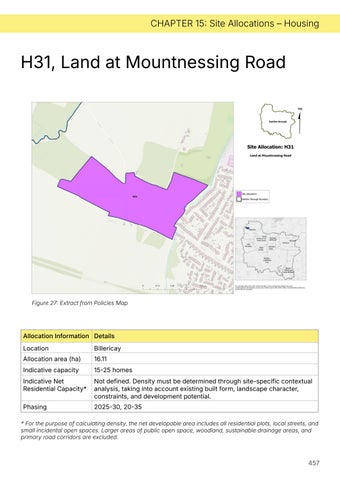
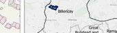
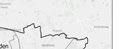
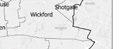
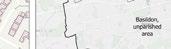
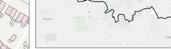
Figure 27: Extract from Policies Map
Site allocation context and description of existing
Land at Mountnessing Road (H31) comprises two small parcels on the north-western edge of Billericay. The sites are well enclosed by strong hedgerows and woodland, forming a clear boundary with the surrounding Green Belt. To the north lies a block of woodland, with further residential development within the allocation. The area sits within a Critical Drainage Area.
POLICY H31, Land at Mountnessing Road
VISION
Our vision for Land at Mountnessing Road (H31) is to support the existing community through sensitive village infill that enhances local character and delivers tangible benefits for residents.
The scheme will incorporate sustainable design principles, including energy-
efficient homes and green infrastructure that supports biodiversity and climate resilience. Community uses and improved public transport connections, such as enhanced bus services, will be prioritised to foster inclusivity and reduce car dependency.
CORE PRINCIPLES
Development proposals should come forward as part of master-planned approach that delivers on the following core principles:
1. New housing should be low-rise, New housing should be low-rise and designed to complement the scale and character of surrounding development.
2. Sustainability to be at the heart of the proposal in relation to:
2.1 The design, operation, and adaptability of new buildings, with a focus on reducing embodied carbon, maximising water efficiency, and incorporating sustainable drainage that responds to the allocation’s topography.
2.2 The provision of open space in line with the emerging Open Space Strategy, ensuring access to high-quality recreational and natural environments. This should include spaces for informal
recreation and play, designed to be safe, inclusive, and accessible for all age groups. Sufficient usable open space must be provided beyond areas required for SuDS.
2.3 Supporting active travel and contributing to improved bus services to reduce car dependency.
2.4 Retain and enhance existing hedgerows and Priority Habitat deciduous woodland, contributing to biodiversity, landscape quality and climate resilience.
3. Development must include a buffer in the southeastern end of the allocation to protect and enhance Forty Acre Plantation LoWS (ancient and seminatural woodland).
4. Developer contributions will be required for:
4.1 Nursery, primary and secondary school places to meet the needs
arising from the development.
4.2 Expansion of local primary and community healthcare services, unless on-site provision is deemed necessary by the NHS.
4.3 Enhancement and capacity improvements to existing leisure infrastructure, including sports halls, swimming pools, playing pitches, and built facilities, where a need is identified in the Council’s evidence base.
5. A robust and defensible Green Belt boundary to the west must be maintained and, where necessary, strengthened.
6. Development should accord with
Reasoned Justification
H31 comprises two small parcels on the north-western edge of Billericay, enclosed by strong hedgerows and woodland. The allocation lies within the Green Belt and has been assessed as making a moderate contribution to purpose (a) and a weak contribution to purpose (b). Their contained locations support their release for development.
The allocation enables sensitive smallscale development that complements the scale and character of surrounding housing. Development must be lowrise and landscape-led, retaining and enhancing existing hedgerows and woodland to support biodiversity, climate
any flood mitigation and adaptation measures stated within the borough’s most recent Strategic Flood Risk Assessments.
7. Development must have essential services (water, electricity, and foul drainage) available on-site or able to be made available on-site. Foul drainage to a public sewer should be provided where possible. Where it is not, evidence will need to be provided showing that suitable alternative facilities can be provided.
resilience, and visual integration. Connectivity is a key consideration. Development must support active travel and contribute to improved bus services, reducing car dependency and enhancing access to local services. Contributions will be required to support education, healthcare, and leisure infrastructure, ensuring the development meets wider community needs.
Due to its proximity to Norsey Wood SSSI/ LCR and location within SSSI Impact Risk Zones, development on the allocation would likely require consultation with Natural England.
CHAPTER 15: Site Allocations – Housing
The proposed release of Green Belt land has been informed by the Basildon Borough Council’s assessment of all reasonable alternatives for meeting identified development needs, in line with the NPPF. The spatial strategy has considered brownfield opportunities, existing urban sites, density optimisation, and engagement with neighbouring authorities. Where Green Belt boundaries are amended, they will be defined through the master-planning process to ensure they are robust, defensible, and capable of enduring beyond the plan period.
Mountnessing Brook runs to the east of H31 where a small area of the allocation lies within flood zone 3a, the rest of H31 is flood zone 1. H31 completely falls
within CDA reference NBAS_O16. Sitespecific flood risk assessments should take account of the borough’s most recent Strategic Flood Risk Assessments, including any recommended mitigation and adaptation measures.