3 minute read
Columbia Water GIS Relocates to Washington Square

Columbia Water’s Geographic Information Systems (GIS) team led by Stewart Hall recently relocated from the Clean Water 2020 (CW2020) program office to the City of Columbia’s offices at Washington Square. Staff was originally a GIS Technician and a GIS Manager under the Sewer Mapping Plan (SMP), the City’s effort to establish the current wastewater collection and transmission system (WCTS) asset data and electronic systems to be used with other programs required in the Consent Decree (CD). However, Columbia Water proactively expanded GIS staffing to one Manager and six Technicians. For 9 years the GIS team was embedded in CW2020 to work directly with program leads on CD goals. The CD requires improvement to the City’s WCTS GIS data sets, mapping standards, and integration with other systems such as Cityworks. Since implementation of the CD began, the GIS team has also expanded duties to improve water and stormwater GIS standards. The team recently completed their required goals of accurately mapping the WCTS system and continue to improve water and stormwater GIS accuracy through survey, inspection, and integration with other information systems.
Mapping Technician Manager Stewart Hall has been with the City of Columbia for 11 years. Previously with the City’s IT GIS Department, Hall transitioned to his current role managing the Columbia Water GIS team in 2019. Through meticulous recruitment, Hall has brought together a team of mapping technicians from various backgrounds to support the City’s GIS needs. Mapping Technician Lead Matt Naglak has a BS from the University of Arkansas, a PhD in Digital Archaeology from the University of Michigan, and over 10 years’ experience in archaeological and digital mapping projects. Senior Mapping Technician Martin Rivas has extensive experience with wastewater assessment in both the private and public sectors. The most recent additions are Mapping Technician Senior Felix Mitchell and Mapping Technicians Michael Wagner and Hannah Harp. All three are graduates from the University of South Carolina (USC). Mitchell’s time at USC was spent developing skills through several GIS-related positions. Harp graduated with leadership distinction with a degree in Marine Science. Wagner brings along a year of field experience with Water Maintenance along with a BA in Environmental Studies.
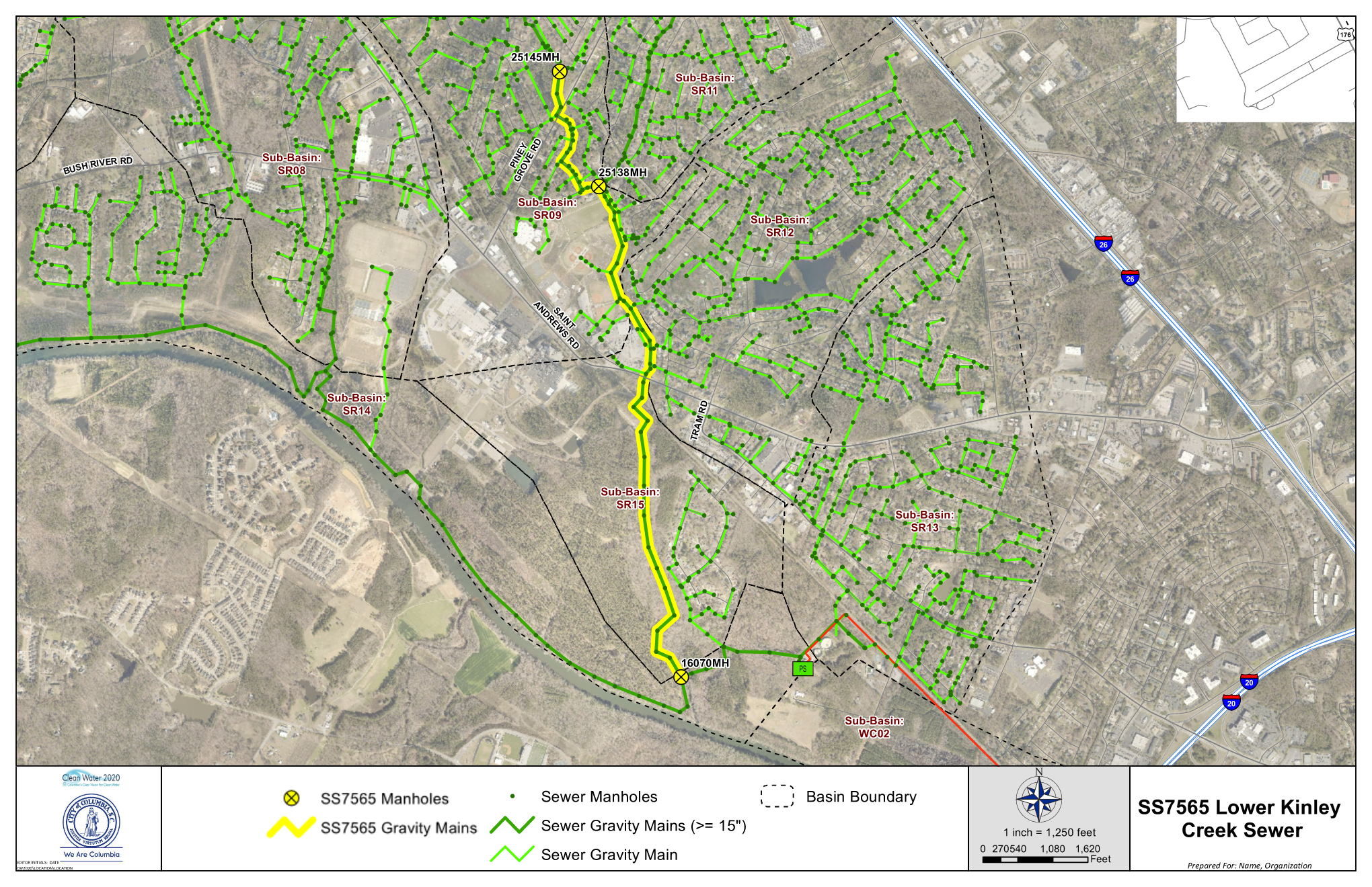
The GIS team maintains a database for the City of Columbia that includes digital mapping layers for the WCTS (e.g., gravity mains and manholes), Water Distribution, (e.g., water mains and laterals, and fire hydrants), and Stormwater Collection (e.g., stormwater pipes, channels, catch basins) as well as mapping layers and tables used for detailed analysis on areas such as capacity planning, sanitary sewer overflows, capital improvement projects, asset risk, and water service line inventory. The database is used citywide to provide accurate data to citizens, staff, maintenance crews, leadership, and decision makers. Columbia Water crews and contractors may link to the data while working in the field to access info on prior repairs or locate system assets.


