5 minute read
Snowmelt is swelling Colorado’s rivers


BY SHANNON MULLANE THE COLORADO SUN
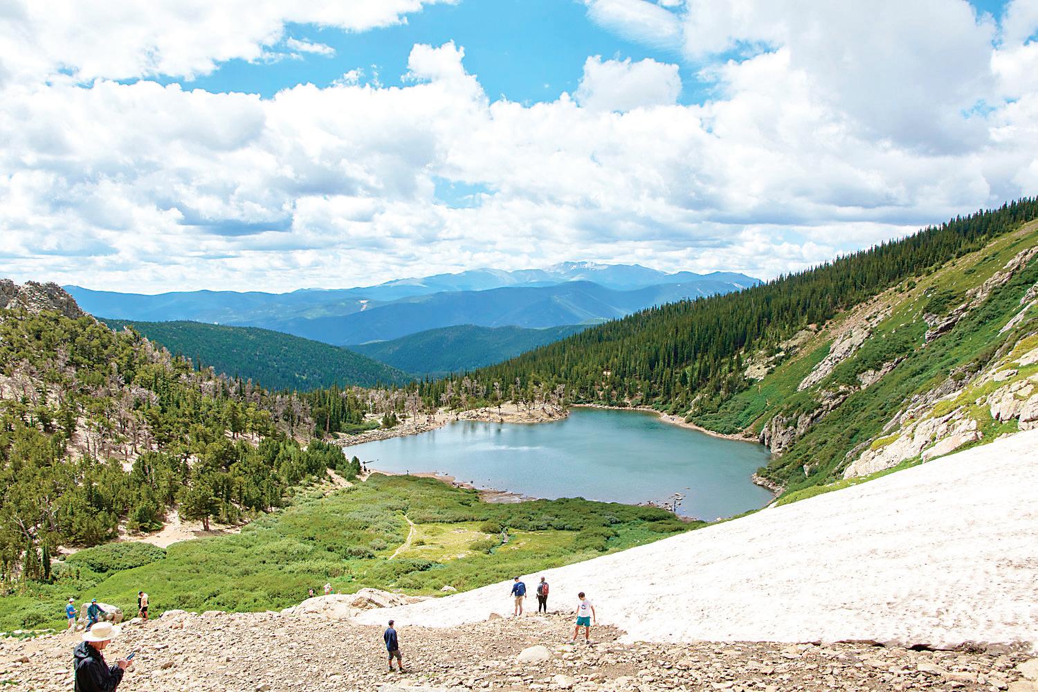
Floods, swollen rivers, road closures — Colorado’s spring runo season is in full swing and much of the snow in the state’s mountains hasn’t melted yet.
Colorado saw higher-thanaverage snowfall build up on the Western Slope this year, a boon for irrigators and other water users who rely on the Colorado River Basin which spans Colorado, tribal lands, six Western states and parts of Mexico. But the snowmelt, with the help of recent weather, is leading to high runo and its adverse impacts are popping up around the state like a game of whack-a-mole.
Beyond monitoring for mudslides and rockfalls loosened by rain and high runo , the Colorado Department of Transportation is also watching bridges and roads for possible closures.
“I’m seeing higher ows in almost every single drainage that we have over here (in western Colorado) than what we’ve seen probably in at least four or ve years, if not longer,” said Julie Constan, a CDOT regional director. “We had such a heavy snowpack across the entire western portion of the state, so that’s causing all of the creeks to de nitely be running higher than what we’re used to seeing.”
On the Front Range and Eastern Plains, 10 days of rain in May helped with the state’s continuing recovery from drought over the past year. e amount of the state experiencing drought conditions has dropped from 93% a year ago to just 11% today.
But the rain has also combined with snowmelt to cause ooding around Colorado. In northeastern and southwestern Colorado, communities in the WhiteYampa River Basin and along the Dolores River have built sandbag barriers to slow encroaching ooding.
On May 11 in Denver, Cherry Creek leapt to its highest ow rate since 1980 after intense rain supplemented by reservoir releases, according to media reports.
For anyone traveling, weekend, checking road and weather conditions will be key for a safe outing. e high spring runo is also impacting road conditions across the state. In southeastern Colorado, the Arkansas River ooded U.S. 50 near La Junta.
Statewide, 42 people died in water-related accidents in 2022, according to the Colorado Parks and Wildlife. As of May 18, two people died in con rmed water-related incidents this year. e state recommends that boaters wear life jackets regardless of age or experience level.
Campsites could also be temporarily closed. Dinosaur National Monument closed its Pot Creek campsites this month due to the possible failure of an old, earthen dam on private land. e dam is structurally sound, but the area has received so much snow this year that, as of mid-May, runo in ows increased the reservoir’s elevation to within a few inches of the dam’s crest, Park Ranger Dan Johnson said.
“ e state o ce was concerned that, should that dam fail in the middle of the night when people are camping there, it could create a hazardous situation,” Johnson said, adding that the campsites could reopen in time for Memorial Day weekend campers.
A debris ow at the Hanging Lake exit on Interstate 70 in Glenwood Canyon blocked access to the trailhead for two weeks before it reopened last week. e Forest Service announced the trail is closed again until at
“ e amount of water coming down the trail in many spots is really impressive,” Leanne Veldhuis, Eagle-Holy Cross district ranger, said in a news release. “ ere is currently no good way around the water, so we have closed the trail until the runo lessens or our trail crew can mitigate it.”
CDOT is also working to repair a gaping sinkhole that appeared on Colorado 133 near Paonia. Rushing spring runo overwhelmed a culvert under the highway and caused enough erosion to collapse a section of the road that is roughly 20 to 30 feet wide — and certainly large enough to t a sedan, she said. A temporary bridge should be installed by earlyto mid-June, and permanent repairs should begin this fall.
“Lots of monitoring going on, but so far, the only real major failure we’ve had has been on 133,” Constan said. “It’s a good thing that there’s only been one major failure and everything else pulled together OK.” is winter, Colorado saw storm after storm add snow to the growing snowpack in the mountains.
By early April, that buildup peaked. e amount of liquid water in the snow, called the snow-water equivalent, across the Western Slope was 130% to 140% of the median between 1991 and 2020, according to the Colorado Basin River Forecast Center. e estimate is based on SNOTEL data collected using a network of highelevation instruments that measure snowpack. On the median this winter.
In the Upper Colorado River Basin, which includes Colorado, New Mexico, Utah and Wyoming, the amount of water peaked in early April at about 150% to 170% of the historical norm. ese states are situated upstream of Lake Powell on the UtahArizona border, one of the basin’s largest water storage reservoirs. e reservoir’s dam, Glen Canyon Dam, sends water down to Lower Basin states — Arizona, California and Nevada — which also had an exceptionally wet year, said Cody Moser, senior hydrologist at the forecast center.
However in the Upper Basin above Lake Powell, most of the snowpack is still sitting at 150% to 170% of the norm, Moser said, according to SNOTEL data.
“Across the northern part of the Upper Colorado River Basin, there’s been alternating periods of sunny, warm weather that generates the snow melt and the higher ows,” he said. “And then we’ve seen those periods alternating with cooler, cloudier weather that’s brought some additional moisture in both rain and snow. It’s helped the snowmelt rate decrease, so it’s been kind of up and down in April and May.”
Southwestern Colorado has seen more continuous warm, sunny weather and thus more snowmelt than other parts of Colorado, like the northwestern region, he said.
Colorado also received higher-than-normal snowpack across elevations lower than 9,500 feet, where quickly. at thick layer is also frequently downstream of reservoirs which means, depending on the location, the water is going straight into streams and rivers. at has led to an extended period of high ows, especially in the White-Yampa River Basin in northwestern Colorado and the Dolores River Basin, Moser said. And when rain falls onto snow, as it has in isolated patches across the state, the liquid water speeds up melting even further.
“We’ve entered into a period of showers and thunderstorms in the afternoons and evenings,” he said. “We’ve had some enhanced melt due to rain-on-snow with some of these storms.” e Colorado Sun co-owns Colorado Community Media as a partner in the Colorado News Conservancy. It is a reader-supported news organization dedicated to covering the people, places and policies that matter in Colorado. Read more, sign up for free newsletters and subscribe at coloradosun. com.
SNOTEL sites are generally located above 9,000 feet so lower elevation runo isn’t re ected in basinwide snow-water equivalent percentages. ese sites target between 9,000 and 11,500 feet where most of the snowpack typically accumulates. at’s why the snow-water equivalent percentages from SNOTEL data have not changed by much, he said.
“ ere’s still a lot of highelevation snow up there,” Moser said.