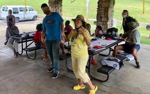
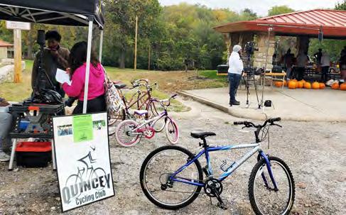
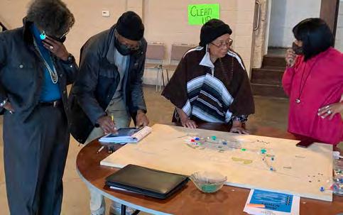
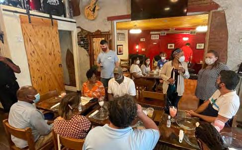
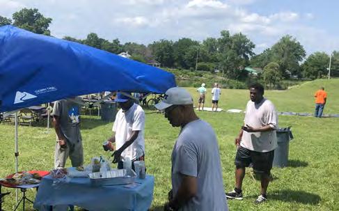
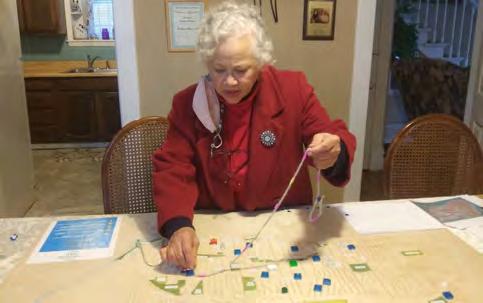
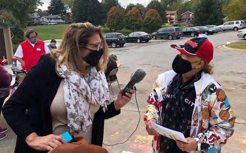
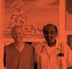
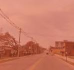
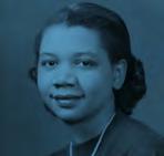
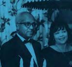
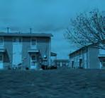
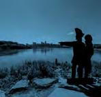
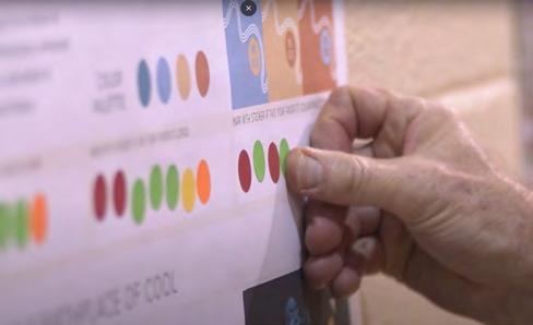
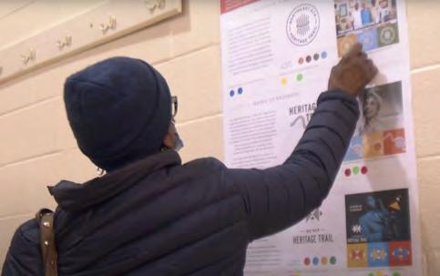
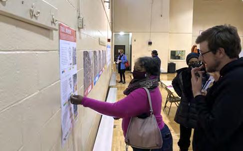
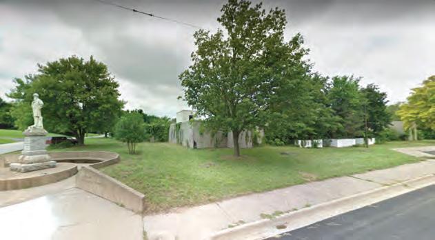
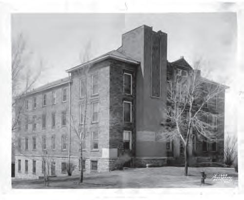
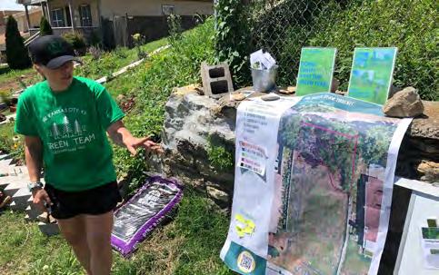
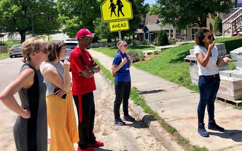
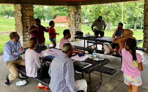
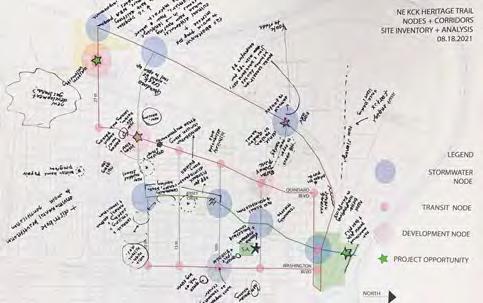
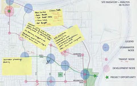
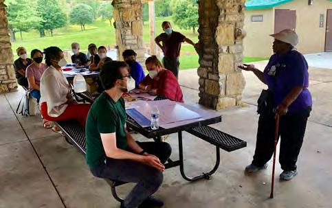
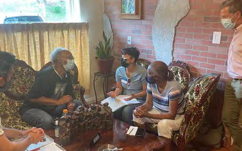
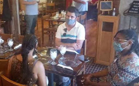
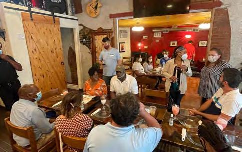
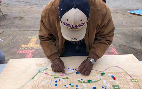
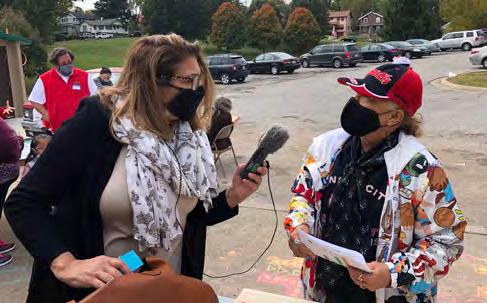
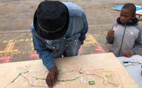
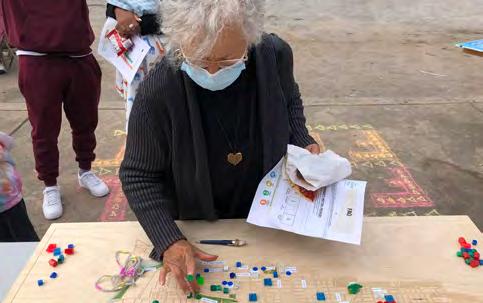
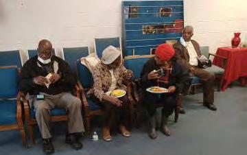
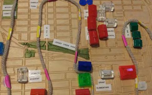
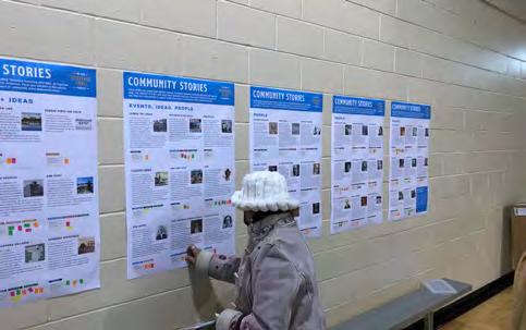
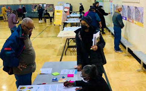
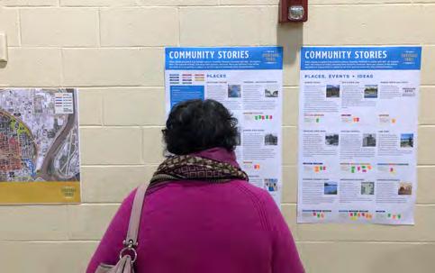
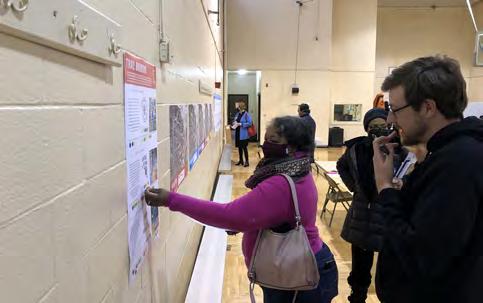
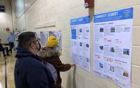
The Planning Team would like to acknowledge the residents, stakeholders and partners who participated in this planning process. In particular, we would like to thank the project Steering Committee for their valuable knowledge and guidance during the process, as well as our Community Ambassadors, whose dedication and persistence helped to make this initiative a success.
Community Ambassadors
Melonee Cason
Karen French
Mata Townsend
Steering Committee Members
Wil Anderson
Rebekah Baughman
Sam Bradshaw
Clarence Brown
Melissa Bynum
Melissa Clark
Evette Cosby
Kenya Cox
Broderick Crawford
Gordon Criswell
Karen Daniels
Rochelle Donald
Anita Easterwood
Jose Faus
Zach Flanders
Jon Harding
Blake Hensley
Kerry Herndon
Evelyn Hill
Jeffery Hollinshed
Tina Hudgins-Baker
Kim Huyett
Synthia Isah
Terry Jackson
Elnora Jefferson
Doris Jenkins
Greg Kindle
Sylvia King
Matthew Kleinmann
Shaya Lockett
Brian Matlock
Mike McCamon
Carlanda McKinney
Monica Mendez
Wilba Miller
Joe Monslow
Stephanie Moore
Marlyn Nevels
Megan Painter
Cassandra Pennington
Shai Perry
Kenthedo Robinson
Roy Robinson
Marvin Robinson
Rachel Russell
Jim Schraeder
Sarah Shafer
Brenda Shivers
Melissa Sieben
Andrea Smith
Stephanie Stauffer
Angela Sublett Knight
Jeremy Todd
Gayle Townsend
Tanece Tyler
Cardelia Walker
Jomella Watson-Thompson
Maila Yang
Donna Young Groundwork NRG Team
Brenda Brinkhous-Hatch
Brendan Irving
Rachel Jefferson
Monica Propst-Medeiros
Rev. Adri Showalter Matlock
Mata Townsend
Jack Vandeleuv
Memorializations and other improvements in the Plan are subject to change. All drawings in the Plan are for illustrative purposes only. Reproduction (printing, downloading, or copying) of images from the Plan requires permission for the following uses, whether digital or print: publication; reproduction of multiple copies; personal, non-educational purposes; and advertising or commercial purposes. Images and texts may be reproduced without prior permission only for purposes of temporary, private study, scholarship, or research. Those using these images and texts assume all responsibility for questions of copyright and privacy that may arise.
heritage trail
introduction
NE KCK is an extraordinary destination. Walk the same shores of the Lewis, Clark and York expedition. Tour the Quindaro Ruins, which tell the story of a town founded on land originally owned by the Delaware Nation, and built around the Wyandot Nation and the abolitionist belief that no human being should be owned by another. Uncover hidden designs etched into the bluffs along the river and stitched into quilts as codes for those traveling the Underground Railroad. Take in the sights, sounds, and food of the hometown of legendary African Americans, including jazz legend Charlie Parker. Connect to an evolving and welcoming community including newcomers from nations world-wide, who are adding their stories and helping to define a vibrant future.
project overview
what is the ne kck heritage trail?
The NE KCK Heritage Trail Project includes the planning and conceptual design of a physical trailbridging historic Kaw Point to the Quindaro Townsite and highlighting the rich culture and history of NE KCK along its route.
WHO IS LEADING THIS PROJECT?
You are! This has been a community-led project that was originally identified in the NE KCK Area Master Plan. The Heritage Trail Plan is being organized and managed by Groundwork Northeast Revitalization Group (Groundwork NRG) in partnership with the Unified Government of Wyandotte County and Kansas City, KS (UG) along with oversight from the Mid-America Regional Council (MARC).
when do we start building?
This is just a Plan. Detailed design and implementation / building of the Trail itself will come later based on available resources. Through the Plan, we are looking to identify those resources while leveraging existing facilities and developing a timeline to set the Trail up for success.
is this just about history?
No, the NE KCK Heritage Trail Project has four Plan Pillars (History, Mobility, Environment, and Economic Development), or elements, which will help to ensure a comprehensive and community-oriented approach. Plan Pillars are described on pages 14-15.
who is the trail for?
The Trail is being planned primarily as a community amenity for current NE KCK residents. It is also envisioned that the Trail could bring additional
visitors to the neighborhood and potentially help to foster new housing and commercial development. The Plan includes development without displacement policy recommendations and an Equitable Development Scorecard to support these goals.
HAS THE ROUTE BEEN SELECTED?
Yes. The community has helped to define criteria for route selection leading to the final preferred route and a phased implementation strategy, which is included herein.
how will this project address potential gentrification?
By recognizing and memorializing the neighborhood’s rich history, the Trail will help to ensure that the legacy of those that came before is not forgotten. Through discovering and documenting the past, we are creating a solid foundation for the community’s collective future. The Plan includes initial anti-displacement policy recommendations along with an Equitable Development Scorecard that can be utilized as a community tool to help evaluate proposed development projects.
who or what will be memorialized as part of the trail?
Based on research and community input, we have identified 30 people, places and events for initial memorialization. In addition to this, there are approximately 14 memorializations, murals and monument signs already located along the trail route. Through the Plan, we are creating a sustainable framework so the Trail, and your stories, can grow and evolve over time.
what will the trail look like?
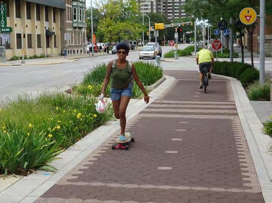
The Trail will include a combination of new and existing pathways (including the Jersey Creek Trail) along with improved and connected sidewalks and crosswalks with a focus on accessibility. Trail features could include special pavement, public art and murals, signage and landscape features.
will the trail touch every important location in ne kck?
The Trail is being planned to help connect primary locations of historical, educational and recreational importance. The Trail could expand over time to connect other locations.
is there anything coming soon?
We have funding for early action projects in the Jersey Creek area which could begin construction in the short term.
will there be a trail map?
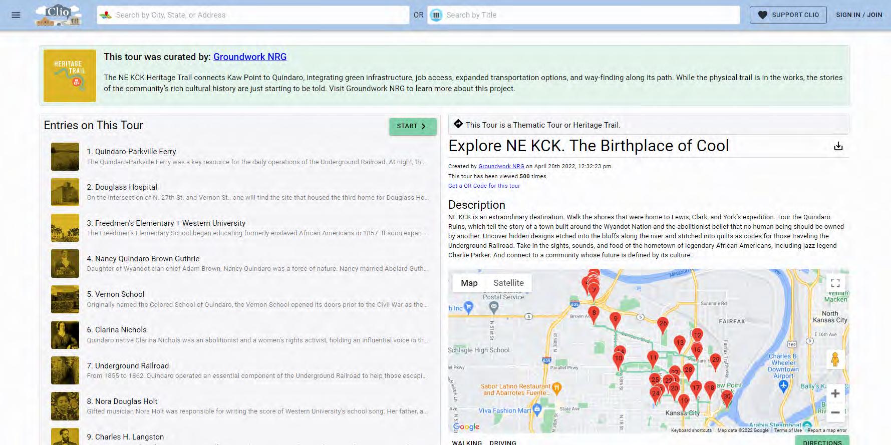
The Plan includes both a paper trail map and an interactive online trail platform (www.theclio.com/ tour/2179). This platform will also be used to add new sites, events, and people in the future.
How does this relate to the goDOTTE Strategic Mobility Plan?
The goDotte Plan integrates transportation and land use decision-making to develop a more sustainable network, and will modernize transportation policy to respond to respond to 21st Century challenges. The NE KCK Heritage Trail Plan is incorporated into goDotte as a Primary Investment Corridor.
planning process
The NE KCK Heritage Trail Plan was initiated in May 2021 as part of a Grant Award through the MidAmerica Regional Council’s Planning Sustainable Places program.
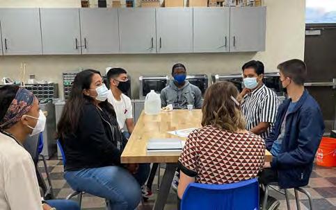
Early on, the Planning Team worked together to establish guidelines and responsibilities regarding decision-making and communication for the Plan. We utilized Community-Based Participatory Action Research as a stakeholder engagement approach while developing an innovative, thorough, fun and effective planning process.
Our Planning Team worked with a Project Steering Committee for the duration of the process to help guide the effort by providing vital information about local initiatives, reviewing ideas and deliverables, and helping to engage the broader neighborhood.
Phase 1 - Listening and Learning
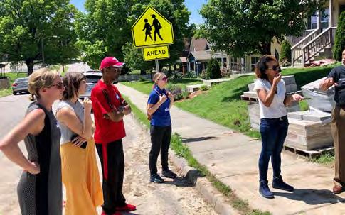
Phase 1 included the establishment of community engagement goals and metrics, an initial neighborhood tour, identification of community ambassadors, three (3) Steering Committee meetings, development of the project brand, and selection of a videographer for documentation of the effort. Smaller community conversations (porch conversations) were initiated during this period and continued throughout the process. Our first community event, Fall Fest, was held as part of this Phase.
Phase 2 - Defining Criteria
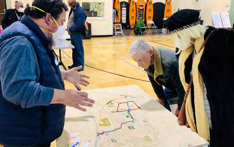
Phase 2 included a thorough analysis of existing considerations, an evaluation of the Green Network (found in the Listening and Learning Section of the Plan), and the definition of evaluation criteria for the Trail selection process. Three (3) additional Steering Committee meetings were held during this period, as well as our second community event, Winter Fest, in March 2022.
Phase 3 - Preferred Alignment
Phase 3 included the selection of a Preferred Trail Route, analysis of physical development potential through the creation of Focus Area Plans, creation of branding themes, as well as the initiation of our online trail platform to document memorializations. The Steering Committee held its final meeting in May 2022 to review and provide feedback on various Plan elements.
Phase 4 - going green plan
Phase 4 included the creation of Draft Plan materials including signage prototypes, potential public art locations, and the development of the Draft and Final Plan documents. Implementation strategies, including development without displacement policies and the Equitable Development Scorecard were completed during this period. This Phase also included our third community event, Summer Fest, in June 2022.
plan pillars
HISTORY
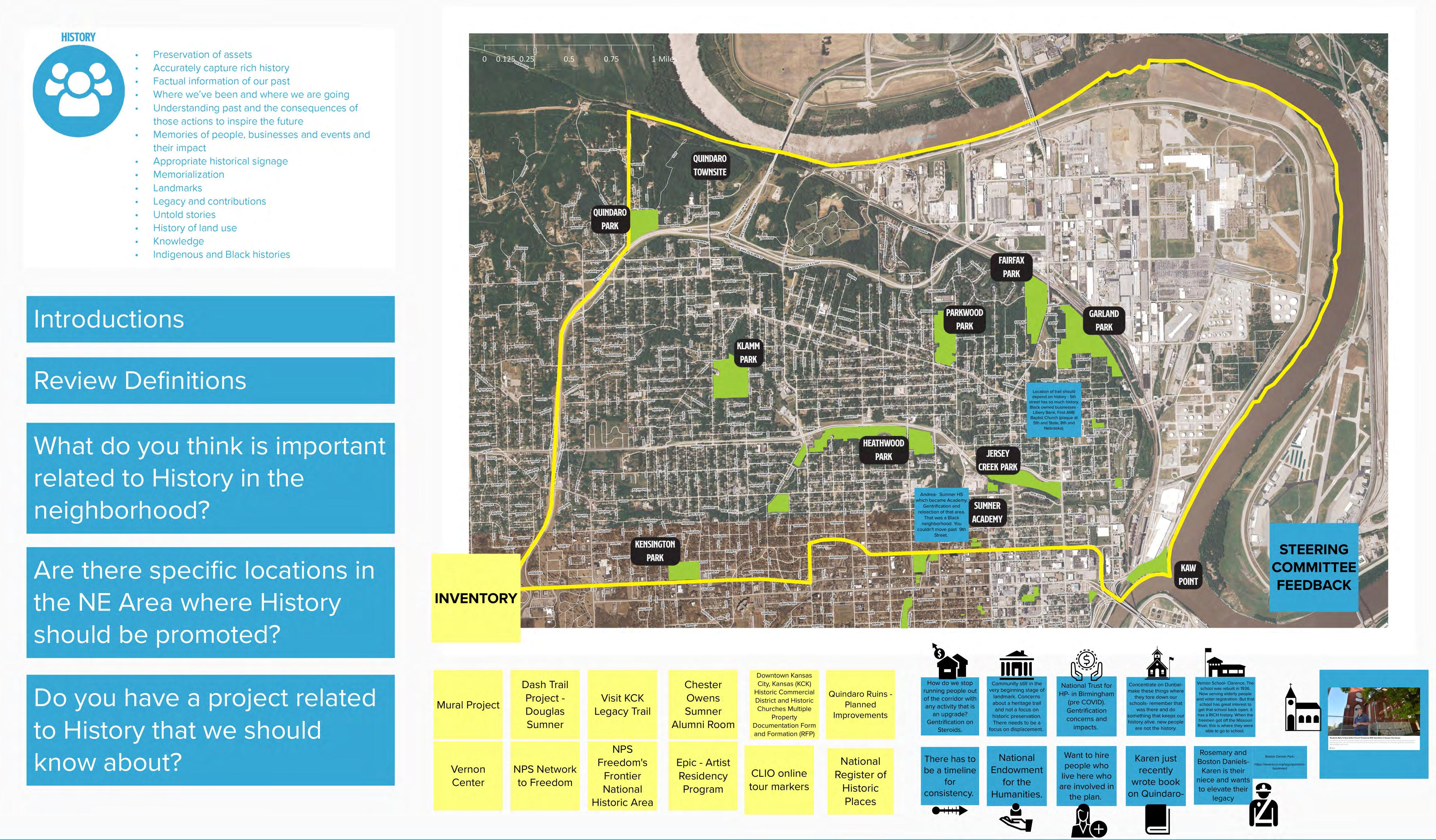
Accurately capturing the rich stories of the past, recognizing where we’ve been and where we are going, and understanding the consequences of those actions to inspire the future.
Memorialization and preservation, including the uncovering of untold stories, will be utilized to capture a legacy of both former and current residents of NE KCK. Local history
MOBILITY
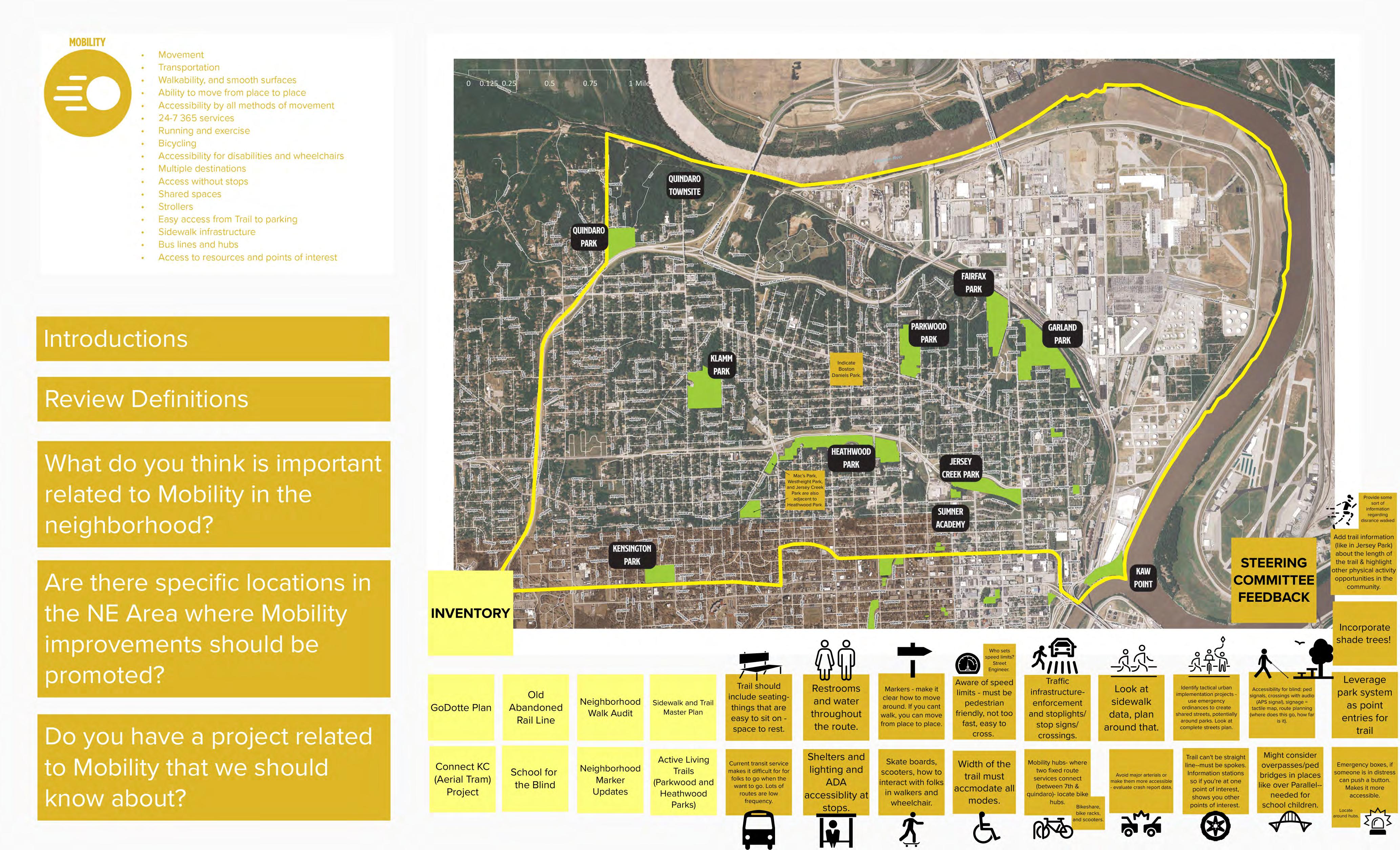
Ensuring accessibility for all ages through multiple modes of transportation, encouraging both residents and visitors to connect to community assets and points of interest.
MOBILITY
Ensuring accessibility for all ages through multiple modes of transportation, encouraging both residents and visitors to connect to community assets and points of interest.
Universal design will ensure that no one is excluded from experiencing and enjoying the NE KCK Heritage Trail.
mobility
ENVIRONMENT
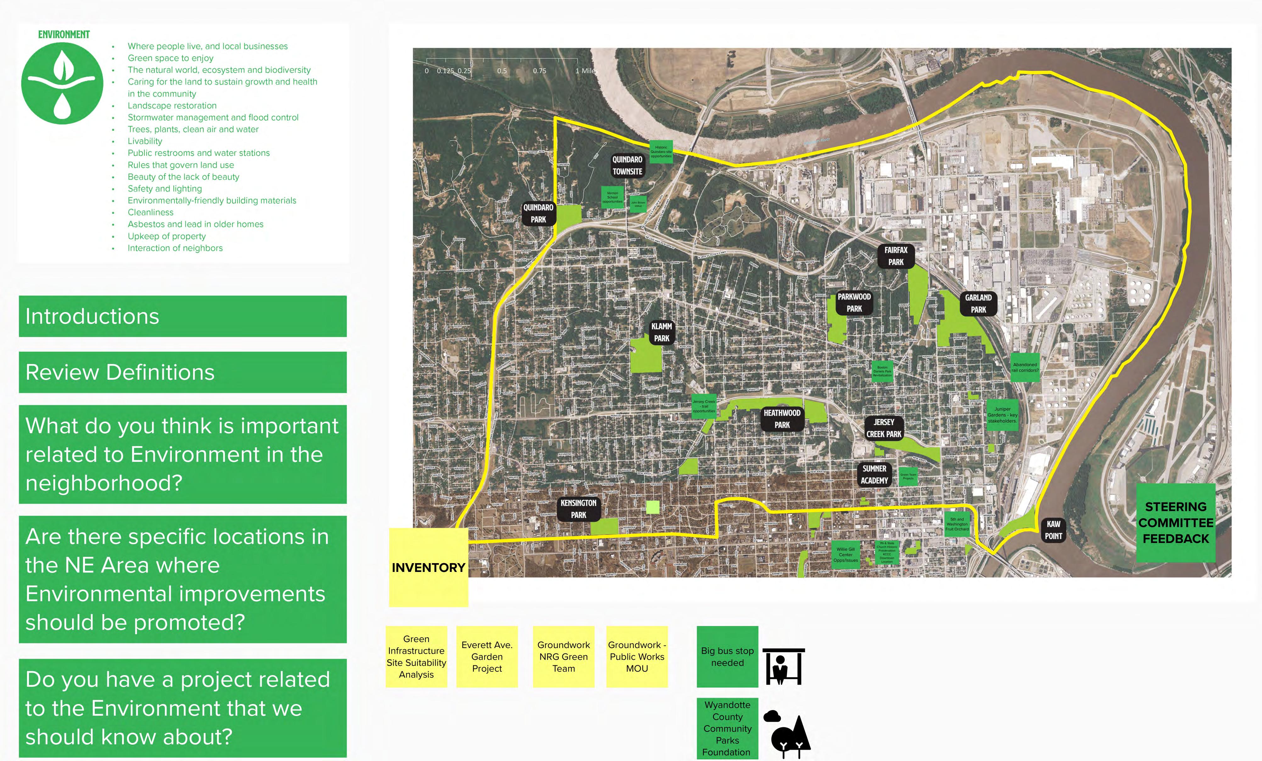
Creating and enhancing usable green spaces for people to enjoy while sustaining a healthy, livable community.
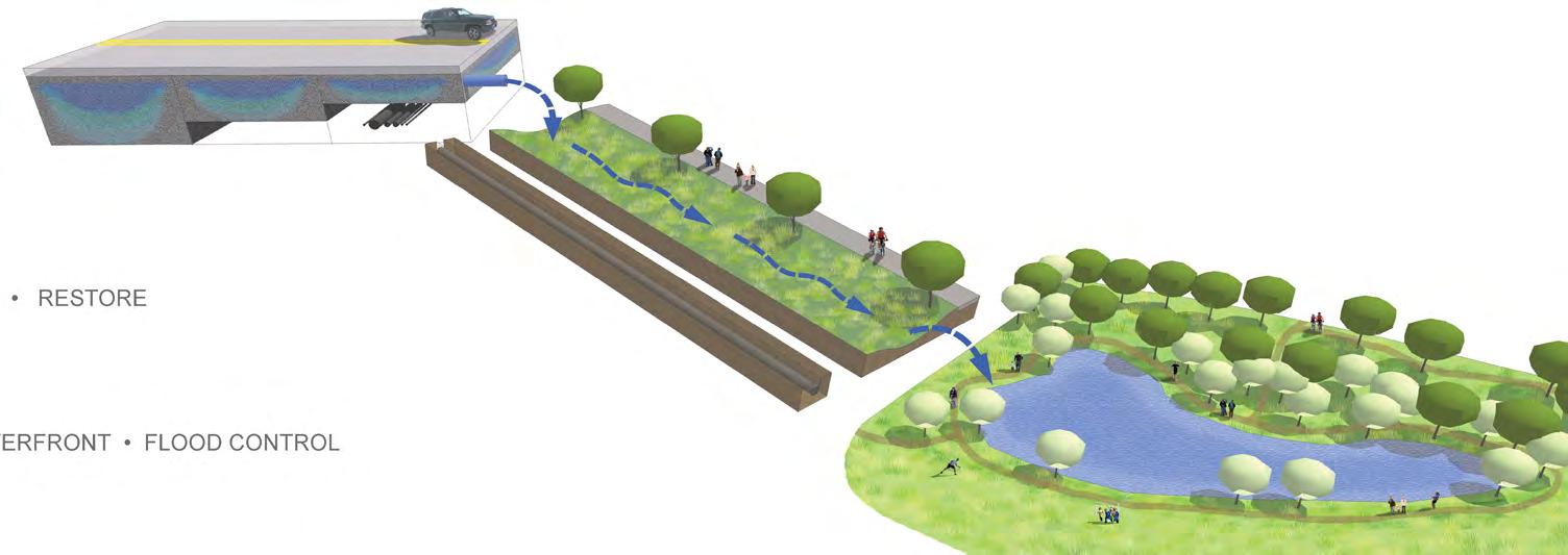
Restoring and establishing beautiful, clean, and safe landscapes to help address stormwater and flood issues.
Greeninfrastructure
ECONOMIC DEVELOPMENT
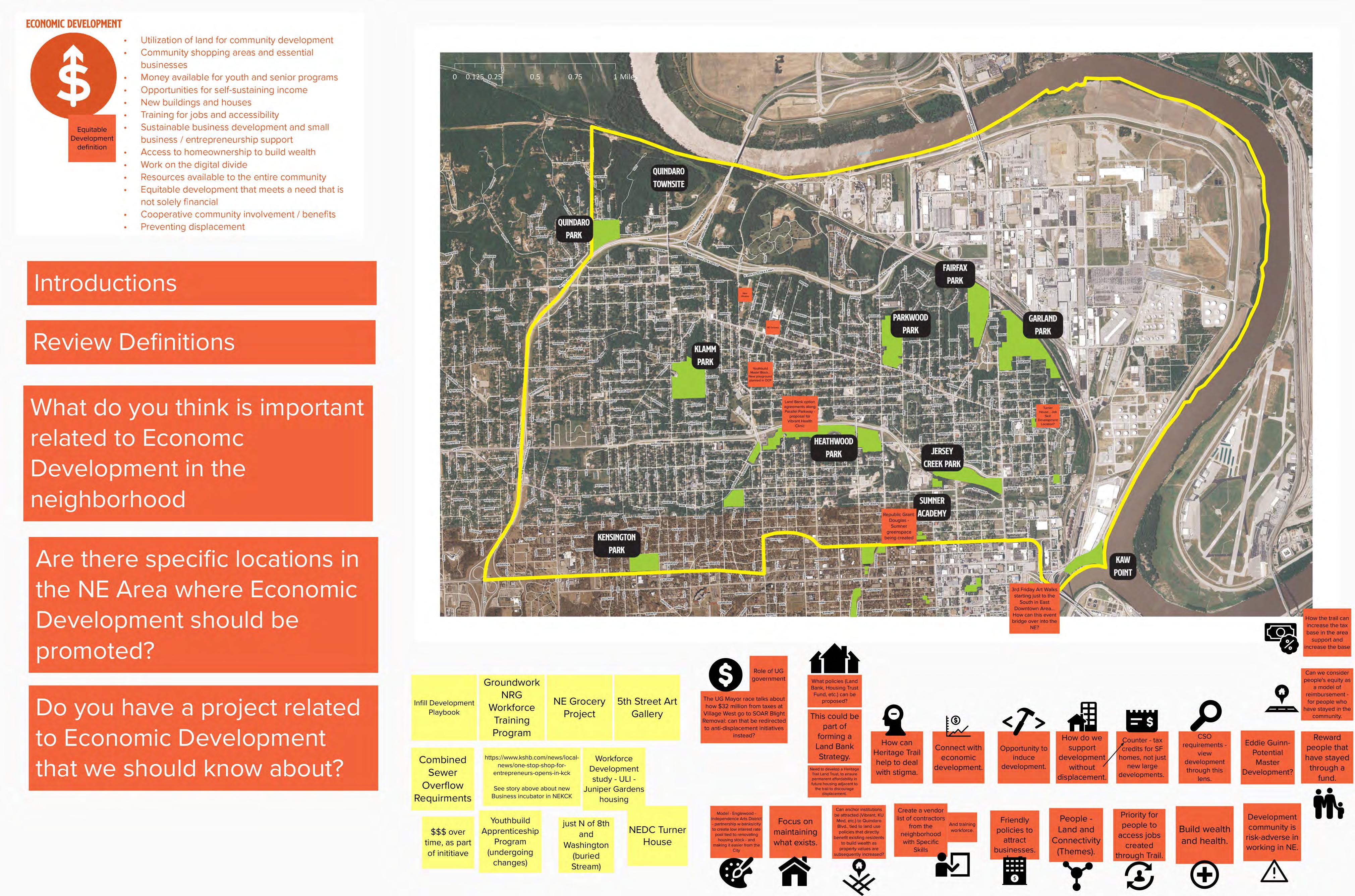
Promoting development without displacement that helps create more shopping areas and essential services, while supporting both residential preservation and growth.
Stimulating locally-based equitable reinvestment while providing additional training and educational resources to connect residents to opportunities.Economicdevelopment
ECONOMIC DEVELOPMENT
Promoting development without displacement that helps create more shopping areas and essential services, while supporting both residential preservation and growth.
memorialization sources
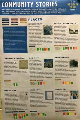
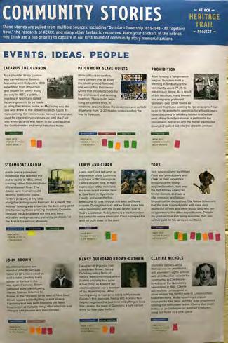
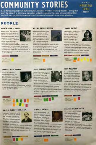
Through research, community conversations, surveys, and workshops with the Steering Committee and community at-large, various historic people, events and locations were identified as priority entries that should be memorialized and celebrated. A number of influential resources informed the research process, including:
• French, Karen (2021). “Quindaro Township 1855-1943 - All Together Now.”
• “Struggler’s Hill: A People, A Community”. Produced by the Northeast Cooperative Council and Light Bearers Entertainment with the support of a Kansas Humanities Council grant.
• “Quindaro” Produced by Jefferson Edward Donald and Northeast Cooperative Council, Inc. and supported by a Kansas Humanities Council Humanities grant.
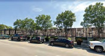
• Kansas City Kansas Community College and Wyandotte County Historical Mural and Timeline
• Kansas City Kansas Public Library resources
• Kansas Historical Society resources
• NPR in Kansas City (KCUR)
• Vernon Multipurpose Center resources
The Plan also recognizes that following locations which are currently on the National and State Registers of Historic Places:
• Castle Rock - 852 Washington Blvd
• Fairfax Hills Historic District (Parkwood Estates)
• Meeks, Cordell D., Sr., House - 600 Oakland Avenue
• Northeast Junior High School - 400 Troup Ave
• Quindaro Townsite
• Shafer, Theodore, House - 2518 North 10th Street
• St. Augustine Hall - 3301 Parallel Avenue
• Sumner High School and Athletic Field - 1610 N. 8th St.
• Vernon School - 2700 Sewell Avenue
• Westheight Apartments Historic District - 1601-1637 Washington Boulevard
• Westheight Manor Historic District
heritage trail
illustrative trail map
QUINDAROBLVD
MISSOURI RIVER
preferred Route overview
The Preferred Route of the NE KCK Heritage Trail was developed through a community engagement process that included various methods of CommunityBased Participatory Action Research. This documentation is located in the Listening and Learning section of the Plan.
The Preferred Route includes three (3) Trail segments, each of which connect to form the overall NE KCK Heritage Trail. The Trail utilizes a combination of existing pathways and widened sidewalks, along with proposed improvements to create a safer and more attractive environment for walkers and cyclists.
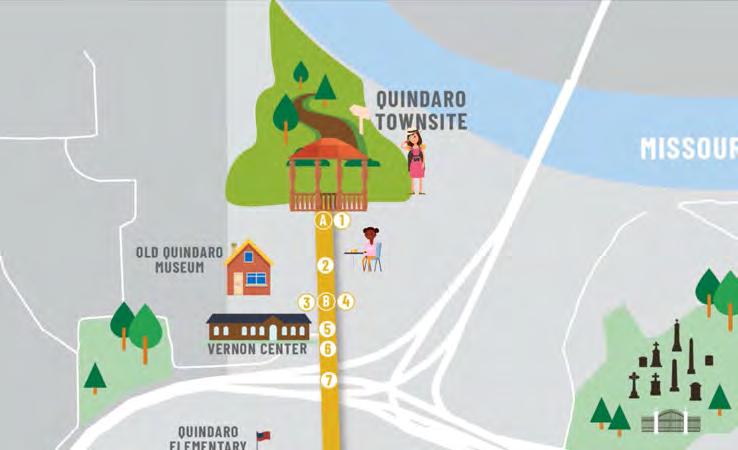
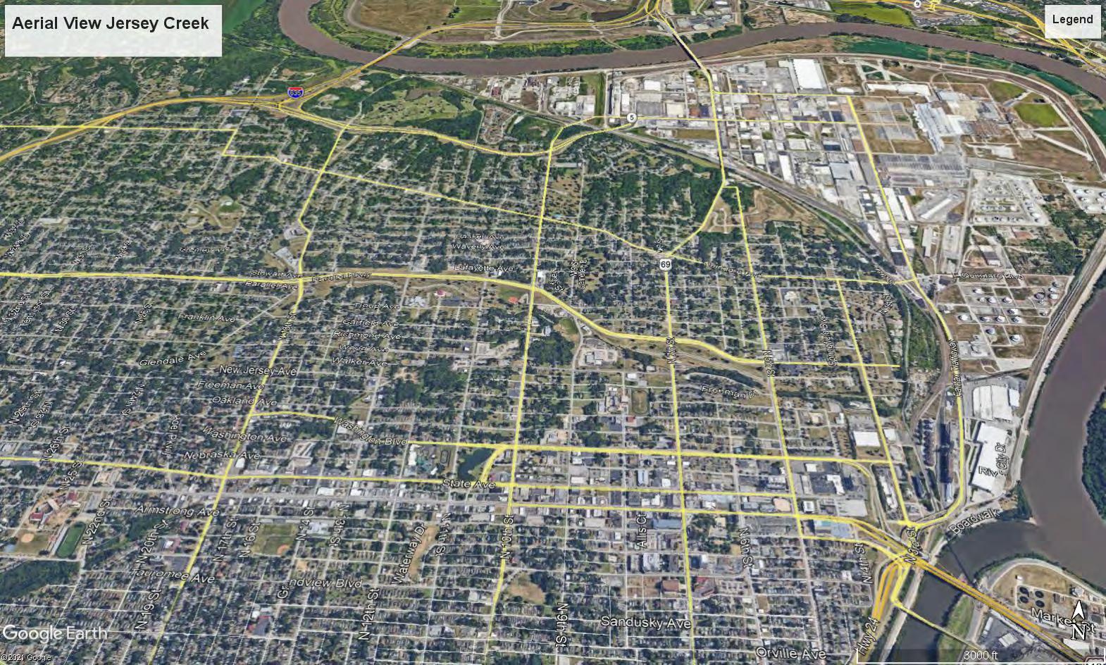
The Town Trail will connect the historic Quindaro Townsite with the Jersey Creek area of the neighborhood.
The Heart Trail creates a loop, centered around Sumner Academy, connecting the edge of Downtown KCK to Quindaro Boulevard.
The River Trail strengthens the connection between the center of the neighborhood and Kaw Point.
Throughout the Trail, we have identified both existing signs and memorializations, as well as 30 proposed locations to signify important people, places and events. These locations are outlined within the Plan, along with a framework for future entries to ensure that the trail grows and evolves over time, which is documented in the Implementation section.
EXISTING SIGNAGE/MEMORIALIZATIONS
A
B JOHN BROWN
C PARKWOOD PARK
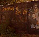
D "SOMETHING TO LIVE FOR" MURAL
E MCGREW GROVE
F JERSEY SOUTH NEIGHBORHOOD
G NATHAN W. THATCHER SR.
H TURTLE HILL NEIGHBORHOOD
I FRANK WILLIAMS OUTREACH CENTER MURAL
J THE LEARNING CENTER MURAL
K CHESTER C. OWENS SUMNER ALUMNI ROOM
L DOUGLAS SUMNER NEIGHBORHOOD
M CHARLIE PARKER
N KAW POINT
QUINDAROBLVD
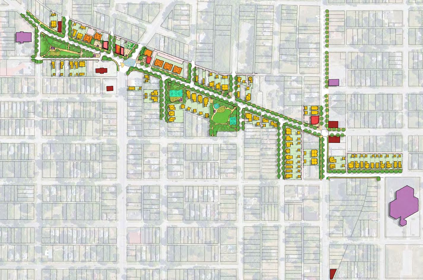
The Heritage Trail Plan includes four (4) Focus Areas that are intended to illustrate the visionary change that could occur as a result of public improvements in tandem with private investment. The Focus Areas have been identified through the community process. Each of these areas represents key locations along the Trail, with significant potential for change and evolution.
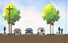
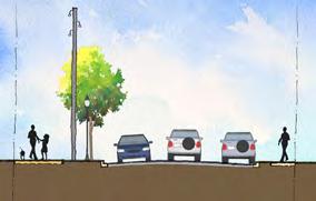
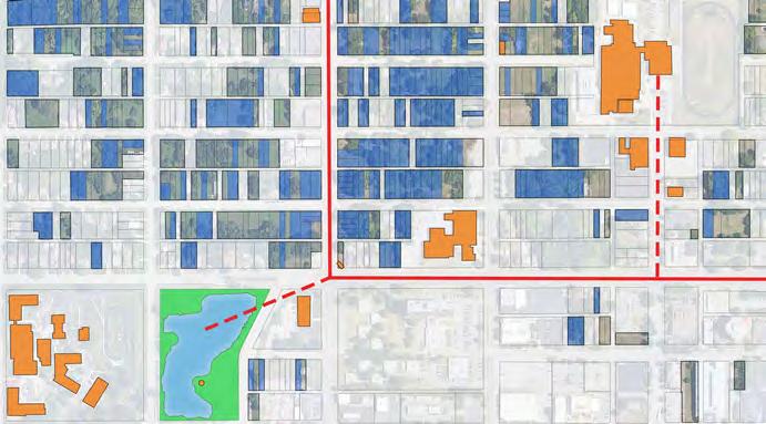
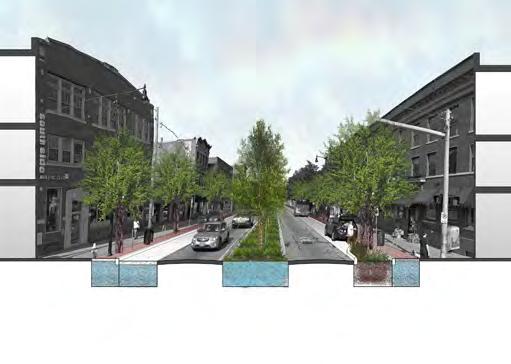
Focus Area Plans are consistent with the Future Land Use Map of the NE KCK Area Master Plan. They include an assessment of existing conditions, including both vacant and Land Bank owned properties, an illustrative site plan showing the Trail routing in more detail, along with potential infill development and green infrastructure locations, and a collection of street sections intended to portray how public right-of-ways could change to incorporate the Trail.
Focus Area 1 - Quindaro Connection
Focus Area 1, located on the Town Trail segment, includes the portion of 27th Street between Quindaro Boulevard and the Quindaro Townsite, and includes the Old Quindaro Museum, the Vernon Center, Quindaro Elementary, and the Quindaro Community Center.
Focus Area 2 - Quindaro HUB
On the Heart Trail, Focus Area 2 is located at the intersection of Quindaro Boulevard and 5th Street and includes Boston Daniels Park and Banneker Elementary.
Focus Area 3 - Big Eleven Gateway
Focus Area 3 is located on the Heart Trail, and centered on the intersection of Washington Boulevard and 10th Street. It includes Big Eleven Lake, the Beatrice L Lee Community Center, Douglass Elementary, and Sumner Academy.
Focus Area 4 - Kaw Connection
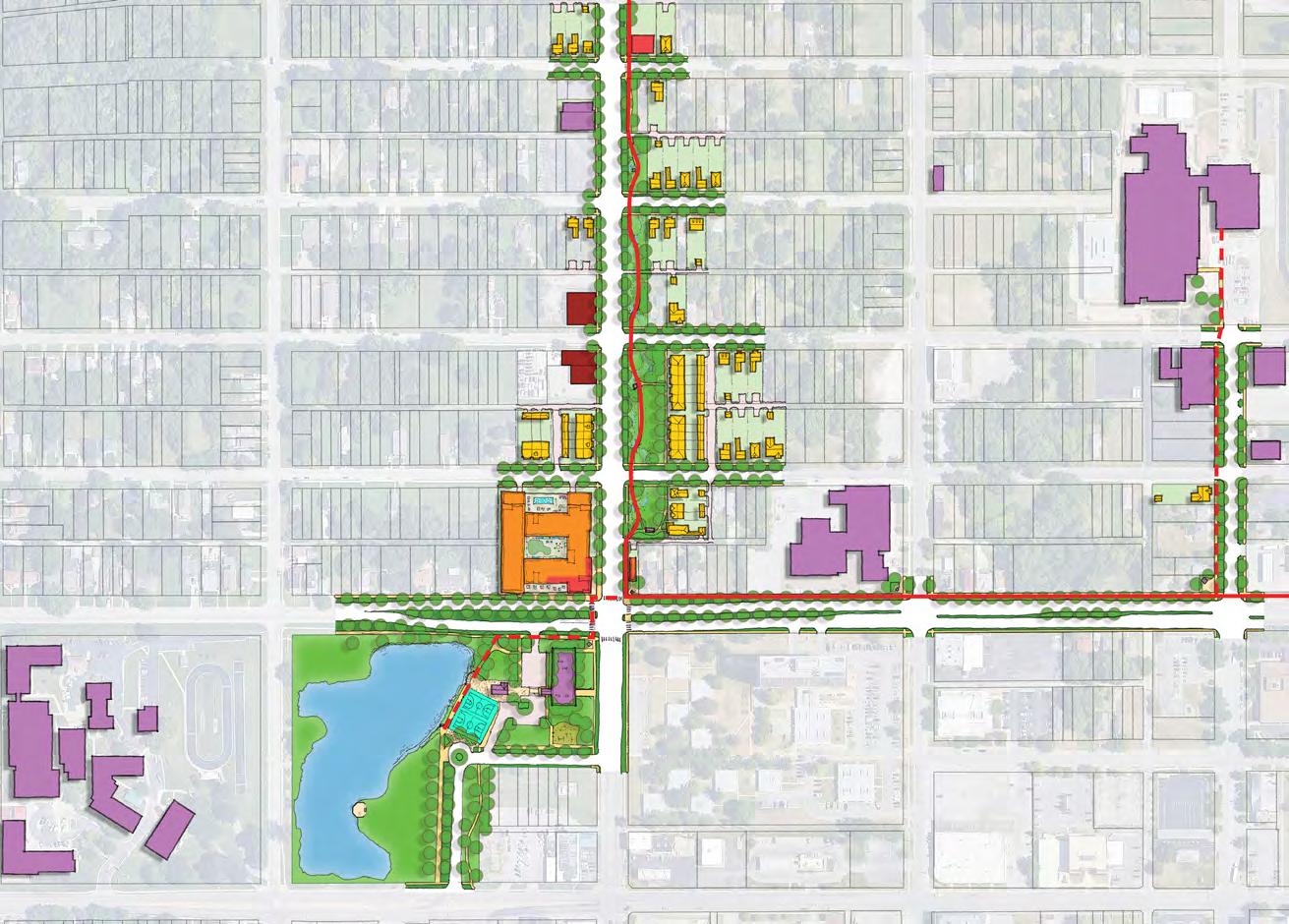
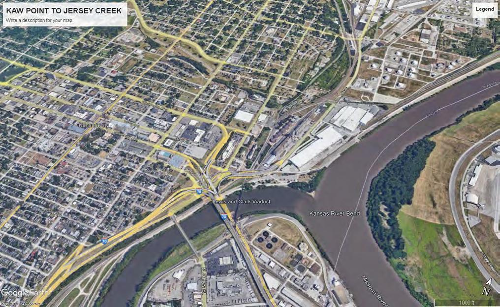
Focus Area 4 includes the portion of the River Trail connecting Kaw Point to Jersey Creek, along 3rd Street. It includes the Juniper Gardens property including the Somali Bantu Community Garden.
town trail map
town trail overview
The Town Trail will connect the historic Quindaro Townsite with the Jersey Creek area of the neighborhood.
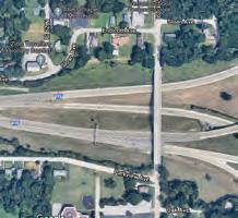
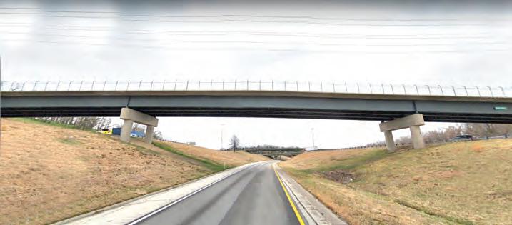
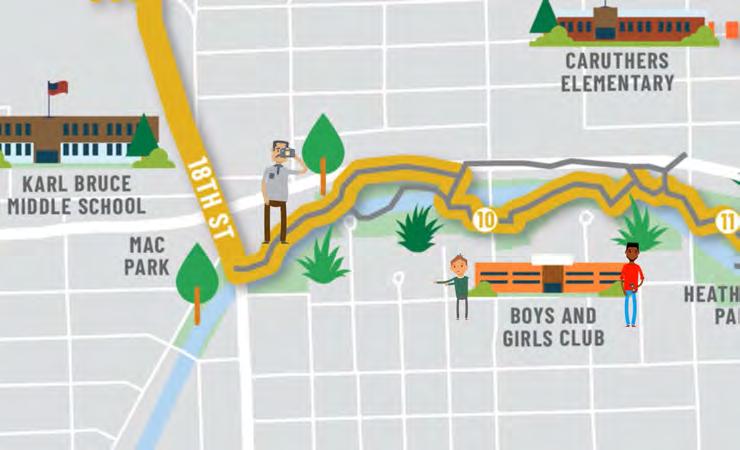
This portion of the Trail represents an opportunity to strengthen the bonds between an area of great national historic significance, and the NE KCK neighborhood through the utilization of a portion of the existing Jersey Creek Trail (indicated by the gray line on the map), an improved 18th Street with widened sidewalks adjacent to Karl Bruce Middle School, a section of Quindaro Boulevard, and a widened multi-use path on 27th Street, across the US 635 overpass, and into the Townsite area.
The Town Trail includes two (2) existing memorializations at the Quindaro Townsite overlook and the John Brown statue, along with community amenities and assets including the Old Quindaro Museum, the Vernon Center, Quindaro Elementary, the Quindaro Community Center, the newly constructed Karl Bruce Elementary School, Mac Park, the Boys and Girls Club, and Heathwood Park. The Plan identifies 11 additional memorializations along the Town Trail route.
Potential Trail extensions could include the portion of Quindaro Boulevard between 18th Street and Parkwood Park, along with a spur trail to Klamm Park.
2.8-mile segment, from 10th street to the quindaro townsite
utilizes some existing trails along jersey creek
incorporates some vacant rail right-of-way
strengthens connection between the neighborhood and the townsite
potential trail expansion / spur trail east on quindaro boulevard, and west from 18th street to Klamm park
13 memorializations along route (2 existing and 11 planned.
town trail memorializations
QUINDARO (THE TOWN)
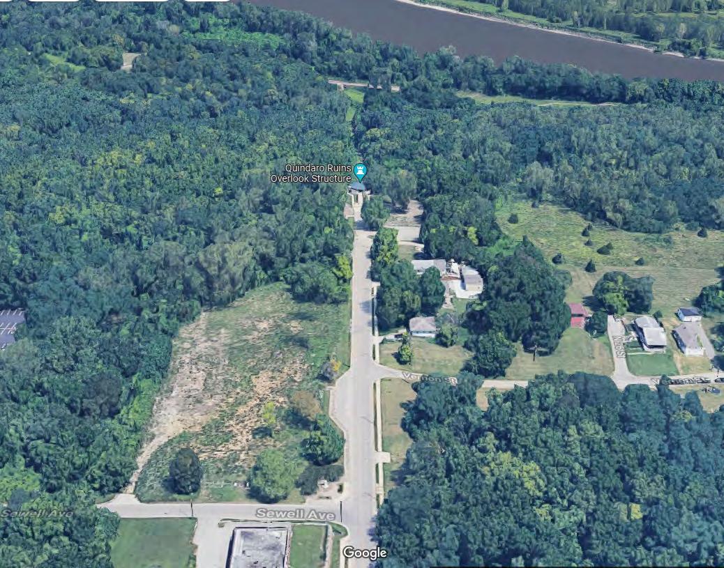
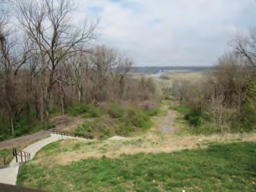
In Wyandot, Quindaro translates to “bundle of sticks,” a signifier of strength, and is also the namesake of one of the town’s founders. In 1856, Quindaro was created containing fourteen (14) businesses along Main Street. It also included various residences and even Kansas’ first public park. Despite the town being destroyed in 1862, the remnants of Quindaro’s townsite were placed on the National Register of Historic Places in 2002, following community organization to cease a landfill from destroying the site. The Quindaro Ruins overlook is built over what remains of Quindaro’s original townsite, representing the lasting legacy the town had on Kansas City and the US. In 2002, the site secured a designation on the National Register of Historic Places, further protecting the memory of Quindaro.
The Quindaro-Parkville Ferry was a key resource for the daily operations of the Underground Railroad. At night, the ferry carried many formerly enslaved individuals into freedom. In 1861, the Missouri side (pro-slavery) sank the ferry in protest of it being used as a ‘freedom ferry.’ And yes, despite this effort, a number of small transfer boats continued to ferry people across the river, continuing on the freedom ferry spirit. In 1862, due to a record cold winter many were even able to walk across the ice river.
DOUGLASS HOSPITAL
On the intersection of N. 27th St. and Vernon St., one will find the site that housed the third home for Douglass Hospital, which was founded primarily by Dr. Thompson and Dr. Unthank. Douglass was named in honor of AME Minister Calvin Douglass, a reverend at Western University. The idea for the hospital and training school devoted to educating African Americans was born from a meeting between the pair and a lawyer in 1898. Douglass was chartered ten years later and then in 1905 the AME Church’s fifth District began sponsoring the insitution. After much success, Douglass grew enough to necessitate expansion into a new location in 1924, where it remained until closing in 1978.
FREEDMAN
ELEMENTARY SCHOOL AND WESTERN UNIVERSITY
The Freedmen’s Elementary School began educating formerly enslaved African Americans in 1857. It soon expanded into Freedman’s University, the first African American University west of the Mississippi River, to include college courses. Freedmen’s was originally run by Charles Langston with the assistance of Eben Blachly and his wife. When poverty in the community began to rise, student enrollment declined, which led to the African Methodist (AME) Church taking over the university and renaming it Western University.
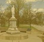
Abolitionist leader and minister John Brown was father to 20 children and an avid soldier. Leading battles in Kansas in the war against slavery, Brown gathered quite the following. Harriet Tubman referred to Brown as the ‘greatest white man to have lived.’ Brown vowed to die fighting to end slavery, a promise that was kept following the failed insurrection at Harpers Ferry after which he was charged with treason and then hanged. Students of Western University in 1911 successfully campaigned and funded the commissioning of an Italian sculptor to erect a marble statue of John Brown on this site. While Western University closed in 1948, the statue still stands today.
JOHN BROWN 3 4
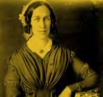
NANCY QUINDARO BROWN GUTHRIE
Daughter of Wyandot clan chief Adam Brown, Nancy Quindaro was a force of nature. Nancy married Abelard Guthrie and they had quite a love story, as Abelard–an abolitionist–was not a member of the Wyandot clan. After moving to Kansas to establish new roots, the pair took part in Wyandotte County’s first official marriage. After finishing their marriage business in the area, Nancy and Abelard helped negotiate the purchase and gifting of land that created the town of Quindaro, a safe port of entry for free-state settlers.
VERNON SCHOOL
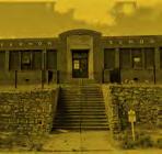
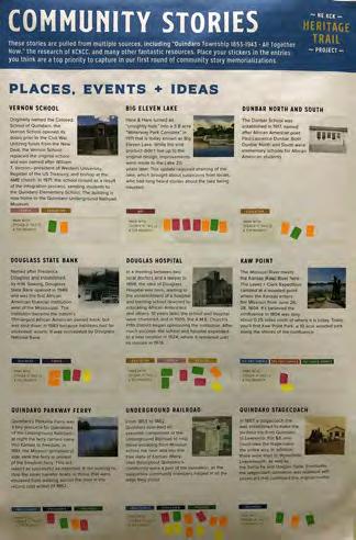
Originally named the Colored School of Quindaro, the Vernon School opened its doors prior to the Civil War as the first school in the area for African American children. Utilizing funds from the New Deal program, the Vernon School replaced the original school and was named after William Tecumseh Vernon, president of Western University, Register of the US Treasury, and Bishop at the AME church. After 13 years, in 1971, he school closed as a result of the integration process reducing the local population of students.
CLARINA NICHOLS
Quindaro native Clarina Nichols was an abolitionist and a women’s rights activist, holding an influential voice in the community as co-editor of the Quindaro Chindowan Newspaper. Many of her articles advocated for the Free-State proponents, and as a result, Clarina became one of the territory’s most prominent free labor and free state proponents. In 1861, Clarina successfully campaigned to allow women the right to vote in the Kansas School Board elections. Clarina also made history as an Underground Railroad conductor, using her home as a safe space for freedom seekers.
UNDERGROUND
RAILROAD
From 1855 to 1862, Quindaro operated an essential component of the Underground Railroad to help those escaping from Missouri across the river and into the free state of Kansas. Many sites throughout Quindaro’s community were a part of the operation.
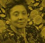
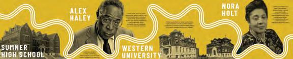
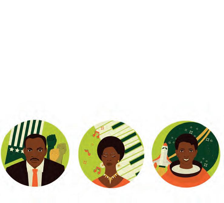
Gifted musician Nora Holt was responsible for writing the score of Western University’s school song. Her father, an administrator at the school, wrote the words. From there Nora went on to earn a BA in music and became the first African American woman to earn a master’s degree in music in the US. After graduating from the Chicago Musical College and pursuing a career in music, Holt composed more than 200 works of music and was associated with the leading figures of the Harlem Renaissance and the co-founder of the National Association of Negro Musicians.
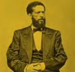
Prominent orator for African Americans, selfappointed abolitionist, Langston devoted his life to protecting civil rights and pushing for the end of slavery. Although he wasn’t born in Kansas, he made great waves in the state and it was where he chose to call home. Charles was appointed the Superintendent for Kansas’ Freedman’s Bureau and served as the Freedman’s Elementary School’s president.
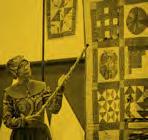
All along the Underground Railroad, one would find Patchwork Quilts which were representative of codes that provided instructions to slaves trying to escape into freedom. These quilts were hung on clothes lines, windows, or carved into the landscape, with 12-20 codes leading travelers on their secret journey.
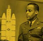
Edward Dwight was born and raised in Rattlebone Hollow, and after becoming the first African American to graduate from Bishop Ward, went on to pursue an engineering degree where he enlisted in the Air Force. Dwight was one of the first African Americans to enlist in the Air Force’s astronaut training program. His successful career led the Kennedy administration to select him as a candidate to join NASA. Soon after, Dwight returned to his artistic roots, and began designing memorials and sculptures around the world.
focus area 1
A
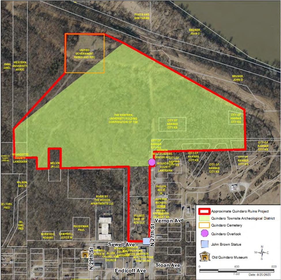
Proposed Quindaro Ruins Project (outlined in red)
background
The Plan recognizes the significant effort that has gone into recognizing the Quindaro Townsite (Quindaro Ruins) area, along with the partnerships that have been established between parties that are jointly focused on preserving and enhancing this site as a location of significant national and global importance.
In 2020, a Memorandum of Understanding (MOU) was executed by and between Western University Association of the A.M.E. Church, Inc. and the Unified Government of Wyandotte County/Kansas City, Kansas. This MOU was entered into in connection with the potential partnership between the parties related to the proposed future preservation and development of the Quindaro ruins site located in and around the site of the former Quindaro township in Kansas City, Wyandotte County, Kansas (“Quindaro Ruins Project”).
The MOU outlines the process to identify the physical boundaries of the land to be included in the Quindaro Ruins Project and the intention of the parties to form a non-profit corporation to own the property included in the Quindaro Ruins Project, to apply for and seek grants, government funding, and donations, and to develop and operate the Quindaro Ruins Project. The parties intend for the Corporation to qualify as a tax-exempt entity under the federal income tax code.
The Quindaro Townsite The site will require ongoing archaeological surveys.
focus area 1
Sewell
Observations
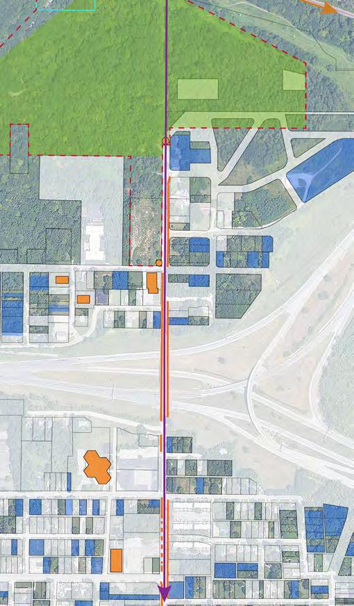
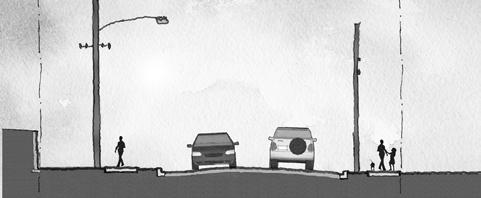
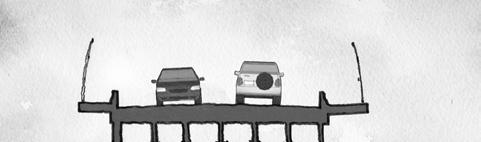
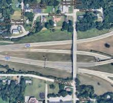
• The 27th Street bridge over the interstate has narrow sidewalks, but wide travel lanes.
• The west side of the 27th Street bridge has a 5’ sidewalk and the east side a 6’ sidewalk.
• There is a greater length of sidewalk along the east side of 27th Street than along the west side.
• All of the community assets shown on the drawing are on the west side of 27th Street.
• Vacant and land bank-owned property is abundant along 27th Street.
THEMES
• Harness and build on existing assets.
• Pair private investment with public investment so that the two complement one another.
• Every marker, art installation, or pocket park should be visible from the next one on the Trail in order to visually pull someone along the Trail.
Notes
• Create a series of nodes along 27th Street by pairing new housing with new public amenities along the Trail.
• Recruit small-scale, local developers to buy and build housing along 27th Street.
• Form an HOA for the area to promote infill housing.
• Provide a variety of housing choices from single-story detached singlefamily homes to walk-up 2-bedroom apartments.
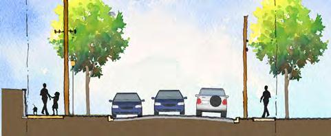
• Change the character of 27th Street to be more hospitable to pedestrians and cyclists.
• Transition from a vehicular street to a pedestrian/bike only street at the intersection of Sewell Ave. and 27th St.
• The site will one day feature an Interpretive/Educational/Community Center at the northwest corner of 27th Street and Sewell Avenue that features stakeholders and their respective collections of artifacts involved.
• Future construction of a Quindaro Ruins trail in accordance with the Quindaro Townsite National Commemorative Site Act
INTERSECTION & PAVEMENT MATERIAL CHANGE
AT PLAZA WITH OLD STONE WALL 10' PATH, LIGHTING, SIGNAGE, AND INTERACTIVE DISPLAY
heart trail map
MISSOURI RIVER
heart trail overview
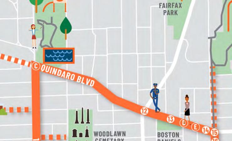
The Heart Trail creates a loop, centered around Sumner Academy, connecting the edge of Downtown KCK to Quindaro Boulevard. The idea of a loop trail was strongly supported by the Steering Committee, in relation to an assessment of other successful heritage trails nationwide.
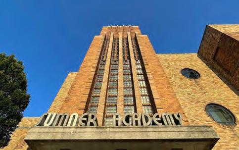
Because of its extraordinary importance in helping to educate many significant local residents, Sumner Academy (formerly Sumner High School) sits at the center of the Heart Trail. The Trail includes a reconfigured Washington Boulevard, a recently widened sidewalk on 5th Street, improved sidewalks along Quindaro Boulevard (former stagecoach and streetcar route), and a redesigned 10th Street to complete the Loop.
Along with Sumner Academy, the Heart Trail helps to connect many important community assets including Big Eleven Lake, the Kansas School for the Blind, the Beatrice L Lee Community Center, Douglass Elementary, Grant Elementary, Banneker Elementary, Boston Dainels Park, Parkwood Park, Caruthers Elementary, Woodlawn Cemetary, Jersey Creek Park, and Heathwood Park.
Potential Trail extensions could include 7th Street south into Downtown KCK, and 5th Street north to John Garland Park.
3.5-mile loop, centered on Sumner Academy
connects major parks and schools
focused residential and commercial Reinvestment along route
potential extensions / spur trails north on 5th street and south on 7th street
26 memorializations along route (11 existing and 15 planned)
heart trail memorializations
Parkwood Park is a central node of activity for residents and members of the community. The Park Shelter, swimming pool, open spaces, and tennis courts are major neighborhood assets. It includes a footbridge designed by the nationally-renowned and local Hare and Hare landscape architecture firm, as well as the Parkwood Park Shelter designed by John G. Braecklin.
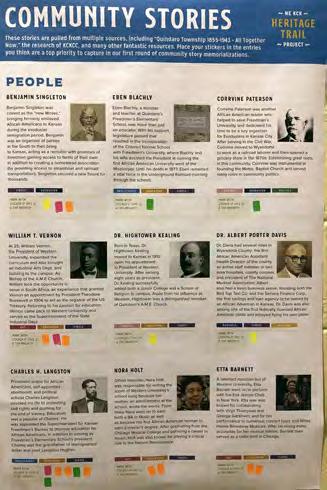
Benjamin Singleton was coined the ‘new Moses’ bringing formerly enslaved African Americans to Kansas during the exoduster immigration period. Benjamin was an organizer of parties in the South, acting as a recruiter with promises of freedmen gaining access to farms of their own in the free state of Kansas. In addition to creating a homestead association, he provided access to steamboat and railroad transportation for thousands.
In 1945, Boston Daniels’ dream of becoming a policeman came true after joining the Kansas City, Kansas Police Force. In Boston’s 25year career, he worked his way up to become police chief and was known for his non-violent approaches to conflict de-escalation as well as his all-around good nature. Before his death in 1995, Kansas City dedicated a park in his honor–what is today known as Boston Daniels Park, located on the corner of 8th St. and Quindaro Blvd. Recently, Boston’s surviving relatives are restoring the park to a destination fit for the community, working regularly to garner support for their revitalization efforts to carry on Daniel’s legacy of “love, unity, and community.”
“SOMETHING TO LIVE FOR” MURAL
Lucky Easterwood has been painting murals across the Quindaro neighborhood since 1996, when the “Something to Live For” mural was completed. The mural is an expression of the grief he felt for the victims of murder in his neighborhood, including his own nephew. He wanted to provide a message of hope for the area, and while the mural has faded over time, it is now a local landmark, and remains a powerful symbol for all.
MCGREW GROVE
McGrew Grove is the location of the mansion of James McGrew, the third Lieutenant Governor of Kansas. He was a major player in the early days of Kansas history as a proponent of Kansas’ admission to the Union as a free state. He was one of the first merchants in Wyandotte, the mayor of the City of Wyandotte two terms, and was elected to the State Senate twice.
WILEY M. POPE
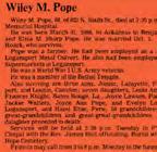
In early June, 1860, Colonel Wiley M. Pope approached Judge Chadwick for a “Deed of Emancipation” for himself, his wife, and his children. Pope and his family had just fled Mississippi. He had acquired a significant amount of dept, and because his wife was formerly enslaved and their thirteen children were biracial, under Mississippi laws, they could be sold to recover Pope’s debt. Pope and his brood were one of the first five families to settle in the town of Quindaro, and the entire community rose together to protect them until emancipation was signed. This was the first emancipation in the State of Kansas.
Whether the namesake spurred from the early churches using rib bones to make music or as a result of the local meat packing plant’s waste being claimed from the rattling neighborhood cart, Rattlebone Hollow is a community rich in history. Originally a small exoduster settlement that formed along the Jersey Creek, this community became home to several significant historical figures including Maxine Clair, Tommy Campbell, Ed Dwight, Marva Whitney, and both Floyd and Willie Maywether. HUB BOOKSTORE
The Hub Bookstore was founded in 1965 by two local couples and quickly became more than just a bookstore–it was the cultural hotspot for African Americans in the Kansas City community. Opening during the period of awakening for African American literature, music, and art, The Hub was the one-stop-shop for gathering, learning, listening, and creating. When national chains began carrying similar products, The Hub began its decline, leading to its closure in 1975. Despite closing, the store left a lasting legacy on the people and cultural artifacts that spent time in the space.
This neighborhood named after the Jersey Creek, is a historic neighborhood in northeast Kansas City. It is centered on N. 5th St.
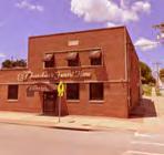
In 1912 Nathan W. Thatcher Sr. founded Thatcher’s Funeral Home at 1514 North 5th Street. Thatcher and his family have been an institution in Turtle Hill and the surrounding neighborhoods.
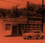
Named after Frederick Douglass and established by H.W. Sewing, Douglass State Bank opened its doors in 1949 as the first African American financial institution West of the Mississippi. After reaching the status of the nation’s 17th-largest African Americanowned bank, the bank was shut down in 1983 by banking authorities because its liabilities had far exceeded its assets. The bank was then succeeded by Douglass National Bank.
DR. S.H. THOMPSON
SR. & JR.
Founder of Douglass Hospital, Dr. S.H. Thomspon Sr. ensured that there was equal access and care to all patients in his facility, hiring people who shared this value regardless of their race or ethnicity. The facility was considered the best African American public hospital in the nation. Thompson’s son also left a lasting legacy in the community, serving as Sumner High School’s principal for over 20 years.
TURTLE HILL NEIGHBORHOOD
This neighborhood is generally bound by 5th St. to the east, 7th St. Trafficway to the west, Freeman Ave to the north, and Washington Blvd. to the south. It has a rich history with many important residents including Judge A.B. Howard, Judge Cordell Meeks, and Nathan W. Thatcher Sr.
FRANK WILLIAMS OUTREACH CENTER MURAL
Frank Williams worked as a case manager for the Wyandot Center, the non-profit community mental health center, for four (4) years before suddenly passing away. The outreach center bearing his name includes a large mural on the northern wall with many famous residents of the area depicted.
heart trail memorializations
THE LEARNING CURVE MURAL
This mural is located on the north side of the building facing Nebraska Ave. The building is currently used as a child care center that helps children between the ages of one (1) and 12 with early childhoood education.
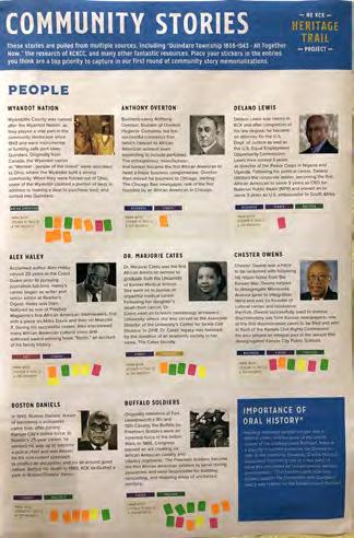
Acclaimed author Alex Haley served a 20-year career in the Coast Guard prior to pursuing a full-time journalism career. Haley’s role as a journalist began as a writer and senior editor at Reader’s Digest. His career soared when he was featured as one of Playboy Magazines first African American interviewers, with his first piece covering Miles Davis. During his successful journalism career, Alex interviewed many African American cultural icons, most notably Malcolm X. Their conversation became the basis for the “Autobiography of Malcolm X.” Haley also authored award-winning book “Roots,” which told the story of his family’s history and their relationship with slavery.
SUMNER HIGH SCHOOL
Sumner High School was built on the corner of 9th and Washington Blvd. in Kansas City, Kansas following a 1905 law authorizing the segregation of schools within the state. As a countermeasure for the recently passed law, the Governor built a new school to service the growing African American community, named the Manual Training High School. After the community objected to the original name, the school was renamed in honor of Charles Sumner, an abolitionist and leader who fought for the rights of African Americans. Sumner High School provided an exceptional education for all those in attendance, as many of the educators held high-level degrees and many of the students excelled to the point of state, regional, and national recognition.
CHESTER C. OWENS SUMNER ALUMNI ROOM
Chester C. Owens Sumner Alumni Room, located at Sumner High School, preserves the history, artifacts, and other memorabilia of Sumner High School, the only high school established for African Americans from 1905 to 1978 in Kansas. The community is very proud of what was accomplished academically, athletically and historically in that time. The exhibit includes photographs, trophies, documents, school newspapers, and books written by Sumner Alumni associates and other materials.
DR. A. PORTER DAVIS
Dr. Davis served several primary roles in Wyandotte County: the first African American Assistant Health Director, County Coroner, president of the National Medical Association, and also remained an active staff member in two (2) area hospitals. Albert also had a keen business sense, founding both the Red Top taxi company and the Service Finance Corp. (savings and loan agency), a first of its kind to be owned by an African American man in the state of Kansas.
Dr. Davis was also among one of the first federally-licensed African American pilots and enjoyed flying his personal plane. The A. Porter Davis Residence, also known as Castle Rock, is a historic house located at 852 Washington Boulevard.
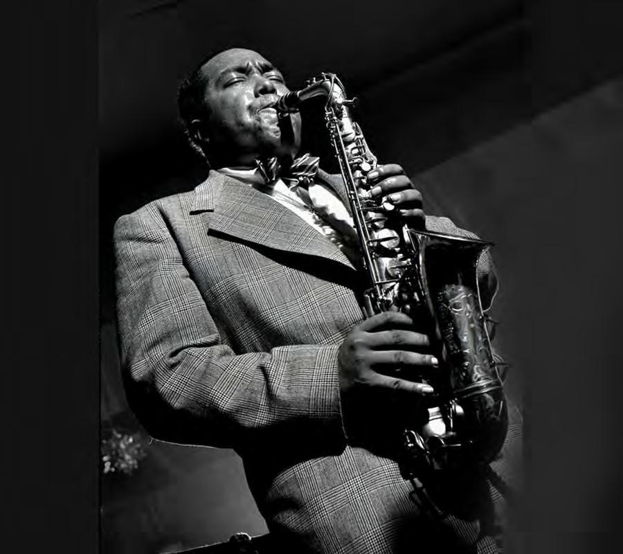
CHARLIE ‘BIRD’ PARKER
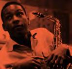
Charlie ‘Bird’ Parker, a talented saxophonist, was one of the fathers of the Bebop genre of jazz and forever changed music history. Born in Kansas City, Kansas and raised in Wyandotte, Charlie rose to stardom in Kansas City, Missouri’s clubs - several of which are still standing today. Along Big Eleven Lake there is a memorial in his honor, located within the Charlie ‘Bird’ Parker Plaza.
ALEX HALEY
BIG ELEVEN LAKE
Landscape architects, Hare and Hare, turned an ‘unsightly hole’ into a 3.8-acre ‘Waterway Park Complex’ in 1911 that is today known as Big Eleven Lake. 20 years after their effort, additional improvements were made to the lake, requiring it to be drained. Locals had many suspicions of what lay beneath the surface, including ghosts! Today, Big Eleven Lake is a recreational destination and features a memorial to KCK’s very own, Charlie Parker.
DOUGLAS SUMNER NEIGHBORHOOD
This historic neighborhood was a stop on the Underground Railroad, the birthplace of Charlie “Bird” Parker, and home to many notable local African Americans. Located close to downtown, nearby quarries, steel mills ,and stockyards, Douglass-Sumner was a great place for working-class families for decades.
STRUGGLERS HILL
Struggler’s Hill was established in 1920 and named after the lived experience of the residents who moved there–the idea being that once you moved in, you would then struggle to make payments. While the community had sufficient infrastructure and local businesses, (a majority of which were also homeowners) housing costs were high. Yet the community endured and the neighborhood was a strong and supportive network, resulting in many talented African American firsts and generations of families that live there to this day.
JOHN MCCLENDON
John McClendon was raised in NE KCK, attending Dunbar Elementary and Sumner High School. He was a major contributor to the sport of basketball, as both a player and a coach. He was drafted by the Washington Capitols (a former Basketball Association of America team based in Washington, D.C. from 1946 to 1951), making John the first African American to sign a contract with an NBA team. He later became a basketball coach and is recognized as the first African American head coach in any sport.
focus area 2
Observations
• A large number of parcels in the focus area are either owned by the Land Bank or vacant.
• Quindaro Blvd. and 5th St. lack street trees.
• The west side of 5th St. was recently paved with a new 10’ off-street multi-use bicycle pedestrian path.
• The intersections at 5th St. and 7th St. are difficult for pedestrians to cross.
THEMES
• Harness and build on existing assets such as local schools, churches, and Boston Daniels Park along with a collection of historic commercial buildings and homes.
• Pair private investment with public investment so that the two complement one another.
• Incorporate the Unified Government’s commitment of approximately $500k of CDBG funds to improve Boston Daniels Park. It is recommended that the Park improvements also include a vertical interpretive sign memorializing Boston Daniels as part of the overall redesign.
• Every marker, art installation, or pocket park should be visible from the next one on the Trail in order to visually pull someone along the Trail.
• Create open spaces that have amenities, face the fronts of houses, and are easy for a pedestrian to access.
Notes
• All new development shown is on vacant property with the exception of the parcel on the northwest corner of Quindaro Ave. and 5th St.
• Create mixed-use nodes at the intersections of 7th St and 5th St. with Quindaro Blvd.
• Adaptively reuse brick buildings and paint murals on the facades facing small plazas and pocket parks.
• Add street trees where possible along the Trail.
EXISTING CONDITIONS
CHURCH
CHURCH
focus area 3
Observations
• There are several Lank Bank owned and vacant parcels along 10th St., and fewer along Washington Blvd.
• Big Eleven Lake has limited amenities and is disconnected from the Beatrice L. Lee Community Center.
• Waterway Dr. is an unnecessary connection and is extremely difficult for a pedestrian to cross.
• Washington Blvd. is difficult for a pedestrian to cross.
• There appears to be a market for multi-family construction along Washington Blvd. based on existing development projects.
THEMES
• Vacate part of the Waterway Dr. and extend Big Eleven Lake Park to the Beatrice L. Lee Community Center.
• Utilize local developers to build infill single-family housing on vacant and Land Bank-owned parcels.
• Create a mixed-use node at 10th St. and Washington Blvd.
Notes
• All new development shown is on vacant property or Land Bank owned property.
• Place trail markers, memorials, and art within the open space system along the east side of 10th St.
• The removal of a portion of Waterway Dr. facilitates the reduction in the number of Washington Blvd. travel lanes, allowing for pedestrian refuges in the crosswalk.
• The northwest corner of 10th St. and Washington Blvd. should be developed as a larger mixed-use building given the lake views, higher visibility, and strategic location along the Heart Trail.
• The upcoming to Douglass/Sumner Quality of Life Plan update being coordinated through LISC will serve as a Land Bank strategy pilot area.
EXISTING CONDITIONS
OR MEMORIAL
BAPTIST CHURCH KANSAS SCHOOL FOR THE BLIND GREATER JERUSALEM BAPTIST CHURCH
LAWN, BASKETBALL COURTS, PAVILION, AND PLAZA NARROW STREET AND CREATE DROP-OFF
FOCUS AREA PLAN
EIGHTH STREET BAPTIST CHURCH
ACADEMY CHESTER C. OWENS SUMNER ALUMNI ROOM DOUGLASS ELEMENTARY SCHOOL
APARTMENT BUILDING WITH GROUND FLOOR COMMERCIAL MARKER AT CORNER BY DAVIS PORTER HOUSE MIXED-USE BUILDING AND NEW PLAZA TO ENHANCE EXISTING SIGN
HOUSING
river trail map
river trail overview
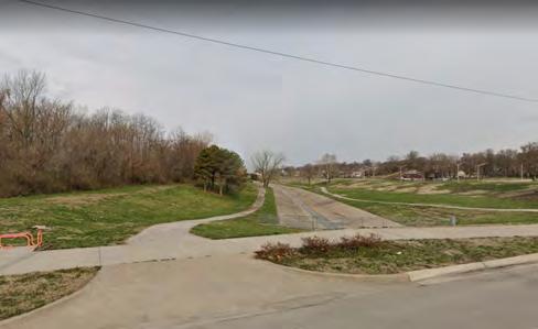
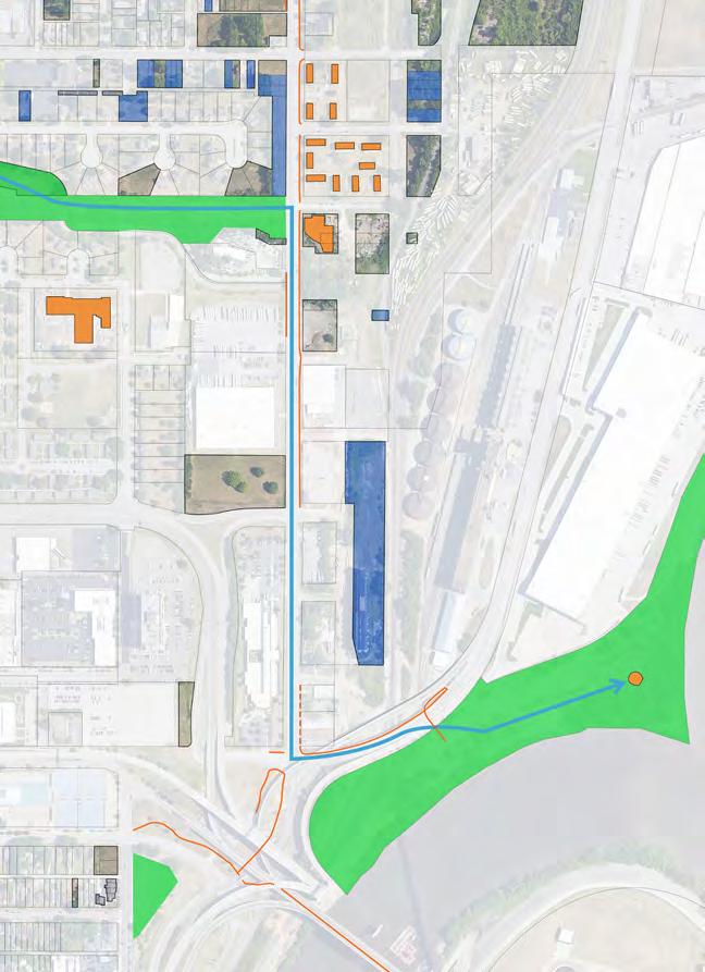
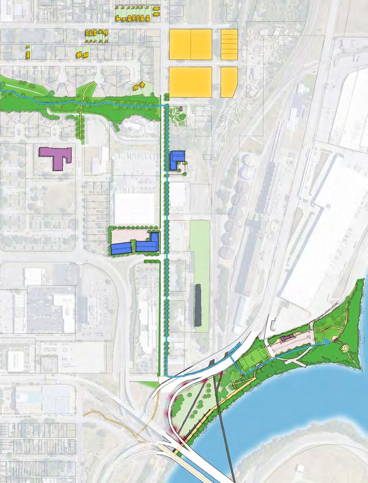
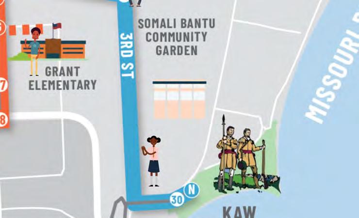
The River Trail strengthens the connection between the center of the neighborhood and Kaw Point. This Trail segment utilizes a large portion of the existing Jersey Creek Trail (indicated by the gray line on the map), which would be improved with signage and other amenities.
East of the existing terminus of the Jersey Creek Trail, the River Trail would continue from 5th Street to 3rd Street, utilizing existing public right-of-way and UG-owned land. The Trail would then cross 3rd Street and proceed south on the east side of the street, with a new multi-use path. The River Trail would then connect with the existing Riverfront Heritage Trail with improved access to Kaw Point.
Integration with the existing Riverfront Heritage Trail would allow for greater regional connectivity, including a direct off-street route west to Downtown Kansas City, Kansas, and east to the West Bottoms neighborhood.
The River Trail helps to connect important neighborhood assets including Heathwood Park, Jersey Creek Park, Edgerton Park and Kaw Point.
A potential Trail extension could continue north on 3rd Street to Oakgrove Cemetery.
1.5-mile segment, from kaw point to 10th street
utilizes some existing trails along jersey creek
improved access to kaw point
potential extensions / spur trails north on 3rd street to oakgrove cemetery
5 memorializations along route (1 existing and 4 planned)
this page is intentionally blank
DR. MARJORIE CATES
Following her time at Sumner High School, Dr. Marjorie Cates was the first African American woman to graduate from the University of Kansas Medical School. Following her sister’s death from cancer at a very young age, Dr. Cates went on to teach hematology at Howard University where she also served as the Associate Director of the University’s Center for Sickle Cell Disease. In 2018, Dr. Cates’ legacy was honored by the donation of a academic society in her name, The Cates Society.
JUDGE CORDELL MEEKS
Kansas’ first African American District Judge, Cordell Meeks, was elected in 1972 and served two terms. Prior to becoming a judge, Cordell owned and operated his own law firm alongside his 19-year career as County Commissioner, where he successfully organized for two (2) low-income housing developments to be built in Kansas City, Kansas (the Gateway Plaza Homes and Gateway Plaza Homes East).
Following Judge Meeks’ terms, he retired in 1980, and began writing an autobiography which he published five (5) years later, “To Heaven Through Hell: An Autobiography of the First Black District Court Judge of Kansas.”
The State of Kansas chartered the Kansas City Kansas Housing Authority on August 6, 1957. The first five (5) Commissioners included Leonard Childers, Robert DeVero, Oscar Hall, Allen Sever, and Fletcher Speck. Their goal was to establish a low-rent housing development for the community, and they did that through their first family development, Juniper Gardens. The development was built on a 33acre plot located in Northeast KCK in 1962. A total of 390 units were built in Juniper Gardens at a cost of $6 Million, making it today the oldest and largest public housing development in the State of Kansas.
LEWIS, CLARK, AND YORK AT KAW POINT
Lewis and Clark set upon an exploration of the Louisiana purchase in 1803 alongside York. York was enslaved by William Clark and was the first African American (that was not an escaped slave) to visit Kansas. The team spent days at Kaw Point and were the first Americans to pass through the county and leave records. Despite Yorks’ great service and essentiality to the cause, he was neither paid nor freed.
KAW POINT
Kaw Point Park is a 10-acre wooded area along the confluence of the Missouri and Kansas Rivers and features great views of downtown KCK and KCMO. This park is also part of the greater “Lewis and Clark National Historic Trail,” which connects park-goers to the Missouri side. Here you can find an amphitheater with limestone seating blocks carved with names of the members of the expedition, and the Confluence of Nations Plaza, containing a memorial to Indigenous peoples. One panel describes the homeland of the Kanza Indians.
focus area 4
Observations:
• There are very few parcels that are either vacant or owned by the Land Bank.
• The area is largely industrial.
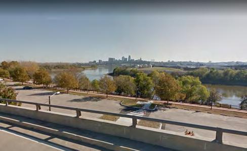
• Kaw Point Park is severed from the rest of the neighborhood by highways, overpasses, and terrain.
THEMES
• Reconnect Kaw Point Park to the rest of the city.
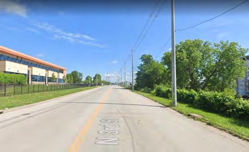
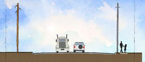
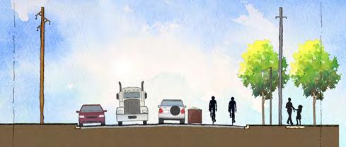
• As 3rd St. is excessively and dangerously wide, it does provide an opportunity for a road diet.
• Make Kaw Point Park a destination.
Notes
• Further explore the Kansas City Design Center’s options to simplify the intersection and roadway alignment underneath the interchange.
• Create connections to the trail where possible including to Grant Elementary, the Riverfront Heritage Trail, and Walker Ave.
• The existing parking at Kaw Point is underutilized and should be replaced with recreation fields and open space.
• Plant trees and landscaping to hide the highway and industrial uses north of Kaw Point.
• Incorporate ULI-TAP Plan to redevelop Juniper Gardens site, which builds off initial goals outlined in the NE KCK Area Master Plan.
For Illustrative Purposes
CONVERT TO STROMWATER STORAGE
heritage trail
implementation
this page is intentionally blank
initial action steps
The Plan recommends a four-phased approach to implementing the NE KCK Heritage Trail. This approach is outlined in the following pages. Phases shown do not include additional additional Trail spurs or alternative routes. To support this phased approach, a number of initial action steps are recommended to ensure success of this effort.
1. Fabricate and install sidewalk decals at each of the existing memorialization locations along the trail
Sidewalk decals should be printed and installed for all memorializations outlined in this Plan. These decals will be linked to the online trail platform and can help to establish a framework for the Trail within the community.
2. Utilize sunflower grant funding to begin phase 1 improvements along jersey creek
As part of Phase 1, utilize existing Groundwork NRG Sunflower Grant Funding to begin improvements along Jersey Creek. This funding should include the establishment of the first set of Trail memorializations in this area.
3. update existing mou with quindaro townsite property owners to plan for landscape restoration and resource harvesting effort
As part of the landscape restoration project at the Quindaro Townsite, create a program of resource harvesting as outlined in the Plan, by using the removed trees as a key material for signage, benches, mulch and more. Update the existing a MOU between the UG and the African Methodist Episcopal Church to enable this effort. The updated MOU should include Groundwork NRG as a parther.
3. coordinate with local, state and Federal transportation agencies to create detailed improvement plan for 27th street corridor, including I-635 bridge improvements
The 27th Street corridor is critical to the success of the Trail. Through the vision established in this Plan, we recommend coordination with local, state and federal transportation agencies to create a detailed improvement plan for the area, with a focus on I-635 bridge pedestrian and gateway signage improvements.
4. evaluate anti-displacement recommendations through local neighborhood associations and the Land Bank
Utilizing the anti-displacement recommendations outlined in this Plan, begin meeting with local neighborhood associations in tandem with the Land Bank to share and create dialog about future development and growth in the area. The Plan can be a tool to support efforts to update Land Bank policy and inform the to Douglass/Sumner Quality of Life Plan Update and Land Bank Pilot Strategy. Through these conversations, begin to establish an HOA structure utilizing the Equitable Development Scorecard included in this Plan as a tool for the evaluation of proposed development projects.
5. evaluate and begin applying for grant programs based on timing, while leveraging existing resources for phases 2-4
Utilizing the resources listed in this Plan as a guide, begin identifying and applying for grant funding for various elements of the Trail, based on timing and the leveraging of existing resources.
planning-level cost estimates
These costs are intended to be general and used for long-range planning purposes. The construction estimates do not include costs for detailed planning, surveying, engineering design, right-of-way acquisition, mobilization, maintenance of traffic during construction, landscaping/aesthetics, utility adjustments, lighting, drainage, storm water management, erosion and sediment control, significant grading, bridges, retaining walls, significant changes in vehicular traffic patterns, or contingency costs. Construction costs will vary based on the ultimate project scope (i.e. combination with other projects) and economic conditions at the time of construction.
phase 1: $250,000 - $400,000
Phase 2: $1,500,000 - $2,000,000
Phase 3: $1,500,000 - $2,000,000
Phase 4: $500,000 - $1,000,000
total project $3,750,000 - $5,400,000
branding and signage
CHARLIE PARKER
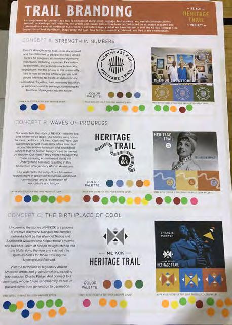
A strong brand for the Heritage Trail will help to define storytelling, signage, trail markers, and overall communications around the Heritage Trail Initiative. The brand story and visuals in the Plan have been crafted based on extensive research and conversations around NE KCK’s history and future legacy. What we have learned is that the NE KCK Heritage Trail brand should feel significant, inspired by the past, true to the community, relevant, and tied to the environment.
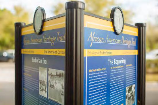
Signage has been designed to reflect this brand through the use of natural materials, including locally-sourced wood, and color. Wave forms indicate successive waves of progress and change in the community and also represent the waterways of the area (Missouri River, Kansas River and Jersey Creek). The signage prototypes on the following pages illustrate sidewalk stickers, gateway signs, directional signs, interpretive signs, and tactile map installations that will help to create continuity along the Trail. Each of the three (3) Trail segments, the Town Trail, Heart Trail, and River Trail, will utilize a different color to help define the theme for the area.
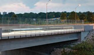
These elements should carry over into public art features such as the base of sculptures, retaining walls, and areas such as the US 635 overpass bridge. Signage and branding prototypes have been developed utilizing MARC’s regional trails standards. Signage has also been designed for full accessibility, utilizing feedback provided by the Kansas School for the Blind.
landscape restoration and resource harvesting
The experience of the Quindaro Townsite is currently limited by the overgrowth of invasive landscaping on the site. Creating trail alignments that bring visitors from the overlook down to the water expands the experience of the site—passing through the ruins of the buildings long gone and emerging at the Missouri River, whose tumultuous waters were the route to freedom for so many enslaved people.
Volunteers have been helping clear out brush and uncovering foundations througout the site and archeological teams have uncovered the ruins of 22 buildings.
To further enable this experience, a massive landscape restoration project must be undertaken— one that involves all levels of volunteers. This process can also serve as form of resource harvesting, by using the removed trees as a key material for signage, benches, mulch and more.
The process for such an undertaking should include the following:
• Coordination with landowners to talk through the landscape restoration process.
• An initial landscape inventory with a landscape architect and the Groundwork KCK Green Team and other interested volunteers. The goal of this visit is to learn to identify different tree species and begin to mark trees with spray paint as either native, invasive, or naturalized.
• Schedule a series of volunteer days to begin to open the landscape up. Volunteer activities can include tree marking, trail marking, removing invasive trees with a chainsaw, trash pickup, and
everything in between.
• Engage existing volunteer efforts, such as Rockhurst Jesuit volunteer days, to program ongoing restoration.
This effort could eventually expand to include other focus areas, such as Jersey Creek and Kaw Point. As invasive trees and other species are removed, identify those that would make ideal signposts: Trees that are of 6” caliper (diameter), straight, and have a trunk height 9-10’ Larger trees should be reserved for benches, and smaller trees should be reserved to create mulch for Quindaro trails.
signage fabrication
There are various ways that signage could be fabricated once trees are harvested.
OPTION 1: Engage the Green Team, with the help of local landscape architects and fabricators, to build the signs. A local sign shop would provide sign panels and attachments. Over the course of three (3) events, the Green Team would build a full set of signs. This option will be more affordable, as volunteers are managing the labor.
OPTION 2: Put sign package out to bid for local sign fabricators to create detailed construction drawings and install.
Estimated costs per sign for these options are included on the signage details. Final sign designs will remain the same with each option. Either option will require additional artwork and details for final sign locations.
branding and signage
Phase 1 is intended to utilize the existing trail network on Jersey Creek and 5th Street to jump start implementation. As an initial Phase 1 strategy, it is recommended that large sidewalk decals be printed and installed at each of the existing and proposed memorialization locations along the Trail. The decals should have a QR code linking to the online trail platform, and should be placed in public locations as indicated on the Preferred Route Map and Focus Area Plans. This initial implementation step will help build awareness and formalize the trail by highlighting key locations. A portion of the $60k Groundwork NRG grant received from the Sunflower Foundation could potentially be utilized to fund printing of the decals.
The Jersey Creek segments of Phase 1 is 0.87 miles from N 18th Street to N 10th Street, and 1.35 miles from N 10th Street to N 3rd Street, for a total of approximately 2 miles in length. This portion of the Trail includes existing sidewalks along the creek, and should be enhanced through the usage of the existing $60k grant from the Sunflower Foundation. Based on significant community feedback, this funding should be allocated to the following features, in this order of importance:
1. Signage and Art
2. Amenities and Accessibility
3. Safety Features
4. Landscaping
5. Sustainability Features
It is recommended that the focus is on designing and installing the four (4) initial trail memorializations that have been identified along this section of the Trail, along with wayfinding signage helping to brand the “Town Trail” and the “River Trail.”
The Unified Government is committing approximately $500k of CDBG funds to improve Boston Daniels Park,consistent with the recently updated Consolidated Plan. It is recommended that the Park improvements also include a vertical interpretive sign memorializing Boston Daniels as part of the overall redesign.
and 5th
The Plan also recommends the installation of memorializations and associated improvements along the N 5th Street portion of the Heart Trail. This corridor is 0.81 miles in length and includes a 10’ wide sidewalk, or off-street multi-use path, that is ideal for both pedestrians and bicyclists. This portion of the Trail includes two (2) existing memorializations which can be highlighted by sidewalk stickers, along with five (5) additional memorializations that can begin to be created with the help of local artists. New memorializations within this area include:
this page is intentionally blank
2
QUINDAROBLVD
Phase 2 of the NE KCK Heritage Trail would include connecting the “bookends” of the Quindaro Townsite and Kaw Point to the surrounding community.
Construction and improvement of a portion of the Trail along 27th Street, between the Quindaro Townsite and Quindaro Avenue, would establish a strong link between Townsite and the larger NE KCK neighborhood as a whole. This segment is shown in greater detail in Focus Area 1 of this Plan. This area, which is 0.78 miles in length, is seen as a critical connector between the past and present. New memorializations within this area include:
Phase 2 also recommends the creation of a new multi-use path connecting the current terminus of the Jersey Creek Trail at 5th Street with Kaw Point, as illustrated in Focus Area 4. This path, which is approximately 0.96 miles in length, would include two (2) additional memorializations. New memorializations within this area include:
QUINDAROBLVD
Phase 3 is intended to complete the Heart Trail loop by utilizing Quindaro Boulevard, 10th Street and Washington Boulevard. The segment from 5th and Quindaro to 10th and Quindaro would include design improvements as shown in Focus Area 2, including expanded open spaces and a widened sidewalk on the north side of Quindaro Boulevard. This portion of the trail is approximately .28 miles in length. New memorializations within this area include:
The Heritage Trail segment from Quindaro Boulevard and 10th to Washington Boulevard would include design improvements as shown in Focus Area 3, including a redesign of 10th Street with a multi-use path and significant green infrastructure elements. This portion of the trail is approximately 1.12 miles in length. New memorializations within this area include:
The Trail segment from Washington Boulevard and 10th Street to 5th Street would include design improvements as shown in Focus Area 3, including a redesign of Washington Boulevard with widened sidewalks. This portion of the trail is approximately .73 miles in length. New memorializations within this area include:
QUINDAROBLVD
Phase 4 is intended to complete the Town Trail by utilizing Quindaro Boulevard and 18th Street. This segment would include “complete streets” improvements that would include wider sidewalks and narrower roadway widths in order to create a more pedestrian-friendly environment. This portion of the trail is approximately 1.25 miles in length. A potential Trail spur or expansion would connect the northern portion of Klamm Park through an off-street multi-use pathway that would utilize former rail right-of-way to connect to Karl Bruce Middle School. New memorializations within this area include:
potential tools and resources
Sunflower Foundation Grant
The mission of the Sunflower Foundation centers around three (3) primary approaches: Healthy Living & Active Communities, Health Care, and Advocacy & Policy. As an Early Action Project, $60k from the Sunflower Foundation has been obtained by Groundwork NRG, and will be utilized to improve an initial portion of the Town Trail or River Trail along Jersey Creek. Based on a participatory budgeting activity that was held as part of the Winter Fest outreach event, community members have ranked the following elements in terms of their preferences for the grant:
1. Signage and Art
2. Amenities and Accessibility
3. Safety Features
4. Landscaping
5. Sustainability Features www.sunflowerfoundation.org/grants/for_grant_ seekers/current_grant_opportunities/grants
The Mid-America Regional Council (MARC) will be soliciting new and updated projects for consideration in the Connected KC 2050 plan. This is not an application for specific funding. However, inclusion in the Plan helps the region understand local agency priorities and can also be a step in the process to secure future federal funding. This process intends to identify any potential regionally significant new projects previously not contemplated as part of the previous Call for Projects and therefore not currently included in CKC2050, and provide an opportunity to update project cost information or consider other changes to existing project listings. connectedkc.org/projects/
Mid-American Regional Council: Project Development
This level of planning in the Planning Sustainable Places program focuses on drilling down into a corridor or district type of plan. Communities that have completed work that meets the criteria of a Sustainable Places Plan are encouraged to utilize the Planning Sustainable Places Project Development opportunity to further develop their big picture plans to integrate project needs and concepts. Possible Elements can include:
• Transportation project feasibility analysis
• Parking facility or management plan
• Bicycle/pedestrian project plan
• Transit project or facility plan
• Multi-modal corridor plans
• Green and complete streets
• Environmental mitigation plan or restoration plan
The Implementation Activities level of planning in the Planning Sustainable Places program focuses on pulling together the final pieces necessary to move a project from planning to preliminary engineering. This level does not include PS&E (plans, specifications and estimates) nor would it include survey work. Possible elements can include: Project scoping study
• Cooperative agreements
• Public information plan for implementation
• Typical cross-sections based on typical ROW, not site measured specifics
• Rough cost estimates for fitting in ROW but not design
• Finish Recommended Plan with deliverable as memorandum or report
• Identification if ROW is needed but not specific details; identify critical issues of project
• Plan should address the final state for a longterm reality, i.e. moving from local to future arterial
• Outline street classification and associated ROW dimensions within ROW plan
• Outline how ROW will increase if planning for trail system
U.S. Department of Transportation: RAISE Discretionary Grants
The RAISE program helps communities around the country carry out projects with significant local or regional impact. RAISE discretionary grants, which were originally created under the American Recovery and Reinvestment Act as TIGER grants, can be used for a wide variety of projects. Projects will be evaluated on statutory criteria of safety, environmental sustainability, quality of life, economic competitiveness and opportunity, state of good repair, partnership and innovation. The Department is also encouraging applicants to consider how their projects can create workforce development opportunities. Applicants can be more competitive in the process if they are creating jobs with free and fair choice to join a union and good labor standards, creating jobs that underserved communities can access, or are supporting worker opportunities and training. Applicants are also encouraged to utilize
registered apprenticeship and local and economic hire agreements.
www.transportation.gov/RAISEgrants
U.S. department of transportation Reconnecting Communities Pilot Program – Planning Grants and Capital Construction Grants
The purpose of the RCP Program is to reconnect communities by removing, retrofitting, or mitigating transportation facilities such as highways and rail lines that create barriers to community connectivity including to mobility, access, or economic development. The program provides technical assistance and grant funding for planning and capital construction to address infrastructure barriers, restore community connectivity, and improve peoples’ lives. The variety of transformative solutions to knit communities back together can include: highquality public transportation, infrastructure removal, pedestrian walkways and overpasses, capping and lids, linear parks and trails, roadway redesigns and complete streets conversions, and main street revitalization. The RCP Program provides funding for two types of grants. Planning Grants fund the study of removing, retrofitting, or mitigating an existing facility to restore community connectivity; to conduct public engagement; and other transportation planning activities. Capital Construction Grants are to carry out a project to remove, retrofit, mitigate, or replace an existing eligible facility with a new facility that reconnects communities.
Humanities in Place supports a fuller, more complex telling of American histories and lived experiences by deepening the range of how and where our stories are told and by bringing a wider variety of voices into the public dialogue. Working with media, heritage and public spaces, history museums and other institutions, and conveners of shared experiences—including the digital or ephemeral— this program strives to expand the public expression of the histories that have made us and the values we hold. The program works across and within diverse communities, encouraging bold, innovative rethinking of past practice, as well as visionary new approaches for how to collectively understand, uplift, and celebrate more complete stories about who we are. Mellon makes both project support grants (which may be in the form of spendable grants, endowment grants, or program-related investments) and general operating grants. They also consider a limited number of Officer’s Grants of $150,000 or less. Grant amounts and durations vary by program and type of grant.
mellon.org/programs/humanities-place/
Mellon Foundation: The Monuments Project
The Monuments Project is an unprecedented $250 million commitment by the Mellon Foundation to transform the nation’s commemorative landscape by supporting public projects that more completely and accurately represent the multiplicity and complexity of American stories. Launched in 2020, the Monuments Project builds on our efforts to express, elevate, and preserve the stories of those who have often been denied historical recognition, and explore how we might foster a more complete telling of who we are as a nation.
Grants made under the Monuments Project will fund publicly oriented initiatives that will be accessible to everyone and promote stories that are not already represented in commemorative spaces. While funds may support new monuments, memorials, and historic storytelling places, not every project will be a statue or permanent marker but may be realized as ephemeral or temporary installations or other nontraditional expressions of commemoration that will expand our understanding of what a monument can be. Mellon will also support efforts to contextualize or recontextualize existing commemorative sites and to uplift knowledgebearers who can tell stories that have not yet been told.
mellon.org/initiatives/monuments/
Sunderland Foundation Grants
The Sunderland Foundation is a family foundation rooted in Kansas City with a history of supporting capital building projects. The Foundation explores giving opportunities aligned to its mission and values, including committing to building just and equitable communities, trusting organizations, communities and leaders to be the experts, and exploring root causes and the systems that create inequitable outcomes. As one of the four (4) Foundation funding areas, Arts and Culture projects received $23 million in 2021. www.sunderland.org/grantapplication
potential tools and resources
National Trust: African American Cultural Heritage Action Fund
Grants from the National Trust’s African American Cultural Heritage Action Fund advance ongoing preservation activities for historic places such as sites, museums, and landscapes that represent African American cultural heritage. To date, the program has funded 105 historic African American places and invested more than $7.3 million to help preserve landscapes and buildings imbued with Black life, humanity, and cultural heritage. With amounts ranging from $50,000 to $150,000, Action Fund grants support work in four (4) primary areas: Capital Projects, Organizational Capacity Building, Project Planning, and Programming and Interpretation. savingplaces.org/african-american-cultural-heritage
National Park Service: Network to Freedom Grant Program
These competitive grants will range between $1,000 and $10,000. Funds can be used for preservation and restoration of buildings associated with the Underground Railroad, for interpretation, and additional historical research related to the previous Network to Freedom listings. Preference will be given to those listings that have not previously received Network to Freedom grants and to those with matching funds. An additional $50,000 is available for competitive grants (up to $5,000 each) to support research and preparation of Network to Freedom applications for historic sites, programs, or facilities. These grants are available to the public and do not have to be associated with an existing Network to Freedom member.
www.nps.gov/orgs/1205/index.htm
National Park Service: Outdoor Recreation Legacy Partnership (ORLP) Program
The Outdoor Recreation Legacy Partnership (ORLP) Program is funded through the Land and Water Conservation Fund (LWCF) State and Local Assistance Program. ORLP is a nationally competitive grant program that delivers funding to urban areas – jurisdictions of at least 50,000 people – with priority given to projects located in economically disadvantaged areas and lacking in outdoor recreation opportunities. These awards help underserved communities address outdoor recreation deficits by supporting projects in cities and densely populated urbanized areas that create new outdoor recreation spaces, reinvigorate existing parks, and form connections between people and the outdoors.
lwcfcoalition.org/orlp
National Park Service: Historic Preservation Fund –Underrepresented Community Grants
The National Park Service’s (NPS) Underrepresented Community Grant Program (URC) is intended to diversify the nominations submitted to the National Register of Historic Places to include communities that are currently underrepresented. URC grants are funded by the Historic Preservation Fund (HPF), and are administered by the NPS. Projects include surveys and nominations of historic sites associated with communities underrepresented in the National Register. Every URC project MUST result in at least one new or amended nomination to the National Register of Historic Places. Estimated total program funding is $1.25 million with an award ceiling of $75,000.
U.S. Economic Development Administration: Competitive Tourism Grants
Competitive Grants include $240 million to help communities that have been hardest hit by challenges facing the travel, tourism and outdoor recreation sectors to invest in infrastructure, workforce or other projects to support the recovery of the industry and economic resilience of the community in the future. For EDA Competitive Tourism Grants, there are no application submission deadlines. While EDA encourages eligible applicants to submit their applications as soon as possible. eda.gov/arpa/travel-tourism/
Kansas State Historic Preservation Office
The State Historic Preservation Office (SHPO) works with issues related to historic buildings and structures, associated programs and tax incentives, and archeology. The SHPO helps to preserve, protect, and honor cultural, historical, and archeological resources of Kansas. www.kshs.org/p/preserve/19387
Nature Sacred Call for Projects: Bringing a Sacred Place to Your Community
Nature Sacred exists to inspire, inform and guide communities in the creation of public green spaces— called Sacred Places—designed to improve mental health, unify communities and engender peace. The Nature Sacred Design Process forges a partnership between a community leader and a landscape architect to guide community members through a visionary charrette process to achieve a welcoming Sacred Place.
Robert Wood Johnson Foundation: People, Parks, and Power
Urban parks and green spaces—playgrounds, pocket parks, outdoor recreation facilities, open spaces, trails, gardens, and green infrastructure— are crucial for community health and well-being, a fact made clear during the COVID-19 pandemic. Despite widespread appreciation for the health and environmental benefits of urban parks and green spaces, evidence shows persistent inequities in access, availability, quality of facilities, and programming, by race, place, and income. The Robert Wood Johnson Foundation (RWJF) is working to build a Culture of Health where everyone in America has a fair and just opportunity to live the healthiest life possible. Park equity is a key component of this vision.
This call for proposals seeks especially small and mid-sized urban communities most impacted by park and green space inequities to participate in People, Parks, and Power: A National Initiative for Green Space, Health Equity, and Racial Justice (P3)—a joint effort of RWJF and the Doris Duke Charitable Foundation, led and managed by Prevention Institute. RWJF expects to award grants up to $500,000 each (up to $250,000 per year). www.rwjf.org/en/library/funding-opportunities/2021/ people-parks-and-power-a-national-initiative-forgreen-space-health-equity-and-racial-justice.html
The Climate Reality Project: Climate Justice for All Project Grants
The Climate Reality Project seeks to work with 10 environmental organizations primarily led by and serving frontline communities to implement project-based initiatives that address environmental
injustices in the US or Puerto Rico. Up to $20,000 will be awarded to each selected organization. Organizations are invited to implement communitydriven solutions to the climate crisis that engage, empower, and benefit a specific community. The project-based proposal must pursue one or more of the following objectives:
• Raise awareness of the disproportionate impacts of climate change in frontline communities and the need for clean energy and energy efficiency.
• Mobilize communities against the fossil fuel industry and in support of emissions reduction.
• Engage communities in green workforce development opportunities (related to climate, natural disasters, environment, clean transportation, housing, water, and wastewater infrastructure) or in paths for a just transition to clean energy.
• Further community resilience to climate change, environmental injustices, and/or legacy pollution. www.climaterealityproject.org/climatejustice/grants
American Association of Retired People: Community Challenge
The AARP Community Challenge provides small grants to fund quick-action projects that can help communities become more livable for people of all ages. This year, applications will be accepted for projects to improve public spaces, housing, transportation and civic engagement; support diversity, equity and inclusion; build engagement for programs under new federal laws; and pursue innovative ideas that support people age 50 or older.
H&R Block and Nextdoor are coming together to make every block better with projects that connect, improve and uplift your community. They’re focusing on projects that safely connect neighbors and local small businesses so communities can thrive. www.makeeveryblockbetter.com/
online trail platform
Clio.com has been utilized to create the digital platform and trail map for the NE KCK Heritage Trail Clio is an educational website and mobile application that guides the public to thousands of historical and cultural sites throughout the United States. Built by scholars for public benefit, each entry includes a concise summary and useful information about a historical site, museum, monument, landmark, or other sites of cultural or historical significance. In addition, “time capsule” entries allow users to learn about historical events that occurred around them. Each entry offers turn-by-turn directions as well as links to relevant books, articles, videos, primary sources, and credible websites.
www.theclio.com/tour/2179
CLIO update process
1. Identify person/place/event of historic significance for which to create an entry.
2. Compile research for entry. Look for: timeline events and dates (birth/opening/milestone/ etc.), major accomplishments, background information, stories, photos, additional resources people would be interested in pursuing.
Useful Resources:
• Kansas City Public Library.
• NPR Kansas City (KCUR).
• Kansas Historical Society (Kansapedia).
• African American Registry (AAREG).
• The University of Kansas.
• Legends of Kansas.
• Flatland KC.
3. Organize information utilizing the following structure:
• Early/mid/end life.
• Today (what has replaced or who lived on).
• Major accomplishments.
• Sources (where you found information and any additional resources that may be added to Clio).
4. Determine location best suited along trail to add point for the entry.
• Collect Google map link, geographic coordinates, address.
• Gather information on location importance.
5. Add to Clio – Using this format:
• Brief Summary (one paragraph). includes a summary of both the entry/topic as well as the location.
• Map - built from the address on Google and or coordinates.
• Images - add images once appropriate filter has been applied, include image source as well as a title in the caption box.
• Background and Context (2-5 paragraphs)
• Sources - enter in sources used, Clio will assist you in the citation process.
• Additional Information - enter in links to resources that one may find interesting.
• Tags - add any of the relevant tags available in Clio.
future memorializations
The NE KCK Heritage Trail Plan honors heritage, while planning for the future. It provides a framework for Groundwork NRG, the UG, and other NE KCK community partners and the region, nation and world to celebrate the stories of the monumental events, places, and people of the neighborhood. It’s home to legendary individuals, including explorers, Exodusters, abolitionists, and activists— each deserving recognition. Yet the power in this community lies in how each one of these people and places intersect to create an extraordinary destination. Together, the community has lifted up and celebrated its heritage, continuing its tradition of progress into the future.
This memorialization framework aims to:
1. Preserve and tell the stories of NE KCK’s past.
2. Deliver a historical foundation that provides context from native populations, early pioneer settlement, resettlement, etc.
3. Organize these stories and context into different categories.
4. Elevate the community’s present-day stories.
5. Create an organization/community structure to nominate and tell stories.
6. Tie physical memorialization to the digital realm.
RESEARCH + ENGAGEMENT
Through research, porch conversations, surveys, and workshops with the Steering Committee and community at-large, various historic people, events and locations were identified as priority entries that should be memorialized and celebrated. A number of influential resources informed the research process, including:
• French, Karen (2021). “Quindaro Township 18551943 - All Together Now.”
• “Struggler’s Hill: A People, A Community”. Produced by the Northeast Cooperative Council and Light Bearers Entertainment with the support of a Kansas Humanities Council grant.
• “Quindaro” Produced by Jefferson Edward Donald and Northeast Cooperative Council, Inc. and supported by a Kansas Humanities Council Humanities grant.
• Kansas City Kansas Community College and Wyandotte County Historical Mural and Timeline.
• Kansas City Kansas Public Library resources.
• Kansas Historical Society resources.
• NPR in Kansas City (KCUR).
• Vernon Multipurpose Center resources.
From this research and community engagement, a list of 30 top-ranking entries were identified for the first round of memorialization and are included in this Plan.
MEMORIALIZATION FRAMEWORk PLATFORMS
The storytelling of the NE KCK Heritage Trail should be multidimensional—weaving together digital platforms, wayfinding, temporary placemaking, and public art initiatives. This framework identifies storytelling mediums, ranging from less expensive, temporary options to permanent public art and wayfinding pieces.
Digital
Cost range: Free, but requires ongoing administration/maintenance.
A NE KCK Heritage Trail page (www.theclio.com/ tour/2179) was created using Clio, a web-based digital storytelling application that integrates interactive maps, data, pictures, audio/videos, and user-submitted stories. Groundwork NRG’s Green Team was instrumental in establishing the page. The platform is accessible and user-friendly, allowing users to help contribute to stories and submit new entries. In addition to the web platform, Clio has an app that users can download and experience the trail through augmented reality.
Physical Markers:
Cement Decals
• Cost range: $50-$100.
• Duration: Temporary to semi-permanent.
• Most temporary, lasts 2-3 years before needing replacement.
• Include name of person or place being memorialized + QR to Clio.
Murals
• Cost range: $5,000-$8,000.
• Duration: Temporary to semi-permanent.
• Could be representational or abstract.
• Should include plaque/marker to provide contextual information.
• Create roster of artists to work with.
Wayfinding and Memorialization Signage
• Cost range: $1,500 - $5,000.
• Duration: Permanent.
• Gateway/Trailhead Sign.
• Directional Signage.
• Mile Marker Signs.
• Interpretive + Acrylic Signs.
• Vertical + Horizontal Interpretive: With map and information.
• Acrylic: Highlight buildings that were lost with transparent panels.
Permanent Art Pieces, such as sculptures
• Cost range: $5,000 - $10,000.
• Duration: Permanent.
• Most appropriate for memorializing people or events.
• Could take the form of a statue or headstone.
• Should include plaque/marker to provide. contextual information.
• Create a roster of artists to work with.
PROCESS
The ongoing memorialization of the NE KCK Heritage Trail will require collaboration among a number of organizations and people, including:
Groundwork NRG: the organizational lead, which will oversee memorialization process and funding
channels, collaborating closely with UG on implementation of wayfinding and public art.
NE KCK Memorialization Committee: a group of individuals that will work with Groundwork NRG and the Green Team to help engage the community around entry selection, review and sign-off on research and writing, and help to ensure ongoing implementation.
Green Team: the team under Groundwork NRG that will:
• Work with the Memorialization Committee to identify entries.
• Facilitate annual community engagement around entry selection.
• Track implementation for each entry (depending on its tier).
• Oversee digital platform and maintenance.
UG:
• Wayfinding.
• Public art.
• Permitting. The Annual Cycle:
2022-2023:
• Print and install QR codes at each of memorialization locations for the first 30 entries, as well as 14 existing memorialization locations.
• Identify funding opportunities to implement wayfinding and priority memorialization.
2023-forward:
Bi-annually: Groundwork NRG, UG and the Committee meet bi-annually to:
• Determine a list of entries for public to vote on, identify tier for highest-ranked entries.
• Evaluate current list and determine which type of marker is most appropriate or desired for different people/places/events.
Annually: Groundwork NRG to put out a call or a list of entries for public to vote on, initially building on the entries that have been identified but not yet been captured. Once entries are selected, Groundwork NRG to coordinate with Memorialization Committee to research, write, and source entries.
Bi-Annually: Add a batch of five (5) new entries to Clio based on public input and additional research. Ensure ongoing implementation of wayfinding, site markers, and public art.
Annually: Host an annual “groundbreaking” event of new entries with an emphasis on a platform for the community to tell their present-day stories.
future memorializations
The following People, Places and Events have been provided through the Draft Plan review process as potential future memorialization opportunities for consideration:
People:
• Eben Blachly
• James H. Browne
• Al Burdette
• William Patrick Foster
• Bishop John A. Gregg
• Senator George and Mrs. Haley
• Dr. Hightower Kealing
• Delano Lewis
• The Fine Sisters
• Anthony Overton
• Corvine Paterson
• Charles Wilbur Rogan
• Andrew Rollins
• William T. Vernon
Places:
• 500 Freeman
• Antioch Baptist Church
• AME Church
• Brentwood Homes
• Dunbar North and South
• JFK Community Center/Beatrice L. Lee Community Center
• Kaw Industrial District “West Bottoms”
• Northeast Junior High School
• Mid Central Mortgage Company (848 Quindaro Blvd.)
• Ms. R’s Restaurant
• Oak Grove Cemetery
• Parkwood Pool
• St. Rose de Lima Catholic Church
• Stowe School
• Thatcher’s Funeral Home
• Yates Branch YMCA
Events/Ideas:
• The Hog Brothers Construction
• Lazarus the Cannon
• Prohibition
• Quindaro Stagecoach
• Steamboat Arabia
recommended anti-displacement strategy
One of the strengths of the Northeast Area is its numerous well-established neighborhood associations. These groups act currently act as a sounding-board for local issues and topics. However, the neighborhood associations do not have the ability to enforce any process, rules and approvals when it comes to community development projects that are not controlled by them directly. This lack of enforceable process often encourages the community to engage in a “reactive vs. proactive” manner. This typically leads to the perception of an outside developer through a lens of “speculator vs. investor” which can lead to a process with the community in a more adversarial role.
The Plan recommends exploring the establishment of a homeowners association (HOA) for various neighborhood associations that may be experiencing development pressure or potential displacement.
Through recent history, Homeowners Associations (HOA’s) were often established to define an exclusive process that delineates how all facets of project development will need to occur related to a piece of real estate. This structure can be utilized to help define specific criteria based on community input and needs.
The “rules” of an HOA are generally created through covenants, conditions and restrictions (CCR’s) to be placed on the property deed. This framework often can include, but is not limited to the community engagement process, the planning and design approval process, overall land transfer, architectural design approvals as well as defining the incentive process.
Once a homeowners association (HOA) has been established it can become the conduit for future vacant land parcel development within the HOA boundary. This framework will allow the HOA to receive the vacant land parcels fee simple (full and irrevocable ownership of land, and any buildings on that land) and place the covenants, conditions and restrictions, allowing for a more transparent development process, particularly if the proposed developer is looking to receive incentives from the Unified Government.
There are many steps towards establishing a successful HOA. The following process framework helps delineate the early HOA milestones:
1. Identify a local neighborhood association interested in becoming an HOA as a pilot project. This could include the Douglass/Sumner community, who will soon be updating their Quality of Life Plan.
2. Establish a “voluntary” homeowners association with the State of Kansas. This will allow the HOA to place the covenants, conditions & restrictions for each parcel that is seeking planning and development approvals to become a “voluntary” member.
3. Define the boundary for the homeowners association. Is it a neighborhood association boundary? Is it a housing/development nonprofit footprint? Is it a watershed and/or streamway border?
4. Define the covenants, conditions & restrictions. The CCR’s will attach to the real estate deed and remain on deed until they have been removed by the HOA. This is the mechanism that can ensure the community process is followed and the CCR’s or procedures are enforceable
moving forward. This ability is not available to a neighborhood association but is a great tool to ensure the desires of the community are fulfilled.
5. Establish a process for developers, community engagement and community approvals.
6. Create an architectural review committee (ARC) within the homeowners association. The role of the ARC is to review the planning and design process with the development team to ensure the CCR’s are being followed for each project that is seeking incentives. An approval letter from the ARC is often required prior to the developer obtaining a building permit for the project.
7. Develop design guidelines and development standards for types of mixed-use development opportunities. The Equitable Development Scorecard included in this Plan can serve as the foundation for these guidelines and standards. This will help to delineate the development “rules” in advance.
8. Develop a community benefits agreement (CBA) template. A CBA is a contract between a developer and community-based organizations representing residents’ interests. The agreement spells out the benefits the community will receive in return for supporting the developer’s project in their neighborhood.
9. Establish a Community Investment Trust (CIT). A CIT is a solution that utilizes a wealth-building approach to invest in people and places by helping residents to grow their wealth in assets, specifically those that are located in their own neighborhoods.
10. Finalize the architectural review committee process.
EQUITABLE DEVELOPMENT SCORECARD
GOAL: The goal of the Equitable Development Scorecard is to help residents and stakeholders provide feedback on proposed development projects through the lens of the community-defined principles and projects outlined in the the NE KCK Heritage Trail Plan. The Equitable Development Scorecard is intended as a tool to be utilized by the Wyandotte County Land Bank, Groundwork NRG and Northeast KCK residents and stakeholders to assess larger proposed development projects seeking local approval or support. The Scorecard should inform the Land Bank’s disposition strategy as it relates to properties within the Northeast Area.
The Scorecard is organized around the Plan Pillars developed through the NE KCK Heritage Trail Plan and should be utilized for developments of at least 10 dwelling units, and/or 10,000 square feet of commercial, industrial or office space.
PROJECT/PLAN NAME:
LOCATION OF PROJECT/PLAN:
DEVELOPER:
DEVELOPER CONTACT INFO:
IS THE PROJECT PART OF A LARGER LAND USE PLAN? (Circle) Y / N
If yes, please attach plan
DESCRIPTION OF THE PROJECT:
USING THE SCORECARD
Step #1: Fill out the project information sheet on the previous page.
Step #2: Review each Equitable Development Category based on information provided or dialogue with the developer.
Step #3: Hold conversations with your group around each criterion, and give each category a score.
Step #4: Add up all of the scores below for the final score, and you have completed the scorecard.
SCORING
1. Write the score from each section below, along with the maximum possible score for the section. (Points Earned / Max possible) History____ / 5 Mobility ____ / 7 Economic Development ____ / 10 Environment ____ / 21
2. Add up all of the above scores to get a total. ____ / 37 Total (Points Earned / Max Possible)
3. Turn the total into an equitable rating percentage. Divide the total Points Earned by the Max Possible
WRITE THE FINAL SCORE HERE: ____ %
HISTORY
Project helps to accurately capture the rich stories of the past, recognizing where we’ve been and where we are going, and recognizing the consequences of those actions to inspire the future.
MOBILITY
___ / 5 Based on criterian below, estimate overall SCORE
Check boxes below, based on criterian that has been met
Meets Criterian Doesn’t Meet Criterian N/A
DEVELOPERS HAVE COMPLETED A CULTURAL AND HISTORICAL TOUR OF THE NORTHEAST AREA, LED BY A LOCAL COMMUNITY MEMBER. THE TOUR INCLUDES ACKNOWLEDGMENT AND DESCRIPTION OF THE IMPACTS OF PAST RESIDENTIAL PATTERNS INCLUDING REDLINING, WHITE FLIGHT, RACISM AND IMMIGRATION AND ITS EFFECT ON LOCAL NEIGHBORHOODS.
PROJECT INCLUDES A DOCUMENTATION OR SUMMARY OF HISTORY OF THE SITE OR DEVELOPMENT AREA.
PROJECT INCLUDES FUNDING TO SUPPORT A LOCAL MEMORIALIZATION ELEMENT AS INDICATED IN THE NE KCK HERITAGE TRAIL PLAN.
PROJECT INCLUDES NEW PROGRAMS, EVENTS AND ACTIVITIES, THAT ENCOURAGE DIVERSE GROUPS TO COME TOGETHER.
DEVELOPMENT ACKNOWLEDGES AND DRAWS FROM PRIOR PLANNING INITIATIVES
Check boxes below, based on criterian that has been met ___ / 7 Based on criterian below, estimate overall SCORE
Project helps to ensure accessibility for all ages through multiple modes of transportation, encouraging both residents and visitors to connect to community assets and points of interest. Universal design is utilized to ensure that no one is excluded from experiencing and enjoying community. Meets Criterian Doesn’t Meet Criterian N/A
PROJECT INCLUDES SIGNIFICANT LIGHTING UPGRADES TO HELP IMPROVE SAFETY AND SECURITY.
PROJECT INCLUDES STREETSCAPE IMPROVEMENTS INCLUDING STREET TREES, BENCHES, LANDSCAPE AND LIGHTING AND SIGNAGE IMPROVEMENTS TO IMPROVE THE PEDESTRIAN ENVIRONMENT.
PROJECT INCLUDES THE FUNDING AND CONSTRUCTION OF A PORTION OF THE NE KCK HERITAGE TRAIL
PARKING IS LOCATED TO THE REAR OF THE SITE AND IS WELL-LANDSCAPED AND SCREENED FROM SURROUNDING USES.
PROJECT IMPROVES OVERALL ACCESSIBILITY FOR ELDERLY AND DISABLED RESIDENTS
TRAIL HELPS ADDRESS CHALLENGES IDENTIFIED BY THE COMMUNITY WALK AUDIT
equitable development scorecard
ENVIRONMENT
Project creates and enhances usable green spaces for people to enjoy while sustaining a healthy, livable community. Project restores and establishes beautiful, clean, and safe landscapes to help address stormwater and flood issues.
___ / 10 Based on criterian below, estimate overall SCORE
Check boxes below, based on criterian that has been met
PROJECT INCLUDES FARMERS MARKET, GROCERY, URBAN FARM, COMMUNITY GARDEN OR OTHER AFFORDABLE FOOD SOURCE
PROJECT INCLUDES PLANS TO REMEDIATE ENVIRONMENTAL ISSUES OF AN EXISTING BROWNFIELD SITE.
PROJECT INCLUDES PLANS TO CLEAN OR REPAIR ANY NEGATIVE ENVIRONMENTAL IMPACTS CAUSED BY THE DEVELOPMENT. IMPACTS INCLUDE BUT ARE NOT LIMITED TO POLLUTION OF AIR, WATER OR SOIL; WASTE REMOVAL; EXPOSED SOIL WILL BE PLANTED TO PREVENT EROSION.
PROJECT IS WITHIN 1/8 MILE OF AN EXISTING PARK.
PROJECT INCLUDES GREEN INFRASTRUCTURE ELEMENTS TO IMPROVE STORMWATER CONDITIONS.
PROJECT INCLUDES A NEW PUBLICLY-USABLE PARK, WALKING TRAIL, PLAYGROUND OR PLAZA SPACE.
PROJECT LANDSCAPE INCLUDES NATIVE PLANTS AND GRASSES, REMOVES AND/OR DISCOURAGES INVASIVE PLANT SPECIES.
PROJECT INCLUDES REDEVELOPMENT OF VACANT OR SIGNIFICANTLY UNDERUTILIZED PROPERTY.
Project helps to ensure development without displacement and helps to provide shopping areas and essential services, while supporting both residential preservation and growth. Project stimulates locally-based equitable reinvestment while providing additional training and educational resources to connect residents to opportunities.
___ / 21 Based on criterian below, estimate overall SCORE
Check boxes below, based on criterian that has been met
PROJECT WAS INITIATED BY THE COMMUNITY OR DEVELOPERS HAVE PARTNERED WITH THE COMMUNITY TO CREATE A COMMUNITY ENGAGEMENT PLAN BEFORE THE PROJECT STARTS.
THROUGHOUT THE PROJECT, DEVELOPERS AND PLANNERS REGULARLY USE APPROPRIATE TOOLS TO ENSURE THAT THE PROJECT AUTHENTICALLY ENGAGES THE COMMUNITY.
PROJECT IS BEING DEVELOPED BY A LOCAL KCK-BASED ENTITY.
PUBLIC SUBSIDIES ARE BEING USED TO ENCOURAGE PRIVATE INVESTMENT WHERE IT CAN BEST PROVIDE OPPORTUNITIES FOR ALL NEIGHBORHOOD RESIDENTS.
PROJECT INCLUDES AN “EARLY ACTION” ELEMENT FOCUSED ON A TANGIBLE COMMUNITY IMPROVEMENT THAT CAN REALIZED BEFORE THE PROJECT IS FULLY COMPLETED.
PROJECT HELPS TO ATTRACT AND SUPPORT COMMUNITY ANCHORS, SUCH AS DAY CARE AND OTHER SMALL BUSINESSES, CLINICS, SKILLS DEVELOPMENT CENTERS.
DEVELOPERS UTILIZE WORKFORCE/EDUCATION PROGRAMS, SUCH AS HUD SECTION 3, TO CONNECT RESIDENTS TO JOBS AND LONG-TERM EMPLOYMENT OPPORTUNITIES.
PROJECT INCLUDES A COMMUNITY BENEFITS AGREEMENT AS PART OF THE DEVELOPMENT.
LOCAL RESIDENTS OR BUSINESSES OF THE NE KCK COMMUNITY ARE BEING HIRED OR UTILIZED FOR THE ENGAGEMENT ELEMENTS OF THE PROJECT (OUTREACH, MARKETING ETC.)
LOCAL RESIDENTS OR BUSINESSES OF THE NE KCK COMMUNITY ARE BEING HIRED OR UTILIZED FOR IMPLEMENTATION ELEMENTS OF THE PROJECT (BUILDING, CONSTRUCTION, STAFFING ETC.)
PROJECT IS BEING IMPLEMENTED UTILIZING ALTERNATIVE FINANCING OPTIONS SECURED BY LOCAL ENTREPRENEURS OR BUSINESS OWNERS
PROJECT HELPS TO HIGHLIGHT AND IDENTIFY EXISTING RESOURCES, ALLOWING GREATER UTILIZATION BY LOCAL RESIDENTS AND BUSINESS OWNERS.
PROJECT INCLUDES ONE OR MORE MINORITY-OWNED BUSINESSES OR SPACE TO INCUBATE AND FOSTER MINORITY-OWNED BUSINESSES.
PROJECT INCLUDES LEASE AGREEMENTS THAT PRIORITIZE NEIGHBORHOOD-BASED BUSINESS OPPORTUNITIES..
heritage trail
Neighborhood tour
Attendees Included:
Struggler’s Hill Roots resident
Brenda Brinkhous-Hatch
Tim Duggan
Beverly Easterwood
Donna Guerra
Gunnar Hand
Brendan Irving
Rachel Jefferson
Doris L Jenkins
Adrianne Mattock
Brian Mattock
Ashley Newson
Kim Portillo
Monica Propst-Medeiros
Katanya Raby
Adam Rosa
Thomas Scott
Jim Schraeder
Marisa Schulz
Commissioner Gayle Townsend
King Tye
In May 2021, the Planning Team, along with Groundwork NRG staff, local residents, stakeholders and partners, took a day-long neighborhood tour of the NE KCK community. The tour, led by a longtime Struggler’s Hill Roots resident, provided the group important insight on the rich history and culture of the neighborhood, along with initial discussions of potential project opportunities and challenges. The group stopped several times during the tour for conversations and additional insight.
The tour began at Kaw Point, the confluence of the Kansas and Missouri Rivers. The Lewis and Clark expedition party camped at Kaw Point in June 1804, on their way from St. Louis to the Pacific Ocean.
The group then proceeded to the West Bottoms area, previously home to the Kansas City Live Stock Exchange and Kansas City Stockyard.
The next stop on the tour was John Garland Park, a result of a landfill capping project with continuing environmental justice concerns.
Jersey Creek Park provided an opportunity for the group to see recent trail improvements, and to discuss opportunities for additional green infrastructure.
For lunch, the team met at Parkwood Park, a vital community open space, and learned about the establishment of Parkwood Pool.
Following lunch, the tour stopped at the Quindaro Townsite, an important settlement established by
abolitionists in late 1856 as a free state port-of-entry and as part of the resistance to stop the westward spread of slavery.
Sumner Academy was the next stop on the tour. Sumner Academy is a nationally ranked magnet school in Kansas City, Kansas which prepares students for high-level academic and creative pursuits. Named for abolitionist Charles Sumner, it started as Sumner High School in 1905 during a period of racial tension as a segregated school for black students, which offered vocational training, but emphasized college-preparatory training.
Within close proximity to Sumner Academy, the group toured the Everett Avenue Garden, a project currently underway as part of Groundwork NRG’s Green Team program.
Throughout the driving portion of the tour, the local Struggler’s Hill Roots resident narrated about important people, places and events of the NE KCK community, and provided valuable direction to the Planning Team in their efforts to organize the Heritage Trail Project.
Steering Committee Meeting 1
A SAMPLE OF COMMITTEE FEEDBACK AND QUESTIONS
How can the trail project create jobs and help reduce violence?
Has there been any conversations regarding cultural displacement and opportunity zone development?
Great news that you are paying the Community Ambassadors for their expertise!
Excited to see what comes of this!
I would love to see young people become a part of this process.
Will the UG be helping to garner funding for sites along the trail?
Should the committee be broken down to the four aspects that will be addressed?
Hopefully the History of the EXODUSTERS presence in Wyandotte County is included.
It sounds like this conversation is garnering ideas about the history. That’s great.
Any thoughts on how we might be able to connect the Made Men program to this project?
Think about Importance of mobility to this project, especially elders.
Figure out how to help crosspromote GREAT Events in the area.
Consider a Steering Committee tour of the potential route.
We would love to have students as Ambassadors!
We have to intentionally engage senior citizens (they are not online).
Can reach out for participation through USD500.
It is my hope we are conscious that funding sounds limited for a large and potentially solid plan; thus, phases to this is important.
What is criteria for Community Ambassador selection?
Learn from KC, MO Trail and make it even better.
Thanks, to staff, students & KCKCC Board for such awesome presentation about the Heritage into the FUTURE appreciation realms of possibilities.
In July 2021, the Planning Team, along with Groundwork NRG staff, put out a call for interested Steering Committee members. The first Steering Committee Meetings were held virtually online on August 6, 2021, and included an introduction to the Planning Team, an overview of the project background, goals, and process, a review of the Community-Based Participatory Research (CBPAR) principles, and an overview of the role of the Steering Committee.
The Steering Committee consists of residents, property owners, local business representatives, service providers, and public officials who are all stakeholders in the improvement of the NE KCK community. The role of a Steering Committee member is to:
• Identify resources or provide information regarding conditions within the neighborhood
• Assist in promoting larger Community Meetings to a broad range of residents and partners
• Provide information about agencies, businesses or other entities that could assist in Trail development
• Help to establish criteria for Trail route selection
• Review deliverables and provide comments and feedback before they go to the larger community
• Help to establish nomination criteria for significant people, places and events to memorialize through the Trail
• Help identify potential partners and guide post Plan implementation
Between the morning and afternoon meetings, a total of 77 individuals participated in the call. Comments and questions introduced by Steering Committee members are summarized on the previous page.
The meetings also included polling questions to help the Planning Team understand initial priorities and goals for the project, as well as scheduling preferences for future meetings.
1. ECONOMIC DEVELOPMENT
2. HISTORY
3. ENVIRONMENT
4. MOBILITY
How would you rank these four goals in order of importance (Morning Meeting - 30 votes cast)
Steering Committee Meeting 2
PLANNING PILLARS - COMMITTEE FORMED DEFINITIONS
ECONOMIC DEVELOPMENT
• PROMOTING DEVELOPMENT WITHOUT DISPLACEMENT THAT HELPS TO PROVIDE SHOPPING AREAS AND ESSENTIAL SERVICES, WHILE SUPPORTING BOTH RESIDENTIAL PRESERVATION AND GROWTH.
• STIMULATING LOCALLY-BASED EQUITABLE REINVESTMENT WHILE PROVIDING ADDITIONAL TRAINING AND EDUCATIONAL RESOURCES TO CONNECT RESIDENTS TO OPPORTUNITIES.
HISTORY
• ACCURATELY CAPTURING THE RICH STORIES OF THE PAST, RECOGNIZING WHERE WE’VE BEEN AND WHERE WE ARE GOING, AND UNDERSTANDING THE CONSEQUENCES OF THOSE ACTIONS TO INSPIRE THE FUTURE.
• MEMORIALIZATION AND PRESERVATION, INCLUDING THE UNCOVERING OF UNTOLD STORIES, WILL BE UTILIZED TO CAPTURE A LEGACY OF BOTH FORMER AND CURRENT RESIDENTS OF NE KCK.
ENVIRONMENT
• CREATING AND ENHANCING USABLE GREEN SPACES FOR PEOPLE TO ENJOY WHILE SUSTAINING A HEALTHY, LIVABLE COMMUNITY.
• RESTORING AND ESTABLISHING BEAUTIFUL, CLEAN AND SAFE LANDSCAPES TO HELP ADDRESS STORMWATER AND FLOOD ISSUES.
MOBILITY
• ENSURING ACCESSIBILITY FOR ALL AGES THROUGH MULTIPLE MODES OF TRANSPORTATION, ENCOURAGING BOTH RESIDENTS AND VISITORS TO CONNECT TO COMMUNITY ASSETS AND POINTS OF INTEREST.
• UNIVERSAL DESIGN WILL ENSURE THAT NO ONE IS EXCLUDED FROM EXPERIENCING AND ENJOYING THE NE KCK HERITAGE TRAIL.
On August 18, 2021, the Planning Team held an interactive Steering Committee workshop at Parkwood Park. The Workshop included two primary elements.
The first was a definition-setting activity designed to capture feedback relating to the four Plan Pillars of the NE KCK Heritage Trail: Economic Development, History, Environment, and Mobility. The activity encouraged Committee members to share their thoughts about each Pillar, and its direct relationship to the Trail project. Feedback from the discussion is summarized on the previous page.
The second element of the workshop included an overview of initial findings of the Green Network evaluation, specifically relating to Mobility and Environment, including green infrastructure. Following this presentation, Committee members worked in small groups to share additional information and ideas in order to help to create an inventory of potential opportunities and challenges for Heritage Trail development. Feedback from these discussions is shown to the right.
AUGUST
Community conversation 1 - Sumner Academy of arts and science
COMMUNITY CONVERSATION FEEDBACK
ACADEMY
On the morning of August 17, 2021, Sumner Academy teacher Jeremy Todd hosted the Planning Team as part of his senior engineering class. Approximately 20 students participated in the conversation through four smaller group discussions. The Community Conversation highlighted important elements related to all four Pillars of the NE KCK Heritage Trail Project, with an emphasis on History and Mobility.
Sumner Academy of Arts and Science is a nationally ranked magnet school in Kansas City, Kansas which prepares students for high-level academic and creative pursuits. Named for abolitionist Charles Sumner, it started in 1905 during a period of racial tension as a segregated school for black (“Negro”) students, which offered vocational training, but emphasized college-preparatory training. Located at 1610 N. 8th Street, the current architecturally significant complex began with its Art Deco core in 1937, but has been repeatedly expanded. The segregated Sumner High School closed in 1978, converting at that time to its present high-challenge magnet program.
The Community Conversation was recorded by a videographer in order to capture the stories that were being shared. Feedback from the Community Conversation is summarized on the preceding page.
AUGUST
Community conversation 2 - Struggler’s Hill Roots resident
COMMUNITY CONVERSATION FEEDBACK
STRUGGLER'S HILL - ROOTS
HOLLOW
On August 17, 2021, a Strugglers Hill-Roots neighborhood resident hosted the Planning Team in his backyard, along with a small group of neighbors. The Community Conversation highlighted important elements related to all four Pillars of the NE KCK Heritage Trail Project, with an emphasis on History and Economic Development.
The neighborhood resident also shared a collage of important historical documents and memories associated with the community, including newspaper articles, photographs, and stories.
The Community Conversation was recorded by a videographer in order to capture the stories that were being shared. Feedback from the Community Conversation is summarized on the preceding page.
AUGUST
Community conversation 3 - John’s Java and Jazz
COMMUNITY CONVERSATION FEEDBACK
JOHN’S JAVA ANDJAZZ
On the afternoon of August 17, 2021, local resident and business owner Jeffery Hollinshed hosted a Community Conversation at John’s Java and Jazz, located at 2003 1/2 N. 5th Street. Jeffrey’s grandfather, John E. Dickens Sr., purchased the building in 1949 to support his family through John E. Dickens & Sons Barber Shop. His grandmother, Dorothy, also had a cafe on the corner. Jeffrey’s parents, Morris Sr. and Mary Hollinshed operated a neighborhood pub in the building. Over the years, several family members have operated businesses, as well. Jeffrey opened a community coffee shop and jazz parlor in December 2018.
Following a lunch catered by the restaurant, several neighbors participated in the conversation through smaller group discussions. The Community Conversation highlighted important elements related to all four Pillars of the NE KCK Heritage Trail Project, with an emphasis on History and Economic Development.
The Community Conversation was recorded by a videographer in order to capture the stories that were being shared. Feedback from the Community Conversation is summarized on the preceding page.
A SAMPLE OF COMMITTEE FEEDBACK AND QUESTIONS
heritage trail
Columbia, MO: African American Heritage Trail
Steering Committee Meeting 3
American heritage trail
precident studies
• The trail is designed for residents and visitors alike and honors some of the big contributions made by African Americans. Spots include more well-known areas like the Jackie Robinson Ballpark and Bethune-Cookman University, but also parks and buildings named after residents.
Daytona Beach: Black
st. petersburg, florida columbia, missouri daytona beach, florida
role of downtown Black neighborhoods in shaping the city.
• The Black Heritage Trail features 18 locations highlighting important sites around the city.
Columbia, MO: African American Heritage Trail
• The trail is designed for residents and visitors alike and honors some of the big contributions made by African Americans. Spots include more well-known areas like the Jackie Robinson Ballpark and Bethune-Cookman University, but also parks and buildings named after residents.
1. Its development, heritage, archaeological or cultural characteristics of the African
2. Its location as a site of a significant African local event.
3. Its significantly contributed to the development of the African
4. It should visibly retain those physical characteristics that were
communityhave participated.”
On October 15, 2021, an online Steering Committee meeting was held to discuss precedent studies and what could be learned from other successful cultural trail planning efforts. The precedent studies were presented through a series of slides, videos and news articles, and focused on the following trail projects:
• St. Petersburg, FL: African American Heritage Trail
• Columbia, MO: African American Heritage Trail
• Daytona, FL: Black Heritage Trail / Share the Heritage Trail
• Indianapolis, IN: Cultural Trail
• Lexington, KY: I Was Here Project
Guest Speakers included Marshall Fields and Marjorie Guyon, from the I Was Here project, based in Lexington, KY. I Was Here began in 2016 with a set of emblematic Ancestor Spirit Portraits created by photographing contemporary African Americans as archetypal Ancestor Spirits. The portraits embody Family: mother, father, brother, sister. They form cohesive, ethereal images that convey the dignity of the African American individual and family – imagery mostly missing in America’s visual history.
Indianapolis, IN: Cultural Trail
Steering Committee discussions related to identifying the focus and defining traits of the trail, while incorporating all groups and how they connect. The ultimate goal should be to acknowledge the greater history and multitude of cultures that settled from the Quindaro Townsite to Kaw Point.
The Indianapolis Cultural Trail seamlessly connects neighborhoods, cultural districts and entertainment amenities while serving as a downtown hub and creating economic development opportunities.
indianapolis, indiana
Attendees were impressed by the Indianapolis Cultural Trail in particular as a model for NE KCK. The Cultural Trail is seen as a successful precedent in that it incorporated the arts, the sharing and acknowledgment of different cultures, and a measurable economic impact, with sound infrastructure planning through different departments. In particular, the Steering Committee expressed the desire to incorporate a loop in order to make the NE KCK Heritage Trail more dynamic in nature while connecting the urban landscape with nature.
Indianapolis, IN: Cultural Trail
• The idea that started in 1999 when Indianapolis officially designated 6 cultural districts and tasked Cultural Development Commissioners (CDC) with finding ways to promote the city’s cultural assets.
• The Trail was founded by local Indianapolis philanthropy and federal transportation grants.
Lexington, ky: I was here
Indianapolis, IN: Cultural Trail
Marshall Fields
long urban multi-use trail
Marjorie Guyon
of downtown Indianapolis' unique 6 cultural districts in downtown managed and maintained by a nonprofit, Indianapolis Cultural Trail Inc (ICT Inc). that works to continue to grow and improve all aspects of the Trail. 9 pieces of public art along the The Glick Peace Walk celebrates
individuals who made peaceful progress.
Community EVENT 1 - FALL FEST
engagement model
GREEN HOUSES - SINGLE FAMILY
BLUE BUILDINGS - RETAIL OR SERVICES
RED BUILDINGS - APARTMENTS
GREEN TREES OR STICKERS - PARK / ENVIRONMENT IMPROVEMENTS
On Saturday, October 23, 2021, the Planning Team organized and held the first larger Community Event for the NE KCK Heritage Trail, entitled Fall Fest. The event included a series of stations designed to provide information and elicit feedback from participants, as well as additional fun activities such as trick-or-treating, pumpkin carving and a bicycle give-away as part of the Quincey Cycling Club. The goDotte team was also in attendance to gather comments on elements related to the Mobility Plan.
Over 75 local residents and stakeholders attended the meeting, and were very active in participating in activities relating to the core pillars of the Plan. Attendees received meeting passports, which were stamped at each station for raffle prizes. Community Ambassadors helped to gather information and facilitate meeting activities. The following pages summarize the feedback and comments received from participants.
Community EVENT 1 - FALL FEST
Enjoyed the free concerts in the park and remember arts and crafts at the center after school!
HISTORY HISTORIA
REVIEW DEFINITION AND WHAT WE’VE HEARD REVISE LA DEFINICIÓN Y LO QUE HEMOS ESCUCHADO
RECORD A 1 MINUTE VIDEO ABOUT A PERSON, PLACE, OR EVENT THAT IS IMPORTANT TO YOU GRABE UN VIDEO DE 1 MINUTO SOBRE UNA PERSONA, LUGAR O EVENTO QUE SEA IMPORTANTE PARA USTED
PUT A STICKER ON THE MODEL NEAR WHERE IT HAPPENED
PONGA UNA ETIQUETA EN EL MODELO CERCA DE DONDE SUCEDIÓ
HAVE YOUR PASSPORT STAMPED HAGA SELLAR SU PASAPORTE
5th Street had so many diverse and thriving businesses.
Love the revitalization of Waterway Park and the positive ripple effects to take care of other parks.
Oyama Tate - Music Teacher at Sumner H.S.
Taking private piano lessons at Lillian Burdette’s home on 4th and Greeley.
Parade at Bonito Michuacan - it has not been done since 2009.
Sunday on 5th and Quindarothat became Hub Bookstore.
Beautiful and friendly neighbors were very welcoming.
Quindaro businesses and housing.
Candy store on 5th and Troup.
Tell our history on trail markers to the youth of KCK.
Great memories of Parkwood Apartments.
Grant’s BBQ at 12th and Washington Boulevard.
Good to see the businesses that still exist - and that people are still interested in their survival - Tenth Street Jewelry.
Regular visitor at Judge
Going to Fairfax Elementary and walking down 10th Street - Playing in Parkwood
Ms. Bloodworth - English Teacher at Sumner H.S.
Revive
Howard’s home - played with his daughter.
Park.
Community EVENT 1 - FALL FEST
“So close, but so far” - I’ve lost access to physical activity since becoming disabled.
Mobility MOVILIDAD
REVIEW DEFINITION AND WHAT WE’VE HEARD REVISE LA DEFINICIÓN Y LO QUE HEMOS ESCUCHADO
USING STRING, CONNECT THE QUINDARO TOWNSITE TO KAW POINT, ALONG YOUR PREFERRED (OR DESIRED) ROUTE THROUGH THE COMMUNITY
UTILIZANDO LA CUERDA, CONECTE EL LUGAR DE QUINDARO TOWNSITE CON KAW POINT, EN BASE A SU RUTA PREFERIDA (O DESEADA) A TRAVÉS DE LA COMUNIDAD
HAVE YOUR PASSPORT STAMPED HAGA SELLAR SU PASAPORTE
New curbs and sidewalks!
Bicycling and other sports with adaptive equipment such as hand pedal bikes.
Path needs to be smooth, with good directions!
Public transportation to the trail to get out of the house.
Separation from cars.
Scooters for Seniors.
More sidewalks are needed in the NE Area.
Good lighting to increase safety for all!
Bike lanes from Kaw Point to Quindaro.
Keeping trail weedfree and repairing cracks.
Alumrado Publico - Micro Transporte
Benches and water fountains are needed!
Having a beautiful trail with artwork.
Opportunidades para ejersisios.
Exercise, biking - get kids off of electronics.
Having access to various systems for handicapped accessibility.
Community EVENT 1 - FALL FEST
More resources for Parkwood Pool, including swim lessons, exercise classes, and pool parties.
ENVIRONMENT MEDIO AMBIENTE
REVIEW DEFINITION AND WHAT WE’VE HEARD REVISAR LA DEFINICIÓN Y LO QUE HEMOS ESCUCHADO
USING STICKERS, INDICATE WHERE ENVIRONMENTAL AND OPEN SPACE IMPROVEMENTS SHOULD OCCUR UTILIZANDO PEGATINAS, INDIQUE DÓNDE DEBERÍAN OCURRIR MEJORAS AMBIENTALES Y DE ESPACIOS ABIERTOS
HAVE YOUR PASSPORT STAMPED HAGA SELLAR SU PASAPORTE
Spiritual relationship with the land.
Big 11 Lake in cleaning and more parking, especially for the handicapped.
Heathwood Park - shelter and increase the size of the playground.
Parkwood Park could use a bandstand for outdoor entertainment
Alumbrado publico actividades.
Improve safety and security at Klamm Park.
We need more trash cans.
More fruit orchards.
Garland Park needs improvements.
There’s no recreation for teenagers, need larger rec center building in Parkwood Park.
Better access for youth activities, specifically football.
Better maintenance of existing parks.
Me gustarian arias para fud bool.
Tall grasses and sunflowers!
More perennial gardens!
Connected unpaved trails with trees.
Community EVENT 1 - FALL FEST
Houses need to be rehabbed to get people to move here.
ECONOMIC DEVELOPMENT
DESARROLLO ECONÓMICO
REVIEW DEFINITION AND WHAT WE’VE HEARD REVISE LA DEFINICIÓN Y LO QUE HEMOS ESCUCHADO
USING BUILDINGS ON OUR INTERACTIVE MODEL, INDICATE WHERE YOU THINK LOCAL REINVESTMENT NEEDS TO HAPPEN
UTILIZANDO EDIFICIOS DE NUESTRO MODELO INTERACTIVO, INDIQUE DÓNDE PIENSA QUE LA REINVERSIÓN LOCAL DEBERÍA OCURRIR
HAVE YOUR PASSPORT STAMPED HAGA SELLAR SU PASAPORTE
Provide more support to W/MBE businesses.
A lot of people don’t know where or how to find them.
Community showing up to support local businesses!
Weatherization training to make homes and businesses more energy efficient.
27th and QuindaroHispanic shops / paradesinternational food festival?
Need more local food options.
First-time home buyer support.
Neighborhood was most vibrant from 1959 - 1970.
Everyday items that people actually need.
Me gustaria un lugar para gimnacia para que nuestros pequenos esten avtivos.
Enough apartments, we need self-care places.
Vegan restaurants and a smoothie shop.
Dentists and Doctors.
A Quick Trip.
Lower utility bills and tax incentives for small businesses!
Shops and services for residents - without displacement.
Food trucks.
ambassador-led Community conversations
COMMUNITY CONVERSATION FEEDBACK
Between November 2021 and January 2022, the NE KCK Heritage Trail Community Ambassadors led a series of five Community Conversations aimed at gathering wider input regarding the trail route, locations for materialization, and branding / storytelling. Feedback from these Conversations is summarized on the preceding page.
NOVEMBER 2021JANUARY 2022
& Brown into the es Quindaro Park.
Steering Committee Meeting 5
A SAMPLE OF COMMITTEE FEEDBACK AND QUESTIONS
The trail has to be sure to use the right boundaries and names of local sites.
Quindaro used to be more expansive than what we currently recognize.
The trail has to tie into the history of all areas, including the industrial district.
Fairfax will be happy to partner and share in relation to route planning.
Fairfax Industrial District is having it’s 100th anniversary on 2022.
The trail has to acknowledge black legacy churches.
The trail must ensure that it doesn’t meander into the industrial area creating undue hazards.
The trail can expand the historic connection to Fairfax district. We need to be sure to fact check information before it becomes part of the trail.
We should invite local newspapers to the steering committee, as it would increase the visibility of the project among people with digital barriers.
Could the trail lead to vandalism to private properties along the route?
Fairfax is going to commission historic projects, including a garden and even a museum.
The outreach for the project has to ensure that the outreach includes people with barriers to technology.
History bike rides could create more ownership of the project and increase our outreach.
The trail design has to be mindful of brownfields all over NE KCK.
Steering Committee Meeting 5 was held through an online format on December 10, 2021, and focused on a review of feedback from Fall Fest, an update from the Community Ambassadors, and a discussion of the Initial Trail Concept and associated criteria.
After reviewing the Initial Trail Concept, participants provided feedback summarized on the preceding page.
Approval of the idea of breaking the trail into segments as it may be more feasible.
DECEMBER
The land bank is liquidating their land assets, and the parcels located off of 5th street might be of value to the project.
The route on 6th street could go north on Dunbar St. and connect with Fairfax going across the bridge.
Steering Committee Meeting 6-7
animated trail video showing preferred route
Steering Committee Meeting 6 and 7 were held through an online format on February 18, 2022, and May 20, 200. Each meeting included an update on the development of the Trail routes, along with branding concepts and other associated planning elements. Steering Committee members were invited to share their thoughts and comments in order to help define materials for the Draft Plan.
Connect with the Planning of the Farfax District’s 100 Year Anniversary.
There could be a memorialization related to the Farifax
Ensure that the potential walkway across US-635 is safe and secure.
Trail memorializations should include community involvement
FEBRUARY 2022MAY 2022
Will memorialization designs and installations include opportunities for the community to contribute?
We are advertising trail in a video through the Sunflower Foundation
Foster community ownership for Plan projects and memorializations
There are a lot of memorializations which would be a natural fit for fundraising.
District at Kaw Point Park.
Community EVENT 2 - winter FEST
community feedback on memorializations and branding
On Thursday, March 10, 2022, the Planning Team organized and held the second larger Community Event for the NE KCK Heritage Trail, entitled Winter Fest. The event included a series of stations designed to provide information and elicit feedback from participants related to the four Plan Pillars. The UG’s infrastructure team was also in attendance to gather comments on potential improvements to the Big Eleven Lake area.
Approximately 50 local residents and stakeholders attended the meeting, despite a snowstorm. Community Ambassadors helped to gather information and facilitate meeting activities. These pages summarize some of the feedback and comments received from participants.
Attendees voted on potential early action projects along the Jersey Creek segment of the Trail. Each participant was given $60,000 of planning money to spend on a variety of features. People who were not able to attend could do the activity online. The results are shown below.
• Signage and Art - $510,000
• Amenities and Accessibility - $490,000
• Safety Features - $485,000
• Landscaping - $475,000
• Sustainability Features - $435,000
• Tree Plantings - $390,000
• Expansion of the Jersey Creek Trail to the West - $315,000
• Expansion of Jersey Creek Trail to the East$200,000
community survey community survey
People
Important selected to BE MEMORIALIZED by the community include:
Theresa Van Goethem
Marvin Robinson
Nancy Quindaro Guthrie
Franchiel Nyakatura
Leon Brady
Mary Ann Flunder
Councilman Nathan Barnes
I. F. Bradley
Mark Dupree
William Botice
Doreina Cain
Hayward Spears
Sylvester Townsend
Elder Charles Bailey
Dr. Alexander
Mr. Chester Owens
Charlie Parker
Pastor Robert L. Baynum
Karen French
Tom Lasenter
Owen Murray
Gladys Burks
Harold Roster
Mrs. Swisher
George Kitchen
Ms. Veda Monday
Randy Lopez
Mr. Rucher
Rachel Jefferson
Beatrice Lee
Judge Cordell D. Meeks, Sr.
Ms. Gladys Briscoe
Solomon Thompson
Boston Daniels
V. Hardee Middlebrooks
Victor Harris
Gary Wilson
Elnora Jefferson
Marie Ross
Edgar Galicia
Paul Sanders
Mr. Orange
Eliza, Helena & Ida Conley
Michael McKindra
Dr. Corvine Patterson
Mr. & Mrs. Leah
Mayor Tyron E. Garner
Maurice Green
Willie “Sarge” Townsend
Terrance Henderson
Jackson Van Trece
David Haley
Wilma Baskins Scroggins
Mayor Carol Marinovich
The NEKCK Heritage Trail Survey was administered in the fall of 2021 as part of the NEKCK Heritage Trail Project. A group of 50 residents and businessowners of the NEKCK community completed some or all of the Survey. Data collected through this survey will be utilized to inform the NEKCK Heritage Trail Project, and shared with other partners to implement programs that will support the needs of the community. We want to recognize Groundwork NRG and the NEKCK Heritage Trail Community Ambassadors for their assistance with this effort, as well as all of the residents who took time to complete the Survey.
The NE KCK Heritage Trail Survey was administered in the fall of 2021 as part of the NE KCK Heritage Trail Project. A group of 50 residents and business owners of the NE KCK community completed some or all of the Survey. Data collected through this survey will be utilized to inform the NE KCK Heritage Trail Project, and shared with other partners to implement programs that will support the needs of the community. We want to recognize Groundwork
NRG and the NE KCK Heritage Trail Community Ambassadors for their assistance with this effort, as well as all of the residents who took the time to complete the Survey.
in the neighbohrood
PARTICIPANT PROFILE
25-49 k participants’ reported
community surveycommunity survey
events
Significant selected to BE MEMORIALIZED by the community include:
Quindaro Site Dedications
Establishment of Sumner High School
When Kansas was chosen as a place for exodusters to travel after the first convention of freed people
Neighborhood watch
Boston Daniels park memorial Native Americans originally lived here
The year the Wyandot Indians arrived
The founding of the Quindaro Freedman School
The year that the first Black Mayor was elected Lewis and Clark Expedition Civil Rights Movement
Neighborhood cleanup
20 Men’s club celebration
The fire of Bryant Elementary Science Fair winners from Sumner High School
Dia de los muertos parade
The Underground Railroad Juneteenth Parades
The Conley Sisters Defense of Huron Cemetery
MLK Remembrance and parade
Big Celebration for Kansas Centennial
Sumner High School
Band trip to Paris
places historical
Significant that hold value for the community include:
Regal Theater
Woolworth Lunch Counter
The areas where people were displaced from in Urban Renewal
Franklin Elementary
Big 11 Lake
Bunny Club
Grant Elementary
Klamm Park
Turner House
Bryant, Butler,
Ice house on 13th street
Quindaro Cleaners
Parkwood Park & Pool Quindaro Bank
Dunbar Elementary
Oak Grove Cemetery
Boston Daniels Park
Kitchen Nursing Home
Douglas Bank
Huron Cemetery
Yates Branch YWCA
Wyandotte High school
Indian Spring Mall
Vernon School
Judge A. B. Howard’s house
The place where Corvin Patterson lived
A&P grocery store
Westheight Neighborhood
The water area by Juniper Garden
Vernon Grade School
Kimball Missionaries Baptist Church
Old Indian Spring Cemetery
Leader's Clothing Store
St. Margaret’s Hospital
Grenada Theater
KS Wesleyan University
Old Providence Hospital
Pilgrams grocery store on 18st Street
Wilson’s Pizza
1st Baptist church of Quindaro
Human Indian Cemetery
Quindaro Church of God in Christ
Princess Theater
The laundry mat on 7th street
Business that made vaults
for caskets on 12th St.
18th street
Bethany hospital
Douglas Elementary
Taylor Book Store
Kaw Point
Strawberry Hill Ward High School
Velvet Freeze
Black Quindaro Museum
Heathwood Spray Park
Douglass Hospital
Quindaro Downtown District
Our Lady & St. Rose Catholic Church
Thatcher Funeral home
NE Jr. High School Bryant Elementary
Minnesota Ave business district
Quindaro Business Corridor
The black business community of the 50’s- 60’s
community survey
community survey
existing businesses
What are special to you, your family and your community?
Wilson’s Pizza
Thatcher’s Funeral Home
Camino real
Tarahumara’s
The building at 1100 Quindaro Blvd
Leah’s Laundromat
Gas station
Mr. R’s Cafe
Security Bank
PAL
Pete’s Detail Shop
Community center at 27th and Vernon
The Library
Quindaro Community Center
Gallardo’s Restaurant
The Civic Convention Center
Bonito Michoacan
Dollar Tree
Mad Jack’s Fresh Fish
Churches & Activity centers for all ages
Vernon Center
John’s Java & Jazz
Roya Touch restaurant
Village Initiative
Easy Inn
Pete’s Barber shop
All businesses owned by African Americans
YMCA
EOF
Family Dollar
Fast Fred’s
Mockingbird Lounge
MERC
JLM Construction
Grocery store
Jay’s Dry Cleaner’s
Strawberry Hill Museum
Jayhawk Cleaner’s
10th St jeweler’s
Liberty Bank
Parkwood Swimming Pool
Where are there opportunities within your community to create or improve
green spaces
More flowers and greenery
More youth activities
Plant more trees on Parallel Parkway
St. Margaret's Park
Near Jersey Creek Parkwood Park
Landscape restoration
West side of Willa Hill
Boston Daniels Park beautification project sustainability
Vernon Center and area leading into the Quindaro overlook site
PAL garden,
Turtle Hill Community Garden
Bike lanes/ bike paths
Plant more trees along 11th St to 18th
The space between 6th st. and 7th st.
Klamm park
Composting
Provide better walking/biking paths within, around, and connecting existing green spaces to where people live & work & go to school.
on 5th and Washington Boulevard
Green spaces need support and upkeep by UG and KCKPD
Juniper Gardens
Install large, uniform trash bins and regular pick up
Along 5th and 7th streets
The space across from US Bank on 7th & Central
Add amenities (bathrooms) to Jersey Creek Trail
community survey community survey
What is a story or that you would like to share
memorable experience
What is a story or that you would like to share
memorable experience
What is a story or that you would like to share
memorable experience
“The Old Quindaro Museum”
“I took dancing lessons from Doretha Head in the big pink house on Quindaro”�
“The Old Quindaro Museum”
“We still have several historically black churches in the area”
“I remember when the new Bryant School was built. We carried our books into the new building. I think that I was in the 5th grade. There were lots of windows in the new building, and it was very bright.”�
“I took dancing lessons from Doretha Head in the big pink house on Quindaro”�
“The Original Carnegie library”�
“I
“My first "Christmas Night at the Museum" at Strawberry Hill Museum. Dinner was served with authentic Polish and Croatian foods, drinks, and then the tour. The Museum is lit in lights both inside and out, the nostalgic and homey feeling of the old world, the outrageously beautiful decorations EVERYWHERE...not a room was missed. I wanted to live there””
“We still have several historically black churches in the area”
Sumner High School had teachers who cared about the students learning�
“The first public swimming pool in the Parkwood area”
remember when the new Bryant School was
“Sumner High School is where our parents, grandparents & great grandparents attended.�”
built. We carried our books into the new building. I think that I was in the 5th grade.
“This area was the only one where I could find dental or medical services and entertainment”�
What is a story or that you would like to share
“Northeast Jr. High School. My first all black high school.”�
There were lots of windows in the new building, and it was very bright.”�
“Students won the Science fair every year” “Juneteenth parade”�
memorable experience
“The Original Carnegie library”�
“I brought a friend from South Africa to the Quindaro Townsite, told her about the history and read a poem I wrote about it.
We both got very emotional and it was almost a spiritual experience --just was profoundly struck with how special of a place, how beautiful the ideals and promises of freedom and cooperation, seeing the river people would cross to escape a slave state into a free state.”
“I worked at BBK Nursing Facility”�
What is a story or that you would like to share
memorable experience
“Visiting the Rucker SHOES repair for candy”�
“This area was the only one where I could find dental or medical services and entertainment”�
“James Brown Performance at Memorial Hall�”
“The first Fire Station in the Northeast area”
“Juneteenth parade”�
“I had Family in Douglass Hospital”
“In 1976 Mr. Orrin Murray led a tour of the Quindaro Ruins site. I remember the makeshift graves on top of the hill overlooking the river.”�
“The BBK Nursing Home was my v ery first job as a college graduate”
“ Shopping with my grandparents on Quindaro”�
“Buying ice from the ice house”
“Students won the Science fair every year”
“Gunther’s bakery on 18th”�
Black entrepreneurship on 5th st�
NE KCK Heritage Trail
What would make the a success in your mind
The trail is bikeable
Seeing more people interested in living in KCK
SafetyPublic lighting Publicity
The trail creates home-ownership opportunities
Trail is always open
The trail is safe
To see people using it Continued upkeep! Accessibility
The trail becomes a destination The trail connects neighborhood assets
The trail acknowledges the community history
Law enforcement presence
Place for concerts The trail beautifies the community
The trail is walkable
To see the people of KCK working together
neighborhood snapshot
NE KCK Heritage Trail Infographics
HOUSING
9,806
2021 Total Housing Units (Esri)
1950
2019 Median Year Structure Built (Total Housing Units) (ACS 5-Yr)
9,806
2021 Total Housing Units (Esri)
2,356
2019 Total Vacant HUs (ACS 5-Yr)
Polygon Prepared by Esri Area: 10.98 square miles
1950
2019 Median Year Structure Built (Total Housing Units) (ACS 5-Yr)
NE KCK Heritage Trail Infographics
Polygon Prepared by Esri
2,356 2019 Total Vacant HUs (ACS 5-Yr)
2015-2019 Home Value (ACS)
474
2021 Unemployment Rate (Esri)
inventory of plans and projects
The strategies and objectives within these existing planning and policy documents forms a foundation upon which to plan the NE KCK Heritage Trail.
Northeast Area Master Plan
The Northeast Area Master Plan, completed in 2018, is the genesis for the NE KCK Heritage Trail effort. Residents, community groups, stakeholders, local businesses, planners and those passionate about the neighborhoods that comprise the Northeast Area undertook the comprehensive planning needed to transform the area into a more viable and sustainable mixed-income community that supports positive outcomes for all its residents. A process rooted in listening and learning forged the Master Plan’s strategies, which are aimed at building stronger local relationships, increasing job opportunities, improving local housing and services, and addressing neighborhood safety and infrastructure. These strategies are organized around the themes of A Rich History, A Food Hub, A Healthy Community and An Expanded Economy.
The Plan features a community-defined project, the Northeast Historical Markers and Tour, which is intended to include the installation of a series of historical markers in the Northeast Area that form a self-guided trail through the community. The project is envisioned as a way to connect cultural and historical assets within the neighborhood. The Trail should reclaim and reimagine existing public space, and infuse it with new life using branding and navigation cues, or wayfinding. This permanent and curated cultural content will enrich the community and help communicate the Northeast Area’s rich history to residents and visitors alike.
City-Wide Master Plan
The 2008 Unified Government of Wyandotte County / Kansas City, KS City-Wide Master Plan is designed to achieve the community’s vision of a forward looking, environmentally minded city with development that supports healthy neighborhoods and the City’s rich and diverse cultural history. The Plan is intended to serve as a resource for developers, property owners, business owners and residents. The Plan recommends encouraging green industries and businesses, incorporating sustainable approaches to development, enhancing natural areas, revitalizing neighborhoods and prioritizing public infrastructure investments.
Downtown Master Plan
The 2007 Downtown Master Plan identifies the downtown as the primary community destination point east of I-635 and envisions it being a regional destination. The Plan emphasizes the principles of place diversity, safety and image, history of place, connections, location, vitality, infrastructure and economic development.
History
All Together Now - Quindaro Township, 1856-1943
Written by longtime Kansas City, Kansas, resident and Community Ambassador Karen French, this book documents the Quindaro townsite and surrounding area in an effort to ensure that history is not lost.
The book chronicles local history from the birth of Quindaro in 1855 - 1876 through the building of Quindaro in 1877 - 1897, the education evolution of 1898-1918, trough to the Great Depression era from 1919 - 1943.
It includes an inclusive portrait of those that helped create the town, focusing on how people from all races and cultures came together to work in collaboration.
to Douglass/Sumner Quality of Life Plan
LISC partnered with the Douglass/Sumner Neighborhood Association (DSNA) to develop the 2016 NeighborhoodsNOW Quality of Life Plan for the neighborhood, which seeks to expand physical development and housing, advance resident engagement, enhance communication efforts and increase organizational capacity to create a more livable and vibrant multicultural community. As part of the Quality of Life Plan, the DASH Trail
inventory of plans and projects
Project was developed and included the creation of a Douglass/Sumner Trail Map. The Map identifies potential marker locations of places with historic significance. Plans are moving forward for the potential construction of a marker commemorating the Charlie Parker birth site (Marker #7), at 852 Freeman.
KCUR
The NE KCK Heritage Trail planning process is being covered by KCUR, which is an NPR affiliate in Kansas City. Laura Ziegler from KCUR is dedicated to partnering with communities to uncover the ignored or misrepresented stories by listening and letting communities help identify and shape a narrative.
KCKCC and WYCO Historical Mural
Together with the community, KCK Community College (KCKCC) and WYCO have designed a dynamic digital mural featuring a visual timeline of KCK Community College’s centennial history, alongside the regional & cultural histories of Wyandotte County. The KCKCC and WYCO Mural is located in the Administrative Hall of the Social and Behavioral Science Building. The 100’ x 8’ mural features over 1000 images, along with two touch screen kiosks, and captures the past, present, and future. The online platform at www.kckcc.edu/ community/arts-entertainment/arts/kckcc-andwyco-historical-mural.html contains a Historical Timeline of significant people, places and events, along with descriptions and photos. This research is being utilized to help identify initial memorialization features and locations for the NE KCK Heritage Trail.
Quindaro Film
This documentary short film can be seen at www. youtube.com/watch?v=xZAsJw7utgY, and examines the history of the Northeast Kansas community of Quindaro and the area’s plans for revitalization. Produced by Jefferson Edward Donald and Northeast Cooperative Council, Inc. and supported by a Kansas Humanities Council Humanities grant.
Strugglers Hill: A People, A Community Film
This documentary short film can be seen at www. youtube.com/watch?v=qLiuLrxh47k, and explores the vibrant history of the Strugglers Hill neighborhood in Kansas City, Kansas, from its inception, through the era of segregation, and into its present future. Produced by the Northeast Cooperative Council and Light Bearers Entertainment with the support of a Kansas Humanities Council grant.
Dignified Digital’s Sumner High School: The Best Kept Secret, The Documentary
The documentary, which can be seen at www. amazon.com/gp/product/B075XFKFY7/ref=as_li_tl ?ie=UTF8&camp=1789&creative=9325&creativeA SIN=B075XFKFY7&linkCode=as2&tag=dignified di08-20&linkId=9eea2ca802724f9dd16edda4c41b 3f80, captures the story of the famous all Black high school, which was located in Kansas City, Kansas from 1905 - 1978. It highlights the rich history which includes the academic successes of its students; stories of beloved teachers, successful students, the superior athletics, outstanding musicians and more. It is the first documentary which chronicles the opening of Sumner High.
VisitKCK Legacy Trail
VisitKCK (www.visitkansascityks.com/plan/ neighborhoods/northeast/) includes information on the history and local sites of NE KCK. The organization is currently working on a series of online trails that will look at the history of settlers in the Northeast area.
Freedom’s Frontier
Authorized by Congress on October 12, 2006, Freedom’s Frontier National Heritage Area (FFNHA) tells the stories and builds awareness of the region’s past, present, and future: the Kansas-Missouri border war, the Civil War, the settlement of the western frontier and rural America, and the enduring struggle of freedom. FFNHA supports and promotes approximately 323 partners, including historic sites, museums, historical societies, libraries, and other cultural-heritage tourism destinations in 41 counties across the Kansas-Missouri border.
Chester C. Owens Sumner Alumni Room
Chester C. Owens Sumner Alumni Room houses the history, artifacts, and memorabilia of Sumner High School, the only high school in the state of Kansas that was established for African Americans from 1905 to 1978. The exhibit includes photographs, trophies, documents, school newspapers, books written by Sumner Alumni associates and similar materials that highlight academic, athletic and historic achievements. The exhibit remains on display every second Tuesday and every fourth Thursday of the month, from 10am-2pm or by appointment.
Quindaro Underground Railroad Museum - Vernon Multipurpose Center
The Quindaro Underground Railroad Museum is housed in the Vernon Multipurpose Center. The Center was built in 1936 and formerly served as an elementary school. It was designated as a historical site by the State of Kansas in 2004. Bishop and Mrs. Harrison J. Bryant of the African Methodist Episcopal Church established the Vernon Center in 1975 as an outreach program to meet the needs of senior citizens in the Northeast and Quindaro areas of Kansas City, Kansas. The Quindaro Underground Railroad Museum began collecting artifacts in 2000 and now houses archeological finds related to the underground railroad that serve as a monument to both racial harmony and the pursuit of freedom. The displays have cultural and historical value for the descendants of Native Americans who once owned and occupied the site, for African Americans whose ancestors once looked to Quindaro as a gateway to freedom, and for the descendants of Euro-Americans who saw the need to found a Free State port and fight slavery. The museum also features plaques and monuments reflecting the history of the Western University. The Quindaro Underground Railroad Museum holds a portion of history significant not only to the state of Kansas, but to the nation as well. The museum is currently closed, tours of the Quindaro Museum and Overlook are available by appointment.
Network to Freedom
The National Park Service Network to Freedom program coordinates preservation and education efforts nationwide and integrates local historical places, museums and interpretive programs
associated with the Underground Railroad into a mosaic of community, regional and national stories. Goals include collaboration and networking, awareness and understanding, stewardship and scholarship, organizational effectiveness, and significance and alignment with agency goals.
Epic Artist Fellowship Program
EPIC is a program sponsored by Community Housing of Wyandotte County (CHWC). CHWC’s mission is to stabilize, revitalize, and reinvest in KCK neighborhoods through improved housing and other quality of life initiatives. Community Housing of Wyandotte County (CHWC, Inc.) in partnership with Groundwork NRG, are supporting an artist-in-fellowship centering around community engagement while exploring narratives that arise within the context of the NE KCK Heritage Trail planning process. The Heritage Trail design process is capturing the history that has shaped the NE KCK neighborhoods and also the economic, environmental, and mobility goals current residents want to develop alongside the Heritage Trail. The CHWC, Inc. Artist Fellowship will combine community engagement, research and art to unfold a retelling of NE KCK neighborhoods’ history that should include indigenous peoples, African Americans, and/or immigrant community.
Quindaro Ruins Project
The Unified Government (UG) and Western University Association of the A.M.E. Church, Inc. (Western University) entered into a non-binding Memorandum of Understanding (MOU) in 2021 for the purpose of future preservation and development of the Quindaro Ruins located in and around the site
of the former Quindaro Township. With the UG and Western University being the major land holders surrounding the Quindaro Ruins site, the MOU allows them to proceed in good faith to work toward identifying the physical boundaries of land to be included within the Quindaro Ruins Project; applying for state and Federal tax-exempt status in order to seek grants, donations and government funding for the preservation and development of the historic site; creating an initial Board of Directors that will be accountable for the use of funds, meeting specific project milestones and approving projects within the identified boundaries that have been agreed upon by the two entities, including the necessary steps to comply with the 2004 Quindaro Ruins Preservation Covenant; and seeking collaborative engagement and input from other stakeholders regarding the potential future preservation and development of the Quindaro Ruins Site.
Downtown Kansas City, Kansas (KCK)
Historic Commercial District and Historic Churches Multiple Property Documentation Form and Formation (RFP)
The UG recently released this RFP relating to historic resources. The UG boasts a diverse past that is demonstrated by its many historically, culturally, architecturally significant buildings and structures both in Downtown KCK and across Wyandotte County. Downtown KCK is currently experiencing a nascent renaissance with recent and proposed investments in housing, education, and the arts. This urban regeneration will only gain momentum through the shared experience of creating a new historic commercial district and a listing of historic churches in partnership with our community and many stakeholders. The RFP represents not only an opportunity to support strategic reinvestment
inventory of plans and projects
in Downtown KCK, but will also foster a more informed vision of the future by creating a stronger connection, understanding and appreciation of our storied past.
National and State Registers of Historic Places
The following locations within the NE KCK area are located on the National and State Registers of Historic Places:
• Castle Rock - 852 Washington Blvd
• Fairfax Hills Historic District (Parkwood Estates)
• Meeks, Cordell D., Sr., House - 600 Oakland Avenue
• Northeast Junior High School - 400 Troup Ave
• Quindaro Townsite
• Shafer, Theodore, House - 2518 North 10th Street
• St. Augustine Hall - 3301 Parallel Avenue
• Sumner High School and Athletic Field - 1610 N. 8th St.
• Vernon School - 2700 Sewell Avenue
• Westheight Apartments Historic District - 16011637 Washington Boulevard
• Westheight Manor Historic District
UG Historical Surveys and Resources
This online database includes the following documents relating to the NE area:
• Quindaro and Western University Historic District (March 1, 1984)
• Historic Inventory – Phase 1 Survey Parkwood The Third Ward 10th Street and Shawnee Road Hanover Heights (September 30, 1987)
• Historic Inventory – Phase 2 Survey_Kerr Park, Arickaree, and Westheigh Manor_St. Peter Parish Kansas City University (August 31, 1988)
• Quindaro – Kansas Territorial Free-State Port on the Missouri River Historical Background
• Kansas City, Kansas Historic Landmarks and Districts (October 2021)
Clio
Clio is an educational website and mobile application that guides the public to thousands of historical and cultural sites throughout the United States. Built by scholars for public benefit, each entry includes a concise summary and useful information about a historical site, museum, monument, landmark, or other site of cultural or historical significance. In addition, “time capsule” entries allow users to learn about historical events that occurred around them. Each entry offers turn-by-turn directions as well as links to relevant books, articles, videos, primary sources, and credible websites.
Mobility
Sidewalk and Trail Master Plan
The 2012 Sidewalk and Trail Master Plan focuses on the few trail and bicycle facilities within Wyandotte County, which are located in existing parks and lack safe and convenient pedestrian connections. The Plan identifies numerous opportunities for connections to established trail and bicycle networks in adjacent counties. The Plan also proposes a future trail and bicycle network building on and refining previous planning efforts, including the Johnson and Wyandotte County Bicycle Plan, the MetroGreen Action Plan, the Southwest Boulevard/Merriam Lane Corridor Master Plan and the City-Wide Master Plan.
Complete Streets Resolution
The UG’s 2011 Complete Streets resolution is part of ongoing efforts to develop an effective policy that supports the goals of developing an infrastructure that encourages active living in KCK. This program is part of the UG Healthy Community Task Force Initiative and helps to ensure that all users are considered at the outset of every transportation project. The Health Community Task Force later became Healthy Communities Wyandotte.
Wyandotte County Community Health Improvement Plan
The Community Health Improvement Plan, or CHIP, is a long-term strategic effort to address issues that were found in the Community Health Assessment. Both agencies and people in the community coordinate to use the plan to achieve real results. The Plan includes priority issues and has a significant amount of alignment with the Northeast Area Master Plan.
goDotte Mobility Plan
The goDotte Strategic Mobility Plan, currently under development, strives to reimagine mobility to focus on moving people and not just vehicles in Wyandotte County. The Plan will ensure that future transportation investments support the community’s goals to improve the quality of life for the people who live, work, and play in Wyandotte County. The goDotte Plan integrates transportation and land use decision-making to develop a more sustainable network, and will modernize transportation policy to respond to 21st Century challenges.
Neighborhood Walk Audit
Organized by Groundwork NRG, the purpose of a Walk Audit is to empower community members to play an active role in shaping the infrastructure around them. By walking the streets, we’ll be able to identify areas that are in need of repair and flag them for future improvements. This is important, because safe and well-maintained walking infrastructure is part of what makes our community healthy. Walking improves heart health, mental health, and is a vital aspect of transportation infrastructure, especially for
those of us who don’t have access to a car. For this reason Walk Audits are an important step towards the goal of well-maintained walking infrastructure.
Connect KC Gondola
The UG commissioned a preliminary concept for a gondola as part of a mobility strategy study. The concept calls for a two-mile gondola line above the West Bottoms that would link the downtowns of the two Kansas Cities. The gondola could run between Case Park/Quality Hill on the Missouri side to St. John’s Park/Strawberry Hill in KCK. It could include two stops serving the West Bottoms as well.
Kansas School for the Blind (KSSB)
KSSB has been in the same location for 154 years and has a rich tradition with the Wyandot Nation of Kansas tribe. They owned this property originally, before deeding it to the state of KS in 1867. KSSB would like to create a mural to honor them somewhere on their campus. KSSB are the only school for the blind in the States to have a fullyfunctional “Wayfinding System” for the blind. Built by Click-and-Go maps, it’s a layered system that includes 3 large, artisan tactile maps of our campus + step-by-step routes available on an iPhone app delivered by low-energy bluetooth beacons. The school is working with Google and the UG Parks and Rec (Angel Obert) on a research project called “Google Guideline” https://blog.google/outreachinitiatives/accessibility/project-guideline/. They will be using Waterway Park and a portion of Jersey Creek Trail to test the navigation app. At this stage, they are using purple tape as the marker for the iPhone app to recognize, but eventually they hope
to put down special purple paint. They want to raise awareness about mobility and accessibility for the blind in the area.
Neighborhood Marker Updates
Groundwork NRG provided matching funds for this neighborhood marker for the Organization for Community Preservation. The Marker is an updated version of OCP’s long-standing sign. The new edition was installed close to the intersection of 18th and Parallel.
Active Living Trails (Parkwood and Heathwood Parks)
Together with many community partners, including Parkwood Colony Inc., the NBC Community Development Corporation, and the CCO. The goal of the effort was to improve the health of the community by making small but meaningful improvements to the Parkwood and Heathwood Park walking trails. Groundwork NRG also helped to purchase land in Turtle Hill to preserve their neighborhood marker.
Urban Hikes KC
Urban Hikes KC is an organization that holds 4-6 mile guided urban hikes throughout the region. They explore diverse communities in Kansas City, KS, to learn about the history, see lots of street art, connect with others and get exercise. https://urbanhikeskc. com/hikes/
environment
MetroGreen Action Plan
The 2002 MetroGreen vision is a proposed 1,144mile interconnected system of public and private open spaces, greenways, and trails designed to link seven counties in the Kansas City metropolitan area. The MetroGreen system plan covers Leavenworth, Johnson, and Wyandotte counties in Kansas and Cass, Clay, Jackson, and Platte counties in Missouri. MetroGreen builds on the area’s tradition of valuing green space by extending the “parkways and boulevards” concept of the 1894 Kessler Plan for Kansas City, Missouri. MetroGreen identifies 85 separate corridors that form a regional network of greenways connecting many of the area’s most valuable natural assets.
Kaw Point Park Improvements
The UG commissioners approved an agreement with the U.S. Army Corps of Engineers earlier this week to add what the Corps calls “betterments” to a half-billion dollar levee improvement project now underway. The UG is committed to spending $5.56 million on additional improvements along the Kaw that include a park on the east bank in the Stockyard District of the Bottoms, and building 17 miles of trails atop the rebuilt Kaw levee system.
Groundwork NRG Green Team
As part of the expanded mission as a Groundwork USA trust, Groundwork NRG is engaging young people in the development of green infrastructure in the Historic Northeast. Youth engagement strategies produce economic benefits both to the youth and the communities in which they live. Actively engaging youth in their communities strengthens social ties, fosters a sense of community, weakens the cycle of poverty, and inspires youth to achieve. By employing high school-age youth from or community in environmental education, job training, stewardship, employment, and leadership opportunities, the Green Team initiative teaches youth environmental stewardship and how to transform neglected land into community assets. This work supports the Groundwork Trusts’ larger mission to sustain regeneration, improve, and manage the physical environment by developing community-based partnerships that empower people, businesses, and organizations to promote environmental, economic, and social well-being.
Boston Daniels Park Revitalization
Boston Daniels Park overlooks Quindaro Boulevard on a hill between Seventh and Eighth streets. Houses and a church line the park’s south and west sides. To the north is Ms R’s Cafe. It’s been identified by northeast residents and stakeholders as a community asset in the Northeast Area Master Plan, which seeks to revive the area that has seen disinvestment for years. The park is more than its dilapidated facade of a lopsided swing, splintering sidewalk and rusting paint. It represents an important history for Kansas City, Kansas, and for Karen Daniels. Named after Boston Daniels, the first Black
inventory of plans and projects
police chief in the city, the park is in need of some love and recognition — and has been for years. His legacy, one of love, unity and community, is one that Karen Daniels is fighting to help live on.
Economic Development
Downtown Parkway District Plan
The 2014 Downtown Parkway District Plan seeks to address the food desert that extends across the Downtown and Northeast Area. The Plan proposes a new grocery store with excellent pedestrian access, a central farmer’s market with a permanent pavilion space and land for urban agriculture. Through this Plan, the MERC Co-op was built and is now open to residents.
to Douglass/Sumner Quality of Life Plan
The 2007 to Douglass/Sumner Quality of Life Plan seeks to coordinate pockets of development within the neighborhood, improve amenities, promote local history, collaborate with local institutions, emphasize quality new construction, improve development standards and support the neighborhood’s ownership of implementation. The plan envisions construction of primarily new housing. Detached single-family houses form the center core while attached housing (duplexes and townhouses) and commercial development are located at the edges of the neighborhood. Additional improvements include new open spaces, a new street off Washington Boulevard and improvements to Sumner Academy.
Tremont Neighborhood Development Plan
Produced by the Tremont Neighborhood Association, the Tremont Neighborhood Development Plan provides a vision for future economic and community development within and around the Northeast Area’s Tremont neighborhood.
Wyandotte County Land Bank
The Wyandotte County Land Bank is a unit of the Economic Development Department. The Land Bank contains more than 3,500 vacant lots acquired through the Judicial Foreclosure Process and donations. The duties of this division are to put delinquent tax properties back on the tax roll through various strategies that benefit the community. This includes marketing, removing prior year taxes, maintaining an inventory list, accepting parcels as donations and researching neighborhoods in Wyandotte County that contain delinquent taxes.
Groundwork NRG has done significant of advocacy around making the Land Bank more equitable and has raised close to $100,000 to save local NE KCK homes from the tax sale.
SOAR
SOAR is a 5-year plan to confront some of the most pervasive challenges in the appearance, communication, and safety of Wyandotte County neighborhoods. It aims to address issues like vacant and abandoned homes, property maintenance, loose dogs, poorly maintained streets, a lack of trails and sidewalks, mowing frequency, graffiti, and more. SOAR also aims to improve government services like communication with the public and resident
green infrastructure network: introduction
The Unified Government of Wyandotte County’s infrastructure investment to make their combined sewer system compliant in the next few decades is the most definitive opportunity to implement substantial changes to the public realm of its urban watersheds through a truly collaborative and focused community planning and design effort.
Watershed-based planning approaches propose initiatives centered around creating safe, walkable, transit accessible, digitally-connected, resourcerich environments with a primary goal of reducing combined sewer overflows within the existing urban watershed communities. In addition, the process encourages leveraging limited infrastructure resources into more holistic public realm outcomes that can be shared by all community members.
This method of integrated planning approach is centered around a comprehensive site inventory and analysis of the existing conditions within the Jersey Creek, Esplanade Creek and the Fairfax Industrial District Watersheds.
This data driven process will help identify highly strategic community infrastructure nodes, corridors and assets located within Northeast Kansas City, KS, and will help inform the long term Green Infrastructure Network for the watersheds
green infrastructure network: watershed based approach
A broad understanding of Green Infrastructure (GI) systems-based thinking affords large-scale infrastructure opportunities like consent decree projects, transit-oriented development, parks/ boulevards & opens space, affordable housing opportunities, and mixed-use developments that can leverage limited resources into very strategic urban revitalization outcomes.
The initial steps taken in the NE KCK Green Infrastructure Network watershedbased planning approach was to compile a digital database of existing conditions within the Jersey Creek, Esplanade Creek and Fairfax Industrial
1
STEP ONE
EXISTING CONDITIONS REVIEW
SITE INVENTORY + ANALYSIS
COMPILE A DIGITAL DATABASE OF: EXISTING CONDITIONS + PLANNING OVERLAYS + GUIDING PRINCIPLES
2
District Watersheds. This process included a three-step process that began with gathering data and developing the initial mapping analysis related to the public realm infrastructure currently being developed within the municipality. In addition, overlaying initial layers of information such as Land Bank controlled properties, proposed consent decree projects in Jersey Creek/ Esplanade Creek and the Fairfax Industrial District watersheds, Topography & Drainage, and a comprehensive overlay of the existing Parks & Boulevards system within NE KCK. This approach allowed for a better understanding of the watershed and opportunities and constraints to emerge.
3 STEP TWO NODES + CORRIDORS FRAMEWORK CONCEPTS STEP THREE GREEN INFRASTRUCTURE NETWORK OPPORTUNITIES
SYNTHESIZE DATABASE + DEVELOP PUBLIC REALM FRAMEWORK: COMMUNITY ASSETS + NODES + CORRIDORS
PRIORITIZE + REFINE GREEN INFRASTRUCTURE NETWORK: PRIORITIZE OPPORTUNITY AREAS + GREEN INFRASTRUCTURE STRATEGIES + CATALYTIC REVITALIZATION
green infrastructure network: leverage resources
Our response to The consent decree SHOULD BE more than just mitigating the existing stormwater infrastructure. This isn’t just an investment in our infrastructure, this is an investment in a more equitable community. We have to ask ourselves:
where HAS disinvestment occurred? how do we reconnect?
Leverage Strategies
• investment
• economics
CONNECTING NE KCK
objectives
• invest in what we have
• ecology Concept strategies
• leverage gi into public realm infrastructure improvements
• focus on the implementation of healthy, walkable nodes + corridors
• create economic prosperity through jobs and community
• unify fragmented urban ecologies
• leverage public realm improvements promote water, biodiversity, health, and educational purposes
• utilize workforce development opportunities
• create an ecologically connected web of green infrastructure
• utilizing the historic parks + boulevards
• design complete streets whenever possible
• focus on resilient infrastructure
• enact policy reforms
green infrastructure network: prioritize and implementation
implementation level + community project PRIORITIZATION
• Define a process that allows the proposed projects to have balanced metrics from a community standpoint.
• This will allow for separate “Implementation Levels” of consent decree related projects to be categorized based on community impact, environmental stewardship, economic development and baseline consent decree metrics. It will provide guidance about the general scale of project impacts. In addition, it will assist in long-term system-wide planning of project implementation and prioritization with a community-led process moving forward.
• Identify “Opportunity” projects through the typologies shown below.
Level IV – STIMULATE ECONOMIC INVESTMENT in high priority areas that will be a catalyst for real change
Level III – STIMULATE COMMUNITY INVESTMENT in high priority areas that will be a catalyst for real change
Level II - IMPROVE INTEGRATED INFRASTRUCTURE solutions that increase public benefit at a lower overall cost to NE KCK.
Level I – Incremental STORMWATER REDUCTION to the Combined Sewer System
green infrastructure network: guiding principles and goals
The following sections delineate the initial guiding principles that informed the planning and design team to begin exploring the existing watershed public realm landscape defined with the proposed UG’s consent decree framework, city planning & development’s various area plans, neighborhood plans, corridor studies, and community-based planning efforts. These are flexible principles and should be built upon moving forward.
Guiding Principles:
1) Invest In What We Have With a Focus on:
• Improve Existing Parks & Boulevards System
• Complete Streets Approach: Nodes + Corridors
• Provide Local Workforce Development Opportunities
• Improve the Natural Systems Framework within the surrounding watersheds.
2) LEVERAGE Public Infrastructure Improvements into focused Public Realm Investments.
3) Focus on creating Healthy, Walkable Community Infrastructure that Supports Community Health, Connectivity and Prosperity.
COLLABORATIVE OUTCOMES OF HERITAGE TRAIL PLANNING PROCESS:
1. Improve community infrastructure where investments are being made.
2. Leverage resources of each City Department into shared public realm investments along the NE KCK Heritage Trail.
3. Support quantitative outcomes to maximize overall CSO reductions.
4. Develop a robust community engagement and outreach process moving forward.
green infrastructure network: public realm and overland flow
The graphic below delineates the paradigm shift that is occurring with innovative green infrastructure solutions with a watershed based planning approach. The holistic approach will allow the community to better utilize the existing Parks, Boulevards and Parkways for an interconnected Green Infrastructure system that can be accomplished incrementally as project funding becomes available.
STEP
1. DE-PAVE + ROAD DIET
REDUCE IMPERVIOUS SURFACES IN THE UPPER WATERSHED = CAPTURE RUNOFF
STEP 2. CONVEY RUNOFF USE OVERLAND FLOW + GREEN STREETS + BOULEVARDS
STEP 3. COLLECT RUNOFF CREATE AMENITY IN PONDS & PARKS
green infrastructure network: parks and boulevards system
The Parks and Boulevards system is directly connected back to Kansas City, Kansas and Missouri. This public realm framework was originally designed as a larger systems that connects the parks through boulevards for people, transit and drainage.
This existing amenity lends itself to focusing on three major corridors within the surrounding watersheds and determining how they best connect to each other within the public realm. This includes but is not limited to:
QUINDARO BOULEVARD
WASHINGTON BOULEVARD
PARALLEL PARKWAY + JERSEY CREEK
The process led the team to overlay the nodes and corridors framework that focused on defining potential public realm opportunities that could leverage other infrastructure funding opportunities.
• Reinforce the Parks & Boulevards system through green infrastructure investment and large-scale treatment along Jersey Creek Corridor
• Connecting communities through healthy, walkable corridors
• Build on existing Parks & Boulevard system to reestablish park spaces as gathering opportunities for celebration
• Rethink the interaction between the public and the conveyance corridors intended to interconnect communities, as well as nature
• Reinvestment in landmark parks can reconnect and engage surrounding communities through improvements in accessibility, security, perception and recreational amenities.
• Provide an innovative health and wellness focused Parks and Boulevards system moving forward.
green infrastructure network: watershed-based approach
Integrated planning is a key component to successful implementation of GI at the watershed scale.
Initially, our team began overlaying the Existing Conditions of the watersheds that included a thorough Site Inventory and Analysis phase to gain a better understanding of the surrounding watersheds and the current infrastructure needs. This phase was critical as the overall team began the collaborative community planning process moving forward. This process allowed the team to identify initial community assets, opportunities and constraints related to the natural systems and the overall built environment. This foundation will better allow for dialogue around how to best leverage future infrastructure investment within the historic NE KCK and will likely overlap with cost-effective green infrastructure projects with a large community impact.
The maps to the right are an example of several layers of information used within the Site Inventory and Analysis phase ranging from Topography, Land Use, Natural Systems and Land Bank lots.
green infrastructure network: consent decree analysis
The Unified Government of Wyandotte County has active planning pursuits that focus on the Combined Sewer Overflow consent decree and have created a plan framework to better understand what projects are being pursued in accordance with the Federal Consent to reduce Combined Sewer Overflow events into the Missouri River.
The graphic to the right showcases the most recent proposed project framework by the Unified Government of Wyandotte County to use as a baseline understanding of the POTENTIAL consent decree projects located within the Historic NE KCK community.
Our team used this information and began to develop a Green Infrastructure Network concept within NE KCK’s combined sewer system through a watershed planning approach within Jersey Creek , Esplanade Creek and the Fairfax Industrial District Watersheds. This GI Network is intended to complement and leverage the existing work being done within the NE KCK Heritage Trail project in an effort to be proactive, collaborative and transparent.
By understanding the community assets, current planning processes, community goals, and engaging in stakeholder input, the integration of GSI can be “leveraged” into multiple smart infrastructure systems through a highly collaborative planning process.
The previous map began to clearly show the importance of Quindaro Boulevard as a ridge line and a historical pathway from the river to the highest point in the surrounding watersheds. This broader understanding of how Quindaro connects and drains into three different watersheds allowed the team begin thinking about Quindaro Boulevard and Washington Boulevard differently.
The following pages will delineate the initial opportunities that exist for a Green Infrastructure Framework focused entirely on using the connected Parks and Boulevards system as the overall framework.
QUINDAROBOULEVARD
Muncie Bluff
Splitlog Creek
Mattoon Creek
Creek
Esplanade Creek
green infrastructure network: nodes and corridors
The graphic diagram to the right showcases Quindaro and Washington Boulevards located within NE KCK.
In addition, major community nodes along those corridors were identified to further explore in the initial Green Infrastructure Network inventory and analysis phase.
The graphic diagram to the right showcases Quindaro and Washington Boulevards overland flow drainage network within NE KCK.
This diagram represents where significant stormwater collection opportunities occur that are directly connected to Quindaro and Washington Boulevards.
HISTORICAL QUINDARO TOWNSITE
HISTORICAL WYANDOT NATION SITE
WESTERN UNVERSITY SITE
UNDERGROUND RAILROAD MUSEUM
VERNON SCHOOL + JOHN BROWN STATUE GATEWAY TO QUINDARO SITE + RIVER
QUINDAROBLVD
HISTORICAL KAW POINT RIVERFRONT SITE
LEWIS & CLARK HERITAGE SITE
RIVERFRONT HERITAGE TRAIL CONNECTION
HISTORICAL SITE RATTLEBONE HOLLOW HISTORICAL SITE
ADAPTIVE REUSE FORMER INDUSTRIAL SITE
REGIONAL MOBILITY HUB
GATEWAY + CONNECTOR UG LAND OWNERSHIP
The graphic diagram above represents the initial framework when all of the Site Inventory and Analysis has been overlaid. The proposed Green Infrastructure network would allow for a focused public realm investment to occur within the existing Parks and Boulevards framework and begin to encourage public realm improvements at significant community nodes within the various surrounding watersheds.
JERSEY CREEK
JERSEY CREEK WATERSEHD
ESPLANADE CREEK WATERSHED
FAIRFAX INDUSTRICAL DISTRICT WATERSHED
green infrastructure network: quindaro boulevard
The following sections explore existing corridors and critical activity nodes defined through the proposed UG’s consent decree framework, city planning & development’s various area plans, neighborhood plans, corridor studies, and community-based planning efforts.
• Connect Neighborhoods + Pedestrians + Natural Systems Restoration
• Recreational Park/ Water Amenities
Program/Benefits:
• Improved Pedestrian Connectivity and Wayfinding
• Neighborhood Connections Strengthened
• Ecological Restoration Opportunities
• Jersey Creek Access + Nature Trails Potential
• Educational Opportunities
• Walkable Communities
• Digital Access @ Transit Nodes
• Workforce Development Opportunities
JERSEY CREEK OPPORTUNITY
WASTEWATER INNOVATION
WETLAND + RAILROAD TRAIL
COMMUNITY PLANNING AREA
VISION: KAW POINT PARK RIVERFRONT + RESTORATION
Concept: Jersey Creek Park + Parallel Parkway Green Street
• Regional Watershed Restoration Park along Jersey Creek
• Innovative Green Infrastructure Hub - Innovation + Education
• Green Infrastructure Showcase
• Connect Neighborhoods + Pedestrians + Natural Systems Restoration
• Recreational Park/ Water Amenities
Program/Benefits:
• Improved Pedestrian Connectivity and Wayfinding
• Parallel Parkway Blue Street + Road Diet
• Ecological Restoration Opportunities
• Jersey Creek Access + Nature Trails Potential
• Educational Opportunities
• Create Healthy, Walkable Communities
• Provide Digital Access @ Transit Nodes
• Create Local Workforce Opportunities
• Develop Natural System Restoration Plan for
• Jersey Creek
DIAGRAM OF GREEN INFRASTRUCTURE + SUB-SURFACE DETENTION IN URBAN STREETS
LAKE
green infrastructure network: railroad and wetlands trail
Concept: Railroad Trail
• Regional Destination Riverfront Trail
• Creation of linear trail network from Kaw Point Park to Wyandotte Lake
• Green Infrastructure Showcase
• Connect Neighborhoods + Pedestrians + Natural Systems Restoration
• Recreational Park/ Water Amenities along the Riverfront
Program/Benefits:
• Connect Qunidaro Town Site to Kaw Point Park
• Improved Pedestrian Connectivity and Wayfinding
• Neighborhood Connections Strengthened
• Ecological Restoration Opportunities
• Riverfront Access + Nature Trails Potential
• Educational Opportunities for Wetlands
• Healthy, Walkable Communities
• Digital Access @ Trail Nodes
• Workforce Development Opportunities
FOCUS AREA @ QUINDARO LANDSCAPE
RIVERFRONT PRESERVATION + CONSERVATION + RESTORATION GREEN INFRASTRUCTURE LINEAR PARK ALONG RIVERFRONT TRAIL W/ FOCUS ON A LANDSCAPE RESTORATION APPROACH
@
FOCUS AREA
KAW POINT LANDSCAPE
QUINDARO BOULEVARD
green infrastructure network: kit of parts
The following section showcases the diverse opportunities for Green Infrastructure Best Management Practices (BMP’s) to be used throughout the watershed. The examples below are just some of the ways to use Green Infrastructure in cost effective strategies while improving the public realm.
Routing criteria
Criteria for defining potential routes for the NE KCK Heritage Trail was developed based on a review and assessment of Listening and Learning materials including feedback from Steering Committee and Community Meetings, Community Survey Results, the Green Network Assessment, the Inventory of Plans and Projects, and the Inventory of Significant People, Places and Events.
Utilizing this criteria, the Planning Team has been able to develop Initial Route Options.
Trail utilizes 5th Street
Trail connects to Parkwood Park
History
Trail helps re-establish connection to the community from Sumner Academy
Trail connects to Rattlebone Hollow
Trail helps elevate the Wyandot Nation story at specific points on 27th Street and near Big Eleven Lake
Trail acknowledges and draws from prior planning initatives
Trail connects to existing historic districts and landmarks
Routing criteria
Trail utilizes existing infrastructure
Trail is within 1 block of 7th Street and Quindaro Boulevard
Trail utilizes Quindaro Boulevard as a main mobility thoroughfare
mobility
Trail improves accessibility for people with disabilities
Trail is separated from traffic
Trail is easily accessible by public transportation
Trail connects to the riverfront at Kaw Point
Trail connects to Big Eleven Lake
Trail is within 1 block of Sumner Academy
Trail utilizies vacant rail corridors and right-of-way
Trail utilizes 27th Street
Trail helps address challenges identified by the Community Walk Audit
Trail connects to the proposed Gondola and Overpass area
higher importance
Trail connects to Jersey Creek and the Kaw River
Trail leverages planned infrastructure projects
Trail helps to create environmental restoration areas
Trail creates significant improvements between Heathwood Park and Jersey Creek Park
Trail integrates with the planned Boston Daniels Park improvements
Trail is within 1 block of Klamm Park
Routing criteria
economic development
Trail facilitates site interventions through Land Bank owned property
Trail helps to catalyze homeownership opportunities in the area around Sumner Academy
Trail connects to 5th and 3rd Streets (historic African American business corridors)
Trail stimulates reinvestment at Parallel Parkway and 27th Street
Trail stimulates reinvestment at 7th Street and Jersey Creek
Trail provides opportunities to help address food insecurity
Trail facilitates potential site interventions through Land Bank owned property on Jersey Creek at 18th Street and from 3rd to 7th Streets
glossary of terms
Accessibility - The ease with which public spaces – such as streets, parks, squares and (back) allays –can be accessed and used.
Adaptive Reuse - The process of taking an existing structure and updating or adapting it for a new use or purpose.
Amenities - The desirable features in a home, residential community, or commercial property that enhance its appeal to potential inhabitants or tenants.
Anti-Displacement - Intentional development that includes equitable, affordable and inclusive opportunities for low-income residents.
Assets - Physical elements (often natural or historic) in the city and are linked to quality of life.
Bioretention Garden - Small vegetated landscape practices designed to filter or infiltrate stormwater runoff.
Bioretention Swale - Shallow, vegetated, landscaped depressions with sloped sides.
Blue Roof - A roof of a building that is designed explicitly to provide initial temporary water storage and then gradual release of stored water, typically rainfall.
Branding - The process of creating a strong, positive perception of a company, its products or services with a consistent theme throughout all marketing communications.
Brownfield Site - An area with abandoned, idle, or under-used industrial and commercial facilities where expansion, redevelopment, or reuse is complicated by real or perceived environmental contamination.
Charrette - A meeting in which all stakeholders in a project attempt to resolve conflicts and map solutions.
Check Dam - Temporary structures designed across drainage systems, ditches and swales to control stormwater runoff, prevent erosion, traps sediment, and prevent it from passing through the dam.
Cistern - A waterproof receptacle for holding liquids, usually water.
Community Ambassador - A paid local resident responsible for connecting members of the local community with the planning process.
Community-Based Participatory Action
Research - A collaborative approach to research that involves all stakeholders throughout the research process that aims to address the practical concerns of people in a community and fundamentally changes the roles of researcher and who is being researched.
Complete Streets - Transportation policy and design approach that requires streets to be planned, designed, operated, and maintained to enable safe, convenient, and comfortable travel and access for users of all ages and abilities regardless of their mode of transportation.
Comprehensive Site Inventory - Identifying, observing and recording different features on the site such as stormwater flow, vegetation, sun and shade patterns, wildlife habitat, and elevation changes.
Duplexes - A multi-family home that has two units in the same building.
Ecological Restoration - The process of assisting the recovery of an ecosystem that has been degraded, damaged, or destroyed.
Ecological Restoration - The process of assisting the recovery of an ecosystem that has been degraded, damaged, or destroyed.
Environmental Stewardship - The responsible use and protection of the natural environment through conservation and sustainable practices to enhance ecosystem resilience and human wellbeing.
Equitable Development Scorecard - Scorecard created to ensure that the principles and practices of equitable development, environmental justice, and affordability are applied in all communities as they plan for economic development and wealth creation that benefits everyone.
Equitable Reinvestment - Neighborhood change and redevelopment that benefits existing residents in an even and fair manner.
Forebay - A reservoir or canal from which water is taken to run equipment.
Gentrification - A profit-driven, race, and class change of a historically disinvested neighborhood
Green Infrastructure - An approach to water management that incorporates both the natural environment and engineered systems to provide clean water, conserve ecosystems, and provide a wide array of benefits to people and wildlife.
Green Roof - A roof of a building that is partially or completely covered with vegetation and a growing medium, planted over a waterproofing membrane.
Green Spaces - An area of grass, trees, or other vegetation set apart for recreational or aesthetic purposes in an otherwise urban environment.
Green Streets - A stormwater management approach that incorporates vegetation, soil, and engineered systems to slow, filter, and cleanse stormwater runoff from impervious surfaces.
Greenways - Linear open spaces that link parks and neighborhoods within the community, such as paths or trails.
Homeowners Association (HOA) - A selfgoverning organization in “common-interest” communities where homeowners collectively pay fees to maintain the units or neighborhood. Illustrative Site Plan - A drawing that shows design details for an area in a visionary way.
Infill Development - Rededication of land in an urban environment, usually vacant property, to new construction.
Infill Single Family Housing - New houses constructed on vacant, underused lots interspersed among older, existing properties in established urban neighborhoods.
Innovation Hub - A physical space that brings together researchers, creators and innovators to nurture ideas into industry-changing products and services.
Integrated Planning Approach - A sustainable approach to planning that builds relationships, aligns the organization, and emphasizes preparedness for change.
Landscape Restoration - The improvement of degraded land on a large scale that rebuilds ecological integrity and enhances people’s lives.
Levee System - A natural or artificial wall that blocks water from going where we don’t want it to go.
Level Spreader - An erosion control device designed to reduce water pollution by mitigating the impact of high-velocity stormwater surface runoff.
Memorandum of Understanding (MOU) - A document that describes the broad outlines of an agreement that two or more parties have reached.
Memorialization - The process of preserving memories of people or events.
Mixed Use Developments - A combination of residential and non-residential buildings planned and developed within a city, municipality, and/or state. Mobility - all aspects of movement in urban settings, including walking, cycling, and public transit.
Nodes - Central or connecting points in a neighborhood that have a mix of residential, commercial and institutional buildings.
Parcels - A lot in single ownership or under single control usually considered a unit for purposes of development.
Pedestrian - A person traveling on foot, whether walking or running.
Pedestrian Refuges - A median with a refuge area that is intended to help protect pedestrians who are crossing a multilane road.
Pedestrian/Bike Only Street - Strategically selected streets in which pedestrian/bike volume is high and vehicular traffic is restricted.
Pervious Pavement - A porous urban surface composed of open pore pavers, concrete, or asphalt with an underlying stone reservoir.
Photocatalytic Concrete - A formulation of concrete used as pavers and other structural concrete that includes titanium dioxide as an admixture or superficial layer.
Placemaking - A multi-faceted approach to the planning, design and management of public spaces with the intention of creating public spaces that promote people’s health, happiness, and well-being.
Planning Overlays - Provide more specialized controls for specific land features such as vegetation, heritage or buildings.
Pocket Park - A very small park or outdoor area for public leisure, especially an urban plaza or courtyard with benches and fountains.
Podium Multi-family Construction - a type of building characterized by horizontal divisions between an upper tower and a lower “podium.”
Preservation - The activity or process of keeping something valued alive, intact, or free from damage or decay.
Private Investment - Ownership interests in companies, organizations, partnerships, funds, assets or businesses, where those ownership interest are not publicly listed or traded.
Public Investment - Investment by the state in particular assets, whether through central or local governments or through publicly owned industries or corporations.
glossary of terms
Rain Garden - A depressed area in the landscape that collects rain water from a roof, driveway or street and allows it to soak into the ground.
Red-lining - The discriminatory practice of denying services (typically financial) to residents of certain areas based on their race or ethnicity.
Resource Harvesting - The gathering of flora and/or fauna within a conservation- worthy area for sale or use by a person or agency other than a recognized environmental agency.
Road Diet - A technique in transportation planning whereby the number of travel lanes and/or effective width of the road is reduced in order to achieve systemic improvements.
Single-story Detached Single Family Housing
- Buildings that do not share wall with other houses usually occupied by just one household or family.
Spur Trail - A trail that leads from a primary or even secondary trail to points of interest, such as viewpoints, geological features or memorials.
Steering Committee - A group that helps to review and provide important feedback on Plan elements.
Storm Water Mitigation Interventions -
The effort to reduce runoff of rainwater or melted snow into streets, lawns and other sites and the improvement of water quality.
Stormwater - surface water in abnormal quantity resulting from heavy falls of rain or snow.
Stormwater Conveyance - A permanent waterway, designed to convey stormwater runoff.
Stormwater Planter - A small, contained vegetated area. that collects and treats stormwater using bioretention.
Stream Restoration - Work conducted to improve the environmental health of a river or stream, in support of biodiversity, recreation, flood management and/or landscape development.
Streetscape Improvements - Physical enhancements that affect the appearance or view of a street including plantings, sidewalk improvements, traffic amenities, benches, public art, pocket parks,etc.
Townhouses - A style of multi-floor home that share one to two walls with adjacent properties but have their own entrances.
Transit-Oriented Development - A planning and design strategy that consists in promoting urban development that is compact, mixed-use, pedestrianand bicycle-friendly, and closely integrated with mass transit by clustering jobs, housing, services, and amenities around public transport stations.
Urban Agriculture - The practice of cultivating, processing, and distributing food in or around urban areas.
Urban Ecologies - The scientific study of the relation of living organisms with each other and their surroundings in the context of an urban environment.
Urban Reforestation - The practice of planting trees, typically on a large scale, in urban environments.
Walk Audit - An assessment of the pedestrian safety, accessibility, and comfort of a particular area.
Walk-up 2-bedroom Apartments - A residential space with two bedrooms that is located in buildings that have no elevators, only accessible by stairs .
Wayfinding - Information systems that guide people through a physical environment and enhance their understanding and experience of the space.
Wet Basin - A permanent pool of water as the primary mechanism to treat stormwater.
White Flight - The movement of white people, especially middle-class and affluent white people, from urban neighborhoods undergoing racial integration to the suburbs.
Workforce Development - Economic development that attempts to enhance a region’s economic stability and prosperity by focusing on people rather than businesses.