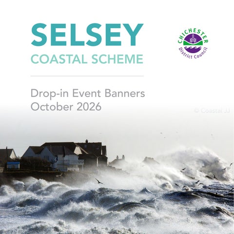
SELSEY
COASTAL SCHEME Drop-in Event Banners October 2026
About Coastal Partners Managing coastlines, improving community resilience, and enhancing the natural environment.
Chichester District Council is one of five Local Authorities that form the innovative Coastal Management Partnership called ‘Coastal Partners’. Working as a shared service across 246km of Hampshire and West Sussex’s coastline creates cross-border efficiencies that helps to protect homes, businesses, wildlife, and infrastructure.
Our diverse work includes managing coastal flood and erosion risk, planning and designing new coastal defence schemes, inspecting and maintaining existing defences and working towards an environmentally focussed future.
On a national scale, we lobby for coastal management policy improvements. Our goal is to influence processes that can deliver greater and more sustainable benefits for our coastal communities. Working alongside residents, we are shaping the region’s coastline for the generations of tomorrow.
We have also evolved our expertise into habitat and environmental services, coastal surveying and research. Furthermore, we advise on a variety of areas including coastal policy and strategy, project planning and design, project delivery and post scheme monitoring.
Coastal Defences Under Attack Selsey’s sea defences have a lot to contend with. The peninsula has always been subject to constant pressure from the sea, but now climate change is intensifying its impact. The current defences are coming to the end of their serviceable lives making stormier seas a serious challenge for Selsey.
A Changing Climate ‘Climate change’ refers to changes in climatical patterns relating to increased greenhouse gas emissions. For coastal management, climate change is forecast to result in increased flooding and erosion through sea level rise and an increase in extreme storm events. This additional pressure is leading to a decreasing level of protection provided by the existing defences. In England, rising sea levels and climate change have put around 2.4 million properties at risk of flooding from rivers and the sea.
Sea Level Rise Data Changes in Sea Level
Portsmouth
Sea level has risen by ~1.77mm per year.
Southampton
Sea level has risen by ~1.69mm per year.
1930
1940
1950
1960
1945: The end of WW2
1970
1980
1966: England wins the World Cup
1990
2000
1993: The WWW gets launched to the public
2010
2020
SOURCE: Standing Conference on Problems Associated with the Coastline (SCOPAC) Storm Analysis 2020.
2011: Prince William marries Kate Middleton
The latest sea level rise data is published in the UK Climate Projections 2018 (UKCP18). The UKCP18 information captures assumptions of the predicted increase in temperature using a range of emissions scenarios. The graph below shows the predicted sea level rise at Selsey based on two different UKCP18 climate change projections for a high emissions scenario. Design standard – This represents a reasonable estimate of expected conditions, incorporating an element of precaution while balancing cost-effectiveness. Sensitivity testing – Used to assess the potential impact of more extreme scenarios. This helps in evaluating adaptability and resilience to more severe but less probable flood events.
Predicted Sea Level Rise 2
© Coastal JJ
Sea Level Change (m)
1.5
SLR for sensitivity testing
SLR projection for design standards
1
0.5
0.0 2000
2025
2050
2075
2100
2125
Year
Asset Condition & Maintenance There are a wide range of coastal defences along the Selsey coastline, including seawalls, rock revetments, groynes, and shingle beaches. Whilst regular maintenance work has been carried out on the existing groynes and seawalls, such repairs are becoming increasingly difficult because many of these structures are nearly 80 years old and need replacing due to their aging condition. Selsey’s coastal defences are owned by several different individuals and organisations.
Coastal Flooding & Erosion Roles & Responsibilities
Rising sea levels and changing weather patterns are having a greater impact on coastal communities. Several organisations and individuals play a role in addressing the effects of coastal flooding and erosion.
Defra has overall policy responsibility for flood and coastal erosion risk management policy in England. It provides funding through Grant in Aid (GiA).
The EA has a strategic Oversight Role and is a Risk Management Authority. They have permissive powers to protect against coastal flooding and erosion This is not a legal obligation.
Landowners Local Authorities are Risk Management Authorities and have permissive powers to carry out work to reduce the risk of erosion and flooding by the sea - This is not a legal obligation.
Private land owners have ultimate responsibility for protecting their own property from flooding and erosion. They must act within statutory planning regulations and other applicable legislation.
The EA and Risk Management Authorities only act where there are sufficient benefits to the public using a suitable engineering solution that is achievable, affordable, and complies with environmental legislation.
Coastal Flooding and Erosion Coastal defences do not last forever. They are subject to extreme conditions from waves, tides and currents, so they typically have a lifespan of around 50 years. Some of the defences in place today were built almost 80 years ago for the conditions of the time. In addition, climate change is driving increased storminess and a faster rate of sea level rise. The combination of these factors is leading to more significant challenges in Selsey.
Coastal Flooding These flood maps are generated by computer modelling and show where coastal flooding may occur during an extreme weather event for both present day and in the future. The future extent (2127) shows how this would increase over time, with sea level rise and if the defences were left to deteriorate. The severity of coastal flooding depends on a range of factors including existing defence heights, ground levels and how close properties are to the sea. In some cases, the areas identified may never have experienced flooding before. Selsey’s sea defences help reduce the risk of coastal flooding and erosion. At their current height, the risk to the community from an extreme event is high and will increase over time due to sea level rise.
Key Present Day
1:200 year return period
N
2127
1:200 year return period
© COPYRIGHT: Reproduced from the Ordnance Survey Digital Data with the permission of the Controller of HMSO, Crown Copyright Reserved 2025, Licence No AC0000820867. Flood modelling outputs produced as part of the CDC SFRA (2024).
Coastal Erosion Due to the age and condition of the sea defences there is an increasing risk of them failing. Historical maps and ground conditions show that Selsey is highly susceptible to coastal erosion. This is reflected in the substantial erosion rates predicted in the absence of coastal defences. This map is accurate as of April 2026. The projected erosion zones have been generated using a methodology consistent with that applied by the Environment Agency in the January 2025 update to the National Coastal Erosion Risk Mapping (NCERM).
Risk
Key
Projected Erosion Zones
Projected Erosion Zone (0-20 Years)
Projected Erosion Zone
(20-50 Years)
Projected Erosion Zone (50-100 Years)
Shoreline Position (Mean High Water) Dates are approximate. 2024 1929 1922 1902 1868
N
© COPYRIGHT: Reproduced from the Ordnance Survey Digital Data with the permission of the Controller of HMSO, Crown Copyright Reserved 2025, Licence No AC0000820867. Indicative erosion zones produced by Coastal Partners (2022). Historic Mean High Water contour Crown Copyright & Database Right Ordnance Survey 2023 LC100019217.
Today, there are around 2,600 properties estimated to be at risk of tidal flooding from an extreme event. If defences were left to deteriorate, this figure increases to approximately 3,900 properties at risk in 100 years when combined with erosion.
© The Francis Frith Collection
Introduction to the Selsey Coastal Scheme In Selsey, the age and condition of the existing sea defences has led to routine repair and maintenance becoming more frequent, challenging, and costly. Coupled with increasing pressure from the sea through climate change, the need to review the defences and consider options for how to manage the flood and erosion risk has become extremely important. Managing future coastal flooding and erosion risk and seeking a long-term solution for Selsey is a key priority for Chichester District Council. In the UK there is a three-tiered framework for planning and delivering coastal management: 1. Shoreline Management Plans (SMPs) are based on a long-term perspective to inform how the coast should be sustainably managed in the future. Chichester’s coastline is covered by two SMPs; The North Solent SMP and the South Downs SMP. They join together at Selsey Bill.
2. Coastal Defence Strategies cover shorter lengths of coast in more detail and consider social, economic, and environmental factors. Selsey is part of the Pagham to East Head Coastal Defence Strategy which implements a ‘Hold the Line’ policy for the coastline. ‘Hold the Line’ means maintaining or changing the standard of protection on the existing defence line.
Scan to read the strategy here
3. Coastal Defence Schemes, such as the Selsey Coastal Scheme, are tailored flood and coastal erosion risk management projects that are developed based on the individual requirements of a specific location.
© Coastal JJ
© Coastal JJ
Are new defences needed? The 2009 Pagham to East Head Coastal Defence Strategy highlighted the challenges at Selsey of aging defences and the affordability of new defences. Challenges the area still faces today. In 2023 a ‘Feasibility Study’ was carried out to review the viability of a coastal flood defence scheme. This work highlighted that more than 700 properties are at a tidal flood risk and the frontage is vulnerable to significant erosion without defences in place. The number of properties at risk from flooding or erosion are also predicted to increase over the next 100 years as sea levels rise and there is increased storminess. It also identified challenges in affordability and sustainability of defences in the face of a changing climate. The Feasibility Study outcomes helped develop and secure a business case for Grant in Aid Funding for the next stage of the project - the ‘Options Appraisal and Outline Design’ stage. This will increase our understanding of the problem, the challenges ahead, and potential solutions. Future stages of the project will need to secure further funding to go forward.
© Coastal JJ
Options Appraisal & Outline Design The Project Stages Chichester District Council has successfully secured £2.9 million of Flood Defence Grant in Aid funding from Defra (the Department for Environment, Food & Rural Affairs) to progress the Selsey Coastal Scheme options appraisal and outline design stage.
Project Timeline Funding Decision Points
Feasibility Business Case
2023
Project Stages
2024
Feasibility Study
Outline Business Case
2025
2026
Full Business Case
2027
2028
Options Appraisal & Outline Design
Design & Consents
2029
2030
2031
Construction
Securing the funding to progress into the detailed design and construction stages is not guaranteed and is dependent on the success of future business cases. The following objectives have been established for the scheme:
REDUCING THE RISK Reduce flood and erosion risk to people, property, businesses, and infrastructure, whilst improving resilience to climate change.
VALUE FOR MONEY
PLACE
ENVIRONMENT
Provide cost-effective and deliverable solutions which are technically feasible and sustainable.
Maintain coastal areas for recreational use and tourism and incorporate opportunities for wider enhancements.
Maintain, and where possible, enhance the natural, historic, and built environments.
Study Area Pagham Harbour
Bracklesham Bay Medmerry Nature Reserve
Selsey East Beach West Beach
The study area covers the whole peninsula, and the exact start and end points of the scheme will depend on what is technically possible and what is affordable. Deciding how far the scheme will extend is part of this stage of the work. To manage flood risk properly, the new defences will need to connect to higher ground at both ends of the scheme. As the project develops, it will become clearer where these connections should be.
Selsey Bill
© Coastal JJ
Selsey Environmental Considerations Protected Areas Environmental designations of international, national, and local importance are located within or in close proximity to the scheme study area. One of the most significant designations within the study area is the Selsey Bill and the Hounds Marine Conservation Zone (MCZ). This covers 16 km2 and it was established in 2019 for its high biodiversity and variety of habitats - ranging from rocky layers, soft sandy sediments and native British Seahorses. In addition, the scheme lies within the Solent & Dorset Coast Special Protection Area (SPA). This international designation is approximately 89,000 hectares in size and encompasses shallow coastal waters that are important feeding areas for Terns.
International Designations RAMSAR legislation protecting wetlands Special Protection Area (SPA)
Local & National Designations Site of Specific Scientific Interest (SSSI) Marine Conservation Zone (MCZ) Local Nature Reserve (LNR) Local Wildlife Site (LWS) Listed Buildings Conservation Areas
© COPYRIGHT: Reproduced from the Ordnance Survey Digital Data with the permission of the Controller of HMSO, Crown Copyright Reserved 2025, Licence No AC0000820867. Ramsar, SPA, LNR, MCZ & SSSI (Natural England, 2024). LWS (SxBRC, 2018). Listed buildings (Historic England, 2022).
The scheme also overlaps with Selsey East Beach Site of Special Scientific Interest (SSSI) which is of geological importance. The Pagham Harbour SPA, Ramsar and SSSI overlap at the Eastern extent and the Bracklesham Bay SSSI at the Western end.
Challenges & Opportunities For a New Scheme Environmental designations protect our important plants and animals. Created to keep ecosystems healthy, they conserve biodiversity by carefully managing or limiting activities that could cause harm, ensuring these special places thrive for future generations.
Ecoformliner at the North Portsea Coastal Scheme
Tidal pools at the Southsea Coastal Scheme
In Selsey, many homes sit right beside the seawall, placing them close to the protected environmental areas. This unique setting brings challenges and responsibilities for how the coastline is managed. To secure planning and environmental regulator consent for new defences, the project will need to demonstrate that all ‘alternatives’ have been considered and that there will be minimal impact on the environment. The scheme also brings opportunities to create better and more stable ecosystems. These might include habitat creation initiatives (such as walls designed for habitats and tidal pools) and environmentally considerate solutions for Selsey’s distinctive marine life. The project team are working alongside the statutory stakeholders, such as Natural England to protect and enhance nature.
Spiny S eah or
e s
Oy
er atch erc st
• Bat ground level tree assessment • Great crested newt habitat suitability index • Water voles surveys • Tern activity surveys • Overwintering bird surveys • Biodiversity Net Gain baseline habitat mapping • Vegetated Shingle monitoring
n r e T n o
Ser oti ne
t Ba
The project team is carrying out surveys and investigations to establish a robust baseline understanding of the environment and identify any ecological constraints. These will also determine whether more detailed surveys are required during the next phase of the scheme, and whether targeted mitigation measures will be needed to support the delivery of the scheme. The findings will also help identify opportunities for environmental enhancements that can be incorporated into the scheme design and delivery. These surveys and investigations include:
Com m
Environmental Investigations
Understanding The Coast Around Selsey Bathymetry & Seabed Mapping Bathymetric surveys give us a detailed picture of what lies beneath the waves, showing the depth and shape of the seafloor. They are helping us better understand the Marine Conservation Zone (MCZ) which lies mainly submerged offshore.
Depth (m) -0.5 -5 -10 -15 -30
One of the survey data outputs used for analysis is ‘backscatter data’. This works by sending soundwaves down to the seabed and measuring the signal that bounces back. The intensity of the return signal helps us identify what is on the seabed - high intensity signals show reflective surfaces and low intensity signals reflect absorbent surfaces. We combine this information with physical samples and underwater photographs to understand the sediment type and textures that make up the local seabed.
Tracer Pebbles
Tracer studies provide a unique way of tracking pebbles as they move along the beach. Radio Frequency Identification (RFID) tags are inserted into drilled native pebbles and sealed in place. These tracer pebbles are then deployed at set locations on the beach and their positions are resurveyed over a 12-month period to track their movement. This helps to understand longshore and cross-shore sediment movement and rates at local areas.
Deployment Sites
Key Coarse Sediment Rock Sand
We can also produce a detailed habitat map using a classification system called ‘EUNIS Level 3’. This highlights important ecological habitats by combining information on seabed type, wave exposure and environmental conditions. These insights help us better understand the rich biodiversity within the MCZ and ensure it is protected for the future. Tracer Pebble Pebble (Size varies)
Radio Frequency Identification Tag (RFID)
Size varies
Epoxy Resin Filler
Tracer Pebble Movement
Site 1
Site 1
Site 2
Site 2
Site 3
Site 3
Site 4
Site 4
Site 5
Site 5
This image shows examples of tracer pebbles deployed at 5 sites in July 2025. After 6 surveys (over approx. 5 months), we can see that the pebbles have made their way around Selsey Bill and up towards the RNLI station. Results are analysed as they are collected. Once a full year of data has been gathered, patterns and trends in sediment transport identified from the tracked pebbles will be assessed and used to evaluate any potential impacts of new coastal defence structures on sediment transport.
Selecting the Shortlist Options How did we get to the shortlist?
Unsuitable Options
All coastal defence options are identified, and then a comprehensive analysis takes place to determine the most suitable defences for the area. Environment (is it sustainable?)
Technical (is it feasible?) Economic (is it affordable?)
Social (is it acceptable?)
Does it meet the objectives?
Health & Safety
Ap
p ra is al C r i t S h or t
a i r e
Submerged Reef: Submerged structure to reduce wave energy prior to it reaching the shore. Needs to be in deep water for stability, so unlikely to influence waves. Complex design considerations required and defences on the shore still required for coastal flooding.
Breakwater: Offshore structure designed to reduce wave energy priorto it reaching the shore. Significant impact on the Marine Conservation Zone due to scale of structures and defences onshore still needed. Significantly costly.
Nearshore Beach Control Structures: These structures are built on the foreshore and maintain or increase beach widths & levels. Significant impact on Marine Conservation Zone due to scale of structures and onshore defences still likely to be needed. Interaction with currents challenging here. Significantly costly.
s n li s t O p t i o
Demountable Flood Defences: Temporary flood barriers put up in advance of storm events. Do not reduce risk of coastal erosion. Not suitable in this high energy wave climate. Not a suitable long-term solution for flooding due to extent of the frontage.
Shortlist Core Options Primary Vertical Defence: Construction of a vertical sea wall, and extending existing seawalls to reduce the risk of flooding and coastal erosion.
Harbour Arms/Barriers: Barriers to create harbour or inlet. Significantly costly and only localised (small) flood protection benefits. Requires regular shingle movement to support natural coastal processes. Significant impact on the Marine Conservation Zone.
Primary Sloping Defence: Construction of a sloping defence wall using materials such as rock or concrete to reduce risk of flooding and coastal erosion.
Realignment of the Coastline & Relocation: Realigning and relocating properties is a significantly costly option. This is not in accordance with the ‘Hold the line’ policy. Significant social impacts to the community.
Supporting Options
Do Nothing This means no further work is carried out on the existing defences. This option does not protect the area, but it helps show what could be at risk if no action is taken. Set Back Defence: Where there is space, construction of set back defences can support the primary defences by providing full flood defence height further back.
Beach Management: Importing beach material or moving it to where it is needed uses the beach to absorb wave energy and protect the main coastal defence structure.
Beach Control Structures: Built to control the movement of beach material (such as groynes), helping to support a core option where the beach is actively managed in front.
Demountable Flood barrier: Used to maintain access where needed such as flood gates, boards or stop logs.
Property Flood Resilience: Measures applied to individual properties to reduce risk of the property flooding i.e. door flood barriers & airbrick covers.
Do Minimum This means carrying out repairs and routine maintenance on the existing defences. However, because these defences are already nearing the end of their useful life, this approach is not considered suitable.
Shortlist Options & Coastal Frontages At the shortlist stage, we only look at the general form of coastal defence, such as ‘Vertical’ or ‘Sloping’. The images below show examples of core options and supporting options from other coastal defence projects.
Core Options ‘Vertical’ Defence
‘Sloping’ Defence
Supporting Options
Go
lf L
ink
Property Flood Resilience
sL
ane Co p
se
Medmerry Nature Reserve
d
d
La
Eas
tB
ne
eac hR
est er R ich
Pa rk
Ch
These areas are based on things such as:
Warners Lane
• Current defences • Coastal processes • Possible management solutions • Land levels • Space limitations • Other local factors
Hig
ne
Man
l La
or R
hS tre et
Mil
d
Medmerry Primary School
East Beach Pond East Beach Car Park
Seal Primary Academy
Eas
t St
ree t
et West Stre
d
West Beach
East Beach
Hillfi
eld R
The Lifeboat Station
efie
Grafto
ld R
d
Coastal Frontages
n Rd
Coastguard Station
Rd
The 4.5km study area of the scheme is split into seven management units so we can focus on the unique needs of each section.
Demountable Flood Barrier
Dan
Study Area
Beach Control Structures
Pa rk
Beach Management
War ner
Set Back Defence
These options are complimentary, and can be added to the core options as additional measures of protection.
Lifeb
oat W ay
Ma
rine
Gd
ns
The Bill House
Selsey Bill
West Beach Selsey Beach Solent Way Selsey Bill Lifeboat Way East Beach Park Copse
Working Towards the Leading Options The diagrams below show the current sea defences at West Beach and East Beach. They illustrate how we assess different factors when deciding which type of sea defence is most suitable for each area. Every part of the coastline is different, but many of the challenges and opportunities are similar. The diagrams show how these factors influence the choice of defence in each location.
West Beach Low height of the exisiting seawall
Limited space due to proximity of MCZ (20m)
Property boundary
Limited space due to proximity of properties
East Beach
How can we lower the risk of coastal flooding? Marine Conservation Zone (boundary varies)
Existing seawall Forecast extreme water level and wave height in 100 years as a result of climate change
By reducing the force of waves before they reach the sea wall, or raising the height of the sea wall to reduce the amount of water that spills over the top.
How can the different shortlisted defence types help?
Beach level (fluctuates)
Changes in beach levels and flow of sediment
Proximity of designated sites
Low height of the exisiting seawall
Sloping defences, such as rock revetments, help absorb and reduce the force of waves before they reach the sea wall. This can reduce the need to make sea walls significantly higher, which may be important where space is limited, beach levels change regularly, or taller sea walls could have a visual impact.
Forecast extreme water level and wave height in 100 years as a result of climate change
Limited space behind the seawall
Marine Conservation Zone (boundary varies)
Beach level (fluctuates) Existing seawall Low lying land behind seawall
Changes in beach levels and flow of sediment Business and recreational use of the beach
In areas where beach levels are more stable and can be managed reliably, raising the height of existing vertical sea walls may be a practical option. In these locations, the beach itself, together with beach-control structures, can also help provide protection from the sea.
Aerial View (West Beach)
Where there is enough space behind the existing sea defences, building set-back defences further inland can help reduce how much the height of seafront defences needs to be increased.
Identifying the Leading Options To help identify the leading options, each shortlisted option has been assessed against five key evaluation criteria: Technical – Design and construction complexity, along with confidence in long-term performance.
Aerial View (East Beach)
A Red, Amber, Green (RAG) rating system has been used to provide a clear, high-level comparison of the shortlisted options within each Management Unit.
RED
Significant technical complexity, uncertainty and challenging design/ construction requirements. Major adverse environmental impacts that are difficult to mitigate and may prevent consent being granted.
Environmental – Potential environmental effects, specifically impacts on designated sites and habitat encroachment.
Significant negative social impacts on landscape, communities, businesses and the built environment.
Social – Effects on the landscape, built environment, and the community.
Major health and safety risks during construction and/or operation.
Health & Safety – Risks associated with construction activities and the longterm operation of the asset. Economic – The overall cost of delivering the option.
AMBER
Moderate technical challenges and some design/construction uncertainty. Environmental impacts likely to be manageable through mitigation.
This assessment compares the strengths, weaknesses, opportunities and constraints of each option across a 100-year design life.
What will they be made of? The appraisal looked at a range of materials that could be used to protect Selsey’s exposed coastline. For sloping sea defences, rock revetments were assessed because they are effective at reducing the force of waves and provide long-lasting protection that requires relatively little maintenance. As the design work progresses, concrete armour units will also be considered in some areas where they may offer additional benefits. For vertical sea defences, both reinforced concrete and steel sheet piles were assessed. Reinforced concrete is considered particularly suitable for the areas most exposed to wave action and storm conditions.
Manageable social impacts on landscape, communities, businesses and the built environment. Health and safety risks require active management during construction and/ or operation.
GREEN
Standard technical requirements with a high degree of performance certainty and confidence in deliverability. Minimal environmental impacts, with potential for positive environmental outcomes. Positive or negligible social impacts on landscape, communities, businesses and the built environment. Minimal health and safety concerns – safe and practical to construct and operate.
West Beach Management Unit 1 Characteristics of West Beach This part of the coastline is exposed to strong waves and is protected by ageing sea walls that are reaching the end of their lifespan. There is very little beach material in front of the defences, so the area has limited natural protection from the sea. Many homes are located directly behind the existing sea wall, leaving very little space between the defences and the community they protect. The area is also affected by environmental protections, include the Marine Conservation Zone (MCZ), which is close to the shoreline. Because space is limited, building new coastal defences will be challenging. Some impact on the Marine Conservation Zone may be unavoidable, but this will be carefully considered as the preferred design options are developed.
Shortlist Options Technical
Sloping Defence
Vertical Defence
Cost: £29m
Cost: £37m Environment
Key Considerations Less complex to build using machinery Lower construction health & safety risks Easier to integrate emergency steps Easier to maintain in long term Less impact on sea views Loss of access to beach Bigger footprint
Key Considerations Smaller footprint More complex to build Higher construction costs Higher construction health & safety risks Loss of access to beach High impact on sea views Unlikely to reduce wave impact vibration
Social
Health & Safety
a
Artist Impressions
Leading Option
Primary Sloping Defence Proposed concrete wall
Properties
Why is this the best option?
Proposed sloping rock revetment
Landscaping
Marine Conservation Zone (MCZ) 2127 Extreme Water Level
Very effective at reducing the force of waves, meaning lower sea defences are needed and there is less vibration
Mean High Water
Existing sea wall
Mean Low Water
Works well in a narrow space Safest construction approach Lower risk to build Removed fall from height risk with vertical option Safest option for emergency access / exit
Go
No reliance on beach management
ink
sL
ane
Rd
lf L
ink
sL
ane
Warners Lane
Rd
Hillfi eld
ld R d
d Lifeb
oat W ay
Ma
Location of Management Unit 1
Grafto n Rd
Selsey Bill
efie
The Bill House
The Lifeboat Station
Dan
War ne
Gd
r Rd
oat W ay
ns
or R
et West Stre
Grafto Lifeb
rine
ree t
Rd
Coastguard Station
n Rd
Hillfi eld
d ld R efie
Dan
War ner Rd
The Lifeboat Station
East Beach Car Park
t St
ree t
et West Stre
Ma
Man
Hig hS tre
Eas
East Beach Car Park
t St
Coastguard Station
East Beach Pond
Seal Primary Academy
East Beach Pond
Seal Primary Academy
Eas
ne
d
Hig
ne
Man
l La
l La
or R
hS tre e
t
Medmerry Primary School
et
Rd
Medmerry Primary School
ch
ne
Mil
Warners Lane
Mil
La
Eas t
Pa rk
Bea
Ch ich est er R
d
Pa rk
Co p
se
Medmerry Nature Reserve
ne
Eas
Go
La
tB
Ch
ich
Pa rk
d
est er
Sea level depicted at approximately Mean Low Water
eac hR
Cost-effective solution
Pa rk
Co ps e
Medmerry Nature Reserve
lf L
rine
Gd
ns
The Bill House
Aerial View Selsey Bill
Selsey Beach Management Unit 2 Characteristics of Selsey Beach Selsey Beach can be divided into two areas, east and west. In the west, homes are located close to the sea defences. In the east, the Marine Car Park sits behind the sea wall. This exposed stretch of coastline is regularly affected by storm waves, which can overtop the sea wall and deposit large amounts of shingle across the car park and the end of Hillfield Road. Properties are also impacted by these storm waves. Danfield Road and the Marine Car Park play an important role in managing the beach. Shingle is regularly placed here and moved naturally by the sea around Selsey Bill, helping to replenish beaches further east.
Shortlist Options Technical
Sloping Defence Cost: £35m
Vertical Defence Cost: £36m
Environment
Key Considerations
Key Considerations Social
Reduced access to beach Impact on sea views Bigger footprint
Leading Option
Primary Sloping Defence
Health & Safety
Beach Control Structures
Proposed concrete wall
Proposed sloping rock revetment
Properties
Marine Conservation Zone (MCZ) 2127 Extreme Water Level
Why is this the best option?
Mean High Water Beach Level Varies
Safest construction approach
Mean Low Water
Existing sea wall
Very effective at reducing the force of waves, meaning lower sea defences are needed and there is less vibration
Sea level depicted at approximately Mean Low Water
Artist Impressions - eastern section
Cost-effective solution Lower risk to build
Proposed concrete wall
Removed fall from height risk with vertical option
Existing concrete floodwall Proposed sloping rock revetment
Proposed resurfaced car park
Marine Conservation Zone (MCZ)
Safest option for emergency access / exit
2127 Extreme Water Level
Beach management can continue from the car park, helping to replenish beaches further east
Go Beach Level Varies
High lf LMeanWater ink sL ane
Existing sea wall
Mean Low Water
Rd
New beach control structures i.e groynes
Pa rk
Co p
se
Medmerry Nature Reserve
d
La
Sea level depicted at approximately Mean Low Water
hR
ne
Eas
tB
Ch
ich
Pa rk
eac
Beach control structures will be used to support beach management at the eastern section
l La
La
ne
Eas
Warners Lane
Eas
Hig
Coastguard East Beach Station Pond East Beach Car Park
Seal Primary Academy
eld
t St
Grafto
ld R efie
Dan oat W ay
Gd
ns
d
r Rd n Rd Grafto
field
Lifeb
rine
War ne
Rd Rd
r Rd
Hillfi eld
The Lifeboat Station
Dan e
War ne
Hillfi
ree t
et West Stre
Ma
The Lifeboat Station
n Rd
Eas
et West Stre
Rd
ne
ree t
d Man or R
et
hS tre
l La
Coastguard Station
East Beach Car Park
t St
Medmerry Primary School
Mil
East Beach Pond
Seal Primary Academy
tB
Ch
ich
Pa rk
Hig
est er
ne
Man
hS tre
se Co p
Mil Rd
Medmerry Primary School
or R
ane
et
sL
Pa rk
Medmerry Nature Reserve
ink
d
lf L
eac hR
Go
d
Warners Lane
The Bill House
Selsey Bill
Aerial View (west)
Reduced access to beach High impact on sea views Unlikely to reduce wave impact vibration
Artist Impressions - western section
Existing property access
Beach Management
Smaller footprint More complex to build Higher construction costs Higher construction health & safety risks
est er
Less complex to build Lower construction health & safety risks Easier to integrate emergency steps Easier to maintain in long term
Location of Management Unit 2
Lifeb
oat W ay
Ma
rine
Gd
ns
The Bill House
Selsey Bill
Aerial View (east)
Solent Way Management Unit 3 Characteristics of Solent Way Solent Way is a more natural coastal environment and is predominantly undefended. Beach health is heavily influenced by Kirk Arrow Spit, which plays an important role in supplying sediment to the beaches. However, it can also contribute to periods of rapid beach erosion. As the spit evolves, it can push tidal currents closer to the shoreline, increasing erosion rates and causing beaches to lower quickly. This can undermine existing defences and create an immediate risk to nearby properties.Understanding the local setting and considering the dynamic coastal processes and the risk they pose has been a key consideration in the selection of the leading option for this management unit.
Shortlist Options Technical
Sloping Defence Cost: £18m
Vertical Defence Cost: £18m
Environment
Key Considerations
Key Considerations Social
Reduced access to beach Impact on sea views Bigger footprint
Leading Option
Health & Safety
Proposed concrete wall alignment can be flexible
Proposed wall and sloping rock revetment - alignment of both structures can be varied and wall can be set-back from the revetment
Property ownership extents to Mean High Water Springs
Proposed sloping rock revetment
Proposed new beach control structures i.e groynes
Set Back Defence
2127 Extreme Water Level
Mean High Water
Why is this the best option?
Beach management continued and control structures replaced i.e groynes
Mean Low Water
Works with dynamic offshore environment of Kirk Arrow Spit and rapid erosion events
Artist Impressions - eastern section
Space for the King Charles III England Coast Path
Proposed set back defence bund Proposed sloping rock revetment alignment can be flexible
Existing path
Go
Using existing embankment retained in east
lf L
ink
sL
Medmerry Nature Reserve
2127 Extreme Water Level
ane
Mean High Water
rR
d
Beach control structures will be used to support beach management
Beach management continued and control structures replaced i.e groynes
est e
Mean Low Water
Proposed wall
Pa rk
La
ne
Eas
tB
Ch
ich
Supported by set back wall defence in west
New beach control structures i.e groynes
Co ps e
Groundwater can flow through permeable structure
Pa rk
Rock largely buried under beach in normal conditions
Sea level depicted at approximately Mean Low Water
Rd
Beach Control Structures
Reduced access to beach High impact on sea views
Artist Impressions - western section
Primary Sloping Defence
Beach Management
Smaller footprint More complex to build Higher construction health & safety risks
eac h
Less complex to build Lower construction health & safety risks Easier to maintain in long term
Warners Lane
l La
lf L
et
ane Co p Pa rk
Rd n Rd
efie
d hR
ree t
tB Eas
Rd
n Rd
Hillfi
Grafto
d ld R
The Lifeboat Station
East Beach Car Park
Lifeb
oat W ay
Ma
rine
Gd
ns
Grafto
ld R
d
Rd
Hillfi eld
The Lifeboat Station
Dan
War ner
ne
Dan
et West Stre
Rd
Coastguard Station
ree t
t St
efie
t St
East Beach Pond
r Rd War ne
Eas
Seal Primary Academy
Eas
eld
d
Hig
ne
Man
l La
et West Stre
or R
et
hS tre
Medmerry Primary School
La
East Beach Car Park
Seal Primary Academy
eac
est er Ch
ich
Pa rk
Coastguard Station
Warners Lane
Mil
East Beach Pond
sL
se
Medmerry Nature Reserve
ink
Hig
Go
ne
Man
Mil
hS tre
Medmerry Primary School
or R d
Sea level depicted at approximately Mean Low Water
The Bill House
Lifeb
oat W ay
Ma
rine
Selsey Bill
Gd
ns
The Bill House
Selsey Bill
Aerial View (west)
Location of Management Unit 3
Aerial View (east)
Selsey Bill Management Unit 4 Characteristics of Selsey Bill Selsey Bill is one of the most exposed sections of the coastline. It is subject not only to high wave energy but also to significant tidal currents, as flows are squeezed past the headland.
Shortlist Options Technical
Sloping Defence
Vertical Defence
Cost: £9m
Cost: £11m Environment
Key Considerations Less complex to build Lower construction health & safety risks Easier to maintain in long term Reduced access to beach Moderate impact on sea views Bigger footprint
Key Considerations Smaller footprint More complex to build Higher construction costs Higher construction health & safety risks Loss of access to beach High impact on sea views Unlikely to reduce wave impact vibration
Social
Health & Safety
Leading Option
Artist Impressions
Primary Sloping Defence
Proposed concrete walls and potential access
Beach Management
Properties and gardens
Beach Control Structures
Proposed sloping rock revetment
Landscaping
Existing concrete groynes to be maintained or replaced
2127 Extreme Water Level
Why is this the best option?
Mean High Water
Keep defence heights as low as possible
Existing sea wall
Mean Low Water
Potential opportunity to improve access olf along frontage for Gpublic and to maintain Lin k sL the defences an e
ste r
Rd
Pa rk
Co ps
e
Groundwater can flow through permeable structure
ve
ne
Retain or replace two large concrete Go groynes lf L in l La Beach control structures will be used to ne support beach management est er R
d
Mil
ich
Pa rk
t St
n Rd
d
oat W ay
Grafto
efie
Dan
rine
Gd
oat W ns ay
Lifeb rine
Gd
ns
Grafto
Lifeb
Ma
Ma
The Lifeboat Station
n Rd
Hillfi
d ld R efie
The Lifeboat Station
Dan
War ner
Rd
ree t
ld R
d
Rd
Hillfi
eld
Rd
et West Stre
War ner
Coastguard Station
East Beach Car Park
eld
Seal Primary Academy
Eas
East Beach Pond
Rd
Hig
ne
Man
l La
hR
or R
et
hS tre
Mil
ree t
d
Medmerry et e r t S t s CoastguardPrimary e W School Station
East Beach Car Park
Eas
t St
Warners Lane
East Beach Pond
tB
Eas
Beach management continued and control structures replaced i.e groynes
eac
Ch
La Seal Primary ne Academy
MaConpse or R
e
Pa rk
Hig hS tre et
d
Medmerry Primary School
Lan
The Bill House
The Bill House
Selsey Bill
Location of Management Unit 4
Existing concrete groynes to be retained or replaced
Eas
Warners Lane
ks
hR
d
La
tB
Ch ic
Pa rk
eac
he
Very effective at reducing the force of waves, meaning lower sea defences are needed and there is less vibration
Selsey Bill Aerial View
Sea level depicted at approximately Mean Low Water
Lifeboat Way Green Management Unit 5 Characteristics of Lifeboat Way Green This management unit is characterised by wider beaches and plays an important role in supporting a range of activities that are central to Selsey’s identity. These include the commercial fishing fleet, the RNLI station, amenity beach, and recreational boating activities. These areas will require more detailed, site-specific solutions, which will be developed during the next stage of the project in close consultation with the relevant stakeholders.Setback defences have been included as a supporting option and they can play an important role in managing the defence heights that may be required along parts of this frontage. The social impacts of introducing new, more robust, higher defence structures are more significant in Managment Unit 5 and 6 than on any other frontage. However, it is important to consider these impacts alongside the consequences of taking no action.
Shortlist Options Technical
Sloping Defence Cost: £35m
Vertical Defence Cost: £34m
Environment
Key Considerations
Key Considerations
Less complex to build Lower construction health & safety risks Easier to maintain in long term
Reduced access to beach Impact on sea views Bigger footprint
Leading Option
Beach Control Structures
Smaller footprint More complex to build Higher construction health & safety risks
Health & Safety
Reduced access to beach Very high impact on sea viewsas defences would be significantly higher
Artist Impressions - space constrained
Primary Sloping Defence
Beach Management
Social
Proposed concrete wall at back of seawall where space is constrained Proposed raised and widened seawall
Set Back Defence
Proposed sloping rock revetment
Existing fence
Proposed beach control structures i.e groynes 2127 Extreme Water Level
Beach access will be maintained, and will be assessed at the next design stage
Mean High Water
Why is this the best option?
Existing seawall
Beach management continued and control structures replaced i.e groynes
Mean Low Water
Set back defences can be used where there is space
Existing concrete groynes to be retained or replaced
Safest construction approachand lowest buildability risk
Sea level depicted at approximately Mean Low Water
Artist Impressions - with set back defences
Very effective at reducing the force of waves, meaning lower sea defences are needed and there is less vibration Can accommodate beach level fluctuation and long-term uncertainty
Proposed sloping rock revetment alignment can be flexible
Go
lf L
Medmerry Adaptive options for medium term toNature be Reserve
Proposed new beach control structures i.e groynes Access for RNLI and fishermen will be addressed at the next design stage
ink
2127 Extreme Water Level
sL
ane
Mean High Water
Existing seawall
Mean Low Water
rR
d
explored at next stage - see Challenges & Opportunities banner for more detail
Co ps e
Proposed raised and widened seawall with raised concrete back wall
Proposed set back concrete wall where space allows
Beach management continued and control structures replaced i.e groynes
Pa rk
Cost comparable at this level of detail
ne
hR
d
La
Eas
tB
Ch ic
Pa rk
eac
he
ste
Beach access will be maintained and will be assessed at the next design stage
Eas
Warners Lane
Rd
Grafto
efie
rine
Gd
ns
se
n Rd
Hillfi eld
d
Grafto
ld R efie
oat W ay
n Rd
Hillfi
ld R
d
r Rd War ne
Dan
oat W ay
The Bill House
Gd
ns
The Bill House
Selsey Bill
Aerial View
The Lifeboat Station
Lifeb Ma
Lifeb
rine
East Beach Car Park
The Lifeboat Station
Dan
eld
Rd
War ne
et West Stre
ree t
r Rd
t St
Ma
Co p
or R
Man
East Beach Pond
Seal Primary Academy
Eas Coastguard Station
Pa rk
d
et
hS tre
H ig
ne
ree t
et West Stre
Coastguard Station
l La
East Beach Car Park
ne Primary Seal Academy
t St
Medmerry Primary School
Mil
La
eac
Ch
ich
Pa rk
East Beach Pond
d
est er
Rd
ne
hR
l La
tB
Mil
or R
Medmerry Primary School
ane
Man
sL
Eas
Medmerry Nature Reserve
ink
et
lf L
Hig hS tre
Go
Sea level depicted at approximately Mean Low Water
d
Warners Lane
Location of Management Unit 5
Selsey Bill
Aerial View (east)
East Beach Management Unit 6 Characteristics of East Beach This Management Unit is characterised by relatively narrow beaches and several physical pinch points created by existing properties and businesses. Beach levels rise and fall regularly along this Management Unit, so it is not sustainable to rely on the beach as a main part of the defence. It will be difficult to maintain a constant beach width and height over time. Ground levels also fall away behind the seawall, so set back defences are therefore less suitable here. Keeping the defences along the current alignment also allows East Beach Car Park to remain as a functional surface water flood storage area. The social impacts of introducing new, more robust, higher defence structures are more significant in Management Units 5 and 6 than on any other frontage. However it is important to consider these impacts alongside the consequences of taking no action.
Shortlist Options Technical
Sloping Defence Cost: £60m
Cost: £62m
Environment
Key Considerations Less complex to build Lower construction health & safety risks Easier to maintain in long term
Vertical Defence
Social
Reduced access to beach High impact on sea views Bigger footprint
Leading Option
Key Considerations Smaller footprint More complex to build Higher construction health & safety risks
Health & Safety
educed access to beach R Very high impact on sea views Unlikely to reduce wave impact vibration
Artist Impressions - western section
Primary Sloping Defence
Proposed raised and widened seawall with concrete wall at front
Beach Management
Proposed new beach control structures i.e groynes
Proposed sloping rock revetment
Beach Control Structures
Beach access will be maintained, and will be assessed at the next design stage
2127 Extreme Water Level Mean High Water
Beach management continued and control structures replaced i.e groynes
Existing seawall
Why is this the best option?
Mean Low Water
Safest construction approachand lowest buildability risk
Sea level depicted at approximately Mean Low Water
Cost comparable at this level of detail
Artist Impressions - eastern section
Very effective at reducing the force of waves, meaning lower sea defences are needed and there is less vibration
Proposed concrete wall at back of seawall where space is constrained
Can accommodate beach level fluctuation
Proposed raised and widened seawall
Beach management and control structures remain important supporting measures. These interventions are included to help maintain sediment continuity to downdrift beaches and preserve natural coastal processes
Proposed sloping rock revetment
Proposed new beach control structures i.e groynes Beach access will be maintained, and will be assessed at the next design stage
2127 Extreme Water Level Beach Level Varies Mean High Water
Existing seawall
Mean Low Water
Beach management continued and control structures replaced i.e groynes
Sea level depicted at approximately Mean Low Water
Go
lf L
ane
sL
ane
La
ich Eas est t Beach er R d Rd
Ch ic
Pa rk
Pa rk
Co p
he ste rR
se
d
Medmerry Nature Reserve
ink
ne
Pa rk
d
East Beach Pond East Beach Car Park
Seal Primary Academy
t St
l La
ne
eld R
n Rd
Hillfi
Eas
efie
Grafto
ld R
d
r Rd War ne
Dan
Gd
d
t St
Coastguard Station
ree t
et West Stre
The Bill House
Rd
ns
East Beach Car Park
Seal Primary Academy
oat W ay
rine
The Lifeboat Station
n Rd
d
Grafto
ld R
War ner
Rd
Hillfi eld
Selsey Bill
efie
Location of Management Unit 6 Dan
Aerial View (west)
East Beach Pond
The Lifeboat Station
Lifeb
Ma
or R
Hig hS tre et
Mil
et West Stre
d
Coastguard Station
Medmerry Primary School
ree t
Man
Eas
ne
Eas
et Warners Lane
Hig
ne
or R
l La
Man
Mil
hS tre
Medmerry Primary School
La
tB
Ch
Warners Lane
d
Medmerry Nature Reserve
sL
eac hR
ink
Co ps e
lf L
Pa rk
Go
Lifeb
oat W ay
Ma
rine
Gd
ns
The Bill House
Selsey Bill
Aerial View (east)
Park Copse Management Unit 7 Characteristics of Park Copse This stretch of coastline is characterised by wide beaches, a largely natural shoreline, and fewer properties at risk from coastal erosion and flooding. The area includes UK and international environmental designations, making it a habitat of significant importance. Unlike other Management Units, there are currently no hard coastal defences along this section of coast. Instead, the existing groynes help manage sediment movement towards Pagham and maintain a wide beach while natural coastal processes play the primary role in shaping the shoreline. This frontage also marks a change in shoreline management policy, transitioning from Hold the Line to Managed Realignment, reflecting a greater emphasis on working with natural coastal processes and habitats.These factors have been a key consideration in the selection of the leading option for this management unit.
Shortlist Options Vertical Defence
Sloping Defence
Cost: £10-15m Environment
Key Considerations Smaller footprint Needs to be set back to reduce impact on natural coastal processes and habitats High impact on beachaccess High impact on sea views
Leading Option Vertical Defence
set back from the beach Beach Management
Beach Control Structures
Why is this the best option? Protects all residents from extreme coastal flooding over the next 100 years Supports the Managed Realignment Policy for this frontage Maintains natural coastal processes and does not interfere with sediment movement Smaller footprint minimising impact
Go
lf L
ink
Social
Health & Safety
What Happens Next? The precise alignment of the defence has not yet been determined and will require careful consideration. Engagement with stakeholder and landowners will be a key part of shaping this decision in the next stage of the scheme. It is proposed that a vertical set back defence is supported by beach management and beach control structures i.e. replacement groynes. These measures would help protect Management Unit 6 defences from erosion and ensure sediment movement towards Pagham continues to be managed. The defence must extend significantly inland to meet high ground to reduce the risk of flooding from Pagham Harbour.
d hR
ich
ne
Eas tB
Ch
La
eac
est er
Rd
Pa rk
Co ps e
ane
Pa rk
d
et
or R
l La
Hig
ne
Man
Mil
hS tre
Medmerry Primary School
East Beach Pond East Beach Car Park
Eas
Seal Primary Academy
t St
ree t
et West Stre
Rd
Grafto
Co p
se
n Rd
d ld R efie
Dan
War ne
r Rd
Hillfi
eld
The Lifeboat Station
Pa rk
Coastguard Station
Lifeb
oat W ay
d
Ma
Gd
The Bill House
d
ne
or R d
Eas
tB
Ch
La
hR
Pa rk
Selsey Bill
eac
ns
ich
est er R
rine
Man
Location of Management Unit 1 East Beach Pond
East Beach Car Park
Key Considerations Given the long-term stability of the beach, lower ground levels and the Shoreline Management Plan policy changes, we have excluded the sloping option for this management unit due to its footprint and impact on habitat and natural coastal processes.
sL
Warners Lane
rimary demy
eet
Technical
Aerial View
Challenges & Opportunities SCAN THIS QR CODE FOR OUR SURVEY!
At this early design stage, it is recognised that the options presented may raise questions about how they could affect different aspects of the seafront. The topics below highlight some of the key challenges and opportunities identified through engagement with the community and stakeholders to date. Further information has been provided on each topic to explain how these issues are being considered as the scheme design develops. If you have any additional questions, concerns or ideas, please speak to a member of the team today or share your feedback through our survey.
CHALLENGES
&
OPPORTUNITIES
Need for higher defences
Design Refinement
The existing flood defences need to be replaced at a higher level to be able to withstand future flood events and reduce flood risk to the community at Selsey. In some places, compared to existing, they will be noticeably higher. We recognise that any further increase in height could have a greater visual impact. This is a key reason why sloping structures have been identified as the leading option for most Management Units. Compared with vertical walls, sloping defences dissipate wave energy more effectively, helping keep the height of the new defences as low as possible over the next 100 years.
The next stage will refine the designs using additional surveys, data collection stakeholder engagement and modelling. Key areas of focus will include defence heights, connections between existing and new structures, and the operational requirements of the seafront to ensure the final design meets the needs of the local community and users.
Image credit © JBA Consulting
Landscape and Public Realm
Pinch Points
Opportunities for integrating landscape and public realm are being progressed alongside the options appraisal and will be incorporated into the evolving design. Well-designed landscape features can help soften the visual impact of higher flood defences and provide wider benefits to the community and environment such as habitat creation, improved wellbeing and opportunities to rest or play.
The space available along the coastline to build new defences is constrained at “pinch points”. Management Units 5 and 6 include some particularly constrained areas, where homes and businesses are located close to the existing seawall. Developing new defences in these locations will require tailored design solutions. These areas will be a key focus during the next design stage of the scheme.
Community Engagement
Need for places to launch and recover vessels
Throughout this stage of the project, we have engaged with the local community and a wide range of stakeholders through public exhibitions, stakeholder workshops and attendance at various local events. This commitment to engagement will continue throughout the next phase of the project, helping to keep the community informed of progress and providing opportunities for feedback to be captured and considered as the designs are developed and refined.
We have been working closely with the RNLI and local commercial fishermen and will continue to engage as the design progresses. Through these discussions, we understand that both groups rely on the beach for launching and recovering vessels, as well as for storing equipment. Ensuring these activities can continue safely and unhindered will be a key consideration during the design development process. This will require tailored solutions to meet operational requirements while delivering the necessary flood and erosion protection.
Multiple Landowners Land ownership within the study area is complex, with a mixture of private ownership extending to Mean High Water Springs and areas of unregistered land. A dedicated Land Agent will support the project team in delivering a Land Strategy during the next phase of the scheme, helping to identify and manage land-related risks and support successful project delivery.
Maintaining Beach Access Maintaining, and where possible improving, access to the beach is a key objective of the project. We recognise the importance of the beach to both the local community and visitors. While the proposed sloping rock defences will require additional space, the rock is expected to remain buried beneath the beach in areas where beach levels are healthy. Where the rock is exposed, access steps or ramps will be incorporated into the design to provide safe and convenient access across a range of beach levels.
Adaptable Solutions Red areas indicate works that may be undertaken later, subject to future beach levels and rates of sea level rise.
2021 Extreme Water Level Beach Level Varies Mean High Water Mean Low Water
Taking an adaptable approach to delivery could involve constructing some defences to a lower height initially, with the ability to raise them in the future when required. Future upgrades would not be tied to a specific date. Instead, they would be triggered by factors such as sea level rise and changes in beach condition. This approach allows coastal management to respond to changing conditions over time while retaining flexibility for future generations to adapt the defences to meet their needs. Until these upgrades are implemented, a greater level of residual flood risk would remain compared with constructing defences to the full 100-year design from the outset. Adaptable solutions are only possible in some areas.
Health and Wellbeing All leading options involve raising the height of the existing seawall crest. This will help reduce shingle overtopping and accumulation on the seawall, improving accessibility along the seafront. Improved access could enhance opportunities for walking, recreation and enjoying the coast, benefiting the health and wellbeing of the local community and visitors.
Balancing the Choices Timeline & Funding Why is change needed? Coastal flood and erosion risk is already prevalent at Selsey, and the risks will continue to increase over time. Doing nothing is not a sustainable option. The objective of the scheme is to reduce the risk of coastal flooding and erosion over the next 100 years.
What’s at risk? • 2,600 properties are currently at risk from an extreme tidal flood event • This could increase to around 3,900 properties within 100 years when coastal erosion is taken into account. • Approximately £1 billion in flood and erosion damages over 100 years
While the proposed scheme will require significant changes to how parts of the coastline look and function, it is necessary to reduce the risk to homes, businesses, and infrastructure, that are fundamental to the future of Selsey. The Leading Options provide a robust approach to managing future coastal change over the next 100 years, and represent an essential step towards securing a more resilient future for Selsey.
What Happens Next? Review exhibition feedback and confirm the Scheme Preferred Options
Spring 2027 Present Preferred Options to Chichester District Council Cabinet & Full Council
Spring 2027 Apply for funding for the next Scheme phase: detailed design and consents
Image credit © Coastal JJ
Image credit © Coastal JJ
Image credit © Coastal JJ
Image credit © Coastal JJ
Image credit © Coastal JJ
Spring/Summer 2027 Subject to funding, start next Scheme phase: detailed design and consents
Managing Flood Risk Selsey Flood Response If extreme high tides and significant weather events are predicted, our Coastal Incident Officers (CIOs) coordinate a coastal flood response. CIOs are volunteers who are on call 365 days a year, 24 hours a day. The Environment Agency (EA) uses a flood forecasting service to notify CIOs of potential flood events. The CIO then works with Local Authority Emergency Planning Teams to advise on the required response.
Selsey Flood Control There are six locations where flood boards are in place during the winter months at Selsey. Should the boards need to be closed at any other time, our CIOs work with onsite contractors to ensure that the right level of protection is provided along the eastern Selsey coastline. There are also four sets of flood gates that are privately operated.
How You Can Prepare For A Flood Even though we work hard to reduce flood risk, it is important that landowners take the necessary steps to prepare for flooding events.
Scan to check your flood risk
Scan to sign up to EA flood alerts
Stay In Touch This project is working with residents and business owners in Selsey, so they can understand and appreciate the challenges the area faces.
Scan for more information
Don’t miss a thing! Sign up to our newsletter here:
Please sign up for the Selsey newsletter via the QR code or by emailing selsey.coastal@havant.gov.uk. More information can also be found at coastalpartners.org.uk/project/selsey-coastal-defences. We are particularly interested in any historical information, records or photographs relating to coastal flooding. If you have any material you would be happy to share, please contact us. All information will be treated in confidence.
or email: selsey.coastal@havant.gov.uk