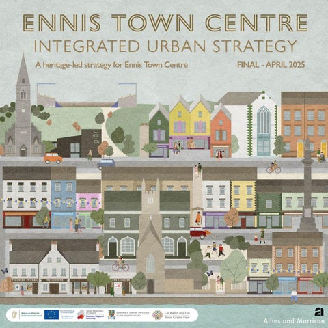
A heritage-led strategy for Ennis Town Centre
THRIVE
Town Centre First Heritage Revival Scheme
Invitation
Clare County Council invites you to join us for a drop-in consultation session on Thrive Ennis, a project that aims to breathe new life into a vacant, under-utilised heritage building in Ennis Town Centre. We’re seeking your input on how an historic space can be adaptively reused to address community needs and serve as a valuable resource for the town. Come share your ideas and help shape the future of this important project. Monday, 23rd September Time: 5-7pm LOCATION The Civic Room in the Buttermarket Building, Drumbiggle, Ennis
FINAL - APRIL 2025
E NN I S
ii
ENNIS TOWN CENTRE FINAL INTEGRATED URBAN STRATEGY
THR I V E
CONTENTS A INTRODUCTION 1 1.1 1.2 1.3 1.4 1.5 1.6
INTRODUCTION.................................................................... 2 Introduction ...................................................................... 2 Purpose of the IUS............................................................... 2 The study area.................................................................... 4 New European Bauhaus....................................................... 6 Planning policy context....................................................... 8 Ennis 2040 Strategy........................................................... 10
B UNDERSTANDING THE TOWN CENTRE
iv
8 8.1 8.2
ECONOMIC ANALYSIS.......................................................... 44 Economic positioning......................................................... 44 Key actions to support investment...................................... 45
9 9.1 9.2 9.3
LANDSCAPE....................................................................... 46 Natural features................................................................ 46 Flooding........................................................................... 48 Strategic movement........................................................... 50
2 2.1 2.2
STRATEGIC CONTEXT.......................................................... 14 Location in Clare............................................................... 14 Town centre context........................................................... 16
3 3.1
HERITAGE.......................................................................... 18 Existing historic buildings and structures............................ 22
4 4.1
CHARACTER....................................................................... 24 Character areas................................................................ 24
5 4.2
LEGIBILITY........................................................................ 30 Gateways and landmarks................................................... 30
10 MOVEMENT........................................................................ 52 10.1 Vehicular movement.......................................................... 52 10.2 Laneways and bow-ways.................................................... 54 10.3 Pedestrian and cyclist movement........................................ 56
6 6.1
LAYOUT............................................................................. 34 Urban Grain...................................................................... 34
11 QUALITY OF PUBLIC REALM................................................. 58 11.1 Spatial analysis................................................................. 58
7 6.2 7.1 7.2
DIVERSITY......................................................................... 36 Land use zones.................................................................. 36 Land Use and vacancy....................................................... 38 Community and civic uses.................................................. 42
12 ENGAGEMENT.................................................................... 60 12.1 Overview.......................................................................... 60 12.2 Stage 2 - Test and review.................................................... 60 12.3 Stage 2 - Test and review.................................................... 60
ENNIS TOWN CENTRE FINAL INTEGRATED URBAN STRATEGY
C VISION AND PROPOSALS 13 VISION AND THEMES........................................................... 66 13.1 Vision............................................................................... 66 13.2 Themes............................................................................. 66 14 HISTORIC ENNIS................................................................. 68 14.1 Overview.......................................................................... 68 14.2 Principles and key interventions......................................... 68 15 CONNECTED ENNIS............................................................. 70 15.1 Context............................................................................. 70 15.2 Key interventions............................................................... 70 16 EXPERIENCE ENNIS............................................................. 72 16.1 Context............................................................................. 72 16.2 Key interventions............................................................... 72 17 GREEN ENNIS..................................................................... 74 17.1 Context............................................................................. 74 17.2 Key interventions............................................................... 74
18 URBAN FRAMEWORK.......................................................... 76 18.1 Urban Framework............................................................. 76 18.2 Key projects...................................................................... 76 18.3 THRIVE project bid............................................................. 94 18.4 Conclusion........................................................................ 96 APPENDIX 1 - THRIVE BUILDING SELECTION................................... 98 APPENDIX 2 - CATCHMENT FLOOD RISK MAPS............................... 104 Copyright © 2025 Allies and Morrison No part of this document may be reproduced without the prior consent of the client. This document is prepared in support of Ennis Integrated Urban Strategy. Allies and Morrison and its collaborators are not responsible for nor shall be liable for the consequences of any use made of this Report other than that for which it was prepared by Allies and Morrison for the Client unless Allies and Morrison provide prior written authorisation for such other use and confirms in writing that the Report is suitable for it. It is acknowledged by the parties that this Report has been produced solely in accordance with the Client’s brief and instructions and without any knowledge of or reference to any other parties’ potential interests in or proposals for the Project. Every effort has been made to acknowledge the source of photographs and illustrations; we apologise for any errors or omissions.
A i
I N T ROD U C T IO N
ENNIS TOWN CENTRE FINAL INTEGRATED URBAN STRATEGY
1 INTRODUCTION
1.1
Introduction
THRIVE is a grant scheme aimed at local authorities, implemented under Ireland’s ERDF Regional Programmes for 2021-2027. It supports the transformation of publicly owned vacant or derelict heritage buildings within key town centres through renovation, renewal, and adaptive reuse. The scheme aligns with policies from the National Planning Framework and the Southern Regional Spatial Economic Strategy. As part of the THRIVE programme, we have prepared an Integrated Urban Strategy which will distill the key place-making opportunities for Ennis Town Centre. The Integrated Urban Strategy for Ennis will fulfil Action 21 of the Ennis 2040 Strategy – Economic and Spatial Strategy and will identify critical areas for intervention, prioritise projects that encourage the conservation and adaptive reuse of Ennis’ extensive built heritage, and address vacancy and dereliction in the Town Centre. The report is set out in three parts:
2
•
Part A: Introduction - setting the scene for the Integrated Urban Strategy, and situating the project in context.
•
Part B: Understanding the Town Centre - analysis of Ennis town centre to inform the Integrated Urban Strategy.
•
Part C: Vision and Proposals - identifying key themes and projects as the basis of the Integrated Urban Strategy, including scene setting for the preferred project for THRIVE funding.
ENNIS TOWN CENTRE FINAL INTEGRATED URBAN STRATEGY
1.2
Purpose of the IUS
The Integrated Urban Strategy aims to achieve the following objectives: •
Develop an Integrated Urban Strategy under Action 21 of the Ennis 2040 – Economic and Spatial Strategy to showcase Ennis’s heritage and architecture, support adaptive reuse of older buildings, and promote a circular economy at the local level under the following headings:
•
Embrace the new Bauhaus values of sustainability, aesthetics, and inclusion.
•
Prioritise project proposals that create a pipeline of investment-ready built heritage refurbishment, renovation, and adaptive reuse projects.
•
Review vacant buildings in Ennis Town to outline potential uses for investment.
•
Identify vacant heritage buildings/properties for community use through collaborative stakeholder engagement.
•
Engage in a participatory planning process to bring one heritage project through to a full planning process, making it shovel-ready for a THRIVE funding application.
It should be noted that Strategy aligns with the Clare County Development Plan 2023-2029.
1.3
The study area
Ennis, the largest town in Munster and the sixth largest in Ireland, is a designated ‘key town’ under the Southern, Eastern and Midland Regional Programme 2021-2027. Ennis serves as a critical commercial and cultural hub in the Midwest of Ireland. The town is intertwined with the river Fergus, which provides scenic views but also poses urban development and flood management challenges. Strategic investments have mitigated these flood risks, securing Ennis’s future growth. Ennis’s rich historical and cultural heritage is evident in its medieval streets, landmark buildings, and conservation areas, making it a prime location for heritage tourism. The town’s population of 27,923 (Census 2022) highlights its attractiveness as a place for living and employment. Despite its appeal, Ennis faces challenges in revitalising its town centre, addressing vacancy and dereliction, and meeting increasing housing demands while preserving its heritage and cultural identity. Figure 1 illustrates the Town Centre boundary which is the extent of the Integrated Urban Strategy. The plan highlights Protected Structures in the town centre, and other key locations.
1.4
SEA / AA Screening
Screening exercises have been undertaken in relation to Strategic Environmental Assessment and Appropriate Assessment by MB Planning and Delichon Ecology. The Integrated Urban Strategy is a non-statutory plan at the lowest level of the hierarchy. The implementation of the Strategy is not anticipated to lead to any significant environmental effects associated with its interactions with other plans. It has been prepared in compliance with higher-level plans and to augment their strategic planning and regeneration initiatives. Proposals in the Strategy, particularly those relating to the renovation of historic buildings and public realm, connectivity improvements, and green and blue network enhancements are expected to have positive effects on the environment and enhance the quality of the town centre. The Strategy is consistent with the Clare County Development Plan 2023-2029. The underlying Development Plan underwent a full Strategic Environmental Assessment and a robust level of assessment in consultation with Environmental Authorities. The Strategy will not lead to the alteration of existing objectives within the Development Plan. Environmental protective objectives contained within the Development Plan continue to apply. Any development arising from the Strategy will be assessed under the existing statutory planning framework and must comply with objectives of the Development Plan at detailed design stage. The findings of the SEA screening assessment recommend that the Integrated Urban Strategy is not likely to have significant effects on the environment and therefore, SEA is not required. The Appropriate Assessment Screening process concluded that there are no likely potential impacts, whether direct, indirect or cumulative/in-combination, which could give rise to significant effects on the qualifying interests or special conservation interests of any designated European Site, in view of their conservation objectives. Consequently, this strategy does not require Appropriate Assessment and can be screened out.
4
ENNIS TOWN CENTRE FINAL INTEGRATED URBAN STRATEGY
Tim Smythe Memorial Park
N18 to M18 to Galway
The Courthouse Crimean Cannon
D
R352 D
EL
OA
DS
CAU
RO
SA
CK
ND
SA
FI
D
The People’s Park
E R
C
ROA
NEW
EG
A
LL
P
CO
CU
RK
The Fair Green
AC
K R
D
RIV
N85 to Cliffs of Moher, Lahinch, The Burren, Doolin, Aillwee Caves, Lee’s Road Sport Amenity Centre
D
IDI
MILL ROA
NE
NS
MILL
M O N Y R O W ROW H A RHARMONY
ET TRE
R
E
F R A NF CR AI SN CS TI SR SETE T
Y
T
RE
BE
E YS
BE
B AB
BEBY
AB
CL
EET ELL STR O’CONN
P
Friars Walk Park Dunnes Stores Shopping Centre
K AL
NEL MO
DY
STR
P
Parish Centre
EET
S TS T A AT T I I OO N N
RO
RD
AV
EN
UE
ON
RK
CL
PA
RD
FR
ON O S’ TC T
O ’C
K S
LL
AC
NE
RR
UP
CAR
Holy Family Senior National School
FI ARR ’ S I AWA R SLK W
L S
K E T STREET
AR
BA
R M
ST
Friars Walk Car Park
STREET
MARKET PLACE
PE
DY
Monastery Park
RD
O
N
RM
O
CA
K
T
Ennis Market Building
ROAD
Glór Theatre
P
Clare Museum
P
P
K
REE
UUPPER P P E RMARKE M A RTKSTE T
RUMBIGGLE ROAD
The Friary
The Friary
ST
LN
N
Y ST IGGLE
HI GH
EY’S
Y’S L
MOD
DRUMB
ER D
EET
P
SU R OM A D
LIN
CAB
CABE
CAR
LOW
RHILL
LIN
T
SUMME
LL STR
The Arc Cinema
IL L M ER H
Poor Clare Monastry
AY
T S
STREET
AE WY
RKE
PARNELL
US
MA
PA RN
PARNE
EW
T
RN
H
EL L ST
CA
CO
REE
W W
Ennis Town Council
P
AY S QU U A Y VEY’ ’ S Q H AAR R V E Y
Q U AY AY O O OO DD Q U
Our Lady’s Franciscan Church
A
P
P
US
T ST
S FERGU RIVER
CA
RKE
AB
An Post Ennis
Post Office Field
Ennis Shopping Centre
ST
NMA
AC
TSRT EE
PL
Queen’s Hotel P ST
COR
NCKE
ST
ER RIV
Bank of Ireland
PBLAA
C IS
The Old Friary
US
ET
NK
AN
FE
HARMONY ROW
BA
G
ON
LAR CU CIR R474 to Milltown Malbay
St. Columba’s Parish Church
Y
Ennis Lawn Tennis Club
N S
T
P
FR
DO
R R
5
BIN
7 4L A RIR4C U D /C
N8
The Cloisters
ET
AD
AD
Clare Mart Cattle Mark
QUIN ROAD
ROAD
AD RO SH RU KIL
Architectural Conservation Area boundary
CLARE ROAD
Town Centre boundary
CL ARE RD
McNamara Park
TURNPIKE
A RO
RD
CCusack U SAC K Park PARK GA A PITC H G.A.A. Ground
D
TRE
RO
ROA
P
A OW
GUS
Ennis Garda Station
CO P
ER F ER
ENNIS BUS AND TRAIN STATION
Protected structure Civic/landmark building P
Car park
N68 to Kilrush, Kilkee Loop Head Pininsula
P
N18 to M18 to Limerick, Shannon Airport, Bunratty Castle and Folk Park
Fig 1 Map of the Study Area: Ennis Town Centre
Quin Ro Business
New European Bauhaus Compass A guiding framework for decision
“The New European Bauhaus (NEB) initiative is an enabler for the green transition of our societies and economy. It calls on all Europeans to imagine and build together a sustainable and inclusive future that is beautiful for our eyes, minds, and souls. It aims at transforming different sectors of economy, especially the built environment, making them contribute to our climate goals and to an improvement of the quality of life of all citizens.”
and project makers wishing to apply the NEB principles and criteria to their activities.
1.5
New European Bauhaus
The New European Bauhaus (NEB) sets a vital framework for the THRIVE funding programme. The Bauhaus is underpinned by three main pillars, “Sustainable, Beautiful and Together” which are defined as follows, each with three ambitions which reflect fundamental values of NEB. The following quotes are taken from the ‘New European Bauhaus Compass, 2022’.
aims at rethinking services, products and places to reduce pollution and carbon impacts and have minimum use of resources, materials and energy. It looks at the scale of a products’ lifecycle. Projects that repurpose are aware of the impact their initiative has on the environment and have the ambition to reduce their environmental footprint.” •
To close the loop: “A sustainable project aims to close the loop, reduce linear processes or transform them into circular processes to aim at zero pollution. It looks at the scale of an (industrial) system. Projects that close the loop actively involve all other actors in the cycle of the design, production, use and discarding phase of their initiative.”
•
To regenerate: “A sustainable project aims to give back more than it takes, enhancing rather than depleting biodiversity, incentivising the restoration and expansion of nature. Regenerative sustainability also considers how contexts and environments influence worldviews, paradigms, and behaviours. It looks at the scale of an ecosystem. Initiatives in this dimension are aware of the complete ecosystem they act in and their project’s impact over time and space on biodiversity and natural resources.”
THREE VALUES Aesthetics (“Beautiful”) Aesthetics refers to the overall quality of experience and style, beyond functionality: •
•
•
To activate: “A beautiful project improves the physical and mental well-being of individuals by considering their senses and emotions, on top of their needs. It activates the cultural, social, and natural qualities of a place to create unique and positive experiences. The project fosters awareness of place and heritage in all its diversity, while embracing its own aesthetic.” To connect: “A beautiful project enhances opportunities for meaningful social interactions and collective experiences. It reinforces a sense of belonging and enriches lives by connecting different places and people. The new attachments that emerge through the project foster openness and mutual care.” To integrate: “A beautiful project enables creation, and the collective re-invention of the places, lifestyles, and communities we identify with. It integrates new cultural and social values, notably through the meaningful experience of a broader ‘us’ (including the non-human world). In doing so, it aspires to anticipate future transformations, and may generate a long-lasting movement”
Inclusion (”Together”) Inclusion encourages valuing diversity and equality for all, and securing accessibility and affordability: •
To include: “An inclusive project grants accessibility (physical, cognitive, psychological, etc.) and affordability for all, regardless of gender, racial or ethnic origin, religion or belief, ability, age or sexual orientation. Equality of treatment and opportunities is essential but cannot be taken for granted, so it is important to prioritise less- represented individuals, groups and communities.”
•
To consolidate: “An inclusive project fosters and equalises relations between users and/or communities, safeguarding the principle of equal treatment and social justice over time. Inclusion and open access to services are secured by formal, structural mechanisms such as funding instruments, business models, planning, policies, regulations and other institutionalisation processes.”
•
To transform: “Inclusion inspires new ways of living together, building on solidarity and cooperation, raising awareness of discrimination and injustice. An inclusive project becomes exemplary and replicable, and has the potential to break obsolete social models, create value and bring transformative benefits on a societal level, influencing worldviews, paradigms and social behaviours.”
Sustainability Sustainability encompasses a wide spectrum of topics ranging from climate goals, to circularity, zero pollution, and biodiversity: •
6
To repurpose: “A sustainable project aims to repurpose in order to avoid and reduce environmental impacts and favours durability, adaptability, recyclability. It
ENNIS TOWN CENTRE FINAL INTEGRATED URBAN STRATEGY
About the Compass
3
Values
6
Working Principles
13
Examples
21
Participatory process
Sustainable
Together
Multi-Level engagement
Transdisciplinary approach
THREE WORKING PRINCIPLES Projects are encouraged to embrace three working principles: a participatory process, multi-level engagement and a trans-disciplinary approach. Working across these principles is intended to achieve the highest level of ambitions in the three values.
institutions (e.g. sectoral departments, political groups…) and/or and engages with them to influence the local living environment with a placed-based approach.” •
To work across levels: “A multi-level NEB project connects vertically informal networks (e.g. groups of individuals, neighbourhoods…) and/or formal institutions (e.g. government, administrations…) across various scales (e.g. single municipalities with regional authorities, local studies with international research programs), and engages with them to push single-scale initiatives beyond their own dimension (e.g. local, regional, national…).”
•
To work globally: “A multi-level NEB project that works at global level reaches for a wider, transformational impact beyond its initial, local scale of application and it connects networks and/or (inter)governmental institutions that, across various levels, share similar purposes looking at the future of the entire ecosystem”
Participatory process This relates to the involvement of communities in the design, decision-making and implementation process: •
•
•
To consult: “A participatory project features already-established communication channels and stakeholder participation. At this first ambition level, participation ranges from information-sharing about the project to consultation feeding into decision-making. The information flow is static and mostly one sided: the information flows from the project owner to its audience and then back” To co-develop: “A participatory project engages stakeholders as key partners and advisers in defining and/or co-creating the rules and objectives of the project. The emerging ideas are developed collaboratively by the project and its stakeholders The information flow is dynamic, exchanges are on an equal foot and information becomes co-designed.” To self-govern: “A participatory project aims to enable stakeholders to negotiate and engage in trade-offs with powerholders, at all stages of the project’s lifecycle (design, management, implementation, monitoring and evaluation) and empowers the community to make decisions and govern the project.”
Multi-level engagement Multi-level engagement encourages consideration of effects across different scales (e.g. local / global), fields (e.g. policy / activities) and times (e.g. short / long term): •
To work locally: “A multi-level NEB project connects horizontally informal networks (e.g. groups of individuals, neighbourhoods…), and/or formal
Beautiful
Transdisciplinary approach This refers to a desire to integrate knowledge and expertise from different disciplines to encourage more nuanced solutions: •
To be multidisciplinary: “A multidisciplinary NEB project aims to address a common problem within one field of knowledge. Working in a multidisciplinary way means working independently alongside other disciplines that engage in similar topics.”
•
To be interdisciplinary: “An interdisciplinary NEB project aims to address a common problem or issue involving two or more academic disciplines or fields of knowledge. Working in an interdisciplinary way means collaborating with other disciplines towards a shared goal.”
•
To be beyond-disciplinary: “A beyond-disciplinary NEB project aims to integrate both formal and non-formal knowledge to achieve a common goal. It aims to bring together people from political, social and economic fields with members of the public to explore possibilities and realise new narratives. By drawing on both local and traditional knowledge and cultural norms and values, it aims to supplement and transform scientific insights for the benefit of society.”
1.6
Planning policy context
National Planning Framework The National Planning Framework (NPF) is the government’s strategic plan for shaping the future growth and development of the country to 2040. The NPF is partnered with the National Development Plan (NDP), which outlines a programme of investment. Regional and local plans must align with shared National Strategic Outcomes of these plans. Southern Regional Spatial Economic Strategy The Southern Regional Assembly has prepared a Regional Spatial & Economic Strategy (RSES) for the Southern Region. The RSES provides a long-term, strategic development framework for the future physical, economic and social development of the Southern Region and includes Metropolitan Area Strategic Plans (MASPs) to guide the future development of the Region’s three main cities and metropolitan areas – Cork, Limerick-Shannon and Waterford. The RSES identifies Ennis as a Key Town which is well-connected to the Limerick-Shannon MASP, forming a key economic triangle. Clare County Development Plan 2023-29 The Clare County Development Plan sets out the overall strategy for the planning and sustainable development of the County over a 6 year period. The strategy aligns with the national and regional framework of strategies, polices and guidelines. Volume 3a sets out plans and policies for Ennis Municipal District. It states the following: “Ennis is a unique and vibrant town and has a proud history and an exciting future to look forward to. Ennis, the ‘Capital’ of County Clare, has a strong community focus, a young and well-educated population, a dynamic business and commercial sector and a thriving tourism sector based on national and international renown for heritage and cultural excellence. It is a great place to live, to visit and to do business.”
The Development Plan identifies an overall objective of supporting Ennis as “a self-sustaining, regional economic driver and as a key location for investment choice in the county and the Southern Region, and to support its enhanced development based on its strategic location relative to the cities of Limerick and Galway, Shannon International Airport and the Atlantic Economic Corridor as well as its role as a centre of employment and economic activity”. Other key priorities include: enhancing the public realm and the environment; encouraging enterprise and economic development, integrating green infrastructure, climate change and flooding; and developing of community and social structures in the town centre. The implementation of Ennis 2040 Strategy is also identified as a key priority. The Ennis 2040 strategy is summarised on the following page. The overall vision for Ennis town centre is set out below: “A vibrant and culturally rich Ennis area with a revitalised town centre and strong economic growth balanced with enhanced social inclusion, accessibility, sustainable neighbourhoods and a high level of environmental quality, to ensure an excellent quality of life for all” The Development Plan identifies a series of Transformational sites and Opportunity Sites. These sites are defined as drivers of change in the settlement area, opening up new lands for development in key locations, regenerating areas that have been at risk of decline, creating employment opportunities and providing new shops and services for local residents. Other local guidance The IUS also references other guidance which has been prepared for the town centre. These include Ennis 2040 Strategy (see section 1.6), Ennis Age Friendly Town Plan (2021) and Ennis Town Centre Public Realm Design Guide (February 2024) which is used actively in guiding streetscape and materials within the Architectural Conservation Area. The Climate Action Plan (20242029) identifies a framework for the reduction of greenhouse gas emissions and increasing climate resiliency, alongside supporting other Clare County Council objectives, such as improved economic development, service delivery and social inclusion. The IUS and THRIVE project also aligns with Clare Tourism Strategy 2030. These documents should be referred to as part of the development of the projects in Part C of the IUS.
8
ENNIS TOWN CENTRE FINAL INTEGRATED URBAN STRATEGY
Town Centre boundary Architectural Conservation Area boundary Transformational sites Opportunity sites
Fig 2 Opportunity and Transformational Sites in Ennis Town Centre
1.7
Ennis 2040 Strategy
Ennis 2040 Strategy defines a comprehensive Economic and Spatial Strategy which sets out a long-term strategy for the sustainable development of Ennis and addresses the measures required to manage economic, infrastructural, environmental and physical challenges, including transportation, demographic and population change, retail vitality and viability, availability of modern office and employment accommodation, environmental considerations and town centre accessibility. Key strengths Ennis 2040 Strategy notes that the town has significant advantages in terms of key assets and capacity:
10
•
Critical Mass: Ennis Town has a population of 25,276 making it the largest Town in Munster.
•
Strategic Location: Strategically located on the M18 between Limerick and Galway Cities.
•
Transport: Served by rail and proximate to Shannon International Airport and Foynes Port.
•
Retailing: Characterised by a “specialised” town centre, Ennis is the boutique capital of Munster.
•
Population: Population of Clare is forecast to rise by up to 15% by 2031.
•
Internet Speed: Access to high quality ‘dark fibre’ broadband.
•
Education: Excellent Schools & new LIT Ennis Campus with 7 Higher Education Institutes within 45 minutes.
•
Quality of Life: Ennis offers excellent quality of life, affordable living costs and is a welcoming and inclusive place.
•
Distinctive Character: Renowned as a centre of traditional music, Ennis has hosted significant events, including Fleadh Cheoil na hÉireann, Fleadh Nua and the Ennis Trad festival.
•
Brownfield Capacity: Ennis and its environs has Town Centre sites and locations to the east and west, with 23ha in Clare castle and 20.8ha at the Clare Technology Park.
ENNIS TOWN CENTRE FINAL INTEGRATED URBAN STRATEGY
Vision and guiding principles The strategy identifies a vision for the town: “‘Ennis will strengthen its role as a key regional economic driver and major tourist destination in the Mid-West through the expansion and diversification of its economic offering and by capitalising on the strength of its significant architectural, cultural and historic heritage. Its growth will be based on the ‘10 Minute Town’ Concept with the Town Centre at the heart of this highly accessible and revitalised Ennis - the focus for retail, residential, commercial, educational, leisure and cultural growth. Ennis will support, enhance and utilise its existing natural assets to lead the way as Ireland’s first Climate Adaptive Town’ and to create an accessible place of quality.” The vision is supported by 12 guiding principles: 1. Develop a distinctive Ennis. 2. Take advantage of the opportunities presented and supported by the AEC. 3. Realise the full potential of grey, green and blue infrastructure (road, air, rail and water). 4. Promote a high quality of life, health and well-being. 5. Maximise and enhance the opportunities offered by the scenic landscapes of Clare. 6. Ensure cross sectoral collaboration with neighbouring towns and cities. 7. Attract innovative industries and commerce. 8. Build a resilient and adaptable economy. 9. Deliver high quality and person-centred buildings and public realm. 10. Make Ennis known as a welcoming, connected and productive place. 11. Establish Ennis as a climate adaptive leader. 12. Carry out an Appropriate Assessment, Strategic Environmental Assessment and Strategic Flood Risk Assessment.
Spatial Implementation Plan Strategic objectives The strategy envisages that the population of Ennis will grow on average by 1.6% per annum to approximately 37,000 people by 2040. The plan proposes the prioritisation of sustainable economic activities by focusing on existing assets and creating a competitive offer unique to Ennis that will deliver an additional 5,000 jobs by 2040. The strategy is underpinned by four strategic objectives: •
SO 1: Location for Investment
•
SO 2: Ireland’s First Climate Adaptive Town
•
SO 3: Accessible Place of Quality
•
SO 4: A ‘10 Minute Town’
The Spatial Implementation Plan is required to give spatial expression to the economic Transformational Projects activities proposed, matching investment • Abbey Riverside opportunities with a plan for physical Action 21 development and strategic sites. In this regard, • Wetlands and Enterprise Area nine potential transformational projects form • Cornmarket Ennis 2040 Strategy defines a series of key actions which structure the main Precinct the basis of the land interventions and long-term outcomes in theactivation report. Action 21 sits under the broad • Friar’s Walk heading offor “AnEnnis Accessible Place of Quality” and seeks to “showcase the Strategy to 2040. Harvey’s Quay & Post Office Field unique heritage and architecture of Ennis, market and collective•achievements
ofThe thetransformational people and supportprojects adaptive can reusebeofdelivered existing older buildings exemplify • to Roche Opportunity Site and showcase reuse of buildings and achieve circular economy at local scale.”
over the short, medium and long-term, to • Former Ennis National School 2040, presenting the opportunity for the early • Data Centre (Toureen) The Integrated of Urban Strategy plays a and key role in embracing this Action and achievement multiple outcomes phasing • town Clare centre Technology Park establishing a heritage-led approach to the enhancement of the of more complex projects.
and the celebration of local identity and character.
Ennis Town Centre Sites 2
1
Abbey Riverside
Cornmarket Precinct
1
2
3
Spatial Implementation Plan
4
Harvey’s Quay
Friar’s Walk
3
Ennis 2040 Strategy identifies several transformational projects which form the basis of long-term land activation to 2040. It is important to note that proposals for Abbey Street car park and Harvey’s Quay are paused following a meeting with the Elected Members of Ennis Municipal District.
4
5Former Ennis National School 5 Transformational Projects 1. 2. 3. 4. 5. 6.
Fig 3 Transformative sites identified in the Ennis 2040 In delivering the Spatial Implementation Plan it is recognised that different areas
Cornmarket Precinct Abbey Riverside Transformational Projects Harvey’s Quay 1. Walk Cornmarket Precinct Friar’s 2. Abbey Former EnnisRiverside National School 3. Harvey’s Quay Wetland and Enterprise Area (not shown) 4. 5. 6.
Friar’s Walk Former Ennis National School Wetland and Enterprise Area (not shown)
This is because some areas are already performing well, some have specific
B 12
U N D E RSTA NDING TH E T OW N CENTRE
ENNIS TOWN CENTRE FINAL INTEGRATED URBAN STRATEGY
2 STRATEGIC CONTEXT 2.1
Location in Clare
Ennis is the administrative capital of Clare, operating as a key administrative and service centre. It occupies a strategic location in the Mid-West, situated between Limerick and Galway, and in close proximity to Shannon. The town centre is well-connected to these key destinations via rail and bus. The town has strong economic connections to Limerick City, the Limerick-Shannon Metropolitan area and Galway and its Metropolitan area which form part of the Atlantic Economic Corridor. Ennis is the gateway to a plethora of visitor destinations. These include the Burren and Cliffs of Moher UNESCO Global Geopark, Loop Head Peninsula, Lough Derg Blueway, the Shannon Estuary Way, Bunratty Castle and the Aran Islands.
Fig 4 Ennis’ strategic location in County Clare 14
ENNIS TOWN CENTRE FINAL INTEGRATED URBAN STRATEGY
SECTION B
N
2.2
Town centre context
The town centre forms the economic, cultural and social heart of Ennis and Clare. Figure 5 illustrates the location of the town centre at the scale of Ennis town. The town centre has a special historic legacy and unique character. The town centre has evolved over time and has become the focus for shops, businesses and community activities. The area benefits from a vibrant mix of uses which help to define a clear sense of place and identity. The plan highlights the strong presence of schools and larger parcels for business, commercial and utilities uses. The River Fergus, strategic road network (M18 and N85) and railway corridor create a clear geographical structure for the town, with the town centre sitting at the confluence of a number of historic routes.
Town Centre boundary Ennis retail core Other retail areas School/university/hospital Business Industrial area Special Protection Area Golf Club Quarry Water body Train line Train station
Fig 5 Ennis Town Centre context 16
ENNIS TOWN CENTRE FINAL INTEGRATED URBAN STRATEGY
SECTION B
3 HERITAGE The history of Ennis, uncovers how the town’s streets and spaces evolved in response to social, economic and cultural shifts over time, since the medieval period.
Ennis has a rich and layered history, dating back to the establishment of the Franciscan Friary. Throughout the medieval period, Ennis grew as a religious and market centre. Its strategic location contributed to its growth and importance, particularly during the 16th and 17th centuries, when it became a focal point in various conflicts. Ennis flourished in the 18th and 19th centuries with Georgian architecture and the establishment of civic and commercial buildings. Its growth continues today, whilst it focuses on the preservation and conservation of its heritage.
1540
11th Century Franciscan friary, 1784 Cooper, from ‘Brian Ó Dálaigh, Irish Historic Towns Atlas, no. 25, Ennis. Royal Irish Academy, Dublin, 2012’
Early Ennis Ennis was formed between two streams of the River Fergus, opposite the Clonroad Fort, which was built in 1210 by the O’Brien Kings of Thomond.
Over the next 400-years the Friary was developed and became a major religious centre and theological college, coupled with cloisters, dormitories and workshops.
The Friary was officially closed by King Henry VIIIs in 1540 Dissolution of the Monasteries. At this time, the Friary and its building were used as a courthouse and administration centre.
Ennis’s name is derived from ‘Inis Cluain Ramha Fhada’, meaning the Island Meadow of the Long Rowings, because boats were rowed against the current, from the Fergus Estuary to the island.
Street layout
Medieval carvings dating back to 1450-1470 can still be seen in the church and cloisters today.
1240
Ennis Friary The Franciscan monks arrived in Ennis and were befriended by the O’Brien, King of Thomond which was an ancient kingdom which covering all of Clare and much of Limerick and Tipperary. In 1282, O’Brien constructed a church on high ground where flooding from the River Fergus was less probable. It was built out of local grey limestone in an ornate Gothic Style, and slowly, the foundations of the Franciscan Friary were laid. This was a focal point for the community.
The McMahon tomb, 1470, showing the Passion Panel and carvings of Christ and his Apostles. 18
Dissolution of the Monasteries
The town’s layout began as a simple organic growth pattern, which was typical of medieval settlements, with narrow streets radiating from the Friary. Abbey Street (formerly Church Street), O’Connell Street (formerly Gaol Street) and Parnell Street (formerly Mill Street), originally linked the Square with the Friary, the Tower-House and the Mill, respectively.
Medieval Ennis, information gathered from ‘Brian Ó Dálaigh, Irish Historic Towns Atlas, no. 25, Ennis. Royal Irish Academy, Dublin, 2012’
ENNIS TOWN CENTRE FINAL INTEGRATED URBAN STRATEGY
1586
Capital of Clare Clare became a county in 1586 and due to its central location in the county, Ennis was chosen as its capital. During this time, activity in Ennis grew, with fairs and markets.
17th Century
Great Famine
The growth of the market town
The Great Famine of 1845-49 reduced the population greatly from 9,318 to 7,041 due to famine, fever and emigration. The town suffered greatly, as many people emigrated to seek better lives abroad.
The establishment of Ennis’ formal markets led to the development of public spaces. A grid-like pattern of growth began to emerge. The ‘Y’ street pattern that exists of Abbey Street, O’Connell Street and Parnell Street dates back to around 1680. These streets became a hive of trade and social activity. Buildings in this period reflected Georgian architecture, which strongly influenced the aesthetic of the town centre.
Railway comes to Ennis
Map of Ennis ,1842. © Clare Libraries
18th Century
Fire in Ennis
Unplanned growth
In 1749, a fire engulfed much of the town and destroyed around 50 houses.
Thomond’s financial difficulties led to the town’s properties being set to twenty-one head tenants, who over time became the virtual owners of the town. This lack of guiding power and regulating authority resulted in urban areas having a ‘haphazard and unplanned appearance, with lease-holders rather than the proprietor extending streets and opening lanes’ (Brian Ó Dálaigh, 2012). Many laneways in the town today still have the names of their 18th C leaseholders.
The Great Southern and Western Railway line was extended from Limerick to Ennis in 1859 and a station was built, which resulted in an unexpected reduction in population numbers as emigration by train was made easier.
Booming trade Trade and commerce boomed in the second half of the 18th century, and a new market square was laid out on the south-western edge of the town. Merchants were invited to build houses around the market square, and by the 19th century, the bustle of market trade had moved towards the new square, leaving the town the place of better shops and law courts.
The Presbyterian Church
1820 painting of Ennis courthouse and marketplace by William Turner de Lond © Ennis walking tours
19th Century
The Presbyterian Church was built in a Gothic Revival style on Harmony Row in 1856. The community, which had worshipped in the old Franciscan friary from the 1680s, moved to the new church in 1871. This led to the Friary being abandoned and falling into ruins.
The growth of Ennis’ economy Ennis’ expansion continued steadily. Roman Catholic Merchants who were forbidden to live in walled towns such as Limerick settled in Ennis, contributing greatly to the growth of the town. Economic trade ranged from clothing factories, flour mills and breweries.
Ennis Presbyterian Church
Early 20th Century
Shannon airport
Late 20th C
2010
Éamon de Valera
Shannon Airport opened to commercial flights in 1945, bringing foreign tourists to the town, many of whom used Ennis as a base upon which to explore Co. Clare.
Celtic Tiger years
Green Infrastructure
Ennis was one of Ireland’s fastest growing towns in the second half of the 20th century, as the country’s economy boomed due to foreign investment. This brought with it the expansion of commercial developments and building of housing estates, reflecting trends of car-centric design. This growth period ended during the 2008 global recession.
Initiatives to develop the River Fergus walkway began in early 2010, enhancing access to the river and promoting outdoor and active lifestyles.
In 1917, Sinn Féin selected de Valera to contest the East Clare by-election, which began his long association with the town. He would later become President of Ireland. Many Ennis men fought with the British and French armies during WWI.
Rise of the car During the 1970’s cars dominated the streets of Ennis, bringing the town’s narrow lanes to a virtual halt during market days. The process of widening lanes to allow for the free flow of traffic resulted in many of Ennis’ oldest buildings being demolished, and in turn much of the late medieval fabric of Ennis was lost.
1997
Ireland’s Information Age In 1997, Ennis became Ireland’s first Information Age Town, with a project that provided computers to residents, schools, and businesses. 2005
Bust of Éamon de Valera in Ennis de Valera Library
National Tidy Town
An aerial view of Ennis from 1970 © The Vintage Lens
Abbey Street 1910 © Ennis walking tours
20
ENNIS TOWN CENTRE FINAL INTEGRATED URBAN STRATEGY
Ennis won the national Tidy Towns competition for larger areas, drawing tourists in to visit the town.
Flooding in Ennis in 2010 © The Clare Champion
2014-Present
Heritage Conservation Between 2010 and 2012, restoration work was carried out on the historic Friary. The Built Heritage Investment Scheme was set up in 2014 which provided conservation for the restoration and conservation of historic structures. In 2018, parts of the town centre were designated as conservation areas, helping protect the historic character of the town. In 2021, Ennis won the Tidy Towns Competition. In 2023, Ennis won the International Communities in Bloom Competition.
Ennis Today
Town centre revitalisation Ennis has focused on revitalising its historic centre, whilst accommodating growth. The town has made efforts to enhance public spaces and pedestrian accessibility, through the development of pedestrian-friendly streets. Ennis continues to improve its public transport
3.1
Existing historic buildings and structures
Ennis Friary
The Cloister
St Columba’s Church of Ireland
Bank of Ireland
Ennis has an extremely rich heritage, and a distinctive range of buildings and structures remain in the town centre. There is major potential for this historic environment to be celebrated. The Council has identified the importance of Ennis as a late-medieval town centred around Chapel Lane, the Club Bridge area and the Old Ground Hotel. The town centre benefits from 117 Protected Structures, and much of the town centre is designated as an Architectural conservation area. The name Ennis is derived from Inis Cluain Rámha Fhada (The Island Meadow of the Long Rowing). Historically, boats were rowed, against the current, from the Fergus Estuary to the island. This area and name was subsequently divided into Ennis and Clonroad. The mediaeval town of Ennis developed around O’ Brien’s Castle at Clonroad and the nearby Franciscan Friary of Ennis, during the mid-thirteenth century. Although much of the late mediaeval fabric of Ennis was demolished during the 1960s and 1970s, many buildings, features and artefacts remain to indicate its early origins (Clare CoCo). Among these are: •
Ennis Franciscan Friary c.1280
•
The Old Ground Tower house c.1500
•
McParland’s House, Parnell Street c.1600
•
Cruises Pub, Abbey Street 1658
•
Abbacabra building Abbey Street c.1600
•
Brogan’s and Maurer’s O’ Connell Street c.1650
•
Wall plaque discovered during demolition at 10 Abbey Street, dated 1661
•
Wall plaque discovered during demolition, Lower Parnell Street, dated 1682
•
Stone gate hanger at rear of Tobin’s O’ Connell Street c.1600
•
Stone door hangers, at Leahy Associates (Architects), Harveys Quay c.1600
•
Vestiges of the old courthouse, The Square c.1630
•
The Cloister, Bar and Restaurant, Abbey Street c.1650
•
Former Presbyterian Church, Harmony Row, 1853
Promotion of archaeological heritage is a key priority for the IUS. It is important to note that the historic town core of Ennis, together with numerous individual recorded sites and monuments, are each subject to statutory protection in the Record of Monument and Places (RMP). 22
ENNIS TOWN CENTRE FINAL INTEGRATED URBAN STRATEGY
The former Presbyterian Church
Ennis community centre
Ashfield House
McParlands
Cathedral of Saints Peter and Paul
Terraces on Bindon street
SECTION B
Town Centre boundary Architectural Conservation Area boundary Sites and Monuments Record (SMR) Protected Structure Architectural Conservation Area
Fig 6 Heritage assets in Ennis Town Centre
4 CHARACTER “The positive features of a place and its people contribute to its special character and a sense of identity.”
4.1
Character areas
This area is adjacent to the River Fergus, the Friary Quarter, and the Historic Core. Buildings fronting Abbey Street are within the Historic Core, while the backs of these buildings are situated in the Abbey Riverside area. Whilst there is frontage onto the car park, the buildings have a larger more coarse footprint, with heights reaching four storeys in the area. The presence of the car park, changes in roof heights, roof pitches, architectural styles and building materials make the area feel less cohesive and tangible as a destination in the town. Despite these challenges, the River Fergus and the large trees on its western banks offer an opportunity to engage with the natural setting
Historic Core
Harvey Quay
The historic core of Ennis is defined by a distinctive ‘Y’-shaped street pattern formed by Abbey Street, O’Connell Street, and Parnell Street - originating from the Early Modern period (circa 1680). The streets exhibit narrow, intimate dimensions reflective of the town’s medieval origins. Traditional shopfronts, often influenced by Georgian and Victorian styles, feature symmetrical façades, sash windows, decorative stonework, and painted timber detailing. The colourful, human-scaled buildings, typically two to three stories high, incorporate large display windows and ornate hanging signs, contributing to a vibrant, inviting streetscape.
Harvey Quay shares many similarities with the Abbey Riverside area, however there is a more consistent frontage of shops onto the car park. Roof pitches and heights are similarly varied. Long ranging views to the Friary Quarter, the old mills in Cornmarket Street, and St Columba’ s Church give the area an open feel. In contrast to Abbey Riverside area, there are open views across the River Fergus into the Post Office Fields.
Friary Quarter This area represents the medieval core of Ennis, anchored by significant historic landmarks such as the Friary, Poor Clare Monastery, Franciscan Church, and the Queens Hotel. Its connection to the River Fergus, marked by the prominent Club Bridge, enriches its historical and architectural significance. The bridge, constructed with local cut limestone and solid stone parapet walls, reflects the town’s architectural vernacular, echoing key structures like the Friary and reinforcing the cohesive character of the built environment. Francis Street This area is reflective of the urban renewal of Ennis and is the ‘edge of town’ retail, leisure and entertainment district, and includes some residential homes. It includes venues such as glór, Cusack Park GAA Pitch, Tesco and Aldi. The area is characterised by wider roads, open space, car parks and buildings set back from the street, giving a less intimate feel than the core of the town centre. Friars Walk This area is the located to the back of the historic core and includes Dunnes and a surface and multi-storey car park. The area is bound to the east by Friars Walk road which is a wide, with set back buildings and a non-continuous building frontage.
24
Abbey Riverside
ENNIS TOWN CENTRE FINAL INTEGRATED URBAN STRATEGY
Harmony Row This area is rich in historic buildings including the Presbyterian Church, the terraces on Bindon Street and the County Library Headquarters. The presence of the Manse, Ennis Community College and Colaiste Muire school, including their associated parking and recreation areas change the character of the area from a historic, fine grained area, to a more modern institutional and civic area. Cornmarket Street This areas character reflects Ennis’s history as a thriving market and milling town during the 18th and 19th centuries. The street is closely tied to the milling industry, with remnants such as restored mill wheels providing hints of its industrial past. In this area, Cornmarket street is narrow with a continuous frontage and building line abutting the pavement, creating an enclosed and compact feel. The area features a mix of traditional stone and plaster buildings. Market Place This area combines a mix of traditional shopfronts, residential buildings, and small businesses. The street is also a key part of the town’s vibrant cultural life, hosting various events. The streets here are much wider than the historic core, giving the area a more open feel, but one which is more car oriented. Station Road This is a civic and education area and includes the development set back from Station Road, with car parking and green space fronting on to the road, giving the area an open and organic character.
Town Centre boundary Architectural Conservation Area boundary
Fig 7 Character areas in Ennis Town Centre
26
Street greening
Paving
Street trees are primarily located on roads which are wide enough to accommodate them. On narrow streets in the historic core, hanging baskets add vibrant colour and greenery to these charming and attractive streets. Larger, older trees are located near Harmony Row, the River Fergus and the Post Office fields. The variety of street trees, including Horse Chestnut, London Plane, and Lime trees add a variety of colours in the steetscape. The town has invested significantly in its streetscape through projects funded by the Urban Regeneration and Development Fund (URDF) and other local initiatives. The latest town centre streetscape enhancement incorporates Sustainable Urban Drainage Solutions.
Many of the pavements in the town centre are lined with cobblestones and feature a variety of finishes, including natural stone and decorative concrete, which blend well with the historic buildings and provide a seamless link to the medieval past of Ennis. Names of the laneways and bow-ways are embedded into the paving materials, creating a memorable, charming and legible pedestrian public realm. As part of the public realm improvement works on O’Connell Street and Parnell Street, there is new paving, which includes granite setts and Irish limestone, which enhance the visual appeal of the street and improves the functionality for pedestrians and vehicles alike.
ENNIS TOWN CENTRE FINAL INTEGRATED URBAN STRATEGY
Materials, textures and details Local limestone is the prominent building material used in historic buildings and bridges in the town centre. Some buildings, predominantly the shops, feature smooth stucco finishes which are painted on the ground floor with a variety of vibrant colours. The building materials reflect a blend of traditional Irish construction methods and modern building practices. The buildings Georgian and Victorian influences feature details such as Victorian semi-circle windows placed above the windows and entrance doors. Many of the buildings include symmetrical façades, sash windows, and decorative stonework, including quoins on the corners of buildings creating distinctive building outlines, which are legible in the streetscape.
28
Colour
Street art
Many of the buildings which are painted include a base colour on the first and upper storeys which a predominantly pastel and grey toned greens (as shown on the previous page). On the ground floors the buildings feature a diverse array of wonderful vibrant and pastel colours, contributing to the lively aesthetic of the town centre. Many façades are painted in bright, cheerful hues such as reds, blues, yellows, and greens. These colours are often combined with decorative detailing, particularly on traditional shopfronts, which include painted timber elements and colourful signage.
There are many vibrant and colourful murals and street art pieces scattered throughout Ennis town centre, reflecting numerous cultural, political, historical and social themes in Ennis. Negative Space Collective is an artist led initiative based out of Ennis, which has contributed multiple art installations across Ennis to provoke thought and celebrate local and global narratives. Other initiatives such as the Art Ways of Ennis, by Experience Ennis, saw artists including Mariana Duarte Santos create murals for laneways in Ennis. Mariana’s mural on Brady’s Lane featured a ‘Trad Music’ theme, celebrating Ennis’s incredibly successful trad music scene. Events such as Ennis Street Art festival contribute greatly to the creative character of the town showcasing temporary installations and live artistic performances. the Art Ways of Ennis (by Experience Ennis) was part of a larger PRISM project which funded other art works around the city.
ENNIS TOWN CENTRE FINAL INTEGRATED URBAN STRATEGY
Shop fronts The beautiful and colourful shop fronts in Ennis reflect the town’s historical and cultural evolution. Many shopfronts retain traditional features from the Georgian and Victorian periods, characterised by classical proportions and crafted details. These include painted timber façades, decorative cornices, and pilasters that frame large display windows. The use of transom lights, colourful signage, and handpainted details enhance the vibrancy of the streetscape. These shops create a very beautiful, memorable, and inciting public realm and shopping experience in the town centre.
5 LEGIBILITY “To promote legibility through development that provides recognisable routes, intersections and landmarks to help people find their way around.”
4.2
Gateways and landmarks
Gateways and landmarks are central in creating a distinctive, memorable and legible public realm. Ennis has a number of significant landmark buildings including Ennis Friary, the Daniel O’Connell Monument, the Cathedral of Saints Peter and Paul, St Columba’s Church of Ireland, the Poor Clare Monastery and Franciscan Church. These are all characterised by their tall stature, which punctuate the sky line. Important views highlight places where views to these landmarks are exceptionally good, and should be retained. The fine urban grain of Ennis and narrow streets with varying building heights and slight changes in topography can result in obstructions to these landmarks. In turn, to orient people and give them a sense of place, it is important to ensure streets and public places are memorable with a distinctive identity within the context of their character area (detailed on page 24). Street art, signage, the use of materials and colours and natural features such as the River Fergus can all help to support the identity of a character area. Clustering of uses is also very important for setting the context of a place. Gateways are entrance corridors into the town, and should set the character and scene of the context. It is important that these gateways provide a public realm which is distinctive, memorable and legible, proving streets which are inclusive and meets the needs of all modes of transport. There are five significant arrival gateways at the edge of the towns medieval core. The majority of these are old urban spaces, some of which are congested and hard to navigate. Views to key landmarks, and a legible network of streets to key nodes is imperative to creating a gateway where people have a strong sense of place and orientation within the town. Gateway 1 - Market Place: This area is located around the junction of four main streets and one laneway. The area has a different character to the medieval core, with wider streets and relatively low building heights. The area is currently congested with narrowed pavements, traffic, an abundance of parked cars, lack of safe pedestrian crossings and a cluttered public realm with onstreet parking, wands, bollards, signs and utility cabinets. Gateway 2 - The Height: This gateway is located within the medieval retail core, and centres around the junction of Abbey Street, O’Connell Street,
30
ENNIS TOWN CENTRE FINAL INTEGRATED URBAN STRATEGY
Parnell Street and Bank Place. The visual field of this space is limited due to the small size of the space and sloped topography. The legibility of the gateway is strengthened by the O’Connell statue which can be seen from a number of points in the town. There is a strong relationship between the O’Connell statue and the spire of Ennis Cathedral, orientating people well within the town and giving the street a sense of enclosure between the two points. There is also an important view between this gateway and the St Columba’s Church of Ireland along Bank Place, which is important to retain as it helps draw people towards the river Fergus. It is crucial that any future development does not restrict the strong visual relationship between these landmarks. Gateway 3 - Harvey Quay: This area is an important gateway for people entering the town from Bank Place, Abbey Street or Cornmarket Street. Views to the Friary can be seen looking east from the riverside. The river forms a natural barrier at the northern edge of town centre and thus this space needs to be highly permeable and offer opportunities to gather and socialise. Currently, the cars dominate the public realm, and there is a clear lack of pedestrian priority. Parked cars block the view of shop fronts and limit shops having the opportunity to spill out into the public realm. The visual relationship between the public realm and the river is limited, disconnecting people from this beautiful natural asset in the town. Gateway 4 - Friars Walk: This is located at the eastern edge of the medieval core and is a key route for those parking their car and walking into the heart of O’Connell Street. Arthur’s Row laneway in the north west corner of the car park is a pedestrian friendly route to O’Connell Street. Cooks Lane, located south of this, is an important link route however routes through a supermarket rear loading dock. It is important to improve this laneway, with improved lighting and street furniture such as planters and benches. Gateway 5 - Club Bridge: This gateway an important entrance point into the town centre navigating over the River Fergus. This area brings together two historic parts of the town; the civic and the retail. The Friary landmark is visible from several points in the town and allows people to navigate themselves towards this gateway. This is the first time people entering the town from the north east will have the opportunity to see the River Fergus and opportunities to enjoy this natural asset should be maximised in this location.
Town Centre boundary Primary gateway Secondary gateway Edge Landmark Key views
Fig 8 Legibility and wayfinding in Ennis Town Centre
1
32
1
2
3
4
2
3
5
6
4
5
7
8
Key views to landmarks
Gateways
There are a number of key landmarks in the town centre, where views towards them are particularly prominent, and thus important. Views towards the Friary (4), the Daniel O’Connell monument (1&2), Ennis Cathedral (3), including views from the station (5), and the St Columba’s Church of Ireland should be retained where possible, as they provide both historical significance in the town centre, visual diversity of the sky line, and aid in legibility and wayfinding.
Details about each of the gateways have been provided on the previous page. Photographs 1 and 2 show the Height gateway, where the Daniel O’Connell monument is located. The photographs show the public realm and street improvement works which are taking place (2024). Photographs 3 and 4 show the gateway at Harvey Quay; photographs 5 and 6 show the Market Place; and photographs 7 and 8 show the Club Bridge gateway.
ENNIS TOWN CENTRE FINAL INTEGRATED URBAN STRATEGY
Edge The town centre lies predominantly to the south of the River Fergus, which acts as a linear boundary in the town centre. The River Fergus, its twists and turns, has historically shaped the town’s layout and continues to guide its visual and functional structure. The high stone walls and overgrown trees and shrubs often restrict visibility to the river, acting as a visual barrier. The River Fergus whilst it limits movement and connectivity, must be better utilised and promoted.
6 LAYOUT “The positive features of a place and its people contribute to its special character and a sense of identity.”
6.1
Urban Grain
Urban grain refers to the degree to which an areas pattern of blocks and plots is subdivided, which may be either small and frequent (fine grain) or large and infrequent (coarse grain). The urban grain of a place can be understood through a figure ground plan, which gives clues to the morphology, density and structure of the town centre, by highlighting building footprints against roads and open spaces. The urban grain of Ennis is varied, with the historic core highly visible on the map, as characterised by an old haphazard medieval street pattern of narrow and winding laneways with fine-grained narrow buildings. These compact streets create a strong sense of enclosure, variety and charm. The urban grain of the town also hints to the town’s historic past. O’Connell Square, located at the junction of O’Connell Street, High Street, Abbey Street and Bank Place, has a prominent right-angled turn, reflecting the extent to which the old courthouse projected into the street. A Monument of Daniel O’Connell is now located in the space of the former courthouse. This fine grain gradually reduces, radiating out of the historic core. For example, the street pattern south of the river contrasts to the wide, formally planned Edwardian, Victorian and Georgian streets located north of the river. Areas to the east and west of the town centre become quickly more loose grained due to the presence of large retail units such as Tesco, Aldi and Dunnes which have large surface car parks, and there are areas of open green space and recreation areas, creating large gaps in the urban fabric. The character of the urban grain shifts again to a more formal layout of residential streets, many organised in continuous terraces, as opposed to large detached properties.
Photographs showing a variety of streets and building types, dictating the urban grain of the town centre
34
ENNIS TOWN CENTRE FINAL INTEGRATED URBAN STRATEGY
Town Centre boundary Architectural Conservation Area boundary Water Built footprint
Fig 9 Figure ground plan of Ennis Town Centre
7 DIVERSITY “The mix of uses (whether within a building, a street or an area) can help to determine how well-used a place is, and what economic and social activities it will support.”
6.2
Land use zones
Figure 10 illustrates land use zoning as designated in Clare County Development Plan 2023-2029. The land use zoning identifies sites that are designated for enterprise, commercial and industrial development. The Development Plan notes that “retail, tourism and cultural developments are also large employers in the local economy and the Council proactively supports these sectors”. The land use zoning, in combination with the opportunity and transformational sites, establishes a strong context for a diverse, vibrant town centre: “A thriving town centre is essential to ensure the future growth of Ennis and its environs. Therefore, town centre rejuvenation and expansion are central components of this plan...It is recognised that as the County Town, Ennis is the primary retail provider in County Clare and that it is necessary to ensure the town can continue to successfully fulfil that role in the future.” Ennis has Purple Flag accreditation which identifies town & city centres that offer an entertaining, diverse, safe and enjoyable night out.
Photograph of O’Connell Street
36
ENNIS TOWN CENTRE FINAL INTEGRATED URBAN STRATEGY
Town Centre boundary Architectural Conservation Area boundary Mixed use Commercial Enterprise Community Residential Utilities Transport Utilities Open Space Recreation Water Car park
Fig 10
Land use zones in Ennis Town Centre
USE 7.1
Land Use and vacancy
Alongside the THRIVE process, the Forward Planning Section of Clare County Council, undertook a survey of buildings in the town centre in late 2024. This included an assessment of specific uses in the town centre and vacancy. Existing land uses and vacancy The survey provides a detailed analysis of the existing ground floor uses in the town centre including vacancies. Figure 12 illustrates all ground floor uses (fig 1.15), and the following page highlights vacancies (fig 1.16). Based on GIS data, fig 1.14 summarises an estimated aggregated total ground floor space for each use category. The largest single ground floor use in the town centre is comparison retail (29.1%), followed by public / civic (17.7%). Calculating a combined total of all active “town centre” uses gives a total of 81.3%. Of the remaining ground floor areas, 11.3% is vacant and 5.3% is in residential use. Size of vacant ground floors Ground floor areas for vacant properties range from 22 sqm (GEA) to 1,060 sqm (GEA). The mean average ground floor area for vacant properties in the town centre (93 addresses) is 144 sqm (GEA). The median average is 81.4 sqm which is a more reflective average of the range of building areas. 61 vacant properties (65.6% of the total) are less than 100 sqm (GEA). Less than 20% of vacant properties have a vacant ground floor which is larger than 200 sqm (GEA). Vacancy of Protected Structures 25 Protected Structures were vacant at the time of the survey with a particular concentration in the historic core including Abbey Street and Parnell Street.
38
ENNIS TOWN CENTRE FINAL INTEGRATED URBAN STRATEGY
Retail Comparison Public/Civic Vacant Public House Residential Restaurant/Café/Takeaway Visitor Accommodation Other Retail service_ Health and Medical Health and Beauty Retail convenience Unknown Garage Repairs Financial and Professional Services Banking Services Legal Services Cinema Newspaper House Betting Office Brokers Insurance/Mortgage Funeral Home Nightclub Fitness Centre Total
GROUND FLOOR AREA (sqm)
34,563 21,041 13,390 6,428 6,296 5,705 5,428 4,442 3,330 3,165 2,754 2,542 2,055 1,701 1,491 1,324 816 781 597 411 277 176 78 118,789
PROPORTION OF TOTAL (%)
29.1% 17.7% 11.3% 5.4% 5.3% 4.8% 4.6% 3.7% 2.8% 2.7% 2.3% 2.1% 1.7% 1.4% 1.3% 1.1% 0.7% 0.7% 0.5% 0.3% 0.2% 0.1% 0.1% 100.0%
Fig 11 Building survey - uses and vacancy (data provided by Forward Planning Section, Clare County Council)
Town Centre boundary Architectural Conservation Area boundary Vacant at ground floor Residential Visitor accommodation Retail Health and beauty Newspaper House Restaurant/cafe/takeaway Public house Cinema Nightclub Betting office Fitness centre Garage Repair Funeral Home Health and medical Public/civic Legal services Financial and professional services Banking services
Fig 12
Land uses in Ennis Town Centre
Vacancy locations Fig 1.16 focuses on ground floor vacancy locations as identified in the September 2024 land use survey. The plan indicates that the vacant buildings are predominantly distributed across several core streets in and around the main town centre. These include: •
Abbey Street;
•
Francis Street;
•
O’Connell Street;
•
Market Place;
•
Parnell Street;
•
Cornmarket Street; and
•
Bindon Street.
It should be noted that the library buildings on Harmony Row have been vacant since November 2024.
40
ENNIS TOWN CENTRE FINAL INTEGRATED URBAN STRATEGY
Town Centre boundary Architectural Conservation Area boundary Vacant ground floor
Fig 13
Buildings with vacant ground floors in Ennis Town Centre
7.2
Community and civic uses
Trad music session
Ennis benefits from a diverse range of facilities which promote social and cultural development such as community centres, places of worship, sports centres, a museum, theatres and library. These facilities are central to the achievement of a high quality of life in Ennis. Key buildings are annotated on figure 14 (alongside other facilities in the immediate vicinity of the Town Centre boundary.) Clare County Development Plan underlines the strong community focus in Ennis, and supports provision of social and community infrastructure as part of future growth and enhancement of the town centre. The Development Plan references the ‘10 Minute Town’ Concept. This concept promotes the provision of all community facilities and services within a 10 minute walk or cycle from homes, or within access by public transport services.
2024 All-Ireland homecoming
Ennis Courthouse
© Ennis Community College
© glór
A key recent project is the new state-of-the art county library and cultural centre, “the De Valera Library and Súil Gallery”, which was officially opened by the Taoiseach in November 2024. In addition to community buildings, Ennis has a proud tradition of cultural activities including artistic and musical endeavours, many of which are celebrated in local community destinations such as glór. Music and associated events such as the Fleadh and Trad Fest are a significant part of the local cultural identity, attracting a high volume of visitors from the local area and beyond. The 2024 Trad Fest featured more than 20 venues with over 100 sessions across five days. Sport is also a major part of local community life. Fair Green hosted the All Ireland homecoming in 2024, celebrating Clare’s success in winning the AllIreland Senior Hurling Championship. The Integrated Urban Strategy offers an opportunity to identify a framework to enhance community provision in Ennis, a key focus for the THRIVE programme.
Clare County Library © Clare County Council
42
ENNIS TOWN CENTRE FINAL INTEGRATED URBAN STRATEGY
Town Centre boundary Architectural Conservation Area boundary Community centre Church Library Community entertainment venue Education facilities Court house
Fig 14
Community buildings in Ennis Town Centre
8 ECONOMIC ANALYSIS Ennis 2040 Strategy is founded on a comprehensive analysis of economic conditions in the town centre. Key findings are outlined in this section of the Integrated Urban Strategy for reference.
8.1
Economic positioning
Retail streets, with residential on upper floors
Ennis friary, now a tourist attraction
Cliffs of Moher - tourist destination close to Ennis
Residential located above businesses in Bindon Street
Leisure entertainment in the town centre
Range of independent and high street shops
Bank of Ireland
Independent, boutique retailers
An Economic Assessment and Competitiveness Review was undertaken by Avison Young. Key findings are outlined below:
44
•
Population: The Town Centre has a low proportion of young persons and a high proportion of elderly people.
•
Residential stock: Residential stock is dominated by housing in Ennis Urban area as a whole, with a 90:10 ratio with houses in favour of apartments. The split is more balanced in the town centre (50:50). Growth in residential sales in Ennis over the previous four years (350%) has outstripped the wider trends in Clare (20%).
•
Economic status: The Town Centre is characterised by a high proportion of retired persons (21%, against an average of 16% in Ennis) as well as a slightly higher proportion of unemployed people (13%).
•
Business performance: Ennis is defined by a high concentration of commerce and trade activities, particularly in its town centre. Ennis is characterised by a “specialised” town centre, known for a high concentration of retail sophistication and a high number of independent retailers with a strong local character specific of the area.
ENNIS TOWN CENTRE FINAL INTEGRATED URBAN STRATEGY
8.2
Key actions to support investment
Ennis 2040 Strategy defines ten actions to guide the future development of Ennis from an economic perspective. The strategy is underpinned by an assumption that the population of Ennis will grow by an average of 1.6% per annum which equates to 37,000 people by 2040. The proposals seek to facilitate an additional 5,000 jobs over the same period to support sustainable population growth. •
Action 1: Set out economic activities to prioritise and target sustainable economic activity at a local level by focusing on existing assets and creating a competitive offer unique to Ennis: This action seeks to attract investment and ensure that economic activities are sustainable. Key sectors include higher-end manufacturing, Science and Engineering, Information and Communications (ICT) and Tourism and associated local industries.
•
Action 2: Develop networks in high end manufacturing, enterprise, education and research with the aim of attracting inward investment and talent. This action seeks to tap into sub-regional growth in the Galway-Ennis-Shannon-Limerick Economic Network, with an emphasis on knowledge- and research-based activity.
•
Action 3: Utilising Local Authority assets (e.g. land) and access to funding sources (e.g. URDF) to establish an Ennis specific investment fund that accelerates and supports the provision of new forms of mixed residential and productive employment development by the private sector.
•
Action 4: Establishing area-based economic vehicles (can be public, public/private, public/semi state, public/institutional etc.) to purchase, hold and manage land/floorspace from an early stage in the development cycle with a focus on opportunity areas/strategic sites.
•
Action 5: Realise the delivery of nine transformational projects (buildings, public realm, transport etc.) that demonstrate a range of economic and social activity. Ennis 2040 identifies five transformational projects in the town centre which could be delivered in the short/medium term. These projects will enable a long-term vision for change, building confidence for investors.
Other key actions include the use of powers under the Derelict Sites Act 1990. The vacant property refurbishment grant and other interventions to address dereliction will be employed as appropriate to support he IUS.
•
Action 6: Build on Clare’s unique tourist attributes to create an offer of Ennis as a gateway and a location in its own right that competes nationally and internationally. This action focuses on capitalising on the distinctive historical, cultural and traditional music heritage, and position as a gateway to County Clare’s tourist destinations. Key to this is creating a modern tourist experience in the town centre.
•
Action 7: Ensure integration of employment land and identified strategic sites with transport improvement measures (public transport, walking/cycling routes, parking etc.). Key opportunities are summarised in subsequent sections of this report.
•
Action 8: Utilise the strategic location of Ennis to explore third level opportunities with adjacent cities (i.e. Galway and Limerick). Enhancing third level education provision will create employment, stimulate innovation and strengthen the knowledge economy in Ennis.
•
Action 9: Address policy gaps in national and regional strategies that are suboptimal for Ennis’s competitiveness and development. This overarching action seeks to amplify growth priorities for Ennis to encourage a longer-term vision for Ennis which aligns with broader regional priorities.
•
Action 10: Invest and improve IT infrastructure continuously to deliver high speed access.
9 LANDSCAPE “Integrating new development into its landscape setting reduces its impact on nature and reinforces local distinctiveness.”
9.1
Natural features
Ennis and its surroundings host a diverse range of wildlife habitats, including wetlands, woodlands, scrub areas, semi-natural grasslands, the River Fergus with its tributaries, and small water features like lakes and turloughs. Urban green spaces such as private gardens, public parks, school grounds, cemeteries, and sports fields also play a vital role in supporting biodiversity. Together, these natural and semi-natural areas form an integral part of Ennis’s green and blue infrastructure, providing essential ecological benefits and spaces for nature within the urban landscape. These areas also provide great recreational, health and wellbeing benefits to residents and visitors of Ennis. Notably, Cusack Park GAA Pitch is a greatly loved asset in the town centre. The River Fergus runs through the middle of the town centre. The river is part of the Lower Shannon Special Protection Area (SPA). Wetlands fringe much of the riverbank, offering vital resources such as food and shelter for a variety of wildlife, including birds, otters, and fish. These habitats play a critical ecological role, supporting biodiversity and maintaining the health of the river ecosystem. Its meandering course and the presence of mature trees along its banks create a harmonious relationship between the built and natural environments. The river has the potential to be a focal point for urban regeneration that celebrates its presence while enhancing accessibility and visibility. The use of local limestone in the bridges and adjacent structures ties the river into the town’s architectural vernacular, further embedding it within Ennis’s identity. The Post Office Field is located on a broad meander on the northern banks of the river, bound to the north by north west by Springfield Orchard and the north easy by Bank Place and Bindon Street. It is an ecological park and important wetland flood plain in the town centre, and one of the only large areas of green space. The field features a rich array of wetland habitats, including areas of wet grassland, willow scrub, and tall herb swamp. During summer, it becomes a vibrant display of wildflowers such as Meadowsweet, Purple Loosestrife, and Yellow Flag, alongside rushes and meadow grasses. This diversity of plant life supports the ecological value of the area, contributing to its importance as a natural habitat. Further information on green infrastructure planning can be found in the Ennis and Environs Green Infrastructure Plan 2014. Photographs showing a range of green and blue spaces in Ennis
46
ENNIS TOWN CENTRE FINAL INTEGRATED URBAN STRATEGY
Town Centre boundary Architectural Conservation Area boundary Water Open Space Recreation G.A.A pitch Vegetation Gardens Graveyards
Fig 15
Landscape and public realm in Ennis Town Centre
9.2
Flooding
Ennis Flood Relief Schemes: Ennis has a strong history of flooding which has led to the delivery of a number of flood relief schemes in Ennis and along the River Fergus. Ennis Urban District Councillors sought funding for a Flood Study of Ennis following flooding in 1995 and 1999 after floods in 1989 &1993. A Technical Steering Group including representatives of Clare County Council, Ennis UDC, OPW Drainage, Consulting Engineers and Hydrologists was set up and information was gathered from the Public and Affected Business Groups and Residents. The Flood Study was completed by June 2001. The recommendations of the Flood Study resulted in the following Flood Relief Projects that are now completed:
48
•
OPW River Ferus Upper (Ennis) Certified Drainage Scheme: Michael Mc Tigue Bridge to Bank Place Bridge
•
OPW River Fergus Lower (Ennis) Certified Drainage Scheme: Bank Place Bridge to Doora Bridge including Foir Uisce and Aughateeroe
•
Ennis South Flood Scheme: Doora Bridge to N85 Bridge West Bank including storm overflow culverts from St Flannan’s College and Ballybeg Lake
•
Lough Girroga Flood Relief Scheme
•
Watery Road Flood Relief Scheme
ENNIS TOWN CENTRE FINAL INTEGRATED URBAN STRATEGY
The Flood Relief Projects have resulted in most of the flood affected areas in the Town Centre having 1% AEP (Annual Exceedance Probability) flood protection. The Town Centre area has not experienced fluvial flooding since the significant flood event in November 2009 following the completion of the Upper Scheme in 2009, the Lower Scheme in the mid-2010s and the Ennis South Flood Scheme in the early-2020s. In the 2009 flood, the recently completed flood walls at Woodquay and Harvey’s Quay and the associated storm drainage and pumping facilities saved Ennis Town Centre from significant flooding. Ennis town Centre is protected from tidal flooding by the River Fergus Tidal Barrage at Clarecastle and tidal embankments downstream of the tidal barrage. The OPW Catchment Flood Risk Assessment and Management (CFRAMs) maps for the River Fergus are under review at present to take account of Ennis South Flood Scheme Protection (see Appendix 2). The existing maps are attached with the hatched area representing area with 1% AEP Flood Protection. Area adjacent or between hatched area such as the Height are white as they are above flood levels.
Photographs of the River Fergus
9.3
Strategic movement
Ennis is located directly adjacent to the M17/M18 Gort to Tuam Motorway, providing excellent connectivity to Limerick and Galway. It has good road connections to Shannon, which is a major employment centre and host to Shannon Airport via M18 and N19 roads. Ennis is also in close proximity to Shannon Foynes Port which is a key international freight destination. Within a 20 minute drive of Ennis, Shannon Airport provides a range of international and domestic flights. Ennis is a key transport gateway to major tourist destinations on the Wild Atlantic Way in West Clare, including the Cliffs of Moher. Train services connect Ennis directly to Galway and Limerick. Transfers to Dublin, Cork and Waterford can be made at Limerick Junction. Regional bus services connect Ennis to Galway, Dublin, Cork, Limerick and Shannon Airport. The National Planning Framework promotes a number of strategic proposals to enhance the inter-urban rail network, as well as the regional/national network of bus routes. These are designed to support broader growth objectives. Ennis 2040 Strategy identifies a number of key proposals which will benefit Ennis including the following:
50
•
Enhance the Ennis, Shannon Airport, Shannon Free Zone, Limerick Commuter Corridor through the provision of direct and increase frequency bus services.
•
Increased bus services on the Limerick to Galway corridor operating via Ennis.
•
Upgrades to the bus and train stations in Ennis to maximise opportunities for transfer between rail and local / regional bus services.
•
Improve sustainable linkages to the bus and train stations through the provision of enhanced cycle facilities and cycle parking.
•
Enhance coach parking facilities to support Ennis’s plans to develop tourism related activities.
•
Provision of high quality bus stops and bus shelters with Real Time Passenger Information (RTPI).
•
Expansion of the Rural Transport Programme and enhanced local transport integration.
ENNIS TOWN CENTRE FINAL INTEGRATED URBAN STRATEGY
Fig 16
Strategic movement from Ennis Town Centre to surrounding towns, cities and tourist destinations
10 MOVEMENT “To promote accessibility and local permeability by making places that connect with each other and are easy to move through, putting people before traffic and integrating land uses and transport.” 10.1
Vehicular movement
The town centre benefits from its proximity to the M17/M18 Gort-to-Tuam Motorway, ensuring strong connectivity to both Limerick and Galway. It also has convenient road access to Shannon, which is a significant employment hub and home to Shannon Airport, via the M18 and N19 routes, the N85 Relief Road provides direct access from the M18 to the N68, R474 and N85 giving direct access to West Clare and North Clare without having to travel through Ennis. Additionally, Ennis serves as a key transportation gateway to prominent tourist attractions in western County Clare, such as the Cliffs of Moher and the Burren National Park. The town centre suffers from congestion at key junctions and inadequate infrastructure to accommodate current traffic volumes during peak hours. O’Connell Street often experiences congestion as it acts as a release to school traffic from the group of schools north of Club Bridge at peak times. Longterm strategies, such as provision of a town bus service, improving active travel capacity to provide alternate means, improving junction capacities, completing the Northern Inner Relief Road and additional bypass routes, are in the planning phase. These projects are designed to provide alternate means of transport, redirecting through-traffic away from the town centre, enhancing traffic flow and accessibility throughout Ennis while maintaining its pedestrian-friendly character. The town centre includes a number of surface and multi storey car parks, which could be creatively used for public and community purposes. Part of Parnell Street and Upper Market Street are permanently pedestrianised. Pedestrianisation has been a significant topic of discussion, particularly for enhancing the town’s historic character and making it more pedestrian-friendly. Temporary measures were introduced on O’Connell Street from March 2020 to September 2021 to facilitate social distancing during the COVID-19 pandemic. A survey conducted in October 2021 found strong public support for pedestrianisation. Despite this support, there are concerns among retailers that pedestrianisation could lead to reduced access for customers, encouraging visitors to areas which are accessible by car. Currently, the street is closed to traffic to facilitate construction of the Public Realm works. The future use will be informed following completion of the Local Transport Plan which will shortly be put on public display. The town centre is well-connected by train, with its station forming part of the Western Rail Corridor. Train services connect Ennis directly to Galway and Limerick. Transfers to Dublin, Cork and Waterford can be made at Limerick Junction. The Ennis Town Bus Service is expected to be in operation by late 2025 or early 2026 and will provide access to the Bus and Rail station. 52
ENNIS TOWN CENTRE FINAL INTEGRATED URBAN STRATEGY
Photographs showing a range of roads, car parks and junctions in the town centre
Town Centre boundary Architectural Conservation Area boundary Second road Third road Fourth road Pedestrianised road P
Fig 17
Car park
Vehicular movement in Ennis Town Centre
Barrett’s Lane
10.2
Merchants Square
Lysaght’s Lane
Arthur’s Row
McNamara Lane/Friary Bow
Brewery Lane
Shank’s Lane
McDonnell’s Row
Quin’s Bow
Murray’s Lane
Engraving on laneways, assisting with wayfinding
Westby’s Lane
Laneways and bow-ways
Ennis is renowned for its charming and atmospheric laneways and bowways, which significantly contribute to its historic character. A bow-way, a term unique to Ennis, refers to a specific type of laneway or narrow street characterised by a covered pedestrian passage curving or “bowing” around buildings. This distinctive feature is heavily influenced by the medieval street layout, where such passageways linked busy tenement areas to the main streets of Ennis. Historically, rows of tenement buildings extended towards the River Fergus, most of which housed the poorer population due to the flood risk near the river’s edge. The laneways of Ennis were also integral to its medieval street layout. These narrow, winding passages, often cobblestone-paved, provided access to homes, shops, stables, and served as short cuts between streets. They were bustling routes, particularly when the town centre thrived with a labouring population before the Great Famine. However, in the 1960s, many laneways and bow-ways near the river were cleared to accommodate car parks. A curved wall along Chapel Lane, visible on historic maps, is believed to mark the location of a historic bow-way. The laneways and bow-ways that still exist today remain essential to the pedestrian movement and permeability of the town. All these streets are located within the Architectural Conservation Area (Fig. 1.6 on page 21). As part of the Clare County Heritage Plan 2017–2023, a project was initiated to revitalise and regenerate the laneways and bow-ways in the medieval core through enhancement measures. The aim was to encourage increased pedestrian activity, contribute to a high-quality public realm, reinforce the heritage character of the medieval town centre, and promote these features as a key attraction in Ennis (Enhancement of Laneways in Ennis, 2018). This vision was realised for all publicly owned laneways through the completion in 2022 of the Ennis Public Realm “Parnell Street, the Laneways and Bow-ways Project” which was 75% funded through the Urban Regeneration and Development Fund as part of Project 2040.
54
ENNIS TOWN CENTRE FINAL INTEGRATED URBAN STRATEGY
Chapel Lane
1.
River Lane
2.
Enright’s Bow
3.
Halloran’s Lane
4.
Brady’s Lane
5.
Barrett’s Lane
6.
Salthouse Lane
7.
Brewery Lane
8.
Howley’s Lane
9.
Fahy’s Lane/Cork Alley
10. Cabey’s Lane 11. Curtin’s Lane 12. Merchants Sqaure 13. Chapel Lane 14. Murray’s Lane 15. Lysaght’s Lane 16. Thompson’s Lane 17. Arthur’s Row 18. Lysacht Lane/Scabby Lane 19. Shank’s Lane 20. Post Office Lane 21. McDonnell’s Row 22. McNamara Lane/Friary Bow 23. Boland’s Lane 24. Quin’s Bow 25. Cook’s Lane 26. Westby’s Lane 27. Bindon Lane 28. Old Friary Lane 29. Lane to Harmony Row Pedestrian laneways Vehicular laneways
Fig 18
Laneways and Bow-ways in Ennis Town Centre
10.3
Bollards are used on a number of the streets to stop cars encroaching onto pavements
Street furniture on O’Connell Street providing places for rest
Bike parking at key destinations and gateways
Bike parking is not overlooked by active frontage
Bike parking located in the middle of a carriage way
Some laneways are cluttered with bins and servicing uses
Shops can spill into the public realm on pedestrianised streets
Some laneways are cluttered with bins and servicing uses
Pedestrian and public transport movement
Ennis town centre is relatively permeable, with numerous laneways and bowways providing connectivity in and around the area. While recent upgrades to pedestrian zones have improved accessibility and safety, some streets remain difficult to navigate, particularly for those with mobility aids or strollers, due to limited space. High levels of vehicular traffic and the presence of on-street parking contribute to an unsafe and car-dominant public realm in certain areas. In the Town Core, to overcome the challenges attached to a narrow streetscape, the used of Shared Surfaces has been introduced with a consequent reduction in speedlimits to 30km/h, with has a hierarchy of users with the pedestrian being to the fore. The town offers a variety of cycling routes that enhance connectivity and support sustainable urban mobility. Key routes, such as those linking Ennis to nearby areas like Newmarket, Sixmilebridge, and Lahinch, provide options ranging from urban commutes to scenic rides through rural and coastal landscapes. While these routes cater to a range of cycling abilities, there is a need to further develop dedicated cycling infrastructure within the town to prioritise active travel and reduce car reliance. Ennis is served by several bus routes that provide convenient access to nearby towns and cities, including Galway, Dublin, Cork, Limerick, and Shannon. Bus Éireann operates intercity routes like Route 51 (Galway-Ennis-Limerick-Cork) and Route 350 (Ennis-Galway via the Cliffs of Moher), while Limerick Clare Local Link, a non-profit community transport service, addresses rural mobility needs. Despite this coverage, some areas, such as Cusack Park GAA Stadium, Market Square, and Harvey’s Quay, have limited bus service. To address this, the Clare County Development Plan (2023–2029) prioritises the introduction of a dedicated town bus service to improve accessibility and support sustainable development. Clare County Council has worked closely with the National Transport Authority on the introduction of a new town bus service. Design is at an advanced stage with routes, bus stop locations, and frequency of service identified. It is anticipated that it will be introduced in 2026. A walking isochrone map centred on Market Square indicates that much of the town centre lies within a 10-minute walk. However, the train station lies outside this range, highlighting the importance of reliable bus connections, particularly for elderly residents and those with limited mobility. In a 2021 survey conducted by Ennis Municipal District as part of the Ennis Mobility Plan, 77.5% of respondents identified driving as their primary mode of transport into the town. Nonetheless, 71.2% expressed a desire for some level of pedestrianisation, with 36.5% favouring full-time pedestrianisation and 44% supporting a timed approach (11 a.m. to 6 p.m., seven days a week). To facilitate pedestrianisation, it is essential to ensure accessible car parks outside pedestrianised zones, enabling smooth traffic flow and encouraging walking within car-free streets.
56
ENNIS TOWN CENTRE FINAL INTEGRATED URBAN STRATEGY
Signage is used down alleyways to assist in wayfinding
Flush paving with subtle change in paving material to distinguish with the between pavement and carriageway whilst integrating them
Occasional car parking make the town accessible whilst not overloading it with parked vehicles and traffic
Construction work will make the town more accessible
Town Centre boundary Architectural Conservation Area boundary Bus stop Bus route Proposed new Ennis town bus service - NS1 Proposed new Ennis town bus service - NS2 Existing pedestrian bridge Potential opportunity for new pedestrian bridge Pedestrian footpath Laneway/bow-way 10 minute walking isochrome Pedestrianised Road West Clare Railway Greenway Ennis train station Train line Coach Park
Fig 19
Pedestrian and public transport in Ennis Town Centre
11 QUALITY OF PUBLIC REALM “To promote public spaces and routes that are attractive, safe, uncluttered and work effectively for all in society, including disabled and elderly people”
11.1
Spatial analysis
Ennis has a range of spaces, which have developed throughout history, contributing to the town’s interest, activity, and charm. Key public squares in Ennis include O’Connell Square, Barrack Square, Cathedral Plaza, Abbey Street and Tim Smyth Park. These spaces serve as focal points for community life, hosting events, markets, and gatherings that animate the town centre. The Ennis Public Realm Regeneration Project is currently in progress, with work being carried out in phases and set to be completed by 2025. The project aims to improve accessibility, enhance the historic town centre, create a safer and more attractive public realm, and support local businesses and investment. This will be achieved through the upgrading and remodelling of various streets and laneways, including the creation of a new a café quarter. The project focuses on streets such as O’Connell Street, High Street, and Bank Place, as well as squares including O’Connell Square, Barrack Square (including Old Barrack Street), and Cathedral Plaza. This project builds on the successful delivery of significant public realm enhancements at Parnell Street and town laneways and bow-ways in 2020 and 2021. Retail frontages in Ennis town centre vary from bustling pedestrian areas with vibrant shops and restaurants to quieter spaces, where vacant or underutilised buildings may be present. The presence of vacant properties, particularly on high streets and prominent corners, poses challenges to the town’s vibrancy and economic activity. Addressing these vacancies is a priority in order to attract new businesses and convert these spaces for residential, cultural, or community use. The Ennis Public Realm Regeneration Project seeks to address these issues, by enhancing pedestrian accessibility, enhancing the streetscape, providing additional planting and seating, all of which should make the town centre more accessible and vibrant, improving dwell time, and making it a more attractive place to live and work. The project aims to create a cohesive and interconnected public realm that enhances the town’s historic character while fostering a town centre that supports economic growth and sustainability. By upgrading the public realm and enhancing key retail frontages, Ennis seeks to attract investment, stimulate footfall, and promote a high-quality living and shopping experience for residents and visitors alike. Currently, the street is closed to traffic to facilitate construction of the Public Realm works. The future use will be informed following completion of the Local Transport Plan which will shortly be put on public display. 58
ENNIS TOWN CENTRE FINAL INTEGRATED URBAN STRATEGY
Photographs showing a range of streets in Ennis, including the high streets and other laneways and car parks
Town Centre boundary Architectural Conservation Area boundary Pedestrian laneway/bow-way Vehicular laneway/bow-way Car park Public square Public realm regeneration project Primary retail frontage Secondary retail frontage Vacant building
Fig 20 Spatial analysis of public realm in Ennis Town Centre
12 ENGAGEMENT
12.1
Overview
In line with NEB principles, the IUS and THRIVE bid have been developed through a regular dialogue with the local community and key stakeholder which has been accessible and inclusive. The events have targeted a broad range of local people including adults, community groups and young citizens from local schools. A total of 406 people attended our consultation events which were held over four stages. The following stages of engagement undertaken included:
60
•
Stage 1 - Listening (September 2024) - Initial engagement to understand key priorities for the IUS and the selection of potential buildings for a future THRIVE bid.
•
Stakeholder engagement (September to December 2024) - The team has undertaken targeted engagement with local stakeholders and relevant statutory bodies to explore potential projects.
•
Stage 2 - Test and review (October 2024) - a second round of public consultation took place in the town centre. This included a primary and secondary schools event, as well as an evening drop-in session open to all. These sessions were information gathering exercises which sought local knowledge of the town and asked for views on aspirations for the future, possible opportunities, and local needs. These events explored potential activities in three short-listed buildings, and wider priorities for the IUS.
•
Stage 3 - Update on THRIVE (December 2024) - Proposals for The Cloister, our priority project for THRIVE funding were shared with a local school, and members of the public.
•
Part VIII consultation (December 2024 to February 2025) - our Part 8 proposals for the Cloister were subject to formal consultation as part of the Part VIII application process.
•
Stage 4 - Test and review of emerging IUS (March 2025)- final engagement event to review the vision, themes and key projects in the IUS.
ENNIS TOWN CENTRE FINAL INTEGRATED URBAN STRATEGY
12.2
Stage 1 - Listening
Outcomes from the first engagement session are set out below: •
Strong support for a THRIVE bid, and genuine enthusiasm for the opportunities presented.
•
Support for heritage buildings, particularly the Cloister, recognising the significance of the building in terms of historic value, strategic location adjacent to the River Fergus and Ennis Friary, and potential for genuinely transformative impact in a flexible range of community and other Town Centre uses.
•
Positive sentiments about several other Protected Structures which could be identified as opportunities as part of the Urban Design Strategy and support for a wide range of potential uses, and reference to several local Community Groups who might play a role in activating an adapted building.
12.3
Stage 2 - Test and review
In total there were 50 primary school students and 72 secondary school students. Students were asked to draw floorplans for community uses in three frontrunner buildings. In addition, students were asked to draw or write on coloured flags about their favourite place in Ennis. In the evening, local residents and stakeholders reviewed emerging floorplan options for each of the buildings. These focused on arts-led spaces, craft spaces and flexible community / performance space. They also fed back on wider priorities for the town centre to inform the IUS. The engagement exercise generated a range of constructive feedback for the IUS: •
Identification of historic buildings for renovation: Attendees fed into our evaluation of a potential building for a THRIVE bid. In addition, several other buildings were highlighted, which the team has considered in developing projects for the IUS. The Cloister received the highest volume of feedback of the three buildings, and there was positive sentiment expressed for an art-led approach.
•
Pedestrian-friendly environment and vehicular access: Several participants emphasised the importance of maintaining and enhancing pedestrian spaces while addressing the balance with car access.
•
Amenities: There was a strong demand for more diverse and accessible facilities that cater to both residents and visitors. The comments reflected a desire for expanded retail and leisure options, with several requests for a larger shopping centre to accommodate a broader range of stores.
Photographs from our evening workshops with the local community during stage 1 and 3
•
Active, outdoor spaces: Outdoor spaces were also highlighted, with a request for more parks or walking areas to promote relaxation and social interaction.
•
Community spaces: Comments about community spaces focused on the need for places that foster interaction, leisure, and community building. The suggestion to keep the town centre pedestrian-friendly and to enhance public spaces, like open-air markets or seasonal events, was a recurring theme.
•
•
Importance of heritage: The importance of the town’s heritage was also mentioned in relation to community spaces, with recommendations to preserve historic buildings and incorporate them into new gathering places. Economic benefits: Respondents recognised the potential economic benefits that could stem from creating a new space in the town. The proposals for craft or arts spaces are seen as a way to draw visitors to Ennis, providing opportunities to engage with the local creative industries and attract tourists.
12.4
•
Strengthening the themes in the IUS: Attendees suggested various additions to the IUS including strong reference to the Ennis Age Friendly Town Plan (2021), opportunities for public transport enhancements and further references to grassroots / community arts groups and facilities.
•
Updates to projects: Attendees made constructive observations about the draft projects in the IUS. These comments have been reflected in the final version of the IUS.
12.6
Consultation on final draft, March 2025
Clare County Council published a draft final IUS for public comment in March 2025 following the stage 4 workshop. A number of supportive comments were submitted, alongside constructive feedback which was incorporated in the final version of the IUS for adoption.
Stage 3 - Update on THRIVE
A2 Architects led workshop sessions with a local primary school and the community. in advance of the submission of the Part VIII application for the Cloister. These sessions demonstrated support for the emerging proposals for the building including the flexible programme of community and artsled activities. Animation of the external elevation through the art wall was particularly well-received.
12.5
Stage 4 - Test and review, March 2025
The local community and stakeholders were invited to a test and review dropin session to comment on the emerging vision, themes and proposals in the IUS We also shared an update on the Part VIII proposals for the Cloister. The following feedback was received: •
62
Strong support for THRIVE proposals for the Cloister: There was strong support for the proposals for the rejuvenation of the Cloister. Attendees welcomed the interventions to the building, and supported the proposed programme of uses. Flexibility to accommodate a range of activities was welcomed, and a number of local groups indicated that they would be keen to use the building, and work with the Council to support the development of an activities programme.
ENNIS TOWN CENTRE FINAL INTEGRATED URBAN STRATEGY
Photographs from our final event to test and review the draft IUS
Megan - Colaiste Muire
Charlie and Liam - CBS
Burren - Colaiste Muire
Emma and Millie - CBS Primary School
Olivia - Holy Family Senior School
Eli and Beth - Holy Family Senior School
Shruti - Colaiste Muire
Axel - Holy Family Senior School
Darren and Anir - CBS
C 64
V I SI ON A ND PR OP OSA L S
ENNIS TOWN CENTRE FINAL INTEGRATED URBAN STRATEGY
13 VISION AND THEMES A vision statement and four key themes have been developed in response to our analysis of Ennis town centre and engagement with local people and stakeholders through the THRIVE project.
13.1
Vision
The Integrated Urban Strategy (IUS) is founded on the following vision which complements the strategies and proposals which are set out in the Ennis 2040 Strategy report and Clare County Development Plan. The IUS has been developed with the principles of the New European Bauhaus in mind, and focuses on a more local-scale level of intervention, which augments the more strategic planning and regeneration initiatives in these other documents.
“Ennis town centre has a proud history and unique heritage which will form a cornerstone of the future growth Clare’s ‘capital’ town. The Integrated Urban Strategy establishes a framework of heritage-led opportunities which celebrate and strengthen the town centre’s strong sense of community, and rich creative tradition. These principles and projects are organised under four key pillars relating to the historic environment, local connectivity, the town centre experience and the natural environment and landscape.”
66
ENNIS TOWN CENTRE FINAL INTEGRATED URBAN STRATEGY
13.2
Themes
Through our engagement and analysis, we have developed an understanding of what is special about Ennis Town Centre and what people love about it, but also what the town centre is lacking, and where improvements need to be made to support the long term vitality and resilience of the town. The IUS is set out under four key themes. Key challenges have been set out for each theme followed by a number of principles which are designed to respond to these challenges. These principles have informed an overarching urban framework and accompanying projects.
14 HISTORIC ENNIS
14.1
Overview
Ennis town centre benefits from a rich and varied heritage, including 117 Protected Structures, with a significant proportion of the town centre designated as an Architectural Conservation Area. A number of key views have also identified. The Protected Structures are representative of the town centre’s diverse character and historic evolution: •
•
•
•
Historic Core: Narrow, intimate streets defined by the town’s medieval origins, with buildings characterised by traditional shop-fronts on Abbey Street, O’Connell Street, and Parnell Street. This is the beating heart of Ennis as a vibrant market town serving the wider County. The historic core is already subject to a programme of public realm improvements to enhance the quality of the town centre environment. The Medieval nature of the core also presents other challenges around accessibility which need to be considered in the round. Promotion of archaeological heritage is a key opportunity in the town centre. Friary Quarter: The medieval core of Ennis, anchored by significant historic landmarks including the Friary, Poor Clare Monastery, Franciscan Church, and the Queens Hotel. Strengthened by a strong connection to the River Fergus, and the prominent Club Bridge. Although the area has a strong visitor and civic character, the area feels fragmented, with key buildings such as The Cloister sitting vacant. Harmony Row: This area is rich in historic buildings including the Presbyterian Church, the Manse, the terraces on Bindon Street and the County Library Headquarters. The presence of Ennis Community College and Colaiste Muire school create a modern institutional and community identity. The recent opening of the new library building presents an opportunity to enliven this area. Cornmarket Street: Reflective of Ennis as a thriving market and milling town during the 18th and 19th centuries. Cornmarket Street is narrow with a continuous frontage and building line abutting the pavement, creating an enclosed and compact feel. This character should be maintained as one of the key gateways into the town centre.
Other individual historic buildings and spaces add to the overall identity of the town centre beyond these predominant clusters of Protected Structures. There is a desire to celebrate all aspects of Clare’s history, including the local community. 68
ENNIS TOWN CENTRE FINAL INTEGRATED URBAN STRATEGY
14.2
Principles and key interventions
The following principles and key interventions have been identified under the “Historic Ennis” theme. The Urban Framework plan embeds this guidance spatially, including a number of specific projects which are detailed in the project table. Key principles and initiatives are summarised below: •
Enhancement of historic spaces: Improvements to key public spaces and streets to enhance their historic character and identity with a view to strengthening the experience of visiting the town centre. Proposals for streetscape and materials in the Architectural Conservation Area should make reference to Ennis Town Centre Public Realm Design Guide (February 2024).
•
Rejuvenation of Protected Structures: As part of the process of identifying a preferred building for a THRIVE funding bid, a short-list of potential buildings for re-use was created. In some cases these buildings are vacant, but others are considered to be under-used with potential for intensification. A range of uses are possible, but, in line with the THRIVE programme, a strong community dimension is envisaged for the majority.
•
Key views: Important views highlight places where visual connections to landmarks are prominent, and should be retained.
•
Gateways: Gateways and landmarks are central in creating a distinctive, memorable and legible public realm.
•
Character areas: Development and public realm proposals should be encouraged to make a positive contribution to the architectural quality of the character area in which the site is located. Particular reference should be made to materials, textures, details, colour, and, where relevant, street art and shop fronts.
•
Key areas for enhancement: Three locations have been identified as being “areas for enhancement”. These areas have a cluster of opportunities relating to the renovation of historic buildings alongside the enhancement of streets and spaces. There is merit in adopting a coordinated approach to their improvement, ensuring that positive opportunities are taken to consider inter linkages between individual projects.
WHAT DO YOU LOVE ABOUT ENNIS...
THIN R FA
VOU
RITE
My favourite place in Ennis is the Clare Abbey. I often walk there with my dog and it’s nice to be surrounded by wildlife and disconnect from everything for a while.
YOU
azing Ennis scout hall - It has am p has helped ou gr t ou sc e th d an s ie lit ci fa nd Ennis for out in the community arou skills I’ve of nt ou am e Th s. ar ye 90 over ible learned in 9 years is incred
Use vacant properties above Parnell Street as apartments
G AB
OUT
ENN
IS
The old friary - An old lovely wher e we hear lovely stories from the past. It is special because maybe people yo u know have been there/ grave is there.
WHAT DO YOU WANT TO SEE IN ENNIS...
Heritage wall [Simms lane] needs to be upgrade and repaired
[The former Presbyterian church] is a very beautiful building and as a church would have great acoustics - strip it back to wh at it was so the architecture can be enjoyed/ap preciated and use for intimate performance s, singing , musical theatre etc. Artists studio/craft sp ace in the centre of town would create a great atmosphere
The stone outside Dan Murphy’s store to be protected McParland’s building should be used as an interpretative centre
15 CONNECTED ENNIS
15.1
Context
Ennis benefits from a strategic location which supports the town centre as the “capital of Clare”. Ennis 2040 Strategy and Clare County Development Plan both seek to improve transport and movement at both a strategic and local scale: •
A visitor gateway: Ennis is located approximately 40km from the Cliffs of Moher, which is a key destination on the Wild Atlantic Way, a 2,343 km route which runs the length of western Ireland. The town is a key gateway to these nationally significant destinations. The town centre benefits from connections via bus and rail, alongside the M18 motorway which allows rapid access to Limerick, Galway and beyond. There is potential for Ennis to function as a mobility hub for sustainable tourism, allowing for access via public transport and/or the Greenway to the Wild Atlantic Way, and Shannon Airport,
•
Economic connections: Ennis is situated within easy reach of Limerick, Galway and Shannon by road and public transport. These are key visitor and employment centres which are vital to sub-regional growth, particularly in relation to knowledge- and research-based sectors. Connections by bus and rail could be enhanced to improve these linkages.
•
•
•
70
Local gateways and routes: The town centre suffers from congestion at key junctions and has inadequate infrastructure to accommodate current traffic volumes. Long-term strategies, such as completing the Northern Inner Relief Road and additional bypass routes, are in the planning phase. These projects are designed to redirect through-traffic away from the town centre, enhancing traffic flow and accessibility throughout Ennis while maintaining its pedestrian-friendly character. Strengthening the pedestrian environment: Part of Parnell Street and Upper Market street are permanently pedestrianised. Works to transform the streetscape are well-progressed on O’Connell Street, and continuing into 2025. Although there has been some short-term disruption to the trading environment, the scheme will have long-term benefits to the town centre. Enhancing the Laneways and bow-ways: Ennis is renowned for its charming and atmospheric laneways and bow-ways, which significantly contribute to its historic character. As part of the Clare County Heritage Plan 2017–2023, a project was initiated to revitalise and regenerate the laneways and bow-ways in the medieval core through enhancement measures.
ENNIS TOWN CENTRE FINAL INTEGRATED URBAN STRATEGY
15.2
Key interventions
The following principles and key interventions have been identified under the “Connected Ennis” theme. The Urban Framework plan embeds this guidance spatially, including a number of specific projects which are detailed in the project table. Key principles and initiatives are summarised below: •
Public transport enhancements: A number of strategic movement projects have been identified at the regional scale and are embedded in planning policy / Ennis 2040 Strategy initiatives. These include provision of more direct and increased frequency of bus services in the Ennis / Shannon / Limerick corridor and Limerick to Galway corridor. Upgrades to the bus/ rail interchange at Ennis and wider enhancements to cycle interchange and bus provision (including real time information) are also identified. A new Town Bus Service is planned for late 2025 with initial Routes planned from Clarecastle to Balleymaley (Route NS1) and Tulla Road to Shanaway Road (NS2). The potential for a third new route will be considered in relation to usage data for NS1 and NS2. Public transport improvements should consider community and business needs and key destinations to support an integrated and safe network, alongside opportunities for improved shelters, signage and information.
•
Active and accessible travel: Safe and legible cycling and walking connections should be encouraged in the town centre, including the potential for active travel corridors. In addition, opportunities to make improved connections between the town centre and cycle connections towards the Wild Atlantic Way should be prioritised. It is important to design inclusively for visible and invisible disabilities throughout the town centre.
•
Riverside connections: Walking routes and linkages to the River Fergus should be enhanced. This opportunity is set out in more detail under the “Green Ennis” theme.
•
Local walking links: A number of opportunities to enhancing walking routes have been identified. The IUS identifies a series of linkages which will help to enliven historic areas in the town centre, improving routes to key spaces or community / visitor destinations.
•
Strategic road links: Clare County Development Plan identifies a range of key infrastructure requirements. These include a Northern Inner Relief Road, linking Gort Road to Tulla Road.
WHAT DO YOU LOVE ABOUT ENNIS...
Keep the town centre for pedestrians. It is well provided for on all sides by car parking
An option to cover/roof a street like in Wexford Town
Make Barrack’s street one way from O’Connell Street to the Market
HING
ABOUT
ENNIS
Simms Lane to be cleaned up, protected and lit up
RITE T
king the ic k r fo ce la p t a re g Lee’s road is a d. Walking n u ro g y la p e th in g ball, playin e track th n o g in n n ru , g n ti in the forest, ska cycling d n a ld e fi e th in s e and match
WHAT DO YOU WANT TO SEE IN ENNIS...
FAVOU
Lee’s road - the joy of getting active
Lee’s Road is my favourite place in Ennis as it provides a be autiful and tranquil place to go fo ra walk and de-stress
YOUR
I think a special place in Ennis is the walk behind our Lady’s. It is a very good walk because you can let your dog off the lead... and it is a very nice calm place - you can find frogs there.
iends, nice place Fairgreen - can meet fr g tracks, in n n ru s, rk a P . n w o d t to si pitch, meet er cc so e th n o s rt o sp y la p e nature. someone for a walk, nic
16 EXPERIENCE ENNIS
16.1
16.2
Key interventions
Ennis is key destination for retail, tourism and culture, and well-known as Clare’s capital town. Planning policies and Ennis 2040 Strategy identify a strong context for the enhancement of the town centre. The “Experience Ennis” theme aims to support these strategies through the creation of a strong and resilient town centre which supports both independent businesses and national retailers.
The following principles and key interventions have been identified under the “Experience Ennis” theme. The Urban Framework plan embeds this guidance spatially, including a number of specific projects which are detailed in the project table. Some of these overlap with key interventions identified under the Historic and Connected themes which underlines the holistic nature of the IUS. Key principles and initiatives are summarised below:
•
•
Development opportunities: Ennis 2040 Strategy and Clare County Development Plan identify a number of sites with transformative potential. The IUS seeks to prioritise a number of more local scale interventions to complement these strategic projects.
•
Bringing historic buildings back into use: The Council will work closely with landowners and businesses to bring vacant properties back into active town centre use, particularly where they contribute to the overall vitality of Ennis, by virtue of their locations on key streets or spaces. Of particular importance are vacant historic properties. There is a risk that left unoccupied, these buildings could fall into disrepair or dereliction. With this in mind, a series of priority renovation projects have been identified for community uses (or other town centre activities) in key buildings (e.g. 18 Parnell Street).
•
Enhancement to streets and spaces: Key streets and spaces have been identified for public realm and connectivity improvements. These have been carefully selected to reflect locations where interventions could have transformative impact on the success of the town centre for shopping, or the visitor economy. Proposals, particularly in the Architectural Character should reference Ennis Town Centre Public Realm Design Guide (February 2024). Opportunities to provide additional playgrounds or children’s facilities should also be considered.
•
Revealing the River Fergus: The river is a beautiful natural asset, and while it is disconnected from the main retail heart, it forms an attractive east-west route from Cornmarket Street via Abbey Street towards the Friary riverside. The river forms an important threshold for the town centre, and opportunities exist to make it a stronger focus for active travel, and informal relaxation which will add to the overall quality of Ennis. It is also important to highlight the importance of flood protection as part of any initiatives to enhance the setting of the River Fergus.
•
•
72
Context
A strong visitor economy and cultural identity: Clare’s unique tourist attributes mean that Ennis is an ideal gateway for visitors and a destination in its own right. The town is known as a centre for traditional music heritage, and is well-served by visitor accommodation. Ennis has already been awarded a purple flag, an award for reaching a standard of excellence in the evening and night-time economy. There is a desire to encourage provision for additional affordable community facilities to cater for the arts (e.g. arts spaces, or specific facilities, such as a community kiln, weaving, stone carving, and potential pop-up spaces to sell craft products). Addressing vacancy: Healthcheck data (2024) reveals that 11.3% of ground floor floorspace in Ennis town centre is vacant. At the time of the survey, 25 Protected Structures are vacant with a particular concentration in the historic core including Abbey Street and Parnell Street. It is important to bring town centre frontages and buildings back into use to retain a sense of vitality and vibrancy. Characterful streets and spaces: Ennis benefits from a range of distinctive historic streets and spaces which create a strong sense of historic identity and add to the quality of experience for local residents and visitors alike. These include the charming laneways and bow-ways, and key shopping streets such as O’Connell Street, Abbey Street, High Street and Parnell Street. Spaces such as O’Connell Square, Barrack Square and Cathedral Plaza also add to the character of the town centre. These streets and areas provide important places to hold events and activities, such as Ennis’ annual book club festival held in March, which is a major draw for the centre. The public realm around the Friary, and routes and spaces adjacent to the River Fergus also present key opportunities for enhancement.
ENNIS TOWN CENTRE FINAL INTEGRATED URBAN STRATEGY
WHAT DO YOU LOVE ABOUT ENNIS... YOU ITE THIN G AB OUT ENN IS
My favourite place in Enni s is Dunnes...There is lots of sh ops like cafe, food shopping, cl othing shopping, hairdressers, be auty salons. Dunnes is also in th e middle of Ennis is so easy to go to .
I love cafe aroma because the food is good and it’s a nice place to meet up with friends. I have lots of memories with my friends of cafe aroma.
VOUR
e great m o s w a s r lo G n A d there e y la p n e v E . e r e concerts th group. d a tr l o o h c s e th with ber it. m e m e r s y a lw a l Wil
R FA
The market - I like the market because it’s a hub of activity that always feel lively
My favourite place in Ennis in the Clare music centre because it has music lessons and drama My favourite is the youth centre because I learn music
My favourite place in Ennis is Lana because I like to go ther e with my friends. I like the food and atmosphere. I always enjoy myself and have good memories there!
My favourite place in Ennis is O’Connell Street because there are many shops and cafés to go to. In general the streets look very good. It is a great place to spend your time.
Nana’s tea cafe (bubble tea shop)The tea is very nice and it is nice looking inside
Lana because the food is yummy, because you get free ice cream and the restaurant is cute.
17 GREEN ENNIS
17.1
Context
Ennis has an attractive landscape setting, benefiting from an attractive mix of biodiverse habitats, focused on the River Fergus. This green and blue network should be celebrated and enhanced in its own right, but also has a key role to play in supporting greater emphasis on active travel and lifestyles, and the overall place identity of the town centre for residents and visitors. •
•
•
74
Diverse habitats: Ennis and its surroundings host a diverse range of wildlife habitats, including wetlands, woodlands, scrub areas, semi-natural grasslands, the River Fergus with its tributaries, and small water features like lakes and turloughs. Urban green spaces such as private gardens, public parks, school grounds, cemeteries, and sports fields also play a vital role in supporting biodiversity. Recreational spaces: Residents and visitors draw recreational, health and well-being benefits from local parks and green spaces which form a key component of the Green and Blue network. As demonstrated through the consultation process, Cusack Park GAA Pitch is a greatly loved asset in the town centre. River Fergus: The river is part of the Lower Shannon Special Protection Area (SPA). It is a key habitat in its own right, with the adjacent wetland fringe offering food and shelter for a variety of wildlife. The river has the potential to be a focal point for urban regeneration that celebrates its presence while enhancing accessibility and visibility.
ENNIS TOWN CENTRE FINAL INTEGRATED URBAN STRATEGY
17.2
Key interventions
The following principles and key interventions have been identified under the “Green Ennis” theme. The Urban Framework plan embeds this guidance spatially, including a number of specific projects which are detailed in the project table. Some of these projects draw inspiration from the “Connecting and Co-Creating Ennis” report (Intelligence Unit of the School of Architecture at the University of Limerick). Key principles and initiatives are summarised below: •
Healthy walking routes: Opportunities exist to rediscover the river as a healthy walking route, alongside improved connections with local streets to establish loops and trails. A number of interventions are required to realise this initiative. These include making the route universally accessible, footpath widening, sensitive lighting, tree planting and making the river visible
•
Creating new riverside spaces: Moving along the riverside is currently a disjointed experience which could be strengthened by making targeted interventions to reactivate the riverbank. Interventions include removing vegetation, opening up access, strengthening visual connections, using native species, and establishing clear routes and way-finding. In some cases, safe access points to the river could also be created, to establish new connections to the natural environment.
•
Prioritise Biodiversity and Green Infrastructure: Consider opportunities to enhance habitats, green the town centre and to integrate drainage and water management through public realm proposals.
•
Consider Climate response as part of all proposals: Embrace sustainable design practices to address climate change, encompassing both mitigation and adaptation.
My favourite place in Ennis in the Clare music centre because it has music lessons and drama
The Fairgreen - swings, slides and see-saw
ause I go c e .b .. e c la p y p p a Lees road is my h f the week. o y a d y n a s d n ie there with my fr y club m h it w g in in a tr nd I have matches a county. d n a ) C F n w o T is (Enn
Lee’s road astroturf. Soccer has always been a passion of mine and always will be. Whenever I play there I get a special feeling and feel happy The fairgreen, I have so may good memories there
Cusack park because we get to watch club and county matches and to meet with frie nds.
Y OU R FA VO U RI TE TH IN G
Cusack Park. I enjoy going to watch matches with my friends here.
A BO U T EN N IS
WHAT DO YOU LOVE ABOUT ENNIS... atch w o t g n i o . I like g k r a p k c and a s m u i Cu d a t s g i ere. B matches th tmosphere good a
Fairgreen. The fields are big and the two parks are fun. It’s good place to meet friends. It’s nice place to walk your dog
18 URBAN FRAMEWORK The Urban Framework distils the key spatial principles and opportunities as identified through the town centre analysis, engagement outcomes and the definition of four key themes.
18.1
Town Centre boundary
Urban Framework
The Urban Framework (figure 22) illustrates the principles and interventions which have been identified under each of the four themes: Historic Ennis, Connected Ennis, Experience Ennis and Green Ennis. Although some of these spatial moves relate more specifically to a main theme, they frequently overlap, highlighting the cohesive and interdependencies of the IUS. A number of projects (and in some cases, sub-projects) have been identified which are identified by numbers on the plan. These are grouped under a series of key headings, which relate to the letter prefixes in the project annotations. Please refer to the project table in section 18.2 which explains the projects accordingly. The key project groupings are listed as follows: A. Rejuvenation of Protected Structures B. Enhancement of spaces and routes C. Improving Gateways and Key Views D. Riverside enhancements E. Key areas for improvements F. Other strategies
#
Architectural Conservation Area boundary
Proposed continuous riverside walking route
Project numbers
Improvement of existing path and public realm along the riverside
Rejuvenation of Protected Structures New riverside walkway/board walk Protected structure with opportunity for conversion Vacant protected structure with potential to bring back into use
Enhancement of spaces and routes Proposed signage Street public realm improvements
Key areas for improvement
Other strategies Improve signage and wayfinding for Wild Atlantic Way
Character areas Historic Core
Improved setting of active frontage
Friary Quarter
Existing laneway/bow-way with potential for enhancement
Francis Street Friars Walk
New laneway Abbey Riverside Improved pedestrian experience over bridge
Harvey Quay
Key decision point/junction
Harmony Row
West Clare Railway Greenway
Cornmarket Street Market Place
Enhanced gateway
Station Road
Enhanced setting of landmark
Surrounding neighbourhoods
Important view from/to landmark to protect Improved river views ENNIS TOWN CENTRE FINAL INTEGRATED URBAN STRATEGY
Key areas for improvement
Enhanced public space
Improving Gateways and Key Views
76
Riverside enhancements
Fig 21
Urban Framework for Ennis Town Centre
18.2
Key projects
A . R EJU VE NATI ON O F P RO T E C T E D ST R U C TU R ES
Overview
A1
The adaptation and re-use of historic buildings is a key priority in the IUS. Supported by planning policy in the Clare County Development Plan, and the ambitions in Action 21 in the Ennis 2040 report, this group of projects will support the historic identity of the town centre, focused on bringing vacant Protected Structures back into use.
Context: The Cloister is a Protected Structure with very high heritage value due to its connection to Ennis Friary, itself a National Monument. The building is situated at the heart of medieval Ennis and serves as a gateway to the town centre.
Section 3.1 of the IUS notes the vital contribution that historic buildings make to the character of Ennis. In many cases, the Protected Structures have a defining role in shaping the specific identity of character areas in the town centre (section 4.1), and supporting overall legibility (section 5.1). Vacancy is a particular issue in Ennis town centre as illustrated in the recent Healthcheck survey (Clare County Council survey, September 2024). More than 11.3% of ground floors in the town centre were vacant at the time of survey, including 25 Protected Structures (21% of the Protected Structures in the town centre - see section 7.1). In other cases, Protected Structures are underused, and could deliver additional benefits to the town centre. Based on a review of their potential for transformative benefits, nine Protected Structures have been highlighted as potential projects for reuse. Several of these were considered as part of the identification of a project for a THRIVE funding bid, as set out in the Appendix to the IUS. The development of more detailed proposals for buildings will need to consider the Business Case and deliverability alongside the progression of design concepts. Delivering key themes Projects A1 to A9 will play a key role in realising the priorities and principles defined in relation to the Historic Ennis and Experience Ennis themes (see sections 14 and 16).
T he Clo is ter “ Teach An Ph obail”
Ownership: At the time of publication, the Cloister is privately owned and on the market for sale. Based on positive dialogue to date, there is clear potential for the building to come under public sector ownership in the short term. Proposal: Bring the building back into use as a multi-use community space (“Teach An Phobail”), including arts studios, classrooms, conference spaces, exhibition and heritage spaces, a tourism space, and a ground-floor café. Provision of a community art wall on the external elevation. Transformative benefits: • Strengthen the Friary and surrounding area as a visitor destination. Proposals align with Clare Tourism Strategy, specifically objective 17: Work collaboratively to support the development of theme-based experiences that align with the positioning narrative i.e. exploring our ‘High Towers and High Powers’. The following is an action within the strategy: Assess the theme of High Towers and High Powers in Ennis, and work to strengthen this theme as a key element of the visitor experience. • Create a new space for cultural and creative use by local artists. • Provide a new space for the local community. • Act as a catalyst for the wider regeneration of the riverside area as a gateway to the town centre, with potential to tie into the regeneration of Harmony Row. Next steps: Part VIII application approved and selected as the preferred project for the THRIVE funding bid - see section 18.3 for further details. Partners: CCC, OPW, Ennis Friary, Clare Arts Linked Projects: A6, B4, B5, C2.1, E2 Timescale: Short
78
ENNIS TOWN CENTRE FINAL INTEGRATED URBAN STRATEGY
A2
F o r m e r Pr es by ter i an C h u r c h
Context: The building has high heritage value and occupies a prominent location on Harmony Row, adjacent to several sites with regeneration potential. It is currently vacant. Ownership: Public ownership Proposal: Opportunity to bring this local landmark back into active use. Potential for flexible community (or other town centre) uses for local groups or cultural activities. It is vital to consider the future of the adjacent De Valera Library and other publicly owned properties on Harmony Row, including the formerLocal Studies Centre and Library Services building. Strong connections exist with adjacent health, community, and education buildings to the north. Transformative benefits: • Opportunity to create a new community space (or other town centre use) which has the potential to complements existing activities on Harmony Row. • Reinstate a visible landmark on a key route. Next step: Consider options alongside adjacent sites and the wider Harmony Row area. Partners: Clare County Council Linked Projects: A7, C2.1, E1 Timescale: Medium
A3
McP a r la n d ’ s , Parnell Street, Ch apel Lane
Context: McParland’s is a significant asset containing late medieval and Jacobean features, and it is the only surviving Irish half-timbered interior. It has strong associational value with former occupants, including Bishop Dean Barrett, who built the church in Chapel Lane, and actress Harriet Smithson, who married the composer Berlioz. The building has previously received funding and a range of potential uses could be considered in discussion with landowners and potential partners. Public sector funding has previously supported the renovation of the building. Ownership: Private ownership. Proposal: Opportunities exist to bring the building back into use. The building’s historic context could lend itself to a series of possible uses that relate to the unique architectural character of the building or the town centre itself. Transformative benefits: • Pivotal location at the heart of the historic town centre, with potential to link to the enhancement of the wider Chapel Lane area. • Potential to deliver economic benefits. • Creation of a new space for local people. Next step: Consider the feasibility of uses that celebrates the architectural character of the building. Partners: To be Identified Linked Projects: A4, E4 Timescale: Medium
A . R EJU VE NATI ON O F P RO T E C T E D ST R U C TU R ES A4
E n n i s C o m m u ni ty C entr e, C h ap el La n e
Context: Situated in the heart of the town centre on Chapel Row, the building is currently in active use as an indoor market and boxing club, with counselling rooms on the upper floors. It is adjacent to the Lower Market Street car park. Ownership: Killaloe Diocese Proposal: Already in use as a community building, but there is potential to make more intensive use of the site, including the upper floors. The building should be retained for community use, but the transformative potential of reconfiguration should be considered. Spaces around the building could also be enhanced and linked to wider improvements in the Chapel Lane area.
A5
N ew H a ll Ba llroom, Station Road
Context: The building is currently in use as a showroom but has significance in relation to its historic use as a dance hall. It is accessible to/from the station. Ownership: Privately owned Proposal: Consider the long-term potential of the building, either strengthened as a retail use or in an alternative community use. Transformative benefits: • Strengthen the connection between the town centre and the station. • Potential economic or community benefits associated with improved space.
Transformative benefits: • Strengthen space for community uses in a central town centre location.
Next steps: Further feasibility discussions including dialogue with building owner / occupant.
Next steps: Liaise with Killaloe Diocese and existing community groups to explore opportunities to enhance the building and introduce other uses. Further feasibility studies are required.
Partners: Clare County Council, Others TBC
Partners: Killaloe Diocese Linked Projects: A3, E4 Timescale: Medium
Linked Projects: C1 Timescale: Long
A6
Royal Ir ish C on s tabul ar y (RIC) Ba r r a ck s at T he Caus ew ay
Context: Strategic location on the River Fergus, adjacent to the medieval core. Ownership: Public ownership (OPW) Proposal: Initiatives are underway to expand the current use of the buildings, which will be supported for employment and historic benefits. Transformative benefits: • Contribution to overall enhancement of riverside area alongside adjacent projects. • Employment benefits from investment in the Barracks.. Next steps: Project being developed by OPW. Partners: OPW Linked Projects: A1, B4, B5, C2.1, E2 Timescale: Short 80
ENNIS TOWN CENTRE FINAL INTEGRATED URBAN STRATEGY
A7
FORMER de V a le ra L i b ra ry a nd L o c al S t u d i e s C e n t r e
A8
2 Abbey S tr eet, former THREE store
Context: Located adjacent to schools and close to the town centre and other community uses in the Harmony Row area. The former library building is now vacant and is no longer designated as a Protected Structure, but it has an important relationship with the protected former Local Studies Centre (The Manse).
Context: High heritage value in relation to architecture and streetscape. Prime location adjacent to the major landmark O’Connell Monument.
Ownership: Public ownership
Proposal: A smaller-scale opportunity, but important to prioritise reuse for community use or alternative town centre activity.
Proposal: Review options for the site and landscape, alongside a holistic consideration of the wider Harmony Row area.
Transformative benefits: • Community or economic benefits from bringing building back into use.
Transformative benefits: • Key position in the town centre. Benefits will be defined through a feasibility study, linked to the broader Harmony Row strategy and projects for adjacent buildings. Next steps: Feasibility study to consider options for the site (in the context of a broader strategy for Harmony Row). Draft proposals are underway for the refurbishment and cultural use of the Manse (the former Local Studies Centre), subject to funding. Partners: Clare County Council Linked Projects: A2, C2.1, E1 Timescale: Medium
Ownership: Private ownership
Next steps: Liaison with the owner to understand the potential for short and medium-term interventions to bring the building back into use. Partners: TBC Linked Projects: C2.2 Timescale: Medium
A9
As hfield H o u se, Sandfield Park
Context: Vacant house and stables. While the location is unlikely to favour core town centre activities, there is potential to reinstate use in this prominent location. In alignment with the Guiding Principles of the Ennis 2040 Economic and Spatial Strategy, Ashfield House offers the potential to refurbish this period property dating from 1790’s and its stables to the rear, to provide residential or tourism-related accommodation. Ownership: Public ownership Proposal: Potential to refurbish house and stables location likely to favour residential uses or tourism related accommodation Transformative benefits: • New residential dwellings in a central location Next steps: Project being developed by Ennis 2040 Strategy. Partners: Clare County Council Linked Projects: A10 Timescale: Short
B. ENHANC E MEN T O F SP A C E S A N D R OU TES
Ma r ket
Overview
B1
Streets and spaces serve as focal points for community life, hosting events, markets, and gatherings that animate the town centre (see Section 11). A number of public spaces form memorable gateways, which aid the legibility of the town centre (see Section 5). Work is already progressing through the Public Realm Regeneration Strategy, which focuses on streets (O’Connell Street, High Street, and Bank Place) and spaces (O’Connell Square, Barrack Square, and Cathedral Plaza). This project builds on the successful delivery of significant public realm enhancements at Parnell Street and town laneways and bow-ways in 2020 and 2021.
Context: Ennis is a historically significant market town, and Market Square offers an important opportunity to strengthen the space.
Eight projects have been identified as priorities for the enhancement of key streets and spaces. These have a strong heritage dimension but will also support the overall quality of the town centre environment for shopping and visitors.
Transformative benefits: • Improved environment for businesses and traders, supporting retail and visitor economy.
Delivering key themes Projects B1 to B8 will shape the delivery of the themes relating to Historic Ennis, Experience Ennis, Connected Ennis, and Green Ennis (see Sections 14 to 17).
Proposal: Consider options for the market. Work with traders, Artisans, Craftspersons. Consider traffic requirements and potential to make additional public realm improvements. Examples of successful markets may be considered as part of any plans to enhance the market area evolve.
Next steps: Progress options and initial design concepts for the space.. Linked Projects: E3 Partners: Clare County Council Timescale: Medium
82
ENNIS TOWN CENTRE FINAL INTEGRATED URBAN STRATEGY
B2
O’ C o n n e l l S q u a r e
B4
Clo is ter p u blic realm
Context: Clare County Council is progressing major investment in a number of key streets and spaces through the Ennis Public Realm Regeneration Project. The completion of works to O’Connell Square will be a key early project that supports the IUS.
Context: The streets and spaces around the Cloister offer significant potential for enhancement, with a view to augmenting proposals for the regeneration of the Cloister building, and connectivity of the wider Friary riverside.
Proposal: Complete the public realm regeneration project, creating a flexible space large enough to hold small events such as live music, including cafés with outdoor dining and places for people to sit and relax.
Proposal: The Part 8 proposals focus on immediate works to enhance the building which will bring the site back into use as a community destination. It is important to enliven the external spaces in front of the building and to the rear in tandem. It is recommended that engagement is undertaken with local stakeholders and the community to consider public realm enhancements, including an improved relationship with the River Fergus, streetscape upgrades, and a general shift towards a pedestrian-first approach. It is acknowledged that the site has environmental sensitivities, and careful consideration is required in relation to a car parking strategy, vehicular access, lighting and safety. This should be be undertaken as part of broader study for Friary riverside area, in relation to connectivity.
Transformative benefits: • Improved environment for businesses and traders, supporting the retail and visitor economy, and creating spaces for local people. Next step: Complete the O’Connell Square works as an early phase of implementing the IUS priorities. Linked Projects: B3, B5 Partners: Clare County Council Timescale: Short
B3
C a t he dr a l P l a z a
Context: Similar to B2, this proposal represents an immediate next step in realising the Council’s public realm regeneration project. Proposal: Upgrade of space by cathedral with new surfacing, planting and seating areas.. Transformative benefits: • Improved environment for businesses and traders, supporting retail and visitor economy, and creating spaces for local people Next step: Complete the Cathedral Plaza works as an early phase of implementing the IUS priorities. Linked Projects: B2, B5 Partners: Clare County Council, OPW, Ennis Friary, Clare Arts, Clare GAA Timescale: Short
Transformative benefits: • Improved environment to support the environment for tourism and the local community. Linked Projects: A1, A6, B5, C2.1, D1, D2, E2 Partners: Clare County Council, OPW Timescale: Medium
B. ENHANC E MEN T O F SP A C E S A N D R OU TES B5
B i n d o n St r eet a nd Ba nk P l a c e
H a r v ey’ s Qu a y
Context: Bindon Street is an attractive terraced street that benefits from a series of Protected Structures. It occupies an important location, connecting Harmony Row to Bank Place. Bank Place/Abbey Street is itself a focus for investment as part of the public realm regeneration proposals.
Context: Harvey’s Quay proposal is currently paused for review and re-evaluation. Harveys Quay occupies a prominent position adjacent to the River Fergus at the edge of the main town centre. There is an opportunity to create a strong relationship with the River Fergus.
Proposal: Enhance the setting of the Protected Structures on Bindon Street. Opportunities to improve pedestrian linkages and greening on Bindon Street, with improved wayfinding on Bank Place to strengthen the desire line to the town centre.
Proposal: Public realm enhancements and a riverside connection.
Transformative benefits: • Improved setting to the street, creating a strong connection between the town centre and Harmony Row, stimulating footfall. Next step: Progress proposals to initial concept development Linked Projects: D1, D2 Partners: Clare County Council Timescale: Medium
84
B6
ENNIS TOWN CENTRE FINAL INTEGRATED URBAN STRATEGY
Transformative benefits: • Create a more attractive setting linking the town centre to the river, supporting a safer, more welcoming experience for walking and relaxing in central Ennis. Next step: Preparation of public realm concept proposals. Linked Projects: A1, B4, B5, C2.1, E2 Partners: Clare County Council Timescale: Medium
B7
L i n k t o C u s ac k P a r k
Context: Cusack Park is a key community and leisure destination. Opportunities exist to enhance connectivity to the stadium, which would support the experience of moving around this part of the town centre, including linkages via the Friary riverside area. Proposal: Improve the arrival experience at the GAA ground, ensuring the pedestrian experience is safe, with pedestrian crossings and the provision of public transport, to reduce traffic on match days. A pedestrian bridge from Aldi/Cusack Park to the laneway on the west side of CBS School. Transformative benefits: • Enhanced connectivity to aid active travel. Next step: Feasibility study to explore options. Linked Projects: A1, A6, B5, C2.1, D1, D2, E2 Partners: Clare County Council, OPW, Clare GAA Timescale: Medium
B8
La n e Wa ys a n d Bow Way s
Context: Ennis is well known for its laneways and bow-ways, which significantly contribute to its historic character, providing a strong reminder of its medieval street layout. Proposal:The laneways and bow-ways that still exist today remain essential to the pedestrian movement and permeability of the town. All these streets are located within the Architectural Conservation Area (Fig. 1.6 on page 21). As part of the Clare County Heritage Plan 2017–2023, a project was identified to revitalise and regenerate the laneways and bow-ways in the medieval core through enhancement measures. Successful examples of laneways from elsewhere (e.g. Kilkenny) may be considered where appropriate. Transformative benefits: • Encourage increased pedestrian activity. • Contribute to a high-quality public realm. • Reinforce the heritage character of the medieval town centre. • Promote these features as a key attraction in Ennis. Next step: Prioritise lane ways and bow ways for interventions and undertake detailed design of public realm improvements. Linked Projects: B1, B2, B5, B6, C2, D1, E3, E4 Partners: Clare County Council, Timescale: Medium
B9
ABBEY S T R EET PU BLIC REALM
Context: Opportunity to undertake a further phase of streetscape improvements along Abbey Street, connecting to O’Connell Square. Proposal: Upgrade of street with a range of surface improvements. Transformative benefits: • Improved environment for businesses and traders, supporting retail and visitor economy, and creating spaces for local people Next step: Undertake feasibility study and initial design work.. Linked Projects: B1, B2, B3 Partners: Clare County Council, OPW, Ennis Friary, Clare Arts, Clare GAA Timescale: Short
C. IM PROVI NG G A T E WA Y S A N D KE Y V IEW S
Views to ca the dral / train station
Overview
C1
Ennis benefits from a number of strong gateways and landmarks which aid the overall legibility of the town centre. These include Ennis Friary, the Daniel O’Connell monument, the Cathedral of Saints Peter and Paul, St Columba’s Church of Ireland, the Poor Clare Monastery, and the Franciscan Church. Section 5 illustrates these key landmarks and identifies five primary gateways (Market Place, the Heights, Harvey Quay, Friars Walk, and Club Bridge).
Context: The station is situated outside the town centre, which can impact the experience of arriving in Ennis. In particular, visitors do not get a sense of the overall historic character and identity of the town centre. The view from the station to the cathedral presents an opportunity to strengthen this connection.
Two projects (and eight sub-locations) have been identified as opportunities to further strengthen the legibility of the town centre. These focus on views, signage, wayfinding, and public realm improvements, complementing projects identified under “B. Enhancement of spaces and routes.” Delivering key themes Projects C1 and C2 will shape the delivery of the themes relating to Historic Ennis, Experience Ennis and Connected Ennis (see sections 14 to 16).
Proposal: Define guidance to protect the key view between the Cathedral and the train and bus station, ensuring that no development obstructs this view. This view is important as there is a lack of signage, and thus this landmark view helps guide people into the town. Transformative benefits: • Support the visitor economy. Next steps: Undertake a views study and corridor modelling to define parameters for development sites and identify supporting improvements in relation to signage and wayfinding. Linked Projects: N/A Partners: Clare County Council Timescale: Medium
86
ENNIS TOWN CENTRE FINAL INTEGRATED URBAN STRATEGY
C2
G a t e w a y e nh anc ements
Context: The experience of moving around Ennis town centre is a vital factor in supporting the local retail environment and visitor economy. Proposal: An overarching project to improve the arrival experience in Ennis Town Centre for pedestrians and cyclists, with clear signage and wayfinding for the town centre and key destinations. A range of interventions should be considered at each of the locations: Improved accessibility, lighting, space for pedestrians, street greening, paving maintenance, and materials. Additional pedestrian crossings are also needed in some cases. (C2.1) Club Bridge, Abbey Street, Harmony Row (C2.2) O’Connell Square (C2.3) Harvey’s Quay (paused for review and re-evaluation) (C2.4) Market (C2.5) Temple Gate (C2.6) Friar’s Walk / Causeway Link (C2.7) Francis Street / Causeway Link (C2.8) Station Transformative benefits: • Support the visitor economy. • Enhance the urban environment and setting for local traders. Next step: Preparation of a gateway feasibility study to develop a coordinated approach to wayfinding, signage and the enhancement of key spaces. Linked Projects: B1, B2, B3, B4, B5, D1, D2, E2, E3 Partners: Clare County Council Timescale: Medium
D . RI VERSI DE EN H A N C E M E N T S
Bin d o n S tr eet and Bank Place
Overview:
D1
The River Fergus has a strong presence in Ennis, bisecting the northernmost segment of the town centre from the principal shopping streets and historic spaces. The river is a major natural asset with diverse habitats and species but feels undervalued from a placemaking and visitor perspective.
Context: Bindon Street and Bank Place form a key historic connection between the core town centre and the Harmony Row area across the River Fergus, adjacent to Post Office Field.
Two projects have been identified as priorities to better celebrate the setting and role of the river as a resource for well-being and active travel, and as an attractive backdrop to the visitor economy.
Proposal: A series of locations are identified for interventions to enhance visual connections to the River Fergus. These include key locations such as Post Office Field and Ennis Friary / The Cloister. An opportunity also exists to open up St Columba’s church and grounds for public use.
Delivering key themes Projects D1 and D2 will shape the delivery of the themes relating to Historic Ennis, Experience Ennis, Connected Ennis and Green Ennis (see sections 14 to 17).
Transformative benefits: • Create an improved relationship with the river, including better connectivity and new spaces for the benefit of the community. Next step: Progress study to define landscape and public realm opportunities and concepts. Linked Projects: B4, D2, E2 Partners: Clare County Council, Local ecology groups, Church of Ireland Timescale: Medium
88
ENNIS TOWN CENTRE FINAL INTEGRATED URBAN STRATEGY
D2
Ri v e r si d e r ou tes
Context: There is a key opportunity to strengthen connectivity along the river for active travel. Proposal: Provide a continuous car-free foot and cycle path along the River Fergus, which includes boardwalks to navigate alongside buildings, and opportunities to explore the richly diverse habitats of wet grassland, scrub, and reed swamp. Opportunities to improve access to the river to enjoy views, and provide seating where appropriate should be considered. Proposals should not have an impact on flood defences. Consider safety dimensions of any proposals. Transformative benefits: • Health benefits to local community. • River as a visitor attraction - increasing dwell time in Ennis. Next step: Undertake a concept study to progress a landscape design strategy for the riverside area to inform detailed design and project delivery. Linked Projects: D1 Partners: Clare County Council, Local Ecology Groups Timescale: Medium
E. KE Y AREAS F O R I M P RO V E M E N T
Harmony Row
Overview
E1
Ennis Town Centre is a key strategic regeneration priority for Clare County Council, and a number of development sites have been identified within the Clare County Development Plan and Ennis 2040.
Context: A series of key sites offer transformative potential for a number of uses, including community and cultural activities. These include the former Local Studies Centre, and Bellevue House.
The projects in the IUS are typically of a smaller scale, with an emphasis on the historic environment and public realm. However, there are some geographical areas where a cohesive, joined-up approach would be beneficial, with a view to facilitating coordination across multiple linked projects to maximise transformative benefits to the local area and community.
Proposal: A comprehensive approach should be taken, considering opportunities in the round to maximise the benefits of interlinked projects alongside strengthened connections with local educational, health, and community activities. Harmony Row also occupies a key location between the Friary Riverside area and Bindon Street / Bank Place.
Other opportunities to enhance areas of distinct character (e.g. St Flannan’s Terrace) should also be encouraged.
Draft proposals are underway for the refurbishment and cultural use of the Manse (the former Local Studies Centre), subject to funding. Refurbishment proposals are planned for the refurbishment Bellevue House as office space which is targeted for completion in 2025.
Delivering key themes Four main clusters have been identified in the IUS. Projects E1 and E2 will contribute to all four themes: Historic Ennis, Experience Ennis, Connected Ennis and Green Ennis (see sections 14 to 17).
It should be noted that the former De Valera Library building is not designated as a Protected Structure. Next steps: Preparation of a mini-masterplan or planning brief which addresses these opportunities and ties projects together. Linked Projects: A2, A7 Partners: Clare County Council Timescale: Short
90
ENNIS TOWN CENTRE INTEGRATED URBAN STRATEGY
E2
E n n i s F r i a r y and r i v er s i d e
Context: Several historic buildings, spaces, and local destinations present opportunities for improved usage and connectivity adjacent to the River Fergus. Proposal: Preparation of a coordinated strategy to maximise inter-project benefits relating to the regeneration of the Cloister, enhancements to the tourism offer at Ennis Friary, enhanced access to Cusack Park, extended use of the barracks, and improvements to the public realm adjacent to Club Bridge and the river.
E3
Ma r ket
Context: The Market area is situated at the heart of the town centre and offers major potential for enhancement. Proposal: Consider options for Market. Work with Traders, Artisans, Craftspersons. Consider traffic requirements and potential for additional public realm improvements. Next steps: Preparation of public realm and urban design strategy for Market Place and surrounding sites.
Next steps: Preparation of a mini-masterplan or planning brief which addresses these opportunities and ties projects together.
Linked Projects: B1, F1
Linked Projects: A1, A6, B4, C2.1, D1, D2
Timescale: Medium
Partners: Clare County Council, Ennis Friary, OPW, Clare GAA Timescale: Short
Partners: Clare County Council
E4 Cha p el La n e Context: Several opportunities exist in and around Chapel Lane which offer potential to secure positive outcomes for the shopping and leisure environment, and the community more generally. Proposal: The Chapel Lane area and Parnell Street area benefits from a number of linked projects which should be considered in the round. These include the regeneration of McParlands and the expansion of community uses at Ennis Community Centre, alongside opportunities to enhance existing streets, spaces, and laneways. A farmers’ market could be considered as a way of bringing life and vitality to the town centre and should be prioritised. Artisanal crafts could be encouraged in vacant units. Next steps: Preparation of a mini-masterplan or planning brief which addresses these opportunities and ties projects together. Linked Projects: A3, A4 Partners: Clare County Council, Killaloe Diocese, Local community groups Timescale: Medium
F . OTHER STRAT E G I E S Overview: In addition to the spatial projects under headings A to E, the IUS incorporates four more general projects which apply more widely across the town centre. These projects focus on the local economy, including strengthening the visitor and night-time identity and offer, as well as opportunities to improve cycling connections and infrastructure through the town centre. Enhancing the overall experience of visiting the town centre is a key priority, which is central to the Clare County Development Plan and Ennis 2040. The IUS complements these strategies through a specific emphasis on heritage and local character. As outlined in section 15.2, a number of transport initiatives are already planned for Ennis and the wider County, which will benefit the town centre, including road enhancements and new bus linkages. Please note that projects F1, F2 AND F4 do not have specific locations on the framework plan. Delivering key themes Projects F1 to F4 will contribute to all three of the IUS themes: Historic Ennis, Experience Ennis and Connected Ennis (see sections 14 to 16).
F1
T o wn cen tr e identity
Context: Ennis town centre benefits from a strong historic character and cultural identity. As illustrated in sections 3 and 4, there are defined clusters of historic buildings with consistent materials and colours that form the principal streets for shopping, food, and drink. Proposal: Brand the town centre through a coherent shopfront design strategy, focusing on materials and colours to support the strong identity of Ennis. Progress a study to identify specific pilot projects (ideally coherent, continuous groups of frontages). Transformative benefits: • Improvements to trading environment which will benefit businesses. • Maintain and strengthen character and identity which will support the visitor economy. Next steps: Progress shopfront study for the historic core, identifying priority zones for enhancement and distilling overarching guidance to steer materials, architectural detailing and colours. Linked Projects: B1, B2, B3, B8, C2, E4 Partners: Clare County Council Timescale: Medium
92
ENNIS TOWN CENTRE FINAL INTEGRATED URBAN STRATEGY
F2
I n v i go r a t e th e ni g h t ti m e ec onom y
Context: Ennis has a strong reputation for cultural activities, particularly around the traditional music scene. The town centre also has a number of visitor attractions and is wellestablished as a tourist base due to transport connections and hotel accommodation. However, the evening and night-time offer performs less successfully than other aspects of the town centre, and there is an opportunity to enhance this for both local people and visitors. Proposal: Prepare a strategy that establishes a framework for a thriving night-time economy to suit a range of people, including families, providing a safe and vibrant atmosphere while being sensitive to those living in the town centre. Transformative benefits: • Increased spend on evening economy and visitor uses. Next steps: Develop a strategy for the evening and night time incorporating stakeholder involvement . Linked Projects: B1, B2, B, B4, B8, C2 Partners: Clare County Council Timescale: Medium
F3
Wild Atla n tic Way (WAW) Cy cle strategy
Context: Clare County Council is already considering a range of opportunities to enhance cycling infrastructure, including a greenway following the route of the old West Clare railway. It is important that active travel in the town centre clearly links into the strategic cycling connections across the County. Cyclists can connect to both Wild Atlantic Way and the Shannon Estuary Way and the Eurovelo 1 route Proposal: Improve signage and wayfinding for cyclists wishing to cycle from the town centre towards key destinations such as the Cliffs of Moher or the Wild Atlantic Way. Wayfinding signage could include blue direction signs with distance markers and repeater signs for route confirmation at key junctions. Where possible, on roads with fast-moving traffic, cycle lanes should be provided, or alternative low-traffic routes signposted. Transformative benefits: • Support active travel, with associated benefits to visitor economy and public health. Next steps: Progress study to assess interventions, and concept designs. Linked Projects: F4 Partners: Clare County Council, Wild Atlantic Way, National Transport Authority (NTA) Cycle Design Office Timescale: Medium
F4
Cycle p a r kin g
Context: There is an under-provision of cycle parking in the town centre which is a barrier to increasing active travel in the town centre. Proposal: Increase provision of cycle parking at key gateways and destinations in the town, including a covered bike stand at the train station. Transformative benefits: • Support active travel, with associated benefits to visitor economy and health Next steps: Undertake feasibility study to identify locations and progress concept design. Linked Projects: A1, B2, B3, B4, B5, B6, B7 Partners: Clare County Council Timescale: Short
18.3
THRIVE project bid
THRIVE context - selection of a preferred building The Cloister has been identified as the preferred building for a funding bid, based on the following factors: •
The Cloister has very high heritage significance by virtue of its connection to Ennis Friary, and position at the heart of medieval Ennis. It occupies an extremely prominent gateway location adjacent to the River Fergus and the threshold with the Town Centre.
•
The Cloister’s historic significance is closely aligned with potential tourism and cultural benefits, alongside direct community opportunities. The size of the building and diversity of internal and external spaces and volumes also lend themselves to an extremely flexible and transformative project.
•
The Cloister is currently vacant and has struggled to maintain a viable commercial use. The sheer size, presence and scale of the building necessitates public investment to avoid dereliction and decline at a key gateway location.
The Cloister - project description (Part 8 submission, Dec 2024) •
Change of use from bar and restaurant to multi-use community spaces including arts studios, classrooms, conference spaces, exhibition and heritage spaces, tourism space, the retention of existing ground floor café + existing kitchen (over two floors) and the retention of bar licence;
•
Addition of accessible platform lift internally to make all floors accessible;
•
Addition of a universally accessible toilet and changing places toilet to ground floor;
•
Provision of storage internally;
•
Stripping out of superficial decoration such as carpets, internal walls and ceiling fittings;
•
Creation of ‘Art Wall’ on ground floor exterior onto Abbey Street in order to facilitate engagement with art in the public realm including digital display and projected media;
•
Internal and external decoration; and
•
Signage externally.
Art wall strategy Our consultation highlighted a clear need for flexible arts space in the town centre. In particular, the workshops with schools and the public highlighted a local passion for the arts, and local creativity. Our proposals for the rejuvenation of the Cloister will establish a vibrant flexible range of community spaces inside the building. There is also an opportunity to facilitate engagement with art in the public realm, through the creation of an art wall on the front elevation of the building.
94
ENNIS TOWN CENTRE FINAL INTEGRATED URBAN STRATEGY
Inspired by the National Gallery’s “Grand Tour” (2007), where copies of artwork were framed and installed in prominent locations in London’s streets, the Art Wall will offer inspiration to local people and visitors to Ennis, at this key historic gateway to the town centre. Clare Arts will work closely with artists in the Cloister, Ennis Friary and local people to curate a rolling programme of exhibitions. The Art Wall has potential to tie into a wider cultural activities and events throughout the year. For example, the Art Wall might embrace some of the following themes: •
Contemporary art created in the Cloister by local artists;
•
Celebration of local Clare artists;
•
Photography which celebrates the history of Ennis, or other key themes (e.g. local businesses, or sport);
•
Artwork which ties into the Trad Fest, or Fleadh; and
•
Art created by school children which explore local identity, heritage, spaces or historical figures.
Future opportunities As the project progresses, opportunities should be taken to involve the art community and other community groups in shaping the programme of activities and events in the Cloister through the Clare Arts Office, drawing on local grassroots expertise, art collectives and experience. Opportunities to maximise participation in the building as a new “thirdspace” may be considered where possible, alongside other potential initiatives such as artist residencies. The Part 8 application focuses on bringing the building back into use as a community asset. As noted in the project table, there is potential to progress further projects in the future relating to external spaces and the public realm adjacent to the Cloister. There is an opportunity now to provide a sewage connection to assist the OPW/Friary to provide toilet facilities at the site. The Friary has a very limited public reception area, which is only suitable for summertime opening at present. The development of the Cloister building could open up opportunities for an all year-round visitor attraction at the Friary. The are opportunities here in terms of appropriate car parking, enhanced access routes in the town and enhanced interpretation and exhibition space on the monastic origins of the town. Economic benefits As part of the THRIVE funding bid, Clare County Council is preparing a Business Case report which identifies the economic benefits of the Cloister project. These benefits will be summarised in the final version of the IUS. Opportunities to tie into strategies and programmes at existing gallery spaces such as Súil and Glór should also be considered.
Artist impressions of the Cloister (A2 Architects)
18.4
Conclusion
The Integrated Urban Strategy (IUS) celebrates the unique character and identity of the historic streets, spaces and buildings in Ennis. Working in parallel with the Council’s adopted planning and regeneration strategies and policies, the IUS defines a vision, key themes, strategies and projects which embrace the local context and historic environment. The themes relate to Historic Ennis, Connected Ennis, Experience Ennis and Green Ennis. The IUS includes a series of general principles for each theme which projects and development proposals should make positive reference to, alongside the Council’s adopted planning policies and guidance. Key interventions are structured around six main types of project which are summarised below. A. Rejuvenation of Protected Structures B. Enhancement of spaces and routes C. Improving Gateways and Key Views D. Riverside enhancements E. Key areas for improvements F. Other strategies The Council will work with key partners to consider next steps and prioritisation of key projects as part of the implementation of the IUS. The key initial project is the rejuvenation of The Cloister which is the focus of our THRIVE funding bid. This project is the cornerstone of the IUS, and will deliver major transformative benefits to the Friary Riverside area, creating an improved destination for the community and visitors alike. Ongoing engagement and consultation will be key to the ongoing process of developing and implementing the IUS, and supporting the evolution of projects.
96
ENNIS TOWN CENTRE FINAL INTEGRATED URBAN STRATEGY
A P P E ND I X 1 : SE L E C T I ON O F P RE F E RRE D TH RIVE BU I L D I N G 98
ENNIS TOWN CENTRE FINAL INTEGRATED URBAN STRATEGY
100
18.5
THRIVE project bid
A. Overview
C. Methodology
The purpose of this chapter is to provide an overview of the process of assessment and selection of a recommended building for a Stage 1 THRIVE funding bid. This work has been undertaken in parallel with the preparation of an Integrated Urban Strategy which provides a supportive context for the application.
The Integrated Urban Design Strategy focuses on an analysis of Ennis Town Centre, considering its strategic context, historic evolution, the current urban design context, and the wider strategies and proposals including Clare County Development Plan 2023-2029 and Ennis 2040 Strategy.
B. THRIVE context and criteria THRIVE Ennis is a new project that aims to breathe new life into a vacant, under-utilised heritage building in Ennis Town Centre. The purpose of the initiative is to identify a historic space which can be adaptively reused to address community / other Town Centre needs and serve as a valuable resource for the town. The bidding process is competitive, and it is therefore important to consider the specific criteria for THRIVE. These are summarised below: •
Reduces vacancy and dereliction.
•
A Protected Structure, benefitting from high heritage value.
•
In public ownership, control, or available.
•
Has potential for community / other town centre use.
•
In a location which supports town centre regeneration, supporting TCF objectives and Action 21 of Ennis 2040 strategy
•
Has potential for adaptive reuse.
•
In relatively good structural condition.
•
Has potential to deliver sustainability benefits.
ENNIS TOWN CENTRE FINAL INTEGRATED URBAN STRATEGY
The Integrated Urban Strategy has culminated in the preparation of a Framework Plan which distils the key place-making opportunities and projects for Ennis Town Centre. Alongside the framework, we have developed a concise assessment of buildings in the Town Centre in relation to the THRIVE criteria above. The methodology has entailed the following elements: •
High-level desk top review of background information.
•
Site visits to Ennis Town Centre.
•
Primary analysis of town centre.
•
Desk-based assessment of Clare County Council Healthcheck data and previous strategies.
•
Initial assessment to define a short-list of potential buildings.
•
Engagement event with community and stakeholders.
•
Internal inspection of potential buildings (where possible).
•
Further review of strategies and policies.
•
Engagement events with community and stakeholders on 21 October2024.
•
Assessment and selection of preferred building.
D. Assessment process (see matrix) Initial assessment (September 2024) 117 Protected Structures were identified in Ennis Town Centre. We undertook an initial sift of buildings, considering significance, strategic location, and vacancy, and drawing on workshop discussions with officers specialising in planning and heritage at Clare County Council. 25 Protected Structures were vacant at the time of the survey. Nine were shortlisted as having potential in relation to the THRIVE criteria above. Engagement event (23rd September 2024) The project team facilitated an event with the local community and stakeholders on Monday 23rd September at the Civic Room, Buttermarket. At this session, the background to THRIVE was explained including the key criteria. The two potential front runner buildings (Cloister building and Ennis Community Centre) were identified, alongside potential to suggest other buildings. Attendees were asked to respond to two main questions: •
To identify a preferred building (or potential buildings) for the THRIVE application
•
To indicate which uses might be incorporated in a renovated historic building.
Initial outcomes from the engagement session are set out below: •
•
•
Strong support for a THRIVE bid, and genuine enthusiasm for the opportunities presented. Support for both front-runner buildings, particularly the Cloister, recognising the significance of the building in terms of historic value, strategic location adjacent to the River Fergus and Ennis Friary, and potential for genuinely transformative impact in a flexible range of community and other Town Centre uses. Positive sentiments about several other Protected Structures which could be identified as opportunities as part of the Integrated Urban Strategy.
•
Support for a wide range of potential uses, and reference to several local Community Groups who might play a role in activating an adapted building.
Further consideration – early October 2024 Following the consultation event, a further review of buildings was undertaken, considering feedback from consultation, alongside a broader strategic review of the bid. At this stage, the steering group indicated that there would be merit in expanding the short-listed sites to include the former Presbyterian Church, acknowledging that there would be merit in explicitly considering the church in isolation given is status in public ownership, vacancy and potentially transformative location in Ennis. The three short-listed buildings at this stage were: •
Ennis Community Centre, Chapel Lane
•
The Cloister, Club Bridge
•
Former Presbyterian Church, Harmony Row
Engagement event (21st October 2024) The project team facilitated three further events on Monday 21 November. The purpose of these events was to seek further feedback on the THRIVE funding bid, focusing on the three short-listed buildings, and a creative discussion about the prospective uses and activities which could be supported through the funding programme: •
Primary school workshop: exercises with two local primary schools to explore how the shortlisted buildings could be re-purposed in community use, alongside the identification of favourite places locally.
•
Secondary school workshop: similar activities to the primary school workshop, alongside an exercise to consider the broader urban strategy for Ennis town centre.
•
Public workshop and drop-in: presentation and workshop to gain feedback to shape the urban strategy, and review potential options for the three short-listed buildings.
102
Selection of a preferred building (October 2024) Following a final technical review, drawing on the consultation feedback, the Cloister has been identified as the preferred building for a funding bid, based on the following factors:: •
The Cloister has very high heritage significance by virtue of its connection to Ennis Friary, and position at the heart of medieval Ennis. It occupies an extremely prominent gateway location adjacent to the River Fergus and the threshold with the Town Centre.
•
The Cloister’s historic significance is closely aligned with a potential tourism and cultural benefits, alongside direct community opportunities. The size of the building and diversity of internal and external spaces and volumes also lend themselves to an extremely flexible and transformative project.
•
The Cloister is currently vacant and has struggled to maintain a viable commercial use. The sheer size, presence and scale of the building necessitates public investment to avoid dereliction and decline at a key gateway location.
•
Ennis Community Centre has much lower intrinsic value and is less likely to stand out when considered against other bids from other bidding authorities. Ennis Community centre is in existing use as a community building. There is potential to make better use of the building, but public sector intervention is less pressing. Ennis Community Centre is likely to have a more limited range of community activities – building on the existing function and quality of the building, but with much lower potential for transformational impact.
•
The former Presbyterian Church has lower significance and is also constrained by its internal floor area which would limit its ability to positively contribute to the local area. In isolation, Church has potential as community use, but likely to lack critical mass to have transformational impact or stand out in competitive bidding process.
ENNIS TOWN CENTRE FINAL INTEGRATED URBAN STRATEGY
BUILDING
OWNERSHIP
HERITAGE VALUE
TRANSFORMATIVE IMPACT
SUITABILITY FOR THRIVE USE
INITIAL SIFTING (SEPTEMBER 2024)
FURTHER CONSIDERATION (OCTOBER 2024)
PREFERRED BUILDING (OCTOBER 2024)
Royal Irish Constabulary (RIC) Barracks at The Causeway, Ennis (Abbeyfield House)
In public ownership (OPW).
High heritage value
Strategic location on River Fergus and adjacent to medieval heart
In existing use, but potential for Ruled out, but alternative community uses. potential to highlight Understood that existing uses and opportunity in IUS. future plans are likely to preclude public use.
Ruled out
Ruled out
de Valera Library In public and former Local ownership Studies Centre on Harmony Row (including former Presbyterian church)
Local cultural importance, but less significant heritage value
Located adjacent to schools and close to town centre
Became vacant with potential for community use
Note that the Library Ruled out has been excluded from the Protected Structure designation, weakening the case for its inclusion.
Ruled out
Former Presbyterian In public church (excluding ownership former de Valera library)
High heritage value
Prominent location, Relatively small building with more and potential to tie-into limited potential to viable subregeneration of adjacent division, depending on use. de Valera library site
Not considered as a standalone building
For consideration
Ruled out
Chapel Row/Ennis Community Centre site
Owned by Less intrinsic heritage Killaloe Diocese value than others in but potential to the Town Centre acquire
Well-located in town centre
In existing community use, but potential to make better use of the building. Potential impact on adjacent car park during development process
For consideration
For consideration
Ruled out
Cloister site, Club Bridge
For sale – potential to acquire site
Very high heritage value due to proximity to Ennis Friary and location within medieval Ennis.
Strategic location at heart of medieval cluster, including proximity to Barracks, Friary, River and town centre. Potential for community and tourism-based uses.
Currently vacant, and recent For consideration history of challenging environment for F&B. Potential for multiple community uses, with a range of internal spaces.
For consideration
SELECTED AS PREFERRED BUILDING FOR THRIVE APPLICATION
McParland’s, Parnell Street
In private ownership – although noted that state and Local Authority funding has previously been used to repair and rebuilt it.
High heritage value – constructed c. 1580, it contains late medieval fireplaces, Jacobean chimney stacks and a Irish half-timbered interior. Associational value with Dean Barrett and Harriet Smithson.
The house has three floors which could be used for community activities.
Currently vacant. Potential to re-use, but lacks the critical mass of other sites
Ruled out, but potential to highlight opportunity in IUS, potentially linked to Ennis Community Centre.
Ruled out
Ruled out
New Hall Ballroom, Station Road
In private ownership - process of acquisition unknown
Moderate heritage value as a former dance hall prior to conversion to furniture shop
Large space, but slightly removed from main town centre location, accessible to station
Currently occupied by a business, although space potentially underused
Ruled out, but potential to highlight opportunity in IUS.
Ruled out
Ruled out
17 Abbey Street, Tierney’s shop
In private ownership – process of acquisition unknown
High heritage value in relation to architecture and streetscape
Central location and key Currently vacant. Potential to thoroughfare re-use, but relatively small-scale opportunity, and lack of critical mass
Ruled out, but potential to highlight opportunity in IUS.
Ruled out
Ruled out
2 Abbey Street, former THREE store
In private ownership – process of acquisition unknown
High heritage value in relation to architecture and streetscape
Prime location adjacent to major landmark (O’Connell monument)
Ruled out, but potential to highlight opportunity in Urban Design Strategy
Currently vacant. Potential to re-use, but relatively small-scale opportunity, and lack of critical mass
104
A P P E ND I X 2 : CA T C H M E N T FLO O D R IS K A S S E SSMENT M A N A G E M ENT MAPS ENNIS TOWN CENTRE FINAL INTEGRATED URBAN STRATEGY
106
133000
133500
06FER00984u
! (
Location Plan:
134000
01CLR00749
! (
SOP 1% AEP
SOP 1% AEP
SOP 1% AEP
s Fergu 07FER00111
(River)
177500
177500
SOP 1% AEP
Legend:
! (
Nodes
! (
Model Reach AFA Boundary
SOP 1% AEP
m)
Flood Defence: Wall
Str
ea
Flood Defence: Embankment
ag
h(
Defended Area
gh le
10% AEP Fluvial Flood Extent
Clo
(1 in 10 chance in any given year) 1% AEP Fluvial Flood Extent (1 in 100 chance in any given year) 0.1% AEP Fluvial Flood Extent
177000
177000
(1 in 1000 chance in any given year)
IMPORTANT USER NOTE: THE VIEWER OF THIS MAP SHOULD REFER TO THE DISCLAIMER, GUIDANCE NOTES AND CONDITIONS OF USE THAT ACCOMPANY THIS MAP.
! (
01CAH00750
Upstream Model Limit The Office of Public Works Jonathan Swift Street Trim Co. Meath C15 NX36
133000 0
50
100
200
300
400
Meters 500
[
133500
10% AEP Water Level (mOD)
1% AEP
Total Flow (m³/s)
Water Level (mOD)
07FER00111
3.51
06FER00984u
2.89
01CLR00749
5.51
5.83
01CAH00750
7.92
8.01
0.1% AEP
Total Flow (m³/s)
4.16 57.75
Water Level (mOD)
3.27
79.58
3.49
97.15
6.14 8.03
134000
© Ordnance Survey Ireland. All rights reserved. Licence Number EN0021014
SHANNON CFRAM STUDY EXTENT FLUVIAL
Area:
Total Flow (m³/s)
4.56
176500
176500
Node Label
Project: Map Type: Source:
Merrion House Merrion Road Dublin 4 D04 R2C5
Scenario: Drawn by: GH Checked by: AC Reviewed by: MC Approved by: PS Map Number:
ENNIS EXISTING Date: JUNE 2016 Date: JUNE 2016 Date: JUNE 2016 Date: JUNE 2016 S27ENS_EXFCD_F1_01 Revision: 0
Sheet: 1 of 22 Map Scale: 1: 5000
Plot Scale: 1:1 @ A3
! (
! (
ENNIS TOWN CENTRE FINAL INTEGRATED URBAN STRATEGY
! (
134500
r Fe
s gu
(R
iv
er
) 135000
Location Plan:
135500
SOP 1% AEP
! (
05FER00529u
Ga
us
am
)
! (
177500
Legend:
Fergus (River)
177500
ur
tre (S
! (
Nodes Model Reach
01GAU00830u
AFA Boundary Flood Defence: Wall Flood Defence: Embankment 01GAU00318u
Ga
u
s( ru
r ea St
m)
Defended Area 10% AEP Fluvial Flood Extent
! (
(1 in 10 chance in any given year) 1% AEP Fluvial Flood Extent (1 in 100 chance in any given year)
SOP 1% AEP
0.1% AEP Fluvial Flood Extent
177000
177000
(1 in 1000 chance in any given year)
! ( 1% AEP
Water Level (mOD)
Total Flow (m³/s)
Water Level (mOD)
05FER00529u
2.62
69.59
04FER00701u
2.61
75.11
01GAU00830u
2.61
01GAU00318u
2.61
50
100
200
Total Flow (m³/s)
Water Level (mOD)
Total Flow (m³/s)
2.96
95.71
3.13
120.95
2.94
102.79
3.11
129.12
5.15
2.95
6.85
3.12
7.63
5.60
2.95
7.44
3.12
8.52
300
Project: Map Type: Source:
04FER00701u
0.1% AEP
134500 0
The Office of Public Works Jonathan Swift Street Trim Co. Meath C15 NX36
Meters 500
400
! (
[
Area:
135000
135500
© Ordnance Survey Ireland. All rights reserved. Licence Number EN0021014
176500
176500
Node Label
10% AEP
IMPORTANT USER NOTE: THE VIEWER OF THIS MAP SHOULD REFER TO THE DISCLAIMER, GUIDANCE NOTES AND CONDITIONS OF USE THAT ACCOMPANY THIS MAP.
Scenario: Drawn by: GH Checked by: AC Reviewed by: MC Approved by: PS Map Number: Sheet: 6 of 22 Map Scale: 1: 5000
Merrion House Merrion Road Dublin 4 D04 R2C5 SHANNON CFRAM STUDY EXTENT FLUVIAL
ENNIS EXISTING Date: JUNE 2016 Date: JUNE 2016 Date: JUNE 2016 Date: JUNE 2016 S27ENS_EXFCD_F1_06 Revision: 0 Plot Scale: 1:1 @ A3
108
134500
Location Plan:
135000
179000
10% AEP
Fergus Min
Node Label
or (River)
01FEM01031
1% AEP
0.1% AEP
Water Level (mOD)
Total Flow (m³/s)
Water Level (mOD)
Total Flow (m³/s)
Water Level (mOD)
Total Flow (m³/s)
06FER00984u
2.89
57.75
3.27
79.58
3.49
97.15
01FEM01031
3.37
01FEM00220u
2.63
3.92 9.37
2.97
179000
134000
4.51 12.67
3.15
19.51
! ( Legend:
! (
Nodes Model Reach AFA Boundary
178500
178500
Flood Defence: Wall Flood Defence: Embankment Defended Area
SOP 1% AEP
10% AEP Fluvial Flood Extent (1 in 10 chance in any given year) 1% AEP Fluvial Flood Extent (1 in 100 chance in any given year)
! (
01FEM00220u
0.1% AEP Fluvial Flood Extent (1 in 1000 chance in any given year)
178000
178000
IMPORTANT USER NOTE: THE VIEWER OF THIS MAP SHOULD REFER TO THE DISCLAIMER, GUIDANCE NOTES AND CONDITIONS OF USE THAT ACCOMPANY THIS MAP.
r Fe 06FER00984u
s gu
(R
iv
The Office of Public Works Jonathan Swift Street Trim Co. Meath C15 NX36
) er
Project: Map Type: Source: Area:
! (
134000 0
50
100
200
300
400
Meters 500
[
134500
! (
Map Number: 135000
Sheet: 9 of 22
© Ordnance Survey Ireland. All rights reserved. Licence Number EN0021014
Map Scale: 1: 5000
! (
ENNIS TOWN CENTRE FINAL INTEGRATED URBAN STRATEGY ! (
SHANNON CFRAM STUDY EXTENT FLUVIAL
ENNIS
Scenario: Drawn by: GH Checked by: AC Reviewed by: MC Approved by: PS
SOP 1% AEP
Merrion House Merrion Road Dublin 4 D04 R2C5
EXISTING Date: JUNE 2016 Date: JUNE 2016 Date: JUNE 2016 Date: JUNE 2016 S27ENS_EXFCD_F1_09 Revision: 0 Plot Scale: 1:1 @ A3
! (
132500
10% AEP Water Level (mOD)
Total Flow (m³/s)
1% AEP Water Level Total Flow (mOD)
(m³/s)
Location Plan:
133500
0.1% AEP Water Level (mOD)
08FER00700
5.39
5.83
6.15
08FER00000
5.29
5.62
5.94
01CLR00749
5.51
5.83
6.14
Total Flow (m³/s)
179000
179000
Node Label
133000
Fergus Min
08FER00700
or (River)
! (
Legend:
! (
Nodes Model Reach AFA Boundary Flood Defence: Wall
178500
178500
Flood Defence: Embankment Defended Area 10% AEP Fluvial Flood Extent (1 in 10 chance in any given year) 1% AEP Fluvial Flood Extent (1 in 100 chance in any given year) 0.1% AEP Fluvial Flood Extent
)
(R
IMPORTANT USER NOTE: THE VIEWER OF THIS MAP SHOULD REFER TO THE DISCLAIMER, GUIDANCE NOTES AND CONDITIONS OF USE THAT ACCOMPANY THIS MAP.
iv er ) 178000
er
178000
iv
s gu
e
(R
r Fe
r au Cl
en
(1 in 1000 chance in any given year)
08FER00000
! (
The Office of Public Works Jonathan Swift Street Trim Co. Meath C15 NX36 Project: Map Type: Source: Area:
! ( Scenario: ! (
01CLR00749
SOP 1% AEP
Drawn by: GH Checked by: AC Reviewed by: MC Approved by: PS
Map Number: 132500 0
50
100
200
300
400
Meters 500
[
133000
133500
© Ordnance Survey Ireland. All rights reserved. Licence Number EN0021014
! (
Sheet: 12 of 22 Map Scale: 1: 5000
Merrion House Merrion Road Dublin 4 D04 R2C5 SHANNON CFRAM STUDY EXTENT FLUVIAL
ENNIS EXISTING Date: JUNE 2016 Date: JUNE 2016 Date: JUNE 2016 Date: JUNE 2016 S27ENS_EXFCD_F1_12 Revision: 0 Plot Scale: 1:1 @ A3
telephone web email
Allies and Morrison
A2 Architects
27 Herbert Place Dublin D02 DC97 +44 20 7921 0100 alliesandmorrison.com studio@alliesandmorrison.com
20 Ormond Quay Upper, D07 TK75, Dublin 7, Ireland +353 1 872 73 93 .a2.ie office@a2.ie
telephone web email