INSTAGRAMMABLE LANDSCAPES:
LINKING AND REVEALING HERITAGE THROUGH SOCIAL MEDIA INFLUENCE
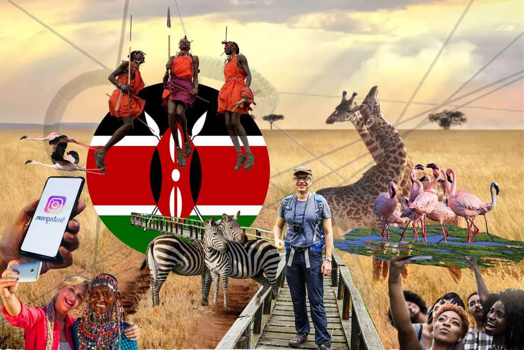 by Clare Tsisika Ayisi | AYSCLA001 MLA Design Dissertation
Contents
Thesis Abstract
Research Proposal
Introduction
Hypothesis
Methodology
Section One: Conceptualizing Instagrammable Landscapes
What is an Instagrammable Landscape?
Bringing back the Picturesque
Investigating Heritage Through the Lens of Instagram
Section Two: Contextualizing an Instagrammable Landscape
Historical Background of Nairobi City
Spatial Development Study
Instagram as an investigative tool
Context Analysis
Photography access and its Impact on the Heritage of the City
Linkage Study
Section Three: Framework as Response
The “Living Monument”
Capturing the Linked Heritage of the Site Site Landing
Section Four: The Re-imagined Space Design Development
Bibliography
Abstract
The natural heritage of Nairobi is deeply rooted within the city’s natural landscape. Nairobi once boasted a rich landscape characterized by natural forests, wetlands and marshy wetlands, abundant wildlife, the Kitengela corridor and riverine ecosystems. It was known as the “Green City in the Sun.” However, urbanization and the rapid population rise have led to a reduction in the natural landscape (Tibaijuki, 2007). With the city having lost most of its landscape character and natural vegetation, only a few green spaces were spared to serve as recreation spaces, offer tourists the chance to see the Kenyan wildlife and to aid in improving environmental and air quality.
This thesis is an investigation of how social media influence, specifically Instagram, can help to restore the lost heritage in Nairobi, by studying the physiological and historical landscape of the city and the site. By regenerating the forgotten indigenous heritage through systems restoration and green infrastructure – the dissertation studies the role of Nairobi’s landscape character in defining the identity of the city. It highlights a juxtaposition between natural landscapes identity and aesthetics value. The correlation between the two emphasizes the heritage value of restoring natural landscapes in urban cities where indigeneity is slowly getting lost with vegetation cover being quickly replaced with urban surface.
The site being used to reveal the heritage of Nairobi is Uhuru Park, a recreation park located adjacent to the central business district of Nairobi. Uhuru Park was originally a large green swath but has since been encroached to make room for a hotel, a museum and a ‘members only’ Golf Club (Communications, 2019). Further plans by the Kenyan government are to come up with an elevated highway that links downtown Nairobi to the Jomo Kenyatta International Airport curving its way through Uhuru Park. Ultimately this means disrupting the natural landscape even more. Addressing the issue of heritage value of the natural landscape would mean restoring the park to what Nairobi once was pre-colonial – a wetland, the savannah grasslands and the wildlife that once occasionally roamed along the Kenyatta Avenue during the colonial era.
The thesis aims to eventually show that through the lens of instagram, landscape architects can create a unique identity and user experience that is reminiscent of the indigenous landscape character of a space, the heritage of the space becomes well preserved and with that people are drawn to that landscape.
Thesis Abstract
7
Introduction
Today, most of us can’t go about our lives without scrolling through our phones which is contrary to the ancient times, before the industrial revolution, the invention of phones and other technological advancements. Society is changing. We are becoming more technology oriented with each passing day and social media, with a specific focus on Instagram, is becoming an influential force in the way our environments are being shaped (Fabiola Fiocco, 2020).
My entry into my study involves a realization that most instagrammable spaces have neglected the indigeneity and heritage of landscapes but rather focus on aesthetic quality of the spaces. Materials being chosen based on how they look rather than how they function or how well they integrate into the natural landscapes. The spaces quickly become urban city’s recognizable landmarks but with each space being made to fit into the instagrammable principles bubble, there is a significant loss of heritage and spaces start to lose their natural identity.
With further research, there was realization that instagrammable landscapes are an opening of landscape designs to the future and that is why there is high risk of losing sense of place (heritage value of a space). However, history can still be evoked with spaces evolving to current uses and technological advancements of now. By doing so, the Instagram-friendly spaces become “living monuments” (palimpsests evolving over time, uses and technical landscape skills) as described in The Charter on Historic Gardens (Santini, n.d.).
There is no doubt that technology and social media will continue to influence landscape architecture designs and affect the tangible, natural and intangible heritage of the spaces and its inhabitants. This dissertation aims to unveil that landscape architecture can use the principles of Instagram as a tool to embrace indigenous landscapes and enhance functionality of the ecological systems while also enhancing the aesthetic values of spaces altogether.
Prologue
9
Hypothesis
Research Question
How can the act of Instagram serve as a catalyst for rejuvenating heritage landscapes and fronting the specificity of spaces in urban cities?
The Why
In the modern world, Instagram has a strong influence on the culture of the people. First it was the food, then the neighborhoods designed with an Instagram aesthetic and now it’s affecting architecture and building aesthetics. The essence of Instagram revolves around photography. You capture a moment and instantly share it. Social media is currently a convenient way to know about the things happening around us. With Instagram being able to manifest what people like and what is undervalued, designers can take advantage of this and use it in capturing identify of local spaces.
The How
The dissertation aims to create a value for the local landscape and through this promote biodiversity habitat. The dissertation aims to use Instagram as a tool to presence the natural heritage of the city. This will later be achieved by an investigation on how the natural landscape of the study area has changed overtime and the spatial development of the spaces. The intention is to create a palimpsest that evolves overtime and adapts to modern landscape techniques. The project research will be conducted through critical research, use of Instagram and social media as a tool for investigating heritage, mapping, manual and digital representation. The dissertation will be divided into three sections. First section will lay a foundation for the thesis and the definition of the subjects. Section Two will involve contextualizing. Section Three will feature a framework intervention and Finally section four will be the design development.
Hypothesis
10
Methodology
The dissertation will be divided into four sections:
Section One: Conceptualizing Instagrammable Landscapes
Section One will be the entry point of the thesis. It will conceptualize instagrammable landscapes and investigate heritage layers.
• Engagement with theory through Literature reviews and research questions.
Section Two: Contextualizing an Instagrammable Landscape
Section two focuses on the bigger picture of the landscape. It studies the morphology of the natural landscape and the urban fabric in relation to the past and the present context.
• Engagement with social media (Instagram) as a research tool.
• Looking into research of the historical landscape, collecting information through historical readings and archives.
• Qualitative research on the natural landscape and the urban landscape as a guide into figuring out the city heritage.
• Design representation through mapping techniques, sketches, photographs, and abstract models.
Section Three: Framework as a Response
Section three is the precinct intervention in relation to the site.
• Representation of the response to precinct issues through mapping, mapping overlays and design sketches
• Choosing of the specific site for design development
Section Four: The Re-Imagined Space
Section Four features back and forth details of the site in relation to the precinct and the revelation of a new lens that creates opportunities to link and reveal the heritage of the site. Section Four is an answer to the thesis question on whether the Implementation of Instagram principles in Landscape Architecture Design aid in Evoking a Sense of place in urban cities?
• Unpack research through mapping
• Design representation using rendered sketches and photo montages
• Site modeling as a study tool
Methodology
Bigger Picture Precinct Intervention
11
Details back and forth Design Development City/ Precinct Site
what is an instagrammable landscape?
Social media is a term coined in the 1990s because of the development of computer and Internet technology. Instagram was launched in 2010 and it gained traction in 2012 whereby it was getting about a million downloads per day. Although originally created as a photo sharing app, it has since become a global sensation, affecting interactivity and sociability.
My definition of an Instagrammable landscape is a space that makes you wonder what it was like to see it for yourself. The space holds a unique and specific identity that is manifested in the individual’s mind as captured from their point of view.
I am choosing to explore the following instagrammable landscapes principles:
People and Spaces
An instagrammable landscape or space is often identified to bear a unique identity and with that it often draws people from different social classes and age groups to the place. By doing so, the spaces get livelier and have a lot of activities going on. Most people these days go on the app and look at the most geotagged locations and go to those places with their friends. There is a lot of human interactions being established, with new people meeting an interacting in the rejuvenated spaces, contrary to popular belief of how Instagram is now limiting physical interaction.
Scenery
Originally created as a photo sharing app, Instagram has an element of capturing beautiful scenery. Instagram users refer to beautiful spots they are in as the perfect content. Most of the scenery captured is often grand architectural elements, views of city skylines, street activities, panoramic natural views and vintage sceneries.
Materiality
In the material context, I will be exploring the relationship between Instagram and nature. It is noticeable that one of the most trending hashtags are often associated with nature. By quickly looking through Instagram hashtags, #landscape has around 50 million posts, #trees with forty million, and #nature with around one hundred and forty-eight million followers. Instagram is making people more aware of their surrounding and the beautiful sceneries around them. An article about Instagram mentions that people are often drawn to a small figure being dwarfed by the scale and beauty of a natural or scenic backdrop.
Section One: Conceptualizing Instagrammable Landscapes
13
The Picturesque movement evolved predominantly from the mid-eighteenth century. The landscape design was centered on “natural” landscape appearances. It contrasted to the earlier designs of the Renaissance and Baroque period such as the Versailles as it was more focused on dramatic asymmetrical positions as compared to the popular axial geometry (The Cultural Landscape Foundation, n.d.). The Picturesque style laid emphasis on views and vistas, unspoiled panoramas, and uplifting scenery. The style continued to thrive up until the twentieth century and acted as inspiration to many neoclassical dwellings and formal gardens designs.
One of the most influential picturesque gardens is the Rousham located in Oxfordshire. The Rousham was designed in the eighteenth century, yet it is still virtually unspoilt up to now. Rousham truly evokes the sense of place as one has a personal relationship with the space. Rousham is a green and wooden garden that sits on a relatively flat land with River Cherwell running through it. The garden feels very animated through the elements such as River Cherwell which opens out from the garden, the herd of long-horned cattle and pulsating architectural ‘eyecatchers’ (GARDENS ILLUSTRTAED, n.d.). Some architectural elements of the Rousham from the Picturesque English gardens style include the ha-ha which acted as a boundary and prevented the cattle from meandering to the gardens while allowing uninterrupted views of the landscape. Another striking feature is the walled garden and the circular dovecote that uplifts the scenery and there was use of gothic follies and mock temples to draw visitor’s eyes across the beautiful landscapes
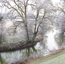
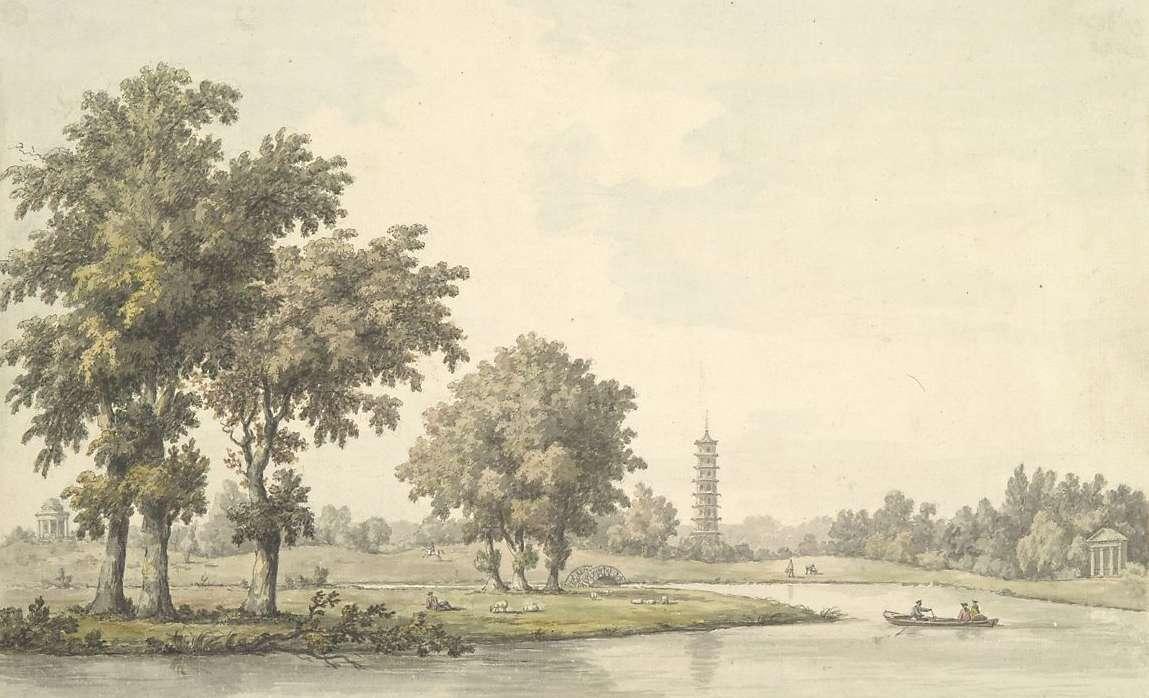
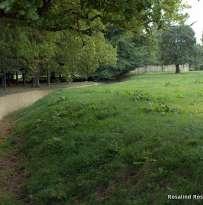
https://www.gardensillustrated.com/gardens/ why-is-rousham-englands-most-influential-garden/
Re-Picturesque
Image source: https://www.rosewarnegardens.com/ garden-visit-rousham/
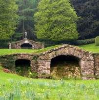
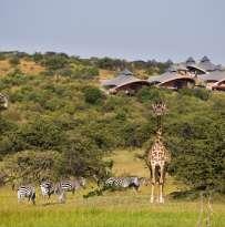
Image source: http://www.travelstart.co.ke/blog/20fascinating-places-prove-kenya-beautiful-country/
Image source: https://www.ft.com/ content/0333f618-adc3-11e3-9ddc-00144feab7de
So How are Instagrammable landscapes a reinvention of the picturesque style?
The picturesque movement occurred at the face of rapid industrialization whereby landscape architecture faced a challenge of making designs look more natural whilst still allowing industrial development to take place (Jellicoe & Jellicoe, 1982). Some features of the picturesque movement that seem to be borrowed in instagrammable spaces include framing of views, uplifting of aesthetics, concealing, and revealing certain elements of the landscape.
The idea of having an interesting natural backdrop that you create while designing is aligned with the principles of the English gardens and is similarly applied to instagrammable landscapes.
Section One: Conceptualizing Instagrammable Landscapes
bringing back the picturesque
Ha-ha prevents cattle from roaming into homestead and allows uniturrepted views
The upper and lower cascades used to uplift the garden aesthetics
River Cherwell as an animated landscape Photo by Andrew Lawson sourced from
Picturesque Gardens Picturesque Gardens Picturesque Gardens
Re-Picturesque
Instagrammable Safari Camp in Kenya
14
what is heritage?
Heritage defined is the background from which we come from. It means that the values or attributes that are valued in the present were passed down from the past and ought to be preserved for future generations.
Heritage is composed of:
Tangible Heritage can both be touched and perceived by the human eye. It includes monuments, places of historic value, sculptures, artworks, paintings, architectural structures, archaeological sites, to name a few. Tangible heritage can further be categorized into movable and immovable. Tangible moveable heritage is portable and is mainly composed of objects such as manuscripts, artworks that have historic, archaeological, or religious value.
Tangible immovable heritage is fixed and is therefore composed of historical buildings and monuments in places (Eslava, 2019).
Natural Heritage comprises of heritage landscapes which are also called cultural landscapes. It is formed because of geological and physiographic formations. Cultural heritage landscapes include trees, indigenous vegetation, historical views, native wildlife, riverine systems, wetlands, to name a few. Natural heritage sites often demonstrate natural significance. They may also be delineated areas that are habitat of threatened biological species. Natural heritage sites are often protected so as to prevent loss of heritage (Statistics, 2009).
Intangible Heritage is made up of immaterial cultural manifestations. It is a representation of specific people’s way of life. Intangible cultural heritage is passed down from one generation to the next and communities adapt to the heritage in response to their existing environments. Intangible cultural heritage offers a sense of identity and continuity. With each person or community having their own practices, expressions, knowledge and skills, intangible heritage helps to create creativity and cultural diversity (Eslava, 2019).
Cultural Heritage
Tangible Heritage
Natural Heritage
investigating heritage through the lens of instagram Section One: Conceptualizing Instagrammable Landscapes
Moveable Heritage
Immoveable Heritage
Intangible Heritage
15
what is heritage (in landscape architecture)?
Architecture and Landscape Architecture can be considered as tangible forms of heritage. Most developing cities are at a high risk of neglecting these forms of heritage with the excuse of modern designs responding to modern context. This can be changed by urging designers in the built and natural environment to consider the past, the present and the future as part of their design routine, especially for the critical heritage sites.
Heritage in landscape architecture does not only entail the preservation of indigenous landscapes or the preservation of old structures and spaces as artefacts and monuments, but it is more so on our response to such places and landscapes, on how we understand, respect, and learn from the cultural influences of such spaces.
There are universal architectural and landscape architectural values to consider in heritage context, as guided by the World Heritage Convention, the Burra Charter and Royal Australian Institute of Architects. The values to be considered include:
• Character: To evoke sense of place, landscape architecture design needs to retain the character of the space, which is defined by underlying natural landforms, distinctive landscape elements, the materials, the building techniques, views and vistas, the skylines, dates, and styles of architectural and landscape architectural elements, building setbacks and the street patterns.
• Scale: Design should respond to predominant scale of the landscape and surrounding buildings and structures.
• Form: The shapes and volumes of structure should respond sympathetically to the surrounding context
• Sitting: To enhance the quality of the streetscape, the design should be in unity with the pattern of the setback.
• Material and Color: The recognition of the local materials and colors and textures will create a harmony with the design. Contrast is also praised where it fits be in modern design.
• Detailing: Details such as elements that bring out the needs of the local community are essential in creating cultural significance of the design. All character details mentioned above are important
Section One: Conceptualizing Instagrammable Landscapes
investigating heritage through the lens of instagram
• Place character and point, focal point, and foci: Focal points are created because they have special character in the surrounding and if the points are specially positioned in the spaces. 16
role of instagram in heritage preservation
Instagram is a tool that captures memories and stores it so that it can be passed down. When you think of it, Instagram is a tool that can be used to presence heritage in spaces and also preserve the heritage to be passed down to generations. As people capture moments of their lives, you can depict both the tangible, the natural and the intangible heritage. Nature backdrops reveal the natural landscapes of the spaces people are in whereas their activities depict their way of life.
If the heritage of a space is slowly seeping away or being forgotten, Instagram can be used as a tool to revive the heritage. For instance, if the natural vegetation of Kenya is of the savannah biome but it was replaced by exotic vegetation, the heritage of the place gets lost and people will start to seek the very few spaces of natural heritage left in the surrounding to capture it. As landscape architects, we can then use this as inspiration to restore the systems in place so that the spaces can be rejuvenated.
Instagrammable landscapes are often landscapes that people want to remember forever.
Instagram illustrates an evaluative image of landscapes that people want to remember, to publish and to share. The published images are often a reflection of what has captured the minds of people more and what is undervalued as well. The images help to shed light on why a heritage site is important and what can be done by landscape architects to ensure preservation of such spaces.
Section One: Conceptualizing Instagrammable Landscapes
instagram
investigating heritage through the lens of
17
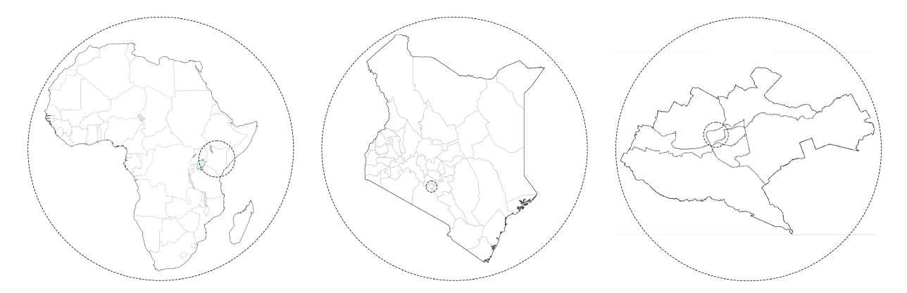
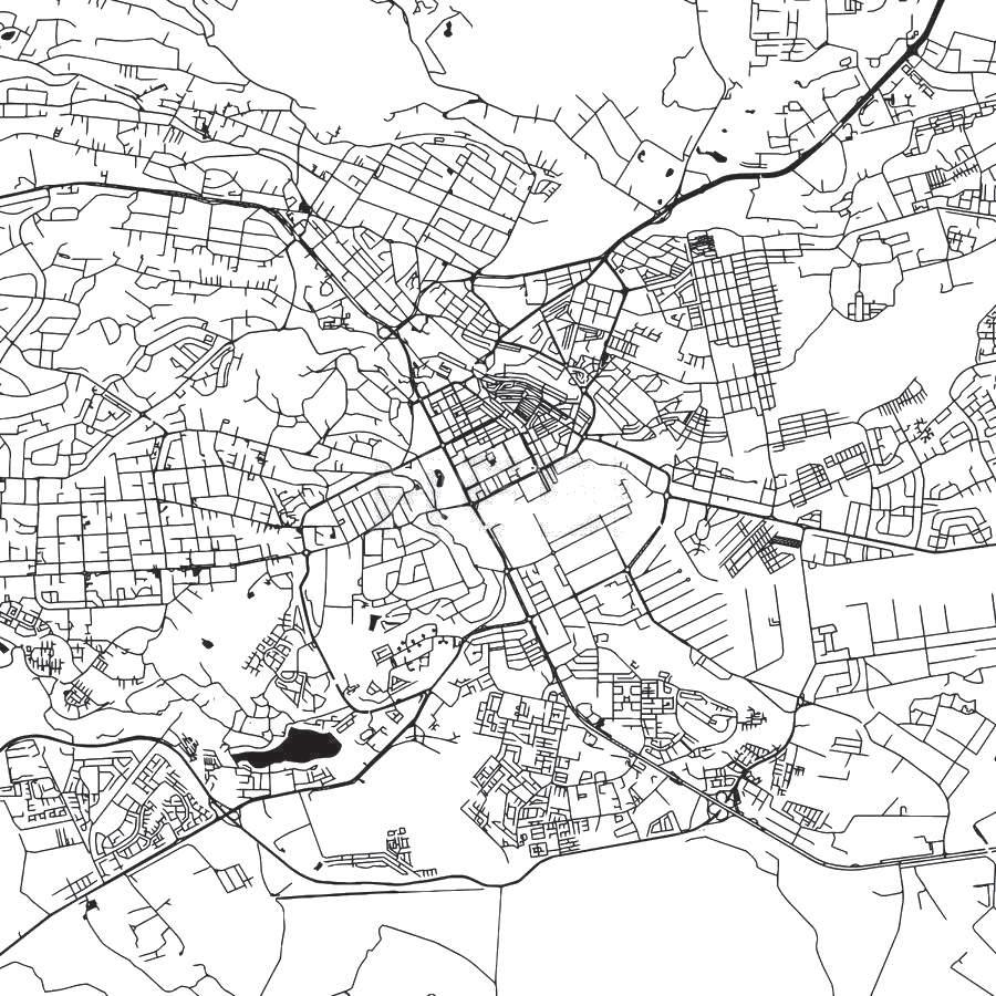
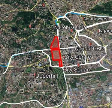
The dissertation is based in Nairobi, Kenya within the Central Business District. The macro analysis study looks at Nairobi and the city center, whereas the micro analysis zooms into the site which is Uhuru Park and Central Park. The analysis unpacks the city’s identity by looking at its physiological analysis and spatial analysis. The analysis will help in the design interventions of using indigeneity in invoking an instagrammable landscape.
 AFRICA
KENYA
NAIROBI
NAIROBI CBD AND ITS SURROUNDS (Uhuru Park highlighted)
Section Two: Contextualizing an Instagrammable Landscape 19
Map highlighting the Study Area
Nairobi city is the capital city of Kenya and the largest city in Kenya. The name Nairobi originates from a Maasai phrase “Enkare Nyrobi” which means “a place of cool waters.” Prior to its establishment in 1899 during the British colonial rule in Kenya, Nairobi was originally an uninhabited swamp and open savannah. During the pre-colonial era, wild animals would roam freely in Nairobi as portrayed in Stephen Mills’ book ‘Nairobi Then and Now’. It then began as a railway depot, linking Mombasa and Kampala (County, 2019).
Prior to construction of the Kenya-Uganda railway, Nairobi was occupied by nomad Kenyan tribes, and they grazed their livestock on the vast savannah land. They were later displaced by the British colonialists. The sufficient water supply and the cool climatic conditions made Nairobi the favorable settlement for the British and Indian railway workers (Lilian, 2020).
Within a few short years after the railway construction, Nairobi was already organized into districts. Between 1902 and 1910, the population increased from 5000 to 16000 and Nairobi grew around administration and tourism in the form of big game hunting and safaris.
Post-independence, Nairobi continued to grow but the city’s rapid expansion overwhelmed its infrastructure. This led to encroachment of the vast savannah lands, displacement of wildlife and reduced vegetation cover that was quickly replaced by the built urban fabric.
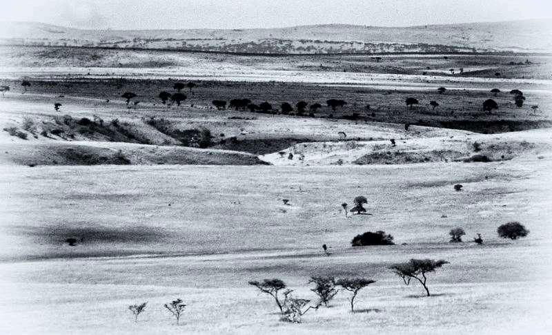
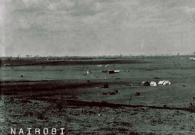
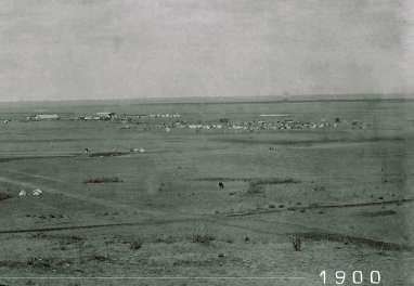
historical background of Nairobi city from a brackish swamp to a burgeoning city Section Two: Contextualizing an Instagrammable Landscape
Nairobi as an uninhabited swamp pre colonial Photo by kenyankalasinga on instagram
Growth of Nairobi as an administrative and tourism town in 1900s Photo by kenyankalasinga on instagram
Nairobi in the 1950s Photo by nostalgickenya on instagram
20
Image of the Present Nairobi City Photo by officialnairobicity on instagram
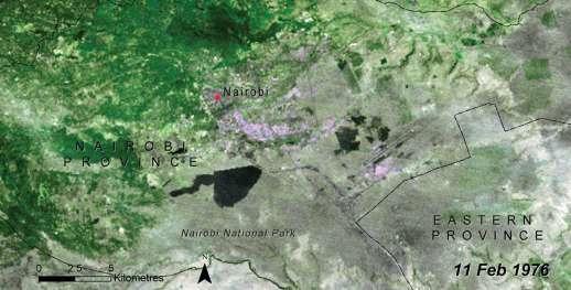
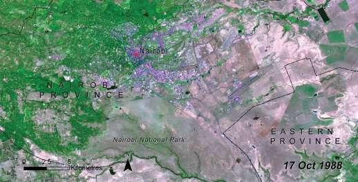
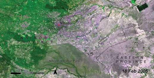
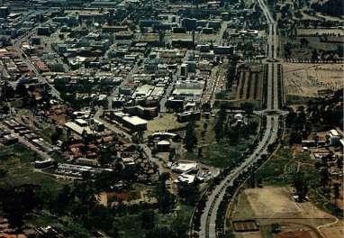
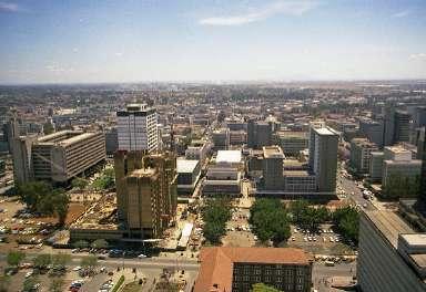
Following its founding and urbanization, Nairobi became a burgeoning city and with that there was a rapid rise in population. The year 1967 saw the climax of urbanization in Nairobi. Consequently, this led to traffic congestion, water shortages and housing problems (Tibaijuki, 2007). The city had to be expanded to ameliorate the existing social, economic, and physical needs of the inhabitants. The development of the city can be identified by the official city boundaries on the footprints and the settlement changes which have been highlighted in purple.
Poor city development and misappropriation of city planning funds have all led to futile attempts at curbing the massive issues that came with urbanization. To accommodate the population, there has been an increase in development densities consequently leading to a decline in environmental quality, reduced vegetation cover that has quickly been replaced with increased urban surface and water and air pollution (Oyugi, 2018).
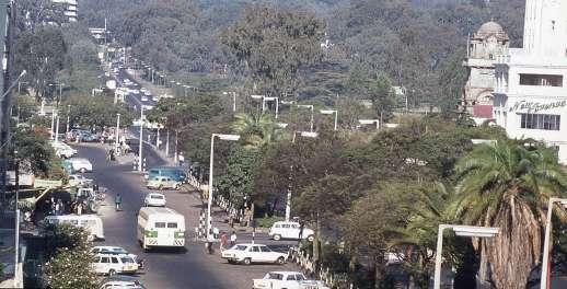
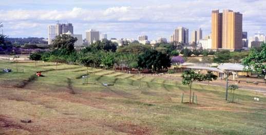
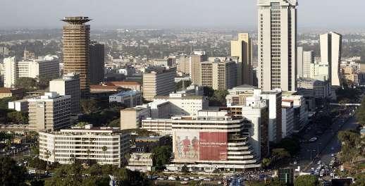
spatial development study growth of urban settlement in Nairobi
Spatial development in 1976
Spatial development in 1988
Spatial development in 2005
Image of Nairobi city in 1976
Image source: Photographs by Steve and Jill Murray obtained from https://www.twala.co.uk/p856846188/h166342BE#h166342be
Image of Nairobi city in 1990
Image source: https://mapio.net/pic/p-29387114/
Nairobi City in 2007
Image source: https://en.wikipedia.org/wiki/Timeline_of_Nairobi
Section Two: Contextualizing an Instagrammable Landscape 21
instagram as an investigative tool
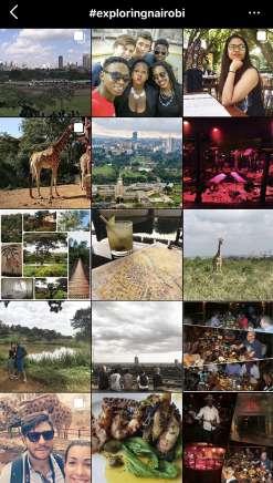
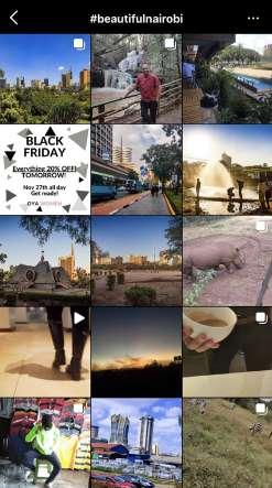
Instagram often captures what people like to do most or see most in their surroundings and spaces. In the case of Nairobi, both the locals and the tourists are often drawn to the green spaces and the wildlife scenery. They use hashtags that describe Kenya as a beautiful country due to its native wildlife and the indigenous vegetation. The culture of Kenya is well presented on social media, and it easily informs landscape architects on what heritage spaces are more valued as they display the identity of Nairobi. Some of the trending hashtags include #greencityinthesun, #exploringnairobi, #tembeakenya, #safari, #beautifulnairobi, and #discoverkenya.
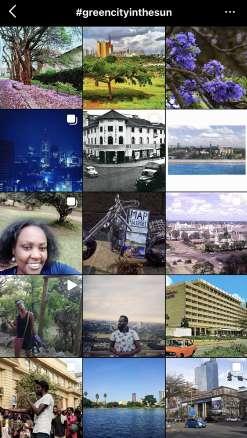
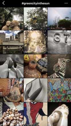
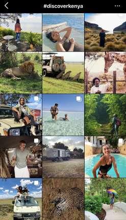
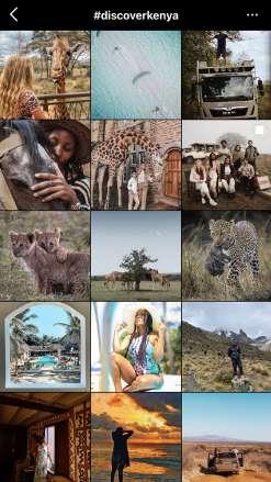 #greencityinthesun
#exploringnairobi
#beautifulnairobi
#discoverkenya #discoverkenya
22 Section Two: Contextualizing an Instagrammable Landscape
geology analysis
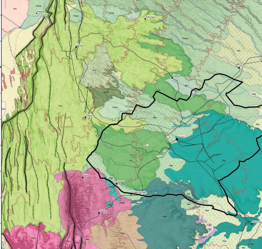
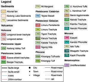
The geological structure of Nairobi is mainly composed of the Mbagathi phonolitic trachyte, the Nairobi trachyte and the Kerichwa valley tuffs. The Mbagathi phonoloitic trachyte has a unique texture made of crowded feldspar phenocrysts set in gray-brown matrix (Onyancha Caroline, 2011). The feldspar laths alignment is often display in a sub-parallel manner as an indication of the direction of lava flow, they originated from. Mbagathi phonolitic soils are across the Nairobi National Park and some areas of the Athi Plain (Oyugi, 2018).
The Nairobi trachyte (greenish grey) is made up of tabular phenocrysts of feldspar. It’s quality of fine-grained groundmass and silvery luster is because of pale grey lava molted into tiny numerous feldspar crystals. It’s prominent in the north and western sides of the city (Oyugi, 2018).

Kerichwa valley tuffs is a group of trachytic tuffs and agglomerates that are younger than the Nairobi trachyte. The tuffs overlie the Nairobi trachyte and are rich in pumice. The formation of the tuffs cannot be traced to any volcanic vent, and it is probable that they are a result of rapid pressure release that follows rift faulting. It is also assumed that the volcanic activity took place within the city center (Onyancha Caroline, 2011). The tuffs, located in the eastern parts of the city, are being excavated and used for construction purposes in Nairobi (Nairobi stone) as they are fine-grained, wind-sorted pumices ash to agglomerate tuffs with rock fragments up to 0.5 m size.
physiographic background
Geology of the Nairobi Region Kenya (Map Adapted from A. Guth, 2013.)
Section Two: Contextualizing an Instagrammable Landscape 23
physiographic background
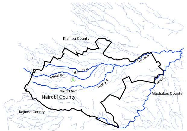
hydrology analysis
The main drainage in Nairobi is influenced by the volcanic formations of the regional slope towards the east. Subsidiary internal drainage into the rift is confined to the western part. The Kerichwa Valley tuffs and sedimentary regions have an occurrence of shallow water aquifers as opposed to the deep aquifers within the Nairobi trachyte (Saggerson, 1991). The Northern and Western parts of Nairobi city have higher water yielding aquifers because of the porous rocks lying underneath whereas the aquifers on the eastern and southern sides have lower water yielding capacity (Oyugi, 2018). Most of the rivers in Nairobi are situated on the northern and western parts of the city and are prone to human encroachment and city developments leading to sedimentation and loss of biodiversity.
Legend Rivers Nairobi Boundary Study Area and Site Uhuru Park
Section Two: Contextualizing an Instagrammable Landscape 24
Map showing the rivers in Nairobi
topography and pedological analysis
Topographical Background
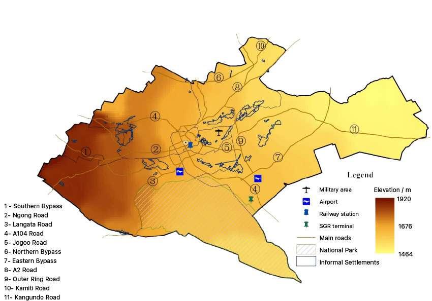
The topography of Nairobi is characterized by deep valleys dissected by rivers and streams that flow from the Aberdare ranges. Major land units in the city such as escarpments, plains and hills were because of lava flow form the Rift Valley fault lines. Some of the faults such as Lari-Ondiri are significant water sources for the city. Overlying the city and running through the national park are plains that have encouraged urban developments due to the relatively flat slopes that saves on construction costs. The eastern and southern sides of the city topography that is relatively flat makes the area more susceptible to urban sprawl, environmental degradation, loss of biodiversity and reduced vegetation cover as compared to the northern and western sides of the city (Oyugi, 2018).
Pedological Background
The north and western parts of Nairobi is dominated by the well-drained red volcanic soils. The soils originate from volcanic tuff under humid conditions (above 1000mm rainfall per annum) and have high hummus content which aids in enabling natural vegetation and biodiversity. The black cotton soils which are in the southern and eastern sides is also because of volcanic tufts but occurs in lower rainfall conditions (760mm to 1000mm per annum). The black cotton soils are rather poorly drained and often get sticky and waterlogged during rainy seasons. They are also more susceptible to floods. Black cotton soils have low hummus content and can only support perennial vegetation growth. The plains, river courses and valleys are dominated by swampy soils that are poorly drained with rich organic content (Oyugi, 2018).
physiographic
background
Section Two: Contextualizing an Instagrammable Landscape
25
Topography Map of Nairobi (Map Adapted from H. Ren, 2020.)
climate and vegetation analysis
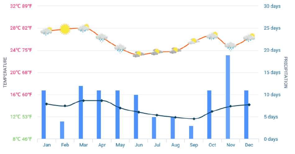
Nairobi lies within the Tropical Savannah biome and experiences a temperate sub-tropical highlands climate. The climate is characterized by a significant amount of rainfall throughout the year. The mean annual rainfall is 610mm. The long rainy seasons are form March to May and the short rains from November to December (Aardenne, 2017). The north and west parts of the city receive more rainfall and experience accentuated vegetation growth and varying agricultural practices whereas the south and east parts of Nairobi receive less rainfall and are dominated by shrubs, rangeland, and grasses (Oyugi, 2018). Ultimately, the north and west parts of the city experience better environmental quality as opposed to the southern and eastern plains.
The average daily maximum temperature (27.5 °C) is experienced between January till March and September to November (26 °C). The maximum temperatures are coolest between June and August (22.5 °C). The long term daily minimum temperatures are correspondent to the rainfall patterns with the warmest nigh time temperature occurring between March till May and November till December (14.5 - 15 °C). The coldest month in Nairobi is July at 11.4 °C (Aardenne, 2017).
The north and west parts of Nairobi have dense, natural, and exotic vegetation while the south and east plains dominated by Sparse vegetation, bare ground and perennials only suitable for grazing. Further real estate developments on the south and east sides have made the environmental conditions worse. The main forests are Ngong and Karura and riparian vegetation is located along the rivers. The riparian vegetation has however been encroached due to human settlements (Oyugi, 2018).
Analysis Data of Nairobi Section Two: Contextualizing an Instagrammable Landscape 26
Climate
zoning map
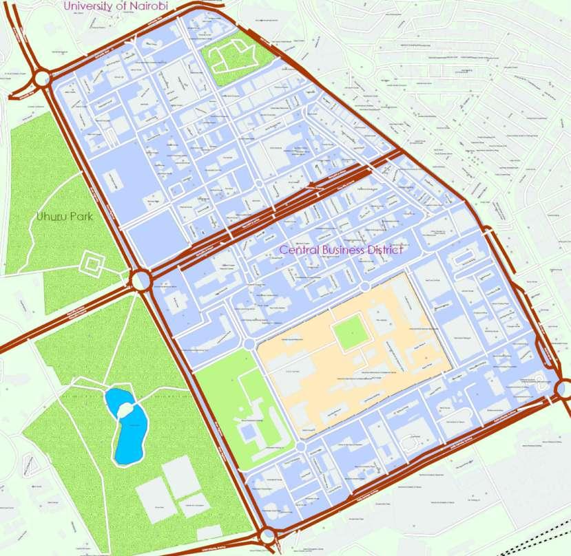

This map shows the zoning map and there is a noticeable disconnect being highlighted in terms of green spaces, recreation facilities for the public and private government buildings at the city square sitting like an island among the other spaces.
The City Center boasts a number of luxury hotels that attract a lot of tourists including: Serena Hotel, Sarova Stanely Hotel and Hilton Hotel. The tourists have easy access to service centers and can easily navigate their way to tourist agents if they need to go to the tourist sites. The city has some heritage spots strategically placed near the city center boundaries.
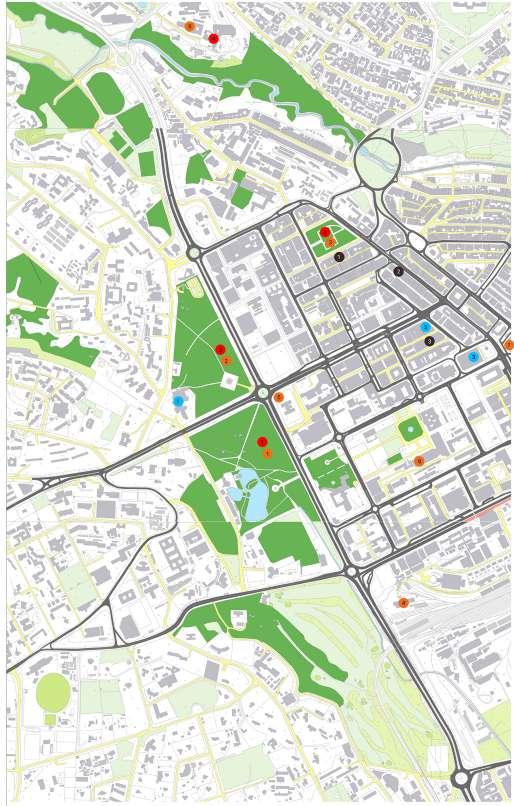
Legend
Hotels
Serena Hotel
Sarova tanely Hotel
Hilton Hotel
Tour Operators
Expedition Kenya Safari
Kudu Hills Safaris
CKC tours & Travel
Recreation Parks
Uhuru Park
Central Park
Jeevanje Gardens
Snake Park
Heritage Spaces
Uhuru Park
Central Park
Jeevanjee Gardens
Railway Museum
Nairobi Gallery
KICC Helipad
National Archives
Kenya National Museum
Tourism Map of the Nairobi CBD
1 2 3 1 2 3 1 2 3 1 2 3 4 5 6 7 8 4
Zoning Map of the Nairobi City Center
Section Two: Contextualizing an Instagrammable Landscape 27
greenery analysis
green spaces and tree canopy mapping
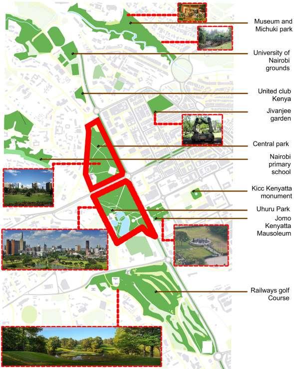
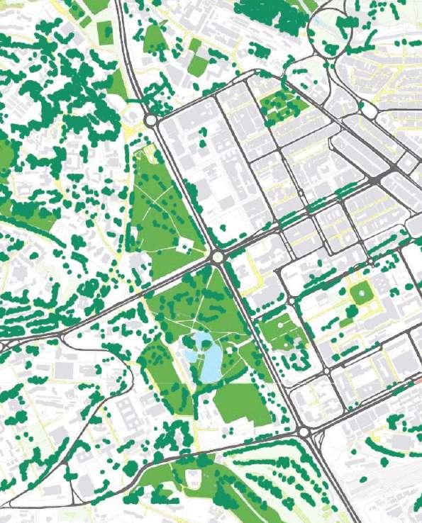
Greenery Analysis
Greenery analysis shows a bit of disconnect with the city center being less green as compared to the adjacent park spaces. Furthermore, the park space was also originally one large swath but has since been divided to accommodate a golf course, a member’s only club and a hotel.
Tree Canopy Map
The map displays the tree canopies located within the city center. There are some trees along the major streets and avenues and there are lesser trees as you move away from the park and towards the commercial spaces within the city center. The car park areas have a few trees.
Greenery Map Tree Canopy Map Section Two: Contextualizing an Instagrammable Landscape 28
figure ground mapping
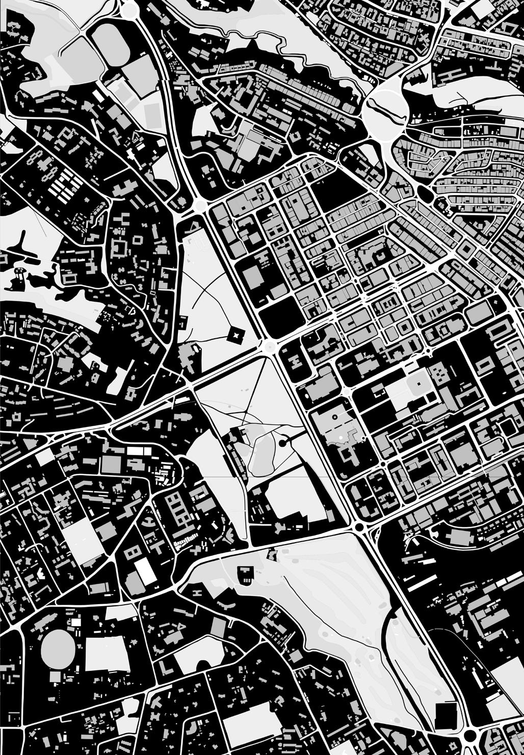
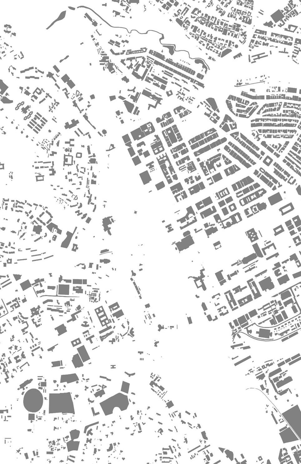
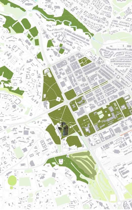
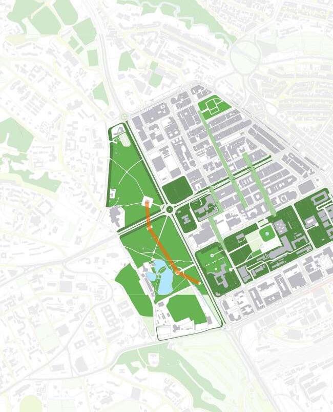
Mapping of open spaces in the city was essential because Nairobi is urbanized, and the city center sits separated from the green spaces on the adjacent side. The map on the left identifies most open spaces as government car park spaces with rather fewer trees, therefore, an opportunity to merge the park into the city by adding green infrastructure in the spaces. The figure ground on the right shows how there is beginning to be a seamless connection of open spaces which link into the site.
Section
space study
open
Legend Uhuru Park CBD Boundary Open spaces Roads Legend Open Spaces Built Fabric
the city Figure ground map
Map
showing the open spaces within
an Instagrammable Landscape
Two: Contextualizing
29
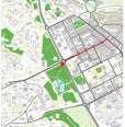
The section 1 cut between the monuments and statues located in the Central Business District reveals that the monuments at the park sit higher than city monuments and that the trees within the CBD are lesser
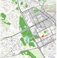
The site can easily be seen from the KICC monument which will make it attract more people as there is uninterrupted views, as shown in Section 2
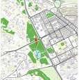
There is a clear disconnect between Uhuru Park and Central Park and this section 3 shows opportunity to connect the two parks into one.
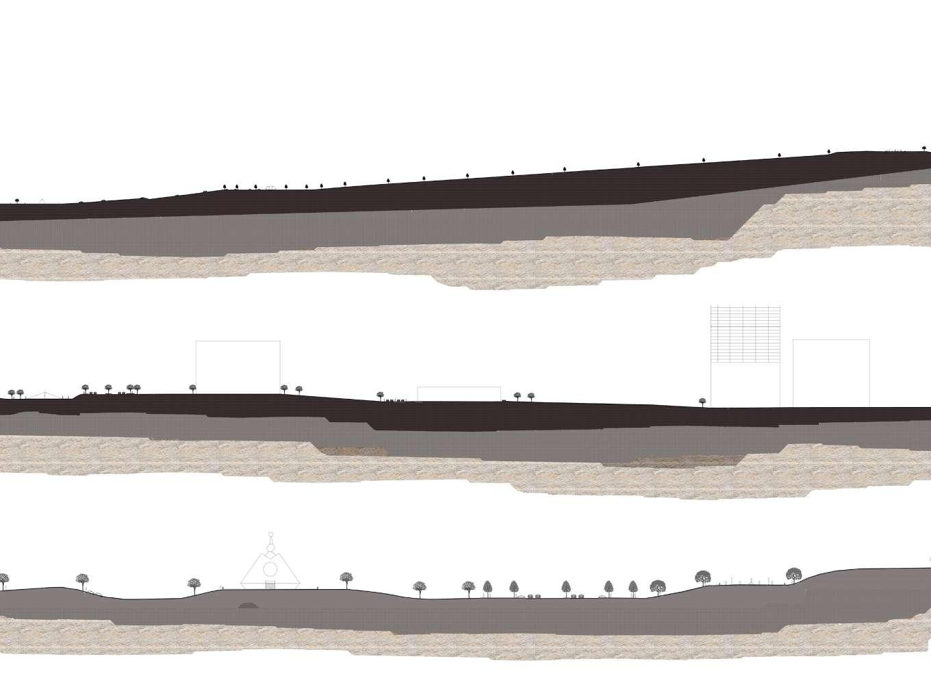
existing street sections thick section exploration Section Two: Contextualizing an Instagrammable Landscape 30
KICC Building that allows 360 views of the city
Nyayo Monument located at Central Park
Nairobi CBD soil made up of Black cotton soil, solid black tuff and yellow agglomeratic tuff
Dedan Kimathi Statue
Triangle Monument
War Memorial Monument
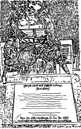
Mau Mau Memorial
Mau Mau Memorial
Opportunity to Connect
photography access and its impact on the heritage of the city socio-political study
In the modern world, phones and experiences go hand in hand. As people go about their lives, they try to capture the moments and the altogether (Lavoie, 2018). For the millennials, capturing pictures that they find inspirational or capturing a breathtaking view and quickly posting on their social media invokes an utterly satisfying feeling. As people travel to different places, they try to experience the culture and livelihood of the local people. This involves taking pictures of their heritage spaces and monuments. Most cities in the world are seen by others through the photos we come across on media platforms. For instance, in the case of France, you would not miss some of the historical landmarks such as the Eiffel Tower. But what would happen if people were not allowed to photograph the Eiffel tower when they visited France? It’s certain that the locals would feel denied the right of being connected to their heritage and the tourists would feel denied access to capture the beauty of the heritage of the space.
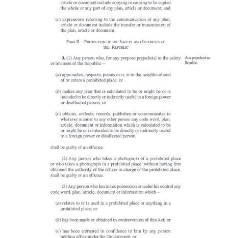
Laws of Kenya
The Official Secrets Act

Chapter 187
Part II – Protection of Interests of the Safety and Interests of the Republic
(2) Any person who takes a photograph of a prohibited place or who takes a photograph in a prohibited place, without having first obtained the authority of the officer in charge of the prohibited place, shall be guilty of an offence.
Emergence of the Secret Act in Kenya
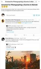
On one morning, September 21st, the year 2013, there was an al-Shabab attack on Nairobi Westgate Mall that sparked a four-day siege and left sixty-seven innocent shoppers dead and injured hundreds more. The attacked was staged by the Somali militant group following the activities of Kenyan military operations in Somali territory (Gathara, 2021). Since the demolition of the mall, the government put a ban on taking photos on the streets, near public buildings and “numerous protected areas.” That therefore meant Kenyan had very few spaces for photography left including homesteads, public parks and when having been allowed by a government official (Riaga, 2016). Young creative photographers are often arrested and accused of being terrorists when found taking pictures even of mere skylines or monuments. This has made photography and instagramming feel unsafe for the citizens as they are always on the lookout for law enforcement officers.
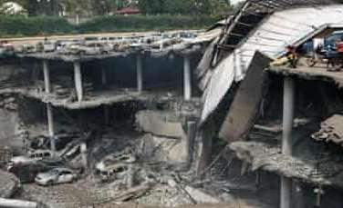

 Ruins of the Westgate Mall Image source: https://www.theguardian.com/world/2013/oct/04/westgate-mall-attacks-kenya
The Secret Act highlighting the photography rules British tourists arrested for taking photographs without authority Source: https://metro.co.uk/2016/03/19/ four-british-tourists-arrested-for-terrorism-after-taking-pictures-at-airport-inkenya-5761751/
Section Two: Contextualizing an Instagrammable Landscape 31
Image is a screenshot from Twitter of young Kenyan photographers talking about an ordeal that resulted from not abiding by the Secret Act
safe spaces for photography
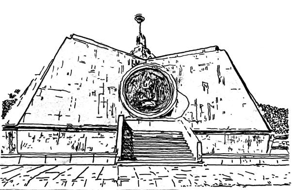
Nyayo Monument
Nyayo Monument is located in Central Park and was officiated as a national monument by the second president of Kenya during his rule. It is often where people sit to rest and take photos with it as backdrop
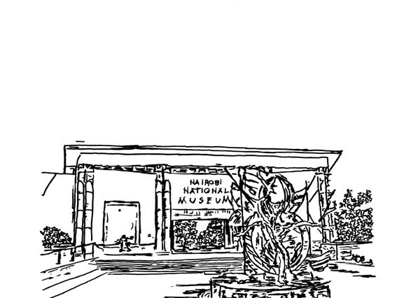
National Museum of Kenya
The Kenyan National Museum has a lot of historical artefacts and it attracts locals and tourists alike to learn about the history of Kenyans
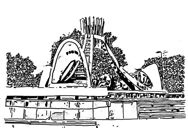
Peace, Love and Unity Fountain
Located in Uhuru Park, the fountain uplifts the aesthetics of the space and people can take photos of it as it is an eye-catcher on the landscape
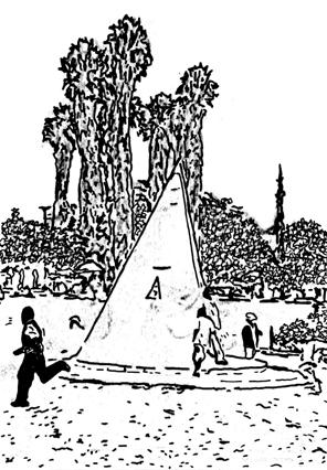
The Triangle
The triangle was officiated by the pope and has since become a playground for kids at the park
The
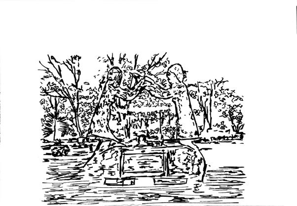
MauMau Monument
The monument signifies peace between the MauMau warriors and the British colonialists. The monument is very modern and people often go in to get a photograph imitating the handshake being portrayed
The Jeevanjee Gardens
The Jeevanjee are one of the oldest gardens in Nairobi located at the Muindi Mbingu Street
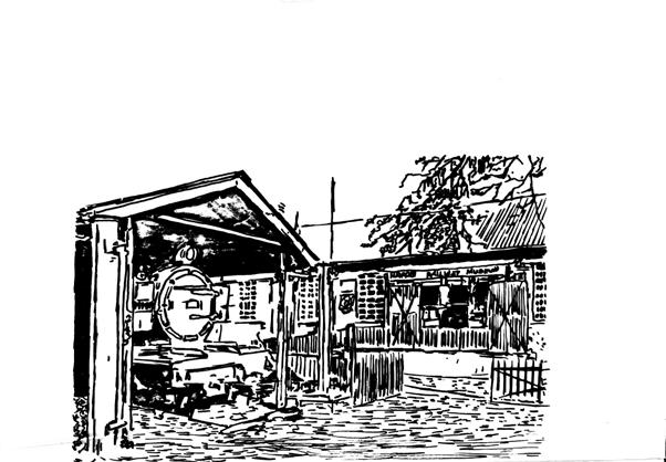
The Railways Museum
Initially an old railway station, the Railways Museum now functions as an art exhibition and other exhibitions. People often get instagrammable moments captured inside the trains as though they are waving from inside the train
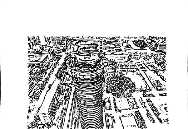
KICC Helipad
The KICC helipad allows 360 views of the entire city. It allows photography only from the helipad but people aren’t allowed to take a photo of the historical building itself.
Section Two: Contextualizing an Instagrammable Landscape
analysis on photography restrictions in Nairobi city center
32
non-safe spaces for photography
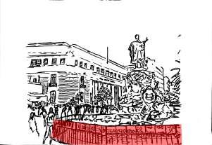
Tom Mboya Statue and National Archives
The Tom Mboya Statue is located next to the Kenya Archives in one of the busiest streets in the CBD. A bus stop is right next to the area and a lot of pedestrians walk on foot. The area is also used for performances but photography of the Archives and the statue is not permitted.
Fence highlighting restricted access
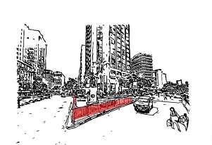
The Dedan Kimathi Statue is located at a cross section road junction within the CBD and along luxury hotels. However, it has been fenced off from the public and a fine is imposed on people who photograph the space.
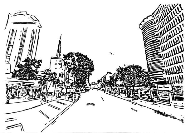
The KICC Building
Despite allowing 360 views photography of the Nairobi Town, the KICC Building is closed off from photography access as its an important government building for official international conferences. However, people would want to photograph it on grounds that it was once one of the tallest structures in the city
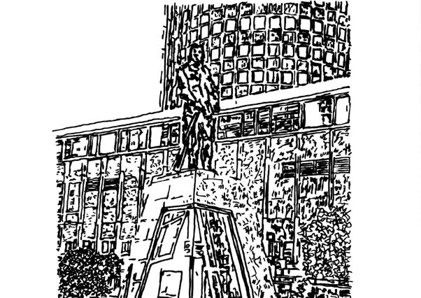
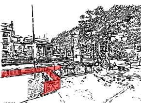
War Memorial Statue
Despite being placed next to a seating area where pedestrians can engage with the space, the monument space is not a safe space for photography. The opposite side of the sidewalk has been fenced off from pedestrian access as well
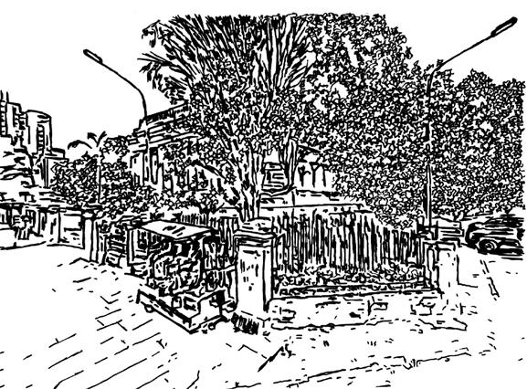
Macmillan Memorial Library
The Library is one of the oldest in Nairobi and there are some local businesses happening outside that can attract tourists to the place. However, photography of the architecture elements and the space is not allowed unless with a permit from officials
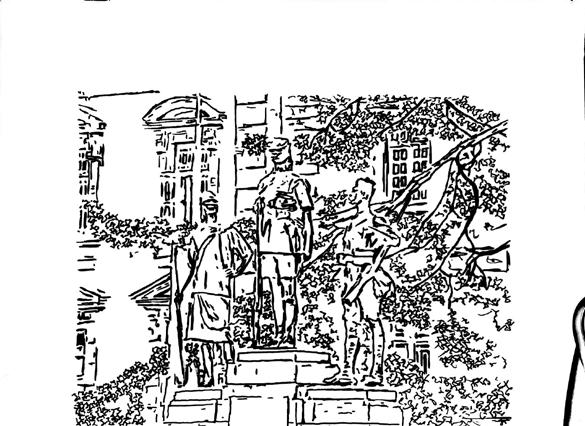
War Memorial Monument
Nairobi City Center has two war memorial monuments located significantly close to each other and would be a great attraction to historians (both tourists and locals alike). However these two monuments are both not allowed to be photographed
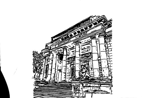
restrictions
Section Two: Contextualizing an Instagrammable Landscape
analysis on photography
in Nairobi city center
Sketch of the Grand Dedan Kimathi Statue standing in front of the luxury Hilton Hotel in Nairobi CBD
Dedan Kimathi Statue
33
Sketch of the Grand Architectural elements of the Macmillan Memorial Library
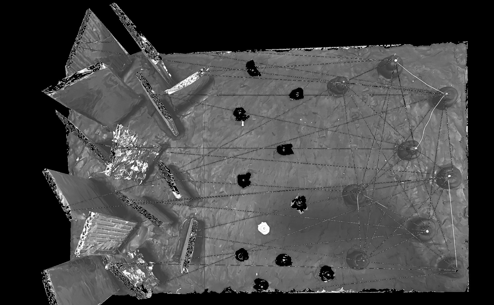
Correlation
/ˌkɒrəˈleɪʃ(ə)n/ a mutual relationship or connection between two or more things.
Artefact shows a mutual relationship between different aspects that are shown through the use of different materials such as clay, cardboard and thread. You then start to see a relationship or rather a connection between the different objects
This reflects to the topic of instagrammable spaces where there is a relationship between the subject and the spaces.
With correlation, there is usually a relationship, meaning a strong relationship between the people and spaces and between the people with one another. Sense of distance is also seen, and different heights of objects used changes the perceptions from different views. Instagrammable landscapes often have backdrops which is portrayed through the sense of distance. They also often have a multi-dimensional effect, so as to bring out different views by different users.
The linkage study further helps in the study of the precinct. Nairobi city center has a lot of heritage spaces and monument spaces that hold a lot of historical significance. With the spaces linked, they create a heritage walk and the locals and tourists will get to see the identity of Nairobi

Section
artefact
linkage study
Two: Contextualizing an Instagrammable Landscape
34
Artefact generated as an abstract process and entry into linkage study of the precinct
linkage study within the city center
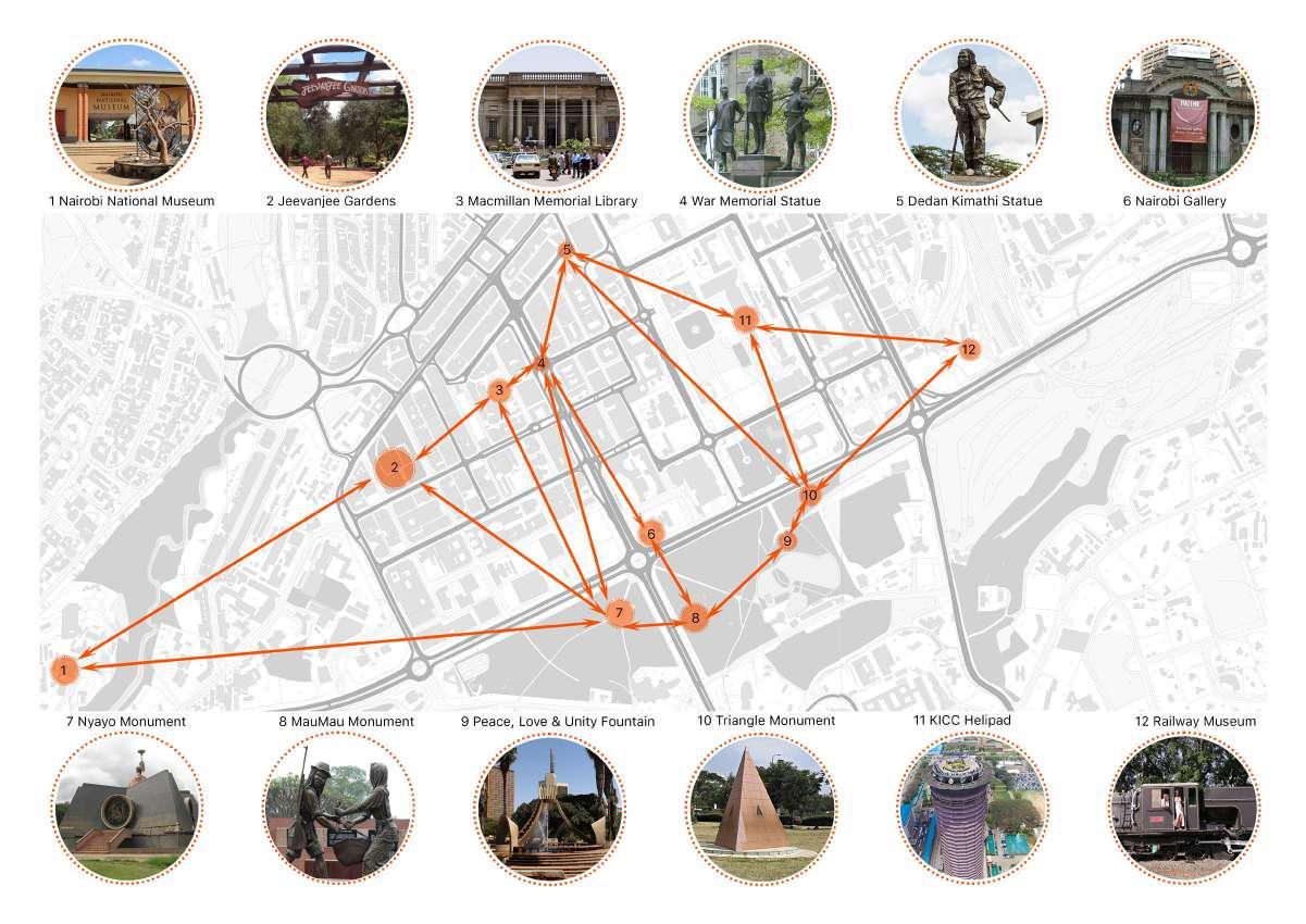
The monuments located within the city center hold a lot of heritage significance but a fine is imposed on people found taking photos or they get sentenced to jail. This has limited freedom of taking spaces within the city center. However, the monuments located within the park spaces and public spaces are safe spaces for photography. For instance, Uhuru Park and Central located adjacent to the city center have four monuments and locals and tourists freely photograph with the monuments as their backdrops. Green public spaces are therefore an opportunity to create safe spaces for photography within the city center. With some spaces limiting photography access, there is a disconnect in the heritage linking in the city center. Green spaces become an opportunity to link the heritage spaces within the CBD.
Section Two: Contextualizing an Instagrammable Landscape
35
the site as a “living monument”
pulling the park into the city
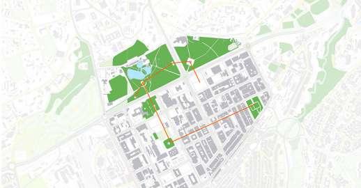
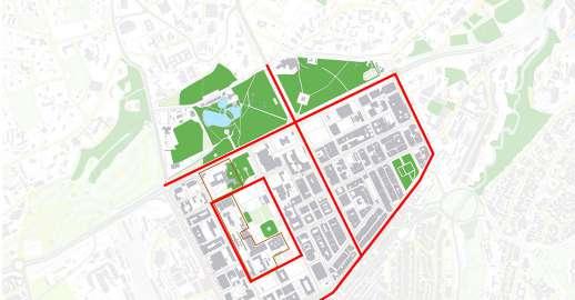
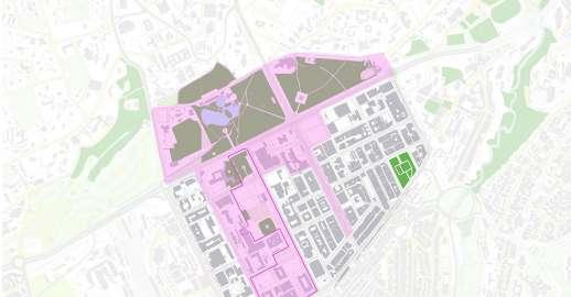
The Disconnect
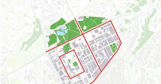
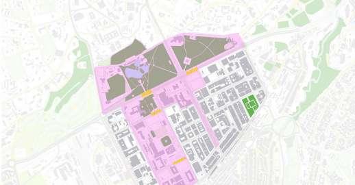
The study area is currently very disconnected. The City Center sits separate from the park space and the inhabitants are not getting the benefits of the park spaces such as the abundant green spaces, the water bodies, the relaxing and comfortable environment. The government area is very disconnected from the rest of the buildings, giving an impression of the social being separate from the political yet they should be connected. The government area has lots of heritage spaces that are also not allowed to be photographed by the general public
The Connect
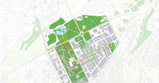
The open spaces are an opportunity to pull the park into the city and to connect the social to the political using green infrastructure. There is an emergence of a relationship between the people and the spaces. Additionally, the city dwellers would be able to get the park benefits as they go about their daily lives.
The “Living Monument”
The seamless connection of the green city that runs from the city center into the park becomes a living monument within the city center and becomes a major attraction to both locals and tourists. The true
of an instagrammable landscape is evoked by connecting the natural heritage (park) and the tangible heritage (monuments and heritage sites). The
becomes a “living monument” because it reveals the heritage of Nairobi as the vegetation used is indigenous savannah vegetation.
Section Three: Framework as a Response
essence
park
Map highlighting the disconnected city and the separated government area
Map showing the private government buildings arrangement in relation to the rest of the city spaces Map illustrating how the government buildings can potentially become connected to the city while still ensuring the privacy of the spaces (semi-public)
Map highlighting the opportunity to start creating seamless connections from the park into rhe city and vise versa
Map highlighting how the monuments act as visual linkages within the park and potential to link them to other heritage sites outside the park
Layered map highlighting a seamless connection of the green spaces within the city
37
the site as a “living monument”
adding indigenous green infrastructure to evoke sense of place
As previously illustrated by the figure ground map, the city center has a lot of open spaces that create an opportunity to merge nature into the built fabric. This can be achieved by adding green infrastructure in the open spaces. Not only will the intervention aid in ecological benefits, but it will also create a natural aesthetic that is indigenous to Nairobi and will become a natural heritage instagrammable area.
Some of the vegetation that will be added include the savannah grass and the acacia species in pocket parks. Other species added along wide avenues and streets include Acacai xanthopholea, Olea Africana, Cordia Africana, Calodendrum capense and Olea capensis
The precedent study that inspired the framework intervention is the Avenue des Champs-Élysées, located in France. The avenue is considered a famous landmark in the city and one of the most beautiful avenues in the world. It offers a unique experience for Parisians and tourists alike (neira, 2021). The precedent study will guide my framework design because the avenue In France is a quintessence of natural public space. The “extraordinary garden” also addresses the current needs of our century as it evolves while still combining the heritage aspect of the gardens created during the nineteenth century.
Benefits of Urban Vegetation in Nairobi city
Reduction of heat island effect which is due to the impervious built surfaces including tarmac metal and concrete. Nairobi has lost approximately 22% of its green spaces since 1988 up to date and greening the city could help in reducing the heat island effect (Soyinka, 2020)
Uplifting the aesthetics of the city and restoring its glory as “the green city in the sun”. This in turn, reflects on the city’s natural heritage. Reduction of carbon pollution in the city.
Increase in biodiversity.
Better quality of health for the city dwellers.

Three: Framework as a Response
Section
Image of the Avenue in France as precedent study
38
The framework plan highlights how the existing heritage sites in the city can be connected through the newly proposed gardens. The heritage sites are currently less frequented by both locals and tourists, but with evoking the essense and beauty of the culture and heritage of the people of Nairobi along the streets, people will be drawn to the spaces in order to capture and photograph the spaces and document on their social media.
Linkage 4 - Site: Re-imagined Uhuru Park
The Re-imagined Uhuru Park will carry on from the frame work and will extend the themes applied on the framework onto the design development of the instagrammable landscape.
Linkage 3: Revitalizing the Street
The Kenyatta Avenue, originally called sixth street and later Delamare avenue was historically seen as the entertainment hub of the budding city but is now less active than it used to be. As mentioned before, lots of parking space in the city is wasted and is opportunity to green the city and other functions. One of the famous markets in Nairobi is the Maasai market which is nomad maasai women selling traditional maasai artefacts and outfits and they appeal to the tourism industry. This creates an opportunity for them to use the parking spaces over the weekends and holidays.
Linkage 2: Capitalizing on local cultures
Muindi Mbingu Street linkage runs from one of the most historical avenues, Kenyatta Avenue, to one of the oldest gardens, Jeevanjee Gardens. The street is currently being used as side parking space next to the sidewalks and there is an opportunity to incorporate varying local activities in the side walk spaces so as to reveal the cultural heritage of the Maasai
Linkage 1: Continuity of Indigenous green infrastructure
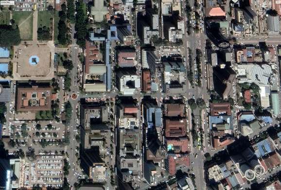
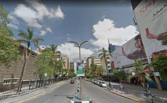
Wabera Street linkage runs from the proposed indigenous garden to the historical Macmillan Memorial Library. It’s a commercial street with few trees. Opportunity to add more green infrastructure on the sidewalks and the median which will promote legibility on the streets and continuity of the greenery from the garden leading up to the library. The trees and plants planted will be native trees and can continue and link up to the Jeevanjee gardens
Legend
Existing Green Areas
Park Monument Visual Linkages Buildings
Artificial Lake
Proposed Green Areas
Proposed Heritage Linkages
Focus Area: Uhuru Park
capturing the linked heritage of the site conceptual framework plan activating the heritage walkways in the city
1 2 3 Section Three: Framework as a Response
39
linkage 1: continuity of indigenous green infrastructure incorporating native tree spaces on streets
Linkage 1 Intervention
By adding more trees the street becomes more walkable. The trees could also run and link to the Jeevanjee gardens and to Uhuru Park through the newly proposed indigenous gardens
Adding Acacia senegal trees on the streets
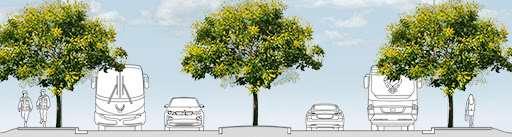
Continuity of green infrastructure along the street so as to create legibility and to enable linkage to existing green spaces, promote walk-ability
section showing re imagined street with indigenous trees
Existing Wabera Street Image showing few trees on sidewalk and opportunity to add signage on median Image source: GoogleStreetMaps
Section Three: Framework as a Response
Map highlighting Wabera Street in white Image source: GoogleEarthPro
40
linkage 2: capitalizing on local cultures creating a varied streetscape
Linkage 2 Intervention
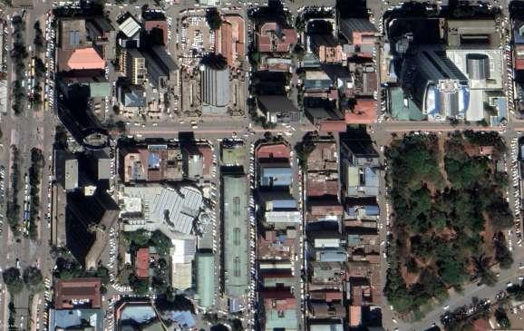
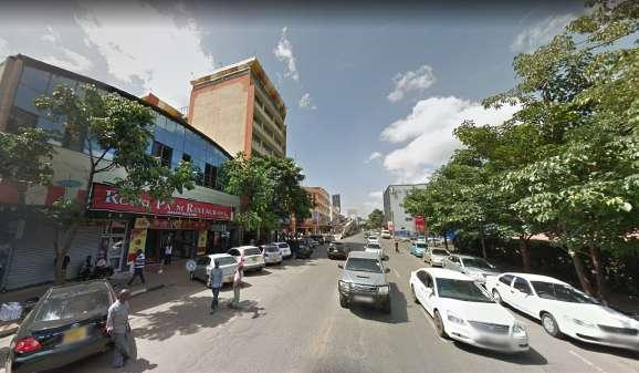
Muindi Mbingu is a busy commercial street and has some restaurants lined along the street. The street can use the road side car park spaces for overspill of local activities such as local food Markets, local food restaurants, manyatta styled rest stops onto the street and also add some seating spaces because the only seating spaces are inside the Jeevanjee Gardens nearby.
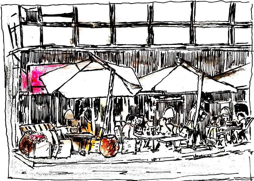 Image showing an opportunity area for intervention along the street
Image source: GoogleStreetMaps
Section Three: Framework as a Response
Map highlighting Muindi Mbingu Street in white Image source: GoogleEarthPro
41
Restaurants selling local cuisine spilling onto the streets
linkage 3: revitalizing the street creating a memorable character of the street
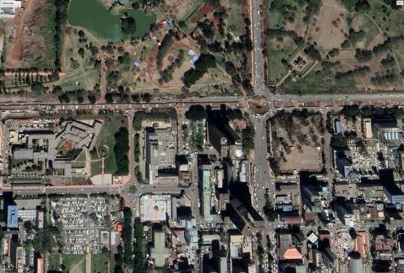
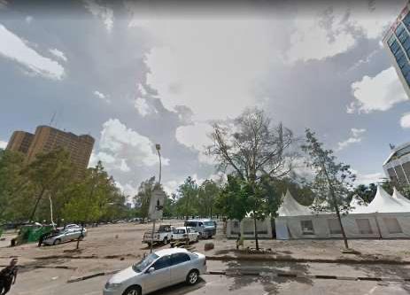
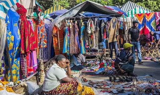
Linkage three is made up of 3 streets and has potential to create a memorable heritage experience. The carpark can have an element of duality by functioning as a normal carpark during weekdays and being transformed into the famous nomad maasai markets during weekends. Koinange street has an underutilized car park and lack of seating areas and that creates potential to incorporate a resting spot which is a pocket park instead.
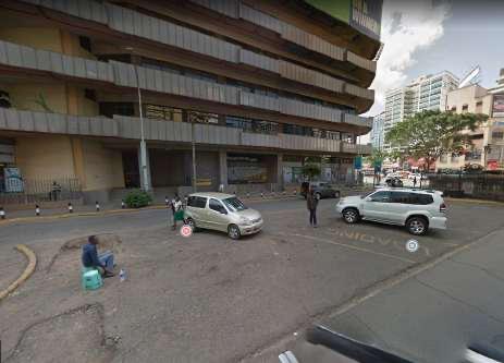
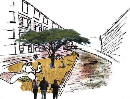 Image showing the existing Central Car Park located along Kenyatta Avenue Image source: GoogleStreetMaps
Section Three: Framework as a Response
Map highlighting linkage 3: Parliament Rd., Koinange Street, Kenyatta Avenue Image source: GoogleEarthPro
Linkage 3 Intervention
Image showing the nomad Maasai Market
Re-imagined Koinange Street incorporating indigenous vegetation to create sense of place in pocket park
42
Image showing the existing Underutilized Car Park located along Koinange Street Image source: GoogleStreetMaps
Linkage 4: Uhuru Park
After conducting a macro analysis and framework intervention, the site that would fit as the instagrammable landscape in the heart of Nairobi is Uhuru Park. Uhuru Park has been a designated public park since 1969. It is one of the few distinct green areas within the Nairobi CBD, juxtaposing the buildings and pavement. The Park contains an artificial lake, a pond, several national and historical monuments, and a national podium. The Park plays a major role in historical and heritage preservation of Nairobi and Kenya. Not only because it holds important historical monuments but because a series of memorable national and cultural celebrations have been held there. Uhuru Park is characterized by expansive lawns, shaded trees and gardens, making it an attractive site within the city (LIVINGINNAIROBI, 2020).
The park would serve as a great linkage between other heritage sites due to its strategic location and it would also serve to reveal the heritage of Nairobi by restoring its indigenous natural vegetation and landscape.
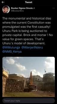
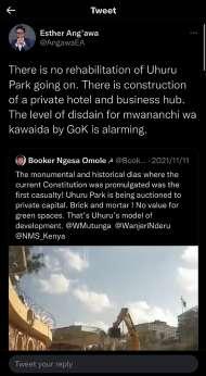
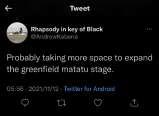
At the moment, Uhuru Park is restricted to the general public due to renovations and Kenyans are complaining that they do not want additional built structures on site but rather to retain the natural scenery. The Kenyans want their voice heard. Trying to reestablish the environment to what it should be would be an answered prayer to the locals.





site landing
Three: Framework as a Response
Section
4
43
Images drawn from social media of Kenyans complaining of Uhuru Park renovations
Site Detail Analysis
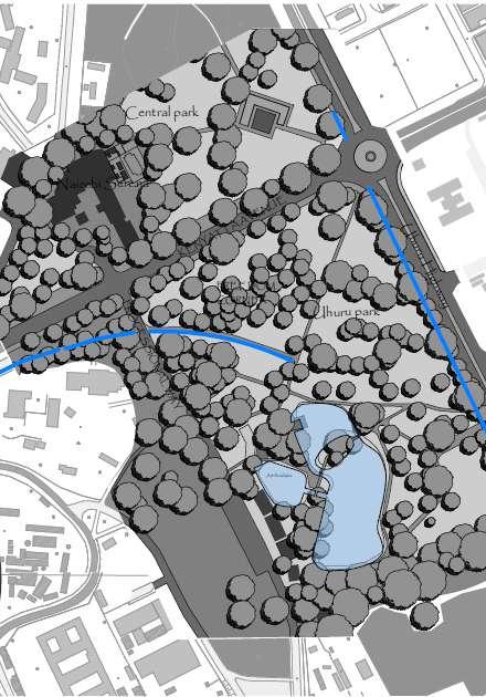
Uhuru Park is composed of the Nairobi trachyte geological structure and the surrounding government buildings are made up of the Kerichwa Valley tuffs. The Park site has black cotton soils at the top layer and severely weathered yellow grey tuff at the bottom layers.
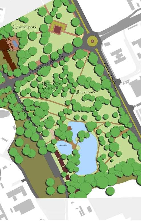
The Park sits on a gently sloping site. The site slopes generally towards the East. The Western side of the park is significantly steeper in slope than the Eastern part, with the major change in slope effectively marked by Processional Way. The flatter Eastern side hosts most of the park’s pedestrian paths and the artificial lake.
The water at Uhuru Park is supplied by the Nairobi City Council through an inlet fountain located in the pond. The site naturally drains towards the East, following the contours on site as illustrated on the topography map (see map on left). A storm water drainage channel runs through the site from the North West Extreme to the South West, partially running underground.
site landing existing site conditions KENYATTAAVENUE PARLIAMENT ROAD PROCESSIONAL WAY 1670 1680 Uhuru Park Central Park Serena Hotel Nyayo Monument All Saints Cathedral Inter-Continental Hotel Nyayo House Teleposta Towers Parliament Buildings County Hall Holy Family Basilica Cathedral Jomo Kenyatta Mausoleum 1670 1690 1660 Railway Club Afya House Ministry of Health Headquarters Kilimo House Capital Hill Towers Ministry of Agriculture Headquarters Continental House Ukulima Co-op House Kenya Local Government Workers Union Uhuru Park Government Press Railway Museum Kobil Petrol Station HAILESELASSIEAVENUE HARAMBEEAVENUE CITY-HALLWAY UhuruParkArti cialLake UHURU HIGHWAY POSTA ROAD KAUNDASTREET STANDARDSTREET BANDASTREET PARLIAMENT LANE HAILE SELASSIE LANE CATHEDRALROAD Utumishi House Minet House Masonic Lodge Nursery School Alico House Milimani Tel-Exchange Panafric Hotel AIC Milimani Church NSSF Building 'A' NSSF Building 'B' Magereza House Panafric Apartments Y.W.C.A. Y.M.C.A. CBK Residence Delamere Flats Court Lady North Home Shelter Afrique Stella Awinja Guest House HFCK Bank Chester House Barclays' Plaza IM Bank Tower Gilfillan House Kipande Emperor Plaza City Hall Shell and B.P. House Fedha Towers Hotel 680 Middle-East Bank Bruce House CBA House Uganda House Simmers Kenyatta International Conference Centre Harambee House Foreign Affairs Embassy House Nyayo House Hamilton House Jubilee House Shell and B.P. House UTC High Parking Standard City Hall Annex Catholic Book Shop Marshalls East Africa Attorney General Chambers NGONG ROAD STATEHOUSEAVENUE NYERERE MAMLAKAROAD 20th Century Cinema Lonrho House Jubilee Exchange Cotts House House Salama House Prudential Ass. Building City House Pan Africa House Standard Bank Minister House Trans National FIRST NGONG AVENUE RAGATI ROAD LOWERHILLROAD HILLLANE UPPERHILLROAD SECOND NGONG AVENUE PARLIAMENT LANE Fairview Hotel Government Press Railway Museum Forodha House Bishops Garden Flats Anglican Church of Kenya Ardhi House Guest House Maji House NHIF Building Bank Afya House Ministry of Health Headquarters Kilimo House Rahimtulla Towers British High Commission Citicorp Nairobi Children's Court Kobil Petrol Station National Library Services Headquarters Harambee Plaza Shell and B.P. Bishops Garden Towers Ministry Transport and Communications Headquarters M.O.W. Headquarters Ministry of Lands and Settlement Headquarters Milimani Commercial Courts Madison Insuarance Ministry Water Dev. Headquarters Capital Hill Police Post Ministry of Agriculture Headquarters Health Headquarters African Inland Church Headquarters Railway Quarters Hotel County Cannon Insurance Lake, Pond River SCALE: 1:2500 at A1 UHURU PARK CONTEXTUAL MAP Width Road (Main) Width Road (Bitumen) Width Road (Earth) Map showing the study area contours Map of water flow on site
Section Three: Framework as a Response 44
site landing
existing conditions on site
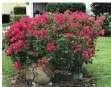
Great bougainvillea (Bougainvillea spectabilis)
Uhuru Park Plant Palette
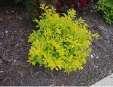

Majorly used to fence out the private area on site.
Common Bamboo(Bambusa vulgaris)
It’s mainly around the artificial lak growing as a cluster.

Traveler’s palm (Ravenala madagascariensis)
Growing next to the artificial lake next to the focal fountain.
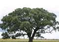
Marula Tree (Sclerocarya birrea)
This tree is scattered all over the site with no specific planting design.

White bird of paradise (Strelitzia nicolai)
Tree located next to the lake which provides an area to relax viewing the lake.
Duranta erecta
This type of flower has been used to define sitting areas and along the walkways.
American Elm (Ulmus americana)
This tree is planted around the sitting areas due to its wide canopy which then provides shade.

Black-walnut Tree (Juglans nigra)
This tree is scattered all over the site with no specific planting design.

Common mango tree (Mangifera indica)
There are only two trees for this plant on the whole site.
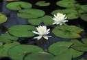
Water lily (Nymphaea alba)
Ideal plants for the 1m deep pond on site with their long flexible stems providing beautiful flowers.
Beefwood
This tree is scattered all over the site to add on the palette.

Fever tree (Acacia xanthophloea Benth.)
Most dominant tree species on site which is also a home to the Marabou stork birds a major bird species in the Nairobi city.

Mediterranean cypress (Cupressus sempervirens)
This tree is planted along the walkway majorly at the entrances which then guides the users on how to move into the park.
Canary island palm (Phoenix canariensis)
This tree is located next to the lake
Kikuyu grass (Pennisetum clandestinum)
Pockets of kikuyu grass on the ground means that it’s the main ground cover though due to the use pattern most of the surface is bare, with no grass.
Plants and Trees on Site
Most trees on site are fairly mature and large in size, some having been around for more than 50 years. The site is also mostly covered by turf of grass.
Uhuru Park has a few indigenous and more exotic plants on site.
The Traveler’s palm has been grown next to the focal fountain to enhance the aesthetics of the park. The tree is however non-native. The Bougainvillea are also native to South America and were planted to fence out the private areas on site. The Marula tree that is native to South Africa is scattered all over the site with no specific plant design and the Mediterranean cypress has been planted along walkways. Most of the landscape has been dominated by exotic plants that were brought during the urban developments and the colonial regime. There are however some native species such as the acacia species.
Section Three: Framework as a Response 45
Map of trees on site
the re-imagined site
conceptual development sketches
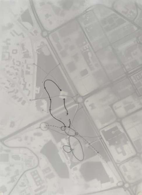
The conceptual master plan was developed by first looking at linking the framework design to the park, continuing the linking of heritage spots meant identifying the monuments on site first. Water was identified as a connector and that meant identifying the water sources on site and studying the contours to aid in establishing the marshy landscape on site and the steam flow. Then there was the development of the savannah landscape and the programmatic design of the activities on site based on the circulations and the restored landscape.
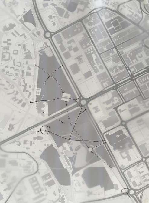
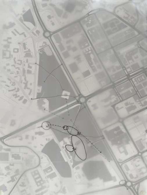
Section Four: The Re-Imagined Space 47
Linkages concept
Establishing the swamp landscape vs savannah landscape
Water as a connector
conceptual development
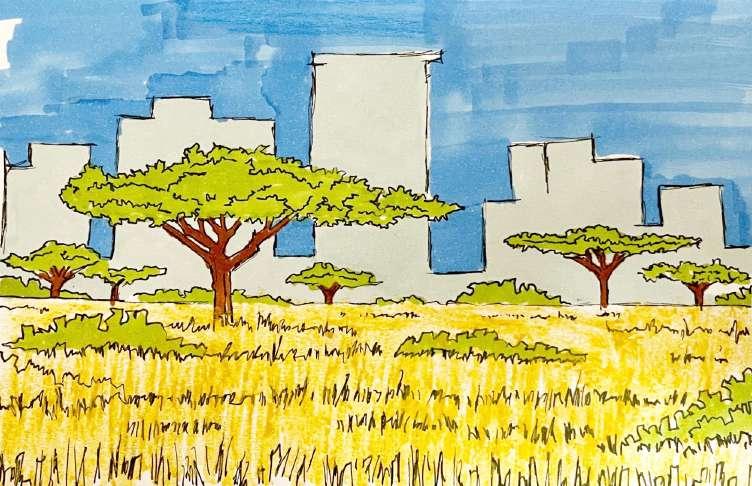
succession of the savannah landscape in the park
Ecological succession is the process that enables a bological community to evolve overtime. The succession of the savannah landscape at the park will be a gradual process as the site is currently dominated by exotic plant species but the intention is to restore it to a savannah ecosystem to reveal the natural heritage of Nairobi. The removal of the exotics will happen gradually as the indigenous species slowly replace them overtime. The succession process of the plants will begin with annual and perennial plants, followed by grasses and shrubs and finally mature savannah trees.
Stage 1:
Migration and Germination
It is the process of seed dispersal, spores and other structures of propagation of the indigenous species to be exposed into the site. Germination occurs when the conditions are favorable where the dispersed structures of propagation give rise to new seedlings of a plant species. Plant propagation by use of vegetative propagation can also apply.
Stage 2:
Colonization and Aggregation
At this stage, the individuals of the species increase in number due to reproduction. Due to the favorable environmental and physical conditions favoring them, they will reproduce and colonize at a fast rate.
Stage 3:
Competitions and coactions
Due to limited resources, the plant species exhibit both inter and intra-specific competition leading to elimination of weaker and unsuitable plants. For instance, competition between the blue stem grass and the exotic kikuyu turf grass. So, the indigenous eliminates most of the weaker exotic plant’s species.
Stage 4: Invasion Stage
Various other plant species try to establish themselves in the spaces left after weak and unsuitable plant species are eliminated due to competition. For instance, the savannah grasses and shrubs will completely take over the park.
Stage 5: Reaction stage
This is the modification of the environment through the influence of living organisms. This alters the conditions of environmental factors such as water and soil to create a favorable environment for a new species. The newly arrived plant species interrupt with the conditions of the existing ones. For example, some savannah trees are nitrogen infusing and will help stabilize the soils and improve soil aeration and soil quality.
Stage 6: Stabilization
In this final stage, a plant community becomes stable for a longer period of time, and it creates a savanna ecosystem. Wild herbivores such as zebras, giraffes are introduced to help with overtime succession of the savannah biome within the park from grassland to forest and scrub through grazing and browsing and trampling.
Section Four: The Re-Imagined Space
48
Sketch of the concept of the savannah landscape within the city in Nairobi after succession
restoration of the marshy landscape in the park
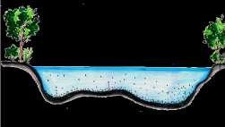
Nairobi was originally a swamp, and to recreate the marsh ecosystem , the site can make us of the existing drainage channels and the artificial pond. The restoration process would be a gradual process before the marshy ecosystem is achieved. The achieved marsh becomes seasonal as some parts of the marsh may dry during the dry months and flood during wet months
Stage 1: Phytoplankton stage
Algal spores are introduced into the water body. After death, phytoplankton and zooplanktons in the water settle at the bottom of the pond to from a layer of mud.
Stage 2: Submerged stage
After the death of the algal spores and mud formation, some rooted submerged hydrophytes begin to appear on the new layer and develop to form tangled masses. When they die, they are deposited at the bottom of the lake or pond together with eroded soil particles and other transported materials. This gradually raises the ponds up, and with time the water body becomes more and more shallow making the area unsuitable for submerged plant.
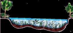
Chara and Ranuculus species
Deposit of eroded soil particles
Submerged aquatic plants
Stage 3: Floating stage
When the depth of water reaches 4-8 feet, the submerged plants begin to disappear, and floating plants gradually appear. The plants have broad leaves floating on water for deep penetration of light. Due to these changes, the chemical and physical traits of the environment also change. More materials are deposited to the bottom of the pond.
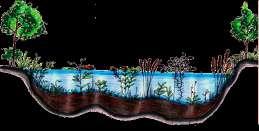
Water depth reduces to 4 - 8 Feet
Floating Plants
Rise in substratum due to deposition
Few submerged plants
Increase in emergent plants
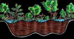
Mesophytes appear at this stage. Shrubs and small trees form an open vegetation or woodland. They also produce more shade, absorb and transpire a lot of water making the area marshy for both plants in the site.
Shrubs and trees form to create a marshy woodland
Floating Nymphae plant
Emergent Typha Plant
Submerged Najas plants
Mound of substratum deposition
Reduction in water colony
Stage 5: Sedge marsh or meadow stage
Plants well adapted to the marshy conditions appear and modify the habitat by absorbing and transpiring large quantities of water and trapping and accumulating plant and soil debris resulting in a less watery habitat
Floating Nymphae plant
Emergent Typha Plant
Submerged Najas plants
Mound of substratum deposition
Reduction in water colony
Stage 4: Reed swamp stage
When the ponds are too shallow (1-3feet), the habitat changes and accommodates plants that are more suited to the new environment. Floating plants are gradually replaced by amphibious plants which can survive in aquatic and aerial environments.
Amphibious plants have their leaves forming a cover over the plants beneath them, cutting of their access to light and they cannot survive. Due to continued deposition, the pond or lake bottom reaches very close to the water surface making the habitat less suitable for pre-existing species.
Typha latifolia plant
Nymphae Plant
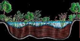
Amphibious plants
Pond becomes shallower
Rise in substratum due to deposition
Section Four: The Re-Imagined Space
conceptual development
Stage 6: Woodland stage
A layer of muck
Algae and phytoplanktons
49
The site is already dominated by exotic species and the kikuyu turf grass. The design would respond to restoring the natural heritage by incorporating indigenous plant species that will also be suitable for the urban microclimate as the site is located within the city center. The plants would also create an ecosystem that supports the savannah biotic life such as birds, insects and the savannah animals. The plants would also respond to the urban needs of the people. For instance, a typical savannah grassland biome has few scattered trees but the park could have more trees for shading. The plants will also be able to survive harsh urban climate and will create the unique physical aesthetic qualities of the savannah. Some plants will be medicinal as the Maasai always use traditional medication and twigs as toothbrush so it will be a way of revealing the heritage and finally some wil reveal the urban essence of the savannah such as trees that produce dye, wild fruits and those that attract bees.
Trees Shrubs Grasses
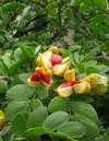
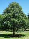
1. Zanthophylum chalybeum
- Common name, Knobwood.
- Indigenous in Nairobi, and yellow green flowers, edible leaves, Carvings, toothbrushes, creates fragrance (when crushed and mixed with oil)
- Leaves used as tea.
- Shiny black seeds used as beads
2. Vitex kiniensis
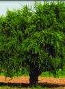
- Common name, Meru Oak, - It is a tall, straight trunk and light green leaves with five leaflets arranged in a vaguely star-like formation.
- It’s used as an edible landscaping, ornamental and a wind breaker.
3. Salvadora persica
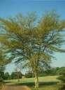
- Common name, Toothbrush tree
- Small evergreen tree native to the Kenyan savanna.
-Sticks are traditionally used as a natural toothbrush Woodlot/ enrichment systems Fodder, soil, protection, food, timber, tannins, apiculture, shade.
4. Acacia xanthophloea
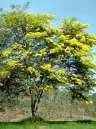
- Trees grow to a height of 15–25 m (49–82 ft).
- Characteristic bark is smooth, powdery and greenish yellow, although new twigs are purple, flaking later to reveal the characteristic yellow
- Produces a general-purpose timber, used in construction, carpentry, boats, boxwood, furniture, mortars, utensils, troughs and fence poles
5. Acacia senegal
- Small thorny deciduous tree
- Common name, Gum arabic, Enderkesi (Maa)
- Flowers are yellowish-white and fragrant
- Used for Woodlot/mixed / enrichment planting Fuel, gum Arabic, bee forage,
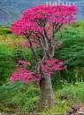
6. Adenium obesum
- Common name, Obbe
- Thick-stemmed sparsely leaved perennial succulent that is native to semi- arid, and savanna woodland.
- Flowers are very showy from white to pale pink to deep rose.
- Used as bee forage and ornamental live fence.
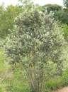
7. Bracheleana huliensis
- Indigenous and evergreen tree, with steeply ascending branching forming narrow crowns.
- Produces an essential oil, used for carving, as an ornamental tree, and it is termite resistant and pollution resistant.
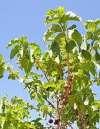
1. Vangueria madagascariensis
- Common name, Common wild medlar
- It is a profusely branched shrub or small tree, 2-15 m tall, with smooth grey bark and a whitish or cream slash.
-Bee forage, shade shrub, ornamental, and produces edible fruits.
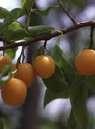
2. Ximenia americana
- Common name, Mutura
- Indigenous tree in Nairobi, usually spiny shrubs occasionally scrambling.
- Fragrant, small green white flowers
- Edible fruits, medicinal, fodder for animals, barks used to make tannins and dye and as a shade tree.
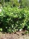
3. Allophylus africanus
- Indigenous shrub.
- Evergreen shrub, with a high spreading branch with a dense foliage.
- Small, cream to white flowers which are fragrant
- Fodder and bee forage as well as fibre
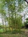
5. Arundina alpina
- It is a large hollow stemmed grass, with a smooth woody hollow yellow green to brown stem
It can be used to make furniture posts, for construction and ornamental purposes, basketry and soil conservation.
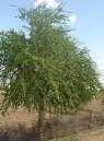
6. Balanites glabra
- It is a very spiny and evergreen which is a mush branched dense bush shrub.
- It has greenish yellow flower, with an orange fruit with greenish yellow stripes
It is used as a barrier and fence. Ripe fruit pulp is eaten by maasai
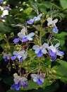
7. Clerodendrum myricades
- It is a small shrub much branched at the base with a smelly leafy when crushed.
- It is medicinal ornamental and ceremonial shrub
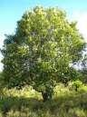
8. Apydotes dimidate
- It is a tall evergreen forest tree with round branching form branching at the base
- It has a yellowish flower
- Can be used as an ornamental shrub, bee forage and medicinal value
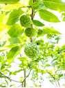
4. Annona senegalensis
- It is a spreading shrub or a small tree rarely high with yellowish flowers.
- It is used as an edible landscaping element(fruit), fodder, ornamental and a wind breaker.
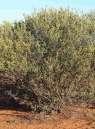
8. Acacia kempeana bushes
- Native to tropical and sub tropical climates
- Landmarks of the savannah grasslands in Kenya
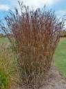
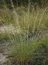
1. Andropogon gerradii
- Bluestem is a warm season, perennial bunchgrass
- Ornamental grass: essential for grassland restoration, bluegreen foliage, and interesting flowering heads provides an aesthetic look.
- Wildlife restoration: Provides cover for at least 24 species of songbirds and Grasshoppers
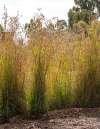
2. Hyparrhenia rufa
- Giant thatching grass. It is a robust, tall and erect perennial grass. It is generally densely tufted and has short rhizomes
- Native to Kenyan savanna and it is widespread in the world as a cultivated forage and fodder
- Grown in pastures for grazing
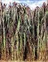
3. Themeda triandra
- Indigenous shrub.
- Evergreen shrub, with a high spreading branch with a dense foliage.
- Small, cream to white flowers which are fragrant
- Fodder and bee forage as well as fibre
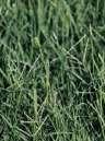
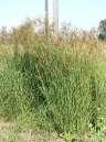
4. pennisetum purpureum schumach
- Ornamental, native to Kenyan savanna
- Elephant grass has coarse, hairy, yellow or purple-colored, multi-branched stem that can reach 10 feet in height.
- It often grows in dense, bamboo-like clumps.
- Important forage in the tropics due to its high productivity.
- Used in zero grazing
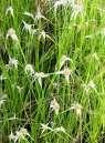
5. Cydon dactylon
- Native to Kenyan savanna
- Bermuda grass usually is tall and has short flat leaves. Has a dense turf.
- Provides hay and pasture for livestock throughout he savanna.
- Used in sports fields, lawns, parks, playgrounds, golf course fairways, roadsides, cemeteries, and other general-purpose turf.
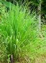
6. Cymbopogon citratus
- Perennial grass, fragrant leaves and stalks which are used as a flavoring. Native in Kenyan savanna
-The heart of young shoots may be cooked and consumed as a vegetable. Leaves for tea
- The essential oil extracted from the leaves is commonly used in insect repellents, perfumes and soaps.
7. Chloris gayana
- Rhodes grass is an important tropical grass widespread in tropical and subtropical savanna biome.
- Useful forage for pasture and hay, drought-resistant and very productive, of high quality when young
8. Cynodon plectostachyus
- Giant star grass is a robust, stoloniferous perennial grass with underground rhizomes.
- It is grass native to the Kenyan savanna.
- The grass Yield Pasture, Hay and cut-and-carry, Agroforestry systems.
planting strategy
savannah landscape
palette Section Four: The Re-Imagined Space
the
plant
50
Nairobi was originally a brackish swamp. A swampy wetland is characterized by the domination of woody plants. Wetland plants can be grouped as either submerged, floating or emergent. The major factor that will affect the dynamic plant palette will be the water level changes during the rainy season and in comparison to the dry seasons. Apart from restoring one of the major natural landscapes of Nairobi, the swamp would also enable soil stability within the park and create an ecosystem suitable to migratory birds and biotic life that originally existed in the marshy landscape. Some acacia woodland trees such as the fever tree, Acacia seyal Delile, Sesbania sesban, also do well in the marshy landscape, and this would create unity in the newly restored landscapes.
Submerged Plants Floating Plants
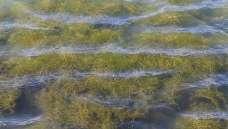
1. Potamogeton pectinatus
- Common name Fennel-Leaved Pondweed
- Perennial found in most wetlands and known to attract wildlife.
- Helps to remove toxins from the swamp and reduction of erosion along the edges of the marshy landscape.
- It cannot grown in shade so it does well when the water levels of the swamp are more during the flood season.
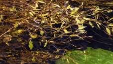
2. Potamogeton octandrus
- Native to tropical and sub-tropical climates.
- It’s an aquatic herb with submerged and floating bright green to brown leaves.
- It’s considered an excellent food source for wildlife such as swans and ducks and provides habitat for many aquatic organisms.
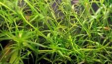
3. Najas pectinata
- Common name saw-weed
- Submerged perennial plant that forms dense clumps. Can be found in both fresh and brackish waters.
- Common in the savannah regions of Kenya.
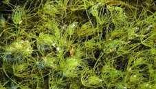
4. Chara Algea
- Chara is a macroscopic, multicellular, profusely branched thalloid plant body, generally attains a height of about 20-30 cm (rarely about 1 meter).
- It is differentiated into rhizoid and main axis and common in Kenyan savanna
- Chara stabilizes bottom sediments; provides food for waterfowl and cover for fish. Chara also supports insects and other small aquatic animals
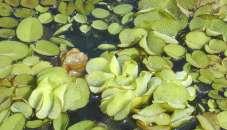
1. Nelumbo nucifera
- Common name Sacred Water Lotus, Sacred lotus
- Perennial aquatic plant that has ornamental qualities and edible uses.
Emergent Plants
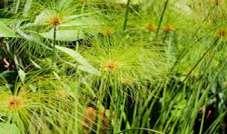
1. Cypressus papyrus
- It is a species of aquatic flowering plant.
- It is a tender herbaceous perennial, native to Africa and Kenyan savanna, and forms tall stands of reed-like swamp vegetation in shallow water.
- Parts of the plant can be eaten, and the highly buoyant stems can be made into boats. It is now often cultivated as an ornamental plant.
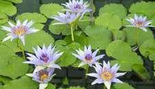
2. Nymphaea caerulea
- Common name Egyptyian blue water lily
- Native to the tropical Northern and Central Africa.
- It’s a tropical water lily plant and it is very aesthetic as it features day blooming star shaped petals and light blue flowers.
- It also aids in air purification in the environment.
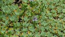
3. Pistia stratiotes
- Common name: Water Lettuce
- It’s a small evergreen plant with free floating leaves in lakes, ponds, swamps etc. It helps to remove toxins in polluted waters.
- It is also grown for its ornamental value in tropic and temperate regions.
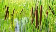
4. Typha latifolia
- It is a very vigorous, herbaceous perennial plant. it forms a colony of unbranched leafy stems 150300cm tall.
- It is also an excellent protector of the soil in wet habitats and a very productive source of biomass. The plant is also planted to provide wildlife habitats and for wetland restoration
- It is grown as an ornamental, though it needs to be restrained at the roots in all but the largest areas
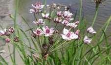
2. Butomus umbellatus
- It is a moderately tall, rush-like perennial widely spread in African savanna.
- Its leaves are basal originating from a stout rhizome that is stiff and erect when immersed or lax and floating when in deep water.
- It is cultivated as an ornamental waterside plant and the rhizomes are used as food.
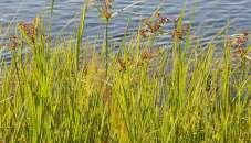
3. Pycreus nitidus (Lam.) J.Raynal
- Robust plant, with culms up to about 60 cm; yellow to dark red-brown
- Often useful for providing shade for fish in ponds and water bodies.
- Also used for thatch, mulch, brick cover, and for its medicinal and cultural properties.
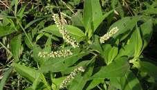
4. Polygonum pulchrum
- Robust Perennial plant with long stems and shortly petiole leaves
- Mostly found in tropical climates, in swamps and by rivers.
planting strategy
marshy
Section Four: The Re-Imagined Space
the
landscape plant palette
51
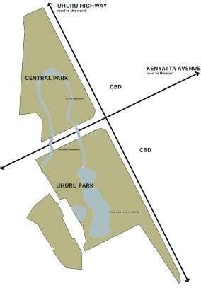
Merge of ecosystems - a programmatic landscape -
Different ecologies ensure the possibility of varying human experiences within the landscape. Coming up with a diverse landscape. By restoring the wetlands/ swamp ecosystem, we also make room for the bird islands, promoting indigenous bird species within the park. By restoring he savannah grasslands, we also promote the savannah herbivores such as the zebras to exist within the park.
Human senses are stimulated through the seasonality of the landscapes. For instance, the change of colors of the savannah grasslands from the rainy season to the dry season, and the seasonality of the wetlands and how the water becomes more during the rainy season in comparison to the dry seasons. The paths vary from the human perception in how they look during different seasons altogether. With the varying landscapes restored, the seasonality aspect makes the spaces have a specific identity that makes them worth to be photographed and shared to other people.
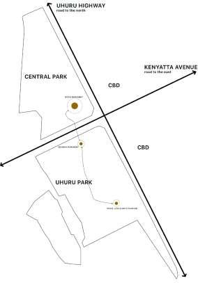
The Monuments - activated hotspots -
Activity hot spots are organized at the existing monuments / heritage spots. The whole essence is to link the heritage and to make the existing monument spaces more frequented by activating them. The monuments are also evenly distributed, and each monument strategically placed near an entry
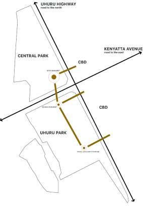
The Artefact - linked form -
The whole idea of linking the heritage monuments within the park, helps with formation of a new form with the help of the lines drawn from the artefact. The bold lines show both physical connections and visual linkages from one activity hotspot “monument” to the next. The form will also aid in circulation of both the people and the waters harmony. By linking the monuments, we also allow the linking of the two divided parks – Uhuru Park and Central Park and merging them into one.
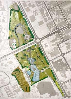
The Instagrammable Landscape
- optimizing the landscape -
The developing landscape, with the merged ecosystems, the restored landscapes, there is now a habitat formed where the humans and the animals can co-exist. A landscape reminiscent of what used to be. There is opportunity to even bring in zebras to show a glimpse of what Nairobi once was. There is now potential to showcase the landscapes to everyone else. There is potential photo spots all over the park through how it has been designed, and it is designed to accommodate all age groups, locals, and tourists alike. The landscape become optimized both ecologically and programmatically.
linking Section Four: The Re-Imagined Space 52
design development form follows merging and
re-imagining Uhuru Park
the redesigned landscape master plan
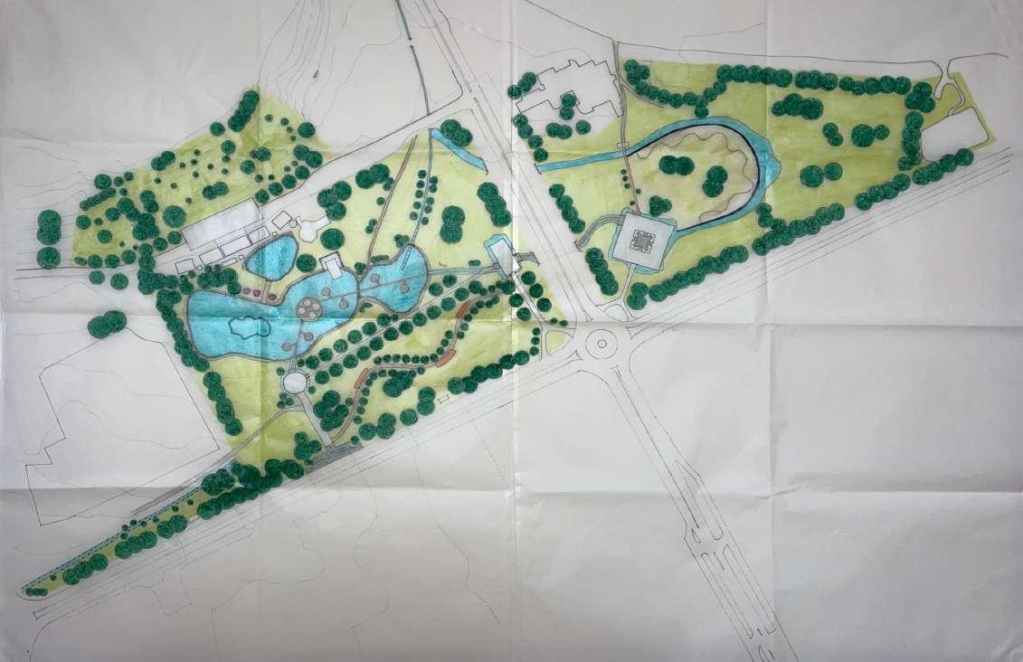
Legend Program
Existing Monuments
Nyayo Monument
Mau Mau Monument
Peace Love and Unity Fountain
Program
Central Park
Zebra Meadow
Ha-ha
Open Picnic
Savannah plants nursery
Uhuru Park
Marsh with boardwalks and maasai styled manyatta gazebos
Podium/ Skateboarder’s paradise (transforms to performace area)
Natural Playscape
Instagramming spots
Outdoor Gym
MauMau Lane
Peace, Love and Unity Route
Water Mirror
Bird Island
Picnic Spots
Vegetation -refer to planting strategy page
Savannah Landscape
Tress Shrubs
Grasses
Marshy Landscape

Submerged
53
Four: The Re-Imagined Space Master plan Hand Render Drawing Scanned Scale 1:1000 @A0
Section
A 1 1 5 A B 2 2 6 B C 3 3 7 4 4 8 9 T Sm Sm S G F E Serena Hotel CBD CBD ExistingAmphitheater seating
Floating Emergent
C 1 2 3 4 1 2 3 4 10 5 6 7 8 9 10 10 10 F& Sm Sm F&E T,S,G T,S,G T,S,G T,S,G A A’ B B’
Kenyatta
Avenue UhuruHighway
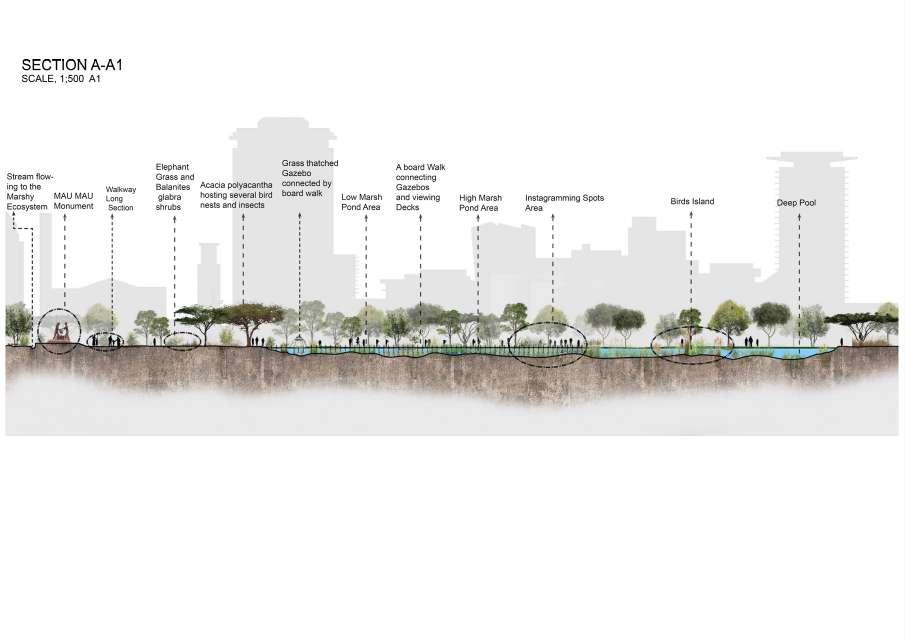
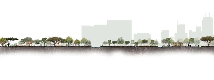
re-imagining Uhuru Park proposed design sections 54
Four:
Space SECTION B-B1 SCALE, 1;500 A1 Stream separating the wildlife area from the viewing area. 600mm high protective natural stone wall NYAYO Monument Pavament area for circulation & vantage point for viewing Open paved area for circulation & vantage point for viewing ren e r e en n re e r e Medium-Tall elephant Grasses Fully grown Acacia polyacantha hosting several birds and insects also actn er r e r e n e r n e nn ee el n n ener re n
Section
The Re-Imagined
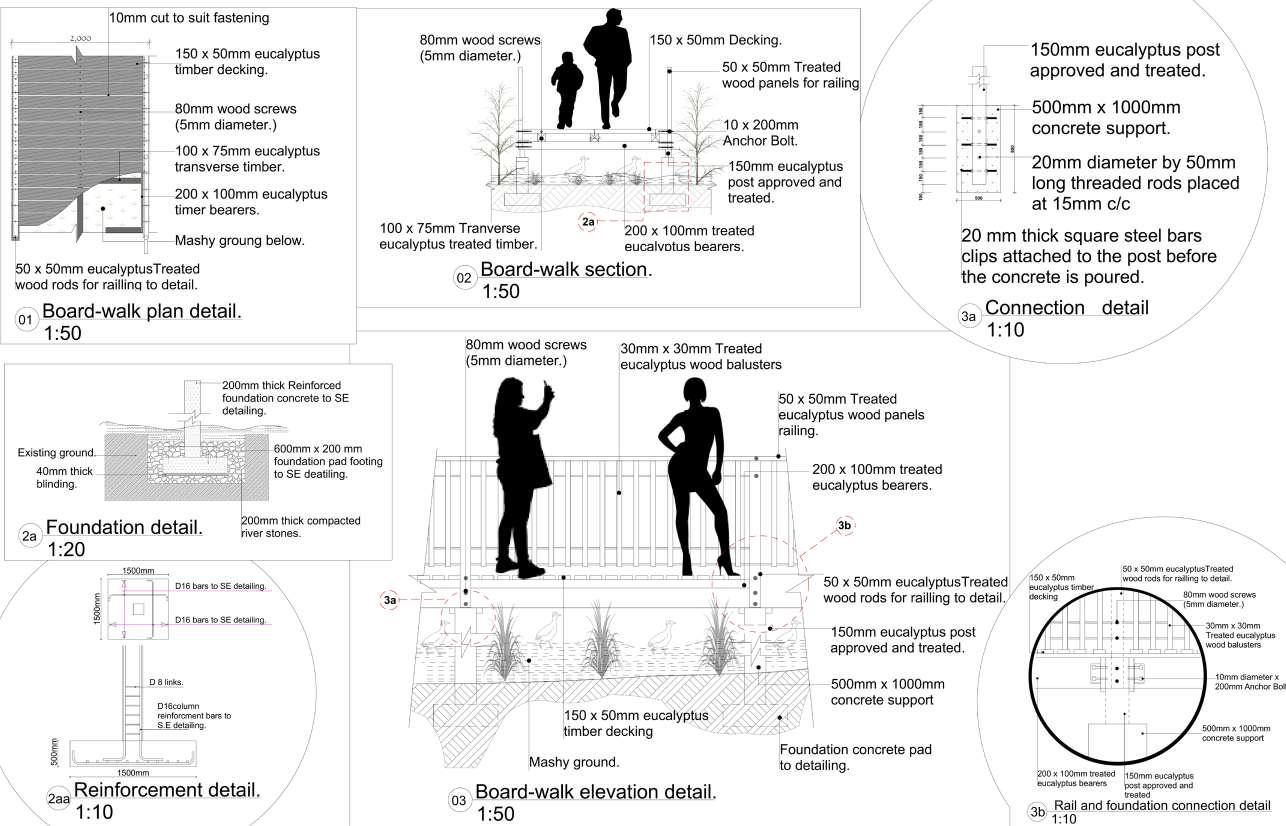
dissertation technology
56
Four: The Re-Imagined Space
Boardwalk detail drawings
Section
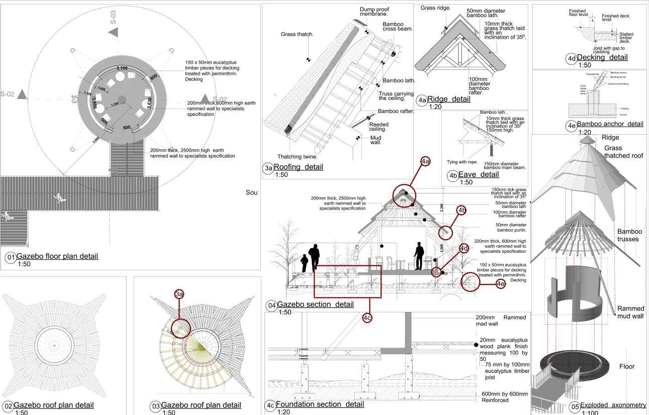
dissertation technology traditonal manyatta styled gazebo details 57
Section Four: The Re-Imagined Space
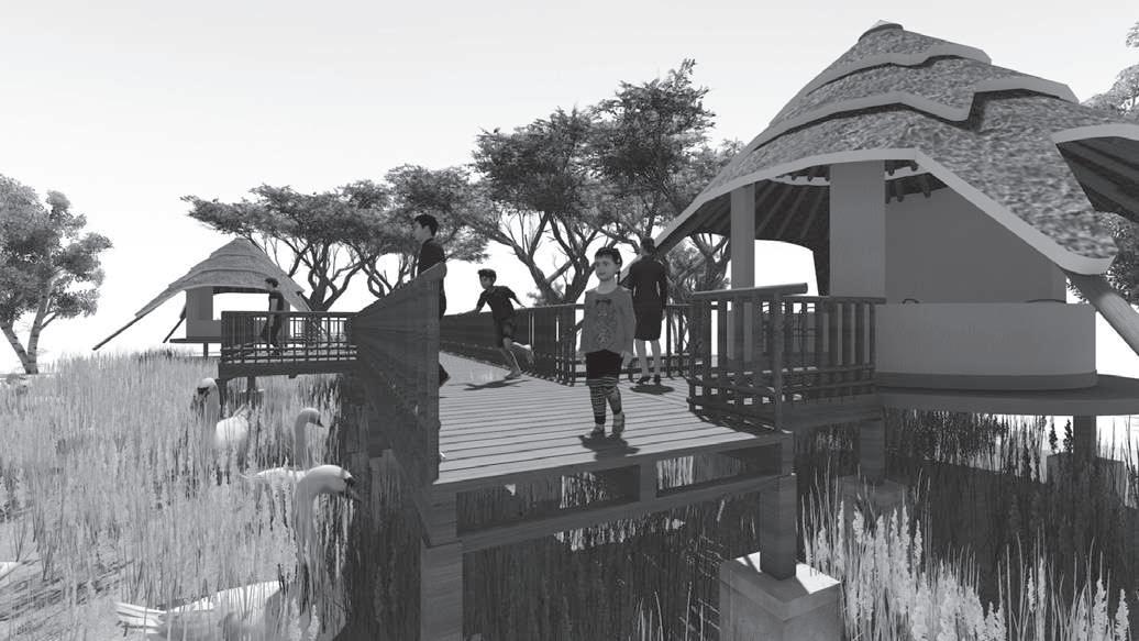
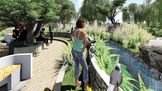
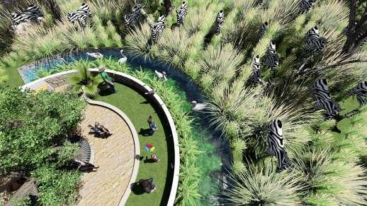
Boardwalks and Manyatta-styled Gazebos Spatial experience
Boardwalks bring out the playfulness of the site. Kids can play around as they look at the wetland birds and the plants. The boardwalks enhance the instagrammability of the space as people can take pictures of the scenery as they walk around. A sense of interaction is evoked.
The gazebos that are projected from the boardwalks will evoke a sense of the Maasai’s manyatta houses as they are clustered to form a ‘village’. They will act as rest stop as people go around the site. They also add onto the heritage as they use some of the maasai materials such as thatched roofing therefore are very instagrammable altogether. They will especially attract tourists as well to see the heritage and culture of the Maasai.
The materials used such as timber, thatched grass complement the surrounding vegetation and make the space even more welcoming. There is relationship hat is developed as people interact with the birds and with the surrounding vegetation.
Ha-ha Spatial experience
A ha-ha has been incorporated onto the site to allow uninterrupted views of the landscapes. The visitors can spot the zebras on the other side of central park and photograph the animals or even pose with the animals as a background – capturing the essence of both a picturesque and an instagrammable landscape. By incorporating both the indigenous landscapes of the swamp vegetation and the savannah grasslands and woodlands and incorporating the safari animals, the landscape is a unity of the original landscape of Nairobi. The identity of the city is revealed
The Ha-ha brings about a sense of being in the wild. The animals are not restricted in fences and people can look at them and photograph them. It is reminiscent of the safaris where people go to the wild to look at the safari animals. It paints a picture of what the landscape would look like overtime, where more than one species can be within the landscape. For instance if giraffes were added humans could even further interact with them by feeding them. The materials chosen for the ha-ha are also local materials such as the local quarried stone which is the most common building material in Kenya.
spatial
59
experiences perspective renders
Section Four: The Re-Imagined Space
Conclusion
The introduction to this dissertation mentioned that society is changing and now everything is concluded with a realization that we can change with it as well. Social media can continue to be a major force in reshaping a lot more societal attributes and environmental qualities.
As designers, but first, as people, we influence the environments that we want to stay in. Judging by the fact that we live in an age where social media applications such as Instagram are affecting and influencing our livelihoods, we can choose to use this opportunity to our advantage and create landscapes that people yearn for.
Often, people seem to yearn for the natural landscapes, or go to the few spaces left with the natural and beautiful landscapes that have slowly been destroyed. While people snap the natural setups on their Instagram and store the memories on their phones, there is a clear idea of the landscapes that people like more, the landscapes that people want other people to see, the landscapes that hold a specific identity of and to the people, the landscapes that have a unique aesthetic – that is what an Instagrammable landscape is. The realization that landscape architects and designers can go onto Instagram and use it as a platform to influence a specific identity of a local landscape by restoring the lost indigeneity and still enhancing environmental values is what this thesis is concluding.
Our world is changing, and we have the power to restore it to what it should be!
Epilogue
62

University of Cape Town, South Africa
January, 2022
Clare Tsisika Ayisi
AYSCLA 001
