8 minute read
Areas of Recommendation

In order to document the vision that the Government and citizens of Nauru will require, to be able to fully implement the Higher Ground Initiative, a series of design and development deliverables were required that would record existing conditions and describe the corresponding design of various urban, infrastructure, and architectural elements, as well as provide the policy recommendations necessary to guide a successful implementation.
Prior to the project, Nauru had insufficient mapping of the existing conditions of its developable land and was in need of improved documentation of the current conditions, in addition to its need for master planning for all aspects of the vision of HGI including community structure, connectivity means, public realm amenities, and architectural morphology, all of which are offered within this body of work. Nonetheless the complete refinement of plans and related regulations should be conducted in engagement and consultation, not only with vested stakeholders but with the broader Nauruan community as a whole, to ensure that the established vision is reflective of a future representing the desires and well-being of the entire Republic of Nauru. As has been noted, while key stakeholder engagement was possible during facilitation of the project timeline, broader consultation will be necessary in future phases, in order to fully meet this objective.
Advertisement
Ongoing land tenure and administration support will also be necessary, to fully underpin the master plan and enable future conveyancing, regulation, and socially and environmentally sustainable and safeguarded detailed land use planning. Land use planning to date has been constrained by challenges of institutional capacity, legislative limitations, and insufficient integration with and recognition by traditional land tenure arrangements. However, a transparent and fair land management system that supports social, economic and private sector development is imperative for Nauru to meet the mandate established by the Higher Ground Initiative. It is important that this system be embedded within community practice, and socially legitimated, in order to remain up to date, to address and reduce land conflicts, and to ultimately promote land productivity and Government service provision. As part of future phases, there remains the need for development of a policy framework for land conveyancing, to facilitate a functioning land market that will allow the HGI vision to be fully implemented; as with the master plan, this framework should be broadly consulted, with clear recognition of custom as well as the existing legal environment.

As the first volume of the final project documentation, Volume 1: Purpose + Need has provided an introduction to the Higher Ground Initiative and the master planning project deliverables including the foundational goals and mandate of the initiative, the purpose of this undertaking and the needs that must be confronted with this body of work, the principle frameworks on which the response has been based, and the national and global context in which the work has been applied. The subsequent reporting for this master planning body of work includes three primary Areas of Recommendation:
Volume 2: Housing + Architecture, including recommendations related to the proposed modular system for housing provision and the corresponding variations and aggregations possible with this system, as well as details of proposed form and construction, the recommended method for arranging block patterns, and the utilization of this system in site planning for Land Portion 230 and adjacent to the Port;
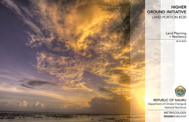
Volume 3: Land Planning + Resiliency, including urban design and development recommendations related to the detailed site planning for Land Portion 230, the potential expansion of development beyond government-controlled property on Topside, the potential new Township adjacent to the Port, and the comprehensive island wide master plan, as well as those recommendations related to infrastructure and utilities, land remediation and grading, and the design of thoroughfares and open spaces; and
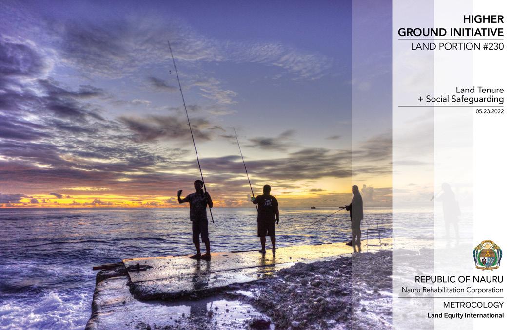
Volume 4: Land Tenure + Social Safeguarding, a summary of the relationship of Land Tenure policy to the master planning process and the Higher Ground Initiative, including an analysis of the land tenure and administration context in Nauru, an overview of the social context and safeguarding needs for the master planning project, an evaluation of the tenure and planning options that would address the housing challenges across the island, and an outline of next steps for ensuring feasibility of the implementation of the vision for the initiative.
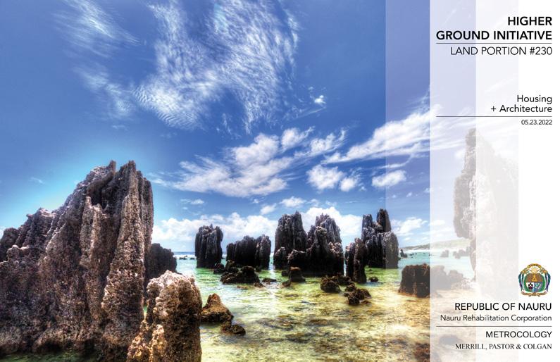

Volume 2: Housing + Architecture
In response to the need for safe, affordable, and accessible housing in order for the Government to address the burden that overcrowding places on the country, the design team has designed a strategy for new housing and architecture in Nauru. The proposed housing is based on a modular system, where a core housing module serves as the base upon which a wide variety of options to both plan and detailing can be applied. The studies included in this volume take a limited number of plan types with relatively constant cross-sections and adapt their layout or change their orientation to the street, efficiently providing a breadth of variety and a platform for customization.

Affordability was a crucial objective of the proposals, and the important constant for saving money with the proposed housing system is the designed cross-section. Length can vary for flexibility, bedroom wings can be extended, simple houses can be expanded over time into various shapes. Frontages and setbacks can be constant or vary, and orientations can vary as well. Importantly, even with these limited and relatively inexpensive planning variables, neighbourhoods can achieve unlikely variety and a true reflection of individual preference from only a handful of actual house types. Beyond plan types, assemblies can vary to give even more variety through window types, the percentage of glass or shutters utilized, the detailing of entries located directly on the street or from inner yards. Any discretionary expense can be used to great effect, and thus provides the unique customization that will reflect the character of Nauruan life in each new house.
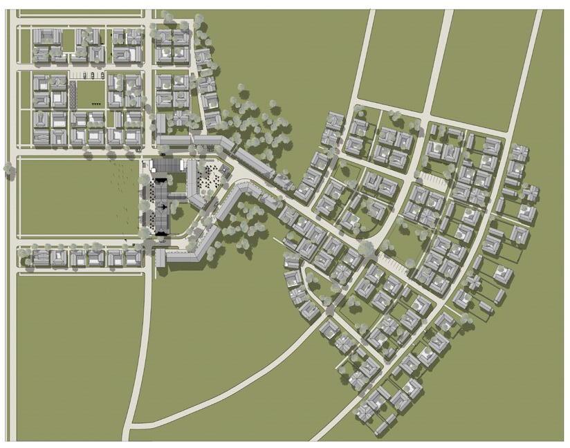
Renderings of Land Portion 230
Included throughout the volume, design renderings of the detailed site planning and housing proposals that have been developed for Land Portion 230 illustrate the experience that these proposals will create when built. The digitally rendered images provide a realistic detailed view of the scale of development, the design of buildings, and the experience of open spaces as designed for LP230. An overall aerial rendering gives a birds-eye view of the development pattern. In addition, both aerial and ground-level renderings show: the central large public space and the surrounding civic and commercial and/or mixed-use buildings, the neighbourhood focused on one of the two church squares included in the plan, that same church square in closer detail, and various neighbourhood streets and open spaces found throughout the master plan.
Volume 3: Land Planning + Resiliency
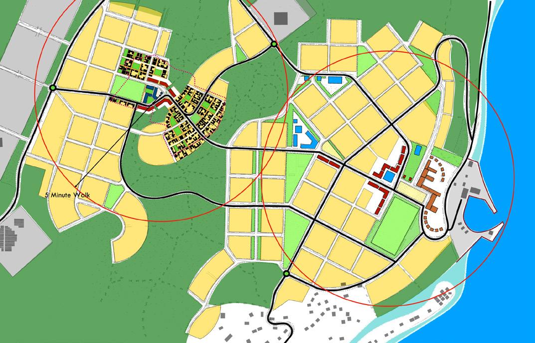
The scope of this project focused on provision of a detailed design for the Government-controlled property defined as Land Portion 230. The design team has developed a series of plans depicting a detailed design for the property, showing location and platting of all public and private properties, surface infrastructure and utilities, and schematic design of parks, playgrounds, and public and civic amenities. The plans illustrate the location and disposition of all buildings, open spaces, streets, and cultural and/or community facilities. The resulting detailed site plan demonstrates a new model of Pacific sustainability and urban development.
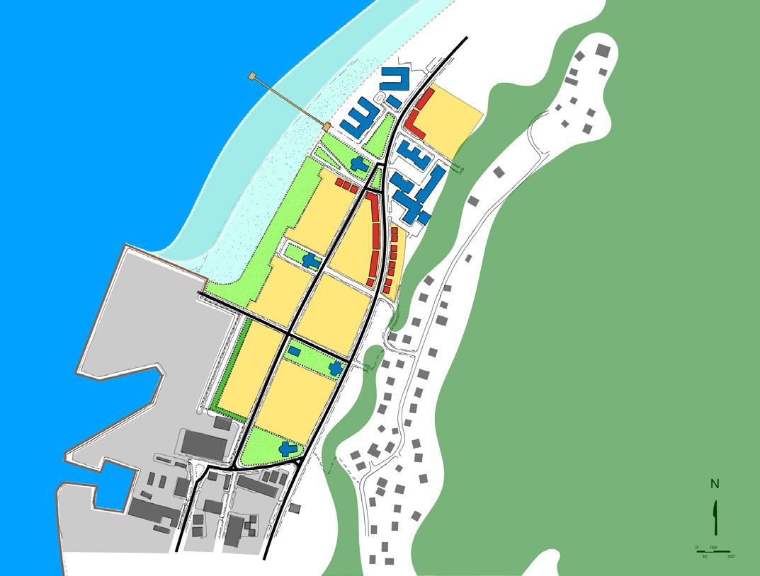
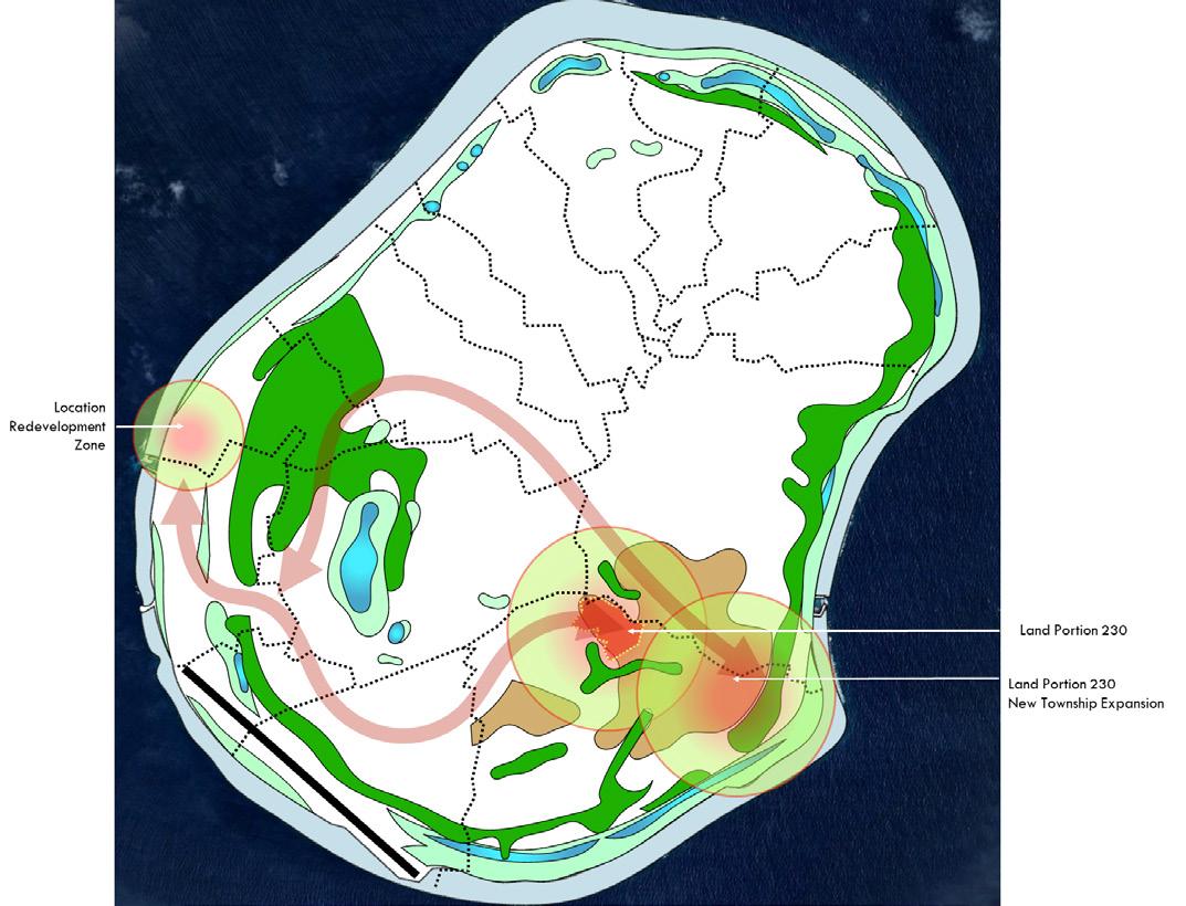
As the implementation of Land Portion 230 gains momentum, it is expected that neighboring property owners will be interested in participating in the significant development happening on Topside. In order to ensure that such interest can adequately align with a common vision, one that reinforces the Pillars of the Higher Ground Initiative and is rooted in neighbourhood planning principles and sustainable development goals, detailed site design consideration has been given to how the development pattern modeled in LP230 would expand outward and eventually reflect a level of growth indicative of a new Township. The pattern for this expansion would be based on the block pattern developed for and established with the housing strategy of LP230, and systemic considerations such as connectivity between Boat Harbors, provision of additional civic and institutional facilities and infrastructure needs, and conservation of viable agricultural and ecological remediation land, have been incorporated.
The island wide master plan provides an illustrative documentation of the master land use vision established for the realization of the Higher Ground Initiative and the future development of the entire island of Nauru. The master plan actively and intentionally incorporates Pillars of the Higher Ground Initiative, including: economic diversification; affordable green housing; education and training; energy security; food security; water security; public health; and low/ zero emissions transport; and does so while employing the design principles of neighbourhood planning as well as the Sustainable Development Goals, producing a vision for Nauru that is inherently secure and resilient.
Street Sections
To ensure that development on LP230 is consistent with the principles of walkability and sustainability that are central to a neighbourhood planning approach, careful consideration must be given to the specific design of all streets, roads, rear lanes, and pedestrian passageways and trails. The street sections included in this volume provide a visual cross-section representation of the various thoroughfare types that will be utilized in the construction of LP230, and include measurements of the provision for vehicular lanes, bicycle lanes, vehicular parking provision, pedestrian footpaths, and tree planting in the overall width of each type of thoroughfare.
Renderings of Land Portion 230
Included throughout the volume, design renderings of the detailed site planning and housing proposals that have been developed for Land Portion 230 illustrate the experience that these proposals will create when built. The digitally rendered images provide a realistic detailed view of the scale of development, the design of buildings, and the experience of open spaces as designed for LP230. An overall aerial rendering gives a birds-eye view of the development pattern. In addition, both aerial and ground-level renderings show: the central large public space and the surrounding civic and commercial and/or mixed-use buildings, the neighbourhood focused on one of the two church squares included in the plan, that same church square in closer detail, and various neighbourhood streets and open spaces found throughout the master plan.
Volume 4: Land Tenure + Social Safeguarding
In order to adequately position the designs for the vision of the Higher Ground Initiative, with the realities of land tenure in Nauru, a thorough analysis of the policy and practical context was undertaken during the initial research phase of the project. The resulting assessment provides a broad overview of the current status and identifies key opportunities, needs, and challenges that exist now, and which may further evolve as Nauru embarks on implementation of its ambitious plans for HGI. Findings illustrate the land-related foundations for realizing the master plan and development of Land Portion 230 as well as the broader aims of HGI, and thus provide the basis for collaboratively developing action plans of short, medium, and long term timeframes with the Government and people of Nauru.
In support of a just approach to project implementation, a high-level overview of the social context of Nauru and existing development partner safeguarding policies was developed, to ensure a common understanding of preliminary potential social safeguarding issues and to support future social safeguards action under the project. Further reporting on regional and global examples supporting pro-poor housing through reforms to land tenure and land use planning provide insights into the tenure and planning options that Nauru could adopt, in order to support an improved housing situation and respond to the overcrowding challenges the country faces. Additionally, a strategic review was presented of pressing decisions regarding the current land tenure regime that the Government must consider in anticipation of implementation, most immediately for Land Portion 230 but also for future development of the new township and eventual completion of the island wide master plan. Case studies of similar challenges to those in Nauru, drawn from contexts around the Pacific, offer helpful lessons for the Government to consider, as it addresses its own land tenure challenges and embarks on future phases of the project.