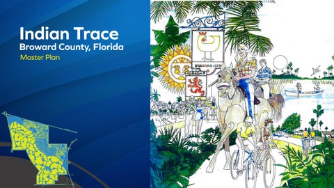
Indian Trace
Broward County, Florida Master Plan
Indian Trace
Broward County, Florida Arvida Corporation First National Bank Building Fifteenth Floor Miami, Florida 33131
Regional Location
The Opportunity The proper development of land is a matter of far-reaching concern to public officials and citizens alike. It is to the benefit of the entire community that land be planned with foresight and imagination. All too often in the past, considerations raised by groups alarmed at the deteriorating effects of uncoordinated housing and strip commercial development have gone unheeded. More recently, at the ballot box, citizens have consistently expressed their support of more comprehensive planning and environmental controls. In Broward County the unprecedented population increase experienced in the past two decades will continue in the future, though probably at a slower pace. Homes will be provided in one way or another, either by spot developments, or more hopefully, by unified and complete communities such as the one being proposed by Arvida Corporation. Totally planned communities are a promising answer to those who protest the continuing sprawl of lot by lot and parcel by parcel development, for mile after mile, without relief, across the countryside. The new towns of America and Europe have demonstrated clearly the many advantages of clustering homes, schools, and other structures around open waterbodies, parks, recreation areas and nature preserves to accommodate regulated
urban expansion. New large-scale communities, which for the most part are built in a natural setting, afford an excellent opportunity for families to live the good full life in neighborhoods freed of through traffi c, surrounded by amenities and with nature close at hand. Arvida Corporation's 16 square mile holding of land in a single ownership presents Broward County with a unique and splendid opportunity. Here, ideally situated within the regional transportation network, a new satellite subcenter has been planned for staged development over the next four decades. In character it has been conceived as a spacious rural to semi-rural Florida community surrounded by, and interlaced with, lakes and open greenways. Its concept has been derived from the County's stated goals and objectives, and uses and elements to be included are those considered by the County leadership and planning agencies to be most desirable. The total community plan will be implemented gradually within the procedural guidelines of the County's forward-looking Planned Unit Development ordinance. Throughout its entire build-out period, it will be responsive to the best of evolving environmental protection techniques and planning principles.
Planning Objectives From its inception, the planning of Indian Trace has been guided by five governing objectives: 1. Protect and Manage the Water Resources A dominant feature of the site is its location between Everglades Conservation Areas to the north and west and the C-11 canal to the south. An abundance of water poses both problems and opportunities and makes necessary a highly sophisticated water management system. Its fourfold purpose Is to prevent flooding, protect water quality, replenish the underground reserves and develop the water storage areas as prized community assets. Much of the land to be improved must be raised to levels at or above flood criteria. The extensive excavations required to provide landfill are to be shaped into a network of reservoirs. These will store excess surface runoff and will serve as natural filters to sustain water quality. They will serve also as highly effective recharge basins which will return to the underlying Biscayne Aquifer more water each year than will be withdrawn to meet future community needs. A further beneficial aspect of the water management system will be the creation of a wide expanse of interconnected lakes and waterways. These, and the meadows and wetlands around them, will provide habitat for fish, game and wildfowl, and will supplement the recreational opportunities of the adjacent conservation lands.
2. Create an Openspace Framework In addition to their primary function, the water storage areas will be designed to provide a magnificent setting of lakes, waterways and vegetated open-space preserves. These will serve to enfold and separate the various development areas to be planned for residential, cultural, business and other uses. By their need for both dispersion and continuity, the water management blueways and greenways will penetrate the entire community. Other spaces will occur in the form of planted parkways, golf courses, recreation areas and urban or regional parks. By employing the "cluster" concept of building arrangement, structures will be grouped around plazas, courts or commons, to free additional greenbelt lands for recreation and buffer zones. Traditionally, neighborhoods have been bound together by highways and streets upon which homes have faced and toward which all life has been oriented. In the community of Indian Trace, islands of development will be surrounded by usable waterways and green areas which will serve as the all-embracing open-space framework.
3. Ensure Ease of Access and Circulation Diagrammatically, the roadway system is comprised of a hierarchy of freeways, arterial parkways, circulation roads and local frontage streets, loops and culs de sac. The arterial parkways are planned without building frontage and with widened rights-of-way to provide for separate bus lanes, mini-transit routes, walks, and bicycle trails. As "lineal motor parks," they will feature earth contouring, landscape planting, and attractive signing and lighting. The circulation roads will also be designed with limited frontage and with parkway characteristics. To yield the utmost in safety, T-intersections will be used except at arterial crossings. While through traffic is not to be encouraged, inward and outward linkages are provided as an integral part of the County's regional transportation and transit network.
4. Define and Accentuate the Neighborhoods Utilizing the neighborhood concept, the conceptual plan provides development areas of varying shapes and sizes to accommodate residential arrangements of many types-from relaxed, semi-rural "villages" to vibrant urban apartment complexes. Each neighborhood will be defined by waterways, greenbelts or circulation corridors and will be provided with routes of interconnection to activity centers that will develop within the larger community. Each neighborhood will develop its own individual character with gathering places, focal points, and those amenities best suited to its own particular needs. These may include playlots, parklets, swim and racquet clubs or other recreation places and spaces. When and where justified, they may include convenience shopping, craftstudios, business offices and learning centers. An essential feature of the neighborhood plan arrangement, however, will be that while each provides some amenities within easy walking or biking distances, other aspects of the larger community life will be shared by two or more neighborhood or sub-neighborhood groupings, or by all of them together. School systems, commercial enterprises and cultural facilities have their own best size and optimum "trade" area and are usually best situated outside and between those residential groupings that they serve. Aside from the residential neighborhoods, there will be other "neighborhoods", or districts, designed as unified shopping malls, light industrial parks, business office complexes and civic or cultural centers. 5. Provide for the Good Full Life In the planning of Indian Trace, the overriding consideration has been to create the best possible environment for living. Implicit is the provision of a full range of housing types, amenities and public services, new approaches to the design of safe and efficient trafficways, the need for freedom from pollution in any form and coordinated systems of schools, parks and convenience centers. Most of all, the plan expresses the conviction that a progressive community must present a variety of opportunities for intellectual and spiritual stimulation, employment and economic livelihood, along with excitement, reward, and pleasure in all aspects of daily life.
Many of the water storage areas will be set aside as boating and fishing preserves.
Much of the low density residential acreage will be devoted to semi-rural "horse country" living.
Pedestrian walkways and bicycle trails will link neighborhoods and activity centers.
Equestrian trails will border waterways and weave through open meadows.
School-park campuses have been planned throughout the community.
Shopping centers, with professional offices, craft shops and restaurants will serve as community gathering places.
Business offices and light industrial parks have been planned to provide employment opportunities for residents.
.......... A community designed to provide the good full life.
Survey and Reconnaissance
The Site The site is protected on the north and west by established conservation areas. It is bordered by existing and proposed thoroughfares: State Road 84 and proposed 1-75 on the north, U. S. 27 on the west, Griffin Road on the south and proposed 1-75 on the east. A neighboring residential community of medium high density is being developed immediately to the northeast. The sparse vegetative cover, consisting mainly of sawgrass with scattered Melaleuca, Brazilian Pepper, and Australian Pine, is of little ecological, economic or landscape significance. The displacement of the existing flora by imported weed species is an on-going process. Essentially, the land, in its present state, is unproductive In terms of the regional ecosystem, except for its water storage function. Site Analysis Sound planning must start with an understanding of all existing conditions and factors which have a bearing on the development process. These conditions pertain not only to the property itself but to the County environs and the larger region of which it is a part.
In exploring the nature of the immediate site, the topographic survey has been supplemented with data secured by detailed field investigations, by soil and water measurements and sampling, and remote sensing photography. Pertinent and available information, as obtained, is made part of the site analysis documents. These in turn form the basis for continuing research and for all land planning studies. Regional Factors Within the regional context, much useful Information has been made available by the County's planning agencies and departments. The Area Planning Board and the County Planning and Zoning Department particularly have been able to furnish not only excellent background data but also related planning studies and projections as to Broward County's long range needs and goals. Eco-determinant Mapping All applicable information obtained from these and other sources has been recorded on a set of Eco-determinant maps which, together, define the ecological basis and indicate the long range constraints and possibilities. Of some 32 maps compiled to date, eight examples are shown.
SITE ANAYLSIS
MUNICIPALITIES & TRANSPORTATION EXISTING LAND USE URBAN GROWTH CLIMATOLOGY
WATER DRAINAGE DISTRICTS SCHOOLS PUBLIC SAFETY & MEDICAL
Community Systems Water Management In this conceptual plan, approximately 3,000 acres of lakes, waterways and open space will be utilized as water storage areas and as drainage ways to conduct excess stormwater runoff to one of two pump stations at which point discharge will be made into the South New River Canal. Additionally, with the improvement of this canal to increase its capacity, the total water management system will result in a 100 year flood elevation of 7.5 feet mean sea level. The Water Management map indicates the proposed drainage system and the direction of flow throughout the lakes and waterways. The water management system will be operated at a normal elevation of 4.0 feet mean sea level, which will provide a positive head of approximately one foot above that presently maintained in the area. This head will aid in the recharge of the freshwater aquifer. During rainy periods, the system will be allowed to reach 5.0 feet mean sea level before discharge is made into the South New River Canal. Discharge into this canal will be at a rate of 1 ¼ inches per day, which is permitted by the Central and Southern Florida Flood Control District. Water that is discharged into the canal will be back-pumped into Conservation Area No. 3A for storage and recharge of the freshwater aquifer.
Prior to entry into the lake system, stormwater runoff will pass through various filters and traps to remove possible pollutants. Grassed swales will be utilized extensively throughout the project as nutrient retainers. A filter barrier system will surround the lakes within the project. As a final screen, and to remove nutrients from the water in the lake and waterway system, aquatic vegetation will be used on the perimeter of the lake sections. The operation and maintenance of the water quality aspects of the stormwater drainage system will be the responsibility of an improvement district or Home Owners' Association. The maintenance of water quality has been a major determinant in all phases of project planning. The stormwater management system has been designed under the criterion that water discharged into the South New River Canal is to be of equal, or better, quality than the water that presently exists in the canal. To achieve the goal of nondegradation of water quality the substantial acreage allotted to lakes and waterways will retain stormwater runoff on the site and conduct excessive quantities of such runoff to one of the two pump stations located adjacent to the South New River Canal.
WATER MANAGEMENT
Population Allocation In its recently published Land Use Plan and report, the Broward County Area Planning Board has addressed Itself to the distribution of the County's projected population. For the Southwest sub-region It has recommended population intensities ranging from very low to medium, as Indicated by map on the opposite page. The population intensity shown on the map for Indian Trace follows almost precisely the low and medium bands recommended in the APB report. The actual density requested for the total tract exceeds somewhat that which the APB has initially recommended. Nevertheless, the APB has publicly supported and praised the philosophic concept of the plan for Indian Trace. A primary consideration In proposing the higher density is that within its extensive holding Arvida Corporation is planning, and will be able to provide, a comprehensive water management program, a unified land use and trafficways system, and a balanced community not· possible in the case of smaller ownerships, and far exceeding in scope or performance any yet conceived for Broward County. Within the population intensity zones described, it is intended that residential uses be graduated from low density at the southwest periphery to medium densities in the northeast sector. With gross residential densities of from 8 to 12 dwelling units per acre recently approved within the vicinity, the proposed density for Indian Trace is quite low by comparison. Here, without stress upon the natural systems or planned highways or other facilities, as has been clearly demonstrated, a large part of the County's anticipated growth can be well accommodated.
POPULATION INTENSITIES
Circulation The free movement of traffic to, from and within the community has been one of the most important planning considerations. From the start, liaison has been maintained with the State Department of Transportation, the Broward County Area Planning Board, and its Trafficways Committee, the Broward County Transportation Authority, and the Broward County Engineering, and Planning and Zoning Departments. Among these agencies there is general concurrence with the proposed traffic plan, which has been mutually devised. Few sites in the county will have comparable access. The property is bounded on three sides by roads presently scheduled as major expressways. Three types of internal roadways are to be providedarterial parkways, circulation roads, and local frontage streets. Provision has been made for access to a future regional transit system and for on-site transit. The inclusion of extensive pedestrian
trails, bicycle paths and equestrian trails are a featured aspect of the circulation system. Arterials These internal traffic arteries, planned as segments of the regional transportation network, are to be controlledaccess parkways. Expanded rights-of-way, some planned to exceed 200 feet in width, will accommodate transitways, walks, and bicycle paths. Circulation Roads The secondary level of vehicular distribution will be provided by a system of circulation roads also having parkway characteristics and limited building frontage. The treatment of these curvilinear paths of movement will vary to reflect the landscape character of the neighborhoods through which they pass and to which they provide pleasant access.
WATER CIRCULATION
Local Roads Within the development areas defined by the arterials, local traffic movement will be provided on circulation roads and low speed frontage streets, loop drives and motor courts. Residents may accomplish all internal trips to convenience shopping, neighborhood recreation spots or classrooms without need to use the arterial highways. The circulation and frontage roads in effect form a loosely arranged network which disperses traffic and, by giving multiple choice of movement, reduces the number of vehicles on any one road. In large outlying areas, the meandering two-lane roads will resemble country lanes in keeping with the rural character of the conceptual plan. In more urban areas they will form winding frontage streets relieved of fast through traffic. Pedestrian, Bicycle and Equestrian Trails In a significant effort to reduce the need for automobile use, and to provide popular forms of outdoor recreation, over a hundred miles of pedestrian, bicycle and equestrian trails have been included as a secondary circulation system.
Transit Space for internal transit routes has been reserved within the major rights-of-way. Additional easements will be delineated in the more detailed planning of the open space areas. It is intended to provide multi-modal transit linkage between commercial, recreational and other activity centers. Although the County's transit proposals have not yet been finalized, it is anticipated that a future Community Center in Indian Trace will in time be structured around a major regional transit node. Transport Within the Broward County region there Is a critical need for the more efficient distribution of goods. It is foreseen that in the light industrial park area of the new community a transport terminal can be located with a direct tie to the Interstate network. Such a terminal, served by classified truckways and conveyor systems,may serve not only the local needs but much of the county as well. Synthesis The Synthesis illustration combines all modes of circulation into a complete and integrated system.
CIRCULATION SYNTHESIS
Commercial
Well-conceived shopping and convenience centers serve not only as thriving retail marts but also as social gathering places where a variety of cultural interchanges may contribute to community life. A complete commercial system has been structured on the basis of currently available standards. During the extended development period, certain program specifics may shift, but an adaptable framework will be established with the capacity to adjust to changing shopping modes and requirements. Trade areas for three levels of shopping have been carefully delineated according to the following accepted market allocation criteria: Convenience Centers @ 3,000 persons per center Supermarkets @ 10,000 persons per store Hardware/Drug @ 16,000 persons per store The Three Levels 1. Specialized retail facilities to serve the entire community have been planned for the Community Center site. Tenants will include department stores, high-quality, grocery stores, bakeries, boutiques, and shops for custom clothing, shoes, jewelry and specialized equipment.
1. 2. Neighborhood centers have been located to provide ready access for all residents. These centers have been planned with a supermarket alone or in combination with a drug-hardware store as primary tenants. Other possible tenants may include dry cleaners, branch banks, bakeries, variety stores and retail clothing shops. 3. In addition, smaller convenience centers containing retail outlets to serve the day-to-day needs of residents have been situated throughout residential groupings to complete the commercial system. These components have been allocated to actual sites according to proposed population distribution and highway access patterns. Together, they comprise a balanced and mutually supportive range of well-placed shops and stores which should satisfy most of the needs of the residents at both the neighborhood and community levels. Over the years, this should do much to reduce the need for travel on the surrounding streets and highways.
COMMERCIAL
Employment Distribution
The current "Regional Land Use Plan for Broward County," prepared by the Area Planning Board, identifies the site as having potential for two possible industrial areas and a major commercial complex. These have been incorporated in the Indian Trace community master plan, for they provide, among other attributes, highly desirable sources of employment. It ls foreseen that the "industrial" uses will evolve as a goods-distribution center and as research-oriented business offices and light industrial parks. The Community Center is to be designed as a campus-type aggregation of civic, cultural and business structures spaced around a regional transit terminal, central shopping mall and lake. Additional employment will be provided by the planned tourist center, the school system, golf courses, and by many other types of recreational and public service installations. As depicted in the accompanying illustration, the employment centers have been so located as to minimize impact on residential areas and circulation routes, while affording convenient employment for residents and nonresidents.
Employment, both during and after construction, will be comprised of the following broad occupational types: • Professional, technical and managerial • Sales • Clerical and kindred • Craftsmen, foremen and kindred • Laborers Estimates of average annual employment and wages have been prepared as follows: During Post Development Development Number of Workers 15,300 23,000 Average Annual Wage $13,085 $14,020 The forty year community build-out period will help to stabilize the Broward economy. Rather than inducing a surge of transient workers, it will provide instead a steadily increasing employment base for an eventual twentythree thousand persons. Such employment opportunities, coupled with an adequate supply of moderate income housing, will be a welcome attribute to a county in which both are presently needed.
EMPLOYMENT CENTERS
Utilities
Water Supply and Distribution System Potable water for the development will be obtained from the Biscayne Aquifer, and the recharge available from the development of extensive lands and large open spaces will make the project more than self-sufficient for water supply purposes. A preliminary water distribution system is illustrated on the Water Distribution map with approximate locations of ground storage tanks and service pumps. These mains will be sized to provide normal water use requirements and adequate pressure for fire protection. Wastewater Collection and Disposal System A preliminary wastewater collection system is illustrated on the Wastewater Collection map with approximate locations of lift stations and wastewater treatment facilities. The entire system will be phased over the development period with the extension of force mains and lift stations into individual areas as development proceeds. The wastewater treatment plant also will be phased over the development period, enabling it to take advantage of future technological improvements. Treatment of the wastewater from the collection system will be in accordance with State and local Department of Pollution Control criteria. Upon completion of treatment of the wastewater, the effluent is planned to be disposed of by a method to be approved by the appropriate governmental authorities. When a regional wastewater treatment system is extended to the project area, the project system will be connected and become a part of the regional system.
Parks & Recreation
The wide expanses of water and open land afforded by the water management program give promise of an abundance of recreational activities. In devising a complete park and recreation program, full coordination with the Broward County Parks and Beaches Department has been helpful. The County's present Open Space Standards require that a total of ten acres of various types of recreational land be provided for each thousand people in the total population. These ten gross acres of recreational land may be categorized as follows: Recreational Type Neighborhood Park Community Park Urban Park Regional Park Other usable open space
Acres per 1,000 Population 1.25 1 2 2 3.75
Employment, both during and after construction, will be comprised of the following broad occupational types: • Professional, technical and managerial • Sales • Clerical and kindred • Craftsmen, foremen and kindred • Laborers Estimates of average annual employment and wages have been prepared as follows:
PARKS AND RECREATION SYSTEM SYNTHESIS
School-Parks
In planning a school system to meet both the initial and ultimate needs of Indian Trace, a major consideration is that the development period will extend an estimated forty years into the future. In the field of education particularly, profound changes can be expected over this period of time. This will be true regarding design and construction of the physical plant, methods of teaching, and even basic philosophy. This suggests that sites of adequate size and optimum location be reserved and that flexibility be retained to permit response to growth and changing conditions. Planning at the initial stage, nevertheless, must relate to present-day criteria. The educational planning data supplied by the Broward County School Board on student generation by housing type, student groupings, number of students per school and size of school sites have been most helpful and have formed the basis for the development of the Indian Trace community school system. Student Generation As a general rule, it can be stated that as housing units increase in density, the number of children per unit decreases. County data on student generation anticipates the following yield: Housing Type Ranchette Single Family Townhouse Garden Apartment Mid-Rise Apartment
Students per Dwelling Unit 1.0 1.0 .8 .2 .08
Statistically, these students are anticipated in the following grouping percentages: Elementary Middle Senior
46% 24% 30%
County criteria for school and site sizes are as follows: Optimum No. Size (Acres) School Type of Students School Park Total Elementary 765 6 4 10 Middle 1,580 13 4 17 Senior 2,300 26 4 30 As illustrated on the maps (opposite), each school type and site has been located with studied relationship to the residential groupings to be served. School-Park Combination In programming the new schools, it is proposed to combine them with neighborhood and community parks. In this way a complete educational and recreation program can be operated jointly on a full-time, year-round basis. Multiple use of the parking and recreation areas and specially designed school building wings will provide expanded opportunities at a substantial cost savings. Lighted parking lots, ballfields and game courts, for example, will be available not only for school use, but for community-wide non-school recreation as well. School and park officials have welcomed the chance to apply their experience and knowledge to the planning of such advanced systems on this extensive county subregion.
SCHOOL-PARKS
Environmental Quality
In evaluating the environmental factors affected by the improvement of this property, it is important to note that a construction program of approximately forty years is anticipated. The following conclusions have been made within the context of this extended development period. Air Quality Air quality in Indian Trace, as in all developments, will be affected by vehicular traffic, construction equipment, and industrial activities. Each of these contributors will comply with prevailing State and local standards for quality control. Since the exhaust fumes from automobiles are a principal source of air pollution, the arterial roads have been planned as controlled-access roadways. The fact that they will be substantially free of stop-and-go traffic will materially reduce the volume of emissions over the conditions that prevail on conventional grid street patterns. In addition, the provision of an extensive open space framework will provide natural ventilation for the building groupings. Even the prevailing winds will help to protect the air quality since the predominant direction of air flow will be away from populated areas and toward the Conservation areas and the Everglades which lie to the north and west. Water Management Approximately 3,000 acres of the project area will be devoted to lakes, lagoons, canals, dry swales, and open space in residential areas. This storage system will permit the water from the primary recharge areas to re-enter the Biscayne Aquifer. It will discharge into the South New River Canal at a rate permitted by the Central and South Florida Flood Control District. Surface runoff water will be retained in a system of ponds and connecting canals.
Noise While there will be a temporary increase in localized noise levels during the construction phases, no continuing noise problems of major consequence are anticipated. After development is completed, noise levels will be greater than the ambient noise levels that presently exist, but this Increase will be comparable to the increase in other developed communities and should not adversely affect the region. Noise levels below those experienced in other urbanizing areas of the county are to be expected. Factors contributing to noise abatement will be free-flowing and planned trafficways, the relatively low density of the community, and the concept of off-highway building groupings with frontage precluded on all major streets. Animals Preliminary reconnaissance of the property revealed the presence of little significant animal life and no endangered species. It is foreseen that the extensive network of waterbodies, waterways and wetlands together with their naturalized edges and cover will provide habitats for many types of fish, indigenous wildlife and migratory birds. These possibilities are being fully explored with the Florida Game and Fresh Water Fish Commission as planning proceeds. Wastewater Disposal Wastewater will be collected on-site and processed in a treatment plant which is to be located within the project boundaries. Disposal of treatment plant effluent will be by a method to be approved by the Broward County and State Departments of Pollution Control and other local and State health agencies.
Water Supply The source of potable water for the project will be the Biscayne Aquifer, and the recharge available from the development will make the project more than selfsufficient for water supply purposes.
Historical Five archaeological sites have been recorded by the Broward County Historical Society. Future studies will be conducted and a plan devised to protect sites of significance.
Solid Waste Initially, trash and garbage collection will be by privatelyowned companies franchised by Broward County. This waste will be disposed of through Broward County facilities. The Broward County Commissioners have expressed a determination to supervise solid waste disposal throughout the entire County, including the municipalities. The problem of solid waste disposal can be solved only on a county-wide or regional basis, and only when it is considered as a valuable resource from which processed metals, glass and chemicals can be recovered and recycled and from which organic material may be converted into energy. As Broward County moves toward new disposal techniques, Arvida Corporation will cooperate in all ways feasible and assume its pro-rata responsibility regarding the overall solution.
Public Safety There will be a Volunteer Fire Protection System approved by the Broward County Fire Control Commission and County Commissioners. Police protection will be provided through the Broward County Sheriff's Department.
Moreover, on the condition that the air and water quality of the community would not be adversely affected, Arvida Corporation stands ready to accept as a by-product of advanced waste treatment, substantial quantities of inert and sterile residual "soil" and composts for use in creating a new landscape of hills and ravines within the overall community boundaries. Power The Florida Power & Light Company will furnish all power required at Indian Trace. On-site generators will be available for emergency conditions.
Traffic With its frontage on U. S. State Route 84 and the proposed 1-75, the community of Indian Trace will enjoy a high level of accessibility to and from the supporting region. Few other areas of the county will be as directly served. Arvida Corporation, working in close cooperation with those agencies of the County and State most concerned with transportation planning, has designed a roadway network which provides continuity to the county-wide system and accommodates all projected internal and external movements. No overloading of the trafficways is expected within the Department of Transportation's period of programmed construction. The ultimate traffic generation of this project, when routed through the planned external road system, is not expected to exceed the level of "C" service on any major highways or their ramps. Transit Planning includes the provision of an internal multi-modal system of "people movers." Interconnected pedestrian paths, bridle trails, bikeways, transit routes and reserved bus lanes are envisioned.
Community Systems Synthesis
To complement the recreational facilities and opportunities in the nearby Everglades, and to protect the natural quality of the existing landscape, an extensive open space system has been designed. This system establishes the basic nature and rural character of the community. All residential neighborhoods will have excellent access to dispersed recreation areas and community activity centers. Major parkways and collector roads within the community will have limited building frontage and will be heavily planted and landscaped. Local streets, due to their spacing and design, will be two-lane country roads with low speeds and limited volumes. This dispersal of traffic flow will allow the parkway system to support the community's rural atmosphere. The extensive waterway network, a result of a comprehensive water management analysis, will be utilized for community-wide water-oriented recreation activities. Two kinds of open space will be provided. Broad bands of land used for water management purposes will be laced throughout the community and have the additional purpose of
providing a wide variety of active and passive recreational opportunities. This system structures and connects all residential, educational, commercial and community uses. An extensive series of bicycle, equestrian and hiking trails are located throughout these areas. In addition, local private recreation areas will be located In each residential cluster to provide swimming, tennis, and other similar facilities. The synthesis of these components will provide a community unique in its character and way of life.
COMMUNITY SYSTEMS SYNTHESIS (ILLUSTRATIVE)
Master Plan In a broader sense, the conceptual plan for Indian Trace, as herein presented,. Is a direct expression of Broward County's long range goals. Its program and criteria have been established through continuing conferences with the County agencies. Its salient features: • A low density of 4.08 dwelling units per gross acre. • The comprehensive planning of a large land holding under a single ownership as a unified satellite community for staged and controlled development. • Protection of the regional ecosystem by the provision of a scientific water management program and by measures designed to eliminate all significant forms of pollution. • Retention of large areas of land in its natural state, with development clustered around a series of sizable lakes, interconnecting waterways, and open space preserves. • Maximization of the recreational use of the waterbodies and water storage areas. • Use of the cluster concept in the planning of all residential, industrial, business office and commercial areas. • Establishment of a rural, ranch-country environment of high quality, embracing more urbanized neighborhoods and community, business and cultural centers. • Provision of a broad employment base ranging from recreation facilities to business office and industrial park centers.
• Creation of a joint school-park system. This forwardlooking approach to the multiple use of school and park facilities, developed in cooperation with the County authorities, should result In substantial savings coupled with a high level of community service. • Inclusion of civic, cultural and commercial amenities within each neighborhood as well as within the Community Center. • Provision of those outdoor recreation opportunities most popular In Broward County. These will include boating, fishing, golfing, swimming, tennis, walking and riding. • Accommodation of a wide variety of housing types in the lower, medium and higher-priced brackets. • Creation of a community that will be made self-sufficient and self-contained, in all ways feasible. • Application of the Planned Unit Development approach as the key to flexible and optimum long term planning . With the development of Indian Trace continuing over a period of almost forty years, the planning of such an extensive land area must be a slowly evolving process. If carried forward within the conceptual framework mutually agreed upon and with the continuing guidance, coordination, and direction of the County and its appropriate agencies, it is believed that the new community will be In many ways exemplary, and a notable Broward County asset.
MASTER PLAN
Owner /Developer:
Arvida Corporation First National Bank Building Fifteenth Floor I Miami, Florida 33131
Traffic Engineer ll Economist:
Wilbur Smith and Associates 8420 N. W. 52nd Street l Miami, Florida 33166 r
Engineer:
Gee and Jenson 2019 Okeechobee Boulevard I West Palm Beach, Florida 33401
Land Planner:
EPD • Environmental Planning and Design 13965 N. W. 67th Avenue Miami Lakes, Florida 33014 Project Planners: John O. Simonds Paul D. Wolfe Jack Scholl James Voss