

Exhibit A: Executive Summary
City of Minot, North Dakota
ExhibitA-ExecutiveSummary
Located along the bank of the Mouse (Souris) River, the city of Minot (Magic City) is in the upper heartland of the Great Plains. With an economy based on agriculture and petroleum, Minot takes pride in being a global community. Minot is the only city in the U.S. that provides for the global population in three areas: Providing food for the world (agriculture); Powering the world (petroleum); and Protecting the world (Minot Air Force Base). In spite of its importance to the U.S., Canadian, and global economies, Minot has seen a great deal of devastation since the city was founded more than 150 years ago. The Mouse River Flood of 2011 wasn’t the first time our river overflowed its banks and devastated Minot and the Souris Valley. There have been six devastating floods since 1900 and with each flood, we have rebuilt our community. In many ways, rebuilding demonstrates the best of our community: resolution, determination, lending a helping hand – but sometimes determination and a sense of initiative have prevented us from seizing the opportunities to make our home a better, stronger and more resilient place.
After the last flood, the city, along with other regional communities, developed a plan to build a new levee – a $1 billion project that was projected to take 25 years to complete. In retrospect, many conversations that now seem so essential were never had: we never discussed what a 25year-long project meant in the scale of a human life. We never talked about a 25-year flood control project in the context of a looming update to FEMA flood maps and the implications on flood insurance costs and home values. We never had a conversation about what would happen if another flood occurred before protection was in place or who and what might be left to protect in 25 years if it happened. We didn’t stop to ask what it meant if, with the changing climate, those walls might be obsolete by the time they would be complete, or how a wall, as high as 15 feet in some cases, would cut off the city and its neighborhoods from the river that threaded through the lives of our parents, and the generations before them. As a community, we never talked about how all these factors could exacerbate the blight afflicting many neighborhoods as a result of the
2011 flood. We focused on the areas that flooded, but not those that weathered the storm – like downtown – where there are greater opportunities than threats. Essentially, we never had a conversation about recovery and what will make Minot a better, more livable community for our future generations.
When the city first heard about the NDRC opportunity, we saw it as an opportunity to finish putting everything back together and to build floodwalls. But the NDRC has granted the community the opportunity to step back, consider all the risks we face, and plan our recovery not only with our past in mind, but with a new vision of where we want to be. Our vision isn’t simply about building back from the 2011 flood, it is about building our future, a future with:
• reduced flood risk, where we are not cut off from the river, but treat it as an community asset;
• safer, more affordable housing built in sustainable and resilient neighborhoods;
• a revitalized downtown, vital to our city’s sense of place, with urban amenities to attract the kinds of employers and talent that foster economic diversity, which is key to reducing our dependence and vulnerability to potential shocks in both the oil and agricultural industries;
• land use patterns and transportation systems that not only reduce our future risks, but provide us all with a better quality of life, support even our most vulnerable populations and provide the transportation choices that foster connectivity across the city.
• improved communication and cooperation with our NDRC partner, the International Joint Commission, located in Canada, regarding flood management of the Mouse River . Our community’s commitment to a new future was reflected by the outstanding participation in nine community meetings held for the NDRC grant competition. This process is not about looking back, but about moving forward to become a better, more resilient and sustainable community – that’s what this proposal is about.
Exhibit B: Threshold Requirements
City of Minot, North Dakota
ExhibitB_ThresholdRequirements
1. General NOFA Threshold:
•• City of Minot is an eligible applicant
•
•
•• City of Minot has no outstanding Civil Rights matters
•
• Minot is not an entitlement community and does not have a Consolidated Plan
•
• This application is consistent with Minot’s Analysis of Impediments
2. Unmet Need:
Since the 2011 flood, the city has had many competing needs for funds related to flood recovery, and insufficient resources to pay for everything. The city of Minot received a first Community Development Block Grant-Disaster Recovery (CDBG-DR) allocation of $67,575,964 and a second CDBG-DR allocation of $35,056,000. To date the city has fully allocated its CDBG-DR funding, the full breakdown of which is included as Figures Appendix _______ and Appendix _______, and while the city has worked tirelessly to prioritize the distribution of resources to the most immediate needs of its citizens, funding has not been sufficient to meet all of the city’s needs following the disaster, nor is there funding on hand to reduce the city’s risk from future flood events.
Housing: The city conducted a windshield survey of 20 flood damaged properties, and received surveys of the owners of nine of those properties attesting to the fact that damage to their homes was not covered by insurance, and that they have inadequate resources from insurance / FEMA, and / or Small Business Administration (SBA) for completing the necessary repairs.
Economic Revitalization: The city conducted a windshield survey of damaged commercial buildings, and documented five businesses with outstanding repair due to damage incurred by the 2011 flood, four of which have yet to secure the resources
necessary to re-open, removing economic activity from the city and leaving blighted and empty structures that detract from the quality of the neighborhoods. All businesses provided letters attesting to the damage being related to the flood, and that they had inadequate resources from insurance/FEMA/SBA for completing the repairs.
Infrastructure: Since the flood, the city spent nearly $11M on critical infrastructure repair throughout the city. Projects range from the repair of sewer lift stations to the removal of debris from the city storm sewer. Despite this investment, essential repair needs remain unmet. Paramount to preventing future losses is repair of the flood protection system (levees and dikes) along the Mouse River which was damaged in the flood. The system was in place before the flood and protected the city from a one-percent annual chance (100-year flood) event. This means that not only is the city highly vulnerable to a repeat of the 27,000 cfs flood event that it experienced in 2011, it is also unprotected from the comparatively modest floods it had experienced in prior years. Without these basic repairs, low-lying areas of the city are extremely vulnerable. In accordance with NOFA Exhibit G, the city has submitted engineering reports for repair needs for levees on the north and south banks of the river, as well as a budget showing sources and uses for a funding gap of approximately $1.8M.
3. Eligible Applicant: The city of Minot, N.D., is the applicant for this grant, and is named as an eligible applicant in Exhibit B of the National Disaster Resilience Competition (NDRC) Notice of Funding Availability (NOFA).
4. Eligible County: The city of Minot is identified as an eligible applicant in the NDRC NOFA.
5. Most Impacted and Distressed Target Area: The city of Minot is a sub-county area within Ward County, N.D., which was declared by President Obama to be a major disaster area under the Stafford Act for a disaster event occurring in calendar years 2011, 2012, or 2013.
6. Eligible Activity: Activities to be paid for with CDBG-NDR funds will only be used eligible activities as provided for in Appendix A of the CDBG-NDR NOFA.
7. Resilience Incorporated: Each CDBG-DR activity proposed will serve to improve the city of Minot’s resilience to one or more of the current and future threats and hazards identified in Exhibit D (Needs) of the city of Minot’s application.
8. Meet the National Objective: The city anticipates projects that will meet one of the three national objectives required of CDBG funding: elimination of slum and blight, benefit to low-and moderate-income (LMI) persons, and / or urgent need.
9. Overall Benefit: The city of Minot will comply with the requirement that at least 50 percent of the funds requested in its application will provide sufficient benefit to LMI persons in the forms of services, area benefit, housing, or jobs, and to meet the national objective of benefit to LMI persons.
10. Establish Tie-Back: All proposed CDBG-NDR activities will establish proper tie-back to the 2011 Mouse River Flood, the Qualified Disaster for which the city of Minot qualifies as an applicant for NDRC funding.
11. Benefit-Cost Analysis: Benefit-Cost Analysis is not applicable to Phase I
City of Minot, North Dakota ExhibitCFactor2Capacity
Minot’s total CDBG-DR funding exceeds $102.5 M. The city has aggressively implemented its CDBGDR Action Plan, successfully conducting 142 property acquisitions for flood control and open space; rehabilitated and reconstructed 117 flood-damaged, owner-occupied homes; repaired and improved $38M worth of infrastructure; supported two new housing developments with 82 units, and launched a low- to moderate-income (LMI) rental rehabilitation program resulting in the rehabilitation or reconstruction of 21 rental housing units; and implemented a homeowner reimbursement program allowing an additional 394 homeowners to get reimbursed for a portion of their investment used to repair their homes. During this same period, Minot produced a new Comprehensive Master Plan, an Affordable Housing Strategy, participated in the Ward County Hazard Mitigation Planning process, completed an Analysis of Impediment to Fair Housing and contributed to other forward-thinking plans and studies outlined in Exhibit G – Long Term Resiliency.
In addition to the experience mentioned above, the city has administered the FEMA-Public Assistance and Hazard Mitigation programs as well as an $18 M Supplemental Disaster grant from Economic Development Administration (EDA). The city has many years of experience administering and implementing federal grant programs where funding is tied to compliance with federal regulations, including civil rights and fair housing requirements.
The new work proposed in this application will be implemented by the team of city employees who have administered these past programs. With the recent implementation of CDBG-DR programs, the city has put in place systems for the implementation of complex housing and community development programs – all of which have served the city well in the administration and implementation of over $102 M of CDBG-DR funds and $75 M of State Recovery funds. With the CDBG-DR obligations, the city created new policies and procedures that formalize program workflow, quality assurance, audits, grant oversight, program income, procurement, internal controls and other matters. New positions have been created for the implementation of programs, and as past allocations of CDBG-
DR funds are spent, staff will be well prepared to take on the responsibility of a new program. In a more recent development, the city has shifted planning from a unit in the Engineering Department into its own department; the City Planner has been reclassified into a Director position and reports to the City Manager as do both Planning Director and Chief Resiliency Officer. The city of Minot has directed and overseen the writing of this application with the assistance of their lead consultant, CDM Smith. From the very beginning, city leadership saw the NDRC as an opportunity to address unmet disaster needs while developing a resilience vision for Minot; the leadership behind this effort and the evolving vision has come from the city.
CROSS DISCIPLINARY TECHNICAL CAPACITY.
The city has engaged government, nonprofit, academic, and private sector partners to provide guidance, technical expertise, and financial leverage to this effort. The team brings together expertise in multiple disciplines, including architecture/landscape architecture, engineering, environmental conservation, housing development, commercial redevelopment, alternative land uses, and the arts. Each of the following partners have participated in the development of the Phase 1 application and are committed to further development of our approach in Phase 2.
Assiniboine River Basin Initiative (ARBI): ARBI is an international NGO committed to management and stewardship of the Assiniboine Basin (of which the Mouse River is a part). ARBI will work with the city to find upstream solutions for flood protection.
CDM Smith: CDM Smith is a multidisciplinary firm with expertise in the development and implementation of housing and community development programs as well as in CDBG-DR and FEMA funding. Engineers in the firm’s water resources unit will also play a role in exploration of the city’s flood protection concepts.
Center for Community Progress (CCP): CCP is a national organization that assists communities in their efforts to eradicate blight. CCP will assist Minot in selecting the best strategies for addressing existing blight in the flood inundation area as well as the prevention of future blight.
Minnesota Housing Partnership (MHP): MHP works with communities to build and preserve housing and community assets. MHP will assist Minot in the planning and with the development of policies necessary to develop new livable neighborhoods.
Minot Air Force Base (MAFB): A large percentage of servicepersons and their families live in Minot which means MAFB has a strong interest in helping the city address its stresses and shocks. MAFB planners will assist in the development of upstream solutions for flood protection and for development of affordable housing in Minot.
Minot Area Council of the Arts (MACA): MACA has a history of fundraising and of enhancing community life through the arts. MACA’s role will be in assisting in the development of plans for new public spaces in connection with Minot’s NDRC efforts. MACA will have a key role in securing funds for public art in connection with those spaces.
Minot State University/N.D. Center for Persons with Disabilities (MSU): MSU and its Center for Persons with disabilities will play two important roles in Phase 1: The Center for Disabilities has played a lead role in the region in advocacy for vulnerable populations and will take a lead role in facilitating planning with the city and other groups that work in this area. MSU will also participate in planning for new affordable housing.
North Dakota State University (NDSU): NDSU’s School of Architecture will participate in a committee to be established for design review related to NDRC effort, and will also work with city planning in the development of downtown design standards and new housing design standards.
Souris Basin Planning Council (SBPC): SBPC is a regional economic and community development organization based in Minot, serving local governments in a seven county region. SBPC will play a role
in the establishment of financial assistance programs for housing and commercial redevelopment, and potentially in the management of programs at a later stage.
Souris River Joint Board (SRJB): SRJB is a regional organization committed to the implementation of flood protection for the Souris River Basin in ND. SRJB will work with the city to identify opportunities for better management of the basin for the prevention of flooding.
International Souris River Board (ISRB) / International Joint Commission (IJC): ISRB is a subcommittee to the IJC, an international commission established between the governments of the US and Canada to cooperatively make decisions concerning shared water resources between the two countries. ISRB will work with the city to identify opportunities for better management of the basin for the prevention of flooding.
Trust for Public Land (TPL): TPL uses its Climate Smart Cities' decision-support tools to help cities become more climate resilient by restoring natural functions of the land by weaving green elements into the built environment. TPL’s support may include providing Climate Smart Cities and GIS services, green infrastructure assessment and implementation, or land acquisition project development.
University of Minnesota College of Design (UMCD): UMCD works with communities to build and preserve housing and community assets. UMCD will assist Minot in the planning and with the development of policies necessary to develop new livable neighborhoods.
Ward County (WC): The city of Minot is located within Ward County, itself identified as an MID.
Flooding that devastated parts of Minot also devastated other areas of Ward County. All parties agree that the best solutions to flooding have to be regional, and that is why Ward County will lend its planning expertise as well as well as potential funding.
Note that three other organizations: The Minot Area Chamber of Commerce, the Minot Area Development Corporation, and the Downtown Business and Professional Association will participate in the development of programs to aid in the development of housing and commercial
redevelopment in the downtown area, and potentially other elements of this proposal. Additionally, three local affordable housing developers have also signed on to participate, including the Minot Housing Authority (MHA) (its non-profit arm), the Neighborhood Development Enterprise (NDE), and the Minot Area Community Land Trust (MALT).Within the structure of our partners and their participation, we have the expertise to help ensure that projects pass the test of cost reasonableness and have high quality design, critical to long-term resiliency. It should be noted that we do not anticipate partners to drop out; however, should this occur the City will quickly procure the expertise needed to move the program to a successful completion. Additionally, there is a significant degree of redundancy in expertise on the team, so the loss of a partner would be unlikely to cause delays or significant loss of momentum.
CAPACITY FOR ASSESSMENT OF SCIENCE-BASED RISK INFORMATION: The city will rely on partners such as TPL with its Climate Smart Cities Decision Support Tools; CDM Smith for Social Vulnerability Index (SOVI) tool; the North Dakota Climate Center; and the National Flood Risk Management Program. The city also plans to build capacity in this area with the naming of a Chief
Resiliency Officer, as addressed in Factor 3: Soundness of Approach
COST REASONABLENESS AND BCA: Cost reasonableness will be determined in accordance with 24 CFR Part 85. In addition, members of our team, such as CDM Smith have reviewed hundreds of Hazard Mitigation Assistance grant applications nationwide, covering all types of natural hazards on FEMA’s behalf. Each project was evaluated based on FEMA’s programmatic guidelines and using FEMA’s standard Benefit-Cost Analysis (BCA) tool.
COMMUNITY ENGAGEMENT CAPACITY: The city of Minot team is committed to meaningful public input and involvement and continues demonstrate their capacity to effectively engaged and empower community leaders throughout the disaster recovery process and in developing local and regional plans. The team has illustrated this capacity and expertise throughout the preparation of the
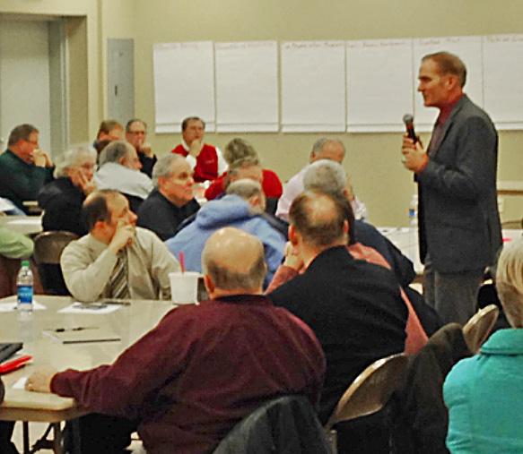
Phase I NDRC application. During this effort community stakeholders and the public worked collaboratively to help develop this framework (A stakeholder and public participation matrix detailing stakeholder groups and their roles and involvement is included in Appendix _______). Residents from across the region identified unmet needs, concepts to address those needs, and defined future goals for recovery and resilience incorporated in this submission. Seven stakeholder and public meetings and two meetings of a committee established to focus specifically on the needs of Vulnerable Populations were held in accessible facilities as a part of the Phase 1 effort. The team utilized small group discussions, storyboarding, dot voting exercises, and other facilitation tools to engage people in meaningful discussions to ensure their thoughts on unmet needs, resilience, and goals for the future were included in this application.
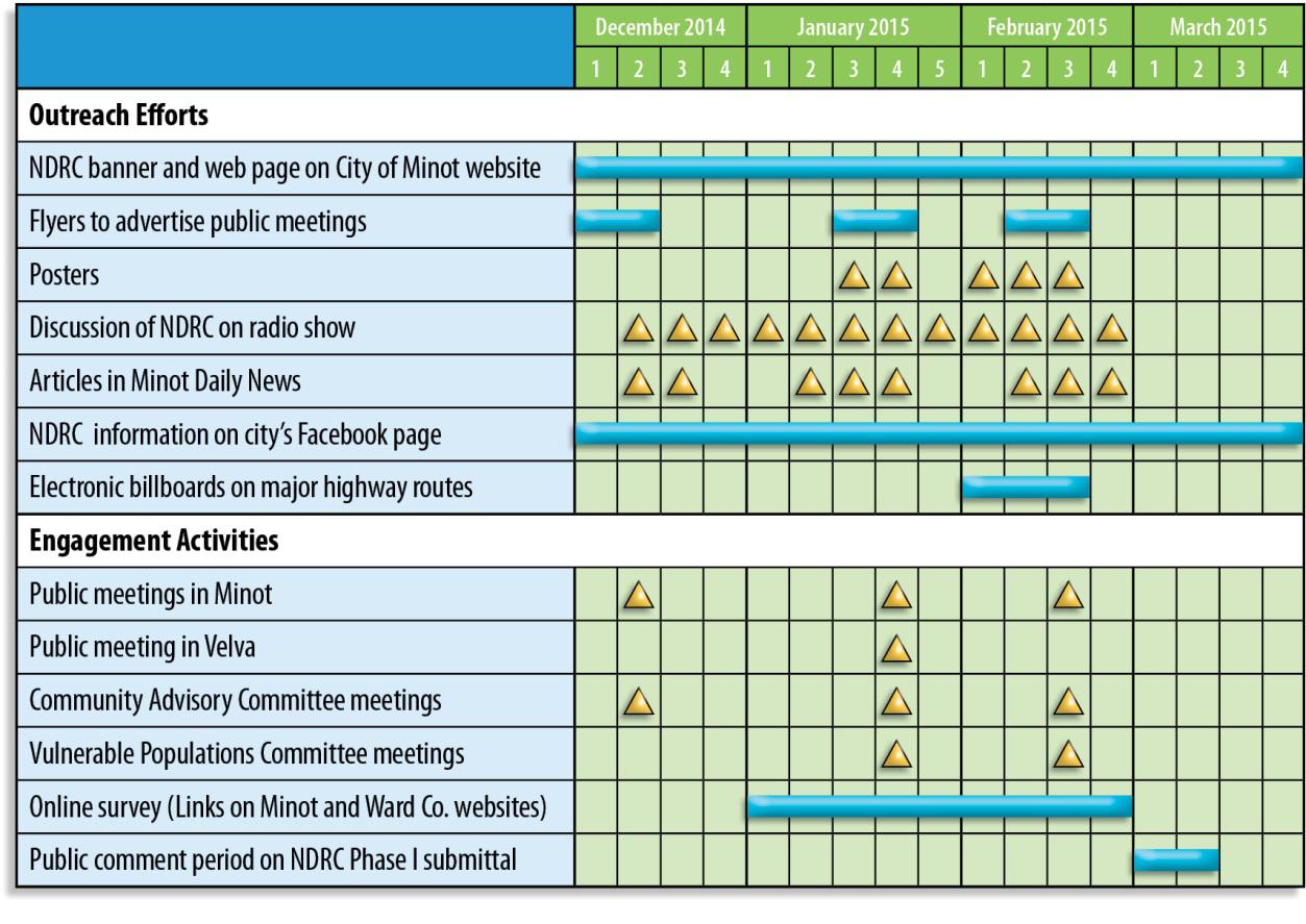
The outreach efforts for the Phase I NDRC process further demonstrate the experience and capacity of this team. Local media outlets, city and county websites, fliers and posters placed in public buildings and area businesses, social media, and other resources have been utilized to share information about the NDRC and future public and stakeholder meetings. Additional examples of outreach efforts are included in Appendix ___.
The Community Advisory Committee (CAC) includes stakeholders from 50 local non-profits, civic organizations, charities, businesses, and agencies serving vulnerable population groups will continue to be involved in the NDRC process through the implementation phase. (Stakeholder Matrix in Appendix ____). Through these committees, the city has worked directly with formal and informal community leaders to ensure a broad base of empower leadership in this planning effort. This collaboration builds on past efforts including the development of the Riverfront and Center Plan.
For Phase 2, a committee structure will be developed to link members of the CAC with project and program monitoring, partnering activities, public communication, and other activities matching their individual skill sets with project development and implementation needs. An ongoing communications
plan will be designed to ensure the public, stakeholders, elected officials, and partners are kept informed of major milestones, project performance, and successes. One element will be to include a committee for soundness of design that will include participation from faculty from the NDSU School of Architecture, and from other partners with design expertise.
REGIONAL OR MULTI-GOVERNMENT TECHNICAL CAPACITY:
The city realized long ago, that solutions to the flooding of the basin had to be addressed on a regional level. The Souris Basin Recovery Strategy, completed in December 2011, is an example of our regional efforts. The Strategy is the result of an intensive process that involved numerous meetings, workshops, and public presentations, along with consultations with local, state, and federal officials. Hundreds of citizens came to community meetings to share their ideas on recovery efforts in Ward County and Minot.
Prior to the floods of 2011, the city worked with multiple entities, stakeholders, and the public-at-large on a regional basis relative to issues that affect the region’s prosperity such as flood control, housing, and economic development. As an example, the city worked aggressively with Ward County, the state, the SRJB, the ISRB to identify solutions to address the flooding of the Souris River, which resulted in the Mouse River Enhanced Flood Protection Plan; although the city is considering a broader direction for flood control, this is a great example of regional cooperation, and it is expected that the city’s approach to flood protection will remain a regional approach, and that its implementation will include the participation of entities throughout the Mouse River Basin.
Exhibit D: Factor 2 – Need/Extent of Problem
City of Minot, North Dakota
ExhibitDFactor2Need
Unmet Needs: A short drive through “the valley” (the area most impacted by the 2011 flood), will take you by nearly 150 unrepaired homes; closed businesses, including the Oak Park Center, once a vibrant commercial plaza; and the remnants of a pedestrian bridge that once connected neighborhoods north of the river to downtown, dismantled and sitting beside the railroad tracks. While progress toward recovery has been made, many unmet needs from the qualifying 2011 flood remain:
Housing: Approximately 4,100 homes were damaged or destroyed as a result of the flood. Approximately 2,376 of these flooded homes were extensively damaged, and 805 were damaged beyond repair, fully 27 percent of Minot’s housing stock. As of this date, many of these homes have been repaired or demolished and replaced. According to the most recent count, however, nearly150 flood damaged homes remain blighted and unoccupied. Documentation of Appendix G Unmet Needs for Housing are provided in Exhibit B.
Economic Revitalization: The effects of the flood continue to have a negative impact on businesses inside the areas inundated by the 2011 flood. This can be seen in the numerous examples of commercial blight throughout the flood inundation zone, some of which were documented in Exhibit B.
Infrastructure: Since the flood, we have spent nearly $11M on critical infrastructure repair throughout the city. Projects range from the repair of sewer lift stations to the removal of debris from the city storm sewer. Despite this investment, essential repair needs remain unmet as documented in Exhibit B
Most Impacted and Distressed: Minot is located in Ward County, N.D., which is identified in the NOFA as MID-URN, and is therefore Most Impacted and Distressed.
Comprehensive, Risk Approach to Analyzing Need: In analyzing need, the city will seek to establish tools and data to identify the areas that are most at risk from the shocks and stresses identified in this application. This will mean identifying areas within the flood zone, and close to railroad tracks that see a high volume of oil trains. In drilling down on where vulnerability is greatest, the city may utilize tools for mapping of vulnerable populations (such as CDM Smith’s Social Vulnerability Index tool [SOVI]) to identify the areas of greatest risk where there are concentrations of populations that are most vulnerable to these shocks. Resilience projects and programs will place a priority on the targeting of these areas.
Approach
to Recovery Project/Activity Selection: With respect to recovery program elements of the city’s proposal, all projects will, at a minimum, go through two major steps (in addition to basic threshold review):
1. Scoring for “resilience value” with metrics established to prioritize the kinds of projects that are most effective at enhancing resilience by addressing our key vulnerabilities. The driving factors in this assessment will include: (1) the project’s effectiveness at reducing risk to the shocks and stresses identified later in this section, and (2) the return on investment from cobenefits. Co-benefits include providing recreational opportunities, enhancing the city/region’s transportation network, improving community liabilities into assets, and the degree to which the investment could have a catalytic effect on a neighborhood, such as changing a downtown blighted building from a hazard into an economic generator.
2. With respect to housing programs, it will be expected that in addition to being safe, new housing meet a minimum threshold for energy efficiency and meet the city’s yet-to-be developed minimum design criteria.
3. Another factor in project prioritization / selection will be the degree to which the investment promotes affordability or addresses other “stresses” identified in this proposal.
4. Implementability: Finally, the city will be reviewing projects for the degree to which they protect vulnerable populations. For example, one project may demonstrate on a purely scientific approach that it could be built now and would offer the best protection for everyone against the threats outlined in this proposal. Yet, if that solution could not be implemented immediately, the consequences of timing substantially impacted, and/or increased the vulnerability of certain populations in the project area (and would have a far negligible impact on other populations), that would factor into the project’s perceived value.
5. Underwriting (in cases of financing assistance): to determine the smallest necessary public investment necessary in order to fund the project.
THREATS, HAZARDS & VULNERABILITIES
To support the development of a holistic resilience and risk reduction strategy, we have undertaken an in-depth analysis of the vulnerabilities that make it more likely for hazards such as flooding, economic downturns, and train crashes to be catastrophes when they do happen. While not all of these vulnerabilities are in our control – we probably cannot directly influence climate change and global macro-economic trends – there are many stresses that leave us vulnerable which we can address right here at home.
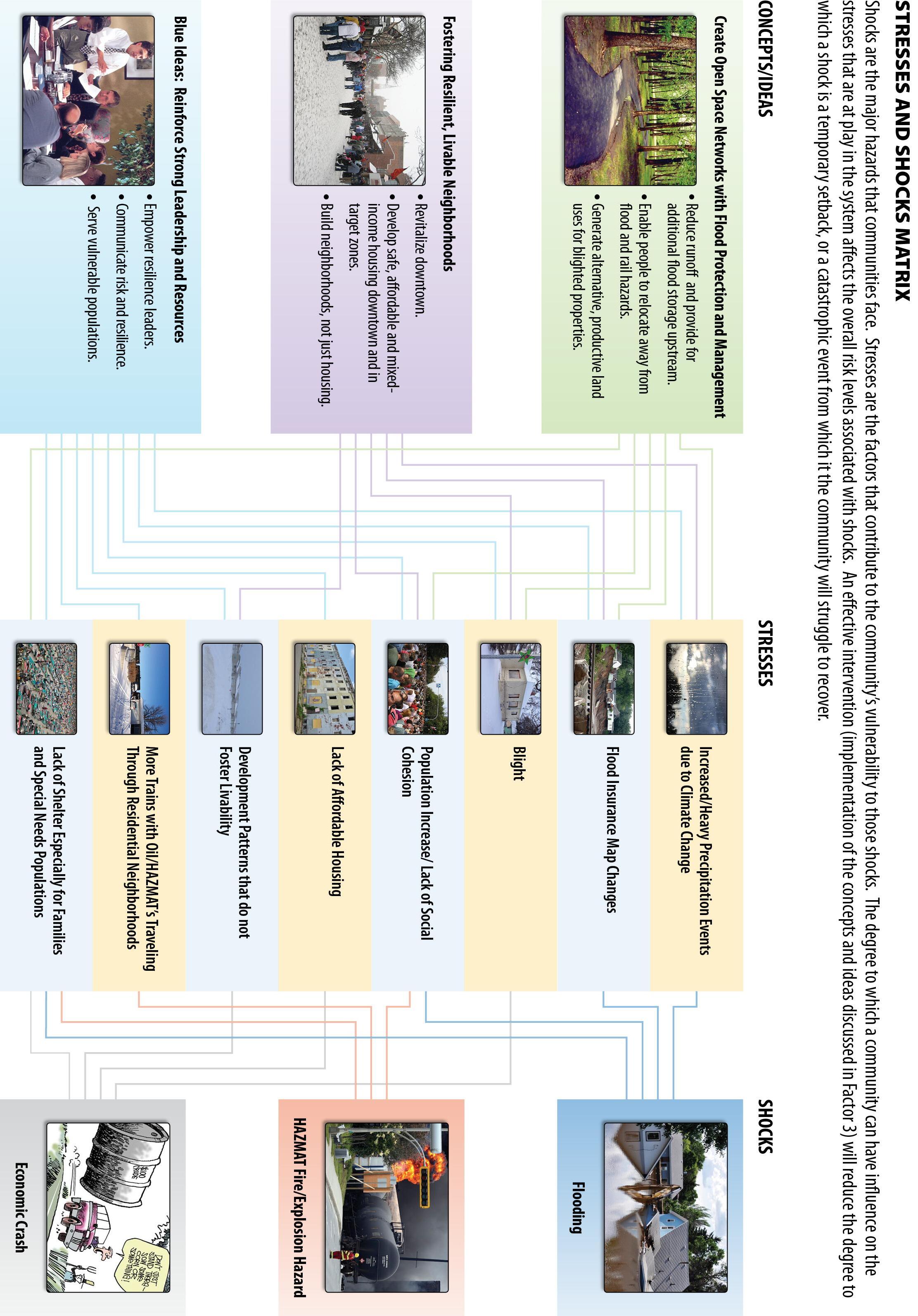
For purposes of this section, we refer to threats and hazards as shocks. Stresses are factors that contribute to our vulnerabilities to these shocks, while also, in most cases, hinder our progress towards our vision for the future. This an important distinction because the degree to which a community can address the stresses that heighten vulnerability is an opportunity to decrease overall risk and our susceptibility to shocks. While there is little we can do to address some
hazards—shocks like heavy rainfall events and stresses like climate change—addressing our vulnerability to these hazards can mean the difference between a catastrophe from which we will struggle to recover versus a temporary setback.
The city held a robust process to gather public input to develop a response to the NDRC NOFA. We talked to the greater public in open community workshops and to informal leaders who emerged from the disaster. We also worked with leaders representing vulnerable populations. In Minot, we do not have large concentrations of poverty or neighborhoods with concentrated ethnic or non-English speaking populations. When we talk about vulnerable populations, we are referring to the elderly, households below the poverty line, people with physical or developmental disabilities, and those with chronic mental illness. In every case discussed, these groups are disproportionately exposed to the shocks identified in this proposal and their vulnerability serves to increase the entire city’s susceptibility to shocks. The stresses and shocks identified in the NDRC process are illustrated in Figure D-1. Three hazards (shocks) of greatest concern emerged from this outreach process: The threat of future flooding; the threat of an economic crash, specifically due to a downturn in the oil industry; and the threat of a fire or explosion associated with the transit of hazardous materials (HAZMATs) through the community by rail. We then identified the key stresses that contribute most significantly to the city’s vulnerability to these hazards. It was striking to realize the interrelationship among these shocks and stresses, that our vulnerability to the shocks appears to be increasing, and that any hazard event is likely to exacerbate our vulnerabilities to the others. Representatives of vulnerable populations contributed valuable insight concerning the ways in which they are disproportionately vulnerable to the identified shocks and stresses. Unique stresses (which will be described later) that make them most vulnerable to these shocks
and the implications for the entire community when these populations are exposed. The stresses we identified include:
Stressor: Climate Change Leads to More Flooding/Worse Flooding: It’s no surprise that participants in the outreach for this proposal overwhelmingly ranked flood protection as their number one concern. The devastation of the 2011 flood was catastrophic: 27 percent of the housing in Minot was significantly damaged or uninhabitable, exacerbating the city’s already existing housing shortage. Our best science predicts that changes in the regional climate will increase both the frequency and intensity flooding in the future. According to The National Climate Assessment, the key factors driving this growing threat are a substantial increase in overall precipitation and an increase in the number of heavy-precipitation events in the Northern Great Plains specifically:
1. Winter and spring precipitation increases for North Dakota: The rate of increase for winter and spring precipitation for this region is higher than the national average. According to the National Climate Assessment, even if there was a 70 percent cut in greenhouse gas emissions, the Canadian part of the watershed that feeds into the Souris (Mouse) River could likely see as much as a 10-20 percent increase in levels of spring precipitation in the coming decades( http://nca2014.globalchange.gov/report/our-changing-climate/precipitationchange#statement-16555). As spring is the leading time for flooding, driven by higher than average rainfall and snowmelt, this is a particular concern.
<http://nca2014.globalchange.gov/report/our-changing-climate/precipitationchange#graphic-16691>
2. An annual increase in regional precipitation: The Northern Great Plains is witnessing an increase in the annual amount of precipitation falling during very heavy events. Between
2001 and 2012, the annual amount of precipitation falling in those heavy events was more than 20 percent higher than the region saw in the first half of the 20th century. Supporting data is included in Appendix X. (http://nca2014.globalchange.gov/report/our-changingclimate/heavy-downpours-increasing#graphic-16692)
Stressor: Rising Flood Insurance and “One Bite Rule”: The majority of the structures flooded in the 2011flood were actually outside of the flood hazard zone as described on the Flood Insurance Rate Map (FIRM) in effect at the time of the flood (Map D-1 X). As a result, very few, if any, properties in Minot could have been subject to the “One Bite Rule.” However, this also meant that very few of these households anticipated being flooded or held flood insurance. The lack of accurate information left them unprepared and physically and financially vulnerable to flooding. Currently, new FIRMs are being prepared and will be adopted in the spring of 2017; if the maps look at all like what happened in the 2011 flood, it will likely look like Map D-2. While 2,300 homes were destroyed or damages in the 2011 flood, according to the National Flood Insurance program as of July 2013 (two years after the flood), the city of Minot had fewer than
200 flood insurance policy holders citywide, likely due to so few people being in the flood hazard zone as the maps are currently drawn. In theory, increasing levels of flood insurance coverage should reduce vulnerability to flooding but in practice, because some homes in a hazard area are unable to get sufficient coverage, or can’t afford coverage, it is possible these changes may in fact increase vulnerability to flooding.
It is estimated that the new 100-year floodplain will include over 4,000 homes not previously mapped in the flood plains. These households will likely be obligated to purchase flood insurance significantly increasing their annual housing costs. A critical implication of the issuance of the new FIRMs is that average flood insurance rates for homeowners in the new 100-
year floodplain could, according to FEMA, increase dramatically from approximately $400/year per home to an estimated $2,200/year, barring homeowners implementing qualifying mitigation measures (elevation or some kind of effective flood control). This stress will have a disproportionate impact on vulnerable populations, such as elderly people on a fixed income who can’t afford to move or to elevate their homes. Furthermore, at the same time the new FIRMs lead to increased housing costs (in the form of flood insurance rate hikes), the homes that are subject to an increase could also see a dramatic decrease in the value. Homeowners remaining in flood-prone neighborhood will likely face not only a continued risk of flooding and, if the effects of the 2011 flood are any indicator, are likely to see a dramatic increase in the level of blight in their neighborhood as some homes begin to be abandoned by their owners who are unable to afford repairs of future flood insurance. Finally, since the neighborhoods most at risk have the greatest supply of the city’s affordable housing, residents priced out of housing, particularly low wage/low skill workers who are so necessary to a healthy economy could be forced to leave Minot making the city even more vulnerable both to an economic crash and to a dramatic population loss. With the current flood risk reduction plan limited to a costly levee system anticipated to take 25 years to implement if the city is able to find the $1B to fund it, these neighborhoods face a real threat in the more immediate future.
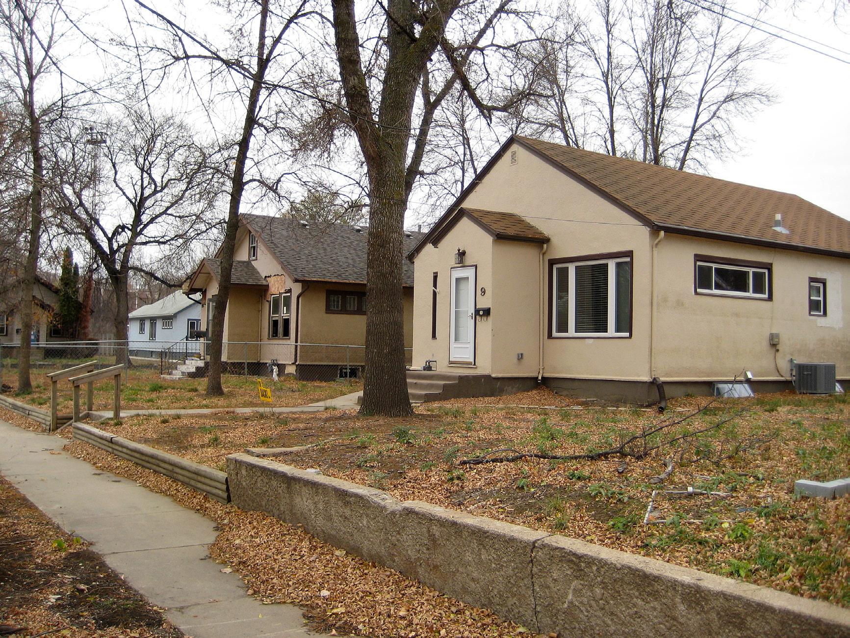
Stressor: Blight: Many of the citizens who participated in workshops for this proposal cited blight as an issue and stress on neighborhoods, negatively impacting health and safety and driving down property values. This is an issue in the flood afflicted neighborhoods, where nearly 150 homes have been identified as blighted as a result of the 2011flood. As mentioned above, there is a justifiable fear that the number of blighted homes will increase substantially with the publication of new FIRMs. Note, that while the vast majority of blight within the city is
attributable to the flood, blight is also an issue downtown (only about five percent of which flooded) and is attributed to years of disinvestment. By detracting from quality of life, blighted properties make the city a less appealing place to live and increase the fiscal burden of property maintenance. Blight detracts from livability, making it difficult for the city to attract the economic activity and diversity that will ensure its resilience in the face of economic downturns.
Stressor: Critical Services Separated from Neighborhoods most in need: In the community meetings for this proposal, city leadership and community members repeatedly expressed concern about the population on the north side of the river, (the lowest lying area of the city most exposed to flooding), being cut off from services at the time of a flood, as most critical facilities and services are concentrated on the south side of the river, with minimal connections to the north. Specifically, there is one undersized fire station on the north side of the river and there are no police stations. The absence of an improved level of emergency services on the north side of the river or hardened / resilient transportation connections during a disaster increases the city’s vulnerability to the shock of flooding.
Stressor: Insufficient Economic Diversity: The oil industry in Northern North Dakota has been booming, and has driven substantial economic and population growth in Minot and the region.
According to the US Bureau of Labor Statistics, “The rapid increase in oil production in the Bakken shale region (of which Ward County is a part) has been accompanied by strong employment increases in mining, quarrying, and oil and gas extraction; transportation and warehousing; and construction. Several industries have seen large increases in average annual pay, notably real estate and rental and leasing, as well as professional and technical services. The result of this growth is a regional economy with a higher percentage of its jobs in mining, quarrying, and oil and gas extraction, as well as transportation and warehousing, and a lower
percentage of jobs in industries that did not grow as rapidly, such as government, health care and social assistance, and retail trade.” http://www.bls.gov/opub/btn/volume-2/employment-wagesbakken-shale-region.htm. The impact on Minot has been a rapid increase in population and jobs — between 2009 and 2013 Minot’s population increased by almost 11,000 people or 30 percent. Over the same period, employment in the region grew by 28 percent.
While the success of the oil industry has been the driving factor in Minot’s population and economic growth over the last decade, it is important to recognize that depending upon one industry to drive our economy leaves us vulnerable to potentially catastrophic economic impacts—including unemployment and a decline in tax base, among others—given an acute downturn in the oil industry that would have ripple effects throughout the city and the region. And we know that this is a potential threat that we need to consider; over the course of 2014 alone, oil went from nearly $100/barrel down to approximately $50/barrel which lead to a reduction in rigs producing oil. Production peaked at 187 rigs in production in the fourth quarter of 2014 and fell to 163 rigs at the turn of the New Year. (http://www.startribune.com/lifestyle/health/287422241.html). Some oil industry experts predict that if prices continue to remain at the current levels, employment levels could fall by up to 20,000 jobs, which could have a devastating impact on our economy and the livelihoods and quality of life of our residents. (http://money.cnn.com/2015/01/22/news/economy/oil-boomtownlayoffs/).
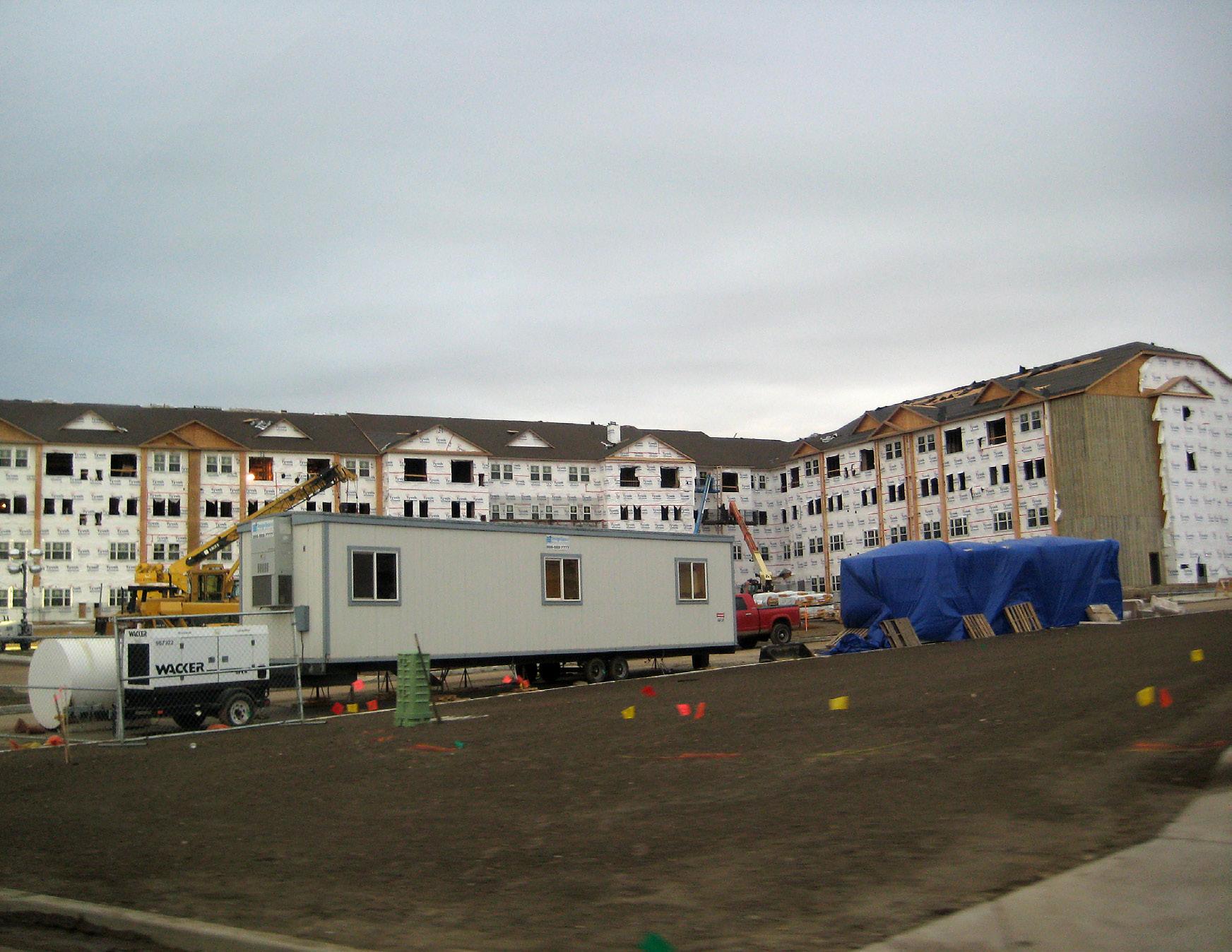
Stressor: Lack of Affordable Housing: As discussed in the housing unmet needs section and alluded to above, the disaster exacerbated a pre-existing affordable housing crises in Minot.
According to the U.S. census, the city of Minot’s population grew by 30 percent in the years 2009-2013 putting a tremendous strain on the housing supply of the city and the region with
which the affordable housing industry could not keep up. When the flood came, it devastated the neighborhoods with the city’s greatest supply of affordable housing. According to an affordable housing study released in December 2012, 28 percent of Minot’s population was then burdened per HUD standards due to the high cost of housing and short supply. Additionally, some of Minot’s key institutions are impacted by shortage of affordable housing: Trinity Hospital reports trouble recruiting personnel for key positions (such as nurses), and Minot State University attributes a loss of approximately 15 percent of its enrollment in recent years due to the unavailability of housing in Minot for students. This impact on employers may influence them to disinvest or even leave the city, and employees priced out of housing, particularly low wage/low skill workers may be forced to leave, further depressing the city’s economic diversity and leaving it more vulnerable to an economic crash.
Stressor: Loss of Social Cohesion: Minot is a boom-town. According to the U.S. Census Bureau, Minot’s population was 35,256 in 2009. As of 2013, that total had risen to 46,321—a 30 percent increase in just four years. It is often said that one of the qualities of living in smaller communities is that people know their neighbors and people look after one another. A key concern raised in the public workshops for this application is that with all the growth the city is experiencing, people don’t know their neighbors as well as they used to. Some are concerned that this has led to a weakening of the social fabric and that neighbors are not checking in on one another to the degree they had before. One practical impact of cohesion is that in a time of disaster, many people are there to help their neighbors. While this was true in Minot’s case (we heard of complete strangers helping senior citizens to move all of their belongings into storage before the floodwaters came and destroyed their homes), there were also others as cited by the Vulnerable Populations Committee who weren’t connected to community networks and, as a
result, fell through the cracks. Because these networks are so critical during a disaster, the lack of community cohesion can serve to increase vulnerability to flooding and in the event of an explosion/fire associated with transit of hazardous materials.
Stressor: Development Patterns in Recent Years have not Fostered Livability, Cohesion or Resilience: In recent years, development has occurred at the fringes of Minot and can mostly be characterized as sprawl. Transit is especially important in Minot for riders who have no other choice, but sprawl or the lack of density is an obstacle to transportation by alternative modes, or to good transit service. Indeed, there are approximately 1.3 units/acre in Minot, which is about 20 percent of what planners cite as the absolute minimum residential density required to support any form of regular, on-street bus service. Good transportation connections are clearly a factor in livability, which is important to residents, as evidenced in the public workshops for this application. Minot will continue to be susceptible to an economic crash if the patterns of development continue to prevail and accessible amenities in an urban location are unavailable.
Stressor: Lack of Shelter Space: Representatives of vulnerable populations cited the lack of shelter space during the flood, particularly for persons with special needs. Lack of shelter space has also been a problem during non-disaster times. As Minot and the surrounding area enjoyed an economic boom, many other areas of the U.S. were beginning to go through a financial recession from which many areas have yet to fully recover. The jobs in the oil fields have drawn many people looking for work, many of them vulnerable. The representatives of vulnerable populations tell stories about workers, many of whom brought their families with them, unable to find work in the area and living out of a parked car, unable to go home because they can’t afford the fuel costs.
Stressor: Increase in Oil Freight Train Traffic through Residential Areas: As the oil industry has grown in North Dakota, so has the reliance on transporting this oil by rail. There has also been in an increase in oil spilled. According to the Federal Pipeline and Hazardous Material Safety Administration, more oil was spilled in rail accidents in 2013 than in the previous 37 years combined, leading to significant damage to community drinking water supplies and other resources (http://www.mcclatchydc.com/2014/01/20/215143/more-oil-spilled-from-trainsin.html). As a spate of high-profile crashes have highlighted, this represents a risk to life and safety as well as the environment: On July 6, 2013, 47 people in the Canadian town of LacMegantic were killed when a train filled with Bakken crude exploded. As the heart of the Bakken region, and with a key rail corridor running right through downtown, this hazard is a significant concern for Minot. The number of trains transporting in excess of 1,000,000 gallons of crude oil that pass through Minot in one week exceeds 30 – as a result the city is more vulnerable now to this kind of shock than it ever was before.
Stressor: Vulnerable Populations are most At-risk: Vulnerable populations are especially at risk due to threats because few have the resources to evacuate or to live in another place while a home is being repaired. The Vulnerable Populations Committee identified a number of factors that served to increase the exposure of vulnerable populations to flood related stresses, such as: the absence of transit/transportation for people who had no other choice in the days immediately before, during, and after the disaster; the fact that many vulnerable people were not part of strong social networks, and did not get important disaster updates from emergency authorities before, during, and immediately after the flood; and finally, that there were insufficient shelter options especially for families and people with special needs. Vulnerable people also faced greater housing challenges due to the lack of affordable housing before, during, and after the flood.
What has the city done to address the risk from these vulnerabilities?
Since 2011, the city, along with Ward County and the Souris River Joint Board, have explored regional solutions to flooding. Minot has already completed 142 buyouts to help move residents out of the flood zone, and committed CDBG-DR funding for the construction of 350 affordable housing units. Minot has been in discussions with the state of North Dakota to get a commitment for funding to build a floodwall, but with the city beginning to explore other options for flood protection, discussions for the use of those funds could likely shift to buyouts or to other types of infrastructure. Minot has also participated with Ward County in the development of a regional economic development strategic plan and in the development of a regional emergency preparedness plan. It should also be noted that in 2013, the city completed an affordable housing study and in November 2014, the city completed a forward-thinking downtown redevelopment plan. Other activities related to risk are discussed in Factor 5.
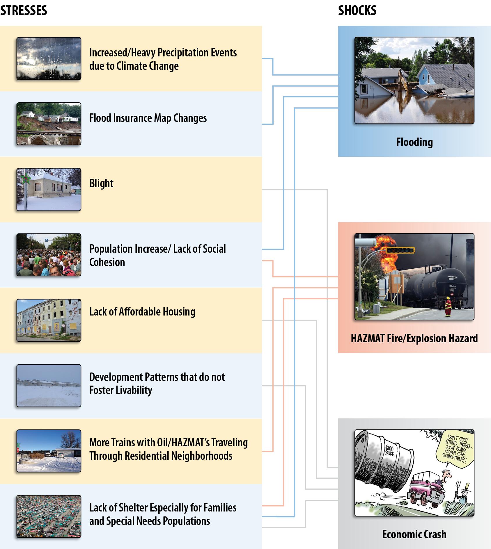
Exhibit E: Factor 3 - Soundness of Approach
City of Minot, North Dakota
ExhibitEFactor3Soundness
a. STAKEHOLDER CONSULTATION:
The determination and resilience of the residents of Minot and Ward County and their commitment to a better future was evident at each of the meetings held to help prepare this NDRC grant application. Six hundred and twenty people were not deterred by -35 degree wind chills or snow and ice; they participated in this process and developed the application because they believe a different, more resilient future is possible. Stakeholders participating in this consultation process included the Souris River Joint Board, several state of North Dakota departments and agencies, the regional Souris Basin Planning Council, Minot Air Force Base, major employers, small businesses, area economic development organizations, Minot and Ward County public schools, agencies representing vulnerable population groups, Ward County Emergency Services, and area power utilities. Through their involvement in meetings and small group discussions they identified unmet needs, completed a SWOT analysis to define threats and opportunities, determined key strategic actions, and developed evaluation filters for prioritizing specific projects in the future. Agencies that serve the region’s vulnerable populations (as identified in Exhibit C) were asked to participate in a discussion to determine how best to engage vulnerable residents in the NDRC process. Through this process, these representatives, the Vulnerable Populations Committee (VPC), agreed to confer with the residents they serve and represent their issues and needs. The VPC agreed to work together to focus on the challenges facing their constituents before and after a disaster, to ensure their needs were represented in the application framework, and to identify shared solution strategies that would improve coordination and result in better outcomes for vulnerable people in the future.
A Robust Outreach Effort:
The city of Minot and Ward County committed to involve citizens, vulnerable population groups, businesses, regional planning and social service agencies in this
process, as well as neighborhoods and businesses directly impacted by the 2011 floods. To this end, outreach strategies were many and diverse, ensuring all stakeholders had access to information and were aware of opportunities to provide input, which were designed to accommodate various communication preferences. Outreach activities included:
• Posting NDRC information, an online survey link, and meeting notices on city and county websites
• Using social media to share information about meeting outcomes and invitations to future meetings
• Involving local TV and radio outlets in covering events, interviewing participants, and developing feature stories about NDRC and the public input process
• Promoting participation at the final public meeting via three digital billboards located on major highways
• Posting flyers about upcoming meetings at downtown businesses, libraries, and offices, and prominently displaying large posters at City Hall, the Minot Municipal Auditorium, and other highly visible locations
A Diverse Engagement Strategy: The public engagement plan developed for the NDRC effort incorporated strategies to ensure broad public participation and consultation. These included robust and extensive public outreach, active involvement of critical stakeholders, and the general public, and interactive group activities designed to encourage people, even those who don’t often speak up at meetings, to share their thoughts and ideas. The public engagement and stakeholder process was developed to build and enhance productive, long-term community partnerships and generate broad-based support for the recovery and resilience actions needed to drive successful
implementation. All NDRC meetings have been held in facilities that meet ADA accessibility requirements.
Committed Local Leadership: Stakeholders are recognized leaders who are already involved in the community and are passionate about its recovery and its future. These trusted leaders have demonstrated their capacity to listen to diverse ideas and collaborate to find the common ground and core values vital to success. Minot and Ward County chose to involve stakeholders in a Community Advisory Committee (CAC) to facilitate local and regional coordination and ensure different perspectives, representing different constituencies and disciplines, are included. CAC members include representatives from federal, state, regional, and local governments and regional planning organizations, residents from neighborhoods impacted by the floods, major employers and small businesses, regional faith-based organizations, and local and regional emergency services staff. A list of the stakeholders serving on the CAC can be found in
Attachment D. The CAC will continue to work together after the Phase I application is submitted and will be actively involved in Phase II engagement and consultation activities and project implementation.
Outreach: Extensive outreach and communication activities for the NDRC process ensured broad-based public awareness of, and involvement in, this process. Information about the NDRC process and post-flood conditions was made available on the City’s website. Invitations to public meetings were posted on social media, city and county websites, flyers, digital billboards, local TV and radio outlets, and in Minot Daily News articles. An online survey offered residents additional options to identify unmet needs, suggest concept projects, and recommend goals for resilience and recovery. Links to the survey were provided in newspaper articles, on social media sites, and on the city and county websites. Meeting presentations and materials were posted on the city’s web site as well, and electronic, print, social media, and person-to-person contacts were used to provide information about and engage people in the NDRC process.
A press conference was held in December to announce the city’s intent to submit an application for NDRC funds and to ask for public input. Since December 3, a weekly regional radio show has featured NDRC meeting activities and announced upcoming meetings. Minot leaders sent individual emails to local and regional elected officials inviting them to discuss the NDRC application.
Engagement: Outreach and communications increased community awareness of the NDRC process and offered opportunities for residents to provide input, but the most important work occurred during meetings in discussions with residents and stakeholders. At the initial CAC meeting, stakeholders developed a SWOT analysis that uncovered threats and identified potential solutions to risks and challenges, including unmet recovery needs; proposed ideas to increase
resilience and opportunities to improve on previously proposed solutions to problems; and highlighted community strengths that can be leveraged to create a more resilient future.
Reflecting on the 2011 flood and subsequent recovery efforts, residents are now able to recognize and appreciate the assets that enabled the region to remain strong in the immediate aftermath of the disaster and begin to recover from its effects. Weaknesses were exposed as a result of the disaster, such as the vulnerability of roads, bridges, and utility infrastructure and how quickly and completely the north side of Minot could be cut off from fire, police, and emergency services as well as groceries, gas stations, pharmacies, and other basic needs. This was an ongoing discussion topic in the CAC and public meetings. In working through the SWOT analysis, the CAC looked back and considered what made a difference in preventing or at least reducing the effects of the disaster, and identified opportunities that will help the region become even stronger and more resilient in the future. At the first public meeting residents worked together in small groups to identify unmet recovery needs as discussed in Exhibit D: Factor 2Needs. Participants were encouraged to consider plans, including the Minot Riverfront and Center Plan, Souris River Recovery Strategy, and the Minot Affordable Housing Action Plan.
Building on group discussions, each group was guided through a storyboarding process during which they wrote down project ideas and concepts; these were subsequently organized to align them with the resilience and recovery themes identified earlier in the meeting. The powerful and compelling resilience opportunities that emerged from these discussions are described in the Idea(s) or Concept(s) section of this application.
b. IDEA(S) OR CONCEPT(S). When the city began the process of preparing this application, most people assumed the Mouse River Enhanced Flood Protection Project would be a system of flood walls and levees to protect Minot and the surrounding region. The NDRC process
broadened our thinking – we began to consider the realities and uncertainties of flood risk and examined a broader range of hazards and vulnerabilities that threaten our future including their disproportionate impact on the elderly, people with disabilities, and poorest among us (as discussed in detail in Factor 2). We realized that our approach to address risks needed to be broader—that structural measures alone would not suffice. That is not to say flood protection structures won’t be part of the solution, but a strategy based only on structural solutions lacks resiliency and encourages complacency. A more resilient and sustainable long-term approach should include measures to resist flooding and address the underlying factors that leave our community vulnerable resulting in devastating consequences when flooding and other hazards do occur. The concepts and ideas developed by those who participated in this process are designed to address the hazards (shocks) and vulnerabilities (stresses) illustrated in Figure E-1 and described in Exhibit D. While we cannot keep shocks from occurring, and some stresses are beyond our control – we cannot directly influence climate change and global macro-economic trends – there are things that we can do to address our vulnerability and keep future shocks from becoming catastrophes. Furthermore, if we address unmet needs (infrastructure, housing, and economic revitalization) in the right way, it will pay dividends creating a more resilient future for Minot. It is our intention that the themes that follow provide a more permanent resilience for our people, places, and economic prosperity.
Create a Resilient and Protective Open Space Network: Identify and preserve underutilized land in the floodplain to increase the capacity of flood storage, while creating local and regional amenities to improve the health, safety, and quality of life of existing residents, and attract new residents, employers and diverse economic generators to the region.
This strategy makes room for risk—physical buffers along rails and rivers become public open space resistant or resilient to flooding and damage while creating a regional recreational and natural amenity. This effort will include planning for creation of usable open space along the river and possibly along rail corridors, ensuring these areas become natural or recreational amenities where risk can be minimized. The city plans to work with its consultant and the Trust for Public Land (TPL) to plan for the development of an open space network that can buffer residents from hazards and foster local and regional non-motorized transportation connections. The city envisions a downtown riverfront park proposed in the city’s Riverfront and Center Plan as the centerpiece of this network. Planning will consider alignments that accommodate passive river management as well as determining strategic locations where open space may help to reduce potential flooding. Planning can also identify partnerships for the maintenance and programming of this new open space. One partnership includes the Minot Area Council of the Arts for the development of a plan for the installation of public art in new public spaces. In partnership with the city’s consultant and the TPL, areas within the Mouse River Basin will be identified where land can be acquired to provide for flood storage. We will perform a resilient river model analysis, which will map identify those areas suitable for passive water storage and natural resources and infrastructure opportunities (resiliency strategies). Finally, the city’s partners will provide a property analysis with parcel-level data on resiliency potential, acreage, and ownership to identify locations where site-scale resilience and flood risk reduction strategies might be feasible and impactful.
The Minot Air Force Base and Ward County are critical partners in this effort. The Air Force Base is interested in cooperating with the city to identify property adjacent to the base that can be used to maximize resiliency objectives and take pressure off of the base from potential encroachment of urban uses. Ward County is keenly interested in the development of an open
space / flood protection network that would connect the entire region. It is essential to gain the cooperation of the International Souris River Board (ISRB), a sub-committee of the CanadianU.S. International Joint Commission, the Souris River Joint Water Resource Board (SRJWRB), and the Assiniboine River Basin Initiative (ARBI) to implement these solutions, whether that means acquisition or stewardship of property, or assisting in the appropriate strategies to create water retention capacity.
As part of this planning effort, the city can develop a program to assist people who desire to relocate out of the flood and rail hazard areas. This effort will be targeted at the residential areas most at risk of catastrophic flooding and rail hazards and will be designed to work in concert with housing development programs described in the Fostering Resilient, Livable Neighborhoods section. We intend to work with state and federal representatives and the railroads on strategies related to rail safety. Many households, particularly in lower risk areas of the new flood zone, will not want to relocate from their homes. For those areas where people chose to relocate, the city of Minot will work with the Center for Community Progress to develop alternative land uses for these properties and sustainable ways to maintain vacant lands, such as a “Lot Next Door” program, where property is made available to an adjacent neighbor in exchange for a commitment to maintain the property.
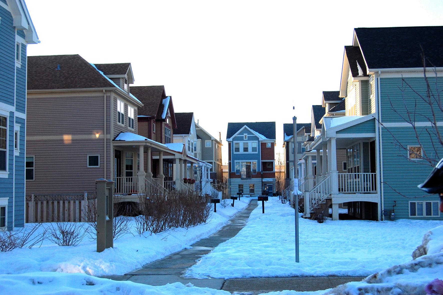
Foster Resilient, Livable Neighborhoods: Provide direct investment, incentives, and policies to promote mixed-use development, including affordable housing and businesses that are sited and designed to be safe from flooding and hazardous waste spills, and are connected, convenient, and walkable.
Building resilient neighborhoods is at the very heart of our approach for addressing our unmet needs. The stresses that make us vulnerable, lack of economic diversity, insufficient affordable
housing, reduced social cohesion, the presence of blight, and rising flood insurance rates can largely be addressed by creating more resilient neighborhoods. The NDRC give us an opportunity to respond to these stresses, to be proactive rather than reactive, focusing on our unmet housing, economic, and infrastructure needs, to move forward rather than revert back to the solutions of the past. We will establish target zones for development (growth nodes) in locations with lower exposure to physical hazards and create more livable, mixed-use neighborhoods that are affordable, energy efficient, and well-connected to other areas of the city. This includes the revitalization of downtown, Minot’s historic core, of which only five percent flooded in 2011. By coupling increased density in the downtown core with compact design and improved transit service, residents of all ages and incomes, including vulnerable populations will benefit. A more vibrant downtown can attract new employers and professionals who want to live in a dynamic urban environment. Increased housing options and a stronger economy in Minot benefits the entire region, which is also experiencing similar stresses including lack of affordable housing and lack of economic diversity. In Phase 2, the city of Minot envisions new land use policies and establishment of programs to support downtown redevelopment and expanded economic diversification in other areas of the city. Minot will work with their consultant, the Minnesota Housing Partnership, and the University of Minnesota - College of Design to create a strategy to support safe, quality, livable neighborhoods in Minot. Initiatives proposed for Phase 2 include:
• Development of design standards for privately-owned commercial and mixed-use buildings in designated commercial areas including downtown. Minot will develop these in partnership with NDSU and other design partners.
• Development of programs, policies, and projects to support redevelopment of key commercial properties within these designated areas including downtown.
• Development of strategic programs and financing to leverage new mixed-use development zones. Financing will be designed to optimize investments from other sources (i.e., Low Income Housing Tax Credits [LIHTC], ND Housing Incentive Fund) to provide the best benefit-costs and positive return on investment. The city may explore other funding strategies such as local tax abatements, community development improvement districts, as well as other proven practices to achieve the desired results.
• Joint participation with for-profit and non-profit developers who may manage the development and construction process and provide ongoing property management for multifamily housing.
• Develop prudent policies and procedures for the operation and management of these programs including guidelines for subsidies or incentives, affordability, and disposition of city-owned land for housing development.
• Evaluating a Complete Streets ordinance that can be used in new development zones. This task may consider design guidelines for streets, sidewalks, bike lanes, accessible transit stops, safe street crossings, and other appropriate design adaptations.
The city will explore appropriate options to preserve a portion of these new housing units for essential employees that qualify for affordable housing. These essential employees may include firefighters, teachers, and nurses, critical to the city’s well-being.
Reinforce Strong Leadership and Resources: For resilience efforts to be sustainable, local residents must understand the city’s risk and vulnerabilities and feel empowered to help foster resilience at every level. In conjunction with resilient development and protective preservation efforts, the city commits to community leadership building and broadly based communication and outreach efforts that strengthen local understanding of risks and support resilience efforts.
• Outreach and communication of risks and hazards: Minot will upgrade communication systems and work with the International Joint Commission to improve the river monitoring systems to provide better information for improved river management and communication regarding current conditions. This is particularly important to our vulnerable populations who may require specialized support and longer lead times to move in times of emergency.
Enhanced river management also has the potential to generate hazard mitigation co-benefits, improving the region’s resiliency against drought and other threats.
• Develop Vulnerable Populations Action Plan: Minot recognizes the disproportional impact of the identified shocks have on vulnerable populations particularly in the times immediately before, during, and after they happen. To respond to these stressors, the city of Minot will work with the VPC and other partners to ensure the needs of our most vulnerable residents are met through all the approaches described above. Vulnerable population groups include veterans, seniors, homeless, persons with mental illness, children aging out of foster case, and disabled children and adults.
• Resilience support centers: We will evaluate the creation of multi-purpose facilities that could function as shelters during a crisis and be used year-round for ongoing resources and coordination. These facilities would be designed to meet the unique needs of vulnerable populations, and support networks and communication to reach these often isolated groups.
We will evaluate opportunities to create programs to link neighborhoods groups and churches to ensure vulnerable people are aware of pending shocks and have a support network to assist them.
• Leadership: Development of the chief resilience officer position.
INTERDEPENDENCIES: It should be noted that all of these strategies, and the activities associated with them are designed to exploit interdependencies between among sectors and
create additional co-benefits. For example, a significant focus of the efforts to foster resilient, livable neighborhoods is targeted toward the redevelopment of downtown. The city recognizes there are opportunities to address some of the impacts of the flood on businesses and affordable housing by focusing a portion of their efforts downtown. By doing so, it can achieve broader goals of fostering community cohesiveness and expanding economic diversification. Downtown can again become the community’s “living room” with a riverfront park connected to a network of open spaces north and south of the river. These amenities can play a critical role in flood protection providing a buffer for developed areas of the city while also creating pedestrian and bike paths that enhance connectivity and offer modal choice.
The development of a more vibrant city center can help to attract talented people and entrepreneurial businesses downtown. New cultural/recreational amenities along with the redevelopment of unutilized and underutilized buildings can create a more economically resilient downtown with quality job opportunities, new small businesses, and revitalized facilities that inspire local people and visitors to spend time in the heart of the city. Affordable housing is a cornerstone for this effort in part because this area is not at risk from flooding, and additional population in the downtown area helps to support new economic opportunity. Clearly, with respect to the kind of vibrant urban commercial areas the city seeks, new economic activity and new housing go hand-in-hand.
The city wants to facilitate development of new mixed-use neighborhoods in other areas of Minot. Providing housing choices is important. More livable, mixed-use neighborhoods can improve accessibility to jobs and employment, reduce journey to work costs giving families more disposable income, improving workforce catchment areas for employers, and provide more options for affordable housing. Housing costs impact the ability of key institutions such as schools and hospitals to find and retain the employees they need to continue operation. The high
cost of housing in Minot has forced some people to take higher paying jobs in the oil and gas industry because they can no longer afford housing in Minot. If workers can’t afford to live in Minot, employers outside the oil industry can’t recruit the necessary workforce, and ultimately, the city and region become even more dependent on fewer industries increasing our economic vulnerability.
The proposed exploration of opportunities for flood control recognizes the growing risk of flooding and the impending cost increase for flood insurance due to the anticipated updated FIRMs is discussed more fully in Factor 2. The cost of flood insurance will have a significant negative impact on people living in the flood zone. Even if the city pushes forward with plans for a flood control project, the impact of changes in the flood insurance rates will be felt long before flood protection is in place, leaving us to question what we will have left to protect if we don’t work to address this risks in new ways and reduce the time it will take to make people safer and the region more resilient.