The City of Launceston acknowledges the Tasmanian Aboriginal people as the traditional custodians of this land on which the city and its surrounds are located, and pays respect to the Elders – past, present and future. Their legacy is evident in the natural and cultural values of this special place, and it speaks to us of the duty we have to preserve these values for future generations.
Introduction
In December 2023, the City of Launceston endorsed its first Urban Greening Strategy. The City of Launceston’s Urban Greening Strategy replaces the Street Tree Strategy and shifts its focus from managing trees on an individual basis to delivering a whole-of-forest approach. This approach encompasses trees and all other forms of vegetation, recognising that urban forests have economic, social, and cultural benefits. It also emphasises the importance of conserving biodiversity, maintaining soil and water values, and mitigating against heat impact and climate change.
While Launceston is known for its leafy parks and significant trees, the urban forest that people enjoy today only covers around 19% of the urban area and lacks species diversity, falling below the national standard of 39%.
The vision of the Launceston Urban Greening Strategy is as follows:
“The City of Launceston’s Urban Forest will be resilient, connected, and diverse, contributing to the health and wellbeing of our community and to the creation of a vibrant, liveable, and sustainable city.”
The Urban Greening Strategy outlines guiding principles that go beyond tree canopy, including:
• Mitigating and adapting to climate change
• Reducing the urban heat island effect
• Transitioning to a water-sensitive city
• Designing for health and wellbeing
• Designing for liveability and sustainability
• Creating healthier ecosystems
• Designing for heritage sensitivity
This strategy also establishes five key themes and targets for the development of an urban forest, encompassing not only tree canopy in the public and private domain but also other forms of urban greening. Following the Urban Greening Strategy, an Implementation Plan has been developed to inform priorities and key actions.
The Urban Greening Precinct Plans were identified as an action in the Implementation Plan. Precinct Plans will be developed for identified priority areas based on the vulnerability index, with a focus on paths that link bus stops and public places such as playgrounds, schools, aged care, and medical facilities. They are intended to be a working document that will develop over time to strategically inform greening works within each suburb. The precinct plans will guide tree planting and other greening works for both council-owned and private land.
Precinct Plans are subsidiary documents to the Launceston Urban Greening Strategy and form a key component of the strategy’s implementation. The precinct plans will also target other key actions outlined in the Implementation Plan.
As actions from the Implementation Plan are developed, progress and updates on the delivery of this Precinct Plan will be posted on the City of Launceston’s webpage, Tomorrow Together (www. tomorrowtogetherlaunceston.com.au/urban-greeningstrategy/greening_mayfield).
In 2021, Geoneon Pty Ltd. developed an artificial intelligence-based algorithm using a method called
Convolutional Neural Network (CNN) to map canopy cover across the City of Launceston’s urban areas. Canopy cover is defined by the extent of leaves, branches, and stems of trees viewed from above. The model was trained and run on high-resolution (50cm), multispectral (8-band) satellite imagery from 2021.
Data referenced in this Precinct Plan has been derived from Geoneon’s ‘Urban Forest Strategy - Technical Report,’ which has informed priorities for the delivery of greening.
The vision for the City of Launceston in the Greater Launceston Plan is for a compact, highly accessible green city with robust sustainable communities and a vibrant diverse inner city core.
Tamar Valley Regional Valley Open Space System (2004)
Parks and Recreation Dept Master Plan
Launceston City Council Open Space Strategy (2007)
Public Open Space assessment and acquisition process
Reserve Management Plans, Conservation Management Plans and Bushfire Management Planning
Greater Launceston Plan (2014)
Corporate Strategic Plan 2014 – 2024
City of Launceston Urban Greening Strategy
Influencing Documents Planning legislation
Tasmanian Planning Scheme 2022
Launceston Local Provisions Schedule
City of Launceston
Stormwater System Management Plan
Sustainability Strategy (2019)
Sustainability Action Plan 2022 – 2030
Associated Policies and Deliverables
Urban Greening Implementation and Action Plan
Policies and Guidelines for urban greening – green roofs and walls, deep soil and tree planting on private space
Neighbourhood Precinct Plans
City of Launceston Transport Strategy
What is an Urban Forest?
The urban forest is made up of all the trees, shrubs, grassland and other vegetation, growing on public and private land within the city, and the soil and water that supports them.
This includes vegetation located in parks, private gardens, plazas, reserves, along main roads, local streets, in commercial areas, railways and waterways, and other green infrastructure such as balconies, walls and roofs.
The urban forest provides important ecosystem services such as air and water filtration, oxygen, shade, carbon sequestration, nutrient cycling and habitat for fauna. Whilst trees and shrubs are a critical element of urban forests, the Urban Greening Strategy encompasses a holistic approach to the cumulative benefits of all vegetation and associated ecosystems across the city and extends beyond the singular approach to tree management.
The Urban Greening Strategy addresses the broader issues of climate change, urban heat island effects, urban densification and social equity, recognising that every part of the city, both public and private, contributes to and can be influenced by the urban forest.
The urban forest plays a significant role in enriching quality of life of its urban communities by supporting health and wellbeing, and making a city more liveable, attractive, sustainable and productive.
Benefits of the Urban Forest
Research has found that urban forests provide a wide range of important benefits for the community, environment and economy that extend beyond aesthetic and recreational values into an interconnected landscape, holistically feeding into the resilience, sustainability and prosperity of cities.
Figure 2.1 Urban Forest Benefits Diagram
What will the Precinct Plans achieve?
A key action from the Launceston Urban Greening Implementation Plan is the preparation of Precinct Plans. Each Precinct Plan will be informed by community consultation and will provide set targets to address the individual needs, challenges, and aspirations of the locality.
The Precinct Plans will help guide the implementation of the Launceston Urban Greening Strategy and direct the Council’s focus to areas with higher vulnerability, lower levels of vegetation, and with a focus on paths that link bus stops and public places such as playgrounds, schools, aged care, and medical facilities.
Within this document, specific direction is provided on the selection of appropriate trees, understory planting and other greening actions for the precinct.
The Precinct Plans are performance-based in that they establish the desired outcomes for streets but do not prescribe specific species for each location. Rather, the Precinct Plans provide options and guidelines to allow for the most appropriate on-ground solution.
This document focuses on the suburb of Mayfield. The documents are designed to be developed and added to over time, to allow priority on-ground works to begin immediately.
The Precinct Plans will target actions outlined in the Launceston Urban Greening Implementation Plan 20232040, as shown in Table 3.1.
Implementation Priorities
Priority suburbs for the Precinct Plans were identified using Australian Bureau of Statistics data.
To determine the priority suburbs, Geoneon combined data from Index of Relative Socio-economic Advantage and Disadvantage (IRSAD), vulnerable age percentages, land surface temperature, and tree canopy cover to create a priority index. This index ranks suburbs by their need for heatwave vulnerability reduction.
The highest priority suburbs are Newnham, Mayfield, Mowbray, Invermay, Ravenswood, Waverley, Summerhill, Kings Meadows, and Youngtown.
Planning Actions
Number Actions
P-1
P-8
P-9
Establish canopy cover targets and milestones for each priority area or green zone to achieve the canopy cover target of 40% by 2040.
Work with community leaders to develop strategies to protect vegetation and deter vandalism.
Develop and implement neighbourhood precinct plans for identified priority areas based on the vulnerability index, with a focus on paths that link bus stops and public places such as playgrounds, schools, aged care and medical facilities.
Priorities:
1. Newnham, Mowbray, Mayfield
2. Invermay, Ravenswood, Waverley
3. Summerhill, Kings Meadows, Youngtown
Operational Actions
O-15
O-25
Achieve a minimum of 20% canopy cover in, and within 400m, of all schools through collaboration with Department of Education, schools, school communities, not-for-profit and community organisations.
Priorities:
1. schools with <5% canopy cover
2. schools with 5-7% canopy cover
3. schools with 7-9% canopy cover
4. schools with 9-14% canopy cover
5. schools with >14% canopy
Note - priority areas identified in GeoNeon Technical report (2022)
Develop and deliver an external engagement program to inform, educate and inspire community about the benefits of trees and other vegetation, provide guidance on planting and maintenance, and the role increased canopy coverage has in sequestering carbon, mitigating against climate change and reducing the urban heat effect.
Priority activities include:
planting days, nursery open days and pop-up demonstrations, establishment of community gardens, informal seminars, and workshops on urban forest maintenance and neighbourhood character.
O-26 Work with communities in areas of low canopy cover and high heat vulnerability index to educate and overcome resistance to trees and develop unique engagement methods that demote negative behavior and vandalism and promote protection and connection to trees.
Table 3.1 Planning and operational actions from the 2023- 2040 Urban Greening Implementation plan that are relevant to this precinct plan.
Figure 3.1 Mayfields location within the City of Launceston
Mayfield
The Precinct Plans will help guide the implementation of the Launceston Urban Greening Strategy and direct the Council’s focus to areas with higher vulnerability, lower levels of vegetation, and with a focus on paths that link bus stops and public places such as playgrounds, schools, aged care, and medical facilities.
Figure
Geographic area
The size of Mayfield is approximately 0.653 square kilometres. It has 5 parks and reserves.
Population
The population of Mayfield in 2022 was 1,542 people. The predominant age group in Mayfield is 0-9 years.
Age Structure
Age is a critical factor in determining the vulnerability to extreme heat. People over 65 years old and youth less than 5 years old are the most vulnerable.
Mayfield has a high percentage of youth less than 5 years of age, with 8% of the population in the 0-4 age group. This has risen from 5.7% in 2016 and the fastest growing group since the past census.
Analysis of the service age groups of Mayfield in 2021 compared to the City of Launceston shows that there was a higher proportion of people in the younger age groups (0 to 17 years) and a lower proportion of people in the older age groups (60+ years). Overall, 25.6% of the population was aged between 0 and 17, and 19.3% were aged 60 years and over.
Mode of Transport
On Census day 2021 in Mayfield, 77.1% of people travelled to work in a private car, 4.0% took public transport and 1.6% walked. No residents recorded cycling to work. 1.4% worked at home.
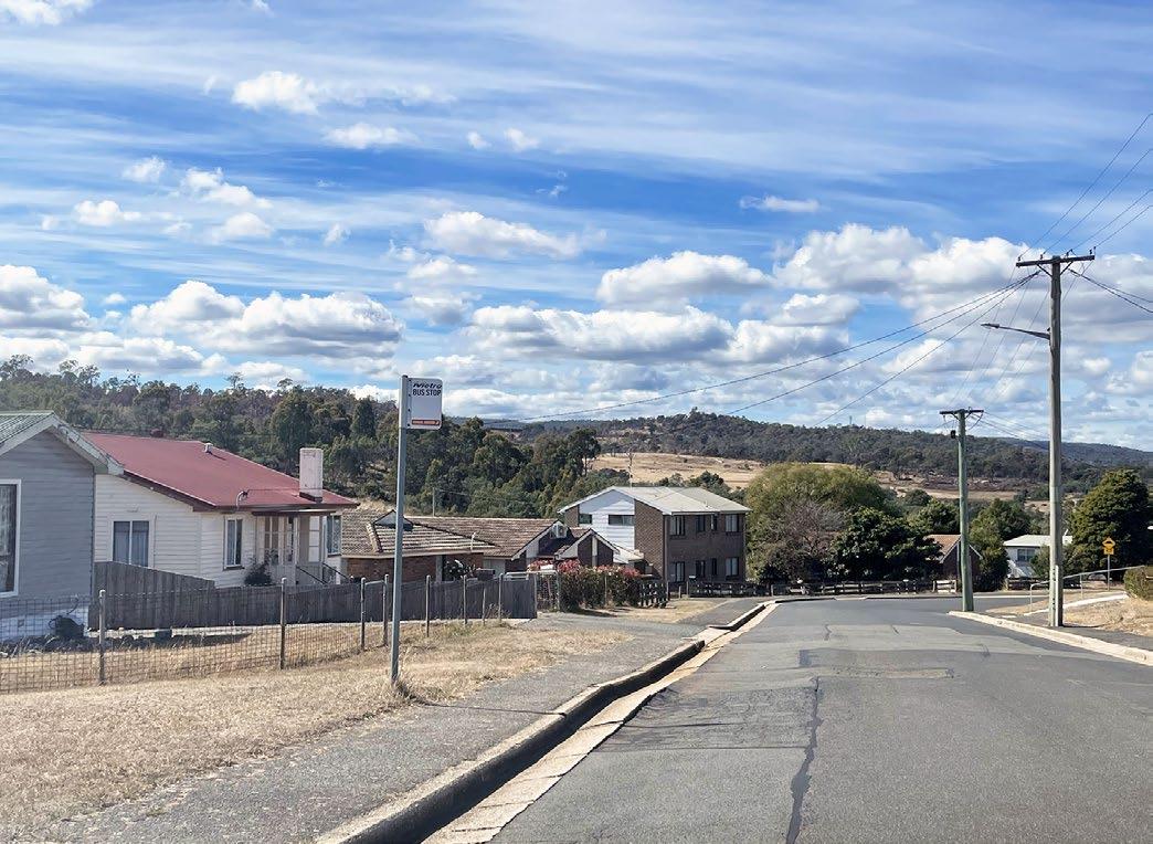
Mayfield is serviced by two main bus routes, with 11 bus stops located in the suburb. None of the bus stops provide shelter, and they all have less than 5% canopy cover to provide shade.
Climate Change
The effects of climate change are anticipated to significantly impact tree canopy and vegetation. In Tasmania projected changes include a significant shift in rainfall patterns, an increase in air and sea temperatures, more heatwaves, reduced incidence of frost, increased frequency and severity of storm events, and a doubling of bushfire frequency and severity by 2100.
Trees can play an important role in mitigating the impacts of a flooding event. The soil under trees and vegetation absorbs water as opposed to urban impervious surfaces where the water just runs (such as pavement and roofs). The leafy canopy of trees also spreads out the rainfall and slows it down.
Trees also provide shade and protection during hotter weather, and help to reduce the heat island effect caused urban development. Trees provide shade, reducing the amount of sunlight that reaches the ground and thus lowering surface temperatures.
Information in this Suburb Profile was accessed from Profile.id which utilises 2021 census data from the Australian Bureau of Statistics and population, household and age structure forecasts.
Median Age: 33 (no significant change from 2016)
Worked (full or part time): 87.4% ( from 2016)
Children 0 – 4 years: 5.4% ( from 2016)
People 60 and over: 19.3% (q from 2016)
Travel to work:
Top languages used at home (other than English): Nepali (2.6%)
Top ancestry (other than Australian): English (41.2%), Australian Aboriginal (7.7%), Irish (7.7%), Scottish (5.8%).
Planning overview
Zones
• General Residential
• Community Purpose Zone (East Tamar Primary School)
Open Space:
• Mawson Place Park
• Hargrave Crs Bushland Reserve
• Torren’s St Park
• Kennedy St Park
Access
The suburb is bordered by the road corridor George Town Road and has a number of thoroughfare subsidiary streets that connect the suburb - Torrens Street, Mayfield Street and Box Street.
The suburb has a walk score of 49, with moderate dependency on cars travel for access to amenities. https://www.walkscore.com/score/mayfield-tasmania
Facilities
• East Tamar Primary School
• Muylatina Child and Family Centre.
Whilst there are no other smaller local business shops or amenities within the suburb, there is an IGA located on George Town Road, within walking distance of Mayfield.
Existing structures
Predominantly single one story dwellings and associated outbuildings, and smaller single level multiple dwelling (unit) developments.
Surrounding land
• Predominantly General Residential zoned land and a strip of Local Business Zone that is situated along George Town Road that services the suburb.
• Native/revegetation reserve (to the east (Hargrave Crs Bushland Reserve)
• Bushfire-Prone Area Code adjacent to the reserve area and toward Rocherlea.
• To the east of Mayfield is an area of land that has been designated for future development under the provisions as set out in the Green Specific Area Plan within the Launceston Local Provisions Schedule.
Figure 4.1 Mayfield planning overlays
Hargrave Crescent, Mayfield
Photograph: CoL
Mayfield neighbourhood character
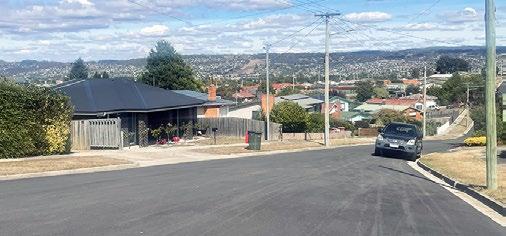
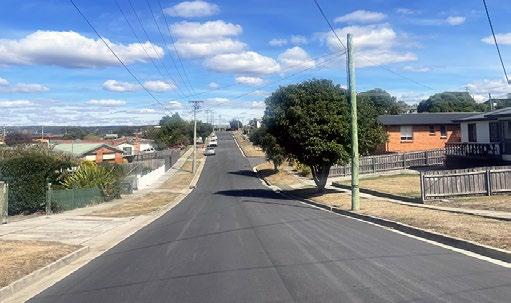
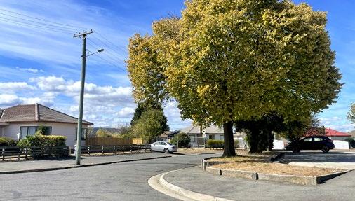
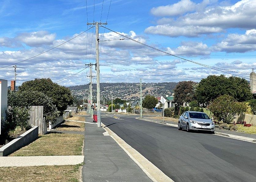
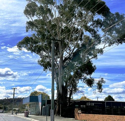
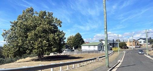
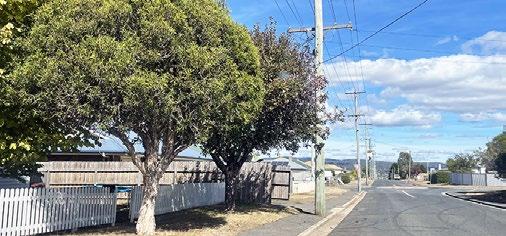
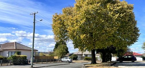
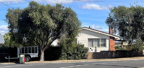
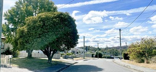
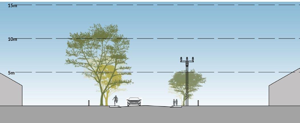
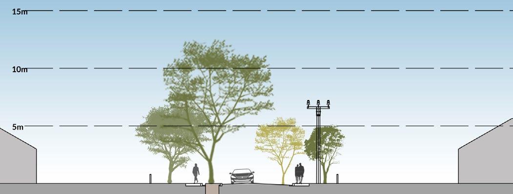
Mayfield has a quiet suburban character, with limited greenery. Mayfield is predominantly characterised by residential streets adorned with single-story weatherboard or brick dwellings. Typically, they have a road width of 7m, featuring asphalt footpaths on one or both sides, grassed verges ranging from 2.5 to 3.5 meters, and overhead power lines positioned on one side. Tree and canopy coverage is limited to small to medium sized street trees.
Hargrave Crescent, situated adjacent to the northern edge of East Tamar Primary School, has a unique character, with a 4m concrete to kerb footpath on the southern side of the road.
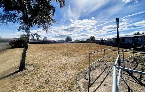
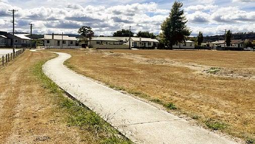
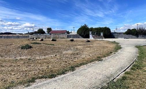
The council-owned and maintained lands encompass Torrens Street Park, Hargrave Crescent Reserve, Mawson Place Park, and Kennedy Street Park. However, these parks exhibit minimal infrastructure and vegetation. For instance, Mawson Place Park stands devoid of trees or planting. To the east, the suburb is bounded by the Rocherlea Old Rail Trail and Bell Bay Line.
Located centrally within the suburb is East Tamar Primary School and Muylatina Child and Family Learning Centre. 19-29 Mitchell Street is the only commercially zoned land, with a range of small businesses facing off-street parking.
Table 5.1 Analysis of Mayfield streets
The urban forest of Mayfield
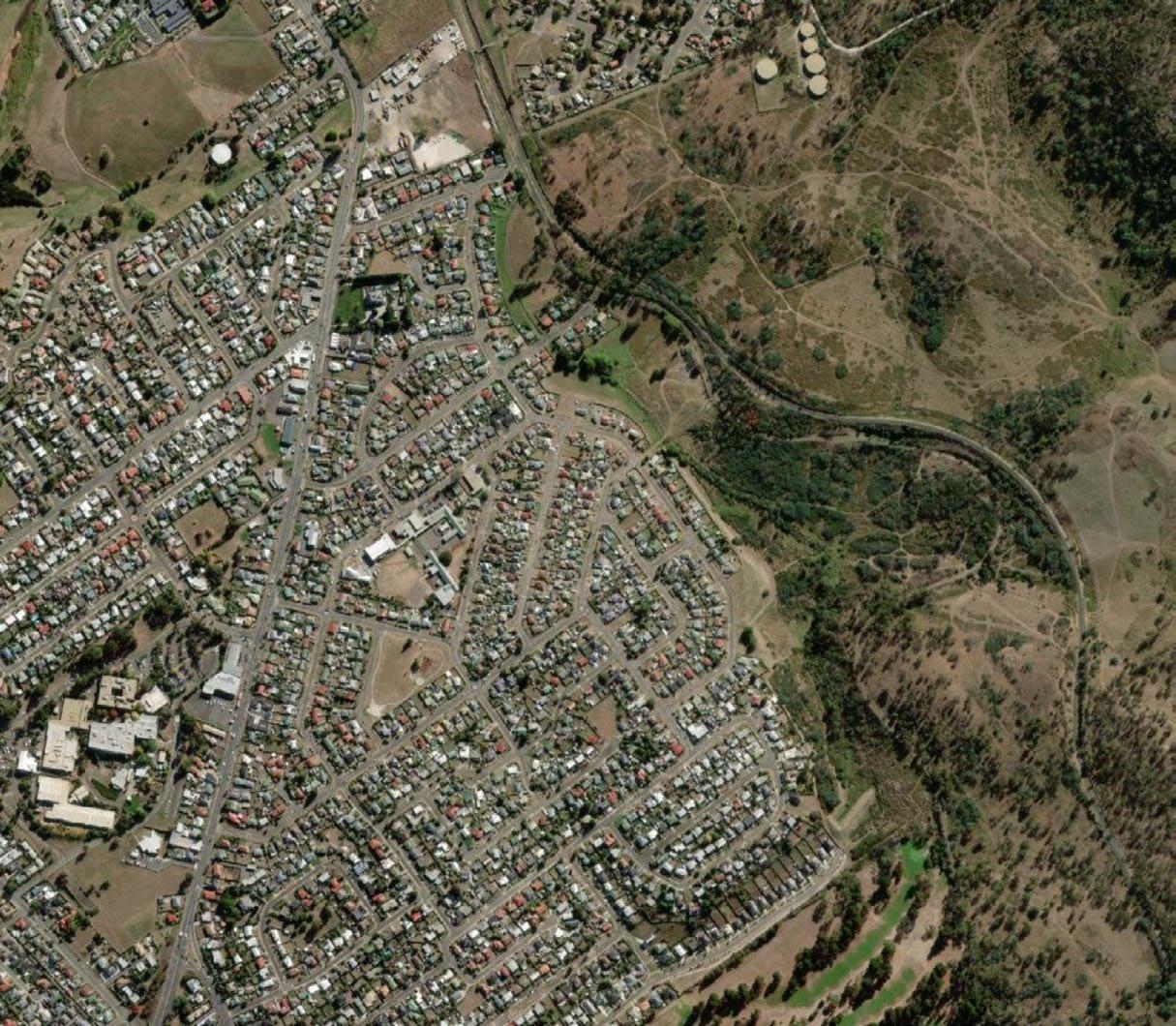
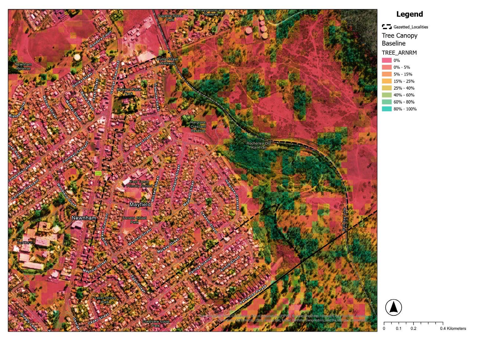
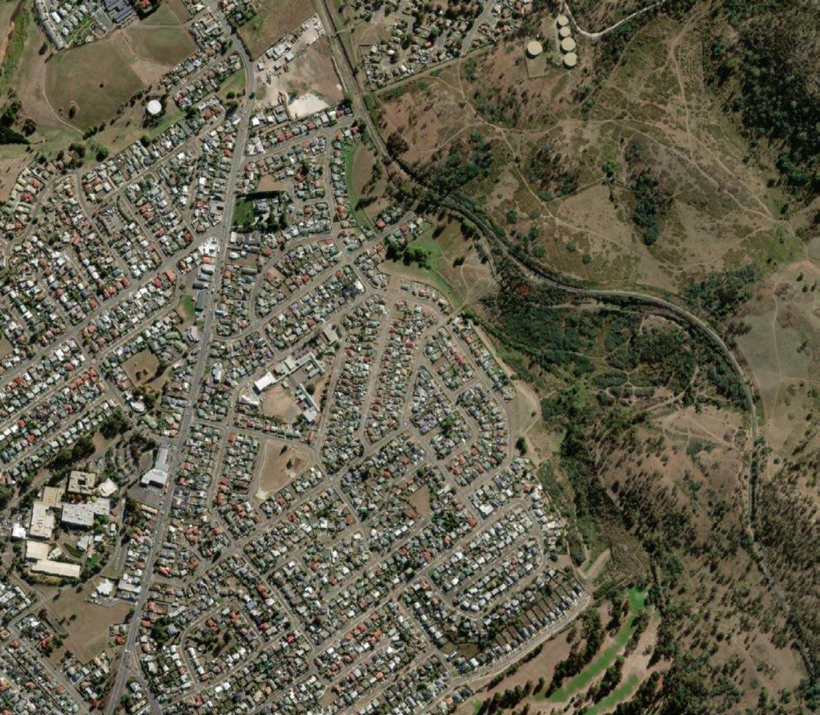
Mayfield currently has an overall canopy coverage of 10-15%, with the majority concentrated in the undeveloped eastern region of the suburb (Fig. 7.1) However, the canopy coverage within a 400-meter radius of East Tamar Primary School is notably lower, ranging from 0-5% (Figure 6.2). Bus stops, which are also listed as a priority for greening in the Urban Greening Strategy, have coverage less than 5% across Mayfield (Figure 6.3).
While certain streets in Mayfield exhibit successful tree planting, the prevalent species tend to be small to medium-sized, spaced between 15-30 meters apart. This arrangement results in limited shading, and areas with potential for larger trees remain largely underutilised.
A resilient urban forest has a diverse range of species from different families. As seen in Figure 6.6 , councilmanaged street and park trees are largely dominated by the Myrtaceae family, making up to 46%. The Rosacea family follows, making up 32%.
The variety of trees in street plantings encompasses both native and exotic species. Notably, Callistemon dominates the native planting, constituting 46% of the street tree plantings (Figure 6.4). Various species within the Rosaceae family, such as Cotoneaster sp., Crataegus sp., Malus sp., Photinia glabra ‘Robusta,’ Prunus blireiana, and Prunus serrulata, are planted in Mayfield streets.
The reliance of a small number of species, and a lack of diversity in species distribution, leaves the urban forest vulnerable to threats from pests and disease.
Guidelines outlined in the Urban Greening Strategy emphasise limitations on tree species, genus, and family representation in Launceston’s urban forest.
Specifically, these guidelines advocate for no more than 5% of any tree species, 10% of any genus, and 20% of any family.
Considering that the Urban Forest of Mayfield significantly contributes to Launceston’s overall urban forest, future plantings should prioritise a more balanced and diverse selection of trees within the suburb, aligning with the guidelines outlined in the Urban Greening Strategy.
Bus stop on Hargrave crescent (Photographer/CoL)
City of Launceston Mayfield Urban Greening Precinct Plan 17
Figure 6.1 Tree canopy coverage of Mayfield.
Figure 6.2 Tree canopy coverage of Mayfield around bus stops
Figure 6.3 Tree canopy coverage of within a 400m radius of schools and educational facilities.
Species Breakdown
Family Breakdown
Figure 6.4 Breakdown of Mayfield trees by species
Figure 6.5 Breakdown of Mayfield trees by genus
Figure 6.6 Breakdown of Mayfield trees by family
What’s growing well in Mayfield
Site surveys were undertaken in the Mayfield area to evaluate the conditions of various species, with a particular focus on both recently planted street trees and existing vegetation. Noteworthy observations within Torrens Street Park revealed the robust health of Fraxinus excelsior trees, showcasing heightened resilience against Ash decline compared to their counterparts elsewhere in Launceston. Conversely, the Ulmus x hollandica in the same park, despite being planted a decade or more ago, displayed limited growth and soil instability.
The park’s trees, situated in lawn areas without mulch or irrigation, grapple with challenges stemming from compacted ground and exposure. This challenging setting impedes the successful establishment of new plantings. Consequently, a recommendation is proposed to introduce under story planting into the park, implementing larger mulched beds with irrigation to provide optimal conditions for the growth of new plantings, including uncompacted soil and the addition of compost and additional soil nutrients.
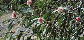
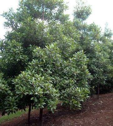
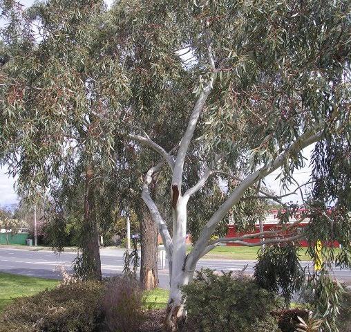
In the realm of private gardens, smaller native trees such as Hakea laurina, Hakea salicifolia, Callistemon viminalis, Magnolia grandiflora, and Eucalyptus leucoxylon thrive in well-established conditions. However, the outcomes for newly planted street trees are varied, with a noteworthy percentage of species struggling to thrive. It is pertinent to highlight that those receiving additional water and mulch from residents exhibit superior growth or, in some cases, have failed entirely, diverging significantly from those lacking such care.
5.
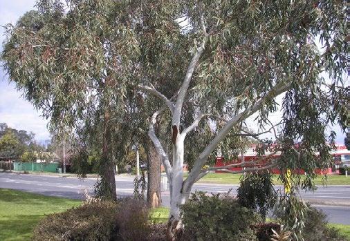
1. Tasmanian blue gum(Eucalyptus globulus), Hargrave Cr.
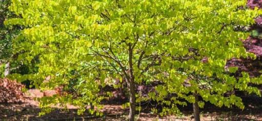
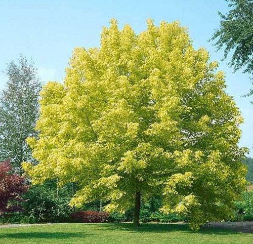
2. Golden Elm (Ulmus Glabra Lutescens),Hargrave Cr.
3. Willow bottlebrush (Callistemon salignus), Kennedy St.
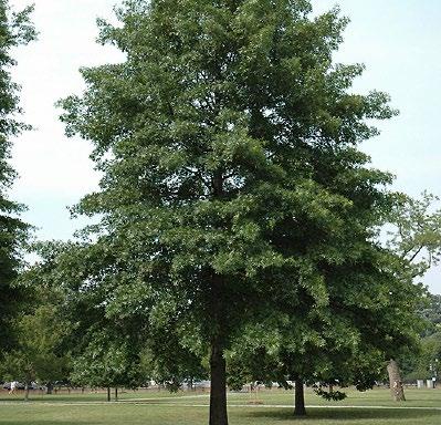
4. Plane tree (Platanus x acerifolia), Hargrave Crescent Reserve.
Photinia (Photinia glabra ‘Robusta’), Cook Cr.
6. Callistemon salignus and Malus spp, Mayfield St.
Surrounding areas of native vegetation
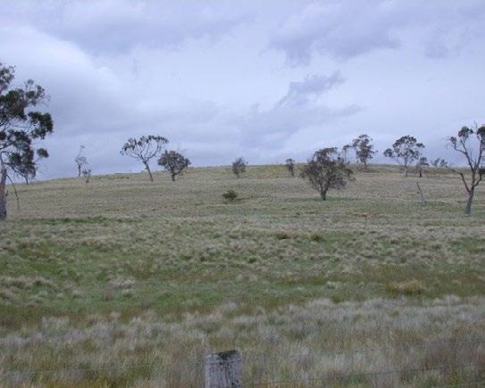
Whilst the majority of Mayfield is now urban areas or agricultural land with little to none remnant vegetation, we can look to the surrounding areas for cues about the endemic vegetation.
Utilising endemic vegetation in urban forests offers a multitude of benefits that contribute to the overall well-being of both the environment and the community. Endemic plants are naturally adapted to local climate and soil conditions, requiring minimal maintenance and reducing the need for artificial irrigation or chemical inputs. By incorporating native species, urban forests can enhance biodiversity, providing habitats for local wildlife and promoting a balanced ecosystem
These plants also contribute to the mitigation of urban heat islands, as their natural adaptability aids in temperature regulation. Additionally, the use of plants endemic to the surrounding landscapes of Mayfield fosters a sense of connection to Country, promoting environmental awareness and a deeper appreciation for regional ecosystems. The incorporation of endemic vegetation in the Urban Greening Strategy for Mayfield will create a sustainable, resilient, and ecologically harmonious landscape for present and future generations.
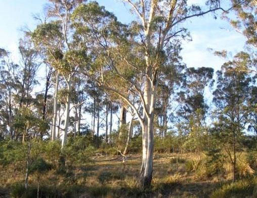
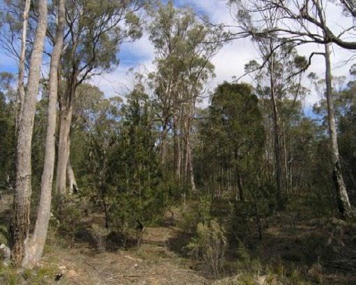
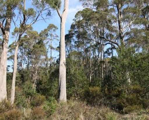
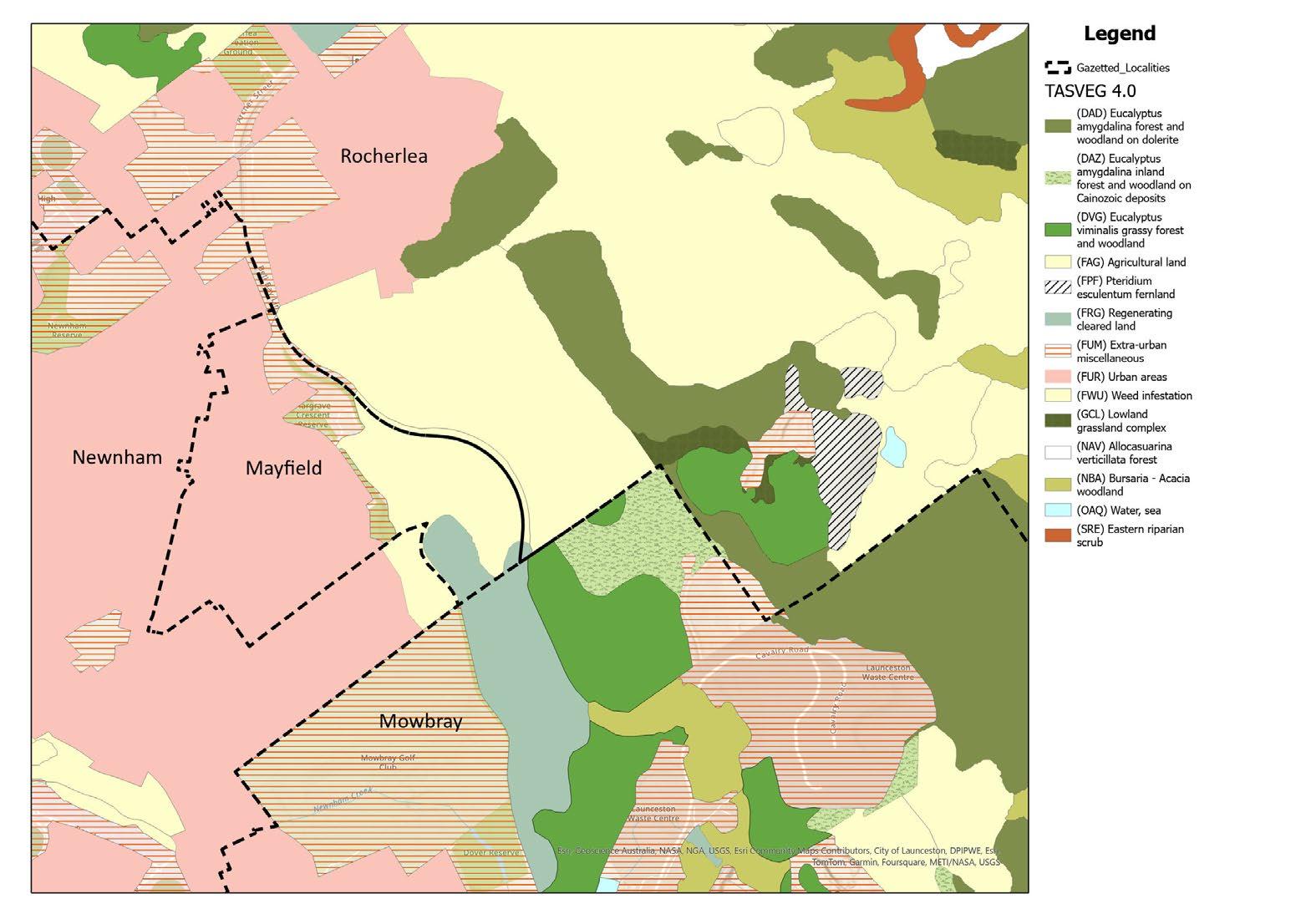
To the south east, there are patches of Eucalyptus viminalis grassy forest and woodland (DVG) and Eucalyptus amygdalina inland forest and woodland on Cainozoic deposits (DAZ) and. To the East of Mayfield there are Eucalyptus amygdalina forest and woodland on dolerite (DAD) and native grassland areas (GCL).
Eucalyptus viminalis grassy forest and woodland is characteristically low to medium height (15-25m) open grassy forest dominated by E. viminalis. The understory is generally grassy; however, rock can form a significant cover in some situations
Eucalyptus amygdalina inland forest and woodland on Cainozoic deposits is dominated by E. amygdalina, E. viminalis, E. pauciflora or occasionally E. ovata. Dry sclerophyll shrubs (often low or prostrate species), Pteridium esculentum, and grasses or graminoids dominate the understory.
Eucalyptus amygdalina forests and woodlands on dolerite are dominated by uneven-aged E.amygdalina in an open forest structure with trees rarely exceeding 25 m. They are dry sclerophyll communities with variable understorys ranging from grassy to shrubby. In some places, rock forms a cover.
Lowland grassland complex generally contains natural or disturbance-induced grasslands dominated by a species-poor grassy sward of Rytidosperma or Austrostipa, with occasional patches of Poa species and Themeda triandra. Rytidosperma/Austrostipa grasslands occur naturally in valley bottoms and lower slopes.
1. Eucalyptus viminalis grassy forest and woodland (DVG)
2. Eucalyptus amygdalina inland forest and woodland on Cainozoic deposits (DAZ)
3. Eucalyptus amygdalina forest and woodland on dolerite (DAD)
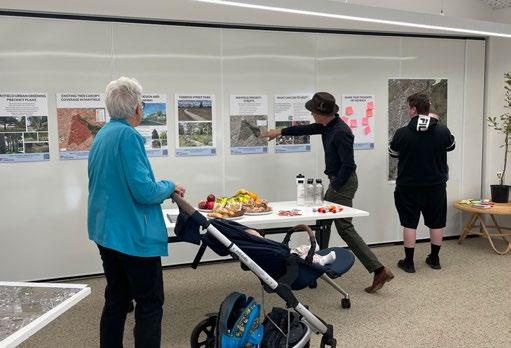
The City of Launceston held a week-long series of sessions from May 27, 2024, for the residents of Mayfield to introduce the Urban Greening Strategy and discuss the proposals included in the draft version of this document. These sessions took place at the Mulaytina Child and Family Centre from 9 am to 4 pm over five days.
Engagement with School Children
The City of Launceston engaged three classes of school children from years 3 and 4 in one-hour sessions each (75 children total). These sessions aimed to educate and involve the children in the Urban Greening Strategy by:
• Providing a short presentation on the importance of urban forests and their role in supporting biodiversity.
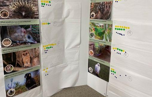
• Introducing the children to eight local animals, birds, or insects, and asking them to vote for their favourite to create a connection to the project.
The animals presented were:
• Swift Parrot
• Echidna
• Tasmanian Masked Owl
• Eastern Barred Bandicoot
• Spotted Quoll
• Tasmanian Christmas Beetle
• Grey Goshawk
• Yellow-Tailed Black Cockatoo.
The Swift Parrot was the most popular choice. As a critically endangered species, the Swift Parrot’s survival is heavily dependent on the nectar from flowering gums, such as Eucalyptus trees. The proposed species in this precinct plan will includes planting more flowering gum varieties to support these birds and enhance their habitat in Mayfield. Planting in the local parks should also endeavour to create food additional food sources for the Swift Parrot.
The children also participated in activities such as:
• Thinking about the best locations for tree planting
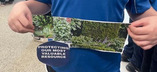
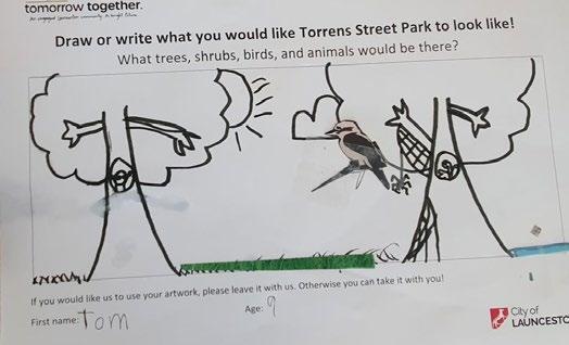
• Creating drawings or collages of how they envision their suburb with more urban greening.
• Learning about plant health and care.
Each student received a native plant to take home at the end of the sessions.
from the East Tamar Primary engagament sessions.
Images
Engagement with the Community
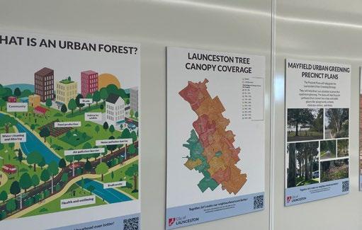
Other visitors to the sessions were presented with detailed information about the Urban Greening Strategy and the Mayfield Precinct Plan. Key topics covered included:
• Launceston’s existing tree canopy coverage.
• Mayfield’s existing tree canopy coverage.
• The purpose of the precinct plans.
• Explanation of “What is an Urban Forest.”
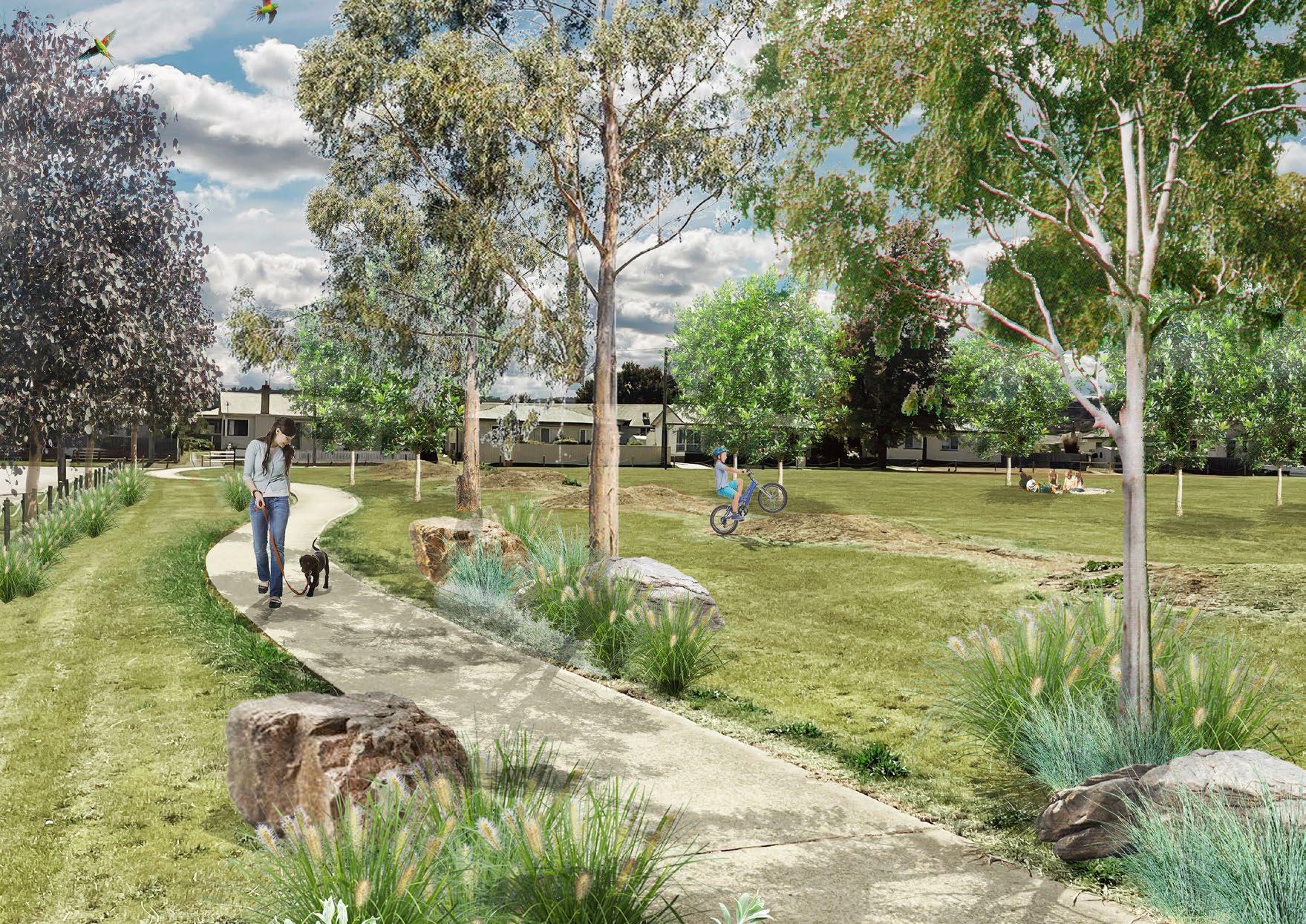
• Visualisations of potential future developments in Torrens Street Park and Hargrave Crescent.
• Priority order of streets to be planted in Mayfield and the rationale behind this.
• How residents can get involved and support the successful implementation of the plans.
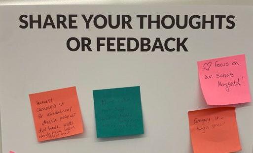
• Opportunity for feedback.
This initiative aims to foster community involvement in the Urban Greening Strategy.
Feedback from visitors highlighted several concerns and suggestions:
• Concerns about vandalism, particularly on Hume Street and Gregory Street.
• Desire for more shade in Torrens Street Park.
• Interest in more plant diversity, not just trees.
• Desire for seasonal color and greener areas to alleviate depressing environments.
• Support for increasing plants to benefit birds and bees.
• Appreciation for learning about the benefits of urban forests.
• Excitement about new plantings and trees in Torrens Street Park.
• Desire for more amenities for children in the neighborhood.
• Looking forward to increased shade in summer.
• Need for more trees, native bushes, and grasses to help with pollution and attract wildlife.
City of Launceston Mayfield Urban Greening Precinct Plan 25
Images from the drop in sessions at the Mulaytina Child and Family Centre
Canopy cover and key targets
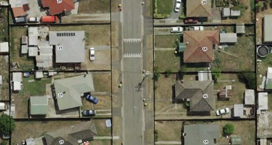
A comprehensive analysis was conducted on properties situated at 16, 18, 21, and 23 Gregory Street, serving as a baseline for formulating planting schedules and targets aligned with the Urban Greening Strategy.
Gregory Street falls within a 400m radius of East Tamar Primary School, designating the selected properties as within the priority zone for greening around schools.
The street currently exhibits minimal street tree plantings, with private gardens featuring limited vegetation coverage. Reflecting the typical characteristics of the area, Gregory Street has a 7m road width, 1.5m footpaths on either side, a 2.5m grassed verge, and powerlines situated on the eastern side. The block sizes for the four properties range from 610m2 to 620m2.
Referencing the research paper ‘Urban Tree Canopy Targets & Development Controls Report’ by Gallagher Studio and Studio Zanardo, reasonable canopy targets
for blocks of this size are identified as 30% canopy coverage. For a 610m2 block, this translates to 183m2 canopy coverage or approximately 3.6 large trees.
The initial assessment of the four properties revealed a baseline canopy coverage of 2%, primarily consisting of small privately owned trees. A sketch plan was developed, placing large trees on the western side of the street, avoiding powerlines. Two trees were proposed per block, accommodating driveways and pedestrian crossovers. On the eastern side, smaller canopy trees were proposed, considering the presence of overhead powerlines. This proposed planting arrangement increased the overall canopy coverage for the area to 11%.
By increasing canopy coverage in privately owned blocks to 30%, the total canopy coverage for both public and private land could reach 41%. Further planting in
parks and open spaces could contribute to achieving this ambitious goal.
This study serves as a foundation for calculating the required number of trees for public domain planting over a 5-year plan. It emphasises the significance of canopy coverage on private land.
According to calculations, 4140 trees, with an average mature canopy coverage of 50m2, are needed to achieve 40% canopy coverage in Mayfield. Breaking this down, 21% of the canopy coverage is allocated for street tree planting, while 79% is designated for available land in the private domain.
Importance of private trees
The robust presence of an urban forest canopy on private land holds immense value, contributing significantly to the overall health and well-being of the environment and the community. In addition to enhancing the aesthetic appeal of urban landscapes, private landowners investing in and maintaining a diverse tree canopy contribute to improved air quality and energy efficiency. Beyond environmental benefits, trees on private property enhance property values, create recreational spaces, and foster community pride, ultimately contributing to a more sustainable and resilient urban ecosystem.
Table 8.1 Mayfield targets for street and private trees per year, over a 5 year period.
Note1: Existing canopy coverage = 17%. Need an additional 23% coverage to meet targets
Note 2: Average tree canopy taken as 50m2
* Requires privately owned land to reach canopy cover targets
Case study - Gregory Street
Table 8.2 Existing canopy cover in Mayfield at 2%
The robust presence of an urban forest canopy on private land holds immense value, contributing significantly to the overall health and well-being of the environment and the community.
Table 8.3 Canopy coverage of 11% when street trees are added to existing street
Existing + Street Trees + Private Trees
Table 8.4 If 30% of private property is covered with vegetation (equating to 3.6 large trees), canopy coverage is increased to 41%.
The overall canopy coverage is broken down into 79% private trees and 21% public trees.
Priority index
Data from the GeoNeon Urban Forest Strategy –Technical Report has been utilised to formulate a priority index for suburbs across the Launceston urban areas. By cross-referencing this information with data from the Australian Bureau of Statistics Index of Relative Socio-economic Disadvantage (ISRAD), areas where vulnerable age populations were most exposed to heatwaves were pinpointed. The findings revealed that Mayfield is among several suburbs exhibiting high population vulnerability, defined here as having a population with ages below 5 years old and above 65 years.
To gain a more comprehensive understanding of the areas requiring immediate attention, GeoNeon integrated various factors with ISRAD such as, percentage of the population in vulnerable age groups, Land Surface Temperature, and tree canopy cover. This combination of data resulted in a Priority Index that categorises suburbs based on the urgency of actions needed to mitigate vulnerability to heatwaves. A considerable portion of Mayfield’s urban areas falls under the classification of Very High Priority and High Priority areas.
Supplementary priorities from the Urban Greening Strategy and Implementation Plan have been superimposed onto this priority index to establish a comprehensive schedule of initiatives over a 5-year period within Mayfield. These additional priorities encompass:
• Enhancing greenery along pathways connecting bus stops and public spaces, including playgrounds, schools, aged care facilities, and medical establishments.
• Attaining a minimum of 20% canopy cover within and within 400m of all schools, with special emphasis on schools having less than 5% canopy cover.
This strategic approach aims to address not only the immediate concerns related to heatwave vulnerability but also aligns with broader urban greening objectives, fostering a more resilient and sustainable community in Mayfield.
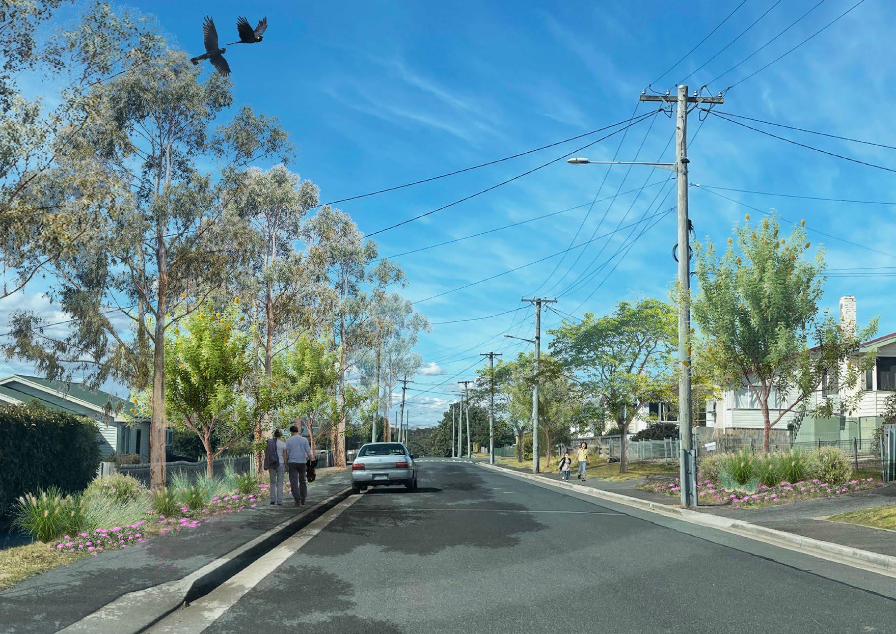
Planted road verges play a vital role in enhancing biodiversity and providing habitat for various species within urban environments
Image: Visualisation of future Hargrave street trees and planting.
Street design
Summary
As all streets in Mayfield are classified as local and link roads, sharing similar dimensions in road reserve, footpath, and verge sizes, this section of the report categorises them uniformly as local streets.
The precinct plan further dissects this classification by analysing street orientation and the positioning of existing services to provide detailed guidance on optimal street tree placement. It considers the ideal locations for both large and small canopy trees, as well as the most suitable placement for evergreen and deciduous varieties.
To accommodate existing underground services, two options are presented for each street type, allowing for flexibility in road design considerations.
This comprehensive approach ensures not only aesthetic appeal but also functional advantages, including shade provision, traffic calming, and pedestrian safety and increased biodiversity. From devising planting strategies for existing verges to selecting tree species based on orientation and environmental factors, each decision contributes to enhancing the overall character and sustainability of Mayfield’s urban environment.
Verge gardens
In addition to tree planting undertaken by council, road verges also present a wonderful opportunity to increase biodiversity and habitat within the suburb and
greatly improve the character of Mayfield. Residents are encouraged to discuss this option with council, who are able to provide guidance on appropriate species for planting.
Residents are also able to request a tree on the City’s Tomorrow Together website, allowing them to have a tree planted on their verge ahead of the planned schedule if desired.
Planted road verges play a vital role in enhancing biodiversity and providing habitat for various species within urban environments. These green spaces serve as interconnected corridors, facilitating the movement of wildlife across fragmented landscapes. By incorporating diverse native plant species, road verges offer food and shelter for pollinators such as bees, butterflies, and birds, contributing to the preservation of local ecosystems. Additionally, the presence of vegetation helps mitigate the effects of urban heat islands, regulate water runoff, and improve air quality by absorbing pollutants.
Planted road verges provide opportunities for communities to connect and engage, fostering a sense of stewardship among residents. Thus, recognising the importance of these green corridors and implementing sustainable management practices is crucial for promoting biodiversity conservation and creating healthier, more resilient urban environments.
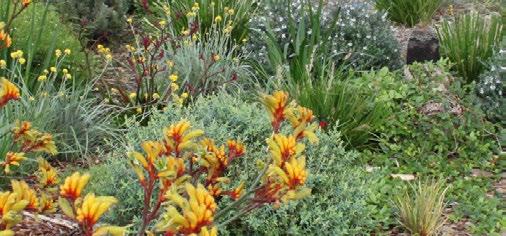
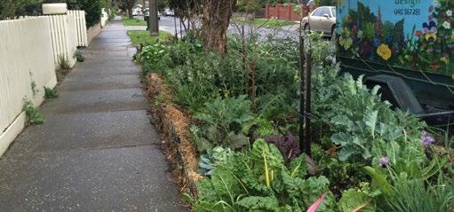
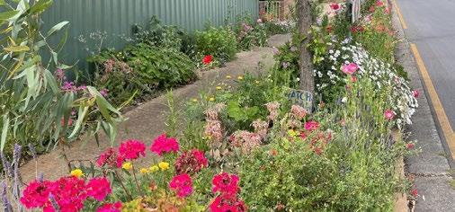
Options for verge gardens could include native, drought tolerant species, vegetable gardens or polinator attracting species.
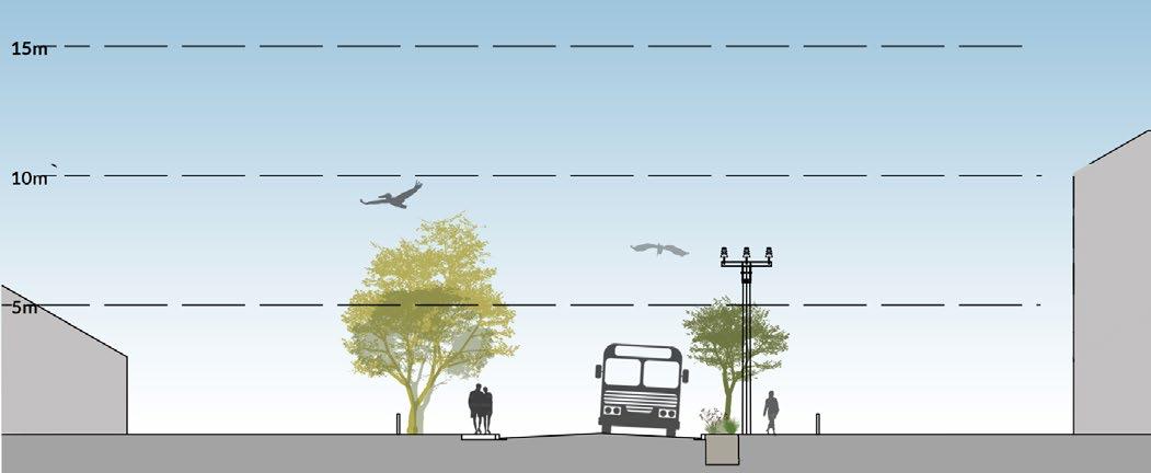
Type 1A Local street, Hargrave Crescent
Between Cook Crescent and Treherne Street
Hargrave Crescent serves as the primary local connector, forming a loop throughout the suburb of Mayfield. It ranks highest on the priority matrix due to its numerous bus stops, connections to public places, and direct adjacency to East Tamar Primary School.
The street’s design should:
• Have a distinctive and easily recognisable character.
• Feature uniform plantings along the street.
• Use a combination of evergreen and deciduous flowering trees to provide visual interest throughout the year.
• Prioritise flowering gums as a food source for Swift Parrots, the favorite animal of East Tamar Primary School students as determined during community engagement
• Trees must be formative pruned to have a clear trunk of 2m
Due to congestion issues, planting in the road verge of Hargrave Crescent is not feasible, especially during school drop-off and pick-up times, combined with the metro bus route.
To create a consistent avenue along the street, areas where asphalt extends to the curb (particularly near the main school entrance) will need modification. Trees or planting can be installed with soil cells in these areas.
The street’s orientation varies, with sections running both north-south and east-west, corresponding to street types 2B and 3B.
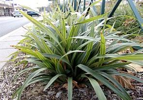
1. Dianella tasmanica
2. Lomandra longifolia
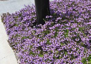
3. Scaevola aemula
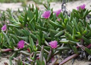
4. Carpobrotus rossii
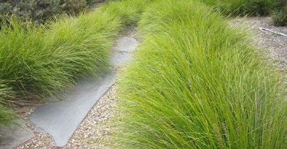
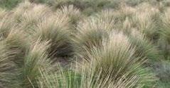
5. Poa poiformis
Small evergreen trees in soil cells with understory planting
Medium deciduous and small evergreen trees
Wintersun
Summer shade
Figure10.1 Type 1A section.
Type 1A Street tree options
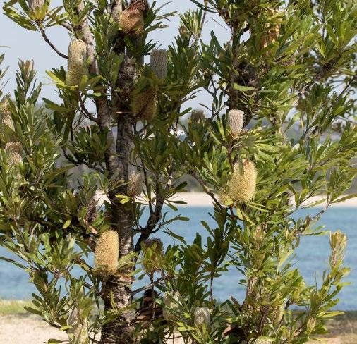
Small evergreen
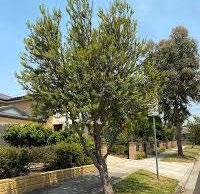
• Banksia marginata (5 x 4m)
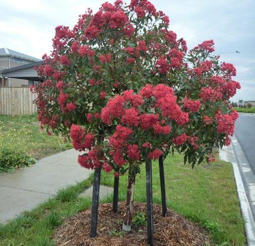
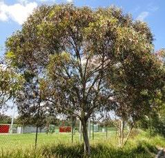
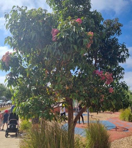
• Corymbia ficifolia ‘Vermilion Fire’ (4 x 2m)
• Eucalyptus ‘Euky Dwarf’ (6 x 5m)
Medium deciduous
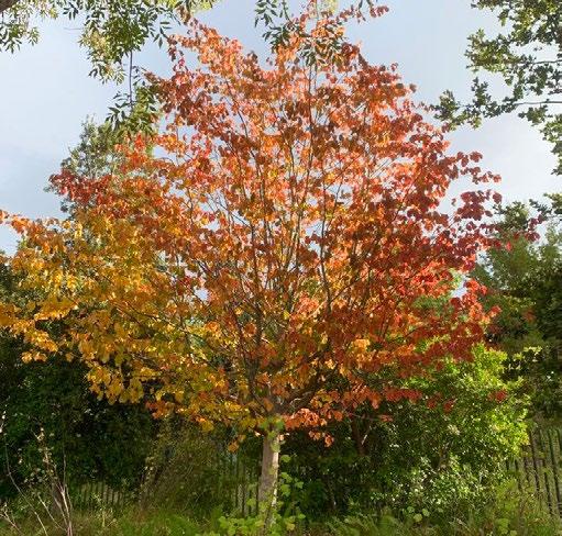
• Parrotia persica (7 x 5m)
• Ulmus parvifolia ‘Todd’
• Pyrus ussuriensis (9 x 7m)
Small deciduous
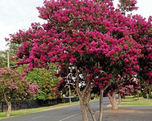
• Lagestroemia indica ‘Zuni’ (4 x 3m)
Understory planting (maximum 600mm height)
• Poa poiformis (Blue Tussock Grass)
• Lomandra longifolia (Spiny-headed Mat Rush)
• Dianella tasmanica (Tasman Flax Lily)
• Carpobrotus rossii (Native Pigface)
• Scaevola aemula (Fairy Fan-flower)
• Grevillea australis (Southern Grevillea)
• Brachyscome multifida (Cut-leaf Daisy)
• Viola hederacea (Native Violet)
1. Banksia marginata
2. Corymbia ficifolia ‘Vermilion Fire’
3. Elaeocarpus reticulatus
4. Lagerstroemia indica
Type 1A Tree layout
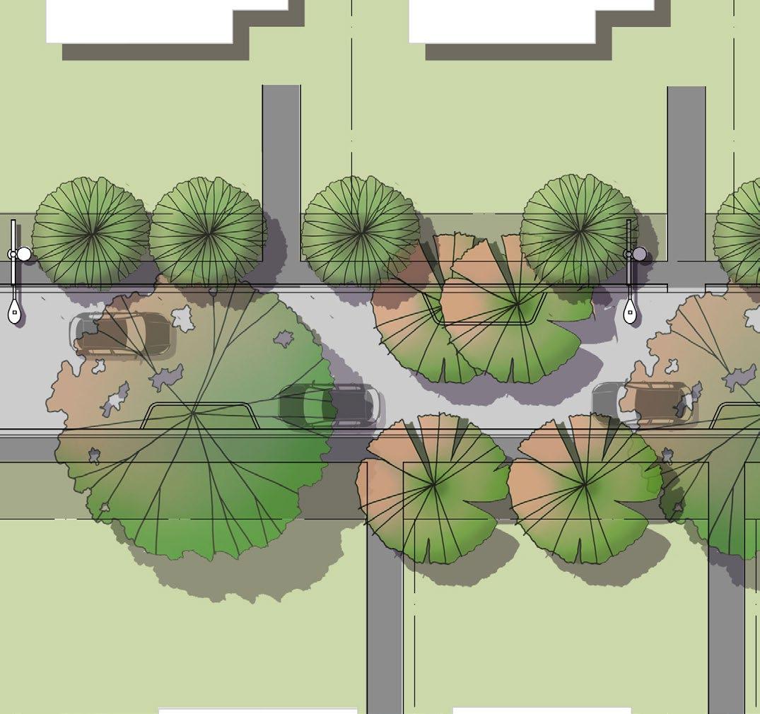
To achieve a consistent layout of trees and greening on Hargrave Crescent, the existing footpath can be modified with garden beds cut into the asphalt for either trees or low planting.
Each garden bed should accommodate two small evergreen trees with understory planting, or where trees are not feasible, low planting.
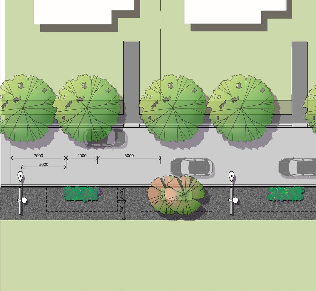
Soil cells under the paved zone should provide a minimum of 27m³ of soil per pair of trees.
Trees should be positioned according to the following guidelines:
• 7 meters from crossings
• 5 meters from light and electrical poles
• 8 meters between tree pits
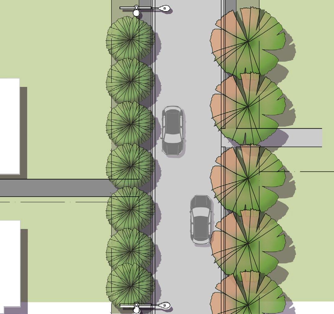
1. Medium deciduous trees
2. Asphalt paving
3. Minimum 27m3 soil cells under paving for trees
4. 2 x small evergreen trees with understory planting, garden bed saw cut into existing asphalt
5. Garden beds saw cut into asphalt with low planting only where trees are not possible
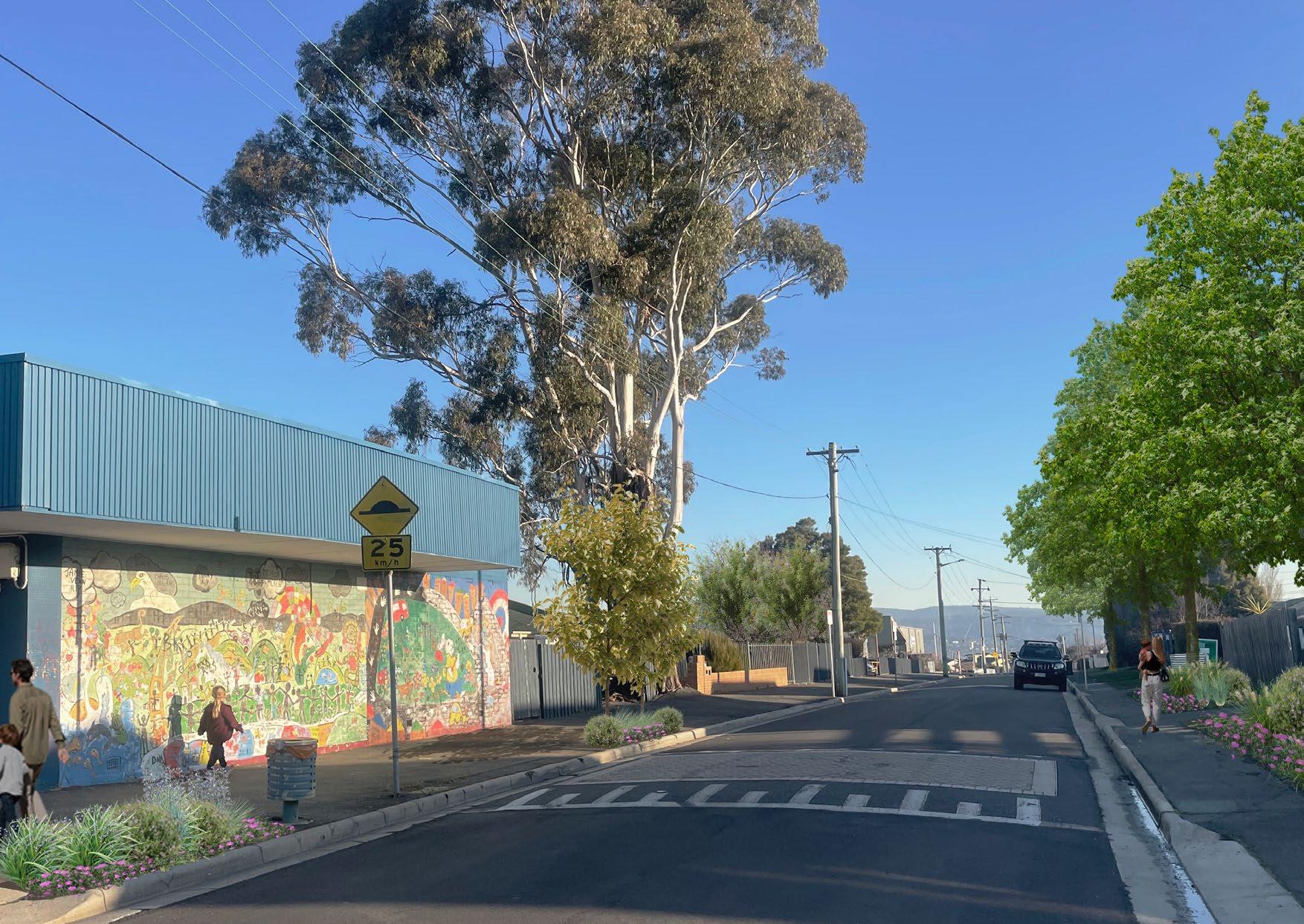
Visualisation of future Hargrave street trees and planting, outside East Tamar Primary.
Image:
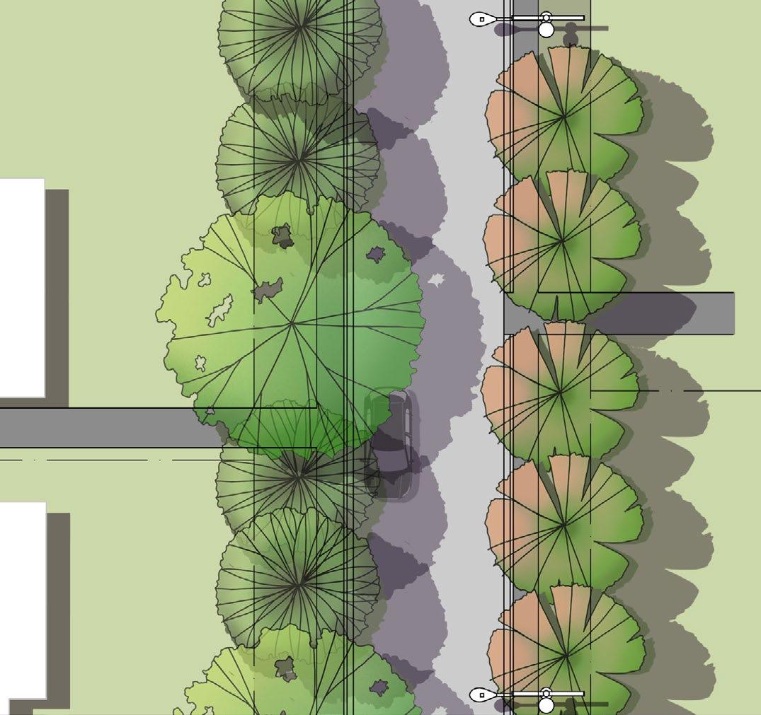
Type 2A - Local street, north- south orientation, power lines on eastern side
In Mayfield, local connectors with a north - south orientation and power lines on the eastern side include:
• Eyre Street
• Mayfield Street (north)
• Mitchell Street
• Gregory Street
• Treherne Street
• Lawson Street
• Flinders Place
• Cook Crescent (south)
North–south orientated streets
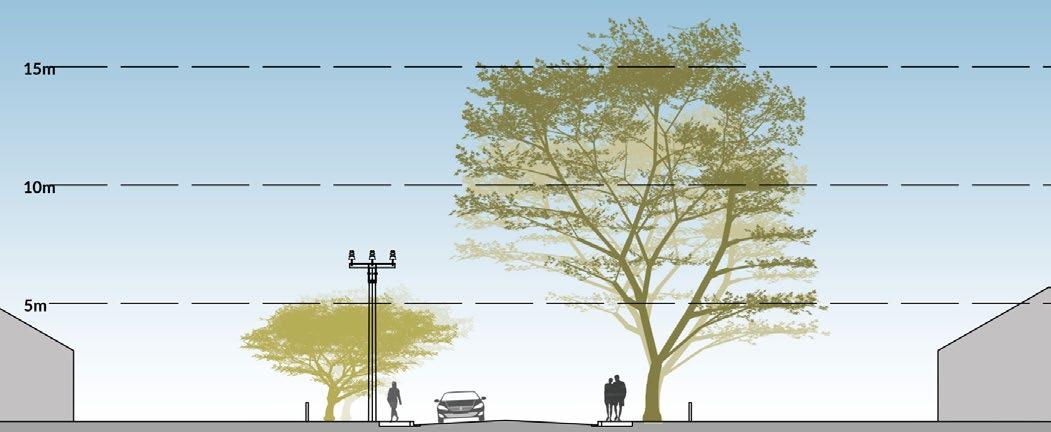
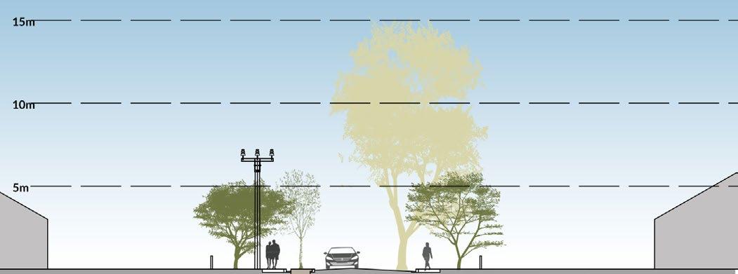
For N–S streets air temperature, mean radiant temperature and solar radiation are greater on the east side in the early morning and greatest on the west side in the mid-afternoon.
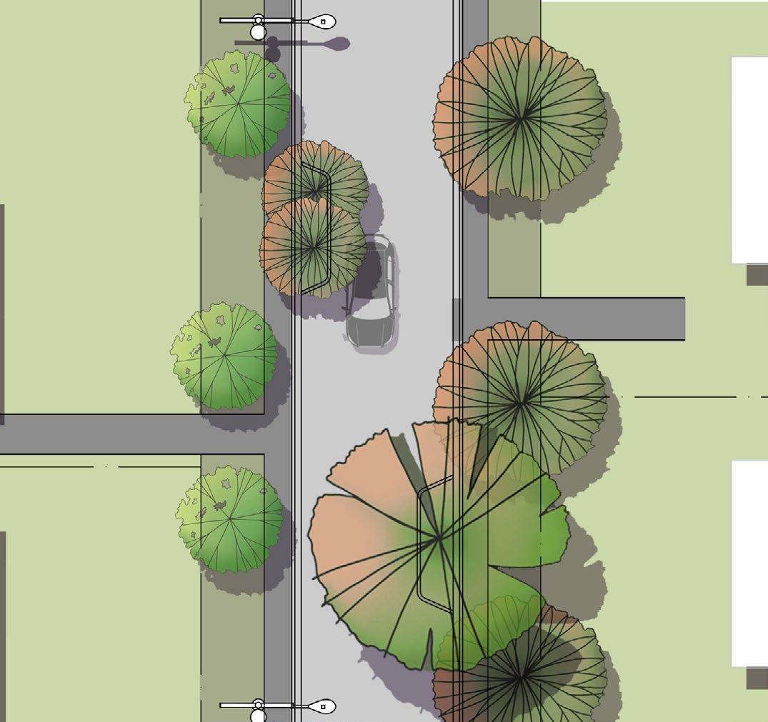
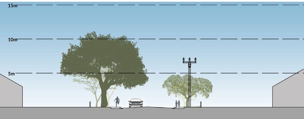
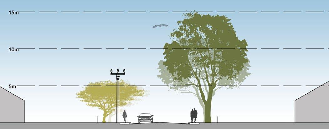
Planting small deciduous and evergreen trees on the east side of the street will take advantage of the thermal warming of winter morning sun, and also allow for trees under power lines.
Planting medium deciduous trees on the west side of the street will block the undesirable afternoon sun in the summer months, while still allowing sunlight to permeate during the winter months. Smaller evergreen trees can be planted in areas where overhead wires cross over to this side of the street.
Small evergreen trees
Small deciduous and evergreen trees
Medium deciduous and small evergreen trees
Medium deciduous and small evergreen trees
Morningsun
Afternoon shade
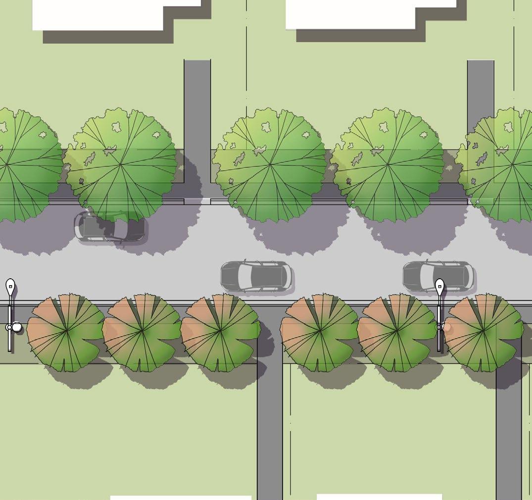
Figure10.3 Option one, all trees planted in existing verge.
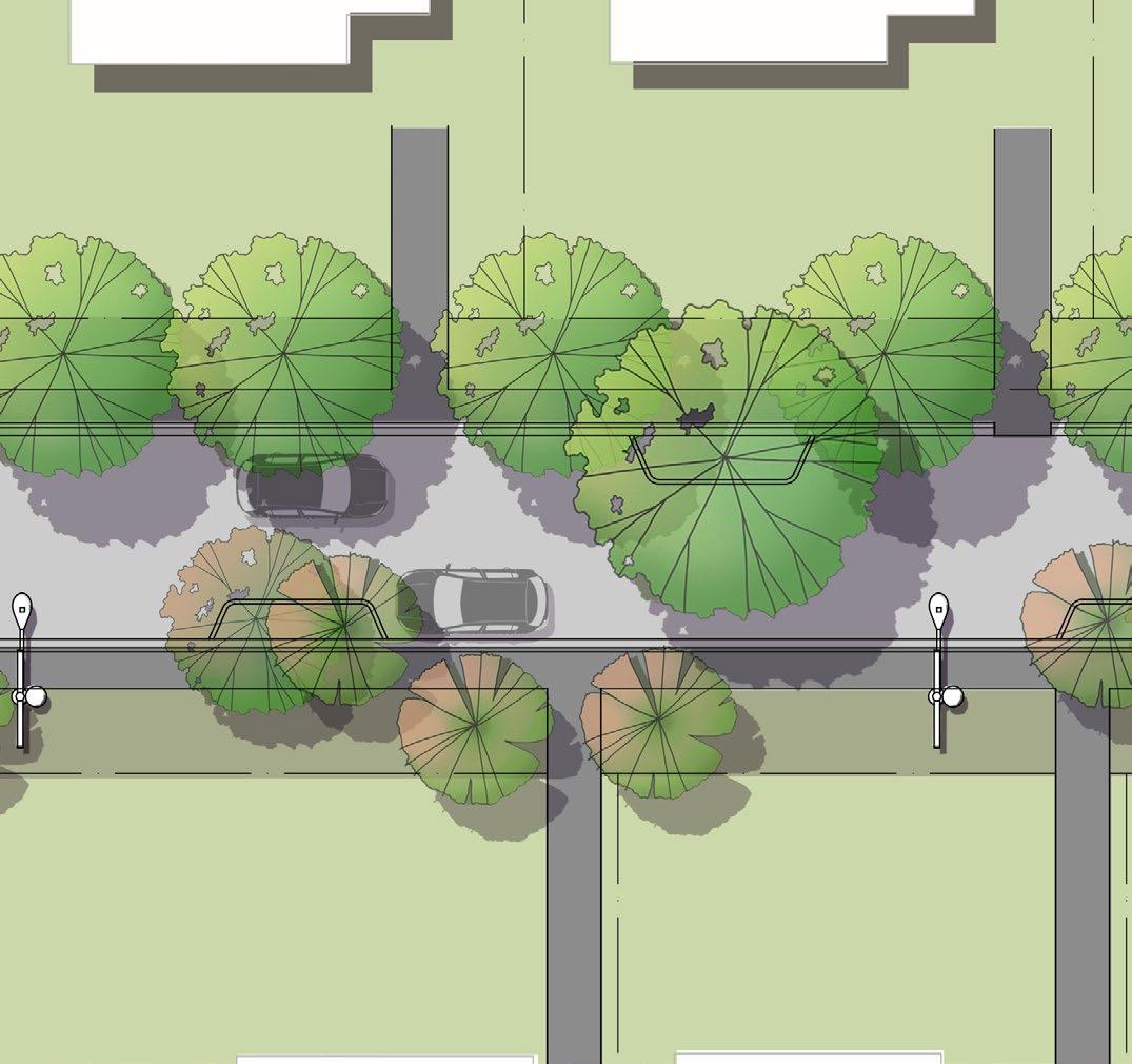
Figure10.4 Option 2, Trees planted in both verge and open tree pit in road reserve.
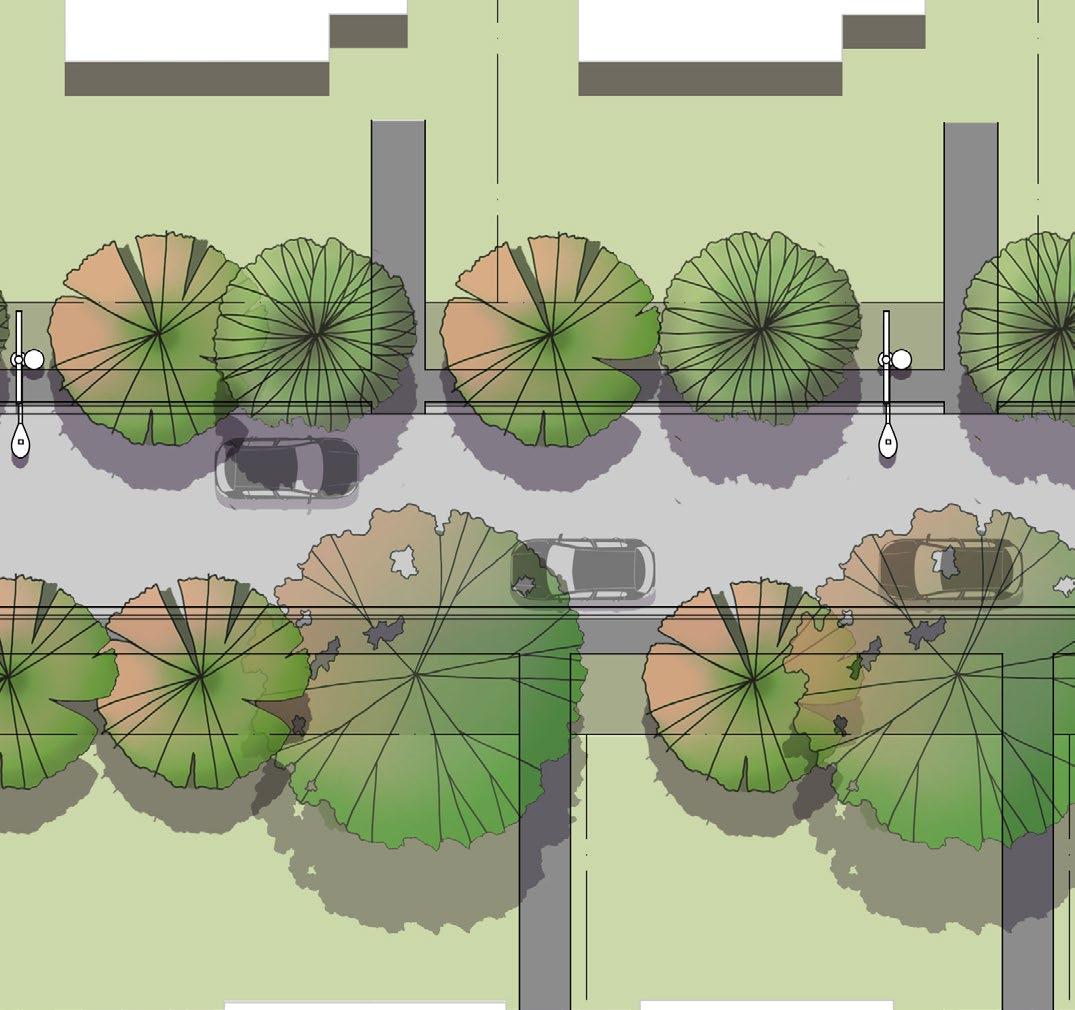
If there are no conflicts with underground services, local connectors with a north-south orientation should prioritise creating consistent avenues with a logical repetition of species.
On the eastern side, maintain a consistent row of selected smaller evergreen species, while on the western edge, establish a repeating pattern of medium deciduous with small evergreen trees.
7. Verge (width varies)
8. Power poles and lighting
9. Dwelling Overhead power lines
Figure10.5 Plan of type 2A tree layout, option 1.
6. Footpath (1.2-1.3m)
Type 2A, Tree layout option 2
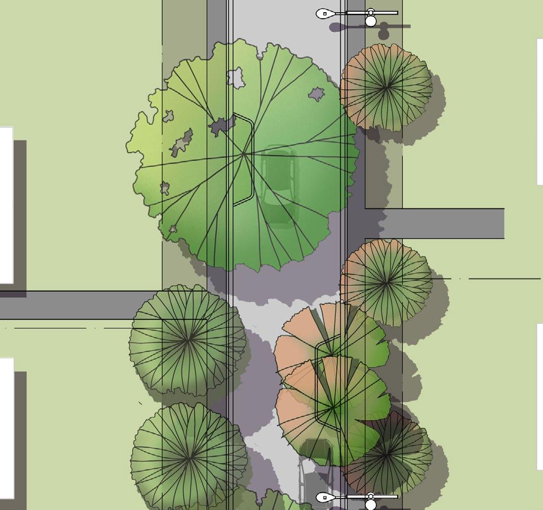
If planting in the existing verge proves challenging due to underground services, trees can instead be planted in the road reserve within open tree pits (refer to detail ‘Open Tree Pit, page 58).
Where space allows within the existing verge and avoids interference with services, consider planting smaller trees, with the inclusion of a root barrier.
Large, deciduous trees can be planted in the ‘bump-out’ into the roadway. These areas can serve multiple purposes such as traffic calming, pedestrian crossing points, or parking delineation. Additionally, the broken kerb and channel design offers an opportunity for passive irrigation.
City of Launceston Mayfield Urban Greening Precinct
Figure10.6 Plan of type 2A tree layout, option 2.
Mix of large and small trees in ‘bump out’
Type 2B - Local street, north- south orientation, power lines on western side
In Mayfield, local connectors with a north - south orientation include and power lines on the western side include:
• Sturt Crescent
• Kennedy Street
• Hargrave Cr (houses 97-121)
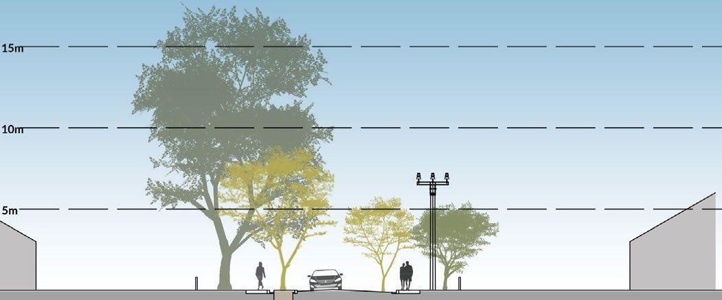
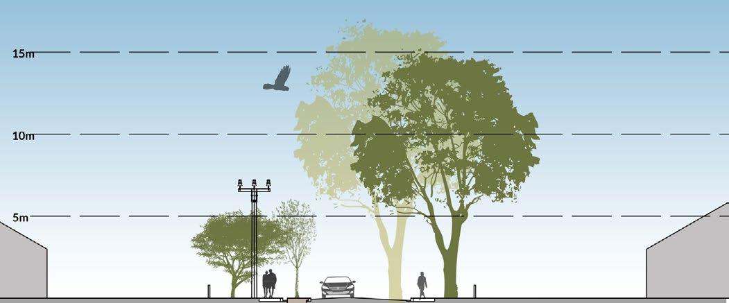
The presence of power lines along the western side presents challenges in creating afternoon shade from the intense western sun. Therefore, prioritising the eastern side for planting large deciduous trees becomes crucial to maximize canopy coverage while ensuring adequate light to properties during winter. These majestic deciduous trees will also contribute to the character of Mayfield by forming impressive avenues.
To provide shading on the western side, consider using small evergreen trees with broad canopies, strategically positioned to shade directly over the footpath.
By incorporating a combination of evergreen and deciduous trees on both sides of the street, foliage and color can be maintained throughout the winter months, contributing to increased biodiversity in the area.
Medium to large deciduous trees
Large and small deciduous trees
Small evergreen trees
Small evergreenand deciduous trees
morning shade
shade
Afternoon shade
Figure10.7 Option one, all trees planted in existing verge.
Figure10.8 Option 2, trees planted in both verge and open tree pit in road reserve.
Filteredwintermorningsun
Type 2B Street tree options
Options for type 2B streets include:
Large deciduous
• Quercus palustris ‘Pin Oak’ (15 x 8m)
• Acer negundo (15 X 12m)
• Ulmus parvifolia ‘Todd’ (10 x 11m)
Small evergreen
• Eucalyptus leucoxylon subsp. ‘Euky Dwarf’ ( 7 x 5m)
• Eucalyptus pauciflora ‘Little Snowman’ (6 x 4m)
• Corymbia ficifolia ‘Vermilion Fire ‘ (4 x 2m)
Small deciduous
• Liquidambar styraciflua ‘Slender Silhouette’ (6 x 1.5m)
• Catalpa bignonioides ‘Nana’ (5 x 3m)
• Lagerstroemia indica ‘Zuni’ (4 x 3m)
1. Quercus palustris ‘Pin Oak’
2. Acer negundo
3. Eucalyptus leucoxylon subsp. ‘Euky Dwarf’
4. Eucalyptus pauciflora ‘Little Snowman’
Type 2B, Tree layout option 1
If there are no conflicts with underground services, local connectors with a north-south orientation and powerlines situated on the western side should strive to establish consistent avenues comprising both small and large trees.
Opt for smaller species under power lines on the western side to mitigate interference, to a maximum height of 5m.
On the eastern side, maintain a consistent row of large deciduous species.
Figure10.9 Plan of type 2B tree layout, option 1.
1. Small evergreen trees
Property boundary
Private land
Driveway crossover
Roadway
Footpath (1.2-1.3m) 7. Verge (width varies) 8. Power poles and lighting
Dwelling
10. Medium to large deciduous trees
Overhead power lines
Type 2B, Tree layout option 2
If planting in the existing verge is challenging due to underground services, consider planting a mix of small and large deciduous species within roadway bump outs (refer to detail ‘Open Tree Pit, page 58).
Focus on maximizing canopy size on the eastern bump outs to shade the road reserve effectively.
For shading over footpaths, consider utilising dwarf species such as the Indian Bean Tree (Catalpa bignonioides ‘Nana’), known for its broad arching canopy.
4. Property boundary
5. Private land
Driveway crossover
Roadway
City of Launceston Mayfield Urban Greening Precinct Plan
Figure10.10 Plan of type 2B tree layout, option 2.
1. Large and small deciduous trees in ‘bump out’
2. Small evergreen trees in verge
3. Medium deciduous trees in verge
Footpath (1.2-1.3m)
Verge (width varies)
Type 3A Local street, east - west orientation, power lines on northern side
In Mayfield, local connectors with an east - west orientation and power lines on the northern side include:
• Mayfield Street
• Hume Street
• Torrens Street
• Box Street
• Cook Crescent
• Sturt Crescent
• Mawson Place
East–west orientated streets
Midday thermal benefits are limited on east-west streets aligned with the summer sun’s zenith. Therefore, it’s crucial to utilise trees with broad canopies where possible to maximize shade and thermal advantages.
Introducing a blend of deciduous and evergreen trees on the north side of the street can offer thermal warming during winter months. Planting deciduous trees on the south side ensures adjacent properties continue to benefit from the warming effects of the winter sun.
Figure10.11 Option one, all trees planted in existing verge.
Figure10.12 Option 2, trees planted in both verge and open tree pit in road reserve.
Small evergreen or deciduous
Large and small deciduous trees
Medium to large deciduous trees
Small evergreenand deciduous trees
Summer shade
Summer shade Wintersun Wintersun
Type 3A Street tree options
Options for Tyle 3A streets include:
Medium to large deciduous
• Pistacia chinensis (8 x 6m)
• Parrotia persica (7 x 5m)
• Fraxinus angustifolia ‘Raywood’ (12 x 9m)
• Acer negundo (10 x 8m)
Small evergreen
• Corymbia ficifolia ‘Calypso’ (5 x 4m)
• Agonis flexuosa ‘Burgundy’ (5 x 3m)
Small deciduous
• Liquidambar styraciflua ‘Gumball’ (3 x 2m)
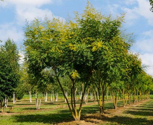
• Koelreuteria paniculata (6 x 4m)
• Gleditsia triacanthos ‘Elegantissima’ (5 x 3m)
1. Pistacia chinensis
2. Parrotia persica
3. Corymbia ficifolia ‘Calypso’
4. Koelreuteria paniculata
Type 3A, Tree layout option 1
If there are no conflicts with underground services, local connectors with an east-west orientation should strive to establish consistent avenues with a logical repetition of species.
On the southern side, consider implementing an alternating pattern of small and large deciduous trees.
Conversely, the northern edge could feature alternating small deciduous and evergreen trees, planted within the verge.
1. Large and medium deciduous trees 2. Property boundary 3. Private land 4. Driveway crossover 5. Roadway
8. Power poles and lighting 9. Dwelling Overhead power lines
Figure10.13 Plan of type 3A tree layout, option 1.
6. Footpath (1.2-1.3m)
7. Verge (width varies)
Type 3A, Tree layout option 2
If planting in the current verge proves challenging due to underground services, trees may be alternatively planted in the road reserve using open tree pits (refer to detail ‘Open Tree Pit, page 58).
Where space permits within the existing verge and avoids interference with services, smaller trees can still be planted, with the inclusion of a root barrier.
For larger deciduous trees, strategic placement in the southern bump outs can facilitate shade coverage over both the road and footpath. Conversely, smaller deciduous trees can be placed in the northern bump outs to accommodate powerlines.
Where feasible, consider establishing an avenue of smaller evergreen trees on the northern side to provide year-round shading for pedestrians.
Figure10.14 Plan of type 3A tree layout, option 2.
1. Large deciduous trees in ‘bump out’
2. Small to medium groups of deciduous trees in ‘bump out’
3. Small evergreen trees
Footpath (1.2-1.3m)
Verge (width varies)
10. Power poles and lighting Overhead power lines
Type 3B Local street, east - west orientation, power lines on southern side
In Mayfield, local connectors with an east - west orientation and power lines on the southern side include:
• Oxley Street
• McKay Street
• Kennedy Street
With power lines situated along the southern side, there exists a prime opportunity for the planting of larger evergreen trees on the northern side of the road. Employing ideally native species in this context will greatly enhance biodiversity and habitat within the suburb.
Furthermore, opting for smaller, broad-canopy deciduous or evergreen trees on the southern side can effectively offer shade from the intense midday sun for pedestrians and parked vehicles, all while ensuring that sunlight isn’t unduly obstructed to neighboring properties during winter months.
Figure10.15 Option one, all trees planted in existing verge.
Figure10.16 Option 2, trees planted in both verge and open tree pit in road reserve.
Medium to large evergreen
Large and small deciduous trees
Small deciduous trees
Small evergreenand deciduous trees
shade
shade
Type 3B Street tree options
Options for Type 3B streets include:
Medium to large evergreen
• Banksia serrara (12 x 4m)
• Eucalyptus pauciflora ‘Little Snowman’ (6 x 4m)
• Elaeocarpus reticulatus (9 x 4m)
• Corymbia maculata ‘Gamai’ (12 x 4m)
Small deciduous
• Prunus ‘Kanzan’ (5 x 4m)
• Lagerstroemia indica x L. fauriei ‘Tuscarora’ Indian Summer (6 x 4m)
• Cercis candensis ‘Forest Pansy’ ( 5 x 5m)
4.
1. Banksia serrata
2. Eucalyptus pauciflora ‘Little Snowman’
3. Elaeocarpus reticulatus
Lagerstroemia indica
Type 3B, Tree layout option 1
If a conflict with underground services is not an issue, local connectors with an east west orientation should aim to create consistent avenues of large evergreen trees to the north and smaller deciduous trees to the south.
2. Property boundary
3. Private land 4. Driveway crossover 5. Roadway
6. Footpath (1.2-1.3m)
7. Verge (width varies)
8. Power poles and lighting
Figure10.17 Plan of type 3B tree layout, option 1.
1. Large evergreen trees
9. Dwelling
Overhead power lines
Tree layout option 2
If creating two consistent avenues within the existing verge is not feasible due to conflicts with underground services, consider using similar species in the verge with large evergreen trees planted in ‘bump-outs’ to the north, and clusters of smaller deciduous trees to the south . Refer to detail ‘Open Tree Pit, page 58.
4.
5. Private land
6. Driveway crossover
7. Roadway
8. Footpath (1.2-1.3m)
9. Verge (width varies)
10. Power poles and lighting
11. Dwelling
Overhead power lines
of Launceston Mayfield Urban Greening Precinct
Figure10.18 Plan of type 3B tree layout, option 2.
1. Large evergreen trees in ‘bump out’
2. Clusters of small deciduous trees in ‘bump out’
3. Medium evergreen trees in verge
Small deciduous trees in verge
Parks and reserves
Parks and reserves play a crucial role in urban greening and boosting biodiversity by providing natural habitats within suburban landscapes. These green spaces serve as vital refuges for various plant and animal species, promoting ecological balance and resilience. They help mitigate the urban heat island effect, improve air quality, and offer recreational and educational opportunities for local residents.
By increasing urban greening in these parks with trees, shrubs, and grasses, they can help to enhance environmental sustainability, support local wildlife, and create healthier, more livable communities
Canopy coverage is a critical aspect of urban parks, contributing to environmental and social benefits such as cooling, air quality improvement, and aesthetic appeal. Parks and reserves in Mayfield should target a canopy coverage of 40% or higher, in line with the Launceston Urban Greening Strategy. This level provides significant environmental benefits, including reducing the urban heat island effect and improving air quality.
Ensure a mix of tree species to enhance biodiversity, increase resilience against pests and diseases, and
provide varied habitats for wildlife. Prioritise endemic species and those related to local plant communities to support native wildlife, maintain ecological balance, and preserve the local ecosystem’s integrity.
Additionally, planting selection should consider engagement with East Tamar Primary School, which selected the Swift Parrot as their favorite animal. Focus should be given to species that create food sources for the Swift Parrot throughout Mayfield.
Trees should be placed where they can provide the most benefits, such as along pathways, around playgrounds and picnic areas, and near water bodies. This placement maximises shade, cooling effects, and aesthetic appeal.
Priority areas for greening of parks and reserves is based on data from the Geoneon priority, as shown in Table 12.5.
Image: Visualisation of future Torrens Street Urban Greening
References
Edition 2 From Forest to Fjaeldmark Edition 2 From Forest to Fjaeldmark The Vegetation Communities Dry eucalypt forest and woodland Eucalyptus amygdalina. (n.d.). Available at: https://nre.tas.gov.au/Documents/f2f_ dry_eucalypt.pdf.
Edition 2 From Forest to Fjaeldmark The Vegetation Communities Native grassland. (n.d.). Available at: https://nre. tas.gov.au/Documents/f2f_native_grassland.pdf.
Local Climate Profile, Launceston City Municipality. Available at: https://recfit.tas.gov.au/__data/assets/pdf_ file/0007/348919/Launceston_Climate_Profile.pdf
City of Launceston, 2021 Census Results, Mayfield. Available at https://home.id.com.au/
City of Sydney Street Tree Master Plan 2011, Part D Technical Guidelines,
Street Tree Planting Design Manual (2021). Available at: https://www.planning.nsw.gov.au/sites/default/ files/2023-10/street-tree-design-manual.pdf.
Urban Tree Canopy Targets & Development Controls Report Prepared For Nsw Department Of Planning, Industry And Environment By Gallagherstudio & Studio Zanardo. (2021). Available at: https://www.planning.nsw.gov.au/ sites/default/files/2023-10/urban-tree-canopy-targets-and-development-controls-report.pdf.
Find out more about Launceston Urban Greening at:
www.launceston.tas.gov.au and www.tomorrowtogetherlaunceston.com.au