DRAFT ALANVALE NEIGHBOURHOOD PLAN 2026
Structure Plan
© Veris Australia Pty Ltd
This work is copyright. Apart from any use permitted under the Copyright Act 1968, no part may be reproduced by any process without written permission from Veris Australia Pty Ltd.
Disclaimer
All professional care has been taken to ensure that the content of this report is current and accurate. However, it is not purported that it is complete, and it is not guaranteed that the content of the report is free from errors. Veris accepts no liability for error, loss, damages or other consequences arising from reliance on information contained in this report.
Project Team Acknowledgement
This document has been a collaborative effort with significant input and advice from the City of Launceston team and key stakeholders. Technical advice has been provided by Pitt & Sherry, Water Technology, Geografia, Colliers, Inspiring Places and Southern Archeology.
Client City of Launceston
Project Alanvale Neighbourhood Plan
Version 01
Prepared By Mesh (a Veris company)
Reviewed By Mesh (a Veris company)
Date May 2026
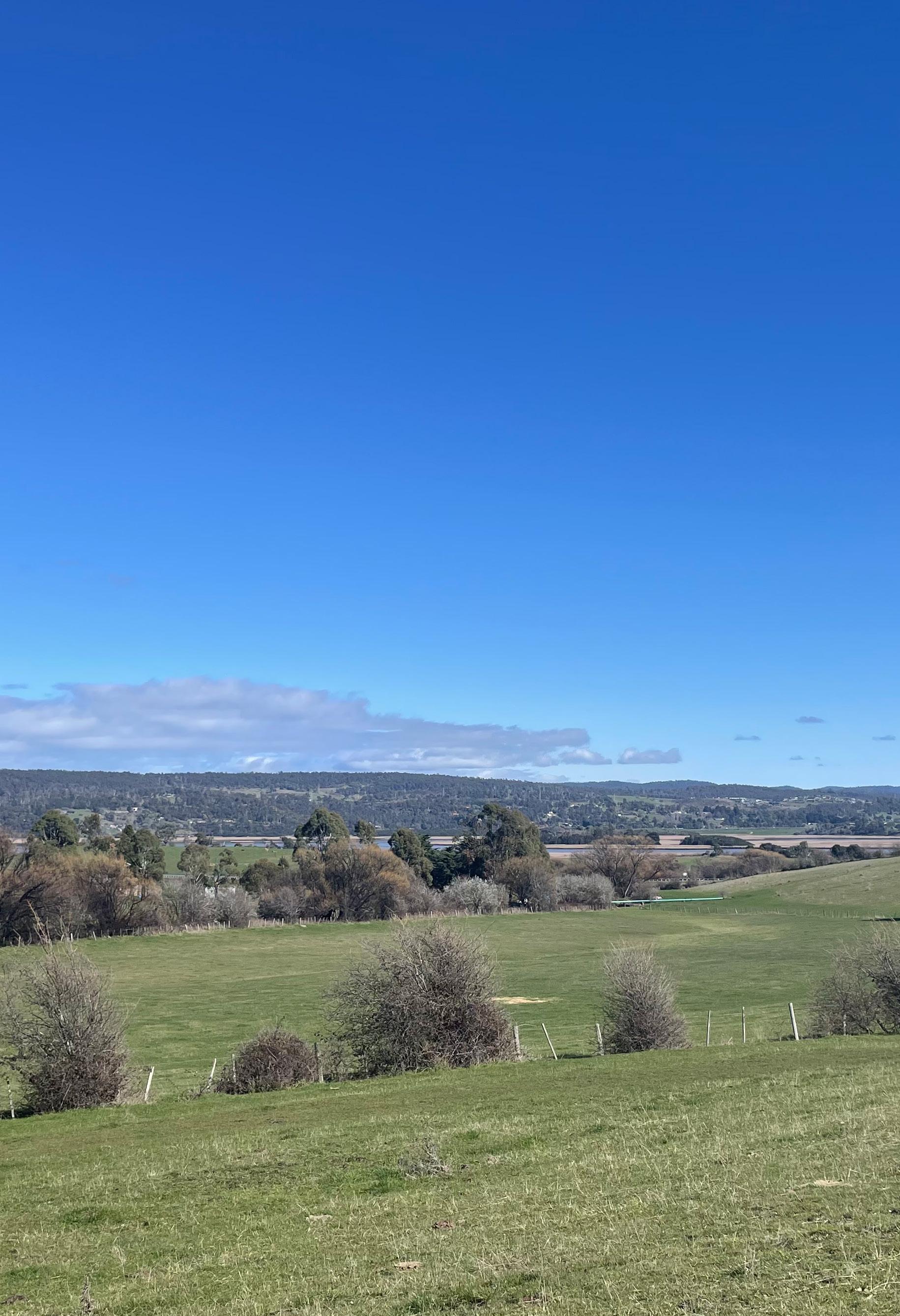
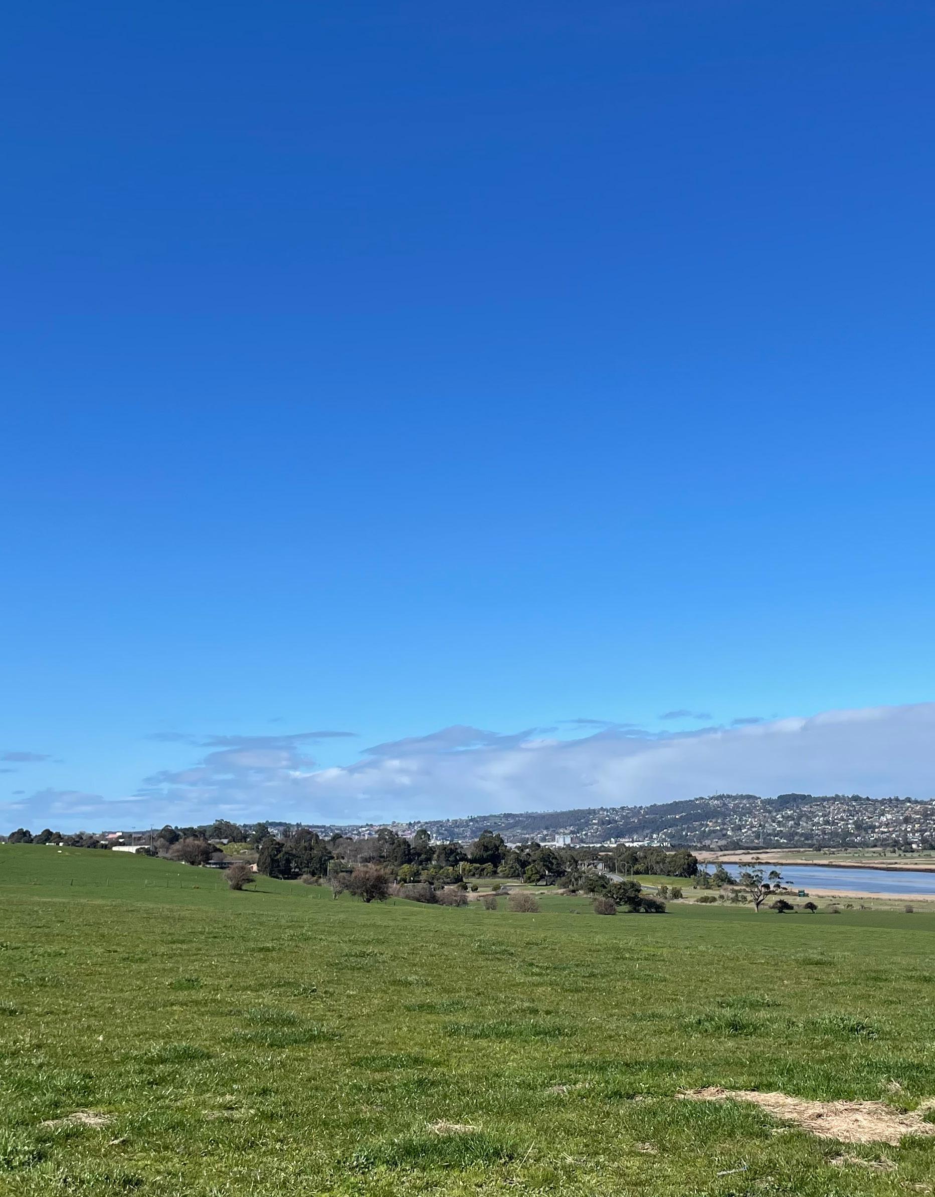
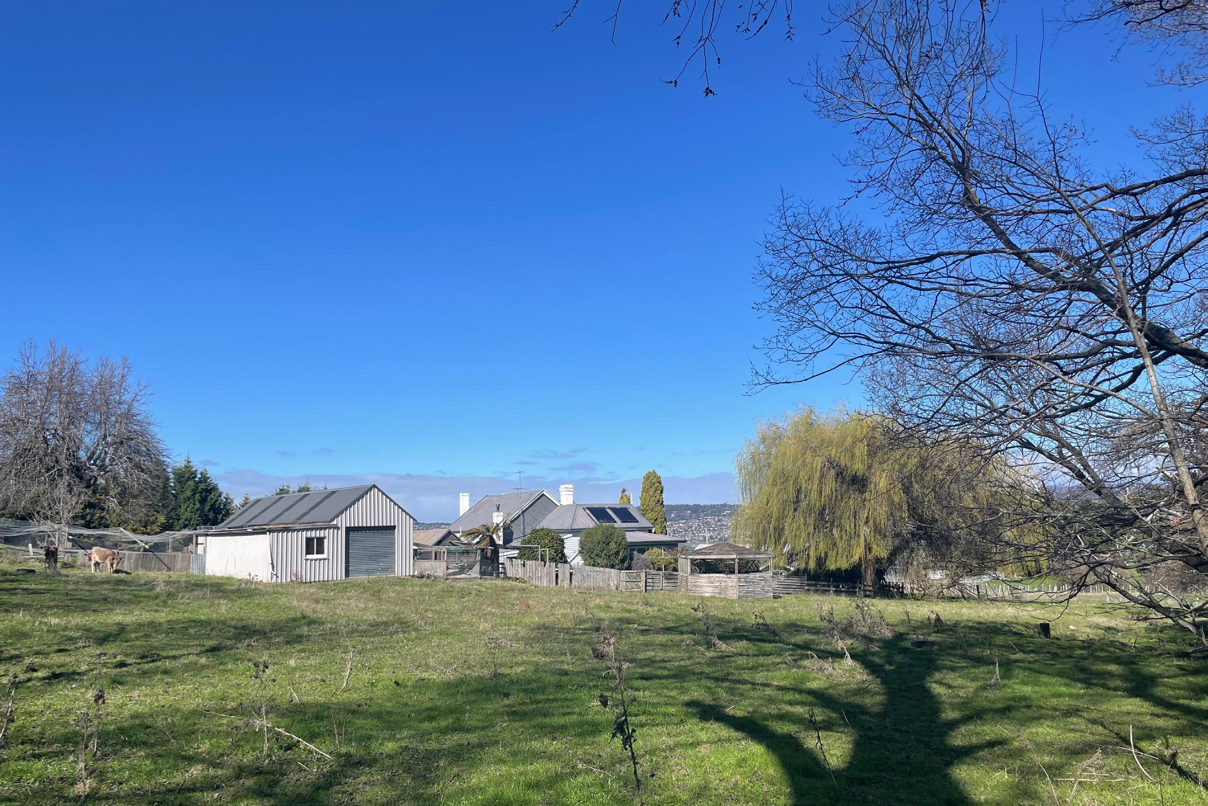
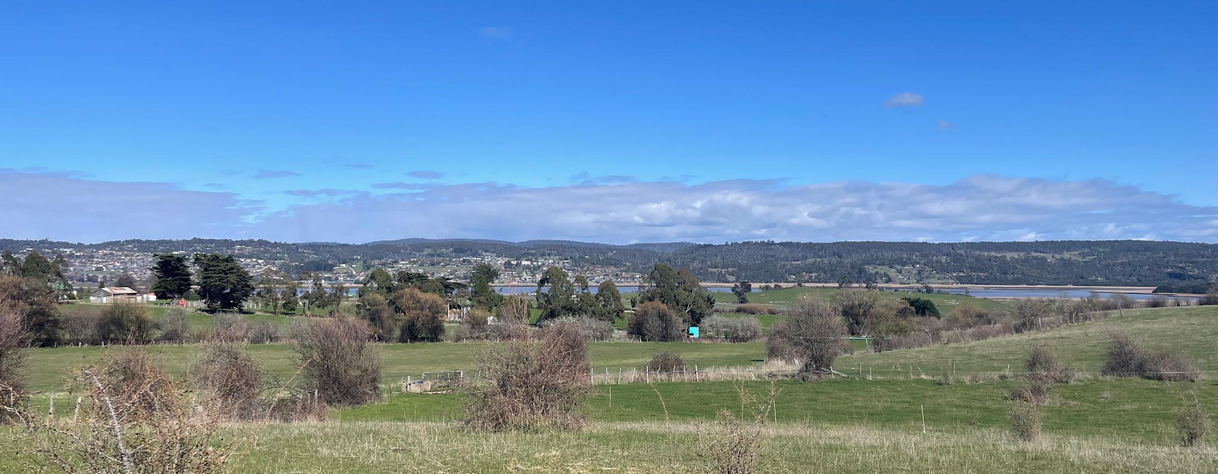
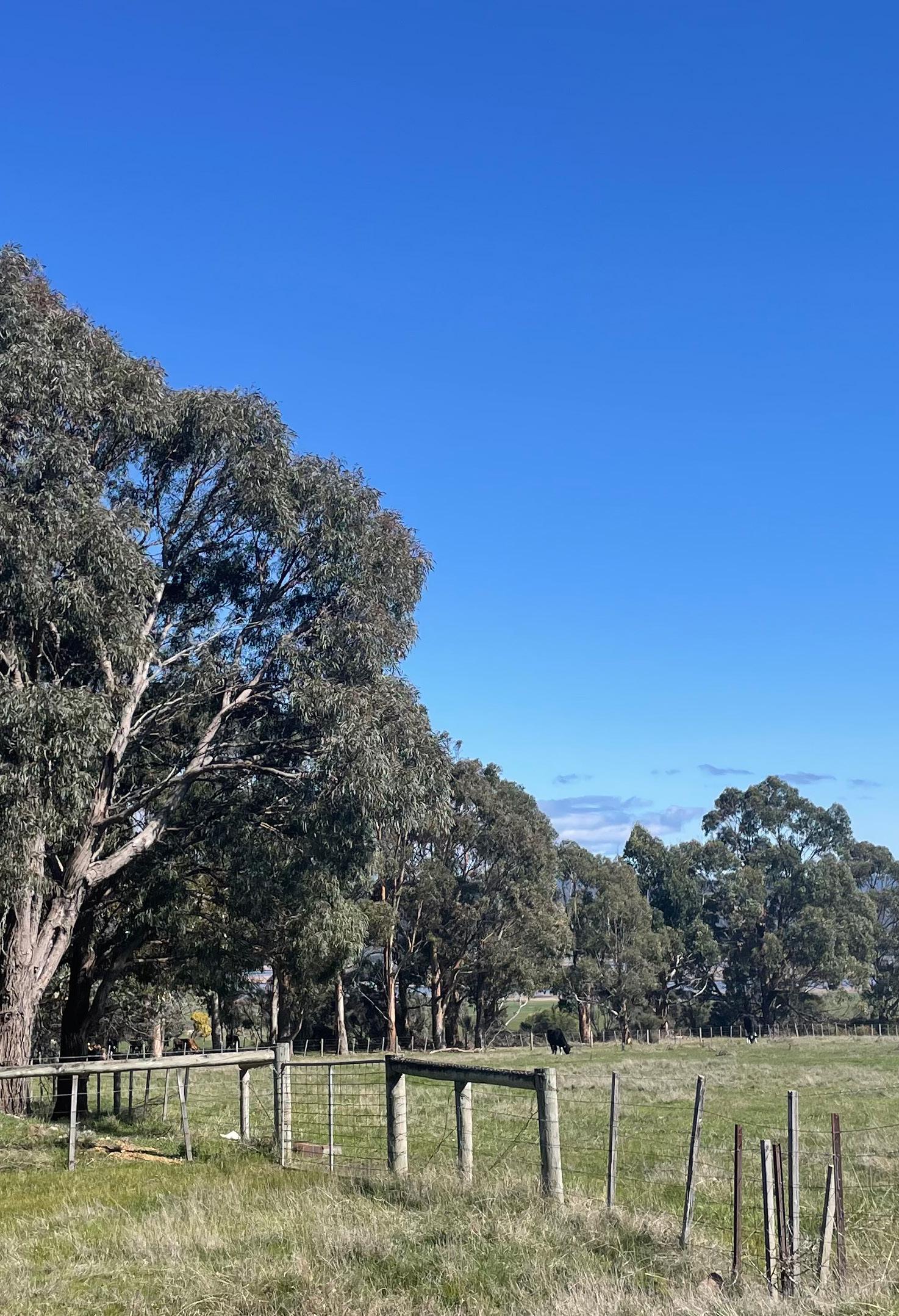
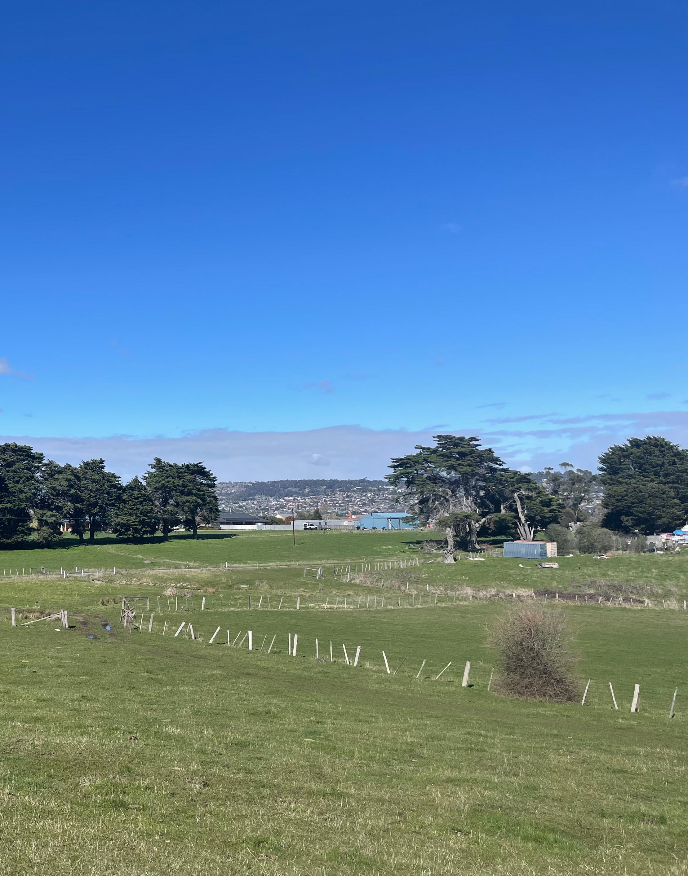
ViEWS TO TAMAR RiVER
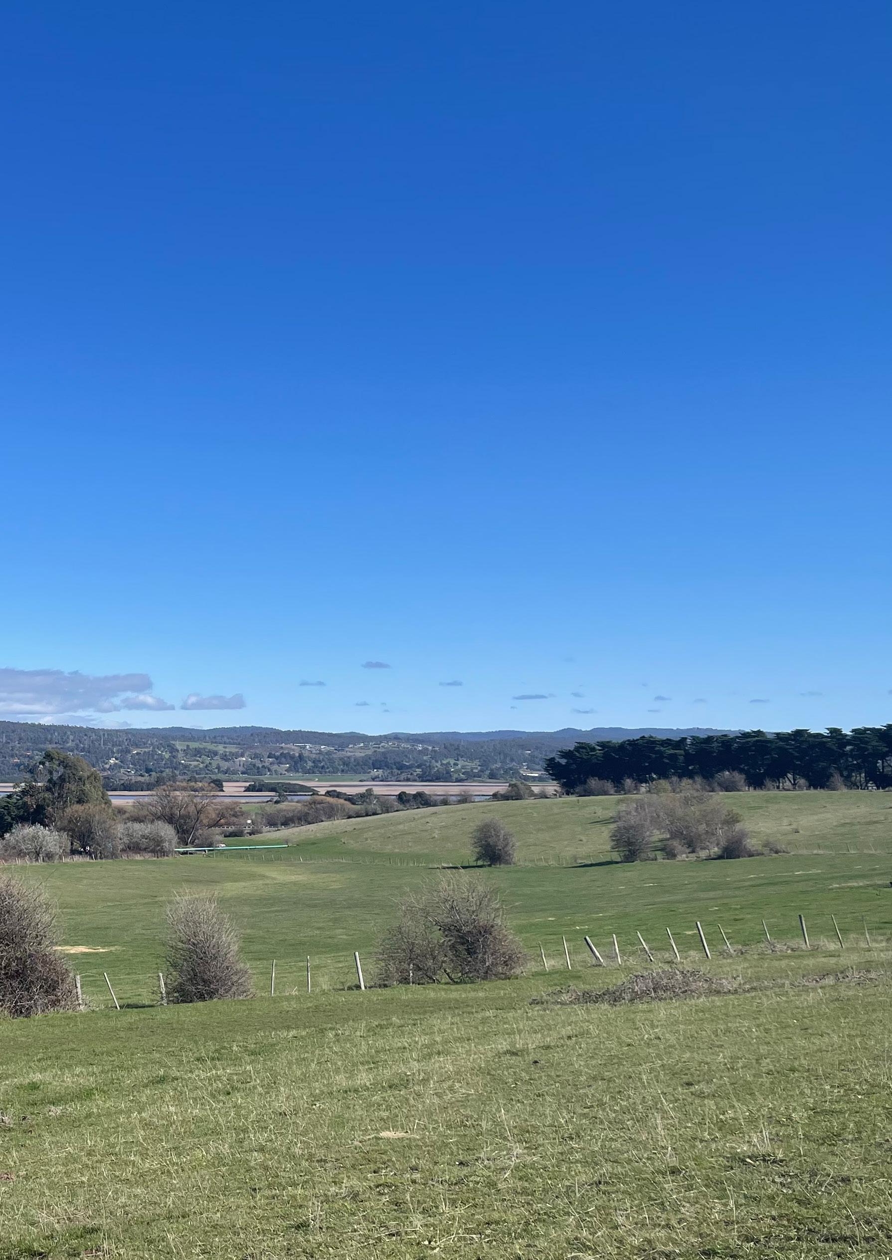
ACKNOWLEDGEMENT OF COUNTRY
We acknowledge Tasmanian Aboriginal People as traditional custodians of this land. We pay respect to Elders past and present. We acknowledge and honour the profound histories, knowledge and lived experiences of the Tasmanian Aboriginal People, who are the First People of this land and uphold the world’s oldest continuing land use planning and management system.
We deeply respect their lasting connection to Country and the profound importance they place on shelter, community and belonging.
Abbreviations
TERM DEFINITION
City of Launceston Launceston City Council or Council
Neighbourhood Plan Alanvale Neighbourhood Plan
UTAS University of Tasmania
Acronyms
DSG Department of State Growth
NTRLUS Northern Tasmania Regional Land Use Strategy
TPPs Tasmanian Planning Policies
LUPAA Land Use Planning and Approvals Act 1993
TERM
Active Open Space
Blue Green Infrastructure
DEFINITION
Public or community land designed to support organised sport and active recreation, such as playing fields, courts or multi use recreation areas
An integrated network of natural and constructed water and landscape elements, including drainage, waterways, open space and vegetation, that delivers environmental, recreational and urban amenity outcomes.
Future Investigation Area
Landscape and Visual Impact Assessment
Limited Line Supermarket
Medium Density Housing
Neighbourhood Activity Centre
Passive Open Space
Priority Consolidation Area (defined by the NTRLUS)
Section 71 Agreement
Land identified to protect options for potential future infrastructure or strategic projects, where development is deferred until investigations are completed and a formal decision is made.
A technical assessment that evaluates the visual sensitivity of land and the potential visual impacts of development, and identifies measures to mitigate those impacts.
A supermarket offering a reduced product range compared to a full line supermarket, typically serving neighbourhood scale convenience needs.
Housing forms that provide increased density compared to detached dwellings, including townhouses, duplexes and low rise apartments.
A locally focused centre providing day to day retail, service, community and employment uses to serve the surrounding residential catchment.
Public open space intended primarily for informal recreation, relaxation and visual amenity, such as neighbourhood parks, linear open space and landscaped reserves.
An area designated for higher intensity infill and redevelopment, typically focused around major centres and high access locations.
An agreement under Section 71 of the Land Use Planning and Approvals Act 1993 used to secure obligations relating to infrastructure funding, delivery, staging or coordination prior to or as part of development.
Supporting Consolidation Area (defined by the NTRLUS)
Water Sensitive Urban Design
An area within or adjoining an existing urban area identified for coordinated growth and consolidation, supporting additional development while reinforcing established settlement patterns and infrastructure efficiency.
An urban design approach that integrates stormwater management with urban design and landscape outcomes to improve water quality, manage flooding and enhance environmental performance.
EXECUTIVE SUMMARY
The Alanvale Neighbourhood Plan (NP) establishes a coordinated framework to guide future growth and development within the Alanvale Growth Area. The NP responds to long standing challenges including fragmented land ownership, infrastructure constraints and site sensitivity, and provides clarity on how the area can be developed in an integrated, orderly and site responsive manner.
Alanvale is identified in the Northern Tasmania Regional Land Use Strategy (NTRLUS) as a Supporting Consolidation Area, reflecting its role in completing the urban footprint between the East Tamar Highway and the established residential community of Newnham. Consistent with this designation, the NP supports consolidation rather than outward expansion, making efficient use of existing infrastructure, strengthening access to services and transport, and protecting landscape, scenic and amenity values.
The NP has been informed by State and regional policy, Council adopted strategies and a comprehensive program of technical investigations covering economic need, transport, stormwater, landscape and visual impacts, and open space guidance. This evidence confirms that Alanvale can accommodate approximately 1,000 new dwellings, supported by new infrastructure and community amenities, provided development is coordinated at a precinct scale.
The Plan sets out Key Directions across six interrelated themes:
Development pattern and land use
Activity Centres and Complementary uses
Open space, drainage and greening
Movement network, public and active transport
Interface and Buffers
Residential neighbourhoods and housing diversity.
These directions articulate what must be achieved, supported by clear objectives and design principles.
Central to the Plan is a neighbourhood activity centre along George Town Road, providing approximately 3,400–4,500 sqm of retail and commercial floorspace, including a limited line supermarket and complementary local services. Medium density housing is encouraged in suitable, well serviced locations, consistent with the Launceston Housing Plan 2025 - 2040.
Environmental and amenity outcomes are addressed through a strong blue green infrastructure framework, including a centralised wetland, distributed local parks, approximately 6 hectares of active open space, and a minimum 50 metre multifunctional setback to the East Tamar Highway
The NP includes a clear implementation pathway, involving coordinated rezoning, preparation of a Specific Area Plan (SAP) and development of an Infrastructure Funding Framework (IFF)
At the request of the Department of State Growth (DSG) a defined portion of land is retained as a Future Investigation Area to protect options for a potential second Kanamaluka / Tamar River crossing, while allowing the remainder of the precinct to progress.
Overall, the Alanvale NP provides a clear, flexible and defensible framework to deliver a well connected, liveable and integrated neighbourhood that contributes positively to the future growth of Launceston.

1. INTRODUCTION
The Neighbourhood Plan (NP) has been prepared to provide a clear framework to guide and coordinate future growth and development within the designated growth area of Alanvale.
1.1.
Purpose of the Neighbourhood Plan
It establishes guiding principles to support an integrated and orderly development outcome.
The objectives of the NP are to:
• Provide a coordinated, plan led framework to guide future growth and residential development, to avoid fragmented planning outcomes;
• Identify land to be set aside for non residential purposes, including infrastructure delivery, open space provision and scenic protection;
• Establish overarching objectives and principles to inform the design of future subdivisions and development proposals;
• Protect and enhance Alanvale’s distinctive landscape, scenic and character values, including key views to the Tamar River;
• Identify shared and higher order infrastructure projects to inform preparation of an Infrastructure Funding Framework to guide the equitable funding and delivery of enabling infrastructure; and
• Set out clear implementation actions, including amendments to the Launceston Local Provisions Schedule of the Tasmanian Planning Scheme and post finalisation steps.
The NP is the culmination of a strategic process that commenced in 2019 to support coordinated development in Alanvale. It responds to key constraints, including fragmentation arising from land ownership parcels and configurations, differing development intentions between landowners, and significant drainage challenges. It also addresses key site context and interface considerations, including the scenic and character values that make Alanvale unique and the management of interfaces to industrial land and the East Tamar Highway, where design measures are required to mitigate visual and noise impacts and protect residential amenity.
The benefits of preparation of the NP and planning for a coordinated and integrated outcome include:
• Clear and consistent development expectations, providing greater certainty and supporting more timely development assessment and approvals;
• A diverse and appropriate housing mix, supporting varying lot sizes and dwelling typologies in suitable locations;
• Greater certainty in unlocking housing land supply in a manner aligned with policy objectives and responsive to site constraints.
• A connected and legible movement network, improving transport connections between future precincts and existing neighbourhoods, including Alanvale and Newnham;
• Well timed and well located delivery of open space and community infrastructure, aligned with population growth and community need;
• Early identification and protection of land for essential drainage infrastructure, reducing future servicing constraints and development risks;
• Identification of a strategically located activity centre, supporting long term economic viability and accessibility; and
• Protection and enhancement of scenic and character values, including sensitive responses to key viewlines and heritage assets.
1.2. Role of the Neighbourhood
A NP is a strategic planning tool commonly used in a Tasmanian context to provide place based guidance that supports the implementation of broader regional and State planning policy directions (refer Figure 1).
The NP responds to the Northern Tasmania Regional Land Use Strategy (NTRLUS), which identifies Alanvale as a supporting consolidation area. It translates this regional direction into a locally specific framework to guide coordinated growth and development.
The NP’s primary role is to support future rezoning by demonstrating that Tasmanian Planning Policy (TPP) objectives will be met, and to coordinate the orderly delivery of zoned land, ensuring that development and subdivision occur in a planned and integrated manner.
In addition, the NP identifies higher order and shared infrastructure projects, establishing the foundation for preparation of an Infrastructure Funding Framework to ensure the sharing of costs and support the timely, efficient and equitable delivery of infrastructure required to facilitate development.
The NP will be implemented through the Launceston Local Provisions Schedule of the Tasmanian Planning Scheme, providing clear guidance to support coordinated land use change, infrastructure provision and investment outcomes over time.
1.3. Study Area
Schedule 1 Objectives Land Use Planning and Approvals Act 1993 (LUPAA)
Tasmanian Planning Policies (TPPs)
Alanvale Neighbourhood Plan
Statutory Implementation Launceston Local Provisions Schedule of the Tasmanian Planning Scheme
Development Applications
Figure 1. Role of the Alanvale Neighbourhood Plan in the Tasmanian Planning Framework
The study area comprises approximately 164 hectares of predominantly Rural zoned land in Alanvale, with some parcels already zoned for General Residential use. The area is located between the East Tamar Highway and the established residential community of Newnham. The area represents a logical extension of the existing urban development pattern, enabling the orderly development of underutilised land for urban purposes.
The subject land benefits from higher order transport connectivity, including opportunities for direct access to Alanvale Road and George Town Road, and proximity to services and facilities, being located approximately 7 kilometres from the Launceston City Centre.
The surrounding urban development context is predominantly residential, supported by adjacent areas of industrial and commercial uses. Newnham also accommodates a campus of the University of Tasmania and a TasTAFE campus, which contribute to local activity and reinforce the importance of Newnham within the broader northern urban area.
Within the wider urban structure, Alanvale is best described as a consolidation area, enabling completion of the urban footprint between established neighbourhoods and the East Tamar Highway corridor. This positioning supports a more contained, coherent, efficient and integrated urban form, reinforcing connections to existing communities while optimising the use of existing infrastructure and services.
Northern Tasmania Regional Land Use Strategy (NTRLUS)
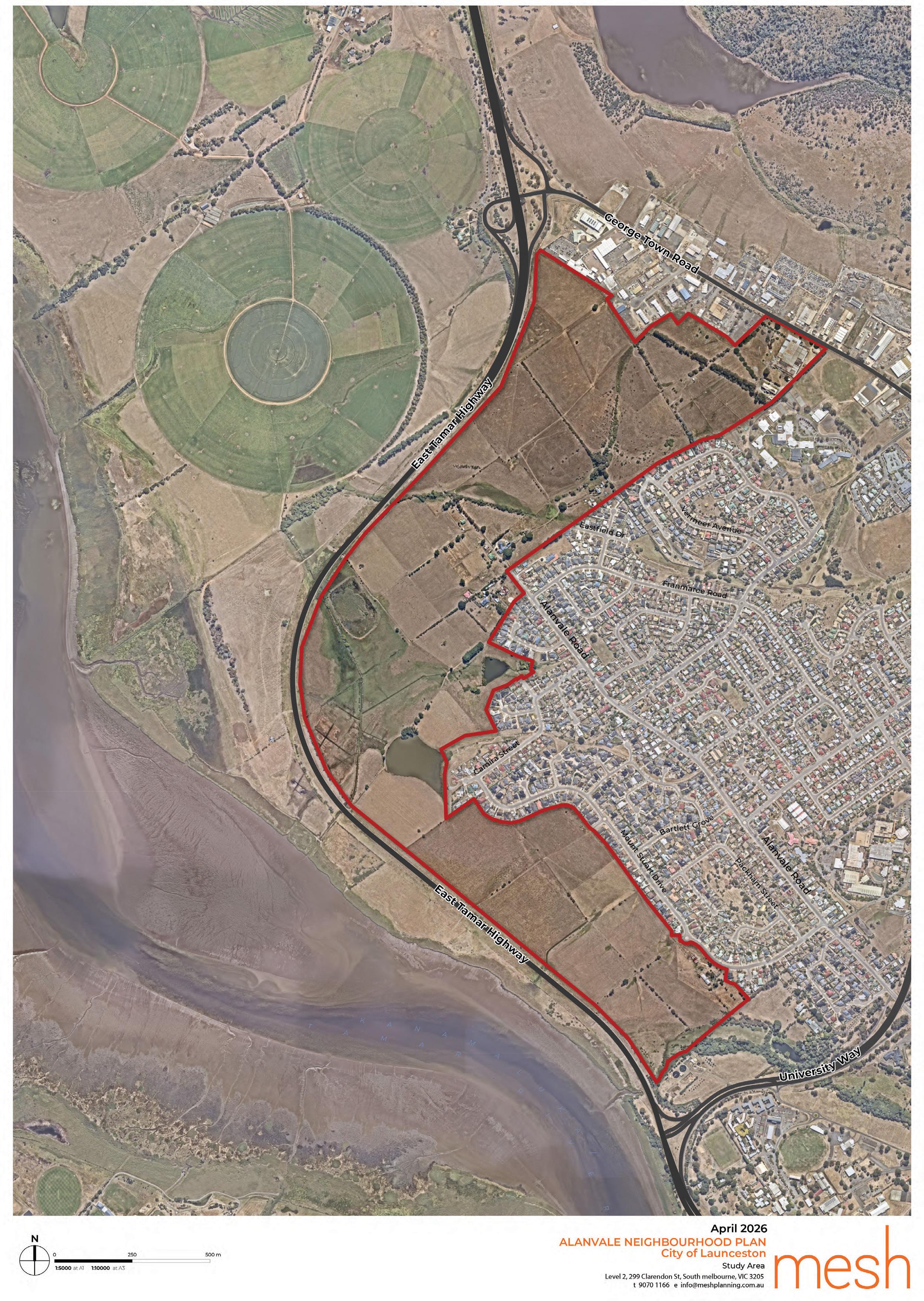
Figure 2. Study Area Plan
2. ALANVALE POLICY AND STRATEGY CONTEXT
2.1.
Policy Direction
The Policy Directions set out the State and Regional policy framework that informs and guides the NP, providing strategic direction for land use, infrastructure and growth.
TASMANIAN PLANNING POLICIES (TPPS)
The Tasmanian Planning Policies (TPPs) have been approved by Government and will come into effect on 1 July 2026 and represent the highest level land use planning policy framework in Tasmania. The TPPs establish the State’s long term objectives and principles for settlement patterns, housing, infrastructure, economic development, environmental protection and liveability.
The TPPs provide the overarching policy foundation that ensures consistency, alignment and integration across the planning system, while allowing regional and local planning processes to determine the appropriate location, sequencing and form of development.
Key Directions for the NP
Policy supports sustainable growth and development within identified Urban Growth Areas, with a focus on consolidating and developing the Greater Launceston Area. Key relevant directions include:
• Infill development: Prioritise infill, consolidation and re-development over outward growth to maximise use of existing infrastructure.
• Structure Planning: Encourage structure plans and local area plans to coordinate land use, identify and protect key values, sequence development, and manage settlement growth boundaries.
• Land Use Compatibility: Protect neighbourhood amenity by avoiding and managing incompatible land uses and development.
• Sense of Place: Support place-making by enhancing and protecting local characteristics and values that contribute to a sense of place.
• Land Supply: Ensure the timely supply of land to meet projected housing demand, informed by the best available evidence.
• Increase Development Diversity: Encourage a diverse range of land uses, employment opportunities and different housing types including medium density.
• Appropriate Servicing: Identify, allocate, and protect suitably located land for servicing infrastructure to meet existing and future community.
• Infrastructure Contributions: Investigate infrastructure contributions systems to fund shared higher order infrastructure projects.
NORTHERN TASMANIAN REGIONAL LAND USE STRATEGY (NTRLUS)
The NTRLUS identifies Alanvale as a Supporting Consolidation Area within the broader Urban Growth Area framework. Supporting Consolidation Areas comprise land within or adjoining established urban areas that accommodate additional development and urban uses while reinforcing existing settlement patterns.
These areas are distinct from Priority Consolidation Areas, which focus on directing higher intensity infill development to the Launceston Central Area and major activity centres. By contrast, Supporting Consolidation Areas provide opportunities to complete and consolidate the existing urban footprint, support a range of residential and complementary urban uses, and improve connections between established communities.
In Alanvale, this designation reflects its role in supporting urban consolidation that enhances access to services, infrastructure and transport, while maintaining amenity and improving overall liveability. Development is intended to be well planned, coordinated and responsive to local conditions, rather than ad hoc or incremental, ensuring growth contributes positively to the functioning of the wider urban area.
Key Directions for NP
• Supporting Consolidation Area: Alanvale is identified as a Supporting Consolidation Area, within the Urban Growth Area framework.
• Sustainable Growth and Development: Supports sustainable growth within identified Urban Growth Areas, with an emphasis on consolidating development across the Greater Launceston Area.
• Increased Development Diversity: Encourage a broader mix of land uses, employment opportunities and housing types, including medium-density outcomes.
• Timely Infrastructure Provision: Identify infrastructure gaps, needs and capacity early, and respond adequately, delivering infrastructure to align with the settlement network.
• Activity Centres: Supports a future Neighbourhood or Town Centre within the Alanvale Priority Consolidation Area.
2.2. Strategic and Technical Direction
The Strategic and Technical Directions summarise Council adopted strategies, technical studies and State led investigations that inform the NP and provide the evidence base for spatial structure, development form and infrastructure planning responses.
LAUNCESTON HOUSING PLAN 2025 – 2040
The Launceston Housing Plan is a Council adopted strategic document that identifies significant housing challenges across Greater Launceston, including affordability pressures, constrained supply and limited housing diversity. To accommodate an additional 7,200 residents by 2040, the Plan identifies a need for approximately 4,500 new dwellings (around 300 dwellings per year). In this context, Alanvale is identified as a key growth location with an indicative capacity of approximately 500–1,000 new dwellings
Key Directions for NP
• Neighbourhood Plan: Identifies Alanvale as an important priority consolidation area that requires preparation of a Neighbourhood Plan in the short term.
• Increase housing yield and diversity: Directs a move beyond a predominantly detached-housing model to better match changing household needs, through delivery of more medium-density housing.
• Locate housing in well-serviced connected areas: Focus growth in locations with good access to services, employment, transport and infrastructure.
• Enrich neighbourhoods and protect character: Housing growth should be accompanied by highquality design, and respect for neighbourhood character for improved liveability.
• Align infrastructure investment with housing growth: Coordinate infrastructure delivery with housing development and consider implementing Infrastructure Funding Frameworks to contribute to higher order shared infrastructure projects.
Sets the framework for delivering a connected and accessible network of open spaces that support healthy and liveable communities. In the Newnham–Mayfield area, it identifies gaps in open space provision, low canopy cover, flood risk and a fragmented trail network, and highlights opportunities to improve walking and cycling connectivity, including potential shared trail connections along the East Tamar Highway.
Key Directions for the NP
• Supporting Consolidation Area: Alanvale is identified as a Supporting Consolidation Area, within the Urban Growth Area framework.
• Sustainable Growth and Development: Supports sustainable growth within identified Urban Growth Areas, with an emphasis on consolidating development across the Greater Launceston Area.
• Increased Development Diversity: Encourage a broader mix of land uses, employment opportunities and housing types, including medium-density outcomes.
• Timely Infrastructure Provision: Identify infrastructure gaps, needs and capacity early, and respond adequately, delivering infrastructure to align with the settlement network.
• Activity Centres: Supports a future Neighbourhood or Town Centre within the Alanvale Priority Consolidation Area.
DRAFT RECREATION AND OPEN SPACE STRATEGY 2024 – 2040
URBAN GREENING STRATEGY 2023 – 2040
Aims to increase tree canopy and biodiversity across Launceston, with a long term target of 40% canopy cover. The strategy identifies Newnham and Alanvale as areas with very low existing canopy cover, reinforcing the importance of embedding greening outcomes within new development to address urban heat island impacts, improve liveability and strengthen ecological resilience.
LANDSCAPE AND VISUAL IMPACT ASSESSMENT (2025)
The Landscape and Visual Impact Assessment (LVIA) identifies the study area as occupying a visually prominent and sensitive position on the eastern slopes of the Tamar Valley, with strong visual connections to the Kanamaluka / Tamar River, the East Tamar Highway Scenic Road Corridor, and the surrounding residential areas of Newnham and Alanvale.
The generally open valley, limited vegetation cover and gently rising east–west slopes result in long sightlines and high visibility, particularly from the East Tamar Highway, where development is experienced in the foreground as part of Launceston’s arrival sequence. The LVIA concludes that residential development is feasible across the study area, including land subject to existing landscape and visual controls, provided development responds to landform, protects key views, and establishes a clear and legible urban edge.
Key Directions for the NP
• Urban greening integration: Integrate urban greening into streets, open spaces and development areas to enhance amenity and environmental performance.
• Increased canopy cover: Increase tree canopy through coordinated landscape design and street tree planting across the NP area.
• Integrated green infrastructure: Align urban greening outcomes with walking and cycling networks, recreation spaces and stormwater infrastructure.
Key Directions for the NP
• Slope responsive layout: Orient development and streets generally across slopes to minimise visual prominence and reduce cut and fill.
• Highway setback and interface: Apply a minimum 50 metre setback to the East Tamar Highway to function as a landscaped, multifunctional interface.
• View protection: Protect and frame key views to Kanamaluka / Tamar River and the surrounding valley landscape.
• Ridgeline avoidance: Avoid development on visually prominent ridgelines or locations that interrupt long range views.
• Urban edge definition: Establish a clear and legible urban edge along the East Tamar Highway corridor.
• Landscape integration: Use landscape structure and early revegetation to integrate development and soften visual impacts over time.
ECONOMIC NEED ASSESSMENT (2025)
Assesses the scale and type of retail and commercial development required to support future population growth within the NP area while maintaining Launceston’s established centres hierarchy. It identifies that a neighbourhood activity centre is supportable within the NP area to meet day to day retail and service needs and provide local employment opportunities.
DRAFT
Key Directions for the NP
• Neighbourhood Activity Centre: Support the delivery of a neighbourhood activity centre within the NP area.
• Appropriate scale and mix: Provide for approximately 3,400 – 4,500 sqm of retail and commercial floorspace, including a limited line supermarket.
• Integrated place outcomes: Integrate the centre with surrounding housing, movement networks and open space.
• Strategic location: Support delivery along George Town Road, where high visibility and exposure can assist commercial viability.
STORMWATER MANAGEMENT STRATEGY (2026)
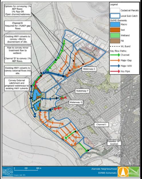
Establishes a coordinated, precinct wide stormwater management approach to support future urban development. A key principle of the stormwater strategy is to ensure the protection of major overland flow paths and upstream conveyance routes through the study area. The strategy responds to upstream catchment flows, downstream flood risk associated with the Tamar River, and future climate conditions. It proposes an integrated system of drainage infrastructure, constructed waterways and a consolidated wetland at the catchment low point to manage stormwater volumes, provide water quality treatment and avoid adverse off site impacts. The stormwater strategy also considers practical staging, maintenance and operation of the stormwater management network.
Key Directions for the NP
• Integrated stormwater network: Protect land for delivery of an integrated stormwater network comprising underground drainage and constructed open waterways to convey local and upstream flows.
• Consolidated wetland provision: Identify and safeguard land for a consolidated wetland at the catchment low point to provide water quality treatment, attenuation and flood management functions.
• Precinct scale servicing: Plan stormwater infrastructure at a precinct scale, rather than on a lot by lot basis, to support efficient servicing and coordinated development outcomes.
• Multi functional integration: Integrate waterways and wetlands with open space, landscape buffers and movement corridors where appropriate.
• Equitable delivery: Establish the basis for equitable funding and delivery arrangements for higher order stormwater management infrastructure.
TRAFFIC IMPACT ASSESSMENT (INITIAL ISSUES AND OPPORTUNITIES ADVICE) (2026)
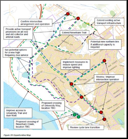
Identifies the key road network upgrades and movement requirements needed to support future development at Alanvale. The assessment highlights capacity constraints and safety issues on the surrounding road network, limited public transport accessibility, and gaps in active transport connectivity. It identifies targeted intersection upgrades, new road connections, and improvements to walking, cycling and public transport infrastructure as critical to enabling coordinated development.
HERITAGE CONSTRAINTS ASSESSMENT (2025)
The Heritage Constraints Assessment was prepared to identify and understand Aboriginal heritage, built heritage, archaeological and landscape values within the NP area, and to inform future planning and development decisions. It provides guidance on where heritage values require protection or further investigation and sets out management principles to ensure these constraints are appropriately addressed through the NP, rezoning and subsequent development stages.
Key Directions for the NP
• Internal road network: Safeguard land and plan for an internal, bus capable collector road network linking George Town Road and Mount Stuart Drive.
• Intersection upgrades: Support new and upgraded intersections, including connections at Thompson Lane and Alanvale Road to George Town Road, and upgrades at University Way / East Tamar Highway.
• Safe and efficient movement: Plan for safe and efficient movement through speed management and lighting upgrades on key collector roads.
• Walking and cycling connectivity: Deliver continuous walking and cycling networks, including connections to Newnham, University trails and the East Tamar Highway corridor.
• Network integration: Investigate upgrades to surrounding intersections, roads and shared path links to improve connectivity and support the staged development of the NP area.
Key Directions for the NP
• State heritage protection: Safeguard the State listed properties Mount Stuart and Eastfield, including their settings, historic landscape context and key view lines, through subdivision design, setbacks and landscape buffers.
• Local heritage places: Support the protection of 202 and 241 Alanvale Road as Local Heritage Places, with development responding through appropriate curtilages, setbacks and built form outcomes.
• Archaeological heritage: Protect the area of high archaeological potential associated with the former Allanvale House through further investigation, potential archaeological listing and careful management of future development impacts.
• Historic landscapes and views: Retain historic vegetation, including hawthorn hedgerows and Monterey cypress plantings, and protect important historic views to and from Mount Stuart and Eastfield.
• Heritage investigations and interpretation: Require early Aboriginal and historic heritage investigations to inform planning and staging, and support the delivery of heritage interpretation within public spaces as development progresses.
EAST TAMAR HIGHWAY CORRIDOR STRATEGY (2025)
Sets the State Government direction for improving the safety, capacity and function of the East Tamar Highway. Of direct relevance to Alanvale, the strategy identifies the University Way / East Tamar Highway intersection upgrade as a priority project, including capacity improvements and provision of a shared walking and cycling crossing linked to a continuous path along the corridor.
SECOND KANAMALUKA / TAMAR RIVER CROSSING
Key Directions for the NP
• University Way intersection upgrade: Support delivery of the University Way / East Tamar Highway intersection upgrade in coordination with State Government.
• Shared path safeguarding: Safeguard connections to enable a continuous shared walking and cycling path along the East Tamar Highway corridor.
• Network integration: Ensure neighbourhood movement networks integrate safely and efficiently with the regional highway corridor.
• Coordinated delivery: Coordinate local development outcomes with State led transport infrastructure upgrades.
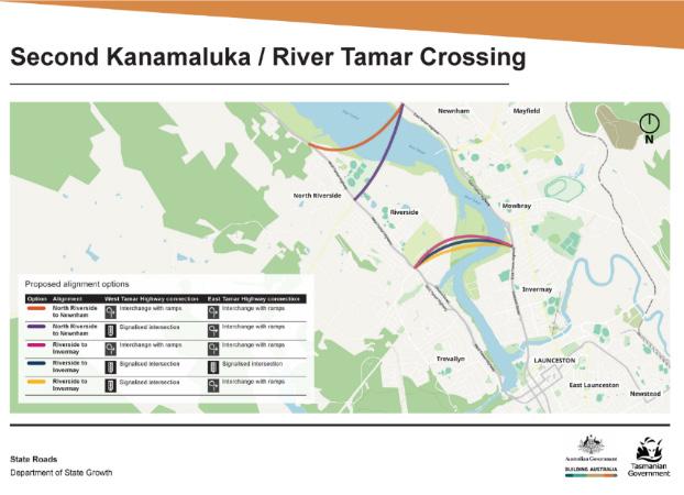
The Second Tamar River Crossing project is a State Government led investigation into a potential additional crossing of the Tamar River between the East and West Tamar Highways. While not currently committed or funded, a business case has explored the need, feasibility and potential alignment options.
Two potential alignments would traverse or land within the NP area. Accordingly, the State Government has requested that land within the study area be set aside and protected to safeguard possible future delivery of the project. If progressed, the crossing would have the potential to significantly influence regional traffic distribution and movement patterns in northern Launceston, including the function of the East Tamar Highway corridor. The River Cross would also include a shared path that could connect into the proposed Alanvale shared path network and the potential to explore potential access from the River crossing into the NP area.
Key Directions for the NP
• Future river crossing context: Recognise the potential future role of a second Tamar River crossing in influencing regional movement patterns.
• Constraint avoidance: Identify the potential future river crossing project and potential land take, noting there is limited certainty about this project progressing.
3. SITE UNDERSTANDING & ANALYSIS
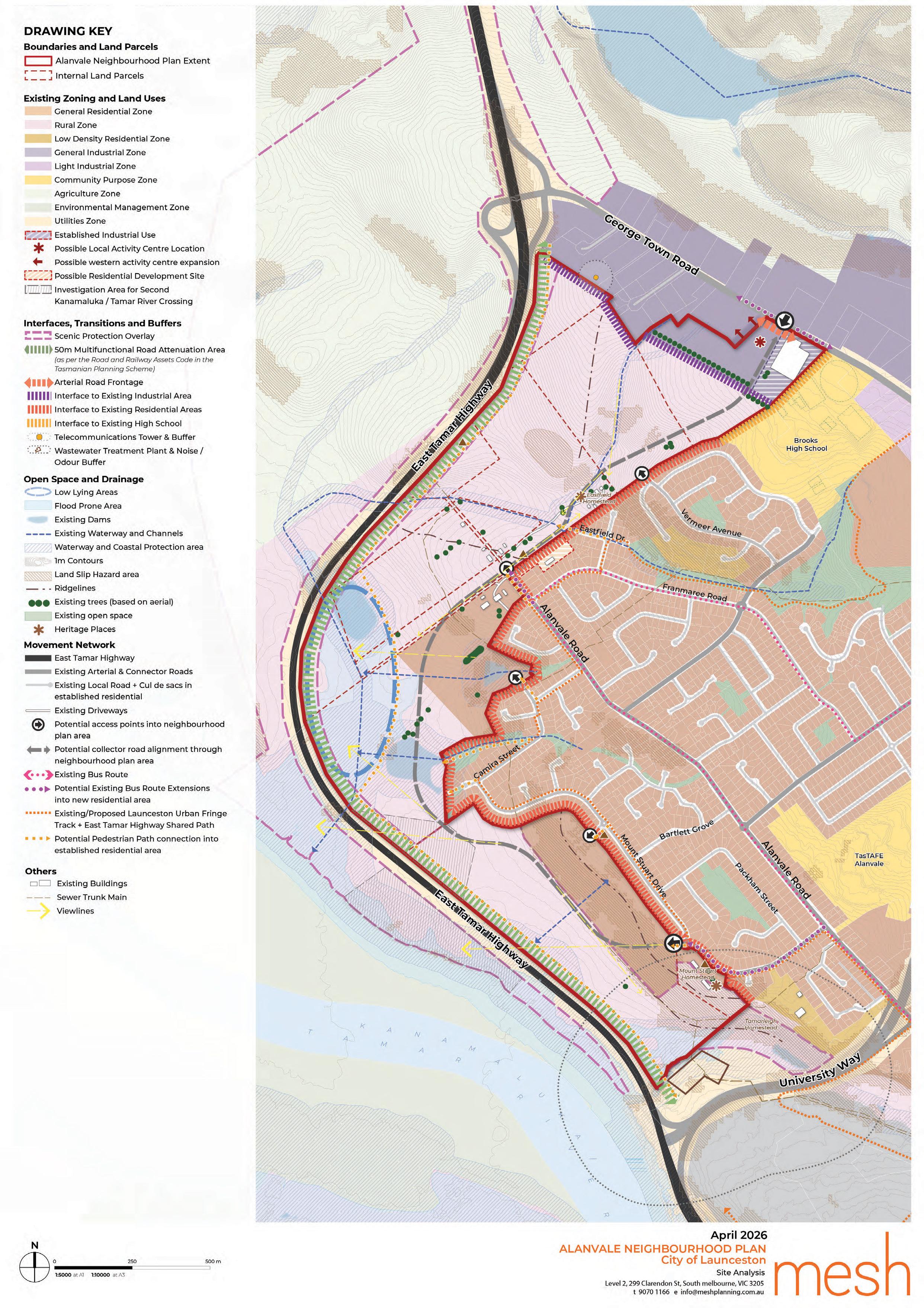
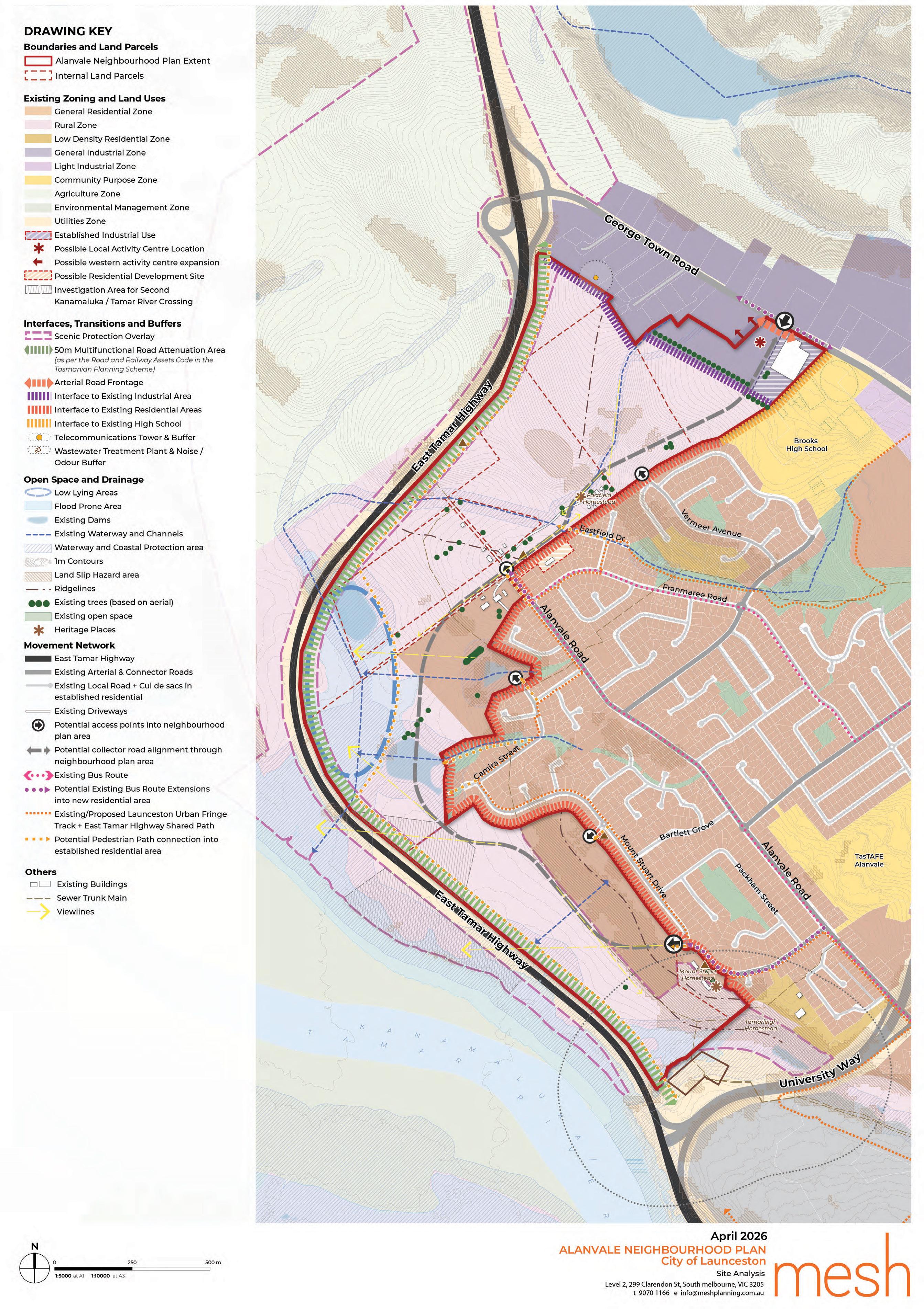
The Site Analysis (Figure 3) establishes a detailed understanding of the physical and contextual characteristics of the Alanvale study area. It provides the analytical foundation for the NP by identifying the existing conditions, opportunities and constraints that influence how land within the area may change over time.
This section draws on site specific investigations, strategic context and technical inputs to examine the factors that shape potential development outcomes. In doing so, it does not propose responses or solutions, but instead clearly articulates the key matters that shape the NP.
To ensure a structured and consistent approach, the site analysis is organised around six interrelated themes. They also form the organisational framework that flows through the remainder of the document, including the Key Directions and NP Sections.
3.1. Development Pattern, Land Use & Ownership
SITE ANALYSIS
Strategic Alignment
The Alanvale NP Area represents a logical extension of the existing township, bounded by the East Tamar Highway (west), University Way (south), and George Town Road (north).
Existing Zoning
The site is predominantly zoned Rural, with established General Industrial and General Residential zones extending into the precinct from the township core.
Industrial Presence
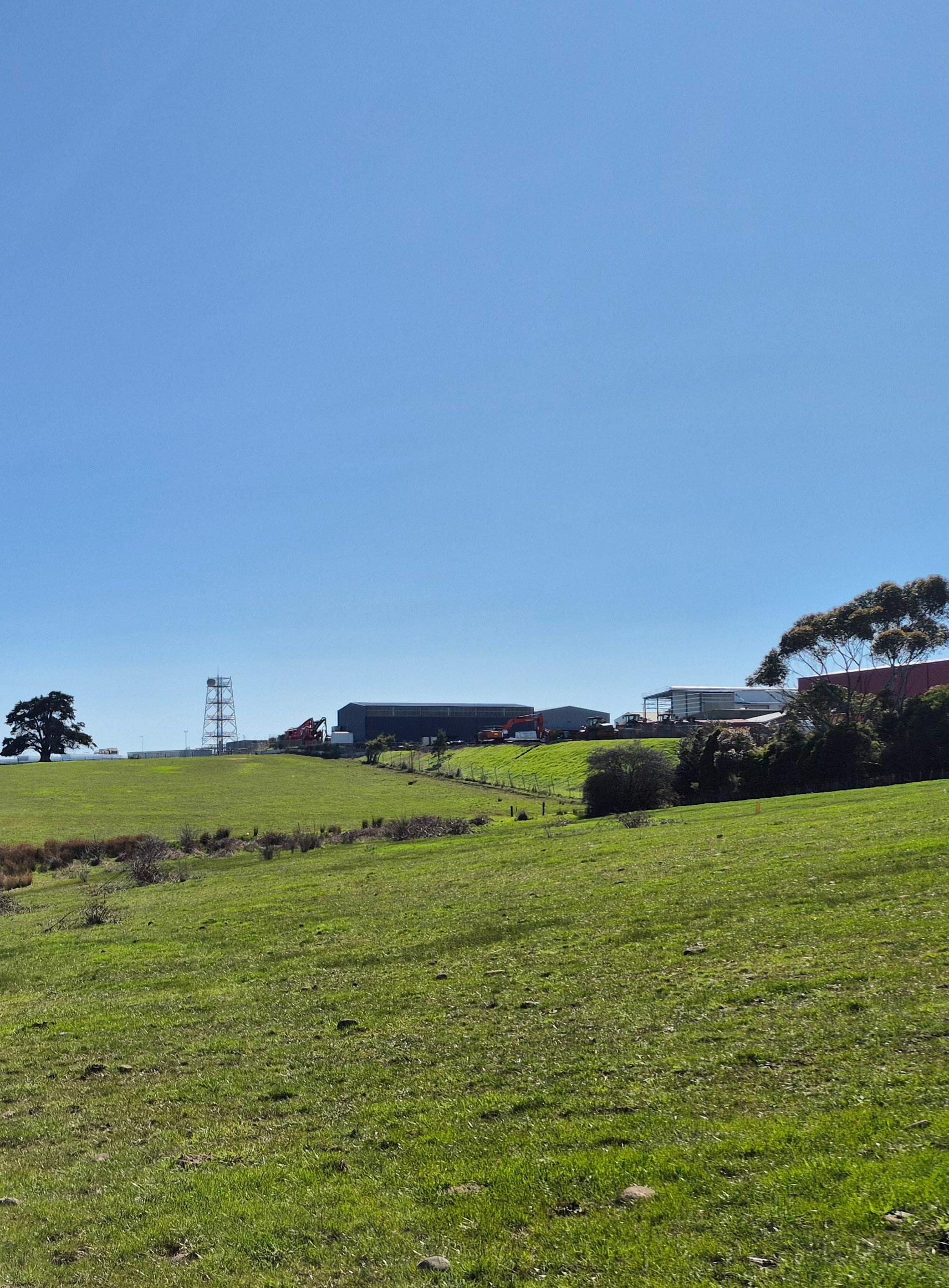
Existing industrial operations to the north are established economic assets; their continued function necessitates a managed interface to protect future residential amenity.
Primary Access
George Town Road serves as the principal arterial corridor and the logical “front door” into the site.
Commercial Potential
A Retail Needs Assessment has identified the viability of integrated retail and commercial uses within the precinct.
Frontage Constraints:
The expected continued long-term operation of the industrial site at 253 George Town Road restricts the available frontage for the NP along the primary arterial road.
Fragmented Ownership
The plan area comprises 13 parcels held by approximately 10 separate landowners. The varied development aspirations and timelines of these entities have been a key consideration in the plan’s formulation.
River Crossing Investigations
Ongoing investigations into a potential second Tamar River crossing indicate a possible alignment that could encroach into the southern portion of the site.
OPPORTUNITIES
Residential Expansion:
Facilitate the logical extension of residential zoning to increase housing diversity and supply.
Natural Attenuation:
Leverage the site’s undulating topography and existing vegetation to create natural buffers between industrial and sensitive land uses.
Activity Centre Integration:
Facilitate a neighbourhood activity centre along George Town Road to create a cohesive interface between existing industrial, commercial, and community uses. The centre will incorporate a smallscale town plaza or public open space designed to serve as a civic anchor, fostering local gathering and reinforcing the neighbourhood’s unique identity.
Strategic Scalability:
Explore a possible future western expansion of the activity centre to achieve a high-quality urban interface, compatible uses and ensure sufficient commercial frontage.
Gateway Establishment:
Establish a primary gateway on George Town Road, co-located with the neighbourhood activity centre utilising landmark landscape response, street tree planting, and integrated public realm treatments to reinforce a sense of arrival, cultivate local identity, and ensure visual continuity throughout the precinct.
Strategic future-proofing:
Design the NP to ensure long-term functionality, independent of the final alignment or decision regarding the second Tamar River crossing. This approach ensures the NP maintains high-quality internal access and connectivity regardless of external regional infrastructure outcomes.
3.2. Sensitive Interfaces, Transitions and Buffers
SITE ANALYSIS
Scenic Protection, Acoustic & Safety Attenuation:
Under the Road and Railway Assets Code, sensitive land uses must have a building area outside the 50m attenuation area for major roads with speed limits exceeding 60km/h. This necessitates a 50m buffer from the East Tamar Highway reserve that also serves as a scenic protection buffer protecting visually prominent areas along the highway.
Industrial Interface Management
The varying operational intensities of industrial land along George Town Road require a nuanced transition to prevent land-use conflict with future residential development.
Amenity Buffers
Safety and noise / odour buffers to ensure continuous operations of existing essential services, including a telecommunications tower and a Wastewater Treatment Plant (WWTP) without interfering with sensitive uses, encroaches into the NP area.
Heritage Assets
The Mount Stuart and Eastfield Homesteads are recognised heritage places. Their prominent positions on the landscape require sensitive design responses to preserve their landmark status and cultural significance.
OPPORTUNITIES
Multifunctional Buffer Zones
Implement a 50m multifunctional attenuation corridor along the East Tamar Highway. This space can be optimised for drainage infrastructure, shared active transport paths, edge roads, linear open space and well-landscaped setbacks.
Natural Buffers
Strengthen industrial interfaces by utilising natural landforms and existing vegetation as primary mitigation tools. Targeted planting will reinforce these corridors to minimise acoustic and visual impacts, improve micro-climates, and reinforce a coherent landscape character.
Buffer Integration
Consolidate the telecommunications tower buffer within the industrial interface to ensure operational requirements do not impede future sensitive uses.
Strategic Land Use Distribution
Prioritise non-residential or less sensitive land uses within the WWTP noise and odour buffers.
Adaptive Staging
Sequence development so that areas affected by the WWTP buffer are delivered in later stages, allowing for potential future remediation or buffer contraction.
Heritage in Open Space
Incorporate recognised heritage places into the public open space network, enabling the community to celebrate these assets while ensuring their longterm preservation and continued contribution to the changing urban environment. To safeguard their prominence in the landscape, development interfacing these sites must ensure appropriate landscape setbacks, protect critical view corridors and prioritise low-intensity land uses.
3.3. Open Space, Drainage & Greening
OPPORTUNITIES
Hydrological Constraints
There are significant encumbered low-lying areas adjacent to the East Tamar Highway that are fed by a network of tributaries, open channels, and existing stormwater infrastructure that discharge into the site informally from the established township.
Topographical Complexity
The site features steep valleys and ridges. The natural topography of these areas presents challenges when integrated into standard residential and requires specialised and sensitive engineering or design strategies. The land at 45 Mount Stuart Drive is identified as having high visual sensitives as its currently partially protected by the Scenic Protection Overlay, is particularly visually prominent and has a steep slope fronting the Highway. This site is also encumbered by the fixed sewer pipe, further informing the approach to development.
Urban Greening
The existing suburb of Newnham has low tree canopy coverage.
Open Space Deficit
The existing suburb of Newnham lacks passive open space to cater for existing and expected future residents. Existing open spaces are also largely restricted to having a drainage function, limiting the community’s access to high-quality recreational land.
Centralised Stormwater Strategy
Establish a centralised drainage reserve strategically positioned to manage flood-prone areas. By locating this infrastructure adjacent to the highway, the plan can optimise the 50m road attenuation zone for dual-purpose water quality treatment and retention basins that could also potentially function as public realm assets. Design outcomes should prioritise high-quality landscaping, gentle batters, pedestrian path networks and safe, legible edges.
Riparian Connectivity
Extend existing waterway reserves into the site through a network of linear green corridors that are of sufficient width to support both ecological and active transport function, creating a seamless transition from the established township into the new precinct.
Infrastructure Rationalisation
Assess the feasibility of undergrounding (piping) specific tributaries and channels in areas where steep topography prevents natural integration into urban development.
Strategic Land Use (Active Recreation)
Utilise land encumbered by the WWTP buffer for Active Open Space (e.g. sports fields or courts). These uses are compatible with utility buffers where sensitive residential uses are restricted.
Urban Greening
Prioritise the retention of mature vegetation as a core component of the precinct’s green infrastructure and support a consistent tree planting strategy that includes street tree / verge planting, to enhance local biodiversity, addressing the suburb of Newnham’s existing tree canopy cover deficit and deliver long term canopy coverage.
Integrated WSUD & Passive Recreation
Co-locate passive open space with drainage reserves in low-lying areas to maximise greening opportunities and deliver high-amenity “blue-green” corridors that are designed for regular use, landscaped, with clear edges and passive surveillance.
Visual Permeability
Position open spaces at the termination of collector road view corridors to enhance legibility and provide a sense of openness within the streetscape.
Vegetation Retention
Design the open space network to protect significant remnant vegetation and existing tree stands where possible.
Heritage Integration
Co-locate public open space with recognised heritage areas, ensuring these assets are preserved as community landmarks and integrated into the broader public realm.
3.4. Movement Network, Public and Active Transport
SITE ANALYSIS
Site Analysis
Arterial Access Limitations: George Town Road serves as the primary arterial access point for the site. Direct access to the East Tamar Highway and University Way is restricted, though several opportunities for integration with the existing township exist along the eastern periphery.
Internal Road Network Deficits
Formal internal road infrastructure is absent. However, each individual developer has the ability to develop their site in isolation due to the ability to connect into the existing road network. The Alanvale Road reserve extension currently functions as private access. Existing dwellings are situated in close proximity to this reserve, presenting physical constraints for potential future road widening.
Fragmented Ownership Risks
Fragmented landholdings present a delivery risk to achieving a highly connected, permeable, and efficient movement network across the broader NP area.
Topographical Constraints
Areas of steep topography will require a terrainresponsive approach to road engineering and street layout.
Public Transport Context
The existing township is serviced by bus routes providing direct public transport connections to the Launceston CBD.
Active Transport Infrastructure
While local and regional active transport corridors like the Launceston Urban Fringe Track and the East Tamar Highway Shared Path exist nearby, the network remains incomplete with notable gaps.
Infrastructure Corridor Investigations
Ongoing investigations into a potential second Tamar River crossing indicate a possible alignment that could encroach into the southern portion of the site.
Servicing Infrastructure
There is a sewer pipe that traverses much of the study area, including the land at 45 Mount Stuart Drive, this results in elements of the road network that are fixed.
OPPORTUNITIES
Primary Gateway Definition
Establish a primary gateway on George Town Road, strategically integrated with the neighbourhood activity centre to anchor the new community, utilising high quality landscape response, street tree planting, and integrated public realm treatments to reinforce a sense of arrival and cultivate local identity.
Street Network Integration
Connect the site to the existing street network of the adjacent township to complete existing street network and improve local permeability by ensuring streets have paths that supports active transportation.
Coordinated Delivery of infrastructure
Facilitate a collaborative, master-planned approach among landowners to avoid over reliance on existing access points (which would overload existing neighbourhood streets). A coordinated framework will enable the delivery of a continuous collector road linking George Town Road to Mount Stuart Drive
Terrain-Responsive Road Profiles
Adopt flexible road cross-sections and design profiles that adapt to the site’s undulating topography, minimising the need for excessive cut-and-fill operations, integrated with Water Sensitive Urban Design (WSUD) and planting to naturally stabilise slopes and manage run-off.
Expanded Transit Corridors
Extend existing bus routes and establish new transit corridors to ensure the future residential population has reliable public transport access. Locate bus stops within walkable distance for majority of future residents, integrate with shared paths, seating and canopy tree planting for shade.
Active Transport Expansion
Provide a network of shared paths that facilitate a walkable community and re-alignment of the Launceston Urban Fringe Trail through Alanvale. Deliver the East Tamar Highway Shared Path link, integrating it into a comprehensive internal network of shared paths.
Strategic Future-Proofing
Design the core movement and active transport network with sufficient flexibility to remain viable regardless of the ultimate alignment or outcome of the second Tamar River crossing investigations.
3.5. Residential Neighbourhoods, Housing Diversity and, Sense of Place and Character
SITE ANALYSIS
Existing Housing Stock
The established suburb of Newnham represents a density of around 10 dwellings/ ha and is characterised by detached single dwellings on lot sizes typically ranging from 600-1000m2 reflecting standard residential development patterns from the late 20th century.
Landscape and Visual Impact
The undulating landform creates significant visual exposure. Portions of the site fall within a prominent visual catchment visible from the East Tamar Highway arterial corridor and the western banks of the Tamar River.
Topographical Development Feasibility
The site’s topography introduces complexities regarding infrastructure delivery and buildability, necessitating a terrain-responsive design framework. The topography also presents challenges to deliver medium density housing in certain areas.
Existing Structures
There are a number of existing buildings on the site, primarily used as dwellings and others within recognised heritage areas.
OPPORTUNITIES
Housing Diversity
In accordance with the Launceston Housing Plan, the NP area is designated for intensified residential development. Increasing housing diversity will enhance the local housing stock and establish a distinct character for the new precinct.
Amenity-Driven Density
Prioritise medium-density housing in high-amenity locations and areas where the land is flatter, specifically around the neighbourhood activity centre and public parks, to promote walkable and vibrant neighbourhoods.
Site Responsive Housing Typologies
Implement site-responsive design by locating higherdensity dwellings on flatter terrain while utilising larger lots, landscaping and built form controls for steeper, visually prominent areas to minimise visual impact and protect key views.
Future Proof Plan
Design the NP to be functional regardless of when or if existing dwellings structures are redeveloped. This ensures the NP remains viable in the short term while existing structures are retained, without compromising the long-term efficiency and connectivity of the plan. All existing buildings within identified heritage areas are assumed to be retained as part of the public realm.
Landscape led Character
Utilise landscape as the primary structural element defining the neighbourhood’s character. By establishing formal street tree avenues, waterway corridors, and integrated open space networks, the design will ensure a consistent and high – quality character that unifies diverse housing typologies and strengthens the neighbourhood’s sense of place.
4. NEIGHBOURHOOD PLAN KEY DIRECTIONS
The NP Key Directions bring together the findings of Sections 2 and 3, including the policy context, strategic and technical inputs, and site analysis, to clearly articulate the key directions that the NP must respond to.
This section is structured around the themes introduced in Section 3 and provides a concise synthesis of the key issues, considerations and opportunities identified through the preceding analysis. The Key Directions establish clear guidance on the matters the NP must address and the opportunities it should explore through its spatial framework, design guidance and implementation actions.
Development Pattern, Land Use and Ownership
Completing growth through an integrated and contemporary extension of the existing urban pattern.
• Develop Alanvale as a coherent urban consolidation area, completing the existing urban footprint and integrating with Newnham.
• Require development to proceed within a coordinated neighbourhood structure that enables staged delivery across fragmented landholdings while securing shared infrastructure, access and urban form outcomes.
• Identify land for the possible second Kanamaluka / Tamar River crossing, without compromising the long term function of the neighbourhood.
Activity Centres and Complementary Uses
Strategically positioned activity centre supporting employment, complimentary uses and housing diversity.
• Deliver a neighbourhood activity centre, providing approximately 3,400–4,500m2 of retail and commercial floorspace (generally within 1.1–1.5 hectares of developable land).
• Ensure the activity centre is anchored by a limited line supermarket, supported by specialty retail and complementary non retail uses (commercial, mixed uses, community etc), to meet day to day needs and support local employment.
• Locate and configure the activity centre to maximise walkable catchment access, integration with surrounding residential areas, and strong frontage and visibility to George Town Road to support long term commercial viability.
• Facilitate medium density and diverse housing typologies within the immediate surrounds and walkable catchment of the activity centre and improve connections.
• Ensure an activity centre with a high-quality public realm, including shade, seating and a potential plaza spaces that supports local gathering and identify.
Movement Network, Public and Active Transport
A site responsive movement network connecting growth with the established area to enhance integration, promote an active lifestyle and access to public transport.
• Establish an integrated and connected movement network that links the NP area with surrounding road networks, including George Town Road, Alanvale Road and Mount Stuart Drive and the existing street network of Newnham.
• Ensure streets are designed to enable tree planting for increased canopy coverage, to address heat and encourage walking and cycling.
• Deliver a logical and permeable internal street network that provides clear connections between land parcels, supports staged development across fragmented ownership, and avoids ad hoc or inefficient access arrangements.
• Require streets and movement corridors to be responsive to landform, framing views, minimising cut and fill, and creating attractive interfaces with open space, heritage assets and landscape features.
• Prioritise improved access to public transport, facilitating opportunities for the extension of bus routes through the neighbourhood.
• Complete a continuous walking and cycling network that links residential areas, open space, the activity centre, surrounding neighbourhoods and regional shared paths, including the East Tamar Highway corridor.
Interfaces and Buffers
Multifunctional buffers and considered transitions between land uses.
• Require development adjoining the East Tamar Highway to incorporate a 50 metre setback from the highway corridor, functioning as a clearly defined and coordinated interface.
• Use the 50 metre setback to deliver multi functional outcomes, including landscape buffering, drainage infrastructure, shared walking and cycling paths, urban greening and, where appropriate, local access roads.
• Ensure development outcomes along the highway interface manage noise and visual impacts, protect residential amenity, and reinforce the corridor as a legible urban edge.
• Apply clear buffers and transition treatments where new development adjoins industrial land, essential services or other constrained uses, prioritising land use compatibility and long term operational certainty.
Open Space, Drainage and Greening
Centralised and strategically positioned drainage reserve, supported by a network of waterways, drainage channels, parks and streetscapes.
• Plan for an integrated blue green infrastructure system that combines open space, drainage and urban greening as core elements of the neighbourhood.
• Secure land for precinct scale drainage infrastructure, to manage flood risk, water quality and climate resilience.
• Address existing open space and canopy deficits by delivering a distributed network of parks and active open space, integrated with drainage corridors and movement networks.
• Provide local parks generally 0.4–1.0 hectares in size within a 400 m walkable catchment of all dwellings and identify approximately 6 hectares of active open space to support future population growth.
Residential Neighbourhoods, Housing Diversity and Sense of Place
Distinct and diverse neighbourhoods, and a range of lots to support housing diversity & choice in the right locations. Elevating connection to place, landform and history.
• Plan for the delivery of approximately 1,000 new dwellings, providing a diversity of housing types and densities consistent with the TPPs and the Launceston Housing Plan.
• Locate higher density housing on flatter land with good access to services, activity centres, public transport and open space.
• Direct residential layout and built form to respond to landform, visual sensitivity and heritage values, including a preference for street and lot orientations that generally run across slopes to minimise visual prominence and reduce cut and fill.
• Require development outcomes that reinforce a distinct sense of place, through site responsive design, integration of heritage buildings, cultural heritage values and coordinated use of landscape, street layout and built form that reflects the area’s character and topography.
• Use landscaping, including street trees and green corridors, to reinforce neighbourhood identity, establish a consistent visual framework, and protect key views and visually prominent areas.
5. NEIGHBOURHOOD PLAN FOR ALANVALE
PLAN
Land Uses
Existing Land Uses
Established Residential Area
Established Industrial Precinct
Established Industrial Use to be retained Nearby School & Higher Education Facilities
Surrounding Rural & Agriculture
Environmental Management
Proposed Land Uses
Neighbourhood Activity Centre
Possible Future Activity Centre Expansion
Medium Density with potential for Mixed or compatible uses
Indicative locations for Medium Density Residential
Standard Residential
Area of high visual sensitivity
development layout and density subject to a more detailed review.
Investigation Area for larger lots due to considerations on interface with adjacent heritage site, high visual sensitivity and steep topography
Possible Residential Development Site
Heritage Sites (subject to refinement)
Movement Network Street Network
East Tamar Highway
Existing Arterial & Connector Roads

Proposed Collector Road (Bus Capable & Shared Path)
Proposed Higher Order Local Road (Piped Waterway)
Proposed Key Local Roads
Potential Road / Pedestrian Connections
East Tamar Highway Flexible Edge Treatment
Indicative Links between landholdings
Potential Controlled Intersection
Proposed Intersection Upgrade
Potential Road Widening
Potential Road Widening Investigation
(Existing Driveway Access)
Potential Road Connections (subject to confirmation of Tamar River Crossing Investigation Area)
Investigation Area for Second Kanamaluka / Tamar River Crossing
Public and Active Transport Network
Possible Bus Route
Existing Bus Route
East Tamar Highway Shared path
Other ‘off road’ shared paths
On Street Pathway network as per cross sections
Launceston Urban Fringe Trail
Other Features
Buildings
Existing Trees & Vegetation for Possible Retention
Sewer Trunk Main
To be accommodated in easements or reserves
1m contours






HOW TO READ THIS SECTION
The NP for Alanvale (Figure 4) establishes the overarching spatial framework for delivering a coordinated, site responsive development outcome that integrates with the existing Alanvale and Newnham communities and reinforces a strong sense of place.
The NP is supported by a set of layered plans, each comprising of Objectives and Design Principles Together, these layers provide structured guidance across the six themes:
The Objectives define what is to be achieved in order to implement the NP Key Directions identified in Section 4.
The Design Principles provide practical guidance to inform subdivision design, development layout and infrastructure delivery in a manner that achieves the Objectives and aligns with the NP Key Directions.
The NP in Figure 4 has been informed by the Concept Master Plan (Appendix 1), which is a detailed, street level concept plan illustrating a possible way the Objectives and Design Principles could be achieved. The Concept Master Plan is provided as a reference and guide, and development proponents are encouraged to draw upon it when preparing future subdivision and development proposals.
The NP identifies the structural elements of the Concept Master Plan that are most critical to deliver on the coordinated outcome. The following elements are considered critical to implementation and are expected to be delivered in a consistent location and form:
Alternative subdivision and design responses to what is identified in Figure 4 may be supported where they:
• Continue to implement the Objectives and Design Principles
• Clearly demonstrate that coordinated outcomes are not compromised
• Contribute to density targets and elevate housing diversity
The NP is further supported by indicative cross sections (Appendix 2), which illustrates the intended function, scale and interface treatments of key road types to guide detailed design and assessment.
5.1. Development Pattern, Land Use & Ownership
OBJECTIVES
• To expand the established neighbourhood of Newnham in a logical, holistic and cohesive manner to ‘complete’ and enhance the precinct.
• To contain development by the East Tamar Highway which forms a logical boundary for residential growth, whilst managing acoustic and visual impact.
• To inform rezoning and the drafting of a Specific Area Plan that facilitates coordinated and considered land use outcomes across the site.
• To enable land parcels across the precinct to be staged and developed independently across multiple development fronts, with each contributing to a shared and holistic vision.
DESIGN PRINCIPLES
• Ensure development proposals align with the broader NP objectives to deliver a cohesive and coordinated development outcome across multiple landholdings.
• Protect existing dwellings, homesteads and established driveway access associated with current land parcels and ownership patterns, where practicable.
• Support expansion of the residential community around the adjacent school (Brooks High School), including provision of safe and convenient pedestrian and cycling connections where appropriate.
• Identify and facilitate redevelopment opportunities on land adjoining the NP area to support integrated and coordinated development outcomes beyond the plan boundary.
• Promote permeability and connectivity between land parcels, enabling coordinated staging and an integrated neighbourhood structure.
• Future proof land required for a potential future Second Kanamaluka / River Tamar Crossing.
• Promote a contemporary, site responsive urban design pattern characterised by connected, walkable neighbourhoods, and minimise the use of cul de sacs and disconnected curvilinear road layouts.



5.2. Activity Centres and Complimentary Uses
OBJECTIVES
• To plan for a successful and commercially viable neighbourhood scale activity centre that meets the day to day retail, service and employment needs of the future Alanvale community.
• To ensure the scale, function and location of the activity centre complements and reinforces the existing activity centre hierarchy, providing for local convenience without undermining Launceston’s established higher order centres.
• To locate the activity centre in a highly accessible and visible location, integrated with surrounding residential neighbourhoods, movement networks and public transport to support walkability and long term viability.
• To promote a mix of complementary retail, commercial, community and service uses that support daily needs, local employment opportunities and a vibrant neighbourhood focal point.
DESIGN PRINCIPLES
• Locate the Activity Centre in a prominent, accessible and contained position along George Town Road, where it can function as a transitional land use between existing industrial areas and proposed residential neighbourhoods.
• Integrate a town plaza or open space area within the Activity Centre to support gathering, social activity and local identity.
• Provide sufficient retail and non retail floorspace within the proposed Activity Centre, to meet community needs, generally comprising:
- a supermarket of approximately 2,000–2,500 sqm,
- supporting retail (e.g. fresh food, café, liquor, personal services) of approximately 1,000–1,300 sqm, and - non retail/commercial space (e.g. medical, health, fitness or office uses) of approximately 400–700 sqm.
• Provide a mix of complementary uses in close proximity to the retail core, including health, community, fitness, childcare and service based activities, aged care, to support day to day needs and local employment opportunities.
• Integrate higher density residential development within a walkable catchment (generally within 200 m) of the Activity Centre core, to support viability, surveillance and a compact neighbourhood structure.
• Design parking to minimise visual impact and dominance, including careful siting of at grade parking away from key streets, frontages and sensitive interfaces, and incorporating landscaping and built form screening to enhance streetscape quality.
• Protect and integrate existing trees within a linear open space framework, using landscape structure to contain the Activity Centre, soften edges and provide a transition to surrounding residential areas.
• Ensure the Activity Centre is well connected to the surrounding movement network, including a high quality network of pedestrian and cycling paths that clearly identify the centre as a key neighbourhood destination.
• Provide for public transport access adjacent to or within close proximity of the Activity Centre, including the opportunity for a bus stop positioned to maximise accessibility and convenience.
• Explore ways to enhance connection between the adjacent school and the activity centre.


5.3. Interfaces and Buffers
OBJECTIVES
• To protect the amenity of future residents and ongoing operation of existing employment areas through appropriate setbacks, buffers and interface treatments.
• To respond to policy guidance for the East Tamar Highway Corridor, ensuring development outcomes are consistent with corridor function, safety and amenity.
• To ensure existing uses, including industrial operations, can continue to function effectively without being constrained by adjacent development.
• To integrate new development with surrounding residential, industrial and institutional areas in a cohesive and compatible manner.
DESIGN PRINCIPLES
• Deliver adaptable and multifunctional interface treatments that respond to the differing boundary and edge conditions across the NP area.
• Locate parkland, drainage infrastructure and reserves adjacent to the East Tamar Highway where practicable, to form a green, open buffer that sets development back from the corridor and contributes to environmental and amenity outcomes.
• Deliver a multifunctional minimum 50 metre buffer to the East Tamar Highway, incorporating linear open space, landscape planting, shared pedestrian and cycling paths, drainage channels and local edge roads, in accordance with the Road and Railway Code and Cross Section A1 & A2 (refer Appendix 2).
• Provide a range of interface treatments to development adjoining the East Tamar Highway, including a preference for development to front the Highway via an edge road or alternative outcomes including rear laneways, siding or backing arrangements, as illustrated in Cross Section A1 & A2 (refer Appendix 2).
• Provide appropriate interface treatments to the existing school, including setbacks, access management and pedestrian connectivity that support safety and neighbourhood integration.
• Respond appropriately to required buffers for sensitive infrastructure, including the wastewater treatment plant and telecommunication towers, through land use transitions, setbacks and landscape treatments.
• Provide deeper lots and vegetated buffers adjacent to existing industrial land along George Town Road, located within easements or at the rear of lots, to protect industrial amenity and ensure compatible residential outcomes.
• Facilitate the orderly development and subdivision of underdeveloped residentially zoned land adjoining the NP area, where it supports integrated, coordinated neighbourhood outcomes.
• Sensitively manage interfaces and buffers to the Wastewater Treatment Plant, telecommunication towers and other sensitive uses, through appropriate setbacks, land use transitions and design responses.
• Protect valued employment land uses through appropriate land use transitions, buffers and interface treatments between industrial and residential areas. Use tree planting to support screening, manage noise and ensure long term resilience.
• Deliver appropriate curtilage to heritage properties in accordance with the Heritage Constraints Assessment, protecting their landscape setting and maintaining key views.
PLAN - Interfaces and Buffers
5.4. Open Space, Drainage & Greening
OBJECTIVES
• To deliver a connected and multipurpose open space network that supports population growth, frames neighbourhood precincts, and provides a setting for active transport, recreation and diverse housing outcomes.
• To ensure equitable access to public open space, with local parks distributed so that all residents are within walking distance of a usable open space.
• To integrate drainage infrastructure with open space and streetscape design, delivering a holistic, precinct scale drainage system that responds to site wide constraints, supports resilience and enhances amenity.
• To strengthen urban greening and landscape structure, increasing tree canopy cover and positioning open space and waterways to reinforce green corridors and vistas throughout the neighbourhood.
DESIGN PRINCIPLES
• Provide a well distributed network of local parks such that all dwellings are generally within a 400m walkable catchment of a park.
• Deliver a centralised drainage reserve supported by a network of drainage channels and waterways, designed as shared landscape and open space assets rather than isolated engineering infrastructure.
• Integrate drainage infrastructure with open space, streets and trail networks, enabling waterways, basins and drainage corridors to function as part of the public realm.
• Ensure appropriate access is facilitated to drainage assets for maintenance, including to wetlands, waterways and culverts.
• Locate parkland, active open space and drainage reserves adjacent to the East Tamar Highway where practicable, contributing to buffering, setback and shared path outcomes.
• Orient roads and subdivision layouts to facilitate efficient drainage, including alignment with natural valleys and waterways and protection of drainage corridors.
• Position open space, waterways and road alignments to frame green vistas, particularly along the connector boulevard and key local streets.
• Incorporate tree planting as a core component of street and open space design, including street trees, park planting and vegetated drainage corridors to support canopy targets and heat mitigation.
• Apply best practice water sensitive urban design and water quality management measures, ensuring compliance with relevant standards and protection of downstream environments.
• Deliver active recreation spaces that meet community sport and leisure needs, including setting aside of approximately 6 hectares of land for active open space, designed as a shared community assets.
• Orient lots and buildings to front open spaces and waterways, promoting activation, safety, passive surveillance and visual amenity.
• Ensure drainage areas are designed for community use, where possible. Including accessible edges, paths, seating and landscaping.
Figure 8. Open Space, Drainage & Greening
5.5. Movement Network, Public & Active Transport
OBJECTIVES
• To deliver a site responsive, integrated and highly connected street network that favours contemporary urban design outcomes and minimises reliance on cul de sacs and disconnected road layouts.
• To establish a clear movement hierarchy, including a multi modal connector boulevard that supports vehicle movement, public transport and active transport, while managing traffic volumes and safety.
• To integrate development with surrounding street, path and public transport networks, extending existing connections to form a cohesive network linking new and established communities.
• To support safe, convenient and attractive walking and cycling environments, including connections to schools, parks, activity centres and the East Tamar Highway shared path network.
DESIGN PRINCIPLES
• Design the street network as a modified grid that disperses traffic, provides multiple movement options, and promotes connectivity and legibility across the NP area.
• Deliver a multi modal connector boulevard through the site that functions as the primary internal spine, accommodating vehicles, public transport and active transport, and supported by the local street and path network (refer Appendix 2 for corresponding Cross Sections).
• Align the connector boulevard and key streets to respond to landform and drainage, incorporating curves, deflections and changes in alignment to manage speeds, create interest and frame vistas to important natural, cultural and landscape features.
• Provide a clear hierarchy of streets, prioritising safe and efficient movement for all users, including pedestrians, cyclists, public transport and vehicles.
• Integrate public transport routes into the street network from early stages, including provision for bus capable streets and conveniently located stops.
• Plan and deliver intersections and access points to minimise congestion and improve safety, particularly where the neighbourhood connects to George Town Road and surrounding arterial routes.
• Extend and connect existing streets that terminate at the site boundary into the development, forming an integrated network that links future neighbourhoods with established residential areas.
• Provide for a continuous shared walking and cycling path along the East Tamar Highway, located within the highway buffer and, where appropriate, realigned internally to improve surveillance and interaction with open space and residential areas.
• Deliver a connected network of pedestrian and cycle paths along key streets, parklands and buffers, linking the Activity Centre, open spaces, residential precincts and surrounding neighbourhoods.
• Future proof and extend the active transport network into surrounding established areas, enabling seamless connections beyond the NP boundary.
• Investigate opportunities for a direct and safe pedestrian connection to Brooks High School, subject to feasibility, to support active travel and community integration.
• Design NP streets as landscape led corridors with consistent tree planting, Water Sensitive Urban Design verge widths to support shade and identify (as per cross sections identified on Figure 9 and Appendix 2).







5.6. Residential Neighbourhoods, Housing Diversity and Sense of Place & Character
OBJECTIVES
• To deliver a series of compact, walkable and well defined residential neighbourhoods connected to the Activity Centre, open space network, movement spine and public transport.
• To support housing diversity and increased densities in appropriate locations, particularly near the Activity Centre, parks and high amenity areas, while responding to infrastructure capacity and landform constraints.
• To shape residential character through site responsive design that responds to landform, visual sensitivity, heritage values and landscape setting, reinforcing a strong sense of place.
• To protect and incorporate environmental, cultural and heritage values, including significant vegetation, heritage buildings and areas of cultural sensitivity, as fundamental elements of neighbourhood character.
DESIGN PRINCIPLES
• Respond to site topography and visual sensitivity by varying lot sizes and densities, with larger lots and lower intensity development in steeper or more visually prominent areas, and more compact forms in flatter, well serviced locations.
• Establish a consistent street tree and planting strategy across all precincts to unify neighbourhood character.
• Encourage a range of housing typologies, in appropriate locations, including townhouses (both front and rear loaded) and other medium density forms, to support diversity and choice.
• Orient streets, lots and subdivision layouts respond to landform and steeper slopes. To align roads along ridgelines and valleys where possible to facilitate drainage and enhance sense of place. In visually prominent slopes facing the Highway and River, streets should align across the slope (parallel to the highway and River where possible to minimise visual prominence from the East Tamar Highway and surrounding areas and reduce excessive cut and fill).
• Align subdivision layouts and street networks with landform and the findings of the Visual Impact Assessment, minimising visual intrusion and reinforcing the surrounding scenic context.
• Use built form and layout responses suited to steep terrain, including split level dwellings and sensitive retaining solutions, and require detailed cross sections, cut and fill plans and driveway access design in steeper precincts.
• Discourage battle axe lots and poor quality rear access outcomes, favouring layouts that support legible streets and consistent neighbourhood form.
• Maintain visual buffers and sensitive transitions along key interfaces, including to the East Tamar Highway, industrial land and other visually prominent edges.
• Protect and integrate heritage buildings and features (including existing historic vegetation and hedge rows) into subdivision and development outcomes, reinforcing local identity and sense of place.
• Protect Aboriginal cultural heritage in accordance with the recommendations of the relevant Cultural Heritage Assessment and applicable statutory requirements.
• Embed Aboriginal cultural heritage values into subdivision design, in partnership with Aboriginal Heritage Officers.
• Retain existing trees and vegetation of significance where practicable, particularly within parks, reserves and linear corridors, and integrate retained vegetation into the neighbourhood structure to enhance amenity, biodiversity and canopy cover.
• Investigate opportunities for social and affordable housing, in accordance with the Launceston Housing Plan.









6. IMPLEMENTATION
The implementation chapter outlines the range of implementation steps to put the NP into action, including timing responsibility for actions. This chapter is broken down into four sub-sections:
• Plan Structure and Flexibility
• Statutory Implementation
• Infrastructure Delivery
• General Actions
6.1. Plan Structure and Flexibility
The Alanvale NP (Figure 4) establishes the primary spatial and structural framework for guiding future development within the NP area. It is intended to support coordinated, site responsive development that integrates with the existing Newnham community and delivers an identifiable sense of place.
The NP should be read as a framework based plan rather than a fixed subdivision layout. It is supported by layered plans and guidance in the form of Objectives and Design Principles, which together direct how development is to respond to the NP Key Directions (Section 4) across the following six themes:
Development pattern and land use
Activity Centres and Complementary uses
Open space, drainage and greening
Movement network, public and active transport
Interface and Buffers
Residential neighbourhoods and housing diversity.
The Objectives define the outcomes to be achieved to implement the NP Key Directions.
The Design Principles provide guidance on subdivision design, development layout and infrastructure delivery to support consistent interpretation and implementation of those outcomes over time.
Figure 4 has been informed by the Alanvale Concept Master Plan (Appendix 1), which illustrates a potential approach to delivering the Objectives and Design Principles at a detailed, street level resolution. The Concept Master Plan is provided as a reference and guide, and proponents are encouraged to use it to inform future subdivision and development proposals.
The NP identifies the structural elements of the Concept Master Plan that are most critical to deliver on the coordinated outcome. The following elements are considered critical to implementation and are expected to be delivered in a consistent location and form:
Alternative subdivision and design responses to what is identified in Figure 3 may be supported where they:
• Continue to implement the Objectives and Design Principles;
• Clearly demonstrate that coordinated outcomes are not compromised.
• Contribute to density targets and elevate housing diversity.
The NP is further supported by indicative road cross sections (Appendix 2), which illustrate the intended function, scale and interface treatments of key road types to guide detailed design and assessment.
FIGURE
6.2. Statutory Implementation
Statutory implementation will embed the directions of the NP into the Launceston Local Provisions Schedule of the Tasmanian Planning Scheme. This will ensure that future development applications are consistent with the NP. Statutory implementation will occur through rezoning, introduction of a Specific Area Plan (SAP), and amendments to relevant Codes.
While the NP has been informed by high level technical investigations (as per Section 2.2), any planning scheme amendment or development application will need to be accompanied by the necessary technical assessments as required by the Land Use Planning and Approvals Act 1993 and the Tasmanian Planning Scheme (such as land contamination, landslip hazard etc).
Rezoning
Rezoning is required to convert the non urban zoned land to urban zones and to implement the Objectives and Key Directions of the NP.
The proposed zoning, as shown in Figure 10 includes:
• General Residential Zone (GRZ) to apply to the majority of and identified for new residential development.
• General Business Zone to be applied to land currently zoned General Industrial within the site to facilitate the proposed neighbourhood scale Activity Centre.
• Inner Residential Zone and Urban Mixed Use Zone (where appropriate) to be applied to land adjoining the Activity Centre to support higher density residential development, subject to completion of an agreed master planning process. Potential for the Urban Mixed Use Zone to be applied as a transition zone between the existing industrial and proposed residential.
It’s noted that there are two areas within the NP area that are already zoned GRZ. Progression of development of these parcels in the short term is subject to resolution of infrastructure delivery, in particularly sewer network capacity. This is discussed further in Section 6.3.
Pre-Conditions to Rezoning
Prior to proceeding with the rezoning, the following actions are required:
• Preparation of a Specific Area Plan (SAP) to give statutory effect to the directions of the NP, so the plan’s directions are responded to as part of future development applications. This is discussed below.
• Preparation of an Infrastructure Funding Framework (IFF), to identify an approach to funding and delivery of shared infrastructure projects. Landowners will be required to enter into a Section 71.
• Agreement with Council to implement the IFF, prior to rezoning occurring. This is discussed in Section 6.3.
• Preparation of a master plan for the proposed activity centre and its surrounds (generally a 200m walkable catchment from the activity centre). The purpose of the master plan is to inform the extent of land to be rezoned to the General Business Zone, Inner Residential Zone and potentially the Urban Mixed Use Zone to facilitate delivery of the neighbourhood activity centre and associated medium density housing. This is discussed in Section 6.4, as part of the NP Actions.
Approach to Rezoning
Subject to finalisation of the pre-conditions above, it is proposed that all land be rezoned through a single Planning Scheme Amendment, with the SAP applied concurrently. This integrated approach will:
• Ensure the NP directions are given statutory effect at the time of rezoning.
• Enable certainty for delivery of infrastructure projects and securing the necessary land to deliver shared infrastructure projects – particularly drainage and servicing (sewer).
Second Kanamaluka/River Tamar Crossing
At the request of the DSG, a defined portion of the NP area has been identified as a Future Investigation Area to protect potential alignments for a second Kanamaluka / Tamar River crossing. In recognition of the NTRLUS providing strategic support for the redevelopment of the NP study area, the NP supports rezoning this future investigation land for residential development. The DSG will be required to work with the landowners to negotiate appropriate pathways to acquire the land if it is required.
The investigation area affects two landholdings one of which will likely exclude the land from early development stages, ensuring that future strategic transport infrastructure options are not compromised. Development of the remainder of the NP area can proceed independently and in accordance with the NP.
If DSG confirms that the land is not required to facilitate the future river crossing, the investigation area can be developed in accordance with the NP.
Codes
The Scenic Protection Code will no longer apply once the land is rezoned to the General Residential Zone and will therefore be removed. As part of preparing the Planning Scheme Amendment, it is recommended that all relevant Codes, particularly those relating to flood-prone land, are reviewed in light of the findings from the associated technical reports.
Specific Area Plan (SAP)
Specific Area Plans (SAPs) are used to provide detailed guidance where a unique or site specific development outcome is sought and cannot be adequately facilitated through the State Planning Provisions (SPPs) alone.
A SAP will be applied to give statutory effect to the NP, ensuring that its directions, objectives and design guidelines are expressly considered and implemented through future development applications. The SAP will apply to the area shown in Figure 10 at the time of rezoning.
Existing zoned land within the NP area will also be subject to the SAP, ensuring all development, both existing and newly rezoned land, is delivered consistently with the NP directions.
The SAP should:
• Embed the relevant objectives from the NP into the Plan Purpose, clearly establishing the intended outcomes for the area.
• Include the Neighbourhood Plan (Figure 3) as a referenced figure, providing spatial context for statutory decision making. In response to the guidance in Section 6.1 above, reference to the NP in the SAP should embed language around responses to the NP being generally in accordance or generally in alignment with the NP, ensuring adherence with the objectives and design principles as the key decision-making tool.
It is expected that the SAP will supplement the State Planning Provisions, rather than replace or modify them. Targeted additions will be required to give statutory effect to key NP design expectations, including matters relating to:
• Landscaping and tree planting
• Infrastructure provision and coordination
• Movement network and street layout
• Open space provision
• Lot layout and subdivision design
A specific statutory modification may be required via the SAP to facilitate the medium density housing outcomes sought by the NP. While application of the Inner Residential Zone around the Activity Centre is proposed as a targeted response, the NP also identifies broader locations where medium density housing may be appropriate.
The minimum lot size acceptable solution of 450 sqm in the General Residential Zone may constrain delivery of these outcomes. Accordingly, adjustments through the SAP may be required to provide greater flexibility where medium density housing is encouraged, while retaining appropriate development standards and ensuring consistency with zoning intent.
6.3. Infrastructure Delivery
An Infrastructure Funding Framework (IFF) will be prepared to support implementation of the NP and provide a clear basis for the coordinated delivery, funding and timing of infrastructure required to enable development.
The primary role of the IFF will be to identify and coordinate the delivery of shared and higher order infrastructure, including infrastructure that benefits multiple landholdings or is essential to achieving integrated precinct wide outcomes. This may include, but is not limited to, key elements of the movement network, drainage infrastructure and servicing infrastructure.
In addition to supporting coordination of shared infrastructure, the IFF will also:
• identify infrastructure projects that are expected to be delivered directly by specific parties, including Council, State Government agencies or individual landowners; and
• clarify the roles and responsibilities for delivery of these projects, including indicative timing, funding responsibility and coordination requirements with other infrastructure works.
The IFF is intended to provide transparency around infrastructure servicing expectations and ensure that development is sequenced and delivered in a timely, efficient and equitable manner, aligned with growth and population uptake across the NP area.
GUIDING PRINCIPLES & APPLICATION
The IFF will be prepared having regard to the following principles:
• Need – clearly demonstrating the need for the infrastructure to support planned development.
• Nexus – identifying and articulating the relationship between the infrastructure included in the IFF and the land and development it services.
• Simplicity – limiting the number and type of infrastructure items to those necessary to support coordinated development.
• Equity – ensuring infrastructure funding obligations are apportioned fairly and equitably across benefitting land and development.
• Transparency – clearly explaining the justification for infrastructure items and the basis for calculating contributions.
• Accountability – ensuring infrastructure obligations are implemented through coordinated delivery mechanisms, with appropriate monitoring and reporting.
The IFF will adopt a practical and delivery focused approach to infrastructure provision, having regard to servicing catchments for sewer, water and drainage infrastructure, infrastructure staging, and feasible implementation arrangements.
It is acknowledged that some land within the NP area is already zoned, including part of the land at 45 Mount Stuart Drive, for which the landowner has expressed an intention to proceed with development in the short term. There may be potential for certain land parcels to be developed earlier than others, subject to confirmation that sufficient infrastructure capacity is available to service these locations in the short term and that early delivery remains consistent with the guiding principles outlined above. Any early development will be contingent on confirmation of infrastructure availability and must not compromise the coordinated and equitable delivery of shared infrastructure across the broader precinct, including stormwater solutions.
To support coordinated implementation, all land within the NP area will be subject to a Section 71 Agreement. For land proposed to be rezoned, entry into a Section 71 Agreement will be required prior to rezonings taking effect. For land that is already zoned, permit conditions will require the landowner to enter into a Section 71 Agreement prior to development proceeding.
IFF PROJECTS
Through completion of the NP, a number of infrastructure projects have been identified for further investigation through preparation of the IFF. Further work will be completed through preparation of the IFF to confirm the scope, design, costs and benefitting catchments of these projects and a recommended approach for their funding and deliver.
Table 1 outlines the projects, a description and potential notes on delivery to inform the IFF.
PROJECT DESCRIPTION
Drainage
Centralised Wetland Based on analysis undertakenby Water Technology, the NP identifies the need for a centralised wetland and associated drainage infrastructure to service a broad catchment, managing both local and upstream flows and providing water quality treatment and attenuation.
DELIVERY
The infrastructure services a shared catchment benefiting multiple landowners.
Delivery is expected to occur through a shared funding approach coordinated via the IFF. The IFF will confirm the preferred delivery model, timing and cost apportionment for both land and construction, noting that the landowner on which the wetland is located has not expressed an intention to develop in the short term.
Waterways, pipes and potential culvert upgrades
Transport
Potential controlled intersection onto George Town Road
East Tamar Highway Shared Path
Surrounding intersection upgrades
Based on technical analysis undertaken by Water Technology, a program of upgrades is required to support the precinct scale stormwater management solution, including waterways, pipe networks and targeted culvert upgrades.
Based on analysis by Pitt & Sherry, a potential controlled intersection will be required to provide safe and efficient access from the precinct onto George Town Road and to support staged development outcomes.
Provision of a shared pedestrian and cycling connection along the East Tamar Highway corridor to support regional connectivity and integrate the precinct with the broader active transport network.
Technical analysis by Pitt & Sherry identifies the need for targeted upgrades to the surrounding road network to support development, including intersections at Alanvale Road / Thompson Lane, Mount Stuart Drive / Alanvale Road, Thompson Lane / George Town Road, and George Town Road / Alanvale Road.
Delivery will be coordinated through the IFF, with infrastructure provided either as shared works or direct delivery, depending on benefiting catchments and agreed funding responsibilities.
The benefiting catchment for this infrastructure is to be confirmed through the IFF.
Delivery will require coordination with the Department of State Growth, noting George Town Road is a State managed road.
Developers are expected to directly deliver this infrastructure as part of subdivision and development works.
The IFF will consider the scope and form of required intersection upgrades, including benefiting catchments, delivery timing, and appropriate funding and delivery pathways.
Alanvale Road widening
Open Space
6 ha Active Open Space
Passive Open Space
Water & Sewer
Water & Sewer
Network Upgrades
Some parts of Alanvale Road may require widening to accommodate anticipated vehicle movements from the development.
Based on analysis by Geografia, provision of approximately 6 hectares of active open space to meet forecast sporting and recreational needs associated with population growth in Alanvale and Newnham
Provision of local parks and passive open space distributed across the precinct to ensure walkable access for residents and to support amenity, drainage and urban greening outcomes
Advice from TasWater indicates there are capacity constraints within the sewer network servicing Alanvale. A solution has been identified; however, dedicated funding has not yet been secured. There is currently capacity in the water network to accommodate proposed growth.
Confirmation of the widening location and approach will be explored through the IFF, including appropriate delivery approaches.
Likely to be delivered through a combination of land dedication and shared funding arrangements, with the IFF to confirm staging, delivery responsibilities and cost apportionment across benefiting land. The form of recreation use will also be confirmed via a master planning process.
Generally delivered through subdivision requirements. Land dedication to be consistent with the NP.
The IFF will confirm the scope, staging and funding approach for servicing upgrades. Table 1.
6.4. Action, Monitoring & Review
This section sets out the key actions required to implement the NP, translating the NP framework, Key Directions and implementation pathways into clear, time bound tasks.
The actions focus on the statutory, funding and coordination steps necessary to enable development to proceed in an orderly, integrated and equitable manner. They identify responsibilities across landowners, Council and State Government, and establish a sequencing framework to ensure that critical planning, infrastructure and delivery mechanisms are in place ahead of, or alongside, development.
The actions are grouped into:
• Statutory implementation steps, including preparation of master plans, Infrastructure Funding Frameworks, Specific Area Plans and planning scheme amendments; and
• Supporting actions, such as advocacy, coordination with State agencies and clarification of future infrastructure interfaces.
Table 2 provides a summary of the key implementation tasks, setting out the responsible party and indicative timing for each action. Collectively, these actions are intended to ensure that development within the NP area is well coordinated across landholdings, aligned with infrastructure delivery, and implemented consistently with the NP objectives and directions over time.
ACTION RESPONSIBILITY
Statutory Implementation
Pre-Condition to Rezoning
Preparation of a master plan for the Activity Centre and associated mixed use / medium density housing area to:
• Confirm the application of zoning including General Business Zone, Inner Residential Zone and potentially the Urban Mixed Use Zone.
• Respond to the Activity Centre principles in Section 5.2 to ensure a high amenity centre.
Pre-Condition to Rezoning
• Preparation of an Infrastructure Funding Framework as per Section 6.3.
Pre-Condition to Rezoning
• Preparation of a Specific Area Plan (SAP) as per Section 6.2
Pre-Condition to Rezoning/ Development Application
Prepare a detailed master plan and other reference materials that will provide Council enough information on the ultimate built outcomes of the site that responds to the LVIA for the land identified as “area of high visual sensitivity” and “Investigation Area for larger lots” on Figure 3. These outputs should include but not limited to:
• Detailed Cross Sections / Elevations
• Building Setbacks and/or Building Envelope Plans
• Housing Typology Plans
• Retaining Wall Plan
• Cut and fill plans and
• Driveway access design
• Collector Road cross section that incorporates the sewer trunk alignment
To ensure a response to the Design Principles in Section 5.3 and 5.6 and develop appropriately on the slope and protect view lines to the existing heritage property.
Landowner of 293 George Town Road
Immediate – within 12 months
Council
Council
of 45
Immediate – within 12 months
Short term – within 18 months
Immediate – within 12 months
Landowner
Mount Stuart Drive
Pre-Condition to Development Application
Complete archaeological test pitting to determine the presence, extent and integrity of subsurface Aboriginal cultural material (as per the Aboriginal Cultural heritage assessment).
Planning Scheme Amendment
Subject to above pre-conditions, prepare a Planning Scheme Amendment to Rezone land, in accordance with Figure 10.
Other Actions
Update the Launceston Landscape Design Guidelines to provide guidance on a consistent tree planting and landscape outcome for Alanvale.
Advocate to the Department of State Growth for improved bus connections and frequency to service the NP area.
Advocate to the Department of State Growth to provide certainty around the land take for the potential future second kanamaluka / Tamar River Crossing. If land is not required for the bridge crossing, it is able to be developed in accordance with the NP.
Implement the recommendations from the Launceston Heritage Constraints Assessment (2025) to
• Prepare a statement of Historical Archaeological Potential for the site at 1820 Alanvale Road (Allanvale House).
• List the properties at 202 and 241 Alanvale Road as Local Heritage Places under the Launceston Local Provisions Schedule of the Tasmanian Planning Scheme.
Prepare a recreation master plan for the proposed 6ha active open space site to confirm the form of recreation use, an appropriate response to the flood prone elements of the land, locations for car parking and integration with the residential community.
Landowner of 45 Mount Stuart Drive
Prior to lodging Development Application
Council Short term – within 18 months
Council
Medium term – within 2 years.
Council Long term – Once development commences
Council Ongoing
Council
Medium term – within 2 years
Council
Medium term – within 2 years
The NP should be reviewed every 5 years to ensure the guidance is still relevant. Progress against actions should be reviewed every 6 months. Table 2. Actions
7. APPENDIX 1
CONCEPT MASTERPLAN
HOMES IN WAVERLEY
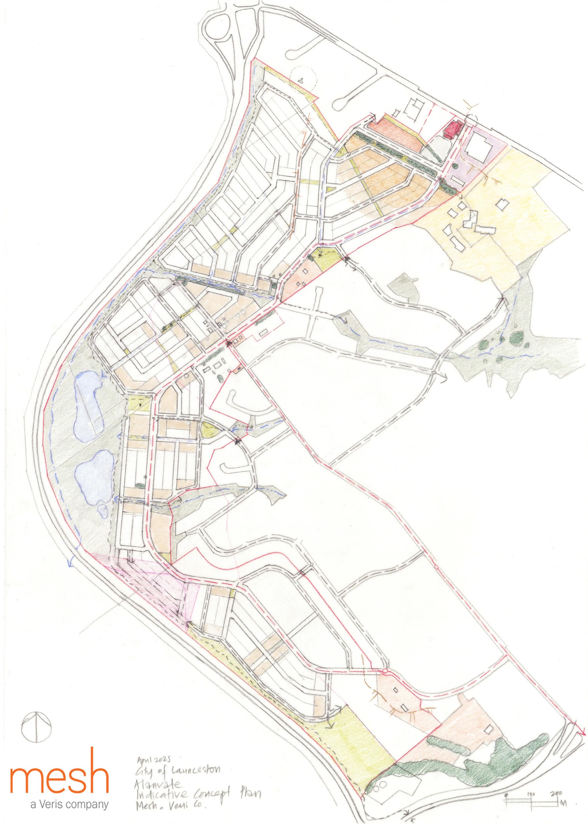
8. APPENDIX 2 CROSS SECTIONS

0
E - PROPOSED STANDARD LOCAL ROAD (18m)