
10 minute read
Proposed PATH Connection between St. Cloud Commons and Memorial Park


HUNTINGTON STRATEGIC NON-MOTORIZED CONNECTIONS STUDY
Advertisement
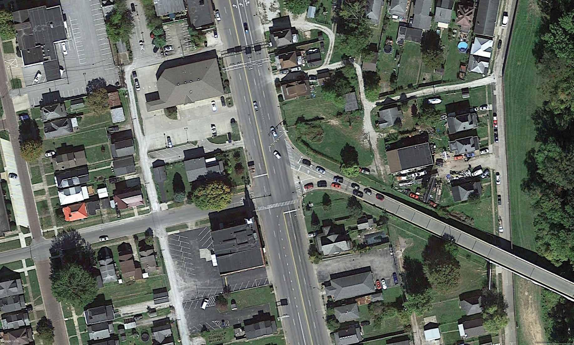
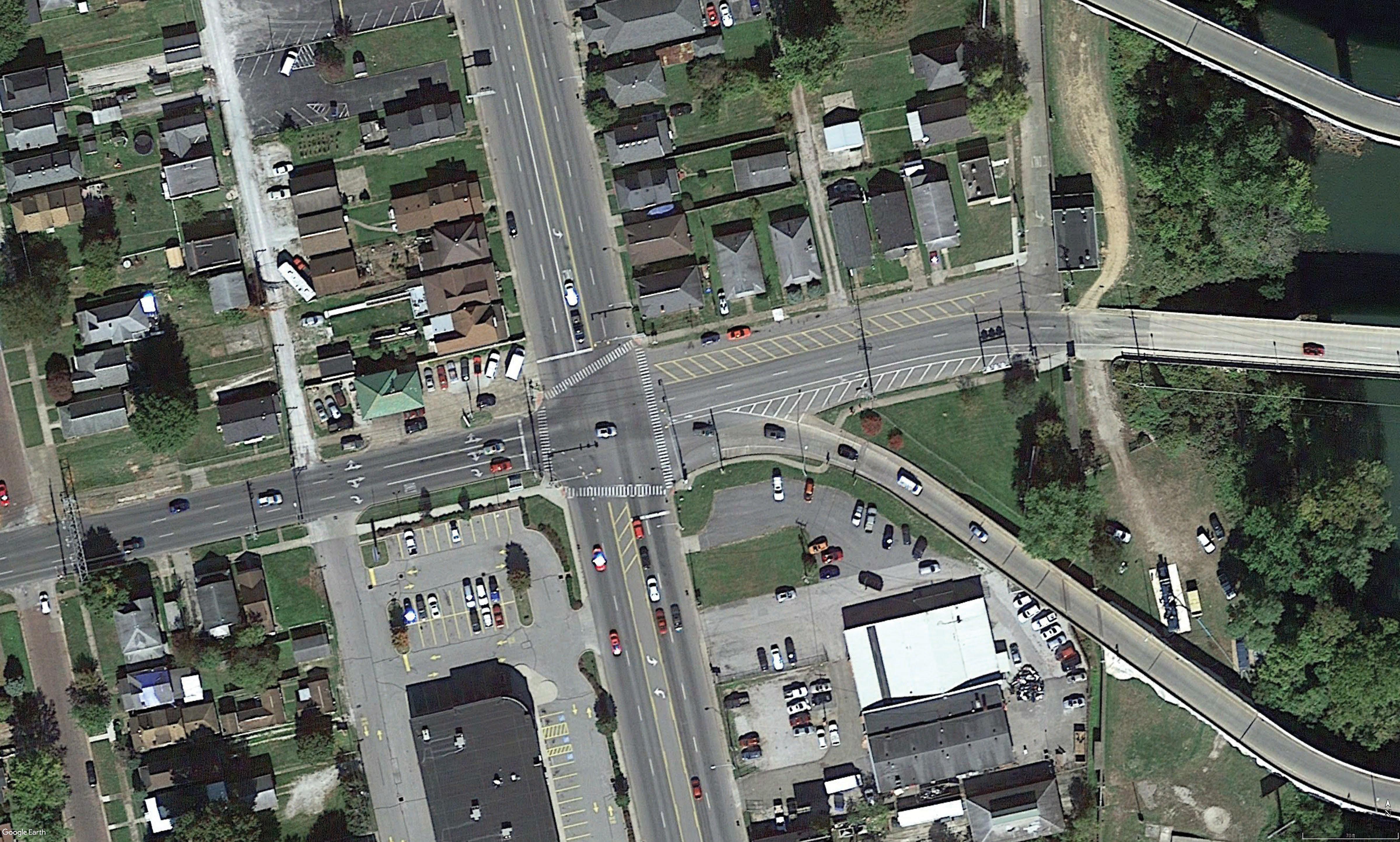
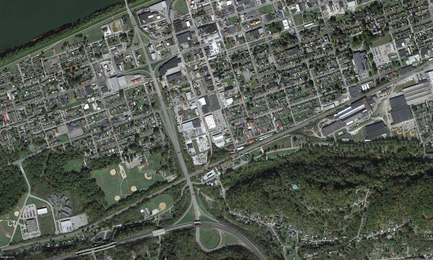
BACKGROUND The section of Washington Boulevard from Holderby Road to Military Road is a two-lane, undivided roadway that connects commercial land uses along Hal Greer Boulevard to residential land uses to the east. Meadows Elementary School is adjacent to the western limit of the study segment, in the southwest corner of Washington Boulevard at Hal Greer Boulevard. The only sidewalk present along the study segment is located in front of the school and connects to sidewalk networks to the west. No bicycle facilities are located along the study segment; however, a section of PATH runs east of the intersection of Washington Boulevard at Military Road. The Washington Boulevard travel lanes are 18-feet wide, and on-street parking is present along the north travel lane.

Stakeholders are concerned about the disjointed segments of the non-motorist network and about gaps in the PATH trail system. Specific interest has been placed on this location due to the opportunity to connect Meadows Elementary School to PATH. Additionally, stakeholders indicated concerns about safety crossing Washington Boulevard at Military Road, where that segment of the PATH terminates.
RECOMMENDED IMPROVEMENTS Connection is provided in the conceptual design by constructing a section of the PATH along the south side of Washington Boulevard from the sidewalk in front of Meadows Elementary School to the PATH entrance at Military Road. Due to the residential nature of the study area, connecting the sidewalk network to the PATH network has the potential to attract many new users while improving existing user experience, resulting in overall community and health benefits. Additionally, because of its proximity to an elementary school, the proposed facility will most likely attract some additional younger, more inexperienced pedestrians and bicyclists. The protected nature of the PATH provides additional safety benefits for these users. West of Military Road, Washington Boulevard crosses Fourpole Creek. To accommodate the proposed PATH extension, the conceptual design includes construction of a pedestrian bridge to cross the creek. Finally, to provide a safe crossing across Washington Boulevard, a high-visibility crosswalk is proposed across the west leg of the intersection at Military Road. High-visibility crosswalks have been shown to increase motorists yielding and help emphasize the presence and primacy of non-motorists.
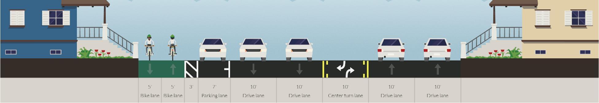
An alternative cross section across Fourpole Creek is also included. Given the high cost estimates for a pedestrian bridge, the cross section shows an alternative that includes lane diets to the existing road to accommodate for a 10 foot sidepath. Additional studies will be needed to decide the type of curb and gutter treatment required to accommodate the lane diet.

PLANNING COST ESTIMATE A planning-level estimate for this concept includes construction of the path, the pedestrian bridge, and one high-visibility crosswalk, for a total of $220,000. Funding may be sought through partnership with KYOVA leveraging TAP or STP funding. This may also present an opportunity for a partnership with GHPRD as they own the property north of the roadway.
HAL GREER BLVD MEADOWS ELEMENTARY SCHOOL
TIE INTO EXISTING 10’ SIDEWALK
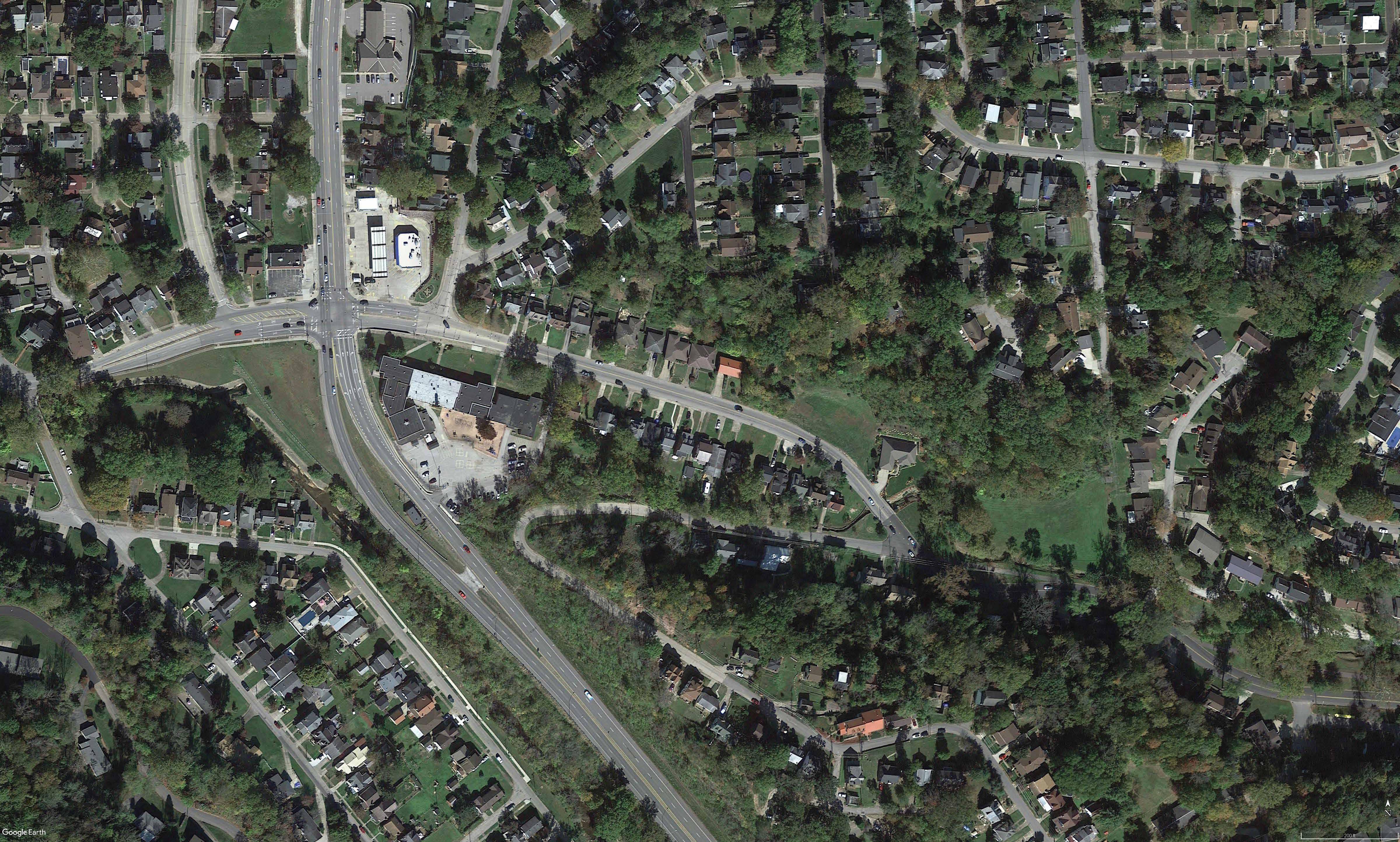
WASHINGTON BLVD SIDE PATH FROM TRAIL TO SCHOOL
INSTALL PEDESTRIAN BRIDGE INSTALL HIGH VISIBILITY CROSSWALK INSTALL CONNECTION TO PAUL AMBROSE TRAIL FOR HEALTH
HUNTINGTON STRATEGIC NON-MOTORIZED CONNECTIONS STUDY
31 st Street |

3rd Avenue to 5 th Avenue
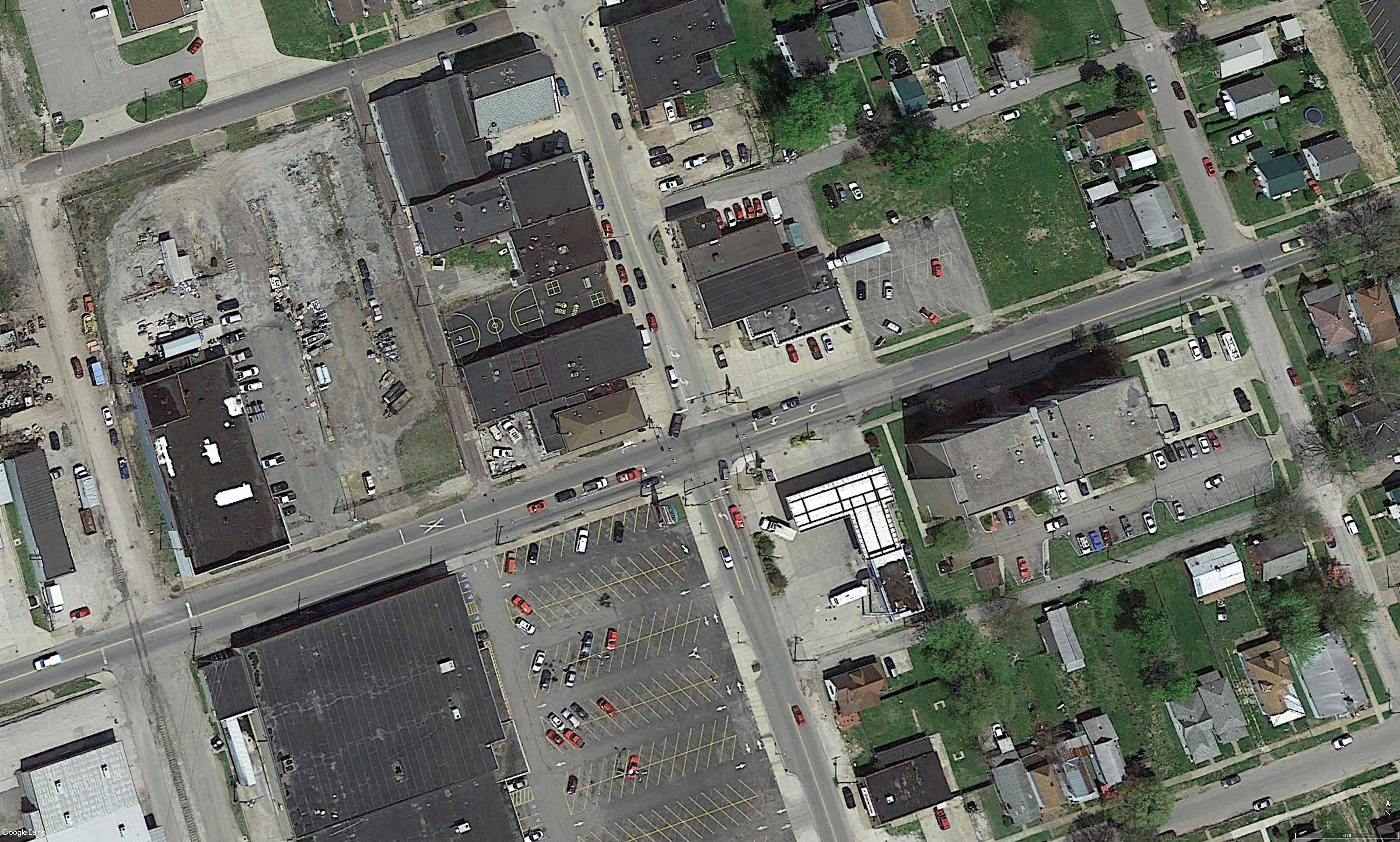
BACKGROUND The section of 31 st Street from 3 rd Avenue to 5 th Avenue is a four-lane undivided roadway that runs parallel to Guyandotte River. All three minor streets, 3 rd Avenue, 4 th Avenue, and 5 th Avenue, provide access over the river to the east side, along which a segment of PATH traverses. Sidewalks are present along the major and minor streets; however, no bicycle facilities are present along the study segment.

The study segment’s proximity to commercial and residential land uses, as well as its potential to connect to the PATH on the east side of the river, make this corridor a desirable connection point for the non-motorist network. Stakeholders indicate that conditions of existing pedestrian facilities are poor and that there is currently no safe passage to the PATH along the Guyandotte River. Bicyclists will often use the roadway on 4 th or 5 th Avenue to cross the river, but will find themselves in difficult and unsafe traffic conditions with motorists. Stakeholders also have observed pedestrians crossing 31 st Street mid-block, which can be attributed to both the poor quality of pedestrian facilities and to poor crosswalk striping at the minor street.
RECOMMENDED IMPROVEMENTS The outside travel lanes of 31 st Street are wide, and the conceptual design takes advantage of that width by proposing installation of bicycle lanes along each side. A well-defined bicycle network provides a safer ride for cyclists and may attract new users to the facility. To improve pedestrian safety along the corridor, the concept includes installation of new high-visibility crosswalks across all legs of the intersections at 4 th Avenue and at 5 th Avenue. The concept also maintains the existing sidewalk network, fixing breaks in the network where necessary to promote pedestrian mobility. Sidewalk improvements and crosswalk improvements provide a safer experience for pedestrians, while also decreasing the need to cross mid-block due to poor quality of facilities.
At 4 th Avenue, the east leg of the intersection is skewed and the right-turn lanes are channelized, which affects pedestrian visibility to motorists. The concept includes a pedestrian island to emphasize the presence of pedestrians and to allow for two-stage crossings. At 5 th Avenue, the east leg of the intersection is separated from on-street parking by a wide striped gore, making the crossing longer and more dangerous for pedestrians. To address this, the concept also includes a pedestrian island on this leg of the intersection.
Two alternative cross sections are also shown here to accommodate 1) a cycle track with parking on one side; and 2) buffered bicycle lanes. Both treatments require lane diets, particularly for the portion of the road that includes the left-turn lane and/or the two-way left turn lane.
CSX has donated a bridge south of the study segment to PATH. The improvements included in this concept improve safety and travel conditions for non-motorists in the near future while also reserving the ability to tie into a future crossing at this bridge in the future.

PLANNING COST ESTIMATE A planning-level estimate for this concept includes striping of the bicycle lanes, installation of nine crosswalks, and construction of two pedestrian islands, for a total of $45,000. Funding may be sought through TAP/STP funds.
RESTRIPE TO ACCOMMODATE BIKE LANES
MAINTAIN EXISTING SIDEWALKS MAINTAIN EXISTING SIGNALS AND CURB CUTS, INSTALL ADDITIONAL FOR NEW CROSSWALKS
4TH AVE
31st and 4th Intersection Improvements
RESTRIPE TO ACCOMMODATE BIKE LANES
MAINTAIN EXISTING SIDEWALKS
MAINTAIN EXISTING SIGNALS AND CURB CUTS
31st and 5th Intersection Improvements
5TH AVE
HUNTINGTON STRATEGIC NON-MOTORIZED CONNECTIONS STUDY
POTENTIAL ALTERNATIVE CROSS-SECTIONS
31 ST STREET, CROSS-SECTION ALTERNATIVE WITH PARKING ON ONE SIDE AND CYCLE TRACK

31 ST STREET, CROSS-SECTION ALTERNATIVE WITH BUFFERED BIKE LANES


HUNTINGTON STRATEGIC NON-MOTORIZED CONNECTIONS STUDY
PATH Connection | St. Cloud Commons to Memorial Park

BACKGROUND St. Cloud Commons is a park in West Huntington bound by Jackson Avenue to the north and by W 17 th Street to the east. Memorial Park is located east of St. Cloud Commons, bound by Memorial Boulevard to the north, Memorial Park Drive to the east, Arthur Street to the south, and Harvey Road to the west. Segments of the PATH trail network traverse both parks; however, the trails are not connected. The parks are separated by two significant physical barriers: the US 52 limited access facility, which traverses north-south to separate the two parks, and the CSX rail line, which traverses east-west to separate the parks.

Stakeholders place a lot of importance on the need to the connect the two parks and PATH trails because of community input and the desire to connect east and west non-motorist networks.
RECOMMENDED IMPROVEMENTS To connect the two parks, the conceptual design includes routing an active transportation path from the Jackson Avenue entrance of St. Cloud Commons east to W 17 th Street, north to Madison Avenue, east to W 14 th Street, and south to Memorial Boulevard. This routing takes advantage of existing underpasses at Madison Avenue and at W 14 th Street. The concept also includes the installation of wayfinding signs along the path to direct non-motorists from one park to the other, improving accessibility of the non-motorist network.
Additionally, the concept includes intersection improvements at the intersection of Madison Avenue at W 14 th Street, as well as the aforementioned intersection improvements at the intersection of Memorial Boulevard at W 14 th Street. Improvements at the Madison Avenue intersection include the installation of four crosswalks across all legs of the intersection, which would promote pedestrian safety while connecting the proposed path to the existing sidewalk network. Wayfinding and intersection improvements make the trail more comfortable, which improves the existing user experience while also attracting new users.
Two tunnel alternatives, one at Jackson Avenue and one at James River Road, were also conceptually included to provide more direct connections; however, both would incur significantly higher construction costs and require extensive additional study.

PLANNING COST ESTIMATE A planning-level cost estimate for this concept includes construction of the path, installation of four crosswalks at the intersection of Madison Avenue at W14 th Street, and installation of seven wayfinding signs along the path, for a total of $428,000. Cost estimates for tunnels at Jackson Avenue and at James River Road have not been determined but are estimated to significantly increase costs associated with this project. Funding may be sought through the City’s Department of Public Works or through partnership with KYOVA leveraging TAP or STP funding.
W 17TH ST
JACKSON AVE
ST. CLOUD COMMONS
MADISON AVE SEE DETAIL ENLARGEMENT: W 14TH ST AND MADISON AVE
W 14TH ST
POSSIBLE TUNNEL CONNECTION AT JACKSON AVE
POSSIBLE TUNNEL CONNECTION AT JAMES RIVER ROAD SEE DETAIL ENLARGEMENT: W 14TH ST AND MEMORIAL BLVD LEGEND
TRAIL CONNECTION
WAYFINDING LOCATION
POSSIBLE TUNNEL CONNECTION
INTERSECTION IMPROVEMENTS SEE DETAIL ENLARGEMENT
MEMORIAL PARK
St. Cloud Commons to Memorial Park Possible Trail Connections Map
JAMES RIVER ROAD
14th and Madison Intersection Improvements
W 14TH ST
MAINTAIN EXISTING SIGNAL LIGHTS AND CURB CUTS
MADISON AVE
WAYFINDING LOCATION SEE TRAIL CONNECTIONS PLAN INSTALL HIGH VISIBILITY CROSSWALKS
This report was prepared in cooperation with the U.S. Department of Transportation, Federal Highway Administration (FHWA), the Federal Transit Administration (FTA), the West Virginia Department of Transportation (WVDOT/WVDOH), the Kentucky Transportation Cabinet (KYTC), the Ohio Department of Transportation (ODOT) and local communities. The contents of this report reflect the views of KYOVA Interstate Planning Commission which is responsible for the facts and accuracy of the data presented herein. The contents do not necessarily reflect the official views or policies of the West Virginia Department of Transportation (WVDOT/WVDOH), the Kentucky Transportation Cabinet (KYTC), the Ohio Department of Transportation (ODOT), the U. S. Department of Transportation, the Federal Highway Administration (FHWA) or the Federal Transi t Administration (FTA). This report does not constitute a standard, specification or regulation.
