TABLE OF CONTENTS
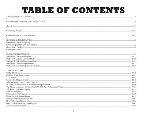
Table of Contents and Glossary....................................................................................................................................................................................................................................... i-iv City Manager’s Transmittal Letter to City Council........................................................................................................................................................................................................1-4 Overview...........................................................................................................................................................................................................................................................................5-11 Continuing Projects...................................................................................................................................................................................................................................................... 13-17 Combined 2013-2014 Plan Summary........................................................................................................................................................................................................................ 19-21 GENERAL ADMINISTRATION...................................................................................................................................................................................................................................... 23 Performance Based Budgeting........................................................................................................................................................................................................................................... 23 General Capital Project Administration.......................................................................................................................................................................................................................... 23 Opportunity Fund............................................................................................................................................................................................................................................................... 23 Contingency Fund............................................................................................................................................................................................................................................................... 23 WADSWORTH CORRIDOR............................................................................................................................................................................................................................................ 25 Wadsworth Corridor Sidewalks.................................................................................................................................................................................................................................. 26-27 Wadsworth Cultural Corridor Study.......................................................................................................................................................................................................................... 28-29 Wadsworth (SH 121) Mulitmodal Study.................................................................................................................................................................................................................... 30-31 Wadsworth Gateway Improvements........................................................................................................................................................................................................................... 32-33 Wadsworth Corridor Repayment Schedule............................................................................................................................................................................................................... 34-35 TRANSPORTATION.......................................................................................................................................................................................................................................................... 37 Bridge Maintenance...................................................................................................................................................................................................................................................... 38-39 Collector Street Improvements.................................................................................................................................................................................................................................... 40-41 ADA Ramps................................................................................................................................................................................................................................................................... 42-43 Leyden Road Improvements........................................................................................................................................................................................................................................ 44-45 Adams County Transportation Projects..................................................................................................................................................................................................................... 46-47 W. 72nd Ave. and Indiana St. Intersection Improvements...................................................................................................................................................................................... 48-49 Ward Road Extension - W. 72nd Ave to W. 80th Ave. Preliminary Design........................................................................................................................................................... 50-51 Safe Routes to School Program.................................................................................................................................................................................................................................... 52-53 Bike/Ped Program......................................................................................................................................................................................................................................................... 54-55 Missing Sidewalk Program........................................................................................................................................................................................................................................... 56-57 Union Pacific RR Quiet Zones .................................................................................................................................................................................................................................... 58-59 Intersection Safety Improvements............................................................................................................................................................................................................................... 60-61 New Traffic Signal Construction................................................................................................................................................................................................................................. 62-63 Long Life Pavement Markings Program..................................................................................................................................................................................................................... 64-65 Video Detection Program ........................................................................................................................................................................................................................................... 66-67
i
Sign Replacement; MUTCD Mandates...................................................................................................................................................................................................................... 68-69 ATMS Completion and Upgrades............................................................................................................................................................................................................................... 70-71 Signal Replacement....................................................................................................................................................................................................................................................... 72-73 UPS at Major Intersections ......................................................................................................................................................................................................................................... 74-75 Olde Town Bus Transfer Facility................................................................................................................................................................................................................................. 76-77 FACILITIES.......................................................................................................................................................................................................................................................................... 79 Park Maintenance Building/Wadsworth Shops........................................................................................................................................................................................................ 80-81 Fleet Maintenance Relocation to Culbertson Building............................................................................................................................................................................................ 82-83 Gold Line-related Parking Structures......................................................................................................................................................................................................................... 84-85 PARKS................................................................................................................................................................................................................................................................................... 87 Irrigation System Renovation...................................................................................................................................................................................................................................... 88-89 Playground Renovation................................................................................................................................................................................................................................................ 90-91 Trail Renovation............................................................................................................................................................................................................................................................ 92-93 Whisper Creek II Park.................................................................................................................................................................................................................................................. 94-95 Candelas Mini-Park #1................................................................................................................................................................................................................................................. 96-97 Candelas Neighborhood Park #2................................................................................................................................................................................................................................ 98-99 Stenger Sports Complex........................................................................................................................................................................................................................................... 100-101 Tree Replacement Program...................................................................................................................................................................................................................................... 102-103 Club Crest Trail.......................................................................................................................................................................................................................................................... 104-105 East Area Neighborhood Park................................................................................................................................................................................................................................. 106-107 Adams County Open Space Projects...................................................................................................................................................................................................................... 108-109 Lake Arbor Master Plan........................................................................................................................................................................................................................................... 110-111 GOLF.................................................................................................................................................................................................................................................................................. 113 West Woods Golf Club Irrigation System Replacement...................................................................................................................................................................................... 114-115 West Woods Golf Club Pond Aeration Systems.................................................................................................................................................................................................... 116-117 Lake Arbor Golf Course Tee Construction............................................................................................................................................................................................................ 118-119 West Woods Golf Club Hole #8 - Sleeping Indian Remodel............................................................................................................................................................................... 120-121 Lake Arbor Golf Course Maintenance Building Remodel.................................................................................................................................................................................. 122-123 West Woods Golf Club Golf Shop and Rest Rooms Remodel............................................................................................................................................................................ 124-125 West Woods Restaurant Remodel, Offices and Storage....................................................................................................................................................................................... 126-127 Lake Arbor Golf Course Golf Shop/Restaurant Remodel................................................................................................................................................................................... 128-129 West Woods Golf Club Rain Shelters..................................................................................................................................................................................................................... 130-131 West Woods Golf Club Entrance Landscaping and Lighting Improvements .................................................................................................................................................. 132-133 West Woods Golf Club Practice Areas Remodel/Expansion.............................................................................................................................................................................. 134-135 HOSPITALITY.................................................................................................................................................................................................................................................................. 137 Hospitality Taking Lasting Care Kitchen............................................................................................................................................................................................................... 138-139 TLC Banquet Equipment......................................................................................................................................................................................................................................... 140-141 Sound System Replacement..................................................................................................................................................................................................................................... 142-143 Refrigeration and Freezer Space Replacement...................................................................................................................................................................................................... 144-145
ii
ARVADA CENTER........................................................................................................................................................................................................................................................... 147 Arvada Center Capital Maintenance...................................................................................................................................................................................................................... 148-149 Arvada Center Front Entry Renovation and Interior Wayfinding .................................................................................................................................................................... 150-151 Arvada Center Safety and Security Video Equipment (RM)............................................................................................................................................................................... 152-153 Arvada Center Exterior Lighting Improvements (RM)....................................................................................................................................................................................... 154-155 Arvada Center Outside Front Entry Plaza (RM).................................................................................................................................................................................................. 156-157 Public Art................................................................................................................................................................................................................................................................... 158-159 PUBLIC SAFETY.............................................................................................................................................................................................................................................................. 161 Two Police Community Stations ............................................................................................................................................................................................................................ 162-163 WATER............................................................................................................................................................................................................................................................................... 165 Denver Water Moffat Project Participation........................................................................................................................................................................................................... 166-167 Water Main Replacement......................................................................................................................................................................................................................................... 168-169 Water Treatment Plant Improvements................................................................................................................................................................................................................... 170-171 Cathodic Protection.................................................................................................................................................................................................................................................. 172-173 Leyden Storage Project............................................................................................................................................................................................................................................. 174-175 Northwest Water System - 18-inch Water Line .................................................................................................................................................................................................... 176-177 WASTE WATER................................................................................................................................................................................................................................................................ 179 Sewer Main Replacement......................................................................................................................................................................................................................................... 180-181 North System Oversizing......................................................................................................................................................................................................................................... 182-183 Access Improvements............................................................................................................................................................................................................................................... 184-185 STORMWATER................................................................................................................................................................................................................................................................. 187 Garrison Bridge Replacement................................................................................................................................................................................................................................. 188-189 Gold Line Improvements/Estes Street Outfall....................................................................................................................................................................................................... 190-191 Quaker Street Storm Sewer...................................................................................................................................................................................................................................... 192-193 Yarrow Street Overflow............................................................................................................................................................................................................................................. 194-195 Allison St Outfall - Phase I ...................................................................................................................................................................................................................................... 196-197 Little Dry Creek Bank Stabilization........................................................................................................................................................................................................................ 198-199 White Gulch............................................................................................................................................................................................................................................................... 200-201 Simms Street Outfall................................................................................................................................................................................................................................................. 202-203 Yankee Doodle Master Plan - Phase I..................................................................................................................................................................................................................... 204-205 Unfunded Projects.................................................................................................................................................................................................................................................... 207-209
iii
GLOSSARY GLOSSARY OF ACRONYMS ADA Americans with Disabilities Act of 1990 ADCO Adams County Apex Apex Parks & Recreation District (formerly North JeffCo) ASTM American Society for Testing and Materials ATC Arvada Tennis Center ATMS Advanced Traffic Management System BDC Big Dry Creek BN/BNRR/BNSF Burlington Northern Santa Fe Railroad CCIPC [Arvada] Citizens' Capital Improvement Planning Committee CDOT Colorado Department of Transportation CMP Capital Maintenance Program COA City of Arvada CPSC Consumer Product Safety Commission CTF Conservation Trust Fund (state lottery funding) DRCOG Denver Regional Council of Governments Funding Advancements for Surface Transportation & Economic FASTER Recovery (state transportation project funding) GOCO Great Outdoors Colorado (state lottery funding) HVAC Heating, Ventilation, and Air Conditioning IGA Intergovernmental Agreement JCMD Jefferson Center Metropolitan District JCOS Jefferson County Open Space JeffCo Jefferson County iv
LCT LDC LD LOC MUTCD NEPA O&M PCI PDFs POS PSC PUC RCT ROW RTD TIP
Leyden Creek Trail Little Dry Creek Lands Dedicated Letter of Credit Manual on Uniform Traffic Control Devices National Environmental Policy Act Operations and Maintenance Payment Card Industry Security Standards Council Park Development Fees Point‐of‐service Public Service Company (Xcel) Public Utilities Commission Ralston Creek Trail Right‐of‐way Regional Transportation District Transportation Improvement Program
TOD UDFCD UP/UPRR UPS WC TBD
Transit‐oriented Development Urban Drainage and Flood Control District Union Pacific Railroad Uninterruptible Power Supply Whisper Creek To Be Determined
OVERVIEW OVERVIEW
OVERVIEW Process
The following graphic outlines City of Arvada’s first ten-year Capital Improvement Plan process.
• Council reviews progress of past successes in first quarter of year. • Re-establishes priorities in context of new information, studies, surveys.
• Departments begin various legal processes to begin the construction processes. • Quarterly reporting on all progress.
Development of Strategic Plan
Develop ten-year capital maintenance and new projects to meet long-term strategic needs
Build and Measure
Council adopts both the two-year appropriations and the ten-year plans
5
• Analyze prior year expenditures. • Identify all possible sources of resources. • Develop prioritization methodology to meet Strategic Plan. • Analyze and select proposed projects for plan and for the ten-year planning horizon.
• Council reviews Proposed Plan. • Adopts two-year appropriations. • Prioritizes unfunded priorities and projects. • Adds operating costs into the operating budget.
In our first year of this new process, we met with each department and identified the progress of all projects. This process resulted in the recognition of a number of projects, allowing the identification of previously programmed monies of over $4.195 million. Among the resources identified was $1.9 million available from the Grandview Grade Separation costs, which came in far below the original budget. This provides the first monies we can allocate towards new capital needs. Each 2012 project (Continuing Projects) with funding decisions and available cash is provided on pages 13-16. The second step was to design allocation methodology, recognizing that the needs always outpace the available resources. Through discussions with Council, surveys, and citizen guidance, the priorities for the 2013 – 2014 allocation process were identified as: • Taking Lasting Care • Building our Base • Investing for the Future Departments then prepared their ten-year proposals. Discussions were then held with the City Manager on the highest priorities in each of these areas. This process resulted in the Capital Improvement Plan approved by City Council.
Ten-Year Plan
The following table identifies the Sources and Uses by Program expenditure for the Ten-Year Plan. SOURCES
§98‐101 $ Other City $ Restricted City $ External $ TBD $ Avail. Cash TOTAL SOURCES USES
General Admin Wads Corridor Transporation Facilities Parks Golf Hospitality Arvada Center Public Safety Water Wastewater Stormwater TOTAL USES
Existing
2013
2014
2015
2016
2017
2018
2019
2020
2021
2022
TOTAL
3,195,000
3,421,029
3,728,688
4,059,825
4,322,587
4,574,386
8,933,445
9,215,099
9,505,812
9,804,972
$60,760,843
12,303,942
51,493,852
10,595,286
16,998,619
12,128,669
14,111,758
17,080,838
21,752,652
24,181,564
11,984,441
8,210,698
$200,842,318
0
8,000,000
0
0
0
0
0
0
0
18,672
1,666,519
$9,685,191
0
1,325,000
87,550
2,290,177
92,882
95,668
6,998,538
101,494
104,539
107,675
110,906
$11,314,430
90,000
2,616,200
228,094
617,391
101,296
1,147,681
1,301,517
10,626,110
10,944,894
117,430
$27,790,612
12,303,942
4,195,537 68,299,389
16,720,065
23,245,577
16,898,767
18,631,309
29,801,443
32,089,109
44,127,313
32,561,494
19,910,524
$314,588,930
Existing
2013
2014
2015
2016
2017
2018
2019
2020
2021
2022
$4,195,537
TOTAL
0
1,075,000
0
0
0
0
0
0
0
0
0
0
1,000,000
500,000
0
1,000,000
1,500,000
500,000
3,500,000
1,000,000
0
0
$1,075,000 $9,000,000
515,212
3,368,608
2,924,170
6,454,860
1,845,616
1,844,709
2,770,050
9,727,349
1,954,270
2,012,898
2,073,285
$35,491,026
0
1,500,000
1,200,000
11,000,000
0
0
1,043,347
1,194,052
10,515,422
10,830,884
0
$37,283,705
1,016,102
2,996,020
455,480
544,793
2,126,011
811,938
583,074
596,568
610,447
2,488,374
2,305,923
$14,534,729 $3,333,811
0
40,000
181,280
83,334
2,615,988
180,081
57,964
0
29,517
38,003
107,644
0
135,000
139,050
371,315
109,273
112,551
150,706
155,227
159,884
164,680
169,621
$1,667,305
0
678,500
51,500
79,568
519,045
0
0
0
0
0
0
$1,328,613
0
8,000,000
0
0
0
0
0
0
0
0
0
$8,000,000
0
41,931,590
4,731,021
4,759,360
6,617,307
10,953,402
13,460,742
18,207,059
20,504,104
7,813,066
5,024,035
$134,001,687
0
2,054,762
2,116,405
2,285,987
2,354,567
2,425,203
2,497,960
2,513,195
2,588,592
2,666,250
2,746,237
$24,249,157
6,452,000 7,983,314
3,870,000
1,570,750
541,059
273,182
281,377
289,819
238,810
245,975
633,385
0
$14,396,357
66,649,480
13,869,656
26,120,275
17,460,989
18,109,262
21,353,660
36,132,262
37,608,209
26,647,540
12,426,743
$284,361,390
1,649,909 Preliminary Net ‐ 2013 Sources ‐ 2013 Uses; Uses include the $1,075,000 for PBB, Opportunity & Contingency
‐850,000 2013 Sources w/o 2013 Uses ‐ to account for funding for Stenger & 72nd & IN that'll be available in 2013 but not spent in 2013 2,320,628 Prior Sources to be Used in 2013 ‐ to account for funding that exists in 2012 still allocated for 72nd & IN, SWs, QZs, and East Area beyond 2012 $3,120,537 NET AVAILABLE CASH 6
The table has the following highlights: Sources • Total revenue needed over the next years is 314.59 million. • The assumptions for the “98-101” revenue – that revenue generated from 20 percent of the City’s base 3 percent sales tax – will total $60.8 million over the next ten years. • Other City dollars include the following sources: - Risk Management money in the amount of $573,500 will be used to meet security and safety needs at the Arvada Center. - Water, Wastewater and Stormwater rates will pay for the necessary capital projects in those Funds. - Golf and Hospitality revenue will meet all of the identified needs in their respective Funds. • Restricted monies are the Police Tax Increment Funds will be used to build two Police Community Stations. • External Dollars are identified grant dollars or monies from another intergovernmental agency. • TBD Dollars: This is “To Be Determined.” We know some of the projects are of a critical nature; we have some ideas on how to fund these needs, but at this time do not have dedicated dollars for particular projects. Uses • General Administration: The major projects in this category are the Performance-Based Budgeting project, the Opportunity “Fund” and Contingency “Fund.” • Transportation: The ten-year total for this category is $35.5 million. Many of the projects are for capital maintenance needs. One highlight is the completion of the West 72nd Avenue and Indiana Street intersection improvements, targeted for completion in 2014. This has a $2.4 million unidentified funding need. We will be looking for grants to cover the construction costs. • Facilities: The most significant near-term project in this category is identification of parking garages. $7.5 million of previously reserved funds for the Wadsworth Corridor, as well as $2.5 million of surplus revenues from 2012, will be utilized for two facilities that will serve the Gold Line and Olde Town. There is a recommendation to renovate the Culbertson Building to provide for an adequate east side vehicle maintenance facility. Vehicle Maintenance and Replacement Funds will be used for this purpose. This would create space at the Parks and Street facility to allow time to plan for the replacement of those buildings in 2020 and 2021. • Parks: There are four categories of Taking Lasting Care (TLC): irrigation systems, playground renovations, trail renovations, and tree replacements. Over $4 million is identified for these purposes in the ten-year plan. The CIP also recommends setting aside a total of $1.4 million over the ten-year plan from City sources and working with the Recreation District to improve the irrigation and parking situation at the Stenger-Lutz facility, which has over one million annual visitors. • Golf: At this time all the projects are for capital maintenance needs. One major expenditure is the replacement of the irrigation system in 2016 at West Woods, for a total of $2.6 million. The funding may be a “lease to own program” as we did at the Lake Arbor site some years ago. • Hospitality: Again, all the projects are for the replacement of the major capital requirements to operate a program that requires updated facilities in order to ensure it remains competitive. • Arvada Center: The most pressing needs are for safety and security. The Risk Management Fund will be used to meet lighting, plaza renovations and updated camera security replacement in the next two years. Future needs include remodeling the front counter area. • Public Safety: Currently, the plan identifies only the construction of two community stations. • Water: The major new project is, of course, the City’s obligation to complete the Gross Reservoir for a commitment of $88 million. There is one project to access water from the Leyden storage area. Other than these two, all other projects are capital maintenance related. • Wastewater: These projects are all capital maintenance related to ensure that infrastructure is maintained in a great condition that enables the system to 7
function safely, efficiently and effectively. • Stormwater: With the exception of completing the Garrison Street Bridge project, the remainder of the projects through the ten-year planning horizon all addresses spot flooding areas, including improvements related to the Gold Line. As you review the table with the sources and uses, you will note we have more sources than actual allocation. This is for a variety of reasons. In the short term, we will review this in the following section. In the long term, this is because the outstanding debt on our capital assets is retired by 2018, providing an additional $4 million for capital projects. Please see the Discussion Section at the end of this Overview for future issues.
Two-Year Appropriations
On pages 18-19 is a summary of the two-year recommended appropriations. The following are some of the highlights from both years. 2013 In 2013, the total appropriation request is $66.649 million. Of this total, $33 million is to make our first payment to Denver Water for the Gross Reservoir. Also embedded in this total is an appropriation to complete the Garrison Bridge of $2.2 million. Of this total expenditure requirement, the sales tax revenue dedication will meet $3.195 million of the requests. We are using utility rates to pay for $47.8 million of the associated major maintenance and capital improvement costs. The Risk Management Fund will be used for $573,500 of security costs at the Arvada Center. Developer fees will be responsible for the costs of completing parks in the west part of the City. The renovation costs of the Culbertson Building will be the obligation of the Vehicle Maintenance and Replacement Fund. The entirety of the 2013 recommendations have dedicated and known sources to meet the costs of the projects. The expenditures in 2013 focus on our three primary areas: Taking Lasting Care, Building on the Base, and then, Investing for the Future. There are a significant number of Taking Lasting Care projects. Examples include: bridge repair, replacement of traffic signals and signs, irrigation, playgrounds, trails, utility pipes and a host of small issues at the Arvada Center, Hospitality and golf courses. In the Building on the Base category, we have several exciting programs. First, we will continue working on the bike path master plan. In 2011 we purchased two large areas for parks in the South Central and East areas of our City. An additional $406,000 is added to the budget for the East Area Park to ensure it provides a very active environment for the neighborhood. The construction budget will be nearly $1.2 million dollars and the neighborhood engagement process will begin this fall. Investing for the Future projects include the major water project with Denver Water, a planning process for Lake Arbor, building new Police Community stations and designing new major transportation connections, such as 72nd Avenue and Indiana. 2014 The 2014 recommended appropriations have only one significant project where the funding is not secure. The City’s Public Works Department will be pursuing a $2.4 million grant to pay for the actual construction of the West 72nd and Indiana Street Improvements. The monies are dedicated for the design in 2013. The City’s history of grants for safe school routes is expected to continue. The total assumption is $92,700, and at this point, the City would be able to meet this 8
need, should that be necessary. The total request in 2014 is $15.2 million. Of that total, $2.4 million is the only outstanding issue. The plan contemplates utilizing $3.145 million of “98-101” dedicated sales tax revenue for capital uses. We realize this is a conservative assumption. We also know we have some pressing projects that should be significantly under construction for the Gold Line, and thus want to make certain we remain able to meet unknown needs in this area. Again, the rates will pay for $8.42 million of major maintenance and capital improvements to the City’s utilities. Appropriated new expenditures in 2014 focus on Taking Lasting Care projects. • • • •
72nd Avenue and Indiana improvements Construction on the Garrison and Ralston areas The new Wolff Park along Ralston Road Major construction on all rail stops
New investment will be occurring with both inter-local monies and City monies. The City funds have been reserved over the years for these major new projects. When putting together a CIP, one needs to balance not only the available monies, but also the capacity to accomplish the work. In 2013 and 2014 significant projects will be accomplished. Ensuring the work we do represents the quality construction that citizens deserve requires attention. We may have fewer projects in 2014 and 2015 as we focus on the priorities already identified. Finally, one of the major projects not identified here is additional money for street maintenance. The 2013/2014 Budget and ten-year General Fund plan demonstrates that we can add $2 million annually through 2018 from our operating revenues for a total of over $5 million in street capital maintenance. Of course, this will be annually reviewed with budget priority discussions. Over time, we may actually change the budget to have street capital maintenance in the capital plan. We continue to work on how to ensure transparency in our presentations and allocations.
Discussion of Priorities and Future Allocations
Once all the projects and resources have been identified in 2013, we have $3.12 million unallocated. We are also fortunate in that we thought we were going to have to pay for the costs of constructing W. 56th Avenue for the rail station. DRCOG provided the City with an additional $2 million to cover that cost, again releasing dedicated monies for other TOD improvements. The City of Arvada has the necessary resources to meet many of our basic needs. We realize that Taking Lasting Care is our first priority. We are working on completing the investments in the west as growth continues. We are reinvesting in the community with the Gold Line opportunities. Nonetheless, we have several pressing needs – referred to as Unfunded Priorities – as well as a list of Unfunded Projects. Many of the Unfunded Priorities, as well as the Unfunded Projects, will require us to have long-term strategic discussions in 2013. We have some incredible opportunities to partner with the Apex Recreational District, our public safety partners, Urban Renewal and others to meet some of these needs. Additionally, the City will make its final $4 million of annual bond payments in 2018. This will provide an opportunity to discuss the policy challenge of “pay as you go” and “generational equity” in meeting future new capital investment. 9
Unfunded Priorities Parking As stated previously herein, the City has many opportunities for parking projects. Currently, we have over $16.8 million already in reserve for a variety of projects associated with the Gold Line. Sales tax growth in the downtown area has increased by nearly 16 percent over last year. It is imperative that the area has parking so that people will continue to use this area as a social center and a revenue generator for the City. The next opportunity is to develop parking for commuters, residents and shoppers. While we have $11.5 million identified for parking facilities, we also know that this may not be sufficient to meet the parking requirements in the Olde Town and Kipling Ridge Station areas. Given this and the other funding opportunities and priorities, it may be necessary to discuss reallocation of funds from previously approved projects in order to meet the immediate need and then reallocate to those projects as we complete these priorities and have additional available funds in the second half of the ten year CIP. Ralston Urban Renewal Area We may have a great opportunity to build on the improvements already started in this area. If the commercial sector is finally returning to health, there may be a large retailer that will help start the redevelopment of the area. There are several challenges. First, while they will generate income, it is the question of “pay as you go” or using that money to pay some debt. The “pay as you go” methodology will not generate sufficient funds quickly enough to complete projects to meet identified community needs. A total investment of approximately $20 million has been identified. All of this will be repaid through sales tax growth in an area that is currently declining in retail sales. The question is timing. If the City would like to have significant changes more quickly in the area, we may need to consider investing in the short term. City Facilities As illustrated in the ten-year plan, the City needs to address the Parks and Street Maintenance facilities. They are not sustainable from an energy perspective, nor are they as safe, efficient or effective for staff. They are over fifty years old and were built for different purposes. The configuration makes it very difficult to keep it from freezing and causing employee risks in the winter. In addition, we also know that the Police Department has needed space for quite some time. We are currently reviewing long-term options to address their work needs. This analysis will build on the 2005 work and explore the positives and negatives of other locations, including the AURA area. We also know our Court facility requires modernization from a security standpoint. The current review will include the Court in the analysis. While we have no idea of the cost of such a facility, with property, it would not be surprising to be in the range of $25 million. Public Safety Communications The City, along with Westminster, operates a police radio system on very aged technology. Over the years, the City has been working in collaboration with the E-911 Board to determine the requirements of a system and the allocation of funding. In every case, the City’s obligation will be near a $4 million commitment.
Unfunded Projects
In the back of this document is a section listing all projects identified by departments within our planning horizon. While we began with a ten-year view of the CIP, these projects certainly illustrate the vision of the community within the next 25 to 50 years. Few of these projects, if any, should be a surprise. The expensive ones are associated with completing our transportation corridors: completion of Ward Road, 72nd Avenue as a four-lane thoroughfare from Kipling to Indiana, improvements along Indiana, railroad crossing separations on major arterials, completion of the bike and pedestrian transportation system, new parks such as the Gibbs West area, and significant improvements to some of our current facilities like Long Lake Ranch. 10
The total of all identified projects is $427 million – a significant amount even in 50 years. Nonetheless, we will have opportunities to meet some of the Unfunded Priorities and some of these Unfunded Projects with a long-term strategic plan guiding our allocation and prioritization.
Summary
The following sections of this document provide identification of all general outstanding projects – “Continuing Projects.” We also have a section describing every new project in summary and in detail. The Unfunded Projects are provided in the back of the document. This is the City’s first effort at a documented ten-year Capital Improvement Plan. We welcome any ideas on what might make it easier to understand. Many documents across the country were reviewed prior to creating the document provided here. The City of Arvada will be spending over $125 million in capital investments over the next three years, including the City’s investment in the Gold Line. The private sector actually accomplishes most of the capital work. This means the City is reinvesting into our economy the tax dollars received, providing jobs as well as a great community. The next five years will change our community more than it has been changed since the late 1990’s. We have a plan to address capital maintenance, our first priority. We have a plan to complete the projects we have started in the west and throughout the city. The investments in related Gold Line projects will change the look and feel of our City. We see new roads, more road maintenance, completion of sidewalks throughout our city, the purchase of property for future parks, a finished skate board park and investment in the Ralston Creek park and the new park along Ralston Road. The projects and plan in this Capital Improvement Plan continues this long and solid tradition of “Continuing to Build a Great Community.”
11
PROJECT DETAIL PROJECT DETAIL
Continuing Projects
Continuing Projects
CONTINUING PROJECTS The information shown on the following four pages lists all Capital Improvement Projects (CIP) that are currently active. During this CIP process, a detailed review of all CIP projects was performed. Staff determined the work and funding required to complete each project. In addition, the expected completion date for each project is also included. After reviewing all projects, staff determined that there was excess funding in some projects or that the original project was no longer necessary or feasible. The “available cash” column represents the excess funds that are now available for other CIP projects.
13
CONTINUING CAPITAL IMPROVEMENT PROJECTS Responsible Department Administration
Transportation
Project Name Garrison Complex Olde Town Station Improvements Wadsworth Corridor Plaza Enhancements Kipling Street Enhancements Gold Line Parking Property Section 16 Building Permit System Visitability Fee CIP Projects W. 64th Ave Improve Phase II Carr Street Improvements Kipling St Bridge Replacement W. 77th/Wads Right Lane W.72nd/Indiana Intersection Missing Sidewalks Guardrails-Revolving ADA Ramps-Revolving Irr.Ditch Reloc. Gold Line W.72nd Spot Widening Arvada Center Sidewalk W.86th Pkwy Bike Ln/Queen-88th Sheridan Bridge Replcmt. W 72nd Ave/Wads Landscaping Arvada Center Drive Relocation Ridge Road Bike/Ped TIP Ralston Rd/Olde Wads NE RT W. 64th/McIntyre Dbl LT W. 74th Bike/Ped Canal Bridge W. 56th Ave. Extension Design Sidewalks (South of BNRR) Arterial Fencing Collector Streets Improvmt.Rev W.74th Ave. On St. Bike Ln. Olde Wads Reconstruction Arterial St. Design & Con.-Rev
2012 2012 Additions Beg. Balance $ 5,115,167 $ $ 602,401 $ 500,000 $ 9,297,881 $ $ - $ 900,000 $ - $ 364,996 $ - $ 750,000 $ - $ 300,000 $ - $ 250,000 $ - $ 66,300 $ 708,273 $ $ 1,249,696 $ $ 180,989 $ $ 2,824 $ $ 26,468 $ $ 554,801 $ 150,000 $ 116,003 $ 26,523 $ 50,923 $ 33,000 $ 101,427 $ 89,116 $ 600,000 $ 200,000 $ 335,000 $ 10,000 $ 51,463 $ 2,039 $ 845,000 $ $ 23,962 $ 100,000 $ 75,000 $ 25,000 $ 999,454 $ $ 90,000 $ $ 46,198 $ $ 360,000 $ $ 108,636 $ $ - $ 250,000 $ - $ 475,000 $ 52,252 $ 60,158 $ (15,000) $ 15,000 $ 940,574 $ $ 276,579 $ 181,090 14
$ $ $ $ $ $ $ $ $ $ $ $ $ $ $ $ $ $ $ $ $ $ $ $ $ $ $ $ $ $ $ $ $ $ $ $
2012 Transfers
Remaining to be spent - $ 5,115,167 - $ 1,102,401 - $ 9,297,881 - $ 900,000 - $ 364,996 - $ 750,000 - $ 300,000 - $ 250,000 - $ 66,300 345,000 $ - $ 274,696 15,000 $ 195,989 - $ 2,824 - $ 26,468 - $ 704,801 108,000 $ 250,526 - $ 83,923 - $ 190,543 (200,000) $ 600,000 (335,000) $ (10,000) $ - $ 8,502 - $ 845,000 - $ 123,962 - $ 100,000 - $ 999,454 - $ 90,000 - $ 3,756 - $ 360,000 - $ 108,636 - $ 250,000 - $ 475,000 (15,000) $ - $ - $ 940,574 (413,000) $ -
Available Cash
$ $ $ $ $ $ $ $ $ $ 1,053,273 $ 975,000 $ $ $ $ $ $ $ $ $ $ $ 45,000 $ $ $ $ $ $ 42,442 $ $ $ $ $ 97,410 $ $ $ 44,669
Expected Completion Winter 2013 2015 TBD Summer 2013 2015 Winter 2012 Complete 2012 TBD NA 2012 2012 2012 Complete 2015 2013 2012 2012 2013 NA NA 2012 2013 Fall 2014 Fall 2014 Fall 2014 2012 Complete 2012 2012 2012 TBD 2012 2012 Complete 2012
CONTINUING CAPITAL IMPROVEMENT PROJECTS Responsible Department Transportation cont.
Parks
Project Name City Share Arterial Sts.-Rev. W. 56th Ave. Ext. - Const. Wads 68th-76th (FASTER) 64th & Sheridan Int. (FASTER) Bridge Repairs Kipling Underpass/Van Bibber W. 72nd/UPRR Crossing EA Gold Line Light Rail Wadsworth Bypass Design/Constr Adams Co. Transportation Tax WW's McIntyre Sig. Lights-2 Kipling Trail (TIP) Long Life Pavement Markings Video Detection Program Traffic Calming Ralston Road Corridor Study Wadsworth Trail (TIP) W72nd Bike Ln/Kipling to Simms Traffic Signals ATMS School Flashers W. 64th/Oak Signal Replacement 2012 Traffic Signal Upgrades 64th/Miller Signal Replacement Intersection Safety Improvements Ralston Garrison Haz Elim grant Alkire 74th-80th SRTS (Grant) RR X-ing Warning Quiet Zones UPRR Quiet Zones Auto Signals Safe Routes Program Bike/Ped. Program 80th & Alkire Signal Leyden Lake Bridge 86th & Kipling Trailhead Trail Signs Indiana Equestrian/Croke Br
2012 2012 Additions Beg. Balance $ 223,000 $ 106,090 $ - $ 2,000,000 $ - $ $ - $ $ $ 2,000,000 $ $ 350,000 $ $ 77,755 $ $ 1,901,444 $ $ 241,867 $ 9,938 $ 18,087 $ $ 89,496 $ $ 33,786 $ 42,436 $ 25,391 $ 21,218 $ - $ 250,000 $ (373) $ 300,000 $ 1,178,479 $ $ 84,402 $ $ 237,244 $ 106,090 $ - $ $ 27,247 $ $ 135,000 $ $ - $ $ - $ $ 61,846 $ 53,045 $ 320,000 $ $ 143,500 $ $ 337,646 $ 350,000 $ 560,000 $ $ 60,600 $ 21,218 $ 58,500 $ $ $ 94,850 $ $ 97,398 $ $ 127,530 $ $ 244,676 $ 15
2012 Remaining Available Transfers to be spent Cash $ (315,109) $ 0 $ 13,981 $ - $ 2,000,000 $ $ 230,000 $ 230,000 $ $ 430,000 $ 430,000 $ $ 275,000 $ 275,000 $ $ - $ 2,000,000 $ $ - $ 350,000 $ $ - $ 77,755 $ $ - $ - $ 1,901,444 $ - $ 251,805 $ $ - $ 18,087 $ $ - $ 89,496 $ $ - $ 76,222 $ $ - $ 46,609 $ $ - $ 250,000 $ $ - $ 299,627 $ $ - $ 1,178,479 $ $ - $ 84,402 $ $ (341,600) $ 1,734 $ $ 22,000 $ 22,000 $ $ - $ 27,247 $ $ - $ 135,000 $ $ 49,600 $ 49,600 $ $ 135,000 $ 135,000 $ $ (114,891) $ (0) $ $ - $ 320,000 $ $ 44,000 $ 187,500 $ $ - $ 687,646 $ $ - $ 560,000 $ $ (44,000) $ 15,500 $ 22,318 $ - $ 58,500 $ $ 135,000 $ 135,000 $ $ - $ 94,850 $ $ - $ 97,398 $ $ - $ 127,530 $ $ - $ 244,676 $ -
Expected Completion 2012 Fall 2014 Fall 2014 Spring 2015 2013 Fall 2014 Winter 2013 2012 NA 2012 2012 2012 2012 2012 Winter 2013 Winter 2013 2012 2012 2012 2012 2012 Fall 2013 2012 2012 2012 2012 2012 2012 Winter 2013 2012 2012 2012 2012 TBD Winter 2013 2012
CONTINUING CAPITAL IMPROVEMENT PROJECTS Responsible Department Parks cont.
Project Name 80th Avenue Medians Welton Reservoir Arvada Skate Park Saddlebrook Park Tennis Ct. Renovations Gold Strike Pk. Spring Mesa Adams Co. Open Space Sales Tax Sunrise Ridge Phase II Park Signs Project East Area Park South Central Park Irrigation Systems Parks Water Tap Fees Broad Lake Park I West Woods Park Playground Four Acre Lake Park Majestic View Park Playground Forest Springs Park Davis Lane Park Playground Oak Park Irrigation Ralston Creek Trail @ Tennis Ctr Thundercloud Park Hills at Standley Lake Park Restrooms @ Chase Dr 2011 Motorola Park Development Fees H2O Taps for Dev-Const Parks Long Lake Restrooms Parks Capital Maintenance Club Crest Playground Sunrise Pk Playground Columbine Pk Playground & Irr Michael Northey Park Playgrd Vol Firefighters Park Wolff Park
2012 2012 Additions Beg. Balance $ 607,773 $ 500,000 $ 60,000 $ $ 224,069 $ $ 287,103 $ $ 58,106 $ $ 282,124 $ $ 459,147 $ $ 120,186 $ $ 270,726 $ $ 1,379 $ $ 875,220 $ $ 522,279 $ 850,000 $ 25,478 $ 151,875 $ 59,716 $ 56,293 $ 63,171 $ $ 44,529 $ $ 247,966 $ $ 161,899 $ $ 399,622 $ 746,770 $ 163,151 $ $ 23,220 $ 278,630 $ 1,101 $ 100,000 $ 231,494 $ $ 244,649 $ 173,000 $ (4,100) $ 9,546 $ 65,000 $ $ 661,699 $ $ - $ 711,000 $ 232,640 $ 179,232 $ $ 215,234 $ $ 347,517 $ 1,400 $ 177,016 $ $ 596,331 $ $ 1,169,340 $ 16
$ $ $ $ $ $ $ $ $ $ $ $ $ $ $ $ $ $ $ $ $ $ $ $ $ $ $ $ $ $ $ $ $ $ $ $
2012 Transfers
Remaining to be spent - $ 1,107,773 - $ 60,000 - $ 224,069 - $ 287,103 - $ 58,106 - $ 282,124 - $ 459,147 - $ 120,186 - $ 270,726 - $ 1,379 - $ 875,220 - $ 1,372,279 - $ 177,353 (23,946) $ 92,063 - $ 63,171 - $ 44,529 - $ 247,966 - $ 161,899 - $ 1,146,392 - $ 163,151 - $ 301,850 - $ 101,101 - $ 231,494 - $ 417,649 - $ 5,446 - $ 65,000 - $ 661,699 23,946 $ 23,946 - $ 711,000 - $ 232,640 - $ 179,232 - $ 215,234 - $ 348,917 - $ 177,016 - $ 596,331 - $ 1,169,340
$ $ $ $ $ $ $ $ $ $ $ $ $ $ $ $ $ $ $ $ $ $ $ $ $ $ $ $ $ $ $ $ $ $ $ $
Available Cash
-
Expected Completion 2012 TBD 2012 2012 2013 TBD 2012 TBD 2012 2012 Winter 2013 Winter 2013 TBD TBD 2013 2012 2012 2012 Summer 2013 2012 2012 2012 2012 2012 2012 2012 TBD 2012 Summer 2013 TBD 2012 2012 2012 2012 2012 2012
CONTINUING CAPITAL IMPROVEMENT PROJECTS Responsible Department Parks cont.
Arvada Center
Project Name Bridgeside PG & Trails Club Crest Trls & Trl Bridges Harry S. Truman Trails Homestead PG & Trails Ladybug Park PG Lake Arbor Pkwy Irrigation Lew Walsh PG & Irrigation Leyden Creek PG & Irrigation Yankee Doodle Park PG A/C Capital Maintenance Public Art Project Arvada Center Monument Sign AC Maintenance Public Art Lighting Boards & BB Intercom Arvada Center Seats
2012 Beg. Balance $ $ $ $ $ $ $ $ $ $ 118,606 $ 141,275 $ 18,300 $ 10,000 $ 18,271 $ -
2012 Additions $ 275,000 $ 175,000 $ 120,000 $ 225,000 $ 175,000 $ 110,000 $ 275,000 $ 350,000 $ 175,000 $ 50,000 $ 50,000 $ $ 10,000 $ $ 200,000
$ $ $ $ $ $ $ $ $ $ $ $ $ $ $
Capital Improvement Projects Reserved for 2012 one time CIP Reserve (8% of 2011 expenditures) Total 2011 CIP Balance
$ $ $ $
$
$
40,915,810 2,191,500 1,128,373 44,235,683
13,766,770
2012 Transfers
-
Remaining to be spent $ 275,000 $ 175,000 $ 120,000 $ 225,000 $ 175,000 $ 110,000 $ 275,000 $ 350,000 $ 175,000 $ 168,606 $ 191,275 $ 18,300 $ 20,000 $ 18,271 $ 200,000
$ $ $ $ $ $ $ $ $ $ $ $ $ $ $
-
$
$
4,195,537
$ $ $ $
(500,000) (500,000) (75,000) 3,120,537
New projects: Performance Based Budgeting Opportunity Fund Contingency Fund Available to Spend
17
50,487,043
Available Cash
-
Expected Completion Summer 2013 Summer 2013 2012 Winter 2013 2012 2012 Winter 2013 2012 2012 TBD 2012 Complete TBD 2012 2012
2013-2014 Plan Summary
2013-2014 Plan Summary
2013-2014 PLAN SUMMARY
19
2013 §98‐101
GENERAL ADMINISTRATION Performance Based Budgeting Opportunity Fund Contingency Fund WADSWORTH CORRIDOR Wadsworth Corridor Sidewalks Wadsworth Cultural Corridor Study Wadsworth (SH 121) Mulitmodal Study Wadsworth Gateway Improvements TRANSPORTATION Bridge Maintenance Collector Street Improvements ADA Ramps Adams County Transportation Projects W. 72nd Ave. and Indiana St. Intersection Improvements Ward Road Extension ‐ W. 72nd Ave to W. 80th Ave. Preliminary Design Safe Routes to School Program Bike/Ped Program Missing Sidewalk Program Union Pacific RR Quiet Zones Intersection Safety Improvements New Traffic Signal Construction Long Life Pavement Markings Program Video Detection Program Sign Replacement; MUTCD Mandates ATMS Completion and Upgrades Signal Replacement UPS at Major Intersections FACILITIES Gold Line‐related Parking Structures Fleet Maintenance Relocation to Culbertson Building PARKS Irrigation System Renovation Playground Renovation Trail Renovation Candelas Mini‐Park #1 Candelas Neighborhood Park #2 Stenger Sports Complex Tree Replacement Program East Area Neighborhood Park Adams County Open Space Projects Lake Arbor Master Plan
‐ ‐ ‐
‐ ‐ ‐ ‐ ‐ 50,000 50,000 ‐ 100,000 50,000 20,000 50,000 ‐ 350,000 75,000 275,000 80,000 20,000 50,000 50,000 780,000 39,000 ‐ ‐ ‐ 200,000 50,000 ‐ ‐ 350,000 15,000 406,000 ‐ 30,000 20
Other City Other/TBD 2013 Total GENERAL ADMINISTRATION 500,000 ‐ 500,000 500,000 ‐ 500,000 75,000 ‐ 75,000 WADSWORTH CORRIDOR 880,000 ‐ 880,000 50,000 ‐ 50,000 ‐ ‐ ‐ 70,000 ‐ 70,000 PW ‐ TRANSPORTATION 125,000 ‐ 125,000 ‐ ‐ 50,000 ‐ ‐ 50,000 ‐ 60,000 60,000 ‐ ‐ 100,000 ‐ ‐ 50,000 ‐ 90,000 110,000 ‐ ‐ 50,000 108,000 ‐ 108,000 ‐ ‐ 350,000 ‐ ‐ 75,000 ‐ ‐ 275,000 ‐ ‐ 80,000 ‐ ‐ 20,000 ‐ ‐ 50,000 ‐ ‐ 50,000 ‐ ‐ 780,000 ‐ ‐ 39,000 PW ‐ FACILITIES ‐ ‐ ‐ 1,500,000 ‐ 1,500,000 PG&H ‐ PARKS 156,000 ‐ 156,000 ‐ ‐ 200,000 ‐ ‐ 50,000 ‐ 300,000 300,000 ‐ 940,000 940,000 ‐ ‐ 350,000 ‐ ‐ 15,000 ‐ ‐ 406,000 ‐ 25,000 25,000 ‐ ‐ 30,000
2014 Other City Other/TBD 2014 Total GENERAL ADMINISTRATION
§98‐101
‐ ‐
‐ ‐ ‐ ‐ ‐ 51,500 51,500 ‐ 515,000 ‐ 20,600 51,500 ‐ 360,500 77,250 283,250 82,400 20,600 51,500 51,500 803,400 40,170 ‐ ‐ ‐ 206,000 51,500 ‐ ‐ 360,500 15,450 ‐ ‐ ‐
‐ ‐ ‐ ‐ WADSWORTH CORRIDOR ‐ ‐ ‐ ‐ 500,000 ‐ ‐ ‐ PW ‐ TRANSPORTATION ‐ ‐ ‐ ‐ ‐ ‐ ‐ 61,800 ‐ 2,472,000 ‐ ‐ ‐ 92,700 ‐ ‐ ‐ ‐ ‐ ‐ ‐ ‐ ‐ ‐ ‐ ‐ ‐ ‐ ‐ ‐ ‐ ‐ ‐ ‐ ‐ ‐ PW ‐ FACILITIES 1,200,000 ‐ ‐ ‐ PG&H ‐ PARKS 156,780 ‐ ‐ ‐ ‐ ‐ ‐ ‐ ‐ ‐ ‐ 51,500 ‐ ‐ ‐ ‐ ‐ 25,750 ‐ ‐
‐ ‐ ‐ ‐ 500,000 ‐ ‐ 51,500 51,500 61,800 2,987,000 ‐ 113,300 51,500 ‐ 360,500 77,250 283,250 82,400 20,600 51,500 51,500 803,400 40,170 1,200,000 ‐ 156,780 206,000 51,500 ‐ ‐ 412,000 15,450 ‐ 25,750 ‐
2013 §98‐101
GOLF West Woods Golf Club Golf Shop and Rest Rooms Remodel West Woods Restaurant Remodel, Offices and Storage HOSPITALITY Hospitality Taking Lasting Care Kitchen TLC Banquet Equipment ARVADA CENTER Arvada Center Capital Maintenance Arvada Center Safety and Security Video Equipment (RM) Arvada Center Exterior Lighting Improvements (RM) Arvada Center Outside Front Entry Plaza (RM) Public Art PUBLIC SAFETY Two Police Community Stations WATER Denver Water Moffat Project Participation Water Main Replacement Water Treatment Plant Improvements Cathodic Protection Leyden Storage Project WASTE WATER Sewer Main Replacement North System Oversizing Access Improvements STORMWATER Garrison Bridge Replacement Gold Line Improvements / Estes Street Outfall Quaker Street Storm Sewer Yarrow Street Overflow Allison St Outfall ‐ Phase I Little Dry Creek Bank Stabilization
‐ ‐ ‐ ‐ 55,000 ‐ ‐ ‐ 50,000 ‐ ‐ ‐ ‐ ‐ ‐ ‐ ‐ ‐ ‐ ‐ ‐ ‐ ‐ ‐
CAPITAL PROJECT FUNDING ALL DEPARTMENTS AND DIVISIONS 3,195,000
2014
Other City Other/TBD PG&H ‐ GOLF 40,000 ‐ ‐ ‐ PG&H ‐ HOSPITALITY 65,000 ‐ 70,000 ‐ ARVADA CENTER ‐ ‐ 123,000 ‐ 225,000 ‐ 225,500 ‐ ‐ ‐ PUBLIC SAFETY ‐ 8,000,000 UTILITIES ‐ WATER 37,331,086 ‐ 3,850,504 ‐ 500,000 ‐ ‐ ‐ 250,000 ‐ UTILITIES ‐ WASTEWATER 1,904,762 ‐ 100,000 ‐ 50,000 ‐ UTILITIES ‐ STORMWATER 2,200,000 ‐ 620,000 ‐ 350,000 ‐ ‐ ‐ ‐ ‐ 700,000 ‐
2013 Total
§98‐101
40,000 ‐
‐ ‐
65,000 70,000
‐ ‐
55,000 123,000 225,000 225,500 50,000
‐ ‐ ‐ ‐ 51,500
8,000,000
‐
37,331,086
3,850,504 500,000 ‐ 250,000
‐ ‐ ‐ ‐ ‐
1,904,762 100,000 50,000
‐ ‐ ‐
2,200,000 620,000 350,000 ‐ ‐ 700,000
‐ ‐ ‐ ‐ ‐ ‐
52,568,852
65,178,852 0 3,145,620 10,595,286
9,415,000
Net Projected §98‐101 per 6‐8‐12 Ten Year General Fund Model 3,183,558 Total §98‐101 Funding of Approved Projects 3,195,000 Total §98‐101 Funding of Approved Projects as % of Net Projected §98‐101 100.36%
3,421,029 3,145,620 91.95%
§98‐101 Remaining After Funding Approved Projects ‐$11,442
$275,409
21
Other City Other/TBD 2014 Total PG&H ‐ GOLF ‐ ‐ ‐ 181,280 ‐ 181,280 PG&H ‐ HOSPITALITY 27,810 ‐ 27,810 111,240 ‐ 111,240 ARVADA CENTER ‐ ‐ ‐ ‐ ‐ ‐ ‐ ‐ ‐ ‐ ‐ ‐ ‐ ‐ 51,500 PUBLIC SAFETY ‐ ‐ ‐ UTILITIES ‐ WATER 250,000 ‐ 250,000 3,966,021 ‐ 3,966,021 ‐ ‐ ‐ 257,500 ‐ 257,500 257,500 ‐ 257,500 UTILITIES ‐ WASTEWATER 1,961,905 ‐ 1,961,905 103,000 ‐ 103,000 51,500 ‐ 51,500 UTILITIES ‐ STORMWATER ‐ ‐ ‐ ‐ ‐ ‐ ‐ ‐ ‐ 206,000 ‐ 206,000 1,364,750 ‐ 1,364,750 ‐ ‐ ‐ 2,703,750
16,444,656
General Administration
General Administration
GENERAL ADMINISTRATION PERFORMANCE-BASED BUDGETING: $500,000 In 2011, the City Council blessed an effort to integrate the City into a Performance-Based Budgeting system. For these efforts, the planned allocation totals $500,000. GENERAL CAPITAL PROJECT ADMINISTRATION As part of the Citizens’ Capital Improvement Planning Committee (CCIPC) recommendations made in 2008, a series of revolving project accounts were set up to receive annual appropriations. The revolving project accounts were designed to address, among other things, opportunities as they would arise and costly, unforeseen project complications as they arose. However, due to the sporadic nature of grant opportunities and the rare but occasional need to cover substantial contingencies, revolving project accounts set up to provide such resources began accumulating funding a levels greater than were necessary to provide the resources. Therefore, staff is recommending that two new financial facilities for capital projects - the Opportunity Fund and the Contingency Fund - be established. OPPORTUNITY FUND: $500,000 For various capital projects, the City periodically finds itself with collaborative funding opportunities from various sources, including the Denver Regional Council of Governments (DRCOG) and the Colorado Department of Transportation (CDOT). Recent examples include DRCOG grants representing 80% of the construction costs for a new pedestrian underpass along the Van Bibber Trail at Kipling Street and various TOD-related improvements on Ridge Road to help accommodate the Arvada Ridge Gold Line Station. Additionally, two CDOT grants providing 80% of the construction costs for projects on both Wadsworth Boulevard and Sheridan Boulevard funded with state FASTER program revenues were approved this year. While the vast majority of costs for such major projects are covered by external sources, the City still must provide substantial financial resources as part of the awarding of the grants, often in the six-figure range per project. The Opportunity Fund will ensure that resources necessary for such matches are readily available and that staff can move quickly to meet the commitments. However, in order to avoid the over-accumulation of capital dollars over time, additional funding will not be added unless and until the funding is tapped at the discretion of the City Manager for a capital opportunity. In other words, the $500,000 funding level is a ceiling. CONTINGENCY FUND: $75,000 While careful planning is a cornerstone of all City operations, the nature of capital projects lends itself to unforeseen difficulties during project work. Often-encountered issues with unidentified utilities infrastructure, including abandoned lines, complicate operations and lead to additional and substantial incurred costs that even the most diligent of planning cannot address. Therefore, the Contingency Fund will operate as a source of appropriated funds to guarantee readily-available financial resources to promptly alleviate problems as they arise. Like the Opportunity Fund, the Contingency Fund is designed to maintain a reasonable level of funding without unnecessarily accumulating funding over time. Unless and until the Contingency Fund is tapped for support (again, at the discretion of the City Manager), it would only be replenished at a level no higher than $75,000. 23
Wadsworth Corridor
Wadsworth Corridor
WADSWORTH CORRIDOR Ten-Year Summary
In July of 2010, City Council designated $9.3 million of available funding for improvements along the Wadsworth Corridor. As the City’s pressing capital needs have become more clearly defined, uses for these funds per this plan have been split into two parts. The first is a series of projects, including the construction of new sidewalks along Wadsworth Boulevard, both cultural and multimodal studies to identify future improvements to the Corridor, and gateway improvements for both ends of the Corridor that lie within Arvada. The second use is for financing structured parking related to the Gold Line. A total of $7.5 million of the available funding will be used to finance these parking facilities, details for which are more expressly laid out in the Facilities section of this plan. In order to ensure a return of funding for Wadsworth Corridor purposes, a repayment schedule utilizing otherwise unallocated §98-101 funding is included in the plan.
SOURCES
Existing
2013
§98‐101 $
2014
2015
2016
2017
2018
2019
2020
2021
2022
TOTAL
0
0
0
1,000,000
1,500,000
500,000
3,500,000
1,000,000
0
0
$7,500,000
Other City $
0
1,000,000
500,000
0
0
0
0
0
0
0
0
$1,500,000
Restricted City $
0
0
0
0
0
0
0
0
0
0
0
$0
External $
0
0
0
0
0
0
0
0
0
0
0
$0
0
0
0
0
0
0
0
0
0
0
$0
1,000,000
500,000
0
1,000,000
1,500,000
500,000
3,500,000
1,000,000
0
0
$9,000,000
2013
2014
2016
2017
2018
2019
2020
TBD $ Total $
0
USES
2015
2021
2022
TOTAL
Prelim Costs
50,000
500,000
0
1,000,000
1,500,000
500,000
3,500,000
1,000,000
0
0
$8,050,000
Design Costs
90,000
0
0
0
0
0
0
0
0
0
$90,000
Const. Costs
860,000
0
0
0
0
0
0
0
0
0
$860,000
1,000,000
500,000
0
1,000,000
1,500,000
500,000
3,500,000
1,000,000
0
0
$9,000,000
0
0
0
0
0
0
0
0
0
0
$0
Total Proj Costs O&M Costs
0
TOTAL PROJECT COST:
$9,000,000 25
W 72ND AVE
t u
WADSWORTH BLVD
36
121 U V 93 U V
_ [
W 68TH AVE
§ ¨ ¦ 76
§ ¨ ¦ 70
72nd
Wadsworth
72nd
W 64TH AVE S WAD ASS BYP RTH WO
64th
Carr
121 U V
RALSTON CREEK
Ralston
58th
Ralston
WADSWORTH CORRIDOR SIDEWALKS WC-01 CITY OF ARVADA
DATE: 11/15/2012
L E G E N D
Project Location Arvada City Limits 26
K
The maps provided are graphical representations intended for general informational purposes only, and may not reflect the most current information or conditions. THE CITY OF ARVADA MAKES NO WARRANTY OF MECHANTABILITY OR WARRANTY FOR FITNESS OF USE FOR A PARTICULAR PURPOSE, EXPRESSED OR IMPLIED, WITH RESPECT TO THESE GRAPHICAL REPRESENTATIONS OR THE UNDERLYING DATA. Any users of these graphical representations or map products accepts same AS IS, WITH ALL FAULTS, and assumes all responsibility for the use thereof, and further covenants to hold the City harmless from and against all damage, loss, or liability arising from the use of this map product, in consideration of the City's having made this information available. G:\GIS_Data\MXD\Finance\Administration\CIP\LocationMaps\Projects2013-2014\WC-01.mxd
PROJECT NAME: Wadsworth Corridor Sidewalks PROJECT LOCATION: Varied DEPARTMENT/DIVISION: PW/Engineering SOURCES
Existing
2013
§98‐101 $
2014 0
2015 0
2016 0
2017 0
2018 0
2019 0
2020 0
2021 0
2022 0
TOTAL 0
$0
Other City $
0
880,000
0
0
0
0
0
0
0
0
0
$880,000
Restricted City $
0
0
0
0
0
0
0
0
0
0
0
$0
External $
0
0
0
0
0
0
0
0
0
0
0
$0
0
0
0
0
0
0
0
0
0
0
$0
0
880,000
0
0
0
0
0
0
0
0
0
$880,000
TBD $ Total $ USES
2013
2014
2015
2016
2017
2018
2019
2020
2021
2022
TOTAL
Prelim Costs
0
0
0
0
0
0
0
0
0
0
$0
Design Costs
20,000
0
0
0
0
0
0
0
0
0
$20,000
Const. Costs
860,000
0
0
0
0
0
0
0
0
0
$860,000
Total Proj Costs
880,000
0
0
0
0
0
0
0
0
0
$880,000
0
0
0
0
0
0
0
0
0
0
$0
O&M Costs
TOTAL PROJECT COST: LAND/ROW ACQUISITION?:
$880,000 Yes
VERACITY OF COST ESTIMATE: LEGAL OBLIGATION TO COMPLETE?:
7 No
PROJECT DESCRIPTION: The project will install missing sidewalks and widen existing sidewalks at three locations to better accommodate pedestrian and bicycle
traffic along the corridor. The identified sites are along the west side of the Wadsworth By‐Pass from Ralston Creek to W. 64th Avenue, the west side of Wadsworth Boulevard from W. 64th Avenue to W. 68th Avenue, and the east side of Wadsworth Boulevard from W. 64th Avenue to W. 72nd Avenue. NEEDS INTENDED TO FILL:
Driveways, utility poles, landscaped boundaries, narrow, and discontinuous walkways, etc. will be eliminated, thus increasing the efficiency and ability for pedestrians and bicyclists to access the businesses and or travel along the corridor.
EXPLANATION OF NON §98‐101 Wadsworth Corridor funding, while set aside prior to the term of this Capital Improvement Plan, is shown as sourced in the year of its SOURCES (if any): scheduled appropriation.
OTHER RELEVANT PROJECT Conversion of overhead utilities to underground will be explored to run concurrent with this project. Sections of narrow sidewalk INFORMATION: abutting the Fairlanes Shopping Center will not be addressed with this project due to a retaining wall that would need modification. This
project will complete several but not all sections of sidewalk in this corridor. Remaining missing/deficient sidewalks total +/‐$900,000. CONTINGENCIES: 27
28
PROJECT NAME: Wadsworth Cultural Corridor Study PROJECT LOCATION: TBD DEPARTMENT/DIVISION: Community Development SOURCES
Existing
2013
§98‐101 $
2014 0
2015 0
2016 0
2017 0
2018 0
2019 0
2020 0
2021 0
2022 0
TOTAL 0
$0
Other City $
0
50,000
0
0
0
0
0
0
0
0
0
$50,000
Restricted City $
0
0
0
0
0
0
0
0
0
0
0
$0
External $
0
0
0
0
0
0
0
0
0
0
0
$0
0
0
0
0
0
0
0
0
0
0
$0
50,000
0
0
0
0
0
0
0
0
0
$50,000
TBD $ Total $
0
USES
2013
2014
2015
2016
2017
2018
2019
2020
2021
2022
TOTAL
Prelim Costs
50,000
0
0
0
0
0
0
0
0
0
$50,000
Design Costs
0
0
0
0
0
0
0
0
0
0
$0
Const. Costs
0
0
0
0
0
0
0
0
0
0
$0
50,000
0
0
0
0
0
0
0
0
0
$50,000
0
0
0
0
0
0
0
0
0
0
$0
Total Proj Costs O&M Costs
TOTAL PROJECT COST: LAND/ROW ACQUISITION?:
$50,000 No
VERACITY OF COST ESTIMATE: LEGAL OBLIGATION TO COMPLETE?:
6 No
PROJECT DESCRIPTION: This project will involve a study of the potential for development of a culutral corridor along the Wadsworth corridor, focusing primarily
on the area between Olde Town and the Arvada Center.
NEEDS INTENDED TO FILL:
Determine the feasibility and extent of a possible culutral corridor, as well as implementation steps and the extent of City involvement.
EXPLANATION OF NON §98‐101 Wadsworth Corridor funding, while set aside prior to the term of this Capital Improvement Plan, is shown as sourced in the year of its SOURCES (if any): scheduled appropriation. There is also the possibility of a small grant and technical assistance in support of the effort from Colorado
Creative Industries (CCI). OTHER RELEVANT PROJECT The study relates to furthering goals for arts, culture and heritage activities as outlined in the Community Cultural Master Plan INFORMATION: completed in 2003, as well as the City's Comprehensive Plan. The City has also applied for, but did not receive, Creative District
designation. CONTINGENCIES: As plans for cultural corridor continue to solidify, the exact scope of the project will evolve over the coming months. 29
30
PROJECT NAME: Wadsworth (SH 121) Mulitmodal Study PROJECT LOCATION: SH 121 DEPARTMENT/DIVISION: Public Works/Traffic SOURCES
Existing
2013
§98‐101 $
2014
2015
0
0
2016 0
2017 0
2018 0
2019 0
2020 0
2021 0
2022 0
TOTAL 0
$0
Other City $
0
0
500,000
0
0
0
0
0
0
0
0
$500,000
Restricted City $
0
0
0
0
0
0
0
0
0
0
0
$0
External $
0
0
0
0
0
0
0
0
0
0
0
$0
0
0
0
0
0
0
0
0
0
0
$0
0
500,000
0
0
0
0
0
0
0
0
$500,000
TBD $ Total $
0
USES
2013
2014
2015
2016
2017
2018
2019
2020
2021
2022
TOTAL
Prelim Costs
0
500,000
0
0
0
0
0
0
0
0
$500,000
Design Costs
0
0
0
0
0
0
0
0
0
0
$0
Const. Costs
0
0
0
0
0
0
0
0
0
0
$0
Total Proj Costs
0
500,000
0
0
0
0
0
0
0
0
$500,000
O&M Costs
0
0
0
0
0
0
0
0
0
0
$0
TOTAL PROJECT COST: LAND/ROW ACQUISITION?:
$500,000 Yes
VERACITY OF COST ESTIMATE: LEGAL OBLIGATION TO COMPLETE?:
7 No
PROJECT DESCRIPTION: This is a study of State Highway 121 from I‐70 to W. 88th Avenue and the Olde Wadsworth corridor from Olde Town to the Arvada
Center. Taking land usage into consideration, forecasts of all transportation modes will be developed. Mode split, which is the percent usage of transit, automobiles, bicyclists, and foot travel, will be part of the forecast. NEEDS INTENDED TO FILL:
To determine the most efficient manner in which to meet the public's transportation needs in SH 121 corrridor.
EXPLANATION OF NON §98‐101 Wadsworth Corridor funding, while set aside prior to the term of this Capital Improvement Plan, is shown as sourced in the year of its SOURCES (if any): scheduled appropriation.
OTHER RELEVANT PROJECT The mode split will determine the feasibility of transportation options, such as additional sidewalks and/or bike lanes, and transit (bus, INFORMATION: streetcar, bus rapid transit, light rail) to accommodate the corridor's future transportation needs. CONTINGENCIES: 31
32
PROJECT NAME: Wadsworth Gateway Improvements PROJECT LOCATION: Wadsworth Bypass From I‐70 north to 52nd avenue DEPARTMENT/DIVISION: Parks, Golf and Hopitality Services SOURCES
Existing
2013
§98‐101 $
2014 0
2015 0
2016 0
2017 0
2018 0
2019 0
2020 0
2021 0
2022 0
TOTAL 0
$0
Other City $
0
70,000
0
0
0
0
0
0
0
0
0
$70,000
Restricted City $
0
0
0
0
0
0
0
0
0
0
0
$0
External $
0
0
0
0
0
0
0
0
0
0
0
$0
0
0
0
0
0
0
0
0
0
0
$0
70,000
0
0
0
0
0
0
0
0
0
$70,000
TBD $ Total $
0
USES
2013
2014
2015
2016
2017
2018
2019
2020
2021
2022
TOTAL
Prelim Costs
0
0
0
0
0
0
0
0
0
0
$0
Design Costs
70,000
0
0
0
0
0
0
0
0
0
$70,000
Const. Costs
0
0
0
0
0
0
0
0
0
0
$0
70,000
0
0
0
0
0
0
0
0
0
$70,000
0
0
0
0
0
0
0
0
0
0
$0
Total Proj Costs O&M Costs
TOTAL PROJECT COST: LAND/ROW ACQUISITION?:
$70,000 No
VERACITY OF COST ESTIMATE: LEGAL OBLIGATION TO COMPLETE?:
6 No
PROJECT DESCRIPTION: This project includes the allocation of funding for the design development, construction drawings and bid documents for the constuction
of new City gateways including the redesign of the median area landscape and irrigation on Wadsworth Boulevard from I‐70 North to 56th avenue. Additional funds would be allocated toward the design of an enhanced north City entrance on Wadsworth across from the Lake Arbor Golf course. NEEDS INTENDED TO FILL:
This project would replace the existing medians : deteriorating concrete, declining landscape and and inoperable irrigation system for these highly visible entrances into the City.
EXPLANATION OF NON §98‐101 Wadsworth Corridor funding, while set aside prior to the term of this Capital Improvement Plan, is shown as sourced in the year of its SOURCES (if any): scheduled appropriation.
OTHER RELEVANT PROJECT The current staff proposal includes entrance improvements to the south and north entrances into the City on Wadsworth Boulevard. INFORMATION: CONTINGENCIES: Work on the north end of the Wadsworth Corridor is contingent on additional funding, with a source tentatively identified from existing
capital funding.
33
WADSWORTH BLVD
W 80TH AVE
W 64TH AVE
W 64TH AVE
SHERIDAN BLVD
W 72ND AVE
W 58TH AVE
WADSWORTH CORRIDOR REPAYMENT WC-06 CITY OF ARVADA
DATE: 11/15/2012
L E G E N D
Project Location Arvada City Limits 34
The maps provided are graphical representations intended for general informational purposes only, and may not reflect the most current information or conditions. THE CITY OF ARVADA MAKES NO WARRANTY OF MECHANTABILITY OR WARRANTY FOR FITNESS OF USE FOR A PARTICULAR PURPOSE, EXPRESSED OR IMPLIED, WITH RESPECT TO THESE GRAPHICAL REPRESENTATIONS OR THE UNDERLYING DATA. Any users of these graphical representations or map products accepts same AS IS, WITH ALL FAULTS, and assumes all responsibility for the use thereof, and further covenants to hold the City harmless from and against all damage, loss, or liability arising from the use of this map product, in consideration of the City's having made this information available. G:\GIS_Data\MXD\Finance\Administration\CIP\LocationMaps\Projects2013-2014\WC-06.mxd
PROJECT NAME: Wadsworth Corridor Repayment Schedule PROJECT LOCATION: N/A DEPARTMENT/DIVISION: Finance/Treasury SOURCES
Existing
2013
§98‐101 $
2014 0
2015 0
0
2016
2017
2018
2019
2020
2021
1,000,000
1,500,000
500,000
3,500,000
1,000,000
2022 0
TOTAL 0
$7,500,000
Other City $
0
0
0
0
0
0
0
0
0
0
0
$0
Restricted City $
0
0
0
0
0
0
0
0
0
0
0
$0
External $
0
0
0
0
0
0
0
0
0
0
0
$0
0
0
0
0
0
0
0
0
0
0
$0
0
0
0
1,000,000
1,500,000
500,000
3,500,000
1,000,000
0
0
$7,500,000
TBD $ Total $
0
2016
2017
2018
2019
2020
Prelim Costs
USES
2013 0
2014 0
0
1,000,000
1,500,000
500,000
3,500,000
1,000,000
0
0
$7,500,000
Design Costs
0
0
0
0
0
0
0
0
0
0
$0
Const. Costs
0
0
0
0
0
0
0
0
0
0
$0
Total Proj Costs
0
0
0
1,000,000
1,500,000
500,000
3,500,000
1,000,000
0
0
$7,500,000
O&M Costs
0
0
0
0
0
0
0
0
0
0
$0
$7,500,000 No
TOTAL PROJECT COST: LAND/ROW ACQUISITION?:
2015
VERACITY OF COST ESTIMATE: LEGAL OBLIGATION TO COMPLETE?:
2021
2022
TOTAL
10 No
PROJECT DESCRIPTION: In order to meet the City's established capital obligations with RTD for available parking, $7.5 million of existing Wadsworth Corridor
funding shall be used to finance a majority of the City's structured parking plans. This schedule of repayment contemplates using projected §98‐101 funding not otherwise allocated within this Capital Improvement Plan to replenish resources identified for the Wadsworth Corridor. NEEDS INTENDED TO FILL:
N/A
EXPLANATION OF NON §98‐101 None SOURCES (if any):
OTHER RELEVANT PROJECT None INFORMATION: CONTINGENCIES: The potential for intervening circumstances and changes in Council priorities leave this repayment schedule subject to revision in the
future.
35
Transportation
Transportation
TRANSPORTATION Ten-Year Summary
Its primary responsibilities being for both maintenance of and improvements to the City’s transportation infrastructure, Public Works sees to the prioritizations for and uses of Arvada capital improvement and major capital maintenance resources. In recent years and as reflected in the Capital Improvement Plan, its focus has been and shall continue to be the maintenance and care of hundreds of existing lane miles of roads, traffic signal system, and various routes for cyclists and pedestrians. However, as a new wave of development marches on, particularly in the northwest of the City, Public Works is highly mindful of the fast approaching needs for additional improvements to accommodate a growing citizenry spread over ever expanding areas. Moreover, the pending arrival of the Gold Line has commanded considerable attention as transportation infrastructure in the oldest parts of Arvada are preparing to fundamentally transform how both Arvada residents and visitors make their way to and through the City.
SOURCES
Existing
2013
2014
2015
2016
2017
2018
2019
2020
2021
2022
TOTAL
2,039,000
2,460,670
1,632,725
1,681,707
1,675,883
3,526,159
1,718,241
1,769,788
1,822,882
1,877,569
$20,204,624
3,961,820
233,000
0
0
0
0
0
0
0
0
0
$4,194,820
Restricted City $
0
0
0
0
0
0
0
0
0
0
0
$0
External $
0
60,000
61,800
63,654
65,564
67,531
6,969,556
71,643
73,792
76,006
78,286
$7,587,833
90,000
2,564,700
95,481
98,345
101,296
104,335
107,465
110,689
114,009
117,430
$3,503,749
2,422,000
5,087,170
1,791,860
1,845,616
1,844,709
10,600,050
1,897,349
1,954,270
2,012,898
2,073,285
$35,491,026
2013
2014
2015
2016
2017
2018
2019
2020
2021
2022
TOTAL
Prelim Costs
304,081
257,500
266,300
0
0
0
0
0
0
0
$827,881
Design Costs
223,053
644,265
42,966
44,255
45,583
916,951
48,359
49,810
51,304
52,843
$2,119,390
Const. Costs
2,841,474
2,022,405
6,145,594
1,801,360
1,799,126
1,853,100
9,678,990
1,904,460
1,961,593
2,020,441
$32,028,543
3,368,608
2,924,170
6,454,860
1,845,616
1,844,709
2,770,050
9,727,349
1,954,270
2,012,898
2,073,285
$35,491,026
65,000
77,765
101,316
104,355
120,992
110,711
114,032
117,453
120,977
140,263
$1,072,864
§98‐101 $ Other City $
TBD $ Total $
3,961,820
USES
Total Proj Costs O&M Costs
515,212
TOTAL PROJECT COST:
$35,491,026 37
38
PROJECT NAME: Bridge Maintenance PROJECT LOCATION: Multiple Sites Throughout the City DEPARTMENT/DIVISION: PW/Engineering SOURCES
Existing
2013
§98‐101 $
2014 0
Other City $
2015 0
2016 0
2017 0
2018 0
2019 0
2020 0
2021 0
2022 0
TOTAL 0
$0
150,000
125,000
0
0
0
0
0
0
0
0
0
$275,000
Restricted City $
0
0
0
0
0
0
0
0
0
0
0
$0
External $
0
0
0
0
0
0
0
0
0
0
0
$0
0
0
0
0
0
0
0
0
0
0
$0
125,000
0
0
0
0
0
0
0
0
0
$275,000
TBD $ Total $
150,000
USES
2013
2014
2015
2016
2017
2018
2019
2020
2021
2022
TOTAL
Prelim Costs
0
0
0
0
0
0
0
0
0
0
$0
Design Costs
12,500
0
0
0
0
0
0
0
0
0
$12,500
Const. Costs
112,500
0
0
0
0
0
0
0
0
0
$112,500
125,000
0
0
0
0
0
0
0
0
0
$275,000
0
0
0
0
0
0
0
0
0
0
$0
Total Proj Costs
150,000
O&M Costs
$275,000 No
TOTAL PROJECT COST: LAND/ROW ACQUISITION?:
VERACITY OF COST ESTIMATE: LEGAL OBLIGATION TO COMPLETE?:
9 No
PROJECT DESCRIPTION: The project provides a designated source of funds to maintain the city's 67 bridges worth $62,000,000. The bridges are inspected every
two years and the deficiencies and maintenance needs are identified. The 2011 inspection noted maintenance needs totaling $1,475,000. This project will help to remedy these needs. Examples of the identified needs are repairing spalled concrete and replacing aged wing wall gaskets. NEEDS INTENDED TO FILL:
Currently, there is no designated fund and maintenance needs compete against all the other worthy street projects. Maintenance work is currently done on an emergency basis only.
EXPLANATION OF NON §98‐101 The additional $125,000 to be spent in 2013 will be supplied with residual prior capital funding. SOURCES (if any):
OTHER RELEVANT PROJECT The aging infrastructure is a reality and only through maintenance can the bridge assets be preserved. INFORMATION: CONTINGENCIES: N/A 39
40
PROJECT NAME: Collector Street Improvements PROJECT LOCATION: Varied Sites Throughout the City DEPARTMENT/DIVISION: PW/Engineering SOURCES
Existing
2013
§98‐101 $
2014
50,000
2015
51,500
2016
53,045
2017
54,636
2018
56,275
2019
57,964
2020
59,703
2021
61,494
2022
63,339
TOTAL
65,239
$573,194
Other City $
0
0
0
0
0
0
0
0
0
0
0
$0
Restricted City $
0
0
0
0
0
0
0
0
0
0
0
$0
External $
0
0
0
0
0
0
0
0
0
0
0
$0
0
0
0
0
0
0
0
0
0
0
$0
50,000
51,500
53,045
54,636
56,275
57,964
59,703
61,494
63,339
65,239
$573,194
TBD $ Total $
0
USES
2013
2014
2015
2016
2017
2018
2019
2020
2021
2022
TOTAL
Prelim Costs
0
0
0
0
0
0
0
0
0
0
$0
Design Costs
2,500
2,575
2,652
2,732
2,814
2,898
2,985
3,075
3,167
3,262
$28,660
Const. Costs
47,500
48,925
50,393
51,905
53,462
55,066
56,717
58,419
60,172
61,977
$544,534
Total Proj Costs
50,000
51,500
53,045
54,636
56,275
57,964
59,703
61,494
63,339
65,239
$573,194
0
0
0
0
0
0
0
0
0
0
$0
O&M Costs
$573,194 Maybe
TOTAL PROJECT COST: LAND/ROW ACQUISITION?:
VERACITY OF COST ESTIMATE: LEGAL OBLIGATION TO COMPLETE?:
9 No
PROJECT DESCRIPTION: This project completes isolated improvements along collector streets such as turn lanes, curb gutter sidewalk, etc. It may also supply the
City's match for outside funding on minor projects, fund preliminary engineering studies and design needed to apply for outside grants, and can eliminate‐reduce the funding gap between a budgeted project and actual costs. NEEDS INTENDED TO FILL:
This project completes minor projects along collector streets to bring them into compliance with the city's collector street standards and to improve safety and capacity. The selected projects are usually too small for their own earmarked budget item.
EXPLANATION OF NON §98‐101 None SOURCES (if any):
OTHER RELEVANT PROJECT This project also completes minor projects to bring collector streets up to current standards and to improve safety and capacity. INFORMATION: CONTINGENCIES: This funding will be utilized as needs are identified. 41
42
PROJECT NAME: ADA Ramps PROJECT LOCATION: Varied Sites Throughout the City DEPARTMENT/DIVISION: PW/Engineering SOURCES
Existing
2013
§98‐101 $
2014
50,000
2015
51,500
2016
53,045
2017
54,636
2018
56,275
2019
57,964
2020
59,703
2021
61,494
2022
63,339
TOTAL
65,239
$573,194
Other City $
0
0
0
0
0
0
0
0
0
0
0
$0
Restricted City $
0
0
0
0
0
0
0
0
0
0
0
$0
External $
0
0
0
0
0
0
0
0
0
0
0
$0
0
0
0
0
0
0
0
0
0
0
$0
50,000
51,500
53,045
54,636
56,275
57,964
59,703
61,494
63,339
65,239
$573,194
TBD $ Total $
0
USES
2013
2014
2015
2016
2017
2018
2019
2020
2021
2022
TOTAL
Prelim Costs
0
0
0
0
0
0
0
0
0
0
$0
Design Costs
0
0
0
0
0
0
0
0
0
0
$0
Const. Costs
50,000
51,500
53,045
54,636
56,275
57,964
59,703
61,494
63,339
65,239
$573,194
Total Proj Costs
50,000
51,500
53,045
54,636
56,275
57,964
59,703
61,494
63,339
65,239
$573,194
0
0
0
0
0
0
0
0
0
0
$0
O&M Costs
$573,194 No
TOTAL PROJECT COST: LAND/ROW ACQUISITION?:
VERACITY OF COST ESTIMATE: LEGAL OBLIGATION TO COMPLETE?:
9 Yes
PROJECT DESCRIPTION: The project funds the Federal mandate to replace non‐compliant and or install new sidewalk handicaps ramps on streets with significant
construction. It also installs ramps along heavily used pedestrian corridors. Ramps are installed in neighborhoods where there are ADA Ramp deficiencies and known physically impaired individuals reside. NEEDS INTENDED TO FILL:
These expenditures fulfill Federal mandate and reduce physical barriers to physically impaired individuals. The project also installs ramps in areas of high pedestrian traffic and in neighborhoods where there are ADA ramp deficiencies and known physically impaired residents live.
EXPLANATION OF NON §98‐101 None SOURCES (if any):
OTHER RELEVANT PROJECT Each year, the ADA ramp installations are bid with the Streets Division’s Concrete Replacement contract. INFORMATION: CONTINGENCIES: Particular project timing and locations are subject to change based on need and constantly reevaluated prioritizations. 43
t u 36
_ [
HIGHWAY 72
V U 121
76
§ ¨ ¦
H IG H
WAY 9
§ ¨ ¦
70
3
93 U V
Indiana
E
INDIANA ST
72 V U
d 82n
W 8 2 ND A V
_ [ Mcintyre
93 U V
72nd QUAKER ST
Quaker
74th
64th
LEYDEN ROAD (W. 82ND AVE) ST-08 CITY OF ARVADA
DATE: 5/7/2012
L E G E N D
Project Location Arvada City Limits 44
K
The maps provided are graphical representations intended for general informational purposes only, and may not reflect the most current information or conditions. THE CITY OF ARVADA MAKES NO WARRANTY OF MECHANTABILITY OR WARRANTY FOR FITNESS OF USE FOR A PARTICULAR PURPOSE, EXPRESSED OR IMPLIED, WITH RESPECT TO THESE GRAPHICAL REPRESENTATIONS OR THE UNDERLYING DATA. Any users of these graphical representations or map products accepts same AS IS, WITH ALL FAULTS, and assumes all responsibility for the use thereof, and further covenants to hold the City harmless from and against all damage, loss, or liability arising from the use of this map product, in consideration of the City's having made this information available. G:\GIS_Data\MXD\Finance\Administration\CIP\LocationMaps\Projects2012\ST-08.mxd
PROJECT NAME: Leyden Road Improvements PROJECT LOCATION: Leyden Road ‐ Indiana Street to CSH 93 DEPARTMENT/DIVISION: PW/Engineering SOURCES
Existing
2013
§98‐101 $
2014 0
2015 0
2016 0
2017 0
2018 0
2019
1,800,000
2020 0
2021 0
2022 0
TOTAL 0
$1,800,000
Other City $
0
0
0
0
0
0
0
0
0
0
0
$0
Restricted City $
0
0
0
0
0
0
0
0
0
0
0
$0
External $
0
0
0
0
0
0
6,900,000
0
0
0
0
$6,900,000
0
0
0
0
0
0
0
0
0
0
$0
0
0
0
0
0
8,700,000
0
0
0
0
$8,700,000
TBD $ Total $
0
USES
2013
2014
2015
2016
2017
2018
2019
2020
2021
2022
TOTAL
Prelim Costs
0
0
0
0
0
0
0
0
0
0
$0
Design Costs
0
0
0
0
0
870,000
0
0
0
0
$870,000
Const. Costs
0
0
0
0
0
0
7,830,000
0
0
0
$7,830,000
Total Proj Costs
0
0
0
0
0
870,000
7,830,000
0
0
0
$8,700,000
O&M Costs
0
0
0
0
0
0
0
0
0
0
$0
$8,700,000 Yes
TOTAL PROJECT COST: LAND/ROW ACQUISITION?:
VERACITY OF COST ESTIMATE: LEGAL OBLIGATION TO COMPLETE?:
6 Yes
PROJECT DESCRIPTION: Development of the Leyden Rock and Leyden Ranch Subdivisions will require improvements ($8.7 million) to Leyden Road to safely
accommodate the increased traffic and bring the road in to compliance with the City's major collector street standard.
NEEDS INTENDED TO FILL:
The City is responsible by development and annexation agreements to make road improvements to Leyden Road.
EXPLANATION OF NON §98‐101 Developers will at pre‐determined milestones will do some construction totaling $2.5 million plus contribute $4.4 million in impact fees SOURCES (if any): to the City. The City is responsible to complete the required improvements not installed by the developers and pay for any fund
shortage currently estimated at $1.8 million. OTHER RELEVANT PROJECT None INFORMATION: CONTINGENCIES: Timing of the construction is dependent on the rate of development. 45
46
PROJECT NAME: Adams County Transportation Projects PROJECT LOCATION: Varied Sites in Adams County DEPARTMENT/DIVISION: Pw/Engineering SOURCES
Existing
2013
§98‐101 $
2014 0
2015 0
2016 0
2017 0
2018 0
2019 0
2020 0
2021 0
2022 0
TOTAL 0
$0
Other City $
0
0
0
0
0
0
0
0
0
0
0
$0
Restricted City $
0
0
0
0
0
0
0
0
0
0
0
$0
External $
0
60,000
61,800
63,654
65,564
67,531
69,556
71,643
73,792
76,006
78,286
$687,833
0
0
0
0
0
0
0
0
0
0
$0
60,000
61,800
63,654
65,564
67,531
69,556
71,643
73,792
76,006
78,286
$687,833
TBD $ Total $
0
USES
2013
2014
2015
2016
2017
2018
2019
2020
2021
2022
TOTAL
Prelim Costs
0
0
0
0
0
0
0
0
0
0
$0
Design Costs
3,000
3,090
3,183
3,278
3,377
3,478
3,582
3,690
3,800
3,914
$34,392
Const. Costs
57,000
58,710
60,471
62,285
64,154
66,079
68,061
70,103
72,206
74,372
$653,441
Total Proj Costs
60,000
61,800
63,654
65,564
67,531
69,556
71,643
73,792
76,006
78,286
$687,833
0
0
0
0
0
0
0
0
0
0
$0
O&M Costs
TOTAL PROJECT COST: LAND/ROW ACQUISITION?:
$687,833 Yes
VERACITY OF COST ESTIMATE: LEGAL OBLIGATION TO COMPLETE?:
7 Yes
PROJECT DESCRIPTION: Each year the City receives about $60,000 in a Transportation Tax from Adams County that can only be used in Adams County for
Transportation related projects. The funds are captured in a holding account. The monies are used to complete missing sidewalks, upgrade street sections not meeting current city standards, and for the city match on jointly funded projects. NEEDS INTENDED TO FILL:
Examples: complete missing sidewalks or upgrade them to current standards, upgrade street sections not meeting current city standards, and fund City matches on joint projects.
EXPLANATION OF NON §98‐101 Each year the City receives about $60,000 in its share of a transportation sales tax from ADCO that can only be used in ADCO for SOURCES (if any): transportation purposes.
OTHER RELEVANT PROJECT In the past, the funding was used to pay for significant projects such as the City's portion to place sidewalks along Sheridan Blvd, in INFORMATION: conjunction with CDOT's bridge placement over the BN‐UP‐Gold Line Railroads, and minor projects like pedestrian improvements along a
school route to Tennyson Knolls Elementary School. CONTINGENCIES: This funding will be utilized as eligible needs are identified. 47
RS H
IG
H LIN
t u 36
ME
INDIANA ST
FA R
EC
_ [
93 U V
A NA L
121 U V
§ ¨ ¦ 70
MO O N
GUL C H
§ ¨ ¦ 76
CROKE CANAL
Indiana 72
72nd GLADIOLA ST
V U _ [
W 71ST DR
INDIANA ST
74th
Mcintyre
W 72ND AVE
W 71ST AVE
K
W 70TH DR
W. 72ND AVE & INDIANA ST. INTERSECTION IMPROVEMENTS : ST-19 CITY OF ARVADA
DATE: 5/7/2012
L E G E N D
Project Location Arvada City Limits 48
The maps provided are graphical representations intended for general informational purposes only, and may not reflect the most current information or conditions. THE CITY OF ARVADA MAKES NO WARRANTY OF MECHANTABILITY OR WARRANTY FOR FITNESS OF USE FOR A PARTICULAR PURPOSE, EXPRESSED OR IMPLIED, WITH RESPECT TO THESE GRAPHICAL REPRESENTATIONS OR THE UNDERLYING DATA. Any users of these graphical representations or map products accepts same AS IS, WITH ALL FAULTS, and assumes all responsibility for the use thereof, and further covenants to hold the City harmless from and against all damage, loss, or liability arising from the use of this map product, in consideration of the City's having made this information available. G:\GIS_Data\MXD\Finance\Administration\CIP\LocationMaps\Projects2013-2014\ST-19.mxd
PROJECT NAME: W. 72nd Ave. and Indiana St. Intersection Improvements PROJECT LOCATION: W. 72nd Ave. and Indiana St. DEPARTMENT/DIVISION: PW/Engineering SOURCES
Existing
§98‐101 $ Other City $
2013
2014
2015
100,000
515,000
2016 0
2017 0
2018 0
2019 0
2020 0
2021 0
2022 0
TOTAL 0
$615,000
704,081
0
0
0
0
0
0
0
0
0
0
$704,081
Restricted City $
0
0
0
0
0
0
0
0
0
0
0
$0
External $
0
0
0
0
0
0
0
0
0
0
0
$0
0
2,472,000
0
0
0
0
0
0
0
0
$2,472,000
100,000
2,987,000
0
0
0
0
0
0
0
0
$3,791,081
TBD $ Total $
704,081
2013
2014
2015
Prelim Costs
USES
304,081
257,500
266,300
0
0
0
0
0
0
0
$827,881
Design Costs
0
566,500
0
0
0
0
0
0
0
0
$566,500
Const. Costs
0
0
2,396,700
0
0
0
0
0
0
0
$2,396,700
304,081
824,000
2,663,000
0
0
0
0
0
0
0
$3,791,081
0
0
0
0
0
0
0
0
0
0
$0
Total Proj Costs O&M Costs
TOTAL PROJECT COST: LAND/ROW ACQUISITION?:
$3,791,081 Yes
2016
2017
2018
2019
VERACITY OF COST ESTIMATE: LEGAL OBLIGATION TO COMPLETE?:
2020
2021
2022
TOTAL
3 No
PROJECT DESCRIPTION: The project installs new traffic signals, through lanes, turn lanes, sidewalks, on‐street bike lanes, and other items to improve the
intersection to its ultimate configuration and improve the intersection to arterial street standards. Safety and system capacity will also be enhanced. NEEDS INTENDED TO FILL:
Lack of sidewalks, bike lanes, adequate through lanes and turn lanes, antiquated traffic signals, and other deficiencies will be eliminated.
EXPLANATION OF NON §98‐101 Federal funding is the usual source of funds for this type of project, but no funds have not been received to date. SOURCES (if any):
OTHER RELEVANT PROJECT While substantial improvements are necessary, future growth trajectories, traffic demands in the northwest of the City, and arterial INFORMATION: development in the area shall dictate the scope of the project. All options are under consideration and both the project scope and
timetable will be under constant review by staff. CONTINGENCIES: Indiana Street is a state highway and all improvements will require CDOT approval. 49
E
CA
UR CT BAN .
URBAN DR. UNION CT.
50
TA FT
PL.
AVE.
74TH
TABOR ST.
CR.
73RD DR.
PL.
73
73
W.
E. AV
ROU
PL.
D 2N W. 7
72
TA FT ST .
SWADLEY
71 ST
SIMMS ST.
71 ST PL.
CR.
71
UN IO N
UNION
CT.
CT .
PL .
70
DR.
SWADLEY W.
DR .
W Y.
CT.
VIVIAN
WELCH
71
71
ROUTT ST
WY.
74TH W.
ROUTT LN.
74
QUEEN
TABOR ST.
AVE.
ST.
Arvada City Limits
71 PL.
N GORDON
CT.
CT.
CT.
CT. XENON
ECH
Project Location
WRIGHT
ST.
CT. BEECH
W.
L E G E N D
ST. SWADLEY SIMMS CT. SIMMS CT.
TAFT ST.
TAFT
BE EC H AR BU C TU T. AL S KI RE CT. ST C T. .
BRAUN CT. BEECH CT.
Kipling
Alkire
Be ec h
Simms
Ward
DATE: 6/5/2012
74 WY.
DR.
CITY OF ARVADA
71 PL.
PL. PL. 68
WARD ROAD EXTENSION ST-31
74 PL.
. CT
TH 69
75TH
W. 72ND AVE.
AN URB WAY
Ra lst on
75TH DR.
ST.
CT.
URBAN
W.
75TH CR.
74 DR .
PL. 69
CT .
TAFT CT.
LN.
FT TA
PL.
76 T
NAL
W. 75TH PL.
PL. 70
W .
UT T
IN
73 . DR
70
72ND CR.
76 TH
W. 75TH PL.
N ST. URBA DON GOR VAN ST.
71
PL.
UN
a
72 V U
PL.
72
RA
Indi a n
64th
73 . E AV
72nd
. DR
W.
DR .
R BO TA T. S
80th
76 TH
RO
HL
DR.
82nd
77
LA NE
W. 75TH AVE.
TH
ITC W. H
C RO T.
H IG
UNION CT.
YO UN GF IEL D ST.
S
75T H
UR BA N WY .
W.
W .7 6T H
W. 75TH AVE. W AY
RA UN ST CT. .
UN
Kip lin g
Alkire
Indiana
AVE.
HD
W. 77TH DR.
B RO T. C
74
ER
U RC
W.
W. 75TH PL.
86th
72 V U
77
ROAD
RM
. W
96th
77 PL.
N BA . ST
70
FA
UR
§ ¨ ¦
O
E CANAL
DR.
76
RD
77TH
CR .
§ ¨ ¦
CR
78 TH
W. W A
LEYDEN C R EEK
CH
K
W.
ZANG
V U 93
74th
PL .
IA NN ZI . ST
ALKIRE ST.
H PL.
121 U V
_ [
W. 79T H
ST.
36
YANK CT.
ZA
t u
AVE.
K
The maps provided are graphical representations intended for general informational purposes only, and may not reflect the most current information or conditions. THE CITY OF ARVADA MAKES NO WARRANTY OF MECHANTABILITY OR WARRANTY FOR FITNESS OF USE FOR A PARTICULAR PURPOSE, EXPRESSED OR IMPLIED, WITH RESPECT TO THESE GRAPHICAL REPRESENTATIONS OR THE UNDERLYING DATA. Any users of these graphical representations or map products accepts same AS IS, WITH ALL FAULTS, and assumes all responsibility for the use thereof, and further covenants to hold the City harmless from and against all damage, loss, or liability arising from the use of this map product, in consideration of the City's having made this information available. G:\GIS_Data\MXD\Finance\Administration\CIP\LocationMaps\Projects2013-2014\ST-31.mxd
PROJECT NAME: Ward Road Extension ‐ W. 72nd Ave to W. 80th Ave. Preliminary Design PROJECT LOCATION: Ward Road Extended; W. 72nd Ave to W. 80th Ave. DEPARTMENT/DIVISION: PW/Engineering SOURCES
Existing
2013
§98‐101 $
2014
50,000
2015 0
2016 0
2017 0
2018 0
2019 0
2020 0
2021 0
2022 0
TOTAL 0
$50,000
Other City $
0
0
0
0
0
0
0
0
0
0
0
$0
Restricted City $
0
0
0
0
0
0
0
0
0
0
0
$0
External $
0
0
0
0
0
0
0
0
0
0
0
$0
0
0
0
0
0
0
0
0
0
0
$0
50,000
0
0
0
0
0
0
0
0
0
$50,000
TBD $ Total $
0
USES
2013
2014
2015
2016
2017
2018
2019
2020
2021
2022
TOTAL
Prelim Costs
0
0
0
0
0
0
0
0
0
0
$0
Design Costs
50,000
0
0
0
0
0
0
0
0
0
$50,000
Const. Costs
0
0
0
0
0
0
0
0
0
0
$0
50,000
0
0
0
0
0
0
0
0
0
$50,000
0
0
0
0
0
0
0
0
0
0
$0
Total Proj Costs O&M Costs
$50,000 No
TOTAL PROJECT COST: LAND/ROW ACQUISITION?:
VERACITY OF COST ESTIMATE: LEGAL OBLIGATION TO COMPLETE?:
5 No
PROJECT DESCRIPTION: The final project will install a two lane road from W. 72nd Ave. to Double E Ranch Subdivision with on‐street bike lanes, detached
sidewalk on one side, and a four lane bridge over Leyden Creek. On Alkire St, sidewalks, minor widening, and bike lanes would be added. Construction would occur such that when additional funds become available sections or the entire reach could be improved to the ultimate arterial street standard. NEEDS INTENDED TO FILL:
The project goal is to reduce traffic on Simms St. and Alkire St. south of W. 78th Ave. by providing an alternative travel route. Close alternative routes for north and southbound traffic are very limited. This funding will permit preliminary engineering as a foundation to proceed when a clearer funding picture is established.
EXPLANATION OF NON §98‐101 None SOURCES (if any):
OTHER RELEVANT PROJECT The Transportation Master Plan identifies a four lane arterial street section be built in the above stated corridor. Due to limited funding INFORMATION: to build the ultimate section this project would construct a two lane section, which would help meet the goals of better traffic
distribution and increased safety. Additional ROW acquisition will accompany any final project. CONTINGENCIES: None 51
52
PROJECT NAME: Safe Routes to School Program PROJECT LOCATION: Various Sites Throughout the City DEPARTMENT/DIVISION: PW/Traffic SOURCES
Existing
2013
§98‐101 $
2014
20,000
2015
20,600
2016
21,218
2017
21,855
2018
22,510
2019
23,185
2020
23,881
2021
24,597
2022
25,335
TOTAL
26,095
$229,278
Other City $
0
0
0
0
0
0
0
0
0
0
0
$0
Restricted City $
0
0
0
0
0
0
0
0
0
0
0
$0
External $
0
0
0
0
0
0
0
0
0
0
0
$0
90,000
92,700
95,481
98,345
101,296
104,335
107,465
110,689
114,009
117,430
$1,031,749
110,000
113,300
116,699
120,200
123,806
127,520
131,346
135,286
139,345
143,525
$1,261,027
2013
2014
2015
2016
2017
2018
2019
2020
2021
2022
TOTAL
TBD $ Total $
0
USES Prelim Costs
0
0
0
0
0
0
0
0
0
0
$0
Design Costs
10,000
10,300
10,609
10,927
11,255
11,593
11,941
12,299
12,668
13,048
$114,639
Const. Costs
100,000
103,000
106,090
109,273
112,551
115,927
119,405
122,987
126,677
130,477
$1,146,388
Total Proj Costs
110,000
113,300
116,699
120,200
123,806
127,520
131,346
135,286
139,345
143,525
$1,261,027
0
515
530
546
563
580
597
615
633
652
$5,232
O&M Costs
TOTAL PROJECT COST: LAND/ROW ACQUISITION?:
$1,261,027 Yes
VERACITY OF COST ESTIMATE: LEGAL OBLIGATION TO COMPLETE?:
6 No
PROJECT DESCRIPTION: The Safe Routes to School program is handled by CDOT and grants are awarded based on a project's merit in proving increased safety
and education on the advantages to walking or biking to school. The City applies for at least one grant each year. There is a 20% local match for the project so the funds shown are to provide that match as well as to construct portions of projects that CDOT may not approve (such as drainage improvements in order to build a given sidewalk). NEEDS INTENDED TO FILL:
This project will provide increased safety for our elementary and middle school students who walk and bike to school.
EXPLANATION OF NON §98‐101 Funding assumes a successful application for a SRTS grant. Being federal, a NEPA document is required. SOURCES (if any):
OTHER RELEVANT PROJECT 98‐101 funds are needed for the local match and also for elements of projects that CDOT (who administers the Federal program) may INFORMATION: not pay for, such as drainage improvements for the Simms Street project. CONTINGENCIES: Federal approval 53
54
PROJECT NAME: Bike/Ped Program PROJECT LOCATION: Various Sites Throughout the City DEPARTMENT/DIVISION: PW/Traffic SOURCES
Existing
2013
§98‐101 $
2014
50,000
2015
51,500
2016
53,045
2017
54,636
2018
56,275
2019
57,964
2020
59,703
2021
61,494
2022
63,339
TOTAL
65,239
$573,194
Other City $
0
0
0
0
0
0
0
0
0
0
0
$0
Restricted City $
0
0
0
0
0
0
0
0
0
0
0
$0
External $
0
0
0
0
0
0
0
0
0
0
0
$0
0
0
0
0
0
0
0
0
0
0
$0
50,000
51,500
53,045
54,636
56,275
57,964
59,703
61,494
63,339
65,239
$573,194
TBD $ Total $
0
USES
2013
2014
2015
2016
2017
2018
2019
2020
2021
2022
TOTAL
Prelim Costs
0
0
0
0
0
0
0
0
0
0
$0
Design Costs
0
0
0
0
0
0
0
0
0
0
$0
Const. Costs
50,000
51,500
53,045
54,636
56,275
57,964
59,703
61,494
63,339
65,239
$573,194
Total Proj Costs
50,000
51,500
53,045
54,636
56,275
57,964
59,703
61,494
63,339
65,239
$573,194
0
0
0
0
2,251
0
0
0
0
2,610
$4,861
O&M Costs
$573,194 Yes
TOTAL PROJECT COST: LAND/ROW ACQUISITION?:
VERACITY OF COST ESTIMATE: LEGAL OBLIGATION TO COMPLETE?:
4 No
PROJECT DESCRIPTION: This fund is used for smaller bike/ped projects such as construction of handicapped ramps or addition of accessible pedestrian buttons at
signals.
NEEDS INTENDED TO FILL:
This project is crafted to increase safety and accessibility for cyclists and pedestrians. The funds cover several small scale projects (spot treatments at intersections) within a year or install a segment of temporary bike lanes (shared road designation) in conjunction with annual street re‐surfacing projects as an interim safety solution.
EXPLANATION OF NON §98‐101 None SOURCES (if any):
OTHER RELEVANT PROJECT Near term needs have been identified at the intersections of 86th/Kipling, 86th/Alkire, 80th/Simms, 80th/Alkire, 72nd/ Simms, INFORMATION: 72nd/Oak, as well as and bike routes along Marshall/Lamar, Carr Street, and Oberon Road. CONTINGENCIES: Particular project timing and locations are subject to change based on need and constantly reevaluated prioritizations. 55
56
PROJECT NAME: Missing Sidewalk Program PROJECT LOCATION: Various Sites Throughout the City DEPARTMENT/DIVISION: PW/Traffic SOURCES
Existing
2013
§98‐101 $
2014 0
Other City $
2015 0
2016 0
2017 0
2018 0
2019 0
2020 0
2021 0
2022 0
TOTAL 0
$0
392,527
108,000
0
0
0
0
0
0
0
0
0
$500,527
Restricted City $
0
0
0
0
0
0
0
0
0
0
0
$0
External $
0
0
0
0
0
0
0
0
0
0
0
$0
0
0
0
0
0
0
0
0
0
0
$0
108,000
0
0
0
0
0
0
0
0
0
$500,527
TBD $ Total $
392,527
USES
2013
2014
2015
2016
2017
2018
2019
2020
2021
2022
TOTAL
Prelim Costs
0
0
0
0
0
0
0
0
0
0
$0
Design Costs
25,053
0
0
0
0
0
0
0
0
0
$25,053
Const. Costs
225,474
0
0
0
0
0
0
0
0
0
$225,474
250,527
0
0
0
0
0
0
0
0
0
$500,527
0
0
0
0
0
0
0
0
0
0
$0
Total Proj Costs
250,000
O&M Costs
$500,527 Yes
TOTAL PROJECT COST: LAND/ROW ACQUISITION?:
VERACITY OF COST ESTIMATE: LEGAL OBLIGATION TO COMPLETE?:
5 No
PROJECT DESCRIPTION: This is a new program that can now begin with the data collected by the Transportation Committee. There are 25 miles of missing
sidewalks in the City. For 2012, $250,000 of one‐time money was appropriated for missing sidewalks. These funds are addressing missing sidewalks on Balsam Street and Lamar Street south of the BNRR in anticipation of the Gold Line. The remaining $250,527 will address needs prioritized by the Transportation Committee. NEEDS INTENDED TO FILL:
The construction of missing sidewalks will offer greater safety of pedestrians.
EXPLANATION OF NON §98‐101 The additional $108,000 to be spent in 2013 will be supplied with residual prior capital funding. SOURCES (if any):
OTHER RELEVANT PROJECT Previous to the work by the Transportation Committee, portions of missing sidewalk were completed somewhat randomly because an INFORMATION: inventory of missing sidewalks did not exist. This inventory is now complete showing 25 miles of missing sidewalks currently being
prioritized by the Transportation Committee. Maintenance costs are minimal therefore they are not shown. CONTINGENCIES: None 57
WADSWORTH BLVD
t u 36
121 U V
_[ [ _[ _[ _ § ¨ ¦
93 U V
_ [
72nd
_ [
o n
Garrison
64th
58th
_ [
_ [
_ [ Ralston
121 V U
Kipling
52nd
_ [
RALSTON RD
K
§ ¨ ¦ 76
QUIET ZONES AT LAMAR ST, OLD WADS, CARR ST, AND W. 66TH AVE : TR-10 CITY OF ARVADA
BYP
_ [
_ [
RTH
er
72nd
Wadsworth
Carr
Ob
74th
SWO WAD
Kipling
70
DATE: 5/7/2012
L E G E N D
_ Project Location [ Arvada City Limits 58
The maps provided are graphical representations intended for general informational purposes only, and may not reflect the most current information or conditions. THE CITY OF ARVADA MAKES NO WARRANTY OF MECHANTABILITY OR WARRANTY FOR FITNESS OF USE FOR A PARTICULAR PURPOSE, EXPRESSED OR IMPLIED, WITH RESPECT TO THESE GRAPHICAL REPRESENTATIONS OR THE UNDERLYING DATA. Any users of these graphical representations or map products accepts same AS IS, WITH ALL FAULTS, and assumes all responsibility for the use thereof, and further covenants to hold the City harmless from and against all damage, loss, or liability arising from the use of this map product, in consideration of the City's having made this information available. G:\GIS_Data\MXD\Finance\Administration\CIP\LocationMaps\Projects2013-2014\TR-10.mxd
PROJECT NAME: Union Pacific RR Quiet Zones PROJECT LOCATION: Lamar St; Olde Wadsworth Blvd; Carr St; W. 66th Ave at Oberon Rd DEPARTMENT/DIVISION: PW Traffic SOURCES
Existing
§98‐101 $ Other City $
2013
2014
2015
350,000
360,500
2016 0
2017 0
2018 0
2019 0
2020 0
2021 0
2022 0
TOTAL 0
$710,500
715,212
0
0
0
0
0
0
0
0
0
0
$715,212
Restricted City $
0
0
0
0
0
0
0
0
0
0
0
$0
External $
0
0
0
0
0
0
0
0
0
0
0
$0
0
0
0
0
0
0
0
0
0
0
$0
350,000
360,500
0
0
0
0
0
0
0
0
$1,425,712
2013
2014
TBD $ Total $
715,212
USES
2015
2016
2017
2018
2019
2020
2021
2022
TOTAL
Prelim Costs
0
0
0
0
0
0
0
0
0
0
$0
Design Costs
95,000
36,050
0
0
0
0
0
0
0
0
$131,050
Const. Costs
855,000
324,450
0
0
0
0
0
0
0
0
$1,179,450
950,000
360,500
0
0
0
0
0
0
0
0
$1,425,712
50,000
61,800
84,872
87,418
90,041
92,742
95,524
98,390
101,342
104,382
$866,510
Total Proj Costs
115,212
O&M Costs
TOTAL PROJECT COST: LAND/ROW ACQUISITION?:
$1,425,712 Yes
VERACITY OF COST ESTIMATE: LEGAL OBLIGATION TO COMPLETE?:
9 No
PROJECT DESCRIPTION: This project will design and construct 4 Quiet Zones along the UPRR at Lamar Street, Olde Wadsworth Boulevard, Carr Street, and W.
66th Avenue at Oberon Road. Quiet Zones are at‐grade road intersections with the railroad improved to federal standards to ensure that vehicles cannot enter the intersection while crossing signals are activated. With such improvements, trains do not have to blow their horns as they approach the intersections. NEEDS INTENDED TO FILL:
Quiet Zone completions will improve the quality of life for residents near the UPRR.
EXPLANATION OF NON §98‐101 The existing funding represents the prior commitments to the competion of Quiet Zones on the UPRR. This additional funding will see to SOURCES (if any): the completions of Quiet Zones throughout the City along the UPRR.
OTHER RELEVANT PROJECT The maintenance costs shown are for the 4 existing quiet zones which are $10,000 per year per zone. Eventually the costs will be INFORMATION: $80,000 per once all 8 are constructed. CONTINGENCIES: Project timing is contingent on collaboration with the Union Pacific Railroad. 59
60
PROJECT NAME: Intersection Safety Improvements PROJECT LOCATION: Various Sites Throughout the City DEPARTMENT/DIVISION: PW/Traffic SOURCES
Existing
2013
§98‐101 $
2014
75,000
2015
77,250
2016
79,568
2017
81,955
2018
84,413
2019
86,946
2020
89,554
2021
92,241
2022
95,008
TOTAL
97,858
$859,791
Other City $
0
0
0
0
0
0
0
0
0
0
0
$0
Restricted City $
0
0
0
0
0
0
0
0
0
0
0
$0
External $
0
0
0
0
0
0
0
0
0
0
0
$0
0
0
0
0
0
0
0
0
0
0
$0
75,000
77,250
79,568
81,955
84,413
86,946
89,554
92,241
95,008
97,858
$859,791
TBD $ Total $
0
USES
2013
2014
2015
2016
2017
2018
2019
2020
2021
2022
TOTAL
Prelim Costs
0
0
0
0
0
0
0
0
0
0
$0
Design Costs
0
0
0
0
0
0
0
0
0
0
$0
Const. Costs
75,000
77,250
79,568
81,955
84,413
86,946
89,554
92,241
95,008
97,858
$859,791
Total Proj Costs
75,000
77,250
79,568
81,955
84,413
86,946
89,554
92,241
95,008
97,858
$859,791
0
0
0
0
0
0
0
0
0
0
$0
O&M Costs
$859,791 Yes
TOTAL PROJECT COST: LAND/ROW ACQUISITION?:
VERACITY OF COST ESTIMATE: LEGAL OBLIGATION TO COMPLETE?:
6 No
PROJECT DESCRIPTION: The Traffic Division analyzes intersections annually and produces a critical intersection analysis report. If the crashes are correctable by
an intersection modification these funds will be used to design and construct those improvements. The project will be designed in‐ house, addressing traffic growth and increased collisions at 130 intersections within Arvada. NEEDS INTENDED TO FILL:
Reducing accidents will make Arvada a safer community.
EXPLANATION OF NON §98‐101 None SOURCES (if any):
OTHER RELEVANT PROJECT We have assumed one project per year at $75,000 based on recent intersection improvement project costs. Some may be more than INFORMATION: this amount in which case funds may be held for a year and a larger project built the following year. Intersection maintenance costs are
included in other CIP or operating budgets therefore no amount is shown here. CONTINGENCIES: Particular locations are contingent on continually evaluated needs and prioritizations reviewed by Public Works. 61
62
PROJECT NAME: New Traffic Signal Construction PROJECT LOCATION: Various Sites Throughout the City DEPARTMENT/DIVISION: PW/Traffic SOURCES
Existing
§98‐101 $
2013
2014
2015
2016
2017
2018
2019
2020
2021
2022
TOTAL
275,000
283,250
291,748
300,500
309,515
318,800
328,364
338,215
348,362
358,813
$3,152,567
Other City $
0
0
0
0
0
0
0
0
0
0
0
$0
Restricted City $
0
0
0
0
0
0
0
0
0
0
0
$0
External $
0
0
0
0
0
0
0
0
0
0
0
$0
0
0
0
0
0
0
0
0
0
0
$0
275,000
283,250
291,748
300,500
309,515
318,800
328,364
338,215
348,362
358,813
$3,152,567
2013
2014
2015
2016
2017
2018
2019
2020
2021
2022
TOTAL
TBD $ Total $
0
USES Prelim Costs
0
0
0
0
0
0
0
0
0
0
$0
Design Costs
25,000
25,750
26,523
27,318
28,138
28,982
29,851
30,747
31,669
32,619
$286,597
Const. Costs
250,000
257,500
265,225
273,182
281,377
289,819
298,513
307,468
316,693
326,193
$2,865,970
Total Proj Costs
275,000
283,250
291,748
300,500
309,515
318,800
328,364
338,215
348,362
358,813
$3,152,567
0
0
0
0
0
0
0
0
0
0
$0
O&M Costs
$3,152,567 No
TOTAL PROJECT COST: LAND/ROW ACQUISITION?:
VERACITY OF COST ESTIMATE: LEGAL OBLIGATION TO COMPLETE?:
9 No
PROJECT DESCRIPTION: Each year the Traffic Division prepares a Traffic Signal Warrant Analysis for unsignalized intersections on collectors, major collectors,
arterial parkways, and principal arterial parkways. For those intersections where warrants are met, those locations are prioritized and one signal is constructed with funds from this account. NEEDS INTENDED TO FILL:
Traffic safety and more efficient traffic operations.
EXPLANATION OF NON §98‐101 None SOURCES (if any):
OTHER RELEVANT PROJECT Currently there are ten intersections throughout the City that are monitored each year as candidates for the installation of a traffic INFORMATION: signal, including W. 52nd Avenue and Garrison Street, W. 64th Avenue and Urban Street, W. 75th Avenue (Saddle Brook) and Indiana
Street (CDOT), W. 75th Avenue and Simms Street, and W. 56th Avenue and Ward Road. CONTINGENCIES: New traffic signal locations that include state highways are dependent on approval by CDOT. 63
64
PROJECT NAME: Long Life Pavement Markings Program PROJECT LOCATION: Various Sites Throughout the City DEPARTMENT/DIVISION: PW/Traffic SOURCES
Existing
2013
§98‐101 $
2014
80,000
2015
82,400
2016
84,872
2017
87,418
2018
90,041
2019
92,742
2020
95,524
98,390
2021
2022
TOTAL
101,342
104,382
$917,110
Other City $
0
0
0
0
0
0
0
0
0
0
0
$0
Restricted City $
0
0
0
0
0
0
0
0
0
0
0
$0
External $
0
0
0
0
0
0
0
0
0
0
0
$0
0
0
0
0
0
0
0
0
0
0
$0
80,000
82,400
84,872
87,418
90,041
92,742
95,524
98,390
101,342
104,382
$917,110
2021
2022
TBD $ Total $
0
USES
2013
2014
2015
2016
2017
2018
2019
2020
TOTAL
Prelim Costs
0
0
0
0
0
0
0
0
0
0
$0
Design Costs
0
0
0
0
0
0
0
0
0
0
$0
Const. Costs
80,000
82,400
84,872
87,418
90,041
92,742
95,524
98,390
101,342
104,382
$917,110
Total Proj Costs
80,000
82,400
84,872
87,418
90,041
92,742
95,524
98,390
101,342
104,382
$917,110
0
0
0
0
0
0
0
0
0
0
$0
O&M Costs
$917,110 No
TOTAL PROJECT COST: LAND/ROW ACQUISITION?:
VERACITY OF COST ESTIMATE: LEGAL OBLIGATION TO COMPLETE?:
8 No
PROJECT DESCRIPTION: Long life markings are either plastic pre‐formed tape or thermoplastic pavement markings with a 5‐7 year useful life depending on the
traffic volumes and other conditions. These markings are also used for crosswalks, stop bars, and certain bicycle usage identification.
NEEDS INTENDED TO FILL:
Provides high visibility, long lasting pavement markings for motorist and pedestrian guidance. The longer life of these materials saves the cost of repainting the pavement markings annually.
EXPLANATION OF NON §98‐101 None SOURCES (if any):
OTHER RELEVANT PROJECT The previous $40,000 per year for this project has not met the current needs. INFORMATION: CONTINGENCIES: Locations are contingent on where the Streets Division identifies roads in need of repaving. 65
66
PROJECT NAME: Video Detection Program PROJECT LOCATION: Various Sites Throughout the City DEPARTMENT/DIVISION: PW/Traffic SOURCES
Existing
2013
§98‐101 $
2014
2015
2016
2017
2018
2019
2020
2021
2022
TOTAL
20,000
20,600
21,218
21,855
22,510
23,185
23,881
24,597
25,335
26,095
$229,278
Other City $
0
0
0
0
0
0
0
0
0
0
0
$0
Restricted City $
0
0
0
0
0
0
0
0
0
0
0
$0
External $
0
0
0
0
0
0
0
0
0
0
0
$0
0
0
0
0
0
0
0
0
0
0
$0
0
20,000
20,600
21,218
21,855
22,510
23,185
23,881
24,597
25,335
26,095
$229,278
TBD $ Total $ USES
2013
2014
2015
2016
2017
2018
2019
2020
2021
2022
TOTAL
Prelim Costs
0
0
0
0
0
0
0
0
0
0
$0
Design Costs
0
0
0
0
0
0
0
0
0
0
$0
Const. Costs
20,000
20,600
21,218
21,855
22,510
23,185
23,881
24,597
25,335
26,095
$229,278
Total Proj Costs
20,000
20,600
21,218
21,855
22,510
23,185
23,881
24,597
25,335
26,095
$229,278
0
0
0
0
0
0
0
0
0
0
$0
O&M Costs
$229,278 No
TOTAL PROJECT COST: LAND/ROW ACQUISITION?:
VERACITY OF COST ESTIMATE: LEGAL OBLIGATION TO COMPLETE?:
8 No
PROJECT DESCRIPTION: Video detection consists of small cameras used to detect vehicles in travel lanes to actuate a change in the signal cycle. Video detection
replaces the dated in‐pavement loop which is susceptible to weather and pavement damage.
NEEDS INTENDED TO FILL:
Uninterrupted signal operations help to ensure an efficient flow of traffic.
EXPLANATION OF NON §98‐101 None SOURCES (if any):
OTHER RELEVANT PROJECT Intersections on arterial roadways such as W.64th Avenue, W.72nd Avenue, and W.80th Avenue are the Division’s current priorities. INFORMATION: CONTINGENCIES: As in‐pavement vehicle detectors continue to fail throughout the City at existing signals, we will continue to replace them with video
detection. 67
68
PROJECT NAME: Sign Replacement; MUTCD Mandates PROJECT LOCATION: Various Sites Throughout the City DEPARTMENT/DIVISION: PW/Traffic SOURCES
Existing
2013
§98‐101 $
2014
50,000
2015
51,500
2016
53,045
2017
54,636
2018
56,275
2019
57,964
2020 0
2021 0
2022 0
TOTAL 0
$323,420
Other City $
0
0
0
0
0
0
0
0
0
0
0
$0
Restricted City $
0
0
0
0
0
0
0
0
0
0
0
$0
External $
0
0
0
0
0
0
0
0
0
0
0
$0
0
0
0
0
0
0
0
0
0
0
$0
50,000
51,500
53,045
54,636
56,275
57,964
0
0
0
0
$323,420
TBD $ Total $
0
USES
2013
2014
2015
2016
2017
2018
2019
2020
2021
2022
TOTAL
Prelim Costs
0
0
0
0
0
0
0
0
0
0
$0
Design Costs
0
0
0
0
0
0
0
0
0
0
$0
Const. Costs
50,000
51,500
53,045
54,636
56,275
57,964
0
0
0
0
$323,420
Total Proj Costs
50,000
51,500
53,045
54,636
56,275
57,964
0
0
0
0
$323,420
0
0
0
0
0
0
0
0
0
0
$0
O&M Costs
$323,420 No
TOTAL PROJECT COST: LAND/ROW ACQUISITION?:
VERACITY OF COST ESTIMATE: LEGAL OBLIGATION TO COMPLETE?:
8 Yes
PROJECT DESCRIPTION: The 2009 Manual on Uniform Traffic Control Devices (MUTCD), the latest edition, has been adopted by the Colorado Department of
Transportation. The MUTCD contains several changes to signs regarding lettering size and sign reflectivity, among other mandates. The MUTCD has compliance dates for the changes that all fall within the next 7 years. The Traffic Division has already met some requirements of the new mandates so the CIP request is for 6 years. NEEDS INTENDED TO FILL:
Better sign legibility for the aging population; New colors for signs will be easier to identify the type of sign by color as well as shape.
EXPLANATION OF NON §98‐101 None SOURCES (if any):
OTHER RELEVANT PROJECT This account will bring the City in compliance with MUTCD. Within 5 years, however, there will be signs that must be replaced due to INFORMATION: fading, knock‐downs, as well as pole replacement. The O&M figure then is for all City signs. CONTINGENCIES: None 69
70
PROJECT NAME: ATMS Completion and Upgrades PROJECT LOCATION: Various Sites Throughout the City DEPARTMENT/DIVISION: PW/Traffic SOURCES
Existing
2013
§98‐101 $
2014
50,000
2015
51,500
2016
53,045
2017
54,636
2018 0
2019 0
2020 0
2021 0
2022 0
TOTAL 0
$209,181
Other City $
0
0
0
0
0
0
0
0
0
0
0
$0
Restricted City $
0
0
0
0
0
0
0
0
0
0
0
$0
External $
0
0
0
0
0
0
0
0
0
0
0
$0
0
0
0
0
0
0
0
0
0
0
$0
50,000
51,500
53,045
54,636
0
0
0
0
0
0
$209,181
TBD $ Total $
0
USES
2013
2014
2015
2016
2017
2018
2019
2020
2021
2022
TOTAL
Prelim Costs
0
0
0
0
0
0
0
0
0
0
$0
Design Costs
0
0
0
0
0
0
0
0
0
0
$0
Const. Costs
50,000
51,500
53,045
54,636
0
0
0
0
0
0
$209,181
Total Proj Costs
50,000
51,500
53,045
54,636
0
0
0
0
0
0
$209,181
O&M Costs
15,000
15,450
15,914
16,391
16,883
17,389
17,911
18,448
19,002
19,572
$171,958
$209,181 No
TOTAL PROJECT COST: LAND/ROW ACQUISITION?:
VERACITY OF COST ESTIMATE: LEGAL OBLIGATION TO COMPLETE?:
7 No
PROJECT DESCRIPTION: The Advanced Traffic Management System (ATMS) is a network of technology used to manage traffic flow along roadways with the
ability to "watch" intersection flow and make adjustments or troubleshoot traffic signal problems from City Hall. This project completes the system by bringing all the primary corridors and signals "on‐line" in City Hall by 2016. NEEDS INTENDED TO FILL:
The system saves staff time and provides for both better overall operation of our traffic signal system and congestion relief.
EXPLANATION OF NON §98‐101 None SOURCES (if any):
OTHER RELEVANT PROJECT The timeframe can be shifted some but our plan is to bring the remaining corridors and signals "on‐line" in the next few years. INFORMATION: CONTINGENCIES: Locations for other types of traffic signal work will affect the ordering of intersections to be brought into the system. 71
72
PROJECT NAME: Signal Replacement PROJECT LOCATION: Various Sites Throughout the City DEPARTMENT/DIVISION: PW/Traffic SOURCES
Existing
§98‐101 $
2013
2014
2015
2016
2017
2018
2019
2020
2021
2022
TOTAL
780,000
803,400
827,502
852,327
877,897
904,234
931,361
959,302
988,081
1,017,723
$8,941,826
Other City $
0
0
0
0
0
0
0
0
0
0
0
$0
Restricted City $
0
0
0
0
0
0
0
0
0
0
0
$0
External $
0
0
0
0
0
0
0
0
0
0
0
$0
0
0
0
0
0
0
0
0
0
0
$0
780,000
803,400
827,502
852,327
877,897
904,234
931,361
959,302
988,081
1,017,723
$8,941,826
2013
2014
2015
2016
2017
2018
2019
2020
2021
2022
TOTAL
TBD $ Total $
0
USES Prelim Costs
0
0
0
0
0
0
0
0
0
0
$0
Design Costs
0
0
0
0
0
0
0
0
0
0
$0
Const. Costs
780,000
803,400
827,502
852,327
877,897
904,234
931,361
959,302
988,081
1,017,723
$8,941,826
Total Proj Costs
780,000
803,400
827,502
852,327
877,897
904,234
931,361
959,302
988,081
1,017,723
$8,941,826
0
0
0
0
0
0
0
0
0
0
$0
O&M Costs
$8,941,826 No
TOTAL PROJECT COST: LAND/ROW ACQUISITION?:
VERACITY OF COST ESTIMATE: LEGAL OBLIGATION TO COMPLETE?:
8 Yes
PROJECT DESCRIPTION: Roughly half of the City's traffic signals have been in use for nearly 30 years ‐ and some longer. Some of these signals are span wire;
mast arms are preferred today. Further, the underground wiring on many of these signals is going bad, along with dated control cabinets, also in poor condition. Some signal poles and mast arms are also in poor condition and must be replaced for safety reasons. Each year the City spends over $100,000 to keep the signals operational. NEEDS INTENDED TO FILL:
This project will help to ensure safe, continued operation of traffic signals with no "downtime" due to needed repairs.
EXPLANATION OF NON §98‐101 None SOURCES (if any):
OTHER RELEVANT PROJECT Replacing aging traffic signals are just as critical as the aging street infrastructure. The aging of signals is not something that can be seen INFORMATION: or is obvious to users. We cannot wait much longer to begin replacement of the signals in the worst condition and the Traffic Division
has a list of priorities for replacement. The costs above assume replacing 4 signals per year. CONTINGENCIES: Prioritizations of signals needing replacement will be driven by actual conditions. 73
74
PROJECT NAME: UPS at Major Intersections PROJECT LOCATION: Various Sites Throughout the City DEPARTMENT/DIVISION: PW/Traffic SOURCES
Existing
2013
§98‐101 $
2014
39,000
2015
40,170
2016
41,375
2017
42,616
2018
43,895
2019
45,212
2020
46,568
2021
47,965
2022
49,404
TOTAL
50,886
$447,091
Other City $
0
0
0
0
0
0
0
0
0
0
0
$0
Restricted City $
0
0
0
0
0
0
0
0
0
0
0
$0
External $
0
0
0
0
0
0
0
0
0
0
0
$0
0
0
0
0
0
0
0
0
0
0
$0
39,000
40,170
41,375
42,616
43,895
45,212
46,568
47,965
49,404
50,886
$447,091
TBD $ Total $
0
USES
2013
2014
2015
2016
2017
2018
2019
2020
2021
2022
TOTAL
Prelim Costs
0
0
0
0
0
0
0
0
0
0
$0
Design Costs
0
0
0
0
0
0
0
0
0
0
$0
Const. Costs
39,000
40,170
41,375
42,616
43,895
45,212
46,568
47,965
49,404
50,886
$447,091
Total Proj Costs
39,000
40,170
41,375
42,616
43,895
45,212
46,568
47,965
49,404
50,886
$447,091
0
0
0
0
11,255
0
0
0
0
13,048
$24,303
O&M Costs
TOTAL PROJECT COST: LAND/ROW ACQUISITION?:
$447,091 No
VERACITY OF COST ESTIMATE: LEGAL OBLIGATION TO COMPLETE?:
8 No
PROJECT DESCRIPTION: A UPS is an Uniterruptible Power Supply to maintain power to traffic signals during power outages. The cost estimate above assumes
providing UPS at the City's 40 major intersections at a rate of 4 per year.
NEEDS INTENDED TO FILL:
Any signal at a RR crossing requires UPS by the MUTCD. To allow traffic operations to continue safely during power outages.
EXPLANATION OF NON §98‐101 The first four will be installed along arterial streets at the highest volume intersections such as W.64th & Simms, W.72nd & Kipling, SOURCES (if any): W.72nd & Simms, and W.72nd and Ward. Having UPSs in place frees up police personnel for other needed duties during power outages.
OTHER RELEVANT PROJECT This could shift is needed. INFORMATION: CONTINGENCIES: Locations for other types of traffic signal work may affect the ordering of intersections to be fitted with UPSs. 75
GRANT PL
t u
_ [ § ¨ ¦ 70
DVIEW GRAN
AVE
H PL W 56T
Ralston
121 V U
58th
R a lst
_ [ 52nd
§ ¨ ¦ § ¨ ¦
on
W 55TH AVE
70
Harlan
76
OLDE TOWN BUS TRANSFER FACILITY TR-28 CITY OF ARVADA
TELLER ST
VANCE ST
th
Carr
r swo Wad
Garrison
64th
WADSWORTH BYP
YUKON ST
93 U V
UPHAM ST
W 57TH AVE
WEBSTER ST
121 U V
OLDE WADSWORTH BLVD
36
DATE: 12/18/2012
W 55TH AVE
L E G E N D
Arvada City Limits
76
K The maps provided are graphical representations intended for general informational purposes only, and may not reflect the most current information or conditions. THE CITY OF ARVADA MAKES NO WARRANTY OF MECHANTABILITY OR WARRANTY FOR FITNESS OF USE FOR A PARTICULAR PURPOSE, EXPRESSED OR IMPLIED, WITH RESPECT TO THESE GRAPHICAL REPRESENTATIONS OR THE UNDERLYING DATA. Any users of these graphical representations or map products accepts same AS IS, WITH ALL FAULTS, and assumes all responsibility for the use thereof, and further covenants to hold the City harmless from and against all damage, loss, or liability arising from the use of this map product, in consideration of the City's having made this information available. G:\GIS_Data\MXD\Finance\Administration\CIP\LocationMaps\Projects2013-2014\TR-28.mxd
PROJECT NAME: Olde Town Bus Transfer Facility PROJECT LOCATION: Olde Town TOD Station area, South of Grandview Avenue DEPARTMENT/DIVISION: PW/Traffic SOURCES
Existing
2013
§98‐101 $
2014 0
Other City $
2015 0
2016 0
2017 0
2018 0
2019 0
2020 0
2021 0
2022 0
TOTAL 0
$0
2,000,000
0
0
0
0
0
0
0
0
0
0
$2,000,000
Restricted City $
0
0
0
0
0
0
0
0
0
0
0
$0
External $
0
0
0
0
0
0
0
0
0
0
0
$0
0
0
0
0
0
0
0
0
0
0
$0
0
0
0
0
0
0
0
0
0
0
$2,000,000
TBD $ Total $
2,000,000
USES
2013
2014
2015
2016
2017
2018
2019
2020
2021
2022
TOTAL
Prelim Costs
0
0
0
0
0
0
0
0
0
0
$0
Design Costs
0
0
0
0
0
0
0
0
0
0
$0
Const. Costs
0
0
2,000,000
0
0
0
0
0
0
0
$2,000,000
Total Proj Costs
0
0
2,000,000
0
0
0
0
0
0
0
$2,000,000
O&M Costs
0
0
0
0
0
0
0
0
0
0
$0
TOTAL PROJECT COST: LAND/ROW ACQUISITION?:
$2,000,000 Maybe
VERACITY OF COST ESTIMATE: LEGAL OBLIGATION TO COMPLETE?:
7 Yes
PROJECT DESCRIPTION: The City will need to fund the improvements related to the bus transfer facility in the Olde Town TOD Station area .
NEEDS INTENDED TO FILL:
These expenditures would represent part of the City's obligations for infrastructure related to the Gold Line.
EXPLANATION OF NON §98‐101 Previous capital funding designated for Gold Line‐related improvements will supply the necessary resources for this project. SOURCES (if any):
OTHER RELEVANT PROJECT The cost of this project may be funded with money from RTD which represents money returned from the Gold Line contractor for INFORMATION: eliminating the surface parking, elevator and pedestrian bridge from the Olde Town station area plans. If this occurs, the funds will be
used for other TOD related improvements. CONTINGENCIES: Discussions related to this work are ongoing with RTD. 77
Facilities
Facilities
FACILITIES
Ten-Year Summary While transportation needs comprise a bulk of the duties of Public Works, the City’s facilities are also under its purview. The Capital Improvement Plan has identified four specific facility projects: the replacement of the Parks Maintenance & Wadsworth Shops buildings, structured parking to meet available parking space mandates for the Gold Line, the consolidation of Fleet operations currently split between the Park Maintenance and Wadsworth Shops buildings to the Culbertson Building, and the construction of two new police community stations (separately addressed under Public Safety). Ever mindful of the substantial impacts on personnel and operations that accompany any major facility change, strategic considerations are the quintessential elements of any facilities planning.
SOURCES
Existing
2013
§98‐101 $
2014
2015
2016
2017
2018
2019
2020
2021
2022
TOTAL
0
0
0
0
0
0
0
0
0
0
$0
Other City $
0
1,500,000
1,200,000
8,800,000
0
0
0
0
0
0
0
$11,500,000
Restricted City $
0
0
0
0
0
0
0
0
0
0
0
$0
External $
0
0
0
2,200,000
0
0
0
0
0
0
0
$2,200,000
0
0
0
0
0
1,043,347
1,194,052
10,515,422
10,830,884
0
$23,583,705
1,500,000
1,200,000
11,000,000
0
0
1,043,347
1,194,052
10,515,422
10,830,884
0
$37,283,705
2013
2014
2015
2018
2019
2020
2021
TBD $ Total $
0
USES
2016
2017
2022
TOTAL
Prelim Costs
0
0
0
0
0
0
0
0
0
0
$0
Design Costs
50,000
1,200,000
0
0
0
1,043,347
1,194,052
0
0
0
$3,487,399
Const. Costs
1,450,000
0
11,000,000
0
0
0
0
10,515,422
10,830,884
0
$33,796,306
1,500,000
1,200,000
11,000,000
0
0
1,043,347
1,194,052
10,515,422
10,830,884
0
$37,283,705
0
0
0
100,000
135,061
143,286
152,012
161,270
266,099
416,369
$1,374,097
Total Proj Costs O&M Costs
0
TOTAL PROJECT COST:
$37,283,705 79
W 62ND WAY ALLISON ST
t u 36
121 U V 93 U V
_ [
W 62ND AVE
§ ¨ ¦
§ ¨ ¦
OBE R O
64th
58th
YARROW LN
52nd
W 60TH AVE
PARK MAINTENANCE BLDG/ WADSWORTH SHOPS : FC-03 CITY OF ARVADA
DATE: 5/7/2012
L E G E N D
Project Location Arvada City Limits 80
AVE
W 61ST AVE YARROW ST
121 V U
ALLISON ST
Carr
Ralston
W 6 1 ST
orth
_ [
D
sw Wad
be ro n Garrison
ON R
OLDE WADSWORTH BLVD
76
70
K
The maps provided are graphical representations intended for general informational purposes only, and may not reflect the most current information or conditions. THE CITY OF ARVADA MAKES NO WARRANTY OF MECHANTABILITY OR WARRANTY FOR FITNESS OF USE FOR A PARTICULAR PURPOSE, EXPRESSED OR IMPLIED, WITH RESPECT TO THESE GRAPHICAL REPRESENTATIONS OR THE UNDERLYING DATA. Any users of these graphical representations or map products accepts same AS IS, WITH ALL FAULTS, and assumes all responsibility for the use thereof, and further covenants to hold the City harmless from and against all damage, loss, or liability arising from the use of this map product, in consideration of the City's having made this information available. G:\GIS_Data\MXD\Finance\Administration\CIP\LocationMaps\Projects2013-2014\FC-03.mxd
PROJECT NAME: Park Maintenance Building/Wadsworth Shops PROJECT LOCATION: 7800 w. 62nd Ave. DEPARTMENT/DIVISION: Public Works/Facilities Management SOURCES
Existing
2013
§98‐101 $
2014
2015
2016
2017
2018
2019
2020
2021
2022
TOTAL
0
0
0
0
0
0
0
0
0
0
$0
Other City $
0
0
0
0
0
0
0
0
0
0
0
$0
Restricted City $
0
0
0
0
0
0
0
0
0
0
0
$0
External $
0
0
0
0
0
0
0
0
0
0
0
$0
0
0
0
0
0
1,043,347
1,194,052
10,515,422
10,830,884
0
$23,583,705
0
0
0
0
0
0
1,043,347
1,194,052
10,515,422
10,830,884
0
$23,583,705
2018
2019
2020
2021
TBD $ Total $ USES
2013
2014
2015
2016
2017
2022
TOTAL
Prelim Costs
0
0
0
0
0
0
0
0
0
0
$0
Design Costs
0
0
0
0
0
1,043,347
1,194,052
0
0
0
$2,237,399
Const. Costs
0
0
0
0
0
0
0
10,515,422
10,830,884
0
$21,346,306
Total Proj Costs
0
0
0
0
0
1,043,347
1,194,052
10,515,422
10,830,884
0
$23,583,705
O&M Costs
0
0
0
0
0
0
0
0
95,008
234,859
$329,867
TOTAL PROJECT COST: LAND/ROW ACQUISITION?:
$23,583,705 No
VERACITY OF COST ESTIMATE: LEGAL OBLIGATION TO COMPLETE?:
4 No
PROJECT DESCRIPTION: The project will provide a new Parks Maintenance facility to replace the old metal building and the Wadsworth Shops building currently
housing Parks, Streets, and Fleet.
NEEDS INTENDED TO FILL:
This project would replace a functionally & operationally obsolete structure, improving productivity and safety.
EXPLANATION OF NON §98‐101 Potential sources for the financing of this project will be under constant review. SOURCES (if any):
OTHER RELEVANT PROJECT This project schedule can float. INFORMATION: CONTINGENCIES: The ability of the City to maintain functionality of existing facilities will influence the timing and level of necessity for replacing these
buildings. 81
82
PROJECT NAME: Fleet Maintenance Relocation to Culbertson Building PROJECT LOCATION: 5555 W 56th Ave DEPARTMENT/DIVISION: Utilities / Fleet Maintenance SOURCES
Existing
2013
§98‐101 $
2014 0
2015 0
2016 0
2017 0
2018 0
2019 0
2020 0
2021 0
2022 0
TOTAL 0
$0
Other City $
0
1,500,000
0
0
0
0
0
0
0
0
0
$1,500,000
Restricted City $
0
0
0
0
0
0
0
0
0
0
0
$0
External $
0
0
0
0
0
0
0
0
0
0
0
$0
0
0
0
0
0
0
0
0
0
0
$0
1,500,000
0
0
0
0
0
0
0
0
0
$1,500,000
TBD $ Total $
0
USES
2013
2014
2015
2016
2017
2018
2019
2020
2021
2022
TOTAL
Prelim Costs
0
0
0
0
0
0
0
0
0
0
$0
Design Costs
50,000
0
0
0
0
0
0
0
0
0
$50,000
Const. Costs
1,450,000
0
0
0
0
0
0
0
0
0
$1,450,000
Total Proj Costs
1,500,000
0
0
0
0
0
0
0
0
0
$1,500,000
0
0
0
0
0
0
0
0
0
0
$0
O&M Costs
$1,500,000 No
TOTAL PROJECT COST: LAND/ROW ACQUISITION?:
VERACITY OF COST ESTIMATE: LEGAL OBLIGATION TO COMPLETE?:
7 No
PROJECT DESCRIPTION: The City’s Vehicle Maintenance Division (often referred to simply as "Fleet") does not have adequate space, equipment, or working
conditions for efficient and effective vehicle maintenance efforts at the Wadsworth and Parks sub‐shops. The project is to consolidate the above Fleet facilities at the Culbertson Building. Extensive remodeling of the space will be required. NEEDS INTENDED TO FILL:
The move will improved working conditions for Fleet employees and improved work flow.
EXPLANATION OF NON §98‐101 The sole source of financing for the move will be Vehicles Fund, an internal service fund with revenues derived from contributions by all SOURCES (if any): City departments and divisions that utilize motor vehicles and motorized equipment in their operations.
OTHER RELEVANT PROJECT A 2011 study performed by the Design Maintenance Group consultant to look at improving the working conditions concluded that it INFORMATION: would be less expensive to move the Fleet operations to the Culbertson Building than remodeling the existing spaces. The move will also
free up existing space for use by both Streets and Park Maintenance. CONTINGENCIES: N/A 83
84
PROJECT NAME: Gold Line‐related Parking Structures PROJECT LOCATION: TBD DEPARTMENT/DIVISION: Public Works/Facilities Management SOURCES
Existing
2013
§98‐101 $
2014
2015
2016
2017
2018
2019
2020
2021
2022
TOTAL
0
0
0
0
0
0
0
0
0
0
$0
Other City $
0
0
1,200,000
8,800,000
0
0
0
0
0
0
0
$10,000,000
Restricted City $
0
0
0
0
0
0
0
0
0
0
0
$0
External $
0
0
0
2,200,000
0
0
0
0
0
0
0
$2,200,000
0
0
0
0
0
0
0
0
0
0
$0
0
1,200,000
11,000,000
0
0
0
0
0
0
0
$12,200,000
TBD $ Total $
0
USES
2013
2014
2015
2016
2017
2018
2019
2020
2021
2022
TOTAL
Prelim Costs
0
0
0
0
0
0
0
0
0
0
$0
Design Costs
0
1,200,000
0
0
0
0
0
0
0
0
$1,200,000
Const. Costs
0
0
11,000,000
0
0
0
0
0
0
0
$11,000,000
Total Proj Costs
0
1,200,000
11,000,000
0
0
0
0
0
0
0
$12,200,000
O&M Costs
0
0
0
100,000
135,061
143,286
152,012
161,270
171,091
181,510
$1,044,230
TOTAL PROJECT COST: LAND/ROW ACQUISITION?:
$12,200,000 Yes
VERACITY OF COST ESTIMATE: LEGAL OBLIGATION TO COMPLETE?:
4 Yes
PROJECT DESCRIPTION: This project entails the construction of parking structures for the Gold Line commuter rail stops in Olde Town north and south of the
Olde Town Gold Line station and at Arvada Ridge and replaces parking lost by the construction of Gold Line related facilities.
NEEDS INTENDED TO FILL:
Provide parking for commuter rail passengers and customers in Olde Town and Arvada Ridge
EXPLANATION OF NON §98‐101 The potential sources of the requisite funding are under constant review, however current plans contemplate $7.5M from funding SOURCES (if any): currently dedicated to the Wadsworth Corridor, $2.2M from RTD, and $2.5M in both expenditure savings and surplus revenues from
2012. Wadsworth Corridor funding and 2012 savings & surplus, while available prior to the term of this Capital Improvement Plan, is shown as sourced in the year of its scheduled appropriation. OTHER RELEVANT PROJECT O & M assumes City responsibility for the elevator, mechanical, electrical and security. To meet RTD EIS requirements, four hundred INFORMATION: spaces with an elevator to the plaza must be available for commuter rail passenger parking by opening day of the Gold Line in July 2016. CONTINGENCIES: As plans for structured parking continue to solidify, the exact scope of the project will evolve over the coming months. 85
Parks
Parks
PARKS
Ten-Year Summary As a further echo of the call for “taking care of what we have,” the backbone of planned activity for Parks is renovation in four areas: playgrounds, trails, irrigation systems, and trees. Ensuring both safety and ADA compliance for playgrounds, continued functionality of trails, the efficient use of water for maintaining park facilities, and maintaining the place of trees for the integrity of park designs will see to the continued health and vibrance of the Arvada park and trail systems. In addition, the plan will see to the full funding and completion of companion projects to bring two new neighborhood parks to currently underserved eastern portions of the City, as well as strategic funding for perhaps the greatest workhorse of our community parks, the Stenger Sports Complex.
SOURCES
Existing
2013
2014
2015
2016
2017
2018
2019
2020
2021
2022
TOTAL
1,051,000
633,450
732,021
753,982
624,657
394,153
405,978
418,157
335,694
443,623
$5,792,715
1,890,122
156,000
156,780
157,564
158,352
159,143
623,649
638,360
653,493
669,057
163,162
$5,425,681
Restricted City $
0
0
0
0
0
0
0
0
0
18,672
1,666,519
$1,685,191
External $
0
1,265,000
25,750
26,523
27,318
28,138
28,982
29,851
30,747
31,669
32,619
$1,526,597
0
51,500
53,045
0
0
0
0
0
0
0
$104,545
2,472,000
867,480
969,153
939,652
811,938
1,046,784
1,074,189
1,102,397
1,055,093
2,305,923
$14,534,729
2013
2014
2015
2016
2017
2018
2019
2020
2021
2022
TOTAL
§98‐101 $ Other City $
TBD $ Total $
1,890,122
USES Prelim Costs
50,000
51,500
53,045
54,636
56,275
57,964
59,703
61,494
87,588
65,239
$597,444
Design Costs
159,250
1,288
1,326
158,247
1,407
1,449
1,493
1,537
19,771
1,631
$347,399
Const. Costs
2,786,770
402,693
490,421
1,913,128
754,256
523,661
535,373
547,416
2,381,014
2,239,054
$12,573,785
2,996,020
455,480
544,793
2,126,011
811,938
583,074
596,568
610,447
2,488,374
2,305,923
$14,534,729
0
10,506
10,821
11,146
11,930
12,288
12,657
13,037
13,428
13,831
$109,644
Total Proj Costs O&M Costs
1,016,102
TOTAL PROJECT COST:
$14,534,729 87
88
PROJECT NAME: Irrigation System Renovation PROJECT LOCATION: Various Sites Throughout the City DEPARTMENT/DIVISION: Parks, Golf and Hospitality Services/Park and Urban Design SOURCES
Existing
2013
§98‐101 $
2014
2015
2016
2017
2018
2019
2020
2021
2022
TOTAL
0
0
0
0
0
0
0
0
0
0
$0
Other City $
0
156,000
156,780
157,564
158,352
159,143
159,939
160,739
161,543
162,350
163,162
$1,595,572
Restricted City $
0
0
0
0
0
0
0
0
0
0
0
$0
External $
0
0
0
0
0
0
0
0
0
0
0
$0
0
0
0
0
0
0
0
0
0
0
$0
0
156,000
156,780
157,564
158,352
159,143
159,939
160,739
161,543
162,350
163,162
$1,595,572
2013
2014
2015
2016
2017
2018
2019
2020
2021
2022
TOTAL
TBD $ Total $ USES Prelim Costs
0
0
0
0
0
0
0
0
0
0
$0
Design Costs
0
0
0
0
0
0
0
0
0
0
$0
Const. Costs
156,000
156,780
157,564
158,352
159,143
159,939
160,739
161,543
162,350
163,162
$1,595,572
Total Proj Costs
156,000
156,780
157,564
158,352
159,143
159,939
160,739
161,543
162,350
163,162
$1,595,572
0
0
0
0
0
0
0
0
0
0
$0
O&M Costs
TOTAL PROJECT COST: LAND/ROW ACQUISITION?:
$1,595,572 No
VERACITY OF COST ESTIMATE: LEGAL OBLIGATION TO COMPLETE?:
8 No
PROJECT DESCRIPTION: Irrigation system renovation is evaluated and as prioritized by Parks Maintenance staff, including: Arvada Center, Wadsworth Medians, Jack B. Tomlinson Park, Tennyson Knolls Park, Club Crest Greenbelt, South Club Crest Greenbelt, Lake Arbor Rec. Center, Arvada Food Bank, Terrace Park, Alice Sweet Thomas Park, Ralston Valley Park, Newcombe Court Islands, Little Dry Creek Greenbelt, Ralston Road Medians, W. 58th Ave Medians, Pomona Dr Medians, Hillside Park, Lakecrest Park, W. 64th Ave Medians, Ralston Cove Park, Wadsworth Park, Lew Walsh Park, Danny Kendrick E Park, Danny Kendrick W Park and Majestic View Park.
NEEDS INTENDED TO FILL:
Older, deteriorating irrigation systems become less water efficient, built in an era when the equipment was not nearly as efficient as current technology. Annual O&M costs increase as replacement parts are no longer available and repair frequencies increase. Saving money on water & specialized labor will eventually pay back the expense of this work.
EXPLANATION OF NON §98‐101 Currently, the city has a 3‐cent revenue source intended for irrigation system upgrades, which ranges in value from $140,000 ‐ 170,000 SOURCES (if any): per year. As a conservative value, staff used $150,000 per year for revenues. Enterprise funds may be available at the Arvada Center
site and APEX funds may be available at the Lake Arbor Recreation Center. Since medians are listed, street maintenance monies may be available. OTHER RELEVANT PROJECT Two high priority irrigation replacements are the Stenger Sports Complex and the Lutz Sports Complex, whose irrigation replacement INFORMATION: costs are included in separate budget sheets. Efficient water use, extensive staff maintenance time, unavailable replacement parts and
safety issues (where a cushiony turf is critical) all point to the need for these projects. CONTINGENCIES: If separate funding can be found for these renovations, staff recommends that the 3‐cent funding be added to accelerate the individual
system replacements. Enterprise funds and APEX funds may be available to supplement current funding. 89
Indiana
86th Simms
_ [
80th Kipling
Alki re
72 V U
t u 36
_ [
121 U V
Hillside Park
_ [
74th
c
Bee
_ [
Lake Arbor Community Park
h
Mcintyre
Farmstead Park
_ [
Lake Arbor Recreation Center
Wadsworth
82nd
_ [
Lakecrest Park
Westree Park
72nd
72nd
95 V U
72 64th Meadowlake V U
Park
Indiana
g
Jack B. Tomlinson Park
Terrace Park
_ [
_ [
PLAYGROUND RENOVATION PK-10 DATE: 5/7/2012
L E G E N D
_ [
Project Locations
90
_ [
58th
Ralston
§ ¨ ¦
121 V U
76
52nd
Gra y
Ki p
lin
52nd
CITY OF ARVADA
Ralston
_ [
Marshall
58th
McIlvoy Park
Creekside Park
ort h
72 U V
_ [
121 U V
sw
Ralston Cove Park
W ad
_ [ Mc Intyre
64th
Garrison
na
_ [ Ward
In d i a
64th
n
Oak Park
ro
Carr
Ob e
Sheridan
Ralston
_ Valley [ Park
K
The maps provided are graphical representations intended for general informational purposes only, and may not reflect the most current information or conditions. THE CITY OF ARVADA MAKES NO WARRANTY OF MECHANTABILITY OR WARRANTY FOR FITNESS OF USE FOR A PARTICULAR PURPOSE, EXPRESSED OR IMPLIED, WITH RESPECT TO THESE GRAPHICAL REPRESENTATIONS OR THE UNDERLYING DATA. Any users of these graphical representations or map products accepts same AS IS, WITH ALL FAULTS, and assumes all responsibility for the use thereof, and further covenants to hold the City harmless from and against all damage, loss, or liability arising from the use of this map product, in consideration of the City's having made this information available. G:\GIS_Data\MXD\Finance\Administration\CIP\LocationMaps\Projects2013-2014\PK-10.mxd
PROJECT NAME: Playground Renovation PROJECT LOCATION: Various Sites Throughout the City DEPARTMENT/DIVISION: Parks, Golf and Hospitality Services/Park and Urban Design SOURCES
Existing
2013
§98‐101 $
2014
2015
2016
2017
2018
2019
2020
2021
2022
TOTAL
200,000
206,000
291,748
300,500
225,102
318,800
328,364
338,215
253,354
358,813
$2,820,896
Other City $
0
0
0
0
0
0
0
0
0
0
0
$0
Restricted City $
0
0
0
0
0
0
0
0
0
18,672
0
$18,672
External $
0
0
0
0
0
0
0
0
0
0
0
$0
0
0
0
0
0
0
0
0
0
0
$0
0
200,000
206,000
291,748
300,500
225,102
318,800
328,364
338,215
272,026
358,813
$2,839,568
2013
2014
2015
2016
2017
2018
2019
2020
2021
2022
TOTAL
TBD $ Total $ USES Prelim Costs
0
0
0
0
0
0
0
0
0
0
$0
Design Costs
0
0
0
0
0
0
0
0
0
0
$0
Const. Costs
200,000
206,000
291,748
300,500
225,102
318,800
328,364
338,215
272,026
358,813
$2,839,568
Total Proj Costs
200,000
206,000
291,748
300,500
225,102
318,800
328,364
338,215
272,026
358,813
$2,839,568
0
0
0
0
0
0
0
0
0
0
$0
O&M Costs
TOTAL PROJECT COST: LAND/ROW ACQUISITION?:
$2,839,568 No
VERACITY OF COST ESTIMATE: LEGAL OBLIGATION TO COMPLETE?:
8 Yes
PROJECT DESCRIPTION: Playground renovation as evaluated and prioritized by Parks Maintenance staff includes the following sites: Hillside Park, Westree Park,
Creekside Park, Oak Park, Ralston Cove Park, Lake Arbor Recreation Center, McIlvoy Park, Jack B. Tomlinson Park, Farmstead Park, Meadowlake Park, Lakecrest Park, Ralston Valley Park and Terrace Park. Lake Arbor Park playground, a high priority, is part of a separate budget sheet. NEEDS INTENDED TO FILL:
Playgrounds receive intensive use at all parks and could represent the greatest potential risk for public use. Adding to use and risk issues, ongoing changes to ASTM Standards, CPSC Guidelines and ADA access requirements force manufacturers to update play equipment, making replacement of older equipment sometimes impossible after 15 years.
EXPLANATION OF NON §98‐101 If Park Development Fees and Lands Dedicated (Fees in Lieu of Land) are collected from developers near one of the playgrounds, those SOURCES (if any): funds may be available to supplement the renovation budget for each playground. As part of an IGA with the city, APEX funds may be
available for replacing the Lake Arbor Recreation Center playground. OTHER RELEVANT PROJECT Many of these playgrounds are located within older parks with trail and/or irrigation systems that need to be renovated for safety, water INFORMATION: conservation, etc. An obvious cost efficiency would be to coordinate the playground renovation with trail and irrigation renovation at
the same site. CONTINGENCIES: Subject to public input (standard city practice) the actual cost of the playground renovation may vary, which explains the qualified
veracity of each cost estimate. 91
_ [
t u
Lake Arbor Community Park
_ [
80th
36
_ [
Little Dry Creek Park
Kipling
Alk ire
_ [
72 V U
Indiana
Sh eri
Westlake Park Wadsworth
Indiana
mms Si
Lakecrest Park
dan
Alkire
86th
82nd
121 V U
Club Crest South Park
_ 74th [
Bee
h
c
72nd
72nd Ob er
o
Ca rr
_ [
Ralston Cove Park
_ [
V 58th U 72
Ki p
Indian a
Ralston
_ _[ [ Wa d
g
DATE: 5/7/2012
L E G E N D
Olde Town Pavers
McIlvoy Park 58th
sw
lin
TRAIL RENOVATION PK-11 CITY OF ARVADA
121 U V
ort h
_ [
_ [
Project Locations
92
R alston
Sheridan
_ [
64 t h
Allendale Park
64th Meadowlake Park Ward
V U 72
95 V U
n
Yankee Doodle Park
64th
95 V U
88th
§ ¨ ¦ 76
K
The maps provided are graphical representations intended for general informational purposes only, and may not reflect the most current information or conditions. THE CITY OF ARVADA MAKES NO WARRANTY OF MECHANTABILITY OR WARRANTY FOR FITNESS OF USE FOR A PARTICULAR PURPOSE, EXPRESSED OR IMPLIED, WITH RESPECT TO THESE GRAPHICAL REPRESENTATIONS OR THE UNDERLYING DATA. Any users of these graphical representations or map products accepts same AS IS, WITH ALL FAULTS, and assumes all responsibility for the use thereof, and further covenants to hold the City harmless from and against all damage, loss, or liability arising from the use of this map product, in consideration of the City's having made this information available. G:\GIS_Data\MXD\Finance\Administration\CIP\LocationMaps\Projects2013-2014\PK-11.mxd
PROJECT NAME: Trail Renovation PROJECT LOCATION: Various Sites Throughout the City DEPARTMENT/DIVISION: Parks, Golf and Hospitality Services/Park and Urban Design SOURCES
Existing
2013
§98‐101 $
2014
2015
2016
2017
2018
2019
2020
2021
2022
TOTAL
50,000
51,500
53,045
54,636
56,275
57,964
59,703
61,494
63,339
65,239
$573,194
Other City $
0
0
0
0
0
0
0
0
0
0
0
$0
Restricted City $
0
0
0
0
0
0
0
0
0
0
0
$0
External $
0
0
0
0
0
0
0
0
0
0
0
$0
0
0
0
0
0
0
0
0
0
0
$0
0
50,000
51,500
53,045
54,636
56,275
57,964
59,703
61,494
63,339
65,239
$573,194
TBD $ Total $ USES
2013
2014
2015
2016
2017
2018
2019
2020
2021
2022
TOTAL
Prelim Costs
50,000
51,500
53,045
54,636
56,275
57,964
59,703
61,494
63,339
65,239
$573,194
Design Costs
0
0
0
0
0
0
0
0
0
0
$0
Const. Costs
0
0
0
0
0
0
0
0
0
0
$0
50,000
51,500
53,045
54,636
56,275
57,964
59,703
61,494
63,339
65,239
$573,194
0
0
0
0
0
0
0
0
0
0
$0
Total Proj Costs O&M Costs
TOTAL PROJECT COST: LAND/ROW ACQUISITION?:
$573,194 No
VERACITY OF COST ESTIMATE: LEGAL OBLIGATION TO COMPLETE?:
8 No
PROJECT DESCRIPTION: Trail renovation as evaluated and prioritized by Parks Maintenance staff includes the following sites: Westlake Park, Meadowlake Park,
Lakecrest Park, Yankee Doodle Park, South Club Crest Park, Little Dry Creek Trail (west), Ralston Cove Park, McIlvoy Park, Allendale Park and Old Town Pavers. #1 Lake Arbor Park is part of a separate budget item. NEEDS INTENDED TO FILL:
Trails receive an increasing amount of use and appreciation throughout the city and represent some potential safety issues for the public as the condition of the trails decline with age. Trail benefits are many and may represent the highest ratio of public use:cost of any recreational function.
EXPLANATION OF NON §98‐101 Where PDF's and Lands Dedicated are available, they can be used to supplement CMP trail renovation funds, though they are SOURCES (if any): geographically limited to trail locations near the development that was the source of the PDF's.
OTHER RELEVANT PROJECT Typically, the prioritized trail locations best represent a snapshot of current conditions, most in need of trail renovation. With each new INFORMATION: spring thaw, the priorities may change. Also, it is typically cost‐effective to coordinate trail replacement with other CMP efforts, like
playground renovation, since one contractor can typically do both. CONTINGENCIES: Since other CMP projects may be needed at a park, timing between renovation projects may be interrelated. Combinations of this list
should be made with playground and irrigation renovation lists to avoid tearing up the same park year after year. 93
CH
t u 36
_ [
UR
CH
DI T CH
76
§ ¨ ¦
W 91ST PL
W 91ST AVE
ELLIS WAY
§ ¨ ¦
70
FIG ST
93 U V
FLORA ST
GLADIOLA ST
121 U V
GARDENIA ST
W 91ST LN
TH E LL I S
h 86t
CT
72 V U
WHISPER CREEK II PARK PK-13 CITY OF ARVADA
DATE: 5/7/2012
L E G E N D
Project Location Arvada City Limits 94
EL LIS ST
W
89 TH
LO O P
DR
_ [
VE
PL
89
W 90 T H A
90 TH
W
Indiana
W
DEVINN EY CT
Alkire
96th
K
The maps provided are graphical representations intended for general informational purposes only, and may not reflect the most current information or conditions. THE CITY OF ARVADA MAKES NO WARRANTY OF MECHANTABILITY OR WARRANTY FOR FITNESS OF USE FOR A PARTICULAR PURPOSE, EXPRESSED OR IMPLIED, WITH RESPECT TO THESE GRAPHICAL REPRESENTATIONS OR THE UNDERLYING DATA. Any users of these graphical representations or map products accepts same AS IS, WITH ALL FAULTS, and assumes all responsibility for the use thereof, and further covenants to hold the City harmless from and against all damage, loss, or liability arising from the use of this map product, in consideration of the City's having made this information available. G:\GIS_Data\MXD\Finance\Administration\CIP\LocationMaps\Projects2013-2014\PK-13.mxd
PROJECT NAME: Whisper Creek II Park PROJECT LOCATION: 90th and Gladiola Street DEPARTMENT/DIVISION: Parks, Golf and Hospitality Services/Park and Urban Design SOURCES
Existing
2013
§98‐101 $
2014
2015
2016
2017
2018
2019
2020
2021
2022
TOTAL
0
0
0
0
0
0
0
0
0
0
$0
Other City $
0
0
0
0
0
0
0
0
0
0
0
$0
Restricted City $
0
0
0
0
0
0
0
0
0
0
1,666,519
$1,666,519
External $
0
0
0
0
0
0
0
0
0
0
0
$0
0
0
0
0
0
0
0
0
0
0
$0
0
0
0
0
0
0
0
0
0
0
1,666,519
$1,666,519
2022
TOTAL
TBD $ Total $ USES
2013
2014
2015
2016
2017
2018
2019
2020
2021
Prelim Costs
0
0
0
0
0
0
0
0
0
0
$0
Design Costs
0
0
0
0
0
0
0
0
0
0
$0
Const. Costs
0
0
0
0
0
0
0
0
0
1,666,519
$1,666,519
Total Proj Costs
0
0
0
0
0
0
0
0
0
1,666,519
$1,666,519
O&M Costs
0
0
0
0
0
0
0
0
0
0
$0
TOTAL PROJECT COST: LAND/ROW ACQUISITION?:
$1,666,519 No
VERACITY OF COST ESTIMATE: LEGAL OBLIGATION TO COMPLETE?:
8 No
PROJECT DESCRIPTION: Whisper Creek II Park is dedicated and designed for residents of Whisper Creek II Subdivision. The 1st developer completed phase one ‐
playground and trail ‐ to serve the immediate single family residents. The bulk of the park will be completed by a future developer/builder for multi‐family residential south of the park. The approved design includes basketball, roller hockey, informal play areas, ballfield areas, grassy amphitheater, trail and landscape. NEEDS INTENDED TO FILL:
With the bulk of the residential population expected with a future multi‐family project, the need for and funding of the park should be concurrent. Completing this park is consistent with City Council's policy to complete neighborhood parks and make developer's "pay their way." The current IGA requires the Metro District to cover maintenance through the Increment Period.
EXPLANATION OF NON §98‐101 City approval of a multi‐family residential project will include approval of Park Development Fees approximating the cost of completing SOURCES (if any): the park. PDF's are typically obligated to a park dedicated for a new residential project or to a nearby park serving the new residential
population. If the city were to front the money, the cost would be $895,000 for park construction, plus the park water tap obligation ‐ an additional $328,568. OTHER RELEVANT PROJECT A church is proposed adjacent to the west side of the park and has already met with staff concerning their intentions to make use of the INFORMATION: recreational functions in the park. A separate section of the Big Dry Creek Trail is intended along the north end of the Arvada trail in this
park; when built it will connect west into Candelas and east to Standley Lake. CONTINGENCIES: The park land will remain undeveloped, if the multi‐family residential project does not occur ‐ for as many years. If WC I Park is
completed as proposed, it would provide an immediate neighborhood park option for WC II. 95
36
WAY
121 U V
W
9 5T
HA
VE
LOVELAND WAY
t u
ST TYRE MCIN
S MOS
_ [ 93 U V
LE NI
§ ¨ ¦
Y WA
§ ¨ ¦ 70
76
W
94
4TH AV E
DR
W9 CT
NO BL
96th
E
ST
TH
W9
Indiana
S ELA D N CA
PKW
Y
72 V U
CANDELAS MINI PARK #1 PK-15 CITY OF ARVADA
PL
NIL E
_ [
3RD
DATE: 5/7/2012
L E G E N D
Project Location Arvada City Limits 96
K The maps provided are graphical representations intended for general informational purposes only, and may not reflect the most current information or conditions. THE CITY OF ARVADA MAKES NO WARRANTY OF MECHANTABILITY OR WARRANTY FOR FITNESS OF USE FOR A PARTICULAR PURPOSE, EXPRESSED OR IMPLIED, WITH RESPECT TO THESE GRAPHICAL REPRESENTATIONS OR THE UNDERLYING DATA. Any users of these graphical representations or map products accepts same AS IS, WITH ALL FAULTS, and assumes all responsibility for the use thereof, and further covenants to hold the City harmless from and against all damage, loss, or liability arising from the use of this map product, in consideration of the City's having made this information available. G:\GIS_Data\MXD\Finance\Administration\CIP\LocationMaps\Projects2013-2014\PK-15.mxd
PROJECT NAME: Candelas Mini‐Park #1 PROJECT LOCATION: 94th Avenue and Nile Way DEPARTMENT/DIVISION: Parks, Golf and Hospitality Services/Park and Urban Design SOURCES
Existing
2013
§98‐101 $
2014 0
2015 0
2016 0
2017 0
2018 0
2019 0
2020 0
2021 0
2022 0
TOTAL 0
$0
Other City $
0
0
0
0
0
0
0
0
0
0
0
$0
Restricted City $
0
0
0
0
0
0
0
0
0
0
0
$0
External $
0
300,000
0
0
0
0
0
0
0
0
0
$300,000
0
0
0
0
0
0
0
0
0
0
$0
300,000
0
0
0
0
0
0
0
0
0
$300,000
TBD $ Total $
0
USES
2013
2014
2015
2016
2017
2018
2019
2020
2021
2022
TOTAL
Prelim Costs
0
0
0
0
0
0
0
0
0
0
$0
Design Costs
0
0
0
0
0
0
0
0
0
0
$0
Const. Costs
300,000
0
0
0
0
0
0
0
0
0
$300,000
Total Proj Costs
300,000
0
0
0
0
0
0
0
0
0
$300,000
0
0
0
0
0
0
0
0
0
0
$0
O&M Costs
TOTAL PROJECT COST: LAND/ROW ACQUISITION?:
$300,000 No
VERACITY OF COST ESTIMATE: LEGAL OBLIGATION TO COMPLETE?:
8 No
PROJECT DESCRIPTION: Candelas is a large residential area from Indiana St to S.H. 93, north of S.H. 72. In the first filing, the mini‐park is the first park that the
developer will build, starting in 2012. The park includes a shelter, a playground and small grassy amphitheater next to a private pool and recreation center, also by the developer. This cost estimate represents the cost to the city if the developer walks away from their obligation and represents a value for audit purposes. NEEDS INTENDED TO FILL:
The first filing includes more than 400 residential units with an estimate population of 1,000 plus in a new area where there are no neighborhood parks. A second, more traditional neighborhood park, is approved with this same filing #1.
EXPLANATION OF NON §98‐101 Developer funds will pay for this construction as part of an approved development agreement. City funds are not anticipated for this SOURCES (if any): construction and maintenance is covered as part of an agreement with the Metro District during the balance of the Increment Period (16
‐ 18 years.) OTHER RELEVANT PROJECT The design was completed by the developer during the project review process. City approved neighborhood park standards were INFORMATION: partially satisfied with a playground. However, the developer felt that the shelter and open play ‐ public gathering space was important
to their Traditional Neighborhood Development functions. CONTINGENCIES: If the developer does not complete this project, the city will need to budget for this development and maintenance cost. 97
t u
ORIO N
36
121 U V 93 U V
W 94
§ ¨ ¦
TH D R
76
Y
PI K EW AY
LE
WA
§ ¨ ¦ 70
ORCHAR D WAY
WAY
_ [
B
CA ND EL AS P
96th
KW Y
Indiana
_ [
NO BL
E
ST
NO
K
72 V U
CANDELAS NEIGHBORHOOD PARK #2 PK-16 CITY OF ARVADA
DATE: 5/7/2012
L E G E N D
Project Location Arvada City Limits 98
The maps provided are graphical representations intended for general informational purposes only, and may not reflect the most current information or conditions. THE CITY OF ARVADA MAKES NO WARRANTY OF MECHANTABILITY OR WARRANTY FOR FITNESS OF USE FOR A PARTICULAR PURPOSE, EXPRESSED OR IMPLIED, WITH RESPECT TO THESE GRAPHICAL REPRESENTATIONS OR THE UNDERLYING DATA. Any users of these graphical representations or map products accepts same AS IS, WITH ALL FAULTS, and assumes all responsibility for the use thereof, and further covenants to hold the City harmless from and against all damage, loss, or liability arising from the use of this map product, in consideration of the City's having made this information available. G:\GIS_Data\MXD\Finance\Administration\CIP\LocationMaps\Projects2013-2014\PK-16.mxd
PROJECT NAME: Candelas Neighborhood Park #2 PROJECT LOCATION: 94th Drive between Noble Way and Pike Way DEPARTMENT/DIVISION: Parks, Golf and Hospitality Services/Park and Urban Design SOURCES
Existing
2013
§98‐101 $
2014 0
2015 0
2016 0
2017 0
2018 0
2019 0
2020 0
2021 0
2022 0
TOTAL 0
$0
Other City $
0
0
0
0
0
0
0
0
0
0
0
$0
Restricted City $
0
0
0
0
0
0
0
0
0
0
0
$0
External $
0
940,000
0
0
0
0
0
0
0
0
0
$940,000
0
0
0
0
0
0
0
0
0
0
$0
940,000
0
0
0
0
0
0
0
0
0
$940,000
TBD $ Total $
0
USES
2013
2014
2015
2016
2017
2018
2019
2020
2021
2022
TOTAL
Prelim Costs
0
0
0
0
0
0
0
0
0
0
$0
Design Costs
0
0
0
0
0
0
0
0
0
0
$0
Const. Costs
940,000
0
0
0
0
0
0
0
0
0
$940,000
Total Proj Costs
940,000
0
0
0
0
0
0
0
0
0
$940,000
0
0
0
0
0
0
0
0
0
0
$0
O&M Costs
TOTAL PROJECT COST: LAND/ROW ACQUISITION?:
$940,000 No
VERACITY OF COST ESTIMATE: LEGAL OBLIGATION TO COMPLETE?:
9 No
PROJECT DESCRIPTION: Candelas is a large residential area from Indiana St to S.H. 93, north of S.H. 72. In the first filing, neighborhood park #2 is the first active,
neighborhood park that the developer intends to build, in 2012 ‐ 2013. The park includes a big playground designed for younger and older ages, a ballfield with backstop and small bleacher, open play turf, a trail loop around the park with exercise stations, picnic units, signage, landscape and irrigation. NEEDS INTENDED TO FILL:
With more than 1,000 new residents around this first neighborhood park, staff expects that this park will be heavily used.
EXPLANATION OF NON §98‐101 Developer funds will pay for this construction as part of an approved development agreement. City funds are not anticipated for this SOURCES (if any): construction and maintenance is covered as part of an agreement with the Metro District during the balance of the Increment Period (16
‐ 18 years.) OTHER RELEVANT PROJECT The design was completed by the developer during the project review process. City approved neighborhood park standards are INFORMATION: represented on the approved plan, though lacking a paved play pad (tennis or basketball.) CONTINGENCIES: If the developer does not complete this project, the city will need to budget for this development and maintenance cost. 99
93 U V
OWENS ST
PARFET ST
PARFET CT
QUAIL ST
QUEEN ST
TT S T
121 U V
PIERSON ST
ST R OU
36
RO BB
t u
W 58TH FRONTAGE RD W 58TH AVE
_ [ § ¨ ¦
§ ¨ ¦ 76
70
Ward
n to ls Ra
OAK ST
72 64th U V
58th 72 U V
_ [ CT
A I L ST
QU
W 54
STENGER SPORT COMPLEX PK-21 CITY OF ARVADA
DATE: 5/7/2012
L E G E N D
5 5T
H PL
W
ST
TH 55
LN
T H LN
Project Location Arvada City Limits 100
W
ET RF A P
K
N
QU
g
AI L
K
ip li n
W
54
TH
L
The maps provided are graphical representations intended for general informational purposes only, and may not reflect the most current information or conditions. THE CITY OF ARVADA MAKES NO WARRANTY OF MECHANTABILITY OR WARRANTY FOR FITNESS OF USE FOR A PARTICULAR PURPOSE, EXPRESSED OR IMPLIED, WITH RESPECT TO THESE GRAPHICAL REPRESENTATIONS OR THE UNDERLYING DATA. Any users of these graphical representations or map products accepts same AS IS, WITH ALL FAULTS, and assumes all responsibility for the use thereof, and further covenants to hold the City harmless from and against all damage, loss, or liability arising from the use of this map product, in consideration of the City's having made this information available. G:\GIS_Data\MXD\Finance\Administration\CIP\LocationMaps\Projects2013-2014\PK-21.mxd
PROJECT NAME: Stenger Sports Complex PROJECT LOCATION: 58th Avenue and Oak Street DEPARTMENT/DIVISION: Parks, Golf & Hospitality Services SOURCES
Existing
§98‐101 $
2013
2014
2015
2016
2017
350,000
360,500
371,315
382,454
2018
2019
2020
2021
2022
0
0
0
0
0
TOTAL 0
$1,464,269
Other City $
0
0
0
0
0
0
463,710
477,621
491,950
506,707
0
$1,939,987
Restricted City $
0
0
0
0
0
0
0
0
0
0
0
$0
External $
0
0
0
0
0
0
0
0
0
0
0
$0
0
51,500
53,045
0
0
0
0
0
0
0
$104,545
350,000
412,000
424,360
382,454
0
463,710
477,621
491,950
506,707
0
$3,508,802
2013
2014
2015
2016
2018
2019
2020
2021
TBD $ Total $
0
USES
2017
2022
TOTAL
Prelim Costs
0
0
0
0
0
0
0
0
24,250
0
$24,250
Design Costs
0
0
0
156,881
0
0
0
0
18,187
0
$175,069
Const. Costs
0
0
0
1,411,933
0
0
0
0
1,897,551
0
$3,309,483
Total Proj Costs
0
0
0
1,568,814
0
0
0
0
1,939,988
0
$3,508,802
O&M Costs
0
0
0
0
0
0
0
0
0
0
$0
$3,508,802 No
TOTAL PROJECT COST: LAND/ROW ACQUISITION?:
VERACITY OF COST ESTIMATE: LEGAL OBLIGATION TO COMPLETE?:
2 No
PROJECT DESCRIPTION: The first phase will replace the existing irrigation system for approx. 78 acres of existing turf not including the existing pump system. The
piping and valves are at least 30 ‐ 40 years old and continually malfunction. The second phase includes the asphalt paving and new curb and gutter for most of the existing milling parking lots that are lacking both treatments. NEEDS INTENDED TO FILL:
The proposed, new irrigation system will greatly reduce costly maintenance on the existing, deteriorating system. Parking is highly inefficient since the milling lots cannot be lined out for proper spacing. Demand for spaces is extremely high and wet weather conditions also make parking even more inefficient and difficult to maintain.
EXPLANATION OF NON §98‐101 This represents potential cost‐sharing with the Apex Recreation District. SOURCES (if any):
OTHER RELEVANT PROJECT None INFORMATION: CONTINGENCIES: Joint planning with the Apex Park & Recreation District will drive both scope and timing. 101
102
PROJECT NAME: Tree Replacement Program PROJECT LOCATION: Various Sites Throughout the City DEPARTMENT/DIVISION: Parks, Golf & Hospitality Services SOURCES
Existing
2013
§98‐101 $
2014
15,000
2015
15,450
2016
15,914
2017
16,391
2018
16,883
2019
17,389
2020
17,911
2021
18,448
2022
19,002
TOTAL
19,572
$171,958
Other City $
0
0
0
0
0
0
0
0
0
0
0
$0
Restricted City $
0
0
0
0
0
0
0
0
0
0
0
$0
External $
0
0
0
0
0
0
0
0
0
0
0
$0
0
0
0
0
0
0
0
0
0
0
$0
15,000
15,450
15,914
16,391
16,883
17,389
17,911
18,448
19,002
19,572
$171,958
TBD $ Total $
0
USES
2013
2014
2015
2016
2017
2018
2019
2020
2021
2022
TOTAL
Prelim Costs
0
0
0
0
0
0
0
0
0
0
$0
Design Costs
0
0
0
0
0
0
0
0
0
0
$0
Const. Costs
15,000
15,450
15,914
16,391
16,883
17,389
17,911
18,448
19,002
19,572
$171,958
Total Proj Costs
15,000
15,450
15,914
16,391
16,883
17,389
17,911
18,448
19,002
19,572
$171,958
0
0
0
0
0
0
0
0
0
0
$0
O&M Costs
$171,958 No
TOTAL PROJECT COST: LAND/ROW ACQUISITION?:
VERACITY OF COST ESTIMATE: LEGAL OBLIGATION TO COMPLETE?:
1 No
PROJECT DESCRIPTION: This program is necessary to purchase and install new trees on City Rights of Way, medians and parks that have died due to vandalism,
accidents, disease and/or storm damage.
NEEDS INTENDED TO FILL:
The program is necessary to maintain the integrity of the original design for the built environment in parks and R.O.W. throughout the City.
EXPLANATION OF NON §98‐101 None SOURCES (if any):
OTHER RELEVANT PROJECT None INFORMATION: CONTINGENCIES: Particular locations are dependent on constantly reevaluated needs as identified by Park Maintenance. 103
t u 36
_U [ V
W
121
80T
H DR ES T E S S
T
93 U V
§ ¨ ¦ 76
§ ¨ ¦ 70
W 80TH AVE
Kip lin g
88th
W 79TH PL DUDLEY C T
W
79
TH
AV
E
h 86t
W
AV E
EV ER
74th
Carr
Wadsworth
Kipling
TH 79
_ [
121 V U
W
80th
W 79TH CT
CLUB CREST TRAIL PK-29 CITY OF ARVADA
DATE: 5/7/2012
L E G E N D
Project Location Arvada City Limits 104
ET T
WA Y
79T HA VE
K
The maps provided are graphical representations intended for general informational purposes only, and may not reflect the most current information or conditions. THE CITY OF ARVADA MAKES NO WARRANTY OF MECHANTABILITY OR WARRANTY FOR FITNESS OF USE FOR A PARTICULAR PURPOSE, EXPRESSED OR IMPLIED, WITH RESPECT TO THESE GRAPHICAL REPRESENTATIONS OR THE UNDERLYING DATA. Any users of these graphical representations or map products accepts same AS IS, WITH ALL FAULTS, and assumes all responsibility for the use thereof, and further covenants to hold the City harmless from and against all damage, loss, or liability arising from the use of this map product, in consideration of the City's having made this information available. G:\GIS_Data\MXD\Finance\Administration\CIP\LocationMaps\Projects2013-2014\PK-29.mxd
PROJECT NAME: Club Crest Trail PROJECT LOCATION: Club Crest Park to 80th Avenue DEPARTMENT/DIVISION: Parks, Golf & Hospitality Services SOURCES
Existing
2013
§98‐101 $
2014 0
2015 0
2016 0
2017 0
2018
326,398
2019 0
2020 0
2021 0
2022 0
TOTAL 0
$326,398
Other City $
0
0
0
0
0
0
0
0
0
0
0
$0
Restricted City $
0
0
0
0
0
0
0
0
0
0
0
$0
External $
0
0
0
0
0
0
0
0
0
0
0
$0
0
0
0
0
0
0
0
0
0
0
$0
0
0
0
0
326,398
0
0
0
0
0
$326,398
TBD $ Total $
0
USES
2013
2014
2015
2016
2017
2018
2019
2020
2021
2022
TOTAL
Prelim Costs
0
0
0
0
0
0
0
0
0
0
$0
Design Costs
0
0
0
0
0
0
0
0
0
0
$0
Const. Costs
0
0
0
0
326,398
0
0
0
0
0
$326,398
Total Proj Costs
0
0
0
0
326,398
0
0
0
0
0
$326,398
O&M Costs
0
0
0
0
450
464
478
492
507
522
$2,912
$326,398 No
TOTAL PROJECT COST: LAND/ROW ACQUISITION?:
VERACITY OF COST ESTIMATE: LEGAL OBLIGATION TO COMPLETE?:
2 No
PROJECT DESCRIPTION: This project completes two very valuable trail linkages along irrigation ditches just west of the Indian Tree Golf Course. The first trail
segment will be constructed along the Croke Canal which is currently inaccessible. The second segment will provide new 10' wide concrete trail and a new pedestrian bridge along the Church Ditch, connecting Robby Ferrufino Park with the subdivision to the west. Each segment is approximately 1,800 lineal feet long. NEEDS INTENDED TO FILL:
Access is available through these land parcels but not in the form of paved all‐weather trails. Both trails will complete the needed access through the adjoining residential areas with new 10' wide trails and connect to the existing neighborhood park.
EXPLANATION OF NON §98‐101 None SOURCES (if any):
OTHER RELEVANT PROJECT None INFORMATION: CONTINGENCIES: Ditch company approval will be necessary for the construction of the pedestrian bridge. 105
t u 36
121 V U
_ [ § ¨ ¦ 76
§ ¨ ¦ 70
BENTON CT
GRAY DR
GRAY CIR
W 69TH AVE
W 68TH PL Sheridan
72nd
_ U [ V 95
EAST AREA NEIGHBORHOOD PARK PK-31 CITY OF ARVADA
DATE: 6/5/2012
L E G E N D
Project Location Arvada City Limits 106
AMES ST
BENTON ST
CHASE ST
DEPEW ST
EATON ST
64th
FENTON ST
GRAY ST
W 68TH AVE
K
The maps provided are graphical representations intended for general informational purposes only, and may not reflect the most current information or conditions. THE CITY OF ARVADA MAKES NO WARRANTY OF MECHANTABILITY OR WARRANTY FOR FITNESS OF USE FOR A PARTICULAR PURPOSE, EXPRESSED OR IMPLIED, WITH RESPECT TO THESE GRAPHICAL REPRESENTATIONS OR THE UNDERLYING DATA. Any users of these graphical representations or map products accepts same AS IS, WITH ALL FAULTS, and assumes all responsibility for the use thereof, and further covenants to hold the City harmless from and against all damage, loss, or liability arising from the use of this map product, in consideration of the City's having made this information available. G:\GIS_Data\MXD\Finance\Administration\CIP\LocationMaps\Projects2013-2014\PK-31.mxd
PROJECT NAME: East Area Neighborhood Park PROJECT LOCATION: 5574 W. 69th Avenue DEPARTMENT/DIVISION: Parks Golf and Hospitality Services/Urban and Park Design Division SOURCES
Existing
2013
§98‐101 $
2014
406,000
Other City $
2015 0
2016 0
2017 0
2018 0
2019 0
2020 0
2021 0
2022 0
TOTAL 0
$406,000
1,890,122
0
0
0
0
0
0
0
0
0
0
$1,890,122
Restricted City $
0
0
0
0
0
0
0
0
0
0
0
$0
External $
0
0
0
0
0
0
0
0
0
0
0
$0
0
0
0
0
0
0
0
0
0
0
$0
406,000
0
0
0
0
0
0
0
0
0
$2,296,122
TBD $ Total $
1,890,122
USES
2013
2014
2015
2016
2017
2018
2019
2020
2021
2022
TOTAL
Prelim Costs
0
0
0
0
0
0
0
0
0
0
$0
Design Costs
128,000
0
0
0
0
0
0
0
0
0
$128,000
Const. Costs
1,152,020
0
0
0
0
0
0
0
0
0
$1,152,020
1,280,020
0
0
0
0
0
0
0
0
0
$2,296,122
0
10,506
10,821
11,146
11,480
11,825
12,179
12,545
12,921
13,309
$106,732
Total Proj Costs
1,016,102
O&M Costs
TOTAL PROJECT COST: LAND/ROW ACQUISITION?:
$2,296,122 No
VERACITY OF COST ESTIMATE: LEGAL OBLIGATION TO COMPLETE?:
5 No
PROJECT DESCRIPTION: This project consists of the development of a recently acquired 7 acre parcel into a neighborhood park. The neighborhood meeting and
design process will occur in 2012. This will be followed by the preparation of construction documents and bidding. The construction will occur in 2013. Typical facilities that will be included in this neighborhood park site are a playground, a multi‐purpose court, walkways, shade structure, landscaping and irrigation. NEEDS INTENDED TO FILL:
This project, along with the fully funded South Central Park, helps to fulfill the major project goal to complete the identified neighborhood park projects. The park masterplan targets this area of the city as an area deficient in neighborhood parks. The acquisition of this property and the development of this neighborhood park will help to complete this goal.
EXPLANATION OF NON §98‐101 Prior capital funding represents the existing funding for the project. SOURCES (if any):
OTHER RELEVANT PROJECT The existing use of just over $1M prior to 2013 represents the costs of land acquisition. INFORMATION: CONTINGENCIES: As with all neighborhood parks, local resident input will influence final design. 107
108
PROJECT NAME: Adams County Open Space Projects PROJECT LOCATION: Varied Sites in Adams County DEPARTMENT/DIVISION: Parks, Golf, & Hospitality/Parks & Urban Design SOURCES
Existing
2013
§98‐101 $
2014 0
2015 0
2016 0
2017 0
2018 0
2019 0
2020 0
2021 0
2022 0
TOTAL 0
$0
Other City $
0
0
0
0
0
0
0
0
0
0
0
$0
Restricted City $
0
0
0
0
0
0
0
0
0
0
0
$0
External $
0
25,000
25,750
26,523
27,318
28,138
28,982
29,851
30,747
31,669
32,619
$286,597
0
0
0
0
0
0
0
0
0
0
$0
25,000
25,750
26,523
27,318
28,138
28,982
29,851
30,747
31,669
32,619
$286,597
TBD $ Total $
0
USES
2013
2014
2015
2016
2017
2018
2019
2020
2021
2022
TOTAL
Prelim Costs
0
0
0
0
0
0
0
0
0
0
$0
Design Costs
1,250
1,288
1,326
1,366
1,407
1,449
1,493
1,537
1,583
1,631
$14,330
Const. Costs
23,750
24,463
25,196
25,952
26,731
27,533
28,359
29,210
30,086
30,988
$272,267
Total Proj Costs
25,000
25,750
26,523
27,318
28,138
28,982
29,851
30,747
31,669
32,619
$286,597
0
0
0
0
0
0
0
0
0
0
$0
O&M Costs
TOTAL PROJECT COST: LAND/ROW ACQUISITION?:
$286,597 Yes
VERACITY OF COST ESTIMATE: LEGAL OBLIGATION TO COMPLETE?:
7 Yes
PROJECT DESCRIPTION: Each year the City receives about $25,000 in Open Space Sales Tax from Adams County that can only be used in Adams County for Open
Space‐related projects. The funds are held in a dedicated project.
NEEDS INTENDED TO FILL:
Various needs in Adams County as they arise.
EXPLANATION OF NON §98‐101 Each year the City receives about $25,000 in a Transportation Tax from Adams County that can only be used in Adams County for Open SOURCES (if any): Space purposes.
OTHER RELEVANT PROJECT Due to the significant geographic restraints for the expenditure of these funds, the resources are used as opportunities arise. INFORMATION: CONTINGENCIES: This funding will be utilized as eligible needs are identified. 109
110
PROJECT NAME: Lake Arbor Master Plan PROJECT LOCATION: Southeast of Pomona Drive and Vance Drive DEPARTMENT/DIVISION: Parks, Golf, & Hospitality/Parks & Urban Design SOURCES
Existing
2013
§98‐101 $
2014
30,000
2015 0
2016 0
2017 0
2018 0
2019 0
2020 0
2021 0
2022 0
TOTAL 0
$30,000
Other City $
0
0
0
0
0
0
0
0
0
0
0
$0
Restricted City $
0
0
0
0
0
0
0
0
0
0
0
$0
External $
0
0
0
0
0
0
0
0
0
0
0
$0
0
0
0
0
0
0
0
0
0
0
$0
30,000
0
0
0
0
0
0
0
0
0
$30,000
TBD $ Total $
0
USES
2013
2014
2015
2016
2017
2018
2019
2020
2021
2022
TOTAL
Prelim Costs
0
0
0
0
0
0
0
0
0
0
$0
Design Costs
30,000
0
0
0
0
0
0
0
0
0
$30,000
Const. Costs
0
0
0
0
0
0
0
0
0
0
$0
30,000
0
0
0
0
0
0
0
0
0
$30,000
0
0
0
0
0
0
0
0
0
0
$0
Total Proj Costs O&M Costs
$30,000 No
TOTAL PROJECT COST: LAND/ROW ACQUISITION?:
VERACITY OF COST ESTIMATE: LEGAL OBLIGATION TO COMPLETE?:
7 No
PROJECT DESCRIPTION: The city owns the 28 acres of undeveloped property immediately west of Lake Arbor Community Park. Over the years, many suggestions
have been made about its potential use and development. At this time, no master plan exists to guide its future development.
NEEDS INTENDED TO FILL:
The purpose of doing a master plan is to identify stakeholders, solicit input and define what is wanted and needed, prioritized.
EXPLANATION OF NON §98‐101 None SOURCES (if any):
OTHER RELEVANT PROJECT Funding this request would result in creating a land use plan for this site, a plan that would include costs for constructing identified INFORMATION: alternatives. CONTINGENCIES: Eventual execution of the Master Plan will be contingent on its findings and available resources. 111
Golf
Golf
GOLF
Ten-Year Summary Over the past many years, the Golf Courses have addressed various capital needs by identifying and executing one substantial project a year. Recent examples include bunker restoration and the construction of a new cart and equipment building at West Woods. This plan identifies nine similarly substantial projects between West Woods and Lake Arbor for the next decade, as well as complete irrigation system replacement at West Woods in 2016. These projects will help to maintain the courses at a proper level for the use and enjoyment by their respective markets.
SOURCES
Existing
2013
§98‐101 $
2014
2015
2016
2017
2018
2019
2020
2021
2022
TOTAL
0
0
0
0
0
0
0
0
0
0
$0
Other City $
0
40,000
181,280
83,334
2,615,988
180,081
57,964
0
29,517
38,003
107,644
$3,333,811
Restricted City $
0
0
0
0
0
0
0
0
0
0
0
$0
External $
0
0
0
0
0
0
0
0
0
0
0
$0
0
0
0
0
0
0
0
0
0
0
$0
40,000
181,280
83,334
2,615,988
180,081
57,964
0
29,517
38,003
107,644
$3,333,811
2016
2017
2022
TOTAL
TBD $ Total $
0
USES
2013
2014
2015
2018
2019
2020
2021
Prelim Costs
0
0
0
0
0
0
0
0
0
0
$0
Design Costs
0
0
0
54,636
0
0
0
0
0
9,786
$64,422
Const. Costs
40,000
181,280
83,334
2,561,352
180,081
57,964
0
29,517
38,003
97,858
$3,269,389
40,000
181,280
83,334
2,615,988
180,081
57,964
0
29,517
38,003
107,644
$3,333,811
0
0
0
0
0
0
0
0
0
0
$0
Total Proj Costs O&M Costs
0
TOTAL PROJECT COST:
$3,333,811 113
t u 36
121 U V
_ [ § ¨ ¦ 76
§ ¨ ¦
72nd
Quaker
74th
Mcintyre
70
QUAKER ST
93 U V
_ [
W 64TH PKWY
W 64TH AVE
64th Mc Intyre
K
WEST WOODS IRRIGATION REPLACEMENT : GC-01 CITY OF ARVADA
DATE: 5/7/2012
L E G E N D
Project Location Arvada City Limits 114
The maps provided are graphical representations intended for general informational purposes only, and may not reflect the most current information or conditions. THE CITY OF ARVADA MAKES NO WARRANTY OF MECHANTABILITY OR WARRANTY FOR FITNESS OF USE FOR A PARTICULAR PURPOSE, EXPRESSED OR IMPLIED, WITH RESPECT TO THESE GRAPHICAL REPRESENTATIONS OR THE UNDERLYING DATA. Any users of these graphical representations or map products accepts same AS IS, WITH ALL FAULTS, and assumes all responsibility for the use thereof, and further covenants to hold the City harmless from and against all damage, loss, or liability arising from the use of this map product, in consideration of the City's having made this information available. G:\GIS_Data\MXD\Finance\Administration\CIP\LocationMaps\Projects2013-2014\GC-01.mxd
PROJECT NAME: West Woods Golf Club Irrigation System Replacement PROJECT LOCATION: West Woods Golf Club 6655 Quaker Street DEPARTMENT/DIVISION: Parks, Golf & Hospitality / West Woods Golf SOURCES
Existing
2013
§98‐101 $
2014 0
2015 0
2016
2017
0
0
2018
2019
2020
2021
2022
TOTAL
0
0
0
0
0
0
$0
Other City $
0
0
0
0
2,567,908
0
0
0
0
0
0
$2,567,908
Restricted City $
0
0
0
0
0
0
0
0
0
0
0
$0
External $
0
0
0
0
0
0
0
0
0
0
0
$0
0
0
0
0
0
0
0
0
0
0
$0
0
0
0
2,567,908
0
0
0
0
0
0
$2,567,908
TBD $ Total $
0
USES
2013
2014
2015
2016
2017
2018
2019
2020
2021
2022
TOTAL
Prelim Costs
0
0
0
0
0
0
0
0
0
0
$0
Design Costs
0
0
0
54,636
0
0
0
0
0
0
$54,636
Const. Costs
0
0
0
2,513,272
0
0
0
0
0
0
$2,513,272
Total Proj Costs
0
0
0
2,567,908
0
0
0
0
0
0
$2,567,908
O&M Costs
0
0
0
0
0
0
0
0
0
0
$0
TOTAL PROJECT COST: LAND/ROW ACQUISITION?:
$2,567,908 No
VERACITY OF COST ESTIMATE: LEGAL OBLIGATION TO COMPLETE?:
9 No
PROJECT DESCRIPTION: Replacement of the irrigation system for all 27 holes, driving range, landscaping and other irrigated areas on the property. Includes
design costs, all labor and material for the new irrigation system including sprinklers, satellite controllers, central computer, pipe and fittings, gate valves, electrical wire and pump station. NEEDS INTENDED TO FILL:
Deliver water to golf course turf and landscaping in the most efficient manner while conserving water resources and providing quality playing conditions.
EXPLANATION OF NON §98‐101 This project will be financed by and within the Golf Fund. While O&M is shown as zero, substantial capital lease costs will likely be SOURCES (if any): incurred to finance the project.
OTHER RELEVANT PROJECT The useful life of a golf course irrigation system is estimated to be between 25 and 30 years by the US Golf Association. Installation of INFORMATION: the original 18 hole system started in 1992, making the age of parts of the system 22 to 24 years old in 2016. By then, repair and
maintenance costs to keep the system operating at peak capacity may outweigh replacement costs. CONTINGENCIES: Project timing is subject to change based on need and constantly reevaluated prioritizations. 115
116
PROJECT NAME: West Woods Golf Club Pond Aeration Systems PROJECT LOCATION: West Woods Golf Club 6655 Quaker Street DEPARTMENT/DIVISION: Parks, Golf and Hospitality / West Woods Golf SOURCES
Existing
2013
§98‐101 $
2014 0
2015
2016
2017
2018
2019
2020
2021
2022
TOTAL
0
0
0
0
0
0
0
0
0
$0
Other City $
0
0
0
83,334
0
0
0
0
0
0
0
$83,334
Restricted City $
0
0
0
0
0
0
0
0
0
0
0
$0
External $
0
0
0
0
0
0
0
0
0
0
0
$0
0
0
0
0
0
0
0
0
0
0
$0
0
0
83,334
0
0
0
0
0
0
0
$83,334
TBD $ Total $
0
USES
2013
2014
2015
2016
2017
2018
2019
2020
2021
2022
TOTAL
Prelim Costs
0
0
0
0
0
0
0
0
0
0
$0
Design Costs
0
0
0
0
0
0
0
0
0
0
$0
Const. Costs
0
0
83,334
0
0
0
0
0
0
0
$83,334
Total Proj Costs
0
0
83,334
0
0
0
0
0
0
0
$83,334
O&M Costs
0
0
0
0
0
0
0
0
0
0
$0
TOTAL PROJECT COST: LAND/ROW ACQUISITION?:
$83,334 No
VERACITY OF COST ESTIMATE: LEGAL OBLIGATION TO COMPLETE?:
9 No
PROJECT DESCRIPTION: Installation of electrical service to sites, high volume air compressors, compressor cabinets, timers, fittings, tubing and membrane
diffusers in 11 of 16 golf course ponds. Five of the 11 golf course ponds currently have aerations systems or a water recirculating pump system. They have not required chemical control for aquatic weeds or algae. NEEDS INTENDED TO FILL:
Improvement of water quality and aesthetics. Most of the ponds are fed by stormwater and runoff from surrounding neighborhoods and may contain pesticides and nutrient loads. In months without precipitation, the ponds often become stagnant and smelly.
EXPLANATION OF NON §98‐101 This project will be financed by the Golf Fund. SOURCES (if any):
OTHER RELEVANT PROJECT Aeration will reduce aquatic weed and algae growth eliminating/reducing the need for chemical controls while enhancing habitat for INFORMATION: aquatic wildlife, eliminating odors and unsightly conditions. There have been complaints from golf course customers and neighbors
regarding pond conditions. CONTINGENCIES: Project timing is subject to change based on need and constantly reevaluated prioritizations. 117
118
PROJECT NAME: Lake Arbor Golf Course Tee Construction PROJECT LOCATION: Lake Arbor Golf Course 8600 Wadsworth Blvd. DEPARTMENT/DIVISION: Parks, Golf & Hospitality SOURCES
Existing
2013
§98‐101 $
2014 0
2015 0
2016
2017
2018
2019
2020
2021
2022
TOTAL
0
0
0
0
0
0
0
0
$0
Other City $
0
0
0
0
42,070
0
0
0
0
0
0
$42,070
Restricted City $
0
0
0
0
0
0
0
0
0
0
0
$0
External $
0
0
0
0
0
0
0
0
0
0
0
$0
0
0
0
0
0
0
0
0
0
0
$0
0
0
0
42,070
0
0
0
0
0
0
$42,070
TBD $ Total $
0
USES
2013
2014
2015
2016
2017
2018
2019
2020
2021
2022
TOTAL
Prelim Costs
0
0
0
0
0
0
0
0
0
0
$0
Design Costs
0
0
0
0
0
0
0
0
0
0
$0
Const. Costs
0
0
0
42,070
0
0
0
0
0
0
$42,070
Total Proj Costs
0
0
0
42,070
0
0
0
0
0
0
$42,070
O&M Costs
0
0
0
0
0
0
0
0
0
0
$0
TOTAL PROJECT COST: LAND/ROW ACQUISITION?:
$42,070 No
VERACITY OF COST ESTIMATE: LEGAL OBLIGATION TO COMPLETE?:
8 No
PROJECT DESCRIPTION: Re‐design and expand tees on holes #3 and #5, add intermediate/ forward tees on holes # 2,#3,#5, #10, #11 #14, #16 and #17. Costs
include topsoil, shaping, leveling, sod and any necessary irrigation improvements. Average cost / 1,200 sq. ft. is $3,500.
NEEDS INTENDED TO FILL:
Lake Arbor has very limited/inadequate teeing areas for the number of rounds played there annually. By remodeling and adding intermediate tees, player satisfaction will be improved due to improved tee conditions and variety of tee shots. Player safety will also be improved with shorter hole distances and strategically placed teeing grounds.
EXPLANATION OF NON §98‐101 This project will be financed by the Golf Fund. SOURCES (if any):
OTHER RELEVANT PROJECT Work on hole #8 at West Woods Golf Club can be completed by the same contractor/bid as this project. INFORMATION: CONTINGENCIES: Project timing is subject to change based on need and constantly reevaluated prioritizations. 119
120
PROJECT NAME: West Woods Golf Club Hole #8 ‐ Sleeping Indian Remodel PROJECT LOCATION: West Woods Golf Club 6655 Quaker Street DEPARTMENT/DIVISION: Parks, Golf & Hospitality SOURCES
Existing
2013
§98‐101 $
2014 0
2015 0
2016
2017
2018
2019
2020
2021
2022
TOTAL
0
0
0
0
0
0
0
0
$0
Other City $
0
0
0
0
6,010
0
0
0
0
0
0
$6,010
Restricted City $
0
0
0
0
0
0
0
0
0
0
0
$0
External $
0
0
0
0
0
0
0
0
0
0
0
$0
0
0
0
0
0
0
0
0
0
0
$0
0
0
0
6,010
0
0
0
0
0
0
$6,010
TBD $ Total $
0
USES
2013
2014
2015
2016
2017
2018
2019
2020
2021
2022
TOTAL
Prelim Costs
0
0
0
0
0
0
0
0
0
0
$0
Design Costs
0
0
0
0
0
0
0
0
0
0
$0
Const. Costs
0
0
0
6,010
0
0
0
0
0
0
$6,010
Total Proj Costs
0
0
0
6,010
0
0
0
0
0
0
$6,010
O&M Costs
0
0
0
0
0
0
0
0
0
0
$0
TOTAL PROJECT COST: LAND/ROW ACQUISITION?:
$6,010 No
VERACITY OF COST ESTIMATE: LEGAL OBLIGATION TO COMPLETE?:
8 No
PROJECT DESCRIPTION: Hole #8 Sleeping Indian: Move the left greenside bunker south, re‐grade / lower the approach and rough to make the green more
accessible to players on the forward tees south of Ralston Creek.
NEEDS INTENDED TO FILL:
The green on hole #8 was not constructed as designed. It should have been situated facing approximately 20 degrees south to be more open/favorable to shots from the forward tees by players who often cannot hit the ball far enough to carry the left bunker and stay on the green.
EXPLANATION OF NON §98‐101 This project will be financed by the Golf Fund. SOURCES (if any):
OTHER RELEVANT PROJECT Work on this project can be completed by the same contractor/ bid as the 2016 Lake Arbor Golf Course Tee Construction Project. INFORMATION: CONTINGENCIES: Project timing is subject to change based on need and constantly reevaluated prioritizations. 121
t u 36
_ [ V U
DR ER T S B WE
121
TELLER ST
W 88TH AVE
CH ASE D
R
93 U V
§ ¨ ¦
§ ¨ ¦ sw ad W th or
WADSWORTH BLVD
76
70
92nd
92nd
88th
_ [ W 84T H WA Y
121 V U
K
80th
LAKE ARBOR MAINTENANCE BUILDING REMODEL : GC-05 CITY OF ARVADA
DATE: 5/7/2012
L E G E N D
Project Location Arvada City Limits 122
The maps provided are graphical representations intended for general informational purposes only, and may not reflect the most current information or conditions. THE CITY OF ARVADA MAKES NO WARRANTY OF MECHANTABILITY OR WARRANTY FOR FITNESS OF USE FOR A PARTICULAR PURPOSE, EXPRESSED OR IMPLIED, WITH RESPECT TO THESE GRAPHICAL REPRESENTATIONS OR THE UNDERLYING DATA. Any users of these graphical representations or map products accepts same AS IS, WITH ALL FAULTS, and assumes all responsibility for the use thereof, and further covenants to hold the City harmless from and against all damage, loss, or liability arising from the use of this map product, in consideration of the City's having made this information available. G:\GIS_Data\MXD\Finance\Administration\CIP\LocationMaps\Projects2013-2014\GC-05.mxd
PROJECT NAME: Lake Arbor Golf Course Maintenance Building Remodel PROJECT LOCATION: Lake Arbor Golf Course 8600 Wadsworth Blvd. DEPARTMENT/DIVISION: P G & H / Lake Arbor Golf SOURCES
Existing
2013
§98‐101 $
2014 0
2015 0
2016 0
2017
2018
2019
2020
2021
2022
TOTAL
0
0
0
0
0
0
0
$0
Other City $
0
0
0
0
0
180,081
0
0
0
0
0
$180,081
Restricted City $
0
0
0
0
0
0
0
0
0
0
0
$0
External $
0
0
0
0
0
0
0
0
0
0
0
$0
0
0
0
0
0
0
0
0
0
0
$0
0
0
0
0
180,081
0
0
0
0
0
$180,081
TBD $ Total $
0
USES
2013
2014
2015
2016
2017
2018
2019
2020
2021
2022
TOTAL
Prelim Costs
0
0
0
0
0
0
0
0
0
0
$0
Design Costs
0
0
0
0
0
0
0
0
0
0
$0
Const. Costs
0
0
0
0
180,081
0
0
0
0
0
$180,081
Total Proj Costs
0
0
0
0
180,081
0
0
0
0
0
$180,081
O&M Costs
0
0
0
0
0
0
0
0
0
0
$0
TOTAL PROJECT COST: LAND/ROW ACQUISITION?:
$180,081 No
VERACITY OF COST ESTIMATE: LEGAL OBLIGATION TO COMPLETE?:
7 No
PROJECT DESCRIPTION: Remodel the maintenance building to include: replace roof and gutters, windows and doors, build ADA compliant restrooms and
amenities, add offices, staff lounge and lockers, replace HVAC, add insulation. Paint building and equipment storage sheds. Improve work spaces and efficiency. NEEDS INTENDED TO FILL:
The maintenance building was constructed in the mid 1970's. It is a steel pre‐fabricated building that is not ADA compliant in access or amenities. It has one restroom and no formal office areas. It is heated with electric base board heaters, is poorly insulated and inefficient making it expensive to heat/cool.
EXPLANATION OF NON §98‐101 This project will be financed by the Golf Fund. SOURCES (if any):
OTHER RELEVANT PROJECT An option would be to complete a site assessment plan for the design and replacement the existing buildings to include player INFORMATION: accessible restrooms. CONTINGENCIES: Project timing is subject to change based on need and constantly reevaluated prioritizations. 123
124
PROJECT NAME: West Woods Golf Club Golf Shop and Rest Rooms Remodel PROJECT LOCATION: West Woods Golf Club 6655 Quaker Street DEPARTMENT/DIVISION: P G & H / West Woods Golf SOURCES
Existing
2013
§98‐101 $
2014 0
2015 0
2016 0
2017 0
2018 0
2019 0
2020 0
2021 0
2022 0
TOTAL 0
$0
Other City $
0
40,000
0
0
0
0
0
0
0
0
0
$40,000
Restricted City $
0
0
0
0
0
0
0
0
0
0
0
$0
External $
0
0
0
0
0
0
0
0
0
0
0
$0
0
0
0
0
0
0
0
0
0
0
$0
40,000
0
0
0
0
0
0
0
0
0
$40,000
TBD $ Total $
0
USES
2013
2014
2015
2016
2017
2018
2019
2020
2021
2022
TOTAL
Prelim Costs
0
0
0
0
0
0
0
0
0
0
$0
Design Costs
0
0
0
0
0
0
0
0
0
0
$0
Const. Costs
40,000
0
0
0
0
0
0
0
0
0
$40,000
Total Proj Costs
40,000
0
0
0
0
0
0
0
0
0
$40,000
0
0
0
0
0
0
0
0
0
0
$0
O&M Costs
TOTAL PROJECT COST: LAND/ROW ACQUISITION?:
$40,000 No
VERACITY OF COST ESTIMATE: LEGAL OBLIGATION TO COMPLETE?:
6 No
PROJECT DESCRIPTION: Full remodel of Golf Shop, offices and fixtures. Full remodel of club house restrooms to include new fixtures, flooring, piping and
plumbing improvements.
NEEDS INTENDED TO FILL:
Improved ADA accessibility to counter and amenities. Improved office and work space, enhanced merchandise and display areas. Replace fixtures, counters and flooring, improve piping and drains.
EXPLANATION OF NON §98‐101 This project will be financed by the Golf Fund. SOURCES (if any):
OTHER RELEVANT PROJECT The West Woods Club House opened in 1994. The building and amenities were constructed to serve the needs of an 18 hole golf course. INFORMATION: An additional nine holes were added in 1999. The original fixtures and plumbing continue to require costly maintenance and repair and
need to be replaced and brought up to current building codes. CONTINGENCIES: Project timing is subject to change based on need and constantly reevaluated prioritizations. 125
126
PROJECT NAME: West Woods Restaurant Remodel, Offices and Storage PROJECT LOCATION: West Woods Golf Club 6655 Quaker Street DEPARTMENT/DIVISION: P G & H / West Woods Golf SOURCES
Existing
2013
§98‐101 $
2014
2015
2016
2017
2018
2019
2020
2021
2022
TOTAL
0
0
0
0
0
0
0
0
0
0
$0
Other City $
0
0
181,280
0
0
0
0
0
0
0
0
$181,280
Restricted City $
0
0
0
0
0
0
0
0
0
0
0
$0
External $
0
0
0
0
0
0
0
0
0
0
0
$0
0
0
0
0
0
0
0
0
0
0
$0
0
0
181,280
0
0
0
0
0
0
0
0
$181,280
TBD $ Total $ USES
2013
2014
2015
2016
2017
2018
2019
2020
2021
2022
TOTAL
Prelim Costs
0
0
0
0
0
0
0
0
0
0
$0
Design Costs
0
0
0
0
0
0
0
0
0
0
$0
Const. Costs
0
181,280
0
0
0
0
0
0
0
0
$181,280
Total Proj Costs
0
181,280
0
0
0
0
0
0
0
0
$181,280
O&M Costs
0
0
0
0
0
0
0
0
0
0
$0
TOTAL PROJECT COST: LAND/ROW ACQUISITION?:
$181,280 No
VERACITY OF COST ESTIMATE: LEGAL OBLIGATION TO COMPLETE?:
5 No
PROJECT DESCRIPTION: Remodel West Woods Restaurant for office space, enlarged service areas and increased storage. Expand loading dock area by extending
the brick wall and paved areas to the parking lot to the west, and removing the existing landscaping. Remove the old scoreboard and storage shed by southwest doors, construct heated office and storage space. Remove current office space. Cover the stairwell to the clubhouse basement with flooring for new storage space. NEEDS INTENDED TO FILL:
Adding private office space will improve security for daily money related activities and secure work areas. Heated storage will keep equipment and supplies out of the weather and more accessible during business hours, while expanding the dock area will permit moving some of the walk‐in kitchen coolers and refrigerators outside to free up kitchen and seating space.
EXPLANATION OF NON §98‐101 This project will be financed by the Golf Fund. SOURCES (if any):
OTHER RELEVANT PROJECT The office area at the restaurant currently delineated by curtains and some shelving in a corner of the west dining room. Safes, INFORMATION: computers and desks where money is counted and disbursed are unsecured. Food, liquor and supplies are stored in a chain link cage in
the clubhouse basement. Currently, equipment is temporarily stored outdoors during peak hours. CONTINGENCIES: An alternate to remodeling and other clubhouse related projects would be to complete a site assessment plan for parking, a new
clubhouse and practice areas. Project timing is subject to change based on constantly reevaluated prioritizations. 127
128
PROJECT NAME: Lake Arbor Golf Course Golf Shop / Restaurant Remodel PROJECT LOCATION: Lake Arbor Golf Course 8600 Wadsworth Blvd. DEPARTMENT/DIVISION: P G & H / Lake Arbor Golf SOURCES
Existing
2013
§98‐101 $
2014 0
2015 0
2016 0
2017 0
2018
2019
2020
2021
2022
TOTAL
0
0
0
0
0
0
$0
Other City $
0
0
0
0
0
0
57,964
0
0
0
0
$57,964
Restricted City $
0
0
0
0
0
0
0
0
0
0
0
$0
External $
0
0
0
0
0
0
0
0
0
0
0
$0
0
0
0
0
0
0
0
0
0
0
$0
0
0
0
0
0
57,964
0
0
0
0
$57,964
TBD $ Total $
0
USES
2013
2014
2015
2016
2017
2018
2019
2020
2021
2022
TOTAL
Prelim Costs
0
0
0
0
0
0
0
0
0
0
$0
Design Costs
0
0
0
0
0
0
0
0
0
0
$0
Const. Costs
0
0
0
0
0
57,964
0
0
0
0
$57,964
Total Proj Costs
0
0
0
0
0
57,964
0
0
0
0
$57,964
O&M Costs
0
0
0
0
0
0
0
0
0
0
$0
TOTAL PROJECT COST: LAND/ROW ACQUISITION?:
$57,964 No
VERACITY OF COST ESTIMATE: LEGAL OBLIGATION TO COMPLETE?:
6 No
PROJECT DESCRIPTION: Move the bar area to the kitchen (west) side of the restaurant, remodel the restrooms, replace fixtures. Move the golf shop counters to
the east side, expand storage and merchandise display areas.
NEEDS INTENDED TO FILL:
Moving the bar area to the kitchen side of the restaurant improves efficiency in food ordering, service and communication with the kitchen while allowing a server to tend bar, place and pick up food orders directly from the kitchen rather than walking back and forth between the bar and kitchen.
EXPLANATION OF NON §98‐101 This project will be financed by the Golf Fund. SOURCES (if any):
OTHER RELEVANT PROJECT The bar area has had frozen pipe problems in its present location, as well as break‐ins through the service windows to steal liquor from INFORMATION: shelving behind the bar. The present layout of the golf shop makes it difficult staff to see the golf course, cart barn and players on the
tees from the counter. CONTINGENCIES: Project timing is subject to change based on need and constantly reevaluated prioritizations. 129
36
TORREY STREET
121 U V
HOLE 23
AVE.
_ [ V [ U _ 93
IR C
69
69TH
9TH W. 6
.
CIR.
W
W.
SECREST
HOLE 5
§ ¨ ¦ 76
HOLE 24
HOLE 2
T WES
PL. 68TH
. PL
HOLE 25
Quaker
Y WA
HOLE 4
HOLE 3
67T HP
L.
L CIRC
E
67 LN.
T COUR
67
HOLE 22
Y TERR
_ [
DS WOO
OU RT
74th
SAL VIA C
§ ¨ ¦ 70
_ [
ST RE ET
t u
SA LV IA
COURT
HOLE 6
67 CR. . 67 CIR
AVE.
W. 67TH
TH 66 . RE ST CIR SE C
W
K
.
T 66
RC CI
LN .
S
66 TH
D OO
VIOLET
TW ES W
64th
PL
LE
WEST WOODS RAIN SHELTERS GC-09 CITY OF ARVADA
DATE: 5/7/2012
L E G E N D
Project Location Arvada City Limits 130
The maps provided are graphical representations intended for general informational purposes only, and may not reflect the most current information or conditions. THE CITY OF ARVADA MAKES NO WARRANTY OF MECHANTABILITY OR WARRANTY FOR FITNESS OF USE FOR A PARTICULAR PURPOSE, EXPRESSED OR IMPLIED, WITH RESPECT TO THESE GRAPHICAL REPRESENTATIONS OR THE UNDERLYING DATA. Any users of these graphical representations or map products accepts same AS IS, WITH ALL FAULTS, and assumes all responsibility for the use thereof, and further covenants to hold the City harmless from and against all damage, loss, or liability arising from the use of this map product, in consideration of the City's having made this information available. G:\GIS_Data\MXD\Finance\Administration\CIP\LocationMaps\Projects2013-2014\GC-09.mxd
PROJECT NAME: West Woods Golf Club Rain Shelters PROJECT LOCATION: West Woods Golf Club 6655 Quaker Street DEPARTMENT/DIVISION: P G & H / West Woods Golf SOURCES
Existing
2013
§98‐101 $
2014 0
2015 0
2016 0
2017 0
2018 0
2019 0
2020
2021
0
0
2022 0
TOTAL 0
$0
Other City $
0
0
0
0
0
0
0
0
29,517
0
0
$29,517
Restricted City $
0
0
0
0
0
0
0
0
0
0
0
$0
External $
0
0
0
0
0
0
0
0
0
0
0
$0
0
0
0
0
0
0
0
0
0
0
$0
0
0
0
0
0
0
0
29,517
0
0
$29,517
TBD $ Total $
0
USES
2013
2014
2015
2016
2017
2018
2019
2020
2021
2022
TOTAL
Prelim Costs
0
0
0
0
0
0
0
0
0
0
$0
Design Costs
0
0
0
0
0
0
0
0
0
0
$0
Const. Costs
0
0
0
0
0
0
0
29,517
0
0
$29,517
Total Proj Costs
0
0
0
0
0
0
0
29,517
0
0
$29,517
O&M Costs
0
0
0
0
0
0
0
0
0
0
$0
$29,517 No
TOTAL PROJECT COST: LAND/ROW ACQUISITION?:
VERACITY OF COST ESTIMATE: LEGAL OBLIGATION TO COMPLETE?:
9 No
PROJECT DESCRIPTION: Construct two rain shelters on the golf course. One located adjacent to the tee complexes of hole #4 tee Sleeping Indian and #26 Silo,
the second between holes #23 and #24 Silo.
NEEDS INTENDED TO FILL:
Customer safety and protection from lightning and inclement weather.
EXPLANATION OF NON §98‐101 This project will be financed by the Golf Fund. SOURCES (if any):
OTHER RELEVANT PROJECT None INFORMATION: CONTINGENCIES: Project timing is subject to change based on need and constantly reevaluated prioritizations. 131
132
PROJECT NAME: West Woods Golf Club Entrance Landscaping and Lighting Improvements PROJECT LOCATION: West Woods Golf Club 6655 Quaker Street DEPARTMENT/DIVISION: P G & H / West Woods Golf SOURCES
Existing
2013
§98‐101 $
2014 0
2015 0
2016 0
2017 0
2018 0
2019 0
2020 0
2021
2022
0
0
TOTAL 0
$0
Other City $
0
0
0
0
0
0
0
0
0
38,003
0
$38,003
Restricted City $
0
0
0
0
0
0
0
0
0
0
0
$0
External $
0
0
0
0
0
0
0
0
0
0
0
$0
0
0
0
0
0
0
0
0
0
0
$0
0
0
0
0
0
0
0
0
38,003
0
$38,003
TBD $ Total $
0
USES
2013
2014
2015
2016
2017
2018
2019
2020
2021
2022
TOTAL
Prelim Costs
0
0
0
0
0
0
0
0
0
0
$0
Design Costs
0
0
0
0
0
0
0
0
0
0
$0
Const. Costs
0
0
0
0
0
0
0
0
38,003
0
$38,003
Total Proj Costs
0
0
0
0
0
0
0
0
38,003
0
$38,003
O&M Costs
0
0
0
0
0
0
0
0
0
0
$0
TOTAL PROJECT COST: LAND/ROW ACQUISITION?:
$38,003 No
VERACITY OF COST ESTIMATE: LEGAL OBLIGATION TO COMPLETE?:
5 No
PROJECT DESCRIPTION: Improve landscaping, signage and lighting at the West Woods Golf Club entrance on Quaker Street. By adding landscaping, views of the
equipment can be minimized and first impressions of the property enhanced. Improved signage for the restaurant and golf shop will allow for customer information and attraction. Improved lighting will provide for safety and customer attraction as well as for holiday decorations and special events. NEEDS INTENDED TO FILL:
Install native plants, grasses and trees at the entrance to screen switch cabinets, transformers and other utility equipment visible from the street and when entering the property. Install improved signage and lighting.
EXPLANATION OF NON §98‐101 This project will be financed by the Golf Fund. SOURCES (if any):
OTHER RELEVANT PROJECT The south side of the entrance has an easement for various public utilities and improvements which have grown in scope and size since INFORMATION: construction of the Silo nine. CONTINGENCIES: Project timing is subject to change based on need and constantly reevaluated prioritizations. 133
134
PROJECT NAME: West Woods Golf Club Practice Areas Remodel/Expansion PROJECT LOCATION: West Woods Golf Club 6655 Quaker DEPARTMENT/DIVISION: P G & H / West Woods Golf SOURCES
Existing
2013
§98‐101 $
2014 0
2015 0
2016 0
2017 0
2018 0
2019 0
2020 0
2021 0
2022
TOTAL
0
0
$0
Other City $
0
0
0
0
0
0
0
0
0
0
107,644
$107,644
Restricted City $
0
0
0
0
0
0
0
0
0
0
0
$0
External $
0
0
0
0
0
0
0
0
0
0
0
$0
0
0
0
0
0
0
0
0
0
0
$0
0
0
0
0
0
0
0
0
0
107,644
$107,644
2022
TOTAL
TBD $ Total $
0
USES
2013
2014
2015
2016
2017
2018
2019
2020
2021
Prelim Costs
0
0
0
0
0
0
0
0
0
0
$0
Design Costs
0
0
0
0
0
0
0
0
0
9,786
$9,786
Const. Costs
0
0
0
0
0
0
0
0
0
97,858
$97,858
Total Proj Costs
0
0
0
0
0
0
0
0
0
107,644
$107,644
O&M Costs
0
0
0
0
0
0
0
0
0
0
$0
TOTAL PROJECT COST: LAND/ROW ACQUISITION?:
$107,644 No
VERACITY OF COST ESTIMATE: LEGAL OBLIGATION TO COMPLETE?:
7 No
PROJECT DESCRIPTION: Upgrade/rebuild the practice areas at West Woods Golf Club. Downsize and move the 10,000 sq. ft. putting green. Construct a new
range tee south of the existing tees at the former putting green location. Add practice bunkers and a short game practice area at the north end of the range. Investigate the possibility of relocating /removing the south chipping green for expanded parking or a gazebo for weddings, special events. NEEDS INTENDED TO FILL:
The existing putting green is larger than it needs to be and is not well received by golf course patrons due to severe slopes and limited cupping areas. A smaller, less severe green would allow more space for other amenities and provide a better place to practice.
EXPLANATION OF NON §98‐101 This project will be financed by the Golf Fund. SOURCES (if any):
OTHER RELEVANT PROJECT In recent years, the golf course has had to utilize limited flight balls on the driving range to avoid patrons on opposite ends of the range INFORMATION: being hit by shots from the opposite tee. Constructing a new tee south of the existing tees would add yardage to the range to return to
use of high quality range balls and improve customer satisfaction, retention and attraction. CONTINGENCIES: Project timing is subject to change based on need and constantly reevaluated prioritizations. 135
Hospitality
Hospitality
HOSPITALITY Ten-Year Summary
Based in the south side of the Arvada Center and periodically using both West Woods and Lake Arbor as event venues, the City’s Hospitality enterprise is training its eyes on ensuring its capacity to provide banquet and conference services to its customers for years to come. Difficult economic circumstances have compelled the deferral of necessary equipment maintenance and replacement. The plan includes a carefully balanced allocation of resources for both kitchen and banquet facilities in order to guarantee both continued worker safety and efficiency, as well as positive customer experiences.
SOURCES
Existing
2013
§98‐101 $
2014
2015
2016
2017
2018
2019
2020
2021
2022
TOTAL
0
0
0
0
0
0
0
0
0
0
$0
Other City $
0
135,000
139,050
371,315
109,273
112,551
150,706
155,227
159,884
164,680
169,621
$1,667,305
Restricted City $
0
0
0
0
0
0
0
0
0
0
0
$0
External $
0
0
0
0
0
0
0
0
0
0
0
$0
0
0
0
0
0
0
0
0
0
0
$0
135,000
139,050
371,315
109,273
112,551
150,706
155,227
159,884
164,680
169,621
$1,667,305
2013
2014
2015
2016
2017
2018
2019
2020
2021
2022
TOTAL
TBD $ Total $
0
USES Prelim Costs
0
0
0
0
0
0
0
0
0
0
$0
Design Costs
0
0
31,827
8,742
0
0
0
0
0
0
$40,569
Const. Costs
135,000
139,050
339,488
100,531
112,551
150,706
155,227
159,884
164,680
169,621
$1,626,736
135,000
139,050
371,315
109,273
112,551
150,706
155,227
159,884
164,680
169,621
$1,667,305
0
0
0
0
0
0
0
0
0
0
$0
Total Proj Costs O&M Costs
0
TOTAL PROJECT COST:
$1,667,305 137
138
PROJECT NAME: Hospitality Taking Lasting Care Kitchen PROJECT LOCATION: Arvada Center Banquet Facility DEPARTMENT/DIVISION: Parks, Golf, Hospitality/Hospitality SOURCES
Existing
2013
§98‐101 $
2014
2015
0
0
2016 0
2017
2018
2019
2020
2021
2022
TOTAL
0
0
0
0
0
0
0
$0
Other City $
0
65,000
27,810
0
0
56,275
75,353
77,613
79,942
82,340
84,810
$549,144
Restricted City $
0
0
0
0
0
0
0
0
0
0
0
$0
External $
0
0
0
0
0
0
0
0
0
0
0
$0
0
0
0
0
0
0
0
0
0
0
$0
65,000
27,810
0
0
56,275
75,353
77,613
79,942
82,340
84,810
$549,144
TBD $ Total $
0
USES
2013
2014
2015
2016
2017
2018
2019
2020
2021
2022
TOTAL
Prelim Costs
0
0
0
0
0
0
0
0
0
0
$0
Design Costs
0
0
0
0
0
0
0
0
0
0
$0
Const. Costs
65,000
27,810
0
0
56,275
75,353
77,613
79,942
82,340
84,810
$549,144
Total Proj Costs
65,000
27,810
0
0
56,275
75,353
77,613
79,942
82,340
84,810
$549,144
0
0
0
0
0
0
0
0
0
0
$0
O&M Costs
TOTAL PROJECT COST: LAND/ROW ACQUISITION?:
$549,144 No
VERACITY OF COST ESTIMATE: LEGAL OBLIGATION TO COMPLETE?:
4 No
PROJECT DESCRIPTION: These expenditures represent kitchen equipment replacement for Hospitality. Included for 2013 are oven and steamer replacements, as
well as "hot box" replacements in 2014.
NEEDS INTENDED TO FILL:
To provide our staff with the proper tools necessary for production and to provide our guests with up‐to‐date service and presentation. This equipment is (20) years old and some of the equipment surpassed industry standard of (15) years and continues to increase repair and maintenance as it breaks down more often.
EXPLANATION OF NON §98‐101 All money for these projects will come from the Hospitality Fund. SOURCES (if any):
OTHER RELEVANT PROJECT Examples of kitchen equipment marked for eventual replacement arestoves, steamers, grills, flat‐tops, food display units, ice machines INFORMATION: and lathes, portable broilers. CONTINGENCIES: The order and timing of projects are subject to change based on need and constantly reevaluated prioritizations. 139
140
PROJECT NAME: TLC Banquet Equipment PROJECT LOCATION: Arvada Center Banquet Facility DEPARTMENT/DIVISION: Parks, Golf, Hospitality/Hospitality SOURCES
Existing
2013
§98‐101 $
2014
2015
0
0
2016 0
2017
2018
2019
2020
2021
2022
TOTAL
0
0
0
0
0
0
0
$0
Other City $
0
70,000
111,240
0
0
56,275
75,353
77,613
79,942
82,340
84,810
$637,574
Restricted City $
0
0
0
0
0
0
0
0
0
0
0
$0
External $
0
0
0
0
0
0
0
0
0
0
0
$0
0
0
0
0
0
0
0
0
0
0
$0
70,000
111,240
0
0
56,275
75,353
77,613
79,942
82,340
84,810
$637,574
TBD $ Total $
0
USES
2013
2014
2015
2016
2017
2018
2019
2020
2021
2022
TOTAL
Prelim Costs
0
0
0
0
0
0
0
0
0
0
$0
Design Costs
0
0
0
0
0
0
0
0
0
0
$0
Const. Costs
70,000
111,240
0
0
56,275
75,353
77,613
79,942
82,340
84,810
$637,574
Total Proj Costs
70,000
111,240
0
0
56,275
75,353
77,613
79,942
82,340
84,810
$637,574
0
0
0
0
0
0
0
0
0
0
$0
O&M Costs
TOTAL PROJECT COST: LAND/ROW ACQUISITION?:
$637,574 No
VERACITY OF COST ESTIMATE: LEGAL OBLIGATION TO COMPLETE?:
4 No
PROJECT DESCRIPTION: Planned 2013 maintenance includes refurbishing moveable walls and door replacement. In 2014, furniture replacement, podium
replacement, and lighting enhancements including wall sconces are planned.
NEEDS INTENDED TO FILL:
The Arvada Center Ballrooms have been in operation for 20 years and is showing apparent signs of being dated and is aging. Equipment need to be replaced to provide continued banquet service.
EXPLANATION OF NON §98‐101 All money for these projects will come from the Hospitality Fund. SOURCES (if any):
OTHER RELEVANT PROJECT Banquet service equipment to be replaced includes portable bars, concession service equipment, chafers, tents, coffee cart, tables, INFORMATION: skirting, audio/visual equipment such as LCD's, microphones, assisted listening devices, portable lighting, pipe and draping, etc. CONTINGENCIES: The timing of particular equipment replacements are subject to change based on need and constantly reevaluated prioritizations. 141
142
PROJECT NAME: Sound System Replacement PROJECT LOCATION: Arvada Center Banquet Facility DEPARTMENT/DIVISION: Parks, Golf, Hospitality/Hospitality SOURCES
Existing
2013
§98‐101 $
2014 0
2015
2016
0
0
2017 0
2018 0
2019 0
2020 0
2021 0
2022 0
TOTAL 0
$0
Other City $
0
0
0
371,315
0
0
0
0
0
0
0
$371,315
Restricted City $
0
0
0
0
0
0
0
0
0
0
0
$0
External $
0
0
0
0
0
0
0
0
0
0
0
$0
0
0
0
0
0
0
0
0
0
0
$0
0
0
371,315
0
0
0
0
0
0
0
$371,315
TBD $ Total $
0
USES
2013
2014
2015
2016
2017
2018
2019
2020
2021
2022
TOTAL
Prelim Costs
0
0
0
0
0
0
0
0
0
0
$0
Design Costs
0
0
31,827
0
0
0
0
0
0
0
$31,827
Const. Costs
0
0
339,488
0
0
0
0
0
0
0
$339,488
Total Proj Costs
0
0
371,315
0
0
0
0
0
0
0
$371,315
O&M Costs
0
0
0
0
0
0
0
0
0
0
$0
TOTAL PROJECT COST: LAND/ROW ACQUISITION?:
$371,315 No
VERACITY OF COST ESTIMATE: LEGAL OBLIGATION TO COMPLETE?:
3 No
PROJECT DESCRIPTION: This project will see the replacement of the existing sound system in 2015.
NEEDS INTENDED TO FILL:
The sound system is beginning to show signs of aging and will need to be replaced in 2015.
EXPLANATION OF NON §98‐101 All money for this project will come from the Hospitality Fund. SOURCES (if any):
OTHER RELEVANT PROJECT The events at the Arvada Center are dependent on proper sound technology. Should this project not be funded, the Arvada Center INFORMATION: Banquet Facility will be at risk of not being able to maintain repeat clients and guest satisfaction. CONTINGENCIES: The timing of particular equipment replacements are subject to change based on need and constantly reevaluated prioritizations. 143
144
PROJECT NAME: Refrigeration and Freezer Space Replacement PROJECT LOCATION: Arvada Center Banquets DEPARTMENT/DIVISION: Parks Golf and Hospitality/Hospitality SOURCES
Existing
2013
§98‐101 $
2014 0
2015 0
2016
2017
0
0
2018 0
2019 0
2020 0
2021 0
2022 0
TOTAL 0
$0
Other City $
0
0
0
0
109,273
0
0
0
0
0
0
$109,273
Restricted City $
0
0
0
0
0
0
0
0
0
0
0
$0
External $
0
0
0
0
0
0
0
0
0
0
0
$0
0
0
0
0
0
0
0
0
0
0
$0
0
0
0
109,273
0
0
0
0
0
0
$109,273
TBD $ Total $
0
USES
2013
2014
2015
2016
2017
2018
2019
2020
2021
2022
TOTAL
Prelim Costs
0
0
0
0
0
0
0
0
0
0
$0
Design Costs
0
0
0
8,742
0
0
0
0
0
0
$8,742
Const. Costs
0
0
0
100,531
0
0
0
0
0
0
$100,531
Total Proj Costs
0
0
0
109,273
0
0
0
0
0
0
$109,273
O&M Costs
0
0
0
0
0
0
0
0
0
0
$0
TOTAL PROJECT COST: LAND/ROW ACQUISITION?:
$109,273 No
VERACITY OF COST ESTIMATE: LEGAL OBLIGATION TO COMPLETE?:
2 No
PROJECT DESCRIPTION: Replacement of Current refrigeration and Freezer Space. This project will replace 2 walk‐in coolers, 1 beer cooler, 1 waling freezer, and
1 reach‐in freezer.
NEEDS INTENDED TO FILL:
The current refrigeration and freezer space is 20 years old. Replacement of the coolers is necessary to maintain quality of product and safety for staff.
EXPLANATION OF NON §98‐101 All money for this project will come from the Hospitality Fund. SOURCES (if any):
OTHER RELEVANT PROJECT Replacement of the coolers is necessary to maintain quality of product and safety for staff. Additional cooler and freezer space will INFORMATION: make our buying opportunities worthwhile by providing more storage of inventory and longer windows of productivity. CONTINGENCIES: The timing of particular equipment replacements are subject to change based on need and constantly reevaluated prioritizations. 145
Arvada Center
Arvada Center
ARVADA CENTER Ten-Year Summary
Concern for safety is paramount in capital improvement plans for the Arvada Center. As one of the City’s facilities most visited by the public, including thousands of children a year, a video monitoring system will greatly enhance the security of the building. The plan also contemplates mitigating trip hazards in the front entry plaza and needed lighting improvements for the parking lots. In addition, capital funding for public art will be maintained at current levels of $50,000 a year through 2014.
SOURCES
Existing
2013
§98‐101 $
2014
2015
2016
2017
2018
2019
2020
2021
2022
TOTAL
105,000
51,500
0
0
0
0
0
0
0
0
$156,500
Other City $
0
573,500
0
0
0
0
0
0
0
0
0
$573,500
Restricted City $
0
0
0
0
0
0
0
0
0
0
0
$0
External $
0
0
0
0
0
0
0
0
0
0
0
$0
0
0
79,568
519,045
0
0
0
0
0
0
$598,613
678,500
51,500
79,568
519,045
0
0
0
0
0
0
$1,328,613
TBD $ Total $
0
USES
2013
2014
2015
2016
2017
2018
2019
2020
2021
2022
TOTAL
Prelim Costs
0
0
0
0
0
0
0
0
0
0
$0
Design Costs
25,000
0
79,568
0
0
0
0
0
0
0
$104,568
Const. Costs
653,500
51,500
0
519,045
0
0
0
0
0
0
$1,224,045
678,500
51,500
79,568
519,045
0
0
0
0
0
0
$1,328,613
0
0
0
0
0
0
0
0
0
0
$0
Total Proj Costs O&M Costs
0
TOTAL PROJECT COST:
$1,328,613 147
148
PROJECT NAME: Arvada Center Capital Maintenance PROJECT LOCATION: 6901 Wadsworth Blvd. DEPARTMENT/DIVISION: Public Works/Facilities Management SOURCES
Existing
2013
§98‐101 $
2014
55,000
2015 0
2016 0
2017 0
2018 0
2019 0
2020 0
2021 0
2022 0
TOTAL 0
$55,000
Other City $
0
0
0
0
0
0
0
0
0
0
0
$0
Restricted City $
0
0
0
0
0
0
0
0
0
0
0
$0
External $
0
0
0
0
0
0
0
0
0
0
0
$0
0
0
0
0
0
0
0
0
0
0
$0
55,000
0
0
0
0
0
0
0
0
0
$55,000
TBD $ Total $
0
USES
2013
2014
2015
2016
2017
2018
2019
2020
2021
2022
TOTAL
Prelim Costs
0
0
0
0
0
0
0
0
0
0
$0
Design Costs
0
0
0
0
0
0
0
0
0
0
$0
Const. Costs
55,000
0
0
0
0
0
0
0
0
0
$55,000
Total Proj Costs
55,000
0
0
0
0
0
0
0
0
0
$55,000
0
0
0
0
0
0
0
0
0
0
$0
O&M Costs
$55,000 None
TOTAL PROJECT COST: LAND/ROW ACQUISITION?:
VERACITY OF COST ESTIMATE: LEGAL OBLIGATION TO COMPLETE?:
5 No
PROJECT DESCRIPTION: The project is designed to provide the Arvada Center with working capital to address relatively minor needs as they arise.
NEEDS INTENDED TO FILL:
As needs are identified for Performing Arts, Education, the Gallery & Museum, and all Arvada Center operations, this project ensures that they can be promptly addressed.
EXPLANATION OF NON §98‐101 None SOURCES (if any):
OTHER RELEVANT PROJECT None INFORMATION: CONTINGENCIES: Particular work is contingent on the prioritization of needs by Arvada Center stafff. 149
150
PROJECT NAME: Arvada Center Front Entry Renovation and Interior Wayfinding PROJECT LOCATION: 6901 Wadsworth Blvd. DEPARTMENT/DIVISION: 08‐1601 ‐ Arvada Center/Administration SOURCES
Existing
2013
§98‐101 $
2014 0
2015 0
2016 0
2017 0
2018 0
2019 0
2020 0
2021 0
2022 0
TOTAL 0
$0
Other City $
0
0
0
0
0
0
0
0
0
0
0
$0
Restricted City $
0
0
0
0
0
0
0
0
0
0
0
$0
External $
0
0
0
0
0
0
0
0
0
0
0
$0
0
0
79,568
519,045
0
0
0
0
0
0
$598,613
0
0
79,568
519,045
0
0
0
0
0
0
$598,613
TBD $ Total $
0
USES
2013
2014
2015
2016
2017
2018
2019
2020
2021
2022
TOTAL
Prelim Costs
0
0
0
0
0
0
0
0
0
0
$0
Design Costs
0
0
79,568
0
0
0
0
0
0
0
$79,568
Const. Costs
0
0
0
519,045
0
0
0
0
0
0
$519,045
Total Proj Costs
0
0
79,568
519,045
0
0
0
0
0
0
$598,613
O&M Costs
0
0
0
0
0
0
0
0
0
0
$0
$598,613 No
TOTAL PROJECT COST: LAND/ROW ACQUISITION?:
VERACITY OF COST ESTIMATE: LEGAL OBLIGATION TO COMPLETE?:
2 No
PROJECT DESCRIPTION: Remodeling the Front Lobby will create a more exciting and accessible entrance, move the Box Office staff to a more secure location,
install a greeter/will call station, install ticketing kiosks, install several informational LED screens throughout the Center, install new automatic front door system and new doors to the Main Gallery, install new shades as required, and replace existing Donor Wall panels with digital elements. NEEDS INTENDED TO FILL:
Help meet PCI and ADA compliance, increase customer experience and convenience, address safety and security for Box Office staff and cash purposes, enhance communications and marketing for revenue potential, allow customers to purchase and/or pick up tickets and do on‐site donations, and provide program/site information.
EXPLANATION OF NON §98‐101 The exact sources and nature of the funding for this project are to be determined. SOURCES (if any):
OTHER RELEVANT PROJECT None INFORMATION: CONTINGENCIES: The establishment of funding sources and the future needs of the Arvada Center will drive this project. 151
152
PROJECT NAME: Arvada Center Safety and Security Video Equipment (RM) PROJECT LOCATION: 6901 Wadsworth Blvd. DEPARTMENT/DIVISION: 08.1608 Arvada Center/Facilities SOURCES
Existing
2013
§98‐101 $
2014 0
2015 0
2016 0
2017 0
2018 0
2019 0
2020 0
2021 0
2022 0
TOTAL 0
$0
Other City $
0
123,000
0
0
0
0
0
0
0
0
0
$123,000
Restricted City $
0
0
0
0
0
0
0
0
0
0
0
$0
External $
0
0
0
0
0
0
0
0
0
0
0
$0
0
0
0
0
0
0
0
0
0
0
$0
123,000
0
0
0
0
0
0
0
0
0
$123,000
TBD $ Total $
0
USES
2013
2014
2015
2016
2017
2018
2019
2020
2021
2022
TOTAL
Prelim Costs
0
0
0
0
0
0
0
0
0
0
$0
Design Costs
10,000
0
0
0
0
0
0
0
0
0
$10,000
Const. Costs
113,000
0
0
0
0
0
0
0
0
0
$113,000
Total Proj Costs
123,000
0
0
0
0
0
0
0
0
0
$123,000
0
0
0
0
0
0
0
0
0
0
$0
O&M Costs
TOTAL PROJECT COST: LAND/ROW ACQUISITION?:
$123,000 No
VERACITY OF COST ESTIMATE: LEGAL OBLIGATION TO COMPLETE?:
4 No
PROJECT DESCRIPTION: This will replace outdated equipment for monitoring and recording of activity throughout the building to ensure staff, volunteer, patrons
(including many children) and property a safe, secure enviorment. Components include replacing outdated equipment along with adding camera's, servers or DVR's, classroom phones, radios, and door keypad readers. NEEDS INTENDED TO FILL:
This will address PCI compliance needs, provide more systems/processes, including an identification system, and ensure that all property is protected. Staff and patrons should feel very secure within the building, even late at night, and meet the needs of the hundreds of children here on a weekly basis who require an even higher level of security.
EXPLANATION OF NON §98‐101 Designed to ensure both safety and security, available funding from the Risk Management Fund will finance the project. SOURCES (if any):
OTHER RELEVANT PROJECT Includes servers for DVRs, IP Cameras inside and a few outside at doors, keypad readers, and video software INFORMATION: CONTINGENCIES: Project particulars will be contingent on the professional assessment. 153
154
PROJECT NAME: Arvada Center Exterior Lighting Improvements (RM) PROJECT LOCATION: 6901 Wadsworth Blvd. DEPARTMENT/DIVISION: 08‐1608 Arvada Center/Facilities SOURCES
Existing
2013
§98‐101 $
2014 0
2015 0
2016 0
2017 0
2018 0
2019 0
2020 0
2021 0
2022 0
TOTAL 0
$0
Other City $
0
225,000
0
0
0
0
0
0
0
0
0
$225,000
Restricted City $
0
0
0
0
0
0
0
0
0
0
0
$0
External $
0
0
0
0
0
0
0
0
0
0
0
$0
0
0
0
0
0
0
0
0
0
0
$0
225,000
0
0
0
0
0
0
0
0
0
$225,000
TBD $ Total $
0
USES
2013
2014
2015
2016
2017
2018
2019
2020
2021
2022
TOTAL
Prelim Costs
0
0
0
0
0
0
0
0
0
0
$0
Design Costs
15,000
0
0
0
0
0
0
0
0
0
$15,000
Const. Costs
210,000
0
0
0
0
0
0
0
0
0
$210,000
Total Proj Costs
225,000
0
0
0
0
0
0
0
0
0
$225,000
0
0
0
0
0
0
0
0
0
0
$0
O&M Costs
$225,000 No
TOTAL PROJECT COST: LAND/ROW ACQUISITION?:
VERACITY OF COST ESTIMATE: LEGAL OBLIGATION TO COMPLETE?:
3 No
PROJECT DESCRIPTION: Upgrade and replace Arvada Center exterior lighting for safety and security of the Arvada Center parking bays, including employee
parking on the east side of the building. Fifty poles will need to be updated to LED lighting with longer pole extensions to improve hided lights in the trees, along with adding 10 outside building mounted LED lights, and upgrading the other 40 to LED for sustainability, and efficiency, to industry standards. NEEDS INTENDED TO FILL:
The project will replace & upgrade Arvada Center exterior lighting for safety and security of the Arvada Center parking bays. This will benefit patrons, employee's visibility for the Center grounds.
EXPLANATION OF NON §98‐101 Designed to ensure safety and security for both patrons and employees alike, available funding from the Risk Management Fund will SOURCES (if any): finance the project.
OTHER RELEVANT PROJECT Project costs can be reduced if we do not change out existing building‐mounted lights to LED. INFORMATION: CONTINGENCIES: None 155
156
PROJECT NAME: Arvada Center Outside Front Entry Plaza (RM) PROJECT LOCATION: 6901 Wadsworth Blvd DEPARTMENT/DIVISION: 08.1608 Arvada Center/Facilities SOURCES
Existing
2013
§98‐101 $
2014 0
2015 0
2016 0
2017 0
2018 0
2019 0
2020 0
2021 0
2022 0
TOTAL 0
$0
Other City $
0
225,500
0
0
0
0
0
0
0
0
0
$225,500
Restricted City $
0
0
0
0
0
0
0
0
0
0
0
$0
External $
0
0
0
0
0
0
0
0
0
0
0
$0
0
0
0
0
0
0
0
0
0
0
$0
225,500
0
0
0
0
0
0
0
0
0
$225,500
TBD $ Total $
0
USES
2013
2014
2015
2016
2017
2018
2019
2020
2021
2022
TOTAL
Prelim Costs
0
0
0
0
0
0
0
0
0
0
$0
Design Costs
0
0
0
0
0
0
0
0
0
0
$0
Const. Costs
225,500
0
0
0
0
0
0
0
0
0
$225,500
Total Proj Costs
225,500
0
0
0
0
0
0
0
0
0
$225,500
0
0
0
0
0
0
0
0
0
0
$0
O&M Costs
$225,500 No
TOTAL PROJECT COST: LAND/ROW ACQUISITION?:
VERACITY OF COST ESTIMATE: LEGAL OBLIGATION TO COMPLETE?:
5 No
PROJECT DESCRIPTION: Front entrance to the Arvada Center, pavers and concerte removal with new materials construction
NEEDS INTENDED TO FILL:
After 20 years the concrete pavers, and concrete have deteriorated to the point they are beginning to be a trip hazard. Some areas of concrete have been replaced but most have not.
EXPLANATION OF NON §98‐101 Intended to ensure safety, available funding from the Risk Management Fund will finance the project. SOURCES (if any):
OTHER RELEVANT PROJECT Pavers 5,000 sq ft @ $17. Concrete 10,000 sq ft @$12 (10% for Others) INFORMATION: CONTINGENCIES: None 157
158
PROJECT NAME: Public Art PROJECT LOCATION: Various Locations DEPARTMENT/DIVISION: Arvada Center/Administration SOURCES
Existing
2013
§98‐101 $
2014
50,000
2015
51,500
2016 0
2017 0
2018 0
2019 0
2020 0
2021 0
2022 0
TOTAL 0
$101,500
Other City $
0
0
0
0
0
0
0
0
0
0
0
$0
Restricted City $
0
0
0
0
0
0
0
0
0
0
0
$0
External $
0
0
0
0
0
0
0
0
0
0
0
$0
0
0
0
0
0
0
0
0
0
0
$0
50,000
51,500
0
0
0
0
0
0
0
0
$101,500
TBD $ Total $
0
USES
2013
2014
2015
2016
2017
2018
2019
2020
2021
2022
TOTAL
Prelim Costs
0
0
0
0
0
0
0
0
0
0
$0
Design Costs
0
0
0
0
0
0
0
0
0
0
$0
Const. Costs
50,000
51,500
0
0
0
0
0
0
0
0
$101,500
Total Proj Costs
50,000
51,500
0
0
0
0
0
0
0
0
$101,500
0
0
0
0
0
0
0
0
0
0
$0
O&M Costs
$101,500 No
TOTAL PROJECT COST: LAND/ROW ACQUISITION?:
VERACITY OF COST ESTIMATE: LEGAL OBLIGATION TO COMPLETE?:
8 No
PROJECT DESCRIPTION: In support of the City Art in Public Places Program, this project will fund the acquisition of public art for placement throughout the City.
The funds are used within the guidleines set forth by the program and purchases are approved by the City Council.
NEEDS INTENDED TO FILL:
Established by City Counci in 2009, program goals are to enhance and enrich the lives of Arvada's residents, visitors, employees, and local businesses by incorporating works of art in public places, contribute to Arvada's civic pride and sense of identity, increase access to works of art, and enhance Arvada's reputation as a city which celebrates and supports the arts.
EXPLANATION OF NON §98‐101 None SOURCES (if any):
OTHER RELEVANT PROJECT None INFORMATION: CONTINGENCIES: Project locations will be determined by staff. 159
Public Safety
Public Safety
PUBLIC SAFETY Ten-Year Summary
For the past couple of years, the Police Department has been planning for a fundamental change in how law enforcement resources are distributed in the City in the form of substations. Utilizing resources made available by the two police tax increments, this plan will see the construction of two new substations in Arvada, thus widely distributing resources to more quickly and efficiently address citizen needs. Additionally, the construction of the substations will provide much-needed space for the currently congested police department.
SOURCES
Existing
2013
§98‐101 $
2014
2015
2016
2017
2018
2019
2020
2021
2022
TOTAL
0
0
0
0
0
0
0
0
0
0
$0
Other City $
0
0
0
0
0
0
0
0
0
0
0
$0
Restricted City $
0
8,000,000
0
0
0
0
0
0
0
0
0
$8,000,000
External $
0
0
0
0
0
0
0
0
0
0
0
$0
0
0
0
0
0
0
0
0
0
0
$0
8,000,000
0
0
0
0
0
0
0
0
0
$8,000,000
TBD $ Total $
0
USES
2013
2014
2015
2016
2017
2018
2019
2020
2021
2022
TOTAL
Prelim Costs
0
0
0
0
0
0
0
0
0
0
$0
Design Costs
800,000
0
0
0
0
0
0
0
0
0
$800,000
Const. Costs
7,200,000
0
0
0
0
0
0
0
0
0
$7,200,000
8,000,000
0
0
0
0
0
0
0
0
0
$8,000,000
0
90,000
92,700
95,482
98,346
101,296
104,334
107,464
110,688
114,010
$914,320
Total Proj Costs O&M Costs
0
TOTAL PROJECT COST:
$8,000,000 161
162
PROJECT NAME: Two Police Community Stations PROJECT LOCATION: 81st Ave. and Vance St. and TBD DEPARTMENT/DIVISION: Public Safety SOURCES
Existing
2013
§98‐101 $
2014 0
2015 0
2016 0
2017 0
2018 0
2019 0
2020 0
2021 0
2022 0
TOTAL 0
$0
Other City $
0
0
0
0
0
0
0
0
0
0
0
$0
Restricted City $
0
8,000,000
0
0
0
0
0
0
0
0
0
$8,000,000
External $
0
0
0
0
0
0
0
0
0
0
0
$0
0
0
0
0
0
0
0
0
0
0
$0
8,000,000
0
0
0
0
0
0
0
0
0
$8,000,000
TBD $ Total $
0
USES
2013
2014
2015
2016
2017
2018
2019
2020
2021
2022
TOTAL
Prelim Costs
0
0
0
0
0
0
0
0
0
0
$0
Design Costs
800,000
0
0
0
0
0
0
0
0
0
$800,000
Const. Costs
7,200,000
0
0
0
0
0
0
0
0
0
$7,200,000
Total Proj Costs
8,000,000
0
0
0
0
0
0
0
0
0
$8,000,000
0
90,000
92,700
95,482
98,346
101,296
104,334
107,464
110,688
114,010
$914,320
O&M Costs
TOTAL PROJECT COST: LAND/ROW ACQUISITION?:
$8,000,000 Maybe
VERACITY OF COST ESTIMATE: LEGAL OBLIGATION TO COMPLETE?:
8 No
PROJECT DESCRIPTION: The above number is based upon a consultant's pro forma of each community station and reflects the upper end of the range
($3,764,575‐ 4,221,287). This number includes all furniture and fixtures necessary to make the community stations operational, including a 10% contingency. This quote does include all furniture, fixtures, computers, etc. necessary to open the building. NEEDS INTENDED TO FILL:
The construction of the community stations is intended to provide better police services within our vision of decentralized policing, coupled with our need to address the severe space‐needs issues presently facing the police department.
EXPLANATION OF NON §98‐101 The Police Department is proposing cash financing using existing fund balances of the .21 and .25 tax increments to pay the costs SOURCES (if any): associated with building both community stations #1 and #2 (approximately 8 million dollars).
OTHER RELEVANT PROJECT Each is a 10,000 sq. ft building complete with community room. A consultant with many years experience completing governmental INFORMATION: buildings provided the Pro Forma. Construction costs may be reduced during the actual design phase. CONTINGENCIES: A 10% contingency was added to the overall cost of the buildings. 163
Water
Water
WATER
Ten-Year Summary The Water Division is on the precipice of the most transformational project to which the City is a party besides the Gold Line. When completed per an agreement with Denver Water in the works for years, the Gross Reservoir Expansion will substantially increase the availability of water for the City, ensuring a stable and adequate supply for decades to come. Plans to further secure the City’s water supply with the continued acquisition of water rights and the Leyden Storage Project will supplement the availability of Colorado’s most precious resource. Other projects, including treatment plant improvements and continued water main replacements, will see to the continued provision of safe drinking water for the citizens of Arvada.
SOURCES
Existing
2013
§98‐101 $
2014
2015
2016
2017
2018
2019
2020
2021
2022
TOTAL
0
0
0
0
0
0
0
0
0
0
$0
Other City $
0
41,931,590
4,731,021
4,759,360
6,617,307
10,953,402
13,460,742
18,207,059
20,504,104
7,813,066
5,024,035
$134,001,687
Restricted City $
0
0
0
0
0
0
0
0
0
0
0
$0
External $
0
0
0
0
0
0
0
0
0
0
0
$0
0
0
0
0
0
0
0
0
0
0
$0
41,931,590
4,731,021
4,759,360
6,617,307
10,953,402
13,460,742
18,207,059
20,504,104
7,813,066
5,024,035
$134,001,687
2013
2014
2015
2016
2017
2018
2019
2020
2021
2022
TOTAL
TBD $ Total $
0
USES Prelim Costs
0
0
0
0
0
0
0
0
0
0
$0
Design Costs
0
0
0
0
0
0
0
0
0
0
$0
Const. Costs
41,931,590
4,731,021
4,759,360
6,617,307
10,953,402
13,460,742
18,207,059
20,504,104
7,813,066
5,024,035
$134,001,687
41,931,590
4,731,021
4,759,360
6,617,307
10,953,402
13,460,742
18,207,059
20,504,104
7,813,066
5,024,035
$134,001,687
0
0
0
0
0
0
2,407,278
2,407,278
2,407,278
2,407,278
$9,629,111
Total Proj Costs O&M Costs
0
TOTAL PROJECT COST:
$134,001,687 165
Gross Reservoir
DENVER WATER MOFFAT PROJECT PARTICIPATION : WA-01 CITY OF ARVADA
DATE: 5/8/2012
L E G E N D
Project Location Arvada City Limits 166
The maps provided are graphical representations intended for general informational purposes only, and may not reflect the most current information or conditions. THE CITY OF ARVADA MAKES NO WARRANTY OF MECHANTABILITY OR WARRANTY FOR FITNESS OF USE FOR A PARTICULAR PURPOSE, EXPRESSED OR IMPLIED, WITH RESPECT TO THESE GRAPHICAL REPRESENTATIONS OR THE UNDERLYING DATA. Any users of these graphical representations or map products accepts same AS IS, WITH ALL FAULTS, and assumes all responsibility for the use thereof, and further covenants to hold the City harmless from and against all damage, loss, or liability arising from the use of this map product, in consideration of the City's having made this information available. G:\GIS_Data\MXD\Finance\Administration\CIP\LocationMaps\Projects2013-2014\WA-01.mxd
PROJECT NAME: Denver Water Moffat Project Participation PROJECT LOCATION: Gross Reservoir, Boulder County DEPARTMENT/DIVISION: Utilities / Water Supply SOURCES
Existing
2013
§98‐101 $
2014
2015
2016
2017
2018
2019
2020
2021
2022
0
0
0
0
0
0
0
0
0
TOTAL 0
$0
Other City $
0
37,331,086
250,000
250,000
2,409,757
6,619,626
8,996,952
13,609,356
15,768,470
2,935,362
0
$88,170,609
Restricted City $
0
0
0
0
0
0
0
0
0
0
0
$0
External $
0
0
0
0
0
0
0
0
0
0
0
$0
0
0
0
0
0
0
0
0
0
0
$0
37,331,086
250,000
250,000
2,409,757
6,619,626
8,996,952
13,609,356
15,768,470
2,935,362
0
$88,170,609
2014
2015
2016
2017
2018
2019
2020
TBD $ Total $
0
USES
2013
2021
2022
TOTAL
Prelim Costs
0
0
0
0
0
0
0
0
0
0
$0
Design Costs
0
0
0
0
0
0
0
0
0
0
$0
Const. Costs
37,331,086
250,000
250,000
2,409,757
6,619,626
8,996,952
13,609,356
15,768,470
2,935,362
0
$88,170,609
Total Proj Costs
37,331,086
250,000
250,000
2,409,757
6,619,626
8,996,952
13,609,356
15,768,470
2,935,362
0
$88,170,609
0
0
0
0
0
0
2,407,278
2,407,278
2,407,278
2,407,278
$9,629,111
O&M Costs
TOTAL PROJECT COST: LAND/ROW ACQUISITION?:
$88,170,609 No
VERACITY OF COST ESTIMATE: LEGAL OBLIGATION TO COMPLETE?:
3 Yes
PROJECT DESCRIPTION: Arvada has a contract with Denver Water to participate in a project that will provide up to 3,000 acre feet of water per year. The $320
million project may start in 2014, with completion in 5 years; more exact cost figures will be generated when the required permits are issued. Arvada's portion is expected to be at least $89 million, which will likely require the issuance of debt. The timing of the bonding depends on the permits, speed of construction, tap sales, and financial market variables. NEEDS INTENDED TO FILL:
This project will provide the majority of the water to meet the build‐out needs of the City.
EXPLANATION OF NON §98‐101 Water Fund ‐ water tap fees, water fund reserves, and future debt. SOURCES (if any):
OTHER RELEVANT PROJECT This project will require a financing agreement and distributor contract with Denver Water. Projected debt service related to the INFORMATION: project is reflected in O&M Costs. CONTINGENCIES: The project requires permits from federal and stage agencies. 167
168
PROJECT NAME: Water Main Replacement PROJECT LOCATION: Throughout the City DEPARTMENT/DIVISION: Utilities / Water System Operations SOURCES
Existing
2013
§98‐101 $
2014
2015
2016
2017
2018
2019
2020
2021
2022
TOTAL
0
0
0
0
0
0
0
0
0
0
$0
Other City $
0
3,850,504
3,966,021
4,085,000
4,207,550
4,333,777
4,463,790
4,597,703
4,735,635
4,877,704
5,024,035
$44,141,718
Restricted City $
0
0
0
0
0
0
0
0
0
0
0
$0
External $
0
0
0
0
0
0
0
0
0
0
0
$0
0
0
0
0
0
0
0
0
0
0
$0
3,850,504
3,966,021
4,085,000
4,207,550
4,333,777
4,463,790
4,597,703
4,735,635
4,877,704
5,024,035
$44,141,718
2013
2014
2015
2016
2017
2018
2019
2020
2021
2022
TOTAL
TBD $ Total $
0
USES Prelim Costs
0
0
0
0
0
0
0
0
0
0
$0
Design Costs
0
0
0
0
0
0
0
0
0
0
$0
Const. Costs
3,850,504
3,966,021
4,085,000
4,207,550
4,333,777
4,463,790
4,597,703
4,735,635
4,877,704
5,024,035
$44,141,718
Total Proj Costs
3,850,504
3,966,021
4,085,000
4,207,550
4,333,777
4,463,790
4,597,703
4,735,635
4,877,704
5,024,035
$44,141,718
0
0
0
0
0
0
0
0
0
0
$0
O&M Costs
TOTAL PROJECT COST: LAND/ROW ACQUISITION?:
$44,141,718 No
VERACITY OF COST ESTIMATE: LEGAL OBLIGATION TO COMPLETE?:
10 No
PROJECT DESCRIPTION: Water pipeline infrastructure installed prior to 1980 has a 50‐year life cycle; as the lines reach the end of their life cycle they need to be
replaced. Replacement priority is based on leak history, age, and other factors. The program is designed to grow at 3% each year, keeping up with higher vendor costs and growing the program slowly over the years. NEEDS INTENDED TO FILL:
A proactive main replacement program is key to maintaining the reliability of our water system, an expectation and responsibility to our rate payers. Projects are designed in‐house by the Engineering Division.
EXPLANATION OF NON §98‐101 Funding is from water rates. The replacement of pipelines and other related infrastructure are ongoing maintenance and replacement SOURCES (if any): costs, which falls to the rate payers.
OTHER RELEVANT PROJECT Twenty years ago, the water system experienced 120 ‐ 125 main breaks a year. Replacing the worse condition piping has lower breaks INFORMATION: to 40 per year. CONTINGENCIES: Particular project timing and locations are subject to change based on need and constantly reevaluated prioritizations. 169
170
PROJECT NAME: Water Treatment Plant Improvements PROJECT LOCATION: Arvada Water Treatment Plant, 17935 W. 64th Parkway DEPARTMENT/DIVISION: Utilities / Water Treatment SOURCES
Existing
2013
§98‐101 $
2014 0
2015 0
2016 0
2017 0
2018 0
2019 0
2020 0
2021 0
2022 0
TOTAL 0
$0
Other City $
0
500,000
0
0
0
0
0
0
0
0
0
$500,000
Restricted City $
0
0
0
0
0
0
0
0
0
0
0
$0
External $
0
0
0
0
0
0
0
0
0
0
0
$0
0
0
0
0
0
0
0
0
0
0
$0
500,000
0
0
0
0
0
0
0
0
0
$500,000
TBD $ Total $
0
USES
2013
2014
2015
2016
2017
2018
2019
2020
2021
2022
TOTAL
Prelim Costs
0
0
0
0
0
0
0
0
0
0
$0
Design Costs
0
0
0
0
0
0
0
0
0
0
$0
Const. Costs
500,000
0
0
0
0
0
0
0
0
0
$500,000
Total Proj Costs
500,000
0
0
0
0
0
0
0
0
0
$500,000
0
0
0
0
0
0
0
0
0
0
$0
O&M Costs
TOTAL PROJECT COST: LAND/ROW ACQUISITION?:
$500,000 No
VERACITY OF COST ESTIMATE: LEGAL OBLIGATION TO COMPLETE?:
3 No
PROJECT DESCRIPTION: Improvements to the water treatment process are needed for infrequent taste and odor events that affect the quality of the drinking
water supply. Based on experience of other front range water utilities, changes to the filter media is a cost effective means of controlling taste and odor events. During 2012 it will be determined if a granulated activated carbon (GAC) cap on the filters is a viable alternative. If yes then the project will be undertaken in 2013. NEEDS INTENDED TO FILL:
Taste and odor events that have occurred in August and September limit out ability to use the Arvada Reservoir supply. This project will help to maximize the use of Arvada Reservoir water.
EXPLANATION OF NON §98‐101 Water Fund ‐ tap fees SOURCES (if any):
OTHER RELEVANT PROJECT The project cost is based on others have spent for a GAC cap on the filters. The O&M cost are for removing a portion of the GAC each INFORMATION: year for regeneration (regeneration effectively redevelops the pore structure within the carbon to return its effectiveness to original
conditions); experience will dictate how much is removed each year. CONTINGENCIES: Project timing is subject to change based on need and constantly reevaluated prioritizations. 171
172
PROJECT NAME: Cathodic Protection PROJECT LOCATION: Water Lines in the vicinity of the Arvada Reservoir DEPARTMENT/DIVISION: Utilities / Water System Operations SOURCES
Existing
2013
§98‐101 $
2014
2015
0
0
2016 0
2017 0
2018 0
2019 0
2020 0
2021 0
2022 0
TOTAL 0
$0
Other City $
0
0
257,500
0
0
0
0
0
0
0
0
$257,500
Restricted City $
0
0
0
0
0
0
0
0
0
0
0
$0
External $
0
0
0
0
0
0
0
0
0
0
0
$0
0
0
0
0
0
0
0
0
0
0
$0
0
257,500
0
0
0
0
0
0
0
0
$257,500
TBD $ Total $
0
USES
2013
2014
2015
2016
2017
2018
2019
2020
2021
2022
TOTAL
Prelim Costs
0
0
0
0
0
0
0
0
0
0
$0
Design Costs
0
0
0
0
0
0
0
0
0
0
$0
Const. Costs
0
257,500
0
0
0
0
0
0
0
0
$257,500
Total Proj Costs
0
257,500
0
0
0
0
0
0
0
0
$257,500
O&M Costs
0
0
0
0
0
0
0
0
0
0
$0
TOTAL PROJECT COST: LAND/ROW ACQUISITION?:
$257,500 No
VERACITY OF COST ESTIMATE: LEGAL OBLIGATION TO COMPLETE?:
3 No
PROJECT DESCRIPTION: In order to extend the life of transmission lines and avoid catastrophic failures, the cathodic protection (CP) systems must be updated
and/or replaced from time to time. CP is a technique used to control the corrosion of a metal surface (pipe) by making the pipe the cathode of an electrochemical cell. By connecting the pipe to be protected with another more easily corroded "sacrificial metal" that acts as the anode of the electrochemical cell, the pipe is protected from corrosion. NEEDS INTENDED TO FILL:
Maintaining the 40 to 50 year old water transmission and distribution system. The City's drinking water supplies are conveyed from the WTP's to the distribution system via major transmission lines. The CP for these lines was installed 25 ‐ 40 years ago.
EXPLANATION OF NON §98‐101 Water fund ‐ rates and tap fees SOURCES (if any):
OTHER RELEVANT PROJECT This work includes a major overhaul of a portion of the CP system. Part of the work is an enhancement of the CP system and will be paid INFORMATION: for by tap fees and part of the work is maintenance of the CP system and will be paid from rates. CONTINGENCIES: Project timing is subject to change based on need and constantly reevaluated prioritizations. 173
LE
t u
Y
D
36
H 84T
§ ¨ ¦ 70
82ND
AVE.
83R
R.
HP
. DR
UMBER ST.
83R D
CT.
W.
E
D
AVE.
GIL VIR ST.
YU L
PL .
W.
W.
93 U V
H 84T
84TH
W.8 5T
CK
OL ET
W.
W.
WILKERS ON CT.
V U 121
WINDY CT.
84TH LN.
VI
RO
DR.
_ [
R WIE ST.
W.
EN
L
PL.
D
83RD CR.
WA Y
§ ¨ ¦
(A.K.A.
76
RD
LEYDEN
. CT
L YU
E
D
TORREY
R.
LEYDEN STORAGE WA-05 DATE: 1/25/2013
L E G E N D
Project Location Arvada City Limits 174
G IL
LE T CT .
VI O
V IR
CT .
W.
77
UM BER
7 W.
H 7T
. DR
. CT
Y D IN . W CT
CITY OF ARVADA
ES
E
CT.
_ [
W.
W.77TH PL.
TH
93 U V
N YA
YANKE CT.
UL YS S
78 DR. 77 DR.
d 82n
E KE
W.78TH DR.
78TH DR.
W.77TH LN.
ET OL VI . CT
W. 78TH DR.
CT.
VIRGIL
72 U V
K
The maps provided are graphical representations intended for general informational purposes only, and may not reflect the most current information or conditions. THE CITY OF ARVADA MAKES NO WARRANTY OF MECHANTABILITY OR WARRANTY FOR FITNESS OF USE FOR A PARTICULAR PURPOSE, EXPRESSED OR IMPLIED, WITH RESPECT TO THESE GRAPHICAL REPRESENTATIONS OR THE UNDERLYING DATA. Any users of these graphical representations or map products accepts same AS IS, WITH ALL FAULTS, and assumes all responsibility for the use thereof, and further covenants to hold the City harmless from and against all damage, loss, or liability arising from the use of this map product, in consideration of the City's having made this information available. C:\Users\ckelley\Desktop\WA-05.mxd
PROJECT NAME: Leyden Storage Project PROJECT LOCATION: Hwy 93 and Leyden Flats DEPARTMENT/DIVISION: Utilities / Water Supplies SOURCES
Existing
2013
§98‐101 $
2014
2015
0
0
2016 0
2017 0
2018 0
2019 0
2020 0
2021 0
2022 0
TOTAL 0
$0
Other City $
0
250,000
257,500
0
0
0
0
0
0
0
0
$507,500
Restricted City $
0
0
0
0
0
0
0
0
0
0
0
$0
External $
0
0
0
0
0
0
0
0
0
0
0
$0
0
0
0
0
0
0
0
0
0
0
$0
250,000
257,500
0
0
0
0
0
0
0
0
$507,500
2013
2014
TBD $ Total $
0
USES
2015
2016
2017
2018
2019
2020
2021
2022
TOTAL
Prelim Costs
0
0
0
0
0
0
0
0
0
0
$0
Design Costs
0
0
0
0
0
0
0
0
0
0
$0
Const. Costs
250,000
257,500
0
0
0
0
0
0
0
0
$507,500
Total Proj Costs
250,000
257,500
0
0
0
0
0
0
0
0
$507,500
0
0
0
0
0
0
0
0
0
0
$0
O&M Costs
TOTAL PROJECT COST: LAND/ROW ACQUISITION?:
$507,500 No
VERACITY OF COST ESTIMATE: LEGAL OBLIGATION TO COMPLETE?:
3 No
PROJECT DESCRIPTION: The Leyden Cavern, between 600 to 800 feet below ground, has been acquired by the City for water storage. This part of the overall
project is for the installation of wells. The wells will be drilled in 2013 and 2014 and the pumps set if we need the water. The water will be pumped into a pipe or surface ditch down to Arvada Reservoir and then to the Arvada Water Treatment Plant. NEEDS INTENDED TO FILL:
Should our surface water rights prove to be inadequate in a drought there is approximately 2,000 acre feet of water in Leyden cavern. While contracts with Denver Water and the completion of the Gross enlargement project should protect us from a severe drought, if we need the water we need the wells in place ahead of time.
EXPLANATION OF NON §98‐101 Water Fund ‐ tap fees SOURCES (if any):
OTHER RELEVANT PROJECT The water in the cavern was treated water purchased from Arvada by Xcel energy to displace the last of the gas in the cavern; this INFORMATION: process was part of the cavern gas storage decommission process. Even though the water was treated we can not pump it from the
cavern and place it directly into the distribution system but need to re‐treat the water. CONTINGENCIES: Project timing is subject to change based on need and constantly reevaluated prioritizations. 175
t u 36
_ [
121 U V
93 U V
§ ¨ ¦ 72 V U
2ND AVE
§ ¨ ¦
3RD AVE
76
70
W 82
ND A
VE
L EY
D EN GU
1ST AVE
LC H
_ [
82nd
Q
ER
Quaker
ST
K
LEYDEN RD & QUAKER ST WA-06 CITY OF ARVADA
UA K
DATE: 6/12/2012
L E G E N D
Project Location Arvada City Limits 176
The maps provided are graphical representations intended for general informational purposes only, and may not reflect the most current information or conditions. THE CITY OF ARVADA MAKES NO WARRANTY OF MECHANTABILITY OR WARRANTY FOR FITNESS OF USE FOR A PARTICULAR PURPOSE, EXPRESSED OR IMPLIED, WITH RESPECT TO THESE GRAPHICAL REPRESENTATIONS OR THE UNDERLYING DATA. Any users of these graphical representations or map products accepts same AS IS, WITH ALL FAULTS, and assumes all responsibility for the use thereof, and further covenants to hold the City harmless from and against all damage, loss, or liability arising from the use of this map product, in consideration of the City's having made this information available. G:\GIS_Data\MXD\Finance\Administration\CIP\LocationMaps\Projects2013-2014\WA-06.mxd
PROJECT NAME: Northwest Water System ‐ 18‐inch Water Line PROJECT LOCATION: Leyden Road and Quaker St. DEPARTMENT/DIVISION: Utilities / Water Operations SOURCES
Existing
2013
§98‐101 $
2014 0
2015
2016
0
0
2017 0
2018 0
2019 0
2020 0
2021 0
2022 0
TOTAL 0
$0
Other City $
0
0
0
424,360
0
0
0
0
0
0
0
$424,360
Restricted City $
0
0
0
0
0
0
0
0
0
0
0
$0
External $
0
0
0
0
0
0
0
0
0
0
0
$0
0
0
0
0
0
0
0
0
0
0
$0
0
0
424,360
0
0
0
0
0
0
0
$424,360
TBD $ Total $
0
USES
2013
2014
2015
2016
2017
2018
2019
2020
2021
2022
TOTAL
Prelim Costs
0
0
0
0
0
0
0
0
0
0
$0
Design Costs
0
0
0
0
0
0
0
0
0
0
$0
Const. Costs
0
0
424,360
0
0
0
0
0
0
0
$424,360
Total Proj Costs
0
0
424,360
0
0
0
0
0
0
0
$424,360
O&M Costs
0
0
0
0
0
0
0
0
0
0
$0
TOTAL PROJECT COST: LAND/ROW ACQUISITION?:
$424,360 No
VERACITY OF COST ESTIMATE: LEGAL OBLIGATION TO COMPLETE?:
6 Yes
PROJECT DESCRIPTION: Parallel an existing 12" water line with an 18" water line. The 12" water line is a critical component in the water transmission system to
the northwest system. The existing water line was installed in the 1970's and is undersized for the future needs at Candelas and Leyden Rock developments. Paralleling the existing line will add capacity and provide redundancy in this critical location. The length is 3,000 feet; the line traverses an open but steep field. NEEDS INTENDED TO FILL:
This project will ensure a sufficient drinking water supply in the northwest of the City.
EXPLANATION OF NON §98‐101 Water Fund SOURCES (if any):
OTHER RELEVANT PROJECT Completion will be necessary before too many homes and businesses are dependent on the northwest system. INFORMATION: CONTINGENCIES: Project timing is subject to change based on need and constantly reevaluated prioritizations. 177
WasteWater
WasteWater
WASTEWATER Ten-Year Summary
The plan for the Wastewater Division, which operates and maintains the City’s sanitary sewer system and sees to the treatment of its collections by the Metro Wastewater Reclamation District, focuses primarily on the maintenance and replacement of sewer infrastructure throughout the City. The comprehensive inspections and proactive maintenance that have marked Wastewater operations for over a decade will continue in order to carry on its exemplary service record for its customers. In addition, the expansion of system capacity in the north of the City will meet rising demands as growth there continues in the coming years.
SOURCES
Existing
2013
§98‐101 $
2014
2015
2016
2017
2018
2019
2020
2021
2022
TOTAL
0
0
0
0
0
0
0
0
0
0
$0
Other City $
0
2,054,762
2,116,405
2,285,987
2,354,567
2,425,203
2,497,960
2,513,195
2,588,592
2,666,250
2,746,237
$24,249,157
Restricted City $
0
0
0
0
0
0
0
0
0
0
0
$0
External $
0
0
0
0
0
0
0
0
0
0
0
$0
0
0
0
0
0
0
0
0
0
0
$0
2,054,762
2,116,405
2,285,987
2,354,567
2,425,203
2,497,960
2,513,195
2,588,592
2,666,250
2,746,237
$24,249,157
2013
2014
2015
2016
2017
2018
2019
2020
2021
2022
TOTAL
TBD $ Total $
0
USES Prelim Costs
0
0
0
0
0
0
0
0
0
0
$0
Design Costs
0
0
0
0
0
0
0
0
0
0
$0
Const. Costs
2,054,762
2,116,405
2,285,987
2,354,567
2,425,203
2,497,960
2,513,195
2,588,592
2,666,250
2,746,237
$24,249,157
2,054,762
2,116,405
2,285,987
2,354,567
2,425,203
2,497,960
2,513,195
2,588,592
2,666,250
2,746,237
$24,249,157
0
0
0
0
0
0
0
0
0
0
$0
Total Proj Costs O&M Costs
0
TOTAL PROJECT COST:
$24,249,157 179
180
PROJECT NAME: Sewer Main Replacement PROJECT LOCATION: Throughout the City DEPARTMENT/DIVISION: Utilities / Wastewater Operations or Public Works / Engineering SOURCES
Existing
2013
§98‐101 $
2014
2015
2016
2017
2018
2019
2020
2021
2022
TOTAL
0
0
0
0
0
0
0
0
0
0
$0
Other City $
0
1,904,762
1,961,905
2,020,762
2,081,385
2,143,826
2,208,141
2,274,385
2,342,617
2,412,896
2,485,282
$21,835,961
Restricted City $
0
0
0
0
0
0
0
0
0
0
0
$0
External $
0
0
0
0
0
0
0
0
0
0
0
$0
0
0
0
0
0
0
0
0
0
0
$0
1,904,762
1,961,905
2,020,762
2,081,385
2,143,826
2,208,141
2,274,385
2,342,617
2,412,896
2,485,282
$21,835,961
2013
2014
2015
2016
2017
2018
2019
2020
2021
2022
TOTAL
TBD $ Total $
0
USES Prelim Costs
0
0
0
0
0
0
0
0
0
0
$0
Design Costs
0
0
0
0
0
0
0
0
0
0
$0
Const. Costs
1,904,762
1,961,905
2,020,762
2,081,385
2,143,826
2,208,141
2,274,385
2,342,617
2,412,896
2,485,282
$21,835,961
Total Proj Costs
1,904,762
1,961,905
2,020,762
2,081,385
2,143,826
2,208,141
2,274,385
2,342,617
2,412,896
2,485,282
$21,835,961
0
0
0
0
0
0
0
0
0
0
$0
O&M Costs
TOTAL PROJECT COST: LAND/ROW ACQUISITION?:
$21,835,961 No
VERACITY OF COST ESTIMATE: LEGAL OBLIGATION TO COMPLETE?:
10 No
PROJECT DESCRIPTION: About 60% of the sanitary sewer system was constructed before 1980. Materials from that time period had a 50‐year life cycle. Using a
relatively inexpensive process, these sewer lines are being rehabilitated, resulting in an extension of their life cycle by many decades. At the current rate of cured in place rehabilitation, the lining of all older sewer lines should be completed by 2025. Priorities are established from video inspections. NEEDS INTENDED TO FILL:
A proactive main replacement program is key to maintaining the reliability of our wastewater collection system, an expectation and responsibility to our rate payers. In 2000 ‐ 2003 we averaged 9 sewer back‐ups / blockages a year; in the last four years we have average one back‐up / blockages per yr. This is a result of improved maintenance and main rehab.
EXPLANATION OF NON §98‐101 Funding is from wastewater rates. The rehabilitation of sewer mains and manholes is a ongoing and long term maintenance and SOURCES (if any): replacement cost, which falls to the rate payers.
OTHER RELEVANT PROJECT None INFORMATION: CONTINGENCIES: Particular project timing and locations are subject to change based on need and constantly reevaluated prioritizations. 181
182
PROJECT NAME: North System Oversizing PROJECT LOCATION: North and East Arvada DEPARTMENT/DIVISION: Utilities / Wastewater SOURCES
Existing
2013
§98‐101 $
2014
2015
2016
2017
2018
2019
2020
2021
2022
TOTAL
0
0
0
0
0
0
0
0
0
0
$0
Other City $
0
100,000
103,000
212,180
218,545
225,102
231,855
238,810
245,975
253,354
260,955
$2,089,776
Restricted City $
0
0
0
0
0
0
0
0
0
0
0
$0
External $
0
0
0
0
0
0
0
0
0
0
0
$0
0
0
0
0
0
0
0
0
0
0
$0
100,000
103,000
212,180
218,545
225,102
231,855
238,810
245,975
253,354
260,955
$2,089,776
2013
2014
2015
2016
2017
2018
2019
2020
2021
2022
TOTAL
TBD $ Total $
0
USES Prelim Costs
0
0
0
0
0
0
0
0
0
0
$0
Design Costs
0
0
0
0
0
0
0
0
0
0
$0
Const. Costs
100,000
103,000
212,180
218,545
225,102
231,855
238,810
245,975
253,354
260,955
$2,089,776
Total Proj Costs
100,000
103,000
212,180
218,545
225,102
231,855
238,810
245,975
253,354
260,955
$2,089,776
0
0
0
0
0
0
0
0
0
0
$0
O&M Costs
TOTAL PROJECT COST: LAND/ROW ACQUISITION?:
$2,089,776 Maybe
VERACITY OF COST ESTIMATE: LEGAL OBLIGATION TO COMPLETE?:
6 Yes
PROJECT DESCRIPTION: The Arvada North Sanitary Sewer Collection pipeline is undersized for the ultimate build out of the northern portion of the City. As the
development continues in the Northwest sections where the flows are restricted the existing line will need to be replaced with larger diameter pipe or a parallel pipe installed. Some construction will begin in 2013 and there is an ongoing flow monitoring program to determine future locations. NEEDS INTENDED TO FILL:
This project will increase capacity for future growth. Overall, the pipeline is in reasonably good condition and is many years away from replacement. The timing is driven by when development takes place.
EXPLANATION OF NON §98‐101 The oversizing or installation of new sewer line along the existing main will be paid by tap fees. SOURCES (if any):
OTHER RELEVANT PROJECT The decision to replace existing pipe with larger diameter pipe or install new pipe along the existing pipe will be based on a number of INFORMATION: factors including cost, condition of the pipe and construction constraints. For example, at a major intersection it may be better to bore
and have two smaller pipes than to have one large pipe that requires an open cut installation. CONTINGENCIES: Particular project timing and locations are subject to change based on need and constantly reevaluated prioritizations. 183
184
PROJECT NAME: Access Improvements PROJECT LOCATION: Throughout City DEPARTMENT/DIVISION: Utilities / Wastewater SOURCES
Existing
2013
§98‐101 $
2014
2015
2016
2017
2018
2019
0
0
0
0
0
0
2020 0
2021 0
2022 0
TOTAL 0
$0
Other City $
0
50,000
51,500
53,045
54,636
56,275
57,964
0
0
0
0
$323,420
Restricted City $
0
0
0
0
0
0
0
0
0
0
0
$0
External $
0
0
0
0
0
0
0
0
0
0
0
$0
0
0
0
0
0
0
0
0
0
0
$0
50,000
51,500
53,045
54,636
56,275
57,964
0
0
0
0
$323,420
TBD $ Total $
0
USES
2013
2014
2015
2016
2017
2018
2019
2020
2021
2022
TOTAL
Prelim Costs
0
0
0
0
0
0
0
0
0
0
$0
Design Costs
0
0
0
0
0
0
0
0
0
0
$0
Const. Costs
50,000
51,500
53,045
54,636
56,275
57,964
0
0
0
0
$323,420
Total Proj Costs
50,000
51,500
53,045
54,636
56,275
57,964
0
0
0
0
$323,420
0
0
0
0
0
0
0
0
0
0
$0
O&M Costs
TOTAL PROJECT COST: LAND/ROW ACQUISITION?:
$323,420 Maybe
VERACITY OF COST ESTIMATE: LEGAL OBLIGATION TO COMPLETE?:
6 No
PROJECT DESCRIPTION: A number of sewer mains are located in easements or along drainage ways where ready access to the manholes doesn't exist. This
project will construct bridges and improved surfaces to allow vehicle access to these lines. While access constraints exist in the Ralston Creek and Little Dry Creek drainage basins and along the canals within the Two Ponds Wildlife Refuge, the Little Dry Creek basin is the highest priority as this is where the north collection system trunk runs. NEEDS INTENDED TO FILL:
This project will improve ability to maintain the wastewater collection system in areas of poor accessibility, off road access points that are too steep, and areas along the easements with cross grades too steep to navigate with the large equipment.
EXPLANATION OF NON §98‐101 Wastewater ‐ tap fees SOURCES (if any):
OTHER RELEVANT PROJECT The goal of this program is to work in unison with Stormwater Drainage projects to allow access for large equipment not only for INFORMATION: improved maintenance, but more importantly, for timely and effective response in the event of emergencies. CONTINGENCIES: Particular project timing and locations are subject to change based on need and constantly reevaluated prioritizations. 185
StormWater
StormWater
STORMWATER Ten-Year Summary
The Stormwater Division is currently engaged in one of the most substantial projects since the inception of the Stormwater utility in 2001. While a vast majority of the Garrison Bridge Replacement and concurrent channelization work on Ralston Creek (financially and operationally distinct from the park improvements at the site) will be completed prior to the end of 2012, it completion will take place during the term of the ten year Capital Improvement Plan. However, a series of additional projects of varying scopes are planned over the next ten years. Among these projects is the Estes Street Outfall, which shall accompany initial Gold Line construction. In 2013, funding for minor and intermittent drainage projects will be captured in operations instead of capital project planning. These undertakings – joint projects, miscellaneous drainage projects, and stream bank stabilizations – are difficult to establish years ahead of time and opportunities for cooperation with entities like the Urban Drainage & Flood Control District intermittently arise.
SOURCES
Existing
2013
§98‐101 $
2014
2015
2016
2017
2018
2019
2020
2021
2022
TOTAL
0
0
0
0
0
0
0
0
0
0
$0
6,452,000
3,870,000
1,570,750
541,059
273,182
281,377
289,819
238,810
245,975
633,385
0
$14,396,357
Restricted City $
0
0
0
0
0
0
0
0
0
0
0
$0
External $
0
0
0
0
0
0
0
0
0
0
0
$0
0
0
0
0
0
0
0
0
0
0
$0
3,870,000
1,570,750
541,059
273,182
281,377
289,819
238,810
245,975
633,385
0
$14,396,357
2013
2014
2015
2016
2017
2018
2019
2020
2021
Other City $
TBD $ Total $
6,452,000
USES
2022
TOTAL
Prelim Costs
83,500
78,538
27,053
0
14,069
0
11,941
0
31,669
0
$246,769
Design Costs
144,000
157,075
75,324
0
56,275
0
47,762
0
43,070
0
$523,507
Const. Costs
3,642,500
1,335,138
438,682
273,182
211,033
289,819
179,108
245,975
558,646
0
$7,174,081
3,870,000
1,570,750
541,059
273,182
281,377
289,819
238,810
245,975
633,385
0
$14,396,357
0
0
0
0
0
0
0
0
0
0
$0
Total Proj Costs O&M Costs
6,452,000
TOTAL PROJECT COST:
$14,396,357 187
_ [ § ¨ ¦
ESTES CT
EVERETT ST
BROOKS DR
76
RALST
O N C RE E K
RC
REE K
70
§ ¨ ¦
FIELD ST
93 U V
FLOWER ST
GARLAND ST
121 U V
GARRISON ST
BROOK S DR
36
HOYT ST
t u
VA N B
IB
BE
O be
64th
RALSTON RD
58th
K
ip lin g
W 57TH AVE
GARRISON BRIDGE REPLACEMENT SW-01 CITY OF ARVADA
DATE: 5/8/2012
L E G E N D
Project Location Arvada City Limits 188
EVERETT ST
FALK CT
_ [
FIELD ST
n
Carr
to ls Ra
Garrison
r
on
K
The maps provided are graphical representations intended for general informational purposes only, and may not reflect the most current information or conditions. THE CITY OF ARVADA MAKES NO WARRANTY OF MECHANTABILITY OR WARRANTY FOR FITNESS OF USE FOR A PARTICULAR PURPOSE, EXPRESSED OR IMPLIED, WITH RESPECT TO THESE GRAPHICAL REPRESENTATIONS OR THE UNDERLYING DATA. Any users of these graphical representations or map products accepts same AS IS, WITH ALL FAULTS, and assumes all responsibility for the use thereof, and further covenants to hold the City harmless from and against all damage, loss, or liability arising from the use of this map product, in consideration of the City's having made this information available. G:\GIS_Data\MXD\Finance\Administration\CIP\LocationMaps\Projects2013-2014\SW-01.mxd
PROJECT NAME: Garrison Bridge Replacement PROJECT LOCATION: Garrison Street at Ralston Creek (Barbara Ann Drive) DEPARTMENT/DIVISION: Public Works / Engineering SOURCES
Existing
2013
§98‐101 $
2014 0
Other City $
2015 0
2016 0
2017 0
2018 0
2019 0
2020 0
2021 0
2022 0
TOTAL 0
$0
6,452,000
2,200,000
0
0
0
0
0
0
0
0
0
$8,652,000
Restricted City $
0
0
0
0
0
0
0
0
0
0
0
$0
External $
0
0
0
0
0
0
0
0
0
0
0
$0
0
0
0
0
0
0
0
0
0
0
$0
2,200,000
0
0
0
0
0
0
0
0
0
$8,652,000
TBD $ Total $
6,452,000
USES
2013
2014
2015
2016
2017
2018
2019
2020
2021
2022
TOTAL
Prelim Costs
0
0
0
0
0
0
0
0
0
0
$0
Design Costs
0
0
0
0
0
0
0
0
0
0
$0
Const. Costs
2,200,000
0
0
0
0
0
0
0
0
0
$2,200,000
2,200,000
0
0
0
0
0
0
0
0
0
$8,652,000
0
0
0
0
0
0
0
0
0
0
$0
Total Proj Costs
6,452,000
O&M Costs
$8,652,000 Yes
TOTAL PROJECT COST: LAND/ROW ACQUISITION?:
VERACITY OF COST ESTIMATE: LEGAL OBLIGATION TO COMPLETE?:
10 No
PROJECT DESCRIPTION: Garrison St. crosses over Ralston Creek near Barbara Ann Drive. The existing bridge is in good condition but far too small to pass the 100‐
year storm event. In order for the Van Bibber outfall to function properly, the Garrison St. bridge needs to be replaced. Bridge design has been completed. Permit applications have been submitted to multiple agencies, replacement of the Apex structure immediately downstream of the bridge location will be completed in 2012. NEEDS INTENDED TO FILL:
Public health and Safety ‐ Remove residential and commercial properties out of the 100 year flood plain.
EXPLANATION OF NON §98‐101 Stormwater Utility funds. Besides the bridge replacement there is a Park project to redo the park along Ralston Creek from Garrison SOURCES (if any): Street to Carr Street, 55% of the 2013 funds are for the Park and 45% to complete the bridge.
OTHER RELEVANT PROJECT Project has Council approval and is underway. INFORMATION: CONTINGENCIES: None 189
CT
DATE: 6/12/2012
L E G E N D
_ [
Project Location Arvada City Limits 190
CODY ST
PL 4TH 5 W
W 54TH AVE
W 53RD AVE
CODY ST
DUDLEY ST
ESTES CIR
GOLD LINE (NEAR ESTES) SW-02
DR
D
ESTES ST
W 53RD AVE
CITY OF ARVADA
R GE
LE
DOVER ST
ESTES CT
_ [
FIELD ST
g
_ [
FIELD CIR
l in
DR
EL AB
EVERETT ST
K
ip
R CLA RID
Ralston
FLOWER CIR
58th
A GYD
Carr
Garrison
FIELD CT
70
76
EVERETT CT
§ ¨ ¦
_ § [ ¨ ¦
T DOVER C
93 U V
DUDLEY CT
121 U V
W 55TH DR
DY CO
H AVE W 55T
FIELD ST
36
FLOWER ST
t u
K
The maps provided are graphical representations intended for general informational purposes only, and may not reflect the most current information or conditions. THE CITY OF ARVADA MAKES NO WARRANTY OF MECHANTABILITY OR WARRANTY FOR FITNESS OF USE FOR A PARTICULAR PURPOSE, EXPRESSED OR IMPLIED, WITH RESPECT TO THESE GRAPHICAL REPRESENTATIONS OR THE UNDERLYING DATA. Any users of these graphical representations or map products accepts same AS IS, WITH ALL FAULTS, and assumes all responsibility for the use thereof, and further covenants to hold the City harmless from and against all damage, loss, or liability arising from the use of this map product, in consideration of the City's having made this information available. G:\GIS_Data\MXD\Finance\Administration\CIP\LocationMaps\Projects2013-2014\SW-02.mxd
PROJECT NAME: Gold Line Improvements / Estes Street Outfall PROJECT LOCATION: Along Gold Line DEPARTMENT/DIVISION: Public Works / Engineering SOURCES
Existing
2013
§98‐101 $
2014 0
2015 0
2016 0
2017 0
2018 0
2019 0
2020 0
2021 0
2022 0
TOTAL 0
$0
Other City $
0
620,000
0
0
0
0
0
0
0
0
0
$620,000
Restricted City $
0
0
0
0
0
0
0
0
0
0
0
$0
External $
0
0
0
0
0
0
0
0
0
0
0
$0
0
0
0
0
0
0
0
0
0
0
$0
620,000
0
0
0
0
0
0
0
0
0
$620,000
TBD $ Total $
0
USES
2013
2014
2015
2016
2017
2018
2019
2020
2021
2022
TOTAL
Prelim Costs
31,000
0
0
0
0
0
0
0
0
0
$31,000
Design Costs
62,000
0
0
0
0
0
0
0
0
0
$62,000
Const. Costs
527,000
0
0
0
0
0
0
0
0
0
$527,000
Total Proj Costs
620,000
0
0
0
0
0
0
0
0
0
$620,000
0
0
0
0
0
0
0
0
0
0
$0
O&M Costs
TOTAL PROJECT COST: LAND/ROW ACQUISITION?:
$620,000 Maybe
VERACITY OF COST ESTIMATE: LEGAL OBLIGATION TO COMPLETE?:
1 Yes
PROJECT DESCRIPTION: A variety of drainage improvements are needed for the Gold Line, however; until the final Gold Line Design is completed the exact
improvements cannot be designed, and therefore the cost estimate is very weak. Some of the construction cost will fulfill the City's Gold Line offset requirement. Design and construction will get underway once Gold Line design is completed. NEEDS INTENDED TO FILL:
Drainage improvements are needed along Gold Line route so Gold Line does not cause flooding. Project is likely to include enlargements of inlets, installation of new inlets enlarging storm sewer pipes, replacing deteriorating piping and improve surface channels.
EXPLANATION OF NON §98‐101 Stormwater Fund SOURCES (if any):
OTHER RELEVANT PROJECT Firm cost estimates will be established upon final Gold Line design. INFORMATION: CONTINGENCIES: Final design and cooperation with RTD will dictate the project's execution. 191
t u
H CIR W 67T
36
W
NOBLE CT
LN W
TH 66
LN
IR TH C W 66
W 66TH PL
CT
_ [
TH 66
D AR CH OR
CT
§ ¨ ¦ 76
W 6 5 T H PL 5TH
CI R
72nd
S
TZ C
CT
IR
AY
W LL
CIR
QU AR
ER G
W
PL ORION
Quaker
OD S
LN ION OR
WEST WO
PIKE ST
O R
CT
E SS
T
QUAKER CT
RU
PIKE
POPPY S
W6
CT
§ ¨ ¦ 70
O RC HA RD
93 U V
A
121 U V
PL
I LV SA
W
TH 66
O RI O
N
AY W
H 64 T WAY
L E G E N D
PL
C HU R
C H D I T CH
Project Location Arvada City Limits 192
NO
W
B LE C T
ORION CT
T
EC PIK
POPPY CT
2 ND
W 6 2 ND ORION CT
ROGERS ST
DATE: 6/12/2012
W6
R D LN
LN
W 62ND PL
BLE LN
QUAKER ST & 64TH TO WESTWOODS GOLF CLUB : SW-09
W 63RD PL
NO
Mc Intyre
64th
CITY OF ARVADA
QUAKER ST
_ [
63
W 64TH AVE
K
The maps provided are graphical representations intended for general informational purposes only, and may not reflect the most current information or conditions. THE CITY OF ARVADA MAKES NO WARRANTY OF MECHANTABILITY OR WARRANTY FOR FITNESS OF USE FOR A PARTICULAR PURPOSE, EXPRESSED OR IMPLIED, WITH RESPECT TO THESE GRAPHICAL REPRESENTATIONS OR THE UNDERLYING DATA. Any users of these graphical representations or map products accepts same AS IS, WITH ALL FAULTS, and assumes all responsibility for the use thereof, and further covenants to hold the City harmless from and against all damage, loss, or liability arising from the use of this map product, in consideration of the City's having made this information available. G:\GIS_Data\MXD\Finance\Administration\CIP\LocationMaps\Projects2013-2014\SW-09.mxd
PROJECT NAME: Quaker Street Storm Sewer PROJECT LOCATION: Quaker Street form 64th to entrance to West Wood Golf Course DEPARTMENT/DIVISION: Public Works / engineering SOURCES
Existing
2013
§98‐101 $
2014 0
2015 0
2016 0
2017 0
2018 0
2019 0
2020 0
2021 0
2022 0
TOTAL 0
$0
Other City $
0
350,000
0
0
0
0
0
0
0
0
0
$350,000
Restricted City $
0
0
0
0
0
0
0
0
0
0
0
$0
External $
0
0
0
0
0
0
0
0
0
0
0
$0
0
0
0
0
0
0
0
0
0
0
$0
350,000
0
0
0
0
0
0
0
0
0
$350,000
TBD $ Total $
0
USES
2013
2014
2015
2016
2017
2018
2019
2020
2021
2022
TOTAL
Prelim Costs
17,500
0
0
0
0
0
0
0
0
0
$17,500
Design Costs
35,000
0
0
0
0
0
0
0
0
0
$35,000
Const. Costs
297,500
0
0
0
0
0
0
0
0
0
$297,500
Total Proj Costs
350,000
0
0
0
0
0
0
0
0
0
$350,000
0
0
0
0
0
0
0
0
0
0
$0
O&M Costs
$350,000 No
TOTAL PROJECT COST: LAND/ROW ACQUISITION?:
VERACITY OF COST ESTIMATE: LEGAL OBLIGATION TO COMPLETE?:
8 No
PROJECT DESCRIPTION: Install 36" ‐ 42" storm sewer in Quaker street. With Boyd Pond Development and 64th Avenue Road improvements, storm flows have
increased to the point where intersections are flooded during significant rain events.
NEEDS INTENDED TO FILL:
The project will reduce the potential of localized flooding.
EXPLANATION OF NON §98‐101 Stormwater Fund SOURCES (if any):
OTHER RELEVANT PROJECT None INFORMATION: CONTINGENCIES: Project timing is subject to change based on need and constantly reevaluated prioritizations. 193
93 U V
W 63RD AVE
_ [
YUKON ST
121 U V
ZEPHYR ST
ALLISON ST
36
YUKON CT
t u
YARROW ST
W 64TH AVE
§ ¨ ¦ 76
§ ¨ ¦ 70
Wadsworth
AMMONS DR
W 62ND PL
W 62ND WAY
64th
_ [ Carr
121 V U
58th
Ralston
YARROW STREET OVERFLOW SW-10 CITY OF ARVADA
DATE: 5/8/2012
W 62ND AVE
L E G E N D
Project Location Arvada City Limits 194
K
The maps provided are graphical representations intended for general informational purposes only, and may not reflect the most current information or conditions. THE CITY OF ARVADA MAKES NO WARRANTY OF MECHANTABILITY OR WARRANTY FOR FITNESS OF USE FOR A PARTICULAR PURPOSE, EXPRESSED OR IMPLIED, WITH RESPECT TO THESE GRAPHICAL REPRESENTATIONS OR THE UNDERLYING DATA. Any users of these graphical representations or map products accepts same AS IS, WITH ALL FAULTS, and assumes all responsibility for the use thereof, and further covenants to hold the City harmless from and against all damage, loss, or liability arising from the use of this map product, in consideration of the City's having made this information available. G:\GIS_Data\MXD\Finance\Administration\CIP\LocationMaps\Projects2013-2014\SW-10.mxd
PROJECT NAME: Yarrow Street Overflow PROJECT LOCATION: Yarrow Street and 62nd Place DEPARTMENT/DIVISION: Public Works / engineering SOURCES
Existing
2013
§98‐101 $
2014
2015
0
0
2016 0
2017 0
2018 0
2019 0
2020 0
2021 0
2022 0
TOTAL 0
$0
Other City $
0
0
206,000
0
0
0
0
0
0
0
0
$206,000
Restricted City $
0
0
0
0
0
0
0
0
0
0
0
$0
External $
0
0
0
0
0
0
0
0
0
0
0
$0
0
0
0
0
0
0
0
0
0
0
$0
0
206,000
0
0
0
0
0
0
0
0
$206,000
TBD $ Total $
0
USES
2013
2014
2015
2016
2017
2018
2019
2020
2021
2022
TOTAL
Prelim Costs
0
10,300
0
0
0
0
0
0
0
0
$10,300
Design Costs
0
20,600
0
0
0
0
0
0
0
0
$20,600
Const. Costs
0
175,100
0
0
0
0
0
0
0
0
$175,100
Total Proj Costs
0
206,000
0
0
0
0
0
0
0
0
$206,000
O&M Costs
0
0
0
0
0
0
0
0
0
0
$0
TOTAL PROJECT COST: LAND/ROW ACQUISITION?:
$206,000 Maybe
VERACITY OF COST ESTIMATE: LEGAL OBLIGATION TO COMPLETE?:
5 No
PROJECT DESCRIPTION: This project will increase the storm sewer capacity that captures flow on W. 62nd Place. A low point in the roadway exists at Yarrow
Street and the existing inlets and pipe do not have the capacity to convey frequent storm flows.
NEEDS INTENDED TO FILL:
This project will prevent future flooding of the houses and decrease the City’s liability associated with a recurring drainage issue causing damage to private property. While some improvements have lessened the flooding that was historically occurring, there was flooding 8 to 10 years ago that was just short of causing property damage.
EXPLANATION OF NON §98‐101 Stormwater Fund SOURCES (if any):
OTHER RELEVANT PROJECT While this location is at the lower end of the system have not had the # of problems at this location as we have had at Quaker Street. INFORMATION: The cost estimate is based on the relative magnitude of the project; more design work is needed to improve the estimate. CONTINGENCIES: Project timing is subject to change based on need and constantly reevaluated prioritizations. 195
W ND 62
t u 36
W AY
121 U V
_ [ § ¨ ¦
§ ¨ ¦
D
64th
th
Carr
wor
YARROW ST
s Wad
_ [
W 61ST AVE
YARROW LN
121 U V
W 61ST AVE
W 60TH AVE
Ralston
BARBARA ANN DR
ALLISON ST. OUTFALL AT OLD WADSWORTH : SW-11 CITY OF ARVADA
BYP
ON R
RTH
OBE R
OLDE WADSWORTH BLVD
76
70
SWO WAD
WEBSTER ST
93 U V
W 62ND AVE
DATE: 6/12/2012
L E G E N D
Project Location Arvada City Limits 196
RALS TON
K
C R E EK
The maps provided are graphical representations intended for general informational purposes only, and may not reflect the most current information or conditions. THE CITY OF ARVADA MAKES NO WARRANTY OF MECHANTABILITY OR WARRANTY FOR FITNESS OF USE FOR A PARTICULAR PURPOSE, EXPRESSED OR IMPLIED, WITH RESPECT TO THESE GRAPHICAL REPRESENTATIONS OR THE UNDERLYING DATA. Any users of these graphical representations or map products accepts same AS IS, WITH ALL FAULTS, and assumes all responsibility for the use thereof, and further covenants to hold the City harmless from and against all damage, loss, or liability arising from the use of this map product, in consideration of the City's having made this information available. G:\GIS_Data\MXD\Finance\Administration\CIP\LocationMaps\Projects2013-2014\SW-11.mxd
PROJECT NAME: Allison St Outfall ‐ Phase I PROJECT LOCATION: Allison Street and Olde Wadsworth Blvd. DEPARTMENT/DIVISION: Public Works / engineering SOURCES
Existing
2013
§98‐101 $
2014
2015
0
0
2016 0
2017 0
2018 0
2019 0
2020 0
2021 0
2022 0
TOTAL 0
$0
Other City $
0
0
1,364,750
0
0
0
0
0
0
0
0
$1,364,750
Restricted City $
0
0
0
0
0
0
0
0
0
0
0
$0
External $
0
0
0
0
0
0
0
0
0
0
0
$0
0
0
0
0
0
0
0
0
0
0
$0
0
1,364,750
0
0
0
0
0
0
0
0
$1,364,750
TBD $ Total $
0
USES
2013
2014
2015
2016
2017
2018
2019
2020
2021
2022
TOTAL
Prelim Costs
0
68,238
0
0
0
0
0
0
0
0
$68,238
Design Costs
0
136,475
0
0
0
0
0
0
0
0
$136,475
Const. Costs
0
1,160,038
0
0
0
0
0
0
0
0
$1,160,038
Total Proj Costs
0
1,364,750
0
0
0
0
0
0
0
0
$1,364,750
O&M Costs
0
0
0
0
0
0
0
0
0
0
$0
$1,364,750 Maybe
TOTAL PROJECT COST: LAND/ROW ACQUISITION?:
VERACITY OF COST ESTIMATE: LEGAL OBLIGATION TO COMPLETE?:
5 No
PROJECT DESCRIPTION: This project will address erosion issues by replacing undersized and aging culverts under the UP Railroad tracks and Olde Wadsworth
Blvd.
NEEDS INTENDED TO FILL:
Prevent further damage; besides potential impact to railroad looking to prevent property damage to CDOT property on the west side of Wadsworth By‐Pass, can wait until 2014 to start.
EXPLANATION OF NON §98‐101 Stormwater Fund SOURCES (if any):
OTHER RELEVANT PROJECT Entire project involves channel capacity improvements and outfall improvements (total project cost of $2,650,000) but have divided in INFORMATION: to Phases with Phase II to occur when sufficient funding is available (2022 with bonding?). CONTINGENCIES: Project timing is subject to change based on need and constantly reevaluated prioritizations. 197
88th
K ip
li n
g
W 81ST L
W 81ST AV
N
EVERETT ST
LITTLE D RY CREEK
E
N SO
CT
T
W 80TH
DR
CT
HOL
GA
L AN DC
FLOWER
RR
I
h 86t
GARLAND DR
76
W 81ST PL
FIELD CIR
§ ¨ ¦
ST PL
HOYT WAY
§ ¨ ¦ 70
FLOWER CT
W 81
CLUB CREST DR
93 U V
WAY
121
D CT
HOYT CT
_U [ V
R ET T EVE
36
F IE L D C T
AN HOLL
t u
W 80 TH PL
_ [
W 80TH AVE
W
FLOWER ST S TE ES
79
TH
PL
Kipling
80th
CT
LITTLE DRY CREEK AT CLUB CREST : SW-12 CITY OF ARVADA
DATE: 6/12/2012
L E G E N D
Project Location Arvada City Limits 198
K
The maps provided are graphical representations intended for general informational purposes only, and may not reflect the most current information or conditions. THE CITY OF ARVADA MAKES NO WARRANTY OF MECHANTABILITY OR WARRANTY FOR FITNESS OF USE FOR A PARTICULAR PURPOSE, EXPRESSED OR IMPLIED, WITH RESPECT TO THESE GRAPHICAL REPRESENTATIONS OR THE UNDERLYING DATA. Any users of these graphical representations or map products accepts same AS IS, WITH ALL FAULTS, and assumes all responsibility for the use thereof, and further covenants to hold the City harmless from and against all damage, loss, or liability arising from the use of this map product, in consideration of the City's having made this information available. G:\GIS_Data\MXD\Finance\Administration\CIP\LocationMaps\Projects2013-2014\SW-12.mxd
PROJECT NAME: Little Dry Creek Bank Stabilization PROJECT LOCATION: Along Little Dry Creek from Club Crest to W. 80th Avenue DEPARTMENT/DIVISION: Public Works / engineering SOURCES
Existing
2013
§98‐101 $
2014 0
2015 0
2016 0
2017 0
2018 0
2019 0
2020 0
2021 0
2022 0
TOTAL 0
$0
Other City $
0
700,000
0
0
0
0
0
0
0
0
0
$700,000
Restricted City $
0
0
0
0
0
0
0
0
0
0
0
$0
External $
0
0
0
0
0
0
0
0
0
0
0
$0
0
0
0
0
0
0
0
0
0
0
$0
700,000
0
0
0
0
0
0
0
0
0
$700,000
TBD $ Total $
0
USES
2013
2014
2015
2016
2017
2018
2019
2020
2021
2022
TOTAL
Prelim Costs
35,000
0
0
0
0
0
0
0
0
0
$35,000
Design Costs
47,000
0
0
0
0
0
0
0
0
0
$47,000
Const. Costs
618,000
0
0
0
0
0
0
0
0
0
$618,000
Total Proj Costs
700,000
0
0
0
0
0
0
0
0
0
$700,000
0
0
0
0
0
0
0
0
0
0
$0
O&M Costs
TOTAL PROJECT COST: LAND/ROW ACQUISITION?:
$700,000 No
VERACITY OF COST ESTIMATE: LEGAL OBLIGATION TO COMPLETE?:
5 No
PROJECT DESCRIPTION: This project will address bank erosion issues in Little Dry Creek from Club Crest to W. 80th Avenue. Drop structures will be constructed
and boulders will be placed along the bank edges to prevent further erosion of the channel.
NEEDS INTENDED TO FILL:
Over time the stream has undercut the banks and is now causing erosion. The project will prevent erosion from damaging the Pomona Lake dam. A recently State dam inspection noted that corrective measure needed to be undertaken to prevent damage to the dam, private property, trails, and park land.
EXPLANATION OF NON §98‐101 Stormwater Fund SOURCES (if any):
OTHER RELEVANT PROJECT This program will also assist in keeping the water in the streams cleaner. INFORMATION: CONTINGENCIES: Project timing is subject to change based on need and constantly reevaluated prioritizations. 199
_ [
93 U V
XENON DR
CT
ZANG
ZINNIA ST
121 U V
WAY
ZANG
ZANG CT
YANK
YOUNGFIELD
36
ST
t u
CIR
W
6 6 TH PL
§ ¨ ¦ 76
§ ¨ ¦ 70
72nd
Ward
ZINNIA ST
ZANG ST
W 65
TH A
VE
_ [ 72 V U
W 64TH PL
DATE: 5/8/2012
Project Location Arvada City Limits 200
C
T
K
N GFIELD ST
CITY OF ARVADA
L E G E N D
U YO
WHITE GULCH SW-13
G N
NK
72 U V
ZA
W 65TH WAY
ST YA
ZANG CT
64th
The maps provided are graphical representations intended for general informational purposes only, and may not reflect the most current information or conditions. THE CITY OF ARVADA MAKES NO WARRANTY OF MECHANTABILITY OR WARRANTY FOR FITNESS OF USE FOR A PARTICULAR PURPOSE, EXPRESSED OR IMPLIED, WITH RESPECT TO THESE GRAPHICAL REPRESENTATIONS OR THE UNDERLYING DATA. Any users of these graphical representations or map products accepts same AS IS, WITH ALL FAULTS, and assumes all responsibility for the use thereof, and further covenants to hold the City harmless from and against all damage, loss, or liability arising from the use of this map product, in consideration of the City's having made this information available. G:\GIS_Data\MXD\Finance\Administration\CIP\LocationMaps\Projects2013-2014\SW-13.mxd
PROJECT NAME: White Gulch PROJECT LOCATION: Yankee Doodle Drainage, near Yank St. DEPARTMENT/DIVISION: Public Works / engineering SOURCES
Existing
2013
§98‐101 $
2014 0
2015 0
2016 0
2017 0
2018 0
2019 0
2020 0
2021
2022
0
0
TOTAL 0
$0
Other City $
0
0
0
0
0
0
0
0
0
633,385
0
$633,385
Restricted City $
0
0
0
0
0
0
0
0
0
0
0
$0
External $
0
0
0
0
0
0
0
0
0
0
0
$0
0
0
0
0
0
0
0
0
0
0
$0
0
0
0
0
0
0
0
0
633,385
0
$633,385
TBD $ Total $
0
USES
2013
2014
2015
2016
2017
2018
2019
2020
2021
2022
TOTAL
Prelim Costs
0
0
0
0
0
0
0
0
31,669
0
$31,669
Design Costs
0
0
0
0
0
0
0
0
43,070
0
$43,070
Const. Costs
0
0
0
0
0
0
0
0
558,646
0
$558,646
Total Proj Costs
0
0
0
0
0
0
0
0
633,385
0
$633,385
O&M Costs
0
0
0
0
0
0
0
0
0
0
$0
$633,385 Maybe
TOTAL PROJECT COST: LAND/ROW ACQUISITION?:
VERACITY OF COST ESTIMATE: LEGAL OBLIGATION TO COMPLETE?:
5 No
PROJECT DESCRIPTION: This project will construct identified items in the Yankee Doodle Outfall Systems Plan, completed in 2006. A combination of detention
and water quality ponds, new storm sewer piping and the separation of the Juchem Irrigation ditch from storm flows are identified.
NEEDS INTENDED TO FILL:
This project will eliminate nuisance flooding from an elementary school, residences and commercial businesses as well as improve water quality for storm runoff entering Ralston Creek.
EXPLANATION OF NON §98‐101 Stormwater Fund SOURCES (if any):
OTHER RELEVANT PROJECT None INFORMATION: CONTINGENCIES: Project timing is subject to change based on need and constantly reevaluated prioritizations. 201
202
PROJECT NAME: Simms Street Outfall PROJECT LOCATION: Simms Street from 75th to 78th Avenue DEPARTMENT/DIVISION: Public Works / engineering SOURCES
Existing
2013
§98‐101 $
2014 0
2015
2016
0
0
2017 0
2018 0
2019 0
2020 0
2021 0
2022 0
TOTAL 0
$0
Other City $
0
0
0
328,879
0
0
0
0
0
0
0
$328,879
Restricted City $
0
0
0
0
0
0
0
0
0
0
0
$0
External $
0
0
0
0
0
0
0
0
0
0
0
$0
0
0
0
0
0
0
0
0
0
0
$0
0
0
328,879
0
0
0
0
0
0
0
$328,879
TBD $ Total $
0
USES
2013
2014
2015
2016
2017
2018
2019
2020
2021
2022
TOTAL
Prelim Costs
0
0
16,444
0
0
0
0
0
0
0
$16,444
Design Costs
0
0
32,888
0
0
0
0
0
0
0
$32,888
Const. Costs
0
0
279,547
0
0
0
0
0
0
0
$279,547
Total Proj Costs
0
0
328,879
0
0
0
0
0
0
0
$328,879
O&M Costs
0
0
0
0
0
0
0
0
0
0
$0
$328,879 Maybe
TOTAL PROJECT COST: LAND/ROW ACQUISITION?:
VERACITY OF COST ESTIMATE: LEGAL OBLIGATION TO COMPLETE?:
5 No
PROJECT DESCRIPTION: This project is to install stormwater piping and make above‐ground drainage improvements along Simms Street from 75th to 78th
Avenue.
NEEDS INTENDED TO FILL:
The project will eliminate local flooding along Simms Street and thereby prevent hazardous driving conditions.
EXPLANATION OF NON §98‐101 Stormwater Fund SOURCES (if any):
OTHER RELEVANT PROJECT None INFORMATION: CONTINGENCIES: Project timing is subject to change based on need and constantly reevaluated prioritizations. 203
ST.
IL
QU A
RO WY B B .
QUAIL
PAR FET
NELSON ST.
CT.
ST. ST.
ST.
ST. OAK
WA Y
ST.
ST.
ST.
MILLER
NELSON
NEW MAN
CT. OWENS
PIERSON ST.
CT. NEWCOMBE
ST .
MILLER NELSON
CR. ST.
ST.
CT.
ST.
W.62ND AV
ST.
MILLER
LEWIS
ST.
ALLENDALE ST.
CT. NEWCOMBE
ST.
NEWCOMBE
PL
62ND AVE.
MOORE
DR.
OWENS
W.
AVE.
60TH PL.
CT.
AVE.
MILLER
W.
K
58TH F.R.
ST.
56TH PL.
W.
NEWCOMBE
CT.
OAK NELSON
PARFET ST.
63 AVE.
62ND
W.61ST AVE.
OWENS
PARFET
ST.
W.
ST.
PA RFET CT.
ST.
NEWCOMBE
ST.
OAK
W.
ST.
PARFET ST. CT.
PARFET
63
MOORE
ST. OWENS
PARFET ST.
CT.
ST.
OAK
PARFET
PIERSON ST. ST. PIERSON CT.
ST. PIERSON
TH
63RD PL.
W. 58TH AVE.
TABOR ST.
MOORE
ST.
NEWCOMBE ST.
OAK
OWENS
PARFET
CT.
63 DR. AVE.
63 AVE
ST.
ST. QUEEN
QUAIL
64TH
63 WY. 63 PL.
PL.
PIERSON
PIERSON
QUAIL
CT.
ROBB
RO BB
AV E.
ST.
ROUTT
59TH
W.
W.65
PL.
NELSON
QUEEN ST.
QUAIL ST.
ST.
CT. QUAIL
QUEEN ST.
QUEEN CT.
W.
64 PL.
W. 62ND PL. 62ND AVE.
59TH 59
PL.
OAK
UNION ST.
ST.
58TH F.R.
57TH AV.
W.
W.
CT.
SWAD LEY
PL.
58TH F.R.
WARD WAY
CT.
PIERSON
QUAIL ST. ST. QUAIL
PL . ST. TAFT
58TH
60TH PL.
W.65TH
CT.
ST.
MS SIM
TAFT CT.
CT. TAFT
UNION
URBAN
URBAN
VAN GORDON
W.
PIERSON CT. PIERSON ST.
QUAIL
QUEEN CR.
ROBB CT. ST.
SWADLEY ST.
TAFT ST. ST.
ST. ST.
ST.
CT.
ST.
UNION
URBAN ST. UNION CT.
URBAN
CT.
URBAN CT. URBAN ST. UNION
CT. VIVIAN ST. VAN GORDON ST.
ST.
VIVIAN
VIVIAN
W. 56TH PL.
. LN
W. 55TH DR. 55 PL.
CT.
WIS
IL
55
. ST
AK CT.
55TH
W. UA IL CT.
DR. CT.
FT T.
56TH
OR
W.
IS
R.
55T
HD
FT
56T
CT.
ST.
(CSH 72)
VIVIAN
CT.
ST.
WELCH
WRIGHT
WARD RD.
AVE.
60TH
MILLER ST.
ST.
ST.
ST. ROUTT
QUEEN
ST.
TAFT ST.
TAFT CT.
ROBB ST.
ROUTT
SIMMS ST. CT.
CT. SIMMS CT.
SWADLEY
SWADLEY
CR.
CT.
TAFT
CT. TABOR
TABOR TABOR CT. ST. SWADLEY
CR. TAFT CR.
TAFT CT. ST.
TABOR
ST.
ST.
UNION
URBAN
URBAN
VAN GORDON
QUEEN
RO
QUEEN
ROUTT ST. ST. ROBB
SIMMS C
SWADL
TABOR ST.
ST.
IO N
Y.
CR.
ST.
CT.
CT.
ST. VIVIAN
QU EEN ST.
UNION CT.
URBAN DR.
UNION
CT.
CT.
URBAN
ST. URBAN
UNION
ST. VAN GORDON
VIVIAN
W
CT.
VAN GORDON
VIVIAN
WELCH WELCH CT.
WARD ROAD WELCH ST.
WELCH CT.
WRIGHT ST.
ST. XENOPHON ST. XENON
YANK YANK ST.
YOUNGFIELD ST.
AVE.
W.
65 PL.
LEW
Arvada City Limits
PL.
66TH
WY.
63RD
63 AVE.
W.
.
65TH AVE.
PL.
ALLENDALE
. W
PL
Project Location
204
UN
CT.
CT.
CT.
CT. XENON
WRIGHT CT.
ST. WELCH
WELCH WRIGHT ST.
YOUNGFIELD
WY.
YAN K
CT.
YANK
DR.
CT.
CT. YOUNGFIELD ST.
ZINNIA
ZINNIA
ST.
PL.
ST .
ZANG CT. ZA NG ALKIRE CT.
BRAUN CT.
CT.
CT.
WRIGHT
XENON ST.
WRIGHT CT.
D.
CR .
YOUNG
ZAN G
YNFL
ST.
XENON
ST.
CT.
CT.
ZANG
ZINNIA
ST.
ALKIRE CT.
ZINNIA
ARBUTUS ST.
BRAUN WY. BEECH CT.
AU N BR
CT.
. DR
ZINNIA CT.
WAY
BRAUN WY.
ALKIRE ST.
COLE CT
DEVINNEY CT
ZANG CT.
T.
DATE: 6/12/2012
L E G E N D
TABOR ST
ST. TAFT
BE EC H AR BU C TU T. AL S KI C RE T. ST CT . . ST.
CT. BEECH
BEECH
BR AU N B EE C CH ARBUTUS T. ARBUTUS CT CT. . ALKIRE
W .
COORS ST. COLE CT. COORS ST.
COORS LN. COLE LN. BRAUN LN.
E. AV CT.
DEFRAME CT.
WY.
EY
COOR S CT. COLE
NNEY
CR .
CT.
ELDRIDGE ST.
DEVINNEY
DE VI ELLIS CT.
FIG CT.
WY.
ALKIRE
BRAUN
COORS ST.
CT. DEFRAME
WY.
DEFRAME
ST.
BEECH DR.
C ON
WA Y
AVE.
61ST 60TH
59TH
W.
YANKEE DOODLE DRAINAGE SW-15
TA FT ST .
BR
ST .
BR AU N BRAUN
CT. COORS CT.
WY. CT.
COORS
DEVINNEY
DEFR AM E
CT. DEVINNEY
DEVINNEY CT.
DEVINNEY
ELDRIDGE ST.
W AY
DEFRAME
V IN
DE
DEFRAME CT.
DEVINNEY CT.
ST.
ELDRIDGE
CT. ST. FIG FIG ST.
GARDENIA ST.
Ward
CT. BEECH CT.
CT. BRA UN
CT.
S
DE N EY CT. FR AM E
COOR
ELLIS ST.
ST.
ST. ELLIS
ELDRIDGE CT.
ST. ST. FIG
FLORA CT.
FIG
Simms
h ec Be
CT.
XEN
56
ON
57 DR
XEN
FIG CT.
W
6TH PL.
64TH
W.
ST
AV E
68TH
BE
57TH PL.
61 W.
PL.
OM
W. 58TH AVE.
PL.
67TH
WC
E
PL.
62
PL.
W
NE
L CO
PL.
W.62ND PL.
W. W.
60TH AVE.
PL.
63
68TH
W.
Y.
AVE.
62ND AVE.
65
W.
. B ST
W.61ST PL. 61ST W.
W.
66TH
(RALSTON ROAD)
W. 64TH AVE.
ST.
58 DR.
PL.
WAY
67TH
PL.
ST.
58TH PL.
PL.
65
CR.
65TH
CT.
59TH
W.65TH
W 0T
PL.
AVE.
68
CR. 65TH
TT RO U
.
PL.
W .7
69TH
W.
W.
PL.
66TH
69
PL.
LN.
RO B
CR Y.
68
66TH
S
W
WY.
AVE.
66TH
W. 67TH AVE.
T
G
67TH
SIMM
ZA N
68
PL.
W. 70TH PL.
. W
62ND AVE
61 ST
68
W.72ND
AVE.
W.
69TH WY.
WY. W. 67TH PL.
W.
H
PL.
67
66 PL.
PL.
70T
W.
AVE .
W. 63RD
D
W.
AVE.
W.
69
70 PL.
T ROU
60 PL.
N
AVE.
69
WEST 71ST PL.
PL.
W
W. 62
67th PL.
W. 72ND AVE.
71
70
AV E.
67TH PL.
66 AVE.
AV E.
TAFT
67 PL.
. DR
PL.
.
. ST
AVE.
68TH
RALSTON PL.
W.
59TH AVE.
D
74 PL.
62
PL.
AVE. PL.
W.68TH
W. 65TH W.64T H PL .
64 PL.
70
N
CR.
CR. 63
CT.
K
PL.
63
. CT . ST
62
60 PL.
AVE.
T
AVE.
67TH
66
. PL.
WY.
YANK
63 PL. 63
63
PL.
DR
65
Y.
64 DR.
ZANG ZINNIA
. CT
PL. TH 59 H 59T E. AV
FIG
58th
E.
. CT
61
65 AV
K
C
PAR
E
V U 72
61ST
AM WYNDH
W. 59TH DR.
DG
W. 58TH
R.
CR. 66
ST.
(CSH 72)
62 DR.
DR.
66
W. 59TH PL.
RI
. WY
62N D
N.
DR.
N DEV IN
K
Ralston
D EL
64th
62 L
XE NO N
CR.
64
62 PL.
67 PL.
71
71 S
69
W.
ZANG
BRAUN PL. CR.
AR LECT. P
63RD AVE.
ZANG
N YA
63 WY. 63 PL.
63 . LN. CR W Y 63 63 N D . HA R M C
WY.
W
DR.
WY.
FIELD CT.
K
64 DR.
64
CO
ST .
AVE.
W. 65TH
PL. 64
PL.
DE FR A W M Y. E 63 RD
W. N
_ [
CITY OF ARVADA
65 PL.
K
67
N YA
64TH DR.
64
YAN
WAY
T. NC AU LE CO CT.
64 PL.
BR
65 AVE.
65 PL.
.
COLE CT. 65TH DR.
W.
DR.
W. 65TH
W. 63RD PL.
72 V U
66 PL.
T. ES
W
TH 66
Y.
DR
TH 67 YA NK
WY.
66
AM
WAY
TH
. CR
68TH AVE. . DR
. ST
CT . 71 ST PL.
73 AVE.
DR. ROBB
72
W.70TH PL.
AVE.
H
68 AVE.
PL.
LE CO
FR
72nd
66
. PL
DE
6
.
W.69T
67TH
67TH PL. CO O 67 R S CR. CT .
DR
H 6T
67 WY.
N 72
W.
AVE.
AVE.
ROUTT
PL.
SWADLEY W.
DR .
PL .
UNIO ST.
TH AVE.
AVE.
.
74
E AV
W.
70 PL.
PL.
70
.
E AV
DR.
WY.
W.
71
71
ST.
67TH
PL. 68
PL.
AN
68TH
67 CT.
66TH AVE.
DR
PL. 69
TH 69
W.
PL. 70
PL.
71
71 PL.
71
U RB
76
§ ¨ ¦
68TH
PL.
H BEEC CT.
§ ¨ ¦
70
68TH
W.
PL.
70
E. AV
69TH
DR.
PL.
AN URB WAY
_ [
.
71 AV.
71ST
N AU BR T. C LE CO T. C
AVE. TH
93 U V
W.
PL.
72ND CR.
PL.
T. TC
71
72
N ST. URBA DON GOR VA N ST.
121 V U
DR.
73RD DR.
PL.
73
73R D
75TH
W.
WY. AVE.
73
F TA
72
AVE.
D
72ND
R.
PL.
74TH
73 . DR
W.
73 . E AV
73 AVE. 72 PL.
74
74TH W.
74 DR .
DR.
DR .
74 PL.
74 WY.
R BO TA T. S
36
W. 75TH AVE.
74 TH
S
t u
73 PL.
COOR
74 AVE.
. PL
74
CR.
74TH PL.
DEV INNEY
74 WAY
74 PL.
The maps provided are graphical representations intended for general informational purposes only, and may not reflect the most current information or conditions. THE CITY OF ARVADA MAKES NO WARRANTY OF MECHANTABILITY OR WARRANTY FOR FITNESS OF USE FOR A PARTICULAR PURPOSE, EXPRESSED OR IMPLIED, WITH RESPECT TO THESE GRAPHICAL REPRESENTATIONS OR THE UNDERLYING DATA. Any users of these graphical representations or map products accepts same AS IS, WITH ALL FAULTS, and assumes all responsibility for the use thereof, and further covenants to hold the City harmless from and against all damage, loss, or liability arising from the use of this map product, in consideration of the City's having made this information available. G:\GIS_Data\MXD\Finance\Administration\CIP\LocationMaps\Projects2013-2014\SW-15.mxd
PROJECT NAME: Yankee Doodle Master Plan ‐ Phase I PROJECT LOCATION: Yankee Doodle drainage from Indiana to Miller at 64th (Ralston) DEPARTMENT/DIVISION: Public Works / engineering SOURCES
Existing
2013
§98‐101 $
2014 0
2015
2016
2017
2018
2019
2020
2021
0
0
0
0
0
0
0
2022 0
TOTAL 0
$0
Other City $
0
0
0
212,180
273,182
281,377
289,819
238,810
245,975
0
0
$1,541,343
Restricted City $
0
0
0
0
0
0
0
0
0
0
0
$0
External $
0
0
0
0
0
0
0
0
0
0
0
$0
0
0
0
0
0
0
0
0
0
0
$0
0
0
212,180
273,182
281,377
289,819
238,810
245,975
0
0
$1,541,343
2015
2016
2017
2018
2019
2020
TBD $ Total $
0
USES
2013
2014
2021
2022
TOTAL
Prelim Costs
0
0
10,609
0
14,069
0
11,941
0
0
0
$36,618
Design Costs
0
0
42,436
0
56,275
0
47,762
0
0
0
$146,474
Const. Costs
0
0
159,135
273,182
211,033
289,819
179,108
245,975
0
0
$1,358,251
Total Proj Costs
0
0
212,180
273,182
281,377
289,819
238,810
245,975
0
0
$1,541,343
O&M Costs
0
0
0
0
0
0
0
0
0
0
$0
TOTAL PROJECT COST: LAND/ROW ACQUISITION?:
$1,541,343 Maybe
VERACITY OF COST ESTIMATE: LEGAL OBLIGATION TO COMPLETE?:
3 No
PROJECT DESCRIPTION: Total project improvements include detention pond at Yankee Doodle Park, bank stabilization, a detention pond at Arvada West High
School, outfall installation, and road crossings. Phase I includes improvements at Yankee Doodle Park, bank stabilization and channel improvement to prevent flooding of 10675 Ralston Road. Phase II will begin when UDFCD and or funds bonding are available. NEEDS INTENDED TO FILL:
This project will reduce flooding potential and improve system reliability.
EXPLANATION OF NON §98‐101 Stormwater Utility and UDFCD funds SOURCES (if any):
OTHER RELEVANT PROJECT This is an Urban Drainage and Flood Control District Master plan project. In order to get into the UDFCD funding queue, the City needs INFORMATION: to show we have funding. However, without UDFCD participation, we can still make progress. CONTINGENCIES: Project timing is subject to change based on need and constantly reevaluated prioritizations. 205
UNFUNDED PROJECTS UNFUNDED PROJECTS
unfunded project list TRANSPORATION Utility Undergrounding Guardrails W. 64th Ave. ‐ McIntyre Pkwy to McIntyre St.; North Side Completion W. 72nd Ave. Spot Widening Arvada Center Sidewalk W. 72nd Ave. Improvements ‐ Kipling St. to Simms St. W. 72nd Ave. Improvements ‐ Simms St. to Indiana St. W. 72nd Ave. Improvements ‐ Indiana St. to McIntyre St. Alkire St. ‐ W. 86th Pkwy to W. 88th Ave. Eldridge Street ‐ W. 64th Ave. to Ralston Creek Indiana Street / UP Bridge Replacement Indiana Street Widening ‐W. 64th Ave. to W. 86th Pkwy Kendrick Dr. Extension ‐ W. 64th Ave. to Indiana St. Quaker St. Improvements ‐ W. 72nd Ave. to Leyden Road W. 80th Ave. Improvements ‐ Kipling St. to Simms St. W. 80th Ave. Improvements ‐ Simms St. to Alkire St. Ward Rd Extension ‐ Double E Ranch Frontage Ward Road Improvements ‐ W. 64th Ave. to W. 72nd Ave. Ward Rd. Extension ‐ W. 72nd Ave. to W. 86th Pkwy. 4‐lane section Ward Road Extension ‐ W. 72nd Ave to W. 80th Ave. (Two Lane Section) W. 80th Avenue UP Railroad Grade Separation W. 72nd Ave. UP Railroad Grade Separation Simms St. Improvements ‐ W. 64th Ave. to W. 72nd Ave. Simms St. Improvements ‐ W. 72nd Ave. to W. 86th Pkwy Alkire St. Improvements ‐ W. 80th Ave. to W. 86th Pkwy. Bicycle / Pedestrian Overpass at Alkire St. and Union Pacific Railroad Bike Master Plan ‐ Build Out (w/o) bridges) Bike Master Plan ‐ Ped Bridges/Underpasses Ralston Rd Sidewalks Retrofit Projects per TOD Bike/Ped Access Plan Traffic Calming Ralston Road Corridor Long Term Plan Automated Traffic Count Program
$340,535,000 $750,000 $1,000,000 $450,000 $350,000 $50,000 $16,000,000 $28,000,000 $6,000,000 $700,000 $1,000,000 $8,000,000 $45,000,000 $9,300,000 $13,100,000 $13,100,000 $13,100,000 $1,000,000 $24,500,000 $36,600,000 $15,000,000 $8,100,000 $9,520,000 $4,000,000 $10,000,000 $12,000,000 $3,360,000 $8,800,000 $8,730,000 $2,860,000 $10,080,000 $750,000 $16,200,000 $750,000 207
unfunded project list Signal Replacement Fiber Backbone Street Lights Pole Replacement ‐ Wood Poles Street Light Pole Replacement ‐ Ornamental Poles OT Parking Kiosk Installment FACILITIES Arvada Center 69th Ave. Entry Drive Central Stores Relocation / Records Archival Storage City Hall Space Needs Study PARKS Broad Lake Park and Trails Saddlebrook Park Completion Quaker Acres Park Expansion Spring Mesa Trail Extensions Arvada Tennis Center Completion Leyden Lake Open Space and Trails Indiana Equestrian Center Completion Jack B. Tomlinson Park Renovation Leyden Creek Trail Pioneer Park Long Lake Regional Park Lake Arbor Park Kipling Street Entrance Signage The Hills at Standley Lake Park Lutz Sports Complex Double E Park/ Ph2 Gibbs West Community Park Churches Ranch National Historic District Gold Strike Park Historic Gardens at McIlvoy Park Moore Brothers Farm and Agricultural Center Hyatt Lake Park Preserve Majestic View Community Park and Nature Center Arvada Blunn Reservoir
$7,800,000 $500,000 $200,000 $585,000 $3,300,000 $3,620,000 $1,020,000 $2,500,000 $100,000 $73,014,231 $613,171 $535,000 $450,000 $800,000 $2,875,000 $3,340,000 $785,000 $540,000 $1,000,000 $355,000 $4,950,000 $3,325,000 $420,000 $725,000 $3,250,000 $325,000 $28,912,000 $1,710,000 $1,725,060 $70,000 $1,525,000 $3,620,000 $7,927,000 $1,075,000 208
unfunded project list Welton Reservoir Median Renovation/Completion project HOSPITALITY Outdoor Concessions Building Additions Delivery Trucks Sound System Replacement [2022] Smart Lighting Guest Services Center Replacement of Ballroom Doors Electronic Marquees Ballroom Enhancements TLC Chair Replacement ARVADA CENTER Arvada Center Amphitheater Roof and Seating Arvada Center Amphitheater Renovation Arvada Center Amphitheater Plaza Renovation Arvada Center Main Stage and Blackbox Theater Renovations Arvada Center Education Classroom Renovation and Upgrades Arvada Center Interior Lighting Renovation and Improvements Arvada Center Basement Finish Arvada Center Gathering Area and Cafe Arvada Center VIP Space Arvada Center On‐site Storage Arvada Center Main Stage Theater Expansion Arvada Center Black Box Theater Acoustics Arvada Center Wayfinding Exterior Signage Arvada Center Display of Outdoor Art Pathway Arvada Center Ceramics Expansion and Remodel Arvada Center Galley Areas Remodel Arvada Center Patron additional Bay Parking
$662,000 $1,500,000 $2,245,000 $170,000 $900,000 $80,000 $350,000 $350,000 $100,000 $40,000 $100,000 $55,000 $100,000 $7,987,100 $3,300,000 $565,000 $95,000 $64,000 $130,000 $205,000 $230,000 $75,000 $25,000 $120,000 $2,500,000 $75,000 $45,000 $100,000 $171,100 $185,000 $102,000
TOTAL
$427,401,331 209