URBAN TRANSFORMATIONS IN ROME, ITALY
DSN S 546 MORNING IN ROMA
INDEPENDENT STUDY
CHLOE TIMMERMAN
DSN S 546 MORNING IN ROMA
INDEPENDENT STUDY
CHLOE TIMMERMAN
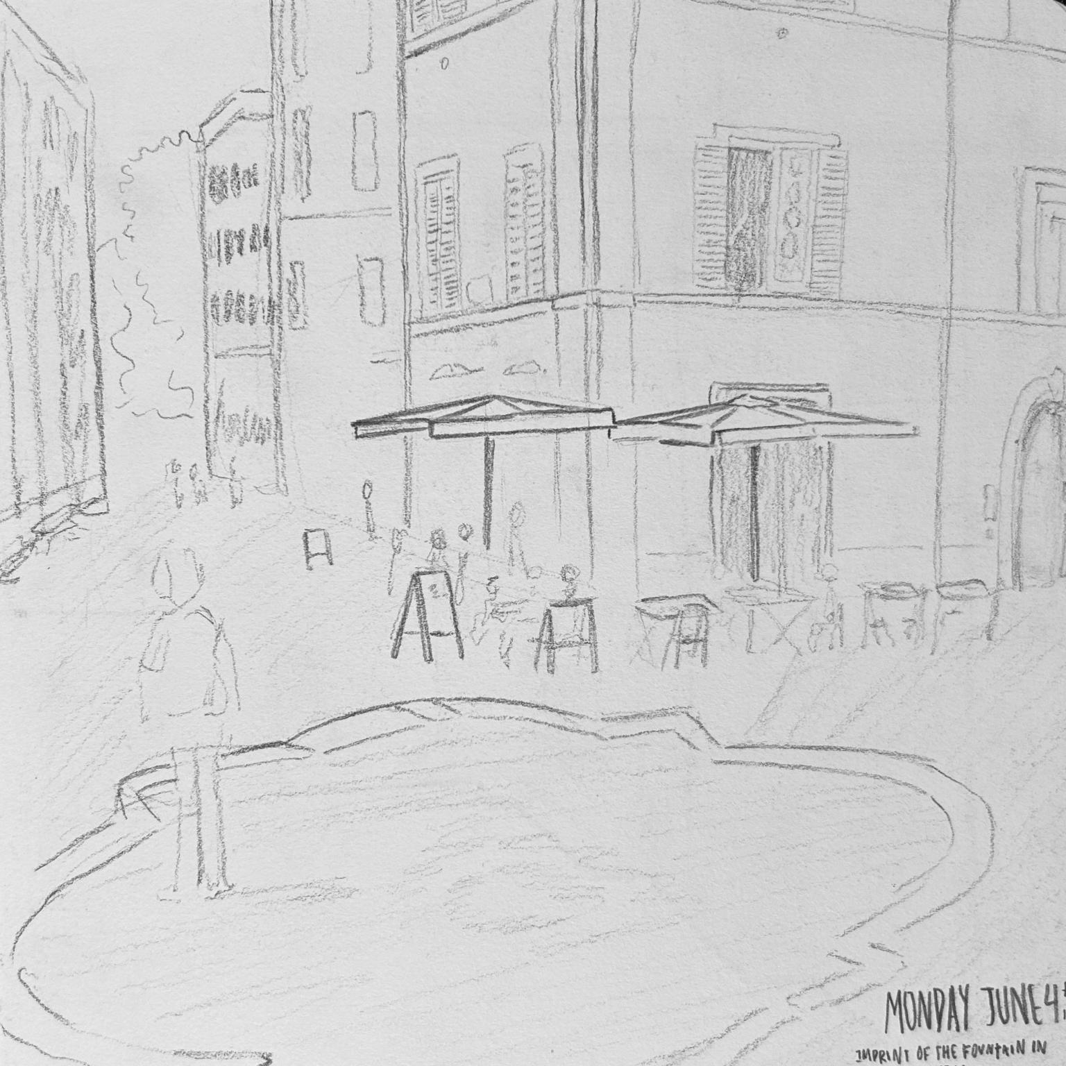
On one of my first days in Rome, our class was exploring the city under the guidance of Professor Martin. He pointed out a mosaic embedded in the ground—an outline marking where a fountain once stood. This captured my attention. While the history of a place is often buried or forgotten, here it was deliberately highlighted. I discovered that the original fountain had been relocated to Piazza della Cinque Scole, directly in front of our school. This sparked my curiosity to delve deeper into the history of the fountain, the piazza, and the Roman Ghetto that once occupied the area, as a way to explore the evolving role of public spaces over time.
During my time in Rome, I was captivated by the city’s vibrant public life, where people seemed to value time spent with others in the outdoor public spaces. Whether it was dining al fresco, strolling through historic streets, or gathering in the piazzas, the Romans’ connection to public spaces was both striking and infectious. I noticed that these communal spaces, from grand piazzas to quiet side streets, were integral parts of daily life—places where people could relax, socialize, and connect with their community. This stood in contrast to my experiences in Iowa, where public spaces often lack the same sense of vitality and community engagement. Intrigued by this difference, I set out to analyze the urban fabric of Rome, seeking to understand what makes these public spaces so inviting and essential to Roman life. My exploration delves into the architecture, culture, and social practices that make Rome’s public spaces a natural extension of daily life, aiming to uncover the underlying factors that foster such a strong public presence in the city’s urban landscape.
Architect: Giacomo Della Porta
Stonemason: Pietro Gucci
Commissioned By: Pope Gregory XIII
Year Completed: 1593
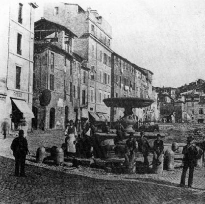
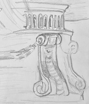
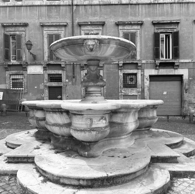
Fontana del Pianto, also known as the Fountain of Piazza della Cinque Scole, was originally located at one of the entrances to Rome’s Jewish Ghetto in Piazza Giudia. It served both practical and social purposes for the local community. As an architectural feature, the fountain was a vital source of water, providing residents with a necessary
resource for daily activities like drinking, cooking, and washing, especially in a densely populated and economically constrained area where access to clean water was limited. Beyond its practical utility, the fountain also played a crucial role as a social gathering point. In an area where public spaces were few and the community was often marginalized, the fountain became a central hub where people could meet, exchange news, and strengthen communal bonds. The sound of flowing water and the act of gathering around the fountain contributed to a shared sense of place and identity within the Ghetto.
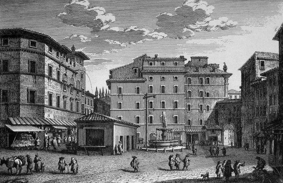
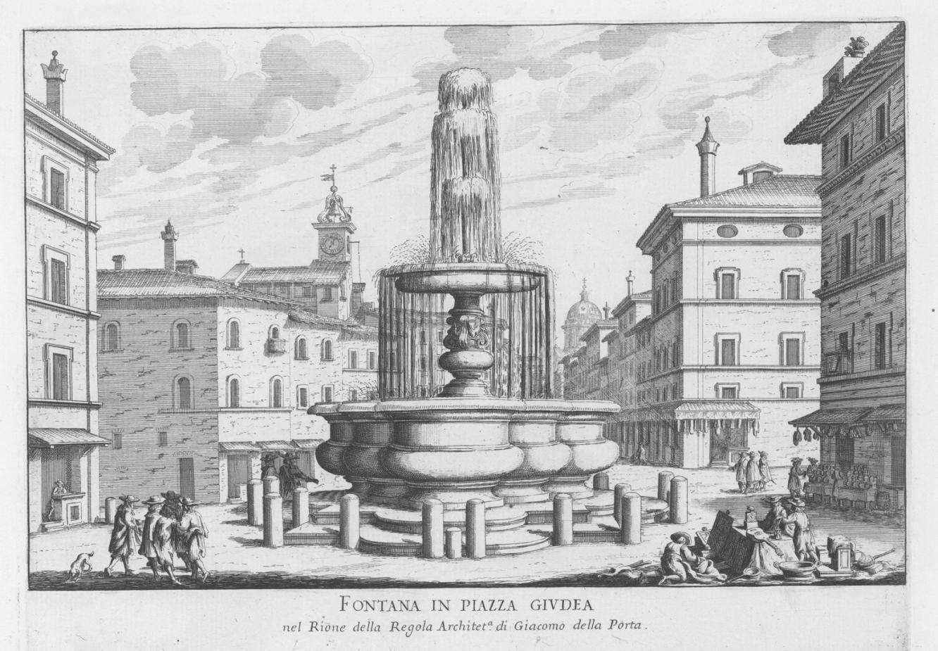
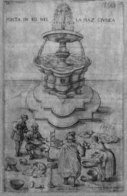
Architecturally, the fountain also symbolized the city’s acknowledgment of the Ghetto’s inhabitants, despite their forced segregation. It was a focal point of urban life, influencing daily routines and serving as a reminder of the community’s resilience and continuity in the face of adversity. The fountain thus not only met the essential needs of the people but also shaped the social and cultural fabric of the Ghetto, offering a space for interaction, reflection, and a sense of belonging amidst the constraints of their environment. As we can see in etchings from the time, people would gather around the fountain, encouraging and fostering interactions with eachother. The Fontana del Pianto, is believed to derive its name from
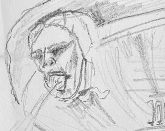
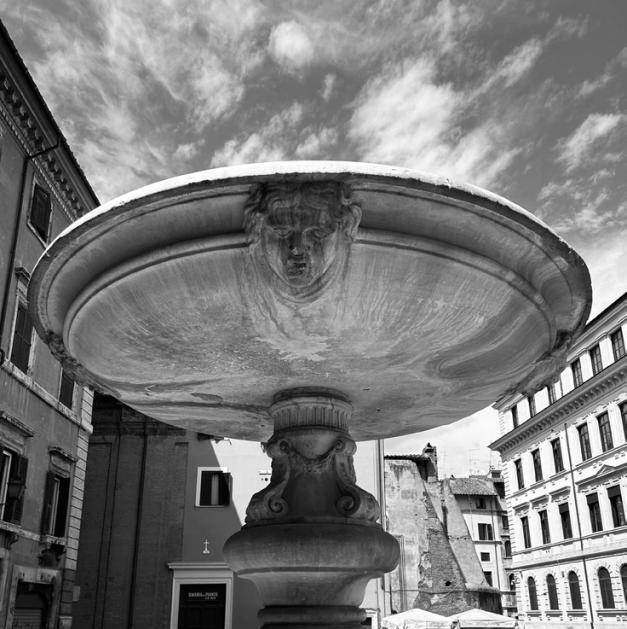
a nearby church once known as ‘Santa Maria del Pianto’ or ‘Church of Tears.’ According to legend, a miracle occurred in 1546 after a murder in the area, where an image of the Virgin Mary was said to have shed a tear and spoken to the offender. This event may have inspired the mascarons on the fountain, which pour water from the upper basin to the lower, symbolizing the tears shed during that miraculous moment. In the 1880s, the Jewish Ghetto underwent significant urban redevelopment, leading to the demolition of many historic structures. As part of this transformation, the fountain was dismantled and placed in a municipal warehouse, where it remained in storage for several decades.
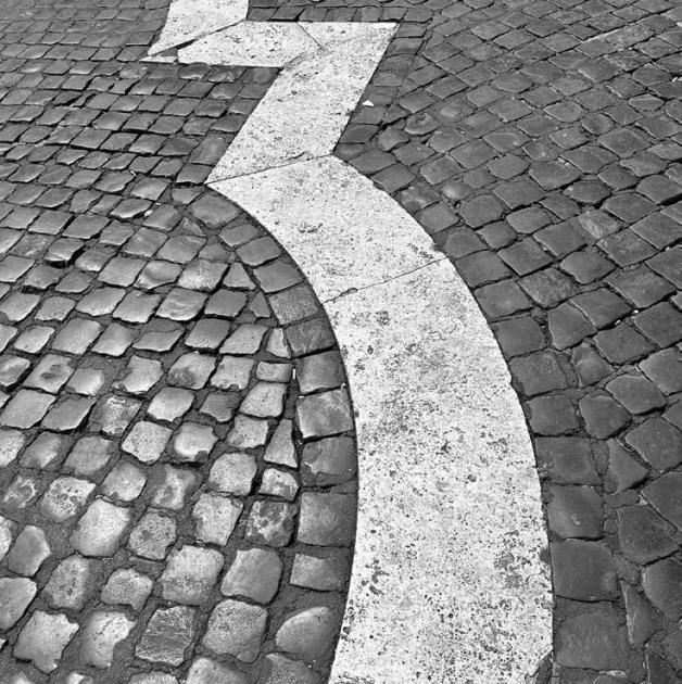
In 1924, the basin and stem of the fountain were recovered and temporarily placed near the Church of Sant’Onofrio al Gianicolo. However, it wasn’t until 1930 that the fountain found its permanent home in Piazza delle Cinque Scole (formerly known as Via del Progresso). An imprint of the fountain was left in Piazza Giudea to mark where it once stood. This imprint serves as a historical reminder of the fountain’s original location and its importance to the Jewish Ghetto. The outline of the fountain’s basin etched into the pavement allows visitors to envision where the fountain once stood, preserving a connection to the past even as the cityscape around it has changed.
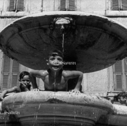
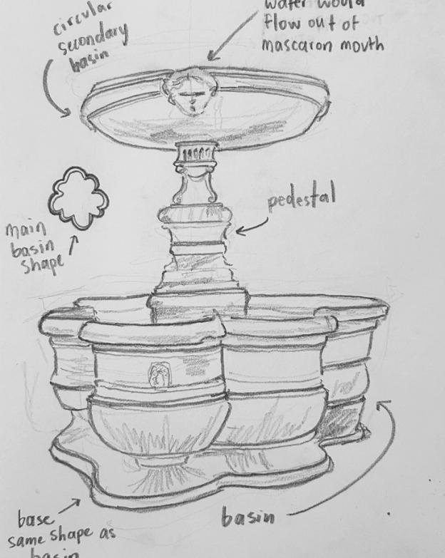
Material Use: The fountain was primarily made of travertine, a type of limestone that was widely used in Roman architecture at the time.
Central Structure: Rising from the basin is a short, cylindrical pedestal. Atop this pedestal is a smaller, secondary basin, from which water gently cascades into the lower basin.
Water Jets: The fountain has small jets that allow water to flow from the upper basin into the lower one, creating a soothing, continuous flow of water.
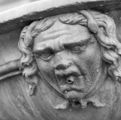
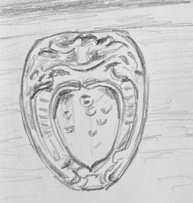
Mascarons: A mascaron refers to a decorative element in architecture, typically a sculpted face or mask, often of a human, animal, or mythological creature. Mascarones are commonly found on fountains where they were initially intended to ward off evil spirits, but over time, their use became more ornamental. The fountain features four of these.
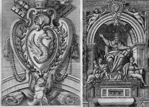
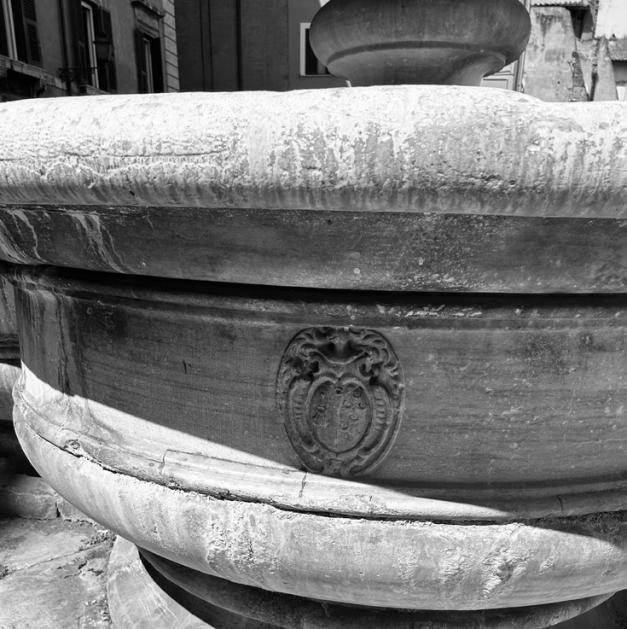
Papal Coat of Arms: The central column is adorned with the papal coat of arms, indicating the fountain’s commission by Pope Gregory XIII, a common feature in many of Rome’s fountains from this period.
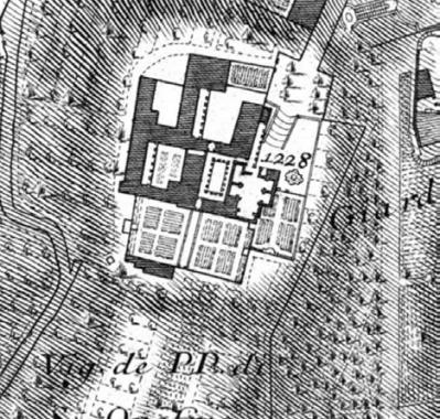
1587
1593
Pope Sixtus V completes the restoration of the Alexandrian Aqueduct, supplying water to various parts of Rome, including the Jewish Ghetto.
1748
Pope Gregory XIII commissions architect Giacomo Della Porta to design a fountain in Piazza Giudea, at one of the Ghetto’s entrances. Stonemason Pietro Gucci builds the fountain using travertine.
1871
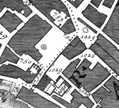
The Nolli Map is created by Giovanni Battista Nolli and shows the fountain in its original location in Piazza Giudea
1880s
Italy became a unified country in 1871 and Rome was established as the official capital. The Italian government, as part of its modernization efforts, initiated the demolition of the ghetto as an urban renewal project aimed at elimainating areas associated with poverty & overcrowding.
1924
The Jewish Ghetto is demolished during urban redevelopment. The fountain is dismantled and stored in a municipal warehouse.
1930
The basin and stem of the fountain are recovered and temporarily placed near the Church of Sant’Onofrio al Gianicolo.
The fountain is reassembled in Piazza delle Cinque Scole (formerly Via del Progresso), under the direction of Governor Francesco Boncompagni Ludovisi.
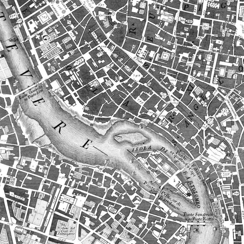
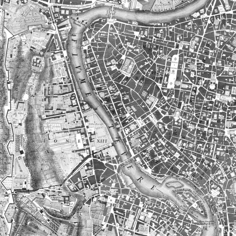
Interested in learning more about the importance of public space in Roman History, I was led to researching the Nolli Map. The Nolli Map, officially titled “Nuova Pianta di Roma,” was created in 1748 by Italian surveyor and architect Giovanni Battista Nolli. This map offered unprecedented detail and accuracy, setting it apart from other maps of its time. On this map, I was able to locate Piazza Giudia and the Fontana di Pianto. Nolli’s approach was innovative as it distinguished between public and private spaces, with public areas like streets, piazzas, and church interiors shown in white, while private buildings were shaded. This clear visual distinction highlighted the significance of public spaces in Rome’s urban fabric, providing both a geographical representation and a social and cultural one. This map has remained a landmark in urban cartography and design history.
Over several years, Nolli conducted an extensive survey of Rome, meticulously measuring streets, buildings, and open spaces to ensure the highest level of accuracy. The map was engraved on twelve copper plates, allowing for an extraordinary level of detail that had never before been achieved in urban cartography. This method of printmaking allowed for the mass production of highly detailed and durable maps, which contributed to their success. The map is now accessible online through an interactive Nolli Map website, which I frequently utilized throughout this project: https://web.stanford.edu/group/spatialhistory/nolli/.
As previously noted, the Nolli Map distinguishes between private and public spaces using shading. Private buildings are shaded with a hatching technique to indicate that they were not accessible to the public. In contrast, the public buildings were left unshaded, the same as with many churches in Rome at the time, reflecting Nolli’s view of them as public spaces. The churches are detailed with dots and other symbols to represent architectural features such as columns.
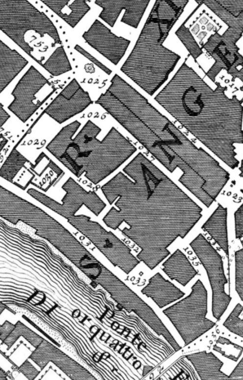
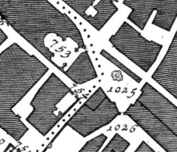
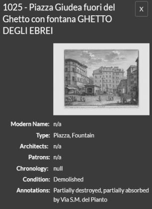
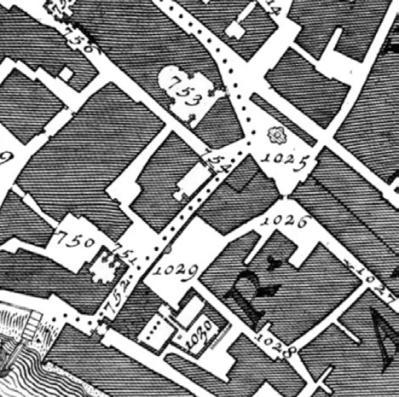
Nolli includes numerous labels and annotations that identify streets, buildings, and piazzas in Rome. The map includes a system of numbers that correspond to an index, which lists and describes the most important buildings, churches, palaces, and other landmarks in Rome. The names of streets, piazzas, and other locations as well as important buildings like churches, palacaes, and public buildings are directly labeled on the map. These not only aid in navigation but also provide insight into the naming conventions and the historical significance of different parts of the city at that time.
For example, on the map we can see the number 1025 next to the Fontana di Pianta. On the interactive map website, you can select this number and information regarding the feature will be pulled up. It tells us that 1025 refers to Piazza Giudea and the fountain. I found it interesting that the Nolli Map clearly outlines the Jewish Ghetto, showing how the walls enclosed and protected the area.
Another feature I observed on the maps is the presence of dotted lines. These lines represent the boundaries of the Rioni, or districts, in Rome. The Rioni, with origins dating back to ancient Rome, continue to shape the identity and organization of the city. Notably, the Jewish Ghetto is located within the Rione Sant’Angelo, one of the smallest yet most historically significant districts in Rome.
Nolli began by extensively surveying Rome and collecting data to draft preliminary sketches of his map. He then turned this information into a base plan featuring the layout of streets, piazzas, and major buildings to which he added details such as interior spaces of buildings and topographical features like the Tiber River.
Once he had his drawing finalized, the etching process began:
1. Transferring the Drawing: Once the map was fully drafted, Nolli would transfer the design onto a copper plate. This could involve tracing the design onto the plate or drawing it directly with a stylus.
2. Etching the Plate: Using an etching needle, Nolli would carefully incise the design into the copper plate. He would coat the plate with an acid-resistant wax layer and then draw through the wax, exposing the copper underneath.
3. Acid Bath: The plate would then be submerged in an acid bath, which would etch the exposed lines into the copper. Nolli would control the depth and width of lines by adjusting the time the plate spent in the acid bath.
4. Cleaning and Retouching: After the etching process, the plate would be cleaned, and any necessary retouching or additional details would be added.
5. Inking the Plate: The etched plate would be coated with ink, ensuring the ink filled all the incised lines. Excess ink would be wiped off the surface, leaving ink only in the etched lines.
6. Pressing the Print: The inked plate would be pressed onto a sheet of paper using a printing press. The pressure would transfer the ink from the plate to the paper, creating a reverse image of the etched design.
7. Drying and Finishing: The printed map would be carefully dried and might undergo final touches, such as hand-coloring or annotation.
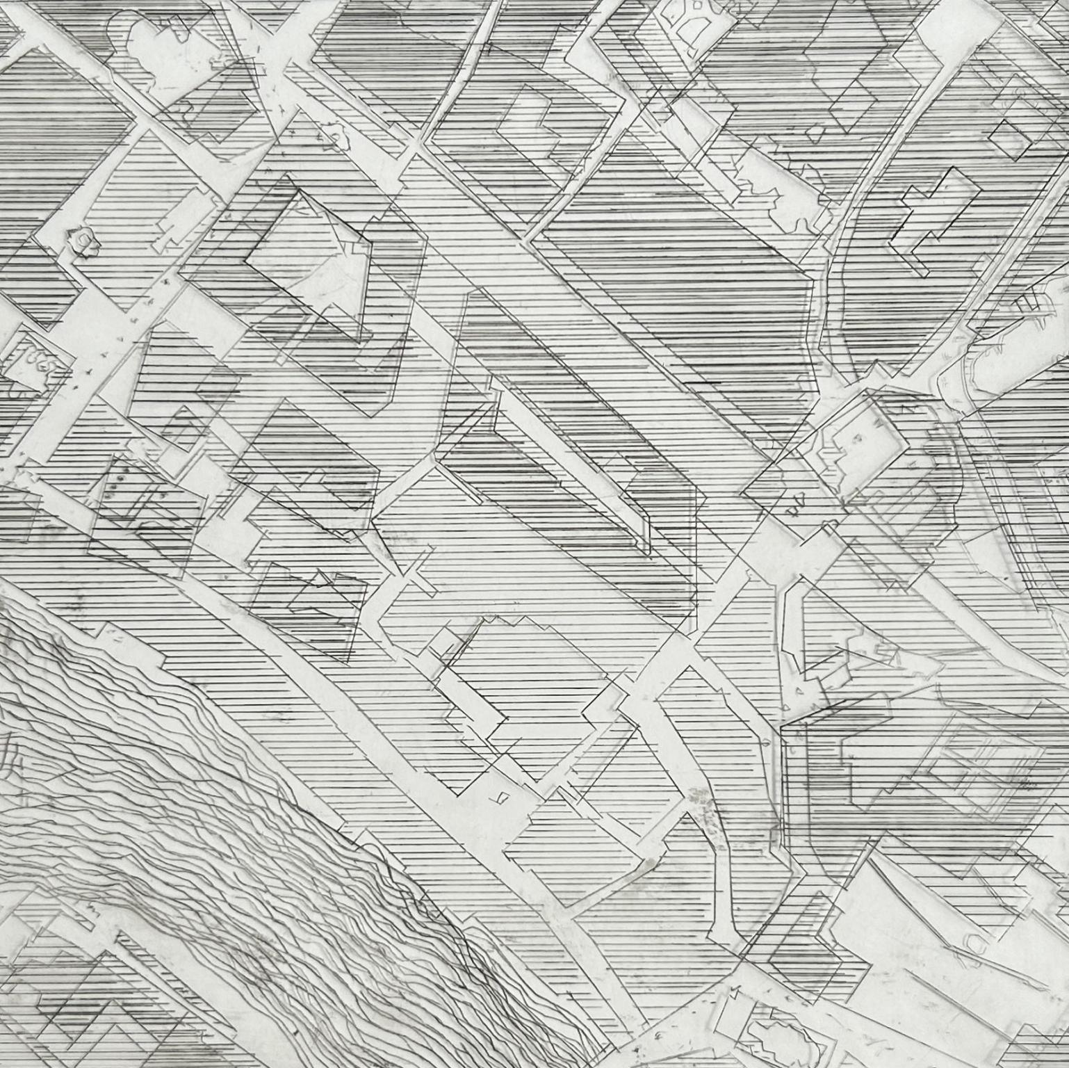
Fascinated by this process, I wanted to try replicating the printmaking technique at home. For my version of the Nolli Maps, I used materials I had on hand. The process was as follows:
1. Create a sketch of your design.
2. Cut an acrylic sheet to the desired size.
3. Use a sharp tool, such as an X-Acto knife or a printmaking tool (which I used), to carefully etch your design into the plate.
4. Coat the entire plate with ink using a paper towel, ensuring that the ink saturates the incised lines.
5. Wipe off the excess ink from the surface with a paper towel, leaving ink only in the etched lines.
6. Soak a sheet of watercolor paper in water, then remove it and blot off the excess so that it remains damp.
7. Secure the plate to the table with tape. Place the damp paper onto the plate and use a spoon to press and rub the paper, transferring the ink from the plate to the paper.
8. Remove the paper and let it dry.
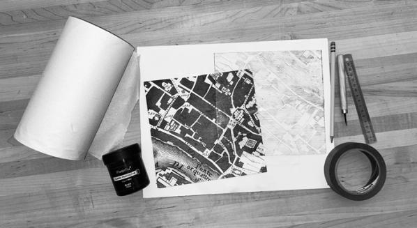
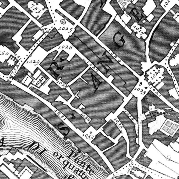
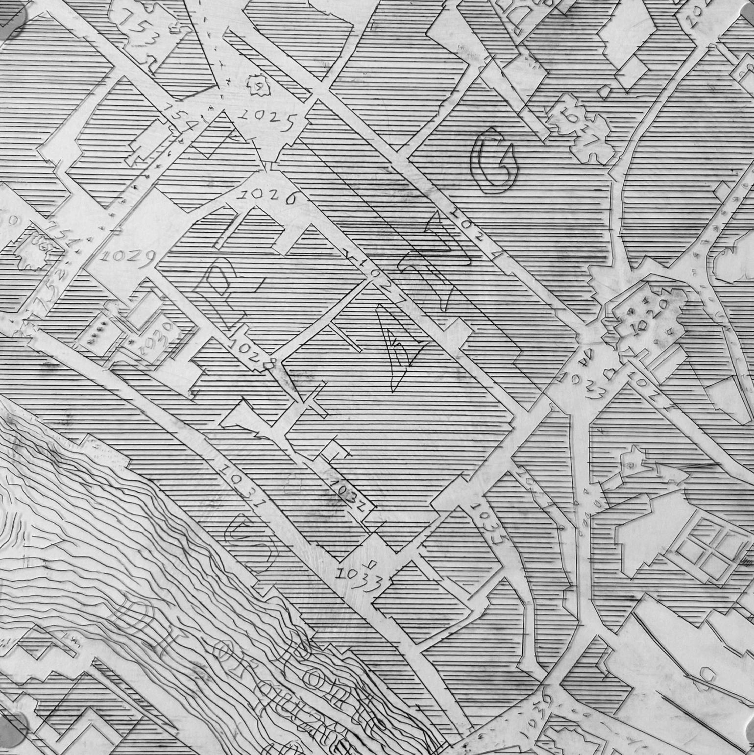
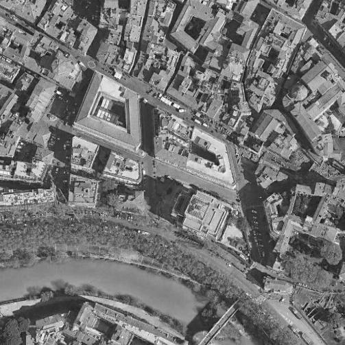
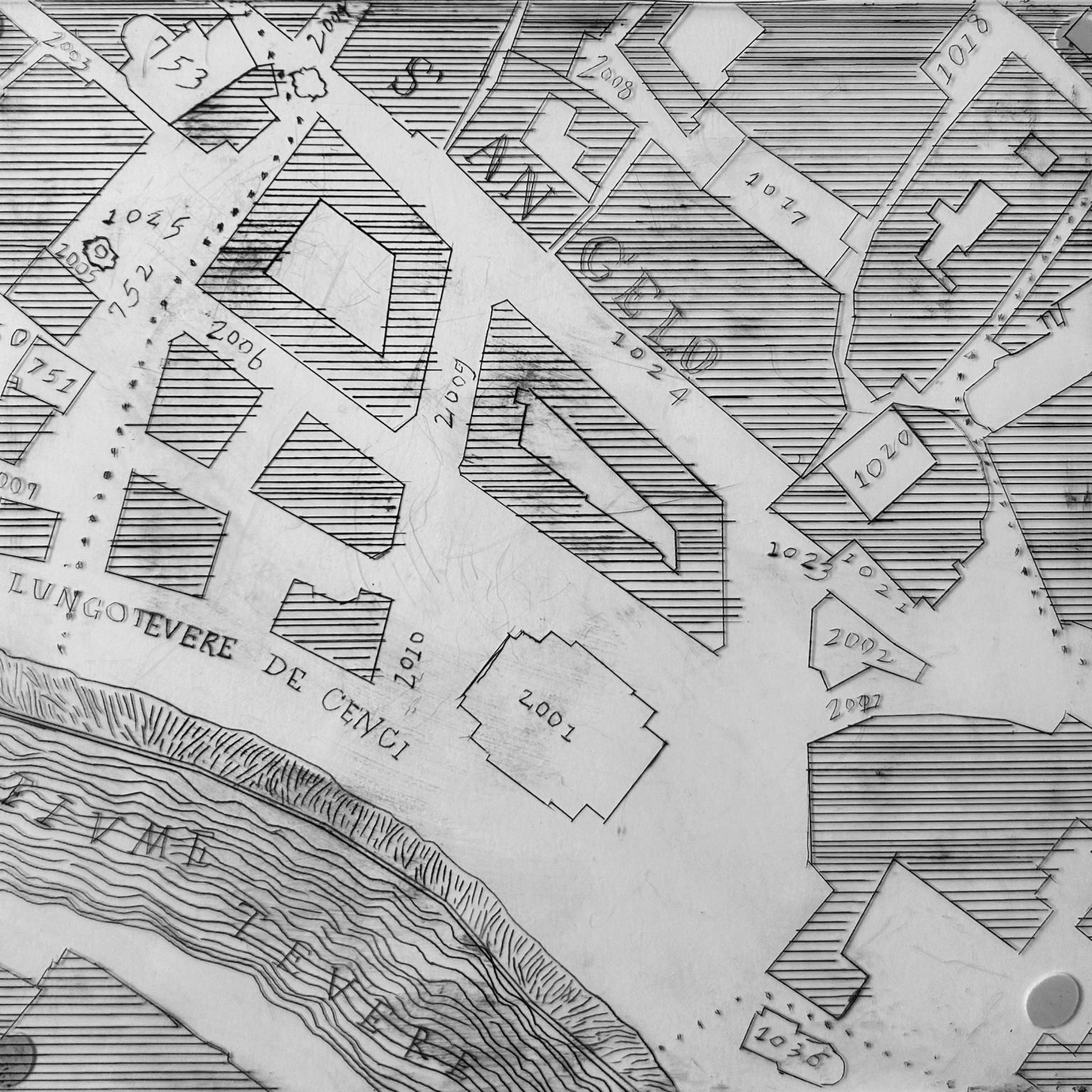
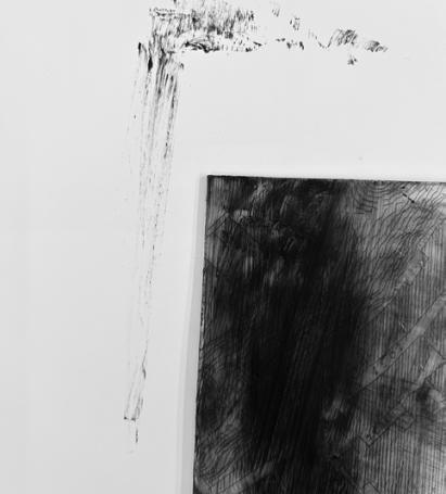
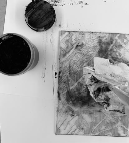
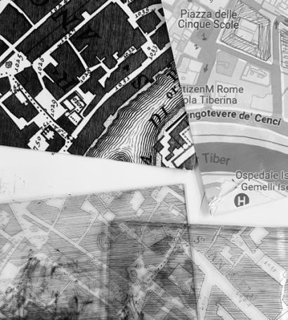
After creating my plates, I encountered difficulties with my printmaking method at home. I suspect this was due to the etchings not being deep enough to hold the ink for transfer onto the paper. However, I grew to enjoy the etched acrylic sheets, especially when the black ink filled in the etchings. While this approach differed from the original style of the Nolli map, it proved valuable for my studies. It allowed me to compare the past and present urban fabric, categorizing the streets, churches, piazzas, and other buildings depicted on the Nolli map into three categories: those that are extinct, those that have persisted, and those that have been newly instituted.
Extinct:
754 Oratorio della Confraternita
suddetta [Santa Maria del Pianto]
1026 Piazza Giudea dentro del Ghetto
1027 Strada della Rua
1028 Piazza dei Macelli
1029 Piazza delle Scuole, con fontana
1030 Cinque Scuole degli Ebrei
cioé Catalana, Siciliana, Castigliana, Scuola nuova, e Scuola del Tempio
1031 Strada della Fiumara
1032 Vicolo della Torre
1033 Piazza delle Tre Cannelle, con fontana
1034 Vicolo dei Savelli, con fontana
1035 Strada Quattro Capi
Persistant:
750 Palazzi Cenci con 2 Archi
751 Chiesa di San Tommaso ai Cenci
752 Vicolo dei Cenci
753 Chiesa di Santa Maria del Pianto
1017 Chiesa di Sant’Ambrogio della Massima
1018 Piazza Serlupi
1020 Chiesa di Sant’Angelo in Pescheria
1021 Oratorio Sant’Andrea dei Pescivendoli
1022 Teatro di Marcello
1023 Piazza di Pescaria, e Colonne antiche
1024 Via del Portico d’Ottavia
1025 Fontana Della Cinque Scole
1036 Chiesa San Gregorio della Divina Pietà
Instituted:
2001 Tempio Maggiore
2002 Ghetto Ebraico di Roma
2003 Via di S. Maria del Pianto
2004 Piazza Costaguti
2005 Iowa State University
2006 Via Catalana
2007 Via di S. Bartolomeo de’ Vaccinari
2008 Via di S. Ambrogio
2009 Via Elio Toaff
2010 Via del Tempio
2011 Via del Foro Piscario
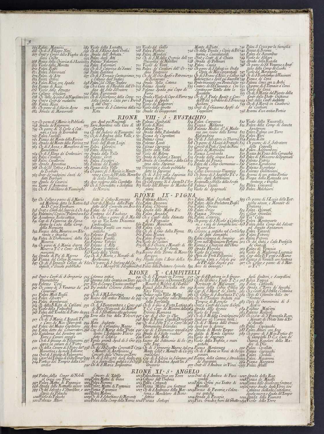
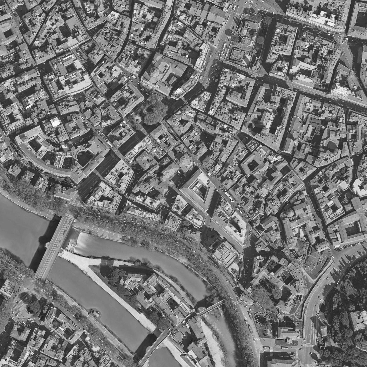
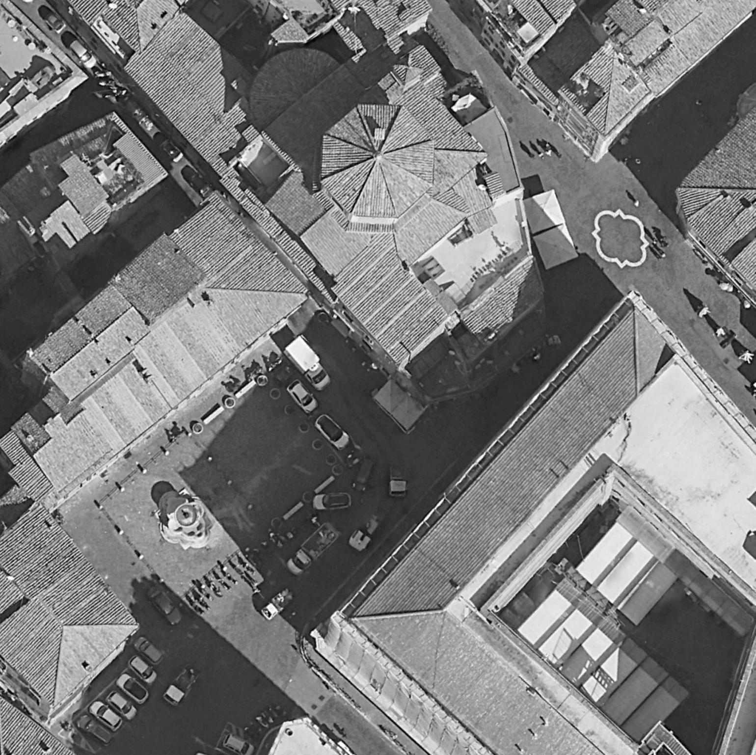
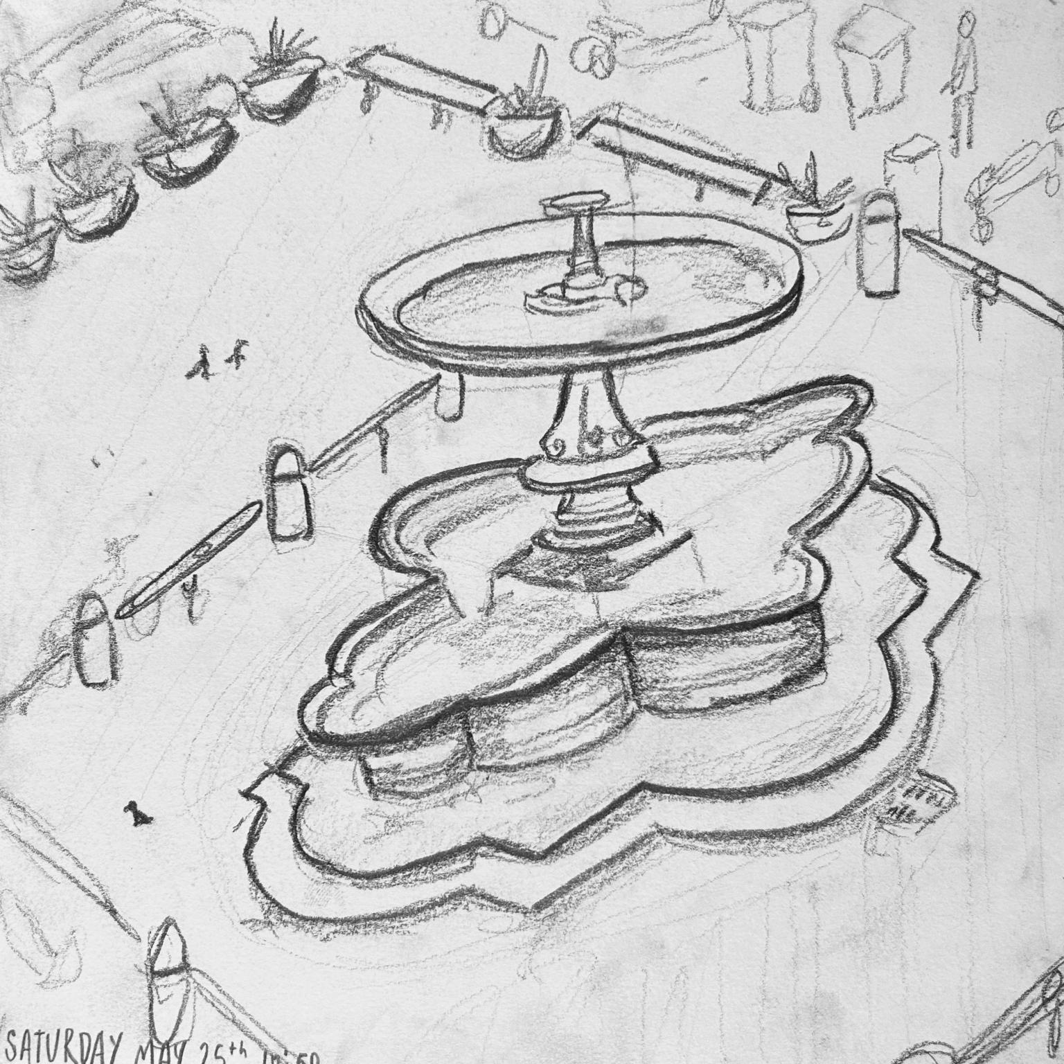
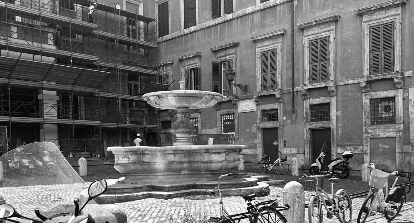
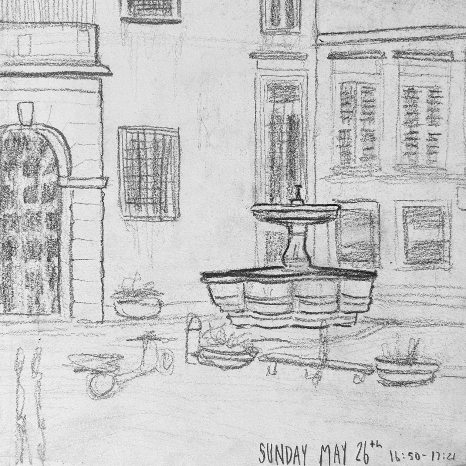
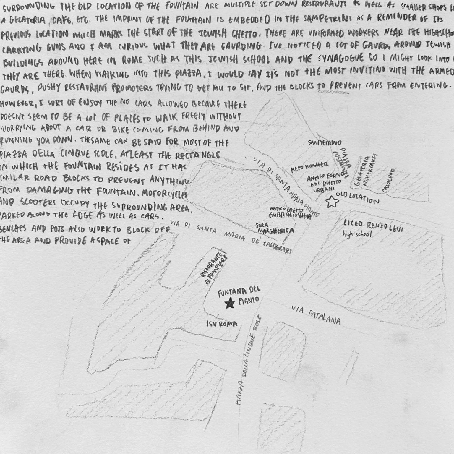
After conducting research into the history of the Roman Ghetto and the Nolli map, I was interested in investigating Rome’s urban space and the fountain myself. The fountain now stands in Piazza della Cinque Scole, but its surroundings have significantly changed. The area around the fountain is cluttered with parked cars, bikes, and scooters, which obstruct access and diminish its visibility. Planters, benches, and railings have been installed around the fountain, seemingly to prevent vehicles from parking too close and to preserve the area.
The fountain itself is no longer functional; it has not been running for some time. The structure bears noticeable signs of wear, including water residue and damage from years of neglect. Weeds have overgrown its base, and litter is scattered around, contributing to a neglected appearance.
In comparing my observations of Rome to the Rome depicted in Nolli’s map, the contrast is striking. My own Nolli-style map of the current urban layout of Rome revealed significant changes. The densely built environment of the Jewish Ghetto, as depicted by Nolli, has been transformed. Many of the historical buildings that once crowded the area have been completely demolished, making way for open, more spacious piazzas like Piazza della Cinque Scole. This transformation reflects broader urban planning and modernization efforts that have dramatically altered the city’s landscape, shifting from the intricate, densely populated streets of the past to more open, contemporary public spaces.
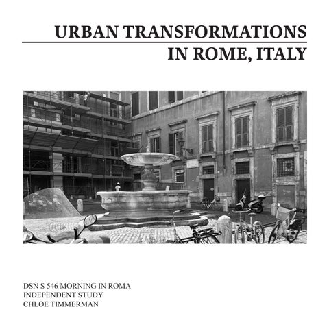
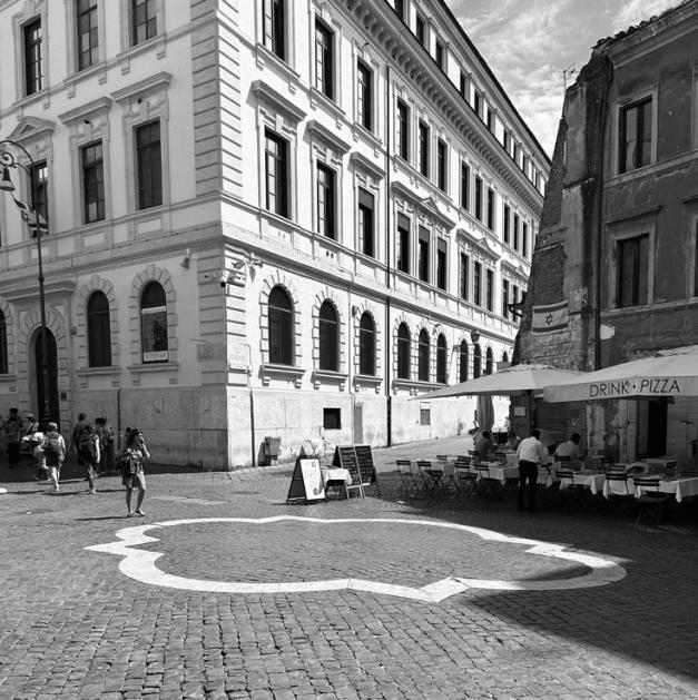
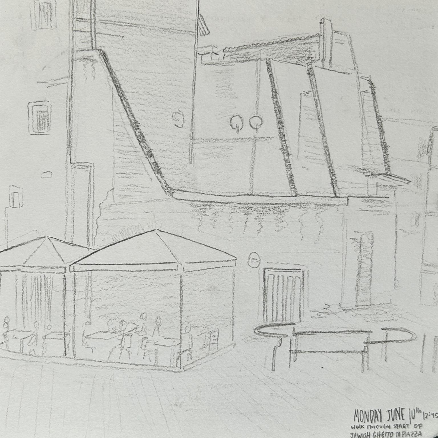
The Fontana di Piazza della Cinque Scole’s original location, Piazza Giudia (or Piazza Giudea), has undergone significant changes, reflecting the evolving relationship between public space and architecture. Once a prominent piazza in the Jewish Ghetto, it is now surrounded by restaurants and outdoor dining areas. As you walk through, restaurant promoters eagerly approach, asking how many are in your party in an attempt to draw you into their establishments.
This shift from a purely communal space to one driven by commercial interests highlights the changing dynamics of urban areas in Rome. While the original purpose of the piazza was to serve as a gathering place for the local community, its current role is more aligned with tourism and consumerism. The outdoor dining setup, though visually appealing, often prioritizes profit over the preservation of the space’s historical and cultural significance. Interestingly, the reviews on Google Maps for these
businesses are not particularly favorable, with many labeling them as “tourist traps” and overpriced. This suggests that the transformation of the space may not be resonating positively with visitors or locals, raising questions about the impact of commercial ventures on the authenticity and quality of public spaces.
The architectural landscape has been adapted to accommodate modern dining experiences, yet this change appears to be at odds with the historical character of the piazza. This tension between preserving the historical essence of public spaces and adapting them to contemporary uses is a critical consideration in urban planning and architectural design. The relocation of the fountain from Piazza Giudia to Piazza della Cinque Scole serves as a metaphor for this shift, as it physically embodies the movement of historical elements within the city in response to changing urban demands.
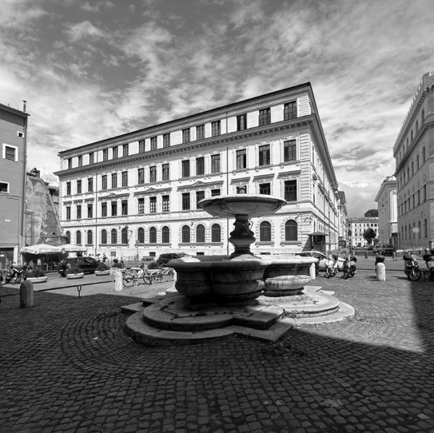
Through my extensive analysis—observing people in the piazza, researching historical cartography methods, comparing maps of public spaces, and sketching my observations—I gained valuable insights into how public spaces shape daily life. I also discovered that inhabitants significantly impact these spaces. For instance, the Fontana di Piazza della Cinque Scole is in disrepair, cluttered, and lacks any signs or information about its history. This neglect explains why it isn’t commonly used as a social gathering spot.
The Fontana di Piazza della Cinque Scole once served as a cultural landmark for the Jewish community in Rome, contributing to the area’s identity. However, with the influx of tourists and commercial interests, the fountain has lost its cultural significance. The modernization of infrastructure has further diminished its functional role, as clean water is now readily available in homes, rendering the fountain obsolete for its original purpose.
Perhaps the forgotten, neglected fountain may symbolize the erosion of cultural heritage and the loss of historical significance. But I think it would be worth while to invest in its restoration; not only to honor the history that has been overlooked but also to create a space for fostering new social interactions as once was done.