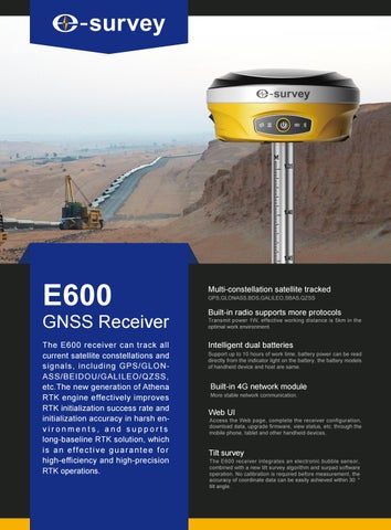
E600
GNSS Receiver The E600 receiver can track all current satellite constellations and signals, including GPS/GLONASS/BEIDOU/GALILEO/QZSS, etc.The new generation of Athena RTK engine effectively improves RTK initialization success rate and initialization accuracy in harsh environments, and supports long-baseline RTK solution, which is an effective guarantee for high-efficiency and high-precision RTK operations.
Multi-constellation satellite tracked GPS,GLONASS,BDS,GALILEO,SBAS,QZSS
Built-in radio supports more protocols
Transmit power 1W, effective working distance is 5km in the optimal work environment.
Intelligent dual batteries Support up to 10 hours of work time, battery power can be read directly from the indicator light on the battery, the battery models of handheld device and host are same.
Built-in 4G network module
More stable network communication.
Web UI
Access the Web page, complete the receiver configuration, download data, upgrade firmware, view status, etc. through the mobile phone, tablet and other handheld devices.
Tilt survey
The E600 receiver integrates an electronic bubble sensor, combined with a new tilt survey algorithm and surpad software operation. No calibration is required before measurement, the accuracy of coordinate data can be easily achieved within 30 ° tilt angle.
Product Specification GNSS Performance Model
E600-N
E600-H
E600-T
Channel
555
600
336
Satellite Tracked
GPS: L1CA/L1C/L2C/L2P/L5
GPS:L1CA/L1P/L1C/L2P/L2C/L5
GPS: L1 CA/L2E/L2C/L5
GLONASS:L1CA/L2C/L2P/L3/L5
GLONASS: G1/G2, P1/P2
GLONASS:L1CA/L2CA/L3 CDMA
BeiDou:B1/B2/B3
BeiDou:B1/B2/B3
BeiDou:B1/B2/B3
Galileo:E1/E5/AltBOC/E5a/E5b/E6 GALILEO: E1BC/E5a/E5b
Galileo:E1/E5A/E5B/E5AltBOC/E6
NAVIC: L5
QZSS: L1CA/L2C/L5/L1C
NAVIC: L5
SBAS: L1/L5
SBAS: L1 CA/L5
SBAS: L1 CA/L5
QZSS: L1CA/L1C/L2C/L5/L6
L-BAND
QZSS: L1CA/L1SAIF/ L1C/ L2C/ L5
Horizon:2mm + 0.1 ppm
Horizon:2mm + 0.1 ppm
Horizon:2mm + 0.1 ppm
Vertical:33mm + 0.4ppm
Vertical:3mm + 0.4ppm
Vertical:3mm + 0.4ppm
Horizon:2mm+0.5ppm RMS
Horizon:2mm+0.5ppm RMS
Horizon:2mm+0.5ppm RMS
Vertical:3mm+0.5ppm RMS
Vertical:3mm+0.5ppm RMS
Vertical:3mm+0.5ppm RMS
Horizon:4mm+1ppm RMS
Horizon:4mm+1ppm RMS
Horizon:4mm+1ppm RMS
Vertical:8mm+1ppm RMS
Vertical:8mm+1ppm RMS
Vertical:8mm+1ppm RMS
SBAS Accuracy
Horizon:0.6m RMS
Horizon:0.3m RMS
Horizon:0.5m RMS
Code Differential Accuracy
Horizon:0.4m RMS
Horizon:0.25m RMS
Horizon:0.25m RMS
Update rate
Up to 100Hz
Up to 50Hz
Up to 50Hz
High Precision static
Static Accuracy
RTK Accuracy
Power Supply Battery
Communication Dual rechargeble batteries
Memory
7.2V/3400mAh*2
Internal 8G; Removable memory support TF card
Working time
Up to 10 hours
Bluetooth
V2.1+EDR / V4.1 Dual Mode, Class2
Input
9~28V DC,with over-voltage protection
WIFI
802.11 b/g/n
4G
GSM/GPRS/EDGE/LTE/UMTS/WCDMA
Internal UHF
Transmit power 1W, Frequency 410-470MHz
Physical Dimension
156mm*76mm
Weight
1.2KG with 2 batteries inside
Data Interface
Work Distance: 5km in optimal environment Web UI
To manage the status and settings, upgrade firmware,data download
TNC
For UHF Antenna
5-pin
External radio and external power
Electric Bubble
Enable
7-pin
Connect to PC controller and other
Tilt Survey
Support
external device, such as Echo Sounder
Environment
Others
SIM slot and TF slot
Operating Temperature -45℃ ~+65℃
Buttons
Power button
Storage Temperature
-50℃ ~+80℃
Indicator
indicators, Satellites, Datalink, 4 indicators,Satellites,Datalink,
Water/ Dust Proof
IP67 / IP68 (Russian Version)
Bluetooth,WIFI Status Bluetooth, WIFI Status
Shock
Survive a 2 m (6.6 ft) pole drop, 1.2 m (3.9 ft) free fall
Vibration
Vibration resistant
Humidity
100%,condensing
Tel: +86 21 54467213 Email: info@esurvey-gnss.com
Shanghai e-Compass Science &Technology Co., Ltd
Web: www.esurvey-gnss.com
Lianhang Rd, Pujiang Town, Minhang District, Shanghai, China
Edition: 20190403