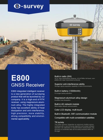
E800
GNSS Receiver E800 integrated intelligent receiver is a new generation of surveying product that will be launched by our company. It is a high-end of RTK receiver, using magnesium-aluminum alloy. The highly integrated body has excellent ability of heat dissipation and anti-interference, h i g h p r e c i s i o n , m o r e s t a b i l i t y, strong compatibility and environmental applicability.
Built-in radio (5W)
Up to 10km transmission distance, 410-470Mhz full-band, compatible with major transmission protocols.
Superior anti-interference ability
Stronger signal acquisition capability in harsh environments.
Built-in battery (13000mAh) For longer lasting operation.
Magnesium-aluminum alloy design Excellent heat dissipation.
Built-in 4G network module More stable network communication.
Color LCD display, multi-touch Built-in Bluetooth, WiFi communication module Compatible with multi-constellation satellites Tilt survey
The E800 receiver integrates an electronic bubble sensor, combined with a new tilt survey algorithm and surpad software operation. No calibration is required before measurement, the accuracy of coordinate data can be easily achieved within 30 ° tilt angle.
Product Specification GNSS Performance
GNSS Performance
Channel
H: 600
Channel
T: 336
Satellite Tracked
GPS:L1CA/L1P/L1C/L2P/L2C/L5
Satellite Tracked
GPS: L1 CA/L2E/L2C/L5
Static Accuracy
GLONASS: G1/G2, P1/P2
GLONASS:L1CA/L2CA/L3 CDMA
BeiDou:B1/B2/B3
BeiDou:B1/B2/B3
GALILEO: E1BC/E5a/E5b
GALILEO:E1/E5A/E5B/E5AltBOC/E6
QZSS: L1CA/L2C/L5/L1C
QZSS: L1CA/L1SAIF/ L1C/ L2C/ L5
SBAS: L1 CA/L5
SBAS: L1 CA/L5
L-BAND
NAVIC: L5
Horizon:2mm+1ppm RMS
Static Accuracy
Vertical:3mm+1ppm RMS RTK Accuracy
Horizon:4mm+1ppm RMS
Vertical:3mm+1ppm RMS RTK Accuracy
Vertical:8mm+1ppm RMS SBAS Accuracy
Horizon:0.3m RMS
Horizon:2mm+1ppm RMS
Horizon:4mm+1ppm RMS Vertical:8mm+1ppm RMS
SBAS Accuracy
Horizon:0.5m RMS
Code Differential Accuracy Horizon:0.25m RMS
Code Differential Accuracy Horizon:0.25m RMS
Update rate
Update rate
Up to 50Hz
Up to 50Hz
Data Interface
Power Supply Battery
Built-in rechargeble battery 7.2V/13.6Ah
Working time
Up to 12 hours
Input
9~28V DC,with over-voltage protection
Physical Dimension
158mm*158mm*72mm
Weight
1.25KG
Communication
LCD
1.45" TFT LCD VGA (320 x 240), capacitive touch screen, multi-touch
TNC
For UHF Antenna
5 pins
External radio and external power,RS232
Type-C
DC input@5V/9V/15V/20V,PD3.0, USB OTG,USB2.0,RS232
Buttons
Power button 4 indicators,GNSS/BT/UHF/PWR
Memory
Internal 16G;Support TF card,up to 32G
Indicator
Bluetooth
V2.1+EDR / V4.1 Dual Mode,Class2
Environment
WIFI
802.11 b/g/n
Operating Temperature -45℃ ~+65℃ Environment
4G
GSM/GPRS/EDGE/LTE/UMTS/WCDMA
Storage Temperature
-50℃ ~+80℃
Internal UHF
TX(2/5W adjustable) & RX,
Water/ Dust Proof
IP67
Frequency 410-470MHz Work Distance: 10km in optimal environment Web UI
IP68 (Russian Version) Shock
Survive a 2 m (6.6 ft) pole drop, 1.2 m (3.9 ft) free fall
To manage the status and settings, upgrade firmware,data download
Vibration
Vibration resistant
Electric Bubble
Enable
Humidity
100%,condensing
Tilt Survey
Support
Tel: +86 21 54467213 Email: info@esurvey-gnss.com
Shanghai e-Compass Science &Technology Co., Ltd
Web: www.esurvey-gnss.com
Lianhang Rd, Pujiang Town, Minhang District, Shanghai, China
Edition: 20190403