UNIVERSITY OF PITTSBURGH CAMPUS MASTER PLAN
PROJECT LEADERSHIP
We extend our sincere thanks to the Steering Committee, Working Group, and the entire Pitt community for their thoughtful engagement and contributions throughout the campus master planning process. Your insights, ideas and collaboration have been invaluable in shaping a vision that honors our history while positioning the university for a vibrant and sustainable future.
This collective effort reflects the shared commitment to creating a welcoming campus that supports student success, scholarship, innovation and possibilities for today’s and future generations.
Steering Committee
GINA BLECK
VICE CHANCELLOR, PLANNING, DESIGN AND CONSTRUCTION, COMMITTEE CHAIR
SCOTT BERNOTAS
SPECIAL ASST., EXECUTIVE SENIOR VICE CHANCELLOR FOR ADMINISTRATION & FINANCE AND CFO
JAIME CERILLI
ASST. VICE CHANCELLOR, STRATEGIC SPACE PLANNING AND MNGMT., HEALTH SCIENCES
TOM CRAWFORD
VICE CHANCELLOR, CORPORATE AND FOUNDATION RELATIONS
LINA DOSTILIO
VICE CHANCELLOR, EXTERNAL RELATIONS
ALLEN GREENE DIRECTOR OF ATHLETICS
BILL HALDEMAN VICE CHANCELLOR AND CHIEF STRATEGIC OFFICER
ANISH KUMAR VICE CHANCELLOR, REAL ESTATE
JOE MCCARTHY PROVOST
CAITLIN MCCULLOUGH STAFF COUNCIL
CARLA PANZELLA
VICE PROVOST FOR STUDENT AFFAIRS
CLYDE PICKETT
VICE CHANCELLOR FOR INSTITUTIONAL ENGAGEMENT AND WELL-BEING
DWAYNE PINKNEY
EXECUTIVE SENIOR VICE CHANCELLOR, ADMINISTRATION & FINANCE AND CHIEF FINANCIAL OFFICER
RACHEL DECKER RICHELIEU VICE CHANCELLOR, COMMUNICATIONS AND MARKETING
ROB RUTENBAR
SENIOR VICE CHANCELLOR, RESEARCH
DAVID SALCIDO FACULTY SENATE
AURORA SHARRARD ASST. VICE CHANCELLOR, SUSTAINABILITY
MATTHEW STERNE VICE CHANCELLOR, BUSINESS SERVICES
KEVIN WASHO
SENIOR VICE CHANCELLOR, EXTERNAL RELATIONS
THURMAN WINGROVE CONTROLLER
LAURA ZULLO
VICE CHANCELLOR FOR FACILITIES MNGMT.
Working Group
CAROLYN VERGA
ASST. VICE CHANCELLOR FOR CAMPUS PLANNING, COMMITTEE CHAIR
KARIN ASHER
ASSOCIATE DEAN FOR STUDENT ENGAGEMENT AND PROFESSIONAL DEVELOPMENT
JULIE BANNISTER
ASST. VICE CHANCELLOR FOR AUXILIARY SERVICES
RACHEL BOWERS PLANNER
LORIE BURNS
SR. PROJECT/BUILDING MANAGER, HEALTH SCIENCES
JUSTIN DANDOY
DIRECTOR OF COMMUNITY AFFAIRS
DAN FISHER
ASST. VICE CHANCELLOR OF OPERATIONS AND MAINTENANCE, FACILITIES MANAGEMENT
JENNIFER HABERMAN
SR. PROJECT MANAGER AND SPACE PLANNER, HEALTH SCIENCES
MATT HANSEN
ASST. VICE CHANCELLOR FOR DESIGN STEWARDSHIP
BRIAN HART
DIRECTOR OF POLICIES, GOVERNANCE, AND PROJECT MANAGEMENT, PITT DIGITAL
PAUL KLACZAK
ASSOCIATE ATHLETIC DIRECTOR, FACILITIES AND EVENT MANAGEMENT
LAUREN MCCONNELL PLANNER
JONATHAN PEARSON DIRECTOR OF PARKING AND TRANSPORTATION
MATTHEW RENDULIC DIRECTOR OF REAL ESTATE DEVELOPMENT
JERRY SCHAFER
SENIOR DIRECTOR OF OPERATIONS & MAINTENANCE
AURORA SHARRARD
ASST. VICE CHANCELLOR, SUSTAINABILITY
Mobility and Accessibility Subcommittee
RACHEL BOWERS PLANNER, COMMITTEE CHAIR
JULIE BANNISTER
ASST. VICE CHANCELLOR FOR AUXILIARY SERVICES
OLIVIA BUDIKE STUDENT
RORY COOPER
ASST. VICE CHANCELLOR FOR RESEARCH FOR STEM-HEALTH SCIENCES COLLABORATIONS
LEIGH CULLEY
INTERIM ASST. VICE CHANCELLOR FOR ACCESSIBILITY
KATIE FITZPATRICK STUDENT
NICK GOODFELLOW SUSTAINABILITY MANAGER, BHAS
NEAL GUPTA STUDENT
PAUL KLACZAK
ASSOCIATE ATHLETIC DIRECTOR, FACILITIES AND EVENT MANAGEMENT
JONATHAN PEARSON DIRECTOR OF PARKING AND TRANSPORTATION
LT. BROOKE RILEY PITT POLICE
AURORA SHARRARD
ASST. VICE CHANCELLOR, SUSTAINABILITY
ANNIE SHVACH
SUSTAINABILITY MANAGER, PLANNING, DESIGN, & CONSTRUCTION
CAROLYN VERGA
ASST. VICE CHANCELLOR FOR CAMPUS PLANNING
Housing Subcommittee
KARIN ASHER
ASSOCIATE DEAN FOR STUDENT ENGAGEMENT AND PROFESSIONAL DEVELOPMENT
JULIE BANNISTER
ASST. VICE CHANCELLOR FOR AUXILIARY SERVICES
GINA BLECK
VICE CHANCELLOR, PLANNING, DESIGN AND CONSTRUCTION
LORRAINE CRAVEN
EXECUTIVE ASSOCIATE DEAN OF STUDENT AFFAIRS
NICOLA FOOTE
DEAN, HONORS COLLEGE
MATT HANSEN
ASST. VICE CHANCELLOR FOR DESIGN STEWARDSHIP
ANNA MACKINNON
ASSOCIATE DIRECTOR OF OFF-CAMPUS EXPERIENCE
LAUREN MCCONNELL
CARLA PANZELLA
INTERIM VICE PROVOST FOR STUDENT AFFAIRS
AMANDA RIES
DIRECTOR OF RESIDENCE LIFE
MATTHEW STERNE
VICE CHANCELLOR, BUSINESS SERVICES
CAROLYN VERGA
ASST. VICE CHANCELLOR FOR CAMPUS PLANNING
Consultant Team
SASAKI, LEAD CONSULTANTS
DHARAM, COST ESTIMATION
GATEWAY, CIVIL ENGINEERING
KMA, ACCESSIBILITY
WSP, MOBILITY
CAMPUS MASTER PLAN OVERVIEW
The University of Pittsburgh Campus Master Plan articulates a bold vision to guide the physical transformation of the Pitt campus over the next 10 to 20 years—one that underpins the University’s strategic objectives outlined in the Plan for Pitt 2028. Building on the momentum of the 2021 Institutional Master Plan (IMP), the Campus Master Plan sets the stage for envisioning what is possible at Pitt.
Crafted over an intensive 22-month process (spring 2024–fall 2025), the Campus Master Plan (CMP or the plan) reflects a synthesis of institutional priorities and community insight. A robust, inclusive engagement process informed the recommendations of the plan. Subcommittees on Housing, Accessibility, and Mobility convened voices from across academic and administrative units. At the same time, open forums, digital platforms, interviews, surveys, and listening sessions captured the diverse experiences of students, faculty, staff and university partners. The Campus Master Plan Working Group and Steering Committee provided leadership and strategic input.
Other concurrent/recently produced plans, such as the Cathedral of Learning Landscape Master Plan, the Mid-Campus Sciences Master Plan, the William Pitt Union Program Study, the 2022 Climate Action Plan, the Business and SCI Program Study, the
School of Dental Medicine Programming Study, and the School of Nursing Programming Study inform this effort.
While the plan offers targeted recommendations across areas such as placemaking, public realm design, accessibility, campus connectivity and sustainability, it also provides a flexible framework for change rather than a rigid blueprint. It serves as a high-level roadmap to guide campus transformation while allowing space for innovation, iteration and collaboration as individual projects unfold. Ultimately, the Campus Master Plan envisions a connected, inclusive, and resilient campus—one that amplifies Pitt’s role as a driver of knowledge, collaboration and impact in the neighborhood, city, Western Pennsylvania and beyond.
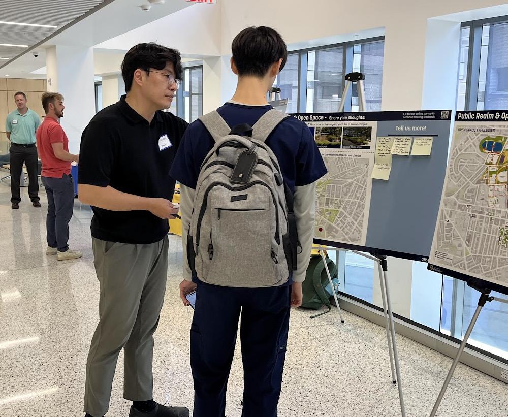
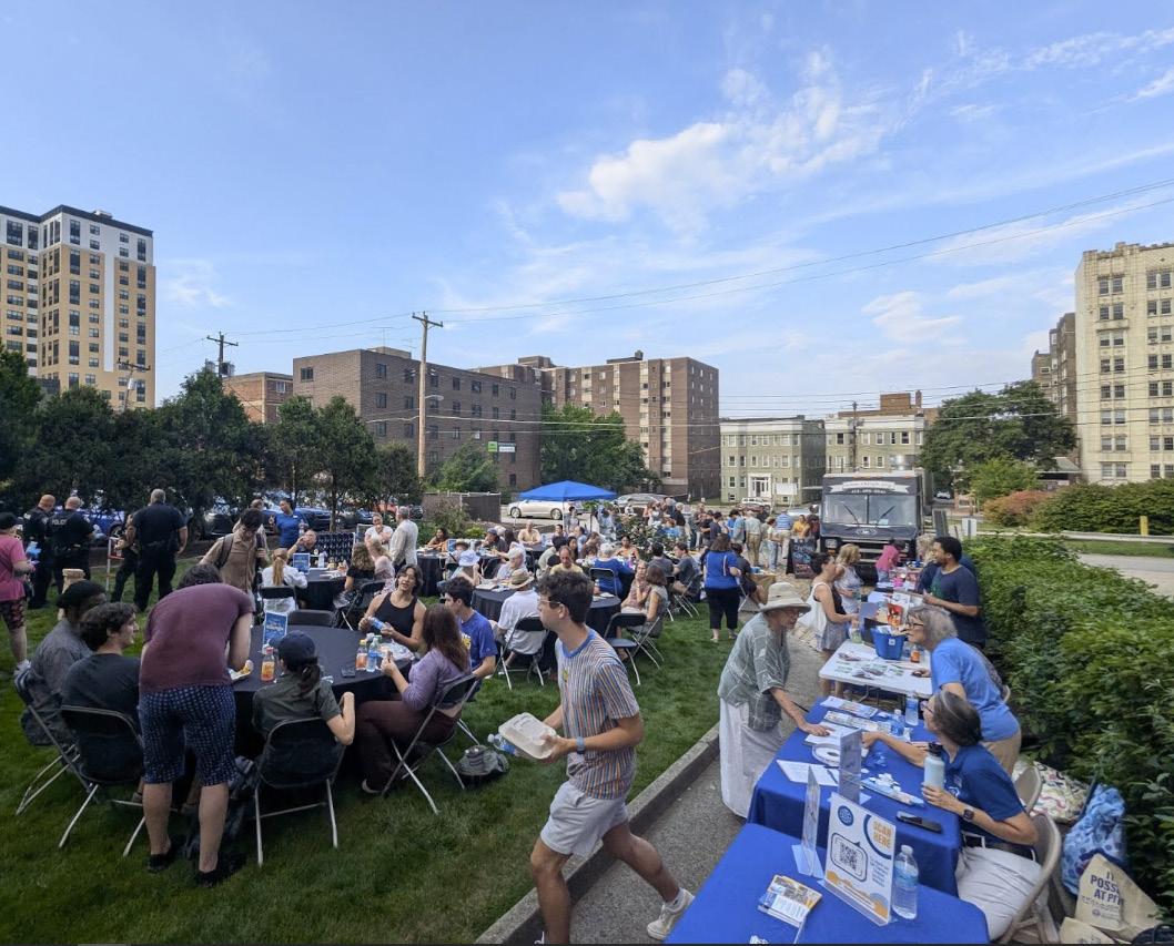
Campus Forum, Scaife Hall Oakland Block Party
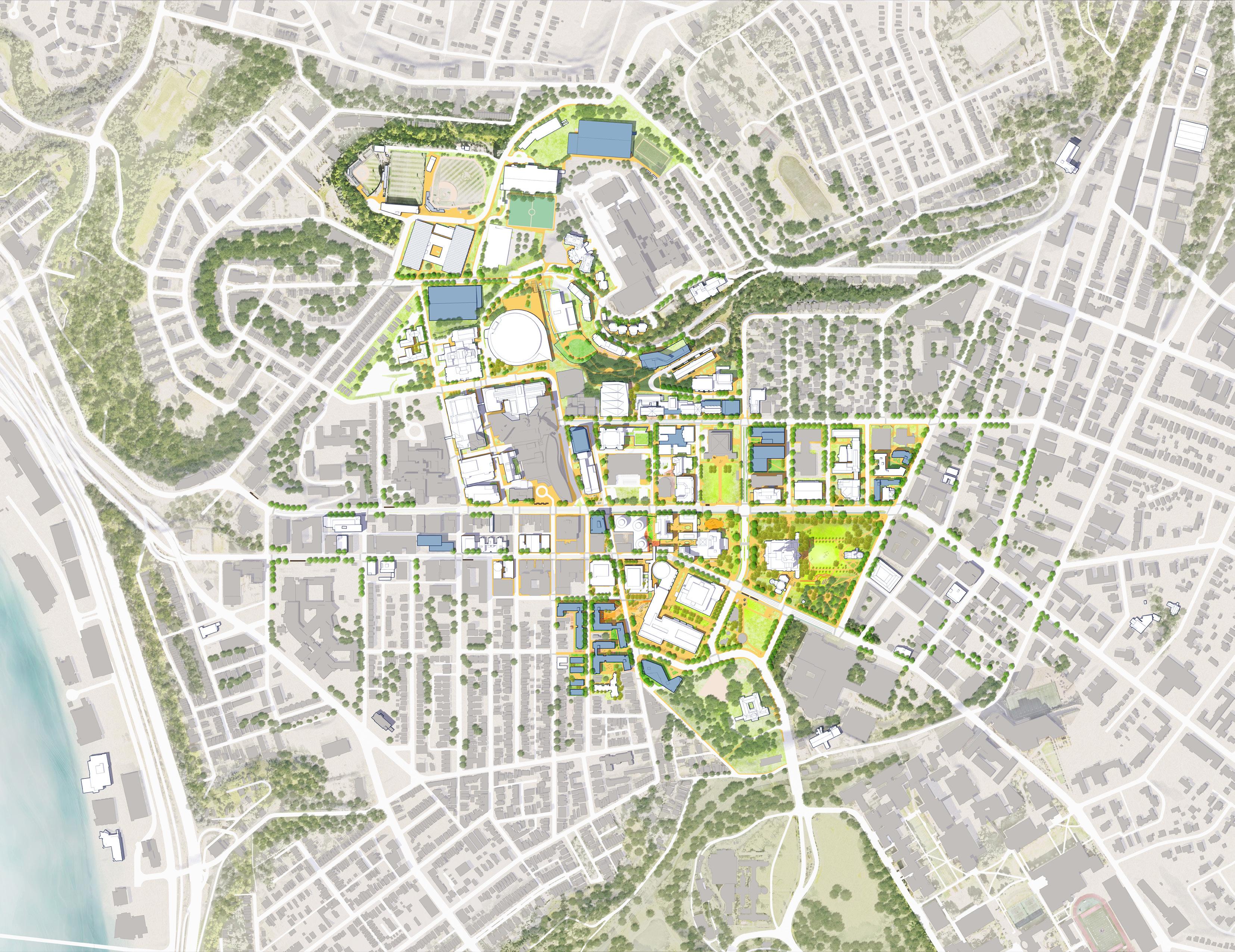
Proposed Vision
CAMPUS MASTER PLAN DRIVERS
Several
drivers inform the priorities and recommendations of the plan including:
• Plan for Pitt 2028
• 2021 Institutional Master Plan (IMP)
• Campus development history
• Historic buildings and context
• Sustainability
• Enrollment growth
• Space needs and utilization
The Plan for Pitt 2028 is the comprehensive strategic framework that serves as the guide for the university’s continued success. Five pillars organize the plan:
• Cultivate Student Success
• Scholarship, Creativity and Innovation
• Welcoming and Engaged
• Accountability and Trust
• It’s Possible at Pitt
The 2021 IMP, in conjunction with the City of Pittsburgh, is a broad, legally binding plan for the physical development of the Pittsburgh campus. It establishes both general and specific quantitative goals categorized under an array of topics, including mobility, infrastructure, neighborhood impact, housing and transportation. The CMP supports and advances the commitments made in the 2021 IMP. If there are any deviations from the 2021 IMP, Pitt will amend the IMP in advance of the specific project.
The storied history of Pitt’s campus development likewise plays a significant role informing its present as well as its future. Three major planning eras shape the campus of today: Franklin Nicola’s early twentieth-century City Beautiful vision for Oakland, the Acropolis Plan of 1908, and a pivot towards the “tall building” concept in the 1920s—which prompted the design and construction of, most notably, the Cathedral of Learning.
Following the mid twentieth century, a fourth era of planning and development emerged in the post-war and brutalist styles that contribute to Pitt’s enduring architectural legacy today.
In addition to its commitment to the historical legacy of the campus, Pitt’s emphasis on sustainability is a key value of the Campus Master Plan. The plan takes into consideration the impact areas and goals of the 2025 Pitt Sustainability Plan and the 2022 Climate Action Plan, which establishes Pitt’s goal to reach carbon neutrality by 2037 (the university’s 250th anniversary).
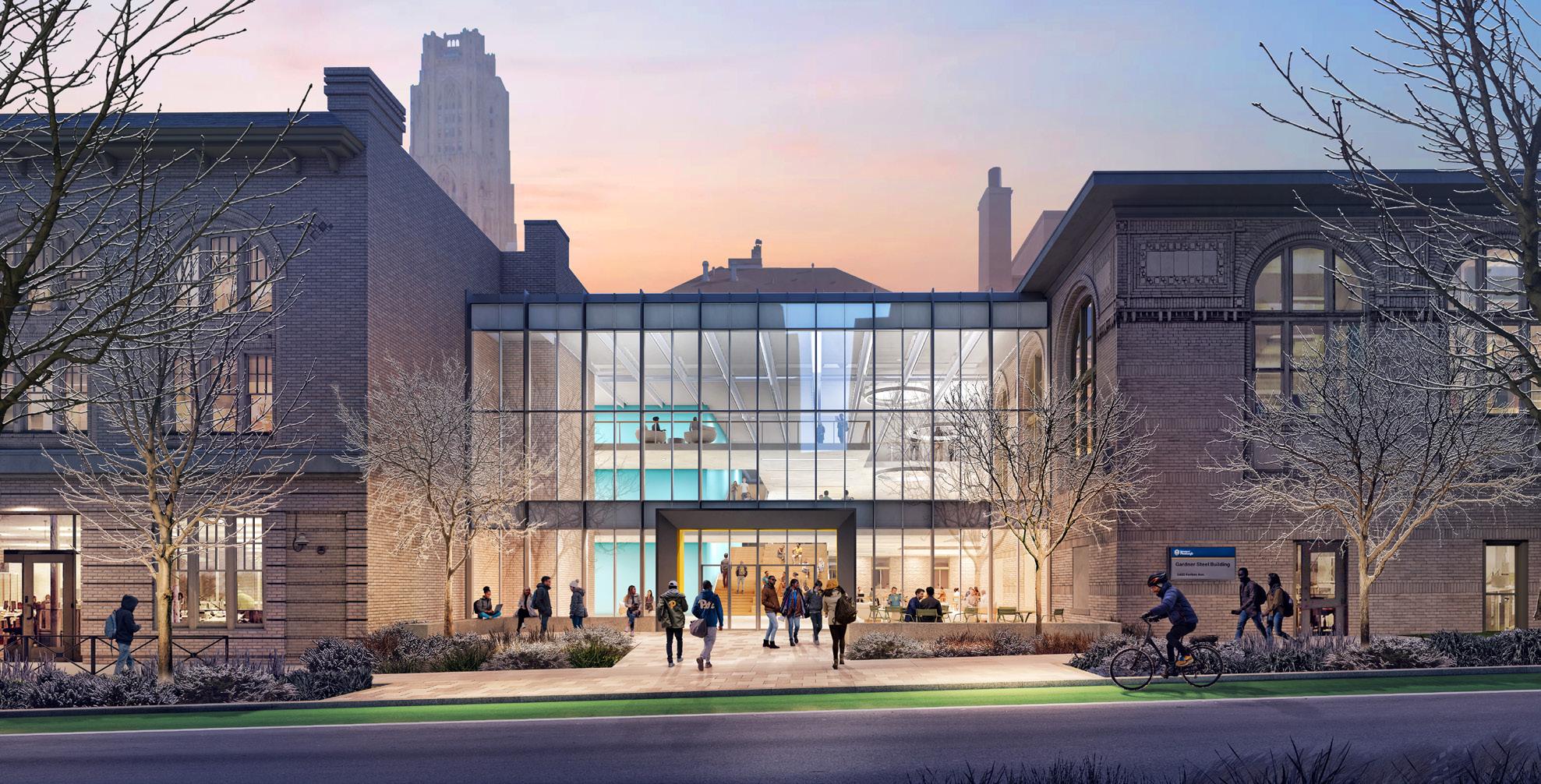
Collaboration Hub At O’Hara and Gardner Steel
A forward-looking document, the plan anticipates and responds to the development of the Pitt community in the coming years. It projects enrollment increases for undergraduate, graduate, and professional students. Accordingly, planned development reflects growth in academic, research, innovation, and campus life, introducing strategic renovations and new facilities tied to space needs and utilization. The plan focuses on the campus experience, providing direction for improvements to the public realm and addressing broader goals for the campus and Oakland.
Planning Principles
The CMP establishes a vision for a vibrant urban campus environment grounded in the history and traditions of the university, its unique place in Oakland, and the academic, research, and partnership initiatives outlined in the Plan for Pitt 2028.
The following principles emerged from the collaborative planning process and are reflected in the plan’s big ideas, vision, and framework plans.
ELEVATE THE CAMPUS EXPERIENCE ENHANCE CAMPUS IDENTITY
1 2 3 4 5 6
A SENSE OF BELONGING STRENGTHEN CONNECTION
THE COMMUNITY BUILD A SUSTAINABLE FUTURE
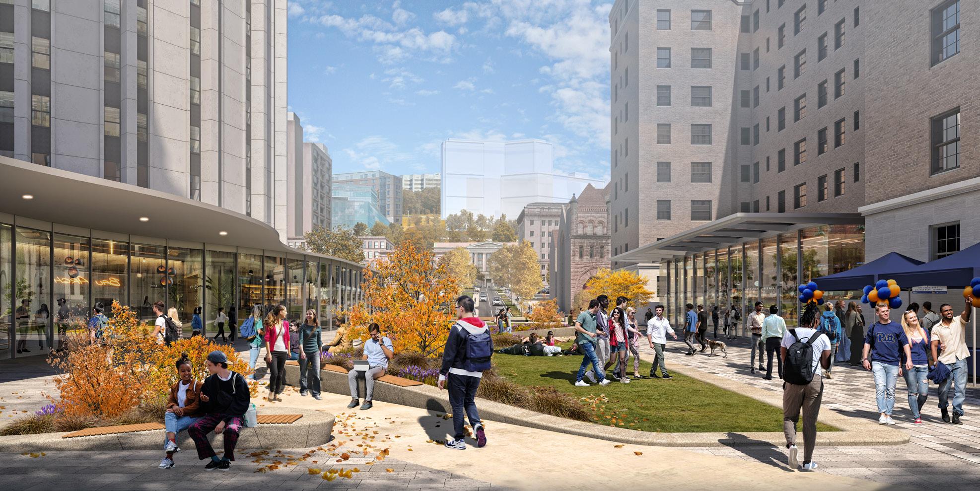
Renewed Litchfield Plaza
CAMPUS MASTER PLAN VISION
The Campus Master Plan reinforces Pitt’s vibrant urban campus, rooted in the history and traditions of the university, anchored to its unique place in Oakland, and informed by and committed to its academic, research and community engagement initiatives outlined in the Plan for Pitt 2028. It establishes a vision for the continuation of campus development.
The vision responds to the five Plan for Pitt pillars with complementary principles and six Big Ideas. It is a foundational revisit of the 2019 Campus Master Plan, with an attention shift to two key areas:
· The public realm
· Stewardship of our historic building portfolio
The public realm connects the fabric of campus within the Oakland neighborhood, and the city of Pittsburgh, foundational to the experience of campus, city and life. The plan establishes and reinforces gateways, pathways and connections, elevating the pedestrian experience for a more intuitive and inclusive navigation of campus. Whether student, faculty, staff, neighbor, visitor or
passerby, the vision welcomes all to campus, fostering a pride of place at the University of Pittsburgh.
The CMP embraces Pitt’s recent acquisitions, of the Twentieth Century Club and the Pittsburgh Athletic Association, accentuating the existing trove of early twentieth century architectural gems, including the competition-winning Acropolis Plan, the skyscraping Cathedral of Learning or the myriad former social clubs of Oakland. It proposes continued and future uses for the historic structures, reinvigorating them while celebrating their rich fabric, and creating additional student space along the pathways of campus.
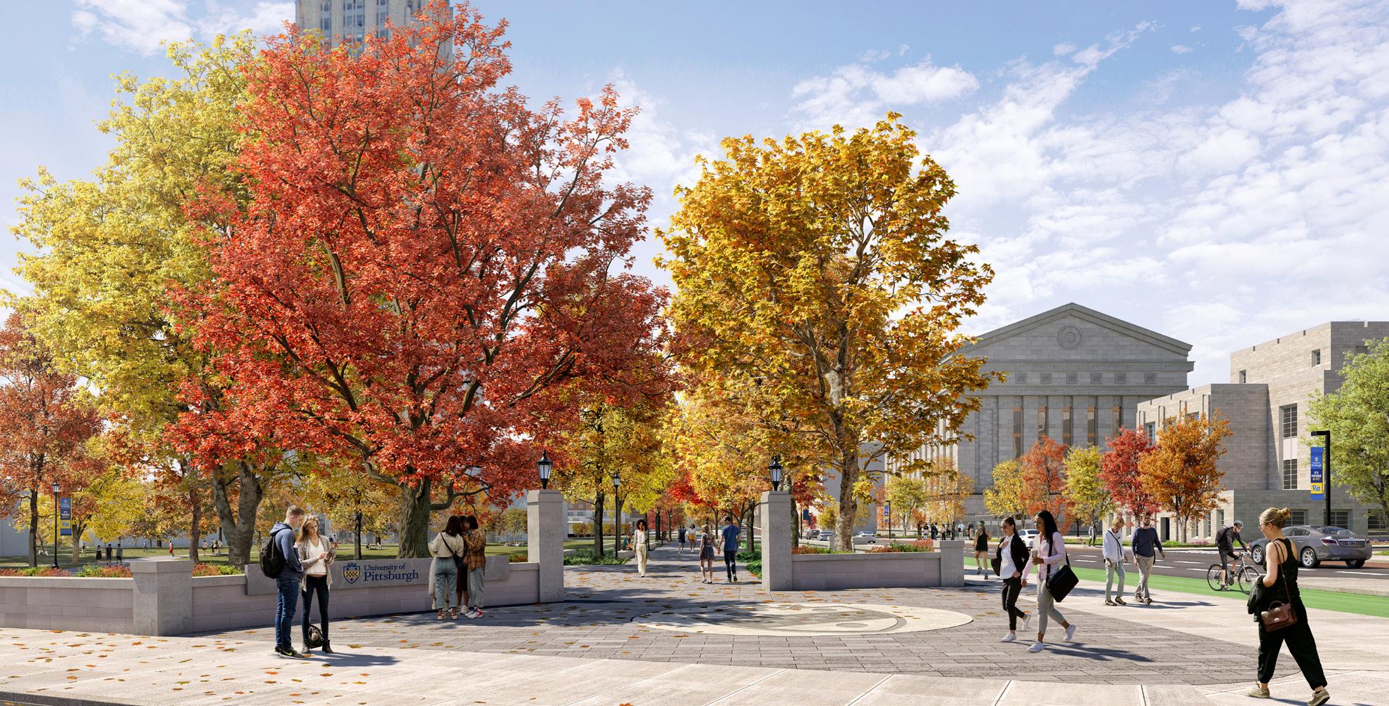
Proposed Cathedral Lawn Gateway at Fifth Avenue and Bellefield Avenue
Big Ideas
The plan’s six “Big Ideas” supplement the planning principles’ broad ideals with specific guidelines for physical development.

1
2
ENRICH THE CAMPUS EXPERIENCE AND STUDENT SUCCESS PROMOTE PITT’S PRIDE OF PLACE
Enhance the sense of place in Oakland and in the City of Pittsburgh through proposed public realm improvements along major streets, gateways to campus, restoration of iconic public spaces, and new buildings that honor the architectural legacy of the campus.
4
CREATE A RICH, CONNECTED AND ACCESSIBLE PUBLIC REALM
Enhance campus life through the introduction of new spaces for student engagement. The renewal and expansion of campus housing and the transformation of the Pittsburgh Athletic Association building into a new student center will reinforce the student and community experience at the heart of campus.
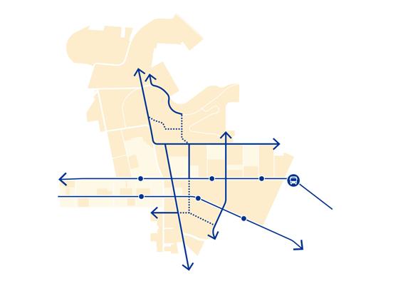
5
CONNECT THE CAMPUS
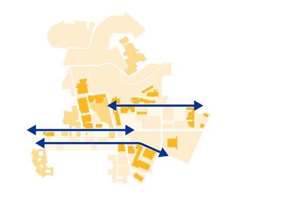
3
FOSTER ACADEMIC AND RESEARCH INNOVATION
Create stronger linkages between academic buildings, elevate and right-size spaces in support of the Plan for Pitt and the academic and research mission. The plan recommends new and/or expanded facilities for Business, SCI, Nursing, Engineering, Bioengineering and Public Health.

6
STEWARD THE HISTORY OF THE CAMPUS AND OAKLAND
Support campus health and well-being and sustainability goals through adding campusdefining spaces, improving streetscapes and open space, and creating integrated academic, research and social facilities that strive towards universal accessibility.
Improve accessible routes to major campus destinations integrated with transit connections. Implement new campus mobility hubs and enhance the public realm and pedestrian experience with intuitive wayfinding elements to enhance the spirit of place and create a memorable Pitt identity.
Harness the historic character of Pitt’s campus and surrounding context—which sets it apart from peer universities and other urban institutions—to steward a beloved campus fabric across Pitt, Oakland and the City of Pittsburgh.
MISSION AND EXPERIENCE
Academic and Research Recommendations
The academic and research recommendations address the need for academic and student success centers, innovation, interdisciplinary collaboration, shared research hubs and partnership spaces. The plan includes a review of the status of facilities across Pitt’s 16 schools and colleges, addressing both instructional and non-instructional campus needs. It identifies new teaching labs, open labs, renewed classrooms to support contemporary learning, and Academic Support Hubs or Collaboration Hubs (inspired by Pitt Global Hub concept, which facilitates community-building through physical spaces). The recommendations embrace the following principles:
• Efficient and Right-Sized Spaces
• Stewardship of Existing Spaces
• Future-Oriented Spaces
• Quality of Space
• Collaborative Space
Campus Experience Recommendations
The campus experience recommendations provide the amenities, common spaces, residential communities and recreation areas that contribute to the quality of campus life at Pitt. The recommendations address student and community needs through several types of facilities:
• A new student center at the former Pittsburgh Athletic Association Building (which allows for the renewal of the existing William Pitt Union WPU for student housing)
• Distributed dining and food service locations, including new venues
• New and renovated residence halls, recreation facilities, health center, lounges, study space, and collaboration hubs
The recommendations locate academic support and collaboration hubs to welcome a diverse array of students, promote a culture of openness, offer flexible spaces and provide centralized student support services in highly visible locations, linked by improved pedestrian routes.
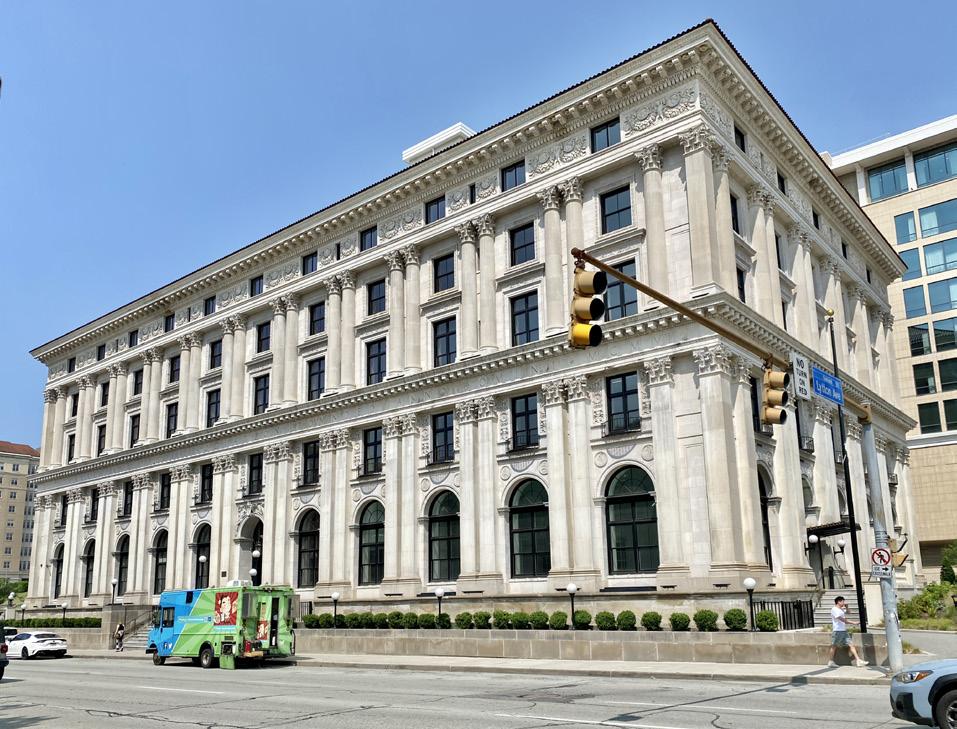
Existing View of the Pittsburgh Athletic Association
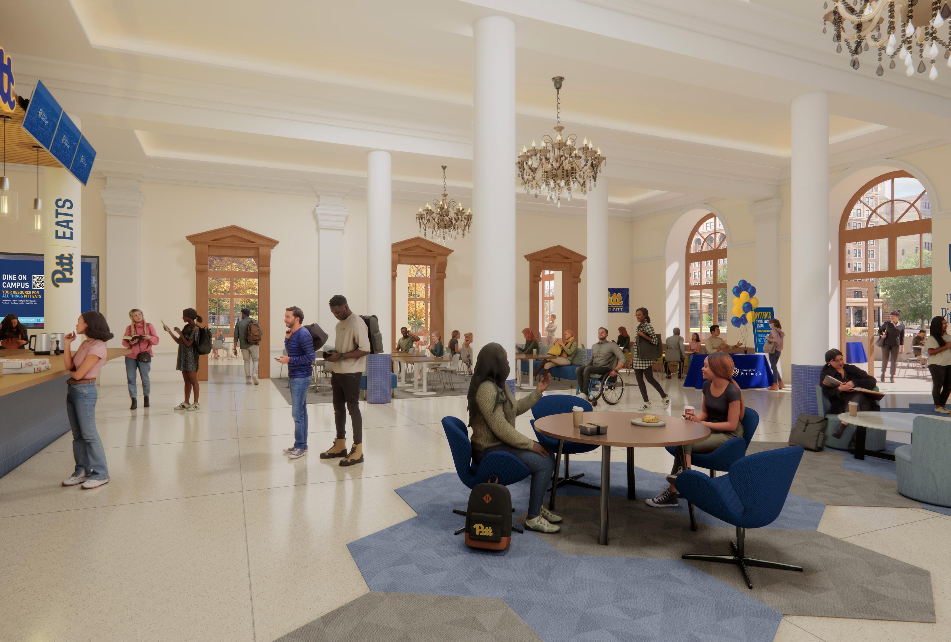
New Student Center at the Pittsburgh Athletic Association
FRAMEWORK PLANS
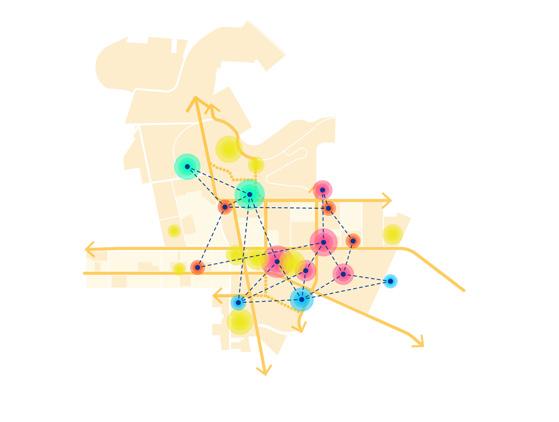
A series of framework plans collectively contribute to a comprehensive and coordinated guide for incremental change and organize the recommendations for the Pitt campus. The framework plans shape an integrated approach for public realm improvements, building renovation and future development.
Community Context Framework
The Community Context Framework plan leverages Pitt’s integral place within Central Oakland and the context defined by nearby institutions (e.g., the Carnegie Museums, Carnegie Mellon University and others). Pitt is a uniquely historic campus, with several of its buildings located within the Oakland Civic Center Historic District and Schenley Farms Historic District (listed on the National Register of Historic Places); the plan recommends building renovations and enhancements to the public realm that honors this historical legacy and satisfies the needs of present and future campus communities.
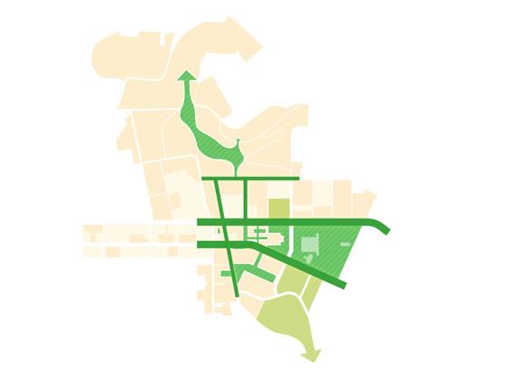
Public Realm Framework
The Public Realm Framework Plan contributes to the urban context established by the streetscapes and open spaces of Oakland as well as the existing cultural facilities, dining, recreation and retail
facilities of the campus. Recommendations include improvements to the ground floors of major buildings to facilitate indoor-outdoor connectivity, as well as new locations for collaboration hubs, amenities, services and retail to form nodes along pedestrian spines. Enhanced gateways, wayfinding, and landscapes, along with site-specific streetscape improvements (such as removal of on-street parking in favor of bike lanes and the creation of planted medians) contribute to the campus experience. The plan also embraces improvements to campus open spaces—like the iconic Cathedral Lawn—with new terraces and places to gather in support of a more welcoming and accessible campus.
Mobility and Accessibility Framework
The Mobility and Accessibility Framework Plan enhances mobility through a series of targeted, data-driven, and stakeholder-influenced recommendations for accessibility and mobility. Responsive to Pitt’s IMP commitments and sustainability goals, the recommendations prioritize accessibility, pedestrian and bicycle mobility, micromobility and bus transit over singleoccupancy vehicle use.
The CMP performed a campus-wide accessibility review with a goal towards universal accessibility and a welcoming public commons linked across shared Pittsburgh city streets and Pitt-owned pedestrian passageways. The plan envisions a more pedestrian friendly, intuitive and vibrant campus within the urban fabric.
Key recommendations target the following categories:
• Accessibility
• Pedestrian Experience
• Bicycle Infrastructure and Amenities
• Mobility Hubs and Shared Mobility
• Transit Optimization
• Parking and Travel Demand Management (TDM)
Sustainability Framework
The Sustainability Framework translates relevant goals included in Pitt’s 2025 Sustainability Plan, Pitt 2022 Action Plan and the City of Pittsburgh’s 2030 climate initiatives into tangible solutions for the built environment. The framework identifies three impact areas embedded within Pitt’s Sustainability Plan that are relevant to physical campus planning: Stewardship, Exploration and Community and Culture. Stewardship translates to recommendations that minimize the impact of energy systems, water management, transportation infrastructure, materials selection and landscape restoration. The framework supports Exploration through an expanded network of research and collaboration spaces. It advances Community and Culture through enhancements to the public realm and open space network and improvements to campus mobility and connectivity, promoting mental and physical well-being across campus.
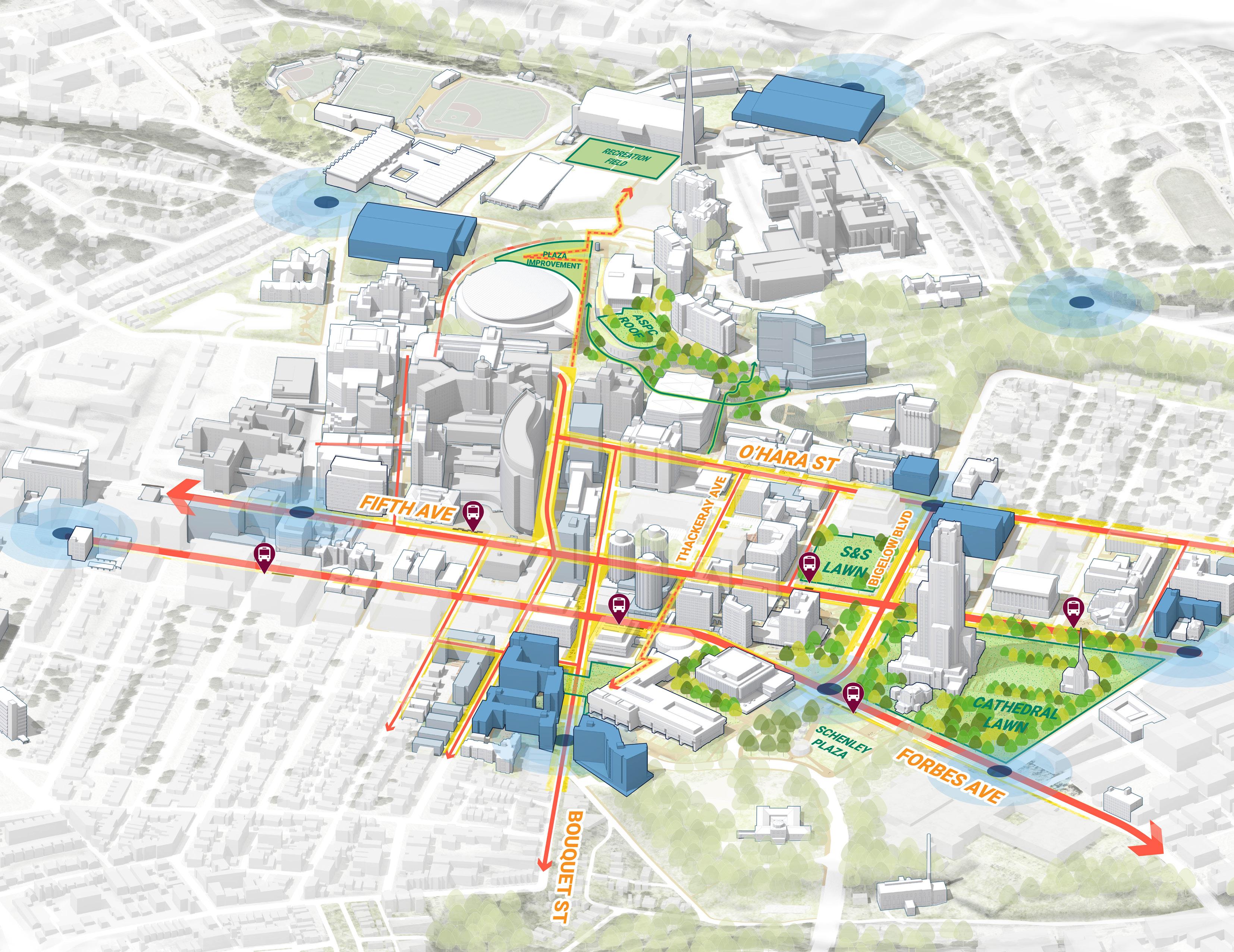
Campus Gateway
Properties Contributing to Gateway Experience
Proposed Buildings Contributing to Gateway Experience
Streetscape Improvement
In-block Pedestrian Connections
BRT Station
Major Open Space
HOUSING PLAN
Concurrent with the development of the Campus Master Plan, the consultant team conducted an analysis of existing on-campus housing facilities and developed a plan to accommodate housing targets established by the University and projected enrollment growth.
Drivers
The following drivers determine the on-campus housing demand for undergraduates.
1
Housing Plan Goals
In addition to meeting the housing demand, the housing plan seeks to achieve the following goals to bolster the residential life experience:
The undergraduate housing needs and aspirations are integrated in the Campus Master Plan with the aim of enhancing the undergraduate student housing experience and contributing to the quality of life on campus while remaining competitive with peer institutions. Furthermore, the vision for each of the major housing neighborhoods align with the broader planning goals for each campus district.
2 Enrollment Growth
The Plan for Pitt 2028 and BHAS Housing Strategic Plan (2024) aim to raise on-campus residency from 41% to 60% while accommodating growth.
Three-Year Housing Guarantee
3
4 Commitment to the City Existing Facility Conditions
Enrollment growth has strained Pitt’s three-year housing guarantee, leading to increased density, removal of lounge spaces, and leasing of nonUniversity owned housing.
The 2021 Institutional Master Plan commits to delivering 1,400 new residential beds by 2031 to accommodate growth and expand on campus housing options in Oakland.
Existing facilities require significant reinvestment, with some halls slated for renovation, demolition, or replacement which requires new beds for swing space.
To accommodate growth, increase capture rate, renovate/redevelop the existing housing portfolio, and exit leases, the projected demand totals 12,100 beds, or 4,950 new undergraduate beds on campus
• Provide a range of housing options to support students throughout their collegiate experience.
• Establish a variety of residential experiences across campus districts with convenient access to academic life and campus amenities.
• Enhance and expand the available social spaces and amenities in each of the residence halls and campus districts.
• Create a welcoming and inclusive residential experience.
• Support Pitt’s sustainability goals and policies.
Renovations and New Construction
Proposed renovations to existing facilities include:
• William Pitt Union Housing Conversion
• Lothrop Hall Renovation and Renewal
• Litchfield Towers Renovation and Renewal
• Schenley Quad Renovation and Renewal
New construction is proposed at the following sites:
• Music and IS Sites
• Tower D
• Hillside Housing
• Central Oakland
• Mervis Hall Site
• Shirley and Mayflower Sites
Housing Plan
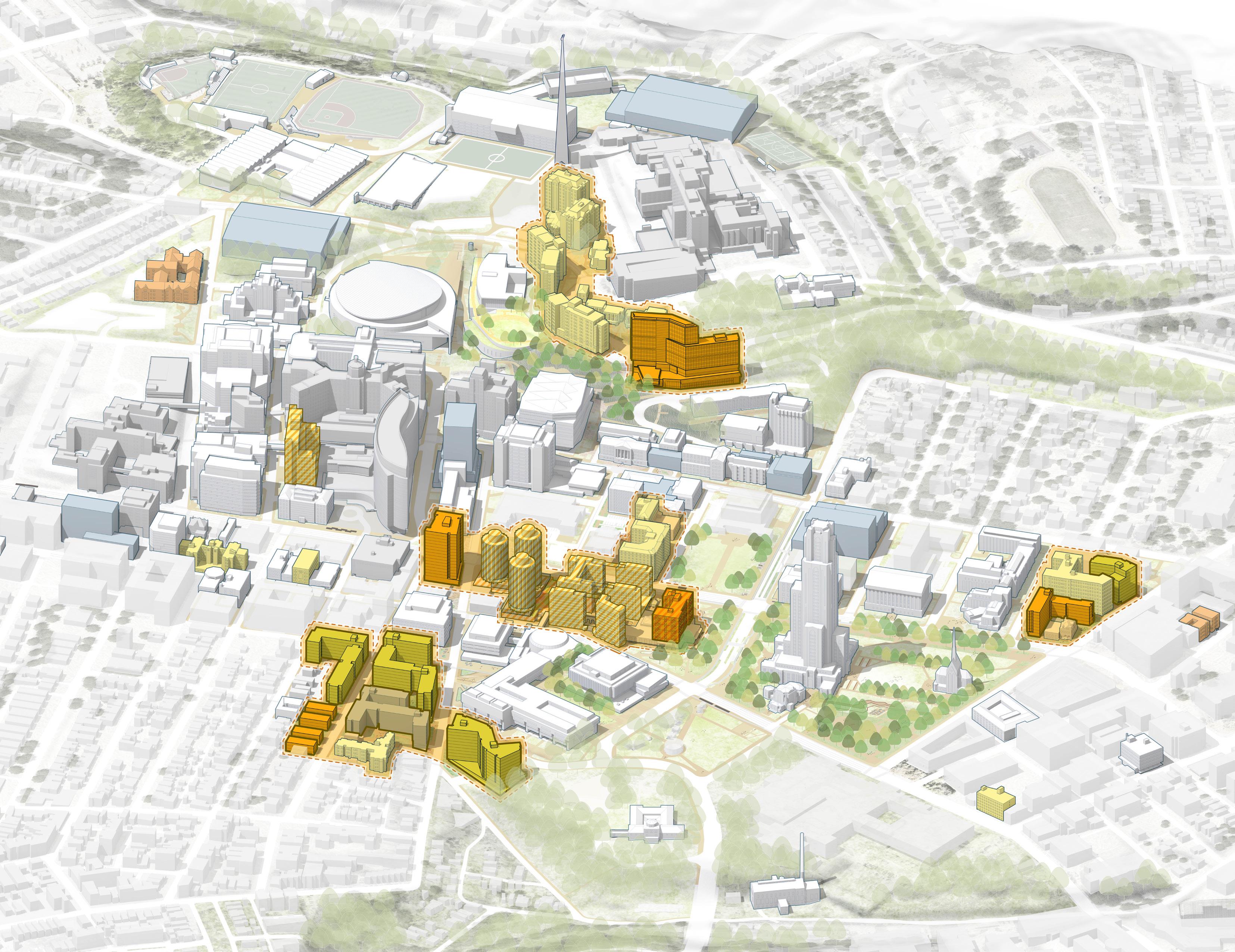
CAMPUS DISTRICTS
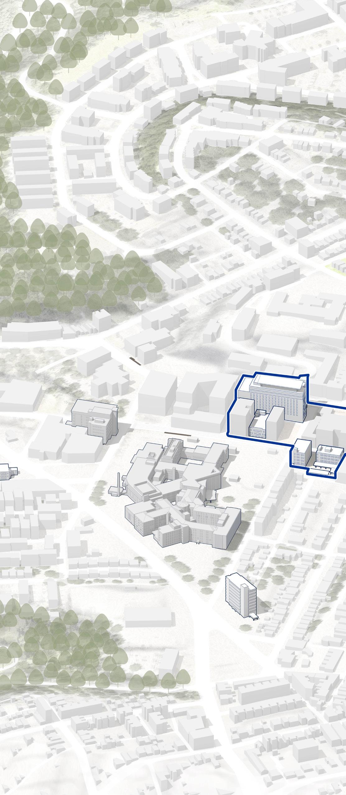
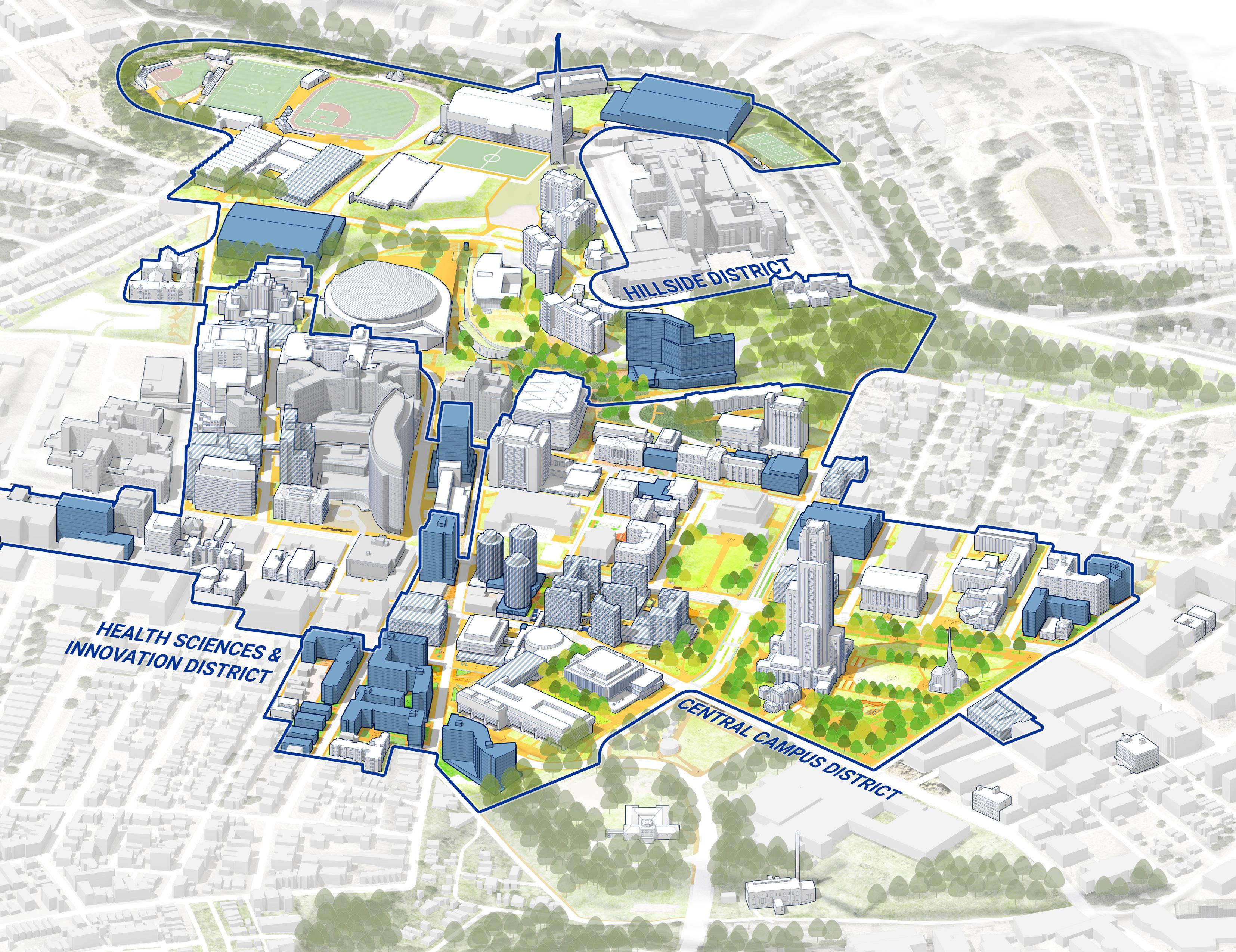
The campus plan defines three campus districts:
• Central Campus District
• Health Sciences and Innovation District
• Hillside District
Pitt Owned Building
Pitt Affiliated Building
Proposed Building within the District
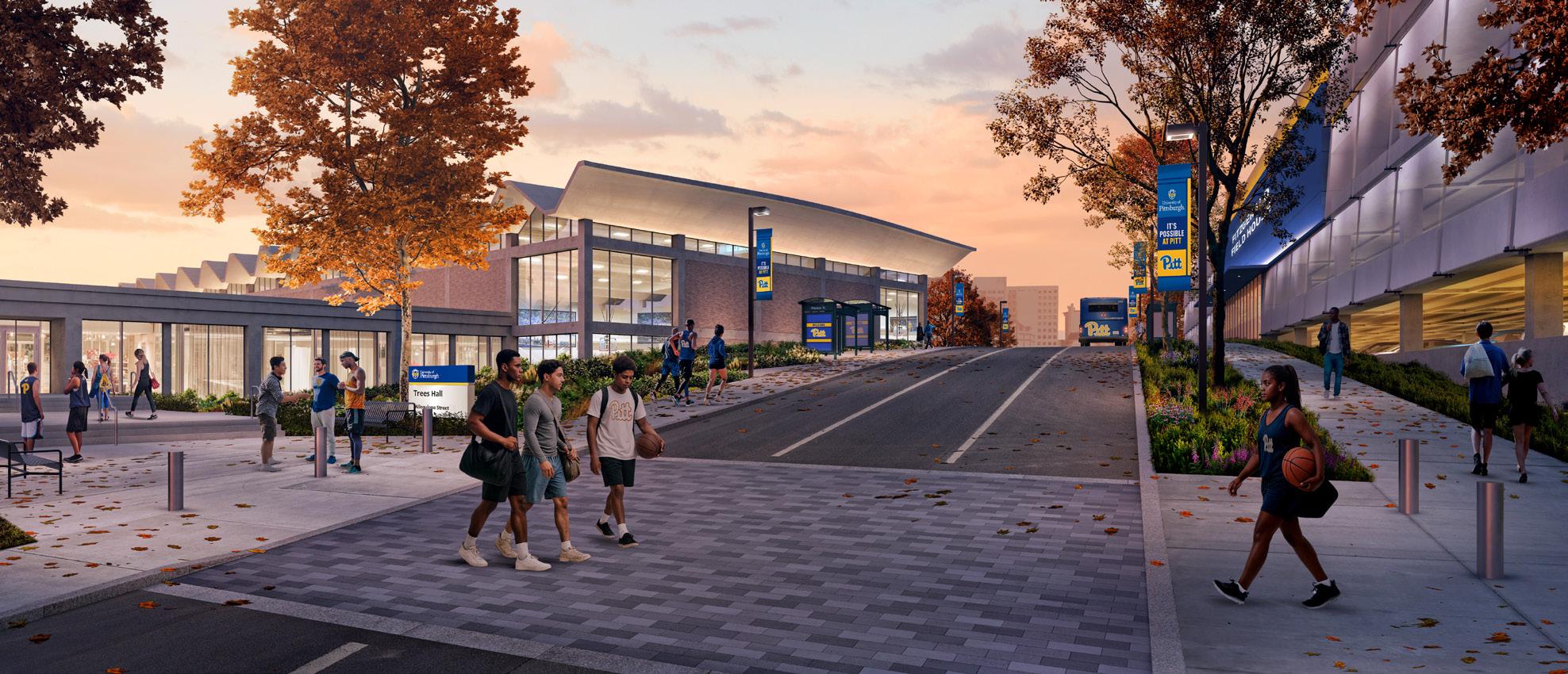
Proposed Trees Hall Renovation and Fitzgerald Field House Redevelopment in the Hillside District
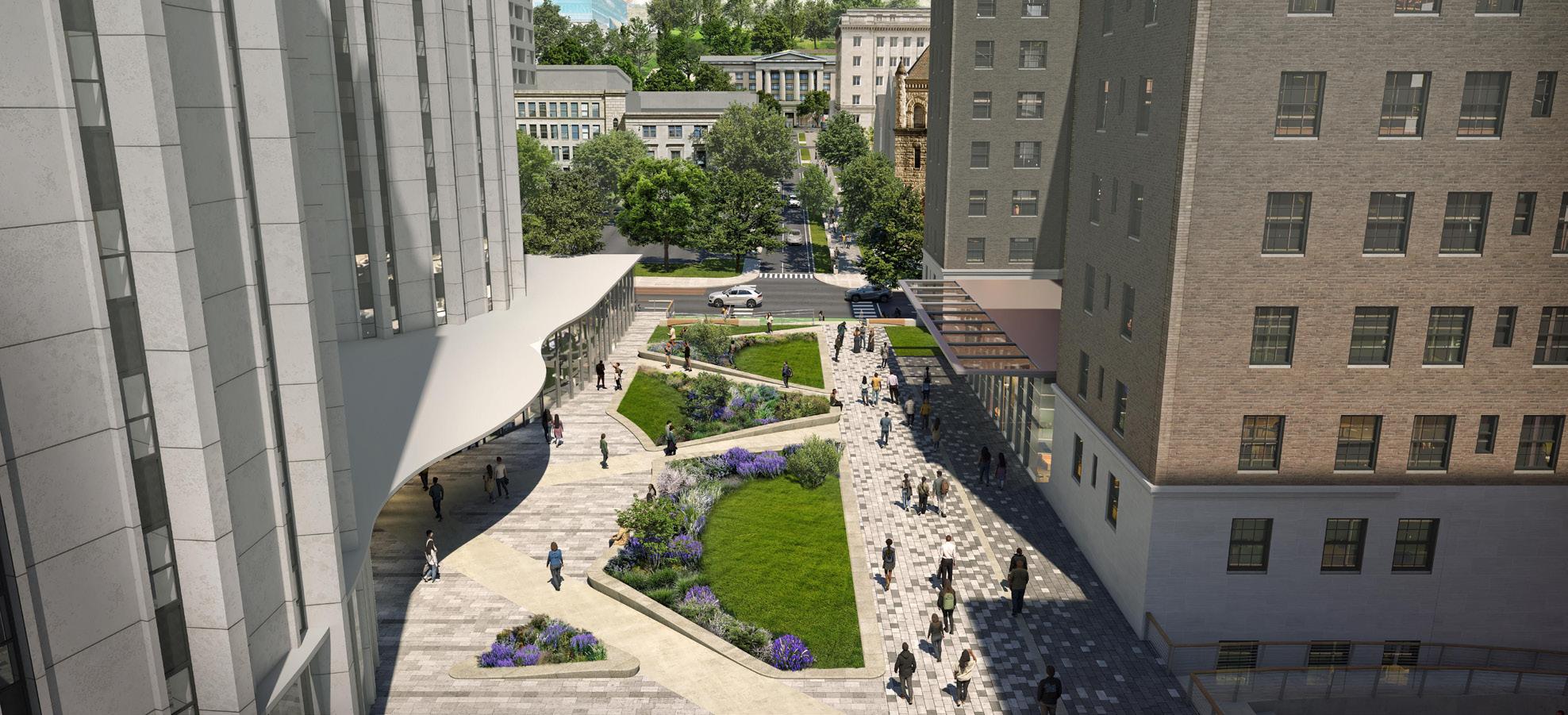
Proposed Litchfield Plaza and Thackeray Avenue Corridor in the Central Campus District
CENTRAL CAMPUS DISTRICT
The Central Campus District encompasses the iconic and memorable buildings of the Central Oakland Historic District. Envisioned as the academic, social and cultural heart of the Pitt campus, the Campus Master Plan includes recommendations for the public realm, renovation and new construction as follows:
Cathedral Lawn Area: improvements to the lawn envisioned by the Olin Partnership create a welcoming and engaging landscape experience for the campus and broader community.
Pittsburgh Athletic Association (PAA): the transformation of the iconic PAA building into a student center in an historic, appropriately scaled space to encourage student engagement and activities in the heart of campus.
William Pitt Union: the conversion of the William Pitt Union to student housing, while maintaining the historic ground floor lobbies and ballrooms, contributes to the first-year student housing and broader campus experience.
Schenley Quad: a vision for renovating the buildings in the Quad contributes to the first-year experience. Changes to the plaza level contribute to accessibility and pedestrian movement and establish a new connection to the bookstore from Litchfield Plaza.
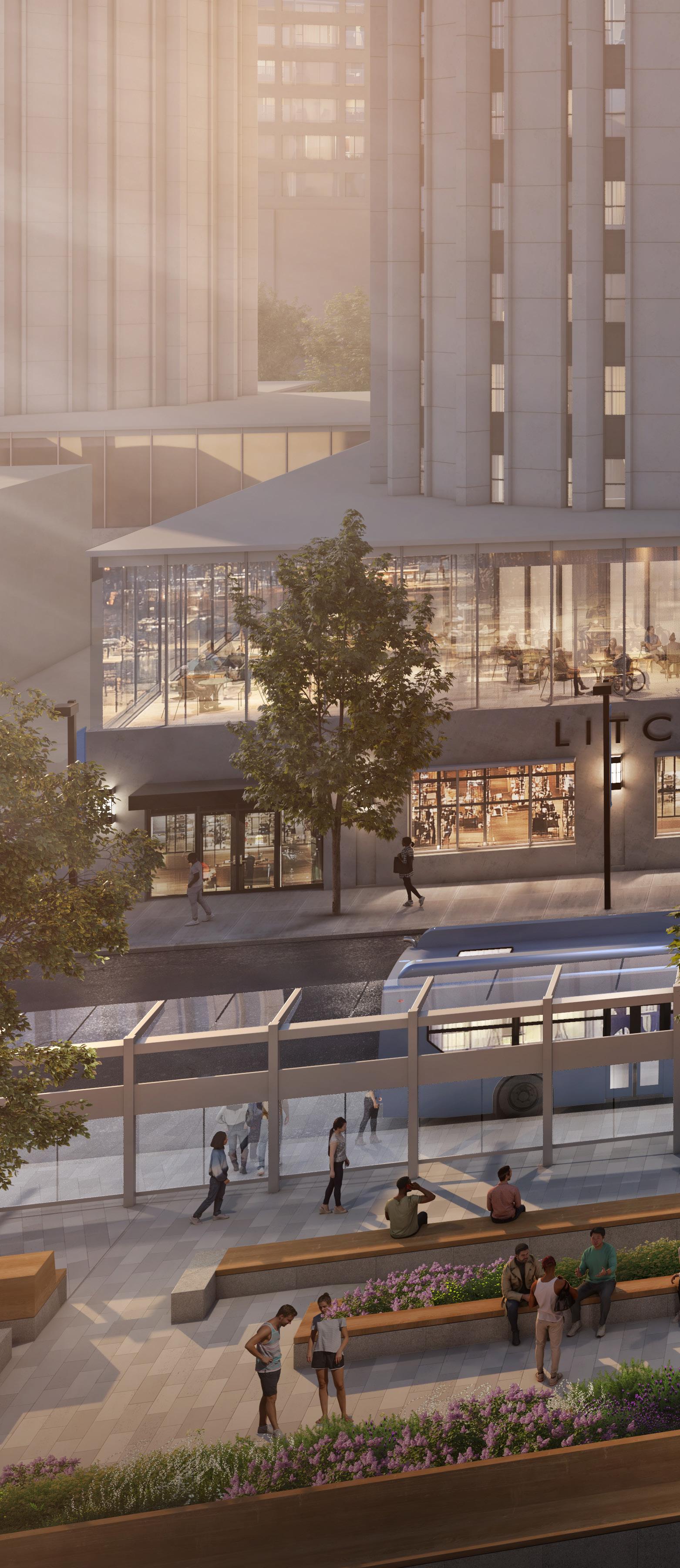
Litchfield Plaza: proposed improvements enhance the accessibility and experience of movement toward Fifth Avenue where new stairs and ADA ramps connect to street level. Reimagined lounges define the base of the Towers contributing to the resident experience and vibrancy of the plaza.
Thackeray Corridor: envisioned as the north-south central spine of the campus connecting Posvar on the south to Allen Hall on the north, Thackeray Ave is the focus of major public realm improvement, including enhanced crosswalks at Fifth Avenue and wider pathways along the east side of the street from Fifth Avenue to O’Hara Street.
Tower D: a new residential building west of the Litchfield Towers, referred to as Tower D, expands the housing capacity for first year students and provides ground floor amenities and retail.
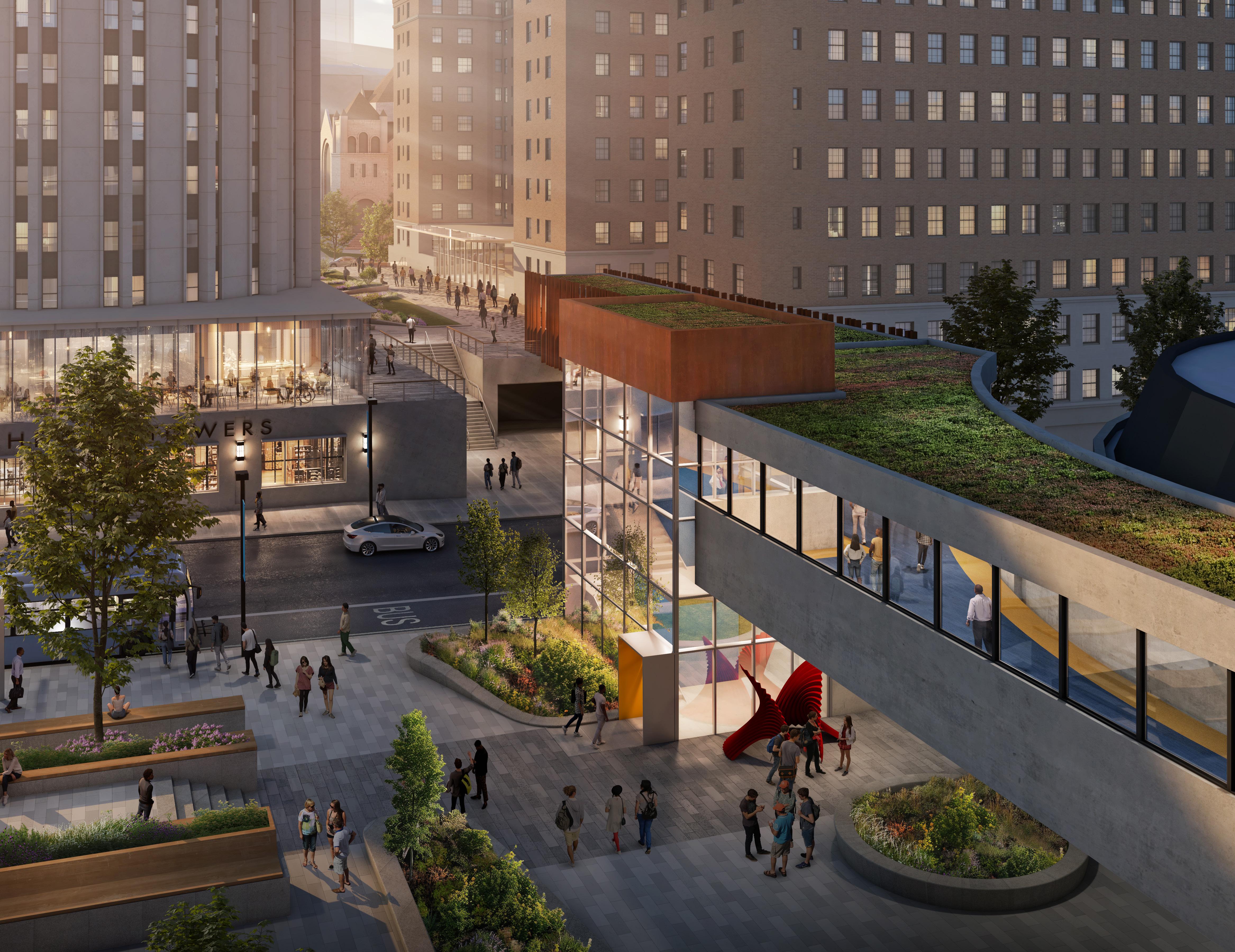
Posvar Pathways: ground level landscape and pathway improvements facilitate connectivity from Schenley Drive to Bouquet Street where a raised crosswalk and plaza connect to proposed redevelopment in Central Oakland. Changes to the Forbes Avenue bridge include a new elevator and stair tower leading to the proposed BRT stop and renewed plaza in front of Barco Law.
Central Oakland: proposed redevelopment provides higher density housing and student support facilities for upper division students. Public realm improvements extend Louisa Street from Atwood Street to Bouquet Street while providing for lowerlevel parking. Over the long term, the plan
recommends the demolition of Mervis and the Information Sciences Building to provide additional housing.
O’Hara Street: The plan builds upon the established and proposed uses along O’Hara Street to create a Collaboration Corridor linking biology, chemistry, physics, astronomy, engineering, public health and medicine. Streetscape improvements widen sidewalks, enhance crosswalks, and add street trees and bike lanes on both sides of the street. Proposed development includes:
• An infill building between Gardner Steel, O’Hara and Thackeray providing additional classroom, student amenity and collaboration space.
• An atrium between Allen Hall and Thaw Hall features amenity space and accessibility improvements.
• A proposed science building at the northwest corner of the O’Hara and Bigelow / Parkman intersection accommodates new teaching and research labs.
• New buildings on the One Bigelow site offer space for future academic, research and collaboration needs for the School of Business and School of Computing and Information Sciences
• A renovated Twentieth Century Club accommodates a visitor / welcome center, the Pitt Alumni Center, Board of Trustees meeting rooms, and Philanthropic and Alumni Engagement.
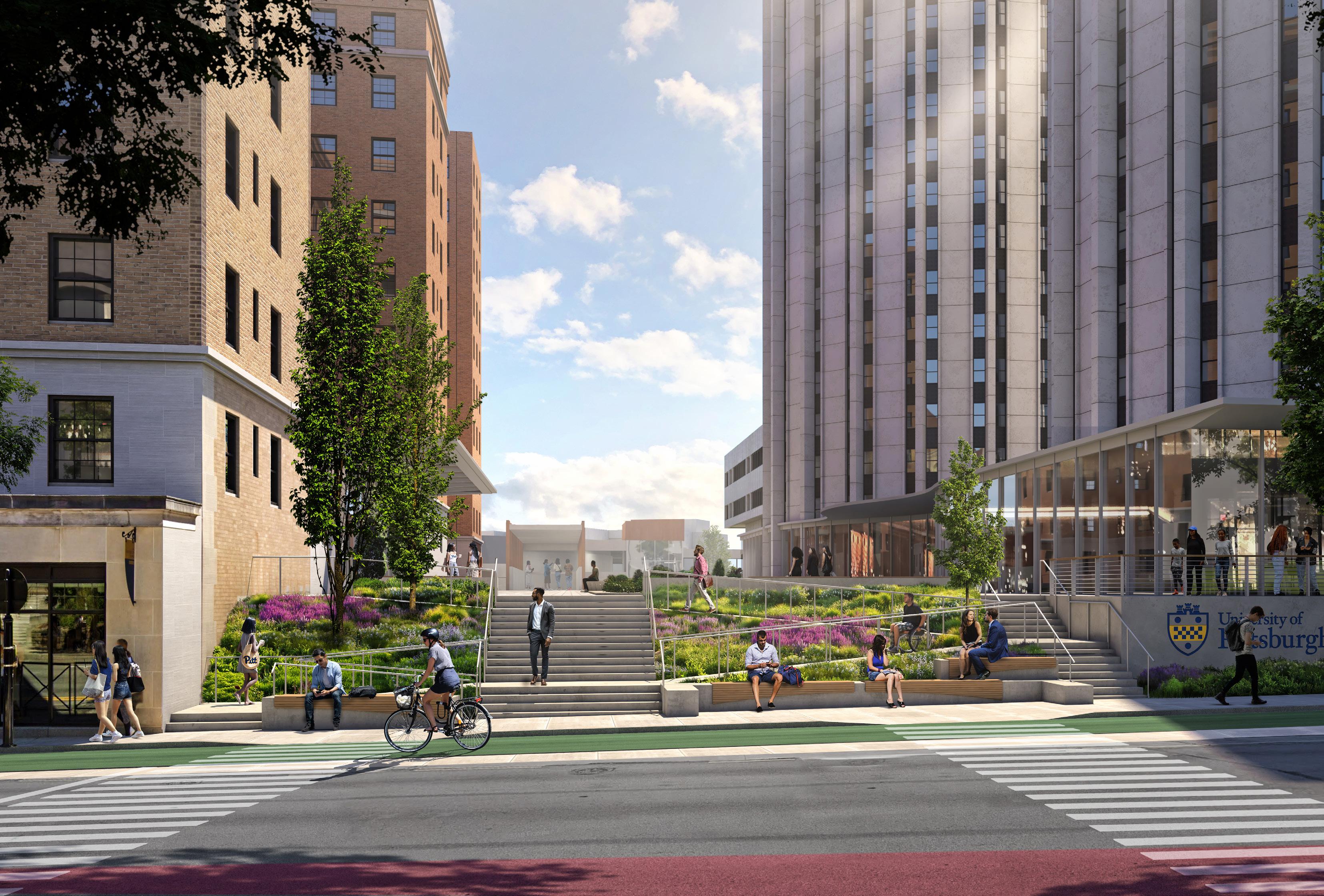
A renewed Litchfield Plaza illustrating the proposed accessible ramp to Fifth Avenue
Proposed Gateway and Music Site Housing Development at Fifth and Bellefield
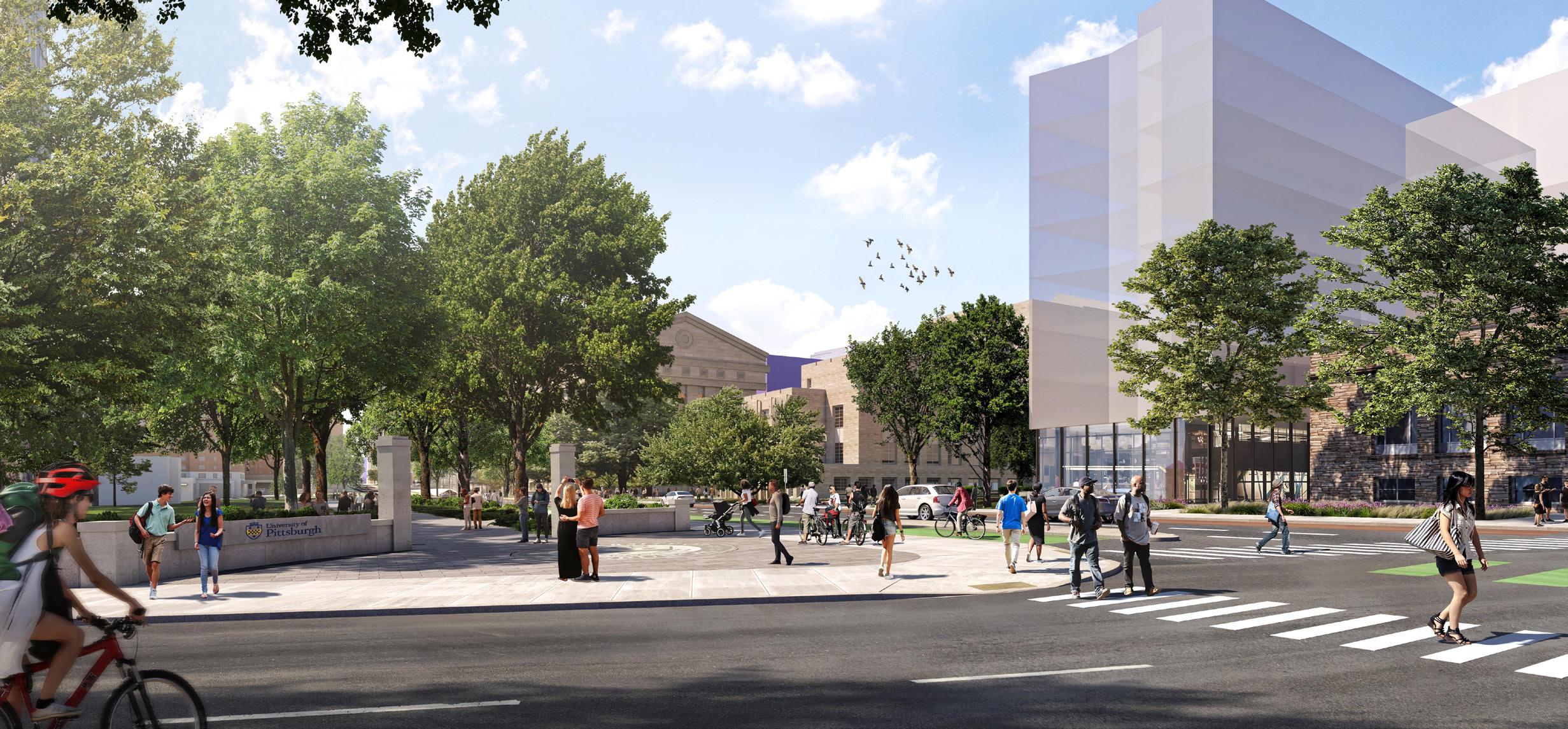
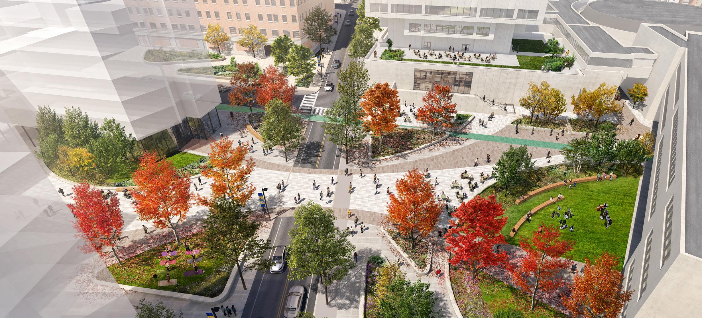
Proposed Posvar Gateway
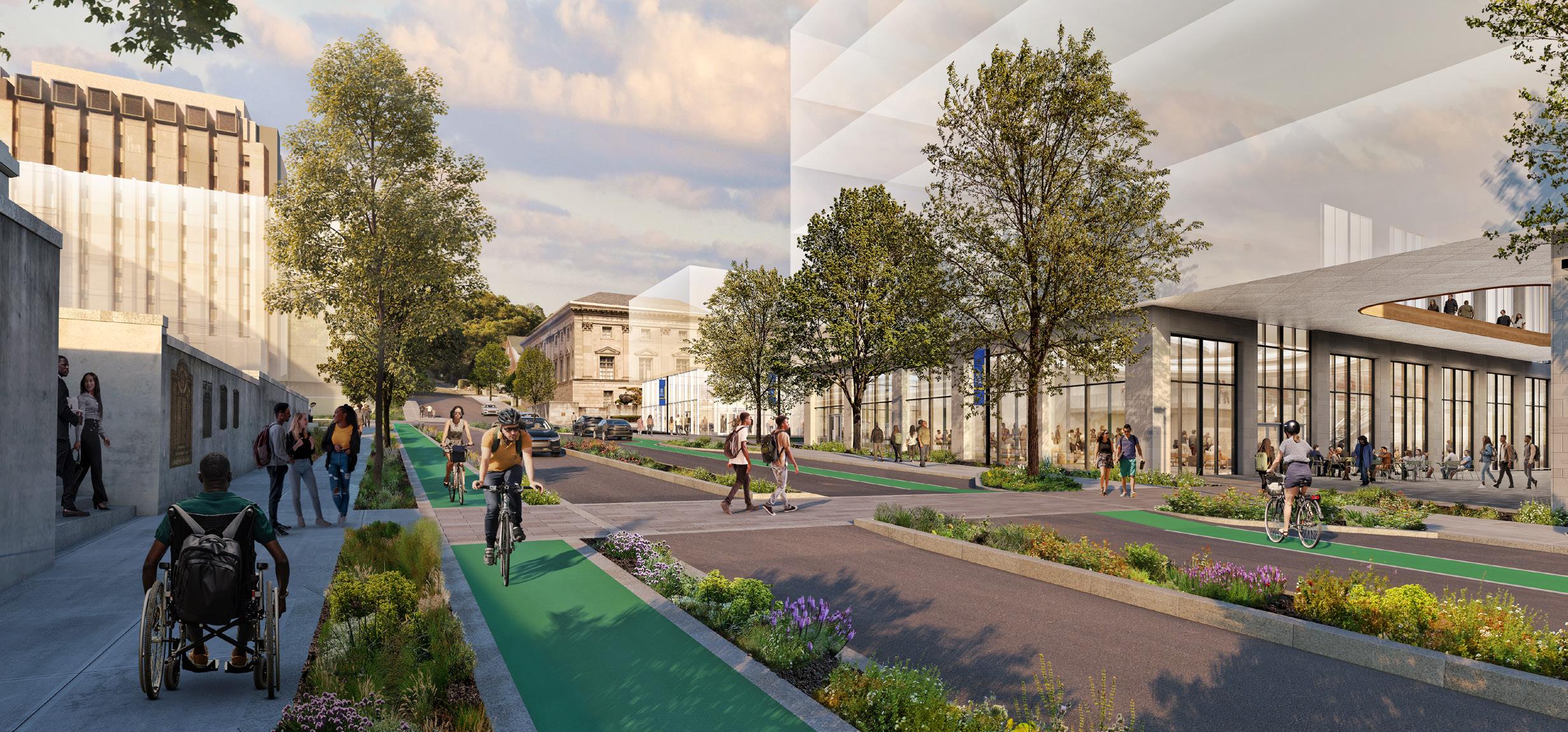
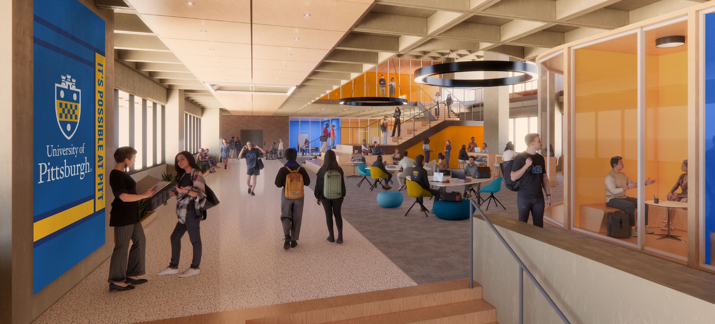
Proposed development and streetscape improvements at One Bigelow
HEALTH SCIENCES AND INNOVATION DISTRICT
The Health Sciences and Innovation District includes the School of Medicine and the Health Sciences located north of Fifth Avenue and the area along Forbes Avenue, which aligns with the Pittsburgh Innovation District.
The plan reinforces existing Health Science programs in the School of Medicine, School of Nursing, School of Dentistry, School of Pharmacy, School of Public Health, and the School of Health and Rehabilitation Sciences—while providing recommendations for incremental renovations and public realm improvements. It proposes three major renovation projects (Lothrop, Victoria and Salk Hall Annex) as well as the redevelopment of the following sites:
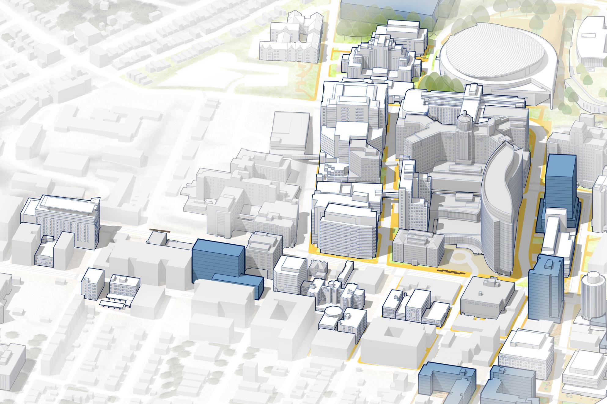
• Crabtree Site: Redevelopment of Crabtree allows for a multi-disciplinary academic and research building featuring a ground level collaboration hub that bridges Health Sciences, research, engineering, and innovation.
• Croatian Fraternal Union and Next-Tier Bank Sites: Redevelopment of the combined sites accommodates growth in the Health Sciences.
Building off the Pittsburgh Innovation District, the Health Sciences and Innovation District convenes university anchors, encourages cooperation between university and industry, fosters growth for startups and entrepreneurs, and nurtures community engagement and development. It also supports the public realm improvements planned by the City of Pittsburgh, notably streetscapes and BRT services along Forbes and Fifth Avenue.
In addition, Pitt envisions an incubator as a launchpad at 3343 Forbes Ave to provide space for incubation and acceleration as part of a life science startup ecosystem.
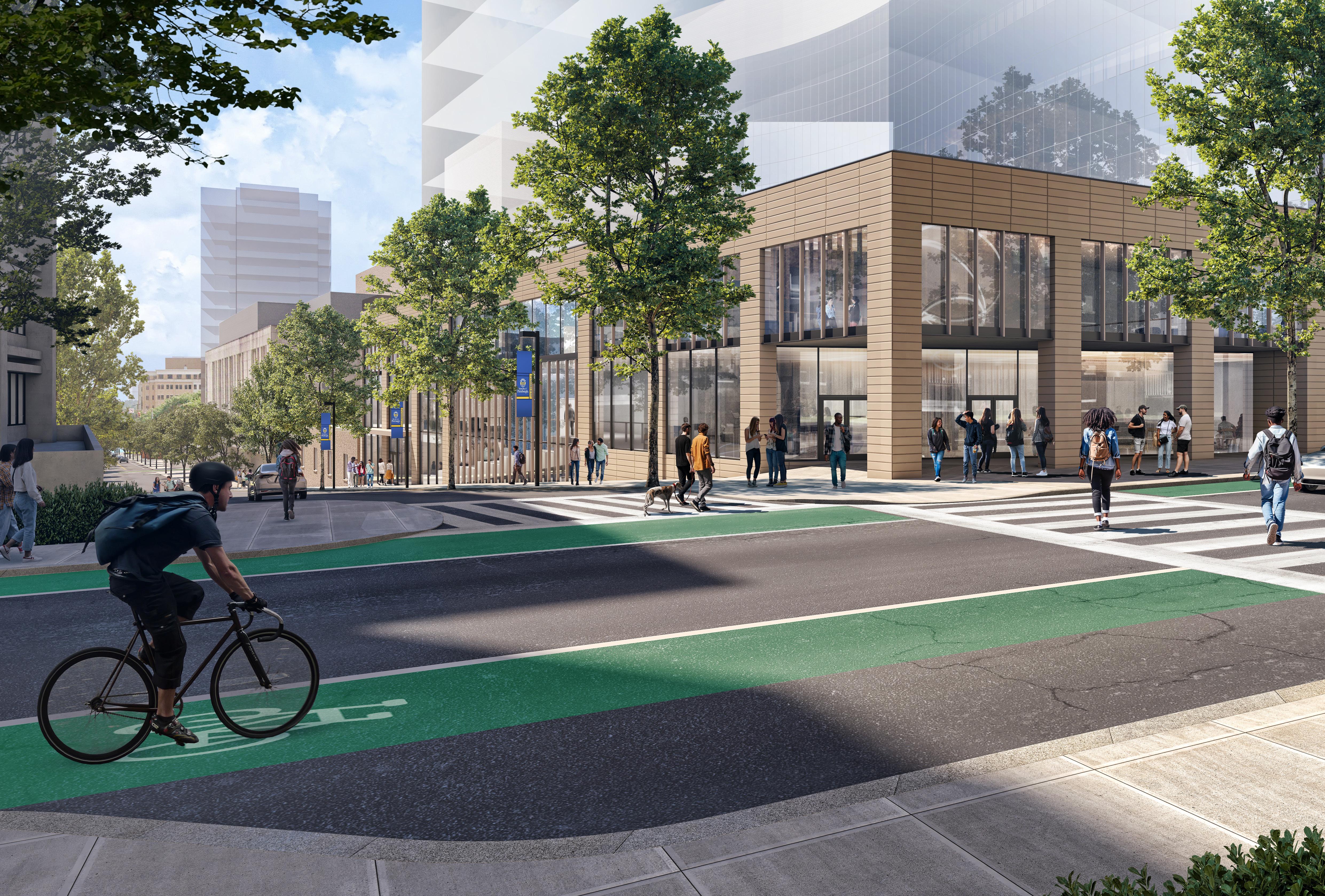
Public Realm Improvements and New Academic and Research Development at Crabtree Site
HILLSIDE DISTRICT
Located immediately to the northwest of the Central Campus and Health Sciences and Innovation Districts, the Hillside District’s major facilities include athletics, student housing, recreation fields and related programs.
The plan envisions improvements to the public realm, campus gateways, renovated and new athletic and recreation facilities, new student housing and expanded parking facilities. Given the challenging topography of the district, the plan establishes greater connectivity with adjacent districts through an integrated accessibility and open space network.
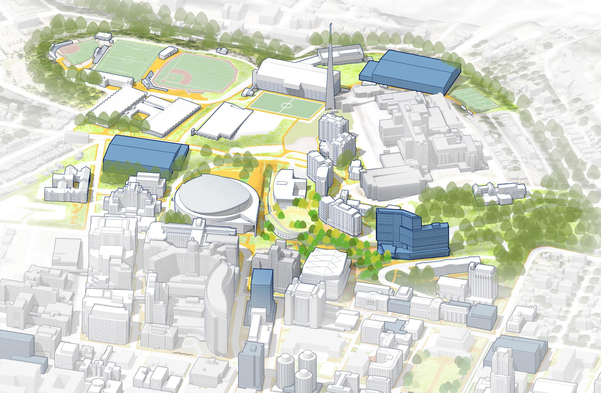
Proposed facilities include:
• Indoor Track Facility Field House and Parking Garage: Located on the Fitzgerald site, an indoor track facility sits on top of a proposed garage integrated with the steep slope conditions of the site.
• Basketball Practice Facility: a renovated east wing of Trees Hall includes a Women’s and Men’s basketball practice facility along with locker rooms, strength conditioning, coach offices and meeting rooms.
• Campus Recreation Sports Dome: replacement of the Pitt Sports Dome provides a permanent indoor facility for campus recreation.
• Band Facility: dedicated band support facility attached to the proposed Campus Recreation Sports Dome.
• Petersen Events Center: relocation of basketball practice and the recreation center out of the Peterson Events Center vacate a space for other potential uses such as an athletics welcome center, hall of fame and student athlete success center.
• OC Lot Field: a new turf field supports the campus recreation program.
• Campus Housing: a new residence hall, known as Hillside Housing, features lower level parking integrated into the steep slope conditions with student housing above.
Allequippa St
Allequippa St Dammond Dr
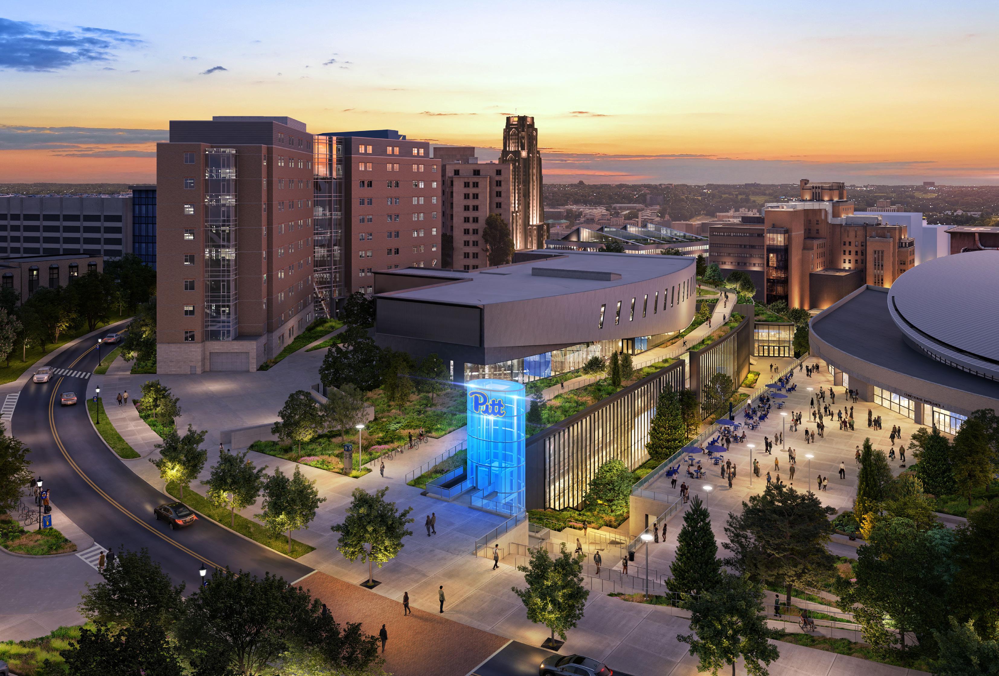
Proposed Victory Heights Gateway at Allequippa Street
01 INTRODUCTION
EXISTING CAMPUS
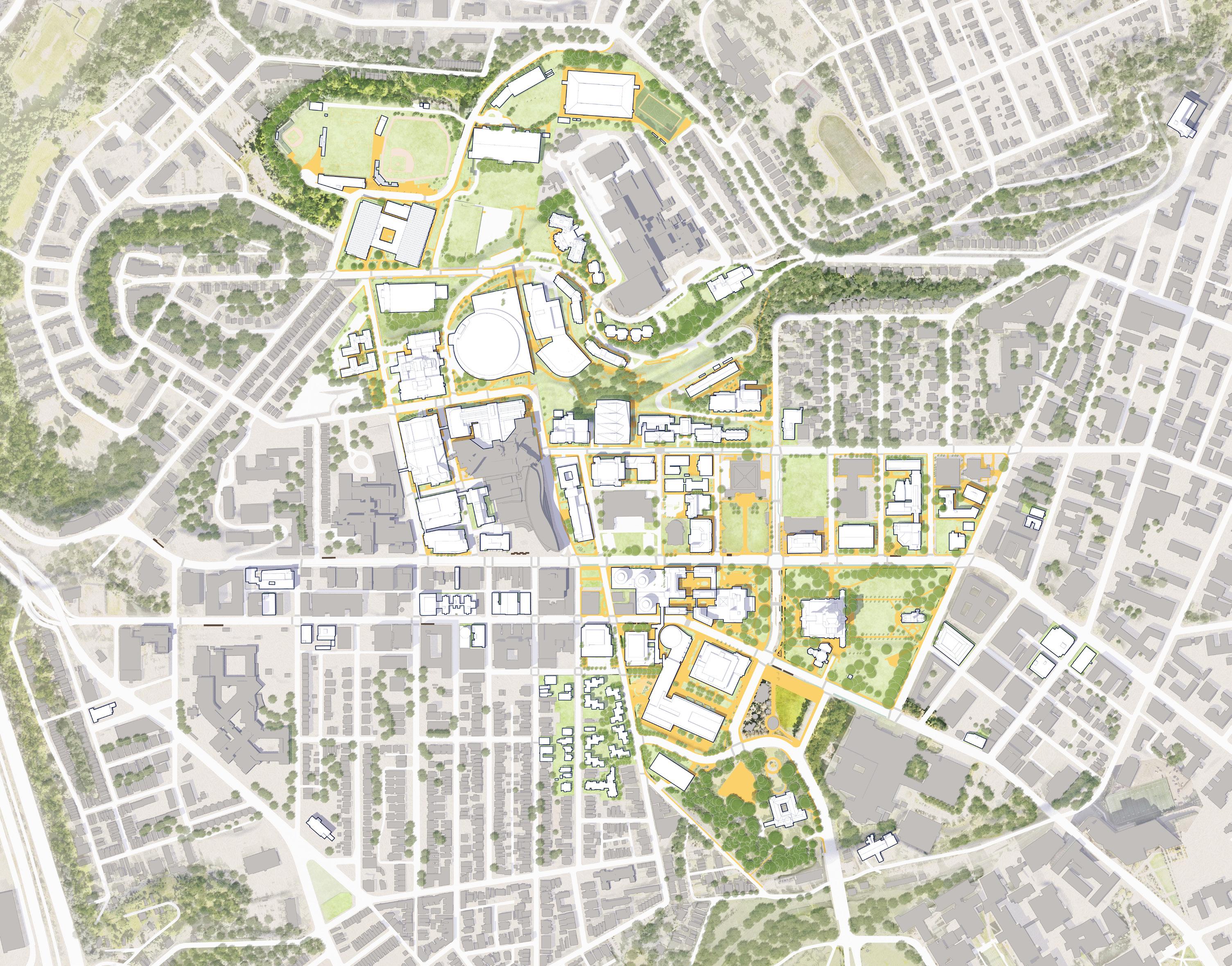
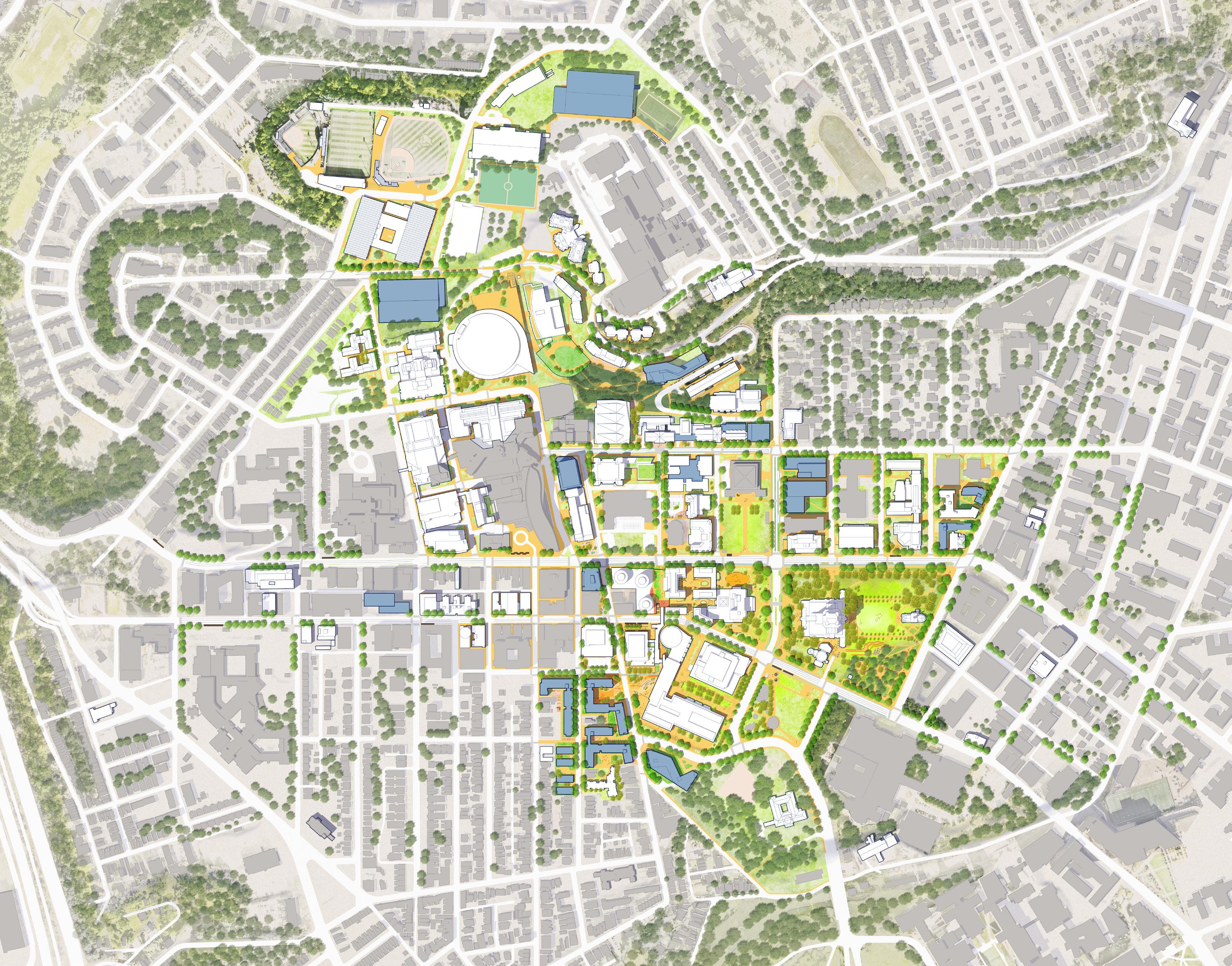
20-30 year time frame
Allequippa
1.1 PURPOSE OF THE PLAN
The 2025 Campus Master Plan (CMP) provides a 20 to 30-year vision for the Pitt campus.
Since the completion of the last Campus Master Plan, many significant situational and organizational changes have transpired, prompting the need for an updated plan aligned with Plan for Pitt 2028. Moreover, while the previous plan had a strong orientation towards specific projects, opportunities exist to enhance accessibility; streamline wayfinding and flow; and imbue the campus with a stronger sense of place.
The 2025 Campus Master Plan (the plan) is informed by broad community input from previous efforts and follows the vision and goals of the Oakland Plan adopted by the City of Pittsburgh in 2022. A great strength of Pitt is its location in Oakland and proximity to adjacent vibrant Pittsburgh neighborhoods; any development on the Pitt campus inevitably impacts these broader communities. The Campus Master Plan builds on past planning efforts aimed at improving surrounding neighborhoods. Pittsburgh’s city-wide comprehensive planning effort, which occurred simultaneously with the campus planning process (and will be ongoing into 2026), provides a unique opportunity to create synergies and ensure alignment across ongoing initiatives.
The 2025 Campus Master Plan considers and aligns with interrelated planning processes and goals, including but not limited to the:
• Housing Master Plan
• Space Study
• Energy Master Plan
• Sustainability Plan
• Hillside Framework Plan
• Victory Heights Master Plan
• Climate Action Plan
• O’Hara Street and Allequippa Street Public Realm Plans
• Signage Master Plan
• Student Union Master Plan
• Transportation and Mobility Plan
• Facility Condition Assessments
• Cathedral Landscape Plan
• Mid-Campus Science Master Plan
In advance of this initiative, Pitt Finance and Operations (F&O) pursued several foundational activities that contributed to the successful execution of the refreshed Campus Master Plan, including an enterprise space management system; a Space Management Advisory Body; refreshed project management processes and systems; and a new real estate business and financial model.
The 2025 Campus Master Plan draws from both the 2019 Campus Master Plan and the 2021 Institutional Master Plan (IMP), a legally binding document approved by the City of Pittsburgh. These documents serve as a foundation on which the plan expands.
The IMP provides details related to city regulations; including building height and mass, parking, urban design and neighborhood compatibility. Some
projects detailed in the following pages were not included in the IMP or are outside of the approved development footprint. If any of these projects were to move forward, an IMP amendment process would be required, following Pitt’s commitment of community outreach. A new IMP must be approved by the City before July 2031 (learn more about the IMP in Chapter 2.2). The 2025 Campus Master Plan provides a basis for the IMP in 2030.
Community Plans
The Oakland Plan (2022) is Pittsburgh’s 10-year neighborhood strategy for land use, housing, mobility, and open space, guiding institutional growth and zoning across North, Central, South, and West Oakland.
The North Oakland / Oakland Zoning Amendments (2024–2025), approved in February 2025, set new rules for land use, density, and inclusionary housing.
The Bus Rapid Transit University Line (ongoing, completion 2027) will link Downtown, Uptown, and Oakland with high-capacity transit, improving access and supporting denser development.
The PGH2050 Comprehensive Plan and Zoning Reform (in progress) will provide a citywide framework for equitable, climate-focused growth and implementation of neighborhood plans.
The Oakland Planning and Development Corporation (OPDC) leads community-level initiatives, guiding partnerships, public-realm improvements, and housing priorities.
Proposed Campus
20-30 Year Time Frame
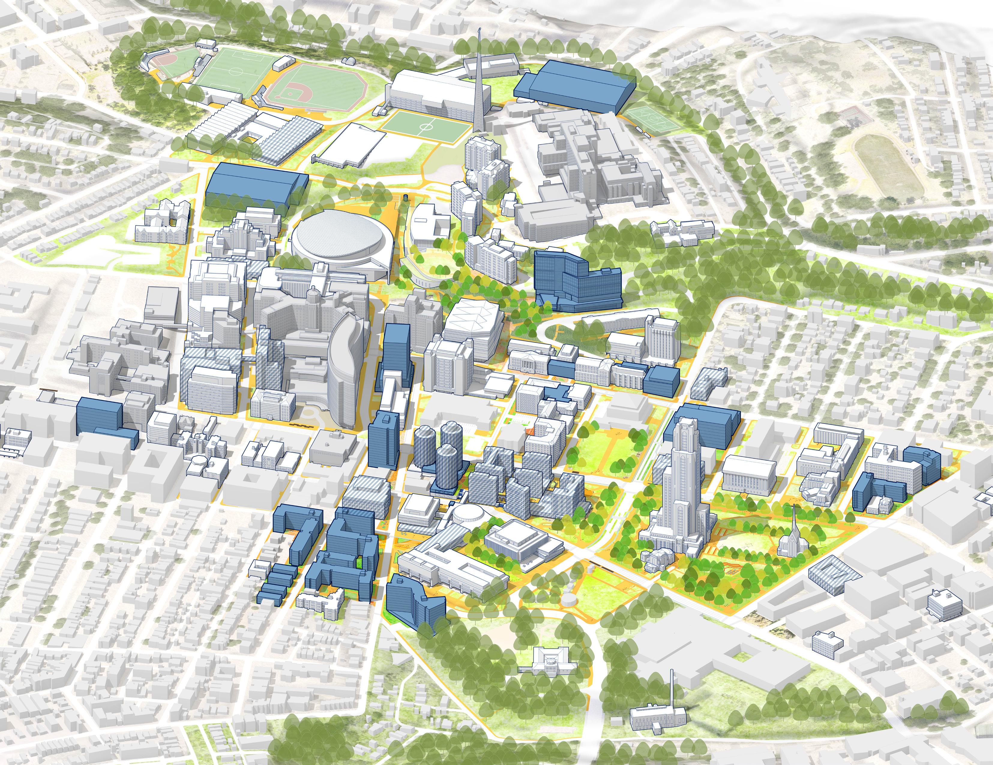
1.2 THE PLANNING PROCESS
Four-Phase Process
The planning process consisted of four distinct phases of work focusing on comprehensive planning for the campus and surrounding context, opportunities for new development and renovation, the public realm, campus-wide accessibility and mobility and sustainability.
The process commenced with site visits, stakeholder interviews and in-depth analysis of the campus and surrounding context. The existing conditions, combined with projected growth and space needs, informed the development of ideas and concepts for the Campus Master Plan. These ideas and concepts were reviewed with Pitt leadership, the Steering Committee, the CMP Working Group and additional campus stakeholders. The ideas were refined and advanced based on the feedback received. The Campus Master Plan documented herein reflects the outcomes of the consultation process and serves as a road map for projected development and change across the campus, while noting further design study and engagement will be needed on a project-by-project basis. In addition to the campus planning scope of work, the process also included a comprehensive space assessment and Housing Master Plan both of which are integrated with the recommendations of the Campus Master Plan.
PHASE 1: DISCOVERY AND ANALYSIS
The Discovery and Analysis phase focused on an assessment of the existing physical conditions of the campus and the surrounding context, an assessment of existing and aspirational needs, and needs associated with projected growth and programmatic change (academic, research, housing, support amenities, etc.). During this phase, the planning team conducted site visits, interviews and meetings with the Steering Committee, Working Group and other campus stakeholders.
PHASE 2: CONCEPT DEVELOPMENT
In Phase 2, work focused on the synthesis of the context analysis, projected needs and aspirational goals as the basis for developing a vision for the future of the campus. The guidance received from Pitt’s Planning, Design and Construction team, combined with input from the Steering Committee, the CMP Working Group and additional stakeholders informed the development of alternative concepts for future development, the public realm, mobility and sustainability elements of the plan. The housing and accessibility and mobility sub-committees further informed the development of the concepts.
PHASE 3: RECOMMENDATIONS
In Phase 3, the consultant team, in collaboration with Pitt’s Planning, Design and Construction team, university leadership, the Steering Committee, the CMP Working Group and sub-committees advanced the emerging ideas for the campus, providing technical details, data and rigor in support of the emerging vision. The recommendations of the housing master plan and space needs plan were integrated at this stage.
PHASE 4: PLAN DEVELOPMENT
The final phase of the planning process focused on the development of the planning recommendations in greater detail including strategies for new development, the public realm, accessibility, mobility, campus and residential life and recreation. This included the development of the final reports, graphics, renderings and other materials supporting the recommendations of the plan.
Working Group
Board of Trustees
Steering Committee
Campus Wide Engagement
Engage and Influence
Development of the Campus Master Plan took place over 22 months, commencing in March 2024 and concluding in December 2025. Pitt’s Planning Design and Construction team guided the planning process in collaboration with the consultant team.
Two committees established by the university provided direction for the development of the plan: the Steering Committee and the Working Group.
Steering Committee membership included senior leadership from academic, research and administrative departments across the university. The Steering Committee guided the alignment of the plan recommendations with Pitt’s strategic initiatives.
The Working Group, consisting of representatives from a range of academic and administrative departments, provided technical input and direction for the plan. For membership of both committees, please see the Acknowledgments section at the end of this document.
In addition to these groups, the planning process also included close consultation with the following sub-committees:
Housing Sub-Committee: A sub-committee consisting of representatives from Business Hospitality and Auxiliary Services, Student Affairs, the Honors College and Planning, Design and Construction guided the development of the Housing Master Plan.
Accessibility and Mobility Sub-Committee: An Accessibility and Mobility sub-committee informed the development of the plan on matters related to accessibility, pedestrian, shared mobility, bicycle, transit and parking systems.
Pitt’s standing Space Management Advisory Committee provided direction and input relative to the space needs assessment. In addition, the Learning Spaces Management Committee provided input on matters directly related to teaching and learning space.
A number of activities were scheduled throughout the process providing opportunities for the Pitt community to engage and influence the Campus Master Plan as follows.
Open Forum: Three open forums were held in September 2024 at Hillman Library, Petersen Events Center and Scaife Hall to gain input on campus needs and the planning process.
Digital Outreach: Digital outreach to the Pitt community took place by means of a dedicated Campus Master Plan website that was updated throughout the process and an online engagement tool. CoMap is a tool that was issued to the Pitt community in the fall of 2024 with the goal of obtaining input from faculty, staff and students relative to how they use and experience the campus, challenges they face and improvements they would like to see. The findings of this interactive engagement tool, in turn, informed the recommendations of the Campus Master Plan.
Collaboration Survey: Faculty and staff were engaged in the planning process through an online collaboration survey which documented the ways in which collaboration occurs between individuals across the campus and beyond. The outcome of this survey informed the development of space needs and planning recommendations.
Academic Dean Interviews and Surveys: Interviews, conducted with all academic deans, provided information on college and departmental space needs and aspirational goals. These interviews were followed by detailed surveys documenting the current and future faculty and staff populations for each college, programmatic needs and specific space needs. The information provided in the surveys informed the space planning process and recommendations of the Campus Master Plan.
Housing Summits: In support of the housing master plan, three housing summits were held with representatives from Business, Hospitality and Auxiliary Services, Student Affairs, the Honors College and Planning, Design and Construction. The summits focused on the goals, objectives and opportunities for campus housing.
Student Listening Sessions: A series of listening sessions were held with student focus groups to discuss their experience living on campus and in the surrounding context. This feedback informed the recommendations of the housing master plan.
Board of Trustees: The Pitt Board of Trustees, specifically the Properties and Facilities SubCommittee, contributed to the review of the plan during their scheduled meetings in September and December of 2024, and June, September and December of 2025.
Block Parties: In the fall of 2024 and 2025, Pitt’s Office of Engagement and Community Affairs hosted a series of five “Be A Good Neighbor” block parties around the Oakland neighborhood surrounding Pitt’s campus. The food and musicfilled celebrations were designed to create a safe, relaxing environment where students, neighborhood residents, community partners and Pitt resources could come together and learn from one another, including a station to review master planning efforts to date. Organizations like Carnegie Library of Pittsburgh, Carnegie Museums of Pittsburgh, Phipps Conservatory, Kidsburgh and Playful Pittsburgh were invited to attend.
Campus Forum: On September 10, 2025, Pitt’s Office of Planning, Design and Construction held an campus forum on the Campus Master Plan in Alumni Hall’s Connolly Ballroom. Organized in an open house format, the forum provided information on progress to date through a series of thematic stations. Students, faculty, staff, alumni and Oakland neighbors participated, offering perspective on how the Campus Master Plan can impact their experience at Pitt.
Campus Presentation: On November 6, 2025 a campus-wide presentation was held at Barco Law Building to share the final draft plan and aspirational vision for the future of the Pitt campus. A Q&A session was held immediately following the presentation.
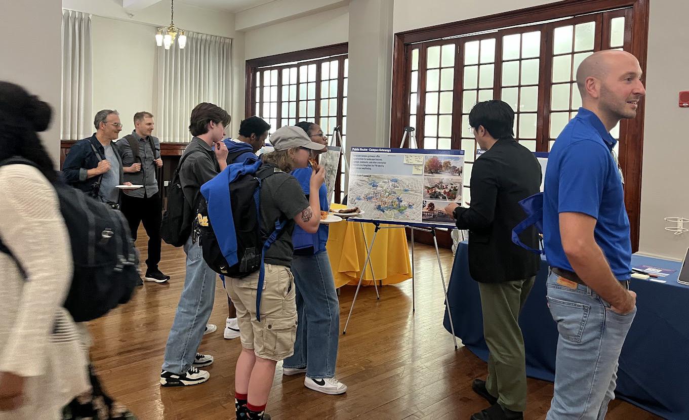
Open Forum, Scaife Hall
Campus Forum, Alumni Hall
Survey Results
The Collaboration Survey identified and analyzed cross and interdepartmental collaborations. This data, alongside patterns with focus groups, CoMap and other resources, helps establish patterns to inform planning and support campus collaborations.
Key findings from the survey include:
• The Kenneth P. Dietrich School of Arts and Sciences, the Swanson School of Engineering, the School of Medicine and the School of Public Health spearhead collaboration across the Pitt campus.
• STEM disciplines tend to dominate research collaborations across campus.
• The humanities and sciences operate largely in separate spheres with less frequent overlap.

School of Education
School of Pharmacy
School of Law
University Honors College
College of General Studies
School of Social Work
Western Psychiatric Institute and Clinic
School of Computing and Information Research
Learning Research& Development Center
School of Dental Medicine
School of Medicine
Swanson School of Engineering
Graduate School of Public & International Affairs Education University Service Programs
Kenneth P. Dietrich School of Arts and Sciences
Health Sciences
Katz Graduate School of Business
School of Nursing
School of Public Health
UPMC Hillman Cancer Institute
School of Health and Rehabilitation Sciences
University Library System
The CoMap Survey was launched for students, faculty, staff and community members to map their experiences on the Oakland Campus.
The CoMap Survey revealed patterns of campus uses, connectivity and experiences that were analyzed and inform the Campus Master Plan.
Key findings reinforced recommendations from the space needs analysis, and identified:
• Areas where accessibility improvements are needed
• Buildings in need of renewal
• Increased demand for study space
• Desired areas for collaboration
• Desire for more open space with amenity features
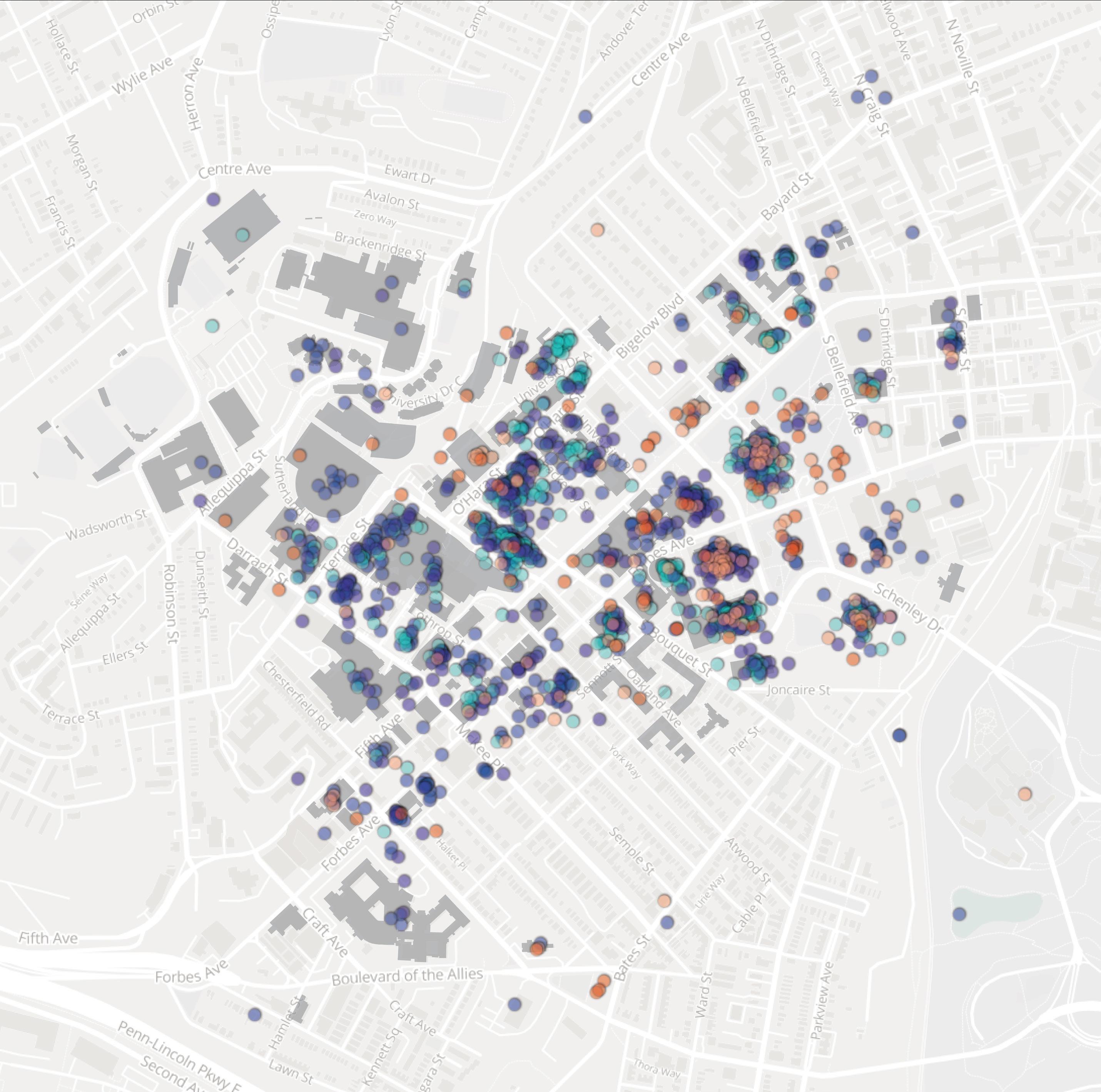
1,000+ Responses
6,990+ Markers
1,900+ Comments
“Benedum
Hillman Library
“The silent floors/silent study rooms were a fantastic renovation to the library and should be more widespread throughout campus.”
- Student
Cathedral of Learning “Needs more seats but great study space.”
- Student
“Substantial improvements are needed in accessibility, HVAC and total available space.”
- Staff
Study or Work Teach or Learn
Would like to...
Frick Fine Arts
Benedum Hall
Hall elevators are in disrepair and in great need of updating.”
- Staff
02 CAMPUS MASTER PLAN DRIVERS
CAMPUS MASTER PLAN DRIVERS
The key drivers of the Campus Master Plan guide the overarching elements important to the planning and design of campus. They represent a synthesis of the existing conditions and formative considerations for campus and serve as the foundation for the Campus Master Plan, driving direction and purpose.
2.1 PLAN FOR PITT 2028
The Plan for Pitt 2028
The Plan for Pitt 2028 is the University of Pittsburgh’s strategic plan focusing on student success, scholarship, innovation, community engagement and accountability. It outlines specific goals and initiatives under five key pillars.
The Plan for Pitt 2028 is a comprehensive framework designed to guide the university’s development and ensure its continued success in the coming years. It’s a dynamic plan, backed up by a progress report card and dashboard to track progress and inform future decisions.
The Campus Master Plan emphasizes improving accessibility, affordability, retention and postgraduate success for students, while also fostering a welcoming and inclusive environment in support of the university’s strategic plan.
The Pillars of the Plan
CULTIVATE STUDENT SUCCESS PROPEL SCHOLARSHIP, CREATIVITY, AND INNOVATION
By engaging in intentional planning and purposeful programming, we aim to make the Pitt experience exceptional, from the moment a student first steps on campus through their post-graduation journey.
Pillar 1 aims to enhance the overall Pitt experience for students, from their initial application to postgraduation.
By supporting and expanding this diverse community of scholars, innovators and problem solvers, we will empower them to pursue big ideas, collaborate creatively and maximize the impact of their scholarly work in our communities and around the world.
Pillar 2 focuses on advancing research, creative endeavors and intellectual pursuits across the university.
WELCOMING AND ENGAGED
As a place-based institution, we hold fast to our roots and responsibilities in the communities of Western Pennsylvania as we strive to have a powerful, positive effect on the world around us.
Pillar 3 emphasizes Pitt’s commitment to its local and global communities.
ACCOUNTABILITY AND TRUST IT’S POSSIBLE AT PITT
By enhancing our internal operations and communication openly with internal and external audiences, we will demonstrate that we are conscientious stewards of public and institutional resources and are committed to preserving and elevating a centuries-old missionbased educational institution.
Pillar 4 focuses on transparency, ethical conduct and responsible stewardship of resources.
We believe that there are things that can only happen with the talent, knowledge and resources that Pitt has.
Pillar 5 serves as a unifying theme, highlighting the university’s commitment to achieving ambitious goals and fostering a culture of possibility.
2.2 INSTITUTIONAL MASTER PLAN (IMP)
The Institutional Master Plan (IMP) is a formal, legally binding document submitted to the City of Pittsburgh by the University of Pittsburgh.
Pitt’s Campus Master Plan illustrates the campus vision while the Institutional Master Plan (IMP) provides details related to City of Pittsburgh regulations; including building height and mass, parking, urban design and neighborhood compatibility. These details represent the culmination of extensive community outreach and engagement.
The IMP addresses:
• Existing Conditions
• The needs of the Institution
• Long-term Vision and Growth
• Ten-year Development Envelope
• Mobility
• Infrastructure
• Environmental and sustainability goals
• Environmental protection
• Campus energy planning
• Stormwater management
• Green buildings
• Waste management and water conservation
• Open space and pedestrian circulation
• Neighborhood Enhancement Strategy
Pitt is currently operating under the IMP approved on July 29, 2021 and subsequent amendments. The
2025 Campus Master Plan will provide a road map for the 2031 IMP.
IMP Goals
• Strategic Space Growth: Provide for efficient, flexible and contextual growth of academic, clinical and research space to meet current and future need.
• Mobility: Prioritize pedestrian safety, bicycle mobility and regional transit over personal vehicles.
• Student Experience: Identify athletics, recreation, housing and student life projects that integrate living and learning to support the student experience.
• Sustainability: In conjunction with the Pitt Sustainability Plan, identify and implement sustainable practices in construction, mobility, transportation, energy use, water use and stormwater.
• Community Process: Define a process that is inclusive and seeks input and collaboration with Pitt’s campus community and the surrounding neighborhoods.
• Regional Investment: Identify opportunities for neighborhood enhancement and to support continued regional economic growth and impact
The Pillars of the IMP
Ten-Year Development Envelope
• Construction and renovation of academic and research buildings.
• Expansion of student housing and recreational facilities.
• Infrastructure improvements to support the growing campus population.
Mobility
• Overall, the mobility plan aims to reduce reliance on personal vehicles, prioritizing pedestrian/ bicycle experiences and regional transit.
• Goals include: 1) No new net on-campus parking; 2) Reduce single-occupancy vehicle mode share (by 3.4%); 3) Promote and enhance partnerships to enhance mobility options (e.g. pedestrian and bicycle infrastructure, public transit; 4) Position the Pitt transportation network to adapt to changes in the university, the region and in society (e.g. increase in tele-work and learning, sustainability and resilience); and 5) Verify and improve current program performance.
Infrastructure Plan
• Improve on-campus green and open spaces.
• Upgrade energy systems for greater efficiency and sustainability.
• Improve water management and stormwater systems, as well as waste management systems.
Neighborhood Enhancement
The IMP supports Pitt’s mission while also addressing the needs and concerns of the local community. In turn, Pitt aims to:
• Alleviate Pitt’s impact on the neighborhood by developing positive relationships with the community and respecting the shared built environment.
• Enhance Pitt’s impact on the neighborhood by strengthening community connections for university-related development projects, supporting community-led strategies for housing affordability and increasing its commitment to sustainability.
• Improve community access to Pitt program and facility resources through increased promotion, developing intentional pathways for involvement and the creation of the Hill District Community Engagement Center.
2.3 CAMPUS DEVELOPMENT HISTORY
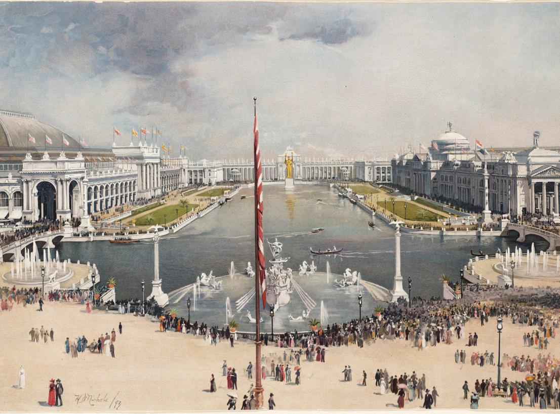
Understanding the campus’s historical development is essential to charting its future. The physical landscape of today’s campus reflects multiple intersecting planning eras: Franklin Nicola’s comprehensive Oakland development that established the neighborhood’s civic and cultural character, followed by the original Acropolis Plan of 1908 that introduced classical architectural vocabulary along the hillside, and in the 1920s, Chancellor Bowman’s bold redirection toward the iconic “tall building” concept that created the Cathedral of Learning.
In the mid twentieth century, Chancellor Edward Litchfield’s 1958 campus plan called for a series of new buildings that would extend into Oakland’s residential neighborhoods. While many of the recommended projects were never realized, the plan laid the groundwork for the 1968 university master plan, which similarly advocated for a larger, more expansive Pitt—both academically and spatially.
The implementation of the plan would necessitate the demolition and redevelopment of several residential areas in Oakland, prompting strong backlash from the community. This backlash was ultimately proven successful when the 1968 plan was abandoned shortly after completion. From there, an era of greater collaboration between the university and the community unfolded, a turning point marked by the opening of Sennott Square, which housed both academic and commercial uses. It was also at this juncture that the university established an Office of Public Affairs, responsible for coordinating joint planning among the university and the city, and for managing communication with the community, city and state.
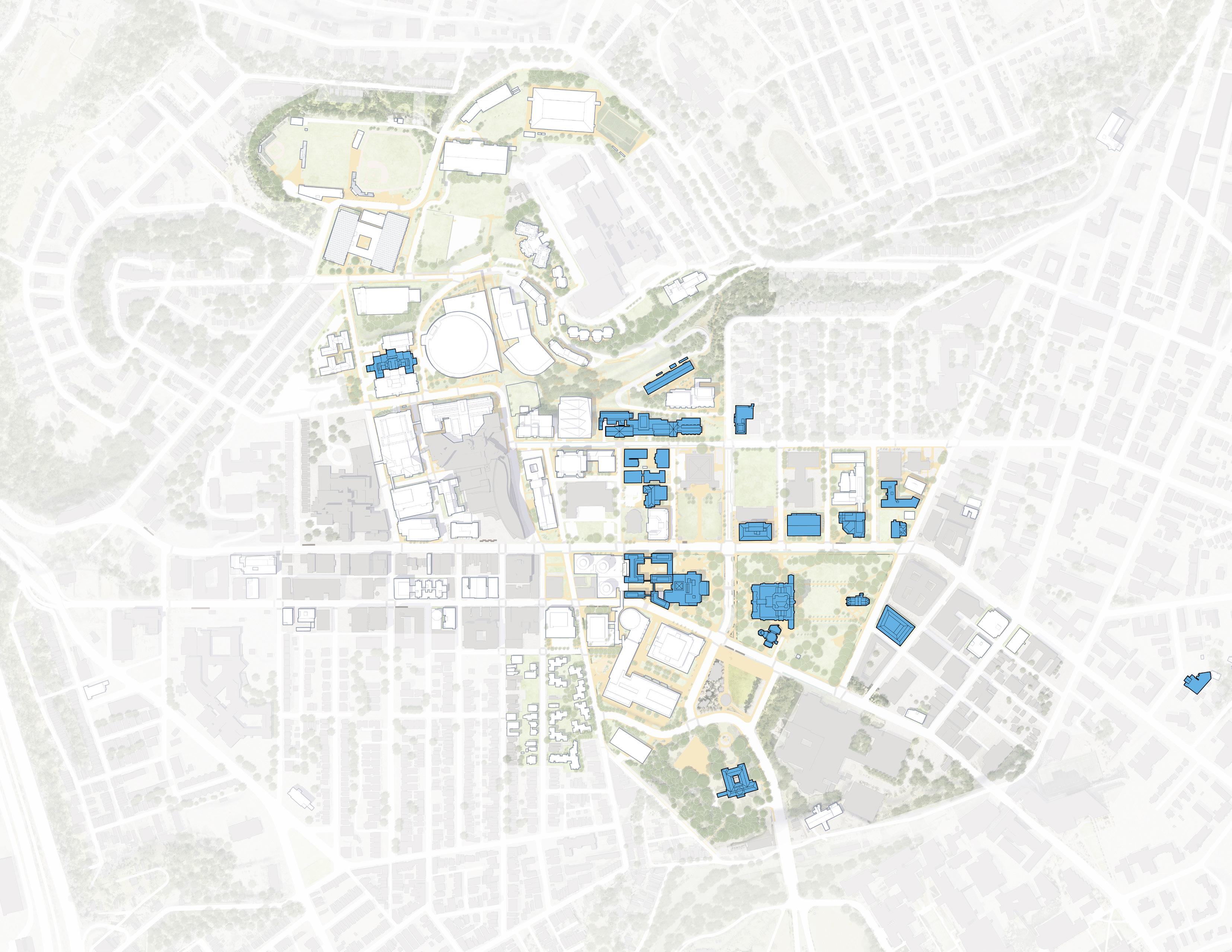
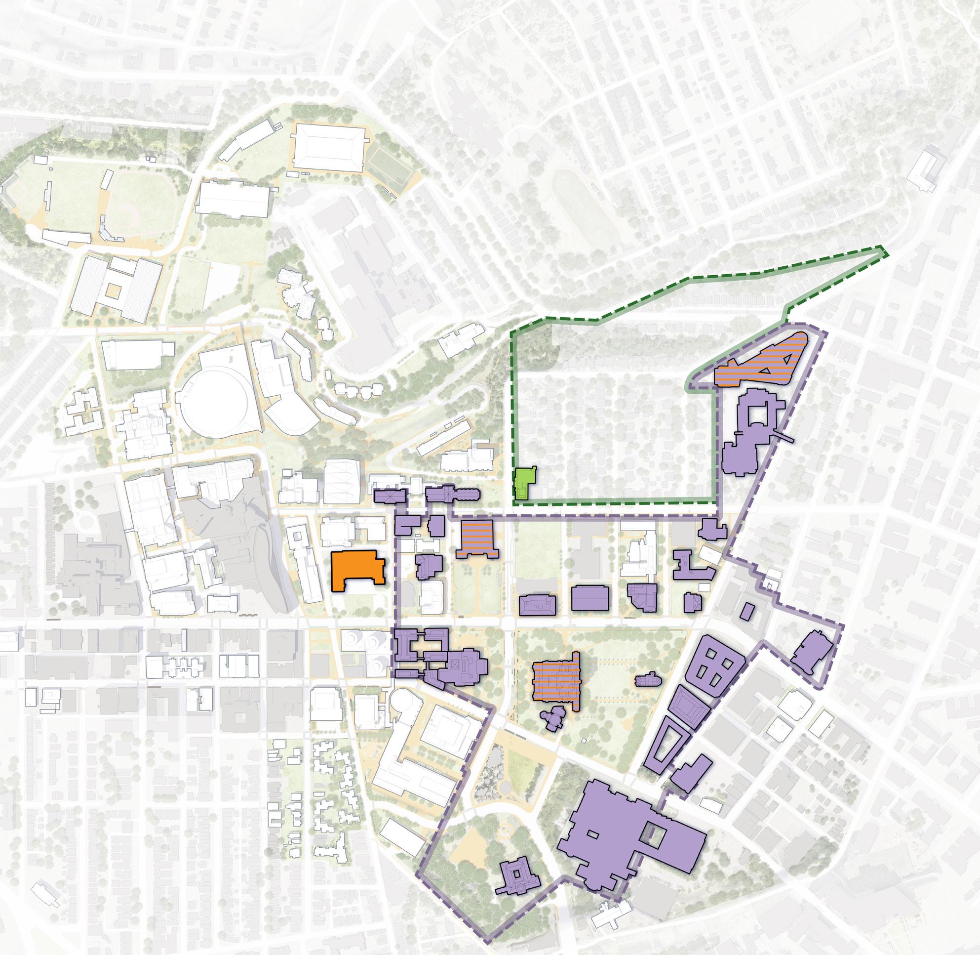
In the map at right, Pitt-owned buildings included on the National Register of Historic Places and within the City of Pittsburgh’s historic districts, many of which were designed by major, influential architects, are highlighted.
City Beautiful Movement
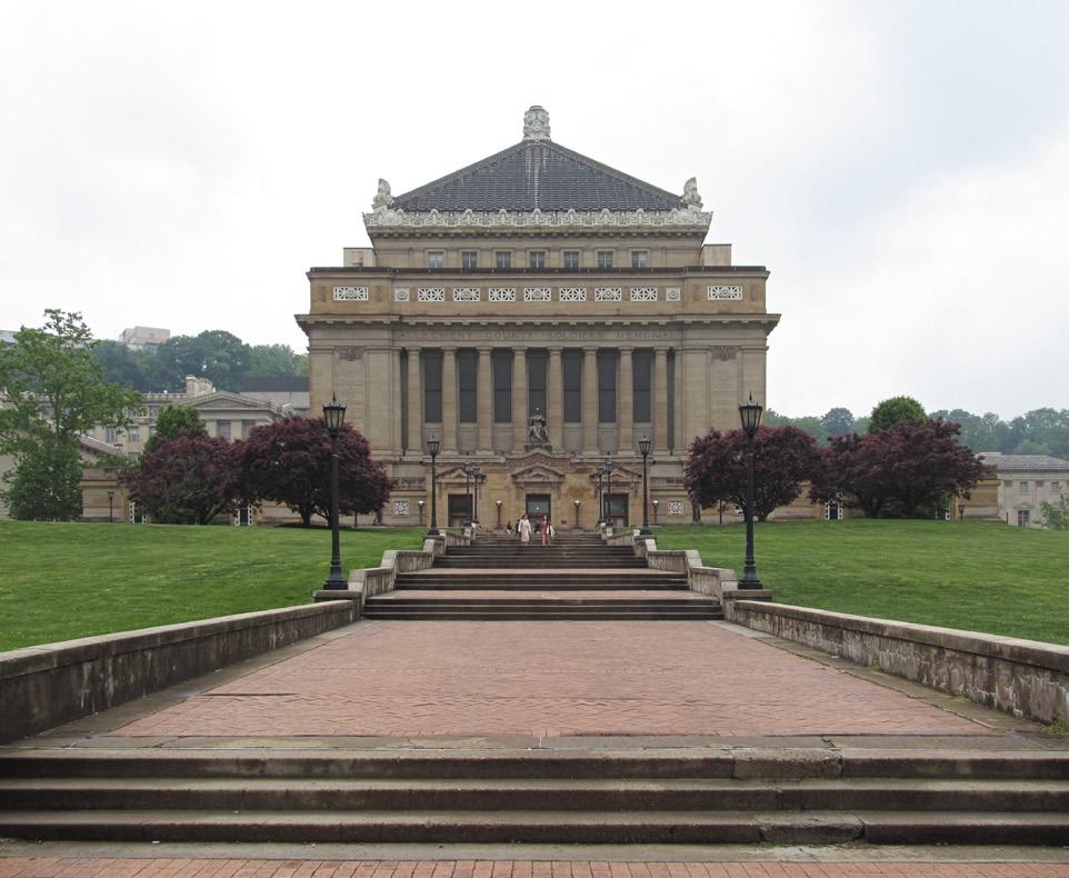
Soldiers and Sailors Memorial Hall and Museum
Source: H.D. Nichols, L. P rang & Co, Wikimedia (Public domain)
Source: Cbaile19, Wikimedia (CC0)
Historic Buildings
Terrace St
Darragh St
Allequippa St
Fifth Ave
FifthAve
Forbes Ave ForbesAve
Bigelow Blvd
Parkman Ave
2.4 HISTORIC BUILDINGS AND CONTEXT
The Vision for Oakland
Pitt’s campus evolved as part of developer Franklin Nicola’s 1905 “City Beautiful” vision for a new civic, social, residential and educational center in Oakland—a center removed from downtown Pittsburgh and the pollution of the steel mills in operation at that time.
To finance his vision, Nicola worked with the Bellefield Company which included Andrew Mellon, Henry Clay Frick, Andrew Carnegie, George Westinghouse, H.J. Heinz as stockholders. Nicola’s plan encompassed land owned by Mary Croghan Schenley, a stockholder in his independent company, the Schenley Land Company. Mary Schenley donated the land for Schenley Park to the City of Pittsburgh in 1889, and in 1905, Nicola purchased all of the remaining land in her estate.
Nicola’s plan ultimately guided the development of Oakland including the Carnegie Museums, the campuses of the University of Pittsburgh and the Carnegie Institute of Technology (now Carnegie Mellon University), Forbes Field, Soldiers and Sailors Memorial Hall, the Masonic Temple (Alumni Hall), the Pittsburgh Athletic Association, Schenley Hotel and the Schenley Farms residential neighborhood.
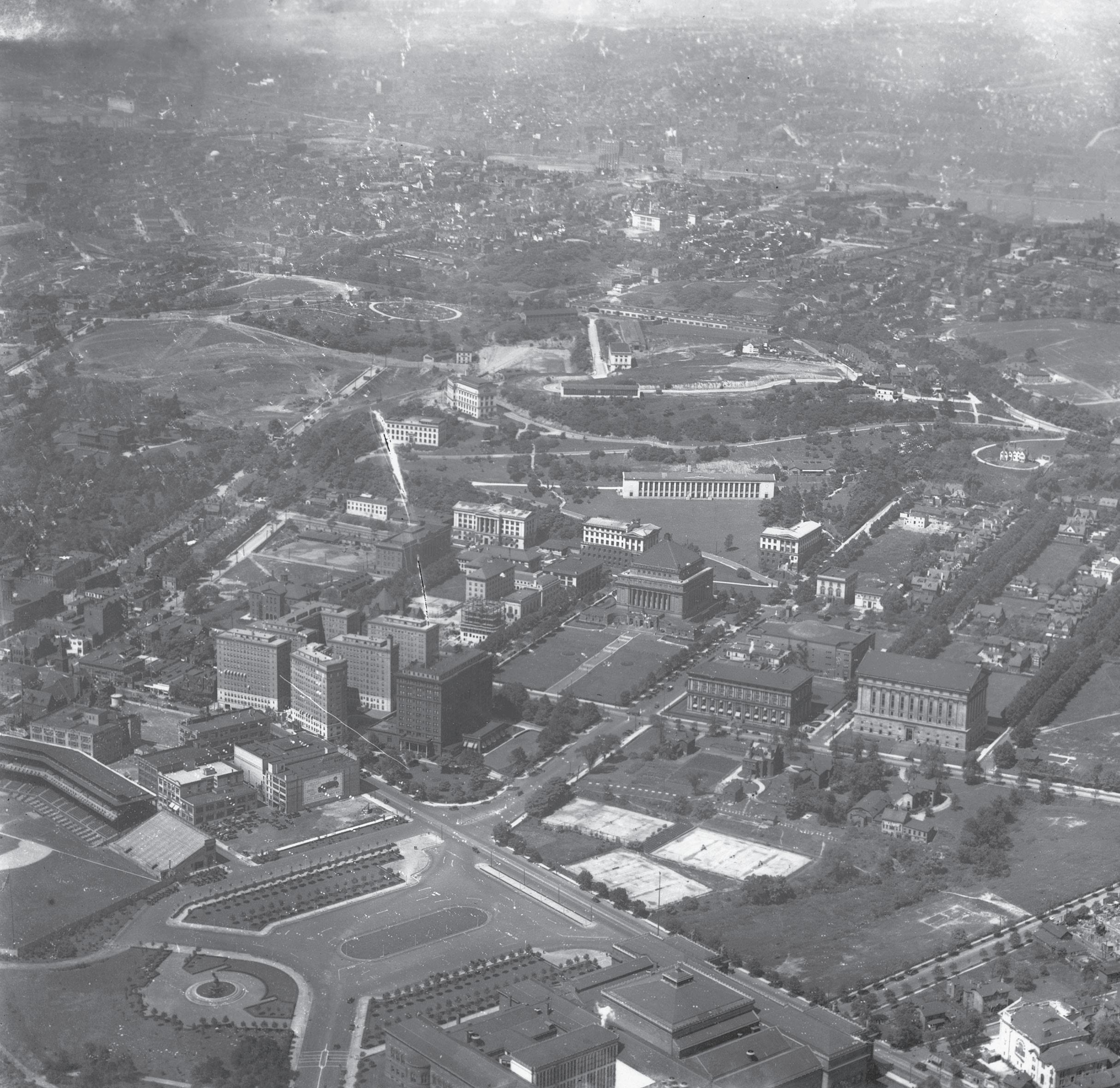
View of Oakland circa 1924
Source: Archives Service Center, Wikimedia (Public domain)
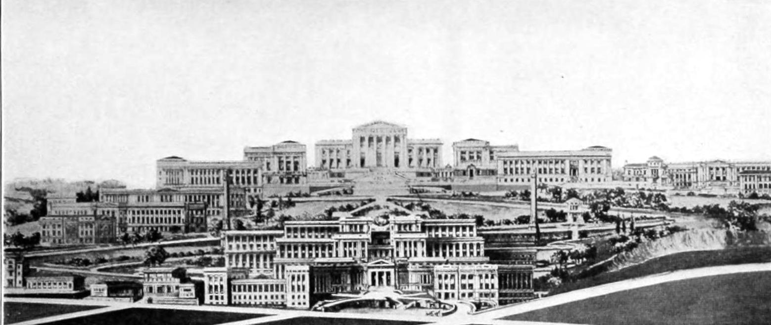
The Acropolis Plan
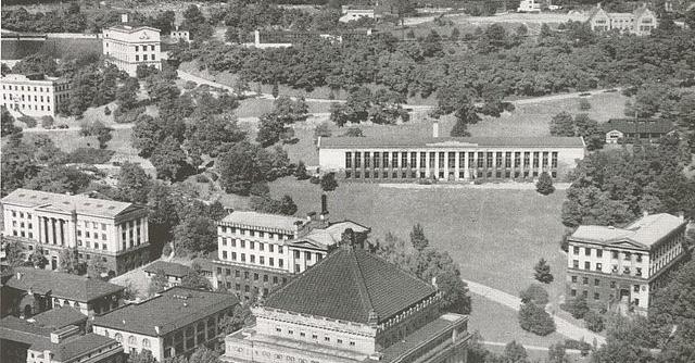
In 1906, Pitt purchased forty-five acres of land from Nicola with the goal of consolidating its operations in Oakland. Prior to 1908, the institution, over its history, had occupied buildings in downtown Pittsburgh and across the Observatory Hill area (present-day neighborhood of Perry South). At the time, this area was part of Allegheny City, a distinct municipality that merged with Pittsburgh in 1907. In 1908, the university held a national design competition for its new campus in Oakland. The winning firm, Palmer and Hornbostel, submitted a design featuring Greco-Roman buildings. Known as the Acropolis Plan, the concept illustrated a hillside campus, transitioning up the slopes north of O’Hara Street. The university ultimately completed four buildings according to the plan:
• The School of Mines (1908), later renamed State Hall (demolished in 1973 to make way for Chevron Hall)
• Engineering Building 1909-1910 (renamed Thaw Hall)
• Pennsylvania Hall (1911)
• Mineral Industries Building (1912)
Of the above, Thaw Hall is the only remaining building.
Eberly Hall
Falk State Hall Thaw Hall
O’Hara Pennsylvania Hall
Acropolis Plan Elevation View
Buildings of the Acropolis Plan
Source: Owl, Wikimedia (Public domain)
Source: Anonymous, Wikimedia (Public domain)
The Cathedral of Learning
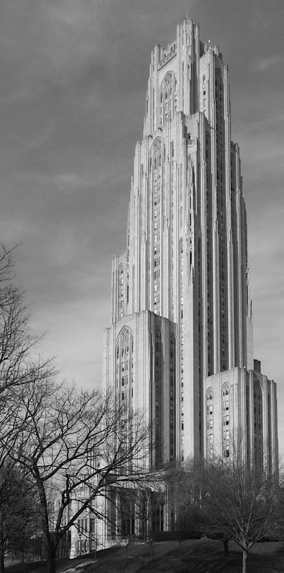
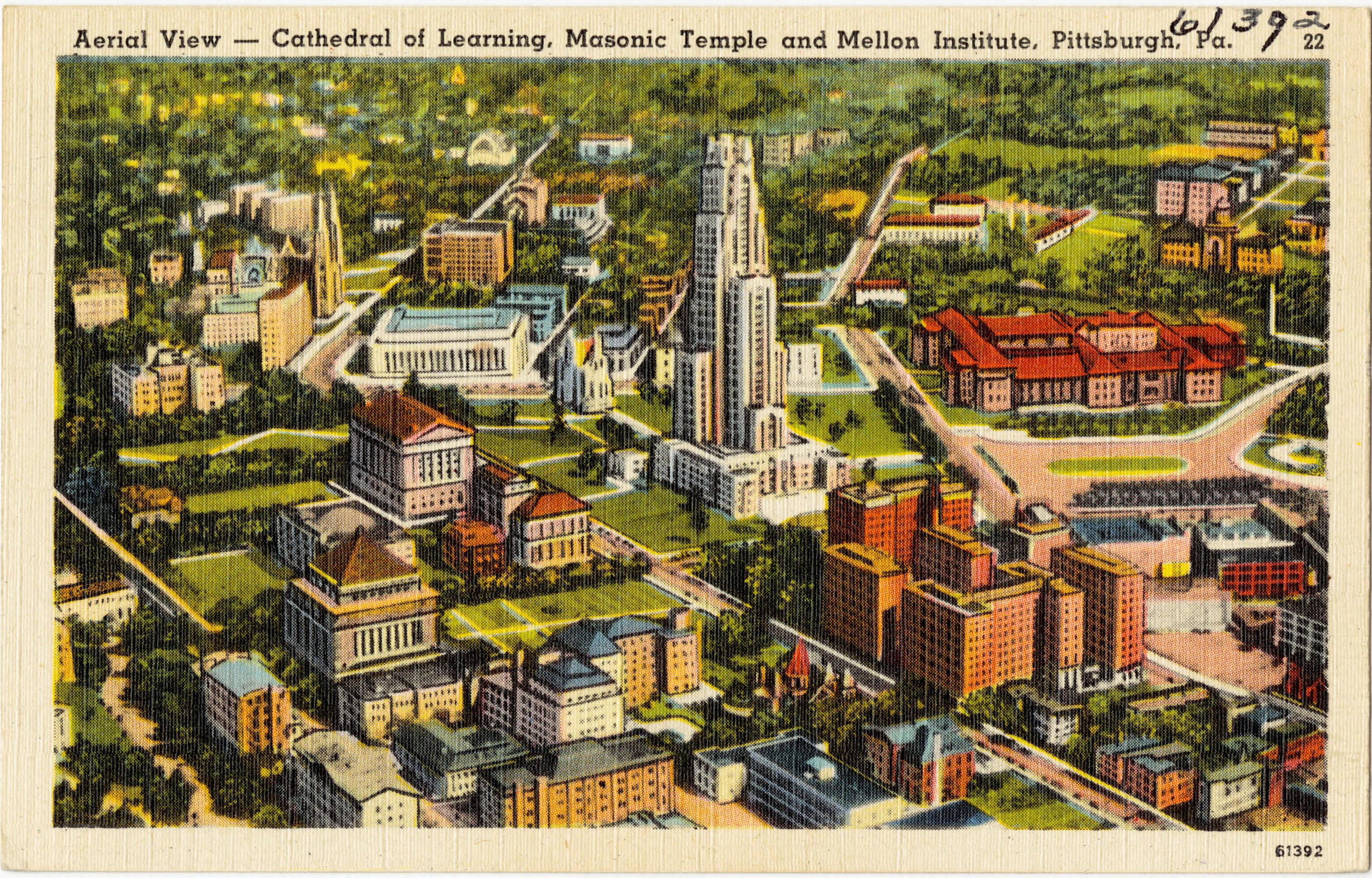
In the 1920s, Chancellor John Gabbert Bowman redirected campus development toward his new vision for a “tall building.” In response, the university purchased fourteen acres of land known as the Frick Acres property and shifted emphasis away from the Acropolis Plan to what became the Cathedral of Learning, Heinz Memorial Chapel and Stephen Foster Memorial. By 1925, the Pitt board approved a “tall building” design by Charles Klauder. Construction began in 1926, and the building was formally dedicated in 1937. Today, it is one of the tallest university buildings in the world.
Cathedral of Learning
Cathedral of Learning Interior
Source: Cbaile19, Wikimedia (CC0)
Source: Daderot, Wikimedia (CC0)
Aerial Illustration of the Cathedral of Learning
Source: The Pittsburgh News Company, “Tichnor Quality Views,” Reg. U.S.
Tichnor Bros., Inc., Boston, Mass., Wikimedia (Public domain)
PITTSBURGH LANDMARKS
Historic Districts and Landmarks
Historic district designations acknowledge the cultural and architectural significance of the campus buildings listed by the Pittsburgh History and Landmarks Foundation as well as other contributing buildings. Listed on the National Register of Historic Places, the City of Pittsburgh’s historic districts include the Schenley Farms Historic District and the Oakland Civic Center Historic District (eastern and central areas of the Pitt Campus).
Buildings within the Oakland Civic Center Historic District listed on the National Register of Historic Places include:
• The Soldiers and Sailors Memorial
• The Cathedral of Learning
• Henry Clay Frick Training School for Teachers (Currently Pittsburgh Science and Technology Academy)
• The Pittsburgh Athletic Association
• Schenley High School (Now Schenley Apartments)
• Phipps Conservatory
• U.S. Bureau of Mines (Hamburg Hall, Carnegie Mellon University)
The following Pitt buildings are contributing properties in the City-designated Oakland Civic Center Historic District:
• The Cathedral of Learning
• Heinz Chapel
• Bellefield Hall
• Frick Fine Arts Building
• William Pitt Union
• Schenley Quadrangle
• University Club
• Gardner Steel Conference Center
• O’Hara Student Center
• Thaw Hall
• Alumni Hall
• Clapp Hall
• Ruskin Hall
• Music Building
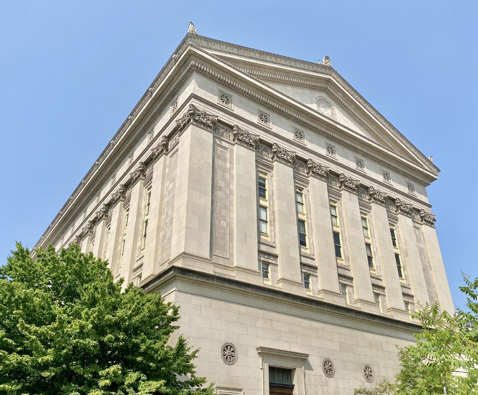
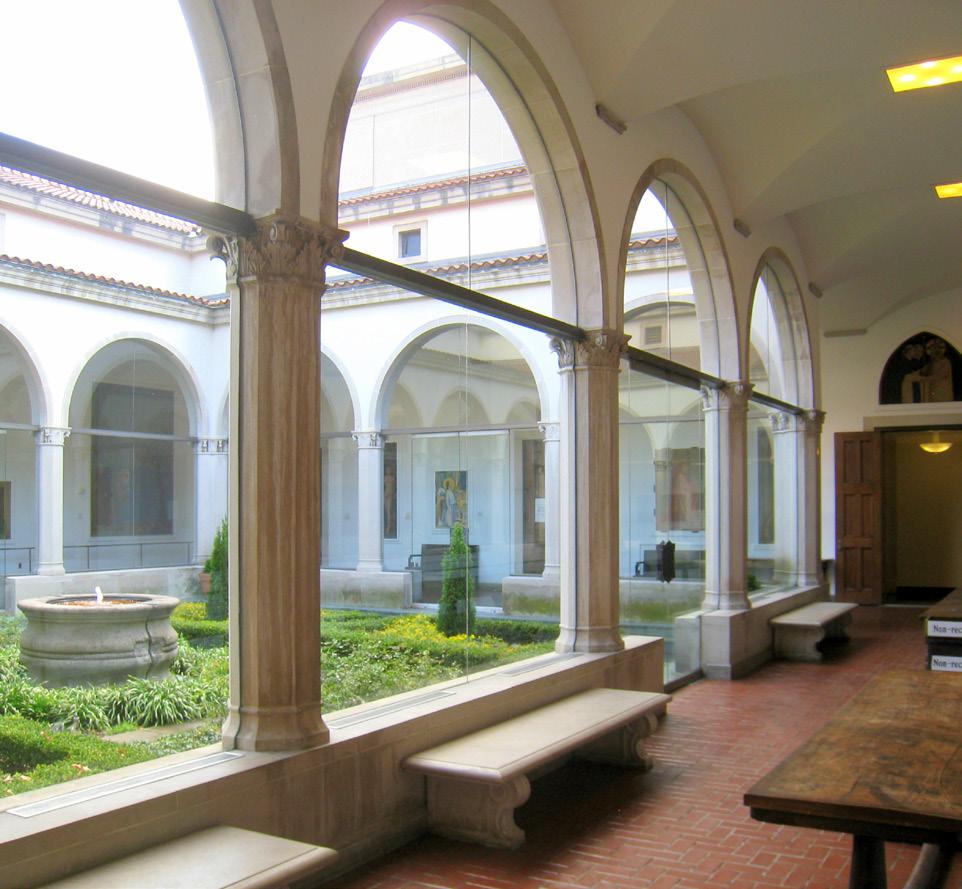
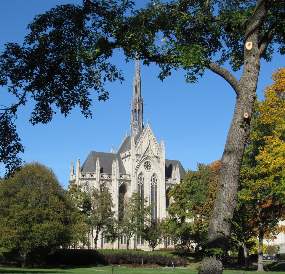
Alumni Hall
Heinz Memorial Chapel
Frick Fine Arts Building
Source: Daderot, Wikimedia (Public domain)
Source: Cbaile19, Wikimedia (CC0)
Source: w_lemay, Wikimedia (CC BY-SA 2.0)
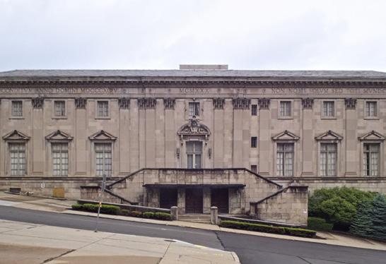
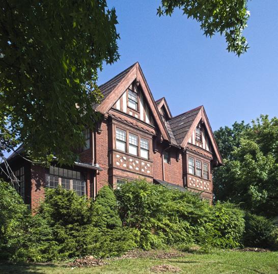
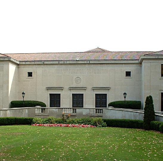
Pitt’s ownership of many of the character-defining buildings of Central Oakland requires a focus on stewardship to meet the current and future needs of the university. To that end, the Campus Master Plan provides recommendations for renovation along with enhancements to the public realm to improve the campus and community experience in Oakland.
National Register of Historic Places
Oakland Civic Center Contributing Properties
Schenley Farm Historic District Contributing Properties
Twentieth Century Club
Frick Fine Arts Building
Schenley Farms Historic District
Oakland Civic Center Historic District
Images Source: Cbaile19, Wikimedia (CC0)
ARCHITECTURAL LEGACY
The legacy of Nicola’s plan for Oakland shapes the Pitt campus. Today, the campus is defined by the remaining structures of the Acropolis Plan (Thaw), those aligned with the Acropolis Plan (Allen and Eberly) and the vision set out by Chancellor Bowman for a “tall building.” It is further shaped by buildings constructed according to Nicola’s plan for Oakland— buildings that the university has acquired over time.
Pitt buildings contributing to the Schenley Farms and Oakland Civic Center Historic Districts National Register include:
Music Building (1884) – Designed by Longfellow, Alden, and Harlow in the Romanesque style as the vicarage for the now-demolished Presbyterian Church at the northeast corner of Fifth and Bellefield. An addition was made to the building in the early 1920s. Later, it became the home of WQED, one of the nation’s first public television stations, and the original filming location for Mister Rogers’ Neighborhood.
William Pitt Union (1898 Hotel Schenley) –
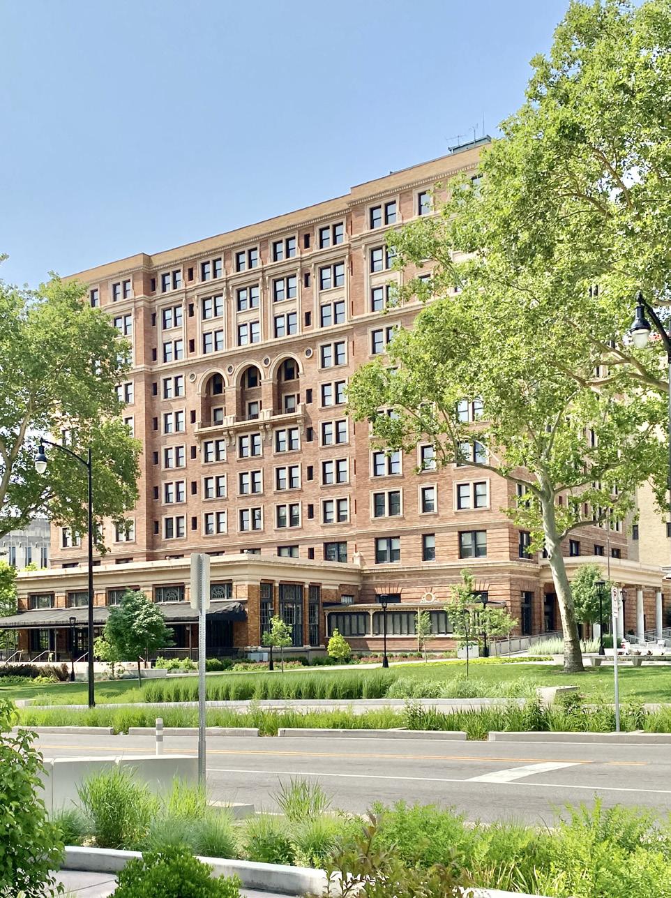
Designed by Rutan & Russell in the Beaux-Arts style, the Hotel Schenley was an initial project in Franklin Nicola’s vision to create a cultural, artistic and education district in Oakland.
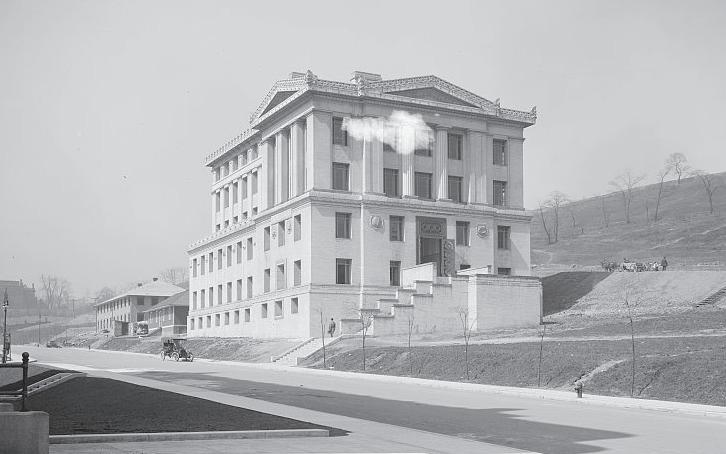
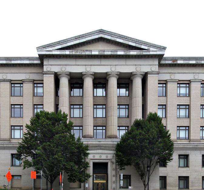
Thaw Hall (1910) – Designed by Henry Hornbostel, this Neoclassical Beaux-Arts five-story building features stone, brick and terra cotta. It is the only building remaining from Hornbostel’s “Acropolis
Plan.” Other buildings constructed in accordance with the plan include the now demolished School of Mines (State Hall), Pennsylvania Hall (1911) and the Mineral Industries Building in 1912.
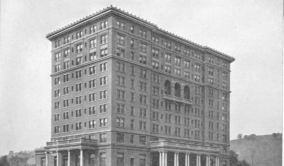
The Pittsburgh Athletic Association (PAA, 1911)
– Founded in 1908 by Franklin Nicola whose idea to create the organization was inspired by the New York Athletic Club. Designed by Benno Janssen, the PAA is listed on the National Register of Historic Places. This eight-story structure features stone and terra cotta details and is designed in the Venetian High Renaissance style based on the Palazzo Corner della Ca’ Grande, Palazzo Grimani di San Luca and Biblioteca Marciana in Venice, buildings of Jacopo Sansovino.
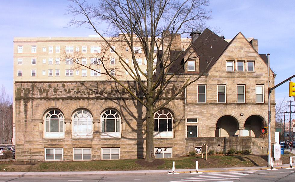
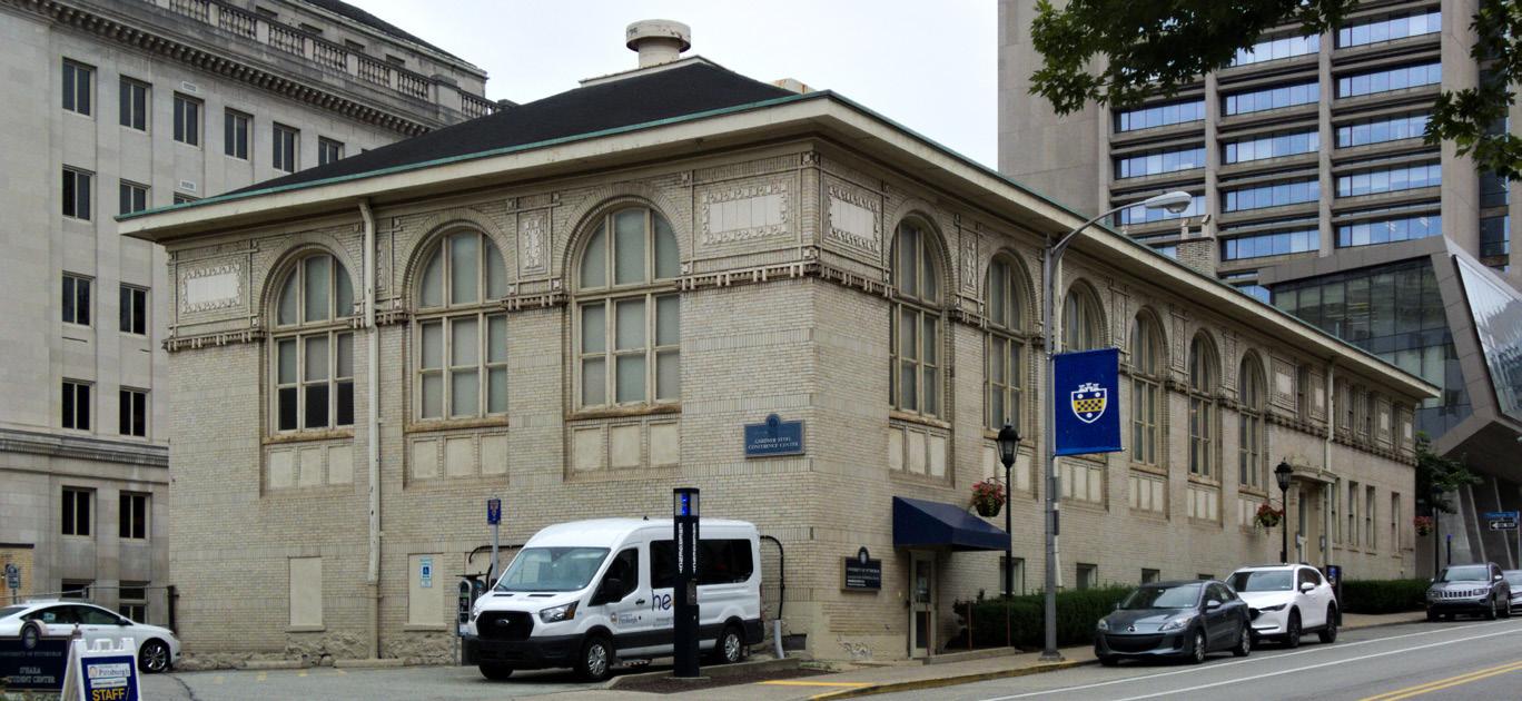
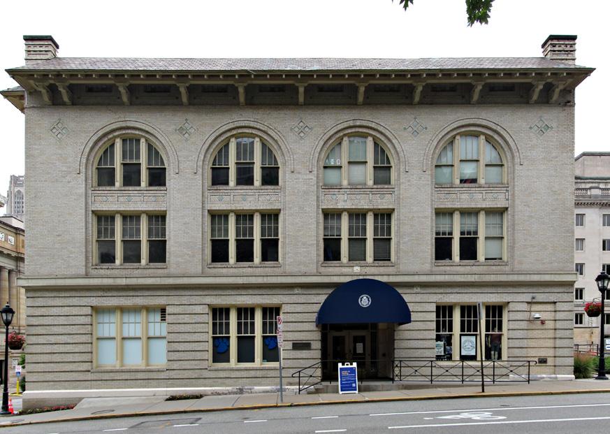
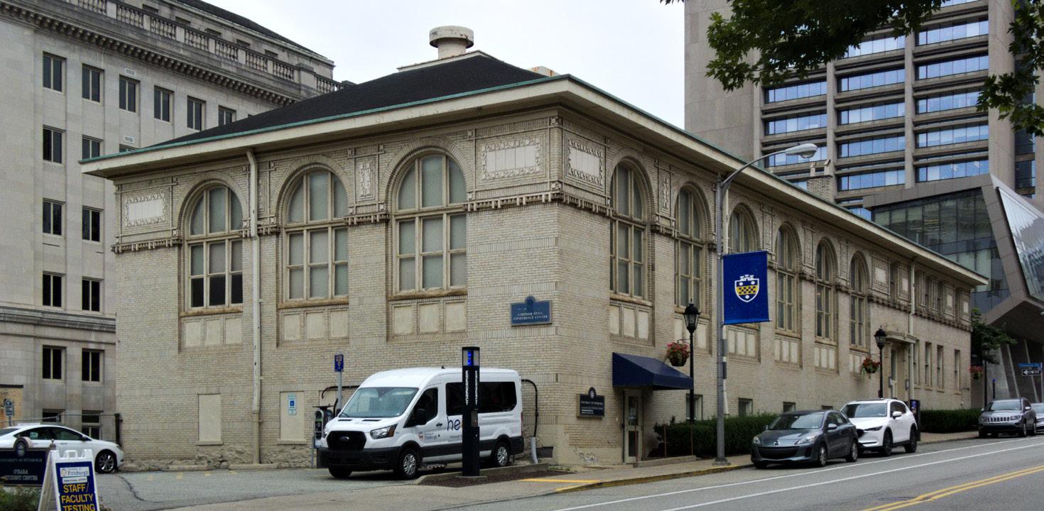
Gardner Steel Conference Center (1911-1912) –Designed by Kiehnel and Elliott, Gardner Steel is an early Modern style building distinguished by its entrance door ornamentation and cornice work inspired by the German art nouveau movement known as Jugendstil. The building originally served as the Central Turnverein, a German American social and athletic association, and was known later as the Central Athletic Association. A 2,500-sf addition was completed in 1922 for the building’s occupant at the time, the School of Dentistry.
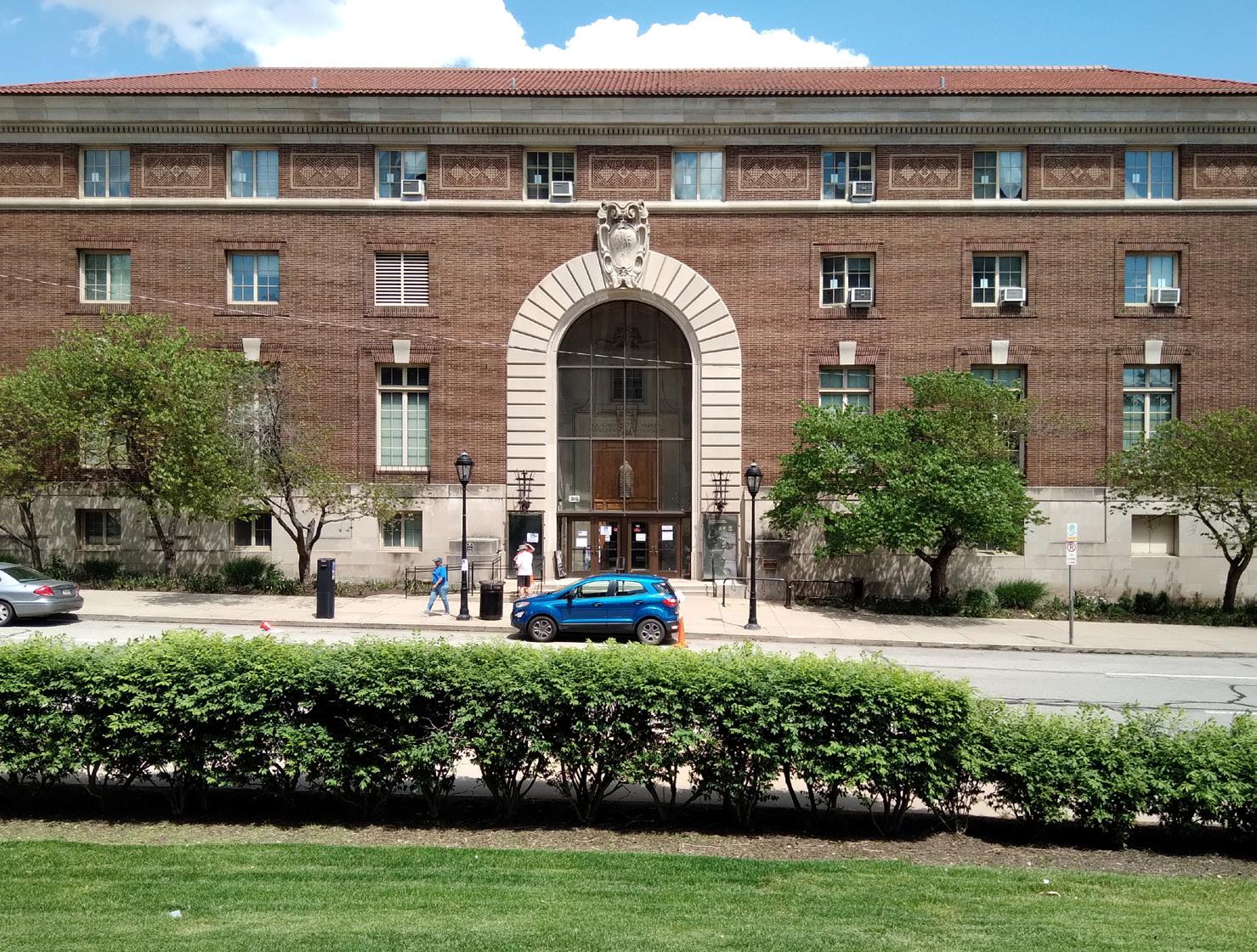
O’Hara Student Center (1913) – Designed by Pittsburgh architect Charles Bickel, the three-story, 18,000-square-foot building features a lobby with dark oak paneling salvaged from Pittsburgh’s Fort Pitt Hotel (1905) prior to its demolition in 1967.
Originally known as the Concordia Club, it was founded in 1874 by a group of mainly GermanAmerican Reform Jews and served for decades as a social center for Pittsburgh’s Jewish community.
Allen Hall (1914) – Originally home to the Mellon Institute of Industrial Research, Allen Hall is a six-story Greek-Revival building designed by J. H. Giesey. Although not designed by Henry Hornbostel, the location and character of the building contribute to the original Acropolis Plan for the campus.
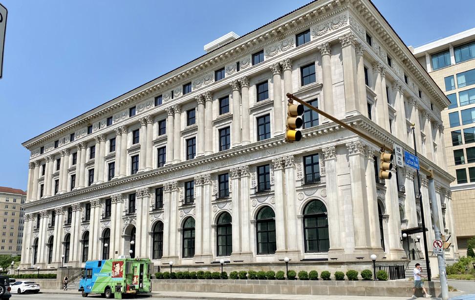
Alumni Hall (1914-1915) – Designed by Benno Janssen, Alumni Hall is a Greek revival building featuring a well-defined base, midsection and ornamental terra cotta pediment, topped with a clay tile roof. It was originally a Masonic Temple.
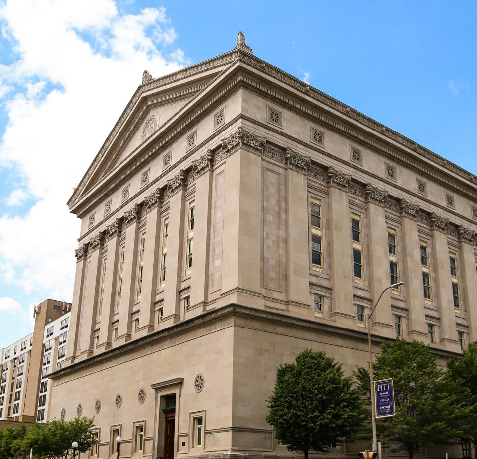
Alumni Hall
William Pitt Union
Music Hall
Gardner Steel Conference Center
Thaw Hall
The Pittsburgh Athletic Association
O’Hara Student Center
Schenley Hotel
Allen Hall
Source: Internet Archive Book Images, Wikimedia (Public Domain)
Source: Unknown (signed “Bragdon”), Wikimedia (Public domain)
Source: w_lemay, Wikimedia (CC BY-SA 2.0)
Source: w_lemay, Wikimedia (CC BY-SA 2.0)
Source: PICRYL
Source: Cbaile19, Wikimedia (CC0)
Source: Cbaile19, Wikimedia (CC0)
Source: Cbaile19, Wikimedia (CC0)
Eberly Hall (1921) – Designed by Benno Janssen, Eberly Hall’s angled orientation aligns with the site topography and the vision set out in the Acropolis Plan. (Benno Janssen, was the runner-up to Hornbostel in the national architectural competition for the campus design).
Schenley Quadrangle (1922-1924) – Originally designed as luxury apartments by Henry Hornbostel in collaboration from Rutan & Russell (Shenley Hotel), the quadrangle was commissioned by Franklin Nicola. Today, it includes the following Pitt residence halls: Amos Hall, Brackenridge Hall, Bruce Hall, Holland Hall and McCormick Hall.
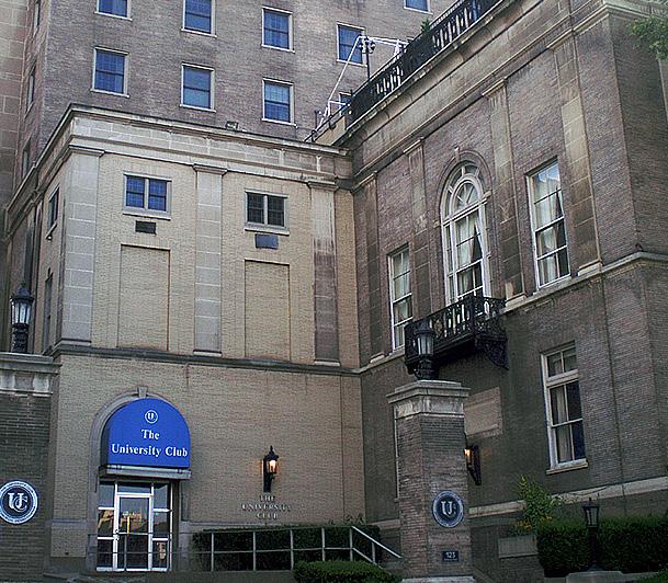
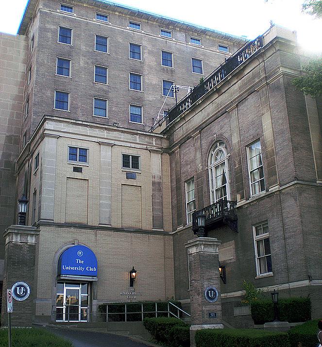
University Club (1923) – A classical limestone clad building designed by Henry Hornbostel; the University Club was a private social club from 1890-2004. It is listed on the National Register of Historic Places.
Bellefield Hall (1924) – An Italianate structure designed by Benno Janssen, originally serving as a Young Men’s and Women’s Hebrew Association. The design combines Italianate Palazzo Piccolomini delle Papesse in Siena with the 18th-century Lee House at Stratford in Virginia (Flemish-bond brick finish and the high basement).
Thackeray Hall (1925) – Designed by Henry Hornbostel in the classical stye, Thackeray Hall is the former National Union Fire Insurance Company building.
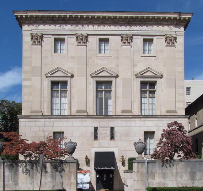
20th Century Club (1910; expanded 1929) –
Founded in 1894, the 20th Century Club was a women’s organization with a mission to create an “organized center for women’s work, thought and action” and to “advance members’ interests, promoting science, literature and the arts and to provide a meeting space for members.” The original building, constructed in 1910, was expanded by Benno Janssen in 1929. Janssen’s Italian Renaissance Revival design features a main entrance with a double external staircase, possibly modeled on Michelangelo’s Palazzo del Senatore on the Piazza del Campidoglio in Rome.
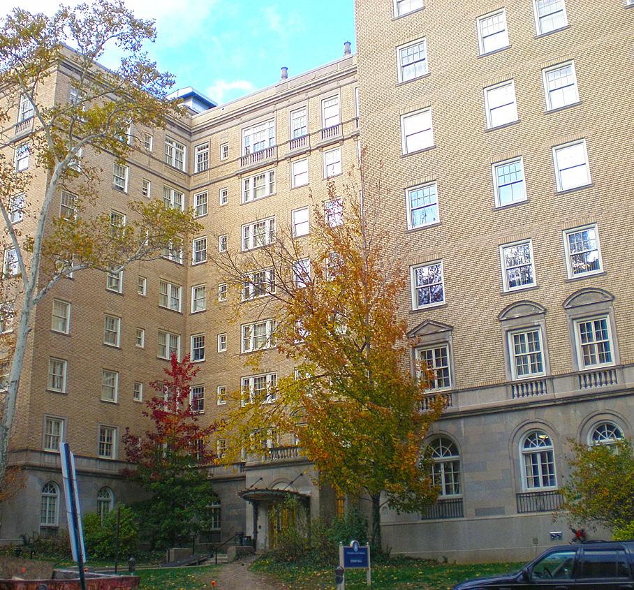
Ruskin Hall (1930) – An eight-story apartment building designed in the neo-classical style featuring a limestone base and brick facade.
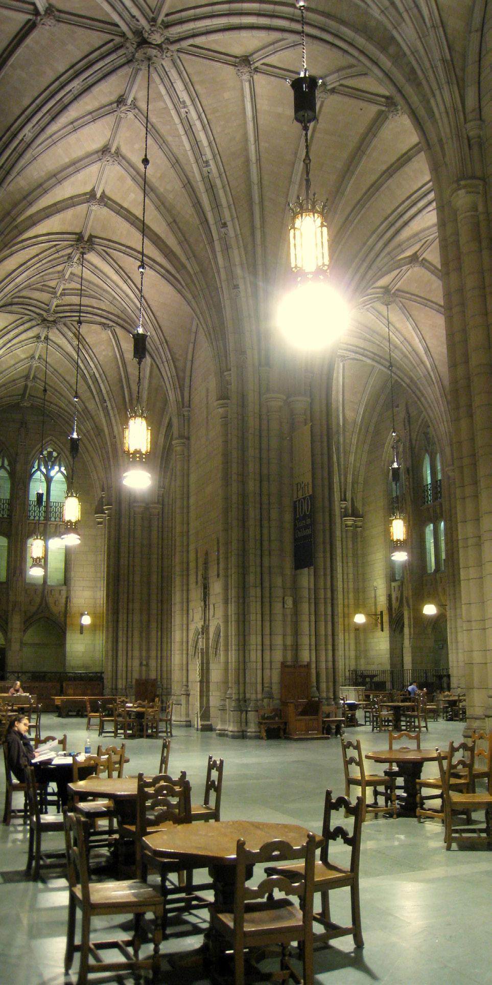
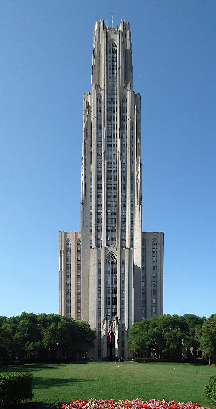
Cathedral of Learning (1937) – The 42 story GothicRevival building designed by Charles Klauder features 31 Nationality Rooms and a 22,000-sf, four-storyhigh, vaulted, neo-gothic study and event hall. This bold vision is one of the tallest academic buildings in the world.
Stephen Foster Memorial (1937) – Designed by Charles Klauder as a complement to the Cathedral of Learning, the memorial includes the 478-seat Charity Randall Theatre, the 151-seat Henry Heymann Theatre and the Stephen Foster Memorial Museum and the Center for American Music.
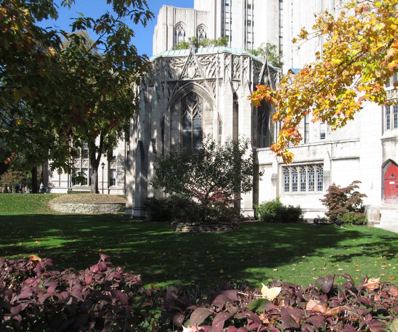
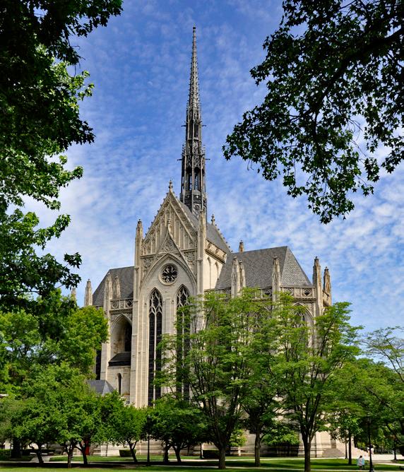
Heinz Chapel (1939) – A Gothic-Revival chapel designed by Charles Klauder featuring a modified cruciform plan, stone vaults, high ceilings, repeated
arches and extensive use of stained glass designed by Charles J. Connick. The windows are among the tallest of any chapel in the world (73 feet). The interior and exterior walls feature Indiana Limestone.
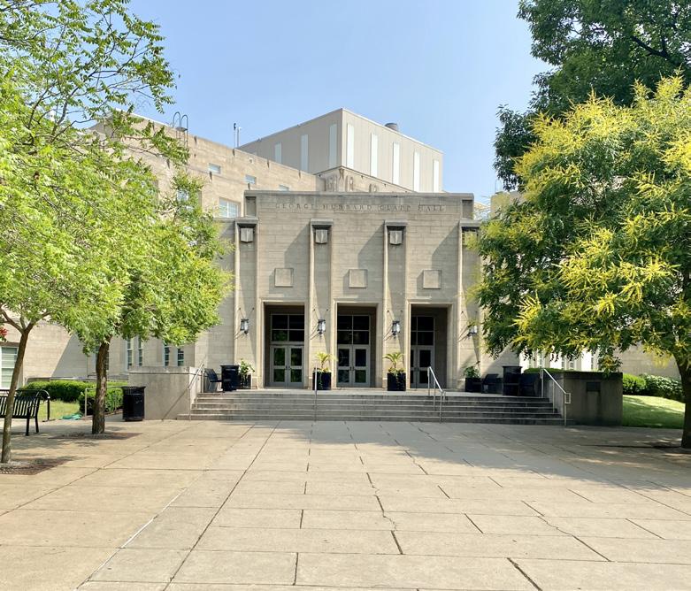
Clapp Hall (1956) – A six-story Gothic-Revival structure designed by Trautwein & Howard. The building features a mix of Collegiate Gothic and Art Deco styles and is diagonally positioned on-axis with the Cathedral of Learning.
David Lawrence Hall (1960) – Completed in 1960 and designed by Johnstone, McMillin & Associates, David Lawrence Hall houses classrooms and Pitt’s largest lecture hall, a 998-seat auditorium. Named for David L. Lawrence—Pittsburgh mayor, Pennsylvania governor, and longtime Pitt trustee—the building is fronted by Virgil Cantini’s Ode to Space, a memorial to Chancellor Edward Litchfield.
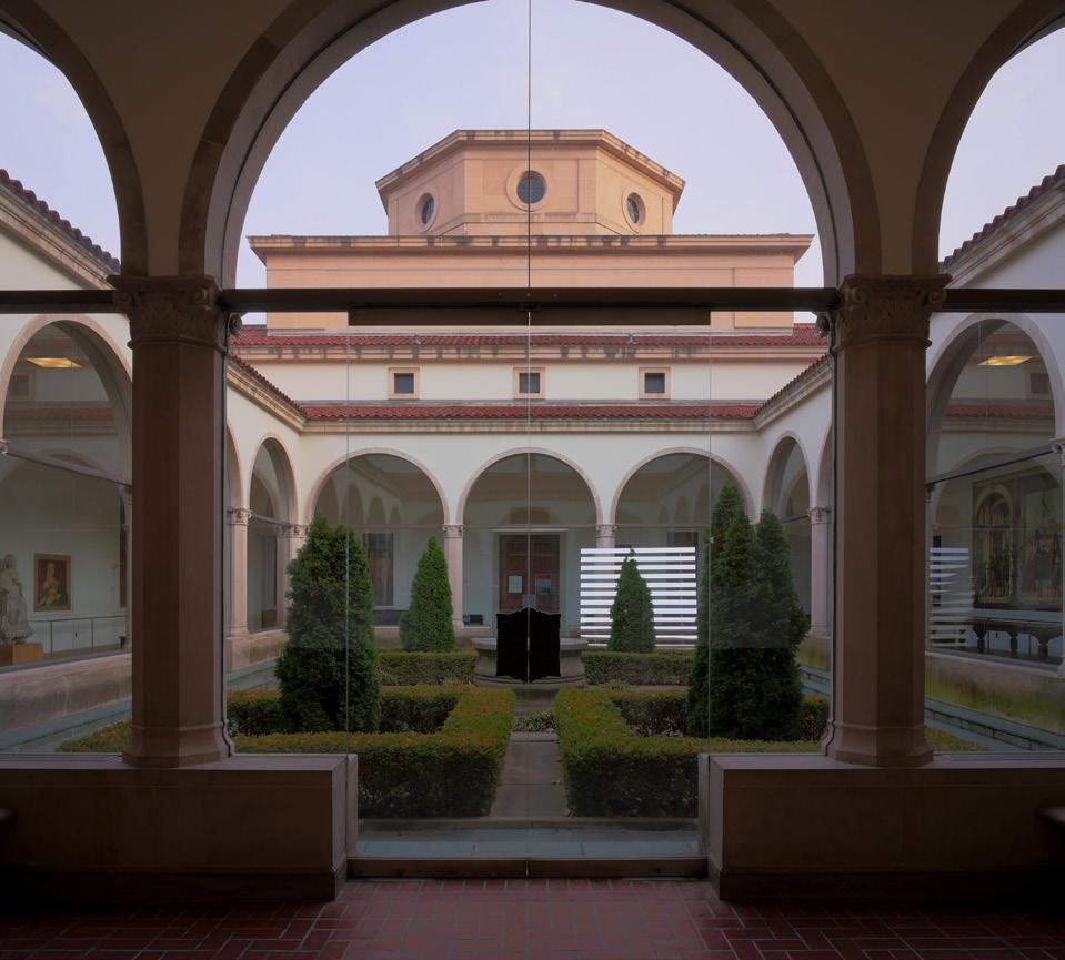
Frick Fine Arts Building
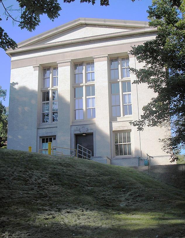
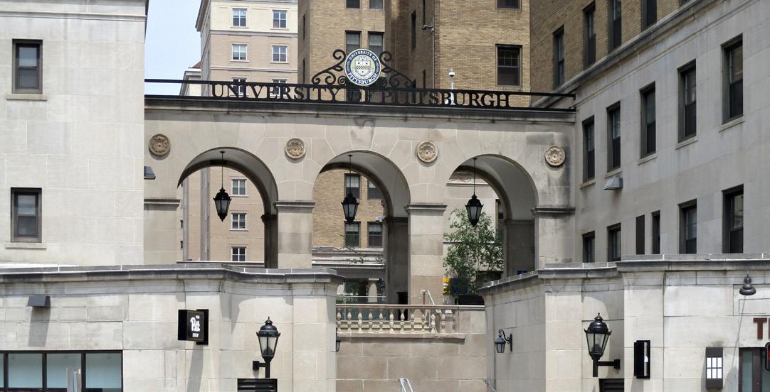
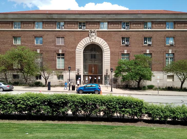
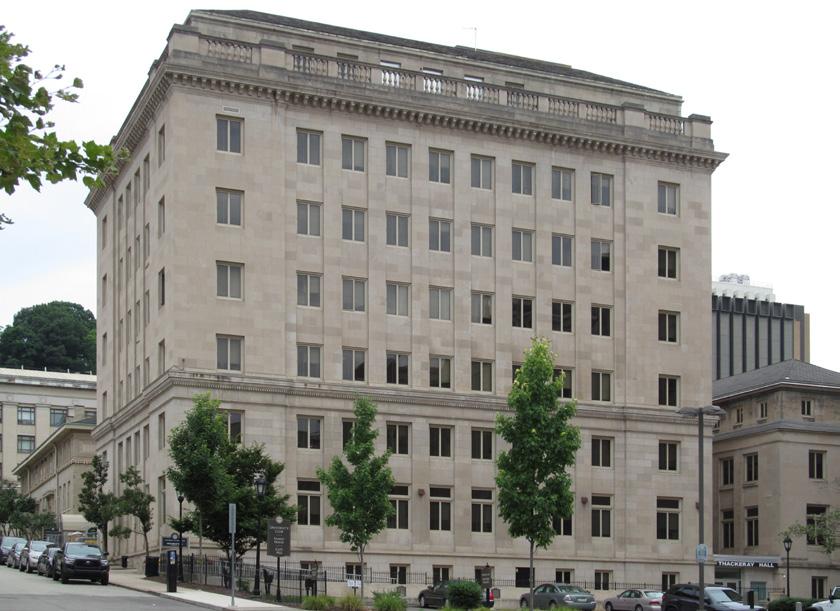
Thackeray Hall
Eberly Hall Schenley Quadrangle
University Club Bellefield Hall
Stephen F. Foster Memorial Heinz Chapel Clapp Hall Cathedral of Learning
20th Century Club
Ruskin Hall
Source: Crazypaco, Wikimedia (CC BY-SA 3.0)
Source: Crazypaco, Wikimedia (CC BY-SA 3.0)
Source: Crazypaco, Wikimedia (CC BY-SA 3.0)
Source: Cbaile19, Wikimedia (CC0)
Source: Cbaile19, Wikimedia (CC0)
Source: Cbaile19, Wikimedia (CC0)
Source: Indies1, Wikimedia (CC BY-SA 4.0 ) Source: w_lemay, Wikimedia (CC BY-SA 2.0 )
Source: w_lemay, Wikimedia (CC BY-SA 2.0 )
Source: Cbaile19, Wikimedia (CC0)
Source: Cbaile19, Wikimedia (CC0)
Frick Fine Arts Building (1965) – Designed by Burton Kenneth Johnstone Associates, the building is modeled after Pope Julius III’s (1487–1555) Villa Giulia in Rome. It features white limestone and marble with a terracotta tile roof around a central courtyard. An octagonal cupola caps a central rotunda.
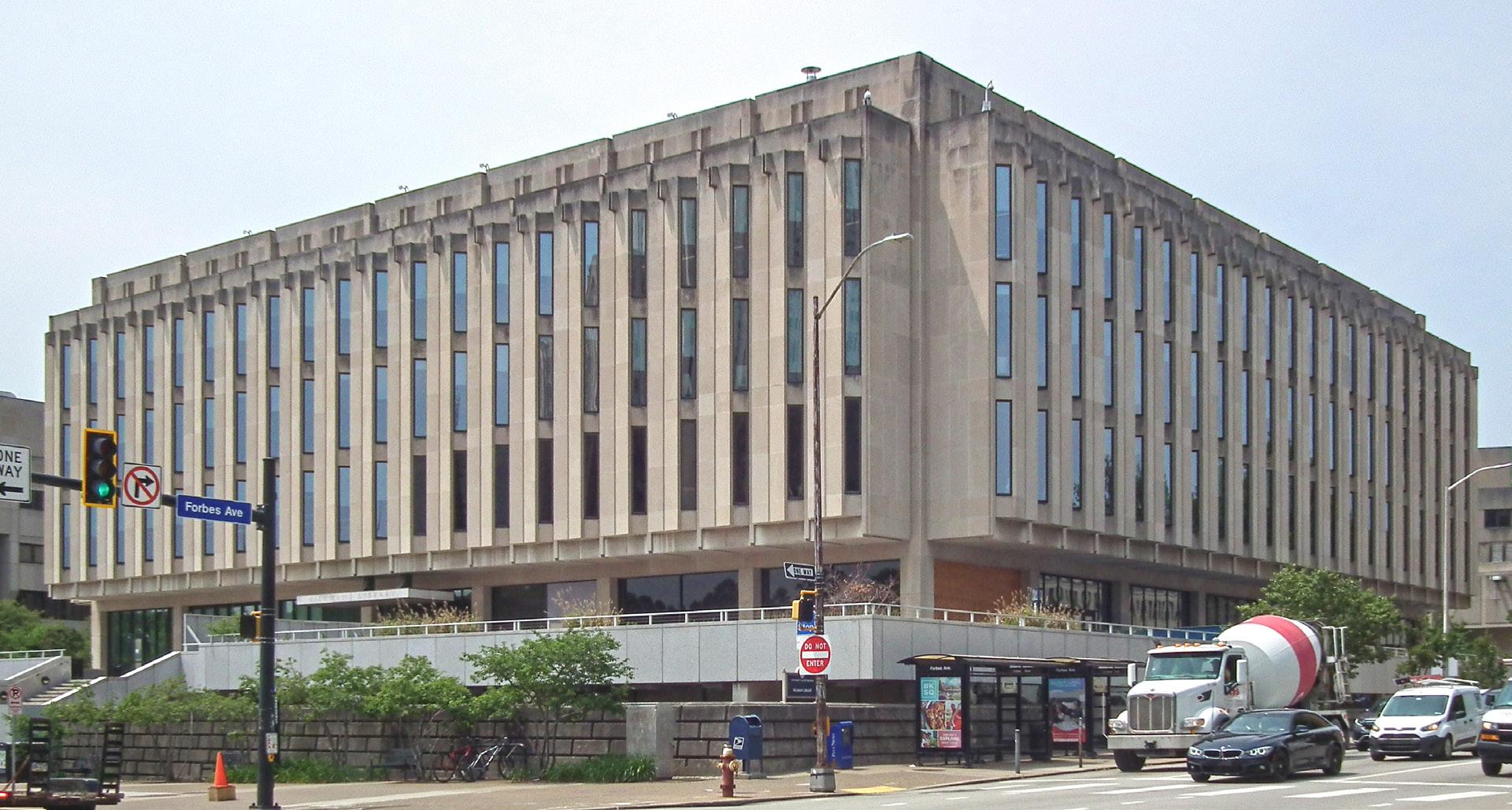
Hillman Library (1968) – Pitt’s first standalone, centralized library, Hillman Library was designed by Celli-Flynn with Kuhn, Newcomer & Valentour and Dolores Miller Associates, and made possible through major support from the Hillman family and Foundation. Its Brutalist exterior and warm interior have evolved through ongoing improvements, culminating in a major 2018–2025 renovation and addition that added a glass atrium, accessible entries, green roofs, a rooftop solar array, and public realm improvements.
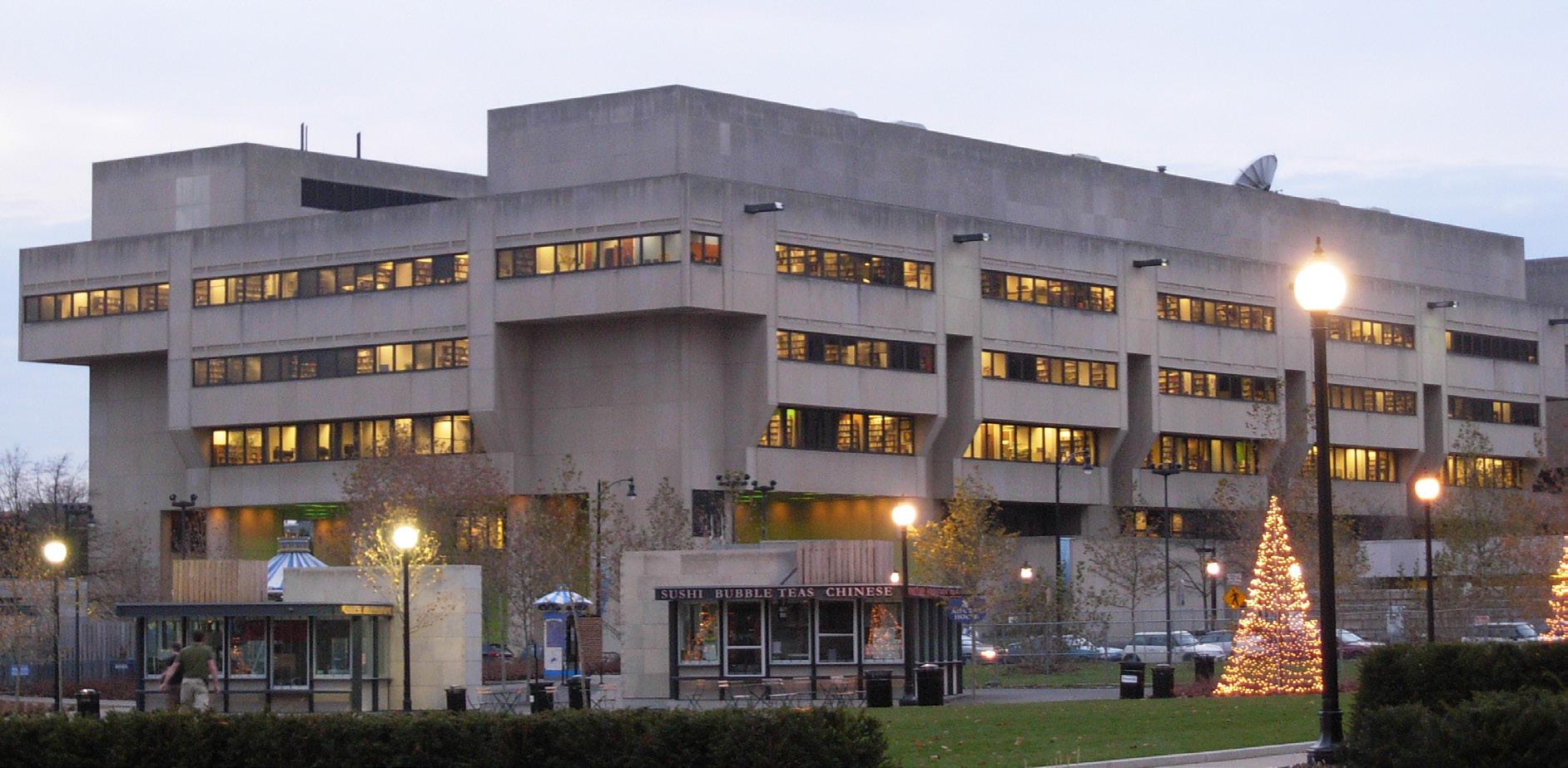
Posvar Hall (1978) – The largest dedicated academic building on campus, Posvar Hall was constructed from 1975 to 1978 on the former site of Forbes Field and named for Pitt’s 15th chancellor. Designed by Kuhn, Newcomer & Valentour, its limestone-paneled, Brutalist-influenced form reflects the monumental academic architecture of the period. The interior has been renovated over time to meet today’s needs.
Biomedical
Science Towers 1 (1990) and 2 (1996)
– Designed by Burt Hill Kosar Rittelmann Associates in a post-modern style, the Biomedical Science Towers are clad in limestone with a glass curtain wall. Tower 1, now named for transplant pioneer Thomas E. Starzl, and Tower 2 together provide more than 19 stories of laboratory and research space for 21 departments and programs, forming one of the University’s most significant hubs for biomedical discovery and clinical innovation.
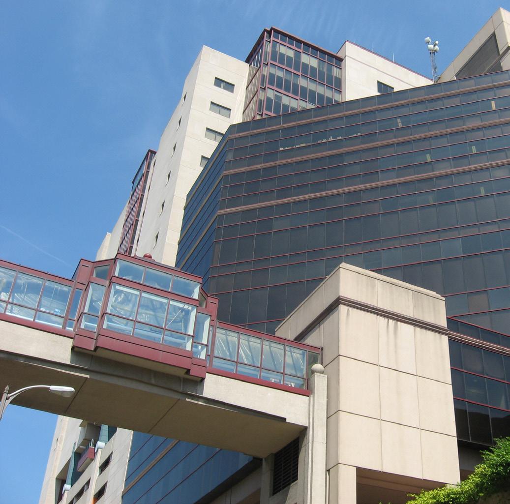
Biomedical Science Towers
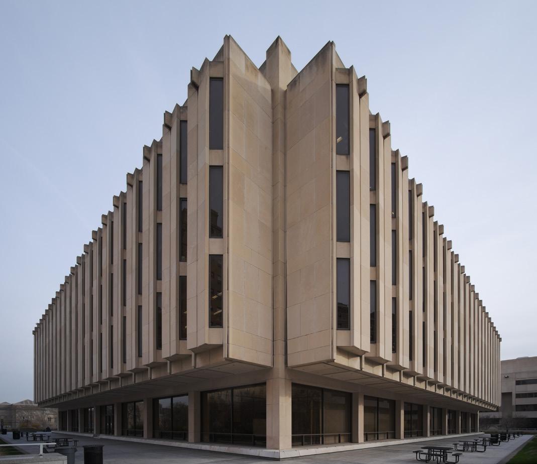
Hillman Library
Posvar Hall
Hillman Library
Source: Cbaile19, CC0, via Wikimedia Commons
Source: Dllu, CC BY-SA 4.0, via Wikimedia Commons
Source: TheZachMorrisExperience, CC BY-SA 3.0, via Wikimedia Commons
Source: Piotrus, CC BY-SA 3.0, via Wikimedia Commons
The Social Club Legacy of Oakland
Oakland’s social club legacy is a testament to Pittsburgh’s diverse immigrant communities. There are few cultural institutions that connect Pittsburgh’s present to Pittsburgh’s past as thoroughly as the city’s ethnic social clubs, and these buildings now serve as tangible reminders of the immigrant communities who shaped the city. Today, the University of Pittsburgh owns virtually all of these historic club buildings, recognizing their architectural and cultural significance while working to respect and carry forward the legacy of the diverse communities that built Oakland.
The key buildings in this social club ecosystem each tell unique stories of Pittsburgh’s immigrant experience. In addition to the previously mentioned 20th Century Club and the Pittsburgh Athletics Association, the following buildings intended for social purposes survive on campus today.
• The German-American Social and Athletic Club, known today as the Gardner Steel Conference Building), was built between 1911-12 by Kiehnel and Elliott Architects and originally served as a host to various athletic competitions. It changed uses during World War I and thereafter, from housing Student Army Training Corps, to an Infirmary, to a general academic building today.
• The Concordia Club , now known as the O’Hara Student Center, opened in 1913 to house the Concordia Club, a private social club whose members included many of Pittsburgh’s
leading Jewish residents. It was designed in Romanesque Revival style.
• The Masonic Temple, now known as Alumni Hall, was designed by renowned architect Benno Janssen, the limestone-clad building was constructed in 1914-15, with Lodge 45 of the Freemasons holding their first meeting there on February 26, 1915. It was acquired by Pitt in 1993.
• The University Club, designed by Henry Hornbostel and completed in 1923, originally served as home to a private social club established in 1890 before becoming part of Pitt’s campus in 2004.
• The Young Men’s and Women’s Hebrew Association (YMWHA), now known as Bellefield hall, had provided additional facilities for the JCC until it was sold in 1984 to the University of Pittsburgh, with historical records indicating the organization embarked on a building campaign which culminated in the 1924 groundbreaking for a new headquarters building.
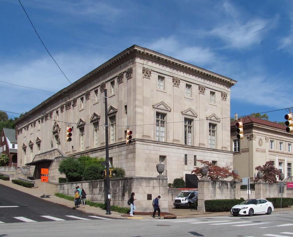
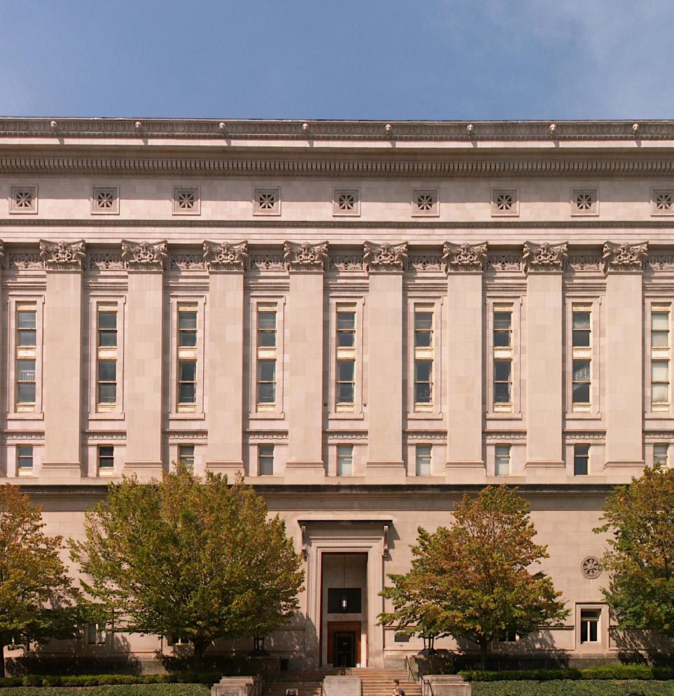
1910 – 20th Century Club
1915 – Masonic Temple (Alumni Hall)
Source: Cbaile19, Wikimedia (CC0)
Source: TheZachMorrisExperience, Wikimedia (CC BY-SA 3.0)
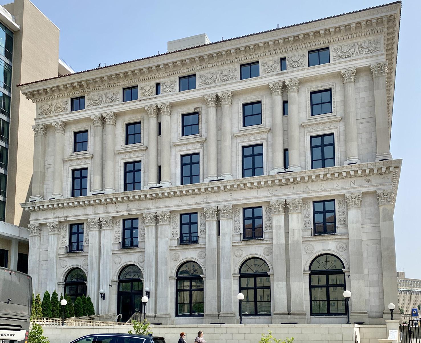
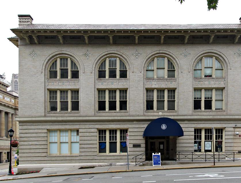
1911 – Pittsburgh Athletic Association
1912 – German-American Social and Athletic Club (Gardner Steel)
1913 – Concordia Club: Jewish Social Club (O’Hara)
1923 – University Club
1924 – Young Men’s and Women’s Hebrew Association (Bellefield Hall)
Source: Cbaile19, Wikimedia (CC0)
Source: Cbaile19, Wikimedia (CC0)
Source: Cbaile19, Wikimedia (CC0)
Source: Crazypaco, Wikimedia (CC BY-SA 3.0)
Source: w_lemay, Wikimedia (CC BY-SA 2.0 )
2.5 SUSTAINABILITY
Sustainability is a core value in the Plan for Pitt and for the Campus Master Plan. The following summarizes Pitt’s commitments and goals relevant to the physical planning recommendations of the Campus Master Plan.
2025 Pitt Sustainability Plan
The 2025 Pitt Sustainability Plan (amended from the original 2018 Plan) sets out strategies and goals organized by fifteen impact areas with sixty-one goals.
The plan includes three main impact areas: 1) Stewardship; 2) Exploration; and 3) Community and Culture. Of these, the goals and initiatives of the Stewardship impact area are relevant to the recommendations for the physical environment that the Campus Master Plan addresses. The Exploration and Community and Culture areas also include goals relevant to the physical environment.
The Campus Master Plan focuses on the Stewardship category, acknowledging that the goals and objectives of the Explore and Community and Culture categories are indirectly relevant to the physical planning initiatives.
Stewardship Impact Area
Pitt cares for both the built and natural environments in a manner that ensures responsible and efficient resource management. The university strives to minimize the negative impacts of its operations. Key goals include:
Energy and Emissions Goals
• Carbon: Reach Carbon Neutrality by 2037 on the Pittsburgh campus, with an incremental goal of reducing greenhouse emissions 50% by 2030 (from the 2008 baseline). Pitt is on track to reduce emissions by 50% by 2030 and has a plan to achieve carbon neutrality by 2037.
• Efficiency: Achieve Pittsburgh 2030 District goals of 50% reduction in energy use intensity (consumption per square foot) by 2030 (below 2003 national median baseline).
• Standards: Elevate design standards and operational practices to achieve energy reduction use goals.
• Renewables: Produce or procure 50% of the university’s electricity from renewable resources by 2030 and 100% by 2037.
Landscape and Ecology Goals
• Design: Adhere to Pitt’s Sustainable Landscape Design Guidelines in all new landscape designs.
• Standards: Maintain at least 75% of landscaped
areas in accordance with Northeast Organic Farming Association (NOFA) Standards for Organic Land Care by 2024.
• Trees: Maintain and grow tree count and canopy on campus by 2037 (compared to 2017 baseline), while improving tree health and ecosystems in Pittsburgh.
• Certification: Pursue SITES certification for applicable landscape projects.
Transportation and Mobility Goals
• Emissions: Achieve Pittsburgh 2030 District goal of 50%reduction in greenhouse gas emissions from commuter travel by 2030 (below the 2013 Oakland neighborhood baseline).
• Fleet: Reduce greenhouse gas emissions from fleet vehicles 50% by 2030 (below 2017 baseline).
• Commuting: Increase active and shared commuting to 55% of all commuting trips to Pittsburgh campus by 2030.
• Biking: Achieve Gold Bicycle Friendly University status from the League of American Bicyclists in 2025.
• Charging: Install 50 new electric vehicle charging plugs in existing facilities between 2025 and 2030.
Materials and Resource Goals
• Purchase: Enhance procedures, policies, practices and educational tools to reduce the quantity and environmental impact of materials entering and exiting the university.
• Building Materials: Use healthy products for the built environment in accordance with future Pitt Design Guidelines.
• Landfill: Reduce landfill waste 25% by 2030 (from 2017 levels).
Water System Goals
• Efficiency: Achieve the Pittsburgh 2030 district goal of 50% reduction in water use intensity (consumption per square foot) by 2030 (below historic district average).
• Standards: Elevate design standards and operational practices to achieve water use reduction goals.
• Drainage: Responsibly manage stormwater by increasing pervious surfaces, improving campus porosity and removing and improving lawn areas with native, sustainable landscapes (compared to 2017 baselines).
• Stormwater: Divert 25% of stormwater from remaining impervious surfaces by 2030 via above ground (green) and rainwater reuse infrastructure.
• Drink: Work with the City of Pittsburgh to ensure clean drinking water for all in our community.
As previously noted, the Stewardship Impact Area includes the goals most relevant for the Campus Master Plan; however, the Community and Culture Impact Area sets out health and well-being goals that can be addressed in the plan.
Community and Culture Impact Areas
Health and Well-being Goals
• Buildings: Pursue LEED Gold green building certification or better for applicable university owned and partnered projects, while continuing to include 2030 Challenge energy and water use intensity performance targets.
• Space: Improve the environmental quality the our indoor and outdoor spaces.
• Happiness: Enhance student and employee physical and mental health.
City and Regional Connections
• Transparency: Continue to maintain and increase transparency between Pitt and our community for knowledge sharing, capacity building, and change empowerment.
• Leadership: Take active leadership roles in sustainability initiatives in Oakland, Pittsburgh,
• Engagement: Incentivize sustainability activism and community collaborations by providing opportunities for volunteerism, internships, service,and community engagement.
• Partnership: Embrace a culture of impactful service through long-term investment in our communities.
Exploration Impact Area
Research
• Collaborate: Provide more opportunities and incentives for interdisciplinary research as well as the bridging of academics and operations – promoting an environment of informing and working together.
• Living Lab: Use the Pitt campus as a living laboratory for faculty and students to implement new ideas and study outcomes over time. the region, and nationally to demonstrate solutions to our grand challenges.
Climate Action Plan (CAP)
CAP Strategies
The following summarizes the strategies for achieving carbon neutrality by 2037:
• Energy Demand Reductions: Reduce building and campus use through space use optimization, existing building efficiency and new building performance. These strategies account for 11% of the reduction from 2019 to 2037.
• Cleaning the Supply via Renewable and Clean Energy Investment: Provide renewable energy and efficient and cleaner district energy through electrical grid shifts and renewable energy procurement. These strategies account for 42.3% of the reduction from 2019-2037.
CAP Themes
The CAP includes three cross cutting themes: 1) Enhance the Academic Mission; 2) Advance Equitable Action; and 3) Ensure Economic Resilience. The carbon neutrality goal of the CAP incorporates the following milestone goals adopted as part of the 2018 Sustainability Plan:
• Reduce GHG emissions 50% by 2030 (from FY08 baseline).
• Produce or procure 50% of the university’s electricity from renewable resources by 2030.
Pitt’s first Climate Action Plan (March 2022) sets out the strategy, approach and details for achieving carbon neutrality by 2037, the 250th anniversary of institution. The strategy calls for reducing demand, cleaning supply and increasing low carbon connections. Carbon neutrality refers to balancing all GHG emissions by removing or capturing and storing and equivalent quantity of GHG emissions.
The Pitt CAP aligns with the larger sustainability initiatives for balancing equity, environment and economics. It supports the City’s targeted carbon neutrality date in 2050 and the Commonwealth’s GHG reduction target of 80% by 2050.
• Low Carbon Connections: Promote active, shared and low carbon mobility for commuting and air travel account. These strategies account for 31.1% of the reduction incorporating Corporate Average Fuel Economy (CAFÉ) standards, shifting commuting to more active, shared and low carbon choices and an increase in flex work arrangements, air travel reductions and air travel offsets.
• Insets and Offsets: Utilize campus education, behavior shifts and carbon insets and offsets to balance the remaining GHG footprint by sequestering carbon regionally, nationally and/ or globally. These strategies account for 15.2% of the reduction.
• Achieve 2030 Challenge Goals: 1) 50% reduction in energy use intensity (kbTU per square foot) below the national average; 2) 50% reduction in water use intensity (gallons per square foot) below the regional average by 2030; 3) 50% reduction in greenhouse gas emissions from commuter travel by 2030 (from 2013 modeled Oakland baseline); 4) Achieve 50% reduction in greenhouse gas emissions from Pitt’s vehicle fleet by 2030.
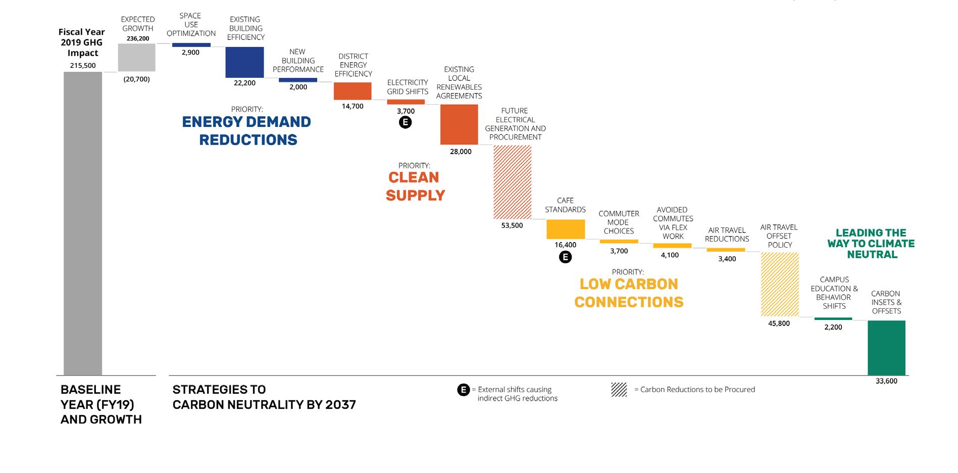
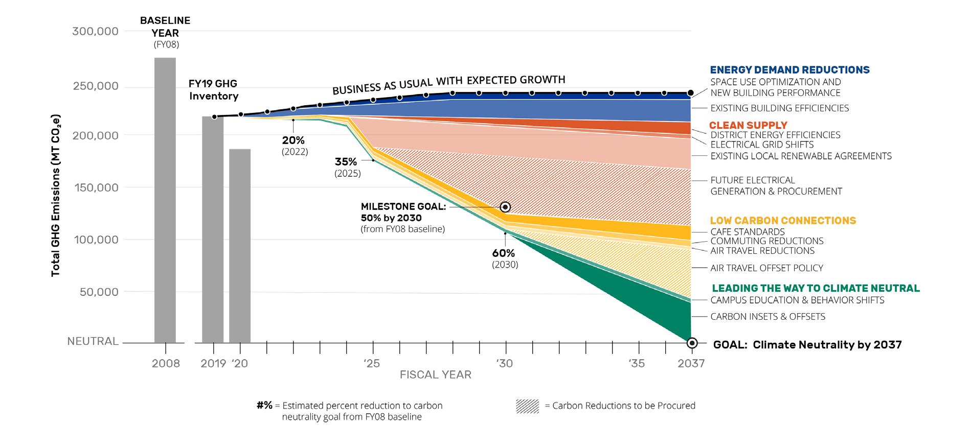
Pathway to Carbon Neutrality
Source: University of Pittsburgh Climate Action Plan: Our Pathway to Neutral
2.6 ENROLLMENT GROWTH: UNDERGRADUATE AND GRADUATE
The Campus Master Plan takes into consideration the targeted enrollment growth and the resulting academic, research, housing and support space needs.
Enrollment Growth
The following enrollment growth assumptions apply:
• An increase of an additional +2,000 undergraduate students by 2028, and a 0.05% increase (baseline 2023) from 2028-2033, resulting in a headcount of 22,726 in 2033
• An increase in graduate students of 15% by 2028, and a one percent (baseline 2028) increase from 2028-2033 resulting in a headcount of 7,933 in 2033.
• An increase in doctorate enrollment of one percent (baseline 2023) annually through 2028, and remaining flat for the following five years, resulting in a headcount of 2,833 in 2033.
Based on these growth assumptions, the plan projects a total enrollment of 33,475 in 2033. From Fall 2023-Fall 2025, enrollment grew by 1,741 totaling 31,229.
The chart to the right summarizes the historical student enrollment obtained from the Office of Institutional Research at Pitt along with the growth projections through 2033 based on guidance from university leadership and the Plan for Pitt.
Faculty and Staff Growth
Over a 10-year period from 2023-2033 faculty and staff populations maintain current ratios as enrollment grows, resulting in the following growth assumptions:
• The faculty population is expected to increase from 5,048 to 5,773 FTE for a total increase of 725 FTE.
• The staff population is expected to increase from 9,010 FTE to 10,577 FTE for a total increase of 1,567 FTE.
Methodology
The enrollment growth and associated faculty and staff growth projections are used to determine campus-wide space needs by space types that ‘right-size’ space types with university specific considerations. The space needs analysis, found on the following page, utilizes a comprehensive space planning model that incorporates formulae and guidelines from two main sources:
• Council of Facilities Planners International (CEFPI) now 4LE
• Pennsylvania State System of Higher Education Capital Facilities Planning and Programming Criteria (PSSHE)
The model is designed with ‘dynamic’ formulae, so that data inputs are tailored specifically to Pitt’s pedagogy, academic mission, strategic goals and preferred practices per direction and input from Pitt. Data inputs include enrollment projections, studentto-faculty ratios, library collection numbers, and other factors.
For most space use categories, projected need is calculated by using existing and projected population data and a guideline for a given space type, typically on a square foot per FTE basis. The projected space need is then compared to the existing space for the given category to determine whether a quantitative space surplus or deficit exists.
Enrollment and Enrollment Projections 2015 - 2033
2.7 SPACE NEEDS AND UTILIZATION
The Campus Master Plan includes an assessment of existing and projected space needs based on the current and targeted populations, including undergraduate, graduate and doctoral students. Enrollment combined with associated increases in the faculty and staff population serve as the key metrics for future space needs projections.
Key findings for the major categories of space are as follows:
Classrooms: Adequate space exists to support enrollment growth provided that policy changes can be adopted to centrally manage departmental and departmental priority classrooms. Classroom de-densification and furniture upgrades are recommended to balance demand within existing classroom inventory and promote active learning.
Teaching Labs: Current and projected demand require additional teaching labs. Highest demand for new teaching labs include Chemistry, Biology, Physics and Engineering.
Research: There is significant demand for new research space on campus considering research faculty growth reported in the Deans’ Survey. Growth in research is anticipated across multiple schools.
Open Labs: There is modest demand for new open labs today that increases in the future. This category includes architectural and art studios, music practice rooms, computer labs, language labs, fabrication labs and other unscheduled learning spaces.
Office Space: Pitt allocates more space than required for offices, exceeding recommended space standards when considering a right-sized approach to space assignment. This may be a result of individuals with two offices and older inefficient buildings. There is potential to reduce office space on campus through relocation, renovation and the adoption of policy changes like reduced office space standards and shared space for hybrid employees.
Study Space: There is significant demand for study space outside of the campus library system. New study space should be provided in the development of new residence halls and integrated into new academic buildings and renovations.
Athletics space: Overall space is adequate when considering the new Arena and Sports Performance Center. Ad hoc planning may be needed to address specific Intercollegiate program elements; known needs include new men’s and women’s basketball practice facilities and an indoor track.
Recreation: The new Recreation and Wellness Center combined with the re-use of spaces replaced by the new facility balances the need over time.
Projected Space Needs by Space Type
Totals represent ASF and include leased space.
Existing Space Existing Need Need
Assembly and Exhibition: There is an oversupply of assembly space today, however, existing policies limit access, making it difficult for students and faculty to reserve rooms. As a result, the available supply is not fully realized or effectively utilized.
Dining Space: There is demand for on campus dining based on increases in FTE and increasing the on-campus student population. New dining options should be considered in the Hillside District, as well as an on-campus grocery store or market.
Existing Space
Existing Need
Projected Need in 2033
Need in 2033
Need in 2033
Existing Space
Existing Need Need in 2033
Social Space: The quantity of social space is adequate, however the majority of social spaces were retrofitted into historic buildings and were not designed to support student programs in the 21st Century. This supports the proposal to consolidate the Student Union into one new location, which would modernize facilities to meet today’s needs and allow for the re-purposing of the O’Hara Student Center and the William Pitt Union.
Student Health: An increase in student health services is required as a result of population growth. Such expansion will require additional study.
Notes:
• For details on the space needs assessment assumptions, methodologies and findings, please see Appendix 02 of this document.
• Chapter 5: Mission and Experience, summarizes how the Campus Master Plan accommodates these needs in renovated facilities and new construction.
* Methodology 1 right sizes office space based on the CEFPI formula approach. Detailed information can be found in Appendix 02 of this report.
**Athletics figure has been adjusted to show the new ASPC in the lighter shade.
***The Recreation figure has been adjusted to indicate spaces that will come off line as a result of the Recreation and Wellness Center in the lighter shade.
03 CAMPUS MASTER PLAN VISION
CAMPUS MASTER PLAN VISION
The Campus Master Plan reinforces Pitt’s vibrant urban campus, rooted in the history and traditions of the university, anchored to its unique place in Oakland, and informed by and committed to its academic, research and community engagement initiatives outlined in the Plan for Pitt 2028. It establishes a vision for the continuation of campus development.
The vision responds to the five pillars of the Plan for Pitt with complementary principles and six Big Ideas. It is a foundational revisit of the 2019 Campus Master Plan, with an attention shift to two key areas:
• The public realm
• Stewardship of our historic building portfolio
The public realm connects the fabric of campus within the Oakland neighborhood and the city of Pittsburgh, that is foundational to the experience of campus, city and life. The plan establishes and reinforces gateways, pathways and connections, elevating the pedestrian experience for a more intuitive and inclusive navigation of campus. Whether student, faculty, staff, neighbor, visitor or passerby, the vision welcomes all to campus, fostering a pride of place at the University of Pittsburgh.
The CMP embraces Pitt’s recent acquisitions, of the Twentieth Century Club and the Pittsburgh Athletic Association, accentuating the existing trove of early twentieth century architectural gems, including the competition-winning Acropolis Plan, the skyscraping Cathedral of Learning or the myriad former social clubs of Oakland. It proposes continued and future uses for the historic structures, reinvigorating them while celebrating their rich fabric, and creating additional student space along campus pathways.
Pitt Owned Building
Pitt Affiliated Building Proposed Building within the District
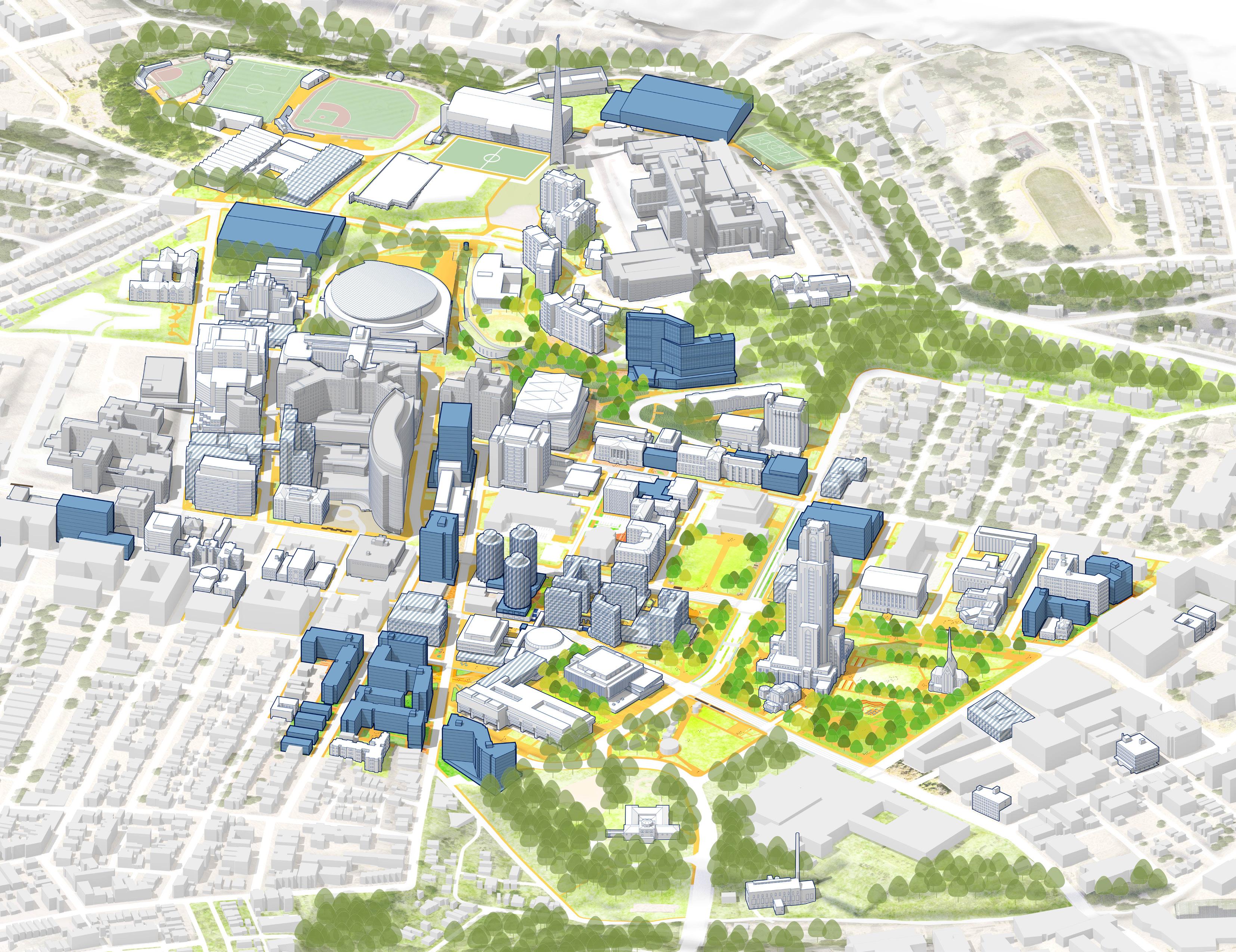
3.1 PLANNING PRINCIPLES
The recommendations of the plan are informed by planning principles that serve as the guiding basis for longterm decision-making. The plan puts forth these “universal truths” to inform future planning and design decisions with the goal of ensuring coordinated and integrated outcomes. The following principles emerged from the collaborative planning process.
Enhance living and learning environments, the public realm, open space and mobility networks to contribute to the academic and research mission, promote collaboration and innovation and foster well-being.
The Campus Master Plan provides comprehensive and integrated recommendations for enhancing the living and learning environments, the public realm and mobility networks through the lens of the user experience. It considers the needs of the many user groups of the Pitt campus including first year resident students, students living on and off-campus, faculty, staff, alumni and visitors. It also considers the experience of those from underrepresented backgrounds by offering a range of support services and welcoming environments in the proposed student center and elsewhere across campus. The plan places particular attention on those with accessibility and other challenges by embracing the principles of Universal Design.
1 2 ELEVATE THE CAMPUS EXPERIENCE ENHANCE CAMPUS IDENTITY
Augment campus edges, gateways and connections to improve the student, faculty, staff, community and visitor experience. Embed the Spirit of Pitt on the physical campus.
The Campus Master Plan enhances the identity of the campus through an extensive range of recommendations for improving the public realm—the gateways, pathways, streetscapes and open spaces that shape the character and image of the campus as well as the experience of the campus. The plan further enhances the identity of the campus by putting forth recommendations to preserve and maintain the important urban design and architectural legacy of the campus set out in the early 20th century vision for Oakland.
Enhance the sense of community and belonging by providing spaces for community engagement, cultural events and academic support that are accessible and inclusive.
The Campus Master Plan bolsters a sense of belonging by integrating welcoming and engaging spaces designed to bring people together around academic, research and social functions as part of all major renovations and new construction projects. In doing so, the plan promotes Universal Design to ensure that spaces are accessible to all.
3 5 4 6 BOLSTER A SENSE OF BELONGING ENGAGE THE COMMUNITY STRENGTHEN CONNECTION BUILD A SUSTAINABLE FUTURE
Strengthen pathway and mobility networks to address changes in topography, improve accessibility and wayfinding and enhance the mobility experience across the campus and beyond.
The Campus Master Plan strengthens connectivity through coordinated recommendations for campus-wide accessibility and mobility. The plan provides strategies for accessibility even in areas with challenging topography and offers recommendations for an integrated mobility experience. It envisions a mobility system supportive of rolling, walking, cycling, micromobility and transit use – a system where mode changes are considered. A series of mobility hubs facilitate mode changes and enhance the user experience.
Leverage Pitt’s location in Oakland to enrich the campus experience, create a cohesive public realm and contribute to social, intellectual and economic development of the neighborhood and city.
The Campus Master Plan engages the community through the proposed public realm improvements, enhancing existing community destinations and providing new facilities such as the proposed Alumni Welcome Center in the former 20th Century Club. It further supports community goals by providing a vision for maintaining and preserving the urban design and architectural legacy of Central Oakland.
Provide a flexible approach for accommodating growth while protecting the environment and community for generations to come, conserve energy, preserve university resources, promote efficiencies and support a sustainable public realm.
The Campus Master Plan fully embraces the sustainability and climate action plans of Pitt by aligning with the key goals of each plan. Proposed renovation, new construction and infrastructure improvements all take into account the efficiency goals and carbon reduction goals established by Pitt. The plan includes a space assessment with an eye towards understanding and right-sizing existing spaces for efficiency.
3.2 BIG IDEAS
The Campus Master Plan establishes a vision for a vibrant urban campus inspired by Pitt’s sense of place and character. It is organized around six “big ideas” which articulate the envisioned physical outcomes. The big ideas-which provide the overall conceptual direction for the plan-are grounded in a thorough analysis of existing conditions, the drivers of the plan, the goals and aspirations set out in the Plan for Pitt 2028, and the feedback received through the consultation process.

1
Enhance the sense of place in Oakland and in the City of Pittsburgh through proposed public realm improvements along major streets, gateways to campus, restoration of iconic public spaces, and new buildings that honor the architectural legacy of the campus.
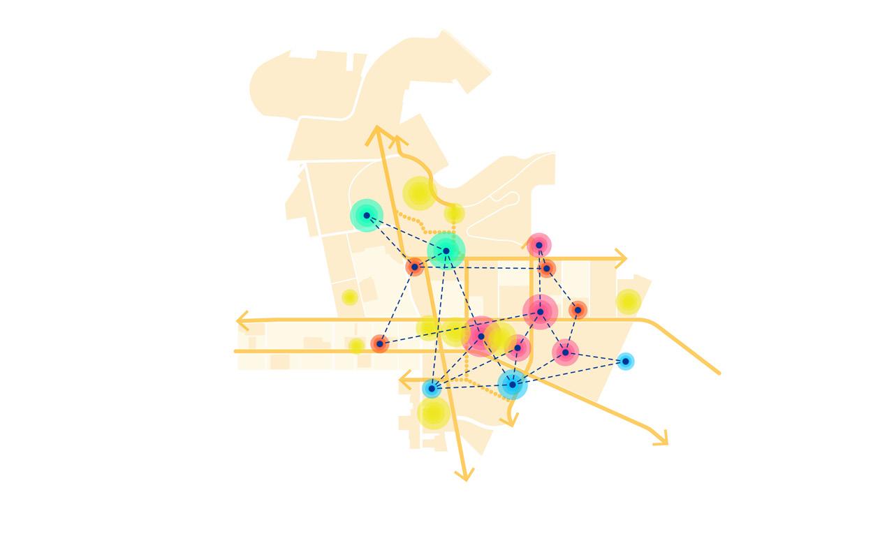
2 PROMOTE PITT’S PRIDE OF PLACE ENRICH THE CAMPUS EXPERIENCE AND STUDENT SUCCESS


Enhance campus life through the introduction of new spaces for student engagement. The renewal and expansion of campus housing and the transformation of the Pittsburgh Athletic Association building into a new student center will reinforce the student and community experience at the heart of campus.
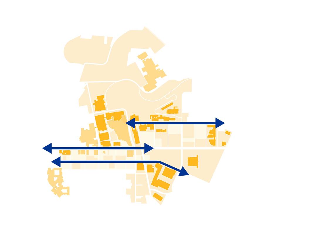
FOSTER
ACADEMIC AND RESEARCH INNOVATION
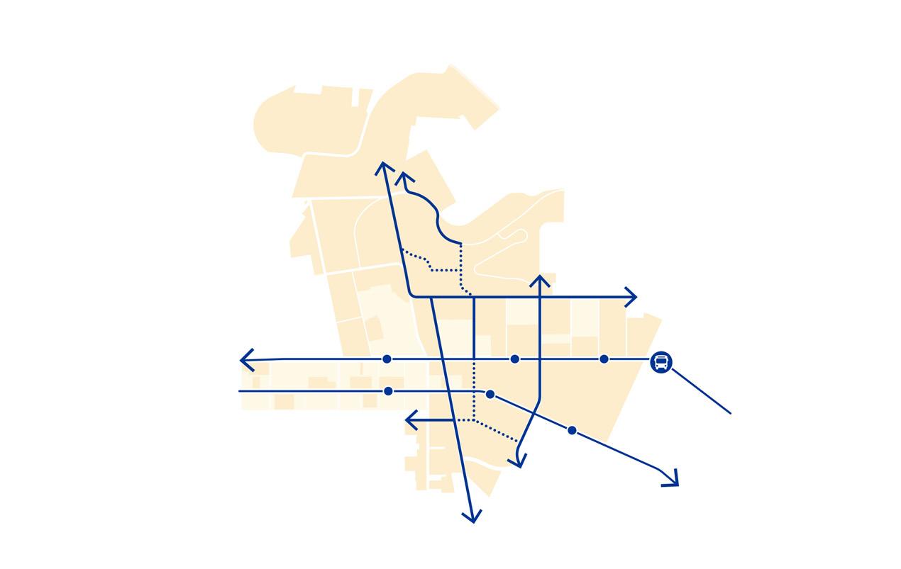
Create stronger linkages between academic buildings, elevate and right-size spaces in support of the Plan for Pitt and the academic and research mission. The plan recommends new and/or expanded facilities for Business, SCI, Nursing, Engineering, Bioengineering and Public Health.
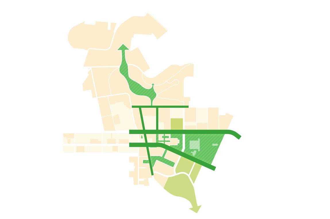
CREATE A RICH, CONNECTED AND ACCESSIBLE PUBLIC REALM
CONNECT THE CAMPUS
Improve accessible routes to major campus destinations integrated with transit connections. Implement new campus mobility hubs and enhance the public realm and pedestrian experience with intuitive wayfinding elements to enhance the spirit of place and create a memorable Pitt identity.
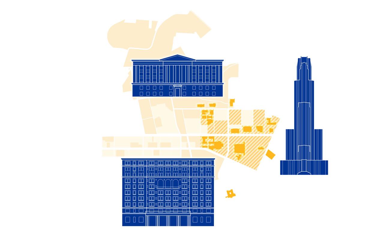
Support campus health and well-being and sustainability goals through adding campus-defining spaces, improving streetscapes and open space, and creating integrated academic, research and social facilities that strive towards universal accessibility.
STEWARD THE HISTORY OF THE CAMPUS AND OAKLAND
Harness the historic character of Pitt’s campus and surrounding context— which sets it apart from peer universities and other urban institutions—to steward a beloved campus fabric across Pitt, Oakland and the City of Pittsburgh.
1 PROMOTE PITT’S PRIDE OF PLACE

Enhance the sense of place in Oakland and in the City of Pittsburgh through proposed public realm improvements along major streets, gateways to campus, restoration of iconic public spaces, and new buildings that honor the architectural legacy of the campus.
The Campus Master Plan contributes to Pitt’s pride of place in Oakland through the proposed public realm improvements along major streets, at gateways to the campus and through restoration of iconic open spaces such as the Cathedral Lawn. These improvements build upon the strong urban design and architectural legacy set out for Central Oakland some 100 years ago. The plan calls for the stewardship of the important architectural legacy of Oakland including buildings constructed by Pitt as well as those acquired by the university over the years. Proposed buildings contribute to the pride of place through thoughtful urban design and building recommendations. Notable additions to the campus include two new residential buildings along Fifth Avenue and new academic and research facilities along the O’Hara / Bigelow corridor in line with the Mid Campus Science Complex Plan.
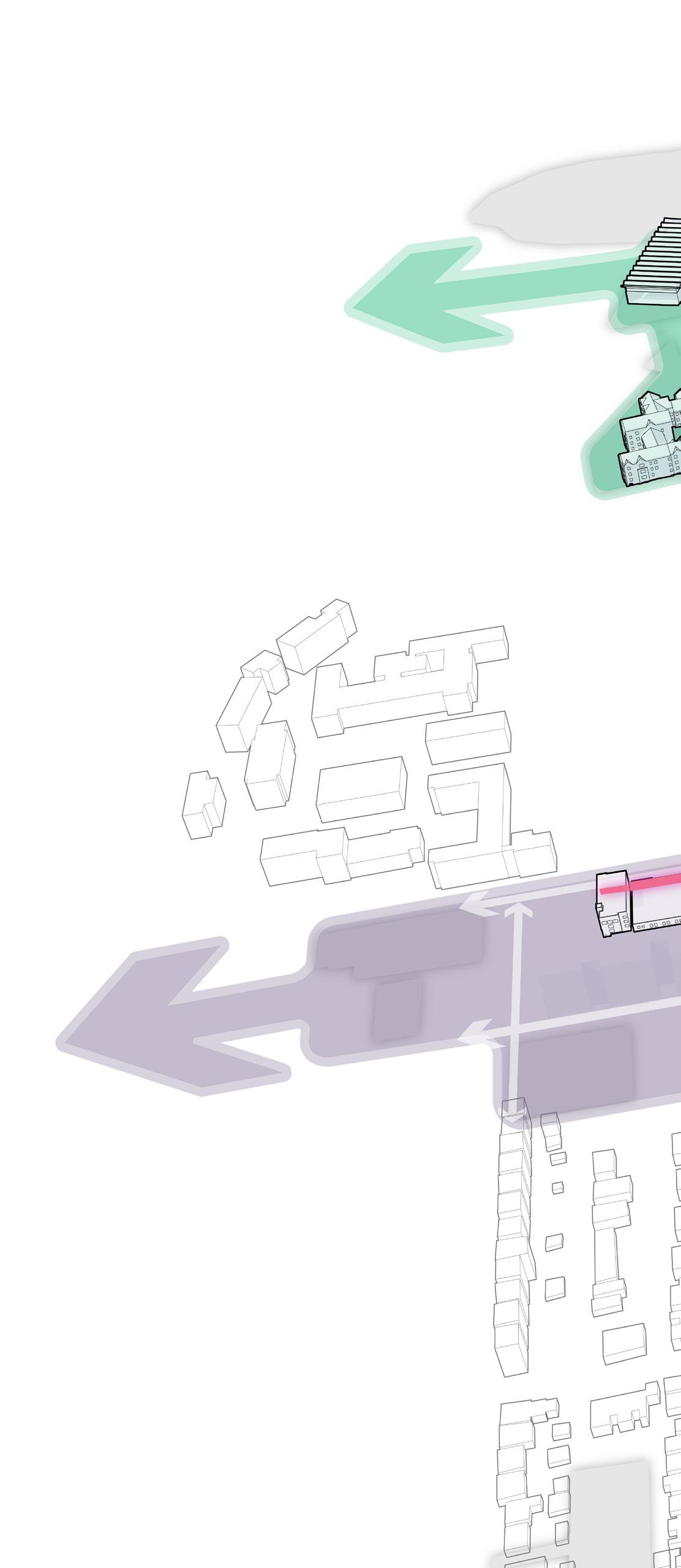
West Oakland
Carlow University
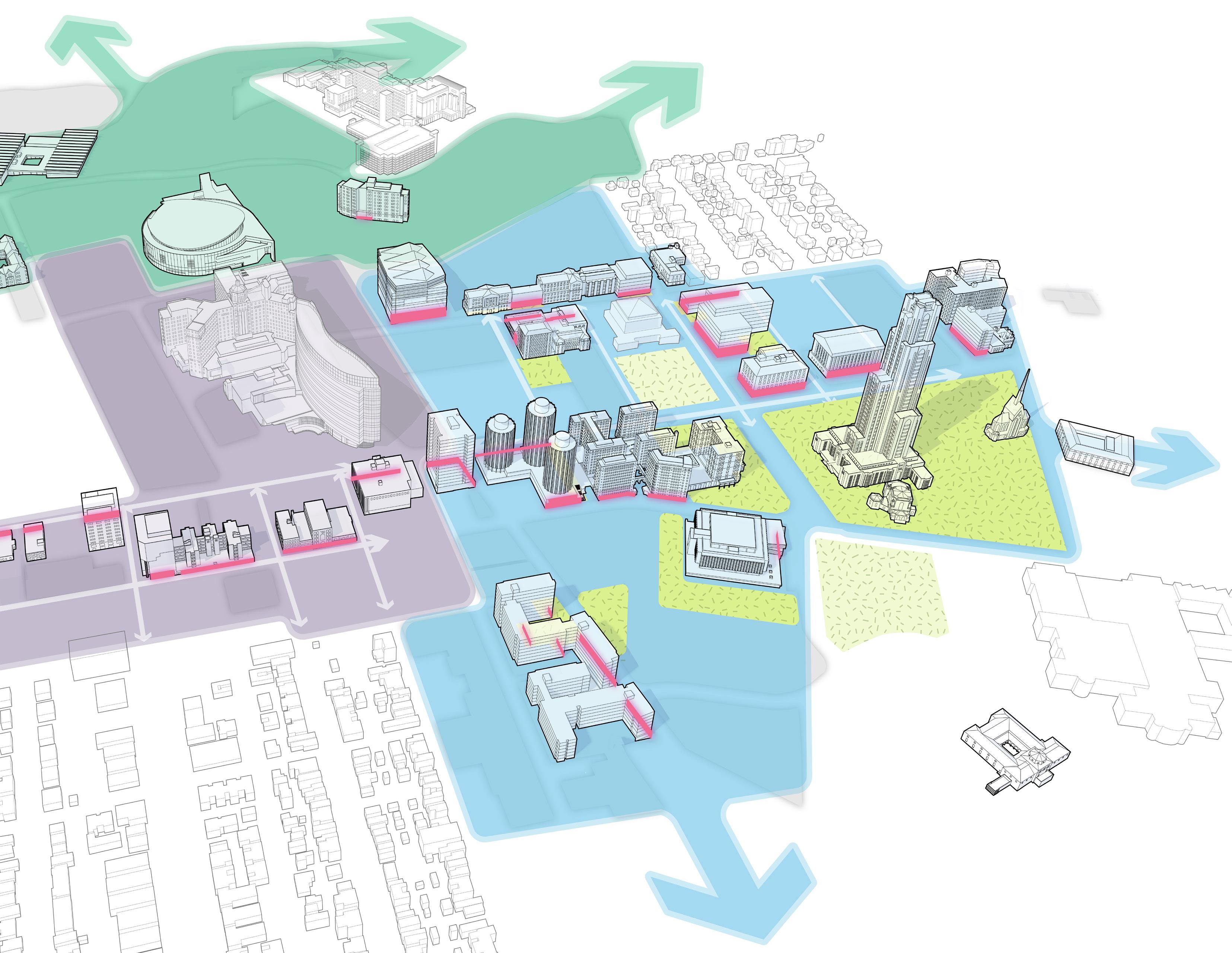
North Oakland
Central Oakland
Schenley Farms Historic District
Carnegie Museum
2 ENRICH THE CAMPUS EXPERIENCE AND STUDENT SUCCESS
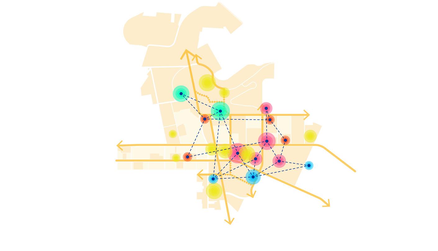
Enhance campus life through the introduction of new spaces for student engagement. The renewal and expansion of campus housing and the transformation of the Pittsburgh Athletic Association building into a new student center will reinforce the student and community experience at the heart of campus.
The plan enriches the campus experience and student success through public realm improvements and buildings designed to support student well-being and success. The renewal of the Cathedral Lawn features areas for outdoor passive recreation and study. In the Thackeray Corridor, the plan connects the academic programs in and around Posvar to the residence halls and amenities of Schenley Quad and Litchfield Towers to the academic buildings and the Recreation and Wellness Center on O’Hara Street. Proposed study and lounge spaces along the Thackeray Corridor combined with collaboration hubs along O’Hara contribute to student success by providing space for informal study and more formal academic and counseling support spaces.
The plan renews existing campus housing and expands the number of units to house more students on campus. Studies have shown that living on campus for the first and second years has ties to student retention and positive GPA results. The transformation of the Pittsburgh Athletic Association building into a new student union consolidates student engagement space in the heart of the campus and enables the upper floors of the William Pitt Union to be converted to student housing.
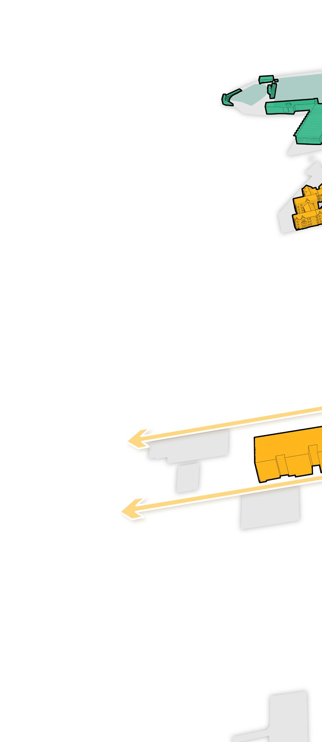
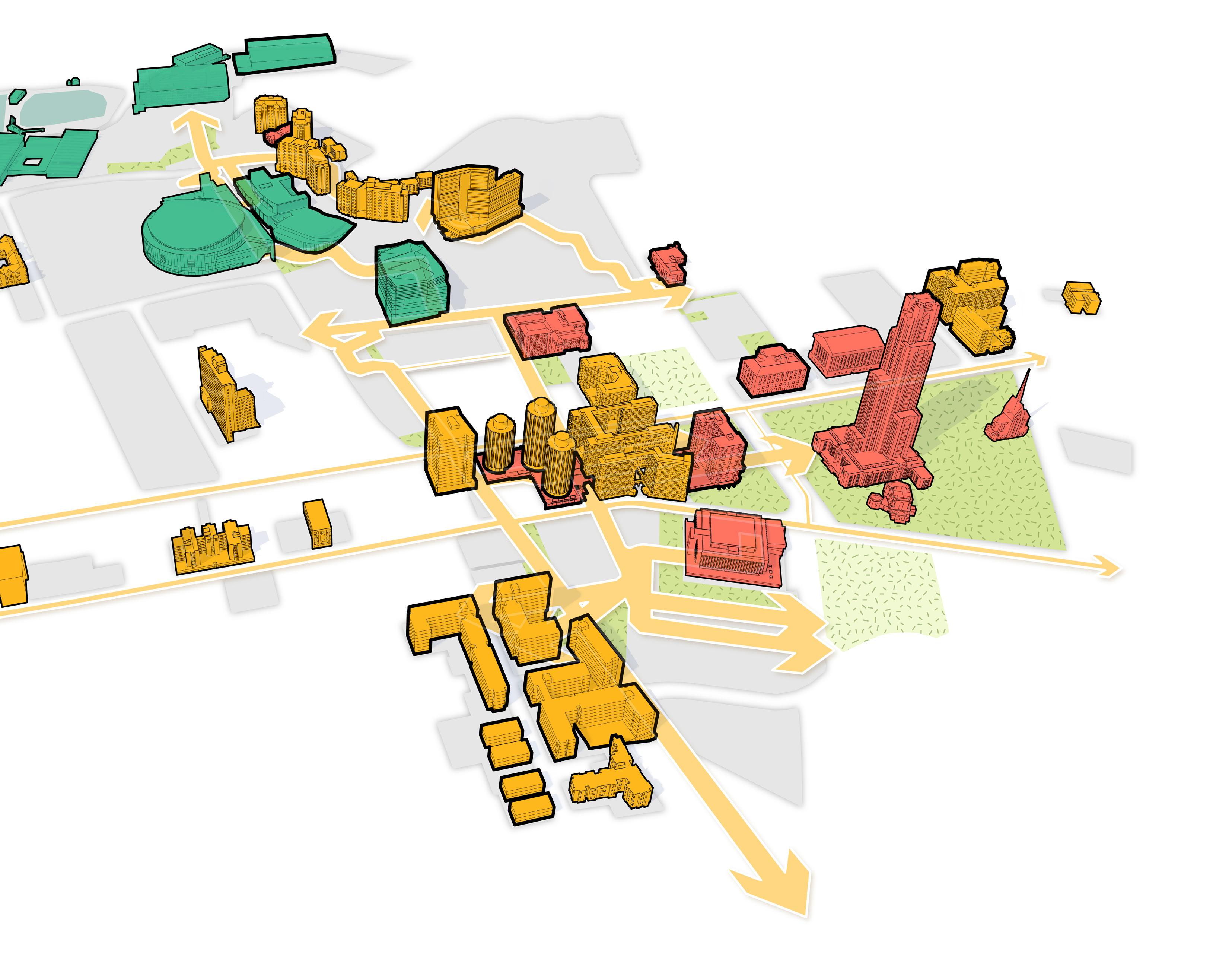
Cathedral Cafe
The Eatery
Peterson Food Court
Schenley Cafe and Pitt Public Market
The Perch
3 FOSTER ACADEMIC AND RESEARCH INNOVATION
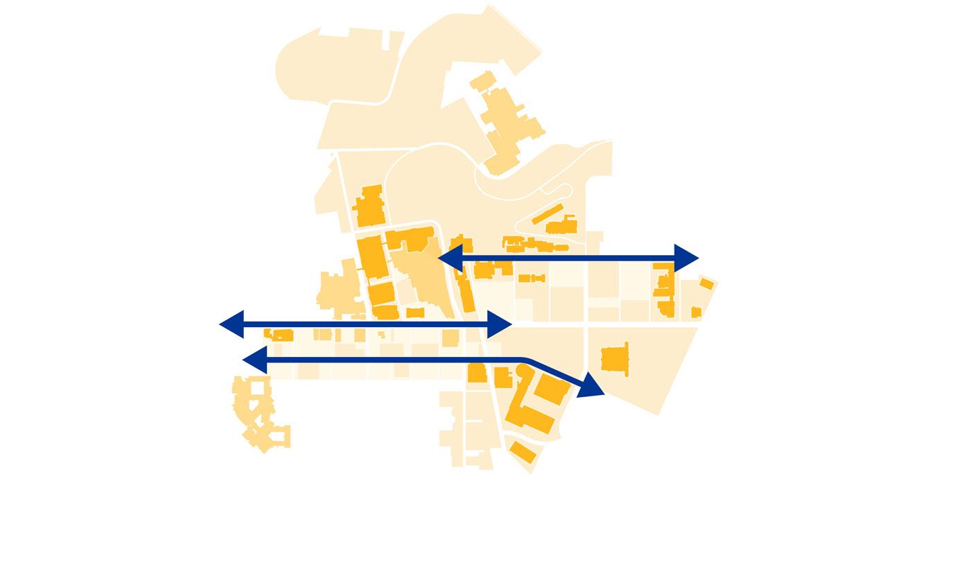
Create stronger linkages between academic buildings, elevate and right-size spaces in support of the Plan for Pitt and the academic and research mission. The plan recommends new and/or expanded facilities for Business, SCI, Nursing, Engineering, Bioengineering and Public Health.
The plan fosters academic and research activity through the strategic renovation of existing facilities and new facilities designed to bring people and ideas together. A comprehensive renovation and expansion strategy for the mid-campus science buildings (Allen, Old Engineering, Thaw, Space Research Coordination Center) addresses programmatic needs and facility conditions. A series of new facilities along O’Hara Street contribute to academic and research endeavors and collaboration. These include new Business and SCI facilities at One Bigelow, General Studies and Mathematics expansion at O’Hara, Gardner Steel and Thackeray and a new bioengineering and public health facility on the Crabtree site. Each of these locations integrates collaboration hubs designed to bring faculty, researchers and students together. These recommendations, combined with the expansion and renewal of the Hillman Library, result in a network of places designed to engage students in the collegiate experience.
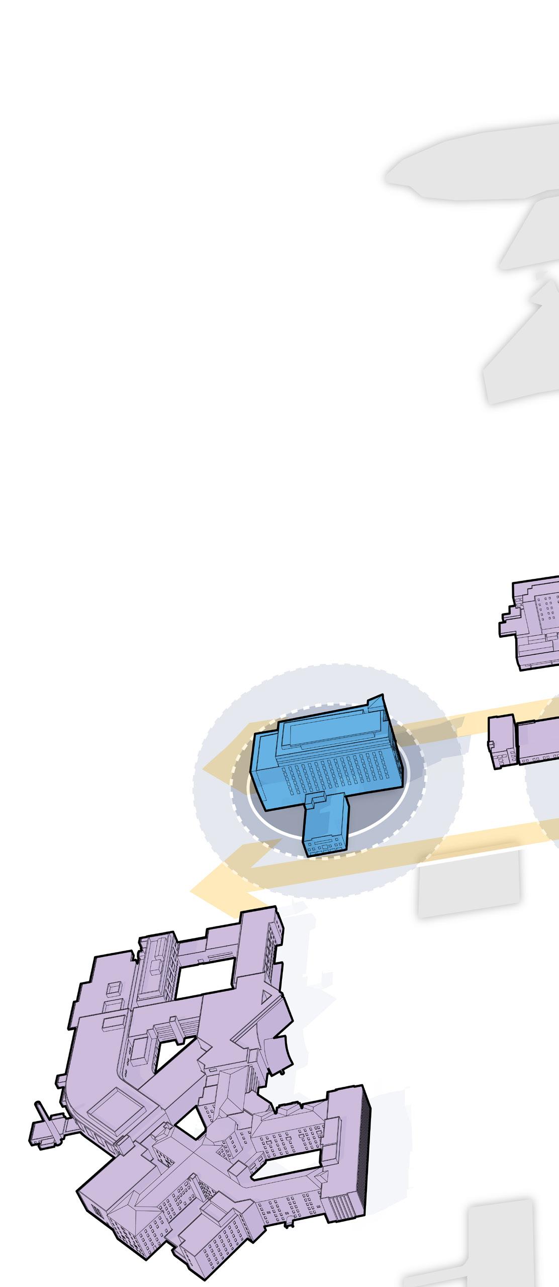
CREATIVITY+INNOVATION
STEM & HEALTH SCIENCES
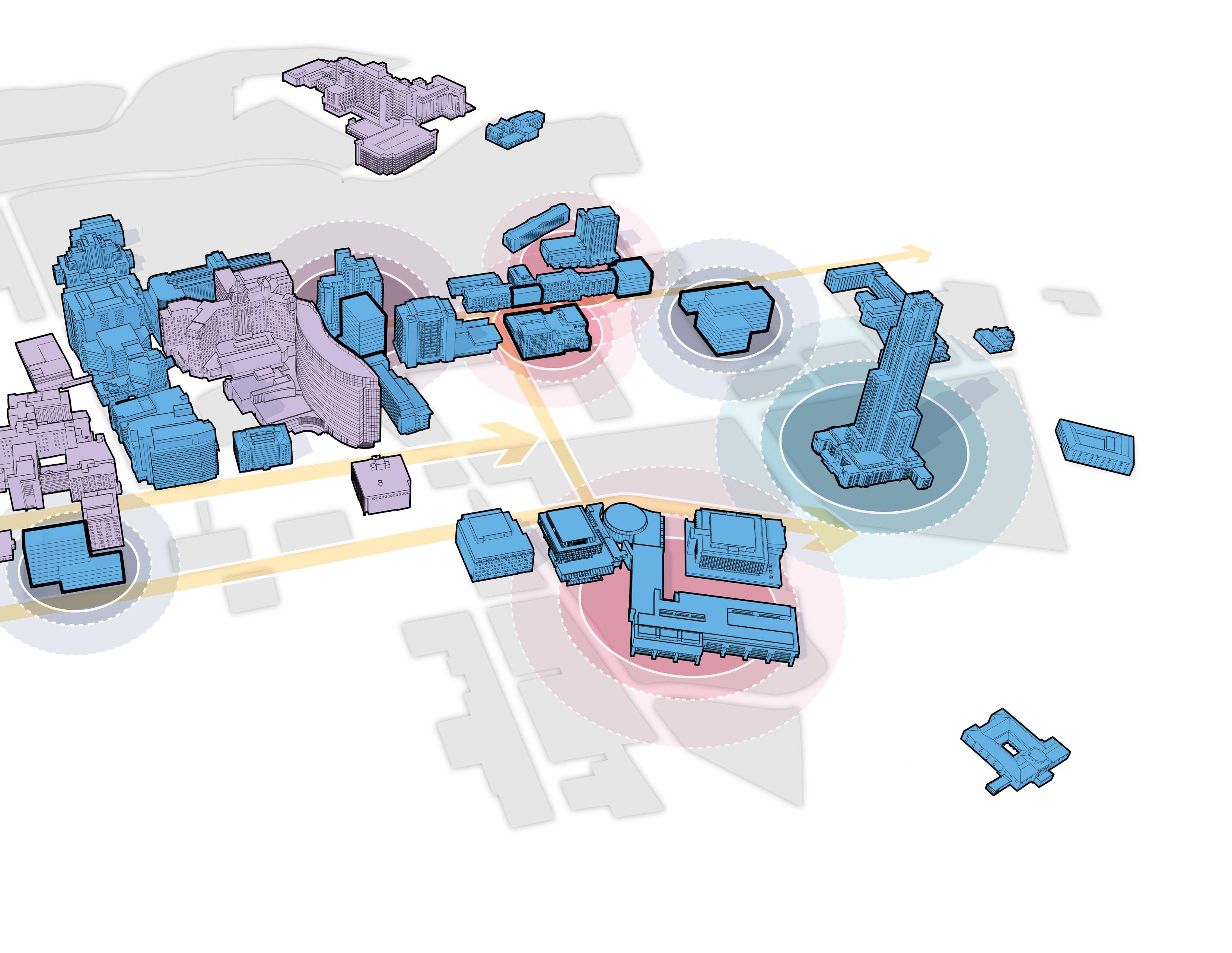
INNOVATION & ENGAGEMENT RESEARCH & TEACHING
ARTS+HUMANITIES+SOCIALSCIENCES+PROFESS
INTERDISCIPLINARYCOLLABORATION
4 CREATE A RICH, CONNECTED AND ACCESSIBLE PUBLIC REALM
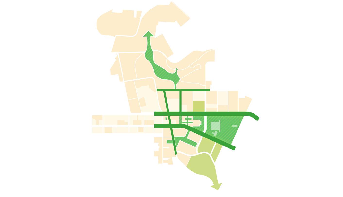
Support campus health and well-being and sustainability goals through adding campus-defining spaces, improving streetscapes and open space, and creating integrated academic, research and social facilities that strive towards universal accessibility.
The plan creates a diverse and accessible public realm by means of improvements to the streetscape and open spaces that define the campus. It coordinates patterns of movement through the pathways and streets with programmatic uses and activities at nodes with the intent of highlighting places where the campus community can engage in academic, research and social activities. In doing so, the plan promotes humanpowered movement in support of health, well-being, and sustainability goals. Improvements to streetscapes, crossings, sidewalks, and open space contribute to an enhanced pedestrian experience.

Transitional Green
Rooftop Green
Lawn and Open Green
Athletics & Recreation
Plaza & Square Pocket Park Major Open Space Owned by Others
Gathering & Rest
Accessible Connection
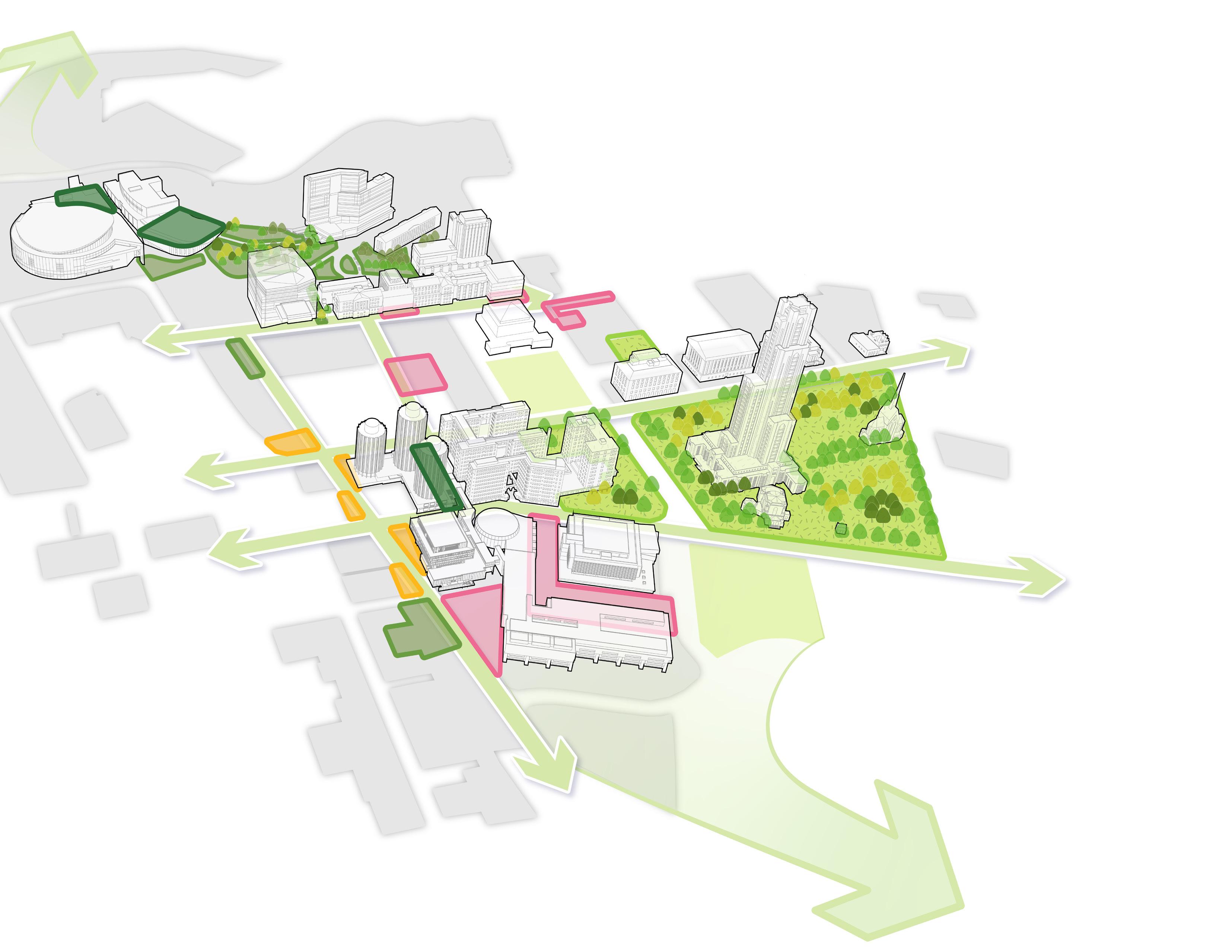
Cathedral Lawn Enhancements
Hillside Landscape Connections & Panther Run
5 CONNECT THE CAMPUS
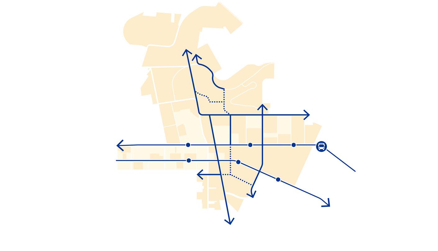
Improve accessible routes to major campus destinations integrated with transit connections. Implement new campus mobility hubs and enhance the public realm and pedestrian experience with intuitive wayfinding elements to enhance the spirit of place and create a memorable Pitt identity.
The plan connects the campus by means of public realm improvements and by coordinating campus mobility with the City of Pittsburgh’s BRT routes along Forbes and Fifth Avenues. New BRT stations and mobility hubs complement the proposed accessible and preferred routes on the campus. Mobility hubs are located at strategic locations across campus to provide localized amenities that support wayfinding and multi-modal transportation. The intent is to create a campus-wide network of accessible routes designed to link the major destinations of the campus, including buildings located on the significant slopes north of O’Hara. The plan emphasizes the principles of Universal Design to create a more inclusive campus environment.
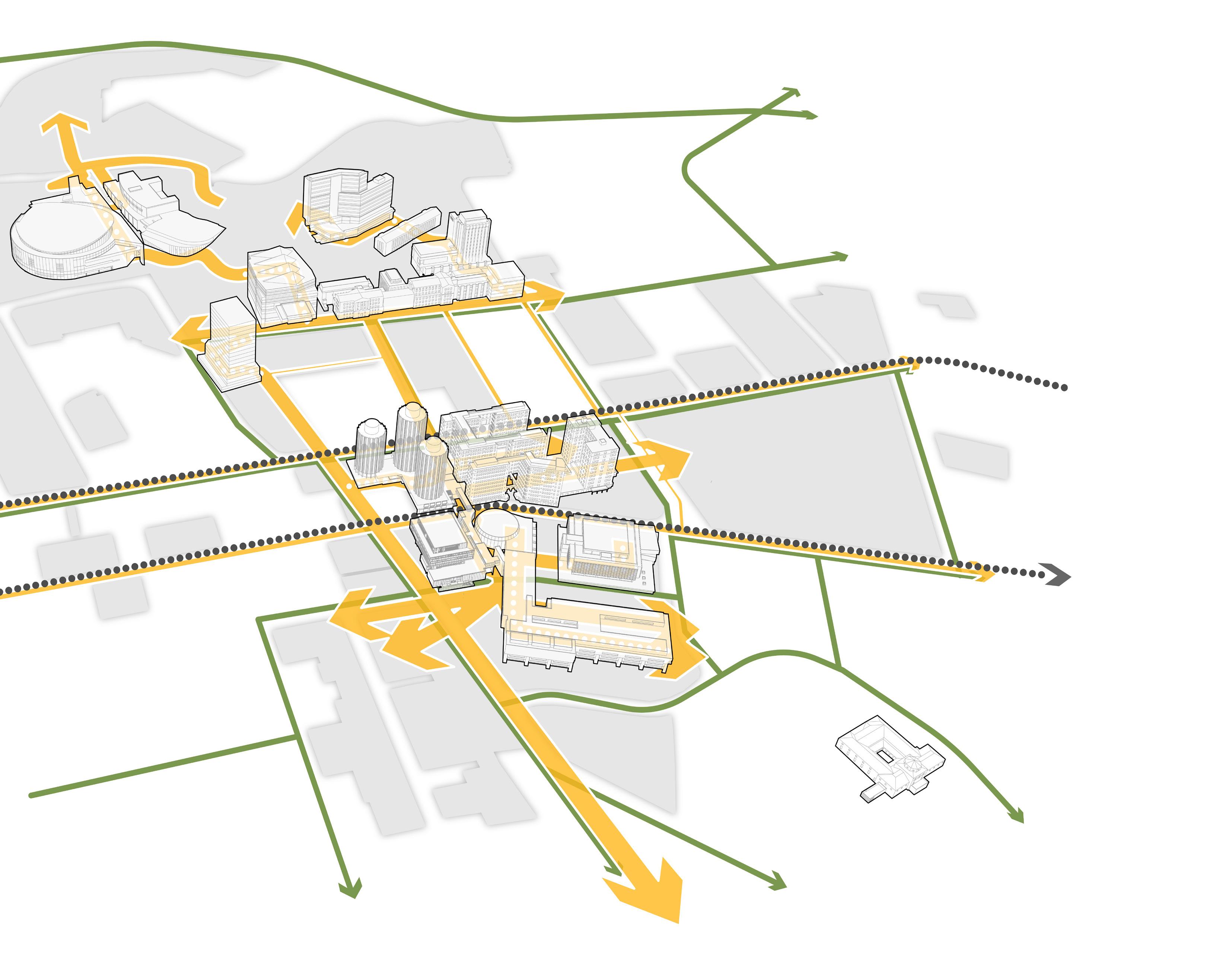
6 STEWARD THE HISTORY OF THE CAMPUS AND OAKLAND
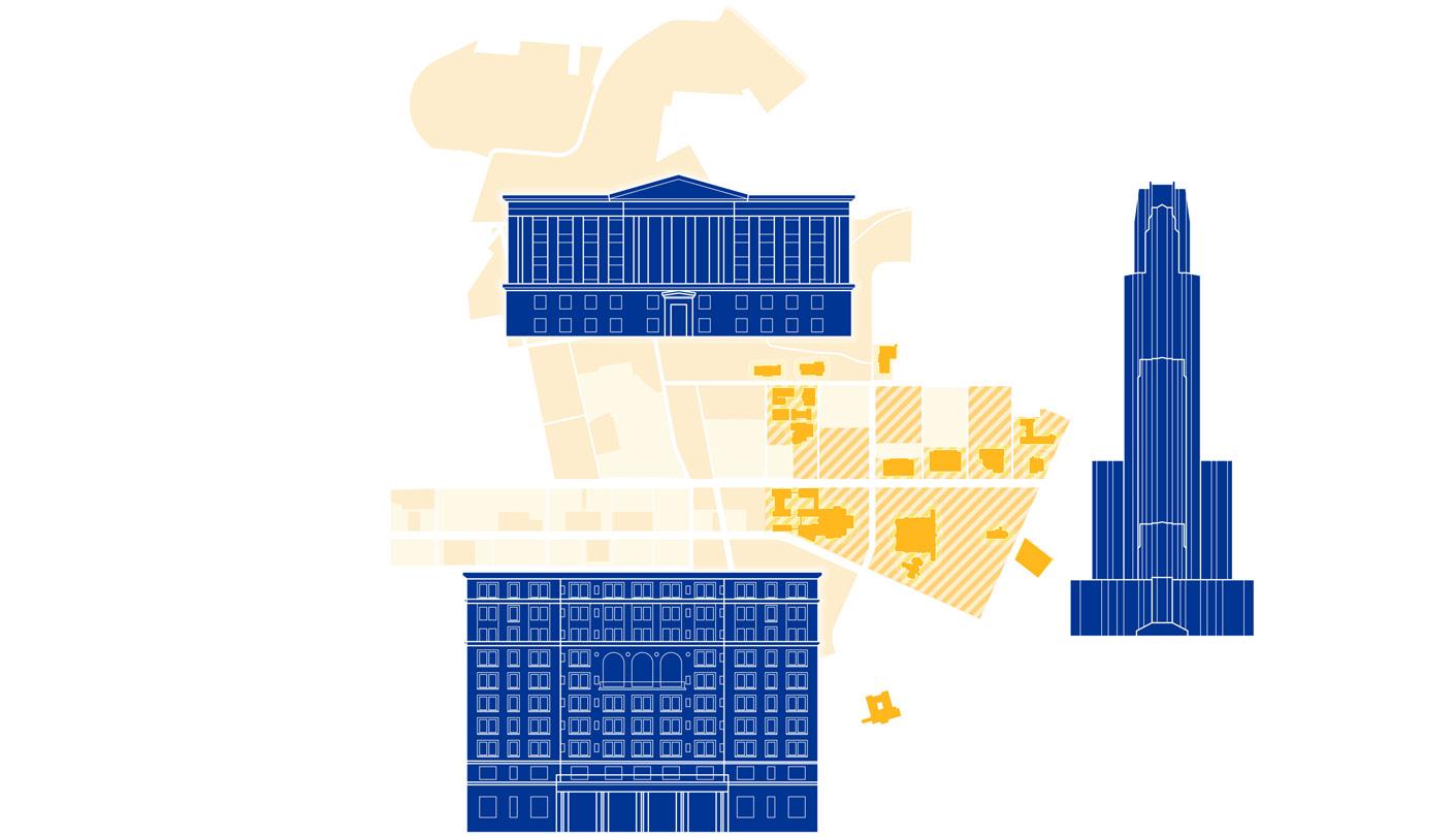
Harness the historic character of Pitt’s campus and surrounding context— which sets it apart from peer universities and other urban institutions—to steward a beloved campus fabric across Pitt, Oakland and the City of Pittsburgh.
The plan embraces the rich architectural legacy of the campus and acknowledges the important urban and architectural vision set out in the early twentieth century. This vision shapes the character and image of the campus and distinguishes Pitt amongst its peers and other urban institutions. The plan provides context for the proposed renovation and the re-purposing of the historic buildings commissioned by the university as well as those it has acquired over the years.
Today, Pitt is the steward of many of Central Oakland’s historic buildings. The plan posits a culture where we live with the historic past while investing in the building portfolio to improve accessibility, wayfinding and increase the amount of informal gathering space. We are correcting deficiencies of architectural works to meet today’s needs and those of the future.

Proposed Renovation to Historical Building
National Register of Historic Places
Oakland Civic Center Contributing Properties
Schenley Farm Historic District Contributing Properties
Other Important Historical Buildings
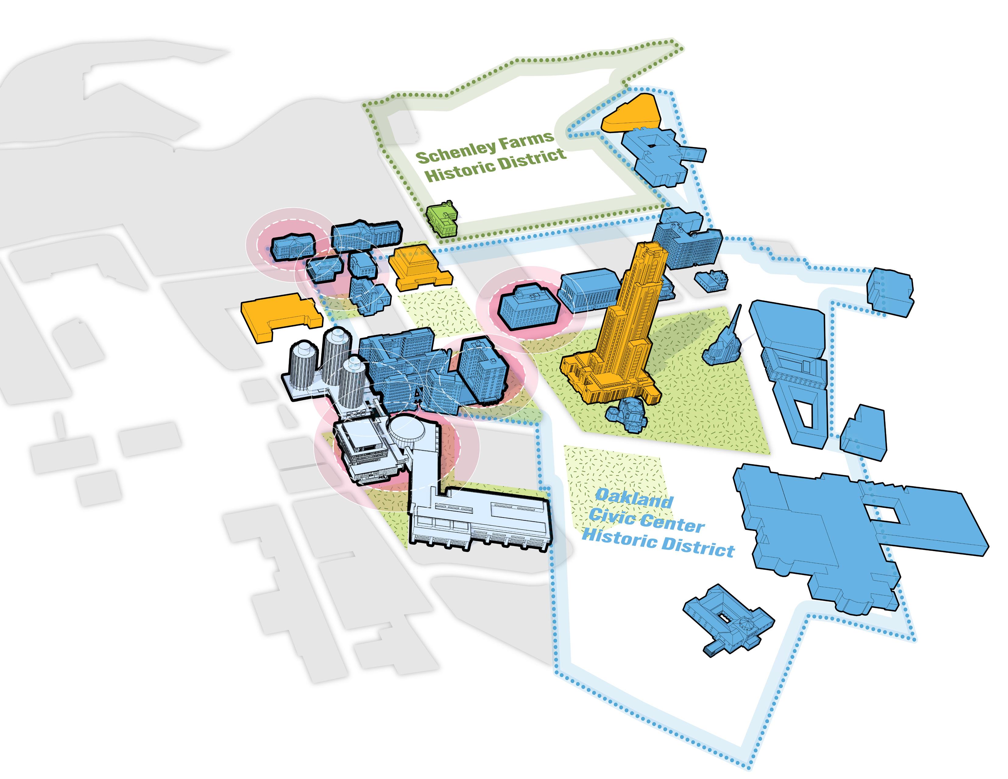
CAMPUS DISTRICTS 04
CAMPUS DISTRICTS
The Campus Master Plan defines three campus districts: Central Campus, Hillside and Health Sciences and Innovation. This chapter lays out the comprehensive vision for each campus district and summarizes proposed development, public realm improvements and mobility strategies.
Pitt Owned Building
Pitt Affiliated Building
Proposed Building within the District
4.1 CENTRAL CAMPUS DISTRICT
The Central Campus District encompasses the iconic and memorable buildings of the Central Oakland Historic District.
The plan reinforces the Central District as the heart of the Pitt campus building upon the memorable character defined by the Cathedral Lawn and its associated buildings, Schenley Quad, Litchfield Towers, Posvar, the buildings along O’Hara Street and the Hillside area south of Eberly Hall.
The approximate boundaries of the district extend from Dammond Drive on the north, to Bellefield on the east, to Bates Street on the south and to a line following Bouquet Street / Oakland Avenue and Atwood Street on the west.
Envisioned as the academic, social and cultural heart of the Pitt campus, the Campus Master Plan includes recommendations for public realm improvements reinforced by the renovation of several historic buildings. Combined with new development, a key goal of the plan is to enhance the campus and urban experience while respecting the legacy of the Central Oakland Historic District. Pitt Owned Building Pitt Affiliated Building
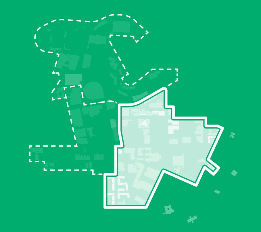
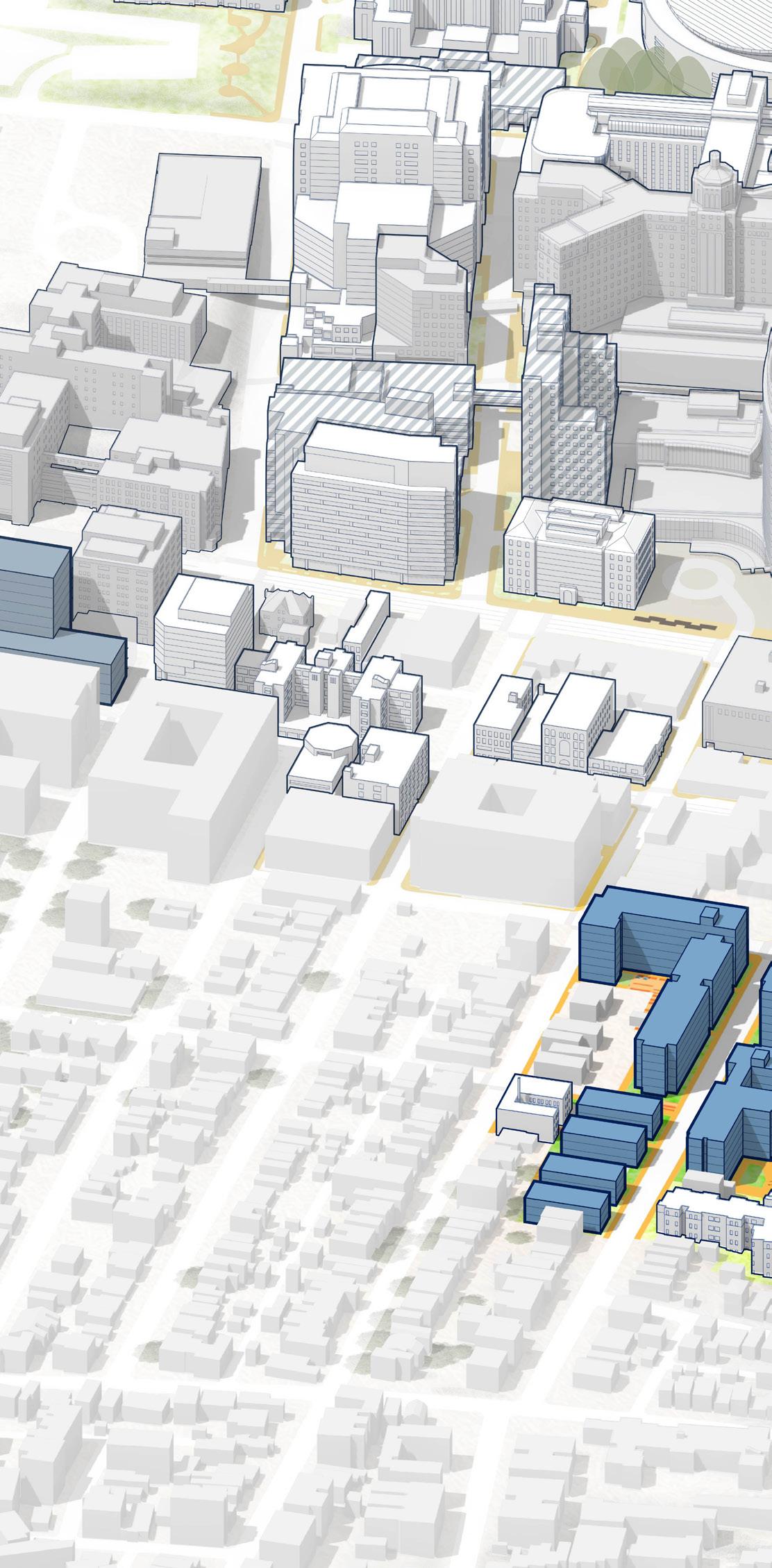
Proposed Building within the
Proposed Building outside of the
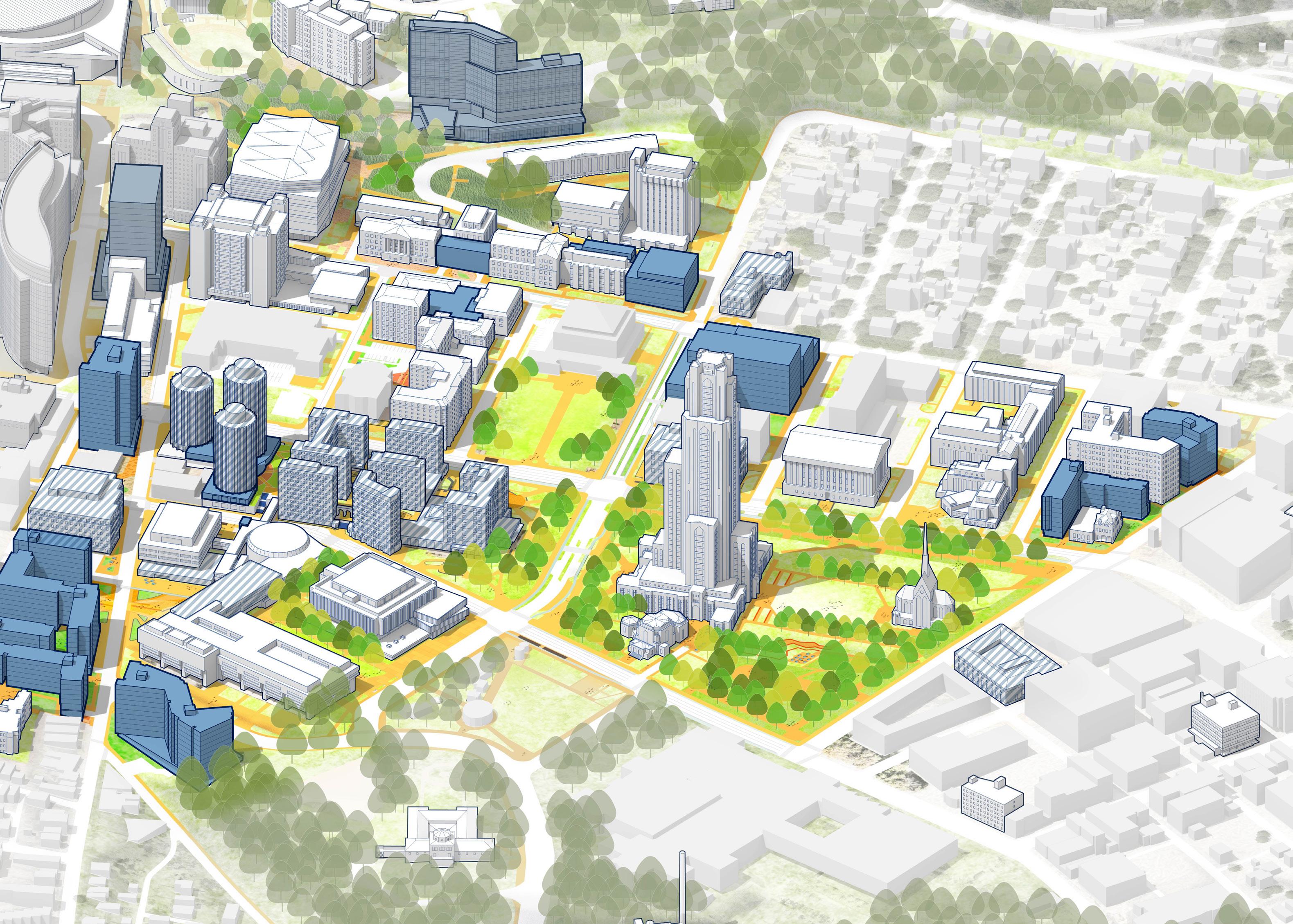
CATHEDRAL LAWN AREA
Preceding the development of the Campus Master Plan, Pitt developed a plan for the Cathedral Lawn in collaboration with the Olin Partnership. The restoration plan envisions a welcoming and engaging landscape experience for the campus and broader community.
Major features of Cathedral Lawn Area include:
• A new entry court leading to the north entrance from Fifth Avenue;
• A renewed East Terrace including ramps to address accessibility issues;
• A renewed South Terrace featuring outdoor tables and chairs;
• A social theater south of the lawn between the Cathedral and the Heinz Chapel;
• The Cathedral Promenade, a new walkway along the southeast corner facing Bellefield Avenue and Forbes Avenue;
• Expanded Southwest Area;
• Walled Garden edge along portions of Forbes Avenue, Bellefield Avenue and portions of Fifth Avenue;
• A Formal Entry Garden on Bigelow Boulevard;
• The Metasequoia Room; and
• A Hammock Grove.
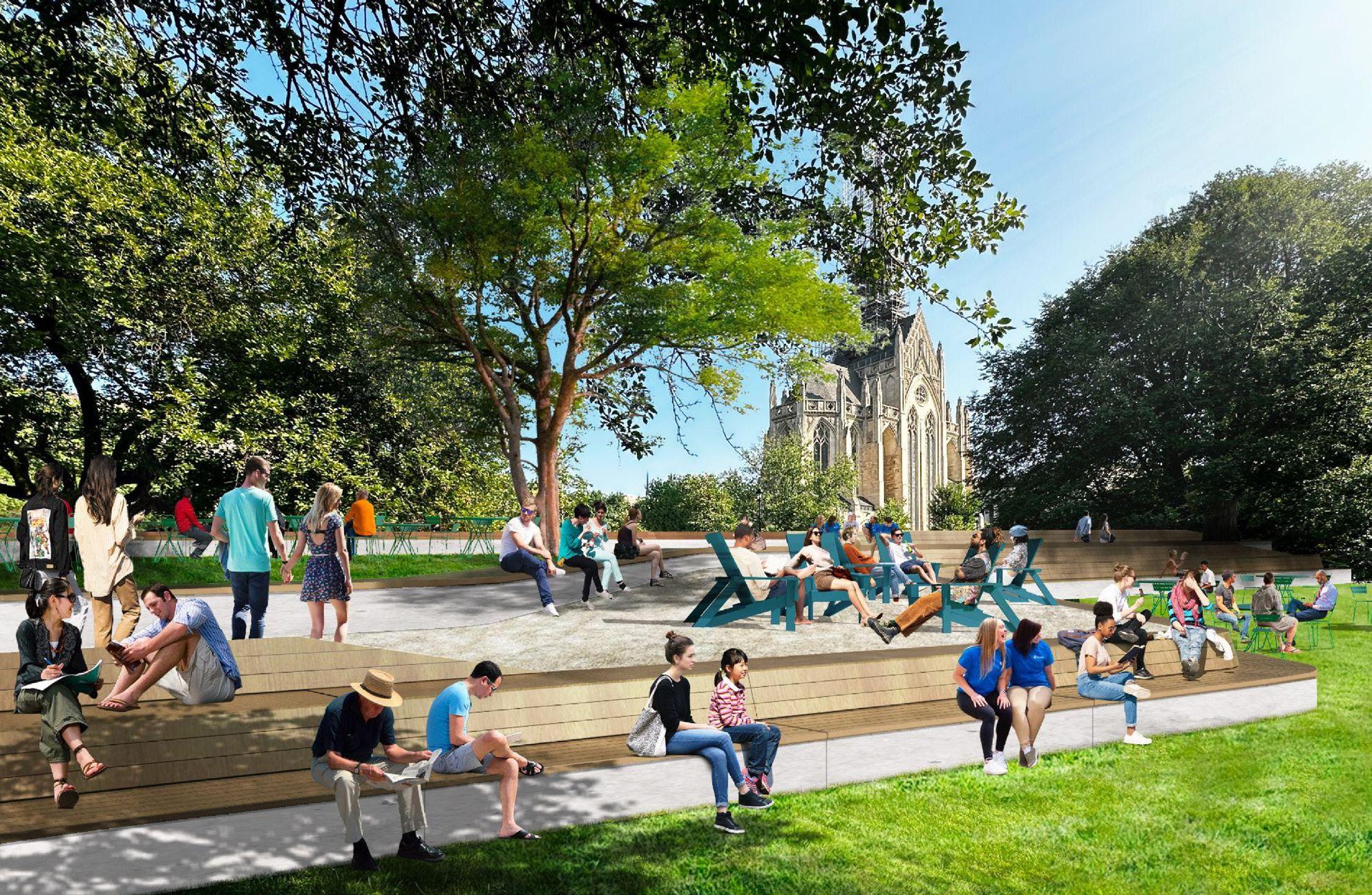
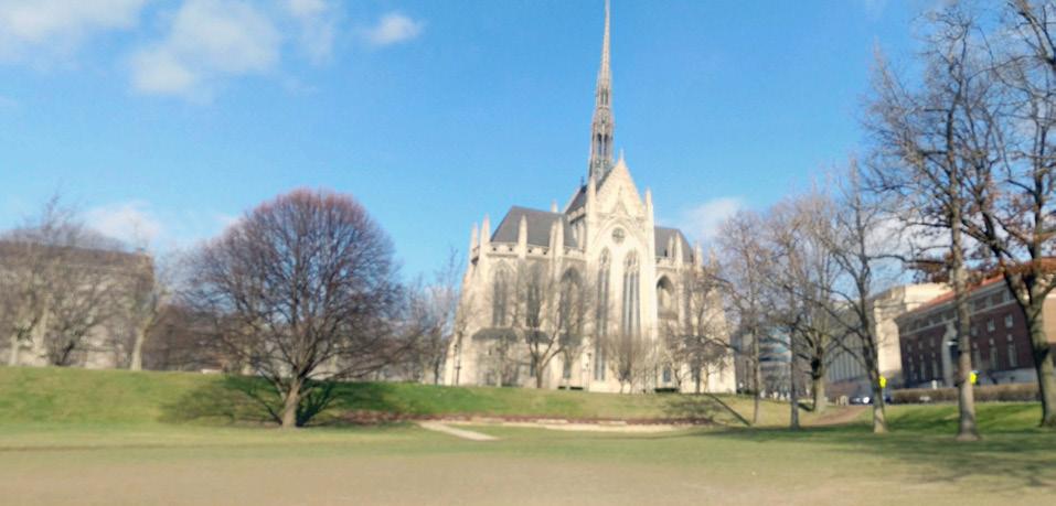

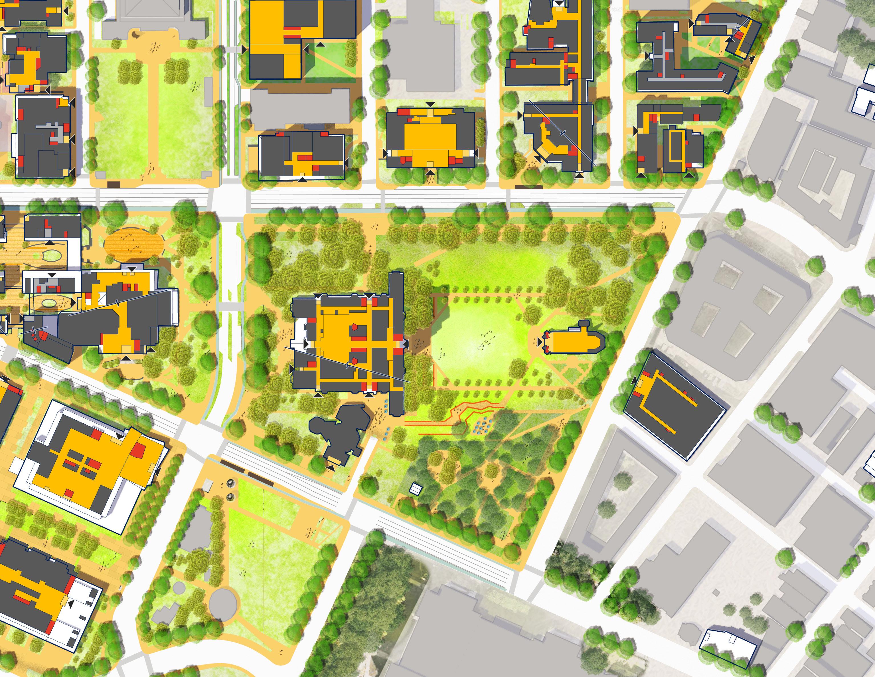
As a complement to the proposed landscape improvements, the Campus Master Plan recommends continued renovation and stewardship of the iconic buildings within the Lawn area including the Cathedral of Learning, Heinz Chapel and the Stephen Foster Memorial.
Although outside the Cathedral Lawn, Bellefield Hall is closely associated with this iconic space. The plan recommends sustained care and management of this contributing building, along with renovations to include the conversion of the pool and gymnasium areas for other uses.
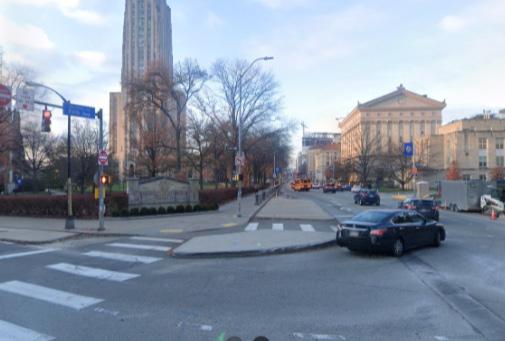
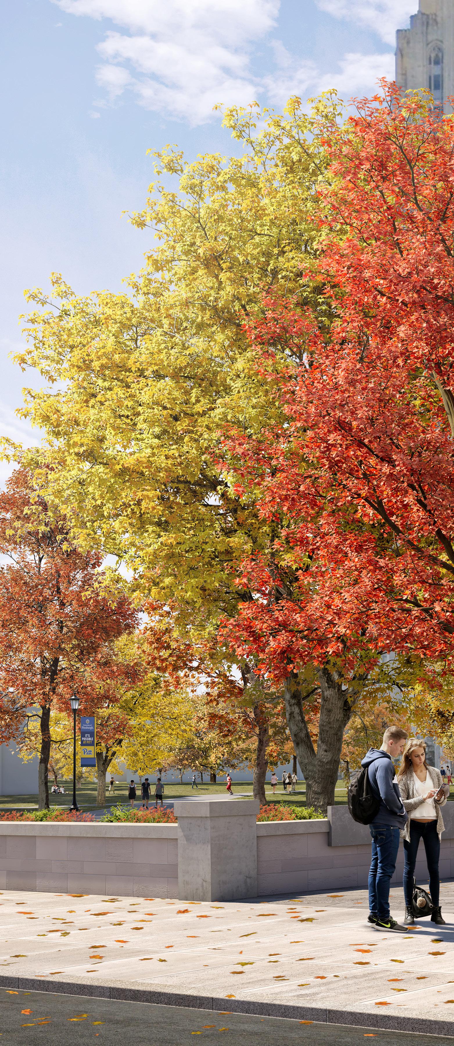
• Proposed Cathedral Lawn Gateway at Fifth Avenue and Bellefield Avenue
Existing Condition
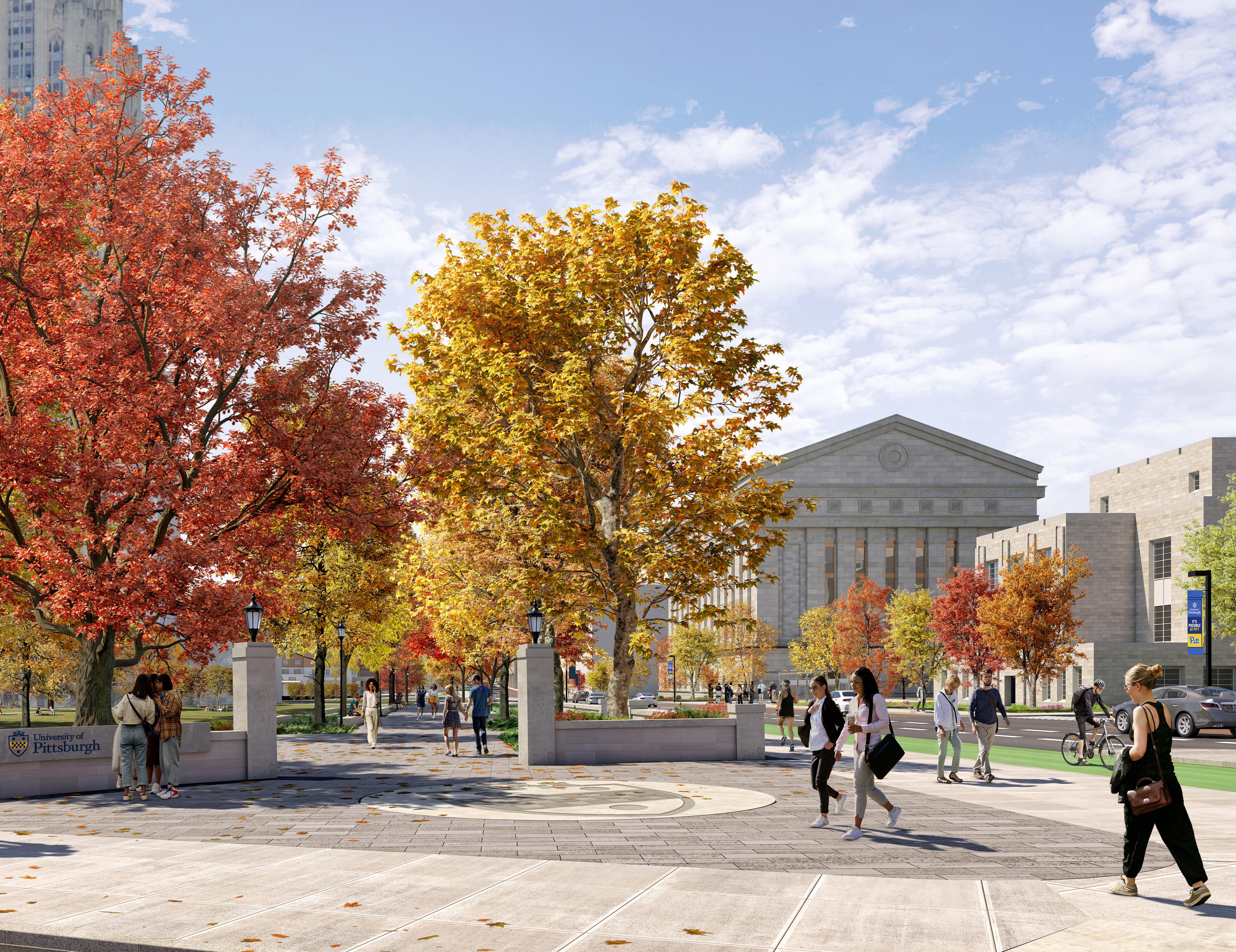
FIFTH AVENUE AREA (BELLEFIELD AVENUE TO BIGELOW BOULEVARD)
Some of the most iconic and architecturally significant buildings of the campus define the area north of Fifth Avenue from Bellefield to Bigelow including the Pittsburgh Athletic Club (PAA) and Alumni Hall. Other contributing buildings include Clapp Hall, Ruskin Hall and the Music School Building. The plan recommends the continued stewardship of these buildings while accommodating new uses in support of the university mission.
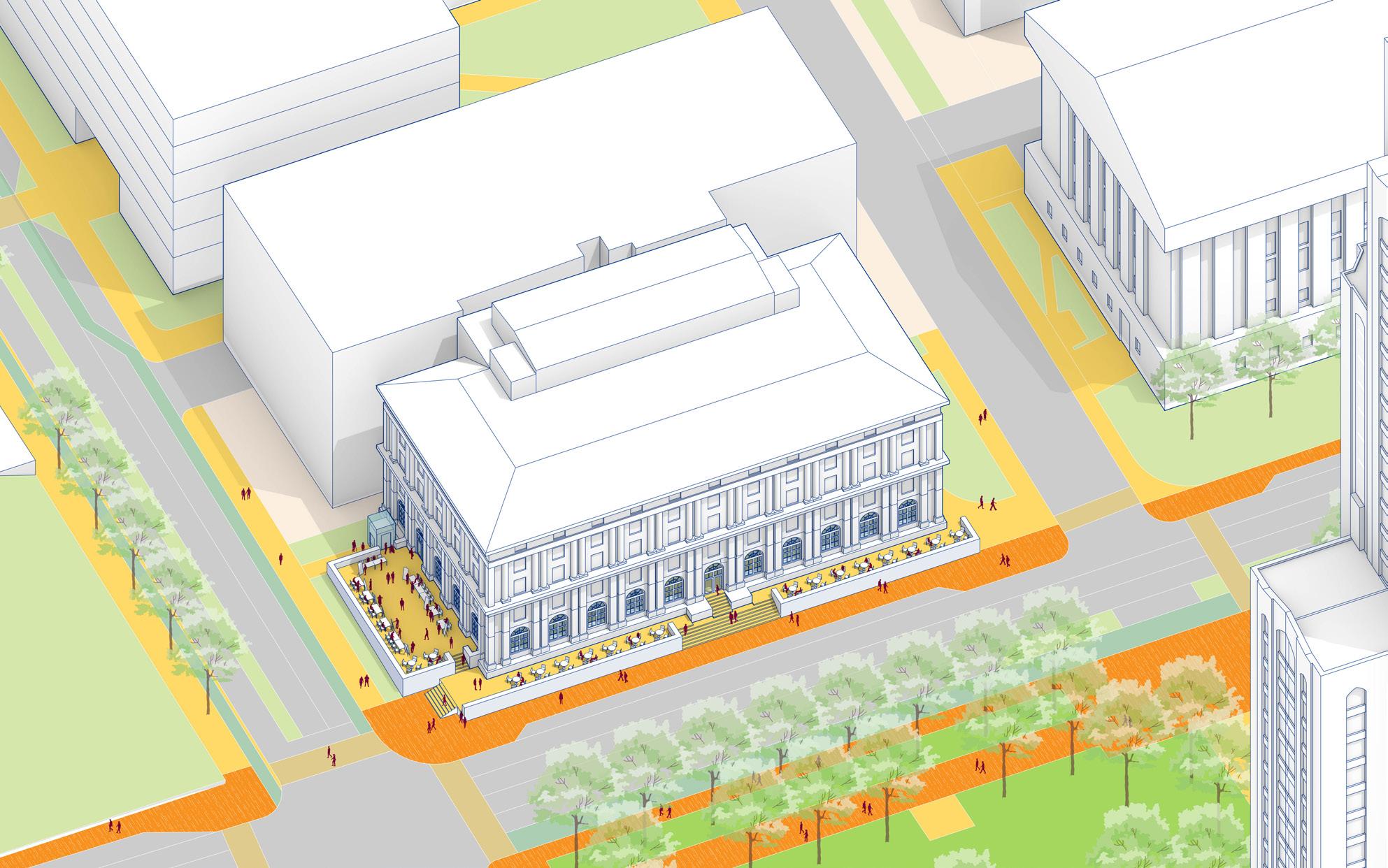
• Exterior View of PAA
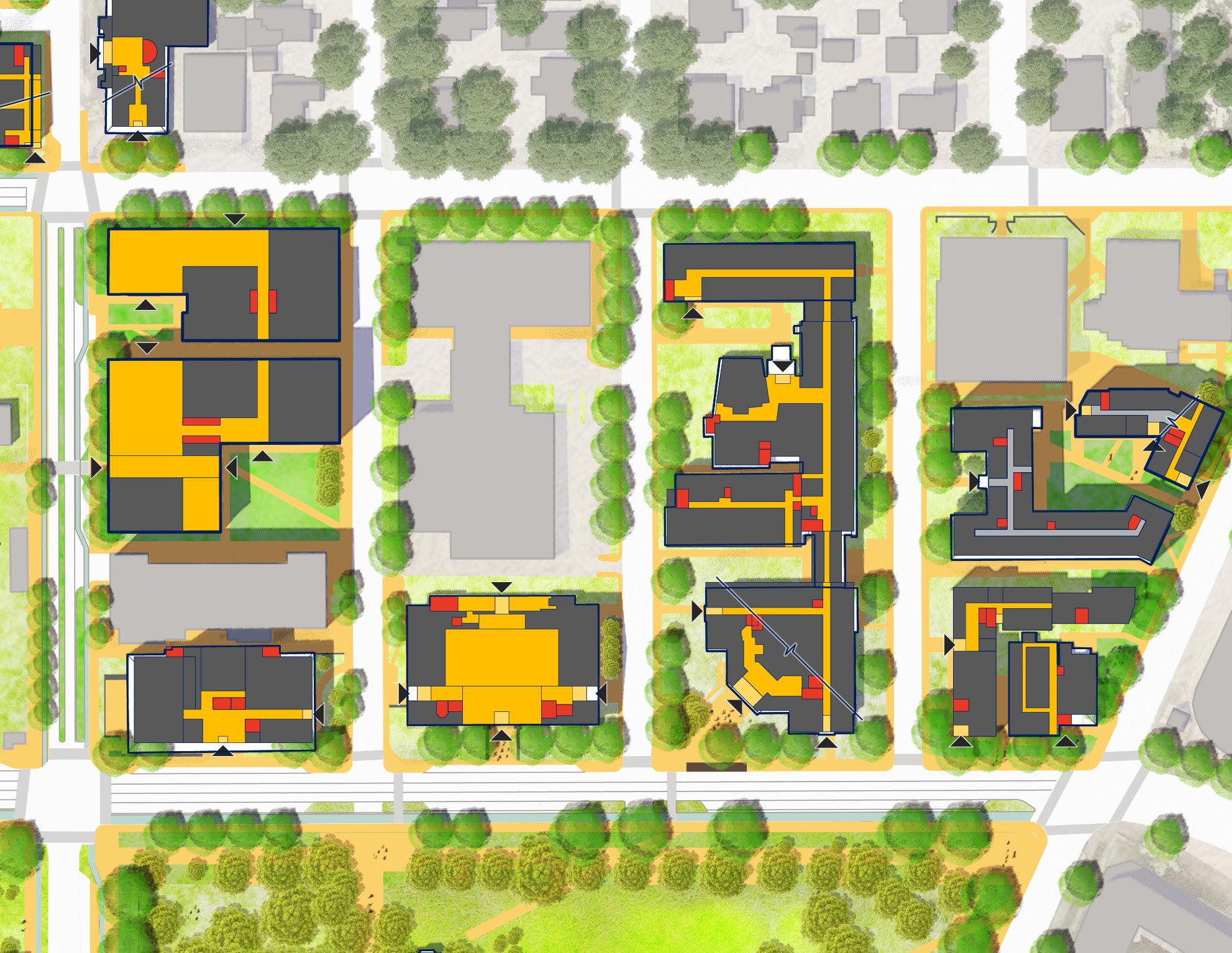
Alumni
Clapp
Langley Hall
Crawford Hall One Bigelow
Ruskin Hall
Ruskin North
• Pittsburgh Athletic Association, the Pitt Union: the plan envisions the renovation and transformation of this impressive building listed on the National Register of Historic Places to create a new student center. Given the monumental character of the building and the configuration of the interior spaces, the building lends itself well to the space required for a new student center for the university. The character of the building combined with its location at the intersection of the Cathedral of Learning, the Soldiers and Sailors Memorial and Schenley Quad make it a logical “center” for the campus community. As one of the early social clubs of Oakland, it is fitting that the building continues
its role as a social gathering place. It is also fitting that it becomes the heart of student engagement given its location at the symbolic center of Oakland.
Alterations to the buildings focus on the interiors with the intent of maintaining some of the memorable spaces including the formal entrance lobby on Fifth Avenue, the ground floor assembly rooms, upper floor meeting rooms and the former swimming pool space. Alterations to the exterior include a new accessible ramp integrated with the terrace on the west end of the building at the corner of Fifth Avenue and Bigelow Boulevard.
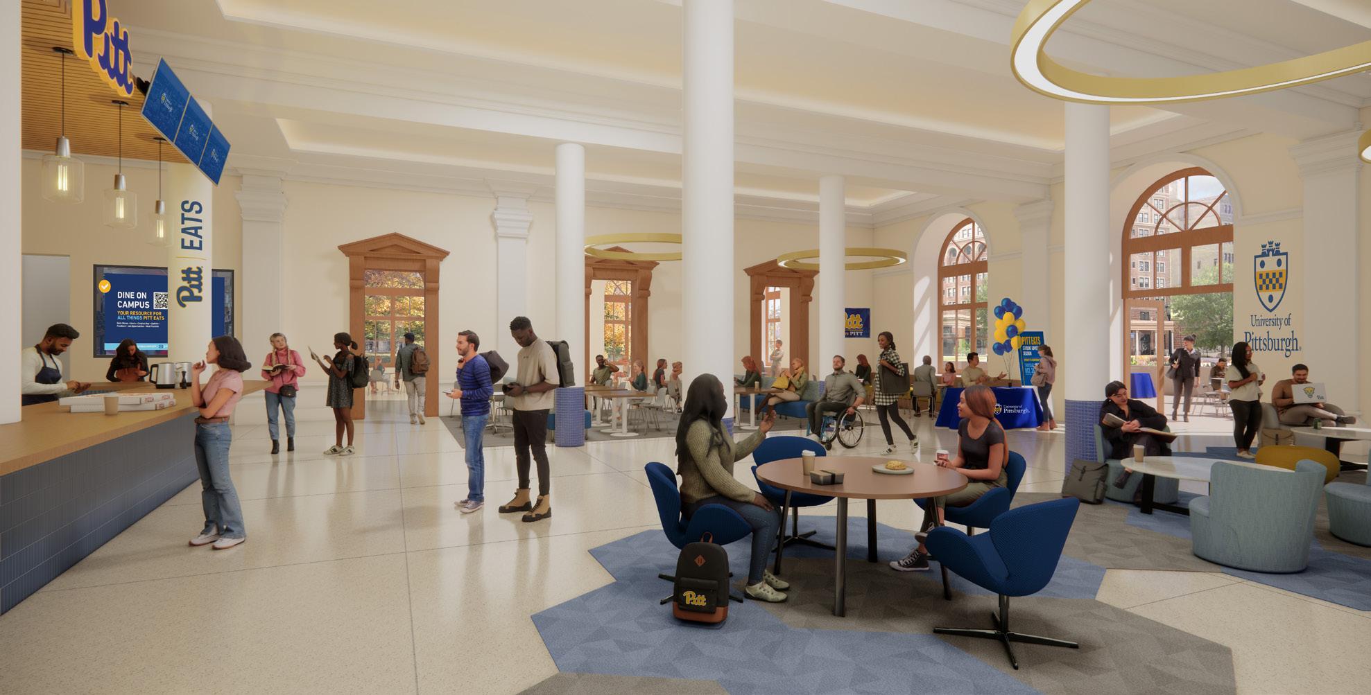
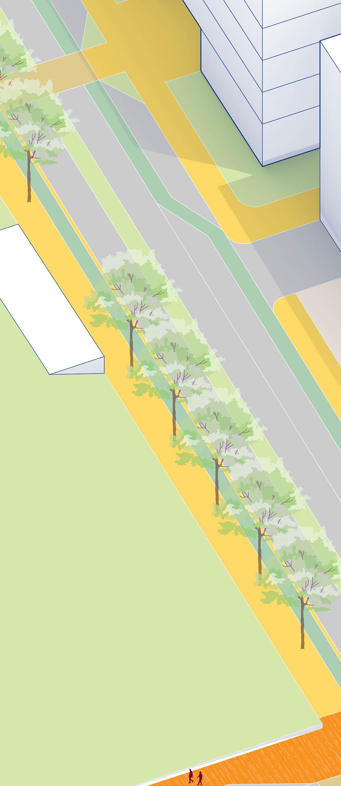
• View of Proposed Layout of PAA Ground Floor
• Rendering of the Proposed Retail Dining Space
FIFTHAVE
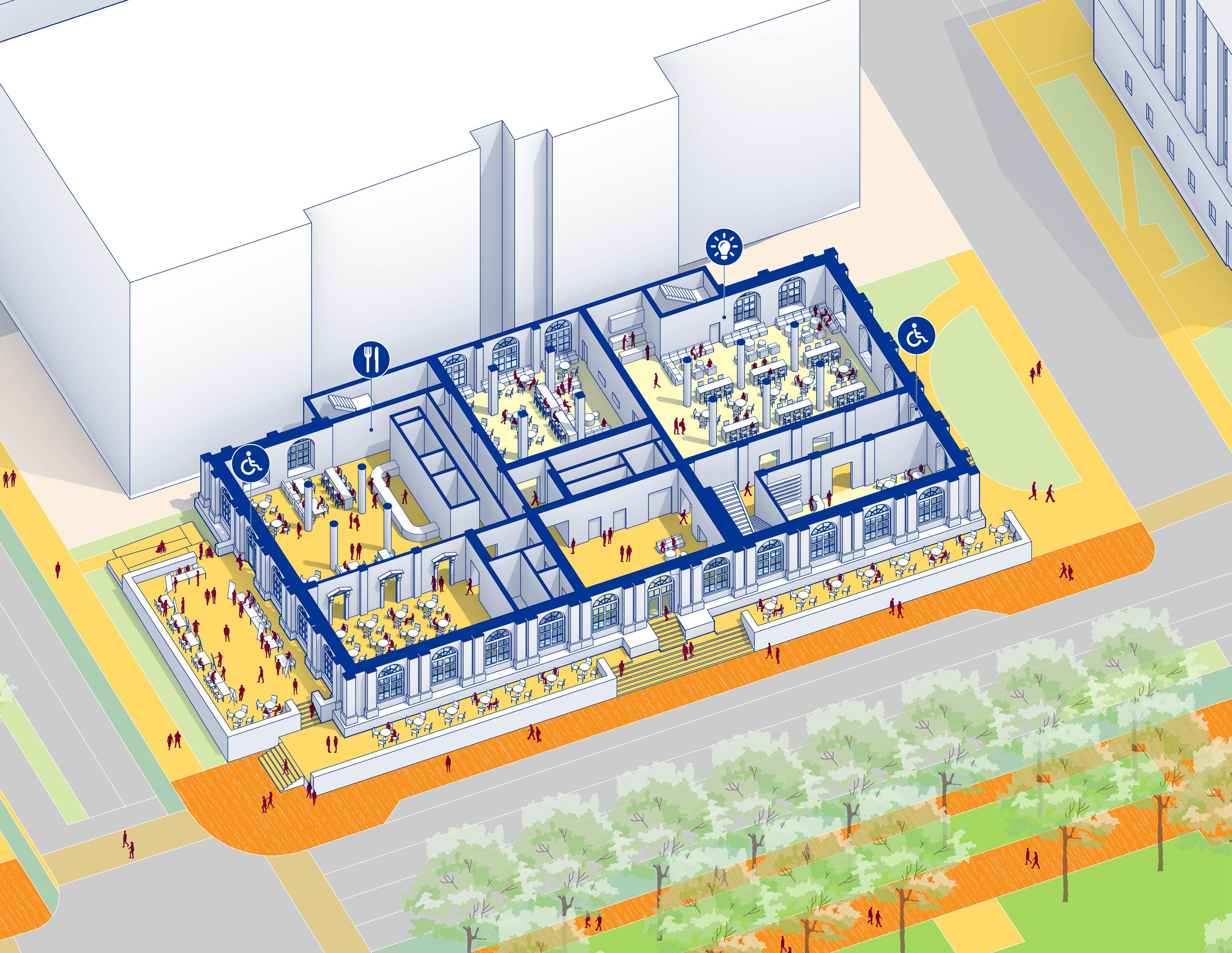
LYTTON AVE
• Alumni Hall: the plan recommends continued use of the massive Greek-Revival temple-like building for graduate business uses and other support departments.
• Ruskin Hall: the plan integrates this 1930s apartment building with new housing proposed for the Music Building site and the site of the current School of Computing and Information (SCI) building (which is proposed for demolition). The intent is to integrate the building that Pitt has owned for some time into the overall strategy for a student housing cluster at the eastern gateway to the campus. Proposed buildings include a new building at the corner of Ruskin Avenue and Fifth Avenue designed to complement the impressive stonework of the Music Building and annex.
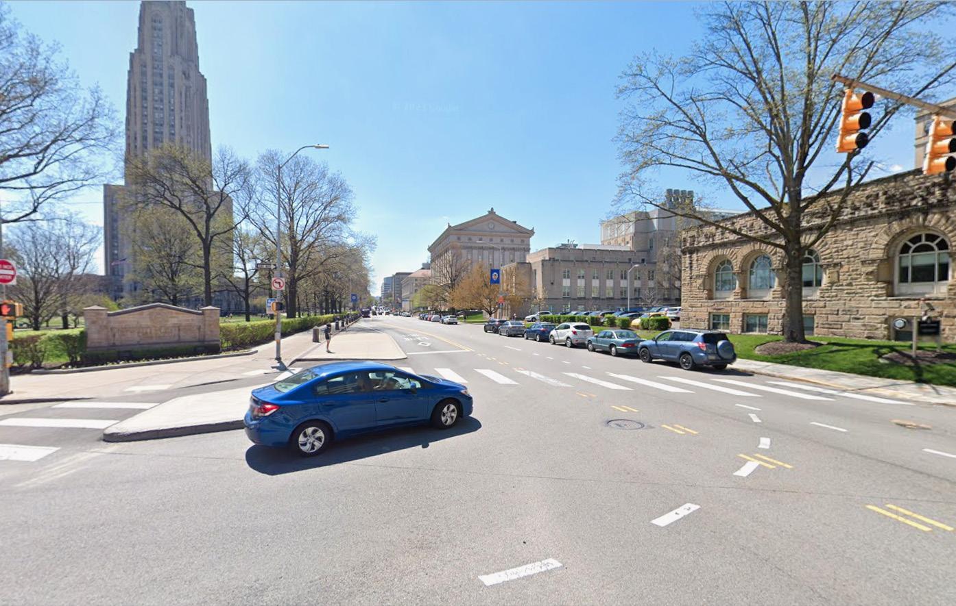
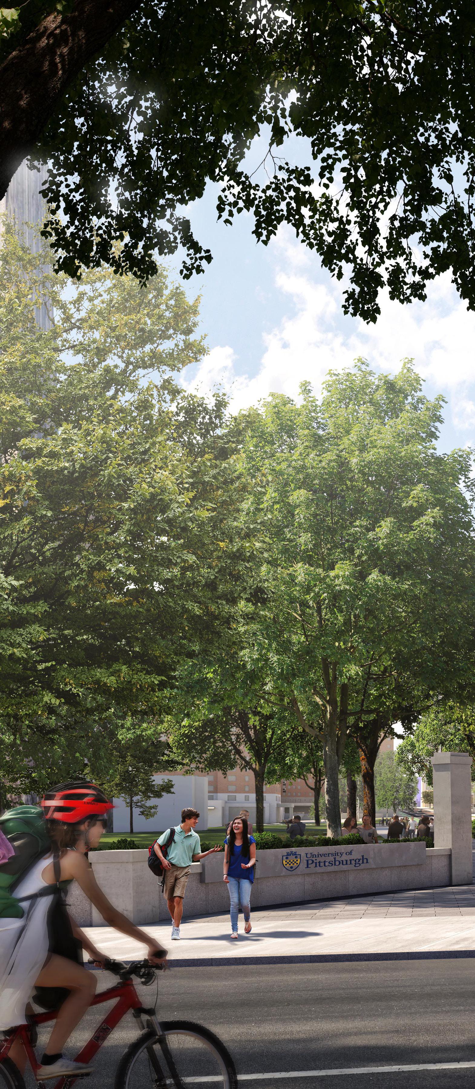
• View of proposed housing at the music site
Existing Condition
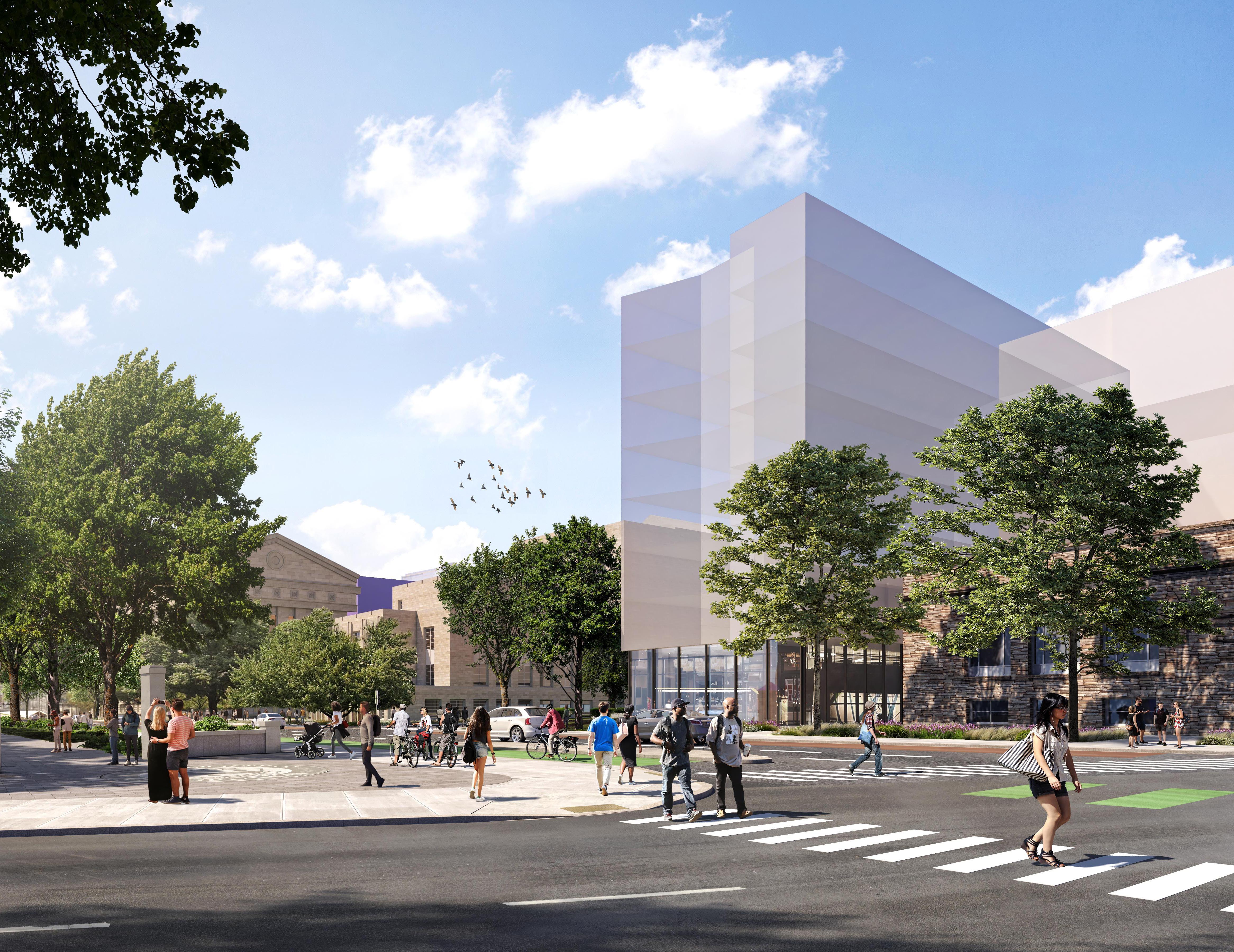
CENTRAL OAKLAND AREA
The Central Oakland area includes the existing Bouquet Gardens buildings constructed by Pitt in the 1990s and a series of row houses along Oakland Avenue and Atwood Street acquired by the university over several years. The Campus Master Plan envisions the redevelopment of the area to provide a higher density of housing along with ground floor student support spaces and amenities, including retail at the corner of Sennott and Atwood Streets.
The redevelopment consists of apartment and micro-suite units for third- and fourth-year students.
The Central Oakland area also includes Mervis Hall, a building constructed for the College of Business. Over the long term, the plan recommends the demolition of Mervis following the completion of a new College of Business building at One Bigelow. Future housing on the Mervis site contributes to the overall housing need and to the proposed Posvar Gateway to the campus. The redevelopment accommodates 1,986 beds and parking spaces accessed for Roberto Clemente Drive.
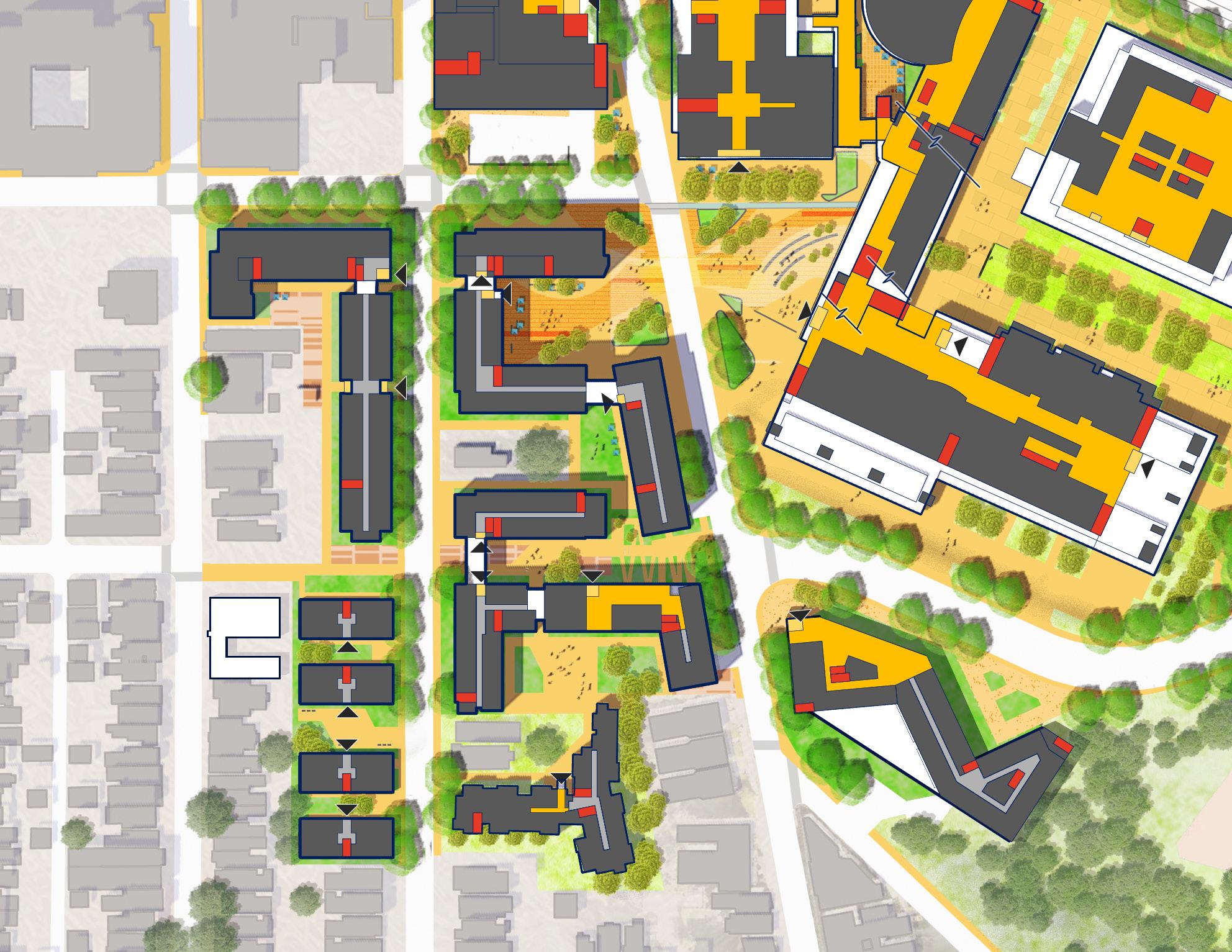
Sennott St
POSVAR AND BARCO AREA
Improvements to the Posvar Area focus on the plaza level of the facility. Ground level landscape and pathway improvements facilitate east-west movement from Schenley Drive to Bouquet by means of new ramps where stairs impede accessibility. This east-west movement continues under the bridge portion of Posvar to connect with the proposed Posvar Gateway near the intersection of Sennott Street and Bouquet. Designed to connect Posvar to Sennott and the future housing on the Central Oakland site, the Posvar Gateway includes a raised crosswalk, a renewed plaza west of Posvar and a new plaza associated with the housing. A new southern entrance on Barco Law provides connections through the building and to the firstfloor classrooms.
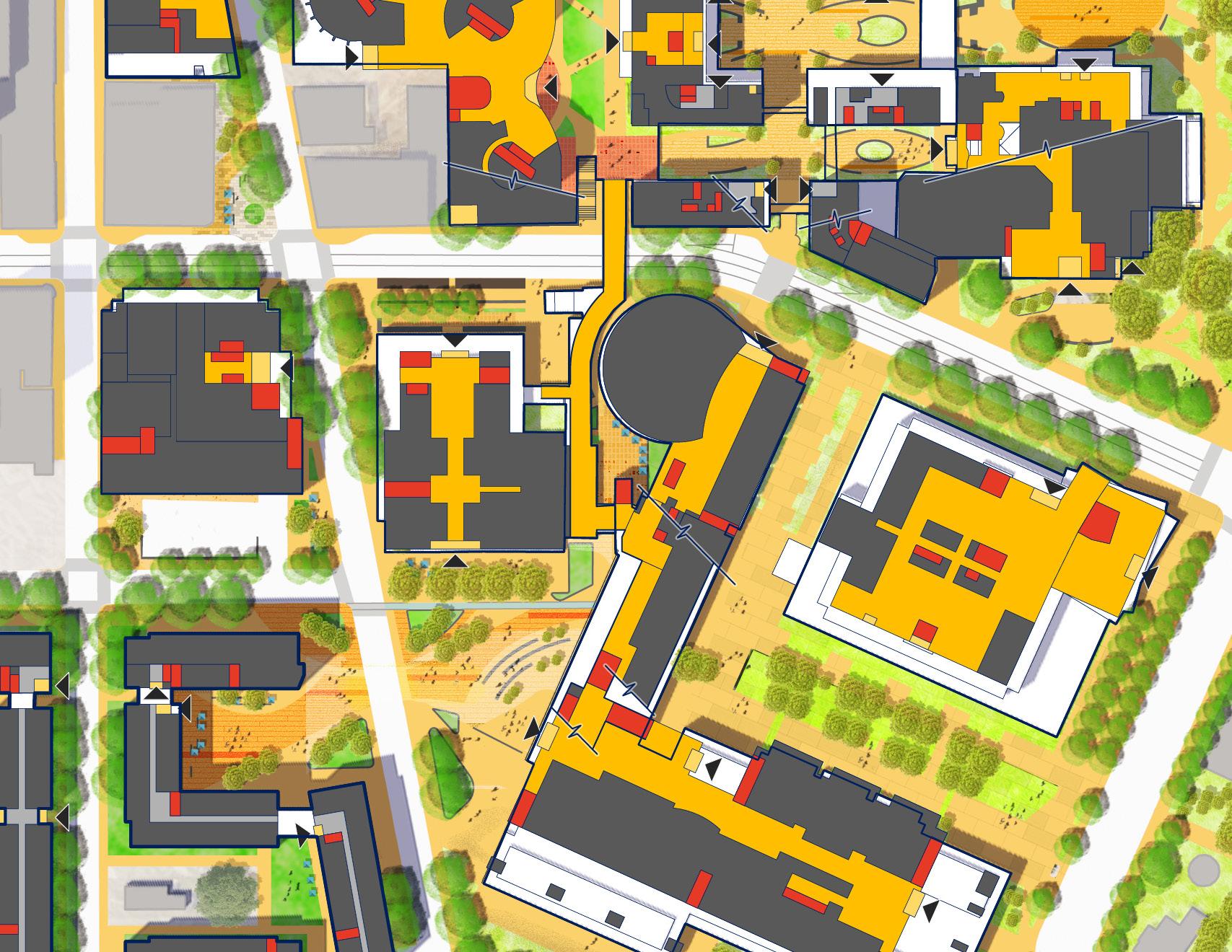
SchenleyDr
S Bouquet St
Posvar Hall
Barco Law Building
Sennott Square
Hillman Library
S BOUQUET ST
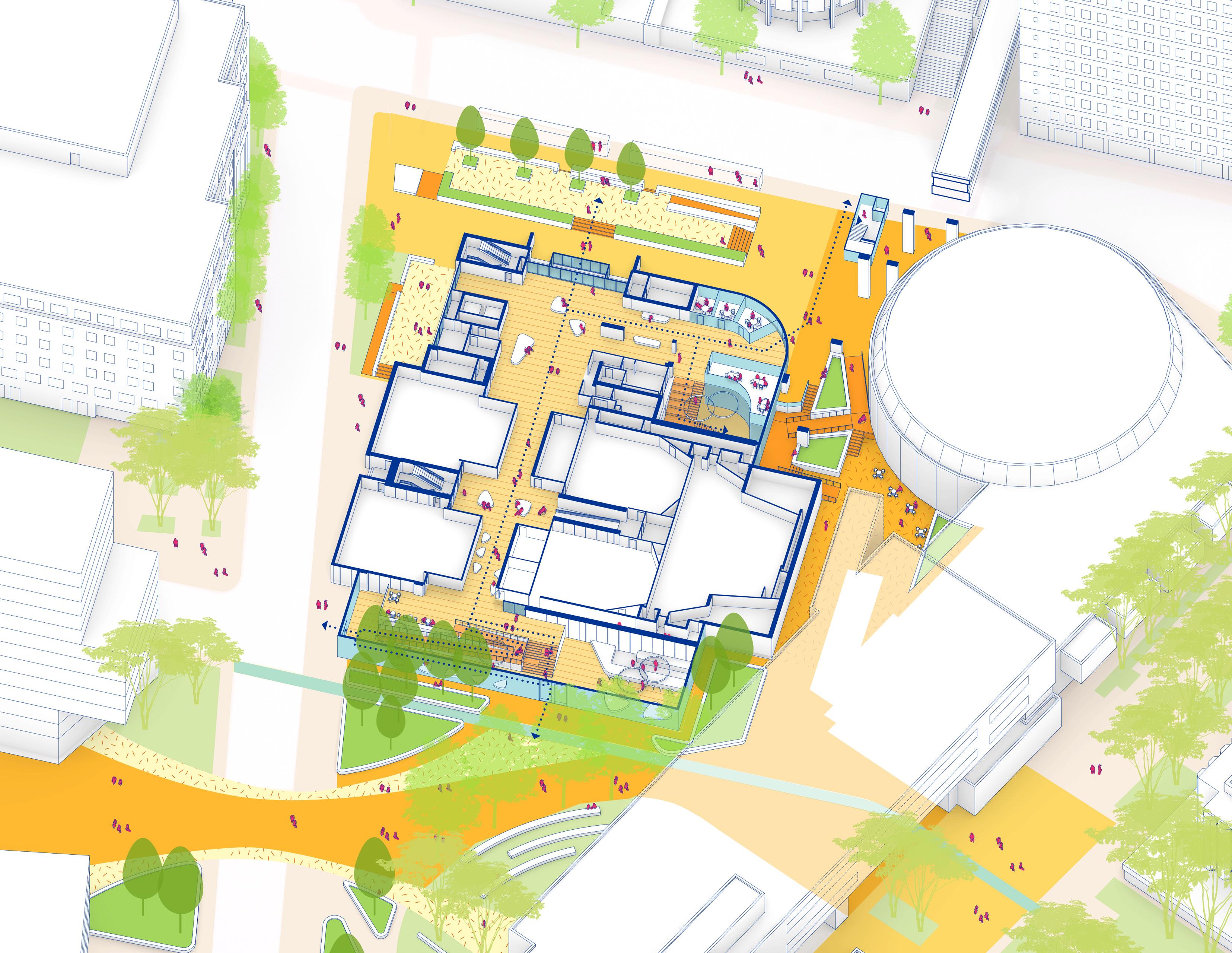
FORBES AVE
LAWRENCE
Posvar Bridge
On the interior bridge level of Posvar (second floor), the plan envisions a new Academic Support Hub designed to centralize student services and enhance the experience and vibrancy of this important circulation route leading to David Lawrence Hall.
Other interventions include access to the roof garden located south of Barco Law. Changes to the Forbes Avenue bridge include a new elevator and stair tower leading to the proposed BRT stop north of Barco Law along Forbes Avenue.
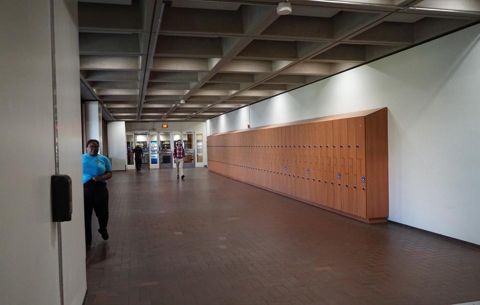
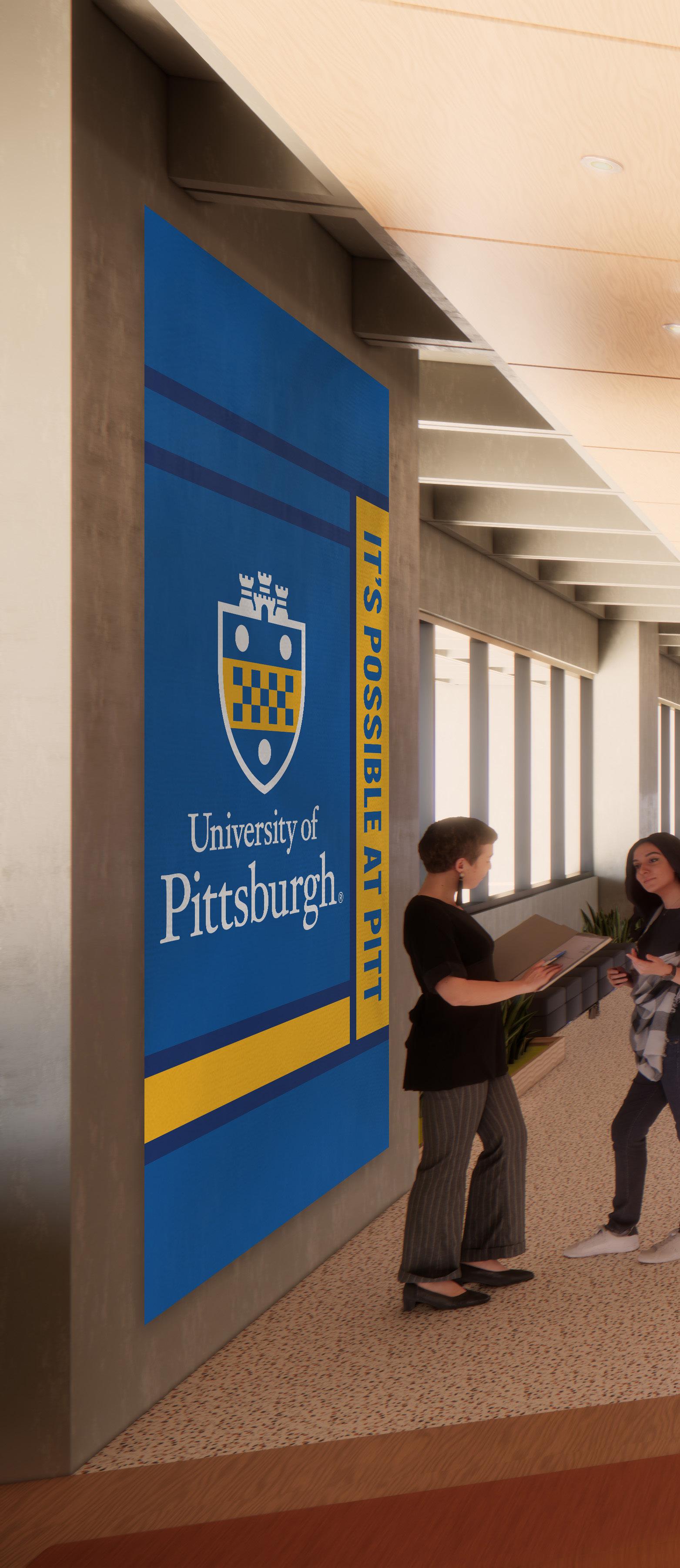
• View of the proposed Academic Support Hub in Posvar
Existing Condition
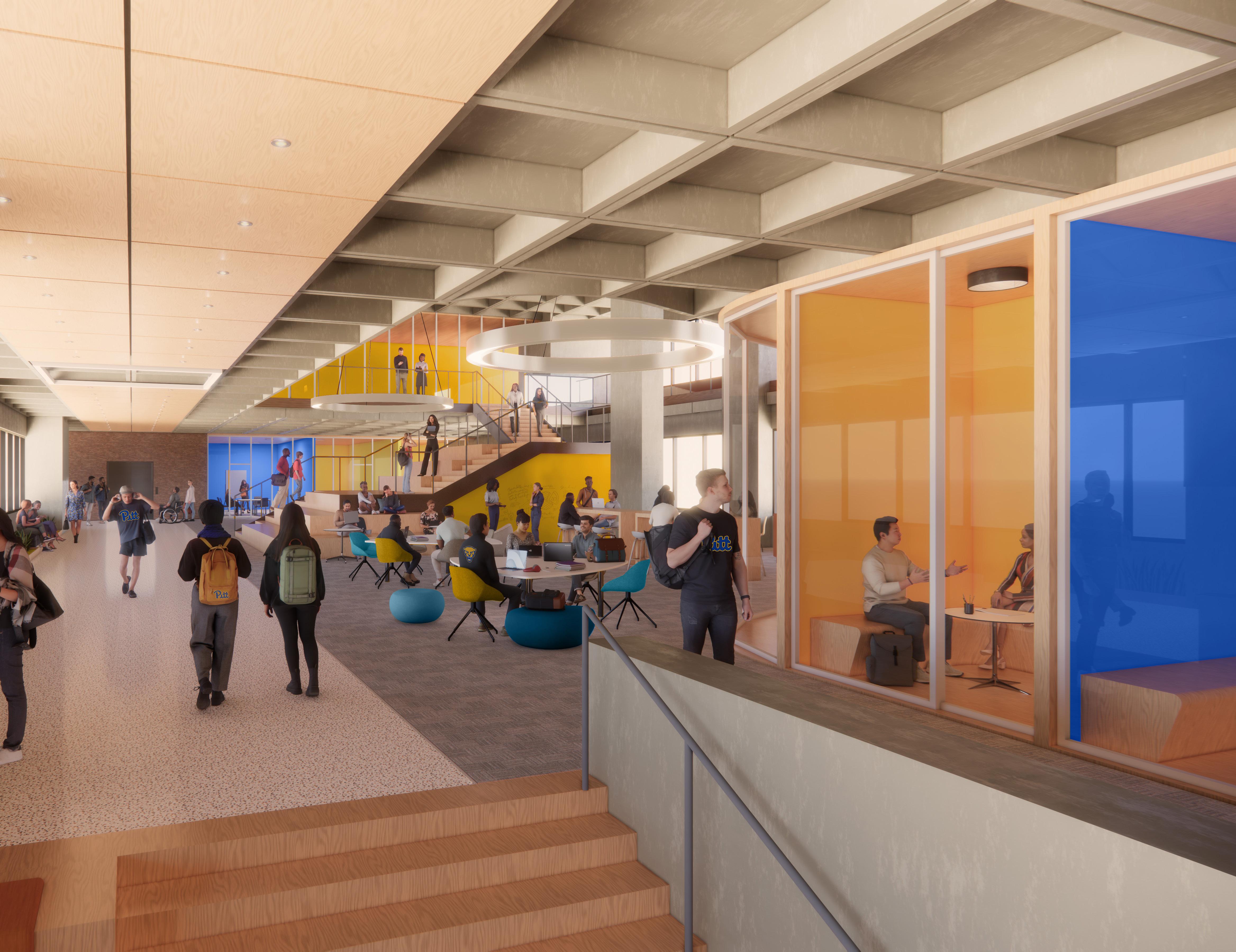
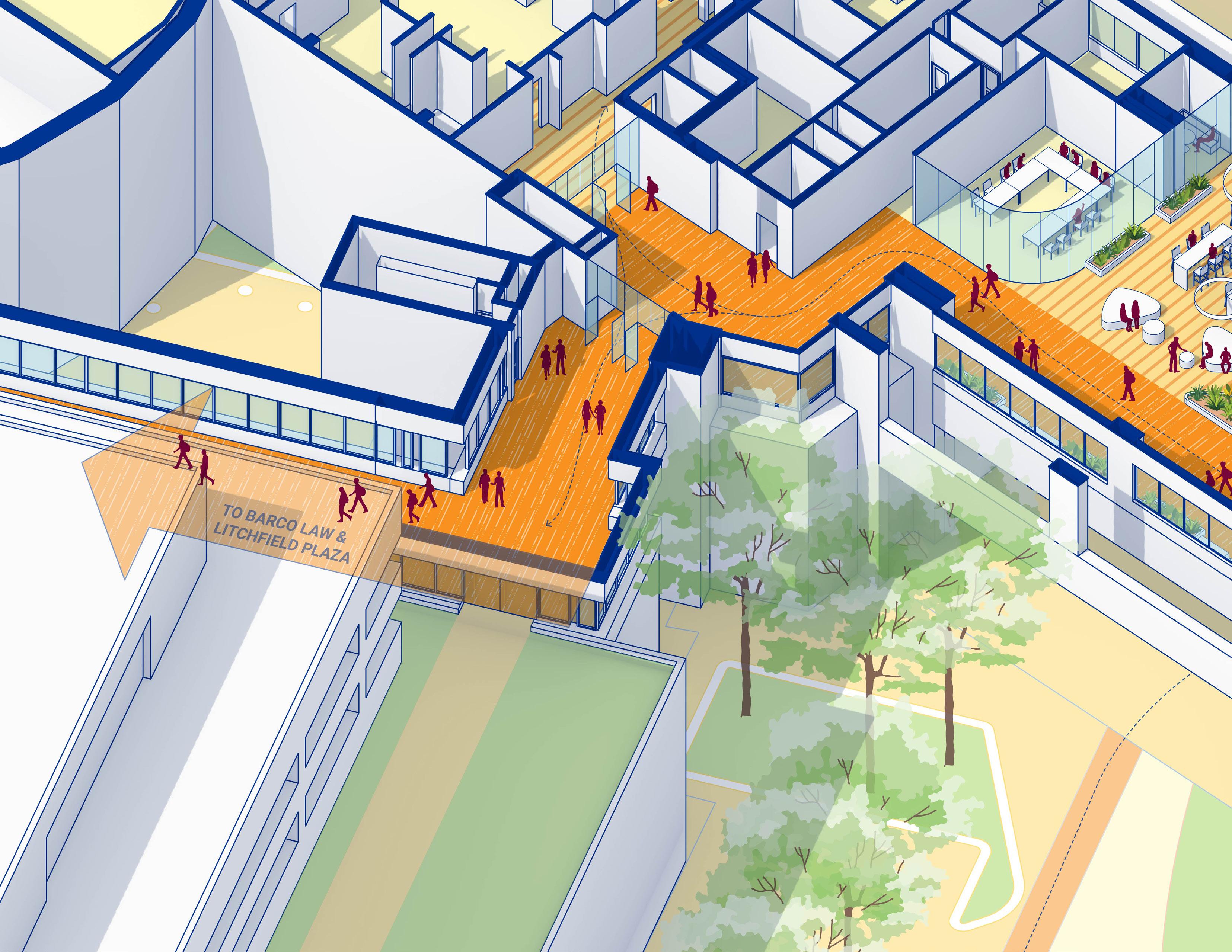
• View illustrating the proposed study and collaboration space on the Posvar Bridge
Connection to Lawrence Hall
Roof Garden at Barco Law
Gateway Landscape
CENTRAL CAMPUS DISTRICT
Social/Gathering Space
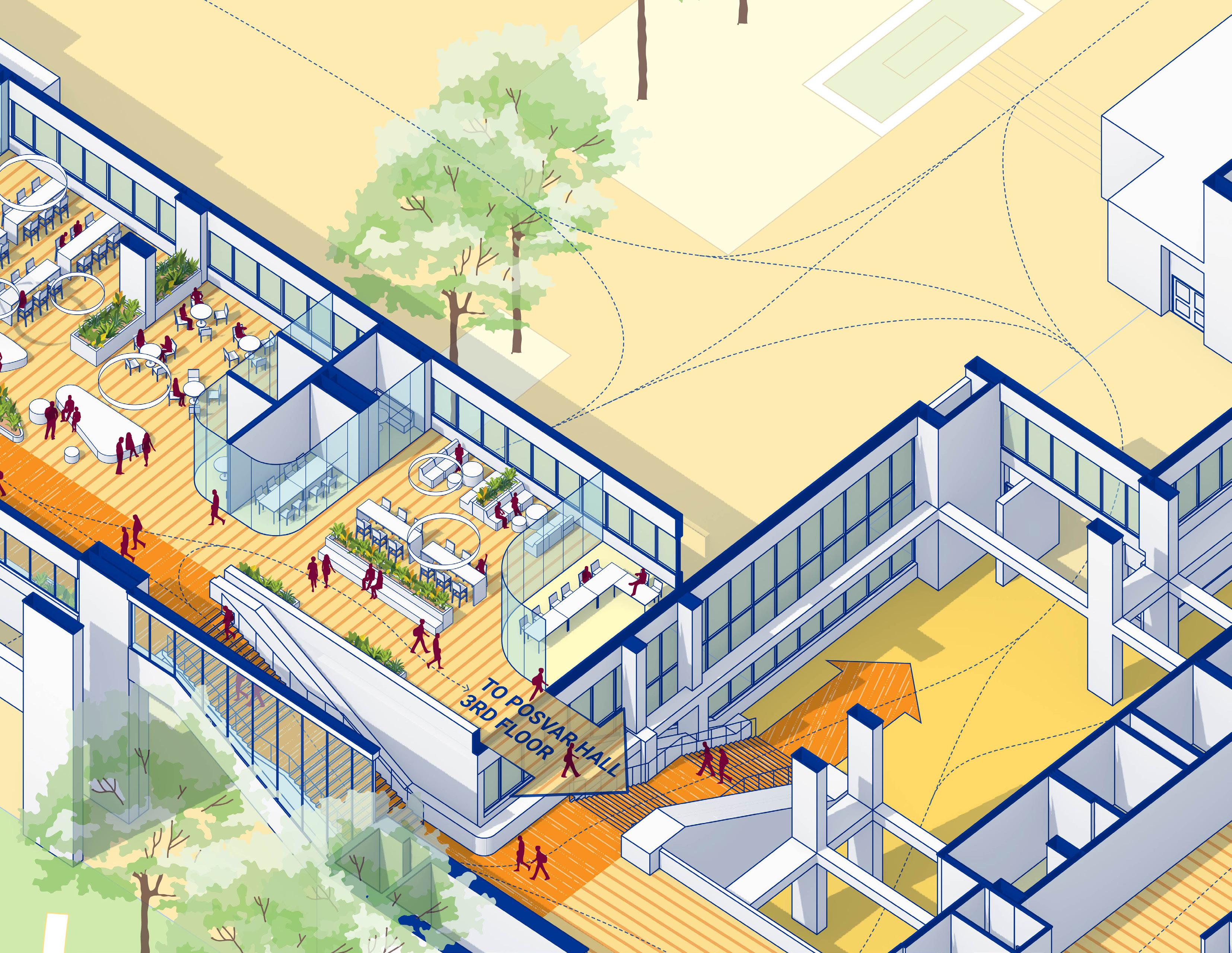
Meeting Rooms
TOSCHENLEYPLAZA
Posvar Passage
Barco Plaza
The plan repurposes space in the Barco Law building, notably the first-floor classrooms, to provide a lower-level collaboration hub and student amenities. Other changes include a new plaza north of the building coordinated with the proposed BRT stop. An addition to the northeast corner of the building where the existing depressed plaza provides access to the lower level of the building, the intent of which is to provide additional amenity space and address accessibility challenges.
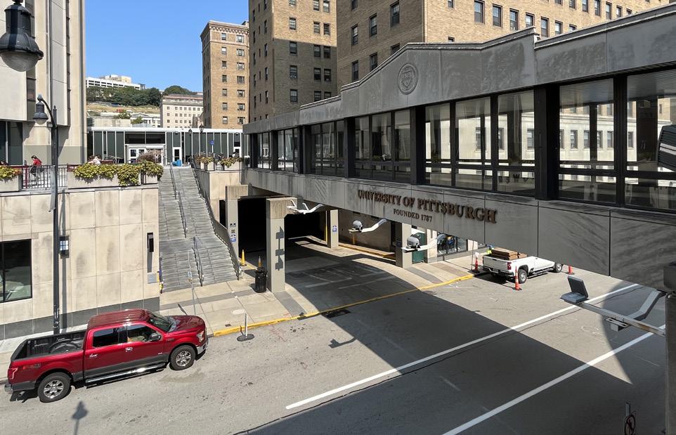
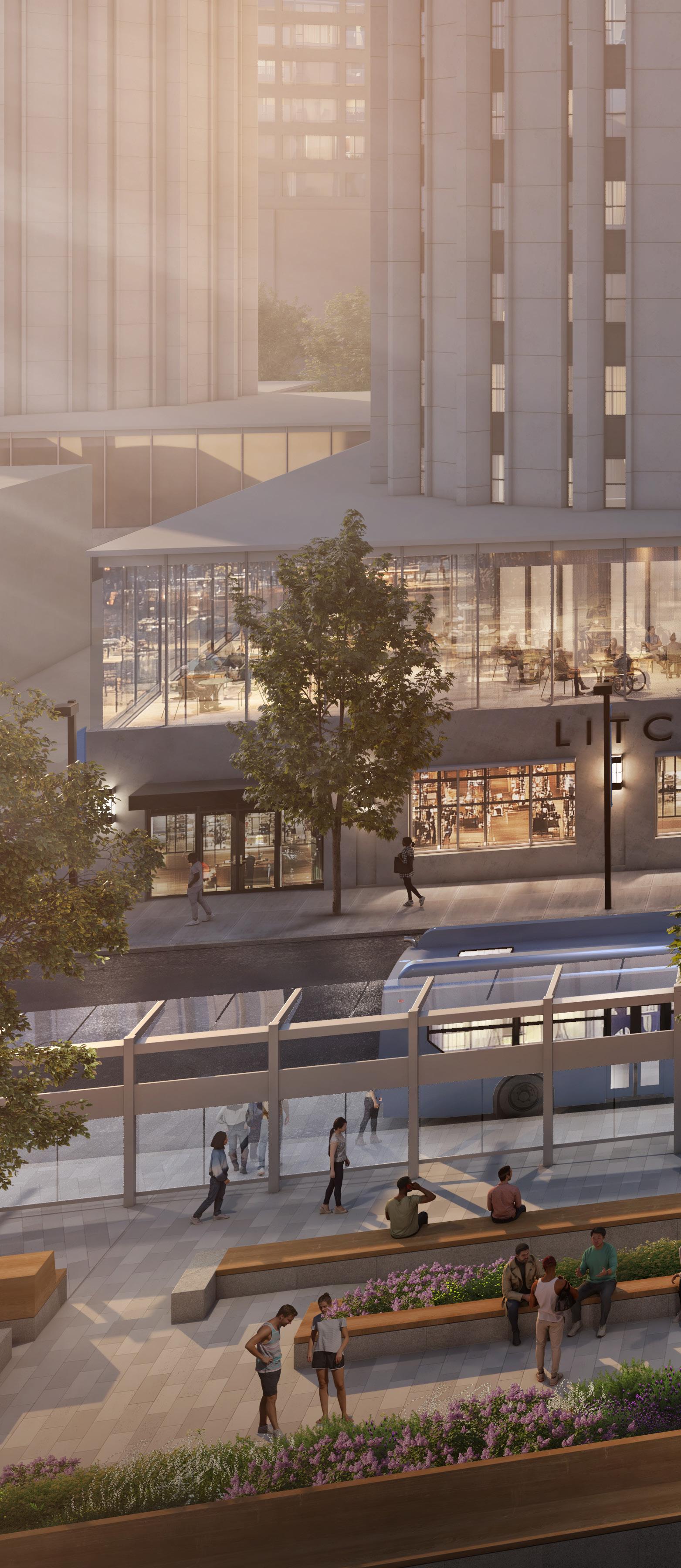
• View of Barco Plaza and the BRT stop (landscape renovated Barco Plaza designed by Land Collective)
Existing Condition
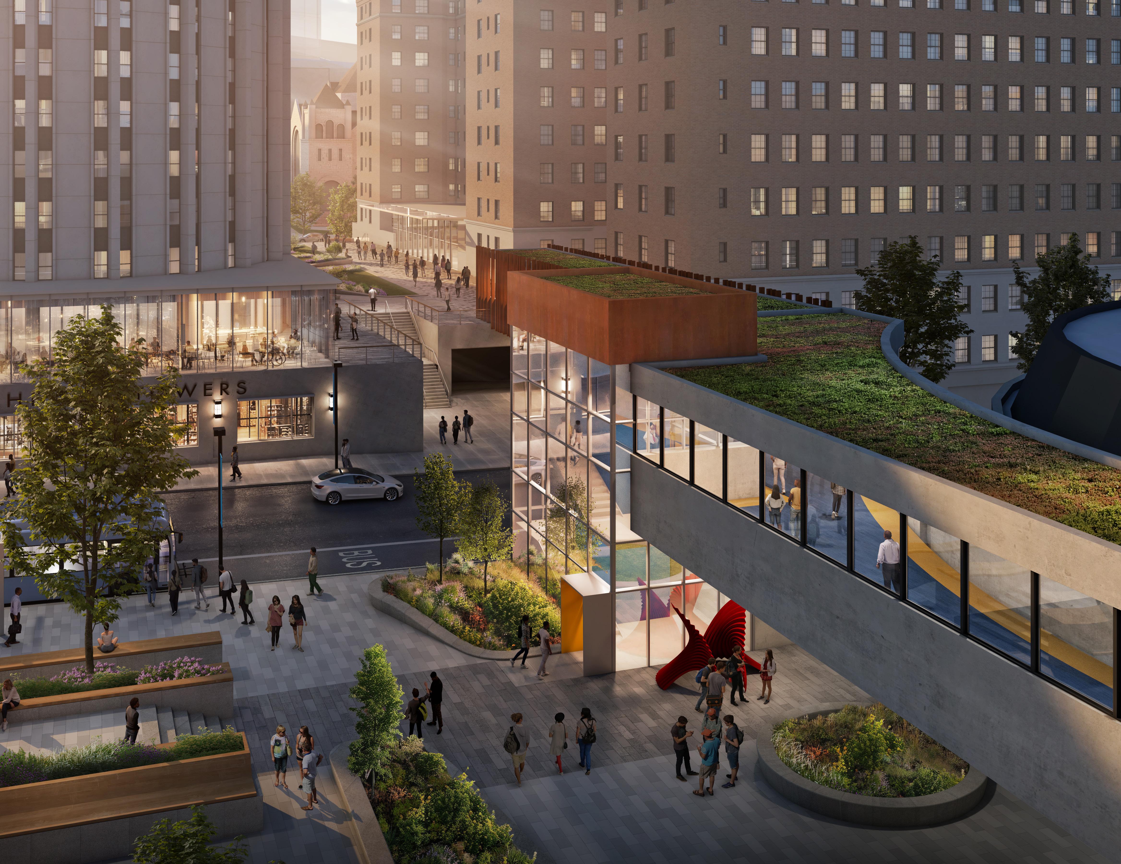
SCHENLEY QUAD AND LITCHFIELD PLAZA AREA
The Campus Master Plan sets out a vision for renovating and respectfully transforming these 100-year-old plus buildings to meet the current and emerging housing needs, notably the first-year student experience. Proposed changes include major renovations to each of the residential buildings that define the Quad including Holland, Brackenridge, Bruce, McCormick and Amos to address mechanical and code issues and to improve the qualitative conditions.
William Pitt Union
The plan recommends the conversion of the William Pitt Union from its current student center configuration to student housing, yielding roughly 350 beds. The plan maintains the historic interiors of the ground floor lobbies and ballrooms and recommends minor renovations to the existing food court on the lower level. The renovations restore the building to its original residential use and a configuration more suitable for the narrow floor plates of the second through ninth floors. The plan recommends the relocation of the student center to the Pittsburgh Athletic Association building.
Schenley Quad
In addition to addressing interior layout and deferred maintenance issues, the plan suggests the transformation of the top floor of each building to provide new lounge and gathering spaces offering views of the campus and Oakland. These new lounges contribute to the vibrancy and of the first-year student experience in this central and iconic location on the Pitt campus.
The plan also envisions changes to the plaza level of the Quad. Specifically, it facilitates east – west movement through the plaza and changes to the Pitt bookstore to provide a new vertical connection to Litchfield Plaza. This intervention includes a new entrance from Litchfield Plaza to the bookstore.
The intent is to improve accessibility, provide additional entrances to the bookstore and to relocate pedestrian flow away from the narrow sidewalk along Fifth Avenue.
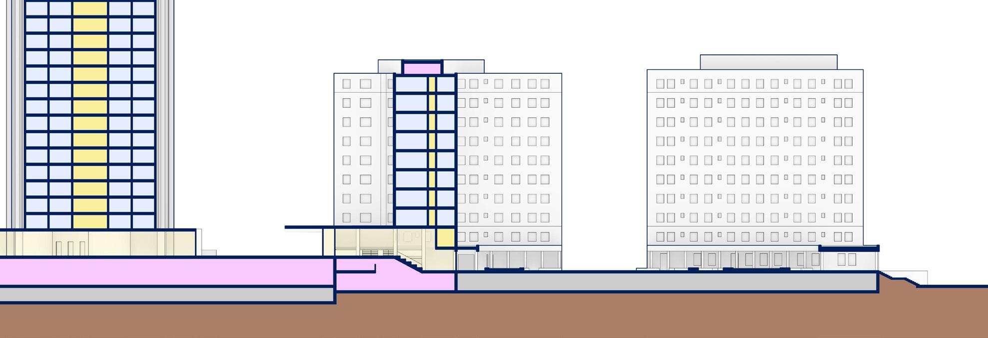
Litchfield Plaza
Litchfield Towers Holland Hall Amos Hall
Bookstore Renovation
Schenley Quad Plaza
WPU Plaza
• Section of Schenley Quad after Renovation
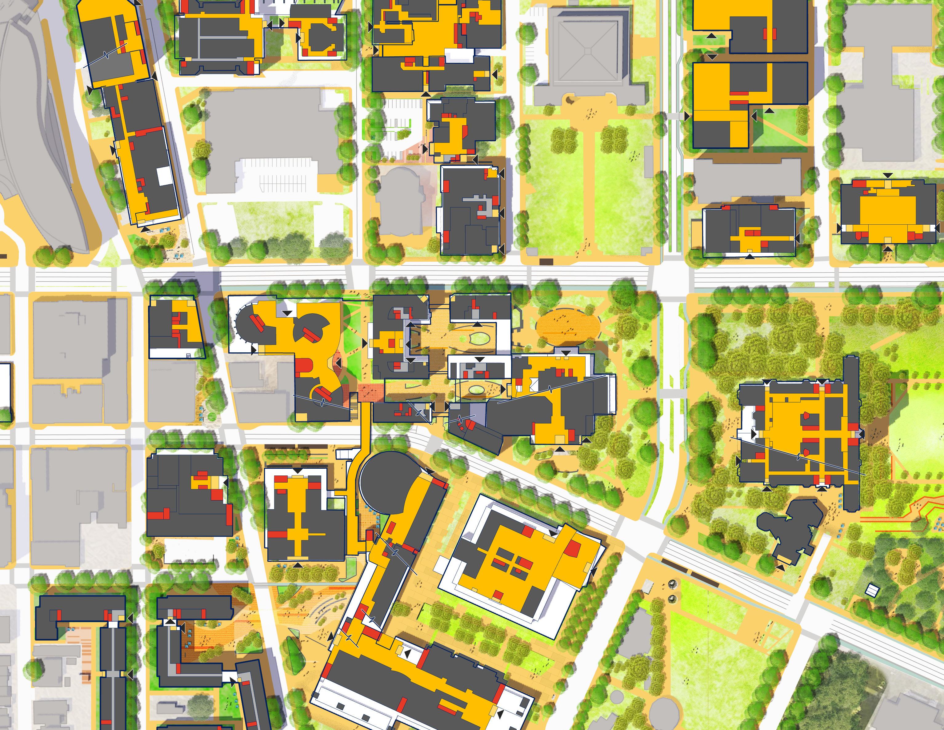
FORBES AVE
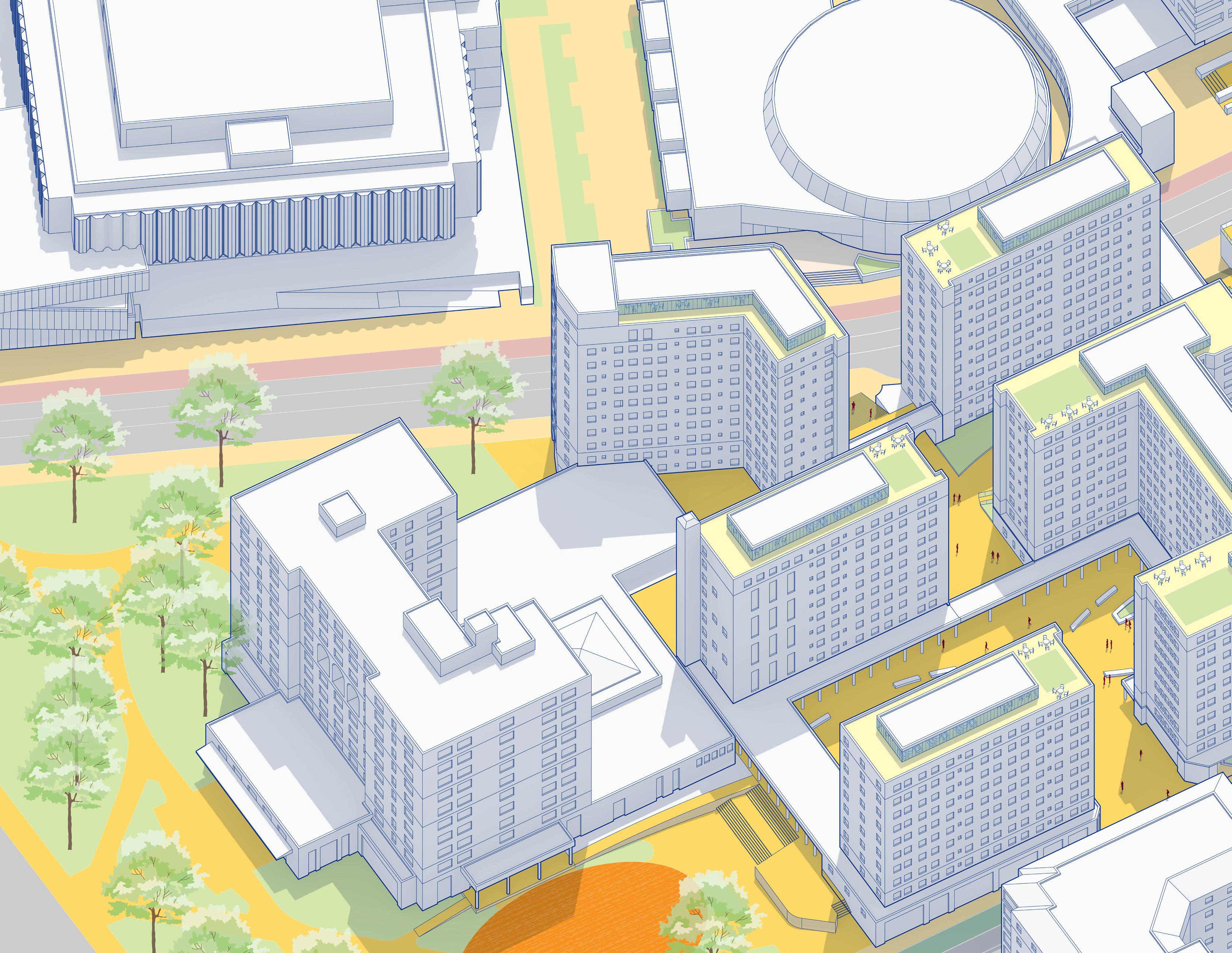
• View of Interventions in Schenley Quad and Litchfield Plaza Area
Residence Halls Renovation
William Pitt Union Conversion
Litchfield
Schenley Quad
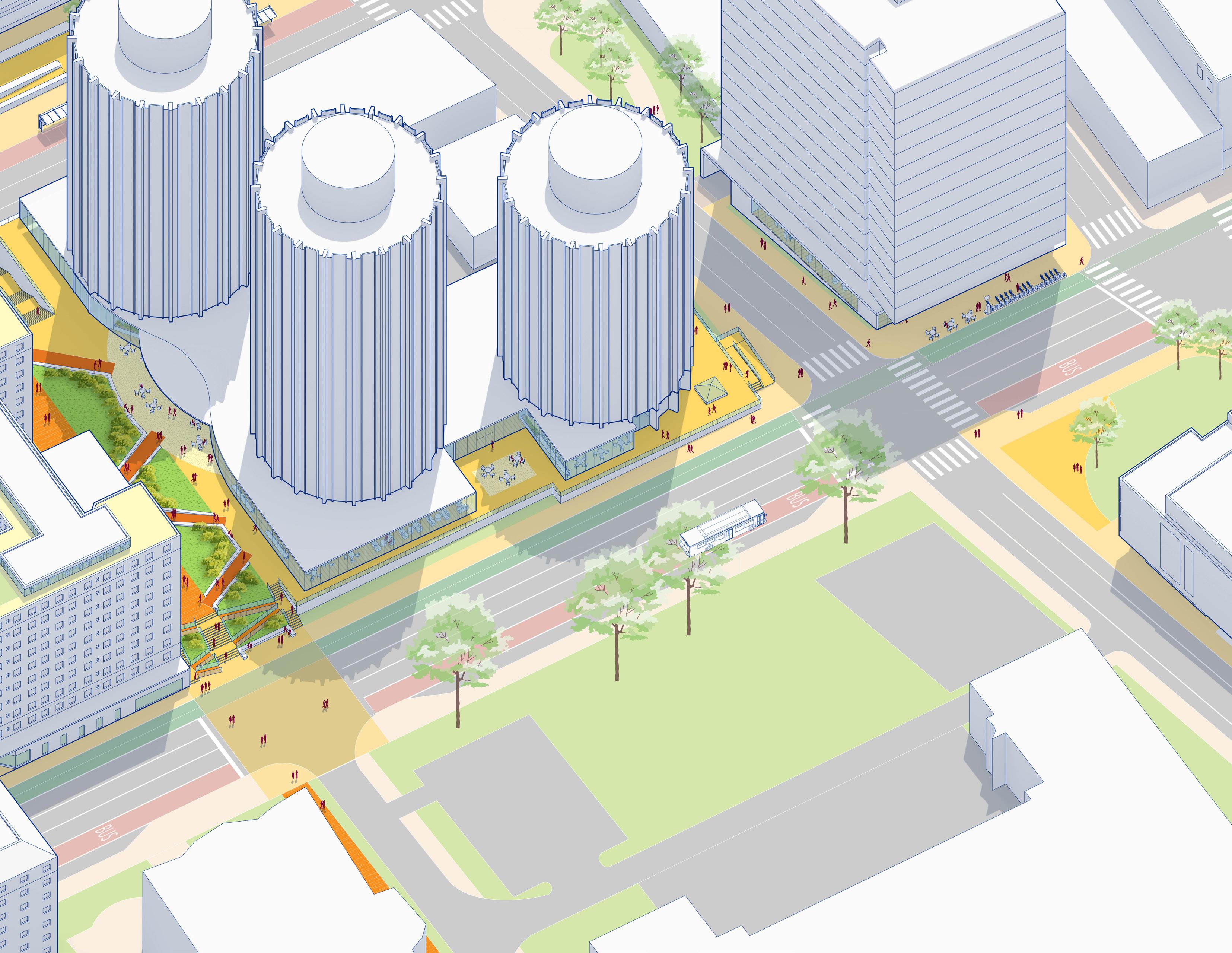
FIFTHAVE
Litchfield Towers Renovation
Litchfield Towers Lobby Expansion
Tower D
Crosswalk Improvement
Bookstore Intervention
Plaza
Litchfield Plaza
In the Litchfield Plaza area, the plan transforms the plaza itself as part of the central north-south spine of the campus along Thackeray Avenue. Changes include the removal of the 1960s corridor connecting the Litchfield Towers to Holland Hall with the intent of facilitating north-south movement from Barco Plaza, across the Forbes Bridge to Thackeray that results in a fully accessible public route.
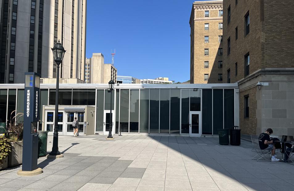
Existing Condition
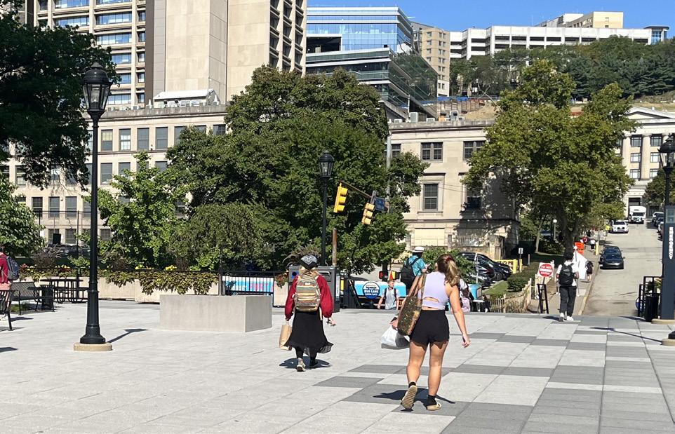
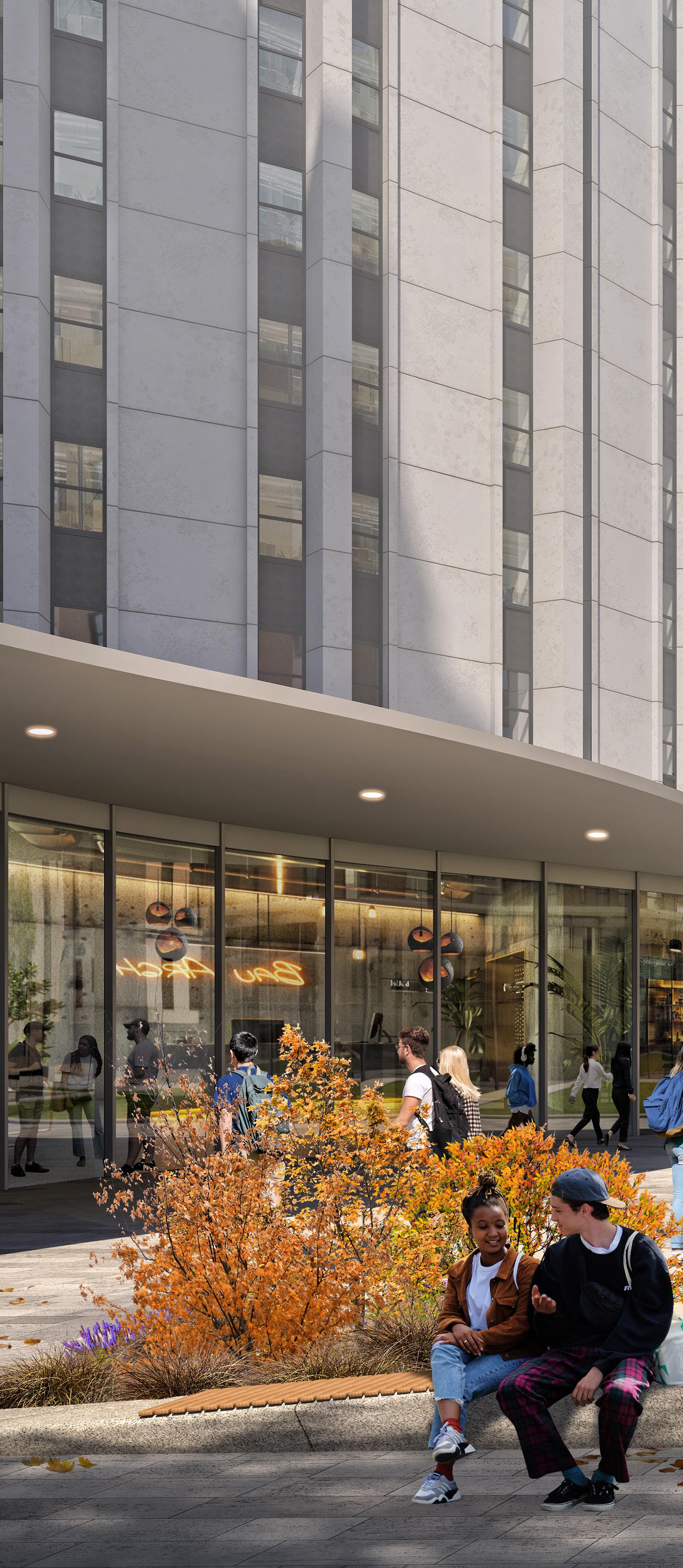
• View from the pedestrian bridge looking at Litchfield Plaza and Thackeray Avenue
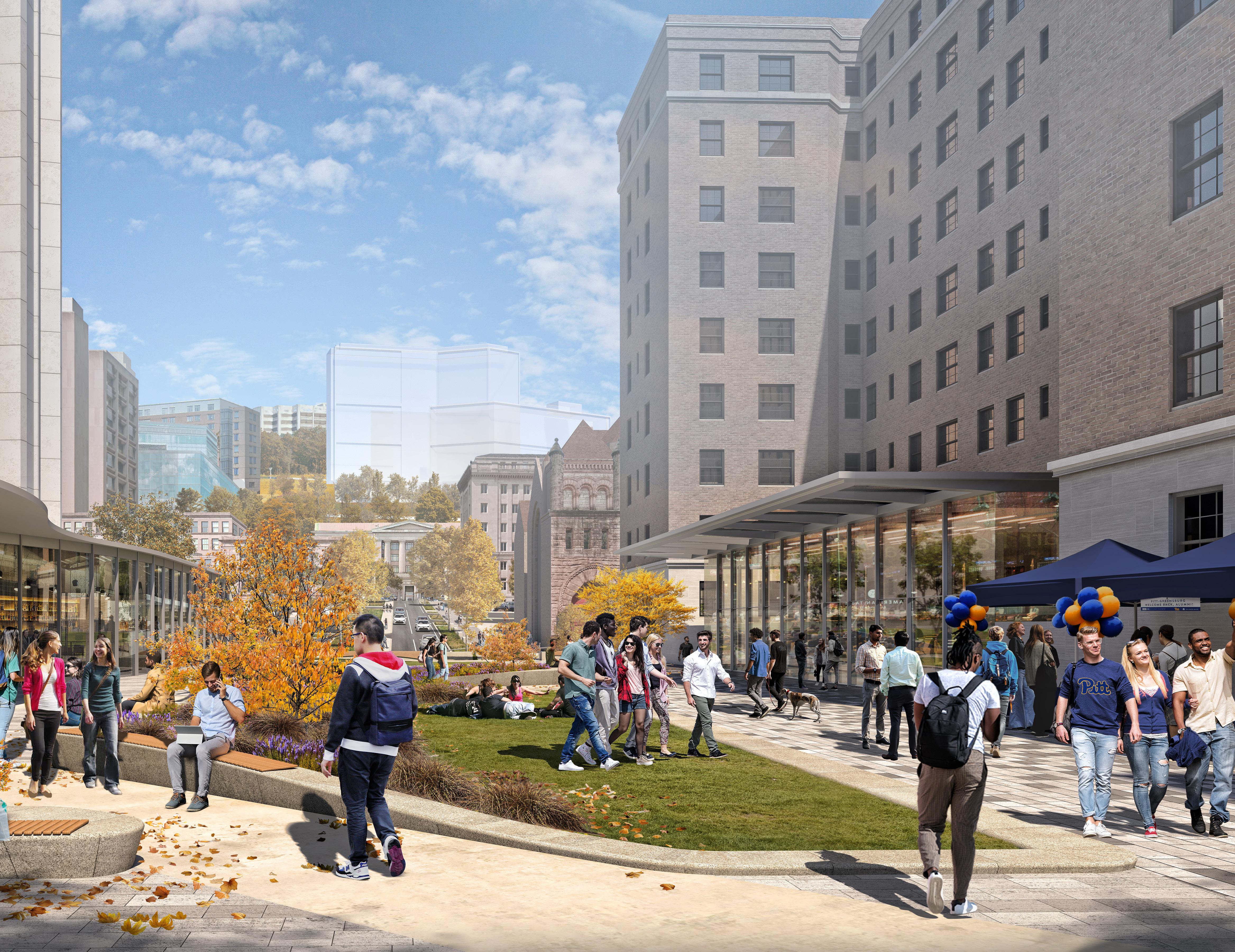
Proposed plaza level improvements enhance the accessibility and experience of movement toward Fifth Avenue where new stairs and ADA ramps connect to street level. Reimagined lounges define the base of the Towers contributing to the resident experience and vibrancy of the plaza. A proposed entrance to Holland Hall connects to the bookstore, making it accessible from this important northsouth route through the campus.
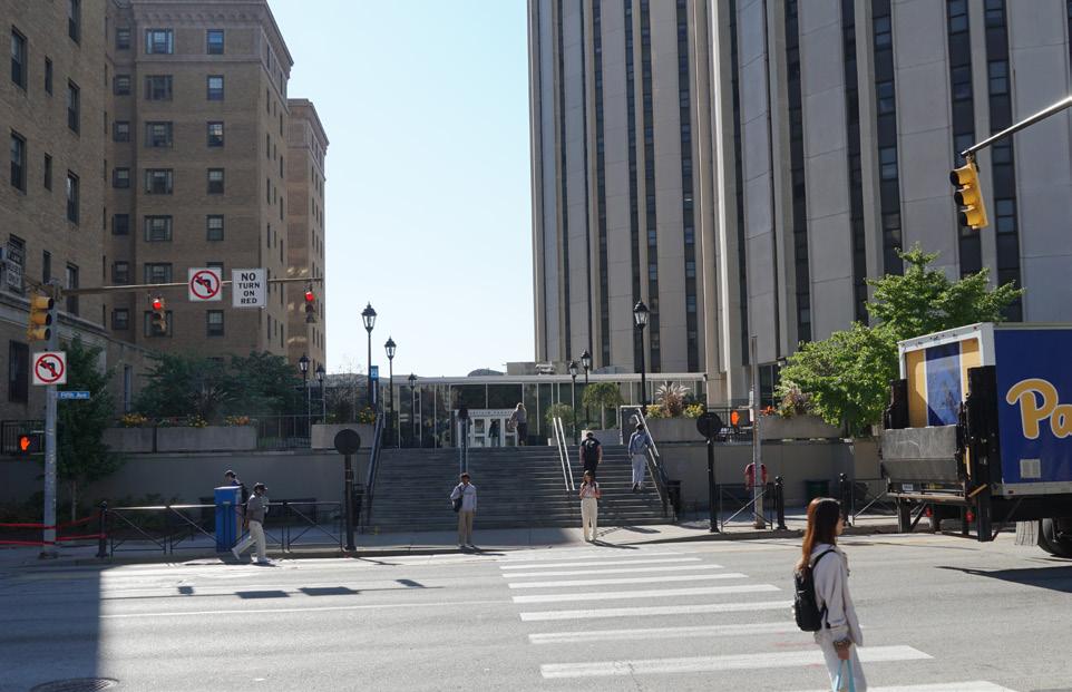
• Litchfield gateway at Fifth Avenue illustrating the proposed ramps, stairs and landscape Existing Condition
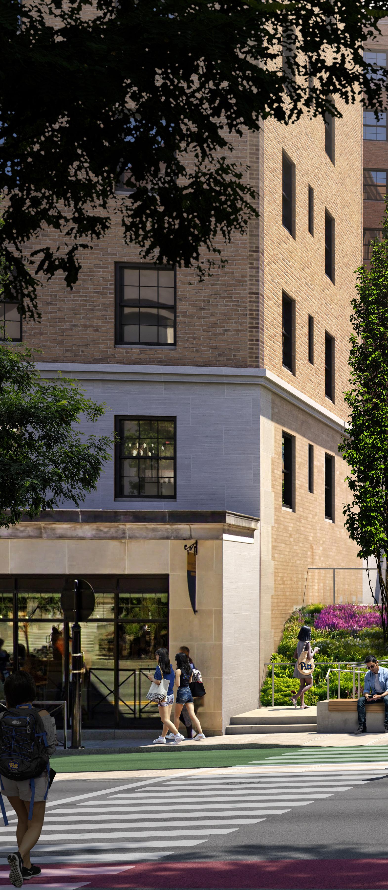
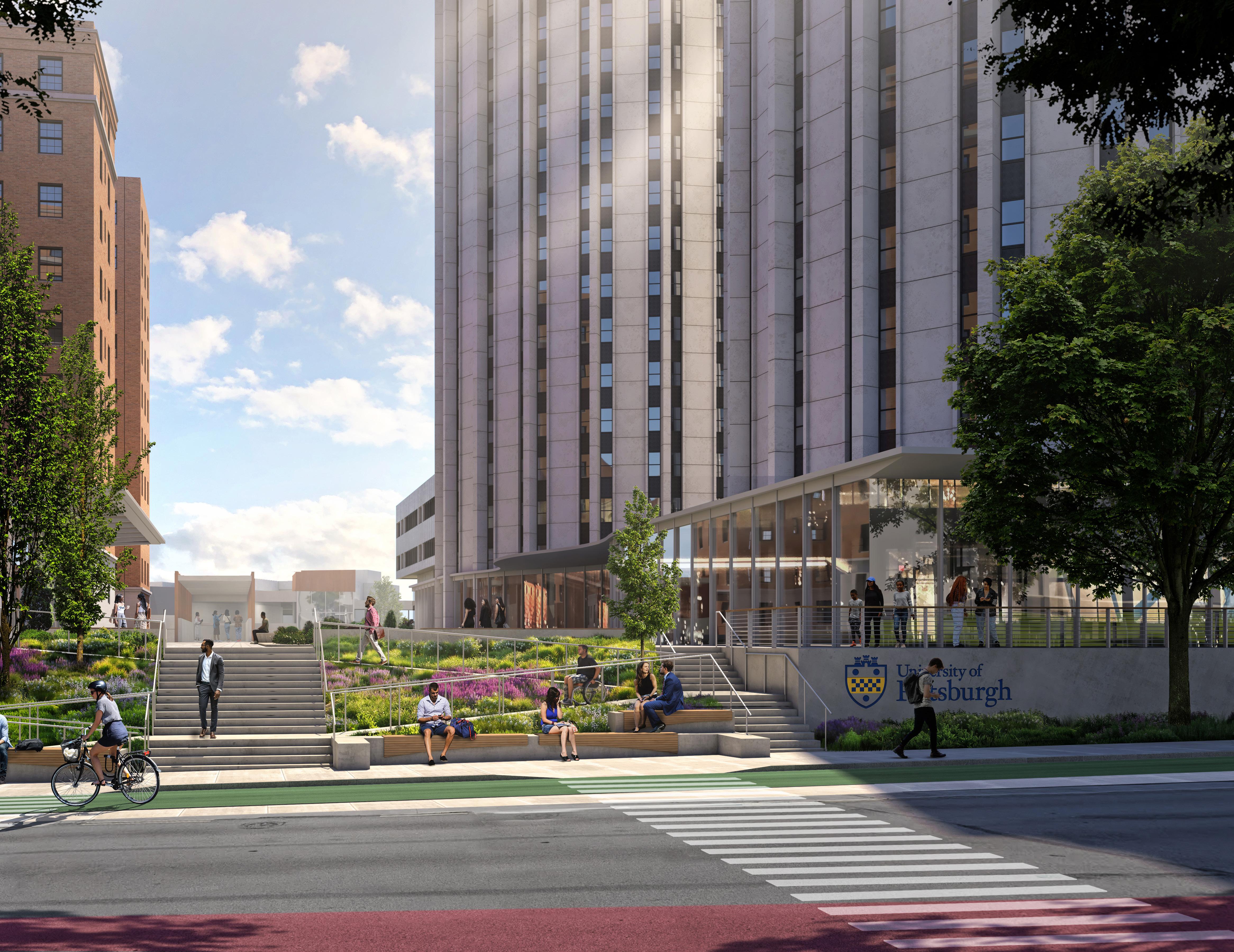
• View illustrating the proposed interventions at Schenley Quad and Litchfield Plaza
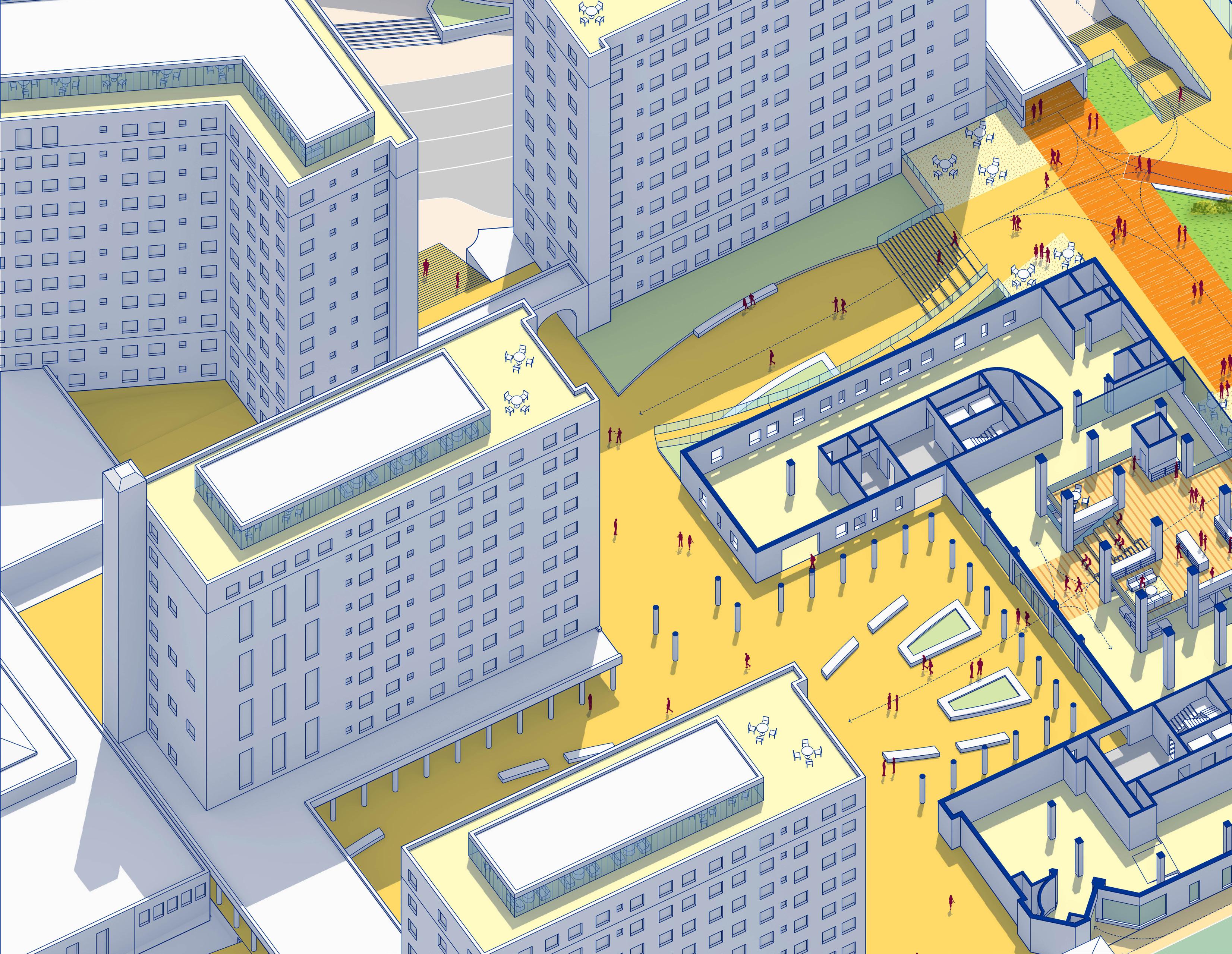
Accessible N-S Corridor
Bookstore Intervention to Enhance Vertical Connection
Rooftop Lounge and Terrace
Pedestrian Bridge
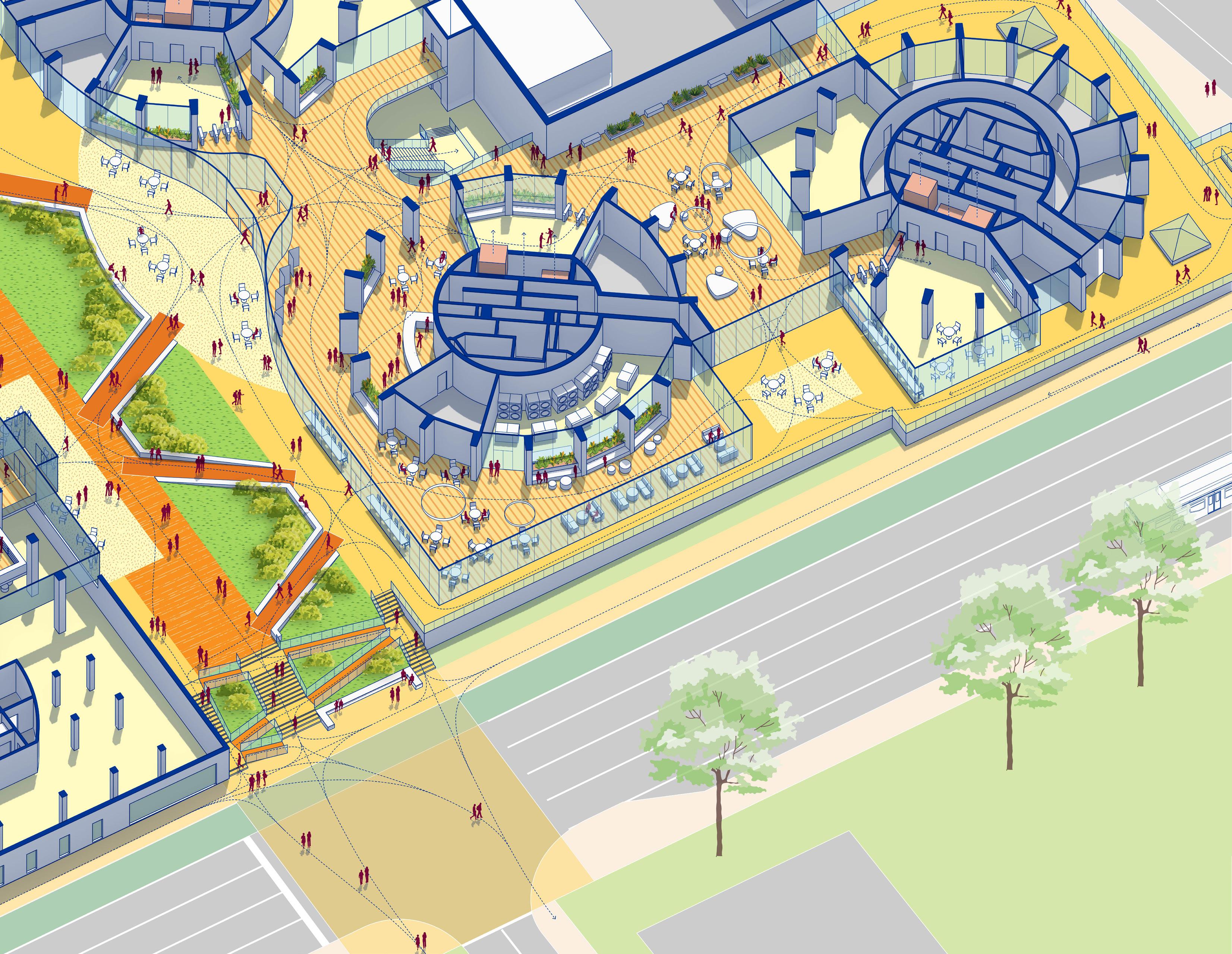
PotentialConnection toTowerD
ConnectiontoEatery
BikeLane FIFTHAVE
BRTLane
Litchfield Plaza
Dorm Entrance
Social / Gathering Space
Accessible Ramps
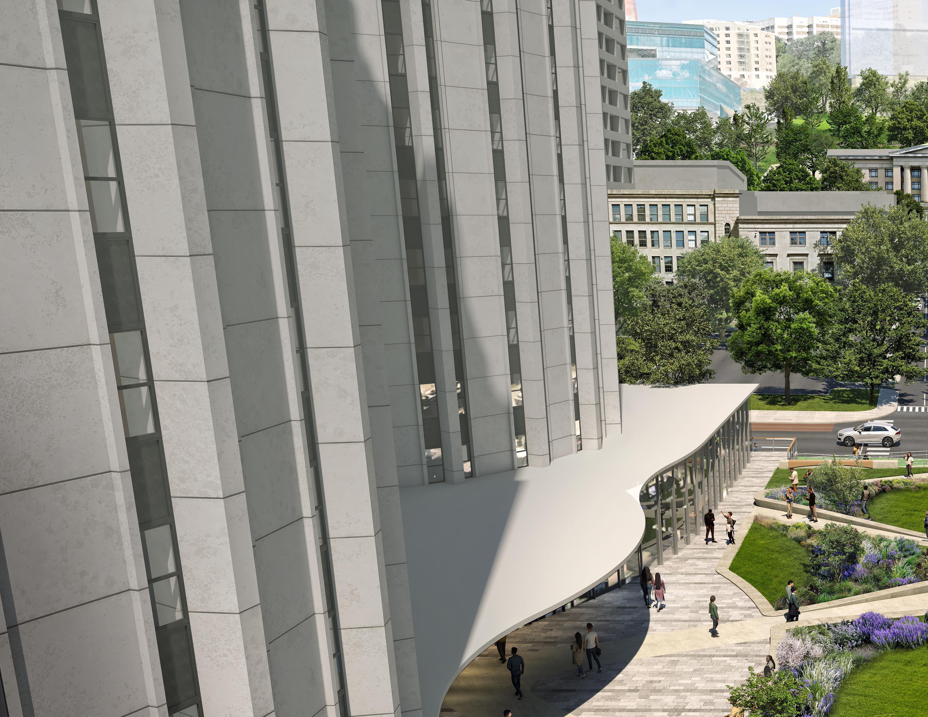
• View overlooking Thackeray Corridor from Litchfield Plaza
CAMPUS DISTRICT
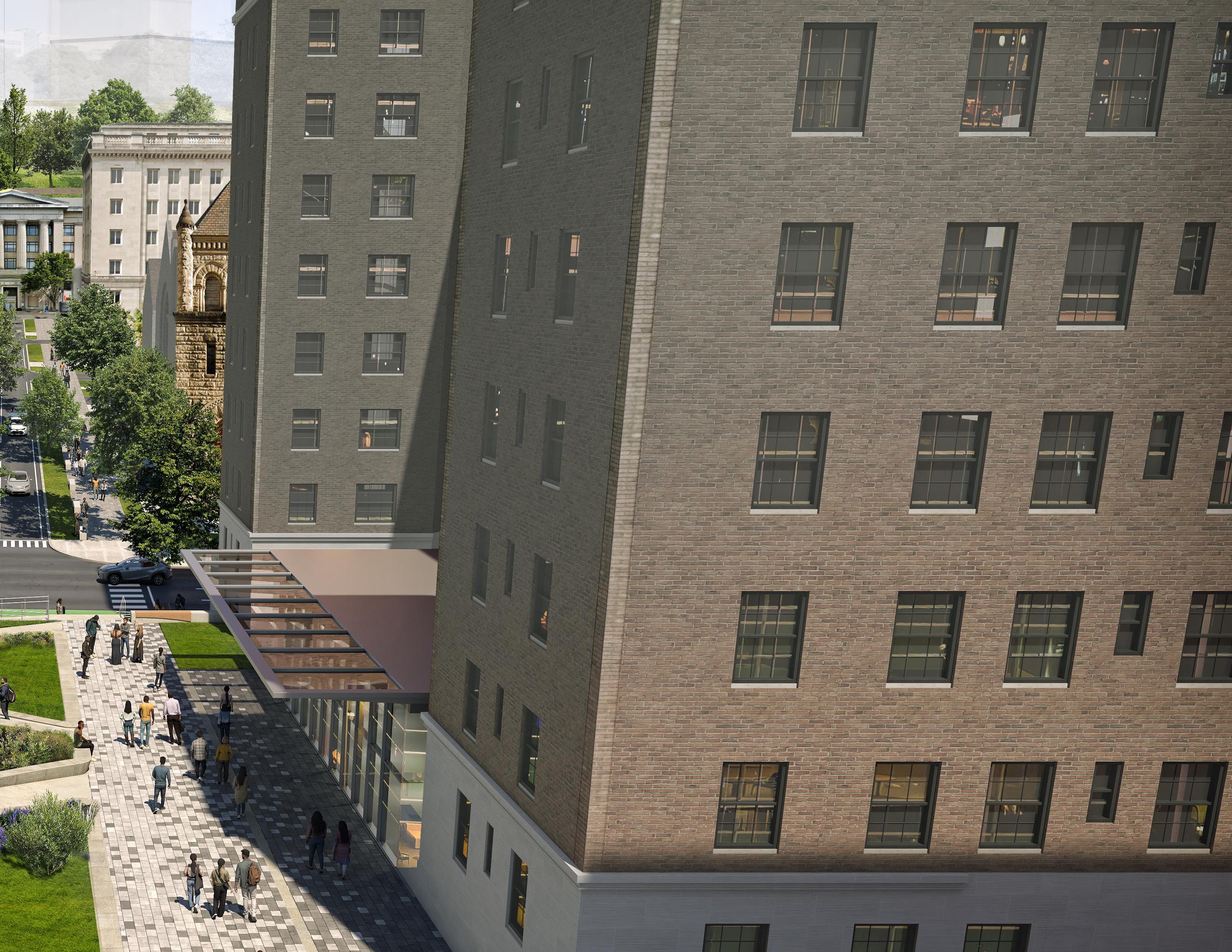
Tower D
Changes to the area also include a new residential building west of the Litchfield Towers on the site defined by Bouquet Street, Fifth Avenue and Oakland Avenue. Referred to as Tower D, this new residential building expands the housing capacity for first year students. The vision for Tower D includes ground floor retail and lounge spaces contributing to the vibrancy of the campus and urban environment.
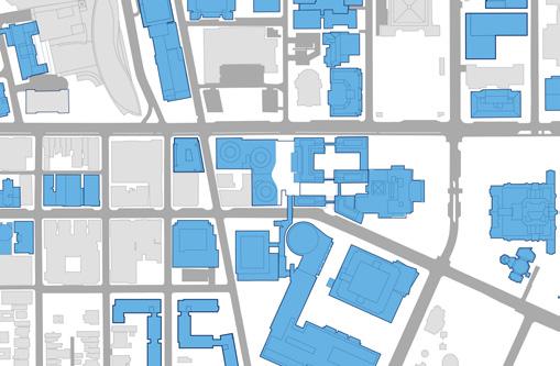
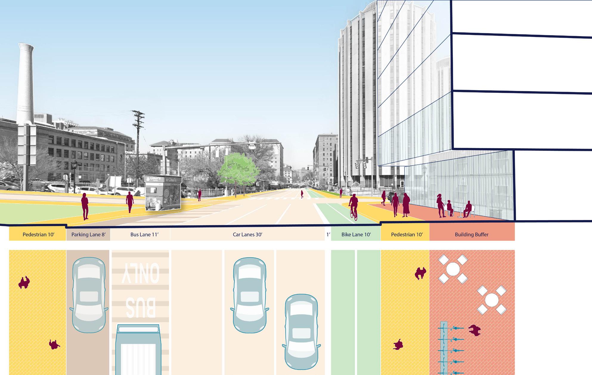
Proposed Section of Fifth Avenue at Tower D
Pedestrian Sidewalk
Bike Lane
Car Lane Bus Lane
OAKLAND AVE
SBOUQUETST
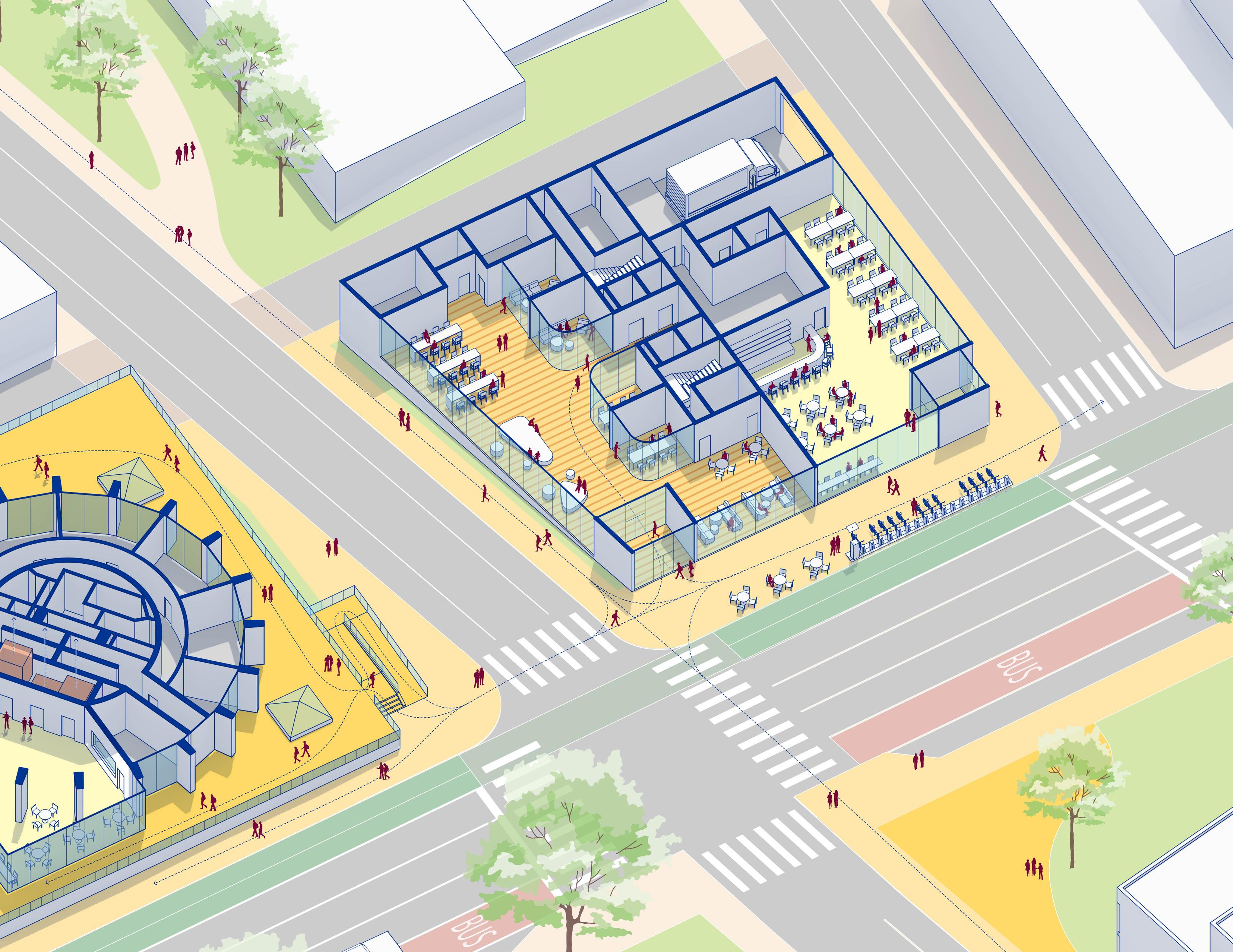
FIFTHAVE
• View of Proposed Tower D Ground Floor Retail Space
Student Lounge
POGOH Station
Litchfield Tower
THACKERAY CORRIDOR AREA
Envisioned as the north-south central spine of the campus connecting Posvar on the south to Allen Hall on the north, Thackeray Ave is the focus of major public realm improvements. These include enhanced crosswalks at Fifth Avenue, wider pathways along the east side of the street and a new “forecourt” car park at the University Club. The intent is to improve accessibility and the overall experience of daily users of this route and its continuation to the Hillside District via Panther Run, which includes an extensive stairway east of the Recreation and Wellness Center.
Gardener Steel and O’Hara
The plan coordinates public realm improvements along the route with renovations proposed for Thackeray, Gardner Steel and O’Hara. To facilitate student engagement, infill development creates a collaboration hub linking each of these buildings. The infill includes social and study lounges and amenities and addresses accessibility challenges in the surrounding buildings. The intent is also to align the space in these contributing historic buildings with the programmatic needs of the university. The infill also serves as a central gathering and entrance point for the integrated complex of buildings with access possible from Thackeray Avenue (between Thackeray and Gardner Steel) from O’Hara between Gardner Steel and O’Hara and from University Place via the reinstated formal entrance to O’Hara (this entrance was closed as part of the 1991 renovation of the building). Connections to Thackeray are possible at the second-floor level.
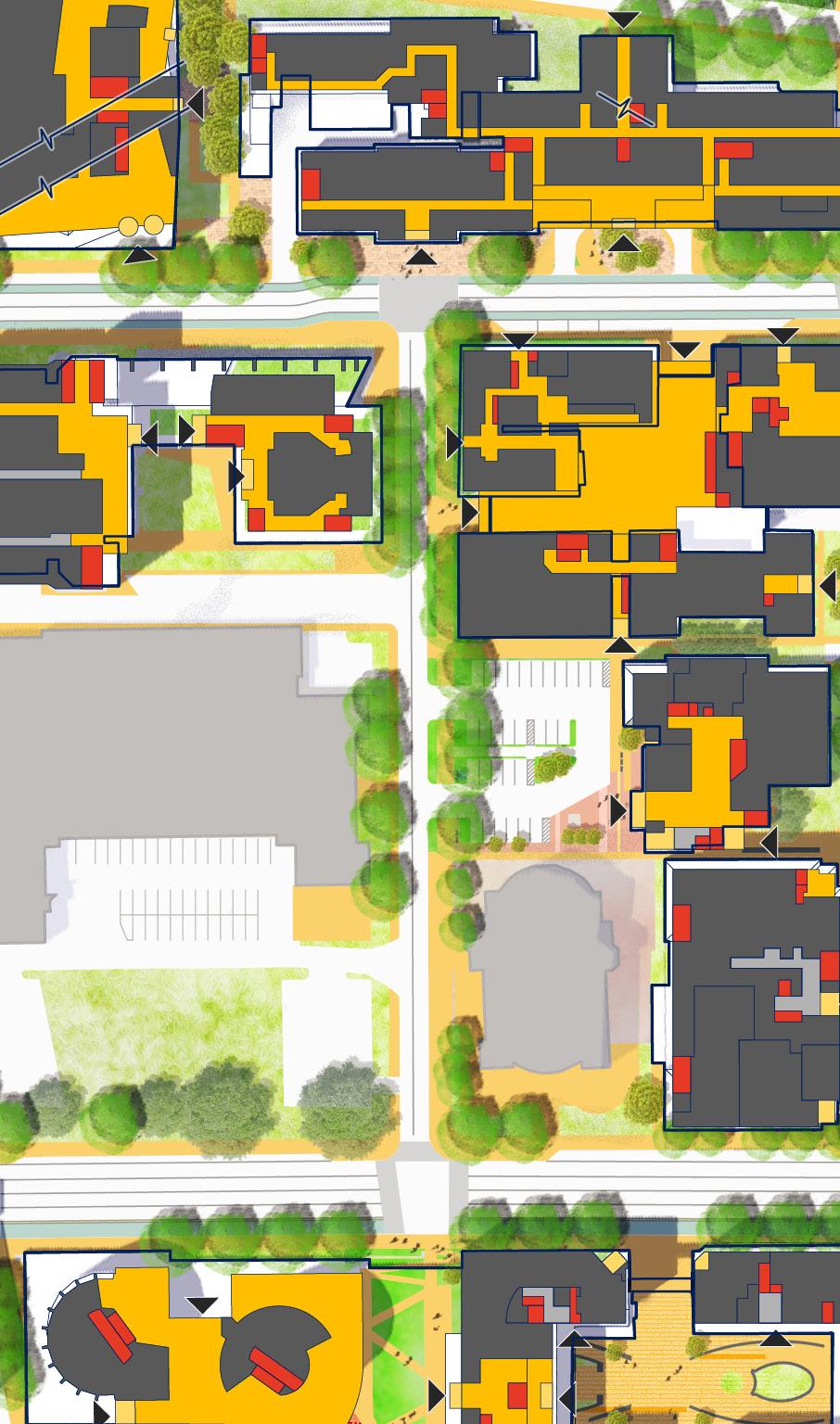
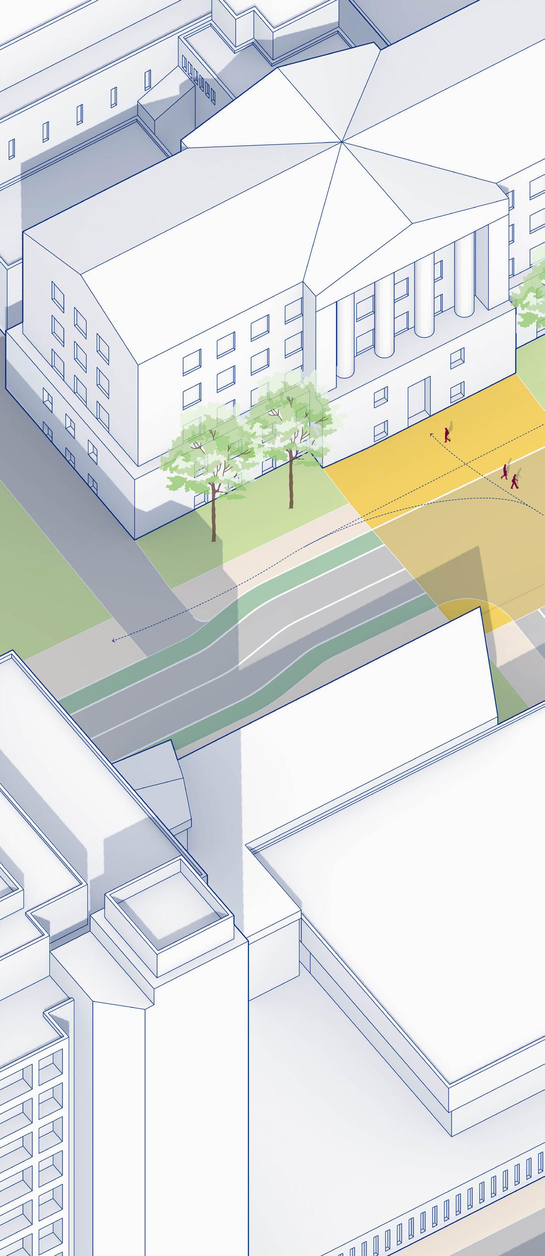
• Proposed infill development and Collaboration Hub between O’Hara, Gardner Steel and Thackeray
Fifth Ave
O’Hara St
Thackeray Ave
Thackeray Hall
Allen Hall
Benedum Hall
Thaw Hall
Old Engineering Hall
Gardner Steel
O’Hara
University Club
Nordenberg Hall
O’HARAST
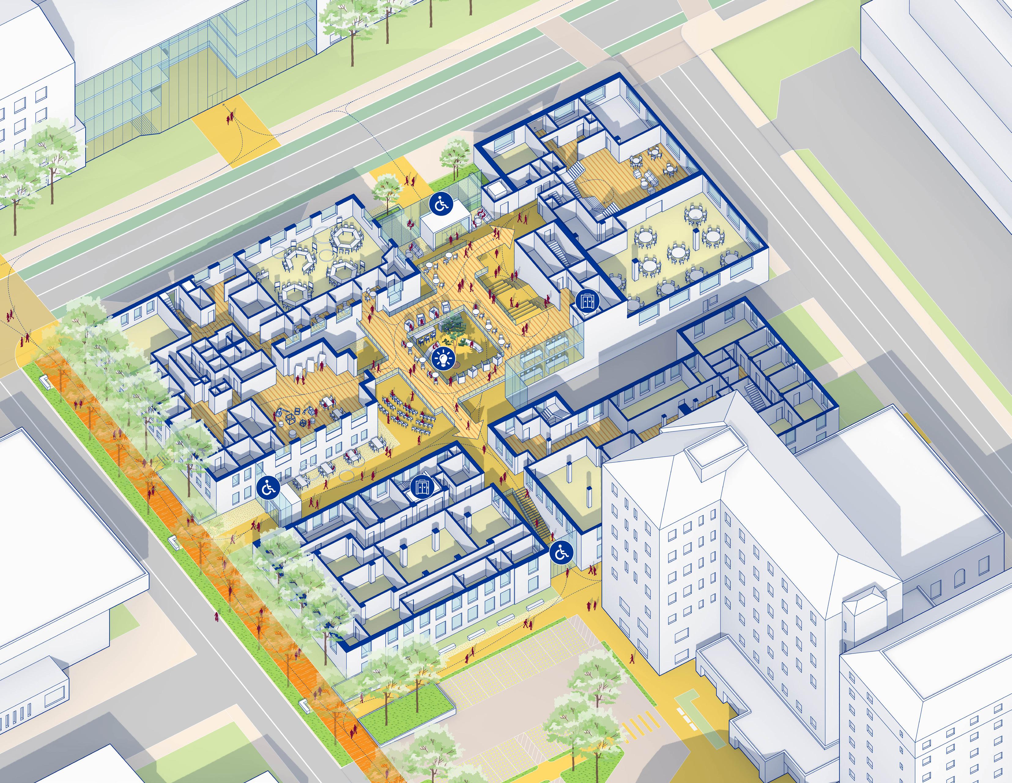
UNIVERSITY PL
O’HARA STREET AREA - THE COLLABORATION CORRIDOR
The plan builds upon the established and proposed uses along O’Hara Street to create a Collaboration Corridor linking biology, chemistry, physics, astronomy, engineering, public health and medicine. Major buildings along the corridor from east to west include Crawford Hall, the Twentieth Century Club, the Soldiers and Sailors Memorial, the Space Research Coordination Center, Thaw Hall, Old Engineering and Allen Hall, O’Hara, Gardner Steel, Benedum, the Recreation and Wellness Center and Crabtree. Buildings north of the O’Hara corridor include Chevron Science Center and Eberly Hall.
Proposed Developments
Proposed development along the O’Hara corridor includes the following:
1. Crabtree Redevelopment: A new engineering, public health and school of medicine facility on the existing Crabtree site featuring a ground floor collaboration hub and accessible routes designed to facilitate movement up the slopes along Bouquet Street.
2. Gardner Steel/O’Hara Infill: An infill building between Gardner Steel, O’Hara and Thackeray providing additional classroom, student amenities and collaboration space. Envisioned as part of a comprehensive strategy to renovate and renew these important character-defining and historic buildings of the campus.
3. Allen/Thaw Atrium: Atrium space between Allen Hall and Thaw Hall providing amenity space and addressing accessibility challenges. The Mid-Campus science project includes
comprehensive renovation for existing science buildings including Allen, Old Engineering, Thaw and the Space Research Coordination Center.
4. New Science Building: A proposed science building at the northwest corner of O’Hara and Bigelow / Parkman intersection includes an accessible entrance at the O’Hara Street elevation connecting with the Dammond Drive elevation to the north and ultimately, the entrance to the Chevron Tower. Via this route, accessible access is possible to Eberly Hall via the existing tunnel connection from the Chevron Tower (the tunnel connects to the fourth floor of Chevron as a result of the topographic conditions of the site).
5. One Bigelow: New buildings for the College of Business and School of Computing and Information (SCI) on the One Bigelow site provide a data analytics and artificial intelligence collaboration hub for the university. The plan integrates a transit stop with the collaboration hub.
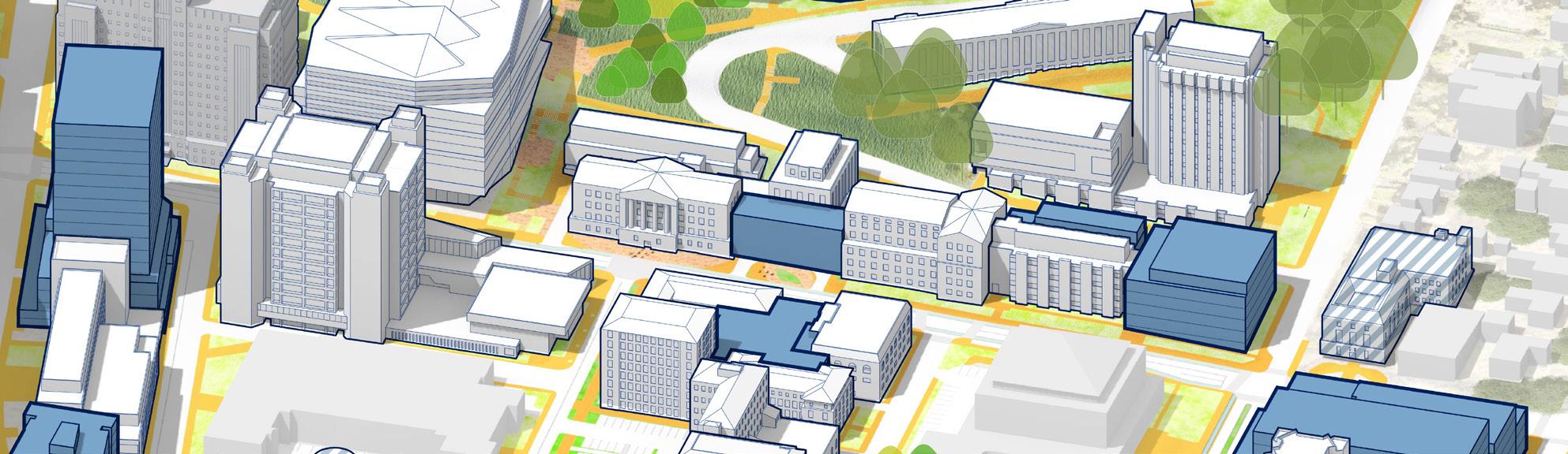
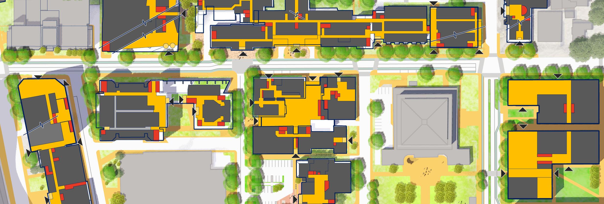
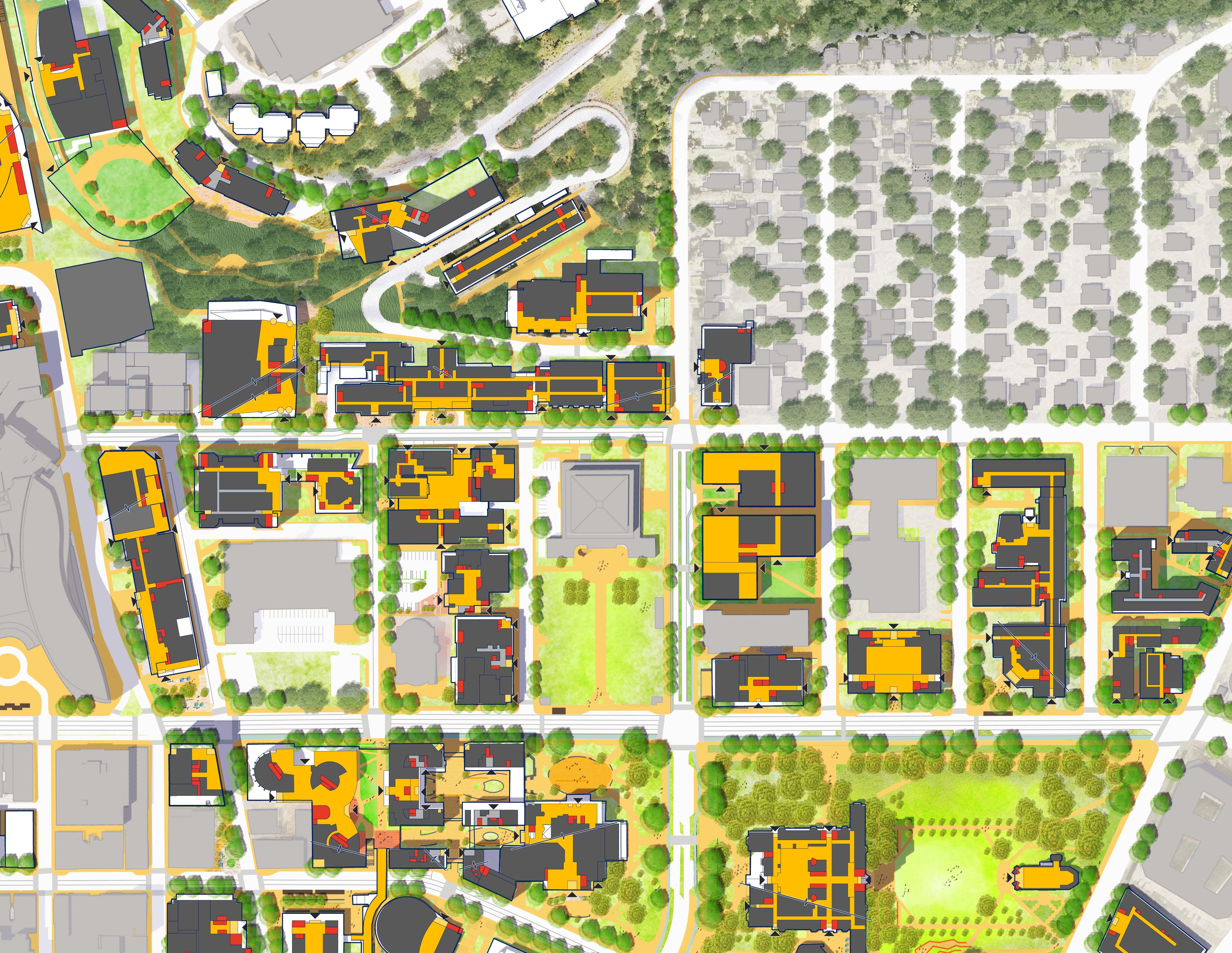
Collaboration
Renovation of Historic Buildings along O’Hara Street
In support of the Big Idea to Steward the History of the Campus and Oakland, the plan maintains the historic buildings of the campus while addressing contemporary space needs and the Plan for Pitt 2028.
The plan recommends renovating the historic and character-defining buildings along the O’Hara corridor as follows:
• Thaw Hall: the only remaining Henry Hornbostel designed building of the original Acropolis Plan, the Mid-Campus Science Master Plan includes renovation recommendations for Thaw Hall, which integrates the building into a broader strategy supportive of programmatic needs while maintaining the exterior of this important contributing-building.
• Allen Hall: as one of the buildings contributing to the original Acropolis Plan for the campus, the plan recommends the renovation and integration of the building with the other science buildings along O’Hara. The Mid-Campus Sciences Master Plan summarized above, provides renovation strategies for the building.
• Gardner Steel and O’Hara: the plan recommends renovation of these former social
clubs and the adjacent Thackeray Hall to create a new academic complex. Infill development between the buildings provides space for additional classrooms, study lounges, a collaboration hub and amenities.
• Twentieth Century Club: the plan reimagines the Twentieth Century Club as a visitor and alumni center. As a former women’s organization and social club, the existing building features grand ballrooms and social spaces that lend themselves to identified space needs including large rooms for Board of Trustees meetings, alumni events, orientation events, etc. The vision is to collocate the Pitt Alumni Center, a Welcome Center, Board of Trustees meeting rooms and the Pitt Development office in this outward facing location in close proximity to Soldier and Sailors parking garage.
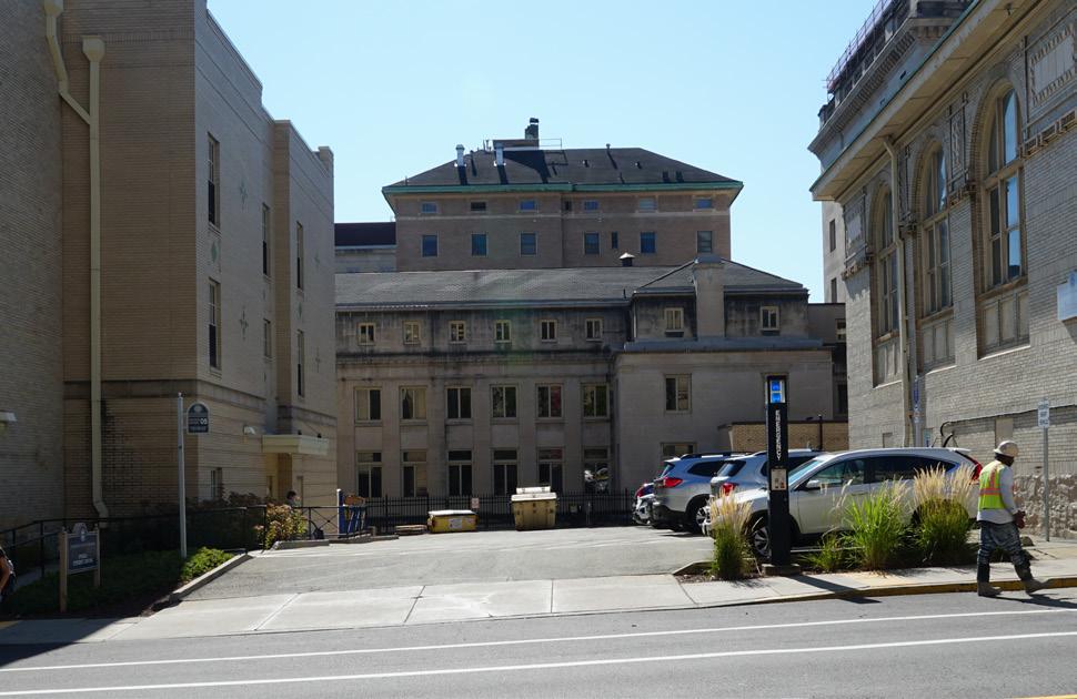
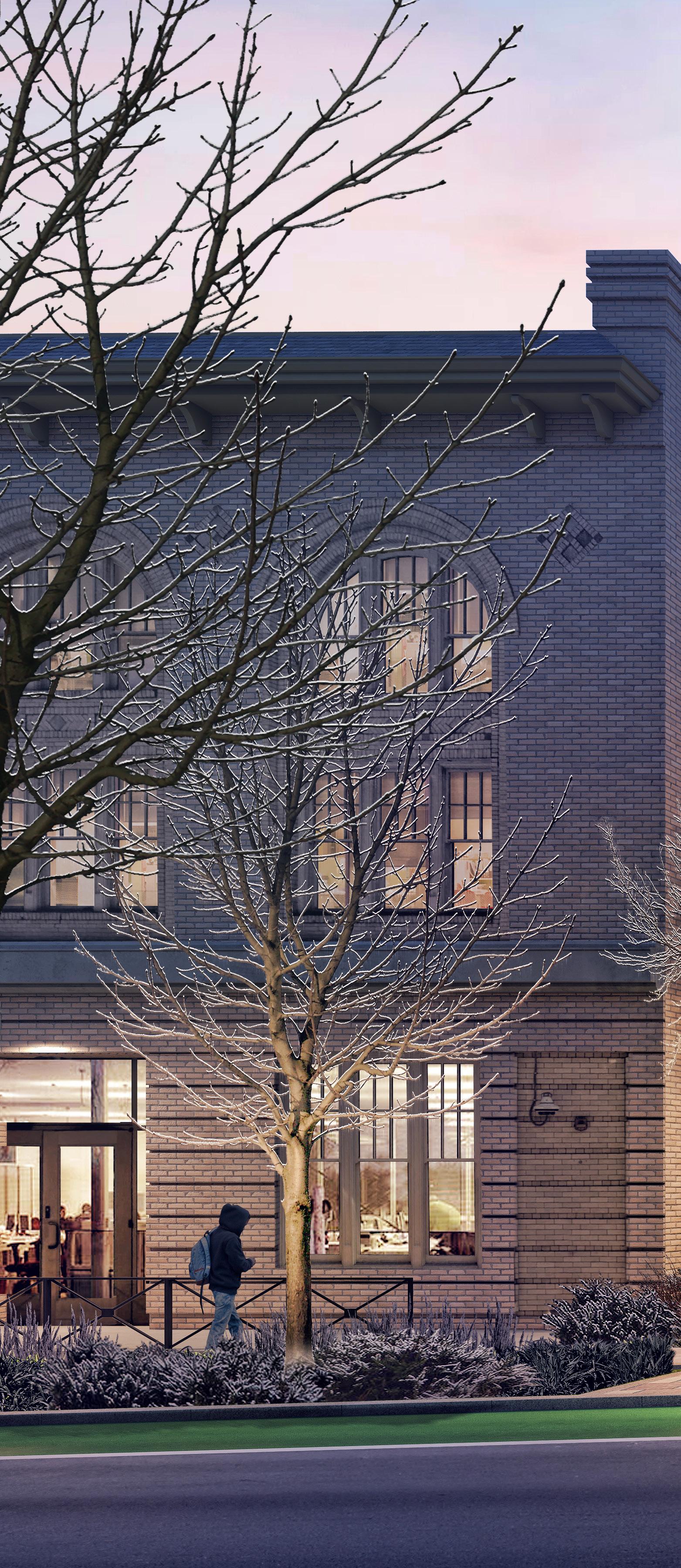
• View of the new academic complex from O’Hara Street
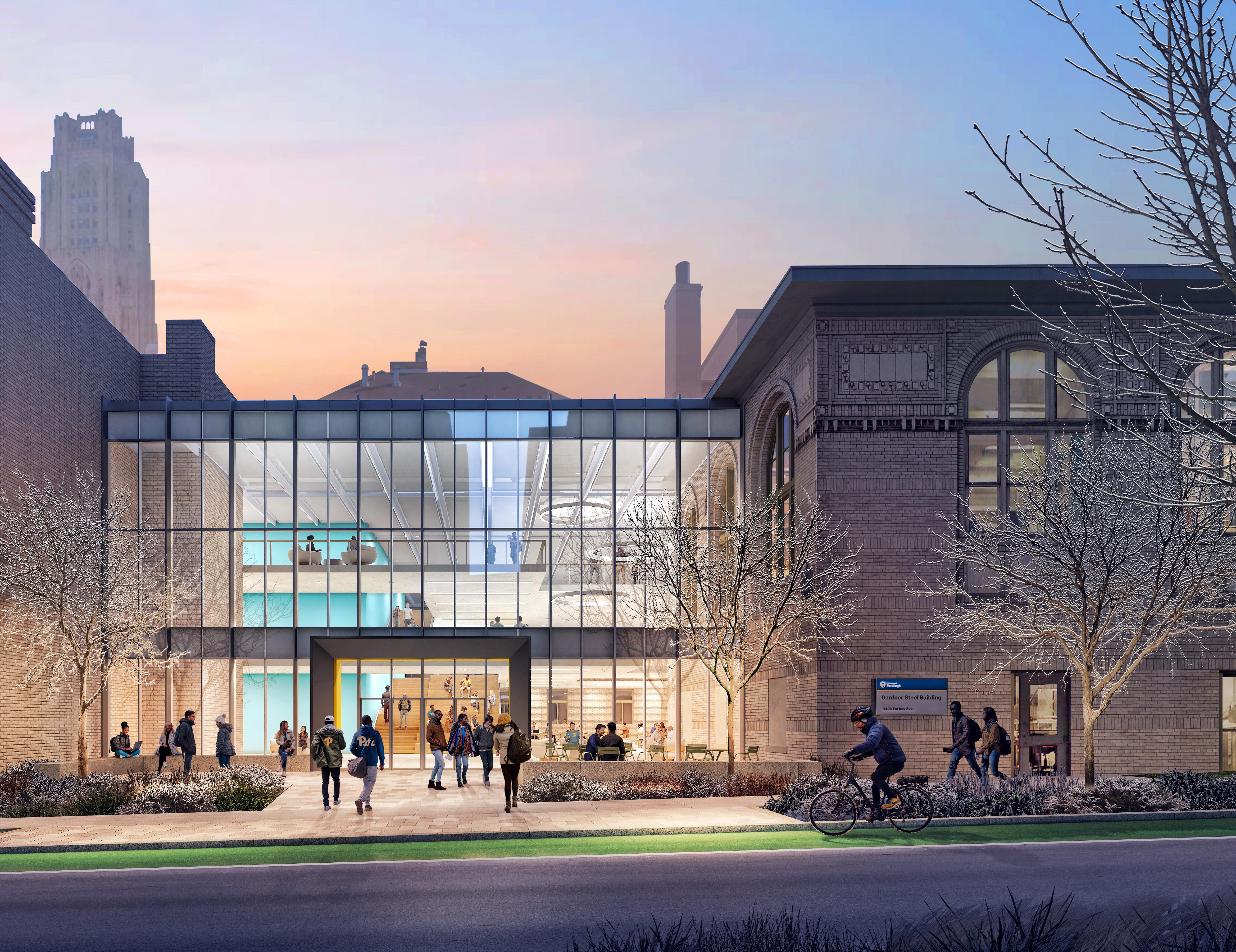
4.2 HILLSIDE DISTRICT
Located on the steepest and most challenging topography of the campus, the Hillside District includes the land initially purchased by Pitt for its new Oakland Campus in 1907. The district includes a range of sports and athletic facilities, residence halls and support infrastructure. Eberly Hall, the Recreation and Wellness Center and Terrace Street (excluding Salk Hall) define the southeast boundary of the district. Centre Avenue, Robinson Street Extension and Vera Street define the northwest boundary.
The district includes Pitt’s major athletic facilities and fields as well as chiller plants and parking facilities (surface and structured). The major facilities of the district include:
• Athletics: Pitt Sports Dome, Charles L. Cost Sports Center, Trees Hall, Fitzgerald Field House, Petersen Events Center and the Arena
• Academic: Fanny Edel Falk Laboratory School (School of Education) and Trees Hall
• Housing: Darragh Housing, Sutherland Hall, Panther Hall, Irvis Hall, Fraternity Houses
• Fields: Vartabedian Field (softball), Ambrose Urbanic Field (soccer), Charles L. Cost Field (baseball)
• Adjacent Uses: Veteran’s Administration Hospital
The Campus Master Plan envisions a renewed public realm, renovated and new facilities for Pitt Athletics, student housing and infrastructure needs, including parking. The goal is to provide accessible connections to the adjacent Health Sciences and Innovation District and the Central Campus District. To that end, public realm recommendations focus on the Hillside landscape between Dammond and Utterback Drives and along Allequippa Street.
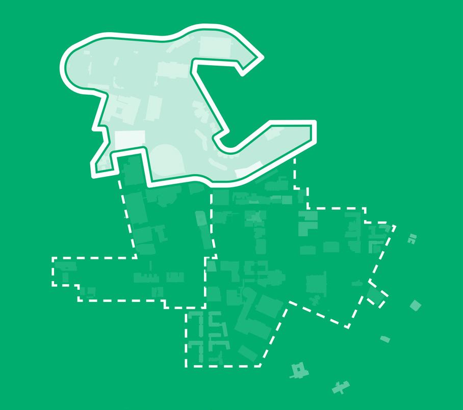
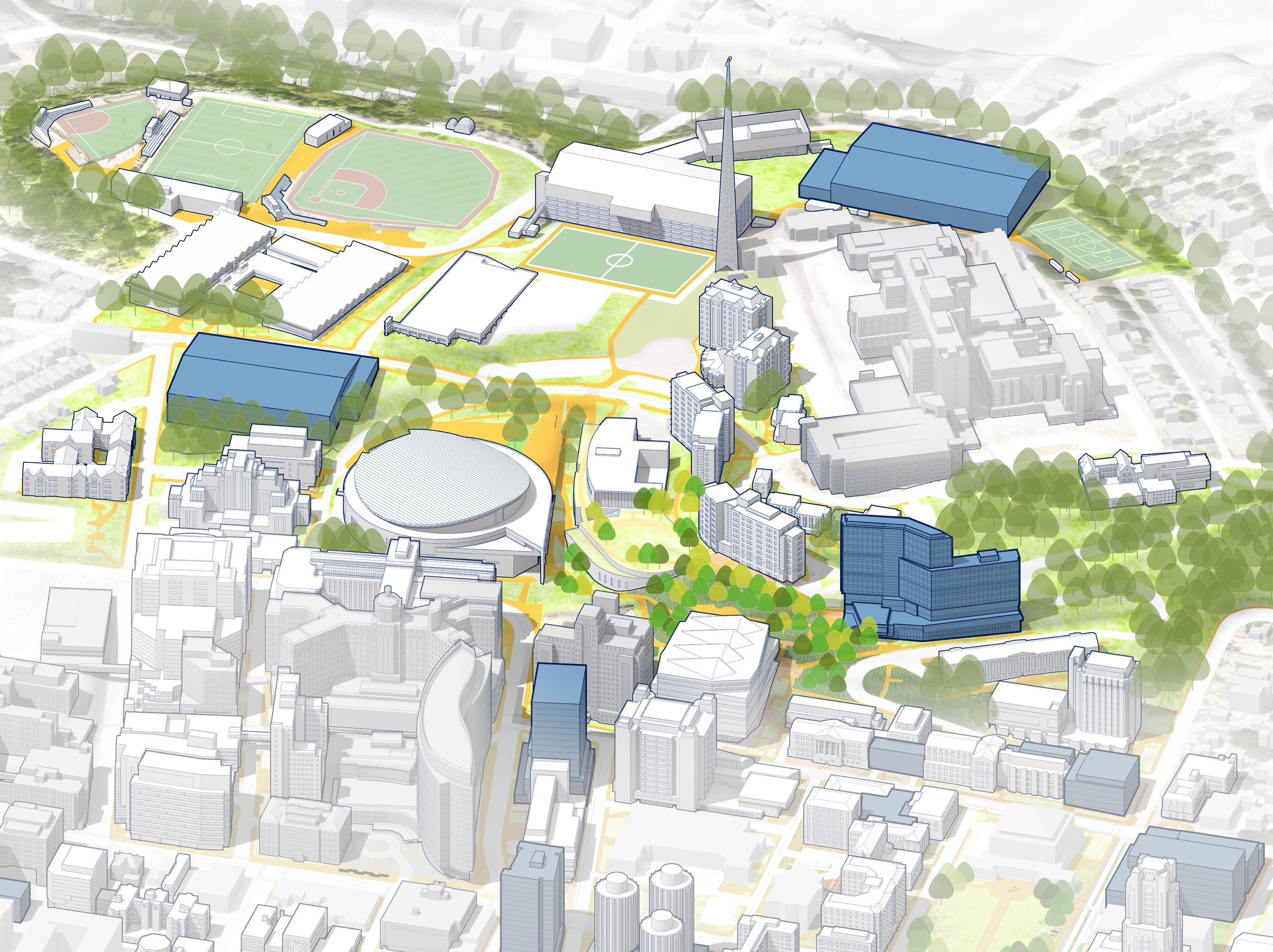
Pitt Owned Building
Pitt Affiliated Building
Proposed Building within the District
Proposed Building outside of the District
Allequippa St
Allequippa St
Dammond Dr
Utterback Dr
Darragh St
BUILDING AND FACILITY IMPROVEMENTS
Campus Housing
The Hillside area includes Darragh Street Housing, primarily serving students in the health professions, Panther Hall, Irvis Hall and the fraternity houses located between Utterback Drive and Allequippa Street. The plan includes additional housing sites between Utterback Drive and Dammond Drive east of Irvis Hall. Given the topographic conditions, a garage integrated into the slope serves as the foundation for a proposed 720 bed facility, known as Hillside Housing. This site is on axis with the Thackeray Street corridor, making it a dominant hillside feature from the lower elevations of the campus. The lower levels of the building offer opportunities to integrate a new dining hall to serve the population of Sutherland, Panther, Irvis and Hillside from a central location adjacent to the proposed accessible pathway network. The site offers dramatic views of the campus below and of the Cathedral of Learning.
The plan recommends the renovation of Sutherland Hall to address programmatic and deferred maintenance issues. Expansion of the Perch dining hall may be required if a new dining facility is not provided in the future Hillside Housing.
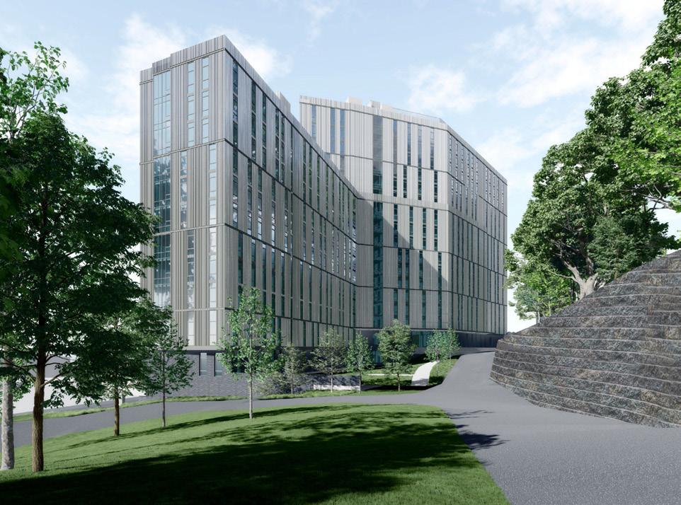
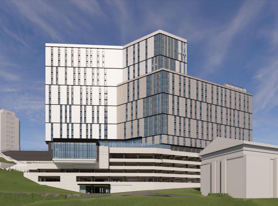
Renderings of Hillside Housing by Perkins Eastman
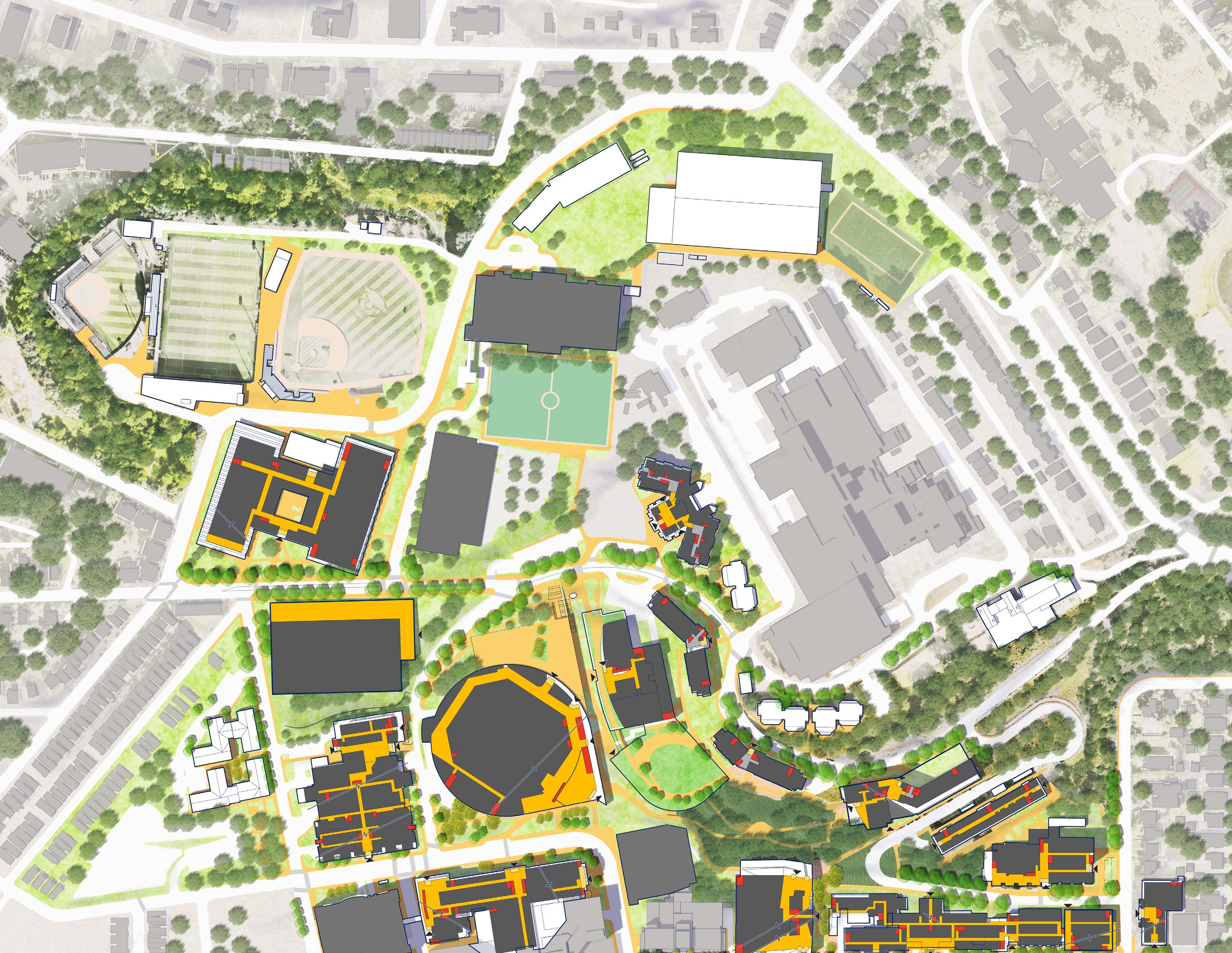
Allequippa St
DunseithSt
AllequippaSt
Terrace St
Petersen Events Center
PantherHall
IrvisHall
Firzgerald Field House
Trees Hall
Arena Sports Performance Center
Sutherland Hall
Hillside Housing
Athletic and Recreation Facility Recommendations
The Campus Master Plan recommends the following in response to the expressed needs of Pitt Athletics.
Indoor Track Facility and Parking Garage: The plan locates a future indoor track on the site of the existing Fitzgerald Field House which is to be demolished following the completion of the Arena. Located on the upper level (Allequippa Street level), the indoor track facility sits on top of a proposed garage integrated into the steep slope conditions of the Fitzgerald site. Parking in this location addresses demand in the Hillside District and campus wide. The severe parking shortage across the campus requires construction of the garage in advance of the indoor track facility. Design recommendations include a stair and elevator tower in the southeast corner to facilitate access to the Petersen Events Center and the adjacent Salk Building on Sutherland Drive. A proposed mobility hub north of the facility along Allequippa Street provides transit services to the central campus and other destinations along with bike parking and Pogoh Station.
Basketball Practice Facility: The plan recommends the repurposing of the east wing of Trees Hall to create a Women’s and Men’s basketball practice facility including locker rooms, strength conditioning, coach offices and meeting rooms. Trees is an iconic modern building offering significant opportunity for future use following the completion of the Recreation and Wellness Center on O’Hara Street.
The proposed basketball practice facility contributes to a comprehensive renovation of Trees Hall to serve athletics and other needs. This includes renovation of the pool and central courtyard areas of the building.
Indoor Recreation Facility: The plan suggests the replacement of the Pitt ‘Bubble’ to provide a permanent indoor recreation facility on the same site.
Petersen Events Center: The relocation basketball practice out of the Petersen Events Center vacates space for other uses.
OC Lot Field: In response to the stated need for additional outdoor recreation space, the plan recommends a new turf field parallel to the Charles L. Cost Sports Center. Although not regulation size, the field provides field space for campus recreation programs.
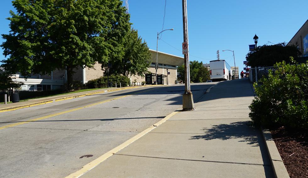
Existing Condition
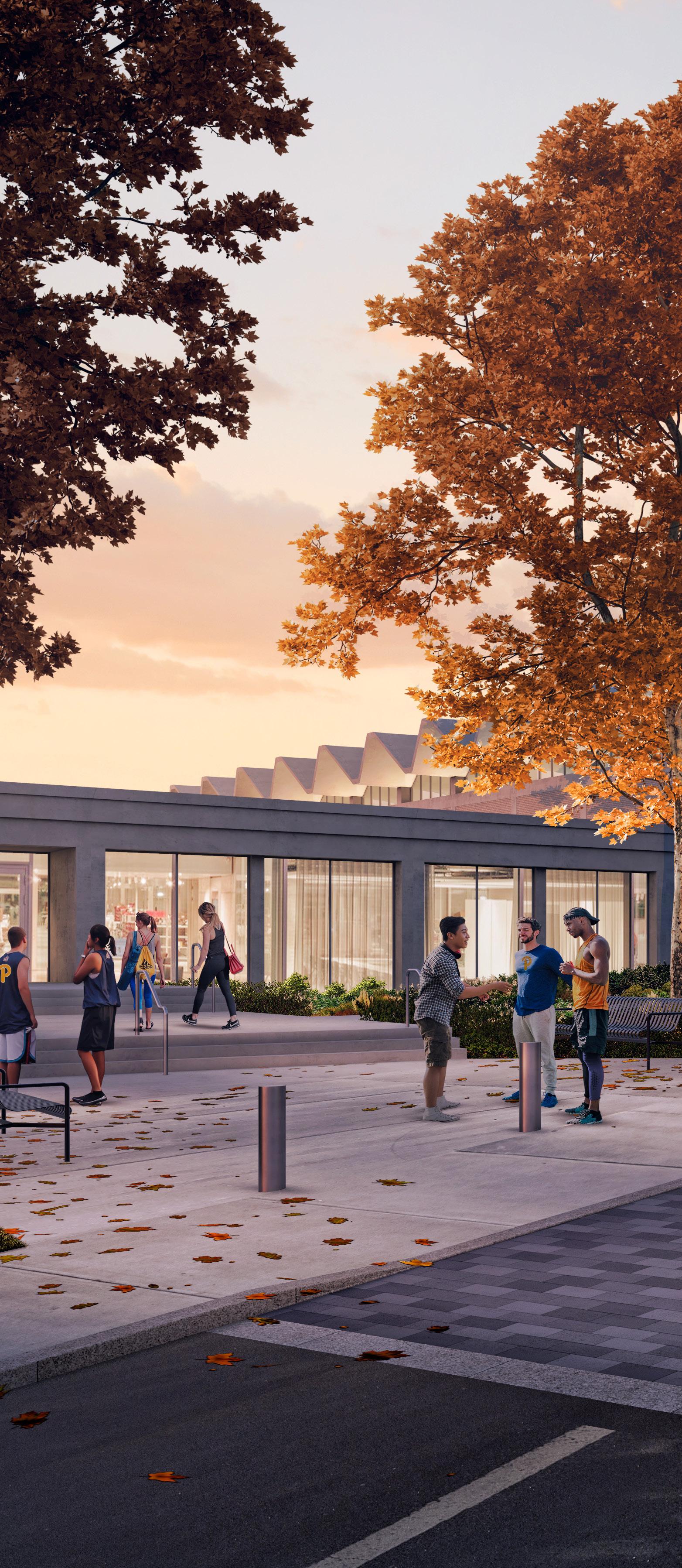
• Allequippa Gateway illustrating new crossing, changes to Trees Hall and new construction on the Fitzgerald site
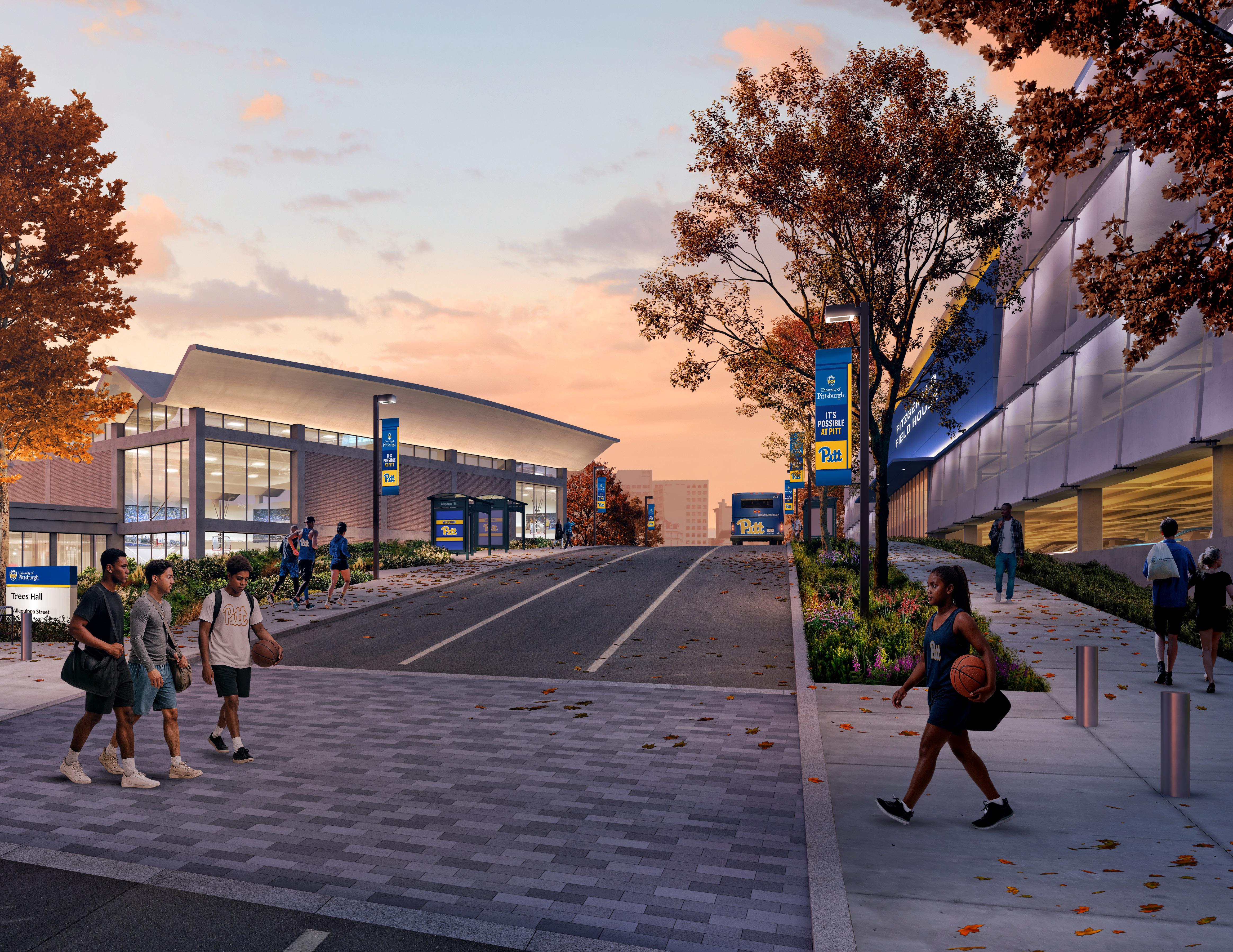
The Arena and Sports Performance Center establishes a new gateway to the Hillside District. Proposed public realm enhancements include upgrades to the Petersen Plaza, new street trees, and a roof garden on the Arena offering views to the Cathedral of Learning and Central Oakland. A new elevator tower serves as a signature gateway element while improving site accessibility. In addition to the elevator, new ramps are integrated into the landscape connecting Allequippa Street to the Petersen plaza and furthering north-south accessible connections.
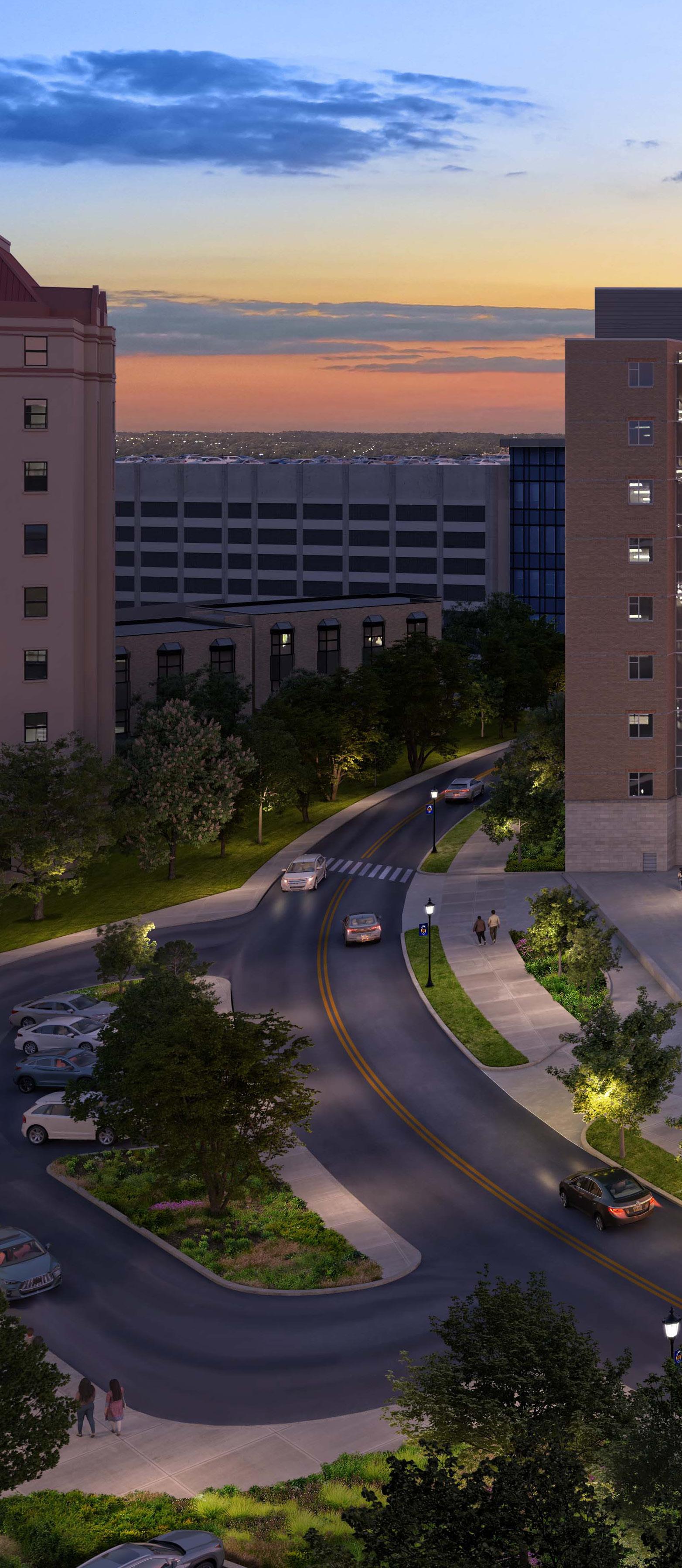
• Birdeye View of the Proposed Accessible Connection to Petersen Events Center
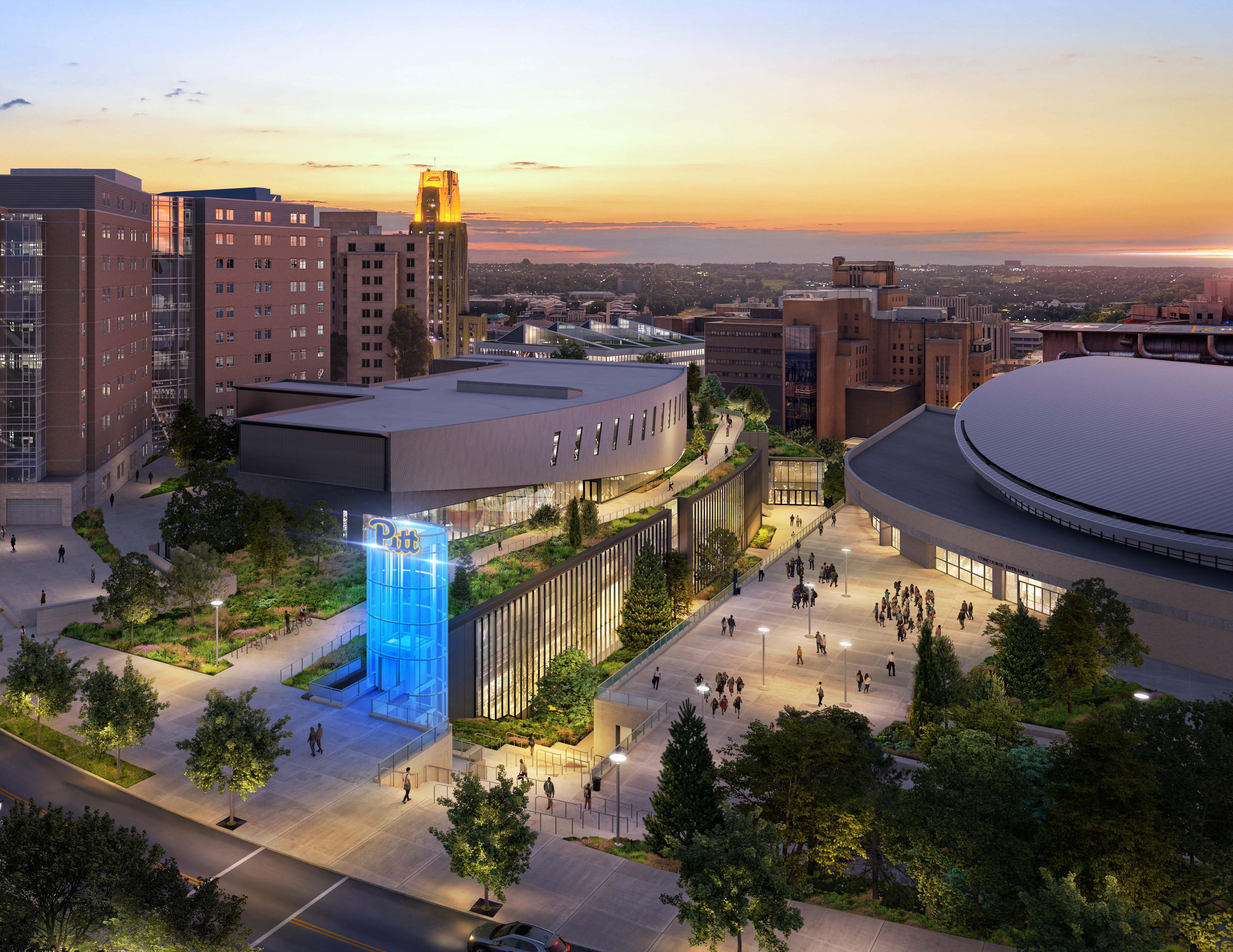
4.3 HEALTH SCIENCES AND INNOVATION DISTRICT
Building off the goals for the Pittsburgh Innovation District, the Health Sciences and Innovation District convenes university anchors, encourages cooperation between university and industry, fosters growth for startups and entrepreneurs and nurtures community engagement and development.
The Health Sciences and Innovation District encompasses the area defined on the north by Terrace Street, on the east by Bouquet Street and Oakland Avenue, on the south by Sennott Street / Iroquois Way and on the west by Darragh Street north of Fifth Avenue and Halket Street south of Fifth Avenue. The innovation area portion of the district aligns with the Pittsburgh Innovation District. Pitt Owned
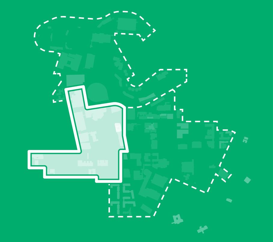
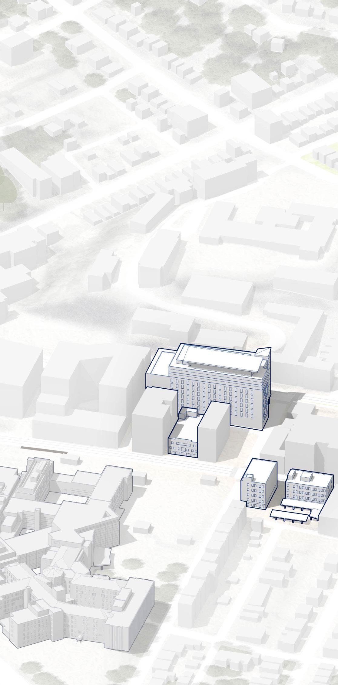
Proposed Building within the District
Proposed Building outside of the District
Fifth Ave
Forbes Ave
Halket St
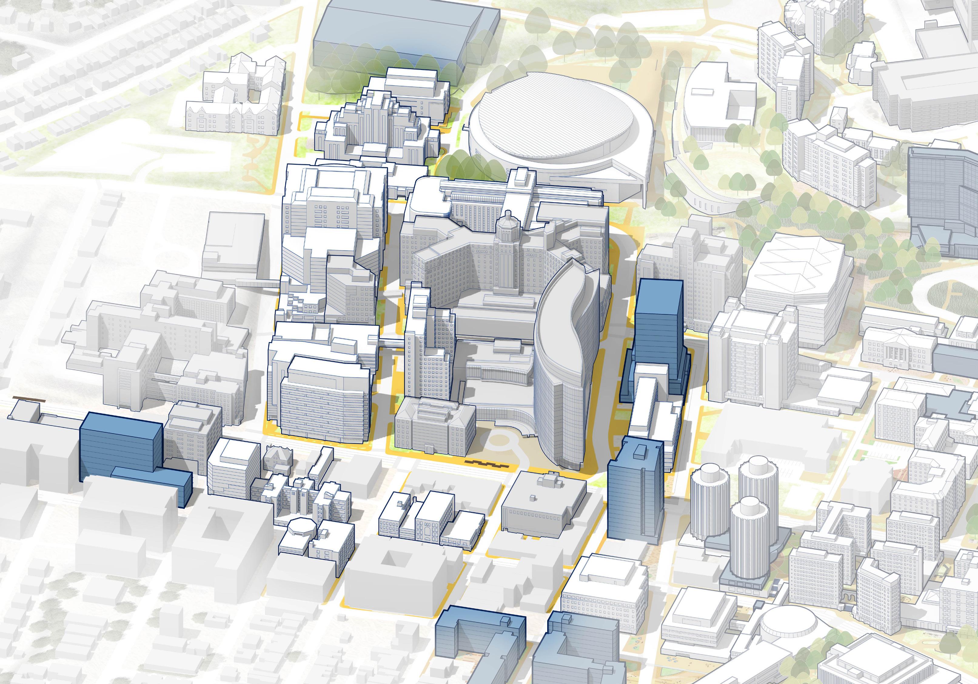
Terrace St
Forbes Ave
Sennott St
Lothrop St
De Soto St
N Bouquet St
Darragh St
Darragh St
HEALTH SCIENCES
The Health Sciences Area includes facilities dedicated to the School of Medicine, School of Nursing, School of Dentistry, School of Public Health and the School of Health and Rehabilitation Sciences and other supporting facilities such as Lothrop Hall, a 723-bed residential building. Pittowned buildings include Scaife Hall (School of Medicine), the Victoria Building (School of Nursing), Salk Hall and Annex (School of Dentistry and School of Pharmacy), Public Health and Crabtree Buildings (School of Public Health), Falk Medical Building, Bioscience Towers 1 and 2 and Bioscience Tower 3. It also includes uses and facilities beyond those controlled by Pitt such as the UPMC Hospitals and Thomas Detre Hall of the Western Psychiatric Institute and Clinic (WPIC). Adjacent UPMC hospitals include Montefiore and Presbyterian.
The Campus Master Plan reinforces existing uses in the Health Sciences Area and provides recommendations for renovation and public realm improvements. The intent is to guide incremental change and redevelopment in a manner that addresses programmatic needs and the user experience, including patients, faculty, staff, students and healthcare workers.
Steep slopes and dense development constrain the major streets of the Health Sciences Area. The three north-south streets of the area, De Soto Street, Lothrop Street and Darragh Street are some of the steepest Oakland presenting significant accessibility challenges. Limited opportunities exist to mitigate these conditions and for that reason the plan maintains on-street and conveniently located accessible parking near building entrances.
The plan recommends streetscape improvements along Terrace Street between De Soto Street and Darragh Street. Proposed improvements include enhanced crosswalks at the following locations:
• Terrace Street at Sutherland Drive
• Terrace Street at Lothrop Street
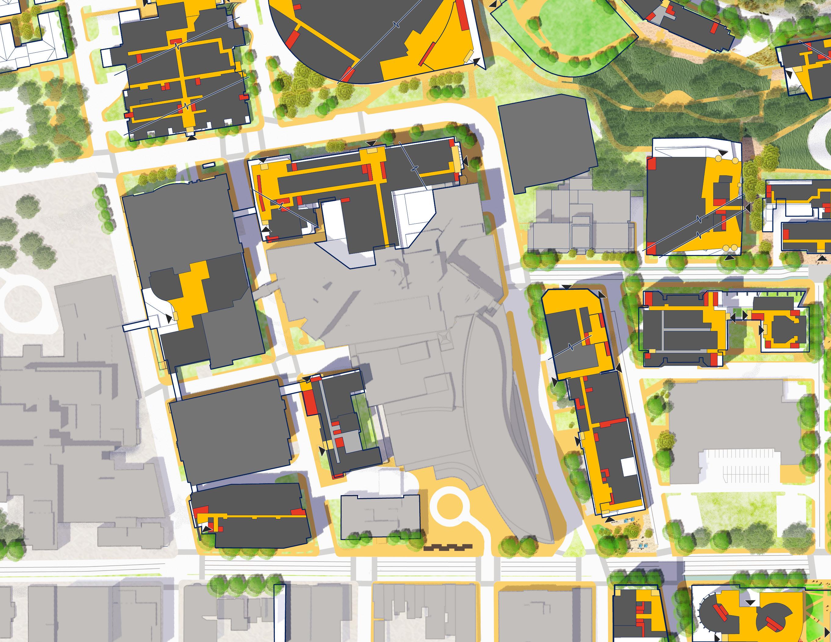
O’Hara St
Darragh
Scaife Hall
New Development
The Health Sciences Area is densely developed with no available vacant sites, limiting opportunities for new development to support growth in the Health Sciences and Research Enterprise. Future construction requires the demolition and replacement of existing facilities in order to meet the demand for new research space and teaching labs in health sciences and engineering. Demand for space is based on course schedule data and growth reported in the 2025 Dean’s Survey. Space needs include a mix of teaching labs, wet labs, dry labs, clinical research, computational space, core research facilities and support space.
Crabtree Site: The Crabtree site is strategically located and bridges the Central Campus and Health Sciences and Innovation District. The existing Crabtree Building is nearing the end of its useful life based on available facility conditions data and building observations. For these reasons, the plan recommends that the site be redeveloped as a collaboration and innovation hub serving both districts. The redevelopment establishes new space for Health Sciences Research, Engineering Labs, Data Science and Artificial Intelligence, and the School of Public Health.
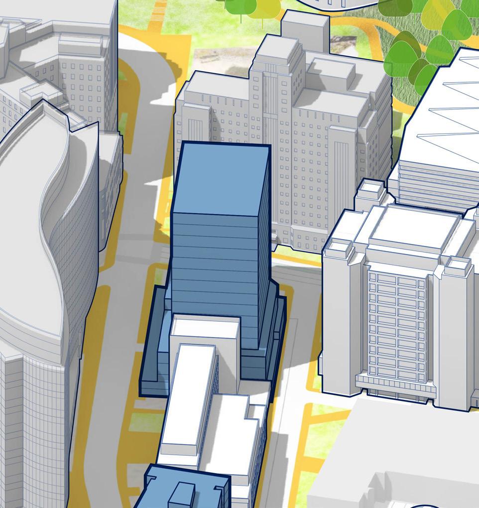
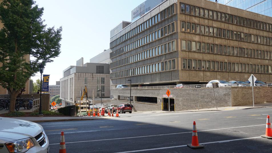
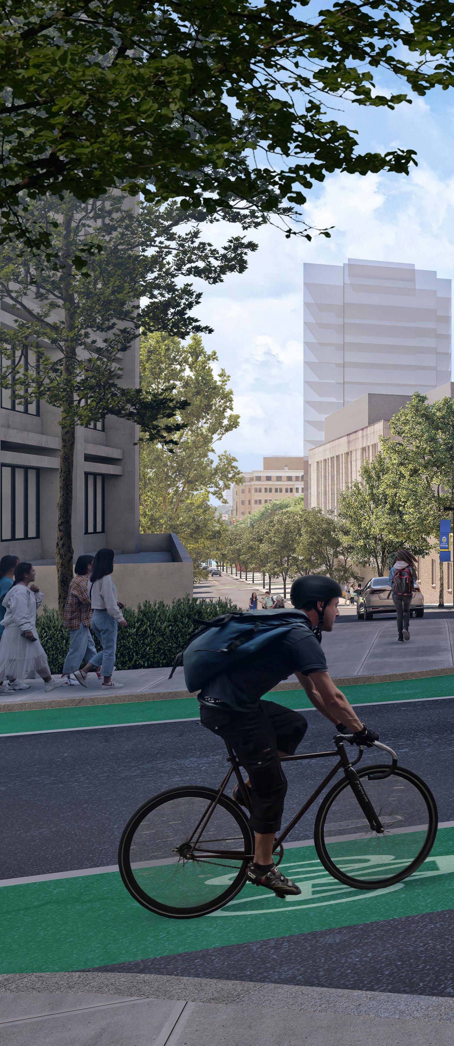
• View of the proposed Crabtree Hall redevelopment from O’Hara Street
Existing Condition
Axon View of Proposed Crabtree Hall N
Soto
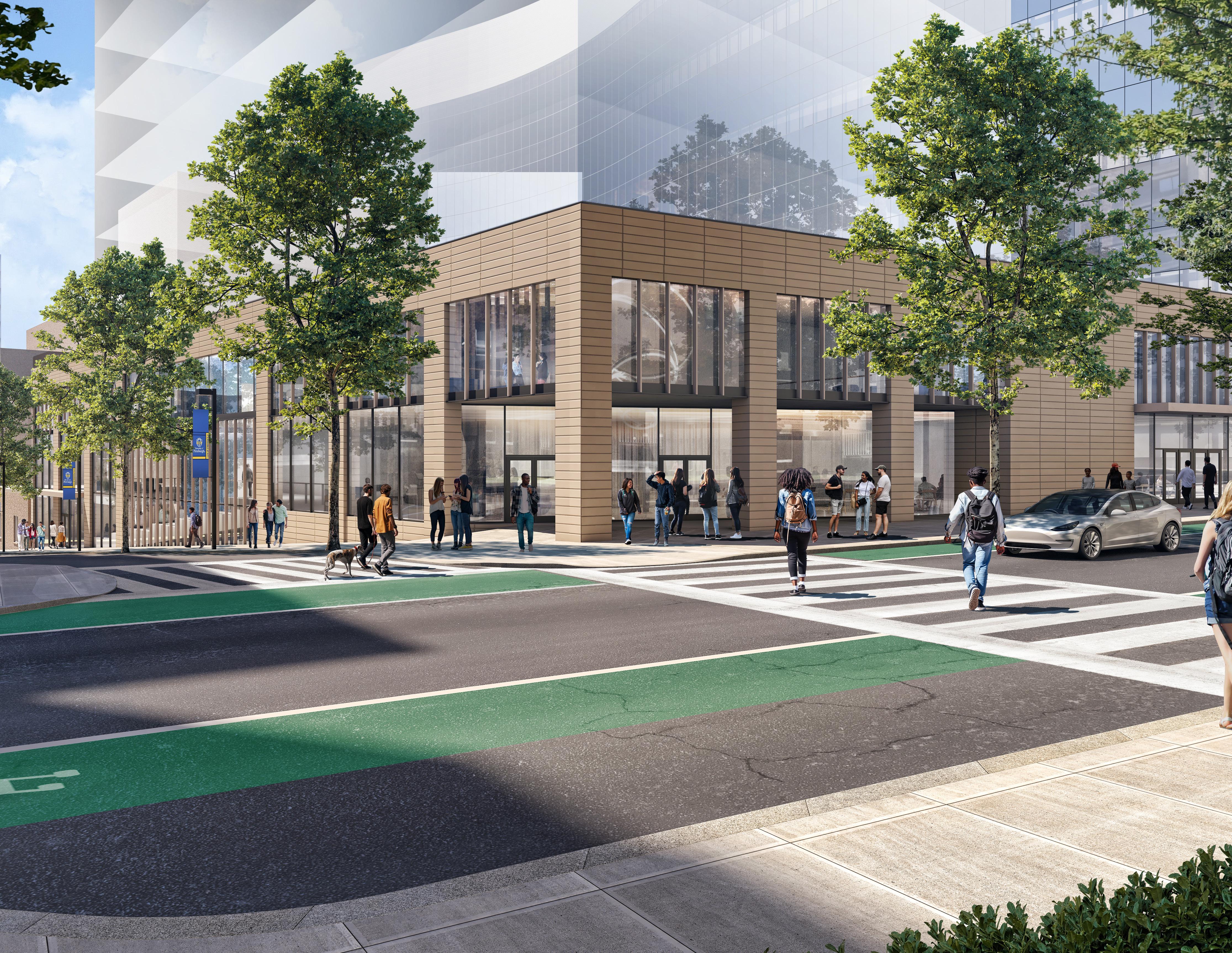
Crabtree Hall
The new building is designed to foster collaboration between bioengineering, medicine, public health and others. Envisioned as a multi-story building with academic and research space on the upper floors, a collaboration hub on the lower levels provides meeting, amenity and support spaces to foster engagement and interaction and activate the ground floors.
On the lower levels, where accessible public routes and vertical circulation are possible, the building integrates with a campus-wide accessibility strategy. Specifically, entrances on the southeast (Bouquet Street) and southwest (De Soto Street) corners of the building connect to accessible routes via an elevator within the building. This recommendation responds to the challenging topography and slope conditions along De Soto and N. Bouquet Streets.
Streetscape improvements include widened sidewalks immediately adjacent to the new development, enhanced crossings at O’Hara and North Bouquet, dedicated bike lanes along O’Hara Street, and increased street trees.
PUBLICHEALTH
• Proposed Crabtree Hall ground floor improves the accessibility of the area
Study Nooks
DESOTOST
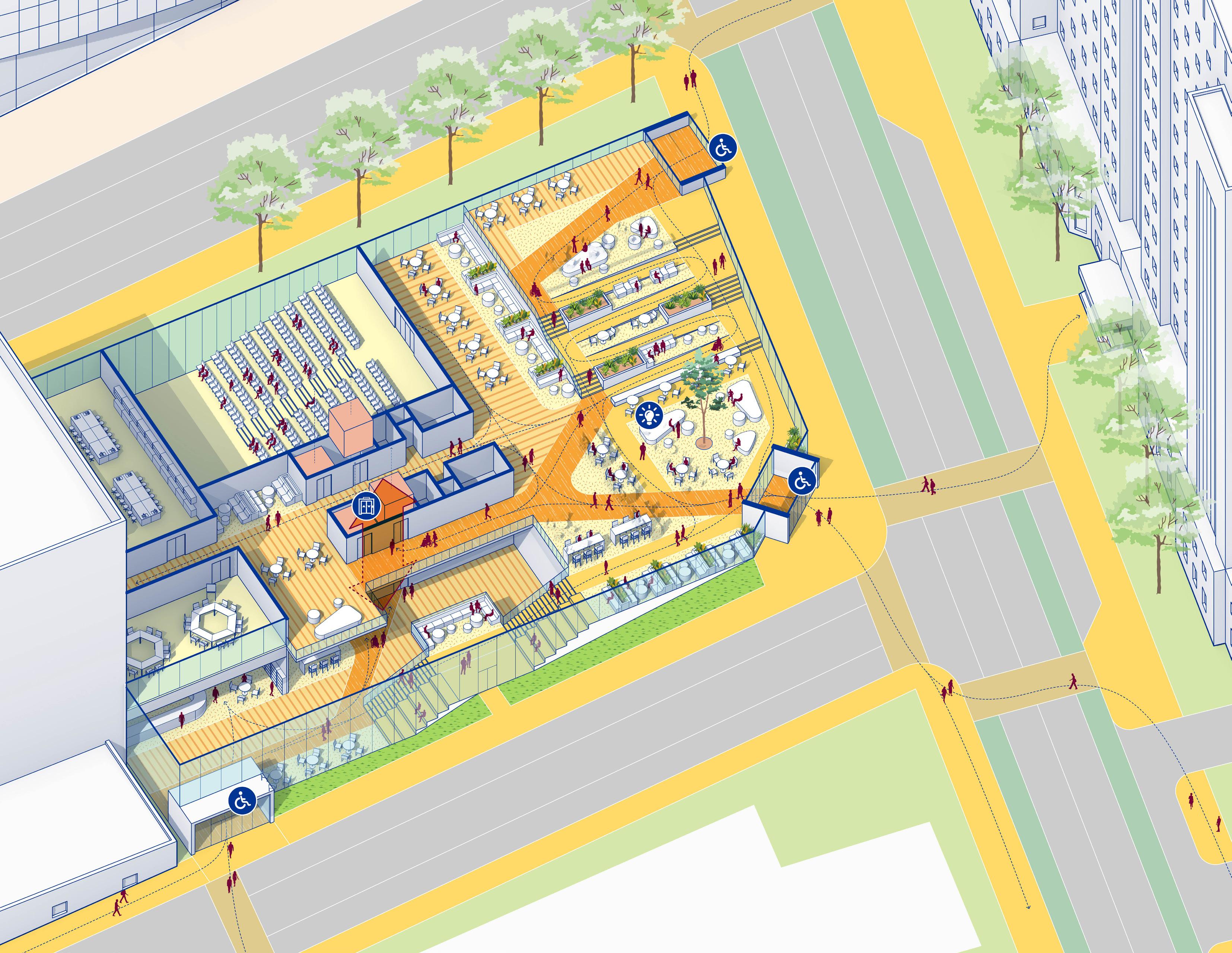
NBOUQUETST
O’HARA ST to Recreation and Wellness Center
Auditorium
Cafe
Connection to Public Health
Gathering Space
Social Stairs and Ramps
Renovation
Routine renovation and upkeep are ongoing processes across the Health Sciences Area, notably in the existing Bioscience Towers. The plan identifies two major renovation projects.
Victoria Building: The Victoria Building is located over a parking garage controlled by UPMC with the main entrance on Victoria Street and a secondary entrance connected by a bridge to an escalator and elevator tower located east of Lothrop Street. Victoria is home to the growing School of Nursing programs, including research activities, whose space needs currently exceed availability.
The plan recommends major improvements and renovation to address programmatic needs, student amenities and significant deferred maintenance issues. Key goals include the elimination of the escalators in the building (10 escalators), upgrading the HVAC systems and improving accessibility and daylighting.
Lothrop Hall: The Campus Master Plan calls for renovation of Lothrop Hall, a residence hall with 723 single-occupancy rooms. Recommendations include comprehensive upgrades to the mechanical, electrical and plumbing systems. Other recommendations address code compliance and accessibility issues. Notably, code upgrades mandate additional fire stairs along with fire protection upgrades.
Given the steep topography along Lothrop Street, notably at the main entrance to the building, the plan recommends a new accessible entrance on the south end of the building. At this location, there is a lower-level entrance adjacent to the service drive where parking is possible.
Salk Hall: Completed in 1941 as the City of Pittsburgh Contagious Diseases Hospital, Salk Hall now houses the School of Dentistry and School of Pharmacy. Expansions to the building include the Dental Annex and the Pharmacy research facility to the north.
Originally, a symmetrical art-deco inspired monument building, the addition of the Dental Annex compromised the integrity of the original design. Today, the Dental Annex presents challenges to the clinical programs that operate in the building. Patient wayfinding and parking and notable concerns along with the condition of the building systems, especially plumbing.
The Campus Master Plan suggests the renovation of the Dental Annex following its relocation to a new facility.
Steep slopes and dense development constrain the major streets of the Health Sciences area. The three north-south streets of the area, De Soto Street, Lothrop Street and Darragh Street are some of the steepest Oakland presenting significant accessibility challenges. Limited opportunities exist to mitigate these conditions and for that reason the plan maintains on-street and conveniently located accessible parking near building entrances.
The plan recommends streetscape improvements along Terrace Street between De Soto Street and Darragh Street. Proposed improvements include enhanced crosswalks at the following locations:
• Terrace Street at Sutherland Drive
• Terrace Street at Lothrop Street
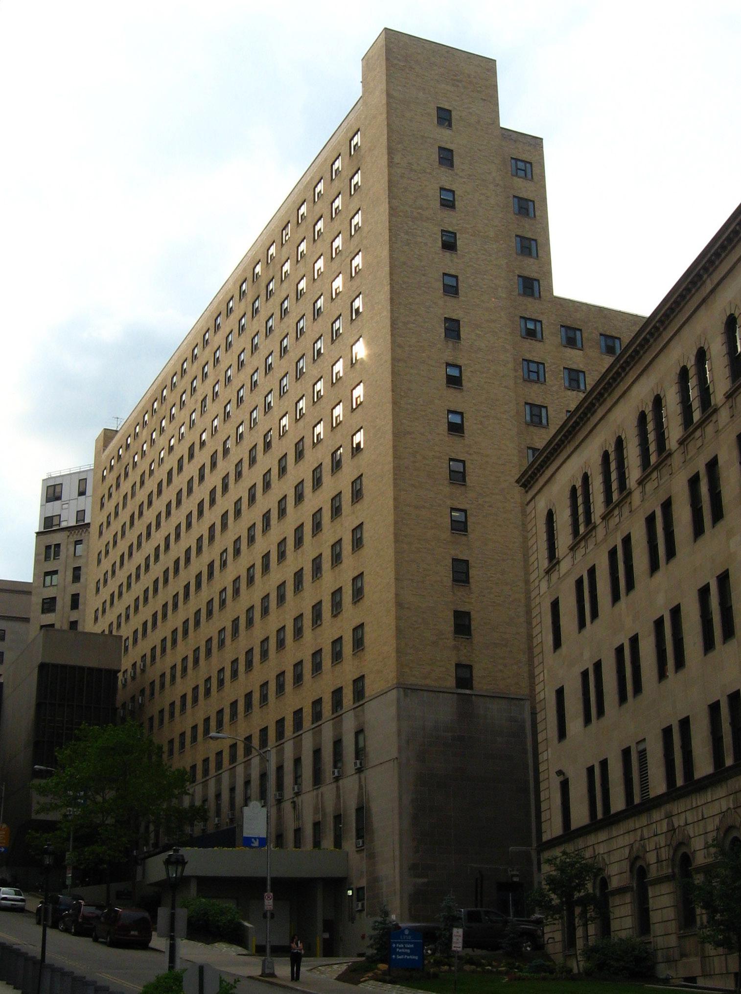
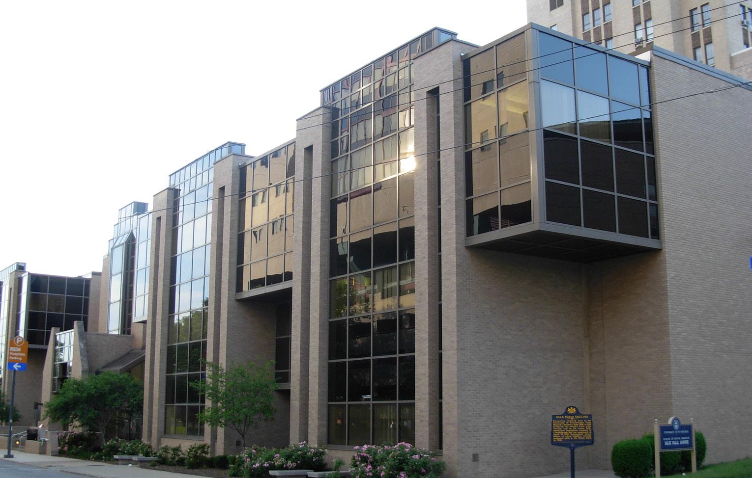
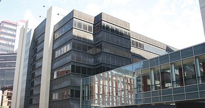
Source: https://www.giveto.pitt.edu/show_module_fw2.aspx?sid=1729&gid=2&control_id=1 4169&nologo=1&cvprint=1&page_id=5177&crid=-1&viewas=user
TheZachMorrisExperience, CC BY-SA 3.0, via Wikimedia Commons
Source: I, Piotrus, CC BY-SA 3.0, via Wikimedia Commons
Lothrop Hall
Victoria Building
Salk Hall
INNOVATION
The Innovation area encompasses a variety of UPMC-related facilities, apartment buildings, offices and retail as well as several facilities owned by Pitt. These include Forbes Hall (student housing), the Oxford Building, the Eureka Building and the Public Safety Building. UPMC related facilities include the Iroquois Building and Forbes Research Tower, home to Pitt’s School of Health and Rehabilitation Services.
This area aligns with the vision for the Pittsburgh Innovation District with a stated mission:
“To unify the critical mass of talent, university resources, transformative technology and cultural assets in Pittsburgh’s Oakland neighborhood to create a sustainable innovation ecosystem with global impact. PID is harnessing the area’s scientific and technical strengths into broad-based economic activity committed to fostering an inclusive innovation community for all.”
Source: https://pittsburgh.id/about-the-district/)
The stated mandate of the Innovation District:
• Convene university anchors to facilitate synergy and collaboration.
• Encourage cooperation between universities and industry to stimulate workforce development.
• Provide workspace solutions to foster growth for startups and entrepreneurs.
• Champion equitable use and development of District real estate.
• Nurture community engagement and inclusivity to all District offerings and opportunities.
The vision is to locate Pitt-related academic and research programs in the area that advance the goals of the Pittsburgh Innovation District. This includes renovating existing buildings and constructing new facilities that contribute to the health sciences and research. It also includes supporting the public realm improvements planned for the district by the City of Pittsburgh, notably streetscapes and the east bound BRT services along Forbes Avenue.
Public realm improvements include restored sidewalks, street trees, new lighting and street furnishings along with the integration of BRT on the south side of the street.
The Innovation area also intersects with the gegraphic boundaries of the Oakland Business Improvement District (OBID), and thus future Pitt-led development in the area will involve consistent collaboration and partnershiop with the OBID to ensure shared goals are addressed.
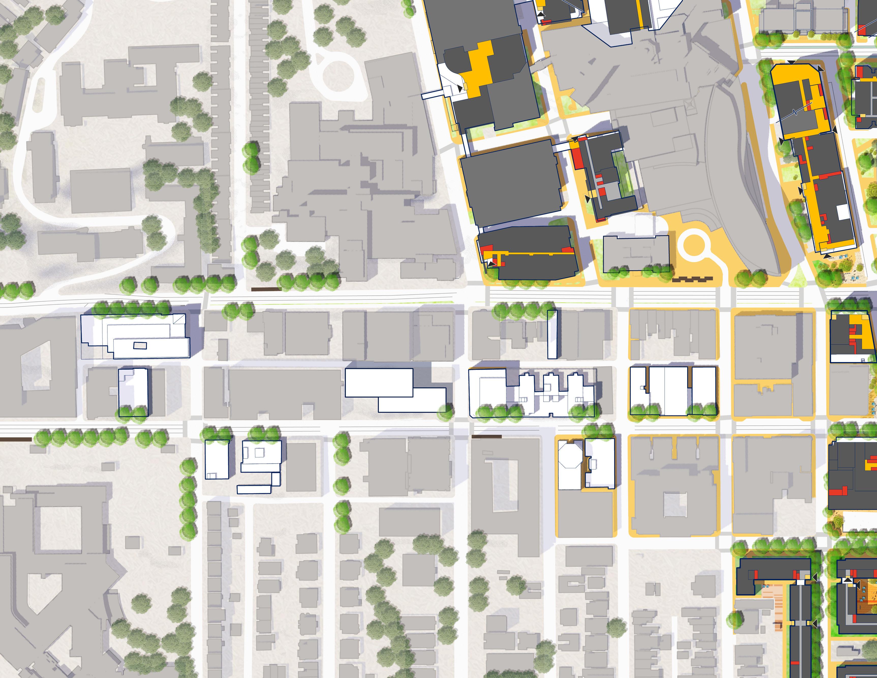
Darragh
Future Development
The lack of vacant land limits major development in the Innovation Area to a few sites including the Pitt-owned vacant land at the former Croatian Fraternal Union Building site at 3441 Forbes Avenue.
Croatian Fraternal Union Building Site – Forbes Avenue:
The Campus Master Plan recommends redevelopment of the combined CFU and adjacent Pitt-owned Next-Tier Bank sites to accommodate future academic and research activities in the Health Sciences and related fields.
Redevelopment of the site requires the integration of the former CFU façade as part of the facility. The City requires ground floor retail and mixed-use programs as part of the redevelopment strategy. The topographic conditions of the site facilitate the integration of parking on the lower level of the building.
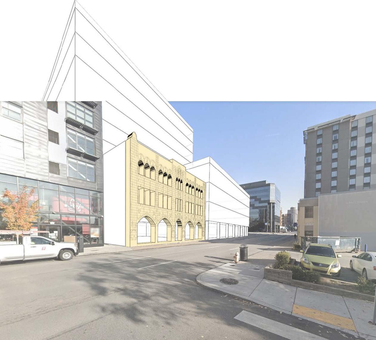
Street View of Proposed CFU by John Ronan Architects
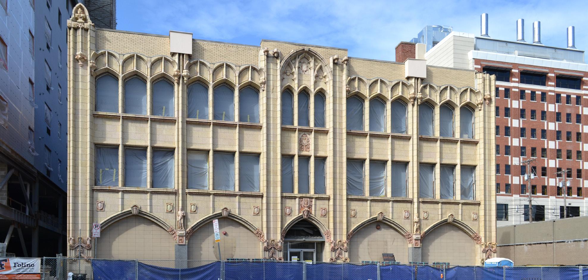
Existing Conditions at Site
Croatian Fraternal Union Building, 2018 Camerafiend, CC BY-SA 4.0, via Wikimedia Commons
4.4 PROJECT EVALUATION
A project evaluation matrix helps compare and prioritize the many projects conceived in the plan. The weighted evaluation criteria tie directly to Plan for Pitt pillars and the planning principles that guide the plan.
The project score reflects alignment with the evaluation criteria. The highest scoring projects achieve the most attributes embedded in the criteria and therefore should be considered a priority project.
The projects reflect a range of programmatic uses including academic, student life, housing, athletics, recreation, and public realm. For evaluation purposes, public realm projects should be evaluated against each other, given that the other projects are primarily building projects.
The project evaluation criteria and scores were developed in collaboration with the Working Group and reviewed by the Steering Committee.
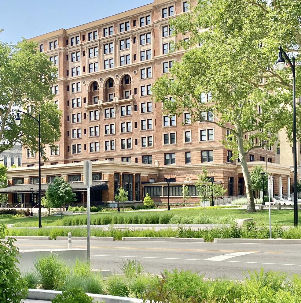
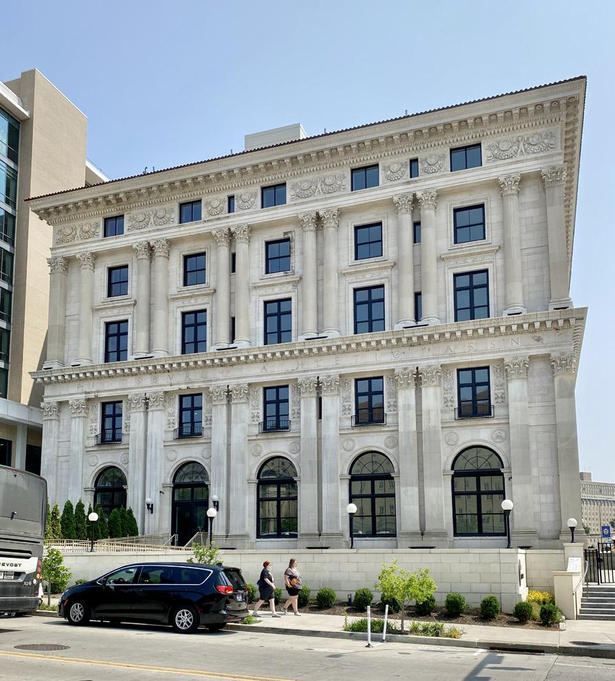
Pittsburgh Athletic Association
William Pitt Union
BUILDING SITES
05 MISSION AND EXPERIENCE
MISSION AND EXPERIENCE
The Campus Master Plan responds to to the academic and research mission as expressed in the Plan for Pitt 2028 and as determined through the planning consultation process with Pitt’s academic and research leadership, including the deans of the 16 schools and colleges. The Academic and Research Framework Plan provides recommendations for proposed renovation and new construction projects designed to deliver the facilities and support spaces required to carry out Pitt’s mission.
The Campus Master Plan incorporates recommendations responsive to the student and campus life mission and aspirations of the university. Guidance for housing, dining, recreation and social environments summarized in the Campus Experience Framework Plan provides comprehensive and integrated strategies for improving the overall campus experience for students, faculty, staff, alumni and visitors. The Campus Experience Framework Plan summarizes the proposed housing, student union, dining and social spaces aligned with broader campus planning and urban design recommendations. Legend
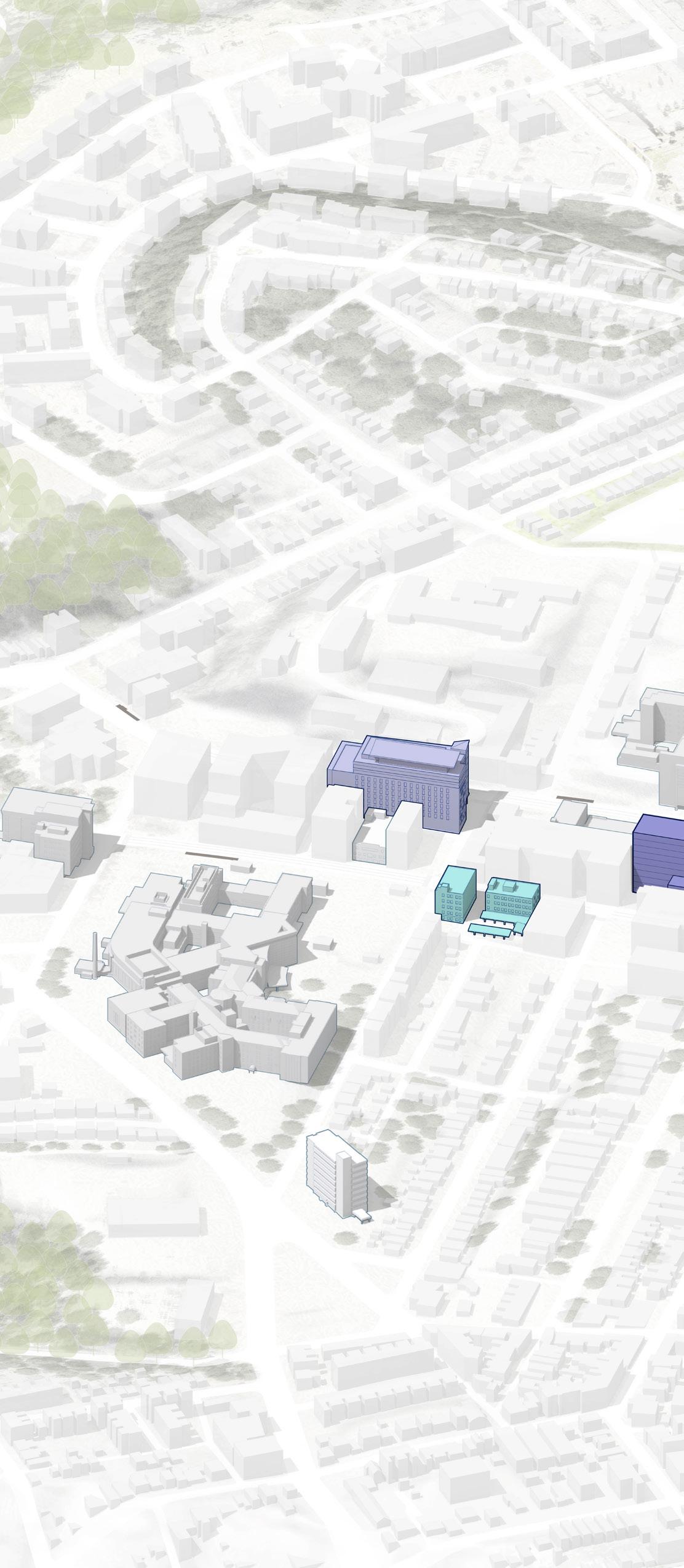
Collaboration
Dining
Library
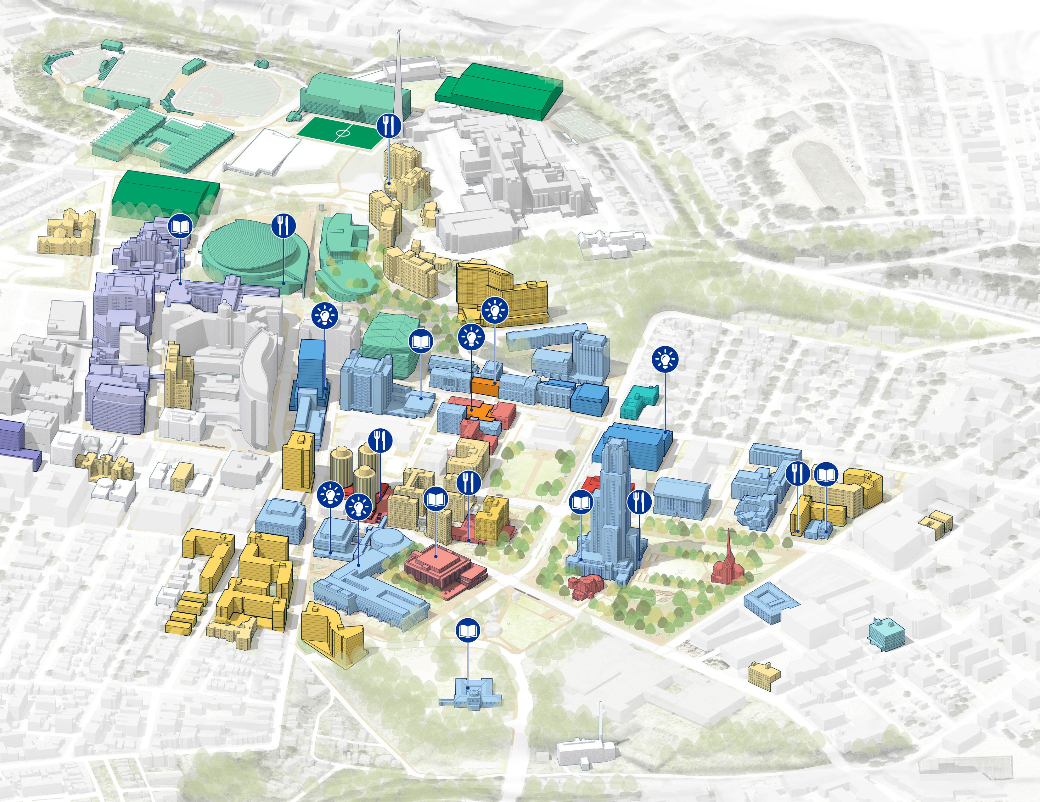
5.1 ACADEMIC AND RESEARCH FRAMEWORK
The Academic and Research Framework Plan provides an organizational structure for research, artistic and scholarly activities that advance learning and transfer knowledge in science, technology and health care.
The plan optimizes the existing space portfolio to accommodate current and future needs and to provide flexibility across the 16 schools in support of their respective missions. The framework plan also addresses the need for student success centers, innovation and collaboration hubs, shared research hubs, and partnership spaces.
The framework plan identifies new sites in strategic locations for academic and research use and designates buildings for renovation, change of use, redevelopment or demolition/ decommissioning in support of Pitt’s mission and plans for growth.
The following principles and goals provide guidance for the future planning, design and construction of academic and research space.
PRINCIPLES AND GOALS
Efficient and Right-Sized
Configure campus owned space to support Pitt’s mission by increasing utilization, optimizing to create space and energy efficiencies, determining space surpluses and deficits and reducing investment in non-Pitt space.
Stewardship
Determine the highest and best use of physical assets by assessing building condition and character, suitability and limitations; designating and prioritizing building candidates for renovation, change of use or demolition/decommissioning.
Future-Oriented
Avoid short-term moves in favor of long-term strategic accommodation and campus design and sustainability goals that maximize flexibility. Identification of opportunities to respond to relevant higher education trends, best practices and space guidelines.
Quality
Invest in existing buildings and infrastructure to improve the campus living-learning environments and protect physical assets for future generations.
Collaborative
Optimize programmatic organization and adjacencies to foster synergies and leverage shared resources, connections and public realm in support of academic and research goals.
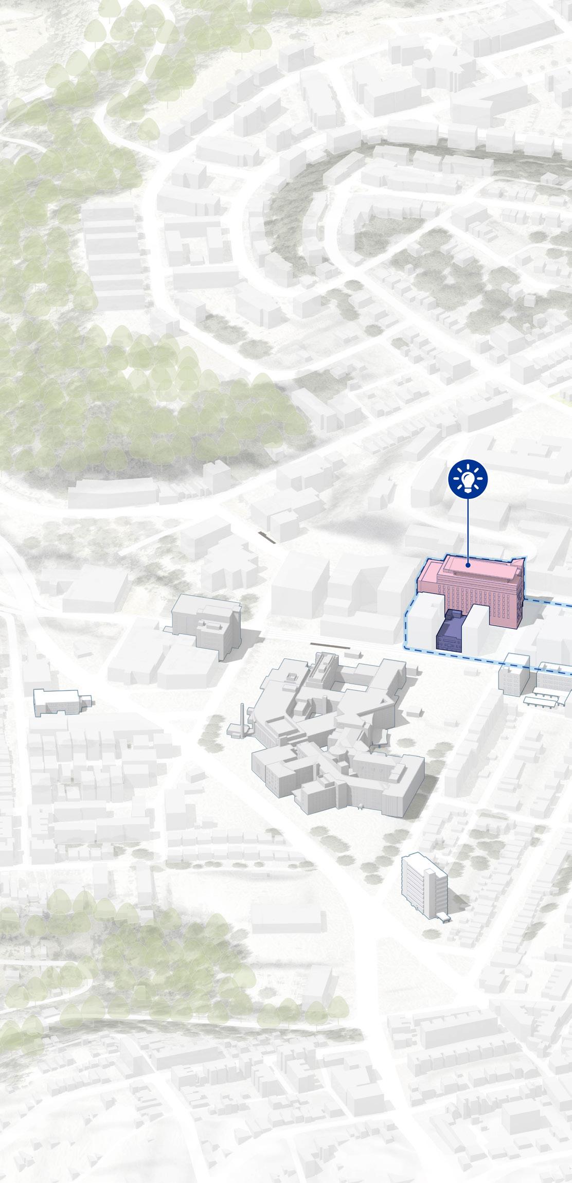
Legend
Dietrich School of Arts and Sciences
School of Business
School of Computing and Information
School of Dental Medicine
School of Education
Swanson School of Engineering
School of General Studies
School of Health and Rehabilitation Sciences
David C. Frederick Honors College
School of Law
School of Medicine
School of Nursing
School of Pharmacy
School of Public and International Affairs
School of Public Health
School of Social Work
Collaboration Hub
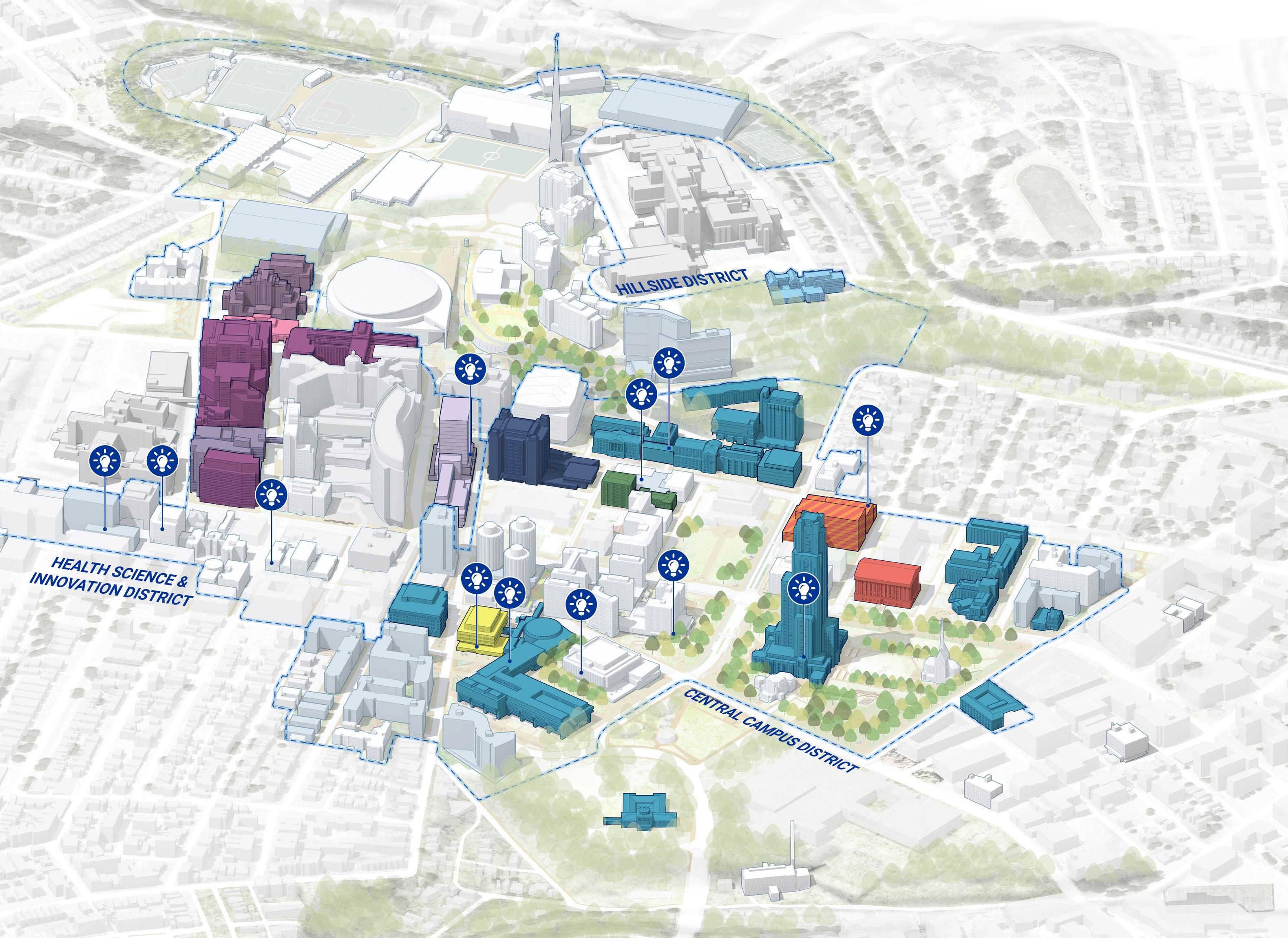
ACADEMIC AND RESEARCH FACILITIES TODAY
Dietrich School of Arts and Sciences
School of Business
The Dietrich School of Arts and Sciences is the largest school at Pitt and spans across multiple buildings and complexes in the Central Campus District, including the Cathedral of Learning and Posvar Hall which serve as academic hubs for undergraduate education. Sennott Square, located along Forbes Avenue, houses the Department of Psychology and Business programs, among others. The Frick Fine Arts Building is home to the Department of History of Art and Architecture and the Department of Studio Arts. Located east of the Cathedral Lawn, Bellefield Hall is home to Department of Music; it includes theater and performance spaces, classrooms and architecture studios. North of the Cathedral Lawn along Fifth Avenue, the Music Building houses the Department of Music.
Biology and Neuroscience are clustered on Central Campus between Fifth Avenue and Bigelow Boulevard in Clapp Hall, Langley Hall and Crawford Hall.
North of O’Hara Street, the Mid- Campus Science Complex houses academic and research programs for the Departments of Physics, Astronomy and Engineering in Allen Hall, Van de Graaf, Old Engineering, Thaw Hall and the Space Research Coordination Center.
The Department of Chemistry is located north of the Mid- Campus Science Complex in the Chevron Science Center and Eberly Hall.
The School of Business is located in in the following buildings: Mervis Hall, the primary location, Sennott Square and Posvar Hall. Executive Education is located north of the Cathedral of Learning in Alumni Hall.
School of Computing and Information
The School of Computing and Information is located across multiple buildings on Central Campus including the Information Sciences Building on Bellefield Avenue, Sennott Square and 130 North Bellefield.
School of Education
The School of Education operates across the Central Campus and Hillside Districts in four locations including Posvar Hall, Trees Hall, the Falk School and leased space in Oak Hill.
Swanson School of Engineering
The Swanson School of Engineering is primarily located in Benedum Hall and the Engineering Auditorium on O’Hara Street. Its location bridges the Mid- Campus Science Complex and the Health Science and Innovation District. The school has additional research space in the Center for Bioengineering located in technology park in South
Oakland and Biomedical Sciences Tower 3 in the Health Science and Innovation District.
School of General Studies
The School of General Studies is located in Thackeray Hall in the Central Campus District. Thackeray Hall is home to student services, such as registration, academic advising, student service center, transfer admissions and the welcome office. In addition, the Department of Mathematics is located on the third floor.
David C. Frederick Honors College
The David C. Frederick Honors College spans floors 34 to 37 of the Cathedral of Learning at the heart of the Central Campus District, with partial space on floor 32 of the Cathedral.
School of Law
The School of Law is located in the Barco Law building, a pivotal location in the Central Campus District between Posvar Hall and Sennott Square.
School of Public and International Affairs
The Graduate School of Public and International Affairs is based in the academic hub of Posvar Hall.
School of Social Work
The School of Social Work is located on Floors 20 to 23 of the Cathedral of Learning at the heart of the Central Campus District. The school also has touch points in Bellefield Hall and the Community Engagement Center in Homewood.
HEALTH SCIENCES
The Health Sciences comprise six schools that bring together education, research and health care in the Health Sciences and Innovation District. Their proximity establishes a dense hub of research activity and clinical delivery benefiting from adjacency to UPMC, The Swanson School of Engineering and the Mid- Campus Science Complex.
School of Dental Medicine
The School of Dental Medicine is located in the Salk Hall Annex fronting Terrace Street, with some additional space in Salk Hall. The Annex is physically connected to Salk Hall and the Salk Hall Pavilion, home to the School of Pharmacy.
School of Health and Rehabilitation Sciences
The School of Health and Rehabilitation Sciences is relocating to the Fifth and Halket Building, with the goal consolidating its program. The school is currently fragmented across six buildings. Off campus leased space will be maintained at Bakery Square, Rivertech and Bridgeside Point.
School of Medicine
The School of Medicine is primarily located in the recently renovated Scaife Hall, and the Biomedical Science Towers 1 (Starzl), 2 and 3. Additional research space is located off campus at Bridgeside, the McGowan Institute and in UPMC facilities.
School of Nursing
The School of Nursing is located in Victoria Hall along Darragh Street. The school has physical connections to the Biomedical Science Towers that house the School of Medicine and residence hall at Lothrop.
School of Pharmacy
The School of Pharmacy is located in the recently renovated Salk Hall and Salk Hall Pavilion. The facility is connected to the Salk Hall Annex, the home of the School of Dental Medicine.
School of Public Health
The School of Public Health is based in the Public Health Building and Crabtree Hall along De Soto Street.
ACADEMIC AND RESEARCH SPACE AND FACILITY NEEDS
Instructional and Non-Instructional Needs
Course schedule data and projected enrollment growth indicate significant demand for new teaching labs in the School of Arts and Sciences, the School of Engineering and in Health Sciences. Open labs for non-instructional use are needed to support activity in the School of Arts and Sciences.
While the total pool of classrooms is sufficient to support current and future demand, departmental control, faculty preferences, and classroom rightsizing limit classroom availability and course scheduling. Classroom de-densification and furniture upgrades should be considered to balance demand within existing classroom inventory and promote active learning. In addition, new classroom space is recommended for the following schools based on reported growth and specialized needs: School of Dental Medicine, School of Health and Rehabilitation Sciences, School of Business, School of Nursing and School of Pharmacy.
Pitt has identified the need for Academic Support Hubs in direct response to a key initiative of the Plan for Pitt 2028:, to cultivate student success. Inspired by the concept of the Pitt Global Hub, the Academic Support Hubs are envisioned as places to educate all passersby, build community through modular physical spaces, and house advising and student services professionals. Four principles form the basis for program and associated space:
1. We are committed to enhancing student agency. We imagine a program where students choose intellectual pathways that complement learning in their chosen majors and minors.
2. We recognize the challenges in preparing students to thrive in 21st-century professional environments and industries that may not even exist at the moment. So, it is crucial that our offerings teach students the skills, attitudes, knowledge and awareness that help them remain flexible and agile in a rapidly changing world.
3. We are considering a more connected and scaffolded approach to student learning that includes moments of intentional reflection on the value of taking courses across varied and broad curriculum. This will entail continued collaboration across schools and disciplines so that students don’t miss opportunities to connect prior learning with assignments and activities in upper-division courses as they progress through their general education.
4. We are also getting creative and leaning into what makes the Pitt experience unique. We are a place where students remain at the center of our work as an R-1 institution. Everyone in our community agrees that our students are not only creative and highly achieving, but also intellectually curious and seeking opportunities to curate their own learning. So, we aim to create a program that supports students’ experiential learning and offers reliable advising so that students can curate pathways to
multiple majors and minors across disciplines and schools without adding time to degree completion.
Source: Office of the Provost Ideas for Academic Support Districts at Pitt, May 2025
Research Space
Research Space comprises almost 16% of Pittowned and leased space today. Reported research faculty growth results in significant demand for new space including a mix of wet labs, dry labs, clinical research, computational space, core research facilities and support space. Existing underutilized space could be repurposed to help meet the anticipated growth in research space needs.
Innovation and Entrepreneurship
Pitt Research has identified a need for incubation/ startup space to bring people together around ideas and to facilitate the commercialization of research. Features of the required space include shared benches and equipment, private labs, conference and co-working space.
The Office of Innovation and Entrepreneurship (OIE) has also identified the opportunity to bring OIE IP Commercialization staff together in one location with the goal of increasing collaboration and innovation. This further cements the university’s priority in this space, thus working to meet university and regional goals.
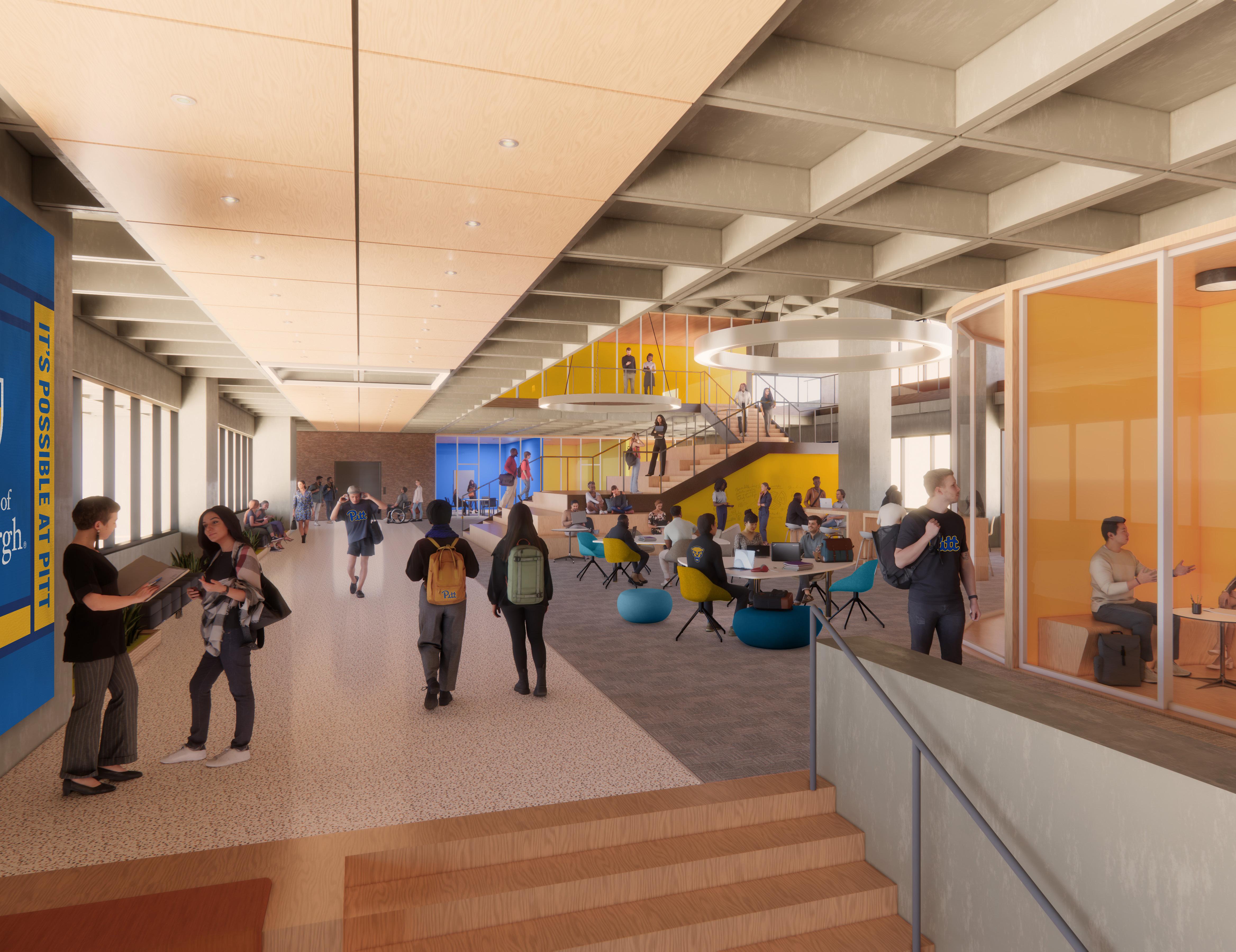
View of the proposed Academic Support Hub in Posvar
ACADEMIC AND RESEARCH SPACE AND FACILITY NEEDS
Facility Conditions
The drawing to the right indicates building facility condition based on information made available by Pitt. Facility conditions data and building observations suggest the following buildings are nearing the end of their useful life and are candidates for renovation or redevelopment:
• Crabtree Hall, home to the School of Public Health
• Information Sciences Building, (ISB) home to the School of Computing and Information
• Langley Hall, home to the School of Arts and Sciences, Departments of Biology and Neurology
• Salk Hall Annex, home to the School of Dental Medicine
• Victoria Building, home to the School of Nursing
Areas of Growth
The following schools report significant growth in the 2025 Dean’s Survey:
• School of Business
• School of Computing and Information
• School of Dental Medicine
• School of Education
• School of Engineering
• School of Health and Rehabilitation Sciences
• School of Nursing
• School of Public Health
• School of Social Work
Building FCI
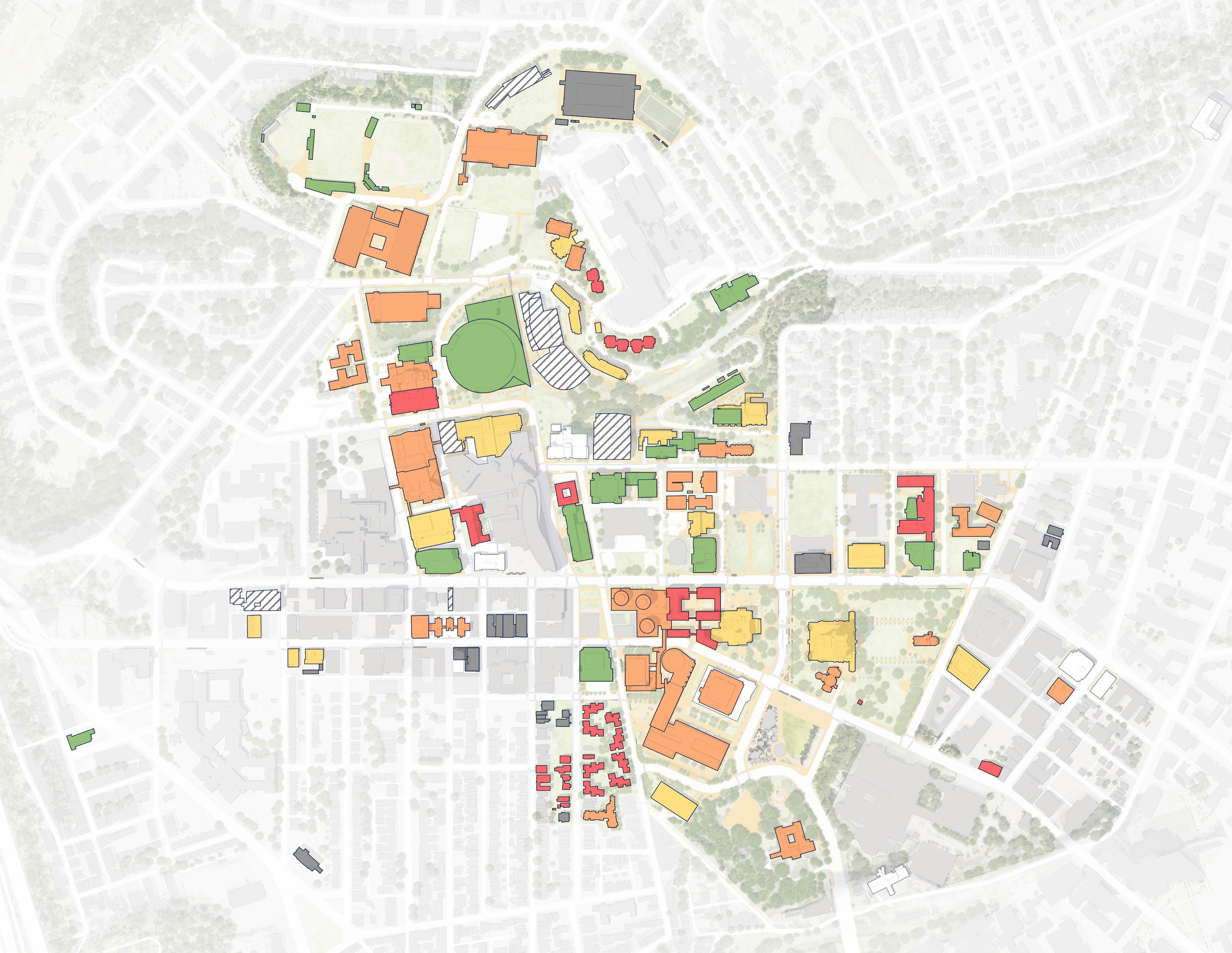
0-0.19
0.2 0.29 Fair
0.3 - 0.49 Below Average

>0.5 Poor New / Renovated Building No Data
Langley Hall
Crabtree Hall
Salk Hall Annex
ACADEMIC AND RESEARCH OPPORTUNITY AREAS
The Campus Master Plan identifies opportunity sites for strategic expansion, redevelopment and renovation across the Oakland campus. The Framework Plan builds off the existing network of academic and research spaces in the Central Campus and the Health Sciences and Innovation Districts in response to space and facility needs and reported growth. Recommendations for future academic and research space include:
• Posvar Hall Academic Support Hub: Centralizes student services in a strategic and highly visible location while investing in an existing asset that is in below average condition.
• Gardner Steel and O’Hara Renovation and Expansion: Creates an Academic Support Hub proximate to the Mid-Campus Science complex and Health Sciences; centralizes general classrooms to deliver contemporary learning environments; co-locates the Office of Innovation and Entrepreneurship; improves accessibility, wayfinding, and the public realm; and invests in existing historical assets.
• Crabtree Hall Redevelopment: Establishes new space for Health Sciences Research, Engineering Labs, Data Science and Artificial Intelligence, and the School of Public Health.
• One Bigelow Redevelopment: Co-locates the School of Business and SCI to accommodate growth, achieve efficiencies and promote scholarship, creativity, and innovation in a strategic location in the Central Campus District.
• Mid-Campus Sciences Renovation and Expansion: provides new research labs, teaching labs and classrooms while investing in historical assets in below average condition, improving accessibility, wayfinding, and the public realm.
• Bellefield Hall Renovation: Repurposes underutilized space in an existing historical asset to deliver open labs and space for the arts.
• Croatian Site Redevelopment: Facilitates growth and expansion for the Health Sciences.
• Salk Hall Annex Renovation: Supports Dental School growth and invests in a building in poor condition.
• Victoria Building Renovation: Renovation for a yet-to-be determined use.
Notes:
1. Refer to Chapter 4 for detailed descriptions of the proposed opportunity areas
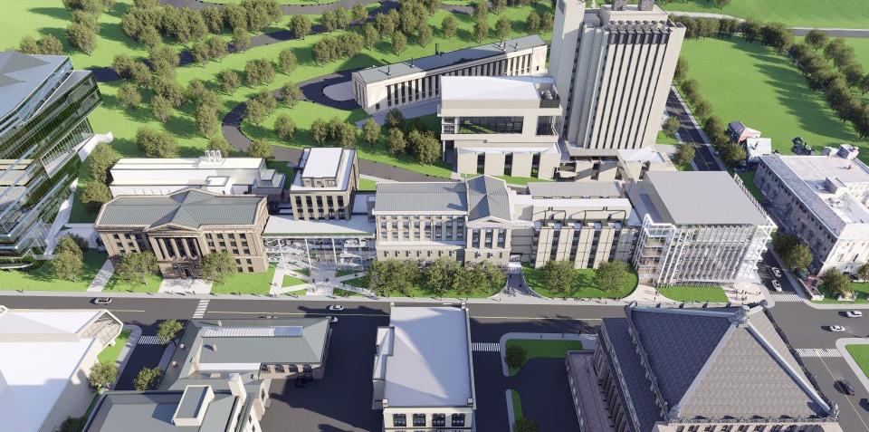
Mid-Campus Sciences Masterplan by Jacobs and Pelli Clarke & Partners
Academic and Research Opportunity Sites
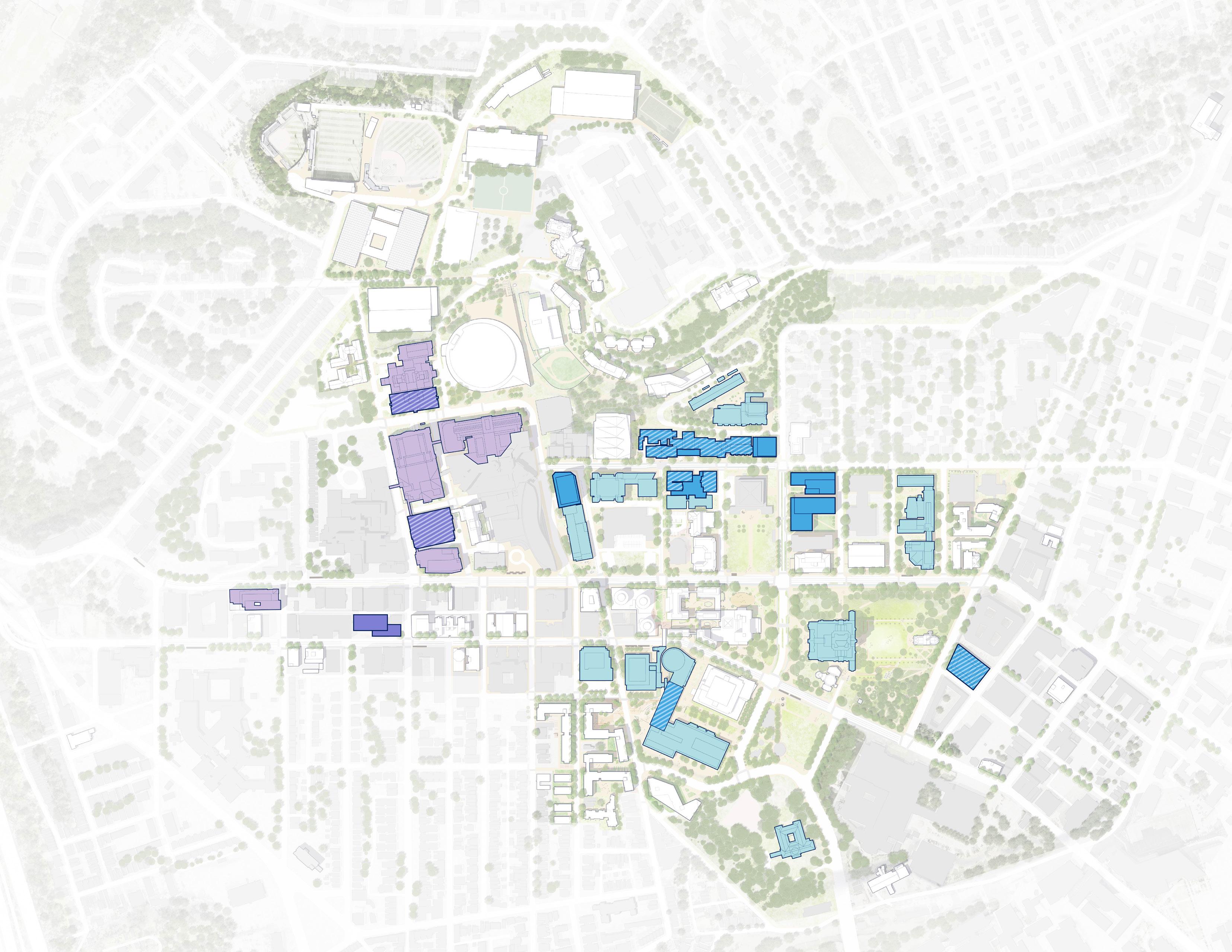
Legend
Existing Academic
Proposed Academic Development
Proposed Academic Renovation
Existing Research
Proposed Research Development
Proposed Research Renovation
Salk Hall Annex
Croatian Site
Posvar Hall Intervention
Gardner Steel & O’Hara
Crabtree Hall
One Bigelow
Bellefield Hall
Mid Campus Master Plan
Allequippa St
FifthAve
O’Hara
Darragh
Bigelow
5.2 CAMPUS EXPERIENCE PLAN
The Campus Experience Plan fosters an inclusive experience by providing the amenities, commons, residential communities and recreation areas that contribute to the quality of life on the Pitt campus ensuring that a vibrant and active campus environment emerges. It includes facilities and public realm improvements that encourage collegial interaction and respond to the needs of a diverse student population. The Campus Experience Plan supports campus life by establishing a network of amenities to serve the entire Pitt community.
Enriching the campus life experience and community-building is addressed at the following levels:
• A new student center in the former Pittsburgh Athletic Association building
• New dining, amenity and food service locations along major corridors
• Residence hall renewal, redevelopment, and new development
• New locations to gather, collaborate, and study
• New and re-imagined indoor and outdoor recreation facilities
The network addresses the various population groups of the campus including resident students, “resi-muters” (those living off-campus within a walking and biking distance), commuter students, faculty, staff and the broader community consisting of alumni and visitors.
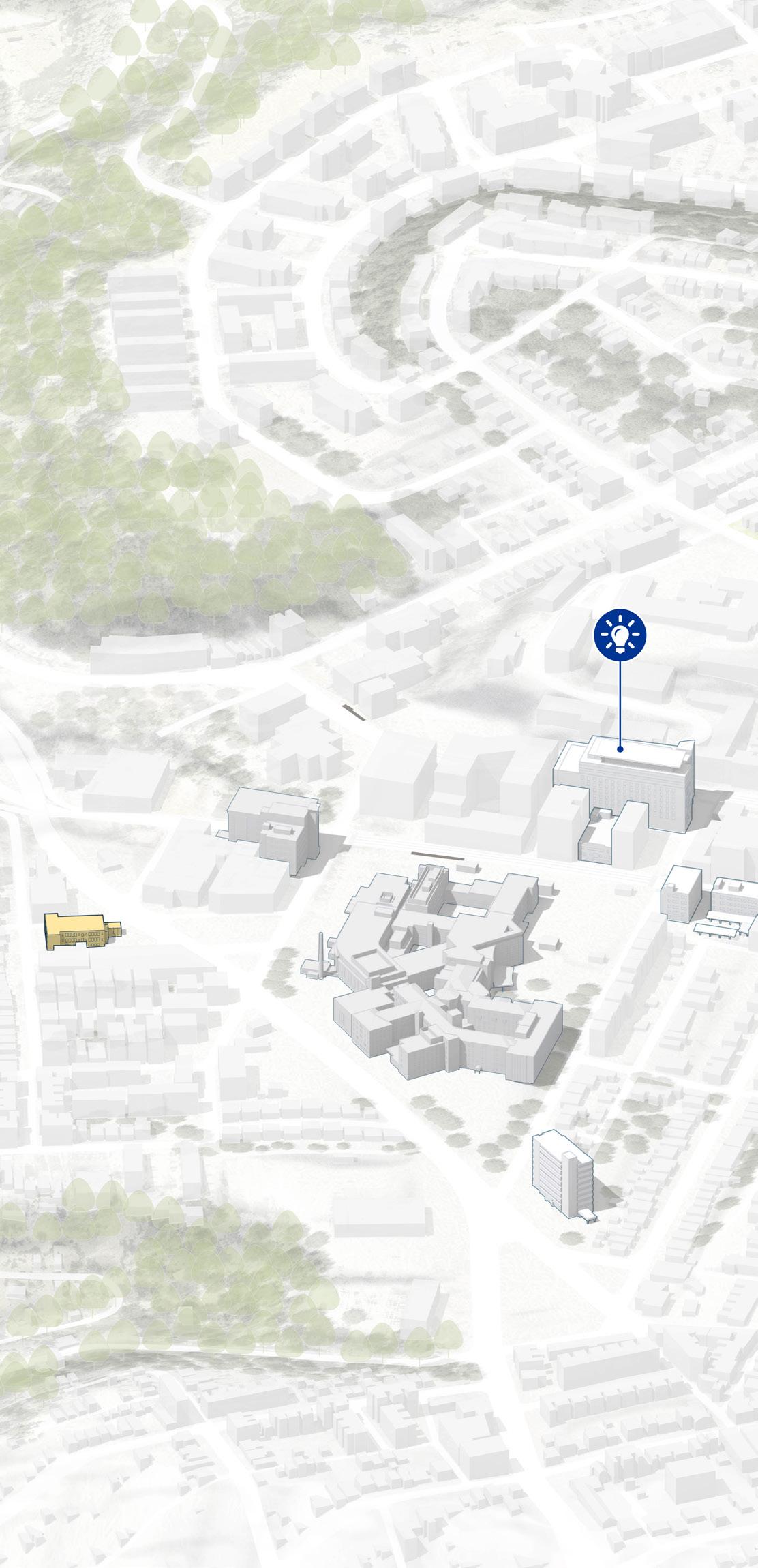
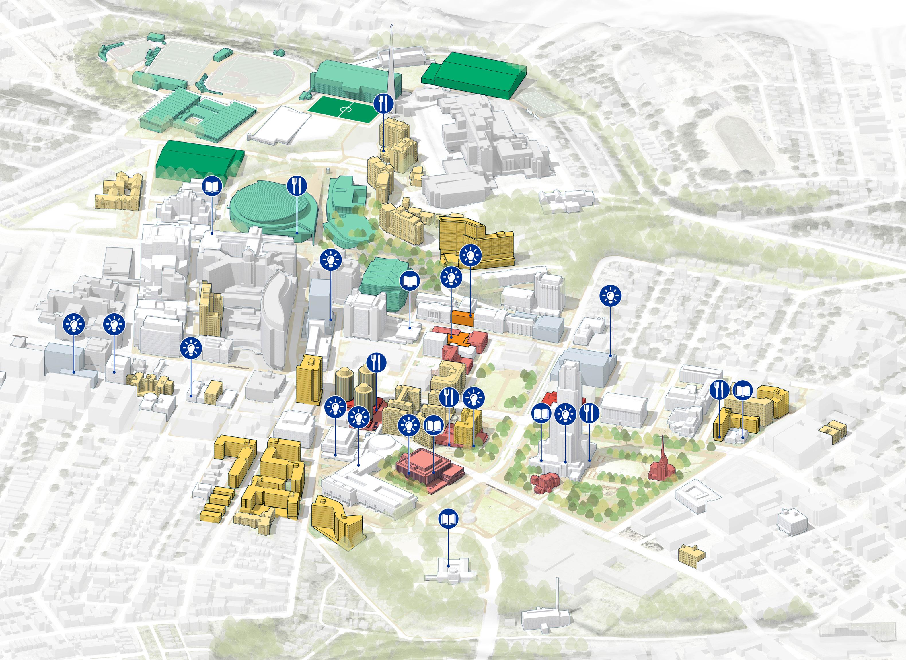
CAMPUS LIFE FACILITIES
Proposed campus life facilities include:
A New Student Center
The Campus Master Plan envisions the transformation of the iconic PAA building to create a new hub for the campus and student experience. Located across from the Cathedral of Learning and Schenley Quad, this landmark building is at the center of campus, especially for student organizations and activities.
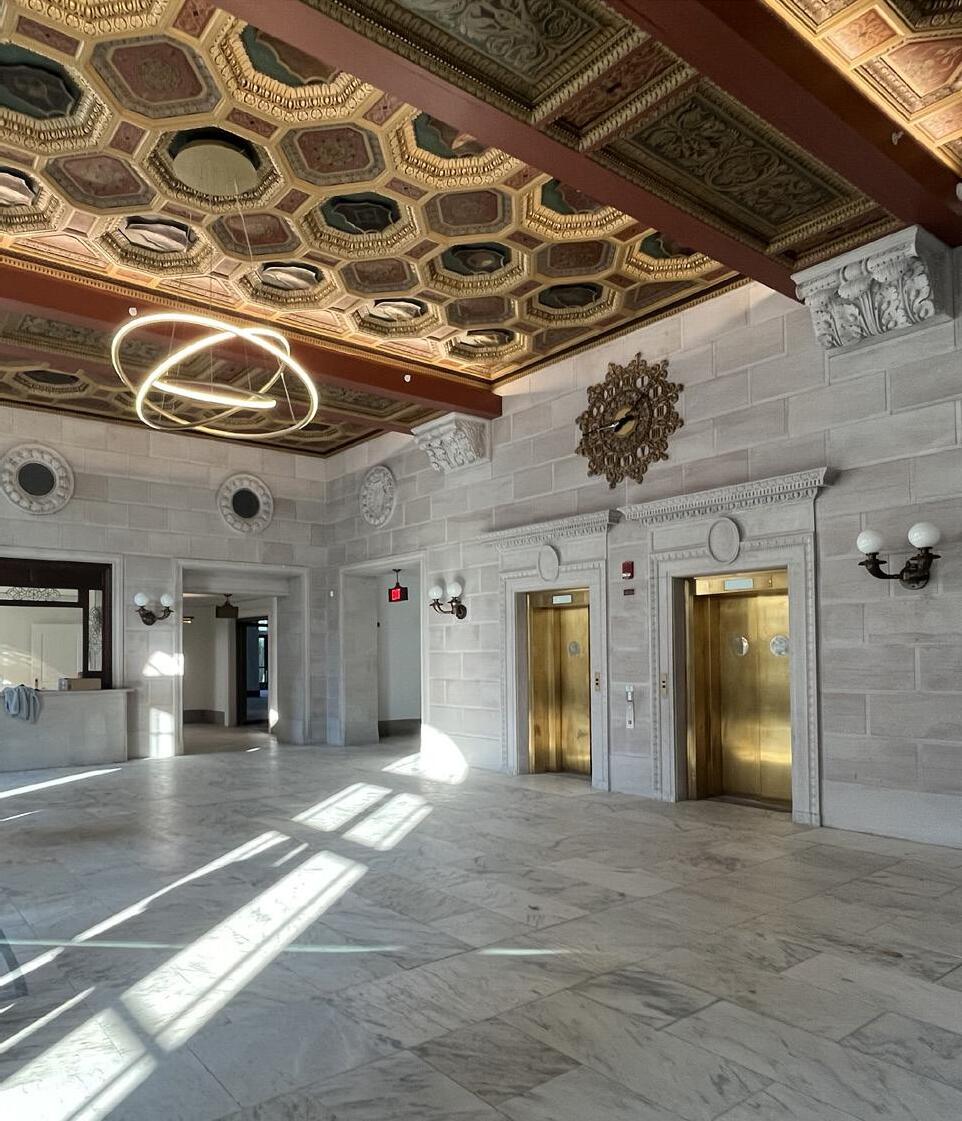
Providing a new student center in the PAA allows for the renewal of the existing William Pitt Union (WPU) as a housing facility. The historic lobbies and ballrooms on the first floor and the Schenley Café on the lower floor, remain at the WPU in support of the student experience. Other student center functions could be accommodated within the entirety of the PAA, including expanded food service options.
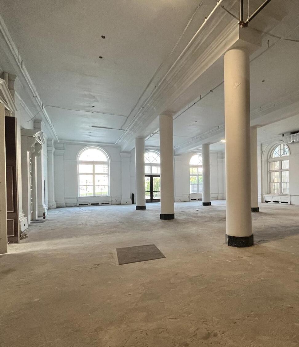
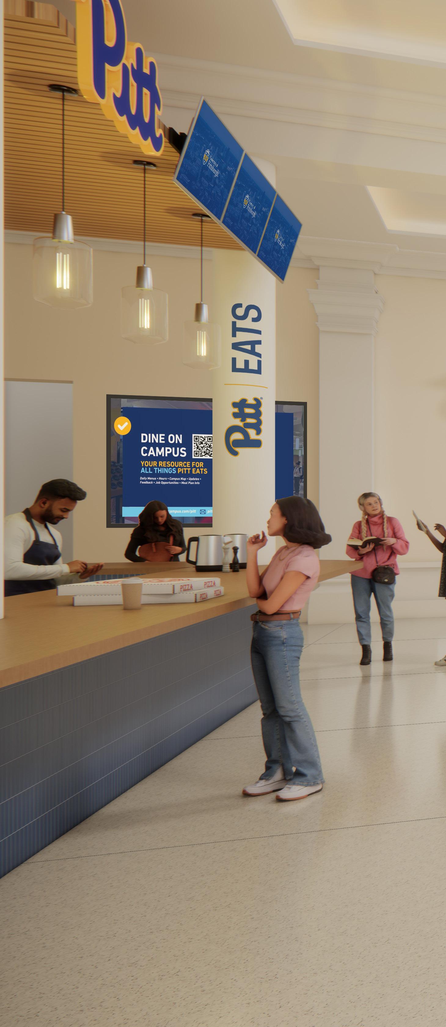
PAA Lobby
Existing Interior View
View of the Proposed Retail Dining Space
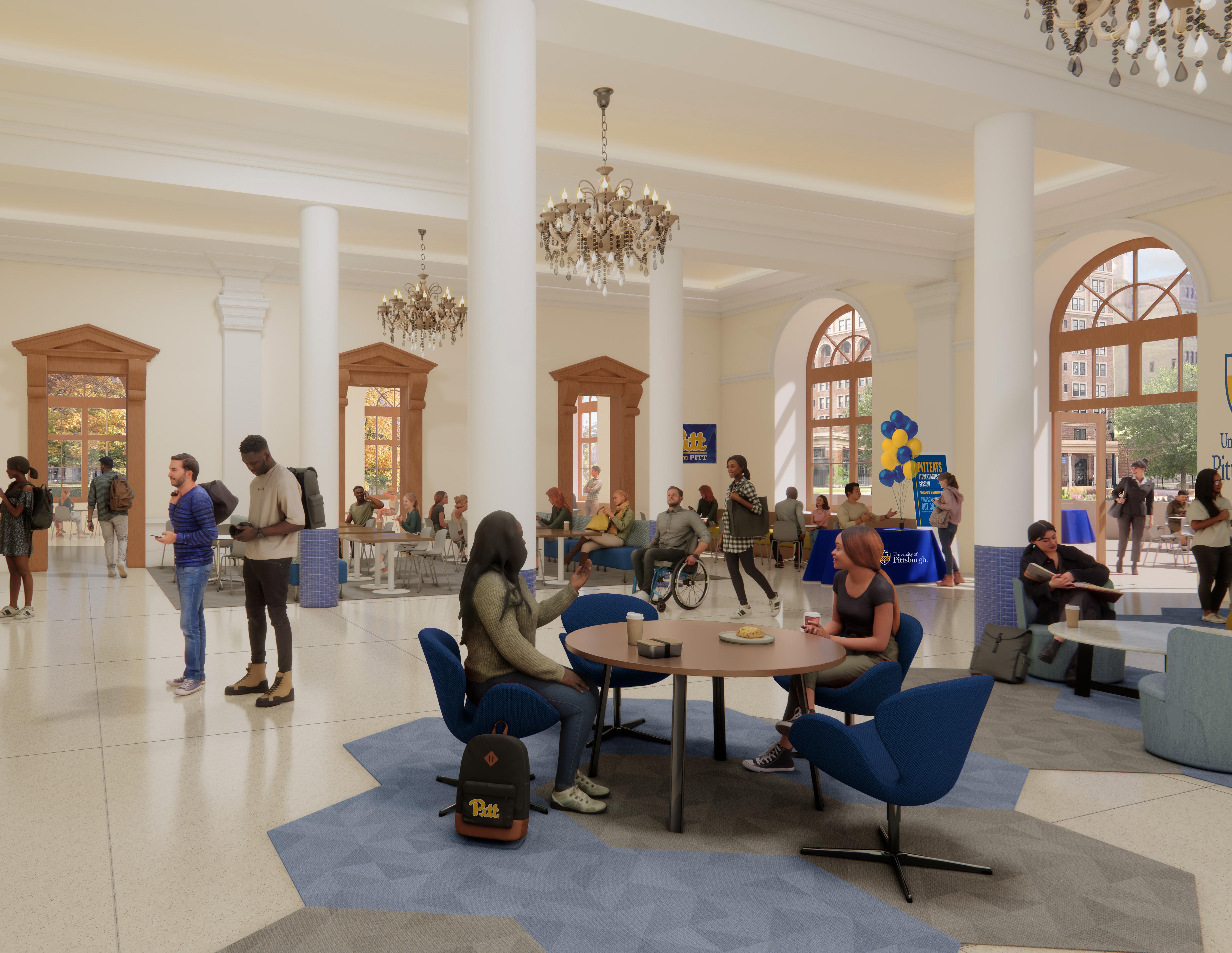
Collaboration Hubs
The Campus Master Plan identifies several collaboration hubs designed to bring the campus community together around academic and research initiatives. Envisioned to include amenities as well as social and study environments, the plan locates collaboration hubs on the O’Hara corridor in new facilities at Mid-campus Sciences, One Bigelow, O’Hara and Gardner Steel and Crabtree. Other hubs include the second level of the Posvar Bridge and the ground floor of Barco Law.
The Campus Master Plan co-locates collaboration hubs at major destinations and transit stops with the intent of bringing people and ideas together to foster innovation and enhance the campus experience. These collaborative work and meeting spaces offer environments where interdisciplinary academic and research activities can be programmed, and co-located with centralized Academic Support Hubs. They pull together disparate conference and social spaces to foster efficiency and the cross pollination of ideas. They differ from innovation hubs in that they are not locations for dedicated research labs and equipment; innovation hubs are a concept proposed for existing and proposed research buildings that focus on specific topics such as biomedical research.
The network of public realm spaces across campus provides an important framework that links collaboration hubs with the broader campus environment. These spaces—ranging from plazas and courtyards to indoor commons—serve as areas of respite while also fostering opportunities for interdisciplinary interaction. By intentionally connecting hubs through the public realm, the Campus Master Plan creates an environment where academic, research, and social activities intersect, supporting the University’s forward-looking vision for collaboration, innovation, and community engagement.
1 Density and proximity:
Collaboration hubs maximize the density and proximity of people, ideas and resources with the goal of enabling frequent and serendipitous interaction among diverse groups.
2 Diversity:
Collaboration hubs attract and welcome people from diverse backgrounds, disciplines, sectors and cultures with the aim of enhancing creativity and fostering inclusion.
3 Flexibility:
Collaboration hubs offer flexible and adaptable spaces, services and programs that cater to the needs of participants.
4 Openness:
Collaboration hubs promote a culture of openness, transparency and trust with the aim of sharing information, knowledge and resources. They facilitate access to mentors, experts, investors and customers who can provide guidance, feedback and opportunities.
5 Support services:
Collaboration hubs integrate student support services and experiential learning including mentoring, advising, co-working spaces, maker spaces, etc. They include adjacent food service and retail amenities.
Features of the Collaboration Hubs
Collaboration Hubs
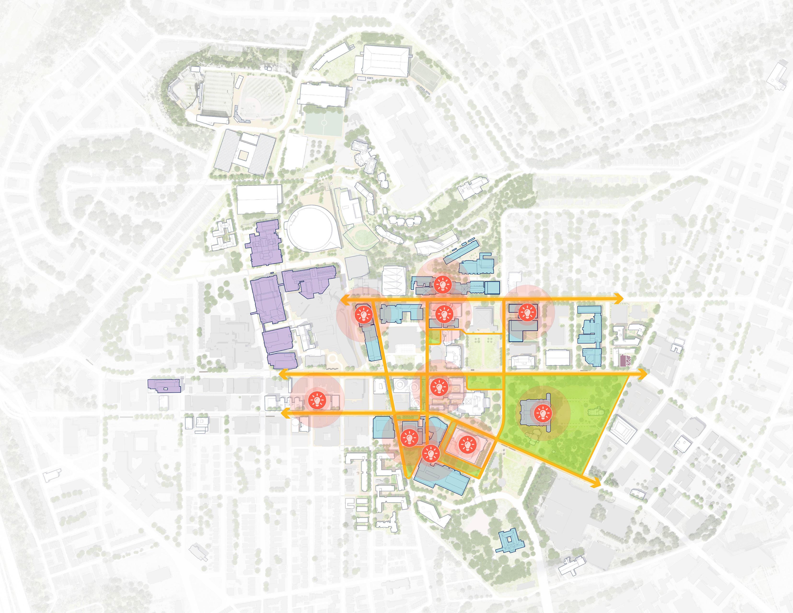
Collaboration Hubs along O’Hara Corridor
Collaboration Hubs at Posvar Bridge and ground floor of Barco Law
Allequippa St
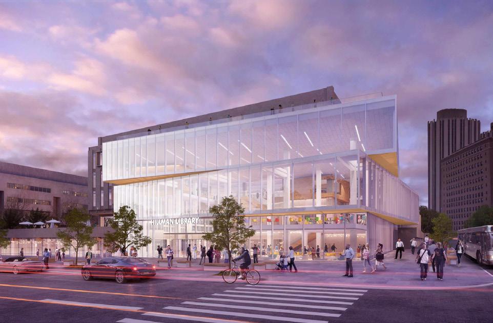
Hillman Library-Image from GBBN
Recent renovation to the Hillman Library includes a new entrance lobby at the corner of Bigelow and Forbes. The renovation also introduces new group and individual study areas throughout the building and improvements to the public realm.
Libraries
The recently finished renovation and renewal of the Hillman Library provides much need student study and academic support space. Other libraries, which may also serve as potential collaboration hubs, include the School of Medicine Library at Scaife Hall, Archives and Special Collections, Barco Law Library, Bevier Science and Engineering Library, Center for American Music library, Falk Library (HSLS), Finney Music Library, Frick Fine Arts Library and Thomas Boulevard Library.
Lounges and Social Hubs
The Pitt campus offers a network of memorable study and social environments including the Commons Room at the Cathedral of Learning. The plan extends this network by locating new and renewed social hubs at the plaza level of the Litchfield Towers, ground floor of Tower D and the Music Site housing as well as in collaboration hubs. The roof terraces of the renewed Schenley Quad buildings also provide lounges offering views over Central Oakland.
Dining
The plan maintains the existing all-you-care-to-eat (AYCE) dining locations at the Eatery (Litchfield Towers) and the Perch at Sutherland Hall. Food court locations at the Schenley Café (WPU lower), the Cathedral Café (lower-level) and the Petersen Events Center also remain. Furthermore, there are 35 additional dining locations in various buildings across the campus.
Potential dining locations include the future Hillside Housing, retail dining, cafe, and late night option at the new Student Center and a retail outlet on the ground floor of the new housing at the Music Building site. Each of the collaboration hubs are potential locations for small cafes, coffee shops or grab-and-go locations.
Recreation
The Recreation and Wellness Center on O’Hara Street provides a centralized health and well-being hub for the campus community. The plan repurposes existing recreation facilities at Trees Hall and Bellefield Hall for other uses. A new informal recreation field on the OC Lot south of the Charles L. Cost Sports Center provides much needed exterior field space. The plan calls for a permanent recreation facility that provides an indoor turf field and band support to replace the bubble.
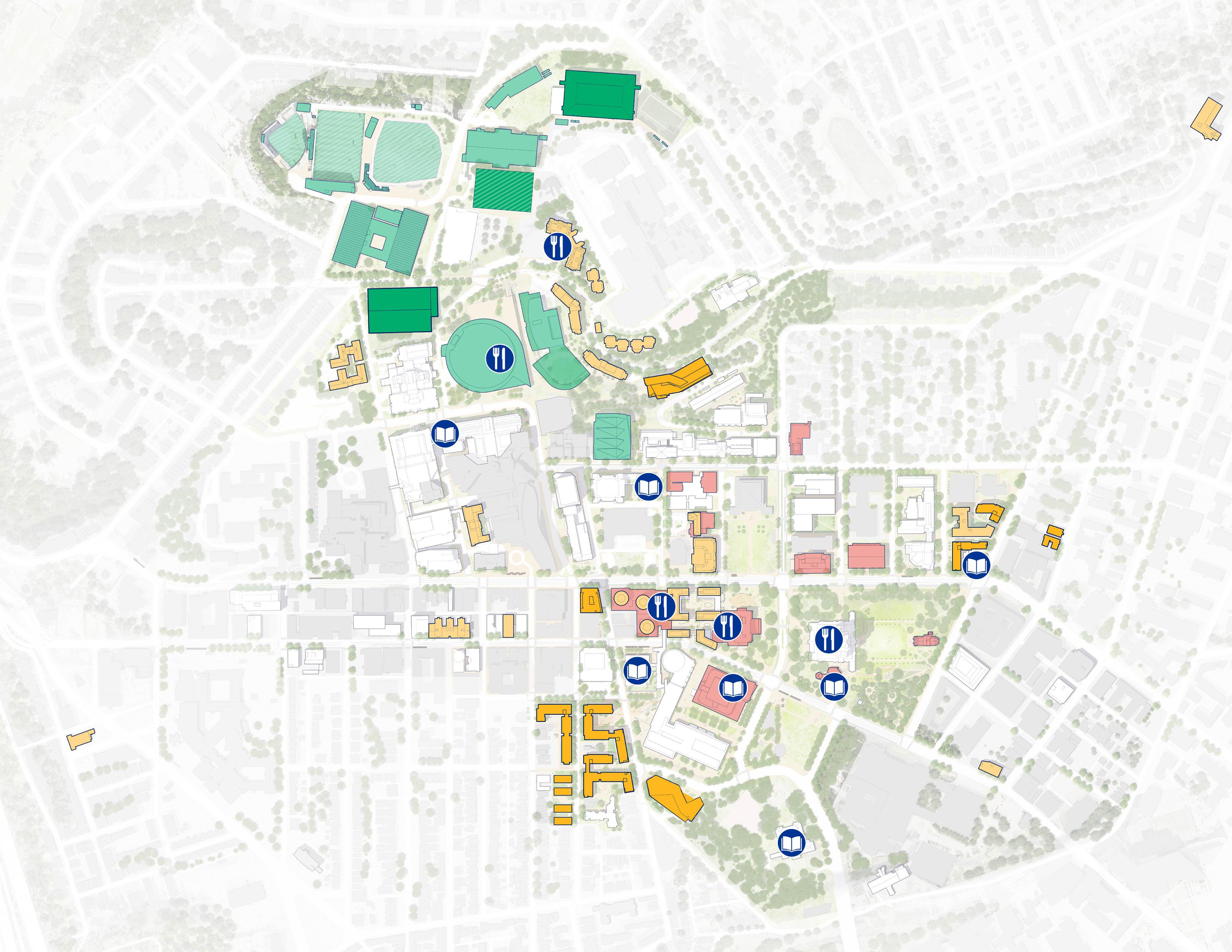
Campus Life Facility Locations
The Eatery (AYCE)
(AYCE)
Renovated
PROPOSED RESIDENCE HALLS
The Housing Master Plan documented in Appendix 01 to this report provides a long-term strategy for renovation of existing housing along with new construction opportunities. All new student residence halls integrate study space based on the space needs findings. The following summarizes proposed construction.
Music and SCI Sites
On the Music Site the plan recommends a 400 bed 8 story building integrated with the historic architecture of the Music School and Annex providing a centralized location for Honors College students. Ground floor amenities and student support spaces contribute to the quality and experience of living in this facility. The adjacent Ruskin Hall and the future housing proposed for the SCI site integrate with the new building to create a new housing district at the east gateway to the campus.
Tower D
The plan illustrates the opportunity to construct a 722 bed, 16 story building on the block defined by Oakland Avenue, Fifth Avenue and Bouquet Street, directly west of the Litchfield Towers. This facility expands the first-year housing capacity at the heart of the campus in close proximity to major academic and student life destinations. It includes ground floor retail along with study lounges and social spaces.
Hillside Housing
A new residence hall on Utterback Drive provides an additional 720 suite style beds in a combination of suites and micro-suite units. The design integrates a parking garage on the lower levels of the building to provide a “podium” for the housing; the garage integrates with the steep slope of the site to create a level platform for the housing above. Pending further study, a new dining hall for Hillside District residents could be integrated into the garage levels.
Central Oakland
The plan integrates previous designs for Central Oakland, an area along Oakland Avenue currently occupied by Pitt’s Bouquet Apartments and other multi-family units purchased by the university over the course of several years. The redevelopment plan includes apartment and suite style units arranged in multi-story buildings featuring ground floor retail along Sennott Street and underground parking along Bouquet Street.
Pitt has identified the Phase Three development area as an opportunity site to construct four modular housing units along Oakland Ave. The modular development is envisioned as apartment style units to meet housing demand for upper class students in the near term.
Mervis Hall
A new residence hall is envisioned to replace the existing Mervis Hall following the relocation of the Business School to One Bigelow. This development densifies undergraduate housing, adding 565 beds, adjacent to the proposed Central Oakland Housing development and strengthens the gateway to campus from South Bouquet Street. It includes the potential for student lounges, study, social spaces, outdoor terrace, and underground parking.
Graduate Housing (Shirley and Mayflower)
The proposed redevelopment of the Shirley and Mayflower apartment buildings provides micro units.
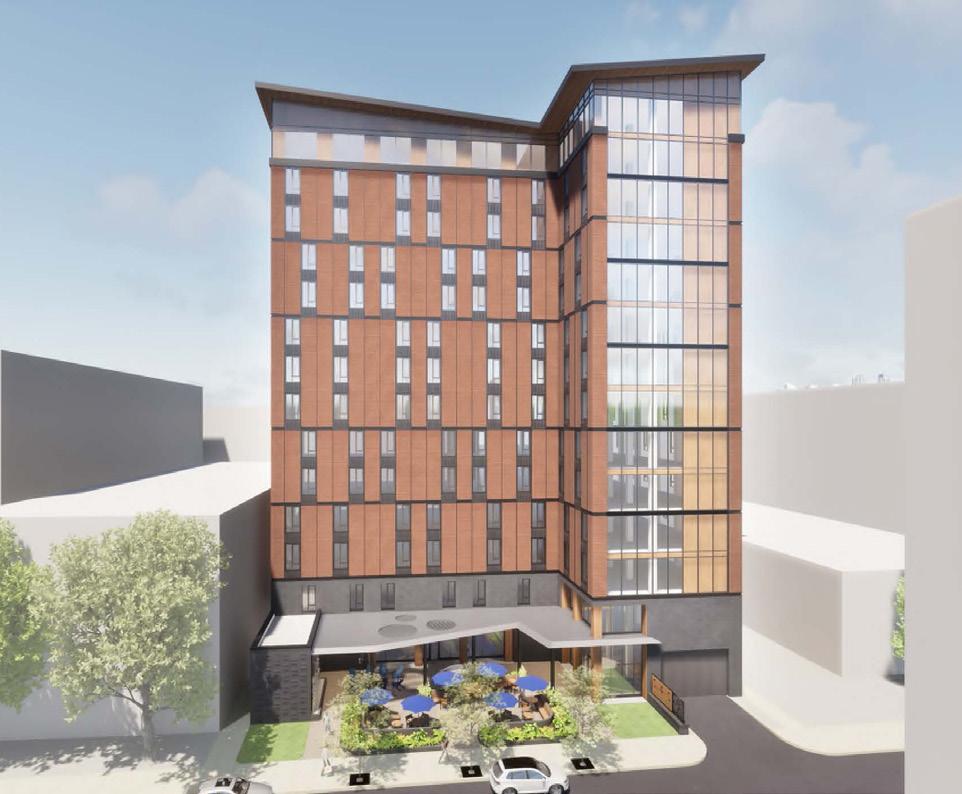
Shirley and Mayflower Rendering by Kimmel Bogrette Architects
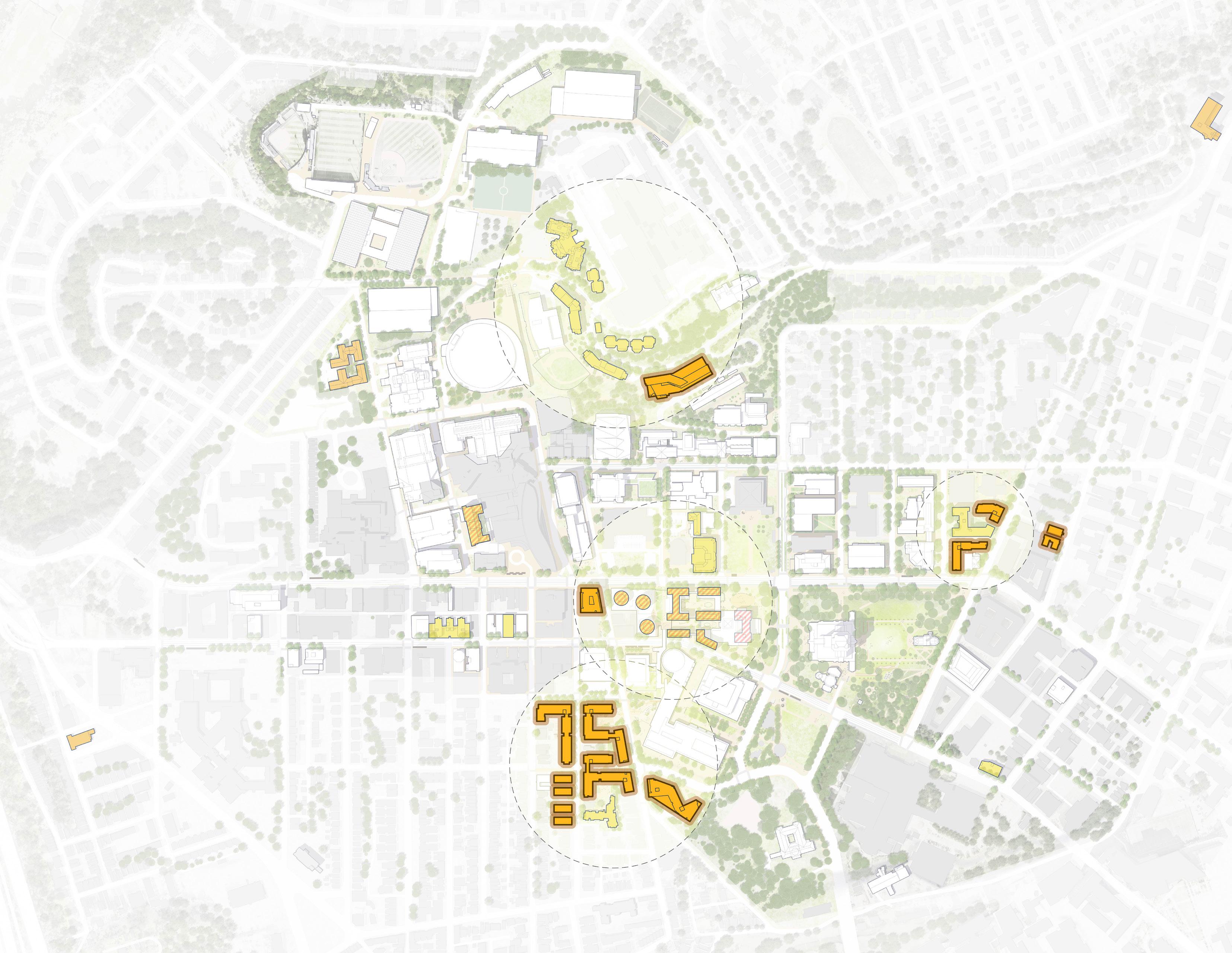
New Housing Development
O’Hara
Hillside Housing Shirley
Mervis
MAJOR RESIDENCE HALL RENOVATIONS
Pitt offers many existing and well positioned housing facilities, including several historic buildings of architectural and cultural significance. The following summarizes proposed renovation projects.
Schenley Quad Buildings
Schenley Quad includes five former luxury apartment buildings constructed in the 1920s as part of the vision for Central Oakland. Purchased by Pitt in the 1950s and converted to student housing, these impressive 100-year-old buildings require major renovation. Today, the Schenley Quad buildings include Holland, Brackenridge, Bruce, McCormick and Amos Halls.
The Housing Master Plan recommends a phased approach to comprehensive renovation over several years to carry out deferred maintenance, code and qualitative improvements. The plan also recommends new types of spaces and interior layouts in support of contemporary use. Key opportunities include the renovation of the existing penthouses to create student lounges and study spaces offering views out over Central Oakland. The overarching renovation goal is to steward these impressive buildings for another 100 years of use at Pitt.
William Pitt Union
The Housing Master Plan also recommends the conversion of the William Pitt Union from its current student union configuration to student housing, yielding in the range of 350 beds. It maintains the historic interiors of the ground floor lobbies and recommends minor renovations to the existing food court on the lower level. The renovations restore the building to its former residential use as a hotel, and a configuration suitable for the narrow floor plates of the second through ninth floors. The plan recommends the relocation of the student union to the Pittsburgh Athletic Association building.
Litchfield Towers
The renovation of the Litchfield Towers provides additional lounge and social space on the residential floors. It also calls for the renovation and expansion of the plaza level lounges to provide additional student gathering and social space. The plaza level changes complement the adjacent exterior enhancements designed to improve north-south connectivity along the Thackeray Corridor. The idea is to create a coordinated interior / exterior design vision with an emphasis on the student and broader campus experience. The new ground floor lounges enclose portions of the exterior plazas along Forbes and east of the Towers to provide social lounges and support spaces such as laundries, student services and other amenities.
Lothrop Hall
Lothrop Hall includes 723 single-occupancy rooms constructed in the 1950s. Renovation recommendations include comprehensive upgrades to the mechanical, electrical and plumbing systems and new egress stairs to address code compliance issues. Notably, the plans include additional fire stairs which reduces the bed count
Given the steep topography along Lothrop Street, especially at the main entrance to the building, the plan proposes a new accessible entrance on the south end of the building. At this location, there is a lower-level entrance adjacent to the service drive where ADA parking is possible.
Residence Hall Renovations
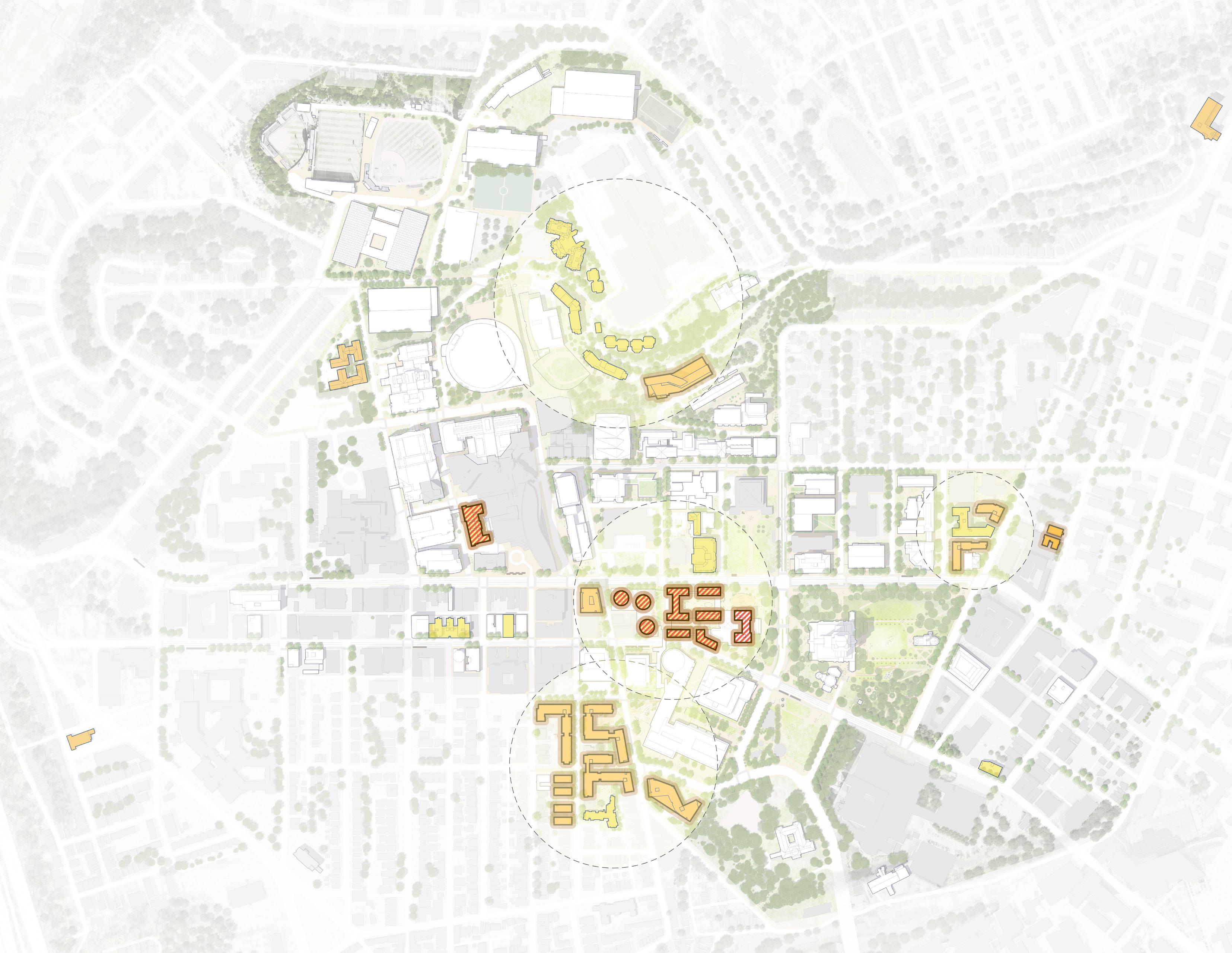
Existing Undergraduate Housing
Existing Graduate Housing
Proposed Housing Development
Proposed Housing Renovation
Housing Cluster
O’Hara
Lothrop Hall
William Pitt Union
Litchfield Towers
Schenley Quad Buildings
06 FRAMEWORK PLANS
FRAMEWORK PLANS
A series of framework plans collectively contributes to a comprehensive and coordinated guide for incremental change and organizes the recommendations for the Pitt campus.
The intent of the framework plans is as follows: 1) To promote flexibility and adaptability in response to strategic priorities and implementation opportunities; 2) To shape an integrated and comprehensive structure for public realm improvements, building renovation and future development.
The framework plans draw from the drivers, principles and Big Ideas for the Campus Master Plan and recommend investments in academic life, campus and residential life, mobility, accessibility and inclusion, landscape and infrastructure to enable long-term growth while also enhancing quality of life, financial and environmental sustainability and community goals.
The framework plans, combined with the proposed development opportunities across the campus districts, create a flexible structure for accommodating projected growth and accommodating programmatic needs over the next decade and beyond.
The framework plans include:
1. Community Context Framework
2. Public Realm Framework
3. Mobility and Accessibility Framework
4. Sustainability Framework
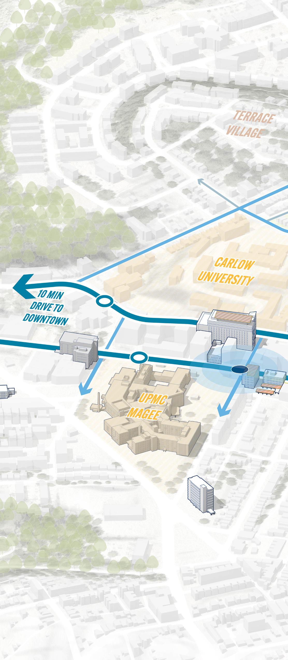
1. Community Context
Historic Districts
Surrounding Institutions
2. Public Realm Framework
Campus Gateway
Major Open Space
Streetscape Improvement
3. Mobility Framework
Major Urban Spine
Streets
Pedestrian Connection
Mobility Hub
4. Sustainability Framework
Potential Panel
Potential Roof-top Solar
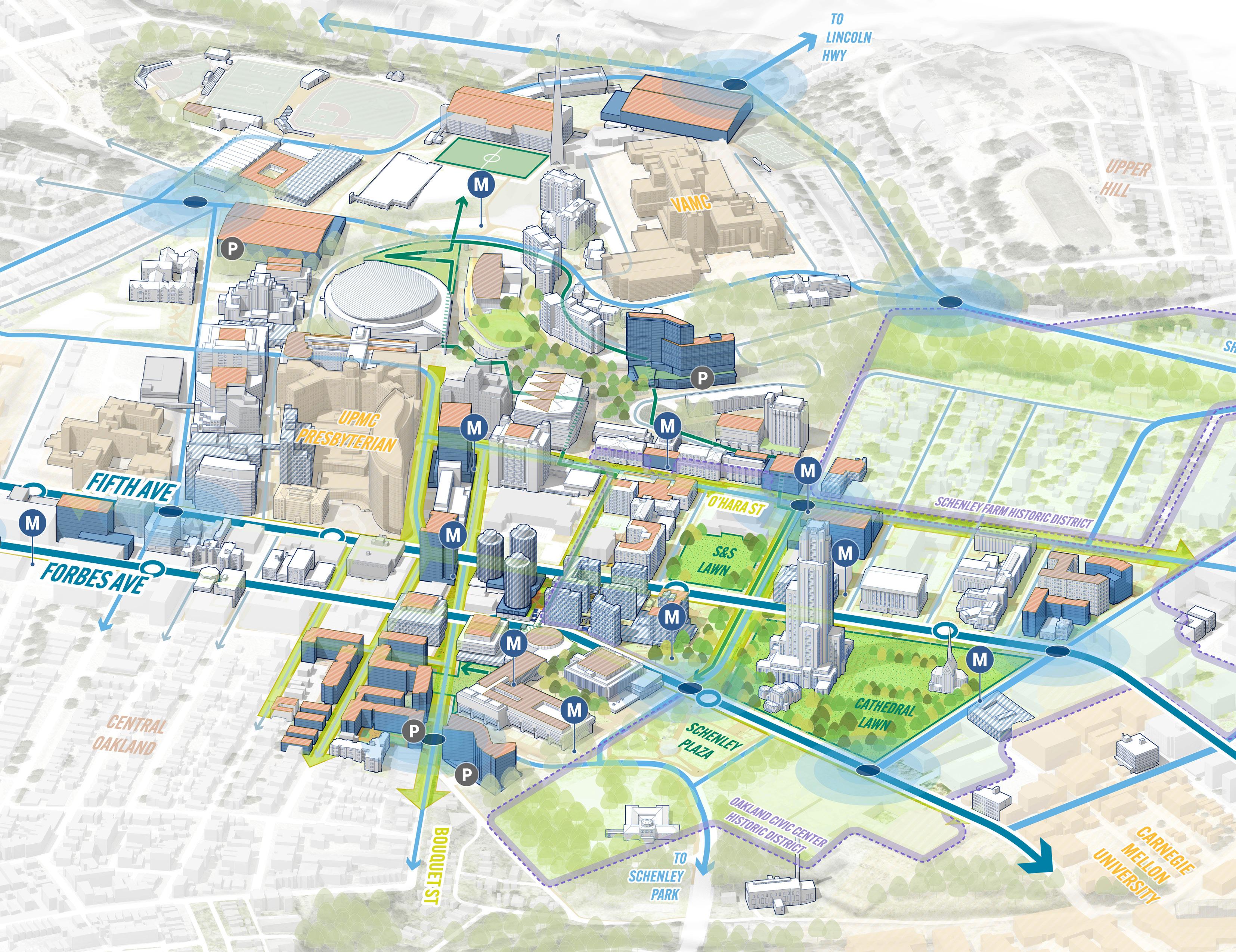
6.1 COMMUNITY CONTEXT FRAMEWORK
Located three miles east of downtown Pittsburgh, the Pitt campus is integral to central Oakland along the Forbes and Fifth Avenue corridors. Central Oakland aspires to be ª dynamic center of innovation and research. Beyond Oakland, Pitt operates in several other facilities and athletic venues.
Located in one of the most dynamic and vibrant areas of Pittsburgh, Oakland is home to Carnegie Mellon University, the Carnegie Library and Museums, the University of Pittsburgh Medical Center, Carlow University and the Veteran’s Hospital. Together, these institutions form the context for the Pitt campus.
Central Oakland is not only defined by its institutional density, however, but also by its vibrant street life, historic architecture, and its cultural and ethnic diversity, shaped by strong connections to the adjacent Uptown and Shadyside. The area’s housing market is made up predominantly of rentals, and is home to sizable populations of students and seniors. While its proximity to major institutions along the Forbes and Fifth Avenue corridors reinforces its role as a hub of education and healthcare, the surrounding residential fabric reflects comparatively lower incomes and a limited mix of neighborhoodserving amenities. As a result, Central Oakland offers fewer services and destinations that appeal to long-term, non-student residents, underscoring both the constraints and opportunities for enhancing the broader community context surrounding the campus.
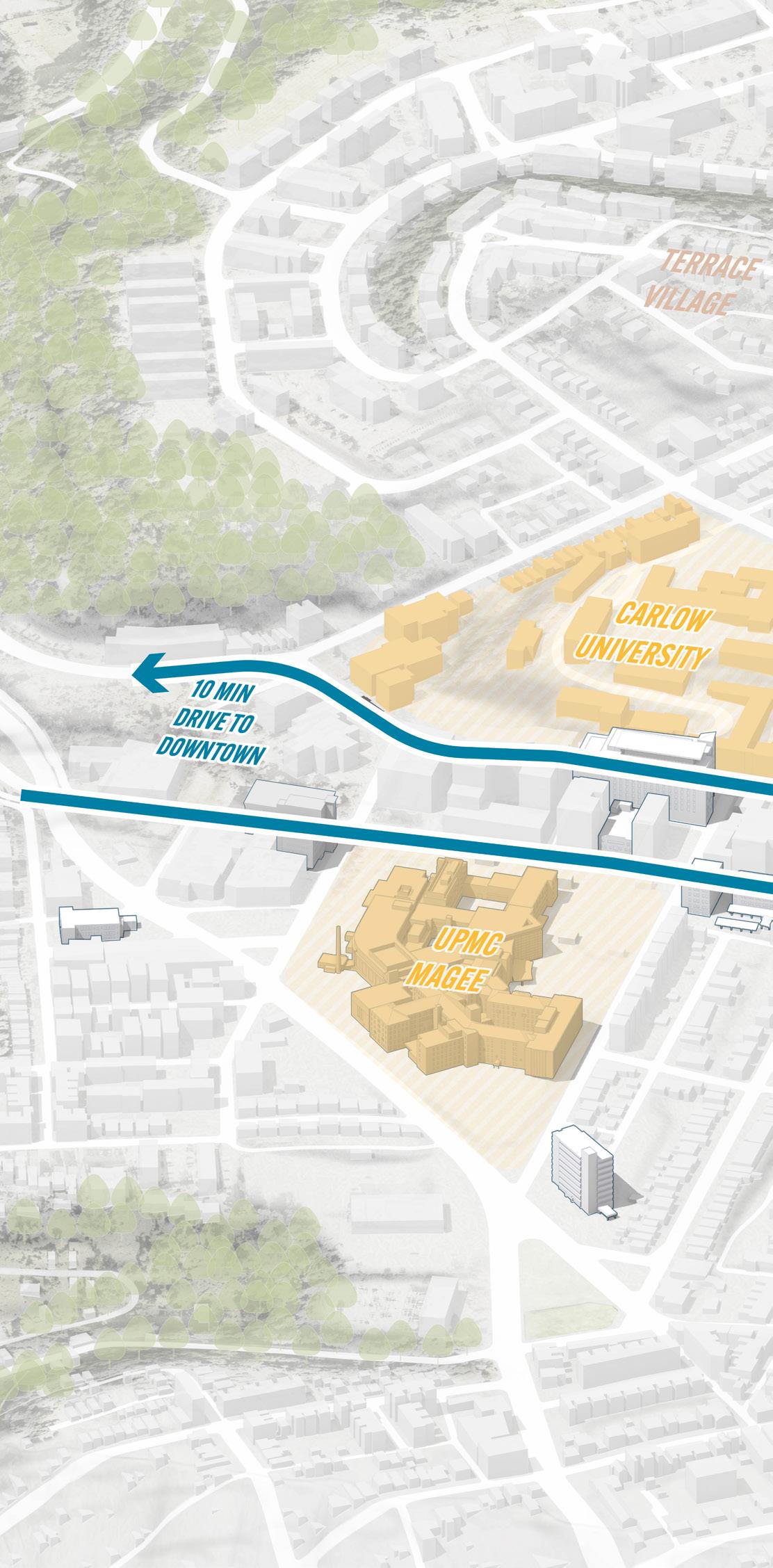
Surrounding institutions
Pitt Owned Historic Buildings
Context Historic Buildings
Historic Social Clubs
Sources: Oakland Business Improvement District. “Oakland | Pennsylvania’s Global Center.” OaklandPittsburgh.com. Accessed January 8, 2026. https://oaklandpittsburgh. com/
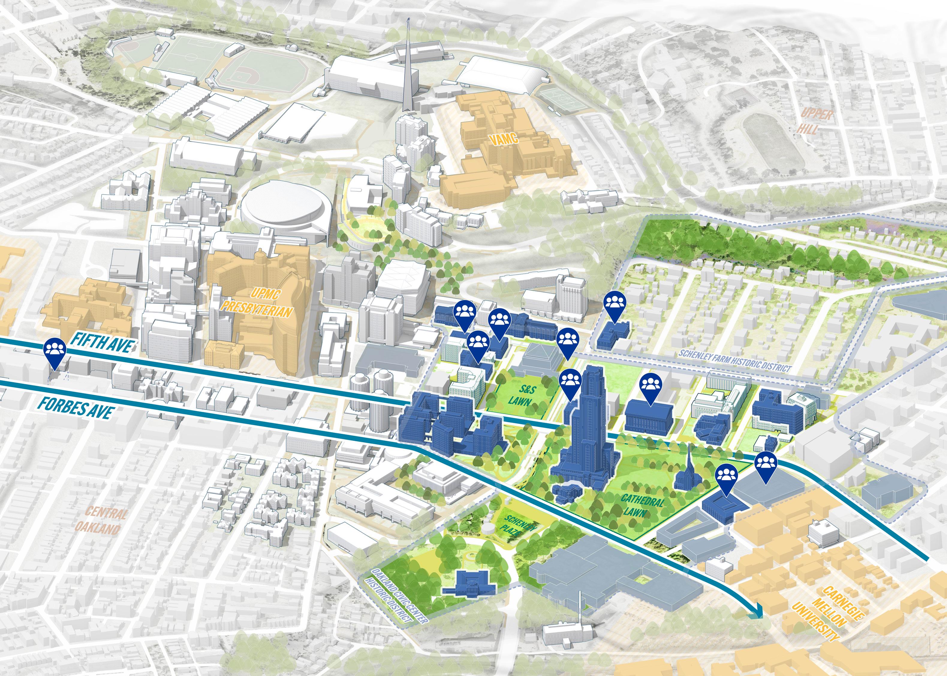
SURROUNDING INSTITUTIONS
A number of factors converged over several decades that facilitated Oakland’s evolution into a nexus for civic, social, and educational institutions. By the late nineteenth century, downtown Pittsburgh was already crowded with industrial activity, leaving little available land for new development. Oakland, meanwhile, on the eastern edge of the city, possessed large tracts of relatively undeveloped land that wealthy philanthropists and institutions saw as potential hosts for campuses, museums, and hospitals. While developer Franklin Nicola laid the visionary groundwork for Oakland’s transformation, Andrew Carnegie, Henry Phipps and others provided the investments that set Nicola’s vision into motion.
Other aspects of Oakland’s spatial and civic character helped situate the neighborhood for institutional development. Located just a couple of miles from Pittsburgh’s downtown Golden Triangle, Oakland was easily accessible by trolley and later by car, making it a natural choice for institutions who desired both visibility and space to grow. Additionally, the architecture along Fifth and Forbes Avenues—the Cathedral of Learning, Soldiers and Sailors Memorial, Carnegie complex—mimicked that of important civic centers in other American cities, thus establishing a fitting and desirable aesthetic for institutions.
Over time, the clustering of universities, hospitals, and cultural centers in Oakland began to reinforce itself. Institutions (Pitt and CMU, for example), benefited from one another’s resources, collectively drawing students, faculty, staff—and other institutions, who desired proximity to the intellectual and cultural life they offered. The neighborhood
became an obvious site for new educational and medical projects throughout the twentieth century, an identity perpetuated today by continual investment from landholders, alumni and government.
The Campus Master Plan acknowledges the importance of the urban context established by Nicola’s vision in association with wealthy investors Andrew Mellon, Henry Clay Frick, Andrew Carnegie, George Westinghouse, H.J. Heinz. Nicola’s plan encompassed land owned by Mary Croghan Schenley, a stockholder in his independent company, the Schenley Land Company.
Oakland’s valued characteristics are sustained in part by a strong ecosystem of community-centered organizations that collectively advocate for Oakland’s residents, support neighborhood stability and economic development, and serve as liaisons between the community and the City of Pittsburgh and Allegheny County.
Chief among these organizations is the Oakland Planning & Development Corporation (OPDC), a long-standing community development nonprofit that shapes South, Central, and West Oakland through affordable housing preservation and renter support. Complementing this work, the Oakland Business Improvement District (OBID) supports Central Oakland’s commercial corridors— encompassing roughly 200 property owners and businesses, including Pitt and UPMC—through place-management, streetscape improvements, and district-wide programming.
Sources: Oakland Planning and Development Corporation. “Housing.” OPDC.org. Accessed January 8, 2026 https://www.opdc.org/housing.; Oakland Business Improvement District. “About.” OaklandPittsburgh.com. Accessed January 8, 2026. https://oaklandpittsburgh.com/pages/about
UPMC
VA Medical Center
Western Pennsylvania School for Blind Children
CMU
Carlow University
Pittsburgh Science & Technology Academy
Central Catholic High School
Oakland Catholic High School
Carnegie Museum
The Board of Public Education of Pittsburgh
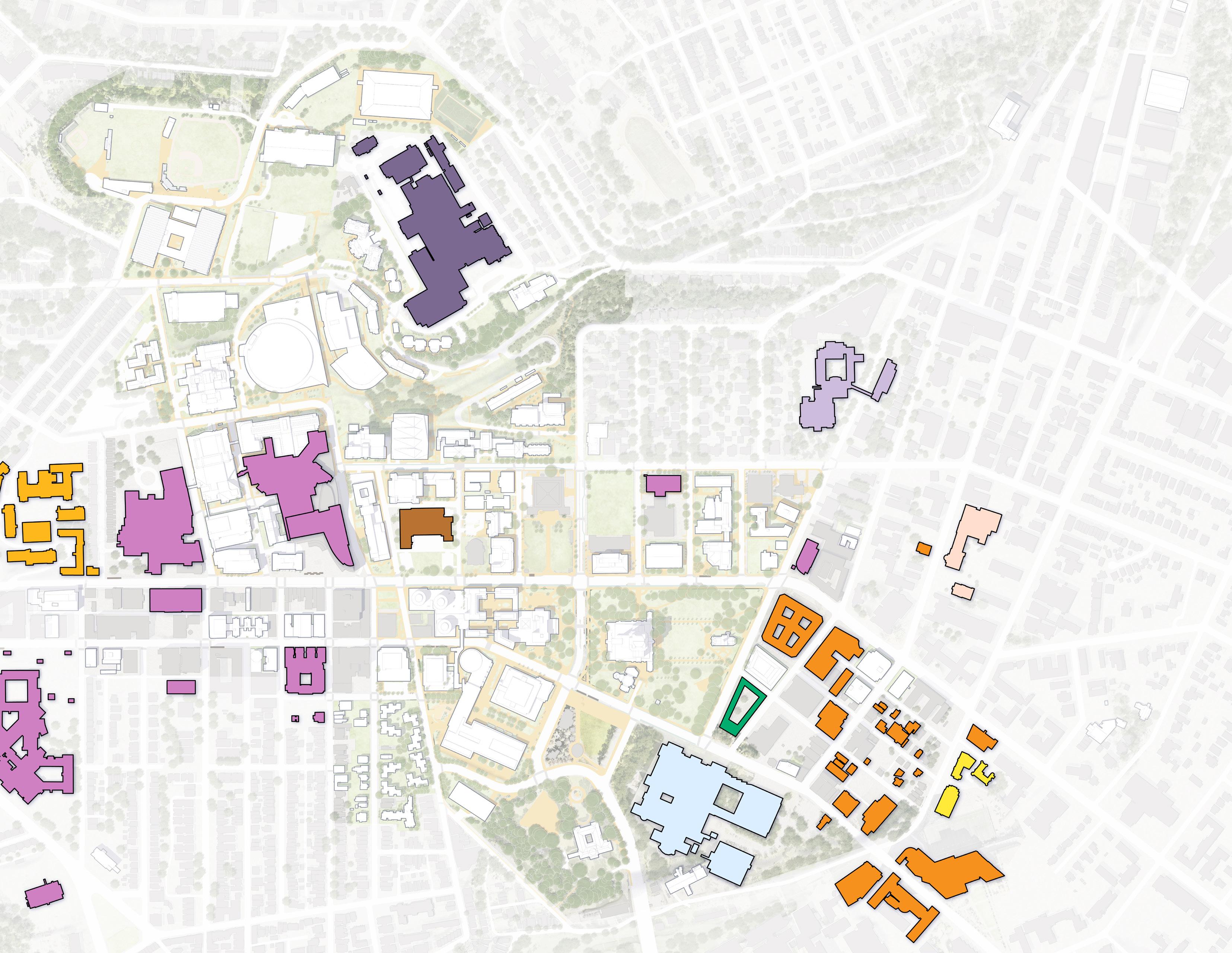
O’Hara St
Parkman
Darragh
6.2 PUBLIC REALM FRAMEWORK
The Public Realm Framework maps the existing limited open space within Oakland, and advocates enhancement of Pitt-owned public spaces to encourage safe pedestrian navigation throughout campus. Where possible, the framework softens and extends exterior plazas for public use, activating the ground floors of buildings to welcome and engage students, faculty, staff, visitors and passersby as they traverse campus and the Oakland neighborhood.
The framework maintains and renews these facilities and proposes the construction of new facilities to foster an inclusive, collaborative campus experience. The integration of public art installations further enhances the public realm framework.
Ensuring that Pitt’s vibrant and active campus environment continues to flourish is a key goal. To that end, recommendations for the public realm include enhancements to major streetscapes and open spaces. Recommendations for the ground floors of major buildings contribute to the vibrancy by means of indoor-outdoor programmatic and visual connectivity / transparency. The framework identifies locations for collaboration hubs, amenities, services and retail along major public realm corridors in both existing and proposed facilities. Outdoor gathering, dining and study terraces complement interior lounges and other public spaces.
The public realm integrates gateways, entrances and wayfinding strategies with streetscape and landscape enhancements, and establishes a comprehensive network of north-south accessible and preferred routes. Altogether, these enhancements will aid in welcoming members of the campus and community to Pitt.
Campus Gateway
Proposed Buildings Contributing to Gateway Experience
Other Proposed Buildings
Streetscape Improvement
In-block Pedestrian Connections
BRT Station
Major Open Space
Gateways:
Forbes and Halket
Fifth and Darragh
Terrace Street and Darragh
Allequippa/Robinson/Dunseith/Darragh Street Gateway
Centre Avenue at Herron Avenue/Champions Drive
Centre Avenue at Utterback Drive and Allequippa Street
Bigelow and O’Hara
Fifth and Bellefield
Cathedral of Learning Area
Forbes and Bellefield
Posvar Gateway (Bouquet at Roberto Clemente Drive)
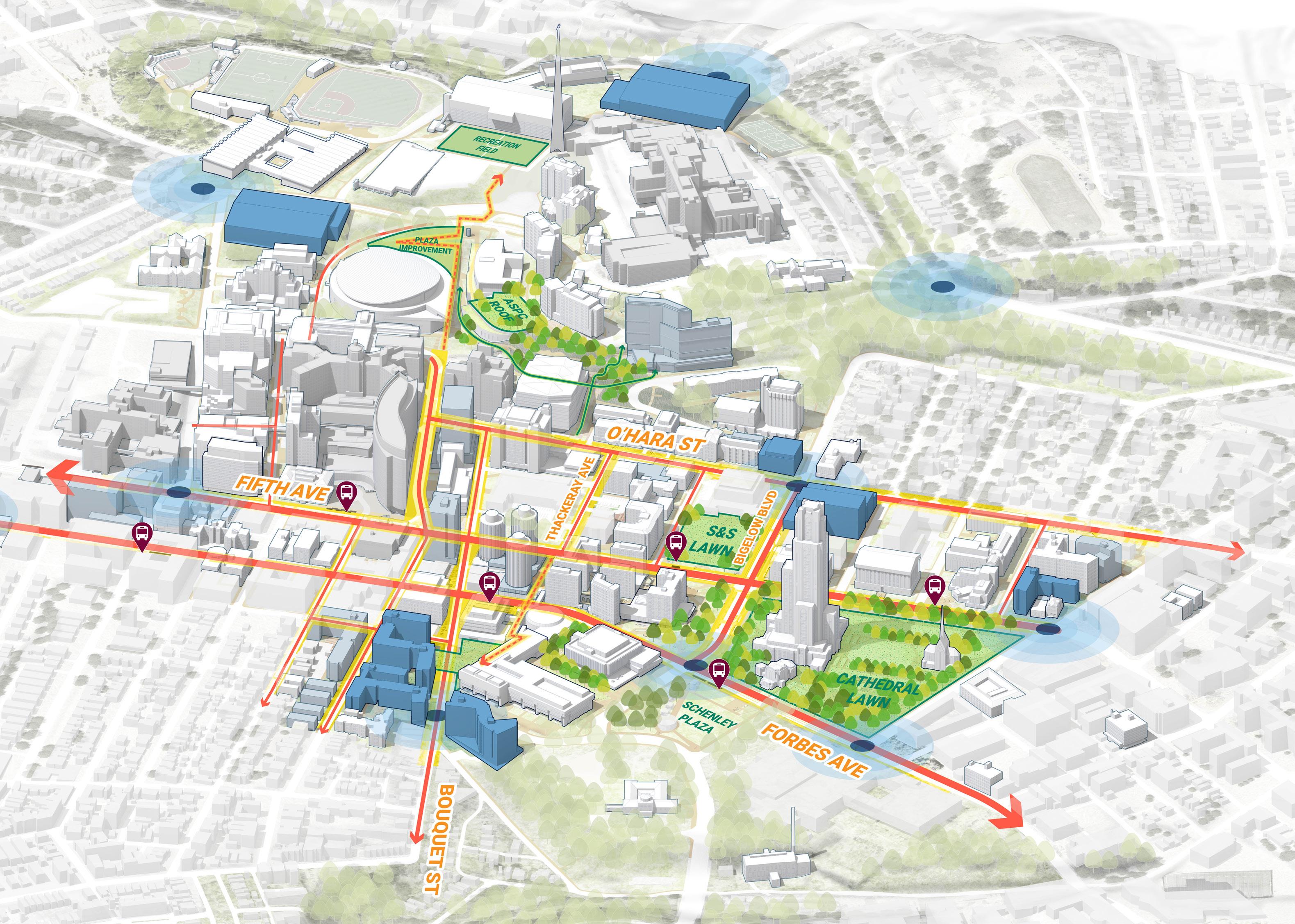
CAMPUS GATEWAYS
Recommended gateways offer opportunities for landscape features, signage and other orientation elements which collectively contribute to wayfinding on campus. The overall goal is to make it clear to passersby that they have entered the campus acknowledging Pitt’s contribution to the character and quality of the environment in Oakland.
• Forbes and Halket – The intersection of Forbes Avenue and Halket Street serves as a primary vehicular gateway for those entering campus from the west and downtown Pittsburgh and headed toward the heart of campus. Though the immediate area has a mix of ownership, including several lots and buildings owned by Pitt, it represents the jumping off point to the Pitt campus to the north and east with an axial view of the Cathedral of Learning along Forbes Avenue. This southwestern gateway presents an opportunity to improve sidewalks, plantings, signage, branding, and wayfinding to signal that you have entered the University of Pittsburgh campus.
• Fifth and Darragh – The Fifth and Darragh intersection serves as a gateway to the School of Medicine, Dentistry and athletic facilities located along Darragh Street. The framework recommends directional signage at the northeast corner of the intersection, the location of BST3.
• Terrace Street and Darragh – A secondary gateway at the corner of Terrace Street and Darragh includes additional gateway signage on the northeast corner providing directions to the Petersen Events Center, School of Dentistry and School of Medicine as well as other athletic facilities at the top of the hill at Allequippa Street. entrance to Posvar and the future Bouquet Gardens, along with an elevator that will provide a new accessible route to Chevron and Hillside.

Gateway at Posvar
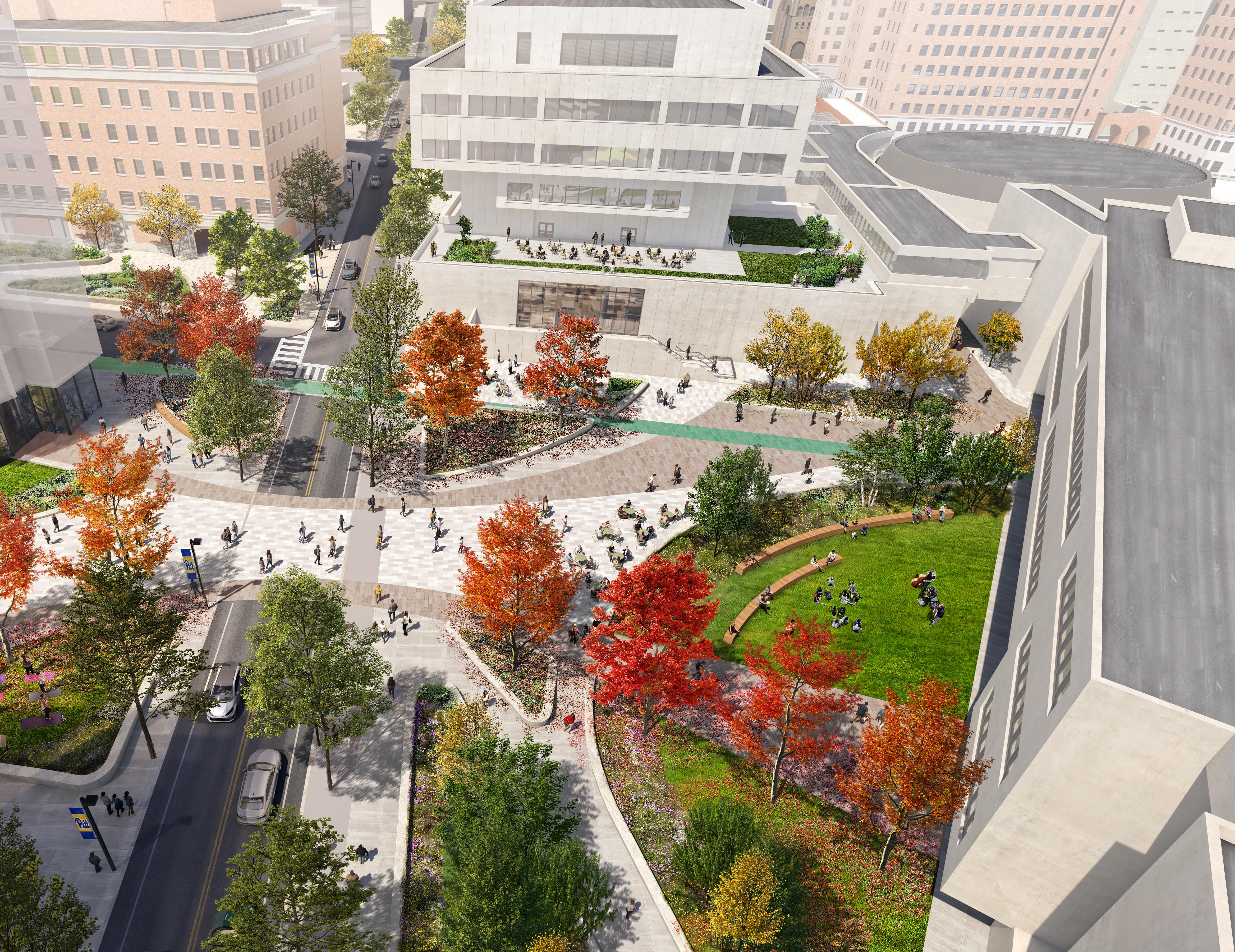
• Allequippa/Robinson/Dunseith/Darragh Street
Gateway – The convergence of Robinson, Dunseith and Darragh Streets defines the athletics gateway to campus on Allequippa Street. Trees Hall and proposed redevelopment on the southeast corner (Fitzgerald Field House), define the gateway to the athletics venues of the Pitt campus including the Petersen Events Center and the new Arena. Enhancements include landscape and signage elements south of Trees Hall. A future hillside parking garage and indoor track facility over the garage contribute further to the definition of this gateway (existing Fitzgerald Field House site). Other facilities accessible from this gateway include Vartabedian Field (softball), Ambrose Urban Field (soccer) and Charles L. Cost Field (baseball).
• Centre Avenue at Herron Avenue/Champions Drive – The Centre Avenue intersection at Herron Avenue and Campions Drive serves as the northern gateway to campus providing access to the major athletic fields. The framework calls for new landscape and architectural gateway signage to define the entrance from the Hill District. The future replacement of the Pitt Sports Dome with a permanent facility contributes to the character of the gateway.
• Centre Avenue at Utterback Drive and Allequippa Street – Utterback Drive and Allequippa Street converge at Centre Avenue to form an eastern gateway to the Hillside area of the campus. Utterback Drive follows the lower elevation on the hillside and provides access to the future Hillside Housing site, and the existing Irvis Hall and Panther residence halls. Via a continuation of the street, Dammond Drive, the route descends southward providing access to Eberly Hall and ultimately intersects Parkman Avenue south of Chevron Hall. Allequippa follows a higher elevation from the gateway intersection at Centre Avenue to provide access to the Falk Laboratory School and the Veteran’s Administration Hospital as well as the fraternity houses located on the slope between Allequippa and Utterback. Allequippa continues to the west, providing access to the Sutherland and Panther residence halls and athletic venues and fields of the campus.
Though not owned by Pitt, the Centre Avenue gateway would nonetheless benefit from ehancements. Potential improvements include landscape and new architectural signage in the converging landscape between Utterback and Allequippa streets. Landscape improvements enhance the central median between the two streets. Reforestation on the steep slope conditions south of Utterback contributes to character of the landscaped edge.
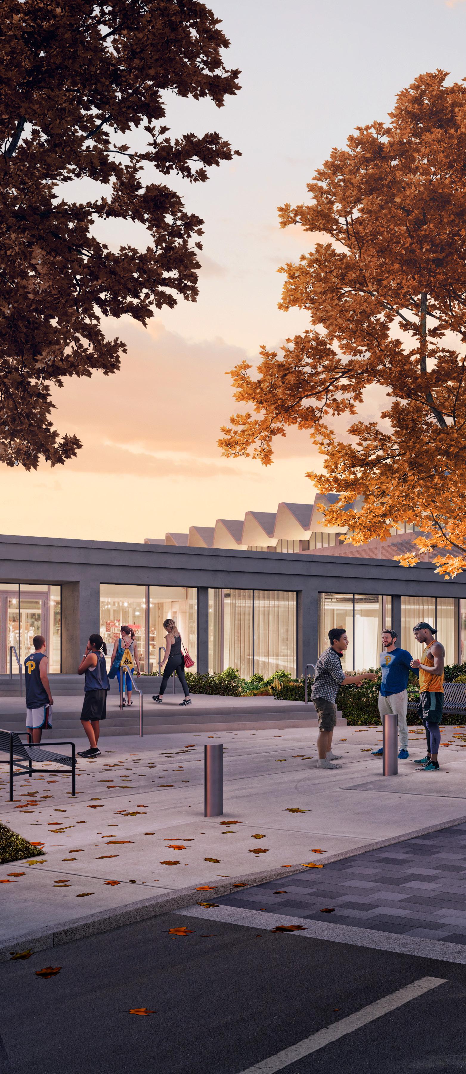
Gateway at Allequippa
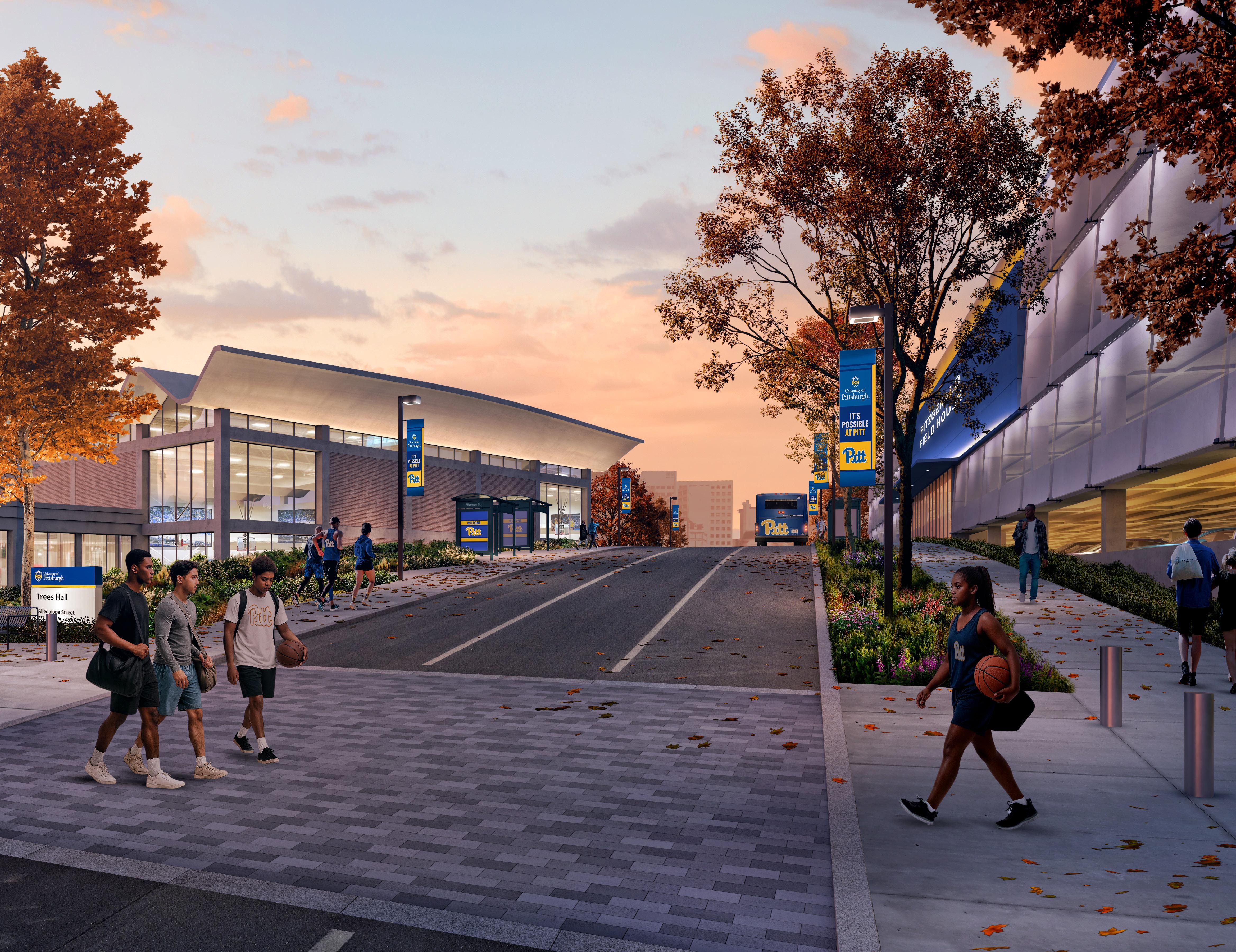
• Bigelow and O’Hara – The iconic Soldiers and Sailors Memorial and 20th Century Club define the Bigelow and O’Hara gateway to the campus. Proposed improvements include a new science facility at the northwest corner, south of the Chevron Tower and the development planned for the Schools of Business and Computing and Information at One Bigelow. Improvements to the public realm include enhanced crosswalks and new pathways through this area.
• Fifth and Bellefield – The corner of Fifth and Bellefield is a high-profile west bound gateway defined by the Cathedral Lawn on the southwest corner, the Music School on the northwest corner, Bellefield Towers on the northeast corner and the Mellon Institute on the southeast. Improvements include a gateway plaza on the southwest corner coordinated with the vision for the Cathedral Lawn, notably the perimeter landscape and allée of trees. The plaza serves as a reception point and integrates new gateway signage. The design of the housing on the Music School site contributes to the gateway character in combination with the historic Music School Building.
• Cathedral of Learning Area – The Cathedral of Learning is the iconic “beacon“ of Pittsburgh, the symbolic center of the campus. The Cathedral Lawn master plan includes recommendations for enhancing each of the pedestrian gateways and greatly improving accessibility.
• Forbes and Bellefield – The Forbes and Bellefield intersection defines an important gateway to the campus for pedestrians as well as motorists traveling east on Forbes. The monumental architecture of the Carnegie Museums on the southeast, the Pittsburgh Public Schools Administration Building on the northeast and the Cathedral Lawn on the northwest distinguish this gateway.
Enhancements to this gateway include new signage coordinated with changes to the Cathedral Lawn.
• Posvar Gateway (Bouquet at Roberto Clemente Drive) –The framework illustrates a major new gateway at the intersection of Bouquet Street and Roberto Clemente Drive. A vehicular entrance to campus, especially for first-time visitors arriving from Interstate 376 via Bates Street, future housing development on the Mervis and Central Oakland sites, combined with streetscape, landscape and accessibility improvements at Posvar, defines this important campus entrance. Improvements include the introduction of a raised crossing point at the entrance to Posvar and the future Bouquet Gardens, along with an elevator that will provide a new accessible route to Chevron and Hillside.
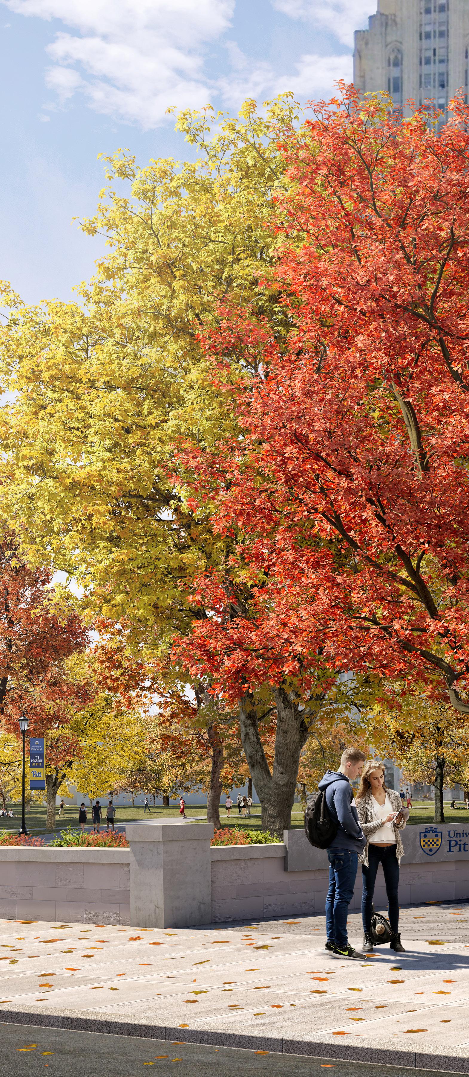
Gateway at Fifth and Bellefield
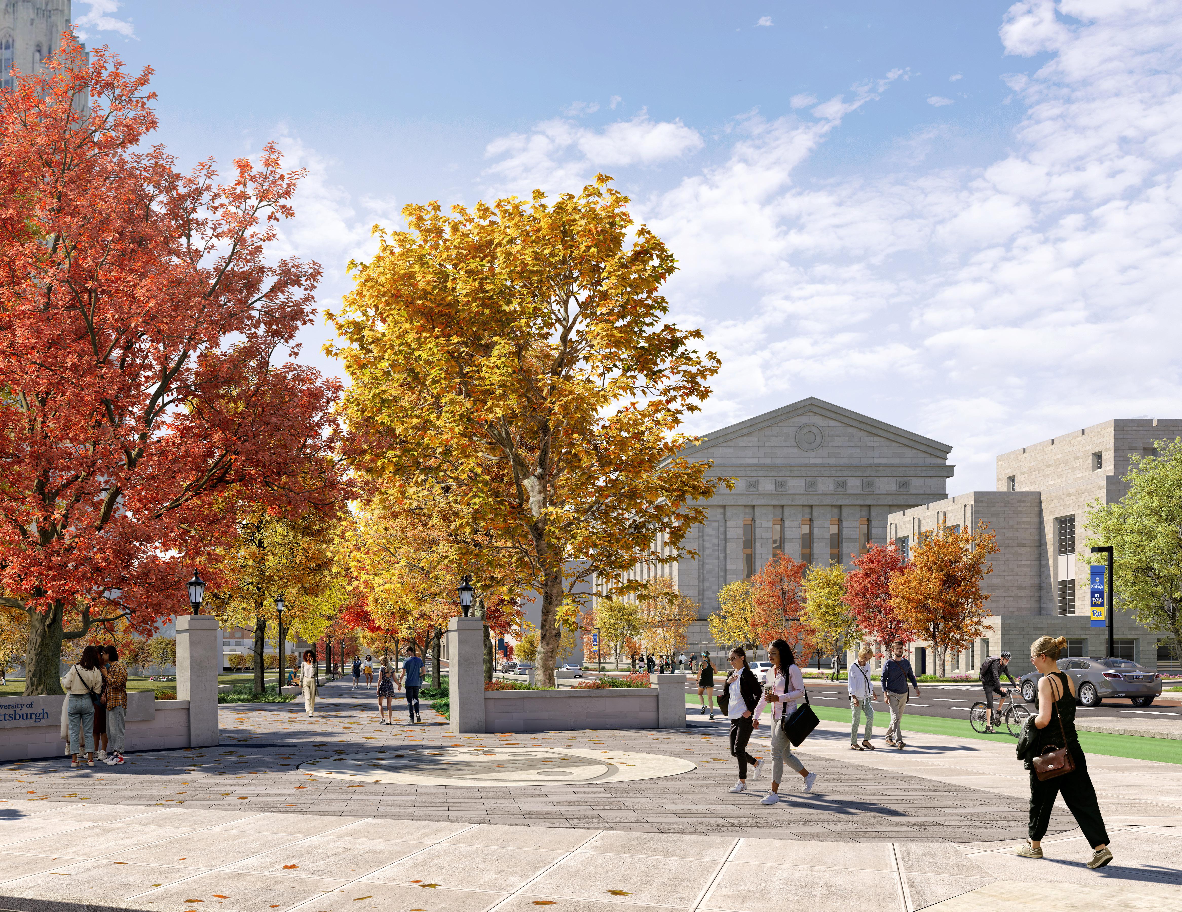
PUBLIC REALM IMPROVEMENTS
Public realm improvements focus on the Fifth Avenue and Forbes Avenue corridors and key north-south streets such as Thackeray Avenue and Bigelow Boulevard with the intent of improving the urban and campus experience. Notable adaptive reuse projects include the transformation of the Pittsburgh Athletic Association building into a new student center for Pitt; the reuse of the 20th Century Club as a new welcome center and alumni building and the renovation of the William Pitt Union (former Hotel Schenley) for housing.
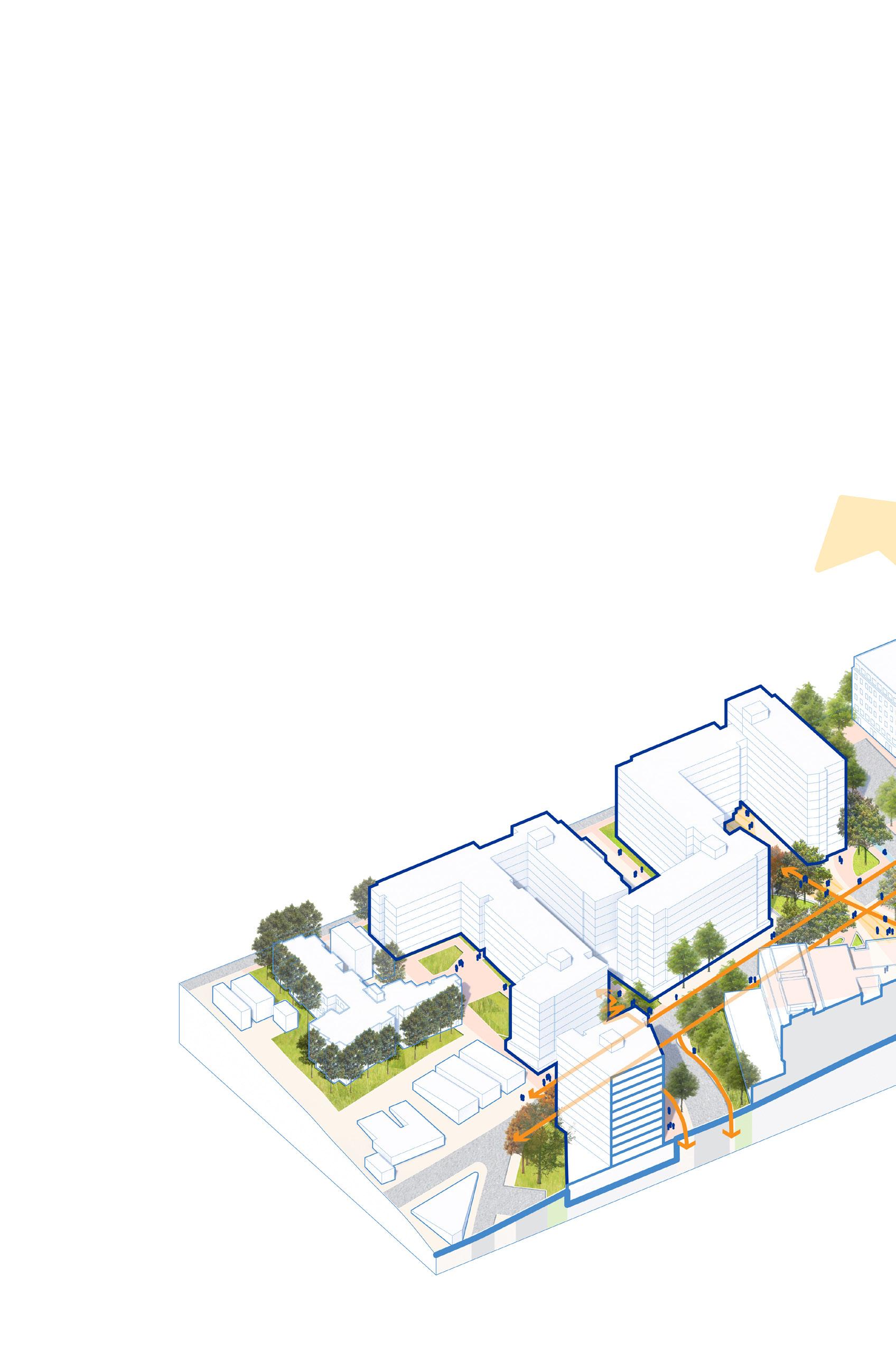
Gateway Landscape with traffic calming measures
Thackeray Bouquet Corridor Public Realm Improvements
Bouquet Gardens Redevelopment
Crosswalk improvement
BRT stop with new plaza and landscape
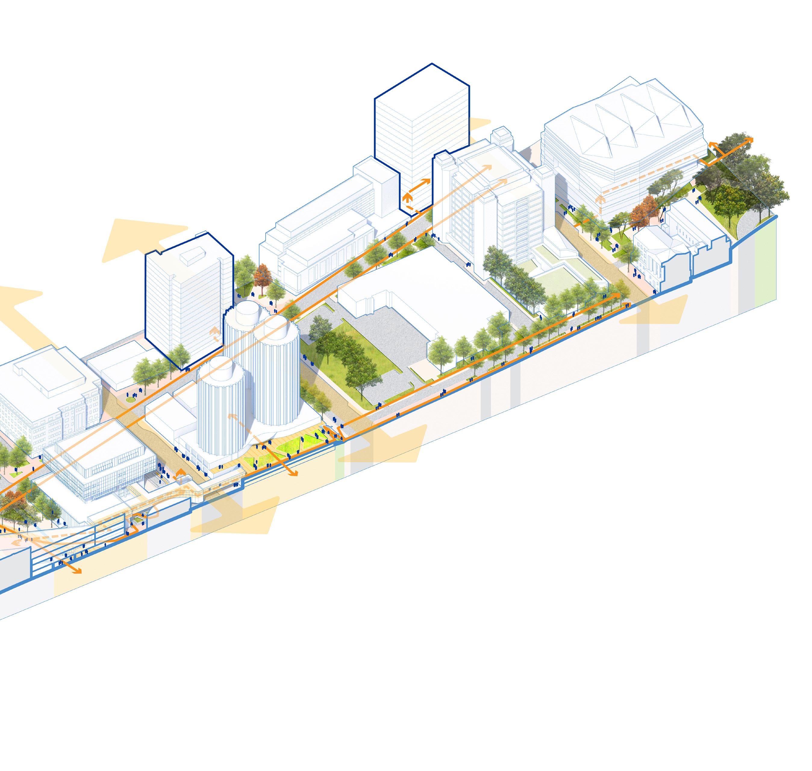
Accessible Path to Forbes Ave
Pedestrian and bike connections to Posvar Lawn
Litchfield Plaza
FORBESAVE
FIFTHAVE
Widened sidewalk and bioswale
Crosswalk improvement
O’HARACORRIDOR
Crabtree Hall
PUBLIC REALM IMPROVEMENTS
The following vignettes illustrate best practices for key public realm features. Incorporating humanscale elements such as seating and rest areas, shade, landscaping, lighting, and accessible pathways enhances the campus experience within an urban context. These recommendations improve comfort and accessibility across campus while delivering shared benefits for both the environment and the campus community.
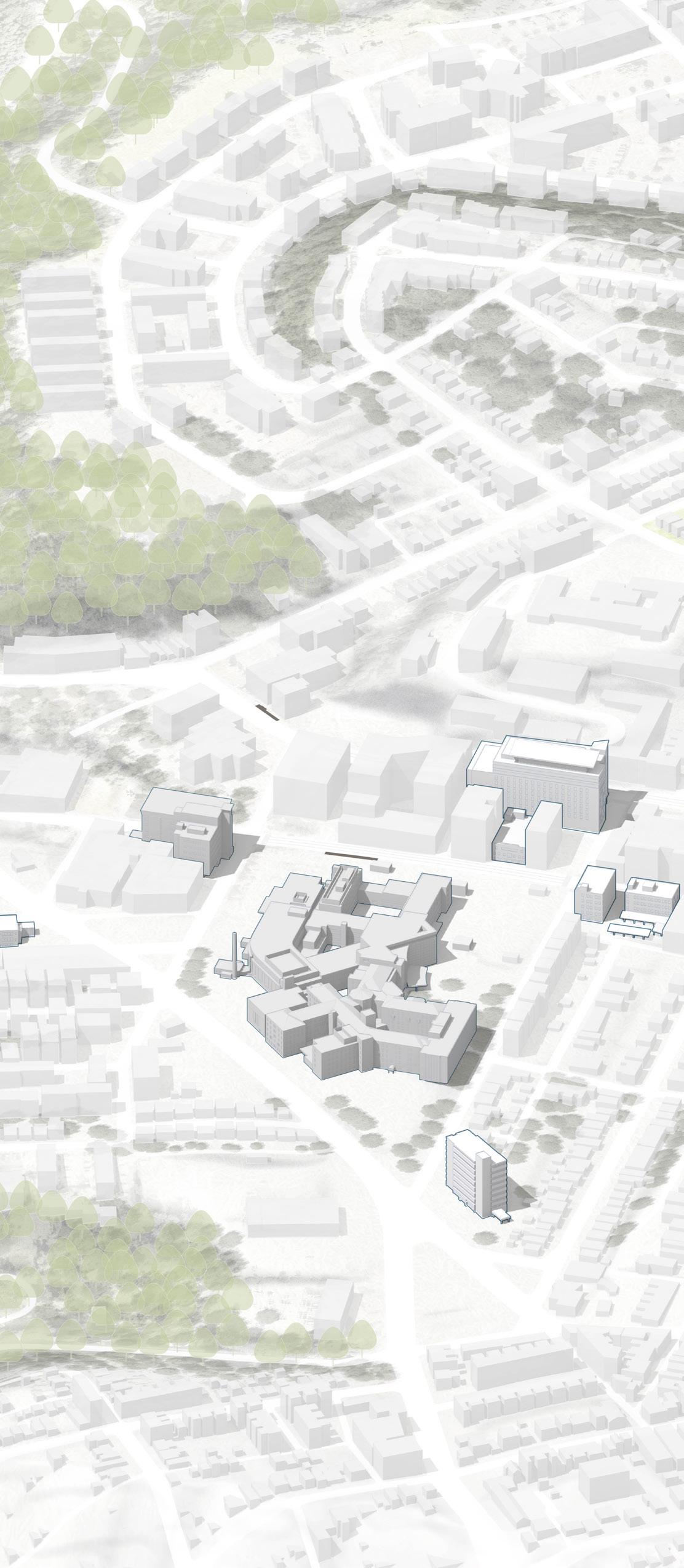
Pocket Park
Integrated Ramps
Occupiable Roofs
Parking Plaza
Pedestrian Promenade
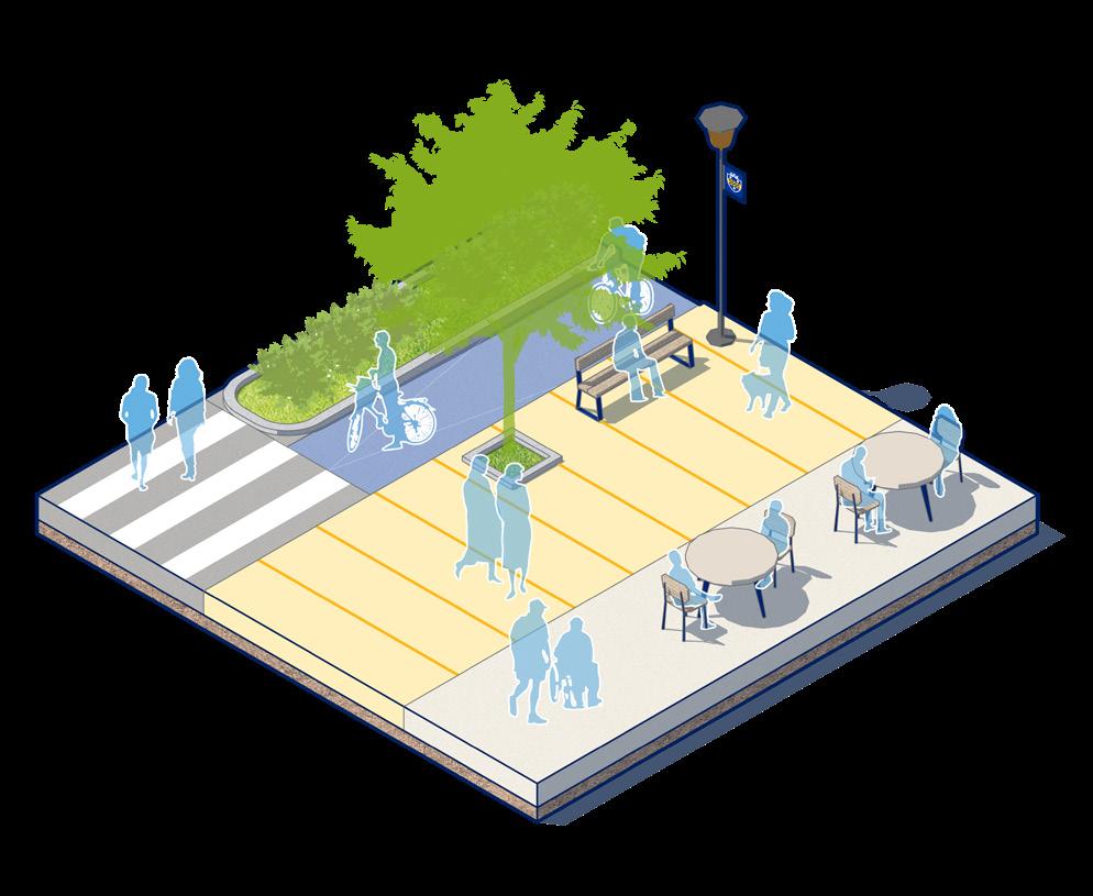
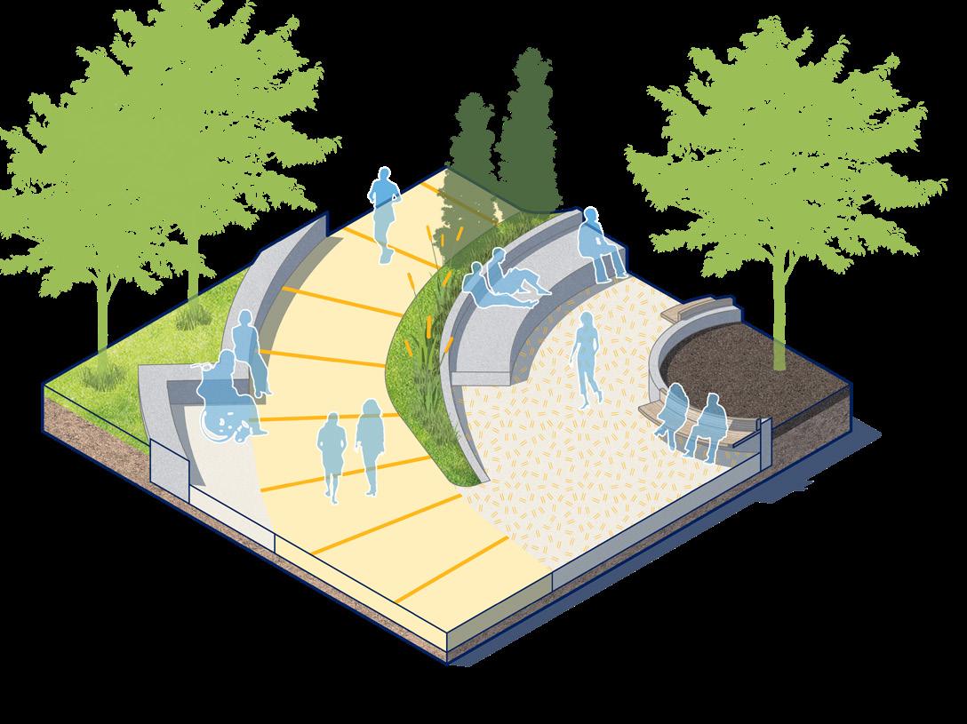
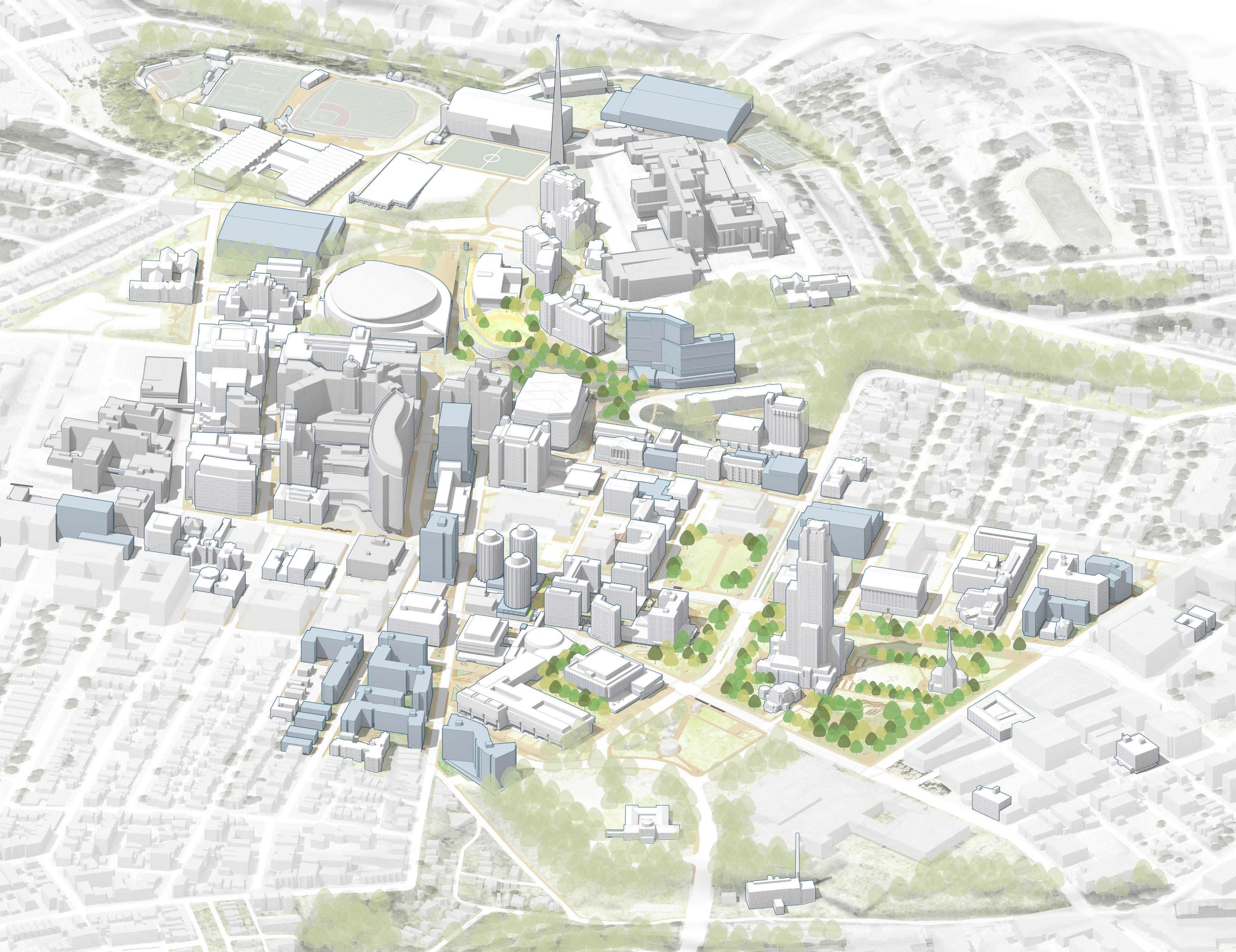
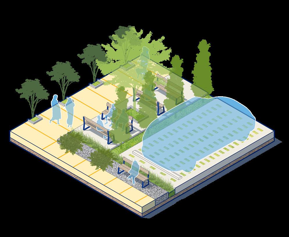
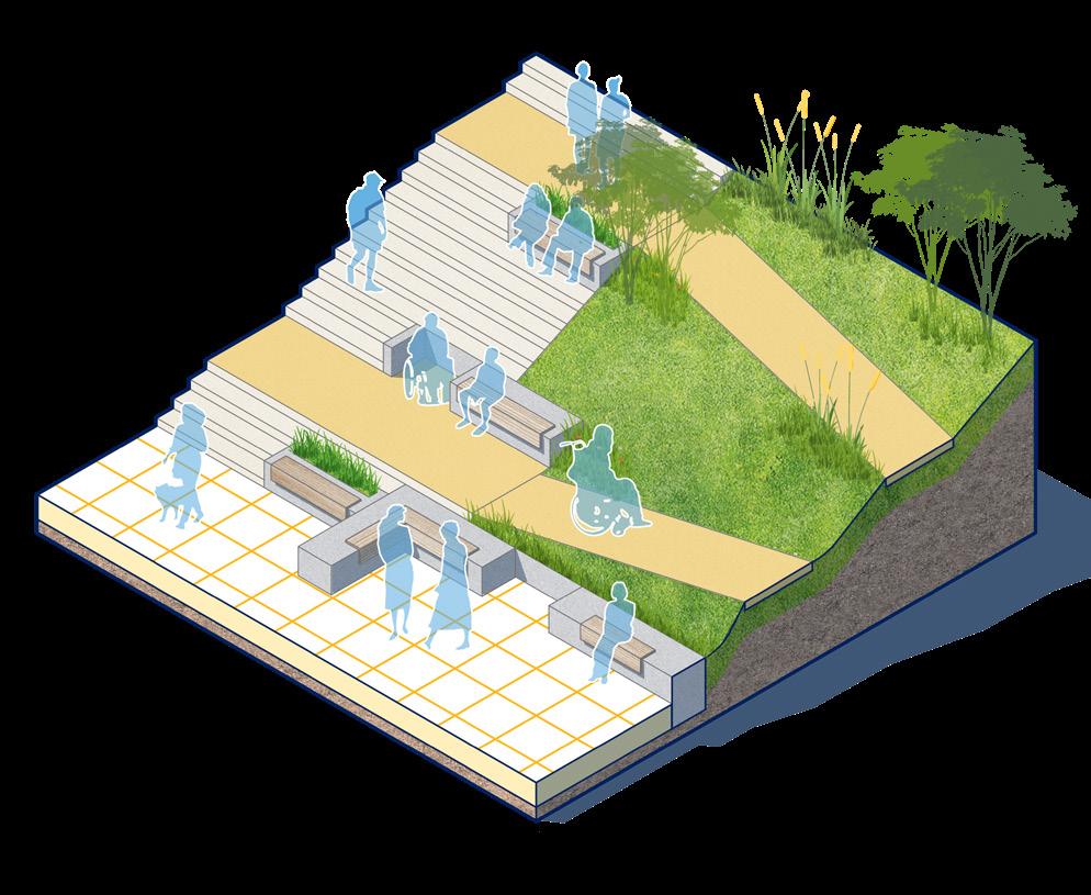
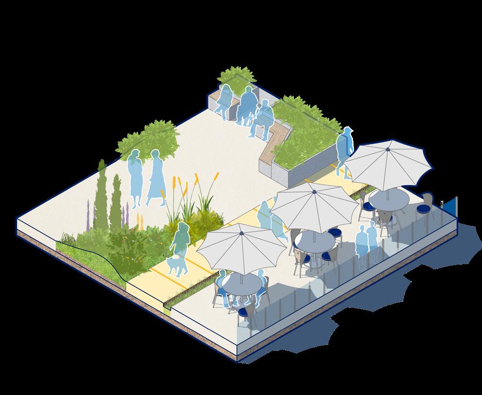
STREETSCAPES
The system of streets, open spaces, and courtyards in Oakland defines both the Pitt campus and its immersive urban context. Major east-west streets such as Fifth Avenue and Forbes Avenue organize the development pattern but also reinforce barriers to north-south movement through the city grid. The Campus Master Plan focuses on improvements to the east-west streetscapes while placing particular emphasis on the north-south streetscapes (due to their generally challenging, inaccessible topography) that connect the lower elevations of the campus with the hillside north of O’Hara Street. These improvements will be developed in close collaboration with property owners, community members, and other stakeholders to ensure that any interventions respect the mix of public and private spaces along these corridors.
East
- West Streetscapes
The framework includes recommendations for improving accessibility and connectivity along the east-west streets within campus. The recommendations respond to the City of Pittsburgh’s proposed BRT routes along Fifth and Forbes along with proposed bike lanes, as well as the Oakland Plan.
Fifth Avenue
Fifth Avenue is a major west-bound arterial connecting eastern neighborhoods such as Shadyside with the campuses of Pitt and Carnegie Mellon, UPMC and ultimately downtown Pittsburgh. To enhance these connections, the City of Pittsburgh is planning BRT lanes along the north side of Fifth Avenue with major stops at Clapp Hall, Soldiers and
Sailors Memorial and UPMC. The City’s plan locates bi-directional bike lanes on the south side of the street, eliminating the current contraflow bus lanes. Anticipated benefits of these investments include enhanced access to the Pitt campus for students, faculty and staff, improved pedestrian safety and expanded bike mobility options.
Existing sidewalk widths limit improvements to the pedestrian realm to paving and fencing details through the Pitt campus from Bigelow to Bouquet Streets. In response, the framework includes recommendations for improving accessibility, crossing points and the character of the streetscape. Given the limited sidewalk capacity, especially along the south side of Fifth, the framework introduces new east-west connections through Schenley Quad to provide an optional route for east-west movement in the historic heart of campus. While existing slopes derived from topography are generally accessible, there are currently significant barriers to movement due to the presence of non-compliant cross slopes and curb ramps.
To facilitate north-south connections along Fifth, the framework calls for crosswalk enhancements at the following intersections to improve accessibility and pedestrian movement:
• Fifth and Bellefield Avenue
• Fifth and Tennyson Avenue (BRT Stop)*
• Fifth and Lytton Avenue
• Fifth and Bigelow Avenue
• Fifth and University Place (BRT Stop)*
• Fifth and Thackeray Avenue
• Fifth and Bouquet Street
• Fifth and Oakland Avenue (BRT Stop)
*Primary portal into the campus in the mornings
Fifth Avenue Corridor
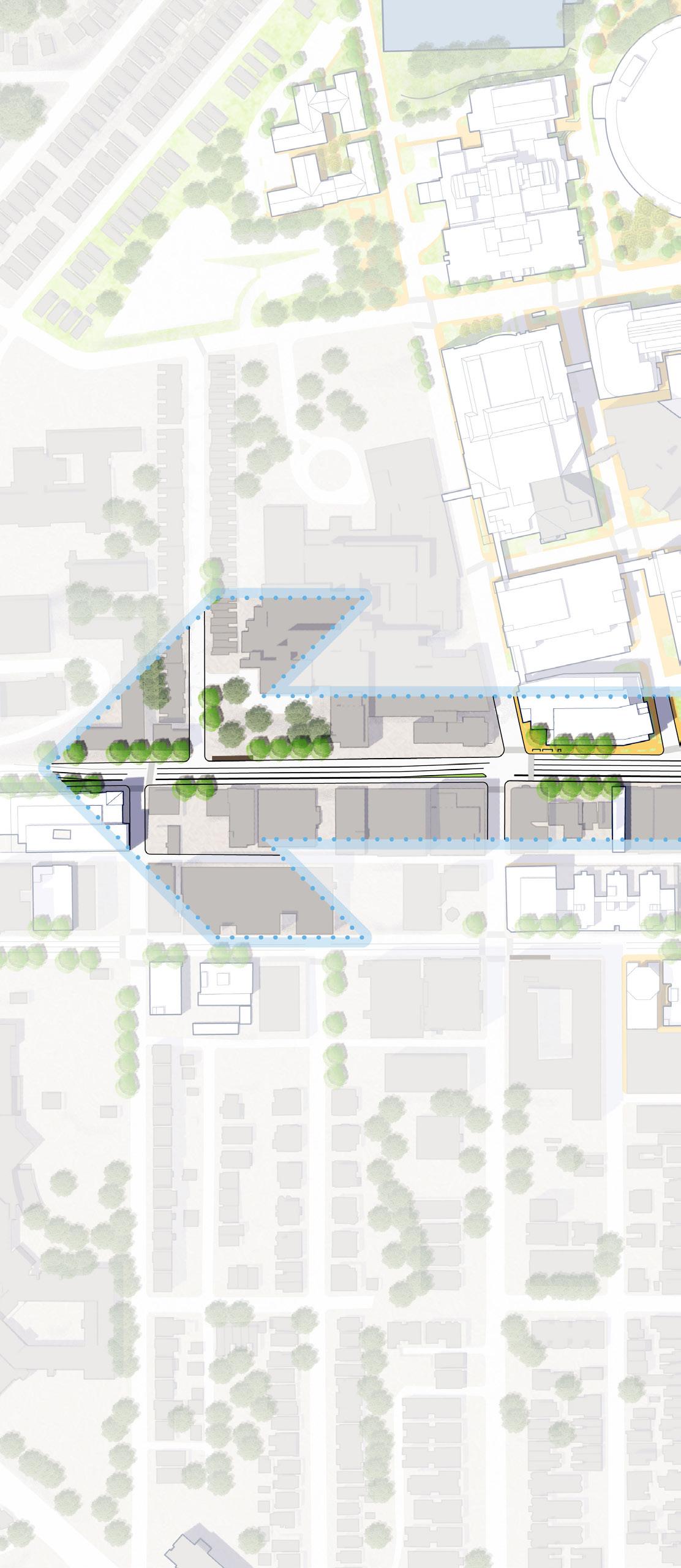
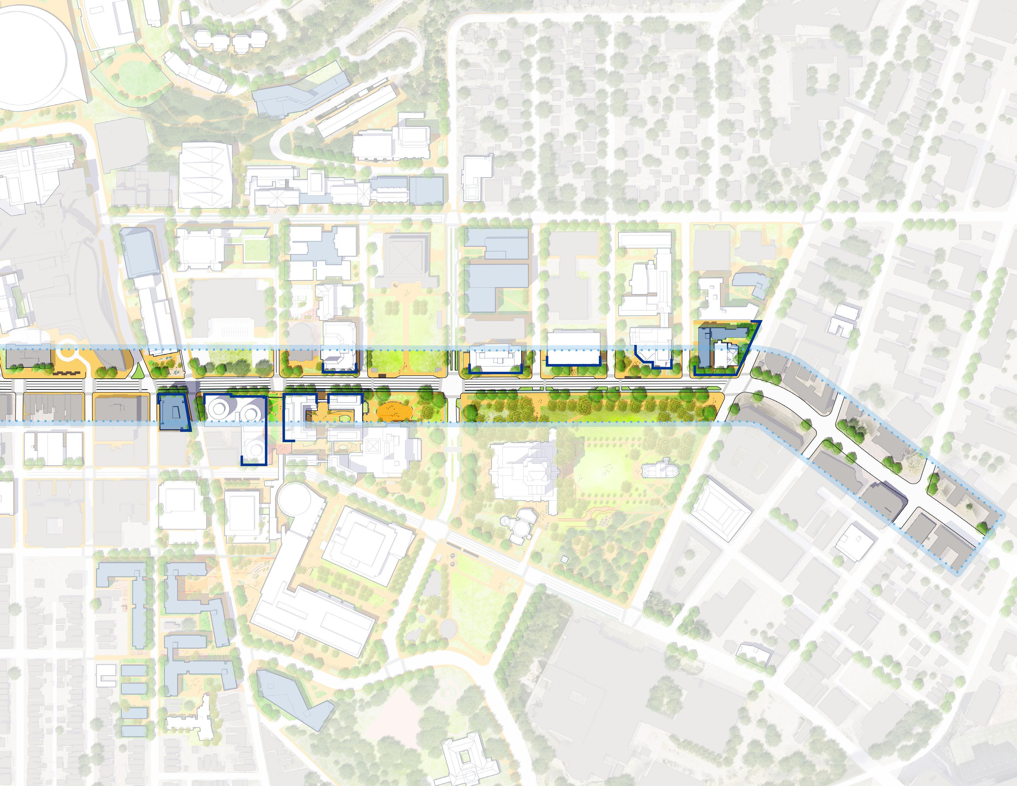
Bigelow
Bellefield
SchenleyDr
Tennyson
Tower D
Proposed Staggered Long Section
O’Hara St-Bigelow Blvd-Fifth Ave
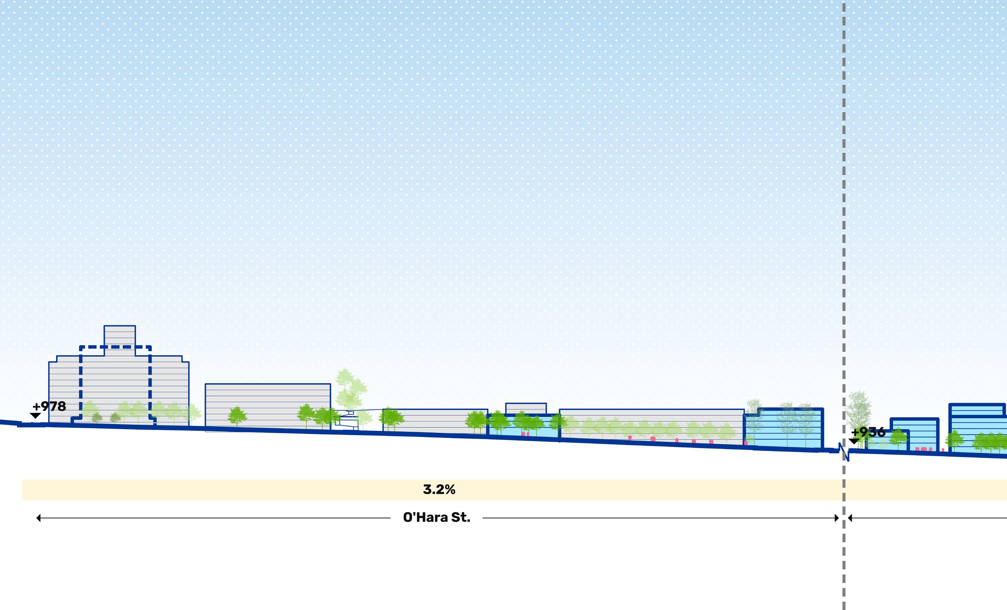
Existing Building
Proposed Building
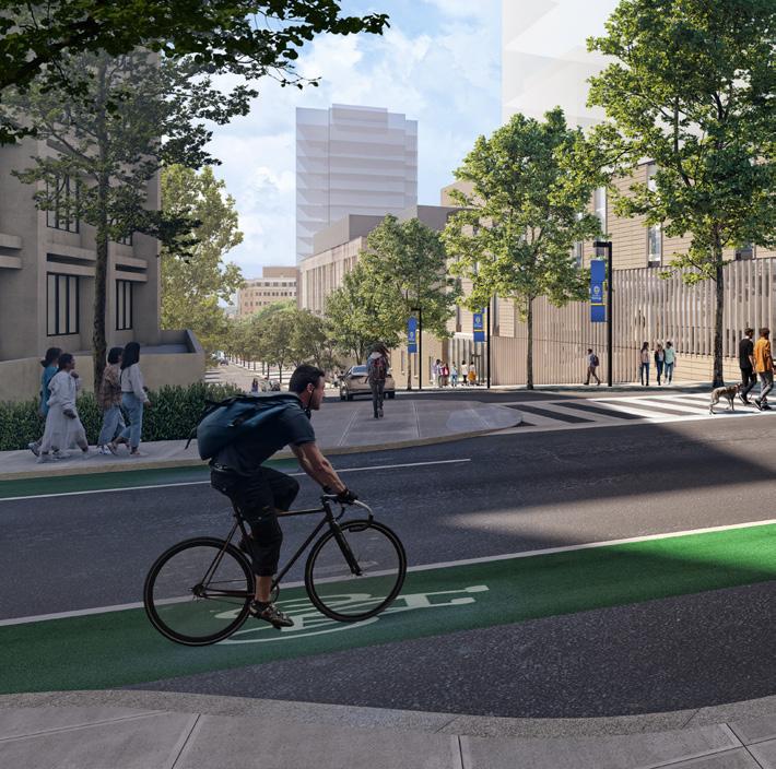
Proposed Building Outside of View
Existing Tree
Propsoed Tree
Slope Level:
Recreation & Wellness Center
Thomas Detre Hall
Lot Site
Crabtree Hall
Old Engineering Hall Renovation
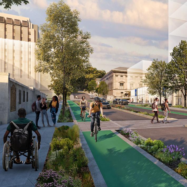
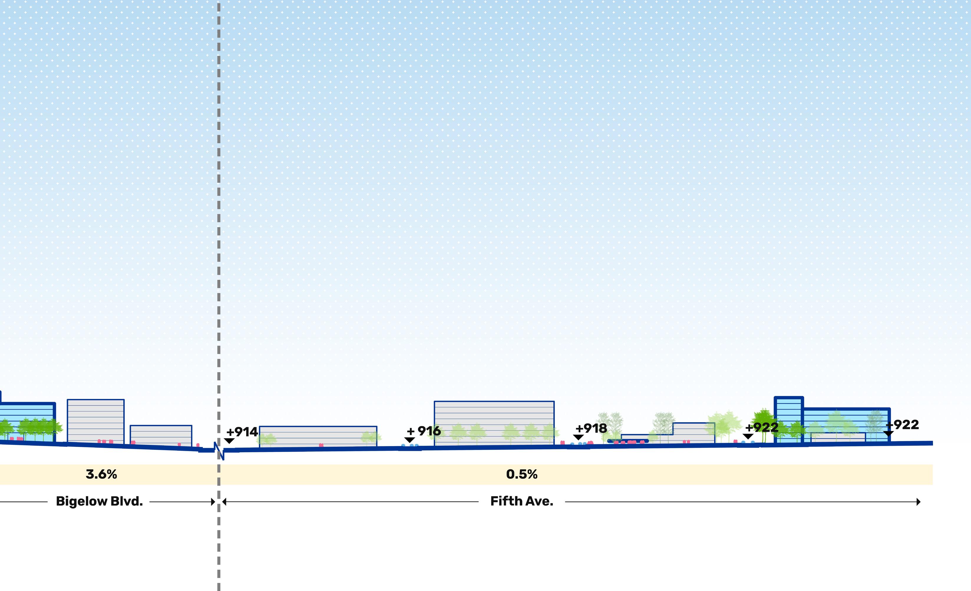
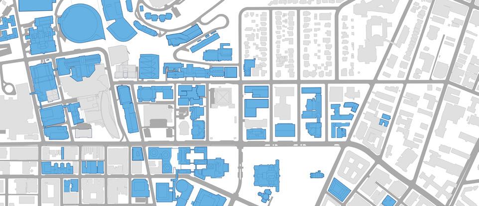
Mobility Hub
BRT Station
Pocket Park
Clapp Hall
Alumni Hall
PAA PAA
The Oaklander Hotel
Residence Halls on Bellefield
Schools of Business and Computing and Information
Fifth at Thackeray
In alignment with ongoing Pittsburgh Regional Transit projects–which the Campus Master Plan adopts–the framework recommends improvements to the Fifth and Thackeray intersection in response to pedestrian flow along the important north-south route connecting Posvar to Fifth via the Forbes Avenue Bridge and Litchfield Plaza. Improvements at the intersection include a gateway landscape at Litchfield Plaza featuring a ramping and stair system designed to provide an accessible connection between the plaza and the Fifth Avenue elevations; this connection is critical to the establishment of a preferred route to the Hillside District. At the street level, proposed improvements to the crossing points facilitate and enhance the flow of people across the proposed BRT, travel and bike lanes on Fifth Avenue. An extensive community outreach and engagement process ensures that these improvements will not only benefit Pitt affiliates, but will also enhance the pedestrian experience for users of the nearby Presbyterian Church and Pittsburgh Public School.
Pedestrian Sidewalk
Bike Lane
Car Lane
Bus Lane
Parking Lane
Green Buffer
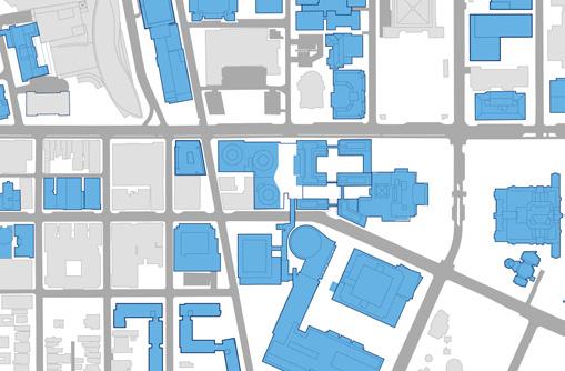
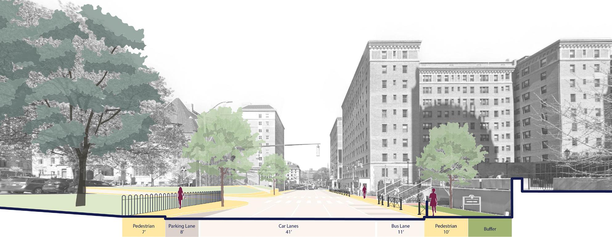
Existing Fifth Ave Cross Section
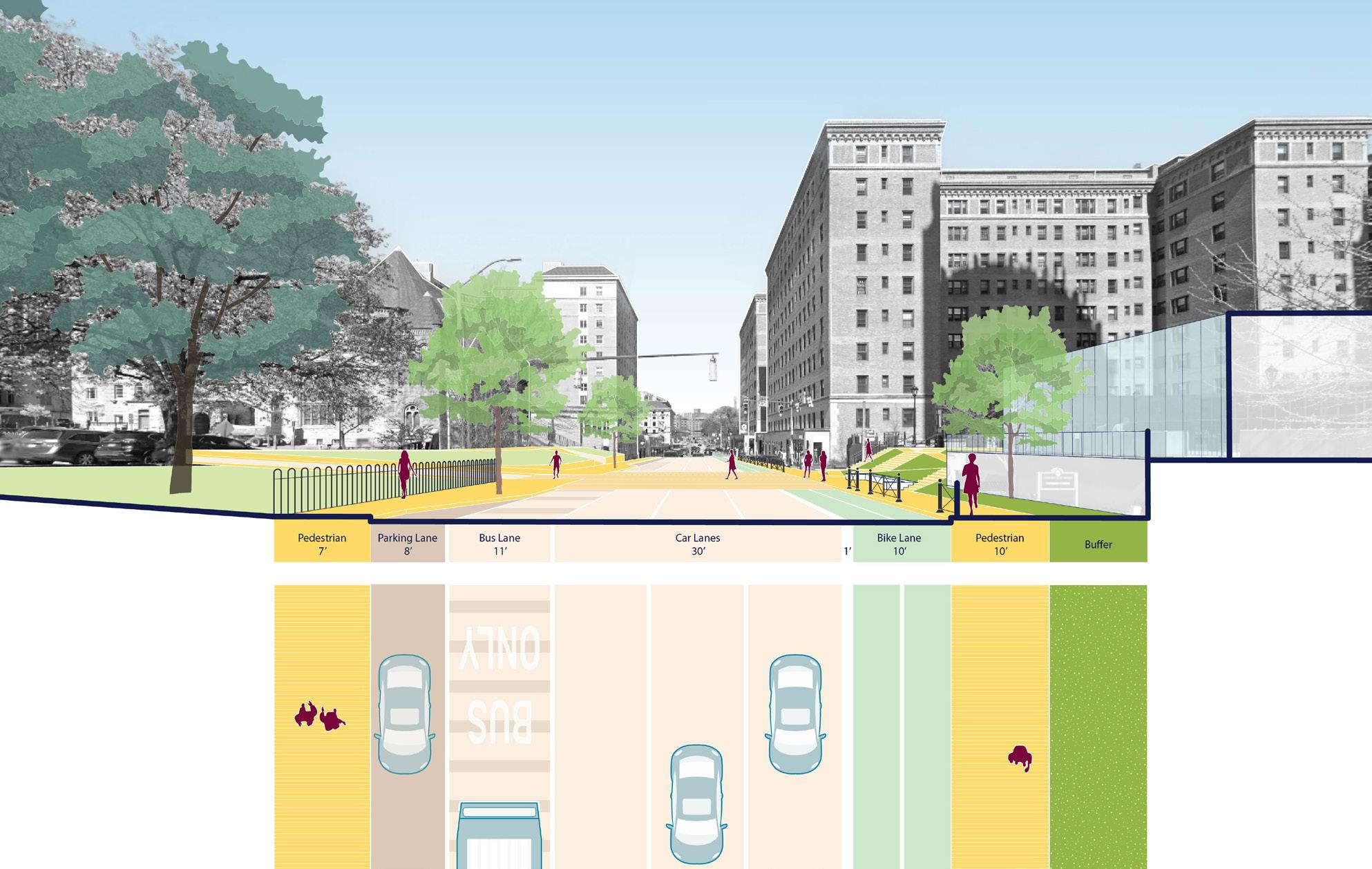
Proposed Fifth Ave Cross Section and Plan
Fifth at Tower D
The Campus Master Plan locates a new residence hall between S. Bouquet Street and Oakland Avenue along Fifth Avenue. The proposed building features a generous sidewalk and plaza area on Fifth Avenue, opening up the social and retail spaces on the ground floor. The building cantilevers to create this generous sidewalk and plaza condition. Revisions to the crossing points take into consideration the east-west and north-south flows of people relative to the proposed BRT, travel and bike lanes on Fifth Avenue, as well as connections to existing Litchifled Towers A-C.
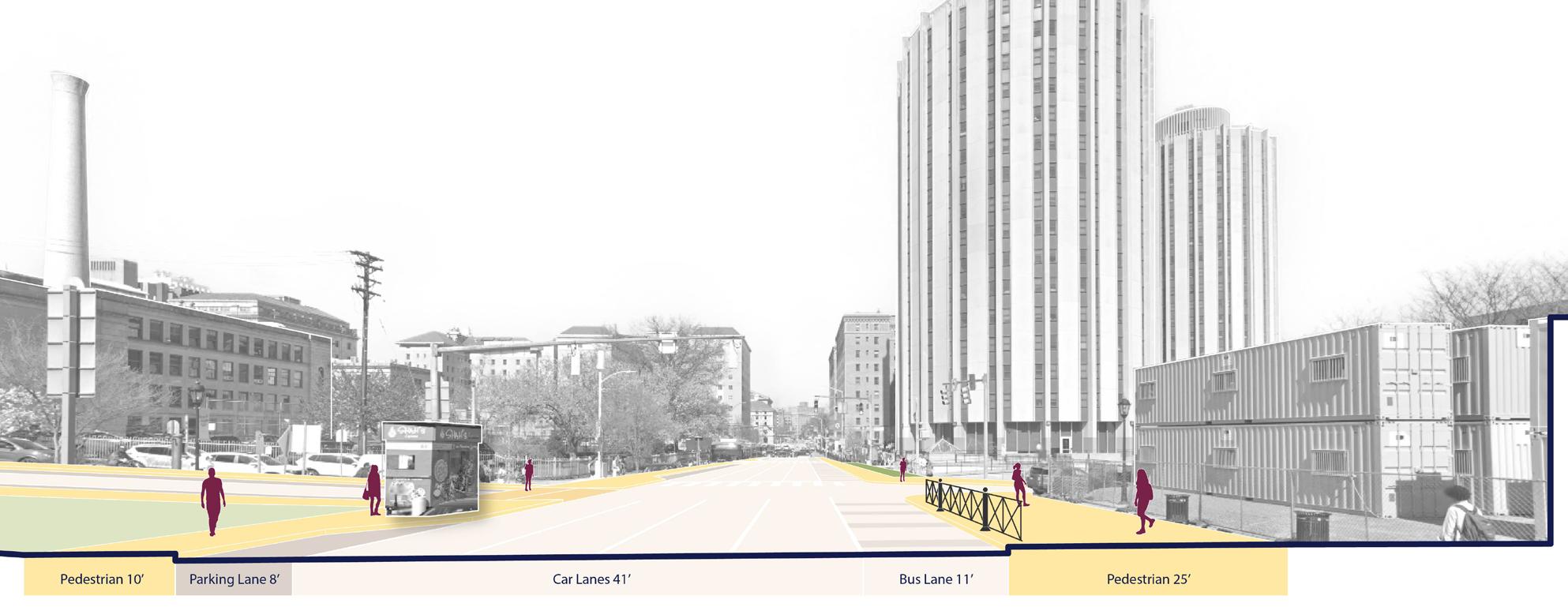
Existing Fifth Ave Cross Section
Proposed Fifth Ave Cross Section and Plan
Generous sidewalk and plaza
Pedestrian Sidewalk Bike Lane
Forbes Avenue Corridor
Forbes Avenue
Forbes Avenue is a major eastbound arterial connecting Interstate 376 with UPMC , the Pitt campus, Carnegie Museums and CMU. Designated as the “Innovation Corridor” through Oakland, the City’s plan locates eastbound BRT Services on the south side of the street with major stops at the Barco Law building and at Schenley Plaza. The dimensional constraints of the street sections— primarily the corss slopes and curb ramps—limit improvements to sidewalks.
The public realm framework coordinates the proposed BRT stop at Barco Law with a new plaza featuring seating areas, shelters and signage / wayfinding systems. To facilitate access to the BRT stop, enhancements include a new elevator and stair tower at the pedestrian bridge over Forbes connecting David Lawrence and the Litchfield Towers; this connection serves as a linchpin to the new preferred and accessible routes. The Barco Law stop is the “exit point” from campus in the afternoons for many users of the PRT services traveling east to Shadyside and beyond.
The framework also recommends improvements to the ground floor of Barco Law to provide campuswide amenities, including general use classrooms. This includes the introduction of a new entrance to Barco Law on the south side of the building to facilitate movement from Mervis and Central Oakland.
Crosswalk improvements along Forbes include:
• Forbes and Bouquet
• Forbes and the Pedestrian Bridge (Mid-block Crossing)
• Forbes and Schenley Drive
• Forbes and Craft
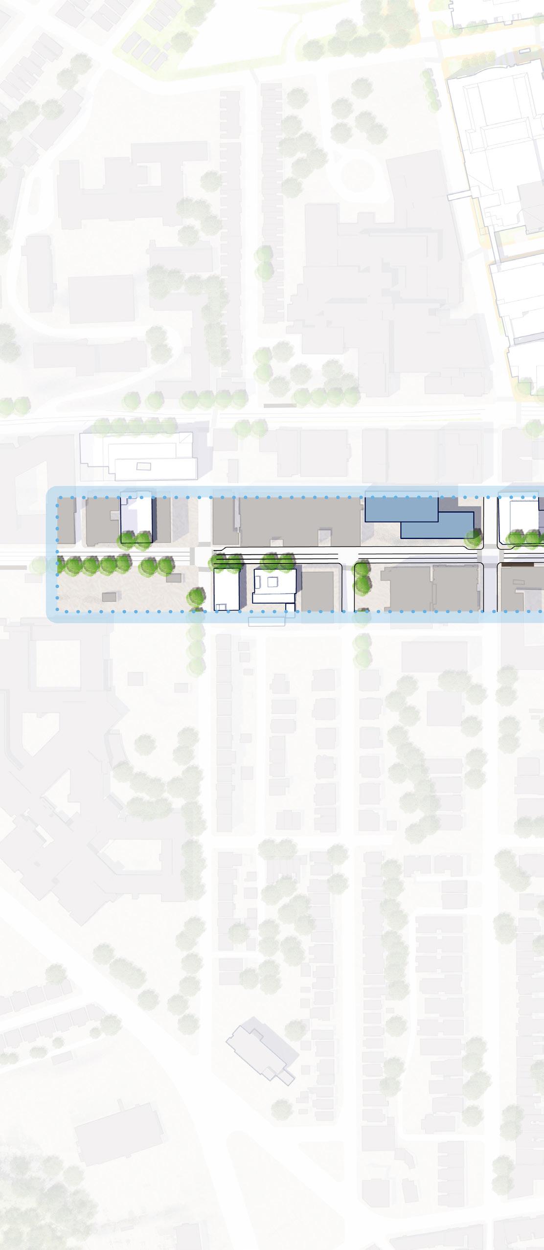
Proposed Building
Active Edge
BRT Stop
Busy Crosswalk
St
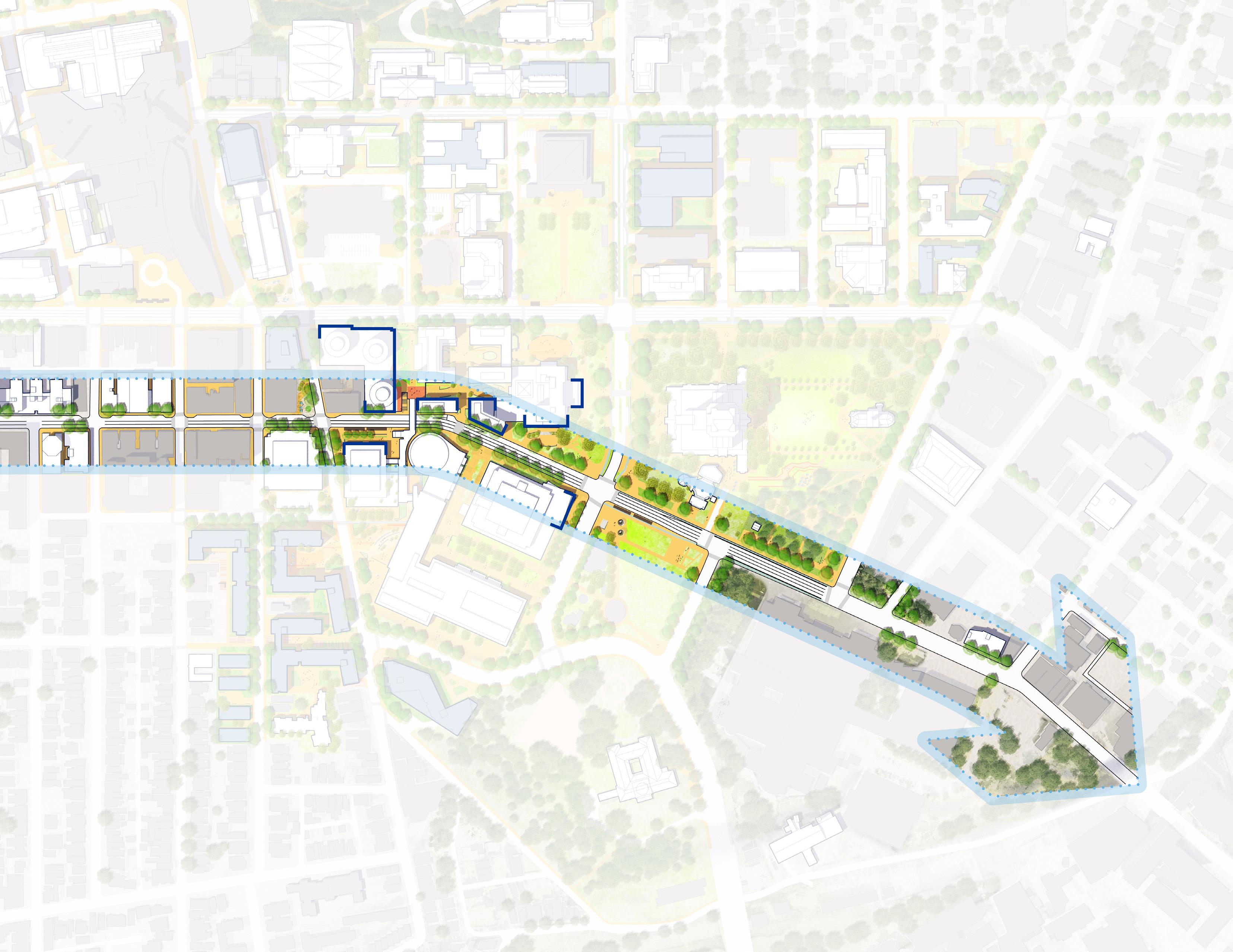
St
Thackeray Ave
Blvd University Pl
O’Hara St
Bigelow
De Soto
Bellefield Ave N Bouquet
S Bouquet St
Schenley Dr
Pedestrian Bridge
Forbes at Barco
A new BRT stop and plaza in front of Barco creates a new campus entry and exit point for those who commute by bus. The plaza features a BRT shelter, seating areas and landscape elements all of which contribute to this gateway to the campus. Given the eastward flow of the buses, the BRT stop serves those living to the east of the campus. The framework anticipates high evening use of this BRT stop suggesting the need for appropriate lighting levels and vertical connectivity with the Forbes Avenue Bridge. Importantly, a new elevator and ramps will together create a completely accessible connection across Forbes Avenue and Litchfield Plaza down through Fifth Avenue, facilitating a more inclusive public realm.
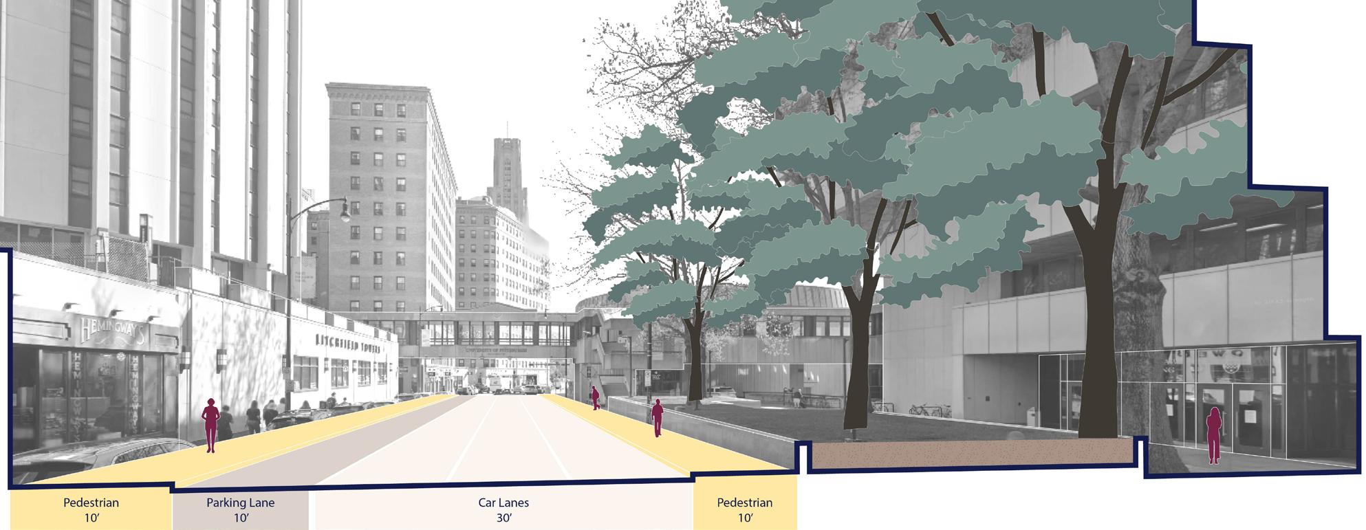
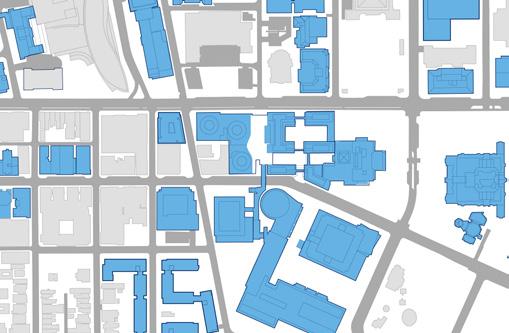
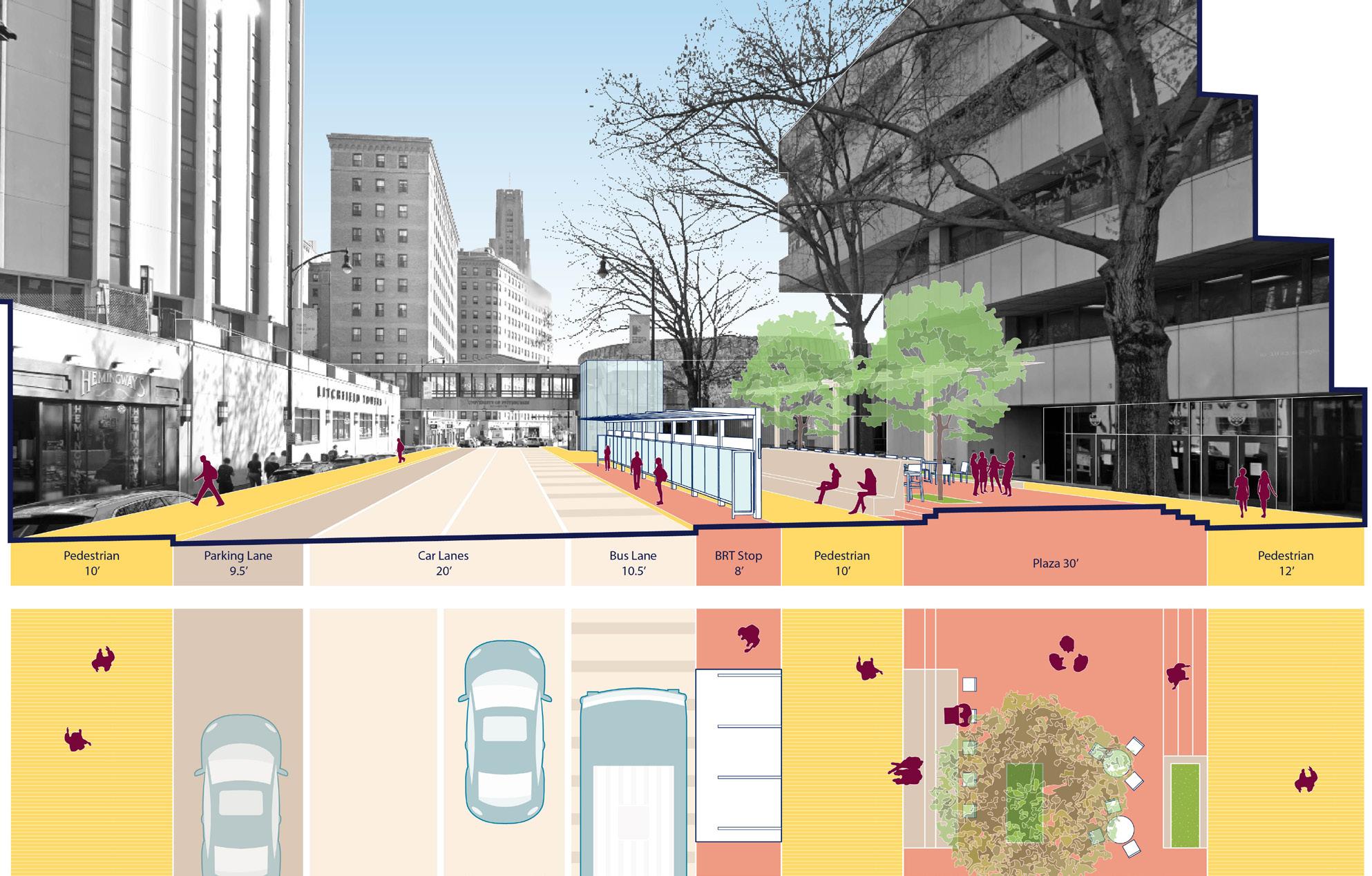
Pedestrian Sidewalk
Car Lane Bus Lane
Existing Forbes Ave Cross Section
Proposed
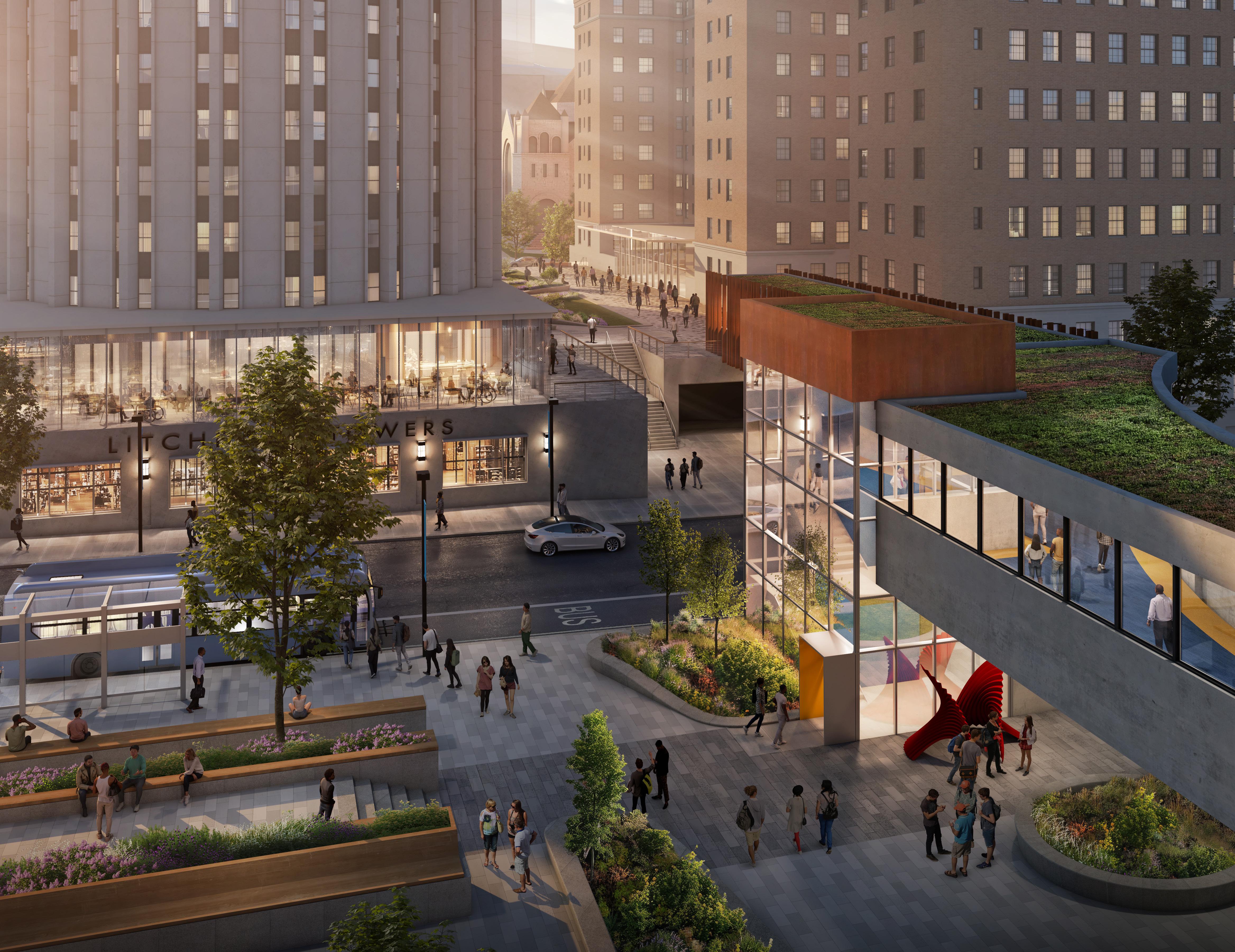
BRT Station at Forbes at Barco Looking North to Litchfield Towers (Landscape of Barco Plaza Designed by Land Collective)
O’Hara Street –
The “Collaboration Corridor”
Proposed public realm improvements along O’Hara Street address existing accessibility challenges, pedestrian connectivity, bicycle circulation and transit services. The public realm framework enhances the user experience along this important east-west route by introducing wider pedestrian pathways where possible, the addition of bike lanes, elevators, transit stops at major destinations including the Recreation and Wellness Center and at O’Hara / Gardner Steel.
The public realm framework also coordinates the improvements with the academic and research programs located along O’Hara Street. From east to west, O’Hara Street links several schools, academic departments and social spaces, such as new the Recreation and Wellness Center and its cafes. To facilitate interaction and innovation among the academic and research activities of these programs, the framework locates collaboration hubs, including One Bigelow, O’Hara / Gardner Steel and Crabtree. Collaboration hubs create areas for pause and respite, as well as encountering others via exterior plazas opening onto active ground floor planes with lounge, cafes, study and inclusive program areas.
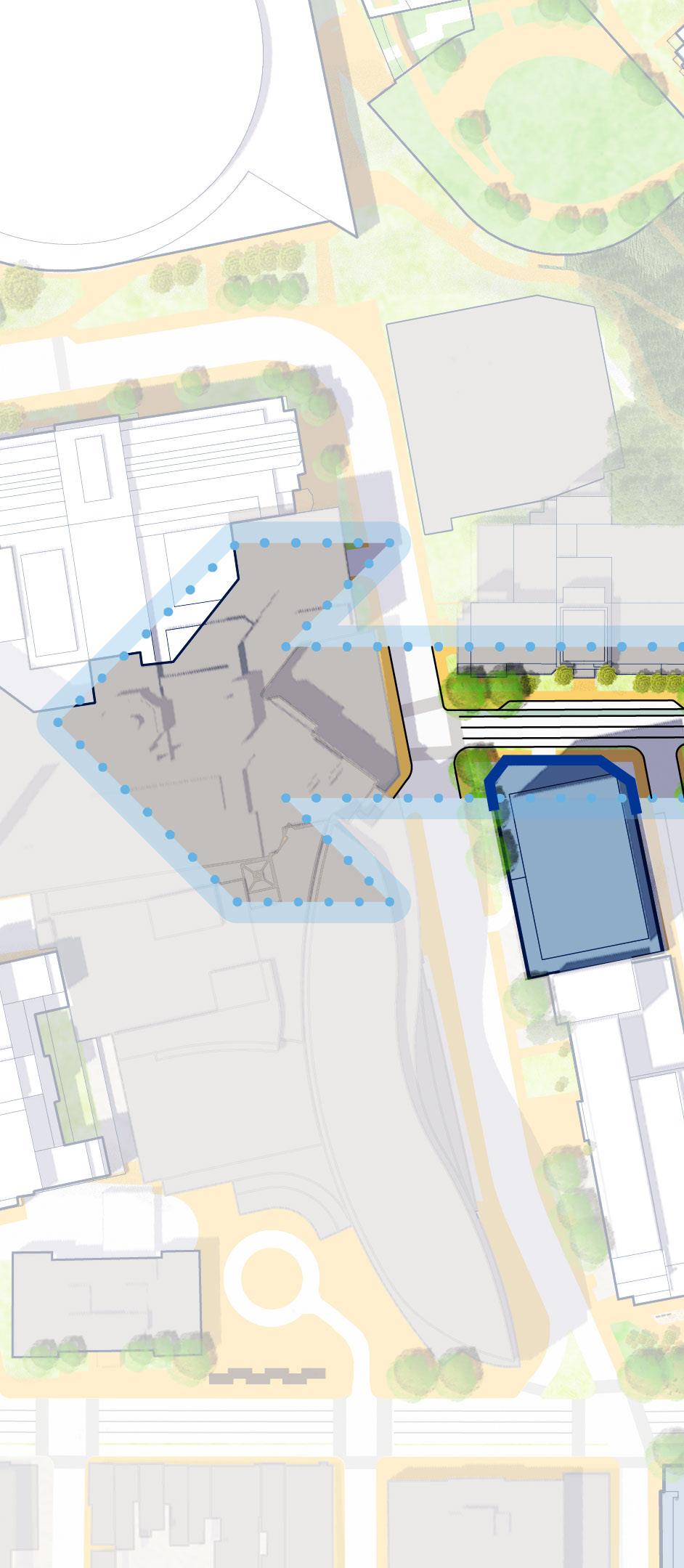
O’Hara Street Corridor
Terrace St
Proposed Building Active Edge
Crabtree Site
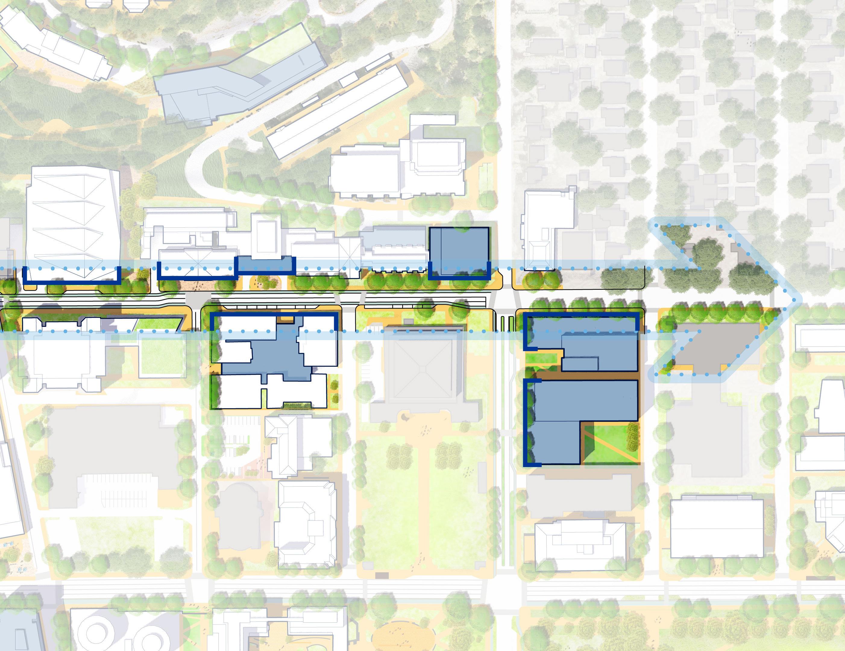
Lytton
Old Engineering Hall
One Bigelow Site
O’Hara / Gardner Steel Infill
Lot Site
O’Hara Street
Streetscape improvements along O’Hara include the reduction of on-street parking in favor of integrating existing bike lanes on each side of the street and a planting zone on the north side, with the goal of enhancing overall user experience and transforming the corridor into a full accessible route. Proposed collaboration hubs between Allen and Thaw Halls and between the O’Hara and Gardner-Steel buildings consolidate amenities along this important academic and research corridor. This intervention also facilitates full accessibility to these academic buildings.
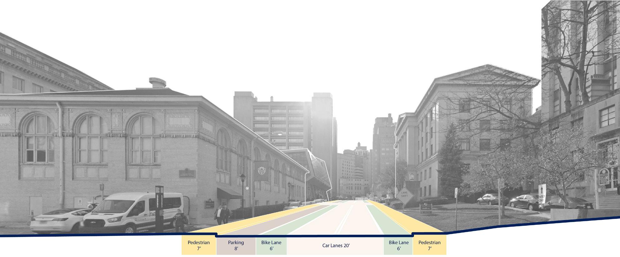
Existing O’Hara Cross Section
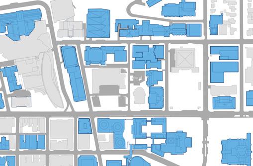
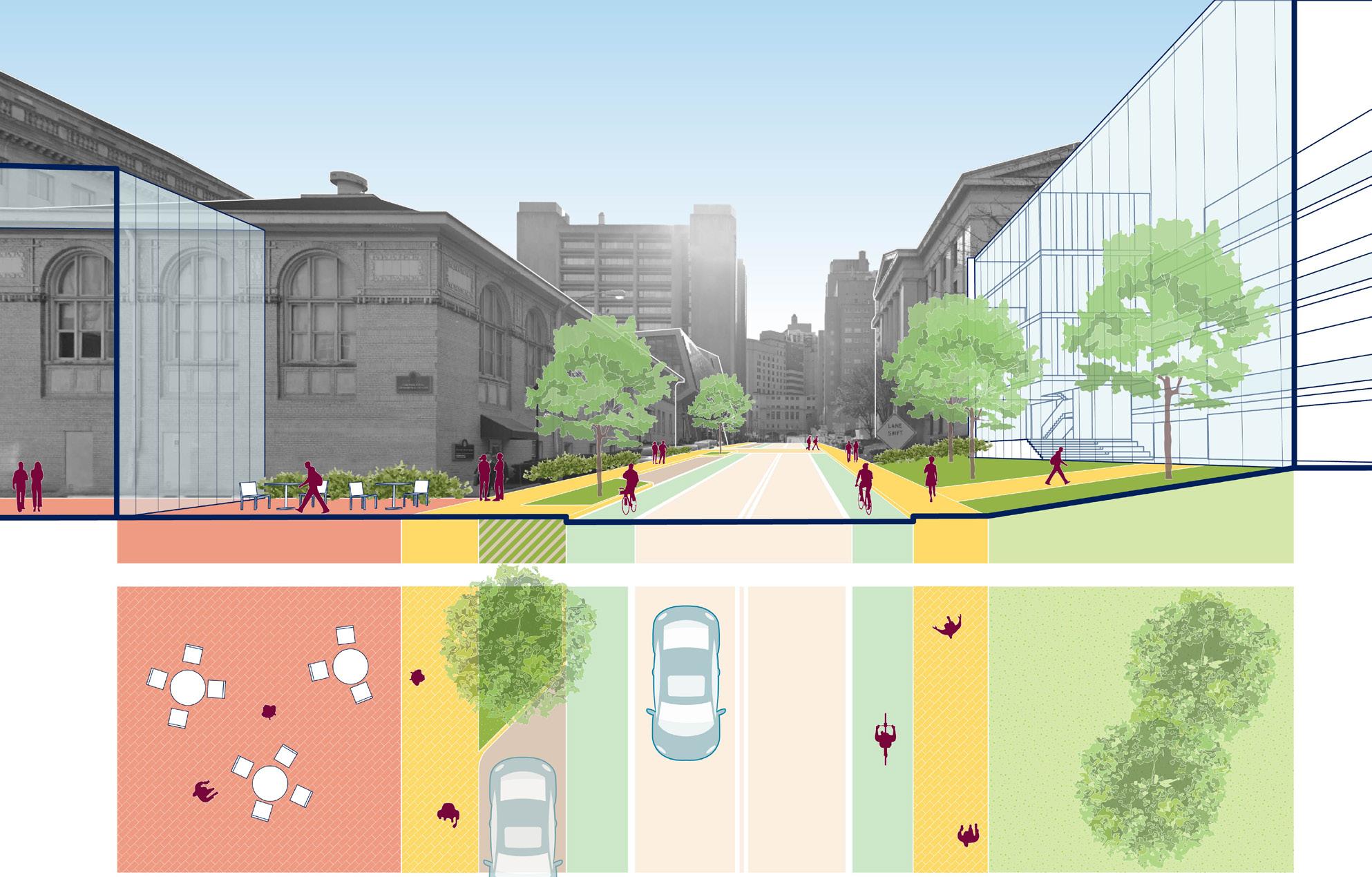
Pedestrian Sidewalk Bike Lane Car Lane Parking/Buffer Plaza
Proposed O’Hara Cross Section and Plan
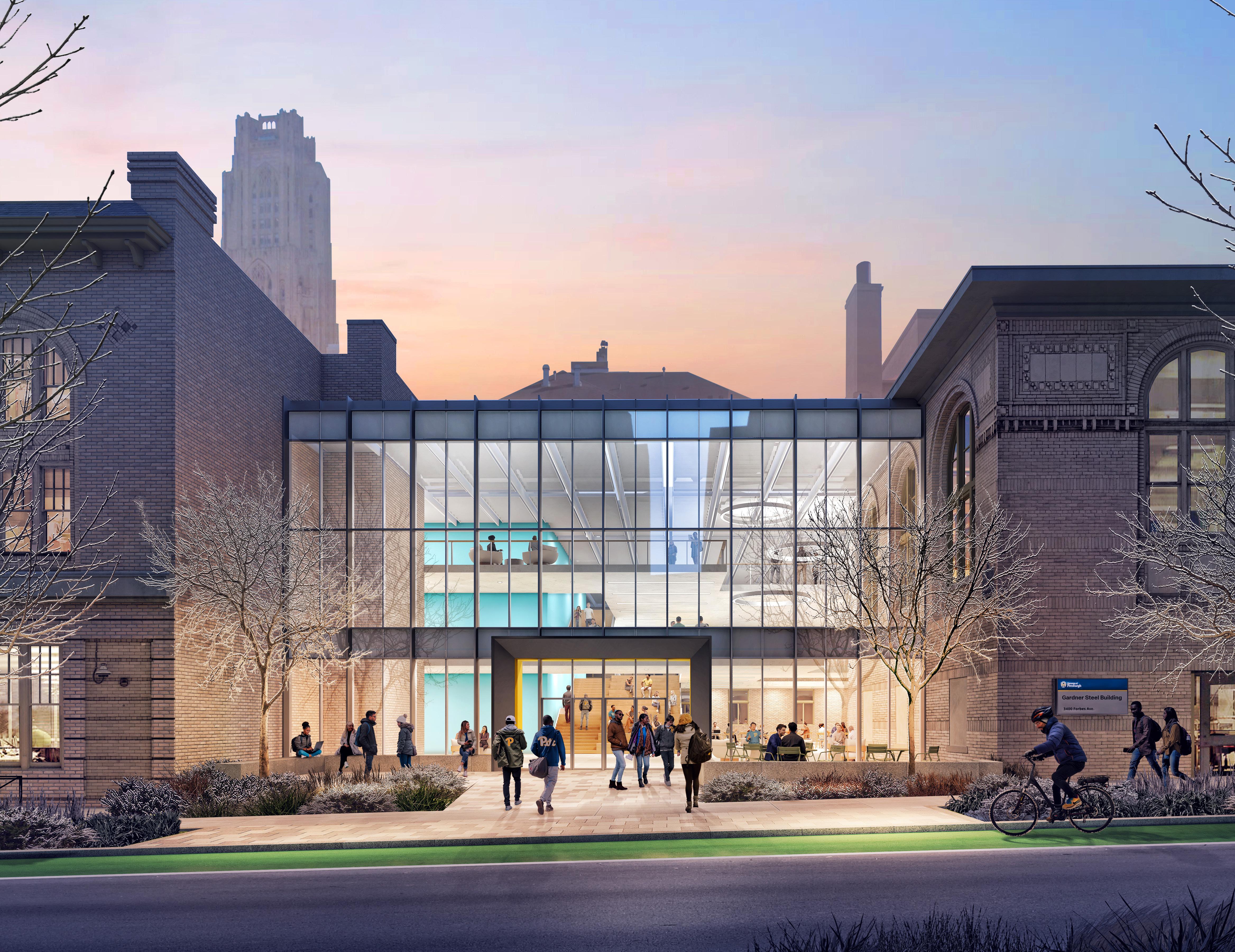
Collaboration Hub At O’Hara and Gardner Steel
North - South Streetscapes
The north-south streets connect the lower elevations of the campus transitioning from the relatively flat topography of the Fifth and Forbes corridors to the hillside north of O’Hara. Programmatically, these streets connect the humanities and arts located in the Cathedral of Learning, Posvar and Frick to the sciences, engineering and medicine located along the O’Hara corridor.
The public realm framework recommends enhancements along the north-south streets to improve accessibility, the pedestrian experience and connect the academic and research programs of the campus. Intervention along these streets is critical for developing a comprehensive accessibility strategy for the campus.
Thackeray Corridor –
The North-South Campus Route
Improvements to the Thackeray Corridor (illustrated to the right) are a key focus of the public realm framework. The corridor extends from Allen Hall on the north (O’Hara Street) to Posvar on the south. This important central campus route connects Posvar and David Lawrence to Allen and the Recreation and Wellness Center via the Forbes Avenue Bridge and the Litchfield Plaza.
The Thackeray Corridor is an important route in the daily routine of students living in the Litchfield Towers and Schenley Quad area as well as those
living in the hillside residence halls of Sutherland, Panther and Irvis. It provides access to the Hillside District via express elevators in the Recreation and Wellness Center, via the Panther Run exterior stairways and new pathways leading to the Arena and other buildings including Eberly Hall.
Improvements along the corridor focus on experience and accessibility and include:
• A new social and study lounge on the “Posvar Bridge.”
• A new elevator and stair tower providing access to the BRT stop at Barco Law.
• Transformation of Litchfield Plaza to provide clear movement toward Fifth Avenue including removal of the existing connector hallway between the Litchfield Towers and Holland Hall; area will provide seating and planting areas.
• Extended plaza level lounges and gathering areas at the base of the Towers.
• An entrance to Holland Hall via a new elevator and stairway in the bookstore.
• New ramps and stairs connecting and transitioning to Fifth Avenue.
• Expanded sidewalk from Fifth to O’Hara.
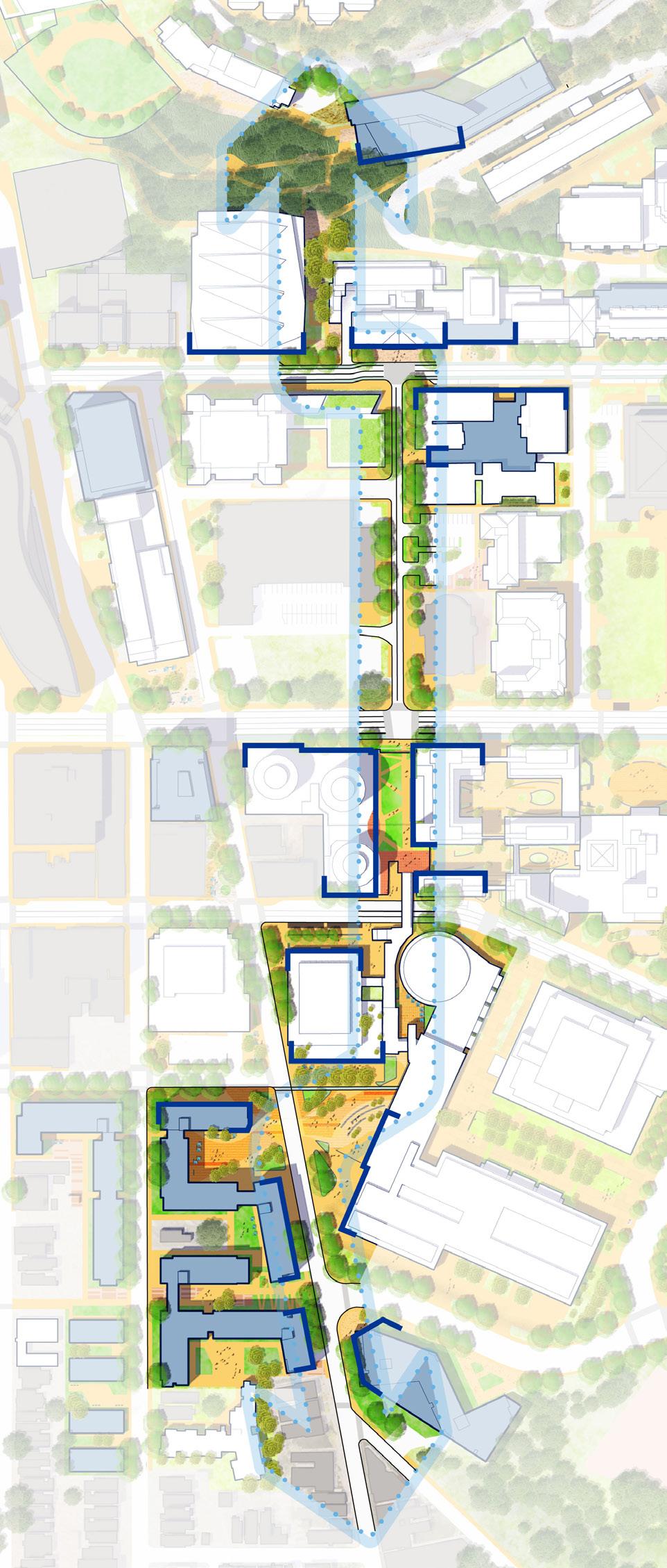
O’Hara / Gardner Steel Infill
Mervis Hall
Central Oakland Housing
Thackeray Avenue
A revised streetscape along Thackeray removes on-street parking on the east side of the street to allocate additional space for pathways and a landscape zone with integrated stormwater management. The framework anticipates increased flows of people toward the Recreation and Wellness Center. It should be noted that improvements will not impact operations at Bellefield Presbyterian Church or Pittsburgh Science and Technology Academy.
Improvements include:
• Enhancements to the crossing at Fifth and Thackeray to facilitate movement across the proposed bike lanes on the south and the BRT lane on the north.
• Streetscape enhancements with emphasis on the east side of the street where wider pathways, landscape elements and seating improve the connection to O’Hara Street.
• A new “forecourt” at the University Club enhancing accessibility, pathways and parking with the goal of improving access to the entrances of the University Club, Café 1923 and Thackeray Hall.
• Entrance to the proposed central infill atrium defined by Thackeray Hall, Gardner-Steel and O’Hara. Crossing improvements at O’Hara providing access to Allen Hall and the Recreation and Wellness Center.
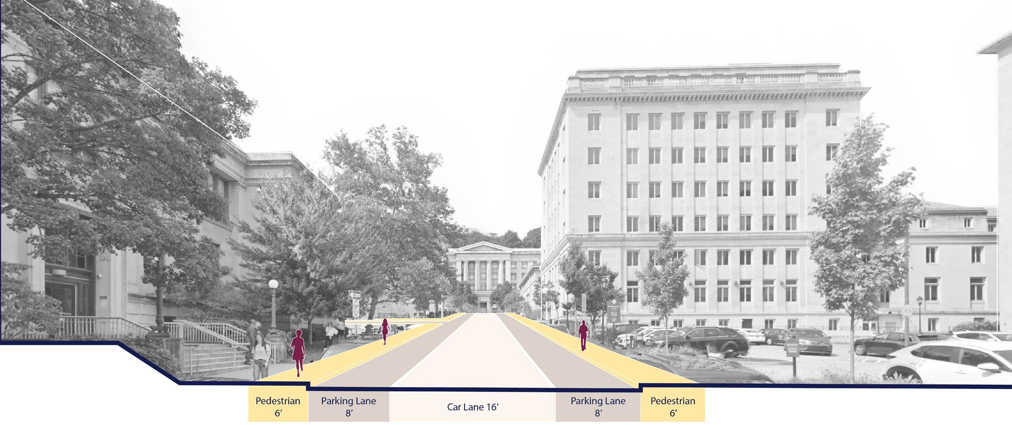
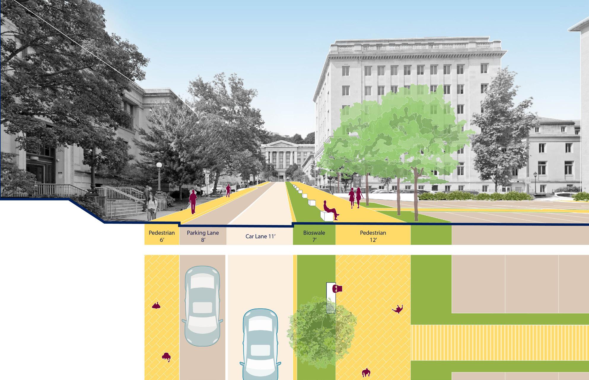
Car Lane Parking Space Green Buffer
Wider pathways and Stormwater Management
Pedestrian Sidewalk
Existing Thackeray Ave Cross Section
Proposed Thackeray Ave Cross Section and Plan
Proposed Staggered Long Section
Petersen Events Center-De Soto St-Fifth Ave-S Bouquet St
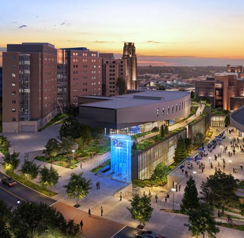
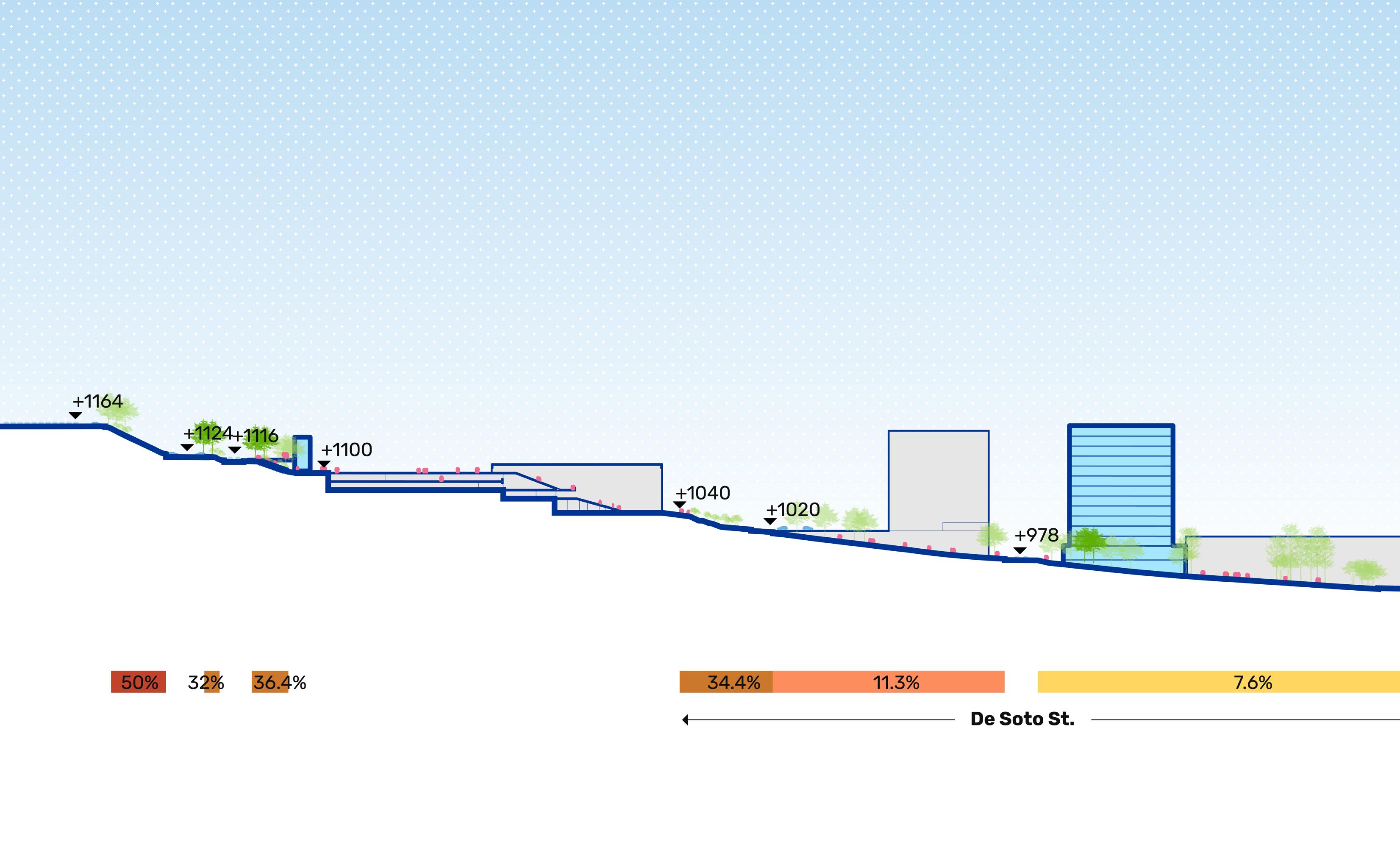
Existing Building
Proposed Building
Proposed Building Outside of View
Existing Tree
Propsoed Tree
Petersen Events Center
Slope Level:
Public Health
Thomas Detre Hall
Crabtree Hall
Athletics Elevator
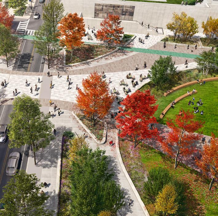
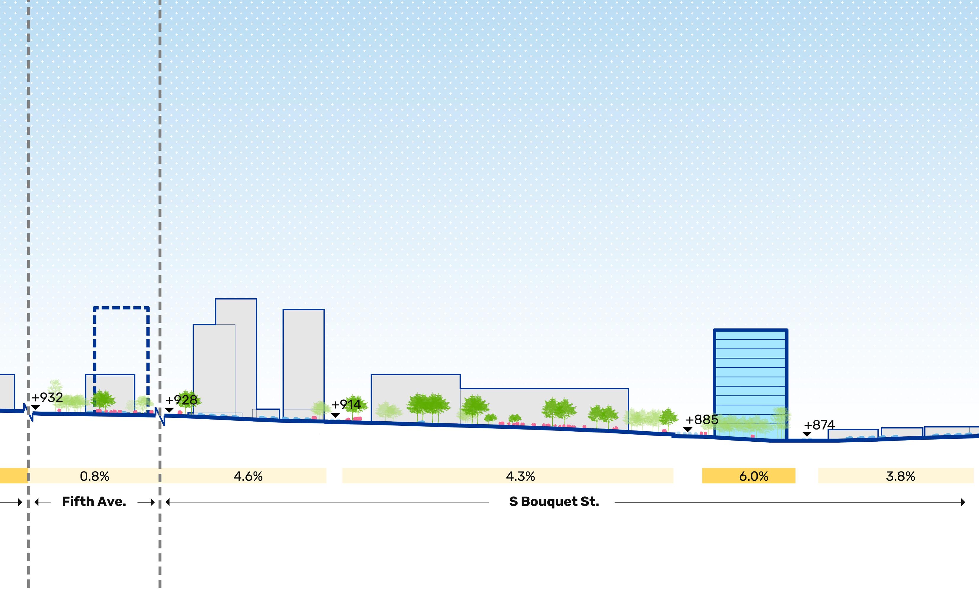
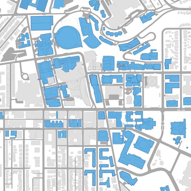
Litchfield Towers
Public Health
Barco Law
Mobility Hub
Gateway Landscape
M Pocket Park
Pocket Park
Mervis Hall
Tower D
Bouquet Street
The public realm framework envisions Bouquet Street (rendered to the right) as the southern entrance to the campus. A new gateway landscape defines the entrance to the campus extending from Roberto Clemente Drive to Sennott Street. It links the existing plaza at Posvar to a new plaza provided in the future Bouquet redevelopment residential quad. The intent is to create a memorable plaza along this vehicular route coordinated with accessible pathways linking the Central Oakland residential area to Posvar.
Bouquet connects the Central Oakland and Posvar areas of the campus to O’Hara Street providing links to the Recreation and Wellness Center and the Petersen Events Center.
Streetscape recommendations extending along Bouquet include:
• Gateway landscape enhancements from Roberto Clemente to Sennott Street.
• Improved crossing points at Forbes Avenue in association with the proposed Barco BRT stop.
• A renewed Forbes and Bouquet Plaza.
• Retail and student life ground floor uses on the future Tower D site west of the Litchfield Towers.
• Improved crosswalks at Fifth Avenue taking into consideration the proposed bike lanes on the south side of the street and BRT lanes on the north.
• Improved pathways and landscape from Fifth Avenue to O’Hara.
• An interior accessible route connecting the southeast corner of the redeveloped Crabtree site to the northeast corner at O’Hara Street (note, this recommendation addresses the significant slope in the area).
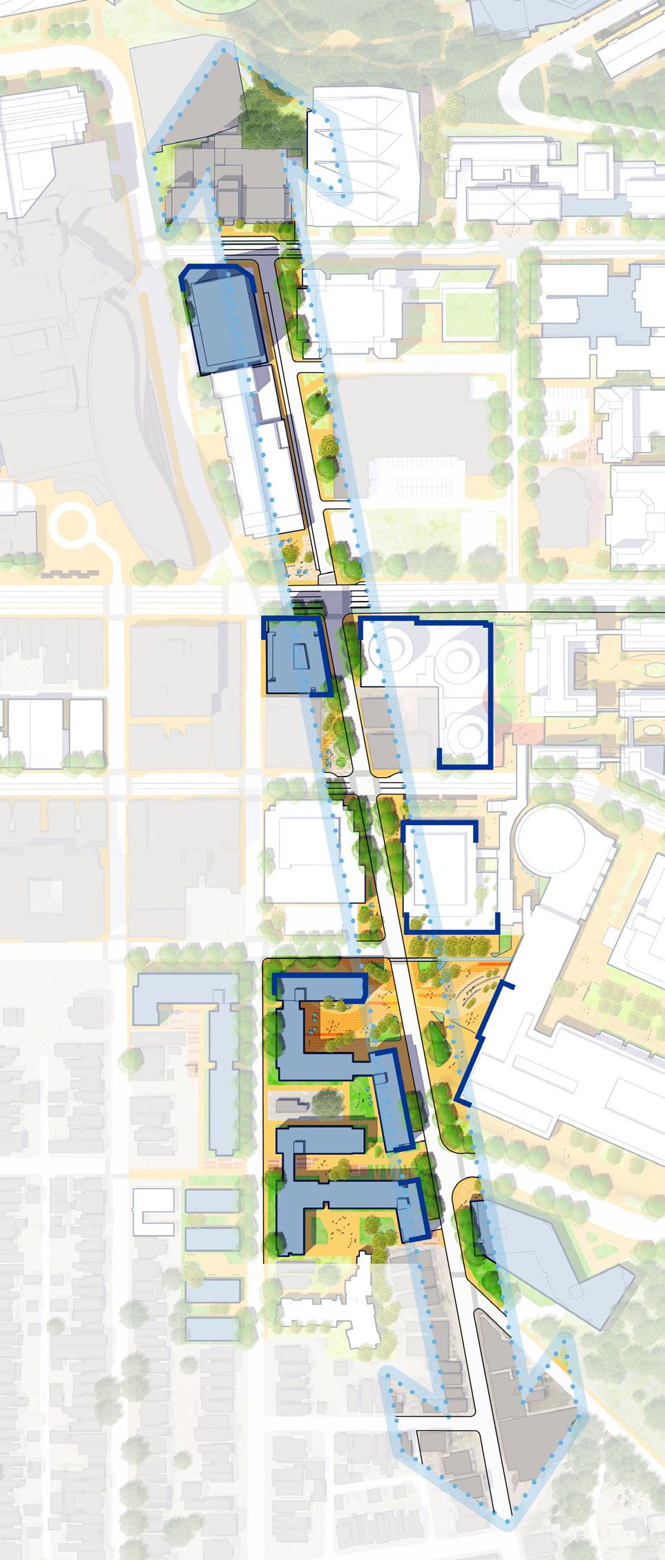
Louisa St.
Crabtree Hall
Tower D
Central Oakland Housing
Oakland Avenue/De Soto Street
Oakland Avenue and De Soto Street connect the Central Oakland area to the School of Medicine and Peterson Event Center on Terrace Street. Public realm recommendations along this corridor include:
On Oakland Avenue from Bates Street on the south to Sennott Street on the north, a new streetscape featuring “complete street” elements including:
• Improved pathways, strategically placed street trees offering shade, north and south bound bike lanes and enhanced cross walks. The framework recommends that implementation occur as a part of the Central Oakland housing development.
• Extension of the Louisa Street alignment between Atwood Street and Oakland Avenue and a continued extension between Oakland Avenue and Bouquet Street; potential urban design modifications, such as the addition of ramps at the extension, could establish a continuous accessible route.
• Enhanced sidewalks at the proposed Tower D housing site located between Oakland and Bouquet at Fifth Avenue.
• Improved crosswalks at Fifth Avenue connecting to De Soto Street north of Fifth.
• Interior accessible connections by means of a entrance at the southwest corner of a future redeveloped Crabtree Hall site to address slope conditions and provide access to O’Hara Street and destinations such as Benedum Hall and the Recreation and Wellness Center.
• New additional seating and railings along “Cardiac Hill.”
Atwood Street and Meyran Avenue
Renewed streetscapes on Atwood and Meyran from Louisa to Sennott also feature “complete street” elements including improved pathways, strategically placed street trees offering shade, north and south bound bike lanes and enhanced cross walks. The framework calls for the implementation of the proposed improvements as part of the future Central Oakland housing development project.
Bigelow Boulevard
Bigelow Boulevard is a central north-south route through the campus leading to Schenley Plaza and Schenley Park to the south, to the Schenley Farms residential neighborhood on the north. Recent improvements in the block between William Pitt Union and the Cathedral of Learning include integrated stormwater landscapes and a mid-block raised crossing point.
The public realm framework extends improvements of this nature to the north between Fifth Avenue and O’Hara Street. Improvements include a central medium, enhanced bike lanes and improved pathways on both sides of the street. A mid-block crossing north of the Oaklander Hotel serves as an east-west connection from Tennyson Avenue on the east to Thackeray Avenue on the west. This route extends across the One Bigelow site and the Soldiers and Sailors Lawn to connect to an existing pathway between Thackeray Hall and the University Club.
While Pitt will play a critical role in shaping and advancing public realm improvements, the successful implementation of these projects will require a collaborative approach. Partnerships with the City of Pittsburgh, regional agencies, community stakeholders, and private partners will be essential to ensure that the work reflects shared priorities and can be supported at the necessary scale. Primary funding for these improvements is anticipated to come from public and external sources, with Pitt’s role focused on coordination, advocacy, and alignment with campus planning goals.
Bigelow Boulevard
Improvements to Bigelow Boulevard north of Fifth Avenue include a central planted median and enhanced bike lanes on each side of the street, coordinated with those to the south. A mid-block crossing provides connectivity between future development on the One Bigelow site and Soldiers and Sailors. The framework anticipates increased flows of people from future development at One Bigelow and the infill development envisioned between Thackeray, O’Hara and Gardner-Steel; Bigelow Boulevard will serve as the accessible route for pedestrians traveling north to O’Hara.
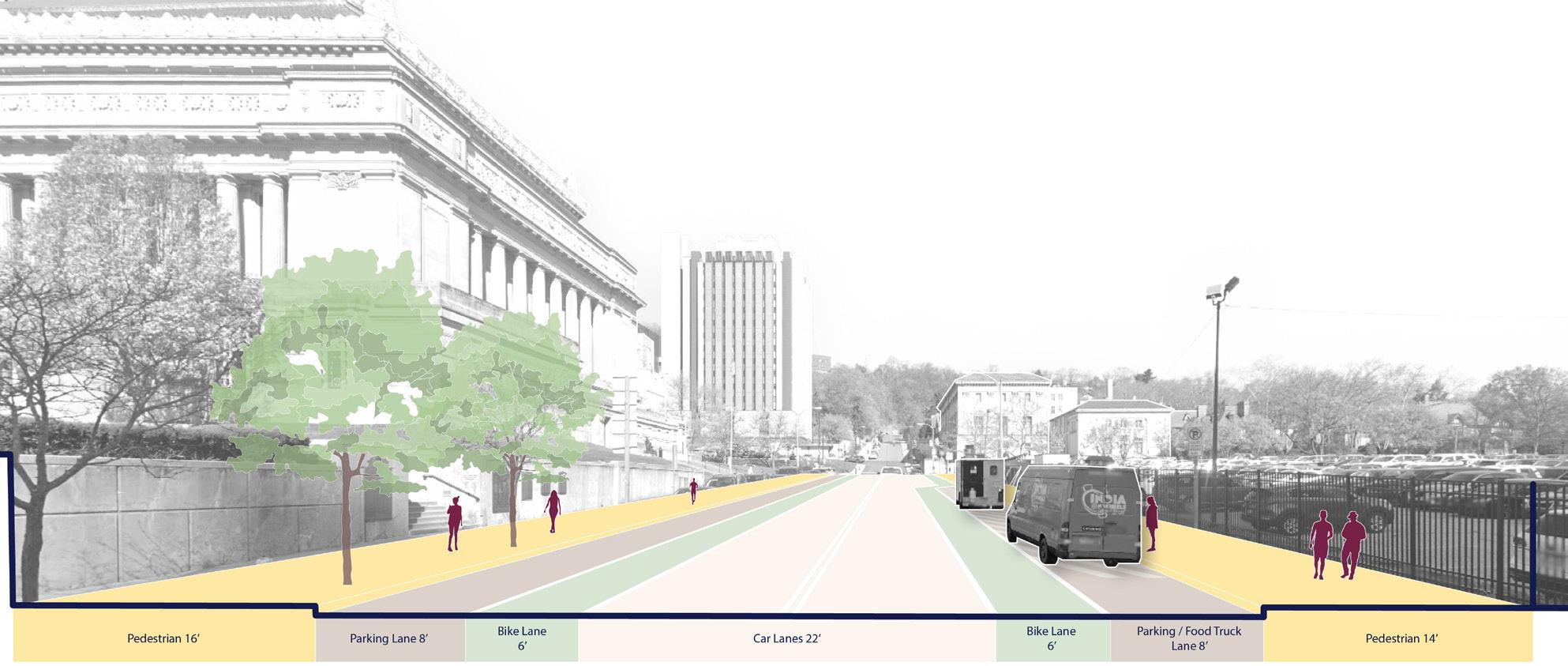
Existing Bigelow Boulevard Cross Section
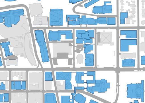
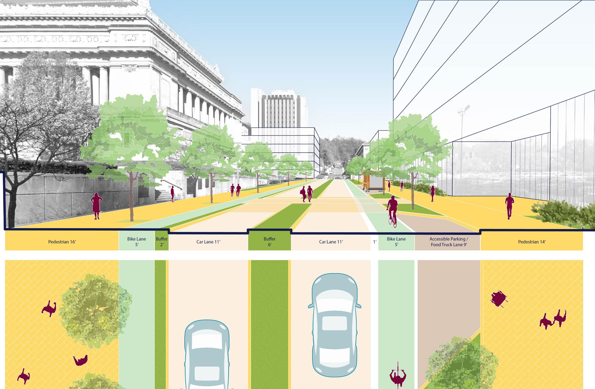
Mid-block crossing Bike lanes on both sides Central planted median
Proposed Bigelow Boulevard Cross Section and Plan
Pedestrian Sidewalk Bike Lane Car Lane
Accessible Parking/Food Truck Lane Green Buffer
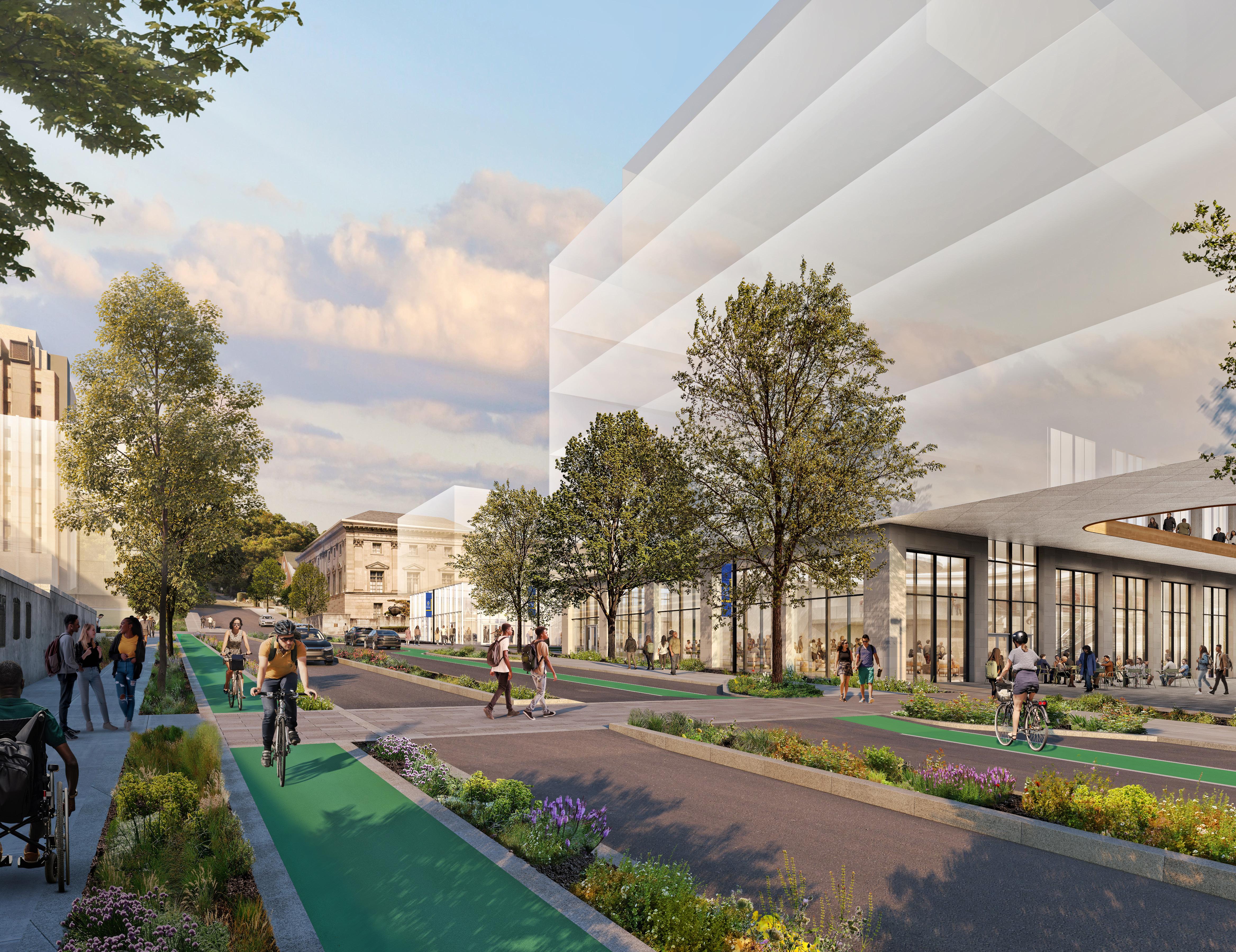
Bigelow Boulevard
OPEN SPACES
The open spaces of the Pitt campus are important places in the overall public realm. The public realm framework includes recommendations for enhancing and improving the major spaces. Two existing “iconic” open spaces define the public realm in the context surrounding the Pitt Campus: the Cathedral Lawn (approximately 13.5 acres) and Soldiers and Sailors Plaza (approximately 3.3 acres).
Other open spaces in and around campus help augment Pitt’s public realm character; these include Barco Plaza, Forbes Digital Plaza, Schenley Park, and the Hillside and Hilltop areas.
Cathedral Lawn –The Iconic Center of Pitt
Providing the context for the Cathedral of Learning, the Heinz Chapel and the Stephen Foster Memorial, the Cathedral Lawn is the most iconic open space on the Pitt campus. The Campus Master Plan adopts the framework for the lawn developed by the Olin Partnership which addresses accessibility barriers, creates a welcoming perimeter, defines gateways to the campus and introduces areas for student engagement. These areas include new terraces, a social theatre, study grove featuring tables and chairs and a hammock zone.
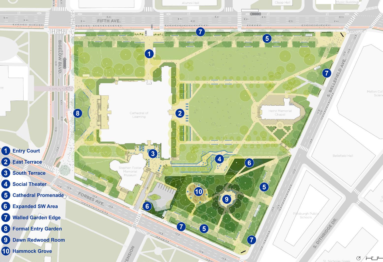
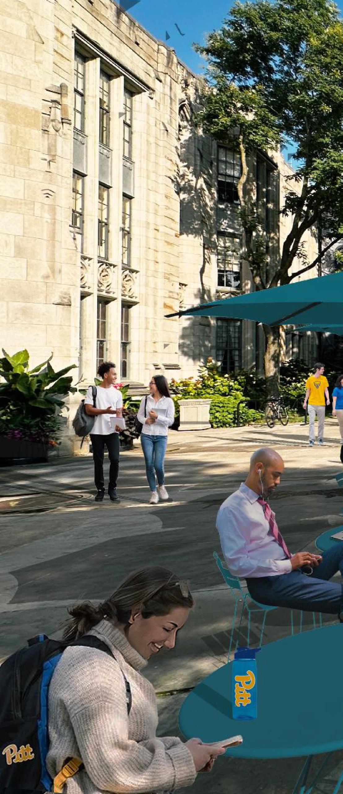
East Terrace Cafe Deck - Image from OLIN
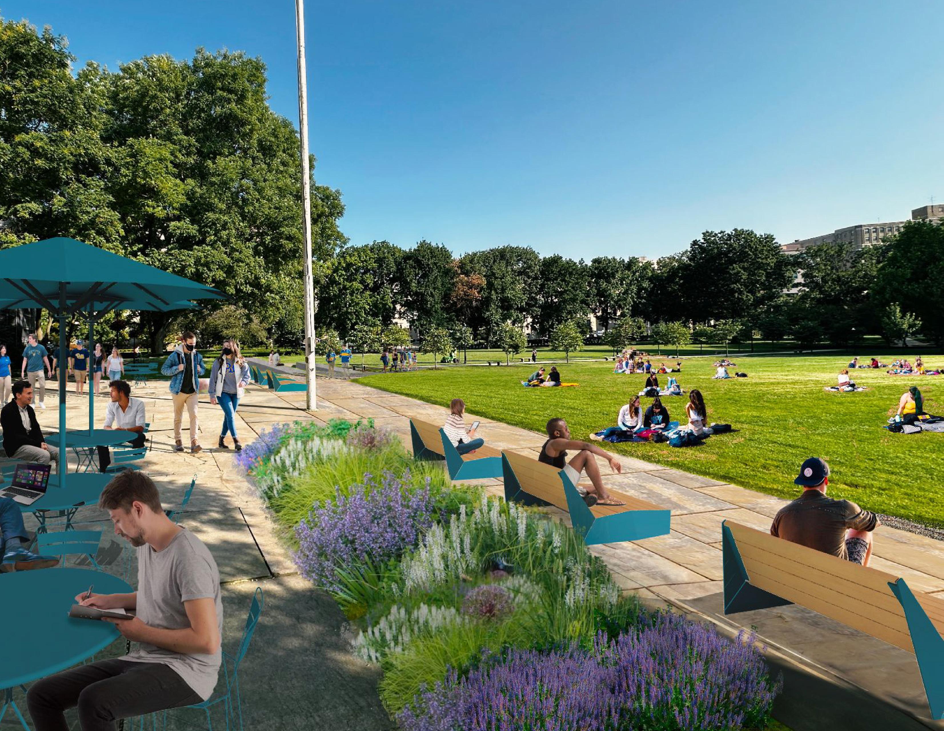
Soldiers and Sailors Lawn
The lawn at the Soldiers and Sailors Memorial serves as passive recreation for the Pitt and Oakland communities. Although it is not university property, the lawn provides a memorable open space offering views of the Cathedral of Learning, the William Pitt Union and Schenley Quad. It also serves as the roof of the Soldiers and Sailors parking garage, which is owned by Pitt through a land lease agreement. A planned renovation of the garage includes improvements to accessibility and the landscape associated with the lawn.
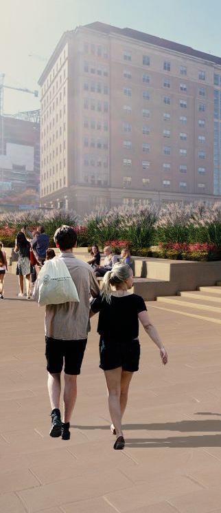
View of Soldiers & Sailors from Fifth Avenue
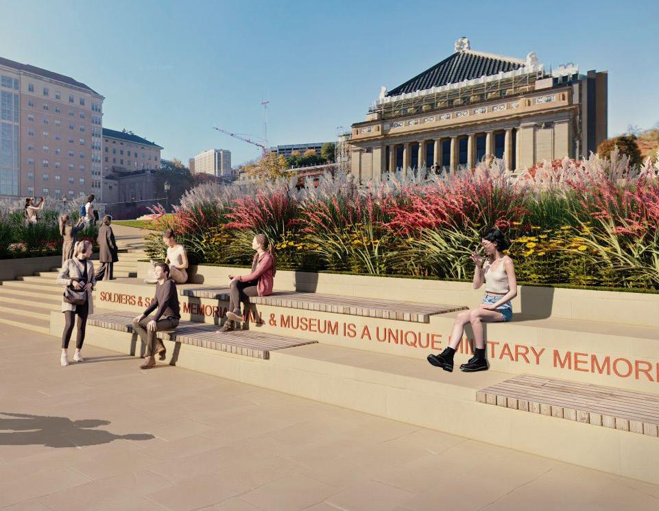
Posvar Passage
Defined by Posvar and Hillman Library, the Posvar Passage includes pathways and informal lawn areas featuring benches, picnic tables and raised planters. Drawing from and integrating previous work done by FortyEighty Architecture, the public realm framework integrates the Quad with the new campus gateway south of the intersection of Bouquet and Sennott Streets. The Quad itself provides an outdoor space for study and informal gatherings for the users of the Hillman Library, David Lawrence Hall and Posvar Hall. Additional beautification (including pocket parks and public art) by Pitt will further elevate the public realm.
In addition to providing outdoor space, the Quad serves as an east-west pedestrian and bike route connecting Schenley Drive and Schenley Plaza to Bouquet Street. Changes to these routes include the introduction of ramps to address existing accessibility barriers, such as stairs.
Barco Plaza
On the northwest edge of Barco Law Building, along Forbes Avenue and across from Litchfield Towers, a landscaped plaza provides a welcoming entry to the Barco Law Building and a transitional area for pedestrians and commuters. Landscape renovations designed by Land Collective respond to the siting of the new BRT station, providing accessible pathways, seating and softscape. The plaza is further activated by the introduction of a proposed elevator and new stair tower that supports movement across Forbes Ave connecting areas
south of Forbes to Litchfield Plaza and beyond with an accessible route.
Forbes Digital Plaza
Situated on the corner of Forbes Avenue and South Bouquet Street, Forbes Digital Plaza opened in 2015 as a hybrid pedestrian plaza and outdoor digital art gallery. Programming includes rotating exhibitions by local, national, and international artists, as well as year-round events open to both students and the broader Oakland community. The project was organized by the Oakland Business Improvement District under Innovation Oakland, an initiative intended to promote art and technology through the creation of a digital innovation district. The plaza provides a welcomed area for respite, play and connection in an otherwise constrained urban street network.
Schenley Park
Located immediately east of Pitt’s Oakland campus adjacent to Hillman Library and Posvar Hall, Schenley Park serves as a valuable natural resource and integral component of the University’s surrounding open space network. Comprising 456 acres of open fields, trails, and wooded landscape, Schenley Park acts as a respite from the surrounding urban fabric, providing ample space for active and passive recreation. Schenley Plaza serves as a hub for community event programming. Phipps Conservatory and Botanical Gardens, both located within the park, are free for students with their Pitt IDs.
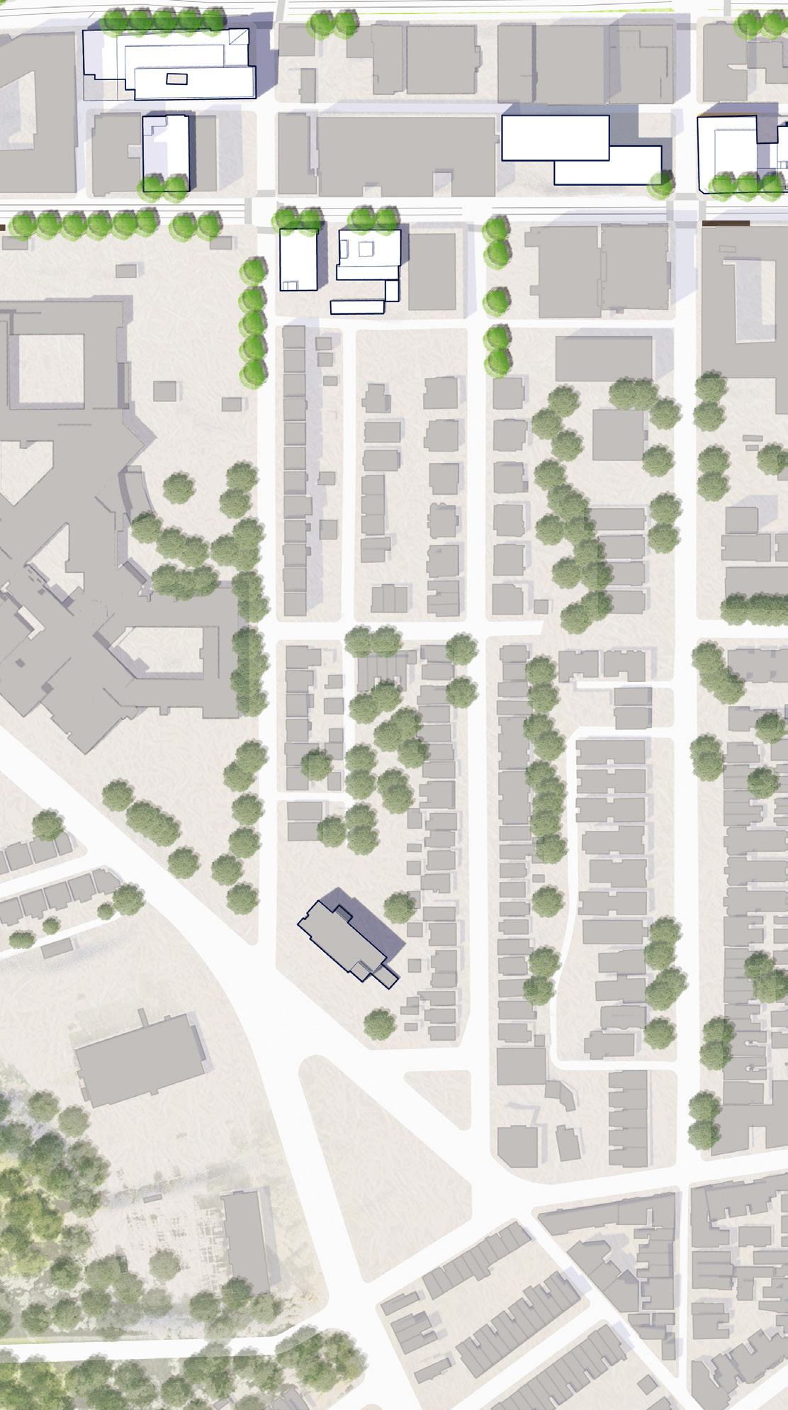
Forbes Ave
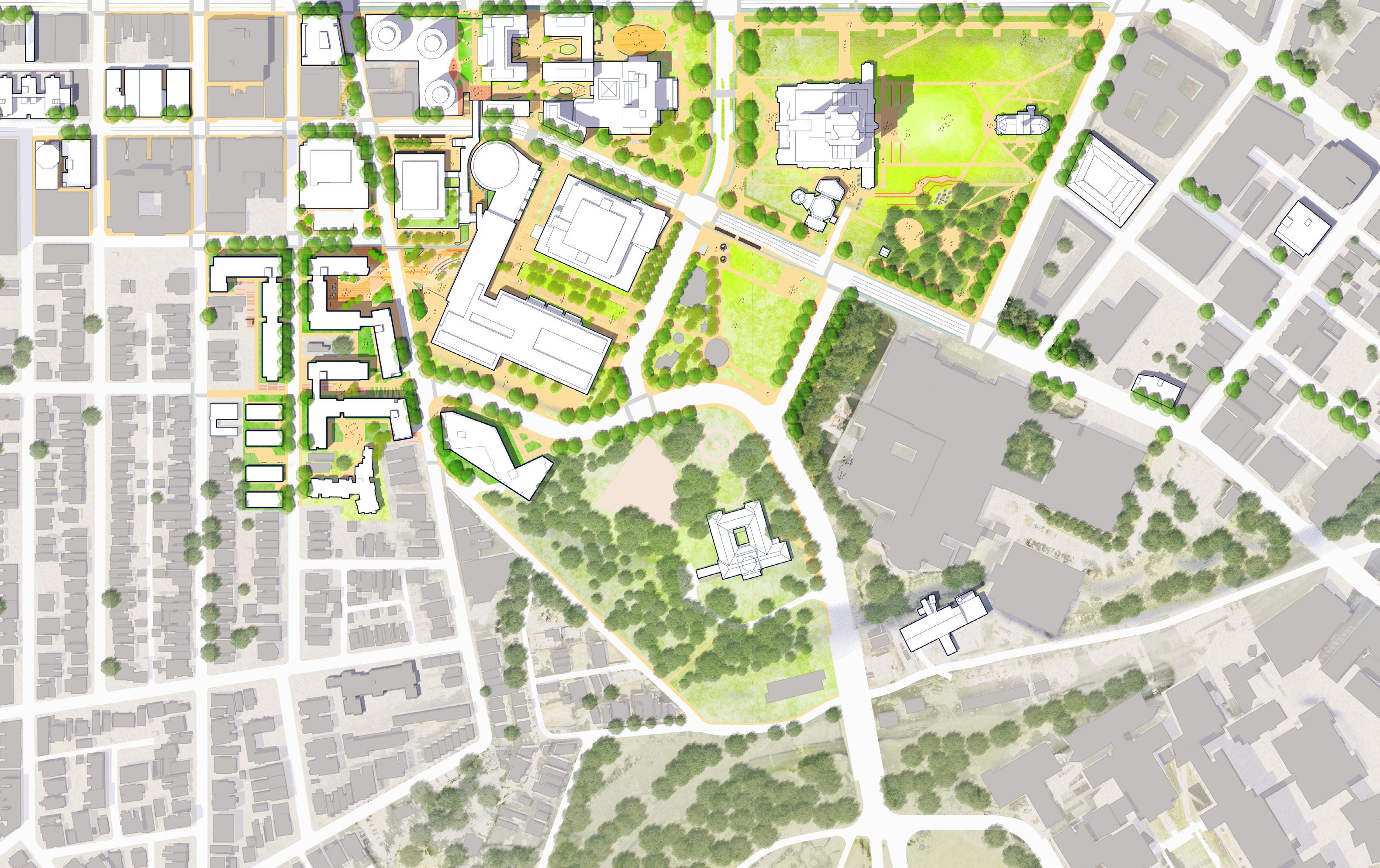
Roberto&VeraClementeDr
Posvar Passage
Schenley Plaza
Barco Plaza
Forbes Digital Plaza
Schenley Park
Gateway Landscape
ForbesAve
Louisa St
Schenley Dr
Hillside
The Hillside area north of O’Hara features some of the most challenging topography of the Pitt campus, with approximately 164 feet of grade change, and contains both historic and new buildings. Recent construction of the Arena and Sports Performance Center and Recreation and Wellness Center integrate with the slope conditions and offer new direction for the landscape. The green roof and landscaping on the Arena will contribute to the open space structure of the Hillside while offering views toward the iconic Cathedral of Learning.
Improvements include the introduction of Panther Run, a north-south stairway system and accessible express elevator system linking O’Hara Street with Petersen events Center, Eberly Hall, the Arena and the residence halls along Utterback Drive, Irvis and Panther Halls. Proposed landscape includes new trees and ground cover planting designed to stabilize the slope conditions and improve the experience of moving through the area.
Hilltop
The Hilltop area encompasses the Athletic and recreation facilities north of Terrace Street. Located on terrain with sustained slopes above 8.3% (exceeding accessibility standards), the facilities include the Petersen Events Center, Fitzgerald Field House, Trees Hall, Charles L. Cost Sports Center, the Pitt Sports Dome (inflatable structure) and the following sports fields: Vartabedian Softball Field, Ambrose Urbanic Field (soccer) and Charles L. Cost
Field (baseball). The Hilltop area also includes the OC parking lot and parking structure.
The Campus Master Plan recommends the demolition of Fitzgerald Field House to make way for a parking structure and future indoor track facility. The framework also recommends the replacement of the Pitt Sports Dome with a permanent facility.
Public realm recommendations include a new recreation field on the OC Lot adjacent to the Charles L. Cost facility. Allequippa Street is the focus of streetscape improvements including pathways and crossing enhancements, notably at the pedestrian route leading northward from the Petersen Events Center to the OC Lot.
To address the significant topographic and accessibility challenges in the Hillside District, the framework includes a new elevator and stair tower north of Petersen Plaza along Allequippa Street. Designed to improve accessibility to the Petersen Events Center, the elevator and stair tower also serves as a campus gateway or beacon to athletics and event facilities. In addition, a new ramping system connects the Petersen Plaza (north side of the facility) to Allequippa Street to provide an expanded accessible network.
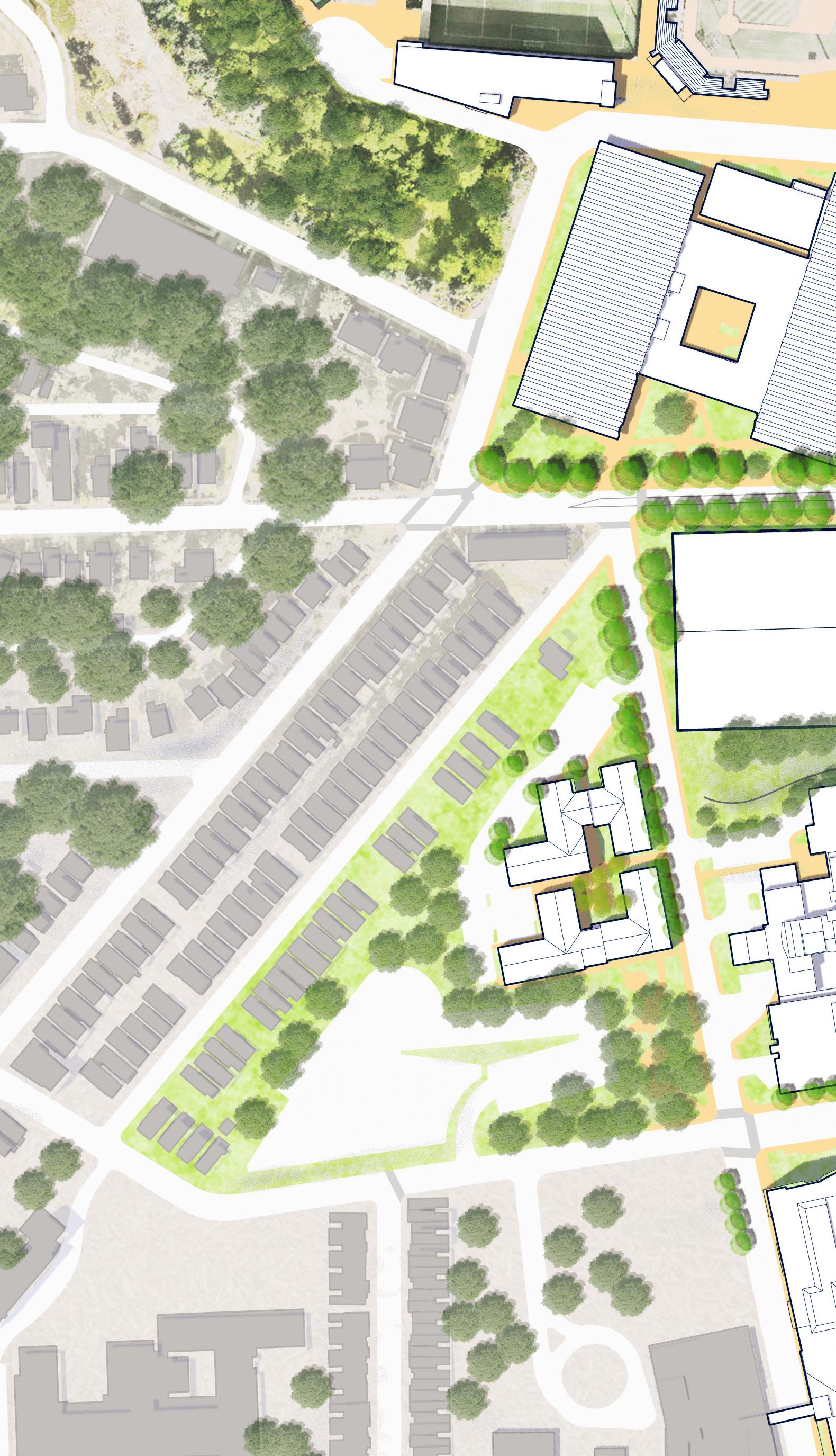
Allequippa
Darragh
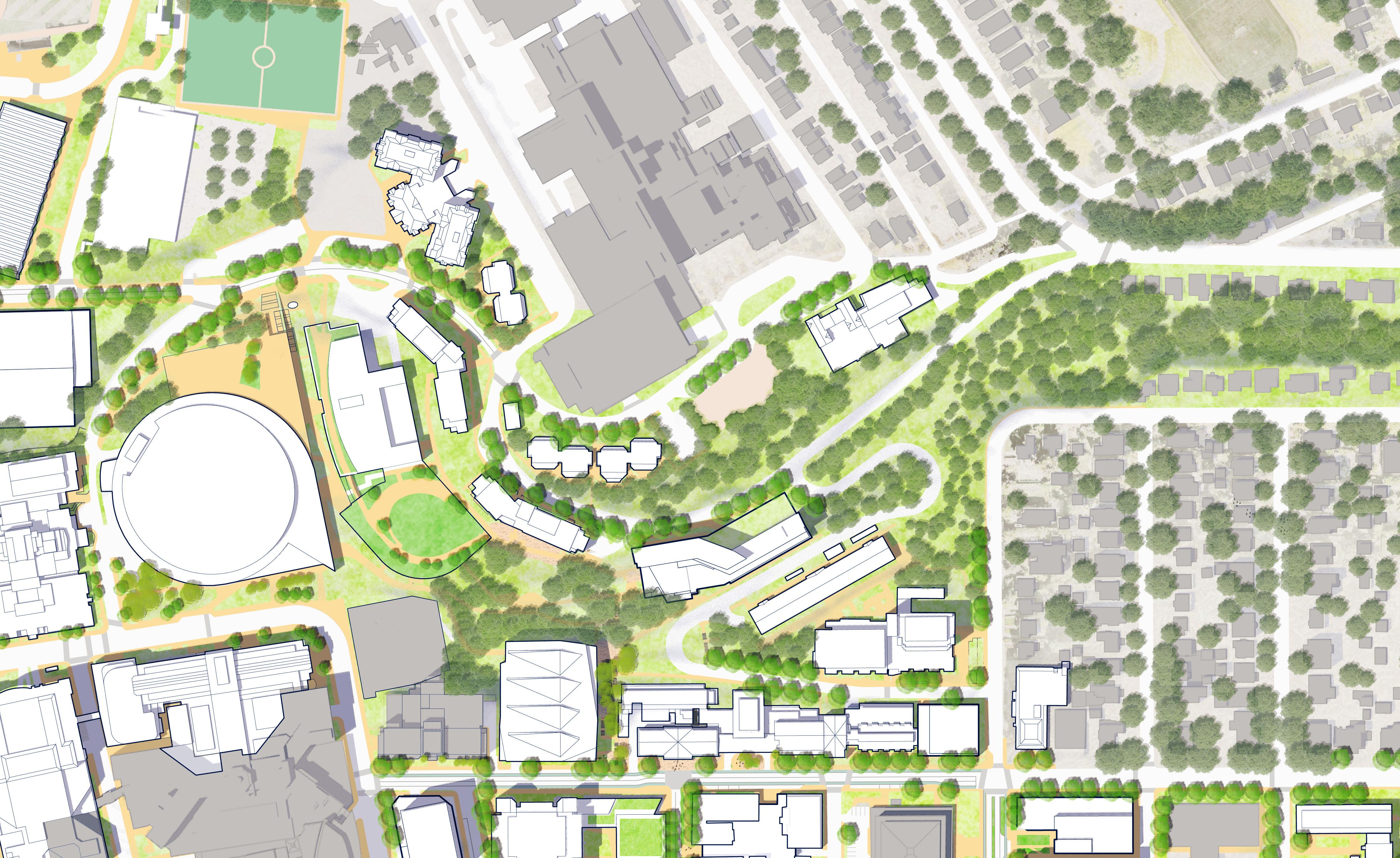
UtterbackDr
AllequippaSt
New Rec Field
New Elevator
Green Roof & Landscaping
Dammond Dr
New Elevator
Panther Run
Accessible Connections
Panther Overlook
O’Hara St
Terrace St
De Soto St
Parkman Ave
University Pl
6.3 MOBILITY AND ACCESSIBILITY FRAMEWORK
The Pitt Campus Master Plan includes a comprehensive Mobility and Accessibility Framework (the framework) designed to enhance mobility, emphasize active transportation modes, and focus on improving the multi-modal experience at the university through a series of targeted, data-driven and stakeholder influenced recommendations.
The framework focuses on improving mobility within and around campus while strengthening connections to the campus. It reflects a comprehensive approach that guides the recommendations presented in this plan. These recommendations were developed to support Pitt’s goal for creating a safe, multi-modal system that prioritizes accessibility and is guided by Universal Design Principles discussed in this section. They also respond to Pitt’s IMP obligations and sustainability goals.
The framework prioritizes accessibility, pedestrian movement, biking, micromobility and bus transit to address the needs of the Pitt community based on feedback obtained through the planning process and ongoing engagement with department stakeholders and the mobility subcommittee formed to guide this process. These modes of movement are coordinated with the urban design and public realm improvements proposed for the campus and surrounding context. The framework integrates each mode to create a seamless mobility network designed to enhance the user experience and convenience, while addressing the goals and objectives set forth to guide the planning process.
The framework also promotes Transportation Demand Management (TDM) to reduce reliance on single occupancy vehicles and to decrease greenhouse gas emissions from transportationrelated sources. While the framework aims to reduce single-occupancy vehicle trips, it is understood that driving will remain necessary for some. As a result, the framework offers a range of transportation choices to meet the diverse needs of the Pitt community.
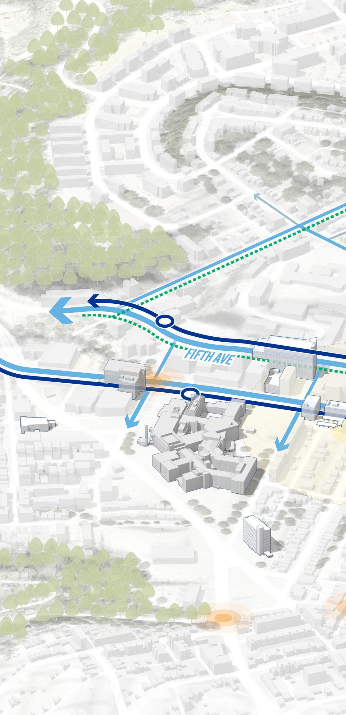
Mobility Hub
BRT Route
BRT Stop
Proposed Parking P M
Major Accessible Route
Major Vehicular Route
Existing Bike Lane
Proposed Bike Lane
Intersection Improvements
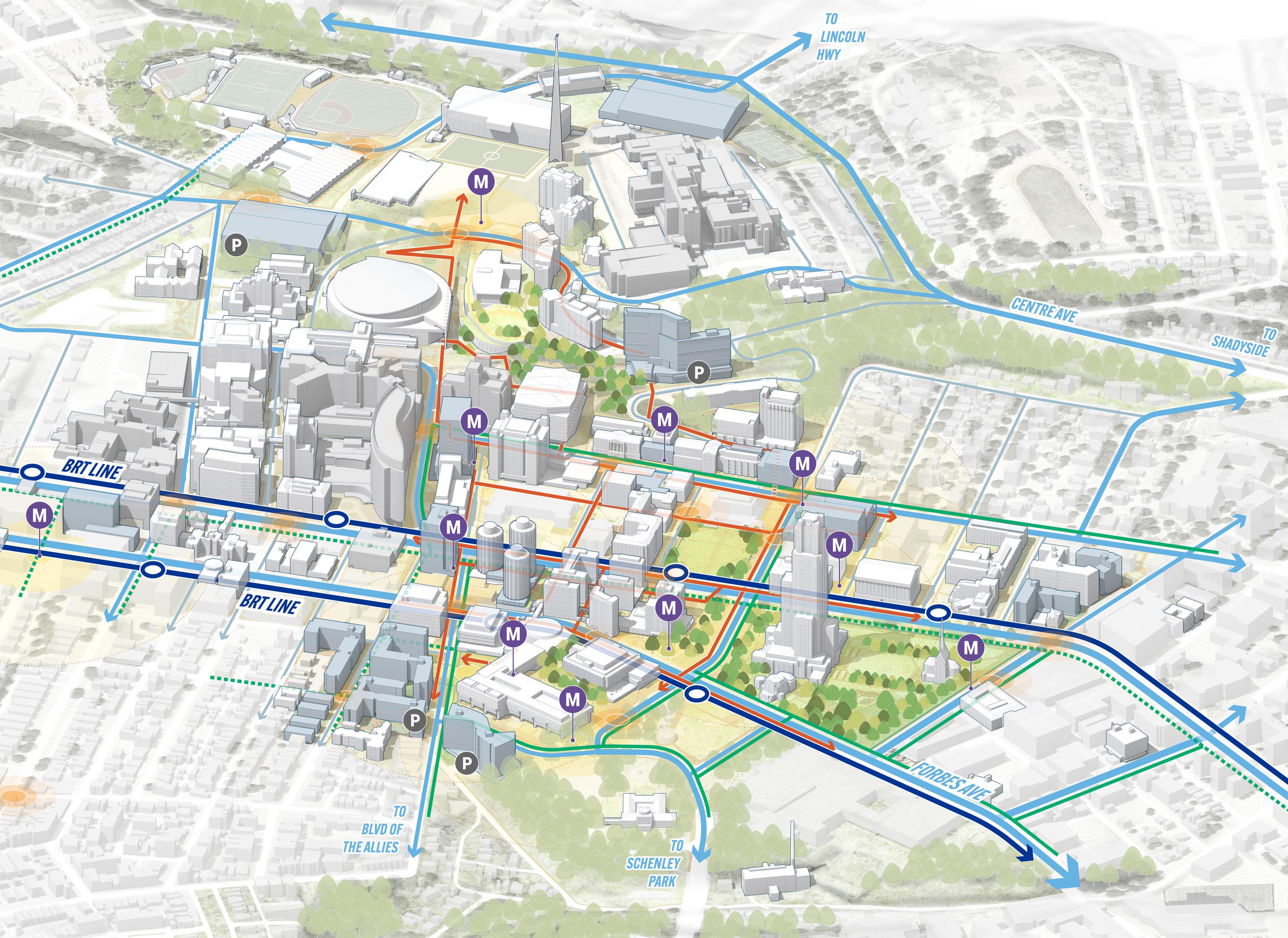
UNIVERSAL DESIGN PRINCIPLES
Universal Design principles inform the recommendations of the Mobility and Accessibility Framework. The seven (7) Principles of Universal Design were developed in 1997 by a working group of architects, product designers, engineers and environmental design researchers, led by the late Ronald Mace in the North Carolina State University (NCSU). The purpose of the principles is to guide the design of environments, products and communications. According to the Center for Universal Design at NCSU, the principles “may be applied to evaluate existing designs, guide the design process and educate both designers and consumers about the characteristics of more usable products and environments.”
THE 7 PRINCIPLES
1
2
Equitable Use Flexibility in Use
The design is useful and marketable to people with diverse abilities.
• Provide the same means of use for all users: identical whenever possible; equivalent when not.
• Avoid segregating or stigmatizing any users.
• Provisions for privacy, security and safety should be equally available to all users.
• Make the design appealing to all users.
The design accommodates a wide range of individual preferences and abilities.
• Provide choice in methods of use.
• Accommodate right- or left-handed access and use.
• Facilitate the user’s accuracy and precision.
• Provide adaptability to the user’s pace.
3
Simple and Intuitive Use
Use of the design is easy to understand, regardless of the user’s experience, knowledge, language skills, or concentration level.
• Eliminate unnecessary complexity.
• Be consistent with user expectations and intuition.
• Accommodate a wide range of literacy and language skills.
• Arrange information consistent with its importance.
• Provide effective prompting and feedback during and after task completion.
Developed by Ronald Mace at North Carolina State University (NCSU)
4 6 7 5
Perceptible Information
The design communicates necessary information effectively to the user, regardless of ambient conditions or the user’s sensory abilities.
• Use different modes (pictorial, verbal, tactile) for redundant presentation of essential information.
• Provide adequate contrast between essential information and its surroundings.
• Maximize “legibility” of essential information.
• Differentiate elements in ways that can be described (i.e., make it easy to give instructions or directions).
• Provide compatibility with a variety of techniques or devices used by people with sensory limitations.
Tolerance for Error
Use of the design is easy to understand, regardless of the user’s experience, knowledge, language skills, or concentration level.
• Eliminate unnecessary complexity.
• Be consistent with user expectations and intuition.
• Accommodate a wide range of literacy and language skills.
• Arrange information consistent with its importance.
• Provide effective prompting and feedback during and after task completion.
Low Physical Effort
The design can be used efficiently and comfortably and with a minimum of fatigue.
• Allow user to maintain a neutral body position.
• Use reasonable operating forces.
• Minimize repetitive actions.
• Minimize sustained physical effort.
Size and Space for Approach and Use
Appropriate size and space is provided for approach, reach, manipulation and use regardless of the user’s body size, posture, or mobility.
• Provide a clear line of sight to important elements for any seated or standing user.
• Make reach to all components comfortable for any seated or standing user.
• Accommodate variations in hand and grip size.
• Provide adequate space for the use of assistive devices or personal assistance.
• Provide effective prompting and feedback during and after task completion.
FOCUS ON ACTIVE TRANSPORTATION
The Mobility and Accessibility Framework emphasizes active and integrated transportation modes for the campus coordinated with those of the surrounding context in Oakland. A safety analysis, utilizing crash history examined through the lens of traditional and Highway Safety Manual (HSM) methodologies, informs the public realm and streetscape recommendations of the Campus Master Plan. Existing and anticipated patterns of pedestrian circulation, along with a review of local infrastructure, inform the recommendations for intersection and mid-block crossing improvements. New bicycle infrastructure is coordinated with the urban design and public realm recommendations of the Campus Master Plan as well as local agency initiatives. New locations for mobility hubs are envisioned, which are facilities that include amenities and services designed to support all active transportation modes.
Recommendations for shared mobility facilities and supporting infrastructure are also realized in the plan, where they are based on an examination of local planning initiatives, anticipated growth, stakeholder feedback captured from the commuter survey, the mobility subcommittee, and community engagement through open forums on campus.
Mobility and Connectivity
The Mobility and Accessibility Framework provides a comprehensive and unified multi-modal framework of accessible pathways and bicycle, transit and vehicular connections across the Pitt campus. It integrates existing transportation infrastructure with future project priorities to coordinate multimodal improvements and achieve an integrated system. The overarching goal is to offer multiple travel choices and shift emphasis away from single occupancy vehicle use. The strategies and recommendations for each mode are summarized on the following pages.
The following goals guide the Mobility and Accessibility Framework:
1. Improve Pitt campus experience and provide accessible connections to pedestrian and mobility network
2. Enhance pedestrian safety and mitigate conflict areas
3. Increase clarity of wayfinding system throughout campus and into the surrounding neighborhoods
4. Prioritize pedestrians on campus and within the mobility network
5. Enhance the transit experience to accommodate a range of users to reduce single occupancy vehicles and traffic
6. Balance the demand for parking to consider user needs while prioritizing programs that support the University’s mission of creating a safe, efficient and easy to navigate campus
7. Increase access to support space for multimodal transit users (e.g. mobility hubs, bike lockers, showers)
8. Develop strategy to support future electrification needs of fleet vehicles, cars, and bikes
9. Primary campus pathways should be fully accessible and minimize barriers to ensure all users can share common routes on both university property and City owned right-of way.
10. Primary entrances should be accessible and inclusive
11. Provide barrier free connections to parking, transit, and mobility network
12. Increase clarity and wayfinding of accessible network
13. Seamlessly link the Hillside and lower campus by means of one or more publicly accessible routes
MOBILITY MODES
The Mobility and Accessibility Framework prioritizes the following modes of movement with the aim of improving the experience of navigating the campus and the surrounding context . The framework also aims to decrease use of single occupancy vehicles and associated demand for parking and greenhouse gas emissions.
typically consist of self powered devices with relatively small electric motor assists.
Non-Motorized Transportation
Self-powered by the individual, including rolling, walking and biking without motor assistance. Note, these modes are more susceptible to impediments related to the weather, infrastructure and changes in elevation.
Shared Mobility
Shared mobility, defined as transportation services and resources that are shared among users, includes public transit, micromobility options like POGOH bike sharing, automobilebased modes with carsharing, like Zipcar, or on demand services like Uber and Lyft, and commute-based modes that involve carpooling and vanpooling. The Mobility and Accessibility Framework addresses modes available today, while acknowledging that the future may include the re-introduction of scooters that are legislatively prohibited today.
Micromobility – Electric Personal Vehicles (EPV)
EPVs are powered by electricity, typically with rechargeable batteries, and focused on sustainability for short to medium trips and provide ‘last mile’ options from transit service routes. Examples include electric scooters (e-scooters) , electric bikes (e-bikes), power wheelchairs and electric skateboards and hoverboards (self-balancing scooters) and
Transit
Transportation services that facilitate movement within and around the campus and surrounding context, including shuttle, bus and light rail services provided by Pitt and through Pittsburgh Regional Transit (PRT) and the future Bus Rapid Transit (BRT) services along Fifth and Forbes Avenues.
KEY RECOMMENDATIONS
The following summarizes the key recommendations of the Mobility and Accessibility Framework, taking into consideration the urban context and conditions that shape the experience of navigating the Pitt campus. The urban mobility experience requires a unified and integrated approach aligned with the public realm and transit services of Oakland. The framework was developed to overcome challenges and limitations to providing more parking, focusing on travel demand management and encouraging mode shift to alternative forms of transportation, like walking and biking, while embracing improvements to transit.
The matrix on the following pages describes all mobility recommendations within the framework, linking each action to specific mobility goals, categories, intended benefits, access impacts, and implementation timeframes.
1 Pedestrian Experience
The framework calls for accessible pathways to enhance the user experience by means of a network responsive to the principles of Universal Design, the challenging topography of Oakland, user requirements, and considering public realm improvements and building interventions envisioned with this framework and proposed by local agencies. Recommendations in the framework call for infrastructure improvements to intersections and mid-block crossings, which require coordination with local authorities having jurisdiction, and include high visibility markings, signal modifications where applicable (e.g., Leading Pedestrian Intervals (LPIs), pedestrian countdown timers, etc.), curb extensions, raised crosswalks and shared street designs.
2 Bicycle Infrastructure and Amenities
The framework identifies strategic corridors for new bicycle infrastructure to enhance continuity and the ability to move safely around campus. Expanding bike storage, adding fix-it stations, and integrating mobility hubs at key locations around campus is a primary focus to support commuters and promote alternative transportation options on campus. Proposed improvements were developed in context with local agency plans and initiatives, where the University is a supportive partner and advocate.
3 Mobility Hubs
Mobility hubs are a critical feature of the plan, where their role is to serve as multimodal nodes providing amenities to support transit, biking, shared mobility (POGOH, Uber, Lyft, Zipcar) and charging of electric personal vehicles (EPV). Mobility hubs may feature a combination of transit shelters, bike parking, bike share (operated by POGOH in Pittsburgh), charging stations and/or curb zones dedicated to Uber and Lyft pick-up and drop off where appropriate in context with existing and proposed development and the availability of space within the right-of-way.
4 Campus Shuttles
The framework coordinates and optimizes existing and proposed campus shuttle routes, aligning services with current and anticipated demand, and providing recommendations to improve quality of life for shuttle users on campus. Recommendations were developed based on a review of existing routes and ridership in context with current and future Pittsburgh Regional Transit (PRT) operations, field review of the shuttle service, and focused engagement with logistics staff.
5 Parking and Travel Demand Management (TDM)
The framework offers near- and long-term parking opportunities in combination with TDM strategies ssuch as ride share, vanpools, and transit zones designed to balance user needs with sustainable alternatives and to help address existing parking deficits. The Pittsburgh Regional Transit (PRT) service changes and fare increases anticipated as part of the Bus Rapid Transit (BRT) implementation, as well as the broader route redesign project for Oakland are integrated into the plan, supporting TDM objectives.
6 Traffic Operations, Safety and Wayfinding
The framework identifies traffic operations strategies based on existing operations and crash data to help reduce bottlenecks and improve safety along priority corridors. Local initiatives are also examined in context with the plan, where demand management initiatives proposed in the framework are expected to further improve operations anticipated for various infrastructure and operational enhancements planned for Oakland roadways.
The framework offers suggestions for standardizing the employee onboarding process to raise awareness of existing mobility initiatives and market new strategies discussed in this plan, building on existing signing and navigation efforts.
7 Logistics, Loading and Event Management
• The framework includes an “event coordination frame-work” to mitigate pedestrian conflicts and improve operational efficiency through multiple strategies and stakeholder coordination, an event management plan prioritizing vehicle dispersal and designation of loading zones utilizing traffic management software to virtually close roadways and direct the circulation of event traffic.
• The framework includes discussion on different types of logistics models to pursue, where the hub and spoke model is preferred for a more efficient approach to logistics around campus, making use of space within existing buildings and allocating space in new developments to support local logistics operations.
• The framework also includes recommendations for a phased approach to expanding operations, focused on maximizing existing facilities where retrofit opportunities exist, and then seeking to streamline operations as facilities reach the end of their useful life. for details on event and logistics management, please see the Technical Appendix.
MOBILITY MATRIX
1.9 Provide free daily parking passes in limited quantities for employees who bike or walk to work to provide flexibility (such as inclement weather). Frequency to consider - Employees would need to walk or bike to work 80% of the semester (assuming a semester has 70 instruction days, they would need to walk or bike 56 days).
PEDESTRIAN EXPERIENCE
Pathway Network
The Mobility and Accessibility Framework focuses on a comprehensive and accessible pathway network. To ensure ease of access by a variety of users, recommended improvements adhere to the criteria of the Americans with Disabilities Act (ADA), the Public Rights of Way Accessibility Guidelines (PROWAG) and the principles of Universal Design, along with improvements to the wayfinding system. Wayfinding improvements stress the importance of providing instructions for moving between major campus destinations and supporting transportation facilities, including parking, especially for those with impaired mobility.
The overarching principle is to make the campus accessible for all members of the community. This requires incremental improvements to vertical connectivity as pathways are replaced and/or extended over the years ahead. It also requires the use of elevators in existing and proposed buildings to overcome the challenging topography of the Pitt campus and surrounding context.
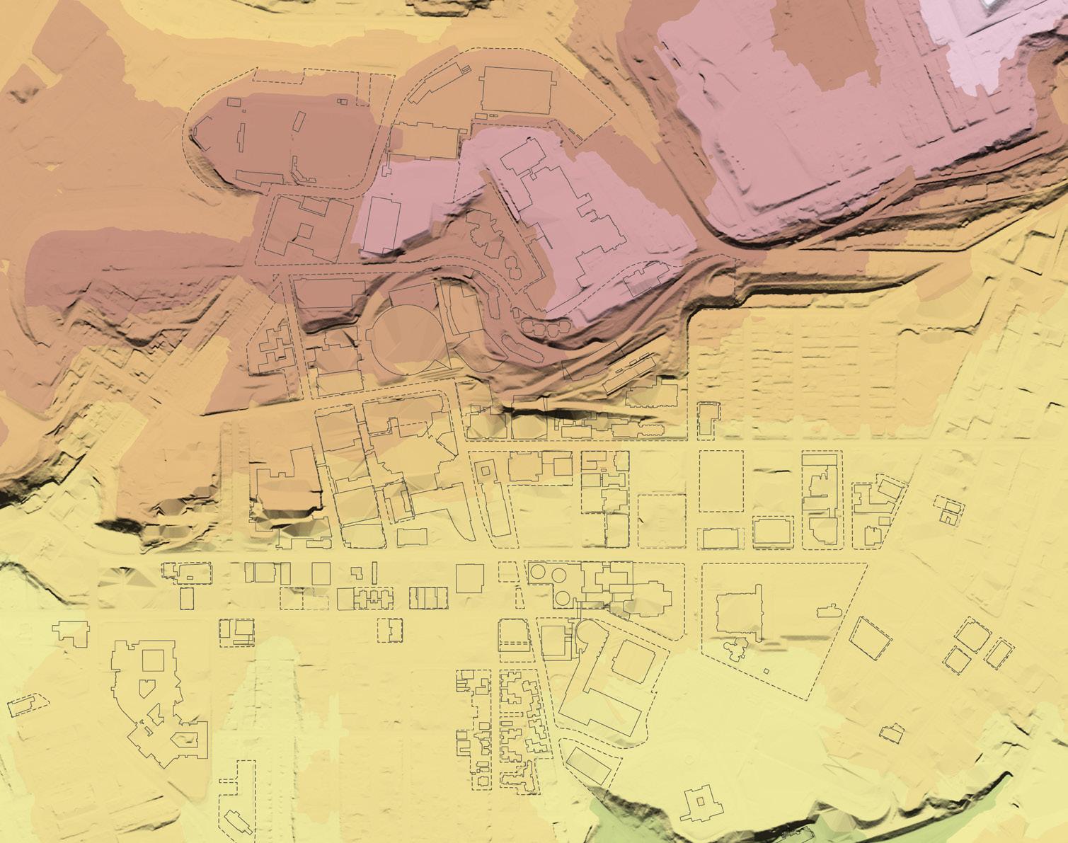
Allequippa St
Accessible Network
Accessible Path
Relatively Accessible Path
Non-accessible Path
Indoor Accessible Path
Elevator
Parking Location
Parking Space
Accessible Entrance Connected to Accessible Route
Proposed Accessible Entrance Connected to Accessible Route
Accessible Entrance not Connected to Accessible Route
Steep slopes at Allequippa Street disconnects the north and west portions of Hillside Campus from the rest of the accessible network
Recreation and Wellness Center, Eberly Hall, and the Chevron Science Center offer important interior connections to complete the accessible network
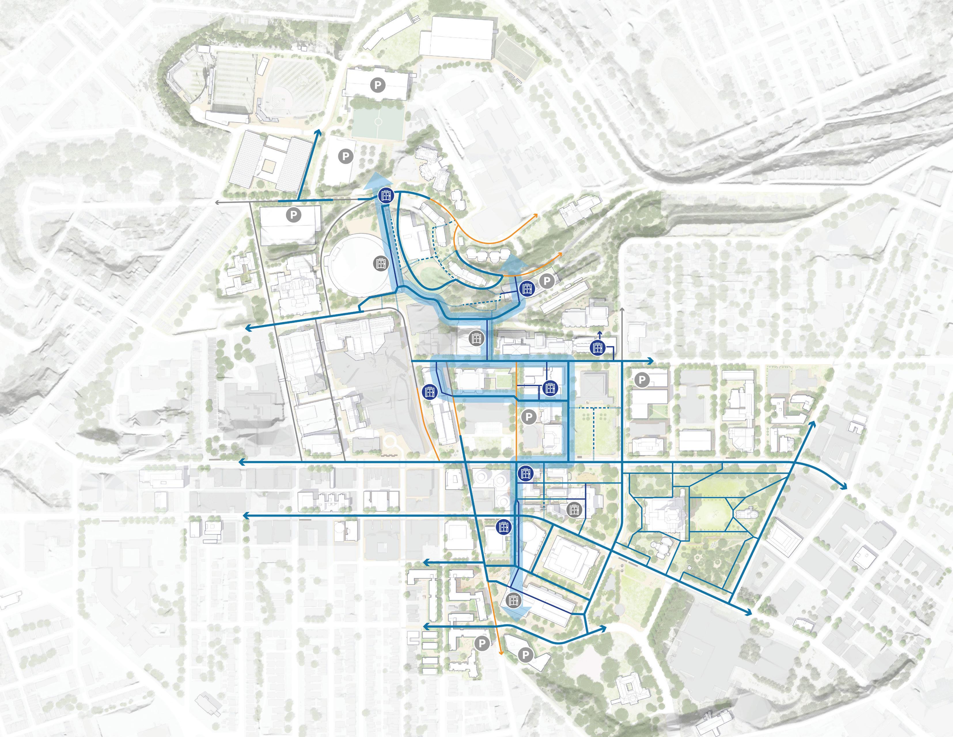
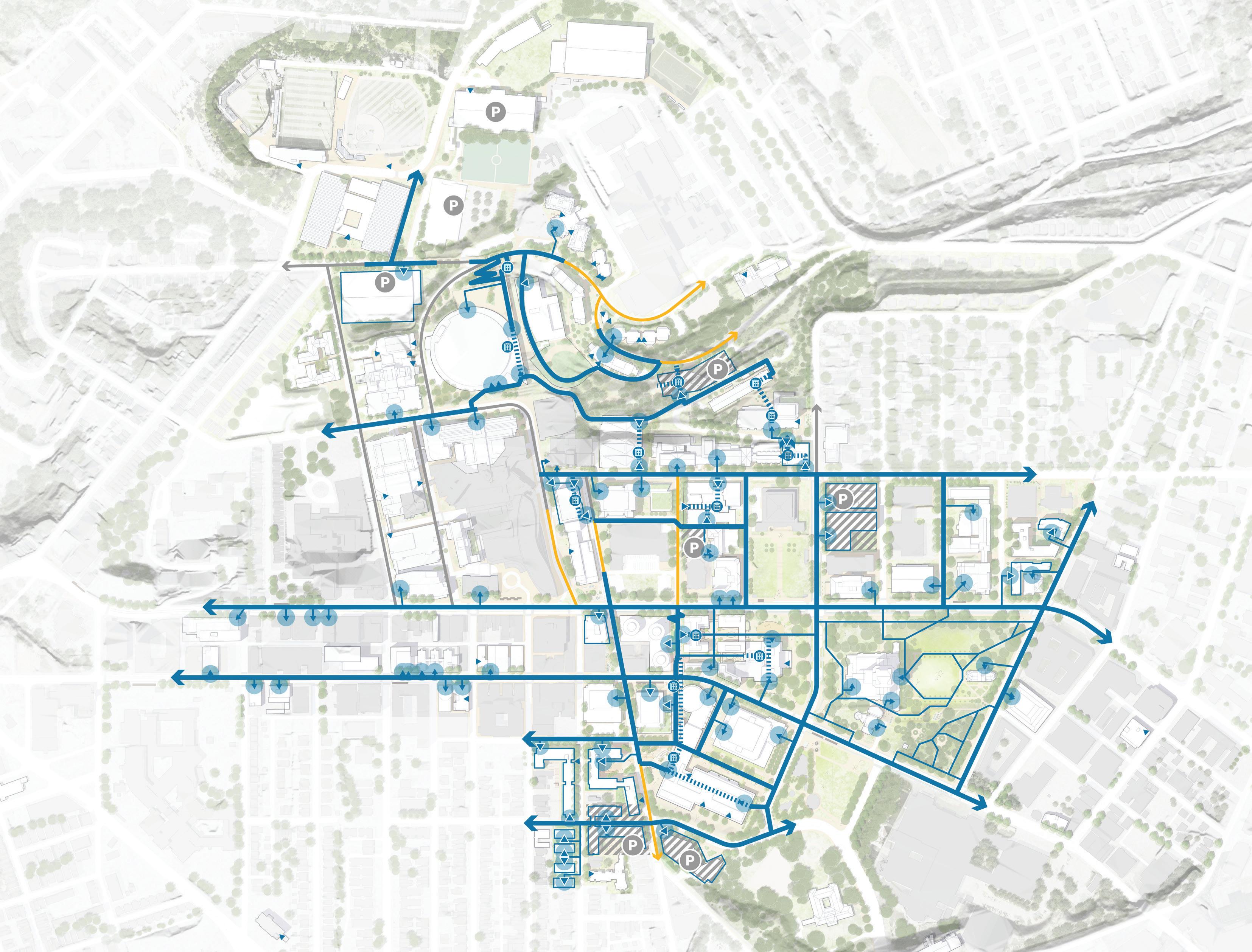
O’Hara St
Parkman Ave
Thackeray
PEDESTRIAN EXPERIENCE
Pathway Network
An inventory of existing campus pathways was developed as a means of providing recommendations and informing development of a preferred route map, included with the plan. In this context a preferred route is one that is accessible and allows for ease of travel between campus nodes. While other routes are accessible, the preferred routes offer the best experience to all users.
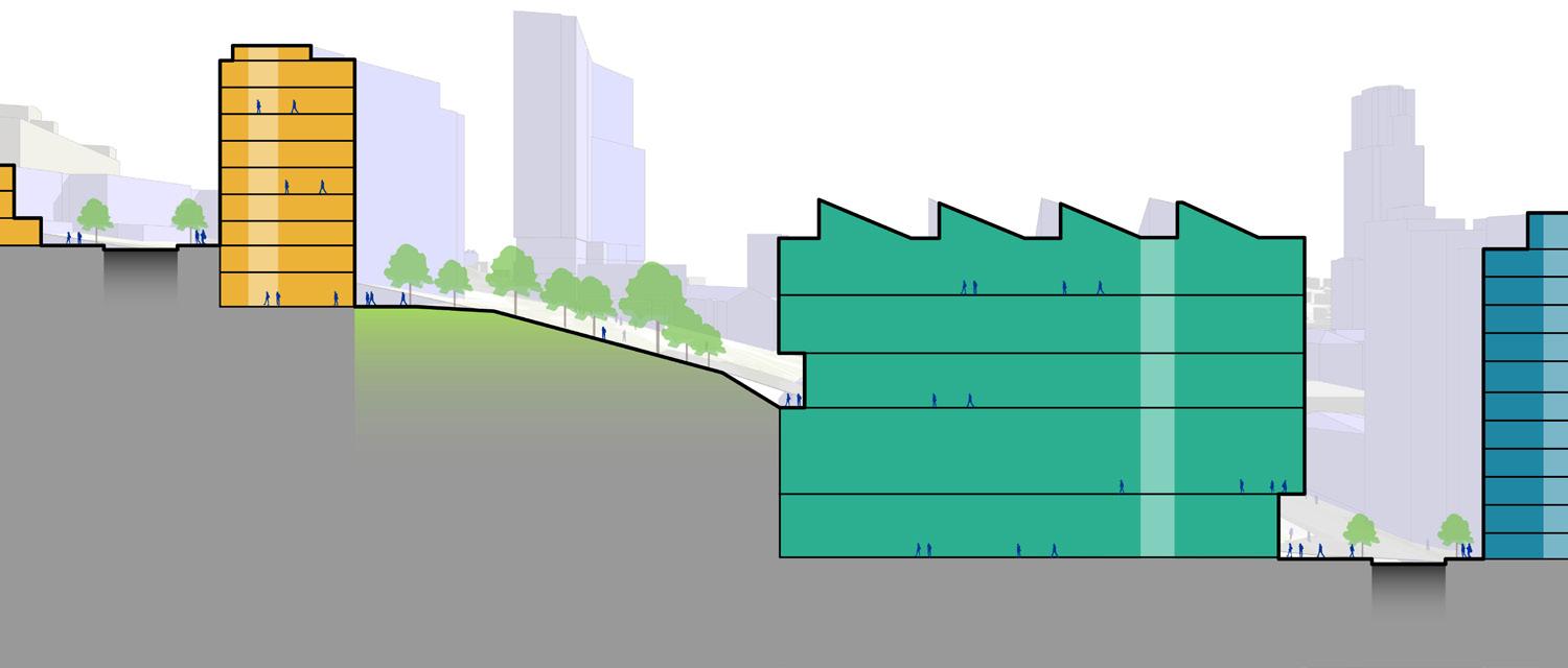
Recreation and Wellness Center
Hillside Landscape
Irvis Hall
Utterback Dr 164’
O’Hara St
Section at Recreation and Wellness Center
Preferred Routes
Preferred Route
Indoor Preferred Route
Elevator
Accessible Entrance Connected to Preferred Route
Parking Location Connected to Preferred Route
Parking Location not Connected to Preferred Route
Steep slopes at Allequippa Street disconnects the north and west portions of Hillside Campus from the rest of the accessible network
Ave Bigelow Blvd University Pl De Soto St
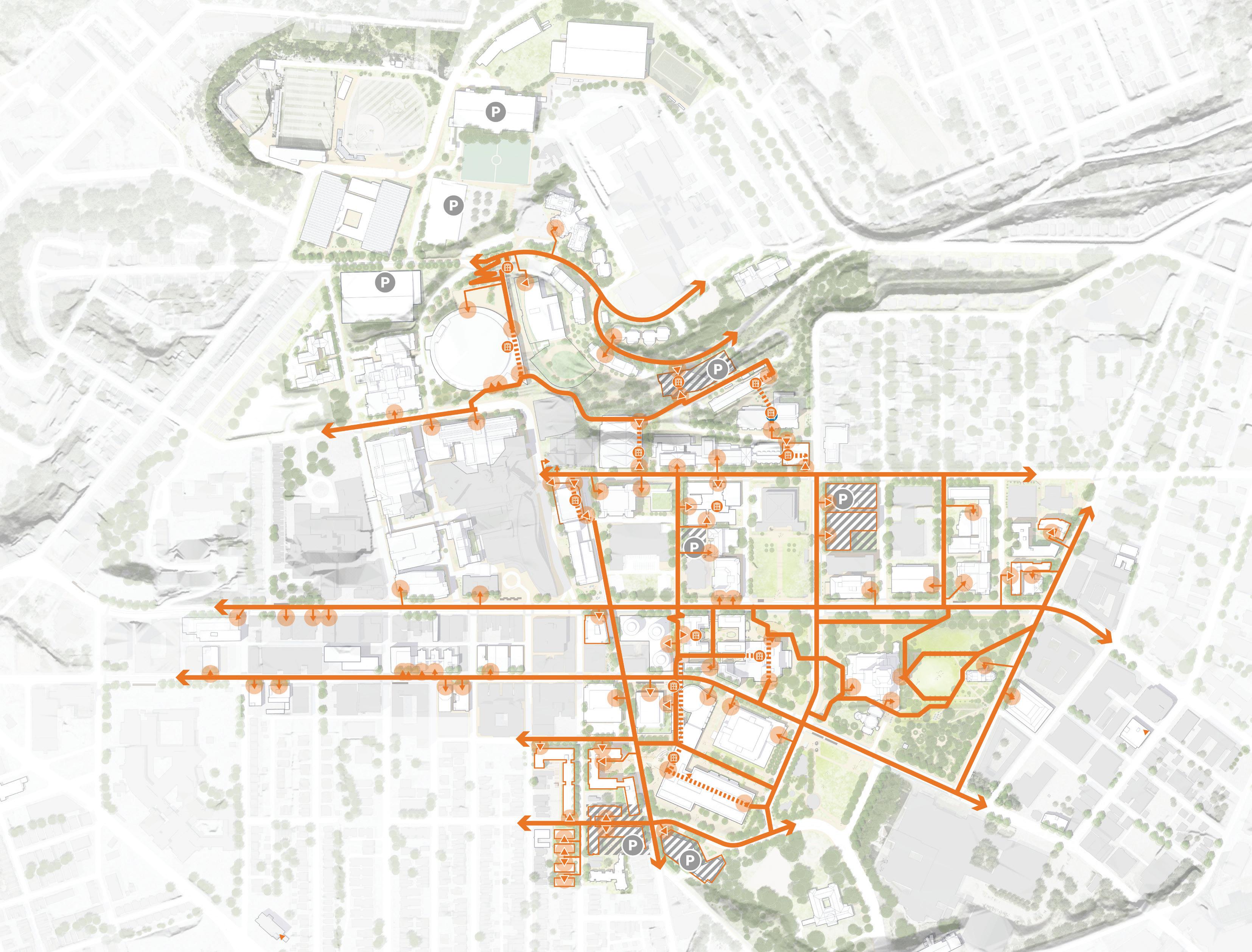
Centre
O’Hara St
Parkman Ave
Thackeray
The proposed enhancements to the pathway network promotes campuswide accessibility with specific emphasis on north-south connectivity and the associated challenging topography of the campus.
A route of particular importance is the BouquetThackeray corridor. Starting with the redesigned plaza space, west of Posvar, the corridor evolves further to embrace more active modes of transportation while serving as a gateway for motor vehicles entering campus via Bates. This theme is continued alongside the School of Law, where the framework is to provide more accessible frontage space that can convey pedestrian movement while integrating with new bus and bicycle facilities. Continuing along this route, new ramps connect Litchfield Plaza to Fifth Avenue and northward to O’Hara Street, where express elevators in the Recreation and Wellness Center connect to accessible routes in the Hillside District. These routes offer access to the Petersen Events Center, the new Arena and Sports Performance Center, the future Hillside Housing complex and ultimately provide an accessible connection to Allequippa Street. The pathway network also relies on elevators in several proposed buildings to overcome the topographic challenges. These include the new facility replacing Crabtree Hall and the new MidCampus science facility at the corner of O’Hara and Bigelow/Parkman. The Public Realm Framework provides additional details on the pathway network and the accessibility strategy.
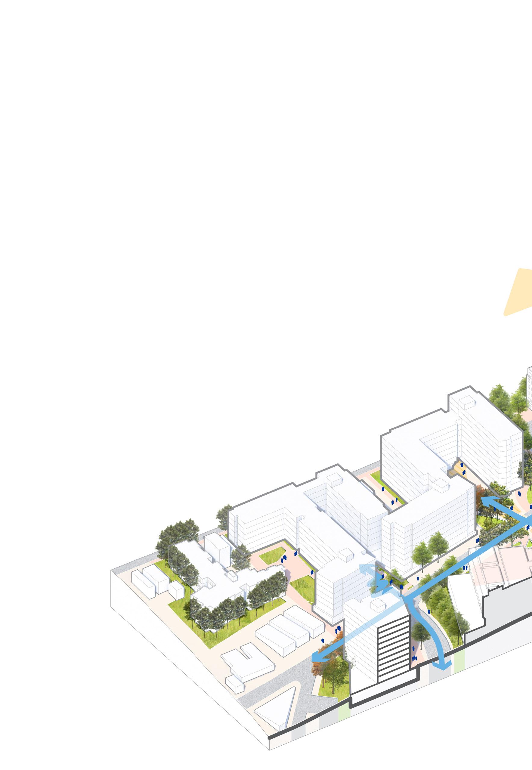
Accessible connection through the interior of the new Crabtree Hall development
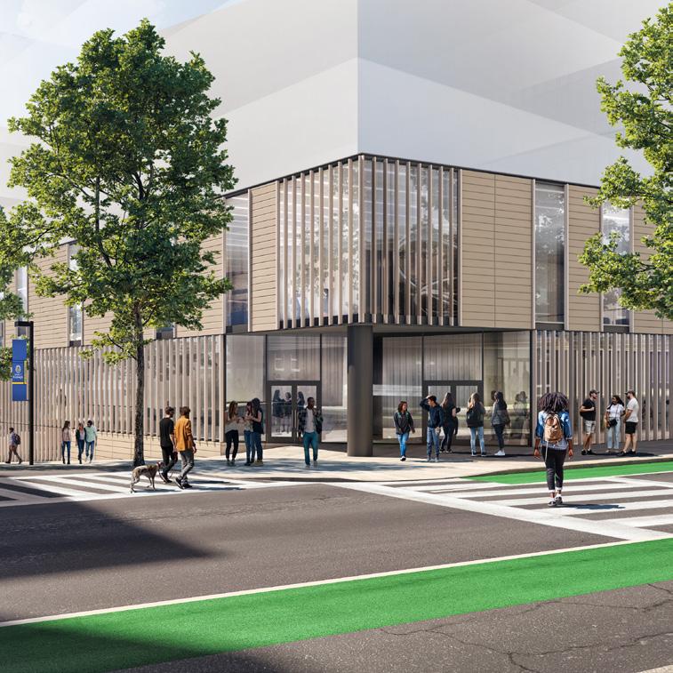
Thackeray Bouquet Corridor
Accessible Improvements
Bouquet Gardens Redevelopment
FORBESAVE
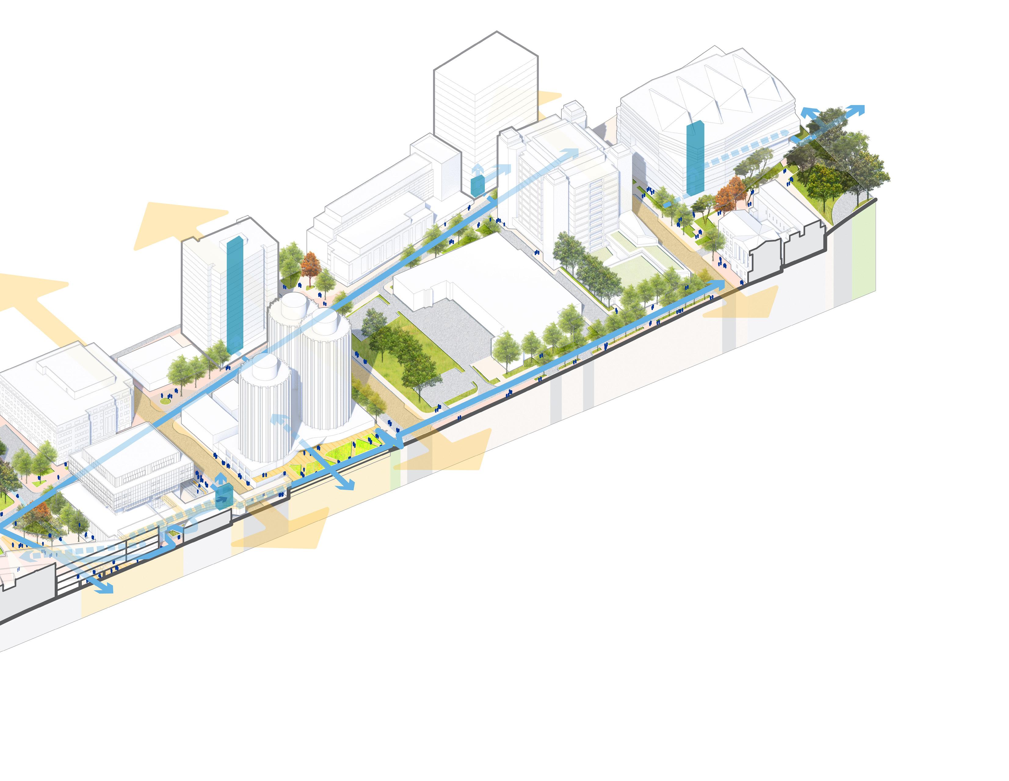
O’HARACORRIDOR
FIFTHAVE
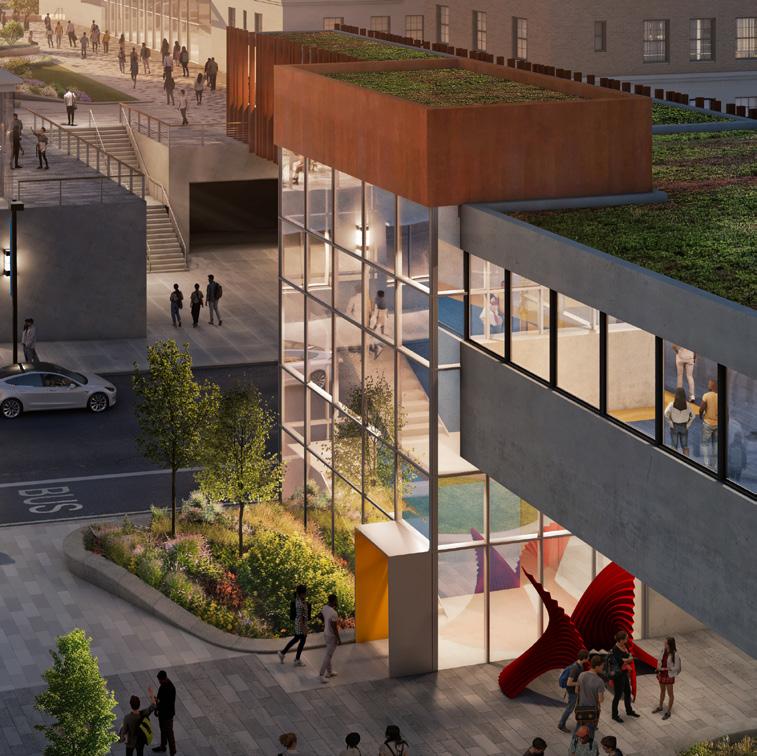
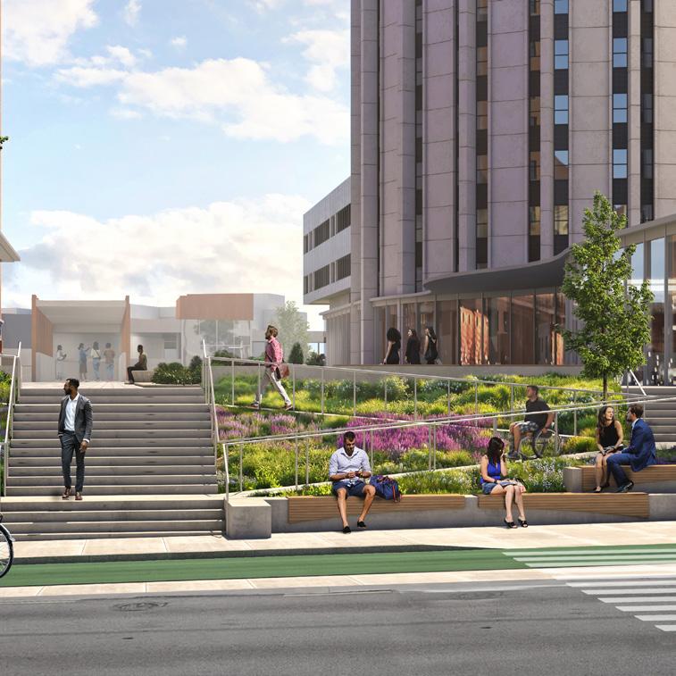
Litchfield Plaza ramps and stairs
New elevator and stair tower
Tower D Pitt Public Health
Litchfield Towers
Barco Law
Crabtree Hall Swanson School of Engineering Recreation and Wellness Center
Intersection and Mid-block Crossing Improvements
In addition to the pathways themselves, the Mobility and Accessibility Framework offers recommendations for improvements to intersections and mid-block crossings. It identifies several accessibility and pedestrian focused intersection improvements, including operational changes like Leading Pedestrian Intervals (LPI), signal modifications, and roadway improvements
like high visibility (High-Viz) crossings, curb extensions, and lighting. These improvements are geared toward improving pedestrian safety. For example, curb extensions reduce vehicle speeds, improve visibility of pedestrian, and shorten the crossing distances for pedestrians. Leading pedestrian intervals (LPI) give pedestrians the indication to go before vehicles receive a green light,
this moves them into and along the crosswalk before vehicles even begin to move. High-Viz crossings bring driver attention to the crosswalk space through improved lighting and retroreflective pavement markings and signage. The following table summarizes summarizes the recommended intersection improvements, along with the initiatives of external planning agencies since the University doesn’t have explicit control or jurisdiction over local roadways.
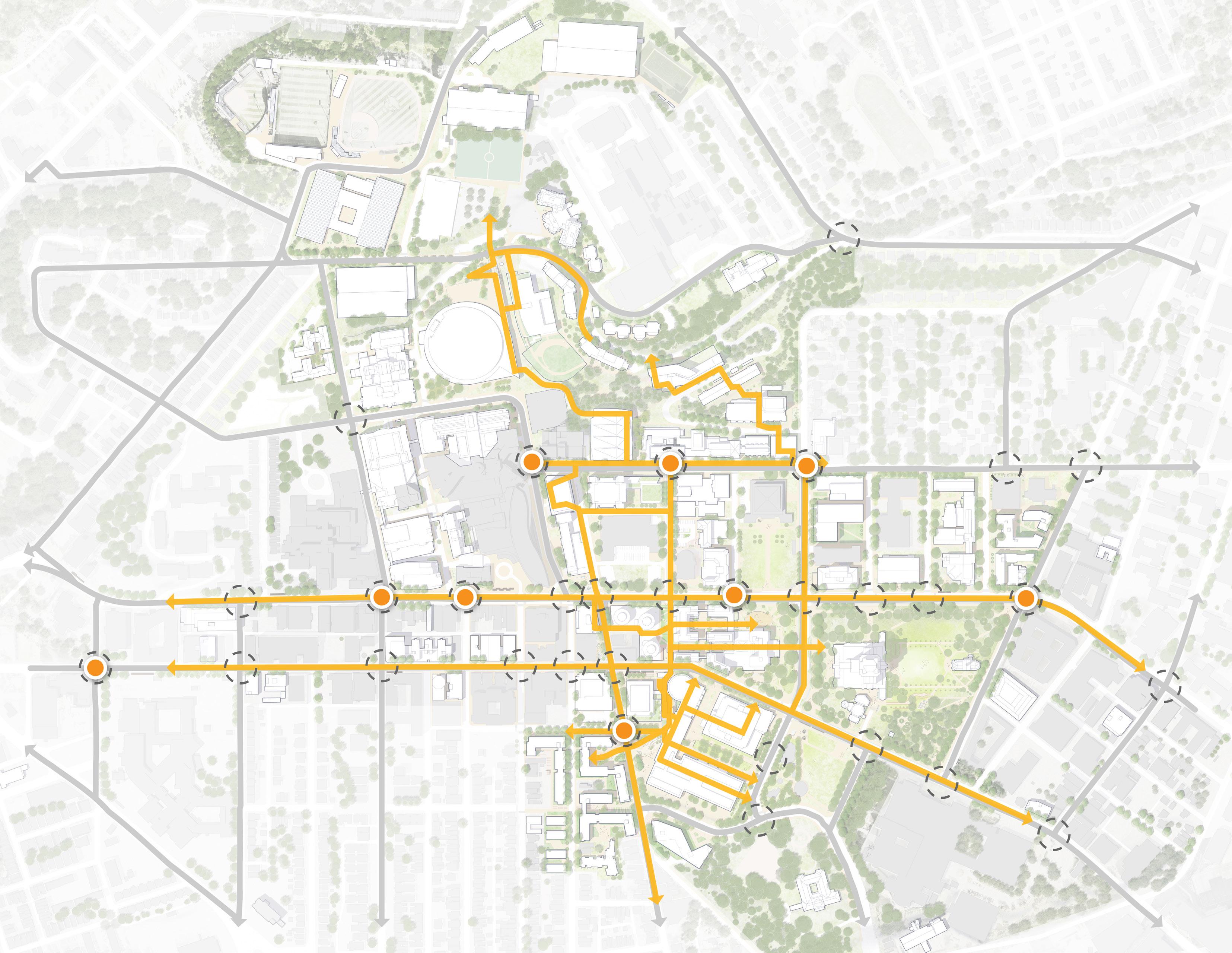
FifthAve
Mid-Block Crossings
Recommendations for mid-block crossings include geometric and operational modifications of roadway infrastructure at locations where accessibility and pedestrian desire lines exist (current or anticipated based on future development plans) outside of an intersection space. Like the intersection improvements, these locations were identified to enhance safety by providing higher visibility infrastructure that draws more attention to the crossing pedestrian, and speed tables to lower vehicle speeds and improve safety outcomes where they are applicable. The following table summarizes
the locations of recommended new crossings and improvements to existing crossings alongside previously identified intersection improvements.
The framework identifies eleven (11) locations for new mid-block crossings or improvements to exsiting mid-block crossings, and coordinates these with the public realm and urban design recommendations of the Campus Master Plan. Existing and anticipated patterns of movement inform the recommendations.
Ave, South of Sennott St
Ave, South of Fifth Ave
New Mid-Block, Enhanced Crossing (Development Support)
New Mid-Block, Enhanced Crossing (Existing Desire Line)
Allequippa St, East of Darragh St
Allequippa St (Sutherland)
Terrace St (The Pete/School of Medicine)
Schenley (Hillman/Schenley Plaza)
Forbes Ave (Hillman./Union)
with Enhanced Pavement Markings and Signage
Upgrade with Enhanced Pavement Markings and Signage
Consolidate with Adjacent Crossing, Speed Table
Upgrade with Enhanced Pavement Markings and Signage
Upgrade with Enhanced Pavement Markings; Signage and Speed Table
Upgrade with Enhanced Pavement Markings; Signage and Speed Table
Recommended New Mid-Block Crossings
Existing Mid-Block Crossings to Upgrade
Bigelow Blvd, North of Fifth Ave
Allequippa St (Petersen/F Lot)
New Raised Crossing (Development Support)
Consolidate with Adjacent Crossing, Speed Table
University Pl, North of Fifth Ave
Robinson Ext (Fitzgerald/Charles L. Cost Field)
New Mid-Block, Enhanced Crossing (Development Support)
Upgrade
Oakland
Bellefield
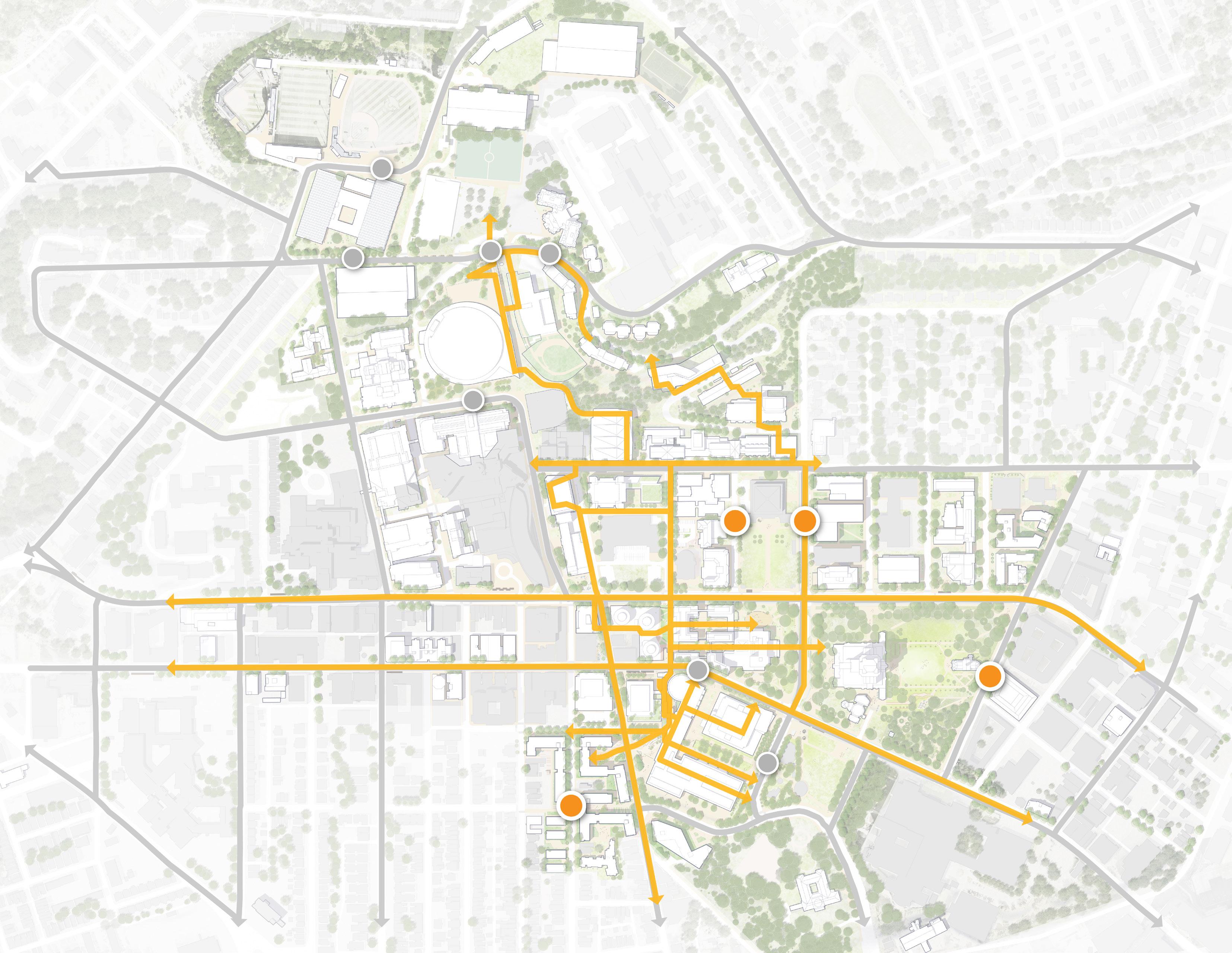
FifthAve
BICYCLE INFRASTRUCTURE AND AMENITIES
Bicycling is an integral part of campus life at Pitt, with a culture that continues to grow and is supported by infrastructure such as the Pitt Bike Cave. The Mobility and Accessibility Framework reinforces the University’s strong commitment to expanding bicycle infrastructure and amenities, building on successful initiatives that recently earned Pitt a Gold Status designation from the League of American Bicyclists. To continue this success with the plan, bicycle circulation improvements to infrastructure are integrated with the proposed network of mobility hubs which feature amenities like bike parking, personal storage, and other enhancements that add value to the user experience and operational efficiency of alternative transportation on campus. The goal is to support ongoing planning initiatives to remove barriers to bicycling.
The existing bicycle infrastructure, which includes bike lanes and signage, near the Pitt campus includes gaps on Forbes from Bigelow to the west, along Fifth through campus, and extending north into the Hillside. The City of Pittsburgh’s Department of Mobility and Infrastructure (DOMI) Bike(+) plan addresses some of these gaps by providing eastwest connectivity along Fifth with a proposed bike corridor extending from downtown to Bellefield (in place of the existing contraflow bus lane), and north-south connectivity with new facilities on McKee Place. The Oakland Plan envisions additional expansion with new facilities on Coltart Avenue, Robinson Street, Craft Avenue and Bouquet Street, in addition to those specified by the DOMI Bike(+) plan. The Campus Master Plan integrates these plans to create a comprehensive network.
Bicycle Storage and Amenities
Existing personal bike amenities include nearly 1,500 spaces for storage, with over 400 racks in service.. While significant, this capacity is not sufficient to fully meet current and anticipated demand, and the University is continually assessing opportunities for additional rack locations. Pitt’s ongoing improvements focus on upgrading and installing new racks to support a wider variety of bicycles and EPVs and meet growing demand. The Mobility and Accessibility Framework integrates these ongoing upgrades by providing a clear design criteria for how and when to approach upgrades, along with provisioning for mobility hubs to accommodate bikes, scooters, and other electric personal vehicles in use around campus. The challenges include availability of level space for double-decker racks and locating secure and safe charging solutions that do not pose fire or other risks to buildings and critical infrastructure. The proposed approach seeks to meet demand while consolidating infrastructure, providing Pitt with more efficient oversight of a smaller operational footprint with future proofing in mind.
The following criteria guide Pitt’s plan for improving street-side bicycle parking throughout campus:
• Locate bike facilities near transit services where locations are ideally within the same block as an existing transit stop.
• Provide secure storage in place of existing unsecured storage.
• Provide a canopy or cover where racks exist uncovered.
• Install a fix-it station where space is available and there isn’t another station within a twoblock walk.
• Add capacity with a second level or wider footprint where appropriate.
• Integrate with a mobility hub where possible.
• Locate new facilities along proposed bike routes. The bike network plan shows the existing bike facilities throughout campus along with areas recommended for upgrades.
Centre Ave
Bike Lane Network
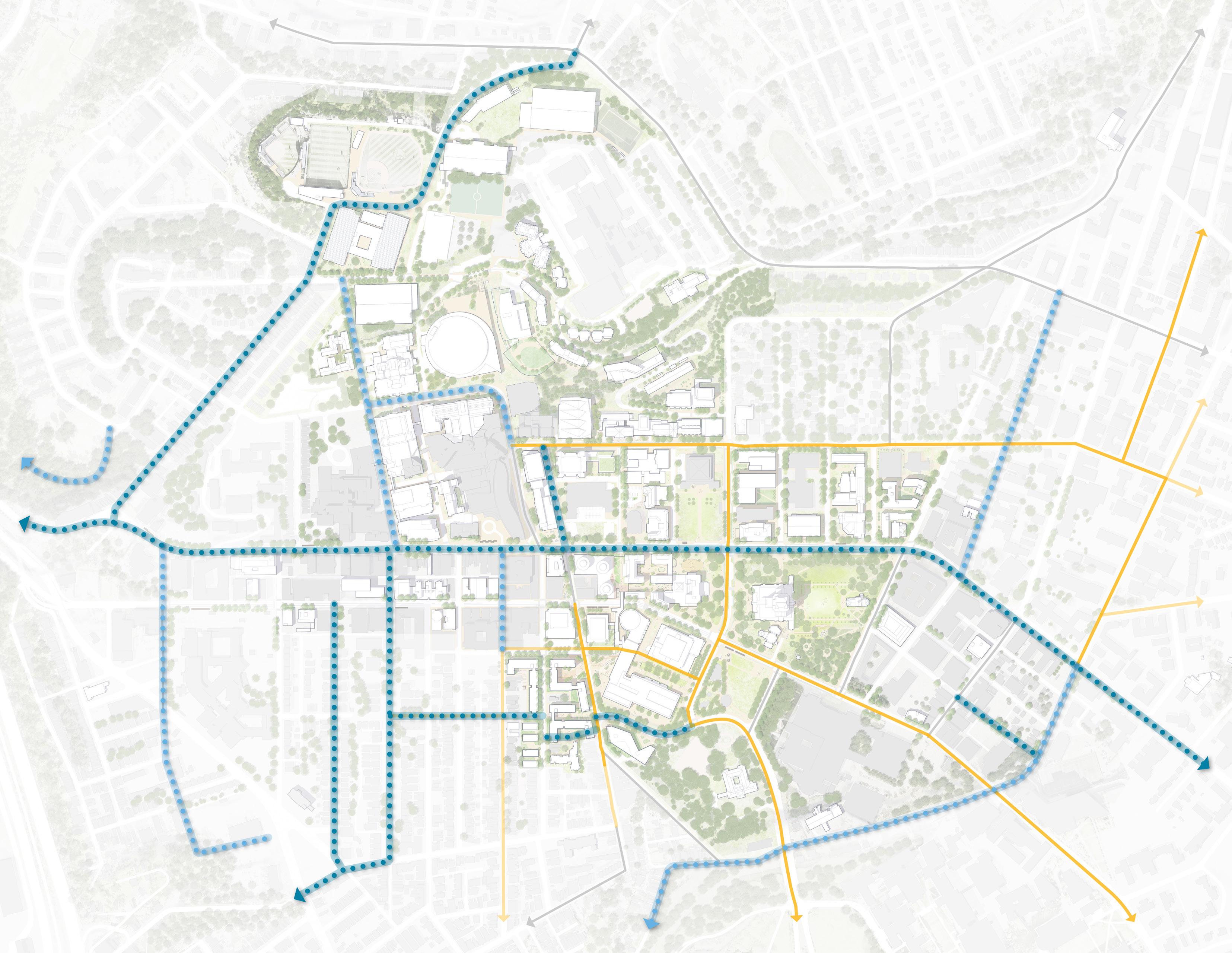
Ave
Ave
St
Ave
Ave
Terrace St
Darragh St
Proposed Bike Lane
Proposed Shared Lane
Existing Bike Lane
Existing Shared Lane
Existing On Street Bike Route
Allequippa
Fifth
FifthAve
Forbes
ForbesAve
Centre
O’Hara St
Parkman
SchenleyDr
BICYCLE INFRASTRUCTURE AND AMENITIES
POGOH Expansion
Oakland sees some of the highest demand for POGOH in the city, where adding more locations and supporting infrastructure provides a pathway for further driving demand. There is a need for funding to support further expansion that can be addressed by willing partners, as a recent POGOH plan to expand in 2025 was postponed with issues related to federal funding. In support of this, the Mobility and Accessibility Framework identifies potential station locations for expanding the POGOH system, using metrics like traffic volume, available infrastructure, and space requirements to inform discussion. This is in line with the POGOH bikesharing program expansion criteria which locates new stations based on user demand, connectivity with existing bike routes, and local stakeholder feedback. Key criteria considered for expansion include:
• Identifying new locations based on user demand and connectivity with existing or planned bike routes.
• Strategically placed to maximize user reach and support commuting needs.
• Coordinating with local stakeholders and property owners to address design and safety concerns.
• Proximity to bike routes, shuttle services, existing POGOH stations, bike lockers or rooms and fix-it stations.
• Access to electricity.
Shared Mobility
The Mobility and Accessibility Framework defines shared mobility as transportation services and resources shared among users, including public transit, micromobility options such as POGOH bike sharing, automobile-based modes with carsharing or on demand arrivals like Uber and Lyft and commute-based modes that involve carpooling and vanpooling. The framework takes into consideration the shared mobility options currently available, while acknowledging that the future may include the re-introduction of scooters that are legislatively prohibited today.
POGOH Network
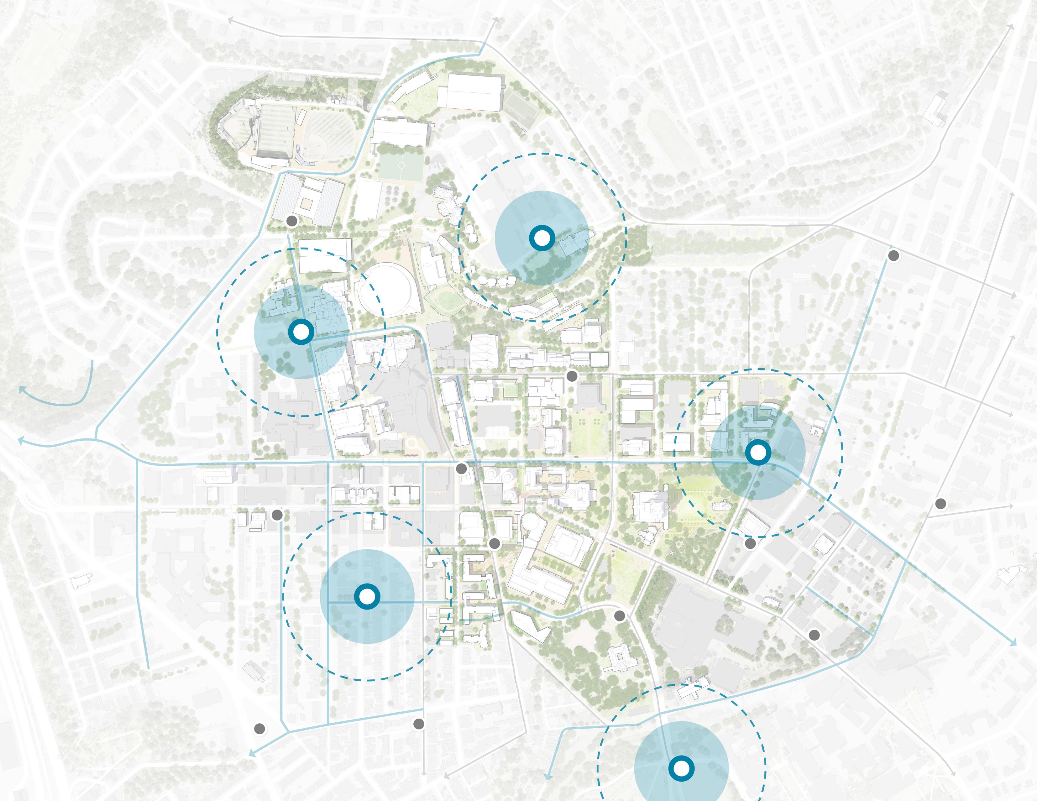
Allequippa St Fifth Ave
Terrace St
Darragh St
McKee Pl
Proposed POGOH Facility
Existing POGOH Facility
Proposed Bike Lane / Route
Existing Bike Lane / Route
Thackeray Ave Bigelow Blvd University Pl De Soto St Bellefield Ave N Bouquet St S Bouquet St SchenleyDr
O’Hara St
Parkman Ave
MOBILITY HUBS
Mobility hubs provide amenities like storage, guidance, vending, and charging in locations of high traffic areas near multi-modal transportation infrastructure. They integrate accessible pathways, public transit, cycling, ride-sharing and micromobility to encourage multimodal travel and enhance the user experience. They feature covered bike and EPV (electric personal vehicle) parking, and integrate POGOH where possible.
They also include supplemental amenities such as bike fix-it stations, transit waiting areas and shelters, real-time transit arrival information, interactive information kiosks and EPV charging stations.
Mobility Hub Locations
Posvar Passage
Tower D (Fifth/Bouquet)
Old Engineering Hall
One Bigelow
Crabtree Redevelopment
Posvar Passage, Schenley Dr
Fifth Ave (Pr), Bouquet St
O’Hara St
O’Hara, St One Bigelow Blvd
O’Hara St
Sutherland N/A
Bellefield/Filmore Forbes Ave, Craig St
Pittsburgh Athletic Association
Future PRT BRT Service (Forbes/Fifth) Several Shuttle Routes
Future PRT BRT Service (Forbes/Fifth)
Future PRT BRT Service (Forbes/Fifth) Shuttle Route 10A/B
Pr. PRT Route 83 (Bedford Hill) Shuttle Route 10A/B
Ex. PRT Route 81, Pr. PRT Routes 83-81, Shuttle Routes 10A, 15A, 30C, 40A Shuttle Routes 10A/B Shuttle Route 20 Shuttle Routes 10A/B
<1 Block North (Schenley Plaza)
<1 Block North (5th/Bouquet St)
~1 Block East (O’Hara St/ University Pl)
Integrate Ex. Station (O’Hara St/ University Pl)
3 Blocks East (O’Hara St/ University Pl)
1 Block West (Allequippa St/ Darragh St)
Filmore St/Bellefield Ave
St, Bigelow Blvd O’Hara St/ University Pl
Future PRT BRT Service (Forbes
Coltart/Forbes N/A
Ave
On-Street: Schenley Drive Off-Street: Posvar Hall Garage
On-Street: Bouquet St/Oakland Ave Off-Street: Displacing 20 Spaces
On-Street: Thackeray Ave/O’Hara St
Off-Street: Displacing 12 Spaces
On-Street: O’Hara St East of Thackeray Ave Off-Street: Displacing 20 Spaces
On-Street: O’Hara St, East of Thackeray Ave Off-Street: PG Lot/Garage
On-Street: N/A
Off-Street: OC Lot
On-Street: Bellefied Ave
Off-Street: N/A
Fifth
One Bigelow
Co-Located with CVS On-Street: Coltart Ave Off-Street: Private
The Mobility and Accessibility Framework identifies eleven (11) potential locations for mobility hubs across the campus, each requiring varying degrees of power coordination, bicycle facility development and integration with other mobility and transit options. The framework coordinates each hub with the broader urban design and public realm recommendations of the Campus Master Plan. Each location is classified based on intended usage within the transportation system, whether that is supporting commuters coming in from the broader region, increasing support of an already highly utilized bike storage or POGOH location, or something that could support new infrastructure like the cycle track proposed for Fifth Avenue.
William Pitt Union Bigelow Blvd, Fifth Ave (Pr)
Fifth Ave/Bigelow Blvd
Soldier and Sailor
Schenley Drive/ Roberto Clemente Forbes Ave, Posvar Passage, Schenley Dr
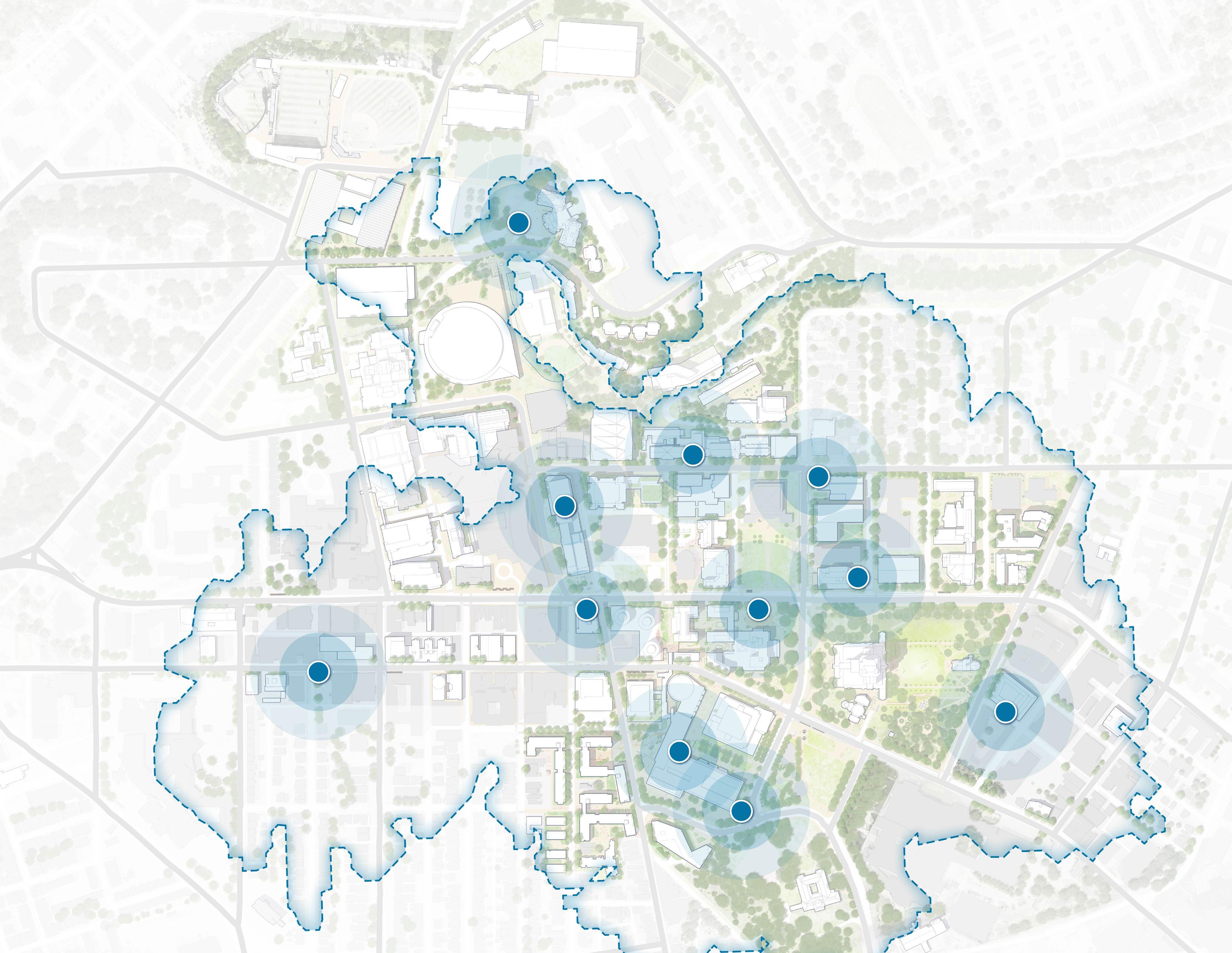
FifthAve
MOBILITY HUBS
Mobility Hub Features
The optional features of the proposed mobility hubs include:
Essentials
• Secure, Covered Bicycle Parking
• Bicycle Maintenance (Fix- It Station)
• POGOH station (integrated or nearby)
• Passenger Amenities (benches and shelters)
• Wayfinding
Technology and Transportation
• Real-time Transit Information
• Interactive Wayfinding
• Secure Package Lockers
• Car-Sharing Services
• Micro-Mobility Integration
• Electric Vehicle Support
Comfort and Support
• Hydration Stations
• Restroom Facilities
• Guest Services
• Concession Areas and Retail
• Public Art and Placemaking
Mobility Hub Classifications
1- Physical Commuter Support
• Restroom Facilities
• Concession Areas and Retail
• Secure, Covered Bicycle Parking
• Passenger Amenities (benches and shelters)
• Real-time Transit Information
• Bicycle Maintenance
• Hydration Stations
• Electric Vehicle Support
2- Adjacent to POGOH/High Utilization Area
• Micro-Mobility Integration
• Interactive Wayfinding
• Guest Services
• Concession Areas and Retail
• Public Art and Placemaking
• POGOH Station
• Hydration Stations
• Secure Package Lockers
• Electric Vehicle Support
3- Bike/Ped Focused
• Secure/Covered Bicycle Parking
• Bicycle Maintenance
• Wayfinding
• Passenger Amenities (benches and shelters)
*Car-Sharing Services would be integrated into mobility hubs on case-by-case basis and not necessarily assigned to specific classifications.
Uber/Lyft
Waiting Area
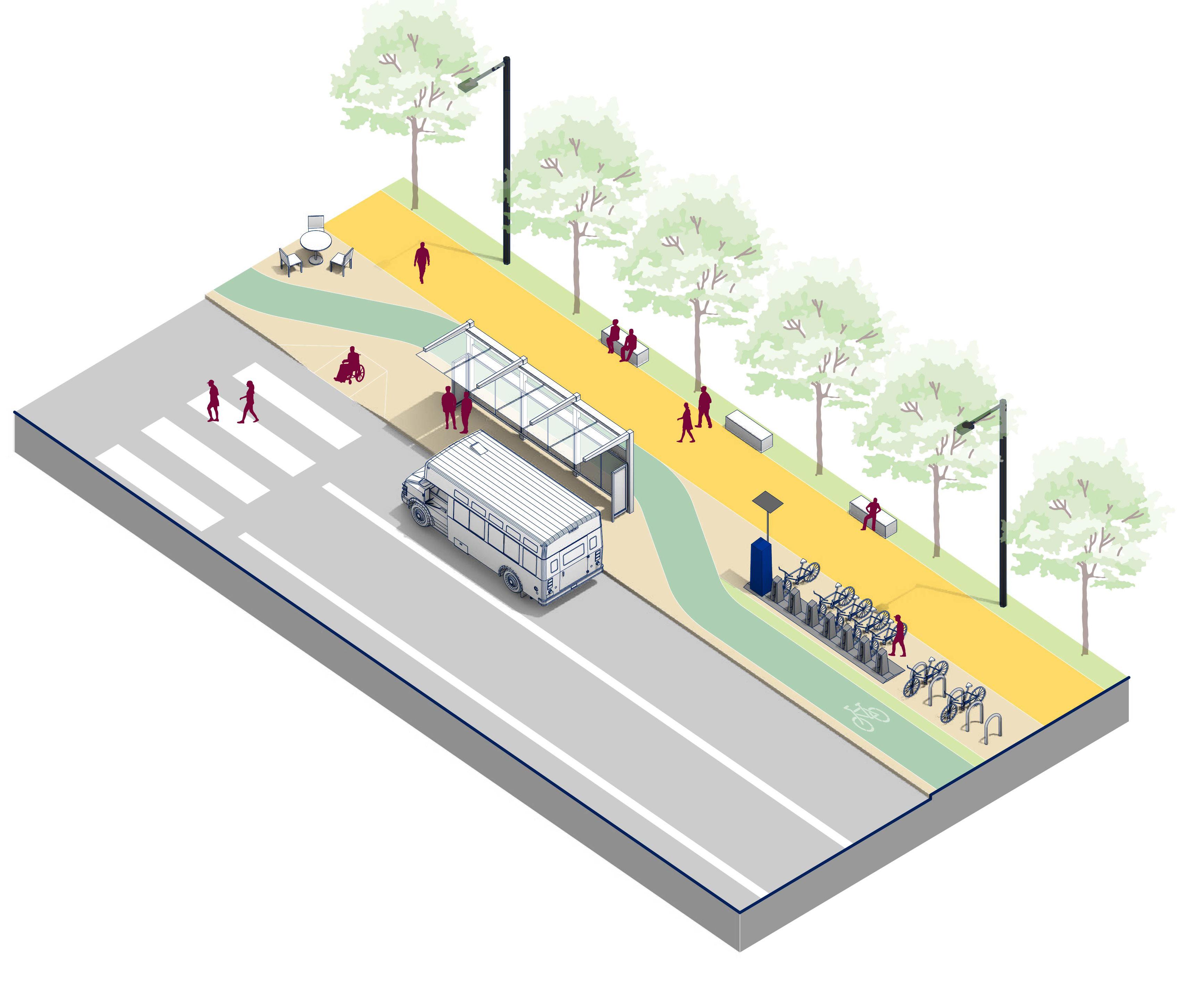
Bus Shelter
Information Board
POGOH Station
Bike Racks and Charging Station
Mobility Hub Example
CAMPUS SHUTTLES AND TRANSIT
Pitt-Operated Services Pitt Shuttles
Pitt operates three transit services: a fixed-route service known as the Pitt Shuttles, two on-demand services including Disability Shuttles, and SafeRider which offers curb-to-curb service. The Mobility Frameowrk coordinates these services with the proposed system of mobility hubs and the public realm recommendations of the Campus Master Plan.
The Mobility and Accessibility Framework supports a robust transit network consisting of shuttlecirculator services provided by both Pitt and Carnegie Mellon, and numerous PRT bus routes connecting the campus area to neighborhoods and destinations throughout Allegheny County. Future services include the Bus Rapid Transit (BRT) services proposed on Fifth Avenue and Forbes Avenue. The framework focuses on the user experience by integrating these services with the accessible pathway network of the campus, the proposed mobility hubs, the bike network, shared mobility services and parking.
Eight shuttle routes provide circulation around campus and connections to Pitt’s buildings, where Route 10A supports most riders today. The existing system and operational scheme was reviewed to provide recommendations for more efficient routing and in response to planned development. The shuttle system is operated for Pitt students and employees, meaning some routes are not operated, or operated at reduced service levels, on weekends, holidays, during Summer Semester and other periods when classes are not in session. Pitt also operates a disability shuttle covering the campus and surrounding neighborhoods with the service area remaining the same throughout the day and does not change based on fixed route operations.
The proposed changes for three shuttle routes (10A, 10B, and 30C) are shown in the diagram at right. These routes are the most heavily used among the twelve total routes operated by Pitt.
Pittsburgh Regional Transit (PRT) Services
The Mobility and Accessibility Framework integrates PRT’s proposed BRT service along Fifth Avenue and Forbes Avenue branded as the University Line. The PRT service provide regional access beyond Pitt Shuttles, connecting Pitt staff and students with campus via a robust bus network. Pitt is one of PRT’s largest customers, where Pitt students and staff members accounted for nearly 10 percent of PRT’s annual total ridership in calendar year 2023. Pitt students and staff members ride free on PRT transit, and are required to tap their Pitt Panther card when onboarding for each trip, where the number of taps made by all Pitt cards are tabulated by PRT and billed to Pitt for each trip at a discounted rate.
The goal of the University Line is to increase bus travel speeds on Fifth and Forbes Avenues between Downtown Pittsburgh and Oakland. Features include bus-only lanes, transit signal priority and transit waiting environment (TWE) improvements. Specific improvements include the conversion of the north-most-lane on Fifth Avenue to a westbound bus-only lane, and the south-most-lane on Forbes Avenue to an eastbound bus-only lane, between Craft Avenue and South Bellefield Avenue. The planned improvements consolidate existing bus stops on Fifth and Forbes Avenues (24 stops) into nine stations. The Mobility and Accessibility Framework integrates these stops with proposed public realm improvements and offers specific guidance for the Soldiers and Sailors stop on Fifth Avenue and the Barco Plaza stop on Forbes Avenue. Please see the Public Realm Framework for details.
Shuttle Routes
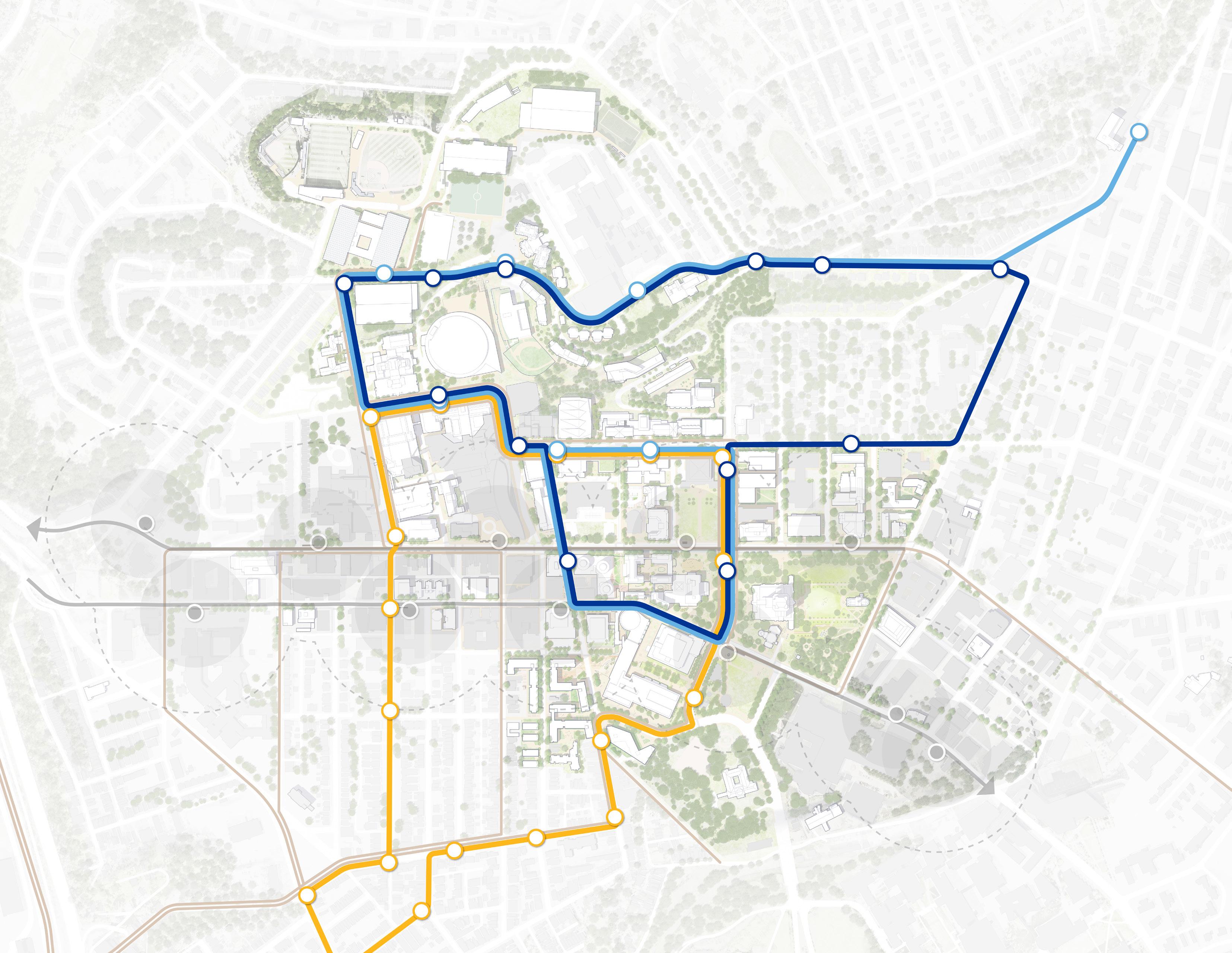
Existing Shuttle Route
Proposed Route 10A
Proposed Route 10B
Proposed Route 30C
Proposed Shuttle Stop
BRT Route
BRT Station
Route 30C
Route 10A
Allequippa St
O’Hara
PARKING AND TRAVEL DEMAND MANAGEMENT (TDM)
Parking Supply
Pitt owns 4,433 parking spaces and leases 972 for a total of 5,405 spaces. Of these, Pitt allocates 2,215 spaces to staff, 255 spaces to students, and 2,935 spaces to other users, which includes visitor, reserved, leased, and other special designated spaces on campus. Relative to the baseline established in the Institutional Master Plan (IMP), which is no net new parking relative to the existing capacity at that time, Pitt is currently estimated to have a parking shortfall of approximately 660 spaces. This is mainly attributed to construction-
related reductions in supply combined with increasing local demand for parking. However, in line with its commitment to the City of Pittsburgh, Pitt has agreed to maintain a “net no new parking” policy, meaning the University will not increase its total parking supply beyond the IMP baseline. This policy reflects a shared recognition that adding more parking could intensify traffic congestion, strain the urban mobility system, and work against the City’s and Pitt’s broader goals for sustainability and multimodal transportation.
Parking Displacement
The recommendations of the Campus Master Plan, including space impacted by proposed development or roadway geometric modifications, result in the displacement of an estimated 825 spaces, including 710 spaces in off-street facilities (e.g., lots and structures) and 115 on-street parking spaces. The following table summarizes the locations:
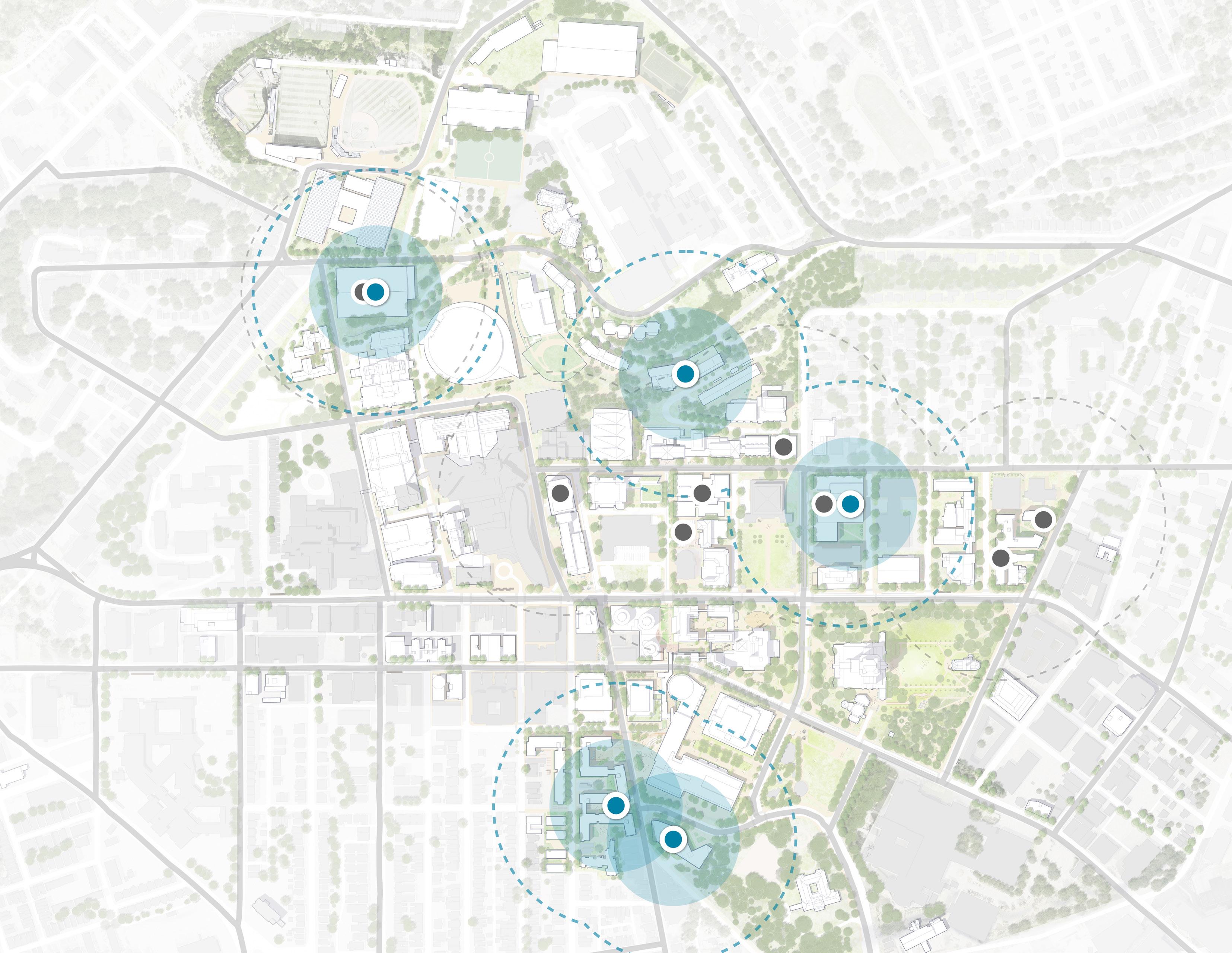
FifthAve
Parking Recommendations
The Mobility and Accessibility Framework provides near-term and long-term parking recommendations for the campus, including partnership opportunities with the public and private sectors and phased parking plans.
Near-Term Parking Opportunities
The Mobility and Accessibility Framework includes near-term parking recommendations as a way to address the challenges of current shortfalls until such time that the implementation of new parking garages is complete. Based on multiple stakeholder workshops with campus planning, the consultant team, and staff and faculty who are directly involved with campus operations, the framework recommends the following:
1. Construct temporary flat lots on property under consideration for future construction, where possible.
2. Seek partnership opportunities at nearby existing facilities or through expansion of existing facilities.
3. Promote strategies to utilize remote parking, external to campus, supplemented with dedicated transit support via shuttle or PRT to connect riders reliably with campus.
4. Expedite construction on a permanent structure to mitigate deficit and provide swing space during planned maintenance of existing facilities.
5. Implement travel demand management (TDM) strategies to reduce parking demand by providing alternatives to personal vehicle travel through policies and incentives.
Long-Term Parking Opportunities
The Mobility and Accessibility Framework summarizes long-term opportunities (see adjacent table) for new parking facilities and infrastructure as part of future development and redevelopment recommendations. The framework identifies opportunities for a potential 1,800 spaces over the long-term in the locations included in the table. This framework provides enough space to address the shortfall relative to the IMP no net new parking commitment while providing flexibility with achieving those goals as campus evolves over time.
Partnership Opportunities
The Mobility and Accessibility Framework also recommends that Pitt explore opportunities for providing parking in partnership with other institutional or private sector partners. This requires a review of potential locations that are served by PRT routes leading directly to the campus or new dedicated shuttle routes.
Transportation Demand Management (TDM)
The Mobility and Accessibility Framework employs a multi-faceted strategy to transportation demand management (TDM) that focuses on incentive and infrastructure based interventions to improve accessibility and mobility for the entire population while offering the potential to reduce the number of vehicles traveling to campus.
Overall, there are fourteen (14) TDM recommendations included with the plan, covering a range of categories like policy, infrastructure, operations, education and marketing, and partnership opportunities. These include strategies to refine, promote, and invest in existing TDM programs, expand local bicycle infrastructure, leverage local transit initiatives like the proposed BRT service on Fifth Avenue and Forbes Avenue and in-progress route design, explicitly define work from home policies, and implement dynamic pricing to shift demand away from peak periods and potentially reduce the burden during a normal operating day within the semester. Additionally, the framework supports development of new assets like mobility hubs to provide additional connectivity with local infrastructure, like the PRT BRT improvements, and help with promoting general awareness of existing incentives and programs (e.g., Ride PRT and POGOH for free) in a more deliberate and concentrated fashion.The planned PRT BRT improvements include new bus only lanes, transit signal priority, and consolidation of the twenty-four
(24) existing stops on Fifth and Forbes Avenues into nine (9) stations. Success depends on campuswide and consistent policies supported by Pitt’s senior administration. The Mobility and Accessibility Framework integrates these stops with proposed public realm improvements and offers specific guidance for the Soldiers and Sailors stop on Fifth Avenue and the Barco Plaza stop on Forbes Avenue. Please see the Public Realm framework for details.
TDM strategies offer the potential for reducing the number of vehicles traveling to the campus. Strategies include policies such as definitive work from home policies and dynamic pricing that can shift demand away from peak periods to reduce the burden during a normal operating day within the semester. Success depends on campus-wide and consistent policies supported by Pitt’s senior administration.
Additional TDM strategies focus on policies tied to the resident locations of Pitt faculty, staff and students. These include parking policies informed by home address data to identify those located within walking distance of the campus and those with access to transit services. Potential policies could include:
• Transit Zone: For those living within ¼ mile of PRT routes leading directly to the campus, Pitt could incentivize the use of transit. This includes the utilization of existing PRT park-and-ride facilities, many of which are underutilized, currently.
Transportation services, such as ride-hailing services (Uber and Lyft) and shared mobility systems (e.g. bike sharing and, e-scooters and Zipcar) offer flexibility and convenience for the user but also contribute to circulation challenges on campus and in the surrounding context. These services can result in conflict with other vehicles, bicyclists, or pedestrians through illegal parking when loading or unloading passengers, or through sidewalk clutter. In response to emerging micromobility patterns, the mobility hubs serve as designated locations for transportation network companies. By implementing dedicated pick-up/ drop-off zones through geo-fencing, Pitt can manage curbside demand and conflicts and accommodate users across transportation modes.
IMP COMMITMENTS - TRANSPORTATION AND PARKING
Mode-Share Goal Priorities
Overall goal is to reduce SOV mode share by 3.4%, independent of any growth or decrease in campus population.
1. Designate a dedicated TDM Coordinator to manage the university’s TDM program.
2. Organize all transportation-related resources and information into a centralized location.
3. Encourage the use of non-SOV modes through financial incentives and parking fee structure.
4. Encourage investments in public transportation that serves Oakland constituencies.
Mode-Share Options
• Walking and Biking – 9.3 9.7%
• Transit, including PRT and Pitt Shuttles –38.1% 41.4%
• Carpool and Vanpool – 7.2% 6.9%
• Single-Occupancy Vehicle – 45.4% 42.0%
Parking Supply
No net-new parking on campus; maintain or replace any displaced parking spaces 1:1 within Oakland through 2031.
1. Reduce required parking.
2. Advance parking management techniques to optimize the utilization of the existing inventory and minimize need for replacement parking.
3. Work with partners to address neighborhood parking concerns.
Partnerships
Promote and enhance partnerships to improve mobility options.
1. Coordinate with DOMI on an ongoing basis to improve bicycle and pedestrian access on campus.
2. Coordinate with PRT on an ongoing basis to improve transit access to campus.
3. Identify and execute opportunities to optimize the shuttle network through a shuttle and ridesharing system study.
4. Increase internal and external dialogue, communication and cooperation on the university’s TDM program.
Resiliency
Position the Pitt transportation network to adapt to changes in the university, region and society.
1. Plan and implement effective curbside management.
2. Evaluate opportunities for flex-work, telework and tele-learning institution-wide.
3. Better align Pitt’s transportation policies with its sustainability and resiliency plans.
Monitoring
Verify and improve program performance.
1. Conduct ongoing monitoring and evaluations.
2. Conduct ongoing marketing and education related to transportation options.
3. Provide the Pitt community with TDM and travel program support, with refinements as needed to meet changing preferences and demand.
ALIGNMENT WITH PITT’S SUSTAINABILITY AND CLIMATE ACTION GOALS
The Mobility and Accessibility Framework aligns with Pitt’s broader commitment to carbon neutrality by 2037, as outlined in the Pitt Climate Action Plan (PittCAP) published in 2022. In particular, the PittCAP goal of Commuter Mode Choices is supported by the mode shift strategies of the framework including enhanced pedestrian and bike infrastructure, increased bike-share through POGOH expansion and planning for mobility hubs to provide flexibility and connectivity between modes.
The above noted travel demand management (TDM) strategies also support this goal by promoting incentives for alternative transportation, implementing walking zones and promoting the use of a park-and-ride strategy with direct transit service to campus.
The 2018 Pitt Sustainability Plan focuses on three pillars:
1. Stewardship
2. Exploration
3. Community and Culture
Each pillar has five impact areas, one of which is Transportation and Mobility. Within this impact area, there are four primary goals and aspirations for transportation and mobility:
• Achieve Silver-level Bicycle Friendly University status from the League of American Bicyclists (LOAB) by the end of FY2020, and Gold by the end of FY2025. The Mobility and Accessibility Framework supports this goal by providing an analysis of LOAB in context with existing campus infrastructure to provide recommendations for achieving Gold and Platinum status as described by the LOAB.
• Embrace the 2030 District goal of a 50% reduction below the district average greenhouse gas emissions from commuter travel and direct transportation by 2030 (from FY14 baseline). The framework supports this goal by providing several different mode shift strategies to encourage the use of transit and active transportation as primary means of travel when commuting and traveling around campus.
• Increase active Pitt registered carpools by two percent (2%) and create one new vanpool annually between FY2018 and FY2030. The framework focuses on improved marketing and promotion of transportation alternatives, including those that are presented through the CommuteInfo portal, and by streamlining the employee onboarding process to provide consistent guidance on mobility options around campus.
• Reduce Pitt Shuttle fuel usage by three percent (3%) annually between FY2018 and FY2030. The framework includes route-specific analysis of the shuttle system and offers recommendations for improving operational efficiency within the existing demand profile and when considering planned development.
The Development of the Mobility and Accessibility Framework included an assessment of the key performance indicators from the sustainability plan such as the number of PRT trip taps per fiscal year, the number of active Pitt registered carpools, vanpools, bicyclists and shuttle trip information which informs the emissions and fuel usage of shuttles as a whole.
TRAFFIC OPERATIONS, SAFETY AND WAYFINDING
Challenges Today Key Recommendations
The major challenges related to campus traffic operations, safety, and wayfinding identified in the planning process include:
1. Construction: Construction creates major impediments with accessing campus on Fifth, Forbes, and Bates
2. Roadway Blockages: There are often multiple blockages on roadways with delivery drivers, pedestrians, and transit limiting traffic flow and causing extensive queuing
3. Connectivity: There are several connectivity issues with the broader region due to the challenging topography surrounding campus, where the following are some of the critical items identified during the planning process:
• Shadyside commuters and bicycle riders use Ellsworth, Neville, and Fifth to get to campus.
• There is limited transit access to and from the northern suburbs
• There is difficulty with navigating the city, especially for unfamiliar users, due to unconventional roadway network that was developed in response to natural challenges with rivers, hills, bridges and tunnels.
• Walking is a challenge due to the steep inclines and limited sidewalk width within the dense urban environment.
• There is a lack of one seat express transit service into campus from south, west, and north.
In response to these challenges, the following actions can be undertaken by the university:
1. Promote CommuteInfo and expand TDM program to induce mode shift and reduce congestion.
2. Improve wayfinding to reduce the number of circling vehicles looking for parking to reduce congestion and vehicle-pedestrian conflicts.
3. Enhance construction coordination and information dissemination to increase awareness and help mitigate conflicts with construction.
Additionally, Pitt can work with local agencies (Pittsburgh DOMI, PRT, PennDOT 11-0, POGOH) to advocate for the following recommendations of the plan:
4. Encourage DOMI to implement operational and geometric intersection improvements indicated in the framework to encourage mode shift with safer facilities.
5. Provide input into the proposed Smart Spines Adaptive Signal Software and Traffic Monitoring Cameras implementation project with locations along Forbes and Fifth.
6. Provide feedback where appropriate for planned local roadway projects to advocate for Pitt mobility goals and objectives (e.g., Bates Street widening, Second Ave to Blvd of the Allies).
On Going Efforts
In addition to the key recommendations, Pitt is engaged with a number of on-going efforts internal to the university and external-facing working with local agencies. Pitt will make continued progress and coordination on:
Wayfinding: There is an in-progress general campus signage master plan that aims to solve wayfinding issues while implementing a coordinated and consistent aesthetic for better recognition around campus. Pitt is also in coordination with the city on newly implemented city-owned wayfinding.
Local Planning Initiatives: There are a number of local planning initiatives that are underway on campus and immediately adjacent to campus. Given the interconnected nature of Pitt with the Oakland neighborhood, Pitt should continue to participate in the planning and implementation of these efforts and advocate for improvements that impact the entire community and its visitors.
Oakland Plan
• Reimagine Bates Street
• Reimagine Robinson Street
• Reimagine Boulevard of the Allies
• McKee Place Complete Street
• Oakland and Pitt Bicycle Connection
• Bike Route Improvements
Other
• Planned Fifth Avenue and Forbes Avenue BRT and Cycle Track Improvements
LOGISTICS, LOADING AND EVENT MANAGEMENT
Managing events within the existing roadway and parking network is a challenge for event staff as there is limited space available to store vehicles and maintain traffic throughput during saturated event scenarios. This activity is primarily focused in the Upper Hillside, centered on the Petersen Events Center.
Logistics and Loading Today
1. Underutilized Space: Reclaiming underutilized space is something the logistics team regularly seeks to achieve in support of Ship2Pitt and other initiatives.
2. Enforcement: Enforcement has been an issue when piloting timed-managed loading docks, where third-parties often claim access when the dock is open regardless of policy.
3. Smart Loading Opportunities: The City of Pittsburgh is implementing smart loading zones with a few in Oakland already.
Event Management Today
4. Pedestrian Volume: Pedestrians overflow into the street beyond sidewalk limits along De Soto after large events
5. Pedestrian Right of Way: There are few routes available to exit the core event center, where limited crossing opportunities are in conflict with primary vehicle flows
6. Coordination with outside entities: Coordination with local entities for events is limited and inconsistent
7. Remote Parking Opportunities: Using shuttles to support remote parking has been successful for season ticket events like basketball where users are familiar with the service, routing, and how to access.
Logistics and Loading Key Recommendations
1. Implement a common logistics model (e.g., hub and spoke, district, etc.)
2. Seek near-term improvements at 7500 Thomas Boulevard to improve efficiency along with mail hub consolidation
3. Develop a new purpose-built or renovated facility to address emerging demands, support further implementation of the preferred logistics model, and include state-of-the art innovations.
Event Management Key Recommendations
4. Develop a coordinated response plan that utilizes personnel, temporary barricades, and virtual tools to better control the flow of traffic with a focus on egress.
5. Expand shuttles use in support of remote parking initiatives and post-event/game programming incentives.
6. Enroll in the Waze Global Events Partner Program
6.4 SUSTAINABILITY FRAMEWORK
The Campus Master Plan supports the 2025 goals of Pitt’s Sustainability Plan (amended from the original 2018 Plan) and the 2022 Climate Action Plan and aligns with the City of Pittsburgh’s 2030 initiatives.
The University of Pittsburgh’s Campus Master Plan serves as a comprehensive framework for physical development that directly supports and advances the institution’s ambitious sustainability commitments. Building on the foundation of the Pitt Sustainability Plan, which has 61 goals across 15 impact areas organized into three main themes, the Campus Master Plan translates sustainability aspirations into tangible, built environment solutions that will guide campus development for decades to come.
The university defines sustainability as “balancing equity, environment and economics so current and future generations can thrive,” and this Campus Master Plan embodies that holistic approach through integrated strategies that address environmental stewardship, community well-being and economic responsibility. The Campus Master Plan primarily focuses on the Stewardship and Community & Culture themes of the Pitt Sustainability Plan. It also acknowledges the interconnected nature of all sustainability impact areas and their collective contribution to campuswide sustainability goals.
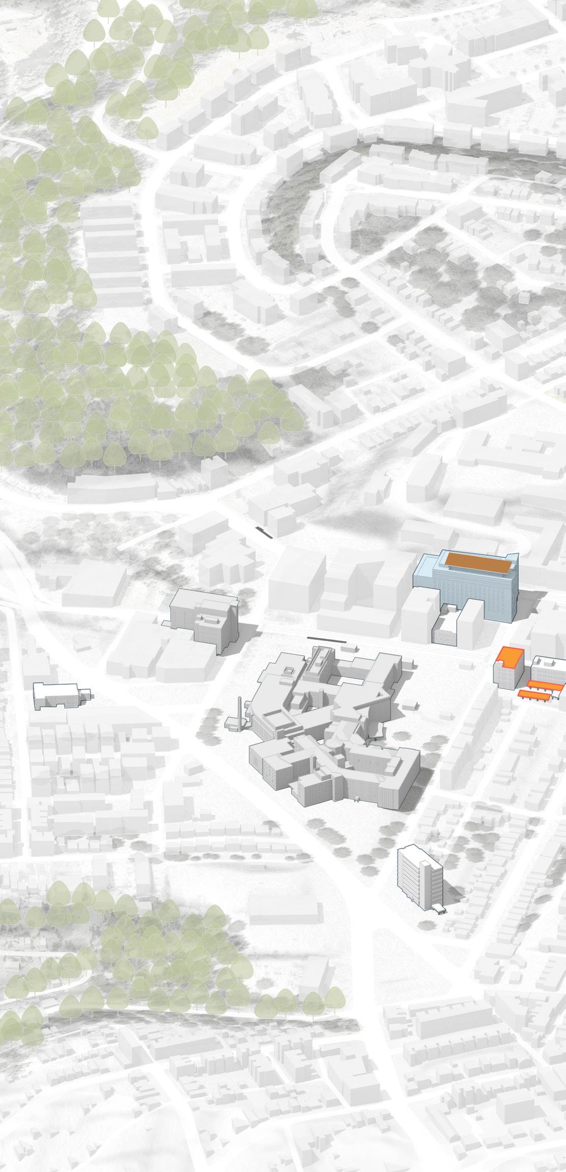
Potential Facade Solar
Potential Roof-top Solar
Existing Solar
Potential Green Roof
Existing Green Roof
Potential Stormwater Control Measures/Rain Garden
Potential Non-infiltrating SCM
Potential Tree Cover
Potential Underground Stormwater Storage Tank
Potential Cistern
Existing Cistern
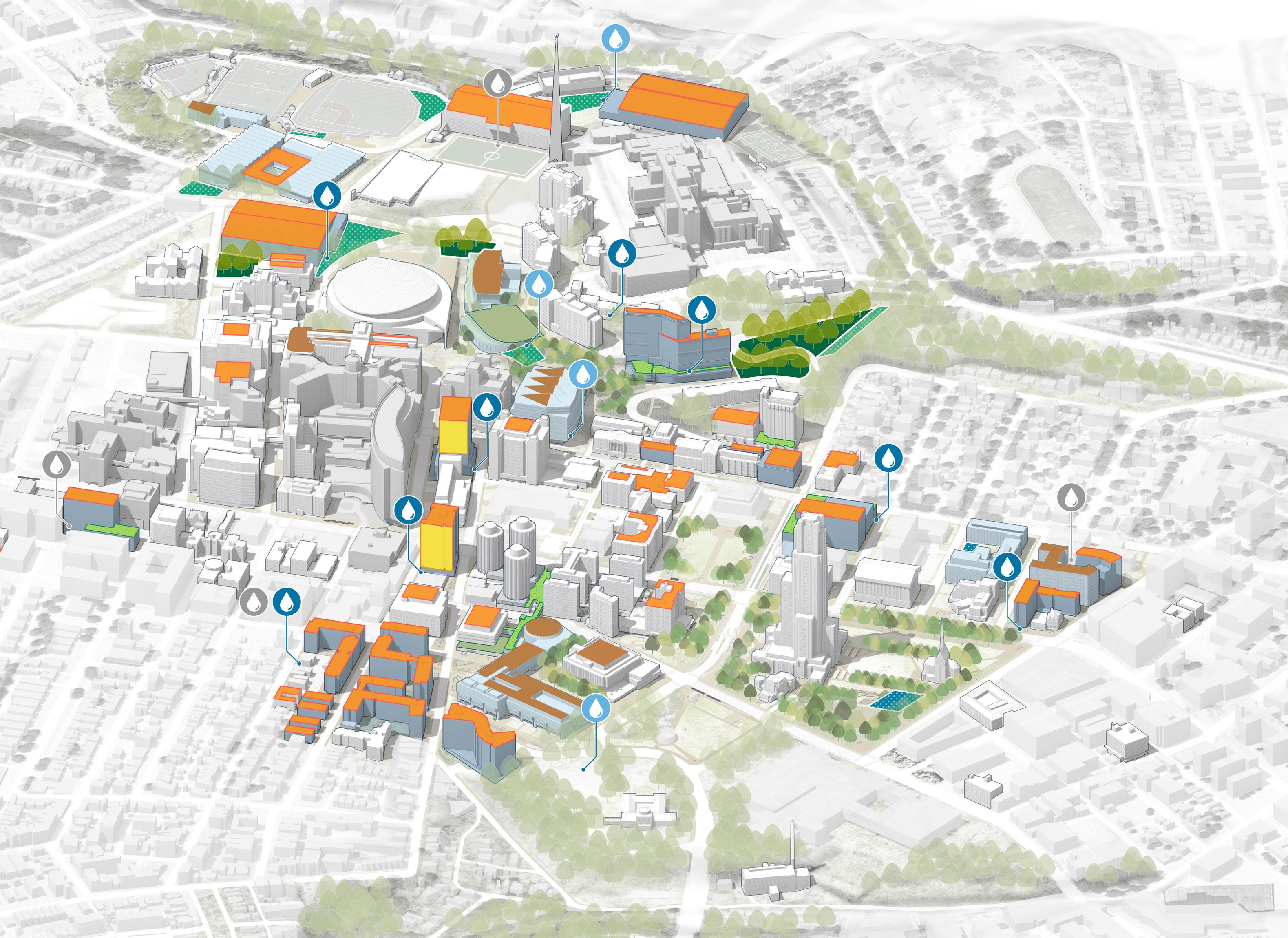
ALIGNMENT WITH PITT’S SUSTAINABILITY PLAN
The Campus Master Plan strategically addresses sustainability through three key impact areas that align with Pitt’s sustainability framework:
Stewardship ensures care for both the built and the natural environments to ensure responsible and efficient resource management. The University strives to minimize the environmental impact of its operations and increase operational efficiencies.
Exploration across the University is supported with emphasis on creating spaces that facilitate curriculum delivery, interdisciplinary research, innovation and opportunities to use the campus as a living laboratory, particularly with sustainability in mind.
Community and Culture focuses on strengthening campus and communities by creating an inclusive, accessible spaces that support the well-being of the Pitt and Pittsburgh communities. The University’s culture embraces engagement with and shared responsibility for its impact on local communities and the region.
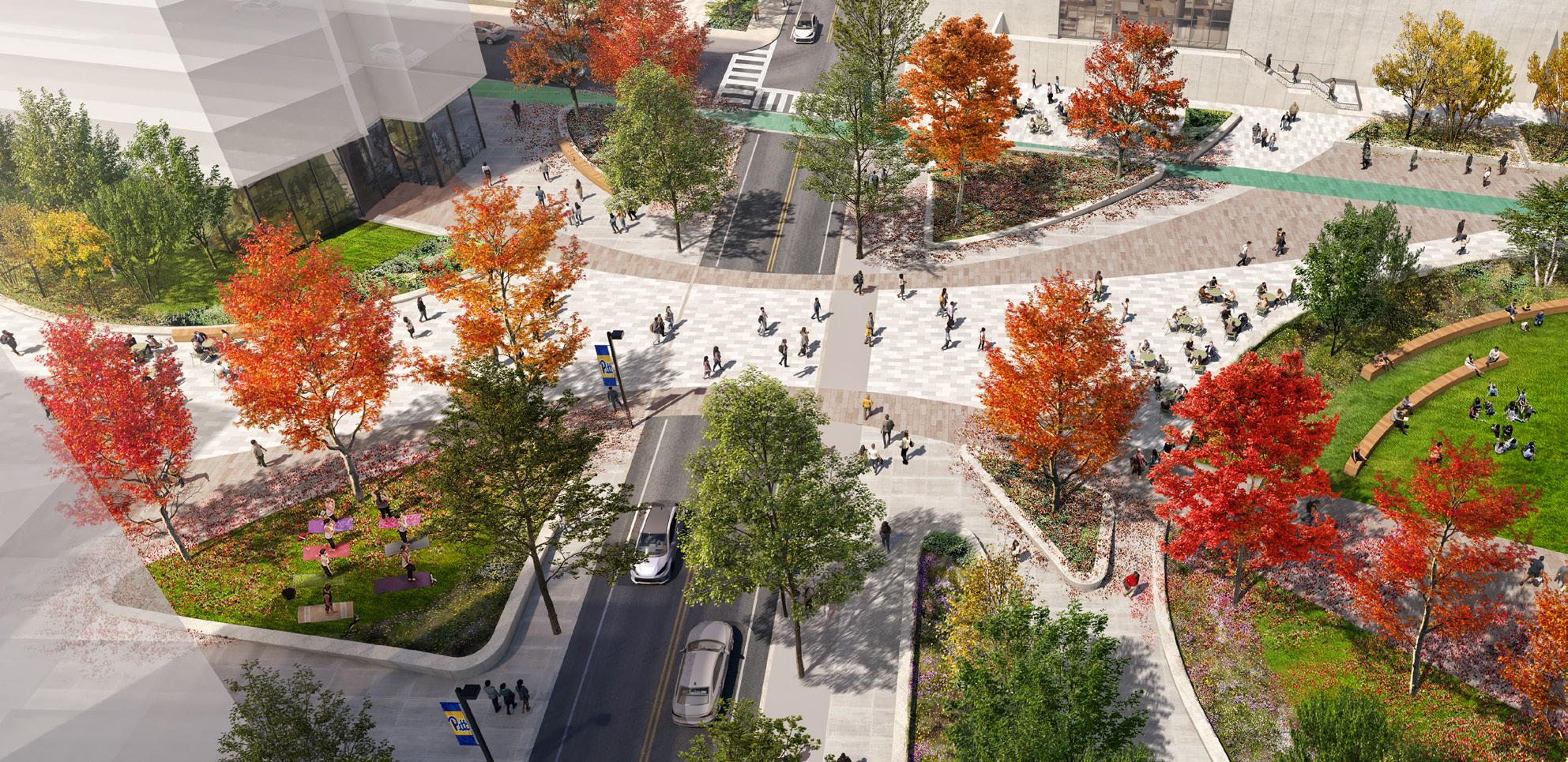
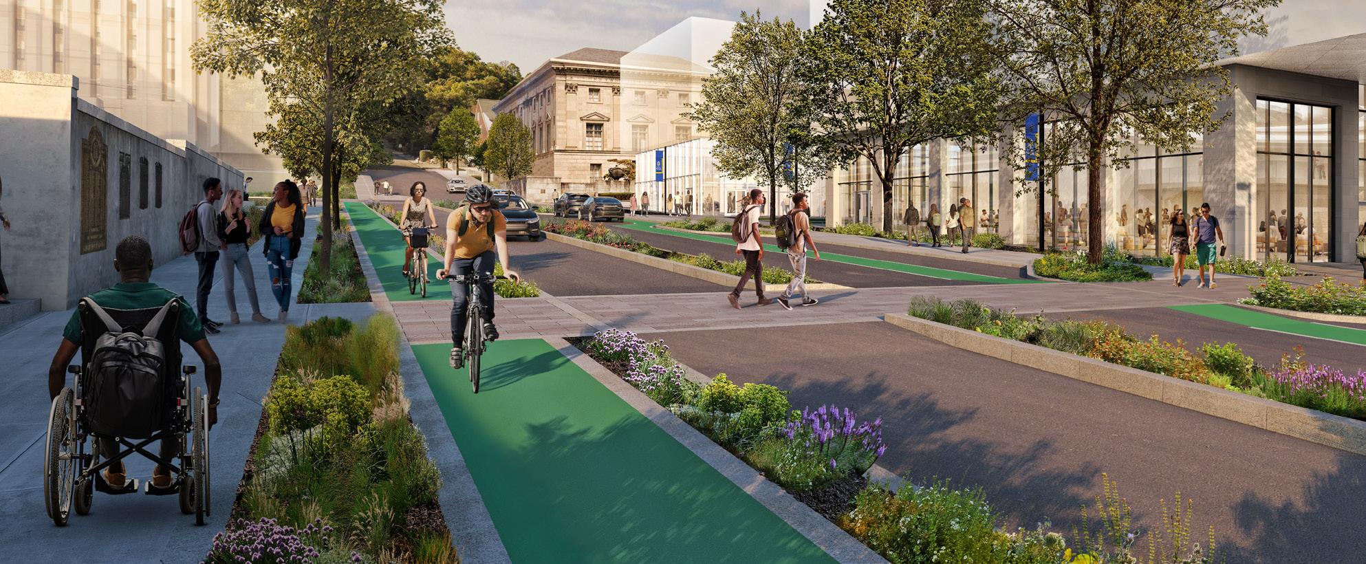
Proposed Street Trees and Landscape Improvements Along Bouquet Street
Proposed Bioswales, Street Trees and Bike Lanes Along Bigelow Boulevard
PITT SUSTAINABILITY PLAN AMENDMENT 2025

HIGHLIGHT: Raise the visibility of faculty research in sustainability.
COLLABORATE: Provide more opportunities and incentives for interdisciplinary research as well as the bridging of academics and operations – promoting an environment of informing and working together.
CURRICULUM: Create faculty tools and incentives to encourage the incorporation of sustainability components into existing and new courses.
ACADEMICS: Ensure every student's academic journey includes sustainability-focused curriculum, including in every degree program, general education requirements, & via a broad array of courses.
ADVISORS: Engage all undergraduate advisors and give them the tools necessary to connect interested students to sustainability-themed courses, majors, minors, internships, and community activities.
CREDENTIAL: Increase number of students graduating with sustainability credentials including the Undergraduate Certificate in Sustainability and Sustainability Distinction (compared to FY18 baseline).
SERVICE LEARNING: Advance environmental progress through community-based sustainability research and servicelearning projects that amplify community voices.

ELEVATE: Promote Pitt's sustainability-related research, academics, & initiatives at industry and academic conferences to inform greater audiences about our stories of impact.
EXPERIENCES: Provide students with insight into the global sustainability challenges facing our world via opportunities on-campus and abroad.
ENGAGE: Increase student engagement with sustainabilityrelated international programs, experiences, and events.
ALUMNI: Engage Pitt Sustainability alumni engaged in sustainability regionally, nationally, and internationally to connect them with University faculty and students.
LIVING LAB: Use the Pitt campus as a living laboratory for faculty and students to implement new ideas and study outcomes over time.

EXPERTISE: Connect with industry and community collaborators to support applied sustainability research and education.
LOCAL: Establish local and regional partnerships to accelerate the transfer of sustainability ideas from Pitt classrooms and laboratories through implementation.
K-12 SCHOOLS: In partnership with existing Pitt and external programs, provide K-12 sustainability educational instruction and hands-on experiences within and outside of the classroom to rural and urban districts.
COMMUNITY: Co-create sustainability opportunities within Pitt's neighborhood commitments that contribute positive benefits to our local communities.
PHILANTHROPY: Verify sustainability as a philanthropic priority across the University, with focus on raising funds that increase sustainability prominence, research, education, campus implementation, and service opportunities for the Pitt community.

INNOVATION: Collaborate with Pitt’s Office of Innovation and Entrepreneurship to embed sustainability principles throughout its offerings.
ADVANCE: Work across sustainability impact areas to define innovations and create new opportunities for students, faculty, and staff to advance ideas for impact.
IDEAS: Guide and incentivize the University's innovation ecosystem to help increase the number of sustainabilityrelated invention disclosures, patents, licenses, and startups (both for profit and nonprofit).

CARBON: Reach
EFFICIENCY:
STANDARDS: Elevate design standards and operational practices to achieve energy use reduction goals.
RENEWABLES: Produce or procure 50% of the University’s electricity from renewable resources by 2030 and 100% by 2037.

EMISSIONS: Achieve Pittsburgh 2030 District goal of 50% reduction in greenhouse gas emissions from commuter travel by 2030 (below the 2013 Oakland neighborhood baseline).
FLEET: Reduce greenhouse gas emissions from fleet vehicles 50% by 2030 (below 2017 baseline).
COMMUTING: Increase active & shared commuting to 55% of all commuting trips to Pittsburgh campus by 2030.
BIKING: Achieve Gold Bicycle Friendly University status from the League of American Bicyclists in 2025.
CHARGING: Install 50 new electric vehicle charging plugs in existing facilities between 2025 and 2030


EFFICIENCY: Achieve Pittsburgh 2030 District goal of 50% reduction in water use intensity (consumption per square foot) by 2030 (below historic district average)
STANDARDS: Elevate design standards and operational practices to achieve water use reduction goals.
DRAINAGE: Responsibly manage stormwater by increasing pervious surfaces, improving campus porosity, and removing and improving lawn areas with native, sustainable landscapes (compared to 2017 baselines).*
STORMWATER: Divert 25% of stormwater from impervious surfaces by 2030 via above ground (green) and rainwater reuse infrastructure.*
DRINK: Work with the City of Pittsburgh to ensure clean, healthy drinking water for all in our community.

STANDARDS: Maintain at least 75% of landscaped areas in alignment with Northeast Organic Farming Association (NOFA) Standards for Organic Land Care.
DESIGN: Adhere to Pitt’s Sustainable Landscape Design Guidelines in all landscape designs.
TREES: Maintain and grow tree count and canopy on campus by 2037 (compared to 2017 baseline), while improving tree health & ecosystems in Pittsburgh.*
CERTIFICATION: Pursue SITES certification for applicable landscape projects.

LANDFILL: Reduce landfilled materials 25% by 2030 (from 2017 levels).
PURCHASING: Enhance procedures, policies, practices, and educational tools to reduce the quantity and environmental impact of materials entering and exiting the University.
BUILDING MATERIALS: Use healthy products for our built environment in accordance with Pitt Design Guidelines.
First published in 2018, these amended 2025 Pitt Sustainability Plan goals reflect University of Pittsburgh achievements, set new goals, and provide clear guidance for tracking progress.
Pittsburgh’s


CELEBRATE: Share our stories of impact as leaders on a national scale and promote our model of sustainability.
STUDENTS: Incorporate the tenets of sustainability into cocurricular student programming, including via unique sustainability student engagement and leadership opportunities and green event best practices.
SURVEY: Deploy & report on trends from triennial University sustainability literacy & culture survey to students and employees.
TRAINING: Ensure all incoming employees know how to infuse sustainability into their everyday work at Pitt by embedding sustainability educational materials into staff and faculty orientations.
EMPLOYEES: Embed sustainability into the employee experience.
DEVELOPMENT: Enhance mechanisms for employees to obtain University-sponsored sustainability professional education & credentials relevant to their fields.

TRANSPARENCY: Continue to maintain and increase transparency between Pitt and our community for knowledge sharing, capacity building, and change empowerment.
LEADERSHIP: Take active leadership roles in sustainability initiatives in Oakland, Pittsburgh, the region, and nationally to demonstrate solutions
ENGAGEMENT: Incentivize
PARTNERSHIP:

BUILDINGS:
HAPPINESS: Enhance

STEWARDSHIP
Recommendations
The Campus Master Plan supports Pitt’s commitment to achieving carbon neutrality by 2037. A comprehensive approach includes energy performance of new and existing buildings, alongside renewable energy expansion and integration. The establishment of Energy Use Intensity (EUI) and Water Use Intensity (WUI) targets for new construction and major renovations remains central to this strategy. Continuing to pursue rigorous third-party green building certifications that prioritize high performance buildings is also a key priority.
GOALS, PROGRESS, AND NEXT STEPS FOR ENERGY AND EMISSIONS
Goals
Third-Party Building Performance & Green Building Certifications:
In line with the Pitt Sustainability Plan goal, the University should pursue LEED Gold green building certification or better for applicable University owned and partnered projects, while continuing to include 2030 Challenge energy and water use intensity performance targets.Third-party green building certification aspiration should be elevated when possible given site, primary use, and building science viability. Passive House certification should be pursued for all residence hall and multifamily new construction and major overhauls. Applicability of Fitwel & WELL Building Standard to University assets should be reconsidered. Pursuit of Zero Energy / Carbon and/ or Living Building (petal or full) designations are aspirations.
Renewable Energy Integration:
Recognizing the critical role of on-site renewable energy generation, the plan systematically integrates photovoltaic panels on rooftops and south-facing facades of new buildings. This approach extends to existing buildings where structural conditions permit, maximizing the campus’s renewable energy generation capacity.
Carbon:
Reach carbon neutrality by 2037 on the Pittsburgh campus, with an incremental goal of reducing greenhouse emissions 50% by 2030 (from 2008 baseline).
The Campus Master Plan’s energy recommendations directly support the institution’s Climate Action Plan strategies, which account for significant emissions reductions through:
• Energy demand reductions (11.5% of planned reductions) through space optimization and building efficiency improvements
• Clean energy supply (42.3% of planned reductions) through renewable energy procurement and district energy improvements
• Comprehensive building guidelines that discourage fossil fuel use in any new construction, renovation, or addition.
Efficiency:
Achieve Pittsburgh 2030 District goals of 50% reduction in energy use intensity (consumption per square foot) by 2030 (below 2003 national median baseline).
Standards:
Elevate design standards and operational practices to achieve energy use reduction goals.
Renewables:
Produce or procure 50% of the university’s electricity from renewable resources by 2030 and 100% by 2037.
Progress and Next Steps
Pitt is on track to reduce emissions by 50% by 2030 and to achieve carbon neutrality by 2037.
The University is on track to reach its renewables goal, with 32.4% electricity renewable in FY24. Along with rooftop solar and a long-term power purchase agreement with the largest solar farm in Southwestern Pennsylvania, the University will continue to expand on-campus solar, directly purchased renewables, and long-term power purchase agreements
For a detailed and up to date information on progress towards Pitt’s Sustainability and Climate Action Plans, visit: https://www.sustainable.pitt.edu/plans-progress
Campus Solar
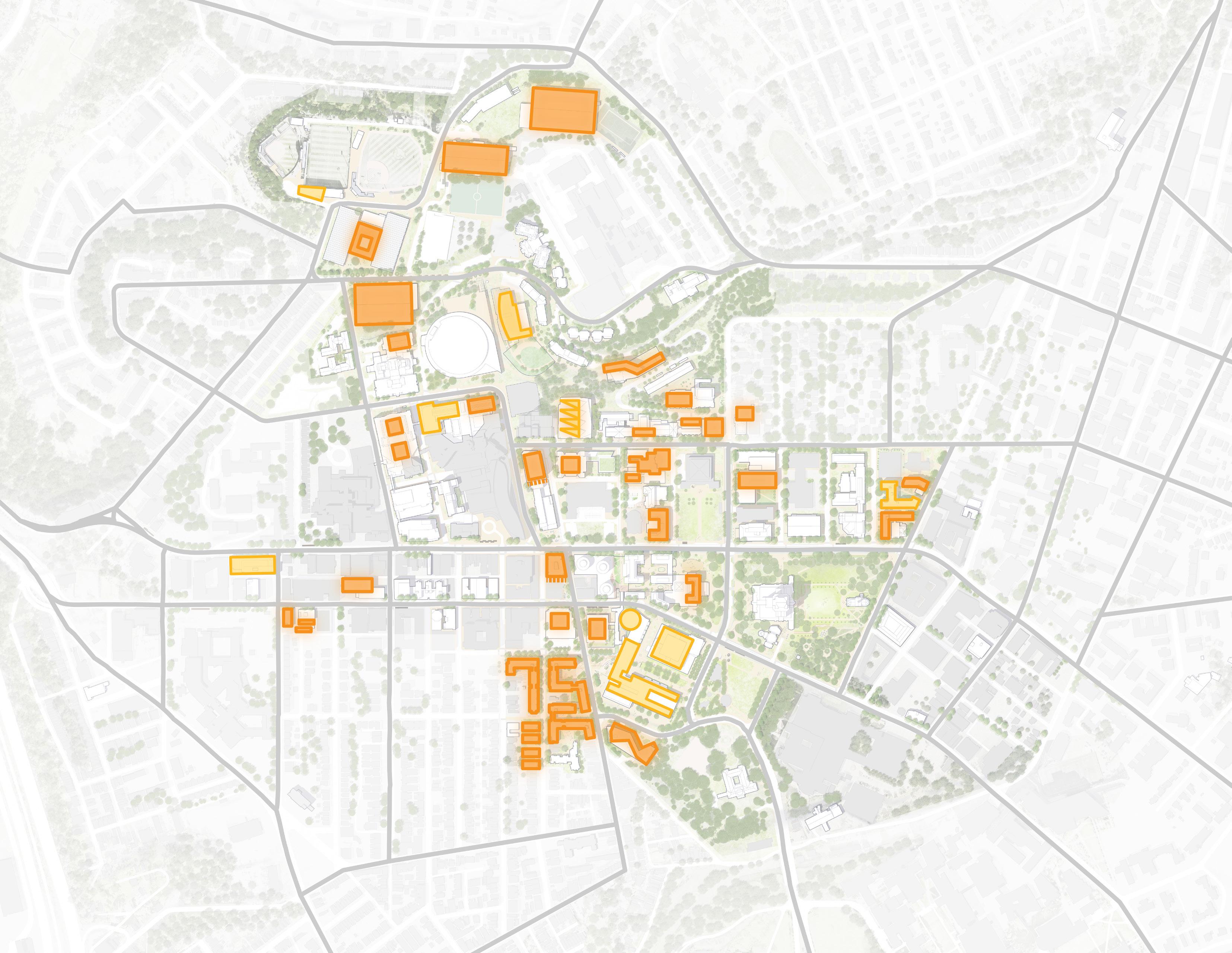
Allequippa St
Water Systems Recommendations
The Campus Master Plan’s water management strategy represents a sophisticated approach to campus hydrology that addresses both conservation and stormwater management challenges. Working in concert with the 2021 Stormwater Management Master Plan, the Campus Master Plan integrates multiple best management practices (BMPs) that position Pitt as a regional leader in innovative water management.
CAMPUS MASTER PLAN IMPACT
Comprehensive Grey Water Systems
The plan proposes expanded development of greywater stormwater conveyance and collection facilities, including strategic underground storage installations. The integration of underground storage at One Bigelow and other strategic locations creates a campus-wide network that manages stormwater while reducing strain on municipal systems.
Green Infrastructure Integration
Green roofs are strategically encouraged on both new and existing buildings, with careful consideration of compatibility with solar panel installations. This dual-purpose approach maximizes both stormwater management and renewable energy generation on available roof space.
Public Realm Integration
The plan thoughtfully integrates public realm BMPs with streetscape improvements along key corridors including O’Hara Street, Bigelow Avenue, Thackeray Street and Bouquet Street. This approach transforms necessary infrastructure improvements into visible demonstrations of sustainable design principles.
Measurable Impact Goals
The water management strategy supports specific sustainability targets including achieving water neutrality through 3% annual water use reductions, embracing Pittsburgh 2030 District goals for 50% reduction in water use intensity, reducing impervious surfaces by 20% by 2030 and diverting 25% of stormwater from remaining impervious surfaces to green infrastructure solutions.
2025 WATER SYSTEMS GOALS
Efficiency: Achieve the Pittsburgh 2030 District goal of 50% reduction in water use intensity (consumption per square foot) by 2030 (below historic district average).
Standards: Elevate design standards and operational practices to achieve water use reduction goals.
Stormwater: Divert 25% of stormwater from remaining impervious surfaces by 2030 via above ground (green) and rainwater-reuse infrastructure.
Drink: Work with the City of Pittsburgh to ensure clean, healthy drinking water for all in our community.
Drainage: Responsibly manage stormwater by increasing pervious surfaces, improving campus porosity and removing and improving lawn areas with native, sustainable landscapes (compared to 2017 baselines).
2021 WATER SYSTEMS GOALS
The Stormwater Management Master Plan sets out three goals: 1) Reduce sewer overflows and flooding within the campus; 2) Reduce erosion and sedimentation within campus; and 3) Develop a regional plan and partnership opportunities. It aligns the following ten objectives with these goals: divert stormwater from impervious surface to grey water, underground stormwater storage, retention and / or green stormwater solutions; replace lawn area with indigenous and adapted plants; increase tree canopy; create visual learning opportunities to highlight positive impacts to stormwater management on campus; install green roof materials on existing and proposed buildings; replace impervious paving with previous materials; work with the City of Pittsburgh to enhance street plantings. Create stormwater districts on campus and monitor stormwater data within each; explore opportunities to convey stormwater to regional underground storage facilities. Monitor existing and proposed BMPs for their cost/benefit ratio.
Campus Stormwater Management
Centre Ave Centre Ave
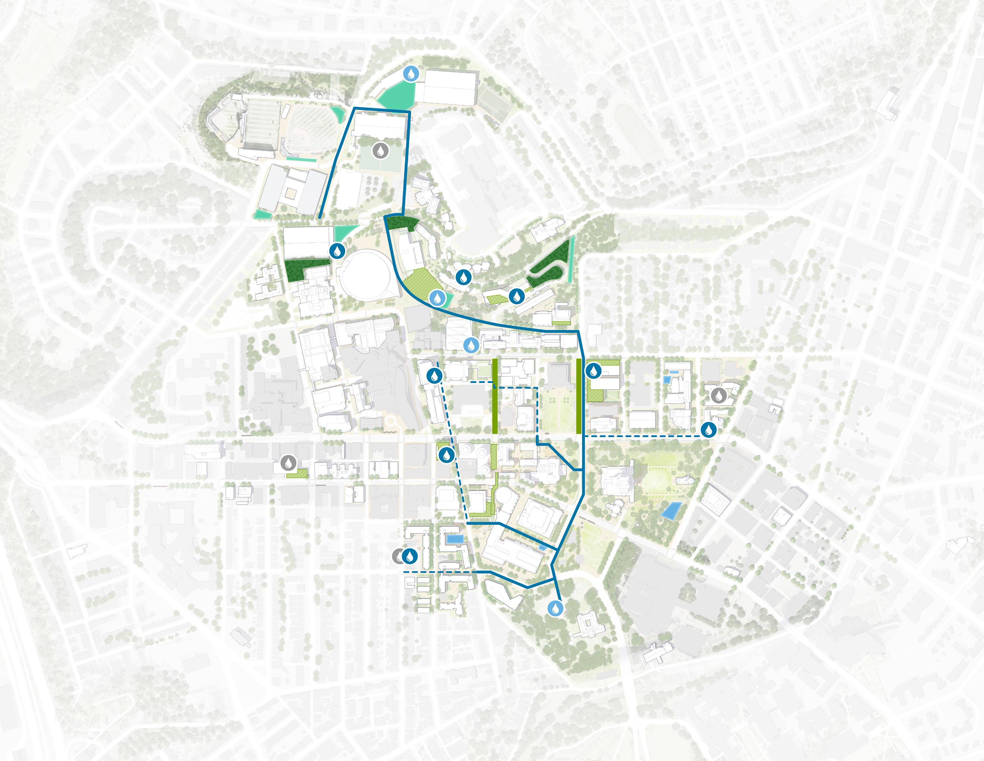
Potential Tree Cover
Green Roof
Bioswale
SCM/ Rain Garden
Non-infiltrating SCM
Existing Cistern
Potential Cistern
Allequippa St Fifth Ave
Terrace St
Darragh St
Ave
Darragh St
Parkman Ave
St
Thackeray Ave
Blvd University Pl De Soto St Bellefield Ave N Bouquet St S Bouquet St
Underground Stormwater Storage Tank
Rainwater Harvest Network as Currently Planned and/or Planned
Rainwater Harvest Network Expansion Opportunities
O’Hara
Transportation and Mobility Recommendations
The Campus Master Plan’s transportation strategy recognizes that sustainable mobility requires both infrastructure improvements and cultural shifts toward multimodal transportation options. The framework’s mobility hub concept represents an innovative approach to integrating various transportation modes while enhancing the overall campus experience.
CAMPUS MASTER PLAN IMPACT
Mobility Hub Network
These strategic locations integrate public transit, cycling, walking, ride-sharing and micro-mobility options at single points across campus. By locating hubs at major destinations and adjacent to parking facilities, the plan creates convenient alternatives to single-occupancy vehicle use while supporting the university’s broader transportation sustainability goals.
Accessibility and Connectivity
The plan comprehensively addresses accessible pathways and routes, ensuring that Bus Rapid Transit (BRT) and transit stations connect seamlessly to major campus destinations. This universal design approach supports both sustainability and inclusion objectives.
Supporting Infrastructure
Mobility hubs incorporate practical amenities including bike parking and shelters, repair stations, bike-sharing locations and transit shelters. Where possible, hubs are integrated with major new facilities, leveraging building amenities to enhance the transportation experience.
2025 TRANSPORTATION AND MOBILITY GOALS Emissions
Achieve Pittsburgh 2030 District goal of 50% reduction in greenhouse gas emissions from commuter travel by 2030 (below the 2013 Oakland neighborhood baseline).
Fleet
Reduce greenhouse gas emissions from fleet vehicles 50% by 2030 (below 2017 baseline).
COMMUTING: Increase active and shared commuting to 55% of all commuting trips to Pittsburgh campus by 2030.
Biking
Achieve Gold Bicycle Friendly University status from the League of American Bicyclists in 2025.
Charging
Install 50 new electric vehicle charging plugs in existing facilities between 2025 and 2030.
Campus Mobility
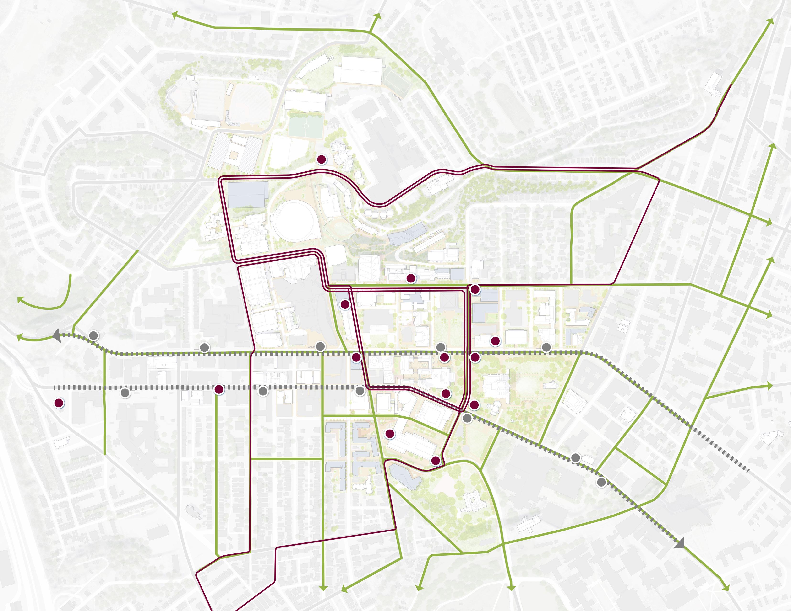
Proposed Shuttle Route BRT Route
St
Parkman Ave
Darragh St
St
St
Thackeray Ave Bigelow Blvd University Pl De Soto St Bellefield Ave N Bouquet St S Bouquet St
O’Hara
Darragh
Materials and Resources Recommendations
While the document notes that detailed materials and resources recommendations are still being developed, the Campus Master Plan’s approach to sustainable materials management aligns with broader sustainability objectives of reducing environmental impact while supporting healthy built environments
CAMPUS MASTER PLAN IMPACT
Sustainable Procurement
The plan establishes procedures and policies designed to reduce both the quantity and environmental impact of materials entering and exiting the university, supporting circular economy principles.
Healthy Building Materials
Future construction will prioritize healthy products in accordance with developing Pitt Green Building Standards, ensuring that material selections support both environmental and human health objectives.
Waste Reduction
The plan supports the university’s goal to reduce landfill waste by 25% by 2030 from 2017 levels, while expanding composting programs to handle 50% of food waste by 2025.
2025 MATERIALS AND RESOURCES GOALS
Purchase
Enhance procedures, policies, practices and educational tools to reduce the quantity and environmental impact of materials entering and exiting the university.
Building Materials
Use healthy products for our built environment in accordance with future Pitt Design Guidelines.
Landfill
Reduce landfill waste 25% by 2030 from 2017 levels.
Landscape and Ecology Recommendations
The Campus Master Plan’s landscape strategy recognizes the critical role of natural systems in supporting both environmental health and community well-being. The reforestation initiatives represent a significant commitment to expanding the campus’s natural infrastructure.
CAMPUS MASTER PLAN IMPACT
Strategic Reforestation
The plan proposes significant reforestation on steep slopes between Utterback and Dammond Drives and on former fraternity housing sites following proposed demolition. This strategic approach addresses both ecological restoration and slope stabilization needs while contributing meaningfully to campus tree canopy goals.
Integrated Landscape Enhancement
Additional plantings in the Cathedral Lawn area and Central Oakland Housing redevelopment integrate landscape improvements with major development projects, ensuring that new construction contributes positively to campus ecology.
Measurable Ecological Goals
The landscape strategy supports ambitious targets including increasing tree canopy by 50% from 2017 baseline levels, replacing 15% of lawn areas with indigenous and adapted plants by 2030 and maintaining 75% of landscaped areas according to Northeast Organic Farming Association (NOFA) Standards for Organic Land Care.
2025 LANDSCAPE AND ECOLOGY GOALS
Design
Adhere to Pitt’s Sustainable Landscape Design Guidelines in all new landscape designs.
Standards
Maintain at least 75% of landscaped areas in accordance with Northeast Organic Farming Association (NOFA) Standards for Organic Land Care by 2024.
Trees
Maintain and grow tree count and canopy on campus by 2037 (compared to 2017 baseline), while improving tree health and ecosystems in Pittsburgh.
Certification
Pursue SITES certification for applicable landscape projects.
Community and Culture: Health and Well-Being Through Design
The above noted Stewardship Impact Area goals are the most relevant for the Campus Master Plan; however, the Community and Culture Impact Area sets out health and well-being goals that the plan addresses.
CAMPUS MASTER PLAN IMPACT
The Campus Master Plan’s health and well-being recommendations recognize that sustainable design must support human health and community vitality. The plan’s approach to healthy building certification and accessibility improvements creates environments that support the physical and mental well-being of all campus users.
Building Certification Strategy
The plan recommends pursuing LEED and WELL building certifications for renovation and new construction where appropriate and feasible. These certifications ensure that buildings perform optimally for both environmental sustainability and human health outcomes.
Active Design Integration
The proposed accessibility and mobility enhancements facilitate active transportation options including walking, rolling and cycling across campus. These improvements support the university’s movement goals while creating more vibrant, healthy campus environments.
Universal Design Principles
The plan’s comprehensive approach to accessibility ensures that sustainable design improvements benefit all users, reflecting the university’s commitment to equity and inclusion.
2025 HEALTH AND WELL-BEING GOALS
Buildings
Pursue LEED Gold green building certification or better for applicable university owned and partnered projects, while continuing to include 2030 Challenge energy and water use intensity performance targets.
Space
Improve the environmental quality of our indoor and outdoor spaces.
Happiness
Enhance student and employee physical and mental health.
CONCLUSION
A Comprehensive Approach to Sustainable Campus Development
The University of Pittsburgh’s Campus Master Plan represents a sophisticated integration of sustainability principles with practical campus development needs. By directly supporting the 61 goals established in the 2025 Pitt Sustainability Plan, the Campus Master Plan transforms institutional sustainability commitments into tangible, measurable improvements to the built environment.
The plan’s comprehensive approach addresses the interconnected nature of sustainability challenges, recognizing that effective solutions require integrated strategies spanning energy systems, water management, transportation infrastructure, materials selection and landscape restoration. Through its emphasis on highperformance buildings, renewable energy integration, innovative stormwater management and healthy indoor environments, the Campus Master Plan positions the University of Pittsburgh as a leader in sustainable campus development.
Most importantly, the plan recognizes that sustainability is not merely an environmental imperative but a comprehensive approach to creating thriving communities. By integrating health and well-being considerations with environmental stewardship goals, the Campus Master Plan creates a framework for campus development that supports both current and future generations while advancing the university’s academic mission and community engagement objectives.
As the University of Pittsburgh continues its journey toward carbon neutrality by 2037, this Campus Master Plan provides the roadmap for transforming sustainability aspirations into built reality, ensuring that every new building, renovation and landscape improvement contributes meaningfully to a more sustainable and resilient campus community.