NOV/DEC 2026 • ISSUE 5 • VOL 53
THE MAGAZINE OF CANADIAN ENERGY GEOSCIENTISTS
Reservoir cegageos.ca
In This Issue
NOV/DEC 2026
4
From the Editor
6
Building Our Geoscience Future: A Message from the CSPG Foundation
8
From the Desk of the AER
11 Volunteer Spotlight: Carolyn Currie 12 Happy Trails — 2026 Field Trip Season in Review 14 Your Association — Doubters and Damage Control 16 The World is Your Oyster (Bed) 26 Volunteer Spotlight: Lauren Eggie 28 The Geology of War: Hannibal and the Punic Wars
GEOSPIEL: SAVE THE DATE PAGE 2
CORE CONFERENCE: NOW ACCEPTING ABSTRACTS
2026 – 34TH ANNUAL CEGA GOLF TOURNAMENT
PAGE 23
PAGE 27
UPCOMING EVENTS & EDUCATION EVENTS INFO PAGES 24&25
EDUCATION INFO PAGE 37
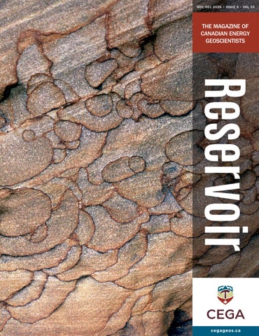
Diagenetic Pattern, Utah. Liesegang rings were deposited from iron-rich pore waters flowing through cross-bedded dune deposits of the Triassic Wingate Sandstone. The origin of this texture, including the shingling of the bands and the apparently unaltered composition of the sandstone within them, is poorly understood. This suggests an external source of the responsible pore waters and a depositional mechanism that is concentrated iron-bearing minerals along their edges. At the very least, this phenomenon produces very attractive decorative stone. The field of view is around 50 cm. Photograph by: Jon Noad
RESERVOIR ISSUE 5 • NOV/DEC 2026
3
FROM THE EDITOR SARAH SCHULTZ, TECHNICAL EDITOR FOR THE RESERVOIR
WELCOME TO OUR NOVEMBER AND DECEMBER ISSUE OF THE CEGA RESERVOIR! In this issue we present the continuation of our regular articles: • Message from the CSPG Foundation • From the Desk of the AER: Summer Student Wrap-Up • Geology of War: Hannibal and the Punic Wars • Volunteer Spotlight: Carolyn Currie and Lauren Eggie
In this issue we present the following articles: • Andre Koladich and Rachelle Pinnow: Happy Trails: 2026 Field Trip Season Review • Clinton Tippett: Your Association: Doubters and Damage Control • Jon Noad: The World is Your Oyster (Bed) • 34th Annual CEGA Golf Tournament Wrap-Up Thank you to everyone who attended CEGA events over the summer and fall! We hope you enjoyed the field trips and courses that were offered. The Core Conference is now accepting abstract submissions for the 2027 conference. Please see the CEGA website for the most up-to-date list of courses and events. We look forward to receiving your manuscripts for the upcoming 2027 issues of the CEGA Reservoir. Thank you to all of the contributors to our 2026 issues!
Sarah Schultz
Technical Editor, Reservoir
PUBLICATION INFORMATION The RESERVOIR is published six times per year by the Canadian Energy Geoscience Association. The purpose of the RESERVOIR is to publicize the Association’s many activities and to promote the geosciences. We look for both technical and non-technical material to publish. The contents of this publication may not be reproduced either in part or in full without the consent of the publisher. No official endorsement or sponsorship by the CEGA is implied
4
RESERVOIR ISSUE 5 • NOV/DEC 2026
for any advertisement, insert, or article that appears in the RESERVOIR unless otherwise noted. All submitted materials are reviewed by the editor. We reserve the right to edit all submissions, including letters to the Editor. Submissions must include your name, address, and membership number (if applicable). The material contained in this publication is intended for informational use only. While reasonable care has been taken, authors and the CEGA make no guarantees that any of the equations, schematics, or
devices discussed will perform as expected or that they will give the desired results. Some information contained herein may be inaccurate or may vary from standard measurements. The CEGA expressly disclaims any and all liability for the acts, omissions, or conduct of any third-party user of information contained in this publication. Under no circumstances shall the CEGA and its officers, directors, employees, and agents be liable for any injury, loss, damage, or expense arising in any manner whatsoever from the acts, omissions, or conduct of any third-party user.
BOARD OF DIRECTORS 2026
PRESIDENT
PAST PRESIDENT
PRESIDENT ELECT
FINANCE DIRECTOR
Christa Williams
Shelley Leggitt
Astrid Arts
David Lipinski
Canadian Discovery Ltd. christa.williams@cegageos.ca LinkedIn
Outwest Energy shelley.leggitt@cegageos.ca LinkedIn
Cenovus Energy astrid.arts@cegageos.ca LinkedIn
AtkinsRealis directorfinance@cegageos.ca LinkedIn
FINANCE DIRECTOR ELECT
CONFERENCES DIRECTOR
OUTREACH DIRECTOR
Thomas Plumridge
Taylor Berezowski
Dilpreet Khehra
MEMBER PROGRAMS DIRECTOR
Freehold Royalties directorfinance@cegageos.ca LinkedIn
Canadian Discovery Ltd. conferences@cegageos.ca LinkedIn
University of Calgary outreach@cegageos.ca LinkedIn
EDUCATION DIRECTOR
PUBLICATIONS DIRECTOR
Rachelle Pinnow
Michael Wamsteeker
GROWTH & ENGAGEMENT DIRECTOR
Cenovus Energy education@cegageos.ca Linkedin
Parex Resources publications@cegageos.ca LinkedIn
Scott MacKnight Bull Pine Energy membershipdirector@cegageos.ca LinkedIn
Gareth Williams Touchstone Exploration Inc. membershipdirector@cegageos.ca LinkedIn
OFFICE CONTACTS
CEGA OFFICE #415, 500 4th Ave SW Calgary Alberta, Canada T2P 2V6 Tel: 403-264-5610 | cegageos.ca
MEMBERSHIP INQUIRIES Tel: 403-264-5610 Email: membership@cegageos.ca
CONFERENCE INQUIRIES Kristy Casebeer Tel: 403-513-1234 Email: kristy.casebeer@cegageos.ca
ADVERTISING INQUIRIES Latoya Graham Tel: 403-513-1230 Email: latoya.graham@cegageos.ca
MANAGING DIRECTOR Emma MacPherson Tel: 403-513-1235 Email: emma.macpherson@cegageos.ca
RESERVOIR ISSUE 5 • NOV/DEC 2026
5
Building Our Geoscience Future:
A Message from the CSPG Foundation As 2026 draws to a close, the CSPG Foundation would like to reflect on the programs and initiatives that continue to strengthen our geoscience community, recognize the generosity of our donors, and encourage continued support for the educational opportunities that will shape the future of our profession. Established in 1978, the CSPG Foundation is the registered charitable arm of the Canadian Energy Geoscience Association (CEGA). For nearly five decades, the Foundation has supported programs that advance geoscience education, encourage technical excellence, and promote public awareness and understanding of earth sciences across Canada. Our mission remains as relevant today as it was at our founding: to ensure that meaningful educational opportunities remain accessible to students, emerging professionals, and the broader community.
SUPPORTING GEOSCIENCE EDUCATION AND OUTREACH Throughout 2026, the Foundation has continued to support a diverse range of initiatives that contribute to the development and advancement of geoscience in Canada. Among these is CEGA’s Student Industry Field Trip (SIFT), a longstanding program providing university students with valuable exposure to the energy industry, professional geoscientists, and potential career pathways. The Foundation also supports Graduate Student Thesis Awards, Regional Graduate Student Grants, University Outreach initiatives, and Technical Awards. Together, these programs recognize academic achievement, encourage research, and help connect the next generation of geoscientists with the professional community.
6
RESERVOIR ISSUE 5 • NOV/DEC 2026
Beyond CEGA’s programming, the Foundation contributes to initiatives such as Earth Science for Society, introducing students and the public to the importance of earth sciences in everyday life, as well as educational programming associated with GeoConvention. These investments reflect our belief that a strong geoscience community begins with education, mentorship, and opportunities to engage with the science.
INVESTING IN LONG-TERM SUSTAINABILITY The Foundation’s ability to support these programs depends on the generosity of individual and corporate donors, along with the careful stewardship of funds entrusted to us. Our Endowment Fund provides an important source of ongoing support, helping sustain established educational initiatives while creating opportunities to respond to the evolving needs of our community. The Foundation also maintains several restricted funds, allowing donors to direct contributions toward specific projects and initiatives that align with their interests. One example is the Alberta Paleontological Society Restricted Fund, established through the generosity of Harvey and Steffie Negrich. This fund supports educational and public outreach initiatives in cooperation with CEGA’s Paleontological Division, promoting the understanding and appreciation of paleontology.
These funds offer donors an opportunity to make a targeted contribution while supporting the Foundation’s broader educational mission.
CONSIDER A YEAR-END GIFT
A SPECIAL OPPORTUNITY: ATLAS 2027
As we approach the end of 2026, we encourage members of our geoscience community to consider making a charitable contribution to the CSPG Foundation.
One of the most exciting initiatives currently supported through a Foundation restricted fund is ATLAS 2027. This ambitious project will update and expand upon the landmark 1994 Geological Atlas of the Western Canada Sedimentary Basin, creating a modern, accessible digital geological resource for researchers, educators, students, and industry professionals. ATLAS 2027 brings together authors, technical contributors, and volunteers to document and share the geological knowledge of Western Canada. As CEGA approaches its 100th anniversary in 2027, the project represents a particularly meaningful investment in our profession’s future. It builds upon decades of geological research and ensures this knowledge remains accessible to future generations. The CSPG Foundation has established a dedicated ATLAS 2027 Restricted Fund to accept charitable donations specifically in support of the project. For those who have benefited from the original Atlas throughout their careers, or who recognize the importance of preserving and sharing Canadian geological knowledge, this is an opportunity to contribute to a lasting legacy.
Whether supporting the Foundation’s general educational activities, contributing to the Endowment Fund, or directing a donation to a restricted fund such as ATLAS 2027, every contribution helps strengthen the future of geoscience education in Canada. The CSPG Foundation is a registered Canadian charity. Eligible donations made by December 31, 2026, can qualify for a charitable tax receipt for the 2026 taxation year. We extend our sincere thanks to everyone who has supported the Foundation over the years. Your generosity has helped create educational opportunities, recognize excellence, and connect generations of geoscientists. As we look toward CEGA’s centennial year, we hope you will consider joining us in continuing this important work.
Together, we are building our geoscience future. Learn more or make a donation at: cegageos.ca/foundation
RESERVOIR ISSUE 5 • NOV/DEC 2026
7
From the Desk of the AER The Alberta Energy Regulator and Alberta Geological Survey (AGS), a branch within the regulator, offer summer student positions each year, helping to train the next generation of geoscientists. The projects help to meet research objectives, and from this past summer we have short descriptions from five of the students that joined us.
FIGURE 1
Bassano-Gem area subsurface geomodel integrating 2D resistivity sections with K-means clustering to map fine-grained sediments, coarse aquifer units, and bedrock.
Integrating towed transient electromagnetics (tTEM) resistivity inversion with LAS and lithology logs for aquifer mapping in Southern Alberta Chigozie C. Ikechukwu, MSc Geoscience (Thesis-based) Program, University of Calgary The Southern Alberta Groundwater Evaluation (SAGE) project, led by the AGS, is assessing groundwater resources across Southern Alberta. SAGE acquired ground-based tTEM survey data to delineate potential aquifers within Neogene to Quaternary sediments and Cretaceous bedrock. The primary objective of the internship was to shift this tTEM dataset from qualitative use toward a reproducible interpretation workflow that defines geologic-unit responses, validates results against borehole control, and delivers model-ready 2D and 3D outputs for integration with geomodelling and aquifer mapping. To accomplish these goals, a multi-step workflow was executed, beginning with a comprehensive data audit that identified metadata gaps, corrupted archives, and unmerged CSVs. Database issues, such as line dropping and spatial gaps, were resolved by re-segmenting lines in ArcGIS Pro using unique identifiers and standardizing them to the NAD83 10TM (Forest) coordinate system. This process successfully expanded line segments across key areas, including Bassano-Gem (from 67 to 378 segments and 70,111 soundings), Wardlaw-Cessford (from 30 to 97 segments and 45,849 soundings), and the Lethbridge valley areas (from 30 to 154 segments and 43,243 soundings). Additionally, a custom Python script was developed to automate the processing of 854 coal-hole LAS logs, evaluating spontaneous potential, single point resistance, induction, and deep induction conductivity responses against lithology picks (such as till, gravel, clay, shale, and sandstone) to extract calibration resistivity/conductivity distributions. Finally, 2D profile grids were exported for 3D modeling (Figure 1), where K-means clustering was applied to cleanly delineate fine-grained sediments, coarse aquifer units, and Cretaceous bedrock.
8
RESERVOIR ISSUE 5 • NOV/DEC 2026
FIGURE 2
Alberta in the Minecraft world.
Building an interactive geoscience model Brett Gow, BSc in Data Science, University of Calgary My summer internship as a geoscience student with the AGS gave me the chance to combine my data-science background with my passion for creating and building things. One task was building a simplified geological framework of Alberta within Minecraft by using FME to transform 13 elevation grids into a suitable format for the software platform. I converted these grids into xyz coordinates and used the built-in writer to generate a Minecraft world (Figure 2). Each zone was selected for its association with some of Alberta’s critical minerals; so, after generating the terrain, I chose different blocks to represent these minerals within these formations. Along with this, I designed and created an interactive mini game within Minecraft that leans into users’ natural curiosity, encouraging them to explore and find the critical minerals hidden within the model’s subsurface. The goal of this project is tobring engagement and critical thought to a geological model and to create interest in and awareness of Alberta’s critical minerals. Keep an eye on the AGS website and LinkedIn for notifications that the model is available online and ready to be explored. Thank you AGS and the Geoscience Innovation team for this memorable summer!
Digitizing historical geological maps for modern GIS applications Nicholas Kwamena Acquah, Master of Geographic Information Systems, University of Calgary This summer with the AGS’s Geoscience Innovation team, I worked on transforming historical 1:31,680 scale geological map sheets of the Canadian Shield into structured digital GIS datasets. These maps, produced in the 1970s and 1980s by the Alberta Research Council, contain valuable geological information that was originally compiled and represented using traditional cartographic methods. My work has focused on georeferencing the historical map sheets and systematically digitizing their geological features, including bedrock and surficial geology polygons, geological boundaries, structural features, sample locations, and other point and line features. The project involved building and maintaining geodatabases, defining standardized attributes and domains, and digitizing features while maintaining the spatial relationships and geological information represented on the original maps (Figure 3). I also explored methods for improving the efficiency of the digitization process, including supervised image classification and GIS editing tools for extracting and constructing geological polygons. The resulting digital datasets will make the information contained in these historical maps more accessible for modern GIS analysis, visualization, data management, and future geoscience applications.
FIGURE 3 Example of a historical geological map sheet (left) and the corresponding GIS features produced through georeferencing and digitization (right).
RESERVOIR ISSUE 5 • NOV/DEC 2026
9
FIGURE 4
Sediment outcrop showing glaciotectonite, specifically Cretaceous black shale (bedrock) intermixed with till (glacial diamicton).
Surficial geology mapping in Southern Alberta Shiv Khetarpal, BSc Honors Program, University of Alberta This summer I contributed to the SAGE project’s surficial characterization and mapping component, which was important because the SAGE study area is a region shaped by a dynamic glacial history that left behind a complex mosaic of deposits. The mapping was done by interpreting the origin of sediments using LiDAR elevation models and satellite imagery, reviewing previous surficial maps, and by analyzing samples of sediments during fieldwork. The fieldwork I completed was related to ground-truthing map interpretations by finding sediment outcrops along road cuts, in gravel pits, and in river valleys, or by using a shovel/auger to dig a small hole to retrieve a sample of the sediment (Figure 4). From the various data sources, we assigned different geological classifications, such as glaciotectonite (Figure 4), glaciolacustrine, and moraine.
From field deployment to automation: Supporting seismic monitoring Syed Emaad Hasan, BSc Student, University of Calgary This summer at AGS, my work focused on enhancing seismic monitoring through field deployments and seismic network maintenance, developing an automated workflow using AI tools, and evaluating a machine-learning-based approach for seismic-event detection. During fieldwork (Figure 5), I assisted with deploying and maintaining seismic stations across Alberta, including deploying a temporary nodal array near Rocky Mountain House and a new permanent station on the Regional Alberta Observatory for Earthquake Studies Network, just west of Calgary. These activities help improve monitoring coverage, support the study of seismic clusters, and establish a baseline level of seismicity prior to potential future energy development. I also developed an automated workflow to process EDGE (Environmental and Dangerous Goods Emergencies) reports submitted by operators. The workflow reviews up to 1,000 recent emails, identifies EDGE reports, and extracts and logs key information from reported seismic events within seconds. By automating this process, it reduces manual effort, enables more timely tracking of seismic events and mitigation measures, and supports weekly updates of the Alberta Earthquake Dashboard. In my final project, I evaluated six autotuned CATS (Cluster Analysis of Trimmed Spectrograms) detection models and developed a Python workflow to process nodal array data collected following the 2022 Reno earthquake sequence. This work aims to reduce false detections and significantly shorten the time required to review large seismic datasets, improving the efficiency of future seismic monitoring and aftershock studies.
10 R E S E R V O I R I S S U E 5 • N O V / D E C 2 0 2 6
FIGURE 5
Activating a seismic node using a handheld terminal during the Rocky Mountain House region deployment.
My CEGA Story: Volunteer Spotlight Carolyn Currie INTRODUCTION
For many years, Carolyn Currie has been a dedicated and highly valued CEGA volunteer, generously sharing her technical expertise, leadership, and time to support the association and its members. Most recently, she served as Co-Chair of the 2026 Core Conference, playing an important role in delivering another successful and engaging event for our community. Over the years, Carolyn has also served on the Core Conference committee and contributed as a presenter on numerous occasions, most recently taking on the role of session chair at the 2026 Reservoir Symposium. She has also supported CEGA as a committee member for the Stanley Slipper Gold Medal Award, helping recognize excellence and achievement within our industry. Through each of these contributions, Carolyn has helped strengthen CEGA’s technical programming and created meaningful opportunities for learning, connection, and professional development. Her thoughtful and steady leadership, collaborative spirit, and genuine commitment to delivering high-quality programs have made a lasting impact on CEGA.
This month, we’re proud to spotlight Carolyn and her continued contributions to CEGA! Q&A with Carolyn Q: What inspired you to first get involved with CEGA? A: “What inspired me to first get involved with CEGA came from a bit of a selfish point of view, haha! I had recently moved back to Calgary from Houston, where I gained a strong technical background in unconventional reservoirs—something that was really just starting to take off here in Canada. CEGA gave me the perfect jumping off point to effectively share knowledge and apply what I learned from the Lower 48 basins to what geologists were looking at and exploring up here in Canada.” Q: What does being a CEGA member mean to you, both professionally and personally? A: “Being a CEGA member is extremely important to me professionally because the organization really fosters my professional development in terms of having a platform to share knowledge, learn from other geoscientists, and advance our learning of the subsurface. This has been especially important as the geoscience community has noticeably shrunk in the last number of years, and the depth of technical knowledge is limited to just a few key individuals. Personally, I just love getting together with my peers over some rocks and beers. We all have gotten so busy we sometimes forget that networking is extremely important to longevity in this industry!” Q: In what ways has CEGA supported or influenced your professional growth? A: “CEGA’s range of technical talks, division talks, conferences, etc., has really provided the missing link to my continued professional development, particularly through years of limited development budgets. In more recent years, I have been more involved in terms of mentorship and volunteering on various boards, including Core Conference, which I absolutely love doing, as I have a passion for leading and teaching.” Q: What is one fun fact about you that others might not know? A: “I am originally from Northern Ireland and grew up on a dairy farm!”
We are truly grateful for the many ways Carolyn has given her time and expertise to our association and our members, and we are pleased to recognize and celebrate her volunteer journey.
RESERVOIR ISSUE 5 • NOV/DEC 2026
11
Happy Trails
Go Take a Hike Together: Big Hill Springs. PHOTO BY ANDRE KOLADICH.
2026 Field Trip Season in Review ANDRE KOLADICH & RACHELLE PINNOW
The CEGA Field Trip program enjoyed another great season in 2026, with nine outings taking place from May to September spanning a variety of geographic areas, industry play types, and geological points of interest. Fluvial deposits, Triassic strata, and carbonates were examined in three technical field seminars. Four excursions were offered as part of the Go Take a Hike Together series, featuring tufas, ancient stromatolites, Montney-equivalent strata, and the K/Pg boundary. Local glacial erratics and Tyndall Stone were the focus of two Go Take a Walk Together trips. The season kicked off in mid-May with Matt Caddel, Greg Baniak, and Cynthia Hagstrom leading the Modern Fluvial Systems field trip, focusing on fluvial geomorphology and sedimentation along the Highwood and Bow Rivers near Calgary. Things kept rolling later in the month with the Williston Lake Field Seminar, led by JP Zonneveld, to study the sedimentology and ichnology of the Upper Triassic Baldonnel Formation in northeastern British Columbia. Also in late May, Murray Gilhooly, Byron Veilleux, and John Weissenberger led a one-day Mississippian Canyon Creek field trip in Kananaskis Country, examining carbonate outcrops from the Banff, Pekisko, Shunda, Turner Valley, and Mount Head formations. In June, Astrid Arts led a walk in Nose Hill Park to look at Calgary’s glacial erratics, components of the Foothills Erratics Train
12 R E S E R V O I R I S S U E 5 • N O V / D E C 2 0 2 6
marking the junction of the Laurentide and Cordilleran glaciers. Observed erratics included Split Rock and the Buffalo Rubbing Stone, their smooth edges both bearing the polishing marks of bison that once roamed the area and used the erratics as a rubbing stone, helping to shed their winter coats. In July, Alexis Anastas and Kent Wilkinson led a trip to Big Hill Springs Provincial Park, focusing on Pleistocene to Recent carbonate tufa precipitation, textures, and landforms. Spring waters saturated in calcium carbonate created several well-exposed, 2–5 m high tufa dam deposits made of calcite, precipitated in association with microbial coatings on mosses, grass, and loose gravel. The dam structures are excellent modern analogs for tufa and travertine sedimentation in the rock record and attendees discussed and comparied similar fabrics in the Aptian pre-
salt plays of South America and Africa. In August, Tako Koning led the Tyndall Stone walking tour to view Ordovician fossils in inner-city Calgary. Attendees gained insight into the sedimentary history, paleoecology, and organisms that existed in shallow tropical seas over 450 million years ago, all preserved within Tyndall Stone gathered from the Garson Quarry near the town of Tyndall, 30 km northeast of Winnipeg, Manitoba. Fossil highlights included gastropods, large sponges, straight-shelled nautiloids, tabulate coral heads, solitary rugose corals, and extensive mottling by the trace fossil Thalassinoides. Also in August, Astrid Arts and Dilpreet Khehra led a group of students and new grads to the Helen Lake stromatolite beds in Banff National Park. Though Helen Lake is frequently visited by many hikers every season, many people are unaware of the
spectacular 3D stromatolite outcrops reached by climbing up the unnamed ridge beyond the lake. The domal stromatolites can be seen in cross-section and plan view over an area that stretches close to a kilometer. Hikers were rewarded with an outstanding day of sunshine with much enjoyment of the beautiful alpine scenery and geological wonders. Tako Koning was out again in late August, leading a trip to view the K/Pg Mass Extinction Boundary on Knudsen’s Farm near Huxley, Alberta. The outcrop is on the north side of the Red Deer River valley, south of Dry Island Buffalo Jump Provincial Park. The exposed contact reveals evidence of fallout from a 12 km diameter asteroid impact at the Yucatan Peninsula in Mexico, resulting in a 200 km wide crater named Chicxulub. This asteroid strike has been dated to 66.5 Ma, and it caused a mass extinction, the effects seen worldwide, including in central Alberta. The importance of the contact was appreciated by all who saw and placed their finger on it! For the final excursion in September, Simon Poirier and Luke McHugh led a hardy group of adventurers to view a spectacular outcrop of Lower Triassic Montneyequivalent strata along Evan Thomas Creek in Kananaskis. Discussions of tectonics, geomechanics, and sedimentology at the outcrop led to a greater understanding of fine-grained sediment transport and deposition in ancient offshore environments and of the Montney Formation as a hydrocarbon reservoir.
Go Take a Hike Together: Evan Thomas Creek. PHOTO BY ANDRE KOLADICH.
Go Take a Walk Together: Tyndall Stone. PHOTO BY ANDRE KOLADICH.
Go Take a Hike Together: Helen Lake Stromatolites. PHOTO BY DILPREET KHEHRA.
The 2026 field trip season had excellent participant attendance. Special thanks to all the trip leaders, especially the volunteer leaders who hosted free hikes for the CEGA community. The Field Trip Committee is currently working on the lineup for the 2027 centennial season! To celebrate the 100th Anniversary of the Canadian Energy Geoscience Association, the Field Trip Committee is launching a special series: Centennial Trails – Go Take a Hike Across Canada. Beginning in 2027, this series will showcase hikes from every province and territory and will be published in the Reservoir throughout the year and beyond. Share your favourite hike with the CEGA community!
LEARN MORE The CEGA Field Trip program gives members opportunities to gain field experience through guided industry-focused trips, international GeoTours, and our free Go Take a Hike Together series to local geological points of interest. This season offered plenty of chances to get outside, connect with your geo-community, and see some great outcrops. We hope to see you on our 2027 field trips!
RESERVOIR ISSUE 5 • NOV/DEC 2026
13
YOUR ASSOCIATION
Doubters and Damage Control CLINTON TIPPETT
Welcome back to our historical retrospective. This time, we will take a look at the context of the formation of the A.S.P.G. in 1927.
In the mid-1920s, the local industry was encouraged by Imperial Oil’s 1924 discovery at Royalite No. 4 of a prolific pool of gas-condensate in the Turner Valley Field. However, this excitement was somewhat overshadowed by the ghost of the Dingman No. 1 well. In 1914, Calgary Petroleum Products Dingman No. 1 struck wet gas in Turner Valley. Calgary erupted in an oil frenzy, with hundreds of hastily formed companies selling shares, many on exaggerated or fraudulent claims. The boom collapsed within months as few wells produced and the outbreak of the First World War dried up capital, leaving many investors with worthless stock and a lasting distrust of the nascent Western Canadian petroleum industry. [This story has recently been documented in Dr. Paul Chastko’s new book “The Boom – Oil, Popular Culture, and Politics in Alberta, 1912-1924” from the University of Calgary Press.] The scattered geologists working the basin in the 1920s were concerned that this damaging situation could occur again. They believed the way to build confidence in the industry was through the work of trustworthy professionals who could vouch for the validity of information provided to companies and investors. This would help investors make sound decisions and avoid swindles. It was in this context that Alberta-based geologists working in the petroleum industry came together to form the Alberta Society of Petroleum Geologists. Although there is an APEGA-type flavour to the rationale for the Society, the main impetus does appear to have been cooperation and the exchange of technical information.
14 R E S E R V O I R I S S U E 5 • N O V / D E C 2 0 2 6
In 1926, following the new Turner Valley find, one publication of the eastern Canadian press, Saturday Night, posed the provocative question as to whether there was oil (this time) in Alberta. This does not seem to have been an unreasonable question at the time given what had happened a decade before. However, the inherent skepticism embedded in the question, of course got the backs up of those working in Western Canada. An article, quoted in its entirety below, was penned by T. B. Williams three decades later and provides his thoughts on what actually transpired. While Williams does not specifically mention them, the 1936 oil discovery at Turner Valley and the string of Devonian discoveries starting at Leduc in 1947 truly put to bed the idea that Alberta was barren of oil. Interestingly, he does throw in a mention of the Cardium, perhaps claiming some foresight in the 1953 Pembina discovery. Of course, hindsight is 20/20. There are several aspects to this controversy beyond credibility. One has to do with whether or not readers knew what “wet gas” meant - wet as in water or wet as in hydrocarbon liquids The Toronto writer also stated that governments were not going to allow flaring of residual gas and therefore related condensate production, in the absence of markets for the gas, should not be considered to be sustainable oil production.
A RETROSPECTIVE ON “IS THERE OIL IN ALBERTA?” (1926) April 1955, by T. B. Williams, Consulting Geologist, Victoria, B.C. President A.S.P.G. 1935 “In 1926 few geologists were operating in Calgary. They worked with a minimum of library information and every bit of data was carefully placed into the picture. Edmonton geologists were better off for they had a University staff and library at hand to refer to. Of the Calgary group, P. D. Moore, now of Midland, Texas, and I had offices in the Lancaster Building. We got our meals at restaurants and met frequently. On the occasion of a chance meeting at the Empress cafeteria I suggested that, when we happened to be in the city, we should have lunch together at the Empress each Wednesday. We should treat the meeting as an opportunity to talk about anything of interest, not necessarily confining our talk to geological subjects. This plan was readily agreed upon. We did discuss, however, such matters as the character and widespread occurrences of the Cardium; the possibility that, under certain conditions it might carry petroleum; and typical geological sections in various parts of the province. These meetings went on with some irregularity. We frequently were out of town. Turner Valley was the chief area of interest but there was as yet a shortage of detailed information. I might add that so far as I know a dip needle survey in 1927 was the first geophysical work performed there. Work also got underway elsewhere, particularly in the southern part of the province. Dr. D. B. Dowling had made discouraging comment on the complex structures of the foothills, so most of our attention centered on areas farther east, the Sweetgrass Arch and on to the Cypress Hills. I began to specialize on the Milk River-Red Coulee area. Gas areas were avoided where possible. A number of smaller companies, mostly operating without geologists, were active. Home Oil was new. Hudson’s Bay-Marland was beginning its “Survey from the International Boundary to the north boundary of Alberta in one year.” It was, so far as I know, the first operator in Alberta to make use of radio in connection with its geological work. The Frontier Development Company started to bring in parties each year but their geologists at that time were rarely in the city. The Gas Company became active and secured the services of Stanley
TITLE BLOCK FROM T. B. WILLIAMS’ ARTICLE OF APRIL 1955, JOURNAL OF THE A.S.P.G., V. 3, NO. 4, PP. 47-48.
T. B. WILLIAMS, A.S.P.G. PRESIDENT 1935.
Slipper. Interest was slowly increasing. New companies became quite common. A bit later Charlie Ross, then in charge of western oil resources for the Federal Government, brought in Walter Calder and later T. G. Madgwick. Some of the geologists met with us on Wednesdays but still the number at the meetings was small. Then came an inspired press article damaging to the new industry. Saturday Night, on November 20th, 1926, took a page, including a map, to enquire, “Is There Oil in Alberta?” The attitude of the article and the inferred answer to the question seemed quite evident. It told all about the hard luck of the Imperial Oil Company in its exploration. During our discussion of the article and of a more stagnant situation which seemed to be settling upon us, the club’s attendance increased. Some dissension showed up. The local press was loud in its condemnation of the article, though our group did not put up a united front in order to correct a wrong impression. In light of subsequent developments, the article appears as erroneous today as it did to the representatives of the small companies at the time. Oil development in Alberta, after some false starts, had really gotten genuinely under way with the bringing in of Royalite No. 4 well in July of 1924. Already in the year 1926 Alberta was to produce just less than a quarter of a million barrels of oil. We thought that such progress was not bad. The Saturday Night article came at a critical time. The public lost much of its
Royalite No. 4 blowout at Turner Valley, 1924. Uncontrolled flow of gascondensate at 20 million cubic feet per day from carbonates of the Mississippian Madison Formation (now named the Turner Valley Formation).
interest. There followed the depression of 1927, during most of which time it was difficult to have meetings. By the end of the year, however, conditions were improving and the present Society was organized at a meeting held on Saturday, December 17th. At this time there were 19 geologists in the Province. It was a real pleasure to me, about a year ago when in Calgary, to attend a meeting of the A.S.P.G. and to note the great growth which has come from the small beginning above described. Congratulations! The “Geological Group” of 1926 has come a long way.”
RESERVOIR ISSUE 5 • NOV/DEC 2026
15
The World is Your Oyster (Bed) JON NOAD | STANTEC CONSULTING; UNIVERSITY OF ADELAIDE
INTRODUCTION: A LITTLE SHELLFISH Our story starts in Springbank, where the discovery of an anomalous oyster bed, slap bang in the middle of more than a kilometre of terrestrial deposits, led me (as so often happens) on a fascinating voyage of discovery exploring the origins of fossil oyster beds, focused on Alberta. This resulted in the development of a new classification scheme for these surprisingly common fossil features. Oysters are marine bivalve molluscs with irregular, often rugose shells, famous for being an edible treat. They occur worldwide, and their robust, thick shells make them very resistant to erosion. They live only in turbid marine conditions, meaning their presence is usually an indicator of a coastal (intertidal or shallow subtidal) setting. They feed by filtering microscopic plankton and algae from the water column, helping to clean coastal waters. Oysters evolved in the Early Triassic and may exceed a metre in size (Figure 1), though most are only a few centimetres in diameter. There are more than 600 species of oyster, many of which fall under the Ostreoidea superfamily, and there are other associated bivalves, such as the spiny spondylids, that are not true oysters. Oysters are known for their ability to produce pearls, a skill that has been taken advantage of by farmers who introduce a nucleus (usually a piece of mussel shell) inside their shells, an irritation that leads the oyster to cover it with layers of nacre to form a cultured pearl over a few years.
BANKING ON SUCCESS Oysters can live in isolation, but more commonly occur in banks that may reach kilometres in length. They thrive in estuaries, bays, tidal creeks and shallow seas, forming colonies growing shell upon shell, and they are a keystone species. Oysters typically occur as dense accumulations of monospecific assemblages, and their shells reflect the depositional water depth, with bored shells indicating a subtidal setting (Figure 2).
Figure 1 Giant oysters at Daiyasu in Kyoto (hermosawave.photography).
A variety of modern environments hosting oysters can be found around the world—for example, in coastal South Carolina. These include oyster banks lining tidal inlets, isolated clumps on sandy delta tops, and striking strandline ridges along barrier islands composed entirely of their shells (Figure 3). Oysters also occur on rocky coastlines, clinging to the bedrock in often turbulent conditions. As we shall see, they are also common in the fossil record. One species, Gryphaea (Figure 4), entered urban folklore in the UK and was nicknamed the Devil’s Toenail. These are Triassic to Jurassic in age with a thick, robust, calcite shell, commonly occurring as reworked fossils in glacial drift. They lived on the seabed in shallow waters, likely in large colonies with their rounded valves resting on the seabed. Scunthorpe’s coat of arms features this fossil (Figure 5), which occurs in the local Frodingham Ironstone (Figure 6). Gryphaea oysters are found in a highly fossiliferous (coquina) layer in shallow, muddy marine deposits in the Middle Jurassic Fernie Group around Blairmore, Alberta. Figure 2 Miocene oyster bored by barnacles, Carboneras, SE Spain.
16 R E S E R V O I R I S S U E 5 • N O V / D E C 2 0 2 6
SPRINGBANK OYSTER BED The Springbank Off-Stream Reservoir Project (SR1), 15 km west of Calgary, has yielded a host of geological treasures. One of these, seen in both outcrop and geotechnical core (Figures 7a, b) from the upper portion of the terrestrial Brazeau Formation, is a sub-vertically dipping, previously unreported oyster bed. The heavily cemented, monospecific “Springbank Oyster Bed” (SOB) is more than 2 m thick and interbedded with grey mudstone beds comprising dominantly plant-rich overbank deposits, but with one bed yielding a single, heavily recrystallized, marine ammonite, Baculites (Figure 8). The oysters are Crassatella sp. (Paul Johnston, pers. comm. 2022) and are extremely abundant and are not bored. Figure 3 Reworked oyster bank, barrier island, South Carolina.
Using subsurface borehole data, it is possible to correlate this oyster bed to another oyster bed immediately overlying the Lethbridge Coal Zone at the top of the Dinosaur Park Formation in Princess, just south of Dinosaur Provincial Park. This bed also contains (bored) Crassatella subtrigonalis (the lower bed in Figure 9), immediately underlying a heavily bioturbated bed (Figure 10). A second oyster bed was observed a couple of metres deeper in the section. These beds are interpreted as a marine incursion, a precursor to a major transgression into the overlying marine Bearpaw Shale. By analogy, this suggests that the SOB also represents a marine tongue, possibly the most landward (westward) extent of the Bearpaw Sea. This correlation dates the SOB to around 74 million years, similar in age to the Horseshoe Canyon Formation of Drumheller and beyond. A section through part of this formation at Willow Creek, a few kilometres west of Drumheller, exposes the 2 m thick “Gryphaea Bed” (incorrectly named because the oysters are actually Crassostrea subtrigonalis) in deposits representing a dynamic coastline of estuaries, bays, lagoons, and barrier bars. Slightly younger than the SOB, this marine tongue is interpreted as a second brief transgression of the Bearpaw Sea onto the coastal plain, with storm activity reworking the oysters to form coquinas.
Figure 4 Gryphaea, the Devil’s Toenail.
Figure 5 Scunthorpe’s coat of arms with two Gryphaea.
Figure 6 Frodingham Ironstone Formation with Gryphaea.
RESERVOIR ISSUE 5 • NOV/DEC 2026
17
Figure 7a Crassatella oysters from Springbank, Alberta.
Figure 9 Upper Cretaceous oyster bed (white speckled bed at base of section) at Princess, Alberta.
Figure 7b Crassatella oysters in geotechnical core, Springbank, Alberta.
Figure 10 Burrowed interval overlying oyster bed suggesting marine depositional setting, Princess, Alberta.
Figure 8 Baculites ammonite confirming a marine setting, Springbank, Alberta.
Figure 11 Merrill Ranch, Oldman River. Small oyster quarry visible in middle right of view.
18 R E S E R V O I R I S S U E 5 • N O V / D E C 2 0 2 6
INDUSTRIAL OYSTERS: MERRILL RANCH What better way to spend a (very) wet April birthday weekend in 2023 than tracking down oyster beds in southern Alberta? My path led to Merrill Ranch near the village of Hillspring near Lethbridge; this was tricky to find as none of the locals seemed to have heard of it. I eventually tracked it down and introduced myself to the ranch owner before heading down to the Oldman River (Figure 11, outcrop middle right of photo). Here, the Upper Cretaceous St. Mary River Formation exposes a series of six thin oyster beds encased in lagoonal shale (Figure 12), representing storm lags in muddy estuarine deposits. A 1995 venture mined the oyster beds, which were ground up in a plant at Granum and used as a supplement for chicken feed. A tonne of oyster grit will apparently provide 3,500 chickens with six weeks of calcium supplement. As a result, the oysters were classified as an industrial mineral (Alberta Geological Survey), a somewhat unique designation for bivalves.
Figure 12 Oyster coquina, Merrill Ranch near Hillspring, Alberta.
Another outcrop on the Oldman River at Monarch, 15 km NW of Lethbridge, exposes a series of coquinas in back-barrier tidal or estuarine channel sands of the lower Blood Reserve Formation (Figure 13). The outcrops are deformed by numerous high angle thrust faults. The oyster beds were deposited in the estuary as a natural build up. The Connelly delta, part of the lower Belly River Formation exposed on the Crowsnest River, near Lundbreck Falls, provides a depositional analogue with tidally modified distributary channels.
Figure 13 Old photograph of outcrop at Monarch, Alberta. Yellow circles represent oyster beds.
RESERVOIR ISSUE 5 • NOV/DEC 2026
19
Figure 14 Micritic calciturbidite with oysters, Hastings, near Hillcrest, Alberta.
Figure 15 Cliff-forming Bearpaw Shale, Lethbridge, Alberta.
HASTINGS RIDGE A striking coarsening and shallowing-upward, progradational sequence is exposed in the lower Callovian Fernie Group on a bleak slope south of Hillcrest, Alberta. Thick basal mudstone beds are overlain by thin siltstones with hummocky cross-stratification (HCS) and thin micrites, passing up into thicker HCS sandstone beds, with the sedimentary structures showing storm-related deposition. These are capped by upper shoreface, trough-cross-bedded sandstones capped by conglomerates. The oyster beds occur in thin micritic beds (Figure 14), which are interbedded with thin HCS siltstones in the lower shoreface deposits. These are interpreted as calciturbidites. Unusually, multiple species of bivalve are preserved, presumably because the fauna has been transported downslope.
BEARPAW OUTCROPS Figure 16 Oyster with fossil pearl from Smoky Hill Chalk of Gove County, Kansas (fossilera.com).
The Bearpaw Shale is interpreted to have been deposited in openmarine conditions, with deposition dominated by marine shales. Many outcrops of the Bearpaw Shale expose oysters, including cliff sections at Lethbridge (Figure 15); the Korite Mine (most famous for ammolite); Snake Lake, near Bassano, and at Beaver Mines Lake (this last outcrop was not seen by the author). Some of these mudstones host scattered oysters, while in others they are encased in cemented nodules. The interpreted depositional setting is open-marine, low-energy conditions. Water depths may have exceeded 200 m. The Upper Cretaceous Chalk in the UK was deposited in a similar setting and is rich in thick-shelled inoceramid bivalves (Figure 16).
PEARLS OF WISDOM: SUMMARY
Figure 17 Pie chart showing relative proportions of depositional settings of oyster beds.
20 R E S E R V O I R I S S U E 5 • N O V / D E C 2 0 2 6
Table 1 summarizes fossil oyster deposits from around the world. These include rocky coastlines, shallow-marine carbonate lagoons, clastic delta tops, and muddy open-marine settings. The impact of reworking due to storms and relative sea-level changes can also winnow and concentrate oyster beds. The growing database of outcrops (currently 32) with oyster beds has been used to construct a pie chart (Figure 17) subdivided into five classes of oyster bed using the data summarized in this article. The five classes are estuarine to shallow marine (both clastic and carbonate);
muddy, open marine settings; oyster accumulations related to relative sea-level change; storm and turbidite-related deposits; and rocky coasts. The first four categories have similar numbers, with estuarine and beach settings the most common. Geographically it is estimated that the muddy, open-marine settings are most prevalent.
significant as a potential tool. As demonstrated in Springbank, oyster beds related to relative sea-level change can be correlated over at least 250 km and provide “spikes” (specific marker beds), in this case at around 74 million years. Without a doubt, oyster beds in the fossil record are well worth a second look—they are not just chicken feed.
However, it is the marine incursions, the brief transgressive events like the one responsible for depositing the SOB, that are the most
I want to finish by thanking my collaborator, Paul Johnston of Mount Royal University
Name/Locality
Age
Description
Interpretation
Bideford, Norfolk, UK
Modern
Coastal patch reef deposits on the foreshore, muddy with gravels. Common on the east coast of England.
Tidal flats, little reworking
Rio Grande do Sul Coastal Quaternary Plain, Brazil
Ostrea and Crassostrea. Washed out from Quaternary barrier-bar deposits.
Oysters concentrated during transgressive and regressive events; storm surges later remobilize bioclasts from foreshore and shoreface
30 km N of Whanganui, North Island, New Zealand
2.5 Ma
50 km long, billions of oysters in reef (Wilkie’s Shell Bed), Crassostrea
Upper to middle shoreface, 30 m water depth, oyster banks
Stetten (north of Vienna, Austria)
Miocene, 16 Ma
Largest fossil oyster reef, densely packed shell bed, Deposited in a tropical estuary, formed at the excavated, and exposed for study onset of the last global climate maximum. Deposited during single event-–a storm or tsunami.
Valdes Peninsula, Patagonia
Puerto Madryn and Santa Cruz Fm, Miocene, 9–10 Ma
Fossil giant oyster banks preserved in fine sandstone and siltstone, interbedded with bioclastic sandstone beds; heavily bored
Shallow marine, estuarine, and tidal-channel environments, coastal setting, not reworked
Almeria, SE Spain
Miocene
Oysters grow on ancient bedrock outcrops
Rocky coastal setting
Mallorca, Spain
Miocene
Oysters grow on ancient bedrock outcrops
Rocky coastal setting
Dur At Talah (DAT) Escarpment, Sirt Basin, Libya
Uppermost Eocene to Oligocene (New Idam Unit)
Prominent Ostrea oyster banks (up to 16 beds) interbedded with green clays (with plants and vertebrates, some continental); beds extend for up to 1 km. Two species present, large oysters bored. Oysters preserved in life position.
Foreshore to backshore, possibly lagoonal. Not reworked. Green clays suggest soils and occasional exposure surfaces and karsting.
Willow Creek, east of Drumheller
Horseshoe Canyon Fm (70–75 Ma)
2 m thick bed of fossilized oyster shells
Broken up by prehistoric storms, washing ashore into dense accumulations as the ancient Bearpaw Sea deepened briefly and spilled over the delta and tidal flats.
Horsethief Canyon, west of Drumheller
Horseshoe Canyon Fm (70–75 Ma)
Footpaths lead down into the canyon to fossilized oyster beds, past layers of colorful sedimentary rock.
Marine incursions similar to Willow Creek
Korite Mine, Blood Reserve near Lethbridge
Bearpaw Shale, 71 Ma
Thick, dense marine shale deposits
Deposition in normal offshore marine facies
Springbank, west of Calgary
Brazeau Fm, Upper Cretaceous, 74 Ma
2 m thick oyster bed sandwiched between terrestrial mudstone beds
Marine incursion, coastal deposit
Princess area, near Brooks
Dinosaur Park Formation, Upper Cretaceous, 74 Ma
Interbedded with coastal coal zone, two thin oyster beds
Marine incursion, coastal deposit
Upper Chalk, UK and Europe
Upper Cretaceous, 90–86 Ma, Coniacian, Micraster cortestudiarium zone
Thick chalk deposits, common flint layers, abundant thick shelled Inoceramus oysters
Deep marine, low energy but with contourite currents
Lee’s Lake and Castle River near Pincher Creek
Bearpaw Shale and basal St Mary River Fm (transition is Blood Reserve Fm)
Dense, packed layers of fossilized oyster shells in a shoreline complex, thick-bedded feldspathic sandstone; also in coquinoid limestone beds (calcareous mud matrix)
Ancient brackish-water shoreline deposit, wave-dominated, prograding barrier island and beach-sand systems. Oysters in the brackish lagoonal deposits at base of St Mary River Fm.
Monarch, near Lethbridge
Blood Reserve Fm, Upper Cetaceous
Oyster coquinas interbedded with estuarine deposits, outcrops are heavily folded
Tidal estuarine deposits continued on next page
Table 1. Summary of fossil oyster bed deposits. Colour coding: Estuarine and upper shoreface – maroon; Muddy offshore – grey; Sea level change – blue; Storm-related and turbidites – yellow; Rocky coast – brown.
RESERVOIR ISSUE 5 • NOV/DEC 2026
21
Name/Locality
Age
Description
Interpretation
Merrill Ranch, Hillspring, Alberta
St Mary River Fm
Six thin oyster beds all encased in lagoonal shale
Estuarine deposits with storm lags and oyster banks
Big Water, Lake Powell, UT
Tropic Shale, 80 Ma
Many Gryphaea oysters, gypsum, Baculites in mudstone
Deposition in normal offshore marine facies
Dunvegan Bridge cliffs, Alberta
Dunvegan Fm, Cenomanian, 100–93 Ma
Two Ostrea species, incredibly common in the transition zone from sandy Dunvegan up into the marine shales of the Kaskapau Fm.
Oysters thrived in the brackish, shallow-water tongues and lagoons on delta tops. Oysters used to map ancient brackish coastlines in Dunvegan Fm and transgressions where oyster beds overlie soils.
Portland Roach, Dorset, UK
Late Jurassic, 145–152 Ma
Highly fossiliferous limestone bed with dissolved shells, oysters, and gastropods. Oysters form reefs (Liosteria, Plicatula).
Formed in warm, shallow, high-energy carbonate seas filled with ooids and oyster patch reefs
Beckley, Oxfordshire, UK
Oxford Clay, Upper Jurassic, 165–155 Ma
Mudstones (with Gryphaea) and silty sands
Open marine; possibly storm deposits
Furzy Cliff, Preston, and Chickerell Quarry, Weymouth, Dorset
Oxford Clay, Upper Jurassic
Common Gryphaea, thick grey clays, fossils forming oyster banks in grey mudstones
Deposition in normal offshore marine facies
Fernie Group Gryphaea Bed, near Blairmore, AB
Middle Jurassic (Bathonian), 168–165 Ma
A coquina with abundant Gryphaea impressimarginata along with ammonites, belemnites, and calcareous siltstone
Shallow-water omission surfaces or temporary regressions of the Jurassic sea when sediment deposition slowed significantly
Hastings Ridge, south of Hillcrest, AB
Fernie Group, lower Callovian
Gryphea impressimarginata in micritic storm deposits
Lower shoreface; calciturbidites interbedded with tempestites
Carbondale River, Crowsnest Pass, AB
Fernie Group, 169 Ma
Fossiliferous sandy limestone to calcareous Shallowing and coarsening-upward succession; sandstone at top of 30 m succession of grey shales not sequence-stratigraphically significant overlain by Green Beds (glauconitic)
Whitehorse River, Yellowhead
Fernie Group, 169 Ma
Broken oyster shell beds, Gryphaea oysters
Shallow inland sea; oysters preserved in shallow, open marine storm deposits.
Loch Aline on the Morvern peninsula in Scotland
Pabay Shale Formation & Blue Lias, 183–199 Ma
Abundant Gryphaea in alternating layers of fossilbearing limestone and mudstone
Deposition in normal offshore marine facies
Redcar, Cleveland Basin, Yorkshire, UK
Redcar Mudstone Formation, Hettangian to Pliensbachian, 201– 189 Ma
Fossils reworked from lower shoreface deposits, grading from mudstone to siltstone to disarticulated Gryphaea shell beds. Bored in upper part of section.
Parasequences, passing up from mudstone to shell bed dominated intervals. Shelly beds deposited in shallower settings, concentrated by storm events and winnowing. More borings show slower deposition.
Blockley, Gloucestershire, UK
Lower Lias, Jurassic
Thick, grey clays with abundant fossils; oysters generally scattered.
Deposition in normal offshore marine facies
Nash Point, Dunraven, Penarth Head, all in Glamorgan, South Wales
Lower Lias, Jurassic
Thick, grey clays with abundant oysters
Deposition in normal offshore marine facies
Kananaskis, AB
Triassic
Oyster beds mentioned in papers
Little information but probably storm-reworked coquinas
Germanic Basin
Middle Triassic Muschelkalk
Some epizoans attached to other shells; also dense oyster beds preserved in shelly, bioturbated, skeletal, wavy limestone, some marls
Massive, shallow inland sea, storm influenced, productive marine ramp; likely that storms reworked oysters into dense beds.
Table 1. continued
REFERENCES
Abouessa, A., Pelletier, J., Duringer, P., Schuster, M., Schaeffer, P., Métais, E., Benammi, M., Salem, M., Hlal, O., Brunet, M., Jaeger, J.-J., & Rubino, J.-L. (2012). New insight into the sedimentology and stratigraphy of the Dur At Talah tidal-fluvial transition sequence (Eocene–Oligocene, Sirt Basin, Libya). Journal of African Earth Sciences, 65, 72–90. https://doi.org/10.1016/j. jafrearsci.2012.02.004 Atkinson, J. W., Wignall, P. B., & Page, K. N. (2020). The Hettangian–Sinemurian (Lower Jurassic) strata of Redcar, Cleveland Basin, NE England: Facies and palaeoecology. Proceedings of the Yorkshire Geological Society, 63(2), 77–87. https://doi.org/10.1144/ pygs2019-011
22 R E S E R V O I R I S S U E 5 • N O V / D E C 2 0 2 6
Djuricic, A., Dorninger, P., Nothegger, C., Harzhauser, M., Székely, B., Rasztovits, S., Mandic, O., Molnár, G., & Pfeifer, N. (2016). High-resolution 3D surface modeling of a fossil oyster reef. Geosphere, 12(5), 1457–1477. https://doi.org/10.1130/GES01282.1 Geological Conservation Review. (2007). Blockley Station Quarry. In British Jurassic fossil fishes sites (Chapter 12). Hamilton, W. N. (1972). Industrial minerals and their utilization in Alberta (Open File Report 1972-19). Research Council of Alberta, Economic Minerals. Márquez-Aliaga, A., Jiménez-Jiménez, A. P., Checa, A. G., & Hagdorn, H. (2005). Early oysters and their
supposed Permian ancestors. Palaeogeography, Palaeoclimatology, Palaeoecology, 229(1–2), 127–136. https://doi.org/10.1016/j.palaeo.2005.06.034 Meloche, J. D. (2011). How deep is shallow? Re-evaluation of depositional models for the Jurassic Nordegg and Rock Creek Members of the Fernie Group [Conference abstract]. GeoConvention 2011, Calgary, AB, Canada. Wild Ardnamurchan. (n.d.). Lochaline – sand, rocks and fossils. Retrieved October 5, 2026, from https:// www.wildardnamurchan.com/ardnamurchan-rocks/ lochaline-sand-rocks-and-fossils Note: Further references available upon request
NOW ACCEPTING ABSTRACTS! The Core Conference 2027 Committee is excited to announce that the call for abstracts is officially open! Click to learn more or visit our website below.
WWW.CORECONFERENCE.CA
RESERVOIR ISSUE 5 • NOV/DEC 2026
23
2026/27 UPCOMING EVENTS INFORMATION TECHNICAL TALKS
TECHNICAL LUNCHEONS
November 18
November 24
In-Person
Wednesday, 12:00 – 1:00 PM
Structural Geology Technical Division Talk Fault Systems of the North Chukchi Basin Speaker: Aleksei Ilichenkov Location: CEGA Classroom, 500 4 Ave SW, Calgary, AB
November 20
In-Person
Friday, 7:30 – 9:00 PM
Palaeontology Technical Division Talk
The Driftwood Canyon Fossil Beds, Smithers, Northern British Columbia – An Amazing WellPreserved and Highly Diverse Eocene-Age Terrestrial Paleoecology Speaker: Tako Koning
Tuesday, 11:30 AM – 1:00 PM
In-Person
Open-Hole Multilaterals for Waterflooding the Clearwater Formation in Central Alberta – History, Performance, Challenges and Outlook Speaker: Bruce S. Carey Location: C algary Petroleum Club, Devonian Room 319 5 Ave SW, Calgary, AB T2P 0L5
January 26 Tuesday, 11:30 AM – 1:00 PM
In-Person
Extraordinary Geological Discoveries at the Springbank Off-stream Reservoir Project, Alberta: The Historical Resources Act in Action Speaker: Jon Noad
Location: Mount Royal University Room B108
Location: C algary Petroleum Club, Devonian Room 319 5 Ave SW, Calgary, AB T2P 0L5
November 25
February 23
Wednesday, 12:00 – 1:00 PM
BASS Technical Division Talk
Online only
Can Geology Teach AI? Using Rule-Based 3D Stratigraphic Models to Train AI for Well-Log Correlation Speaker: Renjun Wen
VISIT UPCOMING EVENTS
24 R E S E R V O I R I S S U E 5 • N O V / D E C 2 0 2 6
Tuesday, 11:30 AM – 1:00 PM
In-Person
Forty Years in Service: Past, Present, and Future of Disposal within the Cambrian of Alberta Speaker: Dave Herbers Location: C algary Petroleum Club, Devonian Room 319 5 Ave SW, Calgary, AB T2P 0L5
2026/27 UPCOMING EVENTS INFORMATION INTERNATIONAL DIVISION HOLIDAY PARTY
AGM
December 2
Wednesday
Wednesday, 4:30 – 7:00 PM
In-Person
Location: L ocal Public Eatery – Barclay 201 Barclay Parade SW, Calgary, AB T2P 4R5
December 9
In-Person
Location: C algary Petroleum Club, McMurray Room 319 5 Ave SW, Calgary, AB T2P 0L5
RESERVOIR ISSUE 5 • NOV/DEC 2026
25
My CEGA Story: Volunteer Spotlight Lauren Eggie INTRODUCTION Lauren has been an active part of the CEGA community for several years, generously sharing her time, expertise, and enthusiasm. Since 2019, she has served on the Regional Graduate & Thesis Award Committee, and since 2020, she has been a member of the Core Conference Committee where she recently stepped into the role of Co-Chair. She also contributes to SIFT, helping create valuable opportunities for students to connect with industry and gain hands-on insight into the field. Lauren is a familiar face at CEGA’s Core Conference, where she has delivered engaging presentations and contributed to the success of the event. She has also shared her technical expertise through presentations for CEGA’s Heavy Oil/Oil Sands and BASS divisions.
We’re excited to spotlight Lauren Eggie, a recognized contributor at Imperial Oil and a dedicated member and volunteer with CEGA. Q&A with Lauren Q: What inspired you to first get involved with CEGA? A: “The Core Conference has always been a highlight of my year, from when I was a student and through my professional career. There is such energy and excitement at the event, taking us all back to what we love about science and rocks. It really represents the best parts about being a geologist. Every year, I look forward to seeing new core, learning about new developments, and reconnecting with colleagues that I haven’t seen in a while. My enjoyment of the Core Conference is what started my interest and respect for CEGA. When I started full-time work, I also learned about the Thesis Award Committee, after being fortunate enough to win the Master’s Thesis Prize. I was later invited to join that committee, which gave me my first experience with volunteering in the CEGA geoscience community. Andre Chow and the members of the committee are so passionate about our discipline, while at the same time being so welcoming to newcomers and different opinions. It has been an amazing group to volunteer with. My experience with the committee made me even more excited to join the Core Conference planning committee, and I don’t plan to step away anytime soon!” Q: What does being a CEGA member mean to you, both professionally and personally? A: “CEGA has always represented collaboration, learning, and scientific excellence. To me, being part of the organization is synonymous with being a Canadian geologist and represents continuous learning, professional development, and staying connected to the oil and gas community.” Q: In what ways has CEGA supported or influenced your professional growth? A: “Core Conference and GeoConvention provide a dedicated time and space to reconnect with colleagues and make new professional connections, which was invaluable to me as a student and young professional. Through presenting at both events, I was able to receive valuable feedback on my projects and develop new ideas, while improving my interpretations and the outcomes of my projects. CEGA has also given me so many opportunities to learn from experts and to improve my geological skills through hands-on courses. This was training that I wouldn’t otherwise have been able to get from my company, and having access to these high-quality courses allowed me to more effectively and quickly develop these skills. Being part of CEGA has made me a better geologist while keeping me excited about learning new things.” Q: What is one fun fact about you that others might not know? A: “I am addicted to escape rooms and have done approximately 30 of them with my siblings—some of the most fun were the Halloween themed ones!”
Thank you, Lauren, for your continued dedication and for all that you contribute to CEGA!
26 R E S E R V O I R I S S U E 5 • N O V / D E C 2 0 2 6
CEGA GOLF TOURNAMENT Thank you to th our sponsors!
2026 – 34 Annual CEGA Golf Tournament Platinum
CEGA GOLF TOURNAMENT THANK YOU SPONSORS Thank you to our sponsors!
The 34th CEGA Golf tournament was held on August 19 at Lynx Ridge Golf Course under beautiful blue skies and warm temperatures. Selling out for the third year straight, we had 140 golfers playing in a best ball scramble format, creating an excellent and fun tournament. At 17-under par, the team low gross trophy and tournament winner was the team of Jeff Kriz, Carey Boucher, Eric Allard, and Jeff Preston. The high gross winner was the team of Gareth Williams, Scott MacKnight, Shelley Leggit, and Taylor Berezowski with a score of +6.
Platinum
During the banquet dinner, teams had the chance to reconnect, share stories from the course, and celebrate another successful CEGA golf event. The strong turnout and continued sponsor support helped make the 34th annual tournament a memorable day for everyone involved. This year, mulligan prize money was donated to the CSPG Foundation in the amount of $3,790.
Attending members and sponsors overwhelmingly expressed their gratitude to be back, and we look forward to your attendance at next year’s tournament.
Gold
We gratefully recognize the generous support of our 2026 tournament sponsors. Platinum sponsors were Geologic for the banquet and Hole 1, and Halliburton for the banquet and the Hole 17 tent. Gold sponsors were Tetra Tech RPS Energy for the Hole 3 tent, GLJ for the Hole 6 tent, ROGII for the Hole 8 tent, and McDaniel and Associates for the Hole 12 tent. Silver sponsors were AGAT Laboratories Ltd. for the Hole 10 tent, PetroCraft/RigSat for golf carts and Hole 13, Chinook Consulting Services for the Hole 14 tent, Silver Weatherford for the Hole 14 tent, and Explore Energy Services for Hole 16. Hole sponsors included Canamera Coring on Hole 2, ProGeo Consultants on Hole 5 for the tent, Beat the Hack and Hole-In-One contests, Earth Signal Processing on Hole 9, and Belloy Petroleum Consulting Ltd. on Hole 18.
Thank you to all the sponsors, golfers, volunteers, and the greenskeeping, pro shop and catering teams at Lynx Ridge Golf Course for their contributions to the day. A special thank you also goes to the CEGA Golf Tournament Committee and CEGA office support for their work in organizing another successful tournament, including Norm Hopkins on Trophies, Darren Hiscott and Connor Fornwald on Sponsorship, Tim Cary on Giveaways and Prizes, and CEGA office support from Julie Beally. A big thank you to Audrey Monlevade who volunteered to take all the team pictures and candid shots.
Gold
Silver
Hole
Hole
Rachel Lea & Nash Hayward Co-chairs, 2026 CEGA Golf Tournament Committee
RESERVOIR ISSUE 5 • NOV/DEC 2026
27
The geology of war:
Hannibal and the Punic Wars Dallin Laycock, Sean Fletcher, Paul Bremner, Erin Pemberton, Richard Mackenzie, Han Byul Woo, Jennifer L. Bremner
INTRODUCTION Geology can influence warfare in many ways. It provides the terrain on which battles are fought, the resources that finance campaigns, and the natural barriers that armies must cross. Some wars are fought over the land itself; others are fought over the natural resources found within it. And sometimes the terrain becomes an adversary in its own right. Few military commanders demonstrated a greater ability to exploit terrain than one of history’s greatest generals, Hannibal Barca. His tactics in the Punic Wars show how geology, geomorphology, climate, and natural resources can influence warfare at multiple scales, from the shape of a battlefield to the resources needed to sustain
an army. Modern armies formalize this kind of thinking. Canadian Army doctrine teaches officers to assess terrain using the acronym FLOCARK: Features, Lanes, Objectives, Canalizing terrain, Avenues of approach, Rating of approaches, and Key terrain and vital ground. Hannibal had no such checklist, yet in battle after battle he exploited every one of these elements through experience, and the geology beneath each battlefield explains why the ground offered them. Modern military doctrine also recognizes three levels of war: tactical, concerning the conduct and outcome of individual battles; operational, concerning the movement and sustainment of armies and the campaigns that connect battles; and strategic,
HISTORICAL BACKGROUND The Punic Wars were a long series of three major conflicts in the Mediterranean Sea between Rome and Carthage, fought between 264 to 146 BC. Carthage, originally a Phoenician trading colony in North Africa, grew into a powerful maritime empire with extensive commercial networks and territorial interests across North Africa, Sicily, and Spain. Rome, meanwhile, was an expanding power centered on the Italian Peninsula (known to the Romans at the time as Italia). As Roman influence spread beyond Italia, it increasingly came into conflict with Carthaginian political, military, and commercial interests. The Punic Wars were not a single continuous conflict, but three separate wars divided by periods of uneasy peace. The First Punic War was largely fought over Sicily, a strategically important island positioned between Italia and North Africa. The result was a Roman victory, with steep reparations imposed on the Carthaginians. This set the stage for the Second Punic War, when Hannibal brought the war directly to the Romans. The Third Punic War ended with the destruction of Carthage in 146 BC, marking the end of Carthage as a power in the region. Across the three conflicts, geography and geology influenced the resources available to both powers, the routes armies could take, and the
28 R E S E R V O I R I S S U E 5 • N O V / D E C 2 0 2 6
concerning the broader objectives and resources required to win a war. Hannibal was a master tactical and operational commander. His march across the Alps remains one of history’s most remarkable military movements, and his victory at Cannae is still studied as a classic example of tactical envelopment. Yet, Carthage ultimately lost the war. The story of Hannibal and the Punic Wars therefore offers an unusually compelling case study of geology’s role in warfare at multiple scales, from the geology of strategic resources, the geomorphology shaping military campaigns, to the physical landscape of individual battlefields.
terrain on which individual battles were fought. The following sections examine several of these connections in greater detail, beginning with Sicily and the geological setting of the First Punic War.
SICILY, THE MEDITERRANEAN, AND THE FIRST PUNIC WAR The First Punic War was fought largely over the control of Sicily and, more broadly, over access to the maritime trade routes of the central Mediterranean Sea. Many of the war’s decisive engagements were fought at sea. However, the strategic importance of Sicily was rooted in its geography, geology, and resources; therefore, it provides an important starting point for examining the role of geology in the Punic Wars. The eastern Mediterranean Sea preserves remnants of the ancient Tethys Ocean, which once separated the African and Eurasian plates, while the western basins are much younger features created as the subduction zones retreated (Rosenbaum et al., 2002). As Africa moved northward during the Mesozoic and Cenozoic, portions of the oceanic basin were progressively consumed by subduction. The result is a
2
FIGURE
FIGURE
2
1
Geological setting of the Mediterranean Sea.
A) Mount Etna erupting on Sicily, photographed from the International Space Station on October 30, 2002. This image showcases the volcanic landscape that forms part of Sicily’s complex geological setting. Photo credit: NASA, public domain. B) Remains of the Punic-founded settlement of Soluntum. It was built on the carbonate rocks of Monte Catalfano. The site illustrates the influence of local geology on both the location of settlements and the materials used in their construction. Photo: Davide Mauro, CC BY-SA 4.0.
complex region composed of subduction systems, accreted terranes, and back-arc basins (Faccenna et al., 2001). The modern Mediterranean Sea is therefore a collection of partially closed ocean basins, volcanic islands, and active tectonic boundaries. Convergence between Africa and Eurasia continues today, producing earthquakes, volcanism, and active mountain building across the region (Wortel & Spakman, 2000). Subduction zone roll-back has occasionally created extensional basins alongside compressional belts, giving the Mediterranean its highly variable and geologically complex character (Malinverno & Ryan, 1986) (Figure 1). Sicily sits between the African foreland and the deforming orogenic belt to the north. Northern Sicily is dominated by accreted and deformed sedimentary rocks, while southern Sicily preserves relatively undeformed carbonate platform sequences representing the former African margin (Dewey et al., 1989). In the east, this tectonic framework is overprinted by volcanic activity associated with Mount Etna (Figure 2), reflecting deeper mantle processes linked to Mediterranean subduction. These geological processes also contributed to Sicily’s economic importance. The island’s resource base, combined with its central
RESERVOIR ISSUE 5 • NOV/DEC 2026
29
FIGURE
position in the Mediterranean, meant Sicily functioned as a key hub in regional trade routes. Its volcanic soils supported highly productive agriculture, including extensive grain production that made it an important source of food in the ancient Mediterranean. The island also contains evaporite deposits that formed around six million years ago during the Messinian Salinity Crisis, when restricted circulation caused much of the Mediterranean to undergo major evaporation. The resulting deposits have been an important source of sulfur and salt from antiquity onward. Sicily’s mineral and agricultural resources therefore added to the strategic value of an island already positioned at the center of major Mediterranean sea routes. For Rome and Carthage, Sicily was consequently more than a convenient military position; its location allowed control over important maritime routes between Italia, North Africa, and the western Mediterranean, while its agricultural resources made the island economically valuable. In short, the First Punic War can be viewed not simply as a struggle for territory, but as a conflict over access to a strategically located island whose physical geography and natural resources supported military and economic power. The war ended in 241 BC with a Roman victory and steep indemnities imposed on Carthage. Polybius records the final financial obligation of 3,200 talents of silver, roughly 80 tonnes, payable over ten years. Three years later, Rome also seized Sardinia and demanded a further 1,200 talents. The financial pressure of these costly war reparations forced significant economic strain on Carthage and encouraged the expansion of its territorial and economic base. A Carthaginian general, named Hamilcar Barca, launched campaigns into the Iberian Peninsula (modernday Spain and Portugal) beginning around 237 BC. There, Carthage established control over territory containing valuable agricultural and mineral resources. Iberia would become the foundation of Carthage’s renewed power in the western Mediterranean and, ultimately, the economic base from which Hannibal launched the Second Punic War.
30 R E S E R V O I R I S S U E 5 • N O V / D E C 2 0 2 6
3
Map of the Mediterranean region, including western Europe and North Africa. Dashed line shows the route of Hannibal’s invasion of Rome, annotated with the major geographic features, battles, and locations discussed in this article. Modified from Pinpin, CC BY-SA 3.0.
MINING IN THE IBERIAN PENINSULA Some wars are fought over the land itself, as in the struggle for Sicily during the First Punic War; others are fought over the mineral resources contained within that land. This was increasingly the case for Carthage in Iberia. Following its defeat by Rome, Hamilcar Barca, accompanied by his young son Hannibal, established a new Carthaginian power base in the Iberian Peninsula. Over the following decades, Hamilcar and his successor, son-in-law Hasdrubal the Fair, expanded Carthaginian control over mineral-rich regions of southern Spain, including the Cartagena–La Unión mining district. The wealth generated by these resources helped to finance Carthage’s military and political expansion in Iberia. Hannibal also strengthened his connections with local Iberian elites; he married Imilce, a princess of Castulo, a major silver-mining centre in the Sierra Morena. The Roman author Pliny the Elder claimed that a single mine, the Baebelo, yielded Hannibal 300 pounds of silver a day. Although the scale of this figure is difficult to verify, it illustrates the reputation of Iberian silver in the ancient world. Silver was particularly important to Carthage because its armies relied heavily on mercenary and allied forces whose continued service required substantial financial resources. In military terms, the mines were Hannibal’s strategic centre of gravity: without them, he could not pay his army. The Cartagena–La Unión mining district lies within the Internal Betic Cordillera of southeastern Spain (Figure 3). The oldest rocks in the region are Proterozoic mica schists and Paleozoic metamorphic basement, including Silurian amphibolite and Devonian gneiss (Figure 4). These rocks are overlain in places by Mesozoic carbonate platform deposits. During the Cenozoic, convergence between the African and Eurasian plates created the Betic Cordillera, deforming and uplifting these older rocks and establishing the structural framework for later mineralization.
The ore deposits of the Cartagena-La Unión district formed during Miocene tectono-magmatic activity associated with post-orogenic extension. Miocene magmatism and extensional faulting provided pathways for hydrothermal fluids to circulate through the fractured rocks. These fluids produced polymetallic sulfide mineralization dominated by silver-bearing galena (PbS), along with sphalerite and iron sulfides, occurring both as veins and as replacement within carbonate host rocks (Sabaté et al., 2015). Subsequent uplift and erosion exposed portions of these ore deposits, making them accessible to ancient mining operations (Figure 4). The geological history of southeastern Spain helped to create the mineral wealth that made the region strategically valuable to competing powers of the western Mediterranean. The interaction of ancient basement rocks, Mesozoic carbonate successions, and Cenozoic deformation, faulting, and hydrothermal activity produced concentrated metal deposits that could be exploited by modern human societies. Geology did not determine Carthaginian expansion into Iberia, but it helped determine where valuable resources were located and, therefore, where economic and political power could be concentrated. Carthaginian expansion in Iberia increasingly brought it into conflict with Rome and its allies. The mineral wealth of the peninsula strengthened Carthage’s ability to support its military, while growing territorial ambitions threatened Roman interests. These tensions helped set the stage for the Second Punic War. The conflict would begin not in the mines, however, but at the fortified city of Saguntum.
FIGURE
4
FIGURE
5
SIEGE OF SAGUNTUM AND BREAKOUT OF THE SECOND PUNIC WAR Following Hamilcar Barca’s death in 229 BC and the assassination of his successor, Hasdrubal the Fair, in 221 BC, command of the Carthaginian forces in Iberia passed to Hannibal Barca, then in his late twenties (Polybius, trans. 2010). Hannibal quickly sought to consolidate Carthaginian influence over eastern Iberia. In 219 BC, he besieged the Roman-allied city of Saguntum (modern Sagunto) near the Mediterranean coast in what is now eastern Spain.
Representative rocks and mineralization of the Cartagena–La Unión mining district. A) Paleozoic schist exposed at Cabo de Palos (located near the eastern edge of the mining belt), representing part of the older metamorphic basement underlying the region. Image credit: V&A Dudush, CC BY 3.0. B) Galena crystals with siderite and greenalite from the Corta San Valentín mine, representing the silver-bearing lead mineralization of the district. Image credit: Bergminer, CC BY-SA 4.0. C) Carthaginian coins struck from silver of the Cartagena–La Unión district. The bottom coin is thought to show an effigy of Hannibal. Image credit: Modified from Enrique Íñiguez Rodríguez (Qoan), CC BY-SA 4.0.
The Saguntum settlement occupied a prominent hill overlooking the coastal plain and the Palancia River valley, making a siege of the city much more difficult. The hill is composed primarily of Triassic Muschelkalk carbonate rocks, including dolostone and dolomitic limestone (Goy et al., 1972; Ramacciotti et al., 2019; Figure 5). These relatively resistant carbonate rocks contributed to the prominent topography of the site, with differential erosion producing steep slopes and limited approaches to the settlement. The geology, therefore, contributed directly to the city’s defensive character. Its elevated position gave defenders an advantage over attackers approaching from the surrounding plain, while the steep slopes restricted the directions from which an attack could be mounted. After approximately eight months of siege, the Carthaginians captured the city of Saguntum, an act that led directly to the outbreak of the Second Punic War. Although the origins of the conflict were
Medieval castle of Sagunto, which now occupies the location once besieged by Hannibal. The castle sits atop a prominent carbonate hill. The hill is underlain by Triassic Muschelkalk dolostone and dolomitic limestone, which contributed to the steep, defensible topography of the site. Photo credit: Pelayo2, CC BY-SA 3.0.
RESERVOIR ISSUE 5 • NOV/DEC 2026
31
more complicated than the siege itself, its capture transformed the growing confrontation between Rome and Carthage into open war. Saguntum provides an early example of geology operating at the tactical scale: geological resistance helped create the landform, geomorphology shaped the approaches, and those physical characteristics influenced how the city could be attacked and defended. Hannibal’s next challenge would be far greater: rather than overcoming a fortified hill, he tried to bring the fight directly to the Romans by moving an entire army across the Alps.
HANNIBAL AND THE HISTORIC CROSSING OF THE ALPS In an effort to catch the Romans by surprise, Hannibal led his army in a daring journey across the Alps and emerged unexpectedly in northern Italia, which was Roman territory. Here, the terrain itself became an adversary. The crossing required the army to negotiate steep slopes, narrow valleys, high passes, snow, rockfalls, and unstable mountain terrain. Figure 6 shows several of the routes proposed by researchers (Mahaney, 2008; Mahaney, et al. 2017). The Carthaginians likely followed the Rhône River northward, before turning east along its tributary valleys toward the Alps. From there, the most practical routes would have followed major drainage valleys eastward, before crossing an Alpine pass and descending toward the Po Basin. The crossing came at a heavy cost. Polybius reports that
FIGURE
6
Hannibal crossed the Pyrenees with about 50,000 infantry and 9,000 cavalry but reached Italia with only 20,000 infantry and 6,000 cavalry. Much of that loss came from the mountains: cold, hunger, ambushes by Alpine tribes, and animals and men falling from narrow paths. Of the 37 elephants that began the march, nearly all died within months of reaching Italia. The exact route Hannibal took remains debated. Mahaney (2008) examined the three possible routes and compared their geomorphology with descriptions in the original historical accounts by ancient authors Livy and Polybius (Figure 6). Several geological and geomorphological clues are especially important: snow at the final pass, a very steep descent into Italia, a substantial view into Italia from the pass, a major landslide or rockfall blocking the route, and evidence of rock that may have been burned to break up an obstacle. Here we summarize the findings by Mahaney (2008), as well as present other observations made possible through modern software that wasn’t available at the time of his paper. 1. Snow at the final pass. The most likely candidate is Col de la Traversette, as it is the highest Alpine pass of the possible options at an elevation of around 2,947 m. As such, it is the only pass high enough to have perennial snow cover throughout the year, making it consistent with ancient descriptions of snow at the final pass. 2. Steep descent. As shown in Figure 6, all three proposed routes eventually descend into Italia through the same physiogeographic region and similar geology. However, the topography of each descent is very different. Figure 7 shows the elevation profile for
Map showing possible routes Hannibal’s army took through the Alps. The black dashed line shows the historian’s consensus route along the Rhone River. The different coloured lines show the different routes as labelled, before ultimately arriving in the Po Basin. Also shown are the major physiogeographic units of the area (modified from Neubauer, 2014). Base image is from Google Earth.
32 R E S E R V O I R I S S U E 5 • N O V / D E C 2 0 2 6
features were not identified along the other possible routes. 5. Fire-shattered rock. Mahaney (2008) reported amphibolite schist at the Col du Clapier showing evidence of exposure to fire, although no date could be established linking the alteration to Hannibal’s army. Livy describes Hannibal’s engineers splitting the rock obstruction by heating it with fire and dousing it with sour wine (vinegar). Taken together, these observations support Col de la Traversette as a possible route, although this remains debated. Other geographic clues can also be considered; for example, Col du Mont Cenis has a large lake near the pass, which likely would have been noted by Livy and Polybius if they had encountered it. Regardless of the precise route, the Alpine crossing demonstrates the importance of geomorphology at the operational level. Hannibal had to move thousands of soldiers, cavalry, pack animals, and elephants through terrain that imposed severe physical limits on the army. The mountains did not simply determine where he could travel; they affected the speed, condition, and size of the force that ultimately emerged into Italia. Having overcome the Alps, Hannibal was in Roman territory and becoming a master at using the terrain to his advantage. FIGURE
7
Descent profiles measured from the col of each route indicated in the text. Measured using Google Earth, this shows that the descent from the Col de la Traversette is the steepest and would have been the most extreme descent of the three options.
each of the three descents. Of these, the steepest descent is the Col de la Traversette. 3. View into Italia from the pass. This clue is relatively easy to investigate, albeit very qualitative. Of the three options, only the Col de la Traversette is tall enough to provide a view of the Po Basin unobstructed by the surrounding mountains. The other Alpine passes are surrounded by taller peaks, making the described view less consistent with the ancient accounts. 4. Rockfall blocking the route. Polybius describes a major rockfall or landslide that obstructed Hannibal’s route. Mahaney (2008) identified a large mass-wasting deposit at the Col de la Traversette, approximately 250 m long, 350 m below the pass. Comparable
THE BATTLE OF TREBIA Hannibal’s first major battle in Italia showed how quickly he could read a landscape. At the Battle of Trebia in the winter of 218 BC (Figure 3), He used the river, vegetation, and weather to weaken the Roman army before the main engagement. The Trebia is a braided Apennine river whose vegetated channels provided opportunities for cover and concealment. The night before the battle, Hannibal hid approximately 2,000 handpicked soldiers in a watercourse whose banks were overgrown with brush, under the command of his younger brother, Mago. At dawn, Hannibal sent his cavalry to harass the Roman camp and then retreat, drawing the Romans into pursuit. The Roman consul, Tiberius Sempronius Longus, decided to give chase and ordered his troops to wade across the frozen, rain-swollen Trebia River. They arrived at Hannibal’s chosen battlefield frozen, hungry, wet, and exhausted, while the Carthaginians were warmed by fire,
FIGURE
8
Simplified geologic map of the area surrounding Lake Trasimeno. The high ground is indicated by the orange and blue shapes, representing uplifted turbidites. The green is the shallow marine and continental valley floor (low ground). The camps and troop movements are indicated along the north shore of the lake.
RESERVOIR ISSUE 5 • NOV/DEC 2026
33
TABLE
1
Summary of Lake Trasimeno formation and the military role it played.
well rested, fed, and prepared. Hannibal had forced the Romans to expend energy contending with the landscape before engaging in battle. Once the Romans were fully engaged, Mago’s concealed force emerged and attacked their rear. The ensuing battle was a decisive victory for the Carthaginians, with heavy Roman losses, likely well over 15,000 killed, while the Carthaginians lost only a fraction of that number. Trebia shows how Hannibal turned a natural obstacle into a tactical weapon. The river’s geomorphology provided concealment, while its winter conditions weakened the approaching Romans. The terrain did not determine the battle by itself, but Hannibal deliberately incorporated it into his plan. In the spring of 217 BC, rather than take the expected road into central Italia, Hannibal marched his army through the flooded marshes of the Arno River. For four days his troops waded through water with nowhere dry to sleep, and Hannibal himself lost the sight of one eye to infection. The terrain again proved an adversary, but the gamble put him behind the Roman army, and led directly to Trasimeno.
THE AMBUSH AT LAKE TRASIMENO After crossing the flooded marshes of the Arno River, Hannibal again used the landscape to his advantage, this time on the northern shore of Lake Trasimeno (Figures 3 and 8). Here, Hannibal lured the Romans into a trap. He set up his camp on the northeastern shore of the lake, his position known to the Romans. The Romans set up camp on the northwestern shore of the lake, anticipating battle in the morning. The battlefield was carefully chosen by Hannibal, as it occupied a narrow area between the lake and the hills to the north. Unbeknownst to the Romans, Hannibal had sent part of his army in the night to conceal themselves in the high ground to the north of the lake. As the Romans set out through the foggy morning for battle, they were unaware that the Carthaginians already occupied the high ground. Hannibal’s forces attacked from the hills to the north and trapped
34 R E S E R V O I R I S S U E 5 • N O V / D E C 2 0 2 6
them, with the lake preventing escape to the south. The framework for this trap was set long before Hannibal and shows how millions of years of tectonostratigraphic evolution set the stage for the battle (Table 1). The geological evolution of Lake Trasimeno can be simplified into four main stages:
1) FOREDEEP DEPOSITION (OLIGOCENE TO MIOCENE, ~30–15 MA) The Apennine orogeny produced a migrating foreland basin in which thick sediment accumulated in a deep-marine depositional environment. In the Trasimeno area, this includes the Macigno Formation, composed largely of thick-bedded siliciclastic turbiditic sandstones, along with interbedded mudstones, sandstones, and limestones known as the Ligurian units (Figure 8).
2) APENNINE COMPRESSION & UPLIFT (LATE MIOCENE TO PLIOCENE, ~10–3 MA) Continued compression incorporated these foreland basin sediments into the growing Apennine thrust belt. Folding and thrusting deformed the Macigno and Ligurian units, producing the structural highlands that now surround Lake Trasimeno (Figure 8).
3) EXTENSION & BASIN FORMATION (EARLY PLIOCENE TO PRESENT, ~5 MA–PRESENT) As the deformation front migrated eastward, the over-thickened crust near Lake Trasimeno began to relax, creating an overprint of extensional tectonics. NW-SE trending normal faults (Figure 8) also generated an eastward tilting of the basin, transitioning the basin from a shallow marine environment to a terrestrial fluvial/lacustrine setting.
4) HOLOCENE INFILLING (11,700 YEARS AGO TO 217 BC) By the Holocene, continued subsidence maintained the lake and its surrounding lowlands despite ongoing sedimentation. By Hannibal’s
TABLE
2
Summary of Cannae geology and military connection.
time, the northern margin of the lake consisted of a shallow lacustrine basin bordered by the elevated terrain produced by the older Apennine structures. The geological history of the region created the basic ingredients of Hannibal’s ambush: a lake forming a natural barrier on one side and elevated terrain providing concealment and high ground on the other. Trasimeno illustrates how long-term tectonic and geomorphological processes can create tactical opportunities that are strategically exploited thousands or millions of years later.
THE BATTLE OF CANNAE At the Battle of Trebia, Hannibal used the icy river to his advantage to weaken the Romans; at Lake Trasimeno, he used the landscape to set an ambush. One year later, at Cannae, he used the battlefield itself to overcome a much larger army. The Romans deployed roughly 80,000– 90,000 men against Hannibal’s approximately 50,000. Hannibal leveraged the geomorphology of the battlefield to neutralize his numerical disadvantage. At Cannae, the hills to the south and east are underlain by Mesozoic limestones. These hills formed the margins of the battlefield and helped confine troop movement. The Ofanto River, currently about 1 km from the hills, has incised the landscape and created a series of broad, flat fluvial terraces that formed the battlefield (Figure 9). The river’s position may have differed somewhat in antiquity, so the precise extent of the ancient battlefield is unknown and may differ from that shown in Figure 9. These features helped constrain Roman movement. The broad fluvial terraces provided sufficient space for the massive Roman army to deploy, while the surrounding valley and river constrained its ability to maneuver once engaged. With one flank anchored on the river and the other limited by the terrace margins, the Romans could not exploit their numerical superiority by extending their line. Instead, they deepened their formation, packing men into ranks so dense that,
once surrounded, most could not use their weapons. In the language of modern terrain analysis, the river and terraces acted as canalizing terrain. The limestone hills also provided elevated terrain along the margins of the battlefield and possibly helped conceal additional troops. Manahey (2024) suggests that the gullies incising the high ground to the SW (Figure 9) could have been routes for hidden troops and cavalry to join the battle late and help encircle the Romans. Hannibal’s tactics exploited this constrained battlefield. As the battle progressed, the Carthaginians allowed the Romans to press into the centre of their line while the cavalry and elite infantry units encircled them. The resulting envelopment produced one of the most devastating defeats in Roman military history. Ancient sources report approximately 50,000–70,000 Roman dead, compared with perhaps 6,000–8,000 Carthaginian losses. The geology did not win the battle for Hannibal, but it helped create the physical conditions in which his tactics could succeed. Cannae is still studied by military officers today. The battle gave its name to a concept: a ‘Cannae’ is still shorthand for the complete encirclement and destruction of an enemy force. In the years before the First World War, the German chief of staff Alfred von Schlieffen wrote a series of studies titled Cannae, and his plan for invading France was built around a vast envelopment inspired by Hannibal (von Schlieffen, 1931). The Soviet encirclement at Stalingrad in 1942 is often described as a modern Cannae, and General Norman Schwarzkopf reportedly cited Hannibal when describing the 1991 Gulf War ‘left hook.’ Canada’s Army, like most Western armies, follows a maneuverist approach, which aims to break an enemy’s cohesion and will, rather than simply wear down its strength. Hannibal is a classic example of such tactics. He studied the ground, chose where to fight, and used terrain, weather, and deception so that battles were largely decided before the main lines met. His use of local Gallic guides and scouts to learn the country ahead of him is an early form of what armies now formalize as intelligence preparation of the battlefield (Goldsworthy, 2001).
RESERVOIR ISSUE 5 • NOV/DEC 2026
35
FIGURE
9 Geomorphology of the Battle of Cannae. The yellow dashed lines to the east demarcate the crests of the limestone hills that formed the eastern margin of the battlefield. Also shown are the approximate troop movements that led to the Roman encirclement. Base image from Google Earth.
CONCLUSION The Punic Wars provide a compelling example of the many ways geology can influence warfare. The conflict involved struggles over geographically strategic territory, such as Sicily, while the Mediterranean Sea itself was shaped by the processes that continue to define the region. Natural resources, particularly silver in Iberia, helped provide the economic foundation for the Carthaginian military power. At the battlefield scale, geology and geomorphology shaped the terrain at Saguntum, Trebia, Trasimeno, and Cannae, while the Alps presented a physical obstacle that Hannibal’s army had to overcome. Viewed through the three levels of war, geology operated at every scale. At the tactical level, battlefield geomorphology and terrain influenced movement and deployment and decided engagements. At the operational level, whole landscapes shaped campaigns, as Hannibal carried his army across the Alps and through the Arno marshes. At the strategic level, the war was decided by natural resources. Hannibal’s aim was not to capture Rome, a fortified city he lacked the siege equipment to take, but to break Rome’s alliances in Italia and force it to negotiate. Even after Cannae, most of those allies held. According to Livy, his cavalry commander Maharbal told him, “You know how to win a victory, Hannibal, but not how to use one” (Livy, trans. 2006). Rome responded with the strategy of Fabius Maximus, refusing battle on Hannibal’s chosen ground and harassing his supply lines (Polybius, trans. 2010), while Roman armies in Spain went after the silver that paid his army. In 209 BC, Scipio captured Carthago Nova (Goldsworthy, 2001), and with the mines lost, Carthage could no longer sustain the war. Hannibal won the battles, but in the end the silver deposits of southern Spain helped decide the war. In total, the three Punic Wars comprised 43 years of active warfare spread across a 118-year period, demonstrating how the geological history of a region can influence the course of human history. Rocks, rivers, mountains, and mineral resources formed and shaped the Mediterranean long before Rome and Carthage existed, and continued to influence the wars fought across it.
36 R E S E R V O I R I S S U E 5 • N O V / D E C 2 0 2 6
REFERENCES AND SUGGESTED READINGS:
Dewey, J. F., Helman, M. L., Knott, S. D., Turco, E., & Hutton, D. H. W. (1989). Kinematics Of The Western Mediterranean. Geological Society, London, Special Publications, 45(1), 265-283. Faccenna, C., Becker, T. W., Lucente, F. P., Jolivet, L., & Rossetti, F. (2001). History Of Subduction And Back Arc Extension In The Central Mediterranean. Geophysical Journal International, 145(3), 809-820. Goldsworthy, A. (2001). Cannae (Fields Of Battle Series). London: Cassell. Goy, J. L., Gutiérrez, M., Pedraza, J., Vegas, R., & Zazo, C. (1972). Mapa Geológico De La Hoja N 668 (Sagunto), Mapa Geológico De España E. 1: 50.000, Segunda Serie (Magna). Livy (2006). Hannibal’s War: Books 21–30 (J. C. Yardley, Trans.). Oxford: Oxford University Press. Mahaney, W. C. (2008). Hannibal’s Trek Across The Alps Geomorphological Analysis Of Sites Of Geoarchaeological Interest. Mediterranean Archaeology And Archaeometry, 8(1), 39-39. Mahaney, W. C., Allen, C. C., Pentlavalli, P., Kulakova, A., Young, J. M., Dirszowsky, R. W., ... & Milner, M. W. (2017). Biostratigraphic Evidence Relating To The Age‐old Question Of Hannibal’s Invasion Of Italy, I: History And Geological Reconstruction. Archaeometry, 59(1), 164-178. Mahaney, W. C. (2024). Cannae Battlefield: A Geomorphic-Geoarchaeologic Perspective. Studia Quaternaria, 41. Malinverno, A., & Ryan, W. B. (1986). Extension In The Tyrrhenian Sea And Shortening In The Apennines As Result Of Arc Migration Driven By Sinking Of The Lithosphere. Tectonics, 5(2), 227-245. Neubauer, F. (2014). The Structure Of The Eastern Alps: From Eduard Suess To Present-Day Knowledge. Austrian Journal Of Earth Sciences, 107(1). Polybius. (2010). The Histories (R. Waterfield, Trans.; B. Mcging, Intro. & Notes). Oxford University Press. Ramacciotti, M., Rubio, S., Gallello, G., Lezzerini, M., Raneri, S., Hernandez, E., ... & De La Guardia, M. (2019). Chemical And Mineralogical Analyses On Stones From Sagunto Castle (Spain). Journal Of Archaeological Science: Reports, 24, 931-938. Rosenbaum, G., Lister, G. S., & Duboz, C. (2002). Reconstruction Of The Tectonic Evolution Of The Western Mediterranean Since The Oligocene. Journal Of The Virtual Explorer, 8(10.3809). Sabaté, A. A., Melgarejo, J. C., Tauler, E., Torró, L., Manteca, J. I., & Arnold, M. (2015). Ore Deposits In La Unión-Portmán District: Mineralogical And Geochemical Characterization. In Proceedings Of The 13th Sga Biennal Meeting-Nancy (France (Pp. 355-358). Von Schlieffen, A. (1931). Cannae. Fort Leavenworth, Ks: Command And General Staff School Press. Wortel, M. J. R., & Spakman, W. (2000). Subduction And Slab Detachment In The Mediterranean-Carpathian Region. Science, 290(5498), 1910-1917.
UPCOMING EDUCATION CARBONATE DEPOSITIONAL SYSTEMS Short Course
Friday, October 30, 2026 8:30 AM – 4:30 PM Instructors: Jean Hsieh, Sedimentary Geology Consultants; Rob Forkner, Think Onward Location: Calgary Petroleum Club Online registration closes: October 23, 2026
GEOLOGY FOR ENGINEERS AND TECHNOLOGISTS Short Course
Tuesday, November 17 to Friday, November 20, 2026 8:30 AM – 4:30 PM Instructors: Thomas F. Moslow; Jean-Yves Chatellier Location: Calgary Petroleum Club Online registration closes: November 10, 2026
INTEGRATED STRATIGRAPHY AND RESERVOIR ARCHITECTURE OF THE ATHABASCA OIL SANDS Short Course
Thursday, November 19 to Friday, November 20, 2026 8:30 AM – 4:30 PM Instructor: Cynthia Hagstrom, Nova Geoscience Location: AER Core Research Centre Online registration closes: October 29, 2026
GEOLOGY FOR NON-GEOLOGISTS Short Course
Wednesday, November 25, 2026 8:30 AM – 4:30 PM Instructor: Michael Webb, Webb Geoconsulting Location: Calgary Petroleum Club Online registration closes: November 18, 2026
RESERVOIR ISSUE 5 • NOV/DEC 2026
37
CEGA PHOTO HIGHLIGHTS
Gussow Committee 2026
Reservoir Symposium 2026
38 R E S E R V O I R I S S U E 5 • N O V / D E C 2 0 2 6
Geospiel 2026
Core Conference 2026