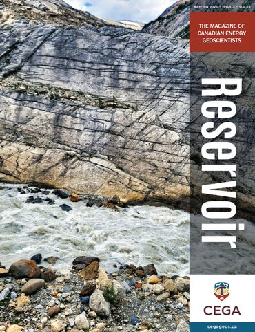
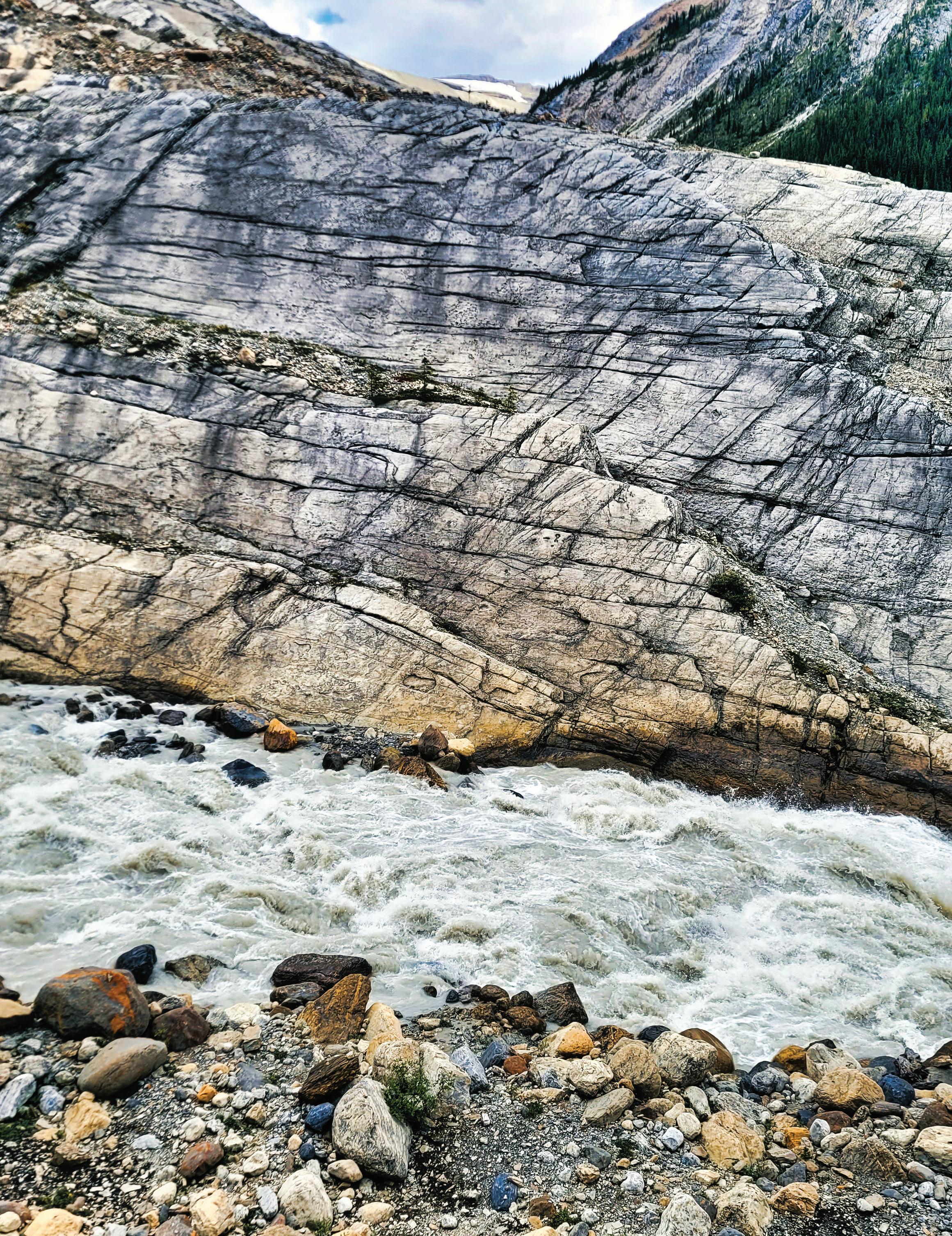
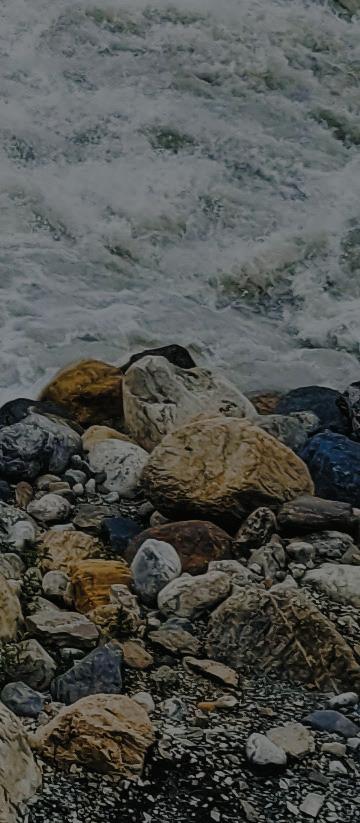
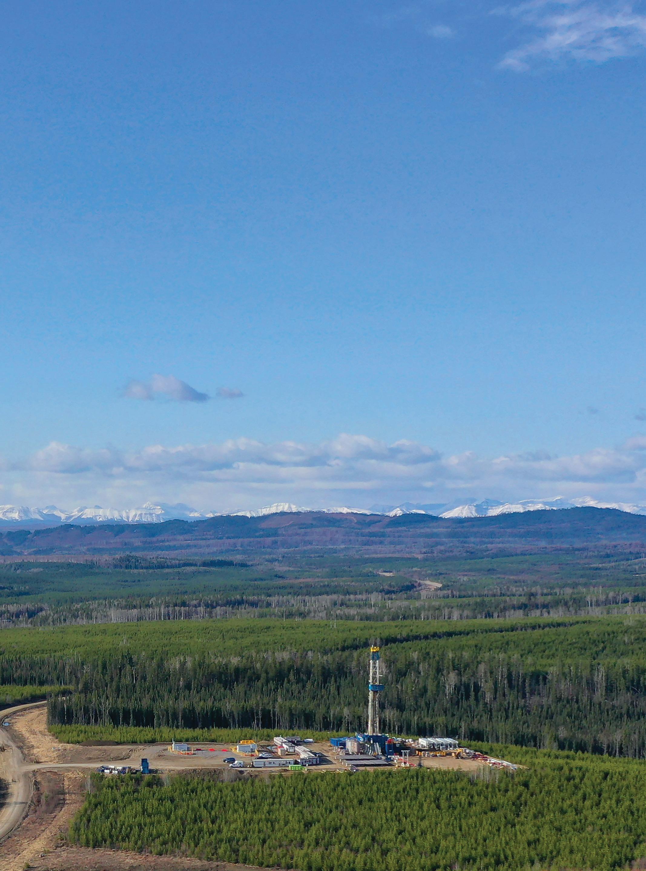
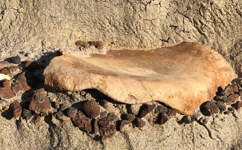
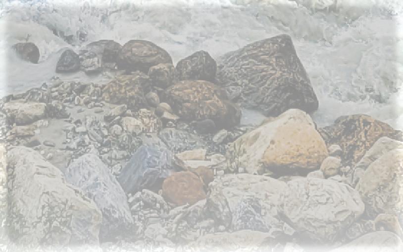
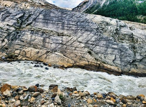
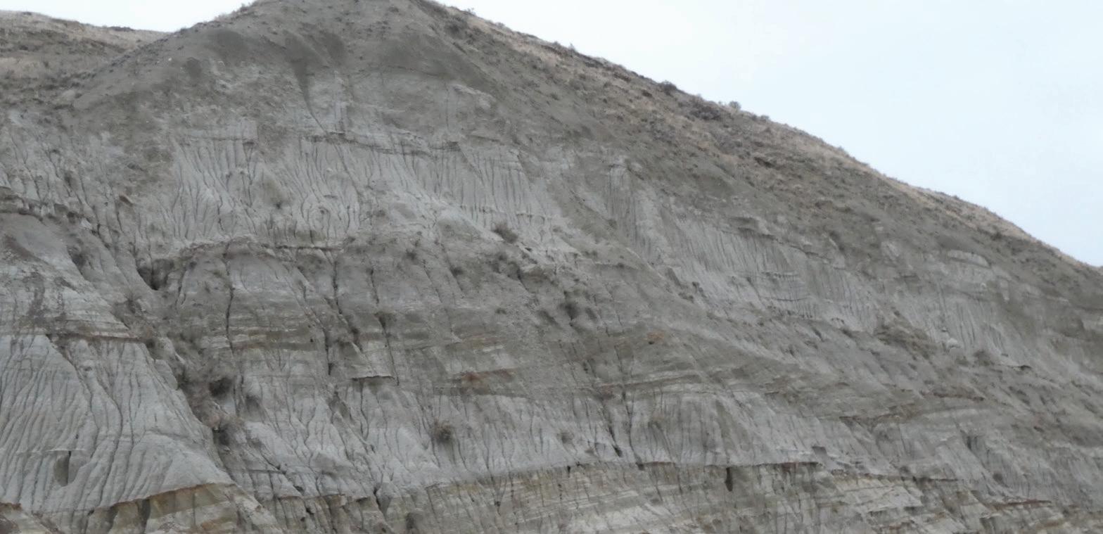
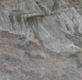
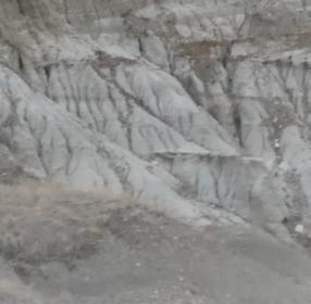
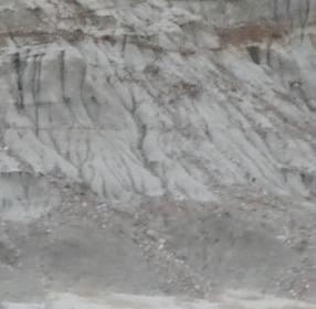
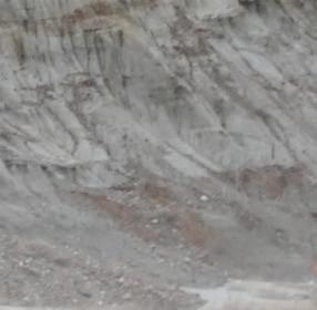
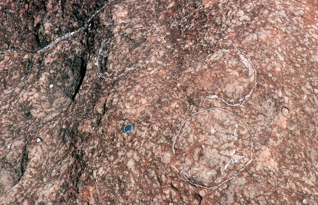
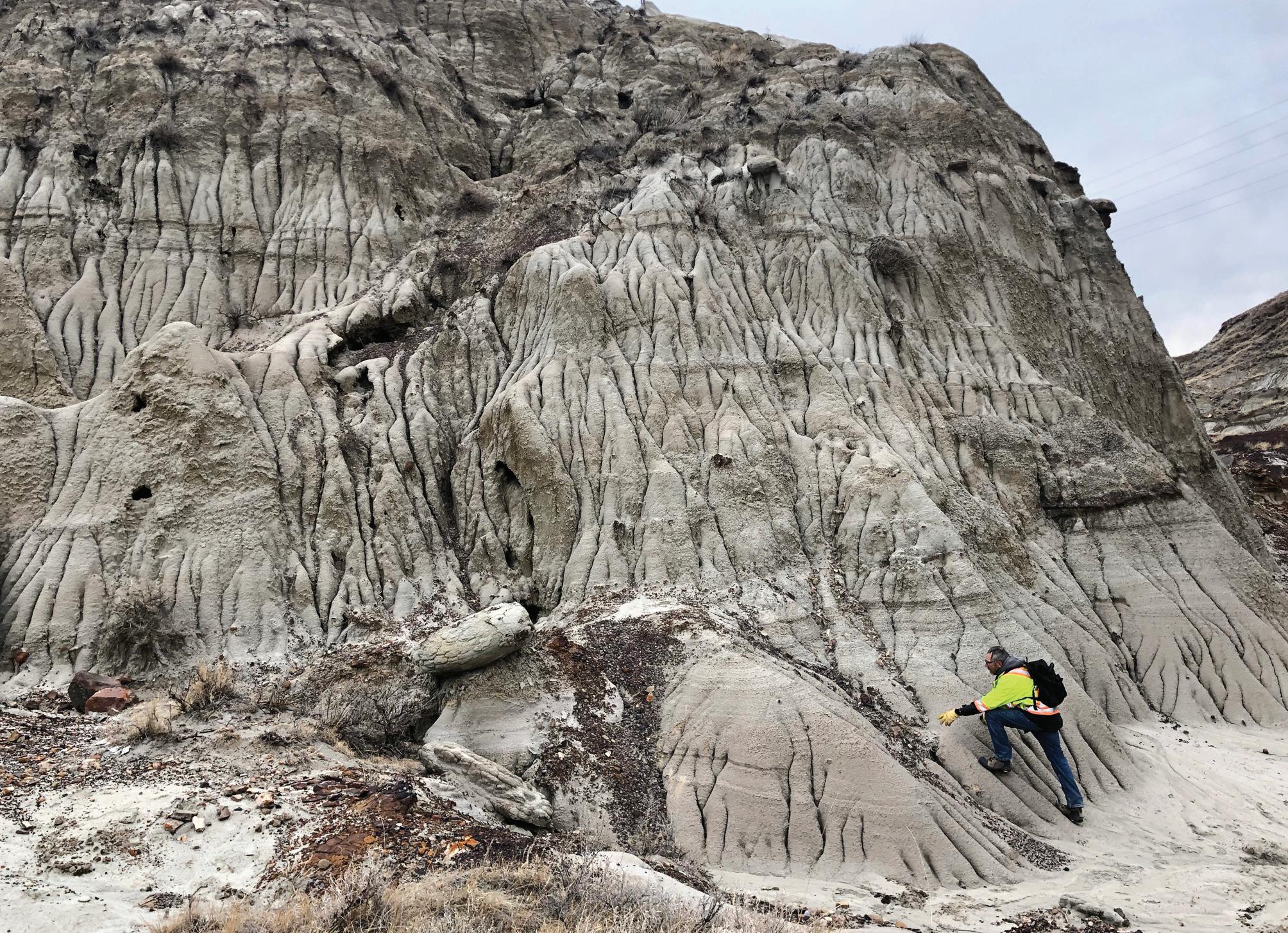
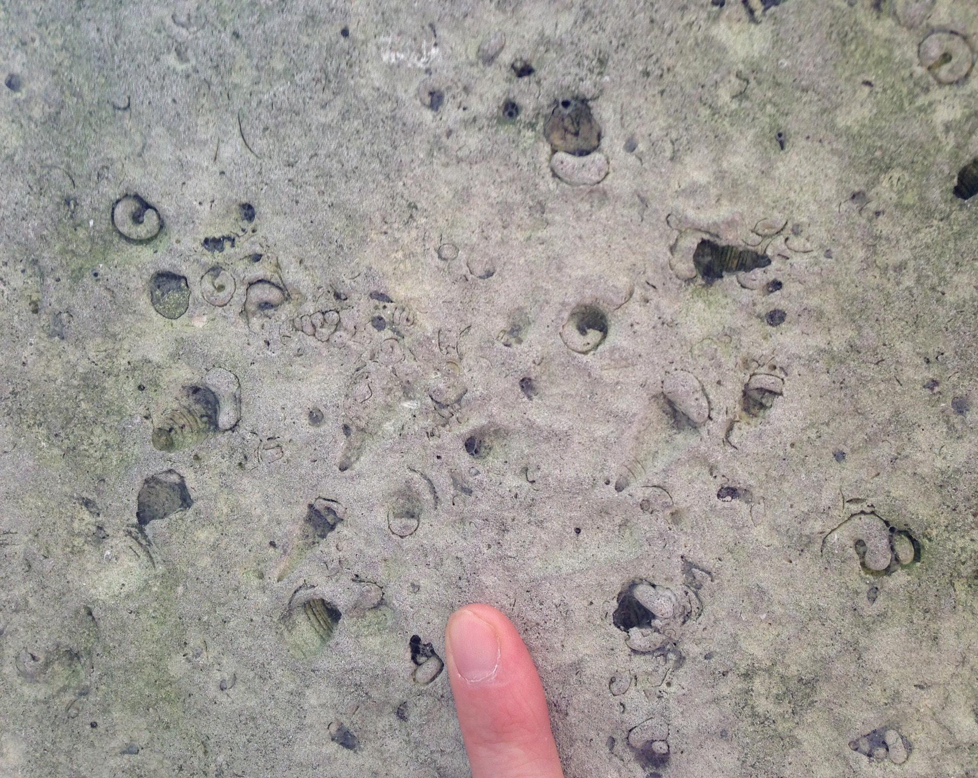
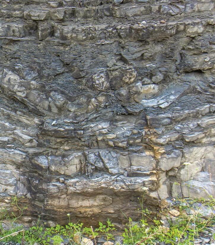
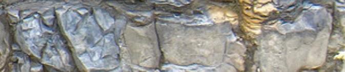
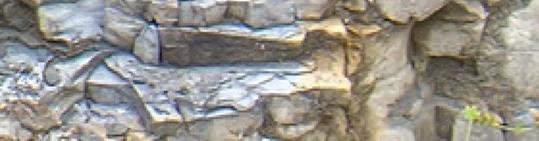
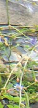
The headwaters of the Yoho River in Yoho National Park rush past an outcrop of the Middle Cambrian Pika Formation on its way south towards the Kicking Horse River and past Takkakaw Falls. This outcrop lies just north of the confluence of the river with Waves Creek. The river is interpreted to flow directly over the down-to-the-west Stephen-Cathedral Normal Fault with the Late Cambrian Sullivan Formation in its hangingwall. It is not clear if the intense fracturing present on the outcrop is related to proximity to that fault or if the fabric is penetrative over a wider area. Colourful boulders in the foreground attest to the wide range of lithologies in this Cambrian countryside.
Photograph by: Brett Frostad
FROM THE EDITOR
SARAH SCHULTZ, TECHNICAL EDITOR FOR THE RESERVOIR
WELCOME
TO OUR MAY AND JUNE ISSUE OF THE CEGA RESERVOIR!
In this issue we present the continuation of our regular articles:
• 2026 Message from the Board
• Geology in Motion: Investigating the Role of Geology on D-Day
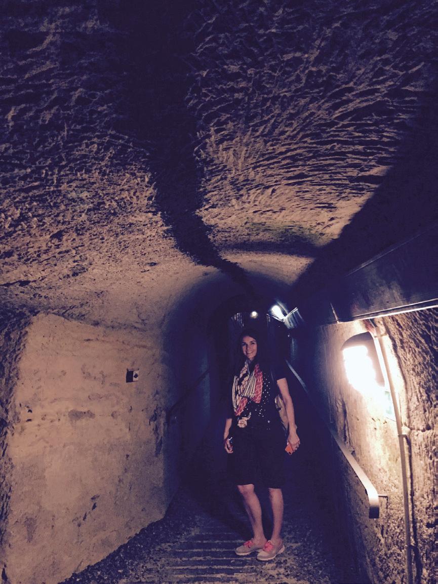
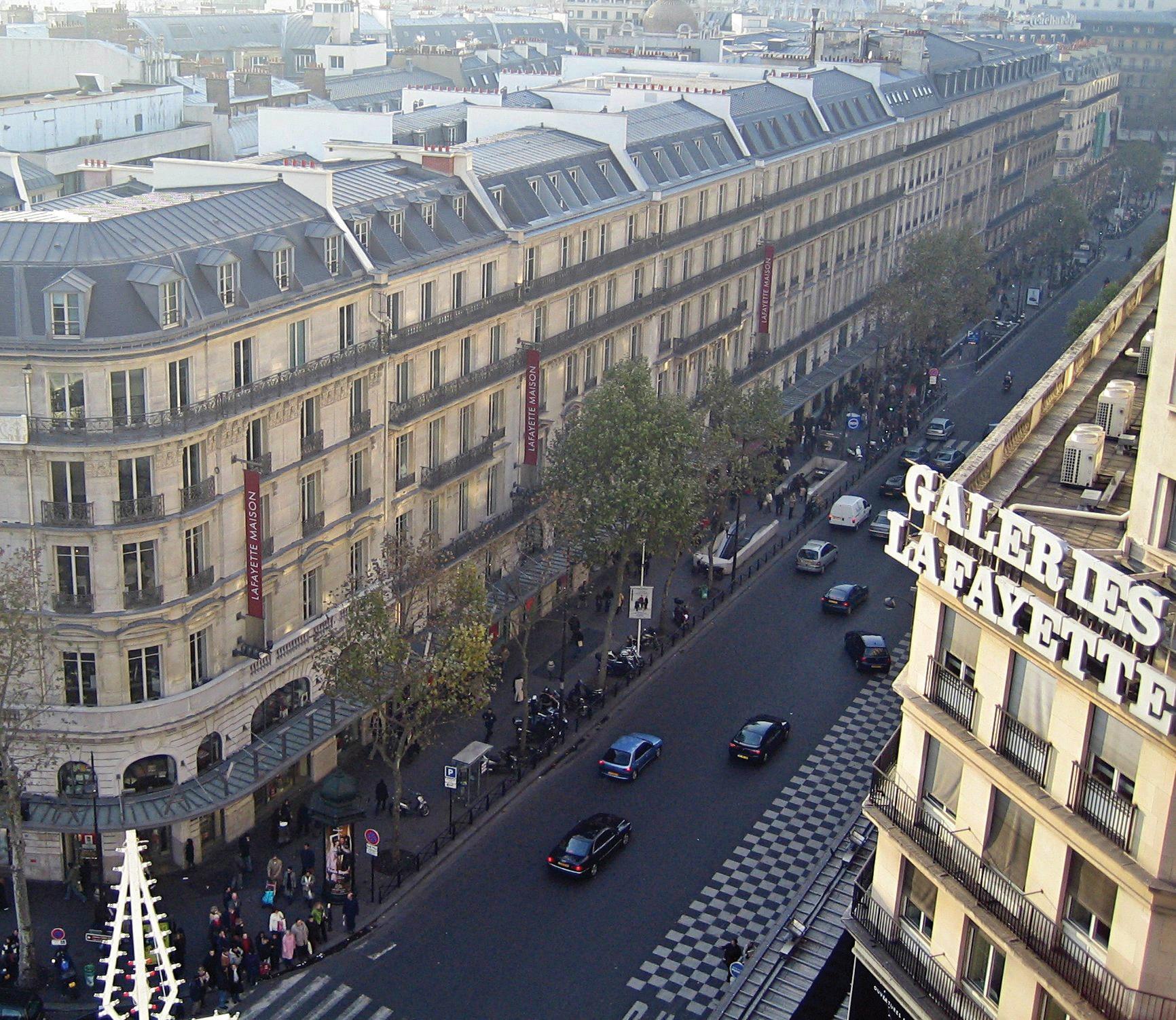
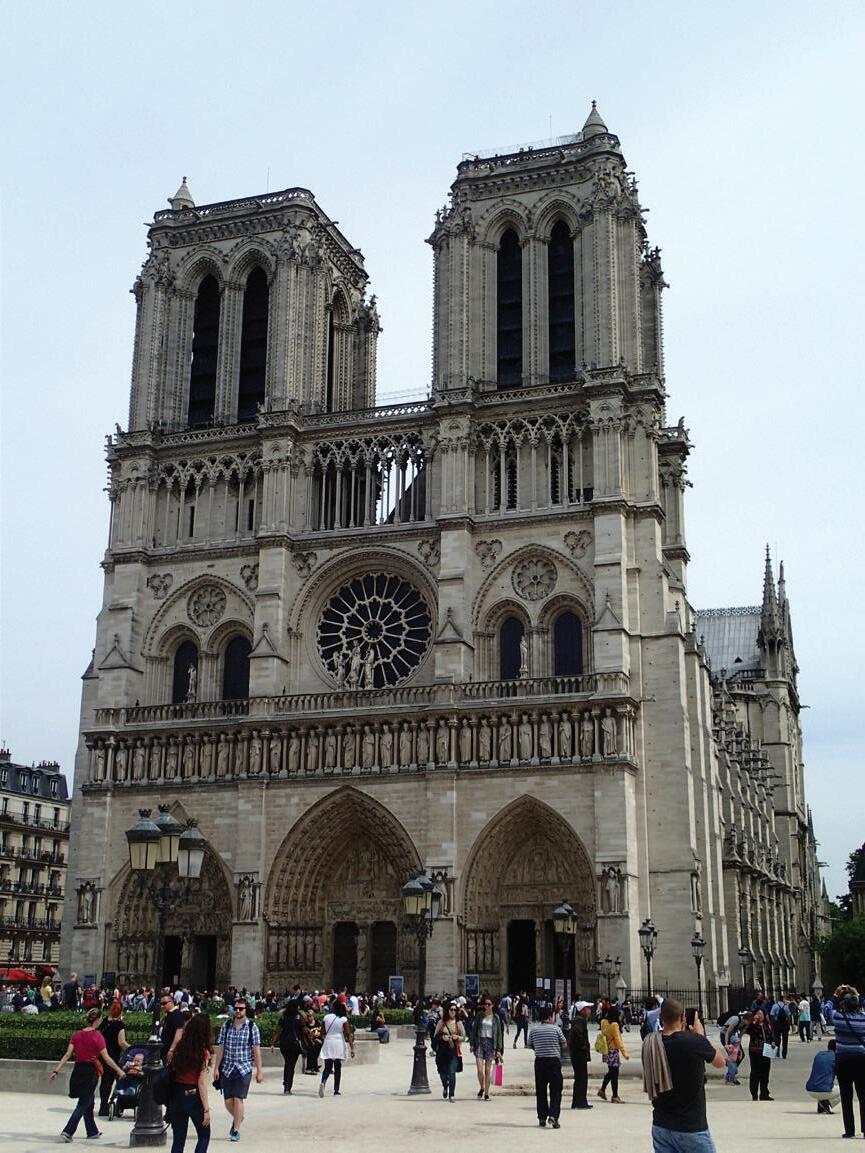
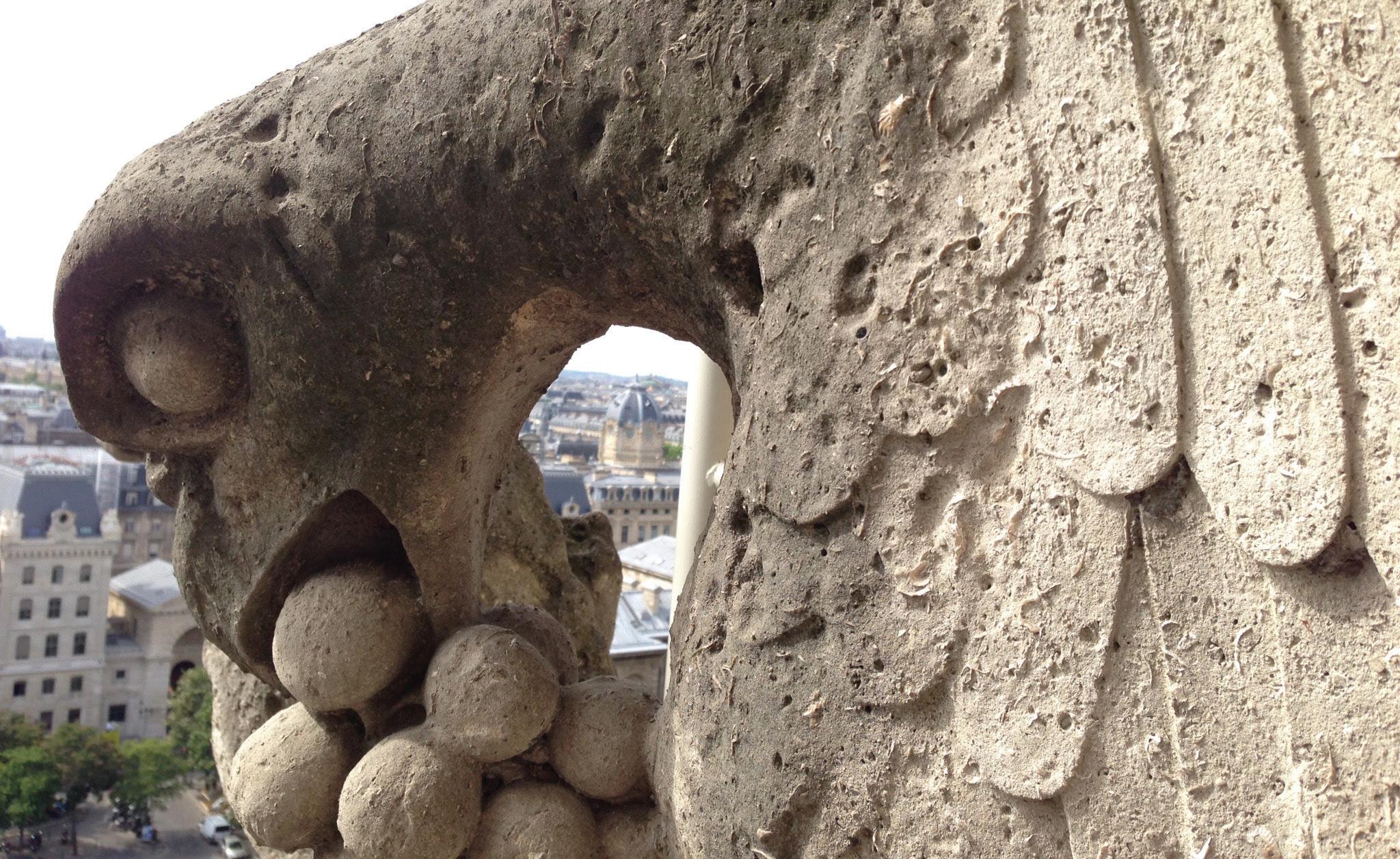
• Go Take a Hike: The Paris Catacombs
In this issue we present the following articles:
• Jon Noad: Dinosaurs Going Solo
• Volunteer Spotlights: Scott Norlin and Darren Hinks
• Gussow 2026: Cracking the Cretaceous Code
• CEGA Reservoir Symposium Wrap-Up
In this issue we present the following awards and would like to congratulate all winners:
• 2025 Stanley Slipper Award: Dr. Peter Putnam
• 2025 President’s Award: Dr. Marian Warren
• 2025 Tracks Awards: Ian Theunissen and Tracy Theunissen
• 2025 H.M. Hunter Award: Mark Mallamo and Brian Pratt
• 2025 Patricia J. Lee Trailblazer Award: Dr. Benjamin Rostron and the late Kim Kreis
• Best PhD Thesis: Patricia Fraino
• Best MSc Thesis: Muditha Goonetilleke
The annual Golf Tournament will be held on August 19, 2026. Registration is open for the event.
The Geoconvention and CEGA Core Conference is scheduled for May 2026. Please check out the conference websites to register for these events.
We look forward to receiving your manuscripts for the upcoming 2026 issues of the CEGA Reservoir.
Sarah Schultz
Sarah.schultz@yukon.ca
PUBLICATION INFORMATION
The RESERVOIR is published six times per year by the Canadian Energy Geoscience Association. The purpose of the RESERVOIR is to publicize the Association’s many activities and to promote the geosciences. We look for both technical and non-technical material to publish.
The contents of this publication may not be reproduced either in part or in full without the consent of the publisher.
No official endorsement or sponsorship by the CEGA is implied
for any advertisement, insert, or article that appears in the RESERVOIR unless otherwise noted. All submitted materials are reviewed by the editor. We reserve the right to edit all submissions, including letters to the Editor. Submissions must include your name, address, and membership number (if applicable). The material contained in this publication is intended for informational use only.
While reasonable care has been taken, authors and the CEGA make no guarantees that any of the equations, schematics, or
devices discussed will perform as expected or that they will give the desired results. Some information contained herein may be inaccurate or may vary from standard measurements. The CEGA expressly disclaims any and all liability for the acts, omissions, or conduct of any third-party user of information contained in this publication. Under no circumstances shall the CEGA and its officers, directors, employees, and agents be liable for any injury, loss, damage, or expense arising in any manner whatsoever from the acts, omissions, or conduct of any third-party user.
BOARD OF DIRECTORS 2026
PRESIDENT
Christa Williams
Canadian Discovery Ltd. christa.williams@cegageos.ca LinkedIn
FINANCE DIRECTOR ELECT
Thomas Plumridge
Freehold Royalties director nance@cegageos.ca LinkedIn
EDUCATION DIRECTOR
Rachelle Pinnow
Cenovus Energy education@cegageos.ca Linkedin
PAST PRESIDENT
Shelley Leggitt
Outwest Energy
shelley.leggitt@cegageos.ca LinkedIn
CONFERENCES DIRECTOR
Taylor Berezowski
Canadian Discovery Ltd. conferences@cegageos.ca LinkedIn
PUBLICATIONS DIRECTOR
Michael Wamsteeker
Parex Resources publications@cegageos.ca LinkedIn
PRESIDENT ELECT
Astrid Arts
Cenovus Energy astrid.arts@cegageos.ca
LinkedIn
OUTREACH DIRECTOR
Dilpreet Khehra University of Calgary outreach@cegageos.ca
LinkedIn
GROWTH & ENGAGEMENT DIRECTOR
Gareth Williams
Touchstone Exploration Inc. membershipdirector@cegageos.ca
LinkedIn
OFFICE CONTACTS
MEMBERSHIP INQUIRIES
Tel: 403-264-5610
Email: membership@cegageos.ca
FINANCE DIRECTOR ELECT
David Lipinski
AtkinsRealis director nance@cegageos.ca
LinkedIn
MEMBER PROGRAMS DIRECTOR
Scott MacKnight
Whitecap Resources Inc. membershipdirector@cegageos.ca
LinkedIn
CEGA OFFICE
#415, 500 4th Ave SW
Calgary Alberta, Canada T2P 2V6
Tel: 403-264-5610 | cegageos.ca
ADVERTISING INQUIRIES
Latoya Graham
Tel: 403-513-1230
Email: latoya.graham@cegageos.ca
CONFERENCE INQUIRIES
Kristy Casebeer
Tel: 403-513-1234
Email: kristy.casebeer@cegageos.ca
MANAGING DIRECTOR
Emma MacPherson
Tel: 403-513-1235
Email: emma.macpherson@cegageos.ca
2026 MESSAGE FROM THE BOARD
TAYLOR BEREZOWSKI, P.GEOL, MPP; CONFERENCES DIRECTOR
T2026 is shaping up to be a very busy year for conferences!
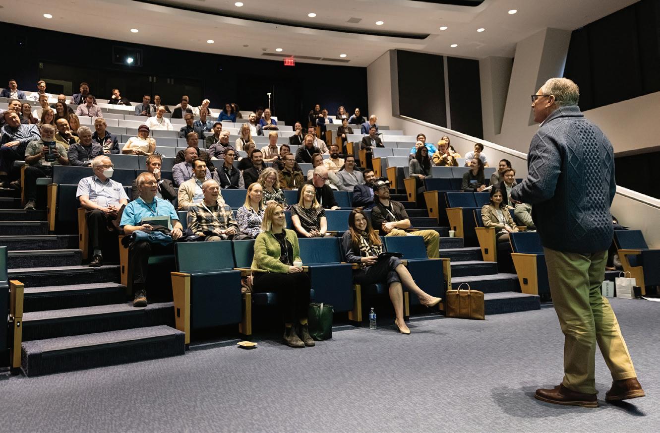
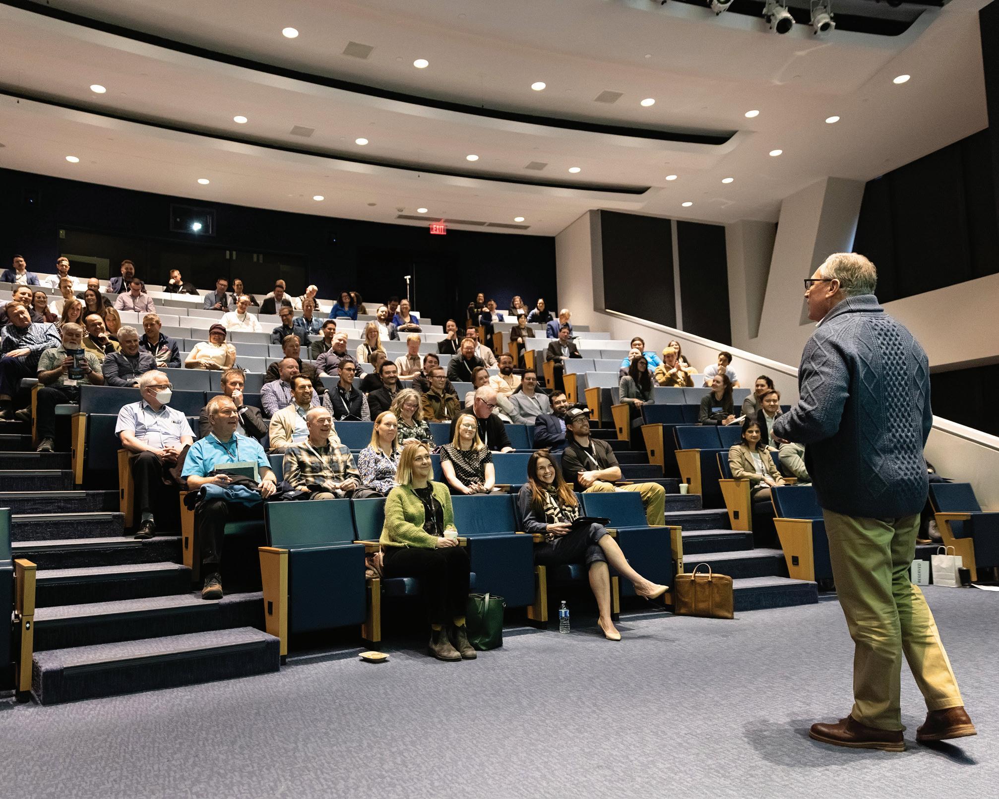
hank you to those who attended CEGA’s inaugural Reservoir Symposium in February, which featured industry case studies, regulatory compliance concerns and technical innovations to drive successful and efficient business operations. The crowd was engaged, the speakers were polished, the venue was packed, and the networking was lit! Please consider joining us for the next Reservoir Symposium, expected within the next two years.
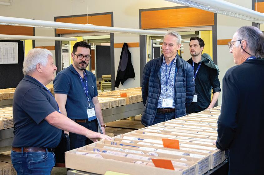
May will host our community of geoscientists at two annual events: Core Conference (May 7-8 [a member favourite!]), followed by the coveted Geoconvention (May 11-13). Sandwiched in between, out-of-town attendees are invited to explore nearby attractions such as the hoodos and Royal Tyrrell Museum in Drumheller, or travel west into Kananaskis, Banff, or Lake Louise for some epic hiking. Make sure to pack for the weather and have a recovery kit ready from the core meltdown…#IYKYK
Rounding off the 2026 year is CEGA’s biennial Gussow conference on October 13-15, a single track event that will focus on Cretaceous play development in the WCSB. Per tradition, Gussow will be held in the scenic Rocky Mountains. The town of Banff will host this immersive learning opportunity and, if you haven’t had a chance to attend a Gussow conference yet, it’s truly a worthwhile experience – particularly for the quality networking. The committee co-chairs and session volunteers are finalizing the technical program, which is shaping up beautifully. Please visit the CEGA website
for more information and reach out if you’re interested in participating!
Looking ahead, there’s always something new and exciting going on at CEGA. The release of Atlas 2027 is afoot, and the Steering Committee is eager to share the new chapter results. You can expect extra core days and show-and-tell events to pop up throughout the year as new geologic content is published online. Atlas 2027 requires herculean-levels of effort to move across the finish line, from hundreds of geoscientific authors, editorial committee members, publishers, fundraisers, marketing and administration folks, etc, etc…all volunteers, to boot! One can’t help but feel inspired by this milestone, just in time for CEGA’s 100th anniversary. Many celebrations will be in
order, and bragging rights will be on display at the International Geological Congress in August 2028 (IGC 2028). Let’s show the world what we’re capable of!
It’s a lot of work to organize these conferences, and the CEGA Board of Directors extend their heartfelt gratitude to the passionate members who make it all possible. As always, CEGA endeavors to present information that is relevant, engaging and valuable to our members. Your participation in this community is essential for its health and quality, so please share your feedback with us.
From the technical generalists to the niche geoscientists, everyone has a place to share their knowledge and shine.
Geology in Motion: Investigating the Role of Geology on D-Day
DALLIN LAYCOCK, GLEN BURRIDGE, ERIN PEMBERTON, SEAN FLETCHER, SAM HUDSON, PAUL BREMNER, HAN BYUL WOO,
INTRODUCTION
In the annals of World War II, one event stands out as a testament to human courage and determination: D-Day (Figure 1). On June 6, 1944, Allied forces launched a daring assault on the beaches of Normandy, France, in a bid to liberate Europe from Nazi control. This operation, codenamed Operation Overlord, sought to establish a foothold on the continent and ultimately turn the tide of the war in their favor. While often overshadowed by the sheer scale of the military assault, the role of geoscientists was critical to the operation’s success. From analyzing tidal patterns and beach sediment composition to evaluating terrain for vehicle mobility, geologists provided critical intelligence that helped determine where and how the landings could succeed.
By 1944, Hitler’s Third Reich had tightened its grip on much of Europe, following rapid early victories that had overrun Belgium, the Netherlands, and France, culminating in the evacuation of Allied forces from Dunkirk in 1940. In anticipation of invasion, Germany fortified the Normandy coast as part of the Atlantic Wall, a vast defensive network of bunkers, artillery, minefields, and beach obstacles designed to repel any invading force (Figure 2). The scale of the invasion, combined with unpredictable weather, strict secrecy, and the complexity of amphibious warfare, these defenses created a formidable challenge for the Allies (Beevor, 2009).
Choosing where to invade was itself a major strategic debate. British Prime Minister Winston Churchill initially favored peripheral campaigns, such as an invasion of Norway, while American planners pushed for a direct assault on German-occupied France. As discussions evolved, it became clear that geography and, critically, geology would play decisive roles. The Allies faced thousands of kilometers
of possible coastline to target, including ports, beaches, and rocky shorelines. Strategic discussions increasingly emphasized the feasibility of a cross-Channel invasion while still considering alternative operations, including a possible invasion of Norway (Weigley, 1981; U.S. Army Center of Military History, 1994). Coastal morphology, tidal range, beach sediment conditions, and inland terrain all influenced where an invasion could succeed.
The pivotal decision to launch the invasion of France was formalized during the First Quebec Conference (codenamed Quadrant) in August 1943, where Franklin D. Roosevelt, Winston Churchill, and William Lyon Mackenzie King approved plans for Operation Overlord (U.S. Army Center of Military History, 1994). Among the planners were scientific advisors, such as physicist J.D. Bernal, who helped integrate scientific analysis into military strategy (Brown, 2005; Rose & Clatworthy, 2007). Their work revealed a crucial truth: success would depend not only on firepower and manpower, but on understanding the ground and geoscience itself (Brown, 2005; Rose & Clatworthy, 2007).
Operation Overlord became the largest seaborne invasion in modern history and required immense planning and coordination. Along with tidal and sediment analysis, the work of geoscientists also extended beyond the beaches themselves, including securing vital supplies of potable water for advancing land forces, identifying suitable locations for the rapid construction of temporary airfields, and locating sources of aggregate needed to upgrade roads that were otherwise unprepared for the heavy movement of Allied troops and equipment (Rose & Pareyn, 1995; Rose & Clatworthy, 2007). Geology and scientists shaped nearly every aspect of the invasion plan.
RICHARD MACKENZIE
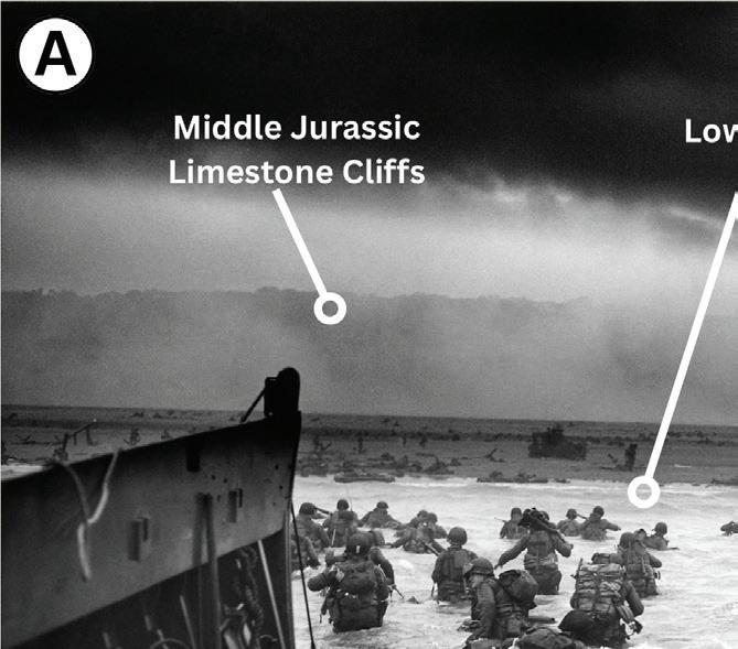
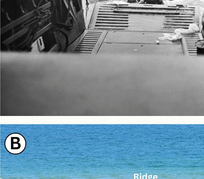
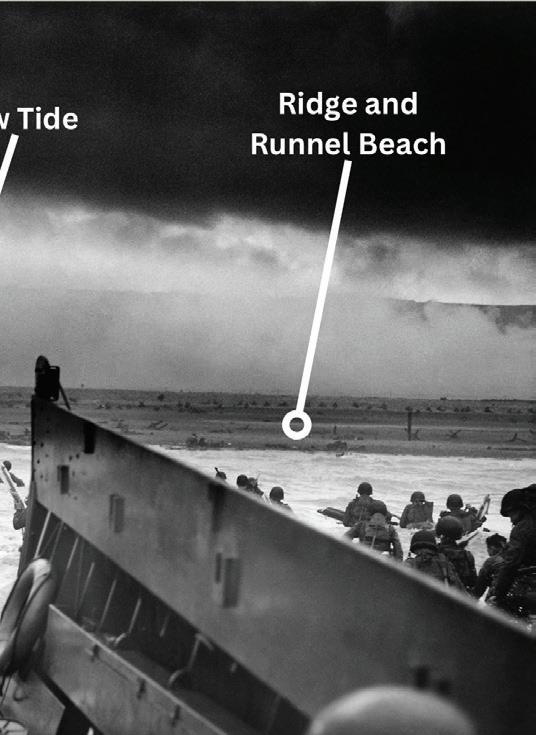
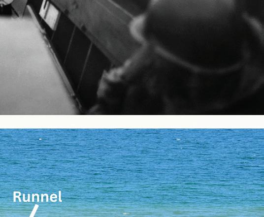
(A) US troops of Company A, 16th Infantry, 1st Infantry Division wading ashore from a Coast Guard-manned LCVP on the Fox Green sector of Omaha Beach, Normandy, France, on the morning of June 6, 1944. Photograph: National Archives and Records Administration, public domain (NAID 195515).
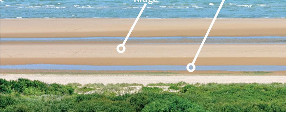
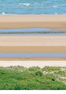
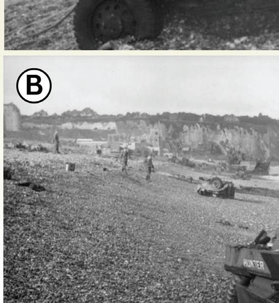
(B) Image taken from top of bluffs at Omaha Beach, looking north. This is representative of the view the German defenses would have had on D-Day. The ridge and runnel topography of the beach is visible.
2.
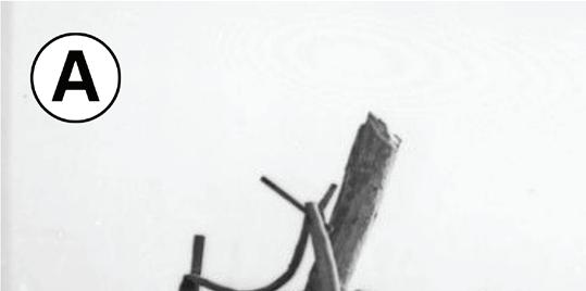
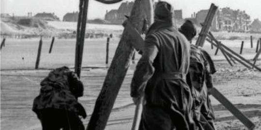
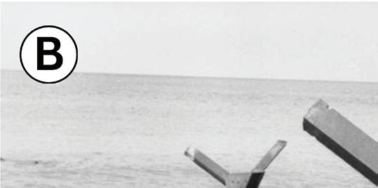
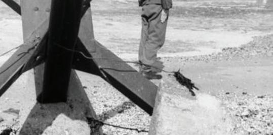
(A) Installation of wooden anti-landing stakes at low tide (Bundesarchiv Bild 101I-297-1716-28).
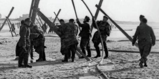
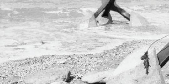
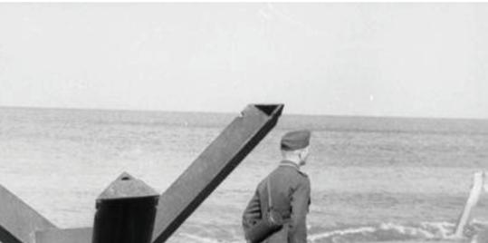
(B) “Czech hedgehog” beach obstacles near Calais (Bundesarchiv Bild 101I-719-0240-26). Images courtesy of the Bundesarchiv, licensed CC-BY-SA 3.0.
Figure 1.
Figure
GEOLOGIC BACKGROUND
Northwestern France consists of two contrasting geological regions with very different ages and lithologies (Figure 3). The Armorican Massif, situated in the northwest, is characterized by a complex tectonic history and varied lithology. It predominantly comprises Precambrian and Paleozoic igneous and metamorphic rocks, including schists, gneisses, migmatites, and intrusive granitic bodies (Faure et al. 2005; Torelli et al. 2020; Sinnesael et al., 2022).
To the east lies the Paris Basin, characterized by a succession of Cenozoic sedimentary rocks, including limestones, marls, sandstones, and mudstones. These relatively undeformed, flat-lying sedimentary rocks resulted in a low-lying terrain with large underlying aquifers (Faure et al., 2005; Brigaud et al., 2018; Torelli et al., 2020). The geology on the opposite side of the English Channel is closely related. Southern England contains several sedimentary basins, including the Weald Basin, Hampshire Basin, and London Basin, that formed as part of the same regional system as the Paris Basin, and they share many stratigraphic units (Chadwick, 1993). As a result, many coastal landscapes and sediment sources on both sides of the English Channel are closely analogous.
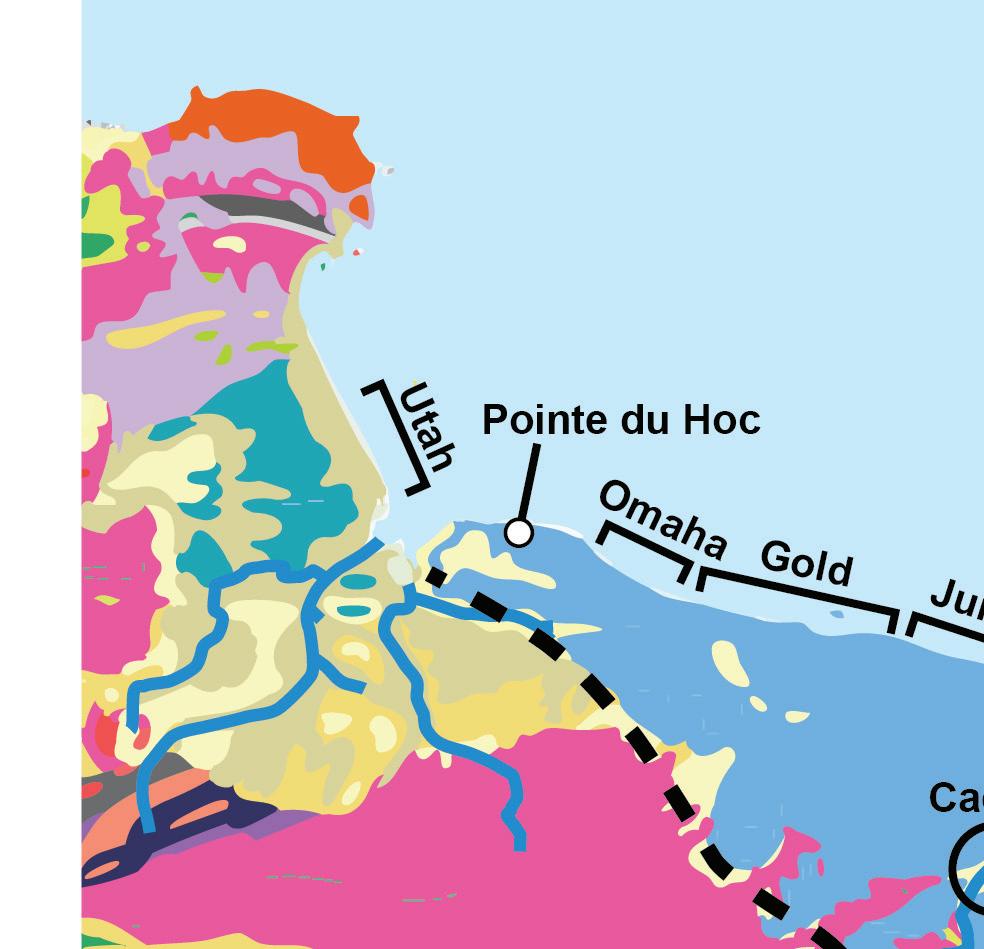
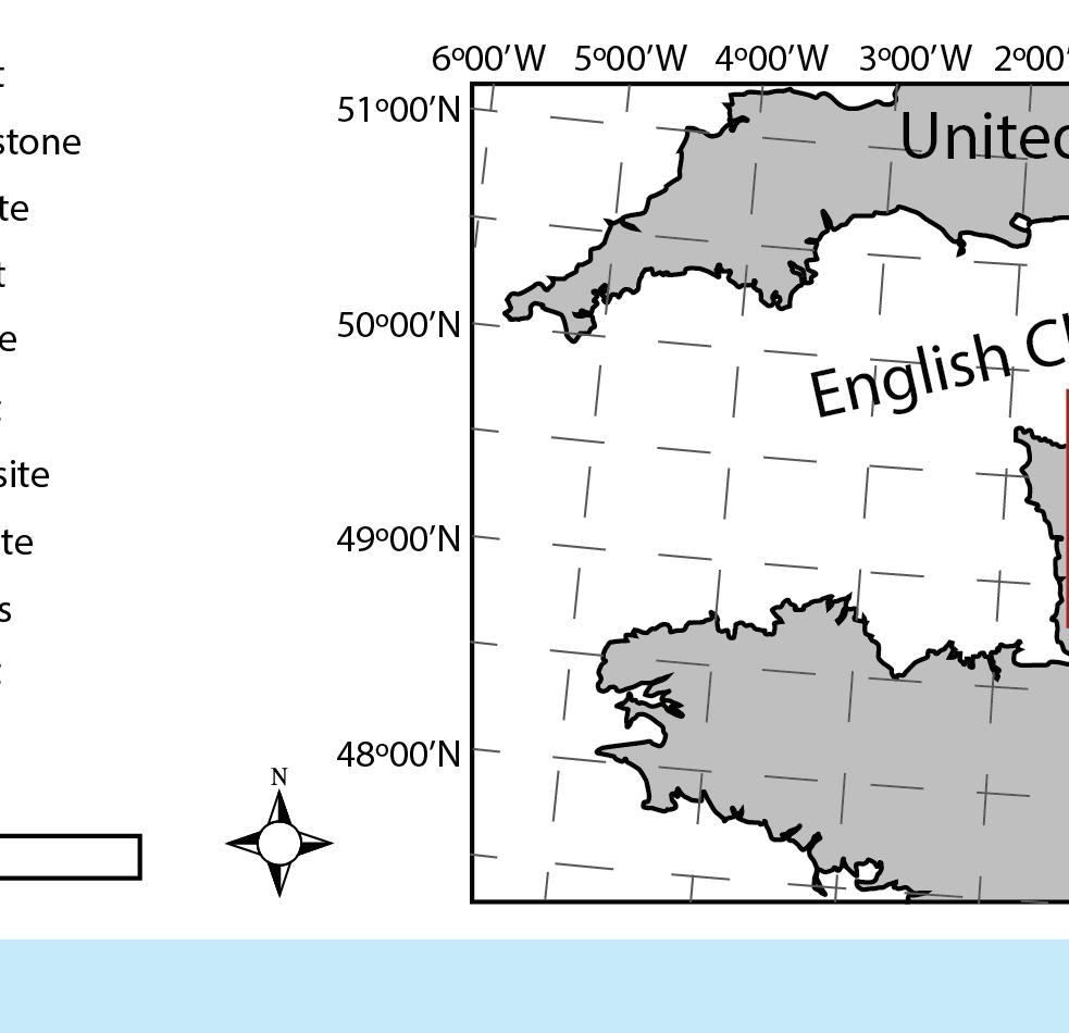
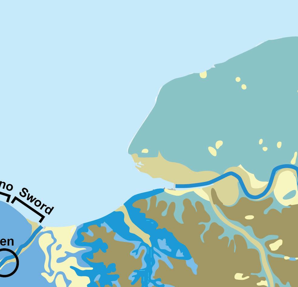
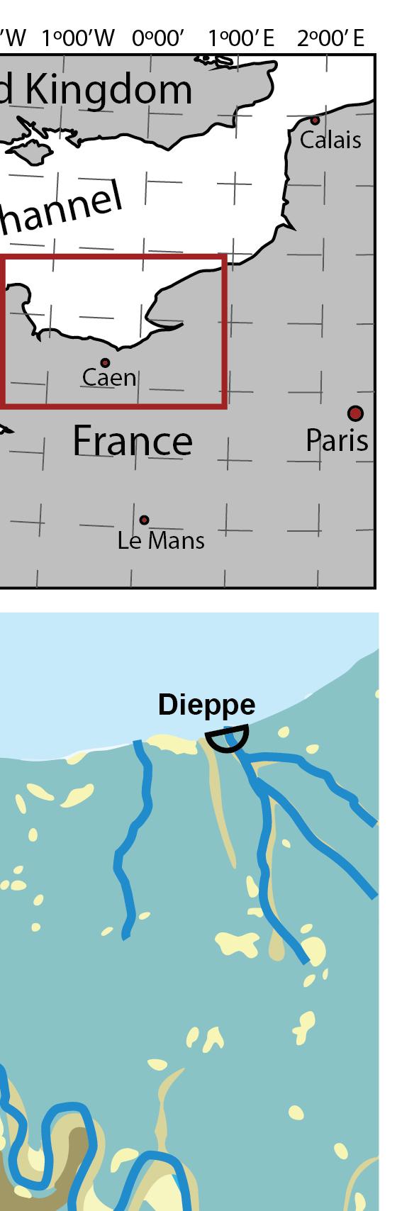
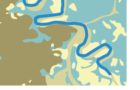
Figure 3.
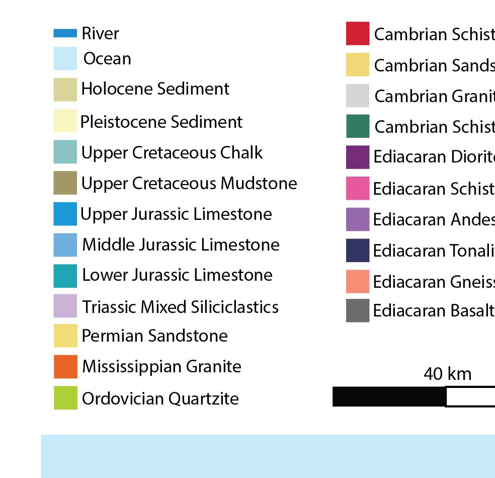
Geologic map of the area surrounding the D-Day beaches and Dieppe. Shown are major lithologies of the Paris Basin and Armorican Massif. A few interesting details are visible, one being the mostly flat-lying limestone plateau behind the D-Day beaches that was ideal for rapid airfield construction, further supporting the choice of attack points. Another is the confluence of rivers behind Utah Beach that created marshlands that slowed progress inland. Map is modified from European Geological Data Infrastructure (2025).
Britain was not always an island, as the English Channel itself is geologically young. For much of the Cenozoic, Britain was connected to France by a broadly folded chalk ridge known as the Weald–Artois anticline. A large proglacial lake formed in the southern North Sea, dammed to the south by the Weald–Artois anticline. In the Middle Pleistocene, catastrophic failure of the ridge at the Dover Straight released megafloods that carved bedrock valleys across the exposed Channel floor, with channels tens of kilometers wide and up to ~50 m deep, ultimately separating Britain and France (Gupta et al., 2007).
Any successful military invasion would have to cross the English Channel or the North Sea, confronting the geological realities of the landing zones. Geologic factors, such as terrain, beach access and egress, the trafficability of the beach for large vehicles, access to water for troops, and air support landing strips, would all influence success. Unfortunately, these lessons were not fully understood at first.
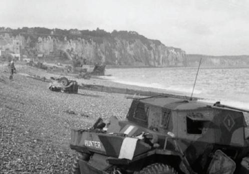
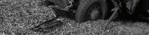
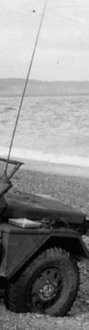
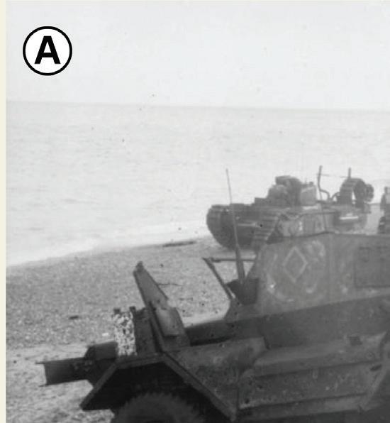
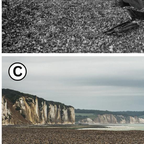
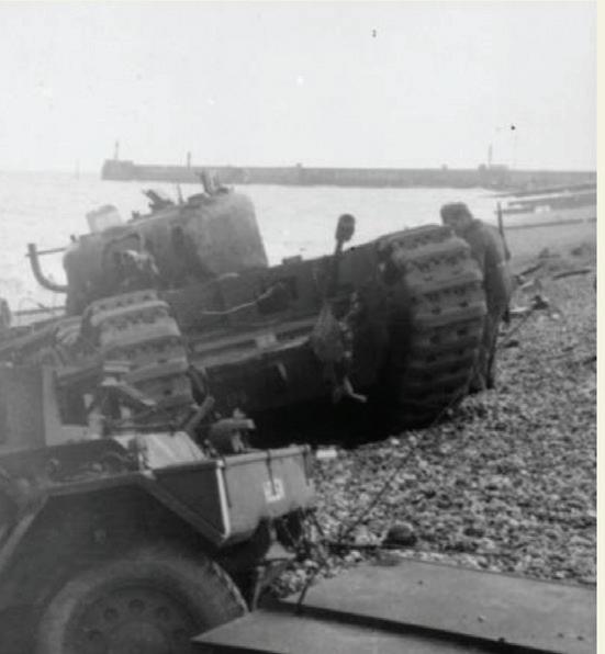
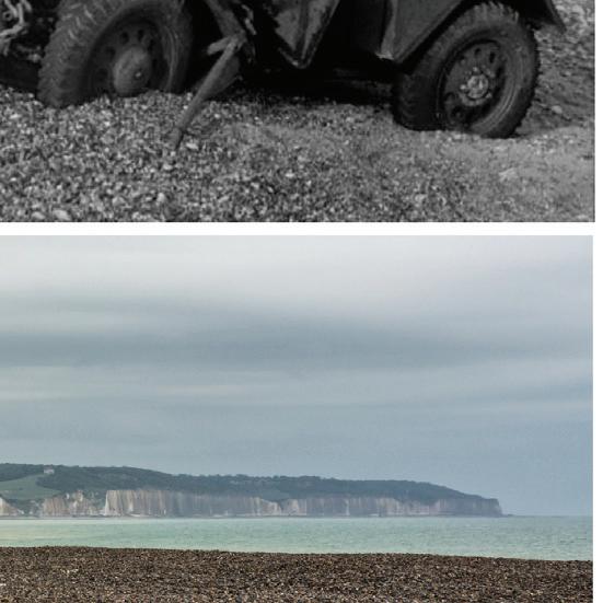
(A) Abandoned Daimler Dingo armoured car and two Churchill tanks immobilized in loose gravel during the failed Dieppe landing, illustrating the poor trafficability of the beach substrate.
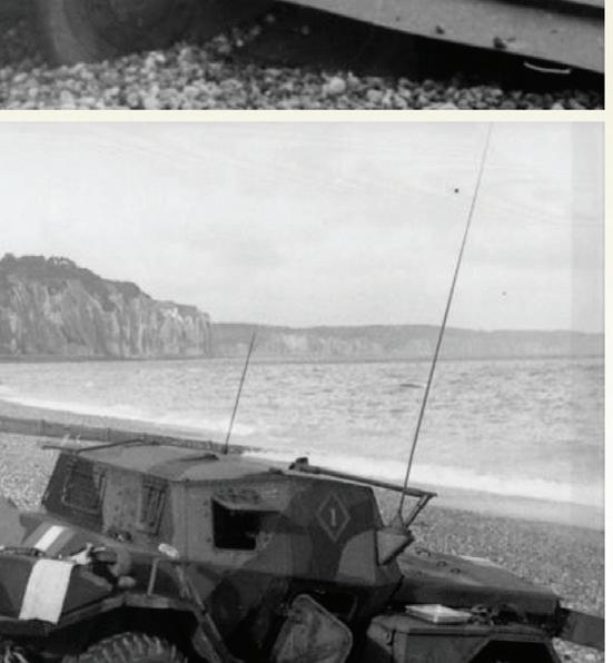
(B) Abandoned Daimler Dingo armoured car with chalk cliffs in the background and coarse pebble beach sediment in the foreground. Photographs: Bundesarchiv, Bild 101I-362-2211-12 and Bild 101I362-2211-04. Licensed CC-BY-SA 3.0.
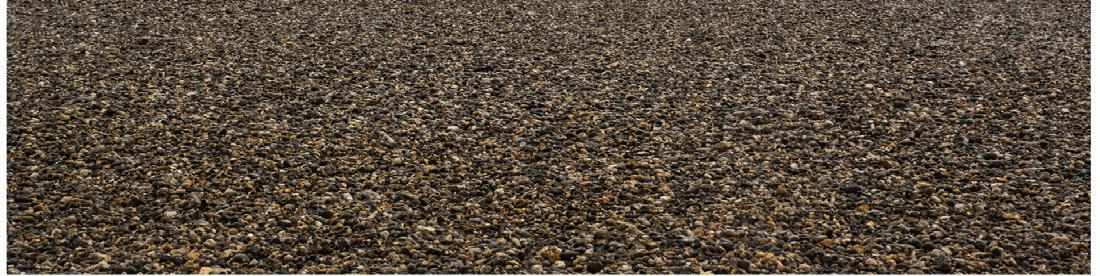
(C) Modern image of the Dieppe Beach showing the abundance of chert clasts. Note that the picture was taken from a very similar location to that shown in panel B.
DISASTER AT DIEPPE
In August 1942, the Allied raid on Dieppe, codenamed Operation Jubilee, revealed just how critical geology could be. An Anglo-Canadian force assisted by US Army Rangers launched a raid of the German-occupied port of Dieppe, with the objective of testing German defenses and gaining a foothold in Western Europe. The operation suffered from numerous challenges, ranging from poor intelligence to a lack of armoured support. However, one of the most crucial mistakes was overlooking the geology.
Behind the beaches of Dieppe are cliffs of Upper Cretaceous chalk belonging to the Seaford Chalk Formation (Figure 4). These micritic limestones (fine-grained carbonate) contain abundant diagenetic flint nodules (Moh’s hardness of 7 out of 10) formed by the replacement of carbonate by biogenic silica (Hancock, 1975; Aliyu, 2016). Coastal erosion liberates these more resistant nodules from the chalk and concentrates them on the shoreline, where continued wave reworking rounds them into flint pebbles (approximately 2–10 cm in diameter). These rounded stones created a steep beach front with unstable surfaces, poor traction, and high rolling resistance for wheeled and tracked vehicles (Figure 4; Carter, 1988; Komar, 1998; Boggs, 2011).
The raid on Dieppe also marked the first combat deployment of the new Churchill infantry tanks, operated by the 14th Army Tank Regiment (The Calgary Regiment), and they played a pivotal, tragic role (Whitaker & Whitaker, 1992; Henry, 2000). Although these tracked vehicles had been tested on landing craft during training exercises on the firmer sandy beaches of southern England, they had not encountered coarse, rounded flint clasts during rehearsals. Upon encountering the hard flint nodules at the Dieppe beach, many tanks and other vehicles quickly lost mobility after landing. Stones jammed in the tracks and around the drive sprockets, causing thrown tracks and repeated mechanical failures that immobilized the armour on the shoreline (Figure 4; Whitaker & Whitaker, 1992). In effect, this turned the tanks into static firing positions that were sitting ducks for the accurate anti-tank fire from the entrenched German defenses.
A more geologically comparable training environment, such as the chalk-and-flint shores near Dover, would have been preferable. There, erosion of Upper Cretaceous chalk cliffs similarly produces flint-rich pebble beaches that more closely resemble the conditions encountered at Dieppe. Especially since the same Seaford Chalk Formation appears on both sides of the English Channel (Aliyu, 2016). Perhaps they might have observed the inability of their vehicles to move effectively and made alternative plans. Additionally, flint shingle beaches such as this are characteristic of the chalk cliff coasts bordering the Dover Strait, but they are relatively rare in the broader coastline of northern Europe, making the choice of Dieppe especially egregious.
The consequences at Dieppe were devastating. Of roughly 6,086 troops involved, over half (~3,600) were either killed, wounded, or captured. For Canadian soldiers in particular, who made up the bulk of the fighting force, casualties reached an alarming 68% (907 soldiers killed, 586 wounded, and around 1,900 were taken prisoner). With such heavy losses of troops, armoury, and equipment, the geologic oversight proved fatal: geology could determine the fate of an invasion. Although deemed an operational failure, the Dieppe raid led to a complete revision of the invasion plans for continental Europe, including the development of “Hobart’s Funnies,” a specialist armoured fighting vehicle derived from tanks to overcome the issues armoured vehicles encountered at Dieppe.
Figure 4.
Figure 5.
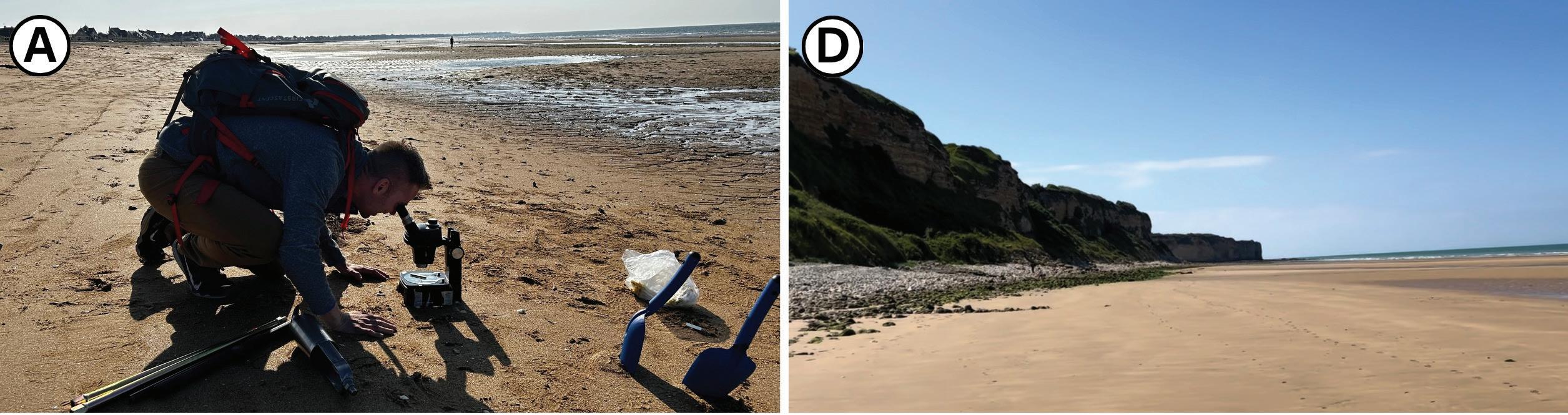
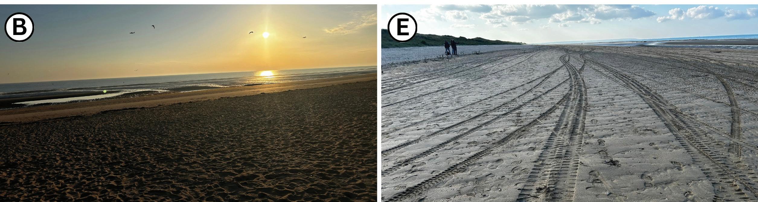
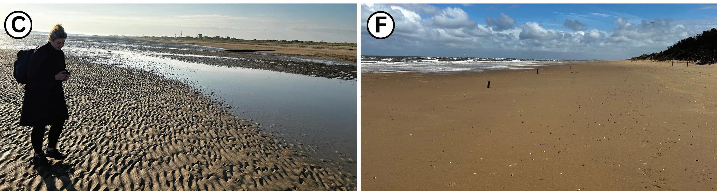
Images taken between June 5–10, 2024, coinciding with the 80th anniversary of D-Day.
(A) Geologist on Sword Beach looks through a microscope in search of World War II shrapnel.
(D) Image taken at Omaha Beach, showing limestone cliffs in the background.
(B) Image on Juno Beach, taken early morning of June 6, marking 80 years since the onset of the attack.
(E) Tire tracks on Utah Beach indicating good trafficability of the beach substrate.
(C) Geologist examines wave ripples at Gold Beach. Visible ridge-and-runnel topography, with the water accumulating in the runnel.
(F) Image of Brancaster Beach in Norfolk, England, showing similar beach morphologies to the D-Day beaches.
INFLUENCE OF GEOSCIENTISTS
Armed with the hard-learned lessons from the failed Dieppe raid, the Allies placed far greater emphasis on geological intelligence and understood how crucial the selection of landing locations for Operation Overlord would be. They required areas with several key geologic attributes, such as:
1) Sandy stable substrate: Clay-rich areas would contribute to vehicles and soldiers getting bogged down; rocky shorelines posed risks to landing craft and could be slippery for soldiers laden with heavy gear; and gravel beaches are difficult for vehicles to traverse.
2) Suitability for establishing a beachhead: Cliffs would be difficult for soldiers to scale and impossible for large vehicles to access. In addition, adequate beach width was required to allow for the landing and maneuvering of troops, vehicles, and equipment, as tidal fluctuations could limit room to operate.
3) Opportunities for inland expansion: Rugged terrain found in the Armorican Massif region would likely be too difficult for efficient transportation inland.
4) Water Supply: After a successful invasion, troops would need consistent water supply, which also required geological consideration.
In the months leading up to D-Day, the Allies increasingly drew on scientific expertise to evaluate these factors. Under the broader scientific coordination of J.D. Bernal, geologists, including Frederick William Shotton and William B.R. King, played key roles in characterizing the beaches of Northwest France and the surrounding terrain. Information at the time was limited, but their work involved literature review, along with covert aerial photography and sampling. Some of their tasks involved studying British beaches to use as analogues, supporting vehicle trials, examining the Seine and Loire rivers for possible assault crossings, preparing water supply prospect maps for NW France, analyzing effects of road metals on mine detectors, studying quarry resources in NW France, planning suitable locations for many future airfield sites, and providing terrain analysis (Rose & Clatworthy, 2008).
In preparation for D-Day, the Allied forces employed various methods to obtain critical geological and geomorphological data in enemy territory. One step included confirming the geomorphology of Normandy beaches via aerial photography. Much of this imagery was obtained by specially modified photo-reconnaissance versions of the Supermarine Spitfire and Lockheed P-38 Lightning. These aircraft were stripped of guns and armour to reduce weight and increase range, and they instead carried highresolution vertical and oblique cameras capable of detailed photographic mapping of the coastline. These images revealed the location of German fortifications and helped estimate beach gradients and the geomorphology of the beach and surrounding area (Nesbit, 1996).
Aerial photography showed that metal Czech hedgehogs and wooden stakes were installed in the intertidal areas and would be visible at low tide (Figures 1 and 2). Geologists were consulted for understanding the tidal range and patterns to ensure the Allies selected the right days for invasion, when obstacles would be most visible. Landing at low tide would help landing craft avoid dangerous defensive obstacles, but the shallow slope angle of the beaches created a long march up the beach, leaving soldiers exposed for longer. However, this was preferred over landing at high tide when defensive obstacles might tear up the hulls of landing craft.
In January 1944, British divers launched from midget submarines to collect samples of the sediment from the Normandy beaches. Samples were analyzed by military geoscientists to confirm sand composition, assess the suitability for landing crafts, and ensure vehicles wouldn’t get bogged down in sticky clay-rich sediment or stuck in loose gravel or underlying peat. They observed that the sand consisted mostly of quartz, with lesser amounts of feldspar, limestone, and fragmented shells, and would be of sufficient trafficability for the invasion. To further test their assumptions, they selected a geologically similar analogue beach at Brancaster, in Norfolk, England, to function as a test ground for the assault (Rose & Clatworthy, 2008). These beaches also contain quartzrich sediment, low gradients, and high tidal ranges similar to those in Normandy (Figures 1 and 5).
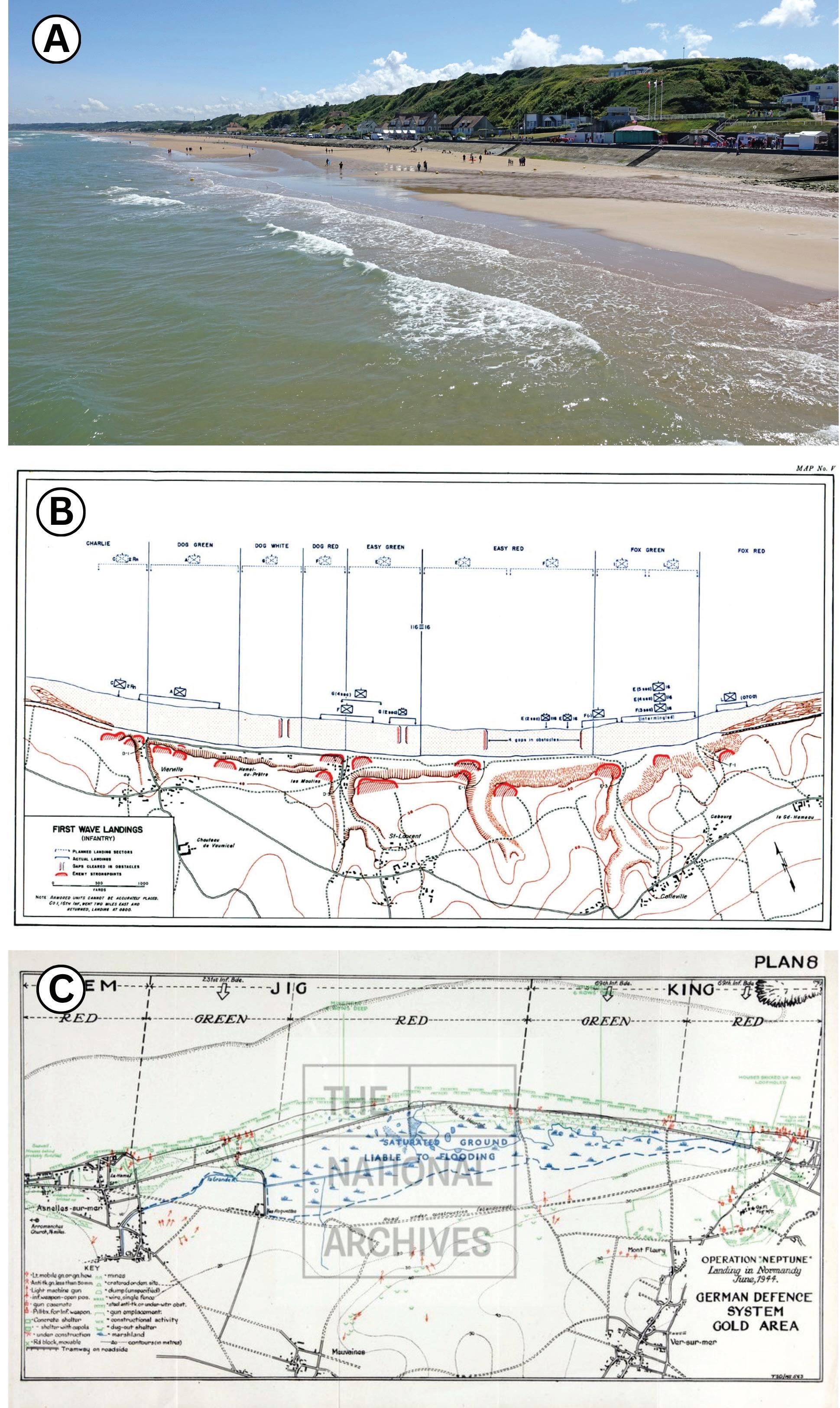
The geomorphology of the coastline also influenced the subsequent phase of the invasion plan. For example, cliffs and steep bluffs at Omaha Beach behind the shoreline were dissected by a small number of narrow valleys that provided the only practical routes inland (Costa et al. 2019). As such, these drainage valleys became focal points of the German defenses. Fortifications were concentrated around these natural corridors, creating deadly “kill zones,” particularly near the Vierville-surMer sector where the western draw came under intense defensive fire (Figure 6; Ambrose, 1994; Balkoski, 2004).
The terrain challenges varied considerably across the other landing beaches. Behind Utah Beach, extensive marshlands limited inland movement to a few raised causeways. Along Gold Beach, low coastal plains and wetlands influenced routes of advance, as was noted in Allied maps of the area (Figure 6c). The most significant obstacles were concentrated behind the eastern beaches of Gold and Sword, where urbanized shorelines featured seawalls and built-up defensive positions, and elevated artillery batteries allowed German guns to fire along the shoreline, threatening the landing forces (Rose & Clatworthy, 2008).
(A) Photograph of Omaha beach showing the sandy beach in the foreground and bluffs in the background.
(B) Official planning map illustrating the relationship between regional geomorphology and Allied assault sectors during Operation Overlord. Source: U.S. Army Center of Military History, public domain.
(C) Allied map of the German defense system in the Gold Beach area. Note the area immediately south of the beach, labelled as “Saturated ground, liable to flooding.” Image courtesy of The National Archives, ADM 234/366 (8).
D-DAY
On June 6, 1944, Allied forces launched Operation Neptune, the amphibious assault phase of Operation Overlord, along the Normandy coastline. The assault was organized into five sectors, with Allied forces synchronously attacking Utah, Omaha, Gold, Juno and Sword beaches. American troops landing in the western sector included the U.S. 4th Infantry Division at Utah Beach and the U.S. 1st and 29th Infantry Divisions at Omaha Beach (Harrison, 1951; Balkoski, 2004). The three easternmost beaches were assigned to British and Canadian forces. At Gold Beach, the British 50th Infantry Division formed the main assault force. Further east, the Canadian 3rd Infantry Division came ashore at Juno Beach. The easternmost sector, Sword Beach, was assaulted by the British 3rd Infantry Division (Figure 3; Stacey, 1960; Ellis, 1962).
Conditions varied dramatically and the German resistance at Omaha Beach was more fierce than at the other beach landings. German defenses occupied a commanding viewpoint of the beach from atop the Jurassic limestone bluffs behind the beach (Figures 1 and 5). In addition, the morphology of the beach itself created significant hazards for soldiers disembarking from landing craft. Many soldiers found themselves unexpectedly submerged in deep water upon disembarking from landing craft, suggesting abrupt depth variations in the nearshore zone. Laden with heavy gear, many drowned (Shepherd, 2019). Such conditions are consistent with ridge-and-runnel topography, where shallow sand ridges are interspersed with deeper troughs over short distances. An example of this can be seen in Figure 1a, where the soldiers closest to the boat are in shallower water than the soldiers closer to the beach, who are almost up to their necks in water. Figure 1b shows a view of the ridge-and-runnel topography looking north from the top of the bluffs.
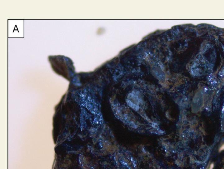
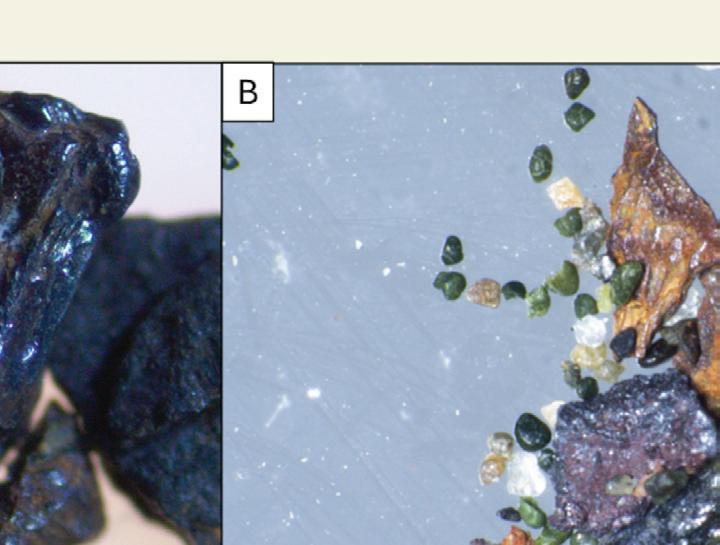
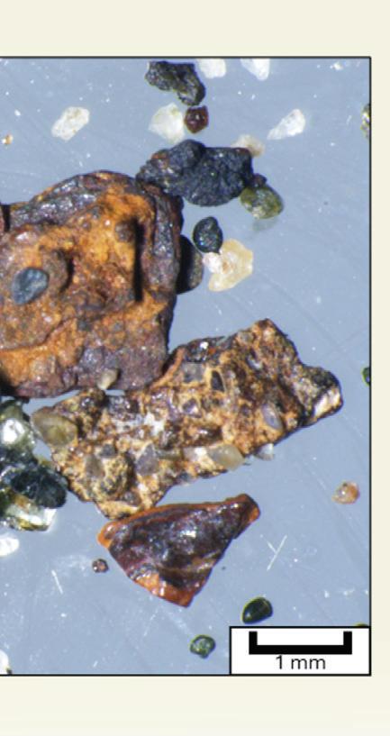
Heavy fighting also occurred across the other landing beaches, with particularly intense resistance at Juno and Sword. Despite all these challenges, by nightfall on June 6, all five beachheads had been secured and Allied units were advancing inland from the shoreline. The invasion came at significant cost, however, with approximately 10,000 Allied casualties on D-Day, including about 4,400 killed, wounded, or missing across the Normandy front (Harrison, 1951; Balkoski, 2004). Fighting was severe enough to leave behind traces of shrapnel in the sand of every landing beach, which was documented as recently as 2025, more than 80 years after D-Day (Figure 7, Hudson et al. 2025).
Figure 6.
The fragments of shrapnel essentially became a technofossil in the Anthropocene layer.
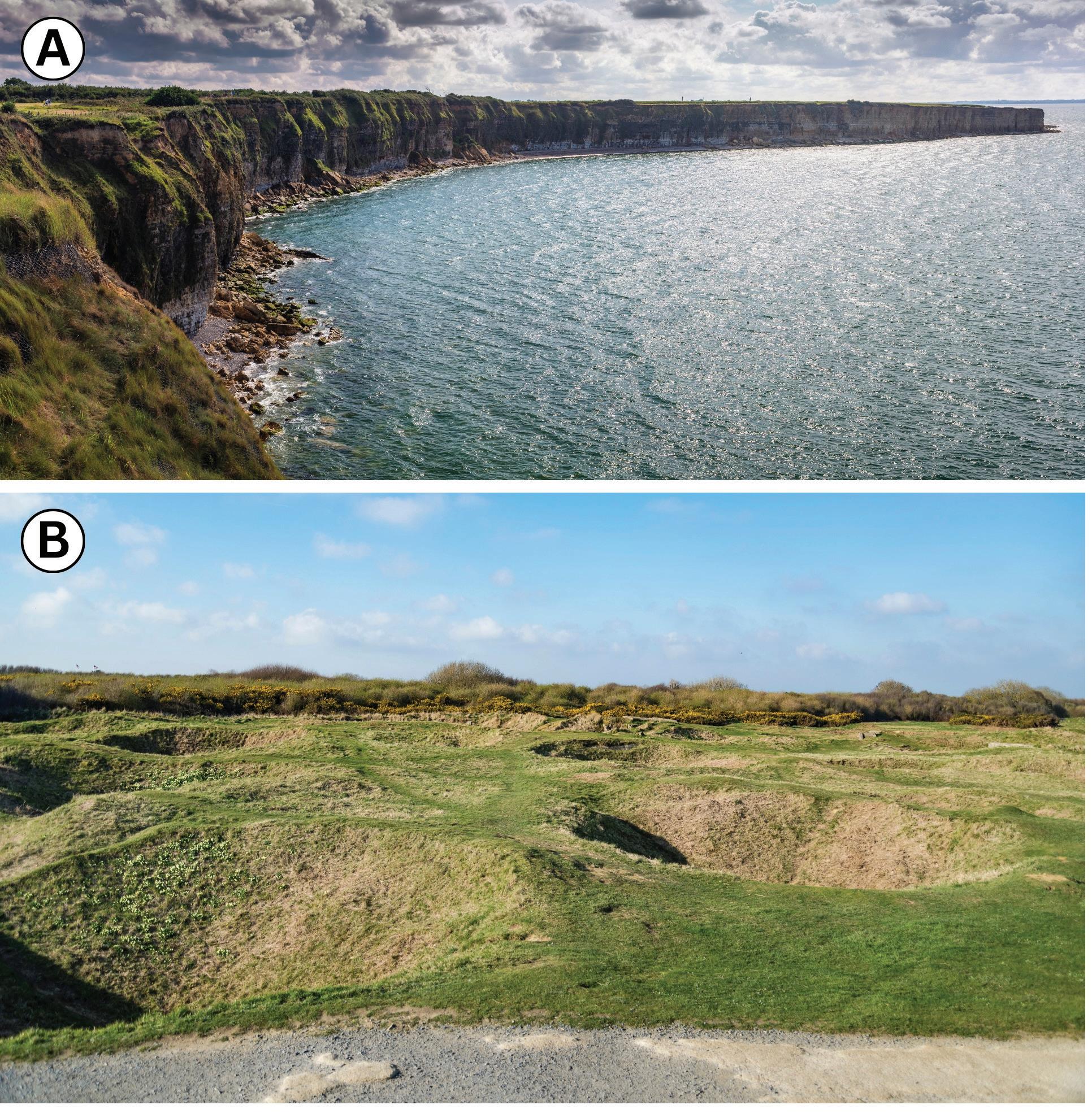
Not every landing point was accessible by foot. Pointe du Hoc (Figure 8) was situated between Utah Beach and Omaha Beach atop a cliff of Middle Jurassic limestones and marls of the Marnes de Port Formation and the overlying Creully Limestone (Udphuay et al., 2011). This prominent cliff-top position was believed to be heavily fortified by German forces, and it was an important target on D-Day. American Army Rangers undertook a daring assault to scale the cliffs and capture Pointe du Hoc. Upon reaching the top, they discovered that the guns had been removed and were positioned in a field behind the cliffs, where they had been deactivated. The landscape there still bears scars from intense bombardment, a phenomenon sometimes referred to as “bombturbation” (Figure 8b; Hupy & Schaetzl, 2006).
Following the successful landings, geoscientists continued to critically support Allied force operations. They oversaw the drilling of water wells to provide potable water for soldiers and identified various suitable locations for constructing temporary airfields. In addition, geologists and the Quarry Group of the Royal Engineers used previously prepared detailed topographic and geological maps to identify sources of local rock suitable for road construction. This involved deployment of quarrying companies to extract aggregates for building roads and airfields to support the heavy mechanized vehicles of the Allied advance (Rose et al. 2006; Rose & Clatworthy, 2008).
Figure 7. Images of shrapnel found within the beach sand of (A) Sword Beach and (B) Utah Beach, eighty years after the invasion of Operation Overlord. Both are magnetic and iron-rich.
Figure 8.
(A) Cliffs at Pointe Du Hoc. Army Rangers were tasked with the dangerous mission of scaling these Jurassic-aged limestone cliffs under enemy attack.
(B) Craters near the fortifications at Pointe Du Hoc show an example of “Bombturbation.”
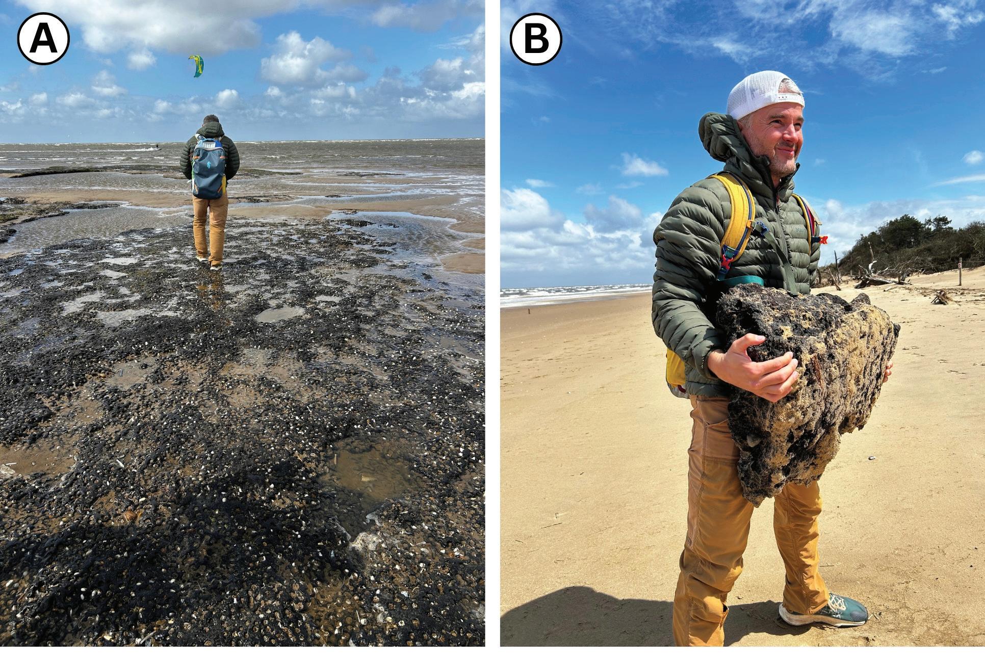
(A) Geologist walks across the exposed soft peat. White dots are boring bivalves.
(B) Due to the low density of the peat, large chunks can be easily picked up. This low density contributes to its unsuitability in supporting the weight of large tanks and vehicles. We did not observe any peat at the D-Day beaches of Normandy.
A GEOLOGICAL LEGACY: SEDIMENTOLOGY ON THE 80TH ANNIVERSARY OF D-DAY
Even decades later, the geology of D-Day continues to tell its story. In 2011, two geologists published results from a sample of Omaha Beach sand in which they found sand-sized shrapnel, likely dating back to D-Day and subsequent activity from WWII (McBride and Picard, 2011; Hudson et al. 2025). While their study was limited to a single beach sample, it highlighted the persistence of wartime debris in the sand. In June of 2024, a geologic crew consisting of co-authors of this article embarked on a field excursion to collect samples on the D-Day beaches to mark the 80th anniversary of the attack (Morgan, 2024; Hudson et al., 2025; Jenson, 2025). Over 300 samples were collected for lab analysis, but it was apparent even in the field that metallic shrapnel was common in the beach sand (Figure 5a). This confirmed that even after 80 years, the shrapnel still persists in the sand as a reminder of the war (Figure 7).
The detection and distribution of this shrapnel is not only historically interesting, but also scientifically significant. Lab analyses show that anthropogenic metal is distributed across all of the D-Day beaches. Metal concentrations increase below the high tide line, aligning with areas of higher energy, perhaps due to winnowing of lighter minerals. In core samples, metal fragments show an abrupt decrease at around 45 cm of burial depth, providing a key time marker that can be used to estimate sedimentation rates on the beaches. D-Day provides a precise time marker, which helps provide an estimated sediment accumulation rate of approximately 0.57 cm/year (Hudson et al. 2025).
In addition to field work along the Normandy coastline as part of this study, samples were taken and observations made at Brancaster Beach in Norfolk, England. This beach was chosen as an analogue by Shotton
and his team prior to Operation Overlord, and sediment samples were collected by the authors to test the appropriateness of this beach for that purpose. Several key observations at Brancaster confirm Shotton’s choice of this beach as an appropriate analogue: 1) the fine to mediumgrained quartz-rich sand was similar to sand observed on the D-Day beaches; 2) the low gradient and high tidal range created a very wide beach at low tide, similar to the D-Day beaches; and 3) the grain size, composition, and water saturation created a firm substrate, ideal for supporting large vehicles, similar to the D-Day beaches.
The only major discrepancy between Brancaster beach and the D-Day beaches was related to peat bogs, which are common at the low tide line at Brancaster Beach. These peat horizons are related to sea-level drop associated with Holocene glaciation across Europe, and they emerge at low tide at Brancaster (Figure 9; Bailey et al. 2020). The presence of peat was of significant concern to the Allies, as tanks were prone to getting stuck in peat bogs. Shotton attempted to map peat bogs on French beaches, and he even made low-altitude flights over French beaches himself in an attempt to observe peat bogs (Rose et al., 2006; Rose & Clatworthy, 2008). They even attempted to identify subsurface peat from bomb craters. RAF bombers dropped bombs over both Normandy and Brancaster beaches to observe and compare, but results were inconclusive (Rose & Clatworthy, 2008; COPP Survey, n.d.). The peat was part of the selection of Brancaster as a primary analogue beach for D-Day; however, in our field work, no peat was observed in the D-Day beaches of Normandy.
Figure 9. Images taken at Brancaster Beach showcasing the peat that posed great concern for the Allies.
CONCLUSION
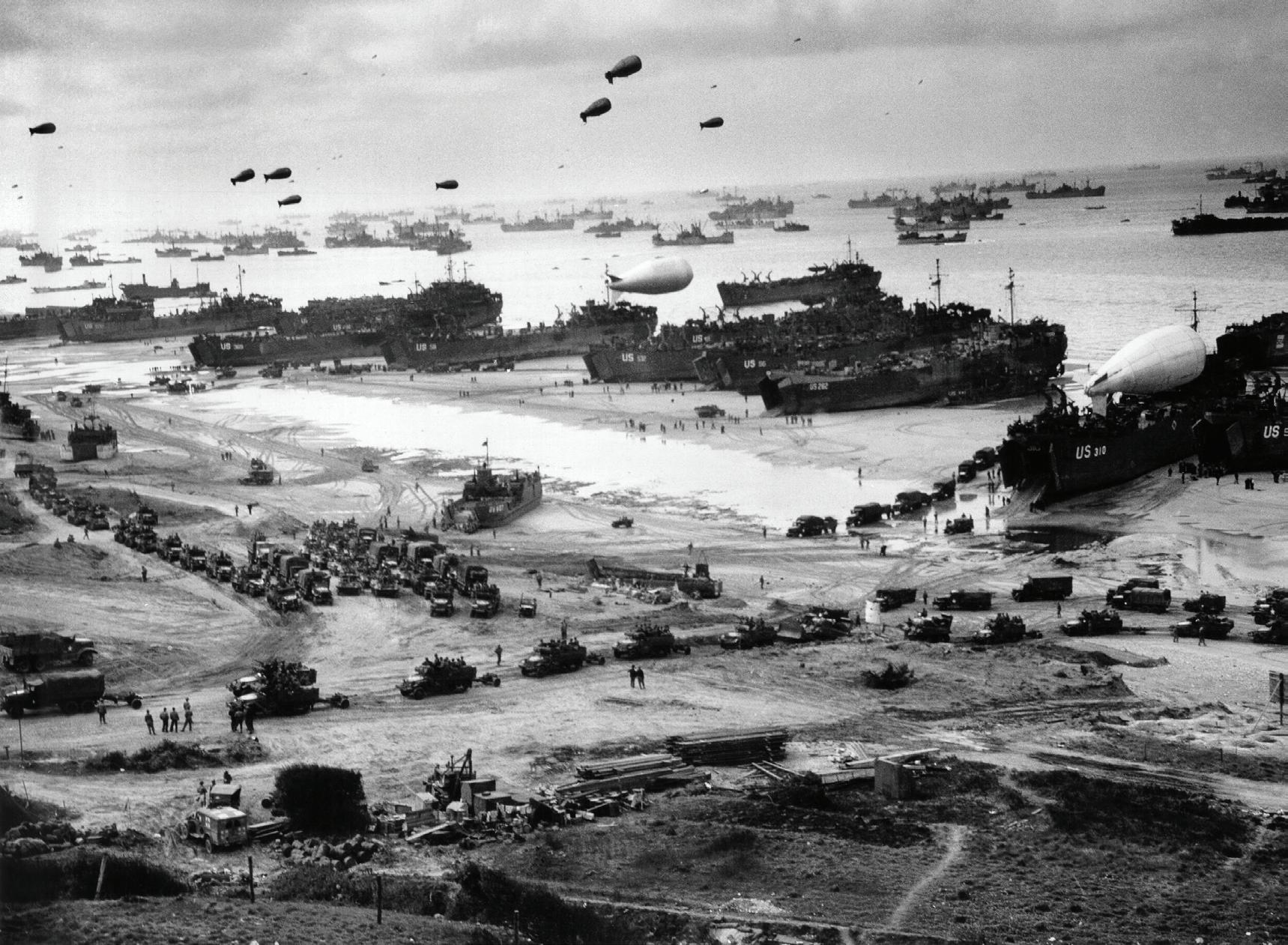
Geological and other scientific advisors played a decisive role in the success of D-Day. From selecting viable landing sites to sustaining advancing forces, geoscientific insight shaped the invasion at every stage. These preparations were essential to the success of the landings and marked a turning point in World War II (Figure 10). After the successful D-Day invasion, Paris was liberated in just over two and a half months, and the war in Europe ended 11 months later, on May 8, 1945 (Harrison, 1951; Stacey, 1960).
The failure at Dieppe underscored the consequences of ignoring geological conditions. Flint clasts eroded from Cretaceous chalk cliffs created an inaccessible beach that contributed to a devastating defeat. In contrast, the careful planning behind Operation Overlord, guided by scientists and informed by the landscape, greatly improved the chances of success. J.D. Bernal and Fred Shotton led these efforts, which included preparing geologic and topographic maps, assessing terrain, mapping inland water sources, identifying suitable locations for roads and temporary airfields, and analyzing beaches for invasion suitability (Rose et al., 2006; Rose & Clatworthy, 2008). They eventually selected the
Normandy beaches, choosing sites that could support heavy mechanized vehicles, allow inland egress, and provide accessible fresh water. While D-Day still came at a high cost, casualty rates were far lower than at Dieppe, demonstrating the value of careful planning and geoscientific preparation. On D-Day, approximately 156,000 Allied troops landed in Normandy. Fighting was intense, resulting in 4,414 deaths. However, this was only a fatality rate of approximately 2.8%, and a total casualty rate of 6.4–6.7% (Commonwealth War Graves Commission [CWGC], 2024; U.S. National Archives, 2025), which is significantly lower than at Dieppe, where the Canadians suffered a fatality rate of 18% and total casualty rate of 68%.
Though often overlooked, the contributions of geologists were integral to this outcome. Working alongside soldiers, scientists, and engineers, their insights and analyses helped shape the planning and decisions that paved the way for the liberation of Western Europe. D-Day was not won by strategy and courage alone, it was also won by a deep understanding of the landscape itself, demonstrating that even in war, leveraging science can shift the course of history.
10.
Image taken at Omaha Beach between June 7 and 10, 1944, illustrating the scale of the buildup after the initial assault and the large number of vehicles moving successfully across the beachhead. Landing ships unload cargo at low tide while Coast Guard–manned LSTs, including LST-262 and LST-532, lie beached, with barrage balloons overhead and Army vehicles forming up on the sand. Photograph from the United States Coast Guard Collection, National Archives and Records Administration; image hosted by the Naval History and Heritage Command (public domain). Compare with Figure 3 (Dieppe), where coarse flint gravel impeded vehicle mobility and frequently caused immobilization or thrown tracks.
Figure
Author’s Acknowledgement: We will never forget what was asked and what was given on D-Day. Thousands answered a call greater than themselves, stepping into history with courage and resolve. To those who served, and to those who never returned, we owe a debt of gratitude and remembrance that can never be repaid, only honoured. Their legacy endures in the freedoms we live each day.
This topic hits close to home as three of this article’s authors have served in the military, and most of the authors have family who served in WWII. Richard Mackenzie and Paul Bremner are both veterans of the US Air Force. Richard is a sixth-generation American soldier whose father fought in Vietnam and grandfather landed on Omaha Beach. His son currently serves in the US Air Force.
Sean Fletcher currently serves with the Calgary Highlanders as a senior Infantry Officer. Along with his own service, Sean is also a seventh-generation Canadian soldier whose father and grandfather both served honourable careers in the post-war era. His great-grandfather and great-great-grandfather served in World War II and World War I, respectively.
Glen Burridge’s grandfather fought for the British Army and landed on either Gold or Sword beach. Sam Hudson’s grandfather fought in the Pacific Theater of Operations of WWII. Dallin Laycock’s great-grandfather served in WWII in Italy. Erin Pemberton’s paternal grandfather and great-uncle served in the Royal British Navy throughout WWII, and her maternal grandfather served in the Royal British Air Force in the Mediterranean Theater of Operations throughout WWII. Additionally, Erin’s close family friend, George Burton Thomson, landed on Juno Beach with the Royal Canadian Infantry. Thank you for your service. We stand in silence for those who answered the call.
REFERENCES AND SUGGESTED READINGS:
Aliyu, M. M. (2016). The origin and properties of flint in the Upper Cretaceous Chalk (Doctoral dissertation, University of Leeds).
Ambrose, S. E. (1994). D-Day: June 6, 1944—The climactic battle of World War II. Simon & Schuster.
Bailey, G., Momber, G., Bell, M., Tizzard, L., Hardy, K., Bicket, A. … & Hale, A. (2020). Great Britain: The intertidal and underwater archaeology of Britain’s submerged landscapes. In: The archaeology of Europe’s drowned landscapes (pp. 189–219). Springer International Publishing.
Balkoski, J. (2004). Omaha Beach: D-Day, June 6, 1944. Stackpole Books. Boggs, S., Jr. (2011). Principles of sedimentology and stratigraphy (5th ed.). Pearson.
Brown, A. (2005). J. D. Bernal: The sage of science. Oxford University Press. Canadian War Museum. (n.d.). Canada at D-Day, 1944. https://www. warmuseum.ca
Carter, R. W. G. (1988). Coastal environments: An introduction to the physical, ecological and cultural systems of coastlines. Academic Press.
Chadwick, R. A. (1993). Aspects of basin inversion in southern Britain. Journal of the Geological Society, 150, 311–322.
Combined Operations Pilotage Parties (COPP) Survey. (n.d.). December 1943 reconnaissance and beach surveys. Retrieved March 14, 2026, from https://www.coppsurvey.uk/december-1943.
Commonwealth War Graves Commission. (2024, May 29). D-Day casualties: Stories behind the numbers. https://www.cwgc.org.
Costa, S., Maquaire, O., Letortu, P., Thirard, G., Compain, V., Roulland, T., ... & Antoine, R. (2019). Sedimentary coastal cliffs of Normandy: Modalities and quantification of retreat. Journal of Coastal Research, 88(SI), 46–60. D-Day Center. (2024). The role of paratroopers on D-Day: Behind enemy lines in Normandy. https://www.dday.center/the-role-of-paratroopers-ond-day.
D-Day.org. (n.d.). Pointe du Hoc. https://www.dday.org/ Ellis, L. F. (1962). Victory in the West: Volume I. The battle of Normandy. HM Stationery Office.
European Geological Data Infrastructure. (2025). EGDI map viewer: PanEuropean surface geology (1:1,000,000 lithology) [Interactive map]. https:// www.europe-geology.eu/
Gupta, S., Collier, J. S., Palmer-Felgate, A., & Potter, G. (2007). Catastrophic flooding origin of shelf valley systems in the English Channel. Nature, 448, 342–345. https://doi.org/10.1038/nature06018
Hancock, J. M. (1975). The petrology of the Chalk. Sedimentology, 22, 137–166.
Harrison, G. A. (1951). Cross-channel attack. Department of the Army. Henry, C. (2000). Churchill infantry tank 1941–51. Osprey Publishing. Hudson, S., Laycock, D., Pemberton, E., Burridge, G., Grover, C., Ramirez, K., Tatum, O., & Robinson, J. (2025, April). Using the “War Sands” of World War II as tracers of geomorphic processes and rates—Sedimentology on the 80th anniversary of the Allied invasion of Normandy, France. In: EGU General Assembly 2025.
Hupy, J. P., & Schaetzl, R. J. (2006). Introducing “bombturbation,” a singular type of soil disturbance and mixing. Soil Science, 171(11), 823–836. https:// doi.org/10.1097/01.ss.0000228053.08087.19
Jenson, M. (2025, June 5). Geology meets history: BYU professor studies WWII shrapnel on Normandy beaches. BYU News. https://news.byu.edu/ intellect/geology-meets-history-byu-professor-studies-wwii-shrapnel-onnormandy-beaches
Komar, P. D. (1998). Beach processes and sedimentation (2nd ed.). Prentice Hall.
Morgan, G. (2024, December 30). When sand tells a story / D-Day 80 years later. ConocoPhillips SpiritNow. https://www.conocophillips.com/ spiritnow/story/when-sand-tells-a-story-d-day-80-years-later/
Rose, E. P. F., & Clatworthy, J. C. (2008). Fred Shotton: A “hero” of military applications of geology during World War II. Quarterly Journal of Engineering Geology and Hydrogeology, 41(2), 171–188. https://doi. org/10.1144/1470-9236/07-034
Rose, E. P. F., & Nathanail, C. P. (2000). Geology and warfare: Examples of the influence of terrain and geologists on military operations. Geological Society of London.
Rose, E. P. F., & Pareyn, C. (1995). Geology and the liberation of Normandy, France, 1944. Geology Today, 11(2), 58–63.
Rose, E. P., Clatworthy, J. C., & Nathanail, C. P. (2006). Specialist maps prepared by British military geologists for the D-Day landings and operations in Normandy, 1944. The Cartographic Journal, 43(2), 117–143.
Shepherd, J. (2019, May). D-Day landing at Omaha Beach. Warfare History Network. https://warfarehistorynetwork.com/article/d-day-landing-atomaha-beach/
Stacey, C. P. (1960). The victory campaign: The operations in North-West Europe 1944 to 1945. Queen’s Printer and Controller of Stationery.
U.S. Army. (n.d.). D-Day—Operation Overlord. https://www.army.mil/dday/history.html
U.S. Army Center of Military History. (1994). Strategic planning for coalition warfare, 1943–1944. U.S. Government Printing Office.
U.S. National Archives. (2025, July 9). Records relating to D-Day. https:// www.archives.gov
Udphuay, S., Günther, T., Everett, M. E., Warden, R. R., & Briaud, J. L. (2011). Three-dimensional resistivity tomography in extreme coastal terrain amidst dense cultural signals: Application to cliff stability assessment at the historic D-Day site. Geophysical Journal International, 185(1), 201–220.
Veterans Affairs Canada. (2026, March 11). D-Day and the Battle of Normandy. https://www.veterans.gc.ca
Weigley, R. F. (1981). Eisenhower’s lieutenants: The campaign of France and Germany, 1944–1945. Indiana University Press.
Whitaker, W. D., & Whitaker, S. (1992). Dieppe: Tragedy to triumph. McGraw-Hill Ryerson.
My CEGA Story: Volunteer Spotlight
My CEGA Story: Volunteer Spotlight
My CEGA Story: Volunteer Spotlight
Scott Norlin
cott Norlin
Scott Norlin
INTRODUCTION
NTRODUCTION
INTRODUCTION
Since 2016, Scott has been a cornerstone of CEGA’s volunteer community, consistently stepping up wherever leadership and dedication are needed most. In his professional role as Senior Research Manager at Wood Mackenzie, he remains actively engaged in the broader energy industry while dedicating significant time to CEGA’s initiatives.
Scott has been a cornerstone of CEGA’s volunteer community, consistently epping up wherever leadership and dedication are needed most. In his professional role as esearch Manager at Wood Mackenzie, he remains actively engaged in the broader try while dedicating significant time to CEGA’s initiatives.
Since 2016, Scott has been a cornerstone of CEGA’s volunteer community, consistently stepping up wherever leadership and dedication are needed most. In his professional role as Senior Research Manager at Wood Mackenzie, he remains actively engaged in the broader energy industry while dedicating significant time to CEGA’s initiatives.
From serving as Chair of SIFT to continuing as a committed committee member, Scott plays a pivotal role in delivering one of CEGA’s most impactful student programs, leading the exploration game and four-day field trip that leave a lasting impression on participants.
serving as Chair of SIFT to continuing as a committed committee member, Scott plays a al role in delivering one of CEGA’s most impactful student programs, leading the ation game and four-day field trip that leave a lasting impression on participants.
From serving as Chair of SIFT to continuing as a committed committee member, Scott plays a pivotal role in delivering one of CEGA’s most impactful student programs, leading the exploration game and four-day field trip that leave a lasting impression on participants.
Beyond SIFT, Scott has also served as CEGA’s Finance Director and chaired the Young Professionals Committee, contributing across the organization with enthusiasm and commitment.
ond SIFT, Scott has also served as CEGA’s Finance Director and chaired the Young essionals Commit ee, contributing across the organization with enthusiasm and ommitment.
Beyond SIFT, Scott has also served as CEGA’s Finance Director and chaired the Young Professionals Committee, contributing across the organization with enthusiasm and commitment.
This month, we ’ re proud to spotlight Scott Norlin and learn more about what keeps him engaged year after year.
This month, we ’ re proud to spotlight Scott Norlin and learn more about what keeps him engaged year after year
This month, we ’ re proud to spotlight Scott Norlin and learn more about what keeps him engaged year after year
Q&A with
Scott
&A with Scott
Q&A with Scott
1. Q: Scott, what inspired you to first get involved with CEGA?
ott, what inspired you to first get involved with CEGA?
1. Q: Scott, what inspired you to first get involved with CEGA?
A: “My involvement with CEGA really began as a participant at SIFT in 2016. After attending, I was keen to get involved and volunteer and I haven't looked back, with expanded roles across the Young Professionals group, SIFT itself as both a co-Chair and volunteer and more recently as a member of the Board. Through my time in these positions, it is clear that the geoscience community is special and the generosity and genuine desire to share experiences across generations is what motivates me.”
A: involvement with CEGA really began as a participant at SIFT in 2016. After attending, I was keen to get involved and volunteer and I en't looked back, with expanded roles across the Young Professionals group, SIFT itself as both a co-Chair and volunteer and more tly as a member of the Board. Through my time in these positions, it is clear that the geoscience community is special and the osity and genuine desire to share experiences across generations is what motivates me.”
2. Q: What does being a CEGA member mean to you, professionally and personally?
A: “My involvement with CEGA really began as a participant at SIFT in 2016. After attending, I was keen to get involved and volunteer and I haven't looked back, with expanded roles across the Young Professionals group, SIFT itself as both a co-Chair and volunteer and more recently as a member of the Board. Through my time in these positions, it is clear that the geoscience community is special and the generosity and genuine desire to share experiences across generations is what motivates me.”
A: “CEGA is somewhere that has allowed me to develop skills and friendships that I cherish. At the same time, I have been able to help to showcase the importance of the community to students across Canada through volunteering with some amazing people.”
2. Q: What does being a CEGA member mean to you, professionally and personally?
A: “CEGA is somewhere that has allowed me to develop skills and friendships that I cherish. At the same time, I have been able to help to showcase the importance of the community to students across Canada through volunteering with some amazing people.”
3. Q: How has CEGA influenced your professional growth?
3. Q: How has CEGA influenced your professional growth?
A: “CEGA is somewhere that has allowed me to develop skills and friendships that I cherish. At the same time, I have been able to help to showcase the importance of the community to students across Canada through volunteering with some amazing people.”
3. Q: How has CEGA influenced your professional growth?
A: “CEGA has helped me build a strong network of passionate individuals and provides access to some of the best educational opportunities available to geoscientists in Canada.”
A: “CEGA has helped me build a strong network of passionate individuals and provides access to some of the best educational opportunities available to geoscientists in Canada.”
4. Q: Fun fact about you?
4. Q: Fun fact about you?
o you, professionally and personally? GA case GA GA ailable ou?
A: “CEGA has helped me build a strong network of passionate individuals and provides access to some of the best educational opportunities available to geoscientists in Canada.”
A: “I spent a chunk of time in the Naval Reserve and my hidden talent from that time is Morse Code. Not exactly practical these days, but it comes in handy in an escape room every once in a while.”
4. Q: Fun fact about you?
Thank you, Scott, for your continued leadership and commitment to CEGA. We’re grateful for everything you bring to the community
A: “I spent a chunk of time in the Naval Reserve and my hidden talent from that time is Morse Code. Not exactly practical these days, but it comes in handy in an escape room every once in a while.”
Code. exactly ape
A: “I spent a chunk of time in the Naval Reserve and my hidden talent from that time is Morse Code. Not exactly practical these days, but it comes in handy in an escape room every once in a while.”
Thank you, Scott, for your continued leadership and commitment to CEGA. We’re grateful for everything you bring to the community
Thank you, Scott, for your continued leadership and commitment to CEGA. We’re grateful for everything you bring to the community
for you the
2025 STANLEY SLIPPER AWARD
STANLEY E. SLIPPER GOLD MEDAL
OUTSTANDING CAREER CONTRIBUTIONS TO OIL AND GAS EXPLORATION IN CANADA
The recipient of the 2025 Stanley Slipper Gold Medal Award is Dr. Peter E. Putnam, in recognition of his outstanding career as a geologist, business and technology leader, founder, strategic thinker, and explorationist.
DR. PETER E. PUTNAM
Dr. Putnam’s career currently spans more than 46 years in Canada and internationally. Peter has worked in public and private companies, in roles including technical research, operations, executive management, board member, and board chairman. He is well known from his years at Petrel Robertson Consulting Ltd. (PRCL), where he initiated and completed many geological programs with clients, including the strategy and acquisition programs of two private junior companies, OSUM Oil Sands Corp. (OSUM) and Central European Petroleum Ltd. (CEP). He has volunteered many hours with professional societies and served in an adjunct professor position at the University of Calgary. Dr. Putnam’s many contributions make him an outstanding recipient for the 2025 Stanley Slipper Gold Medal.
Dr. Putnam received his BSc in Geology from Brock University (1977) and his M.Sc. in Geology from the University of Calgary (1979). Peter worked closely with Dr. Derald Smith on refining the anastomosing fluvial model of stacked channels. His first paper was published in 1979 with Derald Smith, and Peter accepted a full-time position at Husky Oil Operations. In 1980, Peter and Derald jointly presented the new model at a luncheon talk organized by the CSPG. They were awarded the 1981 CSPG Link Award for the best oral presentation at a technical lunch.
In 1982, Peter decided to pursue his PhD full-time at the University of Calgary, while continuing to be a full-time employee at Husky. His PhD thesis was completed in 1985 and is titled “Reservoir Origin and Controls on Hydrocarbon Distributions Interpreted with a Computerized Data Base, Lower Cretaceous Mannville Group, West-Central Saskatchewan.”
Peter’s time at Husky was spent working in its heavy oil division in the Lloydminster area. He quickly became an early leader in computer mapping techniques that resulted in the discovery of new oil and gas pools in the Cretaceous continental formations. Dr. Ian MacIlreath writes that Peter “pioneered computer-generated time slice maps to unravel stacked fluvial channels in the subsurface.” Peter was promoted to the role of Husky’s section leader of the Saskatchewan Exploration and Development Group, Heavy Oil Division. Peter credits Drs. Smith and Hopkins as being the “biggest influences as to understanding field relationships and assessing modern and outcrop settings,” which laid the foundation for one of Peter’s fundamental thought processes: “the exploration ethos of just going somewhere to investigate things one knows nothing about.” He was also influenced by Dr. Edward Klovan, a professor and Husky colleague, during their collaboration from 1981 to 1984.
Through his CSPG volunteer work in 1983, Peter met Dr. Neil Hutton, who was CSPG President and president of PRCL. In 1985 Peter accepted employment with PRCL, a company where he felt “one could work on anything anywhere in the world insofar as someone would pay for it.” At PRCL, Dr. Putnam used his computer skills to delineate significant channel/valley trends in Cretaceous continental successions. Peter authored numerous technical studies detailing oil and gas exploration opportunities in Western Canada. He designed and presented many field and core lab courses to industry professionals.
In 2002, Peter became president of PRCL and organized a paradigm shift. He realized that many junior companies wanted access to investment opportunities, not just the reports generated from Petrel’s large proprietary geological and seismic databases. PRCL subsequently adapted its business model to create investment opportunities for clients in return for long-term consulting engagements and successbased compensation in the form of stock options.
A major PRCL international strategy was subsequently initiated in 2004 when Dr. Putnam created the concept of parcels of three-country blocks where “one politically stable country is the anchor with common geology across borders (with) proven production with exploration upside.” His work also identified prospective areas within post-communist East and Central Europe.
Dr. Brad Hayes writes that “Dr. Putnam was also a significant technical contributor to the critical gas-over-bitumen (GOB) hearings in the early 2000s, which defined important relationships between owners of bitumen rights and owners of gas production rights in Northeastern Alberta.” Peter was an expert witness in other regulatory and legal proceedings.
After the GOB hearings Peter met two senior executives of OSUM, Michael Kobler and John Watson, and convinced them to convert OSUM from a service company to an oil and gas operator. Peter became the “architect” of OSUM’s new business model.
Dr. Putnam decided to leave PRCL in 2005 and direct his career through his family company Hay Valley Resources. Peter joined OSUM’s board in 2005 and became co-founder of CEP in 2006. Peter oversaw OSUM’s acquisition and appraisal of bitumen leases in the Grosmont carbonates at Saleski and Mannville sandstones at Cold Lake. Shawna Christensen, retired Husky/Petrel/OSUM colleague, writes that Peter “guided the company in raising capital and discovering, delineating, and developing significant bitumen resources in the Cold Lake area.” By 2021, OSUM was producing up to 22,000 bopd (3500 m3/d) from Mannville sandstones, and the company was acquired by Strathcona Resources.
In 2006 Dr. Putnam became Chairman of CEP. Shawna Christensen notes that Peter was “instrumental in conceptualizing, fundraising, and delineating a dolomite play in the Zechstein Basin of Germany and Poland.” The small startup acquired oil and gas rights over one million acres of land and shot 3D surveys in the formerly communist eastern Germany and Poland. Eight wells were drilled in eastern Germany resulting in the 2016 Guhlen gas discovery. CEP spudded its first Polish well in 2024 in the Baltic Sea. In February 2025 CEP announced its Wolin East 1 oil discovery in offshore Poland, which has greater than 500 million barrels in place (80 million m3) and 180 million recoverable barrels (29 million m3). Brad Hayes writes that “the recent Polish
discovery is one of the most significant hydrocarbons finds in continental Europe over the past decade.”
During his career, Dr. Putnam spent countless hours volunteering with geoscience organizations. He was a member of the CSPG Executive (1983, 1992–1994), served as president in 1993, and awarded a CSPG Honorary Membership in 2013. Peter has also volunteered in several roles for many geoscience organizations: associate and book review editor of the CSPG Bulletin (1984–1988); Distinguished Lecturer Committee member for the American Association of Petroleum Geologists (AAPG); CSPG President’s Award Committee Chair (1993); member of the CSPG National Liaison Committee (1994); liaison member for the Canadian Geoscience Council (1994–1995); member of the committee advising the provincial and federal governments on the future of government geoscience in Alberta (1994–1995); member of the Educational Trust Fund Committee (1995–1996); councillor for the Association of Professional Engineers and Geoscientists of Alberta (APGEGA) (2000–2003); and member of the Canadian Oil and Gas Handbook (COGEH) chapter on oil sands under the auspices of the Alberta Securities Commission (2005–2006).
Dr. Putnam lectured extensively in public, industry, and university settings. During 2000–2007, Peter served as an Adjunct Professor in Geology at the University of Calgary and as a member of the Selection Committee for the Dean of Graduate Studies (2001). Peter also authored or co-authored numerous published papers. He presented oral papers and posters at many CSPG and AAPG conventions, covering a broad range of applied geology topics for siliciclastics and carbonates, including stratigraphy, sedimentology, reservoir characteristics, pressures, and thermal recovery. The geographical coverage of his publications includes Canada, the United States, Australia, and Yemen. Peter also continued to organize industry field trips along the Columbia River and to the Willapa Bay estuary in Washington State.
Throughout his career, Dr. Putnam distinguished himself in many aspects of the application of energy geoscience knowledge. Ian MacIlreath writes that “Peter has boldly championed out-of-the-box ideas to advance our industry.” He shared that passion and knowledge with innumerable students and fellow industry workers over many decades in excellent lectures, core workshops, and field trips.
Dr. Putnam wishes to acknowledge the input, support, and insights provided by a host of geoscientists and corporations, through team efforts, especially with those people he met through CEGA/CSPG. A few examples would include Brad Hayes, Neil Hutton, and, more recently, Marcelina Labaj who “became a key contributor to CEP’s exploration success in Poland.” Peter advises geoscientists to be unafraid to go to new jurisdictions.
Peter would like to acknowledge the incredible support of his life’s partner, Trish, to provide a stable home “base” despite his prolonged global wanderings to pursue his intellectual passions over the decades.
In summary, Dr. Peter Putnam has excelled at being an outstanding leader to the petroleum geoscience community while generating commercial successes in the oil and gas industry both in Canada and abroad. His success in initiating and guiding exploration and development programs using pioneering geological ideas, his exceptional professional and business vision, and ongoing mentorship make him the deserving recipient of the CSPG Stanley Slipper Gold Medal for 2025
2025 PRESIDENT’S AWARD
MARIAN J. WARREN
OUTSTANDING SERVICE BY A CEGA MEMBER
CEGA is proud to honour Dr. Marian Warren with the 2025 President’s Award. Marian is recognized for her outstanding contributions to the understanding of structural geology and its importance in exploration and development, particularly in the Alberta Basin, but also for her significant teaching efforts spanning several decades. Marian is widely respected for combining deep technical expertise in structural geology with practical teaching and professional training that has influenced exploration geologists, petroleum geoscientists, and students. Marian, together with Mark Cooper, has taught more courses for CEGA than any other instructor over the past 10 years. Marian has also served on CEGA committees, served as chair to organize conference sessions on integrated tectonics and sedimentation, and, most recently, has been an active member of the R.J.W. Douglas medal committee. Marian holds undergraduate degrees in geology and astronomy/ physics. She served as an astronomical observatory technician and instructor in astronomy at Williams College, Massachusetts, before completing an MSc in Geology at the University of Vermont and a PhD at Queen’s University, Ontario (1997), with a thesis in southern Canadian Cordilleran tectonics. She subsequently worked at EnCana as a geologist, seismic interpreter, and structural specialist for Western Canada Sedimentary Basin (WCSB) and international/frontier projects, and successfully tested structurally influenced new plays in the Alberta basin. She also provided structural geology courses for EnCana and served on domestic and international technical peer-review committees.
Marian became an independent consultant in 2008 (Jenner GeoConsulting Inc.), focusing on exploration projects worldwide in structurally complex settings and on developing and presenting industry training courses and field trips. Consulting projects within the last few years have included assessing components of naturally fractured plays and reservoirs in several locations in Europe, the Middle East, and the Americas, as well as conventional fold-thrust exploration. Her consultancy was also affiliated with consultancy Rock Deformation Research in Leeds, UK (from 2009 until its sale in 2014), whose activities focused on characterizing reservoirscale deformation and its impact on fluid flow. In addition to a traditional structural focus, Marian continues to develop her key interest in the interaction between structure and sedimentation and the implications for commercial play elements.
Marian was a co-recipient of the CSPG Medal of Merit, winner of the AAPG Matson Award, and she has served as an AAPG Distinguished Lecturer in North America. She is more recently a co-winner of the 2022 CSPG Pemberton Award for best Core Conference presentation, featuring an integrated stratigraphic and structural approach to successful Mississippian exploration in the Alberta Basin. She also now co-teaches a structural module for the University of Alberta Integrated Petroleum Geosciences MSc program.
Marian represents a CEGA member who has made a committed effort not only to advancing structural geology but strengthening geoscience education and professional development.
2025 TRACKS AWARDS
MEMBERS WHO HAVE SET NEW STANDARDS IN EXCELLENCE
IAN THEUNISSEN
Ian Theunissen’s passion for geology was shaped early through countless camping and hiking trips in the Canadian Rockies, where he developed a lifelong curiosity about how these vast landscapes were formed. He completed his studies at the University of Calgary, graduating in 2003 with a BSc degree, majoring in geology. Ian began his professional career as a wellsite geologist, working on drilling operations across Alberta.
Ian joined the CSPG immediately following graduation and has remained an active member ever since. Over the years, he has participated in numerous society events, including technical luncheons, sporting events, and multiple GeoConventions, and he was a presenter at the 2021 CSPG GeoConvention.
Throughout his career, Ian has demonstrated a strong commitment to community building and volunteerism. While employed at Statoil, he served on the company’s social club
TRACY THEUNISSEN
Tracy Theunissen began her geoscience career at Penn West Petroleum after graduating from the University of Calgary. Her role at Penn West was both dynamic and innovative, allowing her to develop a broad skill set while working on numerous Pembina assets and spearheading several successful drilling programs.
Within her first year at Penn West, Tracy became an active member of its social club committee, where she helped plan and organize events that fostered a strong sense of community within the organization. These initiatives brought together individuals from diverse disciplines in fun and engaging ways— connections that may not have otherwise occurred during the workday. Since graduating from university, Tracy has been actively involved with CEGA, volunteering her time as a student member at the GeoConvention and regularly attending industry events, conferences, and technical talks to expand both her professional development and peer network.
committee, organizing events that fostered engagement and strengthened workplace culture. At his current employer, Vermilion Energy, Ian has embraced opportunities to give back through the company’s “Days of Caring” initiative and has volunteered extensively with organizations such as the Calgary Drop-In Centre, the Calgary Zoo, Wood’s Homes, and Habitat for Humanity.
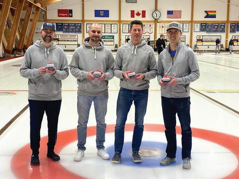
Ian became involved in volunteering for CEGA when he was approached by his wife and a close friend with the idea of organizing a bonspiel through the society. A curler of more than a decade, he immediately recognized the opportunity to create an inclusive, community-focused event that combined his passion for the sport with his desire to give back to the organization that contributed significantly to his professional and personal development. This commitment ultimately led to his leadership in developing, launching, and successfully executing the 2025 Geospiel.
In 2010, Tracy made the decision to switch roles and stay home to care for her children; yet, she continued to nurture her professional connections by attending networking events within the geoscience community. It was at one such event, the CEGA Squash Tournament, where Tracy connected with Cabra Consulting Ltd., a meeting that led to a job opportunity that ultimately grew into her current role as Geoscience Manager at Cabra Consulting Ltd.
Tracy has long believed that social connection is a vital element in fostering fun, engaging, and respectful relationships, both in the workplace and beyond. After a few years of asking colleagues why there was no curling event for geologists, the idea for the Geospiel was born. The rest is history. Friendships were formed, knowledge was shared, and the success of the inaugural Geospiel exceeded all expectations.
2025 H.M. HUNTER AWARD
MARK MALLAMO
PH.D, P.GEOL., FGC
DISTINGUISHED SERVICE TO THE SOCIETY
Mark has been an active member of CEGA (formerly CSPG) since 1985, when he was obtaining his undergraduate degree at the University of Toronto. After completing his M.Sc. (University of Western Ontario) and Ph.D. (McGill University), he moved to Calgary in 1994 to start his career in the oilpatch with Chevron as a carbonate specialist. It was at this time that Mark started to integrate himself into the geologic community of Western Canada, volunteering for the CSPG and the Carbonate Liars Club. He also volunteered his time by leading field trips to his Ph.D. thesis research area in the Rocky Mountains in Kananaskis, Alberta. It was a great way to network and get to know his fellow geoscientists in Calgary, while enjoying a new and prosperous career as a petroleum geologist. Some amazing friends and colleagues that encouraged Mark to be involved with CSPG in those early years include Andre Chow, Natalie Sweet, Jeff Packard, Les Eliuk, the late Graeme Bloy, Jim Barclay, and Tim de Freitas, just to name a few.
During the 31 years of working in Calgary, Mark spent 20 of them volunteering for CSPG/CEGA on at least four different committees. Mark first volunteered with the Continuing Education Committee, supporting and promoting courses and field trips over a span of four years that also included CSPG Convention committees,
such as GeoCanada 2000 Joint Convention hosted by the CSPG in Calgary.
After being named a co-recipient of the Medal of Merit Award in 2000, he joined the Medal of Merit Committee for five years, which involved a great deal of reading of some excellent geo-technical publications. From 2016–2019, Mark joined the Graduate Thesis Awards Committee. In 2019, he was recruited into a new role associated with the Education/Field Trip Committee. At that time, the CSPG President Elect Jen Russel-Houston recognized the need to expand the role that field trips played within the CSPG’s education initiatives. Mark was asked to take the lead to create and recruit for the new Field Trips Committee. This led Mark to join the CSPG/CEGA Board of Directors for three years (2020–2022) while chairing the Field Trips Committee, a task with many challenges during COVID! In 2023, Mark was awarded the Geoscientists Canada Fellowship (FGS) by Geoscientists Canada, recognizing his noteworthy service to the Canadian geoscience profession in a volunteer capacity.
After seven years of volunteering with the Field Trips Committee for CEGA, Mark remains an active member of this committee and continues to volunteer his time leading field trips and Go Take a Hike Together events for CEGA.
2025 H.M. HUNTER AWARD
BRIAN PRATT
B.SC., M.SC., PH.D,
DISTINGUISHED SERVICE TO THE SOCIETY
Being awarded the 2025 H.M. Hunter Award for long-term volunteerism for the CSPG/CEGA came as an unexpected surprise. I am very touched by everyone involved. I joined the Society in 1975, near the end of my time as an undergraduate at McMaster University, which, in those days, was a hotbed of soft-rock research. I had such a great time that my cousin, Marty Hewitt, decided to follow in my footsteps, and many will remember he rose to be president of the CSPG. After my BSc, I got a summer job with Amoco and had an amazing four-month adventure: a subsurface study, Rocky Mountain Devonian field work, and a stint on wellsite. I attended every CSPG luncheon and all the field trips that were on offer. I returned to Calgary the following summer with PetroCanada, and again in 1979, after completing my MSc at Memorial University. I discovered that the core centre is full of geological treasures, and when hiking in the mountains I am surrounded by such amazing geology that I can’t ignore it. I met many oil patch luminaries, as well as just about all the stratigraphers at the Geological Survey of Canada (GSC). Three years later I felt I needed a new horizon in my quest to understand stratigraphy, particularly the role of fossils and evolution, so I called it quits in Calgary and went to University of Toronto to complete my PhD on Cambrian trilobites. By then I was also a member of the Geological Association of Canada (GAC), Society of Economic Paleontologists and Mineralogists (SEPM), International Association of Sedimentologists (IAS), and I signed up for the leading paleontological societies and later the Geological Society of America (GSA). I believe it is important to support the discipline by getting involved, but it is also valuable
to be part of the community and fun to meet new people and attend conferences. After I joined the faculty at the University of Saskatchewan in 1989, I was roped into the, now long defunct, CSPG reef display committee. A few years later I became one of the two CSPG representatives on the North American Commission on Stratigraphic Nomenclature, and I have continued in this role ever since. In 2000 I was asked to join the editorial board of the CSPG Bulletin, a role I continue to hold. After making two nominations for the R.J.W. Douglas Medal, I was asked to serve on the selection committee and have served for more than a decade. More recently I have been helping with several Atlas chapters. I have volunteered for other organizations, served on council for GSA and the same for GAC, where I became president a decade ago. GSA involved a lot of ancillary committee work. I was chair of the International Subcommission on Stratigraphic Classification for two terms. I am on the editorial boards of many journals and served two terms as co-chief editor for Journal of Paleontology. These might be somewhat remote for most CEGA members, but lately we have made important advances in Cambrian biostratigraphy in the Mackenzie Valley area and in Alberta and Saskatchewan because of new cores from carbon capture and storage and helium wells. In my academic work, I specialize in sedimentology, especially carbonates, and paleontology, especially trilobites. Besides providing basic documentation, I like to push the intellectual envelope, and over the years I have challenged received wisdom. It has been immensely rewarding and a great deal of fun.
2025 PATRICIA J. LEE TRAILBLAZER AWARD
DR. BENJAMIN J. ROSTRON and the late MR. L. KIM KREIS
CEGA INDIVIDUALS OR TEAMS WHO HAVE BLAZED NEW TRAILS IN THE FIELD OF ENERGY GEOSCIENCE
CEGA recognizes Dr. Benjamin J. Rostron and the late Mr. Kim Kreis as recipients of the 2025 Patricia J. Lee Trailblazer Award. Their early work in hydrogeology and stratigraphy now underpins lithium-brine exploration in the Western Canadian Sedimentary Basin (WCSB). When much of this work was carried out, produced brine was typically treated as a disposal stream and hydrogeology was rarely used as a primary exploration framework. Using basin-scale fluid-flow analysis together with detailed stratigraphic interpretation, Rostron and Kreis showed that formation waters record basin evolution and can be interpreted directly within exploration workflows. Their work reflects the core pillars of the Trailblazer Award: innovation in applying basinscale hydrogeology, long-term vision for fluid-focused exploration, and collaboration across academia, government, and industry.
Geological Context: Formation Waters Before Lithium Became Strategic
Through the 1980s, 1990s, and early 2000s, lithium was largely an industrial mineral used in ceramics, glass, lubricating greases, and specialty chemical applications. Formation-water studies were common in petroleum geology, but they were mainly used to understand basin evolution and hydrocarbon migration. Regional programs were building large datasets on brine chemistry across the Williston Basin, where lithium, bromine, iodine, and other dissolved elements were recognized but rarely treated as exploration targets. Rostron and Kreis combined new and legacy datasets to evaluate formation-water chemistry across the basin within a hydrogeological framework.
Basin-Scale Hydrogeology — Rostron’s Contribution
Professor Rostron’s hydrogeological mapping of the Williston Basin established a regional framework for understanding fluid migration through Paleozoic aquifer systems. By examining hydraulic gradients, formation connectivity, and brine chemistry, he showed that dissolved elements reflect basin-scale fluid flow and stratigraphic controls. His work demonstrated that formation waters could be interpreted as indicators of basin-scale fluid systems rather than simply as disposal fluids. At a time when most petroleum geoscience emphasized structure and reservoirs, Rostron applied hydrogeology directly to exploration problems.
Stratigraphic Insight and Practical Application — Kreis’s Contribution
Building on this basin-scale hydrogeological framework, Mr. Kim Kreis provided the stratigraphic clarity needed to apply these concepts in exploration. Through his work with the Saskatchewan Geological Survey and later as a consulting geologist, Kreis refined interpretations of Paleozoic formations and their associated brine systems. He recognized that co-mingling fluids from multiple zones often masked formation-specific chemistry and obscured regional trends. Kreis refined the stratigraphic framework required to apply hydrogeological concepts in exploration, linking formation-water chemistry directly to discrete aquifer systems.
Early Collaboration
Discussions at a mid-1990s geological conference led to collaboration between Rostron and Kreis on the hydrogeology and geochemistry of Williston Basin formation waters. Their combined academic, survey, and industry experience allowed regional hydrogeological concepts to be tested against real subsurface datasets and encouraged a more integrated view of stratigraphy, fluid flow, and geochemistry across the basin.
Changing How Produced Brine Was Viewed
One of their key contributions was changing how geoscientists interpret produced water. Formation fluids had often been treated as operational challenges rather than geological datasets. Rostron and Kreis showed that fluid flow, brine chemistry, and aquifer architecture provide primary geological information.
Scientific Work Preceded Market Recognition
As lithium demand increased in the mid-2010s, attention turned toward lithium-bearing formation waters in sedimentary basins. Deep brines in the WCSB, already mapped through earlier hydrogeological and stratigraphic work, became new exploration targets. Lithiumbrine concepts were being explored by several groups in Alberta and Saskatchewan during this period. Prairie Lithium has provided one of the earliest field demonstrations of lithium extraction from deep formation waters in Saskatchewan, progressing from pilot testing toward early commercial deployment.
Broader Influence on Energy Geoscience
Recent lithium-brine work in Alberta and Saskatchewan has brought hydrogeology back to the centre of exploration workflows. Their integration of hydrogeology, geochemistry, and stratigraphy helped establish an exploration approach that treats fluid systems as fundamental geological elements rather than secondary observations.
Legacy and Recognition
This recognition highlights how their work changed exploration thinking and demonstrates the lasting impact of innovative geoscience. Mr. Kim Kreis’s passing in 2020 adds particular significance to this honour. Professor Rostron’s ongoing contributions continue to expand the boundaries of energy geoscience. Their work helped establish a fluid-focused approach to the subsurface that continues to influence lithium-brine exploration across Western Canada.
2025 CEGA GRADUATE THESIS AWARD
BEST Ph.D. THESIS
The recipient of the 2025 Ph.D. thesis award is Patricia Fraino. Her thesis, titled “An integrative geological characterization of the Lower Triassic Montney and Sulphur Mountain formations: Implications for sediment routing, architecture and reservoir heterogeneity in siltstone deposits,” was supervised by Dr. Per K. Pedersen at the University of Calgary. Her research was supported by funding from the Natural Sciences and Engineering Research Council of Canada (NSERC) through an Alliance Grant, a Canada Graduate Scholarship (CGS), the Tight Oil Consortium, and the Government of Alberta Excellence Scholarships. She also received grants from the American Association of Petroleum Geologists (AAPG) and the Geological Society of America (GSA). Patricia holds a B.Sc. from the University of Calgary and an M.Sc. from the University of Ottawa. She is currently the Phanerozoic Stratigrapher and Sedimentary Geologist with the Manitoba Geological Survey in Winnipeg.
PATRICIA FRAINO
Patricia’s Ph.D. research focused on the Lower Triassic Sulphur Mountain and Montney formations of the Western Canada Sedimentary Basin and aimed to refine our understanding of fine-grained sedimentary systems through an integrated, multi-scale investigation. Over the past several decades, the economic importance of the Montney Formation has increased considerably due to its development as one of Canada’s most prolific unconventional resource plays. However, despite this extensive development, these siltstone-dominated deposits have commonly been treated as laterally homogeneous, and the depositional processes and stratigraphic controls governing the internal heterogeneity have not been systematically evaluated. Therefore, the primary objective of Patricia’s research was to develop a refined depositional and stratigraphic framework to better understand the controls, distribution,
and sedimentological expression of heterogeneity at multiple scales within these formations. She conducted detailed sedimentological and stratigraphic analyses of Sulphur Mountain Formation outcrops in the Front Ranges of southwestern Alberta as analogues for the subsurface Montney Formation. She also completed a complementary core-based study of the subsurface Montney Formation in northeastern British Columbia. This integrated approach linked outcrop-scale characteristics with subsurface datasets (Figure 1).
Thirteen sedimentary facies were identified from fourteen outcrops near Canmore and Kananaskis (Alberta, Canada). These facies were distinguished based on lithology, grain size, and sedimentary structures, and were grouped into facies associations that represent deposition
1
Figure 1. A) Regional map of Lower Triassic strata in western Canada showing Alberta and British Columbia (modi ed from Zonneveld et al., 2011). Red stars mark study area locations, including two cored wells in northeastern British Columbia and outcrop sections from the southern belt of southwestern Alberta. B) Lithostratigraphy of Permian–Triassic strata in the Western Canadian Sedimentary Basin showing the northern outcrop belt (British Columbia), subsurface (Alberta and British Columbia), and southern outcrop belt (British Columbia and Alberta). Brown boxes highlight the lithostratigraphic nomenclature for the subsurface and outcrop study areas, respectively (modi ed from Gibson 1969).
across shallow-water environments, including shoreface, platform, slope, and basin-floor settings (Figure 2). Across the outcrops, these facies associations organize into shallow-water clinoforms comparable to modern systems. Three stacking styles are documented, each controlled by systematic changes in the balance between accommodation and sediment supply (δA/δS), demonstrating how the ratio exerts a fundamental control on the stratigraphic evolution of fine-grained deposits. These relationships can be used to predict facies distribution and heterogeneity in the subsurface. Additionally, the meter-scale sedimentary fabrics associated with these clinothem architectures provide a sedimentological explanation for systematic variations in mechanical stratigraphy and natural fracture geometries. Building on fracture stratigraphy previously documented by Poirier (2020) in the Sulphur Mountain Formation, this work demonstrates that changes in depositional architecture are directly related to fracture spacing, orientation, and connectivity by controlling the distribution of mechanically distinct sedimentary fabrics. A paper based on this chapter is in preparation for submission to an international journal.
Building on this architectural framework, exceptional two- and threedimensional outcrop exposures enabled compilation of an extensive paleocurrent dataset (N = 672). Paleocurrent data indicate that sediment transport in the Sulphur Mountain Formation was not governed by a single dominant process. Instead, sediment dispersal resulted from
the interplay of fair-weather wave reworking, episodic storm-driven flows, and gravity-driven transport processes, which were commonly overprinted by semi-permanent along-shore and -slope currents. This overprinting of processes is supported by numerous paleocurrent measurements from unidirectional current ripples that are oriented at oblique angles or nearly perpendicular to the dominant direction of shoreline progradation. These relationships document the complex three-dimensional nature of sediment dispersal in shallow-water settings (Figure 3). These findings improve reconstructions of paleogeography and sediment dispersal pathways within fine-grained sediments and challenge simplified two-dimensional depositional models commonly applied to outcrop and subsurface datasets. A paper related to this chapter is currently under review in an international journal.
Detailed sedimentological analysis indicates that a substantial proportion of the Sulphur Mountain Formation was deposited through bedloaddominated transport. Grain size and mineralogical composition are uniform throughout the formation and consist predominantly of noncohesive, silt-sized quartz, feldspar, and detrital dolomite. Despite this compositional uniformity, bedding planes preserve a diverse suite of small-scale bedforms, including starved, barchan, sinuous, and linguoid morphologies (Figure 4). These observations suggest that traditional bedform models based on flow velocity, grain size, and sediment cohesion are insufficient to explain the observed variability. To account
FIGURE
2
Schematic stratigraphic cross-section showing correlations and interpreted facies associations and depositional environments for the Phroso and Vega Siltstone members (Lower Triassic) of the Sulphur Mountain Formation in the Canmore–Kananaskis study area. Note that the basal part of the Phroso Siltstone Member has been interpreted to be Late Permian in age by Schoepfer et al. (2013). Thick coloured lines (green, red, and blue) denote major shifts in depositional environments and mark sequence stratigraphic surfaces. The substages Griesbachian through Spathian are based on conodont biostratigraphy from the OC section (Buchan, 2020). Abbreviations: JC – James Creek; OP – Opal Creek; CDP – Canmore Dog Park; ET – Evan Thomas Creek; KQ –Kamenka quarry. The datum is the Smithian-aged maximum ooding surface at the base of clinothem set II. The distribution of measured sections is proportional to paleo-reconstructed distances across thrust sheets.
for bedform diversity independent of texture and composition, this study applied a novel sediment flux–to–transport capacity (δSF/δTC) framework, demonstrating that variations in δSF/δTC can explain bedform morphology even within compositionally uniform strata. A paper based on this chapter is currently under review in an international journal.
The final component of Patricia’s thesis focused on the subsurface Montney Formation in northeastern British Columbia, where she applied a systematic, multi-variable analytical approach to quantify heterogeneity. Using representative core samples, this chapter integrated multiple analytical methods to characterize sedimentary fabric, composition, and geomechanical properties at the centimeter- to microscale. These
methods included petrographic analysis, scanning electron microscope (SEM), computed tomography (CT) scanning, handheld X-ray fluorescence (XRF) elemental geochemistry, microhardness measurements, and quantitative statistical techniques. Multivariate analysis (Figure 5) delineated relationships among microfacies, elemental composition, and rock hardness, demonstrating that subtle but systematic variations in sedimentary fabric and mineralogical makeup control mechanical behavior. More specifically, distinct microfacies occupy discrete regions of multivariate space and are associated with contrasting hardness ranges and fracture distributions observed in core. These findings have direct implications for predicting fracture propagation and mechanical variability in unconventional reservoirs, as they demonstrate that
FIGURE
3
Conceptual sediment dispersal model for the Lower Triassic Sulphur Mountain Formation (Phroso and Vega Siltstone members). A) Schematic block diagram illustrating compound clinoform architecture comprising shoreline clinoforms, subaqueous platform, and subaqueous clinoforms. The diagram includes key bedforms, erosional features, and paleocurrent directions associated with the facies associations. Paleocurrent arrows indicate permanent oscillatory currents, episodic basinward-directed ows, and semi-permanent oblique shore- and slope-parallel currents that collectively governed sediment dispersal. B) Representative vertical section showing characteristic bedforms associated with different clinothem segments. Note that symmetrical wave ripples are restricted to shoreline clinothems (FA1), whereas current- and gravity-in uenced structures dominate subaqueous deposits. Abbreviations: WR – wave ripples; CR1 – asymmetrical current ripples in platform deposits; GC – gutter casts; SM1 – sole marks at the base of low-angle, cross-strati ed siltstone; SM2 – sole marks at the base of massive coarse siltstone; CR2 – current ripples in foreset deposits; SR1 and SR2 – starved ripples; SWWB – storm-wave base; FWWB – fair-weather wave base.
4
Examples of bedforms observed in the Sulphur Mountain Formation and their conceptual relationship to sediment ux and transport capacity. Field photographs illustrating representative ripple morphologies in compositionally uniform, silt-sized deposits: A) starved, B) barchan, C) sinuous, and D) linguoid forms. E) Conceptual framework relating bedform types to the ratio of sediment ux (SF) to transport capacity (TC), showing how variations in the SF/ TC ratio govern bedform morphology.
FIGURE
FIGURE
5
Discriminant analysis (DA) illustrating relationships among sedimentary fabric, composition, and mechanical behavior in Montney Formation siltstones. A) Variable loadings on discriminant axes. B) Sample scores plotted in discriminant space, colored by microfacies and sized by measured microhardness values. The distribution shows that distinct microfacies occupy discrete regions of multivariate space and are associated with contrasting hardness ranges.
fracture development is strongly governed by fabric heterogeneity. This thesis chapter was published as: Fraino, P.E., Furlong, C.M., & Pedersen, P.K. (2023). Quantifying Centimeter- to Microscale Heterogeneities in Sedimentary, Compositional, and Geomechanical Properties of Siltstone Deposits in the Lower Triassic Montney Formation, northeastern British Columbia, Canada. Lithosphere (Special 12), https://doi. org/10.2113/2022/1232390. Additional results were disseminated in Fraino, P.E. (2023). Using principal component analysis to explore multivariable relationships. Nature Reviews Earth & Environment, 4(5), 294294. https://doi.org/10.1038/s43017-023-00414-z.
A copy of this thesis can be downloaded at: https://ucalgary.scholaris.ca/items/554baa85-f792-41f5-ab12ddfba8c61d54
References:
Buchan, C. (2020). Sedimentology and Petrology of the Lower Triassic Sulphur Mountain Formation (Montney equivalent) at Opal Creek, Kananaskis Country, Alberta, Canada (Bachelor’s thesis). Faculty of Science, University of Calgary.
Gibson, D.W. (1969): Triassic stratigraphy of the Bow River-Crowsnest Pass region, Rocky Mountains of Alberta and British Columbia; Geological Survey of Canada, Paper 68-29, 48 p.
Schoepfer, S. D., Henderson, C. M., Garrison, G. H., Foriel, J., Ward, P. D., Selby, D., Grice, K., & Shen, Y. (2013). Termination of a continentmargin upwelling system at the Permian–Triassic boundary (Opal Creek, Alberta, Canada). Global and Planetary Change, 105, 21–35. https://doi. org/10.1016/j.gloplacha.2012.07.005
Zonneveld, J. P., Golding, M., Moslow, T. F., Orchard, M. J., Playter, T., & Wilson, N. (2011). Depositional framework of the lower triassic Montney Formation, west-central Alberta and northeastern British Columbia. In CSPG CSEG CWLS Convention (pp. 1-4).
FIGURE
2025 CEGA GRADUATE THESIS AWARD
BEST M.SC. THESIS
The recipient of the 2025 M.Sc. Thesis Award is Muditha Goonetilleke, who completed a Master’s thesis entitled Sedimentary processes and organic matter dynamics of Late Cretaceous fluvial floodplains, Dinosaur Provincial Park, Alberta, Canada at the University of Manitoba, supervised by Dr. Paul R. Durkin and Dr. Ricardo L. Silva. The research was supported by the Natural Sciences and Engineering Research Council of Canada (NSERC) through Discovery Grants RGPIN-2018-06026 and RGPIN-2024-04888, the University of Manitoba Graduate Fellowship (UMGF), and the Canadian Energy Geoscience Association (CEGA) Regional Graduate Scholarship. Muditha holds a B.Sc. Honours degree in Oceanography and Marine Geology from the University of Ruhuna, Sri Lanka (2021) and is currently pursuing a Ph.D. project entitled Paleo–dissolved organic carbon in the marine sedimentary record and its role in carbon-cycle dynamics during the Middle Jurassic at the University of Manitoba, supervised by Dr. Ricardo L. Silva (University of Manitoba) and Dr. Jamie Wilson (University of Liverpool, UK).
MUDITHA GOONETILLEKE
Fine-grained floodplain facies are critical components of petroleum systems and also serve as reservoirs for alternative energy resources, such as uranium and coal, while providing high-resolution reconstructions of terrestrial paleoenvironments. However, unlike sand-rich channel deposits, floodplain successions are difficult to interpret because of the scarcity of physical sedimentary structures and the high degree of pedogenic overprinting, which obscures depositional signals and limits their stratigraphic utility. Floodplains function as major sources and sinks of organic matter, yet the use of organic matter to refine interpretations of fluvial sedimentology and stratigraphy remains poorly constrained.
Muditha’s thesis is based on the hypothesis that fossil organic matter (i.e., kerogen) can be used to discriminate sub-depositional environments in fluvial systems and to refine terrestrial stratigraphic interpretations using chemostratigraphic techniques. He addressed this hypothesis through two complementary research questions within the context of the Dinosaur Park Formation in Alberta.
For the first research question, Muditha evaluated whether fossil organic matter can discriminate floodplain sub-environments. The hypothesis was that low-thermal-maturity floodplain sediments preserve kerogen assemblages that reflect depositional processes. Objectives included
Lithofacies-coupled palynofacies conceptual model illustrating the variation in lithofacies, key palynofacies groups, and TOC across different sub-depositional environments within a Late Cretaceous meandering uvial system (Goonetilleke et al., 2025).
characterizing kerogen distributions within a floodplain succession of the Dinosaur Park Formation, developing a lithofacies-coupled palynofacies model, resolving ambiguities in fluvial palynofacies interpretation, and refining paleoenvironmental reconstructions. Results indicated that channel-belt deposits were dominated by sandstones containing opaque and amorphous non-biostructured phytoclasts and amorphous organic matter (Figure 1). Levee deposits were represented by sandy mudstones, whereas proximal floodplains were characterized by gray mudstones (Figure 1). Kerogen assemblages for proximal floodplains and levees were relatively similar and heterogeneous, with opaque phytoclasts prevalent (Figure 1). In contrast, backswamps (carbonaceous mudstones and shales) and distal floodplain environments (brown mudstones) contained high abundances of cuticles, membranes, sporomorphs, and amorphous non-biostructured phytoclasts (Figure 1). Additionally, his study showed that total organic carbon content can clearly differentiate sub-environments, with higher values found
in backswamp and distal floodplain settings (Figure 1). The resulting lithofacies-palynofacies model demonstrated that kerogen assemblages in the Dinosaur Park Formation floodplains were primarily controlled by channel proximity and floodplain topography (Figure 1). Comparison with modern and ancient fluvial systems supports palynofacies analysis as a robust proxy for distinguishing floodplain sub-environments. The findings of this chapter have been published in the International Journal of Coal Geology: Goonetilleke, M., Silva, R. L., Mendonça-Filho, J. G., & Durkin, P. R. (2025). A lithofacies-coupled palynofacies model for meandering river floodplains in the Late Cretaceous: Insights from the Dinosaur Park Formation, Alberta, Canada. International Journal of Coal Geology, 304. https://doi.org/10.1016/j.coal.2025.104768
For the second research question, Muditha examined whether stable carbon isotope records (δ13C) from floodplain organic matter can be used as a chemostratigraphic tool for correlating Upper Campanian terrestrial deposits globally. The hypothesis was that organic matter
FIGURE 1
The δ13CTOC record from the Dinosaur Park Formation closely correlates with δ13Ccarb records from North America and Europe, identifying a shared Late Campanian Event (LCE). LOESS-smoothed curves and age calibration to Geological Time Scale 2020 demonstrate that this negative carbon isotope excursion is synchronous across terrestrial and marine sections, supporting a global carbon-cycle signal recorded in oodplain organic matter (Goonetilleke et al., 2026).
preserved in floodplain deposits records global carbon-cycle processes. A δ13C record was generated from fossil organic matter preserved in the alluvial floodplains of the Dinosaur Park Formation, which is radiometrically dated to the interval containing the late Campanian negative carbon isotope excursion (LCE; Late Campanian Event) (Figure 2). The data revealed a negative carbon isotope excursion of ~0.8‰ recorded in floodplain organic matter (Figure 2). This excursion was not attributable to changes in organic matter composition or diagenetic alteration and is interpreted to reflect the atmospheric δ13C signal during the Campanian. The identified excursion was therefore interpreted as a continental expression of the LCE. Coupling this δ13C record with the Dinosaur Park Formation age model allowed correlation with well-dated European marine sections (Figure 2), demonstrating that Campanian carbon-cycle perturbations were preserved in terrestrial environments. For the first time, the deposition of the dinosaur-bearing Dinosaur Park Formation was shown to be contemporaneous with a major global
carbon-cycle perturbation, providing a new stratigraphic marker for terrestrial successions. The findings of this chapter have been published in Cretaceous Research: Goonetilleke, M., Silva, R. L., & Durkin, P. R. (2026). A continental record of the late Campanian negative carbon isotopic excursion (LCE, Late Campanian Event) in the Dinosaur Park Formation, Alberta, Canada. Cretaceous Research, 179. https://doi. org/10.1016/j.cretres.2025.106263
Overall, Muditha’s thesis demonstrates that organic matter preserved in floodplain deposits can be used to refine interpretations of fluvial environments through integrated palynofacies analysis and stable carbon isotope chemostratigraphy, advancing the use of organic proxies in fluvial sedimentology and stratigraphy.
FIGURE 2
CEGA RESERVOIR SYMPOSIUM WRAP-UP
ag Crerar, — Co-Chairs
The 2026 CEGA Reservoir Symposium delivered a compelling program spanning a wide range of geoscience disciplines, fostering meaningful collaboration and thoughtful discussion among delegates. Centered on the theme Reservoir Characterization for Energy Security, the symposium highlighted not only technical innovation, but also the professional connections that define CEGA events. It remains a forum where the geoscience community comes together to learn, exchange ideas, and reconnect over a shared passion for rocks and energy
Over two days, 20 presenters from industry, government, and academia shared insights across four diverse technical themes. Day One focused on Digital Solutions and Unconventional Reservoirs. Drill Bit to Dashboard: Elevating Geology through Technology showcased advances in modelling and machine learning aimed at reducing uncertainty and supporting sustainable energy solutions, while The Tight Squeeze: Maximizing Unconventionals explored macro and micro scale characterization of tight reservoirs in Canada and beyond.
Day Two shifted to Pore Space and Heavy Oil. Into the Void: Pore Space Utilization examined subsurface characterization for water disposal and carbon storage, alongside regulatory and legal considerations. The Viscous Truth: Optimizing Recovery in Heavy Oil Reservoirs highlighted industry trends in drilling practices, regulatory applications, rock physics, and steam chamber monitoring.
We extend our sincere appreciation to all presenters and their organizations for generously sharing their time, expertise, and perspectives on the challenges and innovations shaping our evolving industry Attendance exceeded expectations, with 215 delegates joining the symposium.
It was a pleasure to welcome both long standing members and new participants. The strong engagement carried through to two well attended networking events held in the Mountainview Room of the Bow Tower As colleagues reconnected, the backdrop of downtown Calgary, the Rocky Mountains, and an iconic Chinook arch underscored the significance of hosting an Energy Security focused event in the heart of Canada’s energy sector
This symposium would not have been possible without the generous support of our sponsors. On behalf of CEGA and the organizing committee, we extend our sincere thanks to our title sponsor, SLB; venue sponsor, Cenovus Energy; and lunch sponsor, Green Imaging. We also gratefully acknowledge our networking event sponsors, Chinook Consulting and ROGII, as well as GVERSE GeoGraphix, Whitecap Resources, Canadian Discovery, and Sproule ERCE for their support as session sponsors. Coffee breaks were sponsored by Copoint, Core Laboratories, and McDaniel & Associates We also thank Tetra Tech RPS Energy for supporting student and recent graduate registrations and APEGA for sponsoring the program book.
The success of the 2026 Reservoir Symposium was the result of a dedicated team effort. We are grateful to our volunteers—Astrid Arts, Carolyn Currie, Graham Dolce, Joe Guerin, Stacy Hillier, David Hills, Wen Lin, and Kelly Skuce —as well as to Kristy Casebeer, Kevin Webb, and the CEGA office staff for their invaluable support.
Thank you to everyone who contributed to making this event a success, and to all who attended. We look forward to continuing the momentum at future CEGA events and to the connections and conversations yet to come.
Jag Ningthoujam, Canadian Natural Resources Ltd., and Erin Crerar, Emissions Reduction Alberta — 2026 CEGA Reservoir Symposium Co-Chairs
My CEGA Story: Volunteer Spotlight
arren Hinks y Story: Volunteer
NTRODUCTION
en’s journey with CEGA began when he reached out to the road race committee to help organize a memorial fun run in honour of a colleague. Inspired by the support he received, he joined the team and has been volunteering ever since.
In his professional role as Senior Geophysicist at Athabasca Oil Corporation, Darren stays actively engaged in the industry while dedicating his time to volunteer initiatives that strengthen the geoscience community
Today, Darren serves as co-chair of Sweat the Subsurface, the annual road race held in collaboration with CEGA, CSEG and CALEP. He has been an outstanding leader, leader securing record sponsorship, mentoring fellow volunteers, and developing a mission statement centered on eating a safe, fun, and inclusive event that brings people together
This month, we ’ re proud to spotlight Darren Hinks and his ongoing commitment to the community
&A with Darren
en, what inspired you to first get involved with CEGA?
A: volunteer path started when I reached out to the road race committee for help organizing a memorial fun run to raise money for research in honor of a colleague we had recently lost. The committee s epped in without hesitation. After that experience, I was ed to join the road race team, and I’ve been volunteering ever since.”
ommunity meant to you?
3. Q: How has CEGA and the broader community supported your growth?
A: “ The technical exposure through conventions and events has been valuable, but the real impact has come from the people. Volunteering has connected me with an incredible network of colleagues, mentors, and friends who have shaped my professional path and enriched my personal life.”
4. Q: What is one fun fact about you?
A: “I help lead an informal running group called the Bow Tie Run Club, where we combine fitness community and the occasional geology or geophysics run pun. The club started with geophysicists, but has welcomed geologists, engineers or anyone foolish enough to want to run up a hill and downstairs by the Calgary Curling Club. It's a strange mix, but somehow it works and has been a club for 8 years now ”
That first experience opened my eyes to something important: if you want to make a difference, you have to step forward. Through my olvement with CEGA, I’ve seen firsthand how a strong, volunteer-driven community can create meaningful opportunities for connection Since then, I’ve expanded my involvement through the CSEG, serving on the Scholarship Committee, participating in orship, contributing to GeoConvention, and helping with the CSEG/CHOA Symposium. Each role has been a chance to give back, ” GA conv tions teering sonal act eophysics tairs
Thank you, Darren, for your continued leadership of Sweat the Subsurface Road Race and your dedication to CEGA. Your contributions play an important role in fostering connection and community across our industry.
ou, y
Dinosaurs Going Solo
JON NOAD | STANTEC CONSULTING; UNIVERSITY OF ADELAIDE
INTRODUCTION
What do the following dinosaurs have in common: Therizinosaurus (famous for its giant claws), Scipionyx (best-preserved dinosaurian soft tissues), Spinosaurus (aegyptiacus), Dreadnoughtus (a massive titanosaur), and Borealopelta (Figure 1)? All these iconic dinosaurs, and thousands of other fossil species, are each represented by a single specimen. This made me wonder why—why only one specimen? Were they rare animals, or was it a preservation issue?
Figure 1. Borealopelta (taken in the Royal Tyrrell Museum, Drumheller, AB)
In this article, we will explore some of the possible reasons for these “lonely lizards,” and other animals, focusing on dinosaurs. The reasons naturally fall into three categories: how the dinosaurs lived; the way that they were fossilized, including post depositional diagenesis; and how easy it is to find their remains. I have highlighted some of the key reasons behind dinosaurs “going solo” in bold type.
LIFESTYLE
Animals that lived and died near water (such as lakes, rivers, and floodplains) are much more likely to be fossilized. These areas rapidly deposit sediment. Meandering rivers migrate laterally, meaning that carcasses were often buried as point bars built out into the channels. Dinosaur Provincial Park in Alberta, considered by many to be the richest dinosaur locality in the world, has yielded at least 45 species of dinosaur. The prevalence of Cretaceous meandering-river deposits in the park has clearly had a huge impact on this statistic (Figures 2 and 3).
There is another geographical aspect that I term “lions and cheetahs.” Lions are ambush predators and prefer to inhabit and hunt in river valleys with dense bush (Figure 4). The fleet-footed cheetahs prefer the plains of the savannah, where they can use their immense speed to chase down prey. Clearly these animals have adapted their lifestyles to their chosen terrain, and it is a certainty that dinosaurs would have done the same. Overall, any animals
living in wooded or arid areas are considered to have much less chance of being preserved.
Some types of dinosaurs are thought to have lived in dry upland areas, with very little chance of being preserved after death. These include pachycephalosaurs (Figure 5), whose robust, thick, bony skull caps may have been transported long distances, while the rest of their skeletons were broken up. The only fossils of hypsilophodons (small, agile dinosaurs) found in Dinosaur Provincial Park are a few tiny teeth, as these animals are also thought to have been upland inhabitants, living in the proto-Rockies, possibly hundreds of kilometres west of the park itself.
Figure 3: Juvenile ceratopsian head shield, Princess South, AB
Figure 2. Stacked Cretaceous meandering channels, Princess South, AB
Figure 4. Lions and cheetahs
Figure 5. Pachycephalosaurus skull, Field Station, Dinosaur Provincial Park, AB
Figure 6. Cretaceous dinosaur nest, Tremp, NE Spain
Some palaeontologists believe that dinosaurs nested in drier, upland areas (Figure 6) where the eggs had a low chance of rotting. The dinosaurs would have then migrated down to the coast to mature in subtropical, estuarine forests. More work needs to be done on dinosaur nest distributions. It is notable that at least three species of dinosaur nested in close proximity in Devil’s Coulee in southern Alberta, suggesting this was a very suitable rookery over thousands of years. Several dinosaur fossils have been discovered way out of their comfort zone. The perfect example is Borealopelta, found in a marine oil sands deposit near Fort McMurray (Figure 1). This animal died possibly 100 km shoreward of the discovery site. It was then washed into a river, where stomach gases bloated the animal allowing it to float downstream and out to sea. The distended stomach may have acted as a sail before the gases eventually escaped (explosively?), allowing the carcass to sink to the seafloor. Predators may also move prey to a location where the prey might not be found normally (like leopards secreting gazelles in trees).
Another factor that may make certain species rare is regional variants Many types of Cretaceous ceratopsian dinosaurs have been recognized, but debate rages as to whether these are all individual species, whether some animals change their morphology as they mature, or whether they are variations on a single species. After all, humans vary in appearance despite a very similar genome. There is also a small chance that one or two finds represent mutations rather than bona fide species.
CLIMATE
Climate can strongly affect the plant population that flourishes in a region. This will impact the herbivores and, consequently, the predators that colonize that setting. Changes in climate can lead to rapid extinction or to animals migrating to more suitable habitats. Climate
may also affect preservation potential, with frequent floods helping to drown and bury individual animals, while drought can wipe out entire populations and leave stricken animals to rot on the arid plains (Figure 7). Climatic variation can also lead to regional variants, with potentially smaller animals (due to poor quality soils), more robust animals (that may preferentially affect mating potential), or excellent specimens where resources are plentiful.
RARITY IN LIFE
Most of the dinosaur fossils found (like modern mammals in the African savannah) are herbivores, the “impalas of the Cretaceous.” A typical predator:prey ratio is 1:30, meaning that the herbivores have 30 times the chance of being fossilized. This suggests that the chance is higher that a dinosaurian predator, rather than a herbivore, will be represented by a single fossil, a concept belied by Borealopelta and many other animals.
Some species of animal are naturally scarce. A good example of a modern rarity is the majestic sable antelope (Figure 8), found in places like Kruger Park in South Africa. Kruger is roughly the size of Wales but hosts a sable population of less than 400 animals, down from 2,200 only 40 years ago. The Allee effect suggests that small population sizes make recovery more difficult. For the sable antelopes, this includes increasing predation by lions (employing new hunting strategies) and changes in habitat with frequent droughts and manmade water sources encouraging zebra and elephant, who compete for food with the antelopes. There are also challenges in finding suitable mates, increasing the potential for inbreeding, and smaller herds make it more difficult to protect youngsters, leaving them vulnerable to attack.
Figure 7. Fish die-off in drought (Michael Hooper)
Figure 8. Sable antelope, South Africa (Charles Sharp)
FACTORS AFFECTING FOSSILIZATION
Taphonomy is the scientific study of decaying organisms and the processes of fossilization. This covers the critical period after death, when decay, scavenging, transportation of hard parts, and geochemical changes (i.e., diagenesis) can make or break the chance of an animal being fossilized.
Fossilization is an extremely rare event. Most dinosaur species likely lived and died without ever leaving a trace. It is not easy to become a fossil. Scientists studied Tyrannosaurus rex populations and estimated that 2.5 billion T. rexes lived throughout the species’ existence. Only around 100 individual T. rex fossils have ever been found, many represented by a single bone or tooth. This means that we have recovered only 1 out of every 80 million adult T. rexes that ever lived (Marshal et al 2021).
Animals with hard parts are much more likely to be fossilized. Dinosaurs have many bones, but it is their teeth that are most likely to be preserved. Dinosaurs shed their teeth throughout their lives, meaning that every dinosaur shed thousands of teeth, mostly worn but relatively strong and resistant to erosion (Figure 9). Their porous bones permit the ingress of groundwater, often with dissolved solids that can be precipitated, creating cements that hardened the bone.
Some animals fossilize better than others. The heads of sauropods (longnecks) are notoriously poorly attached, with neck ligaments quickly rotting after death. Therapod (meat eater) teeth do not respond well to weathering at surface, quickly “exploding,” forming shards of tooth material. Bigger is usually better. Small dinosaurs, with fragile bones (such as bird-like dinosaurs), are unlikely to be preserved. The bones shatter easily, and small animals are more likely to be snapped up as a tasty morsel by one of many mid-sized predators. Apex predators feeding on large animals are much rarer.
It is not impossible to preserve small dinosaurs, but then you need sedimentology on your side. Archaeopteryx specimens (13 and counting) were preserved in anoxic, very fine-grained lithographic shales; Scipionyx showed unique preservation of soft tissue and was also from an anoxic setting; Coelophysis specimens were preserved in muds during a Triassic flood; while the Chinese feathered dinosaur fossils suffered rapid burial in fine volcanic ash within calm lake environments. Each of these processes involved an extraordinary event.
Figure 9. Dinosaur and other teeth, Ferry Crossing, AB
Figure 10. Ankylosaur ankle bone, Dinosaur Provincial Park, AB
HUNTING THEM DOWN
Thousands of fossil hunters are out in the field every weekend, many with a dinosaurian target in mind. Obviously, the large bones of a dinosaur make them relatively easy to find (Figure 10), leading to a size bias. Carcasses, whether articulated or comprising individual bones, tend to be preserved at the bases of channels (as a lag deposit), on flood plains (washed together in crevasse splays), or in and around ponds and lakes. Most of these processes concentrate bones, making them easier to find.
Animals dying on the flood plain are likely to be disarticulated due to weathering and/or the action of scavengers. Their bones will be isolated and often broken down into fragments before they have the chance to be buried. Even if preserved, it is more difficult to work through tens of metres of mudstone in search of that elusive dinosaur fossil.
The right kind of outcrop is also important. The rocks have to be the right
SUMMARY
I started thinking about solo dinosaurs as an indication of species that were rare or in serious decline. I no longer think that is true. Living in the right environment to be fossilized is essential, and many animals lived in conditions that were too arid or too humid. Getting fossilized is very difficult and everything needs to be just right, from where the dinosaur died; how quickly it was covered by sediment (to avoid scavengers or disarticulation); enough diagenesis (but not too much) to cement the bones; preservation in the subsurface; uplift and exposure in a sloping setting, ideally with soft sediment but not with so much weathering that the fossil is eroded away.
Figure 11. Classic microvertebrate site, Princess South, AB
age and deposited in the right terrestrial setting to maximize the chance of finding dinosaur fossils. The outcrop itself will ideally have a gentle slope exposing soft mudstone beds that can rapidly erode (Figure 11), concentrating hard parts, such as teeth and bone. Many parts of the world are covered with soil and vegetation, making outcrops rare or absent. On a global scale, subduction means that many sedimentary rocks have a limited lifespan (although this is measured in millions of years).
Finding individual bones is also just the start—very few palaeontologists have the expertise to identify individual species of dinosaur from a couple of bones. The vast majority of dinosaur fossils have been completely disarticulated and dispersed prior to burial. The chance of finding a Goldilocks fossil site where the dinosaur is preserved articulated (and later exposed) is very low.
Tick off this shopping list and there is a chance of finding that elusive dinosaur, but you need to tweak something extra to be special and to preserve that one-of-a-kind dino: either by being a truly rare beast, probably on the edge of extinction; living in a setting that is normally not conducive to post mortem preservation; or due to some miracle of preservation, either depositional or diagenetic. I believe it is only the extraordinary popularity of dinosaurs (and the associated funding) that has allowed us to find as many species as we have. Around 45 new dinosaur species are discovered and described annually—a new species every week!
References available upon request.
2026 UPCOMING EVENTS INFORMATION
MAY
May 6
Wednesday, 12:00 – 1:00 PM In-Person
International Technical Division
Structural and stratigraphic controls on the Miocene turbidite reservoirs of Southern Trinidad
Location: CEGA Classroom, 500 4 Ave SW, Calgary, AB
May 8
Friday, 7:30 – 8:30 PM In-Person
Palaeontology Technical Division
Reefs by the Roadside – a preliminary guide to easily accessible (by viewing or walking) Canadian fossil reef localities
Location: MRU Room B108
May 27
Wednesday, 12:00 – 1:00 PM Hybrid
Structural Geology Technical Division
Ever wondered what O&G geomodelers do with your fault interpretation?
Dynamics and Deepwater Lobe Morphology: Insights from Scaled Physical Experiments and the Deepwater Taranaki Basin, New Zealand
Location: CEGA Classroom, 500 4 Ave SW, Calgary, AB
AUGUST
August 19
Wednesday, 1:00 PM - 10:00 PM In-Person
CEGA Golf Tournament
Lynx Ridge Golf Course
Location: 8 Lynx Ridge Blvd, Calgary, AB T3L 2M3
OCTOBER 13-15 | BANFF, AB
CRACKING THE CRETACEOUS CODE
In October 2026, geoscientists and industry professionals will gather in the heart of the Canadian Rockies for one of CEGA’s most cherished technical events. Hosted in Banff National Park, the Gussow Conference offers three days of focused, high-impact technical exchange, set against a backdrop that is as inspiring as it is iconic.
This year’s theme, “Cracking the Cretaceous Code: Unlocking the Strata of the Western Canada Sedimentary Basin (WCSB),” reflects both the enduring importance and evolving complexity of Cretaceous-aged successions. As one of the most dynamic and economically significant intervals in the basin, the Cretaceous continues to drive exploration, development, and innovation across Western Canada.
What sets Gussow apart is its single-track format. Every attendee participates in the same sessions, fostering a shared experience that encourages deeper discussion, cross-disciplinary learning, and meaningful collaboration. The 2026 program is designed to deliver both scientific depth and practical relevance, bridging academic insight with real-world application.
A PROGRAM BUILT ON INSIGHT AND APPLICATION
The 2026 technical program is structured around five sessions, each exploring key aspects of Cretaceous geology across the WCSB.
SESSION 1: Reconstructing the Cretaceous: Basin Development and Regional Context
Opening the conference, this session examines the tectonic and paleogeographic evolution of the basin. By taking a basin-scale perspective, speakers will explore how large-scale processes influenced accommodation, sediment routing, and stratigraphic architecture. This regional framework provides critical context for understanding local variability and reservoir heterogeneity, setting the stage for the more focused discussions that follow.
SESSION 2: Investigating Cretaceous Coastal and Marginal Marine Systems
The Western Interior Seaway left behind a rich and complex record of shoreline and coastal deposition. This session highlights the diversity of marginal marine environments, from deltas and shorefaces to estuaries and beaches. Presentations will draw on both outcrop and subsurface data to explore sedimentology, stratigraphy, ichnology, and depositional models, offering new perspectives on how these systems evolved across the basin.
SESSION 3: Channeling the Past: Decoding Ancient River Systems
Fluvial systems are both familiar and notoriously complex. This session dives into the challenges and opportunities of interpreting ancient river deposits, from the prolific McMurray Formation to the Horseshoe Canyon outcrops. With advances in datasets, tools, and conceptual models, geoscientists are continuing to unlock increasingly subtle and heterogeneous reservoirs, demonstrating that these systems still hold significant untapped potential.
SESSION 4: Stratigraphic and Reservoir Insights from the Lower Cretaceous
Focusing on active plays, this session connects technical innovation with performance outcomes. Case studies will highlight reservoir characterization, recovery strategies, and production optimization, offering insight into what’s driving success in today’s commodity environment. As development continues across the Lower Cretaceous, understanding the link between geology and value has never been more important.
SESSION 5: Reevaluating the Upper Cretaceous: Case Studies of the Colorado and Belly River Groups
The final technical session turns to the Upper Cretaceous, with a focus on the Colorado and Belly River Groups. Through detailed case studies, speakers will examine reservoir complexity, risk mitigation strategies, and emerging geoscience techniques aimed at improving production potential. This session emphasizes the importance of re-evaluating established plays with fresh data and new approaches.
Gussow 2026 offers a uniquely collaborative, single-track format where every conversation builds on shared insights fostering deeper engagement and meaningful crossdisciplinary dialogue. Its location in Banff provides an inspiring setting to connect with peers and step beyond the day-to-day.
The Gussow Committee looks forward to welcoming you for a technically compelling and memorable event, where the challenge is clear: crack the Cretaceous code and unlock the future of the WCSB.
The Paris Catacombs Les Catacombes de Paris, Paris, France
Astrid Arts
ENTRANCE: 1, Avenue du Colonel Henri Rol-Tanguy (Map 1)
EXIT: 21 BIS, Avenue René-Coty
ROUTE INFORMATION: 1.5 km Circuit (~1 hour visit) and requires a ticket; booking ahead recommended. Average temperature is 14°C yearround, and it can be quite humid.
ELEVATION: 243 steps in total: 131 steps down and 112 steps up
NOTE: The “Paris Catacombs” refers to the part of the quarry tunnels turned into the ossuary in the 18th century. Recently the public has erroneously expanded the title to refer to the entire quarry tunnel network under Paris.
The Paris Catacombs are situated in a labyrinth of old mining tunnels in the heart of Paris (Figure 2). Underground, at the entrance to the ossuary, there is a geology exhibit that is under appreciated by most visitors. Included in the exhibit is a stratigraphic reference section (Figure 3) for the Lutetian stage (41.2–47.8 mya) of the Eocene epoch (33.9–56 mya), as well as examples of Eocene fossils you can find in the building stones quarried here (Figure 3, 4). The middle Lutetian Banc de Souchet, also known as “Paris Stone,” has been used in construction since Roman times. The name “Lutetian” derives from the name “Lutetia,” which was the name of the Roman city that eventually became Paris.
The Paris Basin is an intra-cratonic basin that originated from Permian-Triassic rifting and widespread subsidence. The architecture of the basin is the result of a complex history of deformation, and it attained its present shape in the Tertiary after most of the surrounding massifs had been uplifted and the basin was closed off to the Tethys Ocean. During the Eocene, deposition in the basin was limited to the northern part of France, which remained open to the now English Channel/Atlantic Ocean.
2: Location of mine tunnels in relation to Paris’s famous surface landmarks. (modified after Giles, 2014)
FIGURE 1: Map of Paris.
FIGURE
Globally, the Eocene was a time of profound climate and oceanographic change. The Early Eocene was the warmest period in the Cenozoic with mean annual temperatures around 30°C. By the end of the Eocene, the planet had cooled significantly with the polar regions experiencing significant ice development, including the first continental-scale glaciation in Antarctica. The Middle Eocene (Lutetian) still had tropical forests growing across Europe, and the Paris Basin was home to a warm, shallow sea. Large benthic foraminifera dominated all Eocene oceans, and Nummulites foraminifera can be found in abundance.
During Roman times, building stones for the city of Lutetia (Paris) were originally mined in surface quarries. By the Middle Ages, the quarries had moved underground. The mined limestone was used to build many of the gothic monuments in Paris, including the famous Notre Dame Cathedral. Beyond building stone, gypsum and chalk were also mined, creating a network of tunnels that span 200+ km under the city (Figure 2). About
FIGURE 3: The middle section “Banc de Souchet” is the Paris Stone being quarried under Paris.
FIGURE 4: Lower Lutetian foraminifera rudstone contains Nummulites laevigatus (N). Nummulities were very common forams in Eocene marine environments.
FIGURE 5: Geological Map (5A) and Cross Section (5B) of the Paris Basin (modified after Perrodon and Zabek, 1990).
5B
1/10th of Paris has quarry tunnels beneath it. This massive network of unsupported mine tunnels was mostly forgotten until the mid-18th century when some of these tunnels caved in disastrously. Parisians went into a state of panic and so, in 1777, Louis XVI created a government department to oversee the structural integrity of the tunnels. Some tunnels were filled in while others were reinforced with pillars and masonry (Figure 6). Louis XVI was married to Marie Antoinette and is more famously remembered for being beheaded during the French Revolution in 1792 than for returning structural integrity to the quarry tunnels.
By the early 1700s, the main cemetery (Cimetière des Innocents) in the heart of Paris was overflowing. The charnel houses (surface vaults) were overfilled, and there was a serious health risk to Parisians living in the surrounding neighborhoods. Against much public opposition, the cemetery was closed in 1785 and converted into a park. The Fontaine des Innocents now resides in the center of Place Joachim-duBellay and is the last standing remnant of the cemetery.
The city then set out on an ambitious project to create a municipal ossuary (i.e., a site to serve as the final resting place for skeletal remains) in the abandoned underground quarries. The catacombs were consecrated on April 7, 1786,
FIGURE 6: Reinforced walls in the quarry tunnels constructed in 1847. 5.J.1847. (5 – pillar number, J – initial of the engineer, 1847 – year constructed).
FIGURE 7: One of the many skull and bone displays found in the Catacombs. Bones are composed mostly of hydroxyapatite – a crystalline form of calcium and phosphate (Ca10(PO4)6(OH)2.
FIGURE 8: Linear skull and bone display with a decorative front and chaotically piled bones behind. Each Cemetery is marked with a sign and the year the remains were transferred to the Catacombs.
and bones were moved from deconsecrated cemeteries until 1860. Over six million people now rest in the Paris Catacombs, making it the largest underground necropolis in the world. Only about 1/800th of the underground quarry tunnels are used in the ossuary. In 1809, the idea of the catacombs receiving visitors was brought up and so the skeletal remains underwent extensive decorative rearrangement (Figure 7,8). The macabre displays brought tourists, and they continue to do so, more than two hundred years later (Figure 7,8,9).
Overflowing cemeteries were not the only problem in 18th and 19th century Paris. In 1853, Napoleon III commissioned a renovation of Paris to modernize the city and improve overall living conditions. GeorgesEugène Haussmann led the project, and his vision left an indelible mark on Paris. He constructed a new sewer and aqueduct system and created parks, squares and fountains. He carefully planned streets, widened boulevards, and constructed apartment buildings the size of city blocks. The facades of all new buildings were strictly regulated. Architectural elements were to be the same height, color, building material, and general design. Haussmann wanted to beautify the city and required all buildings to be built or faced with cut stone (Figure 10). The Lutetian limestones were the building stone of choice, but all were now sourced from mines and quarries outside the city limits. This bright, creamcolored limestone gives Paris its harmonious look. So, if you fall in love with Paris maybe … you just love Lutetian limestone.
FIGURE 9: The path through the Catacombs takes you through 300+ year old quarry tunnels. The black lines on the ceiling were used by visitors in the 1800’s to orient themselves.
FIGURE 10: Boulevard Haussmann. This street is a classic example of how Georges-Eugène Haussmann reimagined Paris. The wide boulevard is lined by block scale apartment buildings of uniform design, height and colour. The Lutetien Limestone façade and wrought Iron balconies are what make Paris “Paris”. (Thierry Bézecourt, CC BY-SA 3.0, via Wikimedia Commons)
FIGURE 11: Notre Dame Cathedral, built in the late 1100’s, is constructed entirely of Paris stone. During the 2019 fire, many limestone blocks were destroyed by intense heat, falling debris and water. Approximately 1000 m3 of limestone was replaced during restoration.
French Landmarks built of Lutetian limestone in whole or part:
- Notre Dame Cathedral (Figures 11, 12, 13)
- Place de la Concorde
- Versailles
- Louvre Museum
- Hotel des Invalides
REFERENCES:
Les Catacombes de Paris, https:// www.catacombes.paris.fr/en (accessed March 2026).
Perrodon, A., and Zabek, J., 1990, Paris Basin: Part II. Selected analog interior cratonic basins: Analog basins, in Interior Cratonic Basins, AAPG, p. 633–679.
Thomas, G., 2014, The Catacombs of Paris: Parigramma, 127 p. Willsher, K., 2016, Story of cities #12: Haussmann rips up Paris –and divides France to this day: The Guardian, https://www. theguardian.com/cities/2016/ mar/31/story-cities-12-parisbaron-haussmann-france-urbanplanner-napoleon.
FIGURE 12: Notre Dame chimera with abundant visible shell fragments. Gothic Architecture is commonly adorned with chimeras and gargoyles. Chimeras are purely decorative whereas gargoyles are functional waterspouts.
FIGURE 13: Gastropod molds in the building stones of Notre Dame Cathedral.
After the very successful, sold out 2025 tournament, we are pleased to again run the CEGA Golf Tournament, where you can reconnect with CEGA members and share a laugh or two. We are maintaining our mid-week afternoon time slot, with a shotgun start at 1:00pm.
This four-golfer best-ball tournament features a round of golf, dinner, generous hospitality, and plenty of good times, along with valuable opportunities to network with colleagues and industry sponsors. Designed for golfers of all skill levels, the format allows everyone to contribute to the team score while enjoying a day of camaraderie, teamwork, and meaningful connections with fellow geoscientists and service providers.
Make sure to register online at the CEGA website. We have sold out for two years in a row, so register early to avoid disappointment!
We sincerely thank our 2025 sponsors whose generous support helped make the tournament such a success. We look forward to the return of members, guests and sponsors to enjoy the event. A big thank you to our committee members, Norm Hopkins, Darren Hiscott, Tim Cary, and new member Connor Fornwald. We also extend our sincere appreciation to past committee members David Middleton and Brenda Pearson for their outstanding contributions; they have truly left big shoes to fill.
If you are interested in sponsoring the tournament this year, please contact Darren Hiscott (dhiscott@suncor.com) or Connor Fornwald (cfornwald@vermilionenergy.com).
For all other inquiries, please reach out to Rachel Lea (Rachel.Lea@cenovus.com) or Nash Hayward (Nash.Hayward@cenovus.com).
U P C O M I N G
E D U C A T I O N
MODERN FLUVIAL SYSTEMS Field Trip
Thursday, May 14, 2026
8:00 AM – 5:00 PM
Leaders: Matt Caddel, BP Canada; Greg Baniak, PETRONAS C Geoscience
Location: Downtown Calgary Departure
Online registration closes: May 8, 2026
UNDERSTANDING NATURALLY FRACTURED RO Short Course
Thursday, May 14, 2026
8:30 AM – 4:30 PM
Location: Calgary Petroleum Club
Online registration closes: May 8, 2026
Canada; Cynthia Hagstrom, Nova
Instructors: Marian J. Warren, Jenner Geoconsulting; Mark Cooper, Sherwood Geoconsulting
INTRODUCTION TO WCSB AND PETROLEUM SYSTEMS Bootcamp Course Series
Wednesday, May 20, 2026
8:30 AM – 12:30 PM
Instructor: Jim Barclay
Location: Calgary Petroleum Club
Online registration closes: May 13, 2026
METHODOLOGY FOR DESCRIBING CLASTIC FACIES AND CORE LOGGING Bootcamp Course Series
Thursday, May 21, 2026
8:15 AM – 4:30 PM
Instructor: Michael Webb, Michael Webb Geoconsulting Ltd.
Location: AER Core Research Centre
Online registration closes: May 14, 2026
U P C O M I N G
D U C A T I O N
SEQUENCE STRATIGRAPHY OF MARGINAL MARI VALLEY DEPOSITS: CORE-BASED EXAMPLES FRO Bootcamp Course Series
Friday, May 22, 2026
8:15 AM – 4:30 PM
Instructor: Michael Webb, Michael Webb Geoconsulting Ltd.
Location: AER Core Research Centre
Online registration closes: May 15, 2026
TRIASSIC OF NORTHEASTERN BRITISH COLUMBIA: CONSTRUCTING A DEPOSITIONAL AND STRATIGRAPHIC FRAMEWORK Field Seminar
Se
Date: Tuesday, May 26 – Friday, May 29, 2026
8:00 AM – 4:00 PM
Leader: John-Paul Zonneveld, University of Alberta
Location: Fort St. John, British Columbia Online registration closes: May 19, 2026
INTRODUCTION TO WELL LOGGING Bootcamp Course Series
Wednesday, May 27, 2026
8:30 AM – 12:30 PM
Instructor: Kelly Skuce, CORE Petrophysical Consulting
Location: Calgary Petroleum Club Online registration closes: May 20, 2026
CANYON CREEK MISSISSIPPIAN FIELD TRIP Bootcamp Course Series
Thursday, May 28, 2026
7:00 AM – 5:00 PM
Leader: Murray Gilhooly; Byron Veilleux, Conjugate Geologic Services; John Weissenberger
Location: Central Calgary Departure
Online registration closes: May 21, 2026
U P C O M I N G
D U C A T I O N
DISTRIBUTION OF SAND, MUD, AND HETEROLIT ESTUARINE SYSTEMS OF THE DINOSAUR PARK Field Trip
Thursday, June 11 – Friday, June 12, 2026
8:30 AM – 6:30 PM
Leader: Jenni Scott, MRU
Location: Location to be shared with participants registrants
Online registration closes: June 3, 2026
ITHICS IN FLUVIALK COASTAL PLAIN
NOSEHILL ERRATICS – GO TAKE A HIKE TOGETH Field Trip
Leader: Astrid Arts, Cenovus Energy
Wednesday, June 20, 2026
9:00 AM – 11:00 AM
Location: Nosehill Park parking lot – 6465 14th Street NW
Online registration closes: June 18, 2026
GRASSI LAKES DEVONIAN – GO TAKE A HIKE TOGETHER Field Trip
Leader: Mark Mallamo, Alberta Geological Survey
Saturday, August 22, 2026
Location: Grassi Lakes Trailhead – Ken Ritchie Way
Online registration closes: August 26, 2026
SEQUENCE STRATIGRAPHY AND RESULTING FACIES ARCHITECTURE OF THE UPPER DEVONIAN (FRASIAN) REEF AND OFF FACIES, CENTRAL ALBERTA OUTCROPS AND ADJACENT ALBERTA SUBSURFACE Field Trip
Leaders: Murray Gilhooly; Byron Veilleux, Conjugate Geologic Services; John Weissenberger
Wednesday, August 26 – Friday, August 28, 2026
12:00 PM – 6:00 PM
Location: AER Core Research Centre
Online registration closes: August 19, 2026
to supporting continuously their experiences, bout us
its members since 1927, CEGA new opportunities to enhance their skills from events to publications to
earn new skills and expand your professional n twork by volunteering with any of CEG ’s rogra s
ur mis i sion
of the energy geosciences - as it applies to geology; foster the scientific, technical learning and professional development of its members; and promote the
urther your education and receive CPD credits ith our technical o erings - technical luncheons, d vision talks, short courses, field seminars, and ore!
dvance your t r viewed paper oscience and agazine.
s in the Bulletin of Canadian Energy u o events Several n
echnical knowledge through peerarticles in the digital Reservoir
eet members of the industry through our social vents networking events are held throughout t e year, as well as our annual sporting events - Mixed olf, Road Race, and s uash tournament