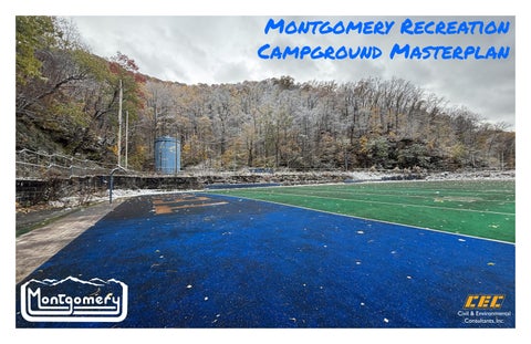
Montgomery Recreation Campground Masterplan
Regional Connections
Charleston
Located just off Route 60 and within minutes of Interstate 64, Montgomery offers easy regional access and sits close to major outdoor destinations, including the New River Gorge National Park and the proposed Mammoth Recreation Area above Smithers. These anchors position Montgomery as a well-connected gateway for adventure in the Upper Kanawha Valley.
Kanawha City Malden
a wh
er
Riv
A new campground near the Tech Trails and the former WV Tech football field—identified in the UKV Masterplan as a prime recreation investment— would build on this advantage. With direct links to local trail corridors, upcoming riverfront improvements, and the proposed Smithers/Montgomery Town Trail, the site would serve as a natural trailhead and overnight stop for hikers, cyclists, paddlers, and travelers exploring West Virginia.
Rand
na Ka Dupont City
Marmet
Belle
Appalachian Outlaw Trails
Appalachian Outlaw Trails
Future Phases
Phase 01 (Under Construction)
Mammoth Preserve
Chesapeake Dickinson
Shrewsberry
Chelyan
WV Land Trust Project (Under Design)
East Bank Glasgow Pratt
Proposed Rim Trail
Hansford
London
Montgomery
(Current Masterplan)
Cabin Creek Water Trail
Ka n
aw
ha
Riv
er
Smithers
Proposed Rim Trail Proposed Rim Trail
Paint Creek Water Trail + Rail Trail
Boomer
ha
aw
n Ka r
ve
Ri
The City of Montgomery Montgomery, West Virginia sits along the Kanawha River as a historic rail-and-industry town that has undergone significant transition in recent years. The departure of WVU Tech in 2017 left a noticeable economic and social gap, but the community has continued to adapt by leaning into its connective assets, regional role, and natural setting. Montgomery remains a key stop along the Amtrak Cardinal line, offering direct rail access to Charleston, Huntington, and major East Coast destinations, and reinforcing its identity as a gateway community within the Upper Kanawha Valley. Its location places it within minutes of some of southern West Virginia’s strongest outdoor recreation amenities—including the New River Gorge National Park and Preserve, whitewater access points, climbing areas, and miles of nearby trails. With established rail connectivity, riverfront views, and proximity to nationally renowned recreation assets, Montgomery is well-positioned for reinvestment, tourism growth, and new community-driven opportunities that build on its historic character.
The Valley Masterplan (2019)
N RIM
Montgomery was also a part of the larger Upper Kanawha Valley Masterplan, The Valley Masterplan, completed in 2019. Within this regional planning effort, Montgomery was identified as a primary node along the Kanawha River, with several opportunities tied to riverfront activation, trail connectivity, reuse of former institutional and industrial sites, and strengthening connections between the downtown, surrounding neighborhoods, and regional destinations. These findings reinforce Montgomery’s potential role as a hub for recreation, mobility, and community revitalization within the broader valley system.
L
TRAI
Montgomery Smithers
S RIM
L
TRAI
Kanawha River Courtesy Docks Montgomery Welcome Center
Cabins
Looking West on Third Avenue
Montgomery Amtrak Stop
Parking/Trailer
Third Ave Third Ave
Rt 61
Intersection of Third Ave. and Washington St. https://commons.wikimedia.org/w/index.php?search=Montgomery+WV&title=Special%3AMediaSearch&type=image
Drone View from WV Tech Football Field
Montgomery Welcome Center and Lodging (Previous Pool Property)
Morris Creek
To Rim Trail
Site Inventory NORTH
3rd Avenue Amtrak Cardinal Line
Stop 2nd Avenue
1
2nd Avenue
S. Ferry St.
Fayette Pike
Library
Golden Bear Dr.
7
7
12
11
4 Site Access Road
5 Retaining Wall Failure
6 Student Parking Area
7 Viewshed Opportunity
8 Football Field Terrace
9 Upper Terrace Area
10 Former Parking Area
11 Existing Trails
12 Access Stairs
13 Water Tower for City
14 Cut Stone Walls and
3
Existing Tech Trails Trailhead
10 11
3 Existing Parking Lot
7
12
6
15 12
5
2 Steep Access Road
Aquatic Center
2
4
1 Entry Road
8 7 14 9 13 7 11
7
11
Bleachers
15 Tennis Court Terrace
Ferr y Str eet
Adams Street
NORTH
rth A venu
e
Third Avenue
Third Avenue
Second Avenue
South Ferry Street
Second Avenue
Steep Existing Road 1 *13.3% Max Slope* *Creates Break Over Issues* *Not Suitable for RV Traffic*
Site Analysis
Fou
The site visit revealed steep access roads that limit vehicle entry to smaller cars and adventure vehicles, making the upper terraces better suited for tent camping and walk-in sites rather than large RVs or trailers. Multiple existing trail connections and several large terraces, including the former WV Tech football field, offer strong opportunities for camping, recreation, and event programming. Existing cut-stone walls, bleachers, and open viewsheds create a natural setting for an outdoor amphitheater or gathering space. Former parking areas and established trail nodes provide entry points, Connection tological Downtown while the surrounding wooded slopes link seamlessly into the broader trail network above Montgomery. This combination of terraces, trails, and existing infrastructure positions the site well for a wide range of new recreational uses.
Gymnasium
Fayette Pike Mountaineer Challenge Skool South
Cavalier Heights
2 Steep Existing Road
Library
*23% Max Slope* *Creates Break Over Issues* *Not Suitable for RV Traffic*
Cavalier Heights
Cross Drain
3 Existing Parking Area
Golden Bear Drive
Tennis Court Terrace
*Approx. 121 Parking Spaces* *Terrace Development Opportunity*
9
Retaining Wall Failure 4
*Poor Condition, Amenity Development Opportunities*
Pedestrian Stair Access Existing Trails
*Terrace Development Opportunity*
Viewshed Opportunity
Former Parking Lot
Football field forms large open terrace
Ro c
k
Fa
ll
*Needs Turf Removal* *Existing Asphalt Below Turf*
6
Ha
Existing Trails
8
*Levi Morris Trail 1.3 miles* *WV Tech Mountain Trail - 1.25 miles*
*Large Fence Needs Removed*
Rock Fall Hazard
*Needs Removed*
Trail Head & Grotto Lily Pond
7
8 *Campground Development Opportunity* *Viewshed Opportunities* *Road Connections*
Debris Pile
*Wall Above Road Has Failed* *Wall Below Road Is At Risk*
Existing Parking Lot
*Provides Access From Site*
1 Entry Road
2 Steep Access Road
3 Existing Parking Lot
Pedestrian Stair Access *Provides Access From Site*
za
rd
Cut Stone Wall + Bleachers *Adaptive Re-Use Opportunities*
Existing Restrooms
*Poor Condition, Utilities Available*
City Water Tower
*AEP to Run New Electric to Tower*
Upper Terrace
5
*Existing Concrete Foundations and Road Connections*
4 Retaining Wall Failure
5 Upper Terrace Area
Field + 6 Football Parking Area
7 Viewshed Opportunity
8 Existing Trail Access
9 Tennis Court Terrace
Entry Road Improvements This masterplan proposes the creation of a new primary entry road to improve access to the site and support long-term functionality. The existing access road is constrained by failing retaining walls located both above and below the roadway, which would require extensive reconstruction to remain viable. Rather than investing in a complex and maintenance-heavy repair, the plan introduces a new access route that responds to the site’s topography and circulation needs. The proposed entry road provides a more accessible and efficient approach into the site, directly tying into the existing parking area and extending to serve the proposed cabin development. By reworking the access strategy, the plan improves circulation, simplifies wayfinding, and establishes a clearer arrival sequence that better supports campground operations and future phases of development.
NORTH
0
20
40
Montgomery Tech Trails Resort This masterplan is shaped by a site-responsive approach that builds directly into existing landforms and makes use of current flat areas to minimize grading and disturbance. Roads, cabins, and tent platforms are carefully aligned with the natural terrain, allowing development to follow existing contours while preserving wooded buffers, views, and the overall character of the site. This strategy supports efficient construction while maintaining a strong connection between built elements and the landscape.
M
u od
lar ‘Zook’ Ca
b s in
Once a vibrant center of community life, the site offers a meaningful opportunity to reconnect Montgomery to a place that was lost with the departure of WVU Tech, reestablishing it as a destination that draws visitors and brings energy back to town—much like football game days once did. This masterplan reframes the site as a place of gathering and celebration, creating new reasons for people to come together, visit Montgomery, and participate in shared experiences.
hted Skywa g i lk L
At the center of the plan, a primary event and gathering space anchors the site and serves as a hub for campground users and community programming. A small amphitheater is integrated into an existing terrace, using on-site cut stone to create seating, walls, and edges that reference the site’s history and reinforce a sense of permanence. The lighted skywalk is designed as a direct pedestrian connection to this central event space, establishing a strong visual and experiential link between the core amenities, adjacent development, and the town.
e
C form amps t a it Pl
ent Building
mphith ea nt A e t v
er
E
Ev
NORTH
0
60
120
Trail Connections Masterplan
Town Access
Downtown Montgomery
Building on the existing Tech Trails, this masterplan proposes the creation of a broader, more connected network known as the Montgomery Rim Trail System. The system strengthens ties to existing trails while introducing a series of loop trails accessible from the proposed campground and cabin areas, as well as nearby neighborhoods and town access points. The plan also identifies opportunities for remote tent platform sites and scenic overlook locations along the trail corridors. Together, these elements expand outdoor recreation options for both residents and visitors, including the potential for dedicated bike trail opportunities.
Existing Trailhead Existing Stairs Football Field
Faye
tte P
ike
Proposed Trails Dashed Lines
Town Connections
Overlook Development
E
Tech T ra il
i
Overlook Development
Tr a
x
ing ist
+ Wayf ead in H d l
s
Ne ig
Solid Lines
ns tio
ec
Existing Trails
g in
o hb
d rhoo Conn
Overlook Development
Tent Platforms
Tent Platforms
Sce n
A
ea
Potential ATV Maintenance Access
C form amps t a it Pl
Proposed Trails
Camping Areas
Dashed Lines
e
il Opportu ni Tra
tie
w
s
Ne
Tr
Scenic Overlook Area - Example Plan
verlook Ar
Solid Lines
s
lO ai
ic
Overlook
a re
.
k Rd
ree
ris C
Mor
Existing Trails
Trail Connection Needed Trail Connection Needed NORTH
0
200
400