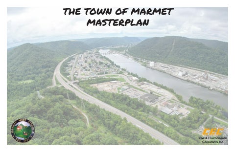
THE TOWN OF MARMET MASTERPLAN
Regional Connections
Dunbar
Marmet’s strength lies in its strategic location within the Kanawha Valley, placing it at the center of a well connected regional network. Just 10 miles southeast of Charleston, the state capital and primary economic hub, Marmet benefits from immediate access to employment, healthcare, education, and cultural amenities. To the southeast, Beckley, approximately 55 to 60 miles away, serves as another key regional center, linking Marmet to southern West Virginia and reinforcing its position along a natural corridor of movement through the state. This connectivity is supported by major transportation routes that run directly through and around the town. U.S. Route 60 passes through Marmet as a historic and functional east to west corridor, while nearby Interstate 64 provides efficient access across the region, connecting to Huntington to the west and the rest of southern West Virginia to the east. The junction of Interstate 77 near Charleston further expands Marmet’s reach by opening north to south travel routes into Ohio, Virginia, and the broader Appalachian region. West Virginia Route 61 supplements these connections by linking smaller communities throughout the upper Kanawha Valley. Marmet is also positioned within close reach of some of West Virginia’s most significant recreational destinations. The New River Gorge National Park and Preserve lies less than an hour to the southeast, offering nationally recognized opportunities for outdoor recreation. Additionally, regional trail systems, including the developing Kanawha River Trail and the extensive Hatfield McCoy Trail system, extend opportunities for walking, biking, and off road travel throughout the area. Together, these connections emphasize Marmet’s advantageous location within a dynamic network of cities, infrastructure, and natural resources.
South Charleston Charleston West Virginia International Yeagar Airport
Malden
Kanawha City
Kanawha State Forest
Marmet
Rand Dupont City
Appalachian Outlaw Trails Phase 01 (Under Construction)
Belle Cedar Grove Glasgow
Dickinson Shrewsbury
Pratt London
Chesapeake
East Bank Proposed Rim Trail
Hansford Proposed Rim Trail Cabin Creek Water Trail Paint Creek Water Trail + Rail Trail
Town of Marmet Along the gentle bends of the Kanawha River in West Virginia’s upper Kanawha Valley, the Town of Marmet reflects a quiet strength shaped by both its industrial roots and its close-knit community. Small in size but rich in character, Marmet offers a kind of small-town charm that feels genuine—where neighbors recognize one another, traditions carry meaning, and the pace of life invites connection. Marmet is ideally situated, lying about 10 miles southeast of Charleston, the state capital, and roughly 55 to 60 miles northwest of Beckley. This location places the town within easy reach of larger economic and cultural centers while allowing it to maintain its own identity. U.S. Route 60 runs directly through Marmet, serving as both a transportation corridor and a familiar main thoroughfare. Just nearby, Interstate 64 provides quick regional access, while West Virginia Route 61 helps link the surrounding communities of the Kanawha Valley. These routes not only connect Marmet physically, but also situate it within the broader story of the region.
George Buckley Community Center
One of Marmet’s most defining landmarks is the Marmet Locks and Dam. Positioned along the Kanawha River, the locks stand as a powerful symbol of the town’s industrial heritage and its longstanding relationship with river commerce. Even today, barge traffic continues to pass through, echoing the history that helped shape the community. The river itself remains a constant presence—both a scenic backdrop and a reminder of Marmet’s enduring ties to the valley. At the heart of Marmet’s present-day identity is a strong commitment to community life. This is especially evident in the recently upgraded community building, which serves as a gathering space for residents of all ages. Inside, a new basketball court—complete with pickleball lines—offers opportunities for recreation and friendly competition. The addition of a concession room, featuring a window positioned near a striking mural, enhances the space’s role as a hub for events and activities. The mural itself is a central feature, thoughtfully designed to reflect Marmet’s history and character. Through color and imagery, it
Marmet Locks
Bill Wells Park
Ben Morris Field
tells the story of the town, honoring both its past and its sense of pride. Beyond indoor spaces, Marmet provides a variety of outdoor amenities that support recreation, leisure, and community engagement. Jerry Lee McGhee II Memorial Park offers a welcoming space for families and visitors to relax and play. Ben Morris Field brings the community together through sports and shared events, fostering a sense of teamwork and local pride. Bill Wells Park adds another layer of opportunity, creating a place where residents can gather, unwind, and celebrate. Together, these parks form a network of spaces that make Marmet not just a place to live, but a place to belong. In Marmet, the balance between history and progress is evident in every corner—from the enduring presence of the locks to the thoughtful improvements of community spaces. It is a town that values connection, invests in its future, and holds firmly to the spirit that defines small-town life in the Kanawha Valley.
Town of Marmet Mural
360 Mountain Views
Town of Marmet Monument
Recreation Center Banner
Relocated Police Station
Overall Analysis
Jerry Lee McGhee II Memorial Park Park has existing playground with newer equipment in good condition. Basketball courts in okay condition with need for updated striping. One picnic shelter, not a lot of room for people to watch their children. Park has poor circulation and access points with a gap in the fence near the railroad, causing safety concerns. Close proximity to the Rec Building and Ben Morris Hub
4
Playground
Good quality play equipment with space for parents to sit and watch. Equipment in random areas, could condense to make room for additional programming.
Picnic Shelter 6
1 picnic shelter, not enough room for more than a couple families. Placed in central location, could relocate for more shelters and better use of space
10
3 Rec Parking
Lee McGhee II 4 Jerry Memorial Park
5 Basketball Court
6 Picnic Shelter
7 Playground
8 Unsafe Access
9 Ben Morris Field
10 Baseball Field
11 Walking Path
12 Concession Building
13 Additional
14 Pedestrian
Wells 15 Bill Community Park
16 Old Jr High
17 Burnt House
18 Bill Wells
19 Fishing Area
20 Rec Building
Marmet Locks and Dam
12 Entrance
Community Building with updated gym, offering basketball and pickleball. Close proximity to existing town parks and fields.
1
Existing walking track along perimeter in okay condition. Baseball Field in okay condition, Old Concession Building Under utilized.
Additional Parking 13
Art piece on the southern wall of the Rec Center encompassing character and history of Marmet.
Marmet Monument
Additional Parking 3
Kanawha River
MacCorkle Ave
Gravel lot used for additional parking, currently 20-30 spaces
2
Grass lot separated by the road by a sidewalk and retaining wall. Large, flat space with access to the concession room window, ideal for a seasonal event space.
2 Existing Lot
Ben Morris Field 9
5
Rec Building 20
Existing Lot
1 Mural
11
8
1 Court with outdated striping. Opportunity for multi-purpose courts
Marmet Mural
Existing park with picnic shelters and river access for fishing opportunities. An existing footpath could be an ideal connection between the park and Ben Morris Field, The Recreation Building, and the Jerry Lee McGhee II Memorial Park.
Existing Path
Good existing pedestrian connections between town amenities.
Existing open space, ideal for train watching area for community members due to access to tracks and town amenities
Basketball Court
Bill Wells Community Park 15
18
Crosswalk 14
Open Space
Maintenance Access
7
19
Gravel lot used for additional parking, currently 20-30 spaces
Existing Sidewalks Old Jr High 16
Old Jr High building, Library to be relocated here
Parking
Opportunity to utilize lot and create drop off space
NORTH
Kanawha River
Burnt House 17
Connections
Playground
Overall Site Inventory
16 19
Kanawha River
15
1 Mural
2 Existing Lot
3 Rec Parking
Lee McGhee II 4 Jerry Memorial Park
5 Basketball Court
6 Picnic Shelter
7 Chums Hotdogs
8 Marmet Monument
9 Cast Iron Fence
Morris 10 Ben Field Entrance
11 Walking Path
12 Marmet Locks
13 Concession Stand
14 Baseball Field
Wells 15 Bill Park
16 Fishing Area
17 Old Jr High
18 Burnt House
Wells 19 Bill Playground
20 Rec Center
7
6 5 20
1
9
9
11
12
3 14
4
10
8
86th St
13
MacCorkle Ave
2
17
Kanawha River
NORTH
18
Marmet Concept
Proposed Path Connection to Bill Wells Park 0.2 miles to Bill Wells Park
Proposed Connections Via Existing Sidewalks
Proposed Vegetative Screening
86th St
MacCorkle Ave
Scenic Walking Path
Proposed U10 Soccer Fields ( 64,800 sqft)
Walking Path
Proposed Connecting Walking Path to access Bill Wells Community Park
Proposed Playground
Proposed Picnic Shelter (1,200 sqft.) Maintenance Access
Proposed Full Size Softball Field (40,000 sqft.)
Proposed ADA Parking Proposed One-Way Road Proposed Splash Pad (4,000 sqft.) Proposed Picnic Shelters (1,200 sqft.) Proposed Lawn Space
Marmet Locks and Dam
Proposed Artificial Turf Area ( 5,900 sqft.)
Oregon Ave
Ohio Ave
Proposed Multi-Purpose Courts (6,480 sqft.) -Pickleball -Full-Size Basketball -Half-Court Basketball
86th St
Relocated Electrical Structure Proposed Bathroom & Concession (576 sqft.) 0.2 miles to Old Jr High NORTH
0
25’
50’
Ben Morris Field Opportunities
Ben Morris Field is the community’s largest area of flat, open land, offering a flexible space for recreation, events, and gatherings. The proposed programming allows the field to serve multiple purposes, with portable goals and temporary striping accommodating two full-size soccer fields and a baseball field featuring an artificial turf infield and portable outfield fence. Its natural open-space character makes it ideal for community events such as the Spring Carnival, Ribfest, and future attractions like a seasonal ice rink. To support this intensive and varied use, the field could be constructed with engineered soils or soil mats designed to improve load distribution, drainage, and resilience. This approach would help protect the playing surface from rutting and compaction caused by maintenance vehicles, event equipment, emergency access, or delivery trucks, reducing costly repairs and ensuring the field remains functional year-round. Located adjacent to Jerry Lee McGhee II Memorial Park, the Community Building, the proposed Splash Pad and Farmers Market area, and Bill Wells Park, Ben Morris Field is uniquely positioned to become the centerpiece of a connected community recreation and event district.
U10 Soccer Fields
Soccer
Portable Soccer Goal
Temporary Soccer Striping
Baseball
Portable Outfield Fence
Seasonal Events
Artificial Turf
Portable Ice Rink
Spring Carnival
Jerry Lee McGhee II Memorial Park Courts Opportunities
The proposed multi-purpose courts at Jerry Lee McGhee II Memorial Park provide a variety of recreation opportunities, including a full-size basketball court that can be divided into two half courts and four pickleball courts. The nearby storage building offers convenient space for portable nets and basketball goals, allowing the courts to adapt to different activities as needed. The court layout also allows for two pickleball games and two basketball games to take place simultaneously. An alternative court layout pictured below could be implemented if the demand for basketball is not as high. With its close proximity to the Community Building, Ben Morris Field, the proposed Splash Pad and Farmers Market area, and Bill Wells Park, this location serves as a central recreation hub and is ideally situated to support a wide range of community activities and events. Existing Cast Iron Fence
Proposed Picnic Shelter Proposed Basketball Hoop Proposed Portable Pickleball Nets
Shared Court Space
Proposed Portable Pickleball Nets Oregon Ave
Portable Pickleball Nets
Existing Parking
MacCorkle Ave
Proposed Portable Pickleball Nets
Proposed Portable Pickleball Nets Proposed Basketball Hoop
Exisiting Playground
Existing Storage Building
Alternate Court Option
Existing Community Center
Existing Sidewalk Connection NORTH
0
10’
20’
Splash Pad & Farmers Market Opportunities The proposed Splash Pad and Farmers Market area will serve as a vibrant community gathering space. The 4,000-square-foot splash pad offers a fun water attraction for residents and visitors, with a nearby concession building and restroom facility for added convenience. ADAaccessible parking along the Community Building provides easy access to both amenities. The Farmers Market area features two large picnic pavilions for shaded vendor and visitor space, complemented by open lawn areas for seating, vendors, and community events. Its central location among the town’s parks and recreation facilities makes this area the most highly programmed and active destination in the community.
Jerry Lee McGhee II Memorial Park Existing Parking
Community Center
Ben Morris Field
Existing Crosswalk
86th St
Proposed Concession & Bathroom Facility Proposed Splash Pad
Proposed Picnic Shelter & Farmer’s Market Area
Existing Parking
MacCorkle Ave
Oregon Ave
Farmer’s Market
Proposed Open Space
Splash Pad
NORTH
0
10’
20’
Bill Wells Park
Existing Picnic Structures
Existing Open Space Proposed Riparian Planting
Existing Picnic Structures
Existing Fishing Area Proposed Cast Iron Fence Existing Picnic Structures Proposed Horseshoe & Cornhole Amenity
Proposed Bathroom
Bill Wells Park is a valued community asset that serves as a recreational hub for the Town of Marmet. With its existing playground, picnic shelters, open green space, trails, and fishing access, the park already provides a variety of opportunities for residents and visitors. This master plan builds upon those strengths by enhancing connectivity and creating a more welcoming entrance featuring a defined gateway, nature-based playground, expanded parking, bathhouse, and relocated police department. Existing playground equipment and a proposed swing set can be relocated across the trail to create two distinct play experiences while maintaining the park’s current character and use. Thoughtful additions throughout the park create a series of activity hubs that offer something for all ages. A proposed horseshoe and cornhole area provides a central gathering space, while large open lawns remain available for activities such as soccer and informal recreation. Along the riverfront, riparian plantings are proposed to reduce erosion, improve safety, and enhance the natural environment. Together, these modest improvements strengthen the park’s functionality and identity, creating unique destinations that enrich the overall visitor experience while preserving the qualities that make Bill Wells Park a beloved community resource.
Existing Picnic Structures
Proposed Relocated Police Station Existing Trail
Walking Track
Proposed Natural Playground
Proposed Park Gateway
Existing Parking
Natural Playground Elements
Existing Playground Equipment
Proposed Swingset
Open Space
Horshoe & Cornhole Amenity
NORTH
0
30’
60’
Bill Wells Park
Proposed Pump Track Proposed Riparian Planting
Existing Picnic Structures
Relocated Structure Existing Fishing Area Proposed Cast Iron Fence Existing Picnic Structures
This master plan reimagines a portion of Bill Wells Park’s open space as a destination pump track, creating an active recreation hub that can accommodate riders of all ages beginner skill levels. Featuring a variety of elements such as rollers, berms, and beginner to advanced riding loops, the pump track offers a unique amenity that complements the park’s existing recreational opportunities while activating underutilized lawn areas. To support this new feature, the existing picnic shelter can be relocated to provide convenient seating and gathering space for spectators and families. These improvements, combined with the park’s existing trails, fishing access, playgrounds, and open space, enhance the overall visitor experience while creating a dynamic new attraction that encourages outdoor activity and community engagement.
Proposed Horseshoe & Cornhole Amenity
Proposed Bathroom
Existing Picnic Structures
Pump Track
Fencing
Pump Track Features
Concession Stand
Proposed Relocated Police Station Existing Trail Proposed Natural Playground
Proposed Park Gateway
Existing Parking
Existing Playground Equipment
Proposed Swingset
NORTH
0
30’
60’