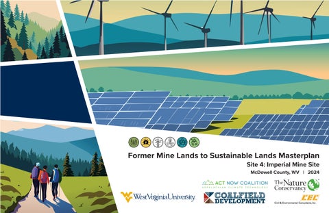
Former Mine Lands to Sustainable Lands Masterplan
Site 4: Imperial Mine Site McDowell County, WV | 2024
A SPECIAL THANK YOU TO THE FOLLOWING ORGANIZATIONS AND INDIVIDUALS THAT MADE THIS PROJECT POSSIBLE:
PROJECT DESIGN TEAM
ACKNOWLEDGEMENTS
JIM CHRISTIE, PLA (CEC) MATT PIZATELLA, PLA, LEED AP BD + C (CEC) COLIN MCCARDLE (CEC) JON MICHAUX (CEC) DUSTIN TOOTHMAN, PLA (CEC) ANDREW GOSNELL, PLA, ASLA (CEC) LOGAN PAXTON (CEC)
85
99
Tri - County Comparison
Cyclone
Mallory
44.7
Sophia
Oceana 80
Pineville
Bluestone National Scenic River
Mullens 77
Median Annual Income (2022)
Welch
Kimball
Athens
Northfork
PROJECT SITE
Elkhorn
Gary
16
Maybeury
83
War
24% Bachelor’s Degree or Higher (2022)
17%
12%
Food Insecurity (2021)
Princeton
Montcalm
Food Insecurity (2021)
3,050:1
Bramwell Bluewell Cucumber
Median Property Value (2022)
Bachelor’s Degree or Higher (2022)
10 52
80
$145,800
13%
16
Raysal
Median Annual Income (2022)
Median Property Value (2022)
Iaeger
$55,217
$78,900
Mercer County
16
52
Median Age (2022)
$39,718
Wyoming County 97
42.6
Median Age (2022)
54
t Creek
WV State Comparison
54
Primary Care Physicians (2021)
161
1,320:1 Primary Care Physicians (2021)
Bluefield 61
Northfork, WV
McDowell County
Oakwood
19
Approx. 15 mi. to Welch
PROJECT SITE
Site Introduction
The Gray Hawk Surface Mine (also referred to as the Imperial Mine Site) is owned by Imperial Resources and is located outside of Elkhorn, WV, along U.S. Route 52. Classified as inactive, scars from the mining process are visible across the landscape and a mixture of soil and vegetative ground cover can be seen in aerial imagery today. This mine site is situated in a region that played a defining role in U.S. History - The Pocahontas Coalfield. Coal extracted in this region spurred the production of steel in the U.S. during the mid to late 1900s. Approximately 100 communities supported this industry during its peak. The region’s population today is a shadow of what was once there, and communities that remain struggle to recover from the dramatic demographic shift that occurred over time as extraction companies relocated. The Imperial Mine Site was identified early on as an area of opportunity for the Former Mine Lands to Sustainable Lands Master Planning Project, due in part to the need to provide support for surrounding communities and the people who live there. For decades, residents of McDowell County dedicated their lives to creating these mines. There is now an opportunity for these mine sites to provide for the people and serve as community building projects in their next generation. This masterplan for the Imperial Mine Site will envision how the Imperial Mine Site can be transformed into a mixed use community that improves the quality of life for both Elkhorn, WV and McDowell County Residents.
McDowell County Demographics 195
17,439 Population (2023)
Elkhorn, WV
Total Employer Establishments (2021)
6%
45.3 Median Age (2022)
Site Entrance
Skygusty Highway
Approx. 1.5 mi from Rt. 52
Project Site
Bachelor’s Degree or Higher (2022)
18%
23.1% Food Insecurity (2021)
Population Age 65 + (2022)
$28,235 Median Annual Income (2022)
3,670:1
Approx. 5 mi. to Mercer Co. Border
Primary Care Physicians (2021)
$47,500 Median Property Value (2022)
Skygusty Highway
28% Access to Recreation (2023)
Sources: The U.S. Census Bureau and The University of Wisconsin Population Health Institute
Mine Site: Gray Hawk Surface Mine Mine Status: Approved, Inactive Permittee: Mid-Vol Coal Sales, Inc. Selected Site Size: Approx. 525 AC
Imperial Mine Site Regional Historical Trends
Jordan Nelson
Mid 1870s
Jordan Nelson, a farmer and blacksmith, is credited with mining the first coal in the region from his land.
Pre-Eurpoean Settlement
Native tribes (including the Shawnee from Ohio and the Cherokee from North Carolina) claimed territory within today’s Pocahontas Coalfields and valued it largely as hunting grounds. Attempts to limit European settlement west were largely unsuccessful. Records show these tribes were aware of coal deposits, but made little use of it.
March 1883
The Norfolk and Western Railway completes its expansion west to Pocahontas, VA, influenced in part by Nelson’s coal discovery.
March 1888 Elkhorn, WV Post Office is founded.
Late 1800s
American ‘frontier era’ settlement gradually spreads west, displacing native people. By the end of the century, small communities are forming. Initial land surveys noted the presence of coal, but a focus was placed on the timber value of property. Completion of the Norfolk and Western Railroad in the mid 1880s, coupled with a growing interest in the region’s coal, would lead to an explosion of development.
1923
Approx. 20% of coal miners in WV work in the Pocahontas Coalfields.
Early 1900s
1920s - 1950s
1960s
Multiple wars and a high demand for steel would continue the high demand for Pocahontas Coal.
Communities and mining operations are established and expand across the region. Steel mills provided a ready market for the high quality coal. The U.S. Navy deems Pocahontas coal ‘Navy Grade’ due to its quality and makes it a standard. Living conditions in company towns found within this coalfield were generally perceived to be good. Despite this, labor unrest is still present.
October 2015
Due to inconsistent employment, the 1960s mark the start of out migration of families from this region.
Mid 1900s
The mid 1900s would see the peak of development in the Pocahontas Coalfields, with over 100 communities containing over 100,000 residents established and supporting the coal industry. Restructuring of coal companies, combined with advancements in technology and an unstable steel industry, would lead to a slow decline due to less secure employment.
Mining permit for the Imperial Mine Site outside of Elkhorn, WV (project site) is issued.
Late 1900s - Today
The late 1900s would see a continued decline in the coal industry and an out migration of residents. Some coal towns became incorporated, further distancing communities from their coal-company roots. As mining technology advanced, fewer workers were needed, and ongoing company restructuring added to the region’s decline. While mining still takes place today, it is on a much smaller scale. Fewer than 10,000 workers currently employed in southern West Virginia’s coalfields.
Imperial Mine Site Aerial Timeline 1996
2024
2011
Earliest available imagery of the project site. Roads can be observed in the landscape, presumably for logging purposes. Present day communities along Elkhorn Creek are noted, including the community of Elkhorn.
While the mining site appears to be largely undisturbed, evidence of earthwork can be observed adjacent to the southern border of the permit boundary. Work appears to be the beginning of an access road.
2007
The Imperial mining site visually appears to be largely undisturbed. The site consists of forested land cover.
2019
The Imperial site is an active mine and began in 2015. Land cover has been removed and large earth forms from mining operations can be observed. Between 2011 and 2019, a second mining operation was established to the west. To the north, logging activity can be observed on the hillside.
Mining activity on the Imperial site appears to be inactive. Vegetation can be observed growing on the former mine. Mining activity observed to the west is active and the disturbed area has expanded since 2019.
85
Hatfield - McCoy Trail system
99
Cyclone
Mallory
Sophia
80
54
t Creek
Pineville
97
Legend
Proposed king coal highway
54
Oceana
Wyoming County
WVDEP Registered Mine site parcels
Bluestone National Scenic River
Mullens 77
Major highways Proposed king coal highway route
16
16
Iaeger 52
Welch
10
Kimball 52
80
Raysal
Maybeury
83
Wyom
Athens
Northfork Elkhorn
Gary
16
ing C
Princeton
Montcalm
Bramwell Bluewell
War Cucumber
McDo well
161
Bluefield 61
Mercer County
Oakwood
McDowell County
19
KIMBALL
ount
Streams / rivers Hatfield - McCoy trail system Proposed Hatfield - McCoy Trail System Recreational trails Active railways Potentially inactive railways
y
Coun
ty crumpler
Proposed Hatfield - McCoy Trail system keystone
ASHLAND Hatfield - McCoy Trail system Indian Ridge Proposed king coal highway elk horn
switchback imperial mine site
McD owe Mer ll Cou cer n Cou ty nt y
thorpe
Maybeury
Hatfield - McCoy Trail system Pocahontas
Proposed king coal highway anawalt
bramwell
Mining Today
While this region has evolved over the years, mining has remained constant. This map illustrates the number of DEP permitted mines found around the selected project site.
VA
bluestone river
pinnacle rock state park trails
bluewell
0
3,000
6,000 US Feet
Challenges:
During the development of this masterplan, a review of existing comprehensive plans for McDowell County and the Region I Planning and Development Council (Includes the counties of McDowell, Mercer, Monroe, Raleigh, Summers, and Wyoming) was performed to identify overarching themes and challenges that county residents face. These themes would inform the development of the project goals and objectives. The ultimate vision for this project is a community development based plan that helps address important issues that McDowell County residents face daily and improve the quality of life in the County.
Plans reviewed as a part of this project include: • 2021 McDowell County Comprehensive Plan • 2022 Region I Planning & Development Council Comprehensive Economic Development Strategy • 2022 Roadmap to Economic Recovery for the Region 1 Planning & Development Council
Economy
Infrastructure
Tourism
Downtowns and commercial districts have suffered in recent decades, often the result of an insufficient customer base to support restaurants and small businesses. Coal industry declines have impacted associated industries, such as manufacturing. There appears to be a disconnect between skills held by current labor force and in demand jobs. Existing workforce training programs do not always align with in demand occupations and/or there is resistance to skills retraining/industry pivoting. Officials can appear to be overly focused on attracting new outside investment, residents feel there is not enough focus on local business growth and investment. Small business support is lacking.
There is an overall consensus that infrastructure within the county has need for improvement. General infrastructure maintenance and improvements is a county-wide need. Public water and sewer service is uneven in areas and/or in need of upgrades due to its age. Lack of broadband/cellular coverage limits several factors. Roads are the primary means of transportation. Current routes can be inefficient and dangerous due to terrain, expressed need for a better transportation network that connects to existing (and proposed) economic centers. There is a desire to encourage new infrastructure in a way that promotes new economic development opportunities for county residents and promotes new businesses.
Tourism is one industry the region is pivoting towards as they recover from the loss of coal industry jobs. The county’s natural features and historical identity lend well to this. The Hatfield - McCoy ATV trail system attracts thousands of annual riders. Tourism provides lots of optimism for the region’s future, but it is not without its challenges. Many businesses that would support the tourism industry are lacking, including lodging, restaurants, and retail. In McDowell Co., conversations with the Economic Development Authority indicated residents are experiencing displacement as homes are converted to rental homes. A lack of indoor, evening, and poor weather activities makes visitor retention a challenge.
Healthcare
Housing
Education
The only county medical facility is an acute care center - Welch Community Hospital. While it is an asset, residents often have to travel out of county to find appropriate medical care. There is a lack of 24-hr emergency medical care and specialized medicinal care for specific conditions, regionally. Residents in general have lower than average access to physical and mental health providers when compared to county and national statistics. Recruitment and retention of healthcare workers, particularly specialty care doctors, is difficult.
The need for good quality, livable, and affordable housing at a variety of price ranges and sizes so that every person has the opportunity to buy or rent decent housing is expressed across planning documents. In McDowell Co., the lack of availability and affordability of good homes is listed as a reason why the county struggles to recruit in multiple professions. Despite lower than average housing costs, 68% of county residents pay 30%+ of their income on housing (affordability concern). In addition, addressing dilapidated and abandoned structures is also a priority within the county.
At the primary and secondary school level, there is a lack of qualified teachers in the county. Vacancies are either left unfilled or occupied with unqualified teachers. Lack of adequate housing has been identified as a main cause by existing teachers. There are limited higher education options within the county, and only 6% of residents 25+ have a bachelors degree or higher. As the county strives to create a resilient economy, there is a need for institutions that provide skill development in industry transferable skills, abilities, and certifications. There is a need for business incubator and entrepreneur programs to train and assist residents with starting small businesses.
Aging Population
Community Development
Quality of Life
The county experiences a population with a higher than average age when compared to state and national levels. By 2030, 23% of the population is expected to be 65+. There is a concern that the county is not prepared to address the future needs of this aging demographic. It has been suggested that everything from the ADA accessibility of public places to the housing and healthcare needed to support this age group is lacking within the county. Moving forward, it has been identified that this needs to be addressed as the population continues to age.
Due to declining populations, tax bases are shrinking and there is less funding for public services. This means communities suffer from a lack of traditional community support structures and amenities. Places to host events, recreational spaces (indoor and outdoor), and places to socialize have identified as community needs. In particular, there has been an expressed need for more activities for youth and seniors throughout the county.
McDowell County residents experience lower than average access to healthy food options, exercise opportunities, and physical and mental health providers. Drug addiction is a challenge in many communities. There are limited basic retail and grocery store options. As of 2019, only 3 grocery stores exist, concentrated in Welch and War. The only Walmart in the county closed in 2016 and had a major impact on the access of fresh food. A lack of jobs, quality housing, and basic services and amenities makes it a challenge to retain existing residents (particularly youth) and attract new ones.
Project Goals and Objectives 1. Propose development on the Imperial Mine Site that improves the quality of life for McDowell County residents and helps attract and retain needed industry professionals, particularly in the fields of education and healthcare. • Objective 1A: Provide a variety of sustainably designed and constructed housing options at a range of prices and sizes so that county residents have the opportunity to buy or rent decent housing. During the development of housing, a particular focus needs to be on the affordability of these homes. Priority should be given to specific demographic groups with a known need for housing, such as those in the education and healthcare professions. Since affordability is a concern, restrictions may need to be placed to control prices in the future. • Objective 1B: Suggest a range of amenities and programs that allow residents to have a healthy lifestyle, including, but not limited to, a variety of recreation opportunities and designing spaces that promote socialization and community events. • Objective 1C: Address existing deficiencies within the care system in the county for those who are 65+. Provide housing and care options for this age group that meets their needs and allows them to live a healthy and active life into retirement and beyond.
2. Propose development on the Imperial Mine Site that supports a resilient, diverse, and sustainable economy for McDowell County that strengthens existing businesses and promotes new business opportunities that benefit county residents. • Objective 2A: Create real estate opportunities that provide a variety of commercial spaces for a range of businesses, from retail stores to restaurants, small businesses, and professional services. • Objective 2B: Target proposed commercial programming to provide space for missing essential retail and services in the surrounding area. This includes, but is not limited to, a grocery store, restaurants, daily essentials such as clothing, household items, medical services, and financial services. • Objective 2C: Promote tourism within the development and provide lodging opportunities that do not take away from available lodging for county residents. Provide a direct connection from proposed developments and neighborhoods to the nearby Hatfield-McCoy Trail System. Utilize tourism to further support proposed businesses on site. • Objective 2D: Incorporate alternate energy generation technology into the proposed site design at a scale where proposed site development can be powered using renewable electricity.
3. Create opportunities that allow for continuing education and skill development programs that provide training for in-demand skills, trades, and supports small business owners and entrepreneurs. • Objective 3A: Establish a school that serves to provide post-secondary education courses and/or certifications on a variety of in-demand topics and skill sets. This program should provide training to give individuals the ability to make a career out of their interests and passions. • Objective 3B: Establish a training and business incubator program to support small business owners and entrepreneurs. This can also serve as a small business resource within the county.
Imperial Mine Site Today
Switchback, WV
Elk
ho
rn
Cr
Good development opportunities at top of mine. Earthwork needed, site terrain from historic land use presents challenges.
ee
k
McDowell Co. PSD (Water Service)
Pad for Potential Development Pad for Potential Development
Class I Norfolk Southern Rail Line
Coal Loading Facility
El
kh
or
n
Cr
Terrain presents challenges when considering site access. Initial access into the site is predetermined utilizing mining roads
Fill slope - development above potentially limited
Fill slope - development above potentially limited
Skygusty Hwy
Analysis of Existing Conditions at the Imperial Mine Site
ee
k
Skygusty Hwy
Elkhorn, WV
McDowell Co. PSD (Water Service)
n
or
kh El k
ee
Cr Class I Norfolk Southern Rail Line
Note: Slopes off of project site can be classified as steep (40% and greater)
Primary Site Ingress/Egress
1.5 mi. from Rt. 52 to Site Entrance
The unique history of the selected project site presents several opportunities and constraints when considering potential site development. While the existing post mining terrain is rugged, performing earthwork can create great opportunities for development on top of the mountain. In a region characterized by steep slopes and limited development opportunities, the possibly of creating a large area of developable land is invaluable. This site also has great viewsheds into the surrounding valleys. Slopes off of the project site are steep and limit development to the former mine area, with slopes exceeding 40% in some areas. Caution will have to occur on existing fill slopes, as they can be unstable. The site also has decent access. Primary site egress is located approx. 1.5 mi. from Route 52. Due to steep terrain, site access is limited to the exiting mine entrance. The first portion of site circulation will also be restricted to former mining roads. A Class I railroad operated by Norfolk Southern is nearby and has the potential to serve proposed site development. Any potential development will have to consider utility access. There is existing public water service that runs along Route 52, from the McDowell County Public Service District. The capacity of this system will likely not be able to handle any large scale development. In addition, sewer is nonexistent. History and cultural identity should also be considered an asset that is utilized. The nearby historic Elkhorn community is a former coal town. Playing off of this identity can create a unique tourism component. It can also be realized into unique design characteristics across the proposed site.
Utility Considerations for Development
Infrastructure will need to be considered when looking at development of the former Imperial Mine Site:
ELKHORN, WV
NORTH
5.
SKY GU STY
HW Y
• Water: Public water is supplied from the Maybeury Water Plant to the east. The supply line follows Route 52. The system’s capacity will need to be studied to determine if it is appropriate for the proposed development in this masterplan. It is known that the existing water system is aged and may be in needs of upgrades. The McDowell County Public Service District operates this system. • Sewer: A public sanitary sewer system does not exist. This will need to be considered when looking to develop the site. • Electric: Nearby electric infrastructure exists. Consideration into its capacity and ability to be integrated with proposed solar energy sources will need to be studied. • Waste Collection and Disposal: Each municipality offers their own garbage collection service, while the private company BeBe Enterprise offers service to unincorporated places. Copper Ridge is the county’s landfill and is located north of Welch. A municipal garbage collection may need to be formed for this proposed masterplan. • Cell Service: AT&T is the main cell provider and covers 90% of the county. A 2013 report from the Region 1 Economic and Development Council reported that AT&T is available along main county routes and that Verizon is available along Route 52 and Route 16 south of War. Despite this, public feedback indicates that service is inconsistent and improvement is a priority. • Broadband: Shentel provides broadband service to about 90% of county residents. Fronteir also provides broadband service in the county. According to the WV Broadband Enhancement Council, the project site is within gigabit broadband service areas.
2
pm e
nt
2.
o el
3 3. APPROX. 230 DEVELOPABLE ACRES
H ST Y U
ENT R A
SK YG
S I TE
W
Y
4.
N CE
During analysis of the project site’s existing conditions, it was identified that the top of the former mine site presents opportunity for development within McDowell County. A region that is defined by steep terrain, there are very few places that have large areas of land with minimal slopes that remains undeveloped. Land with these characteristics will be important for the county and Region I as they strive to achieve goals set forth in their respective comprehensive plans. The former Imperial Mine Site presents an opportunity to create land that can serve this purpose. However, major earthwork will need to occur to achieve this. Based off of available public data, the landscape can be best compared to the surface of the moon. Seemingly random mounds of earth and steep slopes are scattered across the landscape. It is hard to use the land as is for development. Initial conceptual grading exercises revealed that approximately 230 developable acres with gradual slopes can be created after earthwork. Two existing pads can be found near the site entrance, totaling about 15.5 acres of developable land.
1.
ev Limits of D
2 pad sites located on either side of the main access road, close to the site entrance, have been identified as potential areas for infrastructure implementation. They could be particularly useful in the implementation of water/sewer infrastructure, as they are located downhill of the site.
Program Development
1
4
APPROX. 8.5 DEVELOPABLE ACRES APPROX. 8.5 DEVELOPABLE ACRES
0’
1,000’
it
Lim
ve
De s of
ent
m lop
5
Program Development
Based off identified challenges and themes from the review of the McDowell County and Region I Planning & Development Council Comprehensive Plans, the following programming has been developed for the Imperial Mine Site. The recommendations aim to alleviate known shortfalls within the county and region and help various agencies achieve goals laid out in their comprehensive plans. This will provide an improved quality of life for current and future residents. Initial layout of these site programs is shown on the plan to the right and takes into account the site opportunities and constraints to maximize the design. This initial concept development exercise is preliminary and informs the final conceptual plan layout and design.
NORTH
1. Affordable Single Family Housing
• Provides higher density housing at different price levels and increases available housing variety within the county • Supports industries where housing has been identified as an issue for employee retention and recruitment (i.e. education, healthcare, etc.)
pm e
2. Apartment Living
nt
• Responds to identified county need for livable, affordable housing • Supports industries where housing has been identified as an issue for employee retention and recruitment (i.e. education, healthcare, etc.)
ev Limits of D
o el
3. Continuing Care Retirement Community
• Responds to concerns of lacking county-wide support for this demographic • Potential to incorporate medical facilities, a county need
4. Town Center
• Provides real estate for a range of businesses and professional services, responding to a desire to diversify the economy, create jobs, invest and grow local businesses • Facilities could help address a lack of essential community businesses that is present at the county level • Supports existing businesses owners and promotes new ones
5. The Institute
• Support county wide efforts for workforce training, provides post-secondary education option currently non-existent within the county • Supports efforts for economy diversification • Opportunity to introduce new training programs to support county wide initiatives and needs (i.e. farming to increase local fresh food access) • Can have resources and support for businesses owners • Opportunity to promote cultural heritage and historical identity of region
6. Community Solar
• Provide development that is sustainably focused, promote modern development trends and innovative technologies
s of
it Lim
D
nt
me
lop eve
7. RV Campground and Trailer Parking
• Incorporate tourism, connect proposed development to surrounding ATV tourism system • Provide lodging options for visitors that do not take away from available housing for residents • Promote tourism to attract visitors to proposed commercial developments and support local businesses
8. Parks, Greenspaces, and Trails • • • •
Promote healthy living and an active lifestyle Respond to county need for recreation opportunities Respond to need for activities for youth and seniors Provide spaces for community programming and events. socialization 0’
1,000’
TO ELKHORN
The proposed community masterplan for the Imperial Mine Site transforms the former mine into a vibrant, recreation based community that helps address challenges identified from regional comprehensive planning documents. The plan offers diverse housing options, creates opportunities to boost the local economy, and supports local tourism. Trails and parks tie programs together and promote healthy lifestyle living. The development also proposes a direct trail connection to the Hatfield McCoy ATV Trail System. A popular regional attraction and local recreation activity, this is one of many amenities the site provides future residents. The plan ultimately aims to create a higher quality of life for the residents of Elkhorn, WV and McDowell County. This plan is to be incorporated into the Town of Elkhorn and be an extension of the community.
SKY GUS TY H
WY.
ELKHORN, WV
Imperial Site Community Development Masterplan
0.2 MI. TO PROPOSED HATFIELD MCCOY TRAILS
TO ELKHORN
APPROX. 1.5 MI. FROM RT. 52 TO SITE ENTRANCE
A bold vision for McDowell County and Southern West Virginia, the potential impact this can have on the region cannot be understated. For decades, residents of McDowell County worked hard on these mines to make a living. In an age where society is increasingly experiencing the impacts of climate change and looking for solutions to a more sustainable future, it is now time to imagine the next generation use of this land. This example utilizes a community development approach on the former Imperial Mine. This is only one method, however, and other redevelopment methods could be used on other former mine lands in the region. As other mine sites reach the end of their operations, there is an opportunity to use these sites as areas of development to implement other county and regional priorities. The final section of this document will examine an opportunity to use these former mine lands to implement development priorities still to be determined, and to connect all sites to the proposed King Coal Highway.
U YG SK
ST
W YH
Y.
ATVS SHARE ROAD
Plan Key SI TE
Y.
HW
ENTR
Single Family Affordable Neighborhood
C AN E
G SKY
Y UST
Continuing Care Retirement Community Town Center Apartment Living The Institute Community Solar Development RV Campground and Trailer Parking Parks and Greenspace
SITE ACCESS
Community Trail Network NORTH
ATV Connector Trails
SCALE IN FEET 0’
800’
5
Single Family Affordable Neighborhoods
6
5
Providing 108 single family lots, the residential neighborhoods proposed help address housing stress facing McDowell County. Multiple professions, particularly education, have identified housing as a reason they struggle to recruit and retain qualified employees. The availability of good quality, livable housing at a variety of sizes and price ranges has also been mentioned as an issue facing residents in regional planning documents. The key aspect that needs to be considered for housing is its affordability. This will ensure that the demographics that need housing the most are able to purchase these homes. Government subsidies along with price control policies may need to be implemented to ensure their affordability after construction and into the future. It may be a benefit to limit purchasing of some homes to those in certain occupations, such as education or healthcare.
0’
300’
1
4
6
4
2
6
3 1 4
5
4
3
4 2
1
1 4
7
4 4
1
4
5
Re
si d
e n ti a l N e
ig
h
2
4
4
9
Single Family Residential Neighborhood (108 Total Lots, Ranging from 1/5 to 1/4 ac In Size)
3
4
e
11
pl
1
4
12
Exa m
2
4
4
10
1
4
od
4
rho
5
4
bo
8
Plan Key 1
SCALE IN FEET
8
The proposed homes are arranged into 5 different neighborhoods. These neighborhoods are designed to be forested communities and capture views off the mountain side and down valleys. Within each neighborhood is a central greenspace/amenity and recreation area. An opportunity exists to have themed neighborhoods, with the central greenspace providing amenities focused around each theme. Some neighborhoods could be family oriented, with playgrounds and other kid oriented programs. These family oriented neighborhoods could also have larger homes and lot sizes to accommodate a back yard. Others could be professional oriented neighborhoods and contain more passive park elements and smaller lot sizes. The circulation for the neighborhoods is interconnected, but overall residential circulation has only 3 points of access from the overall masterplan’s main circulation route to promote a quieter residential development. Each neighborhood has nearby access to the masterplan’s community trail network to promote recreation and alternate means of transportation around the site. This residential program also has a tie in to the ATV connector trail that provides access from the proposed development to the Hatfield McCoy ATV trail system.
NORTH
5
3
4
1
3
4 Sidewalks / Pedestrian Circulation
5
5 Community Trail Network
4 1
ATV Connector Trail to Existing Elkhorn and Hatfield McCoy
6 Trail System 7 Central Community Park
8 Continuing Care Retirement Community 9 Apartment Living 10 Town Center 11 The Institute
Passive Park Opportunity with Overlook, Shelters,
12 Interpretative Signage
2
1 4
4 11
5
am
Ex
3 Community Trail Network Trailhead Connection
rk
2 Neighborhood Amenity Greenspace ple
y A m e nit
Pa
Continuing Care Retirement Community
me
Ho de
pe n de nt L
iv
i
9
9 12
6 2
2
y
ple
il
it
Ex
am
Care F
ac
3
5
5
5
3
5
7
5
2
2
6 5
6 3
6
3
3
2
1
Within the CCRC, passive and active areas are included and promote a healthy, active lifestyle for those 65+. Sidewalks connect each program together and tie into the overall masterplan trail system.
3
10
3
Plan Key 1 2
53,000 Sq. Ft. Care Facility (On Site Medical/Physical Care Office and Pharmacy, Rotating Specialists Facilities, Independent Living Apartments, Nursing Home Facilities) Independent Living Homes (Single Level, 24 Total Homes)
5
5 5
4 Drop off and Short Term/Employee Parking (32 Stalls)
5
5 Sidewalks
2
6 Community Trail Network
9
10 Affordable Single Family Residential Neighborhoods 11 Central Community Park ATV Connector Trail to Existing Elkhorn and Hatfield McCoy
12 ATV Trails
5
3 5
7 Community Trail Network Trailhead Connection Trail Programming Opportunity - Overlooks, Shelters, and Interpretive Historical Signage
7
4
7
3 Amenity Greenspace for Passive and Active Programming
8 Shared Use Public Parking (160 Stalls)
200’
ng
In
e
• Independent Living: 24 homes establish a stepped facility for those needing some assistance but are able to manage most daily tasks independently. These single story homes are mostly clustered into small neighborhoods of 8 lots. In the center of each cluster is an amenity area. This is sized to accommodate 2 pickleball courts, but could feature other active and passive amenities. Different themes in each neighborhood could encourage residents to walk between communities. • On Site Medical Care: Housed within the proposed 53,000 sq. ft. facility, an on site medical/physical care practice and pharmacy will help serve both patients that live within the CCRC and beyond. Facilities for a rotating specialists program will bring care closer to those who need it and limit current drive times to receive specialized care. This program can work with surrounding hospitals to establish a process that brings regular, needed care to those who need it and can expand beyond this masterplan. • Nursing Home Care: Within the proposed 53,000 sq. ft. facility, a nursing home will provide more intensive care options for McDowell County’s aging demographic. Being within the same building as on site medical/physical care will allow for easy access to doctors when needed.
0’
pl
There are 3 key aspects to the proposed Continuing Care Retirement Community (CCRC):
NORTH SCALE IN FEET
Exa m
Supporting the county’s 65+ age demographic was identified as a need early on in the planning process. This age group is expected to expand and represent nearly ¼ of the population by 2030, following state trends. Development at the Imperial Mine Site presents an opportunity to address concerns and needs related to this growing age group.
12
5
11 8
6
8
Town Center The Town Center creates a mixed use development opportunity within the proposed masterplan and can provide essential services and businesses to future residents and beyond. Regional analysis emphasized the need for business development opportunities for existing and new businesses. A study of existing businesses in the county further confirmed this, as residents generally have limited options to access commercial establishments such as grocery stores, general retail, and restaurants. For example, the only county Walmart closed in 2016 and had negative impacts on the access to fresh produce. Today, only three grocery stores exist and many people buy their food at convenience stores or drive out of the county. The scale of the proposed residential programs in this masterplan will require essential businesses, such as a grocery store or restaurant, to be nearby to make the future development attractive. Having these businesses near residential neighborhoods can also increase the available customer base. McDowell County businesses that struggle often point towards a lack of nearby population needed to successfully operate. Potential commercial businesses at this development will not only have business from development residents, but can also attract residents from throughout the county. This will support the county’s goal of creating a resilient and diverse economy while creating an active Town Center and hub for community activities in the future development.
NORTH SCALE IN FEET 0’
13
120’
8 8
9
8
10
6
8 8 6
8
2
100,000 Sq. Ft. Total Single Story Real Estate (Retail/ Commercial, Restaurants, Professional Services, Municipal Use)
3 3 - Story Mixed Use Buildings with Commercial on 1st Level, Apartments Above (Commercial Sq. Ft. Included in #2; 35 2-Bedroom Units, 20 1-Bedroom Units)
15
2
5
8
8
8
4
4 5
3
8
8 1
Plan Key Main Street with 79 On-Street Parking Stalls
11
8
The Town Center ties into the masterplan’s community trail network, allowing for access of this commercial district via alternate means of transportation from residential neighborhoods.
1
8
3 8
8
4 8
14
3
3
8 8
5 Back of House Facilities 8
7 Public Plaza/Greenspace
8
12
7
8 16
7
8 Sidewalks
8
8
4 8
4
6 Shared Use Parking Lot (160 Stall)
3
8
2
2
8
4
1
4 Outdoor Plaza / Seating Areas for Building Tenants
8
2
8
2
2
8
8
9 Trailhead Connection for Community Trail Network
9
10 Community Trail Network 12,000 Sq. Ft. Community Building/Facilities in Central
7
11 Community Park 12 Single Family Affordable Neighborhoods 13 Continuing Care Retirement Community
16 Apartment Living
ple
To w n
n Ce
t
am
8
ple
er
er
12
Ex
15 Central Community Park
am
Ex
14 The Institute
14
e To w n C
nt
8
10
10
10
Apartment Living 11
4 Apartment buildings are being proposed between the Town Center and residential neighborhoods that will provide higher density housing for future residents. It will also achieve the project goal of creating housing at a variety of sizes and price ranges for residents. The buildings provide 162,000 livable sq. ft. total and are designed to be a mixture of one and two bedroom units. Central public greenspaces and plazas create opportunity for amenities and community gathering spaces. This program blends well with the nearby commercial development and creates an urban development-leaning feel that will differentiate the proposed masterplan from surrounding communities. The apartment complex is integrated into the masterplan’s trail network and promotes alternate modes of transportation on site.
5
9
5
5
The design of this program and ease of access to businesses and site amenities may also be appealing to younger generations and help retain this talent within the county. There is concern that the county does not offer enough opportunity to retain youth after graduation. Affordable living options with a variety of amenities, combined with other aspects of this proposed masterplan, can help address this “brain drain.”
8 5
5
10
2
5 4
5 5
1
2 5
A re a A
ex
m
pl
eA
C p a rt m e n t
om
1
6
Plan Key 1
5
3
5
pl
en
m
G re e n s p
/ a ce
a
P
li c
5
1
Ex
ed
it y
S h ar
ub
4
7
5
4
4
5
7
4 1
5
3 Story Apartment Building Containing 1 and 2 Bedroom Apartments (162,000 Livable Sq. Ft.; 140 Total Units, 86 2-Bedroom and 54 1-Bedroom)
7 6
2 Shared Public Greenspace / Plaza
6
3 Amenity Area for Apartment Complex 4 Apartment Tenant and Guest Parking (150 Total Stalls) 5
5
Sidewalks 10
6 Community Trail Network 7 Trailhead Connection for Community Trail Network 8 Single Family Affordable Neighborhoods 9
8
Town Center
10 The Institute 11 Central Community Park
6
NORTH SCALE IN FEET 0’
120’
5
11
14
The Institute 14
11
13
2
14
13 13
2 14 13
1
4 2
fts
Cra
ch o
ol o
ts f Ar
13
13
13
a
14 12
5
17 12
5 7
7
12
Program Specific Individual Facilities (2,500 Sq. Ft. ea)
3 Main Parking Lot (40 Stalls)
ms
er
ar
s
8
F
Working, Mechanics School, Business Program/Incubator, etc.
17
13
10 6
The Institute Main Building (25,000 Sq. Ft.) - Welcome Center, Admin Offices, 4 Classrooms/Studio Spaces, Gallery Exhibit
2 Examples Include Arts/Resident Art Program, Metal/Wood
13
13
nd
on
tS
16
13
3
Plan Key 1
18
2
13 2
A rr o w m
“The Institute” proposed in the Imperial Mine Site masterplan responds to the desire to retain youth within McDowell County, the lack of existing post-secondary education options in the county, lack of small business support, and the need for skill development training/ retraining for the county’s workforce. This educational program can also complement and/or expand existing programs offered by the McDowell County Career and Technical Center. Additional planning will be required to best identify what programs would be a benefit to the county. However, the masterplan proposes the following: an arts/ trades program, a business school and incubator program, and an agricultural/horticulture/food science program. The intent is that these programs will provide students with the skills needed to create their own successful businesses elsewhere in the county after program completion. This achieves the county’s goal of creating a diverse and resilient economy. The art program can celebrate local art and culture, while the small business incubator program supports locals with getting their business idea started and navigate regulations. Storefronts in the Town Center can be reserved to support these students and give a chance to operate under mentorship. An agriculture/horticulture program can train students on how to successfully start their own farm and increase the supply of local, fresh produce to county residents.
12
W o rk W o
nd
4 Secondary Parking Lot (Approx. 60 Stalls)
15
5 Campus Maintenance Facility / Equipment Storage Proposed Food Science and/or Agriculture Education Facility
6 and Head House for Greenhouses 7 Greenhouse (4 Total) 8 High Tunnels (4 Total)
9
9 Agricultural Fields (26 Acres Total)
12
10 Agricultural Area Parking (20 Stalls)
Passive Park Opportunity with Overlook, Shelters,
11 Interpretative Historical Signage 12 Community Trail Network 13 Sidewalk
12
14 Trailhead Connection for Community Trail Network 15 Affordable Single Family Residential Neighborhoods 16 Town Center
NORTH
17 Apartment Living 18 Share Use Parking Lot (160 Stall)
SCALE IN FEET 0’
200’
12
Community Solar Development After initial earthwork is complete to allow for development of the former Imperial Mine, there is an opportunity to create a large area of land with a slope less than or equal to 5%. This is ideal for the development of a solar farm, and can further enhance the sustainability aspect of the development. Approx. 14. AC has been set aside for this use, with the intent that any proposed development can be fully powered by renewable energy. Solar technology can also be implemented elsewhere, such as through solar roofs, to further increase the solar capacity on site. Experimentation of new technology is also possible, through the implementation of agrivoltaics, in collaboration with The Institute. If additional cropland is needed for the agriculture program, this will allow for crops to grow underneath the panels and is a relatively new technique. This could allow the future masterplanned development to be a leader in sustainable techniques/renewable energy innovation. The view of a large field of solar panels as users drive into the site will further drive home this image of being a leader in sustainable practices. This can be appealing and help define the development’s branding, attracting new residents. In a world increasingly impacted by climate change, many are concerned about their lifestyle impacts on the world around them. Selling the residential lots of the neighborhoods as being a part of a community based in sustainable practices can be appealing to many.
2
4 2 3
2 2
1
ple
So
la
Ex
am
r
2
C o m m u n it y
5
A gri
v olt a ic s
Plan Key 1
Approx. 14 AC of Solar (With Potential for Agrivoltaics)
2 Community Trail Network 3 Affordable Single Family Residential Neighborhoods 4 The Institute
NORTH
5 RV Campground and Trailer Parking
SCALE IN FEET 0’
200’
RV Campground and Trailer Parking
8
Tourism plays a significant role in the local economy, so it is important to incorporate tourism aspects into the proposed masterplan to ensure its success as the plan is realized. ATV tourism is the main economic driver in the region, due to the Hatfield – McCoy ATV Trail systems. Discussions with the local Economic Development Authority indicated there is an issue of local residents getting pushed out of available housing stock, as they are often bought and converted into Air B and Bs or small campgrounds to support ATVers coming to ride the trails. This can lead to an unaffordable cost of living and leaves less housing options for county residents. To help address this issue, the masterplan proposes a 34 unit campground, with 24 RV sites and 10 camping sites. Located away from residential areas to prevent noise from bothering permanent residents, the lodging option brings visitors into the site, invites them to stay multiple nights, and can encourage them to visit local businesses in the Town Center. A direct connection to the nearest Hatfield McCoy trail cluster – Indian Ridge – has been identified for visitor convenience. This trail also connects to the existing Elkhorn Community. Visitors can ride the trails during the day, and come back and enjoy the site’s businesses and amenities at night. Nearby Pinnacle Creek and Pocahontas trail clusters provide additional riding opportunity. The campground also includes a large parking area at the convenience of overnight guests and to encourage visitorship of trail day users. The lot can accommodate 40 standard vehicles and 40 trucks with trailers. The site’s community trail network connects to the campground and provides convenient access to other site programs.
9 8
8
6
2 4 1 4
5 7
d RV
C
g amp
ro
Exa g
C
ar
in
un
te
d
r
es
an
Fo
d
Tr a i l e r
m ple
3
D ay U s e Pa
rk
3
Plan Key 1 Campground Entrance, One - Way Through Campground 2 Check-In Building and RV Stacking 3 24 Back In RV Sites 4 10 Tent Camp Sites / Primitive Camping 5 Bathhouse and Amenity Area 6 Trailer/Day Use Parking (40 Truck/Trailer and 40 Standard Stalls) ATV Connector Trail to Existing Elkhorn and Hatfield McCoy
7 Trail System 8 Community Trail Network
9 Community Solar Development
NORTH SCALE IN FEET 0’
200’
11
Parks and Greenspaces
11
West Virginia is known for its wild nature and recreation opportunities, and the proposed masterplan would not feel the same without incorporation of these elements. The development features abundant greenspace, opportunities for parks and parklets, a connected pedestrian system via trails and sidewalks, and reforestation of large portions of the site where possible. A 5.5 AC centralized community park ties several of the masterplan programs together and responds to needs expressed in regional planning documents for additional recreation opportunities for residents. Pictured right, the park features a 12,000 Sq. Ft. community building. It was noted in the county comprehensive plan that there is a desire for more programming for youth and seniors. The community building provides indoor space for such events. Areas are also provided for court sports (basketball, pickleball), a feature playground, and a splashpad. The remainder of the property is dedicated to greenspace, trails and a pond that serves as both a site feature and a stormwater management tool. The site’s circulation ties into the community trail network and is integrated with circulation from the surrounding programs. The park is within easy walking distance from proposed residential development. The final design is to serve as a tool to create and support a vibrant community.
NORTH
13
SCALE IN FEET 0’
11
12 13
10
9
10
9 8
9
9
9
6
9
9
12
8
7 3
ti o n Pla y g
r
ent
m
1
wa
ter M an a
g
Plan Key 1 Community and Indoor Recreation Building (12,000 Sq. Ft.)
9
9
9
8
2 10
2 Pick Up / Drop Off Area
10 4
10
9
3 Dedicated Park Parking Lot (Approx. 30 Stalls) 4 Court Game Area (Basketball, Pickleball)
5
em
nd na
ou
ti
r
nt
Sto
e n it y C
s
mu
De
C
er
9
om
9 14
9
9
5 Feature Splashpad (6,000 Sq. Ft.)
10
6 Feature Playground (25,000 Sq. Ft.) 7 Stormwater Feature and Retention Pond 8 Passive Recreation Greenspace 9 Sidewalks
9
10 Crosswalk 11 Community Trail Network/Trailhead Connection 12
12 Affordable Single Family Residential Neighborhoods 13 Continuing Care Retirement Community 14 Town Center 15 Apartment Living
120’
15
Community Trail Network + Pedestrian Circulation
ATV Connector Trails 0.65 m i
NORTH
Ro u
Elkhorn
fT rail
te
to Elkh
orn
52
to El
NORTH
khor
n
M
i. o
1 mi
o oy it m cC 2 M 0. eld tfi Ha
5 2. r e Ov
To
Ennis Rd.
Tow
Ce n
ter
e Ov
i. o
m
n
r. 2
.5
2.5 mi. to Coy Hatfield Mc
il
ra fT
ATVs Share the Road
te
u Ro
= Pedestrian Circulation (Sidewalks, Crosswalks) = Proposed Community Trail Network (2.5 mi) = Trailhead A trail network is being proposed in the Imperial Mine Site masterplan that connects each of the program areas together. Named the ‘Community Trail Network,’ this provides approx. 2.5 mi of trail to site residents and visitors for recreation and alternate transportation. Its placement at the edge of the site captures stunning views from surrounding valleys and provides opportunities for small parklets, amenities, and trailheads at strategic locations. Overlook platforms and interpretive signage can also be implemented at key locations to emphasize significant views and explain the historical significance of the region. Combined with the concept of complete streets on typical roadways, which emphasizes safe transportation for all (including pedestrians), future residents and guests will be able to navigate the whole site safely without the use of a car..
52
o y i. t o m McC 2 2. eld tfi Ha
= ATV Connector Trails or Access Path The importance of ATVs to the region as both a tourism attraction and an everyday mode of transportation was observed at the project beginning. Because of this, it was always intended that the proposed masterplan would include direct trail connections to the nearby Hatfield McCoy Indian Ridge Trail Cluster and other key areas. This creates a unique amenity that can be used as a selling point when finding buy in for the project. It also creates additional ways to attract visitors. With the implementation of a day use parking lot and campground, ATV visitors can park at the Imperial Mine Site, ride the trails during the day, and return at night and visit the site’s businesses. Design of this connector trail will need to consider its location to nearby residential areas and be designed to minimize noise pollution from trail users.
Hatfield and McCoy
Trail system Future Land Development Opportunity Proposed king coal highway -proximity to proposed infrastructure, sites lend well to commercial and industrial land uses
wy h l oa
Streams / rivers Hatfield and McCoy trail system Recreational trails Active railways Potentially inactive railways
Wyom
ing C ount y McDo well Coun ty crumpler
recreation “core”
o kin
g coal hw y
-Promote and diversify outdoor recreation offerings -CREATE A SYSTEM THAT UNIFIES EXISTING TOURISM ATTRACTIONS/LODGING, DIVERSIFY LODGING OFFERINGS -preserve and promote local communities -celebrate local culture andHatfield heritageand McCoy Trail system -BUILD UP LOCAL COMMUNITIES. indentify infill strategies in communities to STREGTHEN LOCAL INFRASTRUCTURE, BUSINESSES, AND HOUSE SUPPLY elk horn
in switchback
s fra
t
Future Mine Land Development Opportunity -approx 4,250 ac of post mining land available in the future (mines at various stages of extraction today -proximity to proposed infrastructure, sites lend well to commercial, industrial agriculture, and/or renewable energy land uses -Utilize existing route 52 and future king coal highway for access
Maybeury Hatfield and McCoy Trail system
McD
owe Mer ll Cou cer n Cou ty nt y
-Proximatey to existing infrastructure and Rt. 52 could make these sites appealing for initial development -approx. 5,500 ac of post mining land availalbe in the future (mines at various stages of extraction today -Being located a distance from activity of the future king coal highway, these sites lend well to residential, community development, agriculture, and/or renewable energy Land Uses thorpe imperial mine site
Proposed king coal highway route
re t
Future Mine Land Development Opportunity
Major highways
ctu
keystone
WVDEP Registered Mine site parcels
ru
infrastructure to
KIMBALL
kin gc
-approx 4,000 ac of post mining land available in the future (mines at various stages of extraction today)
Legend
anawalt
bramwell
VA
bluestone river
pinnacle rock state park trails
0
3,000
Future FML Regional Development Concept The Imperial Mine Site is one of several mines in this region that can potentially be redeveloped for a sustainable future use. In a region where prime developable land is limited, these sites offer large areas of relatively flat land. In addition, the proposed King Coal Highway is positioned to be an important transportation route once complete. The proposed road travels through many of these active and former mines and presents new development possibilities. The recently formed ‘Central Appalachian Highway Economic Development Authority’ will be working to identify opportunities for economic development and growth along the King Coal Proposed king coal highway Highway corridor.
The above graphic illustrates a concept where, using the Imperial Mine Site as a model example, the mine sites can be developed so that a system is created that connects to the proposed King Coal Highway. As priority mine sites are identified, a main transportation route can be defined that takes users from the King Coal Highway, to each mine ID’d for redevelopment, and connect to Route 52 and the existing communities. Additional analysis will need to be completed to determine the best land use of the future sites. This current masterplan envisions multiple land uses on the former Imperial Mine for feasibility reasons. If the idea is expanded Proposed king coal highway and taken to other mine sites, it may make sense that each mine site is developed for a specific purpose. One possible approach is that commercial or industrial land uses requiring transportation routes would be located closer to the proposed King Coal Highway, while additional residential, renewable bluewell energy, or community based programming would be located between the King Coal Highway and Route 52. 6,000 US Feet
ENVISIONING A BETTER FUTURE
The vision presented in this masterplan provides infrastructure and services to a county in need. Built on a former mine, and with a unique combination of programming and amenities, the proposed development can serve as an example for future mineland development projects. The projects have the potential to create change in rural communities negatively impacted by the loss of coal jobs. This will have a lasting impact on the residents of McDowell County, the State of West Virginia, and beyond.
FOR MCDOWELL COUNTY AND BEYOND