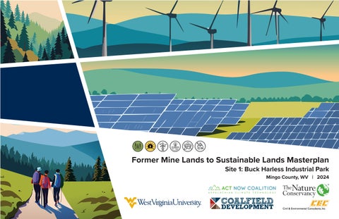
Former Mine Lands to Sustainable Lands Masterplan Site 1: Buck Harless Industrial Park Mingo County, WV | 2024
A SPECIAL THANK YOU TO THE FOLLOWING ORGANIZATIONS AND INDIVIDUALS THAT MADE THIS PROJECT POSSIBLE:
PROJECT DESIGN TEAM
ACKNOWLEDGEMENTS
JIM CHRISTIE, PLA (CEC) MATT PIZATELLA, PLA, LEED AP BD + C (CEC) COLIN MCCARDLE (CEC) JON MICHAUX (CEC) DUSTIN TOOTHMAN, PLA (CEC) ANDREW GOSNELL, PLA, ASLA (CEC) LOGAN PAXTON (CEC)
Mingo County Demographics 23,568
LOGAN COUNTY Ohio
Pennsylvania
Population (2020)
326 Total Employer Establishments (2023)
44.3 US Route 119
Median Age (2023)
8.3% Bachelor’s Degree or Higher (2023)
$85,600
PROJECT SITE
Median Property Value (2023)
$39,527 Median Annual Income (2023)
*Data Collected from The U.S. Census Bureau PROJECT SITE Kentucky
Virginia
MINGO COUNTY Holly Ridge Road
Logan Co. Mingo Co.
PROJECT SITE Scarlet Road
North Carolina
Mingo/Logan Readiness Center
Site Introduction Mining History N/A Phase 2 Released, Revegetation 535 Acres Laurel Fork Surface Mine Phase 1 Released, 60% Revegetation 826 Acres Scarlet Phase 1 Released, 60% Revegetation 654 Acres Tom Branch Surface Mine Revegetated, Completely Released 674.48 Acres Painted Rock Surface Mine Active, Reclaimed 507.63 Acres N/A Phase 1 Released, 60% Revegetation 500 Acres
Coal-Mac
22 Mine Run Road
Mohawk Industries
Accoville Property Owner: Mingo County Redevelopment Authority Mine Status: Phase 2 Released Size: Approx. 15 AC
go Co. Log an Co.
Mingo County and Logan County, like many rural areas in West Virginia, struggle with food insecurity and limited access to fresh, nutritious food - conditions that define it as a food desert. Residents often rely on convenience stores or travel long distances to reach full-service grocery stores, which contributes to poor health outcomes and economic strain. Restoring former mining sites in the region presents a powerful opportunity to address these challenges by converting degraded land into productive agricultural spaces. Coalfield Development, with its deep experience in land reclamation, regenerative farming, and workforce development, is uniquely positioned to be a strategic partner in this effort. Their model integrates environmental restoration with economic empowerment, making it possible to create community farms that not only improve food access but also generate jobs, support local enterprise, and promote long-term sustainability. By working together, we can turn underutilized land into a source of nourishment, resilience, and opportunity for Mingo County and Logan County.
Wright Way Ready Mix
Min
The 22 Mine Road Site, affectionately known as the ‘Buck Harless Site’ is a 15acre tract of land sitting within a larger parcel and is owned by the Mingo County Redevelopment Authority. Its strategic location adjacent to the Harless Industrial Park caught the attention of stakeholders, leading to its designation as a focus site. The site’s allure lies in its proximity to US Route 119, a major transportation artery. This accessibility opens up exciting possibilities for development and economic growth. Since the cessation of mining operations, the property has been repurposed as an industrial park with tenants that include IntertractorAmerica, Wright Concrete, Logan/Mingo Readiness Center, and Coal-Mac, Inc.
FOOD DESERTS
Food Deserts in America
12.2%
A Food Desert is classified as an area where people have limited access to healthy, affordable food. Someone living in a food desert experiences challenges daily, preventing them from going to a grocery store and buying nutritious foods like fruits and vegetables. The project site is in close proximity to multiple rural food deserts, where residents live 10 or more miles from the nearest grocery store. Income level, transportation access, and grocery store locations are key factors in determining if an area classifies as a food desert. Due to lack of access to healthy foods, food deserts impact health with obesity, type 2 diabetes, cardiovascular disease, high blood pressure, and various types of cancer linked to obesity, as well as mental health and overall quality of life.
OF GROCERY STORES IN LOGAN COUNTY WITH FRESH PRODUCE
Logan County
KENTUCKY
PROJECT SITE
4.8%
OF GROCERY STORES IN MINGO COUNTY WITH FRESH PRODUCE
Grocery Store with Fresh Produce Grocery Store with No Fresh Produce
Mingo County WEST VIRGINIA
County Vulnerability Least Vulnerable
Most Vulnerable
Data collected by the University of Missouri Extension center for Applied Research and Engagement System (CARES)
33%
17.4 MILLION AMERICAN HOUSEHOLDS LIVING WITH FOOD INSECURITY
OF US POPULATION IS LOCATED MORE THAN
THE NEAREST GROCERY STORE 10 MILES FROM
Food deserts can be eliminated in America with the implementation of community gardens, smaller grocers, and co-ops. The West Virginia Food and Farm Coalition provides leadership to the local food and farm sector across the state, building a strong network equipped to support food and farm businesses, promote community access to local foods, and share business resources to establish a robust local food sector and prevent food insecurity.
Project Goals & Objectives Goal 1 - Permaculture for Food Production: Use
permaculture farming techniques to convert the post-mining site into a productive agricultural space that maximizes food output for distribution and sale within local communities. Objective: Develop a sustainable farm system on the Harless site by investigating permaculture techniques and identifying strategies best suited to site conditions. Determine compatible farming programs that utilize native crops and sustainable techniques to maximize food production and establish a holistic farming environment.
Goal 2 - Innovation and Workforce Development:
Establish an innovative farming system that can support local workforce and serve as a template for other sites across the state and nation. Objective: Establish a farm on a former mine site by combining traditional farming practices with new and emerging technologies. This includes creating facilities and a training program to equip the local workforce with agricultural skills and provide meaningful employment opportunities.
Goal 3 - Low Impact Farming: Create a sustainable farm system that requires little input from outside sources using livestock, permaculture techniques, and on-site energy sources. Objective: Create a self-sustaining farm with onsite energy and water sources, such as solar and stormwater capture systems. Implement farming practices that rely on internal resources, like composting, to reduce dependence on outside inputs and support long-term sustainability.
CASE STUDY: Introduction To Permaculture What is Permaculture? Throughout the 1970s it became recognized that the modern industrialized methods of agriculture were unsustainable and highly dependent on nonrenewable resources, harming the very environment needed to produce crops and animals for harvest. The term ‘Permaculture’ was coined publicly with the publication of “Permaculture One”, written by Bill Mollison and David Holmgren. The idea focused on the importance of working with, rather than against nature, understanding that agricultural should not be a single product system. Today we understand Permaculture to be an approach that integrates land, resources, people, and the environment into a process that considers whole system thinking. Permaculture is a holistic approach that is applicable across various scales and conditions. Many consider it to be a multidisciplinary toolbox that includes agriculture, water capture and reuse, adaptive and renewable energy, natural building technologies, forestry, waste management, animal systems, aquaculture, economics, and community development. The integration of these processes helps to build systems that closely replicate the closed loop systems that are seen in natural ecosystems. These systems are often self-sustaining and produces little to no waste in the process, every action benefits another organism in the process. A few simplified examples are composting your fruits and vegetables to create soil or reusing or donating old clothing for a second use.
How does Permaculture Impact the Environment? Climate change is beginning to show us the drastic effects on our biodiversity, food and water supply, and overall human health. Rising temperatures have begun to affect rainfall and weather patterns, which impacts the success of crops and continues to deplete the water supply. As our demands for crops continues to rise due to population increases, it is commonplace to use unsustainable techniques and technologies to produce the number of crops needed. This process is unsustainable and often leads to an increase in wasted food and crop product. While agriculture is one sector, the implementation of permaculture into various sectors could help transition these industries to a more sustainable process. In our research we focused on the importance of using permaculture to create a holistic system across the site that begins to create a self-sustaining and low – no waste agricultural complex that utilizes sustainable energy and land management techniques.
What are the Main Goals of Permaculture? While permaculture can be implemented across many different aspects of life, we are focusing on the importance of the Buck Harless site being a low impact agricultural complex that integrates various technologies and techniques into the growing process.
The primary goals of using permaculture on the Buck Harless Site are: • Sustainable Energy Sources • Waste Management / Compositing • Adaptive Reuse of Storm / Site Water • Adaptive Land Management Techniques / Grazing Systems • Sustainable Crop Production • Sustainable Pest Management Solutions
Successful Examples of Permaculture Hidden Blossom Farm • Union, Connecticut • Primary Example of Agroforestry Hidden Blossom Farm is a 134-acre diversified farm in Union, Connecticut. They specialize in heirloom figs, grass-fed beef, and vegetables. They incorporate agroforestry through the practice of silvopasture, the deliberate integration of trees and grazing livestock on the same land, to ensure the pastures and orchards are fertile and ecologically sound. This ensures that the cattle can graze under the comfort of the trees. This is one of the few farms in the northeast that utilizes the technique of silvopasture.
Drinkers of the Wind • Bellevue, Idaho • Primary Example of Agroforestry and Wetland / Water Restoration Drinkers of the Wind is a regenerative farming practice located in Bellevue, Idaho. The land was originally purchased to create a horse ranch but is in the process of being converted into a carbon sequestering oasis, preserving the rare agricultural land in Idaho’s Wood River Valley. This farm is creating a robust riparian corridor while also experimenting with various techniques to create an ecologically and economically sustainable farm. The primary goals of Drinkers of the Wind are Climate, Water, Biodiversity and Community.
Horn Farm Center for Agricultural Education • York, Pennsylvania • Primary Example of Most Permaculture Aspects Horn Farm Center is a 501(c)(3) nonprofit that is fostering learning through ecological land stewardship, experiential education, and community partnerships. Horn Farm captures many of the aspects of permaculture by creating an environment where the sustainable practices are used as educational moments to help others learn how these practices can help to not only benefit themselves, but also the world. From a summer kitchen that helps meet food demands of local businesses and organization to the apiaries and meadow restoration, Horn Farm encapsulates what permaculture can do.
CASE STUDY: Introduction To Agrivoltaics What is Agrivoltaics? The majority of solar projects across the world are used primarily for solar energy production alone. Agrivoltaics suggests creating a multi-layered system that can begin to combine agricultural production with solar energy production. Agrivoltaics is the process of co-locating solar energy, in the form of solar panels, with agricultural production, such as crops or livestock. The exploration of alternate solar system designs with agricultural practices that optimize both energy and agricultural production begins to increase the overall value of the project while lowering the soft costs associated with solar facilities, such as land management around the solar fields. As of 2023, the National Renewable Energy Laboratory identified over 300 agrivoltaic projects across the United States. These facilities represent over 2.8GW, enough potential energy to power nearly one million homes. Most of these projects are focused on grazing and pollinator habitat.
Why is Agrivoltaics Important? In models created and analyzed by Solar Futures Study, it is estimated that solar energy could provide over 1 terawatt of electricity-generating capacity to the grid by 2035. However, to produce this capacity, the solar energy developments would need to consume approximately 5.7 million acres of land. While this number may seem relatively small in the grand scheme (less than 0.3% of US land area), it will begin to conflict with land currently being used for agricultural purposes. Often the land available has similar attributes that make is appropriate for both Solar Energy and Agriculture, (plentiful sun and flat area). The demand for food production and energy production will continue to grow as we experience population growth and higher energy demands. While many see solar and agriculture as enemies, agrivoltaics suggests that they could instead be partners. A journal article published in the September 2019 issue of Nature Sustainability found that by co-locating solar energy and agriculture could provide agricultural enterprises with diversified revenue sources and ecological benefits. These benefits could help to reduce the need for land use competition and decrease the amount of siting restrictions for both sectors. The optimization of co-locating these systems will enable simultaneous land use for both while providing multiple benefits for farmers and the solar industry.
Benefits of Agrivoltaics Many of the agrivoltaic projects across the United States are focused on creating grazing or pollinator habitat. While this is one benefit or opportunity, there are others available. Each section below will go into more detail about the potential opportunities surrounding agrivoltaics.
Ecosystem Services, Pollinator Habitat, and Stormwater Management Traditional methods of installing ground-mounted photo-voltaic panels involves grading, clearing, soil compaction, and the use of herbicides. This can often lead to a negative impact on soil health and water quality not only on site but on the surrounding sites which can affect adjacent agricultural land. However, with the concept of agrivoltaics, the native habitats are preserved or restored to levels that can create a healthy ecosystem while providing habitat for pollinators and other beneficial insects. In addition to the creation of pollinator habitat, preserving or restoring the vegetation across the site can help to create a healthy soil composition that can help alleviate large amounts of runoff from the storm water that is captured by the photo-voltaic panels. These benefits will help to save on operations and maintenance costs over the life of the project.
Crop Production There are a variety of crops that thrive in the partial shade that the installation of solar installations creates. Throughout these areas there are opportunities for configuring crops between, under, or on the perimeter surrounding the photo-voltaic panels. The partial shade that the photovoltaic panels create reduces the overall sunlight that can reach the crops, which changes the microclimate and increases soil moisture levels. While there are both benefits and trade offs within this process, it will require understanding how the creation of these microclimates benefit the crops that area planted.
Grazing In many solar energy projects harmful herbicides are necessary or mowing and trimming to manage the vegetation that grows in and around the photovoltaic panels. Often this adds a large amount of soft costs surrounding solar energy projects. However, livestock can be introduced to help reduce these maintenance costs of trimming or spraying beneath the photo-voltaic panels. Not only does this add an additional industry that can benefit from solar projects but also helps to maintain a robust eco-system across site.
Example Projects Using Agrivoltaics Jack’s Solar Garden
as a win-win scenario, it is cheaper to use sheep for maintenance while also allowing for a partnership and economic support to local farmers that partner with them. Sheep are the ideal candidate because they stick to eating the greenery rather than goats who can be destructive to the equipment.
Jack’s Solar Garden has been family-owned and operated for nearly 50 years. Jack’s is located on a 24-acre farm that was predominantly used for hay and alfalfa production. However, the owner of the farm realized that in order to remain economically viable, something had to change. He wanted to use this farm as a model for other small farms to continue to thrive while taking advantage of the economic benefits clean energy production provides. Jack’s Solar Garden is the largest research site that encompasses all four of the varieties of plants grown in agrivoltaic systems: native, pollinator habitat, horticulture crops, and livestock.
New Field Solar provides power to over 700 community solar customers. Through this program it is expected that these residents, local businesses, and non-profits will expect over $ 2 million in electricity cost savings over the projects lifetime. Newfield has an annual production of 9,300,000 kWh of electricity with an annual CO2 reduction of 11,700 lbs.
1.2 MW Agrivoltaic Solar Farm Boulder County, Colorado
As a research site, it is important for multiple techniques to occur so that researchers can compare and contrast techniques for success. To successfully complete this project Jack’s Solar Garden was designed in partnership with Namaste Solar. This project identified and overcame three specific challenges: I. Installing solar panels and tracking systems at greater and varying heights. II. Determine how to study the microclimates created by installing solar panels at varying heights. III. Avoid overly compacting native soil. Given the solar contractors extensive prior knowledge on dual-use sites, they knew it was important to avoid the compaction of the native soil across the site. To achieve this, the use of gravel across was prohibited and specified drive lanes for heavy farm equipment were designated and designed to allow the equipment to operate without affecting the entirety of the site. Protecting Equipment and Civilians This site does not have a perimeter fence. This is to ensure that farmers can be active beneath and around the solar panels on a regular basis to ensure the success of the crops. However, this required all electrical conductors needed to be covered properly. Namaste Solar implemented a robust mesh system that protects the underside of each of the conductors to eliminate the risk of harm to animals, farmers, or civilians.
New Field Solar
7.5 MW Agrivoltaic Solar Array Newfield, NY This 30-acre solar array is located in Newfield, New York. This 7.5 MW facility consists of over 23,000 solar panels and was officially brought online in 2018. Rather than maintain and manage the land with machinery or herbicides, Nexamp decided that their first community solar project in New York would involve a partnership with local farmers to maintain the grounds using sheep. In the first season they enlisted the help of 45 sheep to manage the grounds around the solar panels. Nexamp’s communication manager referred to this
Aurora Solar Project
150 MW Agrivoltaic Solar Array Minnesota Owned and operated by Enel Green Power, this was one of Minnesota’s first large-scale solar development projects. It was completed in 2017 and creates over 900 acres of pollinator habitat. This project utilizes the practice of planting native plants to help create a healthy ecosystem that is maintained by sheep grazing. By utilizing this method they were able to cut overall maintenance costs while also providing benefits to local farmers for sheep grazing and honey production. Each of the sites takes into account the landscape conditions and creates suitable grazing and pollinator habitats. In order to maintain certification from the state for providing beneficial habitat and meaningful ecosystem services the Aurora team competes an assessment once every three years. Through this project was determined that initial costs of native pollinator mix versus turf grass were very similar but the long-term savings on maintenance makes it worth the effort. Beyond partnering with local sheep farmers, Enel Green Power has also invited beekeeping cooperatives to install hives on the perimeter of the sites to support bee populations and honey production. The honey is then harvested and sold creating yet another diverse economic driver beyond the solar energy.
CASE STUDY: Coalfield Development
265,000+ SQFT. (6 AC) OF ABANDONED
Coalfield Development is a nonprofit organization based in West Virginia that works to rebuild the economy and revitalize communities across Central Appalachia. Founded in 2009, it focuses on transforming abandoned mine lands and distressed properties into productive spaces through workforce training, social enterprise development, and community-led revitalization.
PROPERTY REVITALIZED
$178M+ ATTRACTED IN NEW
INVESTMENT TO THE REGION
Sulphur Springs
Ho
ld
en
IA H
3,800+ Logan
Hw
y
Coalfield Development’s holistic model combines economic development, environmental restoration, and social support to create lasting prosperity for rural communities in West Virginia. Its mission is rooted in empowering people and transforming places—building trust, resilience, and opportunity from the ground up. Slagle
r Bla i
M
PEOPLE TRAINED IN VARIOUS IN-DEMAND INDUSTRIES
Rd
Argyle
Canterbury
Coalfield Development’s Highwall Project
wy
t a in
V P OW M
1,000+ JOBS CREATED BUSINESSES 91NEW SUPPORTED oun
W
Parsley
The organization provides job opportunities and educational support for individuals facing barriers to employment, especially those affected by the decline of the coal industry. Projects like the Highwall Farm and Ashford Lavender Farm repurpose former mining sites into agricultural hubs, using techniques like permaculture and livestock grazing to restore ecosystems and generate local food production.
10
Hutchinson
44
Sr 65
Lenore
S
r 65
65
rt
y r d Fw y
Scarlet
og
rt C
PROJECT SITE
Taplin
N
Mallory 2024
Landville
Delbarton Ragland
52 te
US
Ro u
Highwall Farm
65
Emmett
44
Varney
Present Day
Verner
Aflex Musick
Pie
Red Jacket 49
52
49
Calico
K in g C
119
Newtown Hardy
The site has been reclaimed using the principles of permaculture. It has proven to be an effective model on how to adopt and re-use former mine lands.
Christian
52
Tamcliff
wy
a y 11 9
Man
lH
hw
Don
Burch
oa
Hig
10
Barnabus Bias
Hensley Heights
Williamson Terrace
US
Accoville
Pine Creek
R
I. Rotational grazing across the site with various livestock for soil Hatfield tillage and to rid the area of invasive species. II. Nutrient cycling is supplied via natural fertilizer through the manure, which nourishes the soil and diversifies microbial activity. Chattaroy III. Stormwater capture through gravity fed irrigation channels allow water to flow through the property and collect in designated areas, 52 for use during dry seasons.
wo
d
65
Highwall site presents evidence of recent mining activity and shows conditions before it was reclaimed.
R
Chauncey
Project Site
By
CB
od
R
e ob
D
Belo
Nolan
Williamson This process amends the former mine soils and supports nutrient-rich farmland. Fresh, local Goody meat and produce is then exported and sold in surrounding communities. This is a meticulous process which supplies steady and meaningful employment opportunities to community members. Forest Hills Due to the success Coalfield Development brought to the Highwall Farm and other similar projects, they would be an ideal partner to operate the proposed Buck Harless farm.
2011
Lyburn
In order to experience a permaculture farm first hand and evaluate the success of implemented practices, CEC visited a nearby project by Coalfield Development. Called the Highwall Farm, it is 119 Maher located 9 miles southeast of the 22y Mine Road Site. w rd F Initially containing poor soils and invasive species, the property showed positive improvement by e ob implementing the following principles:
Agriculture is thriving at Highwall thanks to sustainable farming and livestock practices. Permaculture practice creates minimal waste and as a result, the site is nearly self-sustaining.
Matewan Gilbert Hinch WVU Facilities, Commonwealth of Kentucky, VGIN, Esri, TomTom, Garmin, SafeGraph, GeoTechnologies, Inc, METI/ NASA, USGS, EPA, NPS, USDA, USFWS Sprattsville
R D Bailey Lake
Left Fork Scarlet Rd
7/01
Left Fork Scarlet Rd 7/01
Naturally occuring low elevation areas and drainages provide the best opportunities for stormwater capture and reuse.
Flat areas with slopes below 10%. These areas are ideal for the implementation of structures, and certain agricultural land uses such as fields and grazing pastures.
The existing site circulation provides access to areas of the site with tough to traverse terrain.
Existing SIte Photo Low points where water naturally collects Existing SIte Photo Topography and vegetation
Primary Site Ingress / Egress
Existing Electric Corridor
Steep areas having slopes 30% 50% or greater. Development opportunities are limited here due to terrain restrictions. These areas are ideal for forest based programs. Nut and fruit production.
Existing SIte Photo Topography and vegetation
Existin
g Elec
rridor
Flat areas with slopes below 10%. These areas are ideal for the implementation of structures, and certain agricultural land uses such as fields and grazing pastures.
Buck Harless Mine Site Today
Topographically, the site features a mix of steep mountainous terrain and gentler slopes, with elevation changes averaging 40 feet. Gradual slopes under 10% are ideal for development, while steeper areas may be better suited for more flexible land uses. Most slopes face west or south, making them favorable for agriculture and solar energy due to optimal sunlight exposure. Soil surveys identify the area as predominantly Fiveblock and Kaymine soils—unstable fills from past mining activity, best suited for agriculture, forestry, and recreation. Vegetation varies by slope, with grasslands on flatter areas and forested shrublands on steeper terrain. Native species like Tulip Tree and Big Bluestem coexist with invasive plants such as Princess Tree and Autumn Olive, as observed from a site visit in spring 2024.
tric Co
Indicates existing roads that have been identified for use as the site’s primary circulation. Indicates existing roads surrounding the property that provide access to the site and other communities. Indicates above ground electric transmission line. Identifies steep slope areas ranging from 30% - 50%. Areas identified as “Steep” have development restrictions. Developable areas. Steep areas outside of developable area, generally 35%+. Indicates naturally occurring depressional areas and drainages.
This area is most conductive for solar development due to this area having 0%-5% slopes, predominantly western and southern sun exposure, and relative lack of adjacent structures or tall vegetation that would cast shadows on solar panels.
Utility Considerations for Development Existing infrastructure will need to be considered for development of the former Buck Harless mine. For many of the below, system capacity will need to be studied and system upgrades may be needed to support development on the former mine. • Water and Sewer: Site is serviced by a 1 million GPD Water system and 25,000 GPD waste water system. • Electric: An existing electric corridor runs through the center of the Harless site and offers three-phase electric. • Waste Collection and Disposal: Services are provided to Mingo County by Waste Management Services surrounding the site. • Cellular Service: Cellular service on site is very limited. Verizon has the best overall coverage for Mingo County. • Broadband: Fiber is available on the site.
Crop Area 2
• Grades below 10% • Characteristics of these areas are preferred for implementation of structures and certain agricultural land uses such as fields and grazing pastures.
Stormwater Management Areas
• Naturally occurring low elevation areas and drainages provide the best opportunities for stormwater capture and reuse.
Primary Site Ingress/Egress
Solar/Agrivoltaics
Steep Areas
Grades of 0% - 5% slopes. • Mostly western and southern sun exposure. • Relative lack of adjacent structures or tall vegetation that would cast shadows on solar panels. •
• Having 30% - 50% or greater slopes. • Development opportunities of areas labeled “Steep” have restrictions to: • Orchards • Reforestation • Grazing
Electric Corridor
Crop Area 1
• Grades below 10%. • Characteristics of theses areas are preferred for implementation of structures and certain agricultural land uses such as fields and grazing pastures.
Program and Concept Development The design process is iterative, and often involves reworking an idea multiple times before coming to a final conclusion. Such is the case with this project. This concept development phase would also involve research into various aspects of programs being proposed on site. In addition to the design process, this project involved a site visit. Members of the design team visited the Buck Harless site to note key takeaways and observations before beginning design work. Members of the design team would talk with project partners regarding their vision and needs for the future farm. Regular updates were shared with the client team during the design process to gather feedback and make sure the project was headed in the right direction.
Farmcore
• Main Facilities • Parking • Equipment Storage • Animals
Steep Areas
• Having 30% - 50% or greater slopes. • Restricted development opportunities. • Orchards • Forest Reforestation • Grazing
NORTH
Buck Harless Mine Site Masterplan
The Harless Masterplan outlines the transformation of a 15-acre former mine site in Mingo County, WV into a low impact permaculture farm. The plan integrates agriculture, renewable energy (agrivoltaics), and ecological restoration to revitalize the land and support local communities by addressing food insecurity in a USDA-designated food desert. It will create meaningful local jobs and offer hands-on training opportunities in sustainable agriculture, renewable energy, and land restoration, empowering residents with valuable skills and long-term career pathways. At the same time, it will serve as a replicable model for mine land reclamation, demonstrating how degraded sites can be transformed into productive, resilient landscapes that benefit both the environment and surrounding communities.
12 10 12
7
7
11
19
5 5
9
13
13
14
7
19
21
5 8
13 19 14 19
14
UTILITY CORRID
OR
5
13 13
19
20
13
3
14
19
2
15 10
13
19
16
4
21
1
18
19
7
6
17
19
19
Plan Key 1
Proposed 24’ Entrance Road
13 Access Road / Site Circulation
2
Farm Office / Facilities Building (60’ x 40’)
14 Hillside Fruit Orchard (Accommodates
3
Outdoor Gathering Space / Staff Break Area
4 24 Stall Parking Lot 5
Rainwater Harvesting Cistern
6
Agrivoltaics Field (Solar + Grazing) (1.3 acres)
7
Stormwater Harvesting Pond with Wetland Buffer
8
Machine Storage Building (100’ x 30’)
9
Barn (100’ x 50’) with 4 - 25’ x 25’ Outdoor Pens
77 semi-dwarf apple trees or similar size) (2.5 acres)
15 2 Greenhouses 16 Agricultural Field - Intensive Crops
13 18
6
13
UTI
LITY
COR
RID
OR
7
(lettuce, tomatoes & beans) (0.5 acre)
17
Agricultural Field - Fruit Crops (blueberry, raspberry, strawberry & currant) (0.75 acre) Agroforestry/Nut Production (Black Locust, Walnut, Hazelnut, Hickory Nut, Pawpaw) (1.85 acre)
10 Compost Area
18
Paddocks (4 - 50’ x 50’ Enclosures) Includes shade structure, water & feed 12 Grazing Pasture (with option to divide for rotational grazing) (1.5 acre) Includes shade structure, water & feed
19 Deer Fence (All Crop Areas)
11
20
Apiary
21
Herd Passage to/from Agrivoltaics
20
NORTH
0’
100’
FACILITIES
NORTH 12
The proposed masterplan for the Buck Harless Site proposes several programs for facilities and operations to support day to day farm operations: • Farm Office and Facilities Building (#2): This proposed building is to serve as one of the few permanent structures on site. This building will consist of office space for farm employees, restrooms, kitchen/dining area, and a larger room to host meetings or larger groups of farm visitors/tours. A parking area containing 24 stalls is included behind the building to accommodate employees and visitors. • Machine Storage Building (#8): The proposed equipment storage building is sized to fit a medium tractor and any additional tools needed for the tractor to complete various tasks on the farm. • Barn (#8): The proposed barn is 100’ x 50’ and consists of two stories. The bottom level accommodates eight animal pens. Half of these animal pens have access to an enclosed outdoor pen. The second barn story will serve as storage for hay and other materials and tools. Circulation around the barn is open to allow for ease of equipment maneuverability. While enclosed with fence to the northwest, gates will still allow for equipment to drive through the barn and out the opposite side. The northwestern end of the barn also provides fenced in access to paddocks and animal pastures.
Plan Scale: 1” = 125’
10
11
5 9
5 5 8
1
5
3 2
4
All above buildings are to have cisterns, which will assist with rainwater collection and storage.
1 6 1
Proposed 24’ Entrance Road
4
24 Stall Parking Lot
8
Machine Storage Building (100’ x 30’)
2
Farm Office / Facilities Building (60’ x 40’)
5
Rainwater Harvesting Cistern
9
Barn (100’ x 50’) with Outdoor Pens (25’ x 25’) 12 Grazing Pasture
3
Outdoor Gathering Space / Staff Break Area
6
Agrivoltaics Field
10 Compost Area
AGRIVOLTAICS
21
The integration of solar panels in an effort to create a self - sustaining farm focused around sustainable design practices is proposed for the Buck Harless site (#6 on plan). The south eastern portion of the property contains multiple site features that lend itself well for this program - including relatively gentle slopes (<5%) that are southern and western facing (maximum solar exposure). Implementation of solar panels will allow the proposed farm to produce electricity on site. There may even be opportunities for the farm to sell electricity to others, depending on overall demand of farm functions and maximum capacity of the solar area. The plan proposes the integration of solar panels with an agricultural land use, a term called ‘Agrivoltaics.’ This practice is becoming increasingly common in the solar-technology world as the U.S. and other nations put a greater focus on renewable energy generation. Often, solar and agricultural land uses compete for the same property. To address this conflict, solar panels are often combined with crop production, livestock production, or serve as grazing land or pollinator habitat. When selling this electricity, this provides an additional source of income for the farmer. In the case of the Buck Harless site, a combination of solar panels and pasture is being proposed. Due to the steep terrain found elsewhere on site, land available for pasture/grazing is limited. Combining these two programs will allow the farm to maximize the number of animals on site. The type of animals allowed to graze in the solar area needs to be carefully considered, so as to not damage the solar infrastructure. Sheep would be an example of a preferred animal.
11 Paddocks
6
13 6
7
13
20 NORTH Plan Scale: 1” = 125’ 6
Agrivoltaics Field (Solar + Grazing) (1.25 acre)
13 Access Road / Site Circulation 21 Herd Passage to/from Agrivoltaics field
7
Stormwater Harvesting Pond with Wetland Buffers 20 Apiary
Util
ity L
ines
ROTATIONAL GRAZING The management practice of rotational grazing involves the systematic movement of grazing animals between pastures as they consume the available vegetation in each area. This gives the vegetation in the grazed pasture time to regenerate and prevents overgrazing. According to the USDA, this practice has many advantages:
12 10
• Reduces runoff, limits soil erosion, and improves water quality • Improves soil structure, biodiversity, and carbon sequestration • Increases pasture drought resilience • Better distributes nutrients from manure throughout a pasture land • Increases forage for livestock • Results in fewer herd health problems
12
11 9
7 7
The masterplan is set up to allow for a rotational grazing system to be established. 1.5 acre of grazing pasture (#12) can be divided as needed to create separate plots. The 1.3 acre of agrivoltaics can be divided as needed using temporary fence to allow for rotational grazing. The orchard can also be used as grazing land, maintaining the vegetation below trees. In this case, care will be needed to ensure animals to not damage or eat the orchard crop. After season, agricultural fields can provide additional grazing land. Grazing can also be integrated into the agroforestry area. Approximately 8.3 acres of grazing area is provided when all the above areas are utilized. The following animal count is recommended:
Utility Lines
NORTH
• 2 cows • 6 sheep • Flock of chickens
Plan Scale: 1” = 125’ 7
Stormwater Harvesting Pond with Wetland Buffers
11
9
Barn (100’ x 50’) with Outdoor Pens (25’ x 25’)
12 Grazing Pasture
Paddocks
10 Compost Area
AGROFORESTRY With the orchard located on the steep slopes on the northern portion of the Buck Harless site, an agroforestry concept is being proposed on the southern most steep slopes. Like the orchard, this is a program that can be implemented on the steepest slopes found on site, where few others can be. This area is 1.85 acre in size. Quick growing trees such as Black Locust can be grown and eventually harvested and utilized to build other structures on site (such as fence posts). This area could also provide opportunity to grow nut producing trees, such as walnut, hickory, or hazel nuts. Like the orchard, this area can be a part of the rotational grazing plan. Animals can be utilized to maintain the forest-floor vegetation.
18
19 17
Util
ity L
19 18
6
7
NORTH Plan Scale: 1” = 125’ 6
Agrivoltaics Field (Solar + Grazing) (1.25 acre)
17 Agricultural Field - Fruit Crop
7
Stormwater Harvesting Pond with Wetland Buffers 18 Agroforestry/Nut Production
19 Deer Fence
ines
ORCHARD + FIELDS The proposed masterplan for the Buck Harless site includes a variety of agricultural crop areas. This program is located predominantly on top of the steep sloped area found on site. Earthwork will need to occur to create usable land. By grading between existing developable areas (slope <10%), approx. 2.5 acres of usable agricultural land can be created. Several crop uses are being proposed in this space: • Greenhouses (#15): Two greenhouse-type structures are being proposed to aid in crop production on the Harless farm. These structures could be permanent greenhouses that allow for a year-round growing. They could also be hoop houses, and allow the farm to extend the growing season for crops. • Agricultural field, Intensive crop (#16): A half acre agricultural field is being proposed to support crops that tend to require more maintenance, such as tomatoes, beans, or lettuce. This field is placed closer to the greenhouses, following the concept of permaculture zoning and keeping programs requiring the most attention closer together. This field could also be a location to plant crops started in the greenhouse. • Agricultural field, Fruit crop (#17): A 0.75 acre field for a fruit crop is also being proposed for this area of a site. A slightly less intensive crop to grow, it is located further from the greenhouse area. Crops that could be grown here include blueberries, raspberries, or strawberries. • Orchard (#14): Located north of the agricultural fields, the proposed orchard for the Harless farm is situated on a portion of the steepest slopes that can be found on site. This makes use of land that is not suitable for several of the other proposed farm programs. Sized at 2.5 acres, this program accommodates 77 semi dwarf apple trees, or different fruit trees of a similar size. The orchard could contain all apples, or could be a mixture of fruit, such as apples, pears, and cherries. This area can also be utilized in the rotational grazing system, and animals can be used to maintain vegetation under the trees. Temporary fence, combined with the outer deer fence system, can be used to divide the orchard up into sections for grazing. Care will be needed to ensure animals do not damage the fruit trees or consume the growing crop. Each tree can be protected by fence to prevent this. Observation of animals while they are grazing in this area may be needed for additional protection. All agricultural crop areas will need to be protected by deer fence to prevent grazing by outside animals. This fence system can also assist with rotational grazing, when combined with temporary fence.
13 19 7 7 14 19
19
13 14 14
Utility Lines
13
19
19
19
14
19 20
10
15
19 13
16
7
17
19
19 19
NORTH Plan Scale: 1” = 100’
7 7
Stormwater Harvesting Pond with Wetland Buffers
10 Compost Area 13 Access Road / Site Circulation 14 Hillside Fruit Orchard 15 2 Greenhouses 16 Agricultural Field - Intensive Crop (0.5 acre) 17 Agricultural Field - Fruit Crop (0.75 acre) 19 Deer Fence 20 Apiary
STORMWATER CAPTURE AND REUSE One overarching goal of the proposed masterplan is to create a low impact farm with little input from outside resources. To do this, identifying a water source is essential. Farms can consume large quantities of water. A single dairy cow can consume 3050 gallons of water per day, according to the Penn State Extension. Crops are also large consumers of water. While day to day needs can vary depending on growing conditions, it is reported that a dwarf apple tree can consume up to 15 gallons of water on a hot summer day (UCCE Sonoma County). A 100’ long, 2’ wide row of raspberries can consume over 30 gallons in similar conditions. With no water sources found on site, stormwater harvesting and reuse techniques will need to be implemented to support farm functions and limit the consumption of public water supplies. This is being accomplished utilizing two different techniques:
7 7
Utility Lines
• Cisterns (#5): Located next to proposed buildings, cisterns will help collect rainwater off of roofs. • Stormwater Harvesting Ponds (#7): An analysis of existing site topography would identify several locations on site where stormwater retention, or ‘harvesting’ ponds could be implemented. A total of four ponds/drainage areas are being proposed on the farm, two of which are connected via a drainage swale. These four ponds work as a system to collect water as it drains from various areas on the farm. Stored in the ponds, the water can then be pumped out and used for irrigation as needed. A truck or trailer with a tank can be used to transport water from the ponds to the crop areas. The plantings around these ponds also needs to be carefully considered. An established wetland planting scheme would be ideal. Wetland - like plantings will help filter nutrients and pollutants out of water before it flows into the pond. This is important when capturing water running off of agricultural fields. High nutrient loads in the water (caused as water runs through the field and washes away nutrients) can lead to algal blooms, which creates an unhealthy, anaerobic ecosystem. Wetland plantings can reduce this nutrient load and mitigate any potential algal blooms. In addition, recycling water running off of agricultural fields can lead to contamination by pathogens that may be present in the soil. Evidence suggests that wetland plantings can help mitigate pathogens in the water, and prevent them from spreading to uncontaminated crops as water is used across the farm. Establishment of floating wetlands may also be able to support this function.
7
7
NORTH Plan Scale: 1” = 125’ 7
Stormwater Harvesting Pond with Wetland Buffers
DESIGN IMPLEMENTATION
PHASE 1 2 2 3
4
3 1
1 2
2
1
1
3
2
3
2
Phase 1 steps include:
NORTH
1. Human intervention: Clearing and grubbing site, especially for large invasive species removal. 2. Rotational grazing (for herbaceous material). I. Begin on site compost production using organic waste and animal manure. 3. Create swales and stormwater ponds. 4. Observe, monitor, and intervene as needed while land is prepared for agriculture.
NORTH
PHASE 2
1
PHASE 3
PHASE 4
2 2
1 1
2 2
1
1
1 2 1
1 1
1
1 1
1
1
2
1
2
1 1
1
2
1
2
1
1
Phase 3 steps include: 1.
Phase 2 steps include: 1. Road construction. 2. Build site structures.
NORTH
Agriculture implementation: I. Agricultural fields II. Orchard III. Greenhouses
Phase 4 steps include: 1.
NORTH
NORTH
Renewable energy implementation. 2. Native reforestation.
APPENDIX
AM I RURAL? - REPORT
Common Rural Definitions
Census 2020, Percent Rural
Report Address: 22 Mine Road, Delbarton WV 25670
How Your Location is Defined
Percent of County Population that is Rural: 100.00
Latitude: 37.75972 Longitude: -82.11633
Non-metropolitan - not located in a metropolitan or micropolitan area.
Program Eligibility
Urban Area - Not located in an Urban Area.
Federal Office of Rural Health Policy Grant Programs
Census Tract:
54059957200 (2010 & 2020)
Mingo County, WV has been designated by Federal Office of Rural Health Policy (FORHP) as rural.
This location is eligible for Federal Office of Rural Health Policy Grant Programs.
County: Mingo County, WV
Frontier and Remote Area (FAR) Level 2
Rural Health Clinics Program
FAR Description: Areas where the majority of the populations lives 60 minutes or more from Urbanized Areas (50,000 or more population) and 45 minutes or more from Urban Clusters (25,000 - 49,999 population) Note: Urbanized Areas and Urban Clusters are defined by the U.S. Census Bureau prior to the 2020 Census.
CMS interim guidance considers a location to meet the rural location requirement for the RHC program if it is outside of an urbanized area in the 2010 Census Bureau data OR if it is outside of an urban area in the 2020 Census Bureau data. This location is considered rural by these guidelines.
Rural Urban Commuting Area Code: 8.0
Health Professional Shortage Areas
Primary Description: Small town high commuting: primary flow 30% or more to a small UC
There are health professional shortages in the following categories:
Rural Urban Continuum Code Information for Mingo County
Primary Care Dental Care Mental Health
RUCC Code: 8 RUCC Description: Nonmetro - Urban population of fewer than 5,000, adjacent to metro area.
Medically Underserved Areas / Populations
Urban Influence Code Information for Mingo County
This area is a medically underserved area
Urban Influence Code: 9 UIC Description: Noncore adjacent to micro area and contains a town of 2,500 - 19,999 residents
This area is not considered a medically underserved population
Resources for Understanding Rural Communities and Disadvantaged Communities Project Site
Am I Rural? Report - Rural Health Information Hub
Source: Rural Health Information Hub
Science and Technology Notes, by Category | Bridge Initiative for S&T Policy, Leadership, & Communications | West Virginia University (wvu.edu)
https://www.ruralhealthinfo.org
Areas of Persistent Poverty & Historically Disadvantaged Communities | US Department of Transportation Explore the map - Climate & Economic Justice Screening Tool (geoplatform.gov)