
10 minute read
WALKABILITY & GREENSPACE

DEFINITIONS:
Walkability:
Advertisement
• The way in which the built environment supports pedestrian activity and usage.
Sustainable design:
• Determined by a focused reduction in environmental impacts which also minimize waste and promote healthier environments for people and the planet.
Connectivity:
• Having the quality of freely moving throughout a system of streets, paths, etc. without significant barriers to safety and mobility.
Greenspace:
• Areas within the built environment that provide a sense of nature, often including trees, shrubs, grass, soil, and water.
PROBLEM:
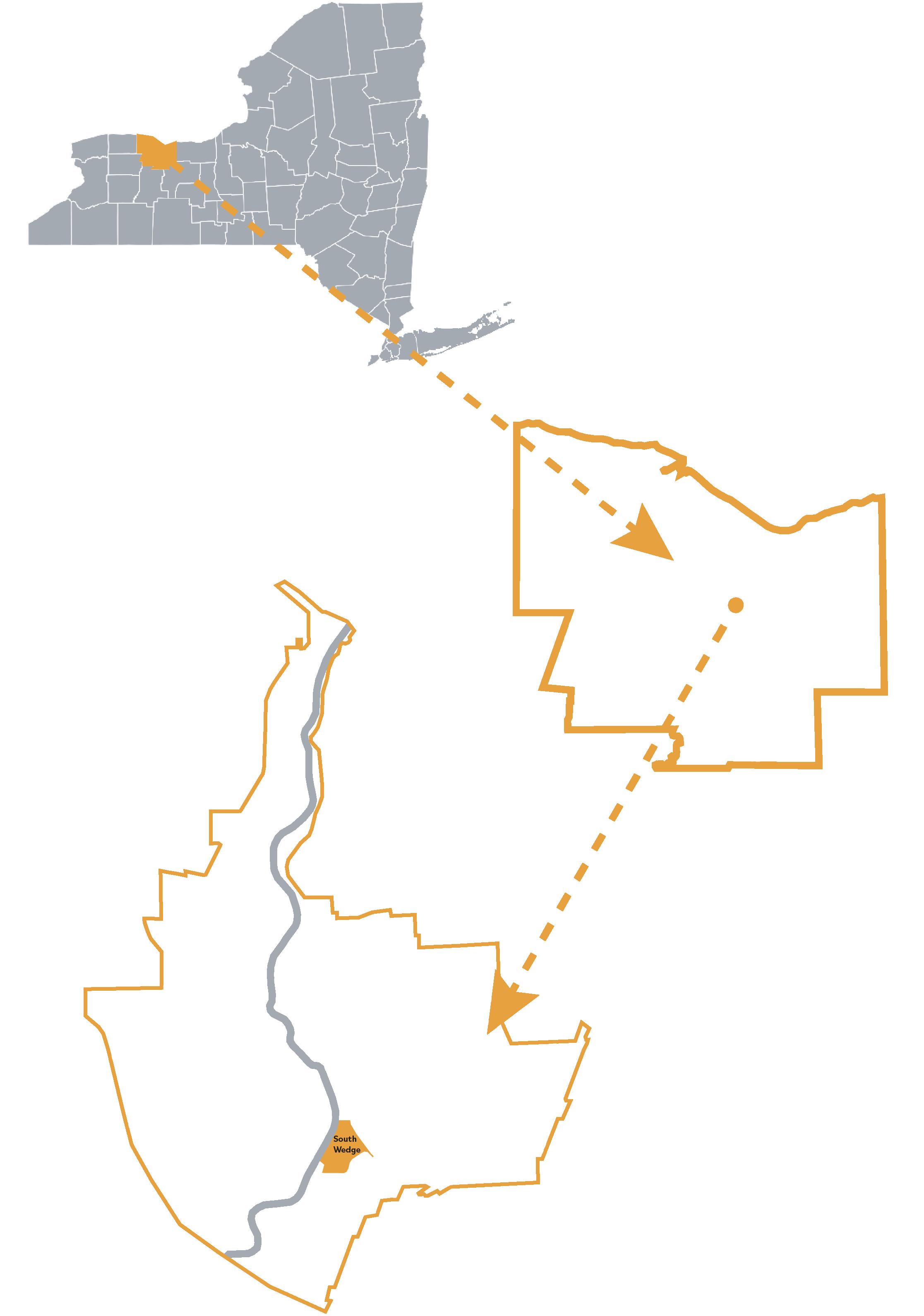
Carbon emissions from vehicles are one of the leading causes of climate change. South Wedge in Rochester, NY is heavily vehicle dependent. There are barriers to pedestrian safety and walkability. Connectivity and accessibility to greenspace contributes to lack of pedestrian activity as in South Wedge, as well as more vehicular use. Observations of the South Wedge neighborhood reveal that the Mount Hope Avenue corridor is lacking features for pedestrian safety and can be improved upon. Members of the community agree that there are barriers to pedestrian safety and connectivity when focusing on this particular roadway. Firstly, the Genesee Riverway Trail is a highly used trail by residents in the South Wedge. The trail runs along the Genesee River from Highland Park all the way up to Ontario Lake. One of the biggest problems found while walking around the neighborhood was trying to access the Riverway Trail. There are only three entrances to the trail from Mount Hope Avenue. One entrance is on the corner of Averill Avenue, the second entrance is the corner of Hickory Street, and the last entrance is located on Ford Street. Two of the entrances have crosswalks while the other one does not. The biggest problem noticed with accessing the trail was safety. Many people drive pretty fast down Mount


Hope Avenue which is a fairly busy street. It is extremely hard to cross the street in order to get to the trail on any point of the road, but the three entrances. The crosswalk on the corner of Averill and Mt. Hope is seen as the main entrance to the park. It is clear to see that the entrance is not clearly labeled meaning someone who isn’t familiar with the area would have no idea there is a trail along the river. The second entrance, which posed a lot of safety issues, is on the corner of Ford Street and Mount Hope. This entrance was easily the most unsafe to use for a various number of reasons. Firstly, the corner of Ford Street and Mount Hope is extremely busy because people are crossing the bridge over the Genesee River. Secondly, the crosswalks that do exist force pedestrians to go in the middle of the intersection which is not very safe or walkable. One of the images shows the intersection and crosswalks on Ford Street in order to access the Riverway Trail. The Ford Street intersection is extremely busy and fairly unsafe to cross. The entrances to the Genesee Riverway Trail was not the only weakness within the neighborhood. Multiple streets were surveyed to get a better understanding of the sidewalks in the area. It was observed that sidewalks were in poor condition making walking on them difficult. Pieces of the sidewalk were coming out of the ground leaving areas very easy to trip and fall on. The sidewalks would not be accessible by wheelchair because it would be almost impossible to push a wheelchair along the sidewalks. Based on the images, it is clear to see that the biggest weakness in walkability within the South Wedge neighborhood is safety. In order for people to drive less and walk more, they have to feel safe wherever they are walking to. When addressing walkability; safety, connectivity and accessibility are important to account for.

SOLUTION STATEMENT & PROPOSALS:
Small changes to the built environment and daily activities can have an immense and lasting effect on South Wedge. Proposing sustainable solutions and programs with the goal of reducing existing automobiledependent systems and encouraging nonmotorized transportation will reduce carbon emissions and create a more sustainable future. As walkability in the neighborhood increases, the demand for car parking and car infrastructure decreases, and the need for traffic-free spaces increases. By focusing on walkability, a reduction in vehicle emissions will decrease air pollution as more people choose non-motorized transportation alternatives. As more people choose to walk or bike to their destinations, there will be an increased demand for areas that support those choices including the need for more greenspace. Infrastructure for non-motorized transport requires far less space and maintenance and in turn can help protect biodiversity by reducing the physical space needed for roadways, offering a reduction of paved areas and allowing more space for plants and trees. Non-motorized transportation choices also aid in reducing noise pollution caused by vehicular traffic. Finally, walkability in a neighborhood increases the likelihood that residents and visitors will choose nonmotorized transportation and encourages healthy behaviors that benefit individuals and the environment.

PARKWAY SYSTEM:
Networks and connectivity can be improved by taking inspiration from Olmsted-style Parkways. This in part helps to link historic and modern greenspace throughout the neighborhood while building on the existing culturally important resources. Following this proven example of walkable spaces, we can utilize passive elements to aid in traffic calming and enhance greenspace connectivity through corridors of plantings and pedestrian-friendly walkways.


DOUBLE ROUND-ABOUT:
A double roundabout implementation at the Ford Street and Mount Hope Avenue intersection will help address traffic calming in that area. Being so close to entrances to the Genesee Gateway Park and the Genesee Riverway Trail, it is important to provide a safer walking condition to help promote walking and calm that area.
CROSSWALKS & REFUGE ISLAND
Crosswalks and Refuge Islands also provide another element of safety for pedestrians. The raised crosswalk proposals will act as a speedbump to reduce traffic speeds and make drivers more aware of pedestrians. Wider crosswalks also add to pedestrian visibility when crossing streets and can assist in reducing pedestrian-vehicle collisions.


BIKE LANES:
Infrastructure improvements will again contribute to the safety of pedestrians as well as prioritize other modes of transport. The separation of travel lanes will help reduce traffic congestion and aid in safety

WORKSHOP & SIGNAGE:
Neighborhood walkability can be encouraged through wayfinding, signage and walking workshops. These will all be forms of education for the members of the community as well as outreach opportunities for residents to contribute to discussions and planning for the future of the neighborhood.
BENEFITS:
Increasing walkability through and around the South Wedge neighborhood will have many positive effects on the neighborhood. Through the lens of equity, it helps with accessibility and connectivity for many different people in South Wedge throughout the neighborhood and other locations in Rochester. This allows for more people to have access within and around the community. There are multiple economic benefits to these implementations as well. The main benefits associated with the proposals include reducing emissions by cutting down on the amount of trips by vehicles. Improving the connectivity within the community also creates a need for more greenspace and pedestrian networks. This protects biodiversity by reducing the need for roadways, encouraging plantings for noise reduction and air purification. These proposals can also have a positive effect on the economy within this neighborhood. Increased walkability can help raise property values, helps connectivity to local businesses, creates jobs for maintenance and upkeep, and attracts more people to the neighborhood.

TIMELINE:
The proposals range from a short term to long term timeline. Signage and walking workshops are very short term solutions which can be implemented nearly immediately. Bike lanes and crosswalks are more medium term design solutions. These can be implemented in phases as well making it slightly more of a gradual process. Finally, the roundabout and the parkway system design solution would be long term on the timeline. This is due to getting permissions, organizing funding and the overall planning of these implementations.
FUNDING:
The Department of Transportation (DOT) will be important when getting resources and funding. Reconnect Rochester will be another helpful organization as they want to support transportation choices to create a more dynamic community. The City of Rochester Department of Environmental Resources is also another option to address funding and gaining resources. The South Wedge Planning Committee is a great group to look for resources. Finally, local businesses to sponsor small implementations (signage) would be a great option for funding.
STAKEHOLDERS:
South Wedge residents and community block groups including the South Wedge Planning Committee and Volunteers. “The South Wedge Planning Committee serves residents, businesses, and visitors of the South Wedge. We are a reliable resource for anyone visiting, living, or working in the South Wedge.”
ROC the Riverway partners. “Revitalizing the Genesee River corridor will help fuel our local economy. ROC the Riverway will serve as a major asset in attracting new jobs and solidifying our identity as a vibrant waterfront community. Cities around the world have discovered the power of great public spaces, bicycle/pedestrianfocused infrastructure, and water-oriented development in attracting employers and the next generation workforce.”
Highland Park Conservancy (Rochester’s Olmsted Parks) “The mission of the Highland Park Conservancy, a 501(c) (3) non-profit membership organization, is to advocate for, and participate in, the preservation, restoration and enhancement of the entire Highland Park with its world class arboretum, its historic Olmsted design and its other amenities, by increasing the public’s appreciation for, and active engagement with, its absolute uniqueness.”
“The Landmark Society of Western New York, Inc., is one of the nation’s oldest and most active historic preservation organizations. It is a not-for-profit membership organization dedicated to helping our region’s communities preserve and capitalize on their rich architectural, historical, and cultural heritage. The Landmark Society’s service area covers nine counties in western New York centered on the City of Rochester. Our mission is to protect the unique architectural heritage of our region and promote preservation and planning practices that foster healthy, livable, and sustainable communities.”
“Reconnect Rochester is a 501(c)3, non-profit organization made up of ordinary citizens who believe we can do extraordinary things together. We roll up our sleeves and lead by example. Our Mission: Whether by bus, by rail, on bike, or on foot, Reconnect Rochester champions transportation choices that enable a more vibrant and equitable community. Our Vision: We envision a community connected by a robust transportation network that makes it easy for everyone—regardless of physical or economic ability—to get around.”
CONCLUSION:
The concepts proposed for improving walkability focus mainly on the Mt. Hope Avenue corridor in South Wedge and offers solutions that can be applied to other streets within the neighborhood and in the greater city starting at the community-scale and building up to large-scale municipal projects. The context of this project uses the inspiration of parkway systems and regional connectivity through placemaking to enhance and create walkable networks using existing streets. The individual design elements outlined can be adapted to fit localized contexts and are meant to be a guide for scalable projects and city-wide implementation. South Wedge is a unique neighborhood in Western New York, as access is restricted on three sides by both natural and man-made features. Many cities across Western New York deal with similar issues and can benefit from these concepts and proposals as well.


