Acknowledgment of Country
The City of Canterbury Bankstown acknowledges the traditional country of the Darug (Darag, Dharug, Daruk and Dharuk) and the Eora peoples.
We recognise and respect their cultural heritage, beliefs and relationship with the land. We acknowledge that they are of continuing importance to Aboriginal and Torres Strait Islander peoples living today. Council also acknowledges other Aboriginal and Torres Strait Islander language groups in the City and works closely with Aboriginal and Torres Strait Islander communities to advance reconciliation in the City.

We’re committed to creating a liveable and loveable City for all our residents







Great Cities
We believe in creating vibrant, dynamic, and diverse communities that offer opportunities for people to connect, pursue their passions, and contribute to the world around them.
Naturally Green
We protect and prioritise nature in and around our city to enhance environmental sustainability and improve the quality of life for our residents.
Design Excellence
We encourage buildings, spaces, and objects that are both beautiful and practical, enhancing the beauty, accessibility, and safety of our built environment.
People First
We prioritise the needs, preferences, and aspirations of our community in all aspects of urban planning and design, creating supportive and enriching places people love.
Community
We engage with our community to ensure their needs and aspirations are reflected in the outcome, creating sustainable, resilient, vibrant, diverse, and inclusive places.
Sustainability
We seek designs that reduce negative impacts on the environment while also promoting social and economic well-being.
Net-Zero
We encourage our community to design buildings and places that produce as much renewable energy as they consume, reducing greenhouse gas emissions, lowering energy bills, and increasing resilience to environmental shocks and stresses.
Accessibility Note:
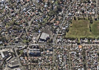
Figure 1. Nearmap (Dated: 11 July 2025)
1.1 Explanation
The Canterbury-Bankstown Local Environmental Plan 2023 and Canterbury-Bankstown Development Control Plan 2023 combine to regulate effective and orderly development, consistent with Connective City 2036.
The Canterbury-Bankstown Local Environmental Plan 2023 is Council's principal planning document. It provide objectives, zones and development standards such as lot sizes, floor space ratios and building heights.
The Canterbury-Bankstown Development Control Plan 2023 supports the LEP by providing additional objectives and development controls to enhance the function, design and amenity of the site at 913-925 Punchbowl Road and 21 Canterbury Road, Punchbowl known as the Club Punchbowl Precinct. Note: If applicable to an application, the development controls of Chapter XX of this DCP will prevail if there is an inconsistency with any other development controls in this DCP.
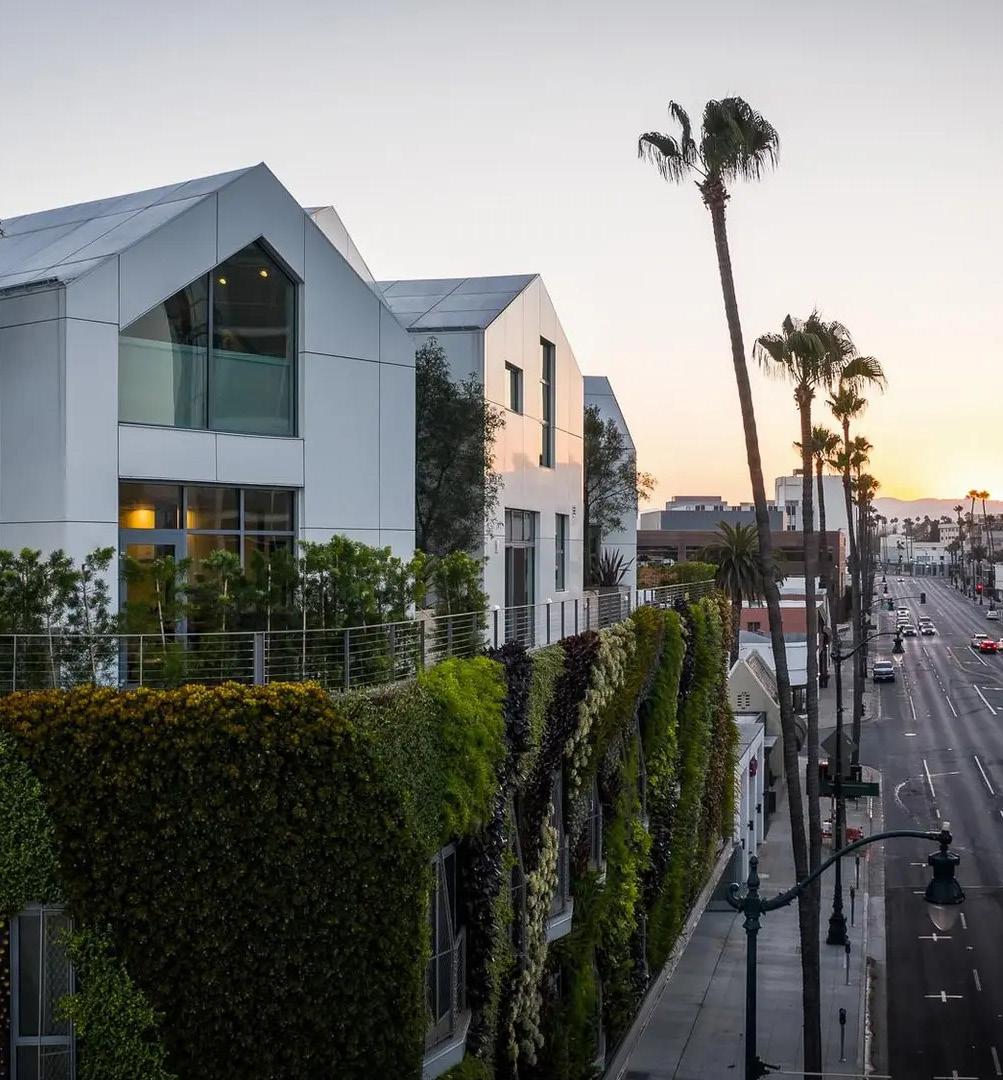
Figure 2. Gardenhouse, MAD Architect
1.2 Application of this DCP
This section of the DCP applies to the land at 913-925 Punchbowl Road and 21 Canterbury Road, Punchbowl also known as the ‘Club Punchbowl site’.
Figure 3. 913-925 Punchbowl Road & 21 Canterbury Road application map
1.2.1 How to read this
DCP
This DCP is structured around a hierarchy of criteria encompassing objectives, principles and controls. The intent is to provide clear, direct and informative design guidance for new development and public domain improvements within and adjacent to the site. When addressing the criteria it is important to consider the purpose of each category, as outlined on this page. Collectively these elements create a comprehensive framework that will enable the site to deliver high quality renewal opportunities.
Objectives
These are the ‘why’ we have the principles and controls in place.
Principles
These are the ‘what’ we want statements. They provide clear direction as to what should be done, without saying how to do it. How these are achieved comes down to individual site circumstances, design and merit.
Controls
These tell the applicant ‘what’ we want, and ‘how’ to do it. They are definitive, and easily assessable, and provide clear guidance on exactly what is expected.
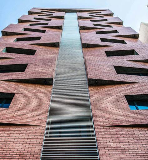
Figure 4. Edges Al BaroukBy Studio Toggle, Salmiya, Kuwait
1.3 Vision and Character
Locality Statement
The redevelopment of the Club Punchbowl site envisions a pedestrian-friendly mixed use precinct that integrates high-quality urban design with a strong sense of community. At its heart, the development will feature an attractive, publicly accessible open space of including a playground and a green 'linear parkway' for residents, visitors, and workers to enjoy.
The precinct will also include enhanced pedestrian pathways and improved connectivity with the surrounding area. Streetscape enhancements along the frontages will reinforce the walkability and accessibility of the precinct.
The new development will be designed to manage flooding impacts to preserve the safety of occupants on the site while being well integrated with well-designed and attractive buildings on the site.
The new development on the site will contribute to a lively and engaging street-level experience away from the noise of Canterbury Road transforming the site into a welcoming precinct for the residents that will live on the site.
Non-residential uses on the site will be designed and operated in a way that will maintain the amenity for the residents and their guests.
Through carefully considered design and a commitment to public benefit, the Club Punchbowl redevelopment will help to enhance Punchbowl, and provide community life, convenience in a vibrant and sustainable urban setting.
Principles
P1. Create a vibrant and well-designed mixeduse precinct at Club Punchbowl, featuring lively public domain that are pedestrianfriendly and filled with detail. The development is to showcase a distinctive skyline with slender towers set back from the streets, enhancing the area’s character and anchoring the corner of Punchbowl Road and Canterbury Road;
P2. Ensure that the public domain is of high quality and amenity;
P3. Contribute to a thriving centre at street level, with well-designed active street frontages;
P4. Create various recreational opportunities for the surrounding community;
P5. Ensure a harmonious transition of built from the site into the surrounding residential areas;
P6. Reinforce the distinctive attributes and qualities of Punchbowl within the precinct;
P7. Promote urban and architectural design quality through planning interventions that foster design excellence.
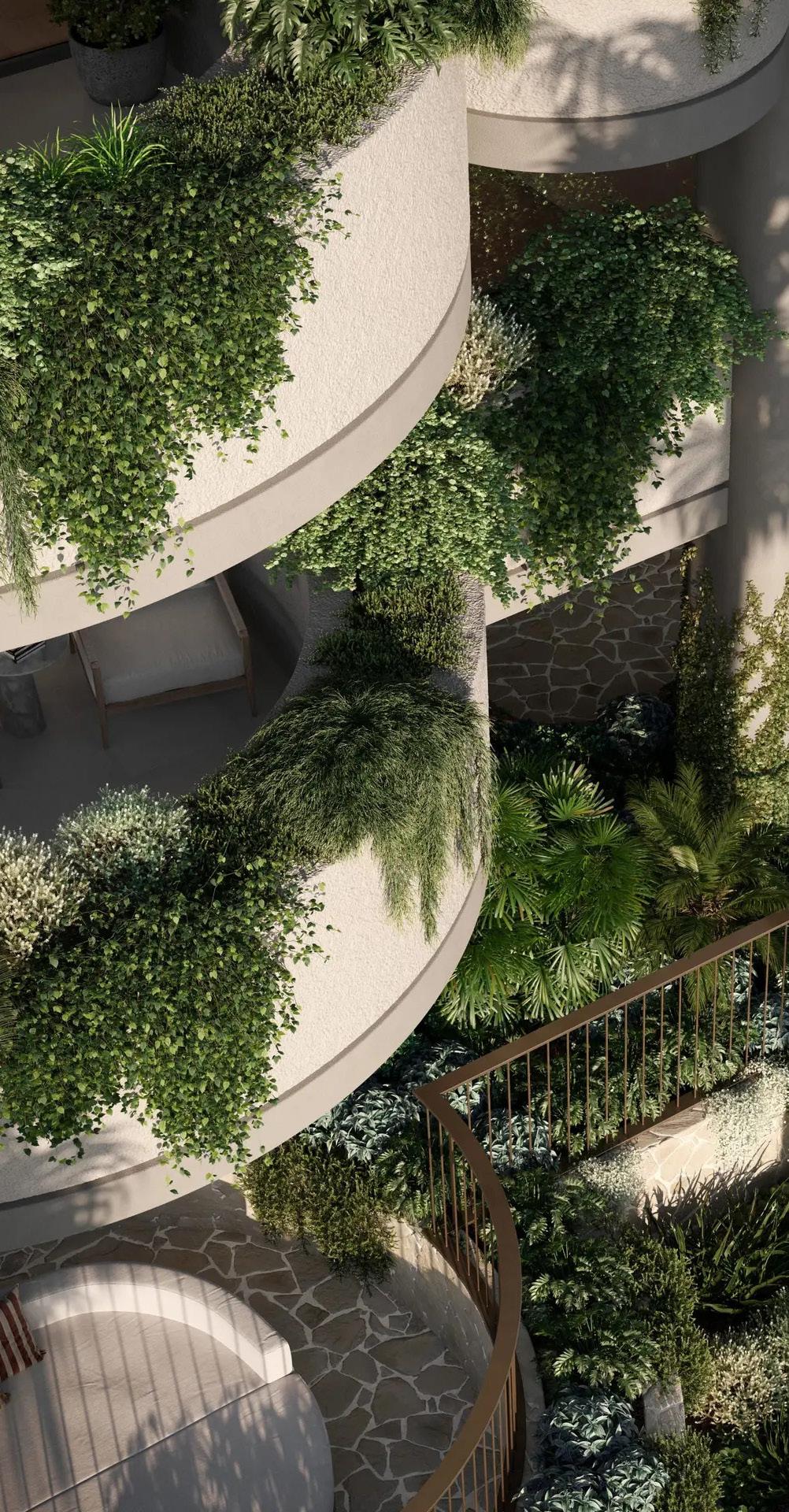
Figure 5. Emerson, Rothe Lowman
Legend
Site boundary
Local centre - mixed use zone
Mixed use zone
High density residential
Medium density residential
Low density residential
Deep soil
Public open space
Improve tree canopy
Proposed pedestrian access
Figure 6. Structure Plan
Viola
Pucnchbowl
1.4 Design Excellence
Objective
O1. Ensure that large, prominent and complex developments are of a high quality and have varied design.
O2. Ensure that development individually and collectively contributes to the unique characteristics of the precinct and the overall urban design quality of the LGA.
O3. Ensure a Development Application on the site that triggers Clause 6.15 Design Excellence in the Canterbury-Bankstown Local Environmental Plan 2023 (CBLEP 2023) provides sufficient evidence to demonstrate how the requirements of that clause have been met.
Principles
P1. Ensure the palette of materials chosen for high impact areas, such as parks and plazas, correlates to high quality facade designs.
P2. Demonstrate how the proposed development provides design excellence in context of the public domain, particularly along Punchbowl Road.
P3. Ensure the new development on the site addresses the urban design principles for the site as provided in the Canterbury Road Review and supporting Urban Design Study for the Review.
Controls
C1. The following document may be required to be provided by suitably qualified consultants to demonstrate Design Excellence:
a) Site and context analysis;
b) Public domain layout, including levels, uses, access and circulation, dedications and hierarchy of spaces;
c) Built form massing and dimensioned envelopes;
d) Overshadowing analysis;
e) Stormwater management strategy;
f) Traffic management and servicing strategy, parking numbers and location; and
g) Ecologically sustainable development strategies and benchmark commitments (including connection to green infrastructure).
C2. Consider the principles of Ecologically Sustainable Development.
C3. Consider opportunities to install public art to enhance the visual interest of key public sites.
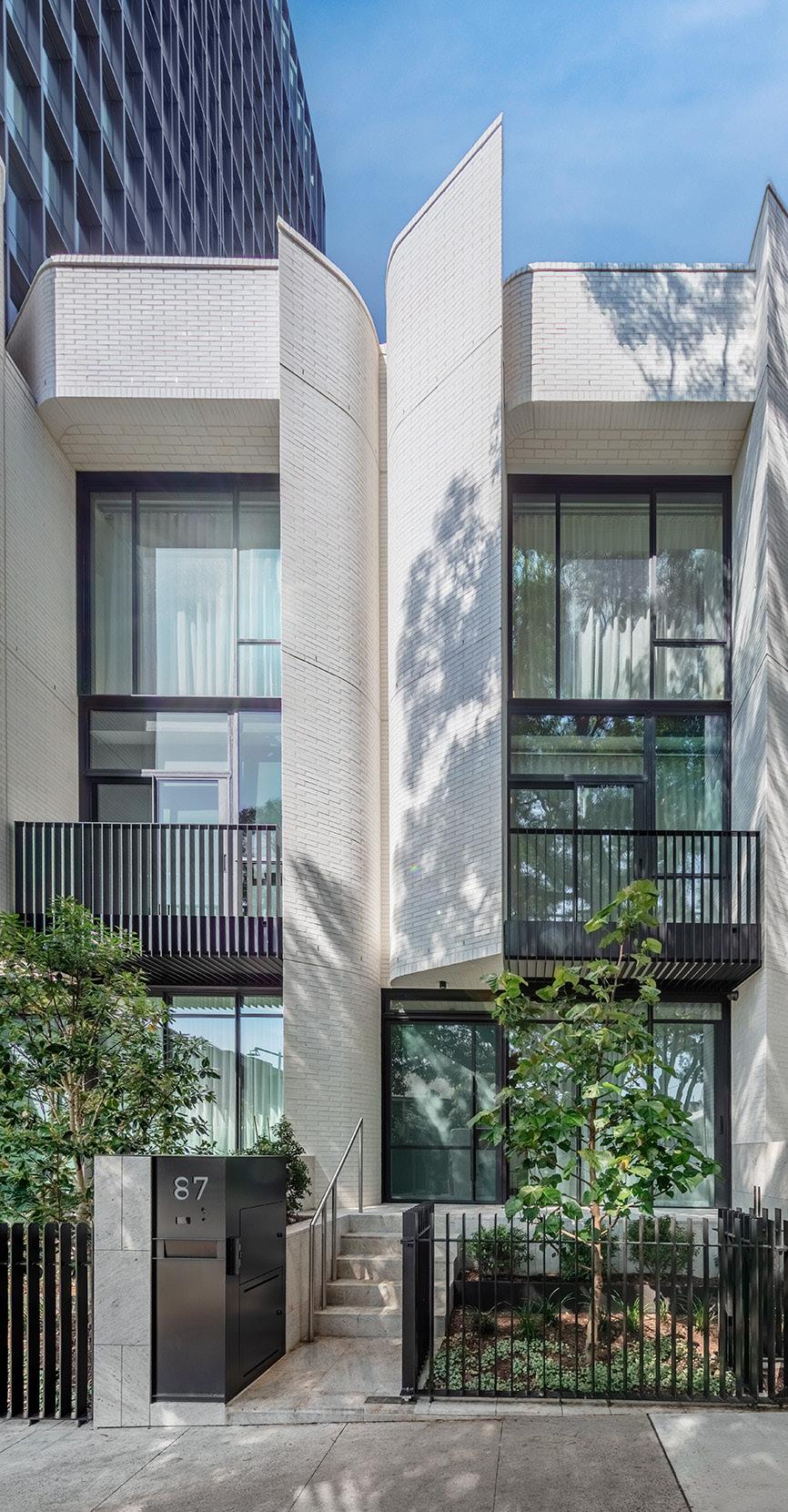
Figure 7. Portman St Terraces, Smart Design Studio
1.5 Connecting to Country
Objectives
O1. To take a Country centred approach and thinking that is layered into new development consistent with the Government Architect NSW 'Connecting with Country Framework' (CWCF).
O2. To encourage a Country centred approach to design using a blending of Darug language group cultural practice with multi-cultural practices.
O3. To include, collaborate and engage with local Aboriginal communities throughout the development and post-development process.
O4. To integrate Aboriginal cultural practices, history, narratives, and values in the design of proposed development.
Design Guidance
G1. If development falls under Clause 6.15 Design Excellence in the CBLEP 2023, it should give regard to DCP guidance outlined in this Section. This design guidance is optional for development that is not applicable to Clause 6.15 of the CBLEP 2023.
G2. The design of the development should acknowledge Sections 3 and 4 of the CWCF by demonstrating the delivery of outcomes that reflect consideration of all aspects of Country.
G3. Development should demonstrate assessments of the scale and significance of the proposal to determine the appropriate scope of engagement with the Aboriginal community and its representatives –whether it be high, medium or low - as outlined in Section 3.1 of the CWCF. If collaborating with the Aboriginal community, it is important to adhere to protocols outlined in the Engaging with Aboriginal Communities Practice Note.


G5. The development should demonstrate that an analysis of the surrounding context has been conducted to connect the development site into existing and proposed landscape elements, open spaces, links and any district or other views.
G6. If the development process includes seeking knowledge and input from the Aboriginal community, Aboriginal people should be invited to co-design and co-manage projects to ensure they retain authorship and control of their cultural knowledge and intellectual property. Developments are to demonstrate the methods and outcomes from engagement with Aboriginal communities.
G4. As set out in Section 3.4 of the CWCF, an Aboriginal perspective should be adopted throughout the four project delivery phases. These include project formation, project design, project delivery and project maintenance.
G7. If significant items such as ancestral remains or artifacts are discovered during subsoil investigations, excavation, demolition or other earthworks, proper engagement with the Aboriginal community should take place to determine the culturally appropriate process for handling, repatriation or reburial.
G8. Development that proposes open space and landscaping should demonstrate consideration of ‘walking Country’ which reflects Aboriginal cultural practices, artifact, artwork and narratives. Aspects involving the senses of seeing, hearing, touching, smelling and tasting, should be included.
G9. Design aspects of each development should give regard to the culture and heritage of the traditional custodians of the land, the Darug People, on which the development is proposed. The following design opportunities should be considered to ensure a Country-centred approach:
(a) Connect design with the natural environment and landscape setting, being: people, animals, resources and plants equally.
(b) Acknowledge shared history between Aboriginal and colonial settlers to promote healing and reconciliation.
(c) Incorporate sustainable practices by using natural building materials that have a cultural and heritage significance.
(d) Use Aboriginal place names to encourage understanding and provoke awareness.
(e) Incorporate storytelling and knowledge of the past to inspire and educate.
(f) Focus on details and patterns to insert cultural meaning.
G10. The development should consider Country centred design for both public and private domains equally, being both: building façades and interior spaces, public and communal open space, internal corridors and public pathways (through-site links).
G11. Consider embedding
(a) ‘Healthy Country’ principles with respect to the analysis, coordination with, and protection of existing site topography, local biodiversity, and site hydrology, as well as the referenced landscape elements, and (b) explore opportunities for ‘Healthy Community’ like community employment during the project design, delivery and maintenance and to provide ongoing access to Country within the development proposal, acknowledging the strong cultural identity and connectedness, that Community has with Country
G12. Provide acknowledgment, interpretation and learning opportunities about Country.
G13. All work prepared to address the Connecting with Country objectives and design guidance must address the NSW Indigenous Cultural and Intellectual Property Protocol, to ensure applicants are aware of their duties with respect to the integration of this content.


Section 2 PUBLic DoMAin
Accessibility Note:
2.1 Active frontage and improving public domain
2.1.1 Ground floor frontage
Objectives
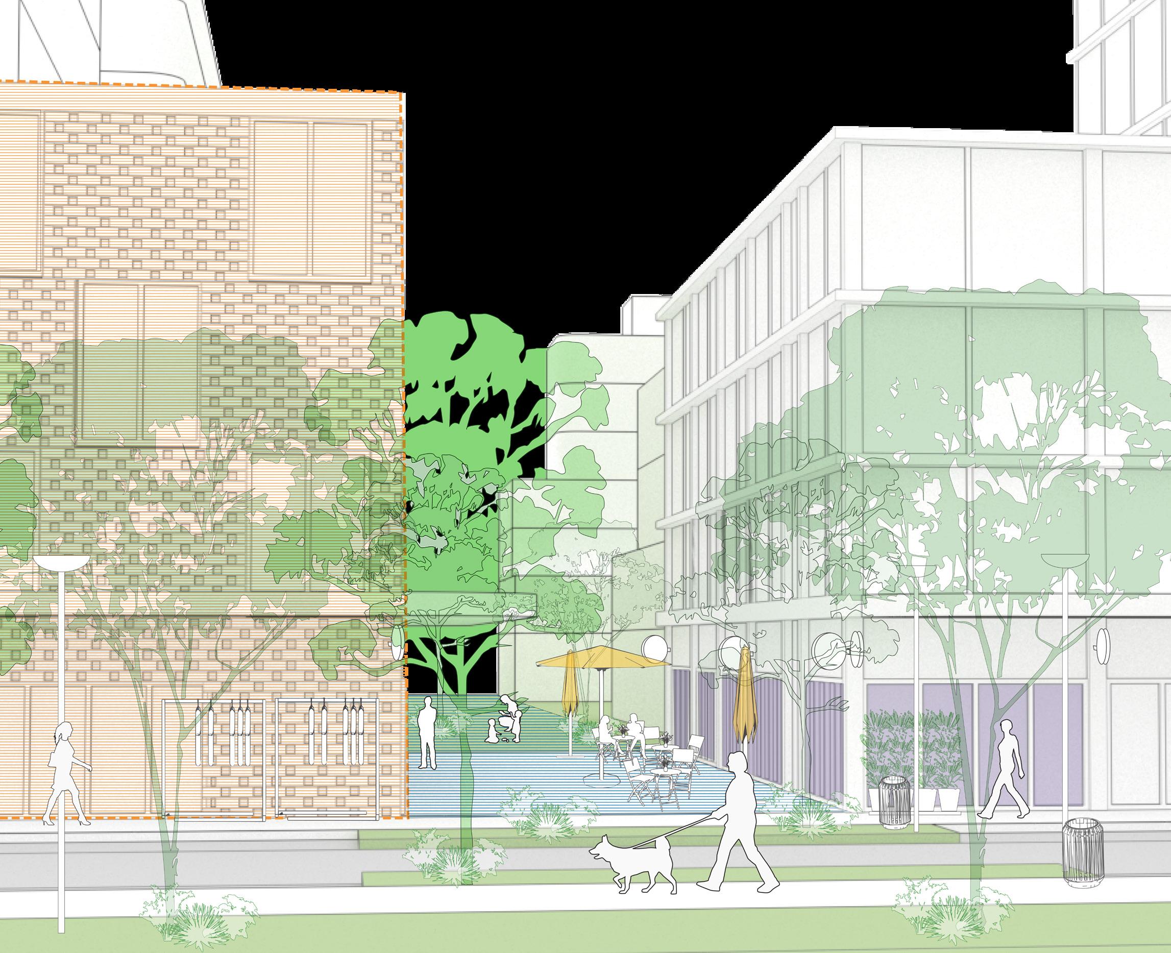
O1. Provide ground floor frontages that are accessible and integrates with the design of the public domain.
O2. Prioritise pedestrian activity and street-level vibrancy along Punchbowl Road and the internal streets.
O3. Increase safety by ensuring adequate surveillance is provided throughout the site;
O4. Ensure good passive surveillance throughout the Club Punchbowl precinct while maintaining the privacy of residents who live on the site.
O5. Consideration must be made to safety measures such as surveillance and lighting in the Public Domain and all relevant matters as part of a holistic Crime Prevention Through Environmental Design (CPTED) approach for the proposed development
Figure
Principles
P1. Ensure the delivery of the Public Domain works on the Club Punchbowl site, in accordance with the approved Public Domain Plan, including its staging and funding provisions.
P2. Facades must have a high level of expressed detail and tactile material quality.
P3. The base of facades must meet the public domain in a well-considered manner that takes account of any slope.
P4. All buildings must have an entry and identifiable address to a street or pathway within the development, with clear and legible pathways for residents, visitors, and deliveries.
P5. Ground level design must incorporate transparent facades and frequent entries to enhance street activation
P6. Ground-floor residences must incorporate privacy measures (e.g. raised sills, landscaping) but still present an engaging interface with the streets.
Controls
C1. Deliver the Public Domain in accordance with the staging as shown in an approved Public Domain Plan submitted with the development application.
C2. A Maintenance Plan is to be provided to Council detailing how the publicly accessible open space on the site will be maintained by the land owner through a regular schedule of cleaning and maintenance work.
C3. Active uses must fully occupy the ground floor frontages within the active frontages identified in Figure 8 and must not be taken up by services.
C4. Active Frontages must be considered in detail and the following must be incorporated within their design:
a) A nominal 500mm interface zone at the frontage must be set aside to create interest and variety in the streetscape, to be used for setbacks for entries, opening of windows, seating ledges, benches, and general articulation.
C6. Fire escapes and service doors must be seamlessly incorporated within the visual design of the facade with the use of highquality materials.
C7. All car parking and service entries are to be located on secondary frontages or laneways to minimise curb cuts along primary active frontages.
C8. Large-format retail uses must be sleeved by smaller retailers or commercial tenancies at street level; or placed below the street level (where topography permits).
Site boundary
Active frontage (facing public roads)
Active edge (facing internal development
PunchbowlRoad
Figure 9. Active Frontage
This indicative plan illustrates a high level vision for the new public domain of the site. This plan is for illustration purposes only and all detailed designs and configurations (including but not limited to materials, trees species and location, internal road layouts, furniture and equipment) will be subject to future design development and Council approval.
Site boundary
Planting buffer and mature trees to be installed beyond the future road expansion area along Canterbury Road.
Publicly accessible open space with recreational amenities and equipment.
Primary entry and exit from Punchbowl Road.
Basement car park entry.
All design and planting elements underneath the electrical easement to comply with Ausgrid standards and design principles.
Private communal open space for residents.
Entry into single direction road for residential uses and servicing only.
Residential exit to Punchbowl Road.
2.2 Streets
Objectives
O1. Design the streets and internal lanes to encourage pedestrian and cyclist amenity and safety.
O2. Encourage active uses such as outdoor dining, retail and recreational activity along the internal lanes without compromising safe pedestrian access and use.
O3. Integrate tree planting and Water Sensitive Urban Design (WSUD) along streets and internal lanes to improve sustainability and public amenity.
O4. Ensure any new landscaping including new tree planting along the Canterbury Road site frontage accounts for the required road widening zone.
2.3 Vehicle access and movement
Objectives
O1. To deliver well-designed new internal roads in accordance with relevant standards.
O2. To provide a human scale streetscape along the new roads.
O3. To provide a pedestrian friendly environment along new roads.
O4. To provide a functional, safe and easy to navigate movement network throughout the site for pedestrians, cyclists and vehicles, with priority to be given to pedestrians, that includes signage devices and wayfinding elements.
O5. Where required to ensure safety for pedestrians crossing and new roads.
Controls
C1. The location of all new roads and footpaths shall be generally in accordance with Figure 12 Access and Movement Plan.
C2. All internal road lanes to be 3.5m wide to allow waste truck serving.
C3. The dual direction carriage way and single direction shareway must be in accordance with Figure 13 Typical Road Sections.
C4. All roads are to remain in private ownership with an easement to permit access by Council and the public.
C5. All roads are to be designed and constructed in accordance with Council specifications and to the satisfaction of Council.
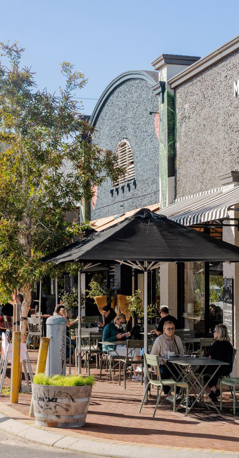
Figure 14. Active Streets, City of Vincent
Site boundary
Indicative building envelope
Dual direction carriage lane
Single direction shareway
3.5m wide footpath
2m wide footpath
1.5m wide footpath
Pedestrian crossing
Canterbury Road
23 Canterbury Road
Figure 15. Access and Movement Plan
NTS
Figure 16. Typical road sections
2.4 Public art
Objectives
O1. To integrate public art with the Public Domain that enhances the user experience of publicly accessible spaces and creates visual interest.
Principles
P1. To promote the creation of opportunities for the creative industry through public art improvements of the built environment.
P2. To provide public art that embraces the diverse history and contemporary community of Punchbowl and also taking a “Connecting with Country” approach by celebrating and exploring the local indigenous history and culture of the subject site.
Controls
C1. Artistic elements encompass creative features in areas such as paving, window treatments, canopy design, balustrading, signage, and wayfinding.
C2. Public art is encouraged within civic spaces, along blank walls or as screening elements to provide visual interest within the public realm.
C3. Prepare and submit a Public Art Strategy with the first major development application on the site to define key locations across the subject site that will feature public art and the type of public provided.
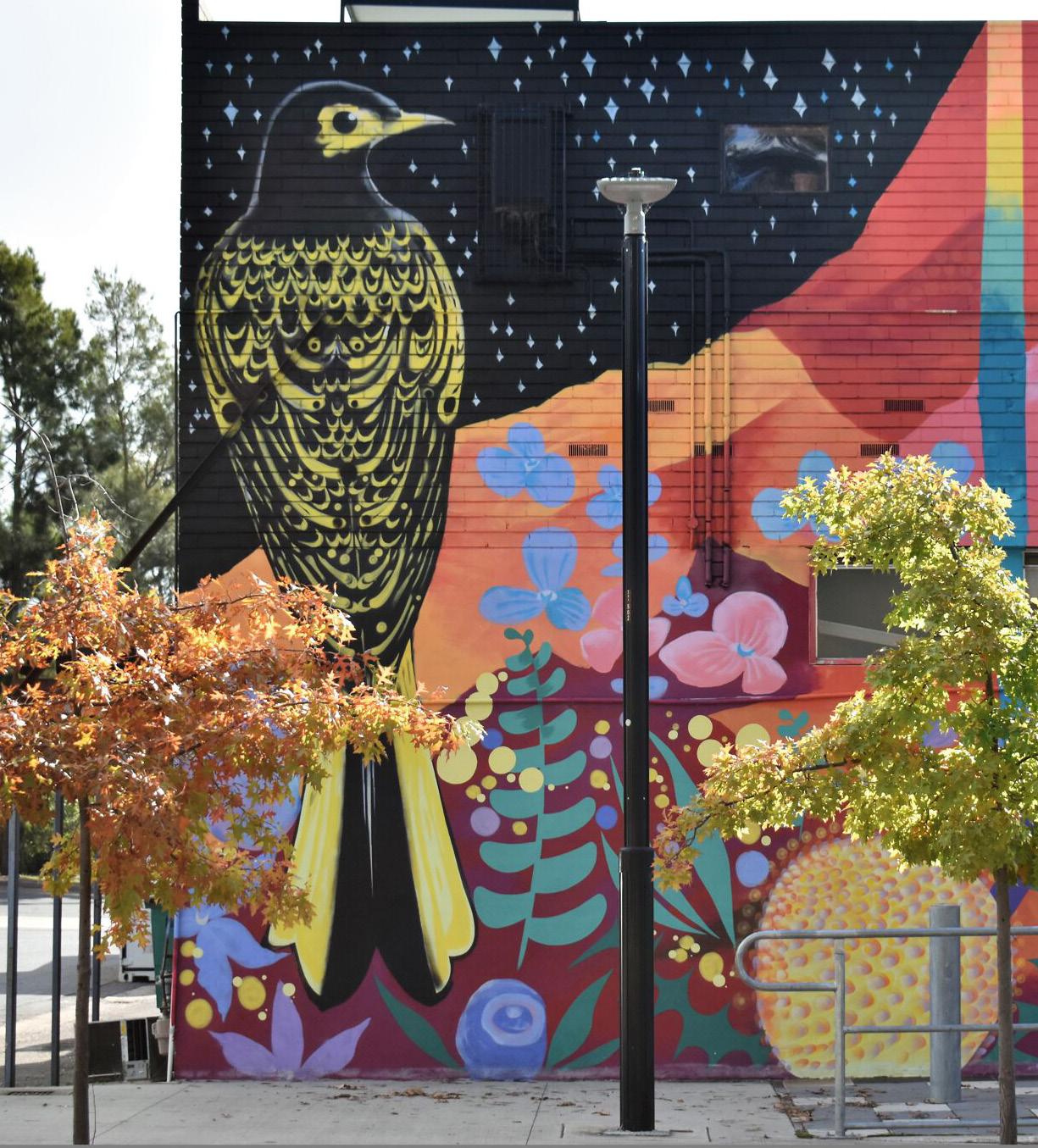
Figure 17. Public street Art, Pollen by David Cragg, Karla Hayes - Street Art Cities
2.5 Tree retention
Objectives
O1. To identify and retain key existing trees on site.
O2. To utilise existing trees to screen new development.
O3. To protect trees during the construction phase of development.
Controls
C1. Where practicable, existing key trees on the site are to be retained. Building setbacks and basements may need to be varied to protect trees.
C2. Any future application(s) are to include a comprehensive arborist report for the site. This is to identify the location, species, and condition of existing trees, and to identify appropriate building setbacks and deep soil areas to ensure existing trees are easily retained.
C3. Where practicable, existing trees are to be protected during construction phase and proposed measures are to be outlined in the arborist report.
2.6 Deep soil zones and landscaping
Objectives
O1. To provide sufficient deep soil areas for mature trees to grow on the site
O2. To provide a pleasant outlook and contribute to the amenity of the precinct.
O3. To soften the scale of buildings.
O4. To maximise the environmental benefits to the precinct.
O5. To minimise stormwater runoff and facilitate rainwater infiltration.
Controls
C1. The amount of deep soil planting to be provided within any future development of the site shall comply with the Apartment Design Guide.
C2. The locations of deep soil areas shall be generally in accordance with the Figure 6 Structure Plan.
C3. The design of deep soil planting areas to be provided within any future development of the site shall comply with the Apartment Design Guide.
C4. Deep soil is to be provided to the site edges, the verges of the new street and within the communal open spaces to support substantial tree planning.
C5. All landscaping design shall comply with Council’s relevant species and landscaping design specifications and requirements.
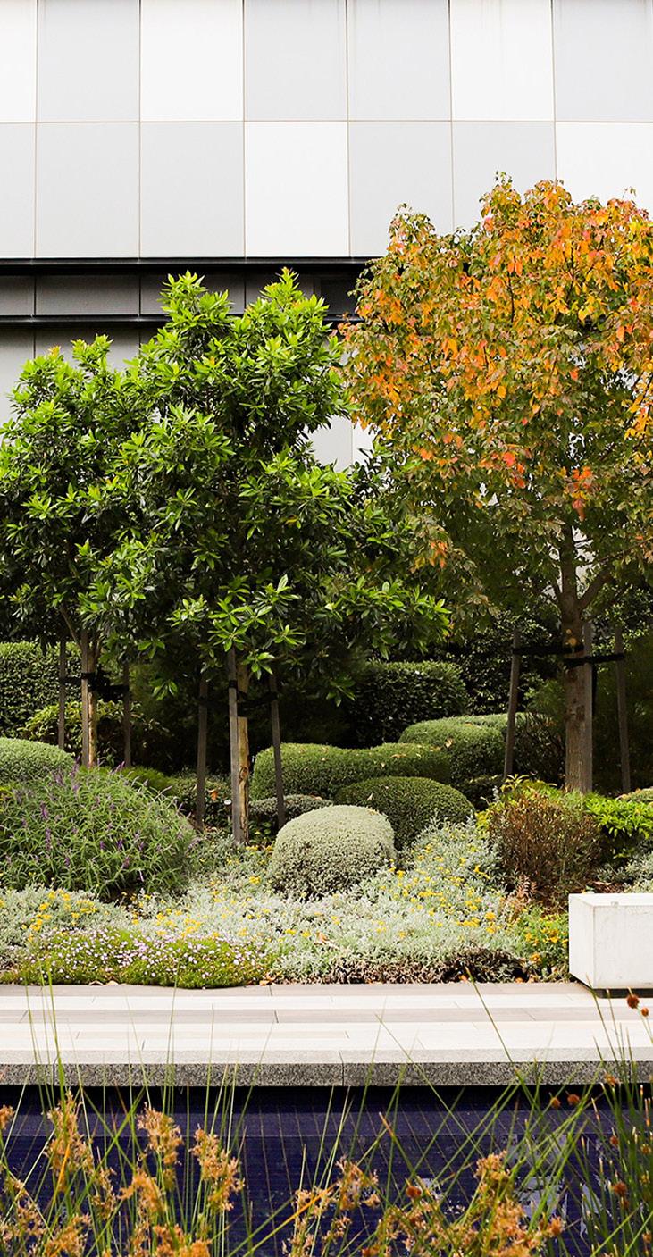
Figure 18. Caribbean Park, Oculus
3.1 Building height and density
Objectives
O1. To achieve an appropriate distribution of built form and height transition across the site to respond to existing character and context within the maximum building height and maximum density provisions in clause 4.3 and clause 4.4 of the CBLEP 2023, respectively.
O2. To minimise the visual impact of development to adjoining sensitive residential uses.
O3. To consider the visibility of the precinct and future development from key vantage points.
O4. To locate taller development in locations of high quality amenity.
O5. To ensure the greatest height is only located on the corner of Canterbury Road and Punchbowl Road.
O6. To distribute the floor space across the subject site while fully complying with the relevant Apartment Design Guide design criteria for communal open space, deep soil planting, solar access and building separation.
3.1.1 Height
Controls
C1. The floor-to-floor height of all ground floor commercial unit is to be a minimum 4.4m inclusive of the FFL freeboad level. The minimum floor to ceiling height is to be 3.3m.
C2. The floor-to-floor height of all ground floor apartments is to be a minimum 4.0m inclusive of the FFL freeboard level. The minimum floor to ceiling height is to be 2.7m.
C3. The floor-to-floor height of all apartment is to be a minimum 3.1m, and floor to ceiling height is to be a minimum of 2.7m.
C4. Floor-to-floor heights less than those specified in control C.3 above, to try to achieve an additional storey within the maximum building height will not be supported.
C5. The additional height allowance between the top storey and the maximum height is to be used to achieve an interesting roof form and building silhouette appropriate to its context on the site and to accommodate lift overruns and plant only. The expression of party walls to development along
3.1.2 Density
Controls
C1. The maximum floor space ratio may not be achievable if adverse visual, acoustic or privacy amenity impact occur to neighbouring dwellings or dwellings within the development.
3.2 Built form and facades
Objectives
O1. To ensure the built form is distributed across the subject site to achieve appropriate transitions in scale to adjoining properties, and to optimise solar access to publicly accessible communal open space.
O2. To ensure that the building facades are well designed and respond to the desired future context and orientation of their address.
O3. To create an exemplar building and development design with a cohesive architectural design language.
O4. To provide high amenity and inclusivity through the design of all walkways, lighting, awnings, entries and street furniture.
O5. To create buildings which contribute positively to the desired future character of the area.
O6. To minimise the extent of flat, undifferentiated surface areas.
O7. To create a cohesive design element across the various buildings of the site that can contribute to a human scale development.
Principles
P1. To ensure that the design breaks down the mass of buildings. Particularly, that potential long facades on Punchbowl Road and Canterbury Road provide relief by using careful design techniques that reduce perceived scale. The design must have design elements that create a human scale at ground level such as using awnings, planters, signage, lighting and the like.
P2. The built form is to integrate well designed and easily accessible pedestrian connections, including wayfinding techniques, in order to optimise pedestrian access and movement.
P3. To provide high quality facade treatments using materials and finishes that are low maintenance and high quality and contribute positively to the streetscape and views from neighbouring properties.
P4. To use high quality materials particularly at ground level that are durable and will last over time.
P5. To minimise the palette of materials to ensure for a cohesive building that has its own identity that is legible from the public domain.
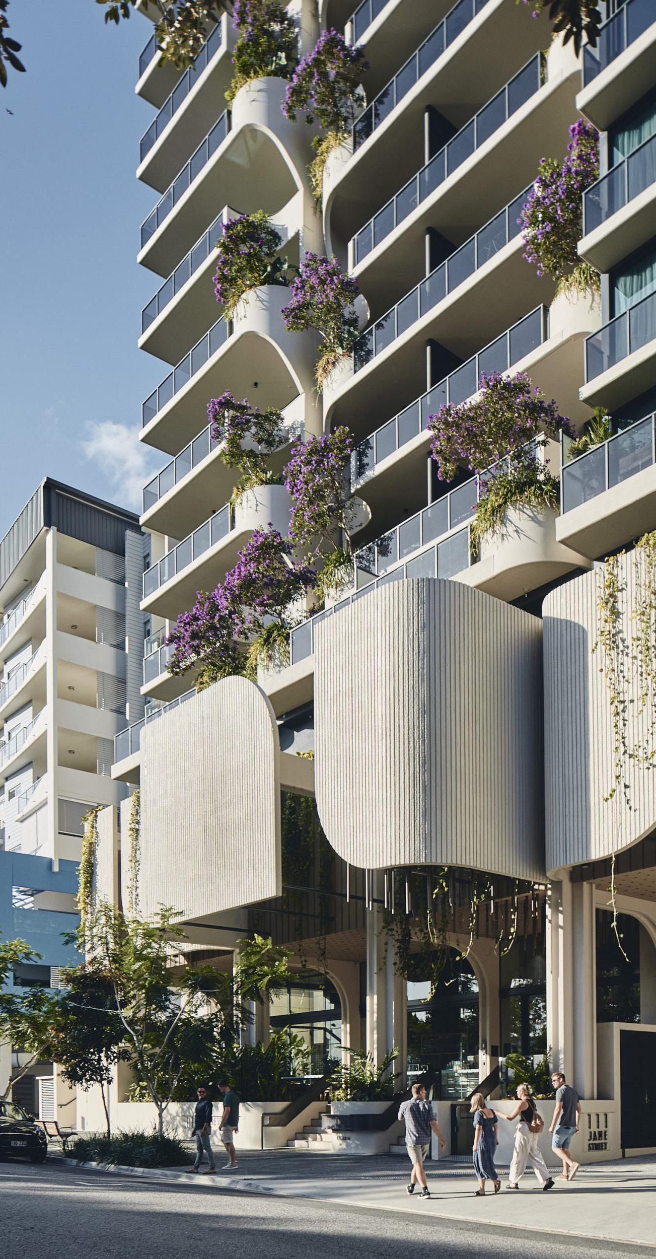
Figure 19. Treehouse 2, Rothe Lowman
Controls
C1. The tallest buildings on the site are to be located at the corner of Punchbowl Road and Canterbury Road to provide a strong urban edge to this busy intersection.
C2. Integrate the built form with the landscape design, utilising the landscaping to soften hard built form elements.
C3. Where practicable on the ground level, integrate pathways to provide weather protection / shelter for any potential outdoor seating areas, and for pedestrians.
C4. The base of the building is to be consistent across all buildings within these sites and be expressed through a change in materiality, colour, treatment and projections either at a one or two storey height planes. The consistent requirement at a one or two storey height is to be informed by the first building to be approved and constructed on the site.
C5. Detailed design is to avoid having excessive areas of flat wall with one material or finish.
C6. Awnings should be designed to tie into the building design.
C7. Reflective materials and finishes should be avoided. E-glass or similar should be consider especially for the western elevation.
C8. Indentations or slots in facades are to be as wide as they are deep.
C9. External shading devices, projections, awnings, communication devices and the like are to be integrated into the design of the facade.
C10. Air conditioning units must not to be located within private or communal open spaces unless appropriately screened or treated. Alternatively, air conditioning units should be located in concealed areas such as the basement, roof or grouped at every floor level in designated areas.
C11. Facades are to be articulated with steps in plan, recessed and projecting balconies and deep windows; are to express a building base, middle and top; provide a range of window types; employ external shading devices that respond to the solar orientation of the facade and balconies; employ changes of materials, colours and textures to articulate the built form.
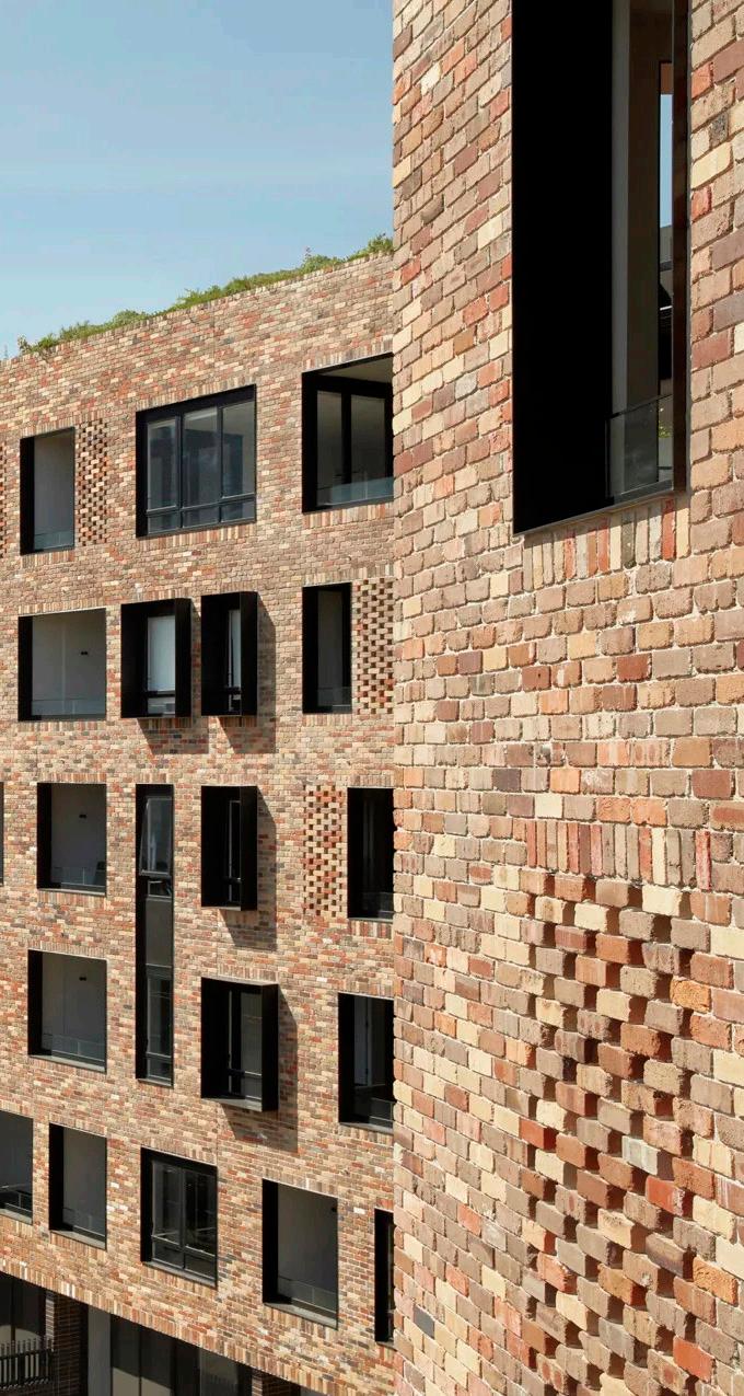
Figure 20. Arkadia Apartment, Breathe Architecture & DKO
Punchbowl
Figure 21.
PunchbowlRoad
Figure 22. Ground Floor Setback Plan
3.3 Visual diversity, articulation and fine grain of buildings
Objectives
O1. Ensure that podiums are not overbearing in length and are designed with smaller parts to create a fine grained and varied experience at street level.
O2. Ensure street blocks present as a group of buildings not a single building.
O3. Encourage variety in architectural design and character across large developments to provide a fine grain which enriches and enlivens the City’s public realm.
Principles
P1. Maintain a diverse and interesting skyline on large sites that propose two or more buildings through a mix of varying heights, roof form and tower design.
P2. Ensure that building services are integrated into the building design and hidden from public view to provide a quality street interface.
P3. Reduce the scale of building mass through vertical or horizontal articulation using depth in façades.
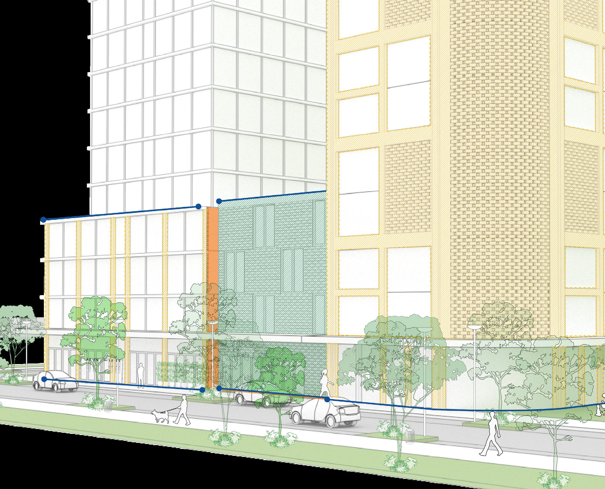
Fine grain frontages and buildings
Variety in architectural design for visual interest and character
Long podiums visually broken to create variety and ensure human scale
Articulation zone to provide depth for design of building façades
and fine grain.
Figure 24. Design guidance on building façades to ensure visual diversity, articulation
Controls
C1. Where a building podium exceeds 45m in length, it is to appear visually broken into two or more buildings using facade variation or physical separation. This outcome could be achieved through the following articulation design considerations or through other alternative design considerations to the reasonable satisfaction of Council:
(b ) Podiums measuring 45-70m in length are divided into two or more vertical sections.
(c ) Vertical sections must be separated by indentations and use a varied architectural expression and materiality.
(d ) In cases where there is a range in street wall height, prioritise the lower range along laneways, pedestrian links, and areas with high pedestrian activity.
C2. Building entries are to face and open to the street.
C3. Where there is a nil boundary setback required at street walls, podiums must include a 1.5m articulation zone to allow architectural form to develop and to provide depth in the facade. This can occur above ground level on all public facing sides of a podium. This space can allow for an outdoor space for office workers and retail users but must not comprise Gross Floor Area in accordance with the CBLEP 2023.
C4. Ensure for a common language between buildings using predominantly masonry and natural building materials, but not including glazed shop fronts.
C5. Be articulated with depth, relief and shadow on the street facade. A minimum relief of 150mm between the masonry finish and glazing face must be achieved.
Building services design
C6. Services such as electricity substations/ kiosks, drainage pipes, fire pumps and hydrants and fire escapes must be addressed early in the design process to ensure they are integrated into building design. Substations must be integrated within the design of the building footprint where these facilities can meet Ausgrid standards and to the extent possible due to authority constraints and design requirements.
C7. Integrate fire booster pumps and associated pipes and equipment into the building design and use metal or tinted glass to visually screen such services on public facing street frontages. If a site has two frontages, locate the services on the secondary frontage if possible.
C8. Where there are blank walls that interface with public open space due to service requirements, metal screens, landscaping and/or public art treatments are to be considered, including green walls where conditions allow plants to flourish.
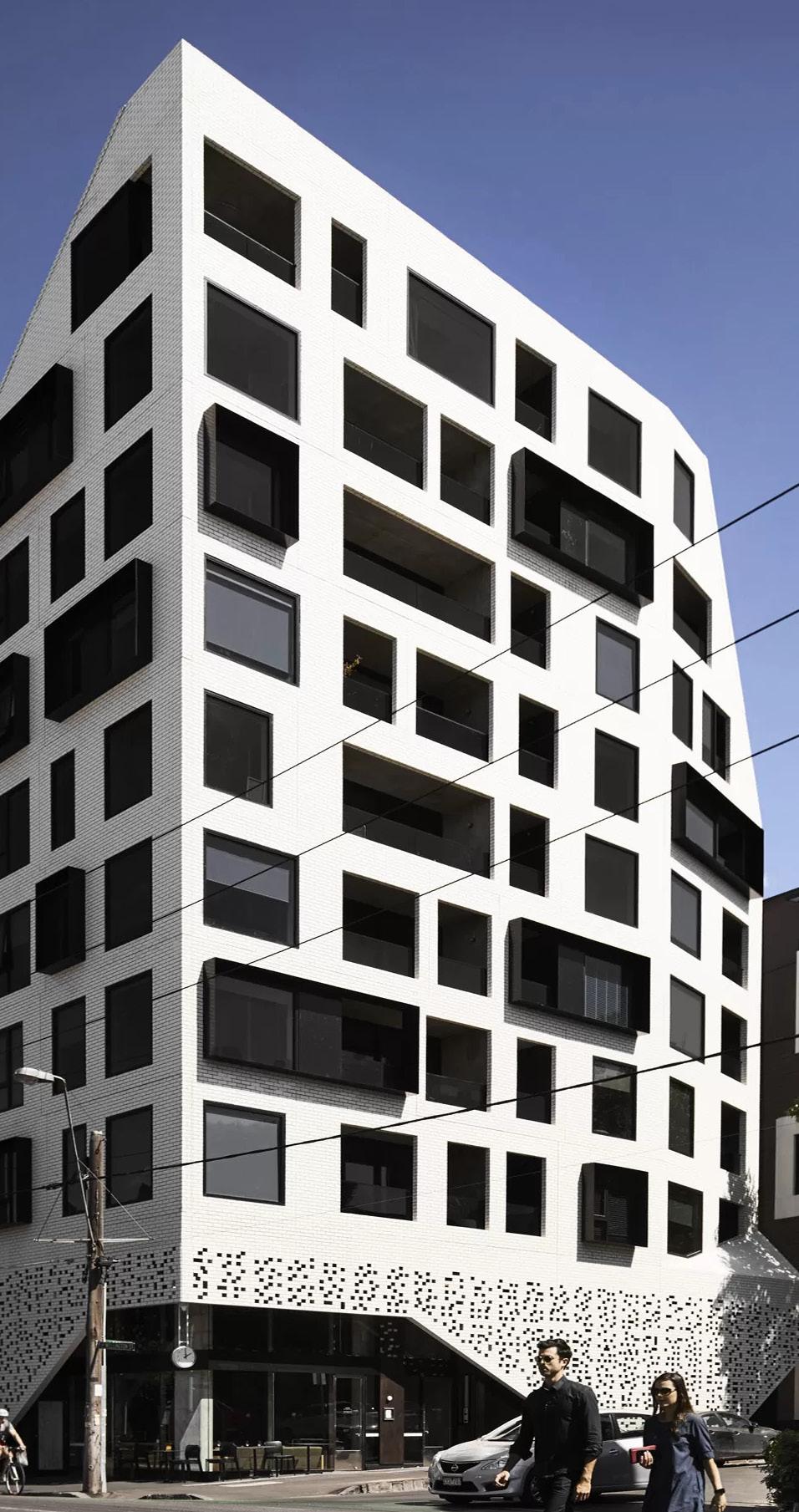
Figure 25. Peel Street, Melbourne, DKO Architects (Source: DKO Architect)
3.4 Materials and finishes
Objectives
O1. Use quality materials and finishes at the street level interface to elevate the pedestrian experience.
O2. Ensure materials are robust and have longevity and contribute to beautiful buildings.
Controls
C1. Buildings must include durable single material finishes such as masonry and/or off form concrete. Painted cement render or similar painted finishes and Aluminium Composite Panel Cladding (e.g. Alucobond) must not be used within the podium levels of buildings and must not comprise more than 25% of each facade above podium level.
C2. Elevate the pedestrian experience of the pedestrian at street eye level through fine grained detailing and quality material and finishes selection.
C3. Development Applications proposing a tall building must include a reflectivity assessment to ensure external building materials do not cause unacceptable glare.
C4. Select materials and finishes that are low maintenance.
C5. Create simplicity through the selection a common language of materials and finishes, rather than selecting many and creating visually complexity.
C6. Where adjacent development is unlikely to occur in the short term, blank side walls must include public art or murals.
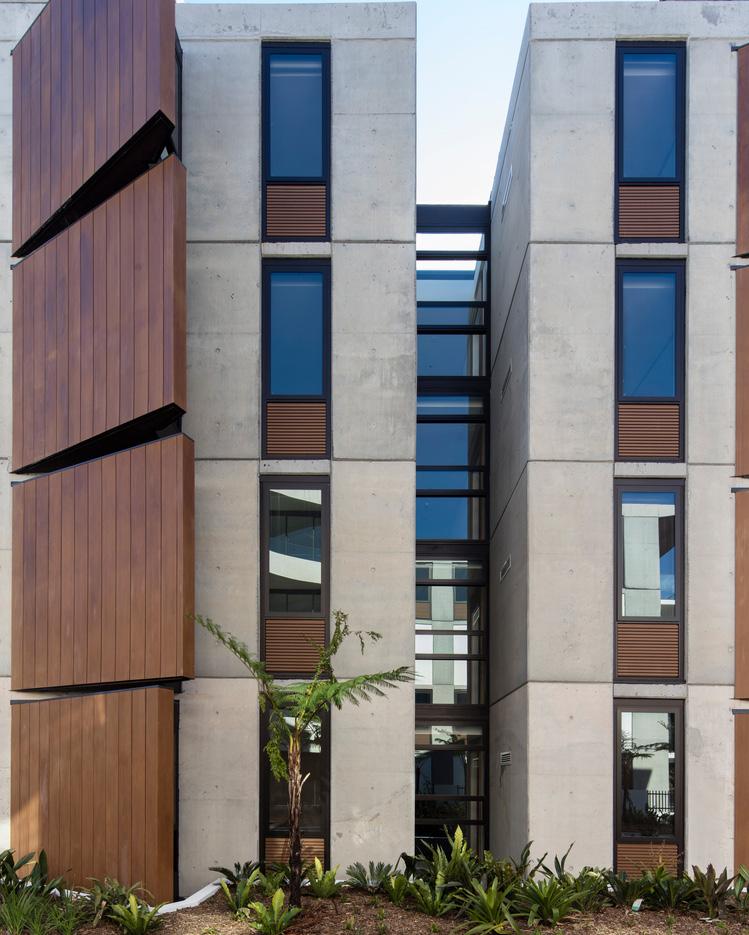
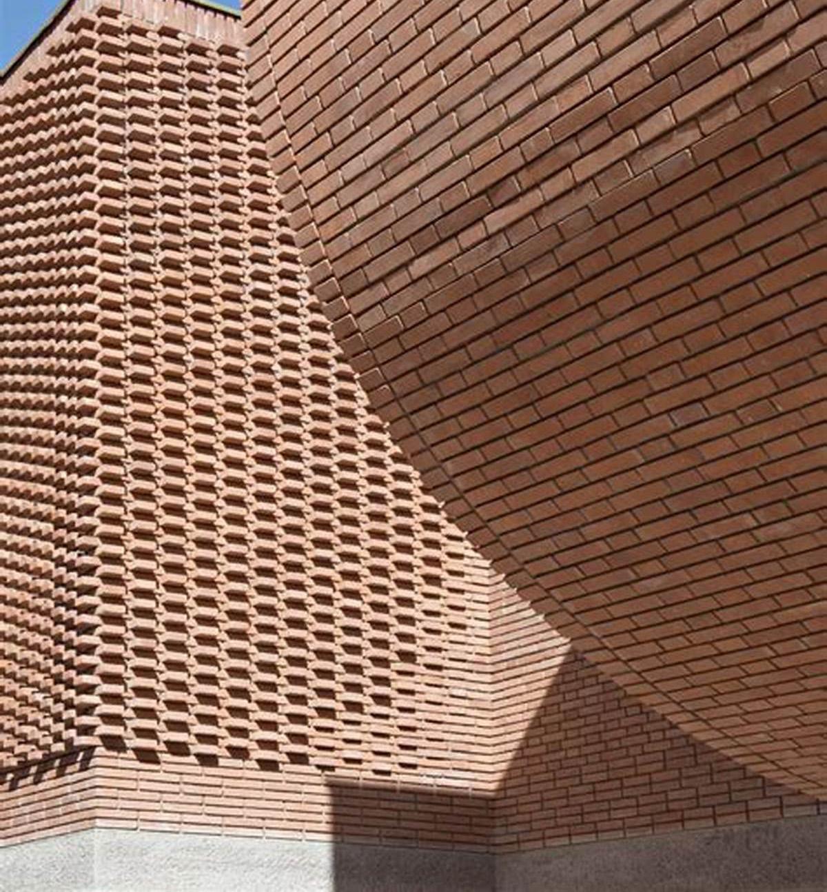
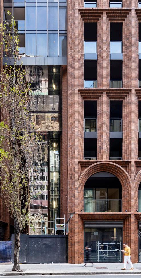
Figure 26. Examples of high quality materials and finishes for building envelopes.
3.5 Through site link
Objectives
O1. To achieve enhanced pedestrian amenity and connectivity through the subject site from the surrounding street network.
Controls
C1. The pedestrian through site link from the corner of Punchbowl Road and Canterbury Road into the subject site shall be a minimum width of 6m.
C2. The pedestrian through site link is to encourage and integrate the ground level uses, while minimising blank walls along the link.
C3. The pedestrian through site link shall be designed to allow for passive surveillance to the link from adjoining ground level land uses.
C4. The design of the pedestrian through site link is to ensure that the selection of materials and finishes are of high quality and durable.
C5. The use of tactile surfaces for visually impaired persons and other accessibility treatments must be considered in the design.
C6. The pedestrian through site link shall be open remain open at all times. No fencing or gates shall be installed to limit access to the link and the subject site.
3.6 View corridor
Objectives
O1. To promote opportunities for local vistas such as views of landscaping and publicly accessible open space from people passing the site along Canterbury Road and Punchbowl Road
O2. To provide opportunities for longer distance vista between the buildings and from surrounding streets within the precinct to the central ground level communal open space/s.
Controls
C1. Landscape within view corridors should frame views and should not block eye line level views to the oval.
C2. Street trees with higher canopies are to be provided along the length of the new street to frame views towards the central ground level communal open space/s.
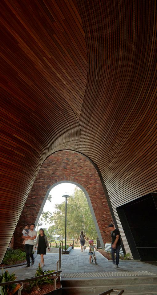
Figure 27. Arkadia Apartment, Breathe Architecture & DKO
3.7 Communal open space
Objectives
O1. To ensure residents are provided with a reasonable level of outdoor amenity.
O2. To provide high quality open space for residents.
Controls
C1. Publicly accessible and communal open spaces are to be provided in accordance with Figure 10 Public Domain Plan.
C2. The communal open space would be in private ownership and only accessible by residents.
C3. The publicly accessible open space would be in private ownership, however it should be designed as public domain with active frontages, play equipment, street furniture, lighting, and planting.
C4. The layout of internal roads and pathways should be clear and legible for occupants, visitors and deliveries, with clearly articulated building entrances.
C5. Clear view corridors in and out of the publicly accessible open space are to be maintained in accordance with CPTED design principles.
C6. All open spaces should be designed as with appropriate amenities, furnishing and shade structures.
C7. All open space shall be designed to take full advantage of passive surveillance from the surrounding buildings.
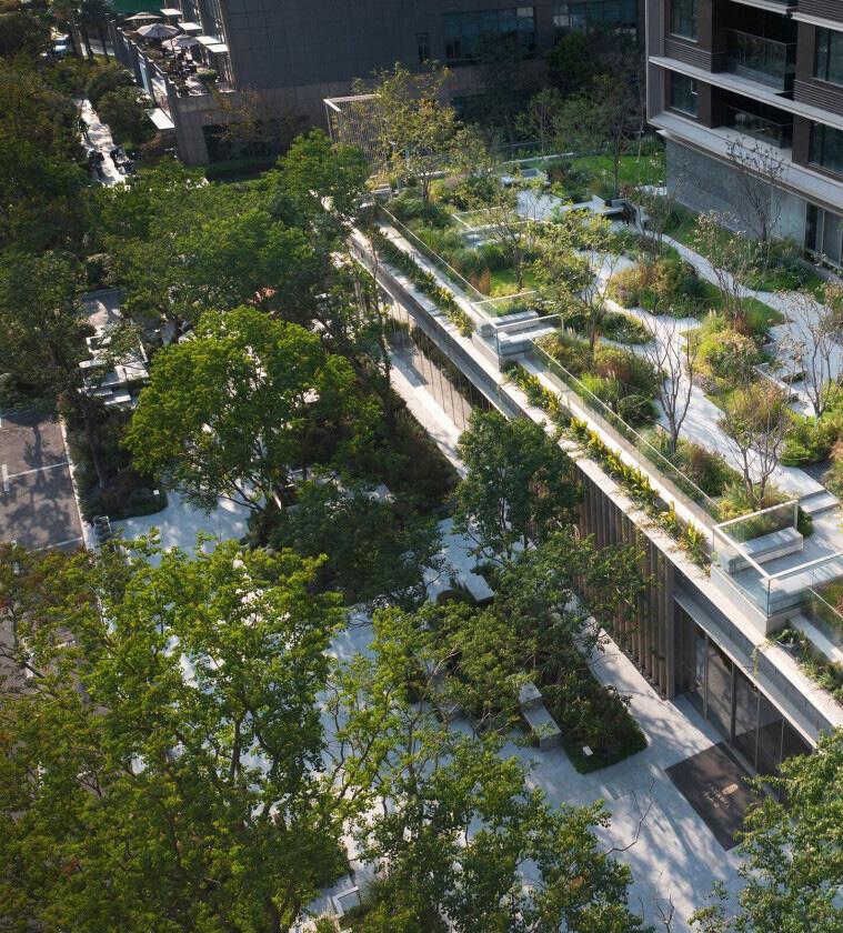
Figure 28. Urban Valley, WJID
3.8 Basement design
Objectives
O1. To ensure all resident parking is within basements.
O2. To encourage limited street parking for visitors along new roads.
O3. To ensure basement parking allows for adequate deep soil area.
O4. To ensure that basement areas are designed to permit access by heavy rigid vehicles including larger garbage disposal trucks that will service this development.
Controls
C1. Basement car parking is to be generally located below natural ground level. Any protrusion above natural ground level is not to exceed 1m.
C2. Basement walls visible above natural ground level must be appropriately finished with face brick work or similar quality materials and appear as an integrated part of the building or landscaping.
C3. Basements are to be located generally and where practicable directly below building footprints and must provide deep soil area along the perimeter of the basement.
C4. Basements may be located under common courtyard areas.
C5. On-site waste collection points are to be located within basements which are to be designed to allow access by heavy rigid vehicles including larger garbage disposal trucks with a minimum entry height of 4.5m. The design shall allow vehicles to enter and leave the site in a forward direction.
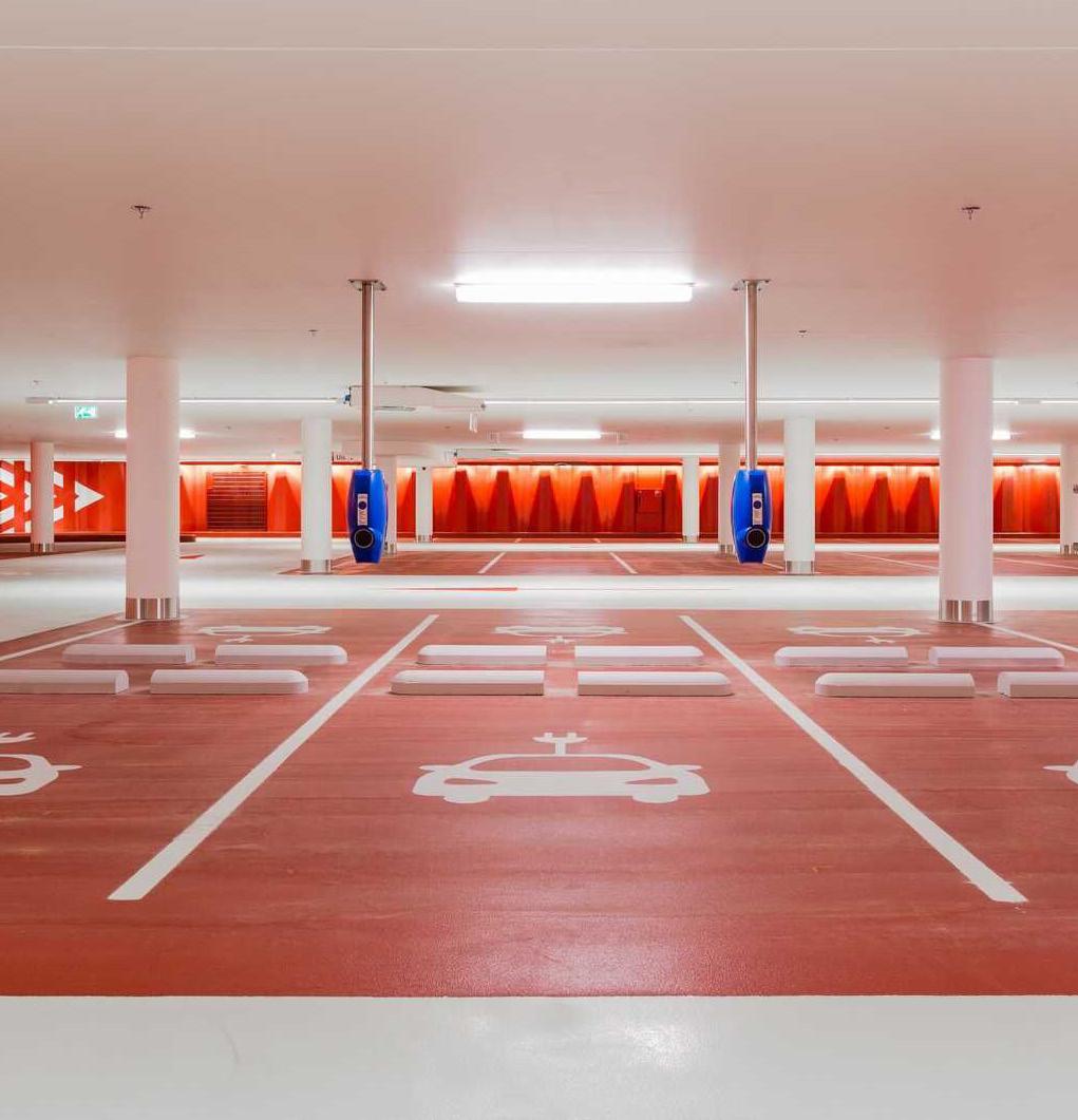
Figure 29. Brinklaan, ZJA
3.9 Flood mitigation
Objectives
O1. To ensure the development is resilient to flood events, hazards and risks.
O2. Reduce the risk to human life and damage to property caused by flooding.
O3. Ensure development does not result in detrimental increases in the potential flood affectation of adjacent or nearby properties.
O4. Where practicable, incorporate water sensitive urban design principles into the open space and/or landscaping.
Controls
C1. Detailed design and setting of levels and thresholds for the building entries and basement car park shall protect against flooding for events up to the Probable Maximum Flood (PMF) level. This includes all potential entry points for water ingress including the main driveway, stairwells and vents.
C2. A detailed Flood Emergency Response Plan is to be developed as part of any future application on the site and the measures and recommendations of the Plan shall be incorporated into the design or management of the development.
C3. Implement the relevant flood planning controls including the CanterburyBankstown Local Environmental Plan 2023, Canterbury-Bankstown Development Control Plan 2023 and Council’s Development Engineering Standards Guide.
C4. Where practicable, the development shall integrate Water Sensitive Urban Design (WSUD) principles into the landscaping design to minimise stormwater runoff. Permeable pavements should be considered.
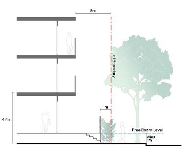
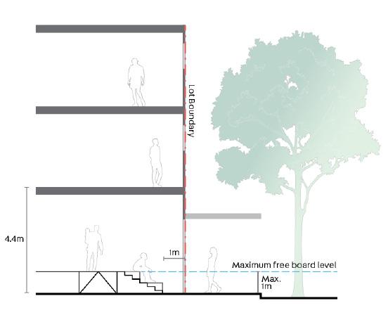
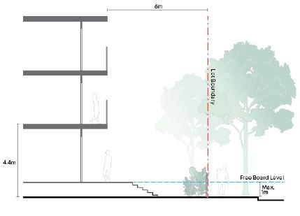
Figure 30. Typical residential ground floor fronting street Figure 32. Typical commercial ground floor
Figure 31. Typical residential ground floor fronting private open space
3.10 Waste management
This section is intended to supplement controls on waste management contained in Chapter 3.3 Waste Management of the Canterbury-Bankstown DCP 2023 (CBDCP 2023), in order to ensure adequate provision for waste management on this site. Where there is an inconsistency in requirements, this section shall prevail in relation to the site. Applicants should consult with Council to discuss waste requirements at an early stage in the process.
Objectives
O1. To maximise resource recovery through waste avoidance, source separation and recycling.
O2. To ensure that the disposal of waste is managed appropriately, efficiently and provides for maximum resource recovery or reuse.
O3. To ensure well-designed and responsive bin storage and collection facilities that are convenient and accessible to occupants.
O4. To require that bin storage and collection facilities are designed so that they can be integrated with and comply with the requirements for Council’s domestic waste services.
O5. To ensure all waste streams being handled, stored and collected in a manner to reduce risk to health and safety of all users, including residents, maintenance (e.g. caretakers), collection staff, and contractors
O6. To allow for kerbside waste collection only for multi-dwelling houses along new road to the north of the subject site. For all other dwellings waste collection is to occur in the basement area.
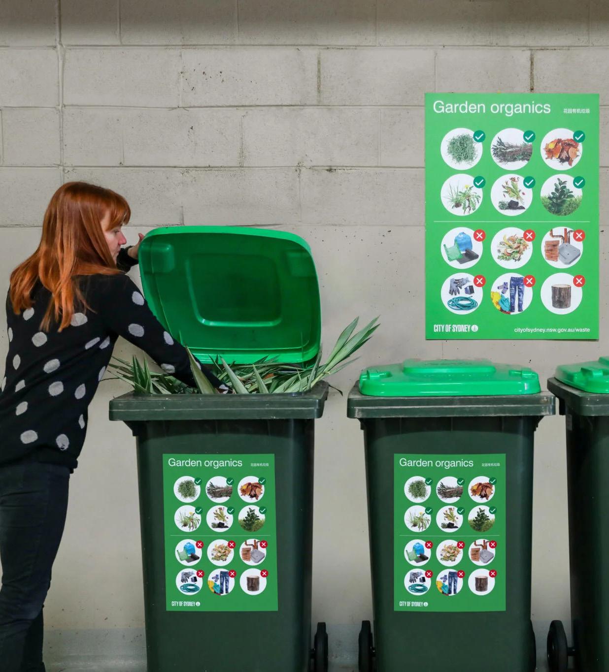
Figure 33. Waste Guide, City of Sydney
3.10.1 Residential development
Controls
C1. Residents in multi-dwelling houses along the new road to the north of the subject site are to utilise kerbside waste collection. Bins shall be stored on individual properties and are to be suitably screened from view from the street. Bin carting routes are not to pass through any internal doorways.
C2. The communal storage area(s) of residential flat building development must be of sufficient size to accommodate all allocated bins, bulky waste and the additional recycling service. This is to be achieved through the provision of a waste communal bin storage area(s) within the basement footprint of the development, which:
a) Provides direct and convenient access for the occupants of the development, at a maximum distance of 30m from each dwelling.
b) Allows for the safe and direct transfer of all bins from the bin storage area to the collection point (if required).
c) Does not adversely impact the occupants within and adjoining the development in relation to visual amenity, noise and odour.
d) Does not interfere with car parking, landscaping and any existing trees and vegetation.
Note: At pre-application stage the applicant shall contact Council’s Team Leader Resource Recovery and Major Projects Waste to discuss waste requirements. This may include requirements for communal bin areas for each “block”, the need for a larger communal bin storage room, and the need for 240 litre and 1,100 litre bins and/or the need for decanting equipment.
The location and design of the communal storage area(s) must comply with the requirements of Council’s Waste Design for New Developments Guide.
C3. Development must designate an on-site collection point that is integrated into the design of the development. The collection point can be directly from the storage area(s) or a nominated holding area within the site. It will be the responsibility of the property manager or caretaker to move bins from the storage area(s) to the holding area. The bincarting route is to have or be:
a) No more than 30m in length.
b) Paved and a minimum 2.5m wide.
c) Non-slip, free from obstacles and steps.
d) A maximum grade of 1:30.
Note: Bin carting equipment (such as a motorised trolley) will be required if the cartage route is greater than 30m or if bins are larger than 240 litres. The design of the on-site collection point must comply with the requirements of Council’s Waste Design for New Developments Guide.
The development is to be designed to integrate with Council’s standard heavy rigid vehicle waste service and to enable all allocated bins, bulky waste and additional recycling to be collected on-site. The onsite collection point must be designed to:
a) Allow collection vehicles to enter and exit in a forward direction, with minimal reversing.
b) Designed to best practice standards for the provision of adequate space for heavy rigid class vehicles to turn around on site, or the provision of truck turn table, as per the Australian Standard AS 2890.2.
c) A minimum basement height of 4.5m to allow sufficient overhead clearance heights to ensure collection vehicles to enter basement and operate to empty waste and recycling bins.
d) Should a hook lift bin system be utilised the clearance height for the vehicle will increase to 6m where the bins are to be positioned.
e) Comply with the any specific requirements detailed in Council’s Waste Design for New Developments Guide.
The design of the on-site collection point must comply with the requirements of Council’s Waste Design for New Developments Guide.
3.10.2 Bulky waste storage
Controls
C1. Separate bulky waste storage areas or rooms are to be provided for residents to store bulky waste (e.g. white goods, mattresses, furniture) awaiting collection to prevent the illegal dumping of materials on the kerbside or in common areas.
The bulky waste storage areas or rooms are to be designed to comply with the requirements detailed in Council’s Waste Design for New Developments Guide.
The areas or rooms are to be separate to the bin storage areas or rooms, and must be both lockable and accessible to residents.
The areas or rooms must not be visible from any street frontage. Where there are multiple buildings, separate areas or rooms must be provided.
The space should be appropriate with the minimum size being:
a) 6 to 20 units: 4m2 total space.
b) 21 to 40 units: 4m2 + 1m2 for every 10 additional units above 20 units (or part thereof).
c) 41 to 100 units: 8m2 + 1m2 per 20 additional units (or part thereof) above 40 units.
d) 101 units and over: 12m2 + 2m2 per 50 additional units above 100 units (or part thereof).
C2. 13.6 On-site collection of bulky waste is required where waste and recycling bins are collected on-site. The
bulky waste storage room must be within 5m to the nominated collection point.
The carting route from the bulky storage area(s) to the collection point is to be:
a) Direct and short as possible.
b) Paved and a minimum 2.5m wide.
c) Non-slip, free from obstacles and steps.
d) A maximum grade of 1:30.
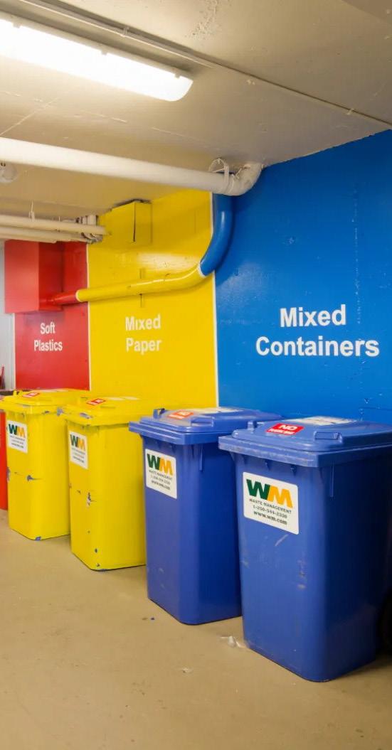
Figure 34. Waste room, Concept Properties
Controls
C1. Separate additional recycling storage areas or rooms are to be provided for residents to store additional recyclable household items (e.g. clothing, mattresses, polystyrene, cardboard and electronic waste) awaiting collection, to prevent the illegal dumping of materials on the kerbside or in common areas.
The minimum area required is 9m2 and the area is to be designed to comply with the requirements detailed in Council’s Waste Design for New Developments Guide.
The area or rooms must be separate to the bin storage area or room(s) and the bulky waste storage room.
The area or room(s) must not be visible from any street frontage. Where there are multiple buildings, separate areas or rooms must be provided.
C2. On-site collection of additional recycling materials is required where waste and recycling bins are collected on-site. The additional recycling collection area or room must be within 5m of the nominated collection point.
The carting route from the bulky storage area(s) to the collection point is to be:
a) Direct and short as possible.
b) Paved and a minimum 2.5m wide.
c) Non-slip, free from obstacles and steps.
C3. Waste chute disposal points (hoppers) are to be provided on each residential level of the development for the five and six storey buildings. A recycling cupboard is to be located adjacent to the chute hopper.
The hopper and recycling cupboard are to be located no more than 30m travelling distance from each dwelling.
The chute should be behind a cupboard door to improve resident’s amenity and reduce odour in the lobby/corridor.
The chute is to be designed to minimise noise and fire risk. It is to terminate in the bin storage room and discharge directly into a bulk bin.
Signage is to be placed on the chute hopper and recycling cupboard on every residential level providing instructions on how to use the system effectively.
d) A maximum grade of 1:30. 3.10.4 Chute
Controls
C1. Bin storage rooms must be located directly under where the chute terminates and allow a space large enough for the bin to fit under the chute base and at the correct angle.
The bin storage room must be large enough to fit the allocated number of bins with additional room for manoeuvring bins and lift lids.
There must be sufficient bin volume under the chute for a minimum of three days waste generation.
Where volume-handling equipment is required to automatically change the bin under the chute when it becomes full (such as bin lifting equipment or linear tracks or carousels), the bin storage room must be of adequate size to accommodate all required equipment and operate it.
Resident access to the volume handling equipment will be restricted. Bin storage room and chute service room may be two separate rooms but next to each other.
3.10.5 Easement
Controls
C1. Council must be provided with an easement for unimpeded access to and from the waste collection locations for Council and its contractors to enter and exit for the purpose of waste and recycling collection. The development is also required to indemnify Council and its contractors against claims for loss or damage or wear and tear of access roads or to other parts of the building. A positive covenant shall be placed on the property title, such as section 88B certificate.
Note: By entering into an agreement with Council for waste collection, the development will be required to operate in full compliance with Council’s waste management collection requirements. The provision of Council’s waste collection service will not commence until formalisation of the agreement.
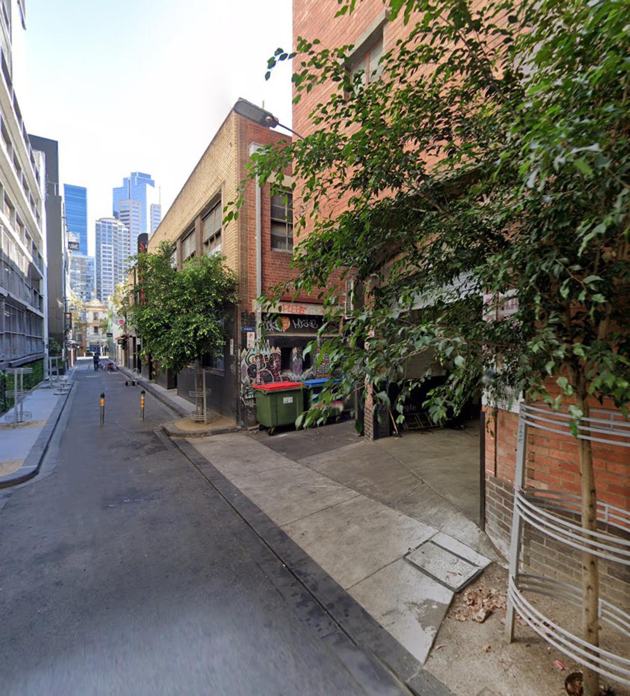
Figure 35. Meyers Place, City of Melbourne
3.11 Fencing 3.12 Integrating with future development at 23 Canterbury Road
Objectives
O1. To provide fencing that responds to the character of the streetscape, with low, visually open fencing which is complemented by landscape.
Controls
C1. Fencing to multi-dwelling houses along the new road to the north of the subject site is to be not more than 1.2m above ground level, visually open and designed in conjunction with landscaping in the front setback zone to provide an attractive streetscape and provide visual privacy for ground level private open space.
C2. Fully masonry fences are not appropriate or desirable within the streetscape character.
C3. Fencing is to respond to building entries and allow for mail boxes, seats and the like at the building entry.
C4. Fencing to ground level private open spaces around internal courtyards and along the new road to the north of the subject site is to provide privacy through a combination of level transition up to the terrace, landscaping and fencing design.
Objectives
O1. The development site must make provisions to ensure future development at 23 Canterbury Road, Punchbowl is able to occur and function without impact to the site.
Controls
C1. The development application drawings and Statement of Environmental Effects must include the following details:
(a) The provision of easements over the Club Punchbowl site to allow right of way for vehicles from future new development at 23 Canterbury Road.
(b) Basement and/or ground level connectivity between the sites to be accommodated in the development plans to allow for vehicle movement assuming no access to Canterbury Road will be allowed for the new development on the site by Transport for NSW.
(c) Design for access for waste collection vehicles and other vehicle servicing requirements like delivery and removalist trucks between the sites.
(d) The design the internal street network to accommodate vehicles accessing 23 Canterbury Road.
(e) The design of buildings on the Club Punchbowl site is to consider the location and potential impacts on future buildings and location of residential apartments on 23 Canterbury Road.

Figure 36. Deco Battens, Shannon Vos