Presented by Dr. Héctor Ruiz, Principal Investigator
Project at a Glance
Multi-year habitat vulnerability assessment of two highly valued, federally protected species — integrating scientific surveys, long-term temperature monitoring, and Traditional Knowledge from local fishers — to inform management measures and recovery plans across the U.S. Caribbean.
Critical Habitats
1
Describe the state of submerged aquatic vegetation (SAV) juvenile habitat and areas of reproductive activity; assess vulnerability via traditional ecological knowledge TEK.
3
Temperature & reproductive cycle
Characterize the relationship between seawater temperature at the seafloor and reproductive phenology of both species.
2
Juvenile abundance
Document juvenile A. gigas and E. striatus abundance, benthic composition, and environmental conditions as well as sargassum inundation events (SIE).
4 Communication
Integrate the perspectives of local project partners (fishers) and asses the knowledge of local coastal communities regarding the impacts to these habitats.
Methodological Approach
1 · Literature & TEK
Review of peer-reviewed and grey literature; consultations with fishers; structured workshops to elicit traditional ecological knowledge on phenology, tolerance, and habitat use.
OUTCOME
2 · Habitat Surveys
Photoquadrats, in-situ water quality measurements, long-term temperature loggers, and standardized juvenile/adult abundance surveys.
3 · Analysis & Synthesis
Trends in data collected crossreferenced with TEK; outputs feed CFMC ecosystem vulnerability assessment.
· Evidence base for climate-ready fisheries management of two ESA-Threatened species
Preliminary study to determine study areas and experimental design:
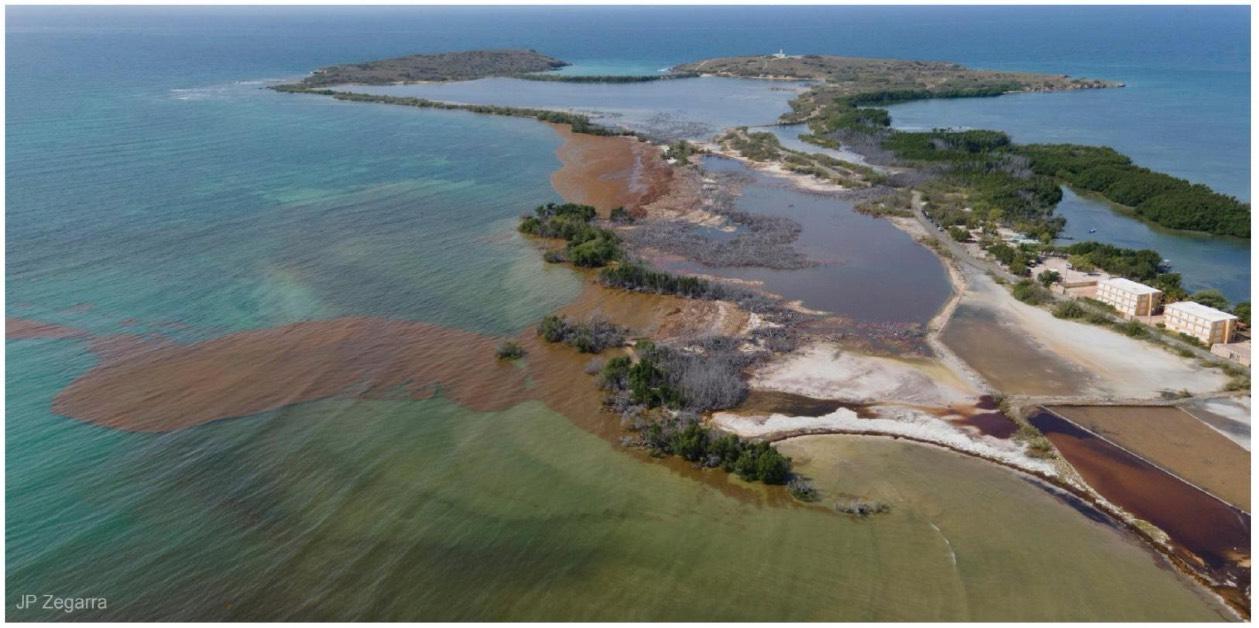
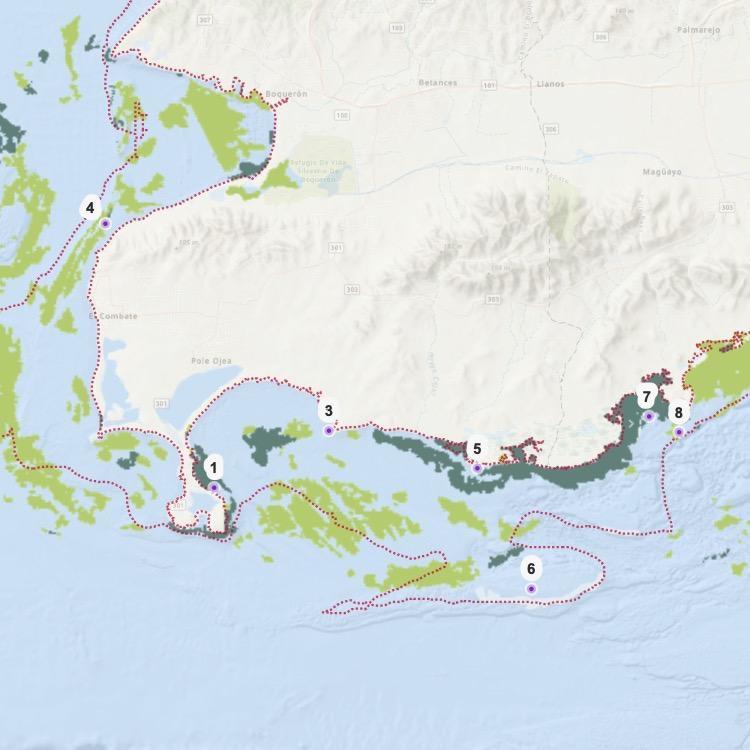
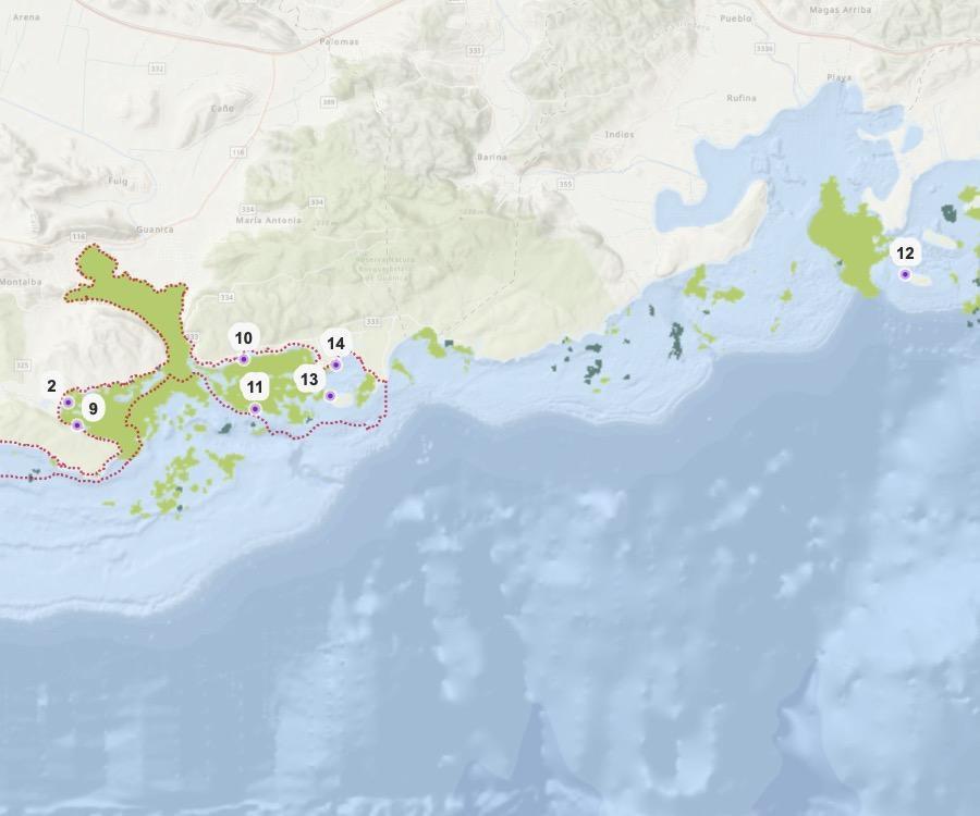
Identifying Areas Impacted by Sargassum-brown-tide (Sbt) in Southwest Puerto Rico
Mariana C. León-Pérez, Ph.D. · Mar Caribe Consulting LLC
May–April years for 2018, 2022, 2023 — covering peak and recent sargassum seasons
6 regions of interest
7 detection indices
True color, Highlight Natural
Color, 3 false-color composites, NDCI, NDWI
Expert digitization
Manual digitization at 1:7,000 in ArcGIS Pro; ≥4 of 7 indices required to confirm Sbt
S. Cabo Rojo · W. La Parguera · E.
La Parguera · Guánica · Bosque
Seco · Guayanilla
3 frequency classes
Natural breaks: low (1–8 obs), medium (9–14 obs), high (15–25 obs)
Findings · Sbt is Persistent Across SW Puerto Rico
79% of months analyzed had Sbt (27 of 34 cloud-free months)
75% of the three-year study period showed active Sbt
What this means
Sbt is not an episodic phenomenon — it is a nearconstant condition along the southwest coast. Data unavailable for only 2 months (Sept 2018 and Sept 2022) due to cloud cover. Of the remaining 34 months, Sbt was confirmed in 27.
Implication: A. gigas and E. striatus juvenile habitats in the corridor are exposed to chronic, not acute, Sbt stress.
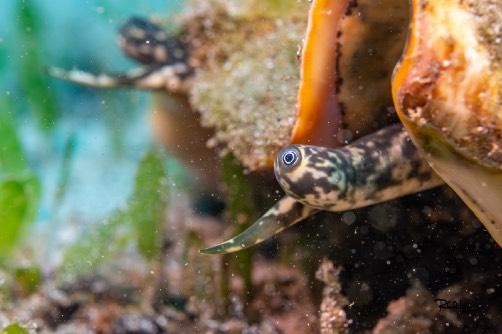
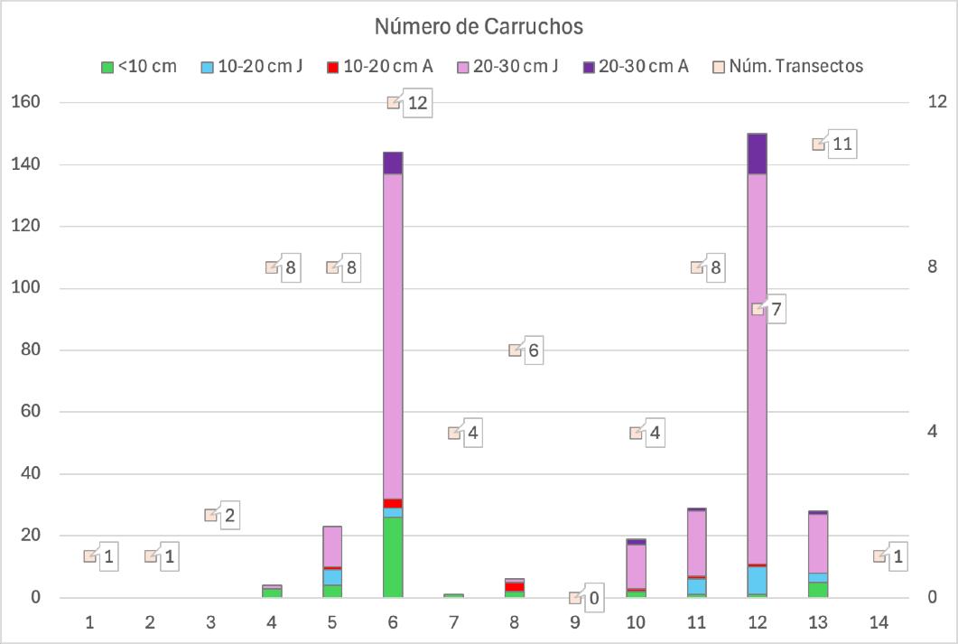
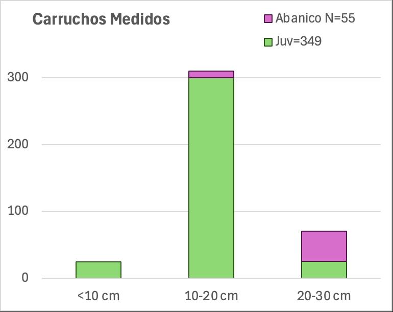
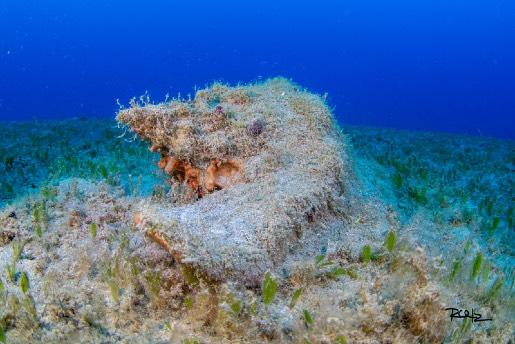
Surveys: Juvenile Queen Conch abundances
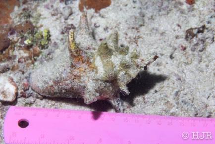
Conch with a flared lip by size class.
Surveys from May 20 to November 12, 2025
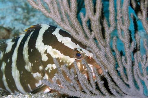
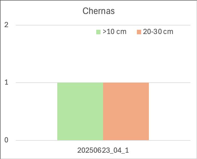
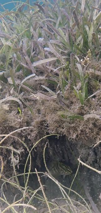
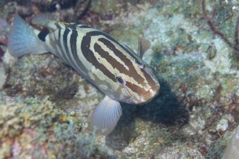
Surveys: Juvenile Nassau Grouper
abundances
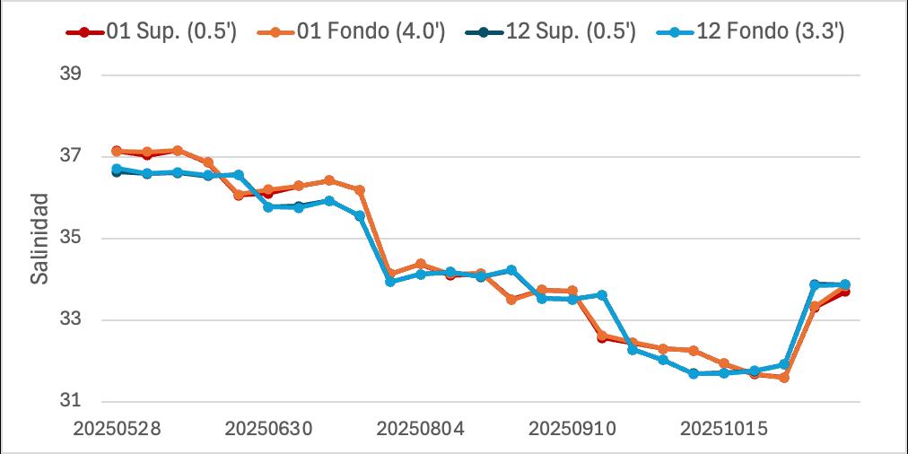
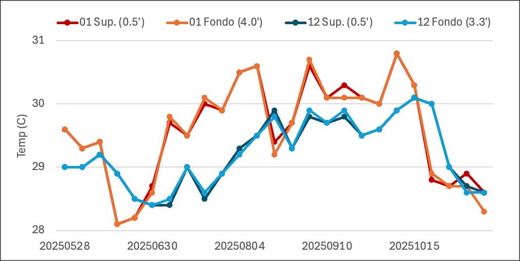
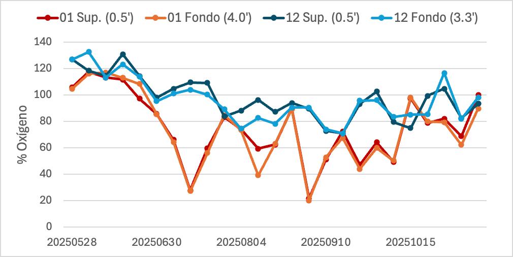
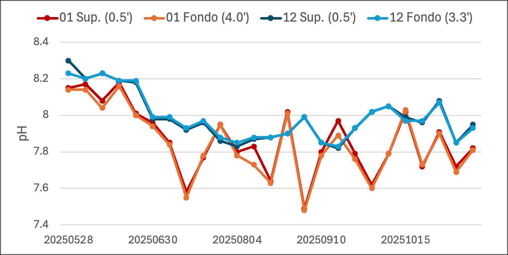
2 Temperature In Situ(Surface and at depth)
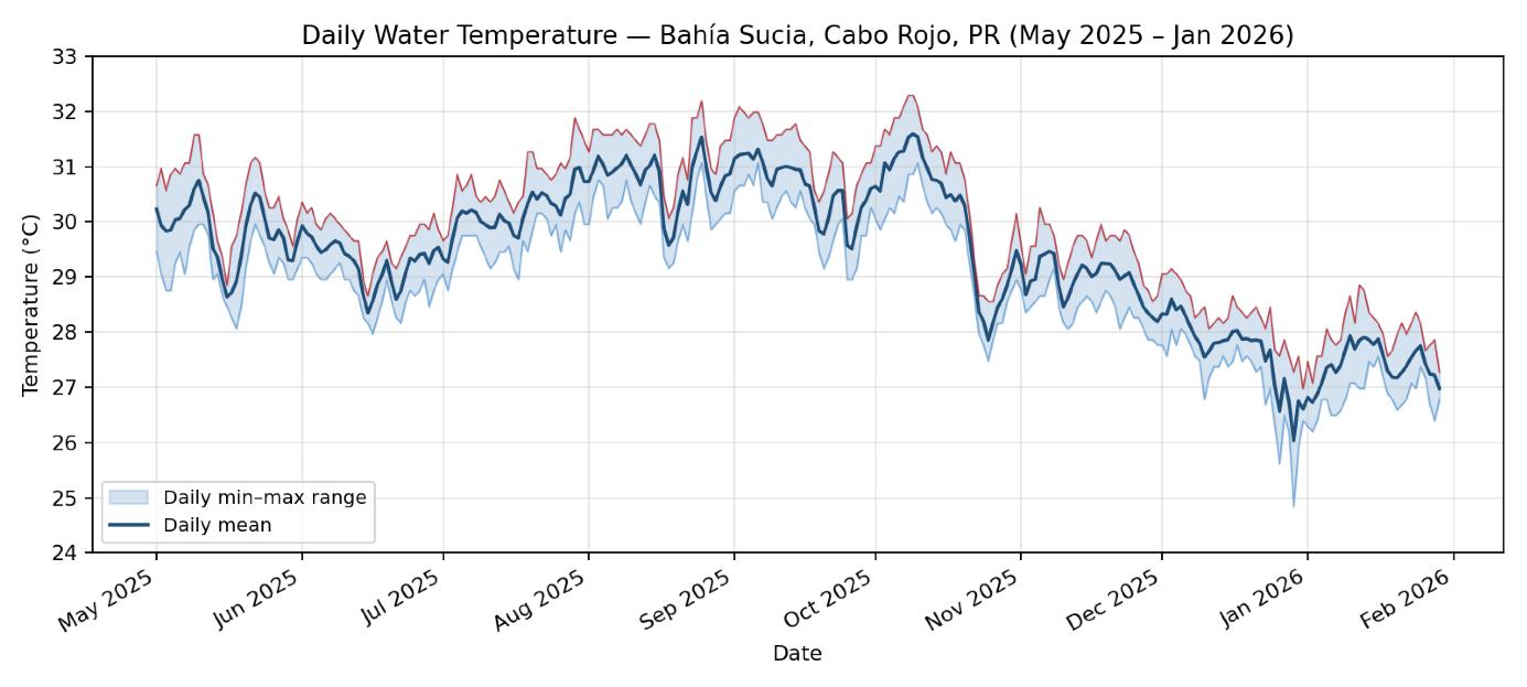
2 Continuous Temperature at seafloor (HOBOS)
Traditional ecological knowledge (TEK)
Core Insight: Fishers as Co-Interpreters
Fishers don't just report 'less fish'.
They describe structural habitat transitions, altered sediment regimes, recruitment pulse variability, microclimate gradients, and reduced nursery capacity.
Lived language → ecological concept
“The grass is gone.”
Potential loss of critical habitat 'nursery' function
“The sediment doesn't settle.”
Water quality declines & sediment covers food
“It's hotter inside the bay.”
Potential thermal intolerance of juveniles
“You can't even work there.”
Reduction in fishing areas
Achievements to Date
Field operations since 20 May 2025.
44
Data collection trips Surface YSI environmental data