5 minute read
How Motus Will Expand Our Understanding of Cape Fear’s Migratory Birds

How Motus Will Expand Our Understanding of Cape Fear’s Migratory Birds
by Shelby Diehl
The Motus Wildlife Tracking System (Motus) is a program of Birds Canada, in partnership with collaborating researchers and organizations, that uses automated radio telemetry to conduct research and education on the ecology and conservation of migratory animals. Currently, there are more than 400 Motus stations globally that have made over 200 million detections from greater than 6000 individuals of 76 species tagged. Dr. Christopher Tonra, associate professor of Avian Wildlife Ecology at Ohio State who is familiar with the program, presented it to Cape Fear Audubon in October 2021.

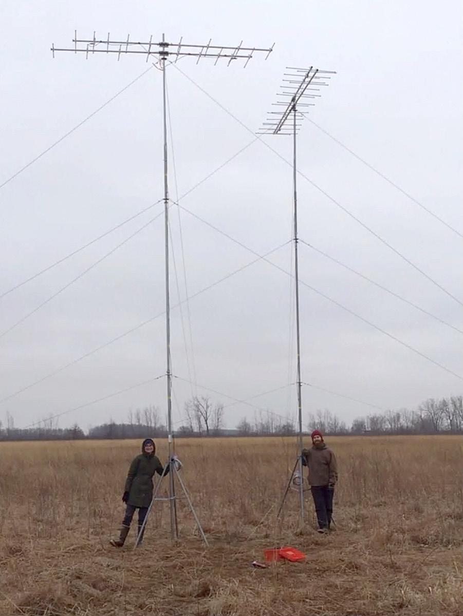
Christy Stein and Jay Wright set up a pair of automated telemetry towers.
Photo courtesy of Dr. Christopher Tonra
To use the program, researchers attach a tag to a bird that transmits a unique signal that makes each tag identifiable by its frequency. These signals are detected by automated telemetry towers, towers that use receivers to detect frequencies from the bird tags. The average tag has a life-span of seven months, which means that if researchers tag a bird during spring migration, if the bird returns during fall migration, they can detect it.
In using tags, researchers seek to answer questions such as how these birds are using space, what habitats they can be found in and how much time the birds are spending at stopover sites. Tags can also answer basic migratory behaviors such as what routes the birds are taking through the region. With this method, researchers have also found lots of movement among migratory birds, including commuting behaviors between foraging and roosting locations.
Motus can be accessed by two different setups: the first is Lotek, an expensive option that provides direct access to data, but without internet access; the second is Sensorgnome, an affordable option that doesn’t allow direct access to data, but has internet capabilities.
Dr. Tonra focused on his Motus research in Lake Erie—the shallowest of the Great Lakes. Lake Erie is a major migratory corridor, especially the western basin, since the area has some of the last remaining remnants of the Great Black Swamp which, after the Everglades, was once the largest contiguous wetland in North America. The stopover habitats are attractive to migratory birds and therefore draw large numbers of migratory birds.
In the data, when birds are detected by two towers, timestamps record the exact time the bird left the vicinity of one tower and passed by another. While detections have been made by other towers around Lake Erie, there have been detections by towers erected and monitored by other organizations in Cape Romain National Wildlife, South Carolina; Refuge Key Island, Florida; and in the Caribbean. This data is found due to the communication, collaboration and sharing of data from researchers across the Motus network, a feature provided by Motus.
These measurements have allowed researchers to study the bird’s migration speed. With these timestamps, Dr. Tonra found migratory birds are much more likely to depart when they have a strong tailwind behind them because it saves energy. There is a difference between males and females, too. The data found that males have a higher probability of surviving the post-fledging period than females.
Cape Fear Audubon, with assistance from the Danner Lab at the University of North Carolina at Wilmington, is spearheading the placement of a Motus tower at Lea-Hutaff Island, an undeveloped barrier island in Pender County. Simultaneously, the North Carolina National Estuarine Research Reserve (NC NERR) is funding the placement of a Motus tower on Masonboro Island, an undeveloped barrier island in New Hanover County.
“[The Lea-Hutaff] tower will be important for tracking migratory species that pass through our area or may use LeaHutaff as a stopover site during migration,” said Marae Lindquist, a Ph.D. candidate working in the Danner Lab. “The information collected from this Motus tower will help the researchers who tagged the birds that fly over the tower and help our local organizations understand what birds are using our area during migration.”
While there are no plans to tag birds at the Lea-Hutaff tower, the Masonboro tower will be tracking Seaside, Saltmarsh and Nelson’s Sparrows. (All bird-banding and radio-tagging is performed under state and federal permits.) The Lea-Hutaff installation will be an important resource to help determine the migratory timing for the species tagged on Masonboro Island as well as to educate the public on these migratory birds.
“Understanding the ecology and movements of migratory birds is an essential function of conserving them,” Lindquist said, “so ideally this tower will help foster an understanding of the migratory birds that pass through our beautiful region.”

The yellow dots depict towers and each bubble represents a 15-kilometer-long detection area. Information collected in these bubbles is transferred to the Motus network where information is available to various researchers across the towers.
Photo courtesy of Dr. Christopher Tonra
Shelby Diehl is a junior at the University of North Carolina at Wilmington studying environmental science with a concentration in conservation and creative writing with a certificate in publishing. She is a Going Green intern and plans to pursue a career in environmental writing that will allow her to advocate for environmental causes worldwide.
