GEOGRAPHY TRANSFORMED
NSW STAGE
UNCORRECTEDPAGES
Rex Cooke, Matt Carroll, Sammy Coburn, Alan Cizzio
Julie Bover, Kathy Cordes, Sharon Davis, Valentina Raguz

2.1 Geo Spark: What are the “dinosaur trees” of the Blue Mountains?
2.2 What were the geomorphic processes that shaped the Blue Mountains?
2.3 What is the environmental and economic value of the Blue Mountains?
2.4 What is the recreational value of the Blue Mountains?
2.5 What is the cultural value of the Blue Mountains?
2.6 How have the human impacts of mining and urban development modified the Blue Mountains?
2.7 How has the human impact of tourism modified the Blue Mountains?
2.8 How are the Blue Mountains protected on a global scale?
2.9 How are the Blue Mountains protected on a national scale?
2.10 How are the Blue Mountains protected on a local scale?
2.11 How do the Traditional Owners manage and care for the Blue Mountains?
2.12 Chapter review
Teachers go to the Online Teacher Suite to:
• plan, sequence and assign directed tasks for students and classes using Task Manager
• view student activity reports
• provide feedback to students
• download a printable “Writing focus” workbook for this chapter.

Learning intention
In this lesson, you will learn about the Blue Mountains and one of its most prized natural features.
Writing
Focus 2.1
Question words
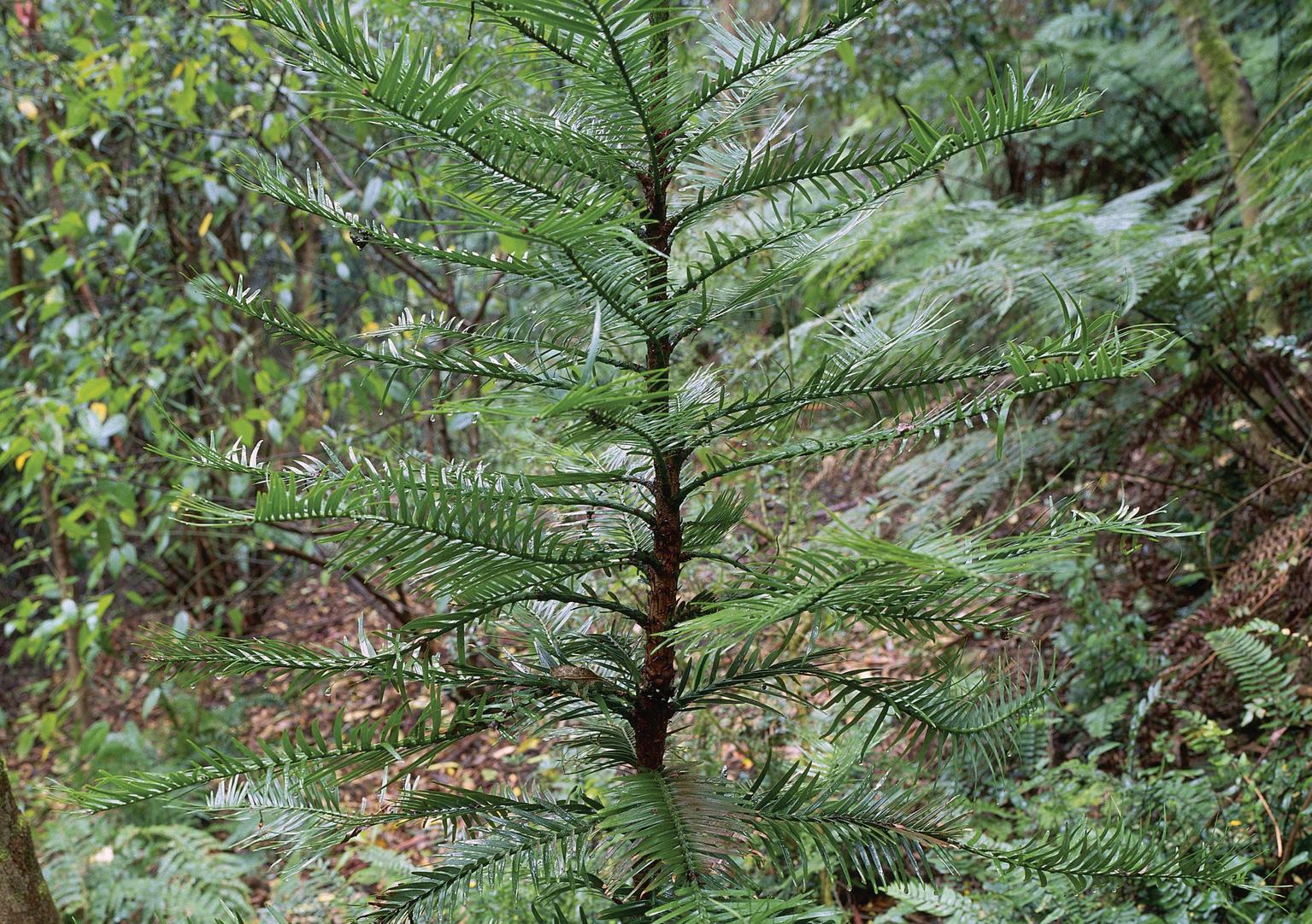
Wollemi pine one of the world's oldest and rarest trees, a critically endangered 'living fossil' dating back to the time of the dinosaurs
Success criteria
❏ I can describe key features of the Blue Mountains.
The Blue Mountains are located approximately 50 kilometres west of Sydney. They are located at latitude 33°S and longitude 150°E. The region forms part of the Great Dividing Range and is centred around the Blue Mountains National Park, which is part of the Greater Blue Mountains World Heritage Area. The Blue Mountains National Park covers around 2,690 square kilometres, making it one of the largest protected areas in New South Wales.
The name “Blue Mountains” comes from the blue haze that often covers the region, caused by tiny oil droplets released from eucalyptus trees mixing with dust and sunlight.
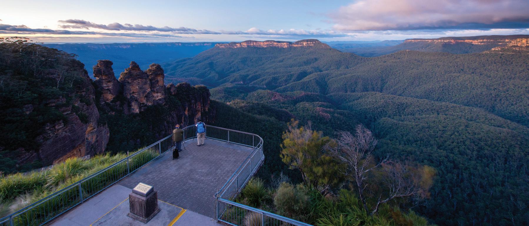
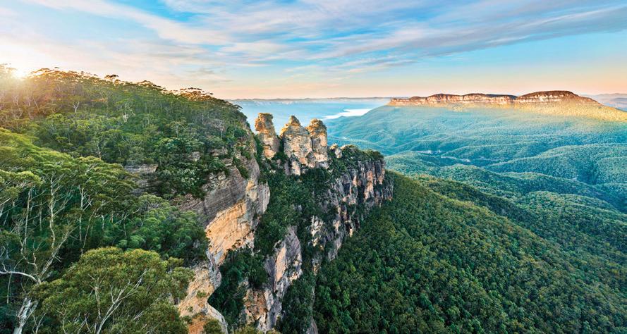
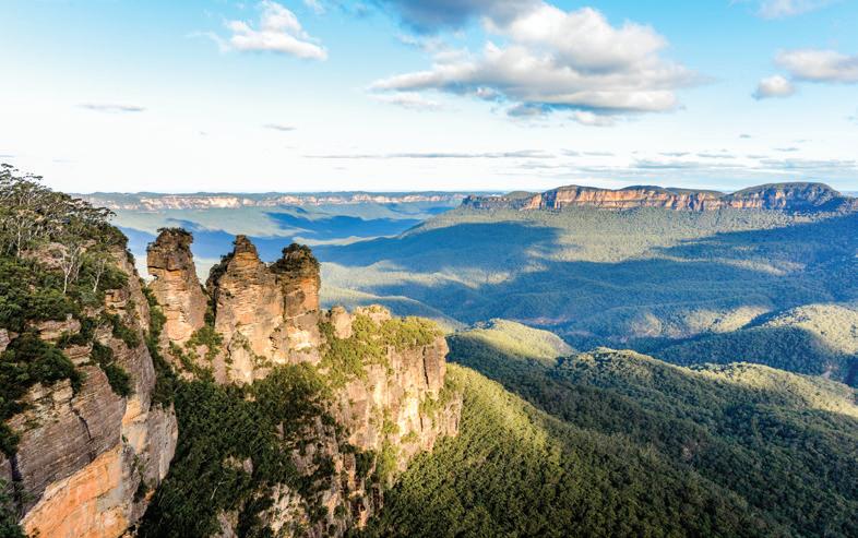
Figure 2.1.1 A scenic view of the Blue Mountains National Park from the Echo Point lookout ➜
The “dinosaur trees” of the Blue Mountains refers to the Wollemi pine, one of the world’s oldest and rarest tree species. Thought to be extinct for over 90 million years, it was rediscovered in 1994 in a remote canyon of Wollemi National Park. Fewer than 100 adult trees exist in the wild, making it critically endangered. The Wollemi pine is often called a “living fossil” because it dates back to the time of the dinosaurs, with fossil records from the Jurassic period. Conservation programs now protect it through secret wild locations and propagation in botanical gardens worldwide.
2.1 Geo Spark: What are the “dinosaur trees” of the Blue Mountains?
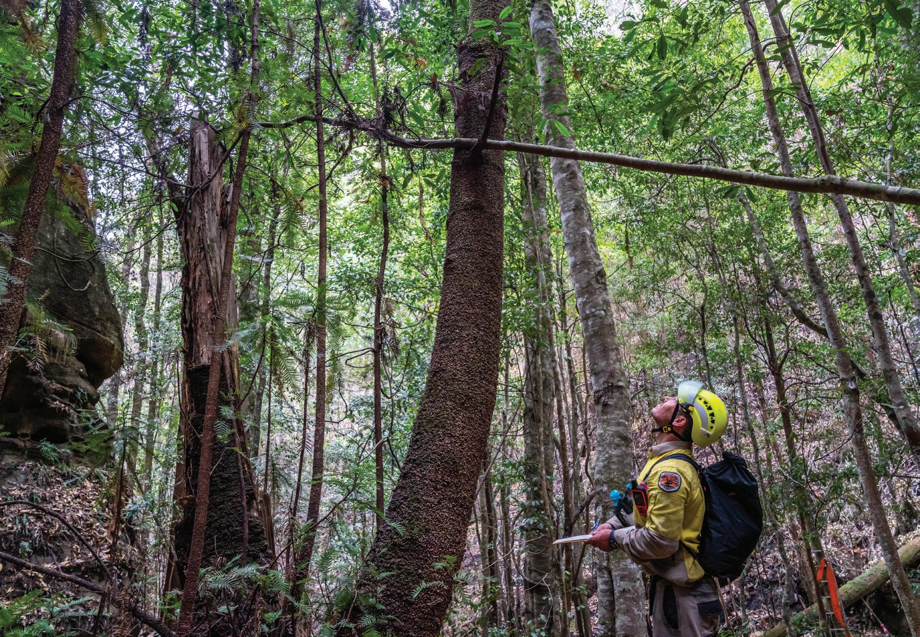
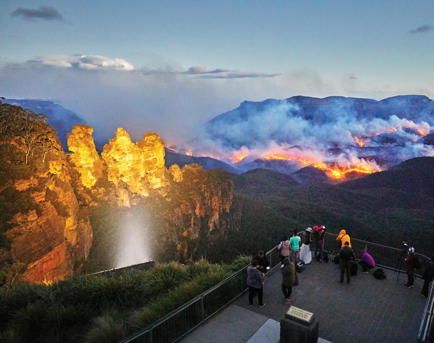
During the devastating January 2020 bushfires, the NSW National Parks and Wildlife Service (NPWS) implemented an emergency operation to protect the only known wild population of the ancient Wollemi pine. Firefighters installed remote irrigation systems, deployed aerial water bombing, and created containment lines around the secret site deep within Wollemi National Park. Despite fires burning nearby, these precise and coordinated efforts successfully prevented the flames from reaching the grove, safeguarding the fewer than 100 remaining trees and preserving one of the world’s rarest living plant species.
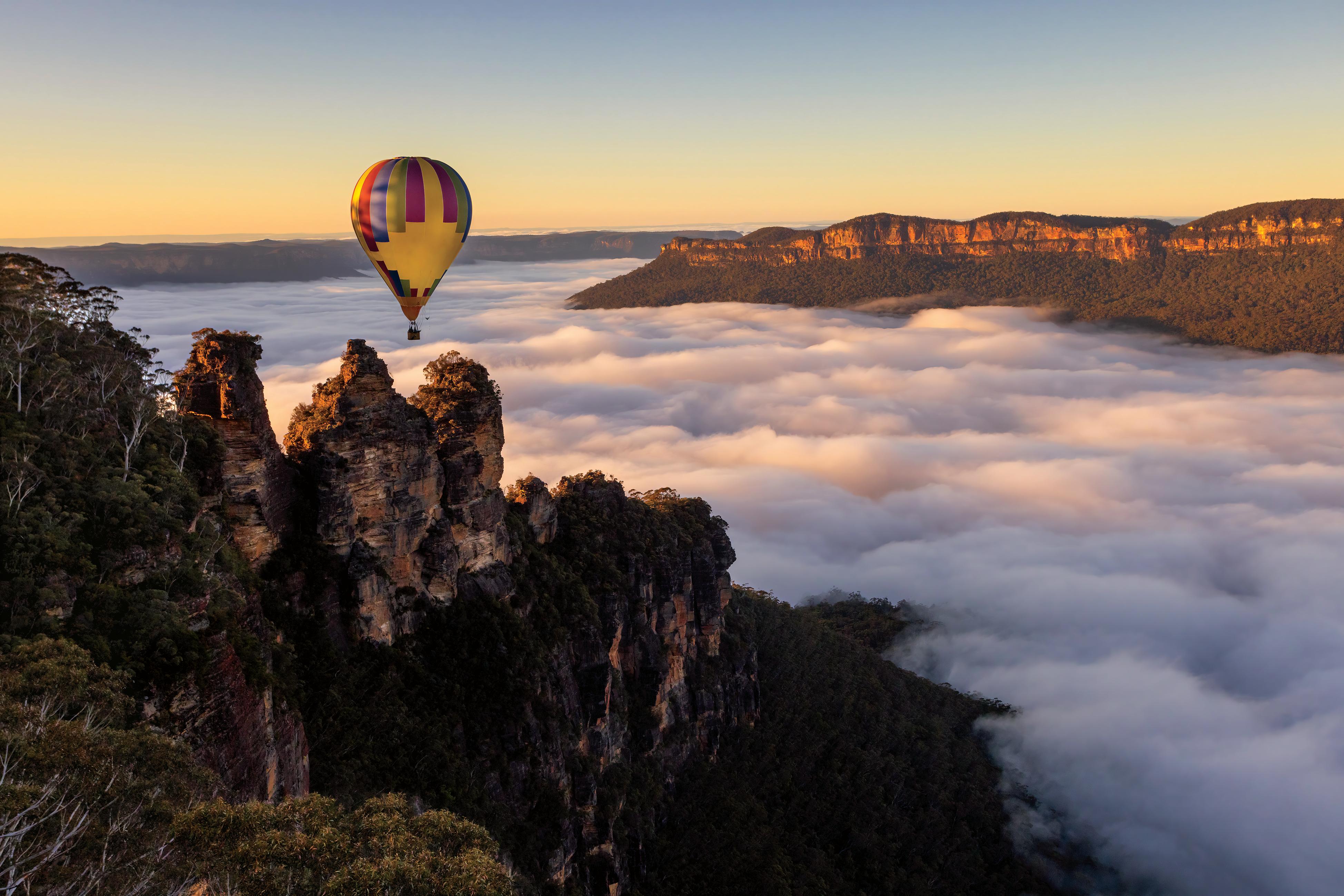
Visible thinking routine: See, think, wonder Refer to Figures 2.1.1 and 2.1.2.
See: What are four key features you can see in Figure 2.1.1 about the landforms and landscape of the Blue Mountains? What clues in the image tell you why the Wollemi pine might be called a “dinosaur tree”?
Think: How do you think this landscape and landform of the Blue Mountains were formed or created? Why do you think NPWS worked so hard to protect the Wollemi pine during the 2020 bushfires?
Wonder: In what ways might how humans have used this unique landscape over time? What do you wonder about the future of the Wollemi pine?
Learning intention
In this lesson, you will learn about the geomorphic processes that created and are shaping the Blue Mountains.
Success criteria
❏ I can identify the geographic processes that formed the Blue Mountains.
❏ I can explain the geographic processes that formed the Blue Mountains.
Starter activity
Using Figure 2.2.1, answer the question: What forces do you think have shaped this landscape over millions of years?
Write down three ideas in your workbook.
Writing
Focus 2.2
Conjunctions
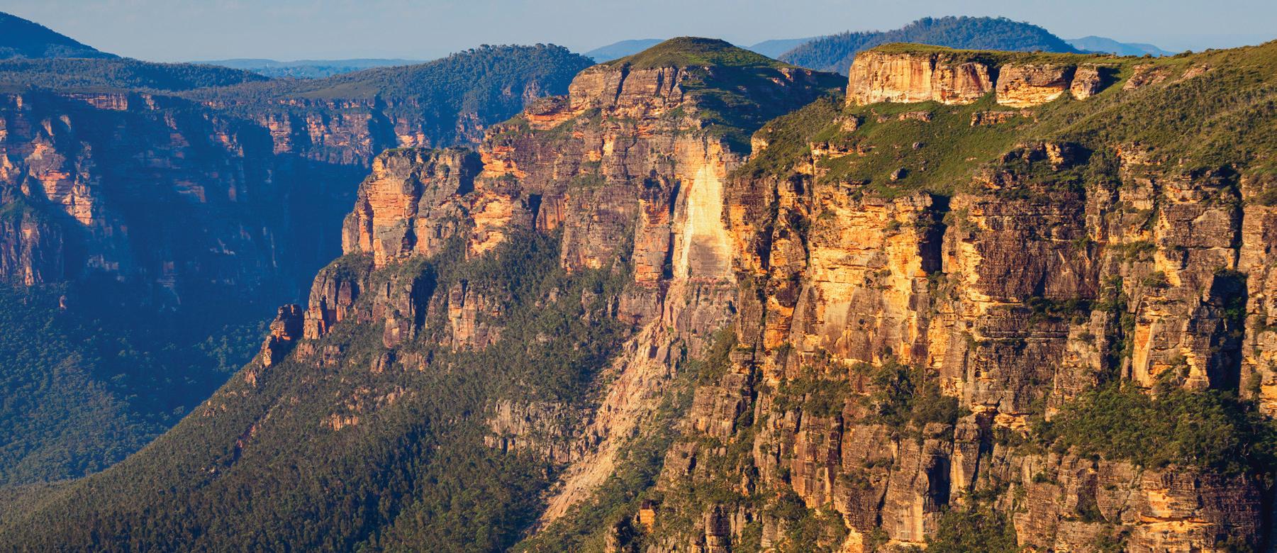
Figure 2.2.1 A sandstone plateau within the Blue Mountains ➜
The Blue Mountains are one of Australia’s most famous natural landscapes. Their dramatic cliffs, deep valleys, waterfalls and unusual rock formations are a great example of how geomorphic processes such as tectonic uplift and weathering shape the Earth’s surface over time.
The Blue Mountains are not true mountains but are part of the Sydney Basin sandstone plateau. Around 250 million years ago, layers of sand, mud and other sediments were deposited by ancient rivers and seas. Over millions of years, these sediments compacted and hardened into sandstone, shale and limestone.
About 50 million years ago, movements in the Earth’s crust caused the land to slowly uplift. This uplift happened because of tectonic forces, when movements of the Earth’s crust pushed the land upwards. Instead of forming sharp peaks, the entire sandstone block was raised into a plateau. Once lifted, the softer rocks began to break down. Water, wind, and gravity gradually wore away at the plateau, carving out the valleys, cliffs, and ridges we see today.
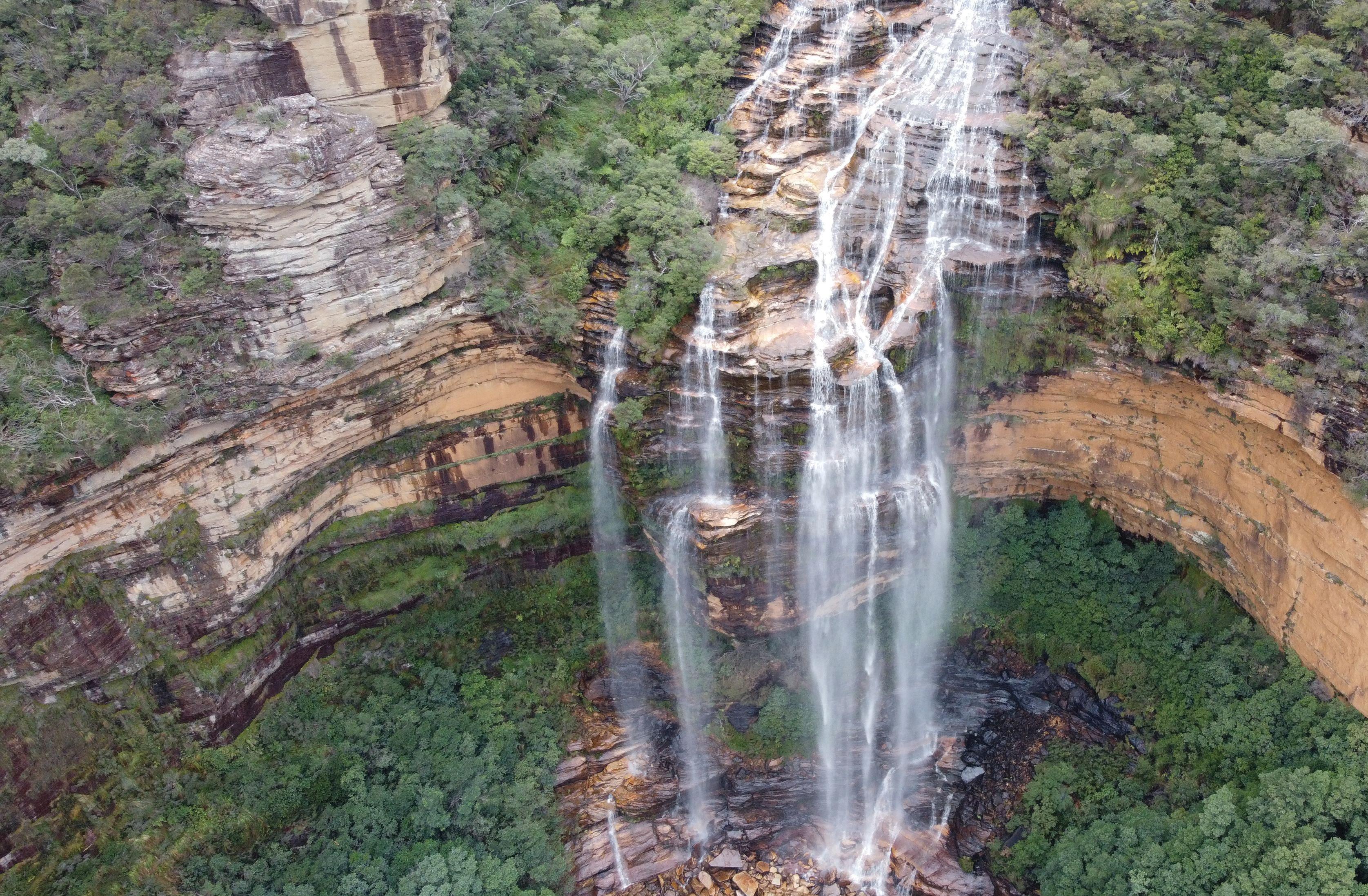
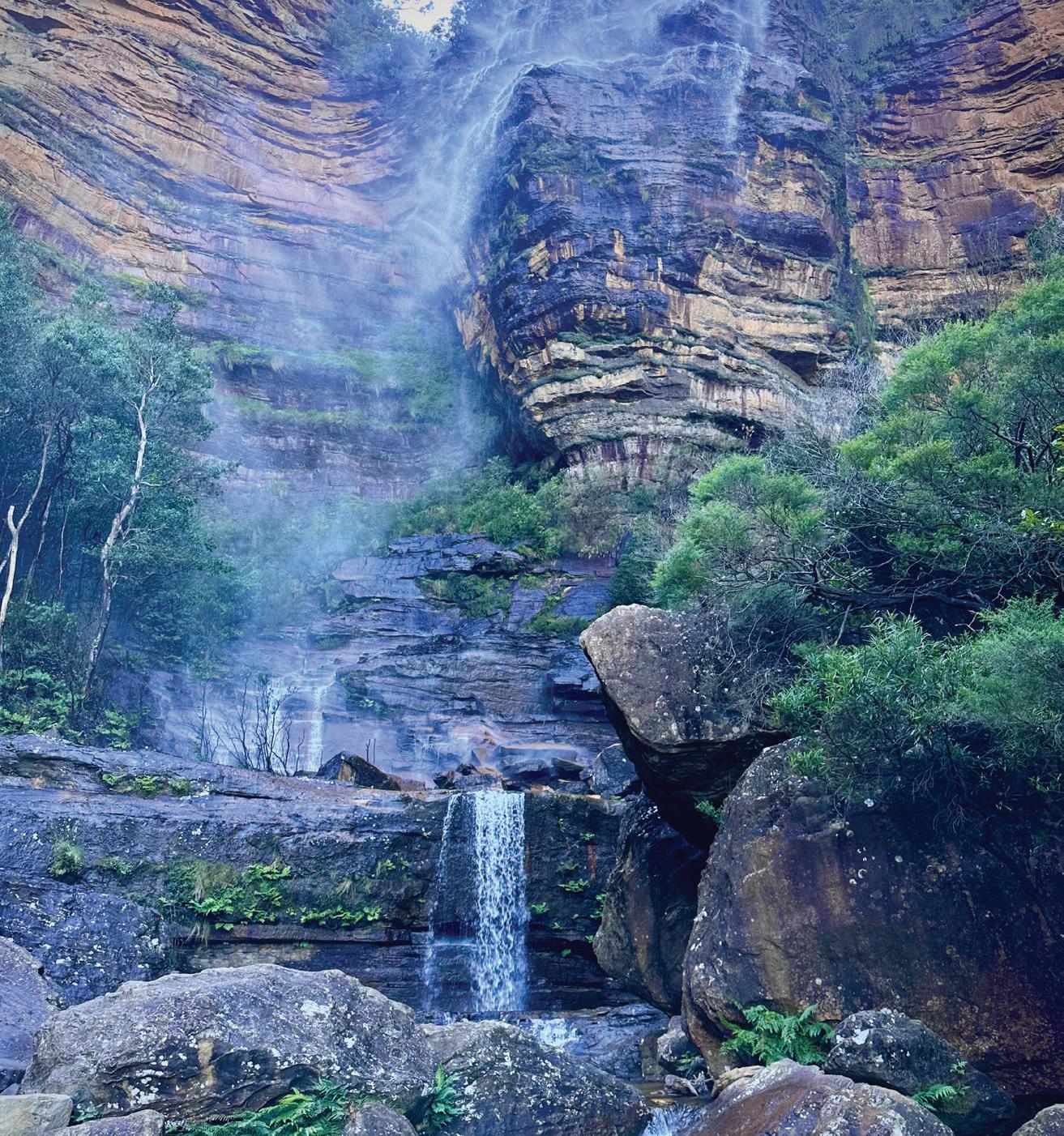
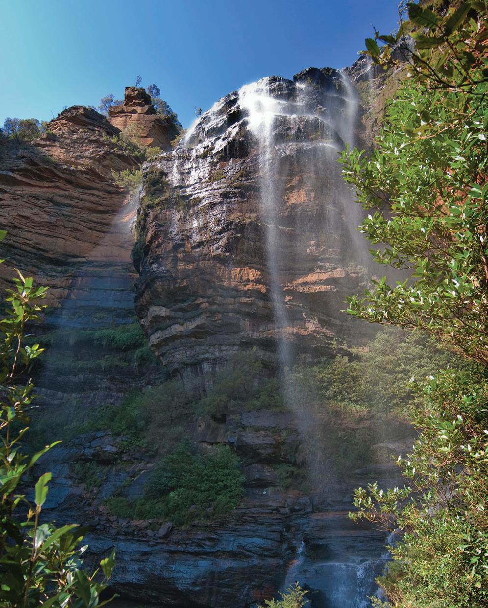
Weathering is the breakdown of rock in its original place, and it plays a key role in shaping the Blue Mountains. The sandstone here is relatively soft and contains many natural cracks and joints, making it especially vulnerable to weathering. Weathering weakens the rock, and erosion removes it. Rivers such as the Grose and Nepean have carved deep valleys through the plateau. Waterfalls like Wentworth Falls form where streams drop over harder rock layers and, over time, the erosion at their bases cause the cliffs to retreat backwards.
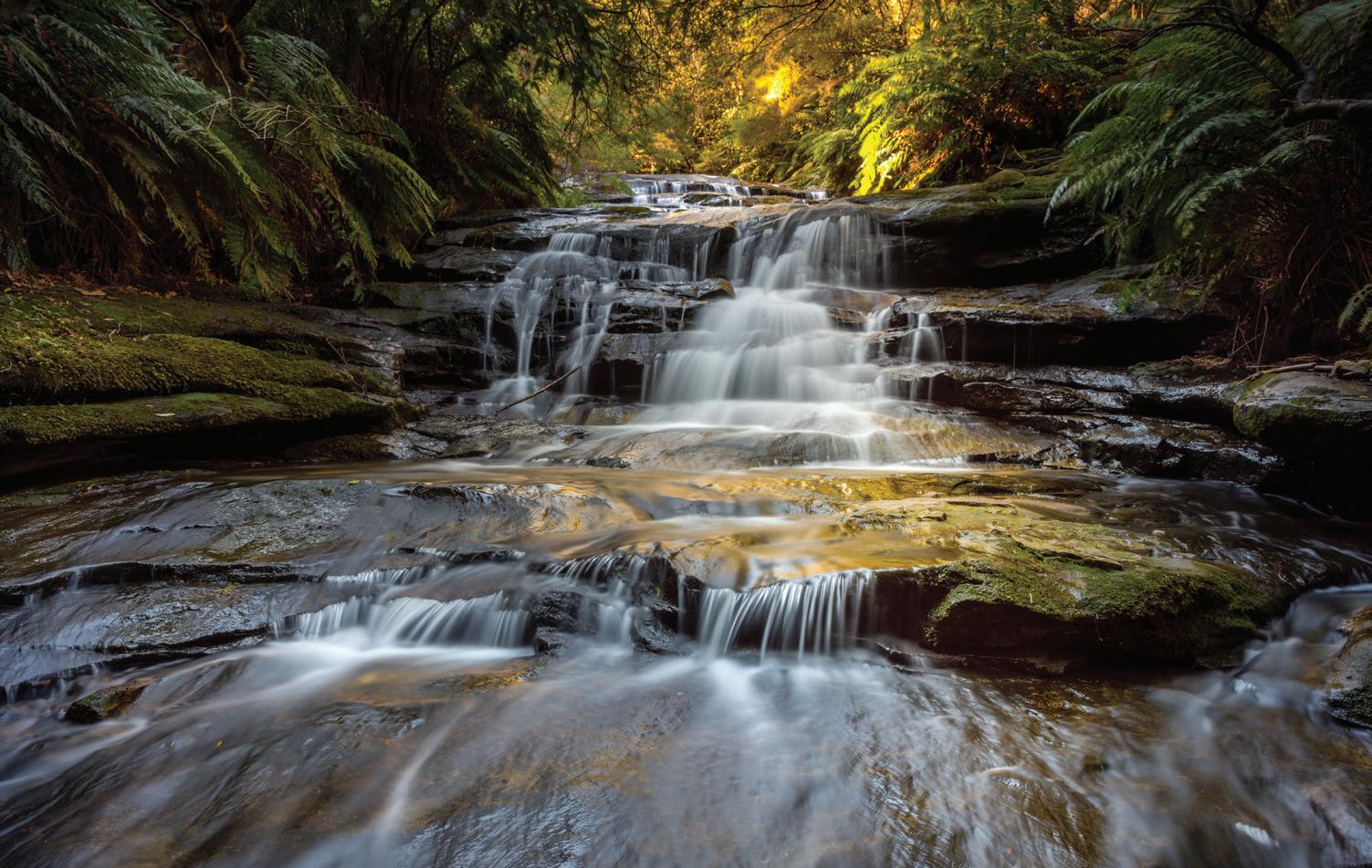
Figure 2.2.4 Wentworth Falls is a major waterfall that has been created in the Blue Mountains from weathering.
Review 2.2
Teachers can go online to assign questions, view results, reports and more! Knowledge and understanding Thinking and working geographically
Students can access sample responses and results online
Knowledge and understanding
Recall how far the Blue Mountains are from Sydney, and their latitude and longitude.
Recall the size of the Blue Mountains National Park.
Explain why the Blue Mountains are called “Blue”.
Define a plateau.
Explain how tectonic uplift created the Blue Mountains.
Describe how weathering has shaped the Blue Mountains.
Thinking and working geographically
Working with geographical concepts: Change
Using the photos and the text, explain how the Blue Mountains changed over time. In your answer, refer to tectonic uplift and current weathering features such as rivers and waterfalls.
Geographical inquiry
Investigate the geological history of the Blue Mountains and construct a timeline to show the key processes that have shaped the area.
change The concept of change is about explaining geographical phenomena by investigating how they have developed over time.
Learning intention
In this lesson, you will learn about the environmental and economic value of the Blue Mountains.
Success criteria
❏ I can describe the how the Blue Mountains has economic and environmental value to humans.
In pairs, students sort the following examples into two columns: environmental values and economic values.
a. Provides homes to over 400 native animal species
b. Generates $560 million annually through tourism
c Provides clean air and water for Western Sydney
d. Supports ecotourism and outdoor recreation jobs
e. Protects unique ecosystems like the Wollemi pine
f Hosts over four million visitors each year
Discuss and justify one example you think is the most important.
The Blue Mountains hold immense environmental value due to their rich biodiversity, unique ecosystems and their role in environmental conservation. The region is home to more than 400 species of animals, including the spotted-tailed quoll, greater glider and superb lyrebird.
More than 1,500 species of plants thrive in the Blue Mountains, including the Blue Mountains ash, scribbly gum and waratah. However, eucalypts dominate the landscape. In fact, the area contains the most diverse range of eucalypt species in the world, which play a vital role in supporting unique forest ecosystems and contributing to the characteristic “blue haze” caused by oil droplets from their leaves.
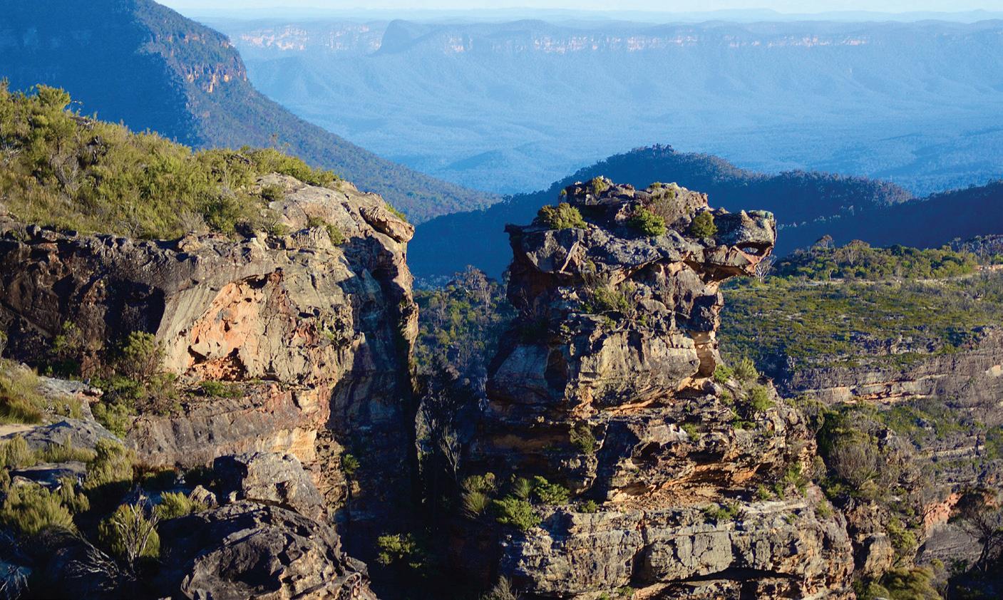
Figure 2.3.1 A view from Cahill Lookout in Katoomba shows the “blue haze” of the Blue Mountains.
A key environmental value of the Blue Mountains was the discovery of the Wollemi pine (Wollemia nobilis) in 1994. Once thought to be extinct for over two million years, fewer than 100 mature trees now survive in a secret location within Wollemi National Park. This “living fossil” is considered one of the world’s rarest and most scientifically significant plants. Strict conservation measures are in place to protect the remaining trees, including cloning and careful monitoring, making the Wollemi pine a symbol of the global environmental importance of the Blue Mountains.
The Blue Mountains are one of Australia’s most popular tourist destinations, attracting around 4.4 million domestic and international visitors each year and supporting over 5,000 jobs in hospitality, accommodation, retail and tour operations. Tourism generates over $560 million annually for the local economy.
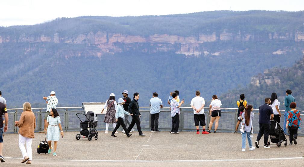
Iconic attractions such as the Three Sisters at Echo Point, Scenic World in Katoomba, and Jenolan Caves draw large numbers of visitors, while activities like bushwalking, canyoning and rock climbing encourage longer stays and greater spending.
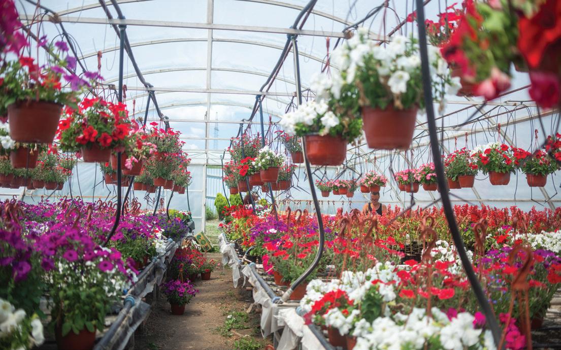
Beyond tourism, the Blue Mountains contribute to the economy in vital but less visible ways. The region’s catchments supply much of Sydney’s drinking water, a service worth hundreds of millions of dollars annually. Agriculture also plays a role, with orchards, nurseries, cut-flower industries and boutique cool-climate vineyards adding both production value and agritourism opportunities. The preservation of natural landscapes also enhances property values and supports industries such as education and research, as the region is frequently used for environmental fieldwork.
Figure
➜
Teachers can go online to assign questions, view results, reports and more! Knowledge and understanding
Knowledge and understanding
Recall how many species of animals exist within the Blue Mountains. Name three species. Recall how many species of plants exist within the Blue Mountains. Name three species.
Identify the dominant plant species in the Blue Mountains. Why is it important?
Explain the environmental value of the Wollemi pine to the Blue Mountains.
Explain the importance of tourism to the Blue Mountains.
Describe the variety of industries that operate in the Blue Mountains. Why do you think those industries operate in the Blue Mountains?
Thinking and working geographically
Working with geographical concepts: Interconnection
Explain the interconnection between environmental value of the Blue Mountains and the economic value of the Blue Mountains. In your answer, refer to the link between environment and tourism.
Visible thinking routine: Circle of viewpoints
a. Write four points that show that the environmental value is the most important value of the Blue Mountains.
interconnection The concept of interconnection emphasises that no object of geographical study can be viewed in isolation.
b. Write four points that show that the economic value is the most important value of the Blue Mountains.
c. Share and discuss your points with a partner and draw a conclusion as to which one you think is the most important.
Learning intention
In this lesson, you will learn about the recreational value of the Blue Mountains.
Starter activity
❏ I can describe how the Blue Mountains has recreational value for humans.
Write a list of the recreational activities you participate in (sport, music, cultural).
Do you think they would be able to be done in the Blue Mountains? Give reasons for your answer.
Bushwalking
Writing
Focus 2.4
Note-making for sentence construction
Bushwalking is the most popular recreational activity in the Blue Mountains. The region contains over 140 kilometres of walking tracks, many of which date back to the late nineteenth century and are now heritage-listed. These tracks provide opportunities for people of all ages and abilities, ranging from short family walks to challenging multi-day hikes. It is estimated that about 1.25 million visitors per year undertake bushwalking in the Blue Mountains region, throughout the whole year.
One of the most famous trails is the Grand Canyon Walk near Blackheath, which takes walkers through lush rainforest, waterfalls, and canyon walls shaped by millions of years of erosion. Another wellknown track is the National Pass Walk near Wentworth Falls, which hugs dramatic cliff lines and provides spectacular views of the Jamison Valley. Bushwalking allows visitors to connect with nature, enjoy physical exercise, and appreciate the unique biodiversity of the area and natural beauty such as scenic waterfalls and stunning lookouts.
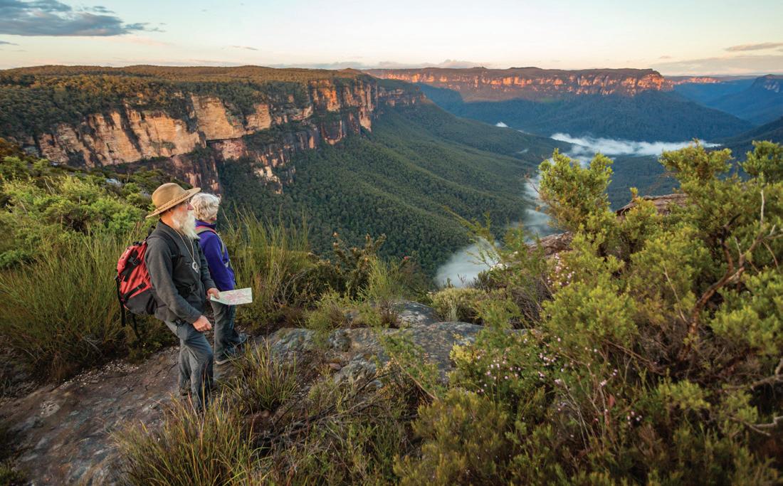
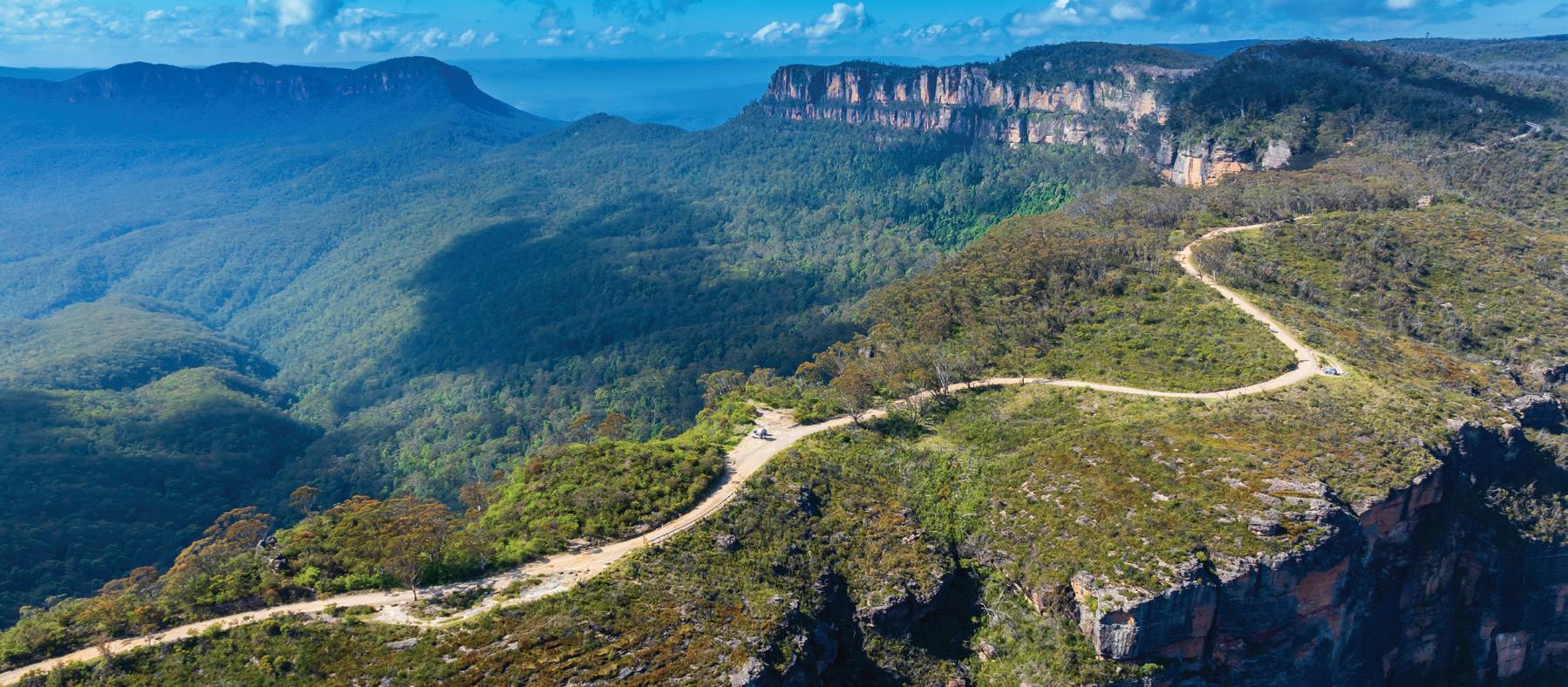
Figure 2.4.1 The Blue Mountains has over 140 kilometres of bushwalking tracks with amazing scenery.
Adventure-based recreation is another growing sector. Canyoning, rock climbing, abseiling and mountain biking are popular activities that take advantage of the Blue Mountains’ dramatic cliffs and rugged terrain.
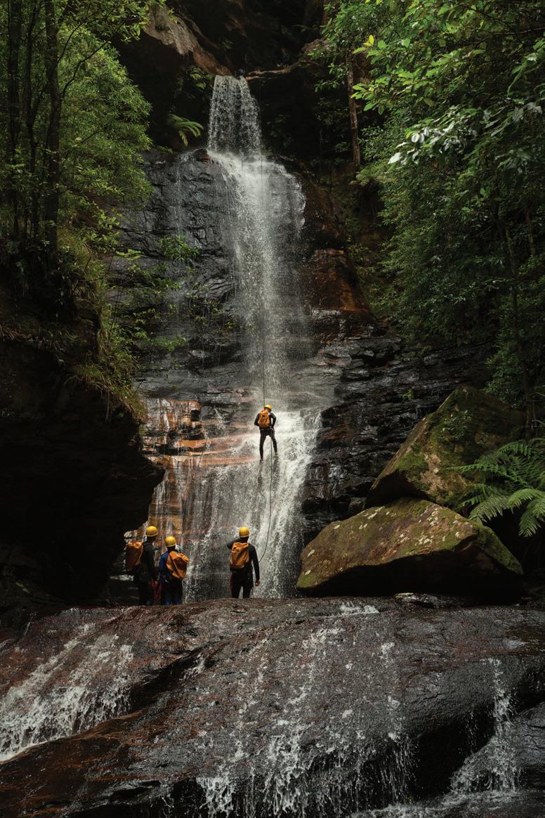
Canyoning is particularly popular in the warmer months, with participants navigating narrow, water-filled gorges through a combination of abseiling, swimming, scrambling and climbing. Sites such as the Wollangambe Canyon near Mount Wilson and the Empress Canyon at Wentworth Falls are among the most famous. According to NSW National Parks data, canyoning permits have increased by nearly 30 per cent since 2015, reflecting growing demand. Beyond the thrill, canyoning also highlights the geomorphic features of the Blue Mountains – the deeply eroded slot canyons carved over millions of years.
Rock climbing and abseiling are a cornerstone of the region’s adventure tourism. Cliffs at Blackheath, Mount Victoria and Narrow Neck attract both domestic and international climbers, with the Blue Mountains regarded as one of Australia’s premier climbing destinations. An estimated 40,000 climbing days are logged in the region each year, contributing significantly to the local economy through guiding companies, gear hire and accommodation.
Mountain biking has also grown rapidly in popularity within the Blue Mountains. Trails such as the Oaks Fire Trail from Woodford to Glenbrook and the Narrow Neck Plateau provide a range of challenges while offering panoramic views. The Blue Mountains City Council estimates that mountain-biking tourism contributes over $30 million annually to the local economy, with visitors typically spending more per trip than traditional daytrippers.
The Ultra-Trail Australia (UTA) Marathon, held every year in the Blue Mountains, is one of the largest trail-running events in the world. The event has grown from just 157 runners in 2008 to over 8,000 participants in more recent years. It attracts thousands of competitors from around the world, with races ranging from 11 kilometres to the gruelling 100-kilometre ultramarathon. In 2025, UTA had 8,000 runners, making it the largest trail-running event in the southern hemisphere.
The event showcases the region’s rugged terrain, steep climbs, escarpments and dense forest trails, and also highlights the importance of the Blue Mountains as a centre for endurance sport. The marathon contributes significantly to the local economy, as participants and spectators spend on accommodation, food and tourism experiences. Beyond economics, the UTA strengthens the recreational identity of the Blue Mountains, encouraging people to push their limits in a natural environment while promoting fitness, resilience and sustainable tourism.

2.4.4 The Ultra-Trail Marathon is an annal event that now attracts more than 8,000 participants to the Blue Mountains.
Knowledge and understanding
Identify how many kilometres of walking tracks are in the Blue Mountains.
Suggest why some of the walking tracks in the Blue Mountains would be heritage-listed.
Describe what attracts people to bushwalking in the Blue Mountains.
Explain the geomorphic features that are needed for people to go canyoning.
Using Figure 2.4.2, explain why the Blue Mountains are a prominent place for rock climbing and abseiling. How do you think the recreation of mountain biking contributes $30 million into the Blue Mountains economy?
Write a paragraph to explain why the Blue Mountains environment is the perfect place to run the Ultra-Trial Marathon. In your answer, refer to how humans and the environment suit this event.
Visible thinking routine: Projecting across time
environment The concept of environment is about the significance of the environment in human life, and the important interrelationships between humans and the environment.
a. Write five points that you already know about the recreational activities in the Blue Mountains.
b What type of recreational activities do you think the Indigenous people did over 250 years ago?
c How do you think recreational activities will change in the Blue Mountains in the next 50 to 100 years?
In this lesson, you will learn about the cultural value of the
❏ I can explain how the Blue Mountains have cultural value for humans.
Write down five things you know about how Indigenous people lived before European colonisation of Australia.
What do you think would be the difference between Indigenous people living in mountain environments and Indigenous people living in rural environments 250 years ago?
The Blue Mountains are a place of spiritual meaning, identity and storytelling for the Gundungurra and Darug peoples, the Traditional Custodians of the land. Rock art, engravings, ceremonial sites and sacred landscapes across the valleys and escarpments reveal an unbroken connection stretching back tens of thousands of years. These cultural landscapes are intertwined with Dreaming stories that explain the creation of landforms, waterholes and plants, reinforcing the deep relationship between people and Country.
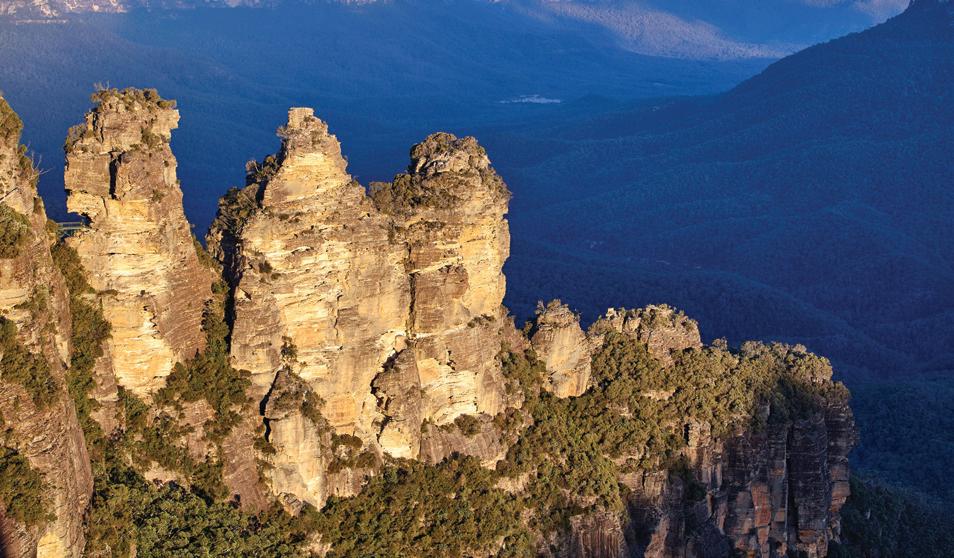
According to one Dreaming story, three sisters named Meehni, Wimlah and Gunnedoo lived in the Jamison Valley. They fell in love with three men from a neighbouring tribe, but tribal law forbade their marriage. Conflict broke out, and to protect the sisters from harm, an Elder turned them into stone. Although he intended to reverse the spell, he was killed in battle, leaving the sisters forever as towering sandstone pillars.
Writing Focus 2.5 Developing sentences
The Blue Mountains also hold cultural significance in Australia’s colonial history. In 1813, Gregory Blaxland, William Lawson and William Charles Wentworth successfully led an expedition across the rugged range, marking the first recorded European crossing of the Blue Mountains. Their journey overcame what was long considered an impassable barrier, and their route provided access to the fertile lands of the Bathurst Plains. This achievement paved the way for inland European expansion, grazing and farming, transforming the economic and social development of New South Wales.
Today, remnants of this colonial heritage remain visible across the region. The historic town of Hartley preserves sandstone buildings from the 1830s, including the courthouse and post office, offering insights into early colonial life. Echo Point, where visitors marvel at the Three Sisters, was first developed as a tourism lookout in the late 1800s, reflecting the Blue Mountains’ growing importance as both a settlement and leisure destination. The Great Western Highway itself follows the line of the original crossing, while walking tracks such as the National Pass, built by stonemasons in the early 1900s, remain as symbols of colonial engineering and heritage.
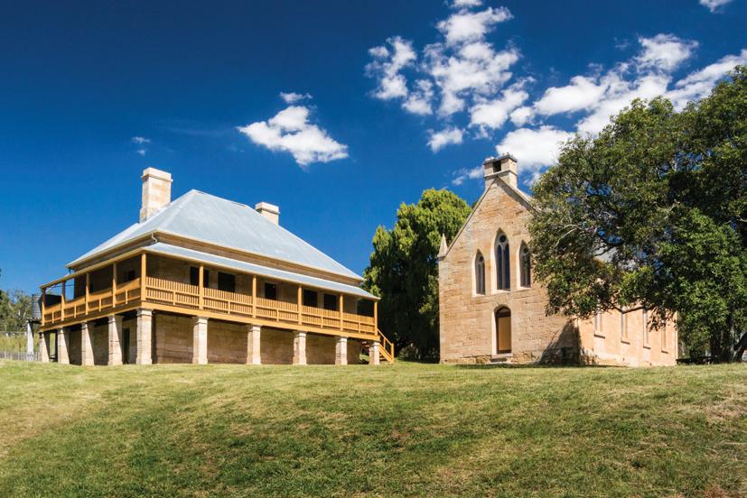
Figure 2.5.2 St Bernards Catholic Church and Presbytery in Hartley show the colonial history of the area.
Teachers can go online to assign questions, view results, reports and more!
Knowledge and understanding
Identify the names of the two First Nations groups in the Blue Mountains. Describe the features that show the history of the First Nations groups in the Blue Mountains. What are the characteristics of the Three Sisters Dreaming story?
Who were Blaxland, Wentworth and Lawson?
What was the significance of crossing the Blue Mountains for Europeans?
How has colonial settlement influenced the cultural characteristics of the Blue Mountains today?
Thinking and working geographically
Working with geographical concepts: Change
Write a paragraph to explain how cultural values have changed in the Blue Mountains over tens of thousands of years up to today.
Photograph interpretation
Compare the way Indigenous people used the Blue Mountains environment and how colonial people used the environment.
change The concept of change is about explaining geographical phenomena by investigating how they have developed over time.
Learning intention
In this lesson, you will learn about the human impacts that modify the Blue Mountains.
Success criteria
❏ I can explain how mining and human development have had an impact on the Blue Mountains.
Think about the local suburb/town where you live. Create a mind map that lists five ways you think humans have impacted your local suburb/town. Give one reason why each is a human impact.
Mining was one of the earliest European industries to significantly alter the landscapes of the Blue Mountains. During the 1800s, the region’s geology made it a target for resource extraction, particularly coal and shale. Coal seams were discovered near Lithgow and Katoomba, and mining operations quickly developed to supply fuel for Sydney’s growing population and industries. The opening of coal mines in the late nineteenth century brought employment and new settlements, but also left scars on the environment. The excavation of coal altered landforms, while run-off polluted creeks and rivers, affecting water quality and ecosystems.
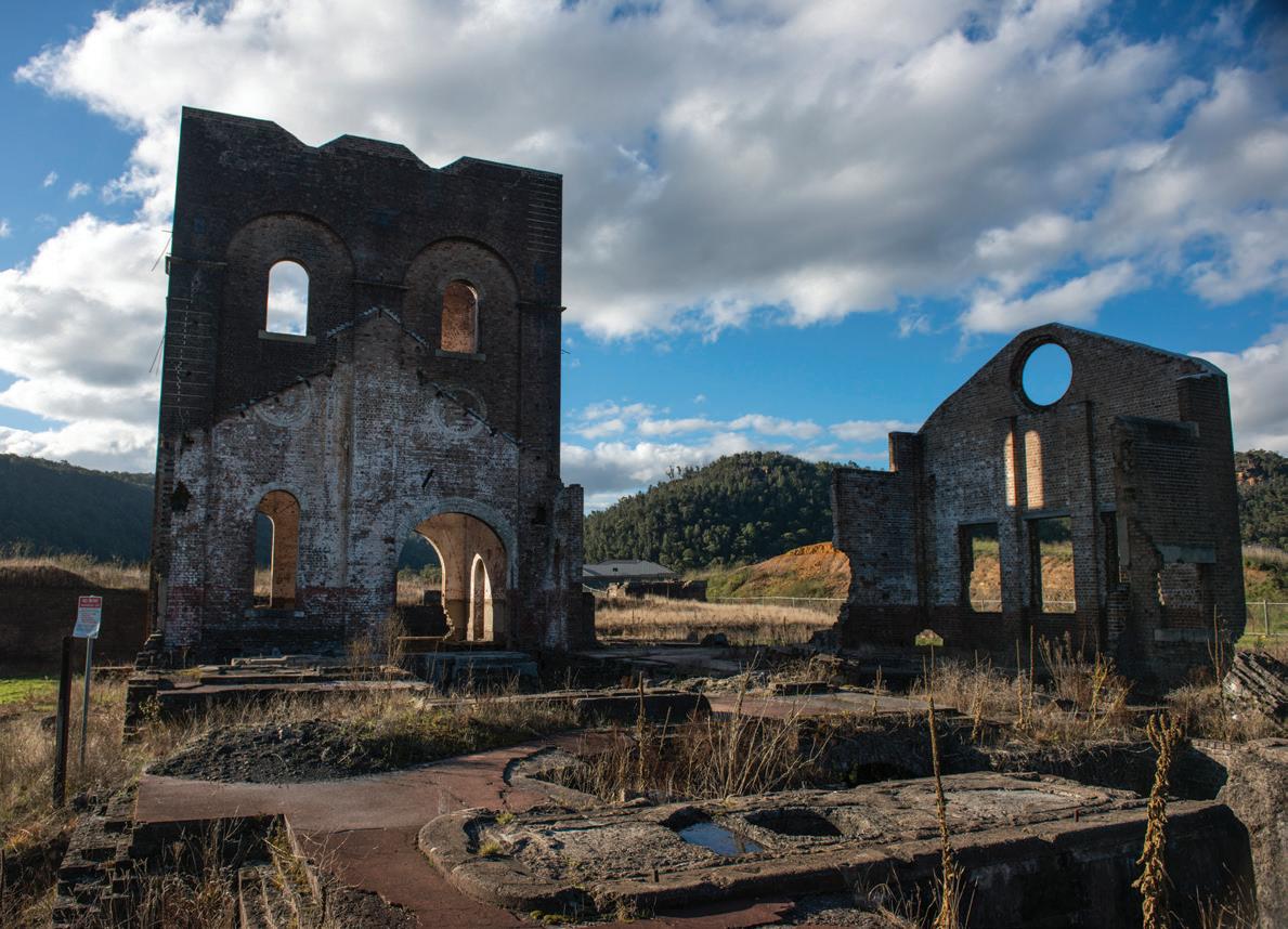
Shale oil mining also had a brief but intense period of activity, with the most notable site at Joadja. Extraction left behind abandoned shafts and waste piles that contributed to soil erosion and vegetation loss. Forests were cleared to make way for mines and transport infrastructure, including tramways and rail links, which further fragmented habitats. By the late 1800s, mining towns had sprung up, but many were abandoned once resources declined, leaving behind derelict structures and disturbed land. Today, remnants of these early mining operations are part of the region’s industrial heritage, but the environmental legacy includes altered waterways, degraded landscapes and ecological imbalances that must continue to be managed.
Writing
Focus 2.6
Creating topic sentences
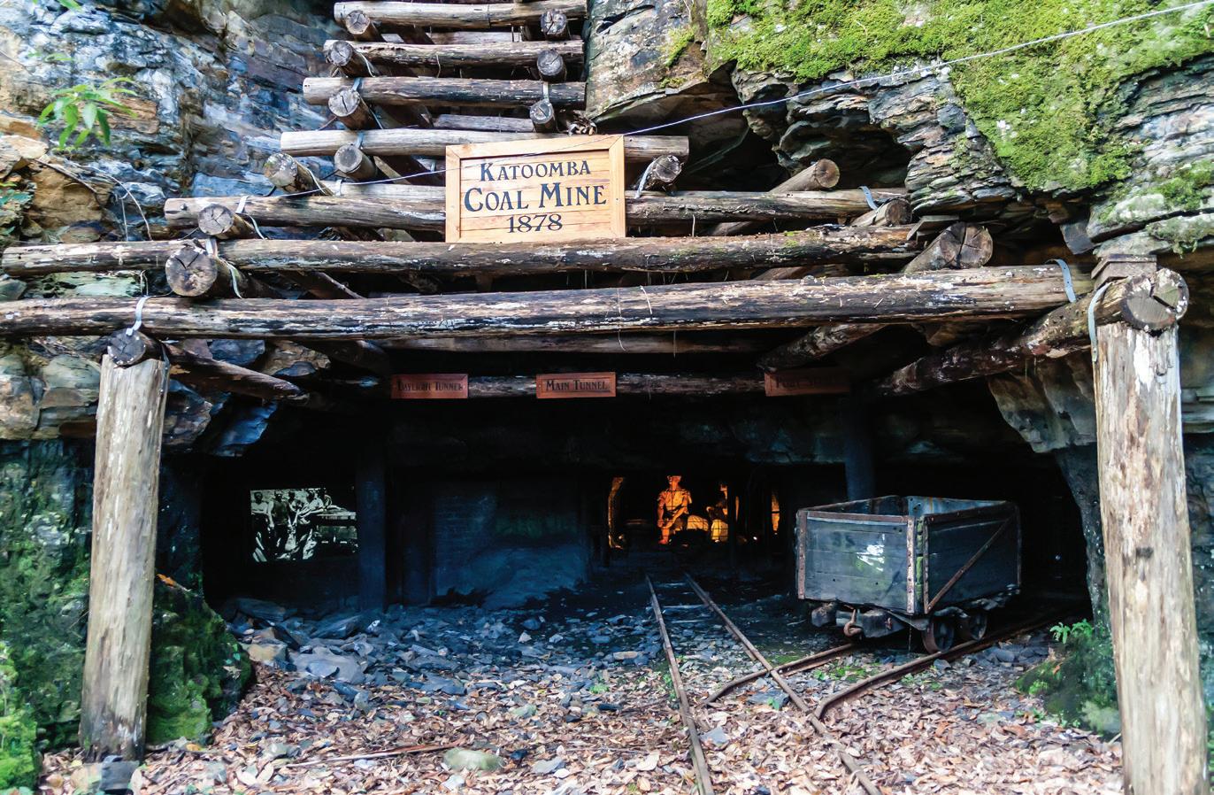
By the late 1800s, Lithgow had become a major coal-mining hub, producing more than 1.5 million tonnes annually by the 1920s. The mines supported the establishment of Australia’s first steelworks in Lithgow in 1900, attracting thousands of workers and building the town’s industrial base. However, environmental consequences were severe: Coxs River, which flows into Sydney’s water catchments, recorded heavy metal contamination and reduced biodiversity due to mine run-off. Today, rehabilitation efforts focus on stabilising waste piles and reducing water pollution, yet the long-term impact on ecosystems remains a significant legacy of nineteenth-century mining.
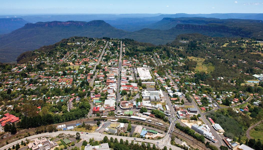
Urban development has been one of the most significant and ongoing human impacts on the Blue Mountains. From the early nineteenth century, towns such as Katoomba, Blackheath and Springwood developed along the Great Western Highway as settlers moved inland. Initially, small villages supported transport and farming, but by the twentieth century, these towns had expanded into suburban communities.
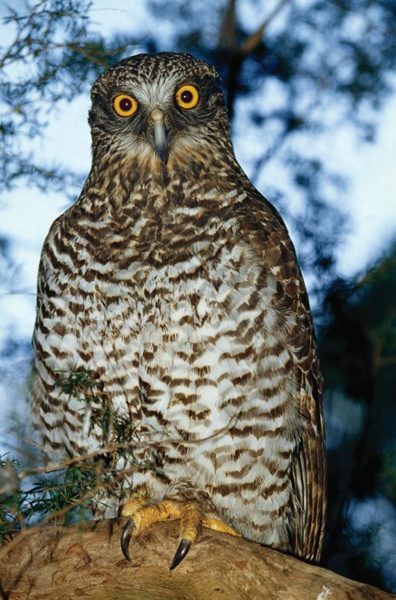
Residential development has placed pressure on native ecosystems, as bushland has been cleared for housing, infrastructure and services. Habitat loss threatens species such as the powerful owl and the broadheaded snake, while urban sprawl fragments ecological corridors. Roads and railways have contributed to pollution and increased the risk of bushfires through human activity.
Water management has also been an issue, as growing populations rely on local catchments and reservoirs. The construction of dams and stormwater systems has altered natural water flows, leading to erosion and reduced water quality. In addition, invasive species such as foxes, cats and weeds thrive on the fringes of urban environments, placing pressure on native biodiversity. Despite these impacts, urban communities in the Blue Mountains have also fostered conservation awareness, with heritage-listed towns promoting sustainable planning. Programs such as Bushcare groups highlight attempts to balance development with preservation of natural and cultural values.
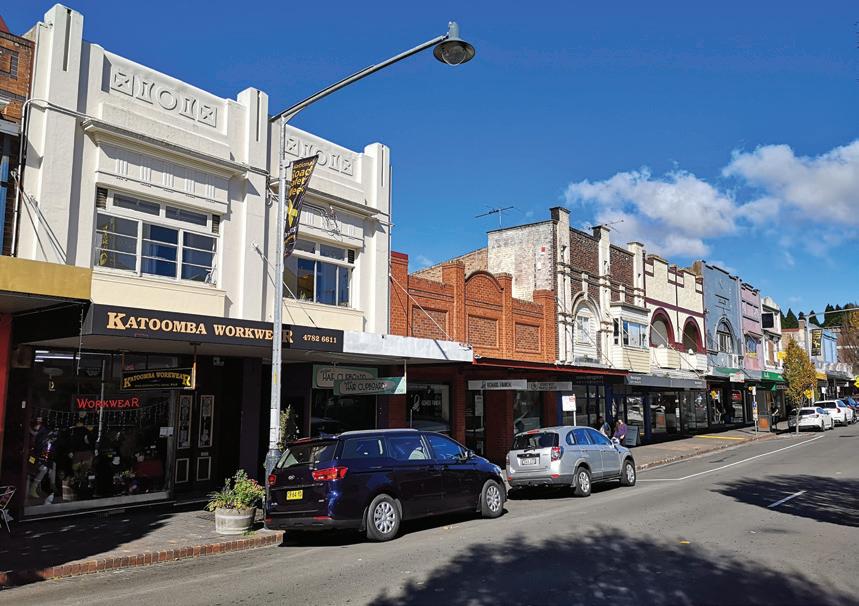
Katoomba grew rapidly in the late nineteenth and early twentieth centuries, spurred by tourism and the coal industry. Today, it has a population of 13,430, making it the largest town in the Blue Mountains. Urban sprawl has increased housing density along the escarpment, leading to bushland clearing and higher fire risks. The Blue Mountains local government area as a whole supports over 79,000 residents, and water demand has impacted nearby catchments such as Lake Medlow and Wentworth Falls Lake. In response, local council Bushcare programs have engaged 1200 volunteers across 65 sites to rehabilitate ecosystems, replant natives and reduce weed invasion, balancing human settlement with conservation.
Teachers can go online to assign questions, view results, reports and more!
Knowledge and understanding
Why do you think coal was mined in the Blue Mountains?
Explain how it has had an impact on the environment in the Blue Mountains. Why do you think people want to live in the Blue Mountains?
Explain how urban development has impacted the environment in the Blue Mountains.
Thinking and working geographically
Working with geographical concepts: Environment
Explain how the relationship between humans and the environment has led to the development of towns and settlements in the Blue Mountains.
Photograph types + interpretation
Refer to Figure 2.6.4, this photograph is called an oblique aerial photograph, which means it is taken in the air at a 45-degree angle from the ground.
Write down four things you can see in this photograph.
What are the benefits to geographers of using oblique aerial photos?
Refer to Figure 2.6.5, this photograph is called a ground level photograph, which means it is taken at ground level.
a. Write down four things you can see in this photograph.
b. What are the benefits to geographers of using ground level photos?
environment
The concept of environment is about the significance of the environment in human life, and the important interrelationships between humans and the environment.
Learning intention
You will learn about how the human impact of tourism has modified the Blue Mountains.
Starter activity
Success criteria
❏ I can explain how tourism has an impact on the Blue Mountains.
Think about the local suburb/town that you live in. Create a mind map that lists five ways you think tourism has impacted your local suburb/town. Give one reason why each is a human impact.
Writing
Focus 2.7
Creating topic sentences
Tourism is both a major economic driver and a source of environmental pressure in the Blue Mountains. Since the late 1800s, when improved rail access brought visitors from Sydney, the region’s dramatic landscapes and cooler climate have attracted holidaymakers. Today, the Blue Mountains welcome around four million visitors annually, making tourism one of its largest industries. Attractions such as the Three Sisters at Echo Point, Scenic World and Wentworth Falls draw international and domestic tourists year-round.
The economic benefits of tourism are substantial. Local businesses, from accommodation providers to restaurants and tour operators, depend heavily on visitor spending, which contributes hundreds of millions of dollars to the regional economy each year. Ecotourism initiatives, including guided bushwalks and Indigenous cultural experiences, also create opportunities for sustainable economic growth.
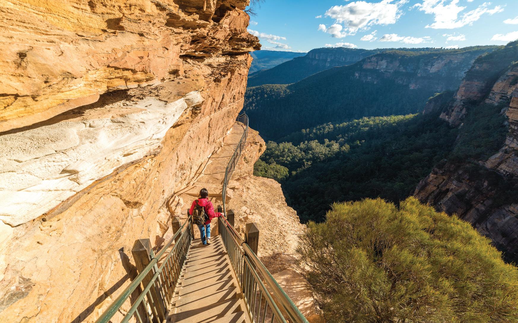
However, tourism has also caused significant environmental impacts. Popular walking tracks and lookouts suffer from erosion, trampling and littering. Increased vehicle traffic contributes to air and noise pollution, while bushfire risks are heightened by human activity during peak seasons. The demand for infrastructure near major sites, such as car parks, toilets and cafes, has led to further habitat modification.
Management strategies, such as the NPWS’s investment in track upgrades and visitor education, aim to reduce these pressures. Initiatives like limiting access to sensitive areas, promoting eco-certified tours and encouraging off-peak visitation seek to balance economic benefits with the preservation of the Blue Mountains’ World Heritage values.
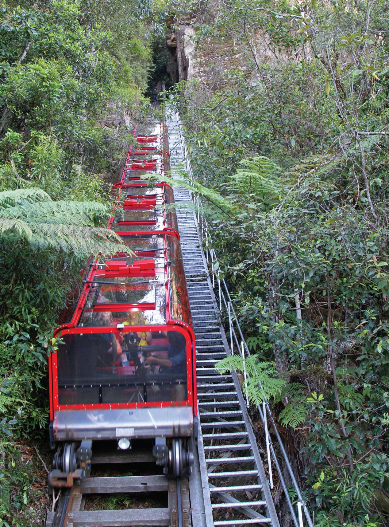
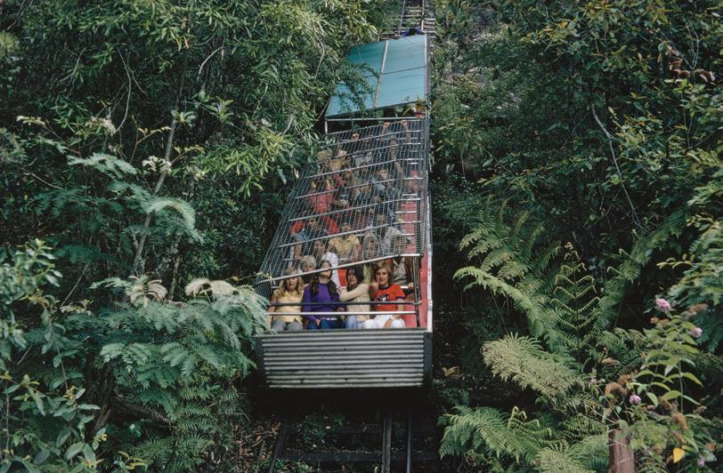
Scenic World in Katoomba is one of the region’s most visited attractions, drawing more than one million visitors annually with its cableway and steep railway rides. The Scenic Railway is located within the Scenic World complex, and is one of the Blue Mountains’ most iconic attractions. Originally built in the nineteenth century to transport coal miners, it now serves as the world’s steepest passenger railway, with an incline of 52 degrees. The glassroofed carriages descend 310 metres through ancient temperate rainforest into the lush Jamison Valley. Along the journey, riders experience stunning views of sandstone cliffs, the Three Sisters and the forest canopy below.
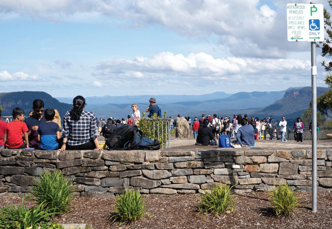
Echo Point, home to the Three Sisters lookout, receives up to two million visitors each year, making it one of the busiest tourist sites in New South Wales. These high numbers have led to soil erosion along walking tracks, vegetation damage and heavy congestion. To mitigate impacts, the NSW Government invested $15 million in 2020 for upgrades at Echo Point, including improved viewing platforms and Indigenous cultural interpretation.
Figure
and understanding
Knowledge and understanding
How many tourists come to the Blue Mountains? Which areas are the most popular?
Explain how tourism can have positive and negative impacts for the Blue Mountains.
Thinking and working geographically
Working with geographical concepts: Change
Explain how human impacts have changed the environment and landscape of the Blue Mountains over time.
Human impacts on the Blue Mountains
Copy the table below.
Mining
Human development
Tourism
Teachers can go online to assign questions, view results, reports and more!
change
The concept of change is about explaining geographical phenomena by investigating how they have developed over time.
a. Fill in the table to show how these factors have both positive and negative impacts on the Blue Mountains.
b. Share and discuss your table with another student.
c. Once you have completed your discussion, write a paragraph assessing human impact on the Blue Mountains.
Learning intention
In this lesson, you will learn about how the Blue Mountains are protected on a global scale.
Starter activity
In small groups, answer these questions:
a. What does UNESCO stand for?
Success criteria
❏ I can describe how the Blue Mountains are protected on a global scale.
b. Which other Australian site is also World Heritage listed?
c. Why do you think a site would need global protection?
d. How might this protection benefit the environment?
Discuss the answers as a class.
Geographical thinking
Scale
In geography, scale has two meanings.
Scale is the method used to represent the size of locations on map. For example 1:100000 or 1 cm represents 1 km.
The other meaning of scale within the study of Geography is that you can look at issues at three different levels.
The first is global scale, where you look at how an issue, management approach or problem will affect the rest or the world, such as how global climate targets will influence climate change.
The next level is national scale, where you look at how an issue, management approach or problem will affect the country you live in or another country.
The third level is local scale, where you look at how an issue, management approach or problem will affect the local area you live in such as your suburb or town.
The Blue Mountains are protected on all three levels. 1. 2.
Writing
Focus 2.8
Appositives
The Greater Blue Mountains was officially inscribed on the UNESCO World Heritage List in 2000, recognising its outstanding universal value for both natural and cultural heritage. Covering over 1 million hectares, the Greater Blue Mountains World Heritage Area is protected on a global scale by the listing, which ensures it is managed, monitored and conserved under international standards.
One of the most significant reasons for listing it is the region’s extraordinary biodiversity. The Blue Mountains contain over 90 species of eucalyptus, representing one of the greatest diversities of this genus on Earth. The area also provides critical habitat for threatened species such as the koala, spotted-tailed quoll, and the critically endangered Wollemi pine, a “living fossil” dating back 200 million years. By receiving UNESCO recognition, the Blue Mountains are legally recognised as an area of global importance, which obliges Australia to safeguard its ecosystems under the World Heritage Convention.
The listing also draws international attention and funding. Global conservation groups and research institutions partner with local organisations to monitor ecological health, restore degraded areas, and tackle threats such as invasive species, urban expansion and climate change. For example, collaborative projects supported by UNESCO have contributed to fire management strategies, especially after the devastating 2019–20 bushfires, which burned more than 80 per cent of the World Heritage property.
Tourism is another dimension influenced by World Heritage status. The global recognition attracts millions of visitors each year, with the Blue Mountains receiving around four million tourists annually. While this provides a significant boost to the regional economy, UNESCO guidelines ensure that tourism development is balanced with sustainability. Strict management plans govern infrastructure projects, walking track upgrades and cultural interpretation to minimise environmental impacts while enhancing visitor awareness of conservation values.
Culturally, World Heritage recognition highlights the deep connections of the Gundungurra, Darug, and other Indigenous peoples to the Blue Mountains. The listing emphasises the importance of Indigenous heritage and traditional custodianship, creating opportunities for cultural tourism and educational programs that share Dreaming stories, rock art and traditional land management practices with a global audience.

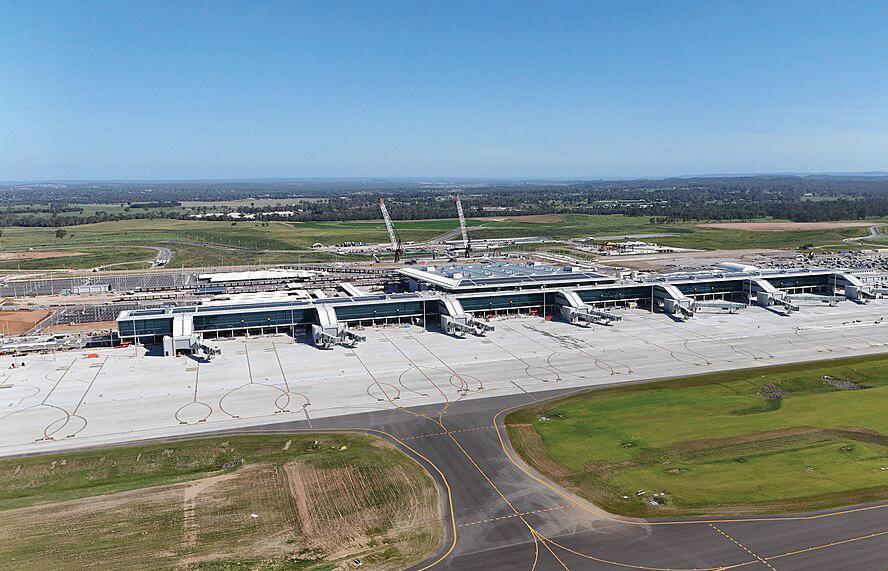
The Western Sydney International (Nancy-Bird Walton) Airport, under construction at Badgerys Creek, is scheduled to open in 2026. It will be Sydney’s second major airport, designed to handle 10 million passengers annually by 2031, with long-term capacity projected at over 80 million passengers per year. Located just 11 kilometres east of the Blue Mountains World Heritage Area, the airport has sparked debate about its potential environmental and cultural impacts.
Environmental concerns
Flight paths will take aircraft over or near the Blue Mountains, raising concerns about noise pollution in areas valued for their wilderness and tranquillity. Wilderness zones such as the Grose Valley may experience a loss of natural soundscapes, which UNESCO regards as part of the World Heritage values. Additionally, conservationists highlight risks of air quality degradation, light pollution and increased urban sprawl, which may impact sensitive ecosystems and species, including the regent honeyeater and spotted-tailed quoll.
Stakeholder perspectives
• Government: The Australian Government argues that the airport is essential for economic growth, job creation and meeting Sydney’s increasing aviation demand. Environmental impact assessments have been undertaken, and measures such as wildlife monitoring and noise management are being developed.
• Conservation groups: Organisations like the Blue Mountains Conservation Society warn that cumulative impacts could threaten the integrity of the World Heritage property. They argue that once degraded, wilderness values cannot be restored.
• Local communities and tourism operators: Residents and ecotourism businesses fear the negative impacts on visitor experience, with tourism contributing $560 million annually to the Blue Mountains economy.
UNESCO implications
If impacts significantly compromise natural or cultural values, UNESCO could place the Blue Mountains on the World Heritage “in danger” list, potentially damaging Australia’s international reputation for conservation.

Teachers can go online to assign questions, view results, reports and more!
Knowledge and understanding
Why are the Blue Mountains protected by UNESCO?
Explain why biodiversity is a key reason for the Blue Mountains being a World Heritage Area.
Why is monitoring needed to look after and preserve the Blue Mountains?
Why do you think the UNESCO guidelines want to balance tourism with sustainability in the Blue Mountains?
What is the cultural significance of the Blue Mountains?
Thinking and working geographically
Working with geographical concepts: Environment
With reference to the case study on the Western Sydney Airport, explain how the development of the airport could have impacts on the environments within the Blue Mountains.
Stakeholder viewpoints
Using the case study on the Western Sydney Airport, construct a table to identify the varied viewpoints of stakeholders in the airport development.
Write two paragraphs to support your viewpoint of the development and whether it puts the area’s World Heritage status at risk.
environment
The concept of environment is about the significance of the environment in human life, and the important interrelationships between humans and the environment.
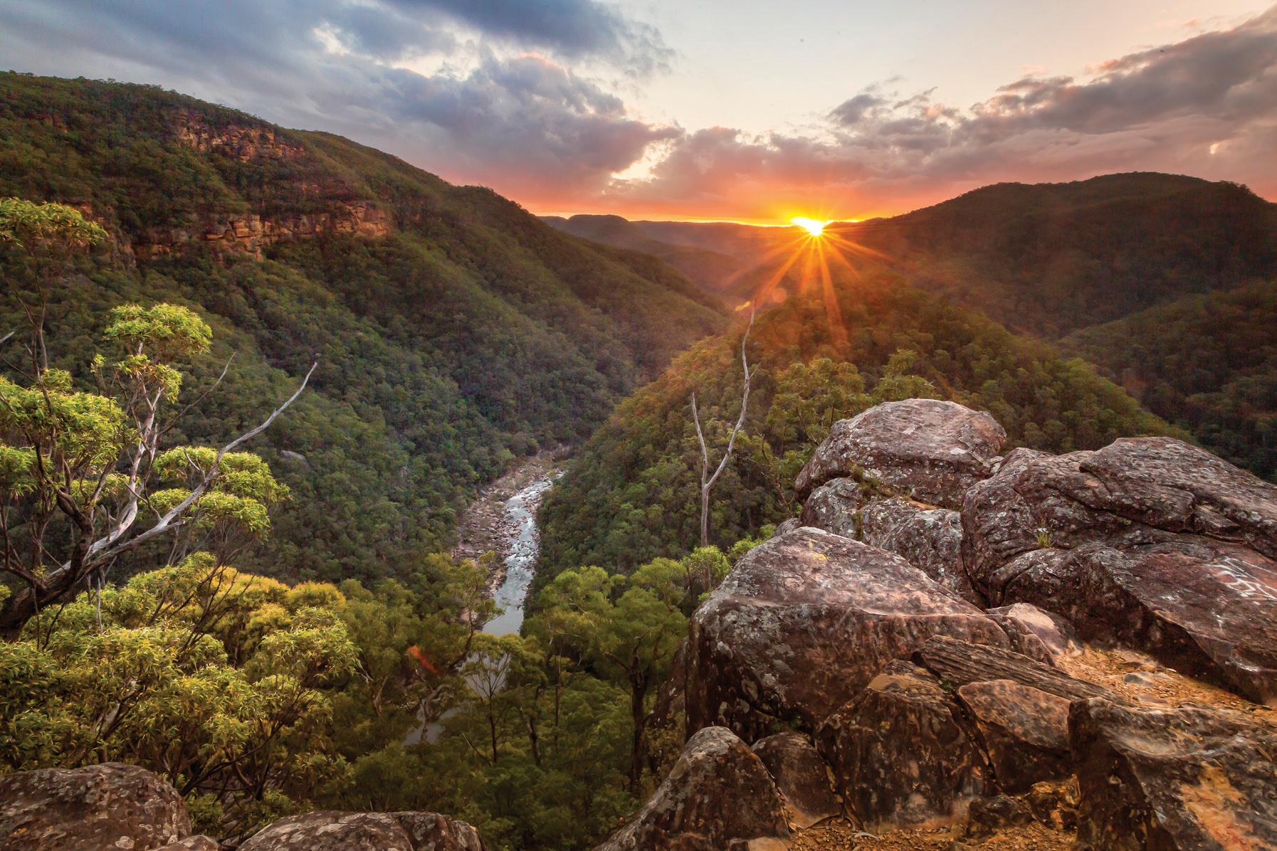
2.8.5 There are concerns wilderness areas such as the Grose Valley may experience a loss of natural soundscapes as a result of flight paths over the Blue Mountain.
In this lesson, you will learn about how the Blue Mountains are protected on a national scale.
❏ I can describe how the Blue Mountains are protected on a national scale.
In pairs: NPWS, guess how each term links to protecting the Blue Mountains:
a. NPWS
b. national park
c. bushfire recovery
d. tourism management
e conservation law.
Discuss your responses as a class.
Explore how NPWS manages the Blue Mountains and how national strategies align with global conservation goals.
The NSW Government, primarily through the NPWS, plays a crucial role in protecting the Blue Mountains. The region of the Greater Blue Mountains World Heritage Area, spanning over 1 million hectares, requires large-scale, coordinated management to balance ecological integrity with cultural values and growing tourism pressures.
The NPWS oversees eight conservation reserves within the Blue Mountains World Heritage Area, implementing comprehensive Plan of Management strategies. These include biodiversity conservation, habitat restoration and pest species control. For example, NPWS programs target invasive species such as feral foxes, which threaten native fauna. In 2022–23, NPWS conducted over 3,500 pest animal control operations across NSW, with a significant portion occurring in the Blue Mountains. Additionally, NPWS employs rangers and ecologists to monitor 400 threatened species, including the regent honeyeater and spotted-tailed quoll. The service also manages over 140 walking tracks and visitor facilities, ensuring both environmental protection and safe visitor access.
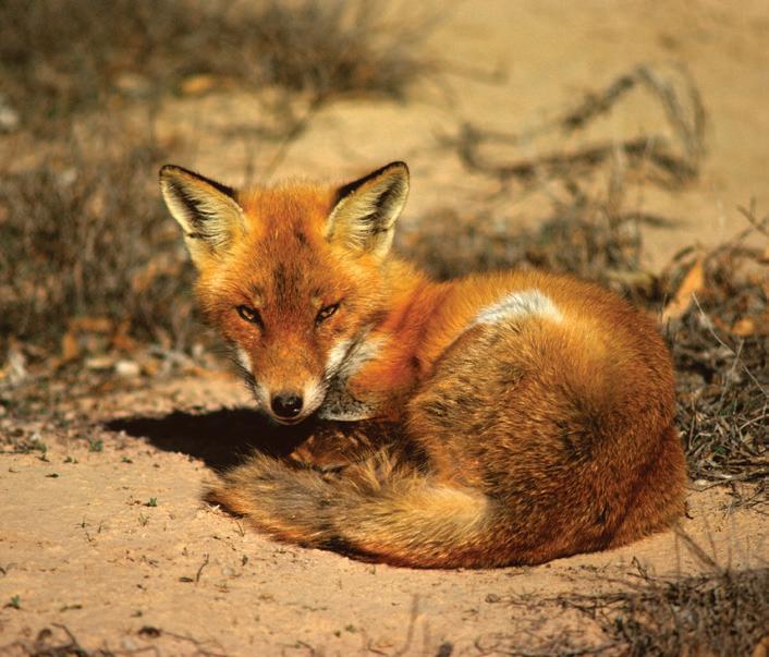
The NPWS runs large-scale pest management programs across the Blue Mountains World Heritage Area to protect threatened species. Feral foxes, and weeds such as blackberry, are significant threats, contributing to habitat loss and predation. In 2022–23, NPWS reported over 3,500 pest control operations statewide, with intensive programs in the Blue Mountains targeting key biodiversity hotspots. For instance, fox baiting along the Grose Valley has been crucial in reducing predation on ground-dwelling mammals like the long-nosed bandicoot. Weed-removal projects in wetlands have also restored more than 200 hectares of upland swamps, ensuring the survival of critical ecosystems listed under national environmental laws.
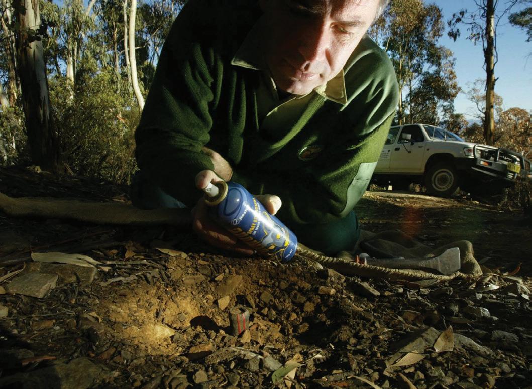
Tourism generates more than $560 million annually for the Blue Mountains region, attracting over four million visitors each year. To manage visitor impacts, NPWS and the NSW Government have invested in sustainable infrastructure. The $15 million Echo Point redevelopment (2020) is a key example, featuring upgraded viewing platforms, accessibility improvements and Indigenous cultural interpretation spaces.
Similarly, NPWS maintains over 250 kilometres of walking tracks, including the worldrenowned Six Foot Track, balancing visitor experience with ecosystem protection. In addition, visitor education campaigns promote “Leave no trace” practices, ensuring tourism contributes to conservation rather than degradation.
The most popular destination in the area is Echo Point Lookout, home to the iconic view of the Three Sisters, which can attract tens of thousands of visitors on peak weekends. However, such heavy visitation places significant pressure on walking tracks, viewing areas and surrounding vegetation, creating safety concerns and environmental degradation.
To address these challenges, the NSW Government committed $15 million in 2020 to a major redevelopment of Echo Point. The project delivered expanded multi-level viewing platforms, designed to disperse crowds and reduce trampling of surrounding bushland. Wheelchair-accessible pathways and railings were introduced, ensuring inclusive access for all visitors. Importantly, the redevelopment also featured cultural interpretation areas developed in consultation with Gundungurra and Darug Traditional Owners, enabling visitors to learn about Indigenous stories connected to the Three Sisters and the broader landscape.
The upgrades incorporated sustainable design principles, including low-impact construction materials, improved stormwater drainage to prevent erosion and landscaping with native plants to protect local biodiversity. Lighting was also designed to minimise disruption to nocturnal wildlife.
Since completion, Echo Point has become a model of sustainable tourism infrastructure. Visitor surveys in 2023 reported a 30 per cent rise in satisfaction, with international tourists praising the improved accessibility and cultural interpretation. Importantly, crowdmanagement strategies have reduced localised erosion and helped protect the World Heritage values of the site, showing how investment in infrastructure can balance visitor demand with long-term conservation goals.
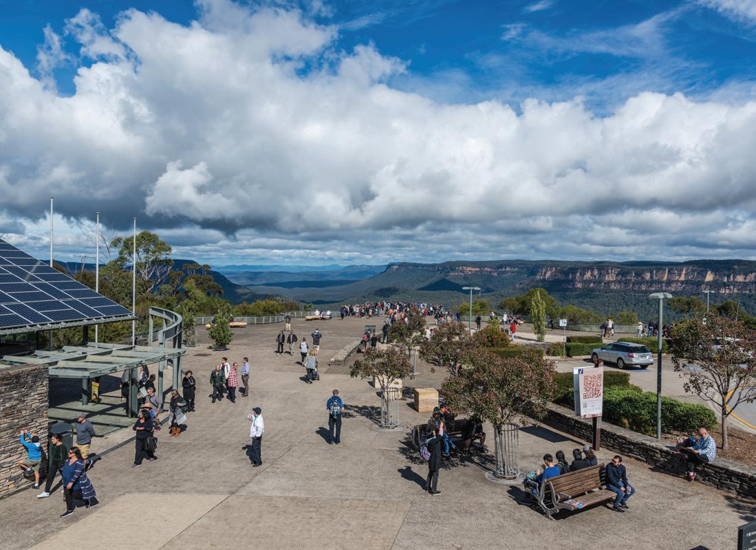
➜
Figure 2.9.3 The redeveloped Echo Point lookout has a much larger viewing area and better facilities to cater for greater numbers of tourists.
Knowledge and understanding
Knowledge and understanding
Students can access sample responses and results online
Teachers can go online to assign questions, view results, reports and more!
Describe why the NPWS has a hard job managing the Blue Mountains. How many conservation reserves is the Blue Mountains divided into and what are the key areas of the protection plan?
Why is targeting feral species in the Blue Mountains important? Use specific examples in your answer. How many people and how much money is generated by tourism in the Blue Mountains? What do you think is the purpose of the visitor education campaign that promotes “Leave no trace” in the Blue Mountains?
How did the NSW Government improve the facilities at Echo Point to cater for tourists? Was it successful?
Thinking and working geographically
Working with geographical concepts: Sustainability
Explain how strategies implemented by the NSW Government are expected to achieve sustainability in the Blue Mountains. In your answer, refer to feral animal and weed removal, and development of tourist infrastructure.
Photograph interpretation
Using Figure 2.9.3, write a paragraph explaining how you see tourists interacting with the Echo Point Lookout. What activities do you see them doing? 1. 2.
sustainability The concept of sustainability is about the capacity of the environment to continue to support our lives and the lives of other living creatures into the future.
Learning intention Success criteria
In this lesson, you will learn about how the Blue Mountains are protected on a local scale.
❏ I can describe how the Blue Mountains are protected on a local scale with global conservation goals.
Think about the local suburb/town that you live in. Create a mind map that lists five ways you think humans have impacted your local suburb/town. Give one reason why each is a human impact.
Writing
Focus 2.10
Conjunctions
The Blue Mountains swamps are one of the region’s most ecologically significant and vulnerable ecosystems. Listed as a Threatened Ecological Community under both NSW and Commonwealth legislation, these upland peat swamps provide critical habitat for rare species such as the Blue Mountains water skink and the giant dragonfly, while also acting as natural sponges that regulate water flow, filter pollutants and reduce downstream flooding. However, their positions near urban centres makes them highly susceptible to stormwater run-off, erosion and nutrient loading from human development.
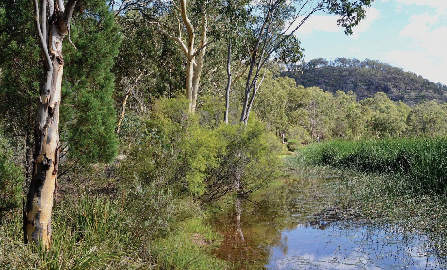
To address this challenge, the Blue Mountains City Council, in partnership with Greater Sydney Local Land Services, the NPWS, and the Saving Native Species program, launched the Protecting Blue Mountains Swamps from Stormwater Impacts project in 2023. This multiagency initiative received $1.5 million in targeted funding, as part of a wider $4.5 million allocation across the Greater Blue Mountains World Heritage Area, to reduce the harmful effects of uncontrolled stormwater entering these fragile environments.
The project combines both engineering and ecological restoration solutions. Stormwater interception systems, such as biofiltration basins, vegetated swales and sediment traps, are being installed to capture and treat run-off before it reaches swamp catchments. Rock armouring and erosion control structures are stabilising creek lines to prevent sedimentation, while targeted weed management ensures invasive plants do not exploit disturbed areas. At the same time, community education programs are raising awareness of the role swamps play in sustaining biodiversity and clean water supplies for Western Sydney.
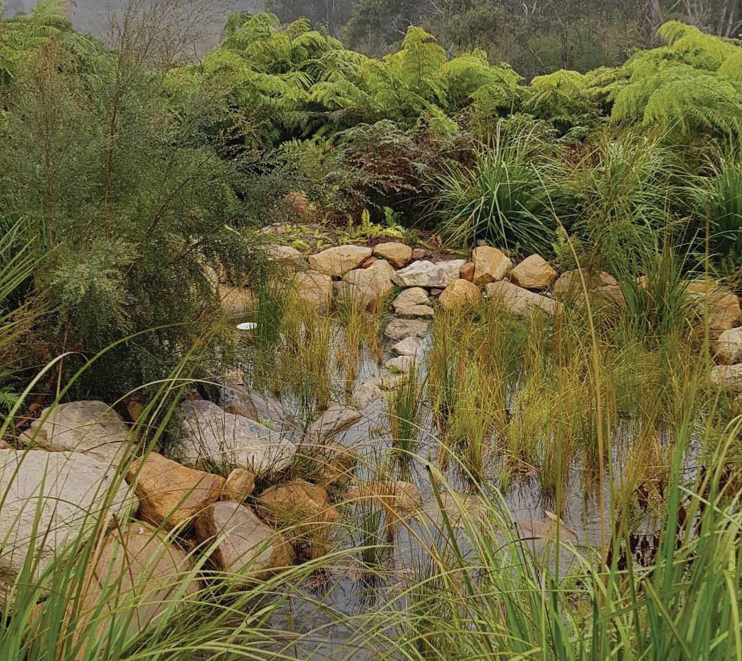
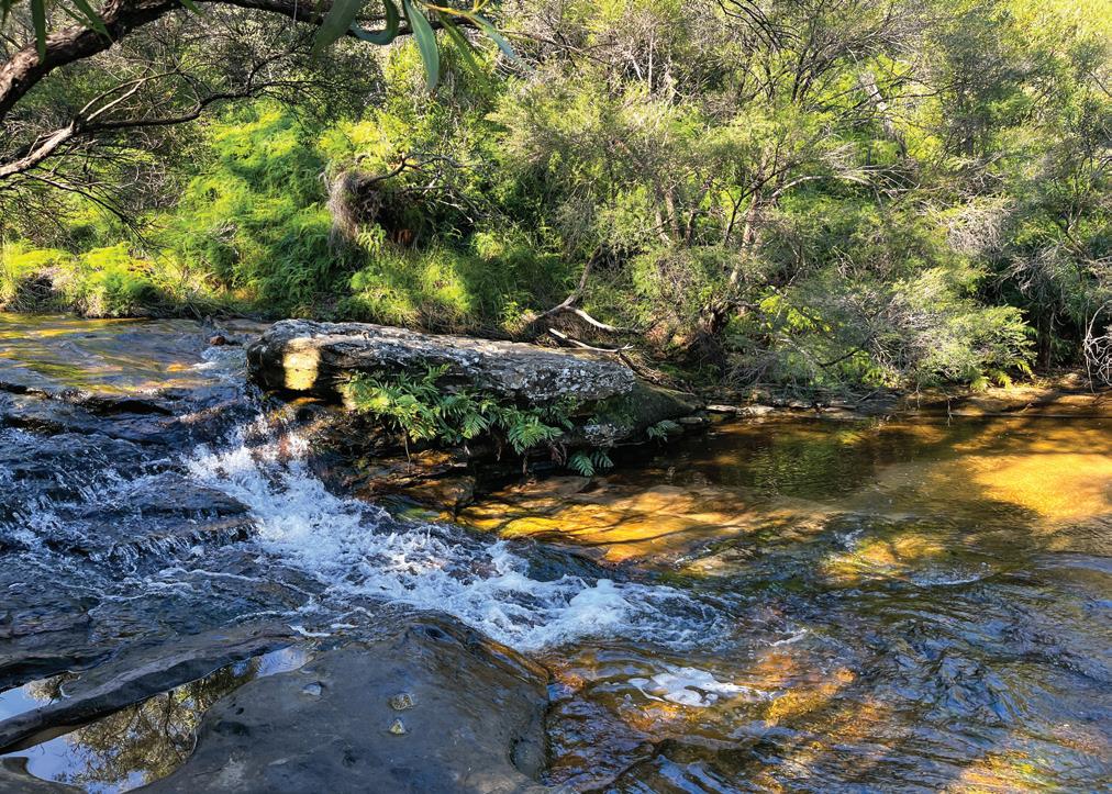
Case studies highlight the project’s effectiveness. For instance, in the Leura Falls Creek catchment, where stormwater once caused significant channel erosion, new biofiltration systems have reduced sediment transport by an estimated 40 per cent in the first year. Similarly, in the Wentworth Falls area, early monitoring indicates improved water clarity and reduced nutrient inflow, creating better conditions for swamp-dependent species.
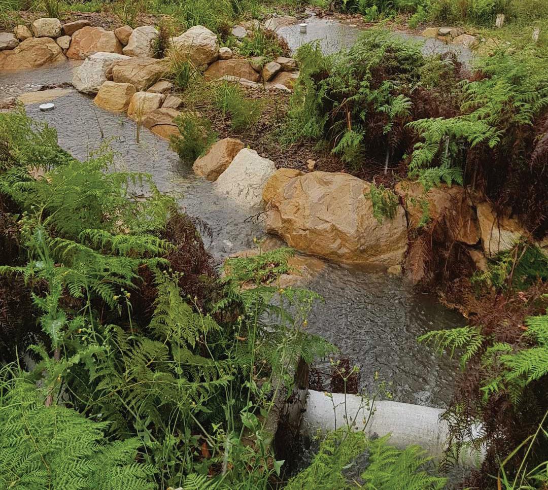
By integrating stormwater engineering with ecological restoration, this program is a leading example of how local councils and state agencies can collaborate to protect World Heritage landscapes. It ensures that the Blue Mountains swamps continue to provide ecological, hydrological and cultural value, safeguarding them for both wildlife and future generations.
Figure 2.10.4 Water monitoring has indicated that the water going over Wentworth Falls has improved in quality as a result of stormwater management strategies.
Knowledge and understanding
Why are the upland peat swamps important for the Blue Mountains? What features are having an impact on the peat swamps in the Blue Mountains? What does multi-agency approach mean and how much funding do they have?
Explain how the stormwater interceptions system work.
Explain how rock armouring and erosion control structures are preventing sedimentation. Have these approaches been successful? Use examples to support your answer.
Thinking and working geographically
Working with geographical concepts: Space
Explain how urban development has influenced the space within the Blue Mountains and how it has influenced the environment. How has the local government managed this space?
Protection comparison table
Compare the protection at the three different scales (local, national and global) in a table. Write down features of each scale.
space The concept of space is about the significance of location and spatial distribution, and the ways people organise and manage the spaces where they live.
Discuss your table with the person next to you and then write one paragraph to explain which scale is the most successful.
Learning intention
You will learn about how the Traditional Owners manage and care for the Blue Mountains.
activity
Success criteria
❏ I can explain how Traditional Owners manage and care for the Blue Mountains
Think about what life would have been like for First Nations peoples in the Blue Mountains prior to European colonisation. Write down five ways you think they adapted to live in a mountain environment.
For tens of thousands of years, the Blue Mountains have been home to the Gundungurra and Darug peoples, whose deep cultural connection to Country is based on knowledge systems passed through generations. Indigenous management of the Blue Mountains is holistic, recognising that land, water, plants, animals and people are interconnected. Their practices ensured the sustainability of ecosystems while maintaining cultural and spiritual responsibilities.
One of the most significant Indigenous land management practices is cultural burning, also known as “cool burning”. Unlike the destructive bushfires seen in recent years, cultural burning involves using lowintensity fires during cooler months. These controlled burns reduce fuel loads, encourage new plant growth, and maintain habitats for animals such as kangaroos, wallabies and native birds. In the Blue Mountains, this practice created a mosaic of vegetation types, improving biodiversity and reducing the risk of catastrophic fires. Today, agencies like the NPWS are working with Traditional Owners to reintroduce these methods, blending ancient knowledge with modern science.
Figure 2.11.1 Cool burning is done to protect areas of the Blue Mountains from major bushfires.
Writing
Conjunctions
In 2021, Gundungurra Traditional Owners worked with the NPWS to carry out a cultural burn in the Megalong Valley. Unlike destructive wildfires, these “cool burns” were conducted in winter to reduce fuel loads, protect heritage sites and regenerate bush tucker plants. Following the burn, surveys recorded a 40 per cent increase in native plant diversity, including yam daisies and native raspberries. The patchy mosaic of burnt and unburnt land also created habitats for small mammals such as bandicoots. This case illustrates how cultural burning not only mitigates bushfire risks but also revives ecological and cultural values of Country.
Waterways and upland swamps in the Blue Mountains are sacred and vital for biodiversity. Gundungurra people have Dreaming stories connected to rivers such as the Wollondilly, Coxs and Burragorang. Ancient Indigenous practices included protecting catchments, using stone tools to manage channels, and harvesting water plants without damaging ecosystems. Seasonal knowledge ensured sustainable fishing and harvesting of eels, yabbies and other aquatic resources.
For the Gundungurra and Darug peoples, water systems in the Blue Mountains are deeply spiritual, linked to Dreaming stories and ancestral beings. One example is the protection of sacred springs near Wentworth Falls, which provide both cultural significance and freshwater habitats. In 2019, Traditional Owners worked with Blue Mountains City Council to restore riparian vegetation around these sites. Monitoring showed a 25 per cent improvement in water quality and reduced sediment run-off. These practices highlight how Indigenous knowledge ensures clean water supplies, protects biodiversity such as frogs and freshwater crayfish, and maintains the cultural continuity of sacred waters.
The Blue Mountains contains numerous rock-art sites, engravings and ceremonial grounds. These places are more than historical artefacts; they are active parts of cultural law and knowledge. Songlines connect sites across the landscape, guiding people physically and spiritually. Respecting and protecting these sites is a form of land management, as they encode ecological and survival knowledge within cultural traditions.
The Three Sisters at Echo Point is one of the most culturally significant sites in the Blue Mountains for the Gundungurra and Darug peoples, linked to Dreaming stories passed down for generations. In 2020, Traditional Owners partnered with local tourism authorities to improve visitor education and site protection. New interpretive signage explained the Dreaming stories while fencing restricted access to fragile rock areas. Visitor surveys indicated that 78 per cent of tourists gained a deeper cultural appreciation after the upgrades. Protecting this sacred site preserves cultural heritage and also demonstrates how Indigenous perspectives can shape sustainable tourism and enhance respect for Country.
Today, Gundungurra and Darug communities continue to practise and share their knowledge, working alongside conservation bodies. Programs like cultural tours and bush tucker walks educate visitors about Indigenous perspectives on land, while co-management agreements with government agencies help integrate Indigenous practices into fire, water and park management. For example, cultural heritage assessments are conducted before major developments to protect sacred sites.
Teachers can go online to assign questions, view results, reports and more!
Knowledge and understanding
How long have First Nations peoples lived the Blue Mountains? Identify the main cultural groups that lived in the Blue Mountains.
Explain how cool burning works. What is its purpose?
Examine the activities of Gundungurra Traditional Owners carrying out a cultural burn in the Megalong Valley.
How did First Nations peoples mange water resources in the Blue Mountains?
Explain how Indigenous people protect a sacred water spring near Wentworth Falls.
How have Indigenous people assisted in the protection of the Three Sisters?
Thinking and working geographically
Working with geographical concepts: Place
In two paragraphs, explain how the significance of Blue Mountains to First Nations peoples allows them to provide care to the environment.
place The concept of place is about the significance of places and what they are like.
Geographical inquiry
Investigate another place of Indigenous significance and compare the way in which the Traditional Custodians care for that place with how the Traditional Owners care for the Blue Mountains. Identify similarities and differences.
Chapter summary
Access the Interactive Textbook for a range of digital tools to help you review this chapter and build confidence.
• Auto-marked questions for fast feedback and fun practice
• Self-assessment tools to track your progress, review answers (if enabled by the teacher), and flag questions for extra help
• Downloadable worksheets for class or homework revision
What have you learnt about the Blue Mountains? For this activity, copy the diagram and fill out by explaining your understanding. Aim for two points per topic.
Terms
Wollemi Pine
Uplift
Environmental value
Economic value
Recreational value
Cultural value
Human impacts
Protection of Blue mountains
Compass points
E-Excited
What excites you about the Blue Mountains?
W-Worrisome
What do you find is worrisome about the Blue Mountains?
N-Need to Know
What other information do you need to know about the Blue Mountains?
S-Stance
What is your current stance or option on the human impacts on the Blue Mountains?
Access a fast, fun, competitive quiz that puts your understanding to the test.
The following questions various ways to demonstrate your understanding of the chapter.
The Blue Mountains get their name from the blue haze created by oil droplets released from __________ trees mixing with dust and sunlight.
The Wollemi Pine is often called a ‘_______ fossil’.
Two key geomorphic processes that shaped the Blue Mountains are tectonic __________ and weathering.
The Blue Mountains attract around ________ million visitors each year.
The Traditional Owners of the Blue Mountains are the _______ and the _______ peoples.
The Blue Mountains are located west of which city?
A. Melbourne
C. Sydney
B. Brisbane
D. Perth
Which of these is the most popular recreation activity in the Blue Mountains?
A. Mountain biking
C. Bushwalking
Cultural burning is best described as:
B. Rock climbing
D. Fishing
A. A high-intensity wildfire that clears land quickly
B. A low-intensity fire used to manage vegetation and reduce fuel loads
C. A method used by tourists for camping
D. A government plan to remove invasive plants
What type of rock makes up most of the Blue Mountains?
A. Sandstone
B. Granite
C. Limestone
What major industry has historically changed the environment in the Blue Mountains?
A. Car manufacturing
B. Ship building
C. Oil drilling
D. Coal mining
Refer to Figure 2.12.1 to answer the following questions
Identify one natural landform or landscape feature shown in this image.
Identify one safety feature that you think would be important for an attraction like the Scenic Railway.
Outline why the Blue Mountains is a popular place for tourism.
Writing
Focus 2.12
Single paragraph response model
The following activities allow you to practice your writing skills.
You can use this as a model when writing your own answers to the questions that follow.
Question: Explain the geomorphic processes that have shaped the Blue Mountains. (20 marks) Model answer:
Topic sentence: the first sentence of the paragraph; directly answers the question
Evidence: specific, relevant evidence to support arguments
Linking sentence: re-connects with language of the question the topic sentence.
Marking criteria for each question can be found in the Interactive Textbook. Refer to these criteria when planning and writing your responses.
The geomorphic processes that shaped the Blue Mountains include sedimentation, tectonic uplift, weathering and erosion. The plateaus, cliffs and valleys of the Blue Mountains of today were first deposited around 250 million years ago when layers of sand and mud were slowly compacted into sandstone. Approximately 50 million years later, tectonic uplift raised the sandstone into a broad plateau that became exposed to strong weathering and erosion. Sandstone is particularly vulnerable to breakdown by wind, water and gravity because it is highly porous and contains natural joints and cracks that weaken the rock over time. Wentworth Falls, a prominent landform in the Blue Mountains, has been shaped by weathering and erosion, as the softer rock beneath the cliff is worn away by the persistent force of falling water. In this way, following the initial geomorphic processes of sedimentation and tectonic uplift, the Blue Mountains landscape has been shaped by weathering and erosion.
Question 1
Explain: clarify, define and describe
Elaborate: additional information, interconnections.
Examples: provide credibility and illustrate the argument
(20 marks)
a. Describe the geomorphic processes that have shaped the Blue Mountains (4 marks)
b. Explain the recreational and cultural value of the Blue Mountains (6 marks)
c. Explain the environmental and economic value of the Blue Mountains. In your answer refer to detail examples for each value (10 marks)
Question 2 (20 marks)
a. Describe ONE way the Blue Mountains are protected at a local scale (4 marks)
b. Explain how the Blue Mountains are protected at a national scale (6 marks)
c. Explain how the Blue Mountains are protected at a global scale. In your answer refer to different stakeholder viewpoints (10 marks)
Question 1
Explain the human impacts on the Blue Mountains.
(20 marks)
Teachers, access the Online Teaching Suite for digital resources and tools that support review, assessment and reporting, including:
• Student and class activity reports
• A test generator to create custom assessments
• Built-in feedback tools
• Editable downloadable support material
• A downloadable and printable ‘Writing focus’ workbook with exemplar responses for this chapter.
3.1 What makes a great map? BOLTSS
3.2 Area and grid references
3.3 Contour lines and elevation
3.4 Scale and distance
3.5 Chapter review: Topographic mapping basics
Teachers go online to the Online Teaching Suite to:
• plan, sequence and assign directed tasks for students and classes using Task Manager
• view student activity reports
• provide feedback to students
• download a printable “Writing focus” workbook for this chapter.
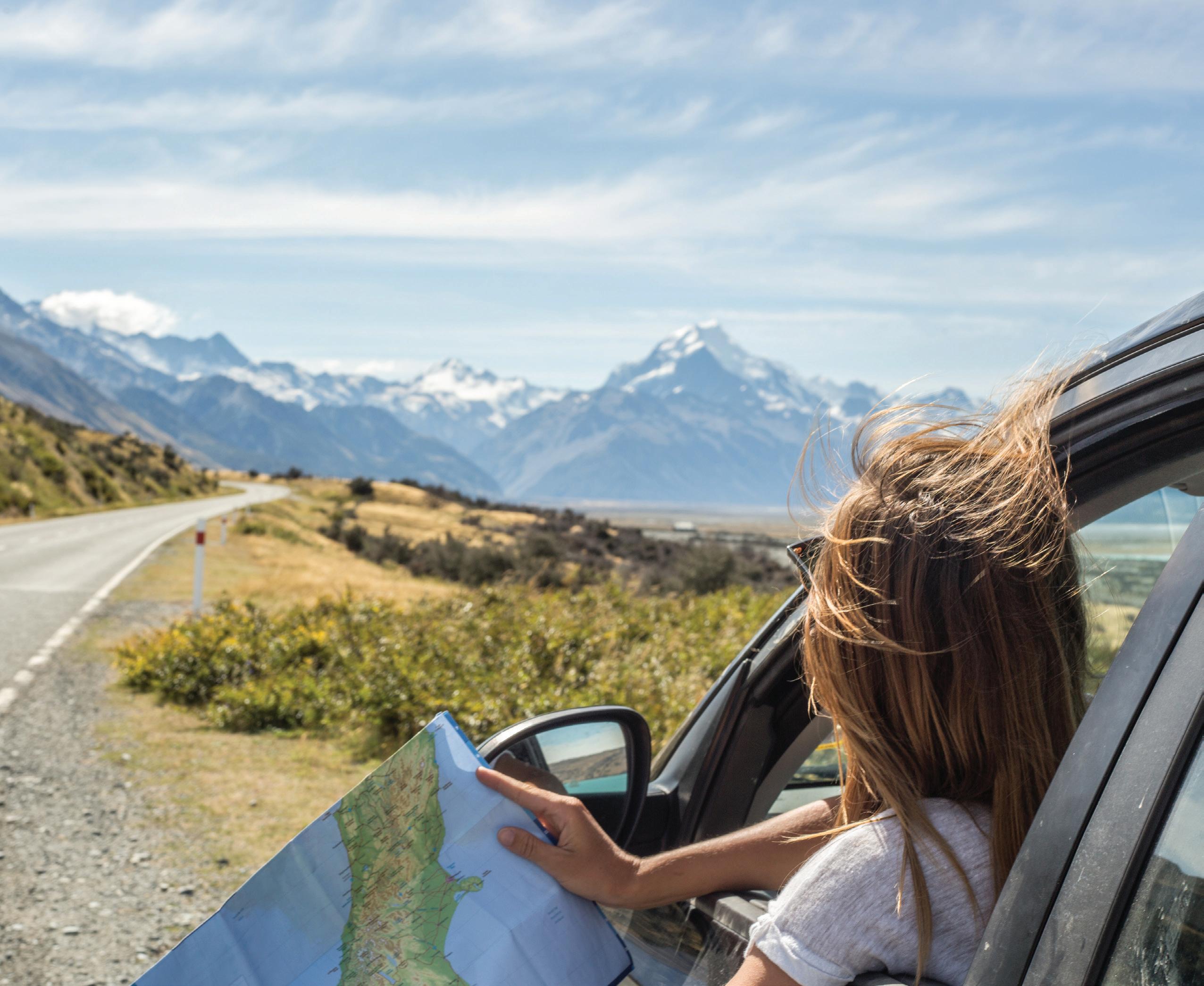
Image: A young woman using a map for directions ➜
Learning intention
You will learn the key features of topographic maps.
topographic map
a detailed, largescale map of part of Earth’s surface that shows the shape of the land and selected natural and human features contour lines lines on a map that indicate altitude

Video 3.1.1 BOLTSS and why we need them
Success criteria
❏ I can identify key features of a topographic map. ❏ I can explain why the key features are important.
Maps are one of the most important tools geographers use to understand landscapes and landforms. Most often, geographers rely on topographic maps like the one shown in Figure 3.1.1. These maps display both physical and human features through a variety of symbols, and they show the shape of the land using contour lines. For a map to be truly useful, it must include certain key elements. To remember these elements, we use the acronym BOLTSS.
Coburn Adventure Bay
T - Title
Tells us what place the map represents
B - Border Shows us the edge of the map
O - Orientation Shows us which direction is north
L - Legend
Tells us what symbols on the map mean
Geography Transformed
Figure 3.1.1 An annotated topographic map showing BOLTSS ➜
S - Scale
Tells us what 1 cm on the map represents in the real world
S - Source Tells us who made the map
Identify what part of BOLTSS is represented by each number in Figure 3.1.2.
For each part of BOLTSS, write one sentence describing the problems that could arise if that feature is missing from a map.
Check your answers on page xxx.
Find five maps, online or in an atlas. For each map, identify which part of BOLTSS have been included and any parts of BOLTSS that are missing. Write a description of how the missing elements could improve the usefulness of the maps you found.

Learning intention Success criteria
You will learn how features can be located on a map.

Area and grid references
❏ I can identify features on a map using area and grid references.
Possibly the most important thing we do with maps is find points of interest, but how do we do that? Area and grid references are the fastest and easiest way to locate physical and human features on a map. With an area or grid reference, you can quickly find a place and save yourself from scanning the entire map. Many geographical skills that you will learn will start with using an area or grid reference to locate a place. Watch Video 3.2.1 to understand how to use area and grid references and then let’s practise this skill together.
Area references tell us what grid square a feature is located within. If you are asking someone to find a school and there is only one within the chosen grid square, then an area reference is likely enough information. An area reference is given as four numbers. We start by finding the bottom left corner of the box and then drawing down to the easting. After finding the easting, we draw across to find the northing. This can be seen in Figure 3.2.1.
Find the area reference of the oval. (Watch Video 3.2.2 to see how to work this out.)
Find the area reference of the pine forest.
Find the area reference of the power station.
Find the area reference of the lake.
Find the area reference of point D. Check your answers on page xxx.
Grid references give even more detail and locate not just the grid square, but the specific location of a feature. We still use the eastings before the northings, but we imagine each grid square is broken into a further 10 × 10 grid. Or when drawing down and across, we treat the number either side of our line as a number line. In Figure 3.2.3, the easting is halfway between 02 and 03, so we think of this as 02.5 but eliminate the decimal place when writing the grid reference.


What is the grid reference of the cafe (go from the middle of the symbol)?
What is the grid reference of the north arrow?
What is the area reference of the end of the jetty?
What is the grid reference of point A?
What is the grid reference of point B?
Check your answers on page xxx.
For this activity, students will work in pairs, with a textbook for each pair and a stopwatch.
Use the more detailed map of the Blue Mountains on page xxx. One student starts by finding a place on the map. Then they hand the textbook to their partner and ask them to find the place by simply giving its name. Time how long it takes for the place to be located. Repeat the process with a second place, but this time give the area or grid reference. Compare the times to see how much faster the activity could be completed with a specific reference.
Learning intention
You will learn how contour lines show the elevation of landscapes and landforms.
Success criteria
❏ I can identify the height of a specific point and understand the general shape of an area of land, using contour lines.
Geographers use topographic maps as a tool to visualise the shape (or topography) of a landscape. Because the world is three dimensional, and maps are only two dimensional, we need a way to show the shape of the landscape on a two-dimensional surface. The feature of a topographic map that allows us to do this is contour lines. Contour lines are created by connecting areas of equal elevation. This allows us not only to get a sense of the topography of the landscape at glance, but also to calculate specific elevations at different locations. In this lesson we will be using contour lines to calculate the elevation of different places on a map.
Contour lines are always evenly spaced in height, which is called the contour interval. The contour interval is usually shown in the map legend, but it can also be found by working out the difference between the numbers on the lines. When contour lines are close together, the land is steep; when they are far apart, the slope is gentle. The contour lines can be read to find the elevation of a point, but when that point is between two contour lines, it must be written as a range. See Figure 3.3.1 for an example.
Point A is on a marked contour: 10 m.
The contour interval is the difference between each contour. For this map the contour interval is 10 m.

Contour lines
elevation the height of a place above the level of the sea contour interval the difference in height between contour lines on a map
Point D is above the hightest contour: 60 – 70 m.
Point C is between two contours: 40 – 50 m. It must be written as a range
Point B is on an unmarked contour: 30 m.
Figure 3.3.1 An annotated topographic map showing contour lines

What is the contour interval of this map? (Watch Video 3.3.2 to see how to work this out.)
Find the elevation of point B.
Find the elevation of point D.
Check your answers on page xxx.
Find the elevation of point A.
Find the elevation of point C.
For this activity, you will need a pencil, paper and playdough or kinetic sand.
Use your playdough to make a model of a hill or mountain. Make sure it has some steep slopes and some gentle ones. If you have a hill that you know well, see if you can make a rough version of it.
When you are happy with your playdough mountain, use a pencil to make a dotted line around the playdough mountain ensuring you stay at the same height above the desk.
Repeat this two or three more times, with each line evenly spaced above the next. Once you have three or four lines evenly spaced vertically, look at your mountain from directly above and draw your view of the lines you dotted on it. You now should have a perfect representation of your playdough mountain using contour lines!
Learning intention
You will learn about the different scales used on topographic maps.
Success criteria
❏ I can calculate the distance between places on topographic maps, using scales in different forms.
Maps are helpful tools because they show a large area of land on a relatively small piece of paper. The scale on the map allows us to understand how much land is being shown on the map. It also is a tool that enables us to find the distance between places on the map. This is important if you need to travel between places on the map. It is also a starting point for other skills you will learn across stages 4 and 5 Geography. In this lesson we will start by looking at the three ways that a scale can be expressed, and then the simple mathematics we can use to convert scales from centimetres to metres or kilometres.
Linear scale –use a bar to show what a cm on the map represents in the real world.
1 cm = 1 km
Written scale –a very easy scale to read and understand.
Ratio scale –in this case 1 cm on the map is equal to 100000 cm in the real world.
Figure 3.4.1 Different scales used on topographic maps ➜
We use the 2 + 5 rule to convert this to metres and kilometres.
To convert a ratio scale, you first need to understand how many centimetres are in a metre and how many metres are in a kilometre. You can then use this knowledge to multiply or divide to change the scale into different units. Another helpful method is the 2 and 5 rule shown in Figure 3.4.2, which allows you to cross out zeros and easily convert between centimetres, metres and kilometres.
1 m = 1 0 0 cm
1 km = 1 000 m or
1 0 0 0 0 0 cm
If a map has a scale of 1 : 1000
We can cross out two zeroes to convert the scale to m
1: 100 000
1 cm = 1000 m
We can cross out the five zeroes to convert the scale to km
1: 100 000
1 cm = 1 km
Figure 3.4.2 Converting ratio scales ➜

Using a scale
scale the relation between the real size of something and its size on a map, model or diagram distance the amount of space between two places

Complete the table by converting the ratio scales to metres and kilometres. Then think about how you could reverse this process to convert kilometres back to metres or centimetres.
11:250,000 1 cm = 2,500 m
Video 3.4.2 How we found the answer to Question 1
21:30,000 1 cm = 0.3 km
31:1,000,000
4 1 cm = 4,000 m
5 1 cm = 20 km
Check your answers on page xxx.
We can now use this knowledge to find distances between places on a map. When given a ratio scale like the one in Figure 3.4.3, we first convert it into metres or kilometres, depending on the question. Next, we use a ruler to measure the distance between points on the map in centimetres. Finally, we multiply the measured distance by the number of metres or kilometres that each centimetre on the map represents.
Step one: Convert the scale
1 : 200 000
1 cm = 2000 m
1 : 200 000
1 cm = 2 km
Charlie Canyon Figure 3.4.3 Annotated map showing how to find the distance between points
Find the distance between A and B in km.
Step two: Measure this with a ruler = 4.8 cm
Step three: 4.8 x 2 (from step one) = 9.6 km
Use Figure 3.4.3 to answer these questions.
Find the distance between point A and point C in metres.
Find the distance between point B and point E in kilometres.
Find the distance between point C and point D in metres.
Find the distance between point A and point E in kilometres.
Find the perimeter of the map in metres.
Create a table in your book similar to the one shown. Review this chapter and find all of the scales used on different maps. For each one, convert the scale to metres and kilometres. Then find five more maps, either online or in books, and record the scale and complete the same conversions. The first one has been completed as an example.

You will consolidate learning from this chapter and apply a range of geographical skills to a topographic map.
I can calculate elevation and distance and locate features using a topographic map.

Video3.5.1
Introducing the geographical data and skills-based activities in this chapter section
Please refer to Figure 3.5.1 to answer the questions.
What is the title of this map?
Why are symbols useful for this map?
Which of the symbols are for physical features and which are for human features?
What part of BOLTSS is missing from this map?
What is the orientation of the map?
Area reference
What is the area reference for Piper’s Sanctuary?
What is the area reference for point F?
What is the area reference of lookout A?
What feature is located at AR0112?
Contour and elevation
What is the contour interval of the map?
Which area reference has a steeper slope: AR0114 or AR0318?
What is the elevation of point C?
Scale and distance
The scale of the map is 1:25,000. How many centimetres on the map equals 1 kilometre in real life?
What is the distance between the two hotels?
Area and grid reference
What feature is found at AR0411?
Find the grid reference of the each of the following:
a. Lookout A
b. Point E
c. Point F
d. Piper’s Sanctuary.
Elevation and contours
What is the elevation of point G?
Is point F at a higher or lower elevation than point E?
What area reference contains the highest elevation?
Locate two places with a grid reference that have a elevation difference of 40 metres.
Scale
Use the scale to calculate the distance from point C to point G?
Are point D and point F more than 1.25 kilometres away from each other?
Calculate the distance along the road between lookout A and lookout B.
Emily says that the area reference for lookout B is AR1505 because the point is closest to horizontal 15 line (northing). Explain why this is wrong. Has she made any other errors?
Describe the landscape around the dam in grid reference GR043117 of the map.
Select three points on the map. For each point, provide an area reference, grid reference, elevation and distance to the nearest feature.
Select two points on the map. Locate points with a grid reference. Which of the points has the steepest surrounding area? Give reasons for your answer.
Plan a hiking route between at least four points. You must start at a hotel and walk to your first location. In your planned route, include the heights of the points, distances between different points and any potential obstacles or slopes to avoid.
Giving reasons, identify which point would be most suitable for:
a. building a lookout platform
b. camping
c. agriculture.
Using at most three area references, explain how topography influences human activity. You are planning a trail to connect points C, D and G to the existing paths. You need to ensure the trail allows for minimal environmental impact and is achievable for mediumlevel walkers.
a. Draw the route and calculate the distances required.
b. Extension: If a person walks an average of 5 kilometres per hour, how long would them to complete the trail?
Find two maps of your local suburb (Google Maps, council maps, flood maps, etc.)
Label BOLTSS on each map.
If any element is missing, add it yourself.
Explain which map has stronger cartographic conventions and why.
Using 2 x 2 cm grid paper, design your own topographic map. It could show your own suburb, a fictional landscape, a fantasy world, or a location from a book or movie. Your map must include:
• contour lines to represent elevation
• a legend with at least five different symbols (also shown on the map)
• a north point
• a title
• at least two points labelled with the specific elevation.
Write three or four sentences explaining what inspired your map.
Task 3: Mystery map challenge
Using 2 × 2 cm grid paper, create a topographic map that follows these rules:
• Two landmarks are exactly 5 kilometres apart (you must set a scale!).
• A pine forest is located to the east of a river.
• A camping ground is below 300 metres elevation.
• A lookout is above 700 metres elevation.
• A picnic site is located at AR 3427.
• A lake is in a valley.
• One hill has a peak higher than 900 metres.
• There are at least four contour lines.
• A walking track between a campsite and a town must be longer than 2 kilometres but shorter than 3 kilometres.
• Create a tourist photo point on a ridge line facing west
Swap maps with a partner and see if their map looks similar. Are you both correct?
Task 4: School mapping project
Your class is tasked to map out the school. Each student must measure a different feature at the school (oval, playground, building, garden, etc.)
You must scale your feature so that each element of the school fits on an A4 piece of paper.
Choose a scale that allows the feature to fill most of an A4 page.
Draw the feature as a scaled map.
Add BOLTSS and three symbols in a key.
Complete the sentence: “To draw my school’s _________, I need to reduce the real life size by ________ for it to fit on an A4 page.”
Compare your map with your peers’ maps. Are your scales the same? What are the advantages and disadvantages of having different scales to represent one site?
Find a topographic map online of any area you like. Make sure it shows contour lines and heights. Print it, or draw a simplified version on paper.
Create a 2D base map of the map you chose. On a sheet of paper, redraw or trace the shape of the land shown on your topographic map. Make sure you include:
• contour lines
• heights labelled on each contour line.
Prepare your contour layers. Each contour line on your map will become a layer in your model.
a. Place a sheet of cardboard, paper or clay over your 2D map.
b. Trace the highest contour lines.
c. Cut that shape out.
d. Trace the next lower contour line and cut that out.
e. Continue until you have one cut-out piece for every contour level.
Important: Each layer equals one contour height.
Build your model.
a. Start with the largest (lowest) contour piece at the bottom.
b. Glue or stack the next highest layer on top.
c. Continue stacking until the peak is finished.
Label your model with BOLTSS.
Choose six places around the school that are easy to find (e.g. a gate, a shelter, a tree, a bench, a goal post, the canteen).
Print a map of the school. Choose one that shows buildings and outdoor areas (perhaps to use Google Maps).
Add horizontal (northings) and vertical (eastings) lines over your map and number each line.
For each of your chosen locations, record the area reference and grid reference.
Create a treasure hunt.
a. Write clues that guide another group from place to place.
b. Your clues should include area references and grid references, but you can be creative in how you word it!
c. The final location should be the “treasure”.
Create your own topographic map and write a 150- to 200-word story that uses elevation, area references and grid references to explain a range of events. For example, a bushwalker gets lost near a steep cliff and then a storm causes flooding in the valley.
Your story must correctly refer to:
• slope
• height
• distance
• features.
Task
Find a topographic map online. Print or redraw this map.
Identify the contour interval.
Redraw a small section of the map using a different interval (e.g. change from 10 metres to 20 metres).
Explain how the new interval:
• changed the appearance of the map
• changed the accuracy of the map
• changed the interpretation of the map.
Discuss: Is there a perfect contour interval? Why or why not?