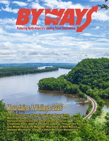
Featuring North America’s Leading Travel Destinations
Instant Connect Direct One-Click links to Advertisers
Byways Magazine
stephen.kirchner@bywaysinc.com https://bywaysmagazine.com
Byways 3
Preview
By Stephen Kirchner, Editor & Publisher ome of the most memorable journeys begin where the familiar routes end. In the October issue of Byways, we explore six destinations where winding roads and distinctive landscapes invite travelers to slow down. From the Upper Midwest to the Canadian Rockies, these places reward curiosity with scenery, history and welcoming communities.
S
Our travels begin in the Driftless Area, spanning portions of Wisconsin, Minnesota, Iowa and Illinois. This region escaped the most recent glaciation, preserving a landscape of wooded ridges, limestone bluffs and narrow valleys. Two-lane highways lead beside winding rivers and spring-fed streams, connecting farms and river towns across a remarkable corner of the Midwest. Next, West Virginia’s Monongahela Mountains carry travelers into a world of forested ridges, rushing streams and mountain communities. Spruce Knob, the state’s highest point, joins Seneca Rocks, Canaan Valley and Blackwater Falls on an itinerary enriched by historic railroads and the vast Monongahela National Forest. Here, each bend reveals another reason to linger. In Colorado, the San Luis Valley stretches between the Sangre de Cristo and San Juan mountains. Farms, wetlands, hot springs and historic communities share this expansive landscape with Great Sand Dunes National Park and Preserve. Beyond the dunes, Alamosa, San Luis and Saguache offer opportunities to discover some of Colorado’s oldest cultural traditions. Byways 4
Across the border, Alberta’s Crowsnest Pass introduces another side of the Canadian Rockies. The Crowsnest Highway links mountain communities with clear lakes, waterfalls and towering peaks. Historic mine sites recall the region’s industrial past, while an enormous field of limestone boulders bears witness to a devastating natural disaster. Scenery and history make compelling traveling companions here. Southwestern New Mexico’s Gila Wilderness and Mogollon Mountains reveal deep canyons, mountain rivers and ponderosa pine forests. Ancient cliff dwellings connect visitors with the region’s human past, while mining towns, hot springs and dark night skies encourage further exploration. Quiet roads lead toward wild country where nature still sets the pace. In northeastern Oregon, the Wallowa Mountains reward travelers who venture beyond the familiar routes. Known as the “Alps of Oregon”, they combine jagged summits, alpine lakes and broad valleys with historic towns and roads leading into canyon country. Their appeal extends from spectacular scenery to communities with a lasting sense of place. In What’s Happening, we visit Los Angeles’s new Lucas Museum of Narrative Art. Founded by George Lucas and Mellody Hobson, this Exposition Park destination celebrates storytelling through painting, illustration, comics and cinema. Its imaginative architecture and wide-ranging collections offer another kind of journey, inviting visitors to explore the pictures and stories that connect us across generations.
P
150,000+ Subscribers 1.2 Million Views CLICK TO VIEW
Byways 6
Volume 43, Issue No. 5 2026 On the Cover. Mississippi River view from Effigy Mounds National Monument at Fire Point, Iowa. This is part of the Driftless area of Iowa, Illinois, Minnesota and Wisconsin. Our Mountains & Valleys coverage begins on page 8.
Features The Driftless Area: Where the Glaciers Never Came .............................................................................................8 Monongahela Mountains: Wild and Wonderful West Virginia .............................................................................16 San Luis Valley, Colorado's High-Desert Surprise ................................................................................................24 Crowsnest Pass: Alberta's Historic Gateway Through the Rockies .......................................................................32 Gila Wilderness & the Mogollon Mountains, America's First Wilderness Area ...................................................40 Wallowa Mountains: Oregon's Other Mountain Wonderland ...............................................................................48
What’s Happening A New World of Stories in Los Angeles, Lucas Museum of Narrative Art ..........................................................56
Departments Byways Instant Connect ..........................................................................................................................................3 Byways Preview.......................................................................................................................................................4 Advertiser/Sponsored Content Index .....................................................................................................................63
Coming in Future Issues Future issues of Byways will feature National Parks and Winter Excursions, Great American Cities and Urban Culture, Great American Roads and Scenic Byways and more . . .
Up Next: National Parks & Winter Excursions
Byways 7
Byways 8
Byways 9
cross portions of Wisconsin, Minnesota, Iowa and Illinois lies a landscape that seems wonderfully out of place in the Upper Midwest. Instead of broad plains left behind by ancient glaciers, the Driftless Area rises and falls through wooded ridges, limestone bluffs, narrow valleys, spring-fed streams and winding rivers.
A
For travelers, the result is one of America's great under-the-radar road-trip destinations. The Driftless rewards those willing to leave the Interstate behind, following two-lane highways through river towns, farms, forests and valleys. Each of its four states offers a distinctly different introduction to this remarkable corner of America.
The name comes from the absence of the glacial deposits known as “drift". While continental ice sheets transformed much of the surrounding Midwest, this region escaped the most recent glaciation. Water and erosion instead sculpted a rugged landscape of valleys, caves, sinkholes and towering river bluffs. Along the Mississippi, meltwater from glaciers elsewhere helped carve an even more dramatic river valley.
Wisconsin: The Heart of the Driftless
Byways 10
Southwestern Wisconsin contains some of the most characteristic Driftless scenery, where highways twist around hillsides rather than crossing the straight, flat landscape associated with much of the Midwest. This is country made for Byways travelers: scenic roads, small communities, river overlooks, farms and unexpected discoveries around nearly every bend. The Mississippi provides a natural western boundary and one of the best ways to explore is Wisconsin's
Great River Road. Limestone bluffs rise above the river as the highway connects communities such as La Crosse, Ferryville, Prairie du Chien and Cassville. At Wyalusing State Park, near Bagley, travelers reach one of Wisconsin's great overlooks. The park stands high above the confluence of the Wisconsin and Mississippi rivers, with Point Lookout providing a sweeping view across the waterways and surrounding countryside. Farther south, Nelson Dewey State Park rises approximately 500 feet above the Mississippi near Cassville. The park honors Wisconsin's first governor, while neighboring Stonefield recreates aspects of the state's agricultural past. Prairie du Chien adds another dimension. One of Wisconsin's oldest communities, its location along the Mississippi made the area important to Indigenous peoples and later fur traders, soldiers and settlers. The community provides a convenient base for exploring both sides of the river and nearby historic sites.
Turn inland and the character changes again. Viroqua has emerged as an appealing center of contemporary Driftless culture. Rolling farmland surrounds a downtown filled with locally owned businesses, galleries, restaurants and a thriving farmers market. Vernon County has more than 200 certified organic farms, giving the area a strong farm-to-table identity.
Byways 11
The countryside surrounding Viroqua also reveals another Driftless treasure: cold, clear streams. Springs flowing through limestone country support excellent trout habitat, making fly-fishing one of the region's signature outdoor activities. Canoeing, kayaking, bicycling and hiking offer additional ways to experience the valleys. For motorists, however, simply driving can be the attraction. County roads descend from ridge-top farms into narrow wooded valleys known locally as coulees, then climb again toward panoramic views. In autumn, those ridges become ribbons of red, orange and gold.
The Great River Road provides an ideal introduction. Traveling through communities including Red Wing, Wabasha and Winona, the highway follows one of the most dramatic sections of the upper Mississippi. Winona makes an excellent base. Squeezed between the Mississippi, Lake Winona and towering bluffs, the city combines outdoor recreation with an unexpectedly strong cultural scene. Visitors can explore the Minnesota Marine Art Museum, discover Victorian-era architecture or climb to overlooks such as Sugar Loaf and Garvin Heights.
Minnesota: Bluffs, Rivers and SmallTown Charm
About 12 miles south, Great River Bluffs State Park protects high terrain overlooking the Mississippi. Trails pass through hardwood forest and remnant “goat prairies” -- dry prairie ecosystems found on steep, sun-exposed slopes. From the overlooks, visitors can look across the Mississippi into Wisconsin while bald eagles frequently circle above the river valley.
Cross the Mississippi into southeastern Minnesota and the Driftless becomes Bluff Country, an appropriate description for a region of limestone walls, deeply cut river valleys and spectacular overlooks.
Turn west from the Mississippi and another valley becomes the centerpiece. The Root River winds beneath wooded limestone bluffs through some of Minnesota's most inviting small towns.
Wisconsin demonstrates what makes the Driftless special. It isn't defined by one must-see attraction. The attraction is the landscape itself -- and the communities that grew within it.
Byways 12
Lanesboro is perhaps the best known. Its historic downtown, 19th-century buildings, bed-andbreakfasts, theater and location beside the river have turned the community into a destination without sacrificing its small-town character. The Root River State Trail makes the valley especially accessible. The paved trail extends 42 miles through Bluff Country, following a former railroad corridor and connecting several communities. Because the trail follows the old rail grade, cyclists can experience this surprisingly hilly region on a generally level route. Nearby caves, springs and sinkholes reveal what lies beneath the scenery. Water slowly dissolving the limestone created the karst landscape that characterizes much of the Driftless. The result is a fascinating underground world as well as the cold streams that have made southeastern Minnesota a popular trout-fishing destination. Minnesota's Driftless country is particularly appealing in September and October. Hardwood forests cover the bluffs, producing spectacular fall color, while overlooks along the Mississippi provide broad views across the valley.
Yet this is more than a scenic destination. River commerce, agriculture, railroads and immigration all shaped these communities. Old commercial buildings, depots and mills remain reminders of an era when the rivers and railroads were the economic lifelines of southeastern Minnesota.
Iowa: Ancient Mounds and Limestone Country Northeastern Iowa may provide the biggest surprise of a Driftless journey. Travelers expecting endless cornfields instead encounter towering limestone cliffs, waterfalls, trout streams, caves and roads that twist through deeply carved valleys. The Mississippi River communities of Lansing, Harpers Ferry, McGregor and Marquette provide a scenic eastern gateway. One of the state's outstanding viewpoints awaits at Pikes Peak State Park, overlooking the Mississippi opposite the confluence with the Wisconsin River. Trails lead through forest to overlooks and a waterfall, while the elevated location provides some of the finest Mississippi River views in the Upper Midwest.
Byways 13
For travelers wanting to understand why the region looks the way it does, the Driftless Area Education and Visitors Center in Lansing makes a worthwhile stop. Exhibits explain the geology, wildlife and Mississippi River history, while the three-story facility itself provides impressive views of the river.
Nearby is a place of much deeper significance. Effigy Mounds National Monument protects more than 200 American Indian mounds, including remarkable earthworks constructed in the shapes of bears and birds. Many are sacred to the 20 culturally associated American Indian tribes connected with the monument. The landscape preserves one of the nation's largest concentrations of prehistoric burial mounds and provides an extraordinary connection between human history and the natural environment. Trails climb through forest to Fire Point and other overlooks high above the Mississippi. From there, visitors see essentially the same rugged topography that has shaped life here for centuries. Northwest of the river lies Decorah, one of the Driftless Area's most appealing communities. Norwegian immigrants left an enduring cultural legacy, interpreted today at Vesterheim, the National Norwegian-American Museum and Folk Art School. Outdoors, visitors can see the 200-foot waterfall at Dunning's Spring Park, follow the 11-mile Trout Run Trail or paddle the Upper Iowa River. Iowa's Driftless country is also a premier trout-fishing destination. Hundreds of spring-fed creeks thread through its ancient limestone terrain, creating an outdoor experience far removed from stereotypical images of Iowa. Byways 14
Perhaps Iowa's greatest attraction is the pleasure of getting there. The state's Driftless Area Scenic Byway and connecting roads roll through forests, farmland and river valleys where the journey becomes as memorable as the destination.
Illinois: Galena and the Mississippi Palisades Illinois claims the smallest portion of the Driftless Area, but it contains one of the region's most celebrated historic towns. Galena seems almost designed for a road trip. Hills surround a remarkably preserved downtown where 19th-century buildings line Main Street. The community prospered during the 1800s as lead mining and Mississippi River commerce brought people and wealth into northwestern Illinois. The mineral deposits weren't incidental to the region's development. The Upper Mississippi Valley became an important lead-and-zinc district extending across southwestern Wisconsin, northwestern Illinois and portions of Iowa. Galena later became closely associated with Ulysses S. Grant. After the Civil War, local residents presented Grant with an Italianate home in 1865. Today, the Ulysses S. Grant Home State Historic Site is one of the community's principal historic attractions. But Galena is only the beginning. Country roads outside town cross some of Illinois' most unexpectedly rugged terrain. Farms occupy high ridges while streams flow through wooded valleys
below. Scenic drives toward Elizabeth and Savanna reveal a landscape that looks very different from the prairie country found across much of the state. Near Savanna, Mississippi Palisades State Park provides the grand finale. The 2,500-acre park sits near the confluence of the Apple and Mississippi rivers and protects steep cliffs, caves, wooded ravines and unusual rock formations. Its trails follow routes through terrain traveled by Native Americans centuries ago. Several overlooks require only short walks, making portions of the scenery accessible to travelers who aren't interested in strenuous hiking, while approximately 15 miles of trails provide more challenging options. The Great River Road connects many of these experiences. From Galena south toward Savanna, travelers encounter river panoramas, historic communities and some of Illinois' finest scenery. Illinois also illustrates why autumn may be the ultimate season for a Driftless road trip. Wooded ravines turn brilliant shades of red and gold, cool temperatures encourage hiking, and scenic highways become corridors through the Fall foliage. Taken together, the four states create a destination that doesn't need towering Rocky Mountain peaks to feel dramatic. The Driftless Area's beauty is more
intimate. A road disappears around a limestone bluff. A trout stream follows the bottom of a wooded valley. An old river town appears beside the Mississippi. A farm sits atop a ridge seemingly miles from anywhere. And then the road climbs, the trees open and the entire Mississippi Valley suddenly spreads across the horizon. That sense of discovery may be the best reason of all to visit the Driftless Area. In a part of America many travelers think they already know, the glaciers left behind something unexpected -- by never arriving at all.
Byways 15
t
Byways 16
Byways 17
here are mountain destinations where the scenery is viewed from a distance, and others where the road carries travelers directly into the landscape. West Virginia's Monongahela Mountains belong firmly in the latter category.
T
Here, highways twist through narrow valleys and climb forested ridges, rushing streams tumble beside the road, and small mountain communities appear around unexpected bends. Above them rise some of the highest elevations in West Virginia, including Spruce Knob, the state's highest point. Add Seneca Rocks, Canaan Valley, Blackwater Falls, historic railroads and the enormous Monongahela National Forest, and this corner of the Mountain State becomes one of the East's most rewarding road-trip destinations. The mountains are part of the Allegheny Mountains of the central Appalachians, and much of their wild character is protected within Monongahela National Forest. Established in 1920, the forest today encompasses more than 900,000 acres of federally Byways 18
owned land within a larger proclamation boundary. Its elevations range from about 1,000 feet to Spruce Knob at 4,863 feet, creating dramatically different environments within relatively short distances. For generations, however, these mountains were also working landscapes. Timber, railroads, farming and mining shaped their communities. By the late 19th and early 20th centuries, industrial logging had transformed large sections of West Virginia's forests. Rail lines pushed deep into previously inaccessible mountains to carry timber to mills and markets. Conservation and reforestation eventually changed the story. Lands that had been heavily logged were acquired and restored, and forests again spread across the mountains. Today visitors encounter a landscape that can appear timeless even though its modern history is very much a story of destruction, recovery and preservation. That combination of natural beauty and human history makes the Monongahela Mountains much more than simply another place to admire Fall foliage.
Elkins: Gateway to the Mountain For many visitors, Elkins makes an ideal starting point. The town developed rapidly during the railroad and timber era and retains an architectural and cultural legacy from those prosperous years. Today its historic downtown serves as a gateway to Monongahela National Forest and some of West Virginia's best-known mountain attractions. Railroad heritage remains an important part of the visitor experience. Excursion trains operating from the region provide an opportunity to experience the mountains at a slower pace, following routes that once carried timber and other freight through the Appalachians. Elkins also offers something especially valuable for travelers planning a multi-day mountain trip: services. Lodging, restaurants and other visitor amenities make it a practical base from which to explore the surrounding region. Nearby communities including Beverly add important historical context. Beverly was an early crossroads community and figured in the Civil War struggle for
control of western Virginia. The surrounding mountains witnessed military campaigns that helped shape the eventual creation of West Virginia as a separate state in 1863. From Elkins, the highways lead deeper into the mountains.
Seneca Rocks and Spruce Knob Few natural landmarks in West Virginia are as instantly recognizable as Seneca Rocks. The enormous formation rises nearly 900 feet above the North Fork River, creating a dramatic wall of Tuscarora quartzite that seems almost to erupt from the surrounding valley. Its vertical faces have made Seneca Rocks one of the East's best-known rockclimbing destinations, but visitors don't need ropes and climbing equipment to appreciate it. The Seneca Rocks Discovery Center introduces visitors to the natural and cultural history of the area, while trails provide closer views of the formation. Even simply approaching Seneca Rocks by highway provides one of West Virginia's great scenic driving experiences.
Byways 19
Nearby is another superlative. At 4,863 feet, Spruce Knob is the highest point in West Virginia. A stoneand-steel observation tower near the summit provides expansive views across the Allegheny Mountains. On clear days, ridge after ridge stretches toward the horizon. The environment at the summit feels surprisingly different from the valleys below. Red spruce, strong winds and cooler temperatures create a landscape with characteristics more commonly associated with regions much farther north. Together, Seneca Rocks and Spruce Knob showcase two completely different sides of the Monongahela Mountains -- one rising vertically from a valley and the other providing a mountaintop perspective over an enormous Appalachian landscape.
The landscape supports wetlands, forests and wildlife while providing year-round recreation. Canaan Valley Resort State Park offers hiking, golf and scenic chairlift rides during warmer months and skiing and snow sports when winter arrives. Nearby Davis and Thomas have evolved from their industrial roots into two of West Virginia's most interesting mountain communities. Davis, once associated with the region's lumber industry, now serves outdoor enthusiasts visiting Canaan Valley and nearby recreation areas. Thomas, another former coal and railroad town, has developed a lively arts and music scene while preserving much of its historic character. Just outside Davis is one of West Virginia's most photographed attractions: Blackwater Falls.
Canaan Valley and Blackwater Falls Travel north and the mountains open into one of West Virginia's most unusual landscapes. Canaan Valley is a broad, high-elevation valley surrounded by mountains. At an average elevation of approximately 3,200 feet, it is among the highest large valleys east of the Mississippi River.
Byways 20
The Blackwater River plunges 57 feet over a sandstone ledge into the gorge below. The water's distinctive amber color comes from tannic acid produced by fallen hemlock and red spruce needles. Blackwater Falls State Park surrounds the waterfall with overlooks, trails, lodging and additional
recreation. In autumn, the combination of dark river water, rugged gorge walls and brilliant hardwood foliage creates one of the signature scenes of the Mountain State.
locomotive working its way up steep Appalachian grades offers an experience completely different from seeing the mountains through a windshield.
For travelers who prefer sightseeing to strenuous outdoor activity, this portion of the Monongahela region is particularly attractive. Many of its principal experiences can be enjoyed from overlooks, roads and developed visitor areas.
Cass, Green Bank and Pocahontas County South of the forest's highest mountains lies another fascinating combination of history, science and scenery. Cass began as a company town serving the West Virginia Pulp and Paper Company. Logging railroads climbed into the surrounding mountains, bringing enormous quantities of timber down to the mill. Today, Cass Scenic Railroad State Park preserves that story. Historic locomotives once used for logging now carry passengers into the mountains. The sound of a steam Byways 21
The preserved company town adds another dimension, helping visitors understand how workers and families lived during West Virginia's timber boom.
Green Bank is also particularly noteworthy for group travelers because the observatory specifically welcomes motorcoach tours and other adult groups of 20 or more with advance reservations.
Then, just a short distance away, travelers can move from steam-era technology to exploration of the universe.
Highland Scenic Highway
Green Bank Observatory is home to the Robert C. Byrd Green Bank Telescope, the world's largest fully steerable radio telescope. Its enormous white dish rises from a pastoral mountain valley in one of the most unexpected sights in West Virginia. The observatory operates within the National Radio Quiet Zone, established to reduce radio interference with sensitive astronomical observations. Visitors are asked to limit or turn off wireless electronic devices in designated areas. The Science Center provides exhibits explaining radio astronomy, while guided tours take visitors through the observatory grounds. The juxtaposition is extraordinary: some of America's oldest mountains surrounding technology used to study objects billions of light-years away. Byways 22
For a magazine devoted to America's highways and byways, one Monongahela experience deserves special attention. The Highland Scenic Highway travels through Monongahela National Forest between Richwood and U.S. Route 219 north of Marlinton. The route includes West Virginia Route 150, a limited-access parkway section that follows the Allegheny Highlands. Overlooks provide sweeping mountain views, while access points lead to trails, waterfalls and recreation areas. At elevations exceeding 4,000 feet, travelers encounter an environment that changes dramatically with the seasons. Summer brings deep green forests and mountain wildflowers. Autumn transforms the hills into layers of gold, orange and crimson. Winter can bring heavy snow and ice, sometimes limiting travel on the highest sections.
Marlinton, the county seat of Pocahontas County, makes another useful base. The Greenbrier River Trail passes through town, following a former railroad corridor for nearly 80 miles through forests and river valleys. The route is another reminder that many of today's recreational corridors were once transportation arteries serving West Virginia's timber and industrial economy.
A Four-Season Mountain Destination Although autumn may provide the most spectacular scenery, the Monongahela Mountains offer reasons to visit throughout the year. Spring brings rushing waterfalls, emerging wildflowers and cool hiking weather. Summer temperatures at higher elevations can be noticeably cooler than surrounding lowlands, making the mountains an appealing escape from the heat. Fall is the showstopper. Elevation differences cause foliage to change progressively across the region, sometimes extending the color season as visitors travel between valleys and mountaintops. Winter transforms Canaan Valley and other high country into a snow-sports destination. Skiing,
snowboarding, cross-country skiing and other winter activities give the region a distinctly different opersonality. Wildlife viewing is another attraction. White-tailed deer, black bears, wild turkeys and numerous bird species inhabit the forest, while the region's rivers and streams attract anglers.
Are the Monongahela Mountains Motorcoach Accessible? Yes -- with thoughtful itinerary planning. Several of the region's most important attractions are well suited to organized groups. Green Bank Observatory explicitly accepts motorcoach groups and offers advance group reservations, discounted group tours and meal arrangements for qualifying groups. The observatory recommends allowing about two hours for a group visit. Elkins is also a logical motorcoach hub because of its lodging, dining and group-tour infrastructure, while developed state-park destinations such as Blackwater Falls and Canaan Valley can fit naturally into group itineraries. West Virginia's high country doesn't depend on a single famous national park or landmark. Instead, its attractions unfold mile after mile: a waterfall disappearing into a gorge, a steam locomotive climbing through the forest, an enormous radio telescope pointed toward the heavens, and a mountain highway disappearing into brilliant autumn foliage. For travelers willing to follow those winding roads, the Monongahela Mountains offer something increasingly difficult to find, a major American mountain destination that still feels like a discovery.
Byways 23
Byways 24
Byways 25
olorado is famous for mountain scenery, but one of the state's most remarkable destinations lies not on the summit of a peak, but in the enormous valley between two mountain ranges.
C
The San Luis Valley stretches across south-central Colorado beneath some of the highest summits in the Rocky Mountains. To the east, the rugged Sangre de Cristo Mountains rise abruptly from the valley floor, their peaks reaching more than 14,000 feet.
But the dunes are only the beginning. From the historic communities of Alamosa, San Luis and Saguache to wildlife refuges, scenic highways, railroads and some of Colorado's oldest cultural traditions, the San Luis Valley rewards travelers willing to explore beyond the state's better-known mountain resorts.
A Valley Between the Mountains
To the west stand the San Juan Mountains. Between them lies a broad, high-altitude landscape of farms, wetlands, historic communities, hot springs and seemingly endless horizons.
At roughly 8,000 feet above sea level, the San Luis Valley is one of the world's largest high-elevation valleys. It extends roughly 100 miles from north to south and is part of the larger Rio Grande Rift, a geological zone where the Earth's crust has been slowly pulling apart for millions of years.
And then there are the sand dunes.Rising against snowcapped mountains, the enormous dunes at Great Sand Dunes National Park and Preserve create one of America's most unexpected landscapes and provide the San Luis Valley with its signature attraction.
Water draining from surrounding mountains eventually forms the Rio Grande, which begins in Colorado's San Juan Mountains before flowing through the valley and continuing south toward New Mexico, Texas and Mexico.
Byways 26
The valley's high elevation and surrounding mountains create an unusual environment. Annual precipitation is low, giving much of the landscape a high-desert appearance, yet snowmelt and underground water support agriculture and extensive wetlands. The contrast can be startling. Irrigated fields spread across the valley floor while snow remains on distant mountain peaks. Sand dunes rise beside wetlands. Cottonwoods follow waterways through otherwise open country. The sheer scale is difficult to appreciate until driving across it. Highways sometimes seem to run straight toward the mountains for miles, with little to interrupt the view. For road travelers, that openness is one of the San Luis Valley's greatest attractions.
Centuries of History Long before Europeans arrived, Indigenous peoples traveled through and lived within the San Luis Valley. The region has particularly deep connections to the Ute people, while other Native peoples also used the valley over thousands of years. Spanish exploration brought Europeans into the region beginning in the 1700s, but permanent settlement came much later.
Following the Mexican-American War and the Treaty of Guadalupe Hidalgo in 1848, the San Luis Valley became part of the United States. Settlement expanded as Hispano families moved north from present-day New Mexico into lands that had previously been part of Mexican land grants. The town of San Luis, established in 1851, is generally recognized as Colorado's oldest continuously inhabited town.
Byways 27
That makes San Luis one of the valley's essential historic stops. Its cultural traditions remain strongly connected to the Hispano families who settled the region. The town's central plaza recalls the traditional settlement patterns of the Southwest, while nearby religious landmarks demonstrate the importance of faith within the community.
These sites remind visitors that Colorado history did not begin with mining camps and ski towns. In the San Luis Valley, Spanish and Mexican influences helped shape communities years before the Colorado Territory was created.
One of the most distinctive is the Stations of the Cross Shrine. A pathway climbs a mesa above San Luis past a series of bronze sculptures depicting the Stations of the Cross before reaching the Chapel of All Saints. From the hillside, visitors are rewarded with broad views across the town, valley and surrounding mountains.
No attraction better represents the surprising nature of the San Luis Valley than Great Sand Dunes National Park and Preserve.
Nearby is another important piece of Colorado history -- the People's Ditch. Constructed in 1852, it is generally recognized as Colorado's oldest continuously used irrigation ditch with adjudicated water rights. The acequia tradition of community irrigation brought north from New Mexico remains an important part of the cultural landscape. Byways 28
Great Sand Dunes: Mountains Made of Sand
Against the towering Sangre de Cristo Mountains rises the tallest dune field in North America. Star Dune and neighboring dunes reach hundreds of feet above the valley floor, creating a landscape that can look more like the Sahara than Colorado. The dunes developed through a remarkable combination of geology, water and wind. Sediment carried into the valley accumulated over long periods. Prevailing winds pushed sand toward the Sangre de Cristo Mountains, while opposing storm winds helped pile it into increasingly higher dunes.
Today visitors can walk directly onto the dune field. There are no designated trails across the main dunes, allowing hikers to choose their own routes. Climbing them is harder than it appears. Every step sinks into loose sand, and high elevation adds another challenge. But visitors don't have to reach the highest dune to appreciate the experience. Sandboarding and sand sledding have become popular activities, while photographers are drawn to the constantly changing patterns of light and shadow. During late spring and early summer, Medano Creek creates another unusual attraction. Snowmelt flowing from the mountains spreads across the sand at the base of the dunes. Under the right conditions, rhythmic waves known as surge flow move down the shallow creek, creating what can resemble a temporary beach in the Colorado mountains. After dark, another spectacle begins. The park's remote location and dark skies make it outstanding for stargazing, and Great Sand Dunes is certified as an International Dark Sky Park.
Alamosa: Hub of the Valley For many travelers, Alamosa is the natural base for exploring the San Luis Valley. Founded as a railroad town in 1878, Alamosa developed alongside the Denver & Rio Grande Railway and remains the valley's largest community and commercial center. Downtown preserves reminders of its railroad heritage while offering restaurants, shops and accommodations. The Rio Grande flows through town, and trails provide opportunities for walking and bicycling.
Byways 29
high-altitude climate of sunny days and cool nights. Continue west and the landscape begins changing as travelers approach Del Norte. The community sits along the Rio Grande beneath the San Juan Mountains and serves as a gateway to outdoor recreation. Historic buildings reflect its 19thcentury past, while nearby trails, waterways and public lands attract hikers, anglers and cyclists. Alamosa also puts visitors within easy driving distance of Great Sand Dunes National Park and several wildlife areas. The San Luis Valley's wetlands are among its most overlooked attractions. The Alamosa, Monte Vista and Baca national wildlife refuges protect important habitat used by migratory birds and other wildlife. Monte Vista is especially famous for sandhill cranes. Each spring, thousands of cranes stop in the valley during their northward migration, feeding in agricultural fields and gathering in wetlands. Their arrival is celebrated during the Monte Vista Crane Festival, one of Colorado's notable wildlife events. The cranes return again during fall migration, giving autumn visitors another opportunity to witness enormous flocks against a backdrop of distant mountains.
Monte Vista, Del Norte and South Fork West of Alamosa, U.S. Highway 160 connects several communities that make excellent stops on a San Luis Valley road trip. Monte Vista developed as an agricultural center and remains surrounded by productive farmland. Potatoes are one of the valley's signature crops, thriving in the Byways 30
Farther west, South Fork stands near the confluence of the South Fork and Rio Grande. From here, travelers can continue toward Wolf Creek Pass and the San Juan Mountains or explore the Silver Thread Scenic and Historic Byway. The highway illustrates one of the valley's great advantages: within a relatively short drive, visitors can move from broad desert-like expanses to heavily forested mountain country.
Saguache and the Northern Valley The northern San Luis Valley feels even more remote. Saguache, pronounced "sa-watch", is one of Colorado's oldest communities and serves as the county seat of Saguache County. Its quiet streets and historic buildings provide an appealing stop for travelers exploring U.S. Highway 285. Nearby, the mountains and public lands offer hiking, wildlife viewing and access to some of Colorado's least crowded landscapes. The northern valley also demonstrates the region's extraordinary geological diversity. Hot springs occur in several locations where groundwater heated deep beneath the surface returns upward along faults associated with the Rio Grande Rift.
Developed hot-spring destinations around the valley give travelers an opportunity to soak in naturally heated mineral water while surrounded by mountain scenery—an especially welcome experience after a day of hiking.
for travelers to discover that miles of open country remain between the highway and the peaks.
Colorado Gators Reptile Park
Then there is the absence of crowds
Near Mosca, Colorado Gators Reptile Park is home to rescued alligators and other reptiles -- all living in a region known for freezing winter nights. The story began with a fish farm that used the valley’s naturally heated geothermal water to raise tilapia. Alligators were brought to the farm in the 1980s to consume fish remains. They thrived in the warm water, attracted curious visitors and eventually became the beginning of a reptile rescue and educational facility. Today, the park cares for alligators, crocodiles, caimans, tortoises, turtles and other reptiles.
A Destination for the Road The San Luis Valley is particularly well suited to travelers who believe the journey should be part of the destination. U.S. Highways 160 and 285 provide the principal corridors, while Colorado Highway 17 runs through the center of the valley. Other roads lead toward Great Sand Dunes, historic San Luis and mountain recreation areas.
A short drive away, the valley delivers one of its most unexpected attractions. Great Sand Dunes attracts visitors from around the world, but much of the surrounding valley remains refreshingly uncrowded. Roads stretch toward distant horizons, towns remain small and many attractions still feel like discoveries. Summer brings warm days, outdoor recreation and access to mountain trails. Spring and fall provide wildlife migrations and cooler temperatures. Autumn turns cottonwoods brilliant gold against the blue-gray mountains. Winter covers the surrounding peaks with snow while the valley remains stark and beautiful. But perhaps the San Luis Valley is most memorable simply because it confounds expectations. Colorado is supposed to be about mountains -- and the mountains here are magnificent. Yet some of the state's most memorable experiences take place on the broad valley floor between them. The San Luis Valley isn't the Colorado most travelers expect. That may be the best reason to go.
The Los Caminos Antiguos Scenic and Historic Byway provides perhaps the best introduction to the valley's cultural heritage. The route connects communities and landscapes associated with Indigenous peoples, Spanish exploration, Hispano settlement, agriculture and the development of southern Colorado. Rather than presenting history inside a single museum, the byway allows travelers to experience it across the landscape. Driving is also one of the best ways to comprehend the valley's enormous scale. The Sangre de Cristo Mountains can appear almost close enough to touch, only Byways 31
Byways 32
Byways 33
he Canadian Rockies are filled with famous names -- Banff, Lake Louise, Jasper and Yoho among them. Yet along Alberta's southwestern border lies a mountain destination that remains remarkably unfamiliar to many American travelers.
T
Crowsnest Pass offers towering peaks, clear mountain lakes, waterfalls, hiking trails and wildlife, but its story is also written across the landscape in abandoned mine sites, historic communities and one enormous field of limestone boulders that marks one of Canada's most devastating natural disasters. Running through it all is the Crowsnest Highway, Alberta Highway 3, connecting the broad plains of southern Alberta with the mountains of British Columbia. For travelers looking for a less crowded alternative to Canada's best-known Rocky Mountain destinations, Crowsnest Pass delivers scenery, history and authentic Byways 34
mountain communities without feeling like a resort created primarily for visitors.
Gateway Through the Rockies Crowsnest Pass lies in southwestern Alberta along the Continental Divide and the Alberta-British Columbia border. Highway 3 crosses the Rockies here, providing an important east-west transportation corridor between southern Alberta and southeastern British Columbia. The Municipality of Crowsnest Pass encompasses five historic communities -- Bellevue, Hillcrest, Frank, Blairmore and Coleman. They lie close together along the highway, yet each developed its own identity during the region's mining era. The Pass is roughly 1½ hours west of Lethbridge and about 2½ hours southwest of Calgary. Continue west across the provincial border and Fernie, British Columbia, is approximately an hour away.
That location makes Crowsnest Pass an excellent component of a larger Canadian Rockies road trip. Travelers can approach from Calgary through Alberta's ranch country, arrive from Lethbridge and Fort Macleod, or incorporate the Pass into a journey through southeastern British Columbia. The mountains themselves tell an ancient story, but much of the human history visitors encounter dates to the late 19th and early 20th centuries.
Coal changed everything. When the Canadian Pacific Railway constructed its Crowsnest route through the region during the 1890s, enormous coal deposits suddenly became commercially accessible. Mines opened, communities appeared and immigrants arrived from around the world seeking work. The result was a string of mining towns unlike the polished resort communities found elsewhere in the Rockies. Their history included prosperity, hardship and tragedy.
Frank Slide: The Mountain That Fell At 4:10 a.m. on April 29, 1903, approximately 110 million tons of limestone broke away from Turtle Mountain and thundered into the valley below.
The Frank Slide became one of the deadliest rockslides in Canadian history. In roughly 90 seconds, a massive section of mountain buried part of the mining community of Frank beneath a field of limestone boulders. At least 70 people were killed, although the exact number has never been known because transient workers and other residents may not have been officially recorded. More than a century later, the debris remains.Highway 3 passes directly through the enormous rock field, providing travelers with an extraordinary sense of the scale of the disaster. Boulders spread across the valley while the fractured face of Turtle Mountain towers above. The Frank Slide Interpretive Centre provides the essential introduction to what happened. Exhibits explain the geology of Turtle Mountain, the mining community of Frank and the people whose lives were changed in a matter of seconds. Walking trails and viewpoints allow visitors to study the slide field and surrounding landscape.
Byways 35
Few historic sites possess such immediate visual impact. Visitors aren't simply looking at photographs of a past disaster. The mountain, debris and remains of the community are still there. Frank Slide alone would justify a stop in Crowsnest Pass. But only a few miles away lies the site of another tragedy.
and many other regions, creating culturally diverse communities in an isolated section of the Rockies. The disaster devastated Hillcrest and left widows and children throughout the community.
Hillcrest: Canada's Deadliest Mining Disaster
Today, the cemetery and interpretive information make Hillcrest an important stop for anyone trying to understand Crowsnest Pass. Together, Hillcrest and Frank reveal a history in which geology, industry and human ambition repeatedly collided.
On June 19, 1914, an explosion ripped through the Hillcrest Mine.
Bellevue: Going Underground
Of the 235 men working underground, 189 were killed, making Hillcrest the deadliest mining disaster in Canadian history. The Hillcrest Mine Disaster Cemetery provides a moving reminder of the human cost of extracting coal from beneath these mountains. Rows of graves tell the story not only of a mine disaster but also of immigrant families who had come to western Canada seeking opportunity. Mining drew workers from Britain, Eastern Europe Byways 36
Travelers who want to experience the mining story more directly can visit Bellevue. The Bellevue Underground Mine provides guided tours into a former coal mine. Wearing hard hats and lamps, visitors enter the mountain with interpreters who explain mining techniques, working conditions and daily life underground. The experience makes the region's history tangible. It is one thing to read that miners worked long shifts beneath the mountains. It is another to step into a cold, dark tunnel and imagine spending a working life here.
Bellevue itself retains the character of a historic mountain community, and the surrounding scenery provides a dramatic contrast to its industrial history. This combination is one of the great strengths of Crowsnest Pass as a travel destination. The scenery draws visitors in, but the stories give them reasons to stop.
Coleman: A National Historic Site Coleman became one of the Pass's principal coalmining communities and today contains one of its most significant concentrations of historic resources. The Coleman National Historic Site preserves a remarkable collection of buildings and landscapes associated with western Canada's coal-mining era. Historic commercial buildings, miners' cottages and remnants of industrial operations illustrate how a resource town functioned during the early 20th century. The Crowsnest Museum and Archives provides another opportunity to explore regional history. Exhibits address mining, community life, immigration and events that shaped the Pass. Coleman has increasingly developed another identity as well. Historic buildings now coexist with shops,
restaurants, galleries and other businesses, creating a community where travelers can experience heritage without feeling that they have entered a reconstructed museum. West of Coleman, Highway 3 begins its final climb toward the Continental Divide and the British Columbia boundary.
Blairmore: The Pass's Commercial Center Blairmore is the largest commercial center in Crowsnest Pass and makes a convenient base for visitors. Restaurants, accommodations and services are concentrated here, while its central location provides easy access to the surrounding communities and recreation areas. Blairmore also carries its own mining-era history. Historic buildings remain along its streets, and the surrounding mountains provide an ever-present backdrop. For travelers staying several days, Blairmore's location makes it possible to explore Frank Slide and Bellevue in one direction and Coleman and the western Pass in the other without repeatedly packing and changing accommodations.
Byways 37
And increasingly, visitors are discovering that Crowsnest Pass offers far more than historic sites.
Nearby recreation areas provide camping and fishing opportunities.
Mountains, Trails and Waterfalls
Travelers can also explore the Oldman River region, mountain lakes and public lands surrounding the Pass.
The surrounding landscape is an outdoor playground. Hiking and mountain biking trails range from easy community pathways to challenging mountain routes. Anglers find rivers and streams flowing through the valleys, while nearby lakes provide opportunities for paddling and fishing. The Crowsnest Community Trail connects key areas within the municipality, giving cyclists and walkers another way to experience the valley. Turtle Mountain attracts experienced hikers, although the mountain's unstable geology and demanding terrain mean it should be approached with appropriate preparation and attention to local advisories. One of the area's most photogenic natural attractions lies east of the Pass. Lundbreck Falls occurs where the Crowsnest River drops approximately 12 metres -- about 40 feet -- over a rock ledge. The broad waterfall is easily reached from Highway 3 and makes an excellent stop for motorists entering or leaving the mountains. Byways 38
In autumn, changing aspens add brilliant yellow to the dark evergreens and gray mountain cliffs. Winter brings skiing, snowshoeing and other snow activities, while spring and summer open the hiking and cycling season.
Nearby Attractions Worth the Detour Crowsnest Pass also sits near several attractions capable of expanding a visit into a multi-day southern Alberta itinerary. East of the mountains, the landscape opens into ranching country along the Cowboy Trail. Fort Macleod preserves an important chapter of western Canadian history and serves as a gateway to Head-Smashed-In Buffalo Jump, a UNESCO World Heritage Site. For thousands of years, Indigenous peoples of the Northern Plains used the cliffs here as part of highly organized communal bison hunts.
The interpretive center explains the hunting system, Plains culture and the relationship between Indigenous peoples and the bison. Waterton Lakes National Park lies southeast of Crowsnest Pass and could also be incorporated into a longer itinerary. There, prairie meets the Rocky Mountains in spectacular fashion along the Canadian side of the international Waterton-Glacier ecosystem. Travel west instead, and Highway 3 crosses into British Columbia toward Fernie, another historic coalmining community that has become a major yearround mountain destination. That makes Crowsnest Pass more than an endpoint. It can become the centerpiece of a memorable touring route linking Alberta prairie, Rocky Mountain communities and British Columbia.
Why Visit Crowsnest Pass? The answer may be that it still feels genuine.There are no grand railway hotels beside turquoise lakes and relatively few attractions designed simply to create a tourist experience. Instead, visitors encounter communities that exist because coal, railroads and mountains shaped them. They can stand beneath Turtle Mountain and contemplate the millions of tons of rock that crashed into Frank. They can enter a coal mine in
Bellevue, walk through historic Coleman and visit the graves of miners killed at Hillcrest. Then, within minutes, they can hike beside a mountain stream, photograph a waterfall or follow Highway 3 toward the Continental Divide.
RVs and Motorcoaches Crowsnest Pass itself is accessible to both RVs and full-size motorcoaches. The main route is Alberta Highway 3/Crowsnest Highway, an important highway corridor that runs directly through Bellevue, Frank, Blairmore and Coleman before crossing the Continental Divide into British Columbia. The municipality itself directs visitors arriving from Alberta and British Columbia to use Highway 3. That makes Crowsnest Pass substantially more grouptour-friendly than some mountain destinations where the primary scenic road itself creates a coach-access problem. The five historic communities are all within about a 15-minute drive of one another, which is particularly convenient for itinerary planning. For RV travelers, the same principle applies. The highway crossing is not the issue; drivers should use normal mountain-driving precautions, watch weather and road conditions, and verify access before taking a large rig onto secondary mountain roads.
Byways 39
Byways 40
Byways 41
ong before national parks became household names and scenic byways attracted millions of road-trippers, a remote corner of southwestern New Mexico inspired a revolutionary idea -- that some landscapes should remain forever wild.
L
Today, the Gila Wilderness and the surrounding Mogollon Mountains offer travelers one of the most authentic outdoor experiences in the American Southwest. Here, mountain rivers still flow unimpeded through deep canyons, ponderosa pine forests blanket rugged peaks, and ancient cliff dwellings tell the story of people who called this region home nearly a thousand years ago. Unlike many of America's better-known mountain destinations, the Gila region has escaped large-scale commercial development. There are no crowded resort villages or endless lines of tourists. Instead, visitors discover quiet highways, historic mining towns, scenic overlooks, wildlife, hot springs, and some of the darkest night skies in the country. Byways 42
For travelers who enjoy exploring destinations where history and nature intertwine, the Gila Wilderness is one of the Southwest's greatest hidden treasures.
America's First Wilderness The story of the Gila begins with conservation pioneer Aldo Leopold. In the early 1920s, Leopold was serving with the U.S. Forest Service when he proposed protecting a large section of the Gila National Forest from roads and commercial development. His vision was revolutionary. At a time when most Americans viewed public lands primarily as resources to be harvested, Leopold argued that some places should remain untouched for future generations. His proposal succeeded. In 1924, the Gila Wilderness became the first designated wilderness area in the United States, decades before Congress passed the Wilderness Act of 1964.
Today, the Gila Wilderness encompasses more than half a million acres of mountains, forests, rivers, and canyons, while the surrounding Gila National Forest protects even more spectacular landscapes. Visitors hiking the same trails today experience scenery that remains remarkably similar to what Leopold saw over a century ago.
Silver City: Gateway to the Gila Most visitors begin their journey in Silver City. Founded after silver was discovered nearby in the 1870s, the community quickly grew into one of New Mexico's leading mining towns. Although mining established its economy, Silver City has evolved into a vibrant destination filled with art galleries, museums, restaurants, and beautifully preserved historic buildings. Downtown's colorful storefronts invite leisurely exploration, while locally owned cafés and breweries provide a welcoming atmosphere after a day in the mountains.
The town's Western history remains visible throughout its historic district. Visitors can explore museums that tell the stories of miners, ranchers, pioneers, and Apache leaders who shaped the region. Silver City also serves as an ideal base for exploring the Gila Wilderness. Lodging options range from historic hotels to modern accommodations, making it convenient for travelers spending several days exploring southwestern New Mexico.
Byways 43
Gila Cliff Dwellings National Monument Perhaps no attraction better captures the region's remarkable history than Gila Cliff Dwellings National Monument.
New Mexico Highway 15 winds through forests, mountain meadows, and dramatic canyons before arriving at the visitor center. The surrounding landscape remains much as the Mogollon people would have known it.
Hidden deep within the mountains, the monument preserves homes built by the Mogollon people more than 700 years ago.
Into the Mogollon Mountains
Between approximately A.D. 1275 and 1300, Mogollon families constructed dozens of rooms within five natural caves overlooking Cliff Dweller Canyon. Unlike many archaeological sites where visitors view ruins from a distance, the Gila Cliff Dwellings allow guests to walk through many of the ancient rooms themselves. Stone walls, wooden beams, and carefully constructed living spaces offer an extraordinary glimpse into daily life centuries before European settlement. The drive to the monument is part of the experience. Byways 44
The Mogollon Mountains form the rugged backbone of the Gila Wilderness. Unlike the dramatic granite peaks of Colorado or Wyoming, these mountains possess a distinctly Southwestern character. Dense pine forests cover higher elevations while deep canyons slice through volcanic rock formations below. Elevations exceed 10,000 feet in places, creating cool summer temperatures that provide welcome relief from the desert heat found elsewhere in New Mexico.
Wildlife is Abundant. Black bears, mule deer, elk, wild turkeys, foxes, and countless bird species inhabit the forests. Lucky
visitors may even glimpse a mountain lion, although these elusive cats are rarely seen. The Gila is also home to one of the Southwest's most successful Mexican gray wolf recovery areas, although sightings remain uncommon. Scenic drives through the mountains reveal constantly changing landscapes -- from high meadows filled with wildflowers to narrow canyons carved by rushing streams. Every turn seems to present another overlook worthy of a photograph.
Mogollon: A Mountain Mining Town Frozen in Time High in the mountains lies one of New Mexico's most fascinating historic communities.
extract precious metals from the surrounding mountains.
The tiny village of Mogollon began as a booming gold-mining camp during the late nineteenth century. At its peak, thousands of residents lived among bustling hotels, stores, and saloons.
Unlike recreated western attractions, Mogollon remains authentic. Its weathered appearance reflects decades of history rather than modern reconstruction.
Today only a handful of permanent residents remain.
Driving into Mogollon feels like stepping backward in time.
Visitors walking Mogollon's quiet streets encounter weathered wooden buildings, historic structures, and reminders of its colorful mining past.
Catwalk National Recreation Trail
The Mogollon Museum preserves artifacts from the community's boom years, while nearby abandoned mines hint at the enormous effort once required to
The Catwalk National Recreation Trail follows Whitewater Creek through a narrow canyon once occupied by a mining-era pipeline suspended above the rushing water.
One of southwestern New Mexico's most unique attractions lies southwest of Silver City.
Today's elevated steel walkways trace portions of that original route, allowing visitors to stroll above the creek while sheer canyon walls rise on either side. The hike is relatively easy, making it accessible to families and travelers seeking a shorter outdoor adventure. Waterfalls, pools, and towering cliffs create a refreshing environment that contrasts sharply with the surrounding high-desert landscape. It is one of the region's most photographed attractions. Byways 45
Scenic Highways Worth the Drive
Nearby Attractions
For Byways readers, the roads themselves are part of the destination.
The Gila region combines easily with several other southwestern destinations.
U.S. Highway 180 provides the principal approach through Silver City before connecting with New Mexico Highways 15 and 35 into the Gila country. These winding mountain roads pass through ponderosa pine forests, open meadows, and spectacular overlooks. Unlike heavily traveled scenic highways in national parks, traffic remains relatively light, allowing motorists to enjoy a relaxed pace. Drivers should allow extra time, however. Curves are frequent, and there are countless opportunities to stop for photographs. Autumn transforms the mountains into brilliant displays of gold as aspens change color, while spring and early summer bring blooming wildflowers to higher elevations. Byways 46
Just east of Silver City lies the City of Rocks State Park, where giant volcanic boulders create a landscape unlike anywhere else in New Mexico. Farther south, visitors can explore the historic community of Deming, known for its museums and annual Duck Races Festival. Those continuing west can cross into Arizona, where the scenic communities of Safford and Clifton provide additional opportunities to explore the rugged landscapes of the Southwest. The Continental Divide National Scenic Trail also passes through portions of the Gila National Forest, attracting long-distance hikers from around the world. Whether visiting for a weekend or incorporating the region into a longer Southwest road trip, travelers will find no shortage of places to explore.
Can RVs and Motorcoaches Visit? The answer is yes -- with some planning. Large RVs and motorcoaches can comfortably reach Silver City via U.S. Highway 180, making it an excellent hub for overnight stays. The community offers lodging, restaurants, fuel, shopping, and services suitable for group tours. However, the scenic mountain highways leading to the Gila Cliff Dwellings National Monument, particularly New Mexico Highway 15, are narrow,
winding, and include sharp curves that are not recommended for full-size motorcoaches or the largest motorhomes. Smaller RVs generally navigate the road successfully, but drivers should be comfortable with mountain driving. Group tour operators often use smaller shuttle vehicles for excursions into the monument while keeping the coach in Silver City. Attractions such as City of Rocks State Park, portions of the Gila National Forest, and many communities along U.S. Highway 180 are much more accommodating for larger vehicles. For RV travelers, the region offers numerous public and private campgrounds ranging from developed RV parks in Silver City to Forest Service campgrounds deeper within the mountains. The combination of accessible gateway communities and remote wilderness allows visitors to experience the Gila in whatever way best suits their style of travel. More than one hundred years after becoming America's first designated wilderness, the Gila remains exactly what Aldo Leopold envisioned -- a place where nature, history, and adventure coexist in remarkable harmony. For travelers seeking an authentic mountain destination far from the crowds, few places in the American West offer a richer or more rewarding journey.
Byways 47
Byways 48
Byways 49
ar from the better-known peaks of the Cascades, tucked into the northeastern corner of Oregon, lies a mountain landscape that can come as a revelation to first-time visitors. Jagged summits rise above alpine lakes and broad green valleys.
F
Historic towns sit beneath snowcapped peaks. Roads follow rivers into deep canyons, while trails disappear into some of the most spectacular wilderness in the Pacific Northwest. These are the Wallowa Mountains, sometimes called the "Alps of Oregon", and they provide a compelling reason for travelers to venture into a part of the state that feels worlds removed from Portland and the busy Interstate 5 corridor.
mountains outside the Cascades. Sacajawea Peak, the highest summit in the Wallowas, reaches 9,838 feet. For travelers, however, the appeal isn't measured simply in elevation. The Wallowas offer that increasingly rare combination of spectacular scenery, fascinating history, outdoor recreation and small towns that retain a genuine sense of place.
A Homeland With a Powerful Story Long before visitors began arriving to hike, camp and photograph the mountains, the Wallowa Valley was part of the homeland of the nimíipuu, or Nez Perce people.
The Wallowas rise dramatically above the surrounding countryside in northeastern Oregon, near the borders with Washington and Idaho.
The Nez Perce lived throughout a vast region of what is now Oregon, Washington and Idaho. The Wallowa band occupied the valleys and mountains of northeastern Oregon, moving seasonally to hunt, fish and gather food.
The range forms part of the larger Columbia Plateau region and contains some of Oregon's highest
Few names are more closely associated with this landscape than Chief Joseph, or Hinmatóowyalahtq̓it,
Byways 50
leader of the Wallowa band during one of the most tragic chapters in the history of theAmerican West. The Treaty of 1855 established a large Nez Perce reservation that included much of their traditional homeland. But after gold discoveries brought increasing numbers of newcomers, the Treaty of 1863 dramatically reduced the reservation. Several Nez Perce bands, including the Wallowa band, refused to recognize the new agreement. In 1877, the U.S. government ordered the non-treaty Nez Perce onto the smaller reservation in Idaho. Chief Joseph's band reluctantly began leaving the Wallowa Valley. After violence erupted elsewhere, what began as a forced relocation became a remarkable flight from the U.S. Army. Over 126 days, the Nez Perce traveled more than 1,170 miles through four states before the journey ended near the Canadian border in Montana.
Today, visitors can encounter this history throughout Wallowa County. At the north end of Wallowa Lake, just south of the town of Joseph, the Old Chief Joseph Gravesite preserves the resting place of tıwi·teq̉ ıs, or Old Chief Joseph, father of the better- known Chief Joseph. His remains were reinterred here in 1926 overlooking the homeland he had refused to relinquish.
Byways 51
The site is part of Nez Perce National Historical Park and remains a sacred place. Visitors should approach it with the respect appropriate to both a cemetery and an important Indigenous cultural site. North of Enterprise, the Joseph Canyon Viewpoint along Oregon Route 3 overlooks a deep canyon that was traditionally used as wintering country by the Nez Perce. Tradition holds that Chief Joseph was born along Joseph Creek. Together, these places transform the Wallowas from simply a beautiful mountain destination into a landscape whose history remains deeply connected to the people who first called it home.
Joseph: Art Beneath the Mountains Few small towns enjoy a more spectacular setting than Joseph. Located at the northern end of the Wallowa Mountains, Joseph sits beneath peaks that rise dramatically beyond the community. Its location alone would make it worth visiting, but the town has developed an identity that combines Western heritage, outdoor recreation and a surprisingly sophisticated arts scene Byways 52
Located at the northern end of the Wallowa Mountains, Joseph sits beneath peaks that rise dramatically beyond the community.
Joseph is especially known for bronze sculpture. Local foundries helped establish the community as an important center for bronze casting, and life-size sculptures displayed along Main Street have effectively transformed downtown into an outdoor gallery. Visitors can stroll among galleries, shops and restaurants while the mountains provide an extraordinary backdrop. The Wallowa County Museum provides an introduction to local history, while Joseph also makes an excellent base for exploring Wallowa Lake and the surrounding mountains. Just six miles away, Enterprise is Wallowa County's largest community and another convenient base for travelers. Surrounded by grasslands, agricultural country and mountain views, Enterprise offers lodging, restaurants, shops and services.
Wallowa sits beside the river of the same name and serves as an important location for understanding the area's Nez Perce heritage. The Nez Perce Wallowa Homeland works to preserve and interpret the tribe's continuing relationship with this landscape. Wallowa also provides a connection to another lesserknown chapter of Oregon history through the Maxville Heritage Interpretive Center. Maxville was a logging community established in the 1920s whose workforce included both African American and white loggers at a time when segregation was common throughout much of the country.
Wallowa Lake: The Scenic Centerpiece If one landscape captures the visual appeal of the region, it is Wallowa Lake. The long, narrow lake stretches south from Joseph toward the mountains, its clear water framed by steep slopes and high peaks.
Rather than functioning as competing destinations, Joseph and Enterprise complement each other. A visitor can easily stay in one and explore both while making day trips throughout the Wallowa Valley.
Glaciers helped shape both the lake and the surrounding terrain, leaving behind enormous moraines that contribute to its distinctive setting.
Farther west, the small communities of Lostine and Wallowa reveal another side of the region.
At the southern end, Wallowa Lake State Park provides camping, picnicking and access to the water. Boating, kayaking, fishing and swimming make the lake particularly popular during summer.
Wallowa Lake Tramway But one of the region's most memorable experiences begins just beyond the shoreline. The Wallowa Lake Tramway carries passengers high above the valley to the summit area of Mount Howard, at more than 8,000 feet. During the ascent, Wallowa Lake gradually appears far below while the surrounding mountains expand across the horizon. At the top, walking trails lead to viewpoints overlooking the Wallowas and neighboring valleys. On clear days, the panoramas seem almost limitless. For visitors who want spectacular mountain views without undertaking a strenuous backcountry hike, the tramway is an especially attractive experience.
Into the Eagle Cap Wilderness Beyond Wallowa Lake begins a very different world. The Eagle Cap Wilderness occupies the heart of the Wallowa Mountains. Byways 53
It protects hundreds of thousands of acres of rugged backcountry. Granite peaks, alpine meadows, forests and high-elevation lakes create scenery more commonly associated with the Rocky Mountains. There are hundreds of miles of trails, ranging from shorter outings to multi-day wilderness adventures. Hikers can reach mountain lakes hidden beneath towering peaks, while backpackers can spend days traveling through country inaccessible to vehicles. Horseback riding has a long tradition here as well, and several local outfitters serve visitors seeking guided wilderness experiences, while backpackers can spend days traveling through country inaccessible to vehicles. The wilderness is one reason the Wallowas feel different from heavily developed mountain destinations. Roads don't climb to every summit, and large portions of the range remain genuinely wild. That doesn't mean travelers must be serious hikers to enjoy the scenery. Wallowa Lake, the tramway, scenic highways and overlooks provide accessible ways to appreciate the mountains without heading deep into the backcountry. Byways 54
The Road Is Part of the Destination For Byways travelers, one of the region's greatest attractions may be the drive itself. The Hells Canyon Scenic Byway forms a roughly 200-mile journey through northeastern Oregon, connecting mountain valleys, forests, ranch country and communities including La Grande, Enterprise and Joseph. The route also provides access toward Hells Canyon National Recreation Area. Carved by the Snake River along the Oregon-Idaho border, Hells Canyon is North America's deepest river gorge when measured from surrounding mountain peaks. In places, the canyon walls rise thousands of feet above the river. The landscape creates a dramatic contrast with the nearby Wallowas. Within a relatively compact region, travelers can experience alpine mountains, fertile valleys and an immense river canyon. Another worthwhile drive heads north from Enterprise on Oregon Route 3 toward the Washington state line. The highway crosses rolling plateau country before reaching the Joseph Canyon Viewpoint, where the landscape suddenly drops into an enormous maze of ridges and canyons.
It is exactly the kind of unexpected roadside discovery that makes northeastern Oregon such a rewarding touring destination.
mountains. Travelers come here because this is where they intended to go. And they are rewarded for making the journey.
Four Seasons in the Wallowas
They find Wallowa Lake reflecting mountains in its clear water. They ride a tramway toward an 8,000-foot summit and look down upon an entire valley. They walk Joseph's Main Street among bronze sculptures and local businesses. They follow scenic highways through ranch country and stand at an overlook above a canyon associated with one of the most consequential stories in Western history.
Summer is the primary season for exploring the high country. Trails become accessible as mountain snow retreats, Wallowa Lake comes alive with boating and other recreation, and warm days contrast with comfortable mountain evenings. September can be especially appealing. Summer crowds diminish, temperatures cool and early autumn colors begin appearing across the valleys and mountains. By October, Fall takes center stage. Golden grasses and changing foliage provide a striking foreground for the high peaks, although travelers venturing into higher elevations need to be prepared for rapidly changing weather and the possibility of early snow. Winter brings an entirely different experience. Snow covers the mountains, and cross-country skiing, snowshoeing and other winter activities replace summer hiking. Spring fills streams and rivers with snowmelt while wildflowers gradually return to lower elevations, although snow can linger surprisingly late in the high country.
Worth the Journey The Wallowa Mountains require some effort to reach. That is part of their appeal.
They can hike into the Eagle Cap Wilderness, explore Nez Perce heritage, discover the story of an African American logging community or continue east toward the immense chasm of Hells Canyon. Most of all, visitors discover a mountain destination that remains surprisingly unfamiliar to much of America. Oregon will always be associated with the Cascades, Mount Hood and Crater Lake. But far across the state, where the roads become quieter and the landscape opens toward Idaho, another Oregon awaits. The Wallowa Mountains don't need to be the bestknown mountains in the West. For travelers who find them, they may simply be among the most unforgettable.
There is no major Interstate running through Joseph and no large metropolitan area just beyond the
Byways 55
t
The Lucas Museum of Narrative Art brings movies, illustration and imagination to Exposition Park. Photo courtesy Hufton+Crow and Lucas Museum of Narrative Art.
Byways 57
Photo courtesy Lucas Museum of Narrative Art and Hufton+Crow. os Angeles has long invited travelers into worlds created by imagination. This fall, a new destination in Exposition Park brings the art behind those worlds into focus. The Lucas Museum of Narrative Art, scheduled offers an expansive look at how people tell stories through images, from ancient traditions to the movies and illustrated books that become part of our lives.
L
Founded by Filmmaker George Lucas Founded by filmmaker George Lucas and businesswoman and philanthropist Mellody Hobson, the museum gives travelers a reason to add a cultural stop to their Southern California itinerary. Its opening exhibitions bring together more than 1,300 works across more than 30 galleries, with familiar subjects offering an inviting starting point for discovery.
The building makes its own introduction. Designed by Byways 58
Ma Yansong of MAD with Stantec, the five-story structure has a flowing, sculptural silhouette that seems suited to a place devoted to imagined worlds. Its 300,000 square feet include approximately 100,000 square feet of galleries, giving the museum room to explore storytelling on an ambitious scale. Outside, landscape architect Mia Lehrer and StudioMLA have transformed former parking areas into gardens, paths and gathering places. The 13-acre campus provides space to pause between gallery visits, with native and drought-tolerant plantings helping connect this futuristic building to its Southern California setting.
Pictures Tell The Story Inside, the museum’s central idea is easy to grasp: pictures tell stories. A painted scene, a comic strip or an illustration in a beloved book can introduce a character, suggest a conflict or preserve a moment in a community’s life. Visitors can begin with the images they recognize and follow their curiosity toward something less familiar.
The collection includes celebrated illustrators Norman Rockwell, N. C. Wyeth, Jessie Willcox Smith and Maxfield Parrish, alongside artists such as Frida Kahlo, Jacob Lawrence and Charles White. Comic art adds another dimension, with creators including Jack Kirby, George Herriman and Robert Crumb represented in the museum’s holdings. Together, these varied approaches offer plenty to discuss across generations of travelers. For families traveling together, choosing a favorite image and comparing what each person notices could be a simple way to turn a gallery stop into a shared conversation.
Movie Enthusiasts Dream For movie enthusiasts, the Lucas Archives provide an especially appealing connection between an idea and its realization on screen. Established at Skywalker Ranch in 1983 and donated to the museum in 2013, the archives preserve props, artwork and other production materials spanning decades of filmmaking. Their scope includes the first six Star Wars films, the first four Indiana Jones adventures and productions such as Willow and Red Tails. These holdings offer a
George Lucas
Mellody Hobson
way to consider the drawings, designs and physical objects involved in constructing cinematic worlds. Even visitors who know the finished movies well may find themselves looking more closely at the creative work behind a familiar scene. Star Wars Gallery. Photo courtesy Lucas Museum of Narrative Art and Iwan Baan.
Byways 59
Star Wars in Motion The inaugural exhibition Star Wars in Motion focuses on vehicles from Lucas’s first six films in the saga. Concept designs, props and costumes accompany subjects ranging from Luke Skywalker’s Landspeeder to General Grievous’s Wheel Bike. For Byways readers accustomed to exploring by road, this gallery offers an entertaining encounter with transportation imagined for another galaxy. Cinema also becomes part of the visit through two theaters with continuous programming. The Robert Flaherty Theater emphasizes documentaries that explore artists, illustration and the creative process. The Slavko Vorkapich Theater turns toward experimental filmmaking, animation and the expressive possibilities of editing, light, sound and movement.
Visitors Can Come And Go Visitors can enter and leave as they wish, making a film break easy to weave into a day among the galleries. That flexible approach encourages discovery: settle in for something unfamiliar, then return to the artwork with another perspective on how images communicate. Byways 60
Lucas Plaza. Photo courtesy Lucas Museum of Narrative Art and Hufton+Crow. Checking the day’s program beforehand will help film lovers leave enough time for screenings that particularly interest them.
Extensive Library The library offers another setting for exploration, with tall bookshelves and broad windows overlooking the park and gardens. Its materials range from children’s books and comics to magazines, science fiction and fantasy. Books remain on site, and approved researchers can arrange appointments to consult reserved materials. For curious travelers, the library reinforces the connection between museum collections and stories encountered in everyday reading.
The Skywalker Grill A meal can also become part of the outing. Skywalker Grill offers modern American dining, including seafood, grilled dishes, pasta and desserts, with a dedicated children’s menu for younger guests.
The Skywalker Grill Travelers planning to eat there should check restaurant reservations when arranging their museum visit. Leaving room for lunch gives companions time to compare discoveries before deciding what to explore next.
Museum Central The surrounding neighborhood makes a longer cultural stay worth considering. Exposition Park also contains the Natural History Museum of Los Angeles County, California African American Museum, California Science Center and its Rose Garden. Choose an additional stop according to your interests, allowing each destination enough time instead of packing every attraction into one afternoon. Planning ahead is essential. Museum admission is listed at $25 for adults and $21 for visitors 65 and older; children 17 and younger enter free. Everyone, including children and members, must reserve a timed entry ticket in advance. General admission covers the galleries, exhibitions and theaters.
The Library. Photo courtesy Lucas Museum of Narrative Art and Paul Salveson.
Byways 61
Photo courtesy Lucas Museum of Narrative Art and Paul Salveson The park and gardens, shop, café and Skywalker Grill can be accessed without a museum ticket. The museum’s regular schedule includes Tuesday closures and extended evening hours on Fridays and Saturdays. Paid parking is available through Exposition Park, while Expo/Vermont is the closest rail station. Before setting out, consult the museum’s website for current hours, ticket availability and arrival information. Allow several hours for the galleries, with additional time if films, dining or nearby attractions figure into your plans. The Lucas Museum offers an appealing invitation to slow down and look closely. A childhood illustration might draw one traveler inside; a movie artifact might capture another’s attention. The pleasure lies in following those first connections outward, discovering artists Byways 62
and stories along the way. In a city so closely associated with making pictures move, this new museum asks visitors to consider the many ways pictures move us.
Photo courtesy Lucas Museum of Narrative Art and Paul Salveson.
t
Byways is published bi-monthly by Byways, Inc. and distributed electronically throughout North America. Byways is emailed to more than 4,000 tour operators and the Travel Trade. Subscriptions are complimentary. An Android browser version is available at www.issuu.com/byways. Byways’ distribution includes motorcoach companies, tour operators, selected travel agents, and other group
tour travel promoters. It is also available to consumers with an interest in North American travel. For advertising rates, editorial deadlines, or to place advertising insertions, contact: Byways Magazine at 540-233-1121. ©Copyright 2026 by Byways, Inc. All rights reserved. No portion of this publication may be duplicated in any form without express written permission of the publisher.
Advertising 540-233-1121 stephen.kirchner@bywaysinc.com Byways on X
bywaysmagazine.com Byways on Facebook
Byways Icredible Travel Destinations YouTube Channel ............................................................ 6 Byways & Highways Music Label .................................................................................................. 6 Shipshewana, La Grange County Tourism, Indiana ..................................................................... 5 Wheeling Tourism, West Virginia................................................................................................... 2
Byways 63