BRYCE LINDEN
Chicago, Illinois
The “Roman Empire”
FL 2024
CAIRN
CHICAGO reFRAMEd | Chandler Ahrens
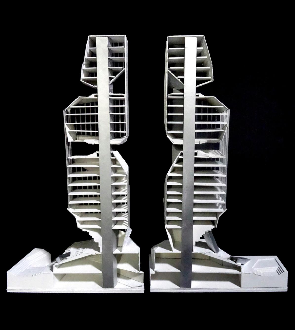
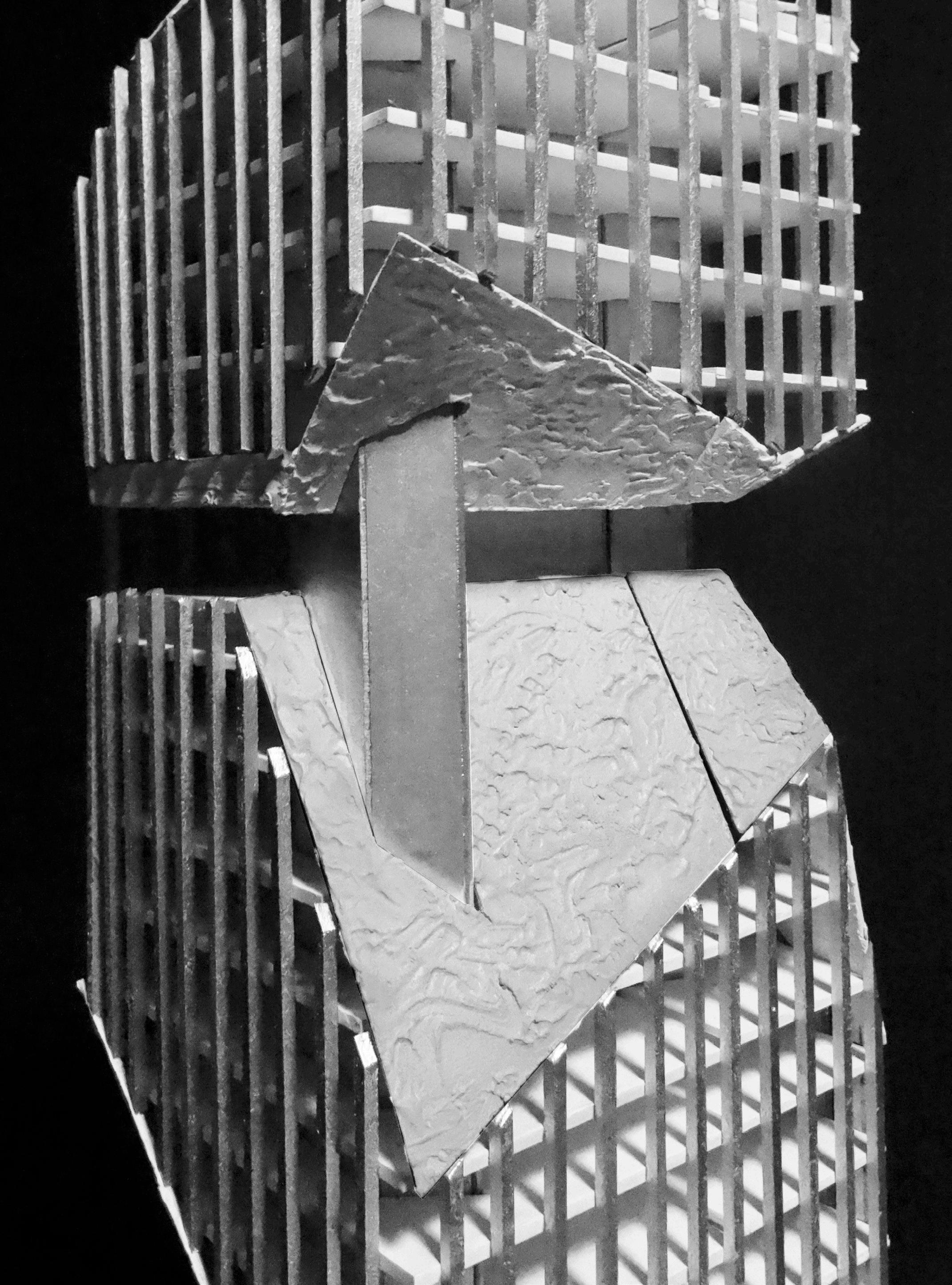
Inspired by cairns, or piles of stones, this skyscraper located along the Chicago river consists of three distinct volumes precariously balanced on top of pedestal rock forms. This stack of rocks is held together by a metal core which skewers through them, in addition to a series of smaller metal props to give the illusion that the stack could topple over at any moment. The metal facade system which bridges the gaps between these separate volumes is juxtaposed with the rock-like texture applied to the base and sloped faces of the tower. Steps carve away from these rock geometries, creating community space between the volumes as well as an interaction between the building and the site.
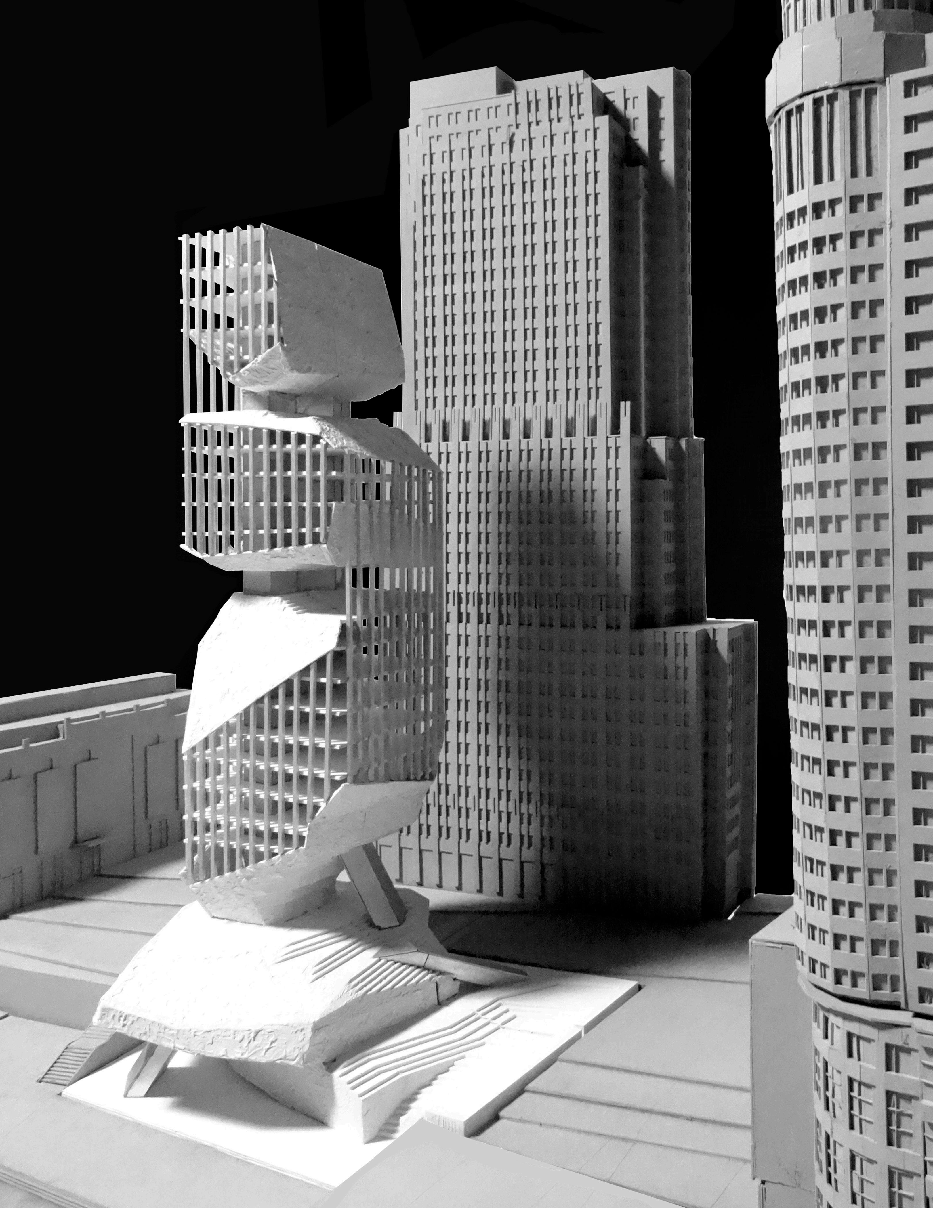
A RIVERFRONT SITE
On the North bank of the Chicago River, the site provides direct access to the Chicago Riverwalk and downtown area.
Situated between Millenium Park and Navy Pier, the tower is embedded within the cultural center of the city.
THE ARTIST’S TOWER
The tower serves as a hub for Chicago’s art community, with artist studios and gallery spaces open to the public.
01 CENTRAL CORES
Two main metal cores skewer through the three rock-like volumes with three smaller cores propping up the stack.
02 SPLIT PROGRAM
Artist studios on the front of the tower are backed by apartments, with exhibition space on the first floors.
03 CARVED SPACES
Stepped surfaces carve out spaces for community between volumes and for the public at the base of the tower.
04 COMMUNITY VIEWS
Framed views revealing the Chicago skyline and Lake Michigan connect artist communities between volumes.
05 PUBLIC ACCESS
A sweeping series of stairs and ramps facilitates access between the street level and the riverwalk below.
06 FACADE SYSTEM
Metal columns clad the tower, partially enclosing community spaces and providing visual cohesion with metal cores.
SP 2026
IMPERIUM
Senior Capstone | Bruce Lindsey
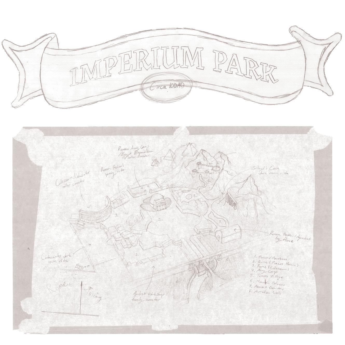
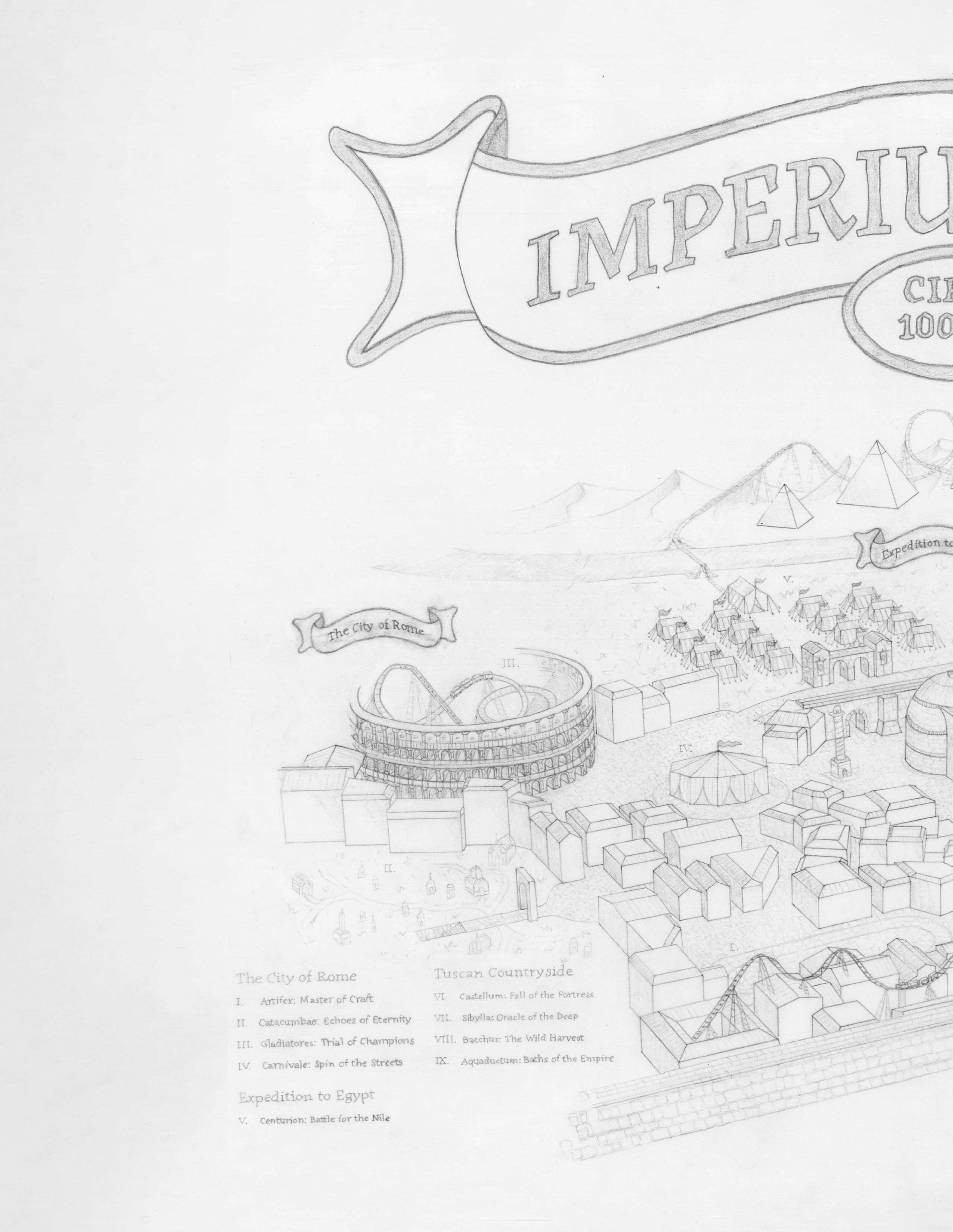
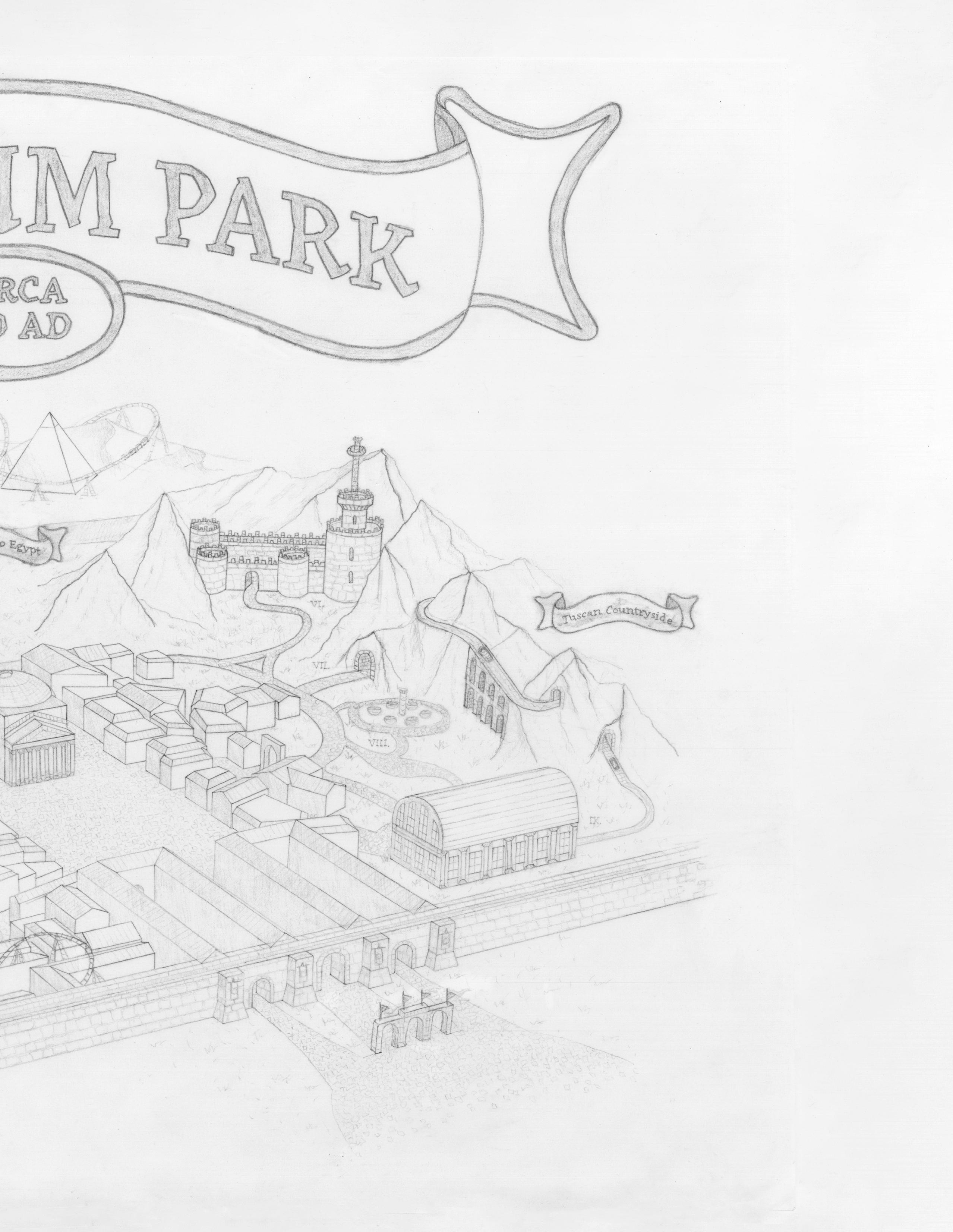
Inspired by the architectural and urban planning practices of Ancient Rome, this theme park transports visitors 2000 years into the past to the Roman Empire, or “Imperium”
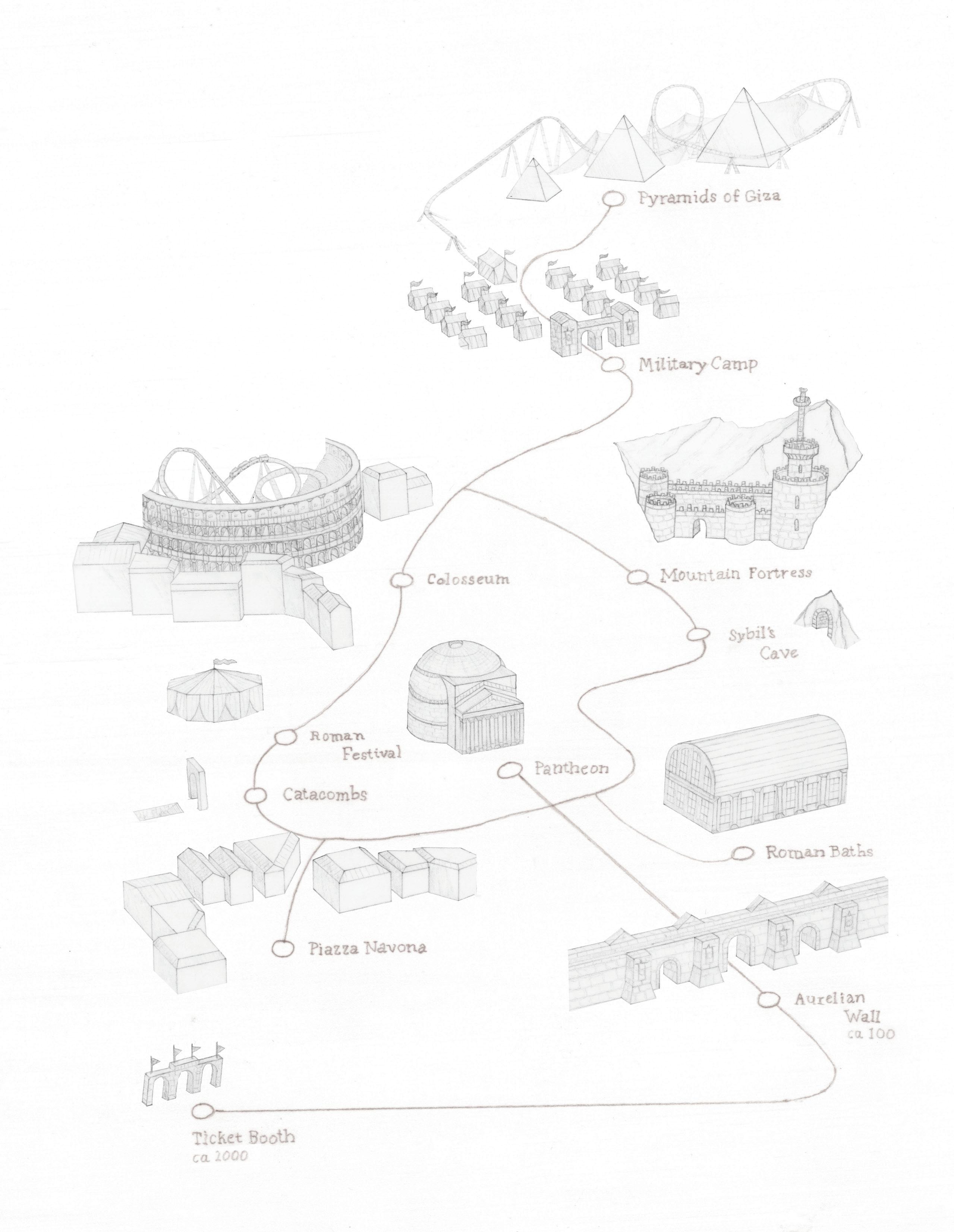
Separated into three distinct lands, the park gives visitors the opportunity to explore the narrow streets and vast piazzas of the city of Rome, the rolling hills and water infrastructure of the Tuscan countryside, and the far away lands of Egypt on a military expedition. Adhering to conventional design practices, the park takes advantage of key scenery pieces and sightlines, forced perspective, as well as circulation and spatial compression strategies to help immerse guests into the world of the Ancient Roman Empire.
WORLD BUILDING
To become fully immersed in Ancient Rome, guests must pass through the historic Aurelian Wall which seperates their present context from the empire of the past.
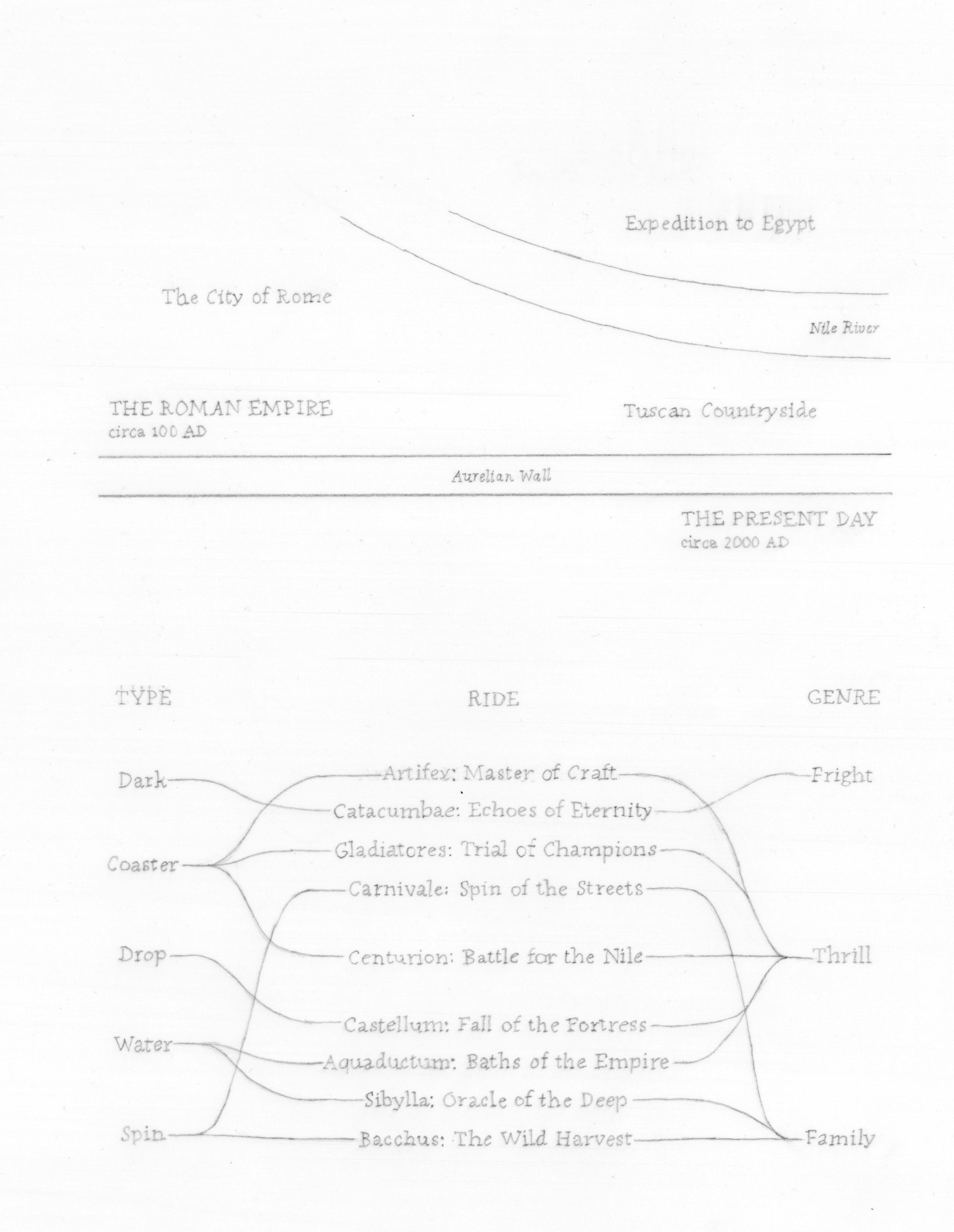
Three distinct lands stretch across the park, enabling guests to experinece Ancient Rome in all its glory, from the city to the countryside to across the sea.
FACADES AND PERSPECTIVES
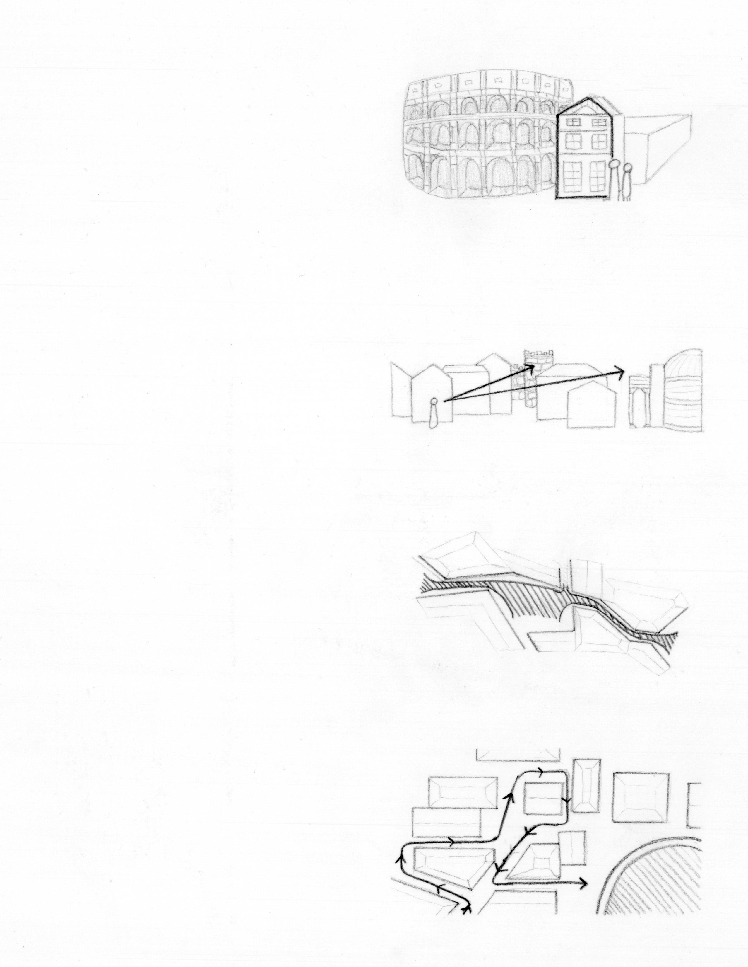
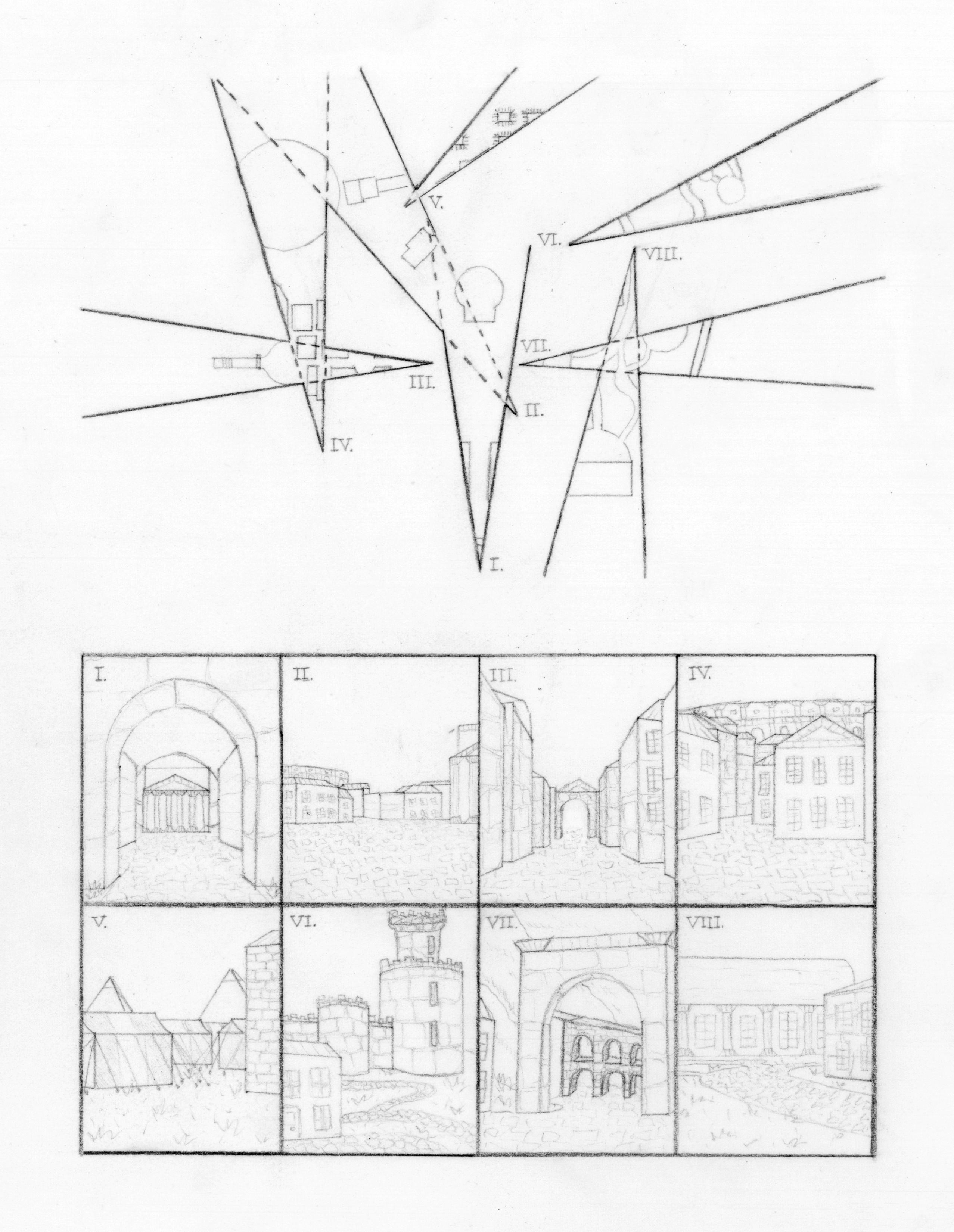
Faux facades make guests feel as if they are in historically accurate spaces, hiding back of house operations that would break the illusion of Ancient Rome.
Forced perspective allows scaled down architecture to feel real as the disproportionatly small top floors trick guests into believing that these buildings are taller than they are.
LANDMARKS AND SIGHTLINES
Landmarks across the park act as the cornerstones of each land, grounding their visual and historical identity with key pieces of architecture.
Sightlines to these landmarks help guests orient themselves within the larger park, acting as navigational guides.
COMPRESSION AND RELEASE
Compression forces guests to narrow their view and notice the smaller details, immersing them further into the world on a smaller scale.
Release opens up these views to reveal key elements of the park, making them seem grander in comparison to the previous moments of compression.
EXPLORATION AND PAYOFF
Winding paths and purposefully confusing circulation encourages guests to explore all corners of the park.
This exploration is then rewarded with various forms of payoff such as landmarks or rides, a strategy which makes the journey just as thrilling as the destination.
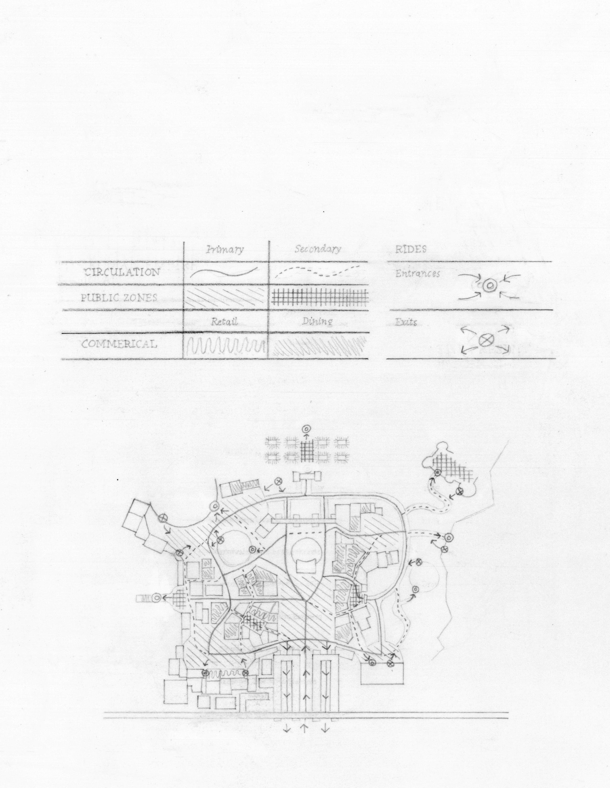
PARK CIRCULATION
Primary and secondary circulation routes enable various journeys through the park as guests travel back and forth between lands throughout the day. Primary public zones are expansive spaces for visitors to gather, providing relief from the smaller, more intimate secondary zones.
Retail and dining options activate these spaces, drawing visitors towards ride entrances and discouraging their congregation around ride exits to avoid congestion.
FL 2025
SPINE
Anthropology of Infrastructure
St. Louis, Missouri is a starkly segregated city split along the Delmar Divide. A decentralized government fragments the city into distinct municipalities, an urban condition which enables economic and racialized segregation. Delmar Boulevard serves as a boundary that reinforces racial divions, exacerbating economic, political, social, and health inequalities. This plan reimagines the road as a green urban spine, connecting residents along and across the divide. By prioritizing bikes and people over cars while providing key public services, the boulevard can facilitate a healthier, more connected community with access to both economic opprotunity and vital public services.
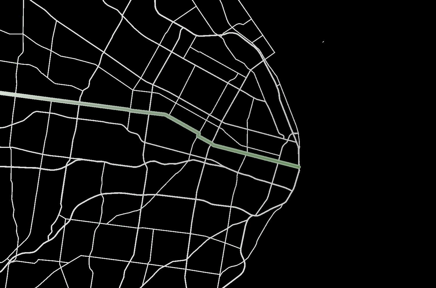
DIVIDE”
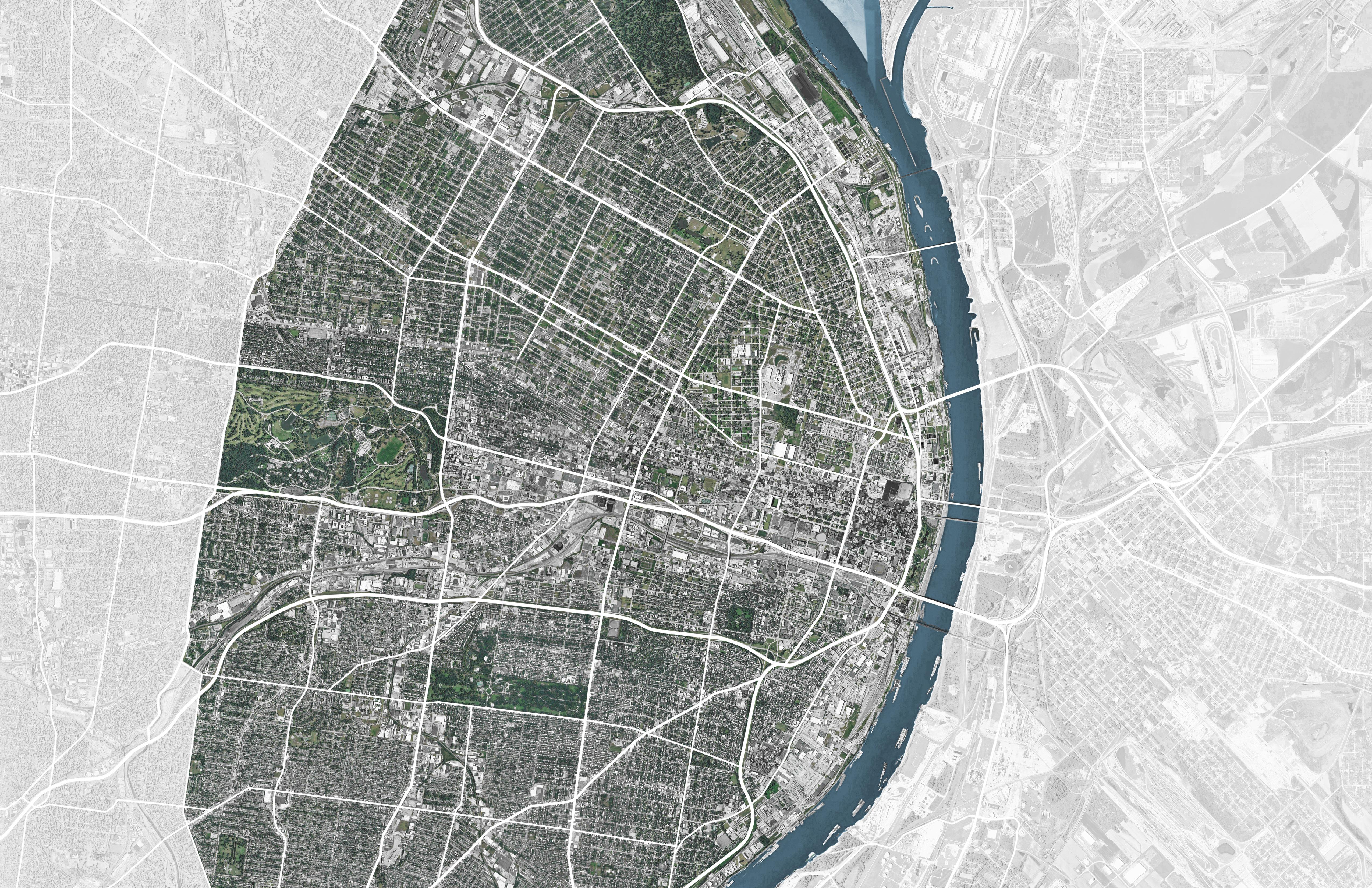

URBAN SEGREGATION AND DISPARITY
Between city municipalities, access to basic services and economic opportunity fluctuates. These disparities exist within just a few miles of one another, a contrast known as the “Delmar Divide”. ABOVE BELOW
ADDRESSING INEQUALITY
To facilitate a healthier, connected community with better economic opprotunities, the Delmar redevelopment acts as a green, urban spine.
This spine and surronding urban development connects residents along and across the divide, making public services more accesible.
01 REDEVELOPED ROAD INFRASTRUCTURE
02 PUBLIC SERVCICE & COMMERICAL DEVELOPMENT
Proposed bike paths
Existing bike paths
Connects residents across the divide
Redevelopment zone
Facilitates access to public services
CONNECTED COMMUNITY
ECONOMIC GROWTH
HEALTHIER RESIDENTS
BIKE NETWORKS
Redesigned roads expand St. Louis’ bike infrastructure, promoting active lifestyles while making transportation safer and more equitable.
01 DEPRIORITIZING CARS
and greenery replace unused parking
02 PROTECTED BIKE LANES
03 SAFER INTERSECTIONS
04 WIDER PROMENADES
Well-lit public walkways facilitate community interaction
Bike lanes
Green medians protect bikers from traffic
Raised crosswalks slow traffic for pedestrians
With its dual function ing is an anchor providing both service and community
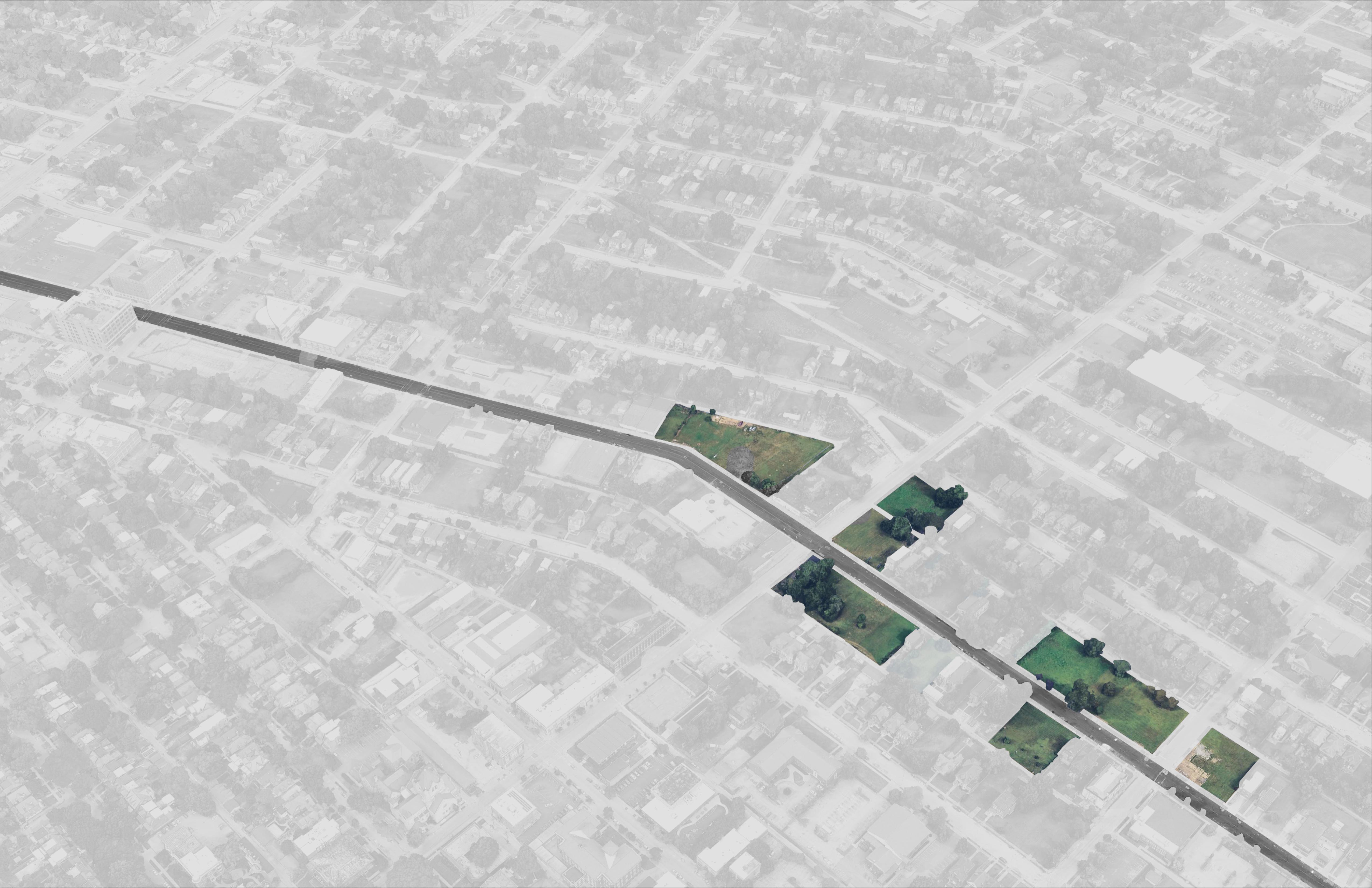
REDEVELOPMENT ZONE
Alongside an expanded network of bike paths, urban development take advantage of vacant lots to provide key services.
These buildings target systemic issues of equity and access, focusing on health, jobs, and public space.
/ COMMUNITY CENTER
function the buildanchor for the community, a vital public community facilities.
03 GROCERY / LOCAL BUSINESSES
A grocery addresses the area’s food desert status, and local businesses provide economic opprotunity and a vibrant commercial center.
02 PUBLIC PARK / HEALTH CLINICS
Medical centers provide accessible healthcare to residents, with the new park encouraging recreational and physical activity.
SP 2024
Urban Fire Station | Ryan Abendroth
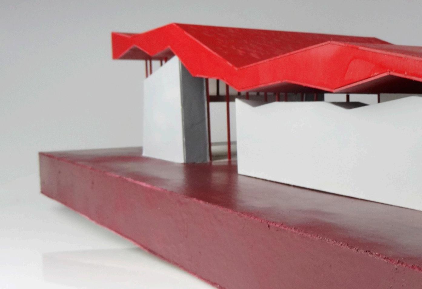
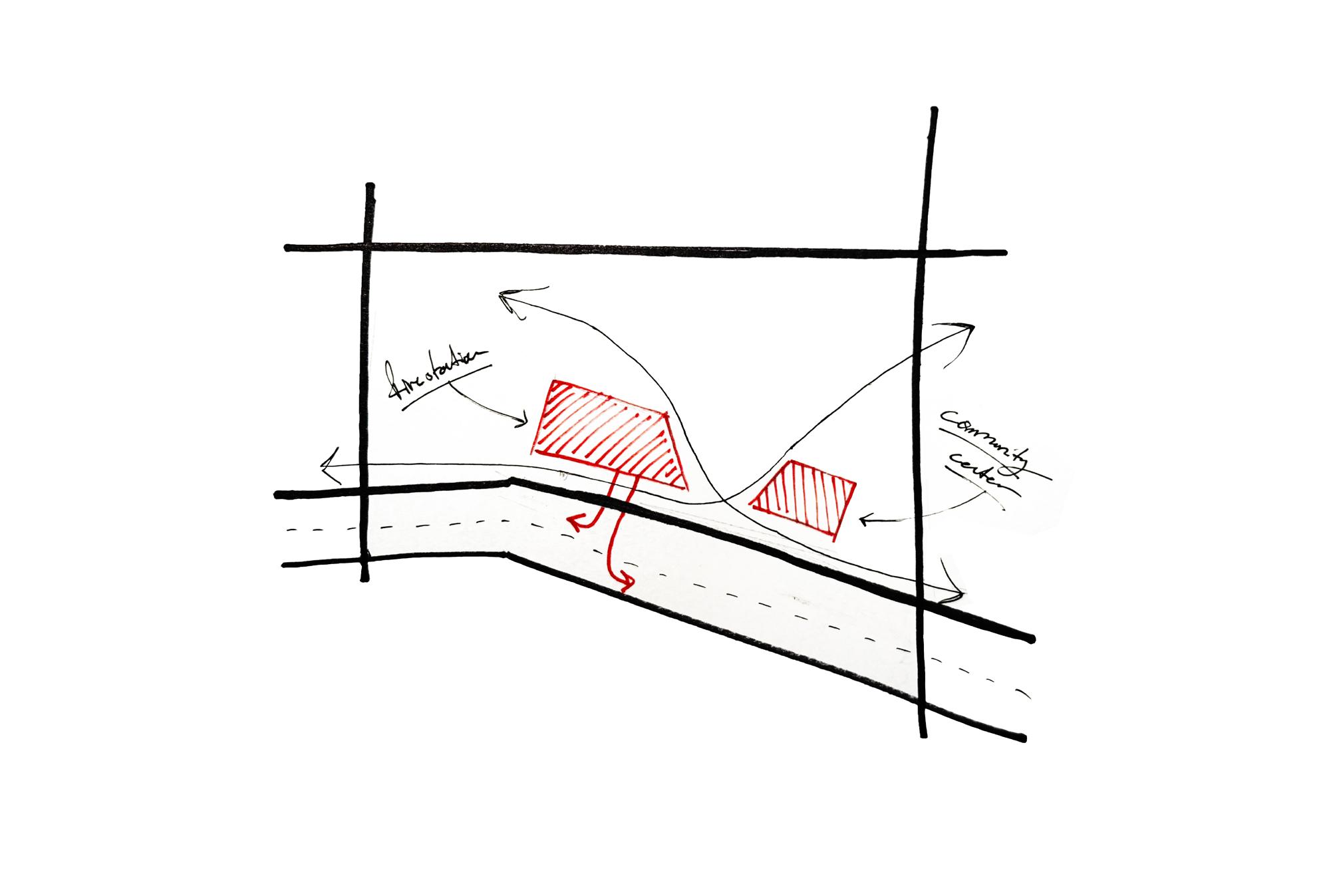
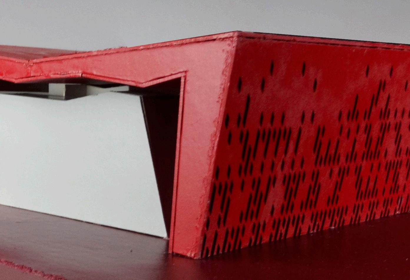
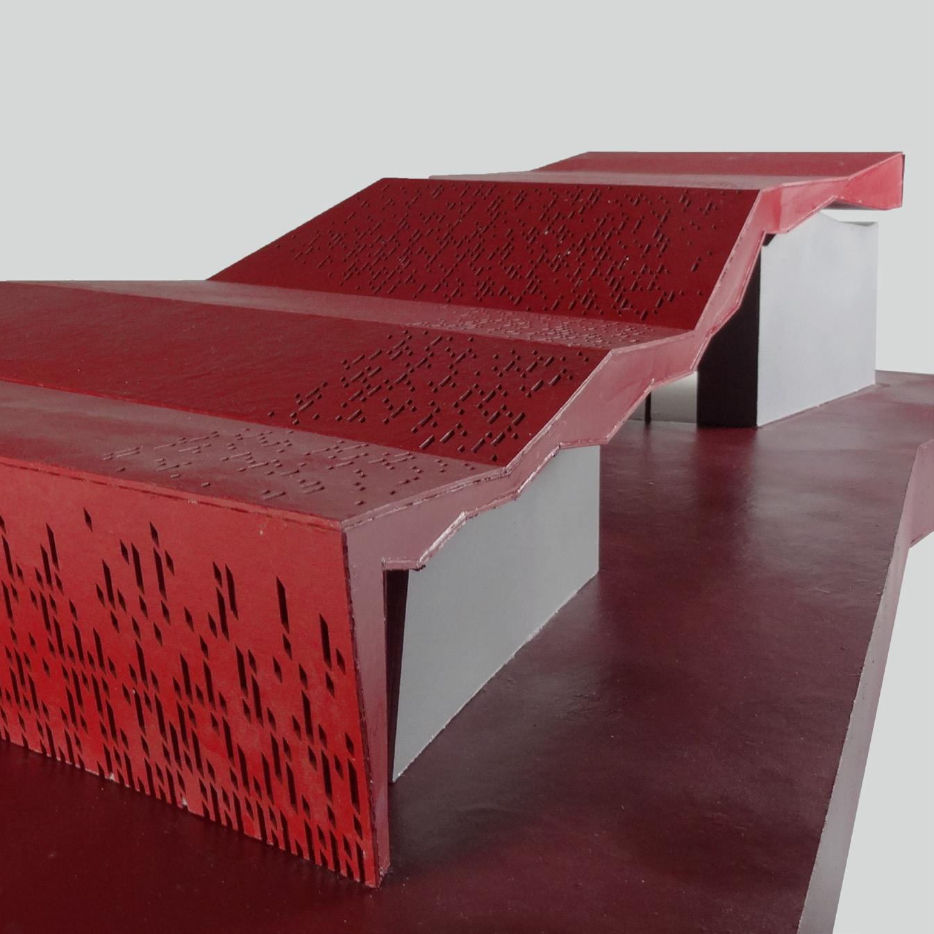
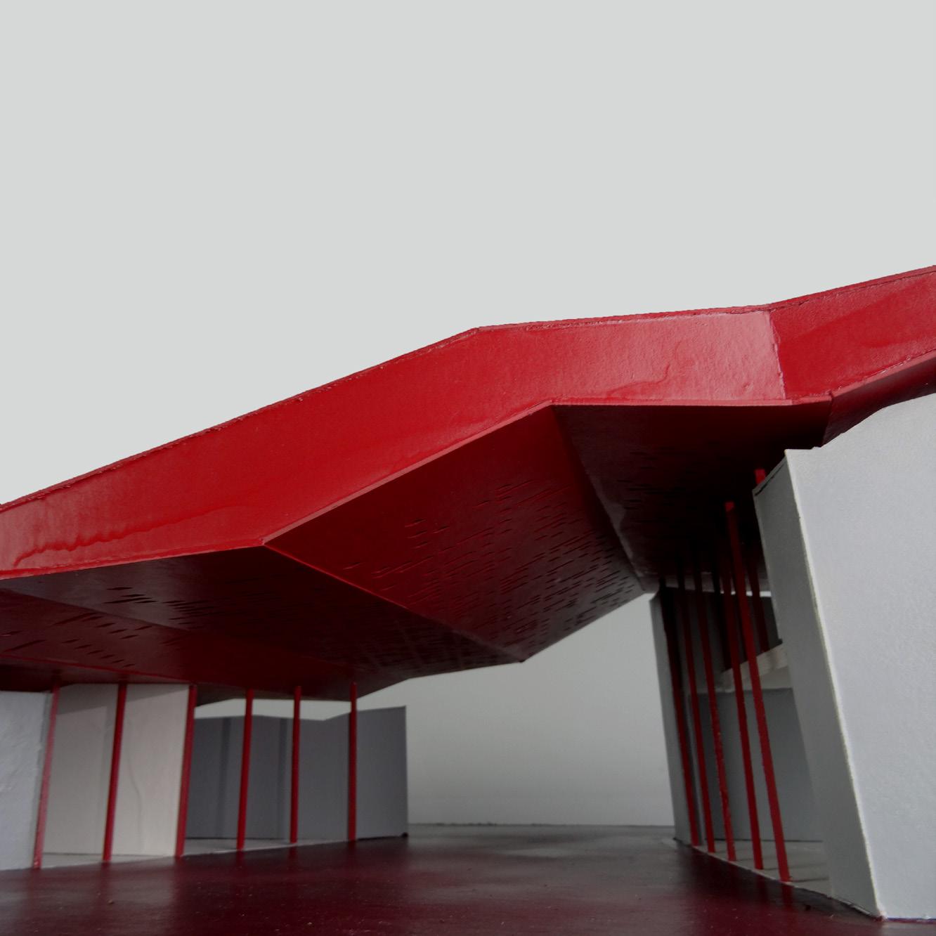
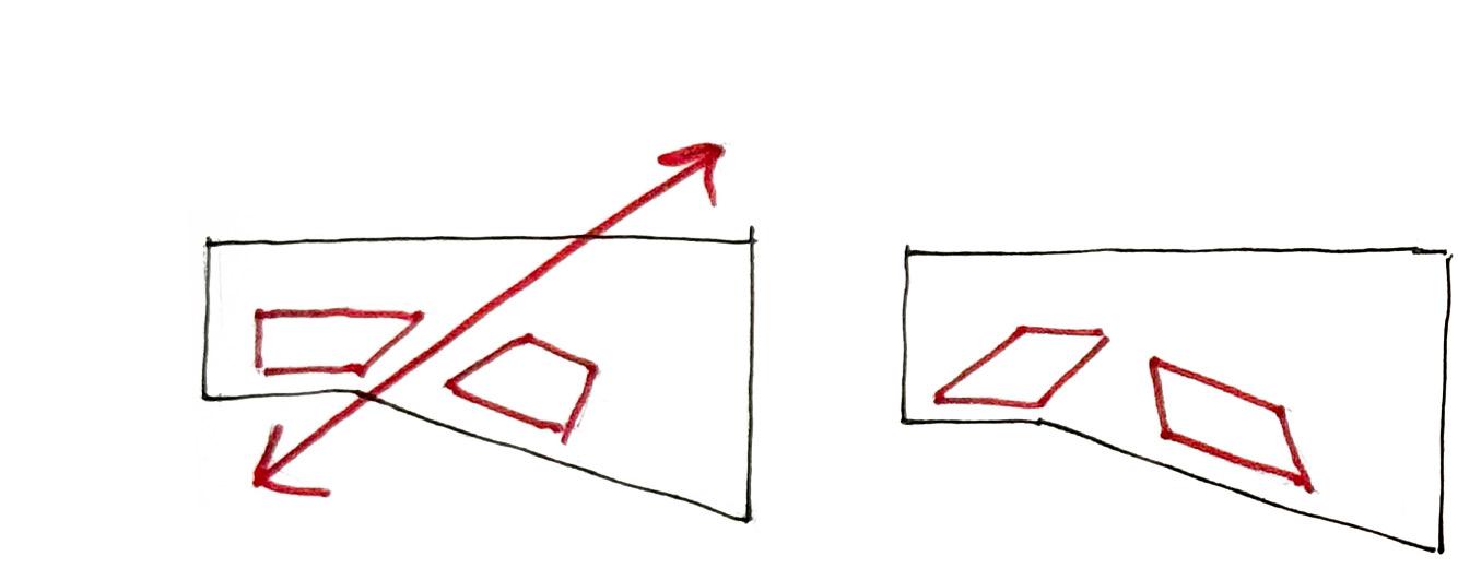
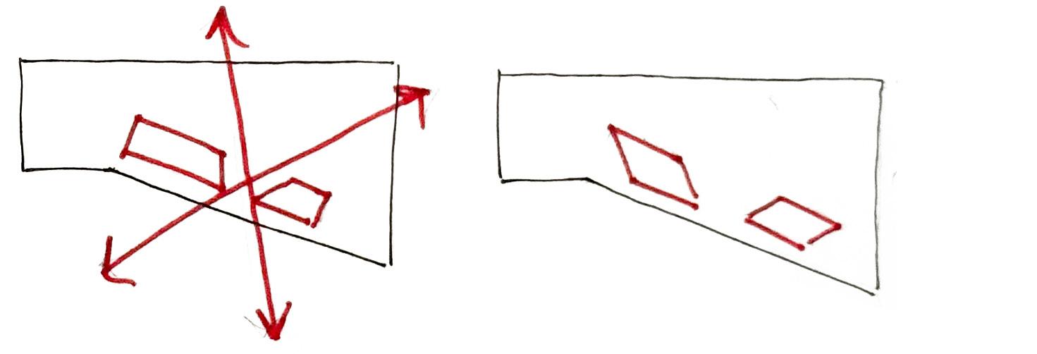
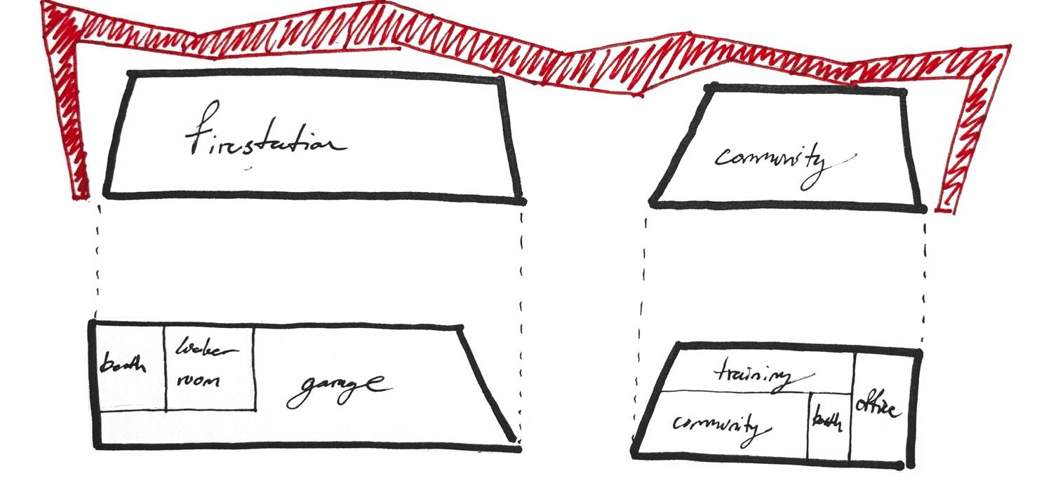
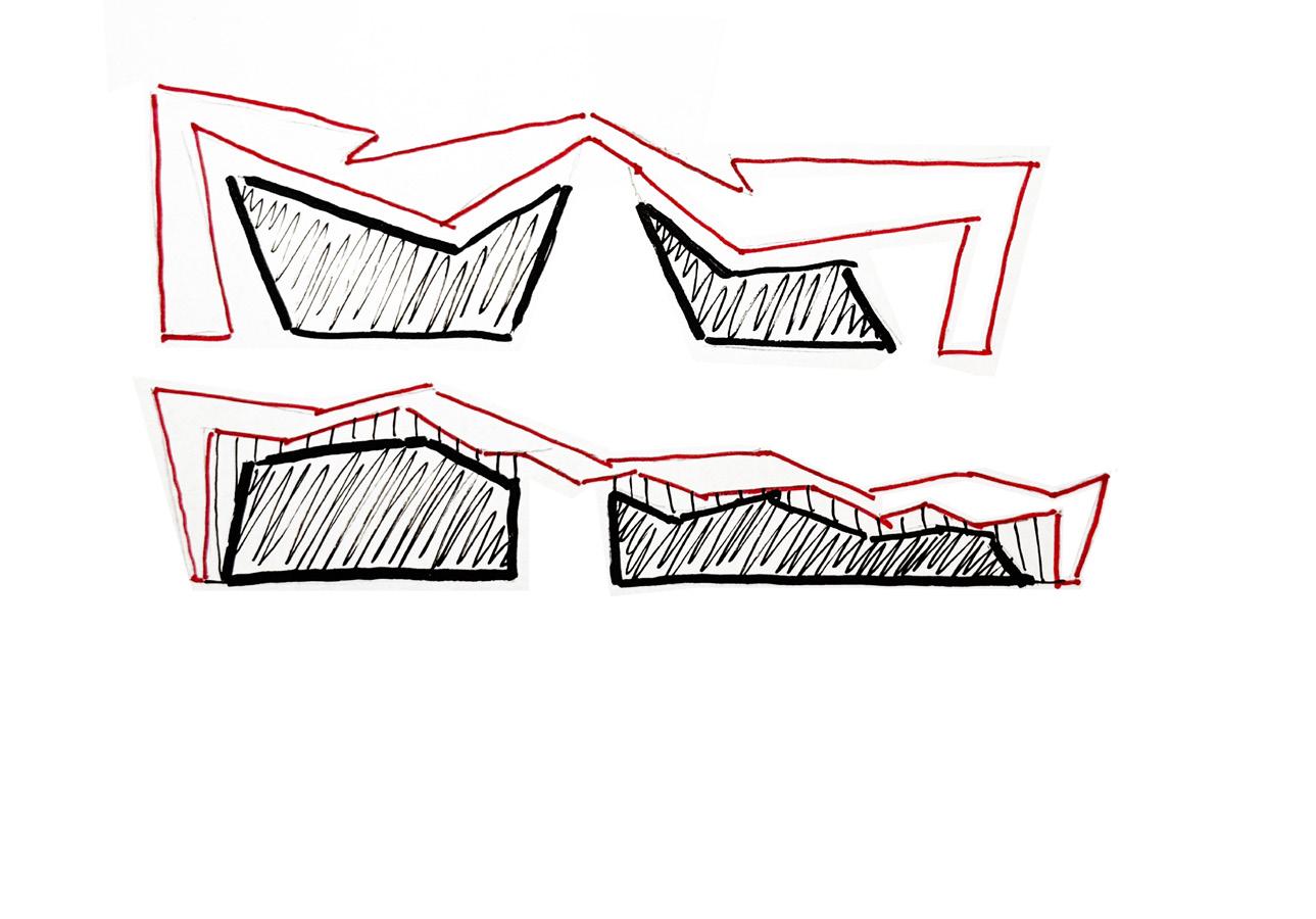
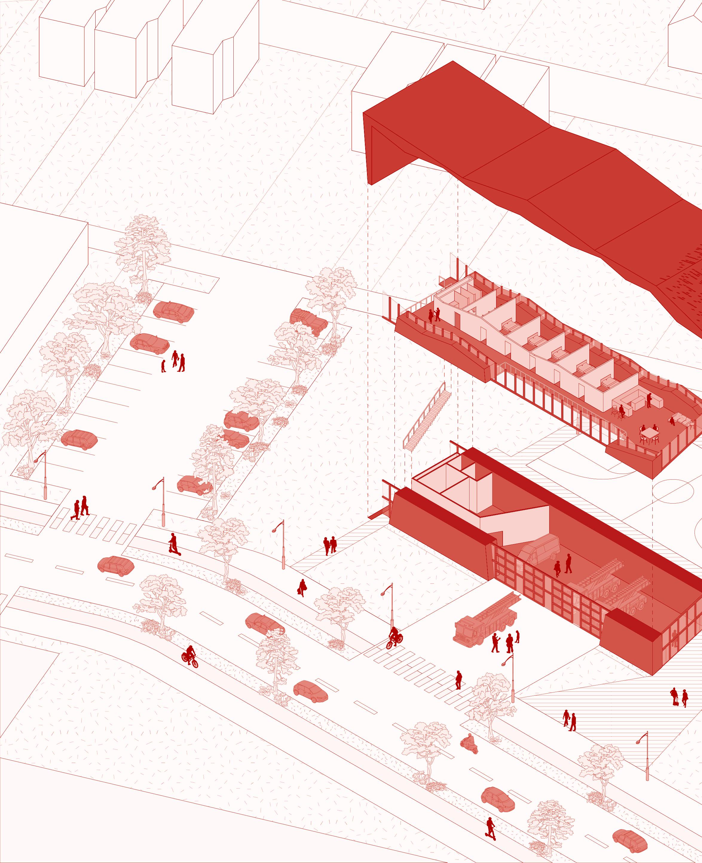
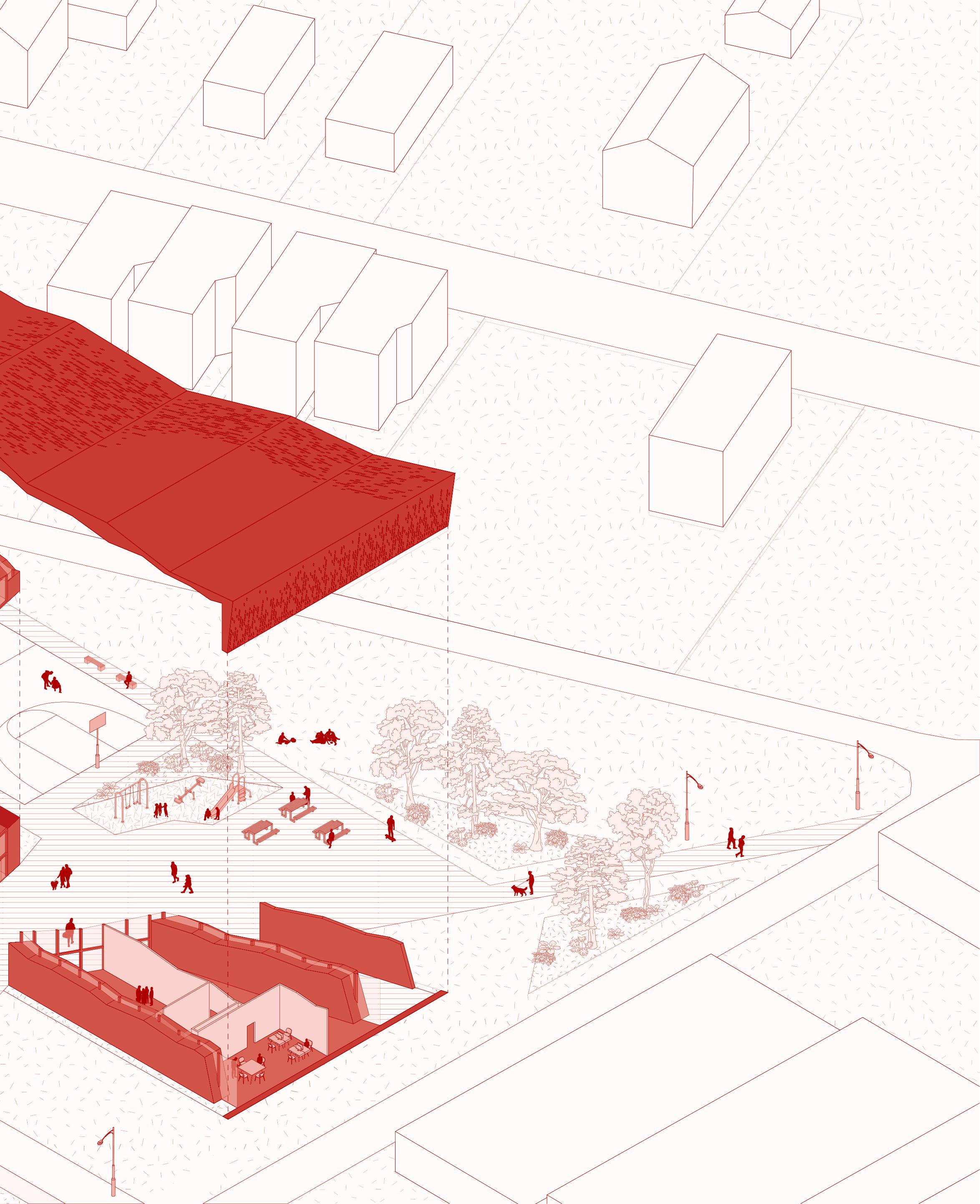
Situated along the Delmar Divide in St. Louis, the line between two historically juxtaposed neighborhoods in terms of socio-economic privilege, this project is designed to act as a community hub to bridge the gap between these two neighborhoods. The project consists of two volumes, one fire station, one community center, bridged by a connecting roof that drapes over both forms. This draped roof creates a public plaza, drawing citizens into the site by revealing the terraced landscape and outdoor facilities behind the building. A facade system of small perforations envelops the roof, fading in and out to control how natural light impacts private verses public spaces.