3 minute read
Day Ride


SoMeRSet FLatLandS
Words & Photography: Peter Henshaw
Advertisement
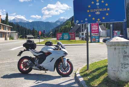
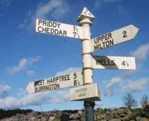
Above: watch out for these signs
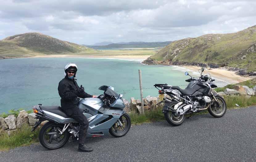
Above: Take your pick, nearly all the roads are good Below: Glastonbury turns up more than once Curvy roads and big skies over the Mendips
120-mile day ride taking in gorges, cliffs and the Somerset Levels
If and when sea levels rise by a couple of metres, the Somerset Levels as we know them will be no more. This vast flat land was once a reedy swamp, and one day probably will be again.
Anyway, it’s the focus of this day ride, though we start at Podimore services on the A303. It’s flat here too, flat enough for the Fleet Air Arm’s Yeovilton air base to have been built nearby in 1939. From Podimore roundabout take the A372 (signed Langport) and after a few hundred metres turn right onto a minor road which takes us through Charlton Mackrell. At the top, turn right and immediately left onto a straight, fast road – still a minor, but more like an A road in width and surface.
We’re on a ridge now, with occasional glimpses of the Levels on both sides. Just follow your nose to join the A39 (turn left) and after 3-4 miles turn right for Edington. The Somerset Levels are stretched out in front as you ride down into the village, with the Mendips on the far horizon. Now we’re on the distinctive back roads of the Levels. Usually straight as a die, they undulate over the soft, peaty soil, which is great fun, but be ready to stand up on the pegs for the bigger dips and humps.
Follow signs for Burtle, East Huntspill and/or Bason Bridge, cross over the M5 and turn right onto the A38. Stick with this classic ex-trunk road, mostly wide and curvy as it heads north for the Mendips before taking the B3133 left to Clevedon. Unlike nearby Weston, Clevedon is a genteel sort of seaside town with a Victorian bandstand overlooking the modestly ornate pier. After an ice cream, hop onto the M5 south and take the high bridge over the River Avon, coming off at junction 18 to follow the A4 into Bristol. Now we get a spectacular entrance into Brizzle, alongside the Avon which narrows into a high, rocky gorge. Look up, and there’s Brunel’s Clifton Suspension Bridge.
Filtering through Bristol’s choked outskirts, follow signs for the A38, and eventually, you’re free of the city. Keep with the A38 past Bristol Airport before eventually turning left onto a minor road signed Upper Langford. Then right and immediately left for Burrington. That, you’ll be pleased to hear, is the end of the trafficky bit of this ride, and it’s now mostly open roads back to Podimore. First there’s Burrington Coombe, which twists its way up the side of the Mendips through a dramatic limestone gorge. After an Alpine-like right-hander we finally pop out right on top of the Mendips and stay high for several miles, crossing a terrain of big skies and the odd drystone wall. At the crossroads, head straight over on a minor road which drops off the edge of the Mendips and deposits us in Wells.
Follow signs for A39 Glastonbury, and we’re back on the Levels as we approach the unmistakeable outline of Glastonbury Tor. At the roundabout, ignore the bypass and take the second exit, through the outskirts of town and some traffic calming – the famous Tor is on your left, and if you’re up to it, get off the bike and walk up to the top.
Turn right at the mini-roundabout then first left to drop back down onto the Levels before climbing back up again and turning left at a T junction. Through the village of Butleigh then we climb away, back to the ridge-top road which will take us back to Charlton Mackrell and Podimore. So there it is, about 120 miles (on the long route) of hills, flats, seaside and limestone gorges. As ever, the best way to see them is by bike.
What’s your favourite day ride? tell us about it in 500 words with a few pictures (high resolution please) you could see it later in Motorcycle Rider and receive a BMF gift! Send to: editor@bmf.co.uk