3 minute read
Day Ride


HILL COUNTRY
Advertisement
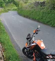
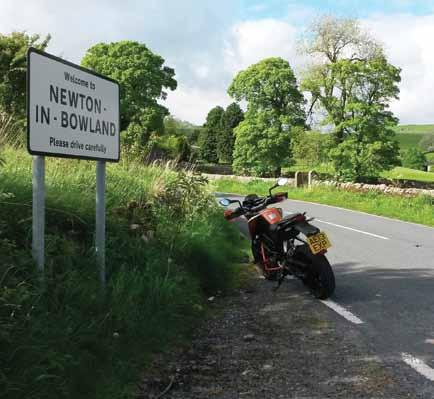
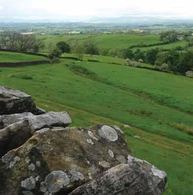
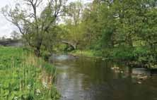
Top: Looking east from Pendle Top right: Newton in Bowland, and a great day out Above: Twisty down to Grindleton Below: River Hodder at Slaidburn
what’s your favourite day ride? Tell us about it in 500 words with a few pictures (high resolution please). You could see it later in Motorcycle Rider and receive a bMF gift! Send to: editor@bmf.co.uk
Trough of bowland and the best of east lancs – PeTeR laidlaw
Ilive in East Lancashire, an area some (uninformed folk, I’d say) see as a previously active industrial area which is now in decline – dark satanic mills country. It’s true that East Lancs saw massive development in the industrial revolution and I remember that pollution in the 1960s could be horrific compared to today’s standards.
Despite which, one is never far from green spaces because of the hills and surrounding moorland always offering an escape. To a certain extent this is true today even though the built environment has changed a lot. This day ride is a celebration of what is good about the Lancashire countryside and its hills. Back in 1999 I was involved in a tourism initiative and used this same run to show visitors the area.
Starting in Burnley (though this is a circular route that could be started anywhere), it’s not far to Whalley where we turn left to Mitton and then to Chipping through the farmland of the Ribble valley after the confluence of the rivers Hodder, Calder and Ribble. From Chipping a small road bypasses Whitewell, climbing over Greystoneley to join the road to Dunsop Bridge. The phone box, at the foot of the Trough of Bowland, is listed as the geographical centre of Britain. Mind the ducks! We carry on through the village and follow the road to Newton and then Slaidburn. For even better views, there is an alternative route from Whalley to Longridge and then over Longridge Fell from where you can see the route we’ve ridden so far. Then we’re through Whitewell (famous as one of HM Queen’s favourite places), to the same road to Dunsop Bridge where we take the B road for Slaidburn.
Slaidburn, on the B6478, has a brilliant little tea shop and dedicated bike parking next to the village green and river. After tea, take a steep incline out of the village and a right turn towards Chatburn giving another viewpoint of the Ribble Valley with Pendle Hill in the background. Down the hill through Chatburn and continuing south now through Downham, again minding the ducks, we skirt the east side of Pendle Hill through Barley and Newchurch. This is where the 1612 witch trials took place, but that doesn’t stop us riding on to Fence and the A6068, turning left to Barrowford and Colne. This is a built-up section and timing is important to miss heavy traffic at work and school times, but the 30 limits are soon over and from Colne we take the road to Trawden, turning right at the church over the ridge above Nelson to Catlow, then left to Catlow Bottoms to Widdop. Past the reservoirs down Hebden Water valley but not quite to Hebden Bridge where we can turn right at Slack, high over the valley containing Todmorden. Then it’s past the wind farm on the Long Causeway and back to Burnley.
There has been a little excursion into Yorkshire here but this can be forgiven for the fantastic views and hills in this part of the world – the hills and moors of East Lancs.


