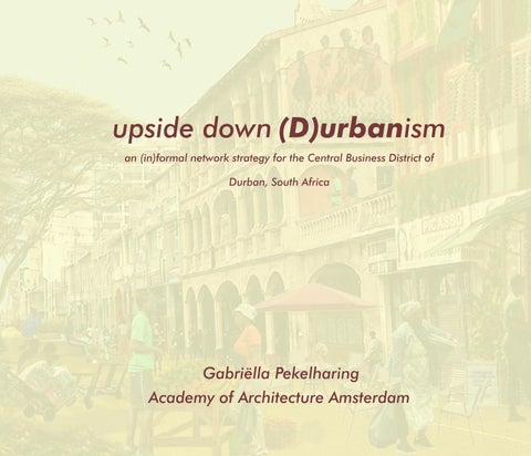
upside down (D)urbanism an (in)formal network strategy for the Central Business District of Durban, South Africa
Gabriëlla Pekelharing Academy of Architecture Amsterdam
Graduation Team
July 2026
mentor Jerryt Krombeen
committee members Jessica Hammarlund Bergmann Chuma Mbambo
external committee members Iruma Rodríguez Hernández Robert Younger
EFL STICHTING
Contents
Glossary Preface Growing up in Durban, South Africa Returning with an Urbanist’s perspective
10 12
Chronic urgency Car-centric city design Climate vulnerability in (public) space Poor economic prospects due to high unemployment rates A housing, basic services and infrastructure crisis The impact of the Apartheid City Model
Concept: Upside Down (D)urbanism 24 26 32 34
Socially-just urbanism eThekwini’s approach to liveability The Centrum Plan the ‘upside - down’ approach
40 42 44
48 50
Case study analysis: Victoria street four protagonists urban mobility public (green/grey) space (in)formal economies Building (under)utilisation
134 136 142 148 154 160 166 172 184
An (in)formal network strategy
Durban’s Central Business District Establishment of the Central Business District Context-driven opportunities in the Durban CBD
six calls to action Toolbox design ingredients 1. Welcome to Victoria street 2. Pedestrian Precinct 3. Crazy Climate Proof 4. Space to Place 5. Economic Equilibrium 6. Building Metamorphosis Mutually inclusive (in)formality
68 76 88 100 118
(ten)tacles for transformation
Reference list
188
Glossary
Victoria street
Officially known as Bertha Mkhize street - the locals still refer to it as Victoria street - is an )in)formal shopping and trading street located in the Durban Central Business District.
Formal traders
A legally registered individual or entity that buys and sells financial assets, goods, or services with the primary goal of making a profit. They operate entirely within the bounds of a country’s official economic system, meaning they are licensed, pay taxes, and comply with labor and trade laws.
Informal traders
Individuals who operate outside the official government tax system. In South Africa there are traders who are officially registered and pay a monthly rent for their market stall, but there are also many traders who are not registered and don’t pay an official fee. The second group is seen as ‘illegal’ and often run the risk of having their goods confiscated by the police.
Minibus taxis
The main mode of public transport for millions of (black) South Africans - white busses, often with a South African flag on it and playing loud music, that seats up to roughly 15 people.
(street vendors, cleaning staff, garden maintenance)
Preface
Growing up in Durban, South Africa One of the brightest, most influential During my time at high school, my family memories of my teenage years took place moved to a lower-income neighbourhood in my High School mathematics classroom. within the city. A neighbourhood classified as a ‘previously Indian-only’ My high school, located in the middle- neighbourhood. I experienced first-hand, higher income neighbourhood of Durban the effects of the Apartheid City Model; a North, situated on an incline, consisted of system where people of colour were forced three elaborate school buildings, a large to live on the outskirts of the city, travelling school hall and multi-purpose centre for far lengths between their work and place of organising functions and school activities, residence. A condition that - 36 years postas well as multiple sports fields, an indoor Apartheid - still affects millions of people sports centre, tennis courts, a swimming on a daily basis. pool and a hockey astro turf. It’s easy to say that there were little to no shortcomings. This is where the motivation for this project stems from - I feel a sense of urgency and With even the slightest glace from my need for spatial-justice: to create better classroom window, I could witness the most living environments for people who are still beautiful, panoramic view of the Indian being neglected and overlooked by their Ocean. Stretching from one end of the room government. right through to the other end, there were optics amplifying the cargo ships close by in the water, waiting to enter the Durban Harbour, diving dolphins and whisking whales. No matter the day of the week, nor the season, there was always something to see, something to witness. It’s highly likely that my sense of ‘observantness’ stems from this experience - a characteristic that shapes me as an urban designer - I enjoy carefully observing and analysing a situation or context, learning from it, and intertwining it within my designs.
Source: Danville Park Girls’ High School 11
Returning with an Urbanist’s perspective In August and September of 2025, I was fortunate enough to spend two months in Durban, the city I gre up in, to fully focus on my graduation project. During this time, that I was able to frequently visit my project location, the Durban Central Business District (CBD), more specifically the Victoria Street (official name – Bertha Mkhize Street) and observe and analyse the social-spatial conditions within the area.
affordable fruit and vegetables, other than the CBD’s informal markets. It’s a part of the city where you’re able to live and work within walking distance from each other. Where you can jump in a taxi and arrive at the Durban beachfront within just a few minutes. The aim of this project is to visualise a new perspective for the Durban CBD. If the local identity and sense of place are finally understood and cherished, it might kickstart a new approach to urban design and planning. A shift from a generic and ‘soul-less’ approach to one that truly embodies the identity of Durban and meets the needs of the local people, who need it most.
The focus of my project stems from the sense of urgency I feel to design and generate highly liveable cities, for people from all walks of life. Since growing up in Durban, the CBD has been labelled as a ‘no-go’ area. This triggered a sense of curiosity and determination to fully understand why this is the case, and investigate if there’s a The practical output of this project socio-spatial design approach that might is a toolbox showcasing design alter the conditions, for the better. ingredients aimed at improving the urban conditions within the focus area; the After spending many hours walking, Victoria street public space, as well as the observing, speaking to locals and fully adjacent buildings. The thorough ‘upside analysing my focus area, I’m confident down’ humancentric site analysis, to say that a large part of the friction or forms the foundation of this toolbox and identity crisis connected to this area, stems leaves room for further expansion, to from a sense of ignorance – from privileged potentially be applied to other streets local residents but also from government throughout the Durban CBD, generating officials. a larger scale inner-city network. By focussing on public space interventions, it The Victoria street, and the CBD at will kickstart the necessary transformation, large, is a ‘hidden gem’. A place of local and simultaneously motivate property culture and history, a place where you owners to invest in the upgrade and can truly feel the essence of Durban. transformation of their buildings. In other Nowhere else in the city can you still buy words, by first investing actively in public
space interventions, where most of the positive impact will be felt, it will have a catalyst effect on the further transformation of the CBD. The applied ‘network’ approach objects the ‘concentrated’ Centrum Plan approach of the local government. By intertwining (in)formal work, housing, mobility and climate-proof public spaces along important socio-spatial CBDwide networks, it will result in a more inclusive, accessible and highly liveable urban area. A concentrated approach also has positive benefits, but it’s only linked to one specific area, and one small group of people. A network approach expands the benefits across a much larger area, reaching a much larger number of people – it’s the most effective way to reach both quantitative and qualitative goals. Of course, this ‘hidden gem’ is still rough. But with a little bit of polishing up through urban building and public space transformation, she’s ready to shine and grow to her full potential as a highly liveable, South African city.
The aim of this project is to create a new perspective for the Durban CBD: a ‘upside down’ humancentric toolbox showcasing contextdriven design ingredients
13
Back-alley informal trading: women selling fresh fruit and vegetables
Informal traders selling beautifully displayed fruits and vegetables 15
Important informal market figures depicted on one of the busiest fly-overs in the city
Young and old: Informal traders selling traditional footwear made of animal skins 17
Durban’s North Beach: one of the country’s surfing hotspots
The Durban harbour’s presence is felt around every corner - it’s the largest shipping port of Africa 19
Chronic urgency
Durban, South Africa Located in the eThekwini municipality, along the east coast of South Africa, is the third largest city within the nation, Durban. Home to just over 4,2 million residents (Statistics South Africa, 2022) this beautiful city profiles itself as the sporting and recreational capital of the country. In addition, the strong isiZulu, Indian and South African English cultures ensure that the city is a melting pot of cultures and diversity. No wonder it’s one of the leading holiday destinations amongst South Africans. The eThekwini municipality is divided into four Municipal Planning Regions (MPRs): the north, central, south and outer west MPRs (KwaZulu Natal Province, 2021:2) The northern and southern MPRs provide significant residential, coastal tourism, agricultural and commercial functions. The outer west MPR is an Environmental Management priority Area as well as providing multiple industrial opportunities. The central MPR is the urban core of the municipality, boasting major economic sectors, multiple tourism and recreational opportunities as well as a broad selection of urban lifestyle choices and services. In addition, the Durban Harbour (the largest shipping port of Africa) and the King Shaka International Airport are based within the central urban MPR, both acting as an international gateway of economic and recreational opportunity.
While the city of Durban functions successfully from a cultural, sports and recreational perspective, the city does however experience multiple socio-spatial problems. Some of these problems include: 1. Car-centric city design 2. Climate vulnerability in (public) space 3. Poor economic prospects due to high unemployment rates 4. A housing, basic services and infrastructure crisis
Aerial view across the Durban CBD with the Indian Ocean in the background Source: my own composition (2025)
23
1. Car-centric city design A mix of suburban, sprawling neighbourhoods and informal settlements stems from the Apartheid city model design and modernist planning principles (Cloete & Yusuf, 2018: 37). The segregating design principles ensure that areas are only connected by wide-laned, private car and mini-bus taxi orientated roads. Walkability throughout Durban is poor due to high travelling distances and
In Durban, wide-landed roads dominate the urban landscape, filled with mini-bus taxi’s, private cars and the occasional bus.
unsafe areas due to a lack of ‘eyes on the street’, caused by inefficient and outdated planning designs. The level of private motor vehicle dominance directly impacts the quality of the urban surroundings. In Durban, wide-landed roads dominate the urban landscape, filled with mini-bus taxi’s, private cars and the occasional bus. Cycling or walking is strictly discouraged due to poor safety levels, and the general lack of infrastructure built to accommodate alternative transportation modes, other than driving. Public transport is almost exclusively used by the middle-lower income individuals. As soon as someone makes enough money, they invest it in a private car. This mindset withholds the city from designing highly walkable, sustainable and safe public spaces. In Durban, your car is your ticket to freedom, it’s your sign of wealth, and your means of public safety. However, this ticket to freedom is an illusion since people are continuously stuck in endless traffic jams and spend huge percentages of their income on petrol and car maintenance due to the extreme ‘car-orientated’ distances that people have to travel between their work place and residences. The city of Cape Town has proven that African cities may also become highly walkable and cyclable, while the city of Johannesburg has successfully invested in the sustainable, publicly accessible Gautrain (Gauteng province train system).
The city of Durban should take inspiration and properly invest in the promotion of sustainable transportation alternatives. A kick-start for the city includes investing in a safe and racially inclusive mini-bus taxi system, promoting walking by constructing inviting, safe and well-lit pedestrian sidewalks, as well as introducing sharedmobility hubs across the city.
Pedestrian vulnerability
Car dominance throughout street profiles
Empty car parkades: everyone parks on the street Source: my own composition (2025)
25
2. Climate vulnerability in (public) space According to the Husqvarna Urban Green Space Index (HUGSI, 2024) Durban is currently ranked 12th on the global rankings, monitoring the proportions and health of green open spaces throughout the city. The entire Durban coastline, Blue lagoon and Beachwood estuary and countless nature reserves which infiltrate the city like green and blue fingers, stimulated by Durban’s humid subtropical climate, can’t help but place the city high on the global rankings. While the city as a whole is ranked very high, the Durban CBD is a grey island within a larger, green body. The CBD consists primarily of heatabsorbing pavements and buildings, with only a few trees planted outside municipal buildings. The CBD’s current, ‘grey’ design adds to the Urban Heat Island effect and highlights how poorly prepared the city is against the increase in flooding throughout the area. Since 2022, thousands of people have been displaced or killed due to the lack of effective design or preparation (Makanda, 2025).
beach entrance points. In addition, the boulevard plays host to a weekly free of charge, ‘5km Parkrun’ event that stimulates healthy walking and running amongst Durbanites. The Golden Mile public space should act as a leading example for the improvement and upgrade of hundreds of other public streets, squares, pocket parks and gardens around the city of Durban. By giving public space a facelift, the successes will act as a catalyst for other liveability upgrades around the city. The privatisation of public spaces, negative perceptions around public space safety, as well as the pre-1994 Apartheid racial segregation practiced throughout public space, all contribute to the negative experiences across Durban’s public spaces (Cloete & Yusuf, 2018: 35-39)
One might say that the overall neglect of public spaces throughout South African cities like Durban are a result of the enforced Apartheid City Model which restricted the interaction between different There are a handful of successful public (racially defined) groups of people. Where spaces; The Durban Golden Mile is a is the best place to encounter people? In wonderful example of a successful public public space! space in the inner city of Durban, adjacent to the CBD. The 8km long pedestrian- In post-Apartheid South African cities, boulevard, stretching from the Umgeni investment in public space has gained too river mouth to the Durban harbour connects little attention, especially since this is the multiple restaurants, shops, the Moses ideal place to ensure desegregation and Mabhida football stadium, the Suncoast unification of different groups of people. casino and entertainment centre, Ushaka The negligence of public space and the Marine World as well as many hotels and car-centric city design has resulted in
anonymous and unsafe public spaces in the inner-city areas of Durban, the suburban neighbourhoods, and the informal residential areas. Acute action needs to be undertaken to improve the quality of public spaces like city squares, pocket parks and streets.
While the city as a whole is ranked very high, the Durban CBD is a grey island within a larger, green body
Hard, grey surfaces: no sunprotection
Trees & grass are only found at government buildings
Hard, grey surfaces: heat absorption & lack of water infiltration opportunities Source: my own composition (2025)
27
3. Poor economic prospects due to high unemployment rates Shifting between 33% and 43% (roughly 17 million people) the stagering unemployment rate of South Africa puts great pressure on local residents (StatsSA, 2026). Of the remaining 25 million people (above the age of 15 - legal working age) another 8 million people are job seeking, but unemployed. One might argue that the ‘true’ unemployment is therefore not
Shifting between 33% and 43% (18 million people) the stagering unemployment rate of South Africa puts great pressure on local residents
17 million people, but rather 25 million people. The hopeful youth in Durban is the generation hit the hardest since their unemployment rate sits at roughly 61% (eThekwini Newsflash, 2024).
designing for the implementation of informal trading spots - the bare minimum is provided. The demand is too high for the supply.
(6) permit costs for an informal stall need These rates are a result of multiple factors: to be paid 6 months up front - it’s being (1) Poor regulatory government made impossible for people to enter into policy implementation has seen an the (in)formal economy. overall stagnation in job availability and a lack of growth in the public sector, across Whilst the unemployment rates remain the country. As a result, well-educated high, the city of Durban is home to and skilled individuals emigrate to other multiple large scale economic drivers. The countries in search for employment, Durban harbour/shipping port and the inflicting a brain-drain problem on the linked industrial sites, the Dube Trade Port country. connected to the King Shaka International Airportas well as the Warwick Junction (2) unequal access to a sufficient and supporting over 6000 informal street wholesome education is an ongoing traders, in the Durban Central Business reality for many South Africans, even in the District (CBD). post-Apartheid context. Support and investment in the (3) Psychological strain easily occurs abovementioned economic drivers when one is continuously turned down are essential to support thousands of when applying for jobs. It’s therefore not Durbanites. In addition, stimulating the a surprise to see that the percentage of growth of smaller companies and informal discouraged South Africans, not actively businesses is essential to tackle and reduce seeking employment remains high, in the unemployment rates. Durban this amounts to just above 10% of the population. (4) The importance of microbusinesses in the informal economy are still undervalued and form an essential means of survival for millions of South Africans. (5) at a local level, governments aren’t
Formal trader selling fresh meat from his store
Two worlds: isolated formal and informal economies
Informal traders selling products along the roads Source: my own composition (2025)
29
Informal economy stimulance to counter unemployment South Africa has one of the world’s highest unemployment rates; 33%-43%, 18 million people (StatsSA, 2026) - with a ‘true’ reading at 25 million people . Asmal et al (2024:1) argue that whilst the country has similar economic growth challenges to countries like Brazil or India, the unemployment rates of those countries are much lower; Brazil’s unemployment rate sits at 14.4%, roughly 2.5 times lower than that of South Africa. Asmal et al (2024:1) continue to add that the extremely low levels of economic informality throughout South Africa make the labour market unique. If the informal market was larger, and stimulated by the government, just as it is in countries like India and Brazil, the staggering unemployment rates with rapidly decline. The informal economy plays an essential survival role in the daily lives of millions of people. In places where people live from day-to-day, informal trading offers an opportunity to still make a living. In the long run, succesful businesses might be able to enter the formal economic market. The South African government should be motivated to enhance the presence of the informal economy to ensure it acts as a stepping-stone to not only reduce the national unemployment rate, but also improve the social-economic living conditions of millions of people.
20%
14%
59% 31
4. A housing , basic services and infrastructure crisis Formal housing in the city of Durban is a privilege destined for the (previously whites-only) middle to high socio-economic class minority. As a result, 80% of urban residential structures are informally built (Cloete & Yusuf, 2018: 36). In addition, housing built in neglected formal and informal urban areas often go hand in hand with a lack of basic services such as electricity and water (AfricaNews, 2022). Durban, split into lone standing residential islands, previously designed to facilitate racial segregation, has been facing a housing, services and infrastructure crisis for the past few years. Residential islands may be grouped into one of four categories: (1) formal (previously white-only) suburban neighbourhoods (2) a formal, inner-city, middle-high rise residential area (3) formal middle-low (previously Indian or black) neighbourhoods 4) informal (previously black) urban settlements. As a result, the housing, services and infrastructure quality and availability is directly proportional to the socioeconomic (previously racial) residential area. In other words, people living in wealthier/higher socio-economic profiled neighbourhoods such as Durban North and Umhlanga, often have access to better quality housing, basic services and infrastructure. These residents also often have the means to access alternatives,
for example, they’re able to buy electricity generators to utilise during the frequent electricity cuts. Individuals living in lower income (previously black or Indian areas) areas such as Kwamashu or Phoenix, very often don’t have access to high quality housing, access to basic services, nor sufficient infrastructures throughout their neighbourhoods.
The plinth (ground floor) of the buildings are often bustling and filled with a mix of formal commercial program, the building levels above are left empty and underutilised.
While there are improvements being made by local government, the quality of these neighbourhoods is far from the quality of the middle to high income neighbourhoods throughout the city. The Durban CBD experiences an entirely different reality. Middle-high rise residential and commercial towers and flats have been abandoned and left to decay. While the plinth (ground floor) of the buildings are often bustling and filled with a mix of formal commercial program, the building levels above are left empty and underutilised. A lack of alternative, social and affordable housing within the urban area, as well as the linked poverty and unemployment faced by many Durbanites, needs to be addressed. To be able to deal with the increasing urbanisation and migration patterns, and to upgrade and stimulate sustainable and humanitarian urbanism, the city of Durban needs to continue to simultaneous seek desegregation as well as enhancing the quality of all urban neighbourhoods.
Shifting building heights throughout the city
Abandoned building blocks
Active plinths but the tops are neglected Source: my own composition (2025)
33
The impact of the Apartheid City Model Due to the unique Apartheid history, experienced throughout the Rainbow Nation, the bulk of South African nationals experienced extreme forms of discrimination, segregation, and unequal opportunities (McGregor, 2011:112) until the abolition of the institutional Apartheid regime and the Group Areas act, in May 1990. In addition, Seekings (2008:2) argues that while the post- Apartheid status-quo is less racially discriminative, there are however still shockingly large differences between people of different socio-economic levels. From a spatial perspective, until the end of Apartheid in 1990, racial and socio-economic segregation was exacerbated by the design and implementation of large-scale ‘barriers’ like grand infrastructural projects such as highways and railways, as well as large open spaces such as natural, green open fields, cemeteries, forests or rivers (De Beer, 2015:15). Initiated by the Apartheid city model, the Central Business District or CBD formed the heart or core of the city where all the main economic activity took place. Directly surrounding the CBD laid the higher income neighbourhoods, only accessible to White people. Then, segregated spatially by large infrastructure projects or natural areas laid the first coloured or Indian neighbourhoods, and then, located even further away, outside the urban core, laid the designated black neighbourhoods. As instructed by leading architects, urban designers and planners during Apartheid,
the modern Apartheid city would keep the minority white population in middle to high income areas, close to their workplaces within the CBD. While the rest of the population would have to travel from far, for a long time, and for a large amount of money, to the white neighbourhoods and CBD area, if they had a Dompas (working permit) which allowed them to enter these areas (Maluleke, 2023). Today, these barriers still segregate neighbourhoods throughout cities such as, Durban. However, racial diversity throughout neighbourhoods has improved since the 1990’s, but often only in wealthier, previously white-only neighbourhoods (Statistics South Africa, 2016 & Lemanski, 2006). Hamann (2024:29) adds that urban growth may act as a catalyst to soften sociospatial boundaries and improve equal levels of opportunities for all people. The Durban CBD provides many opportunities to ensure controlled desegregated housing projects. In the 1990’s, this was already attempted, but the uncontrolled speed of integration resulted in many white residents rapidly moving away, out of the Durban CBD, and into the suburban areas. By carefully initiating inclusive and diverse housing transformation projects for all racial and socio-economic groups, while simultaneously improving the surrounding public spaces, it may have a positive impact and allow a diverse mix of individuals to gravitate towards the new and improved CBD area. Resulting in a more inclusive counter-effect than the circumstances of the 1990’s.
Durban CBD Apartheid zoning map in relation to the CBD 35
37
socially-just urbanism
eThekwini’s approach to liveability In 2020, the city of Durban’s mayor Cllr Mxolisis Kaunda announced that it wants to become Africa’s most caring and liveable city by 2030 (eThekwini, 2020). An ambitious and notable statement that would make any local resident proud. However, the motivating words mentioned by the now ex-mayor, and the various visions plans and Investment Projects announced by the local government, don’t match with what an urbanist would call a ‘caring and liveable city’. Multiple housing projects such as the Beachwood Estate and Virginia Airport projects and the Sibaya Estate project are large-scale, suburban, car-centric urban sprawling development projects that don’t contain any characteristics relating to liveable cities (eThekwini, 2026) . In addition, logistic and industry projects like the Cato Ridge and Giba Business Gate projects boast the promotion of thousands of jobs. The quantitative numbers linked to these projects are never backed up by data.
Respected urbanists and sociologists like Jan Gehl, David Sim, Jane Jacobs and William H. Whyte have emphasised for many years that caring and liveable cities are cities that are designed for people, at a human-scale, for human speeds (Gehl, 2010:77) ensuring there are always eyes on the street (Jacobs, 1961:35) with a diverse profile of accessible and safe public spaces (Whyte, 1988:10 & Gehl, 2011:171-173) and a mix in urban program, spread across active plinths (Sim, 2019:57) filled with a mix of residential typologies above. Unfortunately, the disbalance between the ambitions of the local government, and their interpretation of ‘good, caring and liveable urbanism’ still results in car-orientated, suburban urban design and planning that will ultimately result in Durban not being able to meet its own goals of becoming the most caring and liveable city of Africa.
Durban wants to become Africa’s most caring and liveable city by 2030
41
The Centrum Plan The Centrum Precinct Plan (eThekwini, 2015) designed by an international office UrbanSolutions, in collaboration with the local eThekwini municipality, is a large scale urban development located in the heart of the Durban CBD. The Centrum Precinct Plan is unfortunately yet another example of an ambitious plan aimed at local and international property investors, synthetically aiming to improving the overall urban quality, but fails entirely when it comes to interpreting what ‘good urbanism’ actually entails. The concentrated ‘democratic city’ design, as it’s profiled, should ‘‘meet everyone’s needs’’ (eThekwini, 2015:9) through the pedestrian designed streets and ‘public transport in the right place’. However, the building blocks linked to the ‘pedestrian designed streets’ are designed out of proportion, roughly 150m-200m x 100-150m in size.In some cases, the blocks are lifted onto stilts to provide room for a centralised bus station on the ground floor, and large underground parking garage, thereby eradicating any potential for an active plinth. The massive buildings blocks proposed for the Centrum Plan don’t reflect the necessary humancentric, and local context and identity driven plan that the Durban CBD needs. The overly ambitious top-down Centrum Plan doesn’t contain the necessary spatial ingredients to design the caring and liveable city that Durban is trying to become.
A thorough re-evaluation of the design approach should result in a more humancentric, bottom-up approach that will truly reflect Durban’s identity and meet the needs of the local community.
the Centrum Plan doesn’t reflect a humancentric scale at any point - It also doesn’t represent Durban’s identity in any way
43
The ‘upside - down’ approach In contrast to the local government’s missinterpretation of what a caring and liveable city looks like, the ‘upside-down’ approach aims at rectifying the situation, and designing urban (public)spaces and buildings that meet the needs of local people, as well as the ambitions of the government. The Upside-down approach is a bottom-up research and design strategy that thoroughly analyses the urban conditions of a place to fully understand and cherish its strenghts and weaknesses, from the perspective of the local community. For this project, a broad approach to urban design themes like quality of (public) spaces, climate vulnerability, socio-cultural conditions, building (under)utilisation as well as (in)formal economic opportunities are all addressed through the eyes and experiences of locals who actively live, work, recreate and use the (public) space around the Victoria street. This way, the outcome of the analysis and design process truly reflects the local conditions and the identity of Durban. Members of the local community group Traders against Crime (TAC) have played an important role in this project, since they introduced me to the project area, and taught me all there is to know about it.
It’s important to note that whilst there are many ongoing urban issues, it’s impossible for an urbanist to fix the entire system. For that reason, this project focusses on theme’s that contain tangible, spatial elements which an urban designer is able to address within their power.
the outcome of the analysis and design process truly reflects the local conditions and the identity of Durban
Eric (TAC) my main guide and friend at the Victoria street, Durban Source: my own composition (2025)
45
Durban’s Central Business District
Establishment of the Central Business District
Durban as a newly established city, 1845
Durban as a developing industrial city, 1898
Durban as a highly urbanised CBD, 2016 Source: eThekwini Inner City Local Area Plan (2016)
Historical map of Durban CBD Source: Durban Archives (2025)
49
Context - driven opportunities in the Durban CBD The CBD is the most central part of a South African city. It’s the part of the city where everything, and everyone, has the potential to come together. A melting pot of cultures. While the CBD, like many other urban areas in Durban, faces many challenges, it is however the place in the city with the greatest ability to facilitate positive change. It has the aptness to address necessary social, environmental, physical/spatial and economic goals, and to potentially create a new diverse, functional, highly liveable, modern and inclusive South African city.
the street’. The active plinths cater for multiple targetgroups, ranging from young adults looking for new clothing or beauty products, to families with little money to spend, searching for an affordable meal. Vacant plots and abandoned buildings in the city should be analysed to test their upgrading and developmental capacitie s (including access to basic services like water and electricity) into inclusive public spaces, or mixed-income residential buildings with an active plinth, serving the local community.
The CBD is profiled by a dense, urban grid structure, surrounded by middle-high rise towers and flats (Xulu, 2024). The urban landuse division sits at roughly: • 35% formal commercial and business • 25% mixed-use and institutional functions • 15% open space and recreation • 15% residential • 10% Port logistics and transport
Formal employment opportunities are focused on the finance and business sectors, as well as logistics and industry at the adjacently located Durban Harbour, the largest shipping port in Africa. On the other hand, the Warwick Junction, a transport and informal trading hub on the edge of the Durban CBD, is an essential asset for the informal economy and job creation. On a daily basis, Warwick Junction accommodates roughly 460 000 commuters and at least 6000 informal street traders (eThekwini Municipality Economic Development and Investment Promotion Unit, 2016:13) at the Durban Market, Muthi Market, Early Morning Market, as well as countless shops filling building plinths along roads such as Victoria street and Anton Lembede street. The city of Durban should stimulate both the formal and informal sectors by investing in growth across the board: ‘knowledge’ services like finance and business and physical labour
The Durban CBD is faced with a substantial abandoned building crisis, a result of failed prospects, neglect and ownership abandonment. However, there are also many fully or partly functioning buildings throughout the city. The plinth of these buildings are often filled with bustling shops, cafés and restaurants. An active plinth with the presence of people in and around a building is essential for urban safety through the principle of ‘eyes on
opportunities in addition to increasing the available informal trading spots since they’re fundamental for the daily survival of thousands of Durbanites. Investment across scales, and across sectors are pivotal. Mobility throughout the CBD is dominated by the usage of private cars. Four to fivelaned streets, with parking on both sides of the street, limits the street profile of the CBD. Car-centric city design at its finest. By stimulating sustainable public transport such as walking and the usage of minibus taxis, the entire city will benefit from the much need space it will gain. This much needed space will allow for the development of wide and well-lit pedestrian pavements, minibus taxi terminals and shared-mobility drop-off/pick-up zones. A mobility transition is necessary for the local people, the face of the city, and the sustainability of the planet. Successful public space transformations like the Golden Mile boulevard should inspire local government to invest in the upgrading of public streets throughout the CBD to enhance the level of walkability and safety. By ensuring that wide, well-lit and well paved sidewalks connect buildings, parks and other urban functions, people will start to use them. If these streets ultimately connect to the Golden Mile boulevard, the Durban beachfront, and all the connected shops and restaurants, will also become increasingly attractive to locals.
51
All the layers point at the Durban CBD - the place for change A grey spot inbetween the green
Economic heart of the city
Open (green) space
Land-use division
Car-dominant street profiles
Currently dominated by people of colour, with a lower-income
Urban mobility
Social tapestry 53
Hotspots within the Durban Central Business District
55
analysis: Durban CBD within the eThekwini municipality All the layersLayered point at the Durban CBD - the place for change 1: 35 000
CB D
SO
CI
AL
TA PE ST RY L
AY ER
LA N
DUS
EL
MO BI LI
TY
AY E
R
LA YE
R
EL EV AT
IO NL
AY E
NA TU
RA
LL
AY E
R
R
All the layers further zoom in to the economic (victoria street) district 25 local stakeholders Social interaction zones
Inner-city districts A
Sports & recreation
B
logistics & industries
C
government admin
D
Central Train & bus station
E
Sports, finance & education
F
Soldiers’ way: mobility hub
G
Warwick junction: mobility & retail
H
Beachfront zone: hotels & residential
I
City heart: government & retail
J
Rivertown: light industries
K
ICC: International Convention Center
L
Commerce & retail (formal & informal)
M
Harbour: freight & logistics
N
Harbour: recreation
O
Addington: residential & medical
P
Ushaka: recreation
Q
Victoria Embankment: government administration
R
Golden mile: recreation boulevard
S
Albert Park
T
Cemetery
Mobility network pedestrian zones train stations rail infrastructure CBD buslines Bus and minibus taxi ranks roads dominated by private cars and minibus taxis large parking lots at ground level large underground or raised parking lots
Green spaces Beachfront zone Historically protected green spaces green sport facilities public park open plots / grass fields streets/squares lined with high trees count
eThekwini Central Business District CBD
57
Layered network approach: Victoria district highlighting all four themes
59
Victoria street: an essential ‘connector’ street within the CBD’s hierarchy
Imporrant CBD streets / connectors Mobility hotspots CBD hotspots / important places or buildings\ Victoria street - essential connector street
61
Case Study: Victoria Street
Victoria street - the place for (in)formal trade Victoria street not only plays an important economic role within the CBD, but its impact is felt at a regional level. Individuals travel long and far to shop for the best and most affordable products that the street has to offer. Victoria street spans a length of roughly 750 meter, connecting the Berea train station with the Soldiers’ way taxirank and Workshop square.
180m
90m
t.
vo st. Joe Slo
Dadoo st.
urley s
H Denis
25m
205m
s t.
e Rd.
a Victori
Ingcuc
st.
uf Dr. Yus
750m
d Edwar Prince
Albert Cuyp Markt Amsterdam 670 m
Chandni Chowk market Delhi 1300m
Image © 2026 Airbus
Image © 2026 Airbus
s
Airbus
26 Airbu
Image © 2026
Image © 20
Victoria street Durban 750 m
La Rambla Barcelona 1200m
67
Four protagonists Stemming from a larger community group of roughly 25-30 different individuals, four ‘protagonists’ share their personal experiences living and working in the Victoria street. The Upside-Down (D)urbanism approach ensures that the voice of the local community is avocated throughout the analysis and design phases. The four selected protagonists each play a different, but essential role in portraying the daily lives of thousands of people who are part of the larger community.
Sipho (20) moved from the Eastern cape province to the Durban CBD when he was 16 years old. Desperately seaking employment which he could’t find back home, he took on the role as Carrying Boy. Working roughly 18 hours a day, carrying boys spend all day and night carrying goods on carts around the CBD market zones. They carry goods from individual traders, but also from larger logistic stores. Carrying boys cover the most distance daily and can be found resting on the side of the road during the day in the sun. There are no dedicated resting zones for them so they huddle in groups and sleep on their carts in the street.
Thandi (35) lives in Inanda and travels via Taxi to the CBD - her daily ride takes about 30-40 minutes. Working as a Saleswoman, Thandi’s role is to attract potential customers to a formal store. She often does this for her friend who owns a beauty salon. Thandi can often be found on busy street corners where people jump in and out of taxi’s and rush to quickly cross the street, attracting them with her menu card showing many different hair and nail options - the ladies love it! While there is some shade under the building extensions, most days are spent in the hot sun. She also has to bring her own plastic chair since there’s nowhere to sit and rest.
Naledi (40) lives in Kwamashu and travels via train to the CBD - her daily ride takes about 1-2 hours - the train is the cheapest option, but also takes the longest. Working as an informal trader selling fresh fruit and vegetables, Naledi arrives early in the morning at her stall to sell her delicious goods to locals on their way to their workplace. She often sells just a few pieces of fruit to individuals who will eat it the same day during working hours. Naledi makes long hours standing outside in the sun and can only afford to go to the toilet once a day. Since the toilet is a trip (incl. walking and waiting time) of roughly 30 minutes - she runs the risk of her goods being stolen. Naledi works directly with Sipho the carrying boy - she pays him a small fee to carry her fresh goods from the main market to her stall every morning.
James (58) lives in Umbilo and travels with his own car to the CBD - his daily ride takes about 15 minutes. James always parks his car infront of his store, and not in one of the parking garages, because there’s always a convenient parking spot available in the street. James is a formal trader who runs his own grill restaurant. James has worked in and around Victoria street his whole adult life and is part of the Traders Against Crime (TAC) group ensuring the street remains crime-free. James’ restaurant is small , just big enough for his kitchen grill, which means his customers can only order food for take away and don’t have a space to sit - he isn’t allowed to put chairs outside. In the street the also aren’t any tables or chairs so people have to sit on the edge of the sidewalk, in the dirt, to eat their meal.
69
Four protagonists portraits - stories through Upside Down (D)urbanism Sipho: carrying boy
Naledi: informal trader
Thandi: saleswoman
James: formal trader
71
Four protagonists - socio-spatial claims
73
Socio-spatial analysis themes Urban mobility
Public (grey) spaces
(In)formal economies
Building (under)utilisation
75
urban mobility • Cars dominate the street profile - 5 lanes; 4 filled with parked cars and 1 with moving cars • Pedestrians are squeezed to the sides on narrow sidewalks • Taxis drop people off in the middle of the street - dangerous- no dedicated zones • Loading of good (trucks) also happens in the street. Loading zones are almost always filled with illegally parked cars • Crossing zones are badly marked, unsafe and crossing times are far too short. Dangerous.
77
A staggering amount of cars fill the Victoria street - 4 lanes of parked cars and 1 lane of moving traffic
7-storey parkade with only one parked vehicle inside. All the cars park outside in the street and not in de provided parking buildings 79
Narrow pedestrian pathways of roughly 1,5 meters wide
Narrow pedestrian zones result in pedestrians walking on the road - at risk of being struck by a car 81
Minibus taxi’s dropping people off in the middle of the street - there are no dedicated drop-off zones where people can safely enter and exit the vehicles
pedestrian crossings without safe and visible demarcations - crossing time is too short and cars often drive too close to the people 83
00m
T
Prince Edward St.
Bond St.
T
!
! Victoria St.
!
!
!
!
Buildings with active plinth/ground floor Informal market stall with roof cover on top (2mx1m) Informal market stall with only a remarcated square on the ground (2mx1m)
Historical facade
Buildings with potential for minor renovation
Well maintained buildings
Buildings with potential for ‘adding on’ volume ontop of the current building
Busy social-interaction zones unofficial minibus Taxi dropoff points
!
Dangerous pedestrian crossings
excess parked cars sucking up public space
Pedestrian footpaths
Public transport hub
Minibus taxi rank
Train station
Rail network
Bus station
Car parkinglot / parkade
Existing trees in public space
Mahatma Gandhi Memorial Site
West Street Cemetery
Public toilet
grey streets filled with cars
grey pedestrian pavement
Car network + travel direction
T
Buildings with need for complete demolition and building a new structure Building enterance
There’s a disbalance in the urban street profile - too many cars
85
The pavements are too narrow so I have to walk in the street amongst the cars
87
public (green/grey) space • Extremely hot temperatures - pavement sucks up all the heat • Hardly any (none) shading: a few trees and building extensions to hide underneath • no place to sit and rest - you have to sit on the ledge of the dirty pavement • closest public toilet is a 30 minute trip • street lights present but not enough • trash is thrown on the ground, not in bins.
89
Informal traders protect themselves from the burning sun with their own umbrella’s - they spend many hours each day exposed to the sun
Grass and trees (shade and rainwater catchment) can only be found surrounding government buildings 91
There is not a single space to sit and relax in the Victoria Street. As a result people sit in the dirt / trash, amongst cars, on the pavement edge.
Public toilets are present but often out of service - no maintanance budgets. Traders can easily spend 30 minutes away from their unattended goods if they need to make a trip to the toilet
93
Carrying boys resting during the day, on a roundabout, in a street close to Victoria Street. They don’t have a pleasant, dedicated resting zone where they can relax between shifts.
There are no trashcans within the Victoria street. People dump their goods on the street without a care The bags get torn open and trash is thrown around - not only by desperate people but also by rats, bird and monkeys.
95
0m
Buildings with active plinth/ground floor Informal market stall with roof cover on top (2mx1m) Informal market stall with only a remarcated square on the ground (2mx1m)
Historical facade
Buildings with potential for minor renovation
Well maintained buildings
Buildings with potential for ‘adding on’ volume ontop of the current building
Busy social-interaction zones unofficial minibus Taxi dropoff points
!
Dangerous pedestrian crossings
excess parked cars sucking up public space
Pedestrian footpaths
Public transport hub
Minibus taxi rank
Train station
Rail network
Bus station
Car parkinglot / parkade
Existing trees in public space
Mahatma Gandhi Memorial Site
West Street Cemetery
Public toilet
grey streets filled with cars
grey pedestrian pavement
Car network + travel direction
T
Buildings with need for complete demolition and building a new structure Building enterance
There’s nothing ‘natural’ about this grey area. The ‘green’ profile of Durban isn’t felt here
97
I have to stand outside in the hot sun every day. It can get up to 40 degrees out here!
99
(in)formal economies • Lack of balance of collaboration between formal and informal traders • Formal stores don’t utilise the space outside their stores for marketing/attracting customers • Informal trading spots are not flexible enough • Trading spots of 2m x 2m is a sufficient size for a spot • Not enough informal trading spots to meet the demand • Saleswomen attact customers to formal stores
101
The formal economy is represented by a large mix of entrepreneurs (restaurants, electronic stores, clothing retailers etc) located in the plint of buildings - in physical stores, contributing to the tax system.
Informal trader selling traditional dresses within an official, demarcated zone a rectangle (1m x 2m) on the ground marked with white painting
103
Official informal trader stall filled with fresh vegetables The market stall has a table and roof - however, it looks more restricting and a designated spot on the ground
Informal traders selling fresh fruit on their own constructed table - these traders aren’t in an officially marked stall/spot - they probably don’t have a market permit
105
Informal traders selling fresh cakes and bread from their plastic container boxes - these traders aren’t in an officially marked stall/spot - they probably don’t have a market permit
Informal traders selling traditional beaded necklaces on the pavement Traders often prefer standing or sitting with their back against a car/barrier - keep a better eye on their products Traders bring their own chairs and blankets to sit on and display their products
107
Two different realities: The formal and informal traders work across the street from each other without collaboration or interaction
Formal and informal traders hire ‘salewomen’ who approach potential customers with flyers and menu’s displaying their products Saleswomen spend hours standing in the sun approaching strangers - often at traffic intersections where many people pass by and get in/out of taxi’s
109
Formal program Victoria street
10m
vacant residential 1:2000 fashion 1:2000clothingstore liquor store
restaurant supermarket superstore parking garage cars
textile workspace pharmacy electronics store butchery
vacantvacant residential residential fashion clothingstore fashion clothingstore store liquorliquor store
tabacco shop money transfer hardware store office
restaurant restaurant supermarket supermarket superstore superstore parking garage cars parking garage
There are multiple vacant upper floors in the middle half of the street
textile workspace tabacco tabacco shop shop workspace money transfer money transfer pharmacy cy hardware electronics storehardware store store nics store butchery office office y
111
10m
vacant residential fashion clothingstore liquor store
restaurant supermarket superstore parking garage cars
textile workspace pharmacy electronics store butchery
tabacco shop money transfer hardware store office
113
100m
Buildings with active plinth/ground floor Informal market stall with roof cover on top (2mx1m) Informal market stall with only a remarcated square on the ground (2mx1m)
Historical facade
Buildings with potential for minor renovation
Well maintained buildings
Buildings with potential for ‘adding on’ volume ontop of
290 informal trading spots 185 formal stores Buildings with need for complete demolition and building a new structure Building enterance
There’s a disbalance between the two economies: They’re squeezed together yet isolated
115
I feel isolated from other informal traders as well as formal retailers
117
Building (under)utilisation • Active plinths but empty upper floors • Historical facades in poor condition • Very little residential program presemt in the street • Building heights shift rapidly (e.g. 2 floors to 14 floors) • Large amount of abandoned buildings / parts of buildings
119
Active plints throughout Victoria street - the entire ground floor of the street is thriving! Mix of program: clothing retail, textile warehouses, large supermarkets, electronic stores and restaurants. Something for everyone!
The ‘transition zone’ is often underutilised. Most formal stores don’t place any products or advertising signs outside their store to attract customers. Sometimes stall will rest outside. This results in a very rigid transition between informal store - walkway - formal store
121
Historic building facades in poorly maintained conditions
Building heights rapidly shift throughout blocks There’s no sense of ‘block unity’
123
Buildings on the ground floor are active but floors above are often underutilised or abandoned - no eyes on the street, once the shops are closed
Buildings on the ground floor are active but floors above are often underutilised or abandoned 125
Residential ‘main’ enterances are on the Victoria street - at night the fence closes - during the day, businesses utilise the space to display their products
Once inside the building block, past the main enterance, residential buildings are reached via stairs 127
m
Buildings with active plinth/ground floor Informal market stall with roof cover on top (2mx1m) Informal market stall with only a remarcated square on the ground (2mx1m)
Historical facade
Buildings with potential for minor renovation
Well maintained buildings
Buildings with potential for ‘adding on’ volume ontop of the current building
Busy social-interaction zones unofficial minibus Taxi dropoff points
!
Buildings with need for complete demolition and building a new structure Building enterance
Dangerous pedestrian crossings
excess parked cars sucking up public space
Pedestrian footpaths
Public transport hub
There’s such a high demand for more living and work space, yet many buildings are half empty
129
My restaurant is located in a very small shop - i have no space to seat my guests. The level above me is vacant but I can’t rent it
131
Concept: Upside Down (D)urbanism
Six calls to action
3 Crazy Climate-proof
1 Welcome to Victoria street
2 Pedestrian Precinct
5 4 Space to Place
Economic Equilibrium
6 Building Metamorphosis
135
Toolbox design ingredients
137
Layout Plan Victoria Street
1:2000
139
Layout Plan Victoria Street: zoom in 1:300
drop-off zone
picnic spot
waiting area drop-off zone
safe pedestrian crossing
informal trading spots
public toilets streetlights trash can
tree canopy sitting spot
transition zone formal & informal economies
141
1
Welcome to Victoria street
• Designated pick-up and drop-off / Kiss&Ride (K&R) zones for public transport (minibus taxis and busses) and private cars, as well as logistic zones- located in the adjacent street. Parking for private cars is moved to parking garages only
• Wide pavements to easily step in and out of vehicles
• Shades ‘waiting’ zones with seating opportunities
A safe and inviting enterance point to the most vital economic hub of the city
Mobility plan Victoria street
1:2000 143
When passengers get out of the taxi, I now have enough time and space to approach them with a flyer for my salon!
145
1
147
2
Pedestrian precinct • Victoria street is reclaimed by the pedestrians - the entire street profile is lifted to become one levelled walkway - accessible for all
• Walkways between (in)formal stores and stalls is 4 meters wide
• pathways of 2 meters wide cut through the green central bedding to ensure quick access routes for carrying boys
• Safe, clearly marked pedestrian friendly crossings - cars have to drive up, onto the walkway - this gives the perception that pedestrians always have right of way.
An inclusive and accessible walkway that reconnects the station with the government district
Mobility plan for the pedestrian, Victoria street
1:2000 149
I’m not longer scared to get hit by a car - I can deliver my parcels safely!
151
2
153
3
Crazy Climate Proof
• Green central belt (5 meters wide) is introduced housing a wide range of native tree and plant species, enhanced biodiversity (grey space to a green space)
• Native-tree canopy acting as a sun and heat barrier: temperatures reduced by 10 degrees
• The large scale green belt (roughly 3000m2) ensures largescale rainwater catchment and infiltration in the center of the street
A climate-proof streetscape that protects its current and future users
Climate proof plan Victoria street
1:2000 155
The trees protect me from the burning sun. Since they’re here, the street is about 10 degrees cooler!
157
3
159
4
Space to Place
• Sitting benches are located along the street every 100 meters (concrete edges along the central green belt- in the shade) •
‘picnic zones’ are located every 200 meters (concrete tables and chairs- in the shade)
• streetlights every 25 meters • trash can every 25 meters • Informal, moveable (on wheels) public toilets are located every 200 meters (easily transported and maintained)
A destination where people can spend a whole afternoon, and now actually enjoy it
Spacw to place Victoria street
1:2000 161
Victoria street’s identity has gotten even stronger. It’s become a place to meet up with friends and hang out!
163
4
165
5
Economic Equilibrium
• Formal stores may use up to 3 meters of paving (under the building extensions) to stall their goods and attract passing customers - the inside moves outside
• Informal stalls have a demarcated zone of 2m x 2m to stall their goods
• The number of informal workspaces grows from 290 to 435 (150 new).
• An economic equilibrium has been reached between the formal and informal spaces - both economies are bound to each other by a 4 meter wide pedestrian shopping walkway
A regional economic hub that balances opportunities for formal and informal
(in)formal economic plan Victoria street
1:2000 167
There’s a balance between the formal and informal identitieseveryone has a fair opportunity to make ends meet.
169
5
171
6
Building Metamorphosis
• Building renovation: buildings that need a small revamp are painted and broken windows are repaired • historical facades in a poor condition are renovated • Volumes lower than four-storeys high get new volumes added on top ‘optoppen’
• Newly added ‘optoppen’ volumes need to be set-back by atleast 3 meters to ensure the ‘human-scale’ is maintained at streetlevel • Buildings in a very poor condition are demolished and replaced by new volumes with optimised program • Additional housing program is added throughout the street in new volumes
Revitalising the city by improving the existing and adding where necessary
Building metamorphosis plan Victoria street
1:2000 173
Victoria street’s buildings have been transformed - i finally have the opportunity to live close to my workplace
175
Building entrances on the Victoria street
Link public space and building block volumes
177
6
179
181
183
Mutually inclusive (in)formality
Victoria street: current situation
BVO small: renovations
15 000m2
medium: transformation ‘optoppen’
31 500m2
Large: demolition + new structure
12 500m2
new residential program 59 000m2 800-1200 homes (50m2 - 73m2)
800-1200 new homes 150 new informal work spaces 200 new trees 3000m2 green bedding for water absorption 3 new picnic areas and 15 new sitting zones Victoria street: future development scenario 185
An (in)formal network strategy
(ten)tacles for transformation
189
(ten)tacles for transformation - a perspective shift The Upside Down (D)urbanism approach applies a bottom-up research and design strategy to thoroughly analyse the current and local socio-spatial urban conditions within the Victoria Street, Durban. Six calls to action were announched to kickstart the (public) space transformation throughout the Victoria street, namely; 1. Welcome to Victoria Street 2. Pedestrian Precinct 3. Crazy climate proof 4. Space to Place 5. Economic Equilibrium 6. Building Metamorphosis From the six calls to action, a design toolbox with 24 practical urban design ingredients was applied to radically transform the Victoria street from a car-dominated, grey street to a lively, pedestrian orientated (in)formal market street where people go to shop, as well as hang out with friends and enjoy quality time in the public space. By initiating a public space intervention, a catalyst reaction will result in the transformation and regeneration of adjacent building blocks, allowing for a new implemention of highly demanded residential program. Through smart building interventions, the low-rise/density ‘human-scale’ of the current Victoria street may be maintained, whilst adding new program, out of eye-sight from the local users. Important to note is that the
Victoria street is a pivitol example of how the presence of both informal and formal trade can positively impact the socio-spatial quality of a (public)space. It contributes not only an important economic role, but also an essential social and spatial role .
In total, roughly: 590 000m2 BVO additional (residential) program and 1500 new (in)formal work opportunities, may be added across the CBD through transformation and building new structures. In addition, 2000 new trees will be planted, 30 000m2 new The Victoria Street transformation green bedding for water absorption will be may be profiled as a first pilot added alongside the 30 new picnic areas project for the Durban CBD. and 150 new sitting zones. In time, the six calls to action, and the attached toolbox with design ingredients The Upside-down network strategy may be expanded and tweeked to be applied outweighs the concentrated Centrum Plan to other streets within the CBD that play an of the local government, not only regarding equally important role; connector streets the building development potential, but also with active plinths, potential for building when compared to the holistic growth and transformation and informal trading maturity reached through it’s approach to present within the area. The plan will balancing informal and formal economies, grow from a singular connector, to a climate proofing the city, ensuring it’s a larger, city-wide network. Almost like human-scale, inclusive and safe walkable a chain with beads on it - it contains city and designing (public)spaces where may vital pieces that will contribute people can interact and socialise. Overall, to making the city as a whole identity. the liveability and local Durban identity will be justfully addressed so that Currently, there are already 10 streets or the city may grow out to be the ‘caring and (ten)tacles throughout the CBD that liveable’ city it’s aiming to become. meet these requirements for this network approach, and can in time be transformed in a similar way as the Victoria street. Together, these streets will generate a new ‘network city’, creating a highly liveable Central Business District.
The Centrum Plan output:
(ten)tacles output:
8000-12000 new homes (590.000m2) 1500 new informal work spaces 2000 new trees 30.000m2 green bedding for water absorption 30 new picnic areas and 150 new sitting zones
191
Reference list
AfricaNews. 2022. South Africa stares at an acute hous¬ing crisis following recent floods. https://www.africanews. com/2022/04/24/south-africa-stares-at-an-acute-housing-crisis-fol-lowing-recent-floods// Date of access: 22 Nov. 2024. Asmal, Z. Bhorat, H. Lochmann, A. Martin, L. Shah, K. 2024. Supply-Side Economics of a Good Type: Supporting and Expanding South Africa’s Informal Economy. CID Research Fellow & Graduate Student Working Paper No. 158. Cloete, M. & Yusuf, S. 2018. Conceptual commentary of public spaces in Durban, South Africa. Town and Regional Planning, 73(1), 35-46. De Beer, C. 2015. Creating Connections in the City: From road to street; and buffer zone to landscape: Residual highway space as a tool in stitching segregated neighbourhoods into the urban fabric. Cape Town: University of Cape Town. (Thesis- Masters). eThekwini Municipality Economic Development and Investment Pro¬motion Unit. 2016. Embracing Microbusiness in the formal econo¬my. EDGE, 17th issue, Sept. 2016. eThekwini Newsflash. 2024. Youth-Focused Growth Propels eThekwini To The Top In Q3 2024. https://www.durban.gov. za/ press-statement/Youth-Focused+Growth+Propels+EThekwin-i+To+The+Top+In+Q3+2024#:~:text=While%20the%20unemploy-ment%20rate%20dropped,engagement%20with%20these%20 potential%20workers. Date of access: 22 Nov. 2024. eThekwini. 2015. The Centrum Urban Design Framework. https://www.durban.gov.za/uploads/0000/6/2025/09/23/the-centrum-udf-final-draft.pdf Date of access: 20 mar. 2026. eThekwini. 2016. eThekwini Inner City Local Area Plan. https://www.durban.gov.za/uploads/0000/6/2025/09/23/centrum-inner-city-lap-nov-2016.pdf Date of access: 5 jul. 2026. eThekwini. 2026. Catalytic Projects. https://www.durban.gov.za/uploads/0000/6/2026/03/06/catalytic-projects-investment-opportunities.pdf Date of access: 26 mar 2026. Gehl, J. 2010. Cities for people. Island Press: Washington. Hamann, C. 2024. An analysis of micro-scale segregation and so¬cio-economic sorting in Gauteng. 1st ed. Johannesburg: Gauteng City-Region Observatory. HUGSI (Husqvarna Urban Green Space Index). 2024. Ranking Durban. https://www.hugsi.green/cities/Durban Date of access: 01 Nov. 2024. Jacobs, J. 1961. The death and life of great American cities. Random House: New York. KwaZulu Natal Province. 2021. District Economic Profiles: eThek¬wini metropolitan. https://www.kznedtea.gov.za/documents/ EThekwini%20District%20Economic%20Profile.pdf Date of access: 30 Nov. 2024. 193
Lemanski, C. 2006. ‘The impact of residential desegregation on social integration: evidence from a South African neighbourhood’. Geof rum, 37(3), 417–435. Makanda, J. 2025. Durban’s recurring floods expose dangerous disconnect between policy and research. https://www.dailymaverick.co.za/article/2025-07-09-durbans-recurring-floods-expose-dangerous-disconnect-between-policy-and-research/ Date of access: 23 jun 2026. Maluleke, N. 2023. Discovery: the ‘dompas’ – A young person’s perspective. https://www.nelsonmandela.org/news/entry/discov¬ery-the-dompas-a-young-persons-perspective Date of access: 31 Oct. 2024.
Sim, D. 2019. Soft city: building density of everyday life. IslandPress: Washington. Statistics South Africa. 2016. ‘Mapping diversity: an exploration of our social tapestry’. Pretoria: Statistics South Africa. http:// www. statssa.gov.za/?p=7678. Date of access: 10 Nov. 2024. Statistics South Africa. 2022. Census 2022 eThekwini municipali¬ty. https://census.statssa.gov.za/#/province/5/2 Date of access: 22 Nov. 2024. StatsSA. 2026. South Africa’s Youth and the Labour Market in Q1 2026. https://www.statssa.gov.za/?p=19526 Date of access: 5 jul 2026. Whyte, W.H. 1988. City. DoubleDay: New York. Xulu, K. 2024. eThekwini Municipality to tackle ‘problem build¬ings’. https://witness.co.za/news/2024/03/23/ethekwini-munici¬pality-to-tackle-problem-buildings/ Date of access: 24 Nov. 2024.
upside down (D)urbanism
McGregor, M. 2011. Judicial notice: Discrimination and disadvan¬tage in the context of affirmative action in South African workplac¬es. De Jure Law Journal, 44(7):112-125. Seekings, J. 2008. The continuing salience of race: Discrimina¬tion and diversity in South Africa. Journal of Contemporary Afri¬can Studies, 26(1):1–25. doi: 10.1080/02589000701782612.
upside down (D)urbanism an (in)formal network strategy for the Central Business District of Durban, South Africa
Gabriëlla Pekelharing Academy of Architecture Amsterdam