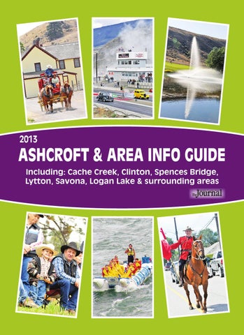
2013
ASHCROFT & AREA INFO GUIDE Including: Cache Creek, Clinton, Spences Bridge, Lytton, Savona, Logan Lake & surrounding areas
Come and experience the life of a small town!
Welcome to Historic Ashcroft www.ashcroftbc.ca
Mayor Andy Anderson Councillor Alice Durksen Councillor Jerry Fiddick Councillor Helen Kormendy Councillor Jackie Tegart
A Jewel in the Desert ... PRIME TIME $69 2 people plus cart
Clubhouse open March 15 Licensed Coffee Shop Equipment Rentals
DISCOUNT noon to close $59 2 people plus cart
Semlin Valley Golf Course Phone: 250-457-6666 Fax: 457-6692
e-mail: semlinvalleygolf@coppervalley.bc.ca
Visit our websiste at: www.semlinvalleygolf.com for discount coupons ONE KM EAST OF CACHE CREEK ON HIGHWAY #1
Page 2
TABLE OF CONTENTS Ashcroft ...............................................6 Cache Creek ....................................... 13 Clinton ................................................ 18 Lillooet ............................................ 21 Logan Lake........................................ 23 Lytton...............................................25 Savona ............................................ 28 Spences Bridge ................................ 19 Walhachin ......................................... 30
Ashcroft Manor Teahouse Restaurant & Gift Shoppe
Visit the Journal website at www.ash-cache-journal.com
402-4th Street, Ashcroft, BC V0K 1A0 Phone: 250-453-2261 Fax: 250-453-9625 E-mail: sales@accjournal.ca Photos: Wendy Coomber Editor: Wendy Coomber Publisher/Advertising Sales: Terry Daniels Layout/Design: Anne Blake
Celebrating 151 Years 1862-2013
Open May through October 7 Days a Week 11:00 a.m. to 5:00 p.m. RV Park - 30/50 Amp hookups, Water and Sani Dump available New Washrooms - Desert Setting 250-453-9983
Ashcroft - Cache Creek Journal
Welcome to the Area! Ph/Fx: 1-888-900-9880 Cell: 250-457-7429 heddahall@royallepage.ca
Hedda Hall
2013
Broker/Owner Sales Representative
110 B Railway Avenue Ashcroft, BC
Proudly serving: Ashcroft, Cache Creek, Clinton, Spences Bridge, Lytton, Savona & surrounding areas since 1895 Open Tuesday - Friday 10:00 a.m. - 3:00 p.m. Closed for lunch 1:00 p.m. - 2:00 p.m. Closed Saturday - Monday & holidays
250-453-2261 Box 190, 402-4th Street. Ashcroft, BC,V0K 1A0
ASHCROFT, CACHE CREEK & AREA GUIDE
PAGE 3
WELCOME If only the hills could talk, they’d fill your head with stories of the men and women who came seeking their fortune – some in the streams and rivers, others in the soil. From the pristine mountains and lakes of the Highland Valley Plateau to the rugged Arrowstone and Trachyte Hills, to the sharply furrowed gullies and cultivated fields that line the Thompson River as it flows west through the valley from Kamloops Lake – the beauty of Gold Country entrances and inspires. The gold rushes that opened up the interior were brief but intense as thousands of miners appeared from nowhere, panned and dredged the waterways until they had taken all of the colour out of them, then disappeared into the hills as they moved on to the next strike. Between 1858 and 1862, towns were built and abandoned, fortunes made and lost, and history was etched forever in the hills and deserted trails. The Fraser River Gold Rush began in 1958 and led to the construction of the Cariboo Wagon Road, which eventually gave rise to, and linked, the communities of Gold Country. Begun at Yale in 1861, the Road eventually stretched nearly 650 kms (400 miles) north to Barkerville. It allowed mule trains, freight wagons and stage coaches to service the central interior of BC. It cost $1 million to build and 6.5 days to travel. Ashcroft Manor was built in 1862 by brothers Clement and Henry Cornwall, who settled on 6,000 acres just south
of the current townsite. They ran the roadhouse, raised 1,500 head of cattle, operated a sawmill and were two of a handful of hardy pioneers who helped create and shape the community knows as Ashcroft. Hat Creek House was built by retired Hudson’s Bay Company Chief trader Donald McLean, who moved from Kamloops with his family in 1860. A year later, McLean and his sons constructed a log stopping house beside the Cariboo Wagon Road. The established ranchers and roadhouses along the newly built Road provided feed for the hardworking horses, and accommodations for the weary drivers and passengers. It would have cost about a dollar a night in the early days to stay at the roadhouse – the equivalent of $50-$60 these days. Most of the miners heading off to Barkerville who stayed at the roadhouse would have unrolled their blankets and bedrolls onto the dirt floor to sleep. In the Spring of 1861, George and Robert Watson built what became the famous Clinton Hotel across from a toll booth which operated 1863-1868. The toll collection was used to pay Road builder Gustavus Wright for his work. In 1867 the land was sold to Joe and Mary Smith and Tom Marshall. The Smiths held the first annual Clinton Ball in the hotel’s billiard room the following year. In 1894, tickets for the Ball cost $5 per person, and that included two nights of bed and breakfast for the guest and their horses. Come, explore and enjoy British Columbia’s original Wild West. And don’t forget your cowboy hat!
Stay alert as you are driving through Spences Bridge. The mountain sheep can often be seen from the highway during the long, hot summer, and just as often they can be seen on the highway. PAGE 4
ASHCROFT, CACHE CREEK & AREA GUIDE
2013
Welcome to Gold Country! Residential, Commercial, Ranches, Small & Large Acreages, Recreation & Investment
Your Hometown Realtors offering you "Old Fashioned Values with Today's Technology"
Proudly Serving Ashcroft, Cache Creek, Clinton, Loon Lake, Savona, Spences Bridge, Lytton and surrounding areas
Kelly Adamski Broker/Owner
Cindy Adamski Broker/Owner
Bob Cunningham Representative
401 Railway Ave., Ashcroft, B.C. • 250.453.2225 • 1.800.557.7355 e-mail: remaxashcroft@telus.net • www.goldencountry.ca
Page 5
ASHCROFT
www.ashcroftbc.ca
Historic Ashcroft is situated on a flat bench overlooking the Thompson River in a unique desert setting. Located off Hwy 1, it is 10 km southeast of Cache Creek and less than 100 km west of Kamloops. The Thompson-Shuswap natives first called the area Tuk Tuk Chin, but the town went through many names - Harper’s Mill, Barnes Station and still later St. Cloud – before settling on Ashcroft, adopting the name from the nearby ranch of the Clement brothers. The townsite was surveyed in 1883 using the property of John C. Barnes and E. William Brink. For many years, Ashcroft bustled with the business of transportation. The Canadian Pacific Railway arrived in 1884 and Ashcroft became the railhead for the north, and the third Mile “0” for the Cariboo Road (after Lillooet and Yale). Ashcroft quickly replaced Yale as the gateway to the Cariboo, and for the next 30 years it served as a major supply centre for the goldfields in the north. The Barnard Express (later British Columbia Express) carried supplies to Barkerville with heavy freight wagons drawn by teams of four to eight oxen, mules or horses,
ASHCROFT IRLY TIM-BR-MART 250-453-2281
Building Supplies & Garden Centre
AND
THE SOURCE For all your Electronic needs
On the corner of Railway and 5th
PAGE 6
250-453-9334
and stagecoaches carried mail and passengers north and gold south on the return trip. Ashcroft lost its position as the main supply centre for the north when mechanized transportation turned the Cariboo Road into a highway and the Pacific Great Eastern Railway pushed through from Vancouver to the Cariboo and from Alberta to Prince George in 1920. PIONEERS AND POLITICIANS Ashcroft Manor was built in 1862 by brothers Clement and Henry Cornwall, who settled on 6,000 acres. They ran the roadhouse, raised 1,500 head of cattle and operated a sawmill. The brothers came originally from the village of Ashcroft in Gloucestershire, where their father had been vicar. When the CPR adopted the name Ashcroft for their station just east of the ranch (and what would become the townsite), the Cornwall’s added “Manor” to the name of their home, making it Ashcroft Manor. The Honourable Clement Francis Cornwall (1836-1910) was schooled at Cambridge and had been successful as a barrister before coming to British Columbia. He represented the Hope-Yale-Lytton riding as member of the Legislative Council of Colony of BC (1864-66); as a senator (1871-81); as lieutenant-governor (1881-87); and as a
Our family helping your family Proudly serving Ashcroft, Cache Creek, Clinton, Savona, Lytton, Lillooet, Logan Lake and surrounding areas.
Thompson Valley Funeral Home Bill Perry • 250-453-9802 or 1-800-295-5138
ASHCROFT, CACHE CREEK & AREA GUIDE
2013
ASHCROFT
Welcome to Ashcroft!
judge, County of Cariboo (188906). He was also Ashcroft’s first postmaster when the post office opened in 1865. He is buried in a private family cemetery on Ashcroft Ranch, across the highway from the Ashcroft Manor. Former BC Premier Charles Augustus Semlin (1836-1927) is buried nearby in the Ashcroft cemetery. Semlin was the twelfth Premier of BC, serving from 18981900. He came to BC from Ontario in 1862, becoming Cache Creek’s first postmaster in 1868 and buying the Dominion Ranch in 1869. Elected Conservative MLA for Yale in 1871, he was defeated in 1875. In the meantime, he successfully petitioned the government to build the first public boarding school at Cache Creek. The school was opened June 2, 1874 with a total of 18 boys and girls enrolled. Semlin was re-elected in 1882, became leader of the Opposition in 1894 and premier in August 1898, but his government was defeated in 1900. He himself was defeated in the ensuing election but he regained his seat in a by-election in 1903.
2013
Semlin retired to his Cariboo ranch, where he remained active in ranching and stock-breeding associations until his death in 1927. THE WILD WEST Ashcroft has a long history of rodeos, dating back to the town’s wild roots. The Ashcroft & District Stampede has its roots going back 51 years and is guaranteed to provide heart-stopping
Legacy Park Campground downtown on the Thompson River
Central washroom • Flush toilets • Electrical & water hook-ups Sani-station • Walking distance to shopping and restaurants Open May to September
For more information or reservations call 250-453-2642 or email ashcroftlegacypark@gmail.com 350 km Northeast of Vancouver on Trans Canada Highway No. 1
ASHCROFT, CACHE CREEK & AREA GUIDE
PAGE 7
ASHCROFT
action for spectators. The BCRA-sanctioned event is held every Father’s Day weekend - June 15-16 this year, and is kicked off by a spectacular parade in downtown Ashcroft. Just prior to the parade on Saturday morning, the Ashcroft & District Lions Club offer a pancake breakfast, after which residents and visitors line the downtown streets to watch the marching bands, clowns and dozens of other colourful and creative floats. Ashcroft’s first races were not called “rodeo” - they were
“Helping people live better lives” Flu and Travel Vaccinations Hormone Replacement Therapy Testing and Compounding Smoking Cessation Program • Medication Reviews by Pharmacists Emergency Medication Refills • Blister Packing Giftware and Cards • Lottery • Stationery Supplies
Monday - Friday 9 a.m. - 5:30 p.m. Saturday 9:30 a.m. - 5 p.m. • Sundays & Holidays: Closed
403 Railway Ave, Ashcroft • 250-453-2553 PAGE 8
race meets, and there were no rules or regulations. Timing was the only important thing being the fastest and the first to reach the finish line. Ashcroft’s townspeople held their first race meet in connection with their annual Fair three and a half years after the CPR arrived in 1888. Directors for the event came from a wide area too - Clinton, Nicola Shuswap, Lillooet, Walhachin, Basque Ranch, Cache Creek and Ashcroft. In the early years the races were held on Ashcroft’s hard, stony Main Street and the route was a circle, such as from the Ashcroft Hotel down to the Town Hall, then to the Anglican Church, and then back up to Main St. Race programs listed such events as Saddle Horse Race, Half Mile, Stock Horse, Quarter Mile, Klootchman’s Race, Ladies Race – all held on the first day. On the second day the program included Saddle Horse Race, Quarter Mile, Relay Race, Turning Stakes, and the Ashcroft Derby, which was open to the world. First prize was $100, second prize was $50. Bucking contests were more or less limited in the early days, and the cowboy who stayed on the longest got $40 and the best bucking horse got $20. The Annual Fair and Race Meet in Ashcroft included everything that made for fun: foot races, lacrosse, football and home made ice cream, cakes, pies, cookies and everything else palatable for man and beast. On one or two occasions, the Barnum & Bailey Circus came to town during the Fair and one could get 10 merry-go-round rides and listen to the pipe organ for a buck. The Ashcroft & District Chamber of Commerce revived the race meet in 1962. The Rodeo Association now holds the annual event at the rodeo grounds west of town in the third weekend of June. WELLNESS AWAITS YOU FESTIVAL July 19-21 marks the town’s first annual Wellness Festival to celebrate and promote its Wellness Awaits You brand. Whether you are wondering what these words mean, or already know, you won’t want to miss out on this three-
Beans Roasted Rite Coffee Company
Ashcroft’s source of Artisan Roasted Coffee
250-453-9864
Custom and private label coffee also available David Durksen - Roaster
available at Packing House (Spences Bridge), Heartland Quality Foods (Kamloops), Safety Mart, Desert Hills Ranch, Shelly’s Place (Ashcroft) email: info@beansroastedrite.com
ASHCROFT, CACHE CREEK & AREA GUIDE
2013
ASHCROFT day festival of non-stop demonstrations, workshops and activities of fitness, arts, theatre, history, nutrition, music, spirituality, health and the many other attributes found in Ashcroft that define Wellness. The event is free although there may be charges for some of the workshops. Browse the vendors lining Railway Ave. while enjoying the buskers for what is sure to be the first Festival in many more to come. For more information, visit their Facebook page, Ashcroft Wellness Awaits You. FAIR COUNTRY If you plan to be in Ashcroft on Sunday, Sept. 8, take in the annual Ashcroft & District Fall Fair at the Drylands Arena. The one-day Fair highlights the area’s agricultural bounty as well as creative and traditional homespun crafts, baking, floral arrangements, art and photography, and much more. The Fair began as the Exhibition of the Inland Agriculture Association. The first one took place in Kamloops in 1888 and then alternated between Ashcroft and Kamloops, with Ashcroft having its first Fair in 1889. Brass bands came from Kamloops and Lillooet to Ashcroft’s 1897 Fair. The entries were many that year. The
ladies entered plenty of fancy work and even some handpainted china which had been transported, with great difficulty, from the coast. Other sections included cattle, sheep, horses, pigs, poultry, dairy produce, vegetables, field produce, fruits and floral. In 1917 the Fair became the “Spud City Potlatch”. It was held to help raise money for the Red Cross War Effort. There were refreshments, games, something called Houp
Ashcroft Apt. & Motel DAILY • WEEKLY • MONTHLY • Kitchen Units • Newly Renovated Units • Wireless Internet • Train Watchers Haven • Just a short stroll to Downtown Phone: 250-453-9129 Fax: 250-453-2003 ashcroftaptandmotel@hotmail.com 2013
715 Railway Avenue, Ashcroft, B.C.
ASHCROFT, CACHE CREEK & AREA GUIDE
PAGE 9
ASHCROFT
La, Chocolate Wheel, and Junk Tent. There were races and raffles, and many citizens and businesses made donations. The proceeds totaled a whopping $2670.31, a lot of money in 1917. FOOD BASKET Museum buffs will adore the Ashcroft Museum which offers endless treasures of early pioneer life as well as the history of Ashcroft. The town was known for, among other things, its great tomato production from the 1880s to the 1930s.
Just after the turn of the century, Chinese immigrants were doing experimental planting and reaping benefits from the sale of tomatoes and potatoes. Daily train service at that time still provided sumptuous full service dining, and their menus proudly offered delicious Ashcroft potatoes with their meals. The BC Express Company decided to convert their freight barn in Ashcroft into a tomato cannery in 1925, and consequently put their employees – and many other townspeople – back to work. It remained open until 1957. It was at this time that Bethlehem Copper went into operation east of Ashcroft in the Highland Valley. Because of the mine, the community was able to survive while new industries developed and created the diverse economy seen in Ashcroft today. Highland Valley Copper now mines in the area. A WALK THROUGH TIME Many buildings from the 1800s are still standing in Ashcroft, offering visitors the chance to experience the western frontier in a setting of modern convenience. You can find the town’s oldest standing building at 401 Brink St. The Opera House was built in 1889 and operated by McGillivray and Veasey, featuring such acts as the Royal Lilliputian Opera Company from Australia and the Pollard Opera Company. Reserved seats cost $1; general admission was 75 cents. Over the years it has been used as a town hall, a movie house, a new and used store and a music hall. St. Alban’s Anglican church has stood at the corner of 5th and Brink St. since 1891. It is the oldest church in Ashcroft, beating Zion United Church by a single year. St. Alban’s was built by William Higginbottom for $500. The Litany Desk and brass railings came from France, the hangings, alter frontals, brass cross and alms dish from England. The church bell, purchased in England for $400, was used whenever there was a fire until the fire hall was built in 1899.
Voted best restaurant in the Fraser Canyon/ Thompson Canyon 2012, on travelthecanyon.com!
Open Tuesdays through Saturdays 8:30-3:00 for Breakfast & Lunch Best Pizza in the area from 3 pm to 8 pm Dinner Service on Fridays only - 5 pm - 8 pm You want the Best? See you at the Central! 211 Railway Ave, Ashcroft 250-457-0301 PAGE 10
ASHCROFT, CACHE CREEK & AREA GUIDE
2013
ASHCROFT Zion United Church sits on the corner of 4th and Bancroft St., built in 1892. The church was originally a Presbyterian Church. The original interior of the church has been preserved, with lofty ceilings and the original kerosene lamps lining the walls. The Ashcroft-Cache Creek Journal office on 4th St., next to the Museum, was built in 1897 to house the newspaper which was started in 1895 as The British Columbia Mining Journal. The interior of the building has undergone various changes over the years and little remains of the original building except for parts of the flooring, but the exterior shape retains its old frontier look Former publisher R.D. Cumming bought the Journal in 1912 and in 1935 he opened the town’s first museum on the second floor of the building, with his own private collections. The current museum was constructed in 1916-17 to replace the Post Office which burned in the 1916 fire. It also housed the telephone and telegraph offices, and later the Customs Office. In 1982 the Village bought it and turned it into the museum. These are just a few of Ashcroft’s historic buildings. You’ll have to visit in order to hear about the rest of them. YOU’RE IN THE WILDERNESS Besides walking through the historic downtown, outdoor enthusiasts will have plenty to choose from. Fish the nearby lakes or hike and bike the many trails surrounding the town. Enjoy a leisurely stroll through Millennium Park
downtown or enjoy a picnic at the municipal campground at Legacy Park next to the Thompson River. Bring along your camera and watch for our golden and bald eagles, marmots, osprey, coyotes and other wildlife. Geocaching is a popular and fast-growing outdoor sport that uses handheld GPS devices to find hidden caches. These caches contain anything from souvenir pins to marked coins to anything else that will fit inside the box. Finding the treasure is great, but in this case, getting there is most of the fun. Gold Country Communities Society has created a number of sites in Ashcroft, Cache Creek, Clinton, Lytton, Lillooet, and points in between, that show off unique and historical aspects of each community. Visit their website at www.goldcountry.bc.ca/bcga This activity is gaining popularity worldwide as a fun and educational family hobby. Cornwall Hill Provincial Park to the west of Ashcroft protects the 2,055-metre Cornwall Hill and surrounding slopes. This park is undeveloped and can be accessed from the Cornwall Hills Lookout off of Creek Rd. The Three Sisters Recreation site is located south of the park entrance, with the wilderness Bedard Aspen Provincial Park to the southwest. Major community events such as the annual Rodeo weekend in June and the Fall Fair in September are great crowd-pleasers, but the Village offers many ongoing events throughout the year such as the Farmers Market held every Saturday from June to September and drag
Ashcroft
The first time, it’s a vacation. After that, it’s coming home!
W
W
ORK
EAR
Telephone: 250-453-2292 Fax: 250-453-9176 417 Railway Avenue, Ashcroft
MESA
CHIROPR ACTIC Dr. James Kendall, DC, CCWP Ashcroft Office
250-453-2266 Lillooett Office
250-256-3715 411 Brink St., 1st f lo or, front entrance, Ashcroft
2013
10 min. South of Ashcroft on Hwy. 97C
1-800-553-3533 saddleup@sundanceguestranch.com
www.sundanceguestranch.com
ASHCROFT, CACHE CREEK & AREA GUIDE
PAGE 11
ASHCROFT
races at the Nl’akapxm Eagle Motorplex. BEAT THE HEAT Ashcroft is located in the middle of a desert belt and therefore has high summertime temperatures ranging from 30-40 C. That makes the Ashcroft Pool a popular place. The outdoor pool opens on the May long weekend and usually boasts quite a crowd at its public swims. There is a hot tub in addition to the kids’ wading pool and swimming pool. The park surrounding it has a playground, picnic area,
regulation soccer fields, volleyball area and two regulation-sized softball diamonds. Staff at the pool hold many fun days, public holiday swims, swimming lessons, and the pool can also be rented for private parties. The Ashcroft Pool Park offers many excellent ways to cool down during the hot days of summer. If you’d rather enjoy the river, enjoy your lunch in Legacy Park overlooking the Thompson River. The park has several camping stalls, picnic tables and washrooms set inside a very peaceful park setting. The river teems with life year round: Canada geese, mergansers, golden eyes, mallards, great blue herons and bald eagles are common sights at different times of the year. Osprey are common between April and September. After breakfast, take a Saturday stroll downtown and stop in at the Farmers Market, located across from the Safety Mart grocery store on Railway Ave. The market operates every Saturday between June and September. SERVICES Ashcroft has a population of 1,735 and its traditional trading area includes Cache Creek, Clinton, Spences Bridge, Lytton and Walhachin. The townsite has an elevation of 335.2 metres (828 feet). Summers in Ashcroft can bring temperatures over 35 C and winters are usually mild with an average daytime temperature of -5. Skies are usually clear and sunny with very little precipitation at any time of the year. Static attractions include the Museum, Millennium Park, Legacy Park campground, Barnes Lake campground and the Highland Valley Copper Mine near Logan Lake which provides regular tours of the mine throughout the summer. Businesses include grocery and convenience stores, restaurants, auto mechanics, gas station, a hardware store, department store, drug store, liquor store and gift shops. Accommodations include a motel, several bed and breakfasts, guest ranches and provincial campgrounds/ RV parks. Services include an RCMP Detachment, the Ashcroft hospital, post office, credit union and churches.
ASHCROFT BOTTLE DEPOT HIGH ON THE MESA above Ashcroft, Willow’N offers a spectacular panoramic view of the Thompson River valley. Our peaceful setting is truly a slice of romantic serenity.
Purity Feed Building, Downtown Ashcroft
250-453-9227 570 Mesa Vista Drive Ashcroft, British Columbia, Canada www.bbexpo.com/willow pdenis@telus.net Reservations are recommended
PAGE 12
Please remember: Caps off - Labels on!
TUESDAY TO SATURDAY 10 - 4
ASHCROFT, CACHE CREEK & AREA GUIDE
250-457-7026
2013
CACHE CREEK
www.cachecreekvillage.com
Cache Creek is surrounded by sage and cactusdotted hills, providing a beautiful backdrop through which the Bonaparte River runs. It is situated at the junction of Hwy 97 and the Trans Canada Highway. Visitors with private planes can take advantage of the 3310 ft. asphalt airstrip located just south of town. Originally serving as a meeting of roads for the hopeful prospectors on the Cariboo Gold Rush Trail, Cache Creek still provides an excellent Oasis for the weary traveler. The town offers a variety of family and fast food restaurants, gas stations, accommodations and rest stops. Admire the awesome scenery of the valleys below from Semlin Valley Golf Course while you play its challenging nine holes; beat the heat and take a refreshing swim in the Village’s outdoor swimming pool; eat your lunch underneath the shady trees next to the Bonaparte River in the Community Park while the children run off their energy on the grass or on the playground equipment. Stop in at the Cache Creek Tourist Information Centre in downtown Cache Creek on Hwy 97 at the Community Hall for information about what to see and do in Cache Creek and the surrounding area. GOLFING IN THE DESERT The Semlin Valley Golf Course was built in 1983 on the hillside just east of downtown Cache Creek on the Trans-
Open 7 Days a Week! Monday - Saturday 8:00 am - 6:00 pm Sundays 9:00 am - 5:00 pm 250-457-9644 Toll Free: 888-774-7414 Fax: 250-457-6280 1002 Trans Canada Hwy, Cache Creek B.C., V0K 1H0
2013
Canada Highway. It is privately owned and maintained by volunteers. Carved out of sagebrush and rabbit bush with a stunning panoramic view of three valleys, this wellgroomed 9 hole course has elements of challenge for any level of golfer. The course’s Bentgrass greens and rolling fairways will keep you focused on your game. The course measures 2,944 yards, and the elevation changes on the course provides for some challenges in club selection. The course operates from mid-March to mid-October and offers club and cart rentals, a Pro shop and a licenced clubhouse. Check out www.semlinvalleygolf.com/ for directions,
Hungry? Herbies
Open at 8:00 am daily Breakfast served until 11:00 am Coaches eat free when they bring the team! Bus tours welcome (Driver eats free) “Good food fast in a clean and friendly environment”
250-457-6644 1301 Hwy. 97 North, Cache Creek, B.C.
A Tourist Attraction Since 1957
ASHCROFT, CACHE CREEK & AREA GUIDE
PAGE 13
CACHE CREEK
prices and other information. DRIVING RANGE You can warm up or spend some relaxing time at the privately-owned driving range across the highway driving range across the street. From the end of March to the end of October, the range is open from 9 am to dusk. Clubs are provided if you don’t have your own, and pay for a punch card if you plan on returning frequently.
Call the range at 457-7076 for more information. CAMPING Campers have several options, ranging from the privately-owned Brookside Campsite on Hwy 1 across from the golf course, to Juniper Beach Provincial Park 19 km east of Cache Creek on Hwy 1, or out at Historic Hat Creek Ranch 11 km north of Cache Creek. The Village offers a free Sani Dump next to the InfoCentre on Hwy 97 at Stage Rd. MOTHER’S DAY FLY IN The Cache Creek-Ashcroft Regional Airport, located just south of Cache Creek off of Hwy 1, is host to the annual Fly In and Mother’s Day Pancake Breakfast. The date this year is May 12. The Fly In is organized by local pilot Andy Anderson and attracts 30-40 small airplanes each year. The very popular breakfast is provided by the Ashcroft & District Lions club. The airstrip is busy all day and features many local and area aircraft, specialty flying and lots of high-flying airplane fanciers. Spectators have the opportunity to get up close and personal with many pilots from the area. Many of the planes are custom made and some are older crafts that have been restored. Admission to the event is free.
Loon Lake Resort
Enjoy your stay on 29 acres of scenic Cariboo land
Cabins • Serviced campsites Boat launch • Boat rentals Store • Ice • Groceries • Bait 9 Hole Mini Golf Course Winter ice rink converts to large sandy area for volleyballl & sports Open Year Round 2726 Loon Lake Road, Cache Creek, B.C. V0K 1H0 250.459.2537 • 1.877.459.2537 loonlakeresort.info
PAGE 14
ASHCROFT, CACHE CREEK & AREA GUIDE
2013
CACHE CREEK CLASSIC CAR WEEKEND Graffiti Days is the town’s biggest weekend celebration of the year, so plan your dance card for this two-day classic car sock hop. Following through with Cache Creek’s 1950s theme (note the neon on the town’s main drag), the annual June 7-9 event in the Community Park coincides with the Langley Loafers Old Time Drags at the nearby Eagle Motorplex on Hwy 1. Classic cars and classic car buffs fill the village for this fun, old-time weekend which includes a parade of cars, free swimming, Show ‘n Shine, beer gardens, a smoke show at the Community Hall, BBQ and dance. All events in the park are free for spectators – except for the concession stand and beer gardens, of course – so pack a lunch and bring your bathing trunks and folding chairs. And turn your radio dial to 105.9 FM where you’ll hear nothing but “Golden Oldies” all weekend long on Cache Creek radio, CFMA. DRAGS AND MOTORCROSS The Langley Loafers hold their annual Old Time Drag Races at the Nl’akapxm Eagle Motorplex in conjunction with Graffiti Days every year. Come and watch the hot rod classic on June 8-9. The Motorplex track was built in 1987, just off Hwy 1 about 15 km (seven miles) south of Cache Creek. The site
was once the Ashcroft/Cache Creek Aero Club’s old air strip. The popular track has grandstands, a concession, washrooms (and showers), and parking for up to 600 cars. Last year they added a challenging 2.1 motorcross track, designed by the BC Motorcross Association. The track is owned by the Ashcroft Indian Band and operated by the Eagle Racers Association. The track normally sees thousands of racers and fans of all ages from as far south as California and Nevada. The regular racing schedule can be found at www.eaglemotorplex.com/
Fully Licenced • Fine Dining
featuring canadian & greek specials
Serving Breakfast, Lunch & Dinner Take Out Available • Buses Welcome Located at the Sandman Inn 250-457-9330 2013
ASHCROFT, CACHE CREEK & AREA GUIDE
PAGE 15
CACHE CREEK
HISTORIC HAT CREEK RANCH Historic Hat Creek Ranch is located just 11 km north of Cache Creek on Hwy 97. This volunteer-run provincial heritage site offers something for everyone! Take a tour of the buildings, including the original roadhouse built in 1862 and learn about the lives of the early white and Chinese pioneers, or visit the Shuswap Village and see how the Shuswap people lived in the past, how they hunted and prepared their food, medicine and clothing. The Shuswap Village is a recent addition to the heritage
site, thanks to the partnership between the Bonaparte Indian Band (St’uxwtews) and the Friends of the Historic Hat Creek Ranch. The original Hat Creek House was founded by retired Hudson’s Bay Company chief trader Donald McLean, who moved from Kamloops to the area of Hat Creek and the Bonaparte River with his family in 1860. In 1861, McLean and his sons constructed the log “stopping house” beside the Cariboo Trail. The roadhouses along the newly built Cariboo Wagon
Open from May 1 - September 30
Visit this historic site on BC’s GOLD RUSH TRAIL Guided Tours • Stage Coach Rides Trail Rides • Restaurant • Gift Shop Camping, Cabins • Gold Panning • Horseshoes
Junction of Highways 97 & 99 - 11 km north of Cache Creek • 250-457-9722 www.hatcreekranch.ca PAGE 16
ASHCROFT, CACHE CREEK & AREA GUIDE
2013
CACHE CREEK Road provided feed for the hardworking horses, and accommodations and services (like haircuts) for the weary drivers and passengers. Most of the miners heading off to Barkerville who stayed at the roadhouses would have unrolled their blankets and bedrolls onto the dirt floor to sleep. Wander over 300 acres of early pioneer setting and take a ride on the old stagecoach. Tours are available and displays depict the history of the original 1861 roadhouse, the Native Interpretation Centre and the McLean Cabin, where you can hear the tale of the infamous “Wild McLeans.” The Ranch is also home to a fascinating collection of agriculture equipment, a blacksmith shop and a beautiful apple orchard where visitors can relax in the shade and enjoy picnic lunches, play horseshoes or visit with the farm animals. Trail rides are available for a separate cost. The Ranch provides camping sites as well as cabins, and there is a Visitor Reception Centre which houses a licensed restaurant and gift shop. For more information, visit www.hatcreekranch.com/ RANCH RODEO Historic Hat Creek Ranch hosts a “Ranch Rodeo” each year in July. The Rodeo honours and commemorates the rich cowboy and ranching history of our area, and the events highlight the skills of the ranch hands and horses. It may sound mundane, but it isn’t. Teams from all over the Interior compete in several thrilling events for a beautiful hand-crafted belt buckle. Ranching continues to be an important part of the area’s economy, and will be brought to life through various cowboy skills. HOT SUMMER FUN The Cache Creek Farmer and Flea Market runs every Saturday from the beginning of May to October, 9 am - 1 pm. Drop by and have a look at the selection of locally-grown food, crafts and rummage-sale treasures. The market is located in downtown Cache Creek at the main highway junction, between Chums Restaurant and the Sundowner Motel. Park your car nearby and head across the intersection to the Gateway Park. Have your picture taken with Cariboo Sam and take a load off your feet on one of the shady benches, surrounded by green grass and walking paths. The hot and dry summers of Cache Creek make the outdoor pool in the Community Park a very busy place during the summer months. The pool opens in May (Victoria Day weekend) and operates through to September (Labour Day weekend). Surrounding the pool is 11 acres of beautiful, green parkland which includes a playground, two regulationsized softball diamonds, washrooms and lots of picnic tables under tall shade trees. The river-side park hosts a number of community events, such as Graffiti Days and the Canada Day celebrations. Cache Creek also has a modern Community Hall which
2013
houses the village’s Tourist Information Centre (accessed off of Hwy 97, next to the free Sani Dump), and hosts such events as craft sales, bingos, carpet bowling, the Graffiti Days’ smoke show, dances, etc. SERVICES Cache Creek has a population of 1,073. It has an elevation of 400 metres (1300 ft.) and its climate is hot, semi-desert with sagebrush and bunchgrass covering the rolling hills. Attractions include the Bonaparte Winery and Historic Hat Creek Ranch, both on Hwy 97. Recreation includes picnic areas, a public park, ninehole golf course, playground, outdoor swimming pool, a drag strip and an airport. Accommodations include several motels along the highway, and private and provincial campgrounds/RV parks. Businesses include 24-hour convenience stores, 24-hr gas stations and restaurants, auto mechanic, automotive stores, Greyhound Bus Depot, liquor store and gift shop. Services: Post office and InfoCentre, bank and veterinary hospital. Access: Cache Creek is situated at the junction of Hwy 97 and the Trans Canada Highway. The Trans Canada Highway (Hwy 1) winds its way north from Vancouver to Cache Creek where it veers east and heads to Kamloops, while Hwy 97 takes travellers on to northern BC and the Yukon, making the town accessible from the south, north and east by car or bus. Visitors with private planes can take advantage of the 3310 ft. asphalt airstrip located just south of town.
ASHCROFT, CACHE CREEK & AREA GUIDE
PAGE 17
CLINTON
www.village.clinton.bc.ca
Clinton sits at the base of the scenic Limestone Marble Range that is nestled among rolling pastures and surrounded by foothills of green pine trees on Hwy 97 about 39 km north of Cache Creek. After the discovery of gold in the Cariboo, Royal Engineers were commissioned in 1859 to build a road through the Fraser Canyon to the Cariboo to join the already existing wagon road from Lillooet to 47 Mile. The junction was 47 miles from Lillooet and thus 47 Mile was the name used. In the Spring of 1861 George and Robert Watson began to build a new log structure which became the famous Clinton Hotel. Across the road from the Hotel there was a toll booth which was built in 1863 and used until 1868 to pay Gustavus Wright, the road builder, for his work. In 1867 the land was sold to Joe Smith, Mary Smith and Tom Marshall. That
For anniversary events visit village.clinton.bc.ca or email admin@village.clinton.bc.ca to speak to us directly call 250.459.2261
PAGE 18
ASHCROFT, CACHE CREEK & AREA GUIDE
2013
CLINTON winter, Mrs. Mary Smith and some friends were sitting around lamenting the long Cariboo winter. In an effort to liven things up they came up with the idea of hosting a weeklong Ball in January 1868. That first event was a series of dances and dinners that were by invitation only, held in the hotel’s billiard room. Guests traveled from San Francisco, Vancouver, and even as far away as Boston by train, stagecoach and horsedrawn sled. Gowns were ordered from New York and even Paris as it just wouldn’t do to wear the same gown two evenings in a row. In 1894, tickets for the Ball cost $5 per person, and that included two nights of bed and breakfast for both guests and horses. The event now has the distinguished honour of being the longest continuously-run gathering in Canada. For nearly 100 years the Clinton Hotel was the landmark on the Cariboo Wagon Road (now Hwy 97). It burned down at approximately 3:45 am on May 15, 1958. 150/50 CELEBRATION THIS YEAR On June 11, 1863, 47 Mile officially became Clinton, named by Queen Victoria in honor of Lord Henry Pelham Clinton, the Colonial Secretary of the day, and 100 years later, on July 16, 1963, the Village of Clinton was incorporated. This year the Village is celebrating the naming of Clinton 150 years ago, and incorporation as a Village 50 years ago. Check the Village’s website for ongoing events all summer long to celebrate the anniversaries. MAY BALL AND RODEO The May Ball is still the social highlight of the year in Clinton, as local residents are joined by dignitaries from nearby communities and visitors from as far away as the U.S. B.C. Lieutenant Governor Iona Campagnolo was the guest of honour in 2007, and in 2010 Lt. Governor Steven Point was the guest of honour. The Ball is held on May 18 this year. Visit www.clintonannualball.com/ for more information. The Ball and the Rodeo are the two main events in Clinton’s annual Western Heritage Week, from May 18–26, but many other activities make it a fun week for the whole family, such as the Open House at the Clinton Museum, Oldtimer’s Tea, and a good old fashioned pancake break-
2013
fast. The BCRA-sanctioned two-day rodeo is always held the weekend after the May long weekend. But, before that, everyone lines the streets in downtown Clinton to watch the great annual Rodeo Parade. Rodeo action begins after lunch at 1 pm both Saturday
Your complete Building supplie s pROVideR with a COuntRy FlaiR
Clinton Building Centre 1217 Cariboo Hwy, Clinton, BC
250-459-2544
ASHCROFT, CACHE CREEK & AREA GUIDE
Fax 250-459-2596
PAGE 19
CLINTON
and Sunday (May 25-26) at the Rodeo Grounds just south of town off of Hwy 97. The grounds have a concession, covered seating and a beer garden. The local 4H Club puts on a steak dinner at the rodeo grounds on Saturday after the rodeo, and the Rodeo Dance begins at 8 pm Saturday night. Sunday morning there is slack rodeo at 9 am and a pancake breakfast. This is the busiest weekend of the year for many Clinton residents and a great family event. MUSEUM The Clinton Museum holds a variety of antiques, photos and historical papers that will take the visitor back to a time long ago. The building was built in 1892 from locally hand-made bricks. The clay for the bricks was taken from a site where the high school now stands. The building was a school itself until 1919, then a courthouse until the late 1940s. The new courthouse was built next door and the brick building was taken over by the
B.C.’s Most Unique Hotel ous f the Fam “Home o urger” B e g Lod
South Cariboo Historical Museum Society in 1959. SERVICES Clinton has a population of 609. Attractions include the nearby provincial parks, the 1861 pioneer cemetery, the Clinton Museum, Western Heritage Week - which includes the Annual Ball, Old Timers’ Tea, the Parade, and the May Ball, rodeo and dance. Recreation opportunities include hiking, cross-country ski and snowmobile trails, fishing and recreational lakes, baseball diamond, the Reg Conn Centennial Park for picnicking, tennis courts and curling rink. City Slickers can enjoy the “cowboy experience” in Clinton, the Gateway to the Cariboo. Accommodations include motels, guest ranches and campgrounds/RV parks. Businesses include grocery stores, convenience stores, hardware store, gas stations and restaurants, auto mechanic, a liquor store and gift shops. Services: RCMP station, Post Office and credit union.
Convenience Store • ATM Lotto Centre • Video Rental Fresh Dairy Products Petro Canada
Clinton Service Gas - Diesel - Propane
250-459-7992 Clinton, BC
cariboolodge@yahoo.com
PAGE 20
www.cariboolodge.com
ASHCROFT, CACHE CREEK & AREA GUIDE
Open 7 days a week 6 am -9 pm Winter 6 am-10 pm Summer Phone 250-459-7715 Fax 250-459-7773 Clinton, BC,V0K 1K0
2013
LILLOOET
www.lillooetbc.com
The largest municipality in the area with 2,423 people, Lillooet offers many service amenities and lots of recreational opportunities. The town is situated on the banks of the Fraser River, affording visitor’s a wonderful display of nature’s beauty at any time of the day or season. Originally known as Cayoosh Flat because of the good grazing that Cayuses (Indian Ponies) found there, Lillooet was renamed in the mid 1860s in honour of the Lil’wat First Nations people who live in the region. Lillooet, with its 13 saloons, 25 licenced premises and clutter of cabins and tents, had a shifting population of over 15,000 residents in the 1860’s and was at one time the second largest North American centre west of Chicago, behind San Francisco. GOLFING WITH FRIENDS The Lillooet Sheep Pasture Golf Course is a small but challenging 2,722-yard 9-hole course located eight km (five miles) south of town, created in 1985 by the Lillooet Community and the managers of the Jones Farm. It is home to the local mixed breed sheep herd who tend to keep the course well fertilized, nicely groomed and the golfers amused. The course’s undulations, water hazards and natural obstacles (not to mention the sheep) can be deceiving. You’ll find the Lillooet Golf Course is not only challenging, but a pleasure to play as well. The Pro shop provides club and cart rentals. Visit www.lillooetgolf.com/ for more information. PIONEER MUSEUM The Museum & Visitor Centre is situated in downtown Lillooet in the former Anglican Church, St. Mary the Virgin. The original St. Mary’s, which was torn down in 1960, stood on the same spot and arrived on the backs of miners and their mules, who carried the timber, piece by piece over the rugged Harrison-Lillooet trail in 1860. The Museum also features First Nations artifacts - some thousands of years old. As well the display includes Gold Rush era relics and a re-creation of Ma Murray’s News Office. The Visitor Centre is the place to visit to gather local, regional and provincial information. Hours of operation and contact information for both the Museum and the Visitor’s Centre can be accessed through Lillooet’s main website.
2013
THERE’S JADE IN THEM HILLS Jade is part of the geographical history of the region and can still be found on the shores of the local rivers and in the surrounding mountains. The Lillooet Ranges are part of the Coast Mountains. The northernmost subdivision of the Lillooet Ranges is the Cayoosh Range, which includes the second-highest summit in the Lillooet Ranges, an unnamed peak about 20 km west southwest of the town of Lillooet. Jade is found only in certain unique areas where two rock formations shift, thereby allowing jade to surface from its source 15 miles deep under the earth’s crust. Lillooet is lucky to be one such rare place. The local First Nation community used jade as a trade staple - trading north, south and west within other indigenous communities. First Nation peoples made axes, deer scrapers and other tools for daily use from jade. Ceremonial figures were also carved from this gemstone and are documented in historical records. The Chinese gold miners were amazed to find jade here when they came to construct the railways and to search for gold. Gold was their cash source, but jade held a special honour in their hearts, where it was thought to bring health, wealth and happiness into their lives. British Columbia’s rich jade heritage served much of 19th century Chinese nephrite jade carving. Jade is still being found along the rivers and local rockhounders, including First Nations people, have collected and worked with jade over the years. Their commitment and donations have led to the Jade Monuments Project. Tourists may follow the “Jade Trail” historical tour map, where they may discover the beauty of the original “Jade Park” with its three large boulders and the interesting history of the other jade monuments along the tour.
ASHCROFT, CACHE CREEK & AREA GUIDE
PAGE 21
LILLOOET
MARBLE CANYON (CAMPGROUND) A small, quiet campground, set between two small lakes Turquoise and Crown. This park is popular with fishermen and birders. Nestled in the rugged Pavilion Mountain Range, the limestone canyon in which Marble Canyon Provincial Park is located is a rather rare geological formation in British Columbia. That’s what makes picnicking here such an unusual experience. You can sense there’s something different; the white, chalk-faced slopes are certainly not composed of granite, as are the nearby Coast Mountains. And the weathered peaks, surmounted by the remarkable Chimney Rock, have the appearance of a crumbling castle wall. This canyon was once part of a Pacific island chain, another section of which lies in the northwest corner of the province. A waterfall on the far side of suitably named Turquoise Lake reminds you of the power of the elements to eventually wear all things down. Visit nearby Historic Hat Creek Ranch to the east and the town of Lillooet to the southwest. Explore the area, rich in the history of the Interior Salish people and the pioneers who followed the gold rush and homesteaded this area. Location: 40 km northwest of Cache Creek, off Hwy 99. DUFFEY LAKE This park is centered around the picturesque Duffy Lake and overshadowed by the glacier topped Mt. Rohr. It is a popular spot for fishing, picnicking, canoeing, kayaking and rustic camping. Use caution, as the wind can be PAGE 22
strong at times while on the lake. Location: Along Duffey Lake Road (Hwy 99) about 35 km east of Pemberton, nearly midway to Lillooet. The Duffey Lake Road is a scenic highway that forms part of an automobile tour route called the Coast Mountain Circle Tour. This route forms a 700 km circle from Vancouver and takes from two to four days to enjoy all the sites. For more information on BC parks, see www.env.gov. bc.ca/bcparks/ SERVICES Lillooet has a population of 2,423. It has an elevation of 250 metres (820 ft.) and its enjoys a semi-arid climate with over 300 hours of sunshine during summer months and fewer than 80 days of precipitation annually, totalling 15 inches. Attractions include the Berens Winery and golf course. Recreation includes picnic areas, a public park, museum, nine-hole golf course, playground, indoor swimming pool. Accommodations include several motels along the highway, and private and provincial campgrounds/RV parks. Businesses include grocery and convenience stores, stations, auto mechanics and parts stores, restaurants, drug stores, liquor stores and gift shops. Services: RCMP station, Post Office and InfoCentre, bank and credit union, and veterinary hospital. Access: Lillooet is situated just off Hwy 99 where it meets up with Hwy 12.
ASHCROFT, CACHE CREEK & AREA GUIDE
2013
LOGAN LAKE
www.loganlake.ca
Logan Lake is set into the hills of the beautiful Highland Valley, located on Hwy 97D approximately 60 km southwest of Kamloops and 70 km north of Merritt. The community of 2,197 offers a wide range of yearround outdoor activities. Logan Lake has gone from being a company ‘camp’ town in 1971, when it was established for the nearby mine, to a ‘rooted’ community in the late 1970s. Today, mining, tourism and ranching form a strong and diversified economic base for the area. The close proximity of unlimited outdoor recreational pursuits include cross-country skiing, fishing, golfing, hiking, snowmobiling and Disc Golf. ON THE GREENS The Meadow Creek Golf Course is a high altitude course built on the gently rolling forested hills just east of Logan Lake in 1989. It is a challenging 6,100 yard 9-hole course, beautifully nestled amid local pine and aspen forests, that complements an array of sporting facilities that can be found in the region. This par 72 course provides an interesting mix of challenges and enticements as elevations quickly increase and decrease. The general elevation is 3,600 feet. The season runs from May to October. Pro shop, licensed snack bar, carts and clubs available for rent. www.golfloganlake.ca/ The Copper Ridge Disc Golf Course is conveniently located above Maggs Park. A combination of frisbee and
golf, disc golf courses are growing in popularity throughout the province. Similar to golf in course layout and scoring, players ‘toss’ special discs at a basket while navigating various challenges. The Pro course length is 5,195 feet with a 290 feet tee and the Amateur course length is 1,919 feet with a 179 feet tee. This is a free activity. HIKING, FISHING, PLAYING Almost a dozen public parks for the enjoyment of the residents and visitors in the community. If you have any questions, please contact the District Office at 523-6225. The Logan Lake Municipal Campground has a boat launch on Logan Lake, 37 campsites sites with picnic tables and fire pits, washrooms, hot showers, free Wireless Internet, a sani-station and more. Access is directly off Hwy 97D (Meadow Creek Rd.), next to the Meadow Creek Golf Course and just 1 km from downtown. The lake is stocked with rainbow trout and there is a two-fish limit. A hiking/nature trail will lead you around the lake to the bike park and the Copper Ridge Disc Golf course The campground opens mid-May and closes mid-October. Reservations are available starting Feb. 13. Place your reservations by email at campground@loganlake.net or phone 250-523-6283. BIKE, SKATE, SKI The Logan Lake Bike Park is conveniently located at the south end of the lake across the street (Jasper Drive) from the Recreation Centre, about 200 feet through the bush east of the Skateboard Park. The park offers multiple challenges such as drops, step downs, jumps, log rides,
Hot showers • Electricity • Wireless internet • Boat launch • Pull through sites • Hiking and biking trails Disc golf • 9 hole golf course nearby • Close to all amenities Reservations available: Campground contact 250-523-6283 • campground@loganlake.net Visitor centre contact 250-523-6322 • 1-800-331-6495 • tourism@loganlake.ca • www.loganlake.ca
2013
ASHCROFT, CACHE CREEK & AREA GUIDE
PAGE 23
LOGAN LAKE teeters, and ladder bridges. If you’re here in the Winter, our X-Country trails range from Beginner loops of less than a kilometre to Intermediate and Expert loops. Snowmobiling is another popular activity that attracts enthusiasts from all over the region. The crown land surrounding the community is open to all snowmobilers and offers hundreds of square kilometers for exploration. The main unloading and loading zone is situated just before the Tunkwa Lake road. Please visit www.snoriderswest. com/logan_lake for more information. FISHING AND ICE FISHING The beautiful Highland Valley is renowned for its excellent fishing. The lakes of the area are teeming with fish and are considered to have some of the best fishing in the province. With over 30 lakes in the immediate area, the wide variety makes it easy to find at least one that suits individual desire. Most of the lakes offer camping facilities and some of the larger lakes have commercial resorts that offer cabins and boat rentals. Some of the most popular lakes in the area are Paska, Tunkwa, Lac Le Jeune, Stake Lake, Leighton, Mamit and of course, Logan Lake. VISIT THE HIGHLAND VALLEY COPPER MINE Mining has been the main industry in Logan Lake since the 1950s. The town boasts Highland Valley Copper Mine, an open-pit, truck-and-shovel operation producing copper concentrate and molybdenum, that covers a surface area of approximately 34,000 hectares. It is one of the largest copper mining and concentrating operations in the world, employing approximately 1,300 people. Production to 2013 yielded 142,000 tonnes of copper. Concentrates are transported first by truck to Ashcroft, then by rail by North American customers or to a port in Vancouver for export overseas. They offer free daily tours between May and August and a special Open House in the BC Day weekend in August. Call 250-523-3307 to reserve a seat. Due to safety regulations, children under the age of 12 are not permitted on the daily tours. However, the Open House is open to all ages - with some age restrictions on various tours. The Open House features tours, displays, and lots of family entertainment. REGIONAL PARKS Walloper Lake Provincial Park is accessible via the Lac Le Jeune exit just off the Coquihalla Hwy, 25 km east of Logan Lake. This small lake is surrounded by an open lodgepole pine forest. Facilities include picnic tables in a day-use picnic area, pit toilets, and a fishing wharf. No overnight camping is permitted, and an undeveloped area provides launching for small boats only. McConnell Lake Provincial Park offers 102 hectares of natural wilderness located 35 km east of Logan Lake. The park encompasses several small lakes and is famous for its fly-fishing. McConnell Lake has been known to produce 1.5+ kg rainbow trout! The park contains an extensive trail network that is popular with hikers in the summer PAGE 24
and cross-country skiers in the winter. Lac Le Jeune Provincial Park, located 30 km east of Logan Lake, offers camping and water sports, and provides lakeshore hiking opportunities, horseshoe pitches, and visitor-program activities in its amphitheatre. The park also contains two archaeological sites. The waters of Lac le Jeune are famous for producing fighting rainbow trout. The campground serves as a base for recreational activities at both Stake and Walloper Lakes. Canoeing: The various lakes around Lac Le Jeune offer plenty of opportunities for canoeing. Lac Le Jeune is one of the bigger lakes in a region characterized by hundreds of pocket-sized ponds, many of which provide serenity in the midst of splendid isolation. SERVICES Logan Lake has a population of 2,197. The elevation is 1,100 metres (2,208 ft.). Rolling hills and lakes feature in this mountain setting. Attractions include the many parks, lakes, hiking trails, golf courses and Highland Valley Copper Mine. Recreation includes picnic areas, public parks and playgrounds, nine-hole golf course, lake fishing. Accommodations include lodges, bed and breakfasts and a municipal campsite. Businesses: Grocery stores, auto service and mechanics, gas stations, gift shops, laundromat, restaurants and a liquor store. Services: Post office and InfoCentre, bank, medical clinic and RCMP Detachment.
Ashcroft - Cache Creek Journal
Proudly serving: Ashcroft, Cache Creek, Clinton, Spences Bridge, Lytton, Savona & surrounding areas since 1895 Open Tuesday - Friday 10:00 a.m. - 3:00 p.m. Closed for lunch 1:00 p.m. - 2:00 p.m. Closed Saturday - Monday & holidays
250-453-2261 Box 190, 402-4th Street. Ashcroft, BC,V0K 1A0
ASHCROFT, CACHE CREEK & AREA GUIDE
2013
LYTTON
www.lytton.ca
Lytton is located on Hwy 1 in the mountains at the north end of the Fraser Canyon where the Fraser and Thompson Rivers meet. From Vancouver and points south, Lytton is about a three hour drive or bus ride of breathtaking scenery. From Cache Creek, it is approximately 85 km (52 mi.) south, most of it following the winding Thompson River through the Canyon. Although the community relies on forestry for its economic stability, tourism and an international reputation for white water rafting has put Lytton on the map for adventure seekers. In 1808 when Simon Fraser was the first European to ‘tour’ the Fraser, he was met by over 1,000 people who were gathered near Lytton. Governor James Douglas named the town of Lytton after Sir Edward BulwerLytton (1803-1873), Secretary of State for the Colonies, who is remembered today chiefly for writing the immortal words: “It was a dark and stormy night.” RIVER FESTIVAL The Lytton River Festival takes place every year on the Labour Day Weekend in September. It is a three-day cel-
Hey Neighbours!
Join us for $99 rafting every Friday, July to September. Kumsheen Rafting Resort | Lytton BC 1 800 663 6667 www.kumsheen.com/specials Celebrating 40 years of river excellence 2013
ebration of the Thompson and Fraser Rivers and the role these two great rivers have played in the village’s past and present. Activities for young and old include live performers, rafting tours, a community barbecue, a huge farmers market, children’s theatre and face painting, Siska Indian Band “Legends of the River”, fireworks, “Rockhound” street dance, a Pow Wow and many other cultural and family entertainment activities. Please visit www.riverfestival.ca for this year’s schedule. WHITE WATER Adrenalin-filled white water with large waves, frothing rapids and relatively warm water provide splendid adventure for novices or experienced river runners alike. Situated in one of the warmest climates in Canada, the Thompson is B.C.’s third largest river. The visually spectacular Black Canyon and the big, powerful rapids are features that only a river of this volume can produce. The Thompson is the ideal one or two day rafting adventure. Highlighted by the lower canyon with 27 exciting rapids, including the Jaw’s of Death, Cutting
Village of Lytton Celebrating two great rivers the Thompson and Fraser and their historic and present role in the community of Lytton.
250-455-2355
ASHCROFT, CACHE CREEK & AREA GUIDE
www.lytton.ca PAGE 25
LYTTON
Board and the Witch’s Cauldron, the Thompson River is sure to awaken all your senses! Kumsheen Rafting offers not only first class white water rafting trips, but an assortment of shorter packages whose focus is on exploring the natural wonders of the river. Stay at the Kumsheen Rafting Resort in Lytton.
Visit www.kumsheen.com/ for more information. Hyak River Rafting offers several whitewater rafting packages that offer rafting thrills by day and nights under the beautiful desert stars. Visit www. hyak.com/ for more information. RECREATION While in Lytton, visit the museum and heritage caboose. Also, take in the Farmers Market every Friday during the summer. Lytton also has a lovely outdoor public swimming pool which is open seven days a week beginning July 1. PROVINCIAL PARKS Visitors to Lytton will be close to both Skihist Provincial Park and Stein Valley Nlaka’pamux Heritage Park. Stein Valley takes in the entire Stein River basin, immediately west of Lytton and east of Pemberton-Mount Currie. “The Stein” is the largest unlogged watershed in the southern Coast Mountains and, like the rest of the Lillooet Ranges, varies from coastal-type alpine in the west to desert-canyon arid on its east. Allow a week or more to cover the entire length of the extended 60 km (40 mile) hiking route that transects Stein
Lytton
Where Two Great Rivers Meet
Hiking Birdwatching Whitewater rafting Photograph our scenery First Nations arts and culture
VISIT US O S ON! Visitor Centre
Wildlife Pan for gold Follow the trains Enjoy our history Farmers’ Market on Fridays
400 Fraser Street, Lytton, BC V0K 1Z0 250-455-2523 • info@lyttonchamber.com • www.lyttonchamber.com PAGE 26
ASHCROFT, CACHE CREEK & AREA GUIDE
2013
LYTTON Valley Nlaka’pamux Heritage Park immediately west of Lytton. This hike is suitable only for very fit, experienced hikers who are prepared to be totally self-sufficient. It’s important for hikers to remember that once you’ve reached Stein Lake, the halfway point, you are at least two days away from any assistance. Skihist is situated high above the junction of the Thompson and Fraser Rivers, and takes in a section of the old Cariboo Wagon Road, used by early settlers and travellers here in the heart of the Thompson First Nation. A destination for naturalists or those simply seeking exciting outdoor adventures, Skihist Provincial Campsite and picnic area welcomes visitors with promises of inspiring natural beauty. SERVICES Lytton has a population of 226 although it services many small surrounding communities. It has an elevation of 171 metres (561 ft.) and as Hwy 1 climbs through the Canyon, temperatures can vary as much as 10 degrees from Hope to Lytton. In the summer, however, the thermometer often sizzles above 40°C/104°F. The Canyon is in the rain shadow of the Coast Mountains which tempers the heat and makes for mild winters and very little annual rainfall. Attractions include the natural beauty of the mountains and the joining of the Thompson and Fraser rivers, the magnificent Stein Valley and Skihist parks, its annual River Fest on the Labour Day Weekend, a museum, and its historic buildings, including its pioneer cemeteries. Accommodations include motels and nearby provincial campgrounds. Businesses include grocery and convenience stores,
Lytton Pines Motel Air Conditioned Rooms Cable Television 250-455-2322 2013
150 Trans Canada Hwy., Lytton, BC
restaurants, gas stations, drug store, gift shops and river rafting guides. Services: RCMP, health unit, post office, bank and InfoCentre.
GOLDEN COUNTRY LTD. Proudly Serving Ashcroft, Cache Creek, Clinton, Loon Lake, Savona, Spences Bridge, Lytton and surrounding areas
Kelly Adamski Broker/Owner
Cindy Adamski Broker/Owner
Bob Cunningham Representative
401 Railway Ave., Ashcroft, B.C. 250.453.2225 • 1.800.557.7355
e-mail: remaxashcroft@telus.net • www.goldencountry.ca
ASHCROFT, CACHE CREEK & AREA GUIDE
PAGE 27
SAVONA
www.savona.ca
On the shores of beautiful Kamloops Lake, just 45 kilometres west of Kamloops, is the Gold Country community of Savona. Savona was named after Francois Savona who in 1859 established a ferry service across the Thompson River where it flows out of Kamloops Lake. Between 1865 and 1885, Savona was the eastern terminus of the BX Stage Coach Line. In addition, it was the western terminus of two steamship lines that provided regular service to Kamloops and ports on the Shuswap Lakes. The first steamboat ever built in the interior of British Columbia, the Martin, was launched in Savona. The steamship era came to an end when the track of the Canadian Pacific Railroad reached Savona from Port Moody in 1885. Thousands of years ago the Shuswap people inhabited the area, enjoying the abundance of fish and the good hunting. That changed in the early 1860s when Europeans moved into the area and the ferry was established. Gold was the original attraction, but within a few years, ranches with long large herds of beef cattle became the mainstay. Savona is surrounded by a semi-arid terrain of grasslands and hills. It makes for a great stopping spot while exploring the neighbourhood. The hills surrounding Savona offer some of the best views that you can find and are steep enough to offer the seasoned hiker a challenge and there are also easy climbs for the casual hiker.
BIG SKY STATION
* Gas Bar * Restaurant * Gift Shop
Open 7 days/wk 7:00 am - 9:00 pm Phone: 250-373-0043 Restaurant: 250-819-0087
Fax: 250-373-0053 Email: sibs@telus.net PAGE 28
PO Box 166 1000 Trans Canada Hwy Savona, BC V0K 2J0
Wildflowers and wildlife abound in this beautiful area all year long. Everything from mountain sheep to trumpeter swans have called this area home. Not far from Savona are the Deadman Creek ‘Hoodoos’ and a chain of lakes that take you to the Deadman Creek Falls. These beautiful falls take a dramatic spill over several hundred feet. Just east of Savona stands the Balancing Rock which can be seen in the valley as you crest the top of the hill. Just past this is a scenic lookout which gives a great view of Kamloops Lake. Savona is one of the friendliest town you could ever hope to visit, and your stay will be worth it. STEELHEAD (CAMPGROUND) Over time, the steamships and paddle wheels that traveled the Lake have given way to motorboats, canoes and sailboats. Savona has the only good public boat launch on the lake, which keeps the park at the main beach busy all summer. Steelhead provides overnight camping and picnicking, with easy access off of Hwy 1, as well as a popular destination camp for boating and fishing on Kamloops Lake. The park offers 240 meters of beach on the lake and 1,000 meters of frontage along the river. Along the shoreline in the town itself, there is an enclosed swimming area with a diving raft, and the shade trees offer excellent picnic spots. GREENSTONE MOUNTAIN Hiking and nature study opportunities exist in the park. The mountain top, accessible by road, offers panoramic views of the surrounding mountains, lakes and dry valley environments of the Thompson Valley. Note that no camping or day-use facilities are provided at this park. Location: The park is located approximately 20 km southwest of Kamloops. Access is off Hwy 1 near Cherry Creek via Greenstone Mountain Forest Service Rd., or off of the Logan Lake (Meadow Creek) Rd. via the Dominic Forest Service Rd. MOUNT SAVONA Visitors can enjoy hiking, nature study, wildlife viewing, and hunting. Scenic and cultural heritage appreciation are also popular. The summit of Mount Savona - accessible by 4-wheel drive road - affords excellent views of the dry Thompson River Valley and Kamloops Lake. Location: The park is located off Hwy 1 approximately 35 km west of Kamloops. Access is by Tunkwa Lake Rd. in the town of Savona. SERVICES Savona is unincorporated and has a population of 640. It’s trading area includes Cache Creek and Kamloops, and the nearby golf course community resort of Tobiano www. tobiano.ca/ Attractions include Kamloops Lake with recreational beaches and boating, and nearby fishing lodges and golfing. Accommodations include an inn, campground and nearby resorts. Businesses include convenience store and gas station and restaurant. Access: Located on the Trans Canada Highway.
ASHCROFT, CACHE CREEK & AREA GUIDE
2013
SPENCES BRIDGE At the confluence of the Thompson and Nicola Rivers, northeast of Lytton, is the community of Spences Bridge, population 138. The area has a long and ancient history, with a First Nations heritage spanning thousands of years. Europeans first came during the Cariboo Gold rush of the 1850s, when the town was known as Cook’s Ferry. In 1863, Thomas Spence, the famous road builder, finished the Cariboo Highway by replacing the ferry with a wooden toll bridge across the Thompson. After the gold rush, the town became a farming and railroad community, which it remains to this day. “Add water to this sun-drenched land and you can grow anything” the saying goes, proven by the many orchards, fruit stands and ranches near Spences Bridge. Famous today for its excellent fishing, the community attracts dedicated anglers from around the world. Aside from fishing, other outdoor adventures include hiking and sightseeing the many heritage buildings in the community. The town has excellent restaurants and accommodations. DESERT DAZE MUSIC FESTIVAL Spences Bridge ignites with music, dance and First Nations drumming at the its annual Desert Daze Festival. The community prepares for an intimate crowd of a few hundred festival-goers at the old school grounds, a stone’s throw from the Trans-Canada Highway. Enjoy a weekend of incredible live music in the magnificent desert landscape as the town hosts its fourth annual Desert Daze Festival on Aug. 9-10. The event schedule is always jam-packed with incredible musical talent of all genres and last year included a guitar workshop, pickling workshop, apple bobbing and seed spitting contests. While you’re there, visit the many booths selling crafts and locally-grown produce, sample the food at the concession or relax in the beer garden. Tickets are available online at www.desertdaze.ca where you will also find more information about this year’s performers. Camping is available. BIG HORN SHEEP Fifty big horn sheep were introduced to the Spences Bridge area by the British Columbia government in 1928. The family has grown to several hundred and for most of the year their home is Spences Bridge. This bold and brassy animal has become somewhat of a celebrity - the stars of a great outdoor play set in a tiny hamlet in the BC Interior. As you approach Spences Bridge on the Trans Canada
2013
Highway, the roadside is often lined with cars as tourists photograph or simply watch these beautiful animals. PARKS The site of the Last Spike of the Canadian Northern Pacific Railway is located on Hwy 1, approximately 20 km north of Spences Bridge on the east bank of the Thompson River. The rail line is now part of the Canadian National Railways system. GOLDPAN (CAMPGROUND) Goldpan was constructed in 1956 on the banks of the Thompson River. It is a convenient overnight camping spot for travelers on Hwy 1 and is a destination site for fishermen during peak fishing times. This is also a popular base camp for visitors enjoying guided river rafting, and exploring the Thompson/Pavilion area. It’s an area rich in geological and human history. Location: This park is located on the east bank of the Thompson River adjacent to Hwy 1, 10 km south of Spences Bridge. Businesses in Spences Bridge include restaurants, motels, cabin rentals and camping, and a Post Office. LUNCH SPECIALS DAILY
FREE WiFi NOW LICENSED LIVE MUSIC
Fresh Roasted Coffee • Incredible Goodies Scrumptious Soups & Meals Spences Bridge B.C. Just off Hwy. 1 • 250- 458-2256
ASHCROFT, CACHE CREEK & AREA GUIDE
PAGE 29
WALHACHIN Walhachin is located approximately 20 km east of Cache Creek on the south side of the Thompson River, off Hwy 1. Walhachin has one of the most compelling and enduring sagas in the history of BC. At the turn of the century, a London-based colonization company attracted English aristocracy, in this case the Marquis of Anglesey, to anchor a new community that was successfully marketed to wellborn Englishmen. They worked hard and were initially successful at that “most gentlemanly of occupations” orcharding - and played hard with pursuits including fox hunting, using local coyotes as stand-ins. In 1908 Walhachin was formally founded on 2,000 hectares that spanned the Thompson River. It was to offer a country squire’s genteel lifestyle in which the leisurely tending of orchards would yield bountiful, well-paying crops. Twenty km of wooden flume was constructed to bring water from Deadman River. By 1910, 56 settlers had come to Walhachin. More than a dozen families were ensconced in graceful new houses with large verandahs. In short order, the community had a restaurant, a laundry, livery stables, competing newspapers, a bakery, ladies’ and gentlemen’s haberdasheries, real estate and insurance offices. August 1914 World War I: volunteers soon included virtually the entire male population of Walhachin and that 97 of the 107 men in the village had joined the army. Most of them gave their lives in the war, and those few soldiers who did come back seemed changed, unable to cope or care. The flume fell into disrepair, although parts of it can still
PAGE 30
be seen on the north side of Hwy 1 as you drive east. The fruit trees, deprived of water, withered and died. One hundred residents still live in Walhachin, but the elegant Walhachin Hotel, the polo matches, the card games in the lounge, and the languid romances of that last serene and golden summer, are ghosts we have allocated to memory. RECENTLY OPENED MUSEUM The community has wonderful people, an outstanding climate, low traffic flow, and a quiet, safe environment. Community volunteers put together a collection of memorabilia which is available for the public to view. The museum is located inside the community hall over the summer. Follow the signs from Hwy 1, down the narrow road that leads to Walhachin and across the old one-lane bridge, built in 1911, over the Thompson and under the osprey nest. The long, winding road will quickly get you to Walhachin and to the community hall. JUNIPER BEACH PROVINCIAL PARK The park protects a representative desert landscape which contains sagebrush, prickly pear cactus and of course, juniper. Part of the landscape includes deep postglacial deposits and large scale erosion features. It is a convenient overnight camping spot for travelers on Hwy 1 and provides access to the Thompson River, known for its trout fishing with rainbows weighing between two and four pounds. This park is also a popular base camp for visitors enjoying boating, fishing, photography. Location: On the north shore of the Thompson River, 19 km east of Cache Creek on Hwy 1 and just west of the turnoff to Walhachin.
ASHCROFT, CACHE CREEK & AREA GUIDE
2013
Cache Creek Proud Gold Country Member
Welcomes you
•Accommodations •Service Stations •Campground •Restaurants •Shopping •Golf •Swimming Pool •And More!
www.cachec
reekvillage.c
om
Graffiti Days Held annually on the second weekend in June. Parade ● Show & Shine ● BBQ ● Smoke Show ● Dance ● Old Time Drag Racing Page 31
Your full service food store... l
Fast & Courteous Service l Instore Bakery l Deli l Grade “A” Quality Meats l Bulk Foods l Fresh Produce l Rotisserie Chicken l Hot Food
art afety S M foods
Railway Avenue, Ashcroft, BC Phone: 250-453-9343 Monday - Thursday 9 am - 6pm
Fridays 9am - 7pm
Saturdays 9am - 6pm
Sundays & Holidays 10am - 5pm