1 minute read
MAPPING


Mapping is a vital part of determining which parts of land in a given property need to be ecologically restored.
Advertisement
At the Black Jaguar Foundation, our Mapping Analyst, Clarissa Sciarra, is in charge of the mapping process.
In Brazil, rural properties fall under the ‘Rural Environmental Register’ (CAR). Under CAR, landowners are required to map and classify their land, with the purpose of integrating environmental information for purposes of monitoring, environmental and economic planning and combating deforestation.
We help landowners map their propperty to determine which parts of their land they are legally required to protect, and how we can help them restore these parts of their property.
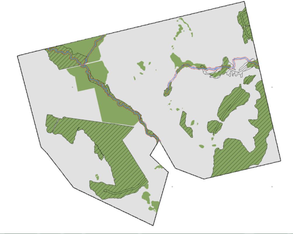
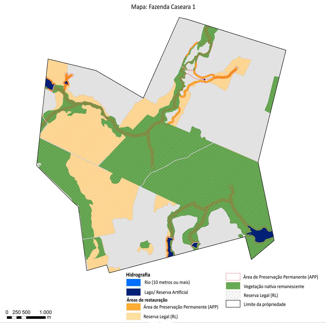
On the left are illustrative maps of the property Fazenda Caseara.
21 hectares of Fazenda Caseara have been validated, of which 14 hectares will be restored.