EXPLORATION TRENDS & DEVELOPMENTS
XCALIBUR
MAPPING is the global leader in airborne geophysics and remote sensing We leverage state-of-the-art technologies to map natural resources, critical for a more sustainable global economy.

Airborne Gravity Gradiometry
Airborne Electromagnetics Airborne Scalar Gravity
Airborne Magnetics and Radiometrics
Geospatial Technologies
is an annual publication prepared by Sean Walker 16 Forth Street, Edinburgh Scotland, U.K. EH1 3LH Email: walker@cwgeophysics.com
Published in co-operation with The Northern Miner 69 Yonge St., Suite 200 Toronto, ON M5E 1K3
Phone: (416) 510-6789 E-mail: tnm@northernminer.com
Editor: Marilyn Scales
Writers: Sean Walker and Tanya Boughtflower
Creative/Layout: Mark Ryan
Production Manager: Jessica Jubb
Advertising Sales: Robert Hertzman
Michael Winter Kathleen Plamondon
Publisher: Anthony Vaccaro Printed in Canada.
All rights reserved. The contents of this publication may only be reproduced with the written consent of Sean Walker.
By Sean Walker, Geophysical Consultant, Campbell & Walker Geophysics, Edinburgh 2024

This is the ninth year that Decennial Mineral Exploration Conferences (DMEC) has served as the patron for Exploration Trends & Developments. DMEC was formed in 2005 to formalize the organization of the decennial exploration conferences which began in 1967 and will continue in 2027. In addition to the exploration conferences, DMEC encourages workshops and conference forums that promote the better integration of technology in exploration. This year DMEC support came from the sponsoring companies listed on pages 18 and 19.
Airborne
Airborne electromagnetic
Airborne gravity
Airborne radiometrics
Airborne other
Ground borehole
Ground magnetometer
Ground gravity
Ground electromagnetics
Resistivity and induced polarization
Magnetotellurics
Physical property measurement
Ground other
“Certainly, here is a possible introduction to your summary of recent trends and developments”, is what ChatGPT might have told me if I had bothered to ask it about what is new and exciting in exploration geophysics. But unlike most people, I have not yet requested ChatGPT to solve my problems or answer any of my questions. While some form of mild Luddism may be involved, my greater concern is that the answers to the questions I am really interested in will not be found by scraping the internet’s dark corners. That is why, instead of relying on a large language model, I asked the geophysical community, and as usual, they provided a broad range of responses.
Fittingly, the use of AI was a common theme. Would I have believed AI if it had given me the same response? Regardless, I found the variety of applications of AI quite interesting. There were the usual reports of faster data processing, improved target detection, and more effective prospectivity mapping. However, software providers are
also using AI to improve the experience of new users.
In addition to AI, trends similar to those seen in 2023, specifically ANT and drones, continued. However, there were also some new trends in the form of multiple companies who were not only improving existing technology but also developing new systems. One company is working on a magnetic gradiometer that can be deployed on the ground or in the air, while two others are working on new airborne gravity gradiometers. There were also multiple companies working on ground and airborne AFMAG systems. It has been quite a while since I can recall this amount of “new” development.
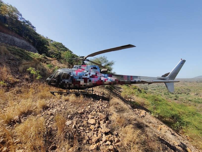
Improvements continued in wellestablished technologies as well. This included helicopter TEM systems, where operators continued offering lower base frequencies. While calling VLF wellestablished is an enormous understatement, several companies did report enhancements to their systems, including a system developed specifically for drones.
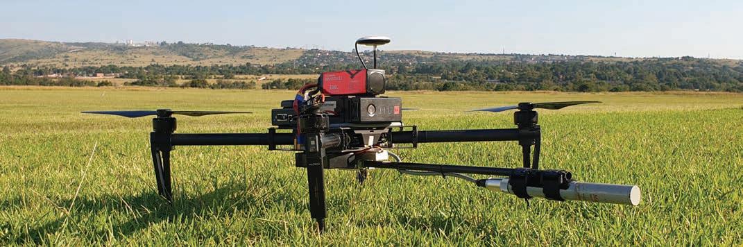
At this point, drones are beyond commonplace. This year, there were reports of magnetic, VLF, semi-airborne EM, AFMAG and radiometric surveys. One company described a combined magnetics and radiometric survey using a heavy-lift drone, bringing the trend of multi-physics to the drone world. And speaking of multi-physics, this phrase is becoming a trend in its own right. While the idea of collecting multiple datasets at once is not new, there were reports of multiple service companies offering magnetics, radiometrics, EM, and gravity (scalar and gradiometer) simultaneously on a single airborne platform.
Another not-so-new development in 2024 was the amount of work in Saudi Arabia. Exploration has been ongoing in the region for several years; however, in 2024, it seemed like many more players were involved. Activity levels appeared to be high worldwide. However, a few reports specifically highlighted the Athabasca Basin and uranium. Lithium and pegmatites, in particular, also continued to be of interest.
Reflecting on this year’s submissions, I wonder if anything “really new” is left to discover. Are we at the point where advances in geophysics are just slight improvements on existing technology? If I believed that, I might try to convince you that modern high-powered digital helicopter TEM systems are merely a logical progression from INPUT (the famous analog fixed-wing TEM system from the ‘60s). But that argument is incredibly reductive. It ignores the decades of incremental improvements, innovative breakthroughs, and commercial failures that were all required to make that progression what it has become today. With that in mind, I commend the companies and organizations who continue to push the envelope, whether they are working on improving upon an idea that some might think of as old, like VLF or updating new technologies like potential field gradiometers. It is important to remember that it wasn’t that long ago the idea of collecting useable airborne AFMAG data was thought to be impossible, and now there are multiple commercial systems available and a number of systems under active development. So maybe there is value to be gained by scouring the dark corners of geophysics. You never know what old, discarded idea might become the next new thing.
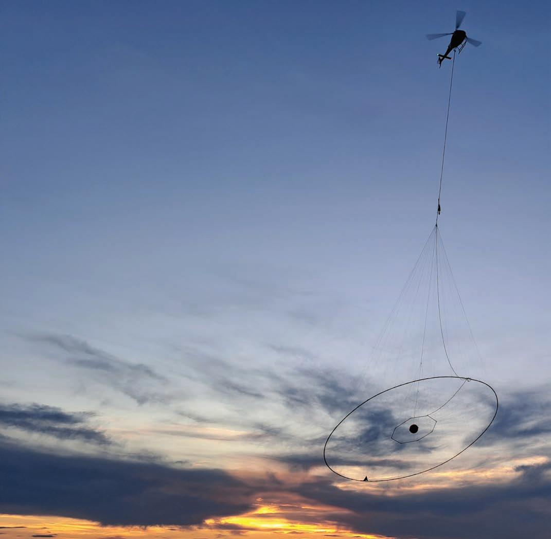
Mobile MagnetoTellurics (MobileMT) is the most advanced generation of airborne AFMAG technology for fast and effective 3D geoelectrical mapping applicable to any kind of geological prospecting projects.
MobileMTm is a lightweight version of MobileMT, adding one additional total field magnetometer to enable measuring the horizontal gradient of the Earth’s magnetic field.
MobileMTd is the revolutionary MobileMT drone-based technology. MobileMTd provides unmatched precision, resolution, and depth of investigation.
TargetEM is an advanced time-domain system with a 12.5 Hz / 15 Hz base frequency, ~ 500,000 NIA dipole moment, long square pulse, and industry-leading low noise. The TargetEM system is designed to provide VLF and AFMAG (high frequency) data along with timedomain EM data.
mTEM is a time-domain system designed for high resolution near surface electromagnetic investigations.
Expert Geophysics Limited (Head Office, Canada) Phone: (+1) 647-657-4774
Expert Geophysics Pty Ltd (Australian Office) Phone: (+61) 049-993-4611
Expert Geophysics Limited (South Africa) Phone: (+27) 82-400-6122
Expert Geophysics Limited (Chile) Phone: (+56) 99-507-3445
Expert Geophysics Ltda (Brazil) Phone: (+55) 65-98465-2504
Expert Geophysics Limited (Peru) Phone: (+51) 97-158-8303
Abitibi Geophysics of Quebec continues to offer a comprehensive suite of ground, borehole, and drone geophysical services, including surveying, data processing, and exploration-focused interpretation. In 2024, they saw rising interest in borehole gravity surveys and an increased adoption of their ground gravity surveys and interpretation, contributing to advancements in lithium exploration within pegmatite deposits. In early 2025, they will launch the second-generation DasVision Pro 3D IP intelligent receiver network.
Advanced Geophysical Operations and Services (AGCOS) manufactures multi-function EM instruments and provides contract surveys with all standard ground EM methods, as we well as proprietary EM technologies. In 2024, AGCOS introduced and successfully tested their new induction mapping technology during commercial surveys in Canada. Instead of using tipper scalar values, IMT utilizes vector mathematical analysis. This allows for a much more accurate separation of nearby anomalous objects and determines their parameters in the vertical and horizontal planes.
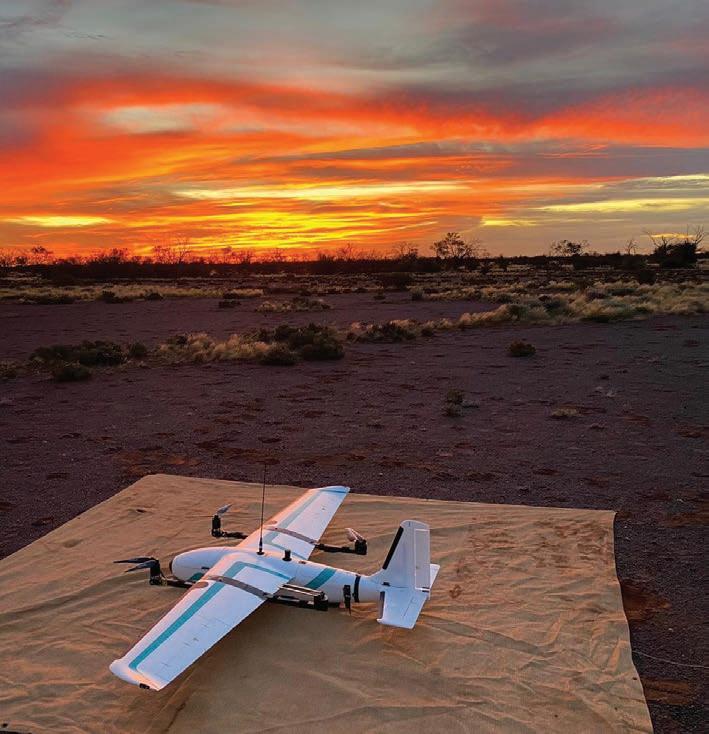
AirGeoX, an Australian provider of drone-based geophysical surveys, successfully flew many VTOL drone surveys over the past year including surveys of up to 6,000 line-km. In 2024, they also found success with their newly introduced drone radiometric surveys in search of uranium, lithium and mineral sands.
In 2024, ALS GoldSpot marked a key milestone in their global expansion by announcing a name change to ALS Geoanalytics. This reflects their expanded capabilities and service offerings including cutting-edge data science, AI and ML combined with industry-leading geoscience expertise. They continue to offer airborne surveys using their Multi Parameter Acquisition Survey System (MPASS) which combines magnetic gradient, VLF-EM, radiometrics and LiDAR in a single platform.
Aurora Geosciences are providers of geological and geophysical exploration services, primarily focused on mineral exploration with offices in Yellowknife, Whitehorse, Juneau and Reno. They have introduced a cost-efficient way to map conduc-
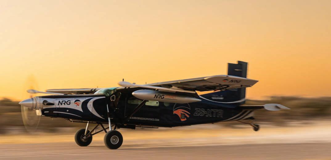
n One of NRG’s Pilatus PC6 Turbo Porter STOL aircraft taking off in the early morning in Botswana. The aircraft has been subjected to an intense magnetic clean up and degaussing process. IMAGE COURTESY OF NEW RESOLUTION GEOPHYSICS.
tors with their ELF electromagnetic survey. It is a natural source geophysical technique that is a technically comparable solution to a ground MT survey, requiring just a two-person survey crew, allowing for expedient data collection.
In 2024, Australian Geophysical Services (AGS) have continued conducting surveys across multiple regions in Australia. In a joint venture with Quantec Geoscience, they have completed Spartan MT surveys for both government and exploration companies across eastern Australia. They also achieved successful results with their conventional IP surveys in some of Australia’s most challenging terrains. They have ongoing DHEM and FLEM surveys taking place across diverse and demanding environments.
The Canadian consulting firm, Axiom Group expanded operations into Africa, offering services including advanced ground geophysics, remote sensing, and project management. Axiom continues to offer the services of Fleet Space’s ANT and New Resolution Geophysics’s NxT airborne gravimeter.
Bell Geospace is an airborne survey company providing gravity gradiometry and magnetic surveying, data processing and interpretation in the oil and mineral exploration industries for over 25 years. In 2024, Bell Geospace noted an increase in the application of FTG technology within mineral exploration, particularly in Europe.
Big Sky Geophysics, a Montana-based consulting company with over 25 years’ experience, has expanded their borehole surveying capabilities. In addition, their TDEM surveys can now be conducted using both fluxgate (B-field for strong conductors) and coil (dB/dt field for weak conductors) three component receivers. Downhole IP surveys and borehole to surface IP surveys are now being conducted. Additional physical property surveys are conducted using Mount Sopris probes.
In 2024, Quebec-based CAUR Technologies made its debut, building on 50 years of seismic expertise from Geophysics GPR. They have developed a seismic nodal instrument prototype tailored for ANT. They also launched a scalable processing platform

NRG’S SPECIALISED SERVICES INCLUDE:
Xcite™ - helicopter time domain electromagnetics and magnetics
Xplorer™ - helicopter magnetics and radiometrics
Xact™ - fixed-wing magnetics and radiometrics
Xtract™ - fixed-wing gravity and magnetics
NxT™ - helicopter or fixed-wing gravity as a stand-alone or compliment to any of the above services THERE IS

South Africa: info@nrgex.co.za
USA: info@nrgex.us
Australia: info@nrgex.au
capable of handling terabytes of seismic data in the cloud. As a new venture, CAUR is focussed on building their team and offering their products to selected clients in North and South America.
In 2024, ClearView Geophysics completed the Guelph gravity survey for the Ontario ministry of mines. One of the major purposes of the dataset is for water exploration. ClearView have also been active in the Kirkland Lake area completing a CSAMT survey which provided resistivity information to approximately 1 km depth in some areas to complement existing gravity, VLF-EM and magnetics data. As a follow up, in 2025 they are planning 2D spectral IP surveys. Additionally, they plan to conduct borehole TDEM and magnetics surveys on historically drilled gold exploration targets to identify conductors that could potentially contain critical minerals such as copper.
Computational Geosciences (CGI) specializes in advanced 3D geophysical inversions and prospectivity mapping, integrating geophysical and geological datasets through constrained and joint inversions. In 2024, CGI was involved in exploration projects worldwide, including Ivanhoe Electric and Ma’aden’s joint exploration of the Arabian Shield, the Tintic copper-gold-silver project in Utah, and uranium exploration in the Athabasca Basin.
With offices in Vancouver and Colorado, Condor Consulting provides processing, modelling and analysis for a range of geophysical data. In 2024, they saw an overall decline in all commodity areas except for uranium in the Athabasca Basin. Several of Condor’s clients are working in parts of the basin where the sandstone depths are close to 1 km. Defining steeply dipping basement conductors with sufficient accuracy to drill at this depth is challenging. In order to address the exploration challenges posed by the region, Condor initiated a workshop at the 2024 Saskatchewan Geological Survey’s open house to discuss the creation of a geophysical test range in the Athabasca Basin.
Convolutions Geoscience is a British Columbia-based consulting company with expertise in project management, 3D modelling, geoscience interpretation, exploration survey planning, and drill hole targeting for critical minerals. In 2024, they consulted on ground and airborne surveys across Canada and Central Africa.
Based in Mississauga, Ont., Crone Geophysics & Exploration offers their proprietary ground-based Pulse-EM system for surface and borehole TDEM surveys. Providing both full-service contract surveys and equipment rentals globally, Crone saw another busy year in 2024. As the push for critical mineral explo-
ration continues to grow, Crone has seen an increased demand for induction coil, fluxgate and SQUID (surface only) surveys, along with their STEP response processing. In response to the demand for their Pulse-EM surveys, Crone saw their field department double in size and expect continued growth into 2025.
Devbrio Geophysics, based in Quebec, celebrated 12 years of service in 2024. Research and development remained a priority for them with focus on UAV-mounted FDEM, TDEM and RTK-GPS systems that work alongside their in-house data acquisition and collision avoidance ecosystem. They look forward to the release of these products in the coming year.
In 2024, Dias Geophysical concluded its amalgamation of Discovery International Geophysics, with all of the former Discovery activities now being carried out by Dias. With the purchase of Gap Geophysics of Brisbane, Dias have also added the services of the Gap team to their offerings to better provide to clients in the southeast Asian market. In the past year, they carried out surveys on all continents excluding Antarctica.
Colorado-based Drone Geoscience provides geophysical and remote sensing mapping via drones. In 2024, they completed numerous high-definition drone magnetics surveys to precisely locate orphaned and legacy oil and gas sites, as well as map geology for mineral and groundwater exploration. They use the MagArrow total field magnetometer with a specially designed stabilizing suspension system for suspended payloads to reduce the motion noise. Another recent development is the collection of EM conductivity data using a drone.
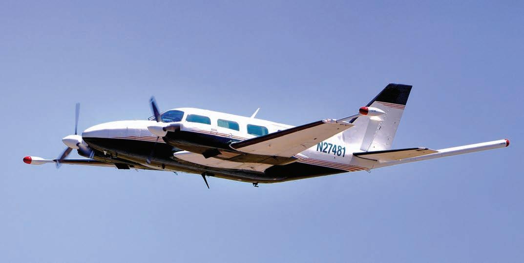
EON Geosciences of Montréal provides airborne high-resolution magnetic, gamma-ray spectrometric, gravity, and EM surveys using fixed-wing aircraft and helicopters, and offers aircraft operation services for all survey industries (geophysics, LiDAR, aerial photography, etc.) In 2024, their aviation fleet continued to grow and now operates over a dozen fixed-wing aircraft, including Piper Navajos, a Cessna Caravan, and a Cessna 206. With multiple crews operating all year, EON Geosciences experienced another exceptionally busy year, flying several large aeromagnetic and gamma-ray spectrometric surveys, both fixed-wing and helicopter-borne, in Quebec, Alberta, Alaska, and several other U.S. states.
EXIGE Australia has entered into a collaboration with Integrated Geoscience Solutions (IGS) in South Africa to offer ground geophysical services in Africa and the Middle East. EXIGE, with its partner Coleoptere, provided the University
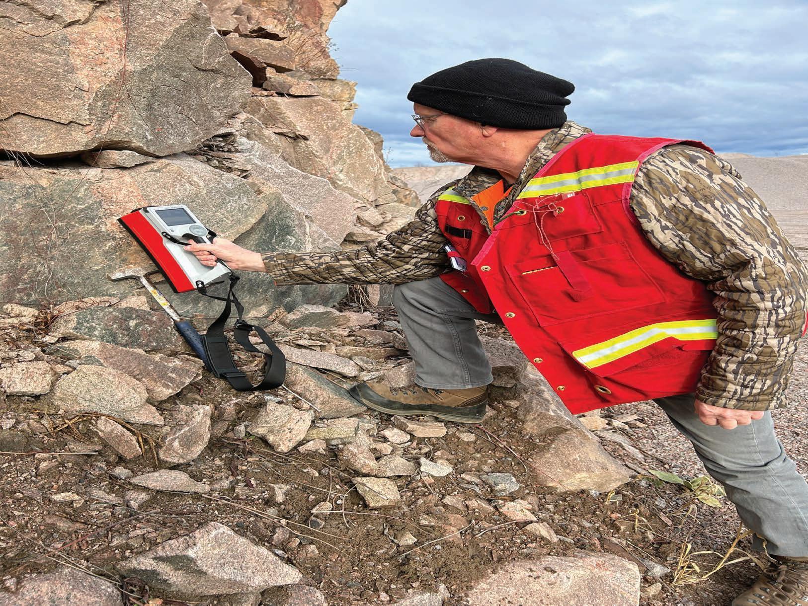
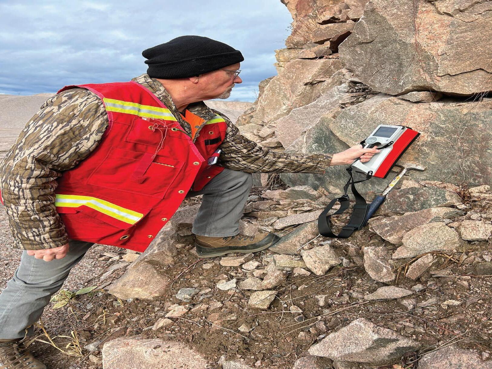
of Witwatersrand with a VAMPair Scarab drone magnetic platform. In conjunction with the University of Free State, this led to the establishment of the Mag Assegai program at Wits University, a unique collaborative research program for drone magnetics mapping in South Africa and beyond.
Expert Geophysics Limited, an airborne geophysical survey company based in Ontario, has expanded its equipment inventory over the past year to accommodate the increasing global demand for MobileMT and TargetEM surveys. In 2024, they established a permanent presence in both India and Brazil, strengthening their global footprint and enhancing service accessibility. Additionally, Expert Geophysics Pty, a subsidiary based in Australia, conducted TargetEM, MobileMT, and MobileMTd surveys to support mining and exploration projects across the region.
In 2024, Fleet Space delivered real-time 3D ANT surveys using their ExoSphere platform. They completed surveys for major and junior exploration companies on gold, uranium, and copper projects worldwide.
Geotech is an Ontario-based company providing EM (VTEM), AFMAG (ZTEM), magnetics, radiometrics and gravity surveys to clients around the world. In 2024, Geotech’s notable surveys included a large helicopter VTEM-magnetic and heli-magnetic/ gradiometric survey in Odisha State, India, a large critical-minerals focused VTEM Max survey in Saudi Arabia, a large helicopter magnetic-gradiometric survey for mineral applications in Egypt, in partnership with Petroleum Air Services, and a challenging, survey in Chile with altitudes exceeding 5,500 metres ASL, using its ZTEM Lite system.
In 2024, Geotexera, based in St. John’s, Newfoundland, provided geophysical inversion and modelling services across various countries, including Canada, the United States, and Ecuador, supporting projects ranging from mineral exploration to detecting buried oil pipelines in the Gulf of Mexico. They also integrated ML techniques to enhance geological mapping accuracy.
HiSeis is an Australia-based company providing integrated geophysical solutions with a focus on seismology for geotechnical, exploration, and environmental applications. Their services include deployment of their own slimline, single-compo-
nent, single-level VSP tool, remote-controlled seismic sources, surface distributed acoustic sensing (DAS) using fibre optic cable and ANT. Highlights of 2024 included the completion of acquisition of over 1,000 km of deep-crustal seismic reflection data, and closer to home they completed a 34-km² 3D survey for Newfound Gold in the Central Gold Belt.
Vancouver-based Ideon Technologies is a leader in muon tomography and related multi-physics. Using Ideon’s proprietary hardware, software, AI-powered services, and multi-physics fusion, they can identify subtle differences in subsurface features that other technologies miss. This allows for more accurate mapping of orebodies and geological formations, such as fault networks and voids, stockpiles and leach heaps, and provides the capability to monitor dynamic underground processes over time, directly informing mine planning decisions, reducing the need for drilling, and eliminating waste. Ideon has released Reveal, a subsurface intelligence platform comprised of proprietary hardware suitable for remote exploration sites and demanding noisy in-mine environments, software, integrated imaging systems, and advanced data analysis and interpretation. In 2024, they released a series of case studies demonstrating the Reveal platform.
IRIS Instruments was busy throughout 2024 with mining exploration, groundwater research and environmental characterization and monitoring in 50 countries on all continents. They also began the first phase of work to extend their workshop and manufacturing hub in France.
Throughout 2024, MAGSPEC Airborne Surveys, based in Australia, continued to offer its high-quality geophysical services, including airborne gradiometer magnetic and radiometric data acquisition and processing in support of mineral industry exploration programs and government departments worldwide.
Medusa Radiometrics produces gamma-ray sensors that can be walked, driven or flown for gathering soil, sediment, and mineral composition. They are rapidly expanding their worldwide distribution and reseller network. In particular, their MS-350 model has taken flight, having the ultimate weight-to-performance ratio for drone-borne surveying.
Mira Geoscience celebrated its 25th anniversary in 2024 with customer events in Toronto and Perth. They were honoured with two prestigious industry awards, the AME Innovation Award, in recognition of the importance of the GEOH5 opensource data structure, and the ASEG Grahame Sands Award to company president John McGaughey for “long-term advocacy and leadership in progressing the state of the art in geophysical inversion and interpretation technology.”
Other highlights of Mira’s 2024 included the continued expansion of the Geoscience Analyst Pro geophysics consortium, surpassing 50 corporate sponsors. Its scope has been expanded so that it is now a viable platform for geophysical data processing and interpretation from survey design to basic processing to the most advanced modelling and inversion, across all non-seismic methods. Mira Geoscience also launched the Geoscience Analyst Pro geology consortium with the objective of bringing geological tools into the established geophysical platform, with several major mining companies as founding members.
New Resolution Geophysics (NRG) of South Africa continues to provide high resolution helicopter magnetics and radiometrics (Xplorer), fixed-wing magnetics and radiometrics (Xact),
fixed-wing gravity and magnetics (Xtract), helicopter or fixedwing gravity (NxT) and state of the art helicopter TDEM (Xcite) throughout Africa, the Middle East, Australasia, Europe and North America. They have recently completed the data acquisition of an Xcite helicopter-borne EM, magnetic and gravity survey for Geoscience Australia and the Geological Survey of Queensland. In 2024, NRG completed a large fixed-wing magnetic survey for the Botswana Geoscience Institute. NRG USA, which started operations in late 2023, is currently conducting a large high-resolution helicopter-borne magnetic and radiometric survey over parts of eastern and central Nevada for the USGS.
Based in Sudbury, Ont., Nova Mining Exploration Solutions (Novaminex) delivers EM sensing and interpretation methods for the discovery and delineation of mineral deposits. In 2024, Novaminex expanded into a new location which provides the space to conduct further development of its NovEM surface EM, BHEMA borehole EM and NovaScan drone-towed EM sys tems, and will allow for production of hardware products start ing in 2025. In additional to hardware research and develop ment, 2024 also saw the licensing of the Provus EM modelling software package which allows for simultaneous modelling of any number of rectangular plate conductors with deform able Provus foil conductors, complex shapes that more realis tically replicate the geometry of mineral deposits. Late in 2024, Novaminex secured IRAP funding for the commercialization of the prototype NovaScan drone-towed AFMAG system.
geophysical surveys in remote areas. Since 2020 they have been developing and surveying with Novatem G2, a light helicopter-based system focused on very high-resolution magnetic, radiometric and AFMAG and VLF-EM measurements. They are able to collect LiDAR data with a system developed by Teledyne for Novatem’s lightweight helicopters. As of 2024, they are operating two fully equipped helicopters. Novatem has a new European subsidiary in France. In 2025, they will continue their high-resolution, low level magnetic and radiometric survey of France by helicopter for the French Geological Survey.
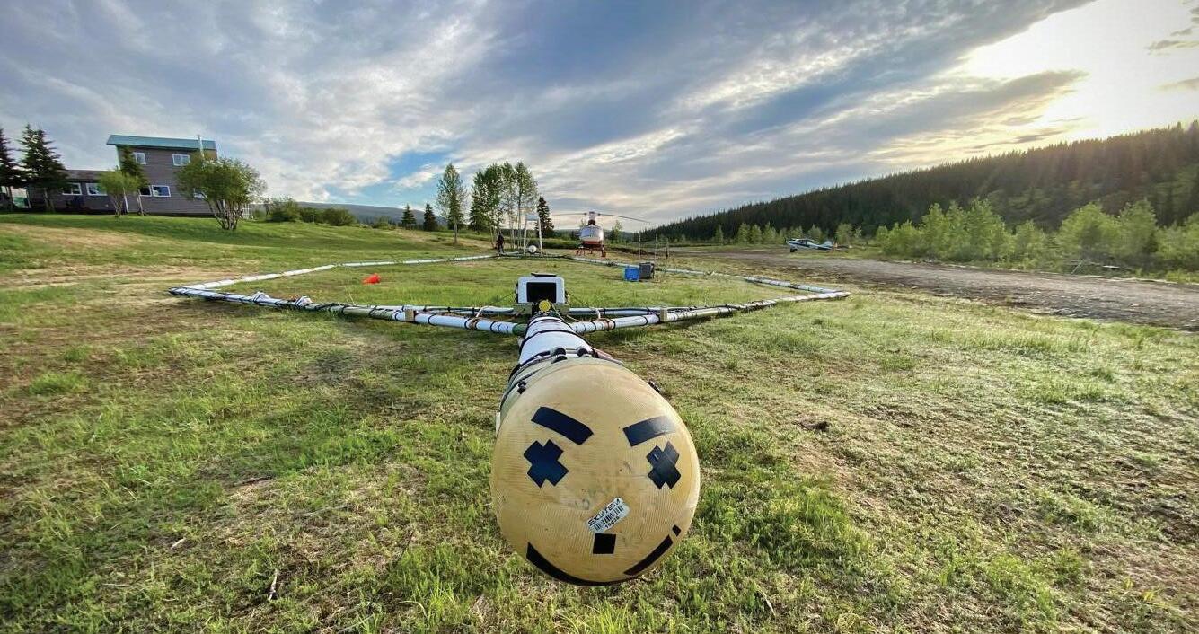
Paterson, Grant & Watson (PGW) of Toronto continued to provide geophysical consulting services to clients around the globe. Highlights include reaching the midpoint of a 6.5-year QC project of airborne geophysics across the Arabian Shield in Saudi

vey commissioning support to projects in Australia, the Czech Republic, the Comoros Islands, Costa Rica, India, Japan, Mexico, and the United States. Their TXU-30 transmitter has been widely utilized in 2024 across various applications, including TDEM, BHEM, and semi-airborne methods.
In the recent years, Quebec-based Prospectair Geosurveys has geographically expanded its service offerings by flying magnetic, TDEM and radiometric surveys from Saskatchewan to Newfoundland, and down to Nevada and Alabama. It has also added two Robinson-66 to its fleet of helicopters, which are equipped with long-range fuel tanks to allow surveys in remote locations far from operation bases.
Quantec Geoscience specializes in deep imaging methodologies including MT with both full frequency stand-alone MT measurements (Spartan MT) and distributed MT (Titan MT) for high resolution and rapid collection of MT. They also provide multi-parameter deep DCIP and MT with TITAN for 2D surveys and Orion for 3D surveys. Quantec opened an office in Brazil in 2024, securing their first Titan survey there. They have also expanded their presence across South America. Quantec recently completed MT transects for the government of Queensland and the Yukon government to highlight crustal scale structural features. Deep imaging surveys for gold exploration has increased and they are active in northeast Ontario doing multi-parameter Titan DCIP and MT surveys.
Radai Ltd., a Finnish company specializing in UAV geophysical surveys, conducted their first drone-based EM survey for customers in Finland. They also established a new flight team in Tanzania where they are conducting drone-based magnetics surveys.
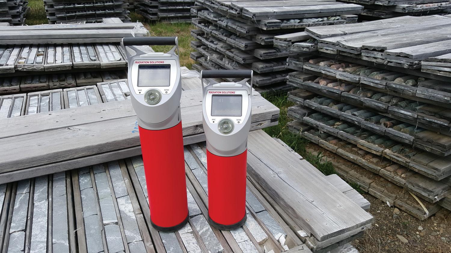
Ontario-based Radiation Solutions Inc. (RSI) experienced continued demand for airborne and handheld gamma-ray spectrometers in 2024. They provided service, support and training to clients in North America, Latin America, Africa, Australia, Asia, and Europe. In December 2024, RSI proudly marked its 25th anniversary, highlighting their commitment to innovation and quality in gamma-ray detector design, application, and manufacturing.
Alberta-based Ramp Geological Services specializes in airborne radiometry using their proprietary RAMP-HD (rapid airborne mineral prospecting, high definition) system. In 2024, they conducted new, unconventional airborne radiometric surveys in northern Saskatchewan over more than 30 separate areas for clients exploring for uranium and rare earth elements, within the Athabasca Basin and in off-basin settings.
Ontario-based equipment manufacturer RMS Instruments report that their DAARC500, the most complete model in their
family of aeromagnetic compensation systems, generated widespread interest throughout 2024, with multiple new-client contracts completed during the year. The UAV-tailored AARC52, and its recently released non-compensating variant DAS52, continue to be well-received by the industry.
In 2024, Ronacher McKenzie Geoscience (RMG) bolstered its geology and geophysics teams by hiring additional staff. The company undertook major projects interpreting geophysical data and providing geological insights for clients including Ma’aden in Saudi Arabia and Eldorado Gold in Türkiye. RMG also engaged in projects across Finland, Mongolia, and various regions in Canada, including Alberta, Newfoundland, Saskatchewan, Nunavut, and Ontario. Notably, the Alberta Geological Survey published RMG’s 2024 work, which will contribute to the development of a new basement map based on recent geophysical surveys.
In January 2024, Sanborn Geospatial established Sanborn Geophysics through the acquisition of Nuvia Dynamics Inc., bringing decades of expertise in designing and building geophysics sensors and systems.
In 2024, Sander Geophysics (SGL) flew several large magnetic surveys, with the majority of them including simultaneous acquisition of other geophysical data in combination with the magnetics. These included a large helicopter magnetic and radiometric survey for the USGS as part of their Earth MRI initiative, a large fixed-wing gravity and magnetic survey in Australia to refine the geoid, the continuation of a large magnetic, radiometric and EM survey using their unique fixed-wing frequency domain EM system, and a very large fixed-wing horizontal gradient magnetic and radiometric survey for the Geological Survey of India. Of particular note, the year marked the completion of a multi-parameter survey involving the simultaneous acquisition of gravity, EM, radiometrics and magnetics, using their SG-FEM.
SBQuantum of Quebec is developing a room temperature magnetic tensor gradiometry exploration drone platform using its diamond vector magnetic technology and noise compensation algorithms. Its technology has been deployed on the ground with government and industry partners to provide tensor magnetic data for improved inversions and modelling.
In 2024, SHA Geophysics saw continued activity with their Heli-GT geo-referenced three-axis magnetic gradiometer system in the Golden Triangle, North Babine, Cassiar (BC), Cape Smith (Que.) and Cape Ray (Nfld.) SHA also included radiometric and LiDAR survey datasets as add-on products to several of the Heli-GT surveys.
After working for more than a decade in Saudi Arabia, Simcoe Geoscience is pleased to announce the opening of its wholly owned company, Simcoe Geoscience Arabia Limited (SCAL). SCAL’s offices and warehouses are strategically located in Riyadh. In North American, Simcoe Geoscience expanded its ground geophysics offerings, including proprietary Alpha IP (surface and borehole), wide-band Omega MT, TDEM (surface and borehole), ground magnetics, ground gravity, physical property logging and more. They have also added a borehole test facility with full test borehole at its headquarters office north of Toronto.
Headquartered in France and with offices in North America and Australia, Sisprobe SAS provides ANT and other passive seismic services to the mineral exploration and mining industry globally. Beyond mining exploration, Sisprobe also provides services for other applications, including seismic and geohazard assessment, subsurface monitoring, geothermal, carbon dioxide
By Northern Miner staff
Mineral exploration has relied on slow, outdated computing for decades to analyze geophysical data. While other industries have advanced, prospecting has lagged behind, hampered by inefficient software and limited processing power.
Now, California-based Vorticity is changing that. The cutting-edge computer company in Redwood City, the heart of Silicon Valley, creates high-speed solutions to process vast amounts of data.
Founded in 2019, Vorticity tackles the challenge of businesses whose investing in hardware hasn’t achieved substantial performance gains. Its solution: tailored software and hardware unlocking maximum computing speed and return on investment on high-end infrastructure.
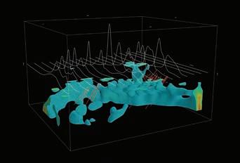
One of Vorticity’s most notable contributions is its inversion portal, a powerful cloud-based platform that enables geophysicists to process largescale geophysical survey data at top speeds.
“An inversion portal is an online platform where geophysicists and other users can process and create models from their data,” Paul Köttering, project lead at Vorticity, said in an interview. “We have developed a way to [create those models] really fast, in the cloud, and on a large scale.”
Traditionally, scientists rely on inversion techniques, which are like puzzle-solving. They gather scattered metrics and use them to create an underground map.
Imagine you’re looking for treasure buried deep underground. You have a metal detector, but instead of instantly telling you where the gold is, it gives you a bunch of signals that need to be analyzed. Normally, experts would take two to six weeks to process this data and create a map of what’s below the surface. Current computers can’t efficiently handle the enormous amount of calculations needed.
Vorticity’s turns the weeks into hours, making the search for underground resources faster, more precise and far less expensive. Instead of using thousands of regular computer chips (which would take over 100,000 computer processing unit cores
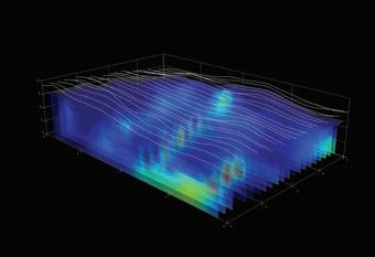
for large projects), they use specialized processors and parallel computing. Many calculations occur simultaneously rather than one after another.
Traditional mineral exploration can take up to a decade to determine whether a deposit is viable. With Vorticity’s inversion portal, companies can streamline their workflow, improve data quality and make more informed decisions quickly. This can save time and money.
Vorticity CEO Chirath Neranjena, who has a background in theoretical physics and engineering, saw an opportunity when he started the company.
“Mineral exploration hasn’t really kept up with modern technological advancements,” the CEO said. “There’s a little bit more uptake from some of the oil and gas companies, but minerals are about 10 years behind.”
Vorticity has taken advantage of graphics processing chips and rewritten the software for them. That’s allowed people to extract a higher amount of data and use more sophisticated models in significantly faster time. They’re the same chips powering the AI revolution.
“Allowing people to have access to these fast computers will reduce timelines, which is really what we want to do,” Köttering said. “If you’re doing any sort of geophysics you need to be doing inversions.”
Vorticity is backed by some of Silicon Valley’s most cutting-edge investors, including Cambium Capital, Dolby Family Ventures and Moore Strategic Ventures.
“When you give other industries access to faster and cheaper computation, using their own indus-
try-specific knowledge, they can do really cool things,” Köttering said.
The company’s flagship system for the mineral exploration community, Astrape, is specifically designed for geophysical analysis, helping companies find valuable underground resources like minerals, oil and gas.
Astrape focuses on airborne electromagnetic surveys, enabling users to perform both 2D and 3D inversions for comprehensive subsurface analysis. Astrape can process data in hours instead of weeks, producing clearer, more detailed underground maps.
Then there is Rhea, which assists in creating detailed subsurface images crucial for geophysical explorations in the energy industry. It enables scientific research and high-security applications.
Vorticity’s Plutus platform, for financial companies, provides rapid pricing options to assist traders and analysts. There is also Asclepius, which simulates molecular interactions, benefiting research in chemistry, biology and materials science.
Vorticity plans to release even faster custom-built computer chips that will outperform current technology by as much as 10 times, the project leader said.
“When you give these people efficient and inexpensive access to better computational power, they use their own expertise to improve the way they do things and revolutionize their own industries.” VC
The preceding Joint Venture Article is PROMOTED CONTENT sponsored by Vorticity and produced in co-operation with The Northern Miner.
and brine sequestration monitoring, and aquifer management. SJ Geophysics, based British Columbia, specialize in the acquisition of 2D and 3D DCIP, EM (surface and borehole), MT, gravity, and magnetic surveys internationally. DCIP, EM, MT data is acquired using its proprietary Volterra distributed acquisition system, a full-waveform, four-channel, multi-sensor, geophysical system. The company has recently added 3D AMT-MT inversion modelling to its existing 2D and 3D inversion capabilities. In 2024, SJ Geophysics conducted field surveys within Canada, the United States, Dominican Republic and Greenland. This year has marked a turning point for the company, with MT data acquisition now occurring in conjunction with the majority of all 2D and 3D DCIP surveys.
SkyTEM Surveys, headquartered in Denmark and with regional offices in Australia and Canada, had another productive year flying in the Middle East, French Polynesia, Brazil, Oman, Europe, Australia, and the United States. In 2024, SkyTEM welcomed a new CEO, Morten Melbye, who brings a commercial background to help with SkyTEM’s global growth. Towards the end of 2024, they announced a partnership with Arabian Geophysical & Surveying Company (ARGAS) in Saudi Arabia. SkyTEM Canada continued to see significant growth in multiple statewide groundwater projects in the United States as well as multiple regional surveys for the USGS.
Southern Geoscience Consultants (SGC) has formed strong alliances with key groups in Europe, Africa, the Middle East and Canada to further expand its reach internationally.

They have relocated their field division to a new warehouse premises to accommodate its expanding data acquisition capabilities. They were a key supporter of CAGE24 (Camp for Applied Geophysics Excellence), a training camp for early career geoscientists in practical geophysics, providing geophysical equipment and specialist geophysicists to instruct students. This year participants travelled to Forrestania in Western Australia and collected gravity, magnetics, MT, seismic and TEM data. SGC has developed its inaugural airborne EM interpretation workshop for geologists which will be delivered at PDAC 2025.
SouthernRock Geophysics has been providing services for mineral exploration in the Andean region for over 25 years from their field base in Antofagasta, technical office in Santiago, and through their sister company Ridgeback Geofisica Argentina based in Mendoza. SouthernRock’s partnership with Advanced Geophysical Technologies (AGTInsturments) has also provided 10 years of development and implementation of the gDAS32 32-bit distributed array system for deep imaging IP, MT, and CSEM solutions in such diverse geographic areas as Canada, Spain, Australia, Japan, Kazakhstan, and Zambia.
Tensor Research, the Australia-based developer of the ModelVision magnetic and gravity modelling and processing system, expanded into services using their rock property and depth mapping technology, RPD Mapping. The service was applied to projects in Africa, Canada and Australia for copper, gold, nickel and diamond exploration. Additionally, director
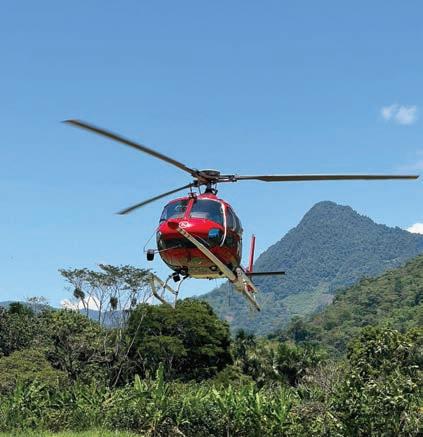
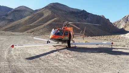
New-Sense Geophysics is a premier geophysical survey company renowned for its expertise in conducting high and steep mountainous terrain. With a focus on safety, precision and innovation, the company specializes in magnetic and radiometric surveys using helicopter and fixed wing platforms. New-Sense Geophysics stands at the forefront with over a million-line km flown, with nearly half above 3000m.
With offices, personnel and equipment strategically located in Canada, the US, Mexico, Peru, Chile, and Argentina, New-Sense Geophysics has established a strong global presence. This positioning allows the company to respond swiftly to project demands.
New-Sense Geophysics has forged strategic partnerships with local helicopter and aircraft operators in each jurisdiction. These collaborations enhance the company’s operational efficiency, providing access to expert aviation services and local knowledge across diverse regions.
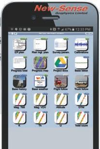
New-Sense Geophysics goes above and beyond by offering clients a cutting-edge project dashboard. This portal allows easy access to real-time updates, project status, and track production statistics. More than just a tool for transparency, the dashboard is critical to safe operations. Metrics on the dashboard facilitate monitoring and adherence to project safety KPI (Key Performance Indicators), critical thresholds, performance benchmarks, and production metrics. NewSense Geophysics clientele are avid users of the dashboard, fostering a safe, informed, and collaborative project.
Blair McKenzie received an award from the ASEG for his work on the magnetic tensor response of a magnetic pipe.
In 2024, Terraplus added to its inventory of rental geophysical equipment with drone-borne sensors, including the GeoDrone 600 MHz UAV GPR system and a DRONEmag UAV magnetometer with GSMP-25U sensor for international projects. Other additions include the next generation RS-225 and RS-232 handheld gamma-ray spectrometers and the GSM-19WVW Walking Overhauser magnetometer combined with Walking VLF system.
Terrascope is a drone magnetic operator established in the summer 2024 by key employees from Vision 4k. Over the summer, Terrascope have worked exclusively in Nunavik and Nunavut, completing large scale surveys for major partners in the industry. This has been a record-breaking year for Terrascope in terms of line-km flown, dating back to 2018 when operating under Vision 4k.
Australia-based Thomson Airborne had a busy 2024 with Cessna Caravan-based gradient magnetics surveys, as well as single sensor work with their C210 fleet. They are currently working on a large survey in Western Australia for the Australian government.
Based in Western Australia, Transparent Earth Geophysics supply stabilized platform mobile gravity systems and services for airborne and marine surveys worldwide. They conduct surveys for oil, gas exploration and mineral exploration, geodetic mapping, and environmental research on every continent, including Antarctica.
Viridien (formerly CGG) provides custom integrated solutions for mineral exploration and mine infrastructure management. Viridien’s expertise covers geophysics, geology and geotechnical engineering leveraged by data science, ML, satellite mapping, in-situ sensing equipment and HPC. In 2024, Viridien completed a multi-client airborne survey of 280,000 line-km over southeast Arizona, delivering HiRes GravMagSpec data, and 3D products including integrated satellite image interpretation, along with the QC of legacy borehole, geochemistry and ground geophysics data.
Xcalibur Smart Mapping is a global airborne geophysics company, with numerous advanced geophysical systems and a fleet of specialized aircraft. They operate five global innovation labs with partner universities such as Stanford for AI and ML projects and Curtin and Trailblazer University for hydrogen exploration in Australia. In 2024, they expanded with a focus on Asia, Europe and Latin America. Due to demand from government agencies and exploration companies, Xcalibur are investing in a significant expansion of the global Tempest fixed-wing airborne EM system. In 2024, the global Tempest fleet was increased to from two to three with another two systems expected in 2025. They are developing large projects such as Zambia’s high-resolution aerial geophysical survey project. Xcalibur also participate in key European projects such as Dexplore, optimizing airborne gravity with unmanned vehicles and 3D modelling, and Semacret, exploring critical minerals for the European Union.
Abitibi Geophysics has introduced drone magnetic surveys using their AeroVision Pro. It operates at ultra-low altitudes, using terrain-following and collision avoidance technology to maintain a constant clearance of 5.0 meters or less to minimize surface noise and ensure high-resolution magnetic data acquisition. The system’s sensitive, lightweight magnetic sensor records 1,000 samples per second, capturing vertical gradient measurements needed for constructing high-resolution ground magnetics maps with the detail and accuracy necessary for subsurface exploration. Real-time QC, live mission recording, and AI spot checks facilitate precise flight patterns and reliable data, further enhancing the quality of 3D inversion models even in challenging environments.
AGP Consulting specializes in airborne geophysical surveying, data processing and interpretation. In 2024, they completed several mineral exploration projects in Kazakhstan, central Africa and southwest Asia. AGP has developed the AGPUAV-MAG aeromagnetic system based on an unmanned VTOL airplane. The magnetometer sensor is placed in the stinger, and residual deviation compensation is performed by an additional fluxgate magnetometer. The flight speed and manoeuvrability of the aircraft allow it to perform flights with detailed terrain drape at a relatively low altitude.
Devbrio Geophysics have improved their proprietary UAVmounted magnetic data acquisition technology, allowing it to fly as close as possible to trees and obstacles, yielding data with very high spatial resolution. Other improvements include optimized battery management during automated navigation and high hardware reliability when operated in some of the harshest weather and topographical conditions found in Canada, the United States and Greenland. The technology has evolved into a lightweight and more compatible system, making it easy to integrate with multiple UAV platforms.
Dias’ QMAGT full tensor magnetic gradiometer system now
includes total magnetic intensity acquisition, enhancing its interpretation capability by increasing the depth sensitivity beyond the limits of the QMAGT SQUID sensor system.
EXIGE and its partner Coleoptere have released the latest model of their VAMPair Colibri backpack transportable drone magnetic platform (single fluxgate magnetometer).
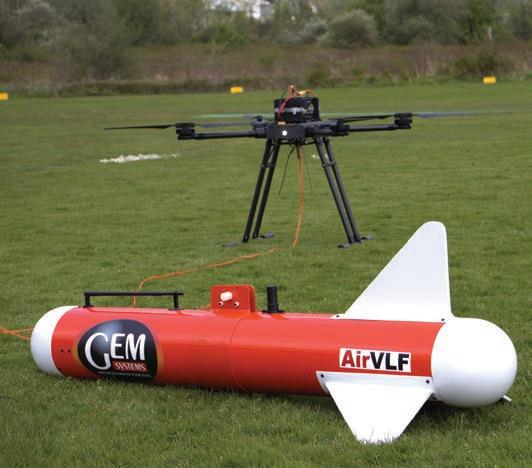
GEM Systems is a global provider of high-precision magnetometers and geophysical instrumentation with operations in over 50 countries. They work broadly, contributing to research and exploration projects across mineral exploration, archaeology, and environmental monitoring. GEM Systems has continued to advance the capabilities of the DRONEmag (GSMP35U/25U), the first lightweight, high-sensitivity magnetometer specifically designed for UAVs. They continuously refine and enhance their instruments based on real-world insights and user needs. AirBIRD, with a weight of only 3.5 kg, is perfectly suited for medium and larger drones as well as helicopter UAVs. Its design ensures simple integration and immediate deployment. AirGRAD is a vertical gradiometer for UAVs. This lightweight system, weighing 9.0 kg, includes two high-sensitivity, ultra-light magnetometers for precise magnetic gradient surveys with wireless data transfer and real-time monitoring
In late 2024, Geotech added a three-boom horizontal magnetic gradiometer to its current line of magnetics systems, which includes a single boom stinger-mounted system (HeliMAG) and a three-axis magnetic-gradiometer towed bird system (HeliGRAD). The STC-approved three-boom design can be mounted on any of Geotech’s fleet of AS 350-B3 helicopters. It offers the advantages of superior detail and interpretability of magnetic data using measured versus calculated gradients.
Precision GeoSurveys, based in Vancouver, specializes in low-level airborne magnetic, radiometric and EM surveys in mountainous terrain. In 2024, they continued development of their proprietary GoMag helicopter magnetic gradient system with new algorithms to de-rotate the measured gradient direc-
tions in three axes. The system was successfully deployed on surveys requiring high-resolution data with enhanced structural information.
Radai have succeeded in improving their UAV magnetics system to more accurately acquire individual magnetic vector components. Changes in UAV flight avionics, IMU sensor and data post processing software have reduced noise levels making it possible to identify magnetic field declination and inclination anomalies.
The continued collaboration between RMS Instruments and Flying-Cam has resulted in the industry’s first highly stable and reliable UAV-based lateral gradiometer using the AARC52. The single-rotor, turbo-engine-powered helicopter allows up to three hours of flight time and 30-kg payload. Initial test flights have consistently produced high-quality compensated data, with total-field and lateral gradient residual errors in-line with those seen with well-compensated manned aircraft.
Sanborn added triaxial magnetic and radiometric fixedwing data acquisition to their offerings earlier this year and are actively working with the USGS. They are in the process of outfitting additional aircrafts with advanced gamma ray spectrometers (32l down, 8l up), three Cs-3 magnetometer sensors and auxiliary equipment, all of which are recorded in the Sanborn AGIS data acquisition system, to expand their fixedwing fleet. Sanborn is currently working towards miniaturization of the proprietary MMS8 magnetometer processor for use on drone systems. These low power boards allow multiple magnetometers to be connected and synchronized in real-time for accurate drone magnetic data.
SBQuantum is integrating their diamond sensor on a rigid drone mount which uses specialized magnetic cancellation algorithms to reach nT level of survey precision. A first flight was in December 2024 and integration into a full tensor magnetic system will be conducted in spring 2025. The drone agnostic system, combined with magnetic algorithms, will be provided to drone survey firms as an add-on to increase the availability of the tensor magnetic data for advanced geophysical modelling.
Over the past year, Terrascope has developed a new drone that has greater autonomy and lifting capacity than its previous model. The development of new navigation algorithms has resulted in improvements while flying in windy weather conditions, allowing flights in scenarios where most drones would
be grounded. Modifications to the hardware and software have improved Terrascope’s daily production by a significant margin, resulting in faster surveys and fewer weather standbys.
Xcalibur Smart Mapping has been actively expanding its North American operations, and a key part of this expansion involved the 2024 addition of an Air Tractor XMAG survey aircraft. The Air Tractor XMAG is an excellent alternative to their MIDAS gradient magnetic system.
AGP has improved their helicopter time-domain EM system, AGP-TEM, to operate at a lower base frequency of 12.5 Hz, providing greater depth of investigation. They have also developed AGP-UAV-EM, a semi-airborne UAV-based EM system based on the CSRMT method. It consists of a horizontal electric dipole transmitter, and a three-component receiver and INS located in a bird towed by a multi-copter UAV.
AirGeoX successfully completed a geotechnical commercial survey combining a grounded transmitter loop and drone mounted receiver, sampling at 4 MHz. A 2D inversion on the results accurately measured the depth to basement and overlying sediment depths.
At Devbrio Geophysics research and development remains a priority with focus on FDEM, TDEM and RTK-GPS UAVmounted systems that work alongside their in-house data acquisition and collision avoidance systems. They look forward to their release in the coming year.
Dias has added a UAV SAM system to its suite of SAM technology offerings. It was recently successfully tested at the Forrestania test site in Western Australia, and a paper was presented at the ASEG conference in Hobart. The UAV SAM system offers the advantages of the power of a ground loop, a fast-sampling B-field sensor, and rapid acquisition and a high-resolution final data set. The Forrestania test verified acquisition at a base frequency of 1 Hz, and a production rate of three to four transmitter loops per day.
Over the past year, Expert Geophysics completed the development of TargetEM, a new high-power, low-base frequency time-domain system. The system can now acquire data at 12.5 to 15 Hz base frequency. They also enhanced their MobileMT/ TargetEM universal three-component sensor to reduce noise levels. They continue to advance their MobileMTd, a natural-field EM drone-based system that is now commercially operational in Australia. It flies low and slow in order to deliver









enhanced resolution without compromising data quality. Its deployment in North American is expected in early 2025.
GEM Systems’ UAV VLF-EM system is specifically designed for resistivity mapping using VLF-EM method drones. It measures both vertical and horizontal field components in realtime data.
Canadian-owned Geonics have continued development of GTEM Lite, a semi-airborne time-domain system, with extensive lab testing and it is now ready for testing in the field.
In 2024, Geotech performed additional testing of ZTEM Lite, its new lightweight ZTEM NFEM receiver and hopes to release the redesign in 2025. It retains the same dimensions and specifications as its ZTEM but is d esigned to fly at higher elevations. Geotech also continued to improve its ZTEM signal processing and data acquisition, enabling it to extend the frequency ranges from the current 30 to 720 Hz ELF into the 1 to 24 kHz VLF range. A full-streaming data acquisition system is also envisaged for ZTEM AFMAG, which Geotech hopes to test for implementation in 2025.
For Geotech’s flagship VTEM (versatile time-domain electromagnetic) helicopter EM system, development also continued on a new 192 kHz sampled, full-streaming VTEM data acquisition system, with hopes of implementing, along with a MHz sampled variant for its VTEM ET (early time) system, in 2025. Finally, in summer 2024, Geotech performed field testing of a new LBF (low base frequency) 12.5 to 15 Hz VTEM system, which they plan to test further and implement in Australia during 2025. An updated design of Geotech’s VTEM transmitter system is also planned for 2025.
Following initial field tests in 2023, in 2024 Novaminex completed development of its prototype NovaScan drone-towed AFMAG system with funding support from the Northern Ontario Heritage Fund. The 7-kg payload is a 2-metres-long bird towed below the drone on a cable. The system provides for full-tensor acquisition with three axes measured in the bird and three axes measured at a fixed base station. Sensor orientations are recovered by precision IMU for post-processing to a full tensor product and derivative products such as apparent resistivity at each frequency. The system is focused on high frequencies (3 to 25 kHz) suitable for lithologic and structural mapping. The application benefits from sensors having extremely low noise. Experiments were also conducted to evaluate the system in controlled-source semi-airborne mode.
The Novatem MT-Plus system records magnetic field variations in the frequency range between 100 and 25,000 Hz simultaneously on three orthogonal inductive coils
located at the front of the helicopter. Twenty-five frequencies are thus measured in the AFMAG band, and three frequencies are measured in the VLF band. A base station equipped with the same measurement system records magnetic variations on the ground simultaneously, as well as electric fields in both flight directions. Measuring both electric and magnetic fields at the base station enables the apparent conductivity for each frequency to be calculated.
In 2024, research and development at NRG focused on improving late time noise for lower base frequencies in the
EXPLORATION TRENDS & DEVELOPMENTS

Computational Geosciences
Condor North Consulting
DGI Geoscience
Paterson, Grant & Watson
Phoenix Geophysics
Quantec Geoscience
Radiation Solutions
Sanborn Geophysical Scintrex
SJ Geophysics

AGCOS
EMIT
EON Geosciences
GEM
Geonics
Ideon Technologies
Precision Geosurveys
Sander Geophysics
Sisprobe
SkyTEM Canada
Technoimaging
Tensor Research
Zonge International
Xcite AEM system. A re-design of the receiver suspension has resulted in the 12.5 Hz base frequency noise levels now matching those of the 25 Hz base frequency. In suitable geological environments, 12.5 Hz base frequency data has the potential for a larger depth of investigation and improved conductor discrimination. In the past, these advantages of the 12.5 Hz data were never fully realized due to higher noise levels than the 25 Hz base frequency, but with the new suspension, NRG now confidently offers excellent quality 12.5 Hz data.
Pioneer Exploration is a global drone-based geophysical and remote sensing company. In 2024, they made Drone-VLF a default service that can be reliably offered to clients in the mineral exploration industry in North America and beyond. A number of successful surveys were flown across Canada leading to positive drilling campaigns. Additionally, with the successful integration of two payloads into the heavy lifter drone, Pioneer now offers Drone-MAG+VLF combo.
Radai released the first version of their three frequency semi-airborne EM system. The system consists of a transmitter loop on the ground and a receiver towed behind a VTOL drone.
Sanborn Geophysics has refined their TDEM system by bettering the dipole moment of the system, increasing the sampling rate of the waveform, and modifying the trigger pulse to obtain a faster turn-off time. Once completed in early 2025, the near surface capabilities of this system will be vastly improved.
SkyTEM continues their transition from the Classic SkyTEM systems to the modern DigiTEM HP systems. The system archi-

tecture has been redesigned to allow for modularity, increasing the flexibility. The HP systems are in continuous development, with the goals of offering improved B-field data and a redesigned tail section to allow Y-coil measurements in the future. The systems also now introduce additional processing innovations and improvements through B-spline techniques. SkyTEM expects to launch a new system in 2025 that will focus on imaging the near surface to 200 metres with improved resolution. This system will replace the classic system known as a SkyTEM304.
In 2025, Terraquest will be expanding their proprietary Matrix VLF-EM which uses a unique multi-azimuth energization, advantageous for omnidirectional structural interpretations and generating VLF-EM inverse-modelled resistivity. Current density products are used to help delineate the size and shape of conductors and are complementary to available current resistivity modelling and Geosoft voxels.
To complement their high-powered, low-frequency HeliTEM system, Xcalibur Smart Mapping introduced a new HeliTEM variant featuring a smaller 21-metre transmitter loop. With double the climb rate of the original system, the smaller HeliTEM provides significantly better drape performance and data quality in rugged terrain, while the lower loop drag provides faster acquisition for more efficient production. During 2024, Xcalibur added iCORUS-X scalar gravimeter capability to their Tempest and HeliTEM airborne EM offerings. The iCORUS-X scalar gravimeter (exclusive to Xcalibur) is compact and robust to turbulence, allowing scalar gravity data acquisi-
+1 801 264 6700 www.technoimaging.com contact@technoimaging.com
The only large-scale 3D AEM inversion with moving sensitivity domain 3D inversion of entire surveys to models with millions of cells, delivered in industry standard formats RESOLVE - DIGHEM - VTEM - AEROTEM - HELITEM - SkyTEM - TEMPEST - GEOTEM - MEGATEM – SPECTREM - NuTEM
The largest joint 3D gravity and magnetic inversion
3D inversion of regional surveys to models with hundreds of millions of cells, delivered in industry standard formats Gravity - Gravity gradiometry - Magnetics - Magnetic gradiometryJoint inversion with Gramian constraint
The largest joint 3D magnetotelluric and ZTEM inversion
3D inversion of entire surveys to models with millions of cells, delivered in industry standard formats Principle componentFull tensor - Tipper - MT - AMT - ZTEM
3D CSEM inversion
3D inversion of entire surveys to models with millions of cells, delivered in industry standard formats
Frequency-domain CSEM - Time-domain CSEM - Towed
Streamer EM - Downhole EM
The only 3D inversion with focusing regularization To produce sharp images of geological structures
Contract R&D
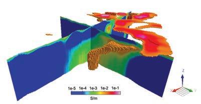
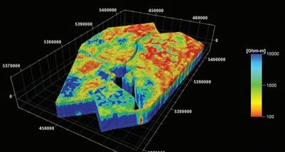
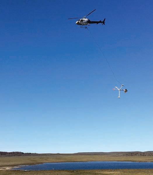
n SHA’s proprietary geo-referenced 3-axis magnetic gradiometer system in operation surveying the Cape Smith region of northern Quebec. IMAGE COURTESY OF SHA GEOPHYSICS.
tion simultaneously with AEM surveys, even under turbulent drape conditions, without impacting the AEM or other data acquired. All Tempest and HeliTEM surveys now have the option to deliver simultaneous TDEM, magnetic, radiometric and gravity data from the same platform.
NRG’s new NxT gravity system makes it possible to simultaneously collect magnetic, radiometric or EM and gravity data on a helicopter platform with no detriment to the magnetics, radiometrics or EM data.
In October 2024, Transparent Earth Geophysics (TEG), formerly known as CMG Operations, commenced a yearlong project to fabricate and test Raptor Grav – a next generation airborne gravimeter. This project is funded by the Minerals Research Institute of Western Australia and aims to test the acquisition of survey data on fixed-wing aircraft and heli-drone to demonstrate its exploration potential at different scales. The first test results should be available in mid-2025. TEG is also involved in an Australian Space Agency-funded project led by Advanced Navigation and aided by Australian Astronomical Optics (AAO) at Macquarie University which seeks to develop and demonstrate a new Australian Doppler LiDAR for space navigation and lunar landings. The prototype device is scheduled to land on Earth’s moon in 2026, on Intuitive Machines’ IM-4 mission. This project accelerated development of a device that could be adapted for airborne geophysics.
Xcalibur Smart Mapping has added iCORUS-X scalar gravimeters to Falcon airborne gravity gradiometer surveys. The iCORUS-X provides higher quality long wavelength gravity data to complement Falcon’s short to medium wavelength gravity data. This service is called full spectrum Falcon gravity and provides high quality gravity from wavelengths from tens of metres to hundreds of kilometres.
Xcalibur and Lockheed Martin are developing a new gradiometer, known as the Condor airborne Laplacian gradiometer. This instrument is designed to directly measure the gravity tensor at a single point in space, eliminating the need for measurements in a rotating reference frame. With the sub-systems validation component of the program concluded, they are confident that the desired performance will be achieved. Modelling has shown that the Condor has the potential to provide data with noise levels lower than current moving-platform-based sensor technology.

In the summer of 2024, Pioneer Exploration successfully tested their radiometric NaI-based sensor on a heavy payload drone. Slow speed and proximity to the target, in addition to low moisture content in the soil and vegetation, remain obstacles for such surveys, but in the correct environment, this type of survey can aid the industry with mapping and exploration.
RAMP Geological Services have introduced RAMP-HD, a new and unconventional approach to collecting high spatial resolution gamma-ray spectrometric data. An on-board system operator uses real-time data collected every second to direct the helicopter pilot in a very slow (down to a hover) and very low (within safety limits), free-form survey mode, not restricted by a conventional, predefined grid flying
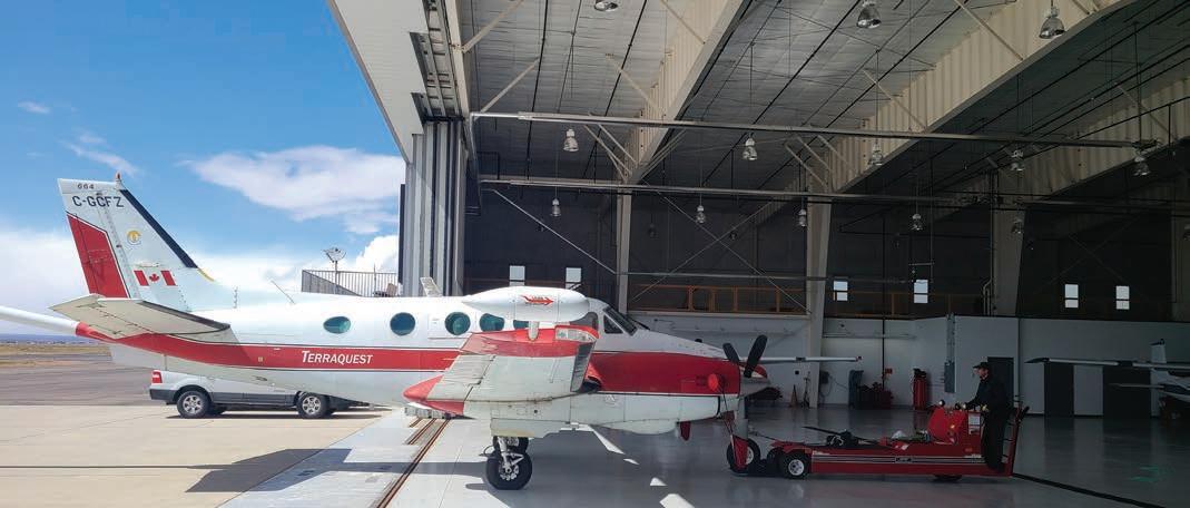
n Terraquest’s C-GCFZ at Big Piney, Wyoming, 2024. IMAGE COURTESY OF TERRAQUEST
approach. Ground crews can follow up the best targets. In 2023-24, ground crews used RAMP-HD results to quickly discover several new occurrences within areas previously prospected and flown by conventional surveys.
In 2024, RSI’s advanced digital spectrometer (ADS) II module, offering unique versatility and contributing to increased project efficiencies, was made available to customers. Besides measuring the temperature of the ADS, a new thermal probe measures the temperature of the crystal, ensuring proper spectral stabilization under all conditions, providing reliable system performance and accurate, consistent and high-quality data the first time.
SHA Geophysics now offers airborne radiometric data collection and processing as an add-on product to the company’s HELI-GT magnetic gradiometer system. SHA operates Radiation Solution’s RS-500 gamma-ray spectrometer model RSX-4.
Building on the pervasiveness of collision avoidance technology in commercial drones, Pioneer Exploration integrated a radarbased collision avoidance system into the middle-class drones typically used in geophysical services. Their system is capable of working in all weather conditions, allowing Pioneer to get closer to the treetops than before. This system can also be used in UXO and well head detection surveys to help in following the terrain.
SHA Geophysics has made a strategic partnership with Riegl to offer LiDAR and orthophoto data collection and processing as an add-on product to the company’s HELI-GT magnetic gradiometer system surveys.
Terraquest offers LiDAR and hyperspectral acquisition on a Cessna 206 fixed wing aircraft. In 2024, they flew the Phoenix Halo-H, Ranger-XL detached, and NAvBox system for the first time.

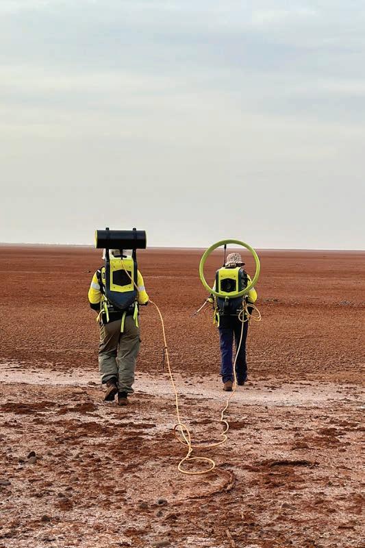
Dias introduced the TerraTX-200 transmitter which is designed for in-mine borehole applications where high power is required. This transmitter is capable of 180 A per unit, and four units can be combined for an extremely high effective moment. This system significantly expands the effective search radius of borehole EM surveys.
In 2024, Novaminex completed development of the three-axis BHEMA borehole EM probe. BHEMA offers noise levels up to 50 times better than a three-axis fluxgate. BHEMA operates on a Kevlar cable, without a data link, using a lightweight winch. As there is no receiver at surface, data acquisition involves lowering the probe and dwelling at a set of pre-determined depths. The probe can also be carried on surface to conduct EM measurements. An absolute GPS timing reference on the surface provides for accurate timing of data and allows for synchronization with multiple transmitters. The raw EM data are collected along with data from an IMU measuring three-axis fluxgate magnetometer, accelerometer and gyro. A separate NovaBox receiver continuously logs the transmitter current during the survey making it possible to synchronize the probe data and deconvolve it to an idealized system waveform.
SJ Geophysics is developing a new borehole probe with a diameter of 45 mm, creating a more compact and portable design.
Their borehole probes are unique in their ability to survey below the drill bit when the rods are removed from the hole, as the electronics and batteries are contained within the acquisition probe.
SBQuantum has qualified its vector diamond magnetometer (SBQDM) at Ottawa’s geomagnetic observatory and at the Goddard Space Flight Center magnetic testing facilities, demonstrating sub nT/sqrt(Hz) vector sensitivity at 1.0 Hz and accuracy of 6.0 nT. The handheld magnetometer withstands vibration profiles, operates in temperature ranges of –40°C to 50°C and is integrated into a rugged casing. SBQ is looking for early adopters to provide feedback on the sensor performance.
Abitibi Geophysics has noted increased interest in gravity surveys for identifying near-surface spodumene-bearing pegmatites following the success at the Winsome lithium prospect. By leveraging the density contrast between high-density ultramafic rocks and lower-density pegmatites, these surveys detect subtle negative gravity anomalies. In Quebec, this method has proven effective in target generation in covered terrains delivering insights into pegmatite geometry and extensions.
Fleet Space now offers ExoSphere gravity as an add-on to real-time ANT surveys to acquire gravity data in tandem with any deployment of an ExoSphere real-time ANT survey. The coincident ANT and gravity data make it possible to deliver cover-corrected gravity data and produce an enhanced 3D density model.
In 2024, AGCOS continued to further develop and upgrade hardware and software for its multi-function EM instruments. In addition to NCSEM and FDEMS-IP, AGCOS introduced non-contact, ungrounded, all-season Induction Mapping Technology (IMT) for cost-effective surveys in challenging geological environments.
Australian Geophysical Services (AGS) conducts both surface and downhole surveys using Georesults’ newly updated DRTX transmitters. Turn-off time calculations have been incorporated into the software and can be enabled remotely by phone or tablet.
Dias has added the capabilities of the Gap Geophysics transmitters to their EM survey services. These include the high power HPTX 80 (for large loop surveys), and the portable EMTX (for moving loop surveys) and the IPTX transmitter (for galvanic applications like the semi-airborne HeliSAM and UAV-SAM methods). New to Dias is the SAM suite of total B-field receivers, which provide extremely low-noise data acquisition, and are highly applicable to low-frequency, high-conductance applications.
In the past year, Geonics have put considerable time in development of GTEM Mobile, a portable time-domain system, that will be available for purchase in early 2025.
Based in Toronto, Geosensors develop and manufacture electromagnetic sensors for near-surface applications. New developments in 2024 included the R64, a 4-metre, 6-receiver, all-coplanar EM ground conductivity meter, which extends their previous selection of R-Series sensors ranging from the compact R1 to the larger R6. They also developed a Wi-Fi-based user interface, which provides easy access to all user-selectable operating parameters and sensor functions, permits wireless data logging, and offers GNSS-based timestamps and positioning for sensor
outputs. The Wi-Fi interface is now standard in all R-series and Dualem sensor models. Finally, the Cart-3 was introduced in 2024 for lightweight, low-speed handheld or vehicle-towed surveying. It accommodates sensors as large as the R64 and as small as an R3, includes a GNSS antenna mast and space for an external data logger if desired, and can be equipped with a variety of wheel sizes for different applications.
In 2024, Novaminex completed three major components of their NovEM surface EM system. The system is based on the orthoPod, a low-noise three-axis sensor and receiver system that can be used for TEM or passive-EM surveys. The orthoPod is comprised of three Novaminex-24 B-field sensors integral to its folding legs. It provides excellent noise performance (up to 100 times better than a fluxgate magnetometer) sensing the magnetic field over a wide frequency band. Each orthoPod is paired with a NovaBox data acquisition system. The companion handheld Arrow tool includes a low-drift gyro and provides for accurate determination of the orthoPod orientation. The system is further supported by a high-precision current monitor and data processing software that can stack, deconvolve, orient and compile the data.
SGC has adapted a remotely operated vehicle to tow the LoupeTEM system in areas where pedestrian access is prohibited, such as on tailings beaches.
SJ Geophysics has developed a compact and portable three-component sensor package using high sensitivity induction magnetometers. They are also in the final stages of development of their next generation EM transmitter, scheduled for commercial operation in early 2025. This new, higher power transmitter generates a 100% duty cycle square waveform with a user adjustable frequency range from 0.1 to 1,000 Hz at 0.001 Hz increments and is powered by a small generator or portable lithium-ion batteries.
Abitibi have improved their exploration operations by adding an innovative mesh network to their wireless DasVision 3D resistivity and IP system. The independent receivers operate autonomously and remain in standby mode until activated, reducing energy usage. The main console uses satellite communication to provide real-time data, offering on-site preprocessing and daily updates of a 3D chargeability and resistivity model. The increase in the volume of samples collected allows for more precise and detailed results, thereby improving anomaly detection and decision-making. It also enhances the system’s ability to analyze and interpret spectral IP data.
In 2024, AGCOS continued to further develop and upgrade TDIP, FDIP and SIP technologies. Additionally, AGCOS introduced new software for extracting IP and SP parameters from standard 5-component AMT-MT data sets.
In fall 2024, Dias introduced Generation 2 of the DIAS32 system. They have updated their receivers and acquisition software, improved battery life, added new GPS technology for more accurate positioning and timing, enhanced radio communications to allow for more active receivers and better real-time information, and added a new processor to enhance the real-time QC capability. They have also modified the acquisition software for better performance and to capture and visualize all of the new features and data available from the new receivers.
In 2024, IRIS Instruments finalized the series production of their latest high-power, current- and voltage-regulated transmitters. Customers can now pair two TIP6000s or two TIP12000 transmitters. This setup can provide high-power transmitters with current and voltage regulation that can be transported in a 4-wheel drive vehicle. This unique feature for lightweight, transportable transmitters ensures high stability of the injected current, whatever the variation in contact resistance and enables recovery of IP (chargeability) in 100% duty cycle injection mode. This saves field operators time and also provides better data. IRIS has also recently launched a range of 3200-Watt power-regulated transmitters. This transmitter is much lighter and can be powered by smaller generators, including some electrically powered generators, making it well-suited to working environments where petrol or diesel are prohibited.
Simcoe Geoscience added 2-1/2 Swath Alpha IP resistivity surveying technology and capabilities in response to expanding interest in the exploration marketplace. The 2-1/2 Alpha IP offers reliable, reduced cost, high-definition surveying for companies without the deployment of Simcoe’s full 3D survey offering.
SJ Geophysics have made their next generation of data loggers for the Volterra acquisition system ready for commercial surveys. The data loggers have been upgraded with 32 bit ADC units and contain increased flash memory storage. The Mbattery and GPS antenna are now integrated within the data logger to improve portability. A contact-resistance generator has been built into the
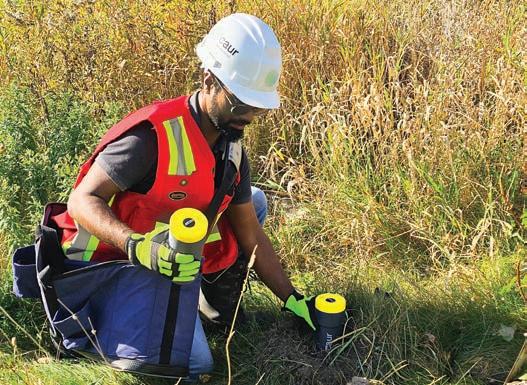
n A geophysicist deploying Caur’s new high-resolution 2-Hz geophones during an ambient noise tomographic survey in Canada.
IMAGE COURTYESY OF CAUR TECHNOLOGIES.
data logger for more efficient measurements of the contact resistance. SJ Geophysics is in the final stages of development of their next generation IP transmitter, scheduled for commercial operation in early 2025. The specifications are similar to those of their 100% duty cycle transmitter described in the Ground EM section. Research continues into the signal processing algorithms used for 100% duty cycle IP data.
In 2024, AGCOS successfully integrated new Induction Mapping Technology (ITM) with its standard wideband MT 50 kHz to over 50,000 seconds surveys and confirmed its distinctive advantages: high sensitivity to geoelectrical inhomogeneities, robust assessment of perspective areas and evaluation total longitudinal conductivity, separation of multiple nearby anomalies, reduction of data acquisition time, in-field express interpretation and all-terrain, all-season application.
Dias has developed a proprietary MT processing system that is designed for both functionality and compatibility. The software package utilizes automatic integration with digital field notes and DGPS locations of electrodes to minimize transcription errors during processing. The processing flow is built on the new MTH5 opensource file format for easy compatibility with the growing number of open-source MT packages. Saskatchewan-based EMpulse Geophysics is solely dedicated to the collection and interpretation of transient MT data using hardware and software of their own design. In 2024, they completed development of a lower power version of their Pulsar receiver. They have improved field work efficiency by including ultra-low-noise
induction coil magnetometers with significantly reduced length and weight along with capacitive measurement of the horizontal electric field. They also conducted field work in order to assess the viability of a new field separation technique whereby lightning strikes are located using commercial and academic location networks allowing for propagation modelling directly from the source. With this approach, it may be possible to split the total magnetic field normally measured at surface into internal (secondary) and external (primary) parts, perhaps allowing for enhanced imaging of subsurface structure via the anomalous tipper and/or Schmucker tensor.
Phoenix Geophysics introduced the MTC-185U, an ultra-wideband version of the MTC-185 sensor within the UMT family. This newly designed sensor delivers true broadband induction, maintaining the compact dimensions of the MTC-185 while achieving performance on par with or exceeding the MTC-155. It operates across a frequency range of 10,000 Hz to over 10,000 seconds. Key features of the MTC-185U include new windings, digital communication with the receiver, a durable thermoplastic polyurethane coating, and integrated bubble levels. Mass production of the sensor, under a new name, will begin soon, accompanied by updated firmware for enhanced data management.
Simcoe Geoscience have established new MT surveying and processing offerings and were pleased to have been awarded a multi-year contract for more than 15,000 MT stations for deep exploration of crustal boundaries related to both metals and hydrocarbons.
SJ Geophysics use the improved data loggers from their Volterra Acquisition System, described in the Resistivity and IP section, for MT acquisition as well as DCIP. The use of a common data logger makes combined audio-magnetotelluric and 2D-3D DCIP surveys straightforward. The majority of DCIP surveys also acquire AMT data.
In 2024, RSI introduced their second generation of handheld spectrometers. All of the functionality and measurement parameters available in the first generation have been retained, but the second generation has greater sensitivity to terrestrial radiation, shorter measurement times, and improved calibration and evaluation methods. The new handhelds have built in GPS and are powered by a Li-ion battery with a USB-C for data input and output. As with the first generation of detectors, the next generation is available with either NaI or BGO crystals. RSI will continue to service and support the first generation of units and offer a trade-in incentive to those interested in upgrading.
• Petrophysical data acquisition and analysis
• Geological review andforward modelling
• Specialty 2D and 3Dsurvey planning
• Supervision and QA/QC of data acquisition
• 2D and 3D modelling and imagery
• Geological integration and interpretation
• Target generation and prioritization
• Drillhole database management
Barry Bourne BSc (Hons), FAIG, MSEG, MAICD Principal Consultant
In 2024, Abitibi Geophysics added GPR, near-surface seismic and acoustic optical televiewer to its list of surveying, data processing and exploration-focused interpretation services.
5/51 Forsyth Street, O’Connor, Western Australia, 6163 www.terraresources.com.au
+61 409 493 485 | b.bourne@terraresources.com.au
CAUR Technologies specializes in the design and manufacture of advanced three-component, 2-Hz geophones that offer exceptional sensitivity for accurate seismic velocity models. These geophones are paired with continuous data transfer systems and are enhanced by IoT technologies and AI for streamlined data collection, real-time transmission, and rapid result delivery. By applying machine learning algorithms, CAUR accelerates the interpretation of seismic signals, enabling near realtime insights and faster decision-making for its clients.
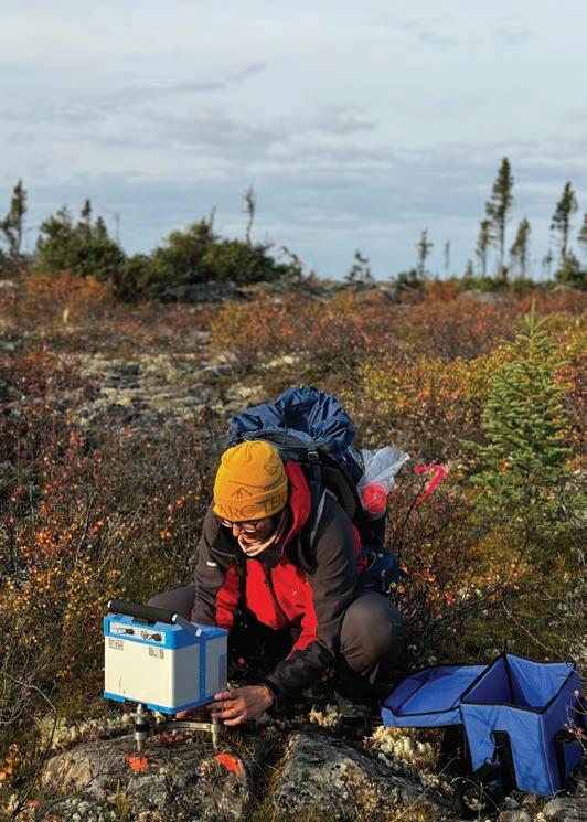
ALS’ AI-enabled pattern recognition and anomaly detection tools provide flexibility and reproducibility when working with multiple data types including EM, gradient magnetics, and gravity data. They also developed PeakFinder, their anomaly detection routine. It examines line data and compares it to responses selected from the survey data and/or those generated from synthetic plates. Magnetic, EM and/or gravity data can be modelled. A normalized result is returned with values between zero and one depending on the similarity the channel data is to the target signal. The results are displayed as a similarity map that highlights segments of flight lines that are similar or dissimilar to the target signal.
In 2024, Bell Geospace successfully employed innovative source body migration methods, leveraging FTG tensor components to directly map subsurface structures and contact lineaments within targeted depth intervals. These developments address the challenge of resolving shallow complexities while providing detailed mapping of deeper structures. This can help uncover subtle geological features that potentially host critical minerals.
In 2024, CGI expanded its prospectivity mapping capabilities and rigorously tested them on public datasets from Australia. To address the need for rapid data turnaround in projects with narrow drilling windows, CGI developed a ML-driven method
that reduces the processing and QC time for DCIP datasets from weeks to hours. Without sacrificing accuracy, this automated approach delivers 20% to 30% more usable data, providing clients with timely insights to optimize exploration campaigns.
To support work in the Athabasca Basin, Condor has been routinely adding constrained 3D inversions to the assessment of magnetic and EM surveys, and gravity where appropriate. As well, efforts are being made to assess how best to undertake the joint processing and interpretation of inductive and natural field EM results (such as VTEM and ZTEM).
Convolutions Geoscience is a British Columbia-based consulting company with expertise in project management, 3D-modelling, geoscience interpretation, exploration survey planning, and drill hole targeting for critical minerals. In 2024, they consulted on projects across Canada and central Africa. Convolutions Geoscience works closely with its clients to run joint 3D inversions for more accurate subsurface modelling. The inversions include unconstrained, parametric, and co-operative geological inversions. The hybrid parametric EM inversion includes conductive rectangular prisms or ellipsoids embedded in a voxel model. This approach allows for the modelling of high-contrast thin conductors while considering heterogeneity in the overlying ground. The co-operative geological inversion uses a seed model produced by the client’s parametric inversion and geologic information. Combining these inversions into a single process allows for a physical property model that agrees with the geophysical and geological data. Convolutions applied this framework to uranium, copper, gold, and nickel projects across Canada and globally, demonstrating its effectiveness.
Convolutions uses high-performance cloud computing provided by DUG Technology of West Perth, Australia, to offer a large-scale computing framework for big, high-resolution datasets. This collaboration allows for HPC for geophysical inversions and quick data processing through parallelization of computer processing
Geotexera’s latest development is ZTEM inversion software, anticipated to be ready after testing by the end of this year.
In 2024, Mira Geoscience continued the development of their geoscience Analyst software. New developments in processing include potential fields and airborne EM processing and filtering, grid merging, and automated anomaly detection-and-characterization methods from airborne TEM data. Survey design methods were improved, with a focus on new tools for DCIP. New developments in geophysical modelling and inversion include significant updates of the SimPEG inversion codes and interfaces across all methods including joint inversion, and GemPy integration for rapid starting model construction. New tools for geological interpretation of geophysical outputs include ML for pseudo-geology map creation from geophysical grids, edge detection on geophysical grids to support structural interpretation, and many more. In Mira’s geophysical consultancy business, they introduced new methods for integrating geological and geophysical data into 3D geological models using a combination of ML and geophysical inversion.
In 2024 Novaminex began licensing the Provus EM modelling software. Provus allows for the creation manipulation and modelling of thin conductors of complex shape. Multiple plate models can be co-simulated including all EM interactions between conductors. The description of the eddy currents is general so that the correct diffusion can be simulated even
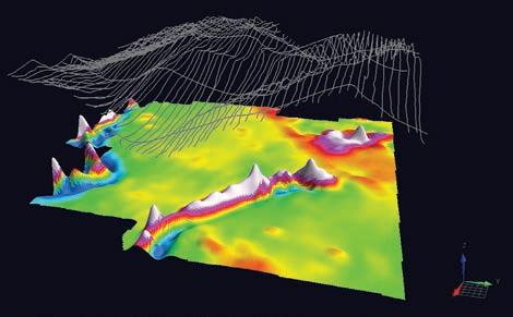

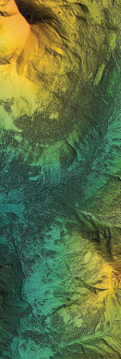
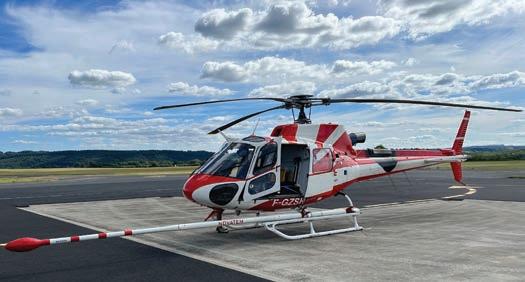
when the primary field varies significantly over the surface of the conductor. Understanding of the simulated fields is aided by visualization of the induced eddy currents on the conductors themselves and as vector panels displaying their primary, secondary or total magnetic fields. Throughout 2024 development of Provus has continued with an interface to pull geological information from Geoscience Analyst so it can be displayed directly in Provus’ 3D view, and facilities were added to allow for modelling a more complex outer conductor edge and for adding holes in the conductor. Advances were made in implementing computer assisted modelling (inversion) but these are slated for completion in 2025.
While Novatem’s recent efforts have focused mainly on hardware development, EM software developments are ongoing and will not be completed until 2025. These include the development of a three-dimensional AFMAG and VLF inversion software.
Paterson, Grant & Watson continued to develop and refine processing workflows for their consulting work. Applications included gradient-enhanced gridding for aeromagnetic data, and equivalent source modelling to improve the accuracy apply of pole-reduction at low magnetic latitudes.
Radai has updated their 3D inversion software for vector magnetics. Inversion seems to give better results when using vector magnetic data rather than TMI scalar data. Radai have also finalized an initial version of 3D inversion software for frequency-based EM data.
RadAssist is the proprietary spectroscopy software developed and used in most RSI instruments. In 2024, RadAssist was updated to include automation of NASVD processing and to provide isotope-specific maps, simplifying the post data processing steps required. It also now displays raw count rates, as well as concentrations of K, U, Th with altitude corrections.
In 2024, RMG increased its capacity for geophysical modelling of magnetic, gravity, EM, MT, and DCIP data. Integrating data and models from multiple techniques with geological knowledge allows RMG to provide unique insights to help progress exploration projects towards discovery. Additionally, RMG expanded its expertise in large-scale regional processing and interpretation of geophysical data within a geological context. RMG developed geophysical interpretation expertise in the context of mineral systems, applied in several high-profile projects across Canada and the Middle East.
SGC have developed ML and AI analysis and interpretation tools to aid mineral mapping, prospectivity analysis and target generation from multi- and hyperspectral remote sensing data, geophysical and geochemical analysis. They also now have ANT modelling, and 3D AFMAG and AEM inversion capabilities.
SJ Geophysics has implemented multiple open-source inversion software packages on their in-house computer cluster. They are now capable of running large scale 3D inversions using the FEMTIC (3D MT), Tomofast-x (MVI and gravity) and SimPEG (magnetics, gravity, and EM) inversion software programs, in addition to the industry standard UBC-GIF 3D DCIP-magneticsgravity inversion codes. SJ Geophysics EM data processing software continues to see active development work. Significant improvements have been made to the processing algorithms that enable data acquisition from two EM loops simultaneously.
TechnoImaging provides advanced 3D-imaging solutions for all airborne, land, and marine geophysical methods for mineral, hydrological, geothermal, oil and gas exploration and production using their proprietary Glass Earth technology. They have developed new methods of 3D airborne EM inversion, which take into account both EM induction and IP effects in order to simultaneously recover 3D conductivity and chargeability models. Considering both the EM induction and IP effects, adds additional information (chargeability) and improves the accuracy of the recovered conductivity. TechnoImaging also introduced a novel approach to recovering the remanent magnetization from TMI field data. It is based on the simultaneous inversion for four unknown scalar parameters of the rock magnetization – magnetic susceptibility and three scalar components of the remanent magnetization vector.
In early 2025, Tensor Research is releasing ModelVision 18, a new online help and documentation system that accesses fast search engines and an AI assistant to make it easier for new users. The new point visualization tool supports RPD mapping output. The RPD mapping system can use tensor data calculated from TMI to extract depth of cover, magnetic susceptibility, magnetic remanence and evidence of alteration events associated with magnetite destruction.
In 2024, Viridien continued its development of algorithms and software for high end 3D imaging of passive and active sources seismic, EM and potential fields data. They also released a new 3D CSAMT modelling and inversion module in Geotools, along with airborne EM tools.
Based in Silicon Valley, Vorticity provides advanced scientific computing solutions across the finance, energy, mineral exploration, and life sciences industries. In 2024, they launched Astrape, a GPU-accelerated inversion framework for mineral exploration. Astrape provides the ability to run large scale 2.5D and 3D airborne EM inversions in two ways – independently via their online portal or as a service through their in-house consultants. Advanced hyperparameter search capabilities allow users to rapidly run a series of inversions with diverse parameters and starting models.
A key innovation in 2024 is Vorticity’s enhanced Uncertainty Quantification (UQ) algorithm. This proprietary tool enables users to assess confidence levels in their conductivity models more effectively by running hundreds of full 3D voxel-based inversions on the same region. Quantifying uncertainty in airborne EM inversion results allows geoscientists to make informed decisions. Initially focused on airborne EM inversions due to their computational demands, Vorticity plans to expand its inversion offerings to create a complete EM mineral exploration solution. The goal is to develop a full joint inversion framework that includes magnetics, DCIP, AEM, and MT methods.
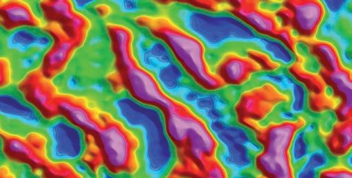
Our comprehensive data integrates seamlessly into your mineral exploration workflow, providing a streamlined and efficient approach to data acquisition, management and integration.
Learn more at viridiengroup.com/mining or reach out to our team at mining@viridiengroup.com
Abitibi Geophysics https://.ageophysics.com/en
Advanced Geophysical Operations and Services (AGCOS) www.agcos.ca
AirGeoX www.airgeox.com
ALS Geoanalytics https://www.alsglobal.com/en/Geoanalytics
Aurora Geosciences https://aurorageosciences.com/
Australian Geophysical Services https://www.australiangeophysicalservices.com
Axiom Group axiomex.com
Bell Geospace https://www.bellgeo.com/
Big Sky Geophysics www.bigskygeo.com
Caur Techologies www.caurtech.com
ClearView Geophysics geophysics.ca
Computational Geosciences https://www.compgeoinc.com/
Condor Consulting www.condorconsult.com
Convolutions Geoscience convolutions.ca
Crone Geophysics & Exploration www.cronegeophysics.com
Devbrio Geophysics https://devbrio.com/
Dias Geophysical www.diasgeo.com
Drone Geoscience www.dronegeosci.com
Drone Geoscience www.dronegeosci.com
EMpulse Geophysics www.empulse.ca
EON Geosciences www.eongeosciences.com
EXIGE www.exigesa.com
Expert Geophysics expertgeophysics.com
Fleet Space fleetspace.com
GEM Systems https://www.gemsys.ca/ Geonics www.geonics.com
Geosensors www.geosensors.com
Geotech www.geotechairborne.com
Geotexera www.geotexera.com
HiSeis www.hiseis.com
Ideon Technologies www.ideon.ai
IRIS Instruments www.iris-instruments.com
MAGSPEC Airborne Surveys www.magspec.com.au
Medusa Radiometrics https://www.medusa-radiometrics.com/ Mira Geoscience www.mirageoscience.com
New Resolution Geophysics www.airbornegeophysics.com
Abbreviations (for acronyms used in the text)
ADC Analog to digital converter
AEM Airborne EM
AFMAG Audio-frequency magnetic
AI Artificial intelligence
AMT Audio-frequency magnetotelluric
ANT Ambient noise tomography
ASEG Australian Society of Exploration Geophysicists
ASL Above sea level
ATV All-terrain vehicle
BGO Bismuth germanate
BHEM Borehole EM
CSAMT Controlled-source AMT
CSEM Controlled-source EMCSR
CSRMT Controlled source radio-MT
dB/dt Rate of change of B with time
DCIP Direct current resistivity and IP
DGPS Differential global positioning system
DHEM Downhole EM
GPU Graphics processing unit
ELF Extremely low frequency
EM Electromagnetic
FD Frequency domain
FDEM Frequency domain EM
FDEMS Frequency domain EM sounding
FDIP Frequency domain IP
FLEM Fixed loop EM
FTG Full tensor gradiometry
GNSS Global navigation satellite system
GPR Ground penetrating radar
HPC High-performance computing
Hz Hertz
IMU Inertial measurement unit
INS Inertial navigation system
IoT Internet of things
IP Induced polarization
Nova Mining Exploration Solutions www.novaminex.com
Novatem www.novatem.com
Paterson, Grant & Watson www.pgw.ca
Phoenix Geophysics www.phoenixgeophysics.com
Pioneer Exploration Consultants https://www.pioneerexploration.ca/
Precision GeoSurveys www.precisiongeosurveys.com
Prospectair Geosurveys prospectair.ca
Quantec Geoscience www.qauntecgeo.com
Radai www.radai.fi
Radiation Solutions radiationsolutions.com
RAMP Geological Services www.RAMPgeo.com
RMS Instruments www.rmsinst.com
Ronacher McKenzie Geoscience https://www.rmgeoscience.com/ Sanborn Geophysics https://sanborn.com/sanborn-geophysics/ Sander Geophysics www.sgl.com
SBQuantum www.sbquantum.com
SHA Geophysics www.shageophysics.com
Simcoe Geoscience www.simcoegeoscience.com
Sisprobe www.sisprobe.com
SJ Geophysics https://www.sjgeophysics.com/
SkyTEM Surveys www.skytem.com
Southern Geoscience Consultants sgc.com.au
SoutherRock Geophysics www.srgeophysics.com
TechnoImaging https://technoimaging.com/
Tensor Research www.tensor-research.com.au
Terra Resources www.terraresources.com.au
Terraplus https://terraplus.ca/ Terraquest terraquest.ca
Terrascope www.tscope.ca
Thomson Airborne www.thomsonair.com.au
Transparent Earth Geophysics https://www.transparentearth.com.au/ Viridien www.viridiengroup.com
Vorticity https://vorticity.xyz/ Xcalibur Smart Mapping https://xcaliburmp.com/
K Potassium
LiDAR
Light detection and ranging
ML Machine learning
MT Magnetotelluric
MVI Magnetic vector inversion
NaI Sodium Iodide
NASVD Noise adjusted singular value decomposition
NCSEM Natural and controlled source EM
NFEM Natural field EM
nT nanotesla
PDAC Prospectors and Developers Association of Canada
QC Quality control
RTK-GPS Real-time kinematics GPS
SAM Sub-audio magnetic
SIP Spectral IP
SP Self potential
SQUID Superconducting quantum interference device
STC Supplemental type certificate
TD Time-domain
TDEM Time-domain EM
TDIP Time-domain IP
TEM Time-domain EM
Th Thorium
TMI Total magnetic intensity
U Uranium
UAV Unmanned airborne vehicle
UMT Ultra-wideband MT
USGS United States Geological Survey
UXO
Unexploded ordnance
V Volt
VLF Very low frequency
VSP
VTOL
Vertical seismic profile
Vertical take-off and landing
AXIOM GROUP introduces a revolution in airborne geophysical surveys: Xcite™ and NxT™. These state-of-the-art technologies by New Resolution Geophysics (NRG™) bring unprecedented precision and efficiency to your exploration efforts.
AXIOM is proud to provide these services in Canada. Choose AXIOM for cutting-edge technology and a comprehensive data collection toolkit that empowers you to boldly explore.
Xcite™, a new generation of helicopter-borne time-domain electromagnetic (HTDEM) system allows for the simultaneous collection of LiDAR, Radiometrics, Magnetics, and Gravity data. A versatile solution for a thorough understanding of your survey area.
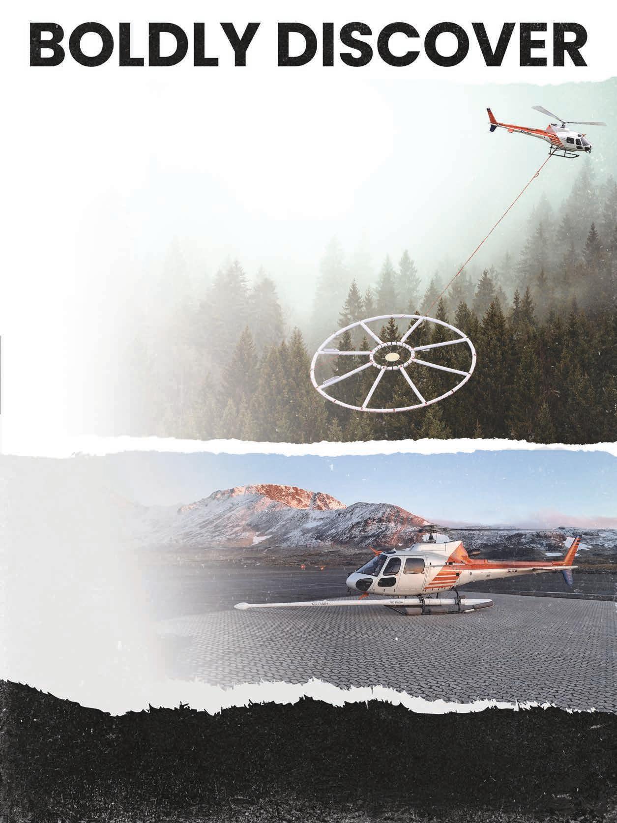
NxT™, a groundbreaking airborne gravimeter offers precision and detail in every flight, co-collecting magnetic and radiometric data without compromising on survey quality. Ideal for intricate geophysical exploration.
Powered by:
Find out more and book your survey today!