5 minute read
SURVEYING IN BRITISH COLUMBIA
Shauna C. Goertzen, BCLS, CLS
Beyond the Measurement
To survey, defined in the Merriam Webster Dictionary (2004 Edition page 721),
to find, look over, and examine closely; to find and represent the contours, measurements, and position of a part of the earth’s surface (as a tract of land); to view or study something as a whole Synonyms—scrutinize, examine, inspect, study.
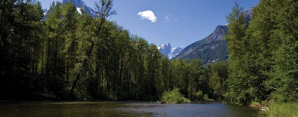
South of Chetwynd, BC
A British Columbia Land Surveyor (BCLS) is a surveying professional.
When people think of surveying, they think of someone on the side of the road or on a site measuring or “surveying,” gathering data on a specific section or area of land. Data can also be collected by other means, such as aerial drone surveys or Global

Navigational Satellite Systems. Data can be shared with other professionals through the use of CAD, point files, surfaces, and so on.
The uses of survey data are many and varied. Topographical survey data are used to aid in detailed design by architects, civil engineers, shallow (communication/fibre optic, gas, and electrical providers) and deep (water, sanitary, and storm) utility operators, and road builders, to name a few. Topographical data are also used to calculate volumes on a variety of masses where contractors are paid based on those volumes.
A British Columbia Land Surveyor has the expertise to analyse geospatial data from multiple sources and determine if they are in the same systems or advise how to relate the information to each other. A land surveyor can determine and provide transformation parameters when design information is not based on the same elevation and/or horizontal reference systems. That is significant during the design or construction phase of a project to ensure features are constructed in the intended locations and at the intended elevation.
Mapping surveys may be used to delineate flood plains and mark those elevations on the ground to ensure houses and structures are not built within the restricted areas. Mapping surveys may be used to show the location of bird nests or bear dens.
BC Land Surveyors complete extensive historical research on parcels, including the examination of aerial photography to determine whether natural boundaries have changed due to accretion—lawful or unlawful fill—or erosion or avulsion or whether existing occupation is consistent with historical occupation for transfer of lands from the Provincial Government to First Nations. Land surveyors are called to act as expert witnesses, speaking to issues such as natural boundaries or whether a road has moved or changed from the original creation/construction.
Land surveyors are involved in construction and land-development projects. They work with civil and construction contractors to mark construction limits or building foundations, to provide elevation benchmarks and site control, and to provide continuous construction support, if needed, during the completion of the project. A surveying professional needs to be able to read architectural plans and engineering drawings to transfer the design from paper to ground.
BC Land Surveyors must have an understanding of zoning bylaws to be able to provide certification to local governments to confirm that buildings and structures conform to regulations. A land surveyor brings many areas of expertise to a land development project, including the knowledge and ability to review zoning bylaws, land use, and official community plans and to understand the mandate of the Agricultural Land Commission Act.
A BCLS has the knowledge and experience to interpret acts such as the Land Title Act, the Land Act, and the Strata Property Act and their associated regulations. A BCLS is able to speak to matters such as the access and frontage requirements of a development or calculate the unit entitlement of a strata development.
Research of a property under development is an important task generally completed at the feasibility study phase and throughout a project. The land surveyor brings experience to this research by looking at exclusions and reservations of the original Crown grant, interpreting and depicting metes and bounds descriptions or legal title descriptions of parcels created through description, that is N 1/2 of Section 3.
A BCLS reviews the legislation and regulations along with registered charges and identifies inconsistencies of the new development with legislation or a registered charge on the title, such as a restrictive covenant.
Land surveyors are able to provide guidance to the public regarding what land is referred to within a title and what charges affect the parcel. Examples of questions from the public to a BCLS include “Does my parcel have access through a neighbouring parcel through a registered easement?” or “Do I own the creek running through my parcel?”
Land surveyors participate in discussions with owners/developers and lawyers/BC Notaries to determine options for ownership and governance structures for developments, for example, the benefits and restrictions of using a phased strata—bare land or building, air space parcel, or fee simple. A BCLS will contemplate the effects of the ownership and governance model on future owners and will seek to ensure the interest and rights of subsequent owners are protected.
As has been evidenced, BC Land surveyors provide professionals in other fields and the public with a complete package of survey data and related information.
So, the next time you are seeking advice or guidance for issues related to land and boundaries, consider contacting your local, professional surveyor. A BCLS is not only an expert in spatial measurement, he or she is a trusted advisor. s Shauna C. Goertzen, BCLS, CLS, practises in Prince George, BC.
From the Agricultural Land Commission Act
Purposes of the Commission 6 The following are the purposes of the commission: a) to preserve the agricultural land reserve; b) to encourage farming of land within the agricultural land reserve in collaboration with other communities of interest; c) to encourage local governments, First Nations, the government, and its agents to enable and accommodate farm use of land within the agricultural land reserve and uses compatible with agriculture in their plans, bylaws, and policies.


