3 minute read
Others follow the trail of the cedar cutters


The path the cedar cutters made in getting to the Richmond River Heads marked the beginning of a great transformation of the landscape – from a natural self-sustaining ecosystem to a farming landscape that has was constantly, and rapidly, altered. This period also marked the beginning of the gradual dispossession of the Bundjalung families who lived from and cared for the Creek and its surrounding environment, along with their adjoining Country. It is nonetheless noted that in the first decade of settlement, the cedar cutters and other settlers living at the river mouth co-existed with the Bundjalung families who lived there.
Back in Sydney colonial authorities were confident that the region boasted vast tracts of fertile territory suited to farming, and so in 1843 Charles Burnett was sent to survey the Richmond River it in its entirety. With convict assistants, Burnett came to the district via Moreton Bay (present day Brisbane). He made direct contact with the cedar cutters, along with the squatter William Wilson who in 1843 took out a conditional lease over much of the land in the vicinity of Ballina, including land along North Creek. When Burnett spoke with Bundjalung people whom, he’d noted on his survey plans, lived at the mouth of the river, they told him they called the location ‘Bul-loona’.14
Throughout the 1840s cedar cutters and traders were the river’s main European inhabitants. Bundjalung families continued to occupy their Country and live from it. In these decades also some Bundjalung men worked for the cedar cutters. Their knowledge of the ‘bush’ and wider landscape greatly assisted the cedar cutters. They worked across all facets of cedarwork, including as axemen, squaring and rafting logs, as well as bullock driving. This working relationship assisted in forging the co-existence that characterised relations between the European and Bundjalung people in the earliest years of European occupation at Ballina. 15
In 1846, former ship’s carpenter turned cedar-cutter, bullock-breeder and then again ship- builder, William Yabsley took over Wilson’s conditional lease and occupied land referred to as the ‘Big Plain’ that was located along the western bank of North Creek (now encompassed by Ballina Island). Wilson left Ballina to concentrate on his grazing operations further upstream at Lismore. Yabsley called his lease Devonport (after his native home Devon) and from here he constructed a ‘fifty-foot ketch’ he named the Pelican. Aside from residing and constructing his ketch at Ballina, Yabsley also grazed bullocks on North Creek. He eventually abandoned this lease in 1849, to settle at Coraki where he established a permanent ship-building enterprise.16
The 1850s brought more changes to life at the mouth of the river – though cedar cutting and shipping remained a dominant activity. As other settlements made upstream grew and expanded the river became busier and settlement at the river mouth also grew in numbers and area. So in this decade a further land survey was carried out at Ballina by AssistantSurveyor Frederick S. Peppercorne to locate the shops and services that the settlements all along the river were demanding.
Peppercorne’s historic plans indicated the location of the ‘town of Woolwich’ at today’s Shaws Bay; it located ‘suburbs’ on the southeast portion of the present day Ballina Island, and edging the western bank of North Creek near its junction with the main river, which encompassed the land contained in William Wilson’s and William Yabsley’s conditional leases from the 1840s. Peppercorne’s completed survey also led to the first sale of land on Ballina Island in November 1857.17
14 Survey map of the Richmond River and notes of Charles Burnett , General – Sketch Books and Surveyor’s Field Books. Index to Sketch Books, 1828- 90, NSW State Records, microfilm 2778. 15 Ainsworth. 16 Clare Schofield., William Yabsley: Master of Coraki 1812-1880, Manilla, N.S.W., 1983. 17 Ainsworth, 32-33.
The 1850s also marked a low point in relations between Europeans and the Bundjalung families living at the river mouth when the Native Police rode into Ballina and executed a dawn raid on Bundjalung families camped on the northern side of North Creek, many people were murdered or wounded.18 Both Bundjalung and European oral testimonies record this event and the dedication of the East Ballina Aboriginal Place recognises and memorialises its impact on Bundjalung families then, and today.
18 Ainsworth, 45-46.
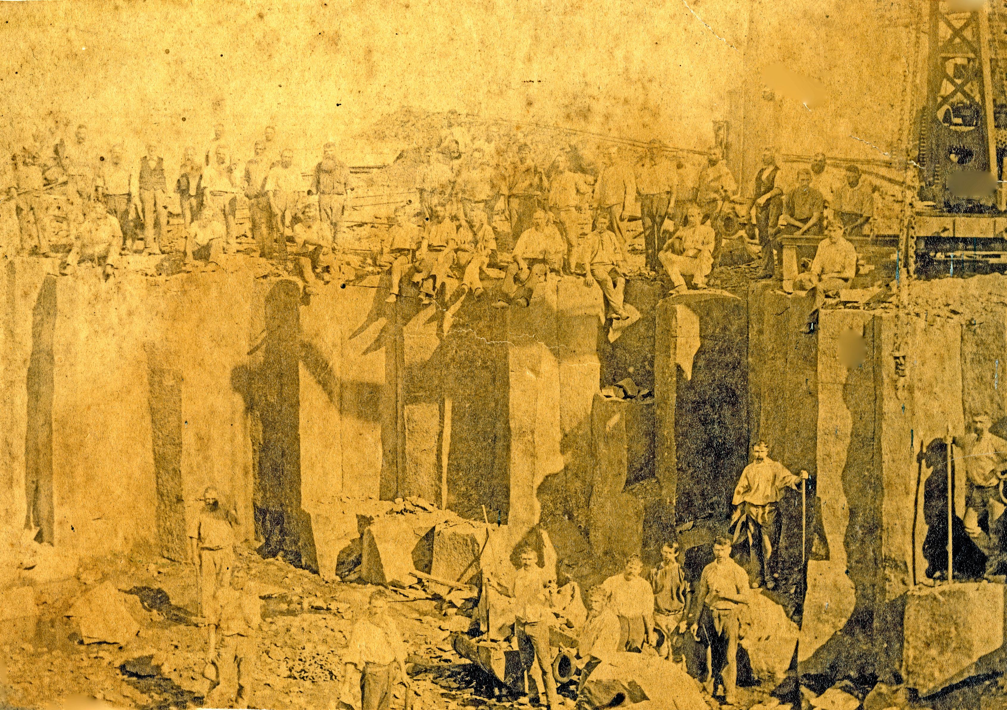
Photograph taken by professional photographer Joseph Check, c.1895 showing men at work on the breakwall at the mouth of the River. Along with farming, the building of the breakwall permanently transformed the landscape at Ballina and along North Creek. Image courtesy of Richmond River Historical Society.