4 minute read
1. OF LAND OR WATER?

Planning for resilience : Rward, Mumbai
Semester 9
Advertisement
With the rapidly changing environmental conditions over the past few decades, Mumbai has witnessed extreme pressure on the land for housing and other infrastructure. The issue of flooding, in the face of increased instances of heavy rainfall coupled with tidal action, leads to increasing socio-economic aggravation and even loss of life and property. In the face of projections about rising sea levels, the instances of flooding in the city will only increase further. Hence this studio aimed to sensitize the public towards developing an understanding of climate change, terrain, and built form.
Mumbai, India
Academic Group design September 2019 - October 2019
Head Supervisor: Ravi Punde | ravi@sea.edu.in
The studio debated and discussed the positions architects and planners need to take concerning making way for the flooding water and the idea of reclamation by negotiating some land for water.
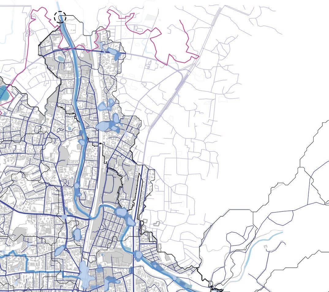
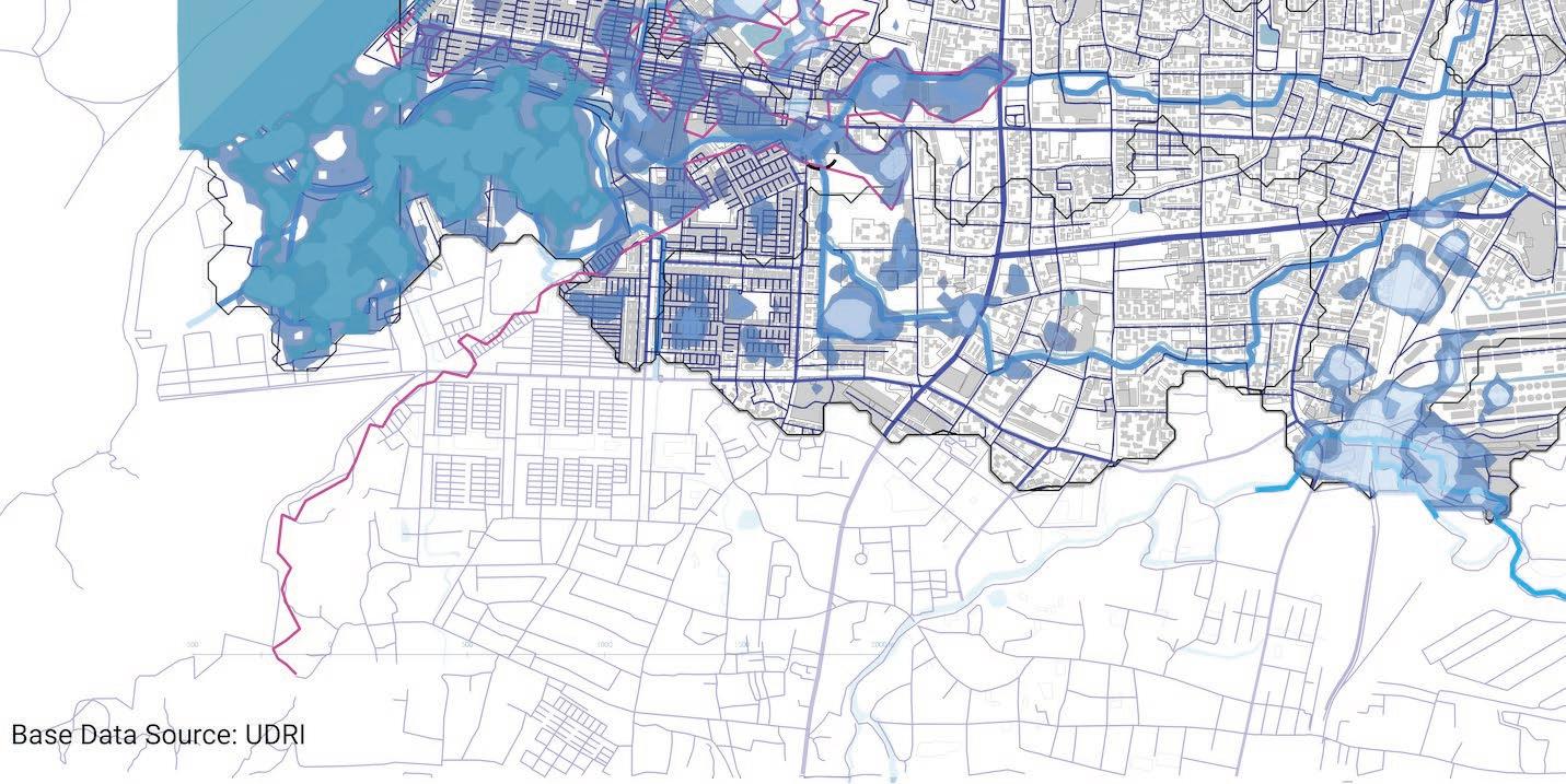
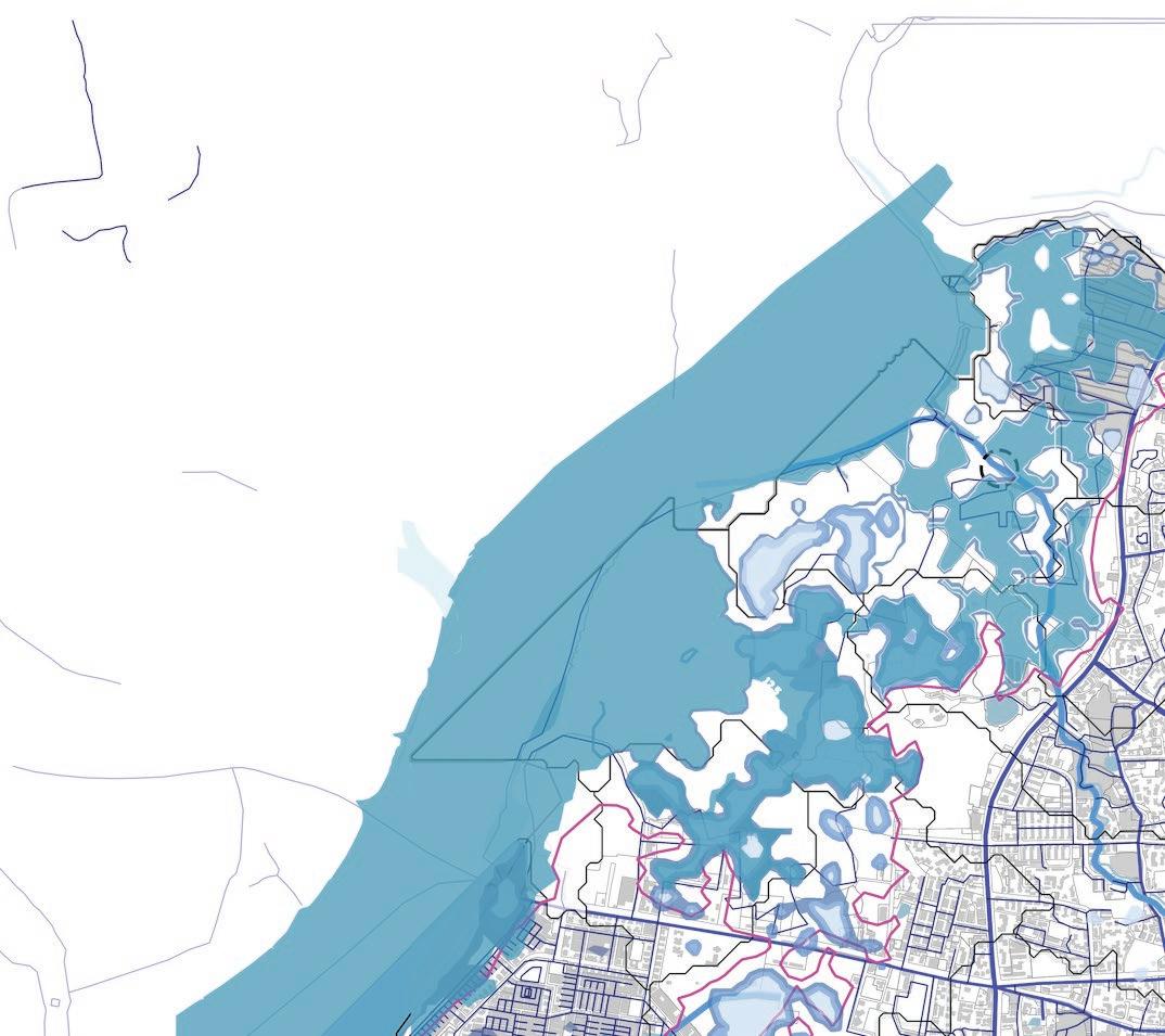
Upon observing the city at a macro level, the development of roads has been perpendicular to the natural flow of water, creating dam-like situations, eventually leading to flooding. This furthered into an understanding of what steps can be taken to construct a resilient city that will be able to handle the current flooding situation.
Survey Methodology
The studio brought together components of the landscape and the urban design studio where the students attempted to understand the complexities of terrain and built form in the light of the recent discussions on climate change and rising sea levels to be specific. This came from studying the terrain using Geographic Information System (GIS), simultaneous fieldwork, and ethnographic documentation.
Stakeholders
The larger focus of the studio was also to collect an ethnographic narrative of stakeholder experiences of flooding within the study area. The module addressed three larger groups of stakeholders; a) the locals inhabiting the area or individuals and collectives sustaining their livelihood on the study site, b) the elected representatives and c) the administrative wings of the city.

Observations
With certain projections and interactions, the approach revolved around the larger framework of four main objectives to be addressed by the strategies being adaptability, awareness, recovery, and relief and redevelopment
Some of the narratives and observations from the sites identified issues of inadequet water systems, improper construction system and ukept disposal systems, all adding up to cause flooding.

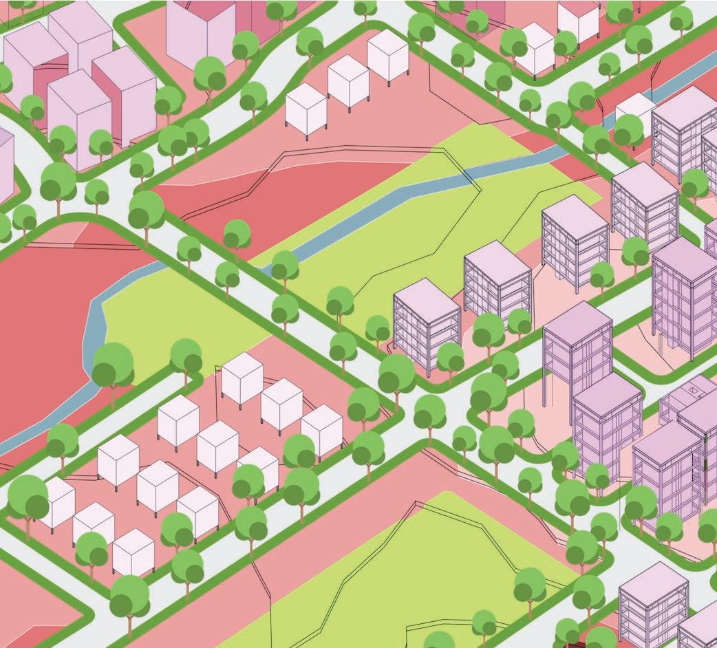
To achieve these larger objectives four main systems were considered for intervening within the watershed a) The open space system - System for holding water to avoid flooding b) The infrastructure - connect areas to larger urban ecosystem and allow water to pass c) The built form - changes in housing in response to the logic of the terrain to allow for the movement of water. d) an awareness ecosystem - devic policy frameworks and information systems.


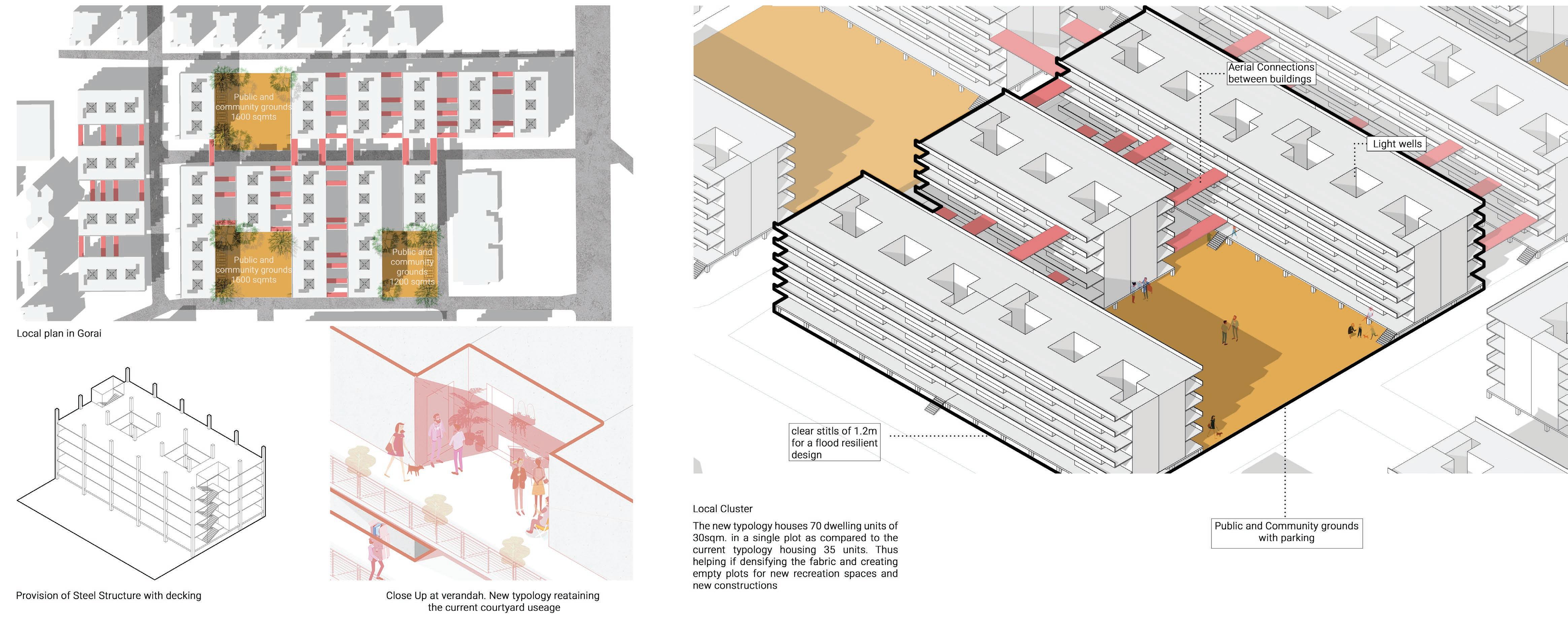
Slum Rehabilitation
The goal was to rehabilitate slums into the immidiate vicinity to maintain the connections the residents have already establishedTo optimize space in a light site, we started by providing 2 common washroom blocks per floor plate. The form thus developed as a staggered “E’ plan 11000 people from Bhim Nagar Slum had to be accomodated in this rehabilitation project.
Existing Dwelling Units = 2200
Size of existing dwelling unit= 12sqm

Proposed Buildings = 12 Dwelling Units = 2400 Size of proposed dwelling units = 20sqm Increase in size 25%
To achieve this, the logic of the watershed, as opposed to the administrative boundary, was adopted. Keeping these in cognizance, three overarching milestone time periods evolved.
1) The immediate electoral term, where the strategies for the year 2021 were fixed to provide a realistic image of immediate vulnerability for the citizen group.
2) A series of reconciliation strategies for a mid-term period aimed at the year 2034 emerged from the development plan year.
3) Long-term redevelopment for the year 2015 formed the next milestone where a sea level of 0.5 meters was predicted by the IPCC due to climate change.
Design For Builtform
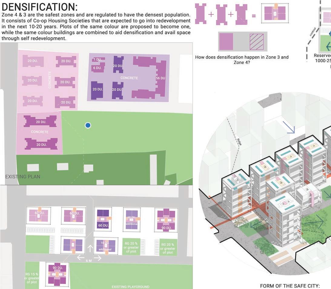
Densification
Parts of the scheme lies in Zone 1 and needs to be relocated at a higher priority. instead of relocation, Densification strategy was chosen.The ground floor chawl typology would be densified into a G+4 structure.This new typology is to be located in Zone 2 in the areas of the sites and services scheme.
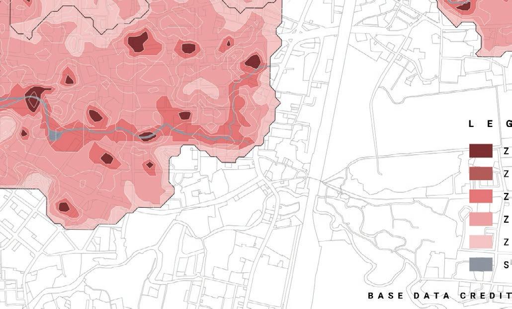


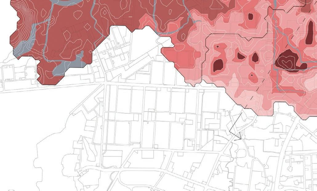
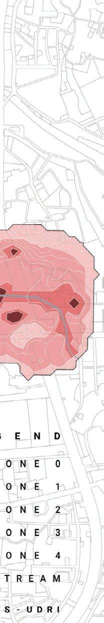
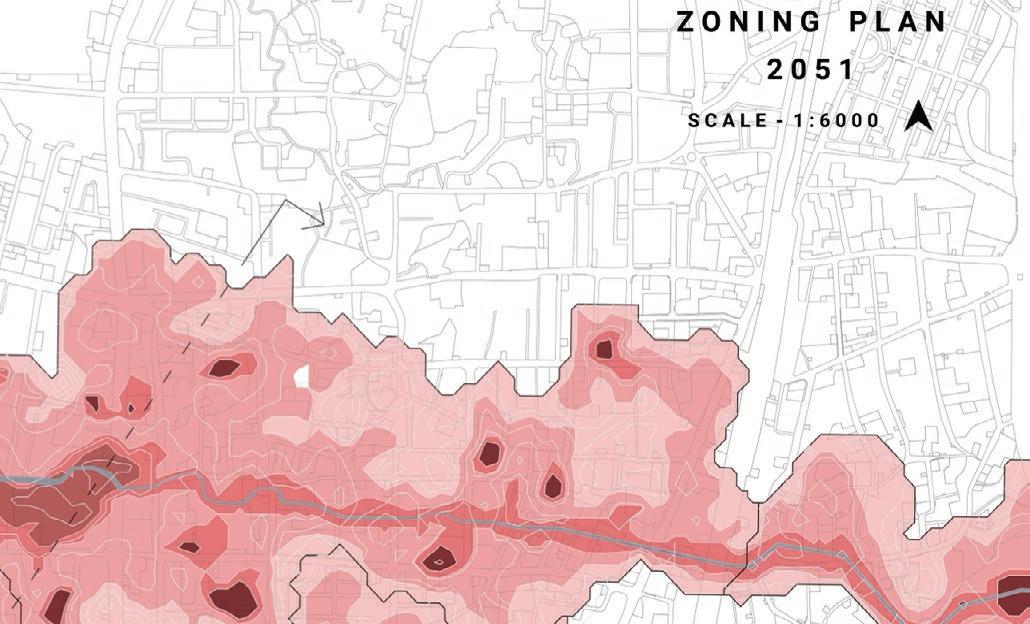
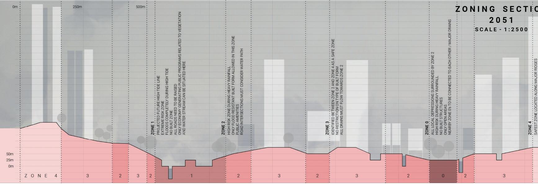
Zoning For 2051
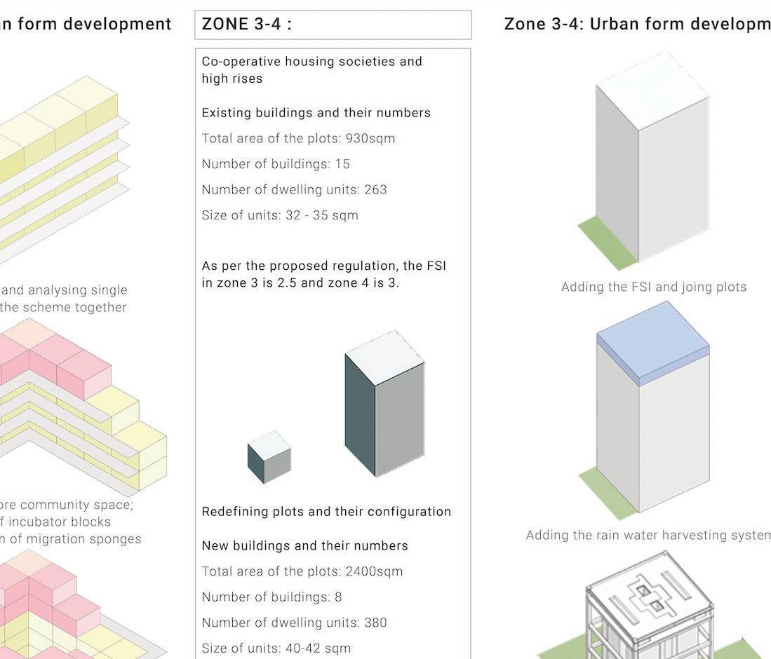
The strategy for the year 2051 is zoning the site in 5 major zones based on their topography and levels. The high risk zone annotated as ‘Zone O’ essentially marks the no build zone, whereas Zone 4 acts as the emergency zone wherein all emergency rehabilitation is provided along with no restrictions on built form for future densification.

Densification
Zone 4 & 3 are the safest zones and are regulated to have the densest population. It consists of Co-op Housing Societies that are expected to go into redevelopment in the next 10-20 years. Plots of the same colour are proposed to become one, while the same colour buildings are combined to aid densification and avail space through self redevelopment.

Design
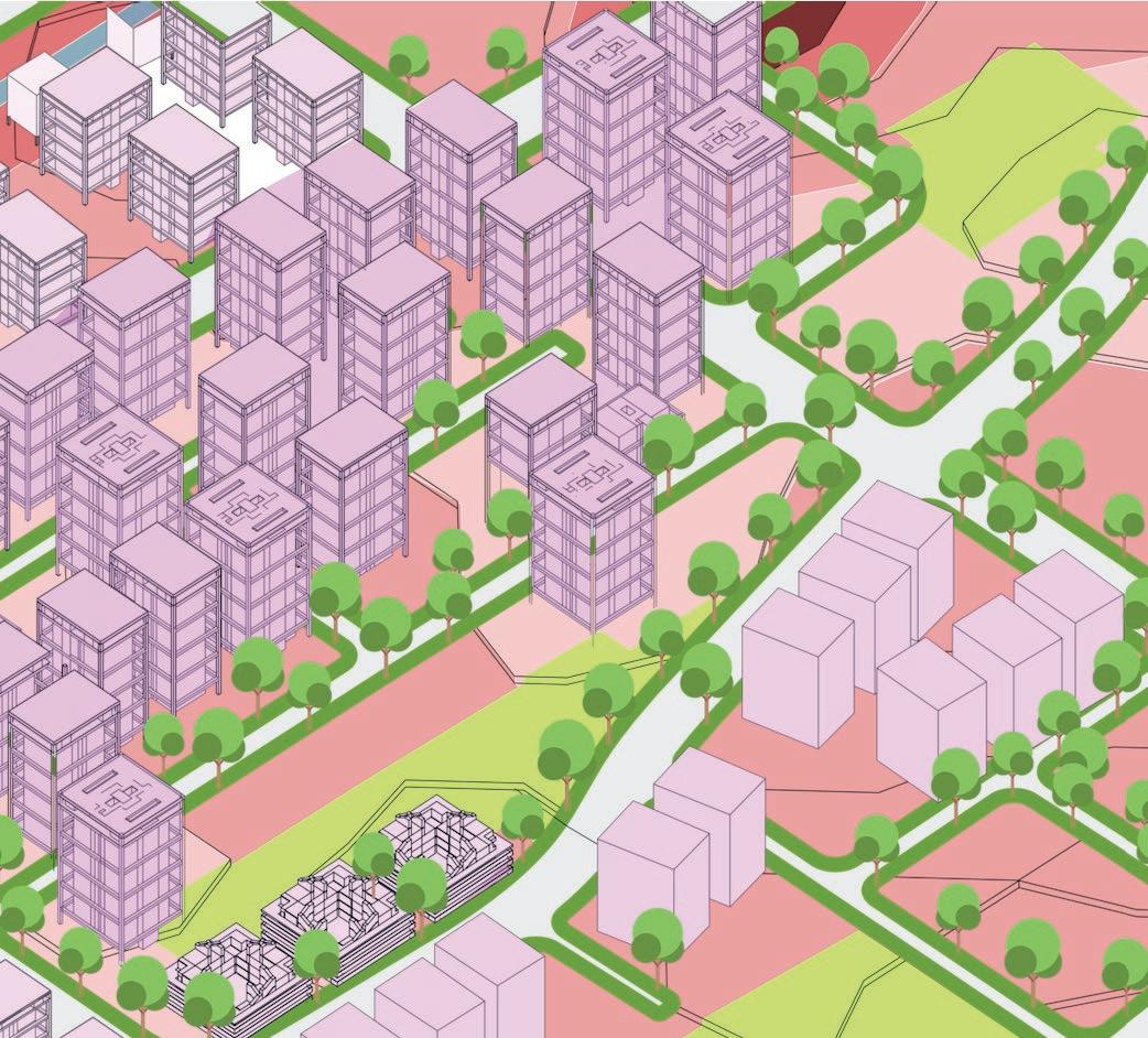
Long Term Strategy For Builtform
This phase proposes new kinds of resilient built forms for various zones responding to their respective vulnerabilities. A new urban fabric is imagined for 2015 Incubator and slub rehabilitation typologies for vulnerable settlements is developed in the new proposed safer zones. A high rise dense typology is developed for the safest zones in the area.


Incubator Building Typology
Slum often grows in the realms of informality on negotiable land becoming sponges for migration.
Zone 3-4 being the safest zones are looked as the densification sponges for the settlements lying in the to be vulnerable zones. The top 12 units of the proposed G+4 typology function as these incubator blocks which can be occupied by the migrants. Therefore it becomes a high density unit, with good light and ventilation, with the possibility of future densification
Conclusion
In addition to the three tier development proposal, the team also proposed a series of soft strategies that work in tandem with all term proposals progressively as frameworks, regulations and government-citizen systems to aid this mega transformation of R-ward.
The future prediction map begins to look a lot like the historic maps of the marshes, and it is imminent that the water will try to reclaim from the city in the near future. It is this realisation that prompts our design approach - working through resilience and not resistance. Climate change is an inevitable future, it is important for us to have a paradigm shift in the way we build, occupy and work with the land and water. More than anything, the studio reveals harshly the bare minimum time we have left for action against and for climate change.