Starting Point
Gate Road
As you leave the Community Centre, walk up Gate Road towards Fron Basin. You may be surprised to know you are walking on the Offa’s Dyke Path (ODP). Argoed Hall is on your right. Note the old ODP sign against the wall of Argoed Hall.
Argoed Hall
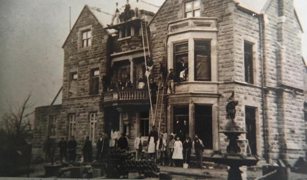
Argoed Hall was originally built as a home for the family of Ferdinand Graesser who established his chemical factory locally, which eventually was sold to Monsanto. He also owned the Wrexham Lager company in Victorian times. Argoed Hall is now privately owned. Ferdinand Graesser is buried in St David’s Churchyard, which you will visit later on in the walk.
Walk aross Gate Road, at the entrance to Argoed Hall, to enter Fron Basin where you have your first sighting of the Llangollen Canal.
Turn left and walk along the towpath, using the footpath nearest the canal. Note the buildings on your left which housed the canal workers mess and the Froncysyllte Institute. Walk along the towpath and you will approach the Pontcysyllte Aqueduct. At the end of the towpath, go down the steps to your left and follow the path under the aqueduct to see stunning and unusual views of the aqueduct.
The Building of Argoed Hall
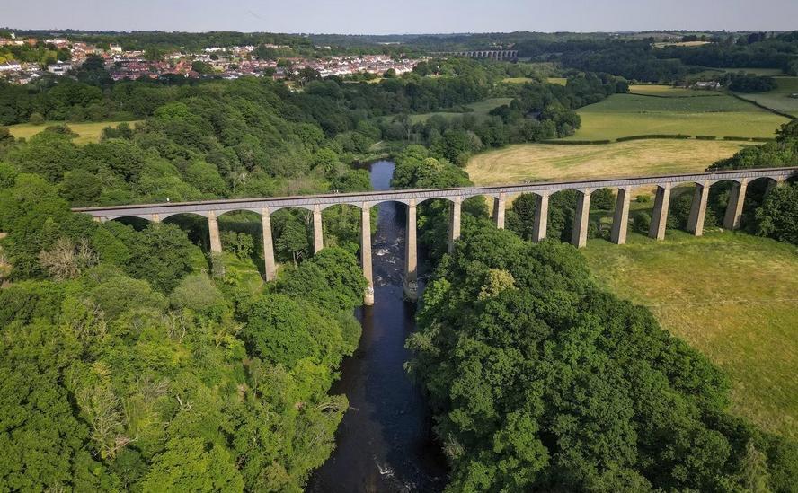
The Pontcysyllte Aqueduct carries the Llangollen Canal across the River Dee.
walk back towards Fron Basin, you will see canal boats moored and also moving to and from the aqueduct.
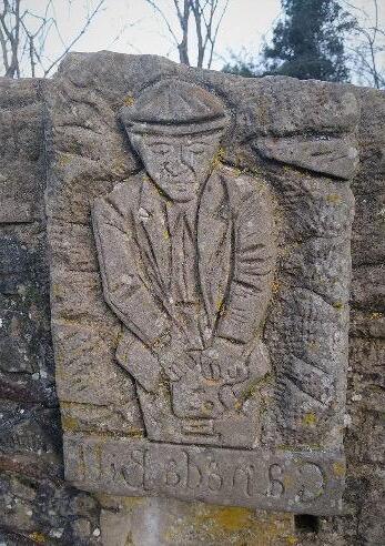
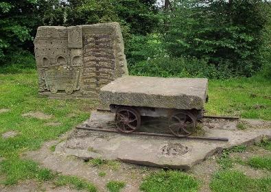
Note the Chirk Castle Limestone Company Monument and the view behind of the stunning Cefn Viaduct, built in 1848, to carry the Shrewsbury and Chester Railway across the River Dee, the viaduct measures 1508ft (466m) in length and stands 147ft (45m) above the river level.
The sculpture shows a local quarryman, Bill Canada or Canada Bill. Bill went out to Manitoba, Canada in the 1920s. His family returned to Froncysyllte in the 1930s, due to a lack of work. He died in the 1980s. This sculpture names one worker, to represent the hundreds who were employed in industries that have now disappeared.
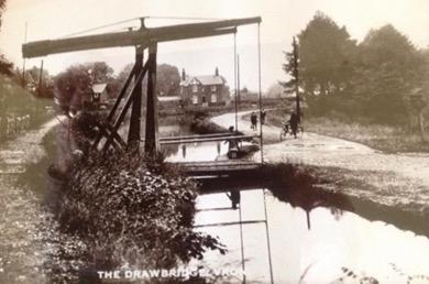
Swing Bridge
Continue along the towpath until you reach the swing bridge. Pause to look back at the aqueduct, across the fields, and read the history of the village on the Area of Outstanding Natural Beauty information board.
Staying on the towpath, continue along to The Old Lime Kilns. Look across the canal to see the limekilns. Commercial lorries stand on reclaimed ground, the area having being used a quay. If you are fortunate, you may see birds, often jackdaws, flying in and out of the limekilns to make their nests.
Cross Street Aqueduct
Continuing along the towpath, you will reach the hidden gem of the Cross Street Aqueduct, not as well known or dramatic as its more famous neighbour but the site of an important part of the industrial history of Froncysyllte. Watch out for the recently renovated steps on your left and walk down the steps. To your right, alongside the stables, is the path to Tan-Y-Cut Woods, a preserved woodland which is very interesting and well worth a return visit to explore.
Fron Branch
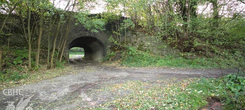
The Great Western Railway’s ‘Fron Branch’ was built westwards along the canal from the standard-gauge Wrexham to Shrewsbury line near Irish Bridge at the south end of the Dee Viaduct. They would both have carried coal to fuel the Froncysyllte Limekilns and carried lime back for conveyance along the main railway. The presumably horse-drawn ‘Fron Branch’ tramway ran parallel with the canal, at the crossing point turntables were positioned at ninety degrees on either side of the canal to turn the trucks. On the north side bricks surrounding the turning plate are still in-situ, but hidden by vegetation, on the south side the iron turning plate is still in position though mainly buried under the track surface.
Now walk, heading west, up the path towards the A5. When you reach the A5, pause and reflect that this is a historic road, built by Thomas Telford, and connecting London to Holyhead and then on to Ireland. Head towards Froncysyllte.
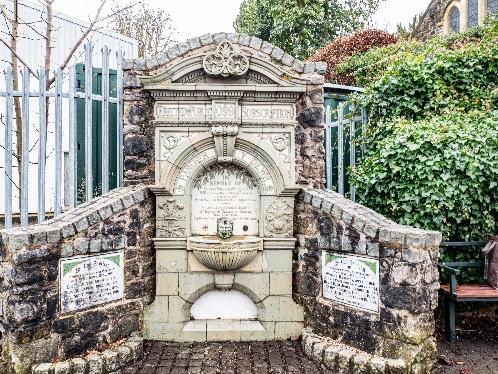
Outside the garage of AN Richards, stop to examine the Boer War Memorial, which dates from 1910. Originally situated at the other end of the village, the local Community Council is working with partners to try to secure funding to restore the memorial to its former condition.
Boer War Memorial
The original, ornate, Italianate drinking fountain was commissioned and funded by public subscription in 1909. It is constructed of Faience and was produced by the J C Edwards brickworks, whose Trefynant site is situated a mile away, on the opposite bank of the River Dee. The freestanding, random rubble masonry backing with scalloped flanking walls has subsequently provided space for the display of two First and Second World War marble tablets. These were saved when the Methodist Chapel was demolished and the whole memorial was relocated and reconfigured in its current form and in its current position in 1996.
Across the road, spot the auction house which is based in a converted Primitive Methodist Chapel. Now enter the grounds of St David’s Church and churchyard. Note the War Memorial at the front of the church. The church was opened in 1871 as a combined school and chapel of ease. The church remains an active place of worship. Volunteers work to maintain the churchyard as a place of rest and reflection. Notable burial plots include the author Dorothy Hartley, the industrialist Robert Graesser and the footballer David ‘Di’ Jones.
From the A5, just before the Post Office, you can look across the Dee Valley to the Pontcysyllte Aqueduct and also see the Bryn Seion Chapel at the foot of Methodist Hill. As you continue along the A5 note the old bakery at the foot of Methodist Hill, you can see the pulley used to raise flour.
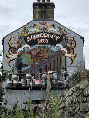
Continue along the A5 to the Aqueduct Inn. Well worth a visit to see the views of the canal and across the valley. Enjoy the wonderful mural by Alan Baillie on the far end of the pub.
Now return to the Community Centre by retracing your steps along the A5 and turning sharp left to go back down Gate Road. Note the History Points QR code on the wall of the Aqueduct Inn, this takes you to a short history of the pub.
When you reach the Community Centre, feel free to take a Community Miles map of a longer Froncysyllte walk from the wooden box on the external wall of the Centre. You can also download other local Community Miles maps by scanning the QR code on the printed copy or by accessing: www.clwydianrangeanddeevalleyaonb.org.uk/projects/community-miles/
Further Reading at: www.clwydianrangeanddeevalleyaonb.org.uk www.coflein.gov.uk: Cross Street Aqueduct
CADW Cefn Mawr and District: Understanding Urban Character www.historypoints.org/index.php?page=the-aqueduct-inn-froncysyllte www.issuu.com/artculturepeopleplace/docs/st_davids_church_trifold_leaflet
We are delighted to support the creation of this leaflet through ‘Navigating Through Time’ WHS Art Project by the Canal & River Trust which has been funded by the UK Government.