BLOCK STREET & BUILDING
The Best of New Urbanism in Arkansas
>PEOPLE-POWERED PROGRESS
>LOCAL CHANGE, REGIONAL IMPACT
>TREASURED PLACES IN ARKANSAS



>PEOPLE-POWERED PROGRESS
>LOCAL CHANGE, REGIONAL IMPACT
>TREASURED PLACES IN ARKANSAS
8 Letter from the Arkansas Municipal League 10 Letter from the Editor
12 BEYOND THE DIVIDE
Reconnecting West Ninth Street to the heart of Little Rock.
16 A PLACE OF CONNECTION
The Alice L. Walton School of Medicine seeks to transform 21st century healthcare with a double dose of disruption and intention.
24 ACROSS ARKANSAS
How local leaders are building the foundation of a statewide housing policy.
26 INNOVATION IN PARAGOULD
The city’s land bank is transforming housing one neighborhood at a time.
28 MAKING IT HAPPEN
A collaborative approach to success in downtown Springdale.
32 NORTHWEST ARKANSAS WELCOMES CNU 34
The Congress for New Urbanism seeks to leave a lasting impact on event’s host region.
34 GATEWAY TO ARGENTA
North Little Rock Arena District aims to connect people, places and downtowns.
40 FOUND IN TRANSLATION
In expanding the Razorback Greenway corridor, regional planners found shared language to inform local planning decisions.
44 A NEW DIRECTION FOR WESTERN ARKANSAS
Greenwood’s The Curve development combines civic space, housing diversity, walkability and mixed-use density into a unified vision.
48 THE CAVE CITY COMEBACK
Relationship building is key to this small town’s success.
50 SHAPING GROWTH BEFORE IT SHAPES YOU Centerton’s downtown master plan.
54 MENA MAKEOVER
A community bets on biking.
56 SUCCESS IN SEARCY
The city’s progress is being powered by a community in support of change.
Treasured Places of Arkansas 15 K HALL & SONS 22 HUGO’S RESTAURANT
WHITE WATER TAVERN
EUREKA SPRINGS
MAMMOTH ORANGE
PLAZA FRIDA
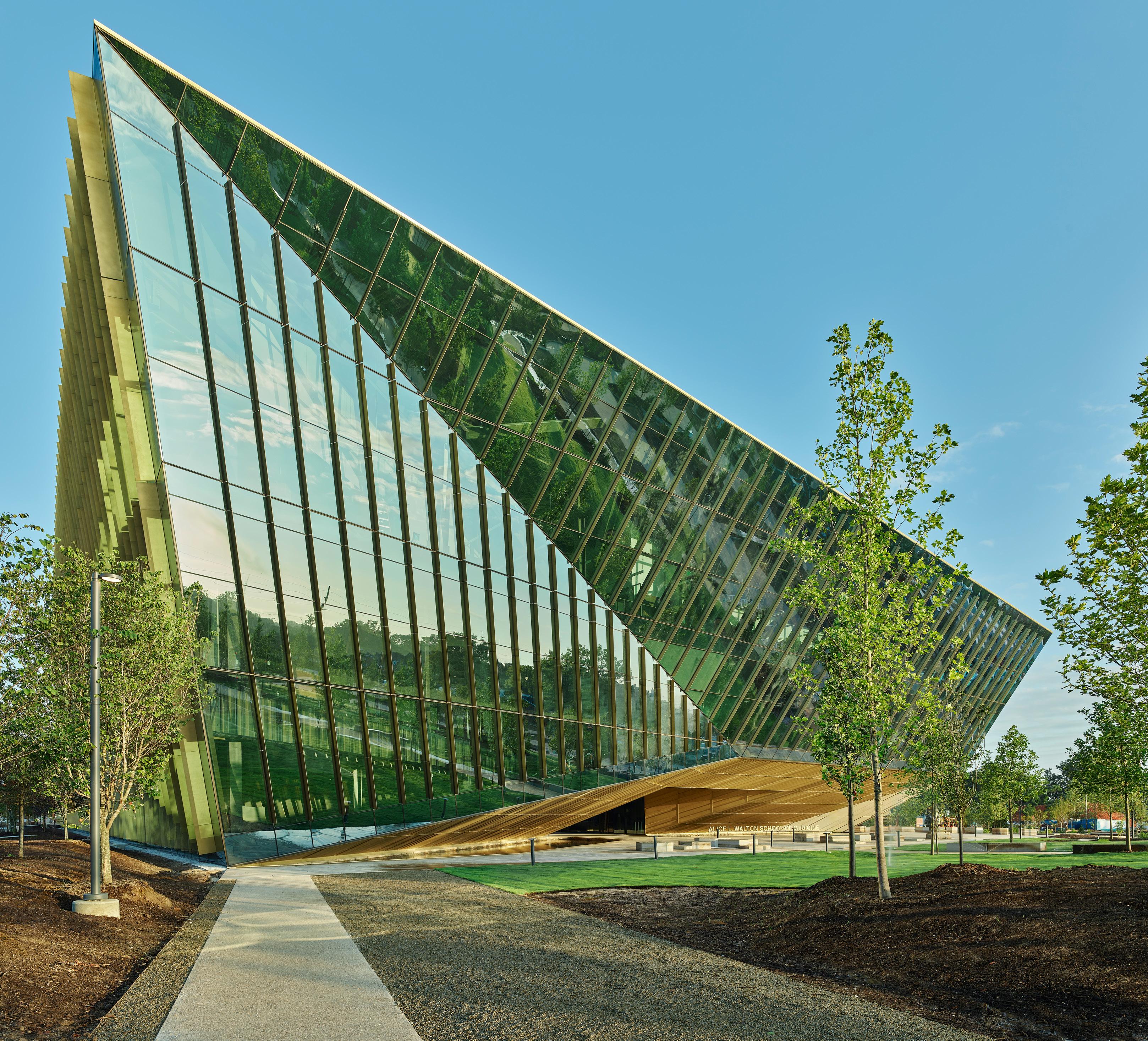
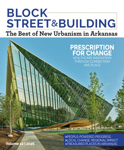
ON THE COVER: The Alice L. Walton School of Medicine’s holistic approach to healthcare is embodied in its design as well. Read more on page 16. Photography by Tim Hursley.

A Special Publication of Arkansas Times Produced in partnership with the Arkansas Municipal League
BROOKE WALLACE Publisher brooke@arktimes.com
JAMES WALDEN Editor
MANDY KEENER Creative Director mandy@arktimes.com

LUIS GARCIAROSSI
TERRELL JACOB
KAITLYN LOONEY
LESA THOMAS
WENDY HICKINGBOTHAM Account Executives
ROLAND R. GLADDEN Advertising Traffic Manager
KATIE HASSEL Digital Content Manager
MIKE SPAIN Advertising Art Director
ROBERT CURFMAN IT Director
CHAROLETTE KEY Billing/Collections
ANITRA LOVELACE Circulation Director
ALAN LEVERITT President
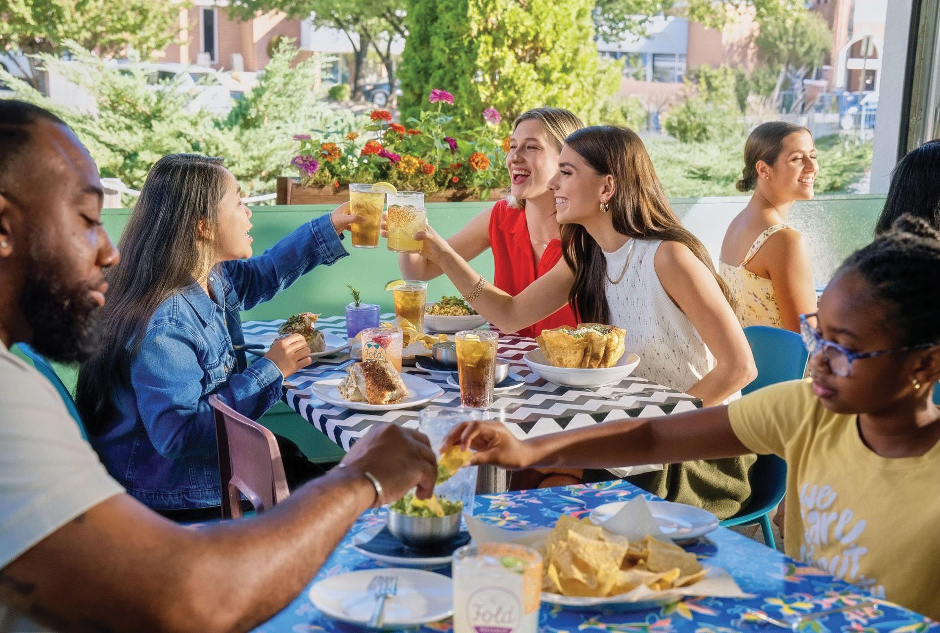
it all CONNECTS HERE. In Little Rock, creativity, cuisine, and scenic Arkansas River views shape every experience. From local art and live music to farm-to-table fare and standout dining, it won’t take long before you love you some Little Rock.
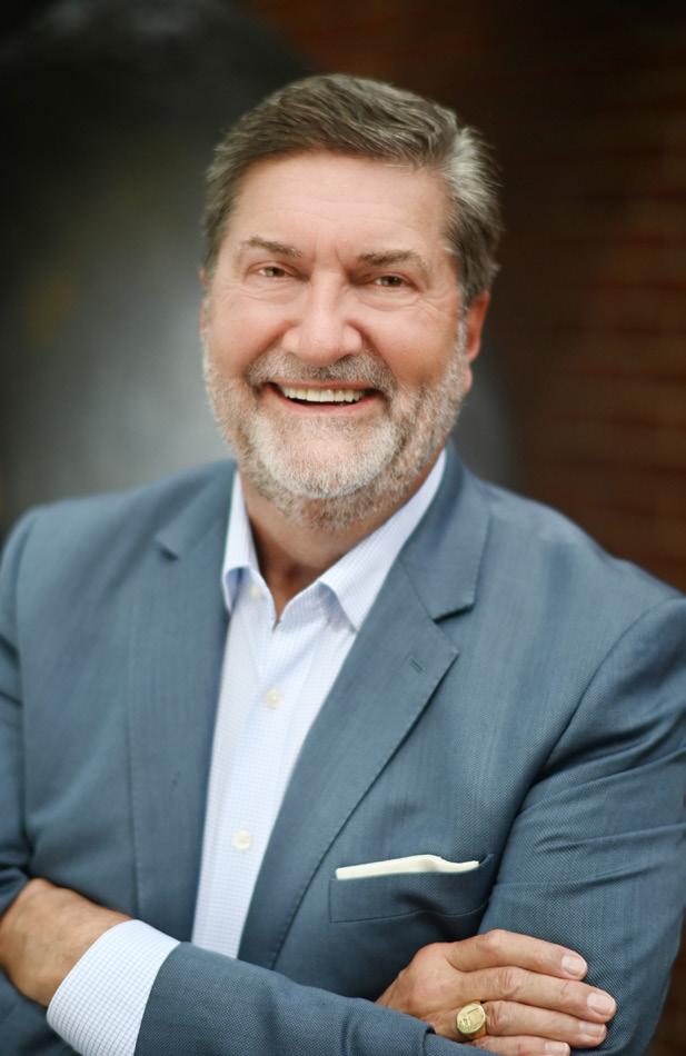
thoroughly enjoy writing this annual letter because this publication never ceases to amaze me. Perhaps I should say that differently. I’m truly blown away by the growth, change and revitalization happening in Arkansas’ municipalities! When you see the activity in cities and towns in all four corners of the state and every point in between, you’d be hard pressed not to be impressed. This year’s edition is no exception; it explores wonderful history, looks at new policy initiatives and offers a peek behind the curtains of several incredible projects. We are fortunate to have a publication devoted to what’s happening in Arkansas’ municipalities.
Before I go any further, let me apologize to the 496 cities and towns that are not mentioned below. The editors have given me an 800-word limit for this letter. I’m a lawyer and accustomed to, well, using a lot of words both when I talk and when I write. It’s no surprise then that I can only point out a handful of hidden gems and treasured places. Complaints may be sent to the editor!
I’ve never counted how many of the 500 municipalities I’ve visited since starting at the League in 1989. I feel certain it’s a large percentage, but again I haven’t done the math. Maybe 60% or more. Someday I’ll count but not today. Rather, I want to point out a few things I’ve seen and experienced over the past three decades. I’m very lucky to have witnessed so many incredible things. Here are a few in no particular order.
Mammoth Spring. Note the name is not “springs” as it’s often referred to. Hot Springs has an “s” at the end, Mammoth Spring does not. Is that important? Yes! Mammoth Spring is a singular massive spring, one of the largest in the United States, that sits smack dab in the middle of town. On average, it produces 9.78 million gallons of water per hour! The water forms Spring Lake, which in turn forms the headwaters of the Spring River. I have fished and canoed that river many times and can attest to three things. The water is cold, 58 degrees to be exact. The trout fishing is incredible. My brother and I once caught fish in the state park and ate them for lunch. Lastly, it is beautiful. Now that I think about it, there’s a fourth thing to mention. The town folks are engaging and will welcome you with open arms!
Manila. Both the Manila Depot Museum and Main Street Historical Museum pack a lot of history in a little square footage. The depot, built in 1910 after the original was destroyed in a lightning-strike fire, is one of the best examples of a traditional board-andbatten structure you’re ever likely to see. Originally established in 2001, the museum’s collections grew so significantly that it expanded to another building in 2014 and became the Main Street Historical Museum. The museums are rich in history about many things
including the city, the cotton industry and the New Madrid earthquakes of 1811 and 1812. But to me, one of the most important aspects of these museums is that they are run by the city of Manila by way of a committee of dedicated citizens.
Piggott. In addition to being one of two county seats of Clay County, Piggott is home to the HemingwayPfeiffer Museum and Educational Center. Yes, that Hemingway. He of the Pulitzer Prize-winning “The Old Man and the Sea”. Hemingway lived in the house with his second wife, Pauline Pfeiffer, whose parents owned the home, and he wrote a large portion of “A Farwell to Arms” in the nearby barn studio. My alma mater, Arkansas State University, was instrumental in restoring the property through its Heritage Sites project. The museum and educational center focus on the eras of the 1920s and 1930s by looking at the lives of the Pfeiffer family and Ernest. Other goals of the project include fostering interest in literature and promoting the art of writing.
Rogers. If you know me, then you know where this is going: the Daisy Airgun Museum, of course! Devoted to one of the most iconic Christmas gifts of all time (the Daisy Red Ryder BB gun), the Daisy Museum is a treat for kids young and old. You’ll learn about a small Michigan company that made iron windmills for farmers and accidentally, or providentially, fell into the airgun business. After firing a metal-framed airgun the general manager of the windmill plant exclaimed in the parlance of the times, “Boy, that’s a Daisy!” That same manager convinced the board of directors to get into the business of airguns, which began vastly outselling windmills in short order! Daisy left Michigan and its antiquated windmill plant in 1958, relocating to Rogers in part due to its more centralized location for shipping. Who can forget Ralphie’s dream of finding a Red Ryder under the tree on Christmas morning in “A Christmas Story”? Treat yourself to a slice of Americana and head to Rogers and the museum!
Of course, this is just glance at numerous treasures in our 500 cities and towns. You’ll read of several more places in this edition, each incredible in their own special way. These hidden gems and treasured places make for Great Cities, and as we all know, that makes for a Great State!
Mark R. Hayes Executive Director Arkansas Municipal League
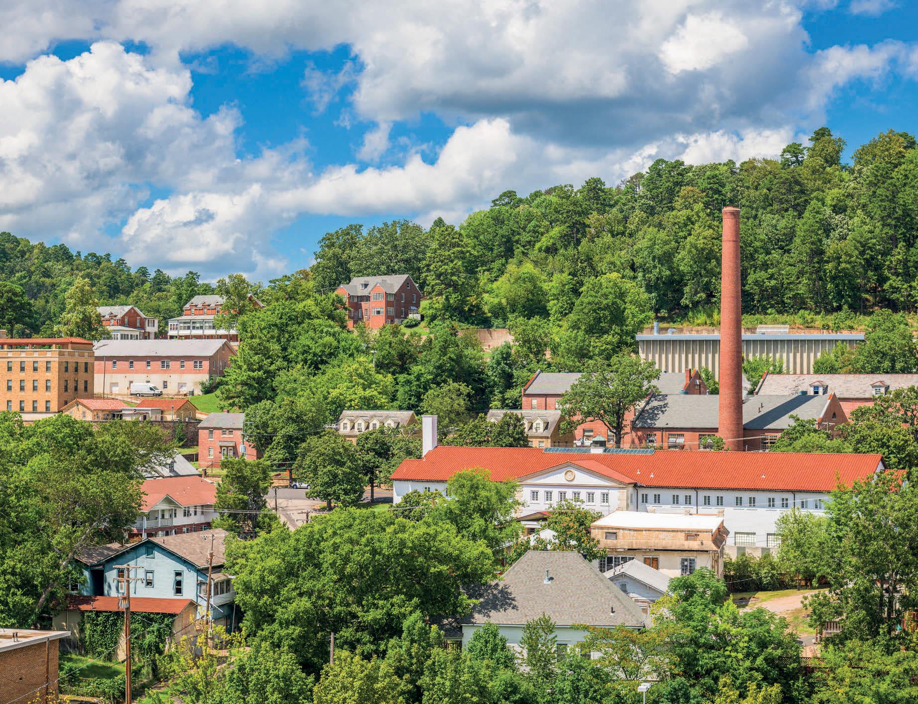
#GreatCitiesGreatState
As the voice for Arkansas’ cities and towns, we encourage municipalities to get involved in the process of progress.
@armunileague
Place. It is integral to who we are. In Arkansas we love to ask, “Where’d you go to high school?” It’s a loaded question of which the answer is not just the name of a school. It lets one immediately know something about the person being asked, cultural influences, socioeconomic status and a host of other assumptions.
The idea is expressed more eloquently in Winston Churchill’s quote, “We shape our buildings; thereafter they shape us.” We build places and imbue them with character, sometimes deliberately and sometimes not. That character shapes the people who inhabit those places. It can elevate us to a more noble version of ourselves. It can instill a desire to protect those treasured ideas passed onto us from previous generations. And, unfortunately, sometimes place can serve as an obstacle we have to overcome before realizing our own human potential.
Place can also hold a special place in a person’s heart. It can root one’s sense of identity. Memories tied to place can create indelible links and shape communities of people across generations. This is all to say, place is powerful. Place can be special and extraordinary in a way that is seldom matched.
The focus of this edition of Block, Street and Building is built on the influence of place. This edition brings a new series of Treasured Places in Arkansas profiles. You’ll find places steeped in history and architecture like Eureka Springs and the Ohio Club in Hot Springs, to places of emerging community and character like Plaza Frida, K Hall and Sons and White Water Tavern, all in Little Rock. You’ll also read stories about indomitable cities and towns rebuilding cherished places and creating community in an effort to leave things better than they found them. It’s my desire these stories serve as hope and inspiration in a time of growing disillusionment, division and distrust.
I’d like to express sincere thanks for again being given the opportunity to serve as editor for this edition of Block, Street and Building. It’s an honor to play a role in such a unique publication with an important mission, celebrating the best of urbanism in Arkansas.
James Walden, AICP, is an urban planning leader with Garver.



BY ERNEST BANKS
Some places are treasured not simply because of what stands there, but because of what they continue to hold.
A place rooted in history is more than a building, a street or a collection of storefronts. It is a vessel for memory. It carries the sound of footsteps, music, conversation, commerce, worship, celebration and everyday life. It holds the invisible architecture of belonging. Even when buildings are lost, businesses close or a street is cut off from the life around it, the meaning of that place can remain. Sometimes, that meaning waits for another generation to recognize it, reinterpret it and bring it forward again.
For Little Rock, West Ninth Street is one of those places.
Before Interstate 630 left an unrecognizable scar on downtown Little Rock, West Ninth Street was one of the most important hubs of Black business, music and community life in Arkansas. It was a corridor of entrepreneurship and social connection, anchored by the institutions now known as Mosaic Templars Cultural Center and Dreamland Ballroom. It was a street where Black residents
supported one another and shaped a cultural identity that was uniquely Little Rock.
But like many Black neighborhoods across the country, West Ninth Street was deeply impacted by urban renewal, highway construction and the separation that came with it. The construction of I-630 did more than introduce a roadway. It created a divide both psychological and physical. It disconnected neighborhoods south of the interstate from downtown. It disrupted economic activity. It changed how people moved, gathered and saw themselves in relation to the city.
Beyond the Divide began with that understanding.
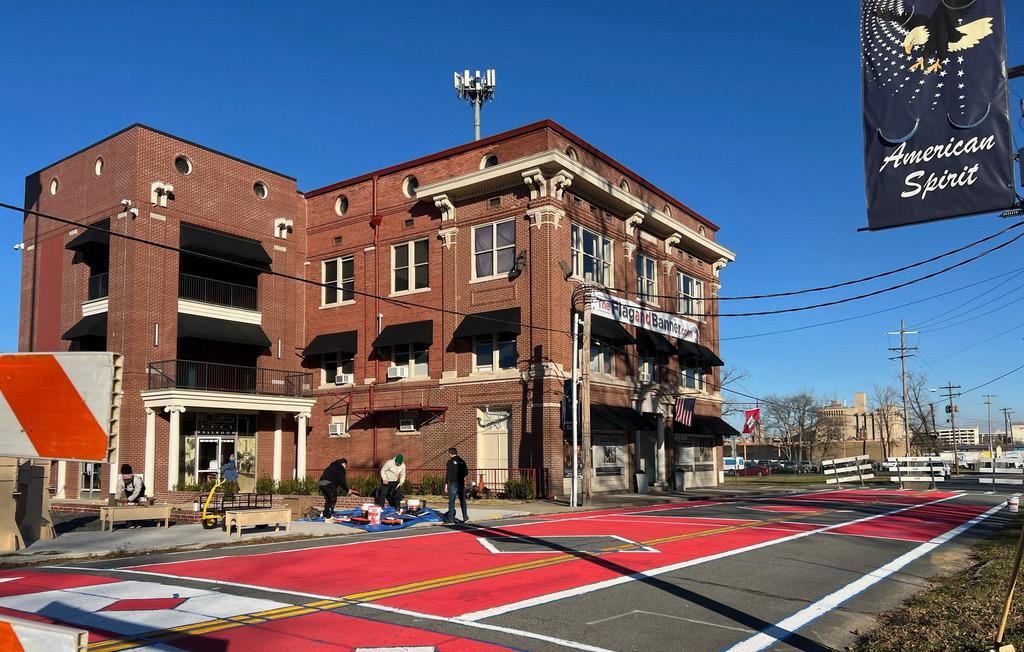
At its core, Beyond the Divide: Reconnecting West Ninth Street to the Hearts of Little Rock is a community-driven demonstration project led by studioMAIN in partnership with the City of Little Rock, Smart Growth America, and a growing network of local organizations, institutions, businesses, artists, students and residents. Through Smart Growth America’s Community Connectors program, Little Rock was selected as one of only three cities nationally to
receive support for a quick-build demonstration project focused on addressing the impact of divisive infrastructure, improving safety and advancing community reconnection.
But this project has never been only about paint, planters, crosswalks, containers or temporary installations. Those are tools. Important tools, yes, but still tools. The deeper work is about asking what it means to design in a place where memory already exists while the physical elements that made it special have been erased. It is about understanding that the architect’s role is not always to invent something new, but sometimes to listen closely enough to help reveal the potential that has been there all along.
That required partnerships before proposals. It required conversations before concepts. It required walking the corridor, studying the history, meeting with cultural institutions, listening to business owners, engaging youth, coordinating with city leaders, and asking residents what reconnection should actually feel like. Surveys, interviews, walk audits, community events and informal conversations became as important to the design process as drawings and diagrams. In a place like West Ninth Street, engagement is not a box to check. It is the foundation.
One of the most important lessons from Beyond the Divide is that alignment is a design element.
When local government, nonprofits, cultural institutions, small businesses, artists, historians, residents and national partners
THE DEEPER WORK IS ABOUT ASKING WHAT IT MEANS TO DESIGN IN A PLACE WHERE MEMORY ALREADY EXISTS WHILE THE PHYSICAL ELEMENTS THAT MADE IT SPECIAL HAVE BEEN ERASED.
begin to see a shared goal, the project becomes larger than any single organization. The work becomes less about ownership and more about stewardship. Each partner brings a piece of the story, a resource, a relationship or a form of trust that the project cannot succeed without.
That has been especially true for The Line on 9, the pop-up business district created as part of Beyond the Divide. The Line on 9 was designed to bring commercial life back to the corridor in a way that honors its history while supporting the entrepreneurs shaping its future. For our team at studioMAIN, creating the physical space was only part of the work. We also needed to create a reason for people to return, gather and experience the corridor in a new way. By building the infrastructure for a small business district, we gave the project life beyond its installations. It turned the space into an active destination. This is not a nostalgic reconstruction of what West Ninth Street used to be. It is a contemporary expression of the same spirit: Black business, creativity, ownership, exchange and gathering. This distinction matters. Preservation is not only about saving buildings. It is also about sustaining patterns of life. It is about preserving the possibility of a place to mean something again. In the past, preserving public memory was all that could be done to honor the legacy and spirit of the Black community of West Ninth Street. With Beyond the Divide, we knew that this project could become a pipeline that connects people together through preserving that pattern of everyday life, but in a modern way.
In architecture and urbanism, we often speak about scale: the scale of the block, the street, the building, the district, the city. Beyond the Divide operates across all of them. At the scale of the block, it asks how underutilized space can become active, safe and inviting. At the scale of the street, it tests how tactical urbanism, public art, pedestrian improvements, and programming can change the way people move and gather. At the scale of the building, it recognizes the importance of surviving anchors like Dreamland Ballroom and Mosaic Templars. At the scale of the city, it asks whether Little Rock can use temporary action to inspire permanent change.
That is the power of a demonstration project. It does not require a city to wait years before people can see what is possible. It allows a community to test an idea in real time, to learn from it and to build momentum around what works.
For West Ninth Street, that testing is both technical and emotional. We are tracking foot traffic, business activity, community participation and public response. We are learning how people use the space, where they gather, how long they stay and what draws them in. But we are also paying attention to something less visible: whether people feel invited back to a street that history tried to separate from them.
That is harder to quantify, but you can see it.
You can see it when a business owner opens their doors for the first time in a district built to celebrate them. You can see it when families walk along a corridor they may have only driven past. You can see it when elders share memories of what Ninth Street once was, and younger people begin imagining what it could become.
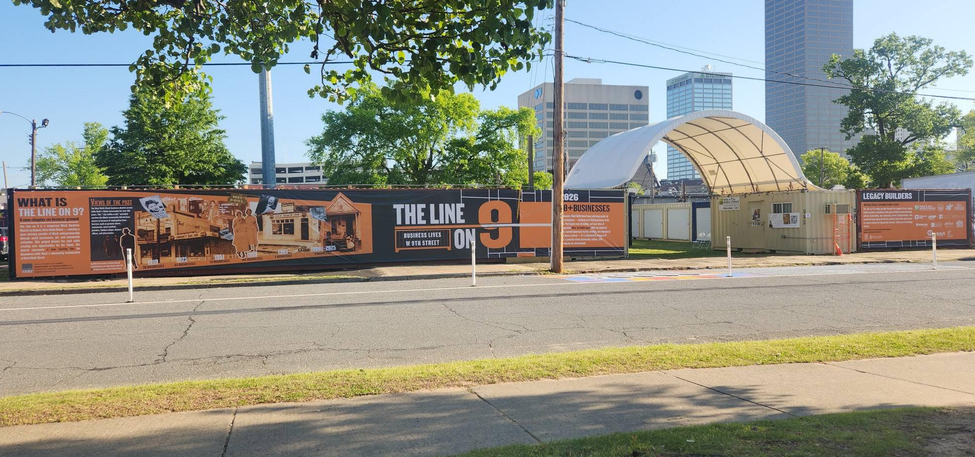
The Line on 9 transformed the space into an active destination, welcoming people back to a street that history tried to separate from them.
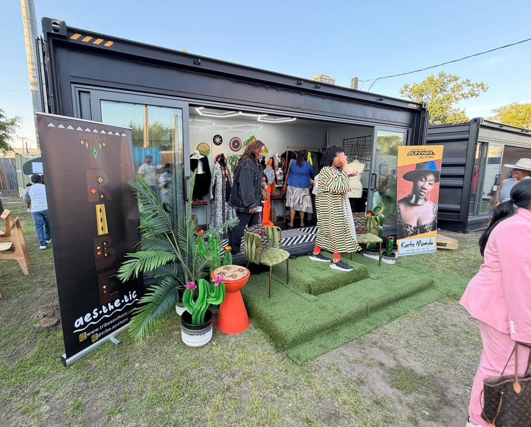
You can see it when music, food, art, retail, storytelling and public space begin to overlap in a way that feels both new and familiar.
That is when a place becomes more than its physical parts.
As an architectural designer, I have always believed in the power of the built environment. But Beyond the Divide has reminded me that design impact is not limited to what is permanently constructed. Sometimes design creates a framework for trust. Through this work, we can show a city how to imagine differently. Oftentimes, the important thing we build is momentum.
And that momentum is meant to be shared.
Beyond the Divide was never intended to be a one-time activation isolated to three blocks of West Ninth Street. It was designed as a scalable model for other underserved communities and underutilized spaces across Little Rock and across Arkansas. Every city has places that have been overlooked, divided or underestimated. Or communities with ideas, talent and memory already in place, waiting for the right partnerships and resources to help bring them forward.
The lesson is not that every neighborhood needs the same project, but that every neighborhood deserves a process rooted in listening, partnership, history and action.
West Ninth Street teaches us that treasured places do not disappear simply because they have been harmed. They remain in stories, buildings, street names, photographs, music, memory and in the people who refuse to let them be forgotten. The work of Beyond the Divide is to honor that memory while creating a path toward something renewed.
Not a replica of the past.
Not a temporary spectacle.
But a living demonstration of what can happen when a city chooses to reconnect with the places that have always carried its heart.
Ernest Banks is an architectural designer at Polk Stanley Wilcox Architects, a board member of studioMAIN, and the project lead for Beyond the Divide: Reconnecting West Ninth Street to the Heart of Little Rock. A lifelong Little Rock resident, Ernest’s work focuses on design, placemaking and community-centered revitalization.
BY DREW GLOVER
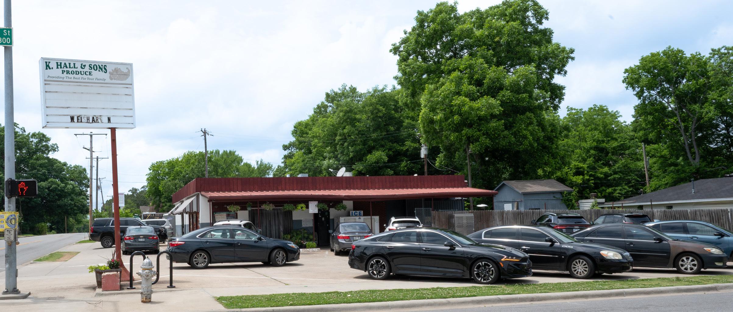
A2025 Arkansas Food Hall of Fame winner, K Hall & Sons has always been a community institution and model for sustained business success for Black Arkansans. It opened as Hall’s Produce in 1973 by original owners Knoxie Hall Sr. and Estella Marie Crenshaw Hall to sell fruits and vegetables from their farm in nearby Wrightsville. After remodeling the structure, the Hall family later expanded into wholesale foods and, by popular demand, cooked foods. Knoxie and Estella Hall's business acumen was recognized by the Arkansas Black Hall of Fame in 2016. K Hall & Sons, as it is now named, is still owned and operated by the Hall Family in the same former service station at 1900 Wright Avenue near historic Little Rock Central High School.
This treasured Arkansas destination is the undoubted anchor of the Wright Avenue neighborhood. A true neighborhood grocery, it provides its neighbors with access to fresh produce, cut meats and prepared foods for breakfast, lunch and dinner, six days a week. One of the most important things new visitors should know: K Hall & Sons is bustling and busy all day, every day. The best move is to arrive early to find a parking spot, which is arguably the best place to eat a K Hall lunch.
Whether you’ve called in a Philly sandwich or something else cooked to order, you’ll need some time to navigate the lines and to check out the different sections. Be sure to visit the produce area for peanuts and to pick up a box of sliced pink pineapple from the adjacent cooler. The drink selection is large and features the fluorescent HallBros2Go
lemonades and punch, which is quite near where you’ll place an order or join the line to do so. Let yourself be tempted by the hot box of fried foods. The pork chop and whole fried wings are great add-ons.
After ordering, look for “dessert row” along the top of the deli counter for things like cake, cheesecake and cinnamon rolls. To go beyond all the deliciousness you find during your visit, follow their social media for updates on their Saturday seafood boils and the everelusive Soul Food Sunday plates from the HallBros2Go food trailer.
Speaking of social media, you’ll find that K Hall & Sons’ Facebook account is quite active, often showcasing dangerously stacked quadruple burgers, updates on new and seasonal items, and comments on peculiar customer behavior, all while managing to engage commenters. You’ll also see regular posts highlighting other businesses, especially those that are small and minority-owned and may not otherwise see such online engagement. Still, there are other examples of the Hall Family making a positive impact beyond their walls, including speaking about healthy eating at local elementary schools and providing meals to those in need.
My advice for those heading to K Hall for the first time is simple: 1) Call ahead for their iconic burgers and pork chop sandwiches; 2) Shop the grocery selection during pick-up (Trust us, you’ll find something else to add to your order.); 3) Plan for a parking lot picnic with a pal.
Drew Glover is a Little Rock-based educator, Pedal Party pal and fulltime family man.
BY WESLEY WALLS
The new Alice L. Walton School of Medicine (AWSOM) was designed around the idea of connection. Connection to art. Connection to nature. Connection to wellness. Connection to community. It’s at the intersection of these connections where its founder envisions a transformation in health outcomes, reinforced by the school’s whole-health principles and emphasis on preventative care and personal well-being. The four-year M.D. program, which welcomed its inaugural class of students in fall 2025, aims to train physicians who are devoted to transforming the health of medically underserved and rural communities in Arkansas and beyond.
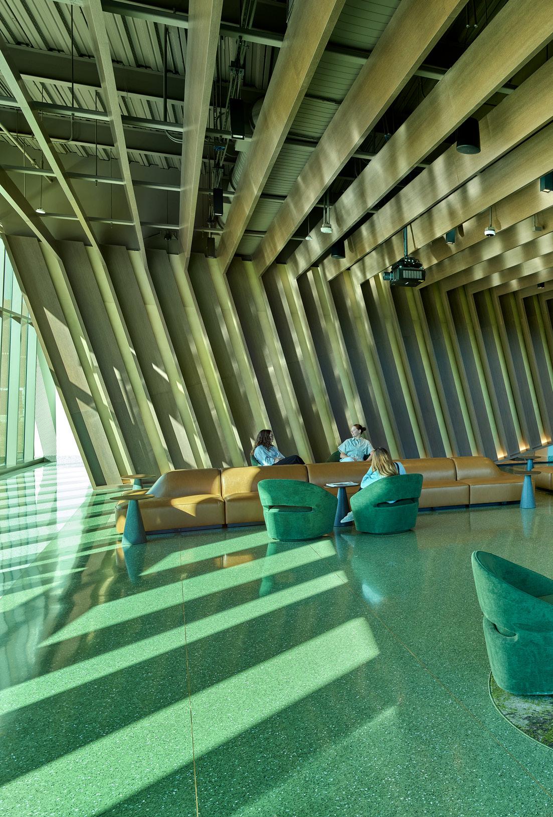
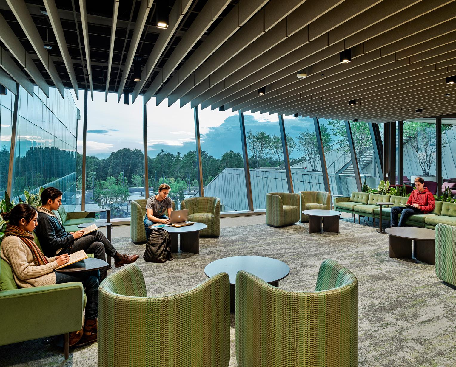
Designed by Arkansas-based Polk Stanley Wilcox architects, the campus encompasses approximately 154,000 square feet and includes state-of-the-art teaching spaces including the AWSOM Library, Simulation Center, Clinical Skills Center, Anatomy Resource Center with Anatomy Lab, and a Makerspace for students to collaborate on 3D-printed anatomical models and other projects. Students also have access to recreational spaces like the gym, quiet space, student lounge and wellness studio, along with direct access to nature.
The site, designed by NYC-based Office for Strategy + Design (OSD), includes more than 550 new trees, 140,000 native plants, and includes forest trails, a community lawn, a tulip poplar walkway, reflecting ponds, healing gardens, meditation terraces, outdoor classrooms, and a woodland amphitheater with a 215foot water feature. AWSOM’s 2-acre rooftop park, the largest in the region, climbs 70 feet from the forest floor, through eroded plateau stonework, and onto an overlook with views of the Ozark landscape.
TIM HURSLEY
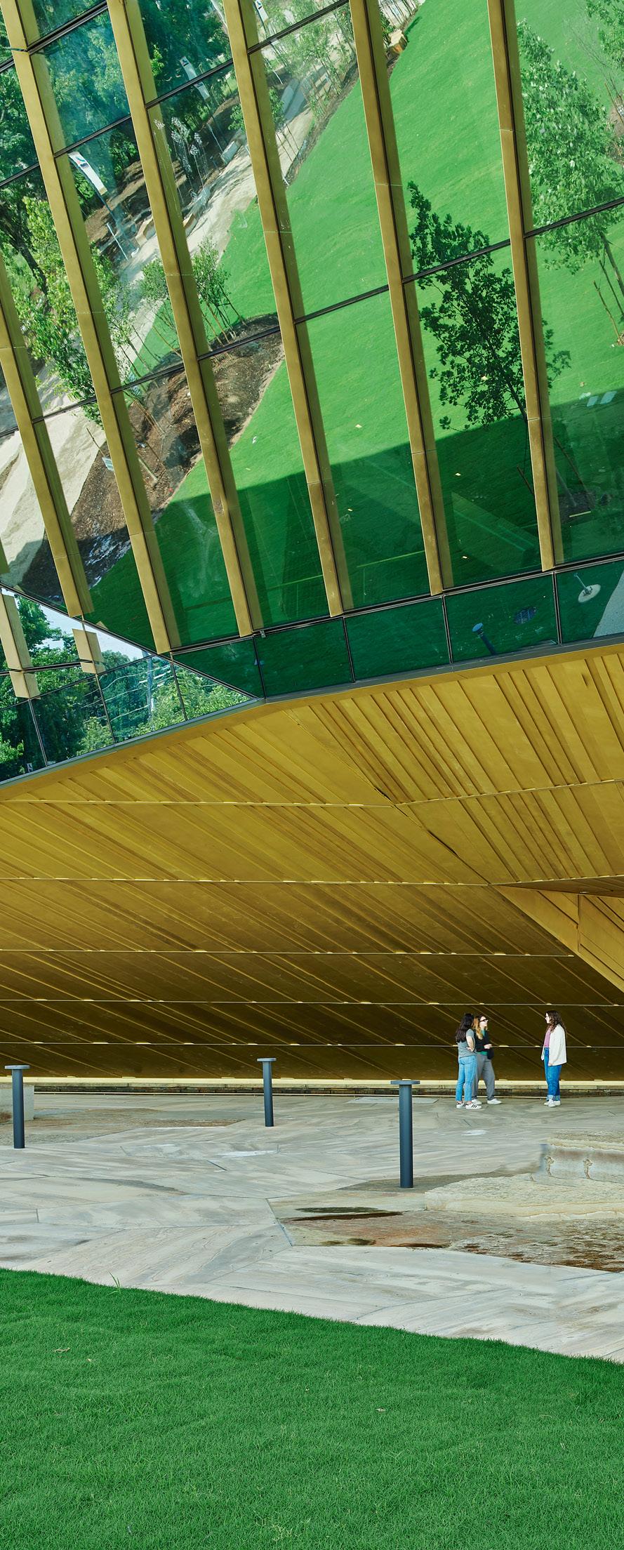
The building’s integration and abstraction of the natural
landscape, its ambitious interplay between park and neighborhood, and its promotion of active lifestyles and self-care are all intentional strategies to creatively embody whole health principles in the pursuit of innovative medical education and transformational healthcare.
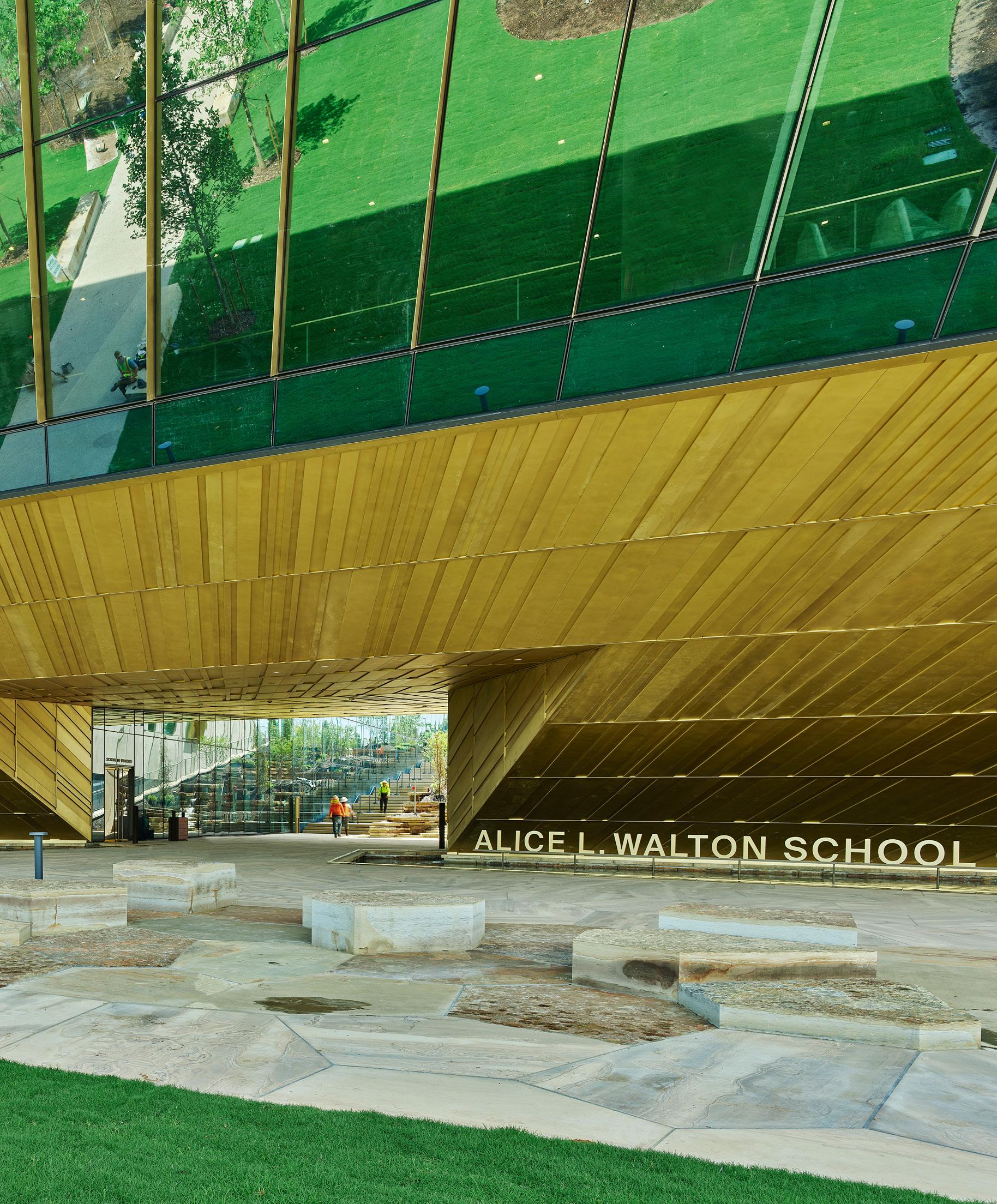
MAKES EVERY EFFORT TO EMBODY WHOLE HEALTH PRINCIPLES IN ITS DESIGN. THIS HOLISTIC APPROACH TO HEALTHCARE CONSIDERS NOT JUST ONE’S PHYSICAL HEALTH, BUT ALSO THEIR MENTAL, EMOTIONAL AND SOCIAL WELLBEING.
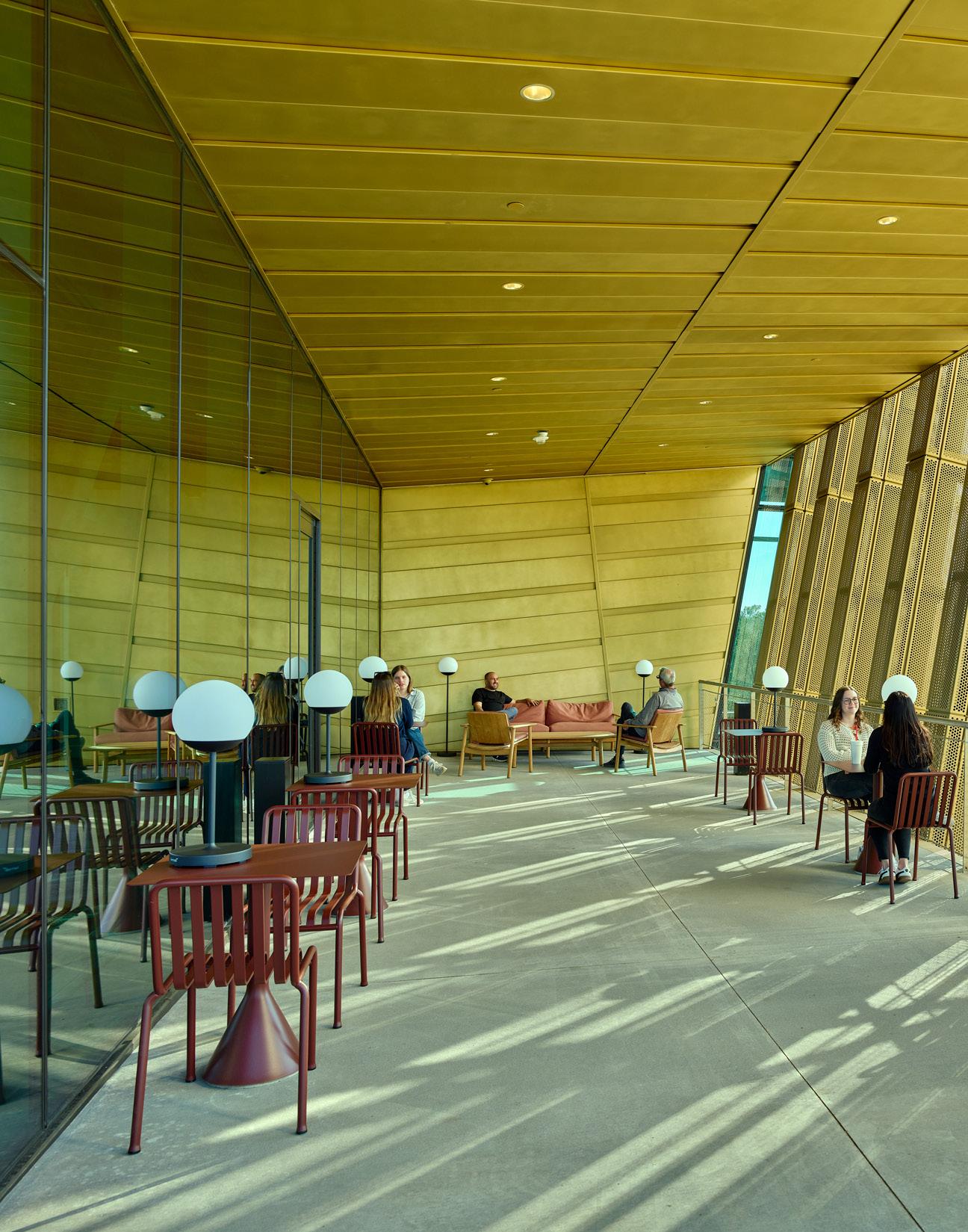
The school’s form, materials, program and curriculum are all designed to foster healthy lifestyles and personal wellness.
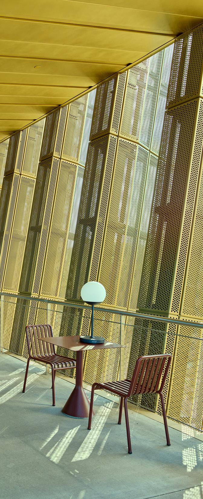
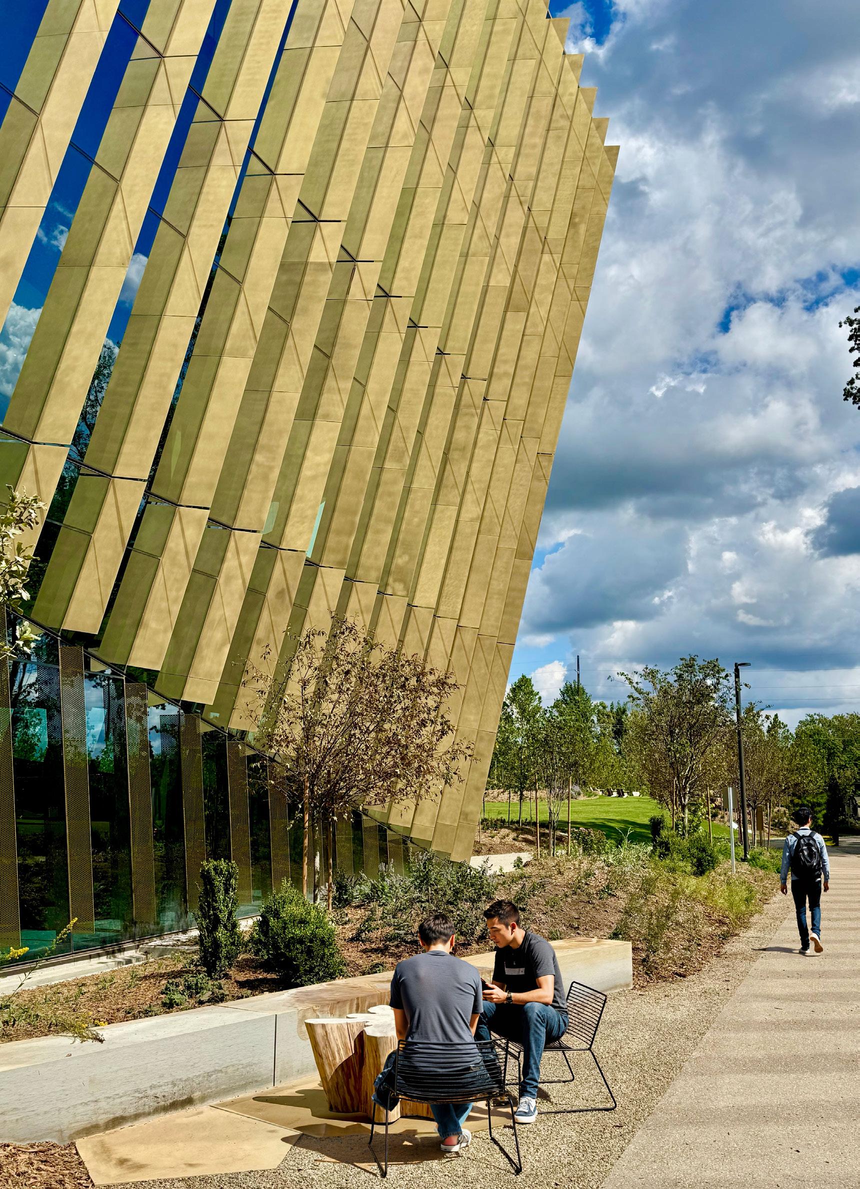
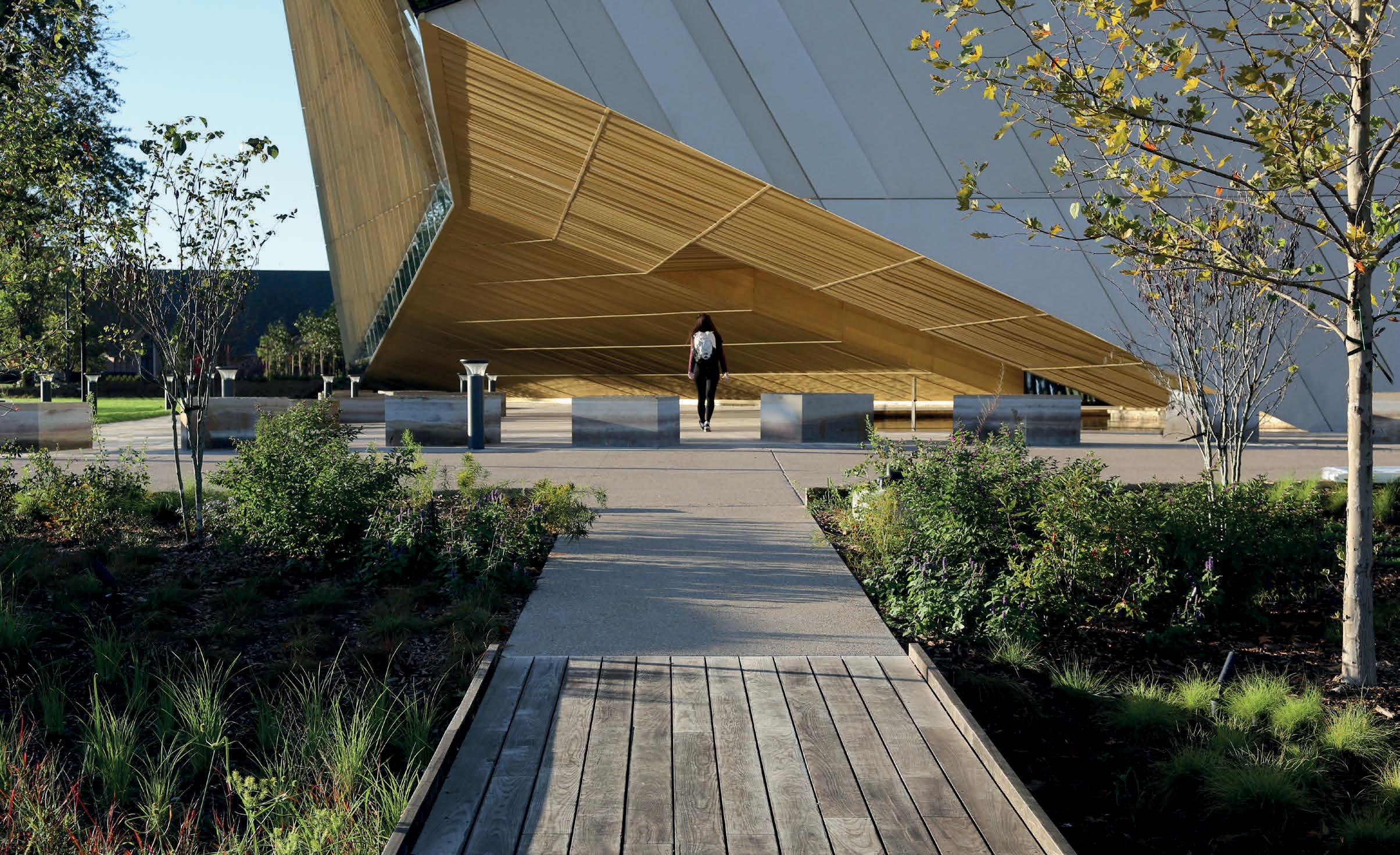
The project’s design was carefully planned through the lens of these connections; how the school could function as art in the landscape, how it could blend with nature, how the building could actively promote wellness and an active lifestyle, and at the request of the founder, how the project could creatively screen itself visually from Crystal Bridges Museum and the North Forest trails. It was within this context that the design was conceived—that the school should be an extension of the landscape, integrating itself into both the site and the community, engaging the land as an abstraction of Ozark geology.
The solution invited the park to expand onto the campus, creating a physical connection between the natural and developed, from forest to city…and then gently elevated the building and park to the east. This extended the park visually and physically onto the building, effectively screening the building from Crystal Bridges to the west, while revealing the school to the community to the east. The school’s east entry façade borrows
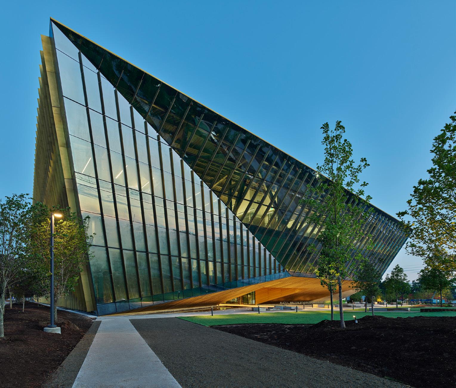
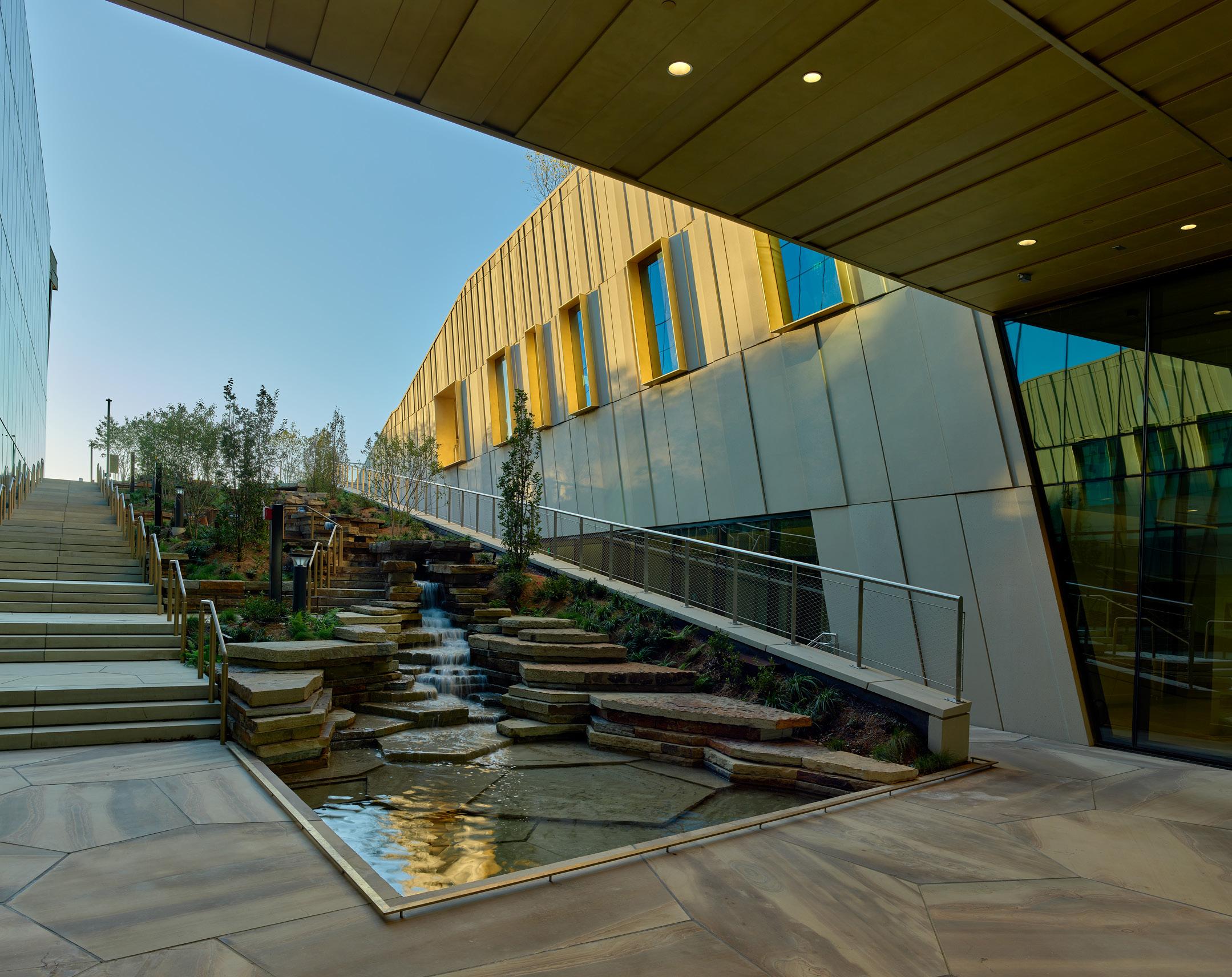
The building is in essence a piece of the landscape...not just of its immediate site, but of the Ozarks at-large. Its corner extrusion beckons visitors to explore the site, generating a sense of discovery and creating a connection with nature. The campus makes every effort to embody whole health principles into its design through visual and physical connections to nature, the integration of water features, access to daylight, use of natural materials, and meaningful integration of the concepts of prospect, shelter, discovery and social connection.
its form and function from regional Ozark bluff shelters, natural formations that served as places of shelter and healing for more than 10,000 years, now re-envisioned in the 21st century as a sacred space.
The building’s integration and abstraction of the natural Ozark landscape (nature), its ambitious interplay between park and neighborhood (community), and its promotion of active lifestyles and self-care (wellness), are all intentional strategies to creatively embody whole health principles in the pursuit of innovative medical education and transformational healthcare.
The project’s deep connection to its site is a foundational element of the campus design. The building is in essence a piece of the landscape...not just of its immediate site, but of the Ozarks at-large. It is physically an extension of Crystal Bridges’ trail system, as viewed and experienced on its rooftop park; and its form an abstraction of the Ozark terrain, wherein the ridges of its structure create valleys, provide shade and generate views within and beyond. Its corner extrusion out of grade provides shelter and beckons one to explore the site, generating a sense of discovery and creating connection with nature.
Public access is a unique aspect of the school’s mission. Like many of the recent large-scale developments in Northwest Arkansas, the design is not insular to the institution. Rather, the school is intentional in inviting
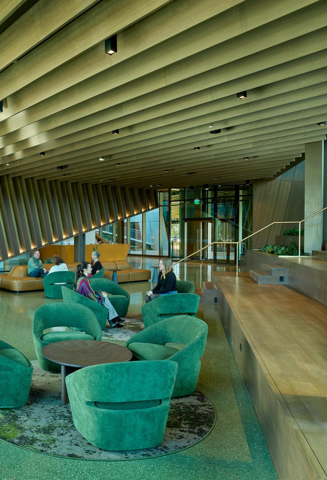
the public onto the campus, to experience the site, the park and its connection to the larger North Forest trail system of Crystal Bridges. The public way, sidewalks and landscaping along J Street are designed to link and draw people through the allée of trees and into the site. The campus is, in effect, a bridge between the natural and the developed, between park and community.
The campus makes every effort to embody whole health principles in its design. This holistic approach to healthcare considers not just one’s physical health, but also their mental, emotional and social wellbeing. The design strives to integrate these principles through visual and physical connections to nature, the integration of water features, access to daylight, use of natural materials, and meaningful integration of the concepts of prospect, shelter, discovery and social connection. The school’s form, materials, program and curriculum are all designed to foster healthy lifestyles and personal wellness.
Designed to purposefully transcend traditional boundaries between art, architecture, nature, education and wellness, the Alice L. Walton School of Medicine seeks to challenge convention, foster innovation and transform the future of medical education in advancing a new healthcare model for the 21st century. In doing so, it becomes the latest in a significant array of new development in Benton County that goes beyond its core function in aspiring to transform both the civic and natural landscape of Northwest Arkansas.
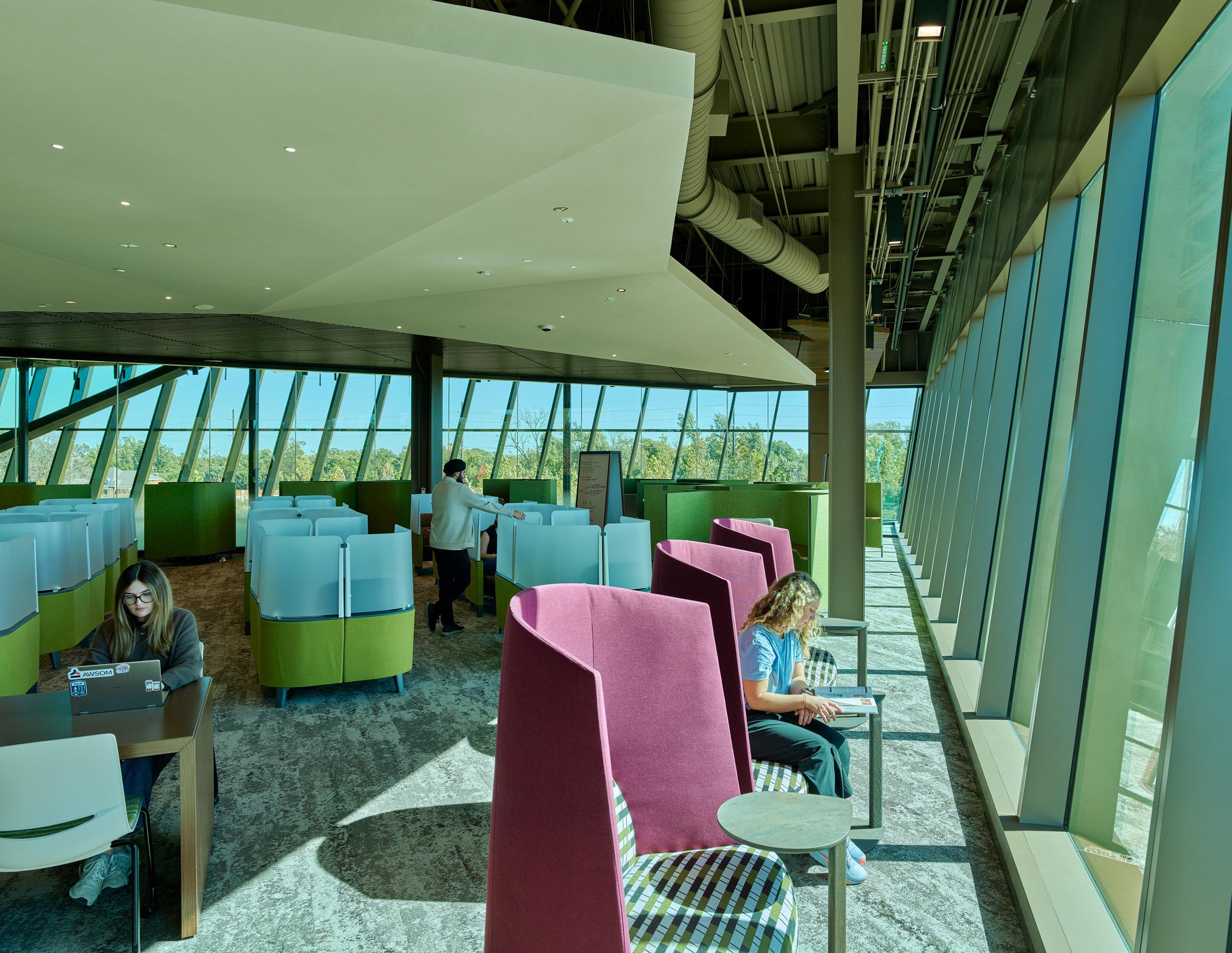
BY SU-LAUREN WILSON
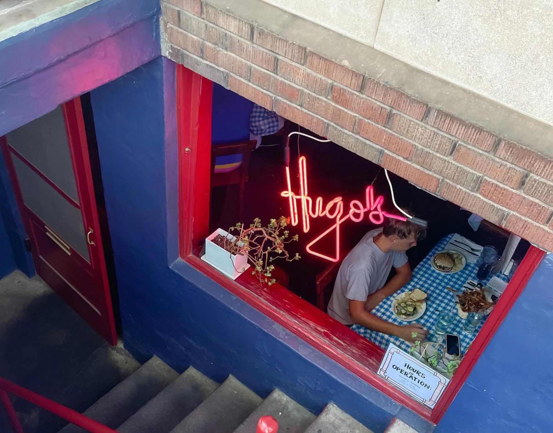
With an energetic atmosphere bustling with college students, service employees and entrepreneurs flush with new ideas that keep the city’s dining scene evolving, Fayetteville is a culinary bright spot in the state. Every once in a while, a particular place evolves into a treasured institution. Hugo’s is one of those places.
Inauspiciously established in a basement in 1977, Hugo’s subterranean location has become an integral part of the restaurant’s charm. Once you locate the basement stairs, be prepared for the blazing red neon lights—both inside and out—that have set for mood for high-powered business lunches and Razorback gameday burgers and beers alike. (Editor’s note: Hugo’s back entry is wheelchair accessible, just call ahead and accommodations will be made.) With features in esteemed publications like Bon Appetit and Architectural Digest , the first-time visitor might expect an equally upscale dining experience. But to enter Hugo’s, located at 25 1/2 Block Street, is to feel as though you’re stepping back into a more casual time. The red gingham tablecloths feel homey, and the exposed brick contains the rich and familiar smells of the joint’s famous hamburgers, “Derek’s Special” chicken sandwich, and the author’s beloved C.S.T.S. (Cheddar/Swiss/Tomato/Sprouts) sandwich. The bar is well-worn from countless pints of cold beer passing its threshold.
Everyone in Fayetteville eats at Hugo’s at one point or another because it is a dining staple beloved by the community. The sounds of conversation and laughter will always bring people in off the street.
Graduations and celebratory moments are always happening and, since they don’t take reservations, even if you have to wait to dine the wait won’t be too long. Current owner Jason Piazza, employed at Hugo’s since 1998, continues a delicious, timeless menu of simple ingredients, masterfully executed.
If you want one of the best hamburgers in Fayetteville, you go to Hugo’s. If you want the best seat for the arts and music scene, you go to Hugo’s. If you want a perfect date night in Fayetteville, you go to Hugo’s. You get the point. People love Hugo’s as locals and as visitors. The place has a way of sticking with people.
How does Hugo’s maintain its food influencer status as one of the best spots for a girls’ night or first date in Fayetteville? By serving a consistent, mouthwatering menu for almost 50 years. Hugo’s is the definition of combining the past with the present. Downtown Fayetteville’s dining options are diverse and plentiful, and lucky for you Hugo’s is known for more than its hamburgers and hot grilled sandwiches. Their quiches, crepes and cheeseboards give the basement dining room a European feel. They serve a full bar with a wide variety of beer, wine and liquor. Hugo’s is open Monday through Saturday, 11 a.m. to 10 p.m., and is as consistently satisfying at lunch as it is at dinner. If you haven’t tried it, you should. Because once you experience Hugo’s, you’ll understand why its Arkansas’ favorite basement.
Su-Lauren Wilson is a writer and SEO specialist focusing on life in Arkansas, specifically covering healthcare and small business. A lifelong resident, Su-Lauren lives in Little Rock.











BY JOHN L. WILKERSON AND VALERIE SHIVELY
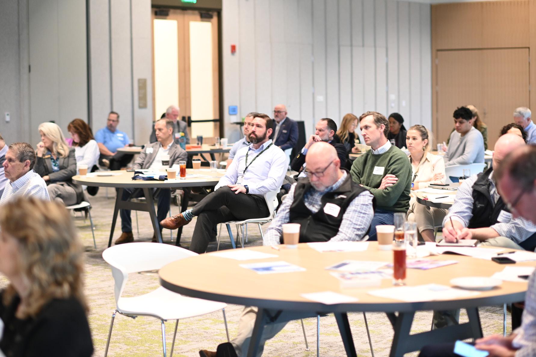
Hundreds of local leaders, planners and elected officials participated in a series of regional meetings held by the Arkansas Municipal League this spring.
Cities and towns across Arkansas are navigating a shifting landscape of housing needs, depleted infrastructure and demographic changes that are reshaping how communities think about growth. In the spring of 2026, roughly 250 local leaders, planners and elected officials gathered at the Arkansas Municipal League’s regional meetings in Bentonville, Searcy and El Dorado to address one of the most persistent challenges facing municipalities: sharing resources to confront neglected properties and the broader housing pressures tied to them. The year before, more than 350 participants attended sessions in Berryville, Crossett, Magnolia, Cave Springs, Russellville, Stuttgart and Jonesboro. That level of turnout clearly demonstrates how widespread the concerns have become.
League staff and field representatives traveled the state to support these sessions through a training, “Shared Resources, Shared Benefits,” helping ground each meeting in a shared understanding of what cities are up against. Attendees representing the full spectrum of municipal life: mayors, city administrators, planning officials, council members, code enforcement officers, clerks, treasurers and building inspectors participated in discussions about legislative changes in the areas of land use, water and wastewater funding needs, infrastructure investment, and housing. Their experiences and comments shaped the conversations as much as any prepared material.
Each meeting carried its own local spirit. In El Dorado, Mayor Paul Choate greeted attendees with Spudnuts, the original potato donut, setting a warm tone that carried into the morning’s substantive discussions. Attendees from Hope, Mineral Springs and Camden, along with smaller communities like Calion, Tollette and Arkansas City, spoke openly about the pressures facing rural towns, from aging housing stock to the persistent realities of food deserts. Representatives from Groundwork AR and the Arkansas Manufactured Housing Association added additional insight, creating a mix of local experience and statewide perspective.
Searcy’s meeting reflected its own atmosphere of communitydriven momentum. Mayor Mat Faulkner led attendees, including mayors from Keo and Leslie, on a walk through Riverside Park’s expanding bike trail, which served as a clear example of how vision and investment intersect in a growing city. The mayors of Greenwood and Wynne, along with Metroplan, brought questions focused on planning and infrastructure. The group also heard from Arkansas APA Legislative Co-chair James Walden. City of Searcy staff members, including Main Street Director Amy Kemper and Planning Director Richard Stafford, explained the #MySearcy campaign and the coordinated, yearslong effort that shaped the city’s downtown revitalization.
In Bentonville, the room carried yet another tone. Many newly elected council members, advisory committee members and
residents exploring runs for office attended, which signaled a high level of energy and a desire to get involved with civic leadership. Leaders from the Urban Land Institute Northwest Arkansas and Northwest Arkansas Regional Planning Commission discussed the opportunities and pressures that come with rapid growth. After the session, Mayor Stephanie Orman hosted a tour of downtown development projects and Heartland Whole Health Institute.
The perspectives varied as much as the places themselves. El Dorado brought a broad crosssection of South Arkansas, with developing cities like Camden and Magnolia alongside some of the smallest incorporated towns in the Delta. Searcy offered the viewpoint of a midsize central Arkansas city with engaged residents and a clear sense of where it wants to go. Bentonville and the rest of the NWA communities in attendance reflect a level of population growth and investment that stands out not only in Arkansas but across the nation.
Across these discussions, League staff noticed a message surfacing again and again: housing is the defining issue for Arkansas municipalities. Cities are struggling to provide attainable housing while also contending with aging infrastructure and rising costs. Local governments are responsible for addressing unsafe or unsanitary properties, yet the legal processes can stretch for years, particularly for rural towns with limited staff, time and resources.
Two priorities consistently rose to the surface during the regional meetings. The first was the need for a more efficient pathway to address abandoned and neglected properties. This was shown by over 500 participants showing up in-person for training opportunities over the past two years, with municipalities demonstrating their commitment to maintaining safety, due process and the protections that the law requires. They also emphasized how difficult it is to return deteriorated properties to productive use when the labyrinthian process stretches on for years. Leaders spoke about development sitting in limbo, the dangers caused for citizens and the frustration of knowing what needs to be done but lacking workable mechanisms to move forward.
The second priority was the call for more education and training, as well as clearer and expanded land banking authority. Cities want the ability to repurpose those vacant or tax-delinquent parcels before they fall further into disrepair. With the right tools, municipalities could break longstanding cycles of blight, consolidate scattered parcels and reinvest in neighborhoods with existing infrastructure in a more strategic way. Local leaders see land banks as a practical solution that would allow them to guide redevelopment thoughtfully and respond to the needs they hear from residents every day, while efficiently using tax resources and building the local economy.
Another opportunity is on the horizon as well. Issue 3, which will appear on the November 3 ballot, would allow the creation of economic development districts that are shaped around local priorities and conditions. Instead of a one-size-fits-all model, economic development districts let local leaders determine how best to support the areas they know most intimately, whether that involves housing, commercial redevelopment, food access or investment in redevelopment. The measure does not establish new taxes or redirect existing funds. Rather, it provides an optional tool that cities and towns can choose to use if it aligns with their local goals.
What stands out in conversations across the state is the recognition that the needs of Arkansas municipalities are not uniform. Crossett’s challenges look very different from those in Cave Springs and Issue 3 acknowledges that reality. For leaders who want more flexibility to guide local development, the measure offers a mechanism to take on projects with long-term impact while keeping control at the community level. As with any new tool, ongoing discussion will be necessary, but local officials see potential in an approach that respects the diversity of Arkansas cities and towns and their specific paths to growth.
What the regional meetings made clear is that Arkansas municipalities are ready to continue engaging and moving forward. These conversations cannot be onetime events. They mark the beginning of a statewide dialogue that will need to deepen and evolve as cities and towns confront new challenges.
Treasured places across Arkansas do not thrive on their own. They endure because people invest their time, their voices and their attention in the decisions that shape their cities and towns. That spirit of participation is what will shape Arkansas’ housing future. Whether it comes from smaller towns dealing with the challenges of aging infrastructure, midsize cities charting their next chapter or rapidly growing communities managing unprecedented change, the commitment is the same. People across Arkansas are investing their time and attention in building stronger, more vibrant places to live. That shared commitment is the foundation for meaningful progress, and it is why these conversations matter now more than ever.
John L. Wilkerson is the general counsel & legislative director of the Arkansas Municipal League.
Valerie Shively is the director of membership engagement for the Arkansas Municipal League.
ACROSS THESE DISCUSSIONS, LEAGUE STAFF NOTICED A MESSAGE SURFACING AGAIN AND AGAIN: HOUSING IS THE DEFINING ISSUE FOR ARKANSAS MUNICIPALITIES.
BY JAMES WALDEN
Lots of cities plan. Those plans are filled with dreams, intentions and great ideas. However, for all kinds of reasons, those plans often don’t become reality. When they result in doing and not just planning, it can be transformative and powerful. That’s exactly what’s happening in Paragould.
Paragould is seeing a makeover within its core neighborhoods that many thought impossible only a few short years ago. This transformation has come in the form of massive, coordinated public and private investments in the city’s Legacy Neighborhoods. The result is nearly 50 new homes in an area where, according to Mayor Josh Agee, it had been around 50 years since a new home was last constructed. The progress began with a plan.
That plan was Discover Paragould 2042, the city’s new comprehensive plan. It was the result of an over year-long process led by the Paragould Regional Chamber of Commerce. The plan was shepherded through development and adoption by Chamber CEO Allison Hestand. “Coming out of the COVID pandemic was a good time to undertake a community visioning process. It gave us a good opportunity to reimagine and rethink our strategy as a community moving forward,” she said. A key recommendation from the plan was reinvestment in existing portions of Paragould, leveraging available tools to achieve that goal.
The community knew it wanted to revitalize the older neighborhoods surrounding downtown that Mayor Agee and
Hestand term “Legacy Neighborhoods.” As Hestand explains, the neighborhoods were somewhat rundown and didn’t reflect their former glory, but “had everything: park amenities, proximity to our revitalizing downtown and community memory of how great the neighborhoods once were.” The primary tool the city needed was a little-known policy mechanism called land banking.
The function of a land bank is fairly simple, even if the steps of its operations are not. The city acquires property by donation or purchase. It ensures any lingering ownership issues are addressed and that the property is ready for development, such as clearing the lot of any structure that is too far gone to save. It then auctions off the property to developers with claw back provisions requiring construction within one year and strict adherence to overlay district standards.
After serving eight years on the Paragould City Council, Josh Agee ran for, and was elected, mayor in 2020. He ran in part on the issue of code enforcement, focused on cleaning up the city. He’s been effective. With condemnation of hundreds of dilapidated structures, the city was left looking for next steps. This is where land banking came in. Agee participated in the Delta Leadership Institute Executive Academy, a selective leadership program of the Delta Regional Authority with representatives selected from across an eight-state region. In that program, Mayor Agee saw firsthand the operation of land banks in places like Baton Rouge,
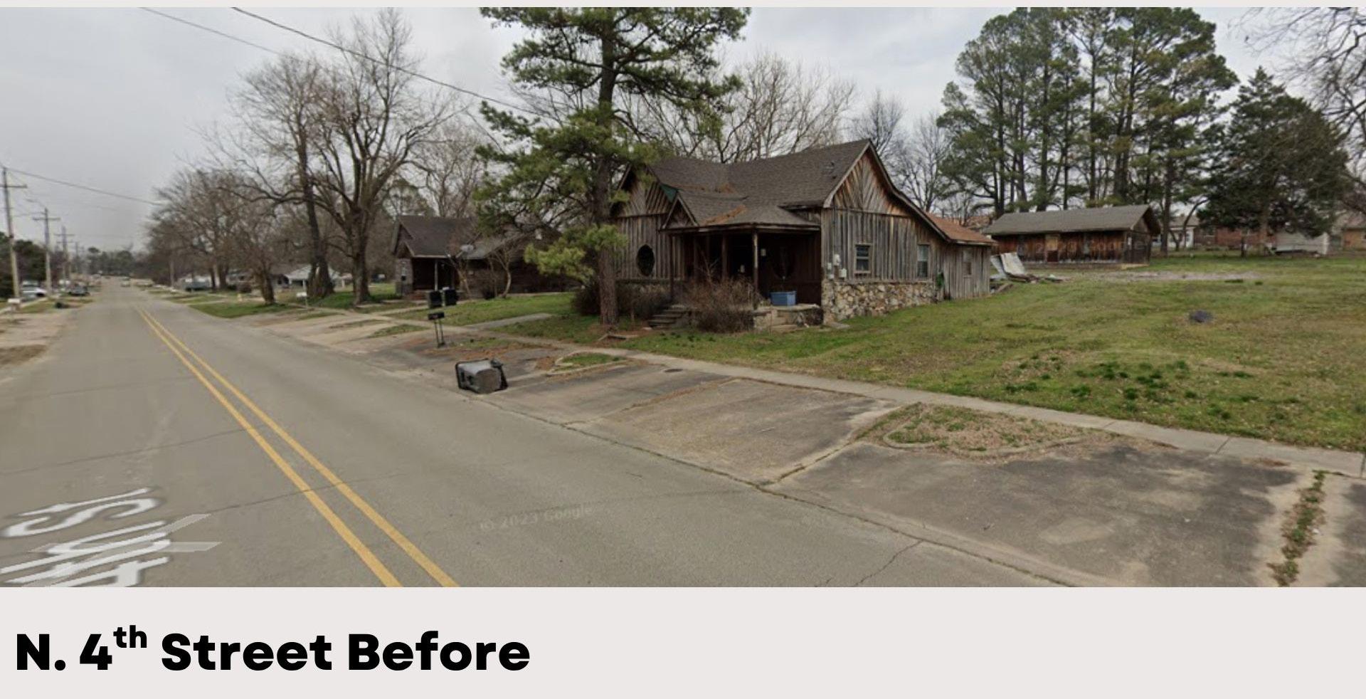
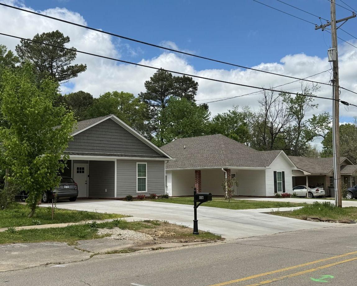
By focusing exclusively on vacant lots and structures, Paragould’s Legacy Neighborhoods have seen upwards of 50 new homes built without displacing a single resident. In addition to the new home construction, the city has reinvested funds into repaving and improving streets, sidewalks and alleys.
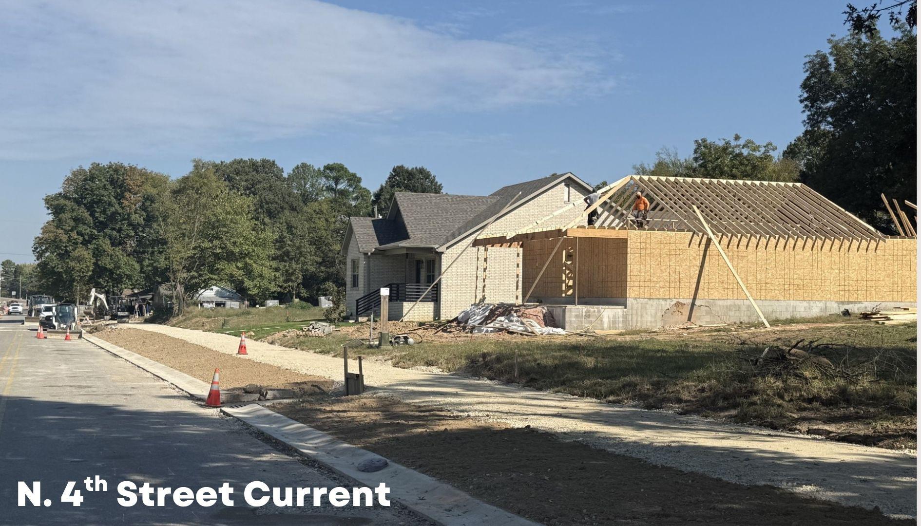
Louisiana, and Greenville, South Carolina. He quickly applied those lessons back home in Paragould.
By 2023, Paragould’s land bank had been created and was moving towards full operations. However, the mayor knew this program was a long-term investment in the city’s future. One that might not yield immediate electoral dividends. “It’s easy as a mayor to have a three-year mindset. What can I accomplish to get re-elected? I knew we needed a long-term strategy,” he said. “This is about the future of my community, not me. We had to look past short-term realities.” That meant Paragould needed to apply strategy to ensure any funds dedicated to the land banking effort were effective and well spent.
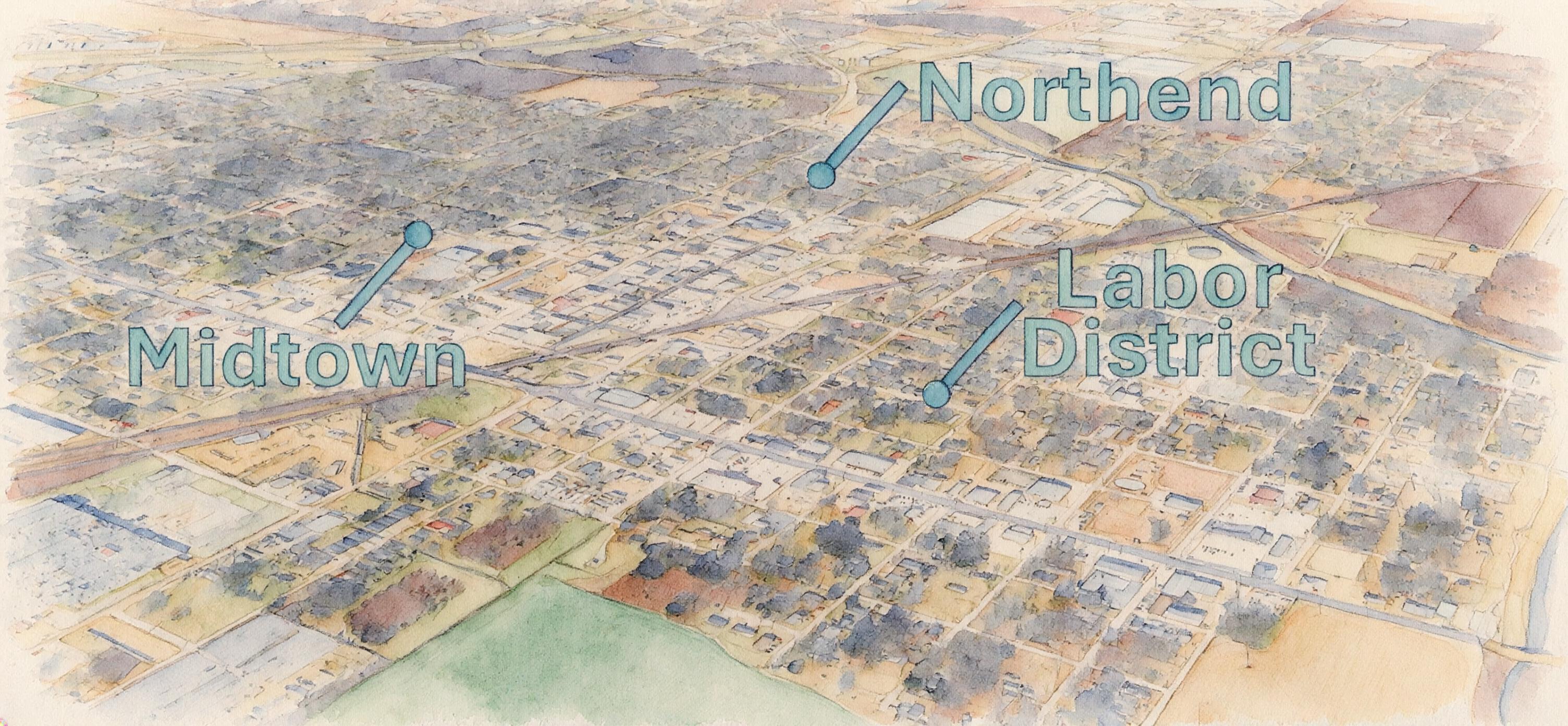
The first step was the creation of three overlay districts to the north, east and west of downtown. These are the Northend District, the Midtown District and the Labor District. Each one is defined by a distinct identity, branding and signature street trees. The Northend features Craftsman-style homes, access to the 8 Mile Creek Trail and signature magnolias. Midtown’s appeal lies in architecturally distinct historic homes, a neighborhood elementary and easy convenience. The Labor District features strong recreational amenities with its namesake Labor Park.
The next step was investment. “We had to create an environment where people and investors understood, the city was serious about revitalization,” said Mayor Agee. “It was time to reinvest in the Legacy Neighborhoods.” That meant the city putting money where its mouth was through a multi-year commitment of its economic development tax funds. The alignment between the chamber and city was critical. Chamber CEO Allison Hestand adds, “We saw the need, and our shared direction through Discover Paragould 2042 made it clear that neighborhood revitalization was fundamentally
an economic development issue.”
In the last three years, over half a million dollars of those economic development tax funds have been reinvested in Paragould’s Legacy Neighborhoods, repaving streets and alleys and purchasing property for the land bank. It’s had the desired effect and people are seeing the progress. “One of the biggest skeptics of the land bank idea, and he had very valid concerns, is now one of the biggest cheerleaders and proponents for the program,” Mayor Agee said.
Nearly 50 new homes have been built in the Legacy Neighborhoods, and it’s been done without displacing a single resident. “We’ve been able to focus solely on vacant lots and structures,” said the mayor. “And success has bred success.” The community and developers have bought in, the city has seen over $200,000 of its investment recouped, new revenues are being realized for the school system and code enforcement demands within the area have declined.
The program has provided an opportunity for the community’s civic pride to shine well. A local eyesore and dilapidated apartment complex dubbed the “Green Monster” has been torn down, making way for the new Coy Park, thanks in part to the philanthropic efforts of the local Kiwanis Club. It’s also had a human impact. “Many of the houses going back are within reach of more of our community,” said Mayor Agee. Young families are moving in. People that didn’t think they’d ever be homeowners now are, becoming a deeply vested part of Paragould and placing the whole community on a positive trajectory.
Success does indeed breed success, and in Paragould its showing what’s possible when good planning, leadership, investment and civic pride align for a community purpose.
BY DEREK LINN
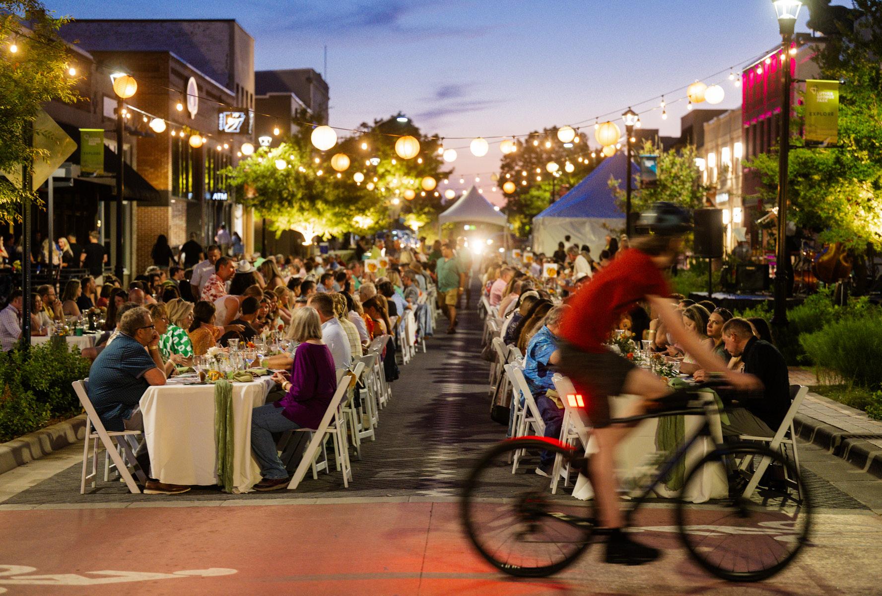
Long known for its strong agricultural and transportation economies, recent efforts and investments in Springdale— specifically its downtown—have shaped the city’s historic core into a local and regional destination. Catalyzed by the completion of the Razorback Regional Greenway, strategic municipal leadership, thoughtful private sector development and a vibrant local population, downtown Springdale is a growing hub for food, housing, employment, shopping, lodging, arts and recreation.
“Downtown Springdale is one of those rare places where you can still feel both the history and the momentum at the same
time,” said Sharon Tromburg, director of planning and community development for the city of Springdale. “Many of the buildings, businesses and gathering spaces reflect generations of people who have shaped the area, while the activity and investment happening today show a community excited about its future. It feels authentic because it is authentic,” she added. Joining the Springdale Planning Department in 2020, Tromburg has served as director since early 2025 and leads a talented planning staff who are rooted in and passionate about Springdale.
Working closely with city staff as well as local business owners, developers and other stakeholders, nonprofit Downtown
Springdale Alliance (DSA) is an integral partner in the downtown Springdale story. Tromburg said the partnership between the city and DSA has played an important role in building a downtown environment that feels active, welcoming and uniquely Springdale.
Established in 2011, DSA works to promote a vibrant and welcoming downtown Springdale through activation of spaces, cultivation of relationships and supporting activities that bring community together. DSA Executive Director Paxton Roberts said that while the organization was originally focused primarily on downtown beautification efforts, DSA has evolved into a broadly supported “Main Street-style” organization, adapting to the needs of downtown over time.
To advance DSA’s mission, the nonprofit utilizes an important community master plan. Initially adopted by the Springdale City Council in 2015, the Downtown Springdale Master Plan was updated in 2022 and 2025. Springdale is actively implementing the plan through strategic city code updates, thoughtful public and private land development, and other community centered efforts.
Roberts is passionate about downtown Springdale and believes the master plan is a helpful community tool. “It’s not uncommon to have plans sit on a shelf, but the community put a lot of time and effort into this plan, and every three to five years, it is reviewed for any necessary updates.” Roberts went on to describe how the downtown plan is truly a living document, informed by ongoing stakeholder interaction and relationships. “The city listens and observes the plan’s effectiveness over time,” he said.
To that end, code amendments reflecting the master plan’s recommendations, stakeholder feedback and implementation experience were recently adopted by the city council on May 4, 2026. Focused on improving clarity, usability and long-term implementation of the code while continuing to support walkable mixed-use development and housing opportunities downtown, Tromburg steered these updates through the city process.
One of the updates adjusted the geographical boundary of a particular development requirement. Specifically, the city’s downtown form-based code promotes mixed-use amenities by requiring the ground floor of new development to be nonresidential within a certain geographical area. With the amendment adopted in May, two streets in the district were relieved of this nonresidential ground floor requirement after hearing from residents and observing long-term development patterns.
This minor amendment to the city code will reduce the volume of applications requiring public hearings and helps advance property reinvestment with fewer hurdles when the applications do not negatively impact the intent of the master plan. “Code updates like this help the developer and community feel listened to,” Roberts said.
Other recent code updates rooted in the updated master plan recommendations include the expansion of the optional S.E.E.D.
District (Springdale Elective Enhancement District) boundaries, which promotes mixed-use development and form-based code on more “downtown adjacent” properties and helps transition areas by providing more development flexibility. Property owners have a choice whether to utilize the S.E.E.D. District provisions where mapped. Also included is the Workforce-Attainable Housing Density Bonus framework within portions of the downtown districts. This update allows eligible developments to receive an additional story in exchange for providing workforce-attainable housing units meeting affordability criteria. Roberts said an applicant is already making use of this optional allowance, through development of a property south of Luther George Park.
Another update is the Workforce-Attainable Housing Density Bonus framework within portions of the downtown districts. It allows eligible developments to receive an additional story in exchange for providing workforce-attainable housing units meeting affordability criteria. Roberts said an applicant is already making use of this optional allowance through development of a property south of Luther George Park.
The Downtown Springdale Master Plan has yielded an impressive list of past and current development projects, bringing much-needed housing and mixed-use amenities to downtown.
Tromburg noted that the downtown area has experienced steady residential growth through mixed-use development, apartment projects, adaptive reuse efforts and smaller-scale infill housing over the last few years. Collectively, recent projects represent more than 300 housing units completed or underway, contributing to a more active, walkable and balanced urban environment. In addition to 24 recent infill housing projects, including duplexes and single-family homes with accessory dwelling units (ADUs), these projects include:
Little Emma (2020): 26 housing units
202 Railside (2022): 55 units within a mixed-use building featuring restaurant and retail space
The Hideaway (2024): 14 units developed in cottage court style
Big Emma (2026): 77 units, with 30 units permanently reserved for households earning below the area median income
Via Emma (2026): 131 units on a 2.54-acre mixed-use site
Greenway Grove (2026): 42 units
Public recreation areas and parks alike have seen improvements and expansions as well, including:
Walter Turnbow Park & Shiloh Square Revitalization (2017): A downtown recreation hub centered on Spring Creek.
Razorback Greenway Realignment (2023): Realignment of the Greenways’ crossing on Emma included accessibility, safety, lighting and other streetscape improvements.
Luther George Park (2024): A redesign and expansion of a 10-
“DOWNTOWN SPRINGDALE IS ONE OF THOSE RARE PLACES WHERE YOU CAN STILL FEEL BOTH THE HISTORY AND THE MOMENTUM AT THE SAME TIME.” —SPRINGDALE DIRECTOR OF PLANNING AND COMMUNITY DEVELOPMENT SHARON TROMBURG
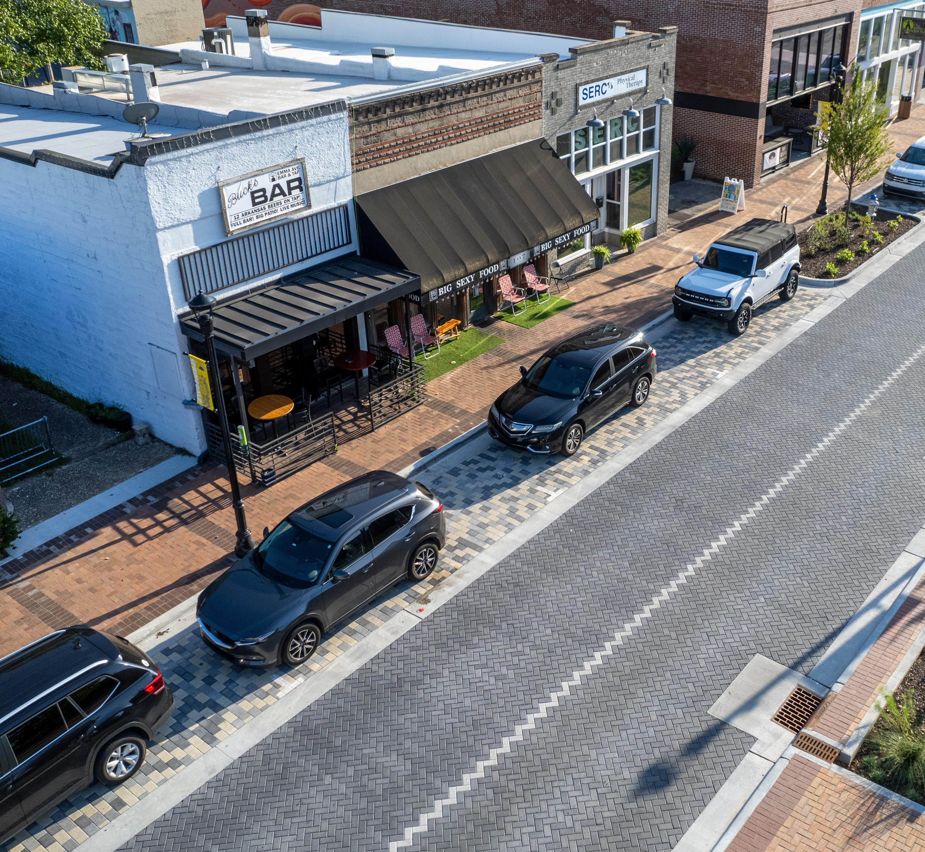
Realignment of the Greenway's crossing on Emma included accessibility, safety, lighting and other streetscape improvements.
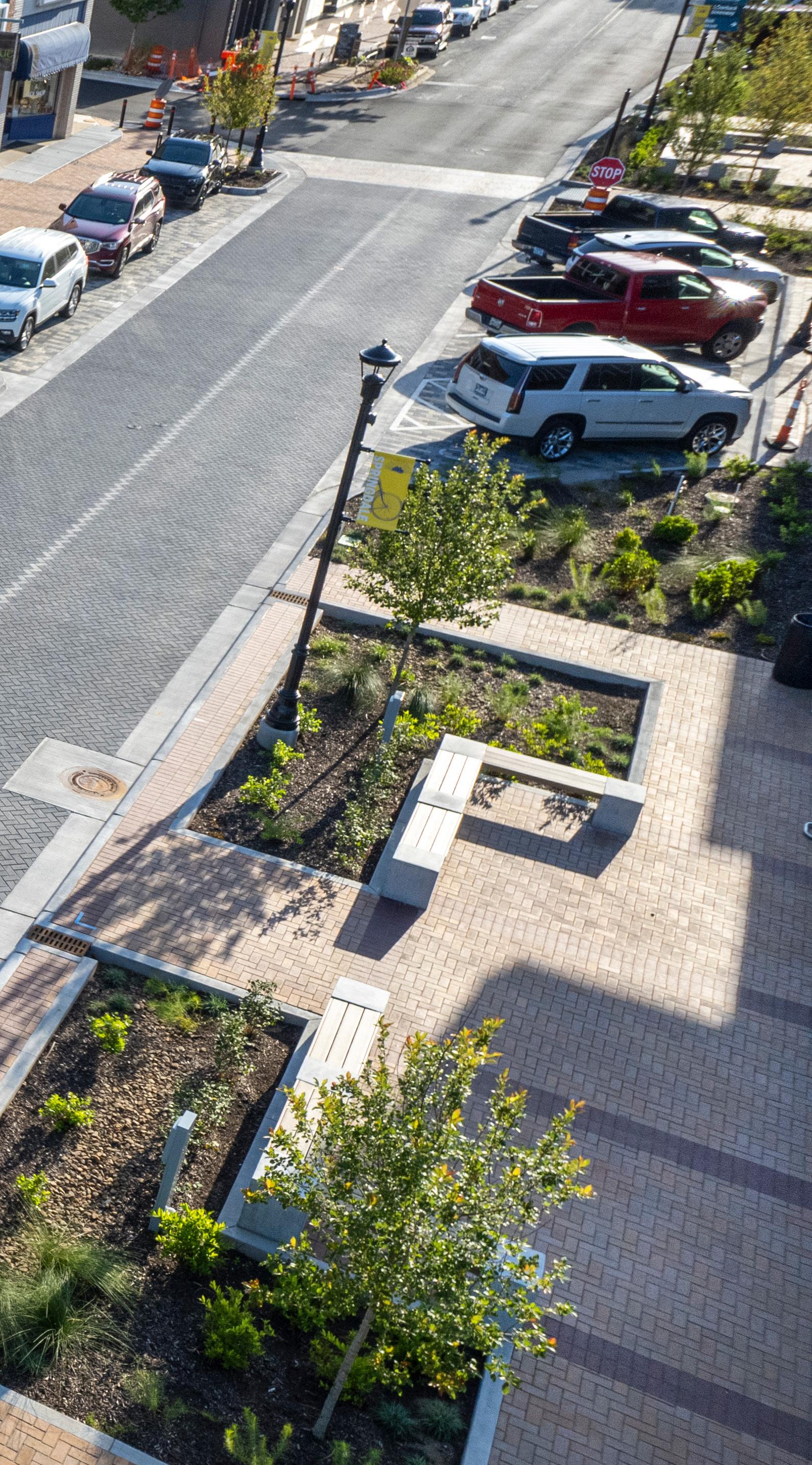
plus acre multi-functional downtown park featuring both passive and active recreation, special events and connectivity to the Razorback Greenway.
Downtown renovations and redevelopments have resulted in a trio of unique spaces on Emma, including: Apollo on Emma (2017): An event venue within a 1940s theater building.
100 West Emma (2025): Redevelopment of a historic bank building into a 35,000 square foot mixed-use facility featuring locally owned restaurant Gaskins on Emma and Onyx Coffee Labs on the first floor, and office spaces on the second.
Market Center of the Ozarks (2025): A multi-functional, 45,000 square foot nonprofit facility supporting local farmers and food entrepreneurs to scale their operations and bring more local food to local markets.
“Springdale may not be the first to do something, but they are very good at taking lessons learned from other cities and implementing smart policies and practices,” Roberts said as he reflected about the multi-faceted evolution of downtown Springdale. He added that the city is efficient with its resources and is thoughtful with its implementation of programs and improvements. It is with this mindfulness and adaptiveness that Roberts runs DSA, especially through its promotion of community events. “Events are a critical strategy to bringing momentum into a place, but we strive for balance,” he said. “Ten years ago, the Alliance was focused on bringing people to the downtown area and finding people to invest in the downtown. We now have the people. We also have over 200 businesses and 40 nonprofits in the downtown footprint, most all of which are local entities. So, what we need now is different from 10 years ago. Today, we want to retain what we have and support everyone who is here,” said Roberts.
In June, DSA is hosting its 10th Annual Downtown Street Dinner, featuring signature dishes and drinks—all of which will be provided by downtown restaurants and partners—reflecting the quality and diversity of downtown food options. As a testament to their logic and adaptability, it was announced that the street dinner has moved from Saturday to Sunday to be more accommodating for downtown businesses. “After many conversations and group meetings with our downtown businesses we learned that having the event on Saturday historically hurt business and inhibited some of their regular customers from visiting. Sunday was also ideal for allowing our restaurant partners to participate, given many of them are either closed or somewhat slower on Sundays,” the DSA announcement reads. Tickets are still available online at the time of this writing.
It’s an exciting time to observe the advancements and strengthened sense of community in downtown Springdale. By carefully blending municipal investments, grassroots initiatives, and the rich cultural contributions of its residents, the heart of the city has been transformed into a resilient, welcoming and vibrantly authentic community space.
Derek Linn is an urban planning project manager at Garver.
BY SU-LAUREN WILSON
Behind every meaningful movement is a passionate and empowered collective of individuals united for a common goal. In the case of New Urbanism, the nonprofit Congress for the New Urbanism (CNU) works toward “Building Places People Love” by fostering alignment between communities and residents with planners, developers and others to create walkable and highly livable places.
Founded in 1993, the New Urbanism movement unites designers, architects, planners, developers, engineers and others around the belief that “our physical environment has a direct impact on our chances for happy, prosperous lives” and that “well-designed cities, towns, neighborhoods and public places help create community: healthy places for people and businesses to thrive and prosper.” A direct response to the urban sprawl that dominated development patterns in the late 1980s and early 1990s—and the resulting urban renewal inside cities as well— New Urbanism seeks to reinvest in design, community and place. The movement is guided by a set of principles laid out in the Charter for New Urbanism, the foundational document for the CNU that was adopted in 1996 and amended in 2024.
helping the region maintain the unique character of both its urban centers and rural landscapes as it harnesses growth.
According to the CNU: “Through public engagement and collaboration, CNU’s Legacy Projects strive to demonstrate the power of great urban design beyond the boundaries of each selected community, and targeted communities experience both short-term progress and longlasting momentum.”
ACROSS NOT JUST THE REGION, BUT THE COUNTRY.
The CNU’s annual Congress convenes more than 1,600 attendees for the premier national event on building better places, offering attendees the opportunity to experience and connect with an inspiring host region. The CNU seeks to leave a legacy of understanding and a positive placemaking impact on its host city or region through its Legacy Projects program, which invites municipalities and neighborhood organizations within the host region to apply for pro-bono technical assistance from leading urban design firms.
Northwest Arkansas had the honor of serving as the host region for 2026’s CNU 34, and Elm Springs, Cave Springs and Rogers were selected for the Legacy Projects program. Each Congress Focus is informed by the host region, and CNU 34 will introduce the Transect as a tool to improve the way local communities build, with a goal of
The cities of Elm Springs, Cave Springs and Rogers understand that infill development—not urban sprawl—builds environmental and financial sustainability in current times. All three communities are experiencing population growth, and they understand the need for accessible, mixed-use places while maintaining ecological standards. Be it plans for revitalizing a historic downtown, developing more community housing or designing an urban village, each area is focusing on the importance of people-centric places in existing areas needing development.
The Legacy Projects all have community-oriented plans in development anchored to existing neighborhoods and community spaces. Elm Springs wants to bring growth without losing its identity to larger, nearby sprawl. Cave Springs is focusing on how to protect its watersheds while promoting commerce and growth. And Rogers wants to engage its Latino community and business owners, by creating a multicultural district. Maintaining an area’s unique charm and qualities are important and, in these areas, crucial for economic success.
Mallory Baches, President for The Congress for the New Urbanism, states “CNU's Legacy Program is one that our organization takes great pride in, since it connects the need for pro-bono technical assistance with design and policy challenges that would otherwise not receive that helpful input and investment,” said CNU President Mallory Baches. This exciting benefit CNU 34 brings to Northwest Arkansas is “recognition that the recommendations from each can serve as a model for conditions common across Northwest Arkansas at various scales of urban intensity, from the village scale of Cave Springs to the (aspirational) small town main street of Elm Springs
to the urban 8th Street corridor of the La Plaza District in Rogers. CNU believes that the proposals for each community can serve as models for similar existing conditions across the region.”
Northwest Arkansas is known as a region of outdoor beauty and innovative business. With a booming business sector, the population increase has driven urban sprawl to the point that many communities feel indistinguishable. Local residents are excited to bring their viewpoints to the table. “In Northwest Arkansas, we see a rapidly changing region that can benefit from smart applications of coordinated density and increased connectivity, as well as partners that are eager to work with us, and our attendees,” said Baches.
What will the Legacy Projects do for Elm Springs, Cave Springs and Rogers? The hope and objectives outline that not only does the Congress want to create active, livable, sharable spaces, but they also understand the economic commitment to reviving these existing areas in an environmentally sustainable way. Working with project planners and developers, who are already in motion with these revitalizations, the communities are excited and ready to continue work.
“Elm Springs is motivated to thoughtfully create the downtown they currently lack; Cave Springs and the folks at Illinois River Watershed Partnership have an admirable partnership that will allow them to work together to make the most of the opportunities for investment that exist, and Rogers shows fantastic determination to support the community-led effort to evolve the La Plaza District into a thriving multicultural transit-oriented center for the
surrounding neighborhood,” said Baches.
The future of urban development in Northwest Arkansas is reflective of the future of city planning and community collaboration across not just the region, but the country. Northwest Arkansas has a major identity regionally, but each city building that identity has its own reasons to shine and be seen.
Efforts like New Urbanism develop local economies in a longterm way and create new opportunities for business growth. CNU 34 provided ample opportunities for partnerships with community New Urbanism leaders, like ULI Northwest Arkansas, a regional chapter of Urban Land Institute, a national real estate development organization. Also in partnership are community leaders and efforts like KMS ESTS CDC LLC of Elm Springs, the Illinois River Watershed Partnership (IRWP) of Cave Springs, and Vasquez Results, LLC of Rogers.
There is substantial promise for lasting impact of the Legacy Projects. While past urban sprawl can’t be helped, the CNU’s history of proposing community-led efforts to resolve abandoned or under-used city areas, revitalizing them fully, and working within the community, is an effort the people are getting behind. For the Northwest Arkansas Legacy Project communities, Baches states that CNU provides “a valuable resource that each community can use to take the next steps towards implementing the vision described, whether those steps involve decision-making, strategic policy reforms, tactical urban interventions, or identification of funding for needed investment.”
BY GREG NABHOLZ
North Little Rock’s Argenta neighborhood is no stranger to transformation. What was once an underutilized edge of downtown has steadily evolved into a vibrant arts and entertainment district, anchored by Simmons Bank Arena, Dickey-Stephens Park, and a growing mix of local restaurants, residences and cultural institutions along Main Street. Now, a new chapter is unfolding along the 2nd Street Promenade, one that promises to reshape the experience of arriving in Argenta and redefine the connections linking both sides of the Arkansas River.
At the center of that transformation is The Arena District, a $25 million mixed-use development adjacent to Simmons Bank Arena designed to serve as a true “Gateway to Argenta.” Announced in November 2025, completion of the total project is estimated to be in late 2027.
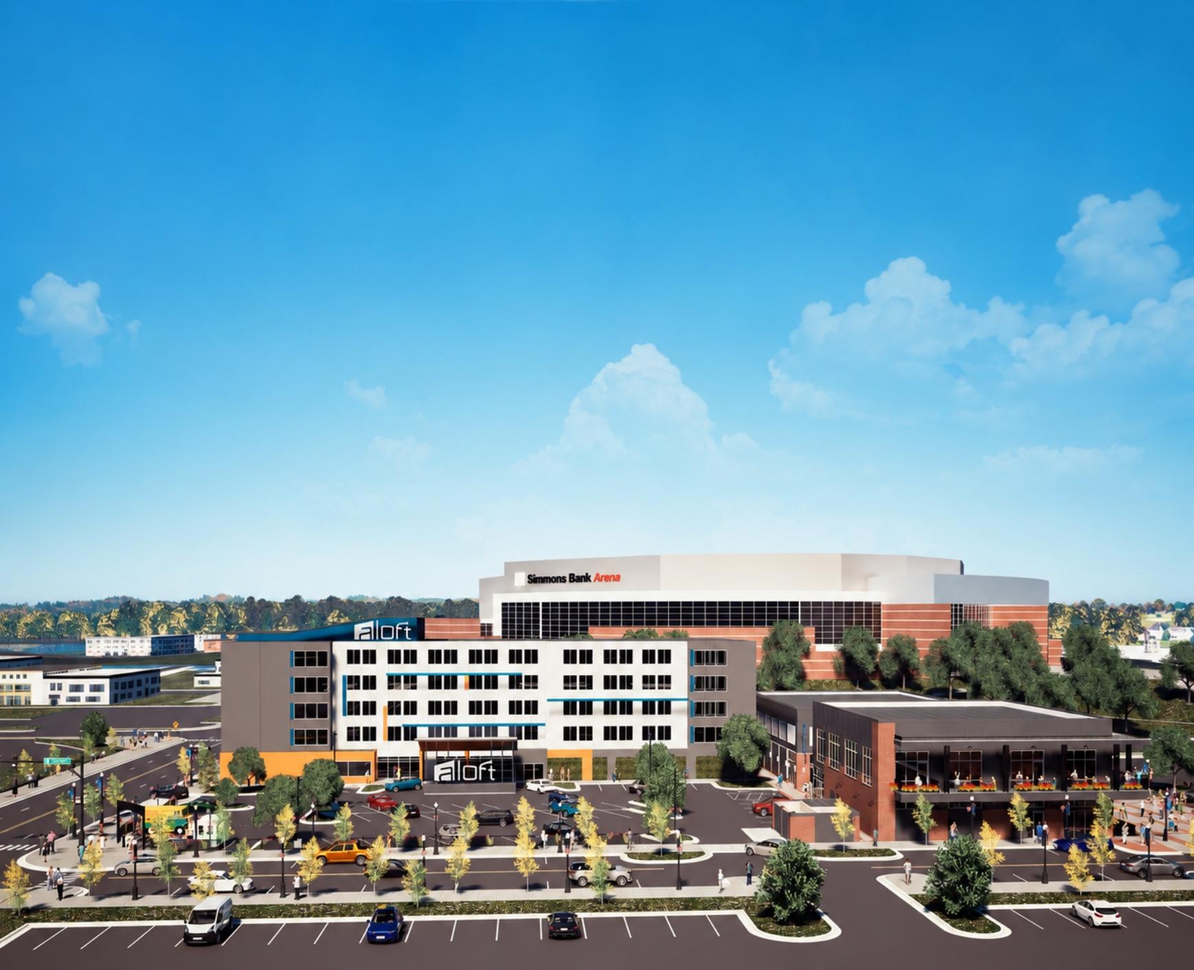
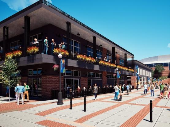
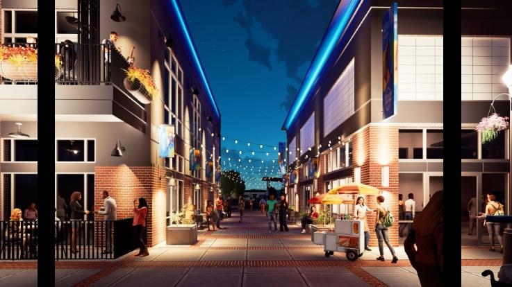
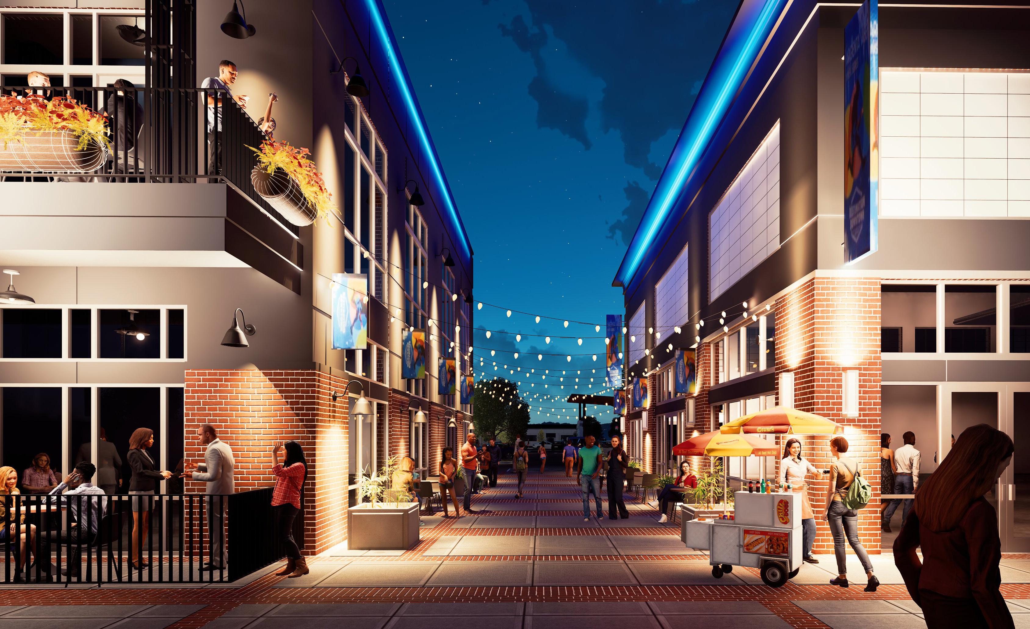
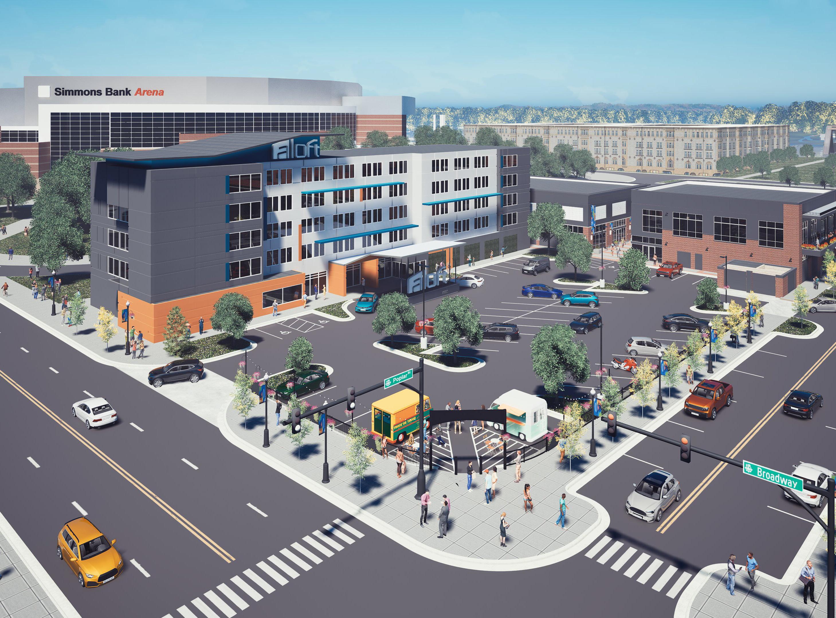
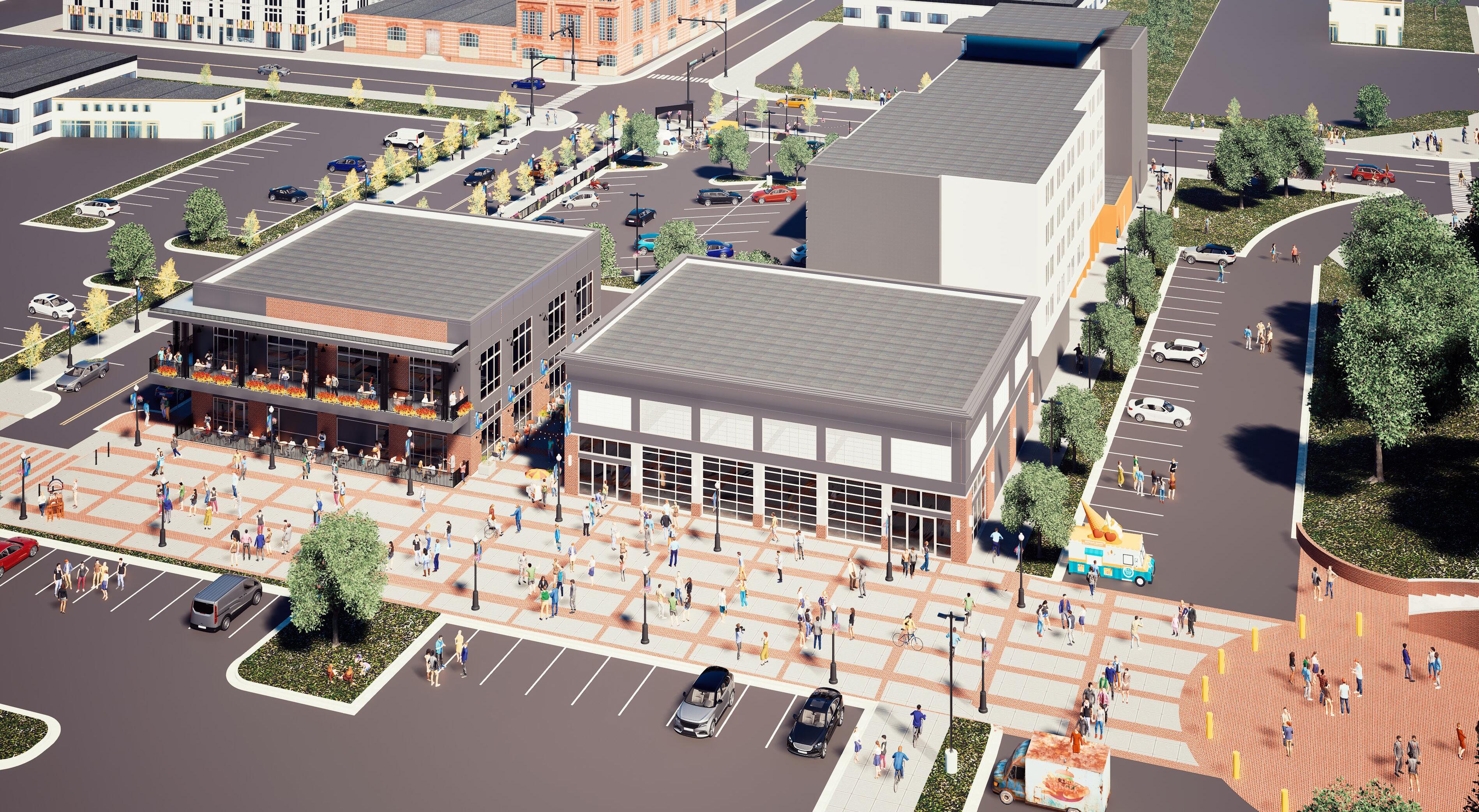
Pedestrian-oriented spaces like Gateway Alley will knit the district’s three buildings together and allow visitors to move seamlessly around the area. Facing page, top: Extending the Junction Bridge Trail and renovating the 2nd Street Promenade are key components to completing the district’s connections. Bottom: The Arena District development is anchored by a five-story Marriott Aloft Hotel, located adjacent to the Simmons Bank Arena and just steps away from the future home of Willy D’s Dueling Piano Bar and John Daly’s Pizza.

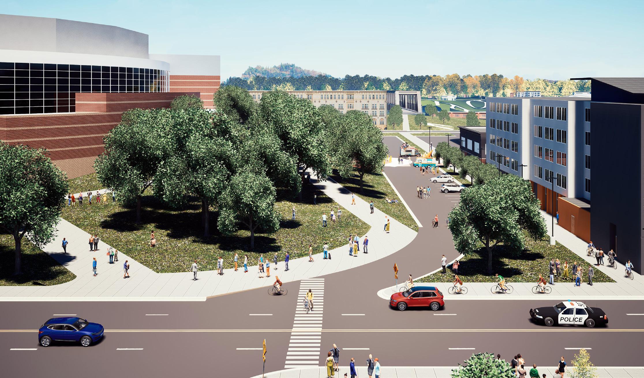
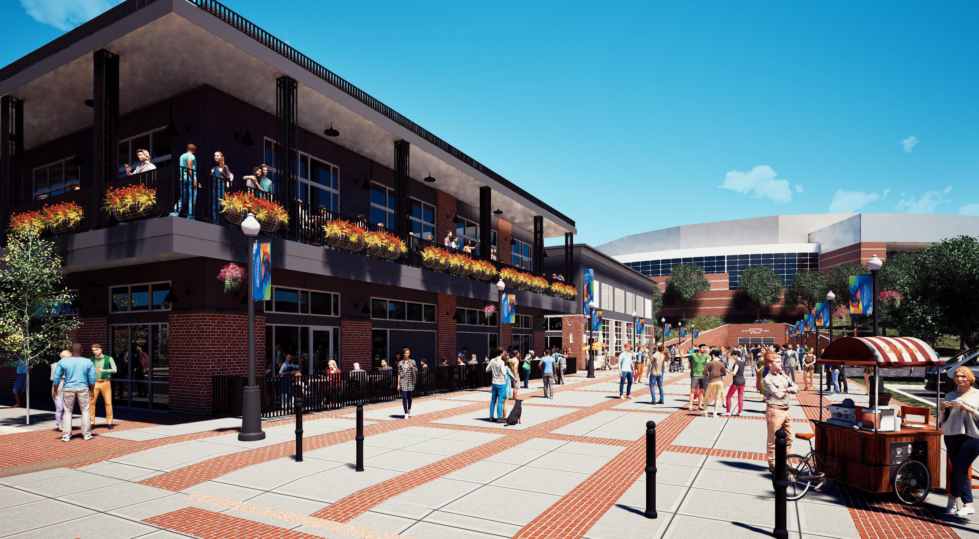
The two-story, 7,770-square-foot building that will house Willy D’s Dueling Piano Bar and John Daly’s Pizza is designed to bring dining and nightlife directly onto the Promenade.
The 2nd Street Promenade has long been envisioned in master plans as the primary east-west pedestrian-friendly walkway spanning five blocks and linking Simmons Bank Arena to DickeyStephens Park from Arena Drive to Willow Street. Only the twoblock portion between Main Street and Arena Drive was built. The corridor is part of a larger Six Bridges District spanning the Arkansas River that connects all of downtown. With major venues and attractions anchored at the end of each bridge and the Arkansas River Trail and Rock Region Metro streetcar line connecting each side, there is a great opportunity for infill development.
The overarching vision for The Arena District is simple: to frame the existing two-block stretch of the Promenade from Main Street to Simmons Bank Arena with active, street-oriented buildings. In addition to creating an inviting, walkable urban environment that provides a link to the existing development on Main Street, doing so will also fill a critical gap along a key intersection of the corridor. We also wanted to work with the city and other adjacent developers to leverage opportunities for cohesive streetscape improvements, trail extension, Promenade renovations and funding a public/ private parking facility.
Rather than treating the area around the arena as a sea of parking empty most days of the week the goal is to establish a cohesive district where visitors can ride the streetcar, walk, bike and park once and easily walk between hotels, restaurants, entertainment venues and public spaces.
The Arena District will include three complementary buildings organized around pedestrian corridors and public gathering spaces.
The anchor of the development is a five-story, 96-room Marriott Aloft Hotel at 210 East Broadway Street. Developed in partnership with Conway Management and Span Hospitality, the contemporary Marriott-branded hotel’s presence—located adjacent to the arena and steps away from the heart of the Argenta Arts District— establishes a strong architectural edge and will strengthen North Little Rock’s appeal to event organizers, performers and visitors. Aloft is known for its modern design and vibrant social atmosphere, and that energy will carry into the ground-floor activation of the site, including the hotel’s signature WXYZ bar concept. To the west at 200 North Poplar Street, a two-story, 7,770-square-foot building will house Willy D’s Dueling Piano Bar and John Daly’s Pizza. This building is designed to bring nightlife and dining directly onto the Promenade. Willy D’s has been a staple of central Arkansas nightlife since 2003 and will feature an expanded performance space and upgraded live entertainment experience.
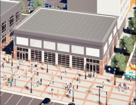
Completing the trio is a 5,000- to 6,300-square-foot restaurant/ bar and/or event venue at 230 East Broadway Street This singlestory structure is designed to open directly onto the Promenade, providing a flexible indoor/outdoor restaurant space that can host a variety of gatherings.
Individually, each building serves a distinct function. Together, they create a layered experience of hospitality, entertainment and public life that reinforces the Promenade’s role as the social heart of the Arena District.
What distinguishes The Arena District is not just the mix of uses, but the way they are connected.
Pedestrian-oriented plazas and alleys will knit the three buildings together. The Entry Plaza at Broadway and Poplar Street serves as a visible front door to the district, welcoming visitors walking from Main Street. From there, pedestrians can move seamlessly south toward Gateway Alley and the portion of the Junction Bridge Trail that will be built within The Arena District and/or the 2nd Street Promenade.
Extending the portion of the Junction Bridge Trail between the Promenade and Washington Street and renovating the Promenade is also necessary to complete all the connections. This extension will intersect at the entrance to the Arkansas Sports Hall of Fame and the Promenade, adding a much-needed northsouth pedestrian connection that links both sides of downtown, both riverfronts and the bridge directly to Argenta’s historic Main Street. The city of North Little Rock’s commitment to upgrade the 2nd Street Promenade will provide yet another outdoor event area and gathering space once the Arena District is completed.
The Arena District does not stand alone. It is part of a wave of coordinated investment along the 2nd Street Promenade corridor. On the south side, between Poplar and Main Street, the North Little Rock Event Center opened in March and adds another muchneeded option for hosting conferences and events downtown. One block south, at the intersection of Washington and Poplar streets, a seven-story, 130-room Tempo by Hilton is currently
under construction. Together with the Marriott Aloft, these two hotel projects will significantly expand the room inventory within walking distance of Simmons Bank Arena, Dickey Stephens Park and the event center.
The concentration of hotels, event space and entertainment venues on both sides of the river creates a critical mass that can support larger conventions and events. Visitors attending a concert, conference or sporting event will find multiple lodging options within a few blocks, as well as dining and nightlife that keeps activity concentrated in the urban core of downtown adding additional numbers of visitors overall.
The project builds on nearly two decades of momentum in Argenta and reflects a broader commitment to placemaking and economic development in downtown.
As Downtown continues to evolve, The Arena District stands as a tangible example of how strategic infill, pedestrian-oriented design and coordinated public-private investment can reshape an urban district. In doing so, it not only strengthens the physical connection between the Junction Bridge, Simmons Bank Arena, 2nd Street Promenade and Argenta’s Main Street but also deepens the social and economic ties that can make all of downtown a dynamic place for residents and visitors alike.
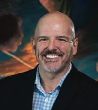
Long-time Argenta resident Greg Nabholz is CEO of Nabholz Properties in Conway and a placemaking economic development consultant. Nabholz Properties is an investor and developer in The Arena District.
BY ANDREW MORGAN
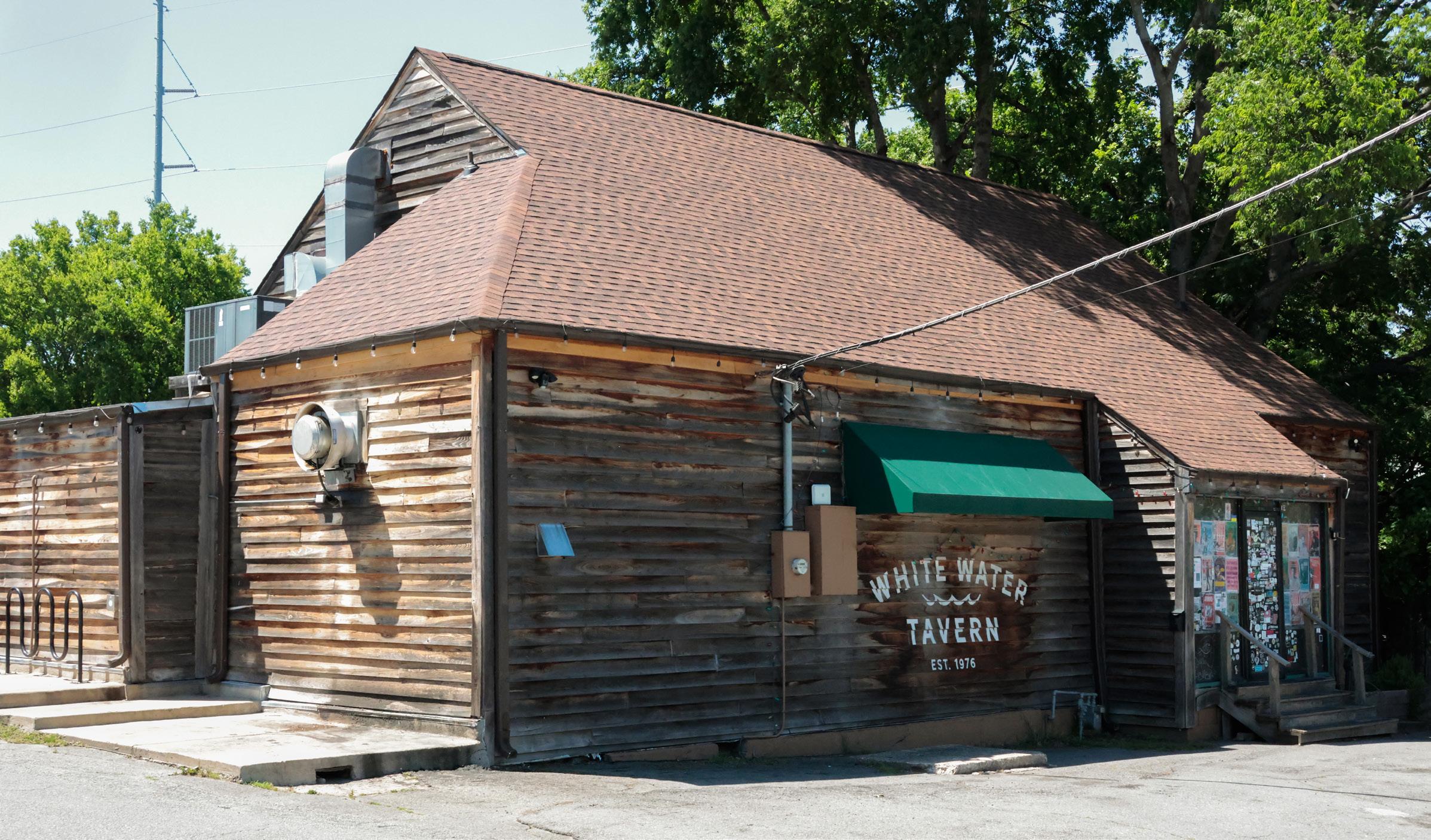
Now that the property is rezoned for commerical use, owners Travis Hill and Natalee Miller can address the fun stuff like expanding the beer garden, as well as more serious projects like repairs.
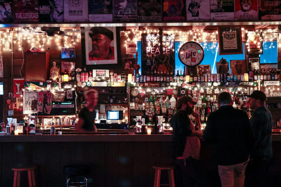
“Chances are it’s gonna be alright.” The Sharpiescrawled message on a stained and crinkled piece of paper is pinned right above the register at Little Rock’s White Water Tavern, and that pretty well encapsulates the vibe at this beloved neighborhood dive bar that has survived fires, ownership reshuffling and a pandemic to keep serving cold beers and hosting musicians from up the street and across the globe.
Nestled into a corner by the Union Pacific rail line where Thayer, Coates and 7th streets converge, the White Water opened its doors in September 1976, on the site of a former beer joint called The Pitcher that dated back to the 1940s. Before that it was a small neighborhood grocery. In whatever incarnation, it was out of the way enough to be easy to miss, a true “if you know you know” kind of place.
“The first time I came down here, I passed it twice,” Travis Hill, who co-owns the tavern with his wife Natalee Miller, said. “You know, the address says 7th Street, and I went under the train tracks because it’s tucked back in a neighborhood. It’s not what you’d think a commercial business would be. But it is also very much part of the neighborhood.”
The White Water was the kind of place that, however historic or important to the fabric of the community, if it burned down, it couldn’t be rebuilt. And it did burn. At least partially. Several times. The first fire was in 1977. Arson. The second fire was in 1982. Arson again. Same perp even! A third fire years later was the result of a motorcycle accident and a gas leak. But that’s another story. (For a rollicking and frequently spicy oral history of WWT, I recommend “Wild days at the White Water Tavern,” published in the October 14, 2010, issue of the Arkansas Times.) Through all that, previous owners managed to keep the tavern afloat, but, being a grandfathered nonconforming zoning use, they were limited to repairing the existing building.
When he and Natalee bought the bar in 2021, it was still nonconforming, Hill said. “When the inspectors came down, they said you can put a new roof on, but if somebody knocks your fence down you can’t put the fence back up, and if the place burns again you can’t rebuild.” The couple started the process to change that. Over the course of about 14 months they bought the parking lot across the street and the gravel lot behind the building, which were zoned industrial mixed-use. They added sidewalks, curbs and drains, and submitted their plans and paperwork to the city
and successfully rezoned the whole property commercial. That’s important for several reasons, Hill said.
“Now we can expand the beer garden. We can repair anything we need to. And make sure that, worse case it burned down, we can rebuild. This place will still be here when I’m gone.”
As a venue, the White Water built its rep on blues and, as renowned musicologist—and Little Rock native—Robert Palmer put it, “the mongrel music called rock-and-roll.” Writing for the New York Times in 1981, Palmer revisited his hometown bar. “The Whitewater [sp] Tavern, a rickety frame building on an unpaved Little Rock back street, is a typical juke joint. And last Saturday night at the Whitewater got off to a typical start, with a band of white longhairs playing loud blues-rock for an audience of rowdy young beer drinkers. But gradually musicians began drifting in, and the music changed.” That night, one of those musicians of which he spoke was CeDell Davis, the Helena-born player who became a virtuoso at scratching out visceral, metallic blues riffs with the flat blade of a table knife, compensating for hands withered by a severe childhood bout of polio. Davis would become a sort of patron saint of White Water, and he performed there many times before his death in 2017. His portrait hangs prominently above the bar.
While fans can still bask in the genu-wine juke joint or honkytonk vibes, depending on the evening, the music has diversified along with the audience. On any given night you might wander into a scuzzy punk club, a near whisper quiet singer-songwriter night, a hip hop showcase, a metalfest, or a karaoke night so packed you consider reconsidering your plans for the evening. (Then again, you may roll with it and belt out your best attempt at “Shiloh.”) The Arkansas Symphony Orchestra even makes appearances on the stage, with small ensembles playing several times a year. Whatever resonates the joint’s cypress boards and brings people together is welcome. Hill aims to keep it that way, and part of being a neighborhood bar is being neighborly, he said.
“Even though we’ve rezoned everything commercial, I want this to be a center of the community and a place people come and gather. And we’re very conscientious about how loud we are. We go and make sure that the neighbors aren’t disturbed, pick up the trash and keep it mowed, keep it looking as nice as we can, and be good stewards and good neighbors.”
Andrew Morgan is senior editor and photographer for the Arkansas Municipal League.
Blockwright’s workshop gave Northwest Arkansas planners the tools—and the tiles—to plan for their cities with consideration for the collective corridor.
BY MATTHEW HOFFMAN, AIA
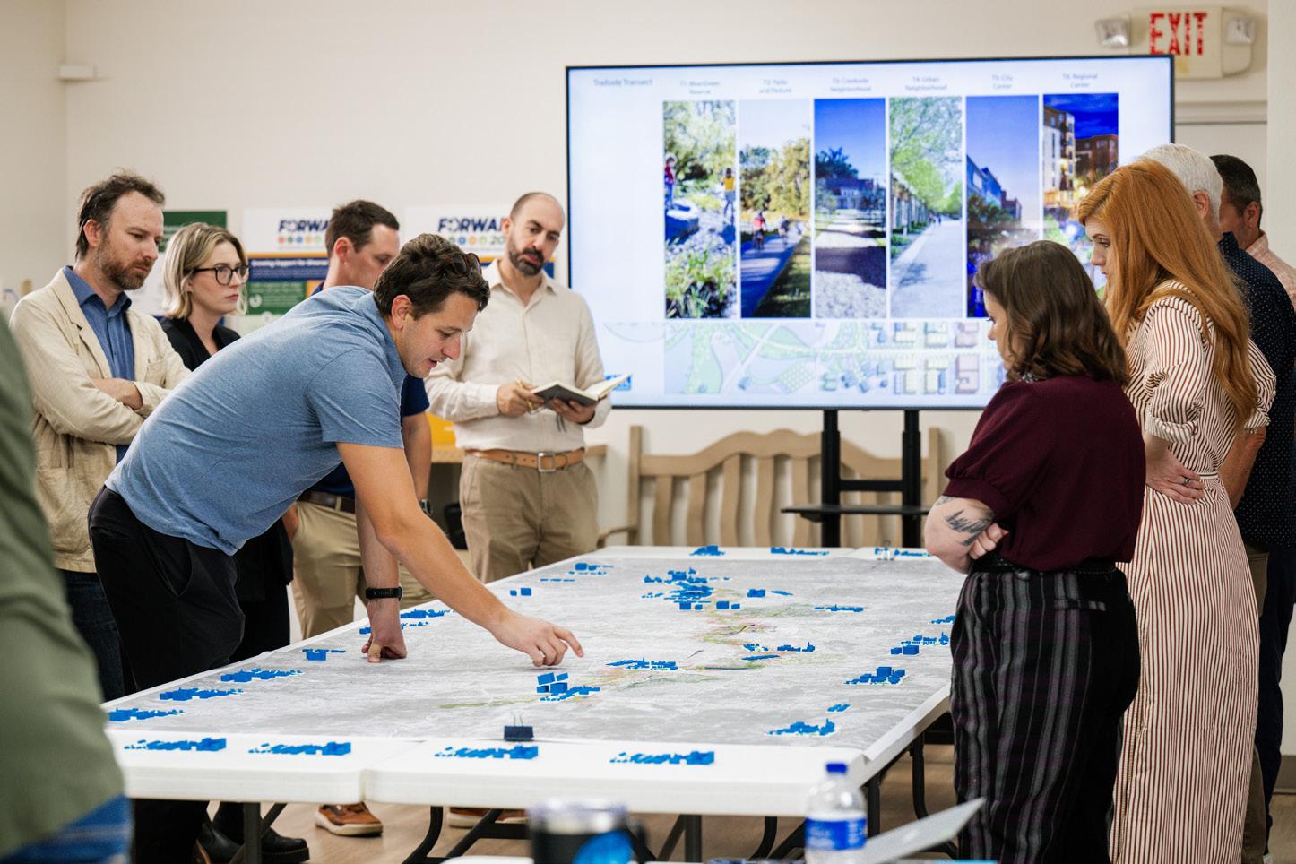
The workshop opened around a corridor-scale map of the Razorback Greenway. Planners from seven Northwest Arkansas cities held 3D-printed tiles in their hands. There were over a hundred tiles in play, each representing one of four distinct place types: Creekside Neighborhood, Urban Neighborhood, City Center Regional Center. Their job was to decide where along 40 miles of trail those places should go.
The rule was simple. You could not place a tile in your own city.
The Razorback Greenway Corridor Plan brought together two firms. Field Operations, the firm behind the High Line in Manhattan, was lead consultant on the project. Fayetteville-based Blockwright (formerly MBL Planning) led the housing strategy, including the transect framework underpinning both the workshop and the plan’s approach to growing new neighborhoods along the corridor. The plan was administered by the Northwest Arkansas Regional Planning Commission and funded by the Walton Family Foundation as the first planning project in its Design Excellence program.
The project’s public engagement survey found that 97% of current users come to the trail for recreation. That is real, and worth keeping. But in a region where housing and transportation costs are already a hardship for many families, a 40-mile network of safe, low-stress connections is a transportation alternative waiting to be activated. The Atlanta Beltline offers a glimpse: employers along it now report up to 30% of staff commuting by trail. The Greenway already passes Walmart, Tyson and JB Hunt, alongside hundreds of smaller workplaces and civic spaces. The Walton Family Foundation’s 2025 housing report names weak links between housing and transportation as one of four priority needs in the region. The corridor plan is the design-level response to that need.
Now the Bob R. Brooks Jr. Justice Building, its revitalization is a welcome sight to downtown Little Rock.
The corridor plan estimates that more than 230,000 residents
live within a 15-minute ride of the trail. Their daily trips are short: 1 to 5 miles from a house to a school, an apartment to a brewery, a townhome to a job. Many of them could happen on the trail. Today, they all happen by car. The Center for Neighborhood Technology’s Housing and Transportation Index puts annual transportation costs for typical Northwest Arkansas families between $12,000 and $14,300, depending on the city. Combined with housing, those costs push the burden in some Greenway cities past what households pay in Boston, San Francisco and Washington, D.C., and well above the 45% of income threshold the Index uses. That is a tax; the Greenway is one of the few public investments that can help reduce that burden.
All of this could change the purpose of the corridor. If the Greenway is recreation, it is a trail. If it is also a bundle of short, useful trips, it is infrastructure: housing infrastructure, workforce infrastructure, school infrastructure. The corridor plays out in episodes: a downtown block, a neighborhood street, a creek bend. What the plan adds is housing and neighborhood activation tuned to each, so that a Saturday ride can also be a Tuesday commute.
Northwest Arkansas faces a critical choice. As the region grows toward a million people by 2050, it’s also urbanizing 1,508 acres a year, according to the Growing Home NWA Regional Vision recently launched by the Northwest Arkansas Council. The Greenway Corridor Plan offers an alternative to doubling the region’s footprint along with the population. With 60% of the corridor land in floodplains, new development patterns will have to be far more compact than the suburbs that have already been built.
At that pace, public infrastructure cannot be designed in silos. A trail planned without housing produces empty corridors and parking-lot frontages. Housing planned without transportation alternatives produces traffic. The seven cities along the Greenway
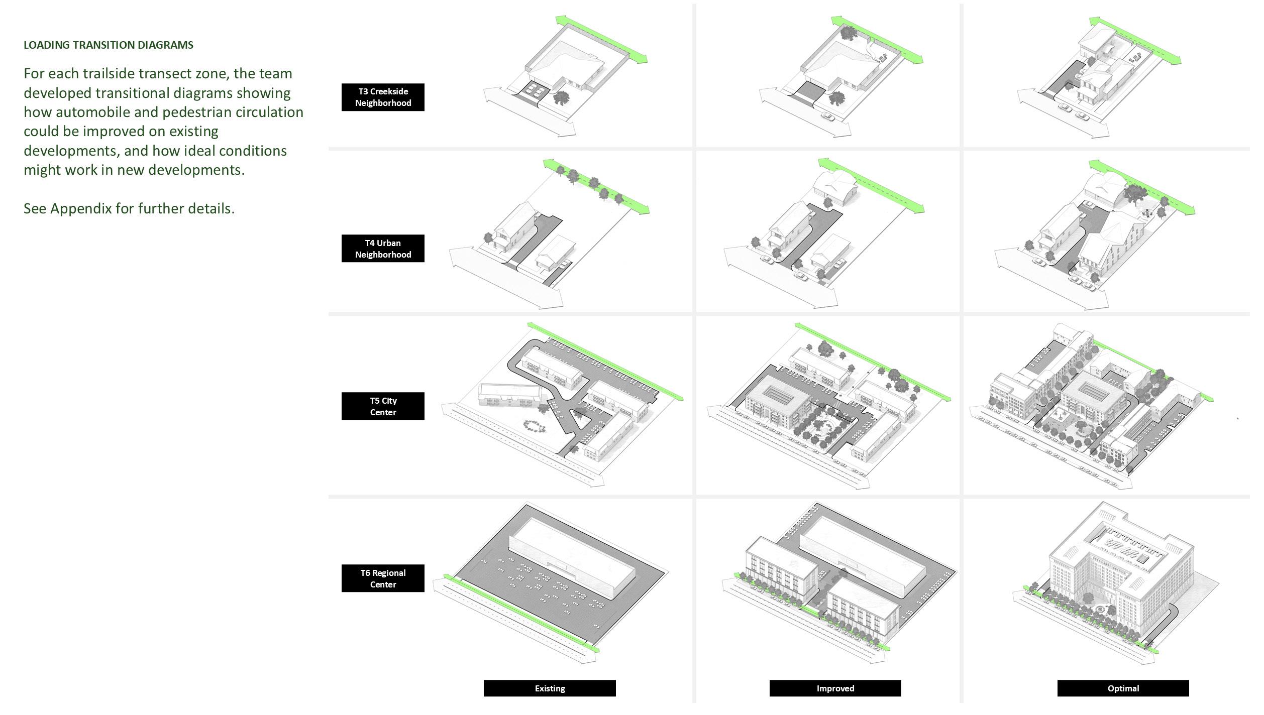
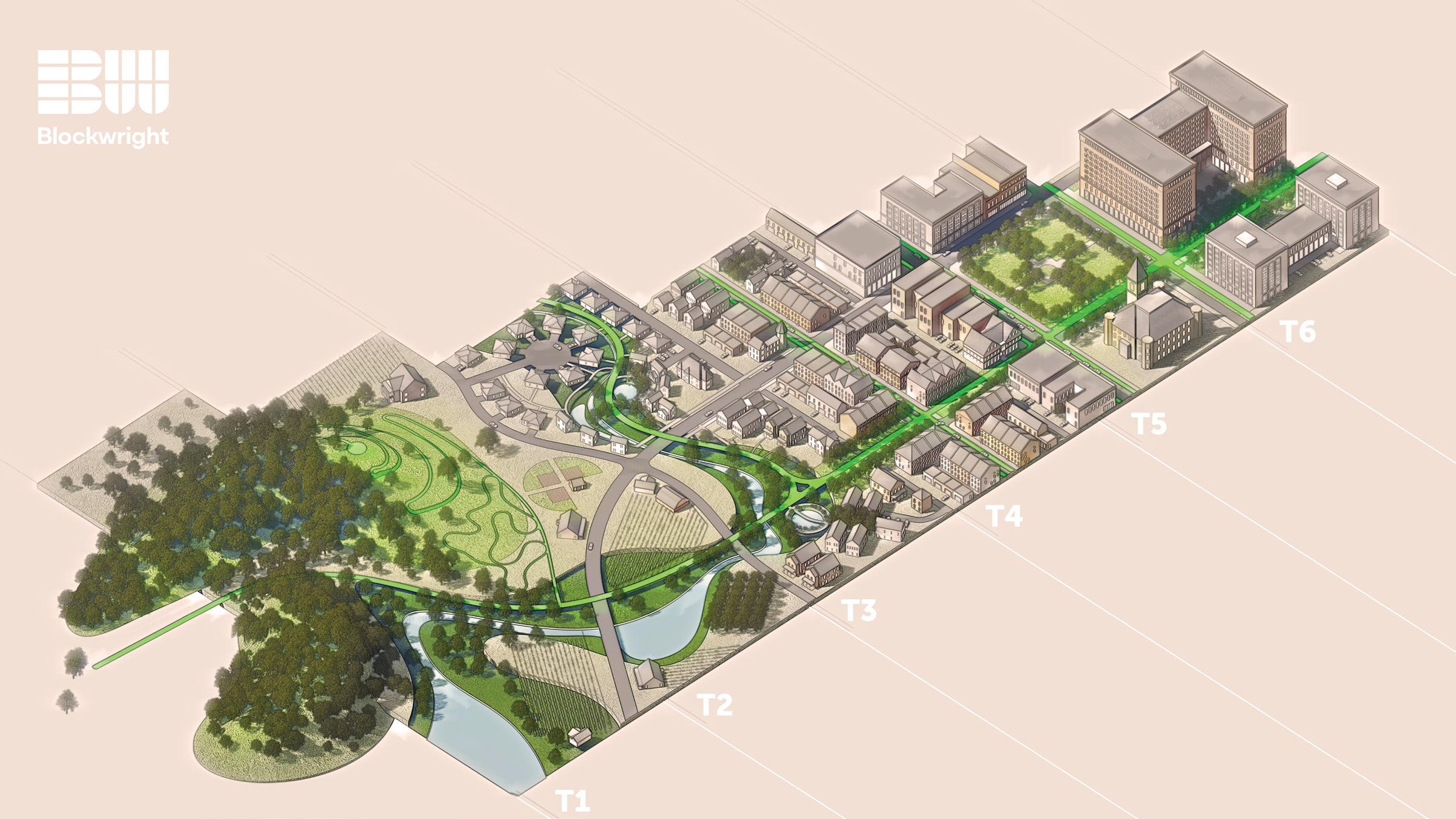
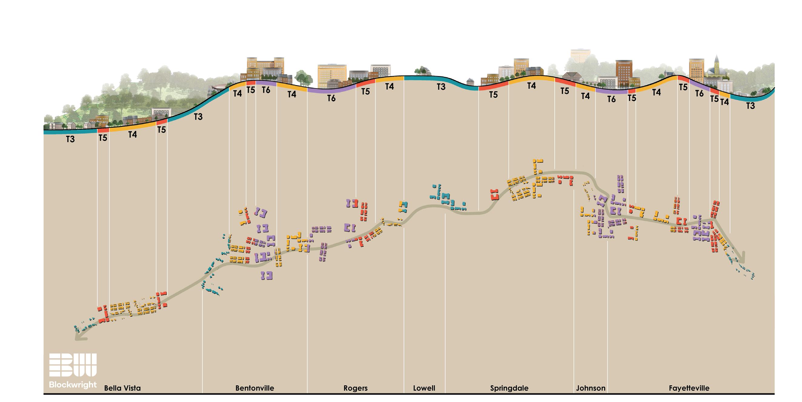
are growing into one another whether their plans say so or not. The choices each city makes about a single development now show up in another city’s traffic and tax base later.
Which brings us back to the room.
The constraint on tile placement was a deliberate inversion of the failure mode of regional planning. Cities plan within their own borders, and the new districts and economic drivers that emerge when cities complement each other go unbuilt, often without anyone noticing they’re missing. By forcing planners to deploy housing, mixed-use and conservation in someone else’s jurisdiction first, we changed the question. Instead of “what do I want for my town?” the first question became “what does the corridor need, and where does it best fit?” Planners argued for trailside neighborhoods in cities they did not represent and made cases for protected creek edges and rural transitions in places where they had no political stake. Practical empathy emerged quickly, because the alternative was an obviously broken corridor.
Then we turned the room around. Planners shifted roles to act as planning commissioners in their own towns, reviewing the development patterns their colleagues had just proposed. The order mattered. Corridor first, city second. By the time anyone got back to defending their own jurisdiction, the regional logic was already on the map, and they were representing it rather than responding to it.
The transect was the common language: a planning framework that grades development from rural edge to urban center. Seven cities meant seven zoning codes, seven development codes and seven approaches to permitting. The transect gave everyone the same vocabulary for what should grow where. Field Operations was familiar with the transect as a concept from ecological study; Blockwright brought it to this project as a design tool. The two firms paired environmental and trailside development zones along the corridor.
Tiles made the abstract feel physical. The no-tile-in-your-
own-city rule turned the workshop into a prototype for regional governance. Transect language, handheld tiles, corridor-first rule: none would have done it alone. Together, they produced a set of regionally consistent expectations for trailside growth that no single city could have written by itself, and that all seven could recognize as their own.
But lovable places aren’t built with zoning and demographic data alone. The corridor plan also asked what trailside development should look like. The answer was sketched in a frontage matrix that paired each transect zone with specific design moves. It trades the privacy fence default for front doors, porches, windows and landscapes that give life to the trail. That is how the Greenway evolves from backyard amenity to principal public space for the region.
Phase 2a of the corridor plan kicks off this summer, with detailed trailside master plans for Bella Vista, Bentonville and Rogers. Washington County cities will follow in a later phase.
The Razorback Greenway Corridor Plan teaches a habit other regions can adopt: corridor first, city second. Over a career, every planner builds an apparatus of political instincts, procedural muscle and the relationships of a particular place. That apparatus is what makes a planner effective in a council meeting. It is also what blocks regional thinking. Most regional plans fail because they ask cities to give up something for a vague collective good. This one made each planner plan outside their own city, leaving the apparatus at the door. Without it, they could do their best work: thinking strategically about where growth lands and what it could become.
For regions like NWA, the biggest opportunities lie across municipal borders. Building a common language is the real work of regional planning.
Matthew Hoffman, AIA, is president of Blockwright, a multidisciplinary design studio.
BY MATT McNAIR
Aplace where city folks flocked by the thousands to “take the waters,” Eureka Springs was one of the most popular, and most secluded, water towns. These were places built around natural springs with purported healing powers, popular in the late 19th and early 20th centuries. Though the days of water cures are long gone, Eureka Springs survives, not only as a popular tourist destination, but also as a destination remarkably similar to the one that greeted those monied miracle-seekers some 100 years ago.
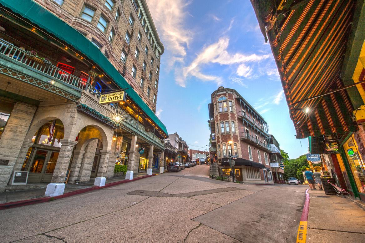
According to the National Park Service, Eureka Springs possesses “exceptional historical value to the United States as a whole.”
Eureka Springs was always intended to be a tourist town. At the time of incorporation, it had already played host to a makeshift Civil War veterans hospital that was located underneath a rock overhang. The initial construction boom was just that—a boom—a flurry of enterprise driven by and aimed at the droves of people clamoring to take the waters…and, perhaps, frequent a saloon or other less-reputable delights. As such, the building was fast and furious, and fueled by the readiest material to hand: timber. That material also fuels fires. By the second or third catastrophic inferno, citizens began to rebuild in the other material with which the Ozark Mountains are flush: stone.
The era of construction in Eureka Springs that began in earnest around 1890 or so is one of rock and boulder, stone and mortar. The large civic and commercial buildings that rose from several successive piles of ashes—health spas, water bottling plants, the courthouse— were fortified piles of stone, imposing in their construction but aesthetically breathtaking in their execution. Master craftsmen erected them in the ornate and beautiful architectural styles of the time, particularly the neo-classical Italianate form so suited to the area’s wealth of stone.
The grand homes of that era are no less impressive. And while massive and ornate Victorian mansions—the Queen Anne style is especially prevalent—were still being built primarily of lumber, stone was no less important to their construction and preservation. Rather than being built of stone, they were built in stone; that is, they were set up against and even into and, in many cases, a bit underneath the imposing rock faces cut by Leatherwood Creek, which formed the tight, steep hollow along the Eureka Springs’ main thoroughfare. Today, there are entire residential neighborhoods carved out of these faces, with grand homes lining the narrow, twisting tracks up the mountainsides and nestled flush to the limestone reach.
It is those twisting tracks and trails, the narrow avenue allowed by the creek and the mountains in the confines of Leatherwood Creek’s cramped and winding hollow, and the sheer faces characteristic of this Ozark Mountain country that make the architecture of Eureka Springs truly unique. Empowered by the early 20th century’s rapidly improving engineering but unencumbered by regulations or oversight
of anything more onerous than the local council, the craftsmen who built Eureka Springs relied on ingenuity and creativity to create a breathtaking cityscape within and upon a landscape not naturally inclined for such things. An area of near boundless building constraints, Eureka Springs was built regardless.
The result is an urban wonderland whose streets mock the very concept of a grid, and which are often accompanied by rock-hewn staircases cut into the very mountains themselves, providing shortcuts up and down the mountain for those with legs and lungs up to the task. Indeed, one of these staircases is a section of street—official, named, marked—itself. To traverse the city’s stairsteps is less a physical challenge than an invitation, a chance to pierce the veil from the everyday to experience a place that almost feels at times imagined.
The same isolation that presented the greatest challenge for getting visitors to and from Eureka Springs to take the waters is arguably the reason for its preservation today. The gradual end of the water craze coincided with the onset of the Great Depression, resulting in economic devastation for Eureka Springs at every conceivable level. But economic crash coupled with difficulty of travel made Eureka unprofitable even to raze. Though the economy ground to a halt, most of the town’s significant structures escaped the creative destruction of retrenchment, repurposing and reinvestment. The time capsule was officially sealed in 1970, when the entire town was placed on the National Register of Historic Places as the Eureka Springs National Historic District, making the wholesale demolition of any structure unlikely in any but the most dire and necessary circumstance. And in 2005, the National Park Service upgraded its status to Nationally Significant District, further cementing Eureka Springs as “possessing exceptional historical value to the United States as a whole.”
Today, Eureka Springs’ partially lucky efforts towards preservation have made it a place emulated by cutting-edge practices in placemaking and new urbanism trying to replicate the authenticity of an architectural wonder and masterpiece from another era. However, newer parts of town are informed by the car-centric development we know today. The combination of ridgetop convenience and mountainside isolation makes Eureka Springs a fascinating stop for anyone interested in the ways our society has experienced urbanism in different times and different places, and how our new ideas of urbanism and urban planning can never be truly cut off from their antecedents. Eureka Springs is urbanism visiting with itself, and one of our favorite places to get in on the conversation.
Matt McNair is a native Arkansawyer and the editor of Arkansas Wild magazine. He currently lives in Little Rock with his wife, Brandy, and their dog Chester.
BY MAHG ARCHITECTURE
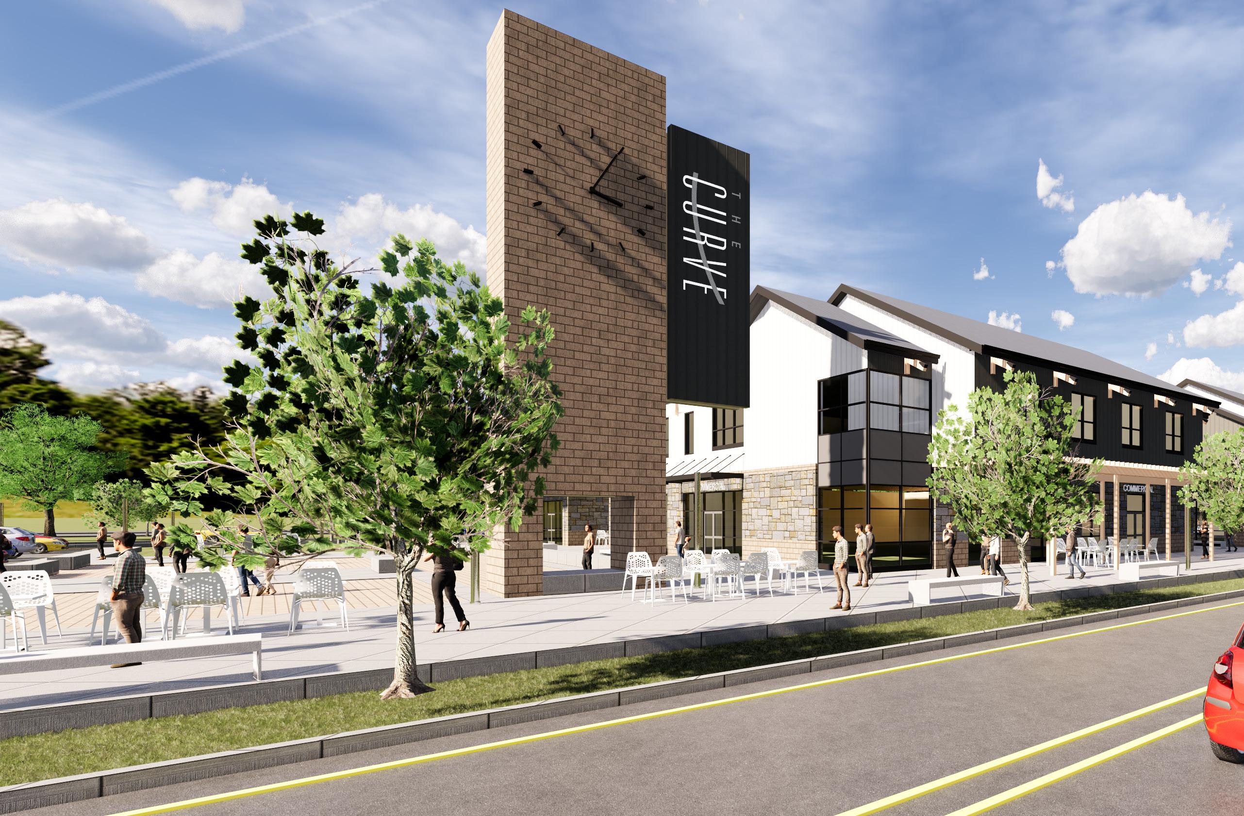
Located at the western gateway to Greenwood, The Curve development is envisioned as a new model for growth in south Sebastian County and western Arkansas—a walkable, mixeduse district designed to bring housing, commerce, recreation and civic life together into a cohesive community. Situated on 40 acres at the intersection of US Highway 71 South and West Center Street, the development reflects a growing shift happening across Arkansas communities: the desire to move beyond isolated commercial strips and suburban sprawl neighborhoods toward human-scaled places that are connected and centered around daily life.
Master planned by award-winning design firm, MAHG Architecture, The Curve embraces the principles of more urban
design through a framework that prioritizes density, pedestrian connectivity, activated public space, and a blend of uses that support both residents and visitors. Rather than functioning as a singleuse commercial center, the development is designed as a complete neighborhood—one where people can live, work, dine, gather and play—all within the same environment.
The project occupies a strategic location within the greater Fort Smith metropolitan area. Positioned along one of western Arkansas’ busiest transportation corridors and less than 3 miles from the future I-49 and US Highway 71 interchange, The Curve is expected to become a significant growth hub as regional infrastructure improvements continue to reshape development patterns in south
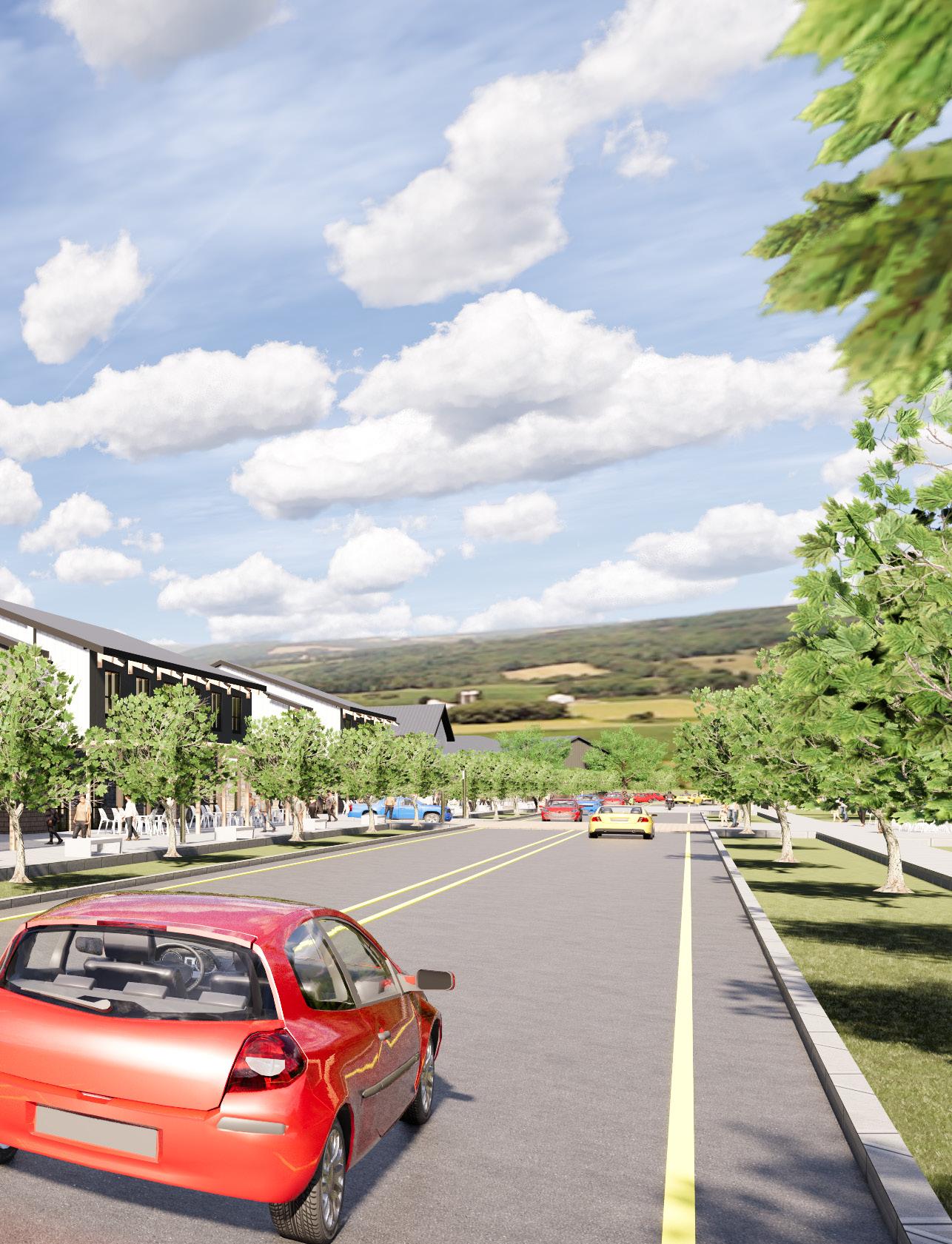
As regional infrastructure improvements continue to reshape development patterns, The Curve is positioned to play a significant role in defining the next era of growth for Greenwood, south Sebastian County and the greater Fort Smith region.
Sebastian County and western Arkansas. The site also sits near several major economic anchors, including the Arkansas College of Osteopathic Medicine campus, the ArcBest corporate headquarters, the expanding industrial and commercial districts of Chaffee Crossing, and the F-35 FMS mission at Ebbing Air National Guard Base.
Equally important is its relationship to the surrounding community. Residents and visitors will benefit from access to Greenwood’s parks, lakes, trails and civic amenities, as well as the highly regarded Greenwood School District. The development’s location creates an opportunity for a more connected and attainable lifestyle for families, professionals, students and commuters alike.
The site itself presents both a challenge and an opportunity. Originally a heavily wooded hillside bordering the highway, early analysis of traffic patterns, regional growth and demographic trends revealed a need for higher-density development capable of serving the area’s rapidly expanding population. Initial master planning began in 2019, followed by extensive grading and excavation led by property owner and developer Jacob Burton. Shale material removed from the site is being repurposed for on-site infrastructure and other regional construction projects, reinforcing a practical and resource-conscious approach to development.
From the outset, The Curve was envisioned as more than a private commercial venture. The first portion of the site was donated to Sebastian County for the future Sebastian County Library, currently under construction and anticipated to open in late 2026. The library immediately established a civic anchor for the development and prompted the extension of municipal utilities to the site by the city of Greenwood, laying the groundwork for future growth.
Commercial activity quickly followed. Braum’s Ice Cream & Dairy Store became the first commercial business to open within the development in spring 2026, occupying a prominent corner near the primary entrance and library site. Its early success has already demonstrated the visibility and accessibility of the location while signaling strong interest in the development.
At full build-out, The Curve is planned to include more than 170,000 square feet of retail, office, restaurant and commercial space, alongside a mix of residential offerings that include approximately 65 luxury loft units and 85 apartment residences. The master plan intentionally organizes these uses to create an active separation between commercial and residential functions. Street-front commercial buildings line the primary internal corridor, Clarence Way, while upper-story lofts and residential units introduce density and provide a built-in customer base that supports local businesses.
The site’s circulation strategy further reinforces its urban character. Clarence Way connects West Center Street to Cedar Valley Drive and functions as the primary spine of the development, while Stallings Trail links the library to future residential zones to the north. Together, these streets frame a central public outdoor space designed as the heart of the community.
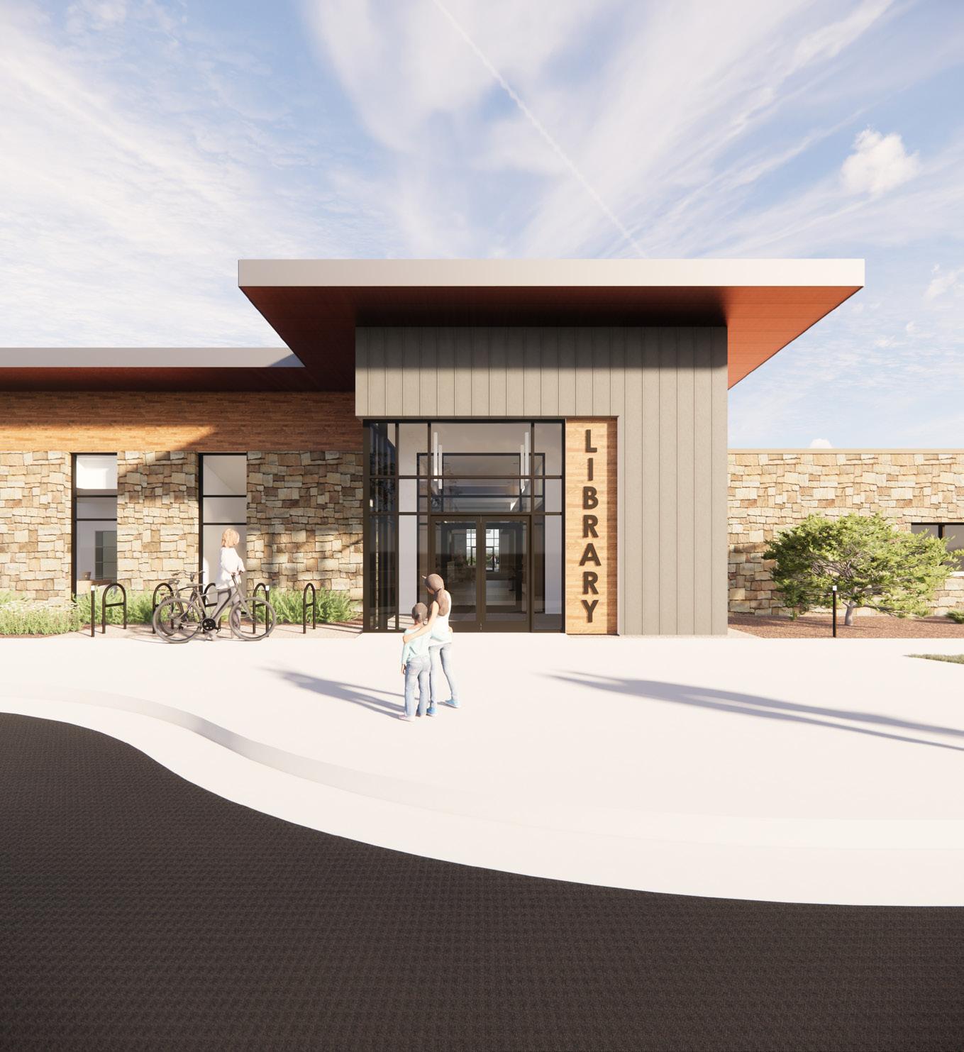
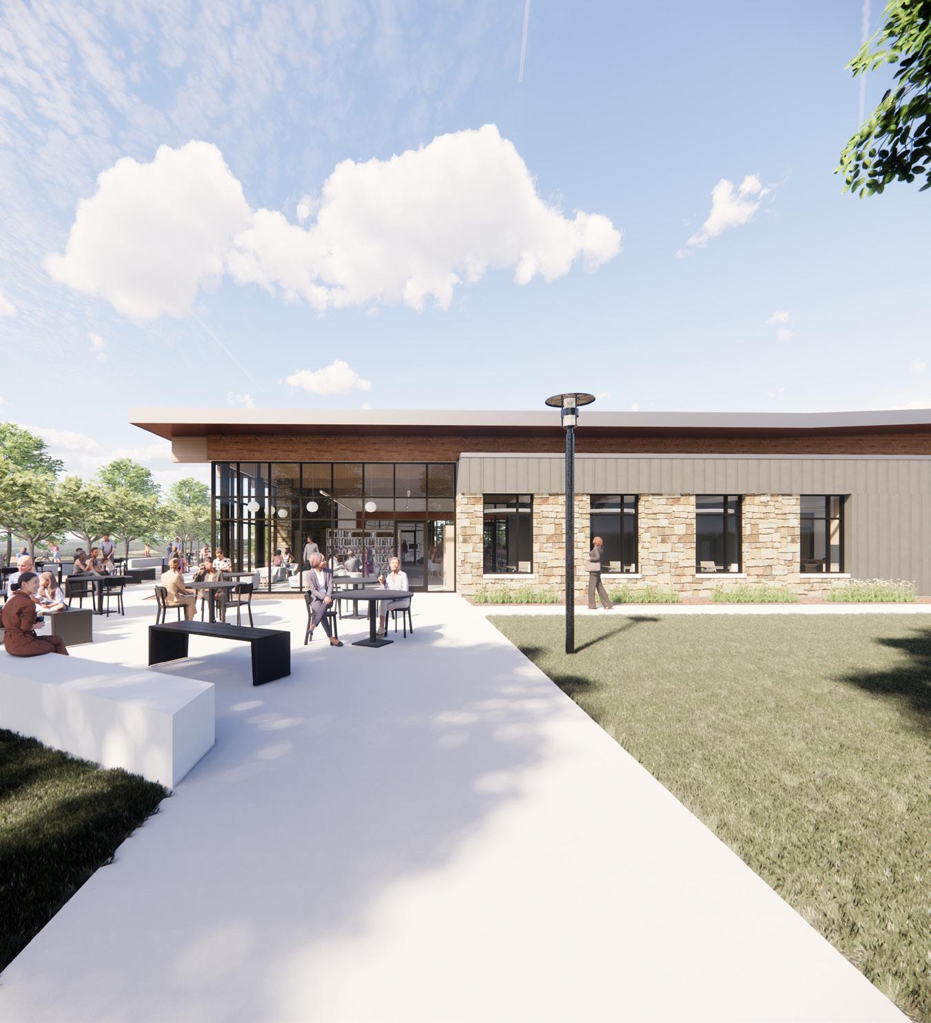
Currently under construction with an anticipated opening date in late 2026, the future Sebastian County Library established a civic anchor for The Curve, prompting the extension of municipal utilities to the site by the city of Greenwood and laying the groundwork for future growth. The first portion of the site was donated specifically for the library.
Rather than prioritizing parking lots and vehicular movement, the development emphasizes shared outdoor experiences and walkability. Planned amenities include a lake, walking trails, amphitheater, splash pad, fountains, plazas and landscaped gathering spaces intended to foster year-round community interaction. The arrangement of buildings around these open spaces reflects a deliberate effort to create a sense of place rather than a conventional commercial center.
Pedestrian-oriented design principles are embedded throughout the development. Boulevard-style streets incorporate on-street parking, bicycle sharrows, landscaped buffers and shaded sidewalks that separate pedestrians from traffic and encourage slower vehicular movement. Parking areas are generally located behind buildings to maintain active street edges and improve the pedestrian experience. Careful attention to scale, streetscape design and architectural guidelines helps create a more cohesive and inviting environment while celebrating the natural character of the region.
Ultimately, The Curve represents a new direction for development in western Arkansas—one that recognizes that successful communities are built not only through economic investment, but through intentional placemaking. By integrating civic space, housing diversity, walkability and mixed-use density into a unified vision, the project demonstrates how emerging communities can grow in ways that are both economically resilient and socially connected.
As grading and infrastructure work continue, momentum around the development continues to build and the “next turn” is commencing. With its first buildings nearing completion and additional parcels entering development, The Curve is moving from vision to reality. Coupled with the future completion of the I-49 corridor, the development is positioned to play a significant role in shaping the next era of growth for Greenwood, south Sebastian County and the greater Fort Smith region.
MAHG Architecture is an architecture, interior design, planning, and sustainability firm that has been a trusted partner to its clients, designing for people and communities since 1935.
BY MATT CAMPBELL
First impressions are key, and there’s no better introduction to Mammoth Orange Cafe than the squat orangeand-white structure that houses the dairy bar and its road-trip worthy menu (and prices!).
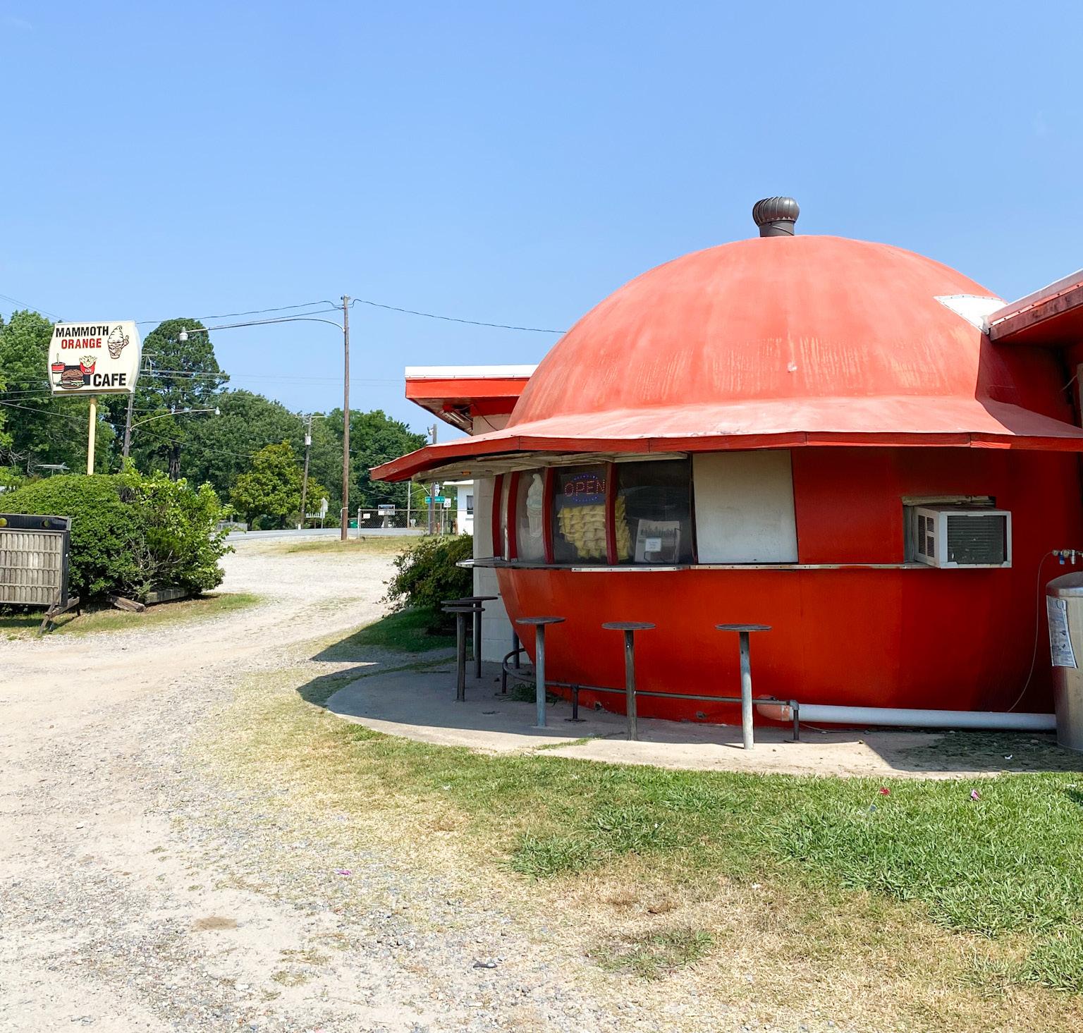
If you know where Redfield is, there’s about a 95% chance that is because of Mammoth Orange Cafe.
It’s not the only business in the Jefferson County city of 1,500—a handful of standard-issue small-town small businesses dot either side of the highway as you drive into town—but the venerable burger joint in the squat white-and-orange building at the corner of highways 46 and 365 is the one that draws folks from all over central Arkansas and points beyond.
We made the 30-minute drive from Little Rock for dinner on a recent mid-May Thursday night and were third in line to order. Five tables were occupied by others who had already placed their order and were eating or waiting on their food. After a few minutes, the couple in front of us struck up a conversation.
“Where y’all from?” a middle-aged man in a t-shirt and jeans asked.
“Little Rock,” I said. “You?”
“Stuttgart,” he said. “Drove an hour for a shake, can you believe it?!” He laughed and slapped his thigh.
It was suddenly his turn to order and, true to his word, he and his companion ordered three shakes—chocolate, vanilla and pineapple.
“Three?” I asked.
“Two are mine!” he said, again breaking out in laughter and slapping his thigh.
“Hell, yeah,” I said. We fist bumped, which in retrospect seems like a weird way to celebrate a frozen treat order.
But that’s the beauty of Mammoth Orange, really. It doesn’t just exist as an afterthought for folks who don’t have a better idea for dinner. It’s a destination for people who specifically want what Mammoth Orange offers: classic dairy bar eats at prices that seem like you stepped back in time at least a decade.
A smashburger-style cheeseburger that comes standard with lettuce, tomato, onion and pickles will set you back less than $6. Most sides run less than $3. A five-piece catfish dinner—available only on Fridays—is $14. Our entire tab for two cheeseburgers, Cajun fries, corn nuggets and two root beers, plus tip, ran less than $30.
And that’s just the lunch and dinner situation. According to our cashier, “some folks say the breakfast here is even better.” Because, like the throwback it is, Mammoth Orange opens at 7 a.m., six days a week and serves a full diner breakfast menu, including eggs any way you please, biscuits and gravy, and pancakes.
Between the breadth of the menu and the quality of the food they put out until 8 p.m. (or 9 p.m. on Friday and Saturday) every day but Sunday, it’s easy to see how Mammoth Orange has stayed in business since 1966. It may not be the only place to eat in Redfield, but, for many hungry Arkansans, Mammoth Orange definitely put Redfield on the map.
Matt Campbell is a reporter for the Arkansas Times. In a previous life, he was a lawyer. He lives in Little Rock with his fiancé, daughter and three dogs.
BY JAMES WALDEN
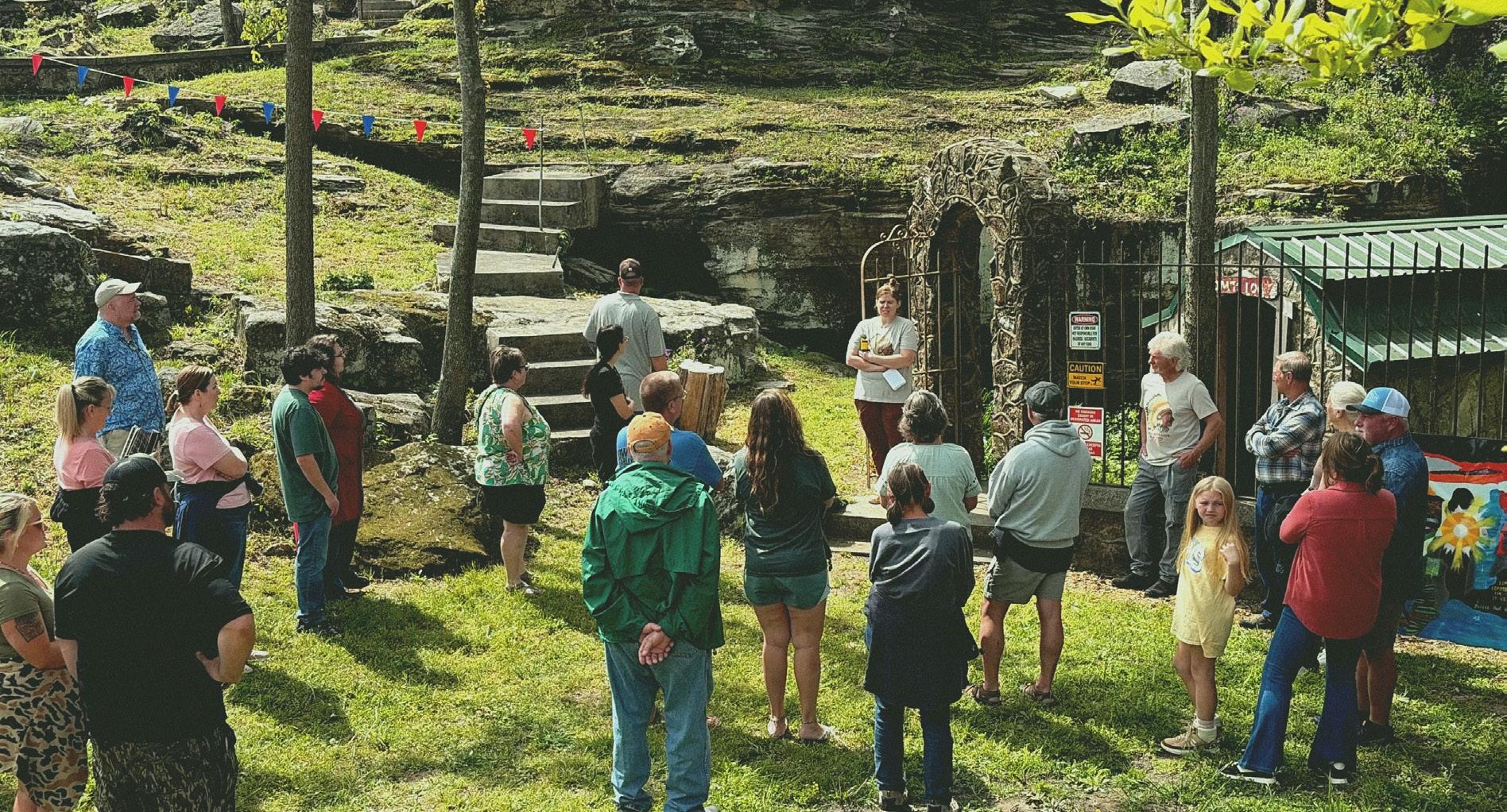
“We punch above our weight because of relationships,” says Cave City Mayor Jonas Anderson. “We do a good job of working together and connecting as a community.”
It’s easy to look across rural parts of Arkansas and see only endless challenges. Places set back by an industry gone, mere happenstances of geography or communities run over by today’s technology treadmill. But that simple view ignores what can be seen when you take a closer look: people pulling together to build place, creating and recreating community. And leaders who have quietly chosen resilient dedication to making things better, living out René Dubos’ famous quote, which the author first heard from a beloved mentor, “Wherever human beings are concerned, trend is not destiny.” Nowhere is that more apparent than in Cave City, a place that’s been doing the Cave City Comeback.
March 14, 2025, was a dark day for Cave City residents. A devastating tornado struck, testing the resilience of the entire community. Homes were damaged, businesses disrupted and much of the city’s physical fabric was torn apart in a flash. A quick response by residents and first responders helped propel the community forward and over 5 million pounds of debris were removed after the tornado. A simple view of the story would come to a quick conclusion—the tornado was bad and brought the community together. You’d be wrong to make that assumption.
The groundwork for Cave City’s comeback has been deliberate and predates the tornado by several years. A key piece was community leadership. In 2017, Jonas Anderson was appointed to fill the remainder of the previous mayor’s term. Dubbed the “Millennial Mayor,” he’d served on the city council for several years. He brought a fresh perspective to the role rooted in community improvement, one that focused on trust, relationships, change and quality of life.
A pivotal moment came in 2024, when the community participated in the University of Virginia’s Thriving Cities Lab, a program that uses stakeholder engagement to develop actionable
planning based around community assets. How would a small town in north central Arkansas participate in a selective program of an East Coast university? It came down to relationships between a community member and institute leadership. “We punch above our weight because of relationships. We do a good job of working together and connecting as a community,” notes Mayor Anderson. That engagement brought together residents, business owners, city leaders and stakeholders from across the community in a structured process aimed at defining a shared vision for the future. The value of that process was not just in the ideas it generated, but in the community and leadership alignment it created.
Through workshops, conversations and collaborative planning sessions, Cave City developed a unified sense of direction. Priorities became clearer. Possible partnerships were fostered. And perhaps most importantly, a shared vision and strategy for action were married together. The Thriving Cities Lab experience helped Cave City answer a critical question: What does success look like for our community? From that answer grew a series of initiatives that are now reshaping the city.
One of the most important outcomes of that shared vision was the creation of the Heart of Cave City, an organization dedicated to promoting and enhancing the downtown area. Headed by Executive Director Brandi Schulz and part of the Main Street Arkansas program, the Heart of Cave City works alongside the city’s efforts to enhance downtown. Schulz has also played an integral role in the relaunch of the Cave City Area Chamber of Commerce. She serves as executive director for that organization as well, growing its membership in the last year and a half to over 100 members. The chamber and Heart of Cave City have become a driving force for change in the community.
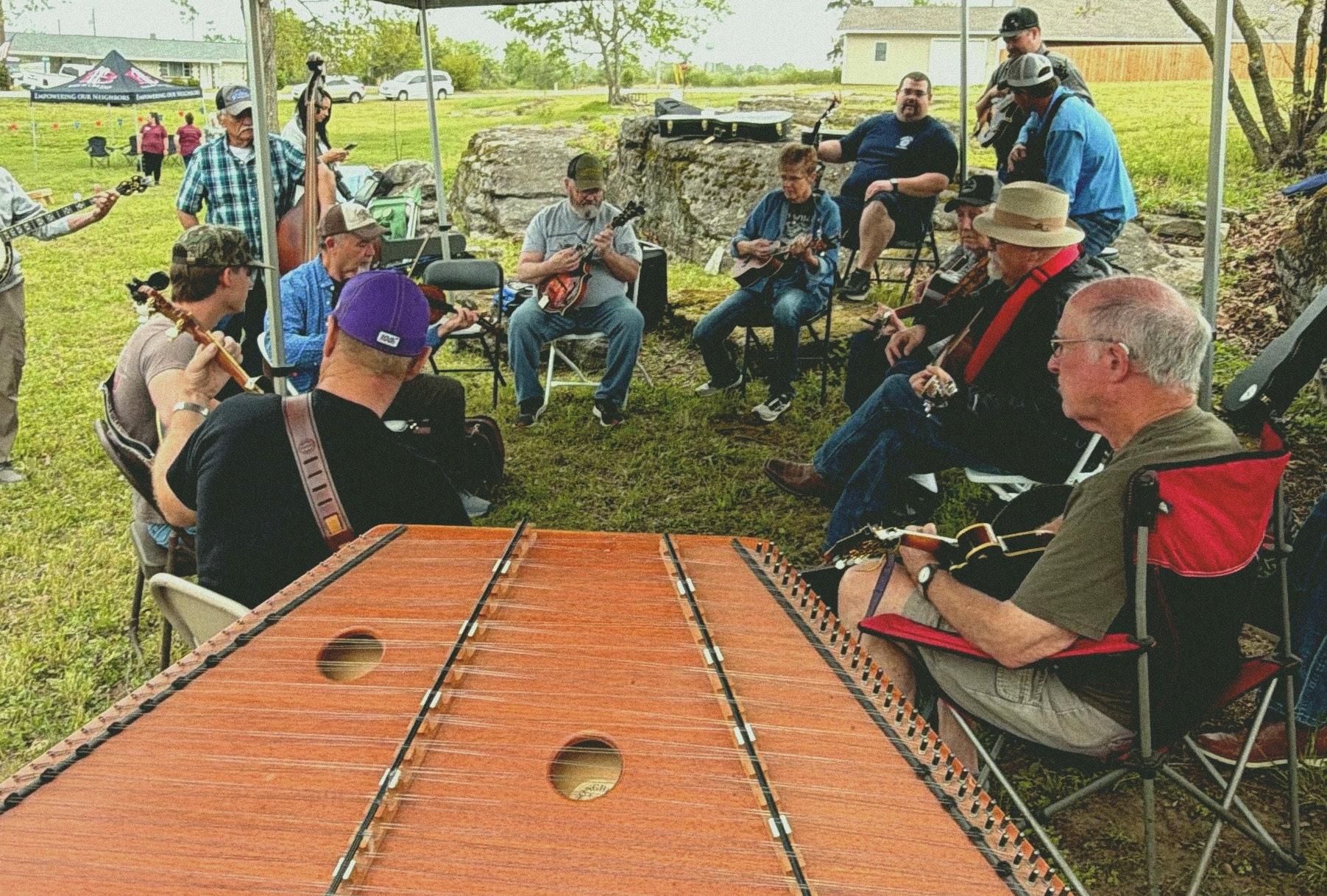
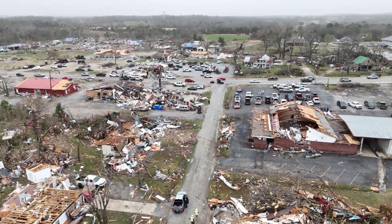
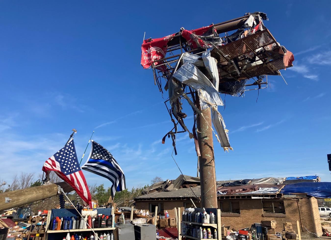
The organization helped put on the small town’s second and more locally focused festival, Founders Day. Its inaugural run was this spring, and it was a big success. “We wanted something that brought our community together, that was just focused on us,” said Mayor Anderson. What he describes as a “big yard party,” offered games, music and food, including a community table where folks shared food together church potluck style. It was a big success and another example of the togetherness that makes Cave City special.
While large projects often capture attention, some of Cave City’s most meaningful improvements have come from smaller interventions like the new Downtown Pocket Park at 115 Main Street. What was a fallen-in building and eyesore has become a new community gathering space after action by the city council to purchase the property. This modest but impactful space has quickly become a hub of activity, hosting community movie nights and informal gatherings. It demonstrates how even a relatively small investment can have an outsized effect when it is thoughtfully designed and strategically located.
The momentum of the Downtown Pocket Park has carried forward with other improvements in downtown. In 2023 and 2024, the city purchased, renovated and moved into a new city hall at the former Citizens Bank building. The city also purchased the former Cave City Lumber Company building and renovated it for a new police station. The Downtown Pocket Park and stunning new city hall became a source of pride for the community and a signal to investors that downtown was on its way back up. The signal was received and private investment has flowed in with new restaurants like the equally popular Bailey’s and Muffin Top Bakery. The downtown improvements reflect a broader philosophy: reinvest in what you have, honor the past and adapt it for the future.
Looking ahead, Cave City is looking to continue the comeback.. Located along the busy U.S. Highway 167, downtown has been at a disadvantage for decades. The highway designation has resulted in a road better suited to move traffic than to be a place to stop, park and walk around. However, the closure of the community center and teardown of older vacant structures along Union Street behind city hall have presented an opportunity.
The community has an emerging vision of a town square anchored by a new community center and pool. Existing facilities had been costly ongoing maintenance headaches for the city, and their replacement became a clear priority after the opening of the new city hall. As Mayor Anderson explains, “City hall has reawakened civic pride in the community. It raised the question of whether we should continue to sink money into facilities that will always be problems, or whether we should invest in the type of facility that our community deserves?” The vision is ambitious but grounded in the needs of the community. A central gathering space where families can spend time together to enjoy summer days at the pool, where community focused events can be hosted, and where seniors, kids and the community as a whole can have a place to come together.
What is most amazing about Cave City’s comeback is that it has all been punctuated by a radically destructive natural disaster that, rather than serve as a setback to the community, has galvanized its resolve. It’s brought a greater sense of urgency to make the community a better place for all its residents. “While many in our community lost a lot, no one lost their lives,” said Mayor Anderson. “It made everyone realize they could have lost everything. It strengthened our resolve to make our community better, now, not tomorrow.” That resolve and dedication are all one needs to see to realize the Cave City’s Comeback is just beginning.
BY JULIET RICHEY
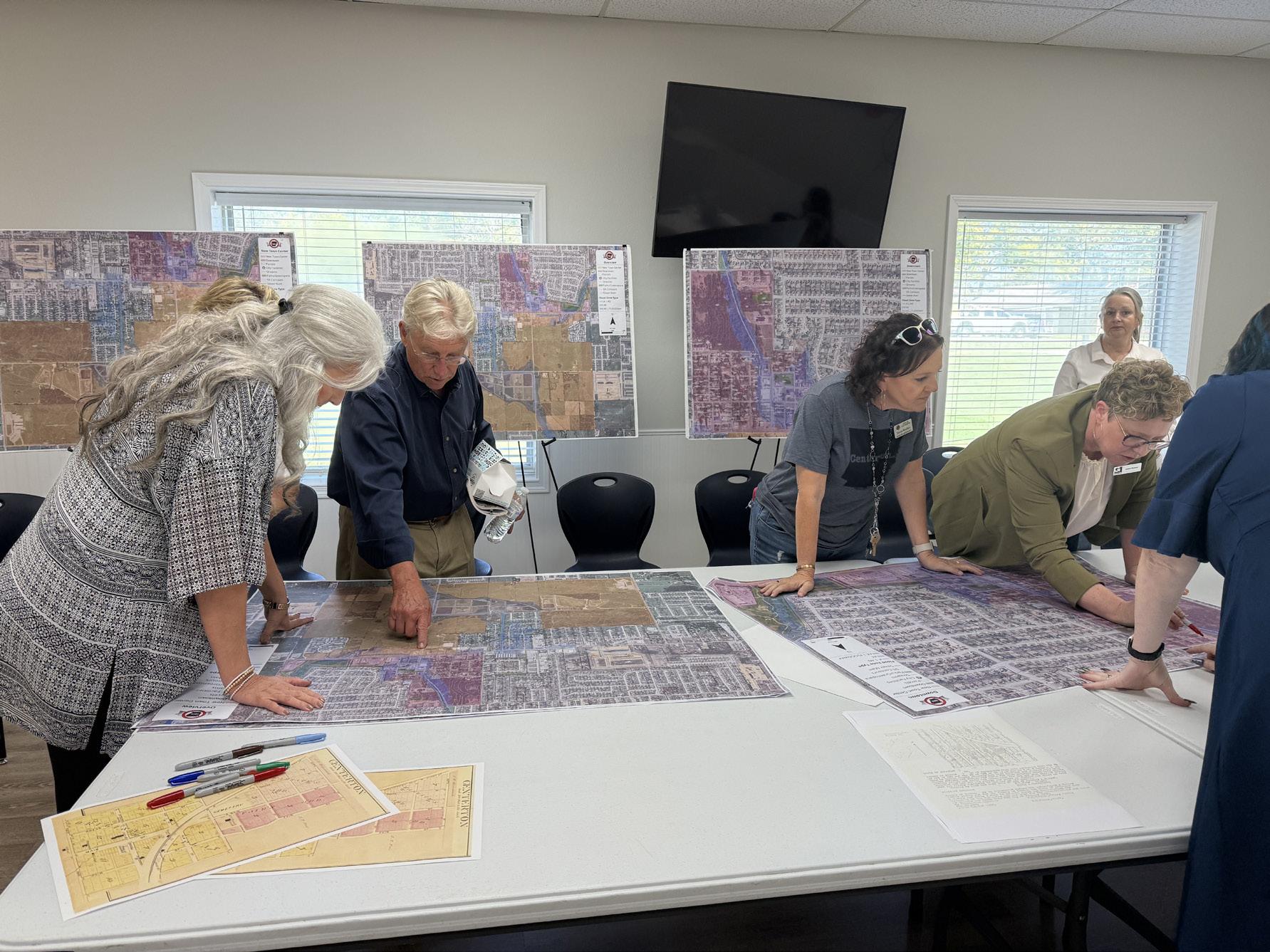
Centerton has spent the last several decades growing at a remarkable pace. Like many smaller communities outside Northwest Arkansas’ largest cities—Fayetteville, Springdale, Rogers and Bentonville—Centerton has absorbed a significant share of the region’s population growth. When I began on-call planning work in 2018, its population stood at 15,556. In 2025, the U.S. Census Bureau estimates placed the population at 27,176. However, the population growth trajectory tells only part of the story.
To many looking in from the outside, Centerton is regarded as a bedroom community. But city leaders, staff and residents see the potential to intentionally shape the Centerton’s continued growth into an ambitious plan for the core of their city.
Centerton’s roots run deep in western Benton County’s agricultural history, particularly in apple production and processing. Its original town center grew around a railroad line (now long gone) and a spring (owned by the city and an element to be incorporated into the downtown plan), and longtime residents remember when the community was little more than a crossroads of unpaved roads surrounded by farms. That crossroads has become a city, one that increasingly feels it needs a center of gravity equal to its size that
can root a strong sense of identity for Centerton’s future.
That vision has been shaped in large part by Planning Director Lorene Burns, whose long tenure with the city began before Centerton had a formal planning department. Colleagues describe her commitment to the community as both deeply personal and forward-looking. “The vision for connecting Centerton’s historic downtown to a newly created town center south of Highway 102 has been fostered and marinating in Burns’ mind, but it lives in her heart,” says Planner and Program Coordinator Kayla Knight. Together with engaged elected officials, planning commissioners, staff and residents, Burns has helped frame a bold question for Centerton’s next chapter: how can this fast-growing city most effectively build a true civic heart that honors its history and ensures current and future residents want to call it home?
Centerton currently lacks a strong downtown square, a central gathering place consistent with the its current size and a civic identity not defined only by the linear commercial strip along Highway 102. In conversations throughout this planning effort, stakeholders have emphasized the need for a place that reflects Centerton’s scale and aspirations. The project also comes at a rare moment of opportunity. Much of the proposed New Town Center

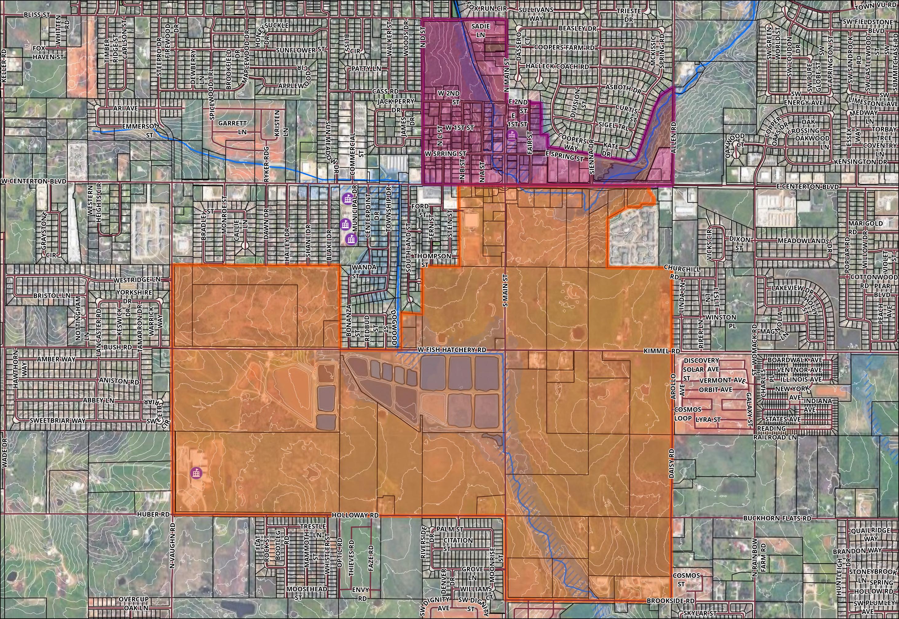

area is held by a relatively small number of private property owners, many of whom are already engaged in the process and serving on the steering committee. That alignment has made it possible for the city to think bigger—not simply about growth, but about creating a complete community. As Knight says, Centerton wants to become “the whole house and not just the bedroom.”
In partnership with the Northwest Arkansas chapter of the Urban Land Institute through its Plan Local program’s Planning Partnership, the city of Centerton selected a planning and design team led by Garver who has partnered with partnered with firms ISG and Planning Local to undertake a downtown master plan focused on two interconnected places: the enhancement of its historic downtown and the creation of an envisioned mixed-use New Town Center south of Centerton Boulevard/Highway 102.
The plan builds on earlier comprehensive planning efforts while taking a closer look at two study areas: roughly 130 acres in and around the historic downtown and approximately 830 acres south of Highway 102 identified as the New Town Center. Through a multidisciplinary process involving stakeholders, property owners and community members, the city is exploring how both areas can evolve together. Placemaking, mixed-use development planning,
infrastructure strategy, connectivity and ecosystem-sensitive design are all central to the work.
At its core, the master plan is intended to define the future character of both areas, clarify their boundaries, strengthen connections between them and identify opportunities for housing, mixed-use development, and public gathering spaces. Just as importantly, it will establish frameworks for floodplain management, stormwater, parking, trails and active transportation, potential transit, infill growth, placemaking, and wayfinding—laying the groundwork for a more connected and cohesive city center.
Downtown. Today, Centerton’s downtown is generally understood to be the area along North Main Street between Spring Street and First Street. Historic buildings and local businesses line the west side of Main Street, while Centerton City Park and Centerton Hall— the former city hall building—anchor the east side. Together, these places already function as an informal community hub. The city’s farmers market is held in the park during the season, and the area also hosts Centerton Day celebrations and other public events.
Centerton City Park is heavily used throughout the year and draws residents from across the city. Centerton Hall, on the same site, serves as a gathering place for senior groups and local
The plan bridges Centerton's past and its future, from honoring the city's existing downtown and laying the groundwork for a new town center.
organizations and will be undergoing a transformation to become a city library in the future. Nearby businesses, including a bakery, mercantile and food trucks, add to the area’s sense of activity and small-town character.
This downtown core is surrounded by residential blocks that could support future infill and redevelopment. To the west, McKissic Springs sits on city-owned land—an asset with the potential to play a larger role in the area’s identity and public realm. Downtown is also loosely connected to Centerton Lake and McKissic Springs Park and splash pad by a walking trail that terminates near Centerton City Park. These elements create strong bones within the existing downtown: a place that already serves the community, but could become more vibrant, walkable and cohesively connected to the city at large through strategic investment in infrastructure, placemaking and land-use policy.
South of Highway 102, the proposed New Town Center spans approximately 830 acres across multiple properties. Several major landowners control large portions of the site and are participating in the planning effort. That level of engagement gives Centerton an unusual opportunity to think comprehensively about how an entirely new mixed-use district could take shape over time.
The New Town Center study area also includes important institutional and community assets. On its western edge are the Arkansas Game and Fish Commission’s C.B. “Charlie” Craig State Fish Hatchery and Bentonville School District property that includes Grimsley Junior High School and room for future expansion and additional schools. The hatchery, which is open for walking and jogging between dawn and dusk and hosts an annual community fishing derby, already functions as a community amenity. In the northern portion of the study area are Lifeway Christian School, First Baptist Church Centerton and the site of the proposed Walmart Supercenter. Beyond those uses, the remaining land is held by several large private property owners and a range of smaller landholders. Together, these conditions create both complexity and promise: a landscape where civic, educational, recreational, commercial and residential uses could be woven into a new town center that complements—and is meaningfully connected to—Centerton’s historic downtown. The masterplan will be completed by late summer 2026; you can visit the project website to view the progress of the plan (https://centertondowntown.planyourcity.com).
Juliet Richey is an urban planning leader at Garver.
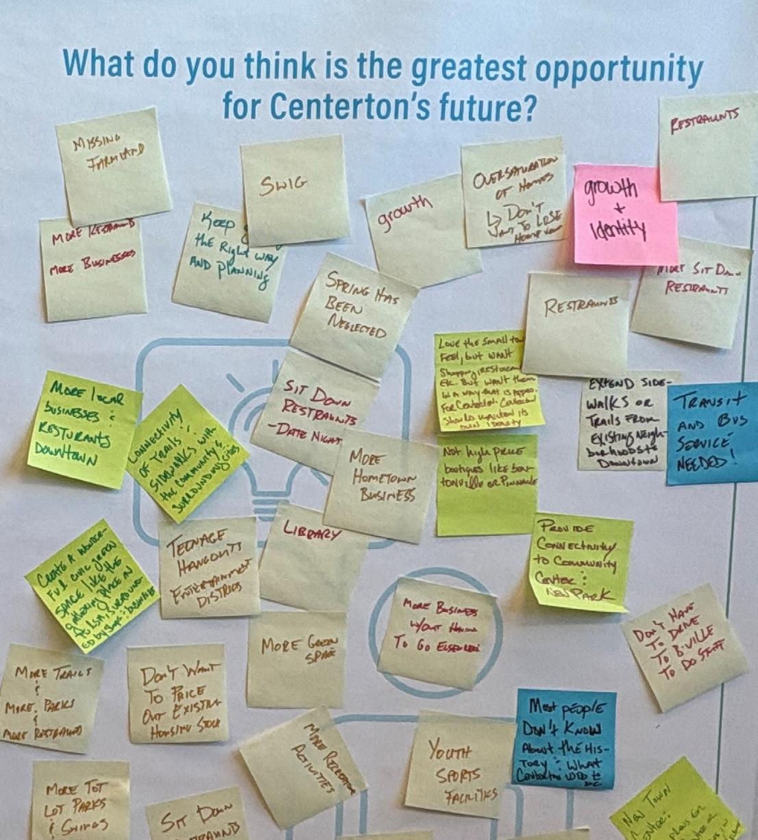
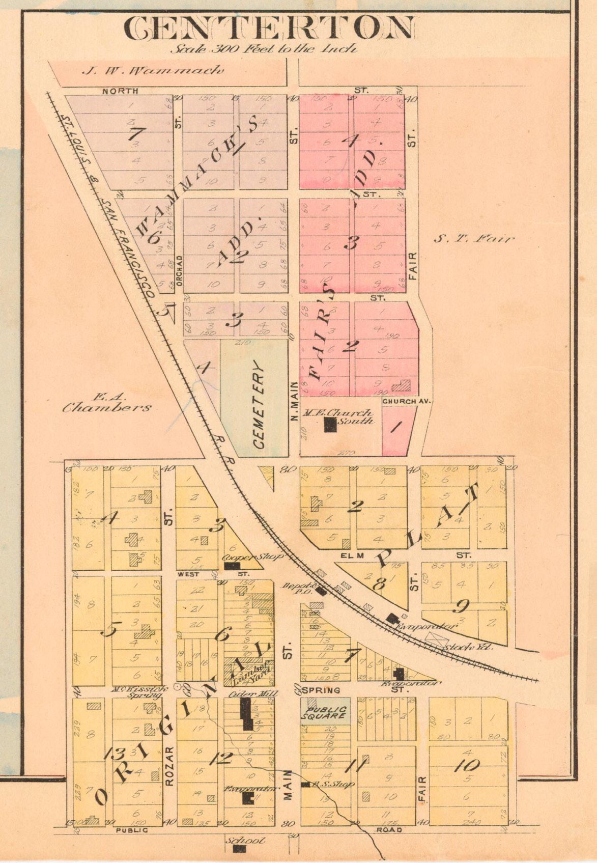
BY MATT CAMPBELL
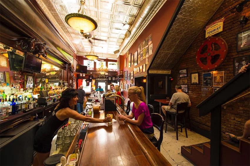
The big-time gangsters and Prohibition-era starlets are long gone, but the spirit of the Ohio Club’s speakeasy days endures with live music, packed crowds and a brilliant bar menu to boot.
In a town dripping with as much history as Hot Springs, it can be difficult for any non-bathhouse locations to stand out as a mustsee. That’s unfortunate, because the Ohio Club, located directly across Central Avenue from the Superior Bathhouse, has one of the coolest backstories of any place in Arkansas.
Considered Arkansas’ oldest continuing operating bar, the Ohio Club opened in 1905 as a bar and casino and was immediately a popular haunt for all sorts of celebrity traveling to the Spa City for its therapeutic thermal baths. Gangsters Al Capone and Bugsy Siegel, baseball superstars Babe Ruth and Tris Speaker, and vaudeville greats like Mae West and even Theodore Roosevelt, among countless others, came through the doors in the club’s early years.
Even after Arkansas outlawed casinos in 1913 and Prohibition made alcohol illegal in 1919, the Ohio Club thrived. They simply changed the name to the Ohio Cigar Store, created a storefront with a fake rear wall that held doors leading to the bar and casino, and continued operating as a speakeasy.
Even today, the history of the place is palpable. The white-andblue façade, still lit with incandescent bulbs, recalls an earlier time. Just inside the front door, a massive mahogany bar dating to the 1880s, decorated with hand-carved horses heads and scantily clad women, fills most of the right side of the main room. The walls are festooned with old photos of gangsters and gambling ephemera.
Not that the Ohio Club is resting on its laurels. In 2023, J&S
Hospitality purchased the venerable club and set to work expanding and tweaking the bar’s already high-quality menu into something a little more upscale. The eponymous Ohio Burger—an umami explosion featuring pepper jack cheese, bacon, creamy mustard and an onion ring on top—is joined on the menu by a coffee-rubbed wagyu beef burger and the Hangover Burger, which includes a fried egg, spicy ketchup and garlic aioli. On the appetizer slate, standard fries and onion rings sit alongside breaded spicy green beans and fried cauliflower, while the sandwich options include everything from a classic Reuben and chicken parm to the Gambino—a ham, salami, mortadella and capicola concoction served on a hoagie roll— and a lobster roll.
Whatever J&S is doing, they seem to be doing it right. Live music blares from the back of the room nearly every Thursday through Sunday night, and the place is packed just about any time there’s any kind of event in town. The Ohio Club was even inducted into the Arkansas Food Hall of Fame in 2025.
While the city still draws a ton of tourists each year, it’s fair to say that Hot Springs is not the same international destination it was 100 years ago. Anyone trying to glimpse what old Hot Springs might have felt like, however, should go beyond the bathhouses and stop into the Ohio Club on a busy Saturday night. You won’t have to squint too hard to picture Bugsy Siegel stopping in for a cold one on his way to Las Vegas.
BY PHILLIP POWELL
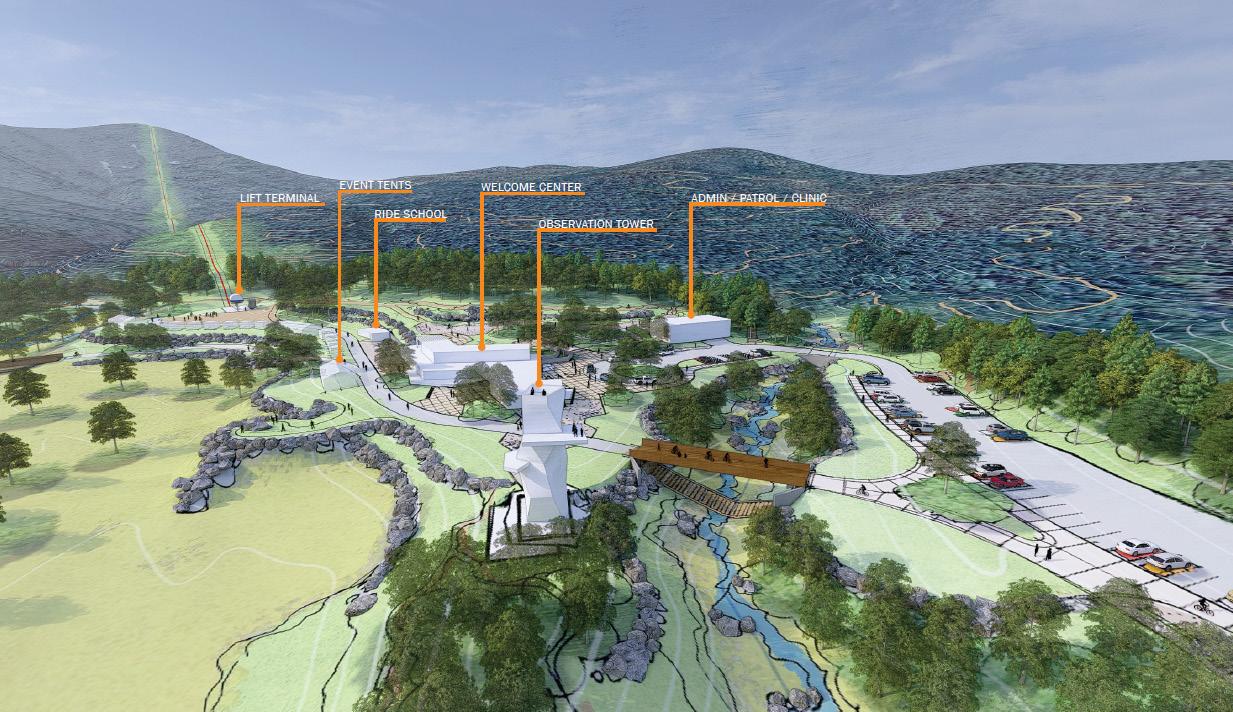
After the land around the old Ward Lake is cleared and leveled to create the staging area for all of the trails, work
trail development.
With an eye toward increasing tourism, Mena is betting that a big biking boom will follow a landmark publicprivate investment in the Trails at Mena bike park project in the footholds of the Ouachita Mountains. Now years in the making and conceived as a 100-mile-plus trail system covering around 9,000 acres of land, the Trails at Mena came about as a partnership between the city, the U.S. Forest Service (which owns much of the Ouachita National Forest), Arkansas State Parks, and the private Arkansas Parks and Recreation Foundation. With the first phase of construction rolling forward just north of the town, Mayor Seth Smith is working tirelessly to prepare the town for the tourism rush he hopes will infuse sleepy little Mena with new life.
Smith, who served in the Arkansas National Guard, worked in the sheriff’s office and owned a gravedigging business before becoming mayor in 2019, brings a special southern charm and enthusiasm to his leadership that has won him quite a few fans. Mena’s current population hovers around 5,500 according to the U.S. Census Bureau, and Smith certainly has his work cut out for him in preparing the town to see a potential influx of 197,000 new tourists a year, according to the Forest Service’s environmental assessment.
The park is currently in the early stages of construction, with the
land around the old Ward Lake being cleared and leveled to serve as the “staging area” of all the trails, which will be constructed up the mountain. The first stage of construction will see around 40 miles of trails developed, bringing bikers downhill to the staging area. The catch of the project, which Smith says has the potential to be “world class,” is the bike lift that will transport bikers up the mountain so they can enjoy the fast gravity trails on the way back down. The vision for the staging area also includes a large parking lot, visitor center and restaurant. Because the park will be mostly built across Forest Service land, the federal agency conducted a massive environmental review and ultimately approved the project to build three bike lifts.
“We are trying to make Mena a place where when kids graduate high school they don’t feel like they have to go somewhere else to make a living, that they can stay home if they want to,” Smith said. “And there are naysayers who always say, ‘we don’t have places to eat’ or ‘we don’t have that,’ but if you want change, then you have to accept the change that comes with it. If we want more places to eat, more stores, then we need the visitation and the population to support it.”
The young mayor has recently taken up biking around town with his family, and he is working on several infrastructure projects to turn Mena into what he envisions as a sort of year-around ski
town, except instead of skiing, the tourists will be biking down Arkansas’ second highest peak in Rich Mountain. Smith is focused on securing funding to develop bike trails that connect the park to the town, so after a long day of riding, bikers can ride right down the mountain into Mena to retire at a hotel or short-term rental and grab a drink or bite to eat.
In 2022, Mena released a vision plan for the park with partners and wrote that the creation of connections between the town and the park was a priority for the city, but it will be costly. Smith has secured a $3.3 million planning grant from the U.S. Department of Transportation to plan bike routes that will connect the new bike park with downtown Mena and the Ouachita Trail—which runs through the Ouachita National Forest from Little Rock all the way through Oklahoma.
Mena’s advertising and promotion commission is looking to bring a large hotel to a vacant property close to city hall on the historic Mena Street, and Polk County became a wet county in 2022, welcoming a liquor store in Mena soon after. A lot of pieces are falling into place to make Mena even more of a tourist destination. The town has already capitalized on ATV trails at Wolfpen Gap just south of town, as well as frequent parades of motorcyclists and classic car rallies.
The Department of Parks, Heritage, and Tourism is seeking a concessionaire to run the park, which will at first be based only in the phase one area. If the park is as successful as it is hoped to be, the company will take on expanding further up the mountain where trails will be built as far north as Queen Wilhelmina State Park.
The business community around Mena has mixed feelings about the project. Rick Chrisman and his wife have owned and operated a little restaurant called American Artisans Eatery and Gallery for years. They’re looking to sell the place and downsize their lifestyle into retirement, but they’ve been having trouble getting someone to bite. Chrisman has chaired the Mena A&P Commission for years, and together with local mountain biking enthusiast Kenny Smith was one of the major proponents of a bike park in the Ouachitas.
Chrisman and Smith went to mayor Smith in 2019 to get the ball rolling, and even while inching toward retirement, Christman is still excited about what the park could bring to the town.
“We got started on this in 2019, and we contacted the Arkansas Parks and Recreation Foundation and submitted our plan. And they came down and there were a lot of big meetings with statelevel officials and the Forest Service, and everyone was working together and it just caught on,” Chrisman said.
Others in the business community, like the longtime owners of Pony Express Printing, believe the project will be far more disruptive to the community than beneficial. Kathy Burks and her daughter have run the design business for about nine years but have run other businesses in the community for a while.
“We’ve always been known for being a small town, more of a retirement area and tourist area, and I like the way it is and don’t see the need for massive growth,” Burks said. “I just don’t think our town is equipped to handle all that. Some of these lifts are
“WE ARE TRYING TO MAKE MENA A PLACE WHERE WHEN KIDS GRADUATE HIGH SCHOOL THEY DON’T FEEL LIKE THEY HAVE TO GO SOMEWHERE ELSE TO MAKE A LIVING, THAT THEY CAN STAY HOME IF THEY WANT TO.”
—MENA MAYOR SETH SMITH
supposed to be built where I live, and there could be a lot of traffic up the mountain that might change our way of life.”
With the park only in its earliest stages of development, Smith has taken on the task of trying to alleviate residents’ concerns. As of now, many of the complaints are speculative. The state hasn’t committed to building out the rest of the project after already committing $48 million to phase one.
“The park will be so spread out that it will feel more intimate than commercialized. It’s kind of like the difference between Lake Hamilton and Lake Ouachita. On Lake Hamilton, you can’t go anywhere without seeing a house or another boat, while on Lake Ouachita you don’t see anybody. And I think that is what this park will be,” Smith said. “We are always going to have tension and people will be unhappy, but we will just do what municipalities always do, we will see a need and work to fix it.”
Much of the rest of the business community seems to be keeping their powder dry ahead of the park’s projected opening in 2028. Mayor Smith and Chamber of Commerce Executive Director Sarah Dye see it as a “chicken or the egg” problem where businesses don’t yet see the demand to invest in major retail or hospitality projects, but tourists won’t be drawn to the area in full force if amenities aren’t in place. Smith would love to see some private investment from foundations or others.
The Arkansas Office of Outdoor Recreation, which is based under the larger Parks, Heritage, and Tourism umbrella, was the instrumental state partner bringing about the project. Incentives such as the “economic opportunity zone” expanding a mile south from the bike park into Mena will give hospitality and outdoor recreation-oriented businesses tax incentives. The office continues to work on selecting a concessionaire to run the park, but a spokesperson said they wouldn’t make that decision for months.
“The Trails at Mena will deliver an inspiring, gravity-fed trail experience that drives regional economic growth and elevates quality of life, all by harnessing the Ouachitas’ elevation and unique terrain and the strength of Mena’s community partnerships,” Parks, Heritage, and Tourism secretary Shea Lewis said. “We’re excited about the momentum behind this project and the impact it will have on our state.”
Phillip Powell writes about agriculture and the environment for the Arkansas Times as a Report for America corps member.
BY JULIE KELSO
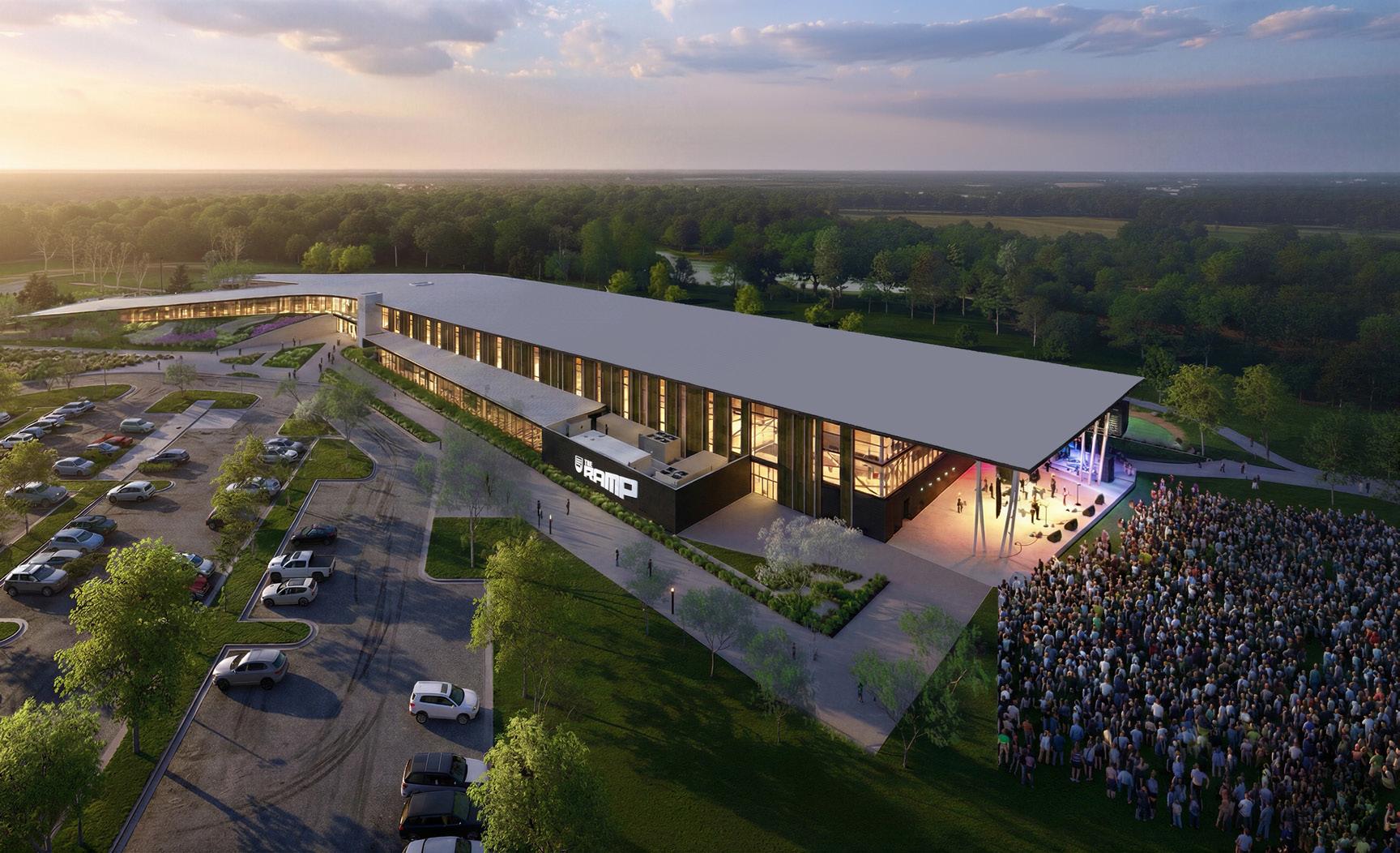
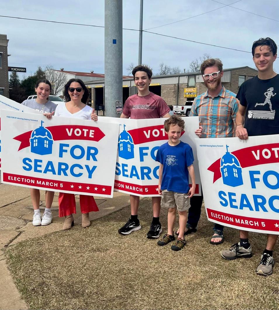
Momentum is a word that gets mentioned in association with an effort for revitalization, but Searcy has momentum that doesn’t happen every day. Searcy is demonstrating how community-driven efforts can define the future of a city.
In early 2019, things were starting to happen in Searcy. A community movement helped obtain enough votes to secure Searcy a spot on a season of Hulu’s “Small Business Revolution.” The excitement of winning the reality show brought the community together and showed what was possible when everyone shares a united vision.
Anna Brumfield, a member of Main Street Searcy and a smallbusiness owner herself, says this helped to shine a light on small businesses and made them feel supported, which is essential for a thriving downtown.
As the city emerged from the pandemic, the drive to grow was even stronger. The community had shown that they were on board with growth, and the looming question was “what’s next?”
“Conversations were happening among new and past city leaders, business owners, community volunteers, young professionals, Main Street supporters and other individuals that just care about the future of Searcy,” Brumfield said. “The best way to help a community grow is to have people who care, work together and take action to make it even better.”
The city saw the value in a planned approach to the future and
they knew it had to be done thoughtfully and intentionally. The vision needed to come into focus. Crafton Tull became a trusted partner with the city of Searcy in 2021 with a visioning workshop that produced ideas for the future and started to paint a broader picture of what the city could look like years into the future.
Roughly a year later, the Searcy City Council approved a contract with Crafton Tull that began the #MySearcy planning process. The parks, active transportation and infrastructure plans will create a true generational investment in the future.
Planners know that public engagement is essential to creating a shared vision. Sometimes, though, it isn’t easy to convey the need for public participation in the planning process, but Searcy showed what it truly meant to create a community vision. The Carmichael Community Center was filled with hundreds of people who wanted to share their input. They knew their voice was important. They felt valued. And it showed.
Brumfield, who also works as a patient experience officer at Unity Health, said one thing her work has taught her is that creating the best experience for others cannot be done if they are not involved in the process.
“You have to listen to the people who will be impacted and understand their perspectives, wants and needs,” she said. “We involved the community, so the planning process did not just land to one committee or group. I think this is why it worked so well, because it brought different generations, types of leaders and
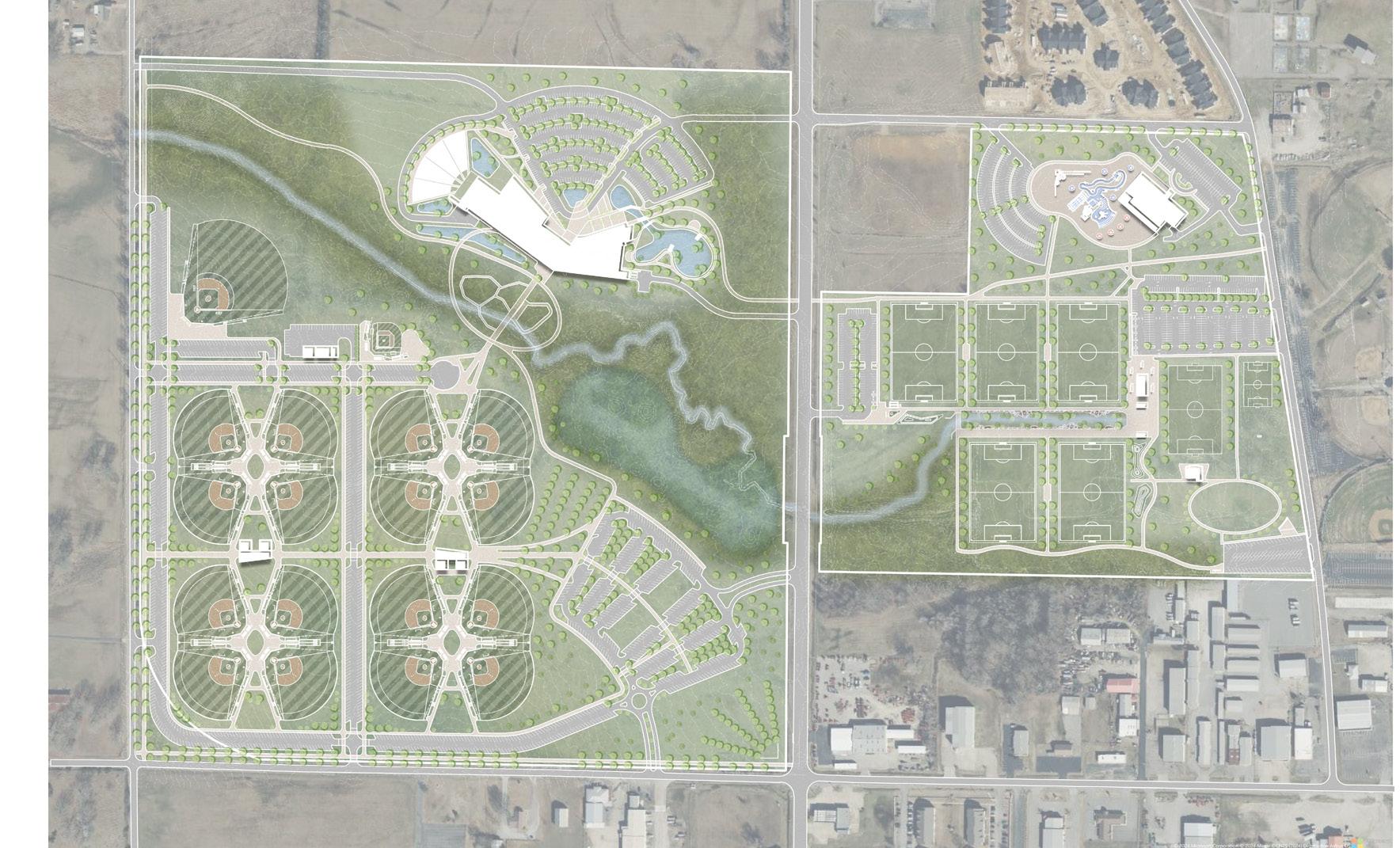
individuals together.”
Brumfield noted that there wasn’t just one demographic involved in the process, either. Younger leaders brought energy, ideas and a desire to move Searcy forward. Longtime community leaders brought history, wisdom and perspective. City council members, business leaders, volunteers and residents all brought unique perspectives and had important roles to play in the planning process.
Quality of life is something that is often talked about, but when it comes to funding these types of projects, sometimes cities lose momentum. The true test came when Searcy asked the voters to approve the ballot measures needed to fund the projects identified by the community during the planning process. Polk Stanley Wilcox joined the team and prepared renderings of what a community center and outdoor aquatics could look like in Searcy, which was at the top of the list of the community’s wants.
City leaders, volunteers, business owners and others dedicated themselves to the cause by knocking on doors, constantly sharing information on social media, and doing as much as they could to ensure the community was informed.
“What stood out to me was how many people were willing to step up and help,” Brumfield said. “It took many people explaining why this mattered, answering questions and helping others understand how the projects on the ballot would benefit the whole community.”
Searcy residents approved over $90 million in bonds to combine with another $10 million from the Searcy Advertising & Promotions Commission designated for aquatics to fund projects that will make a meaningful impact.
Dubbed the South Main Street Projects, the development includes a new state-of-the-art community center featuring an innovative bike
ramp to the second floor as well as an amphitheater for public gatherings, an outdoor waterpark adjacent to the existing swim center, upgrades to the sports complex, and enhancements to Riverside Park and Berryhill Park. The city was also recently awarded a $4.6 million federal RAISE grant to design and permit a 15.5-mile expansion to the trail network.
The long-term impact on the city will be transformative. The new sports complex will position Searcy as a regional tournament hub, generating additional tourism dollars. The expanded active transportation and park network aims to improve health, wellbeing and equity for all residents. These quality-of-life investments will also enhance Searcy’s appeal to new families, students and businesses, which is something Brumfield says she will consider full circle when Unity Health is recruiting physicians, residents, nurses and other professionals, because it means those individuals are looking at more than just the hospital.
“They want to know if this is a place where they can build a life, raise a family, connect with others and just enjoy the area,” she said. “A strong downtown, a strong hospital, small businesses and quality of life are some of the elements needed to move a community forward.”
Searcy is experiencing something that doesn’t happen often. The city is shifting its identity and is slowly breaking away from its reputation as a small Arkansas town. The decisions that are being made by Searcy residents show that they’re capitalizing on opportunity and establishing themselves as an economically prosperous destination.
“What excites me the most is Searcy is being more intentional about its future, while still holding on to what makes it special,” Brumfield said. “Five to 10 years from now, I hope people will talk about how beautiful our community is, the unique experiences we offer and how Searcy really has it going on! I would love for people from other towns to wake up on a Saturday and say, ‘let’s go spend the day in Searcy.’”
The community plans were approved by the Searcy City Council in 2024, and work is underway on each of the bond projects. The past four years have shown that as one of the city’s downtown murals states, “together we can do so much.” And Searcy is just getting started.
BY ITZEL VELAZQUEZ
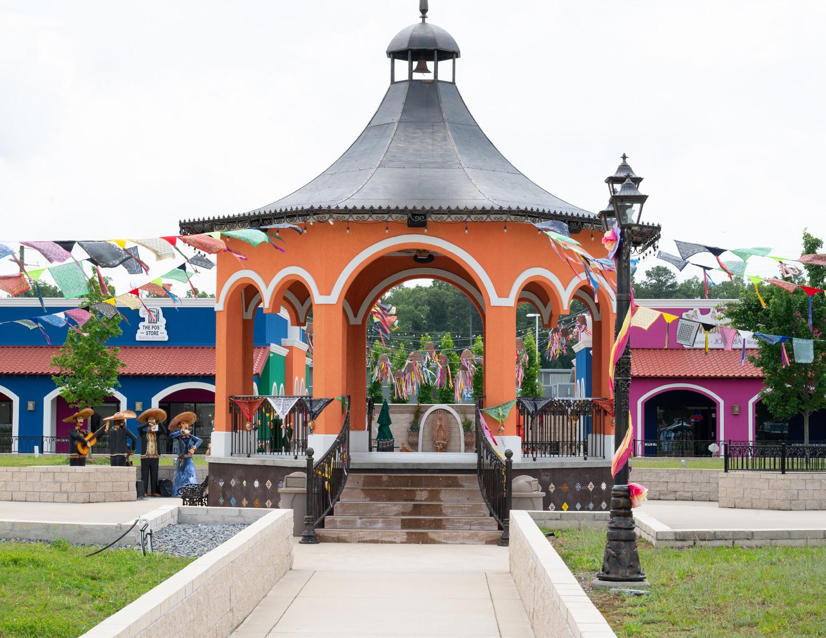
Plaza Frida’s layout is similar to that of town squares commonly found in Mexico and other Latin American countries, with a central “kiosco”—an elevated platform meant for music, gathering and community.
At the corner of 65th Street and Scott Hamilton, colorful walls surrounding Plaza Frida come into view. Plaza Frida is a mixed-use commercial space built around and celebrating Latino culture. Once inside the plaza, visitors are greeted by colorful murals, sculptures and open spaces. The layout is reminiscent of the “plazas,” or town squares, commonly seen throughout Mexico and other Latin American countries. Central to the square is a “kiosco,” an elevated platform, meant for music, gathering, and community.
“Plaza Frida was never supposed to feel manufactured,” shared Jamie Taylor, Plaza Frida’s coordinator. “Too many developments are built only for transactions. This one was built for connection, culture, conversation and community life to happen naturally”.
Construction began in early 2020. Later, in 2021, the plaza began hosting community events. Despite setbacks caused by the pandemic, Plaza Frida opened its first business in the spring of 2023. Each year since then, the plaza has continued to grow.
What began as a place with a couple of soccer fields now hosts 17 Latino-owned businesses. Businesses range from a bilingual pediatric therapy service to a dulcería, restaurant, ice cream shop and a local bar that hosts bilingual salsa lessons, among other activities. In the summer of 2025, the Mexican Consulate moved its services to the plaza. The consulate’s addition has significantly increased the plazas, as it brings patrons from across Arkansas and parts of Tennessee.
In addition to the on-site businesses, the plaza is home to multiple event spaces, including an outdoor courtyard and two full-sized soccer fields. The bilingual soccer program serves more than 700 youth and children weekly.
The layout of the space allows the plaza to host events and programming throughout the year. The plaza’s largest annual events include the 5 de Mayo, Fiesta de Independencia Hispana in honor of Hispanic Heritage Month in September and Día de los Muertos festivities in the fall.
Each event brings in 4,000 to 6,000 visitors, infusing the space with palpable energy. A stage is usually set up, local bands play and dancing erupts across the square. Food vendors line the plaza and the smell of tacos and pupusas fills the air. Families linger late into the evening.
For many Latino residents, Plaza Frida provides a space to celebrate the holidays they would normally celebrate back home while also enjoying traditional cuisine and music. For other community members, it serves as a space to learn and experience Latino culture without having to travel far. Events are bilingual so that everyone, regardless of background or language, can enjoy the celebrations.
Itzel Velazquez is the founder of Velazquez Consulting and serves as editor of Arkansas Flavor and El Latino Arkansas
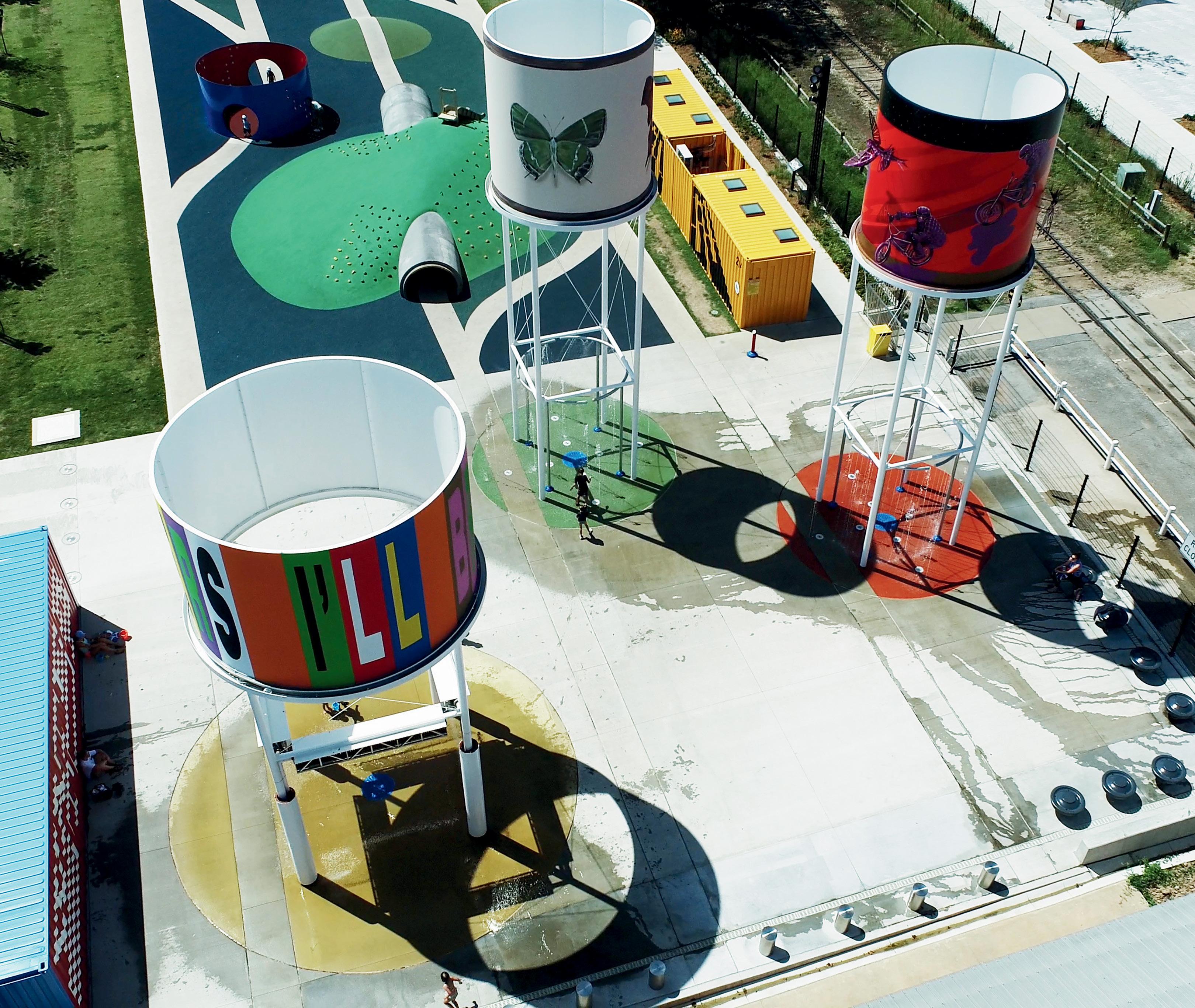

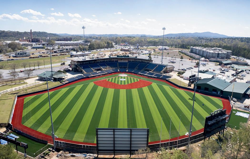
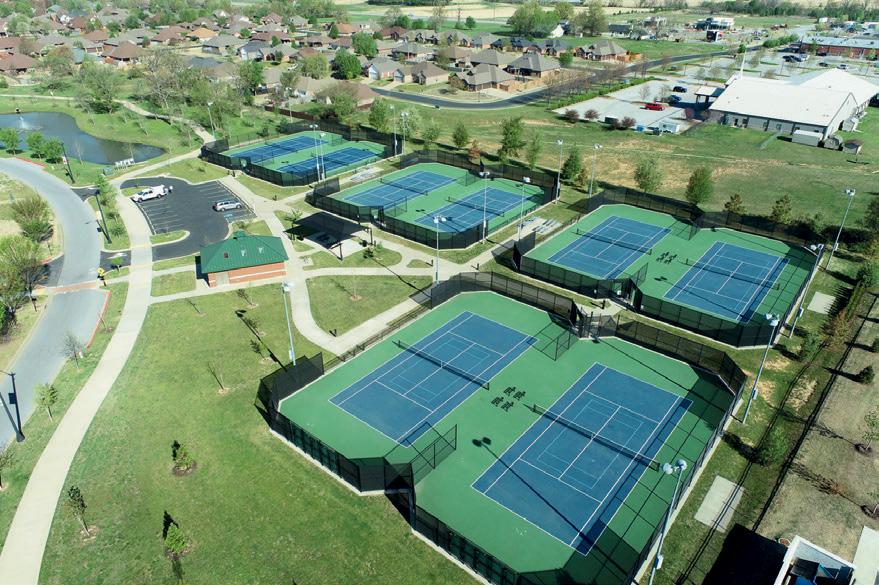
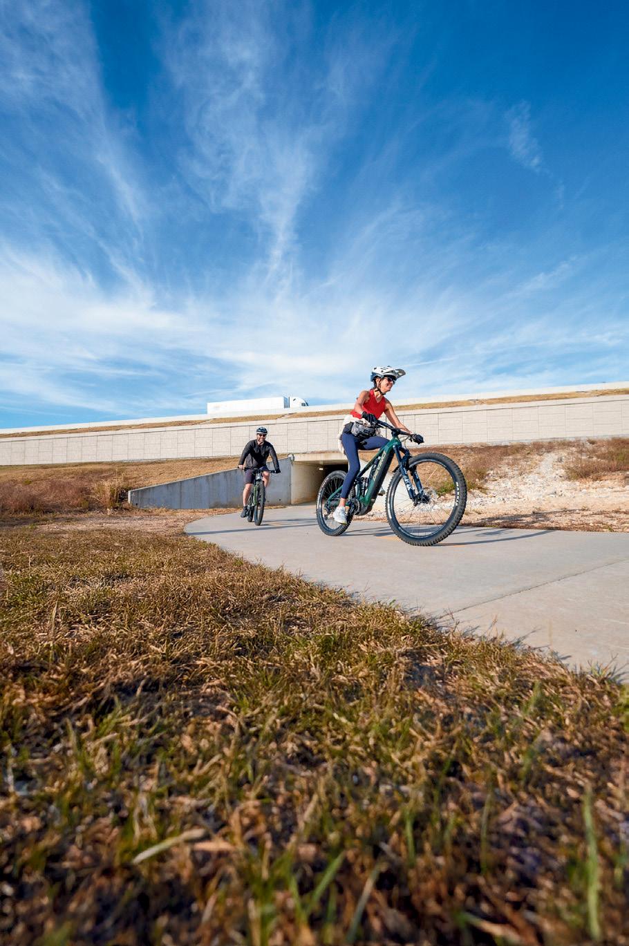
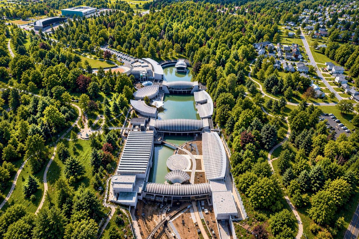
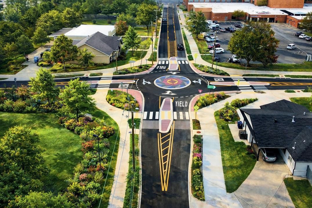
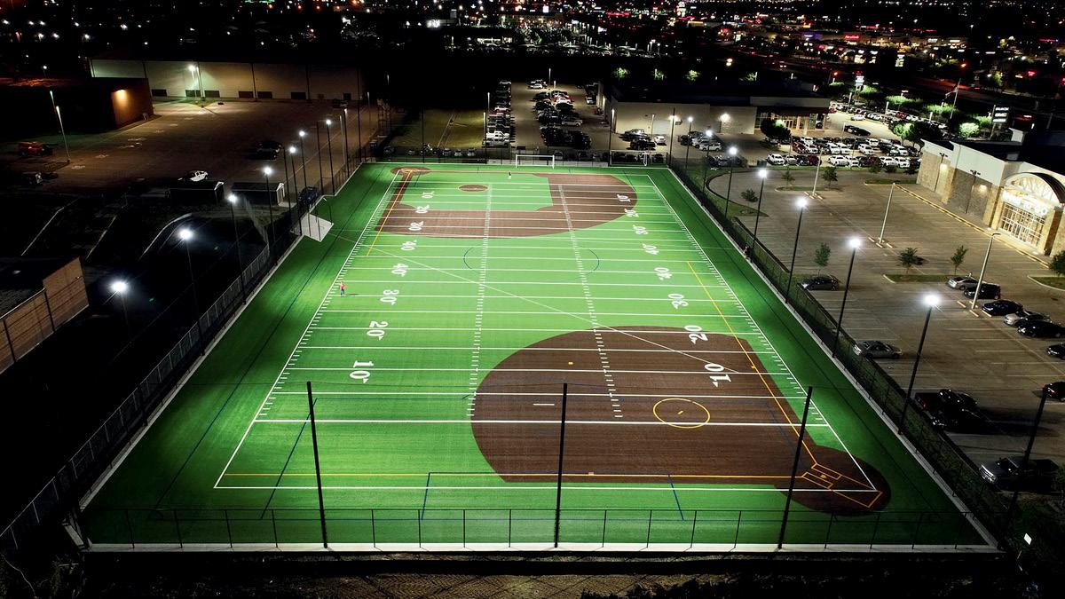

a vibrant downtown is good for business and good for Arkansas.
We’ve been helping Arkansas communities build and grow for more than 125 years. Our team has decades of solid experience guiding cities and municipal agencies through bonds, tax-exempt leases, economic development incentives, and energy savings contracts and leases.
Our knowledge and experience also cover pre-construction planning, payment issues on jobs, regulatory compliance, financial transactions, contract review and negotiation, tax opportunities and professional liability defense.
We offer sound guidance to private business owners, entrepreneurs, venture capitalists, public entities and municipalities, construction companies, architects and engineers, and real estate professionals through all phases of development.
We're proud to live, work, play and invest in our downtowns and neighborhoodsjust like you.