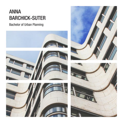
ANNA BARCHICK-SUTER Bachelor of Urban Planning
CONTENTS
5
Building Healthy & Resilient Places
19
Pleasant Street Urban Design Studio
23
Xiamen West // Calthorpe Associates
27
FontaĂnhas: un Quartier de Collage
33
Creativity & Change Workshop
37
Personal Work: Photography
Building Healthy & Resilient Places Roselawn (Cincinnati) Spring 2016 Frank Russell (professor) University of Cincinnati Cincinnati, Ohio
5 My senior capstone focused on a 15-acre site at the intersection of Reading Rd. and Section Rd. in Cincinnati’s Roselawn neighborhood. Sponsored by the Cincinnati chapter of the Urban Land Institute, the theme of the studio was “building healthy and resilient places”. Thus, while the proposal needed to respond to the site’s context, it also needed to include healthy components. After analyzing market data and attending several meetings with the local community council president, a concept was developed that sought to be pragmatic. Recognizing that Roselawn has positive attributes, the proposal attempted to fill in current gaps. The final plan focused on strengthening the business district so that it becomes relevant to residents’ daily life rather than attempt to become a destination neighborhood business district for non-residents. This would be accomplished by concentrating the business district geographically, expanding commercial options, creating social and recreational space, and improving the streetscape.
Left: bird’s eye view of site looking north
ANALYSIS
ANALYSIS
ANALYSIS
ANALYSIS
MARKET TAKEAWAYS
PROPOSALS 1 Recreation center & park
· Imbalance in type of businesses · High concentration of salons and barbershops could indicate disposable income
2 Small grocer
CONCEPT
· Conversely, median income is low · The majority of residents are children or adults nearing retirement · Lack of kid friendly spaces
3 Concentrate businesses
· Mediocre pedestrian experience · Food and recreation hard to rach without a car · 30% of households don’t have a car · Most commercial and residential structures are 1-2 stories
4 Low-density design
5 Streetscape improvements
PRECEDENTS
Seasonal outdoor pool complements indoor lap pool
Shaded path also offers seating
Store is smaller than other options further from NBD
Store offers produce, along with items found at competing stores
Plaza offers seating for businesses fronting the space
Sidewalks are tree-lined and buffered by on-street parking
Shelter house provides free gathering space
Playground provides activity space for younger children
Small buildings reflect existing scale and provide sustainable amount of commercial space
Photo credits (top left to bottom right): 1) Liberty Park; Sapulpa, OK; cityofsapulpa.net, 2) “Parc Montsouris (allée de la Vanne) - Paris XIV”; Paris, France; wikimedia.org, 3) Michael J. Zone Recreation Center; Cleveland, OH; land-studio. org. 4) Grand Park Playground; Los Angeles, CA; taylor-pr.com, 5) Constantino’s Market; Cleveland, OH; photo by Sheehan Hannan; observer.case.edu, 6) Constantino’s Market; Rochester, NY; photo by J. Adam Fenster; rochester.edu, 7) “Transit-Oriented District”; Shaker Square, Cleveland, OH, gcbl.org 8) 1670 Shattuck Ave. in April 2011; Berkeley, CA; google.com/maps, 9) Shattuck Ave. in April 2011; Berkeley, CA; google.com/maps
VISION Filling in current gaps related to business and recreation will strengthen Roselawn. By concentrating the business district around Reading and Section, expanding commercial options, creating a social and recreational space, and enhancing the streetscape, the NBD will become more walkable and relevant to residents’ daily life.
former strip mall outdoor pool shelter house
lawn ULI Healthy Living Components · Mix of land uses · Well-connected street networks at human scale
DESIGN
· Sidewalks and pedestrian-oriented streetscapes · Infrastructure to support biking · Facilitate social engagement · Spaces for multi-generational recreation
former commercial UDF (conversion of existing gas station)
· Play spaces for children
retail
· Access to nature · Grocery store · Healthy food retail · Access to drinking water · Farmers market*
daycare (relocation from strip mall)
bank dry cleaning restaurant (relocations)
doctor’s office cafe
· Ban smoking** *While a farmers market and community garden weren’t stated proposals based on market data, the northeast parking lot and park, respectively, offer opportunities for both.
former parking lot 4-unit apartments 2 single-family homes
**Ohio’s law against smoking indoors in commercial spaces helps meet this criteria. 1:175
basketball and tennis courts
recreation center indooor lap pool fitness center meeting spaces
playground
REA
DIN
GR
D
1/2 mi multi-purpose trail
former vacant lot
small grocery
barber bar (existing)
retail pharmacy
SECTION RD
retail dining
post office (existing)
Roselawn Center (existing) infill vacancies with businesses from strip mall
Pleasant Street Urban Design Studio Over-the-Rhine (Cincinnati) Summer 2015 Vikas Mehta (professor) University of Cincinnati Cincinnati, Ohio
19 Over the course of six weeks, my team and I developed an urban design and infill development plan for Pleasant Street, a five-block long residential street located in Cincinnati’s historic Over-the-Rhine neighborhood. A useful connection between the popular Washington Park and Findlay Market, our team worked to balance meeting the needs of both residents and visitors, ultimately prioritizing residents. Our team recommended tools, such as a Woonerf - a type of living street that sets car and pedestrian areas at equal grade - as well as infill strategies, that would help faciliate the realization of the following vision statement: “As Pleasant Street develops, it should remain a residential street where passersby are welcome and where visitors and residents experience a cared for, lived-in neighborhood street where kids are safe to play, neighbors interact, and old not only exists with but mixes with new.�
Partners: Cassandra Chittum, Greg Sanders Left: urban design plan; completed with Cassandra Chittum Unless otherwise noted, drawings were completed by myself
Infill Strategies
1
Single Lot Infill • Space for one infill building • Provide stoop
Woonerf Strategies
2
3
Multi-Building Infill
Large Development Infill
• Space for several neighborhoodscaled buildings
• Space for large single building with multiple units
• Share stoop space
• Share stoop space
• Provide parking in front, side, or back
• Provide parking in rear or interior lot
Landscaping • Plantings and street furniture encourage personalization • Provides shade for pedestrians
Transitional Space • Designates semiprivate, personalizable spaces • Acts as visual buffer for cars
Parking • Spaces should not block entrances • Spaces should be provided for affordable units Drawn by Greg Sanders
1500 block node Drawn by Cassandra Chittum Decisions about public and private spaces were made based on the theory of bonding and bridging, in which spaces exist for interaction between homogenous (bonding) or heterogenous groups (bridging). Here, a communal green space and Woonerf act as bridging space for neighbors while stoops provide bonding space for friends and family.
1700 block node Drawn by Cassandra Chittum Building setbacks widen the Woonerf in this node, creating a versatile paved open bridging space while stoops, again, act as bonding spaces.
Xiamen West Maluan Bay, Xiamen, China Summer 2014 Peter Calthorpe // Mitali Ganguly (supervisor) Calthorpe Associates Berkeley, California
23 During a three month summer internship, I worked as a member of Calthorpe’s design team. Most of my time was spent working on the Xiamen West project, which involved the creation of a master plan for a new city around Maluan Bay in Xiamen, China. At the time of the project, a series of fishing communities existed around the bay; however, the Chinese government sought to incorporate these communities into a more environmentally sustainable city. My work on the design team included the development of graphics, such as design themes and concept diagrams, for the project book that would be provided to the client in addition to contributions to the illustrative plan (left) and the 3D digital model used to render images. Outside of my work on the Xiamen West project, I created a building typology reference book for internal office use as well as graphics and case studies for the initial stages of a project in Jeddah, Saudi Arabia.
Left: illustrative plan for Xiamen West All graphics developed in conjunction with fellow Calthorpe design team members.
Land Use Map
Employment Zones Diagram
A high density downtown district (depicted in dark red and black blocks) was placed along a main transit axis terminating in a recreational pier with residential areas of varying densities emanating from it. North of the high density area, a curvilinear transit boulevard (shown in blue) acted as a driving development force for neighborhoods situated on the northern side of the bay.
Various employment options were provided, including commercial offices at the two mixed-use Urban Centers and R&D jobs at the Office Tech Park located at the north entrance to the site. In addition, a regionallevel medical facility was a major employer for the site and the surrounding community. At the neighborhood scale, there were smaller mixed-use centers with local-serving retail at all the Metro stations.
Green Corridors Diagram
Transit Diagram
In order to preserve a green corridor along the western river and northern edge of the transit boulevard, a continuous forested park was developed. Supplementing this greenway were neighborhood parks, green boulevards, pedestrian only green streets, and a park lined canal system connecting to the bay.
Planned transit routes were considered in the planning of the city so as to minimze car dependence and create Transit Oriented Developments. The diagram below depicts the access provided by these routes, with radii of 600 (approx. 1/3 mile) and 800 meters (approx. 1/2 mile) surrounding each station.
Fontaínhas: un Quartier de Collage Porto, Portugal Fall 2013 Alexandre Schrepfer (professor) École Spéciale d’Architecture Paris, France
27 After a weekend site visit to Porto, Portugal, I selected Fontaínhas, a mile-long neighborhood along the River Duoro, as my project site. I then developed an urban scale project, which focused on encouraging the resourcefulness of the residents already at play in pockets throughout the city, stabilizing and developing the neighborhood, and avoiding gentrification. My manifesto (below) served as the basis for these designs. Moving to the architectural scale, I designed a community center within Fontaínhas. This house was a renovation of an existing structure that included a community garden and created open spaces for community interaction.
Le quartier devrait réveler la créativité et la débrouillardise de ses résidents. Encourage the existing creativity and resoucefulness of the residents Il devrait y avoir un sens de la communauté et les relations entre les voisins devraient exister. Reinforce a community and relationships between neighbors. La population devrait être diverse pour enrichir la communauté. Foster diversity to enrich the community. Créer un quartier stable en tentant de légaliser les logements illégaux. Stabilize existing illegal or structurally unsound housing. Développer un sentiment de fierté dans la communauté de Fontaínhas. Develop resident pride in the community. Développer ce quartier afin qu’il permette la conservation de sa population existante et que celle-ci puisse aider l’installation de nouveaux arrivants qui adopteraient la meme philosophie d’habiter ce lieu. Develop the neighborhood in a manner that allows existing residents to remain while also encouraging new residents to move to the community. In essence, develop without gentrification.
Left: Fontaínhas, Porto, Portugal
Park space provides more organized space for activity. Acres: 31 Length: 1.12 miles
Site of architectural project: a neighborhood house and community garden
Currently, the neighborhood is mostly residential. In the project, existing housing stock would be renovated to maintain the character of the neighborhood.
A weekly market fills a pedestrian walkway.
Mixed use sections provide commercial and residential space along main roads.
More natural open space is filled with a network of formalized paths and stairways that connect areas throughout FontaĂnhas as well as connect FontaĂnhas to adjacent neighborhoods.
Neighborhood houses exist in renovated homes, acting as centers of community activity and providing amenities such as rentable garden plots, workshops and classrooms, kitchen space, and gathering rooms.
glass wall
first floor of house
upper level of garden
green house
lower level of garden
Creativity & Change Workshop Corryville (Cincinnati) Summer 2013 Kate Bonansinga // Danilo Palazzo // Frank Russell (professors) University of Cincinnati Cincinnati, Ohio
33 This studio took place in Corryville, a neighborhood abutting the eastern edge of the University of Cincinnati’s campus. My group, consisting of six planning students as well as one fine arts student, developed a concept planned based around the theme of connectivity. This plan was developed for the first half of the five week course, at which point each team member then developed an individual project that supported the overarching goal. My individual project dealt with the existing informal paths created over time as people cut through vacant lots, inbetween buildings, and down alleys. In my design, I proposed organizing this informal network into a pedestrian-only green trail system.
Partners: Melissa AuWerter, Nick Charles, Katie Haire, Taylor Higgins, Brook Tadesse Left: Pedestrian Paths Network Map
1
SWOT Analysis
The first step in developing the project was identifying the strengths, weaknesses, opportunities, and threats (SWOT) present in the neighborhood. This map includes notations such as high traffic intersections and successful and failing businesses.
2
Urban Concept Plan: Connectivity
Taking into consideration the findings of the SWOT analysis, an urban concept plan was created that addressed the issue of connectivity at all levels: vehicular, pedestrian, land use and complementary businesses, and public/green space.
Designed with Katie Haire
3.1
Pedestrian Paths Network Map
The final step was for each team member was to develop an individual project that would help achieve the group goal of connectivity. I investigated the latent pedestrian paths throughout Corryville by cataloguing and categorizing them in a network map.
3.2
Pedestrian Paths Design Proposals
Included in my individual project were proposed design solutions that would formalize and “daylight” the paths. Recommendations included lighting fixtures, way finding (which could take the form of a green “carpet”), and landscaping.
BEFORE
AFTER
Personal Work: Photography
37 Photography functions as a creative outlet, a way to broaden my skill set, and practice in perspective and critical thinking. By attending a design school, I was in constant proximity to other creative disciplines, which offered both new perspectives and processes to learn from as well as activities to try for fun. Photography became one of these hobbies for me. The co-op program required of my degree offered a convenient pairing for photography, giving me opportunities to practice shooting in a variety of environments. Since starting in 2013, I’ve grown to enjoy both large landscapes and zoomed in abstractions as well as desaturated colors that can turn clear subjects into gradients, blurring the lines between abstract and concrete.
Left: Chief Mountain (Evergreen, Colorado)
Clockwise from top left: Reichstag Dome (Berlin, Germany); historic center (Porto, Portugal); Paris, France; Haus der Kulturen der Welt (Berlin, Germany); Berlin, Germany
Clockwise from top left: Sutro Baths (San Francisco, CA); Route 33 (Tetonia, ID); Chief Mountain (Evergreen, CO); Great Sand Dunes National Park (Mosca, CO); Garden of the Gods (Colorado Springs, CO)
abarchick.suter@gmail.com