3 minute read
The search for MH370


What the data revealed
March 2024 marks the 10th anniversary of the disappearance of Malaysia Airlines Flight 370. The extensive search that followed involved the collection and analysis of large volumes of marine data from a remote area. While the search did not locate the missing aircraft, the data that it generated will help current and future areas of scientific research.
Malaysia Airlines Flight Mh370
disappeared from air traffic control radar on 8 March 2014. It was on its way from Kuala Lumpur, Malaysia, to Beijing, China, carrying 239 passengers and crew.
After the aircraft had transmitted its final automated position report to the Indian Ocean Region satellite at 1707 UTC on 8 March 2014, it made an unscheduled change in direction. Radar tracked it across the Malaysian peninsula until it reached the Malacca Strait and flew outside the range of radar coverage. Data indicates that it then flew for some six hours until fuel exhaustion at 0019 UTC, entering the sea in the southern Indian Ocean, close to the 7th Arc.
An initial surface and air search took place on either side of the Malaysian peninsula. After data from satellite communications was analysed, the search was moved to the southern Indian Ocean. From 18 March to 29 April 2014, a search co-ordinated by the Australian Maritime
Safety Authority (AMSA) scanned 4.7 million square kilometres of ocean. Nineteen ships from eight nations participated, along with 21 aircraft that undertook 345 individual flights. An autonomous underwater vehicle was deployed to survey more than 850 square kilometres of sea floor in search of the aircraft’s flight recorders.
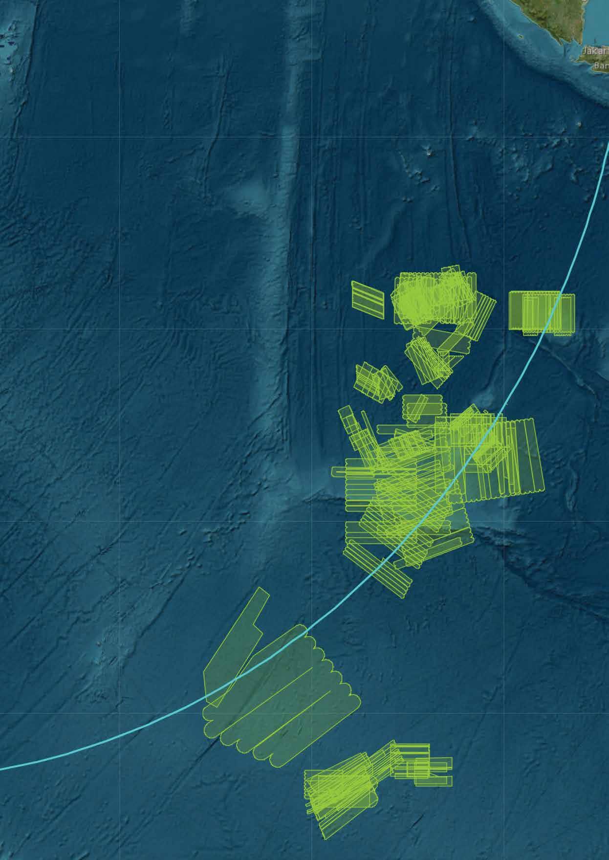
The search area was determined from analysis of probable flight paths and their intersection with the 7th Arc. This is an arc of possible aircraft positions, equidistant from the Indian Ocean Region satellite that received the final transmission from MH370.
Australia took the lead in the Indian Ocean search operation, as agreed by the Malaysian and Australian governments. A Joint Agency Coordination Centre (JACC) was established to coordinate the Australian government’s support in searching for the missing aircraft.
The search for MH370 is one of the largest marine surveys ever conducted
The search in the southern Indian Ocean, from 18 March to 29 April 2014, scanned 4.7 million square kilometres of ocean. It involved 21 aircraft that conducted 345 individual flights over 3,177 hours, as well as 19 ships from eight nations.
The search area is now among the most thoroughly mapped regions of the deep ocean
01
The second phase of the search was able to capture close-up images of objects of interest (shown as coloured dots) as identified by the sidescan sonar survey. This image of an oil drum was taken by ROV Remora III at 1 metre altitude and 3,740 metres depth.
02
Phoenix International
Autonomous Underwater
Vehicle (AUV) Artemis being craned over the side of Australian Defence Vessel Ocean Shield, 17 April 2014. The AUV collected sidescan sonar data using a 400-metre range scale at an altitude of 45 metres. It detected no aircraft debris on the seafloor.
01

In May 2014, the Australian Transport Safety Bureau (ATSB) assumed responsibility for conducting underwater search operations for MH370. Geoscience Australia provided advice and expertise to the ATSB throughout the first bathymetric survey and the subsequent underwater search.
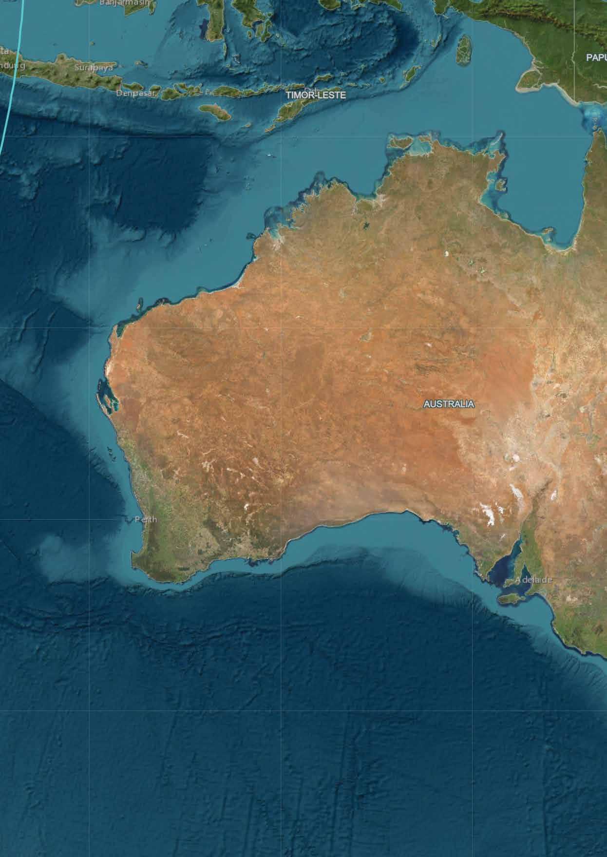
The underwater search for MH370 took place some 2,000 kilometres from Perth, in a remote part of the southern Indian Ocean that took search vessels up to six days to reach.
The first phase, the bathymetric survey, provided a detailed map of the sea floor topography across 278,000 square kilometres of the search area. This map guided the second phase, the underwater search, during which sidescan and multibeam sonar equipment, mounted on towed and autonomous underwater vehicles, collected high-resolution sonar images of the sea floor.
The search for MH370 collected 710,000 square kilometres of bathymetry data in total, making it one of the largest-ever marine surveys. The bathymetric survey is also unique in providing maps that are at least 15 times higher resolution than the previously available satellite imagery. The survey revealed a variety of sea floor features, such as vast underwater landslides of sediment, deep canyons and huge seamounts. The data collected will help various fields of scientific research, including oceanographic, tsunami, climate and habitat modelling.
More than 20 items of debris have been analysed by the Malaysian investigators as being definitely or very likely from MH370. They washed ashore along the south and east coast of Africa and the Indian Ocean islands of Mauritius, Rodrigues and La Réunion. Based on the locations of confirmed debris, drift modelling analysis has determined that possible locations of the MH370 crash site were consistent with the search area.
The search scoured 120,000 square kilometres of the sea floor without locating the missing aircraft, and in January 2017, the search for MH370 was suspended. The Joint Tripartite Committee noted:
We remain hopeful that new information will come to light and that at some point in the future the aircraft will be located.
The information in this article was compiled from geoscience-au.maps. arcgis.com, which includes videos and interactive maps of the search area.
Geoscience Australia acknowledges the very significant contribution of Fugro Survey Pty Ltd, who acquired additional bathymetry data while the search vessels transited to and from the search area, at no cost to the search. This data, along with the bathymetry data gathered in the search area, was released to the public in 2017.
Phase One and Two data is freely available to download on the Geoscience Australia website. To visualise and download datasets, visit portal.ga.gov.au/persona/marine
Further information on the search for MH370 can be accessed from the Australian Transport Safety Bureau: atsb.gov.au


