Portfolio
Urban Planning and Design
Andrew Moore

Andrew Moore
Contact Information
913-952-7714 / amoore8614@gmail.com
I am a senior Urban Planning and Design student with a passion for analyzing the built and socio-economic environment. I have a strong interest in guiding the healthy development of cities through land use planning, transportation planning, and urban design.
While my formal work experience in planning is just beginning, my academic project experience has provided me with valuable insights into the planning field and has solidified my commitment to this career path.
I am excited to bring my passion for urban planning to the world, where I aim to assist in the creation of meaningful projects and learn from experienced planners.
Education
University of Missouri-Kansas City
Bachelor of Arts (BA), Urban Planning and Design | May 2025
Community Engagement
UMKC Center for Neighborhoods | February 2023 - April 2023
• Actively participated in bi-monthly community association meetings.
• Engaged with political figures, community leaders, and residents to identify existing and desired community assets.
Server
Ocean Prime | February 2023 - Current
• Expressed interpersonal and group communication during private dining service.
• Cultivated a loyal client base and repeat business through consistently positive interactions.
• Delivered exceptional service in a fast-paced environment with routine deadlines.
• Adobe Fresco
• Adobe Illustrator
• Adobe InDesign
• Adobe Photoshop
• ArcGIS Pro
• Google Earth Pro
• Tableau
• Attention to detail
• Collaboration
• Communication
• Multi-tasking
• Organization
• Time Management
• Writing
Subject Location: Kansas City, MO metropolitan area
Year: 2024
Type: GIS
Skills Used: Adobe Illustrator / ArcGIS Pro
The goal of this project is to produce a transit analysis of a proposed Bi-State Corridor in the Kansas City metro area. Facilitated by the Mid-America Regional Council, the primary proposed investment of this corridor is a zero-emissions transit system which will move commuters on an east-west route from Independence, MO, to Village West in Kansas City, Kansas.
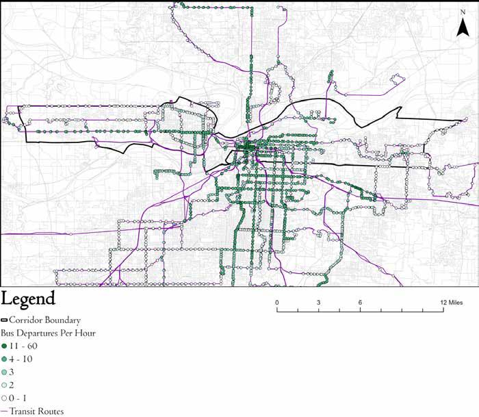
The graphics for this project display the existing transit infrastructure within the corridor study zone.
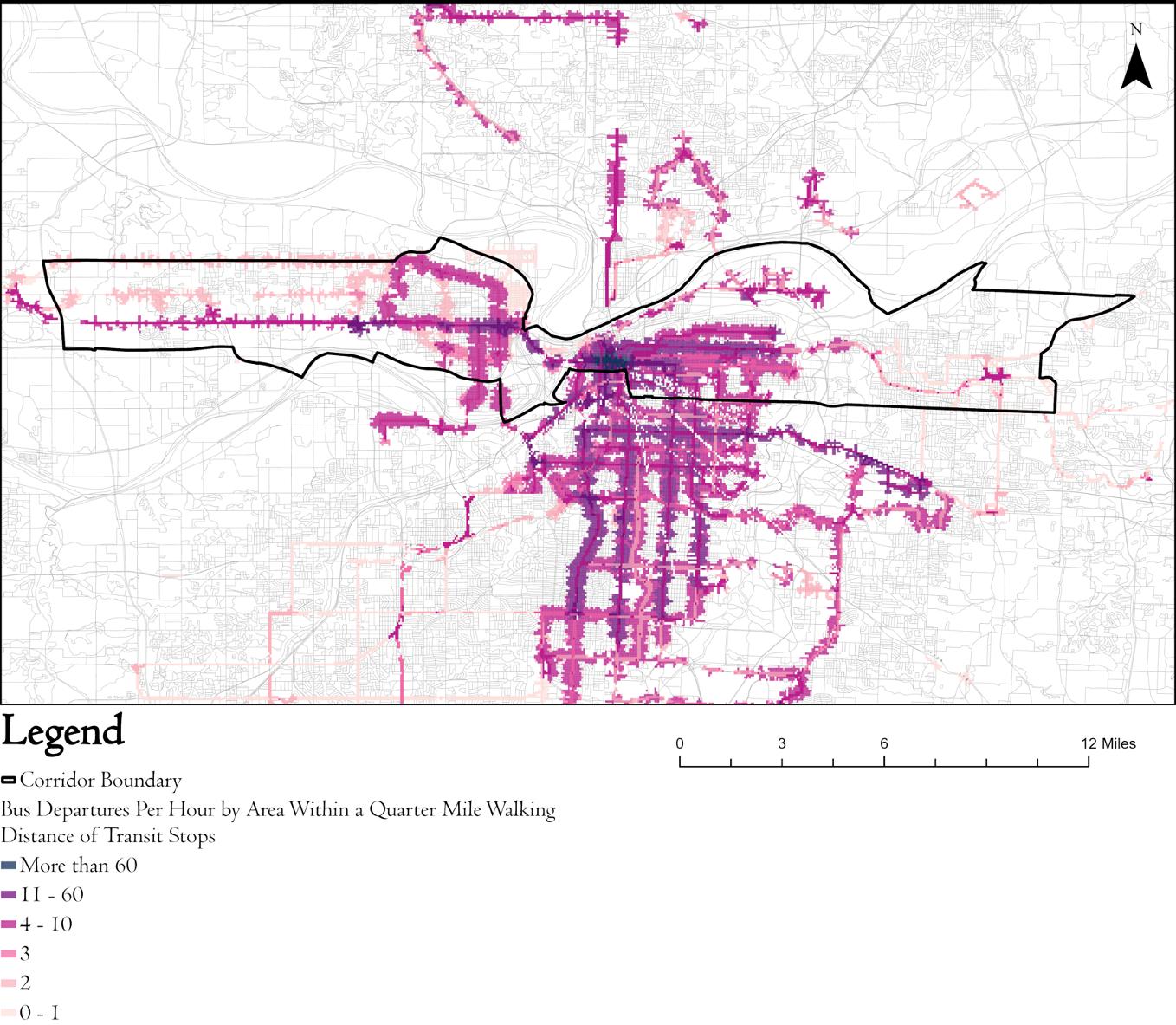
This map was created in ArcGIS Pro. It required the production of a Public Transportation Data Model using local GTFS data. After the creation of a custom Network Dataset, the Network Analyst tool was used to accurately analyze existing pedestrian infrastructure.
This map was made in ArcGIS Pro. It was created with the Calculate Public Transit Frequency tool on a Public Transportation Data Model.
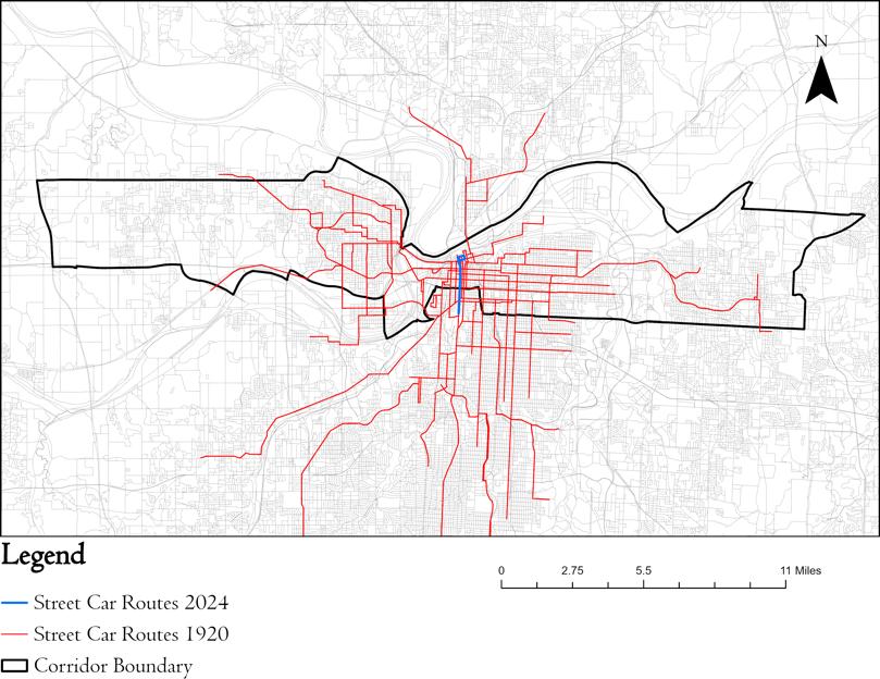
This map was made by georeferencing a historical Gallup map on ArcGIS Pro. It Involved the creation of a new line feature class and a manual trace over historical routes in order to create a visually cleaner and spatially accurate map of the historic streetcar route.
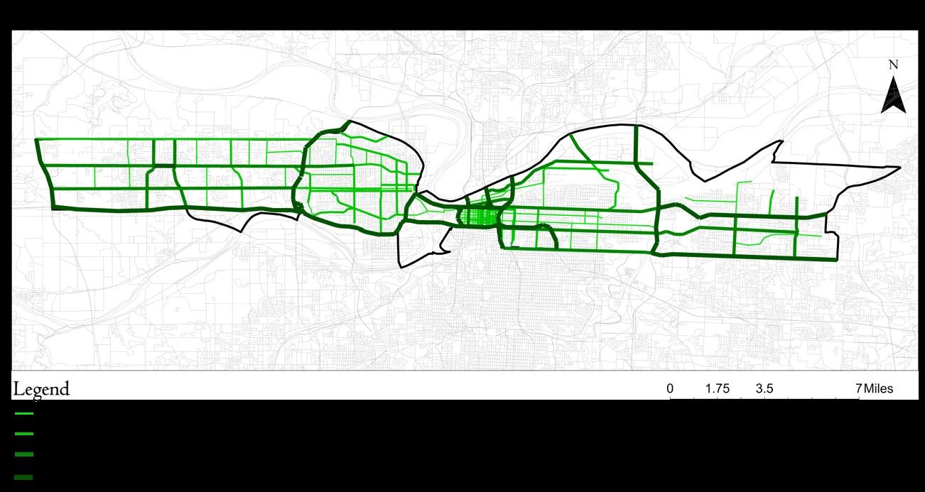
This graphic displays the AADT of major and minor arterial roads. K-DOT and MO-DOT data were used to identify high-volume roads. AADT volume lines were manually created using Adobe Illustrator with an imported ArcGIS Pro map.
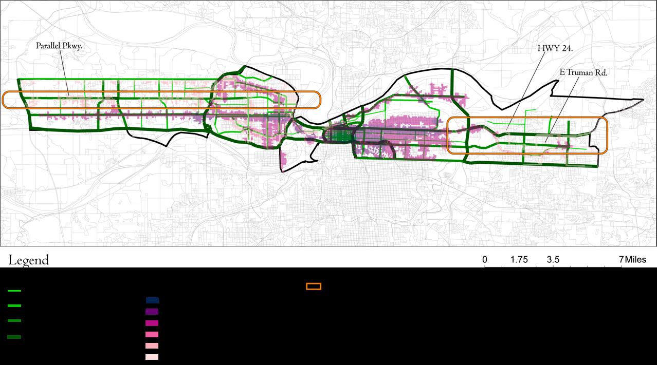
This map identifies major arterial roads with a high AADT rate and low public transit frequency by area. It involved the creation of several layers in ArcGIS Pro, and the organization of each respective layer in Adobe Illustrator.
Subject Location: Kansas City, KS
Year: 2024
Type: Urban Design
Skills Used: Adobe Illustrator / Adobe Fresco / ArcGIS Pro / Google Earth Pro Microsoft Excel
This project displays a mobility hub concept located along the route of a proposed Bi-State Corridor in the Kansas City metro area. The concept assumes that the corridor proposal will take the form of a zero-emissions Bus Rapid Transit (BRT) line, traveling to and from the East and West ends of the metro area.
This design is located in Kansas City, KS, and its center lies in the intersection of State Ave. and College Pkwy. The combination of vacant parcels and nearby neighborhood assets, such as a local community college, invites a unique opportunity to take advantage of the future transit line through mobility-based development.
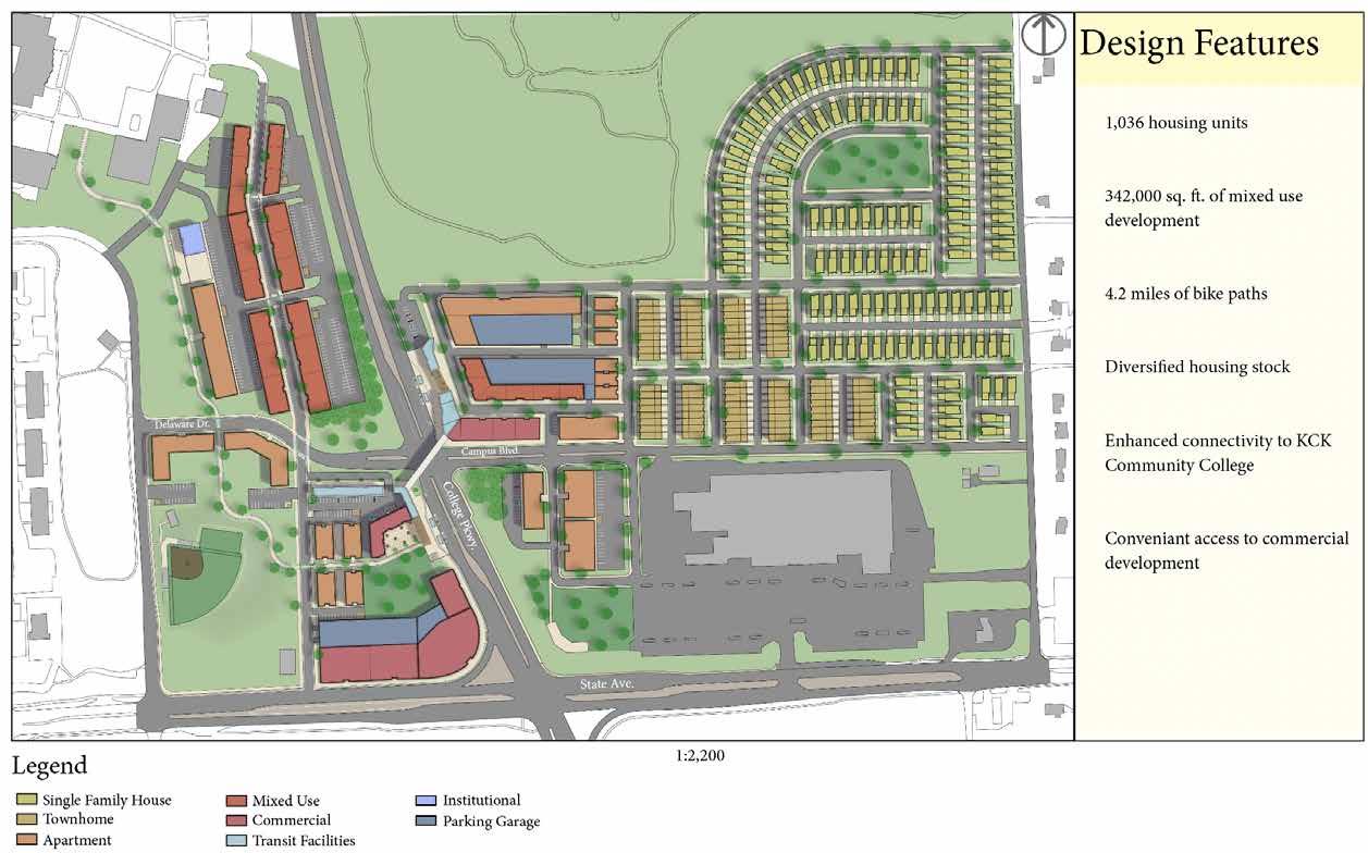
The full plan was produced through an ArcGIS Pro to Adobe Illustrator workflow. Design emphasis is placed on connectivity, safety, economic opportunity, and multi-modal transit.
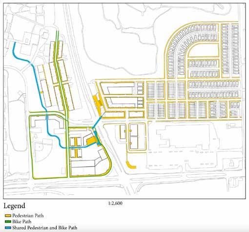
A connectivity diagram illustrates the network of paths. Bicycle, pedestrian, and shared use paths connect commuters from the central hub to the planned mixed use development, in addition to existing community assets. Created with ArcGIS Pro and Adobe Illustrator.
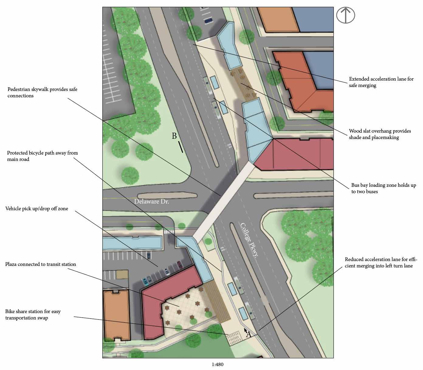
A zoomed image of the hubs center highlights its multi-modal features.
Elevation B was made with Adobe Illustrator.

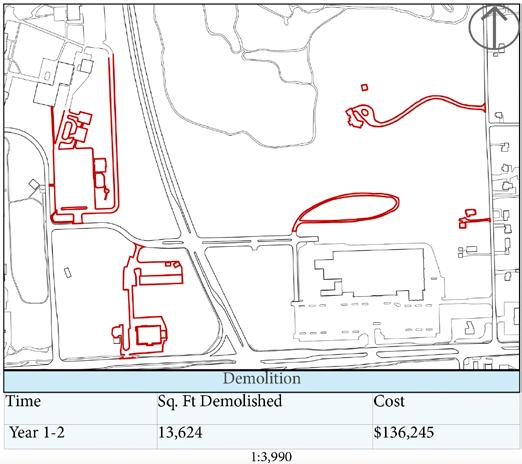
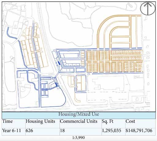
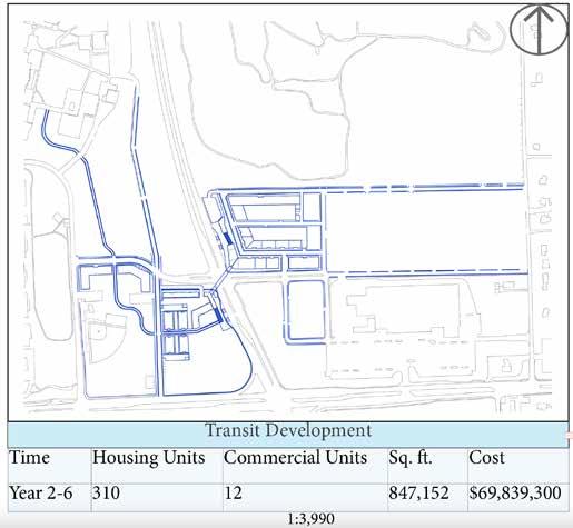
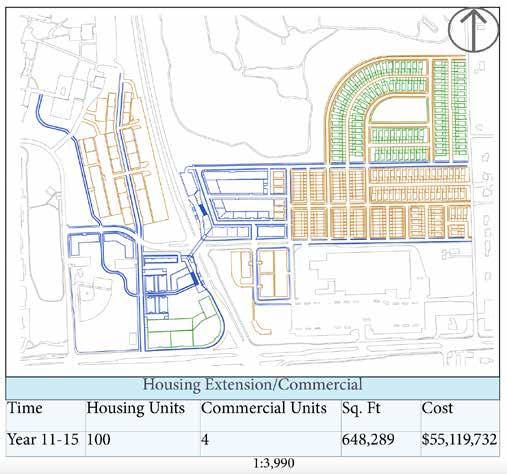
Phase diagrams were made with an ArcGIS to Illustrator workflow. Square footage was calculated through the georeference of planned structures in ArcGIS Pro.
Subject Location: Kansas City, MO.
Year: 2023
Type: Urban Design
Skills Used: Adobe Fresco / Adobe Illustrator / ArcGIS Pro / Google Earth Pro
This work is a response to a proposed streetcar expansion on two intersecting arterial roads in Kansas City. The expansion includes a lengthened north-south route on Main St, along with a new east-west route along Linwood Blvd. The northwest corner of this intersection is currently occupied by several large, low density facilities.
The goal of the project is to imagine a redevelopment of the northwest corner that will compliment the future social and economic activity of the streetcar expansion.
Through the analysis of existing conditions, surrounding land use, and projected future activity, this project displays an innovative neighborhood concept.
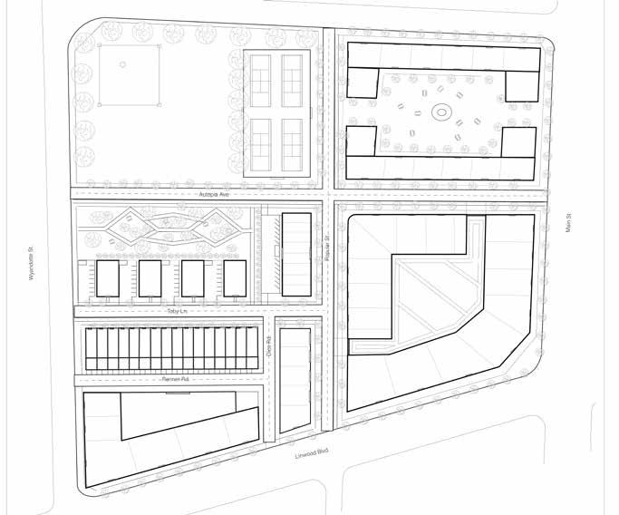
The site plan was created through an ArcGIS Pro to Adobe Illustrator workflow. The concept includes affordable housing, recreational areas, mixed use residential, and parking accommodations with a design emphasis on walkability and connections.
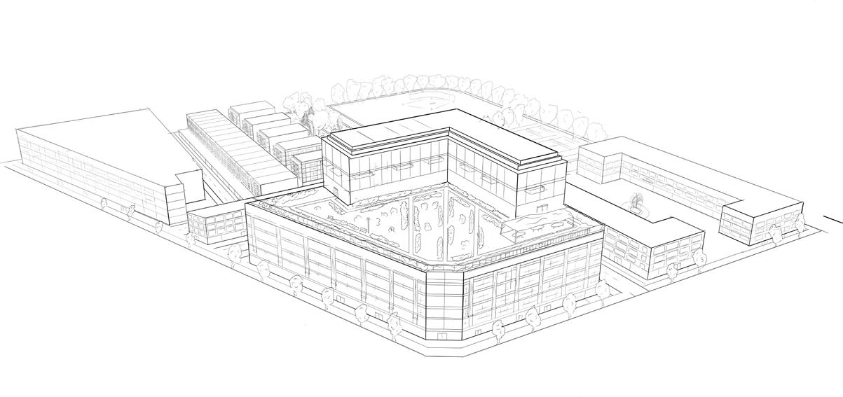
This perspective provides a northwest view of the proposed design. This image underwent a variety of hand drawn renderings before its digital creation in Adobe Fresco. Accurate angles were assisted by Fresco’s 3D perspective grid.

Elevation A was created through Adobe Illustrator. Emphasizes architectural detail.
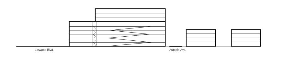
Section B was created through Adobe Illustrator. Emphasizes architectural detail.
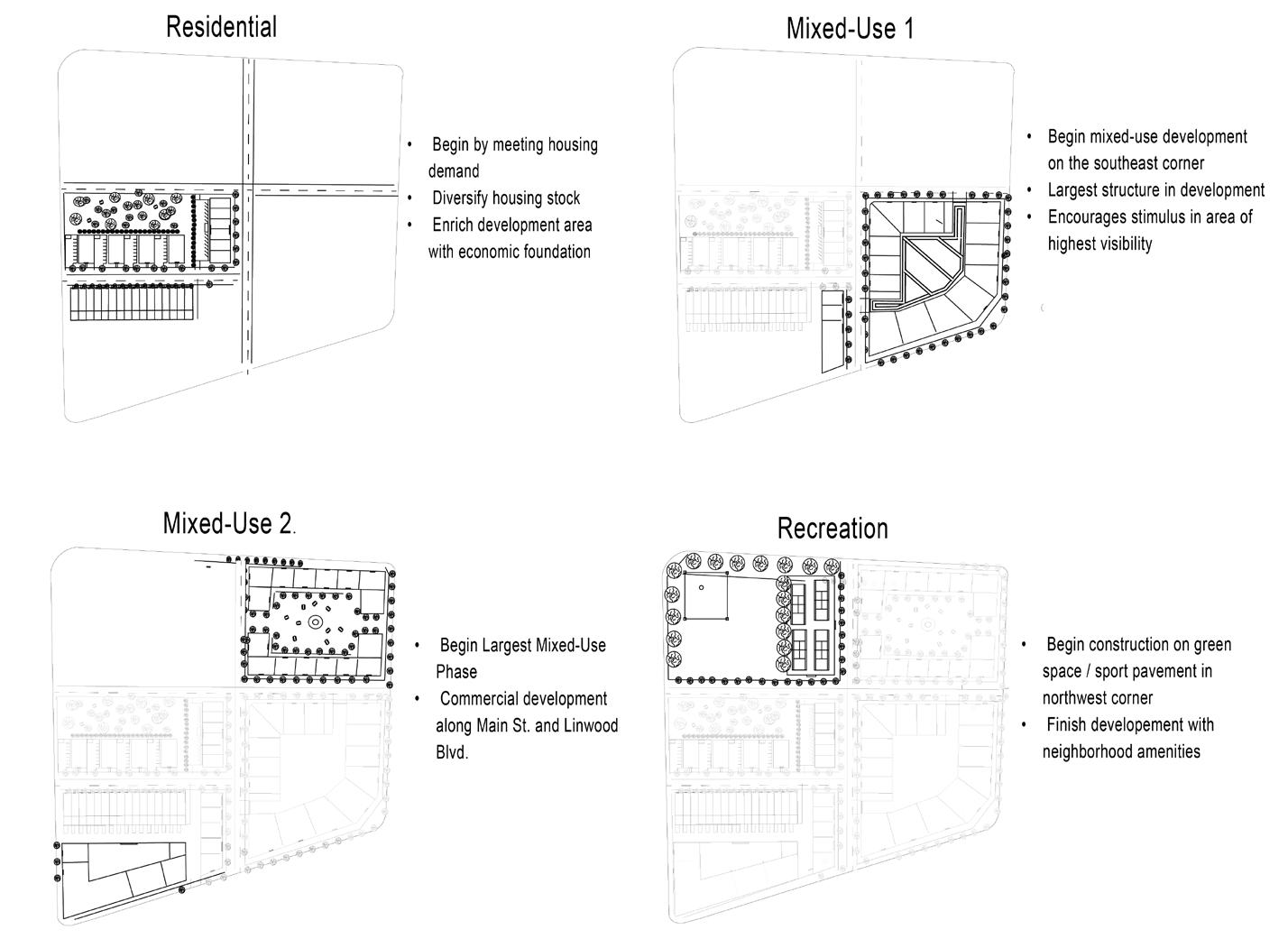
Implementation phases were highlighted in Adobe Illustrator.
Subject Location: Buenos Aires, Argentina / Reykjavik, Iceland
Year: 2024
Type: Writing
Skills Used: Writing / Research / Microsoft Office Suite
This paper provides a comparative analysis of two Climate Action Plans developed by Buenos Aires, Argentina, and Reykjavik, Iceland. Specifically, it identifies one common policy action from each plan and compares the policies through a lens of planning theory.
Research for this project required English versions of Climate Action Plans or the translation of them. Other publications such as Comprehensive plans and UNESCO Voluntary Reviews were analyzed for context.
The excerpt displayed introduces the core points of contention among the plans’ policy actions.
The key policy divergence lies in competing measurements of walkability.
Buenos Aires measures walkability by the level of access to amenities with the exclusion of public transit. The city implements their vision of walkability through the presentation of pedestrianized zones in core neighborhoods, where the ability to access amenities by strictly walking is highly valued. In Contrast, Reykjavik measures walkability by the level of access to amenities with the inclusion of public transit. This vision is observed in the suggested urban growth boundary policy around the city’s light rail stations. Here, The Reykjavik plan suggests that the access of overall mobility is just as significant of an element to walkability as pedestrianization is.
Beyond the differences of the policies themselves, variations emerge in the written presentations of each policy. The Buenos Aires policies are presented as a conceptual framework that suggests broad ideas for action, whereas the Reykjavik policy actions are presented as a framework for pragmatic implementation. To illustrate plainly, while both plans cover the What , the Buenos Aires plan emphasizes the Why , and the Reykjavik plan emphasizes the How .