2026
WORLD
Integrating intelligence From the publisher of
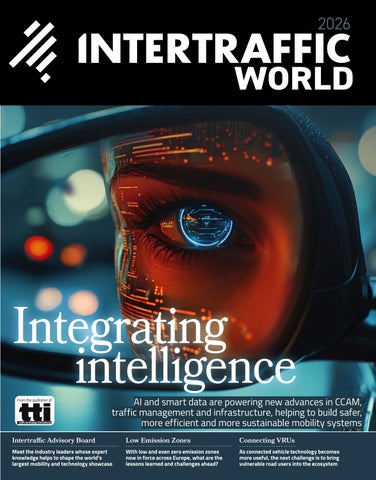
AI and smart data are powering new advances in CCAM, traffic management and infrastructure, helping to build safer, more efficient and more sustainable mobility systems
Intertraffic Advisory Board
Low Emission Zones
Connecting VRUs
Meet the industry leaders whose expert knowledge helps to shape the world’s largest mobility and technology showcase
With low and even zero emission zones now in force across Europe, what are the lessons learned and challenges ahead?
As connected vehicle technology becomes more useful, the next challenge is to bring vulnerable road users into the ecosystem
Revolutionize Your Traffic Signage Production Consistent. Compliant. Worry-free. Every Time. The Canon Colorado M-Traffic printer, powered by the Canon UVgel technology and SAi FlexiCOMPLETE 3M Traffic Edition Software, combined with 3M digital print sheeting, makes high-quality, reliable traffic signage production effortless.* Experience the Benefits: • • • • •
Compliance Assured: Meets ASTM D4956, AS/NZS 1906.1:2017, and EN 12899 specifications.* Reliable Quality: Supported by the 3M™ MCS™ Warranty for Traffic. Effortless Performance: Worry-free printer operation with minimal maintenance. Versatile Production: Fast and efficient production of regulated and non-regulated traffic signs with 3M Reflective Sheeting. Canon proCARE+ service offer: Comprehensive service and warranty to maximize uptime.
*When processed according to 3M recommendations, all regulated traffic colors will meet global specifications (ASTM D4956, AS/NZS 1906.1 and EN12899) when printed on 3M Reflective Sheeting Series 7310/7610, 3930UDS or 4000UDS.
Experience it live at Intertraffic – March 10 –13, 2026! Hall 10, Booth 10.108 see the Canon Colorado M-Traffic in action!
Ask an expert For more information, scan the QR code and connect with a 3M expert today. 3M and 3M Science. Applied to Life. are trademarks of 3M. © 2025, 3M. All rights reserved.
CONTENTS
Exclusive features 010 Get back
“Our aim isn’t just to get from A to B as fast as possible. It’s about livability – schools without throughtraffic, preserving ecology, reducing heat-stress and coexisting with water” Gerry de Koning, smart mobility manager, Gemeente Almere
“It’s all about people and relationships. Intertraffic Amsterdam is especially important for that” Marc Verhage, chair, Connekt – ITS Netherlands; vice chair, ITS Nationals
The world’s largest mobility and technology showcase, Intertraffic Amsterdam, returns for 2026, uniting expertise from around the world to shape the future of mobility
012 A model city
Gerry de Koning, smart mobility manager for Almere, reflects on how the purpose-built commuter city has tackled its unique transport challenges since the 1970s, and how it is planning for the next phase of mobility
016 Expert guidance
Four members of Intertraffic Amsterdam’s Advisory Board share their perspectives on the evolution of the world’s largest mobility and technology showcase and the challenges facing the mobility industry today
022 Safer together
For nine years, the DFRS consortium has advanced real-world connected-vehicle safety use cases, and momentum is accelerating following Euro NCAP’s decision to integrate connectivity into its safety ratings
030 Clear benefits
“Collecting movement data requires a trusted party and full transparency about which data is being collected, and why” Ferry Smith, director of public affairs, ANWB; member of the Advisory Group for the UN Special Envoy for Road Safety
Low and zero-emission zones are becoming increasingly important as urban centres all around Europe battle to clean up their air. ITW looks at the lessons that can be learned from the experiences of cities that have implemented them
036 Chain reactions
A new, Pan-European project is bringing bicycles into the connected-vehicle ecosystem to enable signal prioritisation, improved safety and smarter traffic management
044 Digital roads
The UK’s National Highways has launched its new Network Model,
giving public and developer access to advanced geospatial data to enhance road safety and efficiency
052 Building smarter cities
The Netherlands is building scalable smart-mobility frameworks, centred on reducing car use, that enable rapid nationwide deployment and offer a model for cities across Europe and beyond
058 How secure is your data?
As more and more data is collected from vehicles, the industry must be increasingly vigilant about how it is used and shared
064 Building cloud capability
Transport for West Midlands has built a world-class data capability in-house, using smart funding methods to create a long-lasting legacy of usability
068 How to build a low-carbon road Despite UK budget pressures, the Lower Thames Crossing is moving ahead, pioneering low-carbon construction. ITW outlines the emerging principles shaping the country’s largest road project in decades
148 Advertiser directory
Find out more about the technology and services from suppliers featured in this edition
154 Safer by design
Dr Suzy Charman, executive director of the UK’s Road Safety Foundation, talks about the research that proves how cutting vehicle speeds and smarter infrastructure design can reduce death and serious injury on road networks
Road infrastructure 72 The road to efficiency
Advanced digital platforms from Highway Software are revolutionising construction management by connecting teams through real-time data Annual 2026 | Intertraffic World
003
CONTENTS
76 The right direction
How 3M’s durable road marking tapes can help reduce congestion costs while promoting safety, sustainability and future-readiness
80 Guiding safer streets
Geveko Markings argues that clear, durable road markings are essential for future urban mobility
82 24/7 bridge protection
Combining Kistler’s structural health monitoring with weigh-in-motion technology offers bridge operators automated monitoring and targeted interventions to extend service life
84 Smarter, leaner, greener
Triplesign makes the case for energy efficient variable message signs in modern traffic management
86 The global dangers of overloading
“Cycling is increasingly an element of traffic management, because without the modal shift, it will be hard to reach environmental goals” Stephanie Kleine, senior advisor for Autonomous and Connected Mobility at the Ministry for Environment, Nature and Transport in North Rhine-Westphalia
New enforcement technologies and stricter monitoring from Haenni offer hope for safer infrastructure
88 Kazakhstan’s success story
How Intercomp’s strain gauge strip sensors became the backbone of high-speed weigh-in-motion direct enforcement in Kazakhstan
90 Smarter studs
Madrid’s A-2 highway now uses inductive LED road studs from Sernis to manage its dynamic BUS-VAO lane
ITS traffic management 92 Connected mobility at scale
Kapsch looks at how connected vehicle technology is delivering measurable safety and revenue benefits at scale in Germany and the US
94 Reducing delays with AI
AI-based traffic control from Swarco at a Danish intersection has reduced delays by 48% and CO2 emissions by 22% during routing disruptions
102 AI optimises tolling
Quarterhill explores how AI is being used to unify Europe’s fragmented tolling systems and improve accuracy and traffic flow
104 Mobility reimagined
Cities worldwide adopt integrated, data-driven transport systems to manage congestion, sustainability, and urban mobility challenges, PTV Group finds
106 Adaptive traffic intelligence
AI-led traffic systems from ST Engineering are redefining how cities detect incidents, optimise junctions and respond to growing mobility pressures
108 Redefining MLFF
Combining 3D lidar with edge computing is streamlining multi-lane free-flow tolling, reveals VanJee Technology
110 A collaborative mobility shift
Q-Free reveals how partnerships across public agencies, industry innovators, and global pilots are accelerating smarter, safer, and more connected mobility systems
112 Next-generation plate recognition Compact, high-performance ANPR cameras from QRO Solutions deliver efficient vehicle monitoring across various environments
114 Enforcement anywhere, anytime Vitronic’s Poliscan Enforcement Trailer is proving its worth in improving safety by monitoring previously hard-to-access roadways around the world
116 Continuous data collection
98 Clear intelligence
118 Africa’s digital borders
Cities are turning to advanced ANPR intelligence from MAV Systems to cut congestion, improve safety and protect revenue
Intertraffic World | Annual 2026
Alliance Traffic Systems looks at how Abu Dhabi is pioneering a new era of intelligent, sustainable traffic management, using advanced AI systems to deliver safer, more connected mobility
96 Smart streets, safer cities
How edge-processed sensors from AGD Systems are shaping the future of urban mobility
004
100 AI-driven intelligence
A new high-performance traffic counter from Oriux is delivering consistent accuracy
Intelligent transport systems and integrated digital platforms are transforming African border posts, ICE Tech reports
The most advanced SHM & WIM technologies for safer, longer-lasting bridges. Trusted by engineers. Chosen by authorities.
Visit us at Hall 1, Booth 410 Penang Second Bridge, Malaysia - instrumented with Kistler measurement technology
www.kistler.com/bridges
962-115e-11.25 ©2025 Kistler Group
KNOW YOUR BRIDGE – INSIDE OUT
CONTENTS 121 Scalable C-ITS
132 Moving with demand
122 Intelligent road monitoring
134 Beyond traditional barriers
Ettifos’s new software-defined C-V2X RSU offers a scalable and future-proof foundation for next-generation road safety
Edge AI and vehicle-mounted cameras from WaterView are transforming road maintenance from reactive repairs to predictive monitoring at scale
124 Intelligent roads
Sprinx Technologies reveals how the Tamoios Highway is showcasing Brazil’s shift toward smarter, safer infrastructure
Flexible lane management using moveable barrier systems from Lindsay offers a cost-effective alternative to road expansion
Advanced barrier systems and emergency openings from Heintzmann Traffic Systems are transforming tunnel safety by enabling rapid response during incidents
136 Lifting the heavy load
Rail Raise’s automated guardrail installation technology is helping to reduce manual lifting and labour requirements while delivering return on investment within two years
Road safety 126 Redefining traffic flow
Dynamic traffic systems from Vevacado are reshaping how cities prevent gridlock, protect road users and make better use of existing infrastructureld
139 Guiding modern mobility
A new flexible luminous bollard from Sernis combines LED guidance with impact-resistant design
129 A data-driven approach
141 Temporary road safety barrier
130 Smarter road safety
Parking
Miovision’s data-driven monitoring enhances cyclist and pedestrian safety, guiding targeted design interventions toward vision zero goals
How AI video analytics and Doppler radar integration from IDEMIA are shaping the future of transportation safety
MJK Manufacturing’s Manta Barrier provides durable, versatile, cost-effective road safety solutions for temporary and semi-permanent sites
142 From friction to flow
Smart, digital parking solutions from HUB Parking Technology are turning traditional lots into data-rich assets
144 Smarter parking access
A new platform from Designa bridges the gap between legacy parking systems and modern mobility apps
146 Breaking down barriers
Smart City System’s digital, barrier-free parking solution is providing seamless entry, real-time transparency, and streamlined management
Editor: Tom Stone Associate editor: Helen Norman Contributing editors: Lauren Dyson, Jack Roper Art editor: Andy Bass Designers: Anna Davie, Louise Green, Julie Welby Circulation manager: Charley Nash Publication manager: Julian Bidlake julian.bidlake@markallengroup.com Chief operating officer: Jon Benson Chief executive officer: Ben Allen Chairman: Mark Allen
Part of www.markallengroup.com
006
Intertraffic World | Annual Showcase 2026
Intertraffic World, ISSN 2042-7204 (Print), ISSN 2397-5989 (Online), is published annually by MA Aviation & Auto International, Hawley Mill, Hawley Road, Dartford, Kent, DA2 7TJ, UK Tel: +44 (0) 1322 221144 Intertraffic World is a partnership with RAI Amsterdam, organizers of the Intertraffic events RAI Amsterdam, PO Box 77777, NL-1070 MS Amsterdam, Netherlands Tel: +31 20 549 12 12 www.intertraffic.com Subscription records are maintained at MA Business Limited Hawley Mill, Hawley Road, Dartford, Kent, DA2 7TJ, United Kingdom. Air Business Ltd is acting as our mailing agent.
Welcome
A
few years back, one of the big buzz phrases of the industry was ‘big data.’ It was often framed as being a good thing. Herein lay so much potential. But in fact, perhaps what it really meant was that so much data was being collected from so many different sources that it was becoming overwhelming, or, to put it mildly ‘big’. Yes, we had a lot of transportation data, but that in and of itself was not particularly useful if we couldn’t make sense of it all. These days you don’t hear about big data so much. And that’s certainly not because less data is being collected – quite the opposite, the amount of data gathering is still growing exponentially. But the big difference now is that we have the power to analyse it. And that power is AI. With artificial intelligence data is no longer ‘big’ (read: overwhelming) data is useful. We no longer have to worry about the size of our data sets. AI makes huge data sets manageable, and is able to slice and dice them in new and different ways almost instantaneously. And so we see unfolding before us a new era of information, creating a new and deeper understanding of our transport systems and how they work, enabling us to develop new ways to improve efficiency and safety. This new era is reflected in the pages of this magazine. Deeper understanding of data is powering CCAM (connected, cooperative and automated mobility) and we dive into the ways in which connected vehicle data can improve safety (page 22) and how vulnerable road users can be brought into the ecosystem (page 36). Meanwhile the Netherlands, home of Intertraffic, is leading the world in mobility traffic technology development, creating a hot house for innovation, which we explore on page 52. Cloud computing (page 64) and advanced GIS (page 44) are two further ways in which data is being harnessed for traffic management. But there is a note of warning on data privacy (page 58) – the new world of ‘useful data’ is here, so now we must take extra care in how we set the patterns for the future. Tom Stone, editor
© MA Business Limited 2025. All rights reserved. No part of Intertraffic World may be reproduced, stored in a retrieval system, or transmitted in any form or by any means electronic, mechanical, photocopying, recording, or otherwise without prior written permission of the publishing director. The views expressed do not necessarily represent those of the editor. The presence of advertisements in Intertraffic World implies no endorsement of the products or services offered. Every effort has been made to ensure the accuracy of statements in this magazine but we cannot accept responsibility for errors or omissions, or for matters arising from clerical or printers’ errors, or an advertiser not completing their contract. We have made every effort to secure permission to use copyright material.
Where material has been used inadvertently or we have been unable to trace the copyright owner, acknowledgement will be made in a future issue. Please read our privacy policy by visiting http://privacypolicy. markallengroup.com. This will explain how we process, use and safeguard your data. Printed in the UK by Pensord, Pontllanfraith, Blackwood, NP12 2YA MOVING ON? If you change jobs or your company moves to a new location, please contact circulation@markallengroup.com to continue receiving your free copy of
Intertraffic World
Cover image: stock_adobe.com
Connected Vehicles Real-time alerts for drivers, preventing accidents Translating into: safer roads smarter traffic operations more efficient infrastructure
Explore the Kapsch Virtual City to see us in action
EVENT PREVIEW
Get back
The world’s largest mobility and traffic technology showcase, Intertraffic Amsterdam, returns for 2026, uniting expertise from around the world to shape the future of the industry Words | Lauren Dyson
Main: The RAI Amsterdam exhibition centre is the home of Intertraffic
I With more content, interactive sessions, demonstrations and targeted networking gatherings than ever before, the 2026 edition will deliver an even richer, more valuable experience for mobility professionals from both the public and private sectors Joyce de Winter, director, Intertraffic Worldwide Events
010
Intertraffic World | Annual 2026
ntertraffic returns home to Amsterdam this year after two groundbreaking expos in 2025 in Shanghai and Mexico City. With its events now spanning three continents and a recognised global network of expertise, Intertraffic has established itself as the world’s leading event for smart, safe and sustainable mobility. The 2026 event will take place 10-13 March at RAI Amsterdam, with some 30,000 transportation and mobility professionals from more than 140 countries expected to attend. As always, visitors can expect to learn about the most recent trends and innovative solutions that are shaping the mobility sector, while taking advantage of the opportunity to connect with business leaders and government decisionmakers to discuss the future of transportation. “It will be a holistic showcase of sustainabilitydriven mobility technologies, covering everything from smart parking solutions, infrastructure and green barriers to data-driven traffic systems, road safety and next mobility solutions,” says Joyce de Winter, director, Intertraffic Worldwide Events. “We will have a good balance of the mobility ecosystem, in visitors, in speakers, and on the show floor.” Intertraffic Amsterdam 2024 had the event’s largest ever exhibition floor footprint, along with its most extensive knowledge programme, with more than 200 experts delivering over 100 interactive theatre sessions, demos and presentations. This year’s show promises to raise the bar even higher, with more than 300 sessions planned, featuring presentations covering every sector of the industry. “In addition to the summit theatre programme, which will focus on
Below: The Intertraffic team preparing for their biggest event yet
global challenges and insights with high level keynotes and in-depth discussions from leading experts, city representatives, policy makers and innovators, we have added four open stages in individual halls,” says de Winter. The 2026 event promises a dynamic programme, with a specific focus on sustainable urban mobility and climate goals. Summit presentations will address AI and machine learning for smart asset management, decarbonising transport, 15-minute city planning, active travel, micromobility regulation and sustainable urban mobility plans (SUMPs). There will also be a major focus on mobility services and multimodal ecosystems.
Innovation connection
The 2026 Intertraffic exhibition will span 12 halls, bringing together some 900 exhibitors from 54 countries, including 30 national ITS organisations. To make navigation easier, the expansive exhibition floor will be organised into segments: Road Infrastructure, ITS Traffic Management, Road Safety, Parking, and a new feature called Next Mobility, which will showcase emerging transport modes, such as air mobility, light electric vehicles (LEV) and micromobility solutions. As well the opportunity to learn about these new technologies and discuss ideas with fellow attendees, visitors will also be able to see live demonstrations inside and outside the venue, which de Winter says will include self-driving vehicle solutions for small logistics, shuttles and cars. Other event highlights will include the EV Charging pavilion, where attendees can learn more about fast chargers, infrastructure integration, regulation and planning, the New
EVENT PREVIEW
In the 2024 Intertraffic Opening Ceremony a dancer interacted with moving images on the screen behind him – an allegory for humanmachine interfaces in ITS
to Market pavilion, and also the ITSUP (ITS Startup) zone, Intertraffic’s dedicated startup platform. Here, new companies will showcase groundbreaking products, smart solutions and emerging technologies for traffic management, smart mobility, infrastructure and road safety. “Through our ITSUP platform we give startups a clear stage to present their ideas and meet cities, industry leaders and investors,” says de Winter. “Startups bring passion, fresh ideas and a strong drive that can shape the future of mobility. I truly believe many of tomorrow’s technologies and partnerships will come from them. Intertraffic can be a springboard by giving these young companies international visibility and the connections they need to grow and scale their solutions.”
Getting involved
This year Intertraffic Amsterdam will be adopting an updated entrance policy, which the organisers say reflects the significant expansion of what’s on offer for visitors. “With more content, interactive sessions, demonstrations and targeted networking gatherings than ever before, the 2026 edition will deliver an even richer, more valuable experience for mobility professionals from both the public and private sectors,” says de Winter. “Attendees can expect even more benefits this year. We are planning several networking gettogethers, the official opening will be open to all, and for those who weren’t aware of it yet, all the summit content is included with the visitor pass as well. In short, once you cross the Intertraffic doorstep, everything is yours.” To support this, Intertraffic is moving to a paid entrance model, though de Winter reassures that the fees are “nowhere near” the rates of
other events with similar conference elements. Moreover, visitors can still register for free through exhibitors, just as in previous years.
The power of people
Technology in the mobility sector will undoubtedly continue to advance at a rapid pace, particularly in the spheres of AI, electrification and connected systems. However, technology is only part of the equation – it must be guided by human expertise and shaped by collaborative partnerships in order to meet global safety and sustainability goals. “The mobility sector is moving in the right direction and we see strong progress in areas like electrification, smart traffic management and cleaner urban mobility,” says de Winter. “The innovation power in our industry is enormous, and many public and private stakeholders are truly committed to more sustainable transport systems. But at the same time, we have to be realistic. The transition is complex and not the same in every region. Countries face different economic, political and infrastructural challenges, and the interests of cities, industries and citizens do not always align. This means that changes vary globally.” That is why Intertraffic events are invaluable. They bring together expertise from around the world, enabling governments, authorities and industry leaders to share solutions, align their approaches, and adapt solutions to meet local needs. “If we continue to collaborate internationally, share best practices and scale proven solutions, we can reach our sustainability goals,” says de Winter. “Intertraffic plays a big role in bringing those worlds together, and that gives me confidence for the future.” n
Ones to watch Here are five standout moments to look for in the summit programme:
Unlocking the Future Of Roads: A Global Benchmark on Technology Maturity of Operators Alberto Chiulli, McKinsey & Company Digital Twin Technology as a Strategy for Optimising Traffic Signal Operation Sunny Chakravarty, Econolite Seamless Traffic and Accident Monitoring Along Highways and Roads in Real-Time Thomas Edl, Deltabloc International Beyond The Plate: Rethinking Vehicle Recognition for the Future Of Parking Laura Caillot, Survision Group Traffic and Road Safety Analytics for Traffic Management Using Agentic AI Ralf-Peter Schäfer, TomTom
Annual 2026 | Intertraffic World
011
city
INTERVIEW GERRY DE KONING
A model
How do you design a city’s transport system from scratch? Almere was created as a commuter satellite to Amsterdam in the 1970s and Gerry de Koning, its smart mobility manager, has worked for the governing Gemeete Almere for more than half of its brief but noteworthy history. Here he talks about the transportation challenges the city has overcome, and the ones it is preparing for in the future
A
Words | Christopher Court Dobson
lmere is an anomaly in a country where most city-dwellers must contend with medieval street patterns and the hotchpotch inefficiencies of infrastructure accumulated over centuries. Built from scratch on reclaimed land in the 1970s, Almere only turned 50 last year. For Gerry de Koning, smart mobility manager at its governing authority Gemeente Almere, municipal youthfulness has distinct advantages. Almere’s design separates buses and cyclists from cars not merely in segregated lanes, but on bus roads and cycle paths which diverge entirely and seldom run alongside roads carrying regular car traffic. “Everything is separated,” says de Koning. “Driving is so simple that people have to take their driving test in other cities, where modes are more combined. It’s fairly unique in the Netherlands. Of course, it costs more to have separate bus infrastructure.” New residential developments are still being built in Almere – Gemeente Almere starts running bus services to these areas even before citizens move in, to discourage second car purchases and subsequent car dependency. “We’re pre-investing in safety,” says de Koning. “Because modes are separated, Almere is the safest city in the Netherlands.” Cyclists benefit from dedicated infrastructure dating from Almere’s 1970s inception, replete with bridges and tunnels, which often take more direct routes than cars. Cyclists face the greatest risk on
012
Intertraffic World | Annual 2026
a single 3km street with confluent modes – which Gemeente Almere is currently redesigning. “Our policy approach is very different to more car-focused municipalities,” says de Koning, nonetheless noting that municipal steering depends on which party is elected. “We don’t set targets ourselves. We provide digital tools which are neither right- or leftwing, then the governing party decides at what level KPIs should be targeted.” Whereas traditional transport models may prioritize average users, de Koning is focused on ensuring the system works for everyone. “If you can’t afford a car or walk to a bus stop, you’re stranded,” he says. “We’re studying how to design for those groups. We want to create spaces away from roads for kids to play. That’s not something most traffic models consider.”
Cauliflower geometry
Almere’s garden city design employs cauliflower urban geometries wherein arterial transport spines radiate out into self-contained residential districts. Despite municipal car-agnosticism, according to de Koning, Almere’s residents still run enough private vehicles to fill 70 football-fields. One could say this makes parking itself a political football. “There’s competition for public space between parking and housing, play areas and cycle paths,” says de Koning. “Rather than two cars in front of every house, we try to keep parking a little distant from homes in small
INTERVIEW GERRY DE KONING
Our aim isn’t just to get from A to B as fast as possible. It’s about livability – schools without through-traffic, preserving ecology, reducing heat-stress and coexisting with water
Annual 2026 | Intertraffic World
013
INTERVIEW GERRY DE KONING between green patches matters for ecology and cooling,” says de Koning emphasizes. Meanwhile air quality will be improved by a zero-emission zone planned for Almere in 2028. The Province of Flevoland needs to build 100,000 homes and while nearby cities are deemed full, Almere is reckoned to have space for another 30,000 homes. A dense development of over 20,000 houses is now planned for the city’s southwestern Pampas district, with associated construction traffic set to increase stress on roads well in advance of its residents arriving. Almere is working with the Province of Flevoland to create logistical hubs for building materials as a means to rationalize construction traffic. “In 2023, 25% of our total road use was building-related,” says de Koning. “If we can make that stream cleaner and more efficient, we immediately solve a big part of the equation.”
Parting the waters
Above: As it’s below sea level, water management is essential to Almere’s existence Below: Solar farms are part of the city design
Everything is separated here. Driving is so simple that people have to take their driving test in other cities, where modes are more combined
pockets.” This enables more housing on smaller plots in developments concentrated around stations and connected by bike routes. Unusually amongst cities of comparable size, Almere doesn’t operate a 24/7 traffic management centre, instead relying on automation to prioritize outbound morning and inbound evening flows. Intelligent traffic control systems create synchronized green waves, releasing traffic in platoons through successive green lights. Yet despite internal efficiency, the sheer volume of commuter traffic strains the capacity of Almere’s roads at peak times. “Almere was created as a satellite city for Amsterdam and Utrecht, so commuting was baked in,” says de Koning. While the A6 motorway congestion follows an entirely predictable outbound-inbound, morningevening pattern, solving it requires demand management and economic development beyond the usual remit of traffic managers. “We need tools to help people choose differently, work more flexibly and avoid travel in peak hours,” says de Koning. “Equally, we need more jobs in Almere and Flevoland, so fewer people have to commute to Amsterdam and Utrecht.” Nevertheless, Almere continues to grow as new developments spring up in efforts to assuage a housing crisis which afflicts the entire Netherlands. “For years, we’ve had a housing shortage which has driven prices up,” says de Koning. “People who grew up in Almere want to stay, but can’t always find a house.”
Building a dream
That Almere remains an attractive place to live is underwritten by a 3-30-300 rule whereby residents should see three trees from their homes, live within 30m of a small green space and 300m from a larger park. “Connectivity
014
Intertraffic World | Annual 2026
Built on reclaimed land below sea-level, water management is woven into Almere’s very existence. The city has adopted an innovative approach combining the typically independent domains of water and traffic management. “We’re flat, so rain stays,” says de Koning. “Pumps sized for 60mm are seeing tropical levels of rainfall. The question is: When the water rises, what happens to access?” Combined modelling enables strategic choices about which locations become flooded. “If there’s one critical road into a neighborhood, it’s more important to keep that dry than a road with three alternative routes,” says de Koning. “We don’t have to keep everything dry, just those routes essential to keep people safe and reachable.”
Pilots and pragmatism
Almere collaborates and provides data within the Province of Flevoland’s Sustainable Urban Mobility Plan and Dutch projects which aim to make municipal data modular and connectable. “One aim is to stop doing identical pilots in 30 cities, but instead do just one or two which can scale as reusable products,” says de Koning. A pragmatic stance on automated vehicles has seen Almere defer the opportunity to pilot them in bus applications. “Current AVs are limited to around 30km/h,” says de Koning. “Because our buses travel at much higher average speeds, introducing slower AVs would collapse system performance.” Almere is a young city still going through changes. While AVs may need to attain more credible speeds before they can join the party, in general Almere is well-served by a municipal philosophy which aspires to much more than just reducing travel-times. “Our aim isn’t just to get from A to B as fast as possible,” de Koning concludes. “It’s about livability – schools without through-traffic, preserving ecology, reducing heat-stress and coexisting with water. It’s a broad, integrated view of what a city needs to work for everyone.” ■
Unrivalled Smart ANPR Technology
Enhanced Intelligence ANPR Technology for the smartest traffic solutions from highways to neighbourhoods, charging hubs to rapid-deployment zones, MAV delivers a complete suite of intelligent ANPR technologies built to meet the escalating demands of connected infrastructure, modern enforcement and Smart City mobility.
MAV AiQ - Global Edge-Intelligence ANPR with Embedded Ai AiAccurate™ deep-learning recognition ensures outstanding performance and accuracy in all conditions, sectors and regions PlatePath™ maintains complete capture and event continuity for immediate analysis and action GhostPlate™ identifies tampered or manipulated plates instantly to ensure full spectrum identification and system optimisation
MAV Mobile - Rapid-Deployment Mobile ANPR System High-precision recognition across varied environments, vehicle speeds, angled parking or evasive driving GhostPlate™ and AiAccurate™ technology offers unmatched accuracy and plate capture even when facing evasion attempts Flexible, cost-effective solution for temporary, covert or targeted operations
BayiQ – EV/Parking bay availability and compliance AI-driven rules detect non-EV misuse and overstays beyond charging completion Live dashboards provide occupancy insights, usage trends and multi-site comparisons Supports multiple bays per unit with integrated 5G/LTE/ WiFi for fast deployment
anpr@anprcameras.com | www.anprcameras.com | +44 333 800 3050
INTERTRAFFIC ADVISORY BOARD
Expert guidance Intertraffic Amsterdam benefits from expert guidance drawn from across the industry. Here four members of its Advisory Board share their perspectives on the evolution of the world’s largest traffic technology exhibition and the challenges facing the mobility industry today Words | Tom Stone
016
Intertraffic World | Annual 2026
INTERTRAFFIC ADVISORY BOARD
A
s chair of Connekt – ITS Netherlands, and vice chair of ITS Nationals, Marc Verhage brings important perspective to Intertraffic’s Advisory Board. With a background spanning naval service, construction, and now mobility networks, he believes the industry’s biggest challenges aren’t technical, but cooperative. “Technically, everything is possible,” he says. “The technology exists and works. But now everybody has to look across their borders. The main challenge is cooperation between countries, and between ministries. That’s why Intertraffic is so important. Not only to show all the technical stuff – that’s really fun – but more important is the interaction between all the international delegations, all the different parties that are there.” Connekt’s approach to the exhibition reflects this networking focus. “We always have a very large stand – with a bar,” Verhage says with a laugh. “We try
Annual 2026 | Intertraffic World
017
INTERTRAFFIC ADVISORY BOARD
Above: More than 30,000 visitors are expected to attend the 2026 exhibition Opposite, clockwise from top left: Entrepreneur speaking on the ITSUP startup stage; virtual reality demonstration; hand-on driving demonstration; sharing expertise at Intertraffic Amsterdam
to get the whole world to our stand. For us, that’s really what it’s all about.” In his role at Connekt, Verhage represents 120 members operating in mobility and logistics in the Netherlands, and as vice chair of ITS Nationals, he represents 29 countries and 2,000 members, “Our aim is to combine projects, to combine all the members to learn from each other and start real cooperation in international projects,” he says. “And this should happen not because it has to, but because everybody wants to.” This voluntary cooperation, built on personal relationships and mutual benefit rather than regulation, may ultimately prove more effective than any technical standard. “It’s all about people and relationships,” says Verhage. “Intertraffic Amsterdam is especially important for that.”
The evolution of Intertraffic
Swarco’s Richard Neumann remembers when Intertraffic’s advisory board was an exclusively Dutch affair. That changed in 2016 when he joined the board as one of two representatives from Austria’s two biggest exhibitors – Swarco and Skidata. By making solutions and the Since then, Neumann has watched the exhibition evolve technology more accessible, significantly. “It has changed a lot, we can bring more people into this and the programme has grown area from different backgrounds quite a bit,” he says. “It’s not just a Janine Stuchl, VP marketing, Umovity traffic technology exhibition where
018
Intertraffic World | Annual 2026
you see a lot of hardware on display. It has become more and more a mobility show.” But despite this evolution, Intertraffic’s fundamental character remains unchanged – and for Neumann, that’s crucial. “I like that it is still primarily an exhibition, and not a side exhibition built around another event. That’s a big difference for us.” The numbers highlight Intertraffic’s continued success: over 30,000 visitors across 12 halls of exhibition space. “Those are really big numbers,” says Neumann. “Our customer base is very international, and that’s why we appreciate Intertraffic so much. There is no other show where we have as big a presence.” For Swarco, which indeed maintains one of the largest stands at the whole event, the challenge isn’t attracting visitors – it’s managing them. “I get feedback afterwards from my own people saying, ‘Hey Richard, the stand was too crowded,’” he says with a laugh. “That’s a luxury problem, isn’t it? Others would like to have such a crowded stand!” Neumann’s rival in business but friend and collaborator on the Intertraffic Advisory Board, Fred Kalt of Yunex Traffic, agrees that the scope of Intertraffic is hard to beat: “It’s huge! It’s fantastic!” he says. “People come to see what’s new and they like to go really deep into the technical details. They want to know about product roadmaps and how to integrate the latest technology with existing products, like installing AI software on an existing detection camera. Intertraffic
INTERTRAFFIC ADVISORY BOARD
The main challenge is cooperation between countries, and between ministries. That’s why Intertraffic is so important
Marc Verhage, chair, Connekt – ITS Netherlands; vice chair, ITS Nationals
shows what companies have available today and what they have coming up for tomorrow.” Kalt notes that staying ahead of the curve in ITS is a challenge as innovation cycles themselves are accelerating. “My son in law is working with a big American IT company, and they are pushing their focus into AI,” he says. “The task is not to find programmers to make code anymore. The task is describing problems to the AI that is doing the coding. The smart guys are just describing their problem, describing what the solution could look like. This trial-and-error method is much faster, so the deployment time is much faster.” He draws a parallel with AI and the early internet era. “In the early days of the Internet the biggest question was, what to do with it? Should I really buy a book on the internet? Why shouldn’t I go to a bookshop? It took a while before companies like Amazon and Apple really came into this business. But now… Bang! We’re getting innovation quite quickly, on the spot.”
Inclusivity
Janine Stuchl of Umovity (the brand that unites PTV Group and Econolite) brings another dimension to the Advisory Board’s perspective through her involvement with Women in Mobility, an organisation promoting diversity in the transport sector. “We are developing diverse solutions, so we should also have diverse people creating those solutions and bringing those solutions to the
Featured Advisory Board members Marc Verhage, Chair of Connekt/ITS Netherlands Verhage joined Connekt, the Dutch ITS organisation representing 120 members in mobility and logistics, three and a half years ago after careers as a Navy officer and project manager, and 12 years in the construction sector. He became official chair one year ago after serving unofficially for 18 months. He also serves as vice chair of ITS Nationals, representing 29 countries and 2,000 members. Janine Stuchl, global VP, marketing and communication, Umovity Stuchl has been with Umovity (which incorporates PTV Group and Econolite) for over 13 years, overseeing marketing strategy and communication channels across all regions. She is active in Women in Mobility, an organisation promoting diversity in the mobility industry. Brings focus on technology accessibility and integrated solutions to the advisory board. Richard Neumann, senior manager communications and events, Swarco Neumann has a deep knowledge of the industry having worked for Swarco for more than 30 years. His decades of experience in the traffic technology industry and long-term engagement with Intertraffic provide valuable insight into how the world’s largest traffic technology exhibition has evolved, which helps to guide its direction for the future. Fred Kalt, director of international business development, Yunex Traffic Previously managing director for Yunex Traffic Asia Pacific, Fred Kalt has a passion for ITS-related innovations that drive the mobility industry in business and technology. In particular, he is passionate about the digitisation of ITS as it makes road networks and fleets safer and smarter, benefiting people and the environment
Annual 2026 | Intertraffic World
019
INTERTRAFFIC ADVISORY BOARD
Above: Visitors to Intertraffic Amsterdam will be able to see a wide range of presentations covering all aspects of mobility. In 2026 there will be over 300 sessions
road,” she says. “We connect the female players in the industry across different organisations and roles to really promote visibility and also to bring those voices in the forefront, for example, at conferences, to get them speaking on panels, so we have diverse views.” Stuchl also emphasises making solutions more accessible to incorporate diverse skillsets, in what has traditionally been a world dominated by trained experts. “Some traffic management and modelling solutions have been really only usable by experts,” she says. “But not all cities have the resources to have dedicated planners and modellers. By making solutions and technology more accessible, we can bring more people into this area from different backgrounds. “I think the biggest challenge is really to have a holistic view of the ecosystem. Because you can always zoom in on one solution, and it’s nice, but to really tackle the problem holistically, you need to have an integrated system.”
The data dilemma
Data is one of the ongoing challenges for mobility networks, and Verhage has seen firsthand how different regions approach vehicle data sharing. During a visit to China for the Intertraffic event there, the contrast with Our customer base is very European practices was stark. “Once you international, and that’s why have your car there, all the data must we appreciate Intertraffic so much. come into one system,” he says. “For There is no other show where we example, you can see all the electric cars in Shanghai on a big screen and when have as big a presence you click on it, you can see all the data.” Richard Neumann, senior communications The European approach differs manager, Swarco fundamentally. “In Europe and in the
020
Intertraffic World | Annual 2026
Netherlands, privacy is more important than the comfort of knowing everything,” says Verhage. While he acknowledges China’s governance model isn’t something to copy, he suggests there are lessons: “You can see what is possible if you think a little bit differently about certain topics.” But privacy isn’t the only barrier to data sharing. During a visit to BMW in Munich, Verhage encountered another obstacle. “They said, ‘The government wants our data, but for us, it’s money. So why should we give all the data for free?’ And if everybody says that...” This is why Verhage sees initiatives like Euro NCAP’s approach – linking safety ratings to connectivity and data sharing – as potentially transformative (see page 22). By creating incentives rather than mandates, the industry might finally unlock the cooperative data ecosystem it needs. Nevertheless, getting vehicle manufacturers engaged in connectivity projects remains a challenge, even for established networks like Connekt. “We don’t really have our own OEMs in the Netherlands, so they’re not joining Connekt,” says Verhage. “That’s a problem.” The Dutch government has launched projects with manufacturers like Mercedes to share car data, but broader engagement across the industry remains elusive.
Looking to the future
When it comes to predicting the future of the industry, one of the key areas to look at is startups. Intertaffic supports this ecosystem through the ITSUP area. “It gives startups the opportunity to show their solutions on the biggest exhibition on Earth in terms of traffic technology,” says
INTERTRAFFIC ADVISORY BOARD Left: Technology being showcased. busy exhibition halls, contracts being signed, and expert speakers in the summit programme – it all happens at Intertraffic Amsterdam
Neumann. “We think it’s worthwhile to look into these flexibly acting newcomers who have good ideas. There are cooperations with big companies like Swarco emerging from these startup areas.” For a wider vision of the future of mobility Neumann sees a need to optimise existing road space rather than trying to cram in extra vehicles, no matter how technologically advanced they may be. “I always wonder whether the automated car is an ultimate solution,” he says. “Because it doesn’t reduce the number of cars on the road. I think the solution is to limit traffic, to reduce traffic, and to make the cities more livable by using more public transport, by fostering the micromobility sector – cycling, walking, scooters.” Stuchl agrees that there the need for comprehensive solutions: “As a traveller, I’m not focused on just one solution. I usually have a multimodal journey. And I want to have a smooth journey across different modes of transportation. I think that’s the demand that infrastructure and also technology needs to answer.” As the industry looks for answers to traveller demands, Intertraffic offers something equally important – insight into what road authorities actually need. “It’s important for the industry to hear what the authorities are talking about,” says Kalt. “What are their pain points? Such as, how do you make traffic run smoothly, but then also not make private cars too attractive? And where should the revenue come from? These questions are very important for the industry.” Beyond the networking and knowledge sharing, Intertraffic Amsterdam is also fundamentally a place where business is done. “Intertraffic is often where we sign contracts,” says Kalt.
“We find there’s nothing better than personal contact, face-to-face. Customers want to get together with us,” adds Neumann. “They talk different Swarco contacts throughout the year, but then they want to see them and meet them in person.” To ensure Intertraffic Amsterdam delivers on all its promises, builds on its strengths, and keeps evolving for the future, its Advisory Board provides an impressive level of industry expertise. “The Intertraffic Advisory Board really wants to connect different industry players, because we can all benefit from each other,” concludes Stuchl. “We can all collaborate and shape this whole ecosystem, which is made of diverse players and diverse solutions.” ■
People come to see what’s new and they like to go really deep into the technical details. They want to know about product roadmaps and how to integrate the latest technology with existing products
Fred Kalt, director of business development, Yunex Traffic
Additional Advisory Board members The other six members of the Intertraffic Amsterdam Advisory Board are… Benny Nieswaag Head of department. Ministry of Transport, Public Works and Water Management
Willem Van Heijningen Strategist at the Department of Public Space and Mobility, City of Amsterdam
Carlo van de Weijer General manager, Eindhoven AI Systems, Universiteit Eindhoven
Tom Alkim Strategic advisor, connected and automated mobility, MAPtm
Katharina Rothbucher Head of marketing, Skidata
Raoul van der Struijk Director, Erdi
Annual 2026 | Intertraffic World
021
Safer together
DATA FOR ROAD SAFETY
The Data for Road Safety (DFRS) consortium has been helping to drive forward real-world safety use cases for connected vehicles for the last nine years. But now, with the recent agreement that Euro NCAP is including connectivity in its safety rating system, momentum is building faster than ever before Words | Tom Stone
022
Intertraffic World | Annual 2026
DATA FOR ROAD SAFETY
W
hen Europe’s transport ministers gathered in Amsterdam on February 15, 2017, their aim was to translate the promise of connected and automated vehicle services into tangible safety benefits – what began that day was the consortium known as Data for Road Safety (DFRS). The organisation operates under three pillars: a General Assembly for high-level governance, a Steering Committee with representation from different stakeholder types, and a Technical Group that handles the day-to-day work of making data sharing function in practice. DFRS’s stated aim is to enhance safety for all road users by maximizing the reach of safetyrelated traffic information (STRI) generated by vehicles and infrastructure. It aims to do this by supporting the implementation of laws on access to safety data; prioritising access to that data; and by enabling collaboration between vehicle manufacturers and countries. While the consortium is founded on collaboration between the public and private sectors, with road operators such as the UK’s National Highways and the Netherlands’ Ministry for Infrastructure and Water Management working alongside the likes of Ford, Mercedes and TomTom, until recently the partnership has lacked a tangible, consumer-facing element. But in May 2025 DFRS secured a partnership that will accelerate its impact, by reaching car-buyers themselves – a memorandum of understanding (MOU) was signed with Euro NCAP, the respected vehicle-safety rating organization, which means vehicles that contribute to and utilize DFRS data can now earn points toward Euro NCAP’s coveted five-star safety rating. So now vehicle OEMs are truly incentivised to include connectivity in their vehicles and by extension consumers will begin to look for it. “What we have brought to the table is the digital world,” says Joost Vantomme, who chairs the DFRS General Assembly and serves as CEO of ERTICO-ITS Europe. “It’s a new world, and it’s win-win.”
The Euro NCAP game-changer
The partnership with Euro NCAP provides DFRS with something its leaders had been seeking: a clear way to demonstrate its value to the automotive industry and the public. “We’re incentivizing manufacturers to go in this direction and pushing industry to take on board some of these technologies and utilize them,” says Richard Schram, technical director at Euro NCAP. Euro NCAP’s five-star rating system has proven remarkably effective at driving adoption of safety technologies. When the organization
Annual 2026 | Intertraffic World
023
DATA FOR ROAD SAFETY
added autonomous emergency braking to its rating scheme in 2014, uptake went to nearly 100% within a few years – well before any regulatory mandate. “If the fitment is very high, then Euro NCAP typically starts pushing for higher performances,” says Schram. “We can do the same here. If the pickup is seen to be taken on very quickly within industry on this communication and DFRS, then the next step is to push for higher quality of triggering conditions, new events that we haven’t thought about yet.” The requirements for earning DFRS-related points are deliberately designed to ensure genuine participation in the ecosystem. “It has to be sharing all of the results within the ecosystem,” says Schram. “It has to be standard on every single car of that model that we rate. So it’s standard equipment, not an added option. And there needs to be no subscription to it.” Critically, manufacturers must both contribute data to the DFRS ecosystem and utilize data from all other participants. OEMs cannot rule out any information that “OEMs cannot rule out any information is available in the ecosystem. To gain the that is available in additional safety points they are obliged to use the ecosystem,” everything available, to get the most out of it says Schram. “To Richard Schram, technical director, Euro NCAP gain the additional Above: Data sharing across the DFRS ensures that everyone is working within the same ecosystem
024
Intertraffic World | Annual 2026
safety points they are obliged to use everything available, to get the most out of it.” The official protocol is now live – launching in January 2026, meaning any new vehicle seeking Euro NCAP’s ratings will now benefit if it includes the DFRS data-sharing requirements.
Making a difference today
Mohanad Ismail, an associate director at WSP who chairs the DFRS Technical Group, emphasizes what makes DFRS unique: “We have real-time data flowing today. This is not a concept. We’re not preparing an environment for the future. We have a lot of data today, and the whole idea and purpose of the technical group is to make this work. We can save lives today.” The technical challenge has been substantial. DFRS members share data across eight categories defined in European Union delegated regulation: temporary slippery roads, animals or people on the road, obstacles or debris, unprotected accident areas, short-term roadworks, reduced visibility from exceptional weather conditions, wrongway drivers, and unmanaged road blockages. “Everyone starts on a different page,” Ismail says of bringing together public authorities, service providers, and car manufacturers. “The whole idea with the tech group is we are getting to one page. We’re summarizing and bringing it all in, because that’s the only way we can move forward. Time and time again, we have
DATA FOR ROAD SAFETY
The regulatory context
D
FRS operates within a complex European regulatory framework. The initiative is supported by delegated acts under the EU’s ITS Directive, specifically regulation stemming from 2013 that mandates certain data sharing for road safety purposes. The European Commission’s Directorate-General for Mobility and Transport (DG MOVE) is now reviewing this regulatory framework. “They are reviewing the regulatory part, the policy part, and we are one of the key partners with whom they are
proved that we’re looking at the same goal, but we’re coming at it from different angles.”
Building momentum
The announcement of the safety-rating points being available from Euro NCAP for connectivity is a sign that now, after years of work, different stakeholders really are on the same page. The signing of the MOU sparked immediate interest from the industry in the second half of 2025. “OEMs are joining. Even non-European OEMs express an interest to join our European ecosystem. So that’s a win-win for safety and road safety,” says Vantomme. There has also been renewed interest from the public sector,
interfacing,” says Joost Vantomme. “This regulation is stemming from 2013 – I don’t think we had any connected cars at the time. Today we do, so it’s time to take stock.” Potential new use cases under discussion include emergency-vehicle warnings and endof-queue warnings for traffic jams. “Emergency vehicle warnings – if you have an ambient light, red light, blue light, meaning there is an ambulance approaching – it would be nice if this information was sent to vehicles,” says Vantomme.
Above: DFRS members share data on slippery roads, hazards in the road, accident areas, roadworks, reduced visibility, wrong-way drivers, and road blockages
Read the Road Safety Impact Report
with new government bodies signing up to be part of DFRS. “The French Ministry just joined us,” says Vantomme. “Norway has joined us also. Some others are in the pipeline. And service providers are also assisting – Haas Alert is helping us with triggering Haas Safety Alerts in vehicles through devices from OEMs.” “The uptake and interest from OEMs has been really remarkable, in my opinion,” adds Ismail. “We’ve had email requests going left, right and centre as we got closer to when the new protocol comes in [1 January 2026]. It’s encouraging for us to see this even from non-European OEMs.” Ismail attributes this enthusiasm to the noncommercial nature of DFRS. “We’re not Annual 2026 | Intertraffic World
025
DATA FOR ROAD SAFETY
Above: DFRS data is already having a positive impact on accident response times Right: More connected vehicles means more data available for accurate analysis
a commercialized entity. We are doing this for the benefit of road safety. Whether you’re European, whether you’re non-European, everybody’s coming in with that one goal, and to us, that’s a big win.” “This is not about making money,” adds Vantomme. “There’s nothing about monetizing data. It is a totally different equation from commercialization. This is for the public good.” Richard Schram confirms the global significance: “For global Euro NCAP, we’re the first continent doing these kinds of things. The US will follow, I think. Australia will follow also from what I heard. China and Japan are also looking at us on this data spaces story.” Vantomme garnered US interest in DFRS during the ITS World Congress in Atlanta in August 2025. “I was discussing DFRS with the road operators in AASHTO and the state DOTs, and they were very interested in what we do in Europe – incentivizing the ecosystem to share data for the public good,” he says.
This is not about making money… It is a totally different equation from commercialization. This is for the public good
Joost Vantomme, chair, DFRS General Assembly
026
Intertraffic World | Annual 2026
Real world impact
Perhaps the most important question is whether DFRS is actually improving safety on the roads. According to the consortium’s recently published Impact Report,
the answer is yes –though with appropriate caveats about the current penetration rate of connected vehicles. “In terms of temporary slippery roads, the cars are like sensors on the road,” says Ismail. “We see so much data coming from vehicles around slippery roads. Some of our public authority partners have done analysis and evaluations and correlations of that type of data sets with actual weather data, and it’s pretty much there. There’s definitely a correlation.” The impact extends beyond data collection to actual response times. “Some of our partners have seen the time saving from DFRS data in terms of accident response – that is an immediate impact today,” says Ismail. “Granted that not all the vehicles on the road are connected, but for those cars who are connected and who do experience those events, the likelihood and the chance of early notification and improved response time increases.” Some of the impact already being seen is around collaboration between stakeholders, as different data categories require different sources. While vehicles can detect slippery roads through their sensors, roadworks information must come from road authorities themselves, with vehicles only playing a secondary verification role. This has led to productive dialogue between traditionally separate sectors. “We’re seeing road authorities speak to OEMs and saying, ‘How do you want this data? Why don’t you consume
Explore our safety solutions.
Together, we can save lives and improve quality of life. Safer roads start with our latest solutions.
Like you, we’re dedicated to keeping the world moving forward—safely, efciently, and sustainably. Whether we’re helping you recongure a roadway with the Road Zipper™, installing lifesaving
barriers with our innovative road safety products, or creating new remote technology solutions that save time and money on labor and maintenance, we can make roads safer together.
LINDSAY.COM
©2024 Lindsay Transportation Solutions, LLC. All Rights Reserved. Lindsay and Road Zipper are trademarks of Lindsay Transportation Solutions, LLC and/or its afliates.
Above: C-V2X incorporates data from vehicle sensors as well as infrastructure and other road users Right: Data sharing can provide drivers with real-time updates related to road incidents
certain datasets? Can we improve it in any way?’ So there are different levels where real-life impact is happening,” says Ismail.
The road ahead
The Euro NCAP protocol officially takes effect in 2026, and as it does, all three leaders express optimism tempered with realism about the work ahead. “This is just a starting point,” Schram emphasizes. “As we get used to this cooperation and sharing data like this, there are a lot of opportunities for future applications and future exchange of data for the good of safety. This is where we should all be heading to improve safety and ultimately achieve that Vision Zero goal.” “Connectivity is a big game. It’s not only about C-V2X and short-range and direct communication,” says Vantomme. “Road safety is one of the assets, one of the advantages, but we have many others. We need to train these safety-related algorithms as well with this mixed traffic, with automation and non-automation.” Ismail returns to the theme of collaboration that has defined DFRS from the beginning: “As much as we The uptake and interest from OEMs has been talk technical and as much as this is really remarkable. We’ve had email requests going left, right and centre. It’s encouraging for us to about data sharing, I would re-emphasize see this even from non-European OEMs the importance Mohanad Ismail, chair, DFRS Technical Group of collaboration
028
Intertraffic World | Annual 2026
and really understanding amongst partners. Richard said Euro NCAP ‘incentivizes’, and I like that word, because within DFRS we encourage. We don’t mandate anything. That has had a very important role to play in this growth and uptake – encouraging and incentivizing partners and taking them through the journey to understand the value this will bring to them.” For an industry that has spent years discussing the potential of connected vehicles, DFRS and its Euro NCAP partnership represents something rare: a tangible mechanism for turning that potential into reality. “We have become a really innovative ecosystem,” says Ismail. “That’s an update I can give as a reflection and realization.” The data is flowing. The partnerships are forming. And the impact, while still in its early stages, is measurable. For Vision Zero – Europe’s ambitious goal of eliminating road fatalities by 2050 – the digital road manager may prove just as important as the physical infrastructure beneath it. Ismail’s long-term vision is ambitious: “In ten years’ time, there will be an increased uptake with more vehicles joining this. More market share of connected cars will be on the road. Road authorities will become more mature in understanding data and how they share their data. They will put the proper mechanisms in place to make sure their data is shared accurately with high confidence. At that time, we will see significant impact.” l
IMAGES: @STOCK_ADOBE.COM
CONNECTED VEHICLE SAFETY
Clear LOW EMISSION ZONES
benefits
Low and zero-emission zones are becoming increasingly important as urban centres all around Europe battle to clean up their air. We take a look at the lessons that can be learned from the experiences of cities that have implemented them Words I Christopher Court-Dobson
030
Intertraffic World | Annual 2026
LOW EMISSION ZONES Main: Paris has seen an impressive improvement in air quality since the implementation of its low emission zone, which first began in a small area in 2015 Inset: Clear signage communicates the ever-tightening rules. Since this photo was taken Category 3 vehicles have been excluded from the zone
W
hen it comes to emissions, zero is a big number. In late 2025, the Intergovernmental Panel on Climate Change (IPCC) reprised its alarm on rising sea levels to a world falling short of its 1.5C emissions-reduction target. While 107 governments worldwide aim for net-zero CO2, urban Zero Emission Zones have more ambitious targets for particulate matter (PM), CO2 and NOx, aiming for true zero: no cars, lorries or vans except those meeting the standard. Consequently, a quiet miracle is underway, rendering historically smog-shrouded city-centers newly peaceful and pristine. “Paris has radically changed,” says Jens Müller, deputy director at the Pan-European Clean Cities Campaign. “Nobody thought it was possible – they thought that congestion was simply the Parisian way of life.” The Clean Cities Campaign, billed as ‘Europe’s largest network of organisations on a mission to build public support for cities to shift from polluting vehicles to active, shared and electric mobility’, is part of the Clean Mobility Collective, which aims to implement zero-emissions freight across the USA, Asia and Europe.
Annual 2026 | Intertraffic World
031
LOW EMISSION ZONES
Above: Amsterdam’s zero-emission zone currently targets freight, logistics and commercial vehicles
The campaign’s network advises policymakers on clean air measures, public mobilization and practical methods of transition to sustainable, electrified transport. Fostering popular acceptance throughout municipalities is a key element and Clean Cities directors can offer a wealth of communication expertise. “A key principle is to avoid creating polarization between car users and pedestrians, cyclists or public transport users,” says Nina Bak, head of the Clean Cities Campaign for Poland. “We emphasize that nobody is defined by one mode of transport.”
Freight not hate
At the start of 2025 Amsterdam’s zeroemission zone came into force, targeting
Wheel love
O
ften the Netherlands is thought of as having an advantage over other countries when it comes to reducing car use in its urban centres, due to its famous cycling culture. However, it would be wrong to assume bike-friendliness is an immutable feature of national character. “It hasn’t always been like that,” says Jens Müller, deputy director of the Clean Cities Campaign. “In the 1970s, there were too many children being killed on our roads. There was a sense of crisis which triggered
032
Intertraffic World | Annual 2026
a national debate and a movement to improve road safety. That’s when the shift towards cycling culture really began.” Progress reflected a capacity for national consensus which may appear hard to achieve in our polarised times. “We have a name for this in the Netherlands: poldermodel,” says Müller. “It’s an attitude developed through building dams to protect the country from rising seas. There’s a spirit of agreeing, then all pulling together – without continually reopening the debate!”
freight, logistics and commercial vehicles – rather than private cars already covered by the city’s LEZ. Similar measures across 20 Dutch cities represent an ambitious phased plan towards full decarbonisation. Amsterdam’s Clean Air Action Plan aspires to liberate the city from any emitting vehicles by 2030. In 2027 Amsterdam’s LEZ will expand, with tighter restrictions on diesel cars driving further emissions reductions. Acceleration is timely, since the European Climate Foundation declared last year that while the world has started moving in the right direction on CO2, current progress is too slow to avert a global temperature increase exceeding 1.5°C. “There’s an urgency in these measures,” says Müller. “Considering the climate crisis and the need for net zero, there should be that sense of urgency.” It is one thing to acknowledge the necessity of change, but quite another to strategically implement it in a manner which the public will fully embrace. Doing so requires both creative vision and dogged perseverance. “Our strategy combines data-driven advocacy, coalitionbuilding, and strong public communication,” says Bak. “We want to show that cleaner transport isn’t just an environmental necessity – it’s about fairness, health and quality of life.”
Rollout like Rotterdam
“Every city has its own starting point, and Rotterdam was one of the pioneers,” says Müller. “A decade ago, likeminded businesses came
LOW EMISSION ZONES
together to push in the same direction, creating a whole community of experts who exchange best practices today.” One of the keys to getting the right balance is recognition that people respond best to strategically-phased LEZ or ZEZ rollouts. Clean Cities has discovered that commercialfirst or ZEZ-F measures are particularly effective when it comes to driving change. “We have a testimonies from companies like Albert Heijn and PostNL,” says Müller. “They explain their decisions and we track their investments. We see them prioritizing supply of zero-emission vehicles to operate in these zones.” Alongside changes in registration tax for petrol and diesel vehicles, generous EV purchase subsidies make going electric an extremely persuasive choice. “It creates a business-case for EV adoption – and not only for companies based in the city itself,” says Müller. “Our data reveals a spillover effect whereby areas surrounding the ZEZ also see higher uptake.” Thirty-five European cities aim to introduce freight zero emission zones by 2030, including 18 in the Netherlands. Globally, uptake has been slower, but administrators worldwide are waking up to the need for action on clean air and CO2 emissions. Sometimes the road can be rocky, demanding continual learning and adaptation in response to setbacks. ‘”Look at the debate in London,” says Müller. “We know discussion of private cars is far more emotionally-charged than for commercial vehicles. Given clear direction, companies are
happy enough to make the shift, especially if incentives and public recognition are involved.”
London learnings
It would be a mistake to conclude that LEZ or ZEZ measures simply aren’t a good fit for some cities based on preconceived notions of ‘culture’. If some cities present greater challenges, it just makes effective strategy more vital. When London’s Ultra Low Emission Zone operated only centrally, within its existing Congestion Charge area, as it has since 2019, the scheme was widely accepted. However, as the scheme expanded, firstly in 2021 to within the North and South Circular roads and then subsequently in 2023 to cover the entire city, public pushback fuelled by a hostile media grew to fever pitch. “There’s always a cultural dimension,” says Müller. “I think London was the most extreme example, compared to the rest of Europe. We’ve seen pushback against countless transport policies including LEZs, but never as fierce as in London.” With politically-motivated groups pouring money into fanning the social media flames, last year anti-ULEZ protests culminated in widespread sabotage of ANPR cameras – but could these edifying scenes have been averted by better strategic thinking? ‘’Observing what unfolded in London, we honestly believe policymakers could have done better,” says Müller. “A short lead-time of around one year for the expansion made it difficult for people to comply. The Dutch approach was more
Above: In London, initial acceptance of the Ultra-Low Emission Zone (ULEZ) turned to large-scale public opposition when the zone was expanded
Our strategy combines data-driven advocacy, coalition-building, and strong public communication. We want to show that cleaner transport isn’t just an environmental necessity – it’s about fairness, health and quality of life Nina Bak, head, Clean Cities Campaign, Poland
Annual 2026 | Intertraffic World
033
LOW EMISSION ZONES
surgical and initially focused on businesses, which are easier to win over.”
Grace land
Strategic implementation requires a smooth ‘on-ramp’, with generous grace periods and well-developed communications to flag changes well ahead of time being crucial enablers of orderly transition. “In Amsterdam, 437 warning letters were sent to companies during the January zeroemission zone grace period,” Müller recalls. “By June, the number was down to 184. Fines kicked in after six months and in July there were just 47, which is a really low number.” Thanks to effective communication, companies on a collision-course with fines were able to make timely, non-polluting upgrades. “Because most companies pre-complied, the compliance rate in January was 95%, which has since risen to 96.7%,” Müller adds. City administrators have been liberal in granting extensions in a gentle, diplomatic approach which makes stakeholders feel listenedto. “Some groups were given an extended grace period, including market stallholders with special vehicle requirements.”
Poles apart
But all the diplomacy and incentives in the world won’t work if the ducks of technology fail to sit in a row. Systems in Amsterdam and other Dutch cities rely on ANPR, a national vehicle database and an army of checkers manually approving tickets. By There’s an urgency in these contrast, in Poland, Warsaw takes a different approach. measures. Considering the climate “Current regulations crisis and the need for net zero, there should dictate that only the Straż be that sense of urgency Miejska (municipal police) Jens Müller, deputy director, Clean Cities Campaign have authority to issue fines,”
034
Intertraffic World | Annual 2026
says Bak. “To do so, they must physically stop a vehicle to verify compliance, making systematic enforcement difficult and resource-intensive in a city of nearly two million vehicles. Consequently, the LEZ risks remaining a paper policy, rather than a living, enforceable tool for cleaner air.” By European standards, Warsaw is oriented towards travel by cars which are often older vehicles. The pace of change is slow, requiring considerable persistence and diplomacy. “Poland is one of the world’s most polluted regions,” says Müller. “Because people are so fed up with high levels of air pollution, we often emphasize direct, long-term benefits.” Müller advocates meeting people where they can invest in the broadest consensus. “We find that economic, air-quality, health and quality-of-life arguments speak to people the most,” he says. “This is especially true when we speak about the ability of children to move around and play in a city.”
Target zero
For Bak and Muller, the clean environments the Clean Cities Campaign is creating in European cities represent a dream beginning to be realized. “I started out in the global justice movement almost 20 years ago, educating people about global inequalities,” says Bak. “Subsequently I gravitated towards more local actions: leading cooperatives, working in agriculture, management and community projects.” Already, LEZs and ZEZs are improving lives, cleansing urban air and helping to drive increasing EV registrations. While progress is tangible, more remains to be done. To this end, the Dutch are here to help, not only with advice and best practices derived from successful implementations, but also with the poldermodel for harmonious political consensus and the Dutch example of strategic thinking which is diplomatic, patient but nonetheless unflinchingly persistent. n
IMAGES: STOCK_ADOBE.COM
Above: In Warsaw, LEZ success is hampered by the fact that the police are the only body who can issue fines, and that they must do so by physically stopping vehicles at the roadside
BICYCLE CONNECTIVITY
s n o i t c a e r n i Cha e into th s e l c y c g bi na l bringin enable sig nagement s i t c proje der to r traf fic ma opean ystem in or e r u E s smar t an o P d c , e n a w e l e An ehic afet y cted-v improved s e n n o c , isation priorit per | Words
036
J a ck R
o
Intertraffic World | Annual 2026
BICYCLE CONNECTIVITY Connecting bicycles to infrastructure can give cyclists priority at intersections
C
ycling is good for individuals, transport networks and the planet, but does it need to get smarter? Development of cooperative intelligent transport systems (C-ITS) has primarily focused on motorized vehicles and while cycling’s benefits are acknowledged, perceptions of it being an essentially bucolic activity requiring only physical infrastructure persist. Now, the authors of the European Roadmap for Smart Cycling believe the time is ripe for a digital infrastructure layer to transform the cycling experience. “In the connected vehicle domain, cyclists are mainly seen as additional road users to avoid running over,” says MegaBITS project manager, Ronald Jorna. “They don’t see an individual who can derive benefits from infrastructure beyond safety. We want to give cyclists an equal position to cars in the digital mobility system.” The Smart Cycling Roadmap is the fruit of collaboration between two European projects: MegaBITS, focused on implementing ITS for cycling in the Interreg North Sea region, and MERIDIAN, aiming to roll out C-ITS across Europe’s Scandinavian-Mediterranean and North Sea-Baltic highway corridors. From a highways perspective, cycling offers means to relieve congestion by removing local commuter traffic from major routes around urban nodes. “Cycling is increasingly an element of traffic management, because without the modal shift, it will be hard to reach environmental
Annual 2026 | Intertraffic World
037
BICYCLE CONNECTIVITY
Leaders of the pack
L
evels of cycling are unevenly distributed across Europe, with northwestern member-states leading the way. The only country with more bicycles than people is the Netherlands, where 58% of people cycle every day and 41% consider the bicycle their primary means of transport. In terms of daily cyclists, it is followed by Germany (36%), Sweden (31%) and Belgium (17%). In Denmark, Copenhagen is often cited as the world’s most bicycle-friendly city. One success story is Paris, where cycling has more than doubled since pre-pandemic levels, thanks in part to Plan Vélo policy interventions. “During Covid, Paris took lanes away from cars and dedicated them to cyclists,” says Ronald Jorna. “That has continued and cycling numbers have steeply increased. Paris was also early to adopt a bike-sharing scheme - Vélib’ Métropole – which improved people’s access to cycling.” A further factor that has increased cycling uptake in the French capital is the implementation of its successful low-emissions zone, which began in 2015 – see page 30.
038
Intertraffic World | Annual 2026
goals,” says Stephanie Kleine, senior advisor for Autonomous and Connected Mobility at the Ministry for Environment, Nature and Transport in North Rhine-Westphalia. “In MERIDIAN, we already have implementations using existing ITS and C-ITS systems and shortrange communication for cycling.” The Roadmap envisions a European ecosystem for smart cycling… but what exactly does that mean? “Smart cycling is everything with a chip inside,” says Jorna. “That can be the traffic light, the bicycle or the cyclist’s mobile phone. It can be exchanging information between the cyclist and the roadside or car users, or standalone services like route information or safety warnings. It also encompasses the cycling data that feeds those systems and informs policy-makers.” The idea of a European Roadmap took seed at the 2023 ITS European Congress in Lisbon, where Jorna (from the Dutch Province of Overijssel) and Kleine (representing Germany’s North RhineWestphalia) discovered a shared conviction that smart cycling’s time was at hand. Kleine’s work is rooted in an ITS community that has traditionally viewed cycling only in terms of physical routes. “We have so much knowledge about ITS, C-ITS and automated driving for motorized vehicles,” she says. “Why not apply that to cycling? We felt a momentum to push and, if we succeeded, bring together experts to think about gaps, obstacles, use cases and first actions to advance smart cycling – without the 20 years’ work needed for motorized transport.”
Collecting data
Jorna and Kleine channeled this momentum into a Smart Cycling Taskforce, which produced
BICYCLE CONNECTIVITY
the European Roadmap. Presented two years later at ITS Europe in Seville, this constitutes a call to action, elaborating a vision together with the obstacles to achieving it. Kleine says a document that may at first appear dry and abstract is animated for audiences by concrete examples of real-world implementations. “In the Netherlands, there is an app to stimulate cycling,” says Jorna. “It captures anonymized data on every trip a cyclist makes. They collect points and get rewards, like a free cake with their coffee. At the same time, it provides valuable cycling
data to six Dutch provinces, including MegaBITS project leader, the Province of Overijssel.” Implementations often combine benefits for cyclists with acquisition of data to inform policy and enable digital services. In Copenhagen, variable message signs, which convey real-time safety or detour information to cyclists, are also counting-poles providing bicycle traffic data to relevant authorities. In Withernsea, England, less affluent citizens were given free bikes in return for consenting to GNSS tracking, which generates cycling data. “Utrecht station has underground parking for over 10,000 bicycles,” says Jorna. “Dynamic signage shows cyclists how many spaces are available and on what floor. By counting bicycles, this system also shows the city authority how the facility is used and whether existing capacity is sufficient. It also reveals abandoned, so-called orphan bikes, which need to be removed.” MegaBITS and its predecessor project BITS have documented over 100 instances of smart cycling. Bike-sharing schemes across Europe are inherently ‘smart’ since they are built around app-based interaction. Sensor-equipped ‘sniffer bikes’ measure particle emissions and provide data on polluted routes to city planners. Rain sensors enable traffic lights to increase priority for cyclists in wet conditions. Dynamic lighting activates only when cyclists traverse a path. Floating bicycle data (FBD) is a key smart cycling enabler. Whereas traditional cycling data counts cyclists at one fixed location, FBD uses GNSS to follow cyclists from origin to destination. The Overijssel app tracks cyclists every three seconds, whereas See.Sense smart trackers do so 800 times per second, capturing speed and braking data, which could inform safety improvements. “It’s important for cities to think about defining the purposes of using floating
Far left: Variable message sign for cyclists in Copenhagen Left: Connected technologies could be used to make cycling safer and smarter Below: A smart PrioBike pillar in use in Hamburg. It detects cyclists and then advises them via its display on the ideal speed to catch a green wave on approaching traffic lights
BVM HAMBURG
Cycling is increasingly an element of traffic management, because without the modal shift, it will be hard to reach environmental goals,” Stephanie Kleine, senior advisor for Autonomous and Connected Mobility at the Ministry for Environment, Nature and Transport, North Rhine-Westphalia
Annual 2026 | Intertraffic World
039
BICYCLE CONNECTIVITY
Above: See.sense smart sensors can be integrated with adaptive lights
Trailing behind
D
bike data,” says Jorna. “Do they just need to know the routes cyclists are taking, or is it also imporant to know how fast they travel on every part of that journey? Data from apps like Strava is not always representative, because users typically cycle at evenings or weekends, go twice as fast and take completely different routes to the average commuter.”
espite the positive story in some areas, in many southern and eastern European countries commuting by bicycle is uncommon, even in the flattest of cities. In Greece and Bulgaria, for example, only 2% consider the bicycle their primary mode – the same figure, incidentally, as in the UK. A lack of investment in cycling infrastructure tends to make cycling to work unfeasible. “Sometimes I feel guilty promoting smart cycling in countries with no bicycle infrastructure,” says Ronald Jorna, project manager for ITS cycling initiative MegaBITs. “It wouldn’t feel good, putting them into an unsafe environment.” Stephanie Kleine agrees that physical infrastructure comes first and must be in place before a digital layer can improve the
040
Intertraffic World | Annual 2026
cycling experience for everyone. “Smart cycling will not lead the modal shift,” she says. “But it’s the element we can contribute to that larger story.” From a UK perspective, one problem with the vision of cyclists as equals in a system of smart cooperation with cars is the active antagonism between cyclists and drivers often witnessed today. However, Jorna believes driver hostility tends to diminish as bicycle numbers increase. “In the Netherlands, every new driver learns to look round their right shoulder for cyclists,” says Jorna. “In Greece or Bulgaria, the chance of finding a cyclist beside you is less than 1%, but in the Netherlands, there may be two or three! As cycling becomes more normalized, drivers learn to take it into account at the wheel.”
Beginning the journey
The Roadmap’s intended audience includes the European Commission Directorate-General for Mobility and Transport (DG MOVE), whose funding mechanisms could be marshalled to support the creation of a European platform for the cycling and ITS industries to collaboratively advance the concept. Seville provided a forum to present the Roadmap to Europe’s ITS stakeholders. “We were curious to see how people responded and a little nervous, because of course it’s our baby,” says Kleine. “They looked perhaps skeptical at first, but when they saw the examples they said, Yes, we have to do something! It was also well-received at Eurobike in Frankfurt, where organizers suggested making bicycle-car interaction a more visible topic in next year’s exhibition.” The Roadmap is a balanced document that outlines not only a vision but also the gaps and obstacles to achieving it. Safety, data protection and security, legal and regulatory frameworks, financing, economic sustainability and public acceptance are areas where work lies ahead. For Kleine, data harmonization and standardization represent the most urgent steps to address. “We have processes and organizations already from the motorized vehicle ITS story,” she says. “The Commission has urged member states to make data available in a common format via a national access point (NAP) where the Garmins, Googles and TomToms can find it, rather
VIST US AT INTERTRAFFIC STAND 05.428
NEXT GENERATION DETECTION AI ENHANCED VEHICLE DETECTION
Accurate classification of multiple vehicles for better signal timing adjustments, ensuring smooth, multi-modal traffic management.
MULTIPLE APPLICATIONS
Suitable for applications such as stop-line detection, SCOOT, all red, bus lanes, indicative turn demands and MOVA.
SMART DATA INTEGRATION
Seamlessly integrates with ITS platforms for real-time traffic insights and smarter signal control.
EASY INSTALLATION FIND OUT MORE
Using WiFi AGD Touch-setup for quick and easy installation, with customisable detection fields to suit your requirements.
Contact AGD to see how the AGD650 can work for you www.agd-systems.com
BICYCLE CONNECTIVITY
Utrecht station has underground parking for over 10,000 bicycles. Dynamic signage shows cyclists how many spaces are available and on what floor
Ronald Jorna, project manager, MegaBITS
042
Intertraffic World | Annual 2026
than on hundreds of cities’ internet pages. We need to bring that knowledge to cycling actors.”
Working together
Harmonized standards would make it easier for industry to develop and operate smart cycling apps and services across Europe and enable policy based on pan-European analysis. The convergence of two projects, MegaBITS and MERIDIAN, in the Smart Cycling Taskforce has established propitious connections to this end. “Cycling is handled on a regional or city level, like MegaBITS in Interreg,” says Kleine. “Standardization is done on the European level through projects like C-Roads and NAPCORE. Our joint initiative created a stable link, which helps get smart cycling to a level where everyone can work together on harmonization and specification.” One admission that stands out in the Roadmap is that the economic value of cycling data is unclear and business cases for cycling data are rare. If commercial returns on apps and services prove doubtful, then surely a smart cycling ecosystem becomes less feasible. An econometrist by training, Jorna argues that if the benefits are societal rather than economic, there may be a case for public authorities to sponsor the concept. “Of course, a business needs to earn money,” says Kleine. “Nevertheless, we all have a little computer with us, so there is intelligence on the
bike, and with e-bikes there is energy onboard, too. Road authorities are collecting more and more cycling data. The NAPs are coming to blossom. It will grow – and once standardized cycling data is available to everyone, we can add weight to the business-case.” l 1. Find out more at https://www.interregnorthsea. eu/megabits/project-deliverables
Signal priority
I
n Zwolle, more than 50% of all trips are made by bicycle. The Dutch city has extended the technology used to give green light priority to emergency vehicles to give faster green lights to cyclists. It works via the Overijssel cycling reward scheme app, which participating cyclists must have turned on in their pocket so that it does not distract them whilst riding. “Many traffic lights have a button that cyclists can push, then wait a certain time for green,” says Ronald Jorna, project manager for megaBITS. “Now, the traffic light connects to that app via the cloud and already knows they’re approaching. Even greater priority is given to bike couriers – a limited number at present – which means that they are able to gain a competitive advantage over fossil-fueled vans.”
IMAGES: MOBYCON; SEE.SENSE; MEGABITS
Above: Utrecht train station in the Netherlands provides three floors of underground bicycle parking
Could road fatalities ever be a thing of the past? Investing in traffic enforcement technologies means investing in saving people’s lives.
GEOGRAPHICAL INFORMATION SYSTEMS
Digital roads The UK’s National Highways has launched its new Network Model, giving public and developer access to advanced geospatial data that will enhance safety and efficiency on its Stategic Road Network, as part of its Digital Roads strategy Words | Tom Stone
044
Intertraffic World | Annual 2026
GEOGRAPHICAL INFORMATION SYSTEMS caption caption
I
magine driving at 70mph down a multi-lane highway, following your satnav, but instead of a map, you’re presented with raw text data. Lists of coordinates, road numbers, junction names – all the same information, just without the spatial visualization. “I’m sure you’ll all agree that would be a very dangerous place to be,” says Thomas Coleman, head of geospatial at National Highways. Coleman’s thought experiment isn’t academic. It underpins National Highways’ ambitious Digital Roads transformation, which has at its heart an ambition to communicate data in an easy-to-understand and usable form. The latest iteration of Digital Roads is the release of its Network Model – a comprehensive geospatial representation of England’s Strategic Road Network (SRN), built in partnership with mapping experts Ordnance Survey and made freely available under an open government licence.
Annual 2026 | Intertraffic World
045
GEOGRAPHICAL INFORMATION SYSTEMS
Why location matters
T
homas Coleman, National Highways’ head of geospatial, explains the fundamental importance of geospatial data through several observations: “Location matters. Every event that happens on the strategic road network happens somewhere, and every asset that supports it exists somewhere.” “The human brain processes images 60,000 times faster than it does text, and 93% of communication is nonverbal. That’s why geospatial is such a powerful tool in decision making. It lets us see data, not just read it.” “How do we connect pavement data with lighting data when there’s no common key?
046
Intertraffic World | Annual 2026
We do it by creating a shared geography — a common spatial foundation across systems and platforms,” he explains. “That’s exactly what our network model was created for.” But geospatial capabilities offer more than just integration. “Geospatial doesn’t just help us find a single version of the truth—it can also uncover a single version of the untruth, and that’s a good thing. If we can see where data doesn’t align, we can identify quality issues and continuously improve. If I showed you this same dataset without a geospatial view, you wouldn’t notice that something was wrong.”
The Network Model is a highly detailed geographical information system (GIS) for the 4,500-mile SRN, which includes all of England’s motorways and major A roads. It ;lllcontains nearly 30 different data layers, including attribution data about road names, locations, lanes, widths, transport links and nodes, and height and weight vehicle restrictions. “Historically, National Highways was known as an organization responsible for designing, building and operating the physical infrastructure of the nation’s strategic road network,” says Coleman, who spoke in a presentation at the Highways UK event in Birmingham in October 2025. “Our bread and butter was not digital and data. It was building and maintaining roads and bridges. However, that’s changed.” The organization has quantified this shift through a recent data-valuation study. “That study valued National Highways’ data at £69 billion, which is half the value of the roads themselves that our organization maintains,” says Coleman. The Network Model alone accounts for over £5 billion of this value, with potential to reduce the estimated £3 billion in annual delays to the UK economy caused by pre-planned roadworks and events by giving transportation stakeholders
GEOGRAPHICAL INFORMATION SYSTEMS
£69bn
Above and left: and the public free access and earlier decisions, The Network to an unprecedented level helping customers plan Model provides of geospatial detail. better routes, avoid The total value of National highly detailed It provides geographic disruption and reach information about Highways’ data assets – half consistency across five their destination safely.” 4,500-miles of recently released APIs For customers, access the value of the physical England’s motorways and containing datasets such as to quality interoperable road infrastructure itself major A roads road and lane closures and data means a smoother, more diversion routes. This common reliable experience, reducing foundation enables what duplication and increasing Coleman describes as a businessaccuracy. For the wider transport to-business-to-customer model, where ecosystem, the common geographic National Highways delivers foundation enables all participants data through third-party platforms rather than to work from the same baseline. solely through its own customer-facing channels. “By combining National Highways’ “By making the Network Model data publicly change intelligence with geographic available, we empower our partners such as operational insight, the ecosystem wayfinders, local authorities, and researchers can detect and respond to change to enhance services, improve efficiency, faster, promoting a proactive, and innovate,” says Davin Crowleydata-driven approach,” Sweet, National Highways’ director says Coleman. “We want Historically, National Highways was of digital technical competence. our customers to be better The National Highways-Ordnance Survey informed and have trust known as an organization responsible partnership unlocks value across multiple in the journey information for designing, building and operating the dimensions. For safety, Coleman emphasizes that they access to ensure physical infrastructure… that’s changed “geospatial data will be at the forefront in ensuring they’re safe and can reach Thomas Coleman, head of geospatial, National Highways that customers are able to make more effective their destination safely.”
Annual 2026 | Intertraffic World
047
GEOGRAPHICAL INFORMATION SYSTEMS
GIS for traffic management
Burns senior project manager and product owner at National Highways. “We can see incidents The Network Model forms part of a lot more quickly and react to them. a broader digital ecosystem that Our vehicles update every 30 also includes Single View of the seconds, so we can see exactly Network (SVN). Beginning its whether they’re in the right rollout in 2022, this internal place or not. We use it to real-time operational GIS ensure our staff are in platform has transformed the right place at the how National Highways right time, so we can monitors and manages The extent of England’s Strategic maintain our governmentthe SRN in real time. Road Network in miles mandated KPIs.” SVN enables (7,200+ km), which is covered The overall refresh operators to zoom in rate for traffic situations on specific locations, by the Network Model is even more impressive, access CCTV feeds, across 30 different with SVN updating every and layer on different data layers six seconds, pulling in data information, to show from traditional infrastructure everything from congestion sensors such as MIDAS (Motorway to active incident responses, Incident Detection and Automatic with traffic officers visible on Signalling) loops and CCTV feeds, while screen as they travel to emergencies. also incorporating modern crowdsourced Benefits include being able to predict problem platforms including Google and Waze. “If locations and deploy traffic officers more you’ve got a high trust score on Waze and you quickly, better coordination of roadworks report a pothole you’ve just hit, it’ll also show to reduce disruption and optimizing on the Single View, so our traffic officers can traffic flows to reduce congestion see that,” says Alex Yates of National Highways. and emissions. It also removes the The platform also extends beyond immediate need to maintain multiple road incident response to encompass broader asset models within multiple systems. management functions. By showing how long “We’ve got a lot of different use cases in different road control rooms,” says Matt issues have been reported and tracking the status of various road features it helps National Highways maintain the SRN more proactively. Our vision for the digital roads of the future will incorporate Traffic officers can identify and address problems new capabilities, such as digital twins, predictive planning, before they escalate into more serious incidents. single view of assets, and connected autonomous vehicles The system’s deployment is now comprehensive. “We’ve got this in our seven main control Davin Crowley-Sweet, director of digital technical competence, National Highways Above: The Network Model enables operators to access different types of data related to a particular road or area
048
Intertraffic World | Annual 2026
4,500+
GEOGRAPHICAL INFORMATION SYSTEMS
We can see incidents a lot more quickly and react to them. Our vehicles update every 30 seconds, so we can see exactly whether they’re in the right place or not
Matt Burns, senior project manager and product owner, National Highways Above left and right: The Single View of the Network (SVN) provides operators with a comprehensive view of England’s entire road network
rooms, but now we’ve also fitted it into every single outstation,” says Burns. “We’ve got 38 outstations across the business – at every one you walk into now you’ll see these screens.”
Accurate mapping
Both the SVN and the Network Model, depicted via Esri’s ArcGIS platform, have required addressing a critical challenge: fragmentation. “Over time, numerous network models had developed across different legacy systems within the organization,” says Coleman. “Although these models all derived from similar sources, they gradually drifted apart, maintained in isolation by different teams at different frequencies.” Bringing those disparate sources together required what David Russell, a principal
Why Ordnance Survey?
O
rdnance Survey supports more than 65,000 members in public sector organizations and over 10,000 developers. “This is underpinning government policy and activity,” says Russell. “Services that many take for granted are underpinned by Ordnance Survey data and geography.” The organization is also expanding beyond its traditional GIS and geography user base. “We’re working with data environments like Snowflake and Databricks to ensure that we’re getting data into data analysts’ and data scientists’ environments, rather than just our traditional GIS geographer organizations,” says Russell.
050
Intertraffic World | Annual 2026
He cites accuracy, authority, innovation and international reach as core strengths, pointing to AI-powered feature extraction from aerial and satellite imagery and work on next-generation transport solutions using positional accuracy and APIs. “We’re creating future digital infrastructure that will underpin government policy but also reach out to the general public and commercial organizations.” “We’re really making the most of our reach into different parts of government,” Russell notes, while the team extends this internationally. “We’re talking to international organizations about how to leverage data from geospatial infrastructure, which is now seen as being critical.”
geospatial consultant at Ordnance Survey describes as “a key piece of data infrastructure”: its National Geographic Database, containing 500-600 million geographic features with 20,000 changes processed daily. “Data management and quality assurance are absolutely critical to every activity that Ordnance Survey does,” says Russell, who also spoke at Highways UK in Birmingham. “That’s why National Highways partnered with us. We’re used to managing and developing this kind of critical data. We provide data to numerous organizations, and we are very much a future-focused, data-driven organization underpinning billions of pounds worth of projects in the national economy.” The decision to release the Network Model publicly has exponentially increased its usefulness. “Through collaboration and the granting of an exemption from Ordnance Survey, the Network Model does not just provide our own organization with our Single View of the Network, but gives the ability to share this data via open government license for the whole public to use,” says Coleman. “Our vision for the digital roads of the future will incorporate new capabilities, such as digital twins, predictive planning, single view of assets, and connected autonomous vehicles,” says Crowley-Sweet. “Each of these initiatives will require a common, trusted representation of the network to be successful.” “A great man once said, ‘You can’t use an old map to explore a new world.’ I don’t think this has ever been more true than it is today,” concludes Russell. n 1. The Network Model is available now via National Highways Open Data at opendata.nationalhighways. co.uk. For further information, contact Digital Lab Geospatial at spatialportal@nationalhighways.co.uk.
Alliance Traffic Systems (ATS) delivers AI-driven traffic management, smart enforcement, and intelligent parking solutions across the Middle East. Combining innovation, sustainability, and data analytics, ATS empowers cities with safer, smarter, and more efficient mobility infrastructure. Established in 2008, ATS is a trusted partner for next-generation transport technologies.
DIGITAL INFRASTRUCTURE
Building smarter cities
The Netherlands is creating frameworks for the development and scaling of smart mobility systems that ensure success can be replicated quickly across the country for the benefit of all its urban populations. It is creating a model that could be replicated across Europe and around the world, with deprioritisation of car use a key tenet Words I Christopher Court-Dobson
052
Intertraffic World | Annual 2026
DIGITAL INFRASTRUCTURE
P
ublic space is under unprecedented pressure – and from pressure, diamonds are formed. Growing populations, rising cycling volumes, stricter emission rules, climate targets and the challenge of maintaining accessible mobility are converging on Dutch cities. Traditional systems are no longer enough. Amsterdam and its partner cities are responding, not with isolated pilots, but with a coordinated national approach: digital orchestration through shared platforms, open data and interoperable tools that allow municipalities to steer mobility, manage congestion and allocate scarce space dynamically. This is not just about deploying sensors or apps. It is about building a common infrastructure for innovation itself – one that ensures solutions developed in one city can be reused in another, and that individual tools can be combined into something greater than the sum of their parts.
Annual 2026 | Intertraffic World
053
DIGITAL INFRASTRUCTURE
Above: A crossing that is shared by cyclists and pedestrians in Düsseldorf, Germany
A national innovation ecosystem
Digital Orchestration of Public Space (DRO) is a national innovation consortium within the Dutch Metropolitan Innovations (DMI) ecosystem. With a budget of more than €23 million, it develops and tests digital, data-based tools to help Dutch cities manage scarce public space while keeping mobility systems accessible, safe and livable. DRO brings together municipalities (including Amsterdam, Almere and Groningen), technology companies such as Technolution, consultancies, and research bodies including AMS Institute. The consortium focuses on Paul van Koningsbruggen, director of mobility, replacing traditional, car-oriented Technolution instruments – infrastructure changes,
Your solution is only one piece of a wider puzzle
054
Intertraffic World | Annual 2026
induction-loop traffic lights – with integrated digital solutions, using real-time data to steer public space. “You have to have the data in place to understand what is happening in a public space, not only traffic, but also people who are just walking, sporting, children playing,” says Paul van Koningsbruggen, director of mobility at Technolution. “Together with other companies and municipalities, you have to accept that your solution is only one piece of a wider puzzle – bits and pieces of functionality together become a bigger whole.”
From pilots to platforms
The Amsterdam InChange platform (formerly Amsterdam Smartcity) is where
DIGITAL INFRASTRUCTURE
The DRO toolkit
D
igital Orchestration of Public Space (DRO) develops tools for real-time public space management that work together as an integrated system. AI-based sensors, such as FlowCube [right], can classify pedestrians, cyclists and vehicles while processing image data on-device to comply with privacy rules. Access control systems regulate entry based on vehicle type, emission class or weight, while dynamic allocation systems can reallocate underused parking spaces. Traveller information systems help spread congestion by informing people before and during their journeys. Integration layers connect traffic signals, multimodal sensors and control strategies, allowing these separate components to function as a coordinated whole rather than isolated tools.
this philosophy becomes operational. It functions as a commons where municipal departments, technology providers and knowledge institutions are able to exchange datasets, test new tools and align standards. Instead of separate pilots running in isolation, InChange provides a structured way for Amsterdam to evaluate digital solutions and integrate them into broader city operations. By hosting shared catalogues, reference designs and documented pilots, InChange helps Amsterdam and its partners reuse proven solutions rather than redeveloping them city by city. “We want to bring much more data to the table – not data for its own sake, but data because it gives insights we can explain to each
other,” says van Koningsbruggen. “Traffic, energy, water, welfare: every domain should show its challenge expressed in data.” This collaborative model shifts the city from ad-hoc experimentation to coordinated implementation. “Bits and pieces of functionality only become a real solution when you bring them together across organisations – horizontal collaboration is essential,” says van Koningsbruggen. And crucially, what works in Amsterdam can be scaled nationally. The Products and Data Exchange (PDX) is the distribution layer that sits above city platforms like InChange. PDX maintains shared catalogues of interoperable products – traffic-management modules, sensing systems, digital twins, data standards – and provides guidance for how these components can be integrated across Dutch cities with minimal redevelopment. “When you have a solution that works in Amsterdam, you can put it in a product and service catalogue so other cities can find it,” says van Koningsbruggen. “They should know where to request it, test it or buy it and know it is evidence-based.” Because public-space and mobility challenges tend to be similar across the country, PDX focuses on making solutions ‘plug-and-play’ through open APIs, documented interfaces and agreed technical conventions. This reduces procurement time, prevents duplication and enables smaller municipalities to benefit from innovations piloted in larger cities. For such a fertile approach, the obvious question is: why not make such an exchange Europe-wide? The answer is harmonisation. Different countries have different laws and appetites for sensor-based enforcement, and different interpretations of GDPR. However, the EU is looking ahead with initiatives like the EU
Above: The FlowCube is a piece of roadside infrastructure designed to monitor pedestrian and bicycle traffic
Where InChange meets PDX
A
msterdam InChange is the local, open, integration platform where the city tests and coordinates innovations. The Products and Data Exchange (PDX) is the national distribution mechanism that allows proven solutions to be shared between cities. InChange makes innovations work inside one city; PDX moves them between cities. Together they form a two-tier system: local experimentation backed by national scaling.
Annual 2026 | Intertraffic World
055
DIGITAL INFRASTRUCTURE
Where the past meets the future
H
alf an hour by train from Amsterdam, the historic town of Amersfoort has become a fulcrum of smart-city innovation. In 2024, the DMI Centre opened its doors as the physical home of Dutch Metropolitan Innovations (DMI) Ecosystem, which is driving digital, sustainable and climate-resilient urban development. Amersfoort acts as a neutral meeting ground where municipalities, national ministries, technology companies, research institutes and universities come together to design and test next-generation solutions for mobility, public space and housing. Far from a passive conference venue, the DMI Centre hosts a constant flow of workshops, governance sessions, technical labs, roundtables and pilot demonstrations. City officials use it to coordinate regional strategies; engineers and data scientists refine digital tools; researchers exchange knowledge on urban systems; and industry partners trial interoperable technologies intended for reuse in cities across the country. By providing a shared base where ideas, data and practical experience circulate freely, the DMI Centre has rapidly become the collaborative engine room of the Netherlands’ smartcity transition – a place where old-world streets meet the future of metropolitan innovation. Above: The medieval city of Amersfoort is now a hub for smartcity innovation with opening of the Dutch Metropolitan Innovations (DMI) Centre in 2024
056
Intertraffic World | Annual 2026
Mobility Data Space (MDS) and ITS Directive 2.0 (2023) to the day when this will be possible.
Traffic filtering: putting the system to work This infrastructure for innovation is not theoretical. It is enabling real interventions in how Dutch cities manage their streets – particularly through traffic filtering, an increasingly important mobility strategy closely tied to the DRO programme. The principle is straightforward: limit unnecessary car access in busy or historic areas, while ensuring space and priority for walking, cycling and public transport. While physical filters, or ‘knips’ which narrow the area to allow only pedestrians or cyclists through, are in use, increasingly filtering uses the digital tools developed through DRO – access rules, sensor networks and targeted restrictions to manage who enters, when, and under what conditions. “You can say: do you really need to be with your car in Amsterdam? Or can you leave it at the park-and-ride? And if you go,
does your vehicle fit the area? Its emission class? Its weight?” says van Koningsbruggen. This is driven by pressure on Amsterdam’s historic, narrow street network, rising cycling volumes and the need to reduce emissions in line with national climate goals. Within DRO, filtering is being tested as part of broader, data-led management that integrates traffic signals, multimodal sensors and traveller information systems. The data comes from sources such as AI-based sensors (for example, FlowCube) that can classify pedestrians, cyclists and vehicles while processing image data on-device to comply with privacy rules. Use cases include regulating access based on vehicle type or emission class, reallocating underused parking, and spreading congestion by better informing travellers before and during their journey. “If you would like people to walk and cycle more, you have to create space for them,” says van Koningsbruggen. “The only way to do that is to push back on cars.”
A new model for cities
The Netherlands is proving that smarter, more liveable cities do not require endless new infrastructure - they require shared data, interoperable tools and coordinated digital governance. Through DRO, InChange and PDX, Dutch municipalities are building a unified approach to managing mobility and public space. Each component solves only part of the challenge, but together they form a coherent, scalable model for climateresilient, people-centred urban development. What emerges is not a collection of pilots, but a national ecosystem capable of turning insight into action – setting a benchmark for digital urban management across Europe. n
#1 Traffic enforcement #1 France Traffic in enforcement in France Rejoignez-nous Rejoignez-nous
#1 Red-light enforcement #1 Red-light in Middle East enforcement in Middle East
opyright 2025. © Copyright All rights reserved. 2025. All rights EN - 09/25. reserved. Photo: ENAdobe - 09/25. Stock Photo: Adobe Stock
More than 13,000 IDEMIA More than IDEMIA traffic law13,000 enforcement trafficoperating law enforcement systems worldwide systems operating worldwide
DATA SECURITY
How secure is your data? As more and more data is collected from vehicles, the industry must be increasingly vigilant about how it is used and shared Words I Jason Barnes
058
Intertraffic World | Annual 2026
DATA SECURITY Data collection requires a trusted party and full transparency about which data is being collected and why
T
oday’s vehicles are data-collecting machines. Every journey generates information about your movements, driving patterns and speeds, which vehicle manufacturers and navigation providers already harvest in aggregated and anonymous form. Driving data promises to deliver manifold benefits both to road users and society, from smarter route advice to improved road safety, and be a key enabler of automated driving. But without independent oversight, who can guarantee that manufacturers will not retain privacy-sensitive customer information? When your car records your behaviour, who does that record belong to? Who should decide how to use or profit from it? As vehicles become more connected, the volume and sensitivity of data will only increase and its appeal in spheres like enforcement and insurance pricing will grow more persuasive.
Annual 2026 | Intertraffic World
059
DATA SECURITY
[Data sharing] may be good from a compliance perspective, but who defines the measure of ‘good’?... Do I want to manufacture the bullets used to shoot me?
Dave Marples, chief scientist, Technolution Above: Personal data can be used for many different purposes - some are positive but some are harmful Opposite: A helmet camera developed by Dublin-based Luna Systems is collecting data to improve cycle safety
“Who can access your data, its value, how it can be monetised and how individuals can be recompensed are all questions worth asking,” says Dave Marples, chief scientist at Dutch ITS provider and consultancy Technolution. “If anonymised data is used tactically for a current transit episode and strategically to inform adjustments to infrastructure, there is good utility and payback to the individual.” By contrast, Marples considers using the same data to drive premium food-pricing in service areas less straightforwardly positive. Such applications are familiar from the internet, where your browsing data is routinely monetised to sell targeted advertising. Over time, this has been seen to erode trust and drive platform decay, whereby vendors degrade customer offerings to better serve business partners – pitfalls carmakers could do well to avoid.
Undesirable uses of data
Marples starkly observes that most legallyobtained data is admissible in court – for
060
Intertraffic World | Annual 2026
instance, he imagines a scenario where your car struck a pedestrian who stepped into the road without looking. “If the prosecution can access your driving data and demonstrate you habitually speeding down that road, it doesn’t matter what happened on the day in question,” he says. “A pattern is established.” In many countries, new drivers can only access affordable insurance by having a ‘black box’ fitted to monitor their driving. Since we know that speed kills, who could object to using connected vehicle data to link insurance pricing to driving behaviour for everyone? Certainly, this could save lives by ensuring universal compliance with speed limits, preventing even the most experienced driver from cutting loose occasionally on an empty highway at night. “That may be good from a compliance perspective, but who defines the measure of ‘good’?” Marples asks. “We may ask, Do I want to manufacture the bullets used to shoot me? A shadow modem could easily be included in a car to collect data about who you are,
DATA SECURITY
Connecting VRUs
W
where you go and at what speeds. There are no technical obstacles to doing that today, only financial and legislative constraints.” Data, he says, has no intrinsic character, only different applications. It can be used to improve vehicle performance, make roads safer or increase user convenience. Equally, it can enable personal profiling, enforce politically acceptable behaviour or target lethal drone strikes. Whether the data we generate today is used for good or ill may depend on the governance we choose for tomorrow.
Maintaining transparency
Research conducted by automobile associations like the Royal Dutch Touring Club (ANWB) underlines the importance of privacy to drivers. “Collecting movement data requires a trusted party and full transparency about which data is being collected, and why,” says ANWB director of public affairs, Ferry Smith. “It helps if there is also a user benefit, such as reduced premiums for safe drivers.”
hile connected vehicle data sharing has made significant strides in Europe, extending similar approaches to vulnerable road users (VRUs) such as cyclists and pedestrians presents both challenges and opportunities. “Cyclists and pedestrians are also part of a coherent system,” says Ferry Smith, member of the Advisory Group for the UN Special Envoy for Road Safety. “Standardised protocols will be needed to prevent data collection differing between vehicles, manufacturers or navigation providers, which could lead to undesirable revenue models. We need a co-ordinating entity which oversees development at a system level and maintains contact between parties.” The technical challenges of gathering data from vulnerable road users are being tackled through innovative approaches. Dublin-based Luna Systems has developed AI-powered camera technology that provides cyclists with real-time alerts about approaching vehicles while simultaneously collecting anonymised data about dangerous overtaking, blind spots and infrastructure deficiencies. “We see massive correlation between insufficient infrastructure and safety,” says Maria Diviney, Luna’s cofounder. “Our apps will enable cyclists to share this data with
other users, similar to how Strava works, but also an opt-in function for cyclists to share their anonymised data with us so it can be shared with cities to support their efforts to identify incident blackspots.” Luna’s technology, showcased at CES 2024 in partnership with Qualcomm, exemplifies how camera-based computer vision can create Advanced Rider Assistance Systems (ARAS) for two-wheelers at affordable price points. The company has partnered with Segway-Ninebot to deploy its safety technology across shared micromobility platforms and is developing consumer products including the Luna Oculus rear-facing camera system. Similar data-driven approaches are emerging across Europe. The MegaBITS project,, has deployed over 30 pilot applications across Belgium, Denmark, Germany, the Netherlands and the UK, demonstrating how ITS can enhance cycling safety through smart traffic lights, parking sensors and collision warnings, for more on this see page 36. As cities work toward Vision Zero targets, incorporating data from vulnerable road users into broader traffic management systems remains essential for creating truly comprehensive road safety solutions. Within urban areas, pedestrians, cyclists and users of e-bikes represent almost 70% of total fatalities – making their inclusion in connected safety ecosystems not just beneficial but imperative.
Our apps enable cyclists to share this data with other users… they can also opt-in to share anonymised data with cities to support efforts in identifying incident blackspots Maria Diviney, co-founder, Luna
Annual 2026 | Intertraffic World
061
DATA SECURITY This vision is starting to become reality through European initiatives like Data for Road Safety (DFRS), which has established a non-commercial ecosystem for sharing anonymised safety data. The consortium requires participating OEMs to both contribute and utilise data from all other participants, ensuring no manufacturer can create proprietary advantage from collectively-generated safety information. With Euro NCAP now recognising vehicles that contribute to DFRS within its safety-rating system from January 2026, momentum is building rapidly across the industry [See page 36].
Above: If managed properly, personal data could deliver numerous benefits in training AI
According to Smith, who is also a member of the Advisory Group for the UN Special Envoy for Road Safety, navigation providers and vehicle manufacturers already collect and analyse travel and driving-style data from individuals. “While parties can claim these are aggregated datasets that cannot be traced to individuals, there is no oversight and we now know car manufacturers do have access to privacy-sensitive customer information.” For Marples, the only reliable mechanisms for restricting data exploitation are to avoid generating data at all, or to have strict rules religiously applied. He believes the latter approach has proven ineffective, not least because lawmakers are often incentivised to apply rules flexibly. “We should give the EU some credit for reigning in data exploitation,” he adds. “GDPR and other mechanisms have gone some way towards protecting people.” Nevertheless, he believes correctly-marshalled access to data can deliver numerous benefits in training AI, swiftly disseminating traffic information and extracting ‘human’ knowledge of local environments. But these benefits are constrained when data is guarded in siloes by individual OEMs and not made available to other parties in the transport value-chain. “Perhaps as individuals, that’s the deal we should push for,” says Marples. “Yes, you can use my data - but it should be openly shared with everyone. That would at least prioritise responsible anonymisation and mean when I move between providers, I still benefit from my historic contributions.”
We’re only anonymous by virtue of poor indexing, but AI gives us free indexing. We don’t want a situation where an AI can identify a particular vehicle’s location at a specific time
Ferry Smith, member of the Advisory Group for the UN Special Envoy for Road Safety
062
Intertraffic World | Annual 2026
Marples believes the terms under which data is collected today are often ad hoc, malleable and self-serving. “We’re only anonymous by virtue of poor indexing, but AI gives us free indexing,” he adds. “We don’t want a situation where an AI can identify a particular vehicle’s location at a specific time.” He believes individuals need informed control over their data. While nobody realistically reads or understands all those terms and conditions, this is no excuse for malpractice. Marples believes far better outreach and communication to end-users must underwrite understanding and trust in how their data is used. “It’s important to clarify the value of user-generated data and value added by processing,” says Smith. “Only then can we ensure various parties involved in a final commercial product are properly rewarded.” In answer to Smith’s concerns, the DFRS model demonstrates how government-backed initiatives with clear objectives can overcome these challenges. By operating as a non-commercial partnership between public authorities, OEMs and service providers, DFRS has created a framework where data sharing serves the public good rather than individual commercial interests. The consortium’s technical group focuses on ensuring data from different sources can be harmonised and made actionable for safety purposes. BMW, Ford, Mercedes, VW and Volvo are signed up to DFRS, but other OEMs are not and it is, in any case, a scheme only operating in Europe. Therefore, much of the way data is handled around the world is still lacking governance and pushing into uncharted territory, where success will depend on continuously assessing how far benefits outweigh drawbacks and when intervention is necessary. One certainty is that the onward march of data towards whatever brave new worlds it may deliver will not be slowing down soon. “Most technical challenges have been overcome, allowing for collection of far more data than users would be comfortable with if fully aware of its breadth,” says Marples. “Advances in mobile communication will enable realtime, even predictive data collection to support autonomous decision-making. There is enormous technical opportunity ahead, but we must not forget that we are here to serve people.” n
IMAGES: STOCK_ADOBE.COM, LUNA SYSTEMS
The risks of AI
Visit us at Intertraffic, AMS
0.7 217
Marking the future with you Our markings safeguard communities and guide people to their destinations, they transform surfaces into colourful, and playful environments. Building on our experience and deep knowledge of the road markings industry, it is our passion to make high-quality materials that guide, inspire, and protect people all over the world.
Safe, sustainable and efficient mobility geveko-markings.com
CLOUD COMPUTING
cloud Building
In the UK, Transport for West Midlands has built a worldclass data capability in-house, using smart funding methods to create a long-lasting legacy of usability Words | Tom Stone
064
Intertraffic World | Annual 2026
capability
CLOUD COMPUTING
S
even years ago, Transport for West Midlands (TfWM) in the UK had a problem familiar to many public sector organisations: lots of data, little control, and no real idea what good looked like. Multiple versions of the same map stored across various network drives. No governance. No catalogue. No documentation. Just a small team doing their best in an unmanaged environment. Today, the organisation ingests 10 million records daily, operates sophisticated real-time dashboards refreshing every two minutes, and does it all for around €800 per month in cloud costs. It’s a transformation story that challenges assumptions about public sector digital capability – and it was built almost entirely in-house. “We didn’t really know what we had, and we also weren’t really good at knowing what good looks like in terms of data management,” says Anna Watt, transport research lead at Transport for West Midlands, describing the pre-2018 situation. “The same data was stored multiple times, with a slightly different version of a map that might have a little tweak here, and might have been updated – that meant there was confusion between us.” The transformation began with necessity. The 2022 Commonwealth Games created an imperative for sophisticated, real-time data management that the existing infrastructure simply couldn’t support. “There was a big set of data that we needed to be able to ingest, manage and pipeline out for real-time decision making,” says Watt, who spoke at a presentation at Highways UK in Birmingham in October 2025. “There was a lot of learning that we went through in that process.”
Direct management
Rather than outsourcing the challenge, Transport for West Midlands partnered with AWS and Esri to build internal capability. The decision proved transformative – not just for the Commonwealth Games, but for the organisation’s entire approach to data. Now, the data pipeline requires multiple approvals before anything reaches everyday use. “It’s a controlled process, so nothing enters our environment unless we’ve properly controlled it,” says Watt. The process begins when a team member identifies a data need. This is when data engineers assess the use case: How big is the dataset? How often will it be retrieved? What aggregations are needed? Based on these requirements, engineers select appropriate storage solutions from the organisation’s diverse tech stack and load a sample into the UAT (user acceptance testing) environment. Only after approval from both the user and data management does data move into production. “We now know that the data that goes into our environment is clean and well managed, and we all know where it’s catalogued,” says Watt. The organisation maintains comprehensive catalogues of all data and documents – a dramatic shift from the network drive chaos of just a few years ago. Annual 2026 | Intertraffic World
065
CLOUD COMPUTING
By pooling our expertise and resources with partners we are now able to manage our roads and public transport on a much larger scale than ever before to make a real difference for travellers Cllr Ian Ward, leader, Birmingham City Council
Right: Anne Shaw, executive eirector of TfWM, gives the then UK Transport Secretary Grant Shapps a tour of the new Regional Transport Coordination Centre, when it opened in 2020
Cost-effective cloud architecture
The technical evolution has been deliberate and cost-conscious. From network drives, the organisation moved to on-premises Postgres databases, then into the cloud. In 2022, Transport for West Midlands adopted a serverless cloud architecture, selecting different storage methods optimised for different data types based on retrieval speed, volume and frequency of access. The organisation is now exploring zero ETL (extract, transform, load) approaches, eliminating the need to copy large datasets repeatedly for processing, which saves time. They’re also implementing AWS SageMaker Unified Studio, an AI tool that simplifies
Lessons for the sector
The Transport for West Midlands story offers several lessons for other transport organisations contemplating similar transformations: • Build internal capability rather than relying entirely on consultancies. The knowledge stays when projects end, and the team can continuously evolve solutions. • Use grant funding strategically to capitalise digital assets and grow teams, rather than only funding external delivery. • Implement rigorous governance from the start – the discipline prevents future chaos and builds confidence in data quality.
066
Intertraffic World | Annual 2026
• Cost-engineer cloud infrastructure thoughtfully. Public sector budgets don’t permit waste, but properly structured cloud services can deliver remarkable value. • Focus product management on user needs and decisions, not just technical delivery. • Create clear pathways from operational through strategic data use, ensuring investments serve multiple purposes.
code creation and provides federated data access across different storage solutions. “It doesn’t matter which of those storage solutions your data is in – you can use one platform to access it. All you need to know is the schema, you don’t need anything else,” says Watt. Behind the technical infrastructure stands a dramatically expanded team. From seven people in 2017 doing “various bits of analytics,” the data-insight team has grown to 26 specialists spanning data management, data engineering, product management, research, performance modelling and mapping. TfWM decided to develop much of this new data-management capability in-house, which meant it was able to take various government grants that might have in the past have gone to external consultancies, and get greater value from them, creating lasting organisational capacity rather than temporary project deliverables. “We’ve treated code as a capitalisable asset, and therefore we were able to use funding to grow the team,” says Watt. “Instead of going to a consultancy and saying, ‘Can you deliver this?’ and letting them walk away with all that knowledge, we got some help from AWS and Esri grew our internal capability.”
Managing output
The product management team plays a crucial role in ensuring the data capability delivers genuine value rather than just technical outputs. “Our product management team are really good at engaging with our users, trying to understand really what they’re trying to achieve with that
CLOUD COMPUTING data,” says Watt. “Not just blindly putting a whole load of data out there. Sometimes we’ll get requests to say, ‘I need this,’ and when you unpick it, they don’t really need that. What they really need is a tweak to an existing product or a copy of something else. We have to ask what question it is they’re trying to answer, and what decisions they are going to try to make from whatever solution we provide.” For TfWM, data can assist in decisions in a wide range of different activities – from operational performance to strategic insights and monitoring. At the operational end sits the Regional Transport Coordination Centre (RTCC)’s Operations Dashboard for the West Midlands. At the time of the opening of the RTCC, ahead of the Commonwealth Games, Cllr Ian Ward, leader of Birmingham City Council said: “By pooling our expertise and resources with partners we are now able to manage our roads and public transport on a much larger scale than ever before to make a real difference for travellers.” The Operations Dashboard draws in majorroads data from National Highways’ Single View of The Network (SVN) (see page 44) and while it also runs off Esri’s ArcGIS, it differs from SVN by also including data from local roads, buses, railways and trams, making it the RTCC the UK’s first traffic control centre to bring together such complete multimodal transport information. “Although we obviously use our model for a lot of business cases, what people really want to know is: what is happening on the network now, and how is our network performing now?” says Watt. “That’s one of the key use cases.”
IMAGES: STOCK_ADOBE.COM, TFWM
Strategic shift
When it comes to strategic planning, the newly ordered data is hugely valuable in analysing and improving cycling infrastructure, public transport and the understanding of travel trends – only now the team is transitioning from data analytics towards data science capability. “We’re moving away from spreadsheets into SQL (structure query language). We’re moving into starting to play with machine learning and AI so that we can upskill our team and produce more insight more quickly and more robustly,” says Watt. The zero ETL and federated data approaches lower barriers for this transition. “You don’t need to know where everything’s stored,” says Watt. “It makes it easier for people to transition from ‘I used to do everything in a spreadsheet, now I’m learning a bit of SQL, but it’s really difficult and I don’t really understand how this is structured,’ because you don’t need to know that – you can use SageMaker Studio to enable you to learn more quickly with fewer barriers.” The organisation anticipates reduced reliance on traditional dashboards as large language models enable natural language queries. “Some groups might find that particularly useful,” says Watt. “I’d imagine our policy partners might find that an easier way to engage
Left: TfWM’s Regional Transport Coordination Centre is the first in the UK to incoprate live data from all roads, major and minor, with rail, bus and tram live feeds, simultaneously
and get insight out of our data rather than ‘I need to remember to go to that dashboard and click this and put that filter on.’ “But as people move into data science, they need to be a bit more literate around the cost of the queries that they run. There’s a little bit of nervousness about letting everybody loose and being able to run whatever queries they want without understanding the computational costs.” The journey from network drive chaos to sophisticated cloud infrastructure took seven years, cost less per month than many organisations spend on coffee, and happened largely without the army of consultants that conventional wisdom suggests would be necessary. TfWM didn’t wait for perfect conditions or unlimited budgets – they started with the Commonwealth Games deadline, partnered strategically and built incrementally. The implementation for the Games was so successful that Anne Shaw, executive eirector of TfWM, was been honoured with an OBE (Order of the British Empire) in recognition of her role in spearheading the successful transport planning and operations. “It’s a great honour to be recognised for our contribution to the success of Birmingham 2022,” she said. “This achievement is not just for me but also for the fantastic team of talented individuals here at TfWM, as well as the wider transport community.” What makes the transformation particularly significant isn’t the technology stack or the cost efficiency, though both are impressive. It’s the organisational model: treating code as a capitalisable asset, using grant funding to build permanent capability rather than temporary deliverables, and developing in-house expertise that can evolve with changing needs; transforming data management from an IT project into genuine organisational intelligence. “Everybody’s excited about the journey that we’re going on,” Watt concludes – a sentiment that applies as much to what’s been achieved as it does to what’s still to come. ■
Above: One of the entrances to Istanbul’s Eurasia tunnel, which opened in 2016
We’ve treated code as a capitalisable asset, and therefore we were able to use funding to grow the team
Anna Watt, transport research lead, Transport for West Midlands
Annual 2026 | Intertraffic World
067
LOW-CARBON ROAD BUILDING
How to build a low-carbon road While budget constraints have put many UK infrastructure projects on ice, the Lower Thames Crossing, the UK’s largest road-building project for decades, now has the green light and is blazing a trail for reducing carbon emissions in all types of construction. As the project progresses, we bring you an update on some of the principles that are evolving to guide it Words | Tom Stone
068
Intertraffic World | Annual 2026
LOW-CARBON ROAD BUILDING
T
he construction industry faces an uncomfortable truth. While overall emissions in the UK have fallen dramatically since 1990 – thanks to green energy sources such as wind farms helping to decarbonise the national grid – construction emissions are actually rising. “While the national grid is 78% down, we’re actually going up,” says Matt Palmer, executive director of the Lower Thames Crossing. “That’s predominantly driven by volume. As an industry, we’re expending more carbon than ever before.” This creates a fundamental clash. The UK is legally committed to reducing emissions by another 50% by 2040. Without radical change in how infrastructure is built, the construction sector risks becoming unsustainable. However, a new flagship project: the Lower Thames Crossing – the UK’s largest road investment since the London orbital M25 – is positioning itself as the undertaking that will drive the industry toward net zero. According to Palmer, carbon emissions from road building can be broken down into three main areas: steel, concrete and diesel. Each presents distinct challenges and opportunities. Steel for construction is one of the easiest to address. “You can buy a low-carbon reinforcement bar right now – you just need to choose to do it,” says Palmer. Plant steel is harder, but solutions are emerging. Volvo Construction Equipment announced at the start of 2025 that it is incorporating low-carbon steel into serial production of all its articulated haulers built at its major Braås facility in Sweden. Concrete is more complex – “it’s a recipe,” says Palmer – but the industry is making significant strides. Palmer expects carbon-capture technology on cement works by 2028-2030 to deliver carbon-neutral or carbon-free cement. “Right now, we’re progressing towards that,” he says. Then there’s diesel – construction’s hardest nut to crack. “We’ve all spent 100 years getting really used to it. We build everything with it. Every year someone brings out a new piece of plant that’s bigger, better, uses more diesel, but actually helps us build things more efficiently,” Palmer observes. “Diesel is probably our hardest challenge.”
Five principles for change
National Highways has distilled four years of work into five fundamental principles, recognising that transformation requires collective action. “We can’t do this alone as Lower Thames Crossing; we can’t do this alone as National Highways; we have to do it as an industry,” says Palmer. As well as being executive director for the Lower Thames Crossing’s Matt Palmer also serves as industry sponsor for net zero and biodiversity at the Construction Leadership Council. In this role, he helped develop the Five Client Carbon Commitments to help decarbonise construction in road building and beyond. The programme has already secured commitments from major infrastructure operators
Annual 2026 | Intertraffic World
069
LOW-CARBON ROAD BUILDING
Above and below: The Lower Thames Crossing will connect Kent and Essex through a tunnel beneath the River Thames
including HS2, Anglian Water, Heathrow and Transport for London. “There’s a deliberate reason for this. They all do roughly the same thing that LTC and National Highways do,” says Palmer. “We are trying to drive the whole infrastructure sector to decarbonise using those five principles.”
Leading the carbon revolution
The Lower Thames Crossing has achieved several industry firsts in its pursuit of carbon neutrality: • First UK road project to receive PAS 2080 accreditation • First major infrastructure project with a legally binding carbon cap (1.445Mt CO2e) • Achieved Gold level accreditation from the Carbon Literacy Project • Pioneered the Five Client Carbon Commitments, now adopted by HS2, Anglian Water, Heathrow and TfL
070
Intertraffic World | Annual 2026
• World’s first deployment of hydrogen-powered excavator on a road construction site • By 2027: All construction sites will be zero emissions with no fossil or biofuels used • The project has reduced its carbon baseline from 2.76 million tonnes CO2e to a legally binding limit of 1.445 million tonnes – then set itself an even more ambitious target of 840,000 tonnes, representing a 70% reduction.
The Lower Thames Crossing is pioneering these commitments, which are described as “simple, practical steps that organisations can take to show how they are reducing their carbon emissions and by when.” They embed carbon commitments in procurement processes. The first principle – which is easy to do but harder to realise – is embedding carbon into contracts. “We’ve got three very big contracts with carbon targets in them,” Palmer explains. “It’s like any other part of a contract. They’re incentivised to deliver it and to beat it.” This approach cascades from first-tier contractors down through the supply chain, which has the potential to change how the industry operates. The second principle addresses fuel strategy with an ambitious timeline. By 2027, all Lower Thames Crossing construction sites will be zero emissions with no fossil or biofuels used on site. “We’ve got phase-out dates of when we will get rid of diesel – we’ll go emission free,” says Palmer. The project has already deployed the world’s first hydrogen-powered excavator for commercial use – a JCB machine that uses a hydrogen combustion engine. The third principle tackles concrete standards. “Everybody needs to focus on this,” says Palmer. The project uses 65% GGBS (ground granulated blast-furnace slag) as a cement replacement, significantly reducing the carbon footprint of concrete while maintaining structural performance. Steel sourcing forms the fourth principle, focusing on maximising recycled content and selecting the lowest-carbon options. The project prioritises steel reuse and recycling for both temporary and permanent structural applications, while exploring substitutes like basalt and fibre in reinforced concrete.
LOW-CARBON ROAD BUILDING
Low-carbon haulers
V
olvo Construction Equipment recently became the first vehicle manufacturer to implement low-carbon emission steel into serial production of its articulated haulers at its Braås facility in Sweden – exactly the kind of plant steel innovation identified as crucial for decarbonising the Lower Thames Crossing and other construction projects. In Volvo’s articulated haulers, it accounts for 60% of total mass and over 50% of the machine’s carbon footprint. The Swedish steel revolution offers two pathways. Fossil-free steel, produced using iron ore with fossil-free electricity and biogas, has already been delivered to customers. Low-carbon emission steel, made from recycled steel using the same clean energy sources, is now entering mass production. By replacing just 13% of conventional steel with the low-carbon alternative, Volvo is cutting over 13,000 tonnes of CO₂ annually from its production in Braås, Sweden. “It is important to act to cut emissions in the production phase, including materials like steel, in close collaboration with our global supply partners,” says Rickard Alm, head of Volvo CE’s Life Cycle Assessment programme.
The fifth commitment is rigorous monitoring and measurement using PAS 2080, which has been developed by the British Standards Institution to provide a framework for measuring, reporting and managing carbon from initial design through construction, operation and eventual end-of-life. The Lower Thames Crossing is the first UK road project to receive PAS 2080 accreditation, meaning an independent body has verified that its carbon management systems meet this rigorous standard. It requires all parties in the supply chain – clients, designers, contractors and suppliers – to work together on continuous carbon reduction rather than oneoff calculations. “It will be our Bible,” Palmer says of the carbon management framework.
IMAGES: STOCK_ADOBE.COM, NATIONAL HIGHWAYS, VOLVO CE
Exceeding expectations
When the programme launched, Palmer’s team believed they could achieve a 30% carbon reduction “for free.” The market response exceeded all expectations. “When we challenged our delivery partners, we ended up with a 50% reduction in the bid,” says Palmer. Contractors including Skanska, Ferrovial and Sir Robert McAlpine are now committed to this ambitious target. “They’re really challenged to deliver that 50%, but they’re committed and they’re doing it,” Palmer adds. Nick Harris, chief executive of National Highways, describes the Lower Thames Crossing as vital to the organisation’s broader decarbonisation strategy. “It’s an important pathfinding project, showing the way to do construction with much, much lower carbon emissions,” he says. The government has since pushed even further. The Secretary of State challenged the team to achieve carbon neutrality – going as
far as possible (estimated at 70% reduction) and offsetting the remainder. “That is how aggressive this thing will be,” Palmer states. Harris emphasises the collaborative nature of achieving the 70% reduction target: “They, together with the project team, shared their passion for getting the project done and, more importantly, for doing it as a pathfinder project to deliver a really low carbon footprint.” Embodying the low-carbon ethos of the project, footbridges over the new Lower Thames Crossing roads will use a new design that utilises wood over steel. Traditional steel footbridges spanning 100m across multiple lanes are being replaced with glulam (glued laminated timber) structures that remove 80% of the carbon. “The carbon will only really be in the foundations, because it’s light, the foundations are much less,” says Palmer. While common in Scandinavia, this approach requires building UK supply chain capability. “This is not inventing anything new. This is just supersizing what we can do,” says Palmer. The Lower Thames Crossing’s ambitious decarbonssation programme offers a template for the industry, but its success depends on collective commitment across clients, contractors and supply chains. Palmer urges the industry to work together: “Come and join the fight to take carbon out of construction.” n
Above: The Volvo A50 is one of a new generation of articulated haulers being built in Sweden using low-carbon steel
Based on presentations at Highways UK, Birmingham, October 2025
We can’t do this alone as Lower Thames Crossing; we can’t do this alone as National Highways; we have to do it as an industry
Matt Palmer, chief executive, Lower Thames Crossing
Annual 2026 | Intertraffic World
071
INFRASTRUCTURE DIGITAL PLATFORMS |
The road to efficiency
Advanced digital platforms are revolutionising construction management by connecting teams through real-time data, enabling predictive financial analysis, and fostering transparent collaboration between contractors and public agencies for sustainable growth Words | Andreas Gkikas, founder, Highway Software
I
n today’s infrastructure and construction landscape, the difference between success and struggle often comes down to one factor: information control. Projects thrive when teams communicate clearly, decisions are data-driven, and resources are optimised. This is where Highway Software transforms the contractor’s world, not just through automation, but through intelligent collaboration and analysis that make every operation faster, smarter, and more profitable. Each partnership with Highway Software begins with an in-depth assessment and analysis phase, conducted collaboratively between its specialists and the client’s leadership team. Leveraging the platform’s proprietary Savings Calculator and advanced cost modelling tools, the company simulates real-world
072
Above: Precision on the ground, powered by smarter digital management
Intertraffic World | Annual Showcase 2026
operations, from project schedules to material logistics, identifying operational inefficiencies and how to eliminate them before implementation. This analytical foundation ensures the software is tailored to each company’s unique structure and operational flow. By quantifying the time, material, and administrative savings achievable through digital integration, contractors start every project with a clear, evidence-based roadmap to profitability. Highway Software does more than automate tasks. It builds bridges of communication across all levels of the organisation. From field engineers and project managers to accounting and executive teams, the system creates a unified language of data. Instant updates, shared dashboards, and live progress tracking eliminate silos
that traditionally slow decisions or create costly misunderstandings. Everyone, from the site supervisor to the back office, works from the same source of truth. This continuous information flow reduces delays, avoids double-entry errors, and ensures accountability across the board. In practice, this means that contractors no longer spend hours reconciling conflicting reports or chasing information between departments. The software becomes a communication hub, connecting people, projects, and processes seamlessly. Beyond communication, Highway Software actively prevents deficiencies through predictive analysis. The system monitors resource allocation, workforce productivity, and material use in real time, identifying early warning signs of delays or overspending. These proactive
| INFRASTRUCTURE such as reports, images, or sensor readings, directly to the portal. The agency’s representative receives immediate notification, reviews the submission, and can approve or query the work instantly. This real-time control not only accelerates payment cycles but also reduces disputes and administrative friction. By merging technical precision with transparent communication, Highway Software transforms project management from a reactive process into a continuous, verifiable dialogue. Transparency, it’s more than communication; it’s about data integrity. Every entry, edit, and approval in Highway Software is logged and traceable, forming a verifiable digital trail. This provides unparalleled confidence for both sides in audits, compliance reviews, and long-term project evaluations. Agencies gain reassurance that taxpayer money is being used efficiently. Contractors gain protection against delays and misunderstandings. The result is a relationship grounded in trust, traceability, and technological clarity. channels. Highway Software was Perhaps the greatest achievement of designed with this principle at its core: to Highway Software is that it doesn’t just create a shared platform of truth between connect systems, it also connects people. contractor and client. Engineers, contractors, inspectors, and The Highway Software Client Portal agency representatives become part of a revolutionises the traditional single, fluid communication network. communication model between The platform fosters collaboration construction companies and publicinstead of isolation, ensuring that no sector agencies. Instead of decision is made in the dark. fragmented emails, delayed This digital bridge of reports, or paper-based communication extends far submissions, all stakeholders beyond the project lifecycle. It access a single, secure online builds stronger partnerships, The efficiency environment where project improves long-term data is updated in real time. improvements achieved in cooperation between the Through the portal, site and field management private and public sectors, agency representatives can thanks to the use of and sets a new standard for instantly review work open, efficient, and sustainable completed on-site; approve or Highway Software’s infrastructure management. comment on tasks directly; systems monitor progress and costs with live dashboards, and access Real-time financial documentation, permits, and change intelligence orders at any time. In construction, cash flow is the For contractors, this means fewer lifeblood of every operation. Delays, bottlenecks and virtually no waiting oversights, or fragmented reporting can time for approvals. For agencies, it bring even the strongest contractor to ensures full visibility: every hour, every a halt. Highway Software’s Accounts stage, every cost. Miscommunications Module was designed to eliminate those are minimised, accountability is blind spots, delivering real-time, yearmaximised, and both sides operate on round cash flow analysis that empowers synchronised, reliable data. leaders with continuous visibility, clarity, One of the most powerful features of and control. Highway Software is its ability to This is more than accounting. It’s facilitate instant work approvals. As soon financial intelligence in motion, as a project milestone is completed, field providing contractors with the insight supervisors can upload digital evidence, they need to anticipate challenges, Left: A snapshot of how Highway Software turns operations into measurable profit
insights help contractors act before problems impact the bottom line. The platform doesn’t just digitise existing workflows, but it redefines them for maximum precision. Whether it’s calculating production rates, forecasting project profitability, or managing different equipment cycles, the system empowers teams to perform well with data-backed confidence. Some fear that technology replaces people. Highway Software demonstrates the opposite. It’s designed to empower, not replace, the workforce. By removing repetitive administrative burdens and centralising information, it frees professionals to focus on higher-value activities, innovation, business development, and quality assurance. Instead of reducing staff, companies using Highway Software often find themselves expanding into new markets, managing more projects simultaneously, and delivering higher-quality work with the same resources. The platform becomes the engine for sustainable growth, not redundancy.
Building transparency and trust
In the modern infrastructure and public works environment, transparency is no longer a luxury, it is an obligation. Contractors working with government agencies must demonstrate accountability, provide real-time data, and maintain open communication
+20%
Annual Showcase 2026 | Intertraffic World
073
INFRASTRUCTURE DIGITAL PLATFORMS |
safeguard profits, and invest confidently in future growth. Traditional accounting systems simply record what has already happened. Highway Software’s Accounts Module, by contrast, continuously analyses what is happening and what will happen next. By connecting live data from every project, vendor, and department, the system performs dynamic cash flow simulations, recalculating income, expenses, and project projections in real time. Contractors can instantly see how today’s decisions affect next quarter’s liquidity; which projects are underperforming or overextending budgets, and where idle capital can be reinvested for maximum return. This ongoing financial monitoring ensures that a company is never caught off guard.
074
Above: Ensuring quality on site with seamless connection between field teams, office staff, and clients Below: Precision at every step: approvals, rejections, and project progress, all in one powerful interface
Intertraffic World | Annual Showcase 2026
Every fluctuation, forecast, and opportunity is illuminated in real time. Highway Software shines light where traditional systems remain dark. Its analytical engine identifies hidden risks, from delayed receivables and excessive material costs to imbalanced project portfolios, long before they become financial crises. Through visual dashboards and risk alerts, executives can instantly recognise which areas of the company need attention. Whether it’s a division that’s consistently overspending or a project running lean on margins, the system highlights vulnerabilities and recommends corrective actions to keep operations steady and profitable. This level of transparency protects balance sheets and builds financial confidence across the organisation.
Cash flow shortages often strike without warning, but with Highway Software, they become predictable and manageable. The system continuously evaluates accounts receivable, payment schedules, and resource allocation, ensuring that all projects are sufficiently funded. Automated alerts notify managers when shortfalls are projected, allowing early action such as adjusting payment terms, rebalancing budgets, or reallocating resources. This proactive approach transforms financial management from a reactive firefight into a controlled, strategic discipline. Highway Software helps prevent shortages and reveal opportunities. Its real-time financial modelling identifies when and where the company can safely reinvest.By analysing past performance, projected earnings, and upcoming commitments, the Accounts Module calculates investment allowances, pinpointing how much capital can be deployed without jeopardising operational stability. Whether expanding into a new region, purchasing new equipment, or hiring additional crews, decision-makers gain data-backed clarity on how and when the business can afford to grow. At the centre of it all lies the Highway Dashboard, a unified command centre displaying every aspect of a company’s financial and operational health. It merges accounting, forecasting, and project data into a single, interactive interface where management can monitor real-time cash flow year-round, identify risks or inefficiencies as they arise, plan investments confidently, and manage multiple branches or countries from a single screen. This consolidated visibility allows leaders to maintain total control over complex organisations, without the need for a large financial or administrative team. With the Accounts Module, Highway Software replaces uncertainty with insight. Contractors can now manage their finances with pinpoint accuracy, maintaining continuous liquidity, minimising exposure, and expanding strategically. The result is financial empowerment: a system that transforms scattered data into actionable intelligence and converts everyday accounting into a competitive advantage. In the end, Highway Software turns data into direction, control into confidence, and performance into profit. Highway Software gives its customers absolute control over their company, not just at year-end, but every day, every project, every transaction. n
10 - 13 MAR 2026 THE WORLD’S LEADING EVENT ON MOBILITY & TRAFFIC TECHNOLOGY SMART. SAFE. SUSTAINABLE.
REGISTER NOW! Get your ticket to both the show floor and the summit programme on www.intertraffic.com
900+ leading exhibitors
300+ knowledge sessions
30,000+ global attendees
public & private sector represented
CONTENT THEMES:
• Future-Proof Roads: Building Safe & Climate-Resilient Infrastructure • Smart Traffic Management for a Safer and Greener Future • Drive the Future: Smart, Customized & Autonomous Mobility • Roadmap to Zero: Aligning Safety Goals with Asset Management Excellence
• Revolutionizing Parking: Smarter Systems, Frictionless Experience • Urban Mobility Reinvented: Smart, Safe & Climate-Resilient INTERTRAFFIC.COM
SCAN TO LEARN MORE
INFRASTRUCTURE ROAD MARKINGS |
Beyond white lines
How durable road marking tapes can help reduce congestion costs while promoting safety, sustainability and future-readiness Words I Pascal Rastoul, area sales leader and Verena Overesch, EMEA segment leader, Commercial Branding & Transportation Division, 3M
G
ermany’s highway network is one of the most heavily used in Europe. More than 13,000km of motorway form the backbone of freight and passenger transport and are therefore a central economic factor. The German motorway system is one of the most important transport networks and public assets in the country. The federal government’s Autobahn GmbH des Bundes accordingly places a strong emphasis on sustainable investment in expansion, modernisation, and maintenance. Where traffic flows heavily, roadworks are inevitable. They serve to maintain and modernise infrastructure but they also generate enormous costs: in Germany, traffic jams and roadworks cause economic losses of up to €80bn every year, according to VDINachrichten. In 2024 alone, North Rhine-Westphalia recorded 172,000 traffic jams, according to ADAC – Germany’s largest automobile association. The total length of traffic disruptions in the country in 2024
076
Above: Visibility and safety – powered by 3M
Intertraffic World | Annual Showcase 2026
increased by 6% compared to the previous year, reaching approximately 271,000km in length. A considerable share of the roadworks on Germany’s roads stems from maintenance measures, including the regular renewal of road markings. Markings are more than just “white lines.” They are safety-critical guidance systems that structure traffic flow and minimise accident risks. Yet they are often renewed at short intervals because many conventional materials cannot withstand the heavy stress they are exposed to daily. This is where significant potential for savings lies. The challenge is to combine the key factors of economic efficiency, sustainability, traffic safety and future viability.
Fewer interventions, more efficiency
A study conducted by 3M in cooperation with PTV Transport Consult1 analysed the lifecycle of different marking systems over a period of 30 years and delivered unambiguous results. The scenario was
simple but realistic: a 6km, three-lane German motorway section under heavy traffic over a period of 30 years, considering different road surfaces. The goal of the study was to show that choosing the right road marking can significantly reduce congestion and, consequently, long-term economic costs. Since different products vary in durability – ranging from approximately one year for cold-spray plastic (MMA) to up to six years for high-performance tape – they require very different renewal cycles. Each intervention is inevitably linked to traffic disruptions, work zones, congestion, and economic damage. For highway authorities such as the Autobahn, ensuring road availability is therefore a top priority. The study found that while cold-spray plastic marking may require up to 28 interventions, during those 30 years, the durable 3M Stamark A380 ESD tape requires only four, while maintaining consistently high visibility. The largest cost factor is not the material price, but the congestion caused
| INFRASTRUCTURE
IMAGE: ANTONS JEVTEREVS/EYEEM VIA GETTY IMAGES
VIDEO EXTRA
by construction sites. Every intervention in traffic leads to time losses, higher fuel consumption, increased emissions, and a greater risk of accidents. Under heavy traffic on a concrete road surface, these consequential costs can be nearly ten times higher for cold-spray markings compared to durable tape markings. PTV Transport Consult, based in Karlsruhe, is part of the internationally active PTV Group, a leading provider of software solutions and consulting services for transport, traffic, and logistics. PTV supports cities, transport authorities, and companies worldwide in making mobility safer and more efficient, drawing on decades of experience in traffic modelling, infrastructure planning, and economic impact assessments.
Economic effects in detail
The project’s simulation software considered various road surfaces (asphalt, concrete, porous asphalt), traffic volumes, and construction site layouts. Over 30 years, the benefits
accumulate massively. The benefits include reduced congestion costs, as every avoided roadwork intervention saves millions of euros in time losses; fewer accidents, since construction zones are high-risk areas (fewer interventions mean fewer danger spots), and environmental benefits, as less stop-andgo traffic reduces CO2 emissions and fuel consumption. These effects are not only relevant to public authorities but also directly benefit the economy, for example through more reliable supply chains.
Longer service life, less closures
Above: Traffic flow simulation comparing two motorways with identical load. Source: Study on Congestion reduction through 3M Stamark A380ESD Road Marking Tapes, Germany, conducted by PTV 2023
reliable budgets due to longer maintenance intervals; fewer accidents, as high-performance markings with better visibility demonstrably reduce accident rates, and ADAS-friendly, as increasingly more drivers rely on advanced driver assistance systems. Furthermore, bright markings significantly contribute to greater traffic safety on the roads. Germany’s ASR A5.2 regulation underscores the scale of the challenge: road marking work often requires the closure of two lanes on motorways, leading to massive traffic disruptions. Reducing such interventions not only saves money but also increases infrastructure availability.
Infrastructure investments must be both affordable in the short term and sustainable in the long Sustainability across term. Durability is therefore a the entire lifecycle The economic losses decisive factor in costSustainability does not end effectiveness. Road markings with production. A caused by traffic jams and are exposed to millions of comprehensive view includes roadworks every year in wheel rollovers, braking and the entire lifecycle from Germany. steering manoeuvres, as well as manufacturing to use to weather influences every day. disposal. In the “use stage,” Source: VDI nachrichten Durable tape solutions such as durable pavement marking tape the 3M Stamark A380 ESD offer several deliver their greatest benefits: lower advantages, including ceramic reflective material consumption over their lifetime, beads for exceptional durability; fewer fewer transports and less energy use for road closures thanks to longer service roadwork, reduced environmental life; reduced administrative effort, as impact due to less congestion and fewer fewer interventions mean fewer tenders emissions, excellent visibility thanks to and inspections for authorities; more high retroreflection, optimal skid
€80bn
Annual Showcase 2026 | Intertraffic World
077
INFRASTRUCTURE |
resistance even in wet or dirty conditions, simple and fast installation, and reduced noise emissions. Noise reduction is a further benefit. A study by Müller-BBM (2016) showed that 3M permanent road marking tapes reduce noise levels by up to 3.6dB(A). This matters not only for residents but also for drivers, who experience less stress in quieter environments. Furthermore, thanks to its surface structure, Stamark A380 ESD provides optimal reflection under dry and wet conditions and thereby enhances traffic safety. Such benefits can be integrated into sustainability assessments of public tenders, both under German and European procurement law.
Future-readiness for AVs
With the increasing adoption of driver assistance and automated driving functions, machine readability of road markings is becoming essential. Research by Prof. Marcus Trautmann at the TUD Dresden University of Technology in 2020 confirms that Lidar systems detect reflective tape markings far more reliably than conventional ones and higher visibility leads to more stable
Top left: Necessary restrictions in road traffic for different road marking systems on a three-lane motorway section (6km). Source: Study on Congestion reduction through 3M Stamark A380ESD Road Marking Tapes, Germany, conducted by PTV 2023 Top right: Total economic losses over a 30-year period for different road marking systems (example section: threelane motorway, 6km). Source: Study on ‘ongestion reduction through 3M Stamark A380ESD Road Marking Tapes, Germany, conducted by PTV 2023 Left: Roll of 3M Stamark A380 ESD tape used for durable and highly reflective pavement markings
lane-keeping and fewer system failures. Durable pavement marking tapes therefore enhance current road safety while serving as a key component for tomorrow’s mobility.
Tunnel renovation and traffic resilience
Other infrastructure examples highlight the importance of road availability. According to Germany’s Federal Highway Research Institute (BASt) and its guidelines on tunnel resilience, restricted availability of the Pfaffenstein Tunnel near Regensburg causes economic costs of up to €760,000 per day, depending on the scenario. Even though this is not about road markings, the figure demonstrates how crucial it is to keep infrastructure elements operational for as long as possible without intervention. The 3M Stamark A380 ESD has demonstrated its effectiveness as a reliable solution in several tunnels across Austria, including the Liefering Tunnel, Himmelreich Tunnel, and Plabutsch Tunnel.
Visibility in all conditions
Road markings must remain clearly visible in all conditions – day or night, in rain or fog, during bright sunlight or low sun – regardless of vehicle technology. The 3M Stamark A380 ESD ensures this by combining abrasion-resistant ceramic beads for high retroreflection; skidresistance particles for safe vehicle guidance, even in wet conditions, and
elastic carrier film that adapts to different road surfaces. The solution is also pre-manufactured and therefore a quality-controlled product. The result: consistently high reflectivity and skid resistance over many years, even under challenging weather conditions.
Looking ahead
The German Autobahn GmbH des Bundes is investing heavily in maintaining and expanding the network. The goal is to leverage existing experience – for example from publicprivate partnerships – and create synergies. High quality and costeffectiveness of road equipment should become the nationwide standard. Durable road markings can be a key component in preparing the network for the future.
3M at Intertraffic 2026
The potential of high-quality road markings will be showcased by 3M at Intertraffic Amsterdam from 10-13 March 2026. Visit the company in Hall 10, Booth 10.108 to learn how intelligent marking technology can help reduce costs, improve safety, and make traffic more efficient. ■ Reference: 1. “Congestion reduction through 3M Stamark A380ESD Road Marking tapes” by PTV Transport Consult GmbH/3M, Germany, 2024
The study found that while cold-spray plastic marking may require up to 28 interventions during a 30 year period, the durable 3M Stamark A380 ESD tape requires only four, while maintaining consistently high visibility.
078
Intertraffic World | Annual Showcase 2026
8 - 10 JUN 2027 THE REGION’S LEADING EVENT ON MOBILITY & TRAFFIC TECHNOLOGY SMART. SAFE. SUSTAINABLE.
BOOK YOUR SPOT NOW! Check out the opportunities on www.intertraffic.com
100+ leading exhibitors
60+ knowledge sessions
2.500+ global attendees
public & private sector represented
WHAT TO EXPECT:
• Meet decision-makers from Latin America’s mobility and infrastructure sector
• Showcase your solutions to public authorities, integrators, and industry professionals
• Benefit from a powerful regional platform backed by the global Intertraffic brand
• Reach partners and buyers seeking smart, safe, sustainable mobility technologies
INTERTRAFFIC.COM
SCAN TO LEARN MORE
INFRASTRUCTURE ROAD MARKINGS |
Guiding safer streets
As cities expand faster than infrastructure can keep pace, Geveko Markings argues that clear, durable road markings are becoming essential for creating safer, more sustainable, and more inclusive urban mobility Words | Henrik Bøgesvang Basse, business development director, Geveko Markings Group
C
ities across the globe are growing, and they’re growing fast. Today, more than half of the world’s population lives in urban areas, and in regions such as Europe, North America, and Australia, urbanisation rates already exceed 80%. As cities expand, their streets become increasingly crowded, complex, and demanding. The pace of this transformation has outstripped infrastructure upgrades, leaving many urban environments struggling to keep up with the needs of their residents. In this context, the call for smart, scalable, and sustainable solutions has never been louder. Whether we are walking, cycling, or driving, we all rely on clear infrastructure to feel and stay safe. And while much attention is given to large-scale transport systems and digital mobility platforms, one of the most powerful tools for shaping safer cities lies right beneath our feet: road markings.
More than lines on asphalt
For Geveko Markings, a global leader in the road marking industry, this is not just theory – it is a daily practice. “As cities grow and traffic becomes more complex, ensuring safe and efficient movement on urban streets is an increasingly urgent challenge,” says André D Thomsen, CEO. “Addressing this requires practical, scalable solutions – and road markings are among the most effective. Far more than lines on asphalt, they are essential tools for guiding behaviour, protecting vulnerable road users, and enabling the shift toward safer, greener, and more inclusive mobility.” Road markings are often overlooked in discussions about urban planning, yet they play a vital role in shaping how people move through cities. Positioned directly in the line of sight for both human drivers and vehicle systems, such as ADAS, they serve as a real-time communication channel between road authorities and users, conveying rules,
080
80%
The urbanisation rates in regions such as Europe, North America, and Australia
Above: Road markings play a vital role in shaping how people move through cities – instantly signalling rules and directions to drivers and ADAS
Intertraffic World | Annual Showcase 2026
warnings, and directions. According to Babić et al (2022), their high visibility and ease of installation make them one of the most cost-effective safety measures available.1
Visibility that saves lives
Geveko Markings places visibility at the heart of its approach to urban safety. The company develops products that not only guide traffic but also enhance the visibility of people on the move. From pedestrian crossings and clearly marked parking zones to vibrant cycle lanes, their materials help shape urban environments where everyone can travel with greater confidence and security. This focus on visibility is not just about aesthetics – it is about impact. Brightly coloured, eye-catching products are especially effective for making dedicated lanes stand out. Preformed symbols, signs, or letters layered on top of these coloured zones clearly indicate lane usage and purpose, helping to separate slower, more exposed travellers from faster-moving traffic.
Supporting the shift to micromobility
One widely adopted strategy for easing urban congestion is encouraging a shift from cars to smaller, eco-friendly transport options, commonly referred to as micromobility. But while cycling and e-scooters offer clear environmental and health benefits, they also expose a critical gap: vulnerable road users often lack dedicated, protected space. This is where road markings become essential. Studies show that simple interventions, such as painted cycle lanes, coloured micromobility zones, and designated crossings, play a significant role in encouraging the shift from fourwheeled engines to two-wheeled pedal power.2 “The right road marking solution will help separate pedestrians and cyclists from faster, heavier vehicles,” says Arnaud Derasse, country manager, Benelux, Geveko Markings. “Making them feel seen automatically makes them feel safer, and it is proven to reduce the likelihood of accidents.” By making micromobility routes more visible and intuitive, Geveko
| INFRASTRUCTURE themselves meet the highest standards of sustainability and durability. To be truly effective, road markings must be high quality, highly visible, and built to last. This minimises the need for frequent maintenance and maximises long-term impact. When thoughtfully applied, road markings offer one of the most efficient, non-intrusive ways to improve safety and guide behaviour in increasingly complex traffic settings. Geveko Markings’ solutions make it easier and safer for people to choose lowemission alternatives. Sustainability is embedded in everything the company does, from the materials it develops to the mobility solutions it supports. Its products are designed to reduce environmental impact, aligning with the EU’s Green Deal by lowering carbon footprints through innovative, ecoconscious formulations.
Every journey deserves to be seen
Markings supports cities in creating safer, more inclusive environments, where people feel confident choosing low-emission alternatives.
Designing streets for the future
Road markings are not just reactive tools; they are proactive instruments for shaping the future of urban mobility. A systematic review by Gates et al (2020) found that road markings significantly influence driver behaviour, reducing speed and improving lane discipline.3 For example, rumble strips – raised markings across the lane – have been shown to produce small but statistically significant reductions in speed near intersections, lowering the risk of collisions in busy city centres. To truly future proof our streets, we must rethink how infrastructure supports movement, from daily commutes to long-term planning. This includes designing for multimodal transport, decentralising traffic hotspots, and rethinking parking as vehicles grow larger and space becomes more limited. “Drivers make decisions based primarily on visual cues from their environment,” explains Søren Vinzents, COO Europe and global procurement director at Geveko Markings. “Road
markings and signs guide, warn, and inform them about upcoming hazards, speed limits, and regulations. That’s why they should be an integrated part of urban infrastructure.”
Paving the way to greener, safer cities
Creating safer, more sustainable cities starts with the everyday details we often overlook. For Geveko Markings, this means taking a holistic approach to traffic planning combining highperformance materials and smart design to meet the growing pressures on urban centres. It means addressing not only congestion and pollution but also ensuring that the marking products
As cities grow and traffic becomes more complex, ensuring safe and efficient movement on urban streets is an increasingly urgent challenge André D Thomsen, CEO, Geveko Markings
Top: Cycling eases congestion and benefits the environment; however, without dedicated lanes, vulnerable road users remain exposed Above: Road markings help guide our every step and turn in traffic. From pedestrians to cyclists and cars, they shape how we move safely through the city
With more than 100 years of experience and a presence in more than 80 countries, Geveko Markings is not just a supplier – it is a strategic partner in the evolution of urban mobility. From regulatory traffic control to decorative surfacing and accessibility solutions, the company offers a full spectrum of marking systems tailored to the needs of modern cities. Whether it’s Premark for durable pedestrian crossings, ViaTherm LongDot for enhanced visibility in wet conditions, or custom solutions for e-parking zones, Geveko Markings continues to innovate with purpose. As cities continue to grow and mobility needs evolve, the importance of clear, durable, and sustainable road markings will only increase. Geveko Markings remains committed to shaping the future of mobility with sustainability at its core and safety as its goal. Or as Thomsen concludes, “Every journey deserves to be seen, and every traveller deserves to arrive safely.” ■ References: 1. Babić, D, Babić, D, Fiolić, M, & Ferko, M (2022). Road Markings and Signs in Road Safety. MDPI Encyclopedia. https:// encyclopedia.pub/entry/2673 2. CIE Consumer Research 2023, 8,319 respondents from eight countries. 3. Babić D, Fiolić M, Babić D, Gates T. Road markings and their impact on driver behaviour and road safety: a systematic review of current findings. J Adv Transp. 2020. file:///C:/Users/ jtholstrup/Downloads/Draft_ Content_555978638-beopen233-3474document.pdf
Annual Showcase 2026 | Intertraffic World
081
INFRASTRUCTURE MONITORING SOFTWARE |
24/7 bridge protection
Combining structural health monitoring with weigh-in-motion technology offers bridge operators real-time data on infrastructure behaviour and traffic loads, enabling automated monitoring and targeted interventions to extend service life Words | Kistler
W
ith its new software platform, Kistler now offers complete structural health monitoring (SHM) solutions – from sensor to data – in combination with weigh in motion (WIM) systems. Bridge operators benefit from accurate and highly available data on the actual behaviour of infrastructures and traffic loads and can use enhanced software functions for automated monitoring and alerting in the event of damages. This enables thorough assessment of overall bridge performance using site-specific information, allowing targeted interventions to improve bridge condition, extend service life, and ensure structural safety. Bridges are the backbones of infrastructure in almost every country in the world. Ageing infrastructure, increasing traffic, overloaded vehicles and extreme weather conditions pose many challenges. The key question is: how can bridge owners and operators safeguard their structures efficiently and responsibly? Prolonging the life of bridges and preventing failures are the
082
Above & Below: Structural health monitoring with weigh in motion solutions from Kistler are easily installed to safeguard bridges and help operators to make the best decisions
Intertraffic World | Annual Showcase 2026
main objectives, which require proven and efficient SHM solutions.
A complete SHM solution for bridges
Determining and monitoring the structural condition of a bridge is very difficult using inspections only – these are merely qualitative and carried out at
long intervals. For a comprehensive structural assessment, many parameters must be considered, such as vibration, strain, traffic load, wind and more. Every bridge is different and requires an individual solution tailored to its specific conditions and the needs of the operator. A complete SHM solution from Kistler – from sensor to data – meets these
| INFRASTRUCTURE Left: The intuitive SHM software platform provides easy access to bridge data in combination with the WIM traffic data Below: SHM & WIM technologies from Kistler provide efficient and customised bridge protection solutions, meeting highest quality and accuracy standards
challenges and provides 24/7 automated All-in-one software platform bridge monitoring and protection. The Kistler SHM software stores all The SHM system includes Kistler’s collected data securely and continuously. unique WIM system, which monitors It merges structural, environmental and traffic 24/7 and automatically traffic parameters to deliver a determines axle and vehicle highly accurate picture of loads with the highest changes in the bridge’s accuracy at any speed condition. All data is without disrupting accessible anytime and traffic. Key traffic from any location via data is captured and the platform. Kistler’s years of made easily available Additionally, the experience in on the SHM data software offers a platform, including variety of special measurement vehicle loads, features that benefit technology overloaded vehicles and bridge operators. cumulative traffic loads Notifications and alarms passing the bridge. Kistler’s provide immediate WIM systems integrate seamlessly information when conditions with SHM to provide a combined change, or defined thresholds are solution that delivers a perfectly exceeded. Triggers can be set to collect synchronised data set for advanced relevant data sets in case of special events evaluation of bridge structural (event-based triggering) or on a regular parameters in combination with real basis (time-based triggering). David traffic data. Cornu, head of traffic solutions at
Providing a full service
A dedicated range of services ensures that customers receive the right solution for their particular structure and scenario. Kistler engineers assist with system design, installation and configuration. This way, customers benefit from a customised SHM solution tailored to their needs. The new SHM software platform complements Kistler’s complete solution, which includes bridge-mounted sensors, data acquisition units, and data management software for SHM. With its combined WIM and SHM technologies, Kistler focuses on highest data quality, high data availability, ease of use, and compliance with bridge monitoring guidelines. The comprehensive solution for bridge protection can be used on any type of bridge and is easy to install, configure, and operate. ■
Our SHM and WIM systems provide a validated, synchronised dataset that captures traffic loads and structural responses under real operating conditions, enabling reliable assessment of bridge performance and safety David Cornu, head of traffic solutions, Kistler
IMAGES: THE KISTLER GROUP
75
Kistler, says, “Our SHM and WIM systems provide a validated, synchronised dataset that captures traffic loads and structural responses under real operating conditions, enabling reliable assessment of bridge performance and safety. This allows for a direct comparison of the bridge’s capacity with the effective loads, providing an accurate insight into its overall performance.”
Annual Showcase 2026 | Intertraffic World
083
INFRASTRUCTURE VARIABLE MESSAGE SIGNS |
Smarter, leaner, greener
The case for energy efficient variable message signs in modern traffic management Words | Karen Koelma, export sales director, Triplesign System, Sweden
A
s urban populations grow and global mobility increases, road infrastructure faces unprecedented challenges. The physical space for traffic is limited, while the demand for dynamic, safe, and adaptable traffic control continues to rise. Static signage, once the cornerstone of road communication, struggles to meet the evolving requirements of modern transport systems. In response, cities are turning to dynamic traffic management strategies – particularly systems that can adapt in real time to changing conditions, including weather, congestion, and accidents. One such solution lies in variable message signs (VMS), which offer drivers timely and relevant information as they move through the road network. These signs, when well-implemented, can improve traffic flow, reduce accident risk, and enhance the efficiency of both urban and interurban transport. However, not all VMS technologies are created equal. While LED-based VMS systems dominate much of the market, they come with significant limitations, especially in terms of energy consumption, infrastructure dependency, and visibility reliability. An increasingly relevant factor in traffic system design is energy availability. Across Europe and beyond, national electricity grids are under pressure. The expansion of electric vehicles, heat pumps, and data centres has pushed many regions toward capacity limits. In such a context, deploying traffic infrastructure that relies heavily on continuous power and wired connections becomes problematic, both economically and logistically. Adding new power cables to roadside locations is not only costly but often restricted due to planning regulations, safety concerns, or simply lack of capacity on the grid. As a result, energy-efficient and grid-independent solutions are more critical than ever.
Right: Multiple signs are needed to explain the different situations Opposite: One Triplesign explains the current situation
Low power solutions
Mechanical VMS systems with rotating prismatic panels present a compelling
084
Intertraffic World | Annual Showcase 2026
alternative. These signs, which switch between multiple fixed messages via a low-energy rotating mechanism, consume only a fraction of the power required by their LED counterparts. In some cases, the average energy consumption is as low as 0.2W/hour. Because power is only needed during the changeover process – rather than for continuous backlighting or display – they can be powered using small solar panels, battery packs, or even energyharvesting technologies. In effect, these systems are nearly autonomous. Perhaps most importantly, they maintain their visual message even in complete power failure. Unlike LED signs, which go dark without electricity, mechanical signs continue to display their last set position. This characteristic is vital in safety-critical scenarios. A speed limit, warning, or diversion notice must remain visible regardless of
grid status. The resilience offered by energy-passive signage is particularly valuable in remote locations, in emergencies, or in the event of a system failure. There is also a regulatory benefit to be considered. In many jurisdictions, enforcement of temporary speed limits or dynamic warnings relies on the legal equivalence of the signage to static signs. Prismatic signs, due to their reflective surfaces and fixed visibility states, are often treated as equivalent to permanent road signs. This makes legal enforcement – for example, issuing fines for speeding in wet conditions – more straightforward. In contrast, LED signs may require additional justification or calibration data to confirm driver visibility at the moment of infraction. From a maintenance perspective, the advantages continue. The mechanical systems used in prismatic VMS are known for their long operational lifespan and limited servicing needs. There are no high-voltage components, backlit pixels, or fragile electronic displays that degrade in sun or heat. Some models operate for more than a decade without major intervention. Combined with wireless communication modules, these signs can be deployed in locations that are difficult to access or unfeasible to connect to traditional infrastructure.
Reducing visual clutter
Another key factor in their growing appeal is the reduction in visual clutter. With the increasing use of dynamic signage, some traffic environments are becoming overwhelmed by both permanent and temporary messages. Intelligent use of multi-message, lowpower signs allows for fewer physical signs in total, as one device can adapt to several scenarios without multiplying street furniture. This improves clarity for drivers and supports new vehicle systems
Opting for low-power, autonomous signage demonstrates a commitment to innovation that respects both safety and environmental responsibility
| INFRASTRUCTURE such as intelligent speed assistance (ISA), which depends on accurate camera recognition of signs. Furthermore, in an era of climate goals and public scrutiny of energy use, deploying energy-efficient signage aligns with sustainability objectives. Municipalities are under pressure to reduce carbon emissions across all departments, including infrastructure. Opting for low-power, autonomous signage demonstrates a commitment to innovation that respects both safety and environmental responsibility. Of course, prismatic VMS solutions are not suitable for every scenario. For variable messages that require full text flexibility, graphics, or complex animations, LED technology still plays a role. But in many common use cases, such as speed zones, lane instructions, or turn restrictions, a mechanical, lowpower sign performs just as well, if not better, when factoring in cost, energy, and reliability. As transport authorities seek to modernise their infrastructure, they face difficult trade-offs between performance, cost, sustainability, and resilience. Mechanical VMS technologies that operate wirelessly and with minimal
TSR compliance Even when LED VMS meet the technical requirements set for road signage, they are not always Traffic Sign Recognition (TSR)compliant in practice. Factors such as glare, poor legibility in daylight, or delayed updates can compromise the visibility and reliability of the message, making them unsuitable for consistent recognition by TSR systems in modern vehicles.
power demand provide a rare opportunity to satisfy all these criteria simultaneously. In conclusion, smarter traffic management does not always mean more electronics or higher complexity. In many cases, simplicity, robustness, and independence from the grid offer the greatest value, especially as energy becomes a scarcer and more politicized resource. Low-power VMS systems with autonomous operation are a strong fit for the future of adaptive, sustainable, and enforceable road management. n
Ensuring Road Safety through sustainable solutions
Intertraffic stand 01.519
Revolutionary Solar & UPS solution *0,2W/h*
About Triplesign On/Off application
-IOT Ready-Durable-TRS Compliant-Maintenance free-
www.triplesign.com - info@triplesign.com - +46 8 626 7350
-ResilientAnnual Showcase 2026 | Intertraffic World
085
INFRASTRUCTURE WEIGHING SYSTEMS |
The global dangers of overloading
Overloaded trucks are destroying roads, collapsing bridges, and costing lives worldwide, but new enforcement technologies and stricter monitoring offer hope for safer infrastructure Words | Sukaina Osman, Haenni
A
round the world, weight limits exist for a reason. When trucks exceed those limits, they don’t just bend rules, they bend infrastructure. A small increase in axle weight can multiply road wear many times over, accelerating the formation of potholes, ruts, and cracks. These defects are not minor inconveniences; they create hazards for cyclists, motorcyclists, car drivers, and bus passengers alike. A 2025 Federal Highway Administration and Oxford Academic study showed that if the number of overloaded trucks triples, the lifespan of a road can be cut by nearly two-thirds. The cost of this shortened lifespan is not borne by transport companies alone but by the public. Maintenance bills rise dramatically, and ultimately taxpayers fund the repairs.
Right: Weight control with the Haenni WL 108 scale
When infrastructure fails
The risks go beyond higher costs. partially collapsed. Investigations Overloaded trucks can be deadly. Roads pointed to overloading as a decisive and bridges are designed to carry specific factor. A dump truck carrying far too loads, and when those limits are much weight caused the failure. Several exceeded, the structures themselves are people were injured, and the accident at risk. Several recent incidents highlight prompted nationwide debate over bridge the scale of the problem. design, inspection, and enforcement. In early 2025, in Sikkim, a Whatever share of Himalayan state in India, several responsibility lies with bridges were damaged or infrastructure or vehicles, the collapsed because of heavy Portable wheel message remains strong: if trucks. One well-known load scales offer overweight trucks are bridge fell entirely. allowed on bridges, every Thankfully, no lives were on-the-spot results road user and even those lost, but the collapse and the flexibility to living near the bridge bear severed vital travel routes, measure loads the risk and the cost if and isolating communities and when disaster strikes. demonstrating how a single accurately without Even in less dramatic overloaded vehicle can being tied to a cases, the everyday impact of endanger entire regions. single location overloading quietly In the Philippines, a newly undermines safety. Damaged completed bridge on the roads force cyclists and Cabagan-Sta Maria route in Isabela
086
Intertraffic World | Annual Showcase 2026
motorcyclists into unpredictable manoeuvres, while cars swerve to avoid potholes, pushing pedestrians toward the edges of streets. Bus passengers face longer, bumpier rides, and ambulances often lose precious minutes detouring around compromised bridges or weightrestricted roads. This is not only a challenge in lower-income regions; even wealthy cities struggle with the hidden costs of overloading. New York City’s automated enforcement programme shows just how effective action against overloading can be. By installing weigh-in-motion (WIM) sensors on the Brooklyn-Queens Expressway, the city achieved a 60% reduction in overweight vehicles within the first year, supported by state authorisation and substantial fines. Despite this encouraging outcome, its impact remains limited to specific areas.
| INFRASTRUCTURE Technology as part of the solution
To reduce overloading on a broader scale, enforcement tools must be available wherever the problem occurs, not only at fixed locations. That is why portable, accurate, and easy-to-deploy weighing solutions are essential. Portable wheel load scales, such as those produced by Haenni, can be used at depots, construction sites, or roadside checkpoints, giving authorities the flexibility to monitor multiple locations and enabling widespread compliance. This mobility is key to achieving meaningful, systemwide reductions in overloading on roads. What makes such solutions valuable is their practicality. Rapid measurements can be taken without complex setups, which means operators have the chance to verify vehicle loads before entering public roads. This reduces risks not only for truck drivers but also for everyone sharing the road and for the infrastructure itself. In line with its commitment to continuous innovation and versatile solutions, Haenni presents the updated WL 401 strip sensor, a breakthrough in vehicle load monitoring. Offering two
layout options, it allows users to achieve optimal accuracy for screening and preselection processes. The WL 401 combines a more robust design with enhanced maintainability and ease of service, hallmarks of all Haenni products.
Above: Weight control with the Haenni strip sensor
HAENNI Portable Wheel Load Scales No load too Heavy, no vehicle too Large!
Similarly, the WL 108 static scales are available in a variety of platform sizes, enabling tailored solutions that meet specific customer needs. This ensures that even straightforward systems deliver highly efficient, long-term weight control solutions without hidden costs. The global problem of overloading is not confined to a single country or region. From collapsed bridges in India and the Philippines to enforcement challenges in the United States, the consequences are clear: overloaded vehicles threaten safety, erode infrastructure, and create significant financial and environmental burdens. Traditional enforcement methods, though valuable, are often not enough on their own. As global commerce continues to expand and transportation demands grow, the need for effective monitoring is more urgent than ever. Reliable weighing technology demonstrates that it is possible to tackle the risks associated with overloading. By equipping authorities and operators with the right tools, the dangers of overloading can be reduced, safer journeys ensured, and the sustainability of transport systems worldwide supported. ■
www.haenni-scales.com Annual Showcase 2026 | Intertraffic World
087
INFRASTRUCTURE WEIGHING SYSTEMS |
Kazakhstan’s success story
How strain gauge strip sensors became the backbone of high-speed weigh-in-motion direct enforcement in Kazakhstan Words | Leonardo Guerson, WIM product manager and application engineer, Intercomp
I
The initial pilot sites in Astana were carefully tested for compliance and accuracy between 2023 and 2024, after which they received official certification. These pilot sites demonstrated the desired accuracy and reliability, which gave the authorities confidence to expand the programme.
n recent years, Kazakhstan has emerged as a key player in the deployment of high-speed weigh-inmotion (HS-WIM) systems for direct enforcement of truck weight regulations. This success did not happen overnight but was the result of careful planning, rigorous testing, and the wise adoption of the best available technology. At the heart of this journey lies the decision to use strain gauge strip sensors as the primary tool for weighing vehicles at highway speeds.
From semi-automatic to fully automatic enforcement
A commitment to accuracy and reliability
the system’s ability to deliver accurate, Kazakhstan’s authorities faced a Above:: Intercomp’s strain gauge strip reliable data essential for fair and significant challenge: protecting their sensors in Astana, effective enforcement. roads from damage caused by overloaded Kazakhstan trucks, while ensuring that enforcement did not disrupt traffic or lead to disputes. Combining local expertise The country experiences harsh with world-class technology environmental conditions and One of the key factors behind significant temperature variations Kazakhstan’s success was the integration throughout the year. Therefore, any of local field implementation knowledge technology deployed had to be not only with state-of-the-art hardware and accurate but also reliable enough to hold software solutions. The country invested its calibration over time and function in specialised WIM integration expertise consistently in all weather conditions. to ensure the best possible operation of After evaluating multiple sensor its HS-WIM systems. The software technologies, Kazakhstan chose backbone, APM Pro from Poland, strain gauge strip sensors from played a crucial role in integrating Intercomp as its preferred the strain gauge sensors with solution. These sensors are other intelligent transportation known for their exceptional systems devices, such as laser The number of lanes in stability and lower need for scanners for measuring vehicle Kazakhstan that have been recalibration, making them dimensions. APM Pro’s installed with WIM ideal for large-scale, advanced measurement continuous operation. This validation algorithms are systems using decision was supported by particularly valuable in detecting Intercomp’s strain comprehensive testing by the unusual driving behaviour and gauge sensors Kazakhstan Institute of ensuring the system’s reliability. Standardization and Metrology, Automatic Systems, in partnership which certified the system’s with Intercomp and APM Pro, delivered compliance with stringent national the SmartWIM system to Kazakhstan. standards for vehicle weight This system underwent a rigorous measurement. Certification confirmed evaluation process before deployment.
100
088
Intertraffic World | Annual Showcase 2026
In the early stages of implementation (2023-2024), the enforcement process was semi-automatic: after the WIM system detected an overload, an operator at the situation centre would manually issue a fine. However, in December 2024, Kazakhstan’s legislation was amended to allow fully automatic issuance of fines for overloading without human intervention. Now, once an overload is recorded, an electronic protocol is sent to the violator, and notifications are delivered via SMS and other digital channels. This seamless integration with the Ministry of Transport’s database ensures that enforcement is swift, fair, and consistent.
Impressive results and nationwide expansion
In the first stage of Kazakhstan’s HS-WIM for enforcement programme, six control points were installed at key entrances to the city of Astana, creating a comprehensive ring of enforcement. These sites began recording violations in September 2024, and in the first few days of operation, more than 300 cases of trucks exceeding permissible weight standards were identified. Authorities noted that nearly onethird of the dump trucks entering the capital were overloaded, with some carrying 1.5 to two times the permitted weight. This level of control imposed by the HS-WIM systems quickly signalled
| INFRASTRUCTURE By 2025, Kazakhstan had installed weigh-in-motion systems on more than 100 lanes using Intercomp’s strain gauge sensors, underscoring its commitment to advanced technology for road protection.
A model for the world
to transport companies and drivers that compliance was now essential. The national impact of the HS-WIM programme became more significant as more control points were installed across the country. The introduction of automated enforcement is now enabling authorities to monitor virtually every truck on major highways, creating a powerful deterrent against overloading.
Strain gauge strip sensors as the sensor of choice
The choice of strain gauge strip sensors was not just a matter of accuracy but also of long-term operational efficiency. Unlike other sensor technologies (such as piezoelectric), strain gauge strip sensors offer superior stability, which means
fewer recalibrations and less downtime. This translates into lower maintenance costs and higher availability of the enforcement system – critical for a country with extensive road networks like Kazakhstan’s. Their durability ensures that the HS-WIM system consistently delivers accurate data, enabling fair enforcement and protecting the country’s infrastructure.
Top left: Reliable performance in extreme climates: Intercomp’s strain gauge strip sensors in North Kazakhstan Top right: HSWIM sensors are installed in the existing roadway and ground flush with the pavement surface Left: HS-WIM sensors identify overweight trucks to minimise impact on roadways and bridges
Kazakhstan’s journey to implement HSWIM direct enforcement serves as an excellent example for other nations seeking to protect their roadways and enforce weight regulations effectively. By carefully selecting the right technology, investing in local expertise, and prioritising reliable, accurate systems, Kazakhstan has built one of the largest and most prominent HS-WIM enforcement programmes in the world. This story shows that with the right approach – combining cutting-edge hardware, robust software integration, and local expertise – countries can implement intelligent transportation systems that are not only effective but also sustainable. The choice of strain gauge strip sensors, combined with world-class integration and rigorous testing, has proven to be a winning formula for Kazakhstan, and potentially, for any country aiming to protect its roads and ensure fair transport practices. ■
Annual Showcase 2026 | Intertraffic World
089
INFRASTRUCTURE ROAD STUDS |
Smarter studs
Madrid’s A-2 highway now uses inductive LED road studs to manage its dynamic BUS-VAO lane, combining mechanical durability with real-time monitoring Words | Fernando Afonso, engineer & CEO, Sernis
M
adrid’s new BUS-VAO lane on the A-2 highway is fully operational, prioritising buses, motorcycles, and vehicles with at least two occupants. Designed to reduce congestion on one of the city’s busiest entry routes, this dynamic lane relies on intelligent traffic management rather than permanent barriers, requiring both robust and responsive road marking solutions. At the core of this project is Sernis’s SR-45C-IPW, an inductive LED road stud engineered for high-traffic urban environments. The distributor responsible for installation confirmed that these road studs were chosen for “their technical and mechanical performance” and that the model offers “greater operational advantages compared to others available on the market.” This validation highlights the SR-45C-IPW’s suitability for complex infrastructure projects.
system proved decisive. The distributor confirmed: “This solution allowed the electronic part of the road stud to be replaced quickly and easily, without the need for new drilling, grooves, or cabling. Traditional systems would have required replacing the entire road stud along with the cable network.” This approach reduces traffic disruption, ensures compliance with operational schedules, and significantly lowers long-term maintenance costs.
Collaboration and scalability Above & below: The Sernis SR-45C-IPW is an inductive road stud that makes installation easier through its ‘Plug & Light’ concept
Technical capabilities and high-traffic performance
The A-2 corridor handles approximately 120,000 vehicles per day, demanding a solution capable of withstanding extreme mechanical stress while enabling continuous operational monitoring. The SR-45C-IPW delivers this with IP68/ IK10 protection against water, dust, and impacts; load resistance up to 120 tons, ensuring mechanical reliability; inductive power transfer, eliminating physical wiring between the base and light module, and compatibility with intelligent traffic controllers for realtime adjustment of brightness and signalling logic. Sernis’s distributor emphasised that a key challenge was “implementing a system capable of monitoring the status of the road studs and transmitting this information in real time to Madrid’s DGT Control Center,” highlighting the combination of technical robustness and operational oversight. Furthermore, the distributor added, “Sernis’s
090
Intertraffic World | Annual Showcase 2026
support – through continuous technical advice and commercial assistance – was decisive in ensuring the project was executed with all the guarantees required by the project owner.”
Functionality and visual signalling
SR-45C-IPW road studs have no physical wiring between base and light module, ensuring easier and faster maintenance. They illuminate to signal the BUS-VAO lane during active periods, complementing variable signage. Amber illumination is used as the default when the lane is active, in compliance with Article 144 of the Spanish General Traffic Regulations. Green illumination is applied in boarding zones to indicate authorised access, even if not formally regulated, a criterion defined by the DGT based on previous installations. When the BUS-VAO lane is inactive, the road studs remain off, ensuring clear and context-sensitive signalling.
Installation, maintenance, and operational efficiency
The A-2 project required night-time maintenance in highly restricted windows. Here, the ‘Plug & Light’ modular design and O-ring sealing
Close collaboration between Sernis and the distributor was essential. From the outset, Sernis provided technical guidance and commercial support to integrate a substantial amount of road studs efficiently. As the distributor noted: “Sernis proposed and developed this solution in time to be incorporated into the revised project, demonstrating innovation and adaptability.” Looking ahead, the SR-45C-IPW is fully scalable. “In upcoming BUS-VAO lane projects at a national level, this solution will be highly regarded and is fully transferable to international contexts as well,” the distributor added.
Conclusion
The A-2 BUS-VAO lane demonstrates how intelligent road studs can enhance urban traffic management. By combining operational reliability, minimal maintenance, and contextsensitive signalling, the SR-45C-IPW meets the challenges of one of Madrid’s busiest corridors. Validation from the installation partner underscores its technical superiority and suitability for future intelligent mobility projects both in Spain and internationally. ■ This article is part of the SERNIS internationalisation project (identified as COMPETE2030-FEDER-01440000 Incentive System to the Internationalization of SMEs according to Portugal 2030) and is co-funded by the European Structural and Investment Funds (ESIF) from European Union, framed in the Norte 2030.
TRAFFIC MANAGEMENT C-ITS |
Connected mobility at scale
Germany’s nationwide roadworks-warning system and North Carolina’s first productionlevel V2X tolling deployment show how connected vehicle technology is delivering measurable safety and revenue benefits at scale Words | Sandra Bijelic, Kapsch TrafficCom
VIDEO EXTRA
F
or more than a decade, Kapsch TrafficCom has advanced connected vehicle (CV) technology from research benches to roadside cabinets – and now into production environments. Two recent milestones illustrate this momentum: Germany’s nationwide C-ITS (Cooperative Intelligent Transport Systems) roadworks-warning rollout, one of Europe’s largest connected infrastructure efforts, and the first production-level V2X tolling deployment with the North Carolina Turnpike Authority (NCTA) in the US. Together, they show how connectivity is translating into fewer crashes, better traffic operations, and sustainable funding paths for infrastructure. “Connectivity now works at the scale that matters – entire networks, not isolated pilots,” says Alfredo Escriba, CTO at Kapsch TrafficCom. “In Germany we are seeing the impact of deploying intelligent roadside stations across most of the Autobahn; in the US, we will be integrating production-grade V2X tolling directly into operational back offices. Together, these programmes prove that connected mobility can deliver measurable safety, efficiency, and funding benefits today.”
Above: Kapsch TrafficCom’s ITS Roadside Stations on mobile barrier panels on the German highway
Germany’s C-ITS programme
In May 2025, Kapsch TrafficCom and Autobahn GmbH des Bundes completed Phase 1 of Germany’s C-ITS programme to improve motorway safety, especially around temporary work zones. The rollout mounted more than 700 Kapsch TrafficCom ITS Roadside Stations (IRS) on mobile barrier panels. These transmit warnings directly to approaching vehicles, reducing the risk of crashes in the most hazardous segments of the network. As of Phase 1 and phase 2,
092
Intertraffic World | Annual Showcase 2026
alerts, queue warnings, and roadworks warnings transmitted via severe-weather notifications, expanding Kapsch TrafficCom hardware are live on safety use cases beyond work zones. 8,600 of Germany’s 13,000 highway “What’s changed is coverage and kilometres, supported by software that continuity,” adds Escriba. “With all these meets Germany’s critical-infrastructure IRS in place, covering pretty much all the requirements. Additionally, anonymised German highway network, warnings vehicle data is being streamed to the reach drivers earlier and more operator’s backend and the national consistently, especially where traditional access point (Mobilithek) to enable sight lines or weather limit visibility. broader ecosystem use, allowing for even That level of density is what turns C-ITS more use cases. into a reliable safety service ready and The programme’s scale is notable available for any CV vehicle on the roads beyond Germany: it is cited as Europe’s compared to the traditional pilot largest connected infrastructure deployments.” project, requiring coordination Real-world data from with 120 highway recent connected maintenance vehicle deployments departments to place and meta-analyses and operate the provide a clearer equipment. In picture of the subsequent The percentage by which safety potential phases, the connected and automated at scale. For platform will add vehicle technologies could instance, recent additional reduce crash-related US-based cooperative simulations and services, such as conflicts, according to USfield data show emergency-vehicle
43%
based simulations and field data
| TRAFFIC MANAGEMENT that connected and automated vehicle technologies could reduce crash-related conflicts by up to 43% at high market penetration rates (~90%), with fatal crash reductions estimated at 5% by 2025 and up to 13% by 2035 as adoption grows. In parallel, European field trials of C-ITS services have demonstrated similarly promising trends, with certain applications, like speed limit warnings, projected to cut fatalities by up to 16% when widely deployed. While these figures come from diverse road networks, they reflect a consistent order-of-magnitude improvement that supports Germany’s national C-ITS strategy and highlights the substantial safety gains possible through widespread deployment.
From demonstration to deployment
In parallel, Kapsch has pushed V2X tolling from lab to roadway in North America. Following early demonstrations, including a Texas showcase with the Central Texas Regional Mobility Authority (CTRMA) and standards-based testing at the SunTrax center – Kapsch introduced a next-generation, infrastructure-light V2X tolling solution with operational back-office integration. The SAE J3217 standards framework underpins the interoperability and security of the solution, and the system is designed to co-exist with traditional RFID so agencies can modernise without disrupting revenue collection. The next step is decisive: in August 2025, NCTA and Kapsch announced the world’s first production-ready V2X toll collection system on the Triangle Expressway (NC-540) in North Carolina. This initiative merges legacy roadside tolling and connected-vehicle data into a single, reliable production transaction, solving a long-standing integration challenge and creating a blueprint for scalable deployments. Critically, it formalises the convergence of traffic operations and revenue systems – underpinned by a rigorous security and credentialing approach.
“Reliability matters,” comments Escriba. “When an agency like NCTA integrates V2X into live toll operations on NC-540, it proves the technology can meet revenue, availability, and security requirements day-in and day-out – and do it while co-existing with RFID and existing back offices. That’s the model others can now follow.” This trajectory is also aligned with Kapsch’s broader thought leadership in V2X. In August 2025, Kapsch and Audi of America released a roadmap detailing how V2X platforms can help address the US Highway Trust Fund’s projected US$280bn shortfall by 2035, while enabling real-time, frictionless vehicle-native payments for tolling, parking, and related services. The paper underscores that standards such as SAE J3217/J3217R are central to building interoperable, secure tolling and road-use charging ecosystems – capable of supporting safety alerts, incident notifications, and weather warnings from the same digital infrastructure. “This isn’t just an upgrade to tolling, it’s a platform strategy,” explains Escriba. “A standards-based roadside unit can collect tolls, deliver safety messages, and provide several other connectivity-based use cases without requiring additional infrastructure. In practice, that means lower roadside costs for agencies and a better, in-vehicle experience for drivers – clear rates, immediate notifications, and fewer surprises.”
Why these programmes matter
Operationally, Germany’s C-ITS and NCTA’s V2X tolling share the same design DNA: infrastructure-light hardware, multipurpose technology, standards-based messaging, secure protocols and communications, and tight back-office integration. Germany shows the safety side – work-zone warnings delivered to vehicles at scale. North Carolina proves the revenue side – production transactions created by fusing connected-vehicle messages with
When the same connected infrastructure can clear a lane for an ambulance, warn of a work zone, and settle a toll – all securely and in real time – you move from point solutions to a true mobility platform
Alfredo Escriba, CTO at Kapsch TrafficCom
Above: North Carolina Turnpike Authority and Kapsch TrafficCom have launched a production-ready V2X toll collection system Below: Alfredo Escriba, chief technology officer, Kapsch TrafficCom
established tolling systems, de-risking modernisation for operators who must protect both safety and revenue. Strategically, these rollouts demonstrate how agencies can future-proof their investments. With CV-capable fleets growing, a single V2X roadside footprint can host multiple services: tolling, plus priority for emergency vehicles, transit signal priority, hazard alerts, and work-zone safety – all from a standards-compliant platform, and it all today. “The convergence of multiple use cases and purposes with one technology, from traffic to tolling, from safety to convenience and efficiency is where the biggest gains live,” Escriba concludes. “When the same connected infrastructure can clear a lane for an ambulance, warn of a work zone, and settle a toll – all securely and in real time – you move from point solutions to a true mobility platform. That’s how we scale safer roads and sustainable funding together.” Where do we go from here? “The next chapter is about ubiquity,” Escriba continues. “Connected vehicle technology will move beyond roadside units and embedded systems. We’re working on deeper integration with in-vehicle platforms and dedicated smartphone apps that extend connected vehicle benefits to every driver, regardless of vehicle age – bridging the gap between connected cars and connected lives.” ■
Annual Showcase 2026 | Intertraffic World
093
TRAFFIC MANAGEMENT SMART INTERSECTIONS |
Reducing delays with AI
AI-based traffic control at a Danish intersection reduced delays by 48% and CO2 emissions by 22% during routing disruptions, demonstrating significant advantages over traditional offset-based systems Words | Thomas Eller, corporate communications manager, Swarco
Study objectives and methodology
The study set out to answer a simple but essential question: Can adaptive AIbased traffic control improve the handling of inner lanes compared to conventional methods? Two approaches were tested under identical conditions. The first looked at traditional traffic light control (TLC) with predefined offsets. This included vehicle-actuated control tuned to expected routing patterns. While effective when traffic matches assumptions, it struggles under changing conditions. The second approach tested the SmartAI with inner lanes function. This is a fully adaptive system that continuously learns from live vehicle movements, using predictive algorithms to adjust synchronisation across rings, inner lanes, and signal groups in real time. By simulating both setups under normal and disrupted routing conditions, researchers measured average delay, number of stops, fuel consumption, and CO2 emissions.
Scenario 1: Business as usual
U
rban intersections are among the most complex elements of a road network. As traffic patterns shift throughout the day, the challenge lies in coordinating multiple signal groups and synchronising the flow across different rings or sub-intersections. This complexity is particularly pronounced when inner lanes connect multiple rings within the same intersection. These inner lanes act as the hidden arteries of traffic flow – critical to the entire system’s performance. If the coordination of the inner lanes is misaligned, vehicles may face sudden delays, queues can spill back into upstream approaches, and the efficiency of the whole corridor is compromised. Traditional traffic control methods
094
Above: The RingvejenSøndreviadukt intersection in Køge, Denmark
attempt to manage this complexity with predefined offsets between rings. However, once routing patterns shift or unpredictable events occur, such static setups quickly reveal their limitations. To explore alternatives, Swarco Technology conducted a detailed study at the Ringvejen-Søndreviadukt intersection in Køge, Denmark, using PTV Vissim simulation to compare traditional vehicle-actuated control with Swarco’s adaptive SmartAI platform.
The first scenario reflected current routing patterns, where most vehicles enter from the north into Ring 1 and turn left into Ring 2. Here, the traditional controller with offsets performed adequately since its calibration matched the prevailing traffic. However, SmartAI still provided measurable improvements, including a 12% reduction in average delay and a 2.3% reduction in CO2 emissions. Even in relatively stable conditions, SmartAI’s ability to adapt dynamically yielded smoother flows and modest but consistent environmental benefits.
SmartAI demonstrates that self-learning, adaptive control systems can maintain efficiency across a range of situations, even in the face of unpredictability Morten Søndergaard, managing director, Swarco Technology, Odense, Denmark
Intertraffic World | Annual Showcase 2026
| TRAFFIC MANAGEMENT Left: Traffic Scenario 1 represents a “business-asusual” case, where most of the traffic enters from the north, proceeds to Ring 1, and then makes a left turn towards Ring 2 Below: Traffic Scenario 2 introduces an unexpected change in traffic routing, shifting from a north–south to an east–west pattern
Scenario 2: Unexpected routing change
The second scenario simulated a sudden shift in traffic: instead of a dominant north-south pattern, flows changed to an east-west configuration. This disruption is a typical challenge for urban traffic managers, as it reflects the unpredictability of daily traffic flows, caused by route detours, events, or temporary closures. In this case, the limits of the traditional TLC became evident. With its offsets fixed for the original routing, queues quickly built up, delays escalated, and fuel consumption rose. SmartAI, by contrast, adapted immediately. By relearning routing distributions in real time, it synchronised phases across rings and inner lanes to optimise throughput. The benefits were striking. The use of SmartAI led to a 47% reduction in average delay, 39% fewer stops, and 22% lower CO2 emissions. On a corridor level, this translated into an hourly saving of 91kg of CO2 – a clear indicator of the system’s sustainability potential.
Why it matters for cities and road users
Beyond the percentages, these results have tangible meaning for everyday mobility. For road users, fewer stops and smoother progression translate into shorter travel times, less fuel wasted in idling, and reduced stress. For city
authorities, the benefits accumulate at scale: lower emissions, improved The reduction in CO2 air quality, emissions thanks to the use and of SmartAI during route reduced disruptions on the congestion across the Ringvejen-Søndreviadukt network. intersection in Adaptive Denmark systems like SmartAI also enhance resilience. Whereas traditional controllers must be manually reconfigured to cope with changing traffic conditions, SmartAI continuously finetunes its logic, making the system far more robust in the face of disruptions. This adaptability is especially valuable as cities deal with dynamic challenges such as construction
22%
detours, special events, or unexpected incidents on the network.
Implications for the future
“The Ringvejen-Søndreviadukt case study underscores the limitations of static, offset-based traffic control. While such methods may work under predictable conditions, they fall short when traffic dynamics change,” says Morten Søndergaard, managing director of Swarco Technology, Odense, Denmark. “SmartAI demonstrates that self-learning, adaptive control systems can maintain efficiency across a range of situations, even in the face of unpredictability.” For cities striving toward sustainability goals, the implications are clear. Cutting CO2 emissions by tens of kilograms per hour at a single intersection scales to meaningful climate impact across an urban network. Combined with broader mobility policies, adaptive traffic control becomes a cornerstone technology for smarter, greener, and more liveable cities. As the study shows, the future of traffic management lies not in strict rigid schedules, but in intelligent transport systems that learn, adapt, and deliver measurable benefits to enable: “The better way, every day.” ■
Annual Showcase 2026 | Intertraffic World
095
TRAFFIC MANAGEMENT MULTIMODAL DETECTION |
Smart streets, safer cities
How edge-processed sensors are shaping the future of urban mobility Words | Giorgio Potenza, international business development manager, AGD Systems
C
ities around the world are undergoing a profound shift in the way they plan, design, and manage transportation. For decades, urban planning has prioritised cars, building streets and infrastructure that favour vehicle traffic primarily. Today, a new idea is taking hold: cities are moving away from car-centric planning and prioritising vulnerable road users (VRUs), such as pedestrians and cyclists. This transformation is being driven by a combination of social demand for safer streets and environmental considerations.
The rise of VRU-centric urban planning
Pedestrians and cyclists are now at the heart of urban mobility planning. Cities across Europe and North America are redesigning intersections, streets, and public spaces to ensure that VRUs can navigate safely and efficiently. The shift is not just aesthetic or recreational – it is a safety imperative. In dense urban environments, the number of interactions between vehicles and VRUs is increasing, making accurate detection and management of these road users extremely critical. Governments are responding with updated legislative frameworks that place strong emphasis on street safety, active travel, and multimodal movement. These regulations demand robust systems capable of detecting pedestrians, cyclists, and other VRUs under all conditions. This requirement is driving the need for next-generation detection technology that is resilient and adaptable to evolving urban expectations.
Above: AGD650 in use at an intersection stop line Below: The AGD650 multimodal detector
The need for advanced detection
Modern mobility goals are placing new demands on urban infrastructure. To manage complex, mixed-use environments effectively, cities must deploy sensors capable of understanding busy, multimodal streetscapes. These systems must operate reliably in variable weather, low-light
096
Intertraffic World | Annual Showcase 2026
70mph
By processing data conditions, and locally, edge-based crowded The speed at which the sensors eliminate environments. AGD650 delivers reliable the need for City planners are multimodal detection complex cloud looking for integration, detection solutions across all road reducing installation that are not only classes timelines and ongoing accurate but also operational costs. privacy friendly. Enhanced privacy Many European compliance: Sensitive data remains authorities face uncertainty around under the strict control of the user, data sharing, ownership, and legitimacy, helping to comply with stringent EU and which slows the adoption of systems that UK data-protection requirements. Cities rely heavily on back-office or cloudbased processing. Detection technologies can deploy detection systems without the additional concern that personal that minimise personal data exposure information is being shared or and simplify regulatory compliance are transmitted over networks. increasingly preferred. Simplified infrastructure: Edge processing reduces the number of Why edge processing is supporting systems required, the preferred approach streamlining both the technology stack Edge processing has and maintenance processes. emerged as a critical Improved security: With fewer enabler of modern urban points of data transmission, edge-based detection systems. systems are inherently less vulnerable to Unlike traditional cyberattacks, providing cities with a sensors that rely on more secure operational platform. cloud or back-office In short, edge-processed detection servers to process raw technology aligns perfectly with the data, edge-processed objectives of protecting VRUs and devices manage supporting modern multimodal mobility classification and in urban areas. intelligence directly within the device itself. This architectural shift offers several The AGD650: Supporting the operational advantages. new era of active travel Faster deployment and lower costs: The AGD650 multimodal detector
| TRAFFIC MANAGEMENT
VIDEO EXTRA
regional safety, cybersecurity, and environmental standards. Furthermore, local manufacturing also offers faster delivery, predictable lead times, and more reliable after-sales support. These are all critical considerations for city infrastructure projects. Producing sensors closer to the market reduces carbon emissions associated with long-distance transport, aligning with environmental procurement requirements. Additionally, public authorities increasingly value supply chain security and prefer suppliers with strong regional manufacturing footprints. By combining local production with advanced edgeprocessing technology, products like the AGD650 provide cities with a reliable, environmentally conscious, and compliant solution.
A future-proof solution for modern mobility
delivers high-accuracy detection that meets the rigorous demands of modern urban mobility. Its reliability makes it particularly suited to environments with growing numbers of pedestrians and cyclists, helping cities manage intersections and crossings more safely and efficiently. As the multimodal movement intensifies, the AGD650 offers tangible benefits for traffic management. By providing precise, real-time data on pedestrian and cyclist activity, the device supports smarter signal timing, improved crossing performance, and safer interactions between vehicles and VRUs. Importantly, the AGD650 operates subscription-free, giving cities complete autonomy over deployment, integration, and maintenance. Without recurring fees or proprietary lock-in, authorities retain long-term flexibility and can optimise installations according to their operational requirements.
Moving beyond traditional detection
In many high-labour-cost countries, traditional inductive loop detection is becoming increasingly impractical. Loops require expensive civil works, prolonged installation timelines, and ongoing maintenance. Non-invasive detection solutions like the AGD650 are helping cities transition to smarter, more cost-effective infrastructure. By avoiding civil works altogether, these sensors simplify installation and reduce disruption to urban environments.
Real-world applications
The effectiveness of the AGD650 has been demonstrated in several real-world deployments across North America. After North Line developed a North American-standard controller card, the AGD650 could be integrated directly with local traffic controllers, allowing transportation agencies on the West Coast to deploy the transport system quickly and efficiently. An unexpected benefit quickly emerged: when traditional inductive loops failed, agencies began using the AGD650 as a rapid-deployment solution. Intersections could be brought back online in a fraction of the time normally required for loop repairs, demonstrating the device’s practical versatility. Beyond intersections, the AGD650 is also proving valuable as a pedestrian and cyclist counting tool for mixed-use corridors, including footpaths, trails, and shared roadways. A notable example is its deployment along the Trans Canada Trail in central Canada, where it provides continuous counts and classifications of trail users. These insights help cities make informed planning and infrastructure decisions, supporting safe and efficient movement in both urban and recreational contexts.
Advantages of EU/ UK manufacturing
Manufacturing location matters, particularly when it comes to public infrastructure. EU and UK-based production ensures compliance with
Above: Setting up an AGD650 is easy thanks to an intuitive user interface
The transition to more pedestrian- and cyclist-friendly urban spaces is creating demand for detection technology that is accurate, privacy-aligned, and easy to deploy. The AGD650 is uniquely positioned to meet these needs, offering edge-based processing, subscription-free operation, and EU/UK manufacturing. Its deployment simplifies infrastructure, enhances compliance, and supports the safe management of increasingly complex, multimodal traffic environments. For cities seeking to modernise their traffic management systems and optimise streets for active travel, the AGD650 represents a futureproof investment.
Conclusion
Urban mobility is entering a new chapter, one defined by safety, efficiency, and inclusivity. The prioritisation of VRUs is reshaping cities’ transportation priorities, demanding smarter, more adaptable detection systems. Edge-processed solutions like the AGD650 are enabling this shift, providing high-accuracy pedestrian and cyclist detection, privacy-compliant data processing, and rapid, cost-effective realworld deployment. By embracing these technologies, urban environments can create streets that are safer for all users, more resilient to change, and better aligned with modern regulatory frameworks. The era of smart, multimodal urban mobility is here – and with tools like the AGD650, cities are equipped to meet its challenges head-on. ■ Annual Showcase 2026 | Intertraffic World
097
TRAFFIC MANAGEMENT ANPR CAMERAS |
Clear intelligence
Cities are turning to advanced ANPR intelligence to cut congestion, improve safety, protect revenue and deliver cleaner, more efficient mobility as traditional infrastructure struggles to keep pace with rising demand Words | Andy Humphries, managing director, MAV Systems
T
ransport networks worldwide are struggling to keep pace with rising vehicle numbers, expanding cities and the growing need for cleaner, safer and more efficient mobility. Infrastructure alone cannot solve these pressures, cities need real-time intelligence capable of identifying what is happening on the roads and enabling automated, dependable responses. ANPR has become central to this intelligence layer. Once a specialist enforcement tool, ANPR is now foundational to traffic management, tolling, parking, environmental regulation, policing and smart-city operations. MAV Systems is a global leader in this evolution and through its products MAV AiQ, MAV Mobile and Bay iQ, the company delivers ANPR solutions that provide clarity, accuracy and actionable intelligence, not just data, helping urban environments reduce congestion, improve safety, protect revenue and enhance user experience.
developed by the company’s engineers with more than three decades of ANPR expertise, ensure exceptional recognition accuracy and consistent performance in challenging conditions. This innovative approach transforms ANPR from a passive sensor into an active source of mobility intelligence.
Below: The MAV AiQ intelligent ANPR camera offers traffic solutions across all ITS applications Right: The BayiQ ANPR camera supports efficient EV bay management and facility control
The mobility challenge: Why ANPR intelligence matters
Today’s mobility systems are facing increasing demands to address common barriers. Congestion slows logistics and commuter travel, undermining economic productivity. Safety risks increase as traffic volumes grow and offenders attempt to conceal vehicle identities. Environmental demands require selective vehicle access, precise emissions compliance and trusted enforcement. MAV’s automated vehicle identification technology addresses these challenges head-on. By identifying vehicles reliably in any condition without user interaction, MAV enables proactive rather than reactive mobility management. Cities can detect violations instantly, model congestion in real time and enforce environmental rules with accuracy. The same intelligence supports parking, ports, borders, motorways, events and integrated planning, creating a unified, data-driven mobility ecosystem. This ecosystem can be further extended through the seamless integration of smart radar, smart sensors, traffic management analytics and backoffice software across all sectors.
Moving from plate capture to intelligence
Unlike traditional ANPR systems that rely purely on plate capture, MAV delivers intelligent imaging, edge processing and analytics that offer seamless integration with new and existing systems to develop an optimised ecosystem across all traffic and parking applications. Technologies such as GhostPlate, PlatePath and AiAccurate,
098
Intertraffic World | Annual Showcase 2026
MAV AiQ: Real-time intelligence at the edge
MAV AiQ enhances all ANPR applications by offering a tailored approach to solution development. With advanced capabilities, this new tech is engineered to transform data capture, analysis, and system outcomes. For government and enforcement agencies, tools such as the panoramic context camera, precision GPS, and TPM chip deliver unparalleled accuracy, security, and evidence reliability. Furthermore, in traffic enforcement and intelligent transportation systems (ITS), enhanced survey functions, video analysis, and traffic violation detection provide deeper operational insights and broader application possibilities. Parking operators, meanwhile, benefit from AIdriven optimisation, which significantly improves the accuracy of plate recognition systems, boosting overall system efficiency and revenue return.
MAV Mobile: High-performance ANPR anywhere
MAV Mobile extends ANPR capability to patrol vehicles, motorcycles, covert units and rapid-deployment operations. Stabilised optics and high-speed image capture ensure reliability even at high relative speeds or in complex and changing traffic environments. This mobility enables immediate identification of stolen, uninsured or wanted vehicles; faster, intelligence-led police responses; targeted enforcement at schools, events and congestion hotspots, and mobile parking enforcement without fixed cameras. The outcome is sharper policing, safer streets and more efficient use of enforcement resources.
| TRAFFIC MANAGEMENT VIDEO EXTRA
Bay iQ: Protecting and optimising EV charging bays
As EV adoption accelerates, the reliability of charging infrastructure is critical. Misuse by non-EVs leads to reduced charging bay access which limits availability and erodes public trust. Coupled with EV charge overstays, frustration grows as efficiency and revenues fall. Bay iQ uses ANPR intelligence to manage charging bays automatically. It identifies vehicles, checks eligibility, monitors dwell times and triggers alerts or enforcement based on operator rules. Bay iQ increases charger availability, helping reduce queues and ease range anxiety. It improves utilisation and revenue for operators, while automatically detecting misuse without the need for on-site staff. The system also provides detailed usage analytics to support future charging-infrastructure planning, ultimately delivering a more efficient and reliable EV-charging experience for drivers. Bay iQ ensures charging bays operate fairly, efficiently and consistently as an independent system or as part of an optimised smart city infrastructure.
used for planning infrastructure change and offer actionable analysis in real-time providing direct integration with BOF/ control centres for a fully synchronised technological ecosystem. Knowing that cities cannot build their way out of congestion, dynamic management is essential. MAV’s intelligent technology shortens journeys, improves public transport reliability and increases the productivity of urban economies. Optimal parking and user journey systems: MAV’s ANPR provides the optimisation of parking and mobility systems through the identification of availability for both standard and EV bays within all parking environments. The inclusion of GhostPlate technology and the AiAccurate platform ensure the highest proportion of vehicle reads available, protecting operator revenue and reducing manual intervention and, therefore, cost. Offering enhanced data packets to all parking operations allows for key analysis for management actions whilst supporting greater ROI through unbeatable vehicle recognition across all conditions and environments. Reliable environmental enforcement and cleaner air: Low emission zones, ultra-low emission zones and congestioncharging schemes depend on the ability to identify vehicles accurately. MAV’s ANPR innovative technology ensures appropriate charging and penalties with reliable plate accuracy and vehicle ID data, leading to reduced pollution hotspots, increased adoption of cleaner vehicles, and efficient environmental
Almost
The real world outcomes
1 in 15
vehicles are using ghost plates
Safer roads through accurate enforcement: Accurate ANPR is fundamental to public confidence. MAV’s highintegrity imaging and recognition ensure the identification of violations including speeding, red-light breaches, bus-lane misuse, as well as supporting system-wide analytics. This drives real behavioural change leading to reported reductions in collisions, injuries and illegal driving behaviours following the use of MAV’s ANPR technology, demonstrating the measurable safety value of reliable ANPR systems. Reduced congestion through live traffic intelligence: With MAV’s intelligent ANPR, cities gain real-time data insights across junctions, highways, inner-city road networks, parking facilities, retail centres, stadia and more, with data split per system control requirements or collated for a full city overview. This allows traffic control centres to identify patterns, behaviours, points of congestion impact, as well as potential solutions to overcome these increasing challenges. This data can be
Above: The MAV Mobile system offers multiple traffic and law enforcement solutions with rapid deployment Below: The MAV AiQ offers enhanced accuracy for all parking operators with the inclusion of GhostPlate technology
enforcement. This ensures environmental policy becomes effective, not aspirational and drives objective achievement and revenue protection for further project funding. Empowered law enforcement and faster response times: The MAV ANPR portfolio of intelligent technology provides officers with real-time alerts on stolen, wanted or high-risk vehicles allowing for faster interventions, proactive policing and improved officer safety. MAV’s ANPR intelligence helps prevent crime, accelerate investigations and protect vulnerable road users.
Clear intelligence for modern mobility
As mobility system complexity grows, cities and operators require technology that delivers real-time clarity, accuracy and intelligence. The MAV AiQ, MAV Mobile and Bay iQ provide that capability as standard, driving the boundaries of ANPR expectations to new limits. MAV’s ANPR technology leads to safer streets, optimised traffic planning, cleaner air, seamless user journeys, stronger policing, protected revenue and smarter cities. Expectations for ANPR technology should no longer be met but exceeded across all possible metrics. ■
Annual Showcase 2026 | Intertraffic World
099
TRAFFIC MANAGEMENT ARTIFICIAL INTELLIGENCE |
AI-driven intelligence
Abu Dhabi is pioneering a new era of intelligent, sustainable traffic management, using advanced AI systems to cut accidents, prevent congestion and deliver safer, more connected mobility across the Emirate Words | Alliance Traffic Systems
radars, pedestrian-detection technologies, and advanced fogmanagement systems. Building on this strong foundation, Alliance Traffic Systems is now introducing a new generation of AI-powered, sustainable, and connected safety solutions designed to accelerate this progress and further position Abu Dhabi as a global leader in smart, safe mobility.
Solar-powered enforcement systems
C
ities worldwide are confronting increasing complexity in mobility demand, traffic density, and road-safety risks. Artificial intelligence (AI) is rapidly emerging as the defining force behind next-generation traffic management, unlocking predictive capabilities, sustainable operations, and real-time safety interventions. Abu Dhabi stands as a model for how AI, when embedded into a unified enforcement and communication ecosystem, can deliver measurable reductions in accidents, fatalities, and congestion. This article presents the innovative work of Alliance Traffic Systems, spotlighting advanced AI solutions, such as solar enforcement systems, AIpowered V2X platforms, and emergency warning light systems. By integrating these technologies across the Emirate’s road network, Abu Dhabi has achieved
100
Above: Intelligent Red-Light Enforcement System (IRES)
tangible improvements in safety outcomes, mirroring the strong results previously recorded through traditional enforcement systems. Over the past decade, Abu Dhabi has achieved a remarkable transformation in road safety, driven by a comprehensive modernisation of its traffic systems. The Emirate recorded a 27% reduction in speed-related fatalities, a 50% decrease in severe injuries, more than a 30% drop in intersection accidents, an impressive 70% decline in red-light violation fatalities, and a 60% reduction in pedestrian deaths. These gains were made possible through the deployment of intelligent
Abu Dhabi’s success in deploying intelligent radars and detection systems demonstrates just how transformative smart enforcement can be
Intertraffic World | Annual Showcase 2026
Solar enforcement systems merge AIdriven violation detection with renewable power, enabling continuous, environmentally efficient enforcement in both urban and remote settings. By delivering the same high-impact outcomes achieved by traditional radars, such as the 27% reduction in speedrelated fatalities and the 50% decline in severe injuries, solar-powered systems expand enforcement coverage while reducing operational overheads. Key advantages include autonomous, 24/7 operation driven entirely by solar energy; precise detection of speeding, unsafe manoeuvres, and risky driver behaviour; flexible deployment with minimal infrastructure requirements, and lower lifecycle cost and reduced carbon footprint This approach reinforces safety, supports different sustainability mandates, and enables authorities to extend enforcement to previously underserved locations.
Advanced AI V2X solutions
Alliance Traffic System’s advanced AI V2X platform enables high-speed communication between vehicles, roadside units, and traffic-control centres, turning the road network into an intelligent, self-aware system. By strengthening situational awareness and providing early warnings, V2X amplifies the safety benefits already proven by red-light radars and pedestrian protection systems, which
| TRAFFIC MANAGEMENT
50%
The decrease in severe injuries in Abu Dhabi over the past decade thanks to the modernisation of its traffic systems
previously achieved a more than 30% reduction in intersection crashes, a 70% decrease in fatalities caused by redlight violations, and a 60% reduction in pedestrian deaths. AI V2X builds on this foundation by delivering real-time alerts for collision risks, pedestrian crossings, and sudden braking; predictive analytics that help prevent incidents before they occur; optimised intersection performance through dynamic signal adjustments. and data-driven interventions that reduce congestion related to high-risk events. With V2X, safety is no longer reactive; it becomes anticipatory and coordinated.
Emergency warning light system Secondary collisions frequently occur in scenarios involving sudden stops, fog,
breakdowns, or road obstructions. Alliance’s emergency warning light system introduces automated, high-visibility alerts that help prevent chain-reaction accidents – like the effectiveness seen in Abu Dhabi’s fogmanagement systems, which significantly reduced multi-vehicle crashes in low-visibility conditions. Key features include instant hazard warnings that are triggered by AI-based detection; enhanced visibility during adverse weather or nighttime conditions; integrated communication with command-and-control centres for rapid response, which helps to reduce likelihood of secondary crashes – historically a major contributor to severe accident clusters. The system acts as a first line of defines, giving drivers
Above left: Solar Emergency Warning System Top right: Solar Exits and Chevron Enforcement System (EXIT-I) Above right: Intelligent Speed Enforcement Radar (ISER)
critical seconds to react and avoid highimpact collisions.
Conclusion
Abu Dhabi’s success in deploying intelligent radars and detection systems demonstrates just how transformative smart enforcement can be for a country– reducing fatal crashes, protecting pedestrians, and improving traffic flow. Alliance Traffic Systems is now advancing this momentum by introducing AI-powered, sustainable, and connected mobility solutions that amplify these achievements. Solar enforcement systems, AI V2X technologies, and emergency warning light systems represent the next evolution of smart mobility – solutions that reduce risk before it materialises, support wide scale environmental objectives, and create a safer, more resilient transportation future. ■
Annual Showcase 2026 | Intertraffic World
101
TRAFFIC MANAGEMENT TOLLING |
AI optimises tolling How AI is being used to unify Europe’s fragmented tolling systems and improve accuracy and traffic flow Words | Heimo Haub, managing director Europe, Quarterhill
A
rtificial Intelligence is often thought of as a buzzword, but in Europe’s tolling sector, it’s proving to be the driving force behind solving real and complex transportation challenges. Europe’s systems are facing fragmentation, rising traffic volumes, and increasing demands for accuracy and interoperability. AI is not simply an add-on. It’s the conductor that brings order and harmony to a system that otherwise risks falling out of tune.
102
Above: High traffic volumes across Europe demand smarter tolling solutions
Intertraffic World | Annual Showcase 2026
Europe is one of the most integrated economic zones in the world, yet its tolling systems remain highly fragmented. Dozens of independent national networks operate with different rules, languages, classifications, and environmental standards. Cross-border interoperability is a constant challenge, as is the requirement to handle immense traffic volumes under rapidly changing road conditions. The future requires a solution that can unify these diverse elements and allow them to operate in concert. AI
provides that capability. By processing vast amounts of data, adapting to new conditions, and learning continuously, it can bridge the divides that separate these systems. Just as an orchestra needs a conductor to create music rather than noise, tolling systems need AI to guide them into harmony.
Improving accuracy and performance
Automatic license plate recognition has long been the central instrument in
| TRAFFIC MANAGEMENT
misread or rejected are automatically fed back into the cloud system, retraining the model to refine its future performance. Over time, this equips the AI to handle edge cases with increasing confidence. Historical data is also used to adjust models regularly, ensuring the system remains in step with evolving realities on the road. This ability becomes essential when traffic volumes surge. Traditionally, heavy flows meant a spike in manual reviews, higher costs, and slower throughput. AI changes the model entirely by filtering clear reads automatically and escalating only uncertain cases to human reviewers. Each correction strengthens the system for the next surge, ensuring traffic flows smoothly without disruption.
Layering technology for resilience
tolling, helping agencies move away from legacy processes and enabling crossborder traffic flow. However, on its own, it cannot fully handle the complexity of Europe’s environment. AI strengthens this foundation by reading plates in harsh environmental conditions, such as rain, snow, glare, or physical damage. Each dataset the system processes allows it to improve accuracy, much like a musician perfecting their performance with practice. A critical advantage of AI is its ability to create a feedback loop. Images that are
Just as an orchestra cannot rely on strings alone, tolling cannot rely on one technology. A modern system needs balance and depth. Established tools, such as ALPR cameras and RFID transponders, are now being complemented by lidar scanners, multispectral imaging, and vehicle-toeverything communication. AI integrates these layers, ensuring each plays its part without overpowering the rest. If one technology struggles, another can take the lead. The result is resilience and consistency that would be difficult to achieve through any single solution. Artificial intelligence also plays a vital role in addressing evasion. Drivers who
Inset: AI acts as the conductor, bringing fragmented systems into harmony Above: AI supports interoperability across diverse European systems
attempt to cover or alter their license plates can disrupt the tolling process, but AI can help to create a digital fingerprint of each vehicle. By recognising other vehicle identifiers such as make and model, unique paint, decals, or even wireless signals, the system can track specific vehicles across an entire network. When that vehicle reappears, it can be matched to its stored fingerprint and therefore accounted for. The network continues in rhythm, despite attempts at disruption.
Toward a harmonised future
At the heart of all these advances lies data. The challenges of accuracy, interoperability, traffic flow, and enforcement are all data challenges. AI enables the industry to interpret and act on this information in real time, turning various fragmented inputs into coordinated outputs. With AI guiding the system, Europe can move toward a future where tolling not only efficiently collects revenue but also enhances mobility, supports safety, and reduces congestion. Like a wellconducted orchestra, the result is not noise but music, a symphony of efficiency, connection, and progress. ■
A critical advantage of AI is its ability to create a feedback loop. Images that are misread or rejected are automatically fed back into the cloud system, retraining the model to refine its future performance Annual Showcase 2026 | Intertraffic World
103
TRAFFIC MANAGEMENT NETWORK MANAGEMENT |
Mobility reimagined
Cities worldwide are embracing integrated, data-driven transport systems that unify hardware, software, and real-time intelligence to tackle congestion, sustainability, and the complex demands of modern urban life Words | Stefanie Schmidt, communications lead, PTV Group
sustainably, and coordinate intelligently across all modes of transport.
A mobility operating system for cities
U
rban mobility is in the midst of a profound transformation. Around the globe, cities are confronting a complex mix of challenges: rising congestion, climaterelated commitments, safety concerns, and the demand for inclusive mobility. At the same time, rapid advancements in technology present unprecedented opportunities to reimagine how people and goods move. Against this backdrop, Umovity – the joint brand of Econolite and PTV Group – has established itself as a leading force in shaping the next era of intelligent mobility.
Integrated approach to mobility Launched three years ago, Umovity represents the union of two established leaders in the mobility industry.
104
Above: Umovity’s Mobility Operating System integrates operational planning, traffic management, and decision support Left: Econolite’s new Epiq Radar features a built-in 1080p camera with lowlight sensitivity for visual validation Right: The Connector allows PTV Optima to directly connect with data detected by multiple Econolite radar devices in the field
Intertraffic World | Annual Showcase 2025
Econolite, the leading provider of traffic management solutions in the United States, brings decades of expertise in field hardware and traffic signal control. PTV Group contributes its globally recognised software solutions for traffic modeling, simulation, and predictive planning. Together, these strengths converge into a unified ecosystem that integrates hardware, software and services across the mobility value chain. This integrated approach, bringing different technologies and services under one umbrella, is becoming increasingly vital. Modern cities are too complex for siloed systems to manage effectively. A new paradigm is needed, one where connected, multimodal ecosystems allow urban areas to quickly respond dynamically to real-time events, plan
At the heart of Umovity’s vision is an intelligent Mobility Operating System, an integrated strategy that unites operational planning, real-time traffic management, and decision support. The idea is straightforward yet transformative: every mode of transportation, including public transit, cycling, walking, shared mobility, and eventually connected and autonomous vehicles, should be coordinated within a single framework. This is made possible by combining a wide range of data sources. Econolite’s highly accurate, multi-tasking sensor solutions, such as the next-generation Epiq Radar, capture precise real-time traffic conditions. Live floating car data adds further insight, while long-term repositories provide historical depth. When combined with AI-driven analytics and advanced model-based methods, cities gain a comprehensive, 360° view of their transportation networks. This allows them to manage congestion, respond proactively to disruptions, and design long-term mobility strategies more effectively.
Synergies between Econolite and PTV technologies
This new approach is underpinned by the advanced technologies of Econolite and PTV Group, and the powerful synergies created when they work in concert. Econolite’s Centracs ATMS provides flexible intelligent transportation systems management,
| TRAFFIC MANAGEMENT Left: On display at Intertraffic 2026: PTV Flows, the lightweight AIbased cloud tool for real-time traffic monitoring and prediction Right: Autoscope OptiVu delivers smart object detection algorithms powered by AI
robust traffic control, and streamlined data sharing within a single ATMS platform. Complementing this is PTV Optima, which transforms real-time ITS data into predictive insights and decision support across all modes of transport. When integrated, these solutions achieve even greater impact. For instance, linking Econolite’s Centracs Mobility with PTV Flows enables proactive traffic signal control based on predictive data. Similarly, combining Econolite’s signal controller software with PTV Vissim enhances traffic management at micro and macro levels. The release of the PTV Optima Evo and Epiq Connector in autumn 2025 now allows PTV Optima to directly connect with data detected by multiple Econolite Radar devices in the field. By incorporating real-time traffic speeds and vehicle counts from these sensors, Optima transforms localised detection into comprehensive network-wide awareness, turning raw data into actionable intelligence for more effective traffic management. Beyond technology, Umovity places strong emphasis on collaboration with cities through pilot projects. A notable example is the partnership with the City of Hamburg and its State Office for Roads, Bridges, and Waterways (LSBG). Hamburg is developing a holistic Mobility Operating System (MOS) – a modular platform designed to unify all of the city’s mobility services. By combining data analysis, automation, simulations, and decision-support tools, MOS aims to create a sustainable, integrated approach to cross-modal transport management. As a long-term partner, PTV Group is actively supporting LSBG in shaping this pioneering system that could serve as a blueprint for cities worldwide.
On show at Intertraffic 2026
Visitors to Intertraffic Amsterdam 2026 will have the opportunity to experience
in 2025. The new Epiq Radar, with a built-in 1080p camera streaming at 30 FPS, delivers precision, reliability, and Below: Linking simplicity. Designed to cover two Econolite’s Centracs approaches and up to 900ft (275m) with Mobility with PTV one sensor, it excels in detecting vehicles, Umovity’s vision in action. PTV Group Flows enables proactive traffic pedestrians, bicycles, and complex traffic and Econolite experts will demonstrate signal control scenarios like stop bar, advance, and how integrated systems can deliver dilemma zones. Its powerful hub, tangible improvements to urban equipped with a quad-core Intel i7 mobility. The latest innovations from processor, ensures lightning-fast data the Umovity Tech Suite will also processing and seamless integration with be showcased at booth number 218 in legacy and modern traffic controllers. Hall 2 (02.218). Complementing this is Autoscope Among the highlights is PTV OptiVu. Econolite’s latest intelligent HD Optima, the flagship solution for realvideo detection sensor delivers smart time traffic management, already object detection algorithms powered by deployed in cities such as Taichung, AI and machine learning. The camera Vienna, and Rome. With its latest release and processor provide high performance in October 2025, Optima introduced vehicle detection, bicycle and pedestrian powerful new capabilities, including detection, enhanced traffic data PTV Optima Machine Learning, which collection in real-time, and smart forecasts demand and congestion city readiness with connectivity across the entire mobility to other systems. spectrum, anticipating queues Together, these innovations for taxis, shared vehicles, and illustrate the full scope of even parking facilities. The distance the Umovity’s portfolio and Also on display is PTV highlight how the seamless Flows, the lightweight AIEconolite Epiq Radar can integration of hardware and based cloud tool for real-time cover across two software creates genuine traffic monitoring and approaches with just end-to-end mobility solutions prediction. The solution has one sensor for cities. been significantly enhanced with new features, including a Historical Replay function that allows city Looking ahead managers to review and analyze past As cities increasingly embrace traffic conditions as a basis for more multimodality and digital effective future planning. transformation, the need for unified, Econolite will present its nextintelligent systems will only grow. Many generation detection solutions, launched municipalities are already investing in data-driven solutions, but too often these remain fragmented. Umovity’s unique strength lies in its ability to bring together the practical expertise of Econolite in traffic management hardware with PTV’s leadership in software-driven planning. The future of urban mobility will not be shaped by isolated solutions but by integration at scale. At Intertraffic 2026, Umovity will present not only its technologies but also a clear vision of mobility that is dynamic, integrated, and fundamentally human-centred – a vision designed to help cities thrive in the decades to come. ■
275m
Annual Showcase 2025 | Intertraffic World
105
TRAFFIC MANAGEMENT ARTIFICIAL INTELLIGENCE |
Adaptive traffic intelligence AI-led traffic systems are redefining how cities detect incidents, optimise junctions and respond to growing mobility pressures, delivering faster journeys, safer networks and more sustainable movement Words | Dr Chong Chee Chung, vice president, ITS technologies, mobility road, urban solutions, ST Engineering
U
rban mobility sits at the heart Right: AGIL Urban Traffic Management of how modern cities System leverages function. As populations AI and predictive grow and networks expand, analytics to enable managing congestion and ensuring traffic operators seamless travel becomes increasingly to respond faster and minimise challenging. Traditional traffic systems – congestion rooted in fixed timings, manual monitoring and static data analysis – are Below: ST Engineering has no longer enough to keep pace with deployed various dynamic, high-volume roads. New AIurban traffic driven solutions are, however, enabling management traffic systems to see, learn and adapt in projects in real time, helping cities to tackle the Singapore, Asia, and the Middle urban mobility challenges of today. East, including the From Singapore to cities across Asia, AI-powered iTraffic the Middle East and the US, live system in Dubai deployments by ST Engineering are demonstrating how AI-powered and widespread congestion, impacting data-driven integrated platforms can journey times and increasing the significantly enhance operational likelihood of secondary accidents. efficiency, reduce delays and Conventional detection methods improve overall commuter rely heavily on human experience. Two solutions monitoring or infrastructure exemplifying this shift are the like inductive loops, effective The reduction in AGIL Urban Traffic within limits but unable to incident handling times Management System and the scale across sprawling achieved with the AGIL AGIL Smart Digital Junction networks. Suite, both designed to help AI transforms this Urban Traffic cities operate safer and more landscape by enabling systems Management efficient roads while preparing for to detect incidents automatically, System a future shaped by connected and accurately and exceptionally fast. autonomous mobility. With deep learning-based video analytics, computer vision and neural networks, modern platforms can analyse AI-powered incident live camera feeds to spot anomalies, from management sudden halts to wrong-way driving, Every city faces the ripple effects of within seconds. These models are traffic incidents. A stalled vehicle or trained to handle complexity, such as minor collision can rapidly snowball into heavy rain or nighttime lighting, which has traditionally tripped up earlier generations of analytics. Beyond cameras, AI leverages probe vehicle data to detect wide-area anomalies that would otherwise go unnoticed. Artificial neural networks interpret speed variations and traffic flow patterns to pinpoint irregularities without relying on fixed rules. This improves detection across large zones and creates a proactive rather than reactive traffic management environment.
50%
106
Intertraffic World | Annual Showcase 2026
The AGIL Urban Traffic Management System demonstrates the impact of these advancements. Urban centres like Dubai and Singapore using the platform have seen incident handling times drop by more than 50%, with travel times reduced by up to 20%. Faster detection enables operators to coordinate emergency services more effectively, reroute traffic proactively and deploy roadside messaging based on dynamic conditions. A motorist half a kilometre from an incident receives specific lane instructions, while drivers kilometres away are guided toward alternative routes – precision that would be impossible to deliver manually. This combination of AI, IoT and multimodal data forms a responsive ecosystem. IoT sensors act as the network’s nervous system, feeding realtime data into AI engines that identify patterns and recommend next steps. The result is a more resilient, safer and bettercoordinated network capable of adapting to constant change.
Next-generation intelligent traffic light control
While incidents disrupt flow unpredictably, junctions dictate the rhythm of daily traffic. Conventional signal controls, based on static plans or limited sensor inputs, simply cannot
| TRAFFIC MANAGEMENT adjust to the fluctuating demands of modern mobility. As vehicle volumes rise and cities prepare for connected and autonomous vehicles as well as big data input from multiple sources, junctions must evolve into intelligent, connected nodes that can adapt to traffic changes in real time. AI-driven adaptive traffic light control systems fundamentally reshape this experience. Instead of relying on fixed cycles, machine learning algorithms analyse real-time traffic demand, predict upcoming congestion and adjust signal timings dynamically. This continuous optimisation balances flows across intersections, reduces stopand-go movement and lowers fuel consumption – all contributing to sustainability goals. The AGIL Smart Digital Junction Suite takes this a step further by combining user-friendly central management software, an AI-enabled edge processor and controller-agnostic design. Operators gain intuitive visualisations instead of complex command-line inputs, while AI at the edge aggregates data from diverse sources – cameras, crowdsourcing, V2X inputs and future sensors such as lidar.
This flexibility ensures that the system remains compatible with evolving mobility technologies. Trials in Singapore using rich data sensor inputs such as lidar, radar and C-V2X have recorded improvements of 11-13% in travel times during peak hours on weekdays, along with a reduction in average queue lengths of up to 17% compared with conventional adaptive control systems.
Building strategic value
The advantages of AI-driven traffic management extend beyond operational improvements. Smarter systems form a cornerstone of broader smart city ambitions. By reducing congestion and vehicle idling, cities can significantly cut emissions and contribute meaningfully to local and global climate action goals. Real-time data also strengthens longterm planning – helping authorities anticipate mobility demands, design more effective infrastructure and evaluate policy impacts. Future-ready design is essential as cities prepare for new technologies such as autonomous shuttles, ubiquitous V2X communication and richer sensor ecosystems. Both AGIL platforms
1137902_ITW_ST Engineering Urban Solutions.indd 1
Above: Using AI and edge processing, AGIL Smart Digital Junction Suite analyses live traffic data and dynamically optimises traffic signal timings to reduce travel time
embrace scalability and interoperability, allowing authorities to integrate new data flows, upgrade components gradually and maintain flexibility in controller hardware choices. As urban mobility becomes increasingly digital, the blend of AI, IoT and multimodal transport intelligence will shape roads that are safer, greener and more efficient. By enabling cities to respond to real-world conditions with speed and precision, innovations like the AGIL Urban Traffic Management System and AGIL Smart Digital Junction Suite illustrate how AI can elevate traffic management from reactive control to adaptive, city-wide intelligence. ■
107
05/12/2025 13:27
Annual Showcase 2026 | Intertraffic World
TRAFFIC MANAGEMENT LIDAR FOR TOLLING |
Redefining MLFF
Combining 3D lidar with edge computing is streamlining multi-lane free-flow tolling by improving vehicle tracking accuracy, reducing system complexity, and cutting manual review workloads Words | Rick Fang, regional manager of Australia, VanJee Lidar Company
M
ulti-lane free-flow (MLFF) tolling has become a global trend in tolling systems, enabling barrierless toll collection on high-speed roadways. Most current systems continue to depend on ANPR cameras as the primary means of vehicle identification. Although RFID infrastructure is in place at many sites, the actual adoption rate is low due to the limited number of vehicles equipped with RFID tags. Unfortunately, these camera-based systems face three persistent challenges: low capture accuracy, high system complexity, and an overwhelming volume of manual review. Firstly, cameras struggle to consistently capture clear, wellpositioned images of fast-moving vehicles. Poor lighting, occlusion, or timing errors often result in blurred or off-angle license plate shots, leading to failed recognition. Secondly, modern MLFF systems typically include front and rear cameras, RFID antennas, triggering sensors, and dedicated processing units. This increases system complexity and adds synchronisation issues between sensors, lowering the overall data matching rate. Thirdly, any unclassified or uncertain vehicle record – whether caused by unreadable plates or mismatched sensor data – is handed off to human operators for review. This creates a labour bottleneck that scales poorly. To address these challenges, VanJee has introduced a solution that redefines MLFF architecture: combining the VanJee 3D Lidar 733 with a unified edge computing platform based on Nvidia’s Jetson Orin Nano. The result is a streamlined, sensor-coordinated MLFF system that improves detection accuracy, reduces system complexity, and significantly lowers the manual review burden for operators.
Above: A pilot MLFF project in Malaysia Bottom left: WLR733 Lidar scanning point cloud Bottom right: VanJee Lidar 733 for a MLFF system
The key to MLFF precision
VanJee uses the 360° WLR-733 Lidar (range: 200m at 10% reflectivity) in MLFF systems for vehicle tracking and
108
Intertraffic World | Annual Showcase 2026
sensor triggering. The company selected this model because its 360° horizontal field of view makes it naturally suitable for gantry-mounted installation, enabling full-lane coverage with both front-view and rear-view scanning. This allows vehicles to be reliably tracked as they enter and exit the detection zone. The 733 is specifically designed for ITS applications. All its laser beams are directed downward, which maximises the effective detection area and minimises blind spots – even under the same beam configuration. This design ensures consistent detection performance across all lanes, making it ideal for high-accuracy, multi-lane traffic monitoring. Unlike camera systems that detect vehicles only at fixed trigger points, VanJee’s 733 Lidar continuously monitors the entire lane in real time. Every vehicle is detected and assigned a unique, persistent vehicle ID as soon as it enters the lidar’s field of view, enabling
uninterrupted tracking throughout the vehicle’s journey. To support accurate data fusion across different sensors, virtual trigger lines can be flexibly configured at customer-defined positions. For instance, RFID readers and cameras may require separate trigger zones, depending on installation layout or recognition constraints. Each sensor receives trigger commands precisely when the tracked vehicle reaches its dedicated virtual line. To further ensure trigger accuracy at high speeds – despite the lidar’s 100ms scan interval – the VanJee system predicts the vehicle’s future position using its trajectory information. This enables millisecond-level prediction, allowing the system to issue trigger signals with near-zero latency. The result: consistently sharp camera images and accurately time-aligned RFID reads, even at expressway speeds. Each piece of sensor data is labelled with the vehicle’s ID, ensuring a reliable and synchronised dataset across image, RFID, and lidar dimensions, so there is no need for time-based complex multisensor matching logic.
Nvidia Edge platform for VanJee Lidar 733
To meet the real-time performance demands of MLFF tolling, VanJee offloads critical perception tasks to the GPU on the Nvidia Jetson Orin edge computing platform. These tasks include vehicle detection and tracking from point cloud data and axle counting when required, using video stream decoding and AI inference.
| TRAFFIC MANAGEMENT
By leveraging the parallel computing power of the GPU, the firm accelerates perception and inference processes. This approach brings several key advantages including faster system response times, even under high traffic volumes, thanks to GPU-accelerated clustering and AI inference; lower CPU load and reduced heat generation, which enhances the long-term stability and reliability of the edge device, and a unified platform architecture, where both lidar and videobased modules run together on the same hardware, simplifying deployment, integration, and ongoing maintenance. This task allocation between GPU and CPU enables VanJee’s MLFF solution to deliver high-performance operation
while keeping the roadside infrastructure reliable, and easy to manage.
Real-world validation in Malaysia
One project illustrates VanJee’s approach in action. In a pilot MLFF deployment in Malaysia, a scanning 3D lidar (WLR-733) was used alongside GPU-based computing to support both dimension profiling and axle detection via real-time video fusion. The lidar maintained consistent returns across varying lighting and vehicle types, proving essential in ensuring high detection accuracy.
Looking ahead
The VanJee lidar-based MLFF solution brings clear improvements to existing
Above: The VanJee Edge computing solution
tolling systems. It increases license plate recognition accuracy by enabling precise camera triggering, improves data matching through unified vehicle ID tracking, and reduces manual review workload by significantly minimising uncertain transactions. Meanwhile, the simplified hardware architecture and centralised edge computing platform lower integration complexity and long-term maintenance costs, making MLFF systems more accurate, efficient, and scalable. As transportation networks evolve and data demands rise, a unified, intelligent, and lidar-enhanced edge platform is no longer a luxury – it’s a necessity for safety and efficiency. ■
Annual Showcase 2026 | Intertraffic World
109
TRAFFIC MANAGEMENT ITS |
A collaborative mobility shift
Partnerships across public agencies, industry innovators, and global pilots are accelerating smarter, safer, and more connected mobility systems, proving that the future of transport will be built together Words | Fredrik Nordh, EVP tolling, Q-Free
M
obility is evolving at a breathtaking pace. What was once a predictable, hardware-centric field is now a dynamic ecosystem shaped by digitalisation, transformative software, rapid urban growth, and accelerating EV adoption. As fuel-tax revenues decline and global mega-events place new pressure on transport networks, mobility systems must become more adaptive, connected, and resilient. But navigating this transformation cannot be done in isolation. The challenges facing modern transportation, including congestion, funding, and connected vehicles, are too interconnected for any single organisation or system to solve alone. Success now depends on collaboration. As Q-Free CEO Mark Talbot often says, “Success will not come from Above: Q-Free vendor, and accelerate innovation working alone… the future belongs to validating next-gen through open, collaborative partnerships. those who collaborate, align strengths, distance-based and move forward together.” charging during At Q-Free, this belief is foundational Redefining road user charging pilots in Norway to how the company operates. It works For decades, tolling systems have Above right: A look at Q-Free’s with public authorities and industry provided a reliable foundation for consumer partners to deliver mobility that is safer, revenue collection, evolving into barrierapplication for smarter, and more connected – with free, multi-lane free-flow (MLFF) distance-based RUC interoperability, openness, and shared systems, supported by secure, energyinnovation at the heart of every efficient on-board units (OBUs). But as solution the firm develops. EV adoption grows, many countries With a positive global track including Norway, England, and New record across tolling, traffic Zealand are exploring funding management, and connected models even better aligned with mobility, Q-Free helps electrified fleets, and road user public authorities unify charging (RUC) is moving from The number of countries diverse devices, systems, theory to reality. that are supported by and data into interoperable, Building on its leadership in Q-Free’s Intrada ALPR secure, and future-ready MLFF and tolling, Q-Free is networks. The company’s advancing a next-generation, solution, which delivers focus is simple: enable distance-based RUC platform above 99.9% customers to get more value that leverages advanced accuracy out of every asset, regardless of positioning, secure data processing,
200
110
Intertraffic World | Annual Showcase 2026
and intelligent analytics to enable fairer, more flexible charging based on actual road use. This complements, rather than replaces, today’s systems, creating a balanced path toward modern, hybrid funding models. Working with the Norwegian Public Roads Administration, SkyttelPASS, the Research Council of Norway, and SINTEF, Q-Free has successfully delivered RUC pilots with 200 vehicles in Trondheim and will expand to a largescale, 3,000-vehicle pilot in Oslo and Bergen in 2026.
Connected vehicles
The future of roadway safety depends on real-time data sharing, and connected vehicle (CV) infrastructure is finally scaling. Through partnerships with Cisco, Verizon, Neutron Edge, and public authorities, Q-Free is creating connected corridors that enable V2X safety applications, information dissemination, emergency vehicle pre-emption, and transit signal priority. A proven example is in Franklin, Tennessee, where a fully operational CV system provides network-wide emergency vehicle pre-emption used daily by the city’s fire department – demonstrating that connected mobility is already improving safety today. Building on this foundation, Q-Free is partnering with the Coachella Valley Association of Governments (CVAG) in California to address a major barrier to large-scale CV adoption: spectrum limitations and the need for scalable deployment models. The joint pilot tests multiple communication methods to reliably support CV applications with or without onboard and roadside units, validating a flexible, future-ready architecture capable of supporting both current and emerging applications.
ALPR and smart mobility
Automatic license plate recognition (ALPR) is another area where Q-Free is helping operators adapt to a rapidly evolving mobility landscape. Q-Free’s Intrada ALPR solution supports more than 200 countries and all 50 US states, delivering above 99.9% accuracy across tolling, enforcement, access control, and emerging applications such as mobile phone detection in vehicles and vehicle verification. To support modern deployments, Q-Free has introduced flexible software licensing that allows Intrada ALPR to be deployed across devices, integrated with diverse software ecosystems, and scaled as operational needs evolve.
| TRAFFIC MANAGEMENT together diverse systems and data to support seamless operations, including during one of the world’s largest music festivals, Coachella. By enabling shared situational awareness and coordinated corridor management, Kinetic Mobility provides a blueprint for authorities preparing for major events where unified operations and interoperability are essential.
A future built on collaboration
As Q-Free looks toward Intertraffic 2026 and beyond, one truth is clear: the next era of mobility will be powered by smart, innovative technology and built by the teams who work together to make it possible. At Q-Free, the team is proud to collaborate with its partners to help shape that smart future. ■ Strengthened by continued collaboration from academic partners, this ensures Intrada ALPR remains a trusted, highperformance solution for digital enforcement worldwide.
Regional ATMS and event management
Managing mobility across a region – especially during emergencies or large-
scale events – requires coordination, real-time visibility, and platforms that integrate devices from multiple vendors. Q-Free’s involvement in one of the largest regional deployments in California’s Coachella Valley highlights how multi-authority systems can be unified under one ATMS environment. Across this 11-city region, Q-Free’s Kinetic Mobility platform brings
Success will not come from working alone… the future belongs to those who collaborate, align strengths, and move forward together Mark Talbot, CEO, Q-Free
Annual Showcase 2026 | Intertraffic World
111
TRAFFIC MANAGEMENT ANPR |
Next-generation plate recognition
Compact, high-performance automatic number plate recognition cameras combine built-in GPS, 4G connectivity, and advanced video analytics to deliver efficient vehicle monitoring across urban, suburban, and motorway environments Words | Kevin Grattan, international business development manager, QRO Solutions
I
n the dynamic and fast-evolving realm of traffic management and intelligent transport systems, precision, flexibility, and technological innovation remain essential. QRO Solutions is a wellestablished leader in technology for automatic number plate recognition (ANPR)– also known as automatic licence plate recognition (ALPR). It continues to redefine industry standards with the launch of its latest camera systems: the Harrier Mini and Harrier AI fixed ANPR/ALPR cameras. These compact yet high-performance solutions Above: The Harrier Mini ANPR camera are setting a new benchmark for modern by QRO Solutions, enforcement and traffic intelligence. expertly postAt the forefront of this advancement mounted for is QRO’s commitment to bridging optimal roadside sophisticated engineering with practical surveillance and performance field deployment. The Harrier Mini and Harrier AI cameras reflect this ethos, combining robust performance with Below: Close-up of QRO Solutions’ space-efficient design and intuitive Harrier Mini connectivity. Designed to meet the ANPR camera, diverse needs of urban, suburban, and showcasing its effortless deployment across a variety high-speed motorway environments, compact design and of sites and use cases. both models deliver reliable, highhigh-performance optics for precision resolution vehicle recognition roadside monitoring capabilities across a broad spectrum of Harrier Mini: Engineered licence plate formats. for agility Unlike many systems that rely heavily The Harrier Mini stands out as a on optional add-ons, QRO integrates masterclass in engineering compactness. premium features directly into its Measuring just 190mm x 99mm x standard offering, enhancing 63mm and weighing under 1kg, it functionality without driving up delivers powerful ANPR cost. Each Harrier camera comes equipped with built-in GPS for precise geo-tagging, The weight of the Harrier 4G connectivity for real-time Mini, which delivers data transmission, Wi-Fi for powerful ANPR flexible networking, and H.264 video streaming for capabilities within a efficient footage capture and small footprint playback. These features enable
1kg
112
Intertraffic World | Annual Showcase 2026
capabilities within a small footprint. Its lightweight design lends itself particularly well to mobile enforcement vehicles, temporary installations, and urban areas with space constraints. Despite its minimal profile, the Harrier Mini does not compromise on performance. It delivers full-scale ANPR functionality, allowing it to operate either independently or in conjunction with the Harrier AI for hybrid solutions. Its discreet design is especially valuable for environments where visual impact or public sensitivity is a consideration.
Harrier AI: Powerhouse of multi-lane monitoring
Built for more demanding traffic environments, the Harrier AI is a highperformance camera capable of monitoring up to three lanes simultaneously using a motorised zoom lens. Mounted overhead, it captures and processes vehicle data efficiently across wide carriageways without the need for multiple different cameras, thereby streamlining installation and reducing infrastructure complexity. This model is particularly suited for use along motorways, major intersections, and industrial or logistics zones – locations that benefit from broad coverage and precision. The Harrier AI’s adaptability and comprehensive data capture make it a strategic asset for both enforcement agencies and transport planners seeking actionable traffic insights.
| TRAFFIC MANAGEMENT Driving intelligence through advanced analytics
Beyond plate recognition, QRO’s Harrier cameras are equipped with sophisticated video analytics that add depth to their functionality. Standard capabilities include identification of vehicle make, model, and colour, as well as categorisation into vehicle types such as cars, vans, and heavy goods vehicles. Looking ahead, QRO’s development roadmap includes several cutting-edge features that will further enhance the value of the Harrier range. Planned additions include detection of ADR plates for hazardous goods, advisory speed limit monitoring, recognition of mobile phone use by drivers, and verification of seat belt compliance. These enhancements will support smart city initiatives, road safety enforcement, and environmental regulation, making Harrier cameras vital tools in tomorrow’s urban infrastructure.
Future-ready technology on display
QRO Solutions is proud to bring its innovative Harrier ANPR camera range to the global stage at Intertraffic Amsterdam 2026. As one of the premier
events for mobility and traffic technology professionals, Intertraffic provides a fitting venue for QRO to showcase the precision, versatility, and scalability of its Harrier solutions. The company will be on hand during the event to demonstrate how its integrated systems can be tailored to the specific needs of various jurisdictions and environments, from densely populated cities to remote rural roadways. Visitors will have the chance to explore live demonstrations and engage directly with experts on the applications of ANPR in enforcement, urban planning, and traffic optimisation.
Left: QRO Solutions’ Harrier AI camera, securely postmounted for advanced roadside vehicle recognition and intelligent traffic monitoring Right: QRO Solutions’ Harrier Mini ANPR camera, expertly mounted on a vehicle for agile, mobile surveillance and high-accuracy number plate recognition.
Transforming traffic management
QRO Solutions continues to redefine what ANPR technology can achieve in the transportation sector. The Harrier Mini and Harrier AI are not only compact and cost-effective, they represent intelligent, but adaptable platforms also built for the challenges of modern traffic systems. By combining high-performance imaging, advanced analytics, and seamless connectivity, QRO is empowering traffic authorities and enforcement agencies with tools to improve safety, streamline operations, and embrace digital transformation. ■
Find Out More at qrosolutions.co.uk
Revolutionise Vehicle Detection with QRO Solutions Cutting-Edge ANPR/ALPR Technology Harrier AI & Harrier Mini Camera Revolutionising traffic management and surveillance, QRO’s Harrier AI is a next-gen, all-in-one 5MP ANPR camera sensor delivering unmatched accuracy, efficiency for both mobile and fixed roadside use. Vehicle Make, Model & Colour Detection
Stopped Vehicle Detection
Install Your Own Algorithms
Parking Management
Responsive To Changing Road Conditions
Vehicle Speed from Frame Analysis
Annual Showcase 2026 | Intertraffic World
113
TRAFFIC MANAGEMENT ENFORCEMENT |
Enforcement anywhere, anytime
Vitronic’s Poliscan Enforcement Trailer has already proven its worth in improving safety by monitoring previously hard-to-access roadways around the world – now its latest update comes with a number of key improvements for even greater efficiency and accuracy Words | Vitronic
R
Vitronic’s Poliscan Enforcement oad safety remains one of the Below: The Enforcement Trailer Trailer is a proven solution that can help most pressing challenges facing for semi-stationary to deliver automated enforcement at transportation authorities traffic monitoring these kinds of accident hotspots. With worldwide. In Germany alone, over 1,000 units already deployed 2,770 people lost their lives in road globally, Poliscan Enforcement Trailers accidents in 2024, with excessive or have become essential for municipalities inappropriate speed contributing to and highway authorities seeking to around 30% of these fatalities. So, what maintain road safety without can be done? compromising operator welfare or Studies show that where speed limits stretching limited resources. are consistently enforced, fatality rates The system’s mobility is central to its drop. Yet authorities face challenges effectiveness. Unlike fixed installations in maintaining effective enforcement that require significant infrastructure coverage, particularly in high-risk investment and lengthy deployment regions where traditional methods times, the enforcement trailer can prove either operationally be transported by virtually any impractical or dangerous. vehicle equipped with a tow bar. The fundamental challenge Once on site, the remoteof traffic enforcement lies not The number of people in controlled drive system enables just in coverage, but in the Germany who lost their precise, repeatable positioning nature of the locations requiring lives in road without requiring manual monitoring. Construction sites, handling, ensuring operator sharp bends with poor visibility, accidents in 2024 safety even during deployment in and temporary hazard zones often high-risk areas. lack the infrastructure necessary for fixed enforcement installations. These same locations frequently pose New capabilities unacceptable risks to enforcement The latest evolution of the Poliscan officers who might carry out manually Enforcement Trailer has several controlled enforcement, creating a enhancements compared critical gap in safety coverage that to its predecessor, one of which is the conventional systems cannot address. extension of its autonomous operation capability to 30 days, which changes the operational dynamics for enforcement authorities. “In these 30 days, no measurement officials need to be present on site with the measuring device, as is the case with manual mobile enforcement controls,” says Andreas Schwarz, Enforcement Trailer product manager for Vitronic. “This allows deployment
2,770
114
Intertraffic World | Annual Showcase 2026
in areas that are dangerous for measurement personnel, such as confusing construction zones. This can be seen as a double benefit, as the personnel saved there can be deployed elsewhere, while violations are still detected at the enforcement trailer’s location.” And even after the 30 days are up, authorities won’t have to be without the enforcement trailer for long, because the high-performance batteries can achieve rapid full charge in just one and a half hours when grid power is available, ensuring minimal downtime between different deployments. A further enhancement it the integration of a second Xenon flash system, designated XB2. The dual-flash configuration ensures superior image quality across a wider range of conditions, improving both the reliability of enforcement and the strength of evidence documentation. This enhancement directly addresses customer feedback, demonstrating Vitronic’s commitment to co-developing innovations with its partners in the field and reflecting a broader philosophy of continuous improvement driven by realworld experience. The vandalism-resistant design of the Poliscan Enforcement Trailer addresses another critical concern for enforcement authorities. This is enhanced by an optional video alarm system, which provides surveillance of a two-meter perimeter around the trailer, with LED illumination and integrated cameras that activate in response to potential vandalism attempts. This multi-layered approach to security serves both as a deterrent and as a means of evidence collection should interference occur. Robustness is further enhanced by an optional aerosol fire suppression system,
| TRAFFIC MANAGEMENT
KEY FEATURES OF THE NEW POLISCAN ENFORCEMENT TRAILER • Autonomous runtime is now up to 30 days • Rechargeable in just 1.5 hours • Two flash units for a better driver image • Durable stainless-steel housing
VIDEO EXTRA
utilising four extinguisher generators, it can prevent fire damage to internal components without causing damage to the sensitive enforcement equipment.
Sustainability through efficiency
The environmental considerations built into the latest version help to meet the increasing demand for sustainability in public sector operations. The extended battery life significantly reduces the carbon footprint associated with service visits and lowers operational costs, helping authorities to meet both environmental and financial targets. Integrated solar panels further enhance the system’s sustainability credentials, while also extending operational runtime. “Many authorities are keen, or may have even received stipulations that they should increase the efficiency and sustainability of their work,” says Schwarz. “The new revision of the trailer is designed to operate autonomously for a longer period and to be ready for use again in an even shorter time. The solar panels on the roof of the trailer mean that it can remain operational even beyond 30 days” The Poliscan Enforcement Trailer’s versatility extends beyond speed enforcement. The platform supports – depending on system configuration – license-plate reading, and vehicle access regulation applications, such as bridge drive-through controls. This multifunctionality allows authorities to
maximise their investment by addressing various enforcement needs within a single platform. The integrated modem and Wi-Fi capabilities enable wireless case data transfer and remote system access, ensuring that enforcement data integrates seamlessly with existing backoffice systems. This connectivity eliminates the need for physical data collection, further reducing the operational burden on enforcement teams while ensuring real-time visibility of enforcement activities.
The road to Vision Zero
Vitronic’s Poliscan Enforcement Trailer aligns with Vision Zero – the ambitious goal of eliminating traffic fatalities and serious injuries. By providing authorities with tools that can maintain consistent enforcement in previously challenging locations, the technology directly contributes to creating safer roads. The ability to rapidly deploy enforcement to emerging accident hotspots, maintain coverage in construction zones, and protect vulnerable road users in high-risk areas represents a crucial capability for reducing crash rates. Sensitive locations, such as kindergartens, school zones, and retirement homes, are among the areas where the enforcement trailer is used to protect particularly vulnerable road users. Meanwhile, the autonomous nature of the system ensures
Above: The Enforcement Trailer is equipped with an independent power supply that allows uninterrupted measurement operation Below: Andreas Schwarz, Enforcement Trailer product manager, Vitronic
enforcement coverage isn’t limited by staffing constraints or safety concerns, enabling authorities to maintain the consistent presence that research shows is essential for behavioural change. “In the future, we aim to further develop our existing enforcement systems, improving them in terms of efficiency and sustainability,” says Schwartz. “Regarding efficiency, we also consider the use of AI in traffic technology to be essential and are working on intelligent systems to sustainably ensure safety on the roads.” As traffic authorities worldwide grapple with increasing demands and limited resources, autonomous enforcement solutions like the Poliscan Enforcement Trailer become increasingly vital. The latest enhancements – from extended operational autonomy to improved documentation capabilities – represent not just technical improvements but advances in how authorities can approach traffic safety. The convergence of sustainability requirements, operational efficiency, and unwavering safety objectives defines the future of traffic enforcement. Through continued innovation and close partnership with enforcement authorities, Vitronic continues to evolve its solutions to meet these complex challenges, ensuring that the goal of safer roads remains achievable despite the mounting pressures facing public authorities. ■
Annual Showcase 2026 | Intertraffic World
115
TRAFFIC MANAGEMENT VEHICLE DATA |
Continuous data collection
A new high-performance traffic counter is delivering consistent accuracy, enabling agencies to build long-term datasets and design safer, smarter, more efficient mobility networks Words | Oriux
U
rban mobility is evolving quickly, yet something fundamental remains true: smart cities depend on good data. Before any model predicts congestion, before any corridor adjusts itself automatically, and before any agency can speak confidently about “intelligent mobility”, someone needs to capture what is actually happening on the road. The Oriux ADR-3500 stands out in this landscape. It is not just a piece of hardware. It is a reliable storyteller of how vehicles move, behave and interact with the communities around them.
The backbone of better decisions
Right: Permanent traffic data collection supporting longterm mobility planning and safety improvements Far right: The ADR-3500 delivers continuous vehicle counts and classification data Below: The ADR3500 uses modern connectivity options, such as Wi-Fi, Bluetooth and Ethernet, to simplify maintenance
Every transportation agency knows that long-term traffic data is a quiet superpower. It helps justify budgets, redesign intersections, improve road safety and plan for growth. But these insights are only as strong as the device collecting them. The ADR-3500 is designed to handle that responsibility. Built for permanent installation, it delivers consistent and resilient performance throughout the year, regardless of heat, rain, dust or seasonal surges. This is not a device that performs when conditions are ideal. It performs when conditions are real.
Accuracy that builds trust
Traffic fluctuates. Weather changes constantly. Roadside equipment ages. Agencies still need their data to remain accurate and dependable over long periods of time. The ADR-3500 supports that requirement with stable and dependable vehicle counting, accurate speed and classification data across multiple lanes, and compatibility with industrystandard inputs and roadside equipment. What agencies receive is not just information. They receive insights that maintain quality over time, allowing them to build long-term datasets that become even more valuable with each passing year.
116
Intertraffic World | Annual Showcase 2026
Designed for today, expandable for tomorrow
Infrastructure should not become obsolete the moment a corridor modernises. The ADR-3500 embraces
this philosophy with a flexible and scalable architecture that can grow with the needs of a city. Its design makes it easy to integrate new sensing technologies, add
| TRAFFIC MANAGEMENT capabilities or adapt to upgraded roadside cabinets and networks. Whether a location becomes part of a connected intersection or joins a larger ITS platform, the ADR-3500 is ready to adapt. For agencies, this translates into longer operational life, lower lifecycle costs, and the ability to modernise without replacing everything.
A quiet hero in the smart city story
Some innovations stand out not because they demand attention, but because they deliver results with absolute consistency. The ADR-3500 is engineered to do exactly that. It provides clear, dependable insights into how traffic behaves: how patterns shift through the day, how speeds vary across lanes and how vehicle classes distribute along a corridor. These insights empower agencies to design safer, more efficient and betterconnected mobility networks. Furthermore, modern mobility demands modern communication. The ADR-3500 is equipped with new connectivity options that make traffic data easier, faster and more convenient to access. Whether users are on-site or across the city, the device gives them the
flexibility to connect the way they need. It supports multiple communication paths including Ethernet, wi-fi and Bluetooth, allowing agencies to retrieve information, configure equipment or monitor performance without unnecessary steps or delays. This flexibility reduces service time, simplifies operations and ensures that accurate data is always within reach. Connectivity is no longer just a technical detail. It is the bridge that turns roadside equipment into a living part of a city’s mobility network. The ADR-3500 is built with that future in mind.
Empowering mobility strategies with better data
Cities and agencies around the world are redefining how they manage and understand mobility. The ADR-3500 is designed for this moment. It brings dependable, scalable and long-term traffic intelligence to any network ready to take the next step toward smarter decision-making. If infrastructure demands reliability, accuracy and future-ready flexibility, the ADR-3500 is prepared to deliver. The road never stops changing – the data shouldn’t fall behind. ■
ADR 3500 Advanced Traffic Data, Made Simple. The ADR-3500 is built to give you reliable traff ic data with minimal setup and smooth operation. It’s designed to save you time in the f ield and reduce repeat visits, so each count is done right the f irst time, every time. Consistent results mean accurate reports, greater reliabilty and less down time.
oriux.com
Data collection to drive the future of mobility.
Scan me! Annual Showcase 2026 | Intertraffic World
117
TRAFFIC MANAGEMENT BORDER CONTROL |
Africa’s digital borders
Intelligent transport systems and integrated digital platforms are transforming African border posts, reducing freight clearance times from days to hours while strengthening regional trade and cross-border mobility Words | Monique Oberholzer, marketing coordinator, ICE Tech, South Africa
A
s African nations strengthen Right: The Beitbridge regional trade and border post from cooperation, the efficient above, a modern, movement of people and technology-driven goods has become a strategic priority. border in motion However, many transport networks still rely on legacy border systems, manual traffic management and disconnected infrastructure, which continue to constrain economic potential and operational efficiency. Across the continent, governments are adopting intelligent transport systems and smart mobility solutions designed for local conditions. These technologies combine automation, datadriven decision-making and citizenfocused services to improve safety, compliance and throughput. ICE Tech’s success as the ICT provider on the Beitbridge Border modernisation project in Zimbabwe, and its ongoing work at the newly launched Kasumbalesa border infrastructure development, project in Zambia, illustrate how process modernisation and the technology designed for Africa can introduction of integrated transform cross-border transport digital systems by ICE and mobility. This contributes to Tech, freight clearance the development of Africa’s times at Beitbridge have The number of digital major transport corridors, been reduced from more transactions that have been showing how digitising key than 72 hours to under processed by ICE Borders border points can deliver three hours on average. efficiency, reduce delays and Vehicle compliance at the Beitbridge border lower costs for both governments rates are almost at 100%, since 2021 and consumers. and the ICE Borders system has processed more than 4.32 million digital transactions and The Beitbridge Border more than 4.5 million payment modernisation project transactions since phase one go-live of At Beitbridge, one of the busiest land the project in 2021. The success of the border posts in sub-Saharan Africa, modernisation of the Beitbridge border ICE Tech provides ICT systems to the post demonstrates how coordinated ZimBorders Consortium. The technology deployment can enhance modernisation programme introduced both economic performance and a fully digital, multi-agency platform institutional integrity. integrating customs, immigration, law Equally important, the platform is enforcement and environmental designed for Africa’s operational authorities into a single operational realities. It includes offline functionality environment, as well as an automated for areas with limited connectivity, traffic and queue management system multilingual interfaces for diverse users to streamline movement through the and modular integration to support border post. future policy or infrastructure changes. Through the combined efforts of the The lessons from Beitbridge are ZimBorders Consortium, including
4.32m
118
Intertraffic World | Annual Showcase 2026
informing the design of new border systems across the region.
Kasumbalesa Zambia Border modernisation project
Building on the experience gained through the implementation of the Beitbridge Border project, ICE Tech has been selected as the ICT partner for the Kasumbalesa Border modernisation project in Zambia. This project launched in July 2025 and is currently under construction. Kasumbalesa, located on the trade corridor linking Zambia and the Democratic Republic of Congo, is being developed as a next-generation intelligent border post. The system will feature integrated digital processing across agencies, mobile inspection applications, automated traffic management systems and integration with the latest technology in terms of AI vehicle classification, number plate recognition and business intelligence reporting. Once operational, the project is expected to significantly reduce freight delays, improve revenue assurance and strengthen border security. The ICE Borders software also incorporates a payment portal, where
| TRAFFIC MANAGEMENT BORDER CONTROL
approved border fees can be paid online prior to arrival at the border post. This model improves efficiency and reduces waiting times for users.
meet future demands in smart mobility and transport management.
Intelligent transport systems for local realities
Africa’s mobility transformation depends on infrastructure that is intelligent, interconnected and responsive to realworld conditions. The continent’s experience shows that technology succeeds when it is developed with local insight and implemented through strong institutional partnerships. The ZimBorders and Kasumbalesa projects illustrate what is possible when governments and technology providers collaborate on purpose-built solutions. By combining digital integration, cross-border interoperability and citizen-focused services, these initiatives provide a blueprint for faster, safer and more transparent movement across the African continent. Smart mobility is not only a technological shift; it is an enabler of trade, security and inclusive growth. As Africa’s transport corridors evolve, intelligent systems will play a decisive role in shaping a more connected and competitive future. ■
Beyond border posts, the same principles are guiding the digitisation of transport systems across the African continent. Governments require solutions that reflect their specific infrastructure conditions and requirements, policy frameworks and citizen needs. ICE Tech’s modular platform enables the creation of integrated transport ecosystems, linking driver and vehicle registries, enforcement tools, tolling systems and revenue management into a single, unified digital environment. These systems provide real-time visibility for authorities, enable databased policy decisions and extend access to digital services for citizens through web portals and mobile applications. By improving compliance, reducing congestion and streamlining processes, intelligent transport systems help ministries achieve both operational and developmental objectives.
Towards a connected mobility future
Sustainable and scalable technology
Sustainability is a central requirement for government technology. ICE Tech designs its systems to be configurable by local teams without reliance on external developers. The low-code architecture allows ministries to adapt workflows and policies as regulations evolve, ensuring long-term relevance and cost efficiency. Both ZimBorders and Kasumbalesa are structured and planned for scalability and interoperability. Scalability to other borders and to national-level border management is possible through the ICE Platform. The software is also interoperable with emerging tools, such as predictive analytics and digital identity frameworks, positioning governments to
Above: Real-time border operations with automated traffic control, live data, and an integrated command centre
Powered by
We uplift the citizen’s experience by digitising government processes. ICE Tech transforms how nations manage the movement of people and goods. By digitising borders, tolling, licensing, enforcement, and national transpo�t information systems, we help governments deliver sma�ter and more efficient public services. Powered by our Integrated Country Engine (ICE), our turnkey solutions integrate seamlessly into existing environments, unifying agencies, data, and processes. As a trusted pa�tner, we optimise traffic flow, strengthen compliance, secure revenue, and suppo�t citizen-centred services that uplift every journey.
ICE Tech Borders Solution
Let’s discuss how our product solutions can help you. sales@icetech.io
engine
borders
tis
tolling
billing
enforcement
parks
Annual Showcase 2026 | Intertraffic World
119
SUBSCRIBE FOR FREE AT www.intertrafficworld.com
Read back issues and subscribe here for free!
| TRAFFIC MANAGEMENT C-V2X
Scalable C-ITS
A new software-defined C-V2X RSU offers a scalable and future-proof foundation for next-generation road safety, enabling flexible upgrades, lower costs, and faster deployment of connected mobility infrastructure Words | Natasha Taylor, Ettifos
A
s connected and autonomous mobility shifts from long-term ambition to active deployment, one challenge continues to define the pace of progress: building V2X infrastructure that is powerful enough for today’s demands yet flexible enough for what comes next. Ettifos’ new C-V2X hardware accelerator chip, ESAC (Ettifos Sirius Accelerator Chip), arrives at a moment when that balance has never been more critical. Developed to support the current road safety requirements for connectivity and the growing need for reliable, ultralow-latency communication, ESAC supports both LTE-V2X and 5G-V2X (sidelink/PC5). It is this communication that is essential for real-time safety
messaging, sensor data exchange, and the cooperative driving functions that will define the next phase of connected and automated mobility. One of the most notable aspects of ESAC is its software-defined architecture. As standards shift and new capabilities emerge, updates can be delivered without replacing hardware – an important departure from the costly cycles that have historically slowed V2X infrastructure evolution. For operators, this approach offers a longer-lived, more adaptable platform that reduces total cost of ownership and supports the industry’s broader move toward software-defined mobility systems. But the significance of Ettifos’ development extends beyond the silicon. It
Above: Ettifos’ C-V2X RSU
adds to the company’s comprehensive V2X capabilities, spanning hardware design, embedded software, and application development. This approach provides the interoperability, integration simplicity, and performance consistency that global deployments increasingly require. By applying the chipset exclusively to Ettifos’ roadside unit offering from 2026, it’s delivering more than a new piece of technology; it’s providing a scalable, future-ready pathway to accelerate V2X adoption. For infrastructure operators and mobility service providers working to build safer, more efficient, and betterconnected transportation networks, ESAC provides the foundation needed to navigate confidently through the everevolving mobility landscape. ■
Annual Showcase 2026 | Intertraffic World
121
TRAFFIC MANAGEMENT AI POWERED CAMERAS |
Intelligent road monitoring Edge AI and vehicle-mounted cameras are transforming road maintenance from reactive repairs to continuous, predictive monitoring at scale Words | Paolo Cavagnero, CMO & founder, WaterView
O
VIDEO EXTRA
perating large road and transport networks requires constant oversight, efficient resource allocation, and rapid response to emerging issues. Infrastructure operators must balance user safety with cost efficiency while maintaining resilience against environmental stressors and wear. Traditional inspection cycles – whether by manual field teams or specialised survey vehicles – struggle to keep pace with the scale and complexity of modern networks. Gaps in detection often result in delayed interventions, rising maintenance costs, and compromised safety for both users and operators. The convergence of cameras, visual artificial intelligence (AI), and edge IoT devices is reshaping this landscape. By transforming passive video streams into actionable data, these technologies provide continuous, real-time insights into infrastructure conditions.
Cameras as intelligent sensors
Cameras, widely deployed for traffic management and security but increasingly mounted also on vehicles, can be enhanced with visual AI to detect anomalies automatically. AI-driven analysis can identify potholes, cracks, damaged signage or vegetation encroachment, turning cameras into multipurpose sensors. What distinguishes this approach is the conversion of raw video into structured, actionable information with anomalies descriptions, timestamps and geolocations. Instead of requiring manual review, the system generates automated alerts and standardised data outputs that can feed directly into asset management workflows. This accelerates decision-making and improves consistency in defect reporting.
Above: TraCK detects potholes and cracks on the road pavement Right (top): TraCK can perform road sign inventory and track missing or damaged ones Right (bottom): The solution can also detect vegetation encroachments on road sides to optimise maintenance
The role of edge IoT devices
Analysing continuous video feeds centrally is impractical due to bandwidth demands, latency, and privacy concerns, especially with cameras mounted on
122
Intertraffic World | Annual Showcase 2026
vehicles for road patrolling and monitoring. Automotive grade edge IoT devices overcome these barriers by performing AI computations locally, near the data source. Edge architectures deliver several advantages, including reduced latency through instant, on-device detection; lower bandwidth usage, transmitting only essential data such as defect type and GPS coordinates; built-in anonymisation, ensuring compliance with privacy regulations, and scalability, as compact, low-power units can be deployed widely across fleets of vehicle belonging to road authorities. This distributed intelligence transforms monitoring systems from reactive tools into proactive, real-time networks.
A vehicle-based monitoring solution
WaterView’s TraCK (Transport Camera Kit) exemplifies how visual AI and edge computing can be applied to road asset management. Designed as a compact
and easily mountable hardware kit, TraCK converts ordinary vehicles into mobile monitoring platforms, which are capable of continuous inspection at speeds up to 100km/h. The system integrates an Nvidia Orin-based edge AI server with local storage and UPS; an IP55-rated casing for durability, with modular support for up to three cameras; plugand-play installation, powered via the vehicle’s cigarette lighter socket, and flexible mounting options using magnets or frames with safety cabling. Running on WaterView’s DECK edge AI environment, TraCK offers universal camera interfaces, diagnostics, anonymisation tools, and standardised outputs (JSON, MQTT, Kafka) for easy integration with different asset management platforms. TraCK’s video analysis capabilities focus on three key monitoring domains. The Road Surface Defect Detection domain carries out automatic identification of potholes, cracks, and
| TRAFFIC MANAGEMENT surface deterioration. Traffic Sign Recognition offers inventory creation and assessment of damaged, missing, or obscured signage. And the Vegetation Encroachment Monitoring domain detects overgrowth obstructing sightlines or roadways. By embedding these functions into vehicles used for daily, routinary operations, TraCK reduces the need for dedicated survey runs, providing authorities with up-to-date, evidencebased information to prioritise maintenance efforts.
From reactive to predictive maintenance
The continuous flow of condition data generated by systems like TraCK enables a transition from reactive to predictive infrastructure management, with no need for large investments in sophisticated, multi-sensor equipment. Instead of waiting for defects to become critical, operators can identify early warning signs and plan interventions more strategically. For example, recurring detection of microcracks in a roadway segment can prompt preventive resurfacing before large potholes form. Similarly, trend data
on vegetation growth can optimise scheduling of roadside maintenance. These capabilities reduce lifecycle costs, improve safety, and support sustainability by extending the service life of assets. The adoption of AI-enabled monitoring solutions raises important strategic questions for operators and policymakers. First, there is the challenge of integration, which involves ensuring that defect data from TraCK and similar platforms is standardised for interoperability with asset management systems. Second, procurement models
Above: The TraCK kit can be coupled with up to three cameras, and is mounted with magnets or on vehicle bars
must be carefully considered, with decisions needed on whether continuous monitoring should be procured as a service or embedded into infrastructure maintenance contracts. Third, equity remains a crucial concern, as advanced monitoring must be made accessible to municipalities with limited resources, not only national road authorities. Finally, regulation plays a vital role in defining privacy, data retention, and interoperability standards to support safe and widespread adoption. Addressing these considerations will be essential to scale the benefits of intelligent monitoring across regions.
Looking ahead
Managing large transport networks will always be complex, but new technologies are equipping operators with the tools to meet these challenges more effectively. The rise of visual AI, edge IoT devices, and integrated solutions like TraCK signals a new phase in transport infrastructure management, where the long-term vision of infrastructure-as-asensor includes roads, vehicles, and cameras as parts of a distributed intelligence network supporting safer, more resilient mobility. ■
Annual Showcase 2026 | Intertraffic World
123
TRAFFIC MANAGEMENT INCIDENT DETECTION |
Intelligent roads
The Tamoios Highway is showcasing Brazil’s shift toward smarter, safer infrastructure, using advanced AI-driven monitoring to improve incident response, enhance sustainability and deliver a more reliable travel experience Words | Cristina Rocco, Marketing & Communications Manager, Sprinx Technologies, Italy
B
razil is redefining the concept of modern highways. The country’s growing commitment to safety, efficiency, and sustainability is transforming how infrastructure is designed and managed. In the state of São Paulo, ARTESP, the state road authority, is leading this transformation through projects that bring international standards to local roads. Among these, the South and North Contornos, part of the Concessionaria Rodovia dos Tamoios, a key highway linking São José dos Campos to the northern coast, stands out as a symbol of this evolution. Equipped with almost 300 cameras powered by Sprinx AI-video analytics technologies, the Tamoios corridor is one of Latin America’s most advanced intelligent transport systems (ITS). The project demonstrates how artificial intelligence can translate into safer, more sustainable, and more efficient mobility for millions of users.
hub. The platform’s intelligence enables faster decisions and greater accuracy in handling incidents. Response times have been drastically reduced, minimising AI-powered safety risks for road users and ensuring that and operations innovation and safety go hand in hand. At the heart of the new system is Sprinx’s “The AI-driven system has improved Automatic Incident Detection (AID) operational assertiveness, reduced solution, which continuously monitors technical uncertainty, and enabled faster video feeds to identify traffic events in problem resolution,” explains Denis real time. Whether it’s a stopped Souza, automation and technology vehicle, wrong-way driving, a manager at Concessionária pedestrian on the road, or a fallen Rodovia dos Tamoios. “Incident object, the AID solution detects handling has become more the event instantly and alerts The number of cameras precise, allowing teams to the control center. Fully focus on addressing root integrated with both the video powered by Sprinx AIcauses rather than managing surveillance infrastructure and video analytics alerts. The reliability of firstthe SCADA/ITS platform, the technologies on the level detection, especially for AID system ensures a seamless stopped vehicles and anomalies and efficient ITS architecture. Tamoios corridor identification inside tunnels, has This allows operators to respond in Brazil proven vital. The camera and AI immediately, coordinating emergency layer function as the primary detection services, police, and maintenance level among five, providing the earliest crews without delay. possible warning in critical events.” This technological leap has The software’s ability to detect any empowered the control centre by event on the highway adds a vital layer of allowing it to focus only on what is truly early warning to tunnel safety. This is a happening on the road, transforming the core strength of the AID system: recent control room into a proactive command Above: The Rodovia dos Tamoios highway in the Brazilian state of São Paulo
300
124
Intertraffic World | Annual Showcase 2026
advances have improved detection while sharply reducing false alarms, giving operators greater confidence in a tool they consider truly reliable. The AI-based approach is also redefining detection standards, maintaining exceptional accuracy even in challenging conditions, such as fluctuating lighting and adverse weather. On the strength of the tunnel results, plans are now underway to extend these early-detection capabilities to open-air sections as well, supporting the longterm goal of full coverage across all Tamoios highways. In addition, the system’s high performance and scalability make it possible to use the cameras not only as real-time event sensors, but also as sources of traffic statistics and volume data.
Collaboration driving innovation
Behind this technological success lies a strong network of public and private collaboration. The Tamoios project emerged from coordinated expertise among international and local partners, each contributing essential capabilities to create a seamless ecosystem.
| TRAFFIC MANAGEMENT Left: The Sprinx Dragon is a centralised management and visualisation software platform for Sprinx video analytics. The image is displaying the Event Journal section Below: The Tamoios tunnel accident simulation
Sprinx provided the video analytics platform and AI intelligence forming the project’s core, while EGTC acted as the general contractor and systems integrator, managing hardware, communications, and overall coordination. Delivering and fully installing a 12km road stretch in just 21 months demanded precise planning, tightly synchronised execution, and agile problem-solving. Despite the tight schedule, the project successfully reached every milestone, including a full-scale firefighting simulation conducted with Brazilian firefighters, which validated the system’s performance and secured the regulatory approval required to open the tunnel. Effective management across time zones, continuous communication, and strong post-delivery support ensured that each phase, from installation to commissioning, was completed efficiently and to specification. GoTech, the official distributor of Sprinx solutions in Brazil, supported onthe-ground operations, handling supply, activation, and local support, while consultant Enprodes oversaw engineering, validation, and testing on behalf of the client to ensure that every component met strict safety and operational standards. As Ricardo Miranda, director at Enprodes, notes, “Our role is to guarantee that each component, from camera to analytics engine, performs reliably under real operating conditions.” Miranda also highlighted that the foundation of any successful project lies in “working with reliable technologies and partners who are consistently present and committed throughout its execution.” This cross-border cooperation created infrastructure that not only met expectations but set a point of reference for the region. “The Tamoios tunnels project has become a benchmark in Brazil and across Latin America for
smart highways,” comments Rodolfo Barbosa, electromechanical systems manager at EGTC Infra. “As one of the newest and largest tunnel projects, it incorporates modern safety standards and 100% analytics coverage, features still absent in most older tunnels. Today, other companies and regulatory agencies visit the site as a reference for future infrastructure projects,” he adds. The integration of AI and ITS on Concessionaria Rodovia dos Tamoios demonstrates how technology and safety can coexist in a sustainable and scalable ecosystem, representing a decisive step toward bringing Brazil’s traffic management infrastructure up to international standards. The Tamoios project illustrates how innovation flourishes when global expertise and local execution strategically align.
Transforming sustainability and responsibility
The operational shift brought by Sprinx’s system extends far beyond incident detection. Automating surveillance and alert processes has transformed the highway’s control centre into an intelligent operations hub capable of making real-time decisions. Immediate identification of incidents reduces both the duration and severity of disruptions, while faster interventions lower the risk of secondary accidents. This responsiveness has tangible environmental and economic benefits. Reduced congestion and shorter response times lead to fewer emissions and more efficient resource use. Maintenance crews can be deployed precisely where needed, optimising costs and minimising
road closures. The system also contributes to a safer work environment for field teams and a smoother travel experience for motorists. From a management perspective, early AI-driven detection supports the concessionaire’s legal and safety responsibilities. In the event of an incident inside the tunnel, the company bears civil accountability, making rapid response critical. The enhanced awareness provided by AI gives operational leaders greater peace of mind, knowing they can react quickly to prevent escalation. Beyond safety, the project has reshaped local mobility. By replacing the old mountain road, often closed by flooding, the new tunnel ensures a reliable route between São Paulo and the coastal region, improving accessibility and strengthening the local economy.
Usability, experience, and the road ahead
The Sprinx AI-based solution has also proven more user-friendly and adaptable for operators and technical teams. System configurability and automated analytics have simplified daily management, reducing human error and ensuring consistent operations. Compared with traditional systems, AI tools provide clearer insights and more intuitive interfaces, empowering employees to focus on analysis rather than managing false alarms. Looking ahead, future developments will expand the system’s reach with vehicle counting and classification modules, advanced traffic analytics, and predictive maintenance tools. Plans are in motion to extend detection beyond tunnels to open-air highways, moving toward more autonomous, data-driven operations. The Tamoios Highway demonstrates that the convergence of vision, technology, and cooperation can reshape mobility itself. Artificial intelligence, once confined to research labs, now operates in real time to safeguard travellers and optimise performance. Every journey on the Contornos Tamoios is now monitored by an intelligent system capable of seeing, interpreting, and acting instantly, tangible proof that the future of mobility is already here, unfolding on Brazil’s roads. ■ Annual Showcase 2026 | Intertraffic World
125
SAFETY MOVEABLE BARRIERS |
Redefining traffic flow
Dynamic traffic systems are reshaping how cities prevent gridlock, protect road users and make better use of existing infrastructure, offering a faster, safer and more sustainable way to keep vehicles moving Words | Linda Nanninga, Vevacado International
W
hen Vevacado International officially presents itself to the global market at Intertraffic, it will not just be introducing a new player to the market – it will be announcing the continuation of a proven legacy. According to Martin Nanninga, founder and managing director of the company, “Although we are technically a new company, we are not a start-up with all the usual uncertainties – we are the continuation of a successful business.” When Vevacado took over from Spie Netherlands earlier this year, the company acquired not only ongoing projects and long-standing client relationships but also full certification for its signature systems, Veva and Cado, ensuring seamless continuity for customers around the world.
Right: A 24m Veva 3 system in the Netherlands Below: The first Veva system installed inside a tunnel in Oslo, Norway
From legacy to leadership
The decision to establish Vevacado International stemmed from a clear market vision. As Spie shifted its focus more toward service delivery, its product portfolio no longer aligned with its strategic direction. For Nanninga, who had long represented these products in the market, that was a turning point. “No one else had the same connection to the market or the same sense of urgency for
these solutions,” he recalls. “I believed so strongly in Veva and Cado that I made it my mission to keep them available for the international market.” That determination led to the full acquisition and rebranding under Vevacado International – now the sole global supplier of fully automated, fully certified Veva and Cado products, compliant with international safety and quality standards.
traffic can be rerouted dynamically, while emergency services, including police, fire, and ambulance vehicles, gain immediate and safe access to the incident site. “Our technology transforms traffic paralysis into controlled movement,” explains Nanninga. “It maintains flow, minimises economic damage, and can help save lives.”
Traffic stagnation and its costs
Behind every innovation stands execution – and that’s where Jasper Bethlehem, technical manager of Vevacado International, plays a crucial role. Nanninga describes him as “the indispensable link in a complex chain,” ensuring that each project is carried out with precision, quality and reliability. “Jasper is the person who ensures that what we as a company promise is actually delivered,” says Nanninga. “He turns our vision into reality.” Vevacado’s strength lies in its combination of experience and flexibility: “We have removed bureaucracy from our
Nanninga identifies one of the greatest challenges in modern infrastructure: traffic paralysis due to bottlenecks such as bridges, tunnels, or single-access routes. “When a major incident occurs, there’s often no alternative route,” he comments. “You can’t ask drivers in a tunnel or on a long bridge to turn around. The result is a complete standstill, with enormous economic losses,” Nanninga adds. Veva and Cado systems are designed precisely to mitigate such gridlock. With a single command from a control centre,
126
Intertraffic World | Annual Showcase 2026
The indispensable link: Jasper Bethlehem
| SAFETY “Automation is not the cherry on top – it’s the foundation,” says Nanninga. “When you start by designing a safe control system, every mechanical part that follows is inherently safer.” This focus on control logic ensures that every Veva or Cado installation meets the strictest safety requirements, while reducing operational risk and human error.
company structure,” says Nanninga. “That allows us to make quick decisions and give our clients confidence that they are speaking to the right partner. “Thinking from the client’s perspective doesn’t mean customising endlessly,” Nanninga continues. “It means understanding their operational problems so well that our standardised solution fits perfectly.” Meanwhile, scalability, according to Nanninga, depends on standardisation and optimisation. This modular and standardised approach allows Vevacado to serve a global market efficiently, ensuring every installation meets the same rigorous safety standards.
The data-driven future of traffic safety
Sustainability through smart capacity
In today’s world, infrastructure is too often measured by surface area – the number of lanes or square meters of asphalt. Nanninga challenges this outdated thinking. Using reverse-flow technology, Veva systems can dynamically adjust lane direction according to traffic demand. “In the morning, five lanes can lead into the city; in the evening, those same lanes take people home,” he explains.
“You maximise the existing surface instead of laying new asphalt. It’s smarter, more sustainable, and better for the environment.”
Fully automated, by design
One of Vevacado’s defining choices is its commitment to full automation.
Above: The Cado and Veva system at a site acceptance test (SAT) with the client in Silkeborg, Denmark
Perhaps the most underused asset in modern infrastructure, according to Nanninga, is data. “By combining accident data with traffic management analytics, we can pinpoint the best locations for dynamic barriers where incidents most frequently occur. It saves time, money, and lives,” he says. Over the next five years, Nanninga envisions a visible transformation of the road landscape – not through endless new construction, but through smarter, adaptive use of existing infrastructure. “There will be less new asphalt,” he predicts. “Instead, you’ll see flexible, intelligent systems that preserve nature, increase safety, and keep traffic moving.” ■
VEVA MOVABLE BARRIER CADO EMERGENCY GATE Dynamic traffic solutions fully automated Certified EN 1317-5 and EN 1317-9 www.vevacado-int.com www.movablebarrier.com www.emergencybarrier.com
WE'VE GOT ‘TUNNEL VISION’ FOR SAFETY Annual Showcase 2026 | Intertraffic World
127
3 - 5 JUN 2026 CHINA’S LEADING EVENT ON MOBILITY & TRAFFIC TECHNOLOGY SMART. SAFE. SUSTAINABLE.
SAVE THE DATE! Check out the opportunities on www.intertraffic.com
300+ leading exhibitors
60+ knowledge sessions
10.000+ global attendees
public & private sector represented
WHAT TO EXPECT:
• Discover China’s latest innovations in mobility and traffic technology
• Explore cutting-edge solutions and gain insights from leading speakers
• Benefit from a powerful regional platform backed by the global Intertraffic brand
• Build new partnerships and unlock strong business opportunities across the region
INTERTRAFFIC.COM
SCAN TO LEARN MORE
| SAFETY VULNERABLE ROAD USERS
A data-driven approach
Words | Vicky Bhai, marketing manager, Miovision
A
movement counts, near-miss data, s cities push toward Vision and video clips at intersections. Zero goals, safeguarding Cameras running 24 hours at key vulnerable road users, cyclists intersections along Holly Street captured and pedestrians, becomes all modes – vehicles, bicycles, paramount. Infrastructure investments pedestrians – enabling engineers to alone aren’t enough; what’s increasingly quantify conflict zones, assess bike lane proving effective is the pairing of design usage, and monitor behaviour in with data to identify risks real traffic conditions. The proactively and guide results from phase 1 were interventions. VIDEO EXTRA notable: a 33% increase in A strong example comes bicycle ridership, an 87% from Bellingham, bicycle lane utilisation rate, Washington, where dataenhanced pedestrian safety driven tools were deployed to measures, and the enhance roadway safety along a identification of “right-hook” hot major thoroughfare. City spots where turning vehicles and engineers observed that turning cyclists clashed. movements, especially right-turns, posed What makes this case compelling is elevated risk to cyclists and less the way the city used the insights. Rather experienced active transport users. To than major reconstruction, Bellingham address this, they used Scout Plus and was able to make targeted design Continuous Safety Monitoring (CSM) adjustments, adjusting intersection from Miovision to collect turning
Below: Miovision’s Continuous Safety Monitoring allowed engineers in Bellingham, Washington, to quantify conflict zones, assess bike lane usage, and monitor behavior in real traffic conditions
layouts and signal timing where needed, based on empirical evidence. The continuous monitoring also offers the ability to evaluate the impact of those changes and iterate. In the broader field of smart mobility, Bellingham shows how relatively lowcost upgrades – video detection, consistent monitoring, turning movement and conflict analysis – can lead to measurable safety improvements. For cities balancing limited budgets with ambitious safety targets, such methods are not only feasible but effective. Safety isn’t only about building – it’s about knowing, measuring, and making iterative changes every day towards reaching Vision Zero goals.■
Annual Showcase 2026 | Intertraffic World
129
SAFETY ENFORCEMENT |
Smarter road safety
How AI video analytics and Doppler radar integration are shaping the future of transportation safety Words | Erwan Le Floch, strategy and marketing director for road safety, IDEMIA Public Security
T
raffic is becoming more complex, and the risks for drivers, passengers, cyclists, and pedestrians are rising. To safeguard lives, governments need smarter, more reliable ways to monitor road behaviour. For more than 50 years, IDEMIA Public Security has worked alongside governments and law enforcement agencies worldwide, deploying nearly 13,000 systems across the globe. Today, the company is pushing the boundaries of detection by combining the analytical power of artificial intelligence (AI) with the precision of Doppler radar speed measurement.
130
Above: IDEMIA Public Security, a trusted traffic enforcement partner
Intertraffic World | Annual Showcase 2026
Together, these two transformative forces are redefining how violations are detected and setting new benchmarks for protecting every road user.
AI at the heart of new-gen traffic enforcement systems
Automated traffic control systems once relied on a mix of different technologies to offset individual limitations. IDEMIA Public Security is now moving toward a more integrated architecture, with AIdriven video analytics at the core and Doppler radar reinforcing precise, reliable speed measurement. By combining higher-resolution imaging, increased onboard processing,
and an elevated point of view, IDEMIA Public Security’s systems gain a holistic understanding of traffic scenes. This makes them more resilient to vehicle overlap and occlusions, improving detection in complex environments and expanding the range of use cases. Unlike conventional Lidar solutions, IDEMIA Public Security’s technology has no moving parts. This solid-state design ensures maximised uptime, reduced maintenance, and lower total cost of ownership for operators. Beyond hardware design, AI enhances detection where conditions are challenging. Vehicles can be difficult to identify in partial concealment, but the
| SAFETY This combination of robustness and versatility enables authorities to maintain consistent, reliable road safety monitoring wherever it is needed.
VIDEO EXTRA
Strong partnerships, global reach
Partnerships are critical to successful deployments. IDEMIA Public Security works with best-in-class suppliers and trusted local integrators who bring expertise, market knowledge, and handson support. These collaborations provide smooth deployment, responsive service, and solutions tailored to local needs. By combining technological innovation with strategic partnerships, IDEMIA Public Security delivers advanced road safety systems while maximising customer satisfaction and delivering long-term impact.
Continuous innovation
Automating for safer, smarter roads
Above: MESTAcompact equipment deployed on existing urban infrastructure in the Middle East region
At IDEMIA Public Security, the company continually enhances its portfolio, develops new products, and refines existing solutions to meet evolving road safety challenges. Its teams collaborate closely with partners and authorities to anticipate future needs, from emerging mobility trends to the integration of connected and autonomous vehicles. This ongoing commitment ensures IDEMIA Public Security’s systems remain at the forefront of technology, ready to address new risks and deliver flexible, future-ready solutions.
By automating complex monitoring, AI enables law enforcement to focus human resources on priority interventions. The result is a new generation of systems that detect more types of violations in realworld conditions; ensure precise speed measurement through A mission to save lives Doppler radar integration and At the core of IDEMIA Public deliver greater reliability and Security’s mission is a simple lower ownership costs with objective: to save lives. By solid-state designs and no combining traditional IDEMIA is the leader in the moving parts. detection technologies, AI, Middle East for red-light With these innovations, and decades of field-proven violation monitoring, and in IDEMIA Public Security expertise, the company sets France for speed and redhelps governments new standards for road safety worldwide build safer, worldwide. Through light enforcements smarter, and more sustainable innovation, collaboration, and roads, protecting every user, from strong partnerships, it equips drivers and cyclists to pedestrians. authorities with the tools needed to deter dangerous behaviours, enforce rules fairly, and protect every road user. Resilient and versatile systems This is the journey IDEMIA Public Technology is only effective if it performs Securty is on, and the company invites well in real-world conditions. IDEMIA partners across the globe to join it in Public Security designs its systems to shaping the future of transportation by withstand extreme heat, heavy rain, developing safer, smarter roads. ■ snow, and dust, guaranteeing continuous operation with minimal downtime. The company’s solutions are also By combining traditional detection adaptable: fixed or mobile equipment can technologies, AI, and decades of be deployed flexibly across urban centres field-proven expertise, the company sets new or rural highways, meeting the unique challenges of each environment. standards for road safety worldwide
#1
company’s advanced algorithms track them reliably until license plates and characteristics can be confirmed, even retrospectively. This capability increases detection rates while maintaining precision and reliability. These innovations strengthen the capabilities of IDEMIA Public Security’s equipment, such as MESTAcompact and MESTAmobile, enabling real-time monitoring of violations, including phone use, missing seatbelts, and motorcycle riders without helmets. The MESTAcompact Focus Edition further tracks multiple vehicles simultaneously, capturing high-frame-rate video evidence of violations as they occur.
Annual Showcase 2026 | Intertraffic World
131
SAFETY FLEXIBLE LANE USE |
Moving with demand
Flexible lane management using moveable barrier systems offers a cost-effective alternative to road expansion, enabling highways to adapt capacity during peak periods while maintaining safety Words | Smita Sharma, senior manager, applications engineering, Lindsay
T
raffic consolidation in key connector highways can cause congestion, freight delays, and safety concerns for both commercial and non-commercial traffic. While roadway expansion is likely helpful in improving traffic flow, a cheaper and quickly deployable alternative exists. Flexible travel lane management – or flex lane configuration – is an accepted solution in such conditions in practice. Flexible lane configuration is a traffic operations strategy providing costeffective means of adding or optimising capacity on existing roadways during peak travel periods. This strategy is especially common around business districts and on bridges and tunnels primarily due to limited right of way (ROW), directional commuter congestion during peak periods, and higher user-delay costs. Commonly, flexible travel lanes are dynamically opened or closed using overhead signs mounted to gantries located at regular intervals along the roadway and/or with lane markings and channelising devices. However, flexible lane management using a moveable barrier system provides additional safety compared to these alternatives by maintaining positive protection between bi-directional traffic and limited worker exposure to traffic during lane configuration changes.
Right: All travel lanes are open to traffic during lane configuration change using the Road Zipper barrier transfer machine. The crashworthy Road Zipper Barrier Moveable Median (compliant to MASH TL 3 and EN 1317 H2 crashtesting standards) enhances safety for motorists while ensuring no worker exposure to traffic during barrier transfers Below: Before and after lane configurations on the Alex Fraser Bridge
As with many engineering problems, valuable lessons can be learned from analysing real-world examples of flexible lane management for long-term (managed lane) and short-term (construction work zone) applications. This article summarises three real-world flexible travel lane management projects where traffic flow was safely optimised on an existing roadway rather than roadway expansion.
The Alex Fraser Bridge Moveable Median
The Alex Fraser Bridge (AFB) connects Richmond and New Westminster in Greater Vancouver, Canada, with an average daily traffic of around 119,000 vehicles. Congestion on the bridge was a severe problem affecting daily commuters and commercial traffic. To address the problem, a reversible lane was added to the bridge using a crashtested Road Zipper moveable median in December 2019 to increase roadway capacity during peak periods. Previously, the AFB operated six lanes, and an additional reversible lane
132
Intertraffic World | Annual Showcase 2026
was added (by reducing the lane widths and removing the shoulders). The moveable median barrier is laterally transferred by one lane twice a day, providing four lanes for northbound traffic from 4:30am to 11:30am, and four lanes for southbound traffic outside of these hours. The speed limit was reduced from 90km/h to 70km/h due to the reduction in travel lane widths from 3.7m to 3.55m. A brief before-and-after study1, which aimed to estimate the economic effect of the AFB contraflow lane, showed that the contraflow lane with the moveable median contributed significantly to improving traffic flow on the AFB. Traffic flow increased by 7.4%, travel speed increased by 48.3%, travel time decreased by 31.8%, and volume/capacity ratio decreased by 19.3% on average. This study showed that the contraflow lane on the AFB improved traffic flow and generated an economic benefit of US$12.7m per year on the AFB (estimated using the value of travel time). However, there were economic losses in the zones near AFB (US$1.4m) and in the Vancouver area (US$10.7m), resulting in an overall economic benefit of US$1.1m per year.
Knik River Bridges Rehabilitation Project
The 60-year-old northbound and the 30-year-old southbound Knik River Bridges on Glenn Highway in Alaska serve around 31,000 drivers daily as vital connectors for commuters, freight, and emergency services. In April 2024, Alaska DOT started a major first-of-itskind rehabilitation and deck preservation project to extend the service lives of the bridges, reduce maintenance costs, and enhance safety. The Knik River Bridges project included resurfacing both bridge spans, installing new approach slabs at each end, and replacing expansion joints. Hence, the project work required complete closure of each bridge for at least 30 days. With one span fully closed,
| SAFETY
VIDEO EXTRA
Warringah Freeway Upgrade
moveable barrier for flexible Left: Barrier Transfer Machine lane configuration. Timely rehabilitation and maintenance reconfiguring The upgrade of a 4km section of the of roadway infrastructure is imperative travel lanes under Warringah Freeway required nightly lane to ensure efficient and safe use of traffic, minimising closures to allow construction work to be existing infrastructure. However, disruption to traffic undertaken without interrupting peak mobility and safety impacts of such work flow during transfer operation period traffic flow. The construction was zones can be challenging. Hence, carried out more efficiently and safely by strategic traffic management and Right: Quick lane closures allowed using the Road Zipper for overnight lane maintenance of traffic (MOT) planning no impact to closures. The Road Zipper solution was during project scoping and planning peak traffic flow adopted for the first time for a stages is critical to avoid gridlock and and enabled the construction project in Australia and it community outrage. The Warringah contractors to helped improve worker safety while Freeway Upgrade (WFU) project by physically separate enabling the contractors to reduce the Transport for NSW in Australia is an the workers from live traffic construction duration by 1.5 years. The example of innovation in efficient traffic Road Zipper dynamic lane management to improve work zone and reconfiguration allowed up to three extra traffic safety. hours of construction time per nightly The Warringah freeway, with daily construction shift as compared to the traffic of approximately 250,000 vehicles, conventional lane closure and work zone is one of Sydney’s busiest roads, protection strategies. Steven Clark, connecting the northern suburbs to project director for WFU, CPB the city centre via the Harbour Contractors and DTI joint Bridge. In 2022-2024, the venture, commented that during Warringah Freeway the 2023-2024 Christmas underwent a major overhaul break, the Road Zipper including, but not limited technology helped them to, utility work, inspection, complete 16 weeks’ worth of gantry work, retaining wall, The annual economic benefit traditional construction work earth and drainage work, of the contraflow lane on the in just two weeks. The work and pavement Alex Fraser Bridge in zone efficiency was maximised rehabilitation. The key by creating a distraction-free, challenges for the project Vancouver wide and positively separated included reducing work zone work zone rather than the workers impacts to road users and being exposed to live traffic. ensuring the overall safety of the These examples showcase how safetyconstruction project. A shared oriented solutions were adopted to commitment to finding innovative optimise the capacity of the mobility and safety solutions led the transportation network to better match project team to adopt the Road Zipper the travel demand. Flexible lane management using the crashworthy Road Zipper moveable barrier system is a pro-active and strategic approach to The Road Zipper solution was adopted for the first enhance safety for both motorists and construction workers. ■ time for a construction project in Australia
Alaska DOT faced the risk of severe congestion, delays, and increased crash potential between Anchorage and the Matanuska-Susitna Valley. To address these challenges, Alaska DOT considered several options, including placing temporary concrete barriers down the middle lane of the (open to traffic) bridge to separate bi-directional traffic. However, this alternative limited the traffic flow to one lane per direction, causing significant congestion and delays for commuters. Another option was to install a temporary bridge, but the costs involved were prohibitive. Alaska DOT’s partner on the project, Hamilton Construction, chose to implement a flexible lane configuration or moveable median strategy using the Road Zipper moveable barrier system. Crashworthy Road Zipper barriers offered several benefits during the longterm closure and ongoing rehabilitation of the bridges. They maximised traffic flow by dynamically reconfiguring travel lanes, particularly during peak periods, and provided positive protection between bi-directional traffic to enhance safety. The system also created an efficient, distraction-free and separated work zone while minimising driver confusion and delays throughout an extended construction schedule in harsh Alaska weather. Furthermore, it delivered a cost-effective, low-carbon-footprint traffic-control solution that avoided the need for major infrastructure expansions, temporary detours or widening projects.
and it helped improve worker safety while enabling the contractors to reduce the construction duration by 1.5 years
$12.7m
Reference: 1. https://doi.org/10.1061/JTEPBS.0000760
Annual Showcase 2026 | Intertraffic World
133
SAFETY TUNNEL SAFETY |
Beyond traditional barriers
Advanced barrier systems and emergency openings are transforming tunnel safety by enabling rapid response during incidents, streamlining maintenance logistics, and reducing CO₂ emissions through minimised traffic disruptions and optimized operational efficiency Words | Joerg Zimmermann, head of international sales, Heintzmann Traffic Systems
T
unnel safety does not begin inside the tunnel itself, but well before it. Preventive safety measures, such as automatic traffic management barriers for rapid tunnel closure or emergency crossover openings in the median, are crucial to save lives in case of emergency while helping to keep critical infrastructure fully operational. Functional traffic control barriers and emergency openings, either operated horizontally or vertically, allow rapid and controlled action when required. They block affected tunnel tubes, create emergency routes, and ensure wellregulated diversion of traffic.
134
Above: Median barrier Duo-Gate with 9m vertical opening, installed on a tunnel approach road
Intertraffic World | Annual Showcase 2026
More than just an emergency opening
With Duo-Gate, Heintzmann Group offers a certified, impact-absorbing H2 system that can be operated either manually via hand pump or fully automatically through a hydraulic system, resulting in reduced energy demand and avoiding additional exhaustion of emergency systems. In case of emergency, the opening can be activated within a few minutes and
Duo-Gate contributes to more efficient site operations, reduced downtime and a significant decrease in traffic disruption
without special tools – a crucial advantage for emergency services and rescue teams when every second counts. Beyond this, Duo-Gate is not only a lifesaving system, but also provides logistics advantages. During maintenance works in tunnels, the vertical opening can serve as a temporary direct access for site vehicles to deliver building and maintenance material without redirecting them over long distant slip routes. Therefore, Duo-Gate
| SAFETY contributes to more efficient site operations, reduced downtime and a significant decrease in traffic disruption.
Control before the tunnel
In combination with the Heintzmann traffic control barrier, capable of covering road lanes up to a width of 18m, a thought-out overall safety concept is created. Traffic can already be controlled or stopped in front of the tunnel entrance which helps to mitigate the consequences of fire incidents or technical malfunctions inside the tunnel. Together, the Heintzmann traffic control barrier and Duo-Gate create a multi-level safety and operation concept by combining quick response time, logistics flexibility and high system reliability.
Easy to maintain and sustainable Both systems were engineered with a strong focus on maintainability and uncomplicated access to the technical components. The slim cross section of Duo-Gate enables easy and harmonious connection to existing systems (made of concrete or steel) and an equally simple dismantling in the event of damage. The recommended semi-annual service intervals can be carried out safely
and efficiently, without long closures or complex dismantling. The results are lower maintenance costs, smoother traffic flows and fewer disruptions through optimised transportation. At the same time, the shortened downtime at vital transport hubs reduces CO2 emissions significantly, thereby making a valuable contribution to climate change and environmental protection.
Above: Duo-Gate is an emergency opening that can be opened vertically. The main area of application is roads where the lanes are separated by a central reservation
Overall, the combination of the DuoGate and the traffic control barrier, the Heintzmann Group provides a modern, forward-looking solution for tunnel safety, logistics efficiency and sustainability. It joins technological innovation, robust safety and environmental responsibility – true to the principle of “every traffic jam avoided helps protect our environment.” ■
Safety starts in front of the tunnel Heintzmann provides system solutions for: • • •
Traffic guidance Blocking barriers with horizontal and vertical opening Emergency crossings
PART OF THE
20251030-HTS-Anzeige-183x115.indd 1
For further information, please contact us via e-mail: info@heintzmann-traffic-systems.de
Visit us at Intertraffic 2026 Booth 08.112
www.heintzmann-traffic-systems.de
135
31.10.25 12:14
Annual Showcase 2026 | Intertraffic World
SAFETY GUARDRAILS |
Lifting the heavy load
Automated guardrail installation technology is helping to reduce manual lifting and labour requirements while delivering return on investment within two years Words | Martijn Adema, owner, Made2Reach, on behalf of Rail Raise
I
n a time where labour is scarce, pressure is mounting, and physical strain increasingly leads to absenteeism, it’s essential to rethink how we work. Yet across the world, guardrails are still being installed the same way they were 40 years ago, by hand. Every meter installed manually costs companies more than they think in time, labour, and money. The process can be carried out in a smarter way, as guardrail installer Rail Raise demonstrate.
Right: Installing the A-profile beam in the Netherlands Below left: Preparing and positioning the A-profile beam to support Parapet’s post-driving work in Romania Below right: Installing the W-profile beam in the Netherlands
Fewer workers needed for the same job
Where it used to take two or three installers to lift and position a 60kg Less physical strain, steel beam, one person now gets the less absenteeism job done. Thanks to the Rail Raise Manually lifting heavy guardrail machine, the heaviest part of the beams carries serious risk. Back work is fully automated. The pain, muscle injuries, and The productivity boost result? Up to 50% less manpower chronic fatigue are common in achieved as a result of required, with zero compromise this industry and that translates on quality, precision, or speed. directly into time off. Workers using the Rail Raise For many companies, this is a drop out, the rest of the team system, according game changer. Planning becomes feels the pressure, and to the firm easier, labour costs go down, and productivity declines. projects no longer depend on large Rail Raise solves this. By taking teams. Especially during times of staff over the heavy lifting, the work becomes shortages or illness, this means the manageable for just one person. difference between delays and progress. Employees go home at the end of the day with more energy, experience fewer
20%
136
Intertraffic World | Annual Showcase 2026
complaints, and stay healthier long-term. This leads to higher job satisfaction and significantly reduced absenteeism.
Increased return on investment
Smarter working conditions benefit both a company’s workforce and its bottom line. Companies using Rail Raise report a 10-20% productivity boost, because more meters are being installed per day, with fewer workers, and no slowdowns from injuries or high turnover. Over five years, this adds up to a net profit of up to €212,500. The investment typically pays for itself within just 1.5 to 2 years. It’s not an expense, it’s a proven,
| SAFETY VIDEO EXTRA managed just 400m and ended their day exhausted. That difference is felt every single day.
Smarter working is the future
In many countries, lifting materials over 45kg by hand is already banned. Yet it still happens daily on worksites, often due to a lack of alternatives. The Rail Raise now offers that alternative: a safe, efficient, and sustainable way to work that prepares companies for the future. Vacuum technology ensures no material damage, and the machine works safely on all surfaces. It’s compact, easy to deploy, and even available for rent, so companies can test it firsthand.
Less strain and more profit
profitable upgrade to existing operations. More output, less overhead.
Proven across Europe and the USA
The Rail Raise is now in use across the Netherlands, Belgium, Germany, Romania, and the United States. Clients range from small family businesses to
large infrastructure companies. What do they all have in common? They’ve seen for themselves that this new way of working delivers immediate results on the ground and on the books. One team in Belgium, with just three crew members, installed 500m of guardrail per day without fatigue. Meanwhile, a traditional crew of five
Above: Installation of guardrail in Belgium by Van Doorn Buitenruimte from Geldermalsen
The traditional method of installation has had its time. Companies choosing smarter working methods today make themselves more agile, more productive, and more appealing to employees. They build toward sustainable staffing, maintain control over labour costs, and create a workplace culture where people stay healthy and want to stay. Rail Raise proves that with fewer people, less strain, and greater efficiency, companies can achieve more. ■
Designed and built in the Netherlands by Rail Raise BV. Rail Raise designs and supplies innovative machines for installing guardrail beams. Our solutions reduce heavy manual labor, increase productivity, and allow installation with fewer workers. Companies across Europe and the United States already rely on Rail Raise to combine safety with efficiency in road construction and maintenance projects.
For more information:
Railraise.com +31 383 855 449 info@railraise.com For North American GSI Highway Hutchins, Texas gsihighway.com sales@gsihighway.com
Visit us at stand 08.409 at Intertraffic Amsterdam Annual Showcase 2026 | Intertraffic World
137
AUGUST 2025
NOVEMBER 2025
TOLLTRANS Tolling special
NYC congestion Pay-by-car
In-vehicle payment pilot
Price elasticity
New comprehensive study
ITS World Congress Event guide
AUGUST 2025
NOVEMBER 2025
Success against the odds
Explainable AI
Opening the black box for traffic analytics
TRAFFIC TECHNOLOGY INTERNATIONAL
TRAFFIC TECHNOLOGY INTERNATIONAL
NTA ATLANTA ATLA
ROBOTAXI
THE SMART MOBILITY CITY
REVOLUTION Quantum computing
TRB & CES 2026
Interview: Giles Perkins
How new processing power will deliver more effective transportation
The new year begins with two major technology events in the USA
The man hunting carbon emissions in road infrastructure and working to eliminate them
TrafficTechnologyToday.com TTi cover_Nov 2025(1)acd.indd 1
With over 1,200 C-V2X connected intersections, Georgia’s state capital is leading the world in intelligent transportation systems, making it the perfect location for the ITS World Congress 2025
Published by MA Business Ltd
Published by MA Business Ltd
In 2026, London is set to become Europe’s first public proving ground for driverless taxis. What challenges lie ahead?
Near-miss revolution
The new space age
Future tolling stars
New analytics are identifying danger zones to prevent future accidents
How low-earth orbit constellations will change connectivity as we know it
The intern scheme recruiting the next generation of transportation professionals
TrafficTechnologyToday.com TTi cover+spine_August 2025(1)acd.indd 1
19/11/2025 11:04
30/07/2025 13:37
MARCH 2025
MAY 2025
Digital twins vs the climate crisis Managing assets in extreme conditions
EVENT SPECIAL
NEWS UK’s longestever road tunnel to go ahead
SYNTHETIC
AUTO
REALITY
In a world of infinite possibilities synthetic data is valuable in training transport systems with hard-to-capture scenarios. But can we trust it?
Reclaiming the streets
Heavy traffic
Killed by a traffic engineer
The pros and cons of the UK’s Low Traffic and Clean Air Neighbourhoods
The policies and weighing systems helping to protect roads in Texas
Wes Marshall on his groundbreaking exposé of the scientific roots of road design
TTi cover+spine_May2025(1)acd.indd 1
TrafficTechnologyToday.com 23/04/2025 15:09
Published by MA Business Ltd
Published by MA Business Ltd
ENFORCE
Traffic management and predicting EV ranges
TRAFFIC TECHNOLOGY INTERNATIONAL
TRAFFIC TECHNOLOGY INTERNATIONAL
Is automated enforcement an essential safety tool or an excuse to profiteer and invade privacy?
Road weather innovations
MARCH 2025
MAY 2025
EXCLUSIVE
Curb management
Brian Cronin
AVs and AI
The smart tech enabling full utilization of this valuable roadside asset
The director of the USDOT’s ITS JPO on the future of V2X in the US
How artificial intelligence is changing the game for automated vehicles
TrafficTechnologyToday.com TTi cover+spine_March2025(1)acd.indd 1
04/03/2025 09:48
Subscribe for FREE at www.magupdate.co.uk/ptti
| SAFETY FLEXIBLE BOLLARDS
Guiding modern mobility
A new flexible luminous bollard combines LED guidance with impact-resistant design, offering cities a solar-powered alternative to dangerous rigid posts while protecting cyclists, pedestrians, and reducing long-term maintenance costs Words | Fernando Afonso, engineer & CEO, Sernis
U
rban areas are under growing pressure to balance safety, sustainability, and functionality. Pedestrians, cyclists, and motorists increasingly share the same spaces, and city planners must ensure that environments are both safe and cost-effective. In response to these needs, Sernis has developed a new solution: SR-CITY-BALI-TSL-R, a flexible luminous bollard designed to guide, protect, and illuminate, while offering a safer and more sustainable alternative to rigid metal posts.
Crucially, this durability does not come at the expense of safety. Rigid posts may resist impact, but they transmit that force directly to the cyclist, pedestrian, or vehicle involved. Flexible bollards, by contrast, absorb and dissipate the energy, drastically reducing harm. With the growing popularity of e-bikes, cargo bikes, and scooters, the risk of severe accidents with rigid objects is increasing, making flexible alternatives a practical and future-proof choice.
Guiding light in urban spaces
For decision makers, these features translate into tangible advantages: reduced replacement costs thanks to the bollard’s memory effect, little to no maintenance thanks to solar charging and LED longevity and improved public perception of safety in pedestrian and cyclist zones. Most importantly, they replace dangerous rigid posts with a safer alternative that protects vulnerable road users without compromising durability or visibility. By merging Sernis’s experience in flexible bollards and LED technology, the company has developed a solution that goes beyond simple delineation. The SRCITY-BALI-TSL-R is about guiding people, improving visibility, and creating safer, more sustainable public spaces. As urban mobility evolves, products like SR-CITY-BALI-TSL-R demonstrate how targeted innovation can address the daily challenges of modern cities. More than simple markers, they act as protective tools that help replace outdated rigid infrastructures with safer, smarter and more energyconscious alternatives. ■
Sernis has been a reference in road studs and flexible bollards for more than a decade, consistently exploring how technology can enhance road and urban safety. SR-CITY-BALI-TSL-R combines two of the company’s key areas of expertise: impact-resistant bollards and LED technology. The result is a product that not only withstands collisions and returns to shape but also provides orientation through integrated lighting. The illumination is subtle but effective. Instead of competing with streetlights, the LED top light acts as a complementary marker, guiding users in areas where clarity and visibility are most needed. Sidewalks, cycle paths, pedestrian crossings, and low-speed traffic areas are typical environments where this bollard can be effective. In these contexts, the presence of both a physical barrier and a visual reference help to reduce uncertainty, improving the safety of vulnerable users. Unlike rigid posts that can cause severe injuries, flexible bollards bend on impact, reducing accident risk. Tests show that while collisions with rigid posts throw riders forward and lift the bike, flexible bollards allow bikes to roll over smoothly, keeping the rider in control and proving their superior safety.
Efficiency and durability
Energy efficiency is a defining feature. SR-CITY-BALI-TSL-R can be powered by
A practical response to urban mobility
solar energy, keeping operational costs low and reducing dependency on the electrical grid. When necessary, it can also be connected to electricity, offering municipalities deployment flexibility. Smart brightness management and overtemperature protection add further efficiency and reliability, ensuring longterm performance with minimal maintenance. Durability has also been a priority. With UV protection, IK10 impact resistance and IP68 waterproofing, the bollards are engineered for demanding outdoor use. The inclusion of 3M reflective tape reinforces visibility even when the LED light is not active, safeguarding safety standards.
Above: The SRCITY-BALI-TSL is a flexible bollard with a solar light on top
This article is part of the SERNIS internationalisation project (identified as COMPETE2030-FEDER-01440000 Incentive System to the Internationalization of SMEs according to Portugal 2030) and is co-funded by the European Structural and Investment Funds (ESIF) from European Union, framed in the Norte 2030.
Annual Showcase 2026 | Intertraffic World
139
2024
electric & hybrid vehicle technolog
electric & hybrid vehic
March 2025
y internatio
y international
le technolog nal 2024
ups
June
September 2025
2025
September 2025
electr
starttorcycle ctr ic mo g the The ele oeuv rin outm an th at are er ing liv de d yers an main pla for the ve tech innovati ustry wider ind
March 2025
November
LTOERS I G A P U DIS R
electric & hybrid vehicle technology international
November
ic & hyb rid veh icle tec hnolog y intern ationa l June
s Ltd
Cover.indd
C ON TR OV ER S Y
TERIES a whole EVTOL BAT air presentshow the t e’s the Trump Adm EVs in theWha Getting ges. Her inistration really them of challen ling with mean s for the EV new set stry is dea indu stry battery indu
2025
MA Busines
s are just NIS te batterie all solid-sta the Japanese in V2G and projects two of the electric crystal ball y’s compan
ER
drop PRI gy and a technolo battery prices ances in Can adv ts see EV metal cos investigates in green 50%? EHV falling by
MA Business Ltd
CE OF POW
FUTURE SAN’S EV
BRINGING A CONCE
PT TO LIFE
FUEL-C FUEL FUELCELL ELL FUTUR
With its rotary engine EV powert rain, /2024 15:21 Mazda’s Iconic SP was20/11 too good to remain as a one-off concept
E
New hydrogen fuel-ce ll innovations could soon challenge the dominance of BEVs the zero-emission in heavy truck sector
TRUCK IN THE MIDDL
PROOF OF
E
We go to Sweden to find out how Mercedes-Benz is utilizing its VAN.EA platform to create a van for all season s
CONCEPT
001_EHVT_Cover.ind d 1
1
N O G RA
Ho w
YE AR
Chin
D a’s BY
MA Bu siness Ltd
ip, GH? nersh ENOU EV ow vances GING rrier to re ad jor ba rastructu lete a ma so and inf xiety ob Once an ology range techn made have
CHAR
EV 2-15
Cover.in
OF T H
b ec am
e
su the EV
E LO ING TH
AD
E
ccess
body EN unds res to closu edding po ry en ce are sh batte From es, OEMs performan g tur struc rificin ut sac witho
LIGHT
story
Redefining electric performance with
25 of 20
the Mercedes Concept AMG GTXX
ing the l KS tioniz tia T TRUC revolu ng essen SMAR ions are , becomi eHGVs l solut try to Digita ight indus transition fre the road ating vig for na 6 25 11:5
18/06/20
MA Business Ltd
D
12/03/2025 10:50
MINING THE ETHICS
BRIDGING THE FCEV GAP
PREPARE FOR THE EV-OLUTION
How battery passports are improving the working conditions of the Congo’s artisanal mining communities
Small hydrogen truck manufacturers are taking the lead on FCEV development with pioneering range-extender technology
Electrification may be a done deal but there are still key issues to be addressed to ensure a smooth transition
dd 1
Cover ideas.indd 1
03/09/2025 12:28
Established in 1995 as the first ever global title dedicated to EV technology, Electric & Hybrid Vehicle Technology International has firmly positioned itself as the world’s leading showcase for design and innovation in electric, hybrid, and fuel-cell vehicle design, development, and manufacture. With a subscriber database of over 22,000 key specifiers and decision-makers, the magazine reaches an estimated audience of over 66,000 throughout the global automotive industry.
To sign up for a free subscription, or for further information about advertising in a future issue, please visit www.electrichybridvehicletechnology.com or contact Ed Marshall at ed.marshall@markallengroup.com.
Subscribe for free at:
www.electrichybridvehicletechnology.com
| SAFETY WORK ZONES
Temporary road safety barrier
Words | Nicholas Kennedy, business development manager, MJK Manufacturing
T
he Manta Barrier system from MJK Manufacturing is a dependable, cost-effective solution for temporary and semi-permanent road safety. Designed and manufactured by the company in the UK, it combines robust engineering with practical features that save time, reduce operational costs, and protect both workers and road users. Crash tested to BS EN 1317:2010, the Manta Barrier is built from highstrength galvanised steel with an optional powder-coated finish. This durable construction provides an expected working life of up to 20 years under normal conditions, far longer than plastic barrier systems that often require frequent replacement. The result is lower lifecycle cost, reduced waste, and stronger long-term value. Because the Manta Barrier is not water-filled, there’s no need for bowsers,
Above: The Manta Barrier system in use by Balfour Beatty in Canvey Island, UK
filling, or draining, removing unnecessary logistics and avoiding site delays. Its modular interlocking design allows rapid installation and repositioning, whilst its compact profile lowers both transport and storage costs. At the end of its service life, Manta’s 100% recyclable steel construction supports sustainability and environmental responsibility.
A key advantage of the system is its ability to accept 3m x 2m or pedestrianheight fence panels without compromising structural integrity or crash performance, offering exceptional versatility for controlled work zones. As the system is British made, users benefit from reliable supply and consistent quality. Furthermore, the galvanised and powder-coated finish ensures long-term durability and corrosion resistance, whilst the fact that no water is required means faster, simpler deployment. Meanwhile, the barrier is compact and modular, reducing transport and storage needs. MJK Manufacturing also introduces the Manta Barrier LITE – a lighterweight, non-crash-tested delineator for low-risk work zones. Built to the same high British standards, it’s a sustainable, cost-effective alternative to short-life plastic barriers. ■
We’re Exhibiting at InterTraffic 2026!
Lightweight Delineation, Fully Recyclable, & Cost Effective
See us at Stand 10.233
Cost effective over product lifetime Increased on-site mobility
No Water Needed
U TH E IN M
For more information visit: mantabarrier.com
K
Requires no water ballast, removing contaminated water risk
E
UV Resistant
Steel is sunlight resistant whereas plastic deteriorates
AD
Fully Recyclable
Galvanised steel outlasts plastic and is more sustainable
1128404_ITW_MJK Manufacturing.indd 1
141
08/12/2025 09:25
Annual Showcase 2026 | Intertraffic World
PARKING DIGITALISATION |
From friction to flow
Smart, digital parking solutions are transforming operations and urban mobility, while turning traditional lots into data-rich assets that drive efficiency and revenue for operators Words | Silvia Zarri, global marketing communications manager, HUB Parking Technology
T
he parking industry faces a crossroads. Traditional infrastructure – paper tickets, manual validations, fragmented payment systems, and siloed platforms – drains operational budgets while creating friction for the millions of parkers navigating cities, airports, and transportation hubs daily. Meanwhile, customer expectations have fundamentally shifted to the same seamless, connected experience they enjoy across consumer apps: the old parking experience shall simply disappear. Customers want mobile-first solutions, contactless payments, and instant confirmation.
Right: Self-service payment area in Romexpo car park Below: LPRpowered parking exit lanes at Legoland Windsor Resort, UK
The operator’s dilemma: digital matters
For parking operators and owners managing these competing pressures, the challenge is more strategic than technological: how to modernise and “do more” without operational parking spaces acting as a critical disruption, knowing the parking buffer zone for Bucharest’s city experience has become a centre, the venue faced a touchpoint that shapes how fundamental challenge: customers perceive an entire managing massive traffic The percentage of cash venue experience. surges during events while Digitalisation in parking maintaining smooth transactions at Romexpo’s has in fact become table operations for daily users, car park in 2024 after it stakes today. HUB Parking such as residents, workers, deployed a digital-first Technology works with teams contractors, and even the parking system worldwide to offer a layered fire department. approach that blends versatile, The facility implemented a modular systems with a digital hybrid parking system combining ecosystem of interconnected license plate recognition technology solutions, to transform parking with flexible payment options. The shift operations incrementally and fastwas dramatic. Where manual processes forward them to utmost efficiency. once dominated, drivers can now exit via Two recent examples from Romania free flow lanes, pay via multiple channels and the UK show what is possible when operators embrace integrated digital solutions that are truly scalable and designed for real-world complexity.
25%
Romexpo, Bucharest: Absorbing a city’s traffic
Romexpo is Romania’s largest exhibition centre, hosting more than 140 tradeshows annually and drawing over one million visitors per year. With 1,500
142
Intertraffic World | Annual Showcase 2026
(cash, card, mobile payment, licenseplate entry on a touchscreen), and even complete exhibition entry passes at the same payment station. Real-time management dashboards replaced paper-based oversight. The operational impact was immediate and measurable. In 2024, less than 25% of transactions involved cash, representing a successful migration to a digital-first model that dramatically reduced on-site cash handling and security risks. More importantly, the facility significantly reduced congestion and vehicle idling times, lowering emissions and improving overall traffic flow in the surrounding area. Romexpo’s parking facility has become an integrated node in Bucharest’s broader urban mobility network, demonstrating that private parking operations can function as public infrastructure assets, and support the evolution of urban mobility.
Legoland Windsor: Monetising data, enhancing experience
Legoland Windsor in the UK inherited a parking system from 2009 that no longer matched either operational needs or
| PARKING guest expectations. When the park modernised with license plate recognition and integrated ticketing technology, it pursued a specific goal: to generate seamless experiences while recapturing previously lost revenue. The results speak clearly. The new system, seamlessly integrated with the park’s existing ticketing infrastructure, immediately generated significant recovered revenue that had previously been lost at exit. But the deeper win was analytical. For the first time, park operators obtained detailed visitor behaviour data, such as length of stay and arrival patterns, which created potential for tariff optimisation. This data fed into business intelligence platforms and transformed how Merlin Entertainments – the owner and operator of Legoland Windsor – managed its parking estate across multiple parks. The user experience improved equally. Visitors entering with pre-booked tickets receive a QR code as backup to license plate recognition, ensuring exit delays are virtually eliminated. Whether arriving on-site, booking online, or using mobile solutions, the experience remained consistent and friction-free across
multiple entry points and payment methods – critical for an operation managing peaks during school holidays when thousands of vehicles arrive simultaneously.
Parking as urban infrastructure
What both case studies reveal is that modern parking operations transcend their traditional role. Romexpo’s parking
Above: Mobile payment at Romexpo has smoothened out the user experience
facility now actively manages Bucharest’s traffic congestion. Legoland Windsor’s system generates behavioural intelligence that optimises visitor flows across an entire entertainment estate. The emerging reality is that parking is no longer an isolated infrastructure. It’s a data-rich operational asset that, when digitised intelligently, contributes to broader urban mobility networks. Cities benefit from reduced congestion and emissions. Operators capture previously lost revenue while dramatically reducing labour costs. Visitors experience frictionless, touchless journeys that reinforce brand loyalty. For parking operators and owners across every sector – exhibition centres, leisure parks, sports venues, hospitals, airports, retail precincts, etc., – the path ahead is manifesting. The future belongs to those who can deliver modern customer experiences while maintaining operational control, capturing missed revenue, and contributing to their city’s mobility goals. The technology is welltested, and success stories prove that it works. The only question remaining is: when to plan the move, if you are a parking operator or estate owner? Reach out to HUB Parking Technology. ■
Fast Forward to Efficiency Connect every asset, gain strategic control, and drive intelligent flows.
Explore data-driven, ticketless, and freeflow digital-first parking solutions, redesigning mobility and enhancing urban experiences worldwide.
INTERTRAFFIC AMSTERDAM HALL 12 STAND 327
hubparking.com
Annual Showcase 2026 | Intertraffic World
143
PARKING DIGITAL PLATFORMS |
Smarter parking access A new platform bridges the gap between legacy parking systems and modern mobility apps, enabling seamless digital payments, greater interoperability, and improved convenience for drivers and operators alike Words | Christian Grzona, chief digital officer, Designa
P
arking, a routine part of urban mobility, is undergoing a fundamental transformation. Drivers increasingly expect their parking experience to be seamless, predictable, and integrated with the broader mobility ecosystem. Digital applications, such as EasyPark, Parkster, or PayByPhone have established widespread adoption by allowing drivers to locate, access, and pay for parking using their smartphones. Many of these services operate across multiple cities and countries, offering a consistent and convenient user experience. At the same time, traditional parking access and revenue control systems (PARCS) often struggle to keep pace with these digital services. While they remain reliable, secure, and robust for operational management, these systems were not originally designed for direct
144
Above: Parketplace the marketplace for parking
Intertraffic World | Annual Showcase 2026
integration with third-party apps or cloud-based platforms. This creates a challenge for parking operators: how to connect established infrastructure with the apps that drivers already know and trust, without replacing entire systems or becoming dependent on a single vendor.
Bridging legacy systems with digital platforms
Designa addresses this challenge with a solution that connects legacy infrastructure with modern digital services. Central to this approach is Designa Parketplace, a middleware platform that links operators, PARCS, and third-party mobility providers. Through the platform, operators can connect their parking facilities to multiple digital sales channels – such as EasyPark, their own web shop, or other mobility apps – independently of the
underlying PARCS system. Operators can prioritise these channels, configure access, and use reporting functions while maintaining full operational control. From the driver’s perspective, the Parketplace is invisible. End-users interact exclusively with their chosen app, such as EasyPark, which serves as the front-end interface. Drivers can park, pay, and manage their session within the familiar app environment without noticing the intermediary platform. Parketplace is therefore not customer-facing but provides the necessary integration and coordination behind the scenes, eliminating the need for a dedicated web shop for external sales channels. The platform supports several operational flows. In the Automatic Flow, the driver is pre-registered, and the parking session is activated
| PARKING automatically. In the case of EasyPark, this is referred to as camera parking: the vehicle is recognised at the entrance, the barrier opens automatically, and the parking session is managed entirely via the app. Similarly, in Freeflow environments, pricing, session duration, and communication are handled through the external application. In the Manual Flow, the driver initiates and terminates the parking session manually via their app. This is necessary when automatic recognition is not available or the parking facility does not support camera-based registration. Another use case is the Ticket Takeover, common in markets such as the USA or Scandinavia, where a driver initially recognised as a short-term parker by the PARCS system chooses to continue the session via a third-party app. Parketplace ensures a seamless transition between the PARCS system and the external service without requiring operator intervention.
Enabling interoperability and smarter operations
Beyond improving the customer experience, Parketplace also provides operators with configuration and
reporting tools. These allow monitoring of sales channels, prioritisation of external providers, and standardised collection of usage data. The final product will include dashboards for operators, app providers, and Designa, supporting both operational management and strategic decision-making. By enabling multiple sales channels to connect efficiently with existing infrastructure, Parketplace creates network effects for both operators and app providers. Operators gain access to larger user bases without changing their hardware, and third-party apps can scale more easily by connecting multiple locations through a single integration point. The result is a flexible,
Above: Parketplace connects existing parking systems with leading mobility apps, enabling operators to open new digital revenue channels and deliver a seamless, appbased parking experience
interoperable system that enhances convenience for drivers while preserving the reliability and stability of established PARCS installations. In an increasingly connected urban mobility landscape, open and scalable platforms like Parketplace play a critical role. They enable parking assets to participate in digital ecosystems, support interoperability, and facilitate usercentric services. By linking legacy infrastructure with modern parking applications, operators can maintain operational reliability while ensuring their facilities remain compatible with evolving digital services. In summary, Designa Parketplace provides a practical solution to one of parking’s central challenges: connecting existing infrastructure with the digital tools that drivers expect. By focusing on interoperability and connectivity rather than system replacement, operators can modernise their services while preserving the stability of proven systems. For drivers, it delivers a seamless and consistent parking experience, and for urban mobility, Parketplace lays the foundation for more integrated, efficient, and connected parking solutions. ■
LINKING PARKING SYSTEMS Designa PARKETPLACE is the marketplace to link operators, PARCS, and parking-app platforms. So you can connect your existing infrastructure with the digital providers that drivers expect. PARKETPLACE – The Marketplace for Parking. Join us at INTERTRAFFIC AMSTERDAM 2026, Hall 12, booth 12.101
Annual Showcase 2026 | Intertraffic World
145
PARKING FREE-FLOW SOLUTIONS |
Breaking down barriers
Digital, barrier-free parking is transforming cities, replacing queues, tickets, and congestion with seamless entry, real-time transparency, and streamlined management for operators, municipalities, and drivers alike Words | Smart City System
I
n German city centres and parking garages, queues at barriers, jammed tickets, and lost parking slips are still part of everyday life. Drivers stop, pull a ticket, and wait for the barrier to lift, often blocking traffic in the process. The same happens on exit: lines at the payment machines, searching for coins, and misplaced tickets make the process even longer. Barriers not only slow down traffic flow but also generate high costs for operators, from installation to maintenance and operation. Meanwhile, they provide hardly any useful data on how parking spaces are actually used. Many municipalities and operators face the same challenge: they need to make their parking spaces more efficient, transparent, and user-friendly, while reducing costs. This is exactly where Smart City System comes in, enabling seamless, fully digital parking.
Right: A graphic illustrating how the Freeflow solution works in parking environments
ParkAgent: Software controls hardware
From parking ticket to real-time transparency
At the heart of the solution is ParkAgent, Smart City System’s proprietary Smart City System Parking Solutions, platform. While traditional systems rely based in Fürth, is the pioneer and first heavily on barriers and ticket machines, provider in Germany to focus entirely ParkAgent turns the concept upside on barrier-free parking. With its down: the software, not the Freeflow technology, the company hardware, sets the rules. demonstrates how innovative cities Cameras, displays, and and operators can rethink parking payment terminals act as – without barriers, without data sources, feeding tickets, and without waiting. information into The foundation is automatic ParkAgent’s central number plate recognition The number of Smart system. There, rules are (ANPR). When entering and City System-operated defined, violations are leaving, license plates are cameras in daily use documented, and captured automatically, with operational workflows are no stopping required. The across 1,000 managed. This ensures data flows in real time into locations maximum transparency and the cloud-based software control – whether for a single platform ParkAgent, which monitors, parking facility or for an entire analyses, and manages all parking city network. activities. Users can conveniently pay ParkAgent combines several essential their parking fees digitally, via functions that support efficient parking smartphone, website, or partner services, management. It provides live, real-time even after they have left. data, displaying all spaces with their The result: smooth processes, current occupancy and status so efficient operations, and a modern operators can immediately identify parking experience for drivers, operators, available capacity or detect irregularities. and municipalities alike.
2,000
146
Intertraffic World | Annual Showcase 2026
The platform also delivers detailed analytics and reporting capabilities, allowing users to evaluate parking duration, revenue, payment methods, and overall utilisation. These extensive insights can be exported to support controlling, administration, and more effective space management. In addition, ParkAgent includes automated violation documentation, recording overstays with license plate information, timeframe, and location in full compliance with data protection regulations. Its flexible rule-setting features enable tailored usage models, including specific parking permissions and long-term permits for groups such as tenants, employees, or suppliers.
Freeflow in four steps
Smart City System demonstrates how digitalisation reshapes parking – barrierfree and uninterrupted. During entry and exit, cameras automatically capture license plates, with data flowing in real time to ParkAgent. With the rule setup, each area is assigned specific parking times and special permissions. Any exceedance of parking time is automatically detected and stored.
| PARKING Citizens also benefit from a modern experience: no tickets, no waiting, no barriers. Instead – simply drive in, park, drive out, and pay digitally.
Furthermore, all data can be shared via API or export with partners, service providers, or municipal systems.
Real-world applications
The success of Freeflow parking is already evident: Smart City System operates at more than 1,000 locations, with more than 2,000 cameras in daily use – for municipal utilities, city administrations, shopping centres, and parking operators. Typical applications include city centre parking garages, where entry and exit are possible without barriers, stopping, or tickets. Payment can be made digitally within 48 hours, saving time, reducing congestion, and improving customer satisfaction. Retail customer parking also benefits, as visitors can park free of charge – for example, for 90 minutes – while employees or suppliers are managed via digital permits. Violations are automatically recorded, reducing parking pressure. In addition, multi-site operations allow operators to manage several locations centrally, with standardised rules, reports, and integrations that make management efficient and scalable.
Made and hosted in Germany
Benefits for municipalities and operators
For cities, utilities, and parking managers, the barrier-free solution means less effort, more transparency, and a stronger decision-making foundation. The cloud-based ParkAgent provides real-time occupancy data, historical analyses, and data-compliant documentation of parking violations. This enables the targeted optimisation of parking areas and smarter urban mobility environments.
Above: Barrierfree entry and exit with Freeflow information display-
Technology, data protection, and trust are core values at Smart City System. All solutions are made and hosted in Germany – developed, operated, and maintained in-house. All data remains on German servers, fulfilling the highest security and GDPR standards. Existing camera or payment systems can often be integrated, allowing a cost-effective and gradual transition to Freeflow parking. In addition, Smart City System’s experts accompany its partners through every phase, from planning and installation to continuous system monitoring – reliable, hands-on, and focused on on-site success. With the combination of Freeflow technology and ParkAgent, Smart City System demonstrates how digital innovation transforms everyday parking: efficient, transparent, and user-friendly. Barriers and paper tickets are a thing of the past – as are congestion and parking frustration. Parking becomes seamless, fair, and digital. ■
Annual Showcase 2026 | Intertraffic World
147
ADVERTISER DIRECTORY
Products & services Find out more about the advertisers in this issue
3M Transportation Safety Division (inside front cover)
Everyday the 3M Transportation Safety Division works to maximise roadway visibility and reduce long-term costs, all while conforming to some of the most rigorous government standards. For 80 years, the company has been applying its science to push the boundaries of traffic safety. Its mission is to help bring families home safely, improving road safety, protecting vulnerable road users, and also driving positive impact on the environment.
Alliance Traffic Systems (page 51)
Contact details:
Contact details:
AGD Systems (page 41)
Designa (page 145)
Tel: +49 (0) 2131 147475 Email: Verkehrssicherheit@mmm.com Web: www.3m.de/verkehrssicherheit
AGD Systems offers precision detection through its advanced radar and optical above-ground detectors, delivering real-time data to ensure optimal traffic flow and enhanced pedestrian safety. The company’s cutting-edge technologies are designed to provide accurate and immediate information, enabling cities to better manage their traffic systems and improve overall road safety. Contact details:
Tel: +44 1452 854212 Email: info@agd-systems.com Web: www.agd-systems.com
148
Intertraffic World | Annual Showcase 2026
Alliance Traffic Systems (ATS) delivers AI-driven traffic management, smart enforcement and intelligent parking solutions across the Middle East. Combining innovation, sustainability and data analytics, ATS empowers cities with safer, smarter, and more efficient mobility infrastructure. Established in 2008, ATS is a trusted partner for next-generation transport technologies. Tel: +971-2-444 76 77 Email: info@alliance.ae Web: www.alliance.ae
Designa delivers smart, customisable parking management solutions, from traditional large-scale systems to Freeflow and cloud-based smart city services, helping operators maximise efficiency and revenue while providing drivers with seamless, convenient parking experiences. Contact details:
Tel: +49 431 5336 0 Email: info@designa.com Web: www.designa.com
ADVERTISER DIRECTORY
Ettifos (page 121)
Founded in 2018, Ettifos is a V2X solutions provider delivering high-performance OBUs, RSUs, and services for connected mobility and autonomous driving globally. With expertise across both hardware and software, Ettifos enables reliable, scalable deployments for smart cities, infrastructure, and automotive innovators seeking advanced, future-proof connected vehicle ecosystems. Contact details:
Tel: +82 31 8039 5000 Email: pr@ettifos.com Web: www.ettifos.com
Heintzmann Traffic Systems (page 135)
The Heintzmann Group, with its roots in German and international mining, has been providing security for 170 years. The company is a leader in the development, production and sale of road equipment, traffic technology and safety systems. Contact details:
Tel: +49 6851 93 99 325 Email: info@heintzmann-traffic-systems.de Web: www.heintzmann-traffic-systems.de/en/
Highway Software (page 8)
Geveko Markings (page 63)
Geveko Markings develops and delivers high-quality marking materials that guide, inspire and protect people all around the world. The company helps communities manage traffic, enhance safety, and create healthier environments through practical and sustainable solutions. Its wide range of customisable products makes it easy to build better and safer infrastructure for all road users – whether driving, cycling, walking, or requiring additional support due to a disability. Because to Geveko, every journey matters. Contact details:
Highway Software is a comprehensive project management platform designed for contractors and infrastructure professionals. It streamlines operations from planning to invoicing, providing real-time visibility, cost control and compliance. By integrating field, office and client data, it empowers smarter decisions, faster delivery, and sustainable business growth. Contact details:
Tel: +1 971 5088273 (US), +44 7548 848061 (UK) Email: andreas.gkikas@highway.software (CEO & founder), mike.wilson@highway.software (UK sales director) Web: https://highway.software/
Tel: +45 63 51 71 71 Email: sales@gevekomarkings.com Web: www.geveko-markings.com
HUB Parking Technology (page 143)
Haenni Instruments (page 87)
Haenni Instruments is a globally recognised leader in portable wheel load scales and weighing technology. With precision, innovation and reliability at its core, Haenni enables authorities worldwide to control overloaded vehicles, protect road infrastructure, enhance safety, and reduce environmental impact. Trusted globally, Haenni delivers accuracy wherever mobility meets responsibility. Contact details:
Tel: +41 31 506 54 00 Email: info@haenni-scales.com Web: www.haenni-scales.com/int/en/
HUB Parking Technology is the brand of FAAC Parking Solutions that develops smart software and mobile solutions for the parking industry, manufactures and installs PARC Systems, and provides pre- and after-sales services. The company’s technology differentiation delivers sustainable, data-driven, ticketless, and free-flow digital-first solutions, redesigning mobility and enhancing urban experiences worldwide. Contact details:
Tel: +39 05161724 Email: info@hubparking.com Web: www.hubparking.com
Annual Showcase 2026 | Intertraffic World
149
ADVERTISER DIRECTORY
ICE Tech (page 119)
ICE Tech is a leading software solutions provider specialising in turnkey solutions for border management, transport information systems, road tolling and law enforcement. With expertise in hardware, software and data infrastructure, ICE Tech delivers integrated systems that enhance efficiency, revenue assurance, and compliance for governments and improve citizens’ experience. Contact details:
Tel: 012 683 0860 Email: sales@icetech.io Web: www.icetech.io
Kapsch TrafficCom (page 7)
Kapsch TrafficCom, headquartered in Vienna, Austria, is a global provider of intelligent transportation systems. It delivers end-to-end solutions for tolling, traffic management, and connected mobility, operating in more than 50 countries. Contact details:
Tel: +43 664 628 1720 Email: sandra.bijelic@kapsch.net Web: www.kapsch.net/en
Kistler (page 5) IDEMIA Public Security (page 57)
IDEMIA Public Security’s Road Safety business line is at the forefront of creating advanced and comprehensive technologies that enhance road safety and reduce road fatalities. The firm specialies in crafting, manufacturing, and supporting cutting-edge, versatile advanced traffic enforcement systems. Its solutions integrate advanced embedded image processing, AI, and analytics capabilities, empowering road authorities and municipalities to deter unsafe driving behaviours, detect road violations, and protect all road users. With more than four decades of experience in road safety, the company has successfully deployed 13,000 traffic law enforcement systems globally.
Kistler is a global market leader for dynamic pressure, force, torque, and acceleration measurement technology. The company features more than 20 years of experience in the weigh-in-motion quartz technology. It is based on piezoelectric measurement, which Kistler first applied in its invention of the charge amplifier some 60 years ago. Today, Kistler employs around 2,200 employees at more than 60 locations worldwide. Contact details:
Tel: +42 1232 272 655 Email: Kristina.Palffy@kistler.com Web: www.kistler.com
Contact details:
Tel: +33 1736 02020 (HQ) Email: psi.contact@idemia.com Web: www.idemia.com/business/idemia-public-security
Intercomp (page 89)
For more than 45 years, Intercomp has provided superior-quality portable and in-ground weighing systems, along with the highest levels of customer satisfaction for a wide range of industries. Its static wheel and axle scales and dynamic weigh-in-motion systems are designed with the most innovative technology in the world.
Lindsay (page 27)
Lindsay is a leading global manufacturer and distributor of irrigation and infrastructure equipment. Established in 1955, Lindsay proudly manufactures equipment to keep roads moving safely and sustainably with the Road Zipper System and its full line of road safety products. Contact details:
Tel: +39 02 90 99 61 Email: Marketing.Lindsay@lindsay.com Web: www.lindsay.com
Contact details:
Tel: +1 763-476-2531 Email: info@intercompcompany.com Web: www.intercompcompany.com
MAV Systems (page 15)
MAV Systems delivers ALPR technology that drives real-world results for safer roads, efficient traffic flow and actionable enforcement.
150
Intertraffic World | Annual Showcase 2026
ADVERTISER DIRECTORY With more than 30 years of expertise, MAV’s ALPR technology powers critical law enforcement, ITS and parking operations worldwide. Continuous innovation ensures reliable, high-impact solutions that help customers solve real transport challenges and improve everyday mobility. Contact details:
Tel: +44 (0)333 800 3050 Email: anpr@anprcameras.com Web: www.anprcameras.com
Q-Free (page 111)
Q-Free is a global leader in intelligent transportation systems, delivering cutting-edge solutions in tolling, traffic management, and emerging road-user charging models. With four decades of innovation, the firm helps agencies modernise mobility infrastructure and create safer, greener, and more efficient journeys across Europe, Asia, Australia and the Americas. Contact details:
Miovision (page 129)
Miovision provides intelligent mobility solutions using Al and video analytics to help cities reduce congestion, improve safety and optimise mobility. Trusted globally, Miovision empowers data-driven transportation planning and infrastructure management.
Tel: +47 73 82 65 00 Email: info@q-free.com Web: www.q-free.com
Contact details:
Tel: +1 877 646 8476 Email: pr@miovision.com Web: www.miovision.com
QRO Solutions (page 113)
QRO Solutions delivers advanced ANPR, speed, and video surveillance systems for the law enforcement, logistics and security sectors. Renowned for innovation and reliability, the company serves UK police forces and global partners.
MJK Manufacturing (page 141)
Based in the UK, MJK Manufacturing designs and produces galvanised steel traffic management and road safety systems, including the crash-tested Manta Barrier and lightweight Manta Barrier LITE. Durable, sustainable, and British-made.
Contact details:
Tel: +44 (0)1604 781 890 Email: info@qrosolutions.co.uk Web: www.qrosolutions.co.uk
Contact details:
Tel: +44 121 285 0941 Email: info@mjkmanufacturing.co.uk Web: www.mjkmanufacturing.co.uk
Quarterhill (page 35)
Oriux (page 117)
Oriux delivers advanced traffic management solutions designed to improve mobility, safety and efficiency in cities worldwide. With decades of experience in intelligent transportation systems, Oriux offers reliable products, engineering expertise, and customer-focused support.
Quarterhill is a global provider of electronic toll collection and intelligent transportation systems. The company delivers scalable solutions that help transportation agencies improve mobility, safety and efficiency. Contact details:
Tel: +1 469 759 8800 Email: info@quarterhill.com Web: www.quarterhill.com
Contact details:
Tel: +1 (800) 245 7660 Email: info@oriux.com Web: oriux.com
Annual Showcase 2026 | Intertraffic World
151
ADVERTISER DIRECTORY
Rail Raise (page 137)
Sprinx (page 49)
Based in the Netherlands, Rail Raise designs and supplies innovative machines for installing guardrail beams. Its solutions reduce heavy manual labour, increase productivity and allow installation with fewer workers. Companies across Europe and the US already rely on Rail Raise to combine safety with efficiency in road construction and maintenance projects.
Sprinx is an independent software vendor and expert in designing and providing video intelligent software platforms based on AI to analyse vehicles and people mobility. Sprinx’s value is its expertise in the ITS market, with more than 40,000 video analytics channels provided in the past 15 years. Sprinx’s solutions are available worldwide thanks to certified partners.
Contact details:
Contact details:
Sernis – Soluções Tecnológicas (page 91)
ST Engineering (page 107)
Tel: +31 383 855 449 Email: info@railraise.com Web: www.railraise.com / www.gsihighway.com (for North American sales)
Tel: +39 0362 341040 Email: marketing@sprinx.ai Web: www.sprinx.ai
Sernis is a dynamic Portuguese company, that epitomises innovation across road safety. Renowned for R&D prowess and manufacturing excellence, Sernis leads in road safety markets with cutting-edge products like road studs, flexible bollards, LED traffic signs, VMS and smart systems. A problem-solving and solutions-oriented powerhouse, Sernis is at the forefront of enhancing global road safety through its innovative solutions.
ST Engineering is a global technology, defence and engineering group with a diverse portfolio of businesses across the aerospace, smart city, defence and public security segments. As a leading provider of smart mobility solutions, spanning smart metro, intelligent traffic management, and electronic road tolling domains, the company enables seamless, safe, and reliable journeys for people every day.
Contact details:
Contact details:
Smart City System (page 147)
Swarco (outside back cover)
Tel: +351 253 300 440 Email: sernis@sernis.com Web: www.sernis.com
Smart City System is Germany’s first provider fully specialised in barrier-free parking, delivering full-service free-flow solutions for cities and operators. With ANPR, the ParkAgent software for administration and space management, and AI phone assistants for support inquiries, the company streamlines parking operations, reduces administrative effort, and ensures smooth, efficient workflows. Contact details:
Tel: +49 175 7094028 Email: info@smart-city-system.com Web: www.smart-city-system.com/
152
Intertraffic World | Annual Showcase 2026
Email: URS@stengg.com Web: www.stengg.com/urban-solutions
Swarco improves quality of life by making the travel experience safer, quicker, more convenient and environmentally sound. The Austrian traffic technology corporation provides a large range of products, systems, services, and turnkey solutions in road marking, urban and inter-urban traffic control, parking and charging, public transport, CCAM, and offers an integrated software suite for the ‘Livable City’. Contact details:
Tel: +43 5224 5877 0 Email: office.ag@swarco.com Web: www.swarco.com
ADVERTISER DIRECTORY
Triplesign (page 85)
Triplesign delivers ultra-low power, solar-powered VMS using rotating prism technology – fully cable-free and off-grid. Its signs enable real-time traffic control without the energy use and complexity of LED systems. Built for sustainability, they require no maintenance-heavy components and consume just 0.2W. Ideal for remote roads, school zones, and temporary use, Triplesign offers a smart, eco-friendly alternative for modern traffic management. Contact details:
Tel: +46 (0) 8 626 73 50 Email: info@triplesign.com Web: www.triplesign.com
Vevacado International (page 127)
Vevacado International BV (Netherlands) acquired SPIE’s barrier business in 2025 and is now the exclusive provider of automated, EN 1317-certified solutions. Its Veva movable barrier redirects traffic between tunnel tubes, while the Cado emergency barrier enables rapid access, delivering safer, smarter traffic management. Contact details:
Tel +31 683244242 Email: info@vevacado-int.com Web: www.vevacado-int.com
Vitronic (page 43) Umovity (page 29)
Umovity, the joint brand for PTV Group and Econolite, is a globally leading platform for ITS and mobility technology. With uniquely integrated capabilities across software, hardware, and field services, Umovity delivers end-to-end mobility solutions. Its portfolio includes software for traffic planning, simulation, and real-time traffic management, alongside advanced traffic hardware such as controllers, cabinets and sensors. Contact details:
Email: info@umovity.com Web: www.umovity.com
Vitronic is a global leader in machine vision solutions with more than 40 years of experience. In the traffic technology sector, Vitronic is a trusted partner for authorities and private operators worldwide. With the Poliscan product family, the company provides state-of-the-art systems for speed enforcement, red-light enforcement, license plate reading, as well as mobile phone and seatbelt detection. These solutions help reduce accidents, save lives, and support the goals of vision zero. Vitronic is represented on five continents in over 80 countries with over 1,400 employees. Vitronic’s systems are primarily designed and manufactured at the head office in Wiesbaden, Germany. Contact details:
Tel: +49 611 7152 0 Email: sales@vitronic.de Web: www.vitronic.com
VanJee Technology (page 109)
VanJee Technology is a world leading intelligent transport system (ITS) company, with headquarters in Beijing. Its mission is to protect road assets worldwide, to guarantee traffic safety and to improve traffic efficiency. Contact details:
Tel: +86 10 5976 6986 Email: zhaizhao@vanjee.net Web: www.vanjee.net
WaterView (page 123)
WaterView pushes the limits of computer vision and AI to create actual ‘visual intelligence’. Its 12-person team is driven by a common passion for solving challenging problems through advanced technologies, resulting in streamlined and efficient processes that provide unprecedented insights on the world around us. Contact details:
Tel: +39 011 19705998 Email: info@waterview.it Web: www.waterview.ai
Annual Showcase 2026 | Intertraffic World
153
LAST WORD We’re calling on road authorities to think about what risk is acceptable, and to set their speed limits and enforcement strategies accordingly. It’s about being explicit about the trade-offs. When we allow higher speeds, we’re accepting higher levels of death and serious injury. That needs to be a conscious decision based on understanding the biomechanics, not just what feels comfortable, or what we’ve always done.
Speed reduction schemes often struggle to get approval because of economic appraisal. What’s going wrong?
Dr Suzy Charman, executive director of the Road Safety Foundation in the UK, talks about the research that proves how cutting vehicle speeds and smarter infrastructure design can reduce death and serious injury on road networks – and the need to therefore challenge conventional approaches to scheme appraisals We’re calling on local authorities to think about what risk is acceptable, and to set their speed limits and enforcement strategies accordingly
Vision Zero and the safe system approach are built around accommodating human fragility. What does research tell us about speed and survivability?
It’s a matter of physics and biomechanics. We know there is a clear link between driven speeds and survivability – it’s not all that popular to be talking about speed, but it’s fact. Our recent research looks at the speeds where 10% of personal injury collisions are fatal or serious. The results show those 10% speeds much lower than you might imagine. For pedestrians and cyclists, it’s about 12mph. For motorcyclists, 20mph, and for car occupants in a side or head on collision, it’s about 30mph. Enforcing those speeds would be quite challenging for a number of reasons. But moving existing speeds down even only a tiny bit has a big impact on death and serious injury. So that’s the job right now: trying to move those speeds down as much as we can to get that win, in terms of reducing death and serious injury.
Why was a 10% risk threshold chosen?
We thought that 10% risk of being killed or seriously injured was analogous to energetically heading towards Vision Zero and a safe system.
154
Intertraffic World | 2026
Beyond speed, what else needs to be at the heart of Vision Zero thinking?
We need to understand the humans that use the networks we’re building – not only in how they think, evaluate, perceive, and make lots of errors, but also from a human fragility perspective. We need to understand biomechanics, because we have to provide a system that is ultimately safe when a collision occurs, because they will always occur. That’s the fundamental principle of the safe system – we can’t eliminate human error, so we must design infrastructure that protects people when things go wrong.
What gives you hope for Vision Zero?
We know what works. We have the evidence. We understand the physics. Cities like Helsinki have achieved zero fatalities for periods of time – it shows it’s possible, even if progress can be fragile. The challenge isn’t technical knowledge – it’s having the courage to implement what we know works, even when it’s not popular. It’s about being honest about the trade-offs we’re making and putting human life at the centre of our decisionmaking, not journey time at any cost. If we can shift that mindset across the industry, Vision Zero becomes achievable.
SUZY CHARMAN SPOKE AT HIGHWAYS UK 2025, IN BIRMINGHAM
Safer by design
What we typically do at the moment is we look at the safety impact of a scheme and weigh it up against the journey-time impact. When you then aggregate all the traffic that’s going a little slower, you end up with a huge journey time disbenefit. When we monetize it, it dwarfs the safety benefit. Now arguably, the Green Book [UK Government guidance] would suggest you don’t have to take account of a journey time disbenefit when your primary objective for a scheme is safety – saving lives. But if you feel you have to weigh it up, then I would also say we have to look at all of the cobenefits, which we rarely do very satisfactorily. There are often lots of environmental benefits to slightly slower and smoother journeys – pollution, carbon use, fewer particulates being released from cars on braking. Then there is journey time reliability which improves with lower speed limits, which I feel is actually more important than journey time in and of itself. We’re trying to challenge the way we appraise schemes, to allow us to do the things we know will have a massive casualty reduction benefit, in part because we know there are other co-benefits.
THE WORLD’S LEADING EVENTS ON MOBILITY & TRAFFIC TECHNOLOGY SMART. SAFE. SUSTAINABLE.
10 - 13 MAR 2026
3 - 5 JUN 2026
8 - 10 JUN 2027 GET READY TO SHAPE THE FUTURE OF MOBILITY! Mark your calendar for Intertraffic events
network, learn, and grow your business.
around the globe, the premier gatherings
Don’t miss the chance to make your mark
for traffic and mobility professionals
in achieving smart, safe, and sustainable
worldwide. Whether you’re a visitor seeking
mobility for all. This is where the future
cutting-edge solutions or an exhibitor
happens! Get in touch with our team on
aiming to showcase innovations, Intertraffic
intertraffic@rai.nl or check out
offers unparalleled opportunities to
www.intertraffic.com.
INTERTRAFFIC.COM
SWARCO’s traffic light experts lead once more the way when it comes to sustainability, environmental soundness, and a reduced CO2 footprint. COMBIA CIRCULAR is the world’s first signal head largely made of post-consumer recycled polycarbonate. This forward-looking material philosophy reduces dependence on fossil raw materials, prevents waste, and optimizes the product’s life cycle without compromising the expected qualities of traffic lights: elegant design, energy efficiency, UV-stabilized robustness, and quick and easy maintenance.
swarco.com
It goes without saying that COMBIA CIRCULAR is also a smart traffic light beyond red, amber, or green. It enables intelligent add-ons like the measurement of environmental parameters, the warning of pedestrians distracted by smartphones, the integration of acoustics for the visually impaired, and the AI-supported detection and classification of road users.
Get acquainted with SWARCO’s COMBIA CIRCULAR and our views on circular economy at Intertraffic Amsterdam, stand 02.222, from 10 to 13 March 2026!