13 minute read
CoMMerCe and ConfLICt on the 18th-CentUry frontIer
Commerce and Conflict
on the 18th-Century Frontier
THE INVESTIGATION OF FORT SHIRLEY IS REVEALING THE STORY OF A SUCCESSFUL IRISH TRADER, HIS NATIVE AMERICAN ALLIES, AND THE THREATS THEY FACED DURING THE FRENCH AND INDIAN WAR.
On the main drag of Shirleysburg, Pennsylvania, population 150, a blue historical marker announces the site of Fort Shirley, but for decades the exact location of the French and Indian War stronghold, which was one of the state’s first forts, was anyone’s guess. That is, until Jonathan Burns and his students trekked up the hillside onto a horse farm and started digging. Over the past four years they’ve unearthed the remains of this archaeological gem, which was built by a community of British settlers and Native Americans of the Mingo Seneca tribe.
The site is in a picturesque Appalachian valley about 160 miles east of Pittsburgh, and on a sun-drenched day last June, Burns crouched over a hole that revealed bones protruding from reddish clay. “It’s a fire pit,” said Burns, who’s directing the investigation of Fort Shirley. “There are cut animal bones—possibly a pig—and fish scales.”
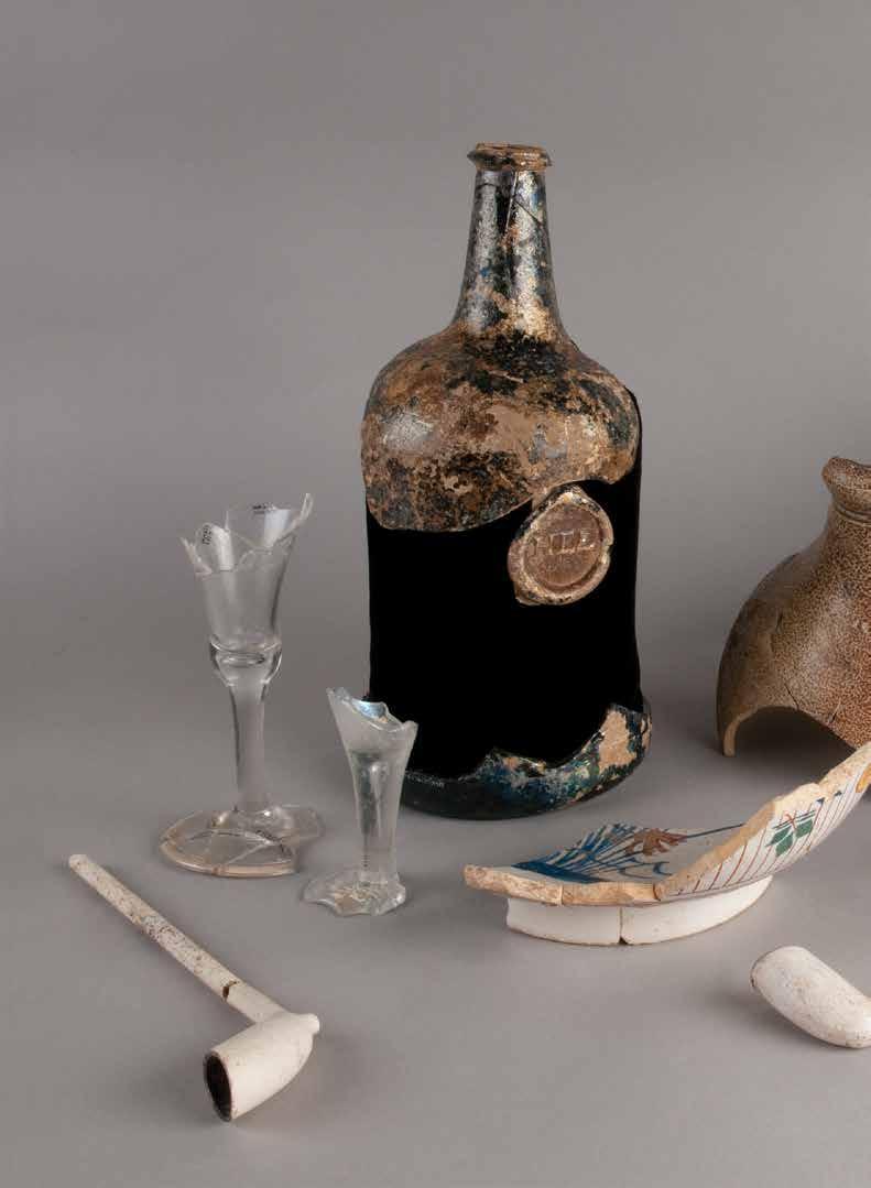
In the preceding weeks, Burns and his students from a Pennsylvania State University field school had recovered tiny Native American glass beads and buttons worn by British settlers from the fire pit and the trench wall. Here in 1755, George Croghan, a colorful trader and Indian negotiator, rallied some 250 people to build an enormous provincial fort that enclosed his bustling trading post.
The dig, now in its fourth season, has yielded artifacts from the fort as well as from prehistoric occupations as old as 8,000 years. “This site is so sweet,” Burns said. “You couldn’t get a better combination of relics: a trading post, a French and Indian War fort, a Native American site. It’s just ridiculous how layered and lucky this is.” Tim Carn, a field school assistant on the dig and a graduate student at Indiana University of Pennsylvania, added, “You can’t dig anywhere and not find an artifact.”
Burns, who grew up just 33 miles away in James Creek, received his bachelor's in archaeology from nearby Penn State, a master’s from Colorado State, and his doctorate from Temple University. It was only when he started studying colonial forts that he learned of Croghan, who emigrated from Ireland in 1741 and who earned the trust of the Native Americans. The Penn family approached him about handling trade and land deals for the colony of Pennsylvania, and consequently Croghan became the premier agent of the British colonies in the frontier zone that was then called the Ohio Country. He was a skillful negotiator with the Indians, trading British tomahawks, scalping knives, and other goods to them in exchange for furs and, in some cases, their allegiance. By the mid 1750s he’d established several prosperous trading posts and forged strong bonds with local Native American tribes by paying fair prices for their goods. In fact, he was so trusted that the Onondaga, one of the six nations of the Iroquois, named him to their council. With his highly successful business, Croghan brought


the mid 18th-century version of globalization to this area. All was going well until he found himself caught in the crossfire of the British and French at the onset of the French and Indian War. The French, upset that Croghan was winning the loyalty of the Native Americans, “knew he was undercutting them and they wanted him dead,” Burns said, adding that, in their attempts to control the Ohio Country, both the French and British used trade and gift-giving to earn the support of the natives. “They put a price on his head. But Croghan always came out with his scalp intact.” He cheated death by retreating west to set up a trading post by Aughwick Creek, a safe location along his trade route. The Mingo Senecas, who numbered about 200 including the warriors’ families, settled on a nearby floodplain that became known as Aughwick Old Town.
From his new location, Croghan supplied Fort Necessity, which was hastily built by George Washington, and he tried to broker the Mingo Seneca’s support. He also scouted for and supplied the ill-fated Braddock Expedition, in which the British General Edward Braddock marched into what is now Pittsburgh in 1755 to claim Fort Duquesne, which was held by the French. The French and their Native American allies crushed the British, killing Braddock in the battle. The governor of Pennsylvania then commissioned Croghan to construct three forts to strengthen the British frontier west of the Susquehanna River, the first being Fort Shirley, on the site of his trading post. (The others were Fort Lyttelton, which was 20 miles to the south, and Fort Granville, 20 miles to the north.)
Croghan built Fort Shirley quickly with the help of about 30 British settlers and some 50 Mingo Seneca warriors. It was highly unusual for Native Americans to assist in the construction of a provincial fort. “Usually they would build a fort to keep the Natives out,” Burns said. But in the case of Fort Shirley “you had British settlers, Natives, and possibly indentured servants all working toward the same goal—to not die a violent death.”
Burns initiated the field school in 2009 to search for the fort’s remains. Historical accounts of its location are vague, as is the roadside marker, which states the fort sat “on the opposite knoll” across the street from the marker. (The marker was made prior to Burns locating the fort.) Artifact collectors armed with metal detectors had found buttons, belt buckles, and musket balls assumed to be associated with the fort on a field by the historic marker. But Burns was hoping to find more precise clues as to the fort’s location before the excavation began.
As luck would have it, he knew that a local engineering
. pa untingdon, h ngineers, e frica John Armstrong’s original survey map showing the location of Fort Shirley. courtesy of a company had a stash of old documents and maps, so members of Burns’s research team asked if the company happened to have any historical documents related to Fort Shirley. The company’s staff rifled through a stack of documents, and to Burns’ amazement, they produced a yellowed and tattered map of the fort and the surrounding area dated Nov. 25, 1761. It was hand-drawn by John Armstrong, a surveyor and officer for the Provincial army who’d used Fort Shirley as his staging point to attack a Native American village in Kittanning, 122 miles away. As Burns compared Armstrong’s map, which was measured in archaic distance units called perches, to modern ones, measured in feet, he realized the old map was drawn to scale and appeared to be accurate. The only thing puzzling him was an almost cartoonish doodle of Fort Shirley. It was out of scale, and the corners of its bastions were unconventionally jagged. At the time, Burns wondered if Armstrong was drunk when he drew it. Noticing that Armstrong had placed the fort icon fall • 2013

An embossed copper Muslim charm and chain recovered at the site.
alongside a bend in a stream that ran through the area, Burns decided to start excavating there. His team immediately unearthed sherds of scratch-blue, salt-glazed pottery, which Burns identified as originating from England during the mid1700s. They also found musket balls from British settlers and copper ornaments worn by Native Americans.
Burns knew he was hot on the trail, but in order to claim he was standing on the site of Fort Shirley, he would have to uncover the palisade—a perimeter that formed the first line of defense. “It is the smoking gun in fort archaeology,” he said. “Artifacts are fine, but people don’t believe you are on the fort until you show physical remains of the fort itself.”
He eventually discovered three dark stains in the soil that looked to be the remains of wooden posts. “It was three bull's-eyes,” he said. Could it be that easy to find the palisade wall? Or was this something more prosaic like a house or shed? He and his team dug along the stained area, chasing it to the end of the field. The line of massive posts, which was over 100-feet long and ramrod straight, led him to conclude it was in fact the remains of the east palisade wall.
The next year they found most of the north and south walls of the palisade, but the west wall proved elusive. Historical references described Fort Shirley as measuring anywhere between 50- to 120-feet square, but Burns and his team realized that wasn’t the case. “Finding the outline is tricky,” Burns said. “Once you think you have it, it starts throwing curve balls.”
They continued to search and eventually uncovered the west wall in a yard beyond the pasture. This discovery revealed that the fort was rectangular and exceptionally large for the era, measuring 134 feet north to south by 165 feet east to west. The bastions had unconventional angles, rather than the symmetrical ones found in most forts. Suddenly Armstrong’s bizarre drawing didn’t seem like the work of an inebriated surveyor, but a reasonable approximation of a fort designed to encompass the extant trading post buildings.
The researchers have identified all four of the palisade walls, and this summer they searched for the southwest corner bastion. Bethany Greene, a Penn State senior, excavated an area containing two palisade postholes and large clumps of rock. “We are trying to find out whether it is the foundation of a building,” Greene said, referring to the rocks. She’s also unearthed tiny lead musket balls, bone flakes, and sherds of prehistoric pottery.
The researchers recovered buttons from the palisade that further confirmed the occupants were provincial settlers and militia rather than regular British soldiers. “The buttons were a mishmash of things, sometimes a flower design,” Burns said. “Military buttons would have had something imperial looking.” They also found glass trade beads worn by the Mingo Senecas and scraps of copper, which were cut into ornaments to adorn clothing.
Historical documents state that the Mingo Senecas built about 20 cabins where they resided on the flood plain away from the fort. But archaeological evidence suggests the Native Americans mingled with settlers within the fort during the day. “They had free reign of the fort to come and go as they pleased,” Burns said. This fall, he and a handful of graduate students and volunteers will begin digging for a


Penn State student Taylor Helsel excavates a section of the palisade postmolds last summer.
few weeks on the flood plain to try to find evidence of the cabins’ remains.
One of the most intriguing finds in Fort Shirley was a Muslim charm the size of a fingernail. A historian suggested to Burns the trinket may have been worn by an indentured servant from the Caribbean or Africa who worked for Croghan and helped construct the palisade.
Andy Stout, the Eastern Regional Director of The Archaeological Conservancy, called Burns’ discoveries “fantastic. They are finding most of the palisade wall. Archaeologists live for that kind of stuff. It really helped that the land wasn’t tilled.”
Though it was often called Croghan’s Fort, the settlement was later officially named Fort Shirley in honor of Pennsylvania Governor William Shirley. Croghan, always the entrepreneur, eventually started selling off tracts of the land, earning him an admonishment from government officials, who told him he did not have the authority to subdivide public property.
Croghan in turn wrote a letter complaining that he was not getting paid and was feeding the large Mingo Seneca community out of his own pocket. Though he had received a captain’s commission, he left Fort Shirley in March of 1756, taking a new job with William Johnson, the British superintendent of Indian affairs. As the Indian agent deputy, Croghan brokered military support and land deals between the Iroquois nation and the provincial government. “He was used to making money, not doling out money,” Burns said. “He complained the Indians were eating him out of house and home. He got a better offer.”
The close-knit relationship between the settlers and the natives dissipated as soon as Croghan left. His replacement, a man named Hugh Mercer, created a much more militaristic and structured life at the fort. The Mingo Senecas were the first to depart. Many of Croghan’s men left, too, including some who had married Mingo Seneca women. The fort, which was never attacked, was decommissioned in the fall of 1756. Croghan left the community both revered and reviled. “Some people say he was a great patriot,” Burns said. “Other people say he was the most selfish, egotistical, land-hungry guy around. He was probably both.”
As Burns unearthed evidence of the world that Croghan created, he thought about the days when this land was the British empire’s bustling western frontier. He also tried to imagine the world set in motion by Croghan. “A universe of activity followed this guy around. Croghan was the glue that held the fort together.”

InvestIgatIng another Croghan Fort
Jonathan Burns often hears from people who dig up an arrowhead or some other trinket in their backyards. Such finds are rarely significant. But one day Dixie and George Heacock found half of a small cannon (or swivel gun) in their backyard when their lawn was dug up to lay down electrical wire. And their property bordered the Fort Lyttelton site, a French and Indian War post purchased by The Archaeological Conservancy in 2005. Dixie asked Burns, a Pennsylvania archaeologist she found on the Internet, to take a look. Intrigued, Burns drove about an hour south from his home in James Creek to Fort Littleton, a town named for the outpost that stood there from 1755 to 1764. When he saw the castiron cannon with its barrel side rusted but remarkably intact, he gasped. “It was the most spectacular thing that had ever been brought to my attention,” he said. “These canons are pretty rare. They didn’t typically throw them away unless they failed or broke.” Two years after that chance phone call, Burns and eight students from a Juniata College field school descended on Heacock’s backyard to do preliminary survey work and shovel tests. They looked for evidence of structures such as a blacksmith shop, a stockade or other fort structures, as well as evidence of a Cherokee The barrel end of the cannon. encampment that once stood nearby. Fort Lyttelton was the second fort built by George Croghan, a British trader and Indian negotiator, who also led the construction of forts Shirley and Granville. After the fall of Granville and the decommissioning of Shirley in1756, Fort Lyttelton became the provincial government’s only post west of the Susquehanna River. In 1756, an expedition led by John Armstrong returned to the fort after the raid on Kittanning, and in 1758, troops from Lyttelton joined General John Forbes’ expedition to Fort Duquesne and helped retake it from the French. (Fort Pitt was constructed beside Fort Duquesne and is located in what is now Pittsburgh.) Almost 250 years later, the Conservancy bought a four-acre parcel of land from the Duvall family after a historian identified it as the site of Fort Lyttelton. Burns, who has spent the past four summers excavating Fort Shirley, wants to compare and contrast the two outposts. While Shirley was rectangular and large, Lyttelton reportedly followed the Royal British blueprint of 100 feet by 100 feet. But there are many similarities: Students Colin Gallen and Claire Lewis locate a postmold at the Fort Lyttelton site. “They were both built by Croghan, and there are Native American elements to both sites.” —Cristina Rouvalis

