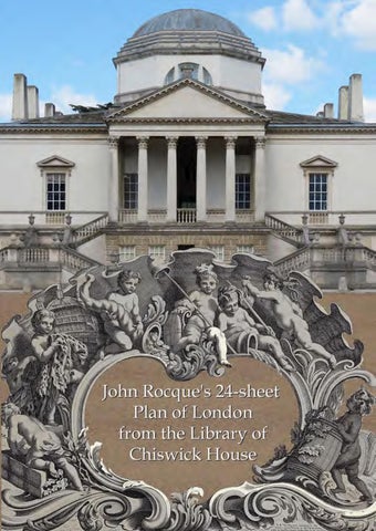
Back cover illustration: John Donowell: Chiswick House from the Road, detail
____________________________________________________________________ Altea Gallery Limited 35 Saint George Street London W1S 2FN Tel: + 44 (0)20 7491 0010 info@alteagallery.com www.alteagallery.com Company Registration No. 7952137
Terms and Conditions: Each item is in good condition unless otherwise noted in the description, allowing for the usual minor imperfections. Measurements are expressed in millimeters and are taken to the plate-mark unless stated, height by width. (100 mm = approx. 4 inches) All items are offered subject to prior sale; orders are dealt with in order of receipt. Prices are quoted in UK Pound Sterling £/GBP). Sales tax (VAT) is included where applicable.
Opening Times Weekdays: 10am - 6pm Saturday: 10am - 4pm Catalogue Compiled by Massimo De Martini and Miles Baynton-Williams Photography by Louie Fasciolo
antiquemaps
Published by Altea Gallery Ltd Copyright © Altea Gallery Ltd 2023
antiquemaps alteagallery
53,000+ followers
John Rocque's 24-sheet plan of London from the library of Chiswick House Dear Customer We are pleased to offer an early example of Rocque's landmark map of London, with the extra 'Contracted Scetch' index map and the separately-issued street index, which also includes a 'Preface' (Rocque's description of his map) and a list of subscribers. This book comes from the library of Chiswick House in West London, with a bookplate of the Dukes of Devonshire featuring a nowed snake underneath a coronet. When the map was rebound, in a library binding with the dukes' emblem (a coronet & 'D') giltstamped on the spine (and, carelessly, the title ''Pine's Views of London''), the rare index was bound at the rear, each leaf mounted on a guard, in order to keep the two publications together. Rarely do examples with such a fine provenance come on the market.
Massimo De Martini
The Plan
Composite image of the 24 separate sheets
A Plan of the Cities of London and Westminster and Borough of Southwark, with the Contiguous Buildings, From an actual Survey taken by John Rocque, Land-Surveyor. [with] An Alphabetical Index of the Streets, Squares, Lanes, Alleys & c. Contained in the Plan... London: John Pine and John Tinney, 1746. Large folio, 18th century calf rebacked with 19th century library red morocco gilt, bookplate of Chiswick House on front pastedown; index map, 24 double-page maps. [&] London John Pine & John Tinney, 1747. Quarto, pp. xii + 47. HOWGEGO: 96, unrecorded state between 1 & 2 of 5, with Chesterfield House named but Hill Street lacking. S/N: 21700
Rocque's plan was the largest up to that time, at 26 inches to a mile, covering from New River Head, Limehouse, Walworth to Knightsbridge and Chelsea Waterworks. He used his experience as an estate-surveyor to introduce different hachuring to denote the usage of land, including pasture, formal gardens and orchards. The detail is such that the Index fills 46 pages, even including 'Alleys', 'Ditches' and 'Holes'.
John Rocque (c.1704-62) Jean Rocque was born in a Huguenot family about the time they were forced into exile in Geneva by the anti-Protestant fervour of Louis XIV. The first evidence that he had come to England is the record of him becoming godfather to the son of the engraver François Vivares in 1728. He started working with his brother, Bartholomew, as a landscape gardener, but in 1734 he published his first survey, a plan of the Royal Residence at Kew. Other commissions of estate plans followed, including Kensington Place and Windsor Park, but Rocque began greater projects, both large scale county maps and urban surveying, publishing a plan of Constantinople in 1742 and Bristol in 1743. At the same time he had begun his maps of 10 Miles round London and this 24-sheet map of the city. His business was successful enough for it to survive the destruction of his premises in a fire in November 1750, fortunately not where his copper plates were stored. He had been appointed Chorographer to Frederick, Prince of Wales, son of George II, who died unfortunately young. Frederick's son George replaced him, keeping Rocque as Chorographer; in 1760, when the prince became George III, Rocque became Chorographer to the King. In 1762 Rocque died childless and his business passed to his widow Mary Ann, who continued it, assisted by Andrew Dury. However in 1771 his copper plates were auctioned off, many purchased by Robert Sayer.
A portrait of John Rocque? A richly-dressed surveyor on Rocque's map of Middlesex
The Story of the Plan London had already been the subject of at least three large-scale printed maps:
The Hanseatic League's survey of c.1560, now lost but the source of the Braun & Hogenberg plan The so-called 'Agas Map' woodblock of the late 16th century, three copies known. The John Ogilby-William Morgan of 1676
Since then, despite huge growth, no one had attempted a new large-scale map. While William Maitland was preparing his 'History of London (eventually published in 1739) he was intending to produce an accompanying survey but was dissuaded by the expense. At the same time a large-scale map of Paris was being prepared under the auspices of Parisian mayor Michel-Étienne Turgot, published in 1739. In the Preface of his Index Rocque discussed the rivalry of London and Paris for the crown of largest city in the world, adding: If exact Plans had been made and preserved of all the great Cities in the World, the Disputes concerning their different Magnitudes might soon have been determined. Together with engravers and publishers John Pine and John Tinney, the project began in March 1737, with the commencement of both surveying and fundraising. To finance his map Rocque turned to the subscription model, using his extensive contacts. A list of printed in the 'Alphabetical Index' names 396 subscribers who ordered 430 plans, including: • •
•
• •
Frederick, Prince of Wales (one of Rocque's patrons) and his brother William ('Butcher Cumberland') 19 Dukes, including the 3rd Duke of Devonshire (father of William, who inherited Chiswick House), the Duke of Newcastle (who ordered three copies) and the Duke of Montague (five!) 33 Earls, including the Earl of Burlington, who bought two copies, presumably one for Burlington House, his town house on Piccadilly (now the Royal Academy) and one for Chiswick House Notable figures including General James Oglethorpe (founder of the Province of Georgia), Sir Hans Sloane and Horace Walpole Public offices including the Treasury, Admiralty, Excise Office, the General Post Office (three copies) and the Hand in Hand Fire Office (founded 1696 in Tom's Coffee House).
Also in the Index is transcribed a proclamation by Micajah Perry, Lord Major of London 1738-9, in support of the project. Nine years later the plan was ready for publication.
I,
_,_,....__, ,.,_.. ,._,_._-v-rT::-tf"'P1rv I
AN oF T I J'S of
£STMINSTER,
e_lJ G II of
WARK; the B U l iJDINGS; ' ';lakcn byJous R ocQUE,
graved by J ou' p,,. E ·anl ~•t.t\nu.s.tmt/Chicf
of Sc:tls,stc. Jtf4}~:STY.
..
Chiswick House
James Donowell: The west front of Chiswick House, 1753
There has been a mansion of the site of Chiswick House in West London since the early 17th century, but it was after the estate was inherited by Richard Boyle, the 3rd Earl of Burlington, that the building that housed this map was created. Despite Boyle (1694-1753) being a Privy Councillor, he was more interested in architecture: having undertaken three Grand Tours he became obsessed with Palladian architecture, introducing it to England for the first time. His career in architecture began with his own property, starting with his neo-Palladian Burlington House in Piccadilly. He then turned to his country estate, Chiswick House, building another neo-palladian house next to the Jacobean building, between 1525 and 1729. He continued to live in the old building and used the new to house his art collection and entertaining his guests, who included Alexander Pope, John Gay and Jonathan Swift. The new house was not to everyone's satisfaction: Lord Hervey described it as being too small to live in, but too large to hang on a watch chain. The house continued to be a society hub under the Dukes of Devonshire until the end of the 19th century, after which it fell into disrepair. Under the car of English Heritage it has been restored to its former glories.
Chiswick House Timeline c.1610 1624 1682 1704 1725 1725-9 1736 1753 1753 1754 1758 1774 1778 1806 1827 1860s 1870s 1892 1929 1944 1948 2010
Original Jacobean house built, recorded as having 33 fireplaces Bought by Robert Carr, 1st Earl of Somerset Bought by Charles Boyle, 3rd Viscount Dungarvan Inherited by Boyle's grandson Richard, 3rd Earl of Burlington & 4th Earl of Cork Jacobean house damaged by fire Burlington designs and builds his neo-Palladian villa on an adjacent site John Rocque is commissioned by the Earl to survey Chiswick House Gardens Engravings of Chiswick House after John Donowell published The Earl dies, passing the estate to his wife, Lady Burlington Her heir, daughter Charlotte, wife of the 4th Duke of Devonshire, dies The estate passes to the Duke of Devonshire The 5th Duke marries Georgiana Spencer, who calls Chiswick her 'earthly paradise' The Jacobean house was demolished Foreign Secretary Charles James Fox dies in the house Prime Minister George Canning dies in the same room The 8th Duke of Devonshire moves the contents to Chatsworth House Rented to Edward, Prince of Wales House becomes Chiswick Asylum, a private mental hospital House sold to Middlesex County Council The building, being used as a wartime fire station, damaged by a V2 rocket A campaign prevents the building being demolished, and ownership passes to the Ministry of Works, then English Heritage A major renovation project is completed
Chiswick House, 2023