THE CITY GATEWAY
MASTER PLAN STUDIO
Monsoon 2022
Akanksha S Rao | PUD21023 CEPT University
MASTER PLAN STUDIO
Monsoon 2022
Akanksha S Rao | PUD21023 CEPT University
Studio : UD4001 Master Plan
Studio (Unit 1)
Studio Mentor : Brijesh Bhatha
Studio Tutor : Vanishree Herlerkar
Teaching Associate : Jugal Bhatt
The studio focuses on the master planning and design of single-ownership large Greenfield developments/ cleared brownfield development with a key emphasis on the design of livable neighborhoods.
In the past few years, there has been increasing attention to redeveloping vacant and inefficiently used public land within cities to add much-needed housing, amenities, and an accessible and inclusive public realm.
The studio unit makes a case for opening up part of the under-utilized defence land along the Sabarmati River in Ahmedabad for redevelopment. This is aligned to the new National Defence Land Policy currently under consideration that encourages the development of surplus defence lands outside Cantonments for public infrastructure and improvements.
The strategic location of the Ahmedabad Cantonment site close to the airport and abutting the riverfront phase 2 provides a unique opportunity to imagine future waterfront developments and to trigger further investments in the area.
Regional
Site
How
Why
Key
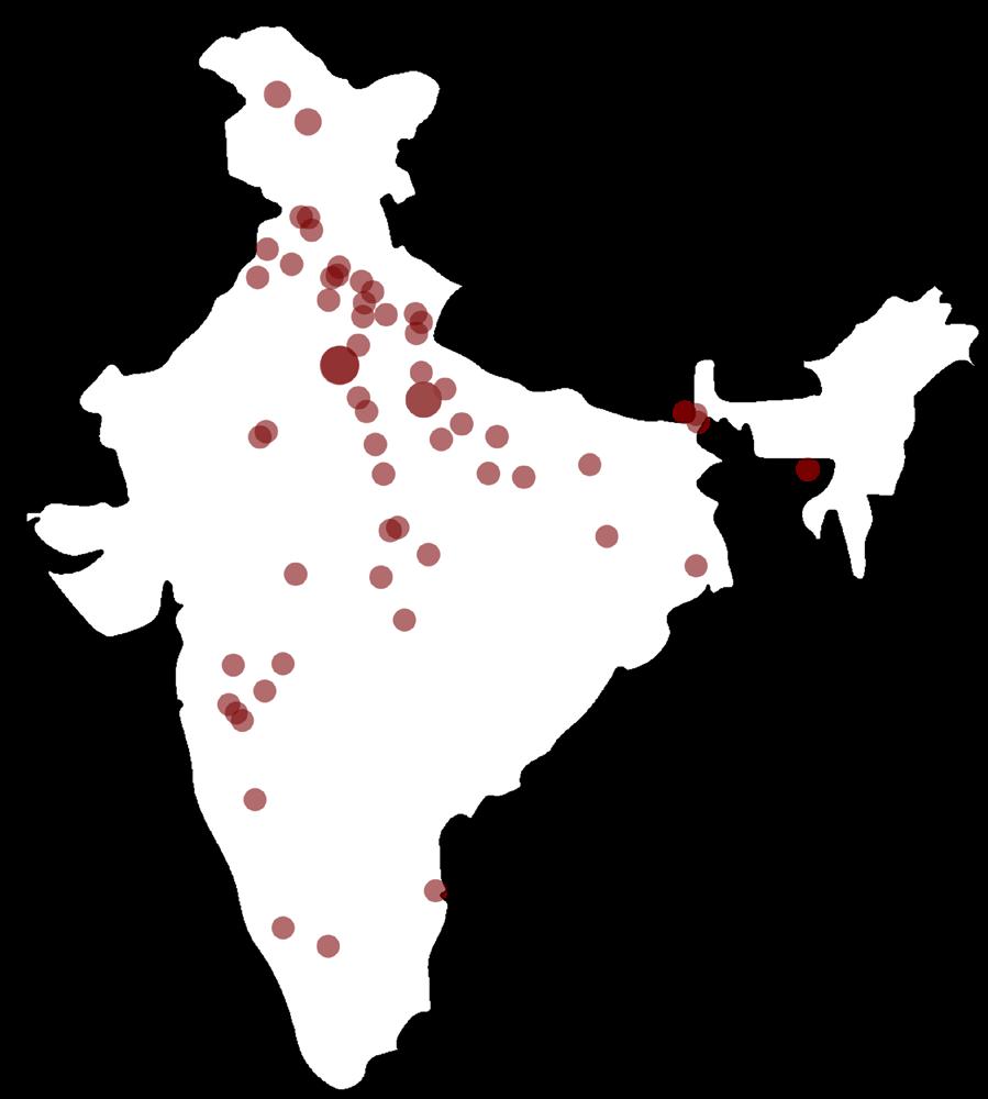
The ‘Ministry of Defence’ is the largest landowner in India - controls 17.57 lakh acres of land. These properties are used by the Indian Army, Air Force, Navy, central & state government bodies and other associated organisations to carry out several operations and activities such as training, ranges, depots, airfields, quartering, camping, offices and miscellaneous military activities. This comprises the cantonment areas of the various cities, which were majorly established before independence by the Britishers.
Over the years, several irregularities have been observed in the management of defence land— inconsistent data, poor utilisation, commercial exploitation, encroachment, poor maintenance and abandoned land are a few to mention. This necessitated collection of comprehensive data to ensure optimum utilisation of the vast parcels of unused defence land.
The anomalies found in management of the defence land can be minimised by using these lands towards public project development, thereby boosting infrastructural development in the country, along with monetising the defence land and modernising the Indian defence sector.
In 2021, Government of India approved a new defence land policy - after almost 250 years - that will significantly change the way defence land is managed at present. The new policy encourages development and use of defence - owned land and cantonment zones as opposed to the earlier restrictions.
Implementation of the new rules would allow the armed services to create equal value infrastructure (EVI) in exchange for allowing use of properties for public projects or other non-military purposes. The underutilized defence land can be used for construction of key public projects such as metros, roads, railways, flyovers and others.
Besides the defence land policy, the Indian government is also focusing on finalising the Cantonment Bill 2020 to carry out further developments in the cantonment zones.
As the policy goes into execution, the underutilized land offers an opportunity to create new housing stock and provide social and recreational public amenities for the city. New development models will emerge in the next few years to manage these transformations.
62 Notified Cantonments
17.57 Lac Acres
Total Defence Land
1.63 Lac Acres
Cantonment Land
15.95
Outside Cantonment Land
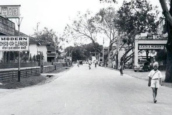
Earlier, cantonments and military stations were built outside cities to keep the locals out and provide a safe place for British to live.
However, with growing urbanisation and expanding city areas, most of these military stations are now located in the heart of cities such as Ahmedabad, Delhi, Mumbai, Pune, Kolkata, Ambala and others. Cantonments have become small islands inside larger adjoining cities which have grown on all sides.
The Ahmedabad cantonment is situated between Ahmedabad and capital city of Gandhinagar on NorthEastern corner.
It was established in the year 1833. It serves as a military base and residential establishment. The Cantonment maintains its own infrastructure of water supply, roads, building and sewerage system in Cantonment area. This is a class II category Cantonment Board. Cantonment has historical buildings such as Camp Hanuman Temple, St. George’s Church, Ahmedabad Gymkhana.
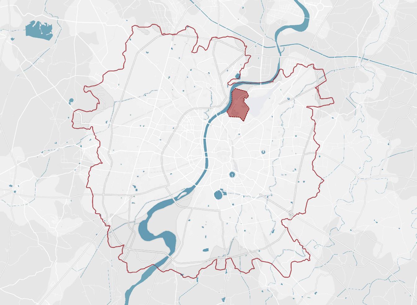
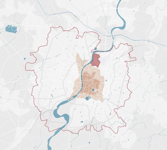
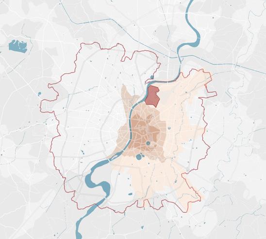
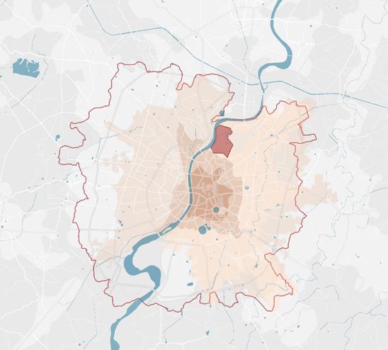
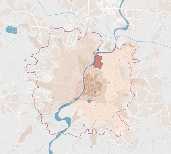
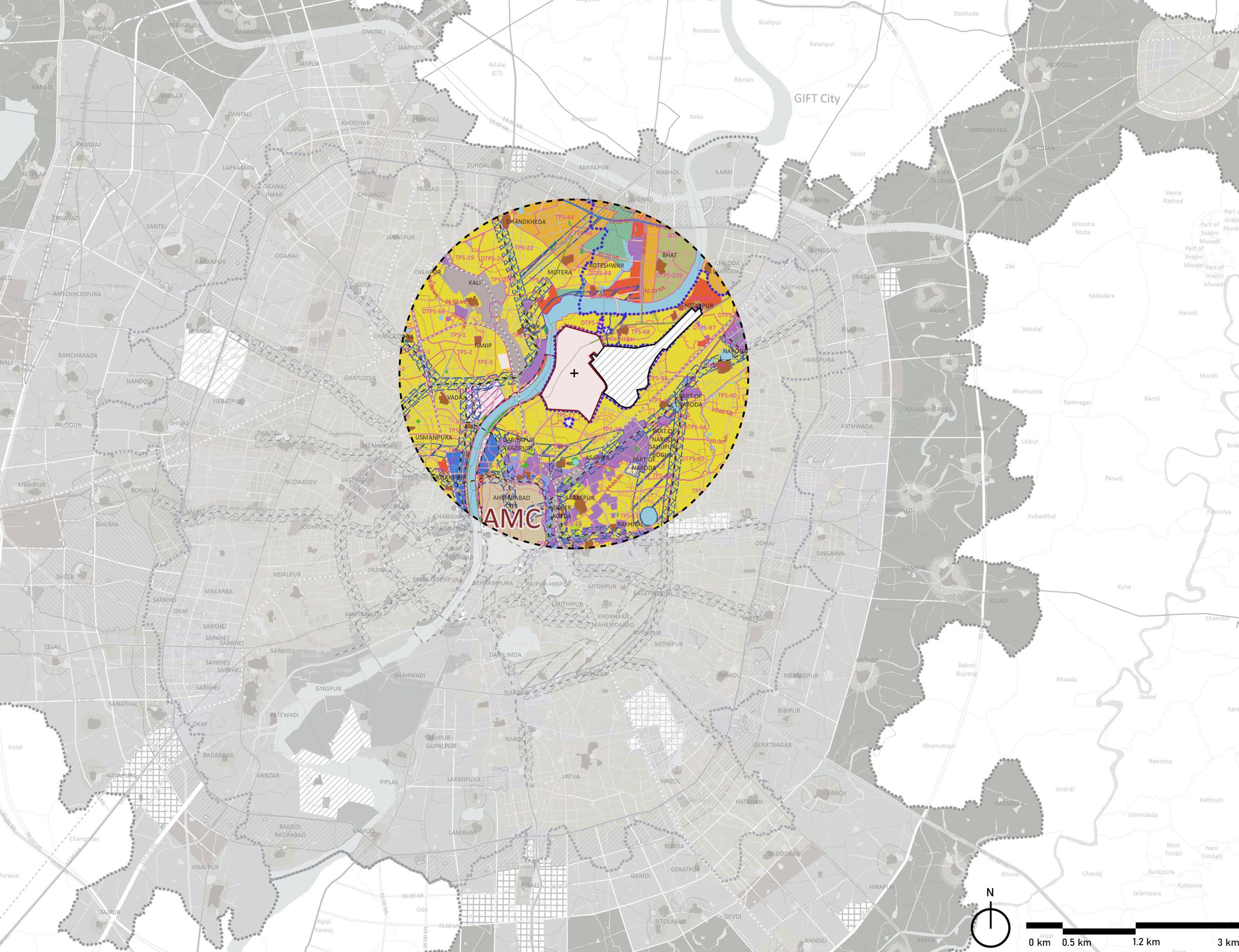
Despite the locational advantage and higher land values, the cantonment remains a void in the Development Plan of Ahmedabad due to the earlier restrictions on defence land.
The strategic location of the Ahmedabad Cantonment site close to the airport and abutting the riverfront phase 2 provides a unique opportunity to imagine future waterfront developments and to trigger further investments in the area.
Delayering Defence Land
The defence land is classified into various subcategories based on the use, ownership and the restrictions. As per provisional figure of 2011 census the population of Ahmedabad Cantonment is 14,345. This is a class II category cantonment.
Classification Land description Managed by
A1 In active occupation of the Forces and allied services
Local Military Authorities of the Service concerned
B1 Land owned by the Ministry but in occupation of any other Ministry of the Central Government The Ministry concerned in occupation of land
B2 Land owned by the Ministry but under the control of the State Government State Government concerned in occupation of land.
B3 Land held by private persons with proprietary rights reserved to Central Government Defence Estates Officer C Land vested in a Cantonment Board for Municipal or other public purposes
Board
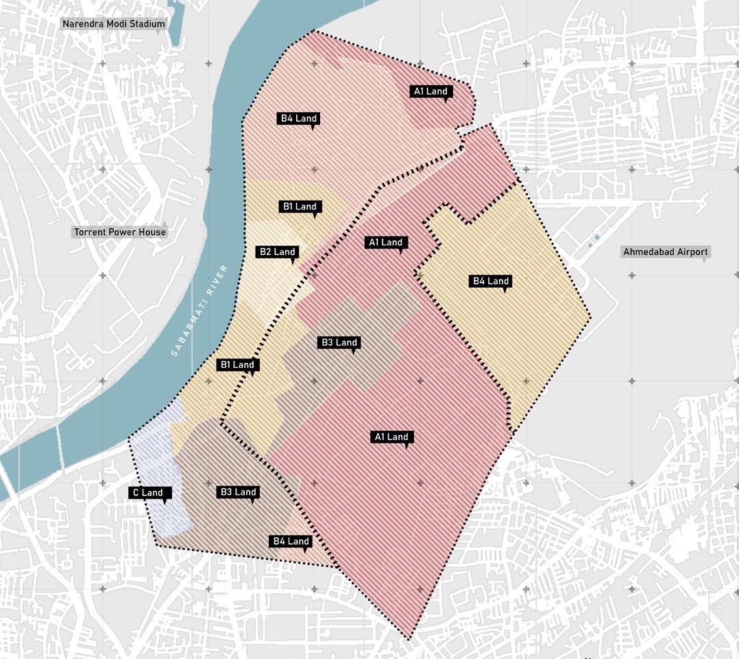
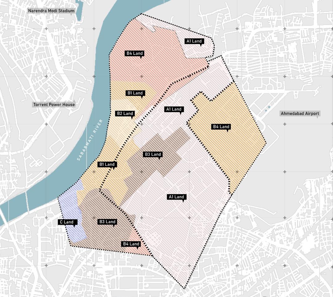
As per the policy, land other than A1 is available for redevelopment which accounts for around 53% land is Ahmedabad cantonment.
With availability of such large unused areas, it is imperative to monetise and develop these regions to serve both the defence and general public requirements.


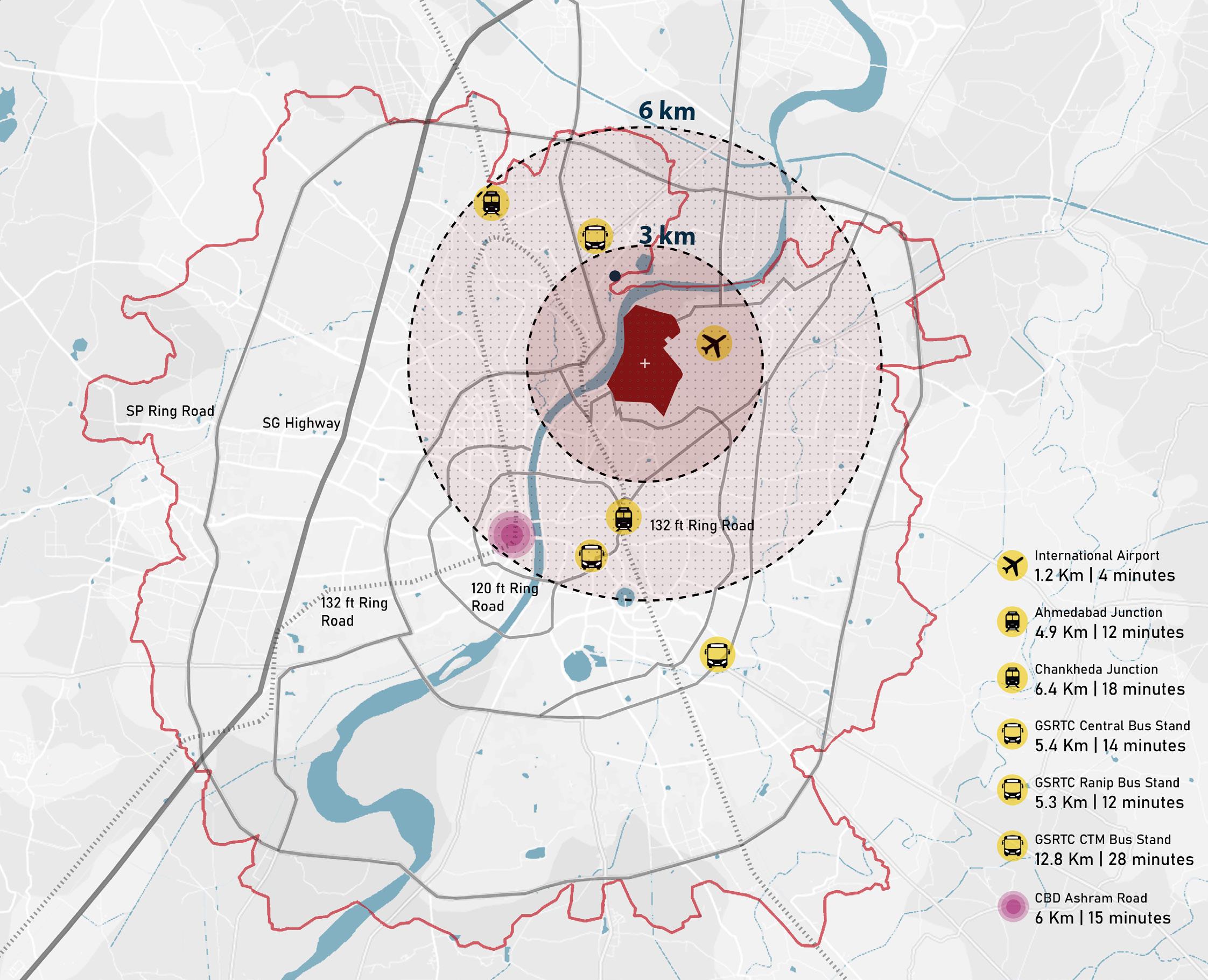
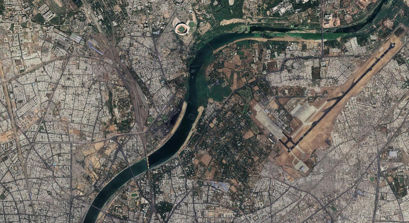
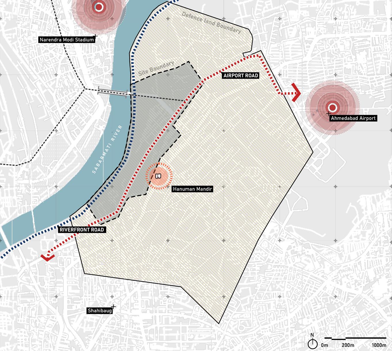
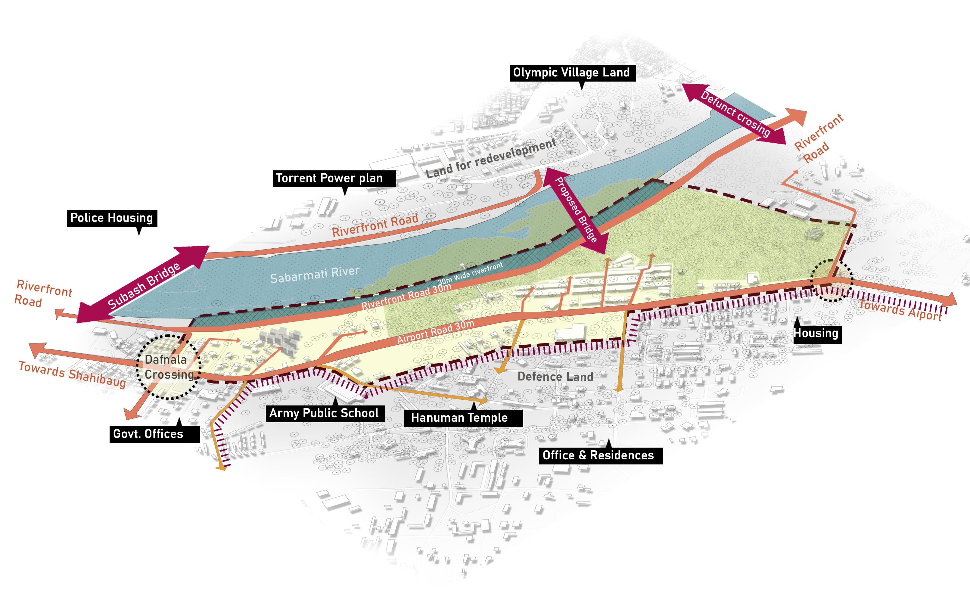
Covering 0.95 sq km (230 acres), the given site is located in east Ahmedabad along the Sabarmati river. It directly abuts the riverfront phase 2 development and will be directly benefited from the proposed development. The site is situated just 2km away from the airport and around 6km from Ashram road making it extremely well-connected to the rest of the city.
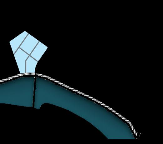
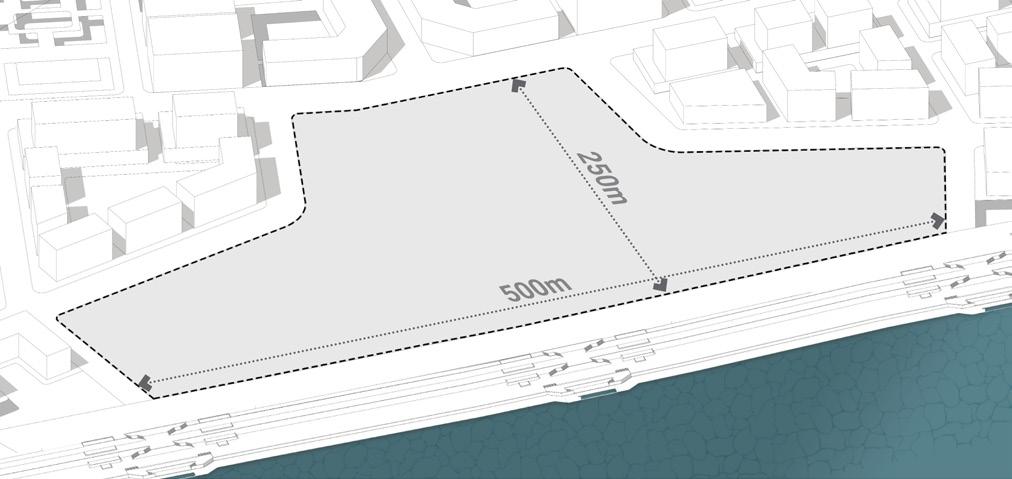
The site is located in the Shahibaug area of east Ahmedabad, along the Sabarmati river. The site is linear and compact with 1.6km of abutting riverfront edge.
Site area : 0.95 sqkm
Distance from Airport : 2 km
Landmark : Cantonment Airport
Dafnala Junction
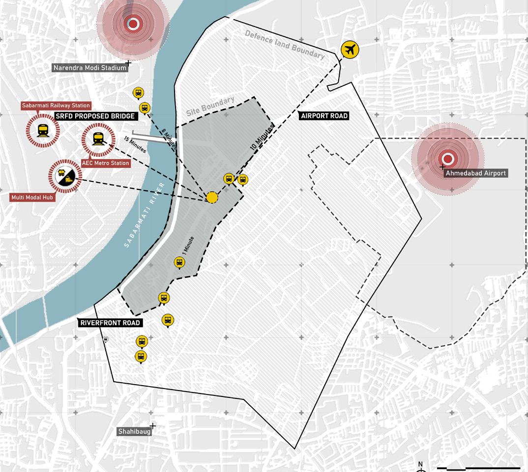
The site is quite well-knit into the city street network. It is also in close proximity to significant city - level infrastructure including the upcoming metro, multi - modal hub and the airport and railway station, thereby making the site highly accessible and valuable. The area is well-served by the AMTS bus route which passes through the site.
With the proposed SRFD bridge, the west to east Ahmedabad connection will also become very convenient and will make the site even more accessible, thus magnifying its development potential.
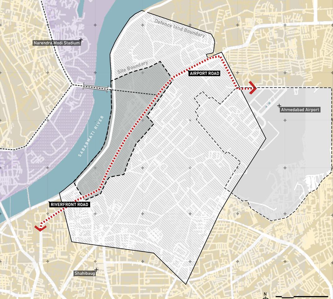
The land around the site and cantonment is predominantly under residential use. Across the river, the hitherto industrial use land under Torrent Power is also in the pipeline for redevelopment. The proposed development will benefit from the well-connected transit infrastructure along with the neighboring residential areas.
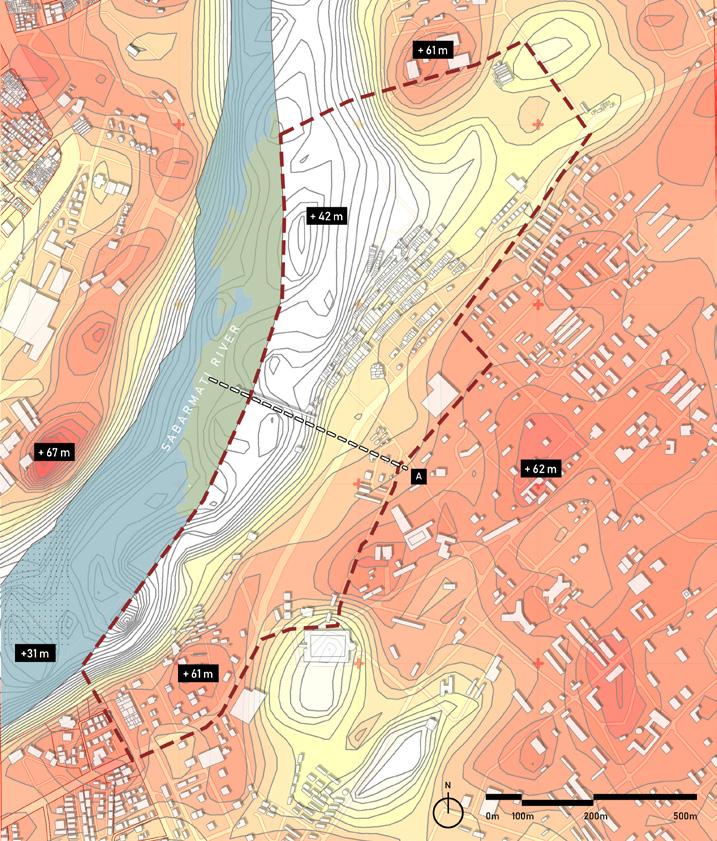
Topographical analysis shows the highest and lowest points are +61m and +42m in the south and north sides respectively.
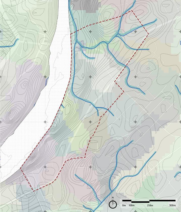
The watershed streams are concentrated in the northern part of the site indicating possible locations of catchment areas.



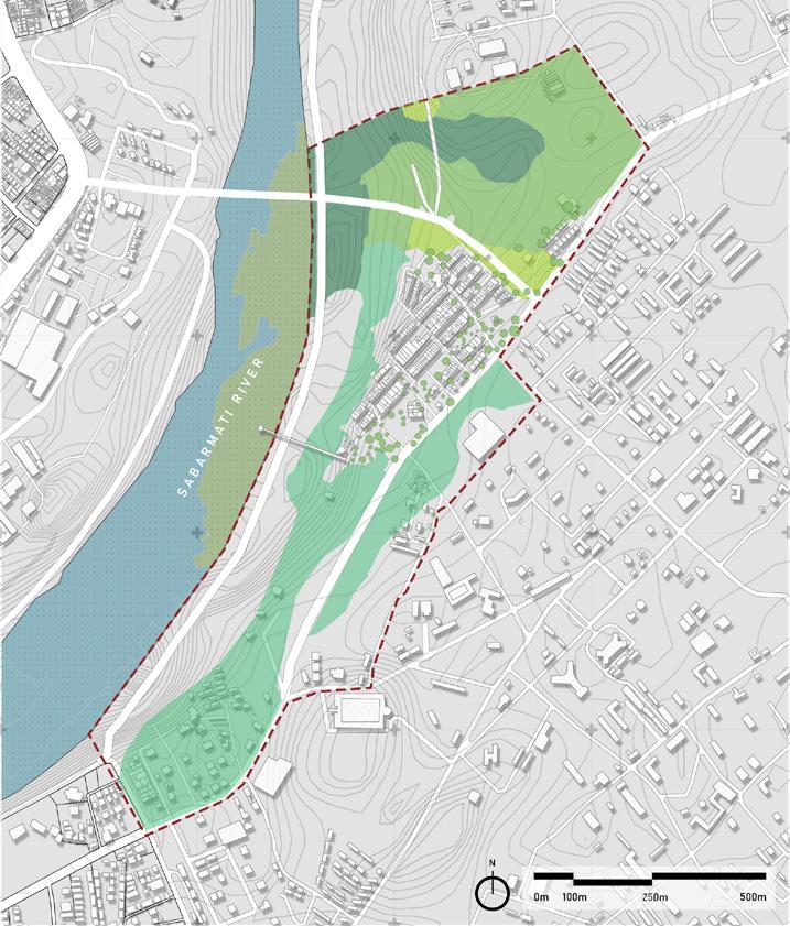
43% of the site is filled with wild vegetation (invasive shrubs) in the form of open forests.
The site will abut the Sabarmati Riverfront Phase 2 currently under development. 1.6 KM length of the site will be integrated with the riverfront.
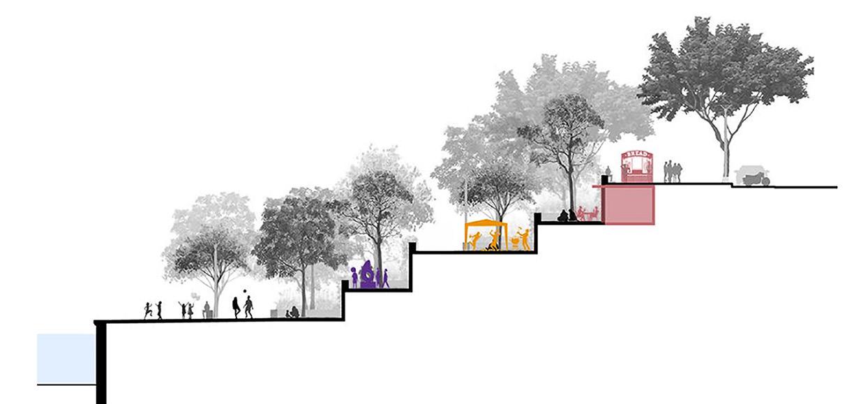
The proposed section is designed as three - stepped levelo ghats with various activity modules such as art, pavilions, eateries, play areas, public amenities, etc - integrated along the stretch.
As part of this riverfront development, the land uptil the nearest road - airport road - will be leveled. This implies that the site will be considered flat and leveled.
Few public housings, commercial setups and a low income settlement are the predominant built forms on site. Parts of the defense land have been leased out to banks, cyber crime cells, and other government housings.
There are a lot of wild shrubs - Prosopis juliflora - across the site. These are not ecologically significant and in fact have made some parts of the site inaccessible.
The government housing colonies such as police and PWD quarters are in a dilapidated condition and are in dire need of redevelopment. At present there are around 200 units with around 1000 people living here. These units will be accommodated in the newly proposed residential areas.
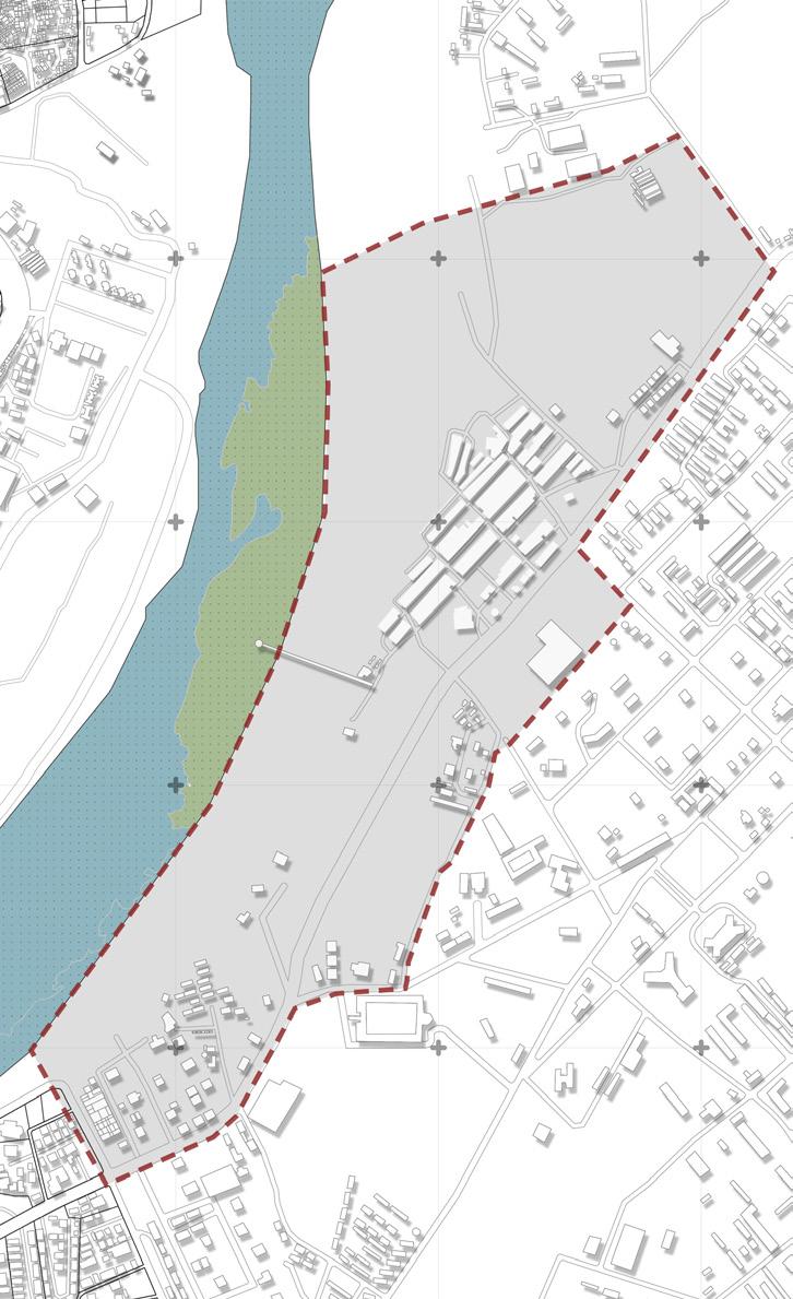
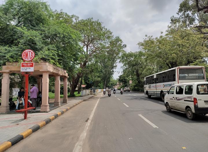
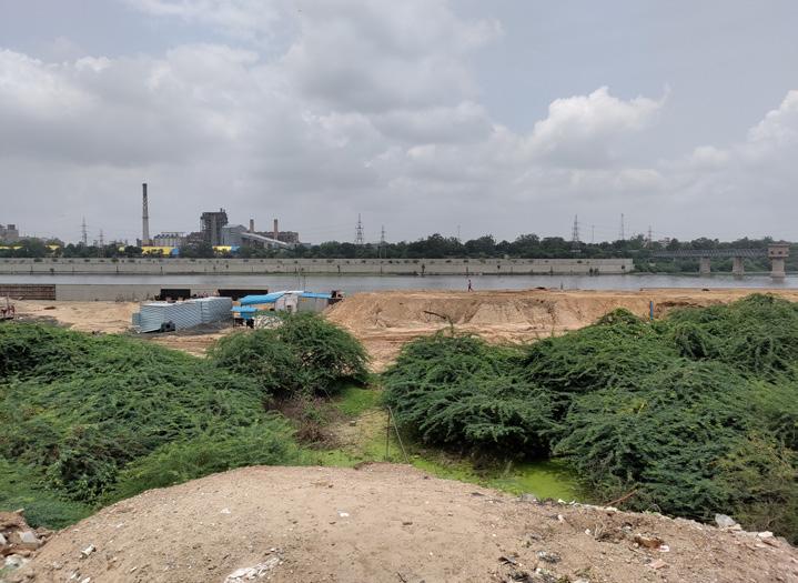
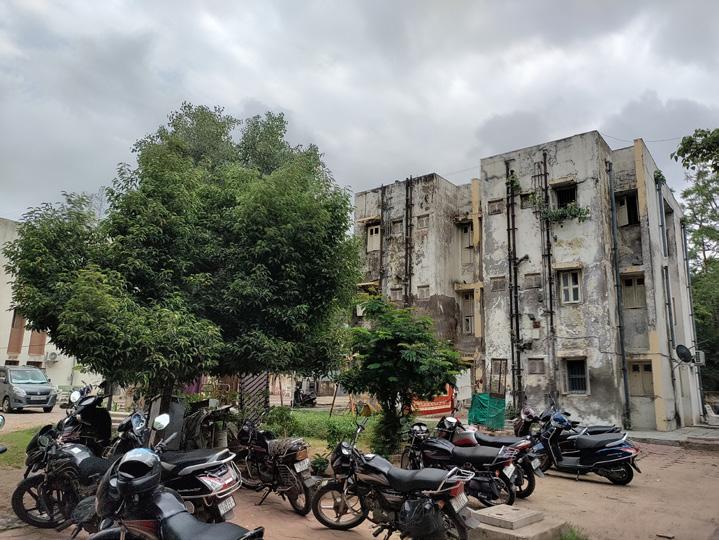
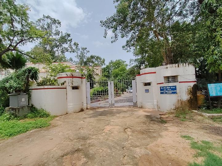
• Longer side of the site is along the riverfront edge
• Proposed bridge connecting east-west passes through the site
• Airport road and riverfront road are major thoroughfares
• Underutilized defence land is unlocked for development
• Linear and narrow site
• Height restrictions due to proximity to the airport
• Cantonment land acting as a barrier due to continuous compound wall
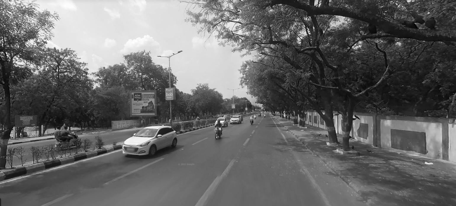
The airport road experience
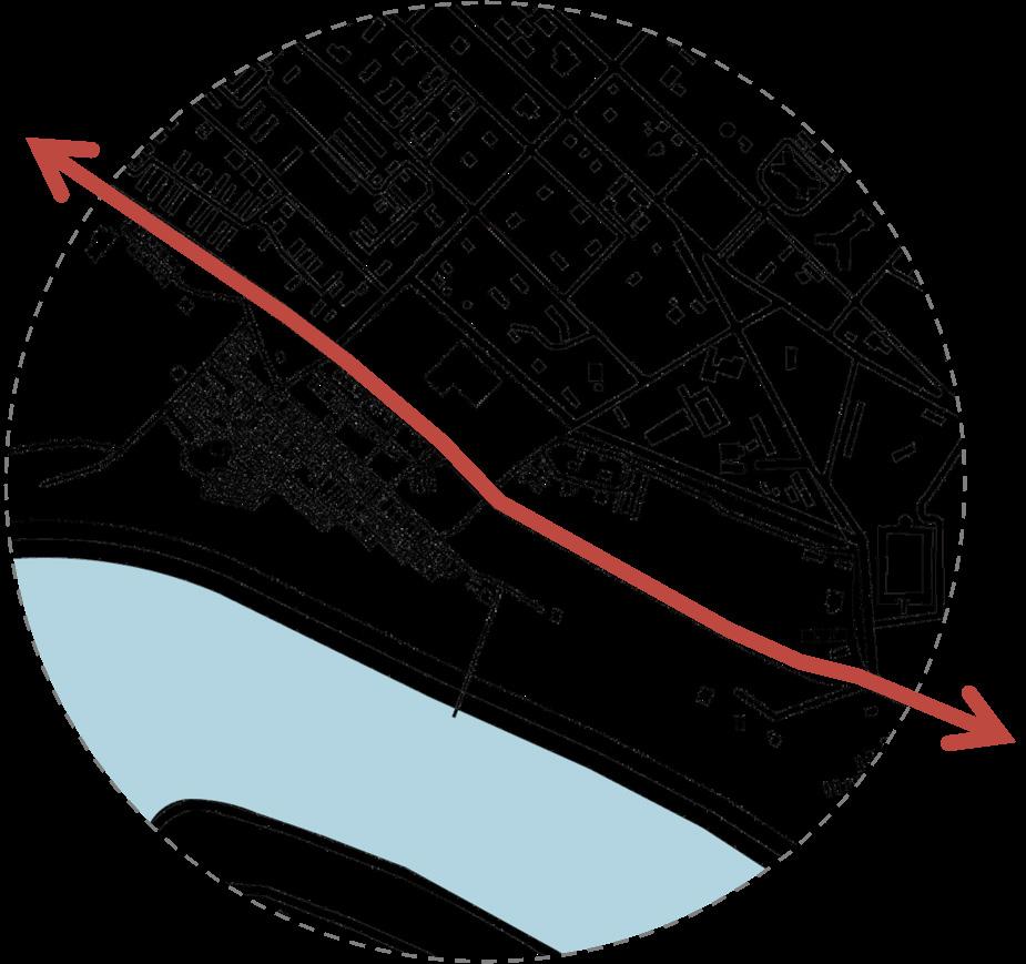
The existing airport road is used as a thoroughfare – people just pass through it with no significant experience attached to it
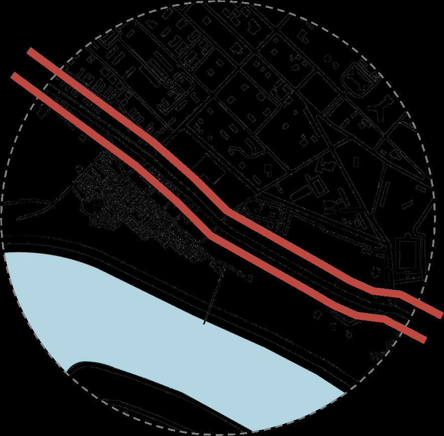
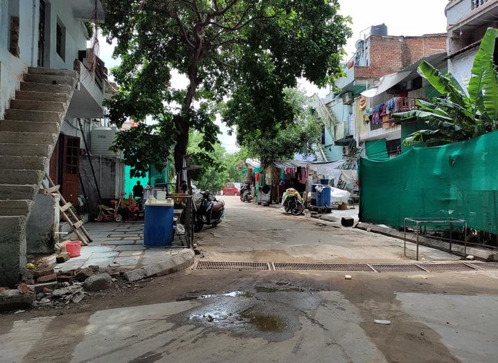
The street edges are opaque and inactive due to cantonment security
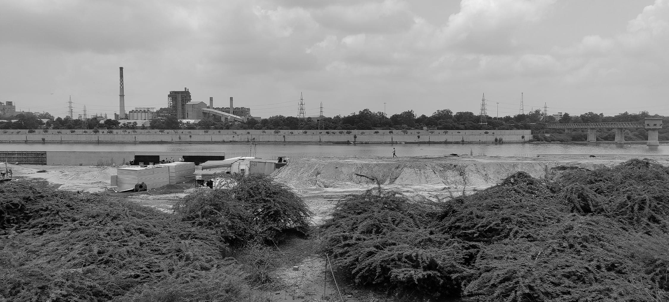
The riverfront experience
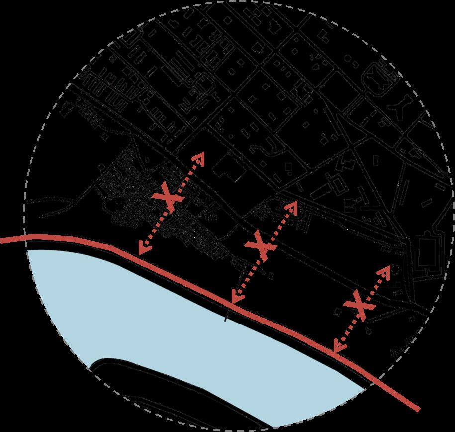
There is a disconnect between the riverfront and the surrounding areas
Proximity to the airport and the abutting airport road is leveraged as this is the first experience for people entering the city and is a key city connection.
Creating unique but varied experiences as people move through this arterial street which would add to the imageability and legibility of the place.
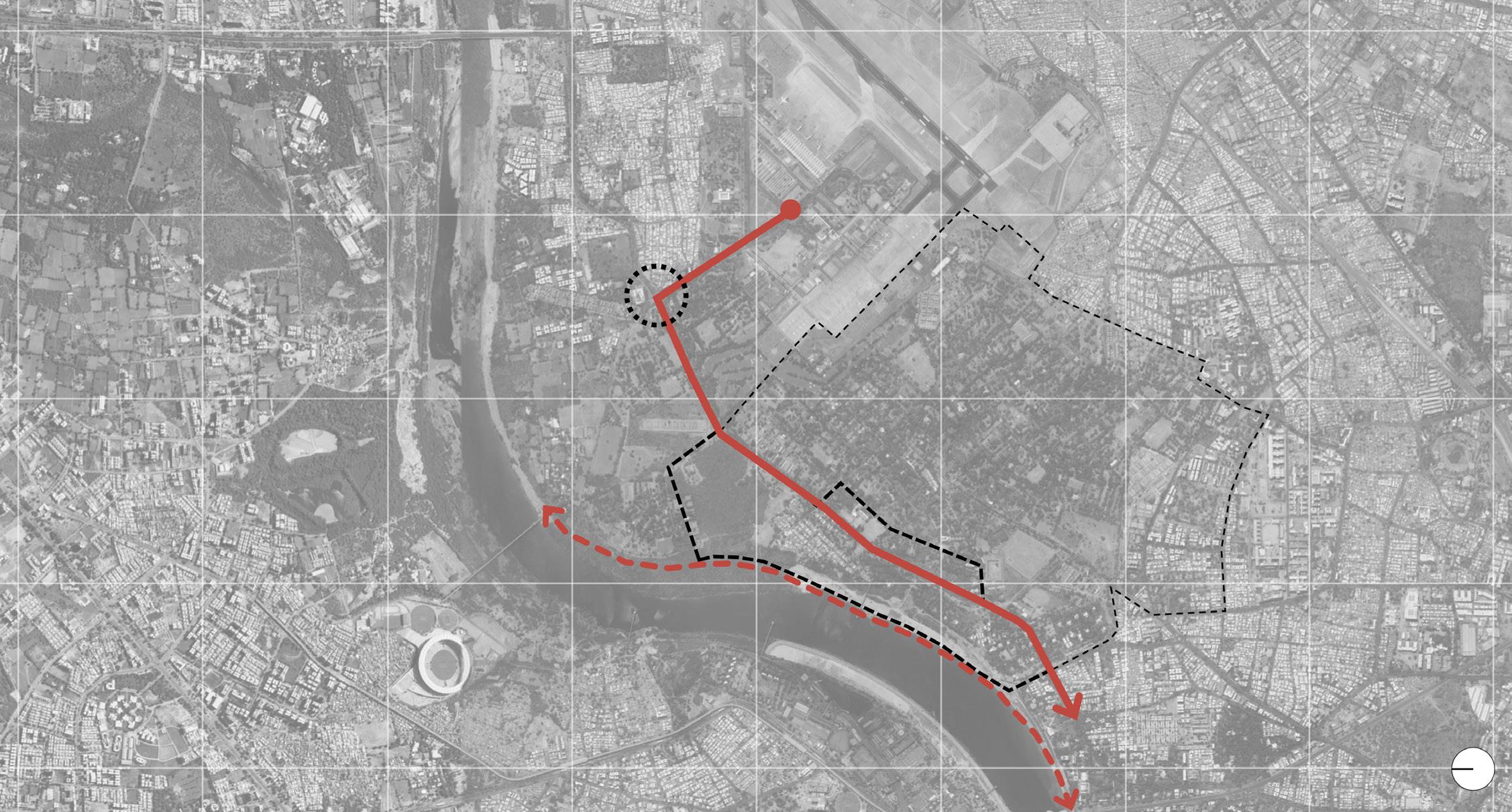
With the new defence policy in place, the entire cantonment will be redeveloped. This incremental and eventual process provides the opportunity to connect this site to the larger city – level connection (Naroda Road).
This would allow the site to capture increased footfall and become a nodal point at the intersection of multiple arterials streets.
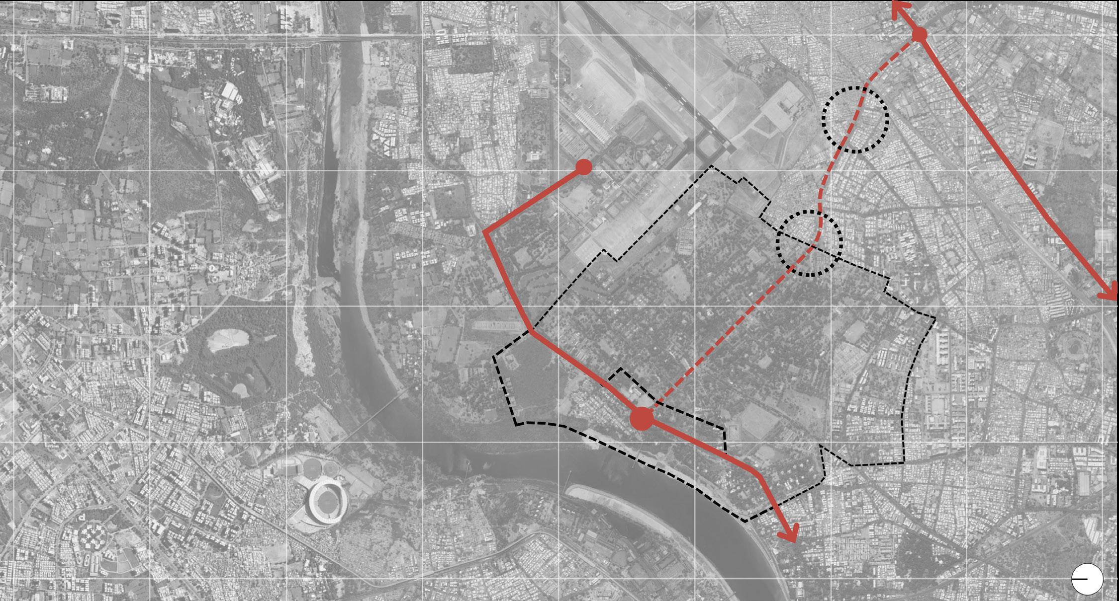
With the upcoming redevelopment projects like the Olympic Village (as part of the Olympic 2036 legacy) and the multimodal hub around the Sabarmati railway station and AEC metro station, the connectivity and thus, the development potential of the site magnifies tremendously.
In addition, the proposed barrage - cum - bridge connection proposed as part of the riverfront project will also ease the connection between west and east Ahmedabad, thus making this site a gateway for people coming from the opposite side of the river.
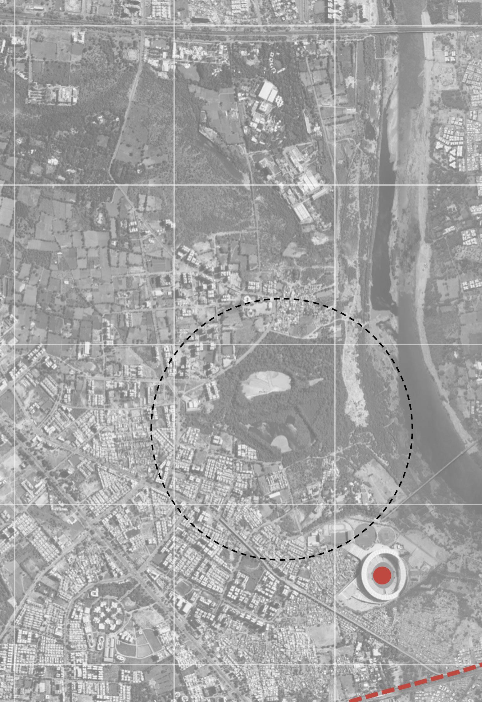
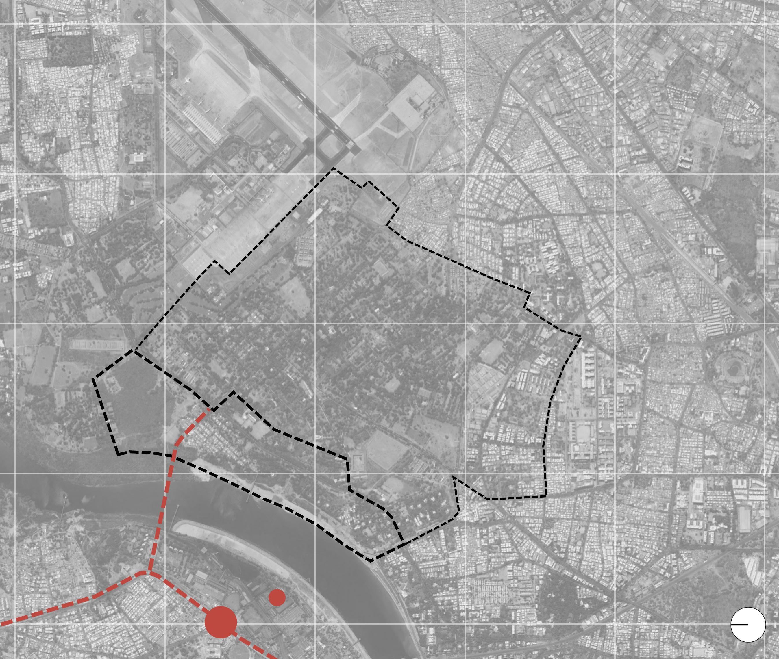
MULTIMODAL HUB
TORRENT POWER LAND TO BE REDEVELOPED
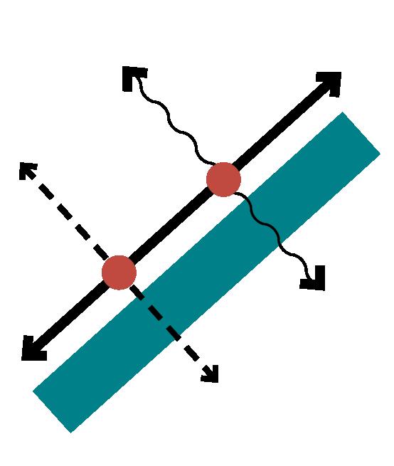
Strategic location of the site in context – proximity to the airport + First experience while entering city
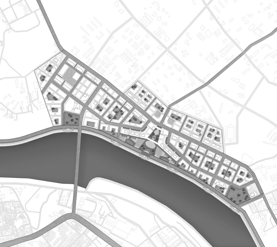
Designing a mixed-use urban district that acts as a new urban centrality for east Ahmedabad.

Creating a gateway to the city by leveraging the airport road as a major thoroughfare to create a destination experience.

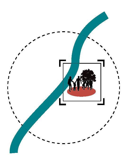
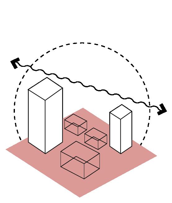
Vibrant urban spaces and waterfront living creating a strong and progressive image for East Ahmedabad
Iconic land parcels and buildings act as markers in space and create a unique skyline
The master Plan would meet its vision of gateway city and a new urban centrality by following an ENHANCE - EXPAND - CONNECT approach. The existing assets and adjacencies of the site are leveraged to enhance their value. Their influence is then expanded and subsequently, all of them are connected to create a public asset that is valuable to the city.
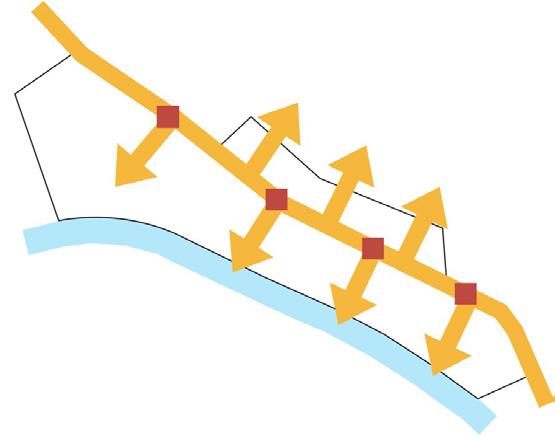
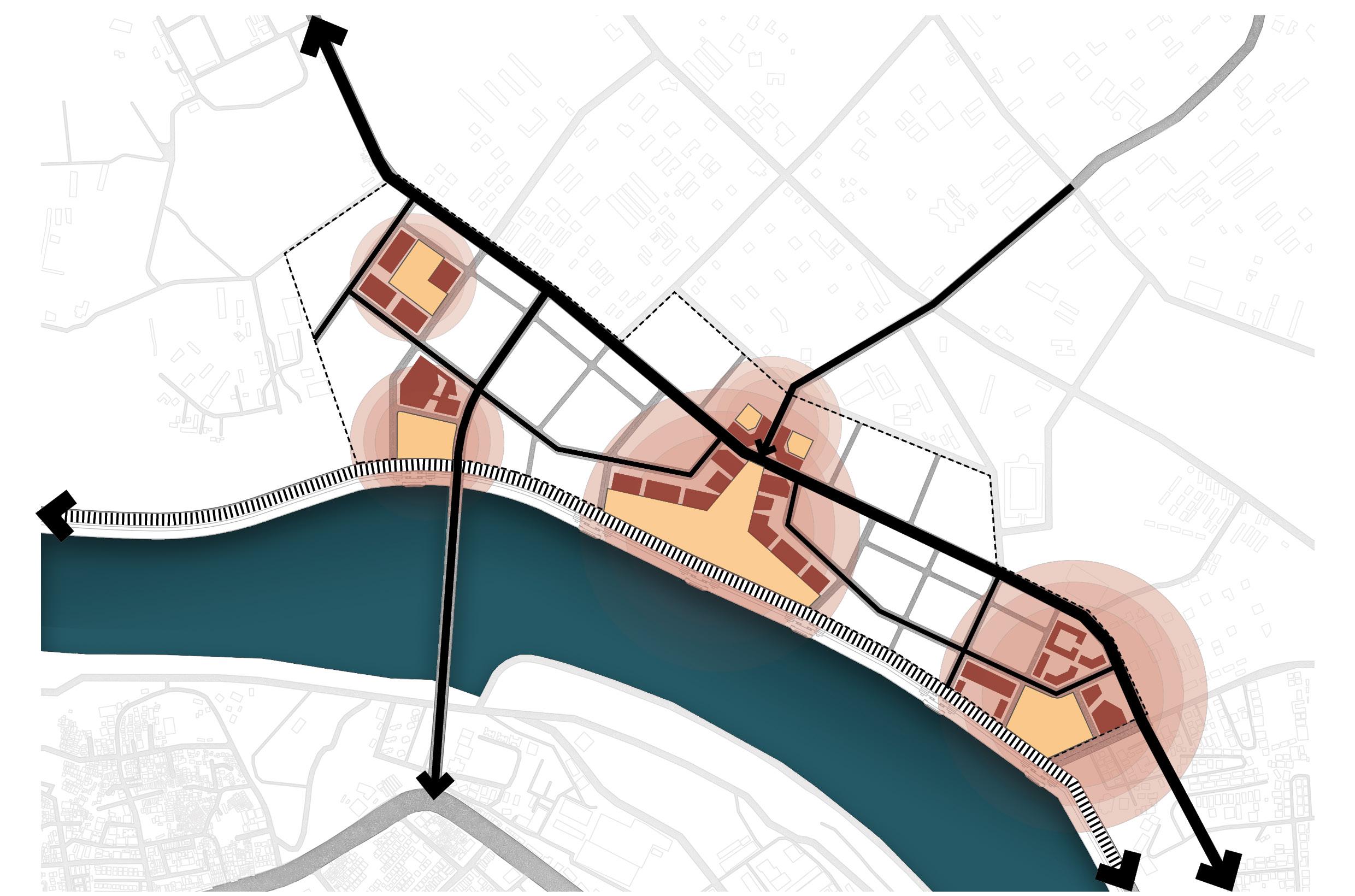
Anchoring the airport road as a central commercial spine and developing districts anchored around it.
• Breaking the rigid road edge through a series of plazas and public activities that pull people inwards – social eddy spaces
• Creating strategic pedestrian connections across the airport road to connect the cantonment and riverfront sides
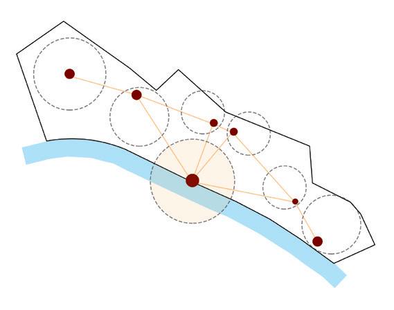
Creating different typologies of urban clusters each with its own focus and recognizable identity.
• Each cluster is anchored around an activity node which is affixed to a cluster-level open space
• Strategic buildings, placed in scenic & significant positions developed as points of architectural highlights – creating unique skyline
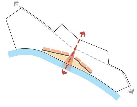
Enhancing the existing asset of riverfront by expanding its influence and connecting it to the airport road.
• The urban form and open spaces opening out towards the riverfront
• Creating pedestrian promenades with view corridors as a spine for the township
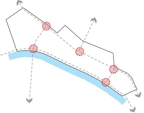
Developing a series of urban nodes that support a variety of activities, rendering a high degree of flexibility and adaptability.
• Varying scales of public squares at the intersection of major streets
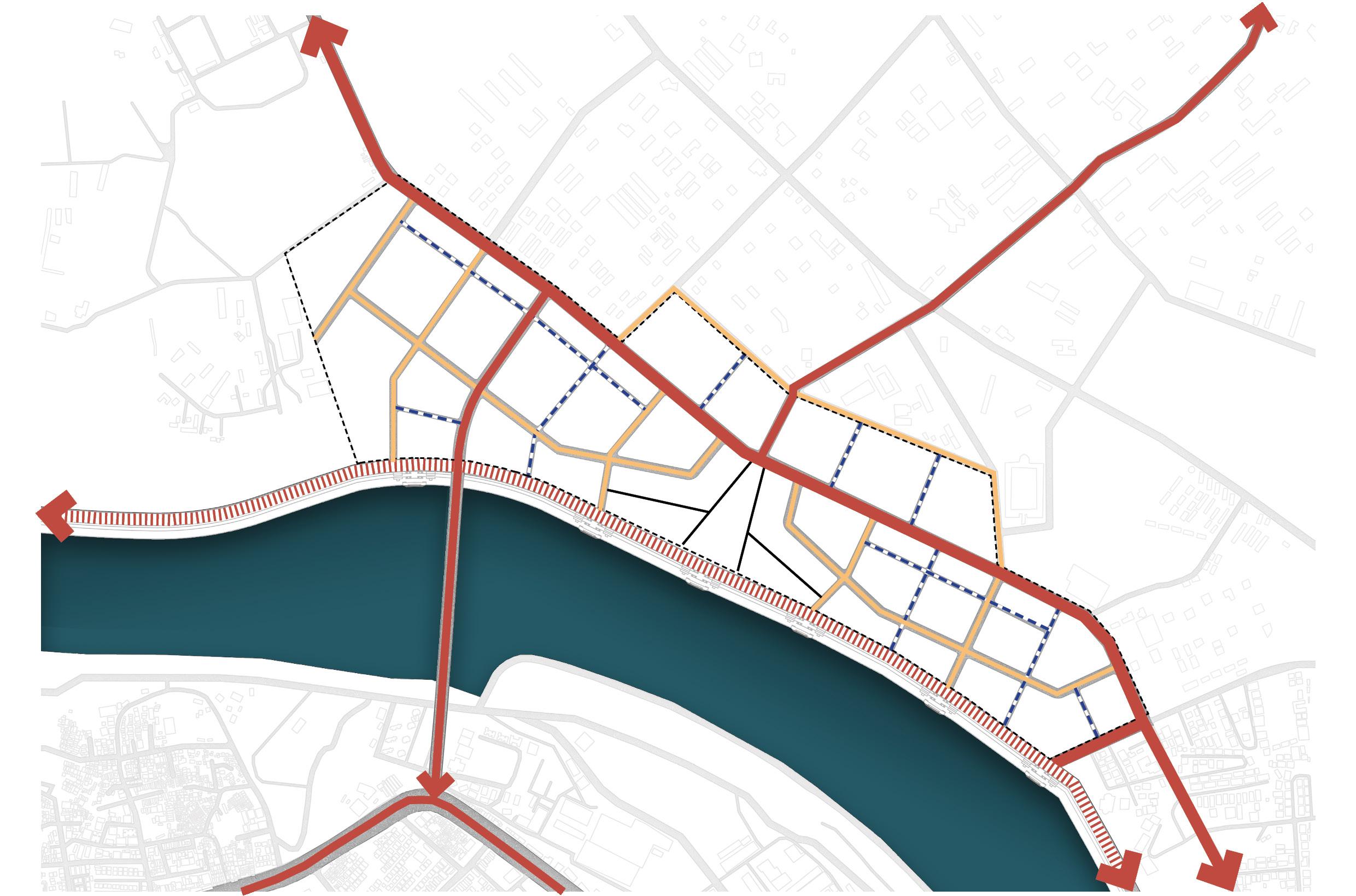
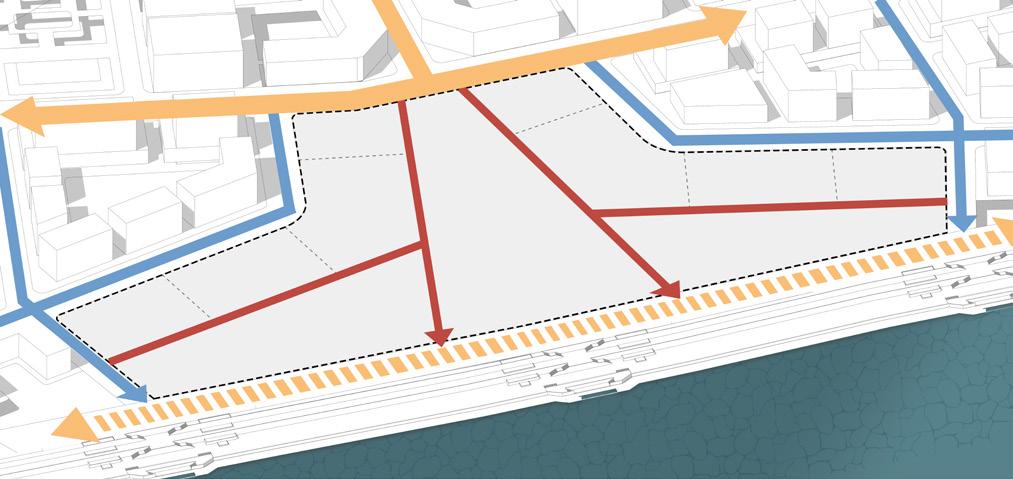
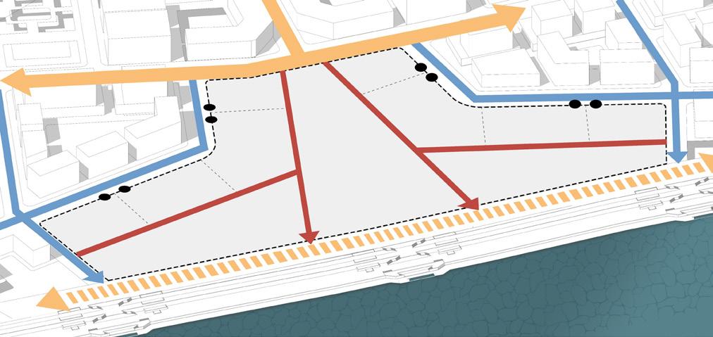
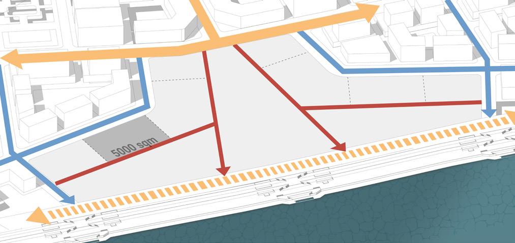
The intent of the movement framework is to build on the existing framework of streets to allow for better integration with the surrounding context. This is achieved through a robust network with busy streets that keep the neighborhoods active and subsequently a layer of quieter residential streets.
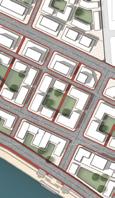
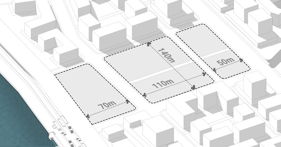
The integrated framework of vehicular and pedestrian streets offer mobility, gathering and play opportunities tied to the open space framework. These streets subdivide the site into walkable blocks of around 150 x 100m and the pedestrian trails further divide them and allow greater inter - block connectivity.
In a site such as this, located on prime value land in the heart of the city, it is imperative to develop a judicious framework of open spaces that balances the high density built form.
This has been achieved through the creation of specific nodes throughout the site which are tied together with the mobility network and lead to the larger city-level public realm. The large-scale public spaces are provided along the riverfront, each with a different experience. They are highly accessible and are the magnets that attract people here. The small-scale nodes are in the form of urban plazas at the intersection of major streets which host district level activities. These enable the people to be closer to each other and increase opportunities to see, hear and meet.
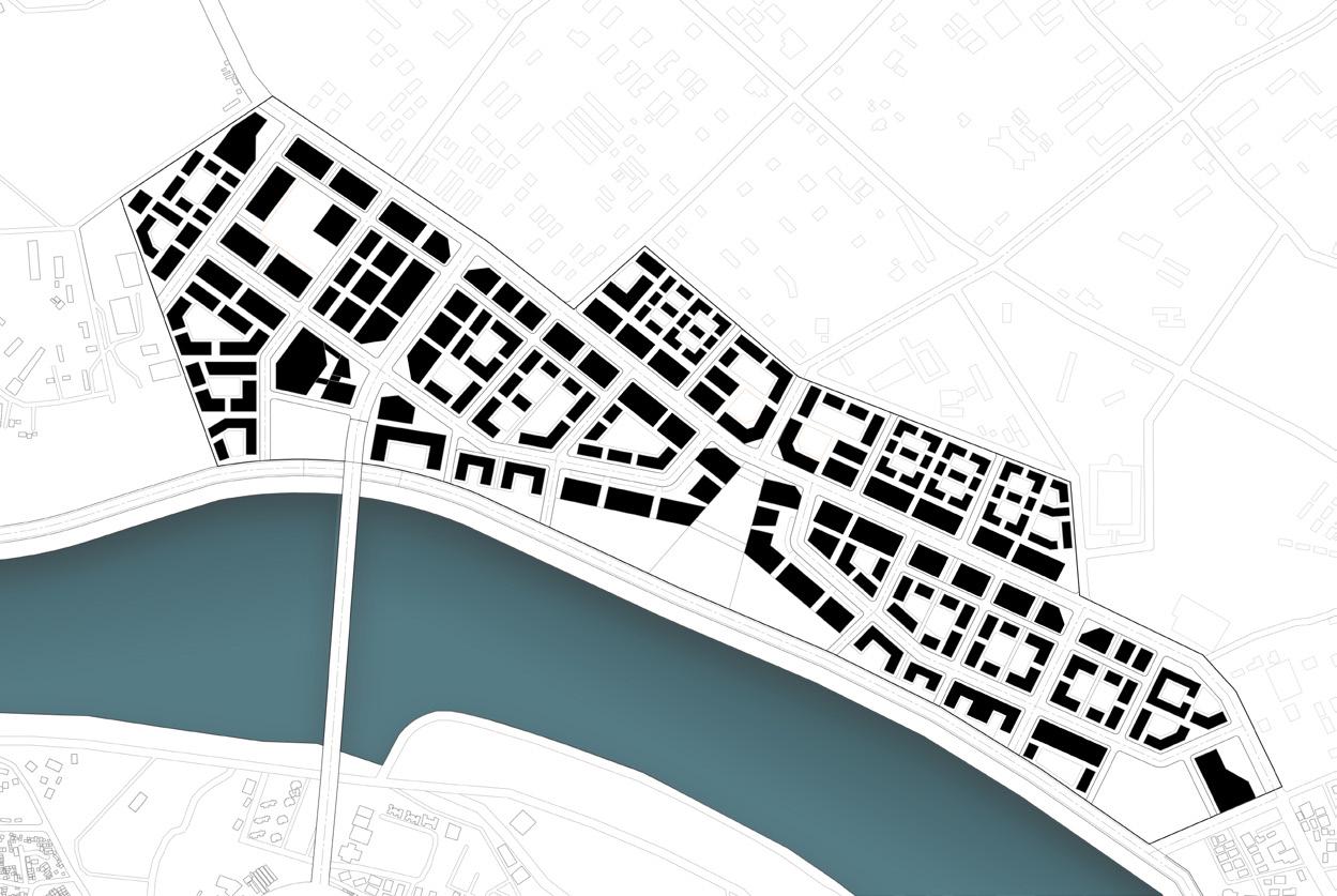
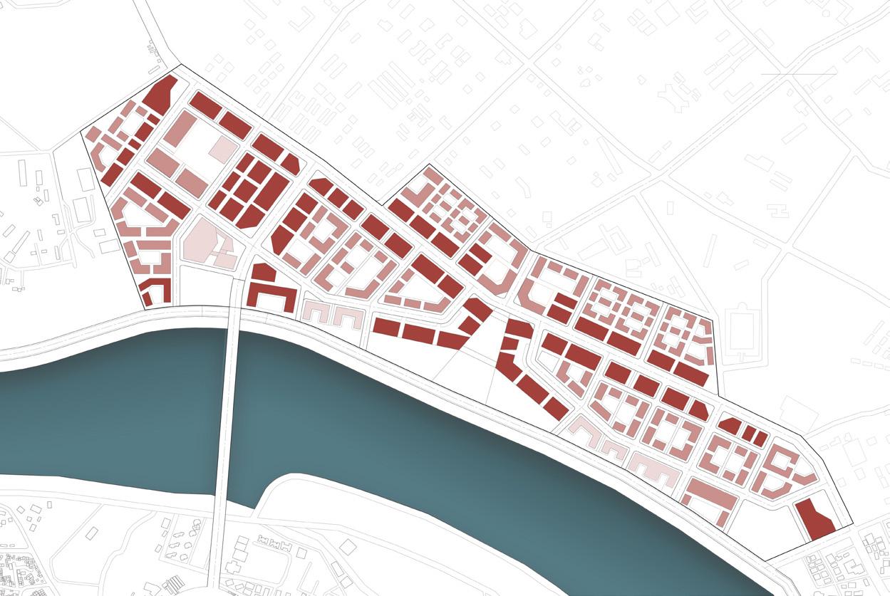
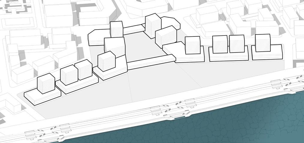
Different typologies and densities of built form create diverse urban spaces. The built form around nodes is an attempt to create gathering spaces and thus, the built edges are chamfered inwards or outwards depending on the function.
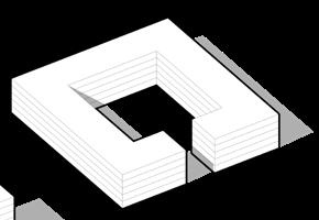
The built clusters are oriented along the pedestrian trails for visibility and social interactions. Perimeter block typology allows for clear distinction between public and private realm.
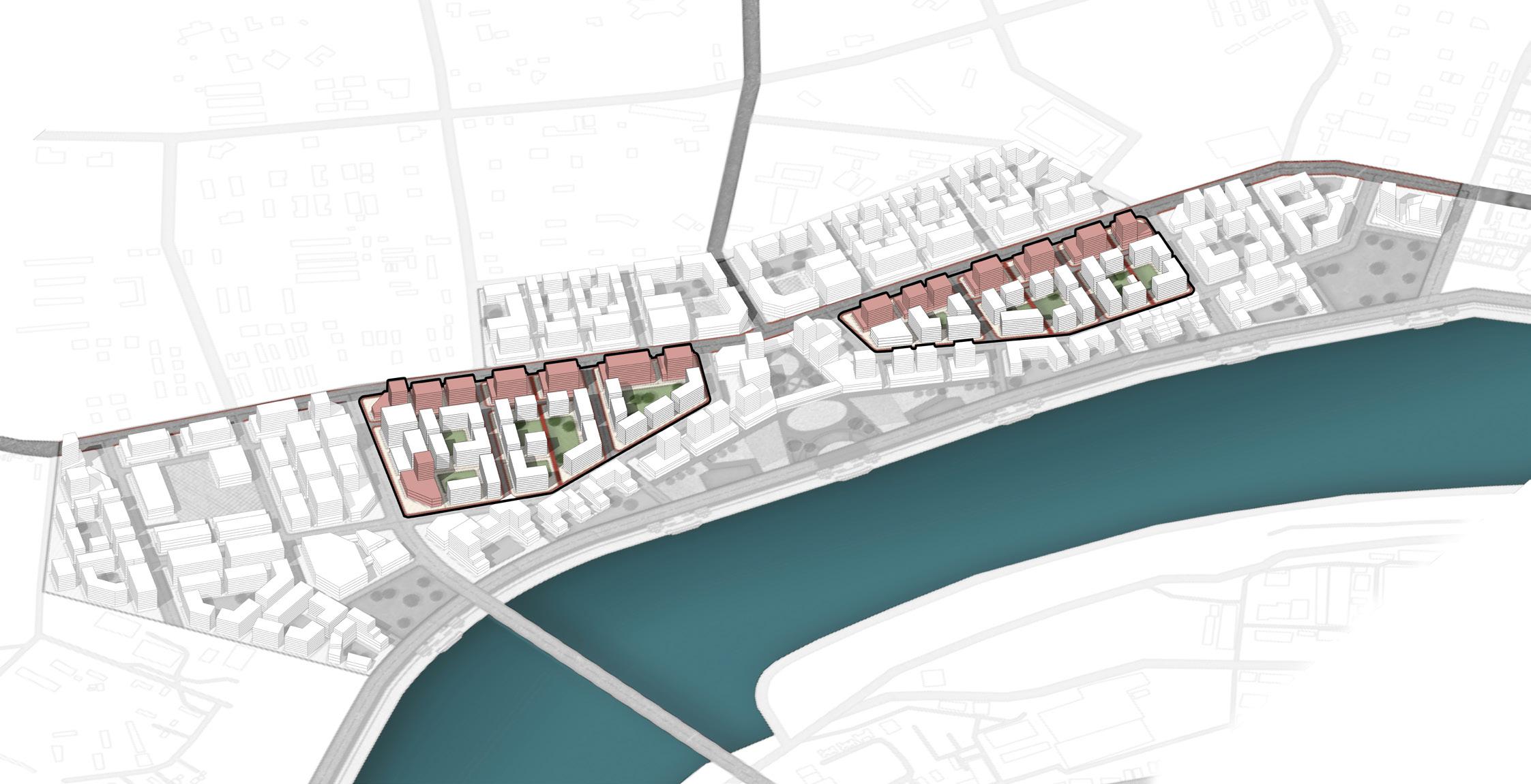
High Density (10 to 13 floors)
Medium Density (6 to 10 floors)
Low Density (Less than 6 floors)
2.2 Gross FSI
The overall built form achieves a gross FSI of 2.2 with the tallest buildings along the airport road which is the commercial spine. The building heights are proposed so as to retain a connection with the ground floor activities and social interaction.
The building heights step down progressively as one goes from the airport road towards the riverfront to capitalise on the views and open spaces.
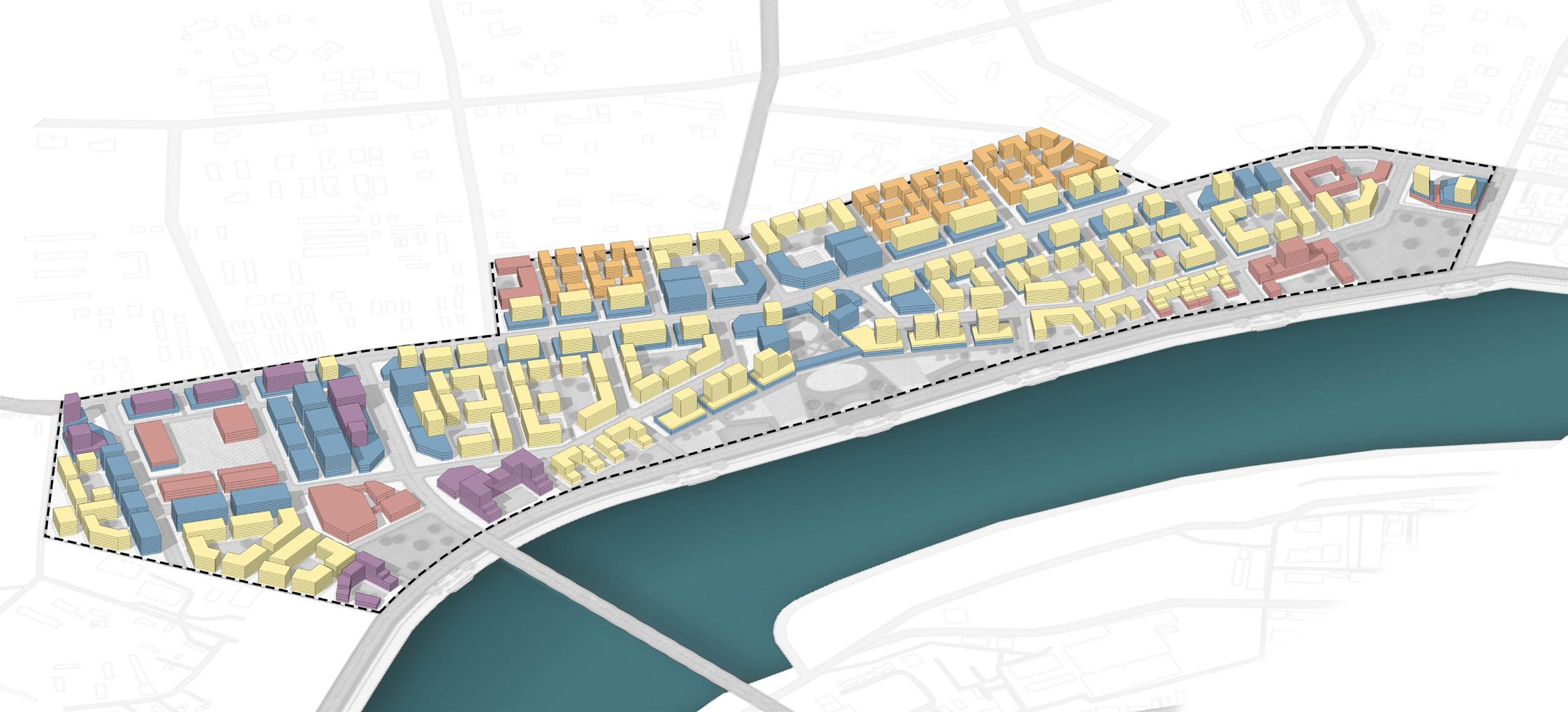
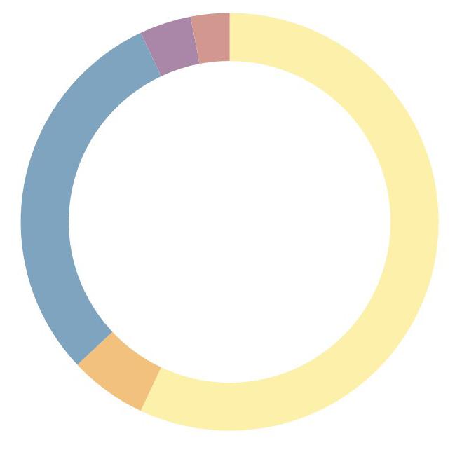
The typologies within different districts provide wide range of housing potential to achieve neighborhood diversity. This master Plan development offers 63% residential floor space which ranges from luxury housing, mid-range and affordable housing.
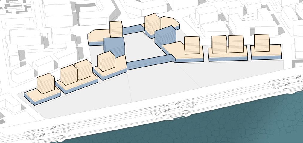
The built uses are proposed in ways to anchor the open spaces around them. The nodes have a commercial character that would keep the edges porous and active. High intensity commercial is located along the airport road.
The central festive plaza is abutted by mixed use buildings with commercial uses up till the podium level and residential towers above.
The northern most district which is the first area accessed and experienced by people coming from airport or from west Ahmedabad has concentrated commercial, hospitality and institutional uses with service apartment typology of residential. This caters well to the travelers and non-locals, who will be the predominant users of this district.
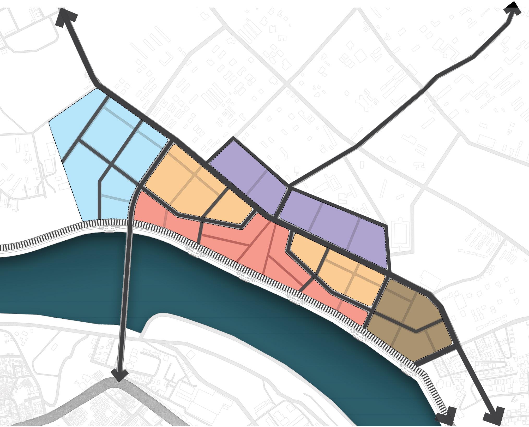
Riverfront District
Active Core Residential District
Gateway District
Edge District
Social District
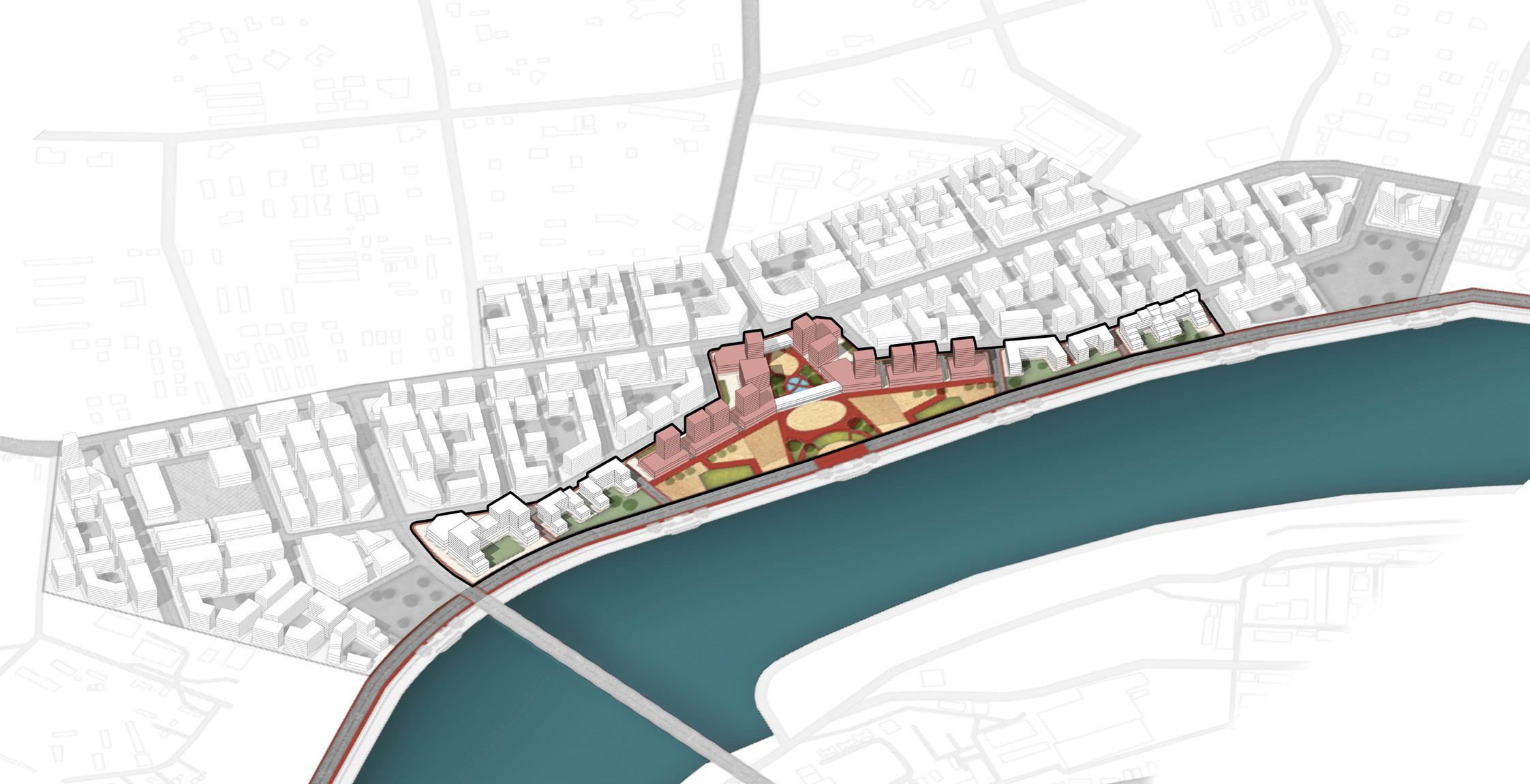
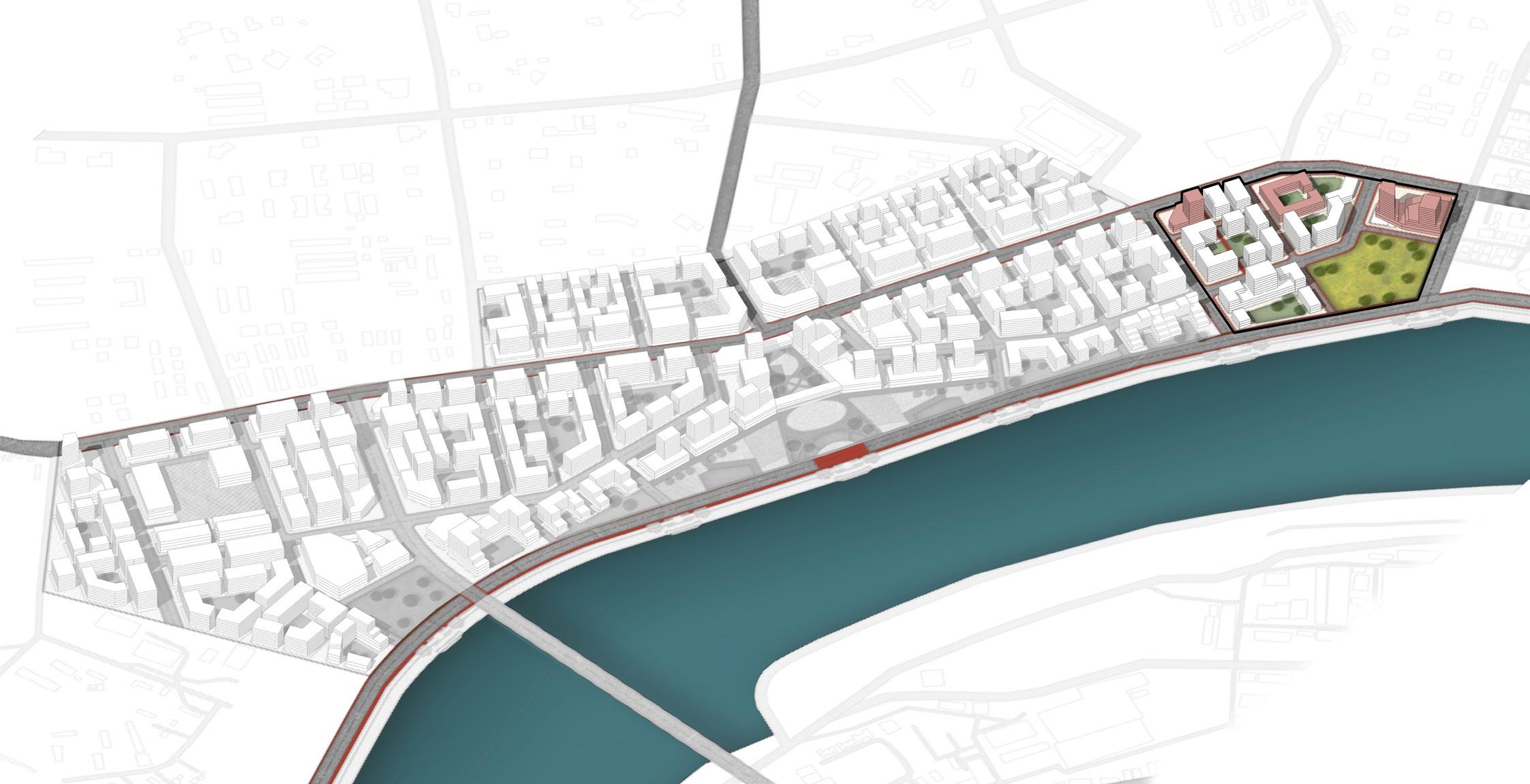
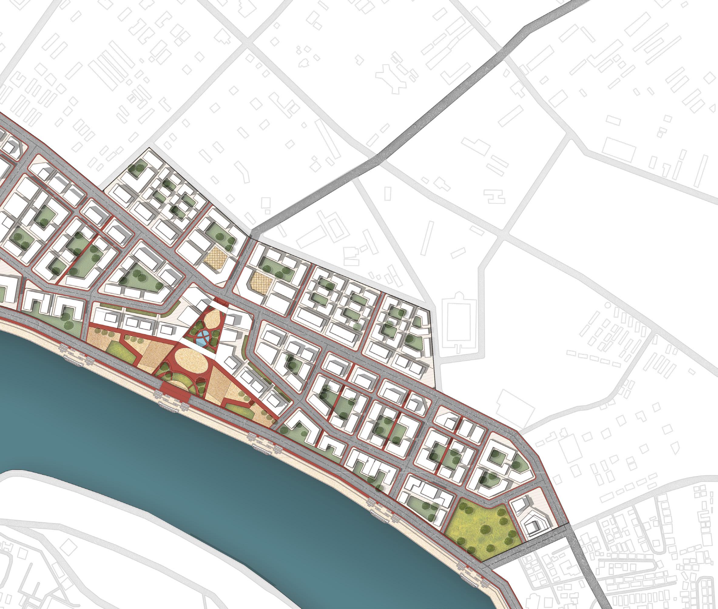
A robust mobility framework and strategic open spaces come together to form five distinctive districts where the built forms are organised to take advantage of the views and create landmarks within this urban insert. The diverse range of urban spaces are defined by the array of typologies,
densities, built uses, and open spaces. The nature of these spaces is also informed by the existing assets and adjacencies of the site. Each district allows for flexibility in terms of the programming of spaces which offer a high degree of flexibility and adaptability to the master Plan.
This district is spread along the riverfront and is highly public with active commercial uses up till the podium level. The central block has a high footfall with high rise residential towers with direct physical and visual access to the riverfront. The smaller blocks have lowdensity, low-rise residential with private open spaces facing the riverfront.
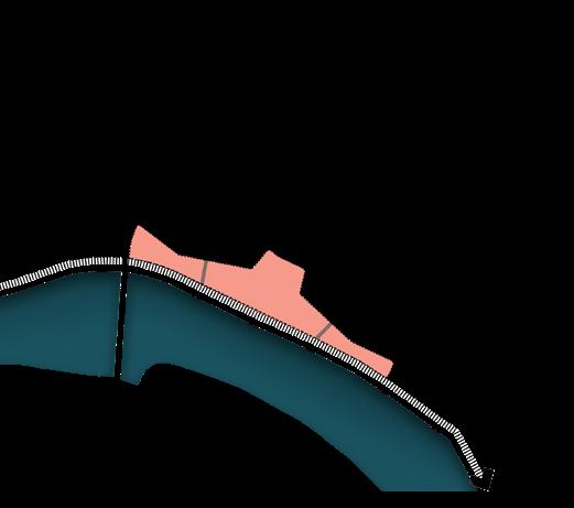
Central festive plaza that serves as city level destination and anchor point. Residential blocks have dedicated private open spaces facing the riverfront road
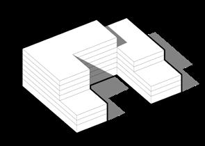
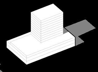
These districts are located along the airport road. The access road edge responds to the commercial viability and high footfall while the other edge has a peaceful residential character.
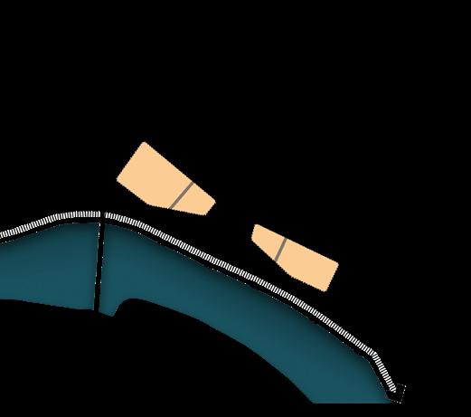
Residential blocks cluster around courtyards that act as their private open spaces which are intimate spaces programmed with community amenities.
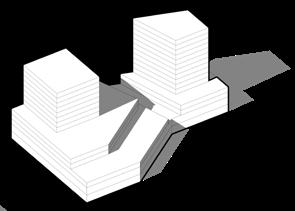
Typology
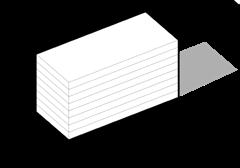
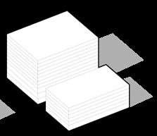

Podium Tower Standalone L–shaped Open block Linear
Residential Mix • Mid-rise apartments • 2BHK and 3BHK units
Gateway District
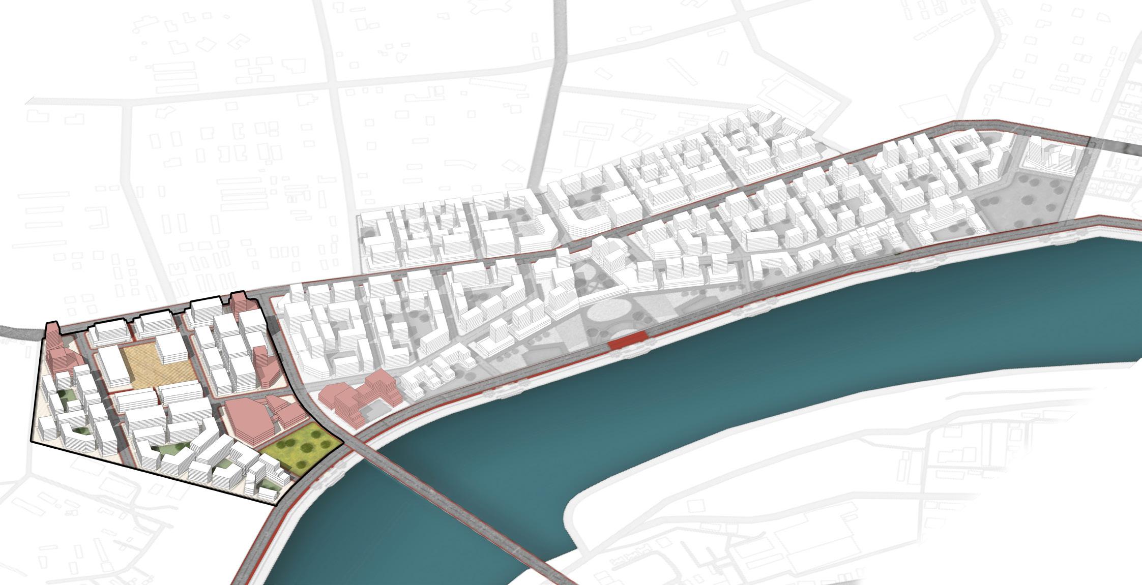
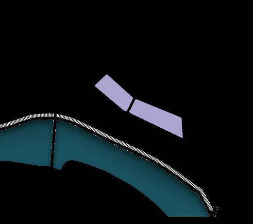
This is the first district experienced by people coming from airport or west Ahmedabad.
It is anchored by an iconic structure on one end and a cultural and performance center on the other – creating a node.
The water square, located in the low lying part of the site – acts as a multipurpose floodable square which can hold water in the event of heavy rainfall, and at other times, function as a recreational plaza for outdoor events, office activities, etc.
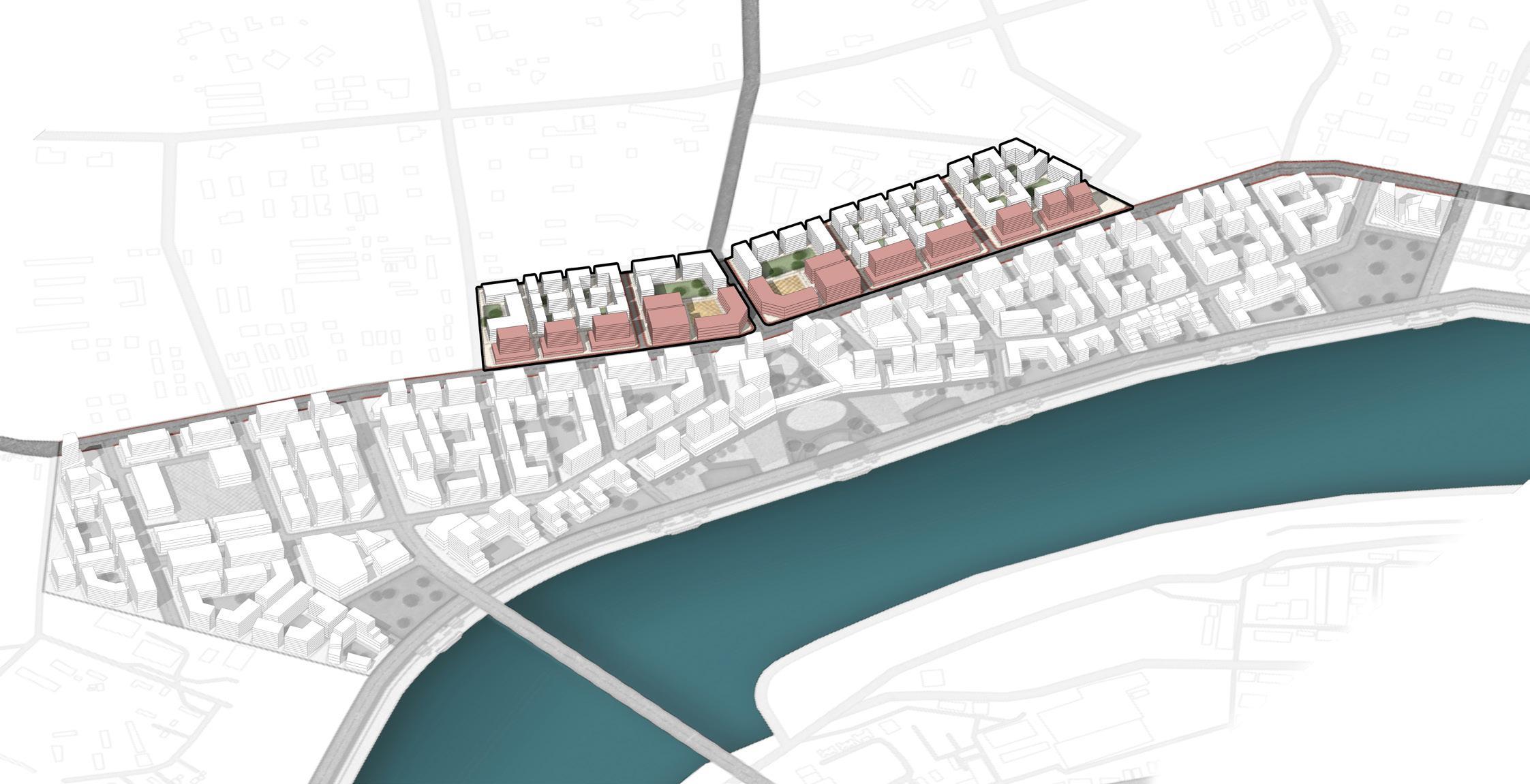
These districts are located along the airport road. The access road edge responds to the commercial viability and high footfall. This has a denser organization of building blocks with a predominantly affordable residential mix
District level urban plazas abutting the commercial anchors. The residential neighborhoods have private courtyards for community activities.
Open block
Residential Mix • Mid-rise affordable residential • Mid-rise apartments (2BHK and 3BHK)
This district abuts the Dafnala junction and the surrounding residential areas. Community and social facilities like school, health clinics, community center anchor this district.
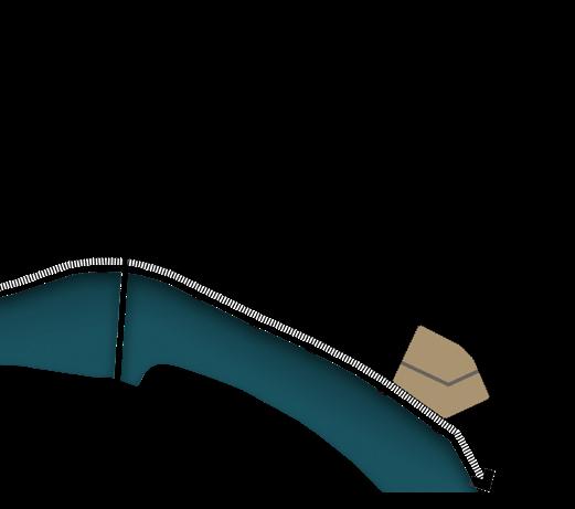
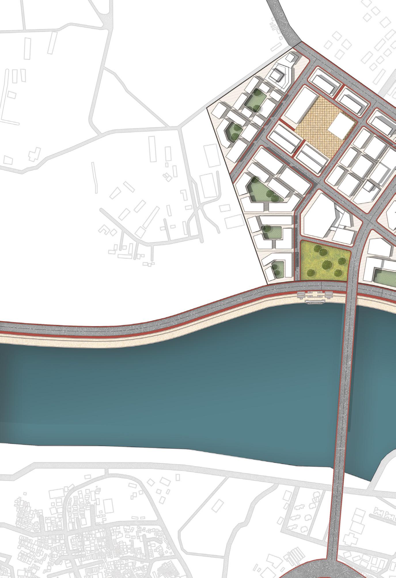
A large public park caters to the local needs of school, community center, etc as well as the larger contextual need of an open space for the surrounding residential areas.
Iconic building marking the gateway and designed as points of architectural highlights.
Airport road is leveraged to create a commercial spine. Commercial use on lower floors to provide active public realm
Urban squares act as district-level nodes (inward /outward) that allow for a variety of activities at neighborhood level and anchor the districts
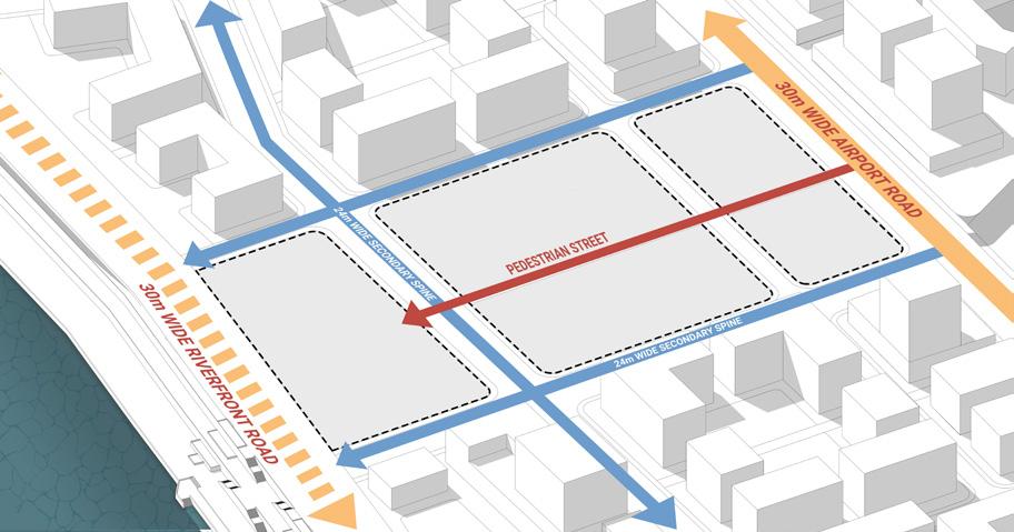
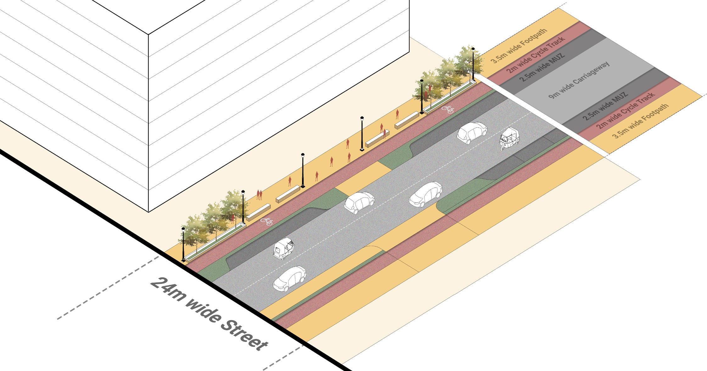
Neighborhood spine of 24m ROW that connects the arterial streets and ties the districts together
Riverfront road is developed as an urban street with pedestrian and NMT focus, forming a porous and active edge along the riverfront.
Central festive plaza serves as a city - level destination and anchor point that attracts high footfall and offers varied experiences
Pedestrian trails running across the site connecting major public realms and providing inter-block connectivity.
Urban park caters to the local needs as well as the larger contextual need of an open space for the surrounding residential areas.
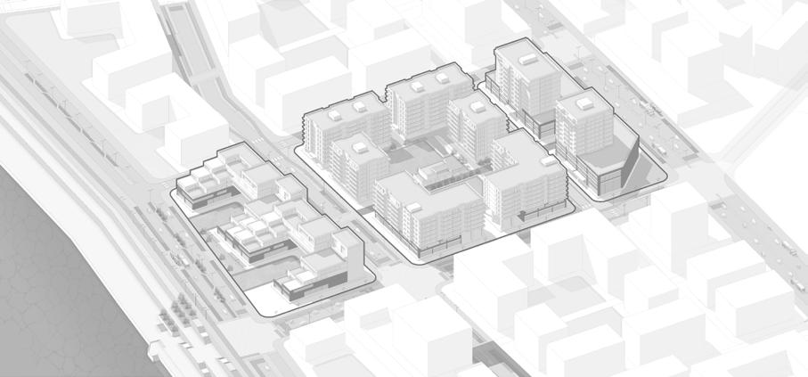
A typical residential transect spans across the width of site from the airport road to the riverfront. This transect demonstrates the treatment of the three edge conditions that get created - along the airport road, along the secondary spine and along the riverfront - each with its own unique experience.
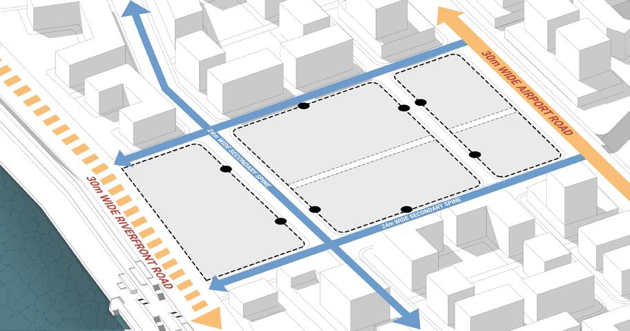
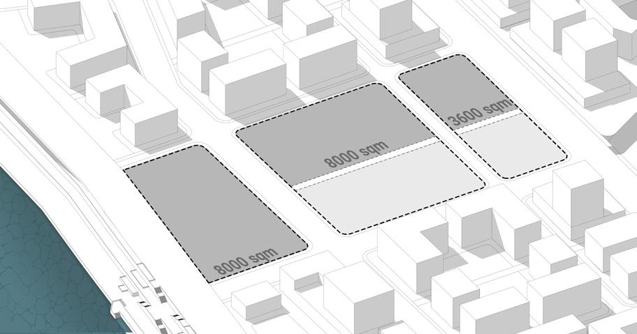
The block access follows a certain street hierarchy with the access to parcels from the secondary and tertiary streets (24m and 18m).
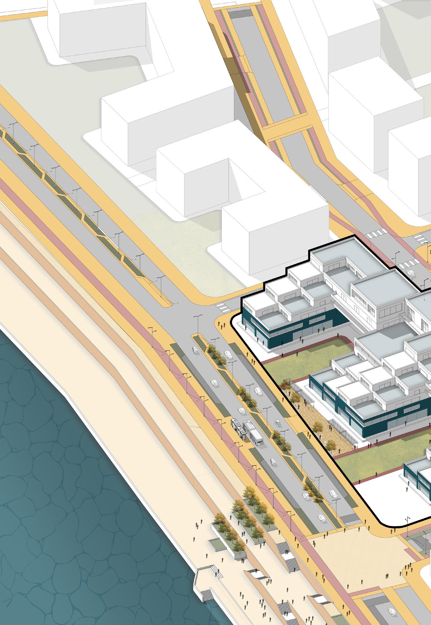
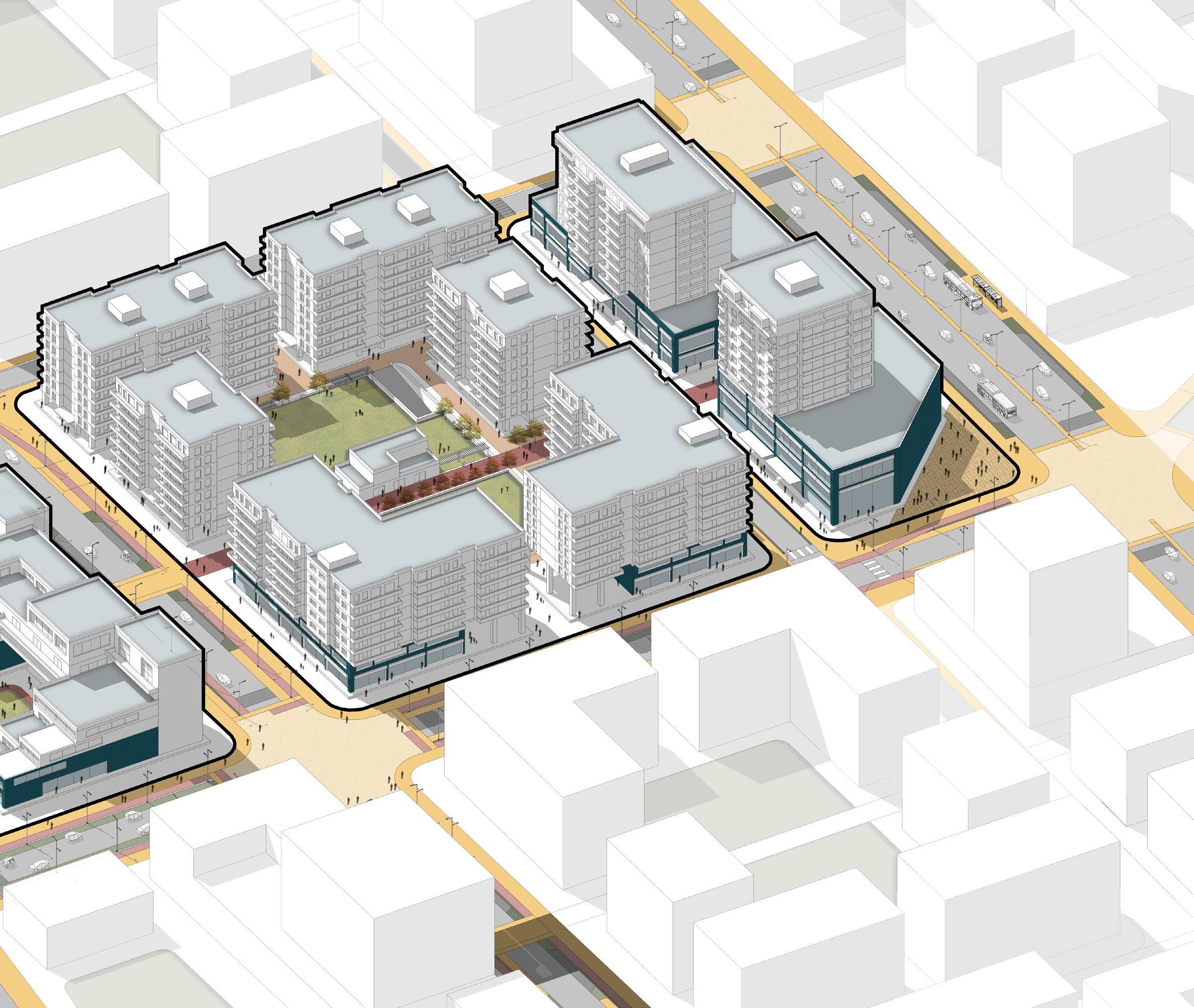
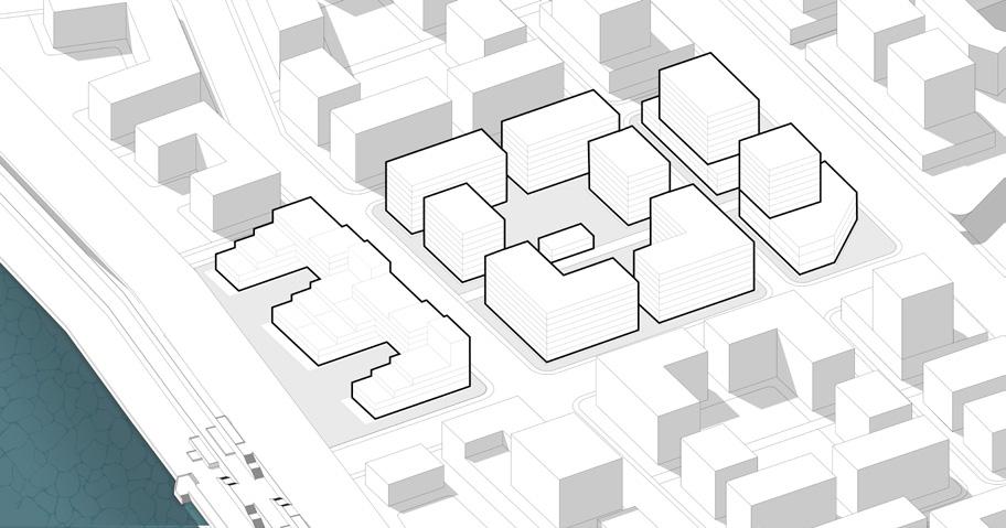
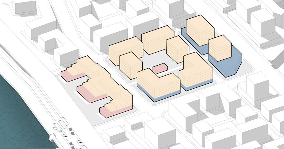
Built form typologies each responding to the edge conditions
These streets create a funneling effect that brings people in and connects the two edges - Linking the arterial roads with sub-arterial roads.
The street is designed to accommodate ample resting areas alongside commercial and mixed buildings, and space for vendors. This street brings people from all the pedestrian boulevards and connects them to the larger public realm.
Perimeter blocks with central open space allow for a clear distinction between the public and the private realm.
A 6m wide pedestrian trail passes through the neighborhood greens, allowing for interblock connectivity as well as opportunities for social gathering and interactions. This central community space offers an active environment for people of all age groups. Neighborhood level amenities such as the clubhouse and day-to-day vendors further activate the open space and ensures its safety.
The entrance to residential blocks from the pedestrian trail are designed with shaded edges and seating spaces that enhance social interaction and security, giving opportunity to see and be seen by passing people.
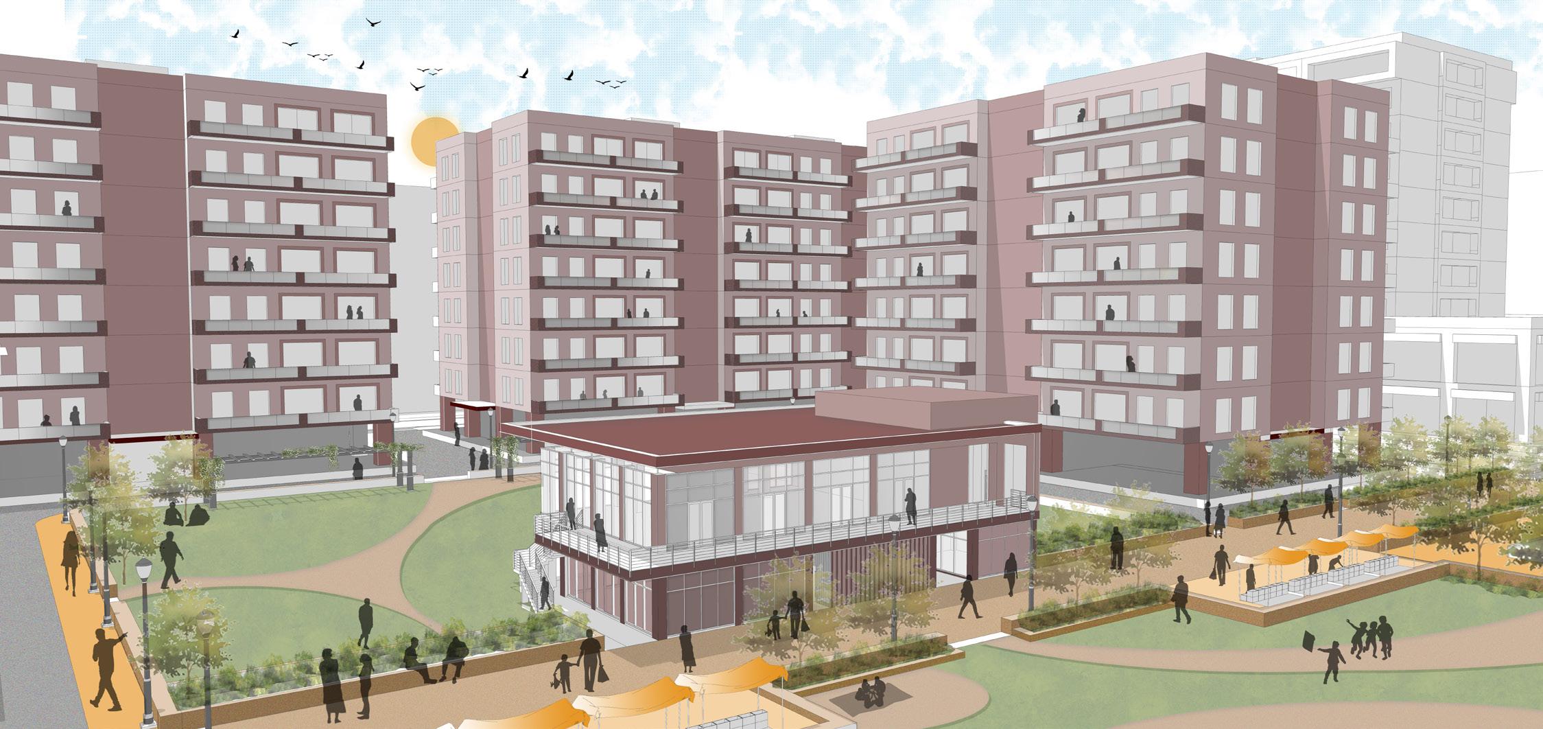
The neighborhood streets are pedestrian and NMT priority streets with dedicated infrastructure for the same.
The block edge abutting 24m ROW street has neighborhood commercial and community uses on the ground floor to maintain connectivity and activate the street edge. Building lengths are restricted to 50m to make the block more porous and walkable.
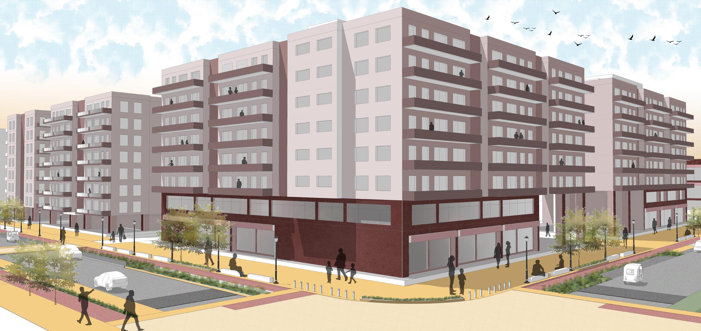
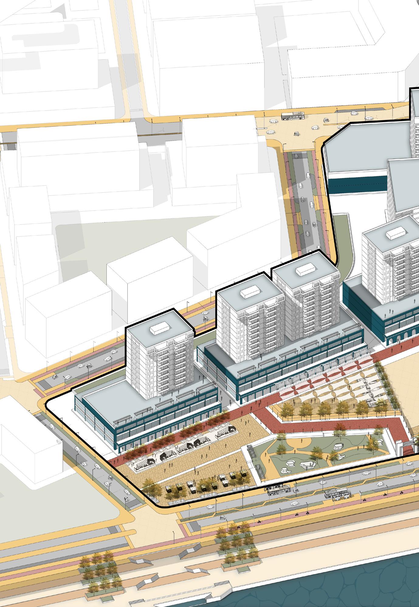
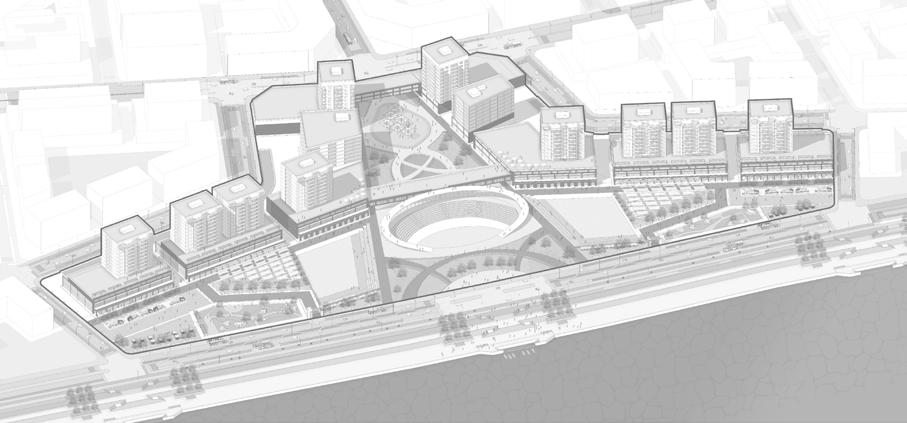
The mixed - use block is anchored by the large - scale central festive plaza which is integrated with the riverfront phase 2 development. The built form organisation creates a funneling effect by strategically connecting and ordering the movement within the block.
Podium - tower typology is used to create an active ground floor while allowing for another intermediate public realm at the podium terrace level. This can serve as a semi - private public space for the residential towers above. This built typology also ensures that a connection with the ground floor activities and social interaction is retained.
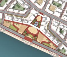
Airport Road Detail : 30m ROW
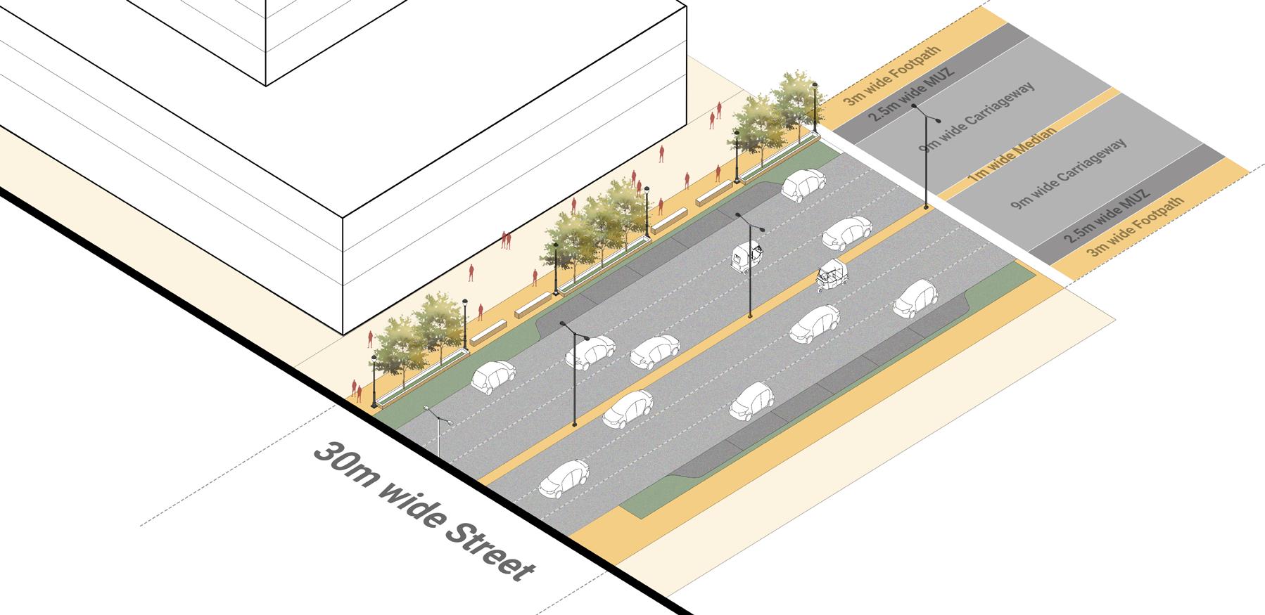
Riverfront Road Detail : 30m ROW
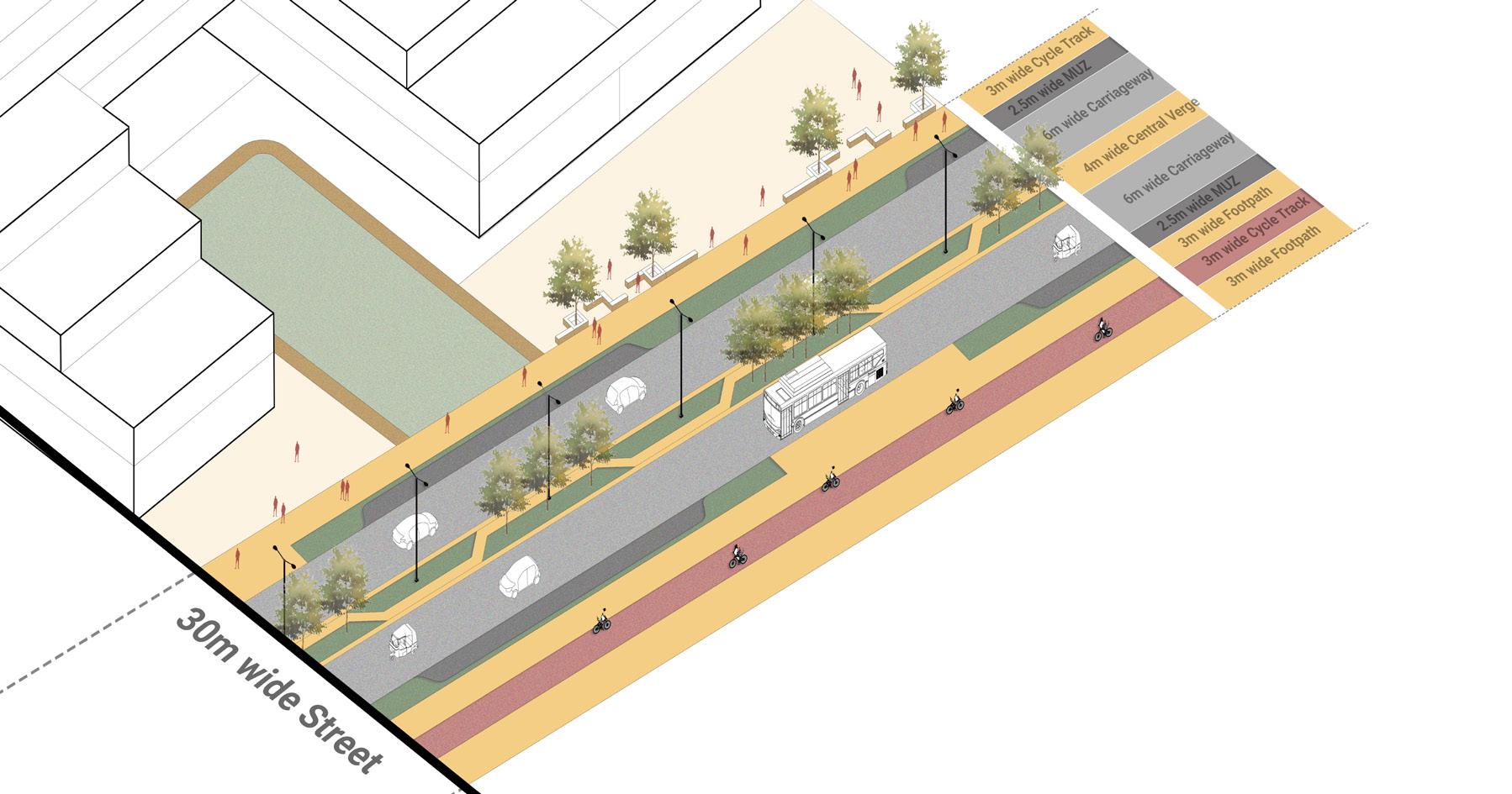
The Airport road is designed as the major commercial spine characterised by active street frontages that abut wide pedestrian plazas on either side.
It is the main thoroughfare carrying high volumes of traffic and hence has a wider carriageway than other streets.
The Riverfront road is designed as an urban street with pedestrian and NMT focus.
The ROW includes a wide pedestrian island in the middle, where urban activities and commerce exists under tree shades, and carriageway and sidewalks on either side - prioritising pedestrian activity.
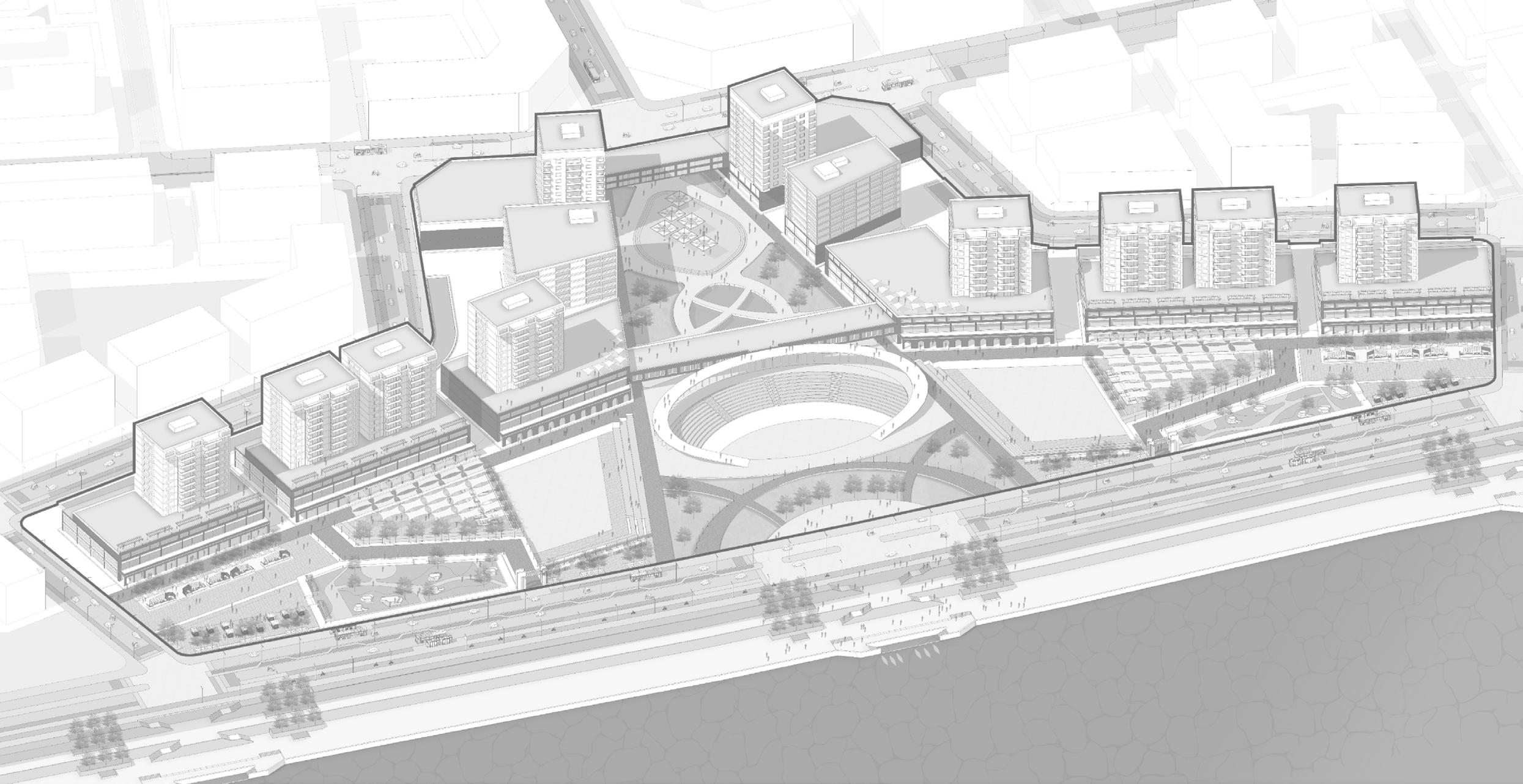
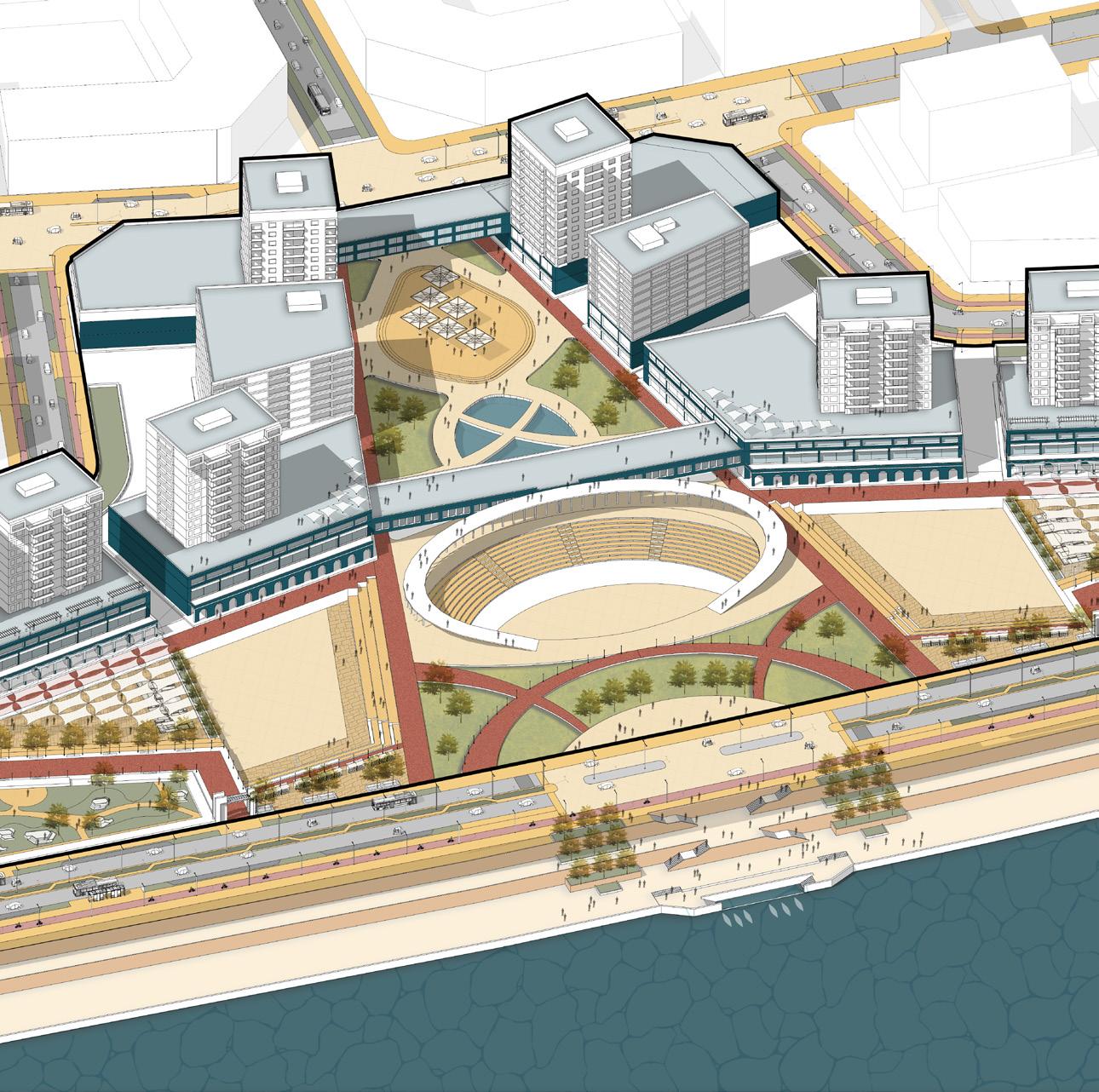
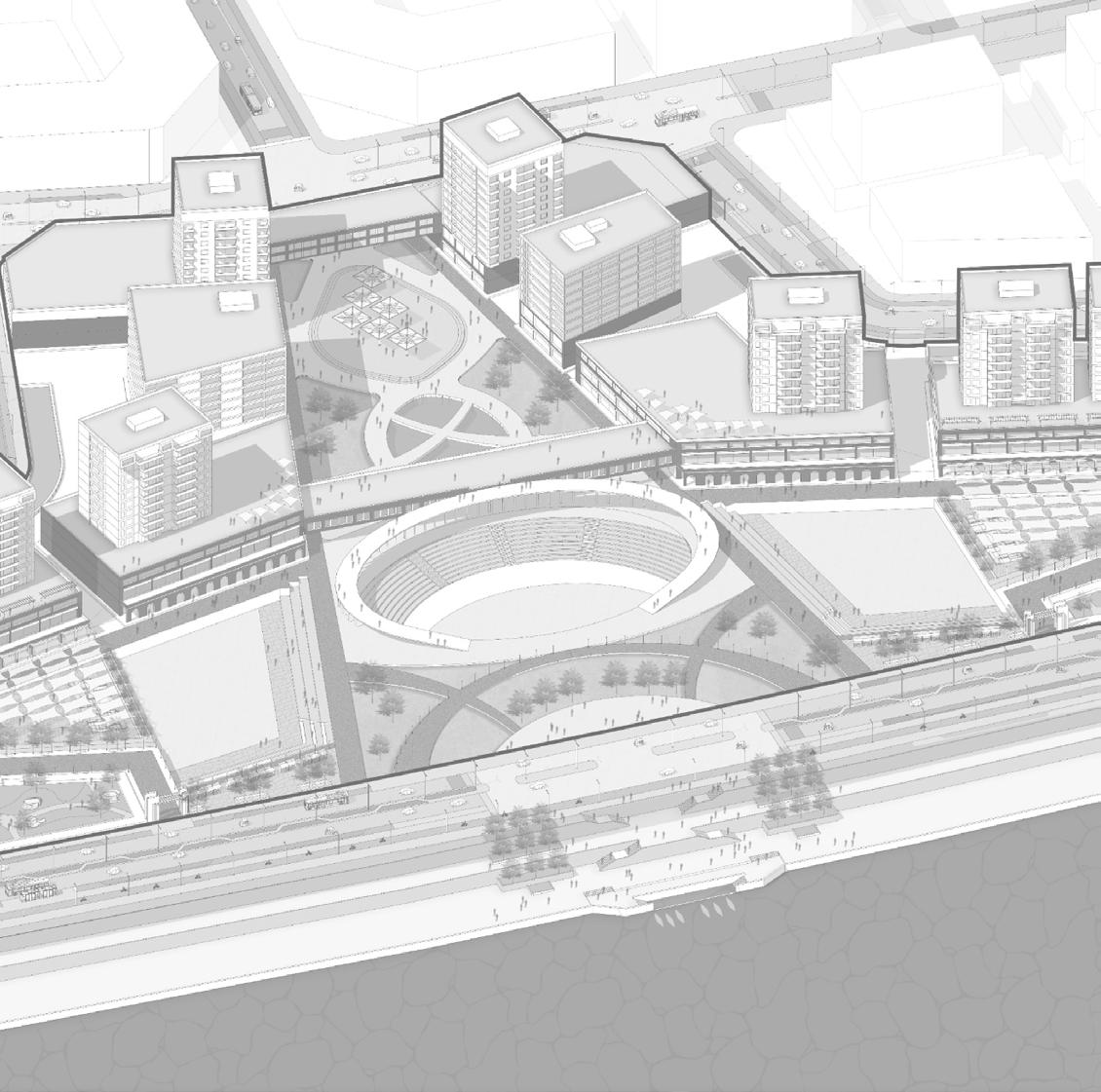
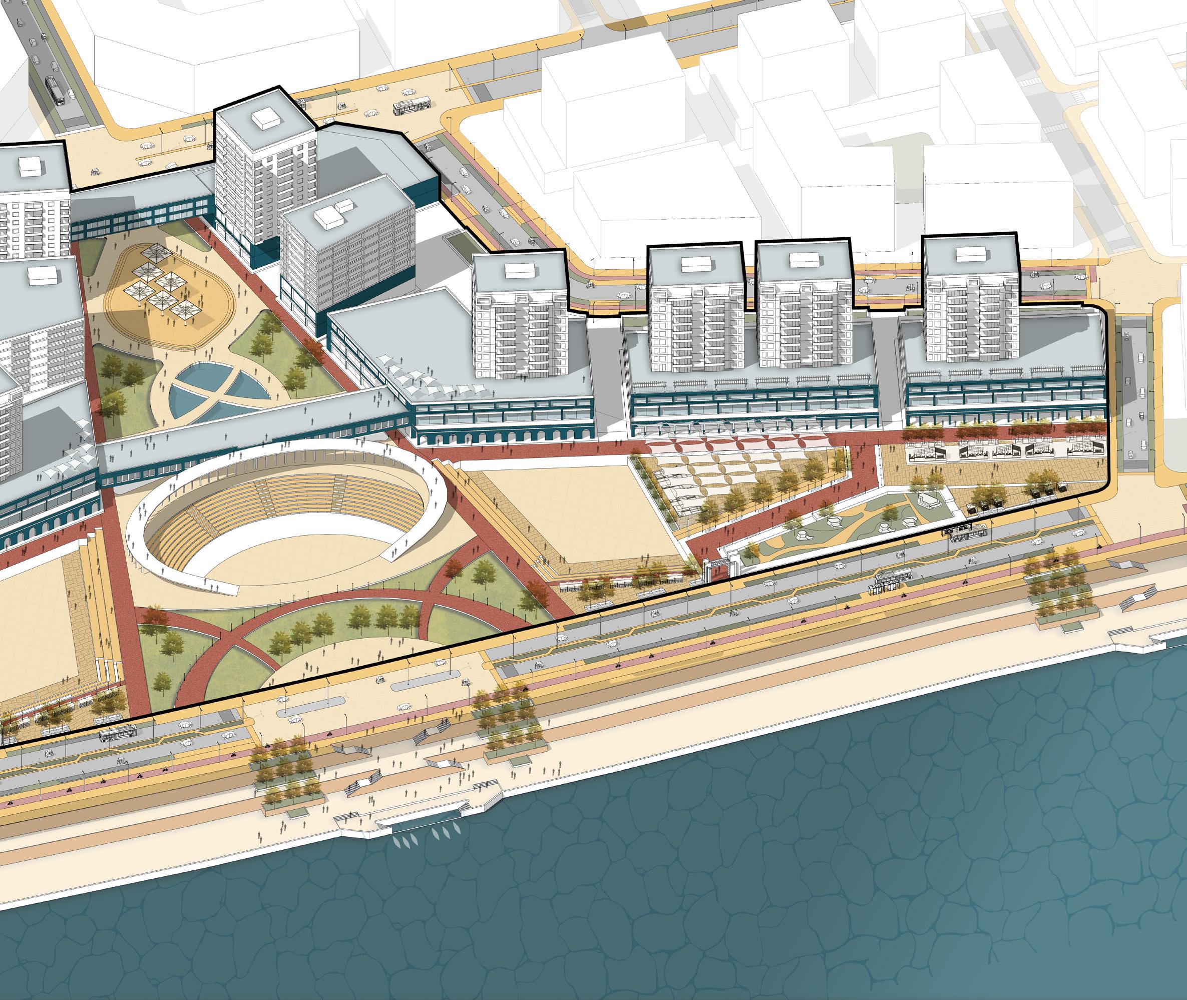
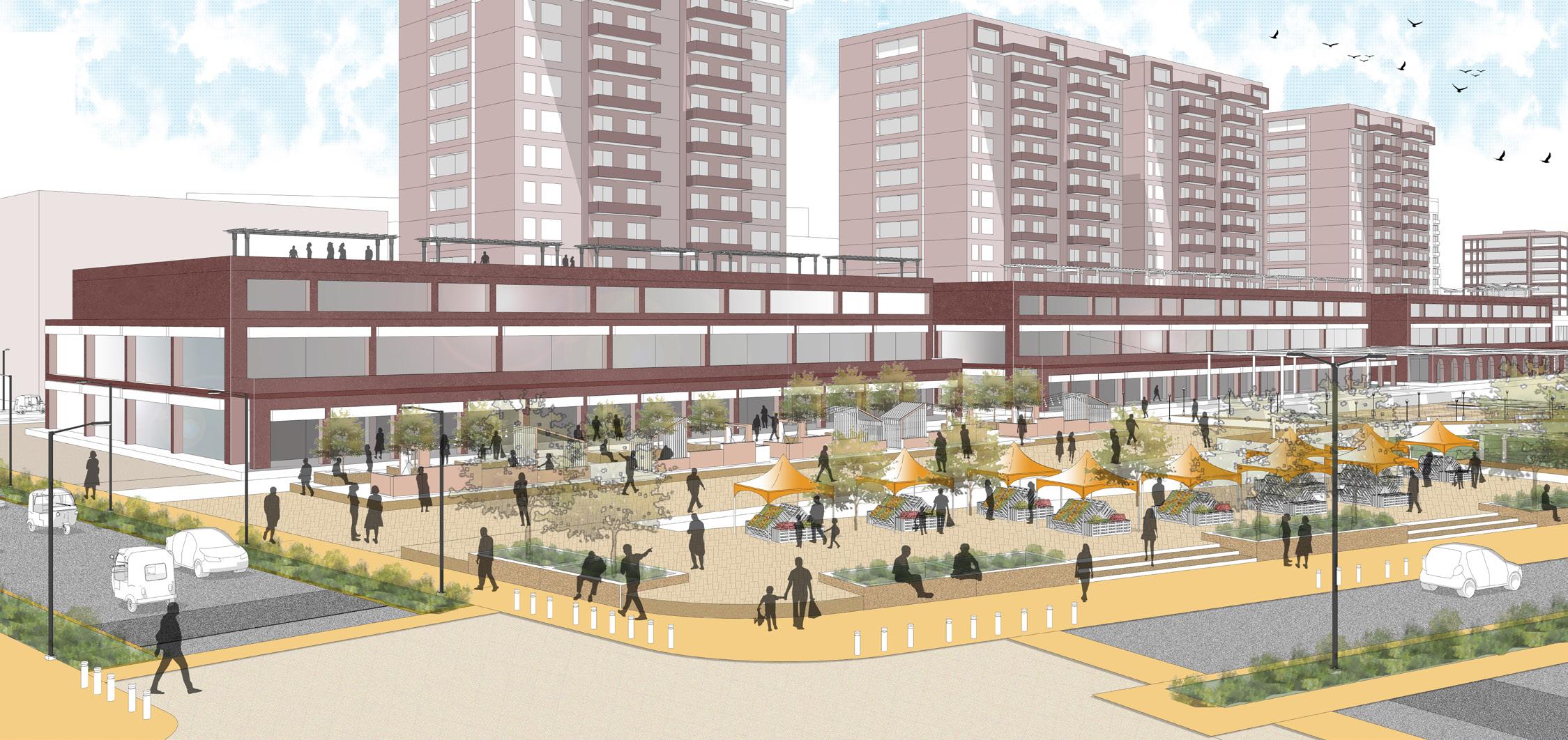
The central festive plaza provides diverse and dynamic spaces ranging from vending plazas, outdoor cafes, exhibition spaces, amphitheater, etc resulting in an active citylevel public space. It serves as an anchor point that attracts high footfall. The highlight of this space is its ability to transform during the day and the week, providing a high degree of adaptability.
The view captures one of the characteristic experiences of riverfront living. This space sits directly along the riverfront road and moves inward to bring in the experience and influence of the riverfront. Mixed use buildings with commercial podium and high - rise residential towers abut the open space with direct physical and visual access to the riverfront.
The intersection of the streets abutting this block are raised to provide a safe and seamless surface for pedestrian movement.
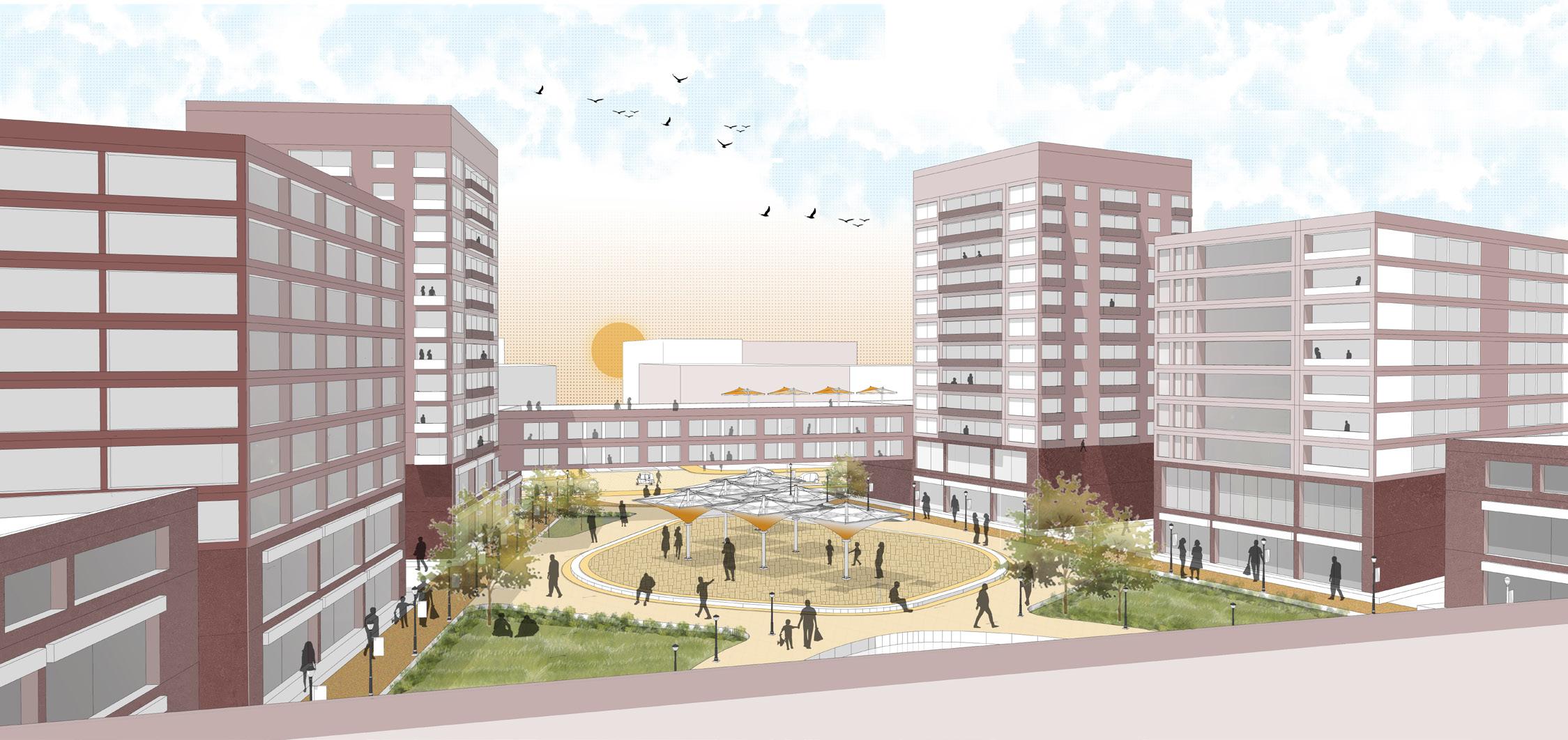
The view captures a different sense of scale and enclosure created by virtue of the podium bridges and the surrounding built form. This open space has a more relaxed and recreational character to it with public lawns and greenery as opposed to the more busy and urban character of the plaza.
The podium bridges are proposed at strategic locations that contribute to the sense of entry and transition as one goes from one open space to another.
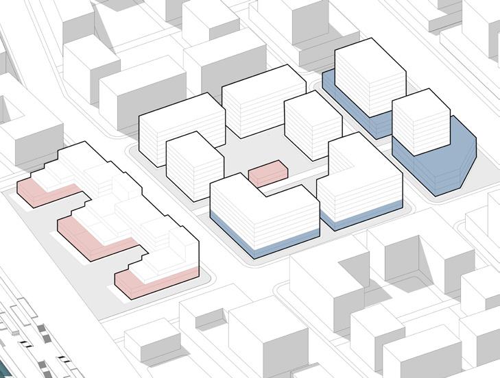
Apartment buildings abutting 24m ROW shall have neighborhood commercial and community uses on the ground floor to maintain connectivity and activate the street edge.
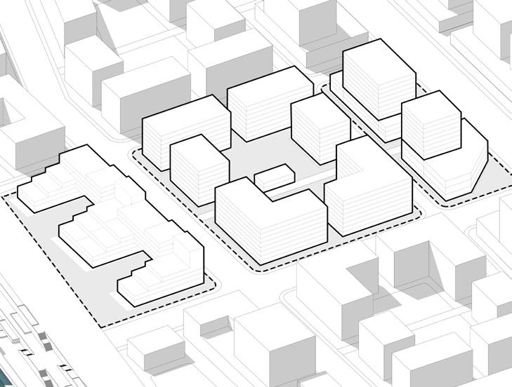
Breaks in building length to be provided at not more than 50m to make the perimeter block porous and allow for inter-block connectivity.
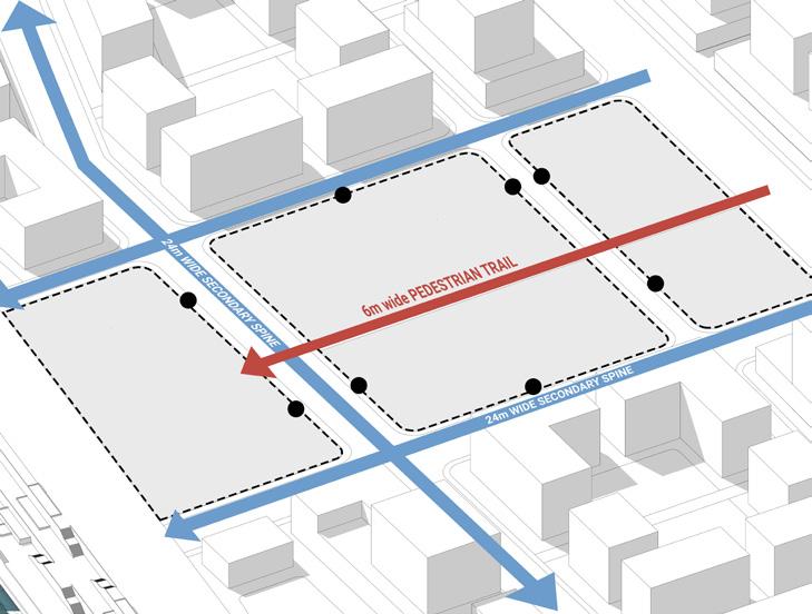
A minimum 6m wide pedestrian trail shall pass through all the parcels in the block, connecting the neighborhood level open spaces and amenities. Vehicular access shall occur from the tertiary and local streets (18m and 12m ROW) and will be pedestrian priority streets.
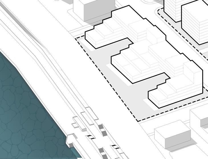
Buildings along the riverfront road shall be set inwards with a private open space in front abutting the road.
Every parcel should have a minimum of 30% area as open space. 50% of this open area should be adjoining the pedestrian connections.
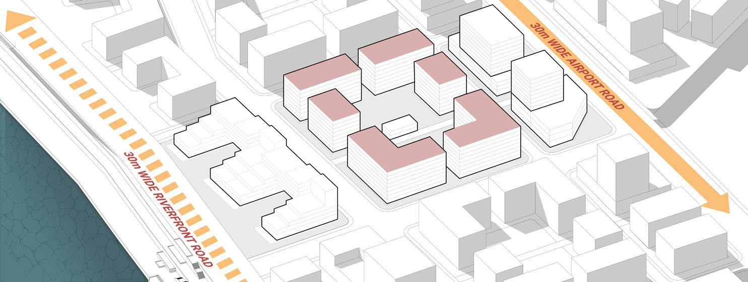
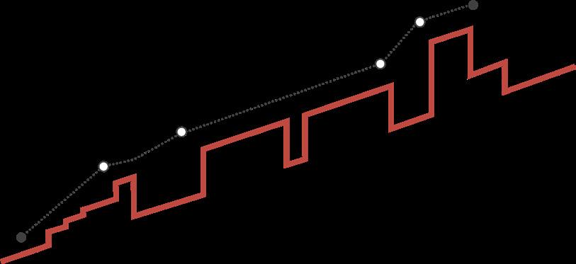
Building heights shall reduce from the airport road towards the riverfront to capitalize on the views and open space. The central residential blocks shall be developed as perimeter blocks with central open spaces.
Buildings abutting the airport road shall
• be of podium – tower typology
• have a constant podium height of G+2
• have no boundary walls
B Buildings along the riverfront road shall
• have a stepped form
• be set inwards with a private open space in front abutting the road.
Mixed Use Block
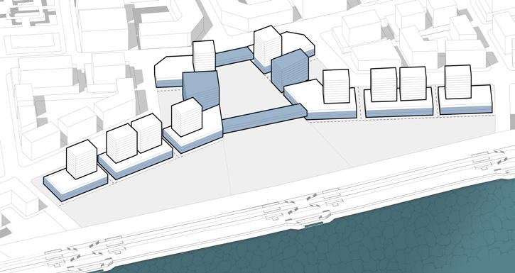
Active frontage is required at both airport road and the high street promenade. Mandatory commercial /retail use shall be followed on the ground floor to promote active public realm.
The plots adjoining the airport road shall have no boundary walls and should be easily accessible from the footpath.
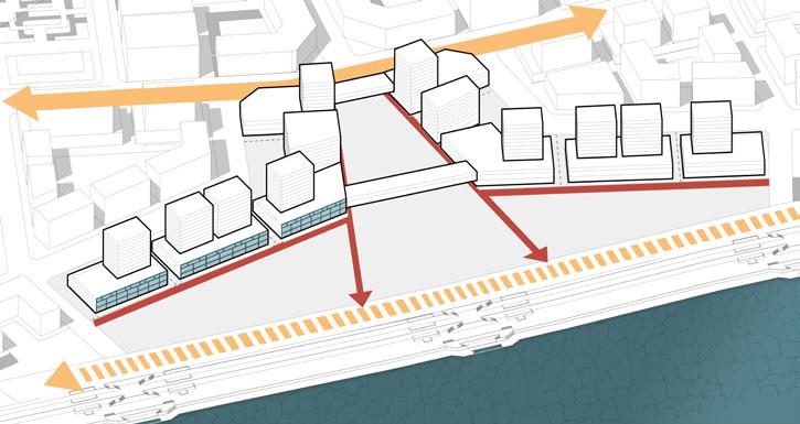
Commercial frontages shall maintain edge porosity in terms of fenestrations.
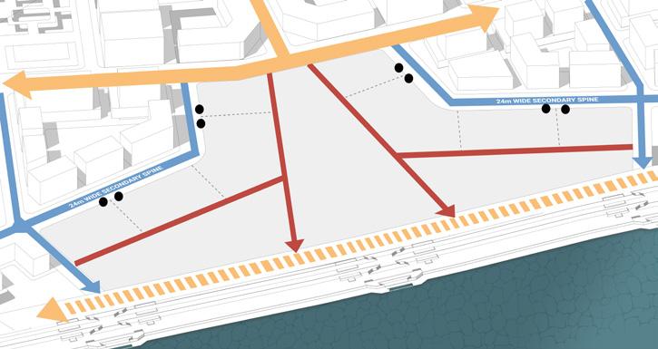
Vehicular access shall occur from the tertiary and local streets (18m and 12m ROW) and will be pedestrian priority streets. A minimum width of 2.5m shall be demarcated for footpaths on all streets to promote pedestrian and NMT movement.
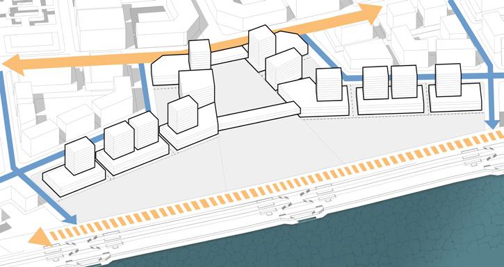
The built form at the nodes shall be commercial in nature with the built edge chamfered at the corner to create a welcoming plaza.
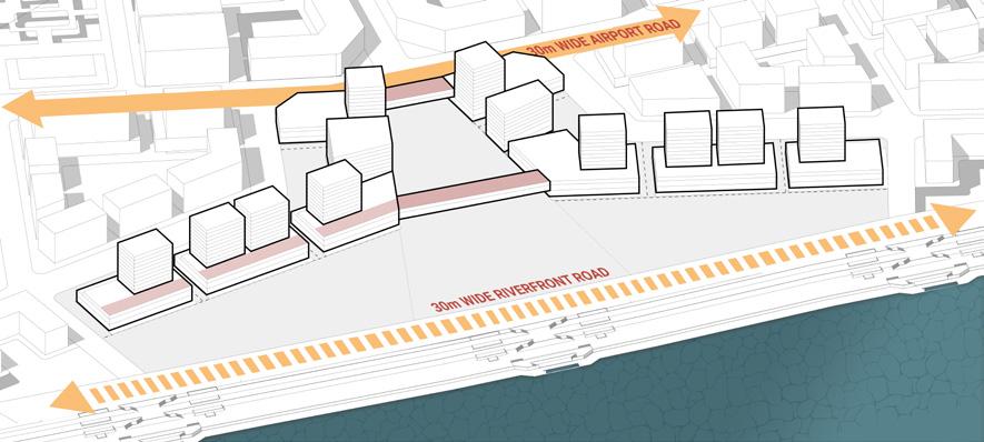
Buildings abutting the airport road shall
• be of podium – tower typology
• have a constant podium height of G+2
• have no boundary walls
A minimum setback of 25m is to be left from the centre of the junction to create plazas at the nodes.
There should be a stepback of minimum 9m after the podium level.
The buildings along the high street promenade shall have a one floor high active colonnade edge that provides a transition space between the public and private.
Bridge connections at podium level are recommended to capitalize on the views.

Creating a gateway to the city by leveraging the airport road as a major thoroughfare to create a destination experience.

The master Plan demonstrates how the judicious use of underutilized land can create a public asset for the city. The proposed design demonstrates the viability of redeveloping underutilized defense land. The site with its particular location and leverage is a good example to exhibit what the city can offer to its people.
It can thus, function not only as the scaffolding for future development, but also refresh the image for East Ahmedabad.
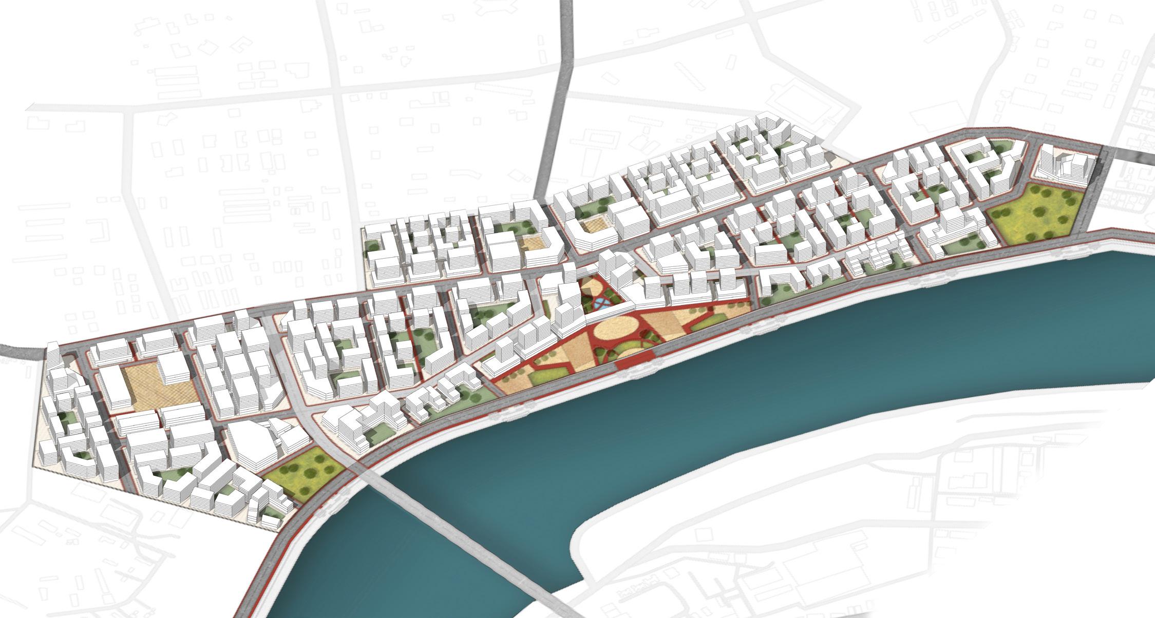
The Master Plan Studio imparted the ability to comprehend large scale urban projectsunderstanding the nuances and complexities involved in handling a brownfield site. Each stage of the studio required a new interpretation of the urban scale and imparted a new perspective to handle such themes and ideas.
Sketching out the conceptual framework plan gave a good understanding of the fundamentals of master Plan and how one can take advantage of the site potential assets and henceforth, build up to an intent and vision.
Being equipped with the basic tools, the design detail stage gave a whole new appreciation for the multiple scales at which urban designers need to operate. It also made us cognizant of the constant back and forth process involved and helped produce a comprehensive outcome.