





ELEMENTS OF URBAN DESIGN
Spring 2022
Akanksha S Rao | PUD21023 CEPT University
The studio is structured as an introduction to urban design representation and design of public places. The studio is based on the premise that urban design is best understood and expressed through study and representation of the built urban environment.
The studio is structured in multiple modules running through the semester, each culminating with a review and exhibition of the outcome. All the studio modules will significantly focus on effectively capturing and communicating the spatial qualities of the urban built environment.
The first module focuses on perceiving and representing the key elements of urban design (building types, streets, open spaces and urban blocks) that come together to make any functional urban space. The second module focuses on the analysis and design of streets including the detail design of elements.
This studio will enable students to explore the scale, form, character of key urban design elements and their relationship with the larger urban context.
Locating the Site
Canal Road : Street Character
Analysing the Existing Street
Proposed Street Layout
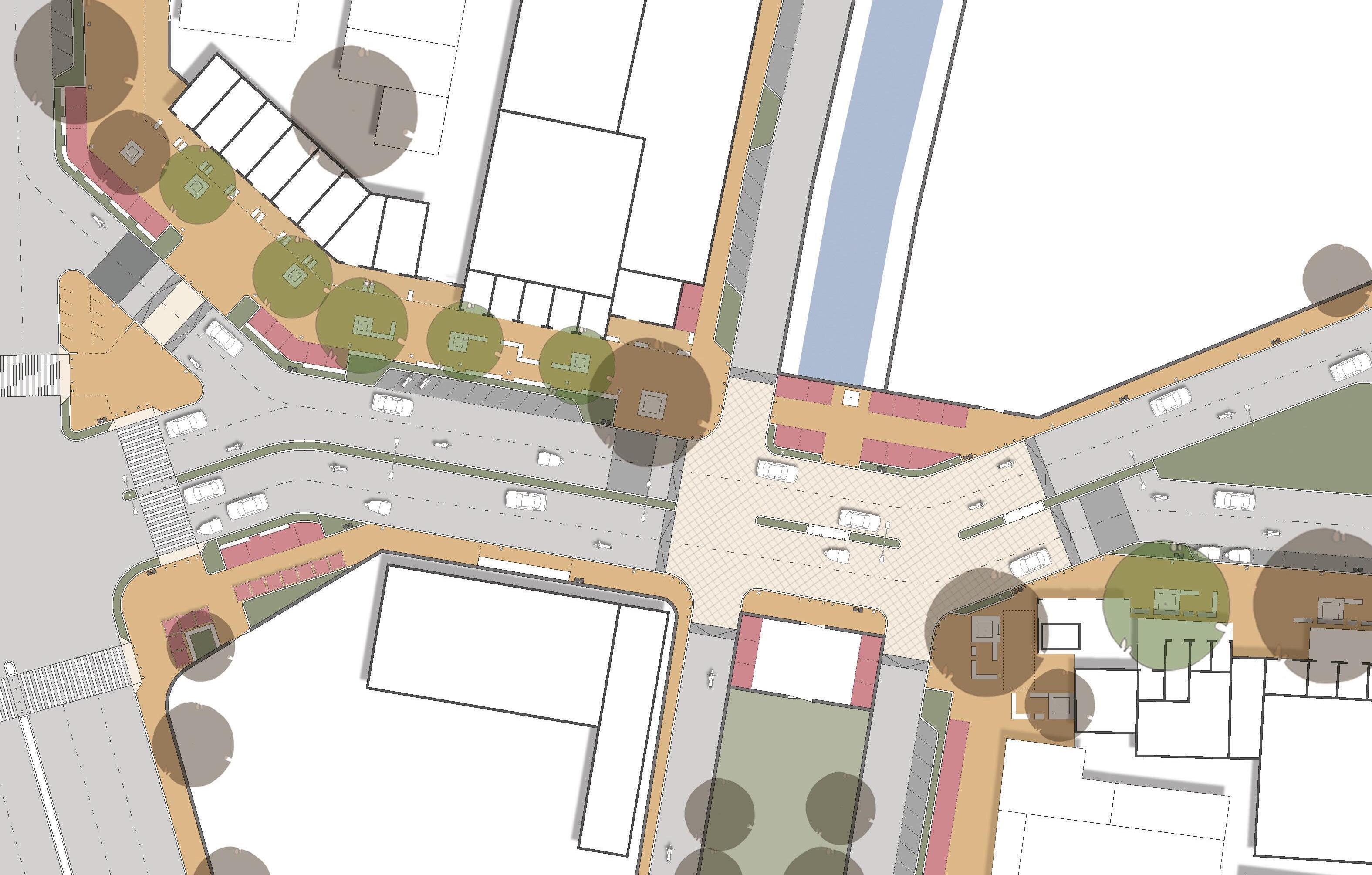
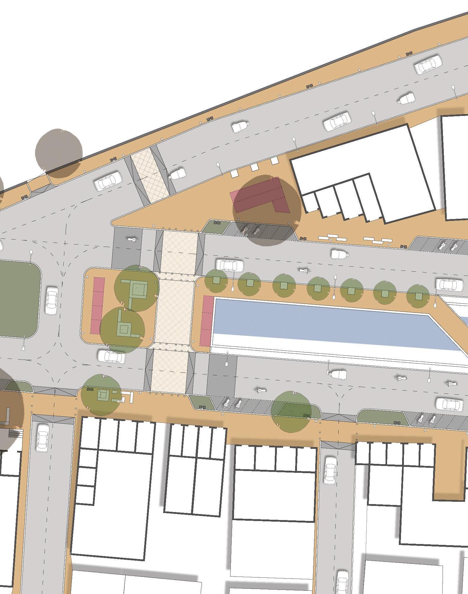
Proposed Design : Detail Stretch
Typical Section through Canal
Design Strategies
Sectional Study of Street
Design
Design
Isometric
: Materiality
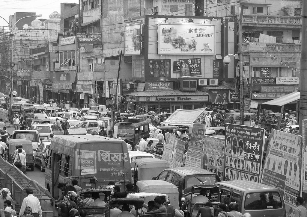
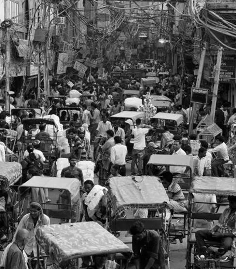
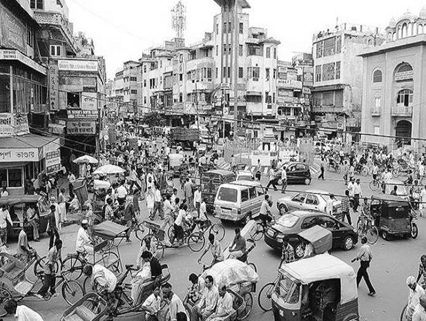
Chandni Chowk is a very significant part of Old Delhi, also called Shahjahanabad. It was a historic marketplace and a vista between the Red Fort and the Fatehpuri masjid, which got dilapidated over the years due to urban sprawl, safety hazards, encroachments, etc.
Consequently, the Redevelopment of Chandni Chowk project was envisioned by Shahjahanabad Redevelopment Corporation (SRDC) in 2008. The essence of this redevelopment project is to honour the heritage of the street while improving the user experience through pedestrianisation and integrated infrastructure development.

Chandni Chowk is a very significant part of Old Delhi, also called Shahjahanabad. It was a historic marketplace and a vista between the Red Fort and the Fatehpuri masjid, which got dilapidated over the years due to urban sprawl, safety hazards, encroachments, etc.
d e c o n g e s t i o n local economic development imageability heritage
r e d e v e l o p m e n t equitable distribution social development
user - experience integrated infrastructure
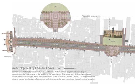
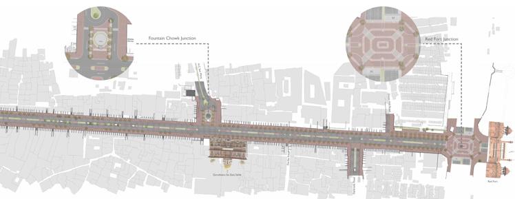
Proposed Design for the Chandni Chowk Source:PradeepSachdevaDesignAssociates
Consequently, the Redevelopment of Chandni Chowk project was envisioned by Shahjahanabad Redevelopment Corporation (SRDC) in 2008. The essence of this redevelopment project is to honour the heritage of the street while improving the user experience through pedestrianisation and integrated infrastructure development.
Project Timeline 2008
Project envisioned
Work started
Urban sprawl and chaos
Congestion as street and public space taken over by motor vehicles
Safety hazard due to electrical cables and utilities hanging over head
Encroachments on pedestrian footpaths
Lack of required infrastructure to support all activities of the street
Execution on site began Technical deliberations based on site issues
Work completed and project inaugrated
50 consultations
17 stakeholders 2 years
After multiple rounds of consultations with the various stakeholders, the design underwent continuous deliberations and multiple revisions, to get the UTTIPEC and ASI approvals.
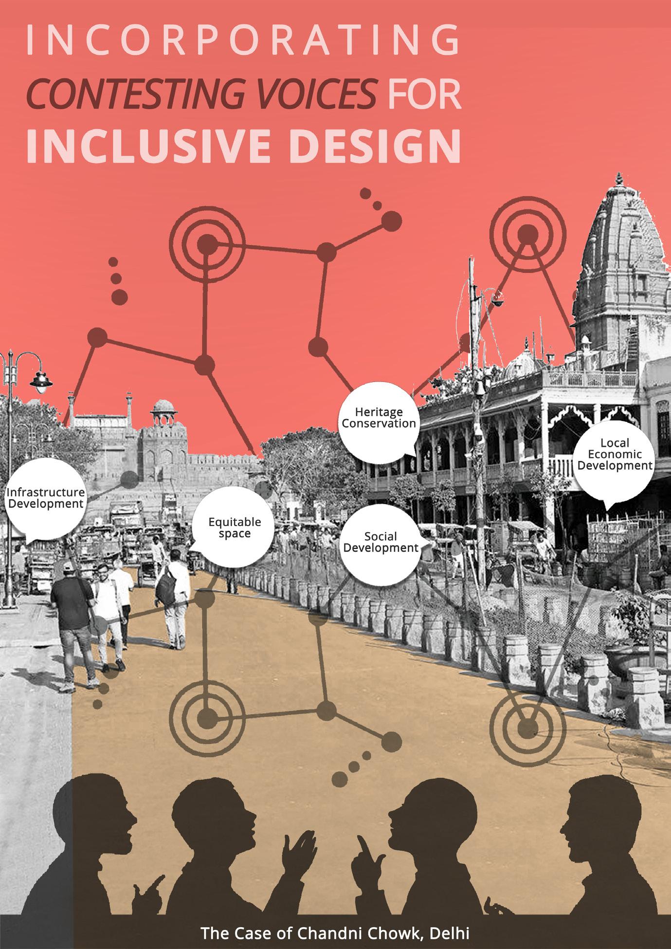
As in a project of this scale, there were disagreements and oppositions from stakeholders, and a key part of this project was to address all the concerns through demonstrations and on-site surveys. While this resulted in delays, it also contributed to the success as a comprehensive approach was followed.
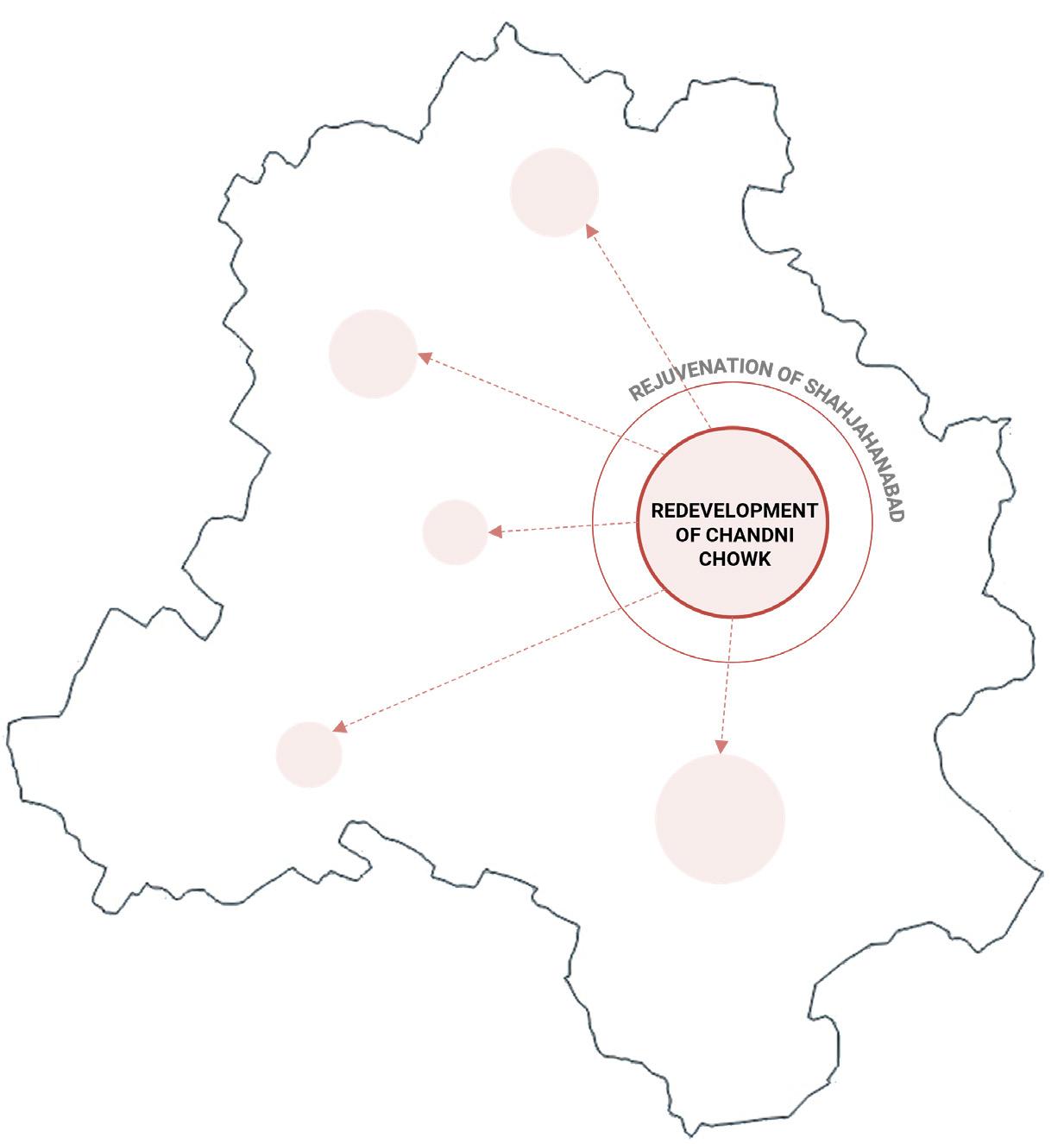
This street is representative of the Indian urban complexities in a marketplace. It is aiming to strike a balance between the heritage and the needs of the people who live and work here.
The ideology of continuous process of deliberations and bottom – up approach can become a model of how street redevelopments and market redevelopments can happen in the city.
This project can become a catalyst and a standard for many such projects to be envisioned and commissioned.
A bottom-up approach for design was followed that was key to its success
Conceptualization stemming from context, people and engagement with stakeholders

A phase - wise implementation was followed to ensure street functions and business were not hampered


Cognizance that motor vehicles cannot be entirely neglected - provided equity on street as much was necessary

A continuous process of feedback and action is at play that improves acceptance and value added to the project
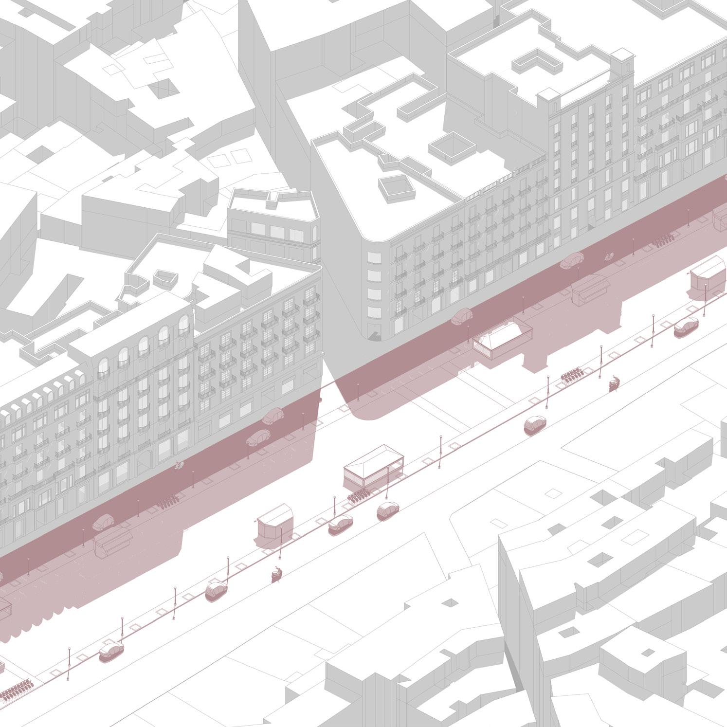
This exercise is designed to develop a strategic understanding of various attributes of streets and building types and their representation. It also explores the functional role of streets of mobility as well as the social and cultural role of being a public space.
The exercise requires the student to identify and represent one street with distinct characteristics and develop their skills to draw its three-dimensional form that abstract the character of the street life.
Additionally, streets are analysed through parameters that shape the physical form of streets and understand their relationship with the surrounding context.
One street each from an Indian city and an international city are chosen for this study.
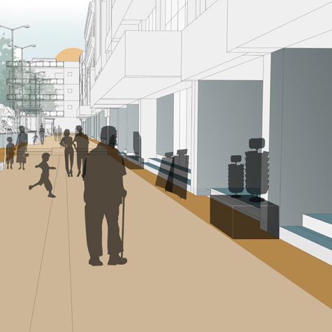
Physical and Perceived Edges
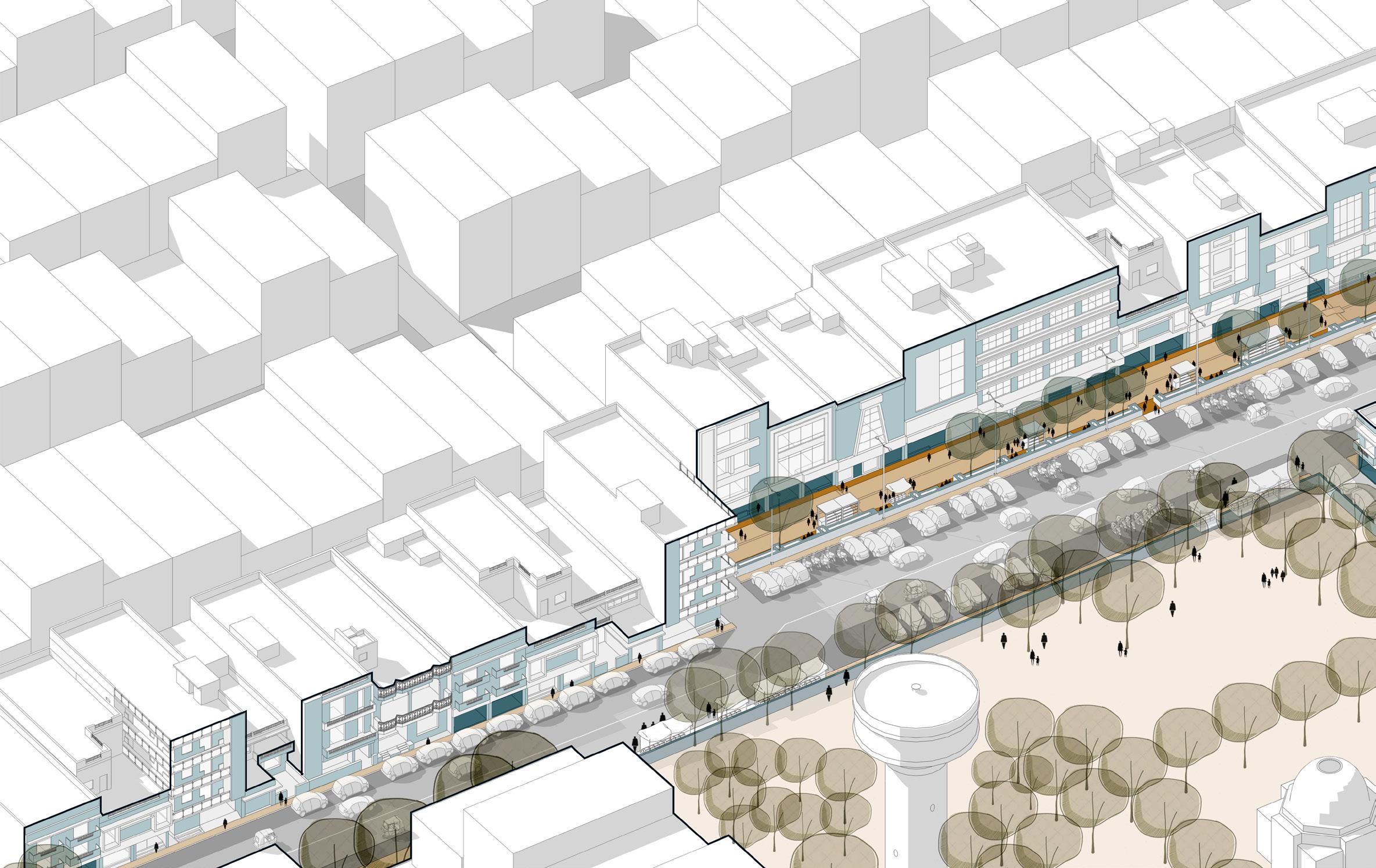
Perceived edges are defined through various activities such as shop extensions, vendor kiosks, paving patterns
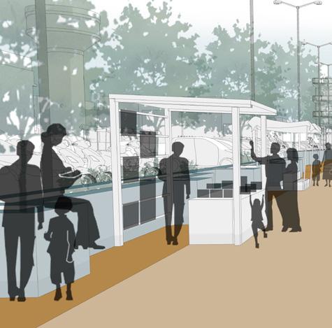
of Enclosure through Trees
Line of evergreen trees along the toe wall creates a shaded space and contributes to the street volume
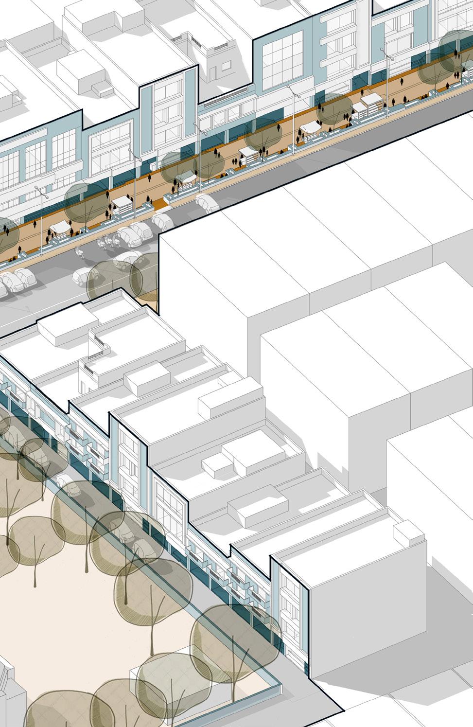
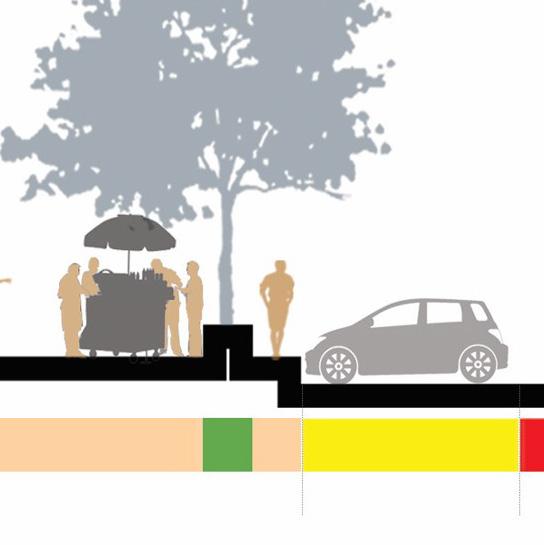
Buffer Strategy
Careful strategy of providing parking space along toe wall –prevents vehicles from entering the plaza
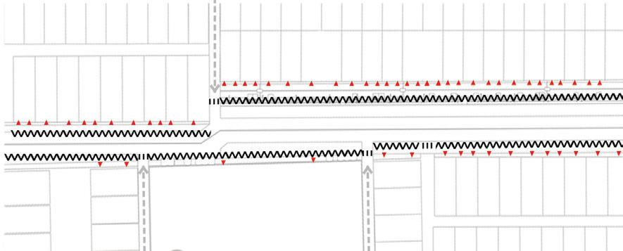

The commercial edges of the street are lined with restaurants, shops, salons, etc. with predominantly glass facades for display. These often spillover into the pedestrian plaza.
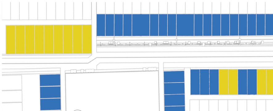
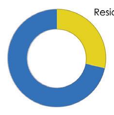
Along the main pedestrian plaza, all the buildings are commercial in nature, while other edges with predominantly residential use are gradually getting converted to commercial on the ground floor.
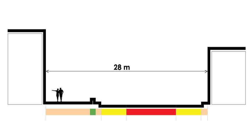
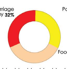
The street has an asymmetrical section with a wide pedestrian plaza on one side, and carriageway and parking on the other. Level difference, toe wall and vegetation along the edge keep the activities separate.
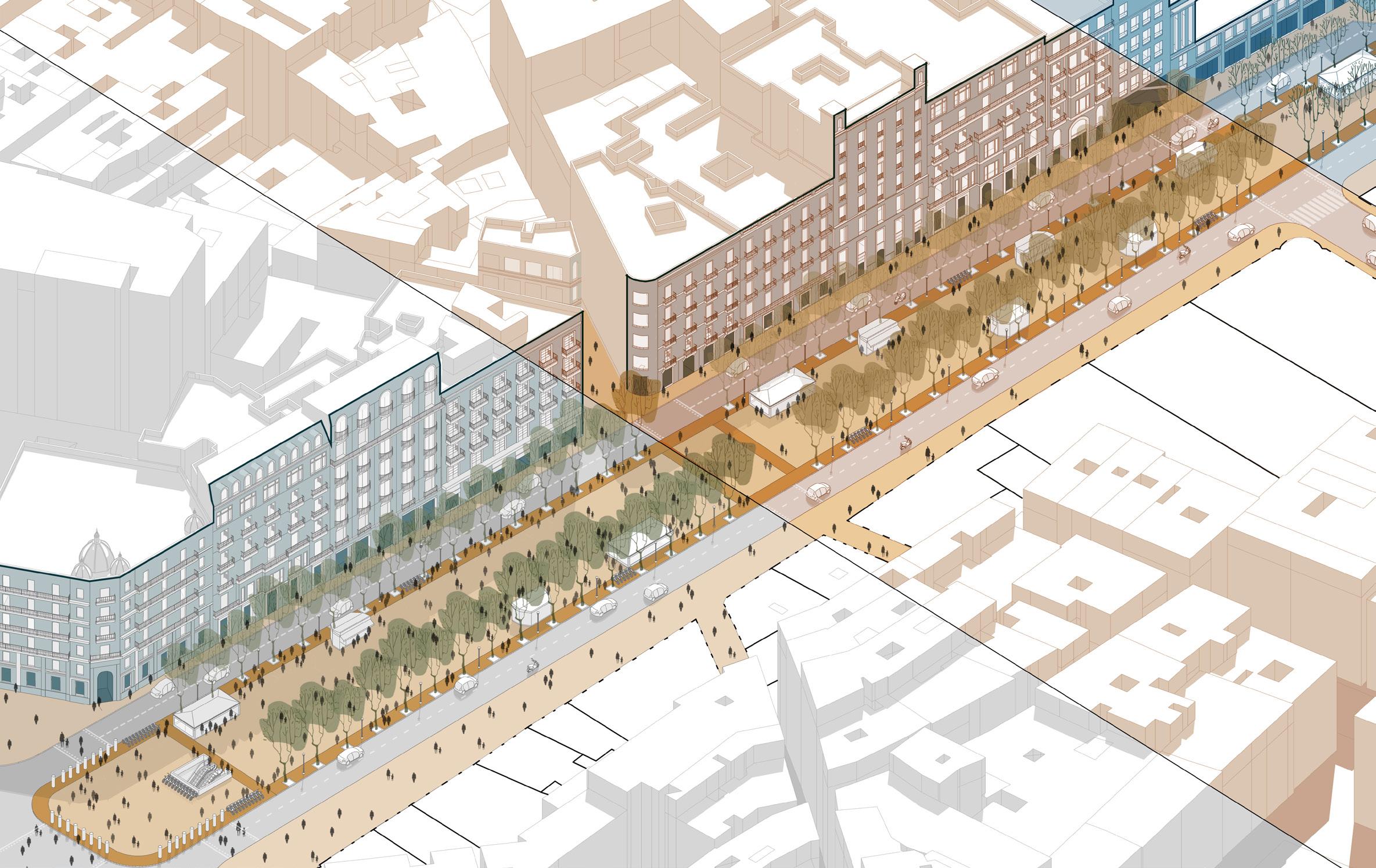
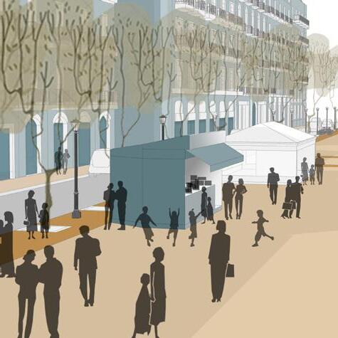
Physical and Perceived Edges
Edges defined through activities – informal vending and parking bays along vehicular lanes.
Physical elements like vegetation, streetlights also contribute to edge condition and street volume
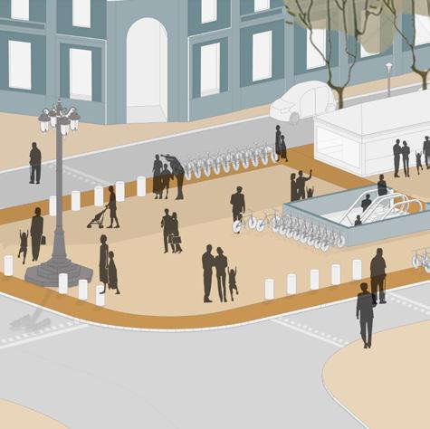
Materiality as a Demarcation Strategy
Change in the paving material between footpath, vehicular lane and pedestrian plaza defines the dedicated spaces for each activity without creating much level difference
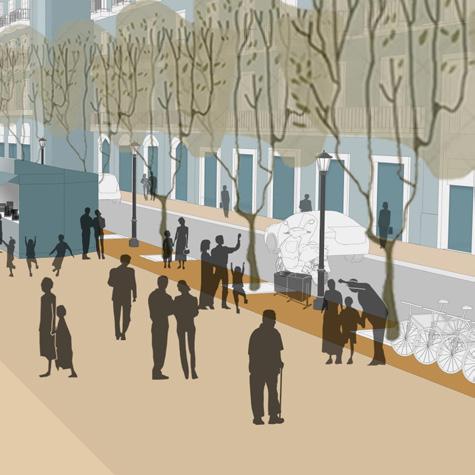
of Enclosure through Trees
Multiple layers of enclosure created through trees (tall, deciduous) and the built form.
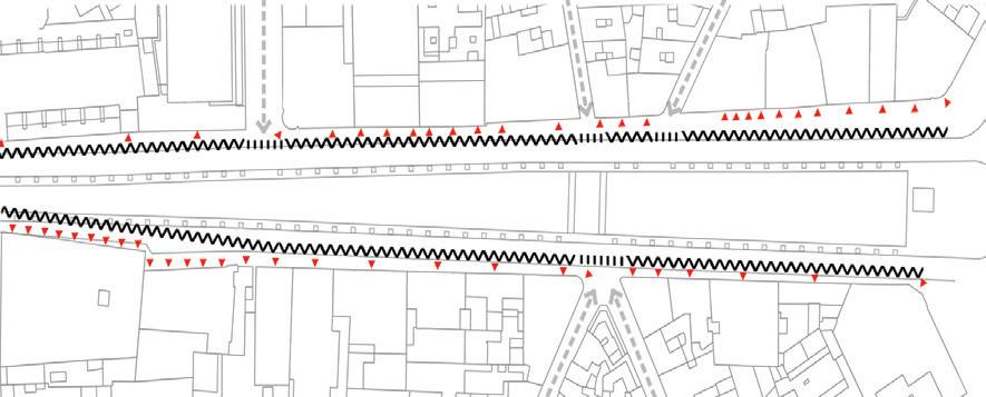
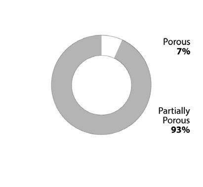

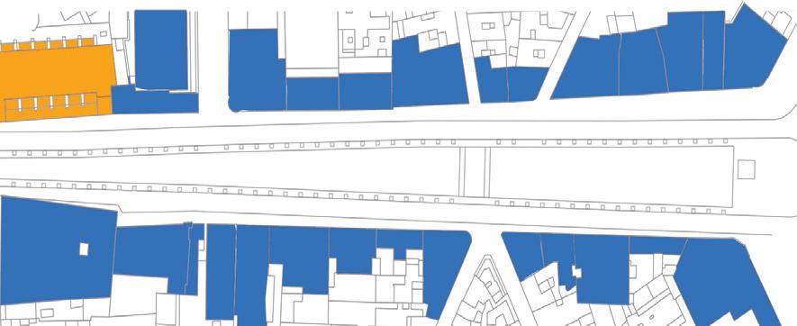
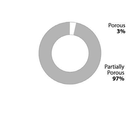
The partially porous edges with a variety of retail, shopping and cafes keep the edge lively throughout the day. Access from other pedestrian streets create multiple pause points for the pedestrians.
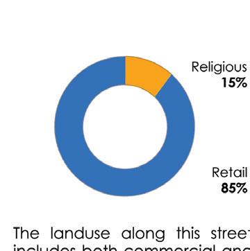
The ground floor for all the buildings is used for retail or commercial, while the upper floors have residences or hotels, offices. The combination of these two uses attracts considerable footfall.
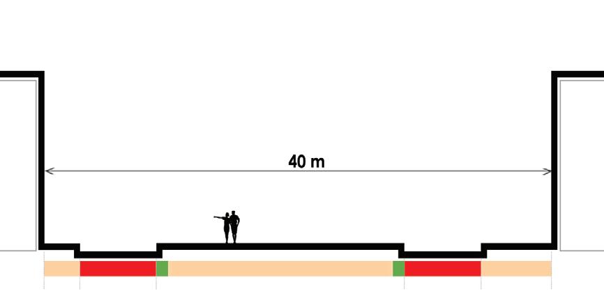
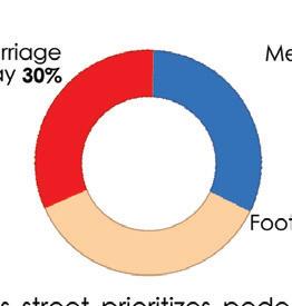
The ROW includes a wide pedestrian island in the middle, where urban activities and commerce exists under tree shades, and carriageway and sidewalks on either side - prioritising pedestrian activity.
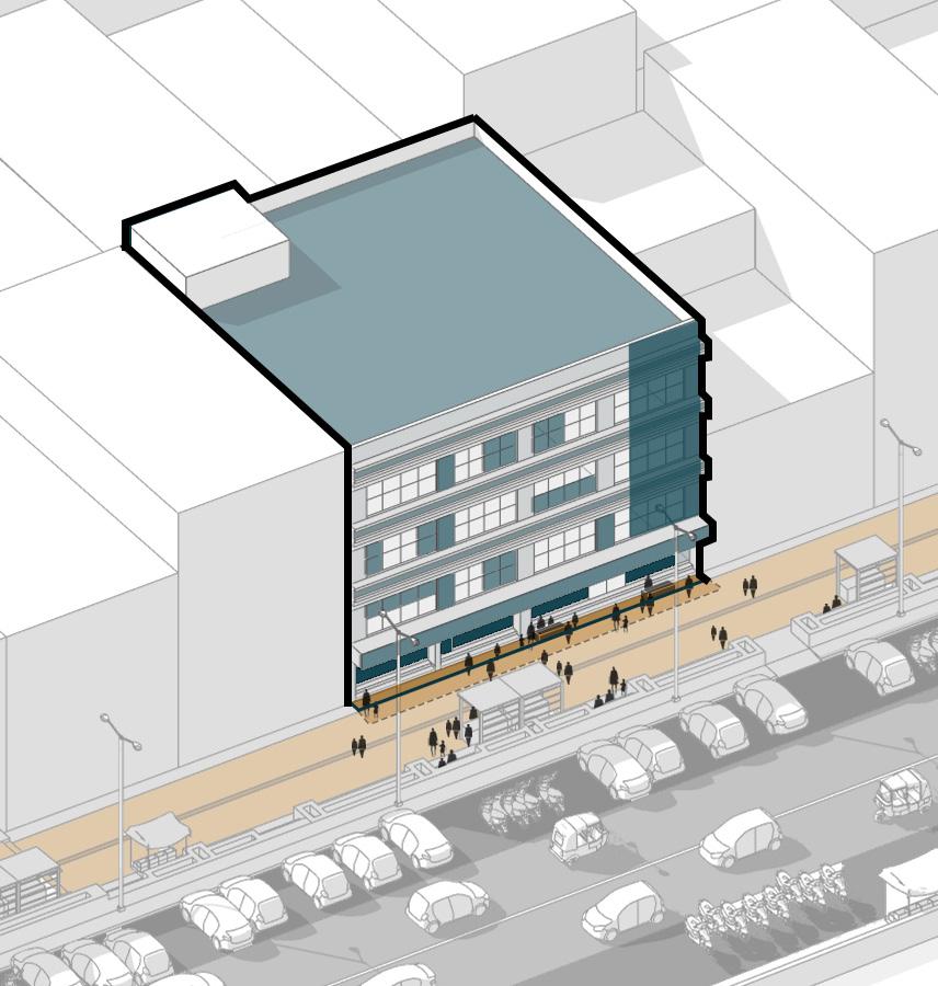
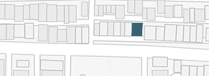
Building Name : Evergreen Sweets, Green Park, Delhi
Ground Coverage : 350 sqmt
Total Built-up area : 1400 sqmt
• Activities on ground floor spillover into pedestrian plaza
• Wide footpath and active shop frontage with high footfall
• Simple, utilitarian facades
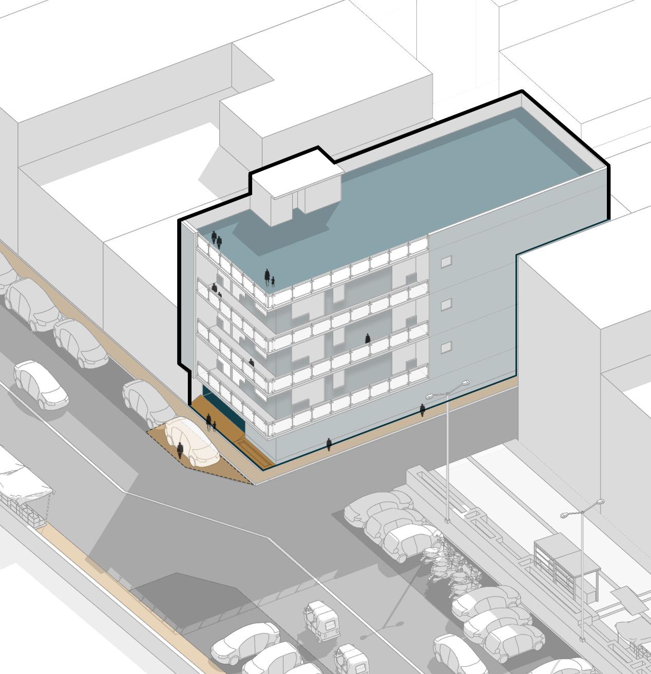
Building Name : Row House, Green Park, Delhi
Ground Coverage : 240 sqmt
Total Built-up area : 960 sqmt
• Functions restricted within the building
• Inactive street edge – minimal footfall
• Built form responds to corner condition with continuous balconies
Commercial
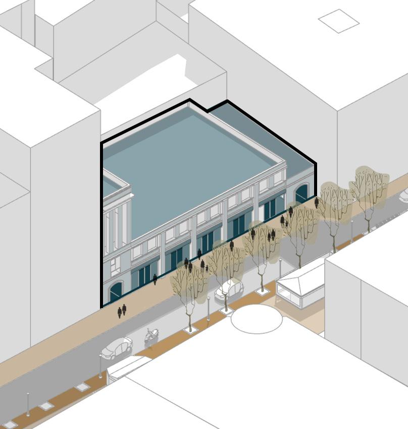
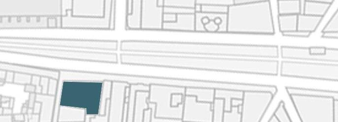
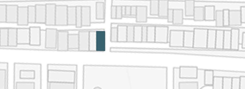
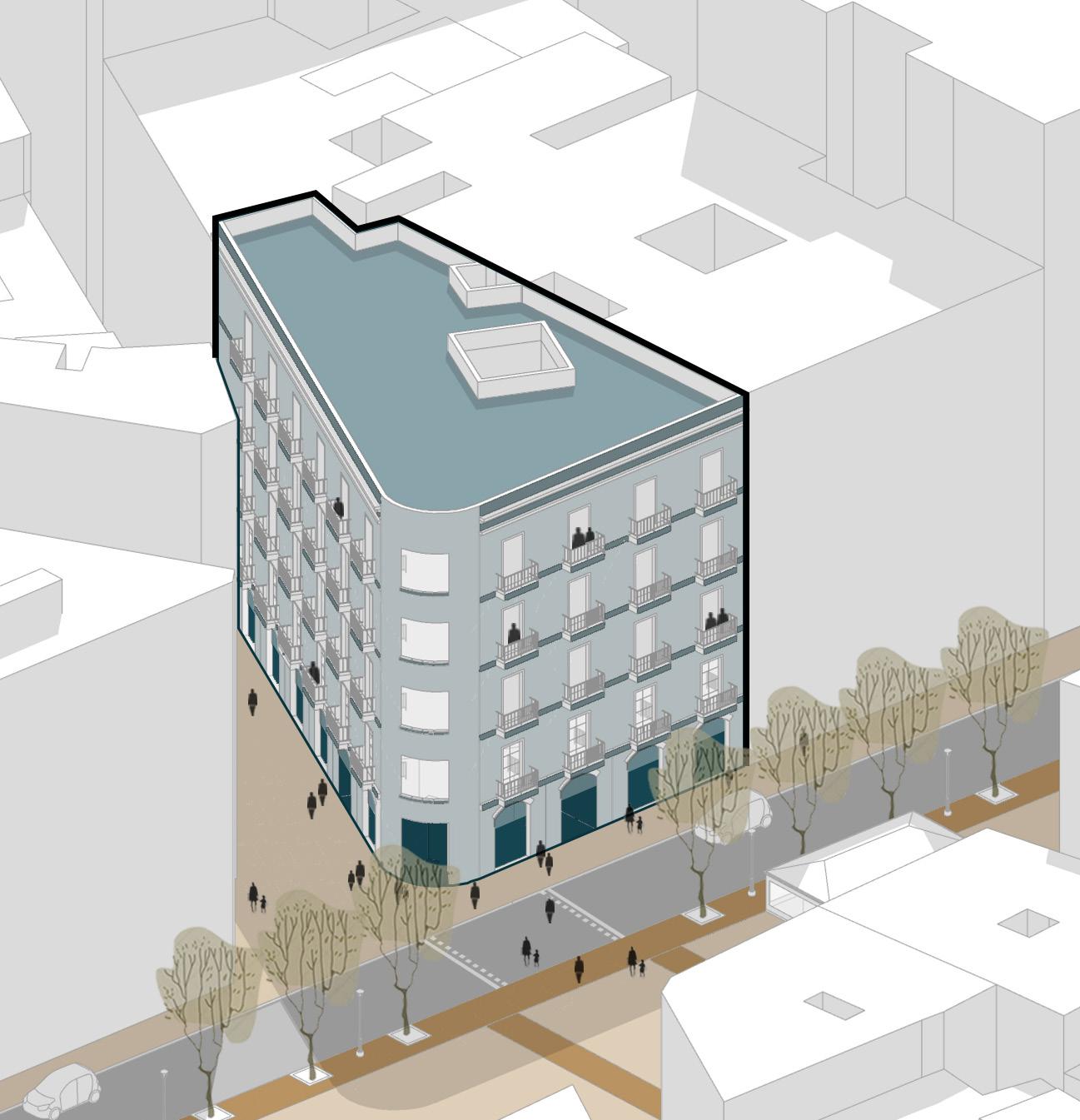
Building Name : NBA Cafe, Barcelona, Spain
Ground Coverage : 530 sqmt
Total Built-up area : 1130 sqmt
• No spillover of activities on the ground floor
• High porosity (physical & visual)
• Ornamental, textured facades with ordered signage spaces
Mixed Use (Retail + Hotel)
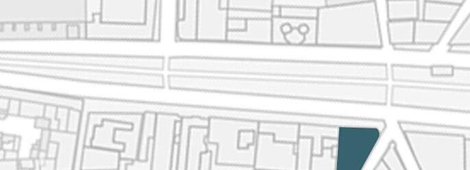
Building Name : Penso Bahia, Barcelona, Spain
Ground Coverage : 350 sqmt
Total Built-up area : 1750 sqmt
• Balance & order in architectural style (Catalan Gothic) of façade – lend certain uniformity to street
• Built form responds to corner condition with access points to capture more footfall
This exercise is designed to develop strategic understanding of various attributes regarding Urban Blocks and their components – Building Types, Streets and Open Spaces.
The exercise requires the students to identify and analyse the parameters that shape the physical form of urban blocks and open spaces to understand their role in the surrounding context.
Additionally, various techniques of representation to draw the urban blocks and open spaces are explored to abstract their character.
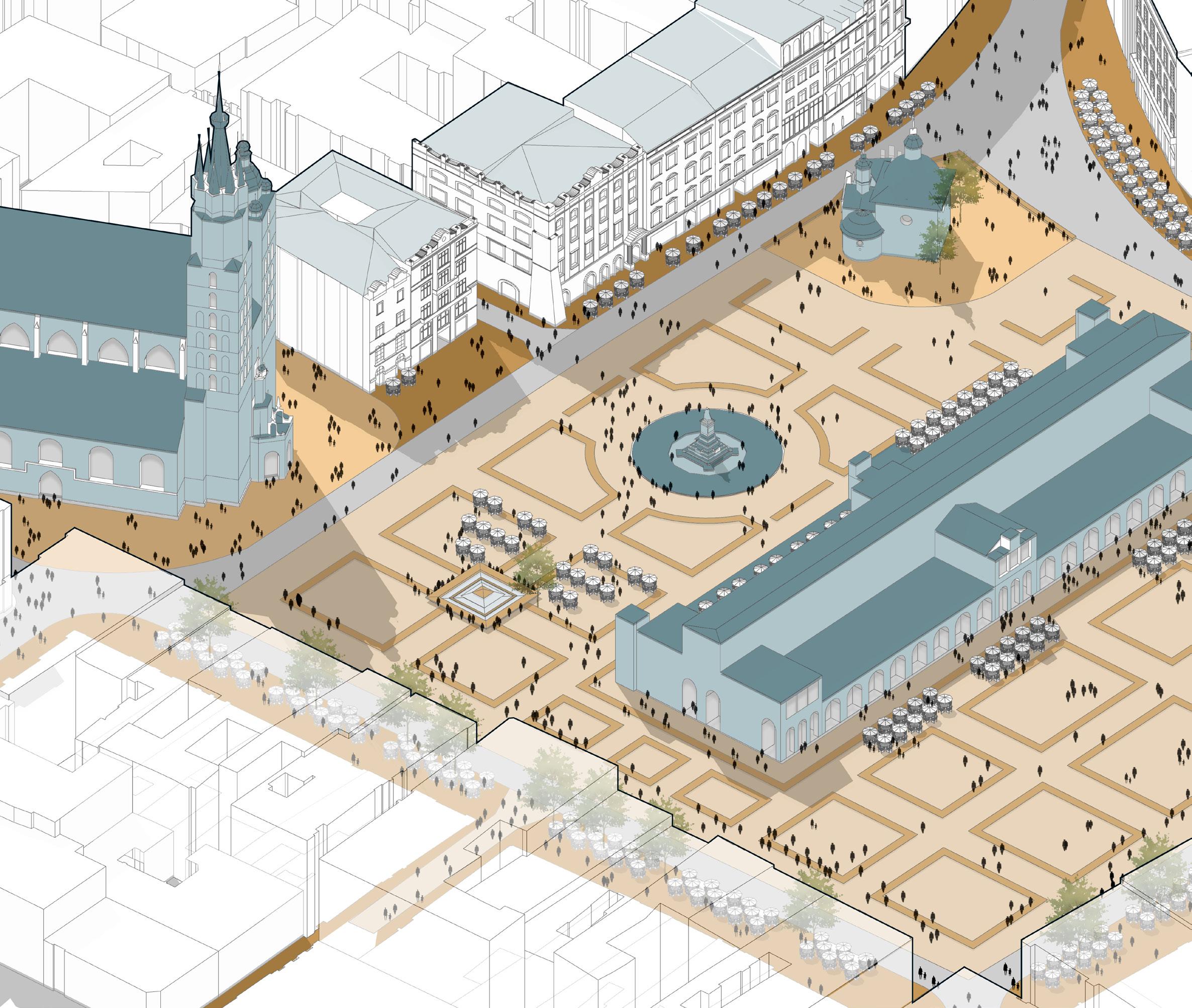
Presence of multiple nodes or anchor points within the square center the activity around them and influence the way the space is used.
Each of these nodes create an individual envelope of enclosure that provide a very humane scale to this otherwise humongous open space.
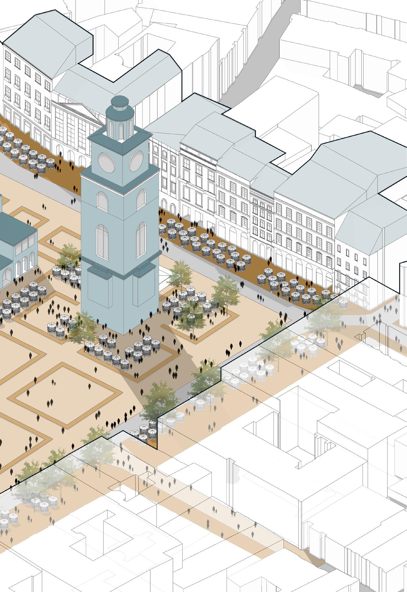
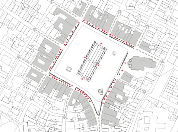



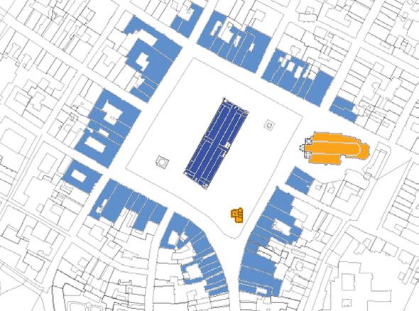
Rynek Glowny is accessible from every direction as 11 major streets meet at this open space. The built use along the square mainly comprises of restaurants, museums, retail stores, churches - thus, creating very porous edges that spillover and activate the central space. Due to the multiplicity of uses of this space, it is attractive to all social groups and is active throughout the day, but evenings receive the maximum footfall.
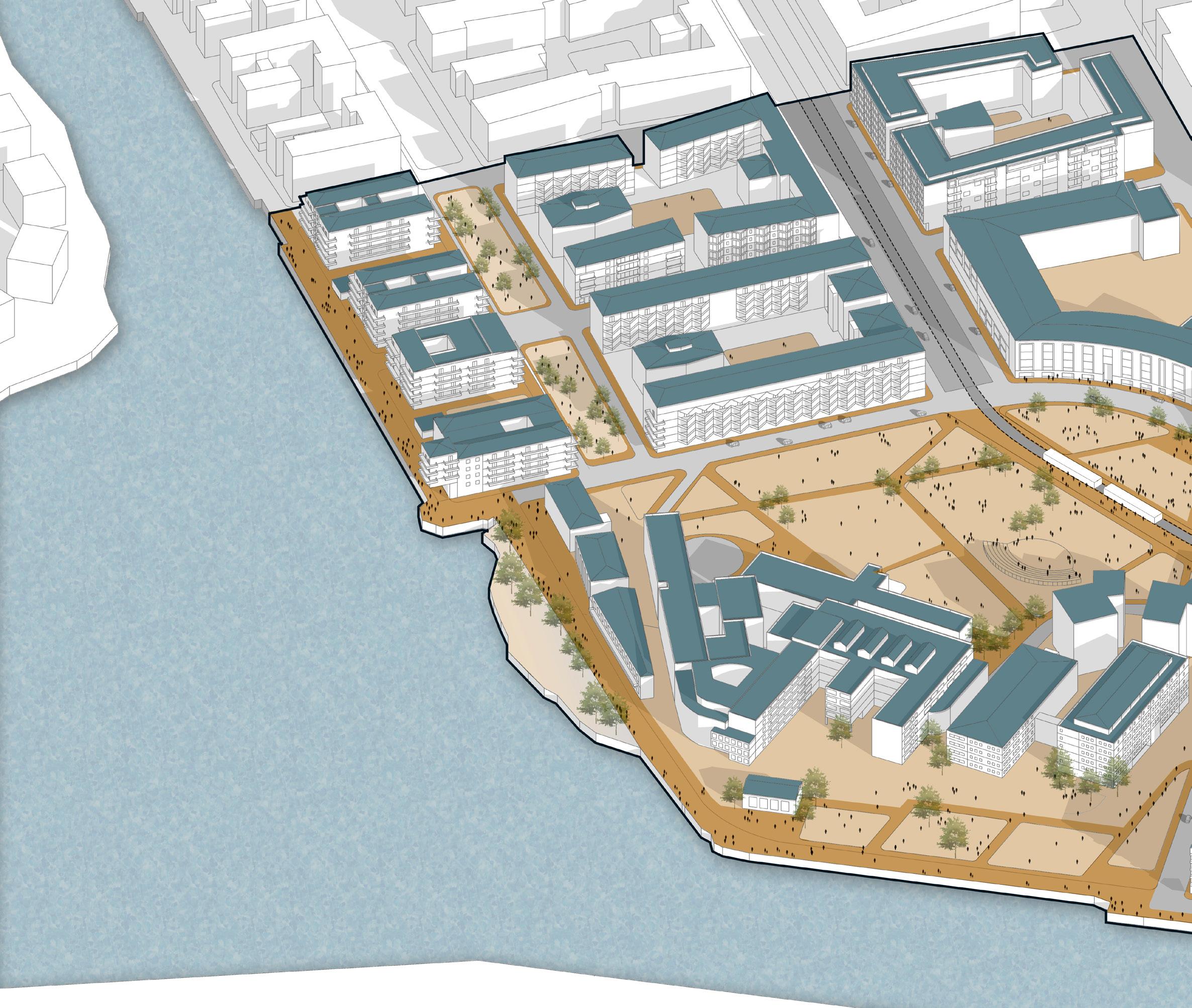
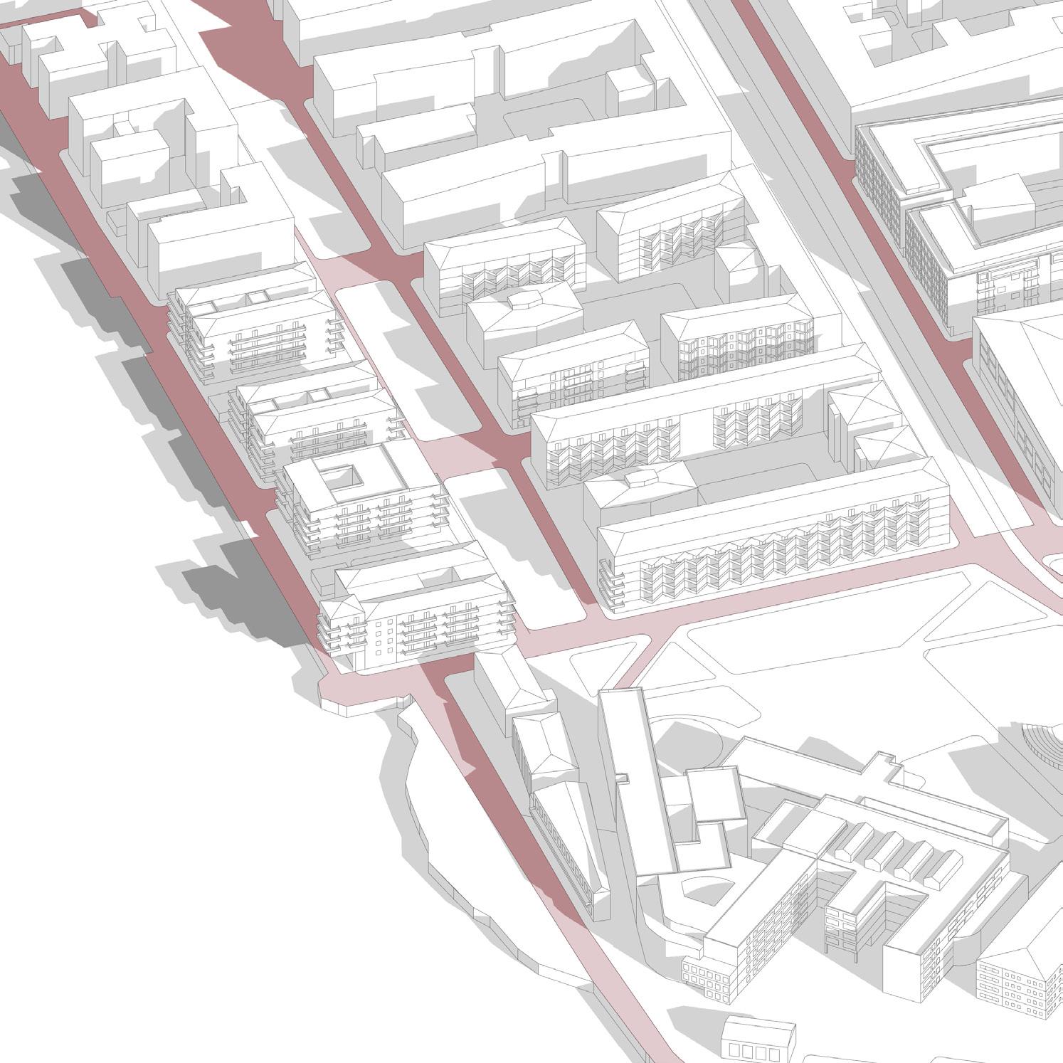
SPATIAL HIERARCHY OF OPEN SPACES
There is variety in terms of scale, use and possible ownership of these spaces.
While the residential blocks have a perimeter typology with enclosed open space in the middle, the public areas have a more open structure with large open spaces around for spillover to happen.
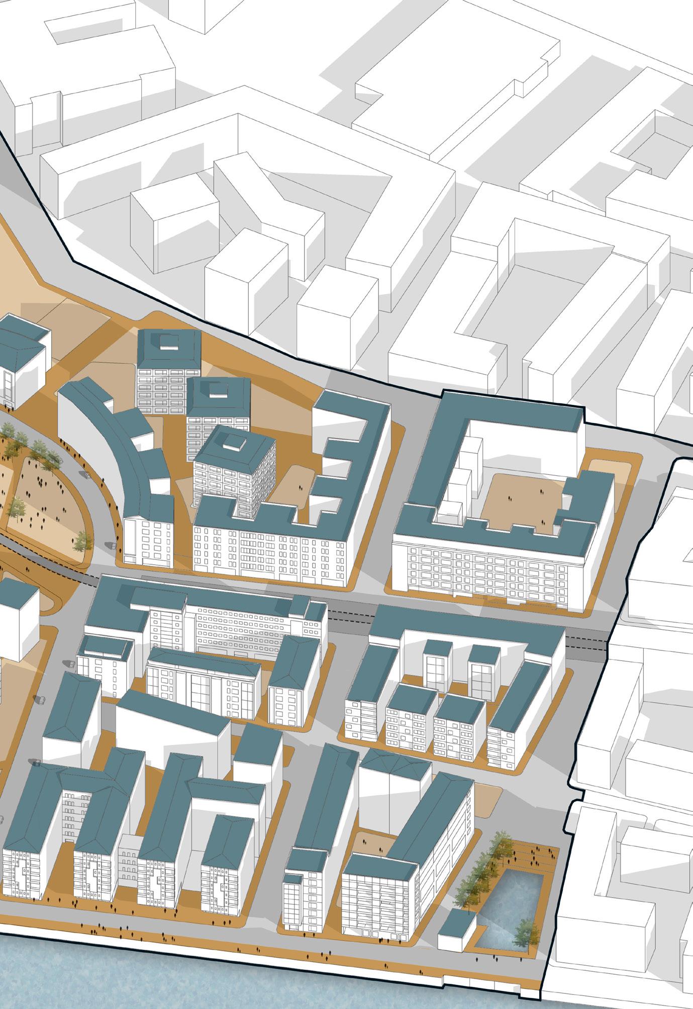
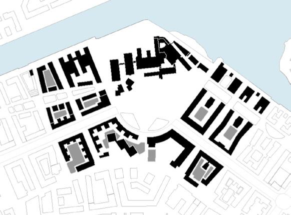
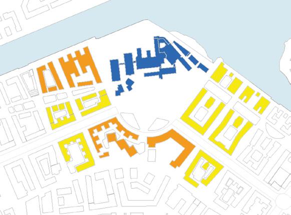
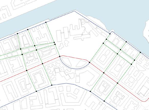
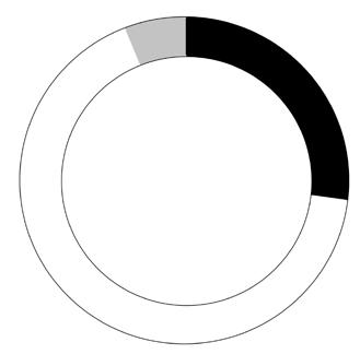
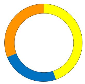
The neighborhood has a low built density with a varying builtopen relationship. While the residential blocks have a perimeter typology with enclosed open space in the middle, the public areas have a more open structure with large open spaces around for spillover to happen. The tram line passing through the center forms a major accessibility axis.
The design exercise focuses on re-imagining existing scenarios in the city with a fresh perspective on the opportunities in the public domain. It attempts to develop the analytical, conceptual and representational abilities in preparing a frame work plan for the street and its surrounding context.
It is taken as a real-life design challenge where the site is critically studied with issues and potential and further design strategies to enhance the overall site are proposed.
The site chosen for this city is the Canal Road in the area of Ghodasar, Ahmedabad.
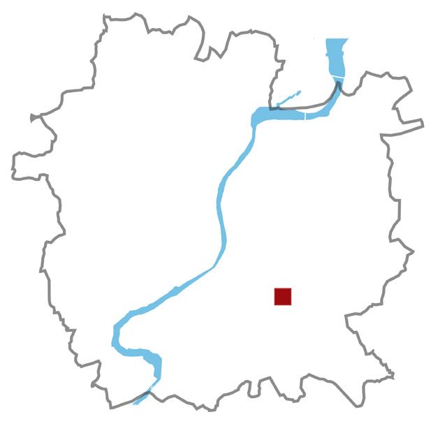
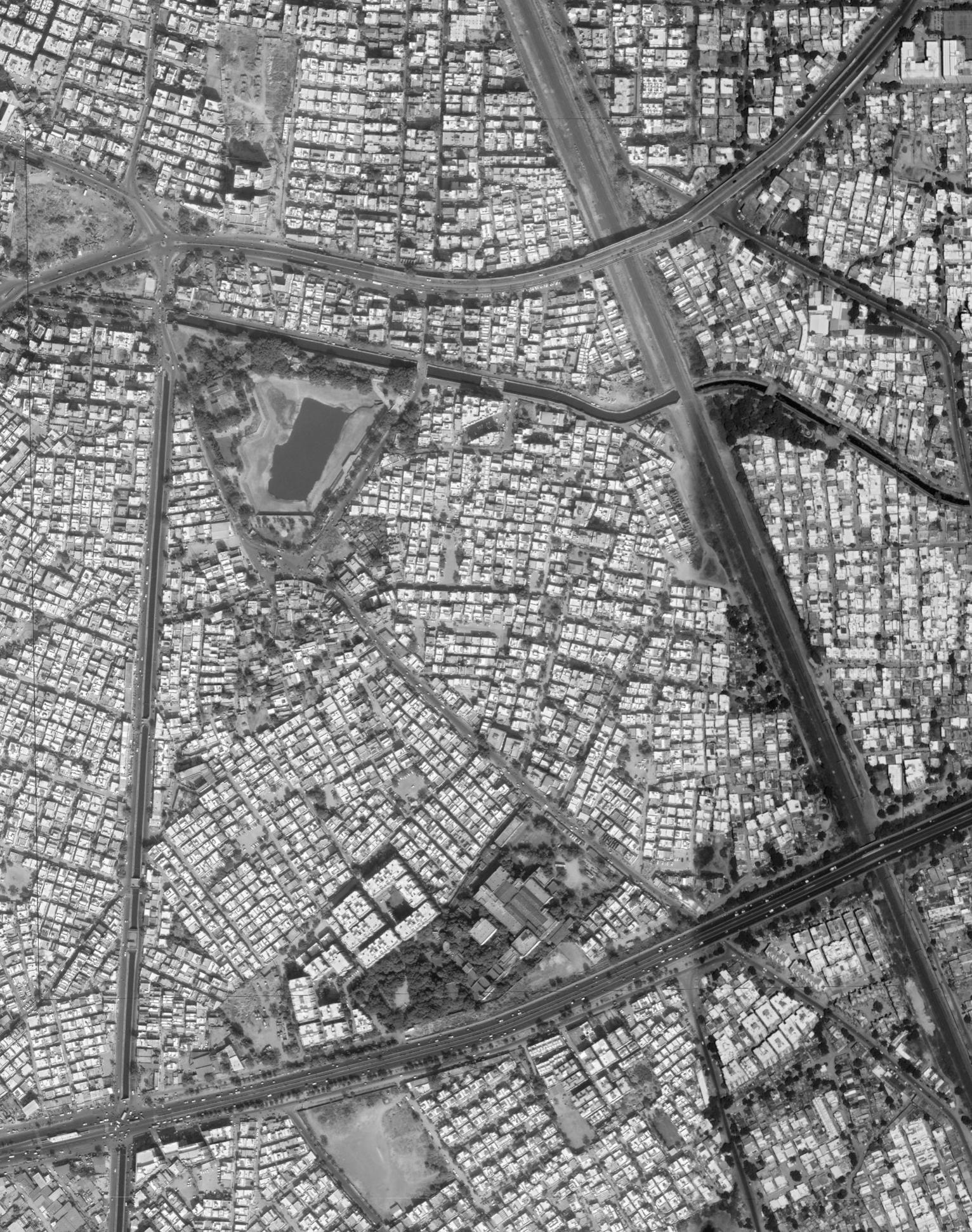
Located in the south-east part of Ahmedabad city, the area is predominantly residential with commercial and mixeduse functions along the sub - arterial and collector streets.
At the city level, the area is well connected via NH8 and the 132ft Ring Road.
The city traffic passes through the precinct, especially the traffic flow from the industrial estate area towards Maninagar and other residential areas.
The Ghodasar Canal Road functions as a sub - arterial road running through a predominantly residential area. It has a unique character as it is a major connector of ring roads but also hosts a variety of neighborhood level activities.





Dual character of Street
By virtue of its structure, the Canal road behaves as a bifurcator, dividing the neighborhoods on the two sides. The vehicular movement further adds a layer of division between the users and the canal.
At the same time, it has a few connections across the canal that try to tie the neighborhood together. It is also an important connector linking the inner and outer arterial roads.




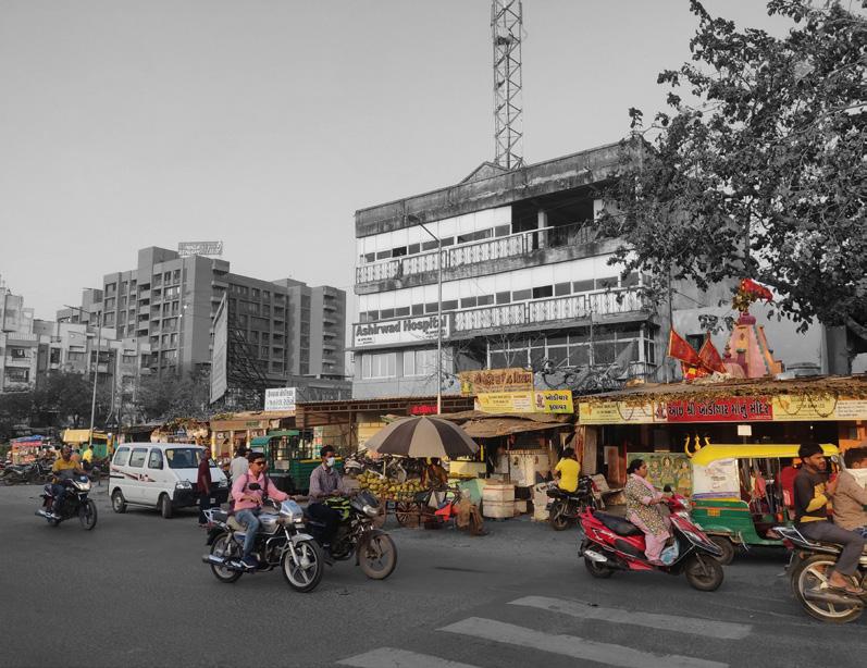
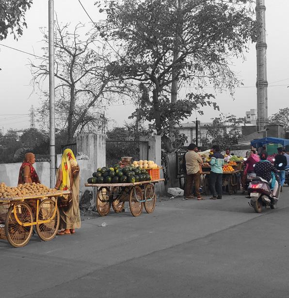
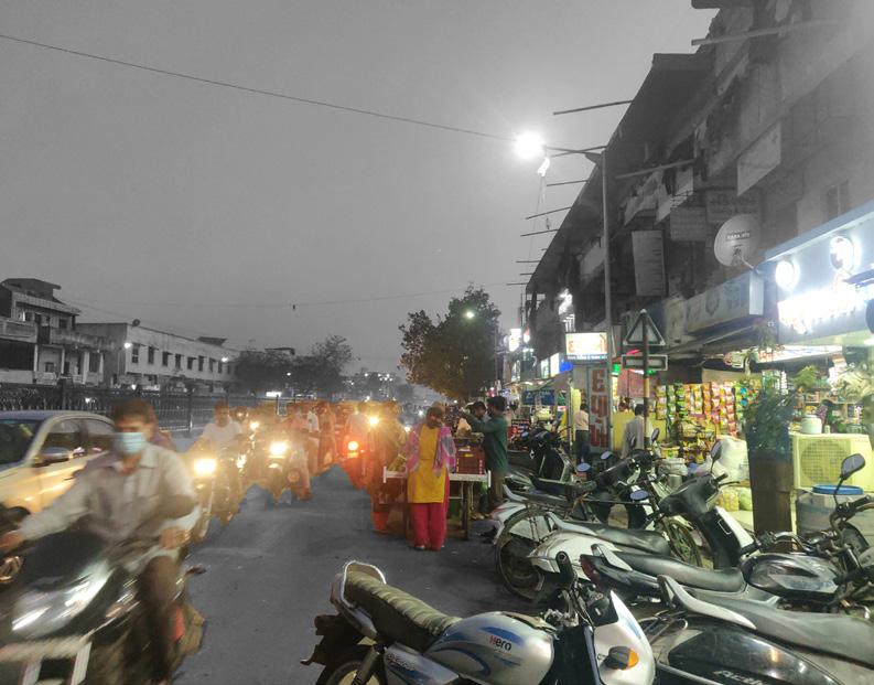
Haphazard parking infront of eateries
Temple acts as anchor point - activities spillover onto the street
Vending activities along lake and playground compound wall
Haphazard parking encroaching on the carriageway
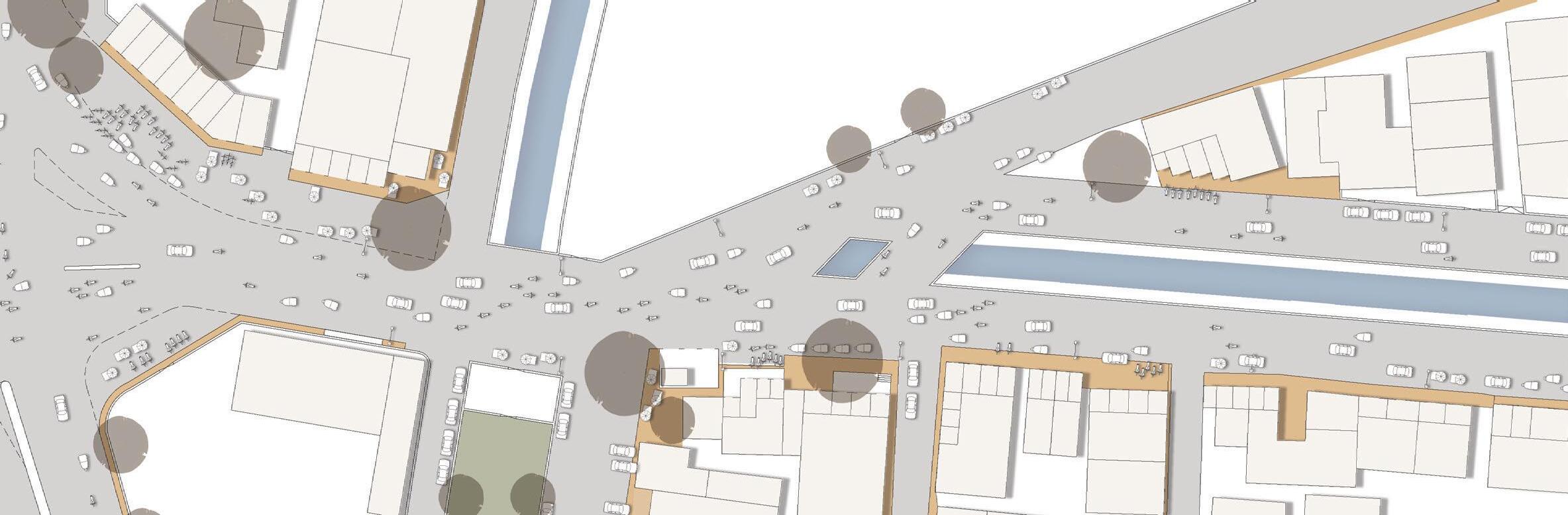
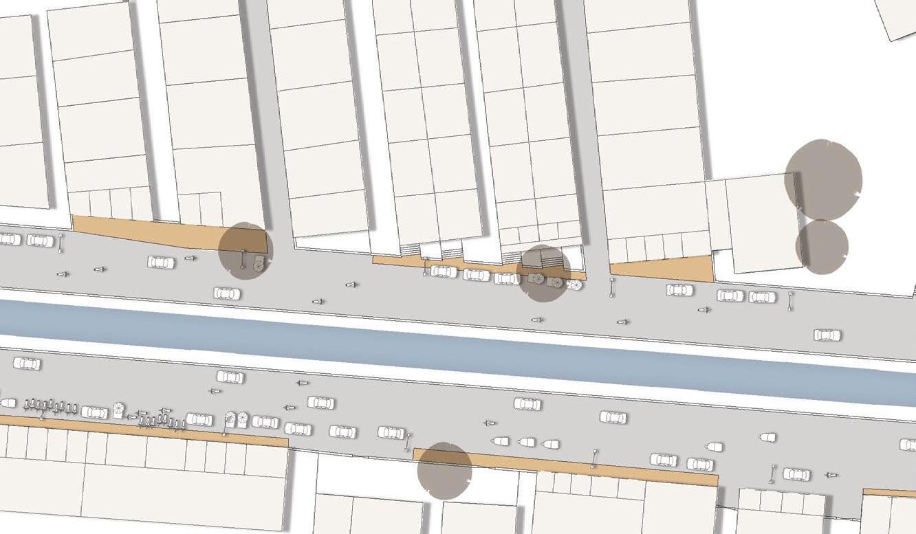
Existing Street Layout (400m)
Community Hall with multiple spillover activities
Temple acts as anchor point - activities spillover onto the street
Vendors gathering around cross streets
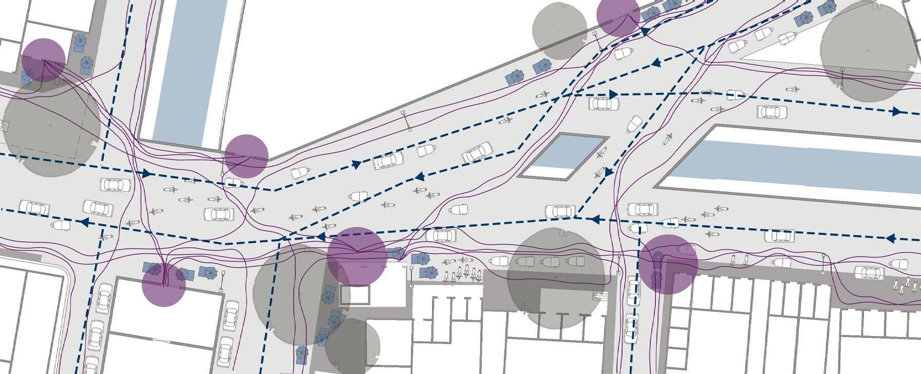
The street ROW changes from 30m to 24m, creating bottlenecks near the intersection and making it an accident - prone area. There is heavy pedestrian footfall along the edges, especially along nodes such as temples, parks, lake ground entrance.
Parking encroaching meagre footpath space People tend to gather and hang around street corners People tend to gather and hang around
Two - Wheeler Parking
Four - Wheeler Parking
Vendors
The street is mainly occupied by vehicles and vending activites. The haphazard parking results in the encroachment of footpaths and under - utilisation of the carriageway.
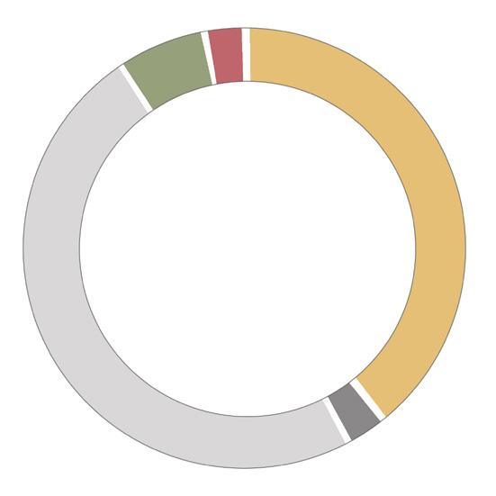
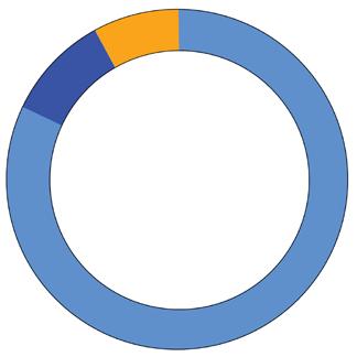
In the existing situation, only 5% of the street space is under footpaths. Even in this meagre space, parking and vending encroachments leave very little space for pedestrians and their movement. N
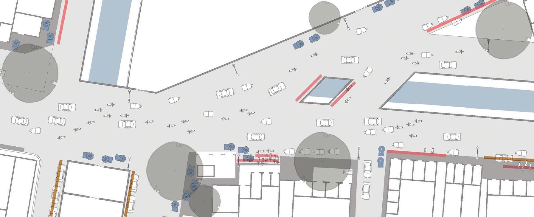
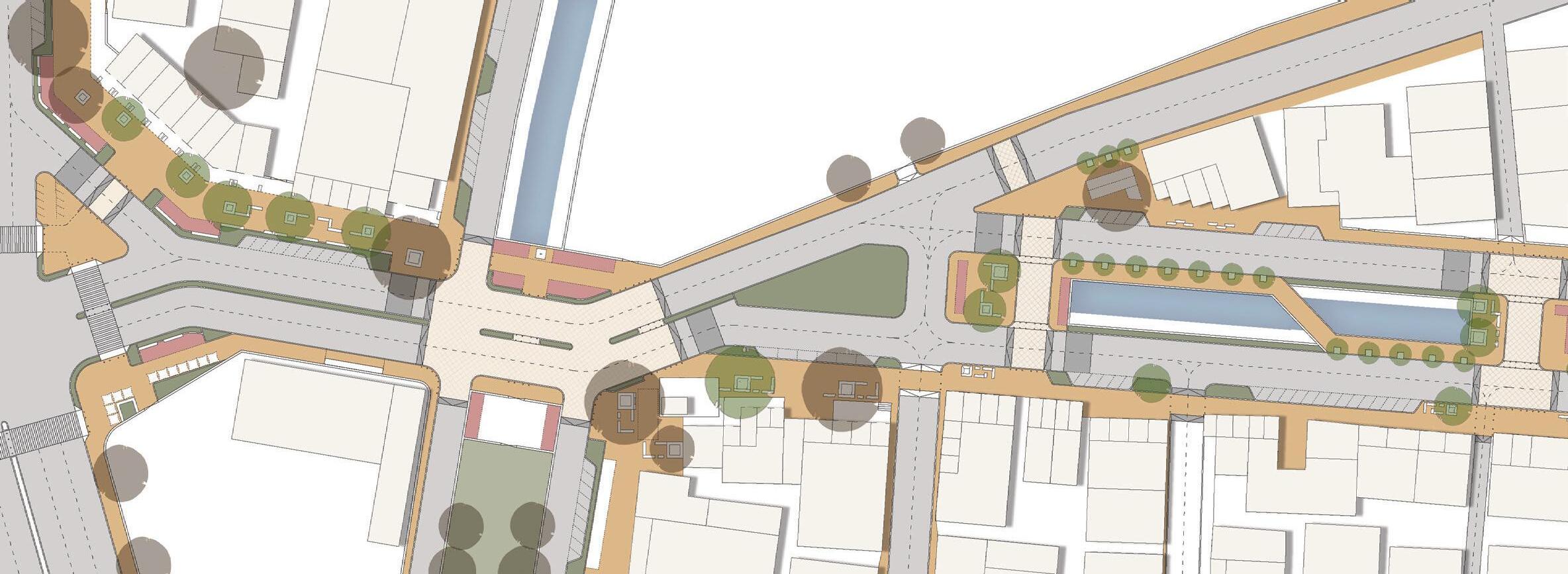
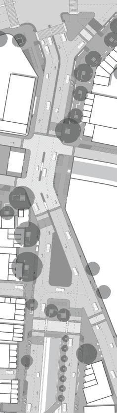
Proposed Street Layout (400m)
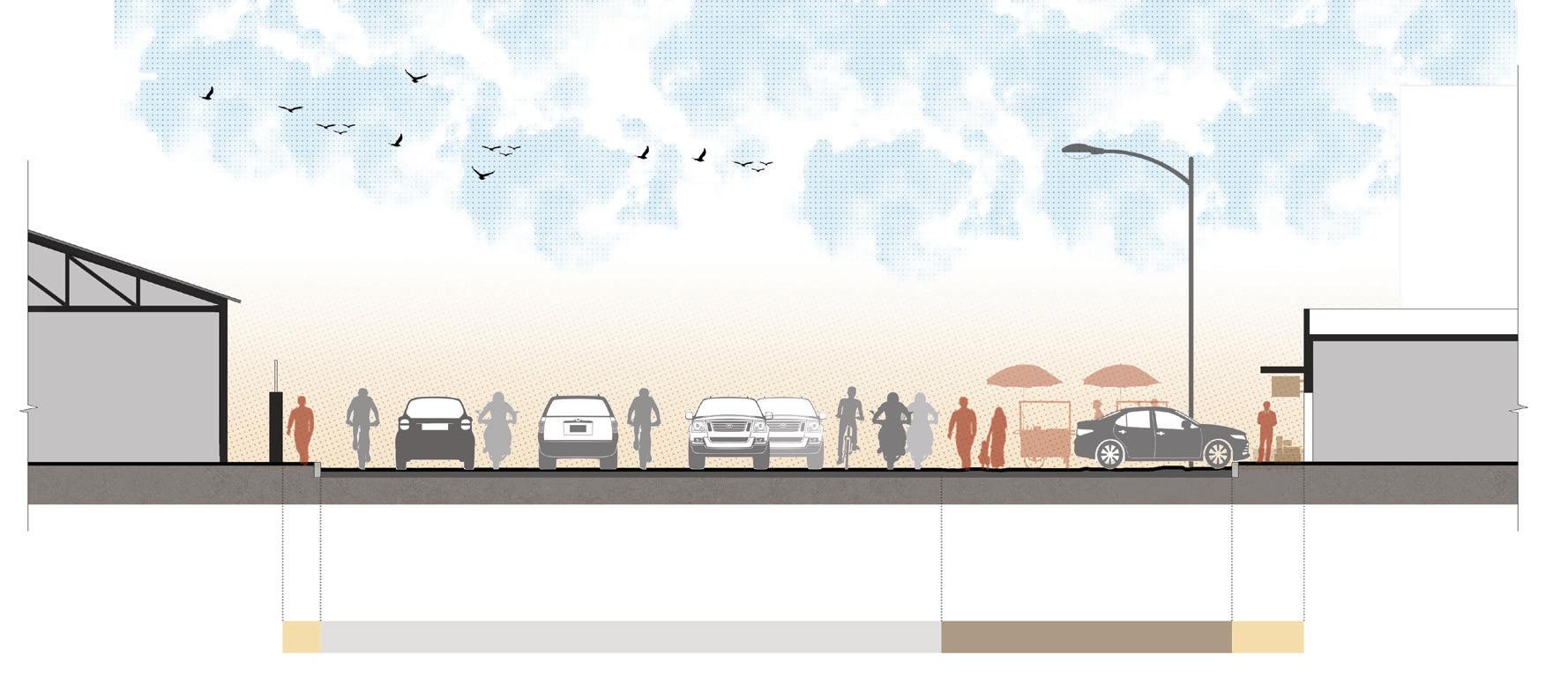
Issues Identified : Undefined carriageway edge No safe space for pedestrians Haphazard parking and vending activities

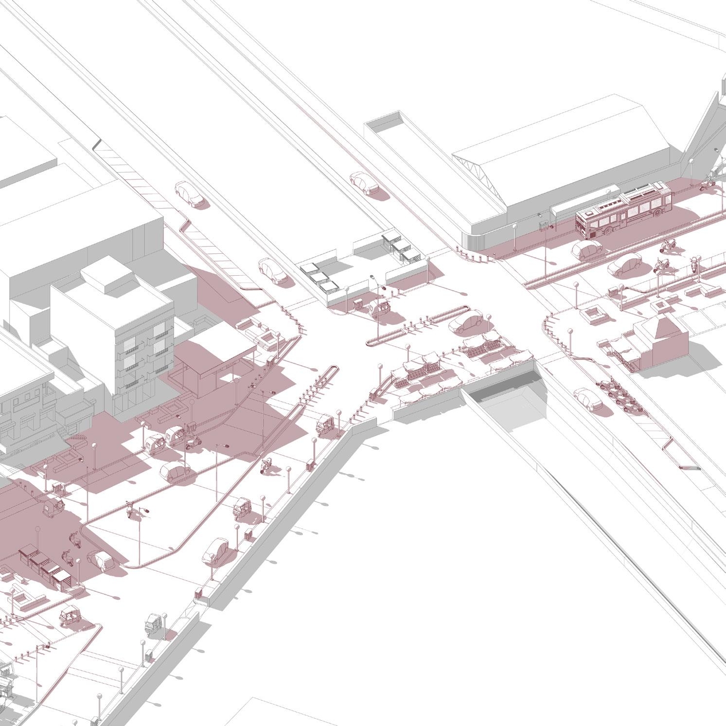
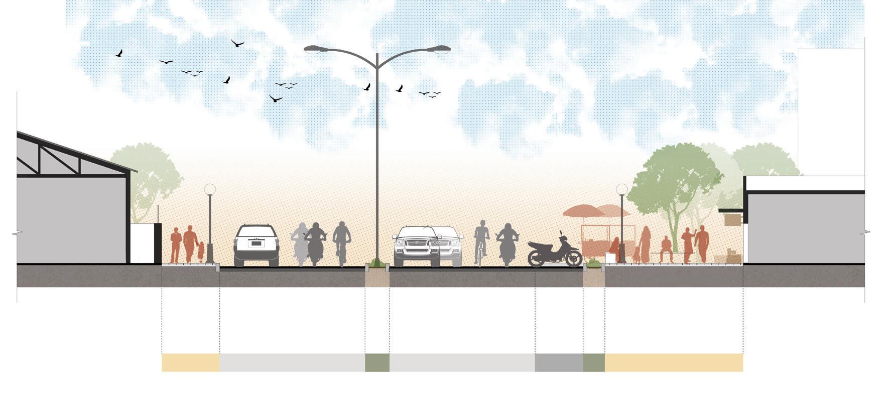
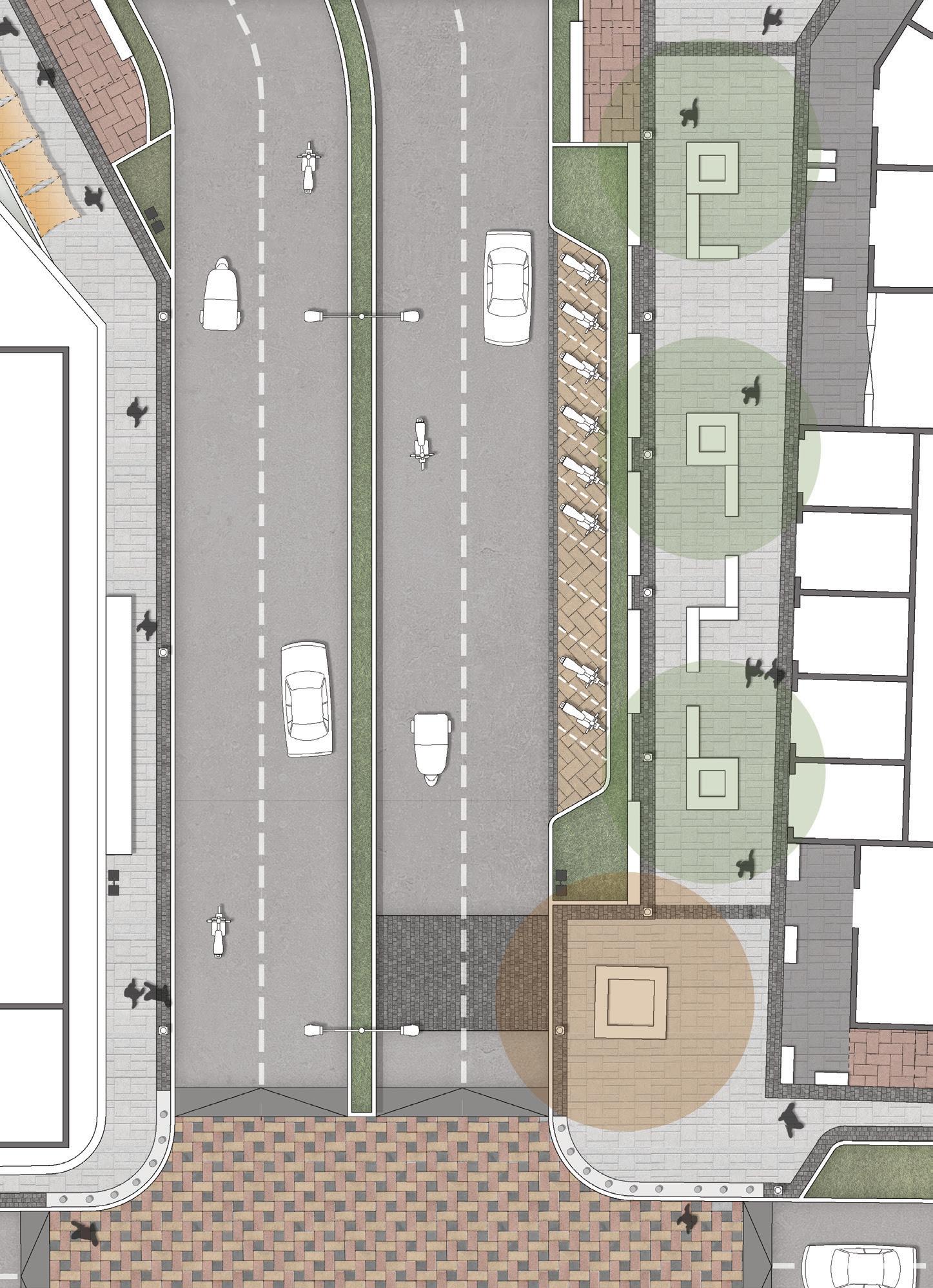
The proposed design focuses on equitable space for all, thus allocating spaces for the diverse functions of the street. Organising parking and vending frees up considerable space to be used as footpath.
Strategies employed : Dedicated parking and vending zones
Material difference used to demarcate various zones
Central median to streamline vehicular movement
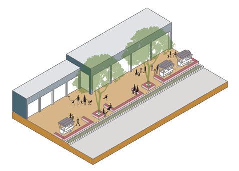
Wide pedestrian plaza along eateries with shaded seating and gathering spaces
Pedestrian Refuge Island Lvl +150
On - grade Pedestrian Crossing Lvl +0
Seating around trees
Central Median Lvl +300
Raised Pedestrian Crossing Lvl +150
Four - Wheeler parking Lvl +0
Temple Vending Plaza Lvl +150
Autorickshaw stand Lvl +0
Carriageway Lvl +0
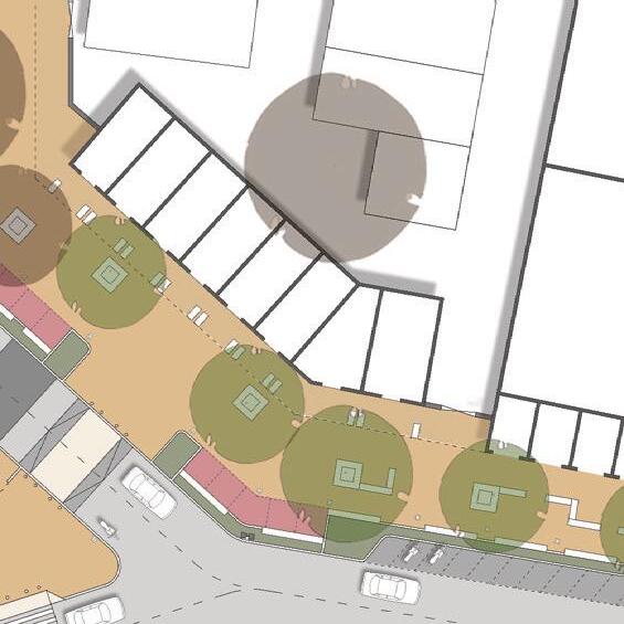
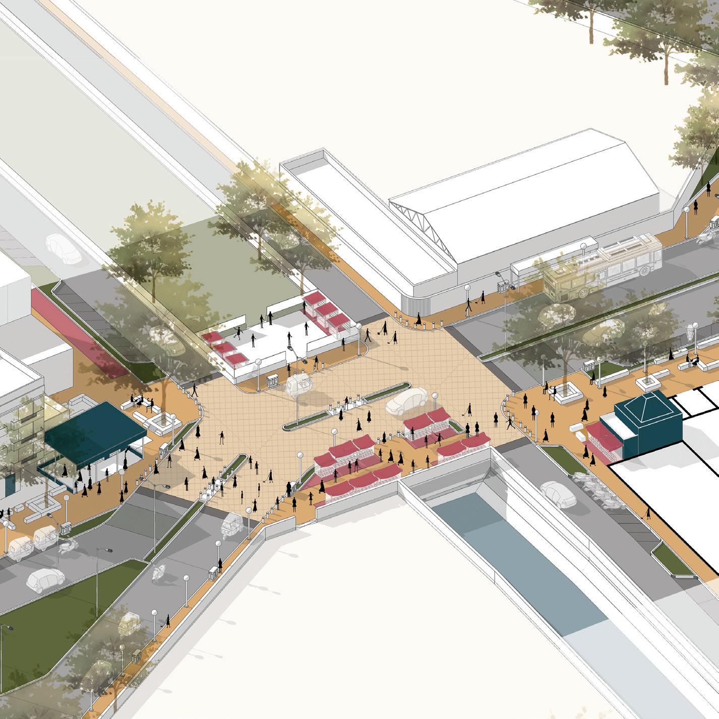
Functional Node : Labour naaka and Food plaza
This corner plaza along the junction functions as a labour naaka in the mornings.
In the evenings, this place transforms into a food plaza with the eatery shops and vendors catering to the people passing by.
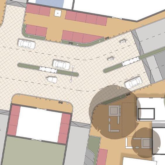
Cultural Node : Temple junction
The two temples and the neighborhood park form an important node on the street and draw high pedestrian footfall. Thus, this area has been raised and safeguarded to ensure easy pedestrian movement.
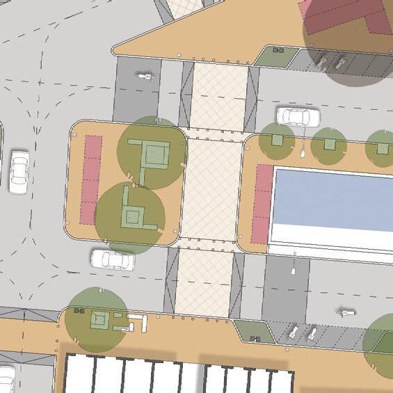
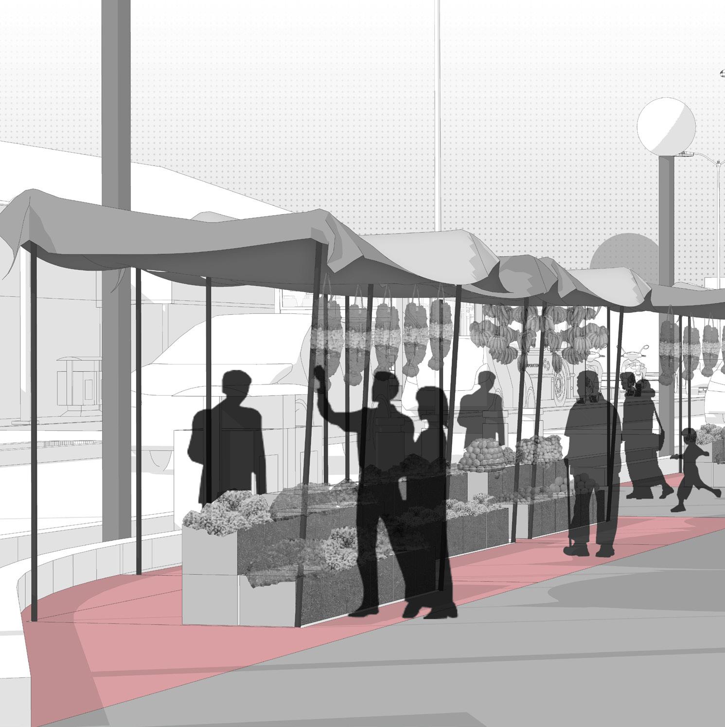
Commercial Nodes : Vending zones
Dedicated vending zones have been provided strategically near junctions and crossings where people tend to halt and spend time.
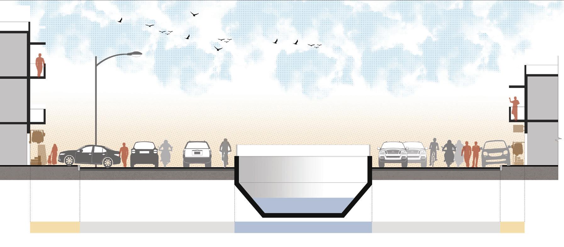
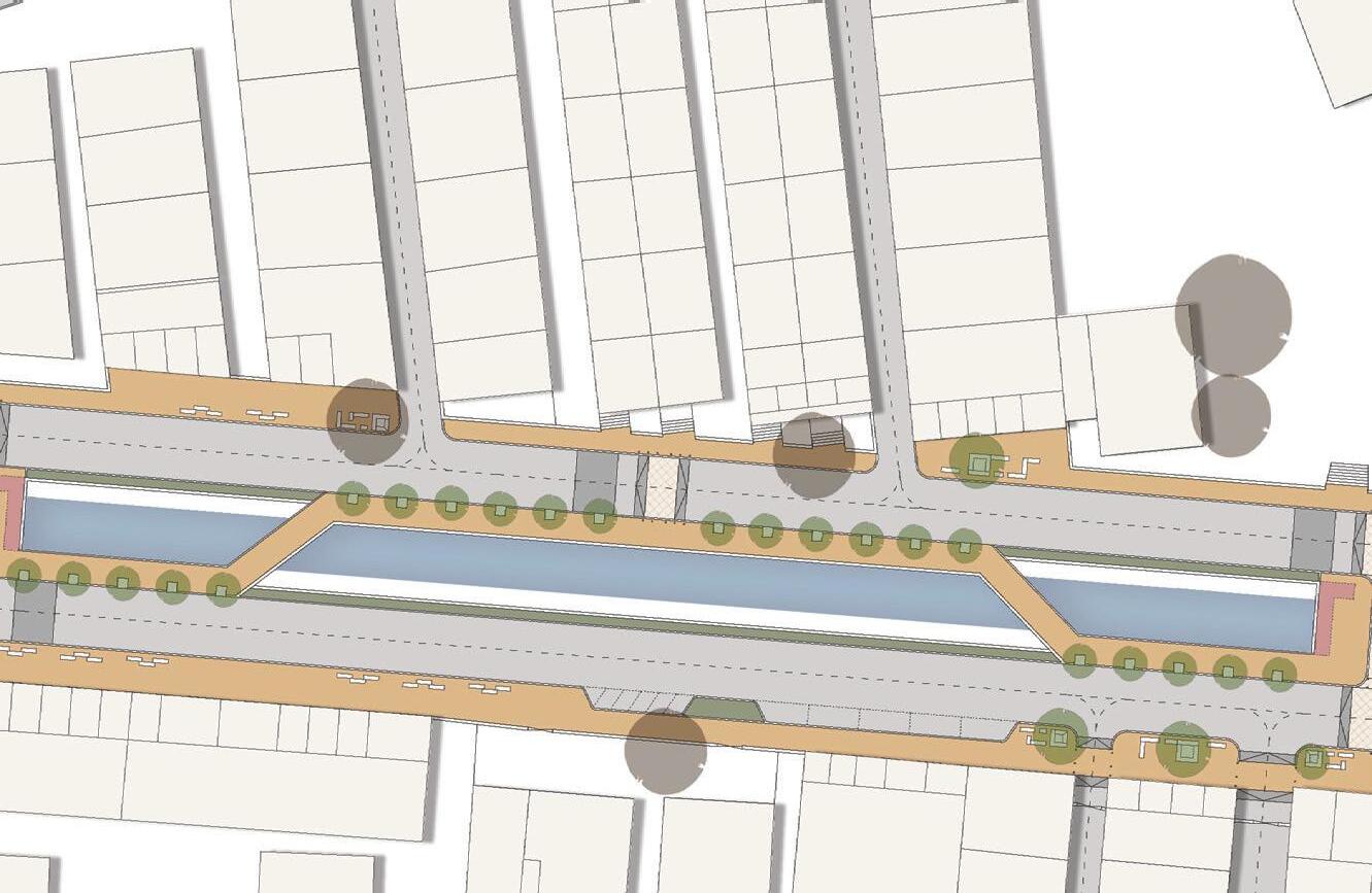
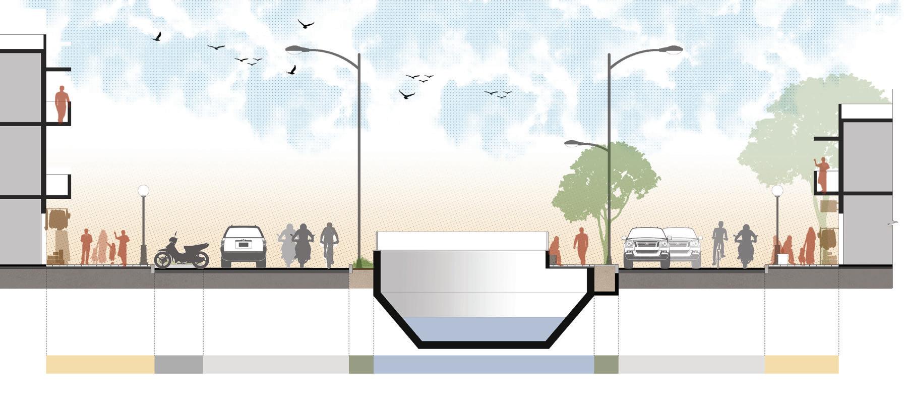
Issues Identified : Parking encroachment No safe space for pedestrians Dead wall edge of the canal
Strategies employed : Dedicated parking bays Walking trail along canal that activates and connects the edges Wider footpaths accommodating various activities
Identifying culturally and socially rich nodes and activities that ANCHOR the street
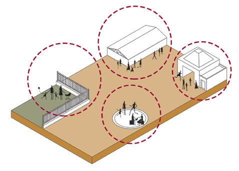
Prioritising the significant nodes
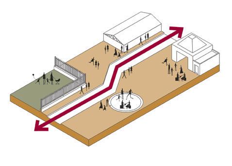
Connecting the fragmented nodes
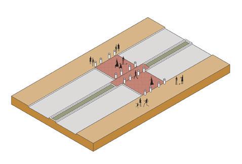
Safeguarding the places
Certain pockets were prioritised and designed as safe and comfortable PLACES
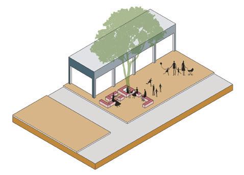
Seating & gathering spaces

Placemaking for variety of pockets
STREAMLINING various activities into zones while allowing flexibility within them, improving legibility
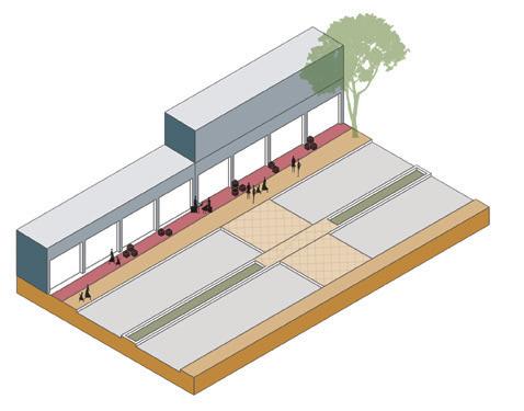
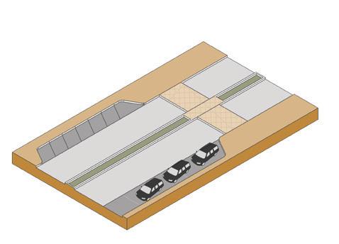
Demarcated space for shop spillover Dedicated on - street parking spaces
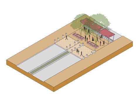
ELEVATING the street experience for a safe and more connected neighborhood
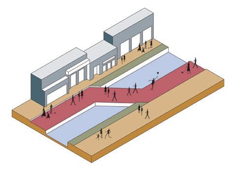
Reclaiming space for public realm
Adaptable spaces to allow temporal activities
VENDING SPACES :
300 x 150 x 80mm thk Permeable Concrete Pavers (Red)
Three rows of 200 x 200mm Cobble Stone edge
SHOP SPILLOVER :
300 x 150 x 80mm thk Permeable Concrete Pavers (Dark Grey)
300 x 150 x 80mm thk Permeable Concrete Pavers (Light Grey)
Green Landscape Buffer
PARKING BAYS :
300 x 150 x 80mm thk Permeable Concrete Pavers (Yellow)
100 x 100mm Cobble stones used for traffic calming
Concrete ramp 150mm thk Precast Concrete Kerb
Seating in Brick Masonry with Kota stone top
200mm dia Concrete Bollards PCC band
RAISED PEDESTRIAN CROSSING : Permeable concrete pavers in colored pattern
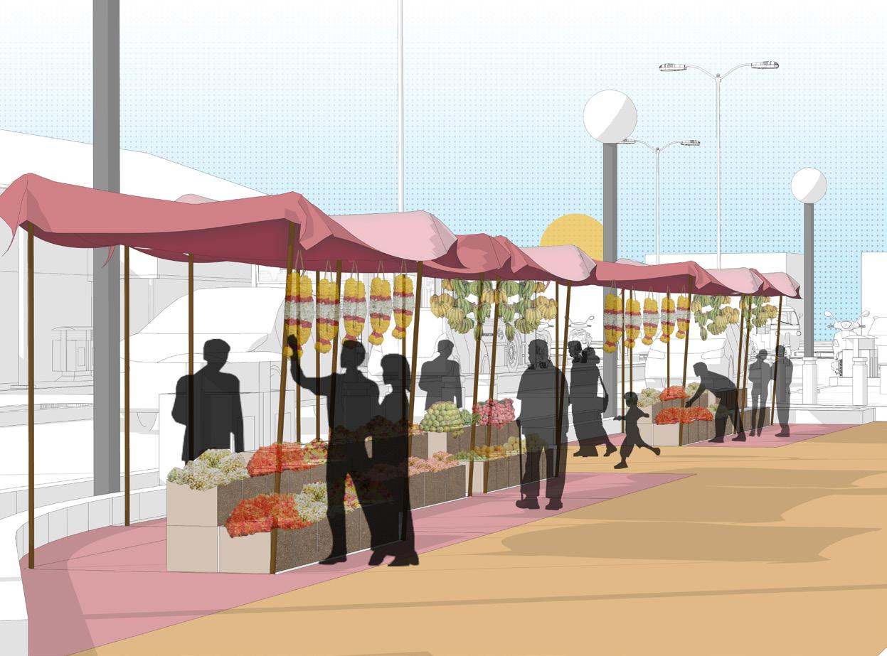
The two temples across the raised pedestrian crossing form important cultural nodes and attract heavy pedestrian footfall. To cater to this, innumerable informal vendors come up around this area.
This temple vending plaza provides them with a dedicated safe space that allows this informality to exist without hampering the other street activities.
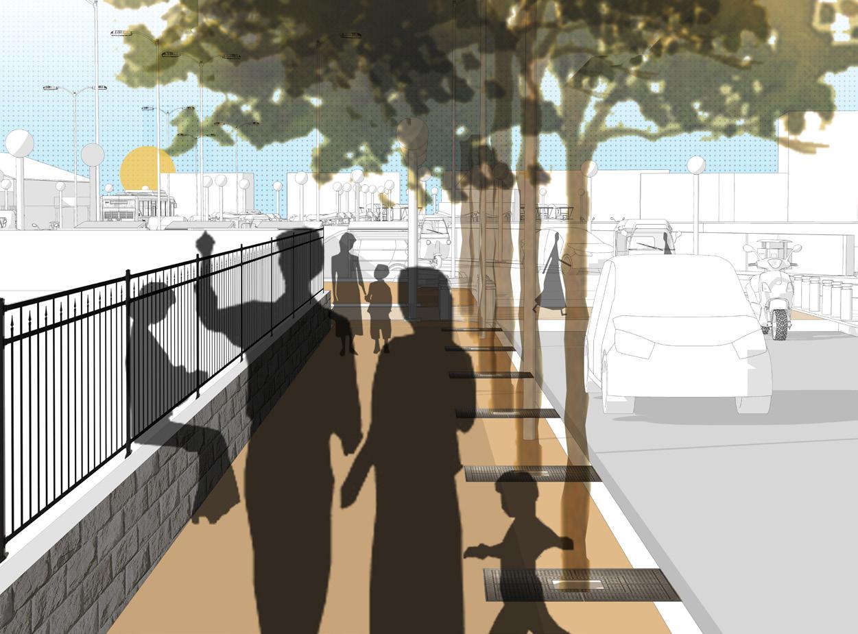
The walking trail along the canal connects the two sides of the neighborhood as well as activate the canal edges. It provides a comfortable shaded space for the people to walk along and linger.
It leverages the potential of the canal to address the concerns of enhanced walkability and conscious placemaking.
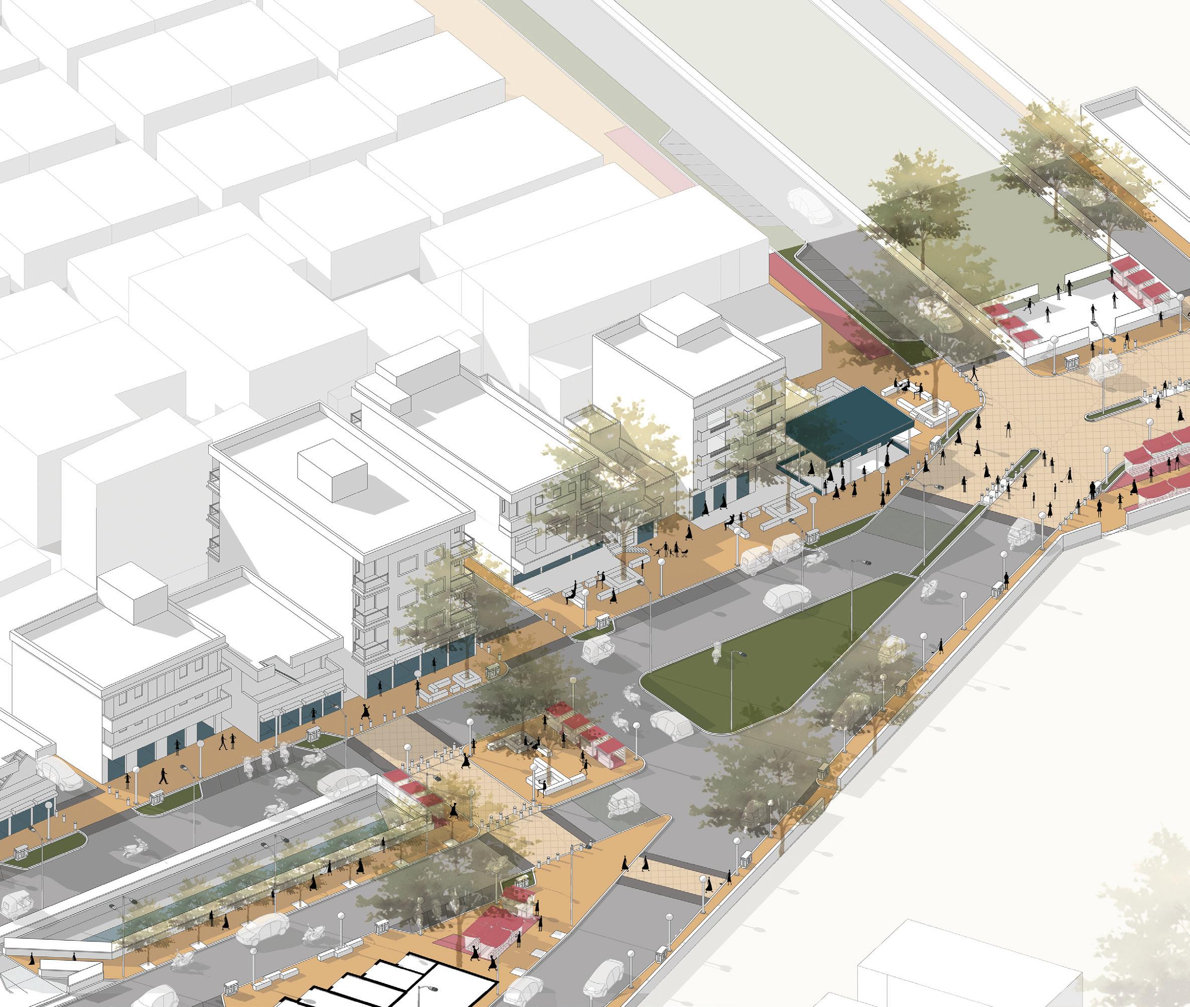
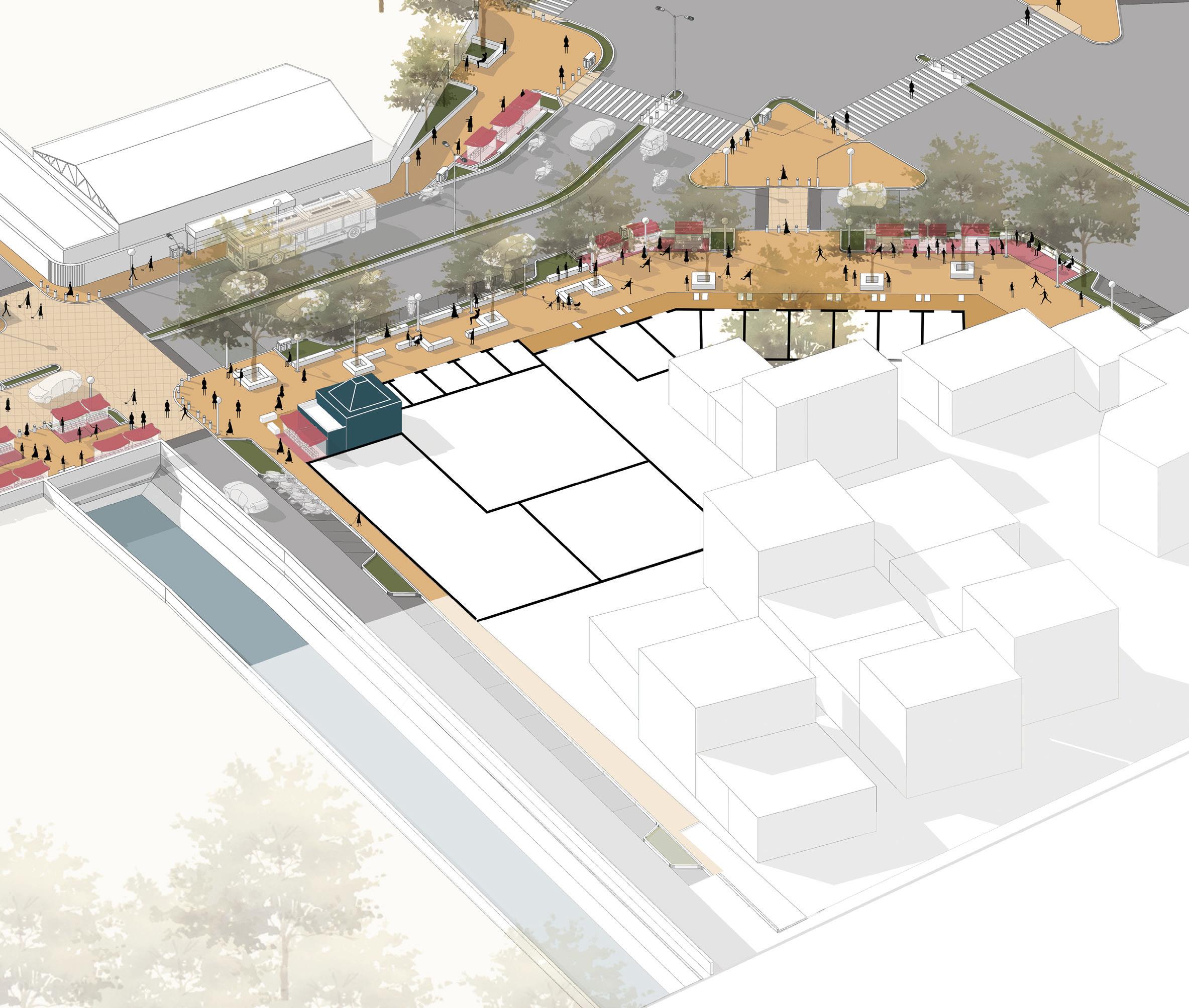
The ‘Representation’ module helped develop skills of abstracting the essential attributes to express the character of any public space - using colors, lines, shadows strategically. It helped understand how the different urban elements worked individually and together as a whole to provide a sense of place.
It also helped develop an eye to observe public spaces through the lens of scale, volume, porosity and edge conditions.
The ‘Street Design’ module gave exposure to the real-life process of designing at an urban scale - the complexities and nuances involved in such a process. A crucial learning was to understand the extent of intervention and accounting for some degree of flexibility within the proposed design that would allow the users to adapt and make it their own.
The skills acquired in the previous module were used to create a communicative representation of own design - employing strategies of color, graphics, highlights and develop a personal graphical language and working style.